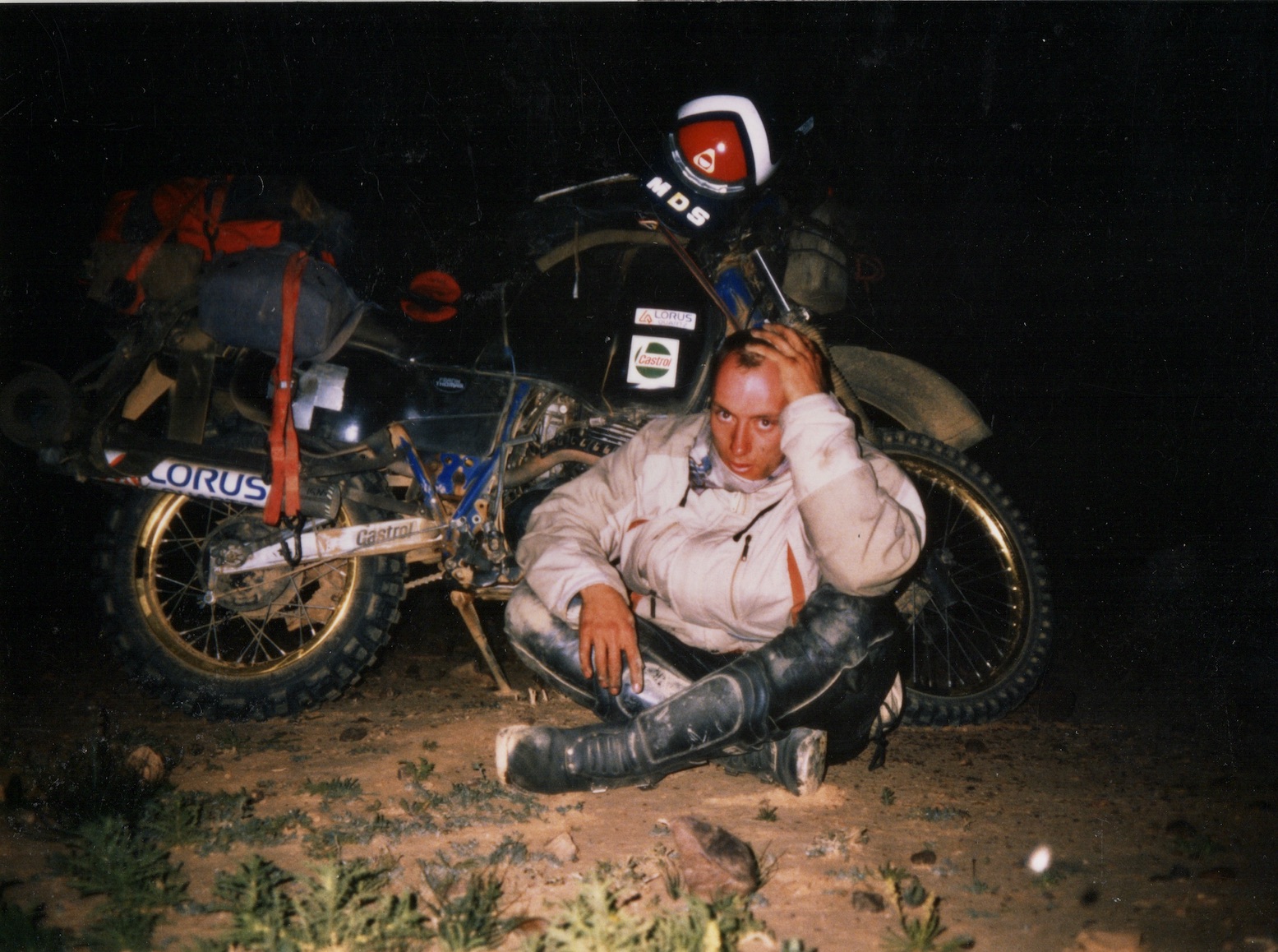
Video of the Week: Bikepacking Morocco’s Route des Caravanes
Leave a reply
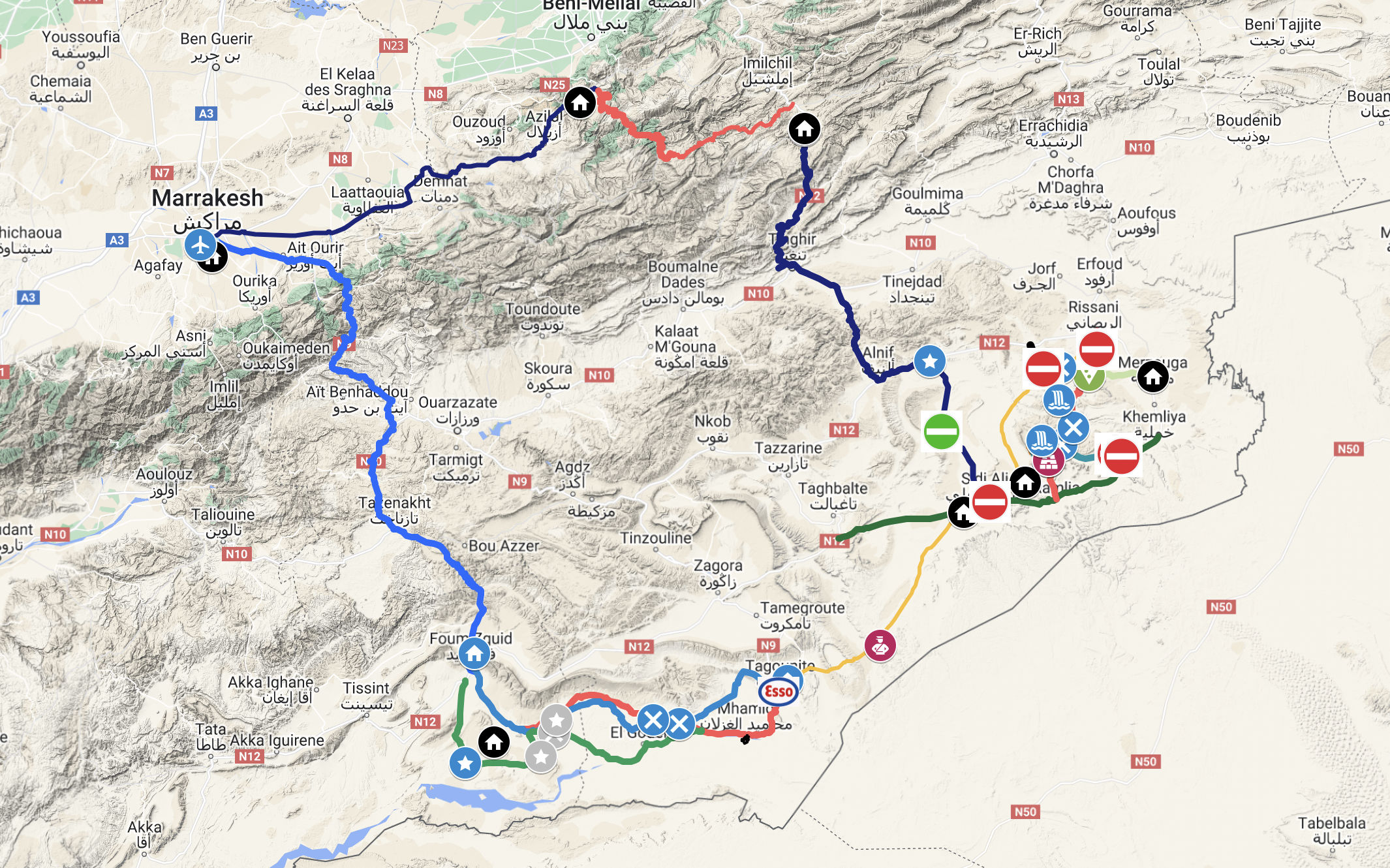
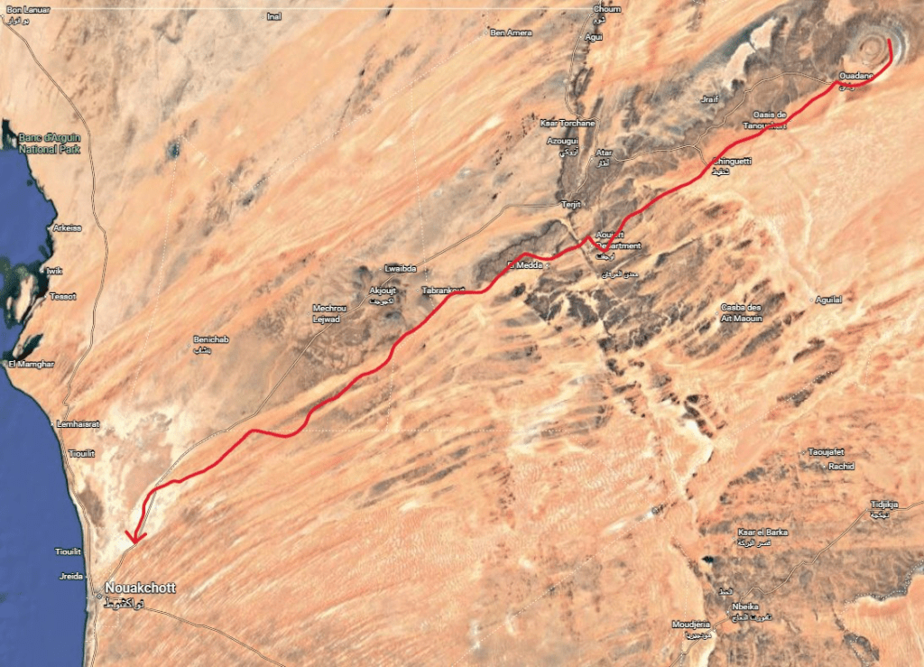
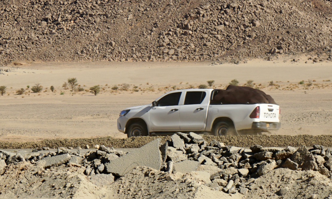
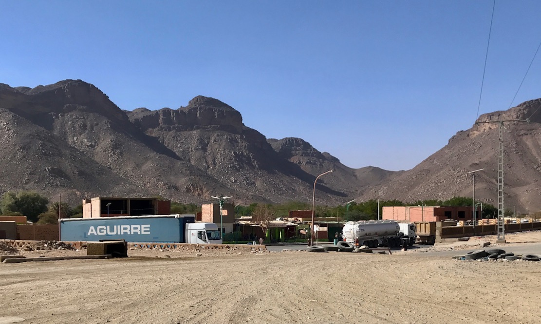
Exped 233; a 700-km walk from the Eye of the Sahara to Nouakchott
by Simon Cope
December 2025-January 2026
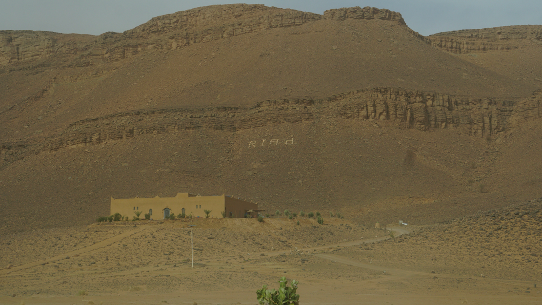
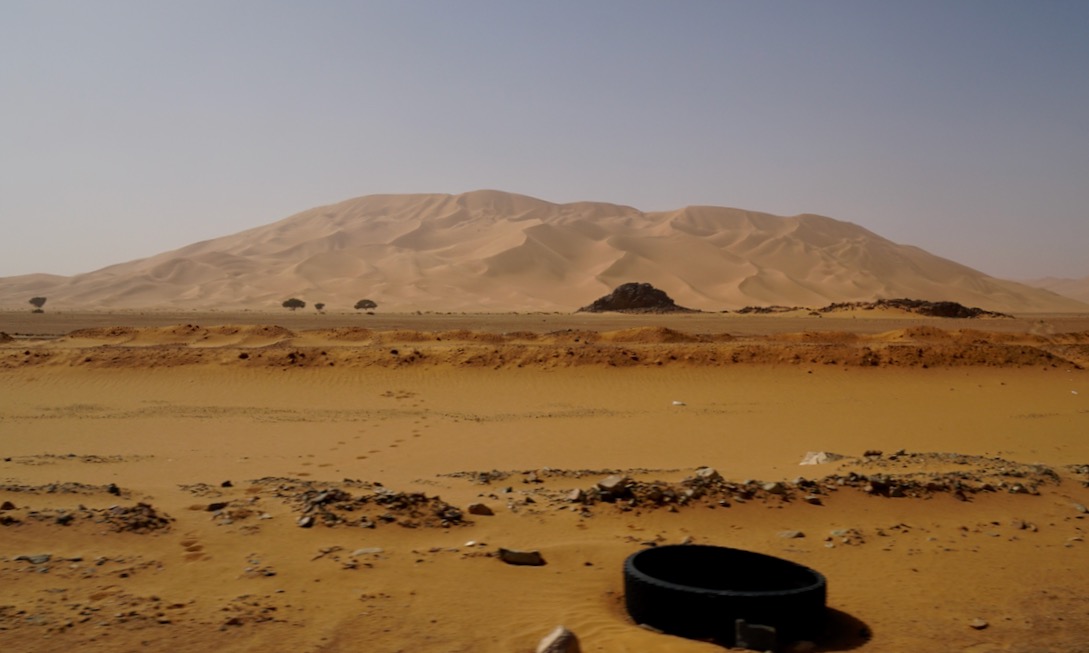
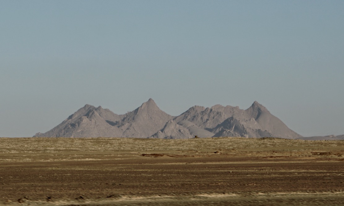
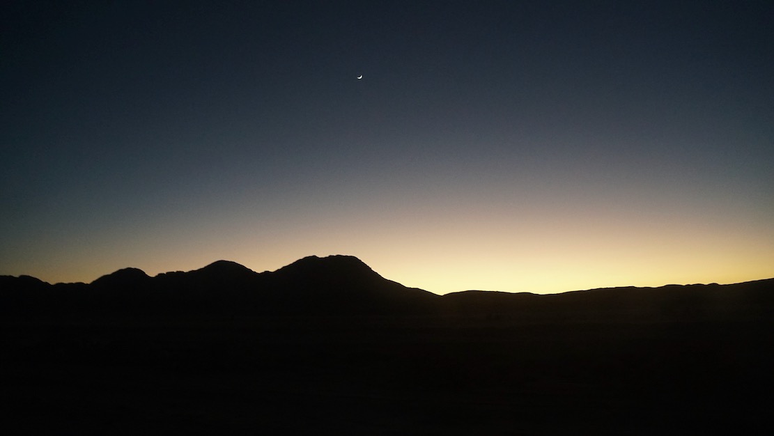
The Richat Structure, often called the ‘Eye of Africa’ is a prominent circular geological feature at the northwestern edge of the Taoudeni Basin, on the Adrar Plateau of the Sahara. The structure gained international attention in the 1960s when astronauts spotted it from space during early space missions.
The name of our expedition (233 Degrees) refers to the bearing we followed for much of the latter half of the route as we made a direct line to Nouakchott. The estimated distance was around 700km. The actual distance walked was 679km due to short-cuts taken where possible.
Expedition members
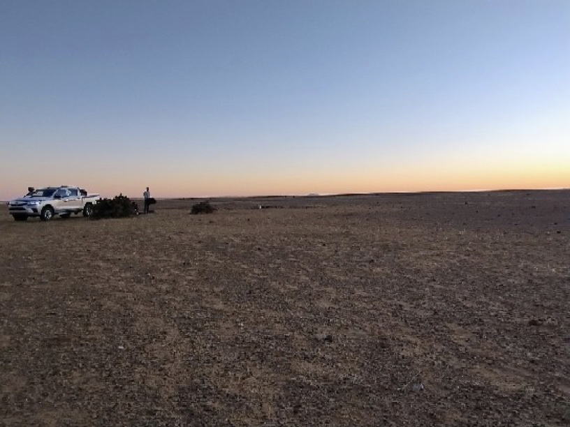
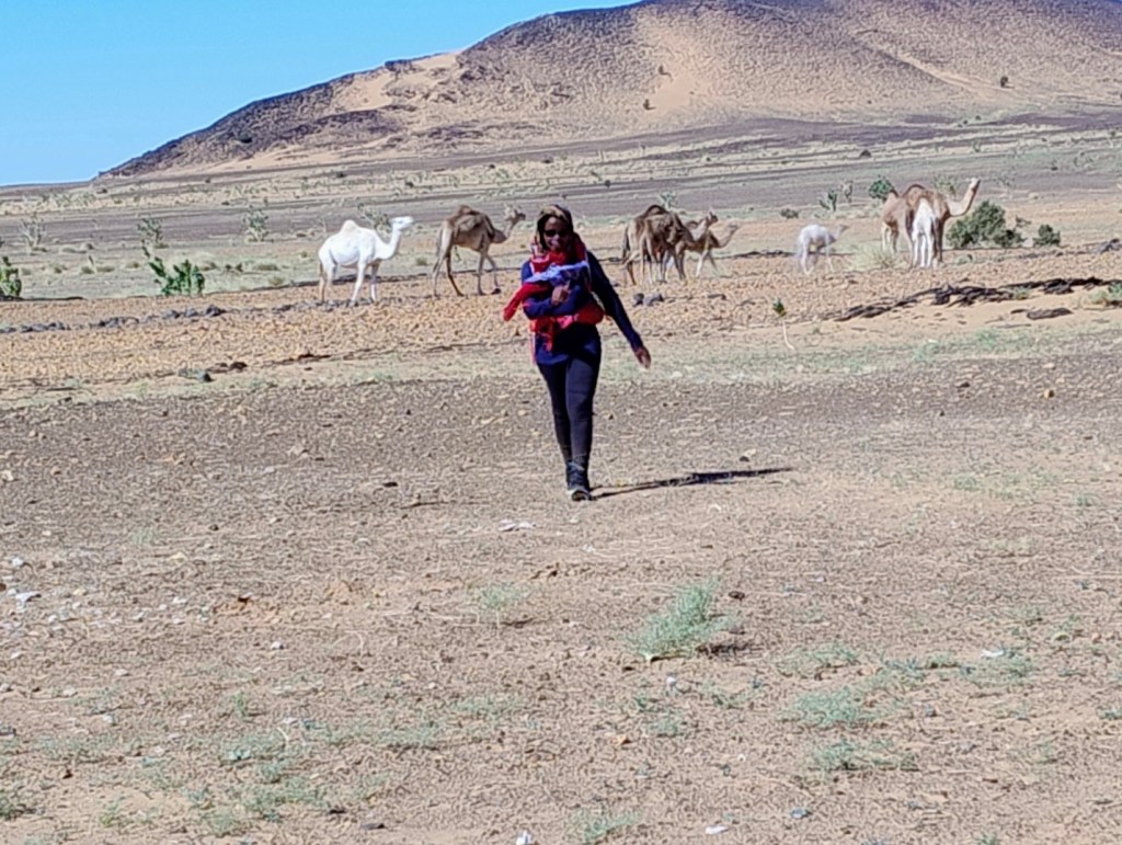
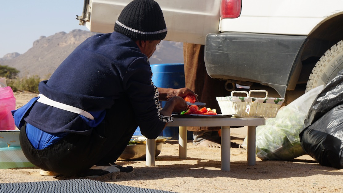
Husband and wife team: Fatuma Babirye and Simon Cope, FRGS
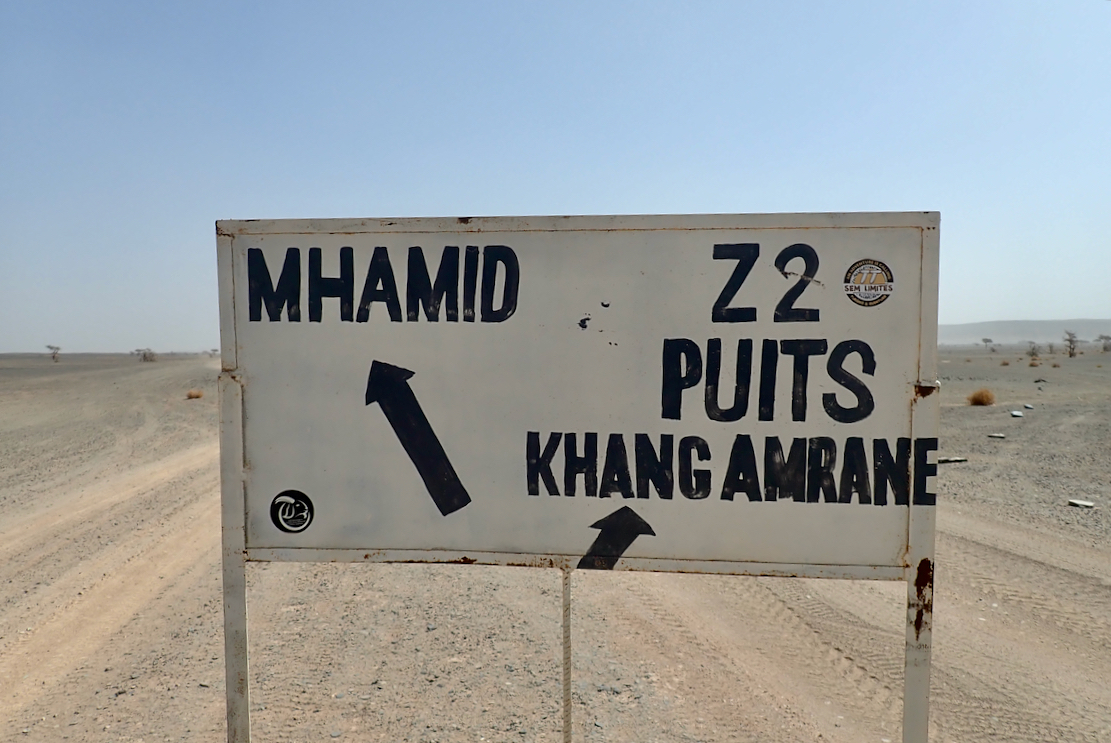
We started walking from the Richat Structure on 17 December 2025. We arrived on the outskirts of Nouakchott on 1 January 2026. The last day was notable due to thunderstorms in the area. In order to avoid camping in the rain (which would be miserable since our camping kit was not designed for heavy rain), we walked 47km on 1 January to finish the walk ahead of schedule.
Dangers and difficulties
The main challenge was being able to sustain walking 35-40km per day. This necessitated considerable walking in the afternoon into the sun at its most intense. Although the air temperature was rarely above 29C, the desert sun was strong. In addition, there was no breeze since we were walking in the direction of the prevailing wind. We therefore found many afternoons to be unpleasant.
Navigation was not a significant problem since the support vehicle was normally ahead of us at prominent locations (track junctions, crests of dunes or hilltops) to guide us.
There were times when we had no support vehicle for navigation, such as first thing in the morning since they were dismantling the camp or collecting supplies. On these occasions navigation was by compass bearing (often 233 degrees) and was relatively straightforward. Fortunately, we did not encounter any sandstorms.
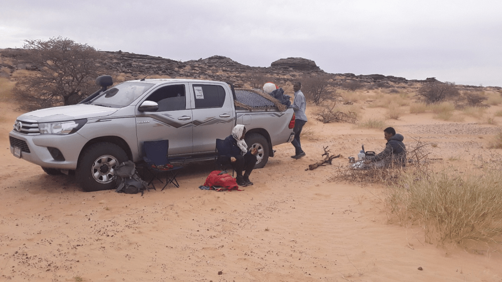
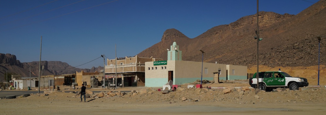
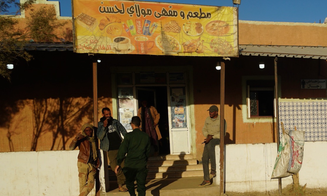
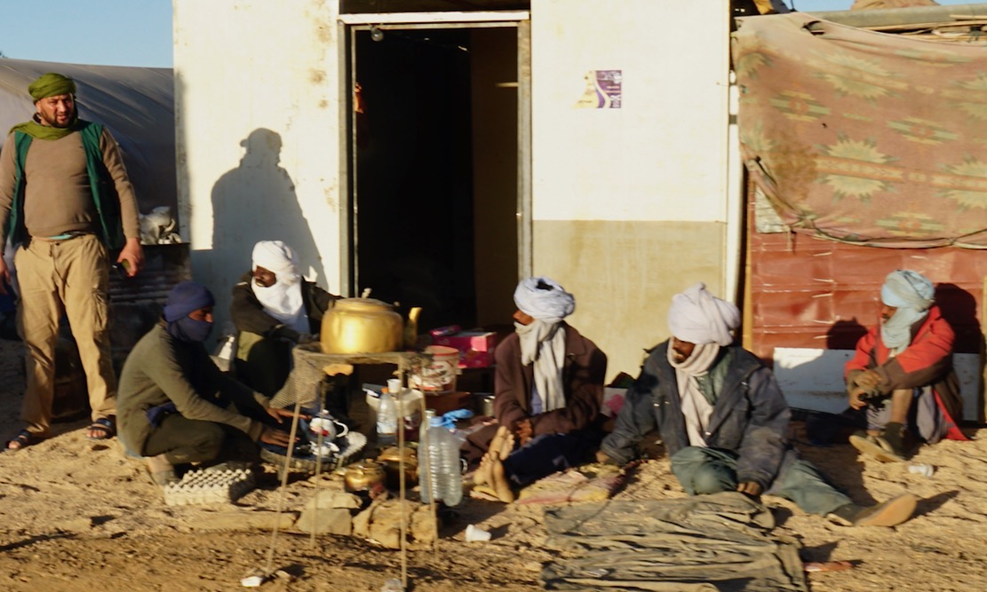
The need for local support
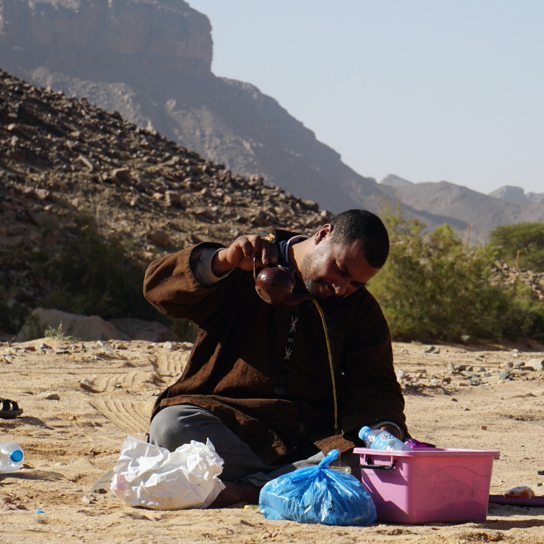
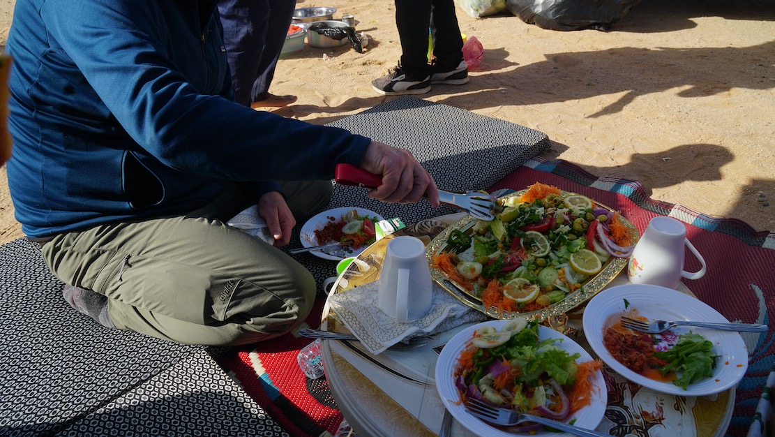
A local tour company, “Tour in Mauritania” was contracted to provide vehicle support, food and water and camping equipment. We considered using camel support instead of vehicle support for a more authentic experience. However, camels would be restricted to 20-25 km per day and would need regular food breaks. Having a vehicle would give us more flexibility as well as the ability to cover longer daily distances.
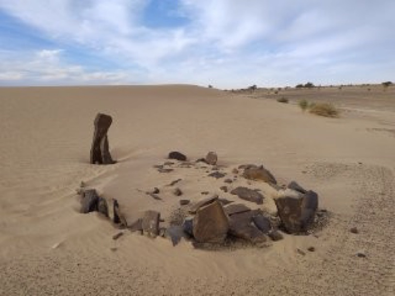
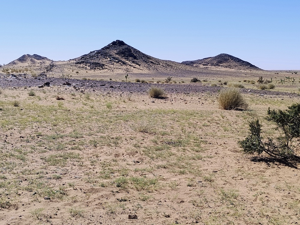
Terrain
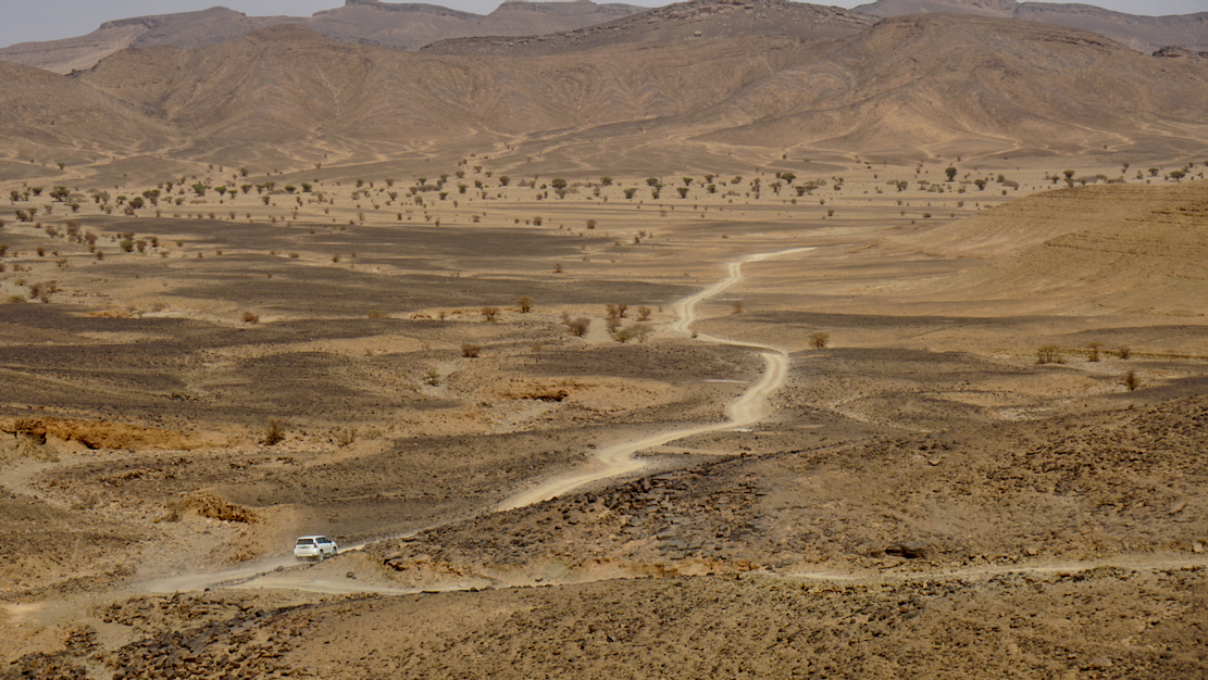
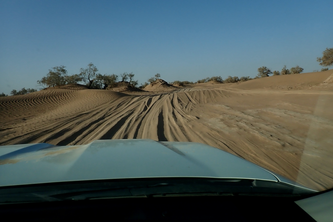
Minimal elevation gain/loss. The start of the trip near the Richat structure was around 550m whereas Nouakchott was at sea level. The second half of the trip was almost completely flat. The first third of the trip had some areas of deep sand, which considerably reduced our daily distances. Wherever possible we would seek firmer ground such as tracks and trails. Once on the coastal plain, we were able to travel cross-country relatively easily since the terrain was much firmer.
Observations
Lessons learned.
– The trip was planned to travel in a southwesterly direction to keep the prevailing wind behind us and to traverse deep sandy areas during the first part of the expedition when we were fresher. On reflection, the expedition would have been more enjoyable if done in reverse since we would have the sun to our rear in the afternoon when it was at its most intense ands we would also be cooled by the prevailing wind. There would have more deep sand towards the end of the trip, however on balance it would have been more pleasant.
– Ensure that the support team understands the nature of the expedition and the calorific and nutritional requirements of walking 35-40km per day in a desert environment. There were a few occasions where food supplies were running a little low.
– Kit we did not bring but would be useful on future trips:
Neck gaiters
Additional Oral Rehydration Salts
Windproof umbrellas
Conclusion
– Many thanks for Hadrami Bouh, owner of Tour in Mauritania, for vehicle and logistic support and to Imane Kaa who provided accommodation and hospitality in Nouakchott and was able to accommodate our earlier than anticipated arrival.
– Would we do it again? Yes, but a different route. We heard from Hadrami about a previous expedition from Chinguetti to Timbuktu (an estimated distance of 1,200 km) many years ago. This route follows historic caravan trade routes and the pilgrimage route to Mecca. We would love to do this, however, the security situation in eastern Mauritania and northern Mali means this is extremely unlikely to happen in our lifetimes.
See also:
Trans Sahara Highway
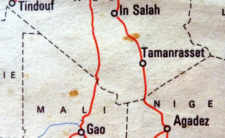
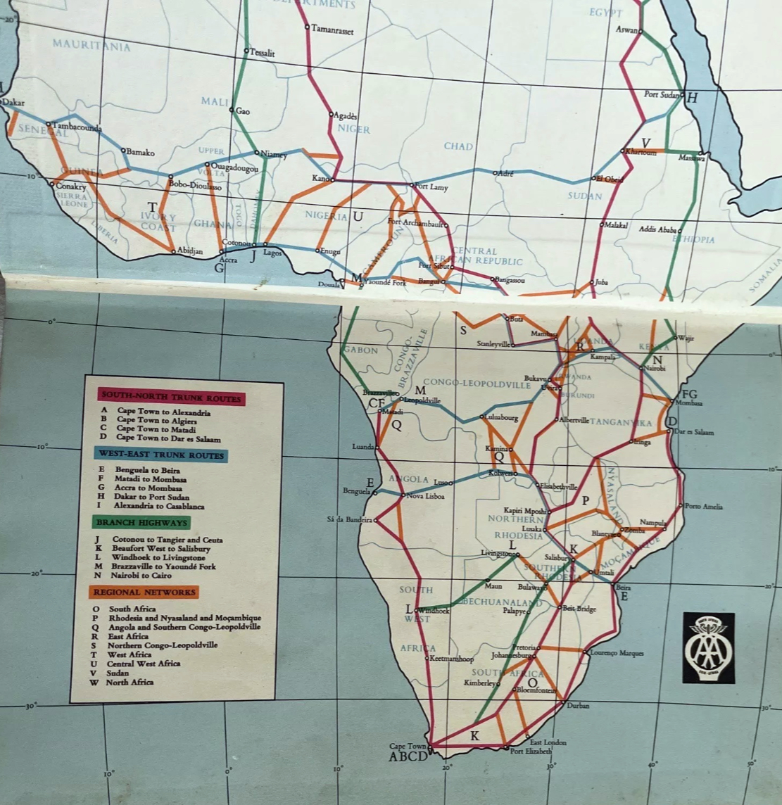
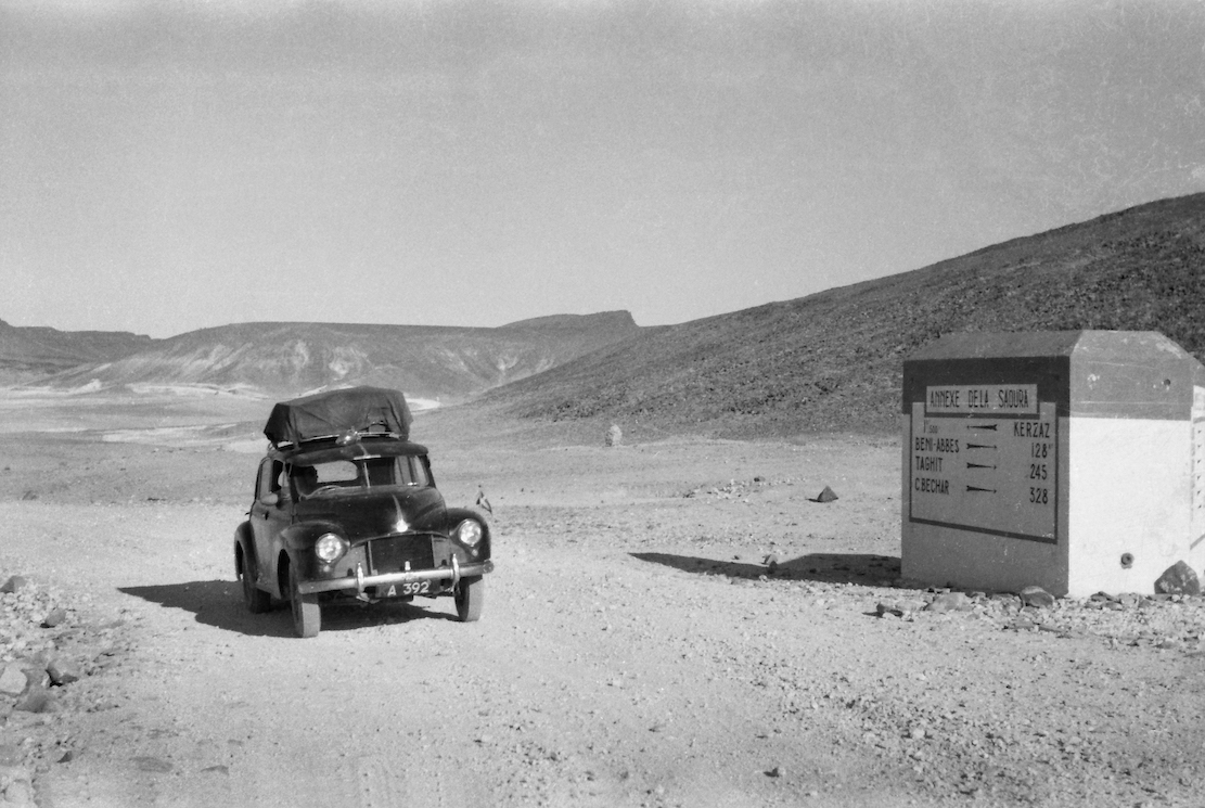
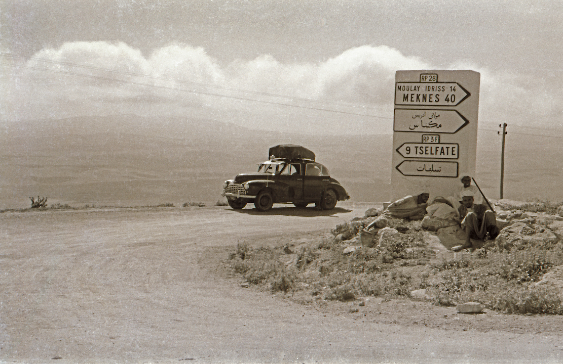
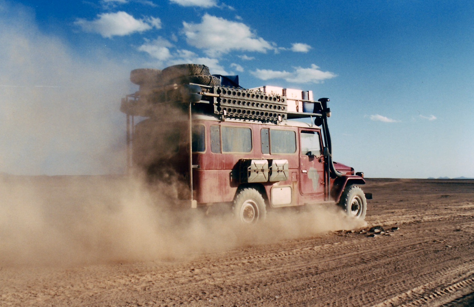
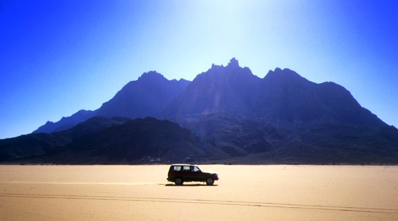
Over the span of some 2300km, along Algeria’s southern perimetre two largely straight lines (below) radiate northwest to Tindouf and northeast to the Salvador-Anai border tripoint. They mark Algeria’s desert frontier with Mali and Niger. For decades as porous as a string vest, they’re crossed by the original trans Sahara routes established at the dawn of the motor car era in the 1920s: the Trans-Sahara Highway from Algiers via Tamanrasset to Agadez in Niger, and the more desolate Tanezrouft from Reggane via Tessalit to Gao in Mali (below). Both are now largely sealed in Algeria but for years have been off limits to travellers.
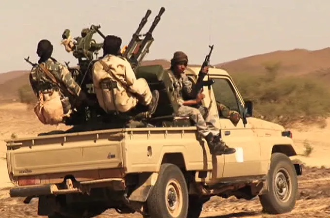
In 2011 the already dangerous Sahara was further unsettled as Gaddafi’s regime collapsed, and militias raided arms depots across Libya. Much of that weaponry flowed west across the desert to northern Mali, long controlled by Islamist insurgents (left) or Tuareg separatists.
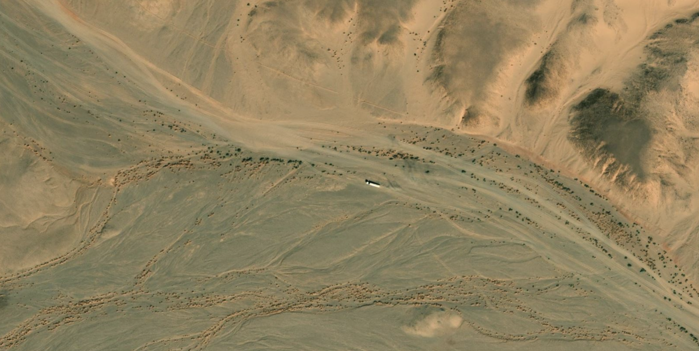
The quickest route was across southern Algeria, because south of the well-used road between Tam and Djanet, the 200 kilometre band of desert to the unmarked Niger border was entirely unpopulated but easily navigable. Even when we did Route A14 (left) in the early 2000s, we were surprised how well developed and even corrugated parts of this obscure track was. At that time Algeria had its own smuggling networks running between Mali and Niger, but come 2011 had nothing to gain and much to lose from the added instability brought about by the redistribution of Libyan arms.
These days controlling the flow of sub-Saharan migrants is probably the bigger concern. In Algeria most come up from Niger around In Guezzam (TSH) or the Chirfa piste (route A3 from the book), and are openly seen walking along the road or wrapped under a speeding pickup tray’s sheet, on the TSH north of Tam, or hanging out in Bordj el Haouas bound for the Fadnoun plateau on the N3, before being rounded up and deported en masse at In Guezzam. I remember way back in 2002 encountering what I later realised where dumped migrants on the Fadnoun, an hour south of Illizi, and later sharing the cliff path climb with others on the ascent to Jabbaren. For migrants this was a short-cut to Ghat in Libya and – long before the advent of Med boat crossings – the possibility of work there.
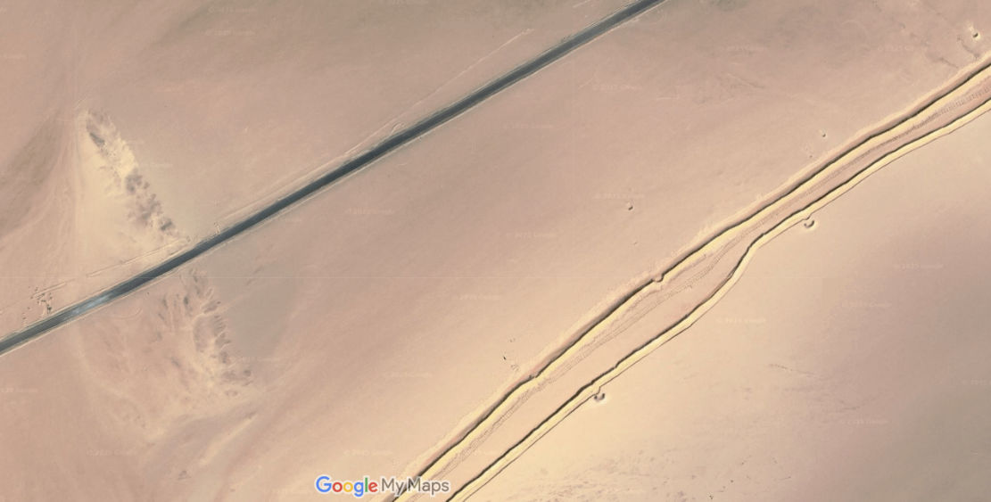
The answer to the latter has been an attempt to seal the exposed southern border with a series of double berms (car-blocking sand ridges; above) filling out the long gaps between impassable natural topography. This is just what Morocco did in the Western Sahara decades ago to define a de facto border with the PFZ, and what Algeria has also done along its Moroccan border to reduce illicit traffic.
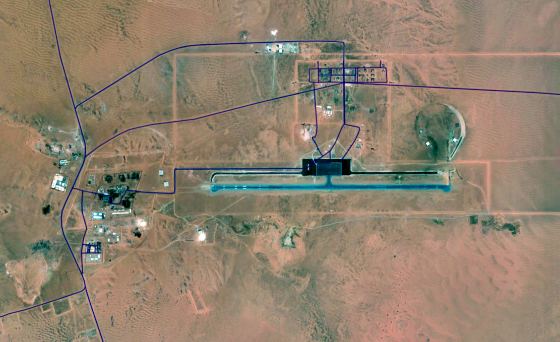
These efforts may be funded by the EU or other agencies and the berms (part-mapped below, in black) are backed up by new military access- and patrol roads (red, below), all linking scores of bases, some with huge runways (above) in the middle of nowhere. They run near continuously from the In Amenas oil producing area south of Ghadames in Libya, all the way round to Bordj Moktar and beyond. West of there towards Chenachen or Tindouf, the Erg Chech acts as a natural berm.

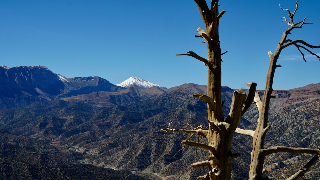
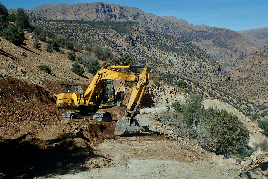
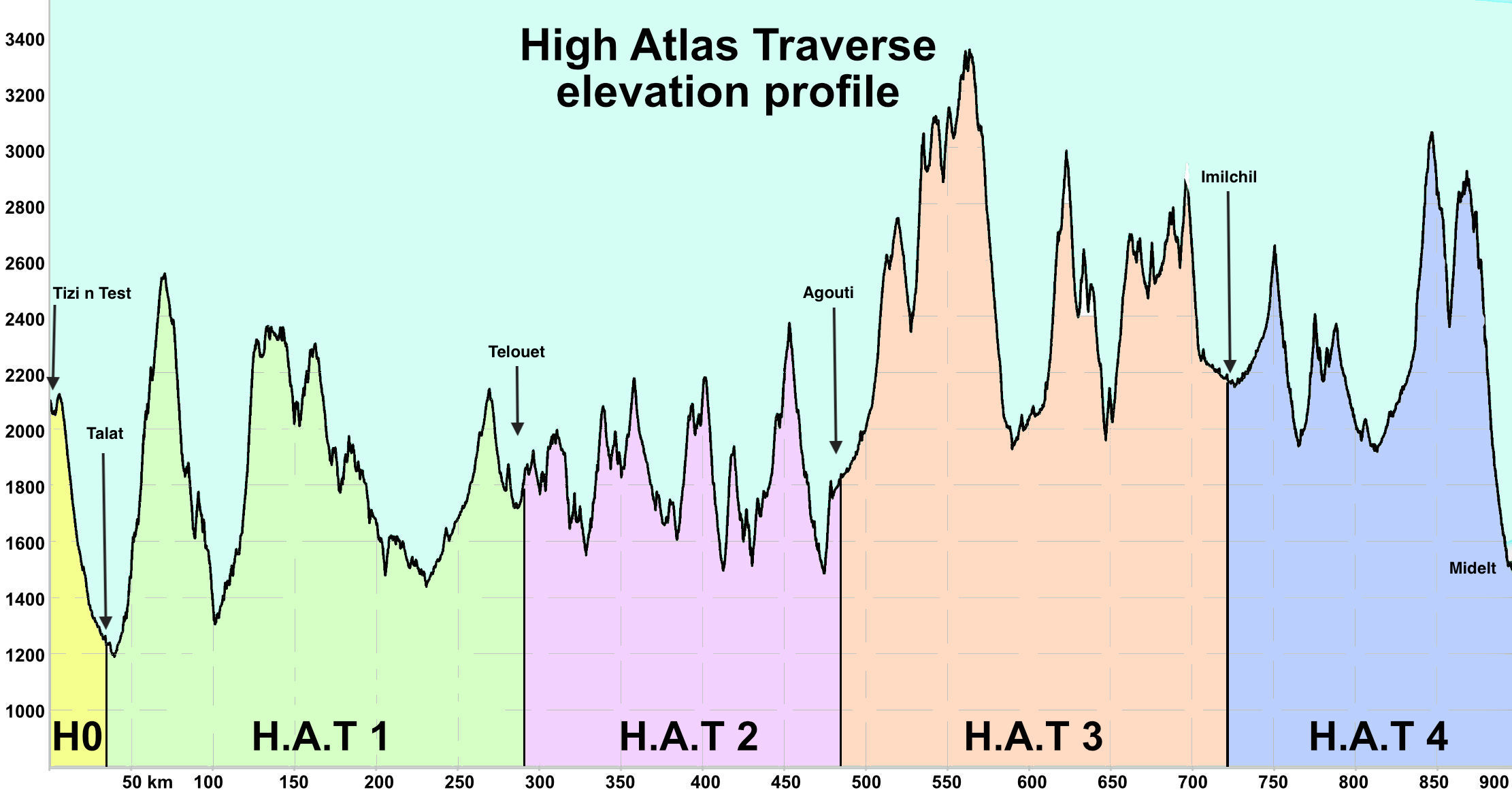
The 900km High Atlas Traverse is now online with the maop getting 1000 views a day. Download the gpx files at the link above.
The H.A.T is like the TMT: quiet backroads and mostly easy trails – but it follows the mountain watershed via the highest motorable passes. Only about 15% overlaps the TMT and it reaches up to 3340 metres (nearly 11,000′) and permanently stays above 1500m from Stage 1 onwards. Bigger bikes and longer vehicles may struggle on some of the climbs. More on the link above and some pics from our recce below.


Thanks to Danish journalist, Anders Nielsen (a friend of one of the protagonists) for passing on this fascinating article and photos. I tidied up a Google translation and added [my annotations] for added clarity.
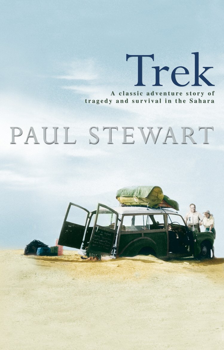
Seventy years ago, on finishing a lengthy contract in the late-colonial sub-Saharan Africa, taking on such trans-African adventures was not uncommon. It was assumed a regular car might manage as in many colonies parts of the road network were well maintained and superior to what exists today. But as you’ll read, the near-new Morris Oxford still got quite a beating. The yarn reminds me of Paul Stewart’s Trek (below right; to be reviewed), also in a Morris just a year later, but which ended in tragedy north of Agadez in the Sahara. And of course David Newman’s demented The Forgotten Piste a few years later.
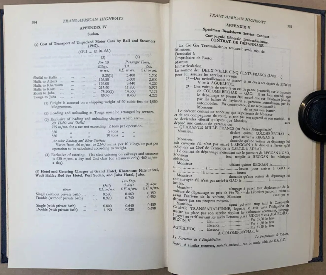
From Kenya to Morocco you’re reminded this era was marked by widespread anti-colonial unrest. It’s also interesting to learn of the huge £1000 bond (2500F + 40,000F) for the Contrat de Depannage (assistance) required to cross the French-controlled Sahara to cover the cost of possible rescues.
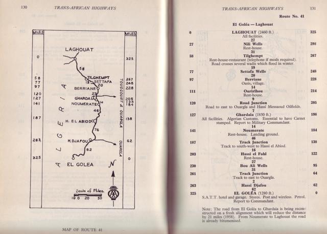
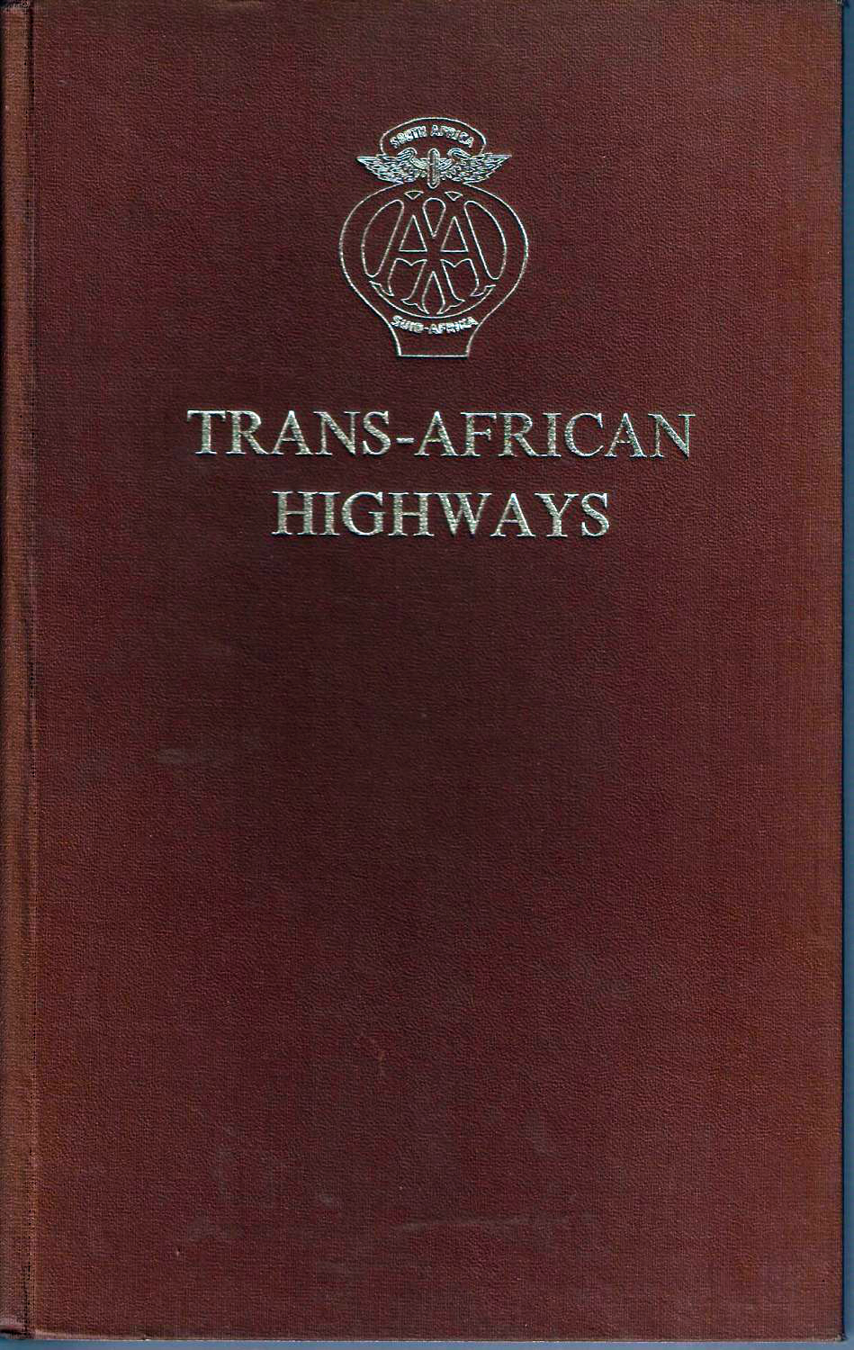
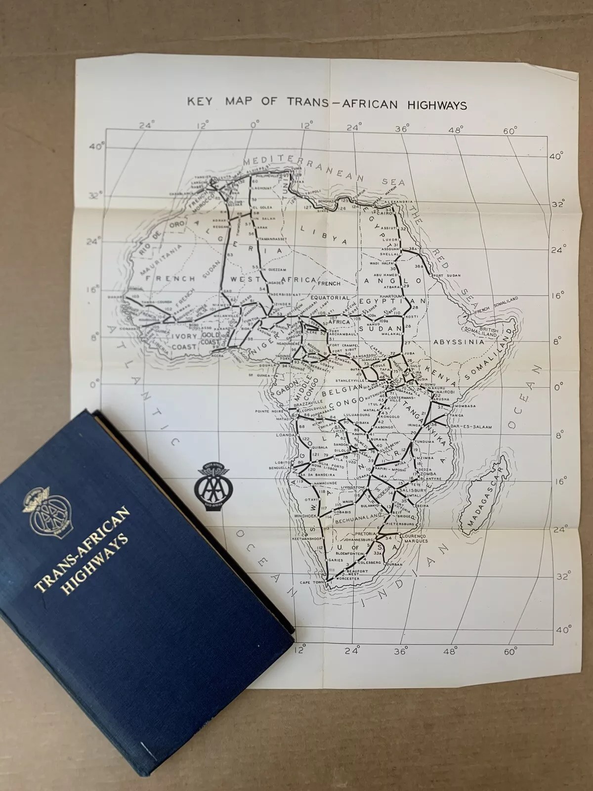
The Trans-Africa Highways route guide (below) was first published in 1949 by the Automobile Association of South Africa. There are loads of copies online from £25: I bought the final, 5th edition published in 1963, by which time the vast majority of the European colonies (list with dates) were independent. The preface to the 5th edition explained the laborious task of redrawing all the guide’s maps to conform with the new nations. The guide closely resembles the French Shell Guide to the Sahara published since the mid-1930s: page after page of annotated strip maps along a given route. Knud and Svend used the 1949 edition of Trans-African Highways which Anders still owns.
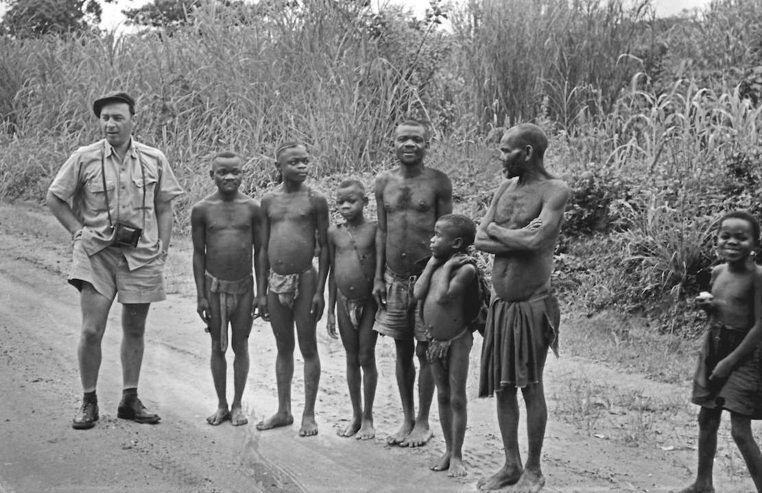
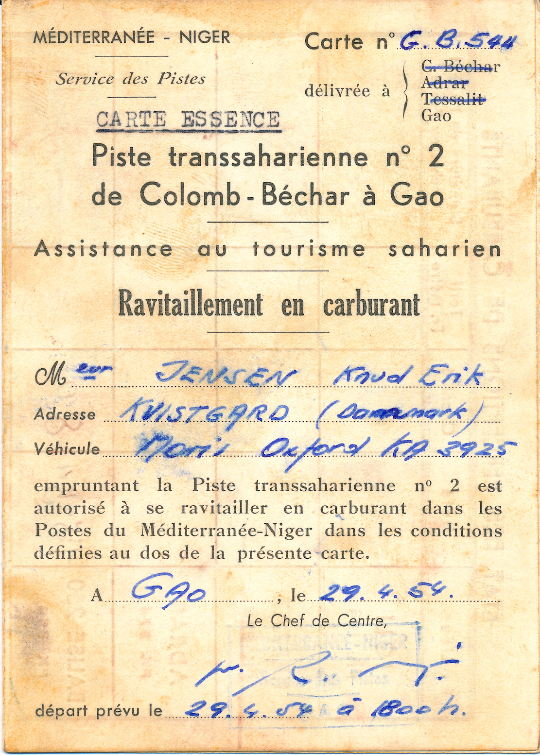
In 1954 two Danes, Knud Jensen and Svend Nielsen, drove a Morris Oxford from Kampala Uganda through equatorial Africa and across the Sahara to Kvistgård in Denmark. The 14,373 kilometre adventure nearly cost the lives of all three.
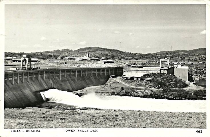
For three years, Knud and Svend had worked as carpenters for Christiani & Nielsen on the construction of the Owen Falls Dam (left) in Jinja, Uganda. This is where the Nile flows out of Lake Victoria to continue north to the Mediterranean. [An old treaty between Uganda and Egypt endured the Nile’s flow was unaffected, though during the 1956 Suez Crisis the Brits considered cutting the flow so to oust Nasser, even at the cost of flooding around Lake Victoria.]

Along with their last salary, they received two plane tickets back home to Denmark, but they chose to cash these in instead. The two young men decided to drive home to Denmark. Knud had an almost new Morris Oxford [Series MO, left] and when you’re young, the spirit of adventure trounces reason.
The direct route was via Sudan and Egypt [with the option of putting the car on a train across the desert from Khartoum to Wadi Halfa], but Egyptian President Nasser was in the process of kicking the British out (the Suez Crisis occurred in 1956). Meanwhile Sudan was also wearying of the British and refused permission to transit the country. The only alternative led west across the Belgian Congo [today’s DRC] and on through French Equatorial Africa [CAR, Cameroon], British Nigeria, French West Africa [Niger] to Algeria and Tangier in Morocco.
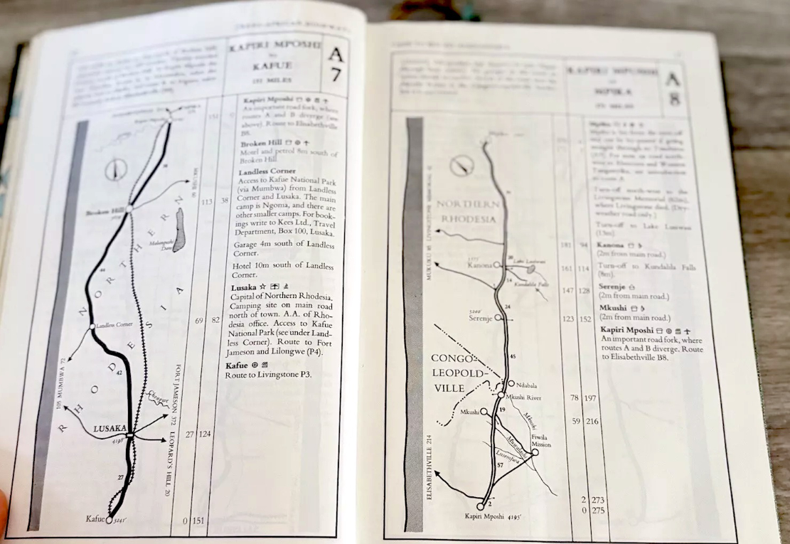
The expedition required a huge amount of planning. Were there reliable maps? What were the roads like? When would the rainy season flood the rivers? What documents would be needed? Would the Morris even survive the trip and what spare parts would be needed? The 406-page guidebook, Trans-African Highways (left), published by the Automobile Association of South Africa, provided many answers.
The rainy season in central Africa began in April, and the route through the Sahara would be closed from June to October due to sandstorms and intense heat. This still gave the pair a few months to get organised. Costly permits to pass through French territories were obtained in Nairobi, Kenya – a round trip of nearly 1500km along wretched roads. In Kenya, the Mau-Mau uprising was underway, resulting in a driving ban after sunset. Knud recalled stayed overnight in a small hotel in Nukuru, where the white guests were hanging out in the bar with rifles close at hand. In another town, the police station had been burned down.
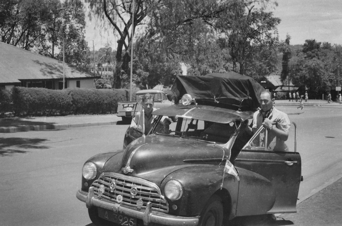
Back in Kampala, the Oxford was given a major makeover, and many spares were thrown into a back-up engine sump, which produced a metallic clatter all the way to Denmark. The spare sump served as insurance against a possibility of damage on rutted tracks. An auxiliary petrol tank was fitted in the spare wheel well, and four spare wheels were lashed to the roof rack. Typically, the car did not get a single flat, even though they didn’t see asphalt until they reached Morocco, 8000km later. With a Danish pennant on the left front fender, Knud and Svend left Kampala on 3 April 1954. Ahead awaited massive rivers, equatorial jungle, harsh desert, isolated tribes and miles of rough tracks.
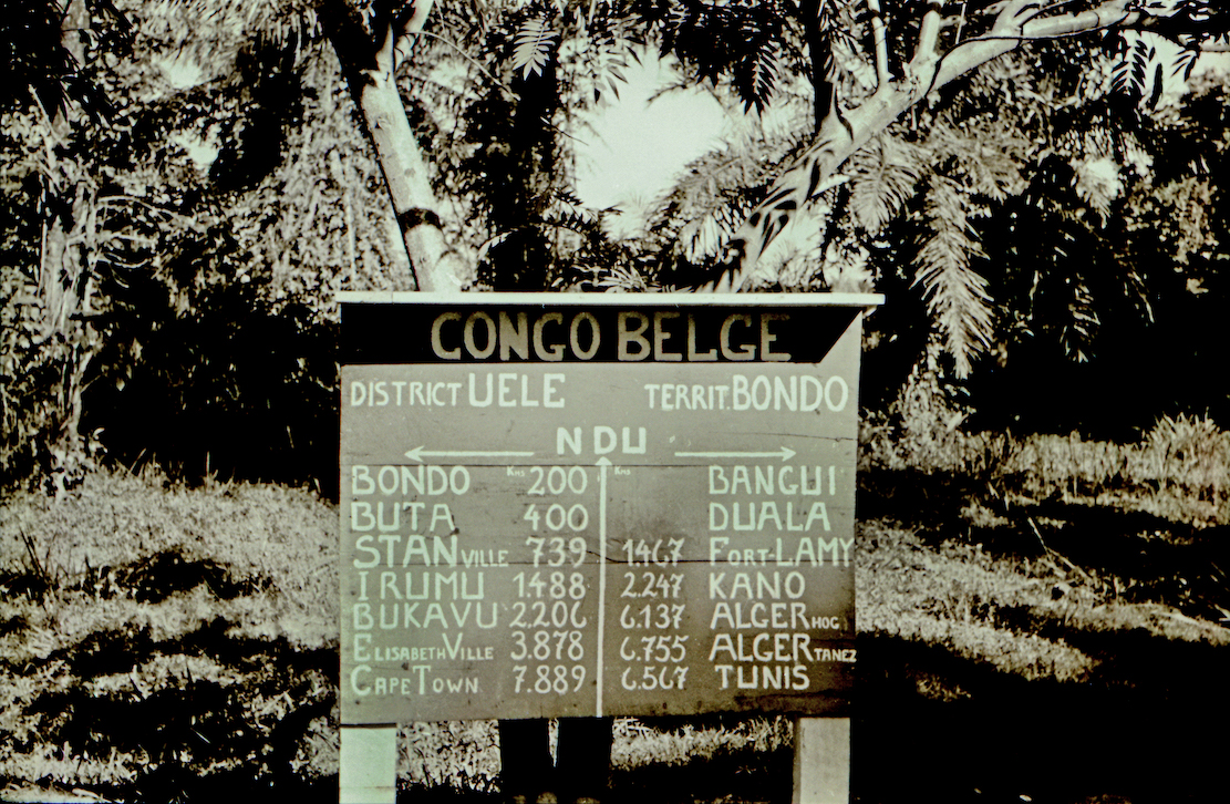
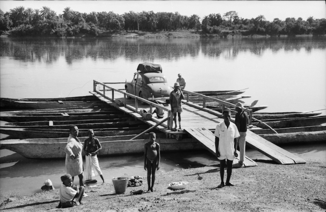
Soon they entered the Congo, where a rebellion against the Belgian colonial rule was already smouldering. But Knud and Svend were more concerned by the Pygmies’ evil glances. The road passed through dense jungle, and several rivers were crossed on small barges made of joined-up dugouts (below). The propulsion was a rower in a canoe on each side, directed rhythmically by the captain’s drum.
Kudu encounter
While still in the Congo, one of the Oxford’s front axles broke. The two had agreed they’d take turns in getting help so with the axle under his arm, Svend got a lift to the nearest town, while Knud set up camp in a clearing. The natives gestured loudly to move the tent, but Knud refused, assuming they were trying to lure him away from the stranded car. That night he found himself camped in the middle of a forest full of snorting, growling and unnerving brushing against the tent, but otherwise the parade of unseen beasts passed without incident. The next day the locals returned to see if he was still alive. Knud emerged from the tent in good form.
A few days later the Morris hit a kudu (a large, spiral horned antelope). The kudu trotted off unharmed, but they did not. The collision had shoved the fan back into the radiator leaving them to repair the damaged cells ‘the African way’. Being carpenters, they figured out how to knock some wooden plugs into the radiator at the bottom and squeeze the cells together at the top so water still flowed through. Miraculously, the repair lasted until they replaced the radiator in Spain.
In French West Africa [Niger] they ran out of drinking water. Thirst became such an acute problem they drew lots to see who’d try some murky ditch water. The idea was that if the one who drank got sick, the other might be able to continue. Knud was given the honour of the dirty water, filtered through a handkerchief soaked up with red wine to cover the bad taste, while Svend had to make do with a mouthful of wine every now and then. The days passed, and when they finally found fresh water, Svend was so dehydrated he was hallucinating.
On the verge of giving up, they were under pressure to cross Nigeria before the rainy season broke. In Niger, the U-bolts holding one of the rear leaf springs snapped. According to the map, the nearest town was at least 60km away and the temperature was reaching 45°C in the shade. Now it was Knud’s turn to seek help; a truck gave him a lift to Dosso which in 1954 turned out to be just a junction. The next day he got another lift to Niamey, Niger’s capital, but it being the weekend, everything was closed. On Monday, he finally managed to get a workshop to fabricate two new U-bolts.
Knud had wanted to wait until the next day, but realised Svend would have been impatient after waiting five days in the bush. The truck Knud returned on was the only vehicle Svend had seen in all that time, and he didn’t want to rot there any longer. While waiting, he’d crawled under the car for some respite from the heat, but the next morning found his body covered in rashes. Unfortunately, he’d shared his space under the car with a dozen rats.
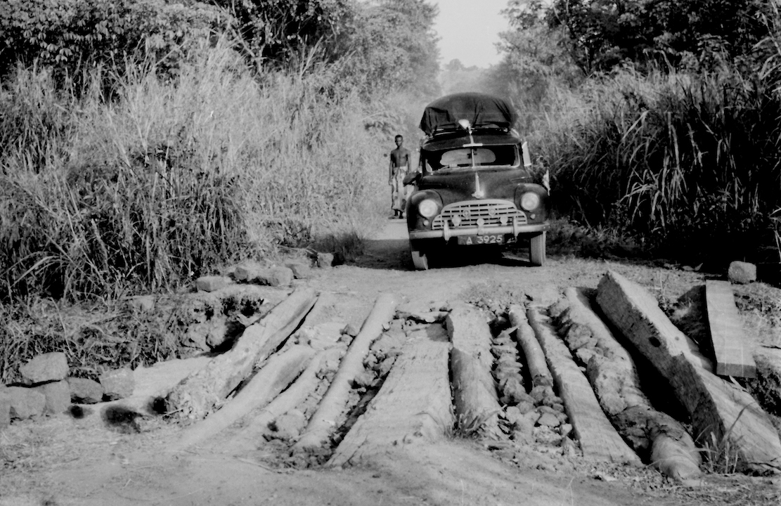
After 6000km and three weeks on the road, the two exhausted Danes reached Gao on the Niger river [present day Mali], the southern terminus of the 1800-km Tanezrouft piste across Sahara to Algeria [the route of the original crossing of the Sahara with
Citroëns in the early 1920s]. Here they met four Englishmen in a well-equipped 4WD, one of whom was a mechanic. They’d driven up from the Gold Coast (a former Danish colony, today Ghana) but had already blown four tyres. Although their original plan had also been to cross the Sahara, they’d lost their nerve and planned to sell the car and fly home.
This encounter made a sobering impression. Here they were stuck with an ailing ordinary family car with a broken rear spring, unstable steering and wheel bearings grinding with sand. Crossing the vast Sahara suddenly seemed like a daunting prospect. The only problem was the price they’d get for the clapped-out Austin wouldn’t even cover a single flight home. In silence they tried again to secure the broken spring by wrapping the handbrake cable around the broken leaves along with a pair of old trousers. At first glance, the repair seemed adequate.
Crossing the Sahara
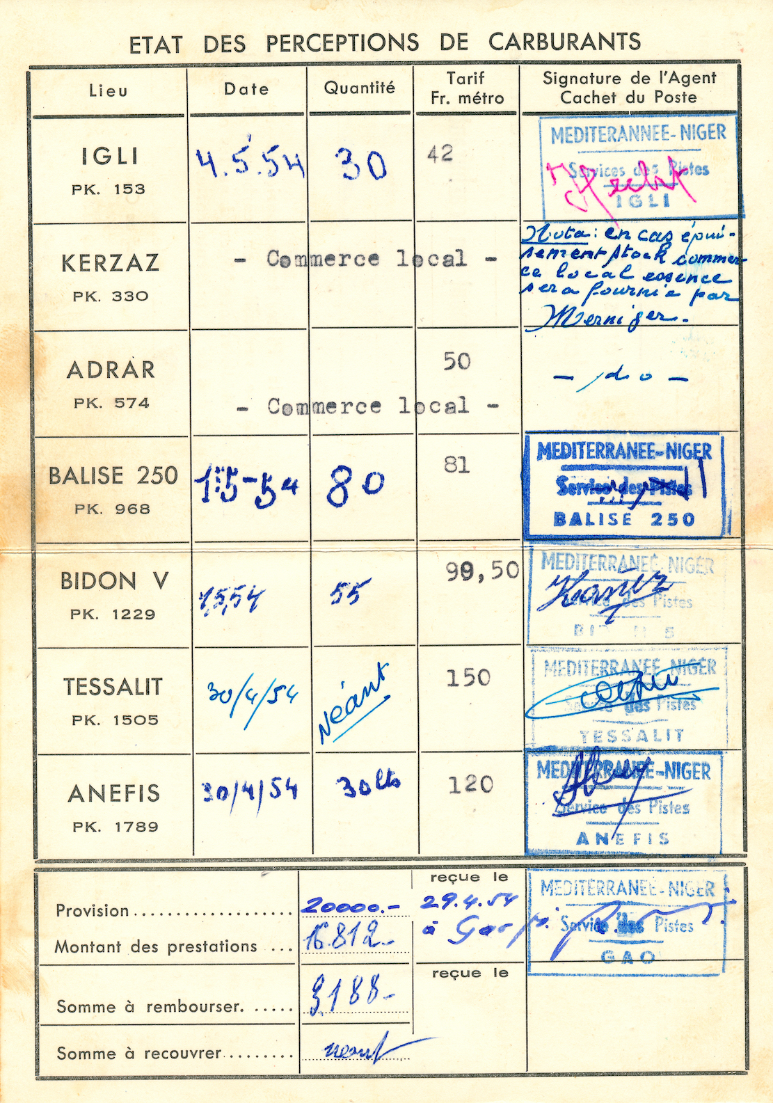
With permission to cross the Sahara came a requirement that the police in Gao verified at least 60 litres of drinking water was carried. However, the police did not seem so bothered in how careless travellers might be, so most of the water reserve was replaced with petrol as fuel was expensive at the military checkpoints further north in the desert. These checkpoints were up to 400km apart and, according to the regulations, travellers had up to 36 hours to reach each one. If they didn’t show up, the military would launch a search at the drivers’ expense. However, one of the checkpoints explained this never really happened. Soldiers serving in the Foreign Legion had not signed up to be tourist guides.
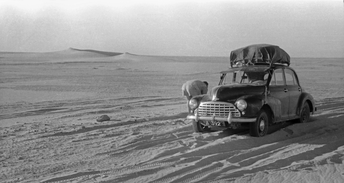
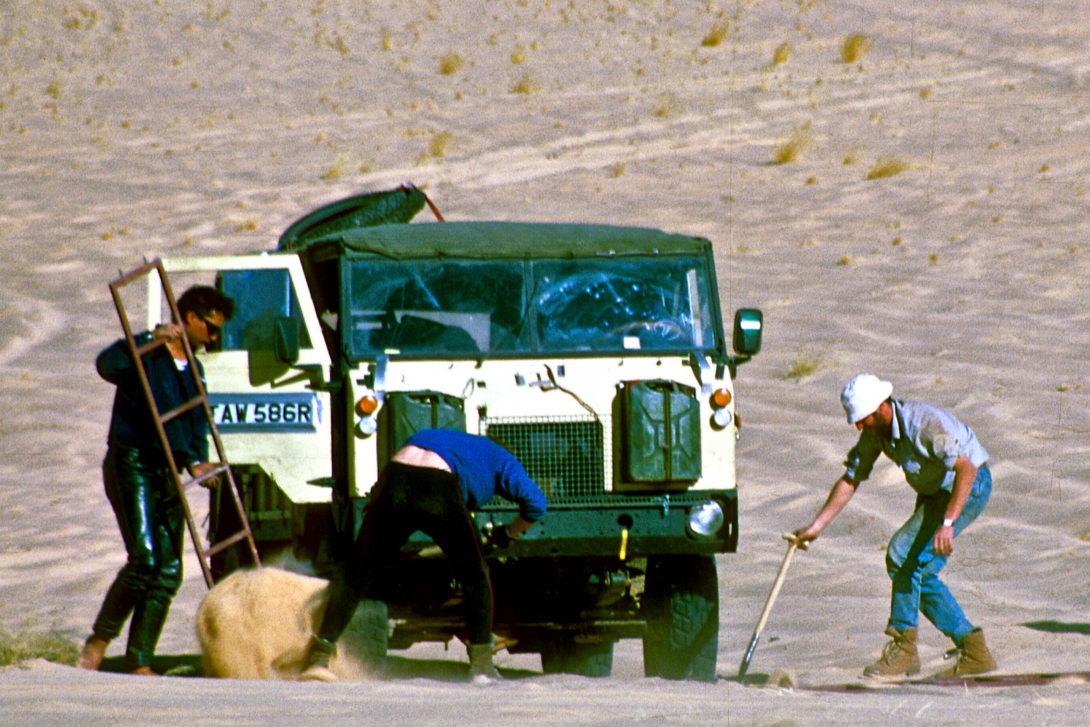
The track through the Sahara was marked with single oil barrels [‘bidon’] every 2.5km and two stacked barrels every 5km. The sand-blasted wrecks of vehicles from unsuccessful transits also helped mark the route. For the first few days the track was corrugated – not so easy with a broken rear spring. Later they entered areas of loose sand which they tried to avoid while keeping in sight of the bidons. It became a struggle to shovel their way free, and the camaraderie became strained. When they got badly stuck for the third time on May 1st, Svend threw away his shovel and refused to work – this being International Workers’ Day. Knud assured him it was hardly likely the Danish Carpenters’ Association would find out about his shameful betrayal of the proletariat.

Despite these challenges, the journey through the harsh and beautiful landscape was a memorable experience. The great silence when they took a coffee break or ate beef straight from the can was indescribable. Then they’d sit in the sand with their feet in the ruts while the fiery red sun set, as it only does in Africa. When they got tired, they would burrow into the sand and look at the billions of stars overhead.

Major repairs in the Sahara
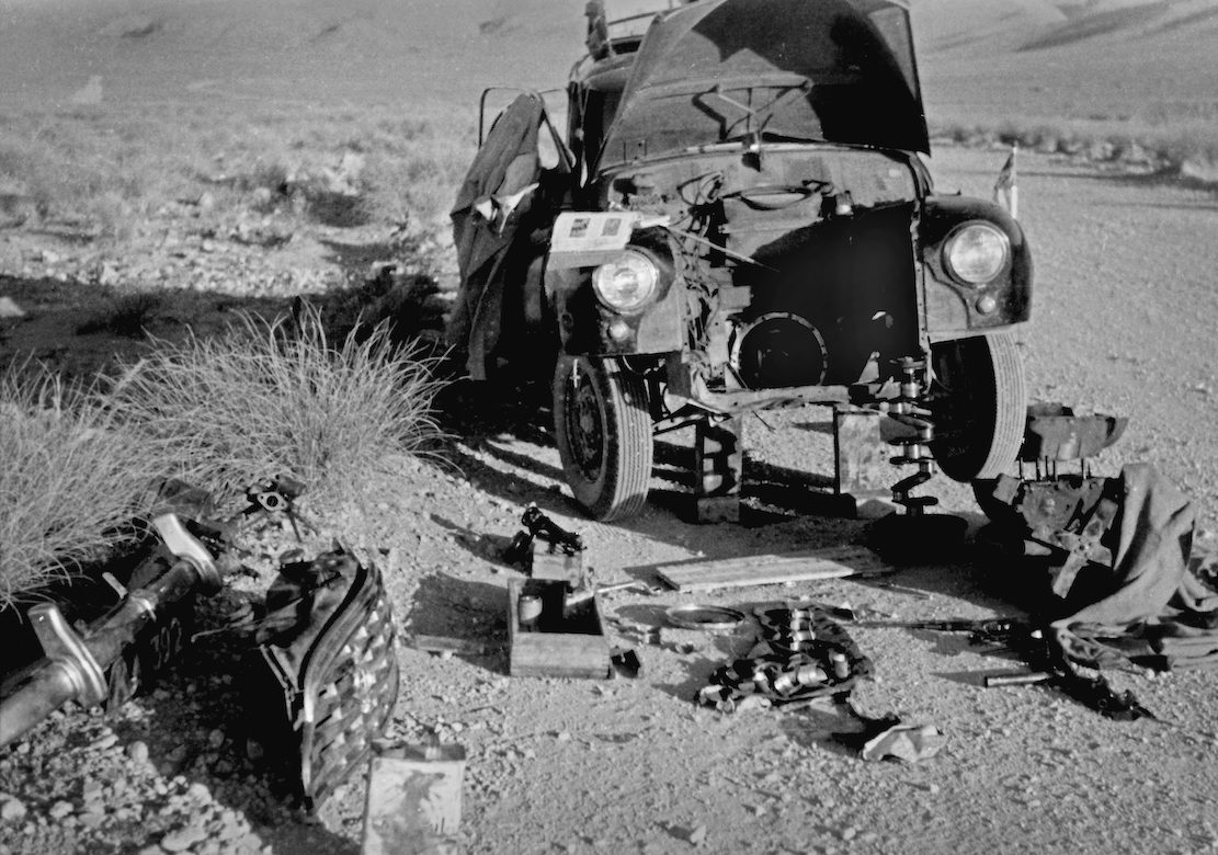
Every now and then the engine would cut-out due to vapour-lock in the fuel pump struggling in the immense heat. Cooling it with a wrapped wet cloth helped a little, but the engine was also losing power and knocking loudly until they could only run for 3km at a time. Now the spare parts they brought from Uganda became invaluable. The engine was removed and disassembled in the desert and a destroyed main bearing was was replaced with a lot of filing and hammering. It took hours, but when the car started on the first try, the proud smiles lasted the rest of the day. The broken spring still had to be re-tied constantly, but after seven days they finally reached Reggane with a hotel and a proper meal.
Finances were tight if they were to get home. In Nairobi they’d paid a deposit of £1000 for permission to cross the desert, which they could claim back at any French government office north of the Sahara. But in Colomb-Bechar they didn’t have pounds. A detour was taken to Oudja in Morocco, but the consulate was closed, and the following day there were violent anti-French riots. And when the consulate finally opened, they didn’t have any pounds either. In Tangier it was the same story, and the Danish consulate could not help.
In the end, by exchanging their remaining African currencies, they were able to buy a ferry ticket across the Straits of Gibraltar, then at least they were in Europe. In Malaga, Svend sent a telegram asking for money, and while they waited, they stayed in a small hotel in town. The money took three weeks to arrive, and by the time the hotel bill was settled, there was barely enough left to reach Denmark. In Madrid, they pawned binoculars, cameras and a tent to get a little further north.
Late one evening in Germany they were stopped by the police on the Autobahn because both rear lights were out. They promised to fix the mess at the next fuel station, unable to admit that both headlight housings were rattling around in the trunk. To their great frustration, they only had enough fuel to reach the border in Kruså, but the Danish customs officers showed a rarely cheerful side. Despite the early hour they were fascinated to learn of the duos’ arduous adventure from Uganda. And when Knud and Svend explained they had to wait for money for fuel, the customs officers offered to lend them the cash so that they could drive home.
The two adventurers never forgot their welcome to Denmark. In Hillerød they sat in silence for half an hour, looking across the lake towards Frederiksborg Castle. It was June 5, 1954 – two months and two days since they’d left Kampala, and a beautiful summer day. It was hard to believe the adventure had reached its final chapter. Twelve minutes later, they rolled up in front of Knud’s parents’ house in Kvistgård, where the mother came out onto the steps, clapped her hands together and exclaimed: “Well, you’re finally here – you must be very hungry!”
See also
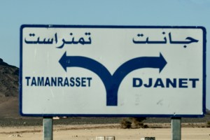
The Road from Djanet to Tam
Algeria page
1982 • 1984 • 1985-6 • 1987-8 • 1989
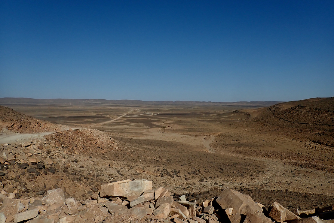
I flew to Algiers to try out a new agency, do a recce and indulge in a bit of a 1980s Desert Travels nostalgia tour (left; 1982). Among other things, I was curious to see if there really was a road all the way from Tam to Djanet.
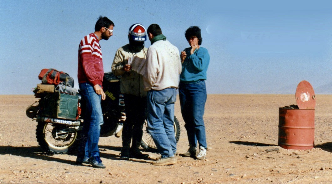
Fog delayed our London flight by a day which meant we missed our twice weekly connection to In Salah. Me, Rob and JT were the only non-Algerians on the plane, and on arrival found a VoA was not the quick payment and passport stamp I’d expected. Expect at least an hour’s wait – significant if catching an onward flight from the adjacent domestic terminal.
Once through, buying black market money was straightforward. So was getting a local SIM (rates and prices here). Last minute, Fouad from Tadjemout Travel had organised a spacious people carrier to take us the 400km to Ghardaia, a run I first did in 1982 and last in 2006 in the MAN.
It took an hour to get clear of dreary, gridlocked Algiers until near Blida where a three-lane highway curved south and up into the Atlas, through a tunnel and onto the rainy high plains (above). We passed Medea, Djelfa and Ain Oussera – all places evoking deeply etched memories and miseries of my 1980s travels here.
After years in Morocco, I was shocked by the crumbiness of the roadside facilities and the endless checkpoints. This being New Year’s Eve, our driver explained the gendarmerie were doing the seasonal shake down for individuals transporting booze and other intoxicants. A couple of days later we watched the morning news in In Salah, showing cops revealing slabs of beer hidden under blankets in car boots.
It got dark and just before Laghouat one unusually arsey soldier wouldn’t let us pass (ironically, he may have been drunk), insisting there were no gendarmerie to escort us onward and we would have to spend the night in the local barracks. There was something dodgy about him, especially when he suggested with a sly grin that we pay him 4000D (£30) to continue. In my experience as a tourist in Algeria, this sort of opportunistic bribery has never happened, and with a pointed finger I assertively spelled this out to matey.
‘Did that work?’ I asked Rob.
Another off-stage conflab with our driver and it seems it did. We moved on and arrived at the Caravanserail auberge in a corner of Ghardaia (below) around 11pm which, while an interesting compound, with the meagre breakfast was pricey at 7500DA or €30 each, even at the best black market rate of 250 to a euro.
Our Tadjemout Travels driver in a 105 Land Cruiser was slow to turn up next morning and after a drive-though tour around Ghardaia, we weren’t southbound on the TSH till noon. This is where the proper, though as yet uninspiring desert starts: the turn off east for Ouargla for the road through the Grand Erg to Djanet, or straight down the TSH for El Menia, a few miles after the dunes which caught my eye back in 1982. This time they looked a bit flat. Maybe it had rained.
Either I dozed off through El Menia (El Golea), or I didn’t recognise anything after what might be 40 years. Up ahead lay the Tademait plateau which was a rubble track shocker in ’82 and now was little better. About a dozen diversions took to the dirt just as decades ago, making for slow progress – expect 8 hours for this 400-km stage. This is Algeria’s Highway 1 and they’ve let it deteriorate to this state. Instead, there’s talk of extending the railway from Laghouat 1500-km down to Tam.
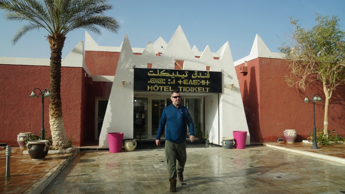
Night fell on the Tademait and the impressive decent to the desert plain passed unseen. In sight of In Salah there was a more serious checkpoint, right down to logging our mothers’ maiden names on a piece of scrap paper. Sometimes I wonder if it’s just down to the pedantry of the individual manning the barrier. He seemed agreeable enough, just doing his job. With a bit more banter – a key driver’s skill to hone at these CPs – we managed to avoid a pointless escort the few km into town. Around 10pm we arrived at the unusually modern Hotel Tidikelt (8500DA; another basic breakfast but from €34, pretty good value) where Fouad from Tadjemout met us to sell more money at 20% better than the airport, plus had a warm meal left waiting in our rooms.
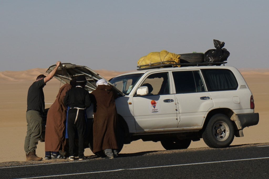
Next day we learned that the gendarmes had over-ruled their rules and imposed a two-car escort on our two cars for the 550-km to In Amguel. We where now in another 105 with Sidi Ali, with a rear diff that didn’t whine deafeningly, but whose electric windows didn’t work. Roll cages on both suggested they were ex-oil exploration cars. Fixed windows would prove to be a big irritation for us (and those that followed), but most agency cars in Algeria are clapped-out bangers. Newer 4x4s are restricted to civilians or hard and expensive and dodging to come by. One time I sold a TLC to an Algerian, but had to drive it to Mali first, to get ‘ringed’). Still, despite a few hesitations, our 105s got us round, covering about 3000km.

To make up for lost days I ditched the Old TSH track plan via Tadjemout spring where the Amguid Crater camel treks used to start, and decided to stick to the main TSH. But add the late start and gendarmerie escorts, it became clear we’d be on the 4th late-night drive in a row.
I rather hoped Berbada roadhouse north of Arak might be a good place for an overnight for future trips, but after stopping there I think I’ll take the open desert. The truckstop is like something from a Mad Max movie with a rough cafe selling 20 types of long life biscuits and as many deodorants; a way of keeping ‘clean’ when there’s not much water around.
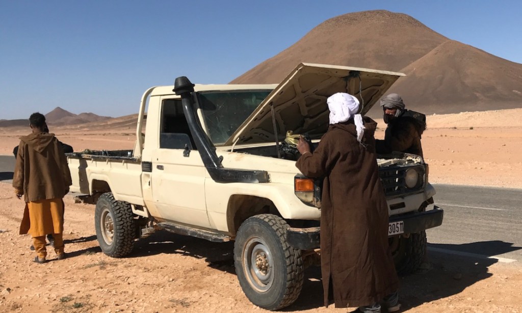
Our 105 wouldn’t turn over, as if the battery was shagged, but a reverse jump start got it running. Didn’t know you could do that with a diesel. The battery was fine from then on, but it didn’t bode well for the desert pistes and conked out inexplicably a few more times. We were picking up a sat phone in Arak, plus I’d borrowed an InReach2 sat messenger in case of trouble.
The hotel next door looked rough and might well be catering for the northbound migrants our driver pointed out on the TSH. The lucky ones were jammed 20-up in the back of crewcab Hiluxes (below), circumnavigating the more onerous checkpoints in towns. The rest were boldly walking along the highway with nothing more than a couple of water bottles swinging from their belts. Out here it’s 100s of kilometres between places. Clearly our gendarmerie escorts weren’t bothered, maybe because they know at some point, once some money had been made and passed around, the migrants all get bused back to Point Zero on the Niger border, where some give up and some try again.
From Berbada truckstop we made our way south towards Arak in the Immidir ranges, taking occasional deviations onto the sands. After passing the huge pale dunes of the Erg Mehajabat, we entered the gorge then negotiated with the cops where we could eat our lunch. You can tell it’s a constant game with the local drivers to get their way or just get one over.

There was a gendarmerie change at Arak, luckily with minimal delay which is what can make these escorts irksome (apart from being chaperoned in the first place).
Once out of the Immidir and back in the open desert, I was on the look-out for the isolated massif of Sli Edrar which had captivated me back in ’82, and which had been the lost goal of my ill-conceived ‘84 trip (left). It wasn’t till 2009 that we finally got to explore the massif which would be a landmark to aim for on the return leg of this recce.
Just down the road was the roadhouse (no fuel) at Moulay Lahcene, another rough joint which would frighten the horses and is not exactly an Aire de Repos. Migrants milled about, Tuaregs kept to themselves (below right) and old bangers littered the compound.
South of Moulay is the turn-off northeast for the Amguid piste which we’d pick up in a few days time from the east, then the sun set as we passed In Ecker mountain which the French accidentally nuked in the early Sixties, irradiating the area for miles around.
At In Amguel the gendarmes left us. The plan had been to turn east into the Hoggar for Hirafok and camp somewhere before looping the Tahifet road round to Tam. But by now it was too late to be camping and getting fed in the desert, so we carried on unescorted another 120 clicks to Tamanrasset where Sidi Ali sorted us out some lodgings at Camping Tuareg, a vast warren of non en-suite rooms under domed roofs and where our cook used the kitchen to bang out another late meal (above).
Next morning up on the roof I recognised the distinctive profile of Hardriane mountain and the volcanic plugs marking the way to Assekrem. A week or so later, a Spanish tourist in a local car with guides was kidnapped and taken towards Mali where his crew were released. It was the first such grab in Algeria in a decade, carried out it’s said by locals responding to ISIS’ call to buy hostages for ransom. Very luckily for him, his abductors was intercepted by Tuareg separatists (not jihadists) before he was handed over, set free and returned to Algeria and home a few days later. Around the same time in Agadez, an old Austrian woman was not so lucky and nothing’s been heard of her since. And soon after, Swiss Claudia who I knew from Tam in the Noughties, and now living in Agadez, was also adducted and is probably in north Mali.

Even if much of it was in the dark, this was my first full transit of the TSH I’d done in 40 years. But apart from 4G cropping up near settlements which themselves have sprawled with migrants and refugees from the Sahelian insurgencies, the TSH was little changed. I’d had a plan for a cushy road bike tour but the escorts and deviations and scant lodgings would make it no better than my previous off-road tours. Plus the kidnapping didn’t help inspire confidence.
It’s never over till it’s over, but I’m sure for a first timer rolling down the TSH to Tam, then east to Djanet before heading back up for either Tunisia or the Algerian Med ports, this full 5000km loop would still be a big adventure and amazing road trip, just as it was for me in the 1980s. All the better too, if you can dodge the highway gendarmes – easier in the east side and on a moto, it seems. But for the moment, as things stand, it’s just too compromised as a road trip, compared to the good years, though at least once you get off road you can shake off the escorts. That’s my tip in the south: get off the main southbound highways as soon as escorts allow, and stay off them. That’s what we did coming back west from Djanet.
Updated April 2026
These two southern Algeria towns will soon be joined with a ribbon of asphalt called the N55. In fact it’s said in April 2026 the job has been done, though it has yet to be independently verified.
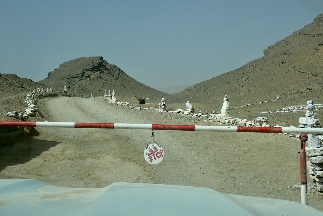
It’s worth knowing that according to the Djanet gendarmerie who give permissions, for some baffling reason, from Djanet this road is closed to tourists, even with a guide. We drove it eastbound in 2025 with a guide with no problems. Maybe eastbound from Tam makes a difference, as you can say that from Bordj you’re heading north to Illizi, even though it’s straightforward (and an amazing drive) to carry on east to Djanet which is a dead end (no open borders to Libya or Niger).
In April 2026 sat imagery showed the gap in the tarmac had shortened in the west by about 9km to 85km. But as said, it may all be sealed. Soon we will know for sure.
How the surface with survive the baking summers and pummelling of trucks remains to be seen, but that’s been an issue since they finished Trans Sahara Highway from Algiers to Tam in the early 1980s. It’s said the TSH remained intact over its 2000-km distance for just one year before flash floods, poor engineering and overloaded trucks beat the bitumen back into rubble. In January 2025 we did the full TSH too; there’s probably 100km of diversions over sand and gravel.
Djanet to Tam
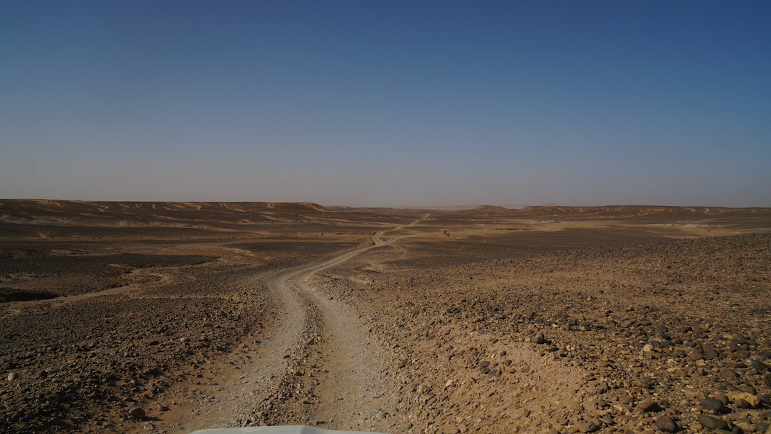
This description may be out of date now but about 8km west of Serouenout checkpoint (270km from Djanet) the tarmac ended in 2025. After 24km there was a short, 20-km section of tarmac, and then you’re back on the piste south of the new road’s alignment for about 70km. Once back on the road around 24.264, 6.4864 (if not already), it’s about 80km to Ideles roundabout (fuel in town) and another 140km on to Tam via In Amguel on the TSH, or about 190km along the scenic ‘Hoggar Ring Road’ via Col Azrou and Tahifet.
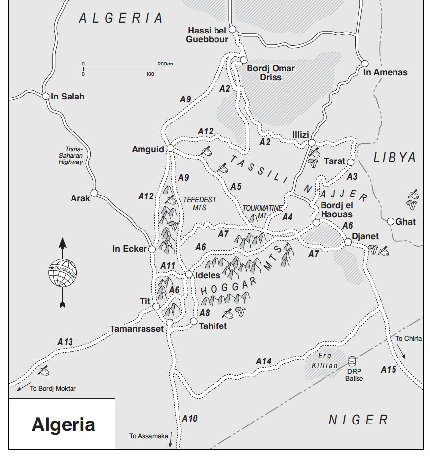
Sahara Overland Route A6
In the good years (1970s, 80s and 2000s) various tracks between Djanet and Tamanrasset and Hoggar mountains all combined to make classic multi-day adventures in southern Algeria.
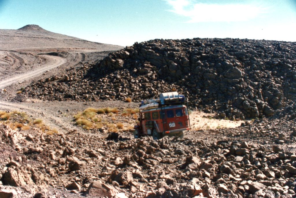
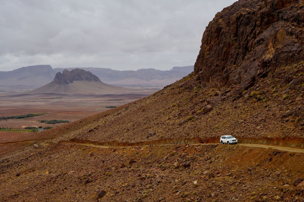
Heading west on Route A6, (the current N55 road), you traversed below the ramparts of the Tassili N’Ajjer plateau, long famed for its prehistoric rock art, then either turned southwest at Bordj el Haouas for Tazat mountain (below right), or used the same mountain as a landmark after crossing the dunes of the Erg Admer (below left; Route A7),
Passing isolated volcanic cones, plugs and other outliers, the basalt rubble from the once molten Hoggar raised you up to Assekrem, a few hours from Tamanrasset and a refuel. The main route used by non-clandestine locals (A6 in my old Sahara Overland guidebook bottom of the page) was still nearly 700 kilometres or two desert nights for most. It was also on the limit of what a moto could manage alone.
When I first did it in 1987, the road from the north ended in Illizi, 400km from Djanet over the Fadnoun plateau. That all added up to over 1000km and one of the best all-dirt stages in southern Algeria (above), with just enough pre-GPS navigational challenges to keep you on your toes. It was rare to pass more than one or two other vehicles during the transit.


In the 1980s the army were tasked with building a road over the Fadnoun’s switchback escarpments. Up to that point, trucks supplying isolated Djanet had to take a huge, sandy detour to the west via Amguid, nearly doubling the road distance.
After about ten years the Fadnoun (below) got sealed and today is still a great drive, even if the road is breaking up here and there and occasionally lorry drivers fall foul of the Fadnoun’s curves (left).

Morocco is famed for sealing it’s southern desert pistes faster than we can keep up, but Algeria has been catching up, only over vastly greater distances and probably with access restrictions to the military. A whole network of ‘hidden’ border highways, remote military bases as well as vast defensive sand berms (below) have emerged in recent years to control migrant traffickers coming up from the south.
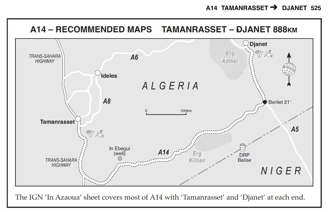
Even though they’ve succeeded in sealing this traverse, A6 Tam-Djanet (N55) still remains one of the great routes in the Sahara and there’s no need to follow the new road. There is A7 to the north which we also partly did in 2025, A14 in the deep south I last did in 2007, and at least one more route via Tiririne, Tarabine which we did in 1989 and again in 2006 on the way back back from Mauritania on Sahara: The Empty Quarter. For me this was all before gpx tracklogs but these routes are probably traced on OSM maps or Wikilocs. So do not be put off by the road being officially closed to tourists. As long as you (and your guide, if present) are prepared and equipped to tackle these pistes, they still offer some of the best, long-range routes in the central Sahara.

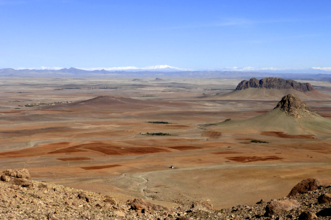
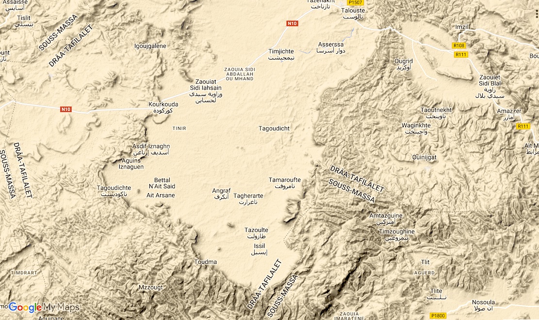
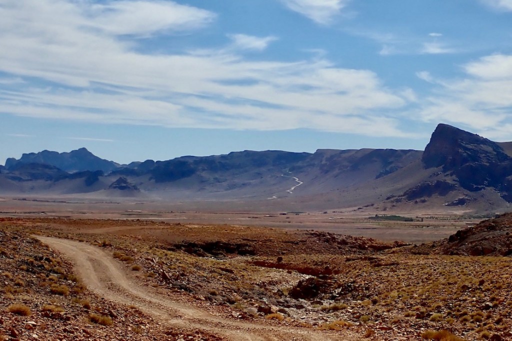
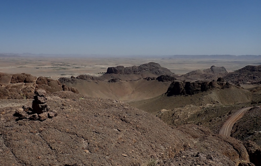
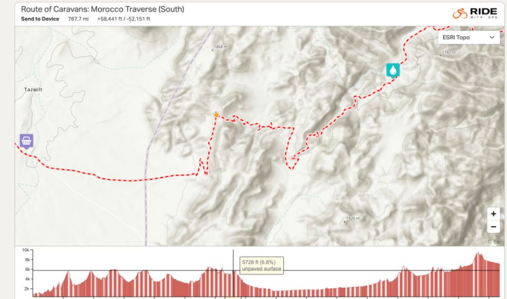
The new book out this week has a bunch of great routes in the A (Anti Atlas) region crossing the Issil Plain which lies between Tazenakht and Taliouine.
Both are good bases to kick off a traverse of the plain towards (or from) what I used to call Jebel Timouka but might more correctly be called Jebel Tawzart – an escarpment which rings the plain to the south.
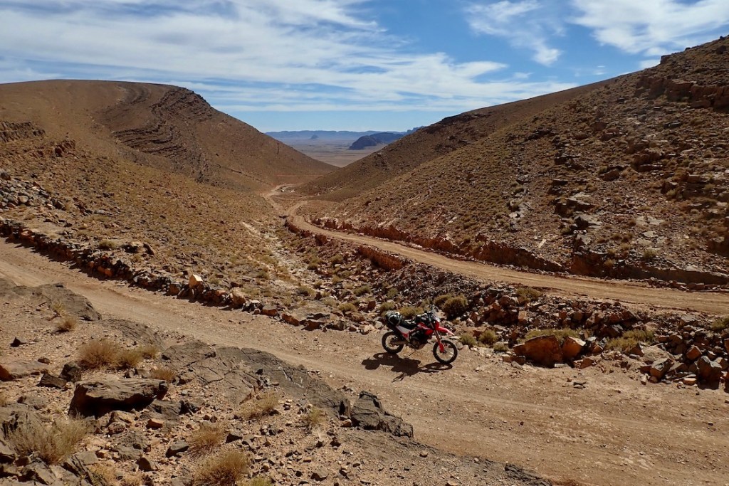
These routes cross six passes or Tizis labelled below. From the west Tizi Ounzi, Tizi Tarslemt, Tizi Tawzart, Tizi Haroun, the unnamed ‘Issil pass’ and the Tizi Mourirt which is not on any M4 route but is worth a look and is part of the RoC.
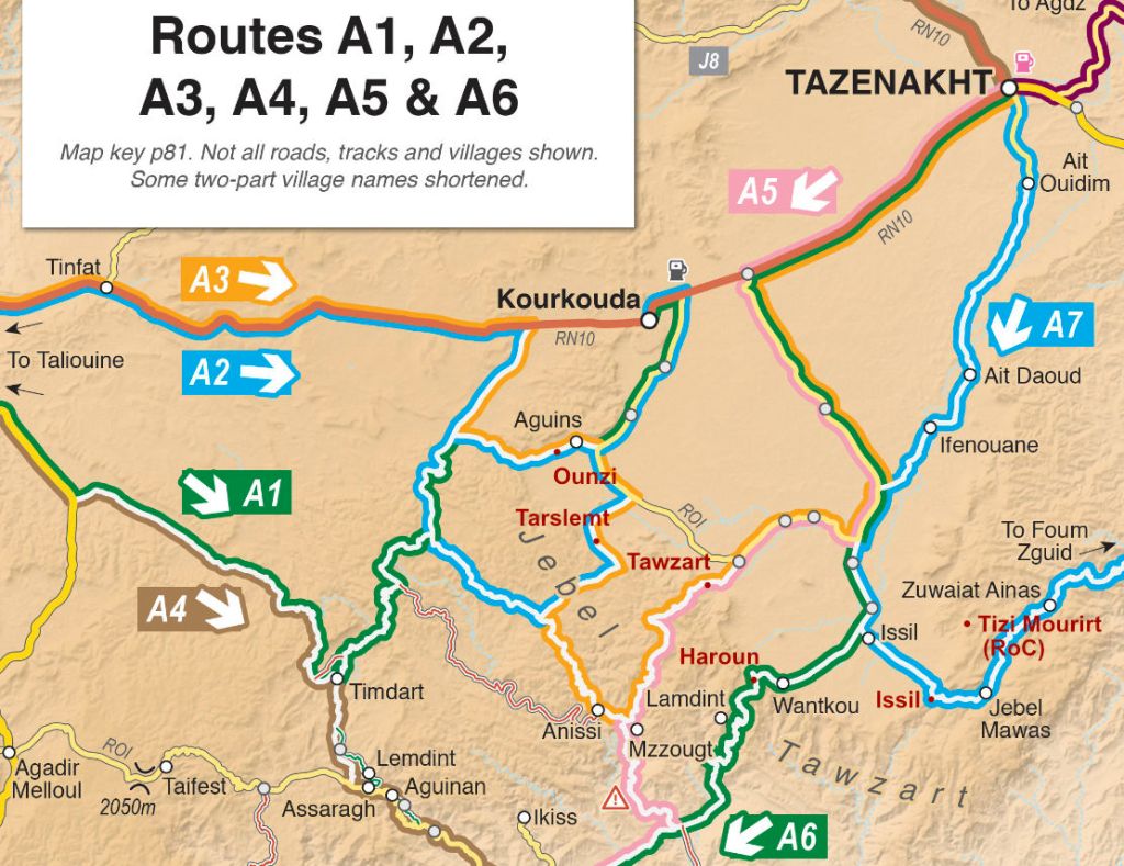
Tizi Ounzi
1750m (Routes A2, A3)
West of Aguins, the Ounzi is not so dramatic but is a fun way of accessing or leaving the plain on the west side. Coming down the Ounzi towards Aguins, you get a good view of the Tarslemt pass up ahead.
Tizi Tarslemt
1896m (Routes A2, A3)
The Tarslemt starts as a broad ramp rising up onto the jebel with great views over the plain before swinging through a few switchbacks to nearly 1900m and down the far side and the canyons beyond
Tizi Tawzart
1940m (Routes A3, A5)
Tawzart takes a steep line up the jebel from Algouz and consequently got damaged by the recent rains: big bikes may struggle. And as you’ll read in the book, all vehicles may struggle trying to follow Route A5 right down the Anissi canyon. On A3, once you get to Anissi, the track gets more maintained to the west.
Tizi Haroun
1825m (Route A6)
Well known from previous Morocco Overland editions, Haroun rises to give huge views over the Issil plain (top of the page), but after the pylon turn-off down to rock-bound Lemdint, the trail turns into an unmaintained ‘BLV’; in a car expect to be crawling for hours at walking pace. And that was before the big rains…
‘Issil Pass’
1825m (Route A7)
I’ve found no name for the ‘Issil pass’, as i call it, another old classic from previous editions, with a jaw-dropping reveal if heading northbound on A7 or the TMT. Riding it last week, the valley to Amtazguine is slowly getting asphalted, but the switchback climb between Mawas and Issil remains an easy and epic gravel track.
Tizi Mourirt
1825m (RoC)
I’ve often thought there was something up here but never looked carefully enough. The Route of the Caravans pushbikers did and logged a route via Tizi Mourirt (Tizi n’Tlite), which comes down to A7 near Mawas village. One for next time.
ⴰⵄⴻⴷⴷⵉ ⵡⵉⵙ 7
Local Amazigh legends speak of a lost pass somewhere in the Jebel Tawzart, an ancient trade route now known as the The 7th Pass or ⴰⵄⴻⴷⴷⵉ ⵡⵉⵙ7 which got smothered in some Atlantis-like cataclysm, just as a treasure-laden caravan was passing through. It’s thought to lie somewhere in the higher reaches of the Jebel’s rim between Mourirt and Tawzart.

READ THE TMT FAQ
The idea of a Trans Morocco Trail is one I’ve had for ages. And after covering 1000s of km in 2023-4 in cars and on bikes updating my M4 book, plotting a brilliant, see-it-all TMT route was easy.
The TMT is the same deal as your TET, TAT etc: a .kml file of verified tracklogs and waypoints free to download off the regularly updated TMT master map above. After that it’s all up to you: do it all; do bits leaving your vehicle there or with rentals; plan it minutely for months on end, or just wing it.
Like the North Coast 500, it is nothing more than a network of long existent roads and village access tracks threaded together and given a catchy name starting with ‘Trans’. And like the book, the TMT is not a hardcore off-road challenge because there can be enough of them out there, as the September 2024 floods have shown. Tarmac stages may run for an hour or more, but these are all great mountain roads or deserted desert highways which are all part of the overland adventure.
Each stage has a summary on the TMT master map but some – like Stage S including Erg Chegaga perimeter piste – will be unsuited to unfit riders on tall, overloaded motos during a hot spell – which these days can run from April to October.
Road or trail there’s always an easier way round that’ll often be as good, or just a way to recover. No need to wear yourself out on the way to Cap Draa unless you want to. I estimate 14 days to cover K to Z comfortably.
You don’t need to buy my Morocco Overland 4 book to follow the TMT, but there’s another ~15,000km of routes in there, enough for several more TMTs, all with detailed descriptions which include long TMT stages. It could be handy as a tracklog is just a line across the landscape.
Ed does the FB:https://www.facebook.com/groups/1023359279129625
I do Insta:https://www.instagram.com/transmoroccotrail/
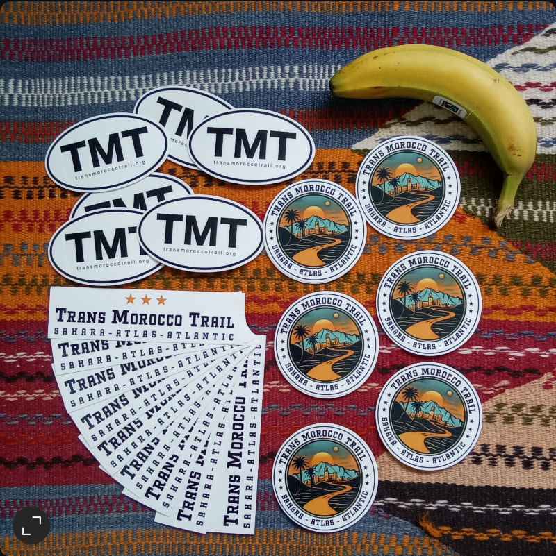
Stickers sets (below) for sale here
There’s a dedicated TMT Forum on the HUBB alongside the best Morocco forum.
See also
Duster rental in Morocco
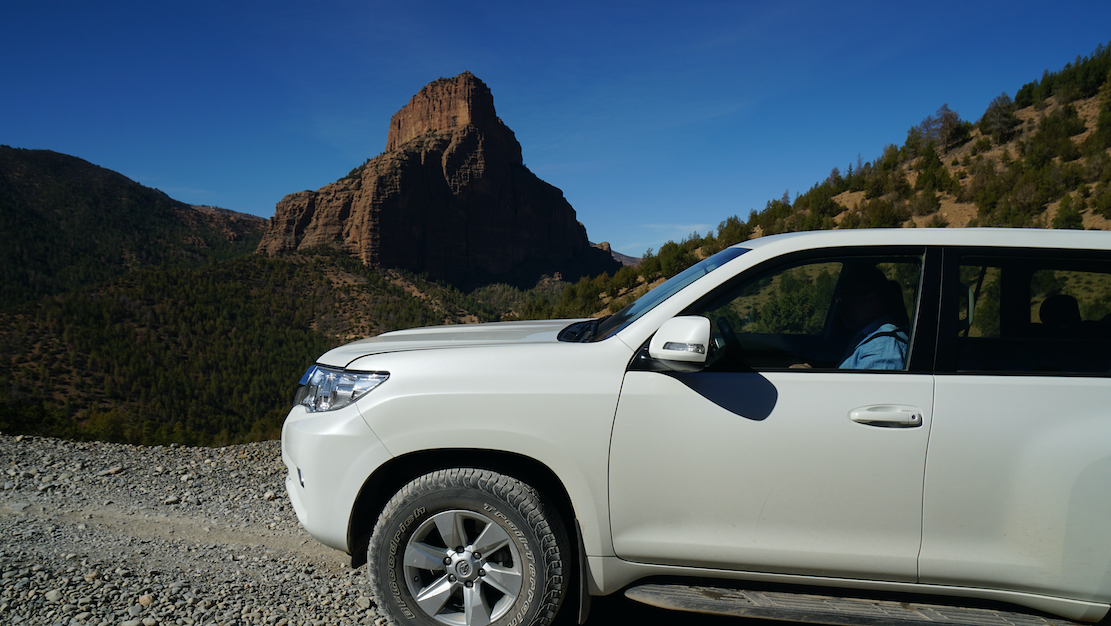
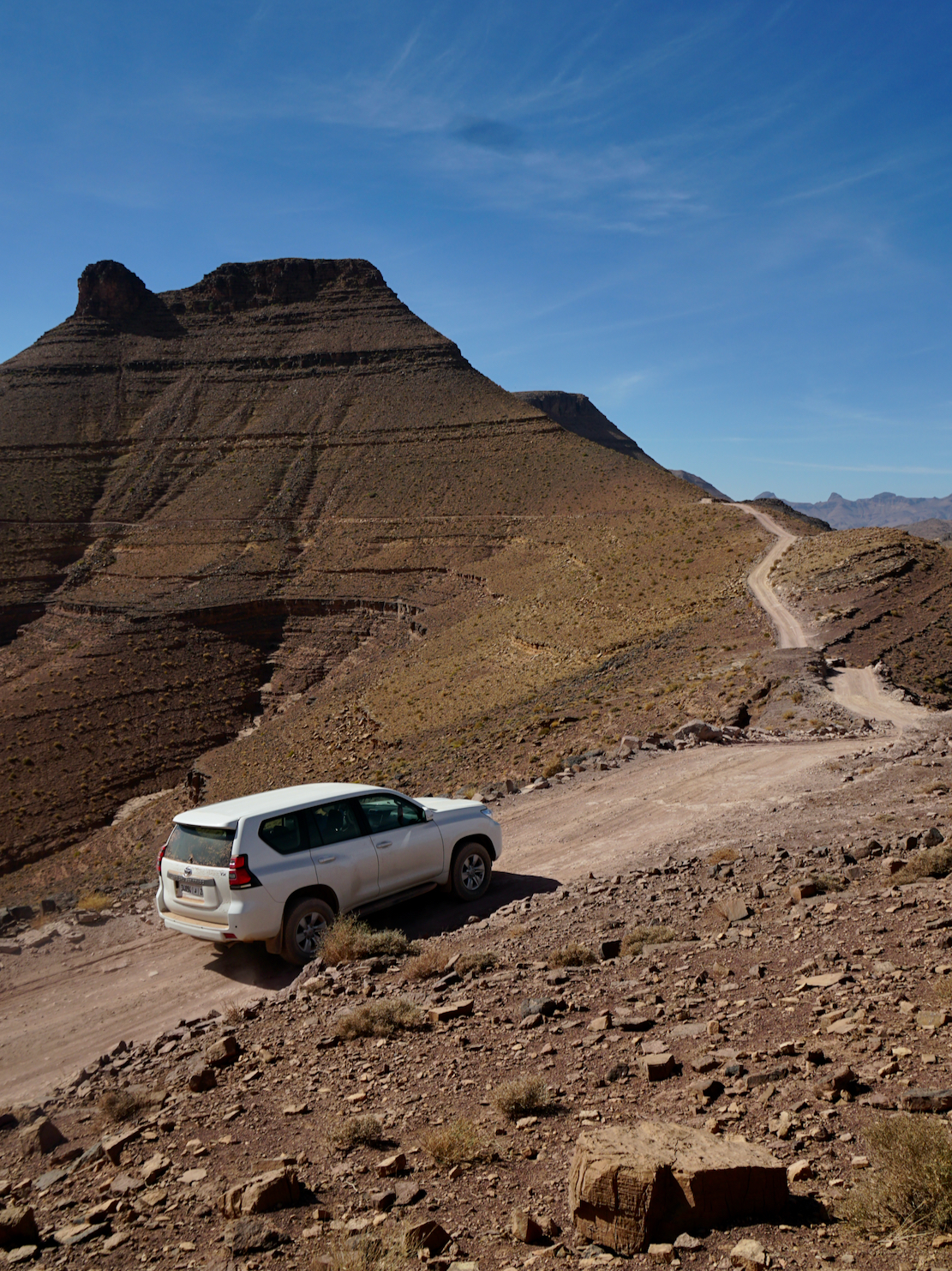
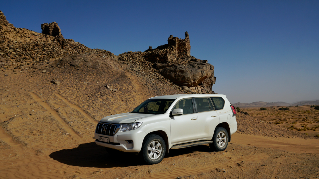
Prado TXL rental in Morocco 1
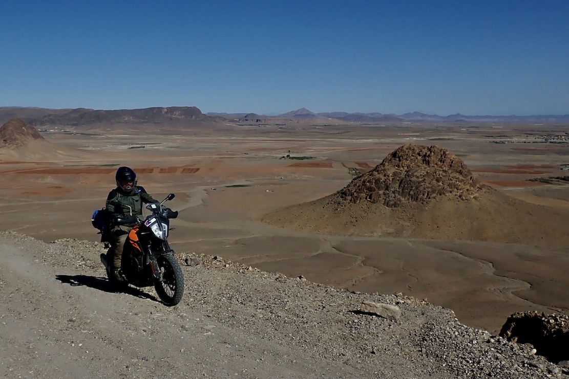
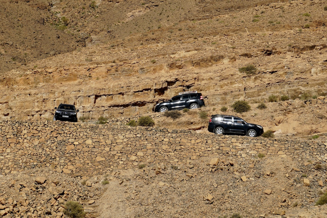
I rented a lifted, 2023 Land Cruiser Prado TX out of Marrakech for a week to recce and update the sandier desert routes between Foum Zguid and Erg Chebbi. I made the right decision: doing this area alone on the bike would be been too risky and tiring with the constant logging required. I couldn’t have covered the distances we did in the car.
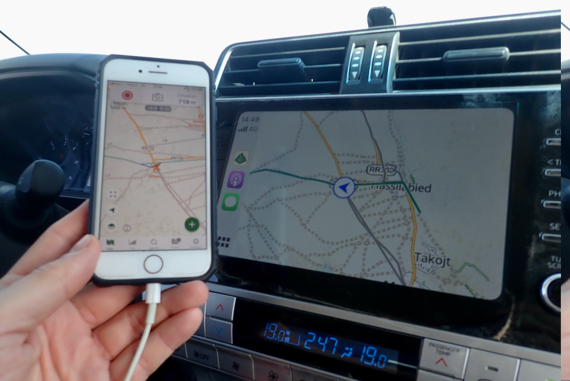
The Toyota of course didn’t miss a beat. A TX is automatic but with a Sport (sequential) shift to keep it in one of the four gears; handy in tricky dunes and other technical sections.
About the size on an 80 series (ie: big), it returned 9-10kpl (compared to 15kpl in a lighter Duster). Still, I’m glad we went for the nuclear option. Though we hardly used low range, it was good to have it there, along with the TX’s reassuring reputation. Amazingly, we paired an iPhone with the display in seconds via Apple/AirPlay (not possible on the Duster), but could not plug in a USB stick to play mp3s, which the Duster easily allowed. It probably could have been done via the phone, too.

At one point we decided to do a Body Twist Test: getting two diagonal wheels airborne to verify clean door shutting. If a body twists under this static tension with two corners unloaded, doors will not close or open freely, even if the separate chassis is twisting a little (as it should). But even with all doors open, the TX passed with flying colours; not a mil of body deflection in the shut-lines. As you’d expect from a Land Cruiser.

And yet, despite the big rubber seal, the TX sucked in dust from the back door or somewhere. This was perhaps the biggest irritation, but is the same in any car with a flat-backed tailgate. I get less dusty on a motorbike. I recall we taped up the back vents in my HJ61, over 20 years ago, but with little success. At high speeds on dusty tracks, I suppose the low pressure across the rear of the car is too great.
Anyway, we covered all the routes I planned to do and even a little bit more, and overall the trip was a bit more comfortable in the Prado (partly due to the reduced ‘will-it/won’t-it’ stress). Our TX cost €110/day (down from €150 last year); Dusters are now €50/day from Medloc).
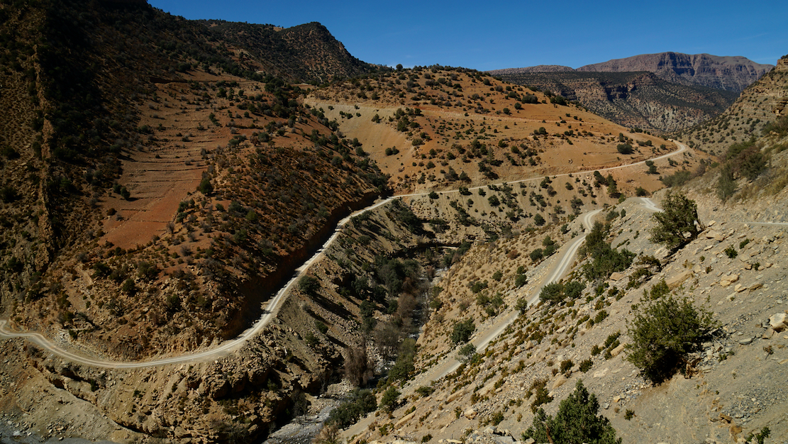
A few pics from out 1500-km recce.