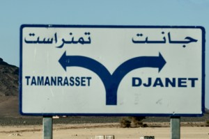
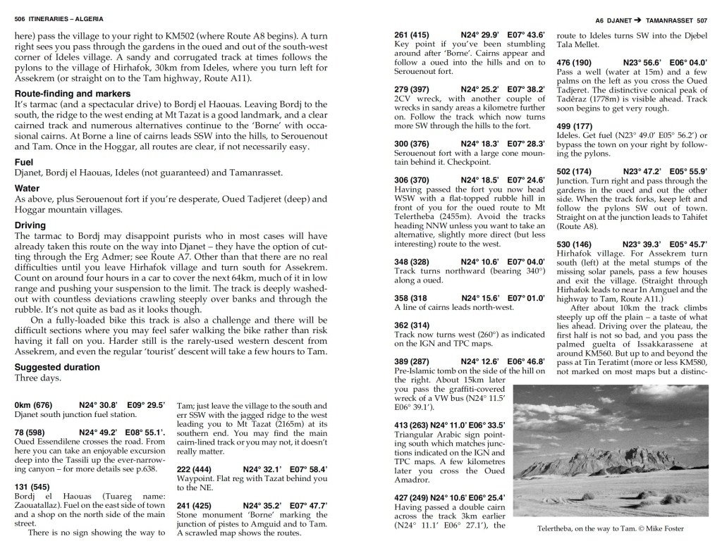
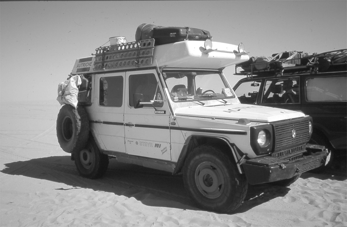
These two southern Algeria towns will soon be joined with a ribbon of asphalt called the N55. In fact it’s said in April 2026 the job has been done, though it has yet to be independently verified. It’s worth knowing that according to the Djanet gendarmerie who give permissions, for some baffling reason, from Djanet this road is closed to tourists, even with a guide. We drove it eastbound in 2025 with a guide with no problems. Maybe eastbound from Tam makes a difference, as you can say that from Bordj you’re heading north to Illizi, even though it’s straightforward (and an amazing drive) to carry on east to Djanet which is a dead end (no open borders to Libya or Niger). In April 2026 sat imagery showed the gap in the tarmac had shortened in the west by about 9km to 85km. But as said, it may all be sealed. Soon we will know for sure.
How the surface with survive the baking summers and pummelling of trucks remains to be seen, but that’s been an issue since they finished Trans Sahara Highway from Algiers to Tam in the early 1980s. It’s said the TSH remained intact over its 2000-km distance for just one year before flash floods, poor engineering and overloaded trucks beat the bitumen back into rubble. In January 2025 we did the full TSH too; there’s probably 100km of diversions over sand and gravel.
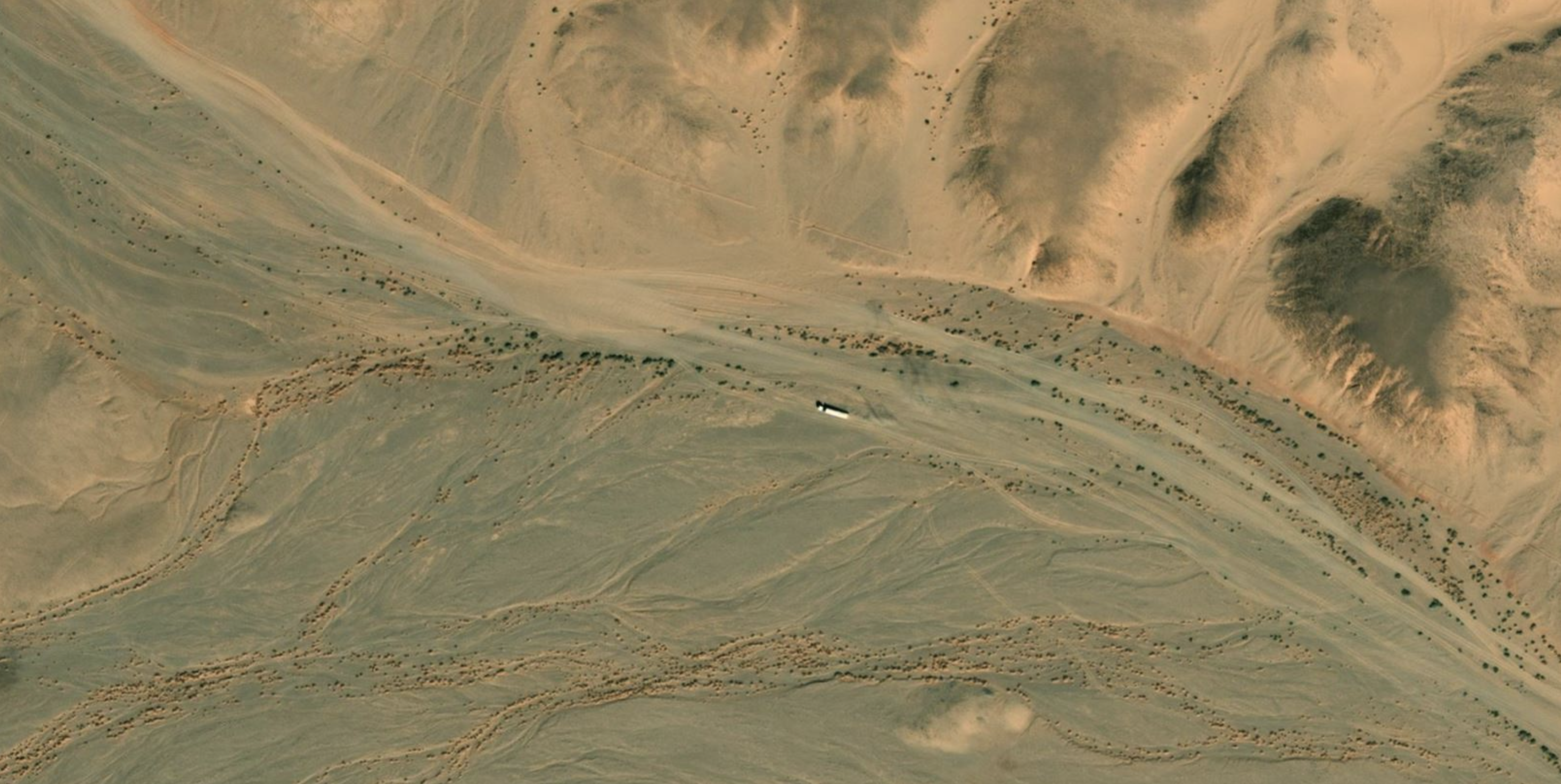
Djanet to Tam This description may be out of date now but about 8km west of Serouenout checkpoint (270km from Djanet) the tarmac ended in 2025. After 24km there was a short, 20-km section of tarmac, and then you’re back on the piste south of the new road’s alignment for about 70km. Once back on the road around 24.264, 6.4864 (if not already), it’s about 80km to Ideles roundabout (fuel in town) and another 140km on to Tam via In Amguel on the TSH, or about 190km along the scenic ‘Hoggar Ring Road’ via Col Azrou and Tahifet.
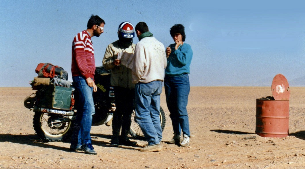
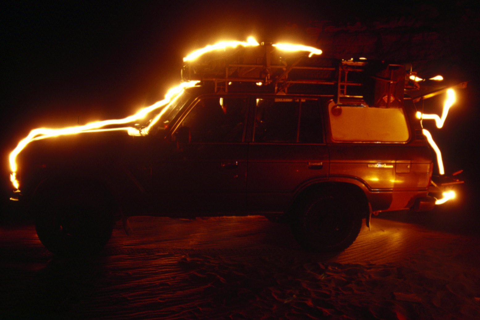
Puzzled near Borne; 1987
Sahara OverlandRoute A6 In the good years (1970s, 80s and 2000s) various tracks between Djanet and Tamanrasset and Hoggar mountains all combined to make classic multi-day adventures in southern Algeria.
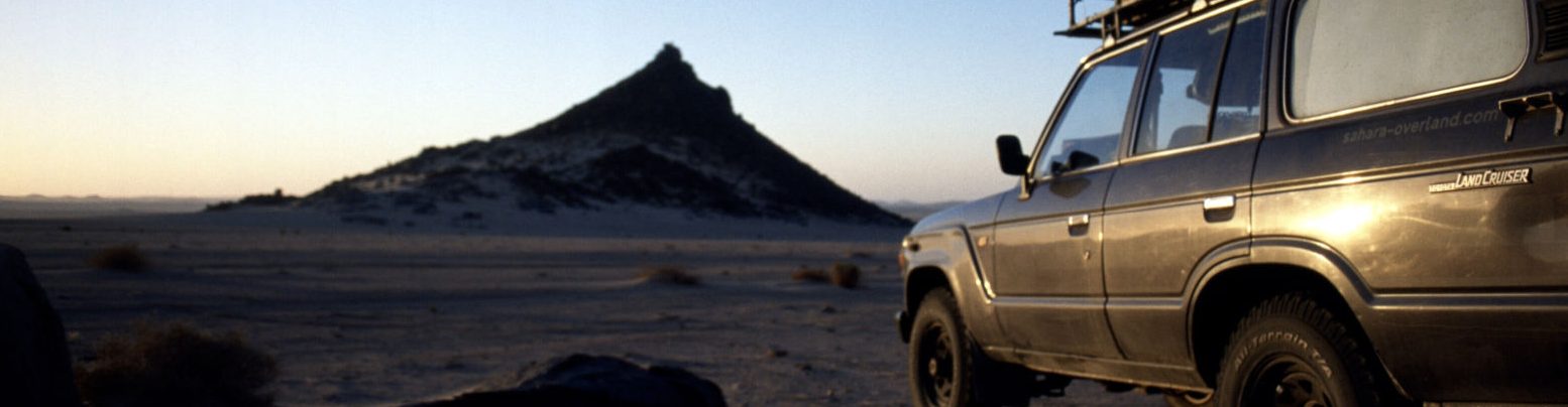
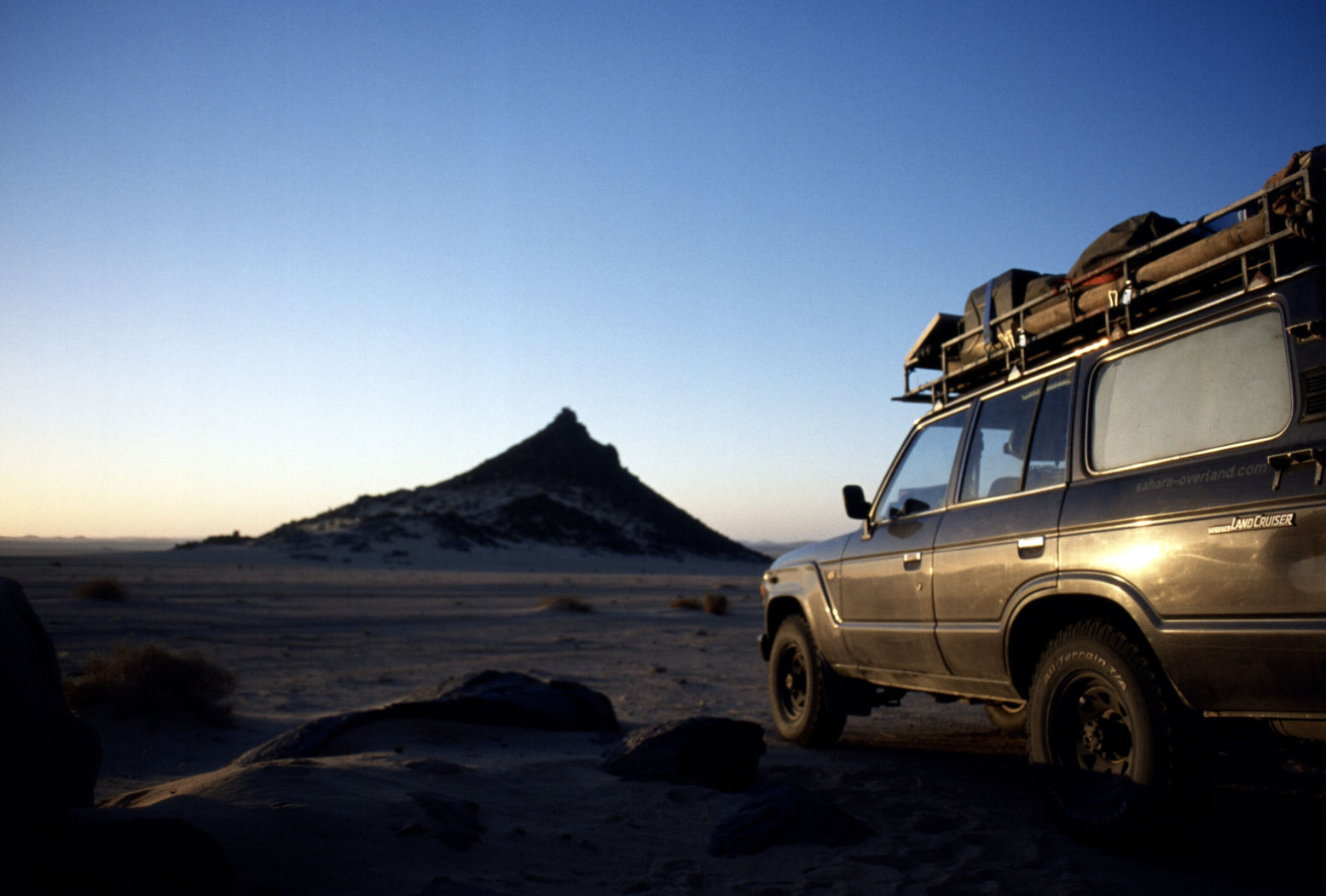
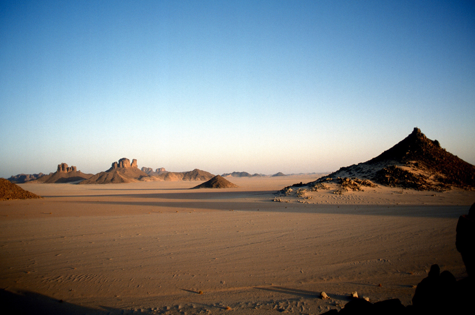
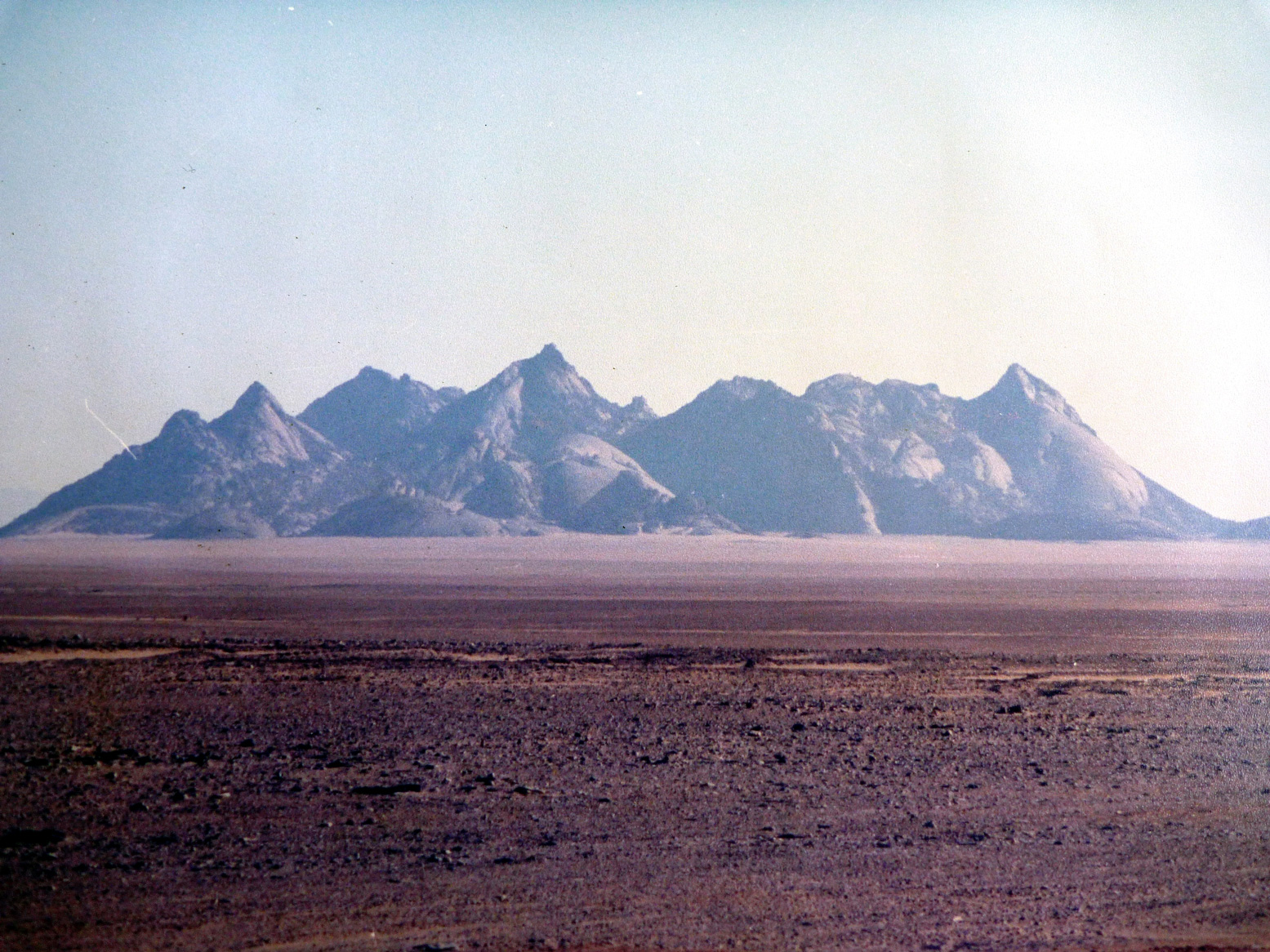
Heading west on Route A6, (the current N55 road), you traversed below the ramparts of the Tassili N’Ajjer plateau, long famed for its prehistoric rock art, then either turned southwest at Bordj el Haouas for Tazat mountain (below right), or used the same mountain as a landmark after crossing the dunes of the Erg Admer (below left; Route A7),
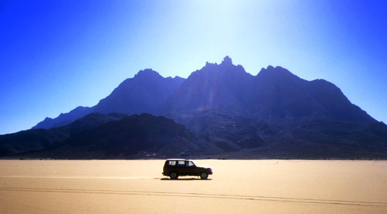
Admer 1989Tazat mountain, 2002
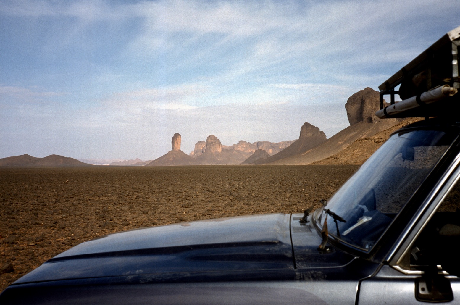
Passing isolated volcanic cones, plugs and other outliers, the basalt rubble from the once molten Hoggar raised you up to Assekrem, a few hours from Tamanrasset and a refuel. The main route used by non-clandestine locals (A6 in my old Sahara Overland guidebook bottom of the page) was still nearly 700 kilometres or two desert nights for most. It was also on the limit of what a moto could manage alone.
Sands of the Ajjer, 1987
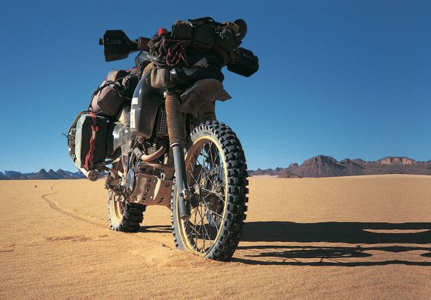
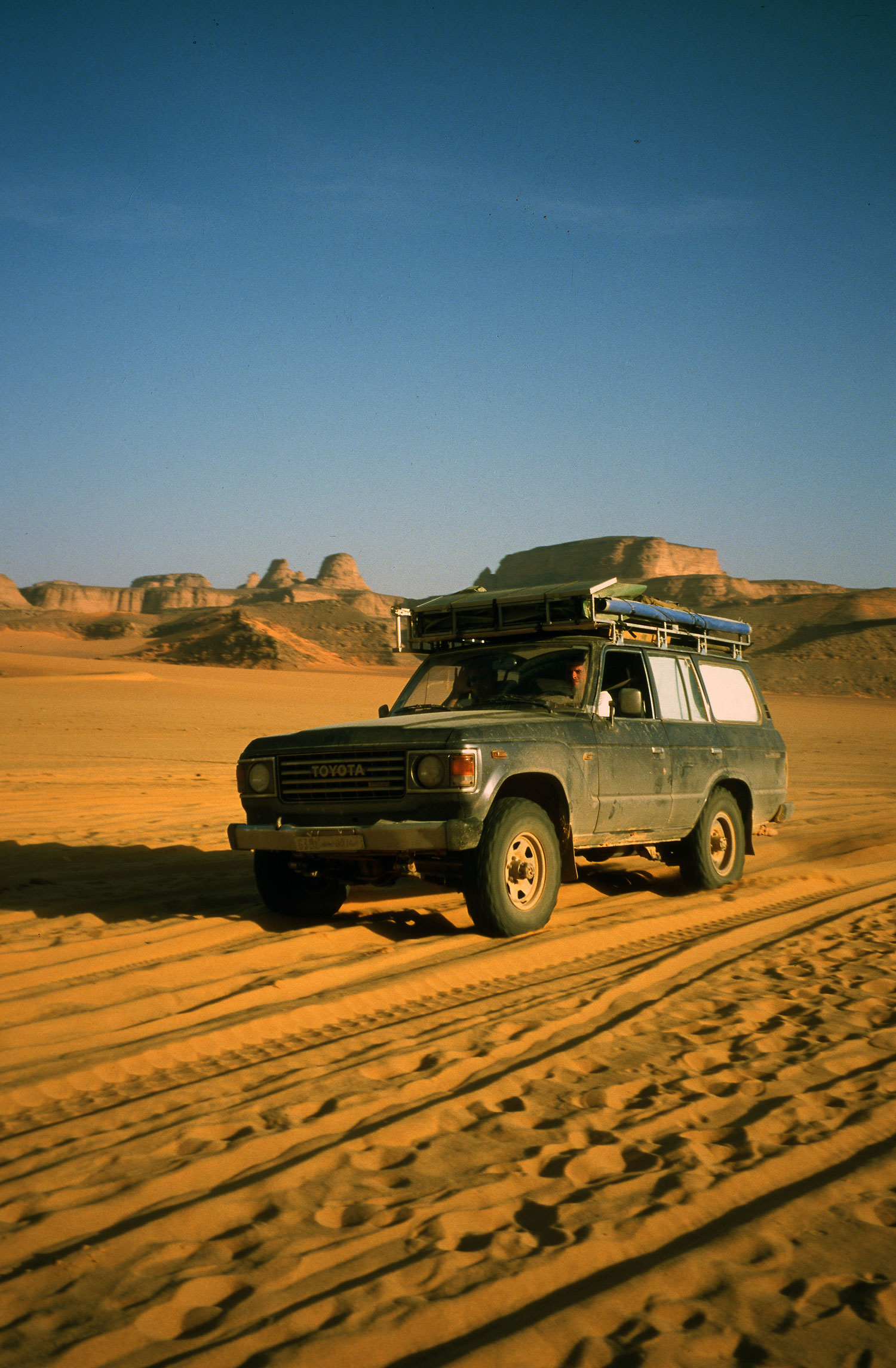
When I first did it in 1987, the road from the north ended in Illizi, 400km from Djanet over the Fadnoun plateau. That all added up to over 1000km and one of the best all-dirt stages in southern Algeria (above), with just enough pre-GPS navigational challenges to keep you on your toes. It was rare to pass more than one or two other vehicles during the transit.
Nearing Tam (1989)Descent from Assekrem (2003)
Fallen MAN
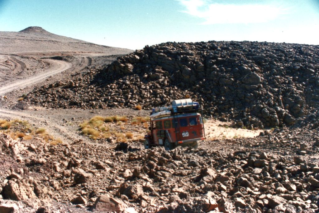
In the 1980s the army were tasked with building a road over the Fadnoun’s switchback escarpments. Up to that point, trucks supplying isolated Djanet had to take a huge, sandy detour to the west via Amguid, nearly doubling the road distance. After about ten years the Fadnoun (below) got sealed and today is still a great drive, even if the road is breaking up here and there and occasionally lorry drivers fall foul of the Fadnoun’s curves (left).
Gara Ihadja n Kli, one of the Fandoun’s escarpments, 2018
Morocco is famed for sealing it’s southern desert pistes faster than we can keep up, but Algeria has been catching up, only over vastly greater distances and probably with access restrictions to the military. A whole network of ‘hidden’ border highways, remote military bases as well as vast defensive sand berms (below) have emerged in recent years to control migrant traffickers coming up from the south.
Border road and berm with Niger, far south of Djanet
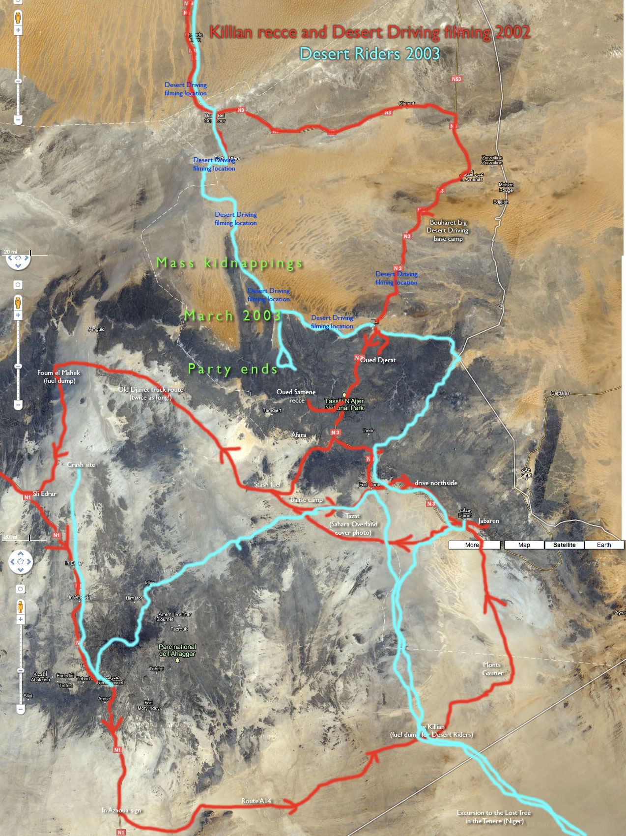
Even though they’ve succeeded in sealing this traverse, A6 Tam-Djanet (N55) still remains one of the great routes in the Sahara and there’s no need to follow the new road. There is A7 to the north which we also partly did in 2025, A14 in the deep south I last did in 2007, and at least one more route via Tiririne, Tarabine which we did in 1989 and again in 2006 on the way back back from Mauritania on Sahara: The Empty Quarter. For me this was all before gpx tracklogs but these routes are probably traced on OSM maps or Wikilocs. So do not be put off by the road being officially closed to tourists. As long as you (and your guide, if present) are prepared and equipped to tackle these pistes, they still offer some of the best, long-range routes in the central Sahara.
Rubble tracks into the Hoggar (’87)Desert Riders camp south of Tazat ’03)
Marseille – Tunis – Nefta – El Oued – Grand Erg Oriental – Deb Deb – Illizi – Djanet – Essendilene – Bordj el Haouas – Tazat – Amadror – Tourha – Tefedest east – Ideles – Tahifet – Tamanrasset – Assekrem – Tam – In Ecker – Amguid – Erg Tifernine – Gara Khanfoussa – Bordj Omar Driss – HbG – El Oued – Tunis – Genoa
Land Cruiser HJ61, Land Cruiser HDJ80 auto, Defender 300 Tdi
With just a couple of cars booked on the March tour, I planned to make the most of a small group and explore new areas that would be problematical with a bigger group. At Marseille Lucy and I met up with Ian and Elke from Wales in a well set-up Defender, and retirees Peter and David in an auto 80 TLC with nothing more than a second spare and a box for the jerries. Peter had bought the 80 just for the tour and preferred the low key ‘school run’ look. The Marseille crossing was deserted and as flat as it gets. And better still, filling out the Tunisian immigration forms took just 20 minutes, whereas on the more popular Genoa run it can take six tedious hours. I guess it’s because Genoa is a funnel for the hoards of German-speaking Saharans, and of course that crossing costs 25% less. But Marseille has other advantages apart from less crowds: it leaves earlier in the day so it gets in to Tunis early too, making a daylight run to the Algerian border possible. Rural traffic in Tunisia may not be so mental, but if it’s your first African driving experience you don’t want to be doing it in the dark. So after a hot, windy day we arrived at Nefta just on sunset and early next morning got through the borders in a couple of hours. My plan was to avoid the long schlep south down past Hassi Messaoud and try one of the lately ‘fashionable’ pistes that cut through the northern Grand Erg Oriental down to the El Borma Road. These routes have the attraction of getting off the highway early, but involve traversing the northern Oriental Erg’s notorious small dunes. The problem with small dunes – as we were soon to find out – is that they have no clear form, being just a chaotic jumble of akle, rather like driving through a very heavy swell. Big dunes (as found in the southern Oriental) may have more scary descents but at least form into regular ridges (seifs) separated by gassis or corridors. You roll along a corridor and once in a while hop over a ridge of dunes to the adjacent gassi. If only… Planning to get all the way to Hassi bel Guebbour through the Grand Erg (500km), we fuelled up at El Oued and turned off the highway near Oued Allenda village. By then a hot wind was blowing from the south reminding us the hot season was on its way. I had a dozen waypoints from a friend and soon we were in the dunes, riding through the swell.
After a few kilometres the tracks veered west but I made the mistake of heading directly for the next waypoint (this route was to be a reminder in reading the terrain first, then a GPS!). Twenty minutes of that saw me battling the Land Cruiser from one dune to the next. I knew this route was no cake-walk, but 200kms of this made 600kms of tarmac to HbG extremely alluring. We returned to the tracks (easier said than done) and I recce’d ahead with Ian in the Land Rover to discover the tracks did indeed turn our way after a few kilometres.
That night scorpions visited our camp. No one was more surprised or repelled than me, having never seen one in 20 years of desert travels. Yellow and only about an inch or two long, they put the dampers on our first desert camp as those of us in bare feet tiptoed gingerly towards their footwear. Lucy had lately read about Lhote killing 168 scorpions on the Tassili plateau in one sitting so Peter and David postponed sleeping out and put up a tent. Next morning the hot south wind continued to blow, obscuring the sky and horizon and offering me another novelty; static electricity. On some days, every time I got out of my car I got zapped. The tracks we’d recce’d the previous evening led into a tussocky flat area (as gassi as
it gets around here) which circumnavigated the dunes I’d tried to plough though yesterday. Presently they led to the well of Thleth el Biar where some Chaamba nomads were watering their herds. Compared to affable (or more tourist-trained) Tuaregs down south, these guys didn’t have much to say and indifferently took a bag of clothes we left by their car. Nearby Ian spotted some sand roses growing in the sand. Being more humid than the deep south, the northern Erg is famous for these unusual crystalline gypsum formations which at best can resemble a pink rose. Firstly scorpions and now static and wild sand roses, what other novelties awaited? None I cared for. From the well the sand was trackless so we muddled south into dunes, passing another well surrounded by nomads. For me the dilemma was: get stuck in to whatever led to the next waypoint, or follow the easier ground and risk getting led off route. Often we’d work our way into a mass of dunes only to see the preferred flat tussocky area half a kilometre to either side but still 20 minutes low ranging to get there. On the flat ground, such vantage points were not possible. I’d driven in terrain similar to this, but never as the lead car, a big difference. Following someone takes a bit of concentration but is easy: whatever the lead car gets through you can usually follow, and where it gets stuck you have time to think and find a better way.
Both Ian and Peter thought this was all brilliant, real desert driving! but I just chewed my lip and wondered how bad it would get. I’ve never been keen on dune driving, it’s no surprise that it’s where all accidents happen and dunes are hard on the transmission and your nerves. In the Nefta hotel we’d met a Belgian guy who’d rolled his 80 in the Grand Erg near HbG. He was hanging out there while they replaced all the windows and bashed it back into shape… Not only was the driving demanding but the terrain was pretty dull too, not helped by the dreary visibility and hot winds. Dunes tussocks, dunes tussocks. Occasionally we’d come across a gravel patch with clear tracks which confirmed we were on target, even if we felt lost most of the time. Luckily both Ian and Peter (who’d never driven off-road before) seemed to manage it fine. I assured them this sort of driving was not the norm, but it being the start of the trip, they didn’t seem to mind being thrown in the deep end. My idea to come this way with six bikes a couple of months earlier would have been a disaster for sure.
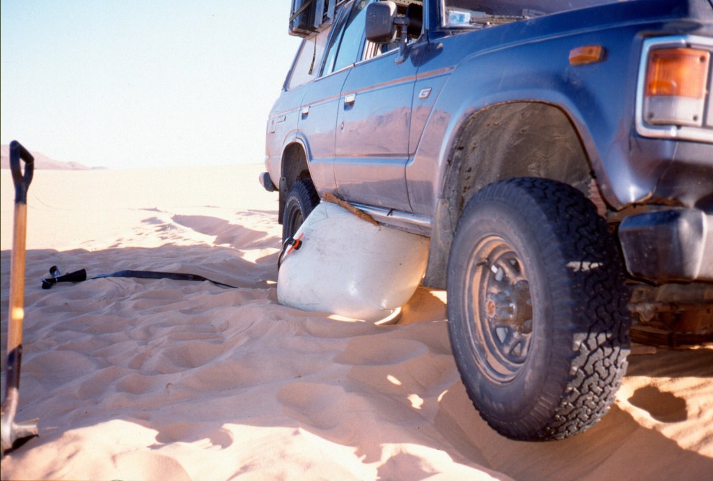
We covered just 100km that day and another 100 the next, getting close to the El Borma road. And by the afternoon of the second day the dunes where getting higher, more spaced out and more regular, which made the terrain easier to negotiate. But not that easy. At one point I was working my way through a pile of dunes en route to the next putative waypoint. Trying to keep moving in Low 2nd, I rode from one crest through a bowl to the next, higher and higher until it was clear it wasn’t going to work out. There seemed no order or pattern, I was just a cork bobbing around in a pail of boiling water. I found myself doing something I’d only discussed hypothetically in the book: “wall of deathing” around the rim of a bowl in an attempt to maintain momentum and height while trying to work out what next. In the end I fell off the tightrope, almost willingly, with the car beached diagonally near a crest at a jaunty angle. And again. from this skewed vantage point one could spy the flat valley of t••••••s just half a click to the east. We extracted ourselves and worked our way round, but a while later the same happened and I found myself mired in a bowl of custard powder with no room to move forward or back. Having never used them in three years, I’d left my sand plates at home but even Ian’s sand ladders couldn’t give the 61 the lift it needed. Towing merely pulled both cars into the sand, so we resorted to dragging the sunken Cruiser out by the arse with Ian’s winch. Handy thing in this situation, a winch!
With the weather almost brightening up and the dunes now rising into impressive formations, we counted the kilometres to the road and decided to leave the southern 300km stage to HbG for another time. Unused to his car, Peter had kept the auto in Low Range rather too much and would not have had enough fuel anyway. And we didn’t want to risk another 2 days in the dunes and get behind schedule.
But instead of scurrying back to Hassi Messaoud, we turned east along the pipeline to El Borma and then down towards Deb Deb, another new route for me and one which I’d heard was notoriously buried in sand. South of Sif Fatimah the buried road section began. Bulldozers and JCBs were working to clear the side track and one amazing articulated 6×6 machine with ex-747 tyres gently pulled me through a bank. The tarmac is built on an embankment through huge dunes, but for kilometres at a time it disappears under the sand, with the side piste not always being much easier. Peter was eyeing his fuel gauge but we made it into the nice-looking border town of Deb Deb next morning, filled up with water, fuel and bread, and trundled on down the dull highway through the eastern oilfields to Illizi and a hotel. Over the Fadnoun the weather was still overcast and dull, to be expected as the seasons change in springtime, but still disappointing. Lack of blue skies really does dampen one’s impression of the desert. Near Tin Taradjeli where the plateau ends we turned off to check out the Sleeping Antelope engravings in Oued Dider, but were content to stop by a two-tier guelta for lunch. We also decided not to spend a night in a Tassili canyon and pressed on for Djanet and a rest day before a planned 4-day plateau walk. Just as well as what is usually a wonderful drive along the Tassili’s southern scarp soon became lost as an afternoon sandstorm swept in from the south, obliterating the tarmac itself. In Djanet I set to changing my back springs. I’d been given a set of parabolics to try out. The fronts seemed to work OK but the back ones (fitted just before I left) were clearly not up to it, especially if I was to return home with enough Algerian diesel to last the summer. Expecting such problems, I’d brought along my trusty Old Man Emus and Hey Presto! the Tojo had some air in the wheel arches again. I flogged the back paras to the car spares shop near the market. Djanet is chock-a-block with erstwhile TLC 60s, though those mushy back springs will be as much use to most Djaneteers as fishing lessons. It became likely that the guide I’d booked for the plateau walk was not going to turn up – oh well, that’s Africa, none of us really minded. And for me, four extra days meant less rushing around the desert. I’ve waiting 20 years to see the plateau, it will be there next time.
We popped down next afternoon to check out the Crying Cow and again another mid-afternoon storm blew in. I tried out the auto 80 and I must say I was not that enamoured. It felt like a heavy slug, very comfy and quiet of course, and featuring a lot of dashboard action. Pete was not that impressed either, finding the lack of pick-up at very low speeds (a feature of 80 engines, compared to earlier 12HTs) in dunes a problem. But either way Ian and I assured Peter just 20-30 seconds in either the Tdi or my 61 would soon highlight the 80s overall appeal. Although the campsite guys were keen to offer us a plateau deal, we decided to move on and left Djanet under blue skies. On the recommendation of a couple of French guys, we took off up Essendilene Canyon (80-odd kms from Djanet, not 30 as in the book, p. 406), a lovely drive into the Tassili’s interior ending at a fern-lapped guelta. Following another couple of tips I decided to concoct a new route to Ideles. First through a pass north of Mt Tazat which Richard Washington had found over Christmas, and then across the Amadror plain directly to the Tefedest and down A6 to Ideles. I made a bit of a mess getting to the Tazat Pass, coming too much from the northeast across all sorts of rubble which slowed tyre-twitchy Peter down to glacial speeds. But by sundown we were 10kms from the mountain and a recce up a nearby hill showed a likely way in. That night was clear but soon after we went to bed a gale blew in from the east and kept up the whole night. It’s one of the advantages of sleeping in a car as Ian and Elke did. Our tent flapped annoyingly all night while Peter and David rose after a night on the sand like a pair of crustaceans.
Stout old cairns marked the way into the pass next morning. Who knows why the French bothered establishing this route while the main piste passed south of Tazat. Whatever, it was a lovely, quiet drive and nice to be off the corrugated piste, even if it had now become oddly cold for mid-March. On the far side I returned to Borne junction after many years to find the old orange drum long gone and a chunky stone monument in its place. From here we took the route northwest towards Amguid, passing a nice Pre-Islamic tomb on a hillside. At a cone mountain south of Toukmatine we then cut out across the Amadror plain where Colonel Flatters and his crew met their end in 18 seventy whatever. It was a weird sensation driving across the flat plain with distant mountains bobbing on the horizon’s mirage. Slowly, as the afternoon wore on the Tourha range rose in the west, a bit like Adrar Bous as you come across the Tenere. There’s even a lone tree at KM321. Ian was leading for a change (he found trailblazing hard work too) and came across a gang of gazelles which inhabit this relatively secluded region. As the day ended we reached the ‘Tourha Pass’ on a lovely evening and camped by a sun-warmed outcrop. Before dinner Lucy and I went for a wander into the hills and watched a little nervously as three cars drove past our camp without seeing it. Smugglers, locals or tourists? Who knows but we were glad they missed us. It being Mother’s Day, Peter could not resist my extortionate fee for the sat phone and called his mum in Surrey. Even though we were only at 1000m, it froze that night to minus 2 or 3 and next day we carried on through the lovely pass and cut down towards the Tefedest proper, stopping frequently just to admire the grandeur of it all in the clear, crisp weather. On the far side of the Oued Igharghar we picked up A6 which I’d done with some bikes a few weeks earlier, met some smiley Targuias and their goats and followed this picturesque route to lunch at the green sign. It’s interesting reversing a route you know well – you see so much more; new pistes and unusual rocks and even a new way into Ideles past a well I never knew about. Ideles for me was the usual run around town trying to find the Tazrouk junction. I know where it is but never know how to get there from the west.
We were now on the outer ring road via Tahifet (A4) which I’d done for the first time in years with the bikes in January. Up to Tazrouk it’s a great track and this time Ian and I half-climbed the 150-metre old radio mast near Azrou to affirm that our arms and legs still worked after 2500km of driving.
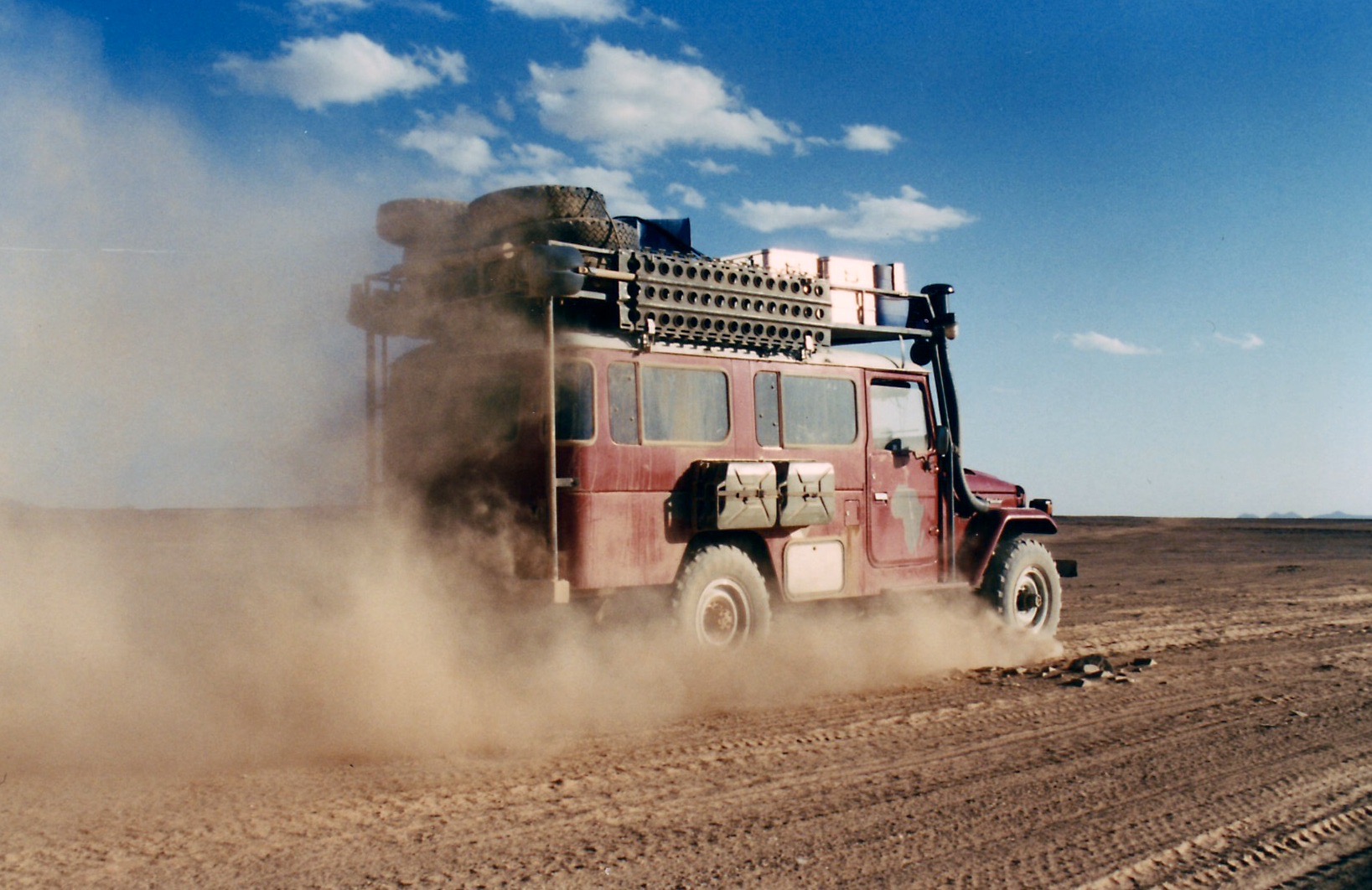
But after Tahifet the wide track becomes Corrugation Central and we were glad to get to the highway south of Tam, pass the dozens of trans-Saharan trucks queuing for fuel and reached Agence Tarahist’s gite near Hadriane mountain. We’d just missed Moktar going out that morning with Jeremy Keenan (a controversial figure) and a group of no less than nine Brits, surely a record! Tamanrasset merely reminds you how nice Djanet is, through it’s a good place to get stuff. Elke and I had had a running joke (well, it was to me) that the Hoggar was not worth visiting and we should spend more time in the wonderful Tassili. It’s a preference I’ve established on previous tours, but one that can only be made once one has seen both places. And Elke had been wanting to visit the Hoggar since she was a teenager. So we trundled out of Tam next afternoon, chattering over the corrugations to the ever more dramatic ascent to Assekrem, seemingly smoother than when I last came this way in ’86. Up at the pass, we checked in full-board into the overpriced lodge and hiked up to the plateau. While the others primed their lens caps and took positions I went over to the north side of the plateau, having read of an alternative view in Sahara Man. In the end, it was nothing special but it was nice to get away from the others for an hour or so. Evenings in the lodge follow a standard pattern. A faux Tuareg twatted about and took the piss out of a Chinese family. On a world tour, they’d tried to go to Egypt, settled for Tangiers but ended up in Algiers which sounded the same to their travel agent. What to do in Algiers but get sent down to Tam for the Assekrem Experience. I’ve never seen dawn at Assekrem. The bikers (whose cutting limerick about my tour I’d uncovered in the lodge’s guest book the previous evening) had told me it was the one to watch. And they weren’t wrong. A little light cloud made for an amazing sight, even as the chill pre-dawn wind riffled through our blanket. We returned to Tam the same way as Peter was worried about the tough western decent on his low and already dune-bashed 80. In Tam we had a bit of argy-bargy getting fuel. Peter’s row of empty jerries did not go down well at the back of the queue, even if other guys we’re rocking up with 50-gallon drums in the boot of their Renault 12s. A sack of bread and some veggies and it was off to In Ecker for another new piste. On this stage Peter and I achieved a faintly phenomenal 36-40 mpg while Ian’s Tdi got it’s best at 26. The Tdi’s mediocre mpg puzzled me, although my experience on other tours is Tdis are usually the same as my 61. Was it Ian’s heavy tyres and rims and all those tanks, or the alloy roof wedge? Not likely. Overall, apart from in the Grand Erg, Peter’s cushy auto was usually tops: 5% better than my 61, with the Tdi around 25% below. At In Ecker mountain we took off onto the Amguid piste, but I soon lost the track and wandered around most unprofessionally, while Lucy got to grips with reading waypoints off a map. Still, it all ended happily at a lovely campsite below a hill a few kilometres off the piste overlooking In Ecker mountain, still fenced off after a nuclear accident in the 1960s. Up to Amguid the going was fast, passing the odd Dakar Rally wreck and the mysterious village of Abdemezeh where a German biker tour was having a cuppa. But by lunchtime a south wind was blowing again, hazing the sky. At Ain Kerma well we barged in on the local Gendarmeries’ weekly wash and then headed for Amguid, Years ago I recall reading (in the Sahara Handbook?) that Amguid was populated by obnoxious children, not normally found in Algeria. I joked about this to the others who noted that these children would have grown up by now. How wrong we were. We stopped in the dilapidated once abandoned village to hand out the last of our clothes and were immediately besieged by clawing hands. This was not the exuberant ‘toubabery’ of West Africa but manic desperation. The adults pulled back the youngsters only to snatch into the cars themselves and it all got faintly scary as they surrounded Peter’s car where all the goodies were. We raced off, left our cadeaux on the ground and moved on as the crowd ripped into the bags. Just north of Amguid we crossed over a pass onto the ‘Graben Piste’ which I’d wanted to do for many years. But that night another sandstorm blew up, this time from the west, and kept blowing all next day. It was dreary driving over rocky tracks with little to see, but that’s the desert: not every day’s a winner and some days are worse than others… At Hassi Ntsel a band of dunes ran across the track. Unable to see an alternative route clearly, the dunes, no more than a kilometre wide, looked no worse than those we’d driven over in the Grand Erg. So rather hastily I got stuck in, got stuck, backed up, recce’d a way on foot using the others to stand as markers and bundled the cars through. On the final dunelette my car came down hard on the front corner: result, both front leaves (there are only two with parabolics) snapped though. With sand blowing all around, getting under the car was uncomfortable, but Ian and I managed a good bodge from a block of wood and a spare bump stop, a chain and a ratchet strap. I doubt the block lasted more than a few kilometres, but with the axle lashed to the chassis with chain and strap, we carried on at a much slower pace while I tried to visualize various meltdown scenarios and how I’d deal with them.
In the end, renewing the ratchet strap ever day or so, the car got all the way back to London on the bump stop with the broken leaves flapping. Whatever rubber they use to make Tojo bump stops, you’d better hope you have some on your parabolic car… The break was not a total surprise as the same happened to Yves’ parabolicked 109″ a couple of months earlier.
Thankfully next day the storm had blown itself out, just in time for us to round the rocky spur of Erg Tifernine, the most spectacular sections of this route where the stunningly red dunes flow over an old colonial track winding through the rocky hills.
From there right up the east flank of the Erg to Gara Khanfoussa was smooth sand, ideal for three-leafed Land Cruisers as well as a good place to spot Neolithic detritus.
Like I said, reversing known routes can be interesting, but it can also get confusing. Having come down through Khanfoussa a couple of times recently, coming back was a whole new game, especially with all traces blown away by yesterday’s storm. At one point I got to a huge dip that I didn’t recall and doubted I could get through. I tried to keep high and ride round one side, a possible way out. But with the car tipping ever further and Lucy getting ready to lower the lifeboat, I gave in just as we neared the crest, and swerved down into the pit. In fact getting out was not so hard, but watching Ian come through, a tiny Land Rover rolling down a 40-metre slope was scary.
Getting into Gara Khan’ hill, the halfway point in the dune crossing, had been easyish, getting out was not. I followed what faint tracks there were, tried to visualize the route in reverse, but soon got in a muddle and ended up following day-old tracks to another thought-provoking slip face. An overdue check on the GPS proved that we’d overshot the western exit by 10kms. Worn out by nursing the car and irritated by my confusion, we set course for a known waypoint at the western entry and rolled over the hills and dunes to a sheltered camp nearby.I was in no hurry to drive my limping car along the rubble track to Quatre Chemins and so next day, out of necessity and a bit of curiosity, we took the piste directly into Bordj Omar Driss along the base of the escarpment. Some nasty soft sand apart, it was a nicer route, passing by an amazing cliff of red, green and white interlaced strata that would have geologists drooling.
With every mile it seemed likely that the bump stop would not disintegrate and once we got back on the tarmac near BoD, I was sure the 61 would make it back the 1500kms to Tunis, and beyond.
On the boat I met up with some bikers including a Lido who’d come up from SA with a mate in a troublesome Td5. La Goulette had been packed out with 10 times the vehicles we’d seen coming out of Marseille. The Tunisians were making even more of a meal of boarding than usual and we didn’t leave until 11pm. As the boat eased into Genoa next day, Lido and his mate congratulated each other on making it across Africa to Europe. Me, I felt sorry for them. What were they going to make of Europe after nearly a year in the bush? They’d been given some skimpy directions for a campsite that might be open nearby. They reminded me of my own early Saharan rides. Bugger that I thought. Lucy and I said our goodbyes to Ian, Elke, Pete and David and attacked Genoa’s one-way system like a band of small dunes in search of the Novotel.
“It’s never over till it’s over” I’ve learned to say to myself over the years but it had barely begun when at Tunis port they whipped away my newly illegal GPS “telephone” unless I chose to arse about getting a permit from the Ministry of Stupid Ideas. I deposited it in a room full of CB radios (fair enough) while others did the same, a bit stunned about how to navigate down south. Luckily my real sat phone (which I had the presence of mind not to declare) had a rudimentary GPS.
Coming off the boat I’d met the famous David Lambeth coming back from supporting a bike rally – he was not keen on lending me his bells and buzzers Garmin 5, but another departee in a pink 110 kindly lent me an eTrex to back up the untried Thuraya sat phone navigator.
Then, trying to call g-friend down the road it turned out my PAYG Thuraya had expired its SIM (don’t use it much in London). This undermined the security of my solo route plans somewhat until my rendezvous with Prof. Nimbus in Djanet in ten days time. I was beginning to wonder was this going to be “one of those” trips – after all, all had gone remarkably to plan these past couple of years …
A fax to g-friend from Nefta saw some new SIMs on the way to Nimbus. Until then I was out of comms. Part of my job on this trip – my first solo car venture into the desert it transpired – was to dump food and fuel for my upcoming Desert Riders caper, scheduled for early 2003. D. Rider Jon had gone shopping for food just before I left and had been called by DR Andy asking him to buy one more of everything. I then spent a night by the Grand Erg scoffing at their tasty food choices and sorting the stuff out into packages we’d be able to carry on a bike from the fuel drops.
Next morning more problems. After fueling up for 1500km plus half a dozen petrol jerries to bury, HbG checkpoint made me take a soldier to Bordj Omar Driss but failed to tell me the piste from there was closed to Amguid (otherwise I’d not have bothered with the lift of course!). I’d heard this piste had been closed (due to smugglers he told me on the way back) and a barrier was pushed up against the piste at Quatre Chemins. It was the direct route to my planned fuel dump south of Amguid but anyway the weather was oddly hot, windy, hazy and even spitting rain. If nothing else my three Algerian trips this year have confirmed the unpredictability of Saharan weather. It boded ill for our much-postponed filming of Desert Driving in a couple of weeks…
I’d half expected a closed piste so had plans to hit Amguid from the Djanet side. I had a hot/cold, windy/rainy night near Ohanet in the back of the car, and with time to kill before meeting Nimbus, soon got to savour the relaxed non-tour-leading pace while driving alone in the desert. I checked out the hotel at In Amenas (a dump, fyi) and explored Erg Bouharet as a great location for some planned DD scenes. We camped here in 1988 on my first bike tour (described in Desert Travels) and I was amazed to see my so-called “apostrophe dune” pictured on my g-friend’s wall unchanged in 14 years. As I suspected, the myth of dune mobility is much exaggerated, especially if part of an erg rather than stranded on a plain.
That night I popped out to Oued Djerat east of Illizi, the site for much rock art, it is said. Clear tracks lead into the canyon and after it got narrow I parked up but found nothing but a quiet night out. Next morning a Tuareg cameleer creeped up on me as they do while I was finishing off Michael Palin‘s book. I’d left a colourful array of kids’ clothes hanging from the nearby trees. He helped himself to the booty and told me the art was a bit further up the canyon where I’d spotted an encampment earlier on. Now that I knew where, it was one for next time.
Over the Fadnoun the weather was still hot and windy from the south. I washed the car in a guelta and recced a D Riders route along which we planned to emerge from Oued Samene (to Ifni). It looked good, as the TPC map suggested. Down the road at Afara junction I headed right onto the piste. I rode this route in 1990 with Steve in his car and some images remained: the nice dune/outcrops where I camped that night and a very steep descent to the Afara plain which I managed to negotiate without a scrape next morning, despite the half ton of fuel on board. I even had the presence of mind to film the undercarriage with a bullet cam taped to the chassis to use in the Desert Driving film later.
Afara
Afara north is pretty amazing – like Monument Valley but without Navajo souvenirs, and the southern bit coming onto the ‘Borne’ plain is nice too, but in between it’s a basalt bashing butt-jabber (something that had not affected me on a bike in 90). Still, at least the weather was now as blue as it gets.
More Afara
I came off this slow route in mid-afternoon trying to find the sandy pass on Route A7 KM195 (link below) with my sat phone GPS (I couldn’t work it out how to get the eTrex to do a “go to”). I’d been here a few months earlier on a tour, but still stumbled around until I found the pass. Then, again I got off track not concentrating on the compass or GPS, but finally picked up A7 and with the sun setting, dumped six cans for Amguid on a outcrop for collection later with Nimbus. I then retraced the route back east, enjoying the 120kgs missing off the roof.
Camping behind a fin of rock just past the KM195 pass, I decided to re-erect a fallen balise (steel post) to assist others. Even first time last March it had been tricky finding our way here. I excavated an old truck tyre and dragged the fallen balise over to the pass “gateway”. The balise had three sticky-out feet and by hoicking the truck tyre over the balise, it rested on the feet and, once filled with sand, held up the balise, sort of, now at KM 195 on A7.
Afara? Yes
That night I was freaked out by a car coming off the pass at 2am. It didn’t spot me behind my fin, but seeing the ‘new’ balise, circled it and swept me in its lights. By then I was already dressed and poised for a locked-in get-away, but the Patrol carried on back the way it came …. phew … and then came back! I was now slinging stuff into the car and ready to move out when it turned north before reaching me. I watched it trundle away for half an hour to make sure. Turns out they were probably as lost as I’d been earlier. Maybe a lot of night driving goes on in Ramadan. Or maybe it was connected with the mass kidnappings that were to occur near here a few months later.
On the way back to Djanet I explored north of Tazat, looking for the pass to Bordj el Haous (Zaoutallaz) as indicated on the TPC map. Climbing an outcrop and surveying the supposed Tehe-N-Essegh pass. it was all sanded up, no way from this side but maybe coming from the east with a slide down. I then slipped through the regular Tazat back corridor and followed a clear track almost all the way to Bordj, dumping the rest of my stash of old clothes with some hyena-like Tuareg kids.
With the plateau to the left and the dunes to the right, the run from Bordj El H’ to Djanet is one of the loveliest drives in the Sahara, even if it’s now sealed. Even though I’d done it several times over the years it still looks amazing and I enjoyed doing most of it on the sands north of the road, looking for new camps and generally marvelling at the scenery.
Move over hi-lift jackers; we’re air bagging
A couple of days later Prof. Nimbus, laden with Thuraya SIMs arrived at Djanet airport and I gave him the news: our double deep-southern run to Tam and back had been changed to a loop: up to Amguid then down to Tam and then back to Djanet, dropping fuel and food all along the way. Naturally, he was not bothered, it was all desert to him. We camped below Tazat that night, on the way trying out my airbag jack for the first time when I got sunk on a knoll of soft stuff. “I’ve never seen a car sink so deep” observed Nimbus without sarcasm. Turns out his petrol 2A hasn’t got the poke to sink itself like my tractor-engined TLC. I found this out for myself a few years later with an old Hilux, it’s an interesting benefit of a modestly powered 4×4, but at the time not enough to p-ex my 61 for a Series 2A. The airbag was nifty in the extreme, as you can see in the Desert Driving dvd which is now on youtube.
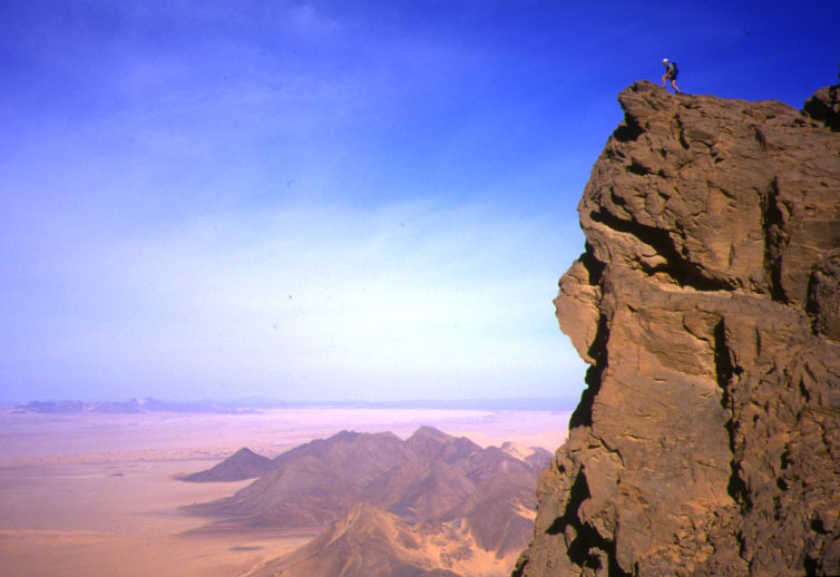
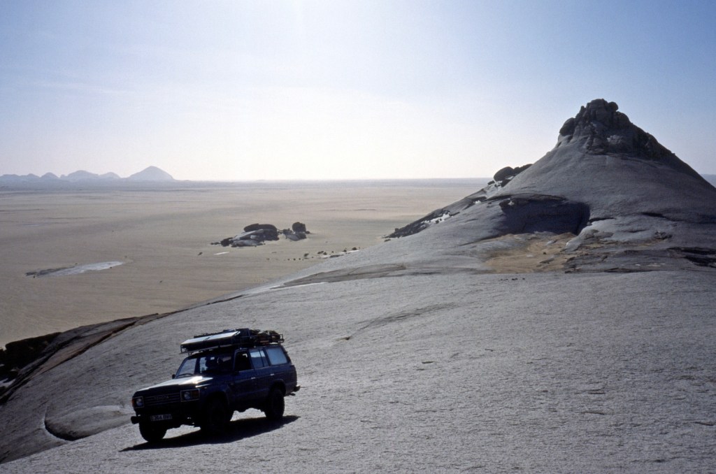
Next day we tried to climb Tazat mountain (2165m), but things got as complicated as they looked near the summit, so we satisfied ourselves with some low-angled shots that looked as good. Far below, ribbons of oueds rolled off towards the hazy horizon and the portly Tojo was but a speck. A smashing picture Nimbus took out there turned out to be the cover of the blue edition of Sahara Overland.
Tazat mountain
We carried on along A7, eventually locating the jerries I’d dumped a few days ago without needing a GPS (all hillocks don’t look the same it seems…). Then carried on up a new track to me – A5 up past Toukmatine ridge and Tiodane Erg. We lost the balises for a while but it was fast going until the complicated hills and knackered tracks which jam the entrance to the Amguid valley. Clouds rolled in that night and a mini sandstorm hit next day as we emerged onto the valley and set course for Foum el Mahek on the other side of the big valley. What a trucking slog this former route to Djanet would have been in the old – pre-Fadnoun – days!
The Foum emerged from the haze, bigger than I’d imagined and – bollocks – a family of Tuaregs camped by the mouth. Not a good spot to dump fuel then, so we blundered around and that night – 28°C at 8pm – crawled up a stony hill to stash 120 litres and a bottle of Dubonet, followed by a hot, windy night.
Sli Edrar 1982
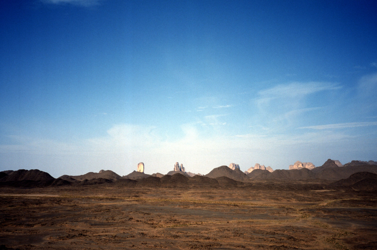
Sli Edrar On my very first trip to the desert in 1982 I’d photographed a distinctive cluster of cone mountains (left) near Moulay Lahsane on the Trans Sahara highway, and always vowed to go back one day for a look around. Nimbus reckoned he’d visited Sli Edrar last year, so we set course alongside Tefedest westside. Other granite inselbergs proved to be decoys, but when we finally rolled up it was getting clearer that my 20-year old aspiration was about to be fulfilled. The flies were a pain and caterpillars were crawling all around, dying in the sands. I went for a wander and found some Neolithics in the crunchy granite sands, including a nice bone cruncher, and for sunset we climbed up to spot an unnoticed old camp in our hidden valley below.
On Sli Edrar’s granite flanks, View from above…
… view from below
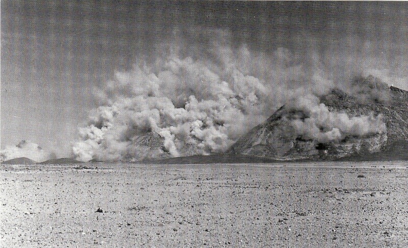
Sli Edrar is just a few clicks off the highway, but hearing of fuel probs in Tam, we turned north 100km to Arak and tanked up there with 250 litres of diesel, plus another 120 of petrol and rolled down the highway to Tam, arguing bitterly whether In Ecker mountain was visibly shaken by its nuking in the early 1960s (below). In Tam cars where indeed queuing out into the hills for fuel – not due to washed-out supply routes but local politics.
Nuking ‘In Ecker’ mountain in 1962. Yes it did accidentally blow the doors off.
Spend too long near In Ecker and this happens
From Tam we were taking on an ambitious route back east to Djanet – 900kms via Erg Killian in the deep south, using a 20-year-old route description (RD) in German including five NavStar (pre-Garmin GPS) waypoints. Nimbus was worried about my fatalistic attitude to spares and safety “I can’t believe you wrote that book!” he said in horror as he trapped me in an arm lock and forced me to buy an engine’s worth of motor oil. It began an interesting branch to the erstwhile LR/TLC debate. Nimbo carries a complete change of undies for his antediluvian Series 2A. Me, I’ve long forgotten what I stashed in the back wings of my Eocene HJ61 many years ago. Radiator hoses and some Haribos perhaps?
Seriously though, we were much encouraged by our Thurayas. If the Tojo soiled itself we could ring any agency in south Alg or even get a message on the web for an eventual rescue. A pre-departure check revealed the 61’s front wheel bearings were pretty floppy. I’m sure I had them done once – or was that the TLC before? We tried to tighten them but some annoying ‘cone washers’ in the hub made it too hard. Destiny it seems wanted them left untouched. Anyway, the other 60s in Moktar’s stable were all as loose and in the end the car got all the way here with only a tad of shimmy @ 101kph.
The famous In Azaoua sign south of Tam on the way to the Niger border. One of two in 400km. Many missed it and inadvertently strayed left to their doom.
We’d used a lot of water on the Amguid truck piste and with no known wells till Djanet, four unknown days away, we stocked up with plenty and some fizzy drinks besides. Down out of town, past the south fuel station queues, people were running amok. Good tarmac led to bad and then none at all right up to the ancient In Azaoua sign right on cue.
Heading east towards Killian
From here it was fast SE, past a Dakar truck wreck down to a hook where we crossed a pass into the Taghrera (green sign) and headed north over grassy power-sapping sands with the classic Taghrera mushroom outcrops beyond. With half a mind to check out In Ebeggui well, we eventually found a little outcrop of our own, changed the TLCs oil for Algerian honey and enjoyed a nice desert camp.
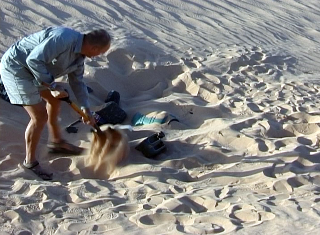
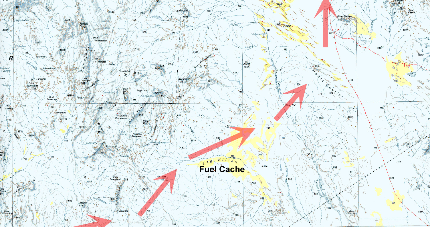
Next day, into the unknown. We weaved through some barchans and got stuck in a nasty sandy/rocky pass (our old RD was not too specific) where you have to choose soft sand or tyre-shredding rocks. Further south we found a better crossing (which I was to use again with the MAN in 2007) and headed east from ridge to ridge to ridge – very nice driving cutting across masses of north-south tracks (some even corrugated!) used by what must be contrabanders. A full RD will follow (this is Route A14) but several passes later we rocked up at Killian Erg and headed for a good spot to dump a barrel of nosh and a pile of jerries for us to dig up in February 2003.
With the cache buried, we rode on east over the Taffassasset oued towards the bailse line. It was was eerily fast until we spotted some striking mountains unnamed on any map I’ve got of the area (the TPC J3B is particularly crap). Were they the insignificant-looking Monts Gautiers? Who knows, we tucked up under the cliff in this spectacular setting, satisfied that we’d broken the back of the Deep South link from Tam to Djanet.
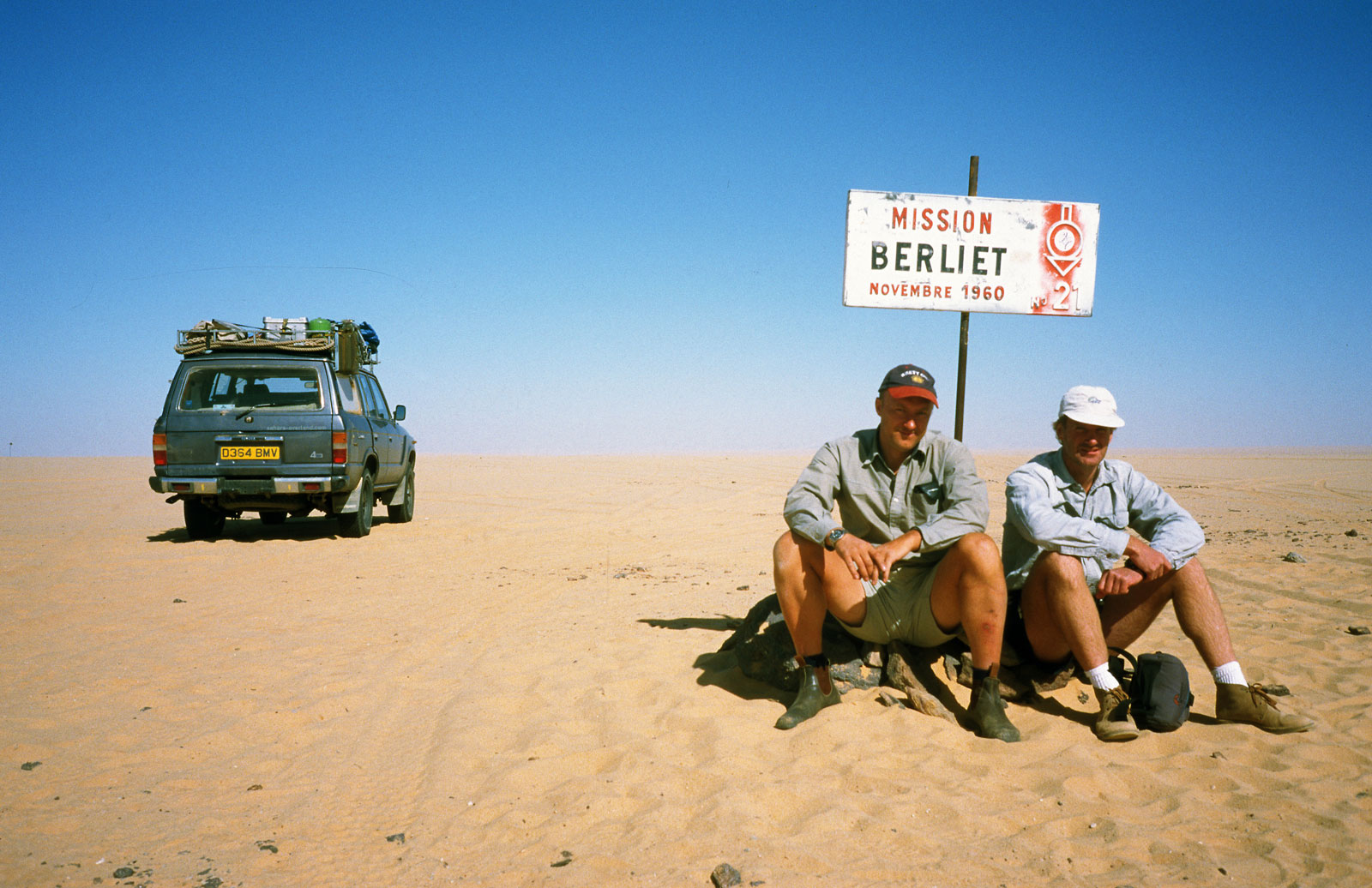
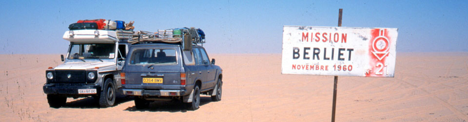
Heading for the Niger Balise Line (Route A15) we got stuck again, filmed it for posterity and hit the Line (over a 1000 markers planted every half km all the way to Chirfa!) just below Berliet 21. If anyone’s still reading, I left a Special Object in the drum at Balise 112, a bit south of Berliet 21. Retrieve it or present evidence of it and you can claim a prize.
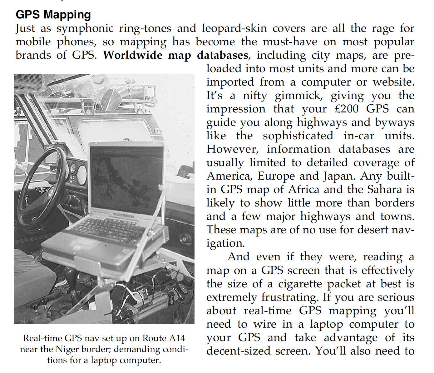
Hitting the Balise Line after so many years trying was another seminal Saharan experience. Nimbus had rolled down this way and into a whole lot of bother a couple of years back and at the famous Berliet Balise 21 we took some commemorative pics and met a tooled-up Austrian G-Wagen with a nice 16mm Bolex retracing our route to Tam. It even had a laptop displaying a live position on a scanned IGN map.
Nim had buried water along the Line in 2000 and we were interested to see if his GPS location worked 40 paces east off the balise. No such luck, After much prodding at two locations, we decided in a featureless area like to north Tenere (as some like to call it!) you need a discreet stone marker or something to pull off a fuel dump with any hope of retrieval. This I’d done yesterday with the cache at Erg Killian.
We eased past Adrar Mariaou checkpoint without being machine gunned to bits and hit the very soft sands near Djanet which, I like to think, killed the kpl down to a pretty poor 5.8 (16.5mpg) since topping up at Killian. We blundered around all sorts of unknown back tracks (including Djanet’s clandestine bitumen depot) until we hit the Libyan Piste and rolled into Djanet for some calamari and chips.
With a couple of days to spare, we organised a day out to Jabbaren with the Zeriba guys – only 30 euros and well worth it. A pre-dawn drive to the foot of the Tassili is followed by a lung-stretching slog up to the plateau – leaving smoking bikers Ahmed and Ian T (and the guide) far below. We shared the path with sub-Saharan migrant workers being guided along a short-cut to Ghat in Libya. I’d never actually been on the plateau but some of the rock art at Jabbaren (let alone the weird rock shapes) is quite amazing – even if you do get “cattled out” after a couple of hours. More here from a decade later.
Nimbus flew back to his day-job and I rolled back out to the Tassili plateau, exploring some nice canyons and slowly over the Fadnoun to Erg Bouharet camp (below), south of In Amenas, where I was set to meet Toby Savage and Rich to film the long-awaited sequel to Lawrence of Arabia: Desert Driving.
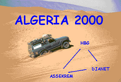
Route Genoa – Tunis – Nefta – El Oued – Hassi Messaoud – Hassi bel Guebbour (HbG) – Quatre Chemins – Gara Khanfoussa – Ain el Hadjadj – Illizi – Iherir – Djanet – Tadrart (Oued In Djerane, T-in Merzouga) – Bordj el Haouas – Serenout – Ideles – Hirafok – Assekrem – Ideles – Tefedest east (Garet el Djenoun) – Erg Amguid west – HbG – El Oued – Tunis. About 2500km off-road
Vehicles Land Cruiser HJ61, Land Cruiser HDJ80, Discovery Tdi and three 110 Defenders.
The film of this tour, Algeria 2000 (as seen on Sky TV), is featured on the Desert Driving dvd.
Ferry and Tunisia It’s still the same story on the Carthage as described in the book, hours of queuing for forms. Not all of us got our Permit de Conduire before the ship docked, but they were quickly obtained from the Customs booths once in the port.
Before that, at the police booths in the first shed it helps not to imply you’re transiting Tunisia fast for Libya or Algeria. To keep them happy make out you’re spending some time (and money) in Tunisia too. One of our group got tricked on the exchange; led to a certain bureau de change by one of the orange boiler-suited guys. Be alert, they’ll get you if they can. And another was told to pay 10 dinars for his Permit de C. (it’s officially 1d or free on the boat).
Fuel prices in Tunisia: Diesel 41d, petrol about 70d.
We covered the 470km from Tunis to Nefta in about 8 hours and stayed at the Hotel Marhala in the zone touristique west of town, opposite the Caravanserai. Half board was around 40d for two people. It’s a clean new hotel with unusually good food (but what isn’t after the Amilcar in Carthage?).
The Border We set off at 8.30am hoping to get a good start into Algeria but the border still took most of the day. The Tunisian frontier at Haouza was pretty straightforward. At Taleb Larbi on the Algerian side things move slowly. You do police forms for you and your car (white and green forms), move on to the Customs declaration (currency and valuables like video cameras or whatever you profer/they find). I was aware of the binoculars (jumelles) ban but was careless in hiding them and so they were confiscated with a receipt and returned on the way out. The others hid their binoculars better.
Each car was searched with a few suggestive jokes about whisky, but bury it deep and they won’t find it because you don’t get taken apart as can happen to locals. With your carte gris (vehicle logbook) you then fill out a Titre de Passage en Douane (TPD) form which eventually gets printed out.
Next is money changing. This seems to be a problem at Taleb Larbi. As Yves found, they claim not to have enough in the office and there’s no bank at Taleb. In our case I got 400FF’s worth but the others got only enough to buy insurance (about 200FF) and the last lot had none. It then transpired that the guy in the insurance office (‘SAA’) took FF anyway. This is probably best paid out of your declared FFs, not your stash.
While I was waiting, taxis drivers just past the gates offered to buy clothes and exchange black market money, offering around 10-20% more. If you’ve arrived low on fuel and you have insufficient official dinars you may need to buy some black to move on. The fuel station is just down the road. We left Taleb round 3pm.
At some stage of course you must buy official dinars (it looks good on your declaration – keep receipts). We did this at the bank in Debila, the first main town after the border. It had just closed but the guy saw the ten of us and generously opened up again to do a quick change for us all.
Stone throwing kids I’d read about the stone throwing villages west of the border on sahara.info.ch and sadly the reports were true. For once I was spared but the Discovery at the back got hit hard two or three times. Most of the kids wave but the ones who throw mean business as the heavy dents in the Discovery’s door proved. Had it gone through a window and struck the driver it would have been nasty. The last car is usually the target because there are no following cars to see who throws it, I suppose.
Unless you’re lucky, trying to catch the culprits or going to the police is a waste of time, but I guess that some irate tourist with a smashed window will do this some day soon and hopefully something will be done. On the ferry back I spotted a tourist car with a smashed window and heard of serious stone throwing in Kufra (Libya) and even at a local guide’s car in Dakhla (Egypt).
Laisser Passer and Gassi Touil convoy We spent the first night in Algeria in the sands just south of Touggourt (although there is the Hotel Oasis in town somewhere).
At Square Bresson (just a junction) there are masses of sand roses laid out for display. Soon after, at a checkpoint just before Hassi Messaoud we had to get our permit for the south – about an hour of writing everyone’s details down in Arabic. But the laisser passer was only requested a couple of times in the Gassi Touil over the next day or two. No one bothered with it or even passport checks south of the oil zone.
We got caught up in a military escort at the Gassi Touil checkpoint, halfway between Hassi Messaoud and Hassi bel Guebbour (HbG). It meant waiting until 3pm (or 9am) for a 100 km drive to another checkpoint or base and continuing the next morning at 10am to HbG. We were told only ‘Toyotas and fuel tankers’ must join the convoy as these have been preyed on by bandits (from ‘Mali’ or course). But while waiting plenty of Toyotas and tankers went through so who knows… It delayed us by about half a day so schedule this into your plans or go via Deb Deb (Libyan border route).
Unlike many other towns in Algeria, HbG is still the one-camel truckstop it was ten years ago. Just a couple of cafes and a checkpoint. There was no problem with us heading down to Bordj Omar Driss (stopping for a wash at the warm spring 2km from Hassi).
On the piste at last We left the tarmac at Quatre Chemins (checkpoint) and headed west along the very rough Amguid track, leaving it early down a sandy ramp towards the Gara Khanfoussa dune crossing and the 410-km-run (fuel to fuel) to Illizi. Once you find the entry point for GK and the old piste rising up over the dunes, with 1.5 bar the crossing is very easy (in our case perhaps helped by the recent heavy rains). There are many recent tracks winding their way over the easiest dunes and by following them you encounter no dangerous crests to speak of. After the first section you drive into the Gara Khan clearing and then keep on the west side to head directly south (a mistake we made when I did it ten years ago). Beware of sharp ‘crests’ as you drive back onto the old orange built-up piste on the way out of the dunes.
Once in the valley we passed Tabelbalet well (good water at 6m), tried to drive along the dunes on the east side (as advised because of flood damage on the track). But the dune banks were tiresome and we found the track OK. Next day we passed Ain el Hadjadj (ruins, good water) and followed the track right to the point where you cross the strip of dunes at around N26 38′. It helps to walk these first to work out the way through. Once you know which way to go it can be done in 10 minutes. No one got stuck except me!
From here east to Illizi is one of the most beautiful pistes in these parts, with the rosey dunes of the Erg Issaouane glowing to the north, a clear track and plenty of nomads camelling around. Just when you think it’s all over there is a steep sand slope to ascend about an hour from Illizi (waiting for GPS info). You’ll need to degonflate to get up this one – watch out for the rocks on top.
If you’re heading south via HbG then this piste certainly beats the tarmac to Illizi.
Illizi to Djanet In Illizi we were lucky enough to get fuel, water, bread and even a restaurant lunch (250d each) without getting hauled in to the police and army as Yves reports on point 11. If they don’t ask don’t offer. From here it was tarmac all the way to Djanet, covering in two hours what took a gruelling day a decade ago. We visited the village of Iherir (basic camping at the north end of the settlement – introduce yourself to the teacher, Ibrahim Kadri). The road to this canyon oasis is much improved (30 mins) and may well be tarmaced by next year.
We did the Tuareg tea thing with Ibrahim that evening and next morning went for a walk with a guide up the valley to see the guelta, gardens, rock art and the old Turkish fort (700D for our group of ten). We also left some old clothes with Ibrahim for the villagers.
Down the road, Dider looks as lovely a lunch/camp spot as ever and there is now fuel at what has become the small refugee town of Bordj el Haouas (checkpoint). You could do Illizi – Djanet in a day.
Djanet The new tarmac makes a lovely drive into Djanet – now you can look around at the countryside instead of the piste. There was no checkpoint on entering Djanet (though there were frequent night time roadblocks) or need to get permits for fuel, as before. We stayed at the only place in town: Hotel Zeribas (250d to camp per person, cars free, basic rooms around 500d) right in the town centre next to the post office. I was told the place was dump a year ago but it looked fine to me, with hot water, plenty of shade and good security. They’ll try and rope you in for a cous-cous meal in their restaurant, nothing special and overpriced at 500d pp. There are restaurants just out the door. The Hotel Tenere, miles south out of town, appeared to be closed or waiting for the Xmas charters. There’s a shadeless campsite near it, but it looked deserted too.
Guided excursion to the Tadrart I organised a guide with Agence Essendilene for a tour of the Tadrart (SE of Djanet) and Alidemma arch. We were advised that my proposed route would take much longer than planned (although a friend did the full tour a year ago in 4 days). It was a guide’s ploy to get more days out of us (a new one me!). In the end we settled on 4 days, Tadrart only at 1200FF a day. We also paid 25d per person per day in the national park at the park office/museum in town. Once we got to the Tadrart it was clear the guides were stringing out the route to fill 4 days, crawling along at times at 10kph. We would have rather driven at a normal speeds and camped early to enjoy time out of the cars, which we later did.
I was looking forward to the Tadrart but to be honest I was disappointed. The sandy drive out towards Mt Tiska and following oueds south of the corrugated Ghat piste was great (and driven at normal speeds). But Oued In Djerane was very dusty and for the price I paid, the region did not quite have the edge over the very similar (and contiguous) Akakus in Libya. Of course, unlike the Akakus, the Tadrart has zero tourists. The ochre dunes at T-in Merzouga were the highlight. Our guides Ahmed and Slimane were a good bunch of guys and, with an email contact in Germany, I may hire them again directly, at a more normal price.
Unfortunately one of our group was injured an accident on Day 3 and we had to return directly to Djanet. Amazingly the Defender nearly made it back in 2WD, at which point the severely traumatised transmission finally gave up the ghost. The doctors at Djanet hospital were extremely helpful and confidence inspiring. The injured driver eventually flew back to the UK via Algiers, with the aid of his travel insurance and looks like making a full recovery. The car was a write-off. There are no modern Land Rovers in Algeria, only ancient Series IIIs. Recovery to the coast was not worthwhile and so it had its contents and components ‘optimised’ and was left with the Customs. Vehicles cannot be sold in Algeria. The Douane huffed and puffed a bit about parts missing from their new ‘present’ (what a nerve!), but once they realise it’s more wrecked than it looks they won’t be quite so thrilled.
Telephoning from Djanet Trying to organise the repatriation exposed the near impossibility of telephoning out of Djanet, even just to the next town. The problem seems to be many new private telephones but just one inadequate satellite/radio dish. I was on the verge of driving 400km to Illizi (linked by land lines and therefore much more reliable), but had one more go at sundown – Ramadan eating time when all goes quite. However the insurance never managed to call back. So despite what I say in the book on p.276, a sat phone would have been useful here. (incidentally the hypothetically described Medevac procedure on the opposite page – outlined to me by a Loss Assessor – proved to be pretty accurate. Getting to a town/phone/hospital is the key. However, the insurance insist on proof that the claimant cannot continue the tour as well as a doctor’s report to prove they are safe to fly. This is what cost us days and why we gave up in Djanet – they could not get through).
Not surprisingly, GSM mobiles don’t work in Algeria (they do in Tunisia), but I was told that next year they will, even down in the south.
Route A2 to the Hoggar With the injured driver slowly on the mend, two cars from the group offered to help assist his recovery to the UK while I continued with the VX and Discovery to the Hoggar. We managed to get diesel at Bordj el Haouas (Ramadan shuts everything down at 3pm) and then headed south along the chain of mountains that end in the landmark of Tazat (an interesting area to explore for another time I think). Mistakenly thinking we needed to move fast to catch up for lost time, we drove from Tazat almost to Assekrem in a long 400km-day. As described in the book the junction at ‘Borne’ is still confusing and we dithered around a bit before heading resolutely SSW over confusing tracks with another lost G-Wagen crossing out bows. Soon we found the crucial cairns and balises that lead into the valleys all the way to Serenout fort (quick passport check) and on past Telertheba. Despite what it says on p.397, the southern route from Serenout (as marked on the IGN) seems to be the main way and is a lovely drive with the 2455m Telertheba looming ever larger up ahead. The sandy sections mentioned on A2 in the book didn’t cause any problems – one wonders if a flat sandy track improves with little passing traffic.
There is diesel only at Ideles from where a corrugated track leads to Hirhafok. At Hirhafok we turned south for Assekrem.
I knew this piste would be washed-out, but the closer we got to Assekrem the worse it got, to the point where one could barely believe anything less tha a Unimog could drive it. The last 50kms took 4 hours in Low Range with extremely slow and rocky going up to and beyond the Tin Teratimt Pass. From here on it was so damaged one could hardly work out the original track among the many deviations.
We had Assekrem to ourselves but there is a whole menu of prices there: parking, parking more than an hour, breathing, etc. The ‘chatty’ guy in charge tried to charge us for camping, too… To be fair it can’t be cheap to run the place and the lovely lodge is well worth an overnight (even at nearly 1000ds demi-pension) so you can see dawn over the plugs.
Tefedest East We returned down the track from hell (not so bad this time but I doubt any local would use it), fuelled up at Ideles, getting caught up with the bored police opposite the pumps for a tiresome “what’s your job, address, mother and father’s name” check. Backtracking, the turn off north for Mertoutek is clear if you’re looking for it and the track unrolls clearly, passing through some lovely spots to a turn-off at a big green sign a few kilometres before Mertoutek (as marked on the TPC). From here twin ruts lead north to Dehine and continue all the way along the east flank of the Tefedest range past the distinctive peak of Garet el Djenoun at its northern end.
The Discovery’s rear radius arm broke, probably as a result of the exertions of the previous day, and with me taking on the car’s fuel and water payload, my 61’s rear main spring also snapped a day later. The flat helper springs had also snapped off I discovered, but the second spring sort of winds round the mount so I could carry on without much problem. The other rear main spring has since broken. I never rated these two-year-old Ironman rear springs for heavy load carrying (front are fine) and will be getting some heavy-duty OMEs.
We had a day off by Garet and then continued north along the west of the Amguid erg, through the pass and northwest back to HbG, a clear if corrugated track marked with oil drums much of the way.
This is a lovely way back north, easy to follow with no GPS needed – 710kms from Ideles to HbG. The last 150km are a flat and dull and after the final rise, the eastbound track back to 4 Chemins is very rough but can be avoided by going via Bordj Omar Driss, I’m told.
Back north We just about managed to wangle our way out of a return convoy north, and continued slowly with the four-wheel steering Discovery all the way from Gassi Touil to Nefta in one very long day. Getting out of Algeria took two hours with no searches or money checks (the same as years ago), just very slow-witted officials at Taleb. At Haouza they asked for Green Card insurance (a first) so those without had to buy a week’s worth for 10Td. After 1200km of hairy handling with just a winch cable and a chain holding the axle in place, the Discovery got its radius arm welded in Nefta and we met up with the rest of the group at La Goulette for the ferry back to Genoa.
Weather Following the severe October rains west of Illizi, we were blessed with no daytime wind and amazing clarity the like of which I’ve never seen in the Sahara. You just could not help staring in amazement at the crisp profiles of the ergs and the mountains. Temperatures were mild too, even at 1800m in the Hoggar it only dropped to 7C.
We also saw plenty of dorcas gazelles which I’d never noticed before and of course thriving Tuareg nomad activity here and there which, along with the famously diverse landscape, is what makes Algeria so special.
Conclusion While it was a shame not to be able to complete the tour with the whole group, Algeria is as good as I remembered: the desert has plenty of tracks, as easy or as hard as you want, and all without excessive hassles with guides or permits. I would not choose to visit the Tadrart again, instead I’d rather explore places like Erg Tifernine and Tihodaine, and the Tazat and Tefedest mountains, as well as more southern routes linking Djanet with Tam. This will be the basis of my 2001 tour.
The most tiresome element is, as always, border stuff on the Carthage and at Taleb, but then if it was easy everyone would go here! I met Gerhard Gottler on the ferry back, updating an old Algerian guide and preparing a new Sahara-wide guide (in German). He agreed the southeast of Algeria is the ‘fillet mignon’ of the Sahara. With one easily obtained visa you get a lot for your money in Algeria, and you can always spice things up by pushing further south to the Tenere in Niger.
While the north and the far west may be risky, security in the southeast was never an issue. The gendarmes bombing around in their green Land Cruisers (a cut above the average army and police) inspired confidence and greeted us warmly, as did everyone.