See also
Michelin 742 Morocco (2024) map review
Map review: Reise Know-How Morocco 1:1m (2023)
Time for my Tablet: Samsung Tab + Gaia GPS vs Garmin Montana
How to trace and save a GPS tracklog online
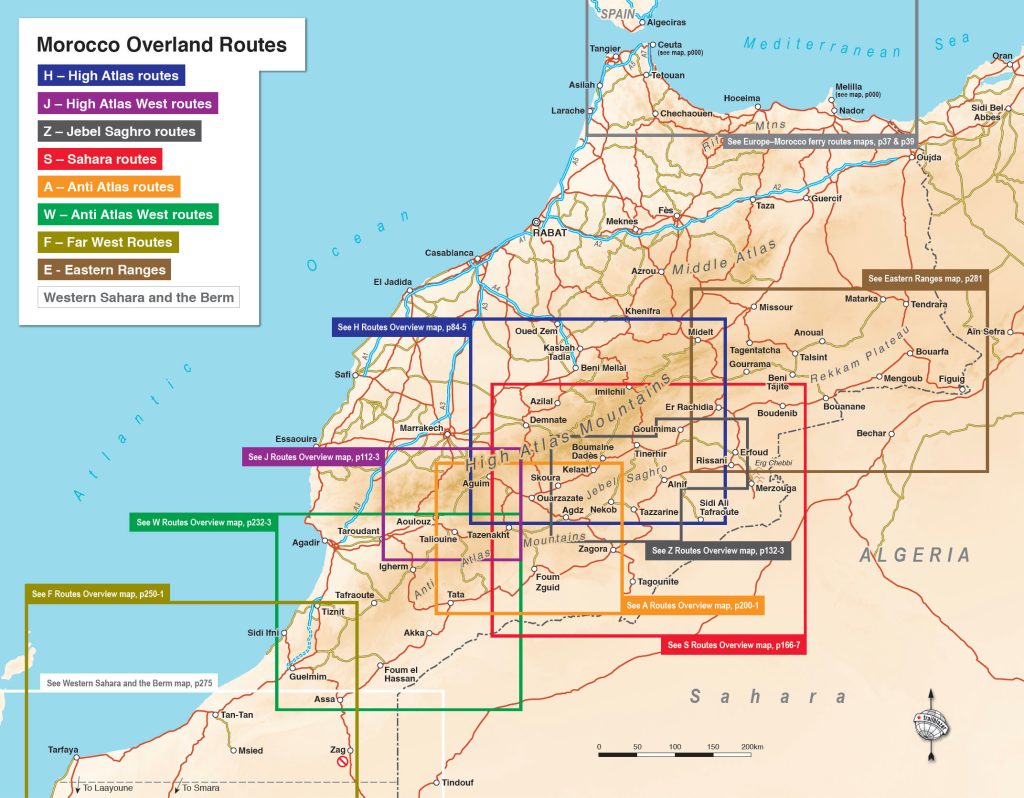
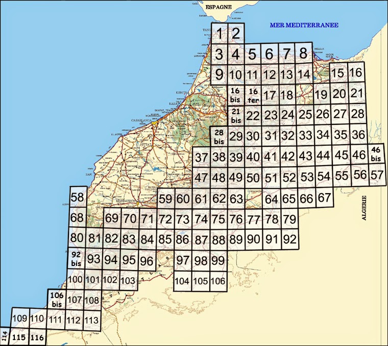
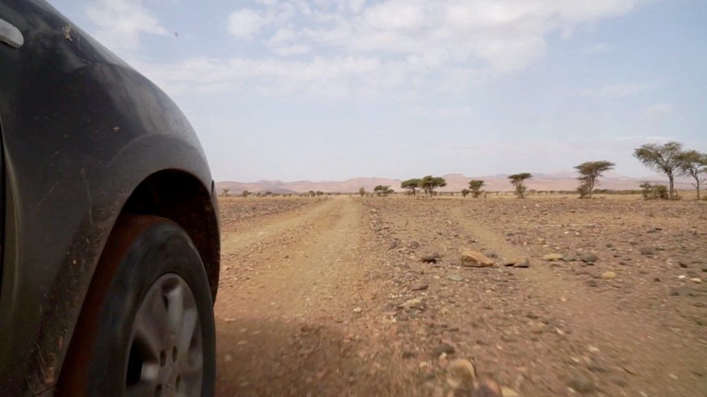
Reviews below only relate to the ‘Morocco Overland 4 zone’ (left) and only the most useful maps are mentioned. The north of Morocco is not considered, although you assume any map will be OK up there too.
Choosing a map
For navigating roads and the big picture, get the latest (2024) Michelin 742 paper map in a car, or consider the more robust and waterproof 2023 Reise Know-How (RK-H) map for a bike, but don’t expect much on the dirt from either.
For overlanding there are no up-to-date large-scale maps anymore; digital maps have stolen the march. For your phone/tablet download an app which comes with a basic map; if you want more detail and functionality you have to pay/subscribe. I had a quick look at Google-owned Waze which has adverts so I presume is free at all levels. Doubtless great at home but unusable off the tarmac in Morocco. I uninstalled in 5 mins. OsmAnd app looks better and uses the open source OSM database (Google’s main competitor in mapping and to which I contribute for Morocco). But like Waze, the free version shows no relief shading and they dump everything the OSM database has to offer, which includes a whole lot of phantom tracks and paths going nowhere (the result of overzealous OSM contributors). Maps.me allows you to download a map for offline use: ‘Morocco South’ is only 70mb but it’s hard to read as the optional isolines (contours) look similar to minor tracks. I suppose the idea is you let it route you and just follow the arrow, not read the map. Ditched after 15 mins. Most of all I liked the look of the free version of Gaia Topo (meters) styled after USGS maps. It also uses OSM but renders it so the clutter less distracting. The OSM database is updated constantly and once in a while all the above who use it update their base maps.
Maps for your Garmin GPS need downloading and installing on a miniSD card. This used to be fraught with aggro but has got easier. This free 500mb all of Morocco map is good though won’t show up on Mac BaseCamp. This similar map does both and all are updated frequently. Again, it’s all about the map’s style or rendering that makes them legible, though on your Garmin device (or BaseCamp) you can vary the level of detail. You can buy Garmin’s North Africa Light v5 (£20) but it’s just an OSM info dump. For aerial imagery research, where WYSIWYG, there is of course the brilliant Google satellite or the similar ‘aerial’ layer on free Bing Maps. Clarity varies; cross check against both.
More on all the above below.
Morocco paper maps
Note: in the last couple of years travellers whose paper maps have been spotted at the Ceuta border have had them confiscated because they identify the disputed zone of ‘Western Sahara‘. They don’t search tourist vehicles intensively (without a reason), but conceal your maps to avoid this petty harassment.
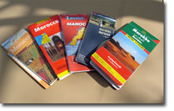
A paper map of Morocco is inexpensive, light, compact, doesn’t need recharging and gives you the big picture which is great for planning at home, or deciding where to go next once out there. You can’t do that on your smartphone or GPS, handy though they are.

There are up to a dozen Morocco country maps in print and taking into account scale, price, clarity, date of publication, the two maps below are recommended for on and off-highway travel in the south of Morocco.
However, one thing quickly becomes clear: while you won’t get lost and die of thirst relying these maps, they’re all surprisingly inaccurate or out-of-date and tend to copy each other’s errors. Some minor routes shown as sealed are in fact little-used pistes and more commonly, pistes depicted identically on several maps do not match the orientation shown, or don’t exist at all. Elsewhere roads sealed for years are not shown at all, while obscure, long unused tracks remain.
What also becomes evident is how many interesting and easily navigable pistes there are in Morocco which don’t appear on these paper maps. The same can be said for villages; many established settlements on a par with other locally depicted places are missing, while some towns are given excessive prominence for what you’ll find there. This inconsistency with road and place ‘hierarchy’ is probably as old a complaint as mapping itself.
For navigating along the main ‘RN’ highways in a motorhome the recommended maps are fine. But not for southern Moroccan back roads and tracks. For that a digital map is better (see below). Once you accept these limitations paper maps are not so bad.
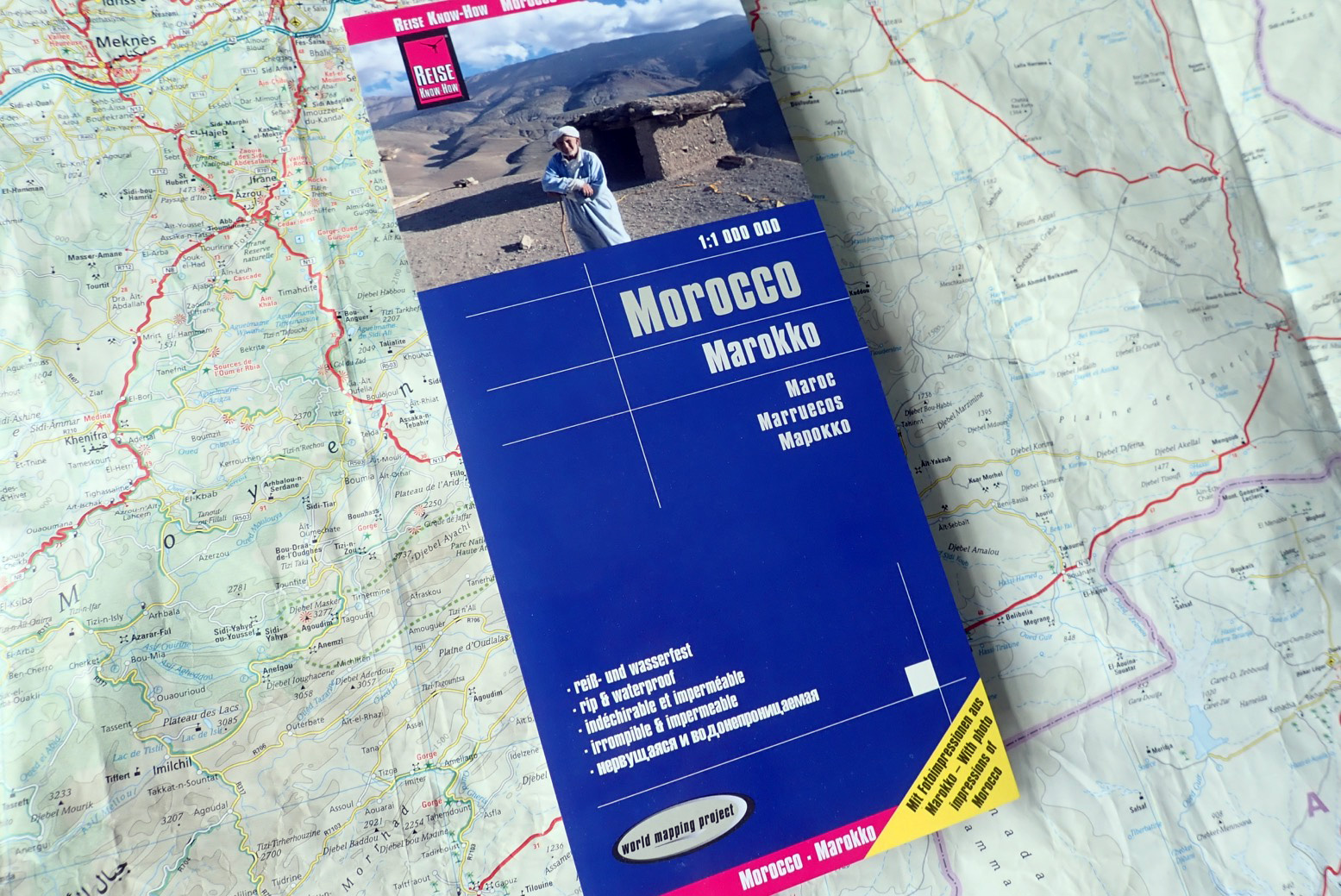
Reise Know-How 1:1m 2023
Best for regular use and motos – £9.95
The 12th edition published in 2019 was a genuine update while retaining some usual errors. The 2023 13th edition has a new cover but with updates and corrections (in the MO area) that can be counted on the fingers of one hand. Fuller review here.
The main changes:
• Negligible
Flaws (same as 2019 edition)
• Fuel station info inconsistent (unless they mean ‘village fuel‘)
• Many Tracks (grey) are easy-to-drive Gravel Roads, aka: pistes (white)
• Many long-established pistes are missing; others are sealed roads (yellow or red)
• Some sealed roads are tracks
• Some villages missing or misaligned
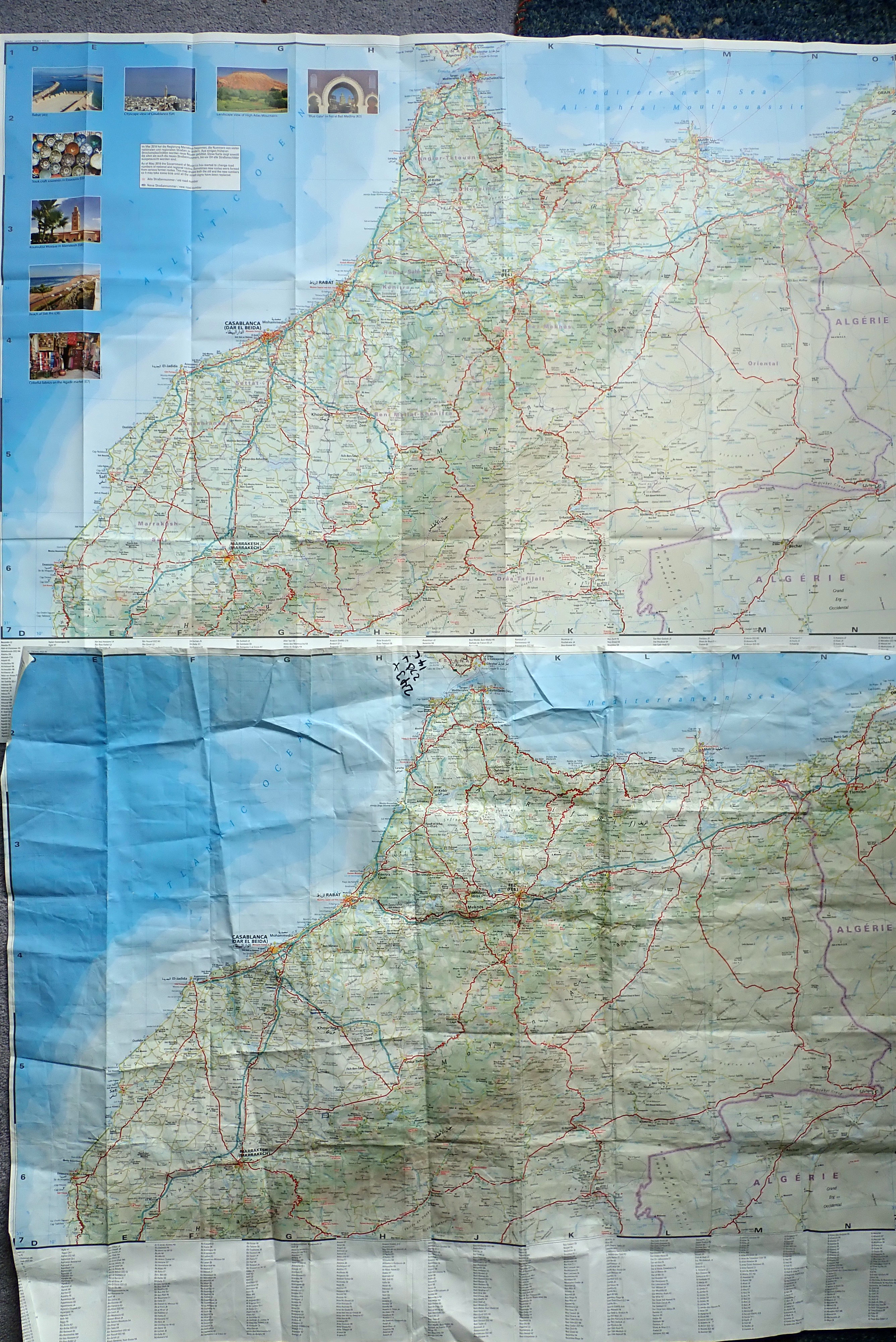
In the end, recognising all these paper maps are flawed in some way, the German RKH was the one I use most. Why? Because unlike the Michelin, it won’t fall apart after less than an hour’s accumulated use and the double-sided printing makes it compact and easy to use in a crowded lift, shove in a bike’s tank net or open out in a gale.
I also find the intuitive 1:1m scale (1mm = 1km) good for quick distance estimates and the grid lines are OK for estimating a position on the map off a GPS if you don’t use a digital map (see below). They even squeeze an index round the edges and some pretty, touristic pictures.
Cartographically, the RKH isn’t the best design for me, but you can eat your lunch off it, use it as an umbrella, origami it into a bowl and generally rough it up without it ending up like Michelin confetti. Plastic paper maps are the way to go. [This text refers to the 2019 edition; 2023 appears unchanged].
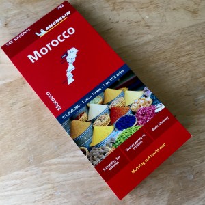
Michelin 742 1:1m 2024 From £6.50.
Use for planning, not navigation
Michelin the best map for Morocco, right? Not for many years, I’m afraid. It looks nice and the late 2024 edition’s paper seems to be thicker. You get five useful sub-regions at 600k scale but the detail there is barely greater or up to date. Plus points are the intuitive 1:1m scale, clear Michelin design and the fact that it goes right down to Laayoune which means you can view all of Morocco 4’s routes on one sheet – except that less than half on them shown on this map. And at £6.50 in the UK, it’s the cheapest of the recommended Morocco maps.
As for the accuracy of secondary roads and pistes? Many easily navigable market roads and tracks mentioned in the M4 book or on the digital maps below are missing and some roads don’t exist. In places this data is nearly 20 years out of date but overall they don’t get it as badly or as conspicuously wrong as the RKH. The 742 is still one of the least bad maps for overlanding in Morocco.
Old, colonial-era Morocco maps scanned and online, from 50- to 250k. Good for old routes and original place names.
Free digital maps for your GPS
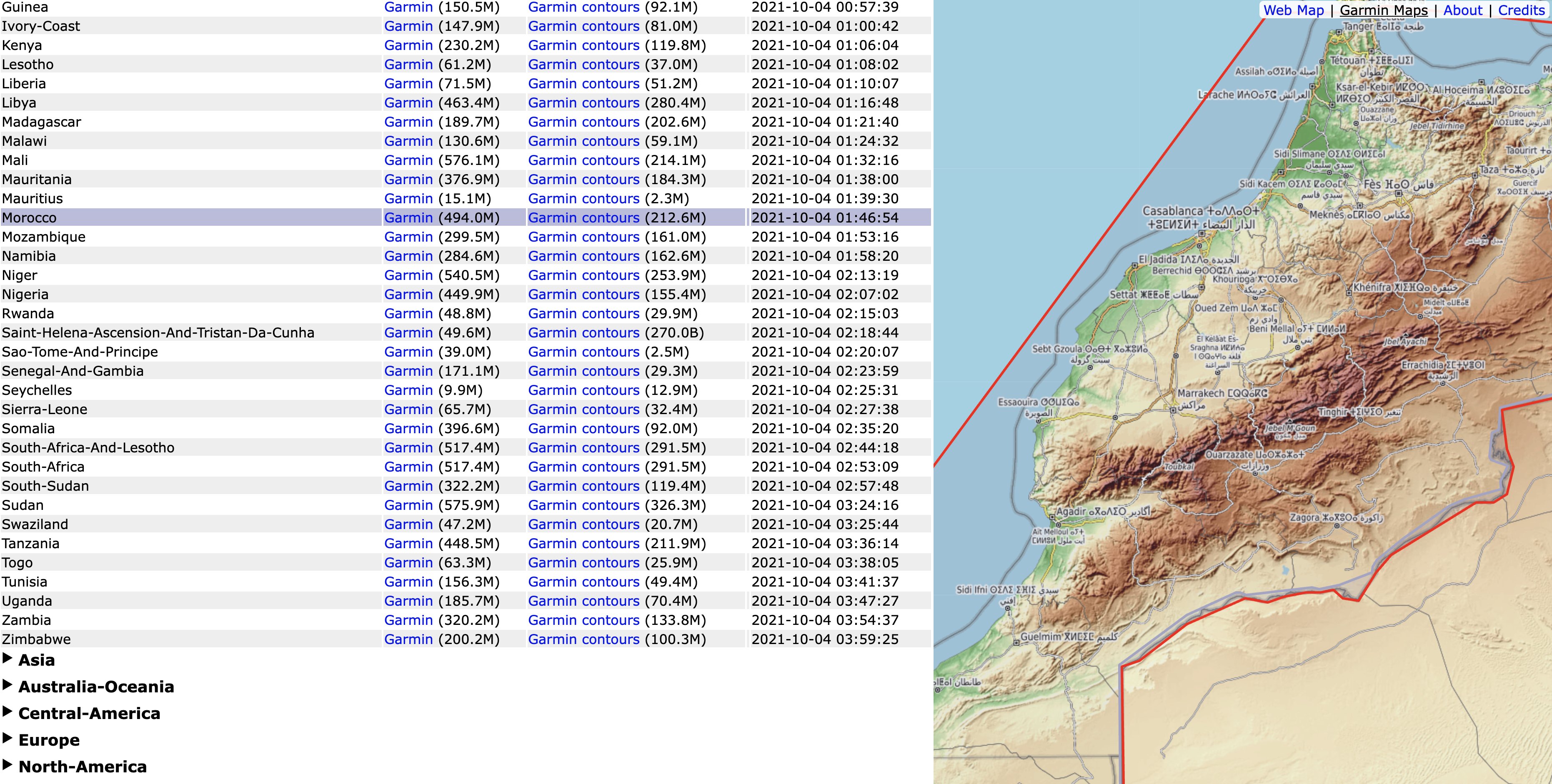
Garmin Open Topo or Alternativaslibres.org
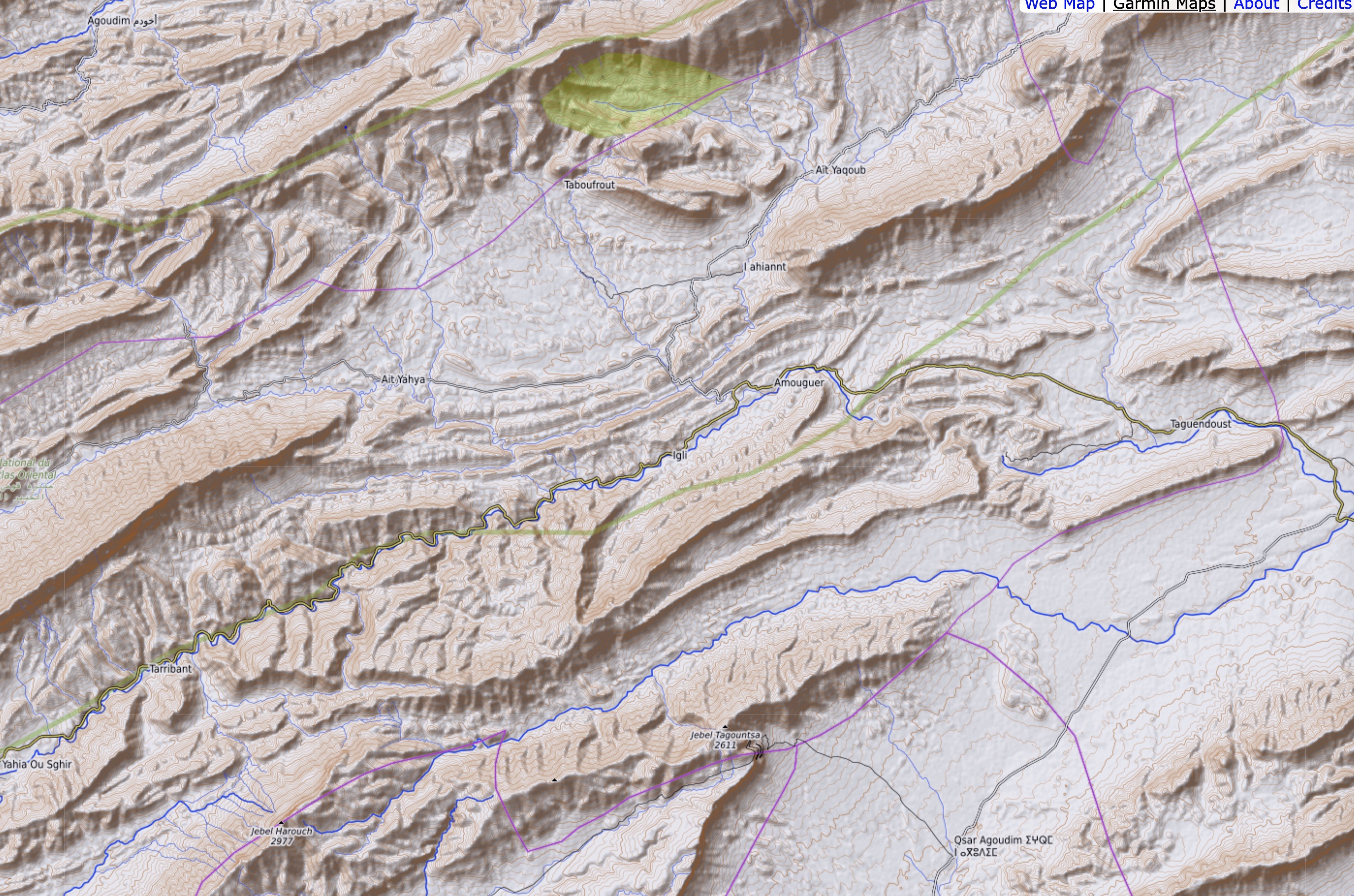
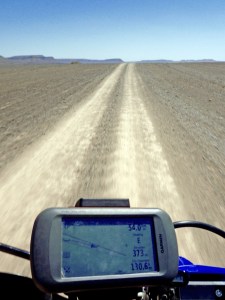
These are the Morocco maps I use; there may be others. They are compiled using the free, community-generated OpenStreetMap (OSM) database (a ‘wiki’ for maps) and come as a simple, single 500mb download which you then unzip and put on the mini SD card of your GPS, but the design or cartography are the best I’ve seen: proper shading for relief and so much clearer to read than anything else I’ve tried. The only problem is I still can’t make the Open Topo show up in BaseCamp, even with the Montana connected.
Garmin North Africa Topo £20
You will need Garmin’s free MapInstall and BaseCamp software. This map is locked in your GPS unit so only shows on Basecamp on a computer screen when your GPS is attached to the computer. Click the link for a full review. Short version: don’t bother and go for the free ones.
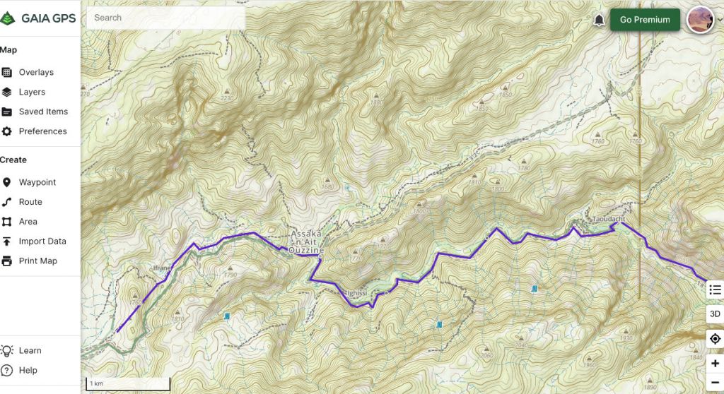
Gaia App with Topo (metres) map
This is the map you get free with the Gaia GPS app; to save it for offline use (without internet) or get other map layers, you have to go Premium at $60/year. I have this on the desktop and as a back-up on the phone and a tablet, but it only works with internet (4G is quite common in the Moroccan hills). I did sign up for a year and try and get into Gaia GPS for logging. The map is clear and easy to read, but has the usual OSM anomalies – scraps of unconnected tracks added by contributors misreading aerial imagery. For what I do (recording and saving) my old Garmin Montana is easier to use on the move. The Gaia app was probably aimed at hikers, not rough riding on motos and in 4x4s.
Google and Bing online satellite imagery. ‘Ground truth mapping’
How lucky we are today today to have brilliant WYSIWYG satellite/aerial imagery for free. Used as a pre-planning map, Google Maps (non satellite) can be hard to get your head round and is no better than the paper maps above. Many town and village names are unrecognisable, presumably taken from non-standard US sources. And don’t start me on the anomalous, irrelevant clutter and distracting user-generated icons marking a sauna or restaurant in the middle of nowhere. Bing Maps is the same if not worse; or at least I am less used to it and like most, go to Google first for quick directions or distances
However, Google Maps’ ‘satellite’ page (or Google Earth) is particularly effective in vividly dramatising and navigating the arid topography of somewhere like southern Morocco. Up till Google’s April 2024, Bing Maps’ Aerial was often better, but now, for Morocco at least, Google has the edge.
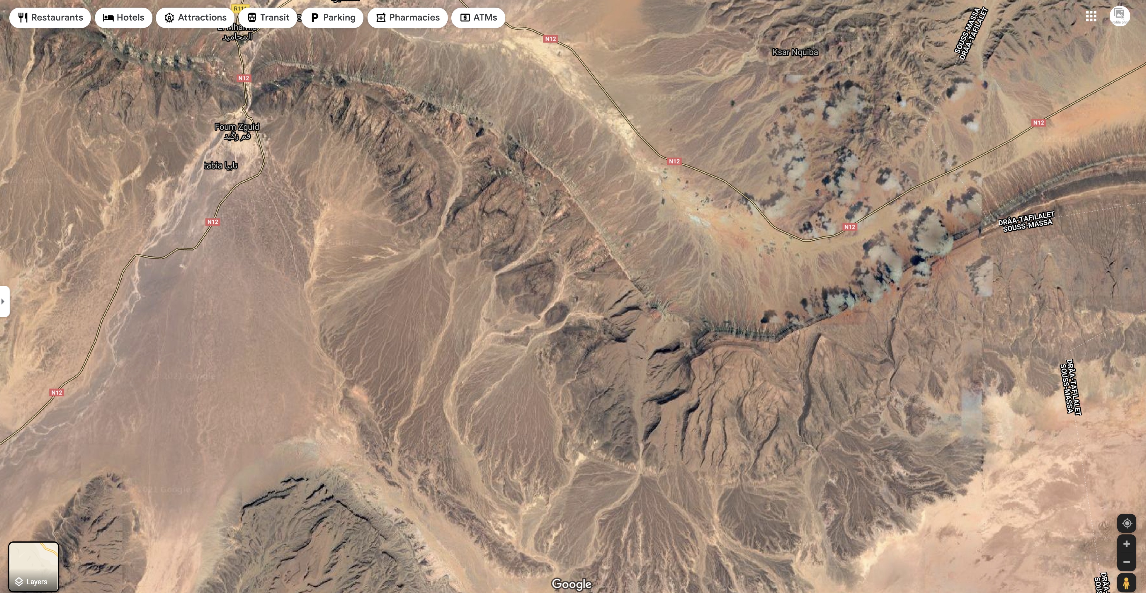
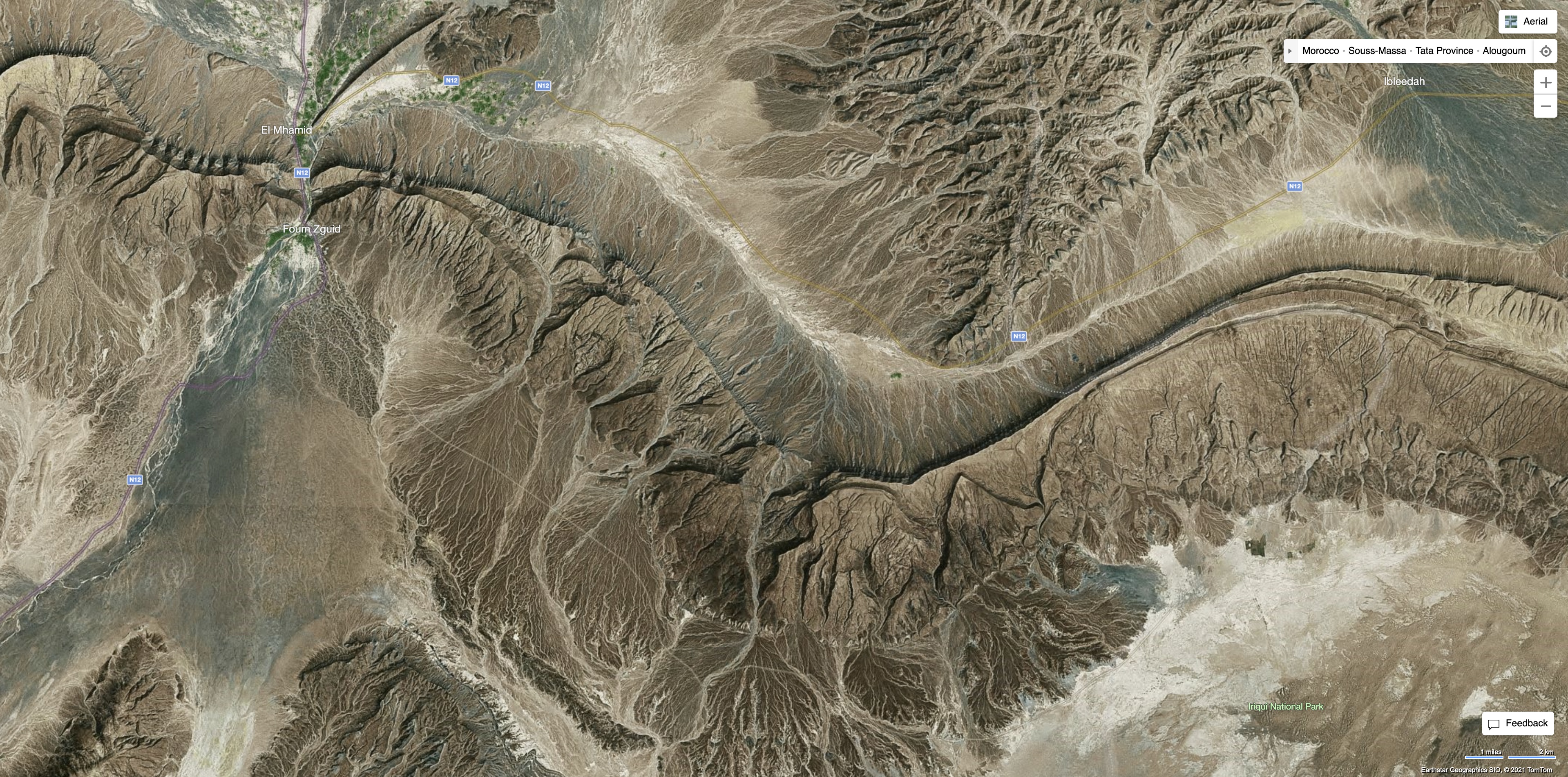
At best, both platforms look as crisp as peering down from a hot air balloon. On Erg Chebbi you can even spot the tourist bivouacs in the dunes. Google Earth needs many of the layers unchecked which often contain wildly inaccurate ‘user-added’ junk, but with Bing Aerial or Google Sat you have a ‘map’ that cannot lie. With a Google account, in ‘My Maps’ you can build a network of routes to easily export as a .gpx for your nav device, as well as discover new areas and generally be thrilled at the bird’s eye view of Morocco.
Getting routed
As the track left was clearly visible online, I traced the route I was logging above (MW7) off Google the previous evening (internet required), saved and exported the kml, converted to a .gpx then imported it into my Montana via BaseCamp. This was pushing the limits of my tech know-how, but it worked great.
GPS digital maps were not needed as I had the an accurate tracklog traced from an actual tracks to follow, while recording my own near-identical but live or ‘true’ tracklog over it.
Years later I have used this same but admittedly laborious process (trace route off Google Earth in My Maps) to amass new routes for Morocco 4 (Christmas 2024). Sometimes I cross-reference with Bing aerial but again, this system has been very dependable and not let me down yet. The great thing with satellite is WYS is usually WYG, whereas with maps (paper or digi) WYS can be wrong/out of date/unclear.
