Part of an occasional series: Sahara A to Z
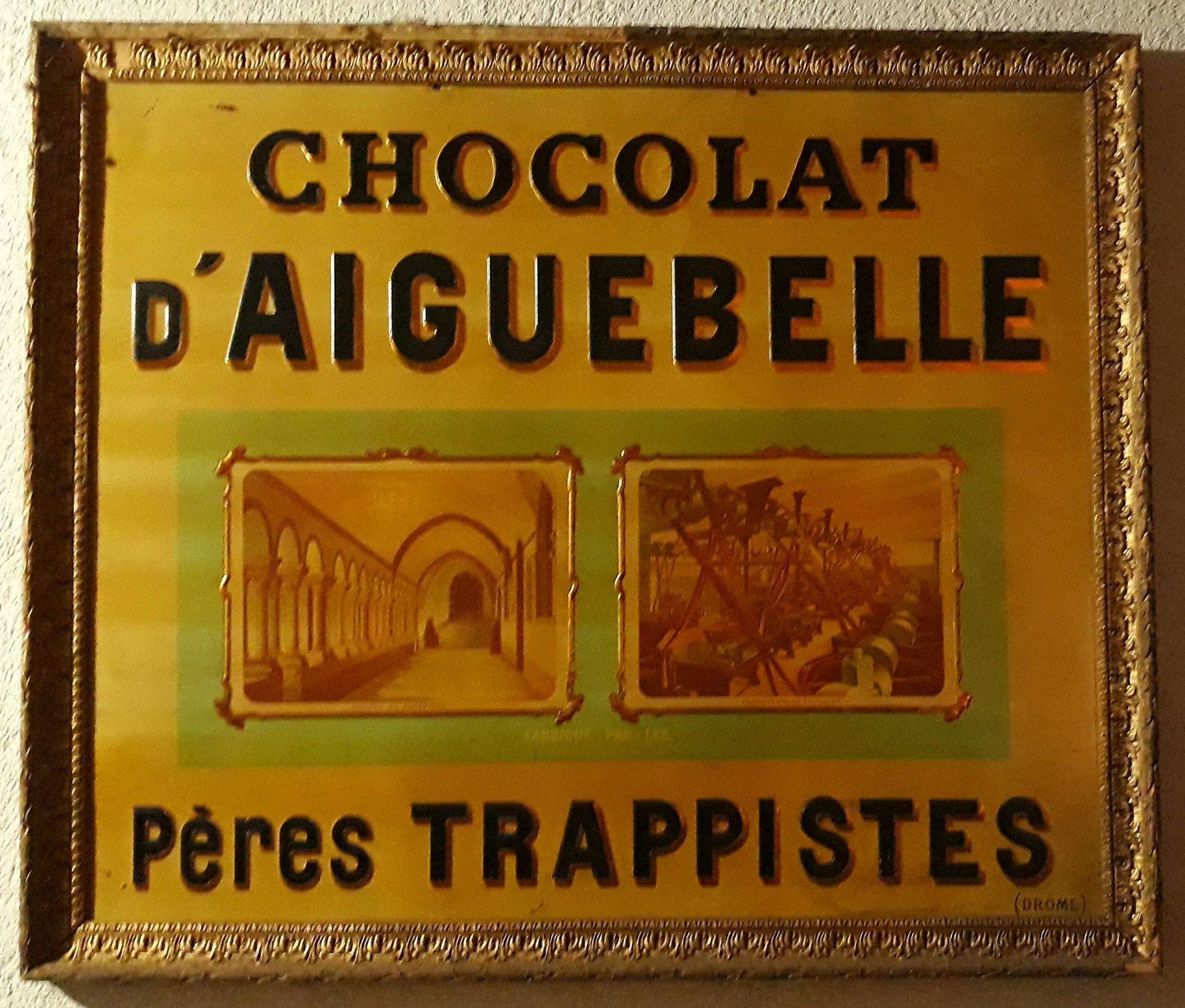
With the help of the internet I can affirm that the Chocolaterie Aiguebelle was founded by a medieval order of French Trappist monks in the mid 19th century to make a bit of money on the side.
As explained here, they also got into producing advertising cards to entertain, educate and inform.
It’s unclear whether these cards came with your chocolates or were distributed from hot air balloons. Probably the former, as that’s what drove me to collect inducements in the 60s and 70. You”l find loads of Chocolaterie Aiguebelle cards on ebay.

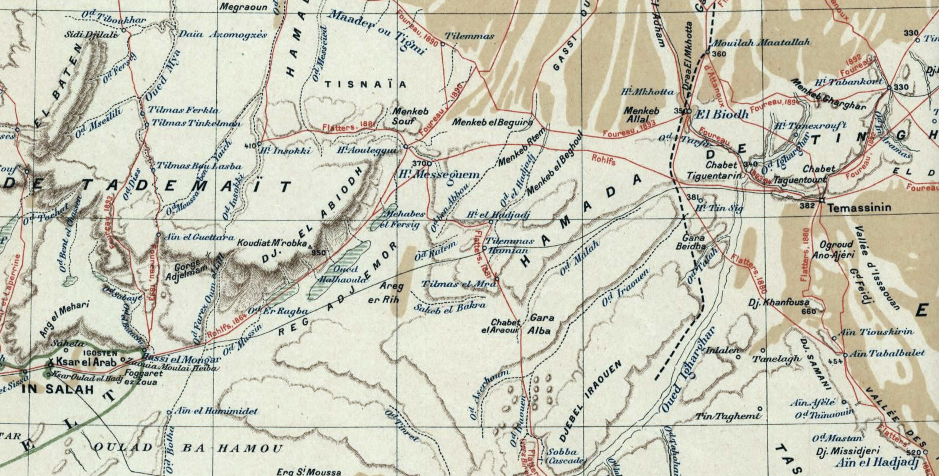
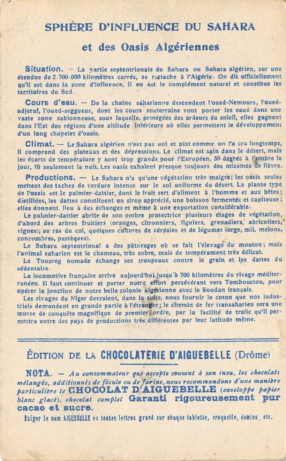
The operation shipped out to North Africa at some point where it’s still around today and which may explain the card below. Yes it’s another interesting map of the Sahara. No date is given but it looks like the state of colonial expansion in the late 19th century.

As always it’s interesting to see what is shown and what is not.
Ancient Timbuktu seems an odd omission (though it’s mentioned on the back as a worthwhile destination for the trans-Sahara railroad). Tamanrasset was just a village at this time so gets skipped and Timassin is Timassinin, later Fort Flatters under the French and today Bordj Omar Driss (BoD). Not far to the west, Messagem and El Biodh were nothing but wells on the caravan route from In Salah to Ghadames, but it seems if early European explorers were led through these places by their guides, then they acquired a cartographic life of their own. They’re all on the map below from 1898.
In the late 1980s we travelled this ‘forbidden’ piste from Fort Mirabel to below the westernmost ribbons of the Grand Erg, coming out at the checkpoint of Hassi bel Guebbour, just north of BoD. By the post war era these obscure wells had slipped off the maps and back into obscurity.
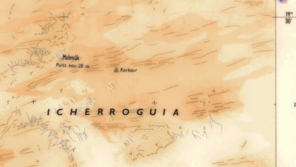
Interesting that remote In Ziza waterhole features, even though it’s not on any trade route, while Taoudenis was then still an important point on the 52 Days Road between Morocco and Timbuktu. East of there, it’s hard to think of today’s lonely well of Mabrouk being any sort of piste junction. Although the wiki waypoint matches the map below, today there aren’t any tell tale vehicle tracks, even though it’s not far from Timetrine where western hostages got shuffled around during their long captivities with AQIM.
On the Atlantic coast Tarfaia is there with more about it here. Never heard of Groha near or maybe Smara, not Djorf el Asfar near present day Bir Lehlou in the PF Zone.
Further east in present day Niger, the Oasis of Djebado is the old name for Djado looks as important as Bilma and the other Kaour oases, but not enough get a marker point. It’s hard to know what Yat might be other than Seguedine or a misplaced and misspelt Ghat, or Tao which appears on other old maps (maps often repeat their predecessors mistakes).Maybe it’s Dao Timni, today a military base in the middle of nowhere.
Discover more from Sahara Overland
Subscribe to get the latest posts sent to your email.

Pingback: C is for Cards of the Sahara | Sahara Overland