Part of the Sahara A to Z series
See also:
Western Sahara
Trans Sahara Routes
The Railway Piste
Tindouf Piste
Atlantic Route
Trans Sahara Highway
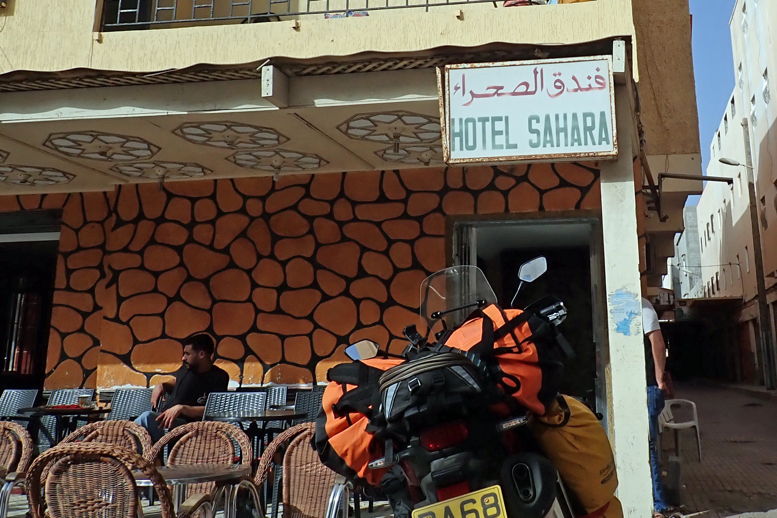
Hotel Sahara
The Dig Tree
In March 2020 I rode Morocco’s 2300-kilometre Atlantic Highway nearly all the way to the southern border and nearly all the way back. I last came this way in 2019 (as far as Gueltat Zemmour) but have not done the whole crossing into RIM since 2006 heading for our Empty Quarter transit.
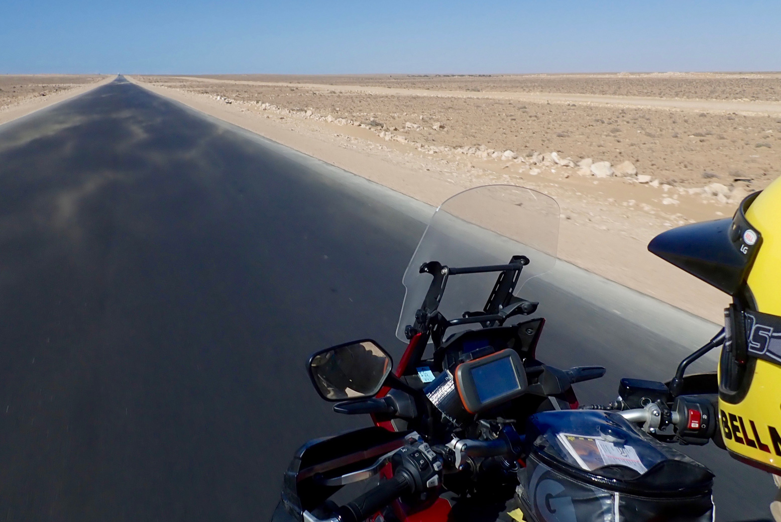
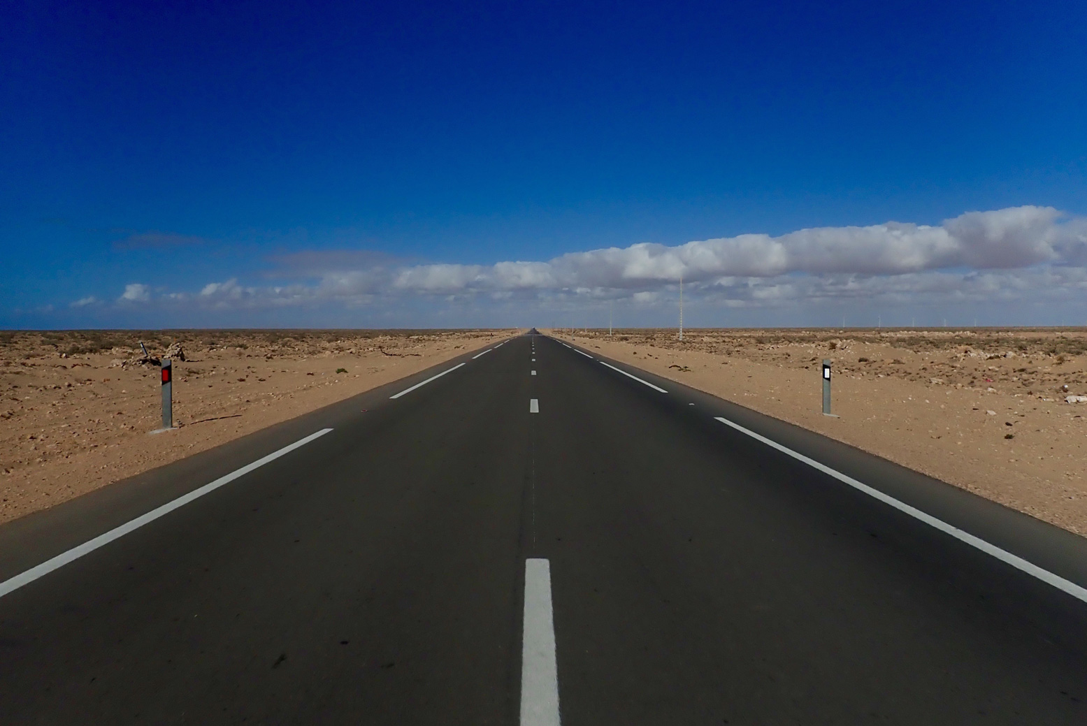
I knew it then, I know it now: scenically, mile for mile, the Atlantic Highway is pretty dull by Saharan standards – a drab limestone plain where, encounters aside, sea-cliff viewpoints and a few barchan dunes are as good as it gets. If you’re on a mission to get to Mauritania – as I was on this occasion – here’s what I found.
Up north, use the autoroutes to dodge the N1 and speed traps
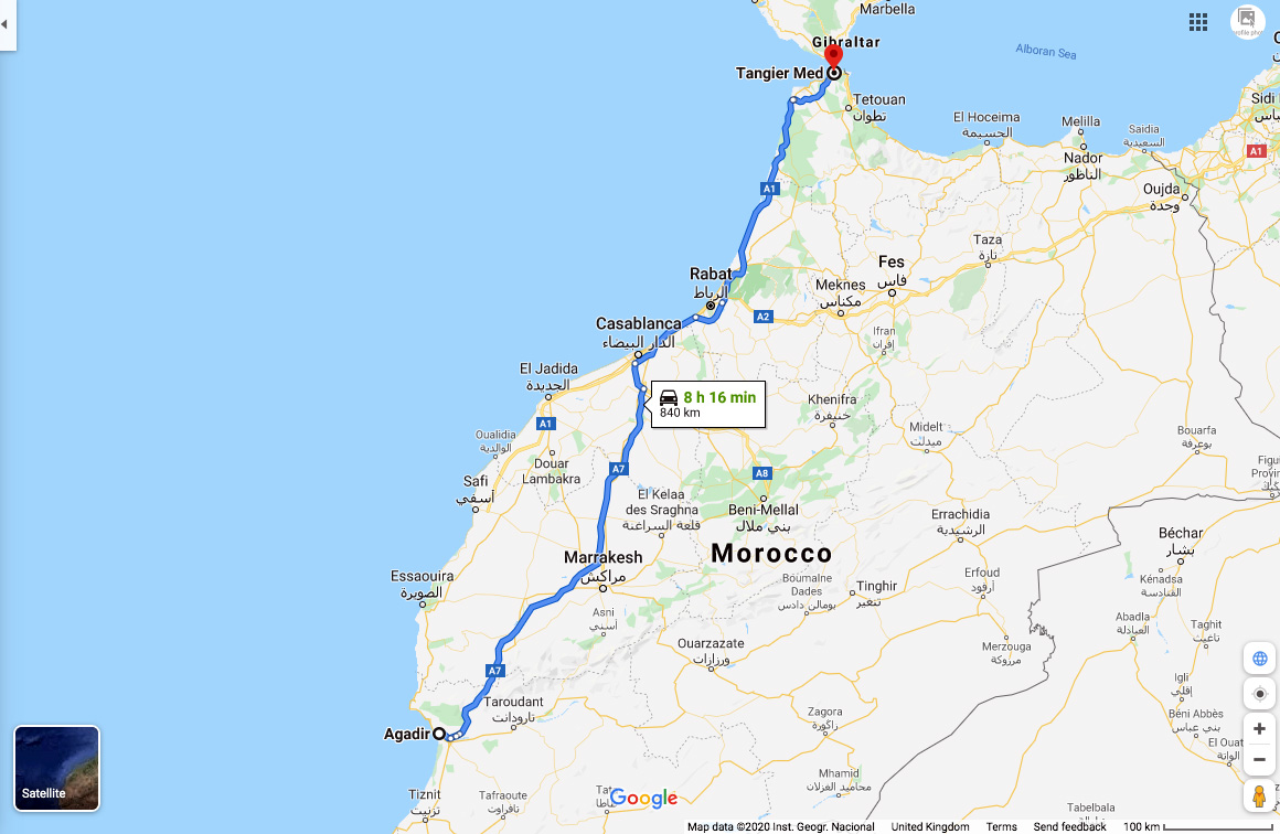
It’s a long way so coming from the northern ports, I recommend sitting on the deserted A1 and A7 motorways all the way to Agadir where the A7 ends, even though you pay tolls (about £30 for a moto/car). South of here traffic thins right out. The alternative coastal N1 trunk road is slower, less safe (in a driving sense) and is commonly staked out by cops with radar guns, especially around Essaouira and Agadir.
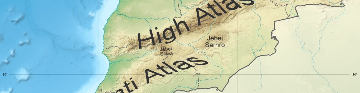
Otherwise, there are any number of great ways of exploring inland Morocco, across the Atlas mountains all the way south to the Desert Highway along the Algerian border.
The speed cops are creeping south
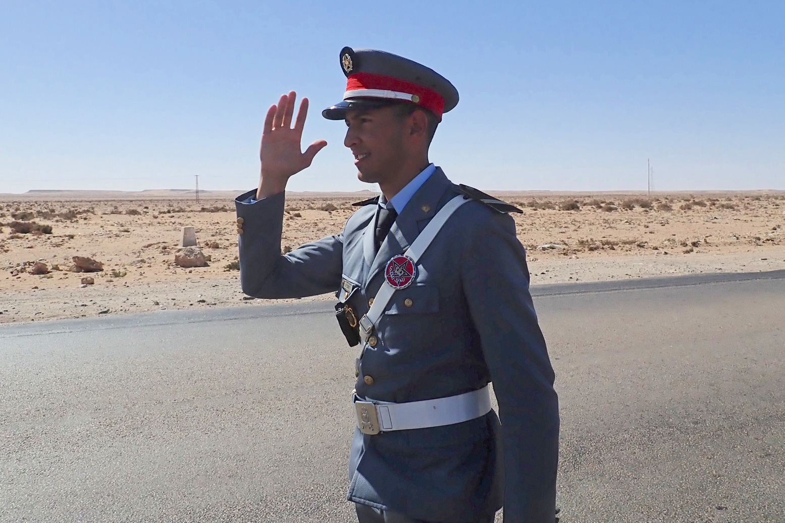
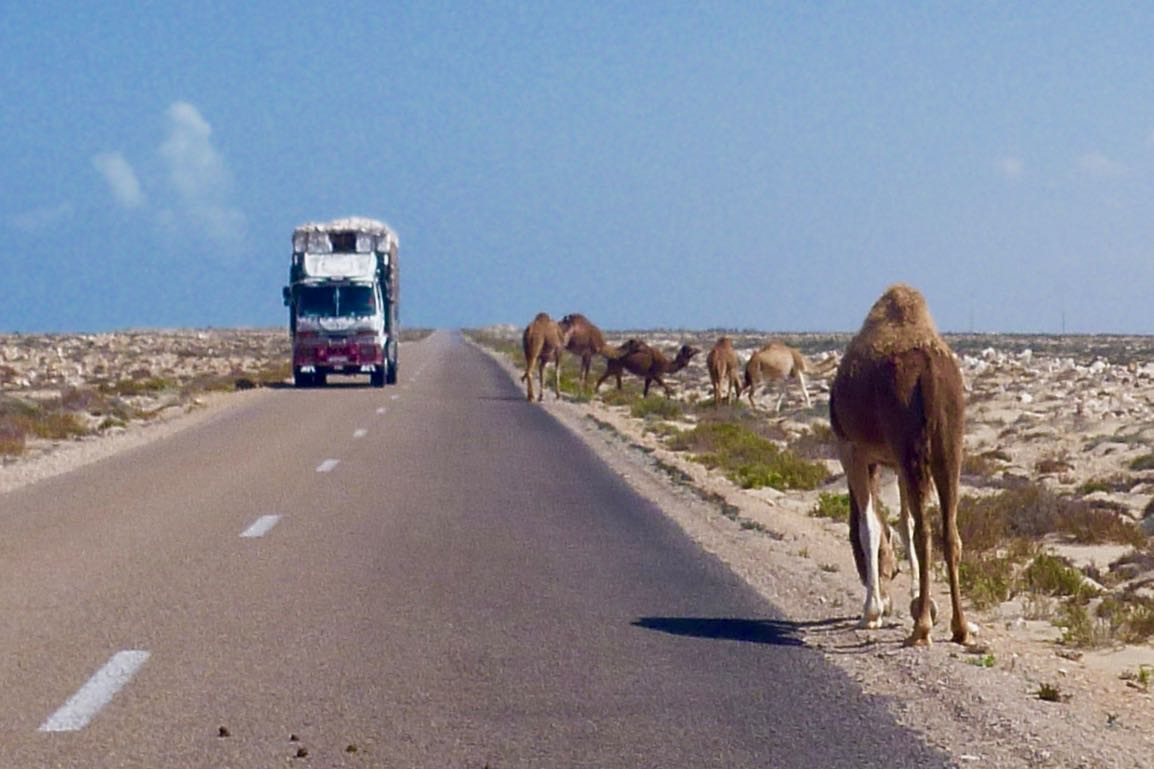
Even though I was hyper-aware of radar cops, I still got caught leaving Tan Tan doing 80 in a 60. That would have been 300d, but deploying the usual techniques – basically: humility in the face of the obvious – he let me off. All the way to Layounne and Dakhla, be wary of lurking speed cops, especially as you approach or leave settlements but even out in the desert too. Crossing solid white lines is another favourite trap; easily done when stuck behind a soot-spewing lorry crawling up an incline,
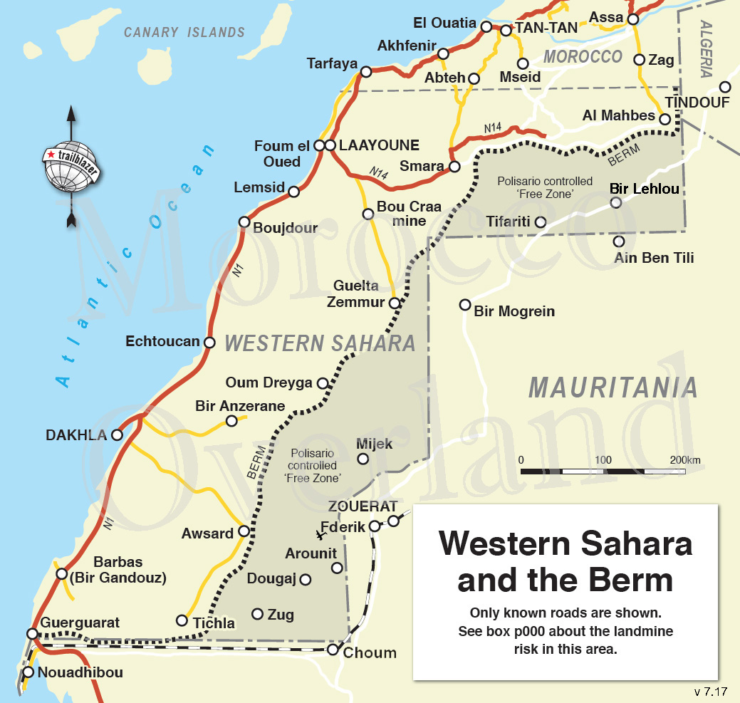
Western Sahara checkpoints and fiches
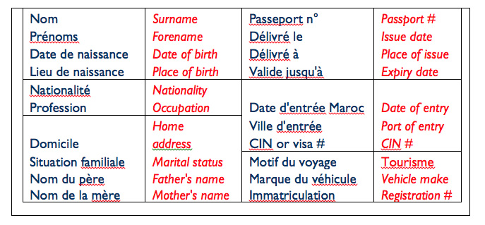
As ‘Western Sahara‘ is a Moroccan military zone, checkpoints increase south of Tan Tan, and unlike up north, they don’t just wave foreigners through but want your passport details. Handing over a pre-printed ‘fiche‘ (French for ‘form’; below) helps speed up the process. Hand one over and they can log you into the ledger once you’ve gone.
It seems fiches are less needed these days; I got through only about six on the way down – the last one at Dakhla Junction. Some checkpoints will insist on seeing your passport anyway; others just want a chat.
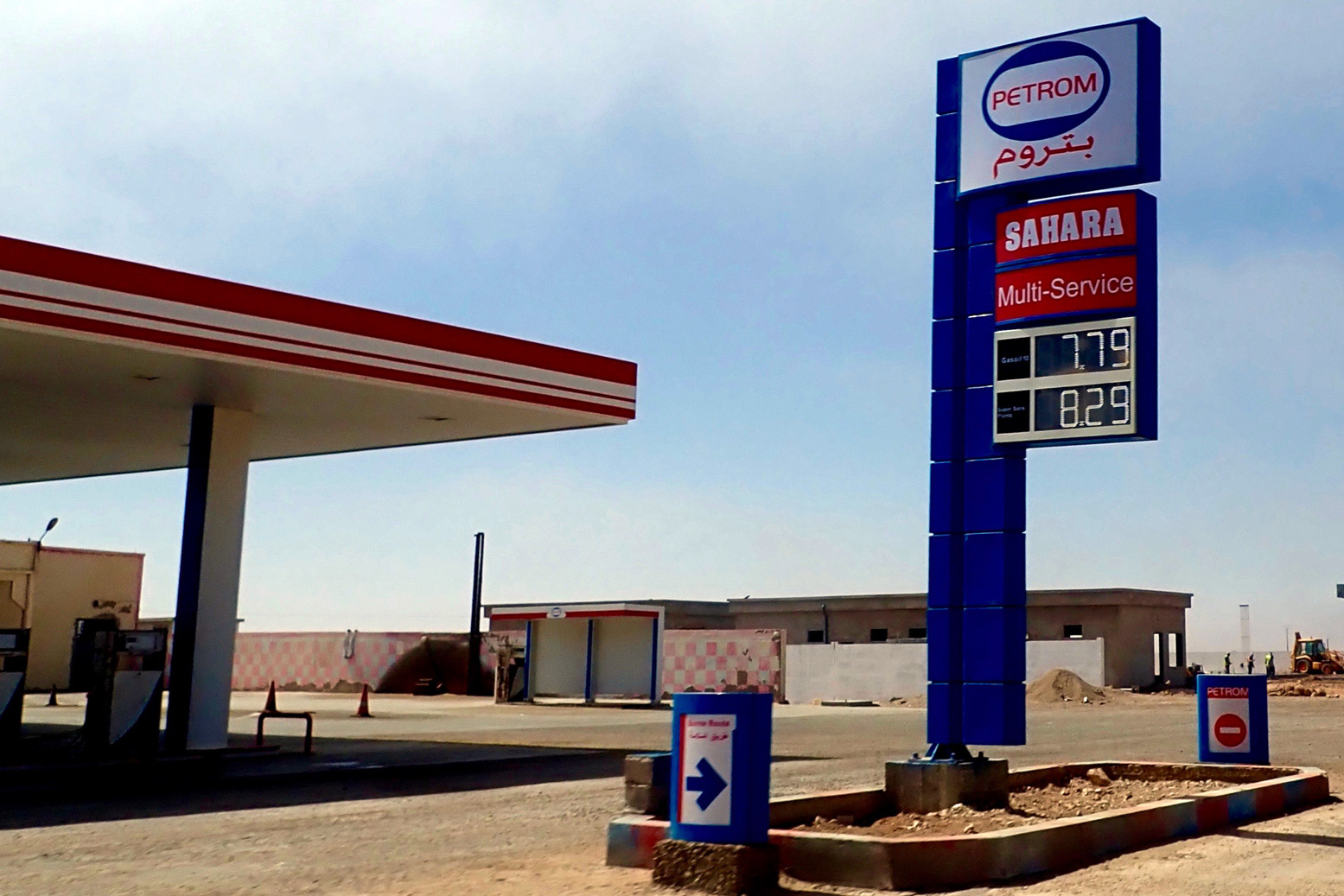
On the N1, subsidised fuel begins 92km south of Tan Tan
Along with a few other key commodities, fuel is subsidised by about 30% in Moroccan Western Sahara. The first discounted fuel station is just after you cross a causeway and climb out of a sea inlet, right by a checkpoint.
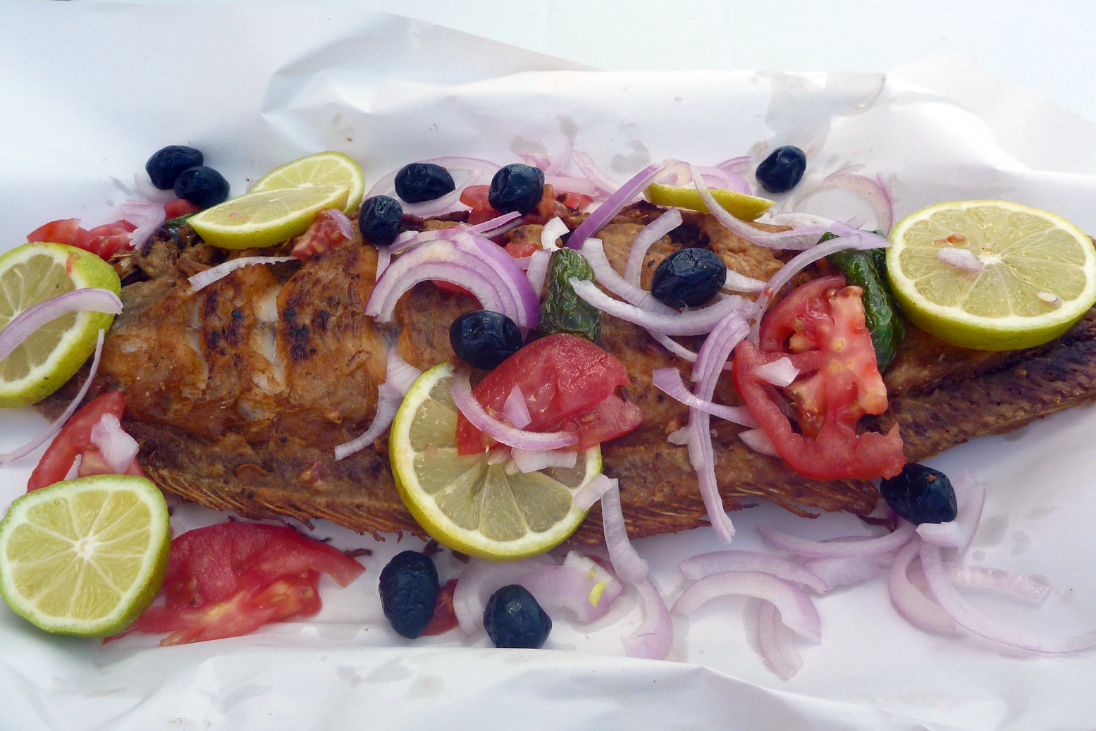
Fish & Chips at Afknenir
Make sure you pull in for a poisson-frites in Afkhenir, 20 kms from the checkpoint above. For some reason streetside fish restos here are like casinos on the California-Nevada border. You may think there’ll be loads more down the coastal highway, but there aren’t.
You can thank the upwelling of nutrients from the cold Canary Current which gets funnelled by the Canaries themselves onto this near-north-facing section of coast before Cape Juby. Or maybe local demand supports the informal shore-casting fishing economy. You’ll see loads of scooterists with rods as well as the crude clifftop shelters where they live.
They’re rebuilding the N1
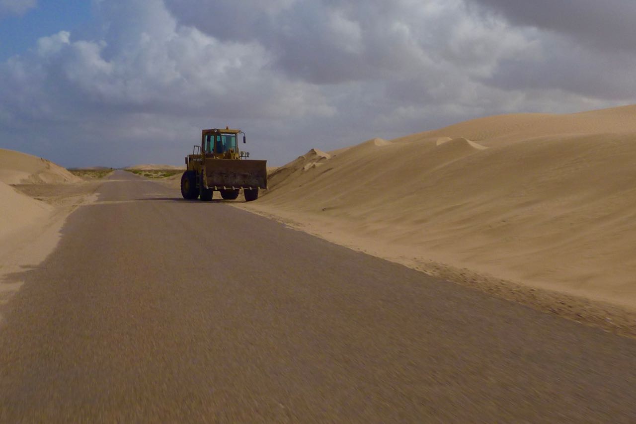
South of Guelmim a new, wider road is being built in stages, sometimes alongside the old one – certainly as far as Layounne. Around the dunes of the windy Khnifiss lagoon past Tan Tan, when I was there roadwork embankments see sand get blown across the two-lane road – not a good place to meet an oncoming truck while checking your likes.
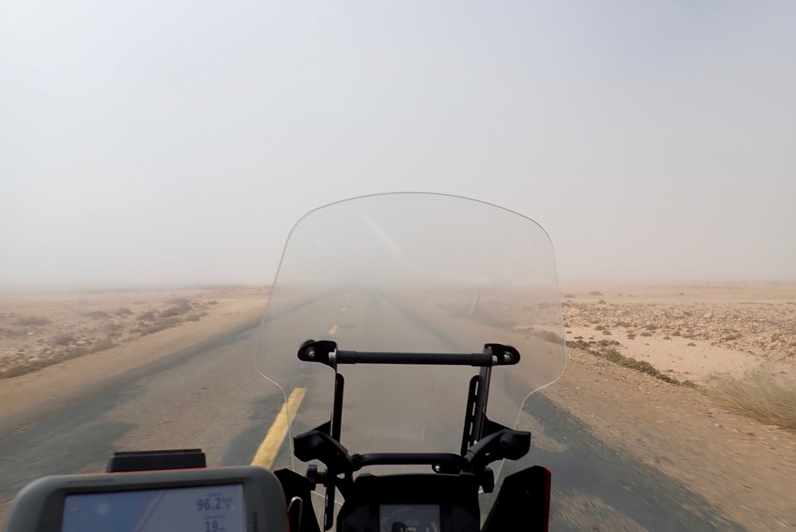
Fog
It’s very windy – day and night
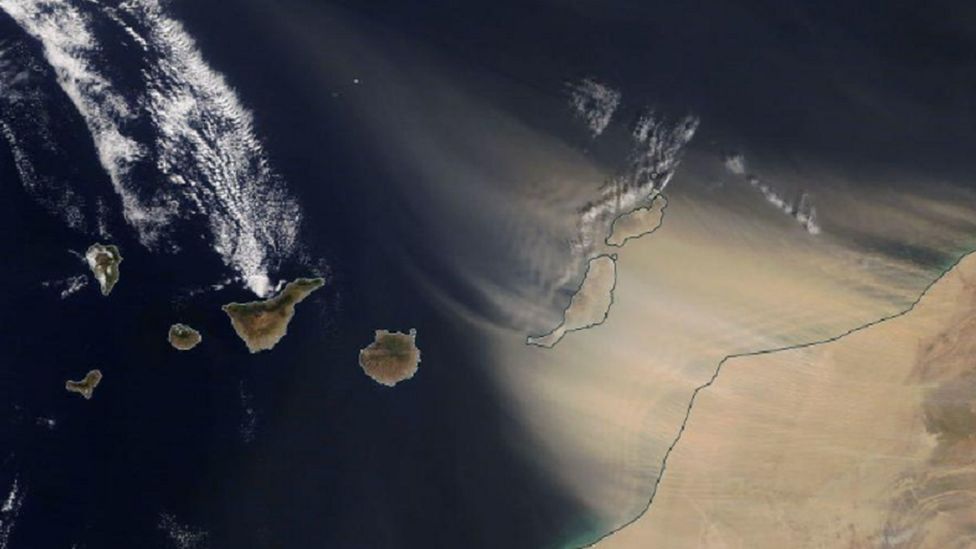
They say March is especially bad, but south of Guelmim where the desert sets in, it’s windy day and night. Normally in the Saharan interior the wind stops at dusk. In late February 2020 a huge Saharan sandstorm (below) made the news when holidaymakers on the Canaries were stranded. Close to the coast the cold current produces fog (right), certainly between Guelmim and Tarfaya. Within a kilometre of the coast a northerly sea breeze can also blow up to 10°C cooler than an easterly from the dry interior – which might be just a mile or two inland. But generally, the wind is behind you; on a pushbike (I saw a few), that’s important.

The flat landscape of Western Sahara can’t help, but when you realise the whole 3000-mile width of the Sahara has been steadily heated by the rising sun before it reaches the Atlantic coast, the wind has had plenty of time to get a good run up.
On the move it’s not so bad, but outside of a car, camping can be pretty miserable. Even the trees are bent southwards.
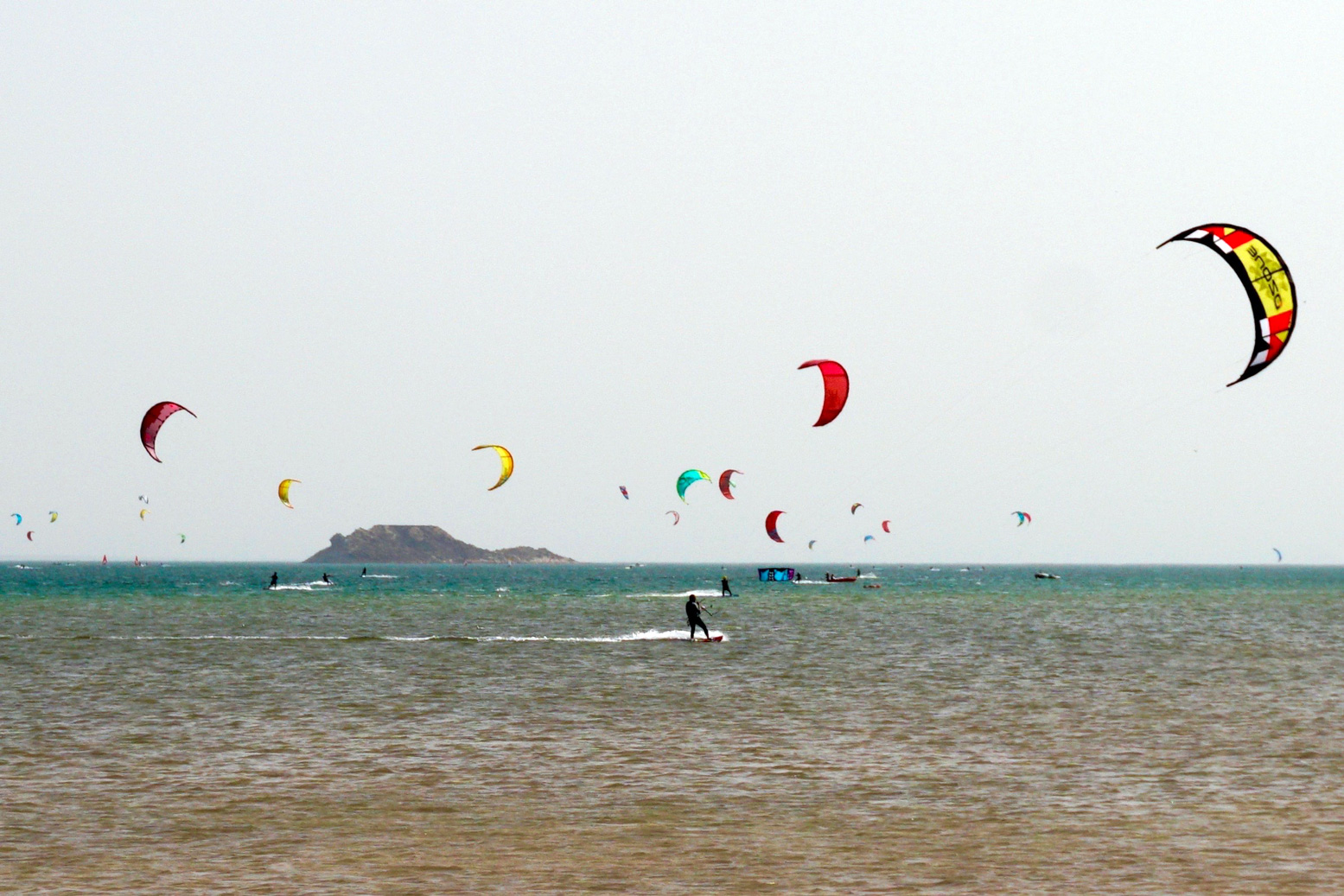
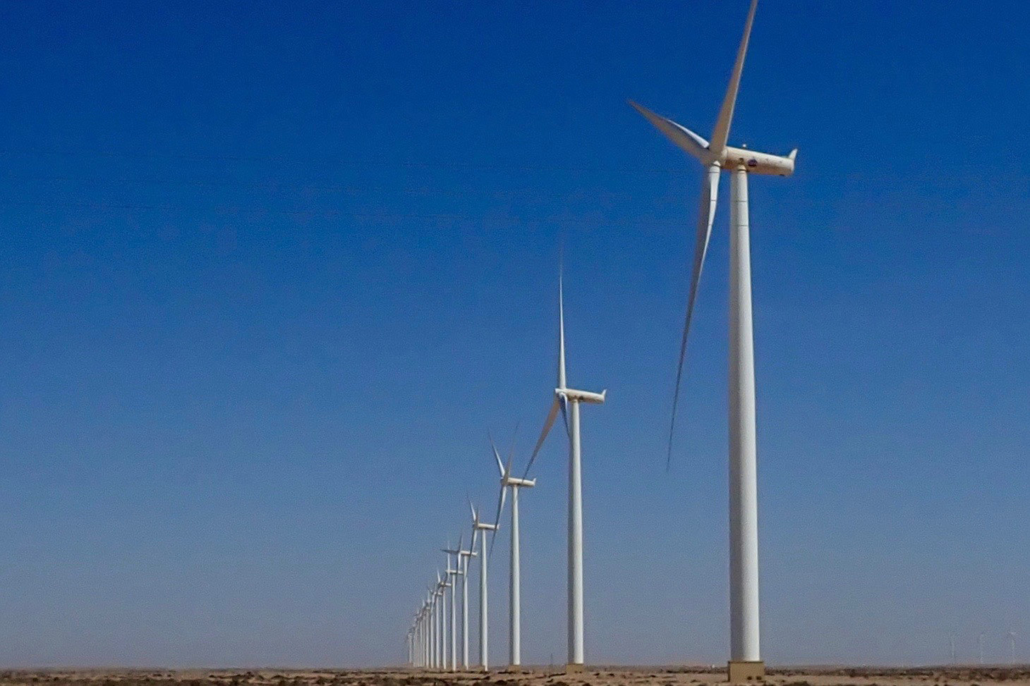
All this wind is good for the economy: Dakhla has long been a kiters’ resort (below) and there’s a huge installation of wind turbines south of Tarfaya, helping keep the lights on in Laayoune. Soon they say that array of turbines (or one like it) will feed electricity to the UK via an undersea cable.
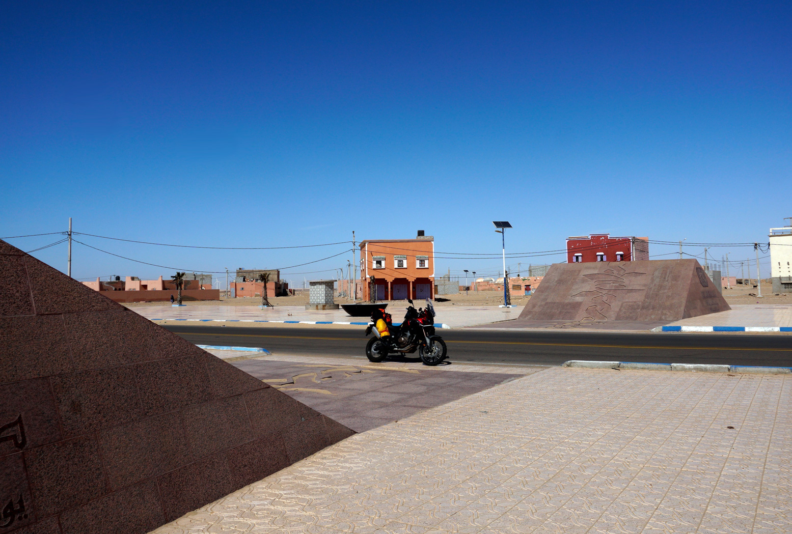
The monument at Tah
On the N1 for Laayoune you’ll pass through nondescript Tah with no fuel and barely a cafe and shop to rub together. In the middle of town is a granite monument covered in Arabic inscriptions. It marks the spot where in November 1975, some 350,000 Moroccan civilians symbolically marched over the then border into Spanish Sahara.
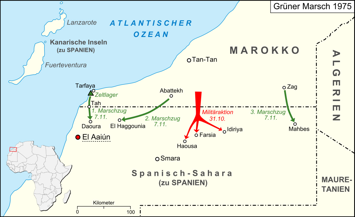
This was the Green March (map left): three co-ordinated and tactical mass demos mobilised by the wily King Hassan in response to rumours of Spain considering handing over its marginal colony to the indigenous Saharawi and Polisario Front. The marches were followed by the 16-year Western Sahara War which Morocco effectively won by annexing most of the territory (see map,above). It’s why the UN still hang out in Western Sahara and why unmapped landmines are still a menace. Otherwise, not much appears to have happened in Tah since that glorious November day.
Laayoune
Laayoune is the provincial capital and biggest settlement in WS by far, with a prosperous frontier-town vibe to it. At least from what I perceived; life in the Saharawi shantytowns may not be so rosy and civil disturbances are not uncommon. Riot police lurk on standby in the town centre (below). The UN’s MINURSO mission is based here, monitoring the Polisario ceasefire.
Passing through the city, the transit is not an obvious single main road. Without a satnav, follow signs for the airport, or back right up and take the Laayoune bypass (see below).
The Laayoune bypass
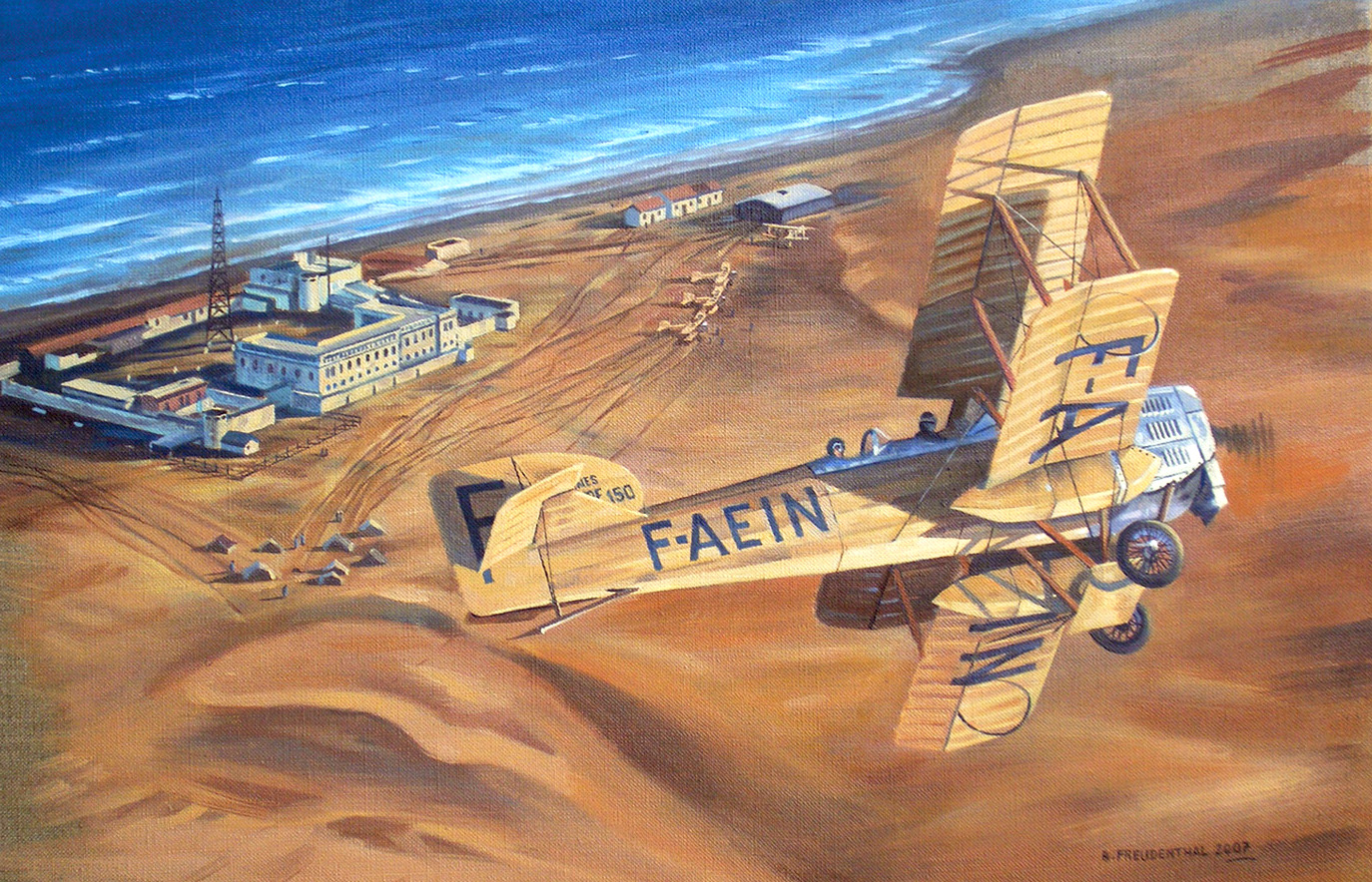
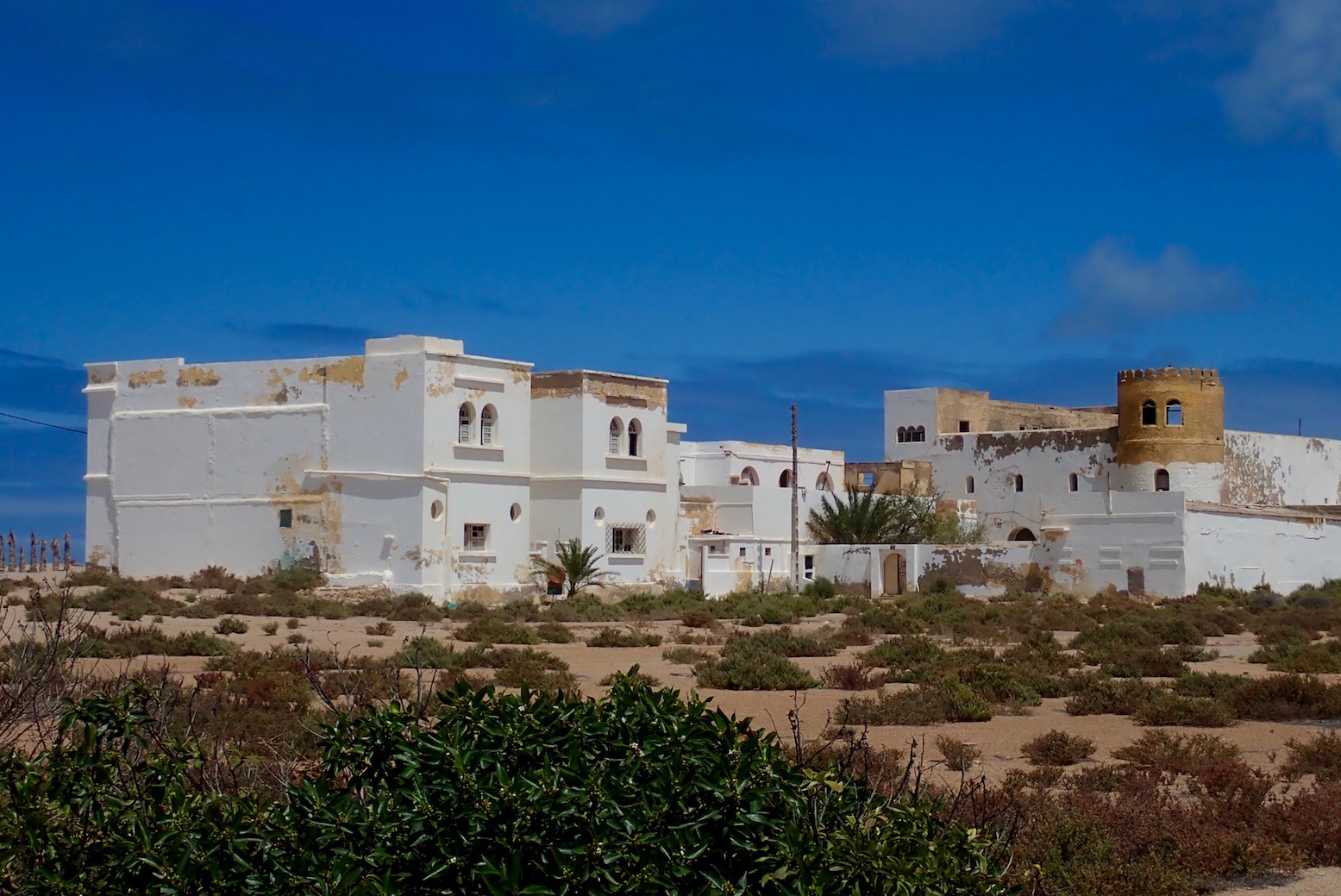
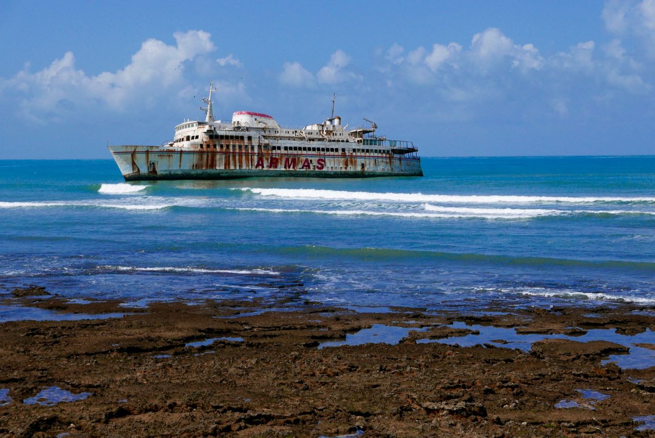
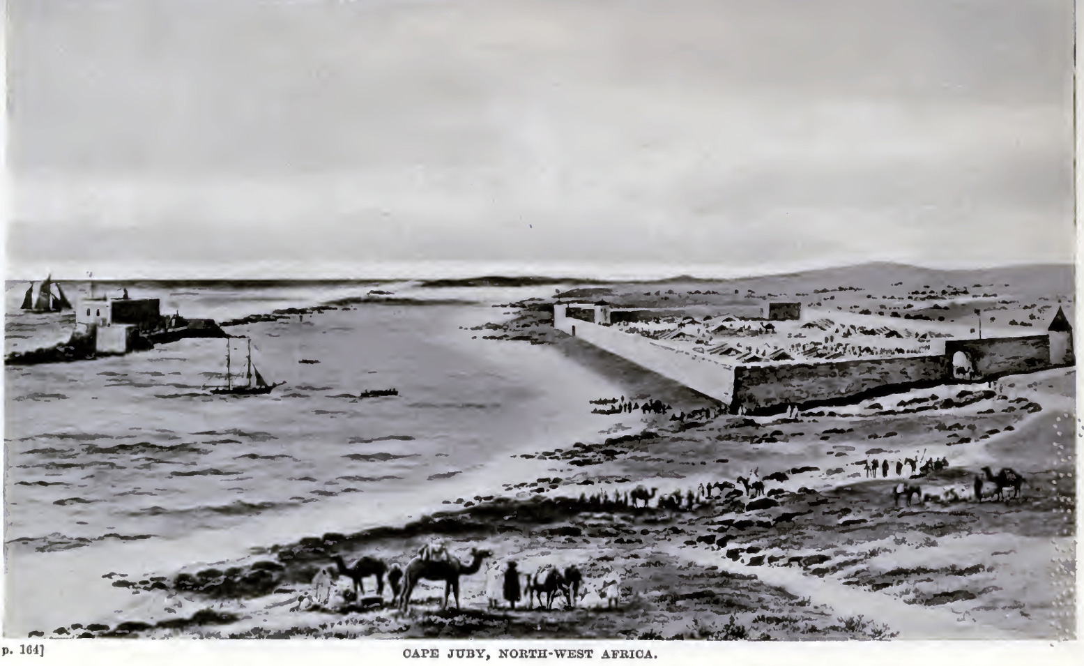
At Tarfaya (former Cap Juby) you can turn into the town, head for the shore 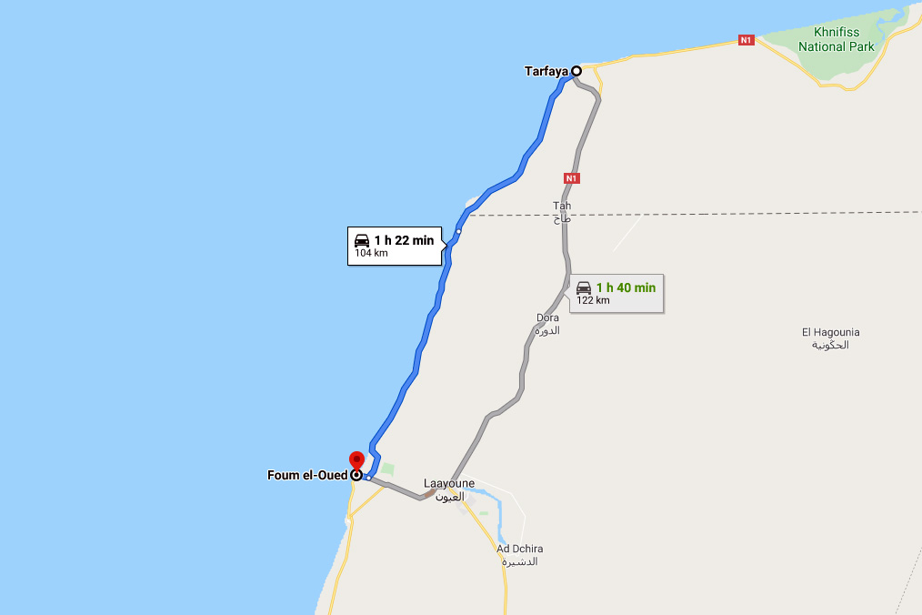 past the St Exupery museum, his monument, and the 19th-C curiosity of Mackenzie’s Factory). Following the coastal road 90km to Foum El Oued (‘river mouth’) brings you back to the N1 just south of Laayoune city.
It would be nice to report this is a quiet byway passing idyllic beaches, but the wind is ever-present and trucks use this narrow road to avoid Laayoune. Dunes also get bulldozed off the road, especially south where the road gets narrower. I suppose it might be cooler than the inland route and the beached Armas ferry is a site to behold. There’s more here.
The longest fuel range is 162km but may be 250km
This is between Tchika (Imlili) near some big white barchans on 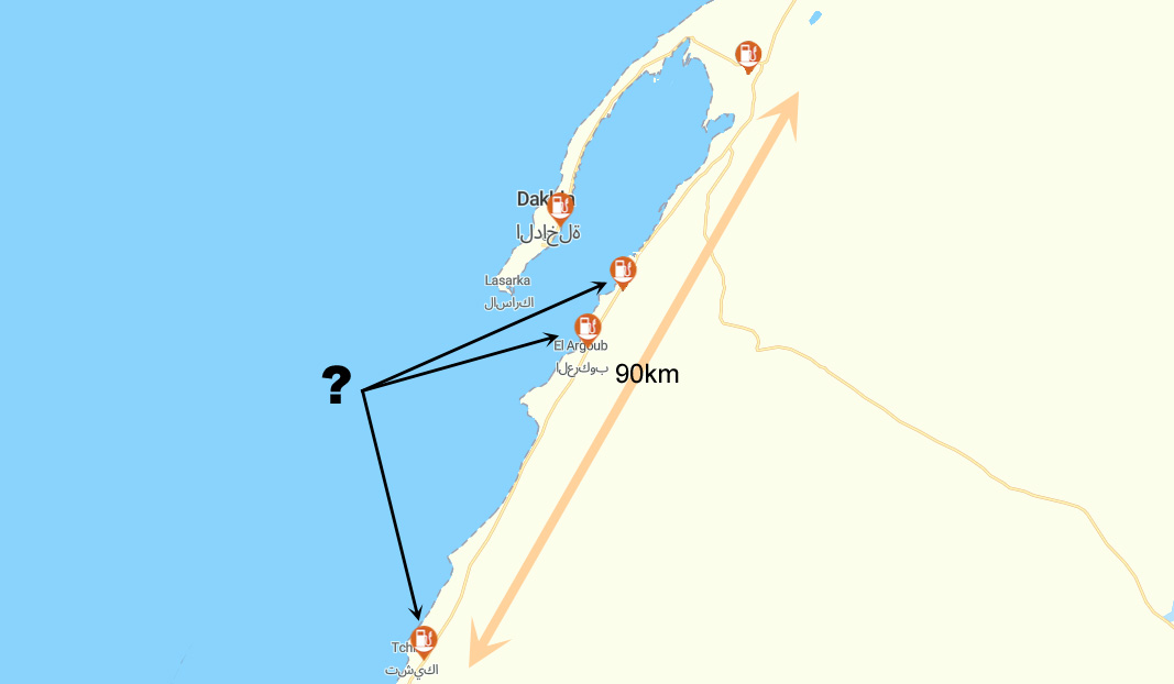 the north edge of the Gulf of Cintra, and Bir Gandouz, the last town, 80km from the border. There is nothing at all along this section except the howling wind. However, the Tchika station and the two similarly old and grubby Atlas Sahara stations to the north near El Agroub (see map right) may be empty.
Stations may get upgraded, but for the moment this means from Dakhla Junction roundabout (two fuel stations) to Bir Gandouz is 252km (via the Tropic of Cancer). I covered that distance northbound into the wind and go in with a pint in the tank.

Is Dakhla worth the 90-km round trip?
No so sure, but then I took the cheap hotel thing a bit far in the old town. Next time it might be more fun to check out the kiters’ resorts at the head of the lagoon. On the other hand, up north, Boujdour was a fun stop for an evening wander.
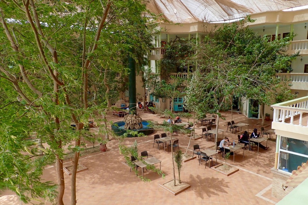
Plan a break at the Hotel Barbas in Bir Gandouz
Maybe it was just me on the day, but the Hotel Barbas was an oasis in a duststorm. And once inside shimmered into a veritable mirage. We stayed here in 1997 but the place has been transformed to the point of incongruity. They built a two–storey U-shaped bank of rooms around a planted courtyard but then, ingeniously, draped the entire thing in a huge shade-net. Result: a large, cool space where courteous waistcoated waiters flit about at your service. Rooms are good, prices are normal, food is good too and so is the wi-fi. Tourist, traveller, refugee or trader, some of the characters that roll through add to the place’s edgy ambience. The south end of Morocco, not the Mediterranean coast, marks the true border with Africa.
Bir Gandouz is an easy day from Boujdour which itself is an easy day from Tan Tan. With an early start and an hour to the border, you’ll easily get to Nouadhibou or on the road to Nouakchott.
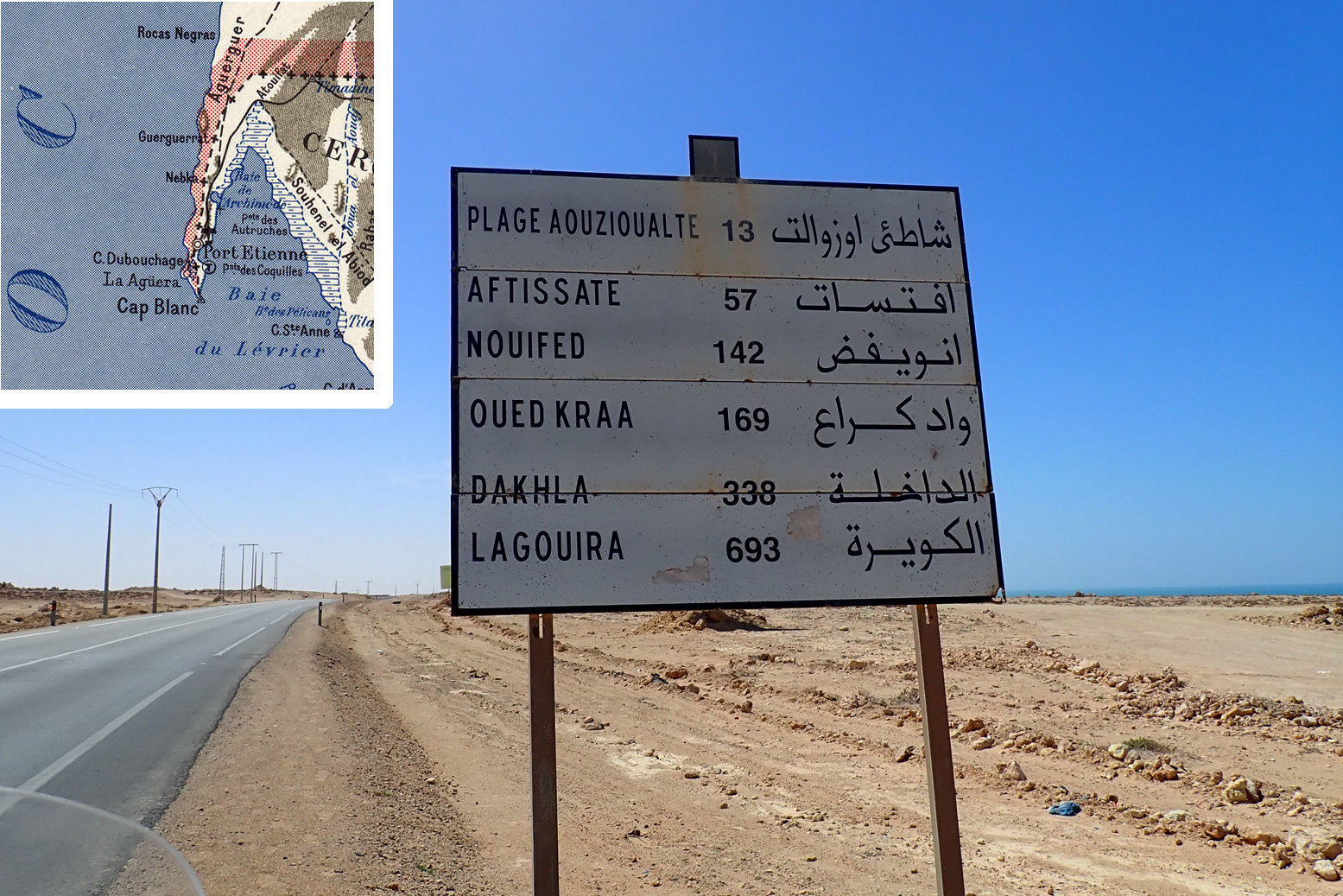
What is ‘La Gouira’ you see on the road signs?
The ‘Lagouira’ you’ll see listed on some old Atlantic Highway road signs indicates the short-lived Spanish base at La Agüera on the Ras Nouadhibou peninsula opposite today’s Nouadhibou. See map inset below. Effectively it indicates the distance to Nouadhibou which is not always listed.
Abandoned at the turn of the century, today it’s a collection of ruins which are actually in the Polisario Free Zone, commonly mistaken for No-Man’s-Land which separates Morocco from Mauritania. Some have managed, but the Mauritanians won’t allow casual visits from the Nouadhibou side.
For Mauritania, see here.
Discover more from Sahara Overland
Subscribe to get the latest posts sent to your email.

Pingback: Morocco ~ Documents and port immigration | Sahara Overland
Pingback: Morocco ~ Routes | Sahara Overland
great content! We are three guys planing to take the same trip in around 6 months… :) so helpful to read your article :)thanks
LikeLiked by 1 person
Pingback: Tarfaya, Western Sahara – Flights, Hotels, Homes, Tours, Car Rentals – NovaTreks
Pingback: Wind, Sand and Bidons – Bivibag's Adventures
Pingback: Wind, Sand and Bidons: KM 2,317 Chinguetti – Bivibag's Adventures
Pingback: Mauritania: The Railway Piste (440km) | Sahara Overland