Part of an occasional Sahara A to Z series
Hang around long enough and you’ll get the full set
Climbing the highest mountain in Africa’s last unclaimed territory
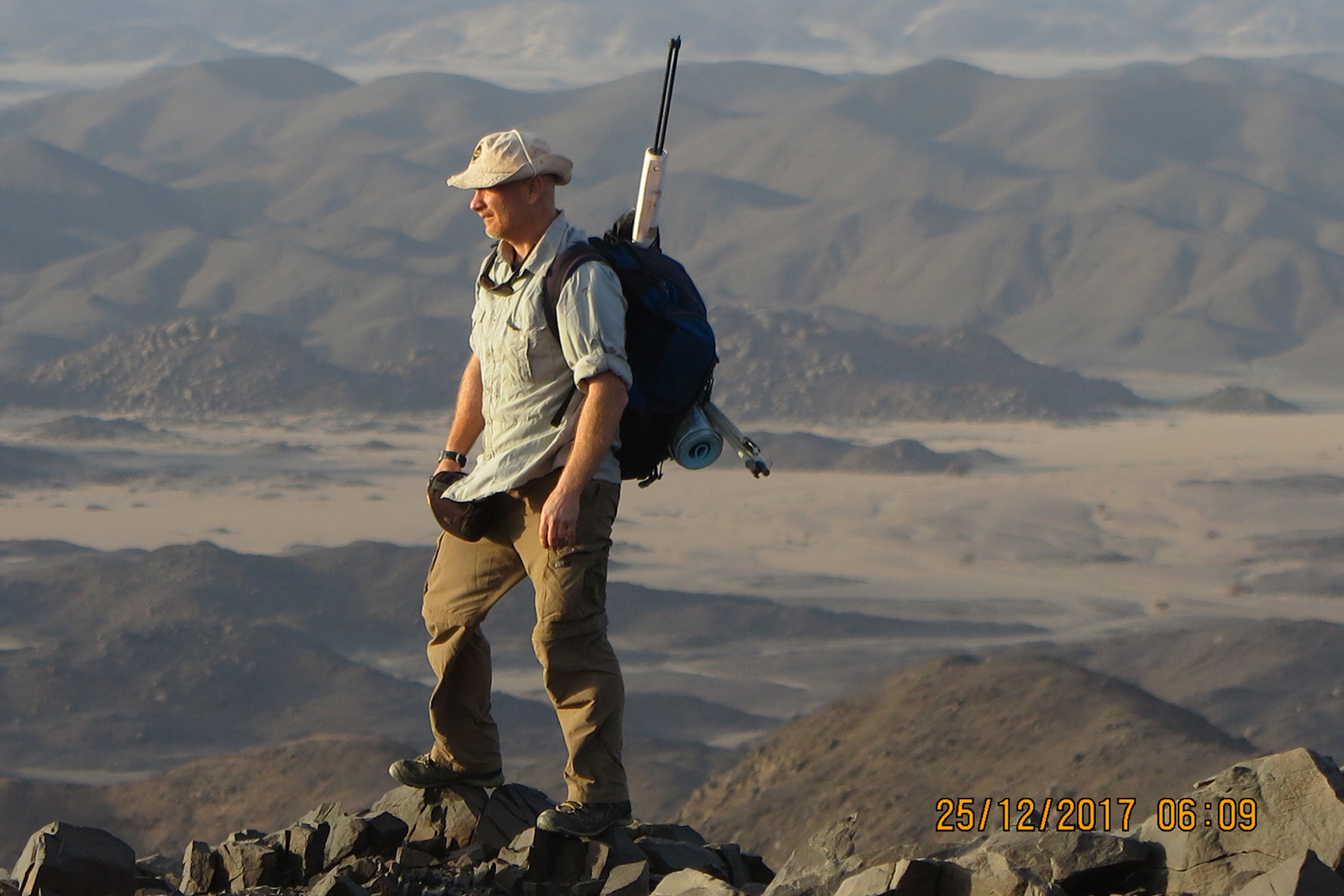 Ginge Fullen (right) is a Guinness-record holding mountaineer and adventurer who among other things, has climbed the highest peak in every African country. Bir Tawil has long been on his radar and the recent division of Sudan sees him planning to visit the Deriba caldera in Darfur in the near future.

In the northern Nubian desert between Egypt and Sudan lies Bir Tawil, an unoccupied 800-square mile quadrangle claimed by neither state. It’s a bureaucratically difficult and potentially dangerous place to reach but has been on my list for some time.
Terra Nullius is a Latin expression for ‘nobody’s land’; it was how Cook described Australia in 1770. Here in the Nubian Desert, it originates from a bizarre situation stemming from the simplest of borders: a straight line along the 22nd parallel drawn in 1899 when Britain formed Anglo-Egyptian Sudan following Kitchener’s campaigns in Sudan. In 1902 Britain sought to modify that boundary to reflect the actual use of the land by the region’s tribes. It counters a complaint commonly made these days about Foreign Office officials blithely marking maps with rulers and in part causing the current grief in the Middle East and Africa.

Bir Tawil lies below the 22nd parallel but the land was traditionally grazd by the Ababdu tribe from Aswan in Egypt. Similarly the adjacent Halaib Triangle, a much bigger area to the east and above the parallel was placed under British Sudanese control as its Beja inhabitants were culturally and ethnically closer to Sudan. Today Egypt resolutely claims the 1899 border including the Halaib Triangle, whilst Sudan sticks to the administrative border of 1902. As a result both claim the Halaib Triangle with its 130 miles of Red Sea shore, but neither are interested in the barren wastes of Bir Tawil.
Bir Tawil is not an easy place to reach, requiring permission from either government to visit; a two-day trip into the desert risking encounters with armed gangs or smugglers. I opted for Sudan as I wanted to get a feel for the country to which I plan to return to climb the highest peak in the troubled Darfur region. (In 2004, before Sudan divided to form South Sudan, I climbed Mount Kinyeti, then the highest point in that country).
In Khartoum I organised everything through Tour-Sudan agency. The owner Midhat Mahir was by far the most pro-active individual I contacted and as it turned out, the best connected. In Sudan government permits are required for everything from registering lodgings outside Khartoum to photography and even permission to buy a detailed map from the Surveyor’s Office. The Sudanese clearly like their paperwork as well as keeping track of you. I needed a dozen copies of my travel permit to hand out to checkpoints along the way.
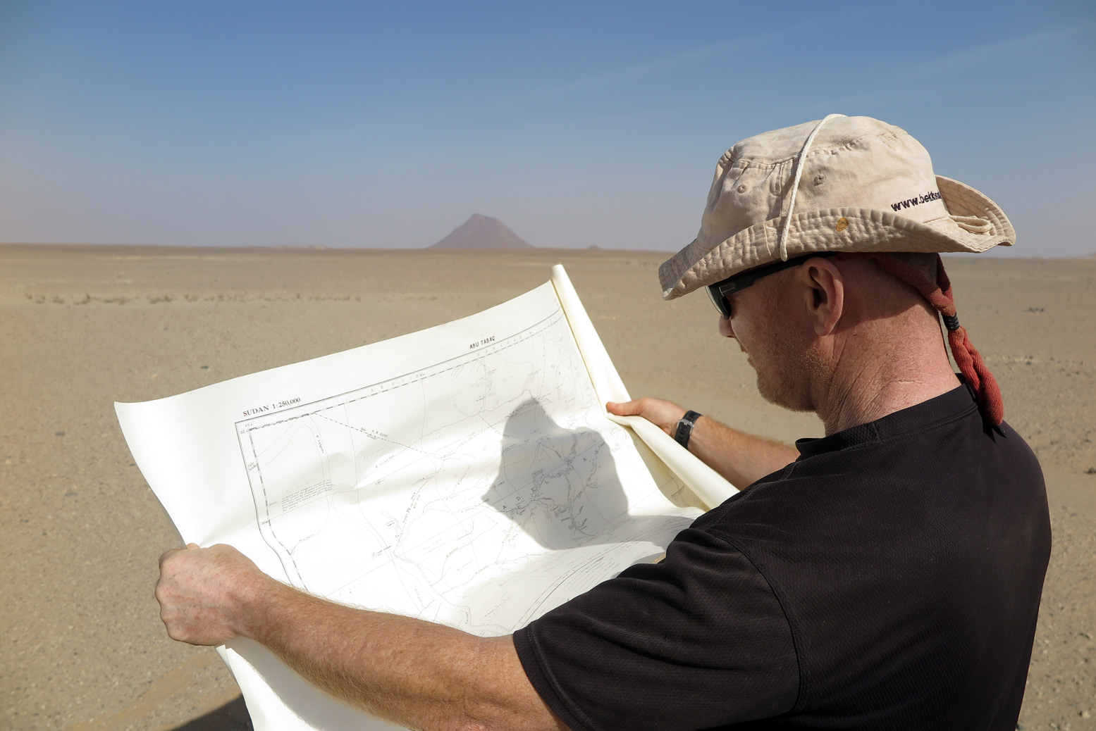
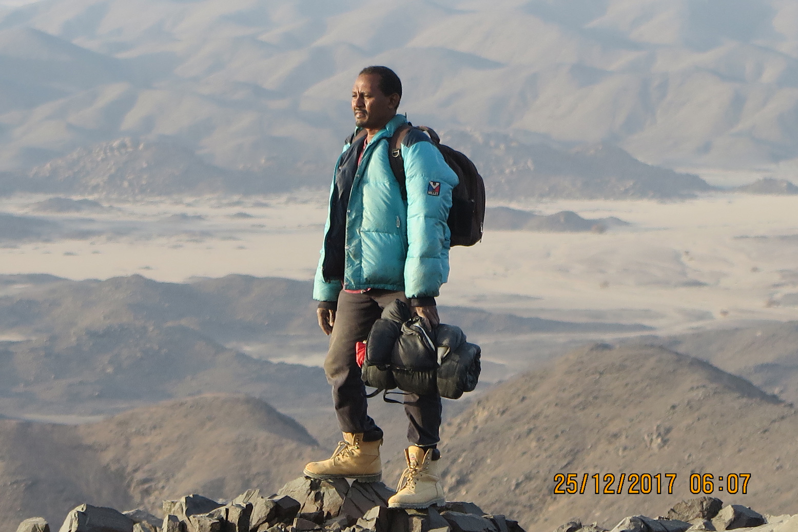
The plan was a week’s trip leaving me two days in Bir Tawil to locate and climb the highest point. Midhat’s brother Moez would accompany me with two drivers on the 500-mile trek north of Khartoum, around half of it on tarmac the rest across the Nubian desert.
Forget snakes and scorpions or the possibility of breakdown and never being found, the road to Abu Hamed felt like the most dangerous part of this little adventure. Terrible driving and being forced off the road by unlit vehicles was the nearest brush with death I’ve had in a while.
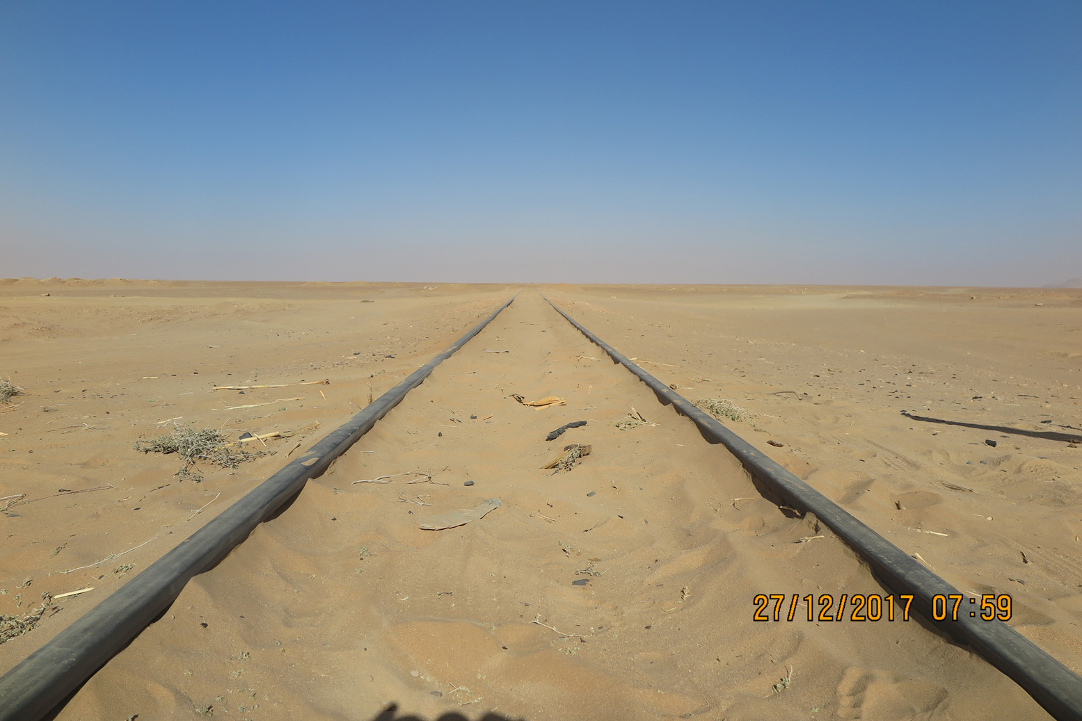
In Abu Hamed we filled up with fuel and water and a few miles north of town left the road and crossed over the railway lines for the last time. I input some coordinates from Grant, my go-to person when tackling unclimbed peaks in dodgy countries. You can’t beat the thrill of heading into a remote place with little available information.
We headed north along flat desert towards the Wadi Gabgaba which would bring us to within 20 miles of our objective. Very soon we started to pass gold miners and for the next hundred miles found the desert had been turned upside down. A gold rush was underway and several thousand men were working hundreds of excavators while individuals were trying their luck with metal detectors. All unlicensed and unregulated, with tons of litter blew across the desert it looked very ugly indeed.
Hoping to keep a low profile, that night we camped well off the main route and away from the miners. In Khartoum I’d gotten hold of a colonial-era 1:25,000 map from the National Survey and the next morning we found ourselves on old routes marked as ‘fair going’ by surveyor W Jennings-Bramley back in 1925. By camel he might have covered 20 miles a day; we did the same distance in just an hour.
Our initial destination was the 609-metre peak of Jebel Bartazuga marking the southernmost corner of the Bir Tawil quadrangle. It came into view, very prominent in the otherwise flat desert. I thought we had left the last of the gold miners but I was wrong; a camp had set up here too on the very boundary of Bir Tawil.
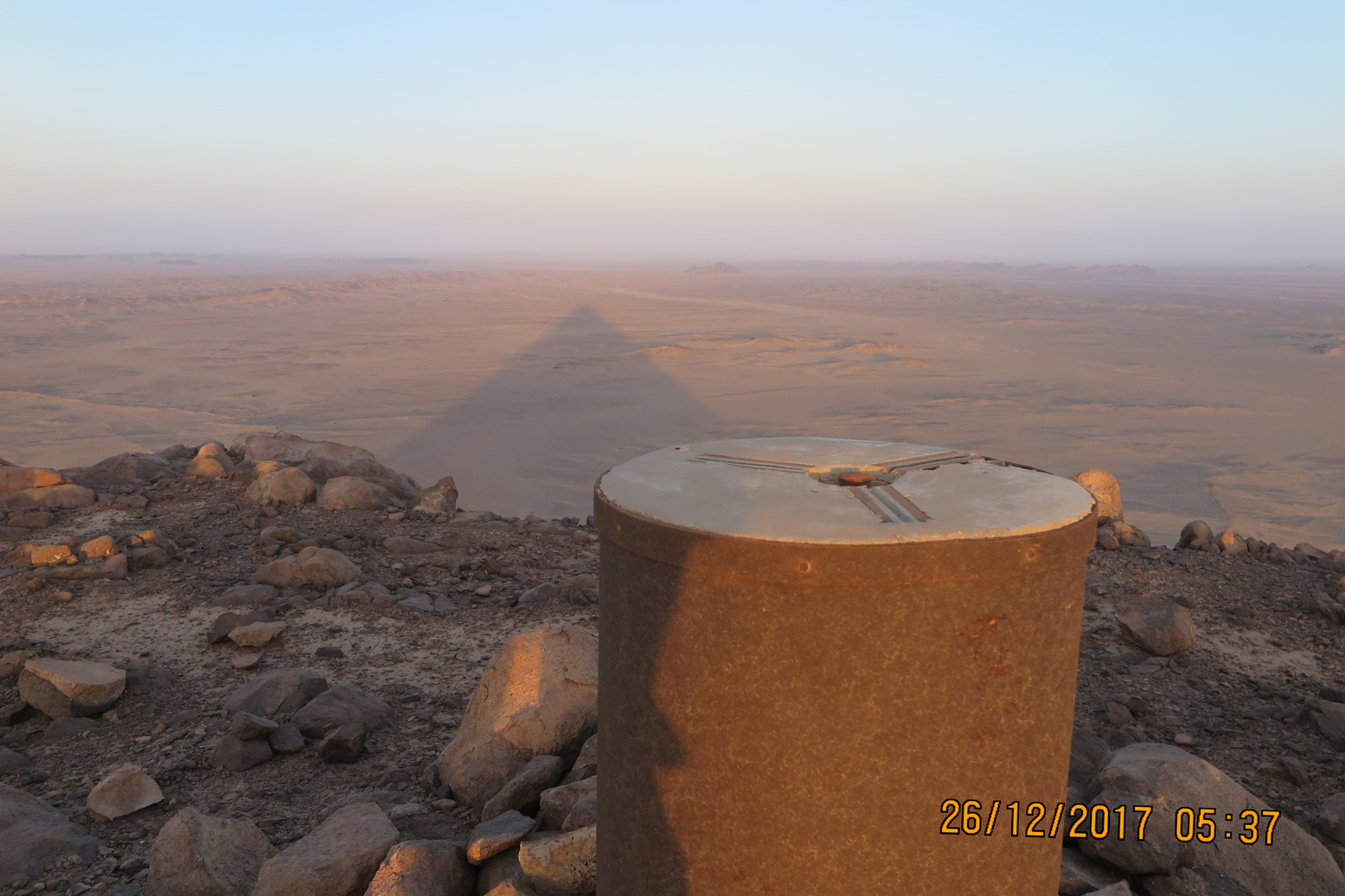
On my return leg I climbed Jebel Bartazuga, topped with an old trig point by the British to mark the boundary when they surveyed the area. Flags have also been placed here from others who’ve recently been laying claims to the territory, but they’ve all long since blown away.
Probably the first westerner here in recent times was former Guardian journalist Jack Shenker in 2011. American Jeremiah Heaton followed in 2014, claiming the area as the ‘Kingdom of North Sudan’, thus delivering on a promise to make his daughter a ‘princess’. He’s in dispute with a Russian called Dmitry Zhikharev who made similar claims, and in 2017 Indian adventurer Suyash Dixit planted a tree and put up yet another flag. There are other claimants including the ‘Kingdom of the State of Bir Tawil’ with its own national anthem and the ‘Empire of Bir Tawil’. I wasn’t interested in such claims but was of course intent on climbing Bir Tawil’s highest peak which I believed had yet to be done.
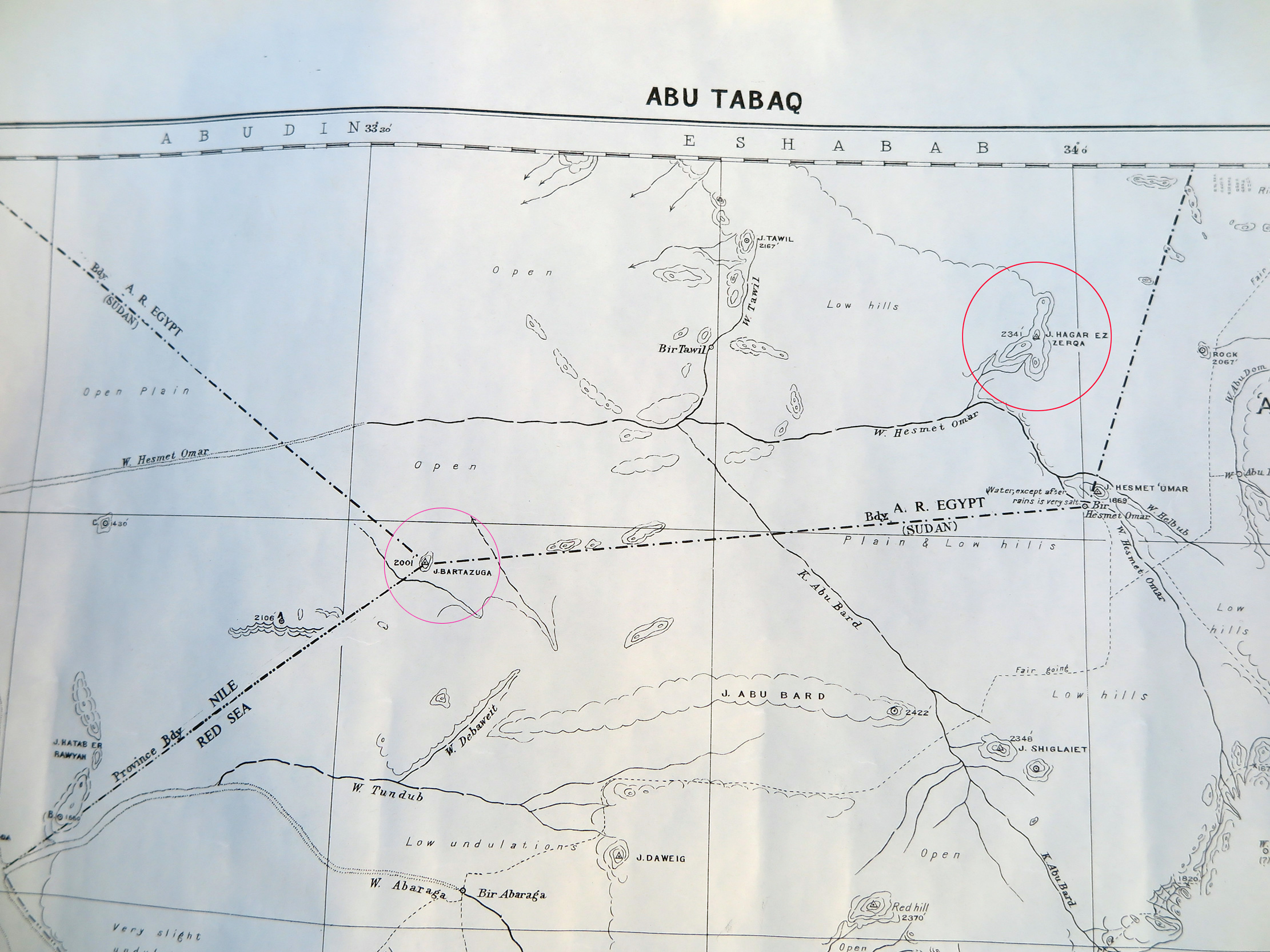
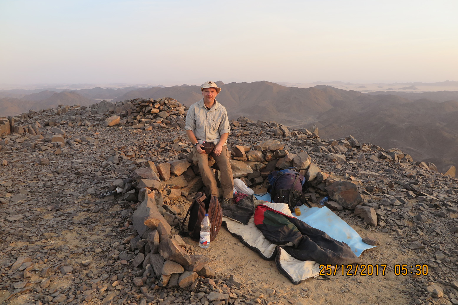
Once over the border we headed towards the eastern end of the territory and Jebel Hagar el Zarqa. On the 1925 map it was shown as the highest point in the land at just 705m (2313’), but one man’s hill is another man’s mountain. It lay some 30 miles away and we headed straight for it; in reality zigzagging through a maze of sandy wadis. Just five miles away our target came in sight and, as I’ve said before on my travels in Africa, once I was so close it would take an army of natives riding a herd of wild elephants and throwing landmines to stop me. Given that we saw no one during our time in Bir Tawil, I felt confident. We weaved our way nearer and nearer and by mid-afternoon on Christmas Eve parked up at the base of the mountain.
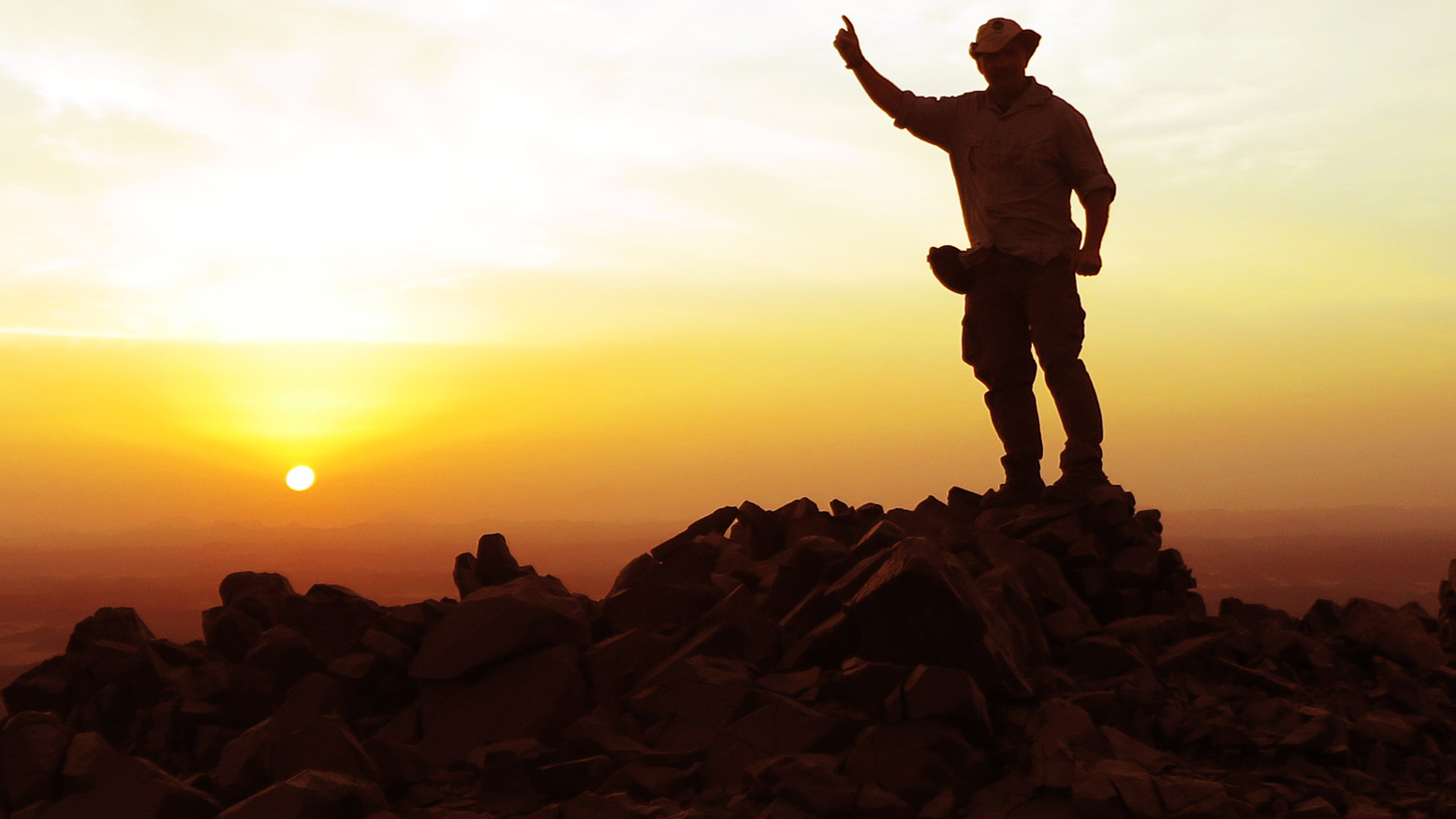
My aim was to sleep on summit but Moez my guide warned it might be chilly. It may the mid-winter but this is still the Sahara so I replied I’d probably survive but suggested he took his big down jacket. Around 4pm, as the sun’s heat diminished we set off, following the edge of a gully until we met a ridge about half way up. Here it was mostly scree but in less than an hour we were on the summit. With a new African peak ticked off, Moez and I shook hands.
Low hills surrounded us and Egypt’s actual border was just eight miles to the north. There was a cairn here so I was not the first, but probably the first in a very long time. Moez suggested we drop down a little out of the wind but he knew what my answer would be: we would build a windbreak right on the summit. We set about clearing an area for our wall and once done, even Moez seemed reassured. The wind did pick up later but our wall did its job.
That night the stars were bright as they always are in the desert and some 100,000 light years away The Milky Way beamed over us like a highway to another world. I envied the future explorers and slept well in our starlit bedroom.
As often, the desert brings on reflective thoughts. I was now 50 years old; where had all the time gone? It’s scary that you’re over half way through your life and find yourself looking more to the past than the future. When you’re young the world is infinite and filled with mystery – immortality beckons. As years roll on the world remains thankfully mysterious but feels less big and the impression of immortality slips through your hands. Death was something that only happened to other people and time was unlimited so you don’t push yourself or do the things you promised you would. But once you grasp mortality good things can result – the ticking clock helps you focus on new challenges.
The sun rose around six and was all ours to see; our bivi on top of Jebel Hagar had served us well. After a few more photos we headed down for our Christmas breakfast of coffee, porridge and eggs. I spent the next two days exploring wadis I’m sure no one has seen in decades and hiking a few other peaks to make sure there was nothing higher. With my short visit to Bir Tawil coming to an end, we headed back to Jebel Bartazuga for our last desert night.
I enjoyed my time back in the Sahara; it reaffirmed my view that there’s still adventure to be had in this world, you just have to get out and find it. The greater the effort, the more worthwhile the journey.
A good friend of mine who died on Everest in 1997 certainly lived his life that way. Mal Duff was old enough to be wise yet far too young to die. His gravestone bears the following words from a poem by fellow Scot, James Graham and twenty years on, it feels a good time to remember his epitaph:
He either fears his fate too much,
Or his deserts are small,
That dares not put it to the touch
To win or lose it all
Midhat Mahir
249 (0) 912253484
tour-sudan.com
Discover more from Sahara Overland
Subscribe to get the latest posts sent to your email.
