Part of the Sahara A to Z series
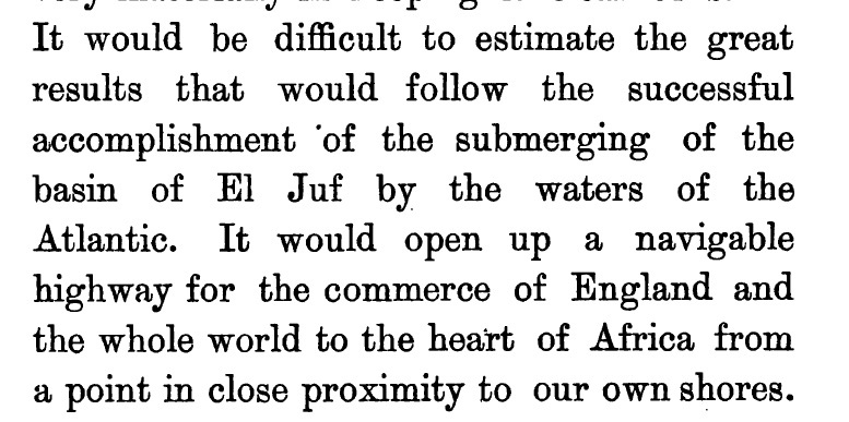
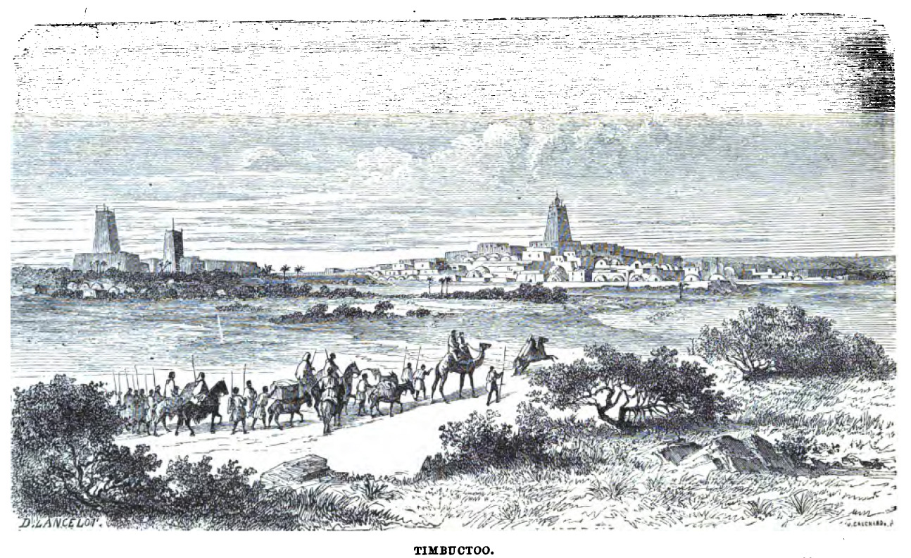
… I had reason to believe that there existed, in the Western Sahara, a vast depression which might be submerged by the waters of the Atlantic, thus opening a navigable way to [Timbuktu]…

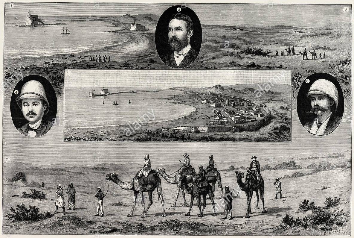
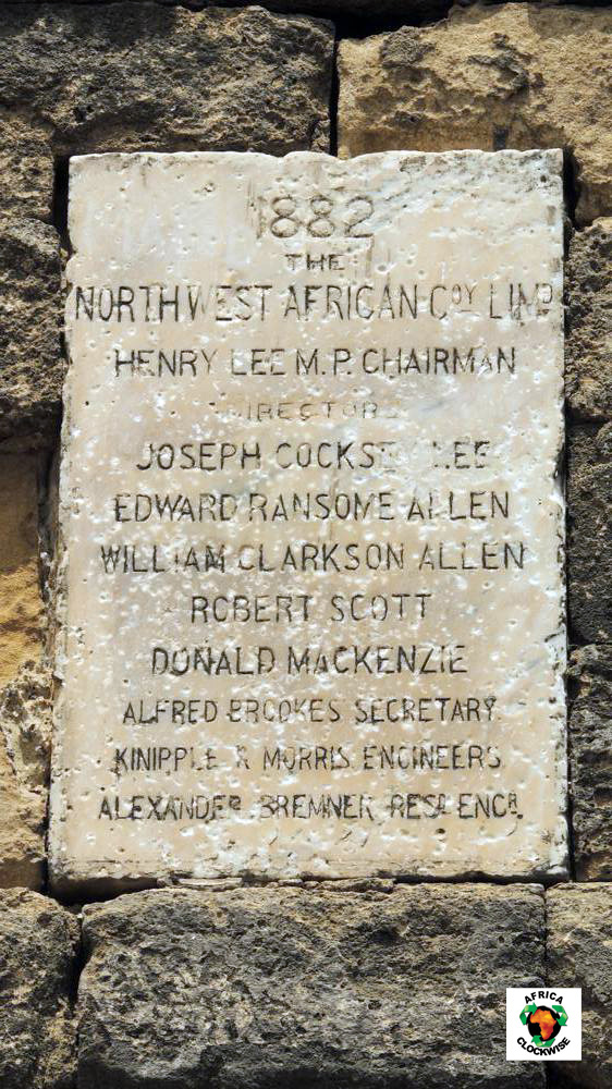
Visit Tarfaya on Cape Juby and just offshore you will see the curious Casa del Mar fort, beyond the St Exupery monument. Port Victoria or Mackenzie’s factory are other names for the trading post of the North West Africa Trading Company, established by Scotsman, Donald Mackenzie in 1882 during the ‘Scramble for Africa’.
Mackenzie’s venture hoped to capitalise on the recent westward swing of the trans-Saharan caravan trade emanating from Timbuktu, by intercepting caravans before they reached the terminus at Wadi Noun (near today’s Guelmin).
In fact, in a decade or more the NWAT Co barely covered its costs after compensation was finally agreed against an earlier raid and to abandon the post in favour of the Moroccan sultanate.
It reminds you that colonisation at the time wasn’t purely a state affair, where armies marched off to conquer distant lands and bring back the spoils. Ahead of them strode adventurer-entrepreneurs with funds raised from venture capitalists and who gambled everything on striking it rich. It was their reports, or better still, securing a government charter to supply a commodity or service, which preceded more cautious colonisation, very often spurred by other European rivals nosing around for an as yet unclaimed slice of the cake.
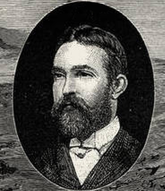
It’s hard to find out much about Donald Mackenzie, but in 1877, a few years before he set up the North West Africa Trading Company, he had a far more radical idea to capitalise on the trans-Saharan trade.
He proposed nothing less than flooding the interior of the Sahara from the Atlantic so that, with the addition of a few canals which had proved so successful in Britain prior to the age of rail, ships could sail directly to Timbuktu and the Niger river in a matter of days, avoiding the arduous overland journey of weeks. As a side benefit the flooding would ‘green’ the Sahara, enabling agriculture to thrive across the wind-blown sands.

This was the era of grand engineering projects like the Suez Canal (completed 1869) and the Panama Canal (first serious attempt 1881). A canal to the trading heart of West Africa could be a similar commercial coup.
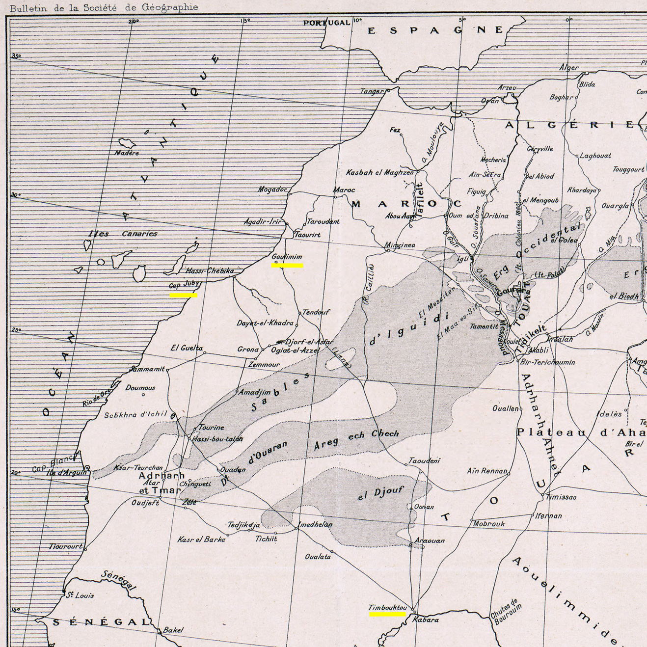
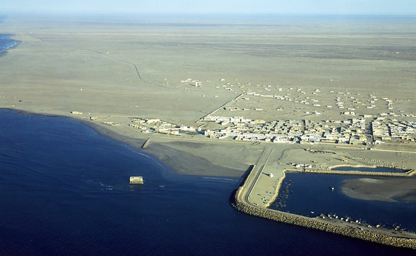
It’s hard to think what gave Mackenzie this idea, other than conflating lurid traders’ descriptions of El Djouf (left) with the small depressions or sebkhas found near Cape Juby. The biggest of these is the Sebkha Tah, some 55m below sea level and just 15km from the Atlantic, but still no bigger than Malta. For some reason he believed that the vast El Djouf (part of the million-square-kilometre Majabat al Koubra or ‘Empty Quarter’) was one huge depression which had been connected to the Atlantic via the Seguia el Hamra or some such, but had become cut off and dried out.
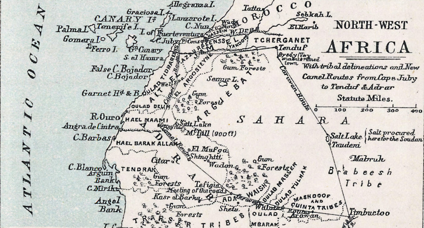
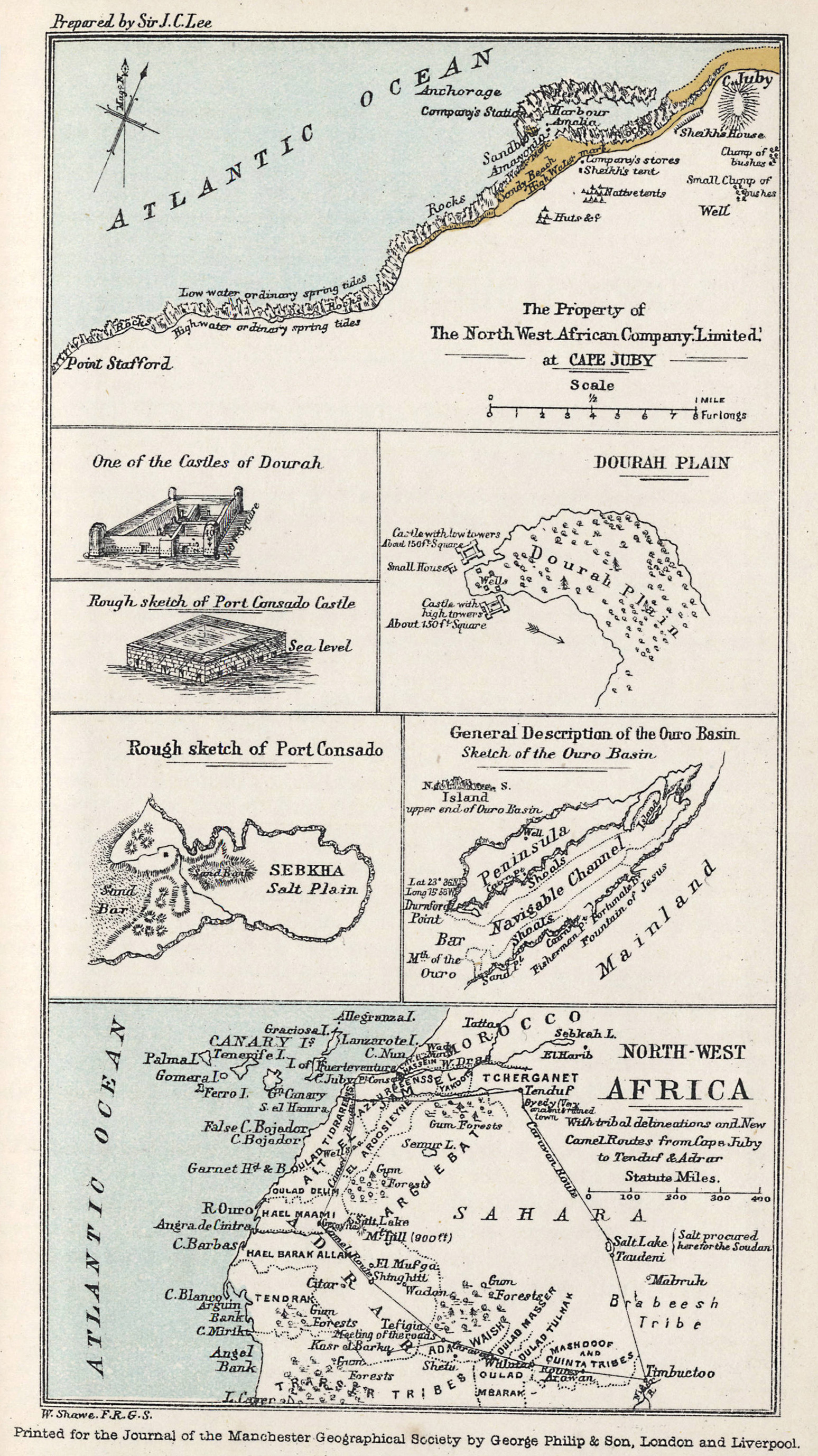
Mackenzie had never actually travelled in this area (other than a camel tour up to Port Consado (present day Khenifiss) and down to Layounne during the NWAT Co era (map above and right) but had read of other larger desert depressions in Tunisia and Egypt, similar to those near Cape Juby. All these basins held seasonally dry salt lakes which may have suggested that flooding was plausible. He believed an inland sea the size of Tunisia or Oklahoma would soon be formed, paving an inland seaway to Timbuktu.

Mackenzie diligently read up on all your great 19th-century Saharan explorers: Barth, Rohlfs, Caille, Duveyrier, Clapperton, and in 1877 published an exhaustive proposal [available online] to ‘The Presidents and Members of the Chambers of Commerce of Great Britain‘ stressing ‘the importance of holding commercial intercourse with the interior‘.
Vividly detailing at third hand the riches, economy, geography and ethnicities in this corner of Africa, he firmly believed his northern route reaching down into the African interior was the key, avoiding the disease-ridden equatorial jungles and pagan tribes further south in favour of the more sophisticated vestiges of the West African Islamic states. Under his proposal, land distances for the annual camel caravans from Timbuktu would be halved, with Cape Juby just nine sea days from Britain. De Lesseps himself, the force behind the Suez and original Panama canals, supported the idea of Saharan flooding, believing a side benefit would somehow improve the European climate while greening the desert for agriculture.
 Mackenzie also thought that trade and communications would help liberate the sub-Sahran population from the slave trade. And this wasn’t just a ploy to appeal to investors’ morals or religious beliefs – Mackenzie’s later work in East Africa long after the NWAT Company dissolved suggested he was always a genuine abolitionist.
According to his upbeat proposal (is there any other kind?) Mackenzie has it all worked out: do a recce to get the tribal chiefs on board at Cape Juby and Timbuktu, locate the channel in El Djouf and unplug that Atlantic cork.
I have no doubt of the ultimate achievement of this project, he wrote in the proposal’s introduction. But investors seemed less keen and, were it even possible, you’d think by creating a shallow, hyper-saline lake, the only thing that would grow would be salt crystals. The fact is the interior of the Sahara, including the dune-filed expanse of El Djouf spanning the Mali-Mauritania border, is a low plateau some 3-500 metres above sea level. Someone ought to tell Conde Nast Traveler.
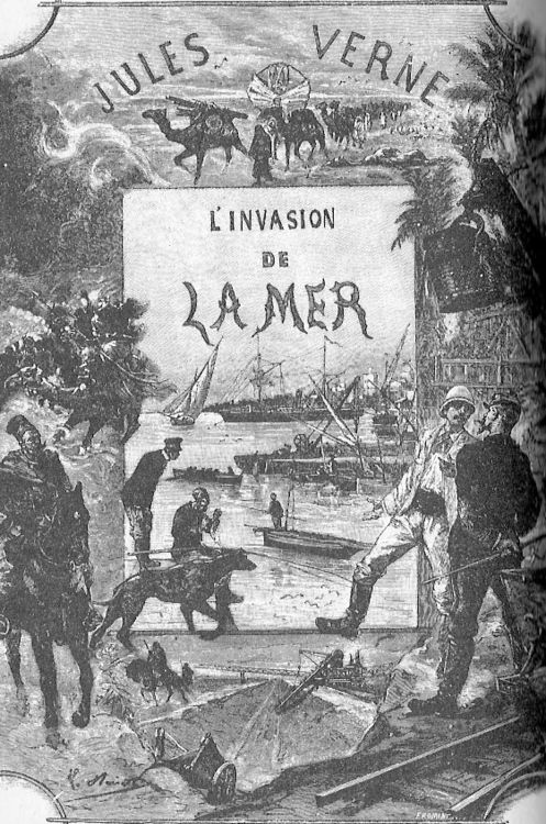
Mackenzie had slightly less difficulty finding investors for Port Victoria a few years later, and decade or three after that, Jules Verne fictionalised the idea of a flooded Sahara in his last published book, The Invasion of the Sea, set in Tunisia.
Discover more from Sahara Overland
Subscribe to get the latest posts sent to your email.

Pingback: ‘A’ if for Atlantic Highway | Sahara Overland
Pingback: ‘C’ is for Chocolaterie Aiguebelle: a vintage Map of the Sahara | Sahara Overland
Pingback: Wind, Sand and Bidons: KM 223 Tarfaya – Bivibag's Adventures