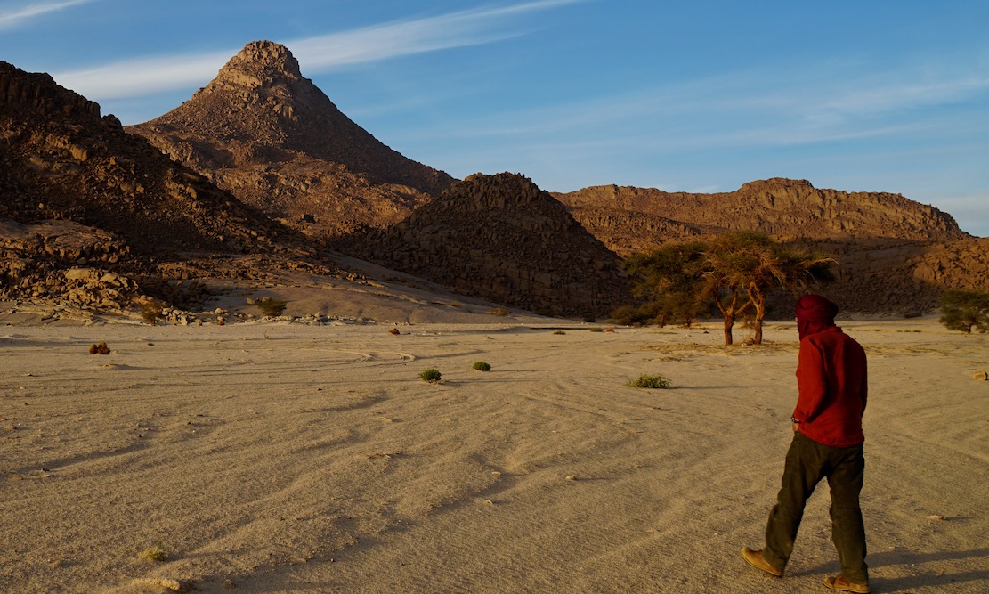
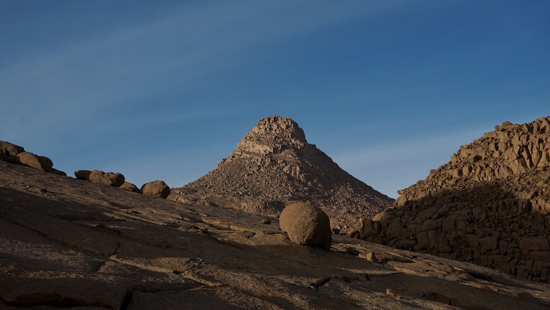
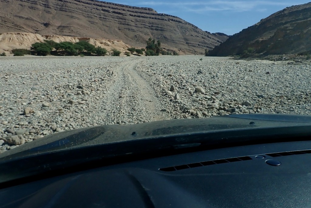
In early 2025 we pulled off a deserted new road and headed across the sands to camp at the foot of Mt Tiska. I’d been looking forward to this moment for nearly 40 years. My first view of Tiska’s distinctive but distant conical form was from Djanet’s old aerodrome way back in 1987. As I write in Desert Travels:
One evening Philippe, a skinny middle-aged Frenchman who had the habit of walking around the campsite in a saggy pair of Y-fronts, invited us to the airport to inspect his old aeroplane. He was immensely proud of his historic plane, a twin-engined machine from the Golden Age of Aviation. He was keen to point out the enlarged fuel tank which former owner, Lady Vanderbildt or some such, had fitted for a one-hop flight to the States as the war turned on Germany… Philippe started up the engines, but I was far more interested in the view down the runway. From this flat vantage point … south of Djanet you could clearly see the unmistakable conical profile of Mount Tiska … the first and only landmark in the featureless expanse which lead across the Ténéré to Chirfa and ultimately Bilma, nearly 900 kilometres away. A waterless expanse of flat, soft, sand, this was the route I’d planned to follow with the only partly cognisant Pete: Yamaha Teneres to the Tenere Desert: it could have been adventure biking gold until his breakdown near Illizi had sunk that idea. At that time I knew only a little more than Pete about the realities of remote desert crossings, and it’s no more likely we’d have made it to Bilma than if we’d tried to paddle to Tristan da Cunha in an upturned umbrella.
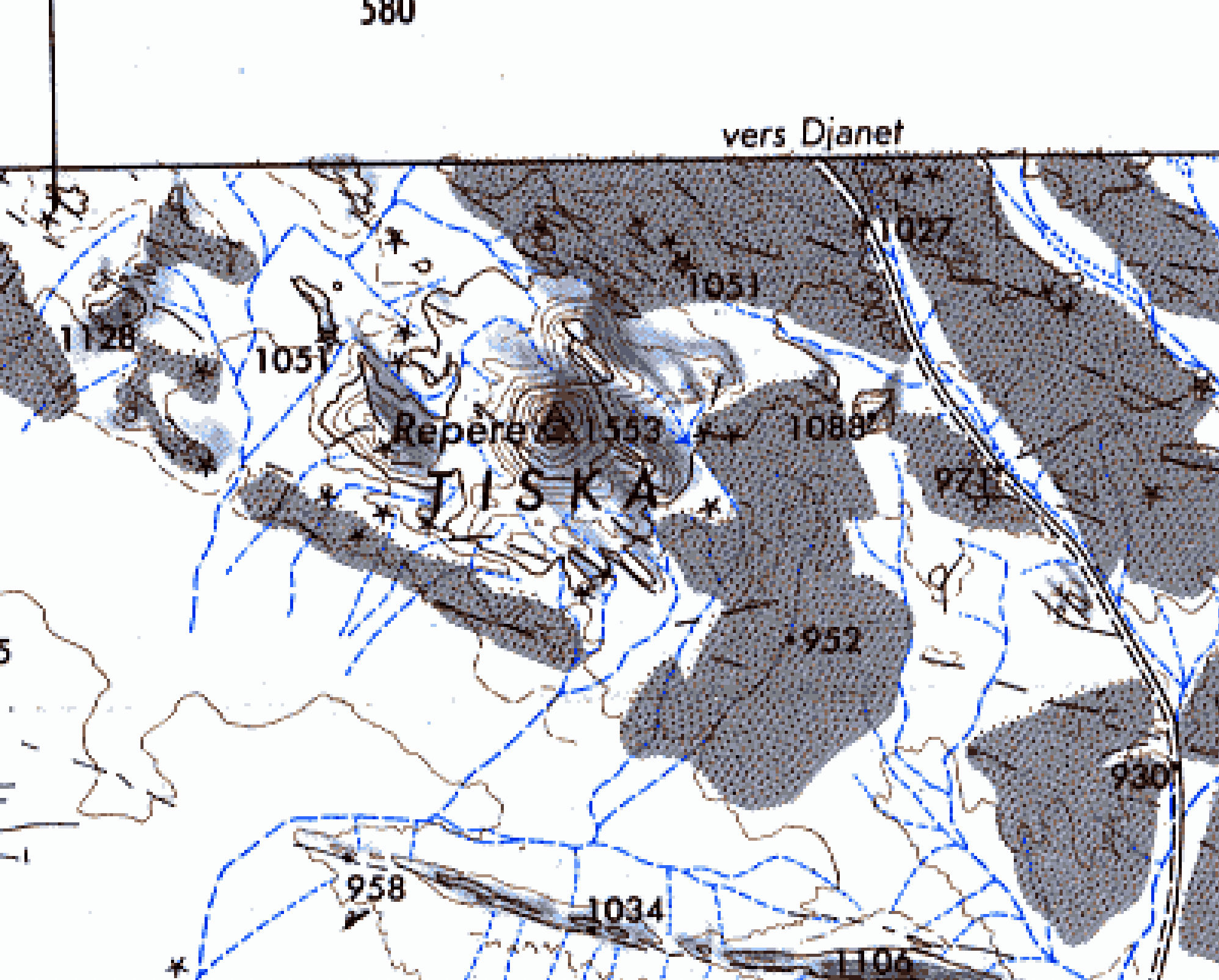
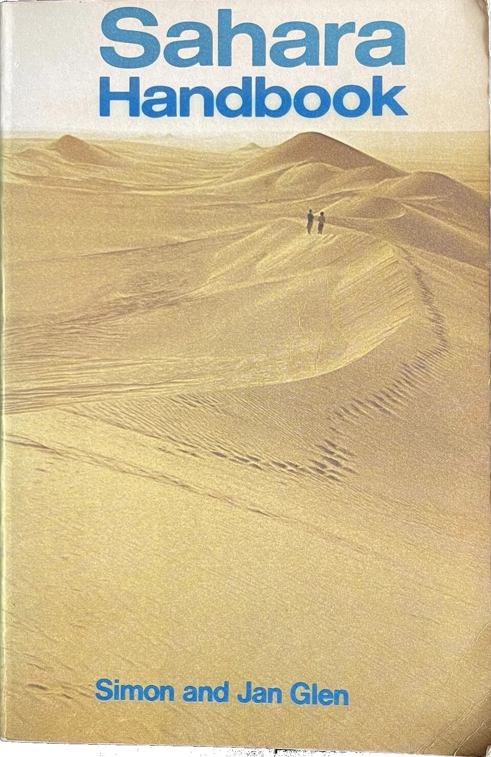
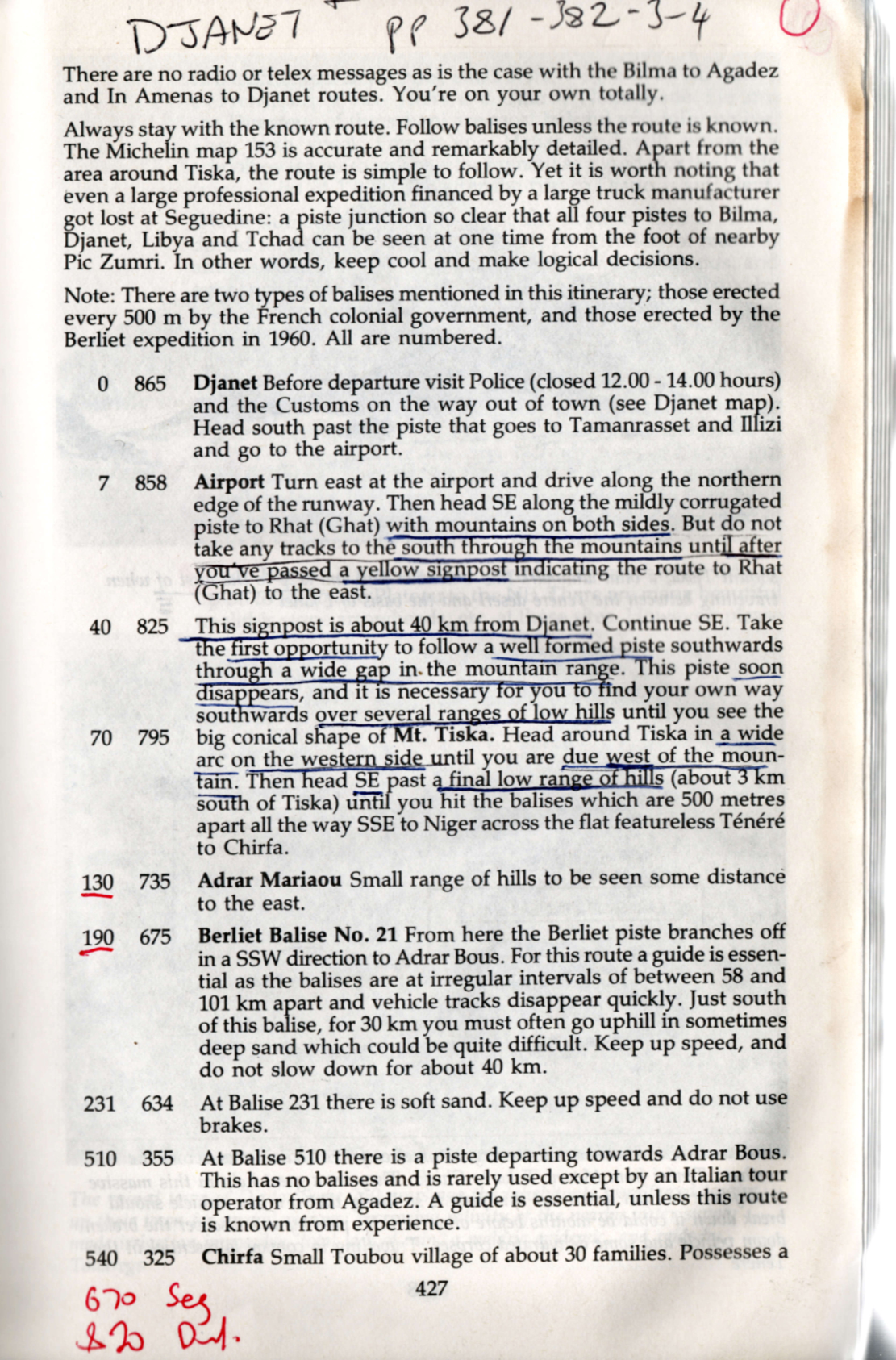
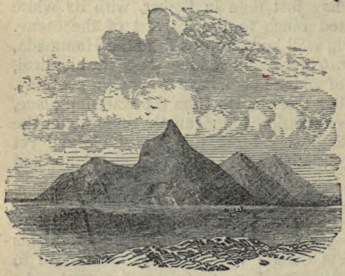
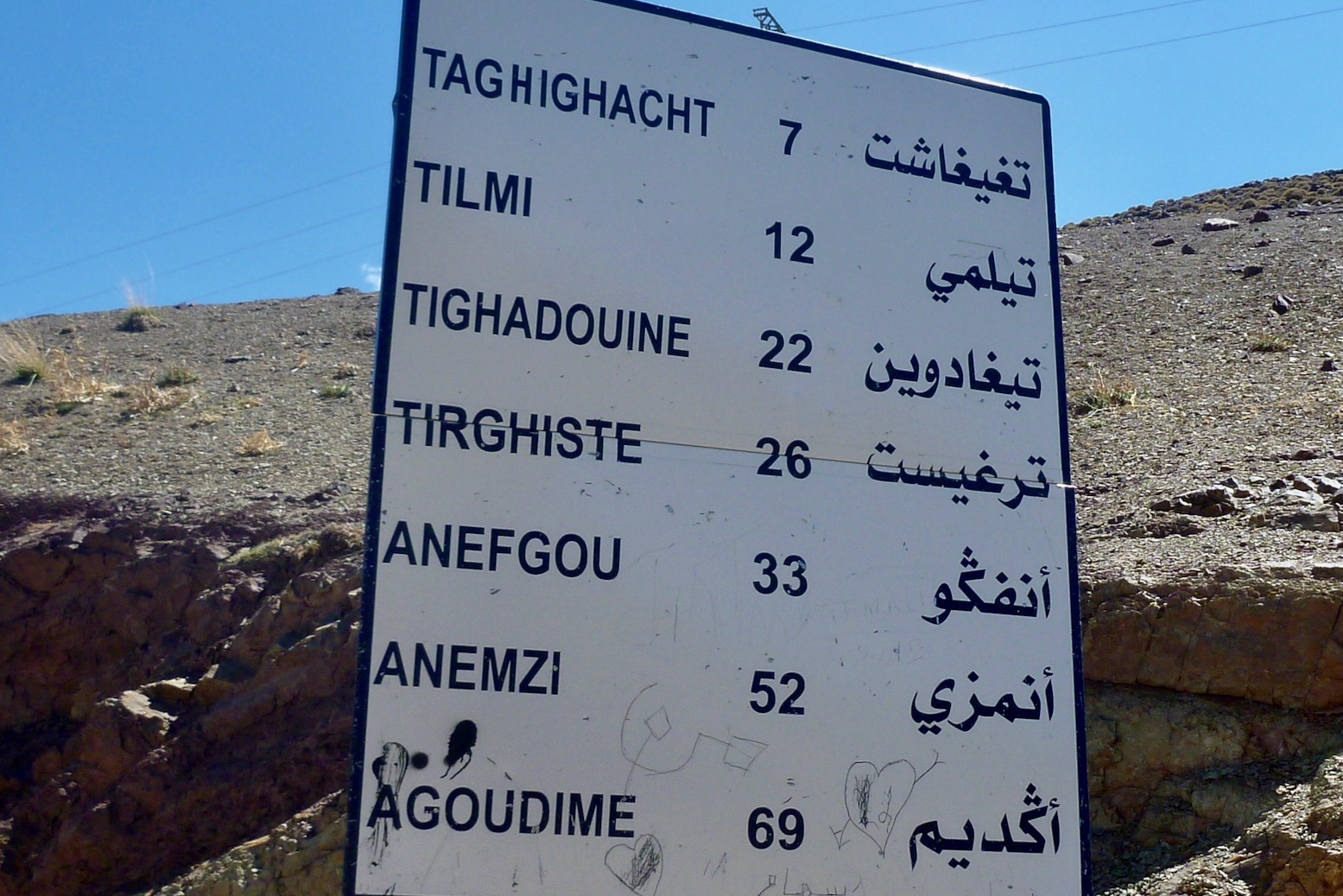
An ancient, pre-GPS landmark, I’d read of Tiska’s significance while leafing back and forth through the original Sahara Handbook (right) in the early 1980s. We all have books that leave strong impressions in our early years; the first SaharaHandbook would be high on my list. In it Simon and Jan Glen’s description of ‘Itinerary No. 19: Djanet – Bilma’, reads like call to adventure. You can see my annotated pages notes left, and might marvel at the sparse landmarks including Mt Tiska, with some spaced up to 200km apart. At no less than 865km, this was a serious desert crossing and the Glens did not mince their words.
To run out of fuel or have a major breakdown could be disastrous, as it could entail waiting for perhaps three months for another vehicle to pass and find tours with dehydrated corps lying around. This is no exaggeration, as the seven marked graves near Arbre du Ténéré show… Here your life depends on your vehicle. On leaving Djanet for the south, no authorities are interested in how well your vehicle is equipped … [nor] interested in whether you make the journey or not. There are no radio of telex messages as in the case with Bilma to Agadez and In Amenas to Djanet routes. You’re on your own totally.
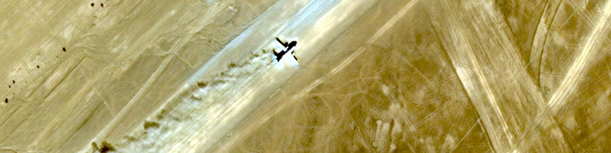
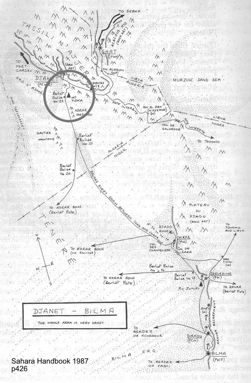
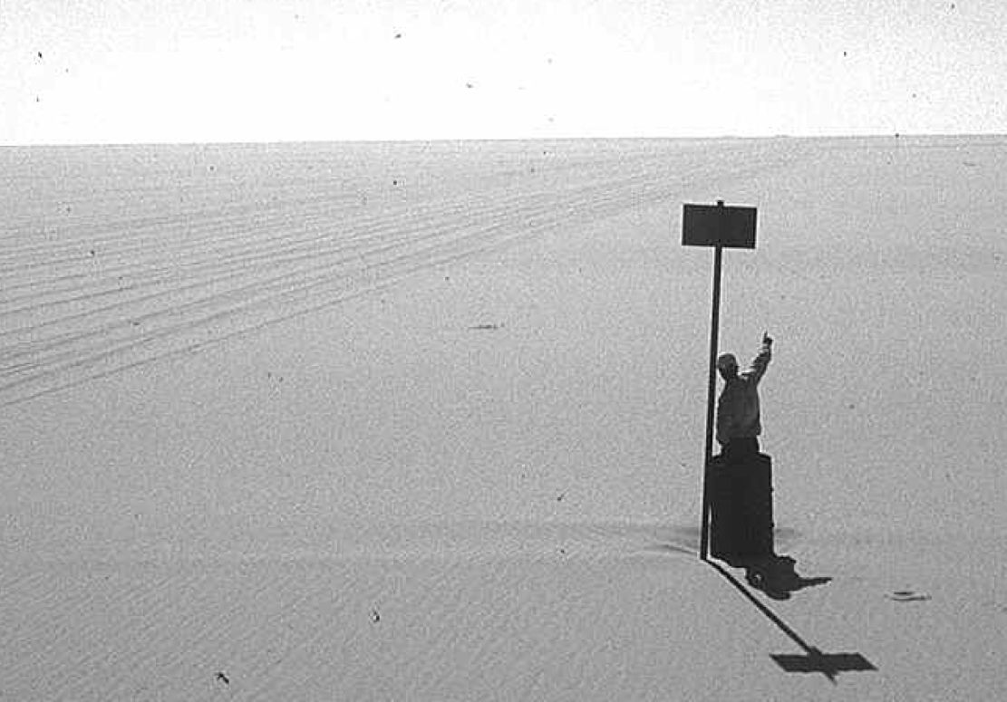
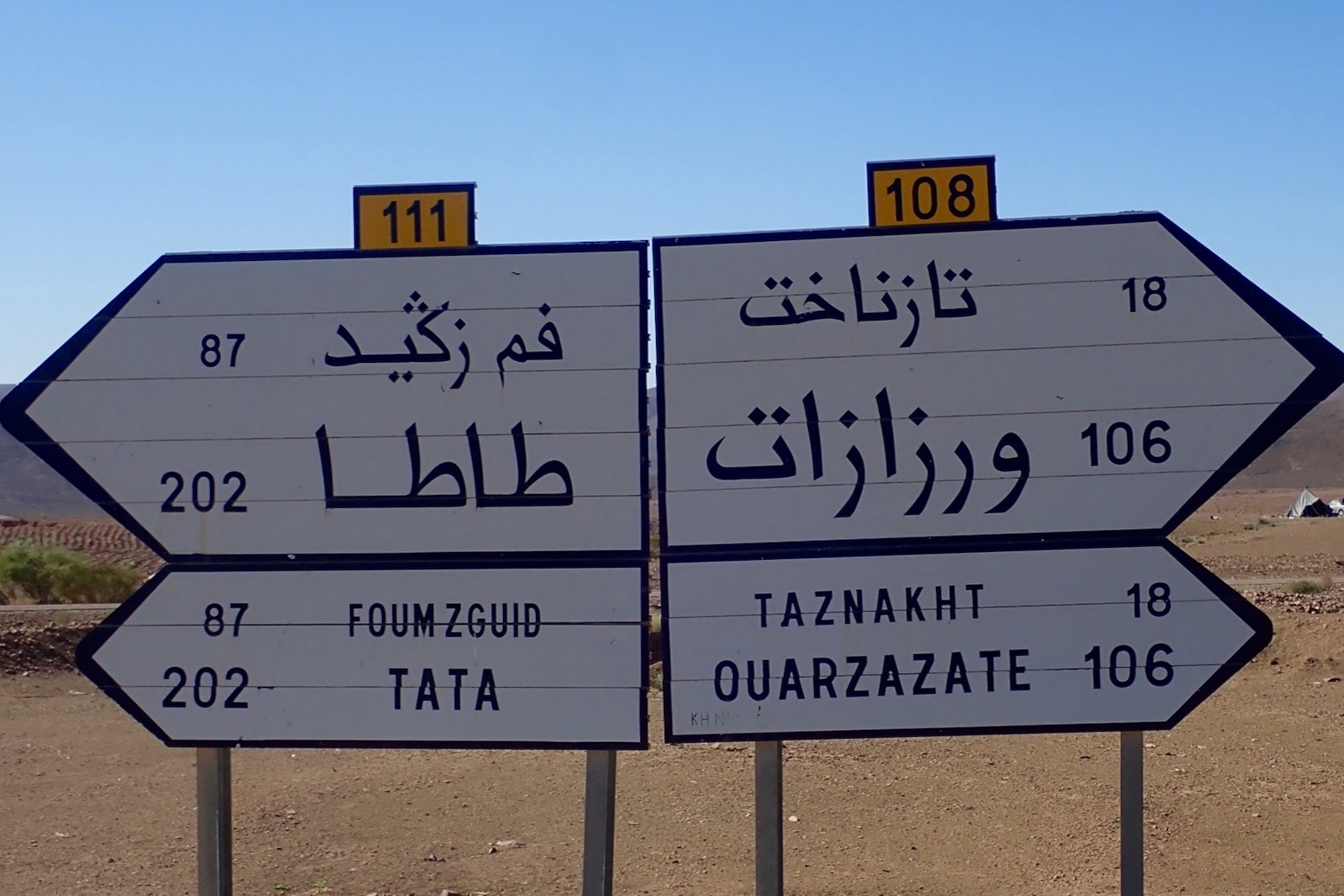
By the time that was written (final edition three, 1990) the piste to Bilma was little used. It’s said that in 1979 four Land Rovers were lost without trace on this route, and as a result the Algerians closed the crossing and pulled up many of the balises (three-metre-high steel marker posts, below) which the French had erected every 500m from Mt Tiska to Chirfa, the first outpost in Niger and a distance of nearly 600km. That information was not known to Pete and myself when in 1987 we set off with plans to blithely ride across the Tenere from Djanet to Niger on Yamaha XT600Z Tenere motorcycles. It was a very long way on a bike, but with a balises every half kilometre, it felt doable providing we had visibility and could carry enough fuel and water.
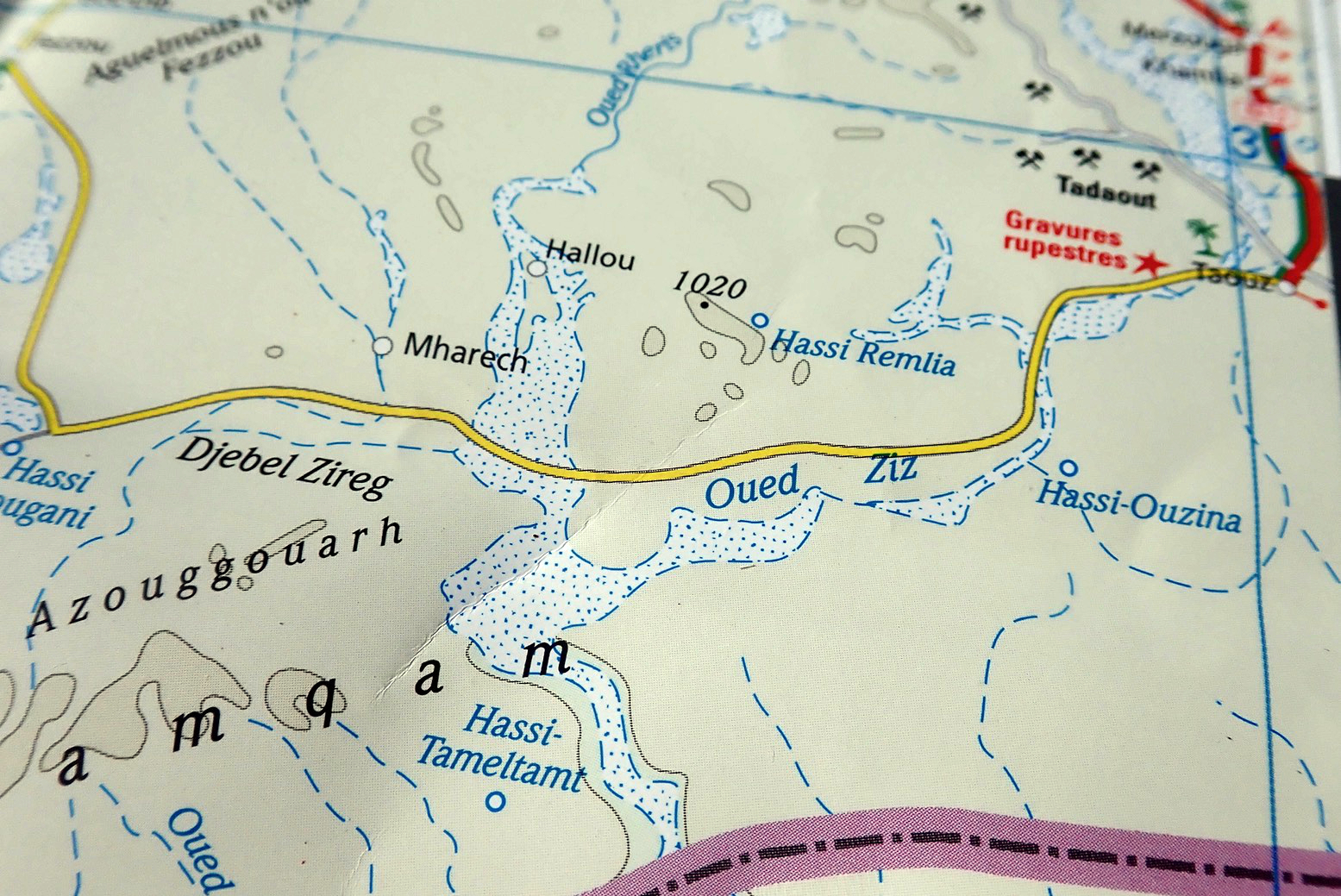
About 1200 of these balises once marked the entire Tiska–Chirfa crossing, like buoys at sea. You can just see the next one, 500m in the distance.
Coming up from Niger, the cone of Mt Tiska (and larger mass of Adrar Mariaou 34km to the south) had long been important landmarks on the caravan route between Ghat and Agadez. In 1860 Heinrich Barth wrote.
August 2 … After a stretch of nine miles, an interesting peak called Mount Tiska, rising to an elevation of about six hundred feet, and surrounded by some smaller cones, formed the conspicuous limit of the rocky ridges. The country became entirely flat and level … and there was nothing to interrupt the monotonous plain but a steep ridge, called Mariaw, at the distance of about five miles to the east [probably Adrar Mariaou; 34km south]. The nature of this desert region is well understood by the nomadic Tuarek or Imóshagh, who regard the Mariaw as the landmark of the open, uninterrupted desert plain, the “ténere;” .
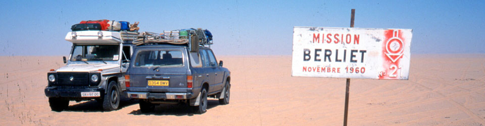
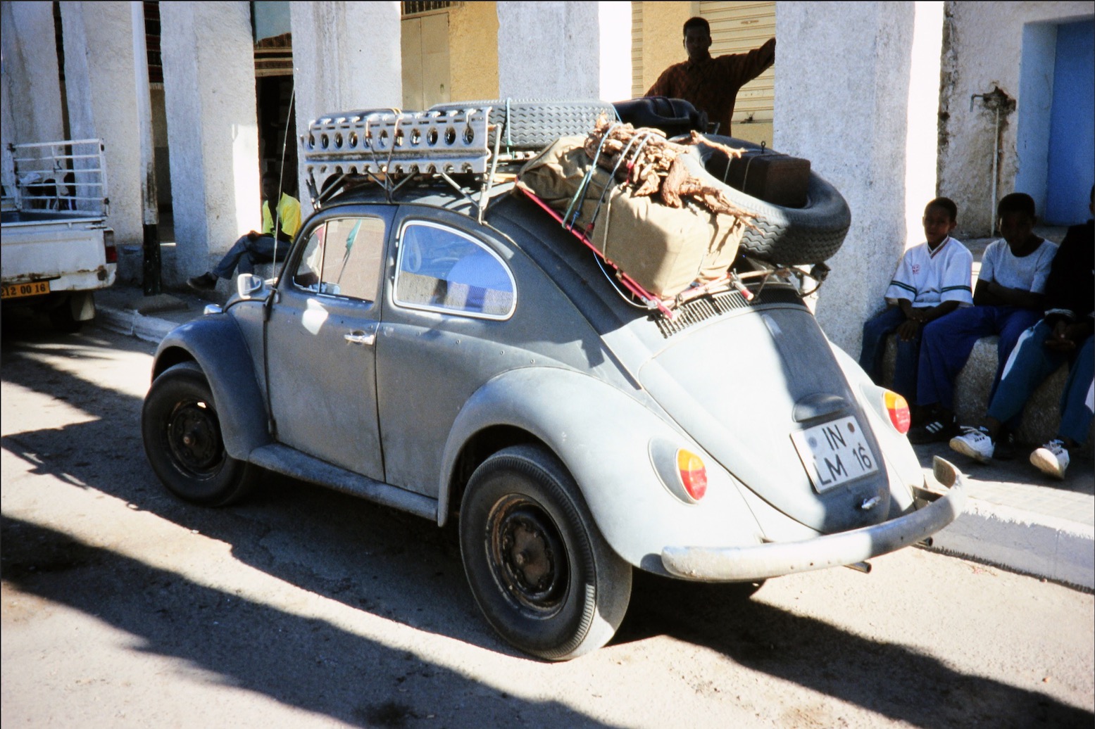
But in 1987 Pete didn’t even make it to Djanet on his Tenere. And soon after I arrived I learned what I now know. Since that aborted crossing, I’ve met others who tackled the route anyway and either got in big trouble in Dirkou in Niger (2001), or got brutally robbed before they even made it to the Niger cut line (2002; probably following a tip off in Djanet). Also in 2002, we came up the balise line from Erg Killian, the Monts Gautier and Berliet Balise 21 (below), but from Mariaou headed directly to Djanet across the very soft sands, bypassing Tiska.
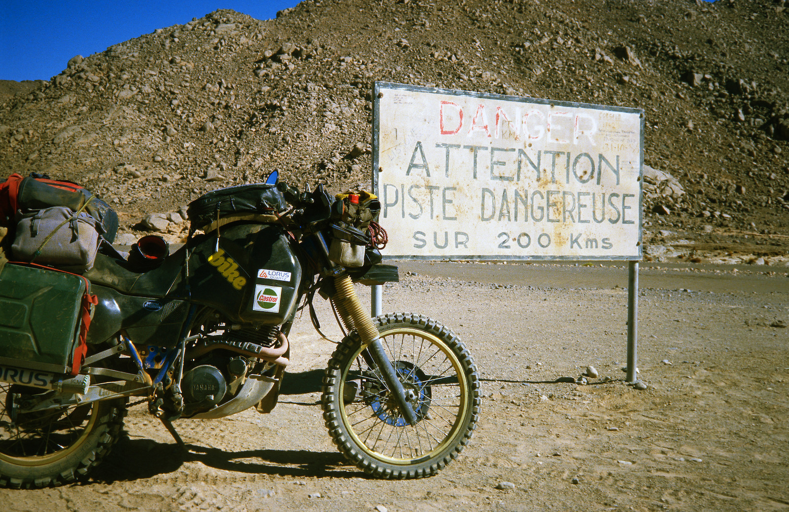
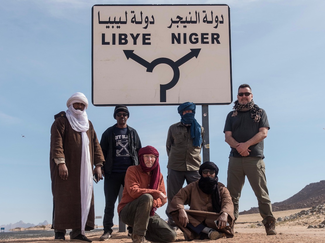
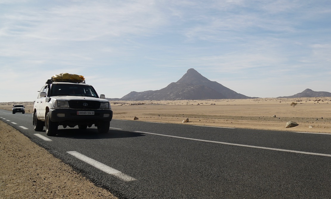
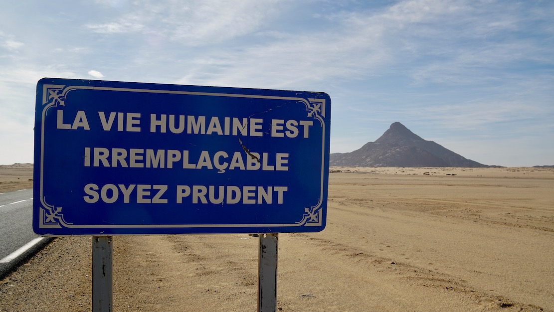
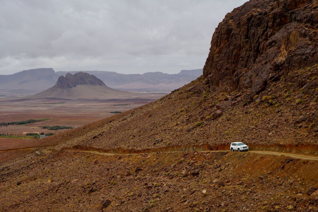
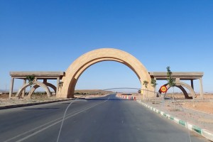
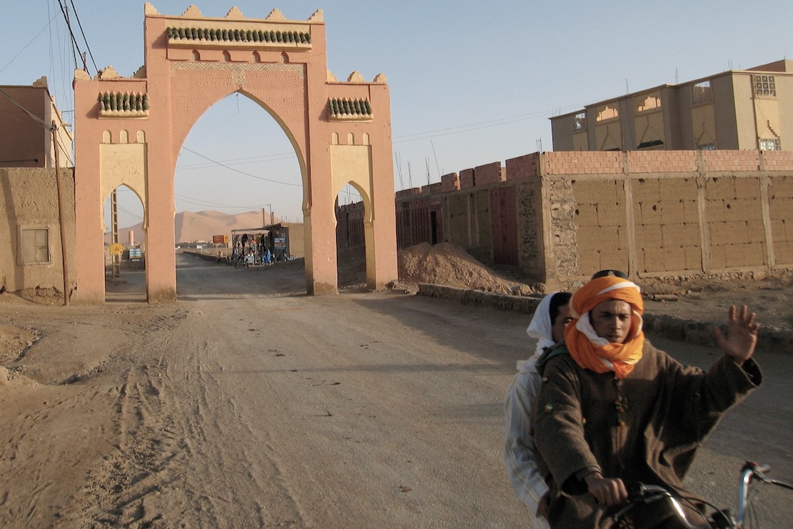
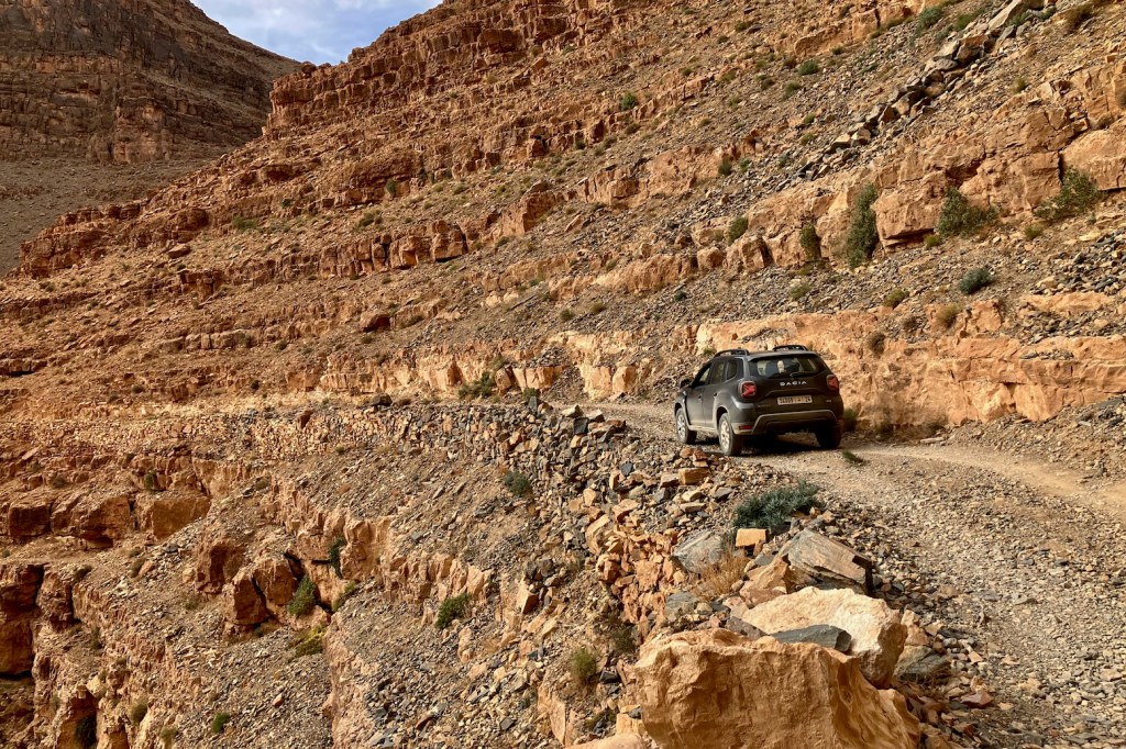
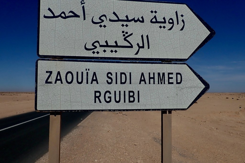
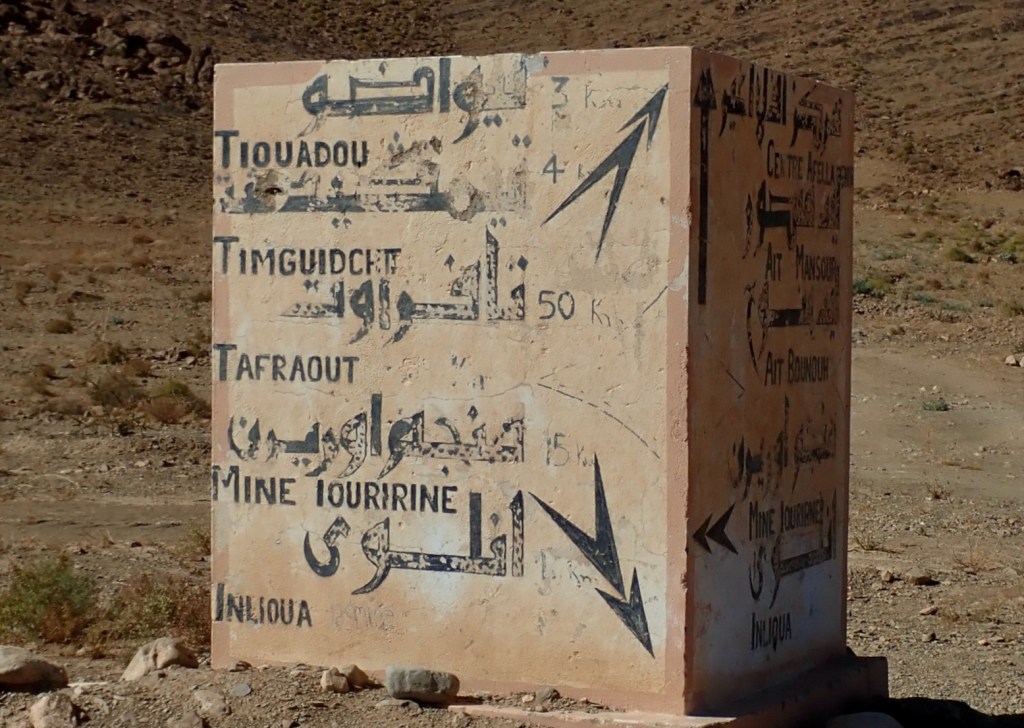
Today, an hour or two from Djanet a tarmac road leads off a roundabout in the middle of nowhere near the famous sign (left) and heads south to pass right by Tiska.
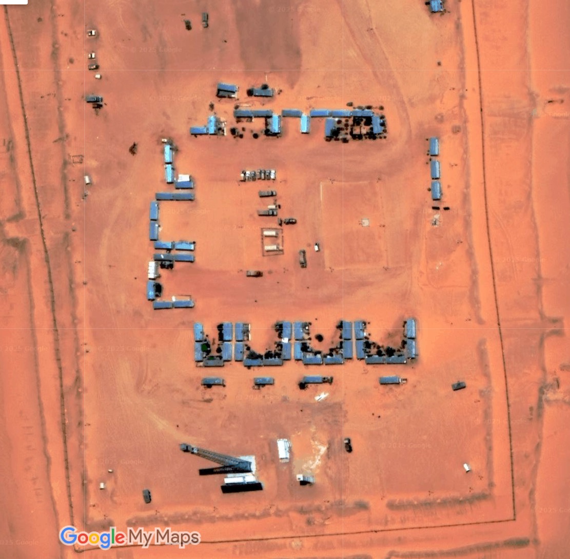
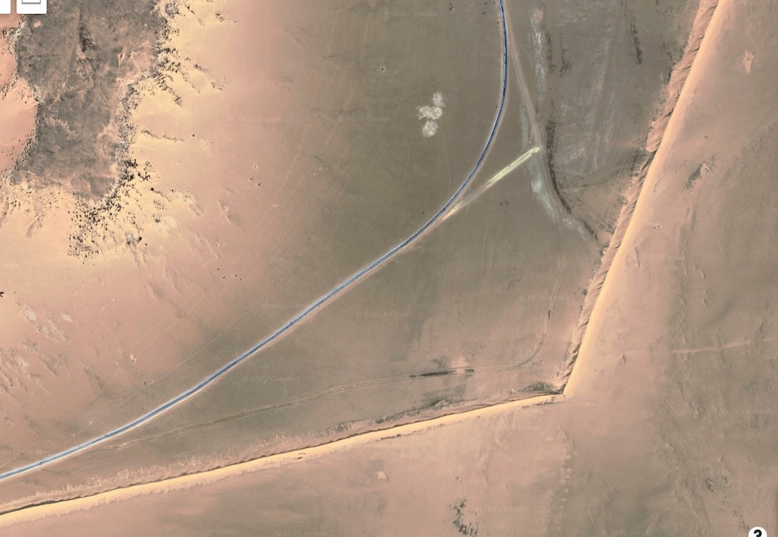
It’s part of a vast network of military roads, remote bases or perhaps migrant camps or prisons, and berms (sand walls) which Algeria has put up in the deep south to control smuggling, migration and jihadist movements.
BaseSand berm and border road
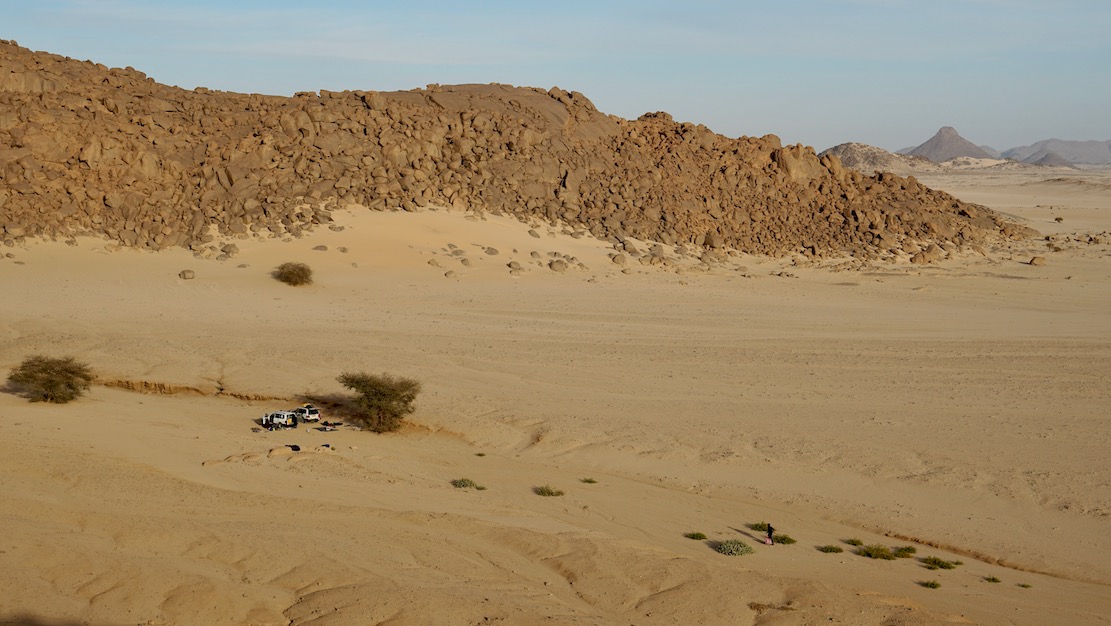
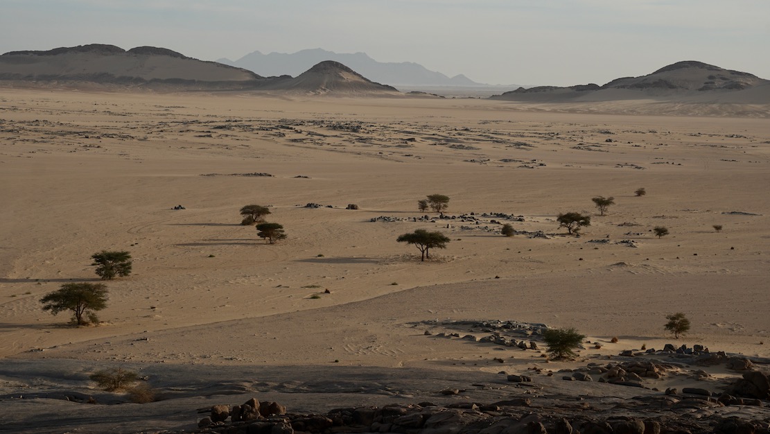
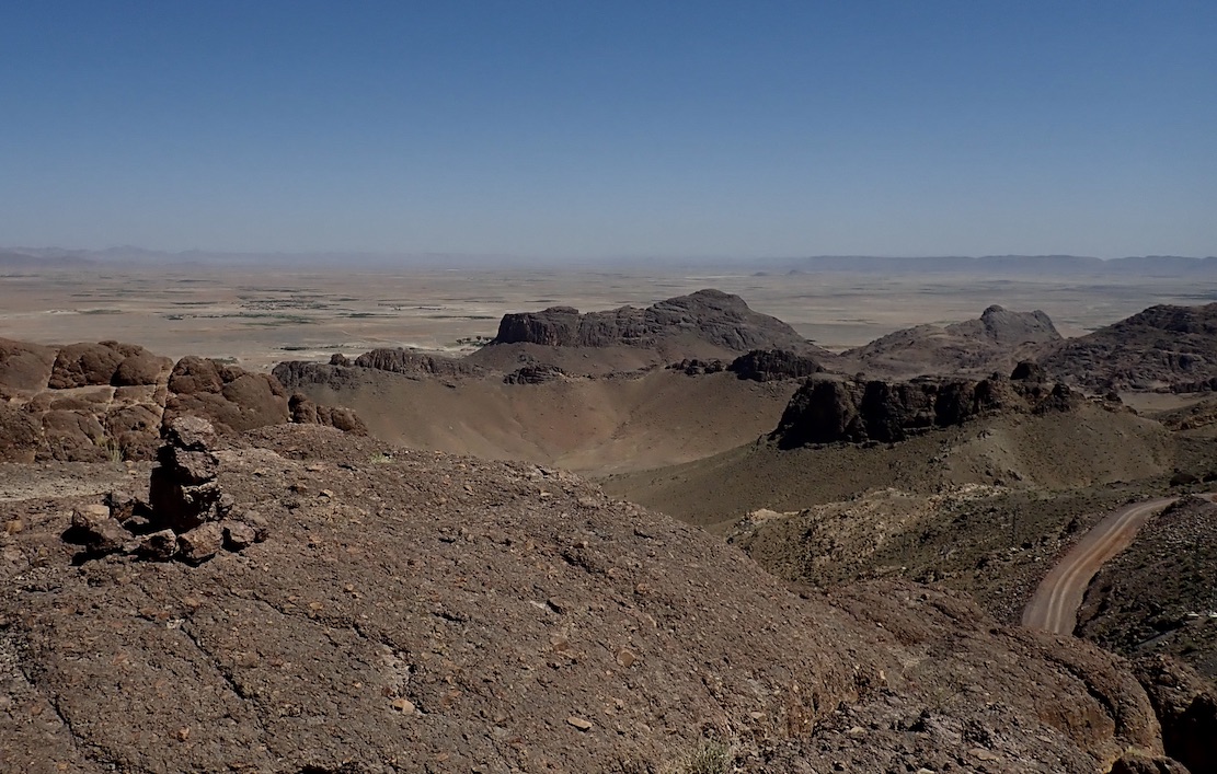
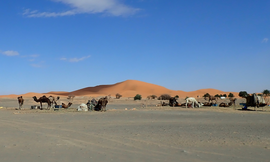
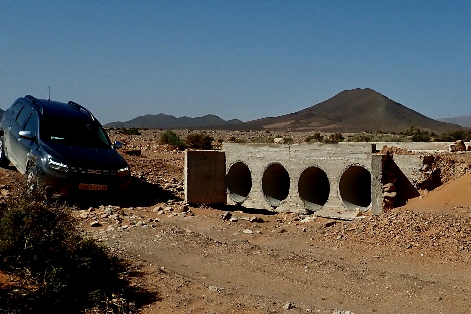
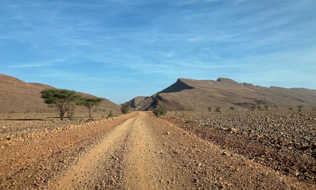
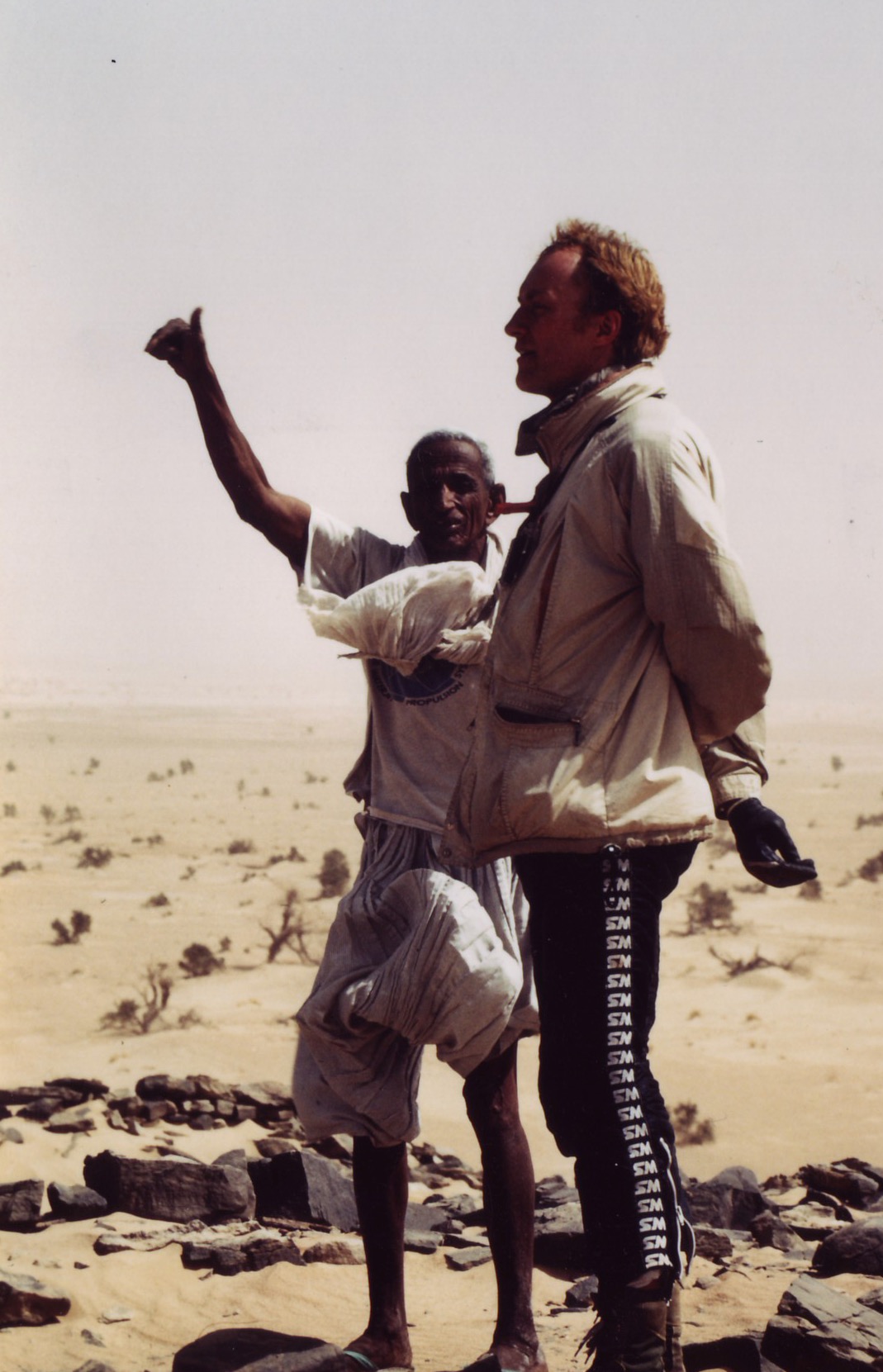
We pulled into a sheltered dip at the southern edge of the hill (below) and the cook got a fire going. Normally I’d have at least tried to climb to the top but at 500m above the desert floor, Tiska is bigger than it looks, one of the last outliers of the Tassili N’Ajjer before the ocean of sand that is the Tenere runs south to the Kaouar hills behind Bilma and the isolated Termit massif which is already in the Sahel, close to Lake Chad.
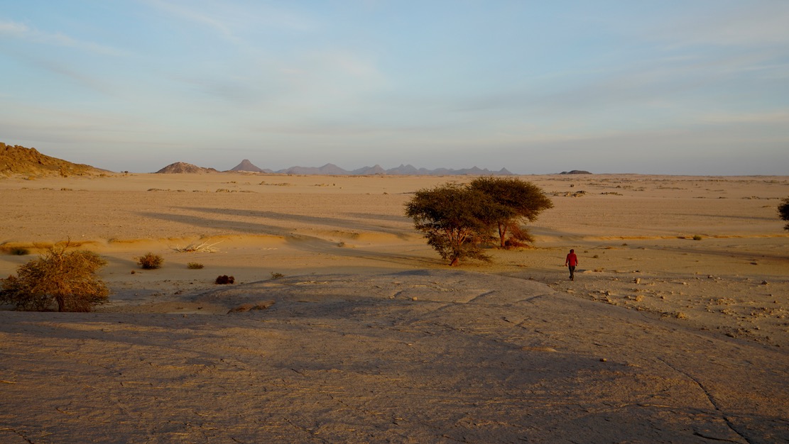
It was sure nice to stretch the limbs after being cooped up in the car for days, but it’s these cars which get us to such places. As always walking in the desert, it’s the tiniest things which catch your eye in the void.
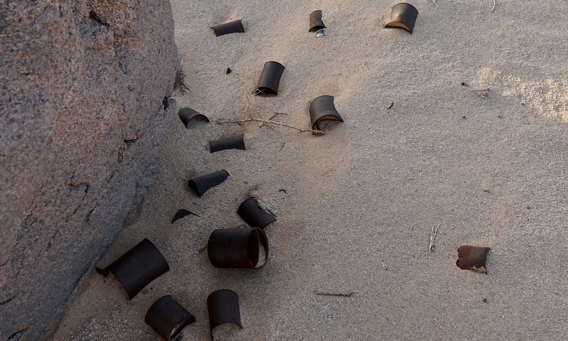
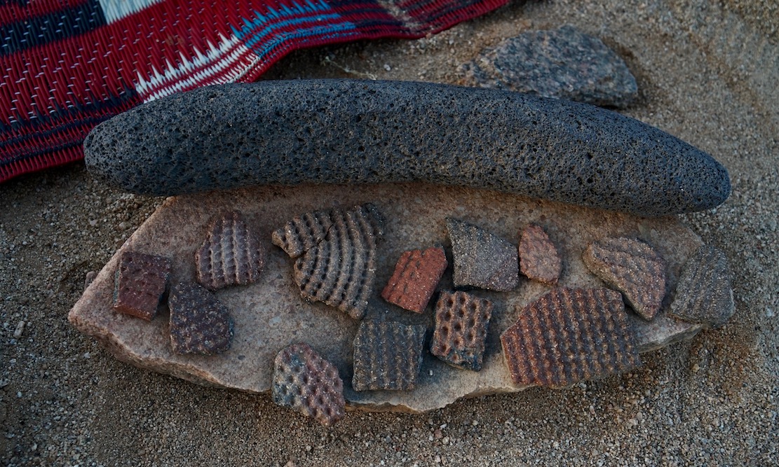
A trove of tin cans dumped by who knows who and who knows when. Anywhere else they’d be rubbish.
More rubbish perhaps dating back to the Neolithic era or earlier when the Sahara was less arid. Ceramic pottery fragments (commonly found) and some sort of grinding tool I’ve not seen before.
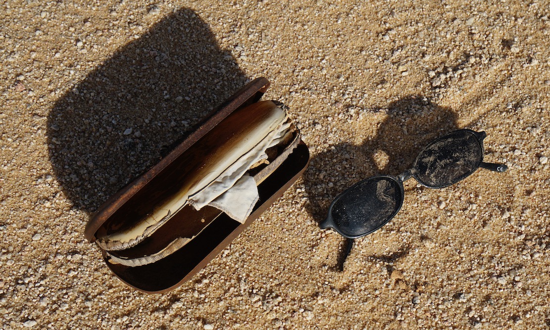
Cheap shades probably dropped by a migrant heading north to the Libyan border and a boat to Europe. Long before the current waves we met lines of migrants way back in in 2002, boldly marching over the Tassili towards Ghat.
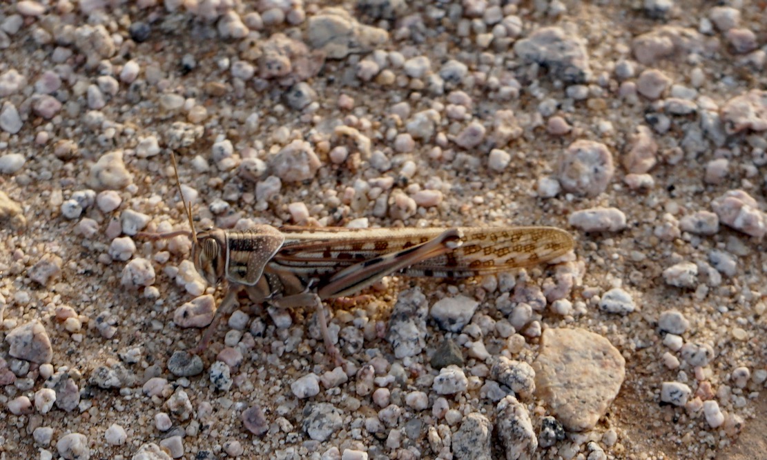
A locust takes a breather
In the foreground the balise line used to start just beyond the ridge. And on the horizon, the mass of Adrar Mariaou and the piste to Chirfa in Niger.
The granite cone of Tiska. I could run a tour in south Algeria hoping from one granite T-mountain to the next.
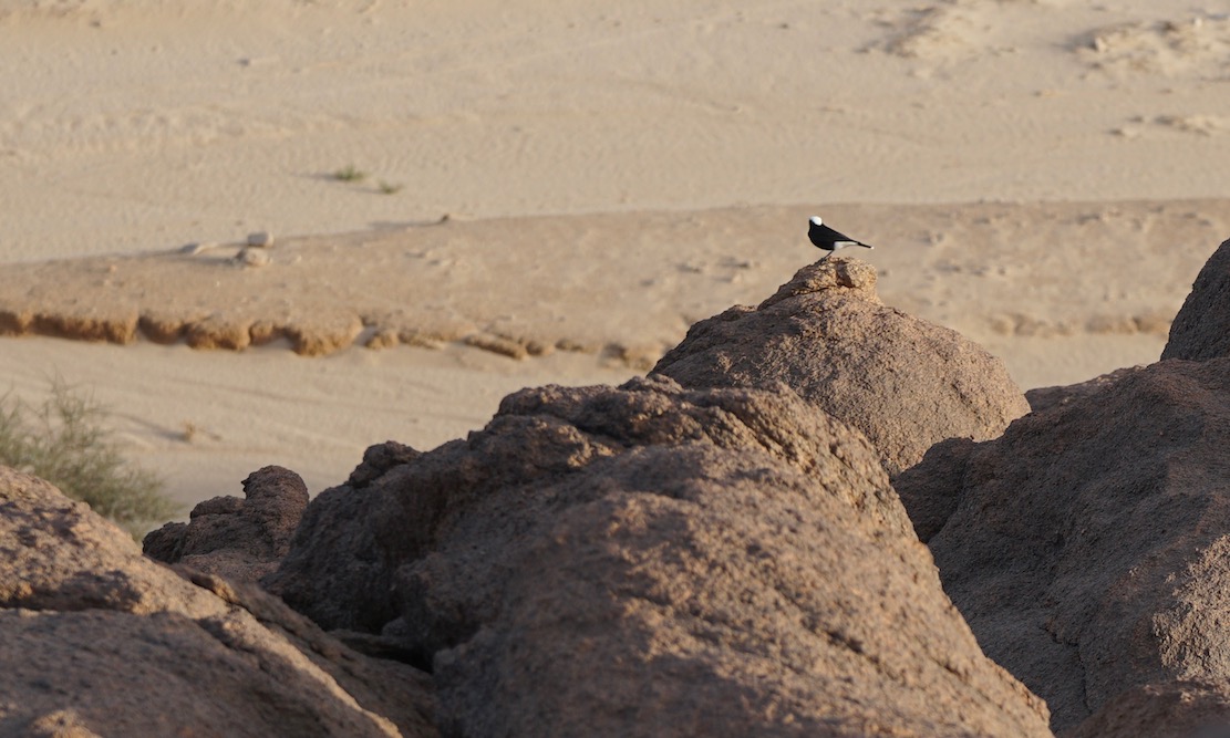
Moula Moula bird, the pigeon of the Sahara.
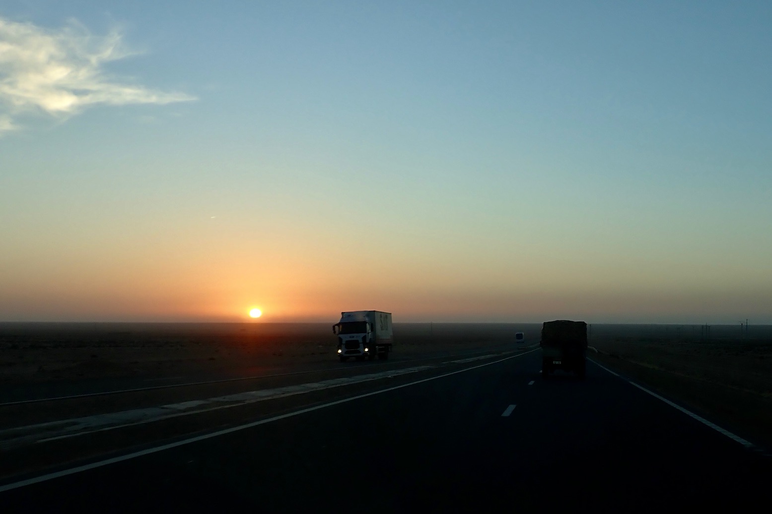
Sunset across the desert sands
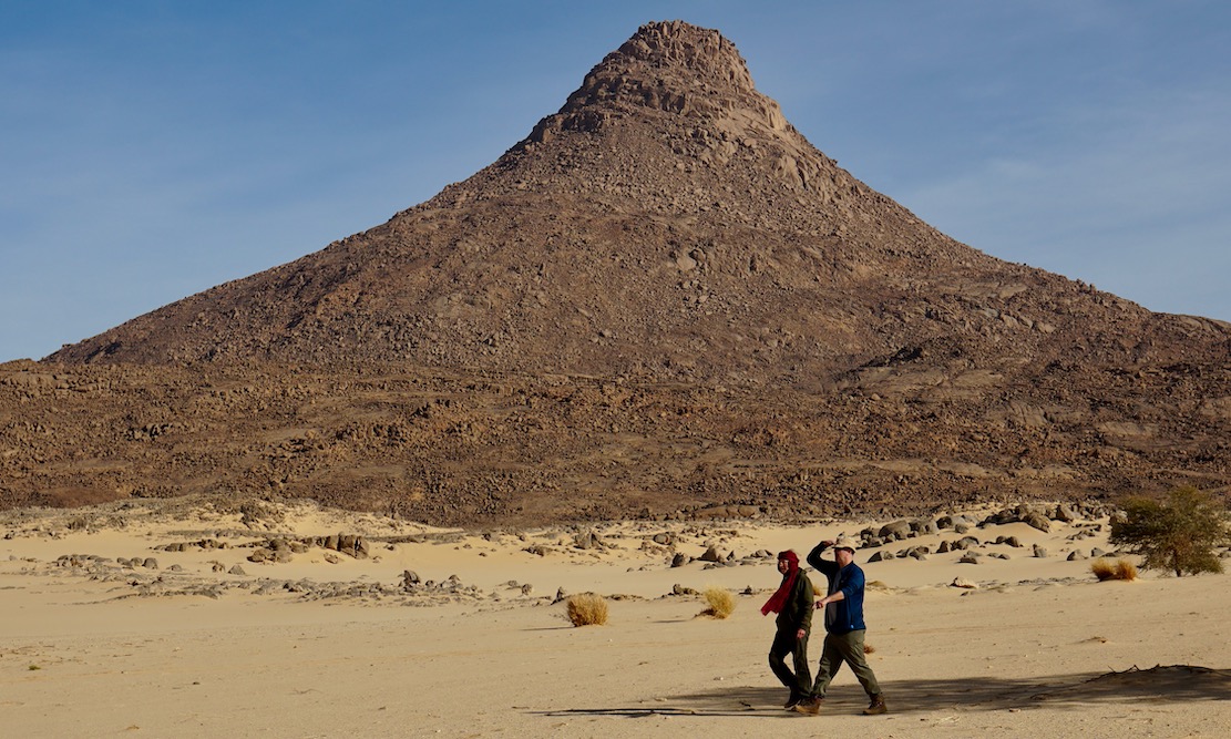
Next morning the three of us set off to walk around the mountain while the crew pack up and catch us up. We carried on clockwise round the mountain, into a hidden bandit valley on the north side, and then back to the road.
Heading back to Djanet after a night out on Mt Tiska.
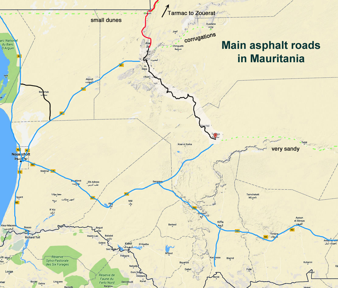
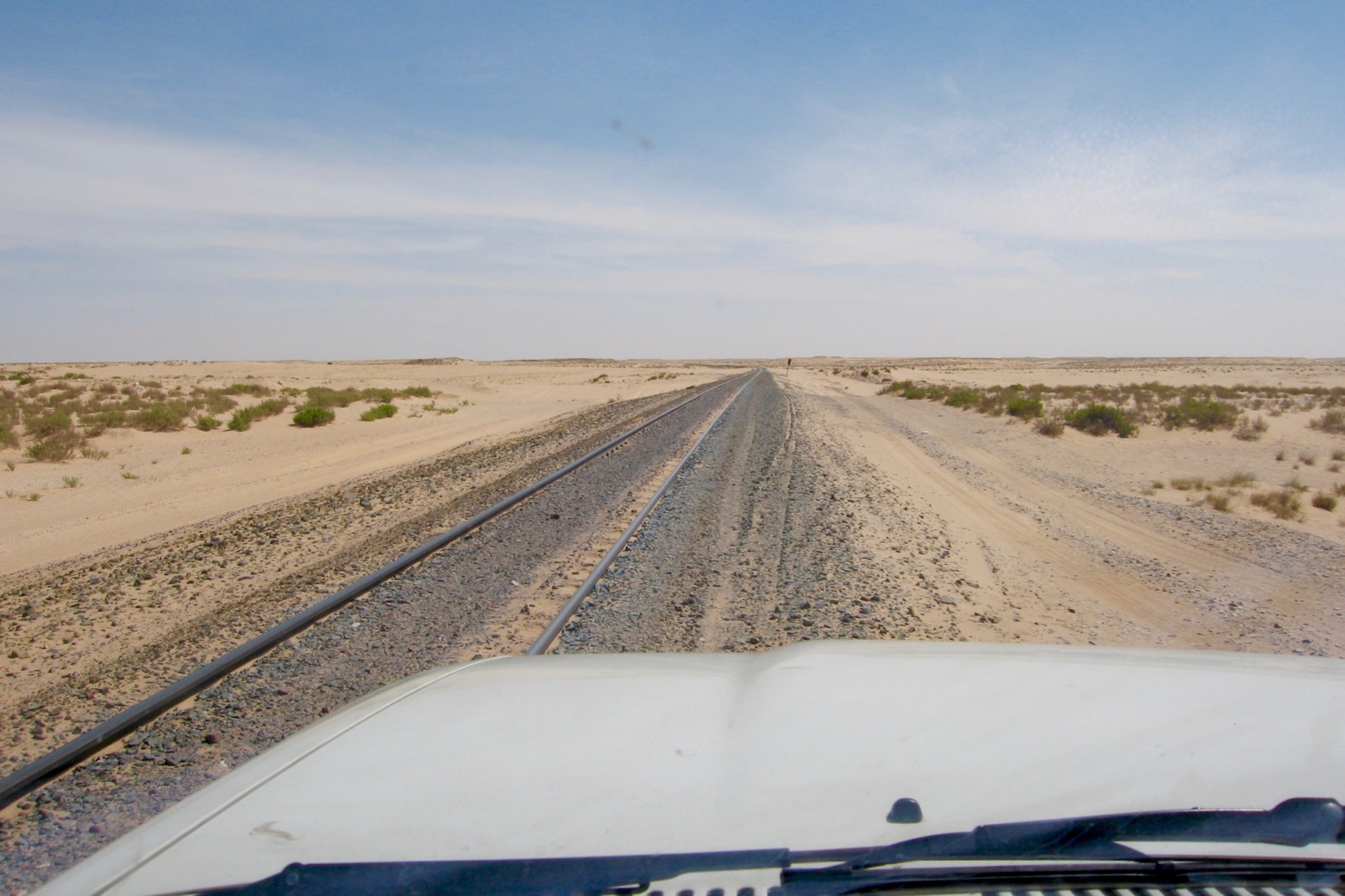
Nearly 20 years after I last drove it, Mauritania’s 400-km Railway Piste is becoming an Overlander’s Thing. If nothing else, it remains a short-cut from the coast to the interesting Adrar highlands east of Atar and is of course a desert adventure in itself. The alternative is twice the road distance via Nouakchott by which time people lose interest in Mauritania and carry on down to Dakar. There is now an asphalt short-cut via Benichab saving 200km (see map below). If the Railway Piste is your first spell on Saharan sands, it can be a drop in the deep end, especially for heavily laden motos.
While navigation in either direction is straightforward with the rail track either in sight or never far to the north, it can still be hard work as you cross the successive cordons of the Anezal dunes in the east before you reach the road at Choum, 400km east of Bou Lanouar, and 115km north of Atar. Note the easiest way to access the piste from the west end is off the N2 about 10km southeast of Bou Lanouar.
Some say the terrain gets easier further south from the tracks, but there’s no way of dodging the long bands of dunes in the east. They are mostly low, rolling mounds, not full-on crested dunes, but the soft sand, occasional drop-offs, ruts and heat will work you and your engine hard. In whatever direction, you just have to plough on, seeking out the easiest tracks or terrain. Riding a bike between the rails on sleepers (above; video) doesn’t always work as they’re buried in sand or thick rubble (below).
Sandor rubble
Alone on a moto this is quite a step if you’ve just cruised down the balmy Atlantic Highway through Morocco. It’s a lot hotter down here and riders have crashed or burned out and needed rescuing or escorting out. Even with the easy nav, think twice about tackling it alone on a heavy bike. You can buy drum fuel and water from the shantytowns alongside the track marked on the map above. North of Ben Amira village (KM360), the granite monoliths of Ben Amira are well worth an excursion, though don’t stray too far north to the PFZ border. And don’t expect Choum to be any kind of Shangri-La, though there is fuel and an auberge here.
Cooling off in late October on the way to Choum
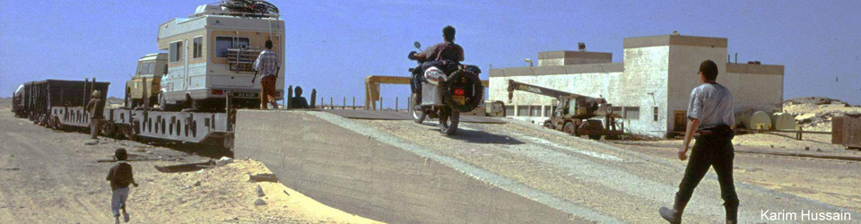
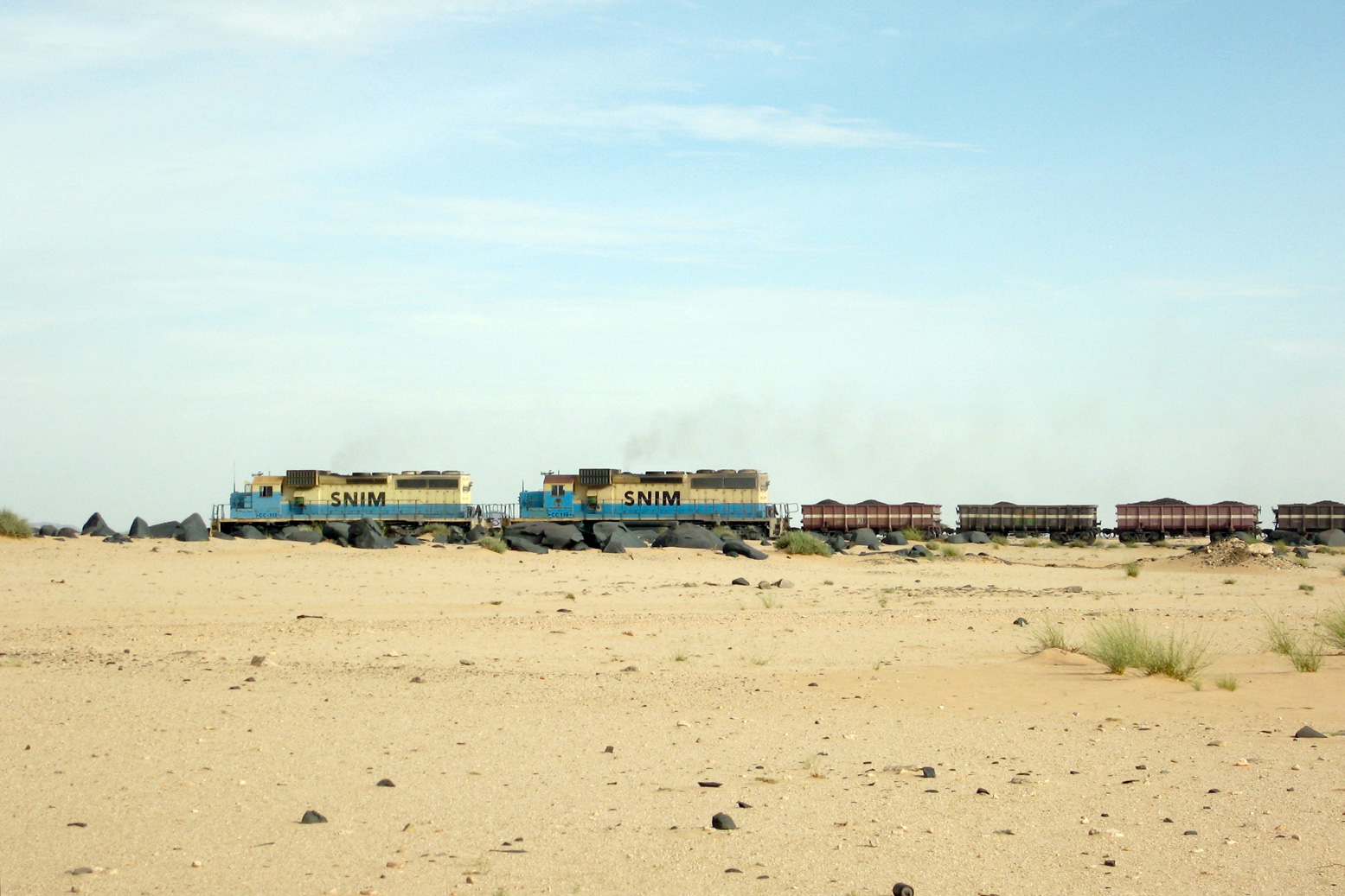
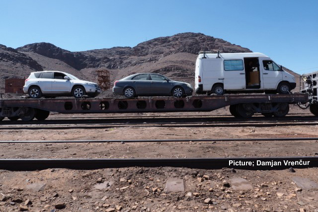
They say the ore train linking Nouadhibou port with the iron mines inland at Zouerat no longer off-loads vehicles at Choum, where it can stop for just a few minutes westbound when full. Motorbikes have been quickly manhandled on and off. Otherwise you might load or off-load a car at Zouerat (12–16hrs), even though asphalt now extends there from Choum. SNIM has no formal reservation system, booking website or even a station. There will be a yard at each end with a ramp.
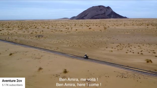
Coming up from Atar and riding the loaded ore train as a passenger between Choum and Nouadhibou has also becoming popular with youtubers (below). You’ll find loads of self-agrandizing vids on social media. There’s even a backpackers’ guide to Mauritania now, as well as organised tours using rudimentary sleeper wagons, while the hardcore huddle on the mineral wagons for free, choking on iron ore dust. Bring a Covid mask.
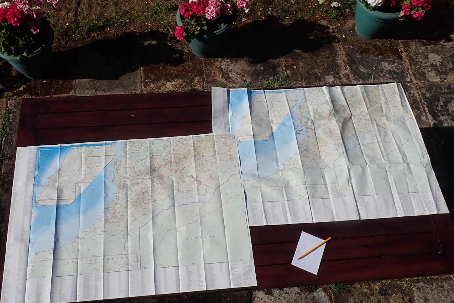
In a line Well after 14 editions the paper feels thicker but in the south much detail remains missing or well over a decade out of date.
Cheap Big (1 x 1.5m) Detailed key in many languages Intuitive 1:1m scale Doesn’t need batteries
So out of date in the south it’s not funny anymore
Big and 1.3 m wide, but years out of-date
Review Michelin the best map for Morocco, right? Not for many years, I’m afraid, unless you’re following the main highways. The late 2024 edition’s paper feels thicker – an age-old complaint. You also get five sub-regions at 600k scale. Plus points are the intuitive 1:1m scale, clear Michelin design and the fact that it goes right down to Laayoune which means you can view all of Morocco 4’s routes on one sheet – except that I’d guess less than half on them exist on this map. And at from £6.50 in the UK, it’s cheap. But many easily navigable market roads and tracks mentioned in my M4 book or on the digital maps below are missing, and some roads and tracks either don’t exist or get misleading prominence. In places this data is nearly 20 years out of date so once you get far of road, it’s unusable.
Jebel Saghro: nothing to see here – at least on the Mich 742
Look at a region like Jebel Saghro (above) about which complete piste guides have been published (and which in Morocco 4 get 32 pages and 11 routes). On the Mich map even the main roads is incomplete.
You’d think one day they’ll go all out and improve the 742, like RK-H did in 2019. That has not happened for years at Michelin. Perhaps the best thing to do with the latest Mich 742 is mark the many, many missing roads and pistes from other sources all on one big and inexpensive map to become a handy reference to what is possible and where. That’s what I’ll probable do with mine.
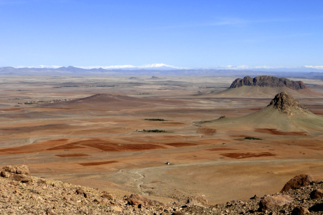
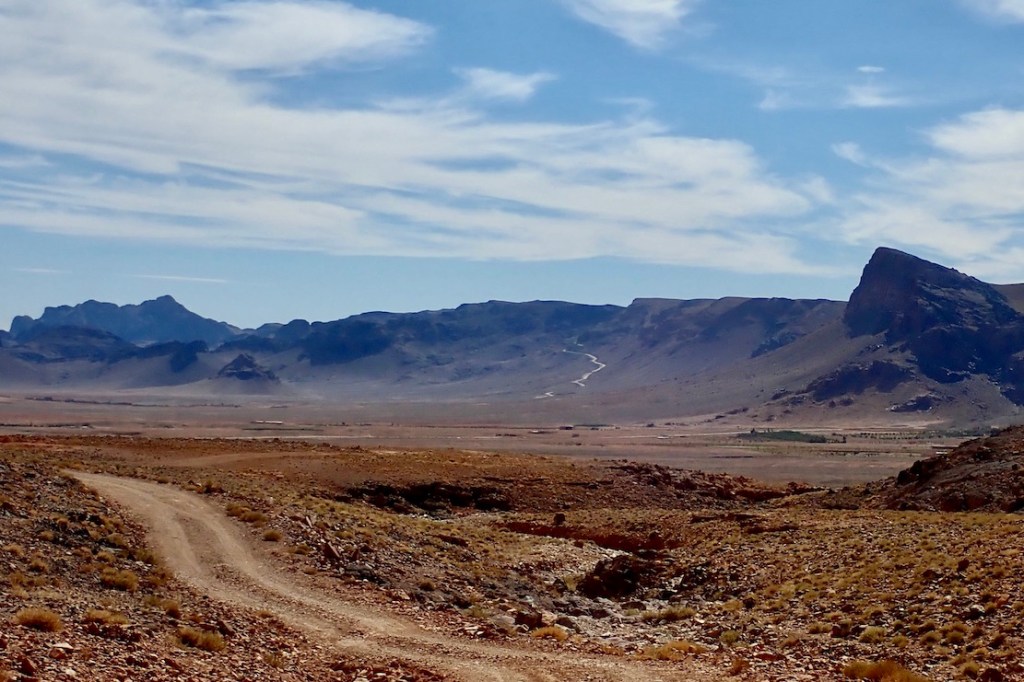
Looking north from the Haroun Pass across the ochre expanse of the Issil Plain to the snowy High Atlas
The issil Plain
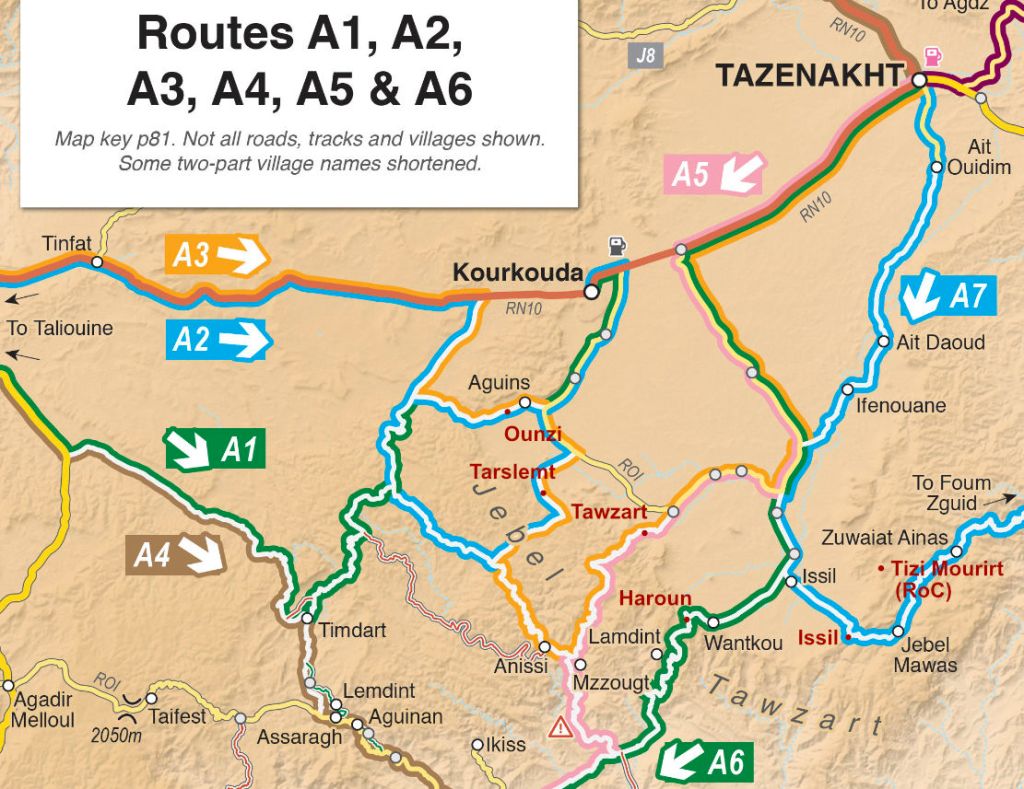
The new book out this week has a bunch of great routes in the A (Anti Atlas) region crossing the Issil Plain which lies between Tazenakht and Taliouine. Both are good bases to kick off a traverse of the plain towards (or from) what I used to call Jebel Timouka but might more correctly be called Jebel Tawzart – an escarpment which rings the plain to the south. These routes cross six passes or Tizis labelled below. From the west Tizi Ounzi, Tizi Tarslemt, Tizi Tawzart, Tizi Haroun, the unnamed ‘Issil pass’ and the Tizi Mourirt which is not on any M4 route but is worth a look and is part of the RoC.
Tizi Ounzi 1750m (Routes A2, A3) West of Aguins, the Ounzi is not so dramatic but is a fun way of accessing or leaving the plain on the west side. Coming down the Ounzi towards Aguins, you get a good view of the Tarslemt pass up ahead.
Tizi OunziTarslemt view
Tizi Tarslemt 1896m (Routes A2, A3) The Tarslemt starts as a broad ramp rising up onto the jebel with great views over the plain before swinging through a few switchbacks to nearly 1900m and down the far side and the canyons beyond
Tizi TarslemtTarslemt summit
Tizi Tawzart 1940m (Routes A3, A5) Tawzart takes a steep line up the jebel from Algouz and consequently got damaged by the recent rains: big bikes may struggle. And as you’ll read in the book, all vehicles may struggle trying to follow Route A5 right down the Anissi canyon. On A3, once you get to Anissi, the track gets more maintained to the west.
Long climb from AlgouzSnowy Tawzart summit
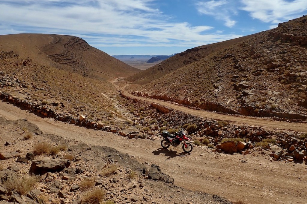
Tizi Haroun 1825m (Route A6) Well known from previous Morocco Overland editions, Haroun rises to give huge views over the Issil plain (top of the page), but after the pylon turn-off down to rock-bound Lemdint, the trail turns into an unmaintained ‘BLV’; in a car expect to be crawling for hours at walking pace. And that was before the big rains…
Slow descent to the desert floorNear the top of the Haroun canyon
‘Issil Pass’ 1825m (Route A7) I’ve found no name for the ‘Issil pass’, as i call it, another old classic from previous editions, with a jaw-dropping reveal if heading northbound on A7 or the TMT. Riding it last week, the valley to Amtazguine is slowly getting asphalted, but the switchback climb between Mawas and Issil remains an easy and epic gravel track.
Cresting the Issil pass
Tizi Mourirt 1825m (RoC) I’ve often thought there was something up here but never looked carefully enough. The Route of the Caravans pushbikers did and logged a route via Tizi Mourirt (Tizi n’Tlite), which comes down to A7 near Mawas village. One for next time.
RoC map
ⴰⵄⴻⴷⴷⵉ ⵡⵉⵙ 7 Local Amazigh legends speak of a lost pass somewhere in the Jebel Tawzart, an ancient trade route now known as the The 7th Pass or ⴰⵄⴻⴷⴷⵉ ⵡⵉⵙ7 which got smothered in some Atlantis-like cataclysm, just as a treasure-laden caravan was passing through. It’s thought to lie somewhere in the higher reaches of the Jebel’s rim between Mourirt and Tawzart.
To paraphrase the cop addressing Jack Nicholson’s character at the end of Chinatown: ‘Forget it Jake, it’s the internet.’
Exactly where does the iconic and eminently Instagramable majesty of Sahara start in Morocco? Like Keyser Söze, is it even there at all? Years ago I came across an internet forum argument on the now defunct LP Thorn Tree (I gave my 2ç then left them to it). There, a couple of know-alls lambasted the callow innocents daring to enquire where they could ‘see the Sahara in Morocco’ – in most cases referring to the famous Erg Chebbi dunes. ‘I told you: there is no Sahara in Morocco!’. All concerned have now migrated to TripAdvisor from where the quotes below were copied. It staggers me that some of these individuals can assert their unsubstantiated beliefs with such conviction, but such are the times. According to one of TA’s wise owls, ‘Erg Chebbi is not in Sahara, desert it is but not Sahara‘. So the Sahara is ringed by an unnamed desert that is not the Sahara?
… neither … Erg Chebbi/Erg Chigaga are the Sahara. For that you need to head to Western Sahara. Ok, we know that but we want just see Sahara and ride camel The limit of the Sahara is classified by the limit of the Date Palms the Sahara,… lies 100 km or more to the south in Algeria. Although not part of the Sahara , the dunes are pretty amazing. It also corresponds to the 100mm isohyet in the north and the 150mm isohyet in the south. Long term average rainfall. A further definition is where the evaporation potential exceeds the presipitation [sic]. I don’t care what “Sahara” means. I am talking about the actual geographical boundaries of the area. And your definition of those boundaries is as incorrect and misleading as that of the ridiculous tour companies’ one. Erg Chebbi is not in Sahara, desert it is but not Sahara. If you by reading see on website about Sahara tour, then it is only marketing to attract customers. But Sahara begin first in Algeria or you have to go to the South of Guelmim, to Western Sahara. Here we go again with the “Erg (Chebbi/Chiggaga) is not the Sahara” brigade. What’s wrong with you? What’s a few hundred miles between friends? Jesus H. Christ. May I just make one thing clear? You will not be travelling through the Sahara desert until you have gone south of La’ayoune. References to the Sahara in other places such as Erg Chebbi and so on are simply concoctions dreamt up by tour companies to fool their victims into thinking that they have been to the Sahara – they haven’t. To the east, the Sahara starts way over the other side of the border, deep into Algeria. the Sahara if [sic] 100’s of kilometers away from the big dune areas over the border in Algeria and not in Morocco [continues] ... [Chebbi] is more spectacular than any of the places in the Moroccan Sahara that I have visited.
This way please.
This knotty problem of the Sahara’s precise extent may be unique to Morocco. You start with the very concept’s compelling mystique. It’s hard to think of other wilderness regions that conjure up such strong imagery and notions, maybe because it’s so close to Europe compared to other iconic wastelands. Then you mix in the unceasing clash between gullible bucket listers wanting to definitively tick off the Sahara – and devious local tour ops who promise the earth and deliver a turd. One wily tour agency has even managed to insert themself as a ‘reference’ on Wiki’s ‘Sahara desert (ecoregion)’ page. This seems to be the angled grinder which the naysayers above fixate on: if some Moroccan cat in an oversized cheche strolls up and says ‘Hello my friend. Come, we will drink tea with nomads and I will show you Sahara’, you can expect to be a little disappointed.
As with all geographical features (seas, mountains, etc), it’s tempting but futile to apply fixed boundaries to their precise extent, as if they were a country. Where exactly does the Southern Ocean become the Atlantic? Where does the Karakoram become the Himalaya, or the High Atlas become the Anti Atlas for that matter (along the N10 highway, of course!).
It’s only rain
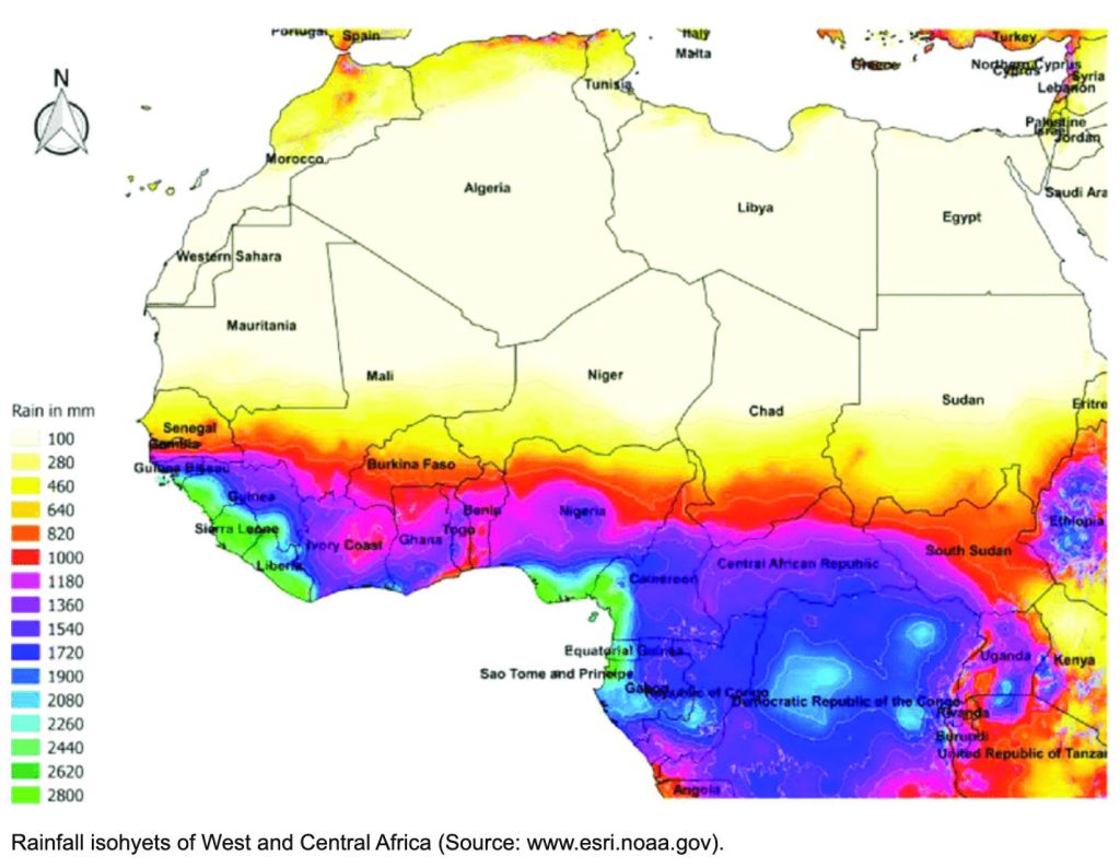
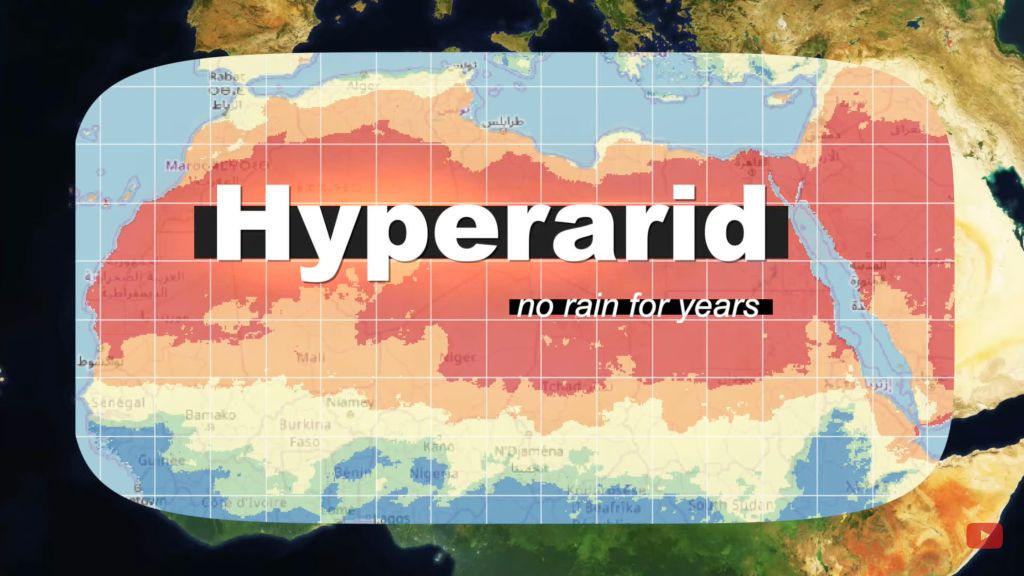
It’s the same with hot deserts, commonly defined as arid regions with less than 100mm of average annual precipitation. Unlike a sea shore, there can be no finite edges identifying this change in rainfall; to imply otherwise would be absurd. In this way the NOAA map (above) is rather more nuanced, showing blurred transitions, not fixed isohyets (rainfall contours) between regions. Both the hard-edged yellow and red maps below could benefit from the same idea.
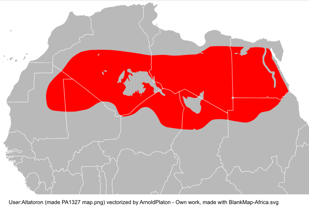
Sahara map from Wiki The hyper-arid Saharan core from another Wiki
Chebbi-aye-yay
According to this ridiculous website, (sadly, the first that popped up on my Google) it appears to rain every other day in Merzouga/Erg Chebbi. (The ‘sea temperature’ there gets pretty balmy too – or maybe they mean ‘sand sea’). This source for Merzouga looks rather more plausible: 65mm. Another estimates 53mm. yet another 172mm. This French Wiki gives 59mm. Let’s assume it’s not Kew Gardens down there and it comes in under a 100 mil most years.
Another map with a red zone straying over the Moroccan border. Can’t be right! Source
Archway into the desert, south of Guelmim (iirc)
Not all accept the level of aridity as a definition (‘I don’t care what “Sahara” means…‘), but they don’t cite any sources to explain their assertions about the Sahara’s boundaries. Instead, some of the TA dolts avow the Sahara lies ‘100km south of Erg Chebbi’ (ie: in Algeria). Others insist ‘200 miles’ from Chebbi. Final answer: ‘100’s of kilometers away’. Some even proclaim they magically entered the Sahara at Guelmim in western Morocco because ‘it is officially known as ‘The Gateway to the Sahara’’, surely a bald, tourist-oriented claim in a town famously thick with faux Tuaregs.
Leaving the clammy Tropics. Scorchio!
Others insist that, to be in the Sahara in Morocco, you must go ‘beyond Layounne’ (left), a fairly boring road trip, even for a dedicated bucketeer. What will they see on the way there? It may look like a desert, walk like a desert and quack like a desert, but it sure won’t be the Sahara! No matter – give it a few decades because it’s said the climate in Morocco will see the Sahara creep over the berm and into Morocco.
You can see why some of your forum know-alls get cynical, myself included, even if I believe they’re dying on the wrong hill on this one. Lately, some canny marketing has designated an area of eroded wasteland ever so conveniently close to Marrakech’s gated resorts as ‘the Agafay Desert’ or ‘le petit Sahara’ which ‘extends over several hundred acres’. There you can do all your favourite deserty things: sip tea in a tent, wear a cheche or ride camels, quads and 4x4s across a landscape where the barren rounded hillocks of dried mud resemble dunes. Insta heaven!
Some academics have sought to reclassify the liminal sweep in question as the ‘North Saharan steppe and woodlands‘. Aka: the edge of the Sahara where things gradually become less arid, like the Sahel in the south. But looking at the zone on the map below, ‘woodland’ is not a word which springs to mind. The band encompasses the vast Grand Erg Oriental spreading across Algeria (left) and southern Tunisia – about as Saharan an expanse anyone could wish for which would swallow up hundreds of Chebbis. The only woodland here is of the petrified fossil variety, west of Hassi bel Guebbour.
Selima
Me? Having travelled much of the Sahara over the last five decades, if you pushed me blindfolded out the back of a Hilux behind Erg Chebbi and removed the hood, I’d get up, smell the air, squint at the sun and guess I was in the Sahara. It may transpire to be the edge of the Sahara in boring old Marrokie, because vegetation and rainfall change in a very short distance (by Saharan standards) in the mountains to north. But from Chebbi south and west along the Algerian border all the way to Tan Tan, it all resembles the Sahara I’ve seen – often dreary, sometimes epic, often barren, vegetated in patches, hyper arid elsewhere – all the way from Mauritania’s Adrar plateau to the Selima Sand Sheet (left) close to the Nile.
Camels? Dunes? Palms? What else could be be?
If anything, Erg Chebbi is just too darn Saharan for school and so has become one trampled terminus of Morocco’s Axis of Tourism, a quad-busting desert resort. I avoid the place. Over the years the pretty cluster of dunes at the end of the road has become choked with desert camps, kasbah-hotels, a few opportunist sharks and us tourists doing the dunes by various means. In that sense it is very much not what I know of the real Sahara, but caught right, Chebbi can still be an amazing sight for a desert first timer. You’re on the very edge of the Sahara. Which side you’re on is up to you.
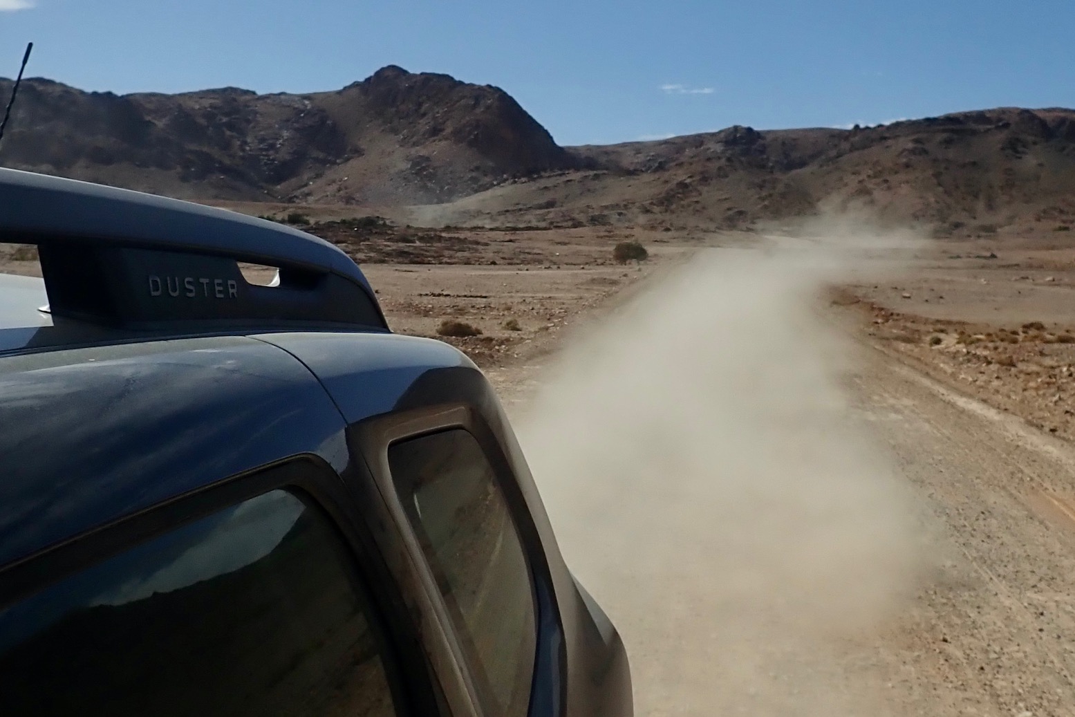
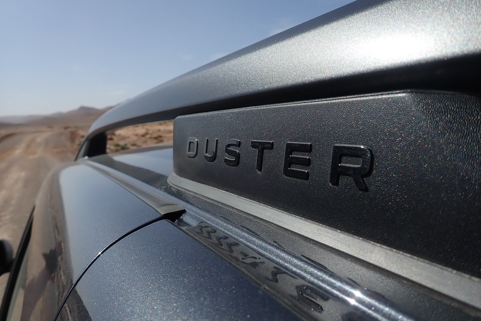
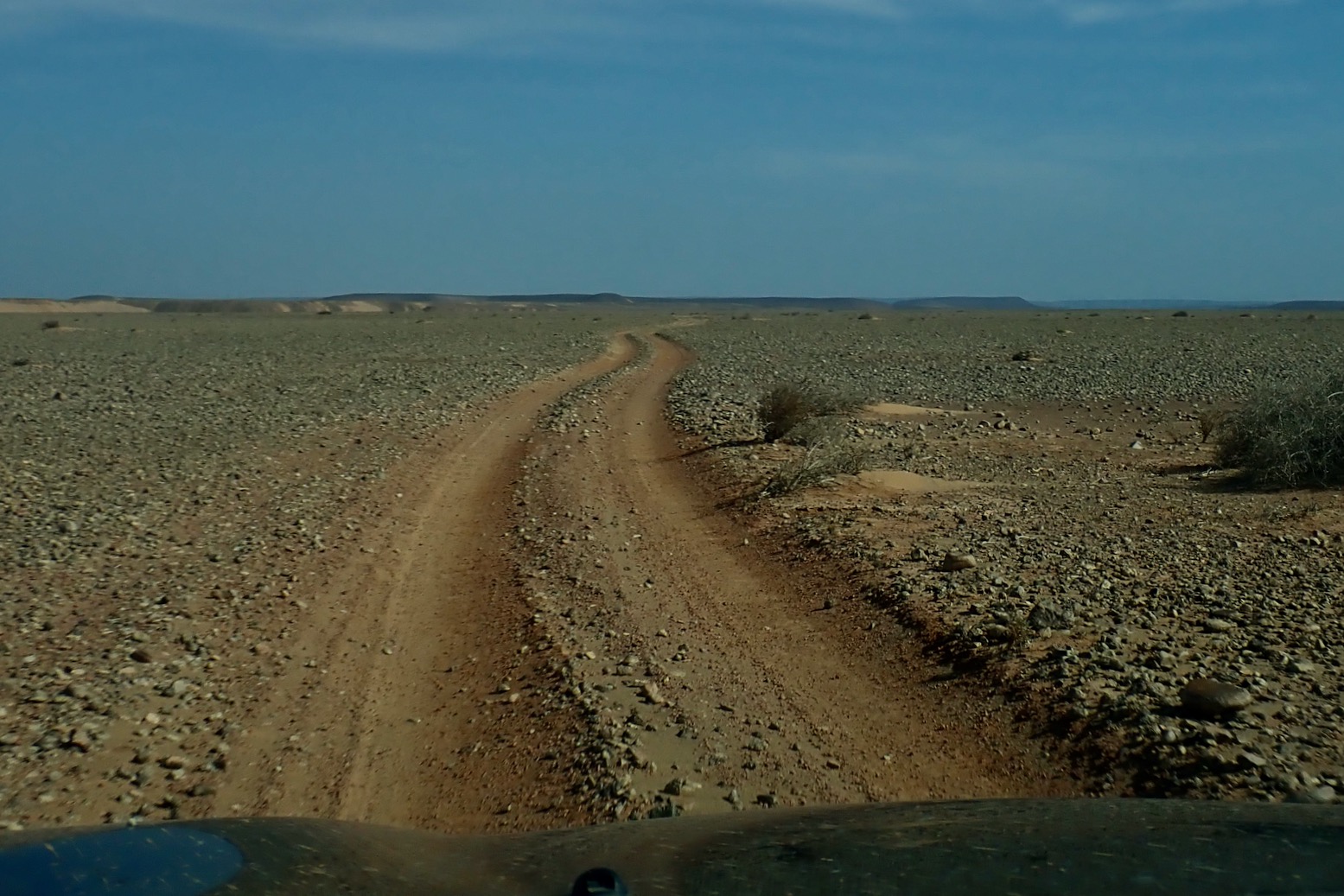
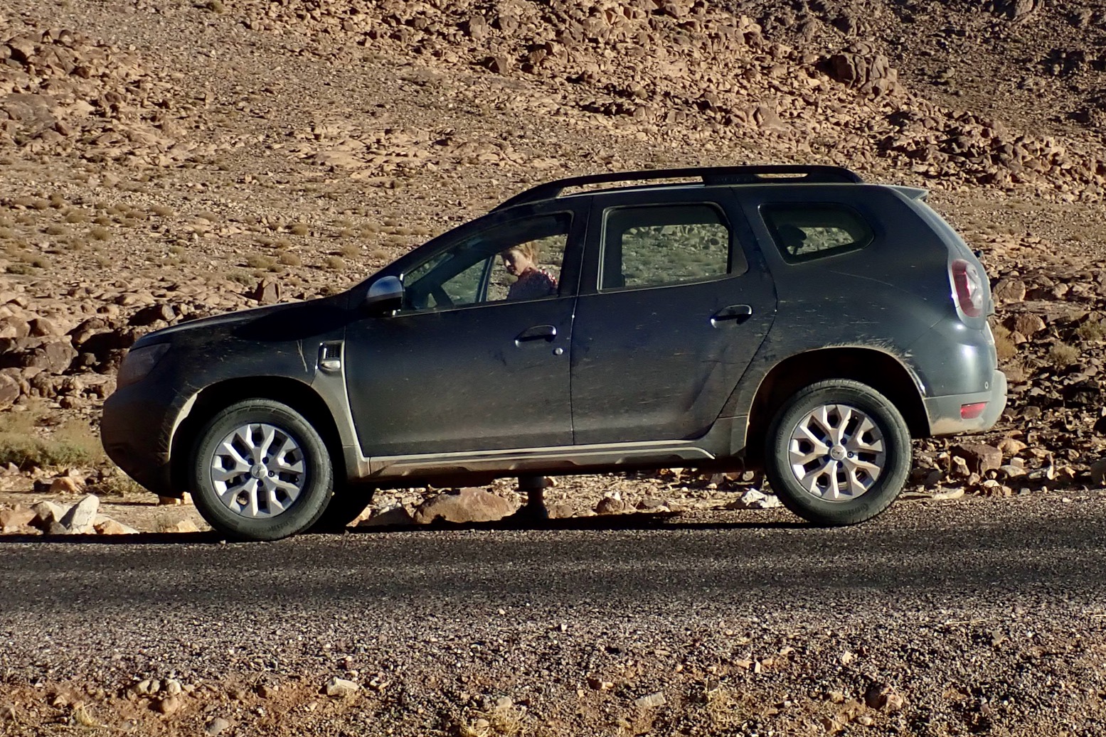
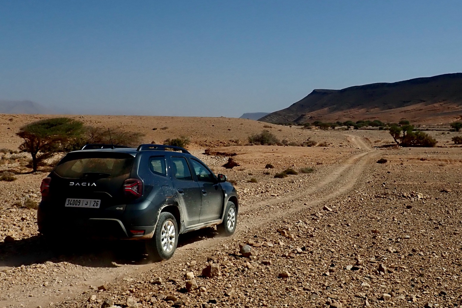
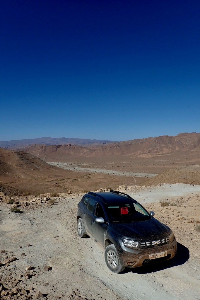
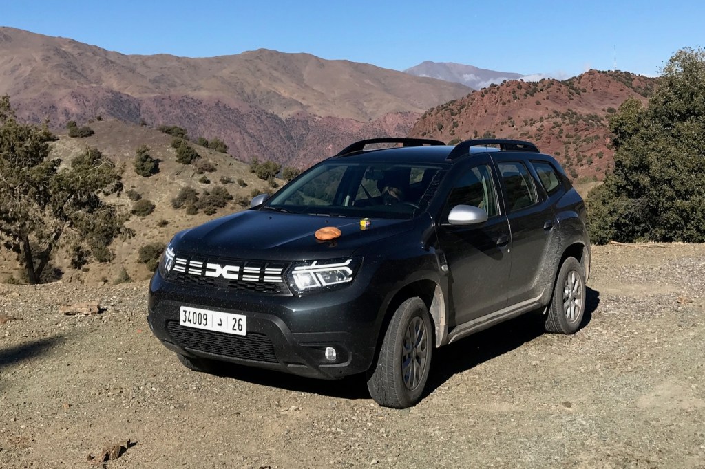
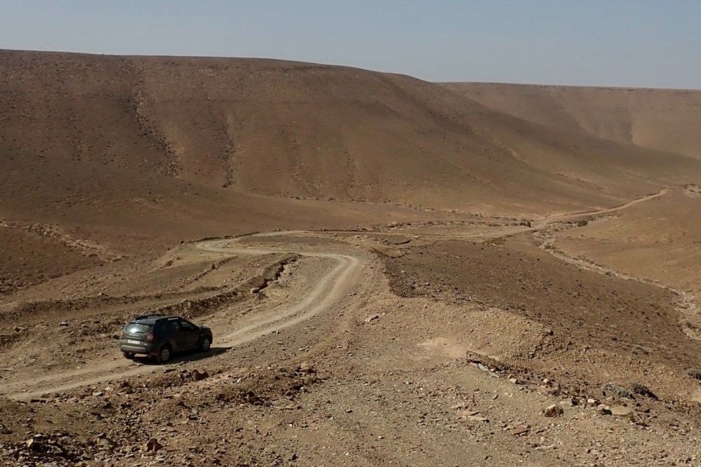
In November the Mrs flew in between my moto tours and we hired another Morocco-built Duster from Medloc Marrakech to scout routes for the M4 book, covering the western corner of Morocco to the Atlantic and within an hour of Smara. Only this time they had a 2023 model with just 14,000km on the clock, but still just €65 a day – about half the price of a Toyota TXL. For more on the rental experience and my unchanged pros and cons, read Duster 1 from earlier this year when we drove a 100,000-km far, but got little done due to preceding rains having damaged many roads and tracks. By the time we got this newer model all the tracks we tried to do and more were in great shape, and so were able to push the car less hard.
A Duster can restore you cynicism in the SUV craze by having genuinely utility on regular tracks (but see below), plus enough power to sit at 130kph on the desert highway – as fast as you’d want to go with camels roaming about. At the same time it’ll reliably do up to 45mpg or 15kpl giving a massive 800km range. And these modern diesels are quite amazing: torquey, quiet and nippy. With an auto box it would have been even better.
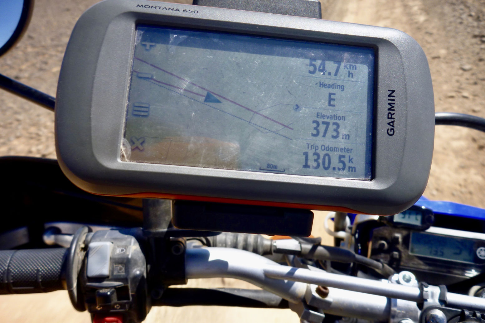
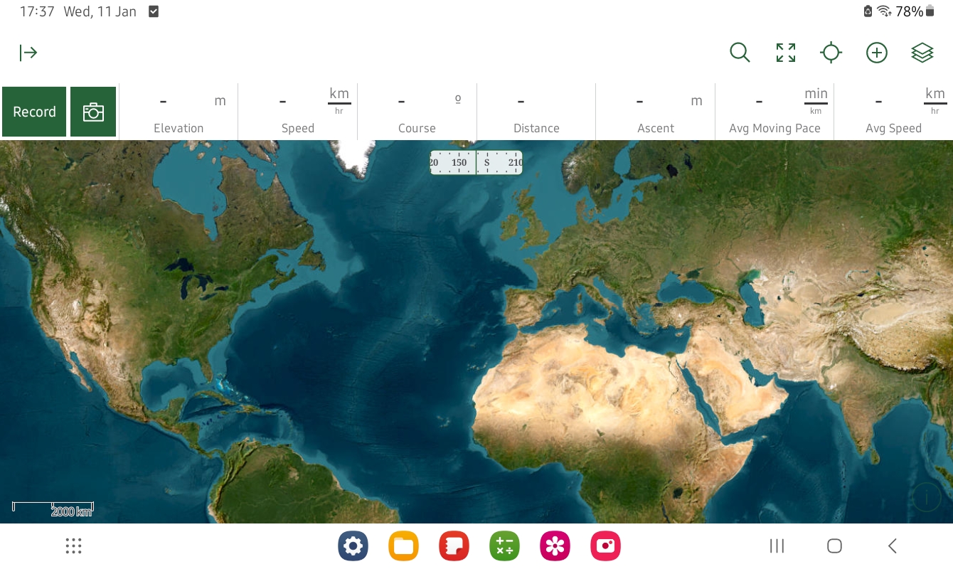
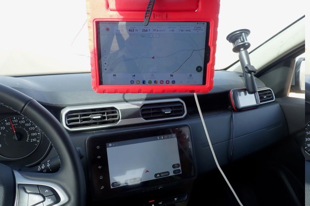
On our one the air-con actually cooled properly which was a relief, the switches and dash have been re-organised, but the fitted satnav was bogus. Yes there was a map displaying our position on an unnamed road or track most of the time, but there was no other info at all and no routing function. This confused us until we read you have to visit the Renault (Dacia’s owners) website to download a map/app? onto a USB stick or some such. You couldn’t even pair a smartphone screen (or we failed). Be warned: unless we got something wrong you will need your own nav device. We had my Garmin Montana, as well as a more readable Samsung tablet running Gaia maps (above). I did happen to have my music on a USB stick and that system worked intuitively, through the speakers are not the best.There was music pairing off one iPhone too.
Toyota’s Prado TXL is the other main 4×4 rental in Morocco but tough though it may be by reputation, the autos can be comparatively portly slugs and unless lifted (left), are also bottom scrapers. As it is, I’d not be surprised if the 1.5 litre, 110-hp 6-speed TD Duster has a superior power to weight ratio than a TXL. It certainly takes off and overtakes effortlessly out on the road and handles bends well thanks to anti-roll bars. Only for deep sand or exceedingly rocky climbs – rare or avoidable in Morocco – might a Prado’s Low Range be needed.
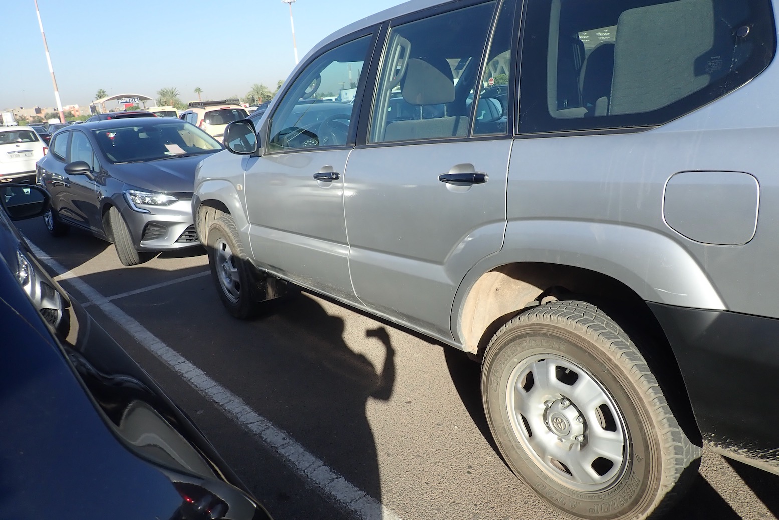
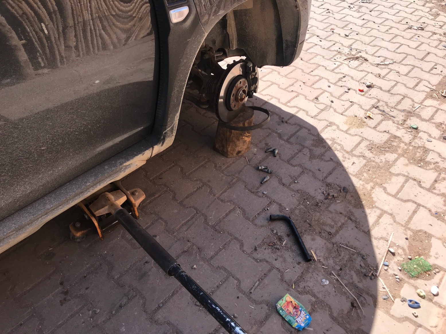
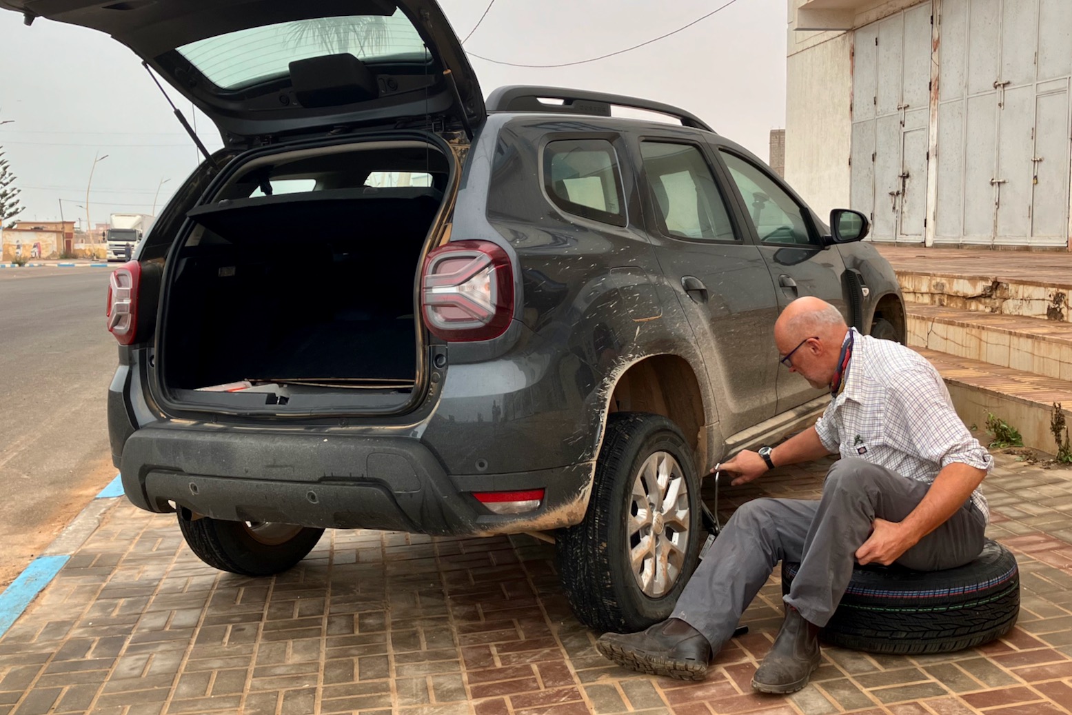
Within hours we got a flat on the ropey Tizi n Test road, luckily just as we stopped in Ijoukak for supplies and close to a tyre repair shop. This was a bit worrying on the road; were the Continental tyres cheapies? I had the means to plug flats with a spike/worm, but better to get a shop to remove a tyre and vulcanise a patch from the inside.
We had another flat in Tan Tan Plage which needed the spare fitting to drive to the tyre shop. This spare is speed limited to 120kph which seems fast enough, and looked the same size tyre, but on a steel rim. Note that the scissor jack has only just enough reach to lift the rear, and be careful about positioning it correctly until the metal sill, not the plastic trim.
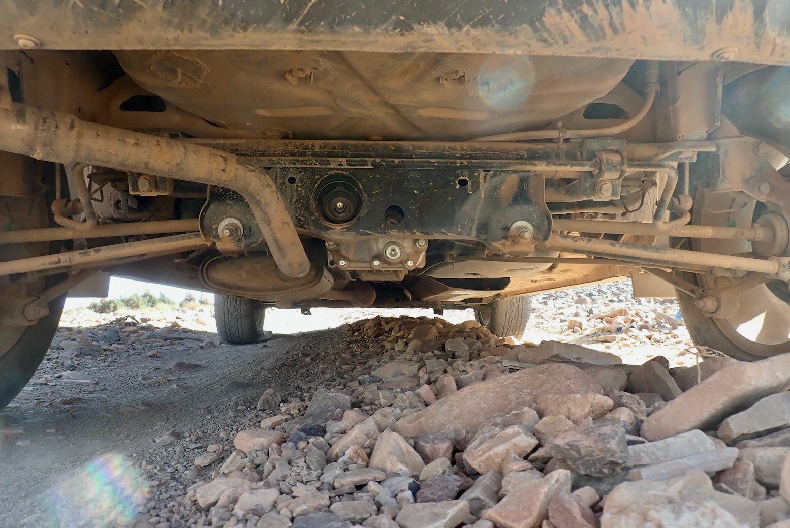
Off road obviously you take it easy in a rental when alone in the desert. So many SUVs, even AWDs have disastrous frontal overhangs but I never scraped the front or rear bumpers driving in and out of ditches or oueds. Same with the ramp clearance. But as before, the ‘axle’ clearance is oddly not as good as it looks and you find yourself having to straddle ruts to one side (above) to maintain clearance. A full tank may not help, but we just had two bags in the back. As you can see below it’s quite tidy and nothing sticks out – it must be down to the plush suspension so you just need to slow down to limit compression and contact. We left the tyres are 2 bar road pressures.
The scraping was frequent until I got a feel for the clearance but the noise is probably amplified by the protection hardware, and we’re talking piled rocks, not solid impacts. Dust crept into the covered boot space so the rear hatch door seal may not be so good. Had I remembered, I’d have done that trick of parking on a bank with one wheel in the air, then closed/opened a door to evaluate body twist as we did with th TXl a few months later. Door closing cleanly = good stiffness.
In 3000km I probably turned on ‘4WD Lock‘ for about 500 metres, mostly to spread traction while crawling out of stony oueds and on one sandy climb in the wastes of Western Sahara.
All up, I’d happily rent a Duster again from Medloc. If you have experience driving 4x4s effectively you soon recognise the limits of a Duster (largely no Low Range). If you’re new to off-road but want to go in hard, you might feel better in an automatic Toyota. Having done a few thousand kilometres in both over the last year, for normal road and track exploring, a Duster is more than adequate and better value for money.
In a line If you have the previous edition, save your money – this time round they’ve made more changes to the cover than the actual map itself.
Note: in December 2022 a traveller had his RKH mapconfiscated at the Ceuta border because it showed ‘Western Sahara‘ – (like all other paper maps, afaik). Actually the back cover (see below right) always gave the impression it is all Moroccan territory, but inside they mark the ‘Moroccan Wall’ and the Polisario ‘Free Zone’, which is correct and more detail than most maps, but might also get up the Moroccans’ noses.
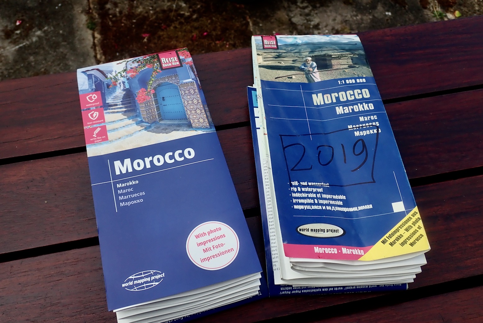
For the very latest mapping digital, OSM updated by users (used by Garmin and many others) is useful. But not everyone gets on with digital maps which are far from perfect of accurate, At the planning stage you can’t beat a paper map spread out before you. Out of habit I routinely carry a 2019 RKH out there, though almost never refer to it now as i know all the southern roads. I have much more success finding unknown pistes as well as verifying newly sealed roads from aerial imagery. As you can read here, the German Morocco Reise Know-How (RK-H) is one of the least bad paper maps for Morocco. It’s double-sided, the plastic paper is tear-proof and compact at 70 x 100cm, and it has an intuitive 1:1m scale (1mm = 1km). They also show both old/new road numbers which changed in 2018, but unlike Europe, this information is of little use in Morocco (* see bottom of page). In 2023 RK-H published the 13th edition of this map. The big question is, given the amount of road-building going on in Morocco, is it a properly updated edition like the previous one, or just a new cover with a few updates, as Michelin like to do? The answer is that in the south there appear to be virtually no changes to the actual mapping in the 2023 edition.
What they say Reise Know-How maps are characterized by particularly stable plastic paper that can be written on like paper, even with a pencil. The cardboard cover is detachable so that the card can easily be slipped into any pocket. A protective cover is not required. The cartographic presentation focuses on the most important information for travelers and is particularly easy to read. Colored elevation layers are used instead of hillshading.
Contour lines with elevation information
Colored elevation layers
Classified road network with distance information
Sightseeing features
Detailed local index
GPS accurate
degrees of longitude and latitude
Legend in five languages (German, English, French, Spanish, Russian)
Einklinker Western Sahara
Larger places also in Arabic script
With the 2023 edition laid out alongside my crumpled 2019, what’s new? The cover; that’s about it, but it does include a redesign of the back cover too! Even the decorative pictures on the northern side of the map are unchanged. I may have missed some of course, but a few minutes scanning familiar roads and pistes in the south brought up precisely two changes, maybe three. Everything else appears identical.
2019 – 2023; spot the difference. The notepad is tellingly blank.
1. What was a yellow ‘Secondary Road’ for Route ME4 (Korima Pass in Morocco Overland 3) has now changed to ‘Track’ although it was actually a ‘Gravel Road’ imo. It suggests a user’s correction was actioned, but ironically it’s now sealed up to KM41 or beyond. I bet there are many more sealed roads let alone tracks on the nearby Rekkam plateau. 2. Another former road they’ve admitted was a piste all along is the R704 (Route MH1) High Atlas crossing from Dades Gorge to Agoudal. Again, the irony is that piste is about to be sealed too! Thirdly, down in WS in the bottom left corner they switched ‘Laayoune’ with ‘El Aioun’ on the main panel in line with the inset; it was probably a typo.
In your dreams…
Elsewhere, right across the area I know well (not the north), pistes and even roads are still missing (Route MW6 to Labouriat) while many more pistes have become roads, in some cases over a decade ago, eg: Routes MW1/2/7 to Mseid; Route MH6 from Aguim as well as Routes MH7/8 south and west of Asakoun and Route MH4 Jebel Saro, etc, etc. Old edition and new, Route MS6 (left) is shown as a secondary road all the way to the Sidi Ali Tafraoute (bafflingly shown as a well: ‘Hassi Fougani’ on the map). Imagine arriving at the notorious Rheris crossing in your campervan! But west of Sidi Ali they miss out the well-used track carrying on directly to Zagora just south of Oum Jrane. And I’ve just noticed in the WS panel on both editions they’ve shown the 1000-km Tindouf Route as sealed all the way (via the PFZ no less) to Zouerat, complete with bypass! No wonder Moroccan hats are confiscating this map at the border. You can understand them not keeping up with all the asphalting, but the practise of calling a piste a road is hard to fathom. Where do they get this information – QAnon? These are just a few of the glaring errors that jumped out at me. There are loads more in the Anti Atlas, plus areas depicted as forest which are barren mountain hillsides and contour shading that jumps in 300- and then 600-metre stages. That means within one shade the elevation could change by nearly 2000 feet. Not a great map for push biking then.
To be fair the previous edition did appear to be a genuine update with tangible changes but this edition is near identical to its predecessor. And I know the Michelin equivalent follows the same practise of ‘cover updates’ and can be just as flawed, last time I looked. All the others maps for Morocco are even worse. Sadly, this appears to be the state of paper mapping in the early 21st century – the money no longer exists to update maps properly, nor even action users suggestions. Good thing then there is Morocco Overland with Updates & Corrections as well as the Horizons forum taking up the slack for the adventurous traveller. I gave the 2023 map away.
Got a 2019 edition? Save your money then.
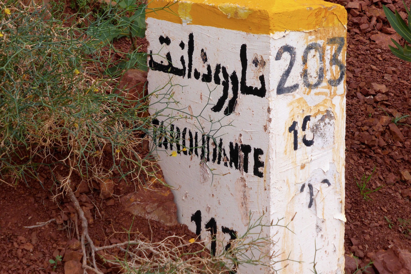
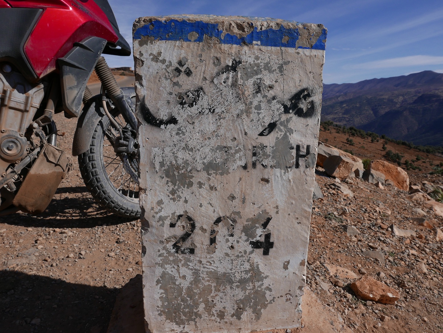
* Are Moroccan road number even useful? Unlike in the UK and Europe, in southern Morocco road numbers rarely appear on road signs, be they at junctions or showing distances. First photo is a positive example, below. So knowing – or wondering if – you’re on the R504 now called the RN4 will be near impossible to ascertain on the ground and therefor of little value. Of course a road sign saying ‘Foum Zguid 87 [km]’ will be what you want to know. Infrequent and often weathered mileposts dating from the colonial era may show a road number. Example: the R203 Marrakech – Taroudant road via Tizi n Test, now called the RN7. In most cases in the 2018 shake up, only the prefix changed so the ‘N10’ became the ‘RN10’ and so on, but elsewhere if there was a new number like the old N12 now called the RN17, I am fairly certain no one has since gone around Morocco updating mileposts and road signs.
Fyi, I do this all on a desktop computer or a laptop at a pinch. It may well be possible on a mouseless smartphone or tablet but would drive me nuts. Also, note this is a reliable but labour intensive procedure which may not align with modern ‘I-want-it-all-I-want-it-now’ sensibilities.
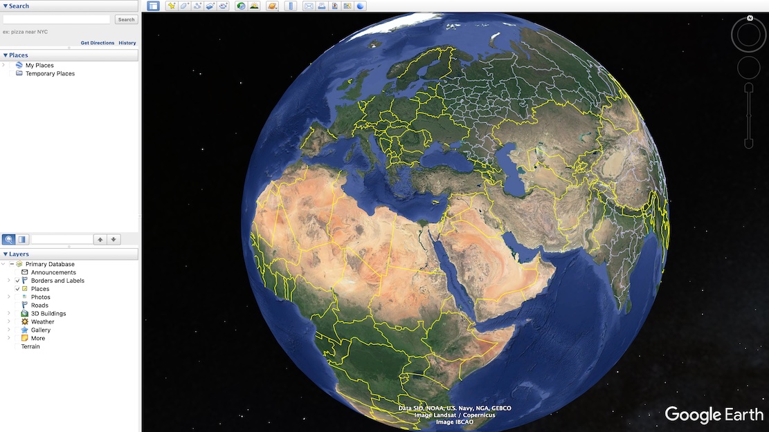
Particularly in the desert, these days aerial or satellite imagery from Google Maps and ESRI (Bing, etc) is so good you can spot passing vehicles and whether a road is sealed, a car track or even a little used donkey trail. This is the sort of age-sensitive information you won’t always get from maps, digital or printed. When planning new off-road routes, I find tracing the probable orientation in advance helpful for all the obvious reasons. It also provides a good preview of the area and what features I might come across (mineral mines; climbs, gorges, junctions).
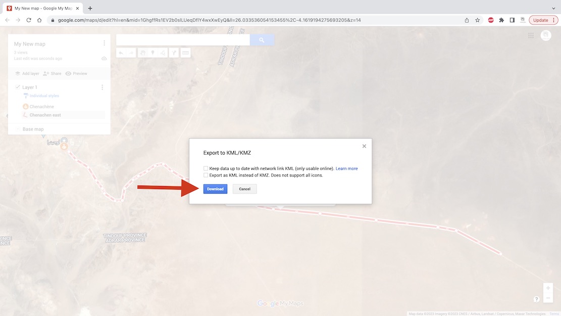
Using Google satellite mapping services, tracklogs can be drawn, saved and exported in two ways: Using Google Earth Pro – no Google account needed but your annotated maps won’t be automatically saved online/in the cloud. I’ve drawn tracklogs using this method in Moroccan hotel rooms prior to setting off along remote tracks (above left), benefitting from the reassurance of knowing a track exists and where the key junctions are. See the images and captions below for more. Note: this is a reliable but labour intensive way of doing it but does not align with modern ‘I-want-it-all-and-I-want-it-now’ sensibilities. You can trace a route much more quickly off something like Garmin Basecamp using the ‘Create a Route’ tool. It takes seconds. But afaik Basecamp doesn’t have an all important satellite layer to verify against an actual track on the ground. Somethng like the subscription Gaia app can do this, but you have to pay.
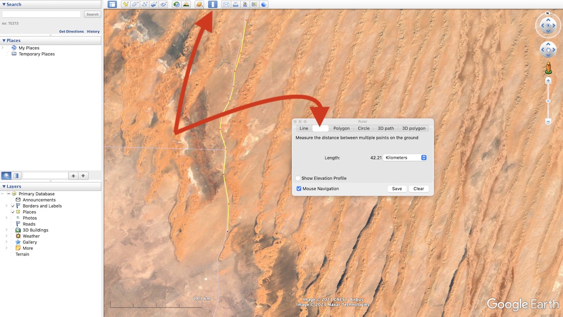
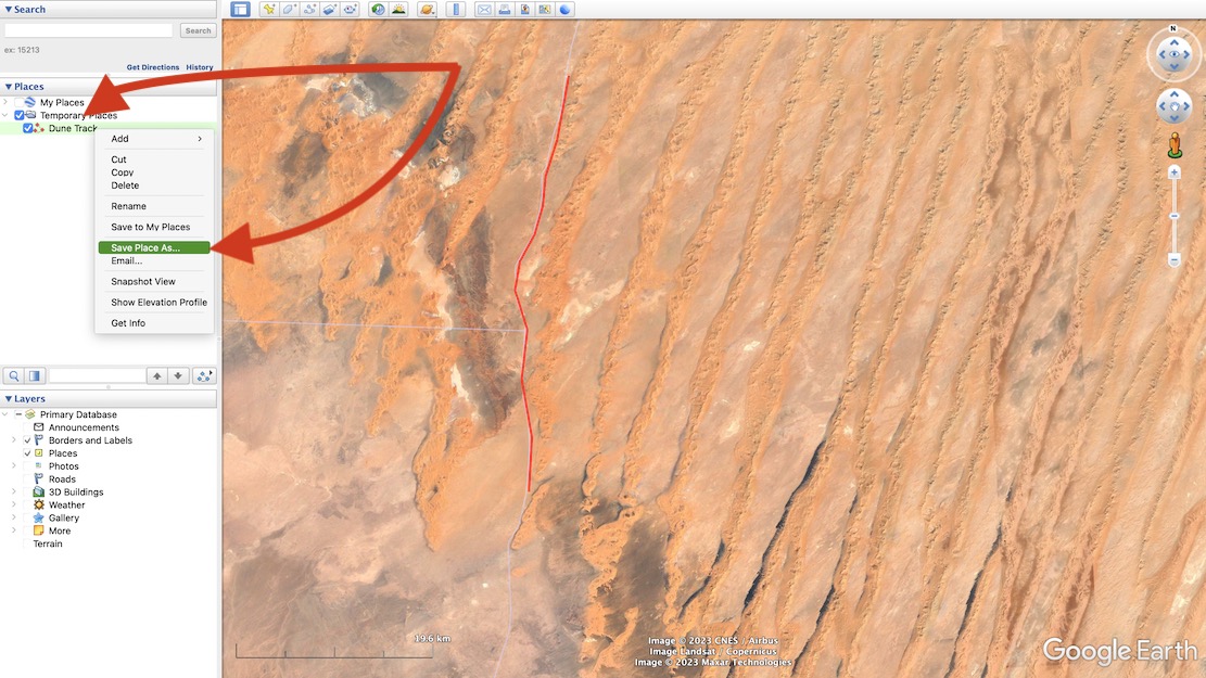
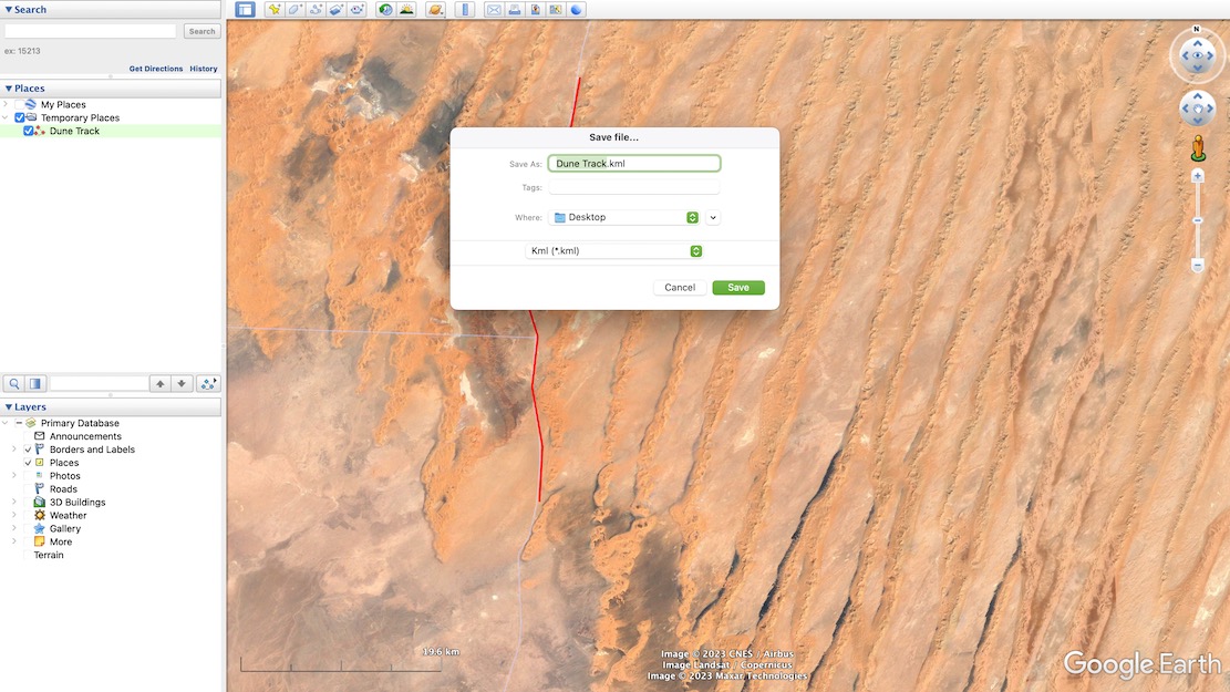
First: download Google Earth Pro (it’s free).Either search for your place or zoom in on your start point. Now choose the Ruler in the top tool bar and then select Path (blanked out above when selected). With your mouse trace a path click by click, point by point along the track you want along the ground. The extent of precision is up to you. When you’ve finished, Save.The tracklog your drew is saved. Now right-click and choose Save Place As…It saves as a .kml or .kmz file (same difference, more or less). You may now need to convert the Google .kml file format to .gpx to import into Garmin satnavs and smartphone/phablet nav apps. Garmin BaseCamp (free) can do it, or use also free online converter like GPS Visualizer. Import the .gpx into your device and you can now set off to navigate your MYO tracklog.
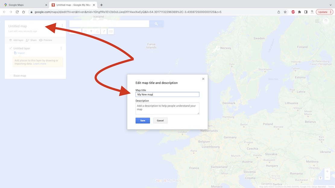
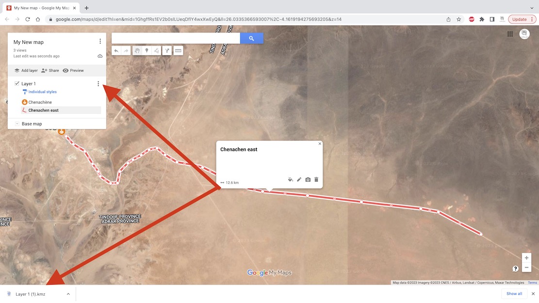
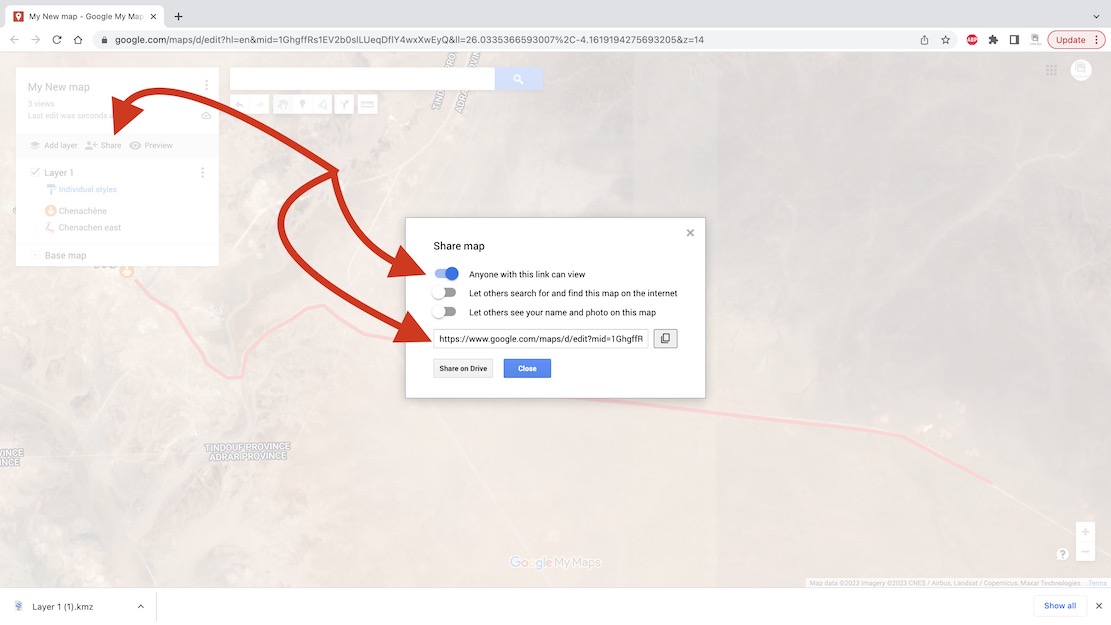
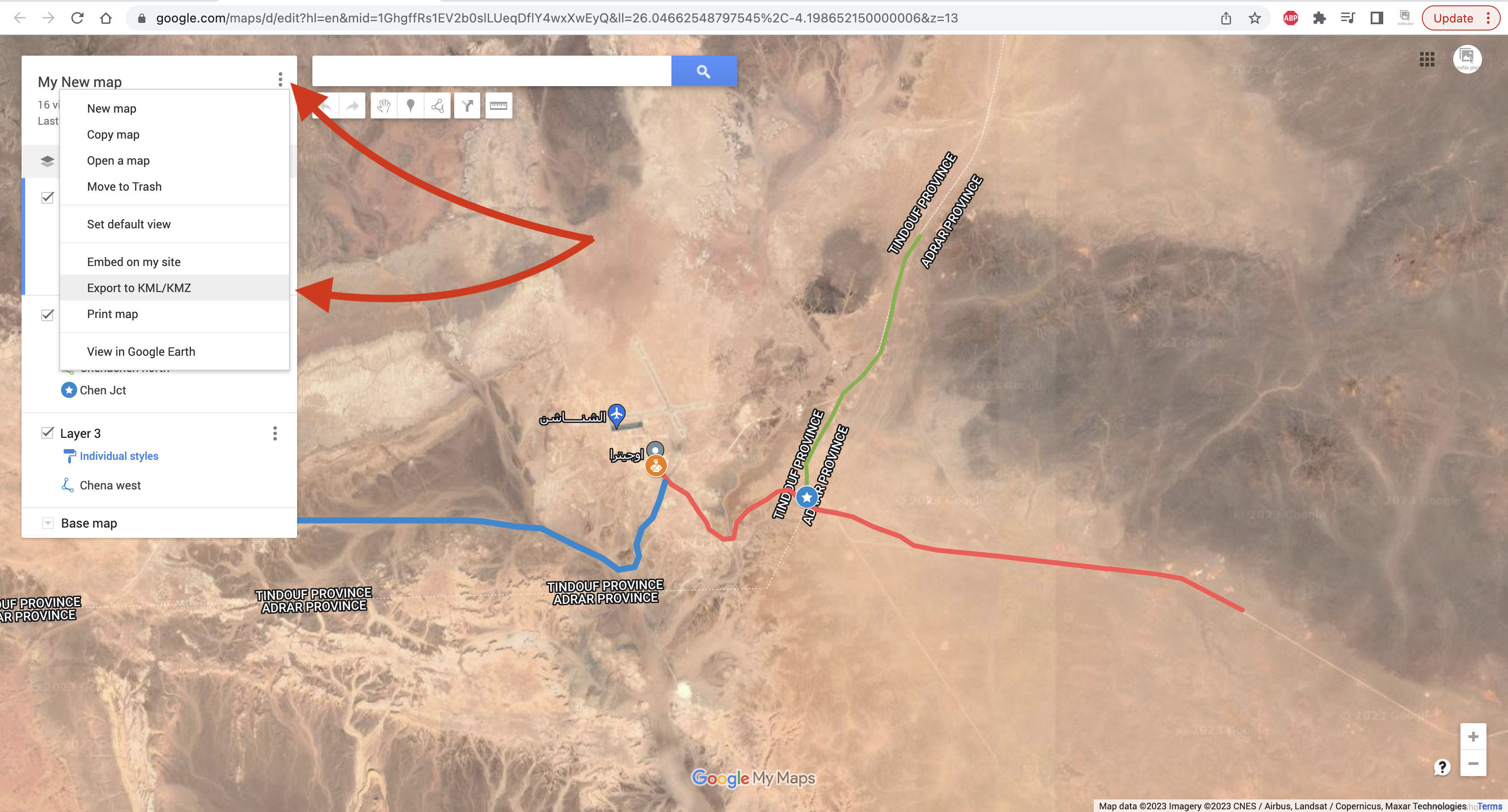
With a Google account (…@gmail, etc) you can save your routes on a Google ‘My Map‘ as has been done for the Trans Morocco Trail. It can have as much detail (tracklogs and waypoints) as you like, but Google ‘My Maps‘ are limited to about 10 layers. Layers are a bit like folders (with infinite capacity) and sometimes you have to shift tracklogs or waypoints into a pre-existing layer to free up a new layer so you can import more. This map can be shared or exported but will be saved online and be viewable/editable wherever you have internet.
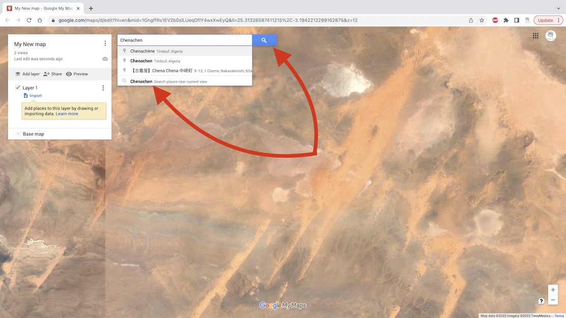
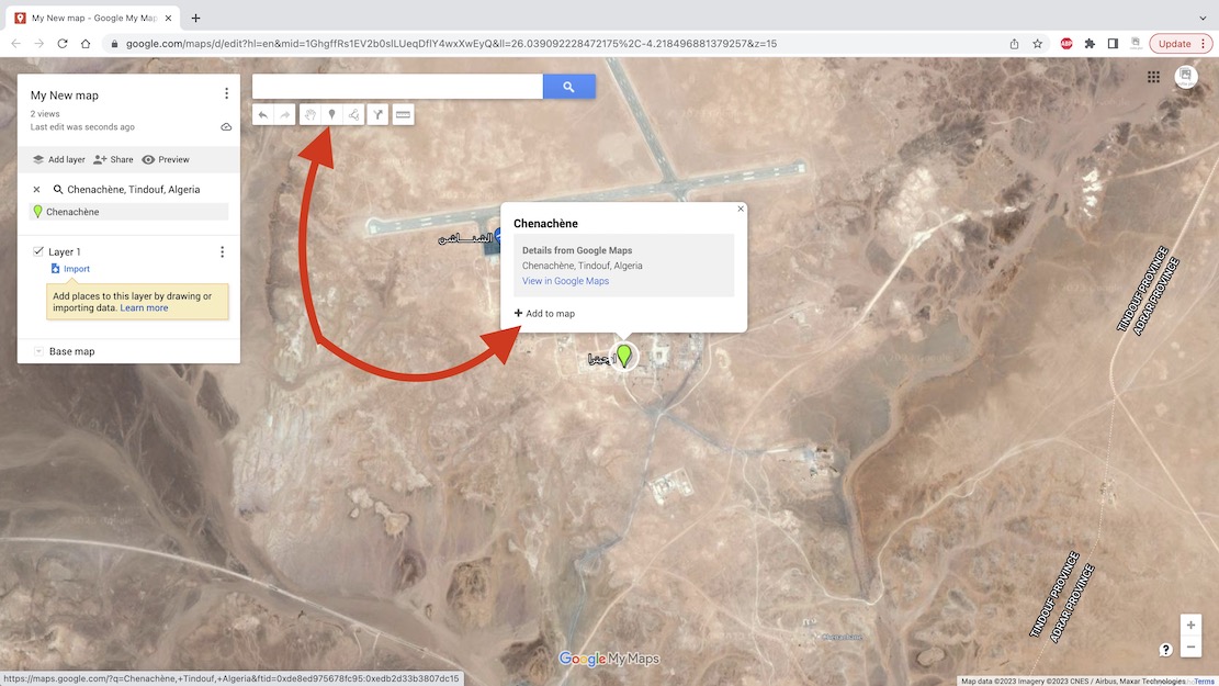
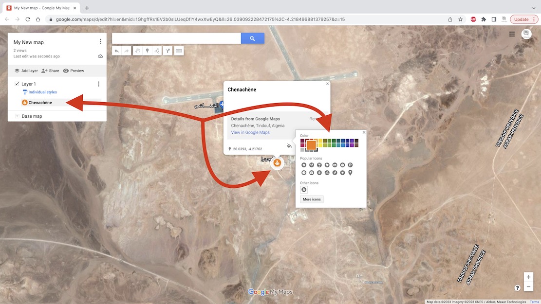
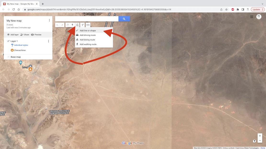
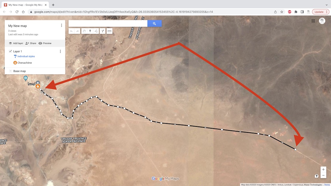
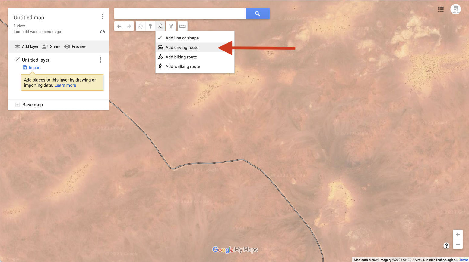
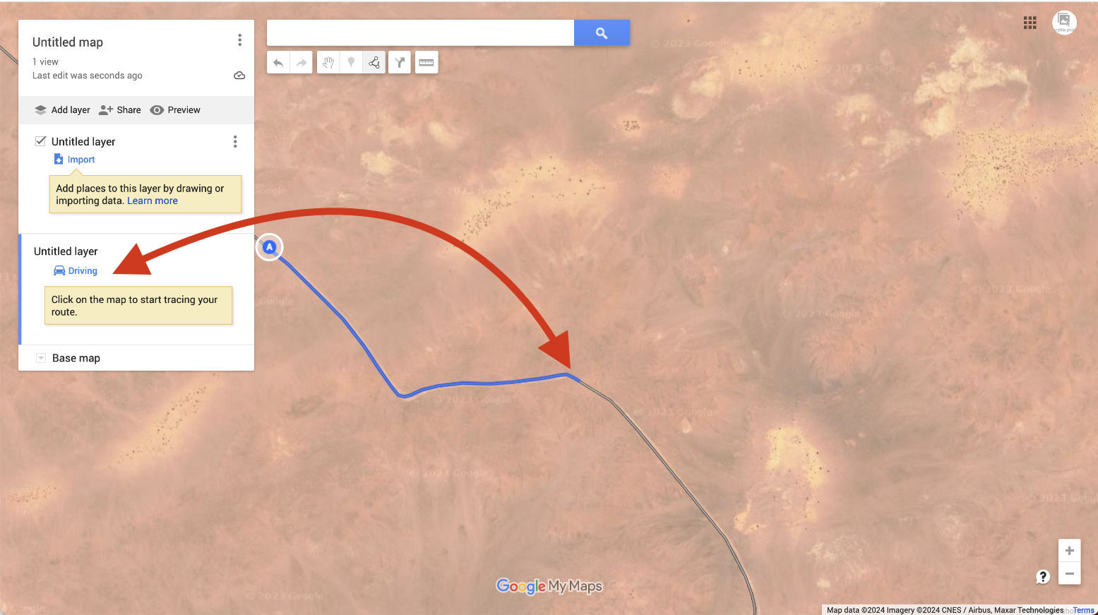
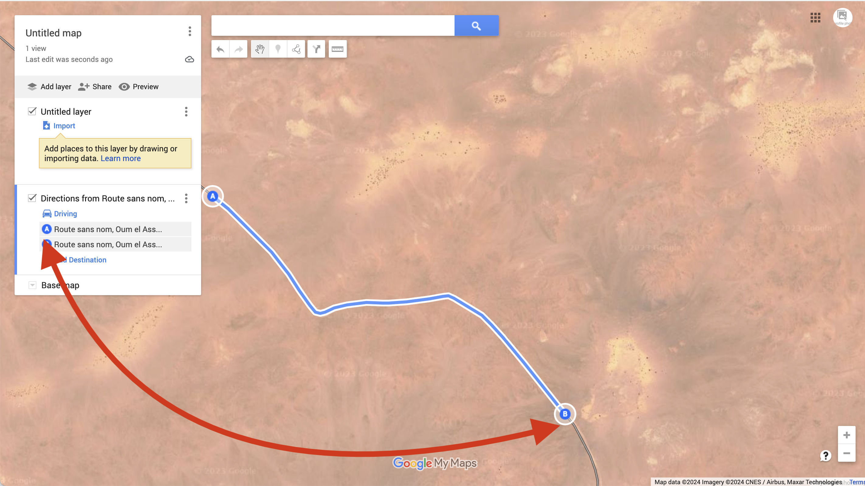
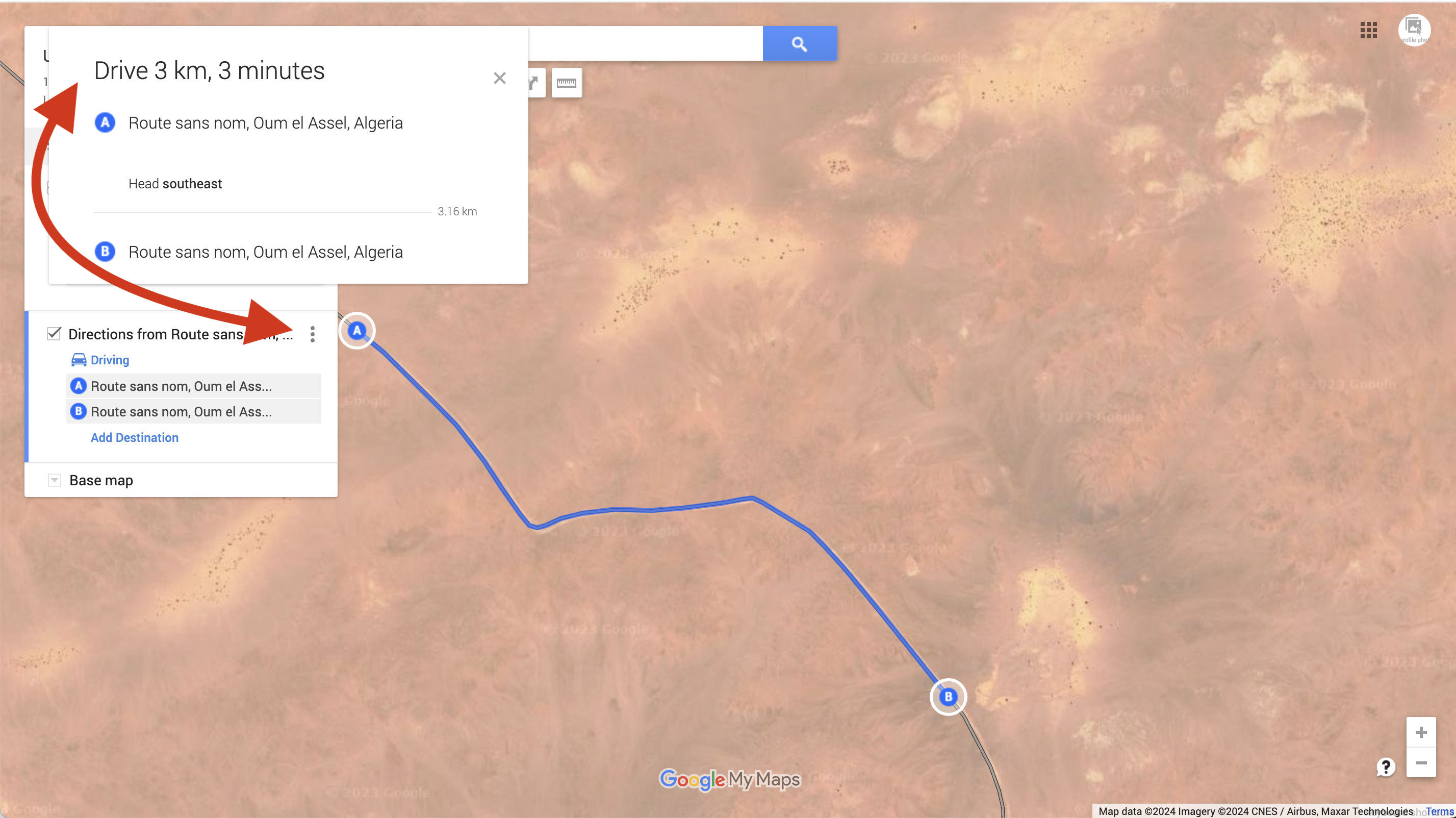
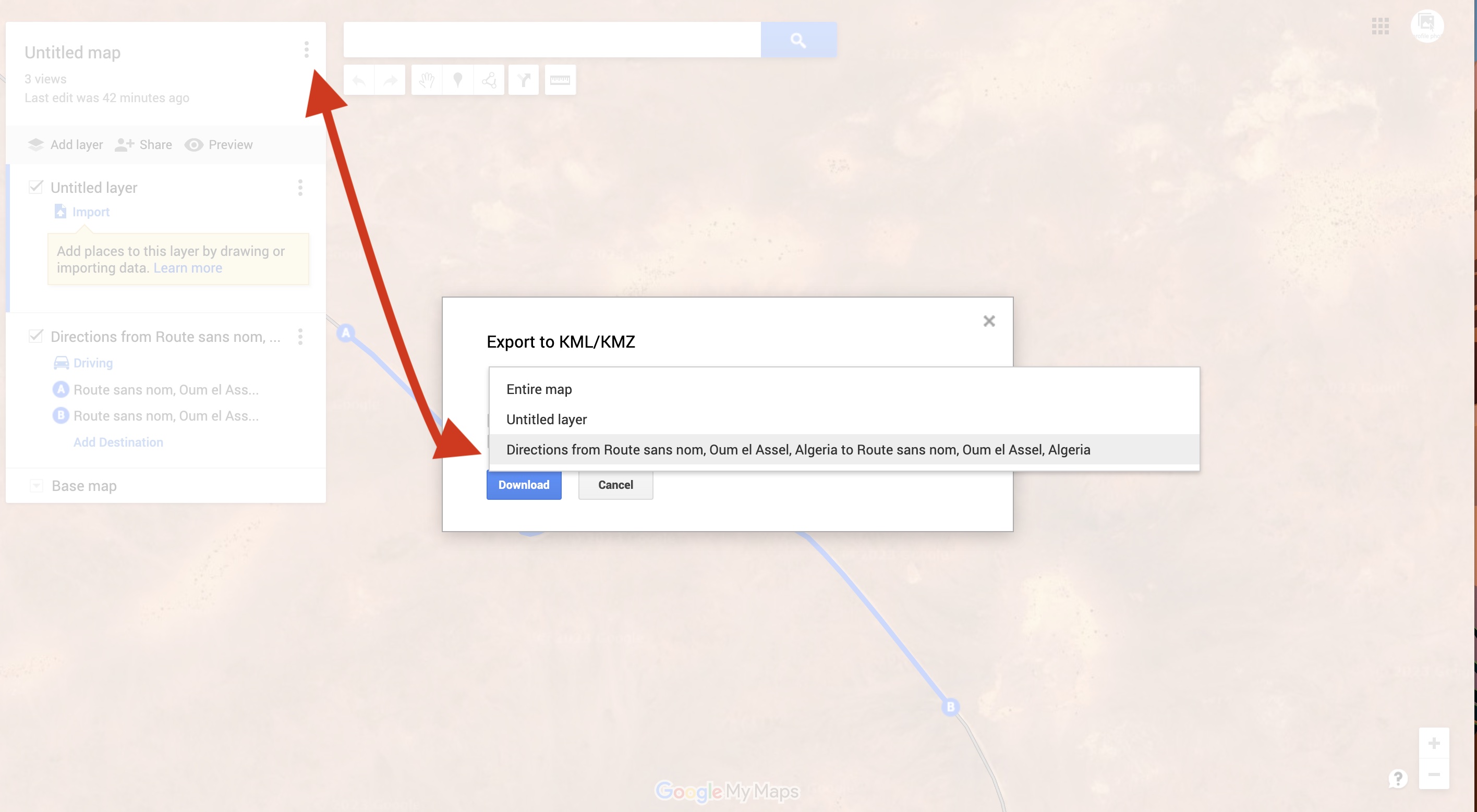
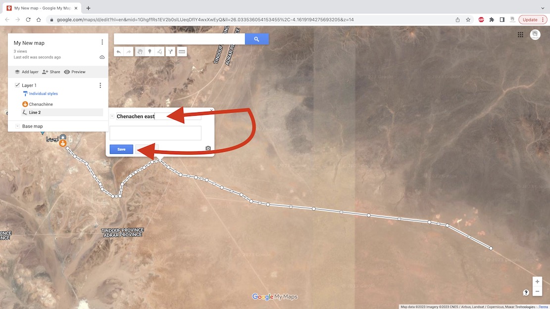
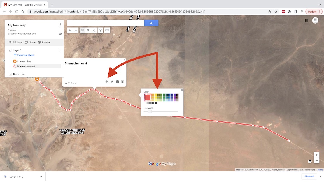
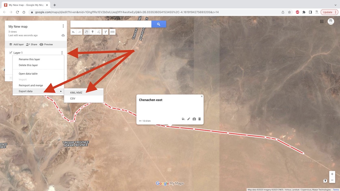
Open Google Maps and once signed in, click the Menu top left.I already have Saved maps so look for My Places or My Maps and click.In the sidebar click Maps and Create New Map.You can give your map a name and save. Google autosaves every few seconds so long as there is internet.You may also like to Name your first layer in your map and Save.To trace a tracklog you need to change the map’s base layer to Satellite.It looks like this – people often call this ‘Google Earth’ though that’s actually the app above.If you don’t know where your start point is and it’s waypoint, use Search. I chose Chenachen base, as close as I’m ever likely to get to this place.It’s not strictly necessary, but click Add to Map to save your searched place as a waypoint. You can also add and name a waypoint anywhere using the toolbar above (top arrow). Useful for important junctions, I find.Right-click and you can edit a waypoint’s Icon and Colour for better visibility and classification.Now, to draw a tracklog along a desert track, click the Draw icon in the toolbar and choose ‘Draw a line or shape‘.Trace the track with successive mouse clicks. As before, levels of precision are up to you. Unless you are going cross-country there will be a clear track on the ground.Or, if the track is shaded by Google, it means it is ‘routable‘. You can automatically trace it, up to a point. This method is much less tedious but hard to control.Click on a start point on the shaded track. It will be saved as ‘Point A’. A new ‘Driving’ layer (not ‘Import’) will be created. Now follow the track with the cursor; it automatically highlights it in blue and keeps going as long as it lasts. The problem is, the track may not go the way you are.At the end click again on the track and ‘Point B‘ is created and the track’s directions are saved as whatever Google calls it: ‘route sans nom’ in this case.Click on the 3 dots and the distance and other data are shown. You can export this Driving Route (not a hand-drawn track) by clicking the 3 dots alongside the map’s name at the top. Choose the layer you want: ‘Directions from Route sans… and it will save as a Google format kml file which you can then convert to .gpx to be read by a GPS or non Google mapping.Back to hand-drawn. Click the track’s end point to Save and give your track a name.Again, you can edit your track’s width and colour to make it more visible on screen.The contents (waypoints; tracks) of an individual layer can be saved and exported by clicking on the layer’s 3 dots sub menu, choose Export Data and save as KML/KMZ.Download your kml or kmz to the desktop.The layer’s data is downloaded as a kml/kmz.You can also Share your data online in various ways.If you have saved several layers and tracks, you can save and export the entire built up map as a kml. Then convert to .gpx as explained above and import into your nav device.Above, the top red line is the tracklog I traced the night before. The second red line with an arrow is the ‘live’ or ‘true’ tracklog I am recording. And the grey line below is the same unverified track as depicted on my digital map and which sort of eliminates the need for your own tracklog, assuming you trust the map. In some cases, not a good idea.
Short version: Gaia detailed mapping on big tablet screen better for following, but Garmin 680 better for easy and reliable recording with minimal tapping faff.
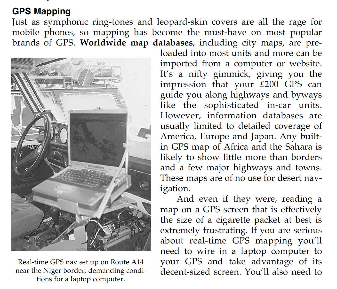
In the early Noughties I recall meeting a lone G-Wagen near the Monts Gautier in far southeastern Algeria (Route A14). They’d hooked up their GPS to a laptop for big screen nav. It was the only sensible way to do it in a car if you wanted that sort of thing, but would have been hard on the spinning HDD drives of that era.
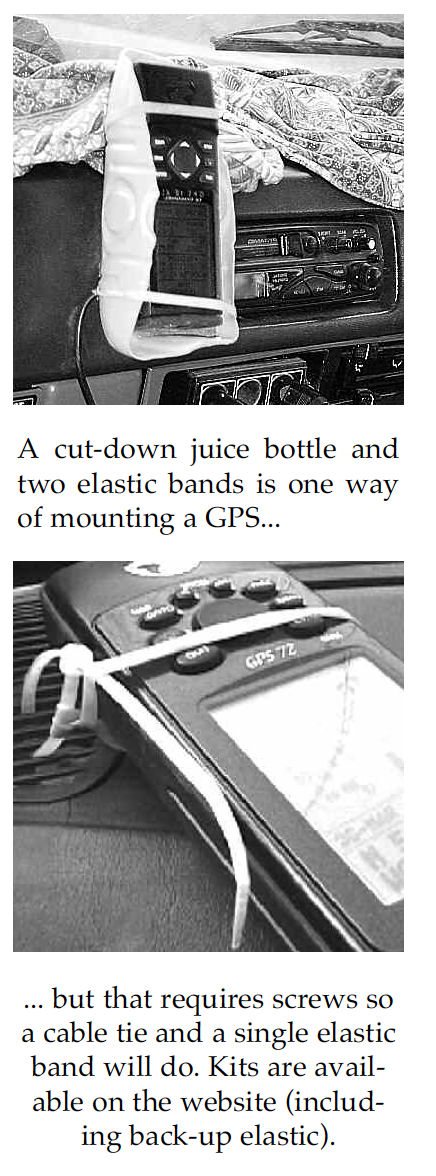
I’m not sure I even owned a laptop at that time. Instead we managed to research and log the scores of routes in Sahara Overland with a hardback jotter and a Garmin 12 or a ‘big screen’ 76 mounted in a sawn-off juice bottle and an elastic band. When needed, I transposed the lat/long reading to the then still excellent IGN 1 million maps using a ruler or a more accurate roamer grid (below).
You could then pinpoint your position with adequate accuracy for the expansive Sahara because, unless you were looking for a cache (which we’d buried the previous day for Desert Riders), that was good enough to locate yourself. Otherwise, as the Austrian guys had done, you had to scan and carefully calibrate your paper maps (taking into account the map’s projection format) so that the moving cursor dot would mark your precise location.
Fast forward 2.2 decades… … and I was driving Duncan Barbour on a recce job in Morocco (more of which later) while he logged our convoy’s route on an iPad. I had my hands full and so assumed his setup was off his phone but in these phablet days, his SIM- enabled iPad was all he needed, along with an app like Gaia GPS. In the meantime a couple of others confirmed it was no longer possible to mirror a Garmin GPS onto a larger screen, be it laptop or tablet. Perhaps because Garmin want you to buy their 5 or 10-inch Tread series from £500 to well over a grand + subscriptions. I already owned some 400 quid’s worth of 680T Montana, the Garmin handhelds which in 2010 changed the game by being able to load several increasingly better base maps and not just record tracklogs and waypoints on what in the Sahara had hitherto been an essentially blank screen.
Tefedest (Algeria). Scraps of tracks on the ‘Overland’ map layer. Not helpful (like old TPC aero maps). (Don’t start me on this ‘scraps’ thing on the OSM database…)
Since then digital mapping has improved to the point where there are topo maps based on OSM of the middle of the Sahara nearly matching the classic IGNs. Problem is, unlike the paper maps, these OSM-supported maps have been in partautomatically rendered – the discontinuous scraps of tracks are a dead give away, as above (southern Tefedest, Algeria). A year later and I see I was quite wrong about this. These disconnected tracks and paths – some less than a hundred metres long, have actually been added – presumably remotely from aerial imagery – by over-zealous OSM contributors whose understanding of ‘ground truth’ is… different. I have since found them all over southern Morocco on the OSM database, often with no path visible on any of the aerial layers and very often the work of one contributor who just does not get it. It can sure make it hard to see the main track among all the clutter. Anyway, even with the on and off lifting restrictions on overlanding in this part of Algeria, such maps will still take forever to be completed with genuine tracklogs while the IGNs show it how is was (and still is). But with Gaia GPS Premium it’s also possible to download high-res WYSIWYG satellite imagery to use offline (see bottom of page). Plus there’s nothing to stop you travelling with paper IGNs or similar, or scan of them on your device.
Tablet + Gaia GPS app vs Garmin Montana GPS
Tablet + Gaia good
Cheap to buy/lose/break
Can do internet/phone/camera etc
Big bright8″ screen
Loads of Gaia maps (once subscribed)
The desktop app is much easier to navigate (keyboard/mouse)
ESRI (or non-Google) sat imagery downloadable too
Masses of memory (1TB)
One tap track recording
Loads of (messy) public tracklogs on the Gaia map (can be ‘muted’)
Works on my iPhone 7 (but not Android phone)
Gaia GPS free Topo map is nicely rendered for an OSM
Samsung tablet/Gaia less good
Gaia GPS requires subscription for good stuff
Freezes or take ages to fire up (could be my tablet CPU?)
Gaia takes ages to get a fix
Tablets (and phones) can overheat
Baffling organisation of saved Gaia files in folders
Hard to tap and manage on the move
Hard to save precise waypoint easily
Screen decentres after inputs
Battery life: must be plugged in unless dimmed
Proper car mounts are expensive but needed
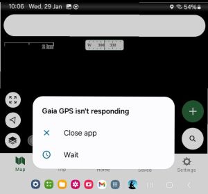
Gaia GPS app froze on my Android phone
Samsung A7 fried 2 motherboards in 2 years. Replaced with cheaper A9.
Garmin Montana + OSM Topo good Rugged build (good for motos)
If needed, li-ion battery lasts all day (or takes AAs)
Once customised and familiar, interface easy to manage
Fits in a pocket
Will do routing like a car satnav (Gaia may too)
Won’t overheat
Garmin less good
Expensive to buy
Small and dim screen
Limited miniSD capacity (32GB)
Freezes/crashes occasionally
Needs BaseCamp and other (free) Garmin apps on a computer
Easy to forget tracking, zero the trip meter, etc
‘Keyboard‘ is comparatively excruciating
It’s only a GPS + a rubbish camera
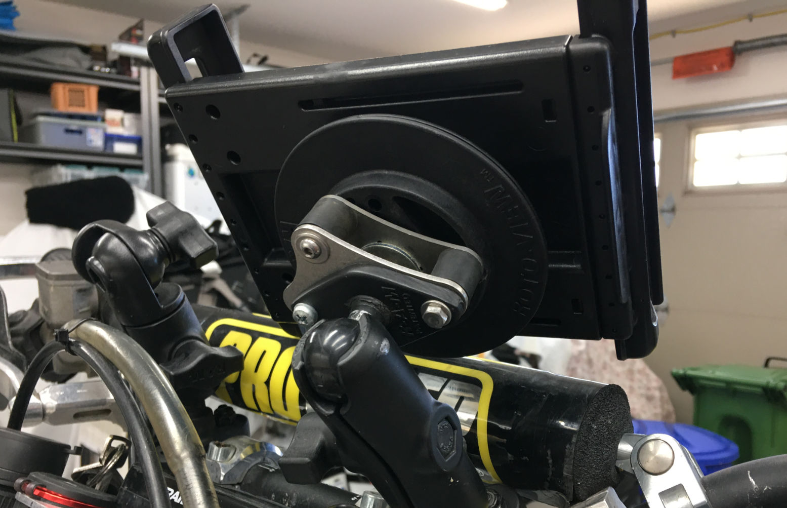
Samsung A7 Lite I decided to try Gaia GPS on my own car recce and settled on a Samsung A7 8.7 incher; £120 from Argos. It has a metal case, takes up to 1TB microSD and weighs 330g when fully charged. CPU speed is 2.3GHz, 1.8GHz Octa-Core; I don’t know if that’s a lot, but 18 months in it fried its motherboard, got repaired on warranty, then did the same at 25 months, just out of warranty. Is that normal for a lightly used Samsung tablet? Don’t know but I replaced it with a near identical A9 for just £85. If that packs up too I guess I’ll just get an iPad. My laptop and desktop have always been Macs, but an equivalent new iPad Mini starts at a staggering £750. I owned a crappy old Samsung mobile once; the A7 has the same interface so the A7’s Android learning curve was pleasingly pruned. Best of all, I was able to flog my Kindle Fire for 40 quid and remain ‘gadget neutral’ in line with current government advisories.
Handy standleHandy handle
From fourbie driver CW in Arizona: a twin-tablet set up to save flipping from maps to satellite or playing with opacity due to bright sun visibility issues.
The A7 got fitted with a screen protector out of the box but the all-metal body is very slippery so needs something better to handle it. I have a RAM windscreen sucker and flange mount but was shocked at A7 RAM ‘Tough Dock’ prices which easily exceeded the cost of the tablet. In a car it’s not going to get run over and smashed, like on a bike, and I’m not rallying, so I bought child’s foam case off ebay for £12, complete with vomit-proof standle. I ended up zip tying it to a handle or rear view mirror
Touratech RAM mount
Adult mounts and other options One the left, the DR400 of Grant from Horizons, based in BC: another A7 on a RAM Tough Dock mount. Grant says the unit tends to droop on rough terrain, which is why people end up with Rally towers. Waterproof cases like Otters can be hit and miss he says (this is a benefit of Garmin’s Mil-810-spec Montana), though there are ruggedised tablets, like the Carpe Iter. “It runs DMD2 software launcher, which is also available for any Android device. Their unit is also excellent in sunlight, whereas the standard tablets are crap. I’m running the software now on mine, and it’s good. It launches GaiaGPS which is what I use the most.” says Grant. I do notice it has 128GB but will only take another 128. Still on bikes, Thork Racing (see YT vids) do bike-ready mounts and even roadbook-like thumb controllers to avoid trying to jab the screen with the chequered flag in sight.
2GB for all of Morocco3GB for the book’s area in medium red ESRI
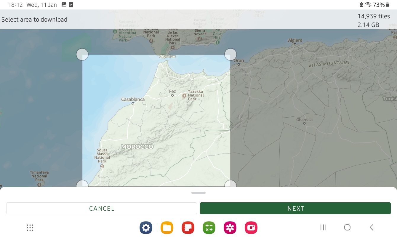
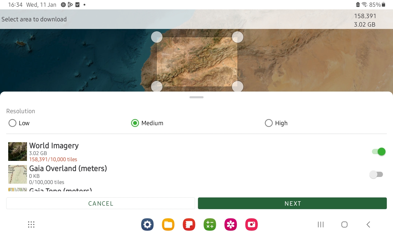
Then choose what maps you want to download so you can use your device offline in the hills. That is they key. Tap the ⊕ icon top right, choose ‘Download Map’, select a rectangular area and import, ideally into a folder if you plan to have loads of maps. As you can see in the examples above, the whole of Morocco in ‘Gaia Overland’ is just over 2GB, while a smaller area of ESRI covering about 15% of the topo map is 3GB. Full res ESRI covering the good bit of Morocco would have been getting on for 1TB. It really couldn’t be easier.
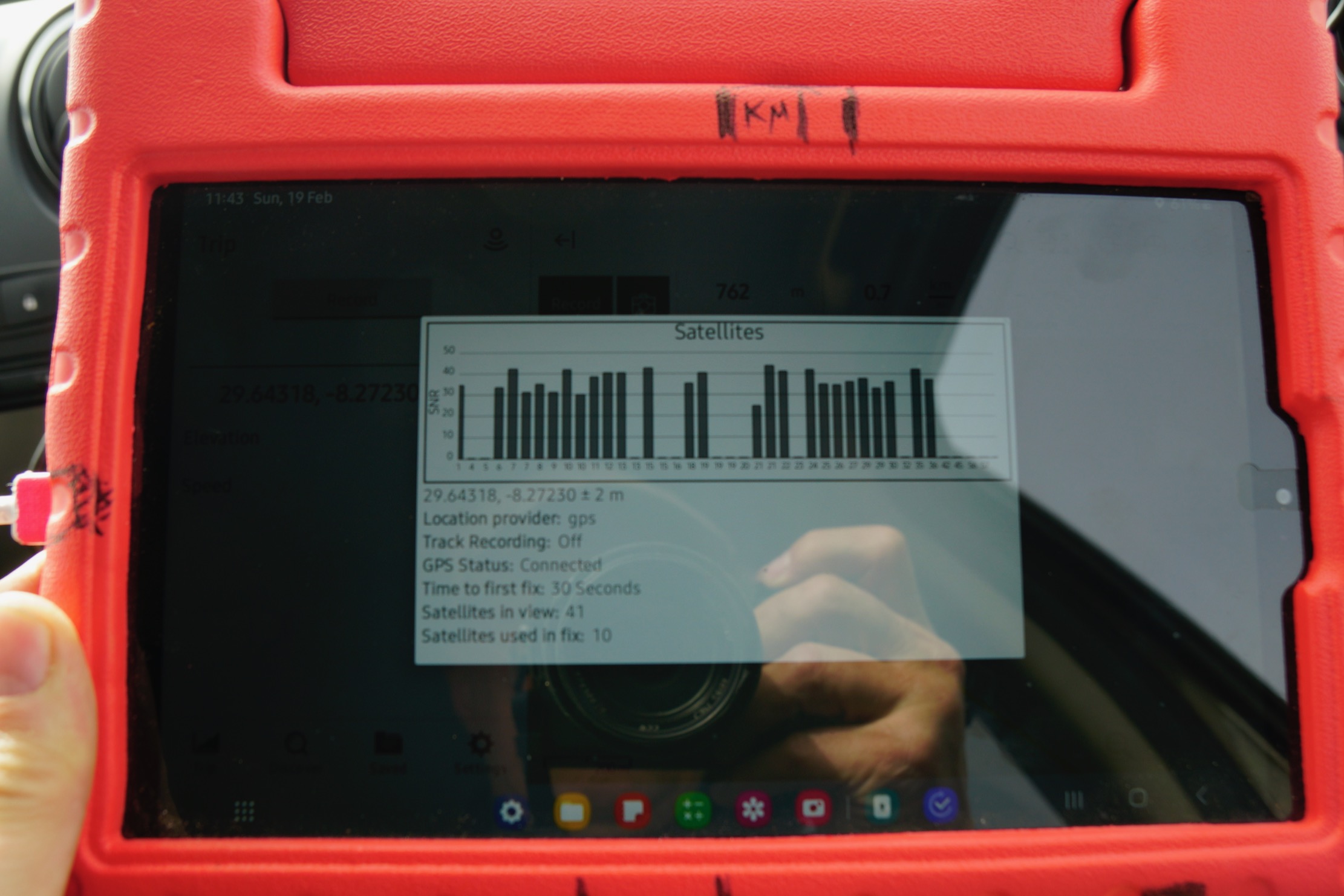
Satellites thicker than bugs on a bumper
Recording and saving a tracklog I laboriously emailed myself ~50 pre-traced tracklogs to and picked them up off the tablet to import into Gaia. This and especially sorting them out took quite some time. I was warned getting to grips with Gaia’s folders is the thing; it’s so much easier on a desktop computer. Loading the Garmin with the same was easier, providing all the .gpxs have been index-accessibly named. I know we’re all supposed to be smartphone savvy now, but around this time you realise what a great invention the keyboard and mouse were. For most travellers that will do: pick up the tracklog you want and follow it; the Gaia Overland map is pretty good in Morocco. I’m a bit different in that I’m over-recording a new, live track plus adding waypoints with distances and take notes. Recording a track is dead easy on Gaia: hit the prominent ‘Record’ tab. The Garmin’s track recording is another page so is more easily overlooked when you’re trying to get your shit together at the start of a new route. But in the Gaia app saving a waypoint for your exact current location requires pressing and holding the position arrow on the map; hard to do accurately with fat fingers and the car shaking about. On Montana you back up to Home Page, hit Mark Waypoint for where you are that second, then Save (and jot down the number). Map > Home > Mark > Save and back to map in just 4 taps.
Gaia waypoints are annoyingly recorded as long (but I suppose unique) date and precise time, though I suppose they’ll all display chronologically somewhere. Also, I found a Montana suckered to the windscreen was easier to grab and tap than the propped up Samsung. I know with Duncan at times I had to stop driving so he could save and jot down. This can break the flow but is the age-old problem in doing this in a jolting fourbie. (Yes, I have thought of voice recordings). Another drag on the Gaia is having to re-centre your location and the full screen map every time you do an input. And I wish the map scale bottom left could be made less opaque, or not opaque at all; same with the zoom buttons, though of course you can spread two fingers to do the same. Occasionally Gaia freezes and needs a restart, but my Montana freezes often and need the battery removing. Later in 2023 I did two more scouting trips in 4x4s and found the Gaia detailed mapon big tablet screen better for following, but Garmin 650 better for easy and reliable recording with minimal tapping faff. I recorded data with my trusty Montana, as I did on several moto trips, when also scouting tracks. It took me a while to fully get the key differences between these two devices (see red/green comparisons above). One just does nav (plus a crumby camera), the other is an internetable phablet that does everything a smartphone can do, but nearly as easily as a laptop. Feet up, when the navigating is over, a phablet can come into its own. And once you’re back on wifi or 4G your recorded and saved nav data shoots off to you Gaia cloud automatically. Then catch up on the news, other emails, twitter off your photos or watch a movie. Duncan said initially he took both Montana and Gaia iPad on his nav jobs, now he relies on the iPad. I suppose alone and travelling at my own pace, I could rely just on the tablet too, though on a bike it would need a secure or shake-proof mount somewhere.
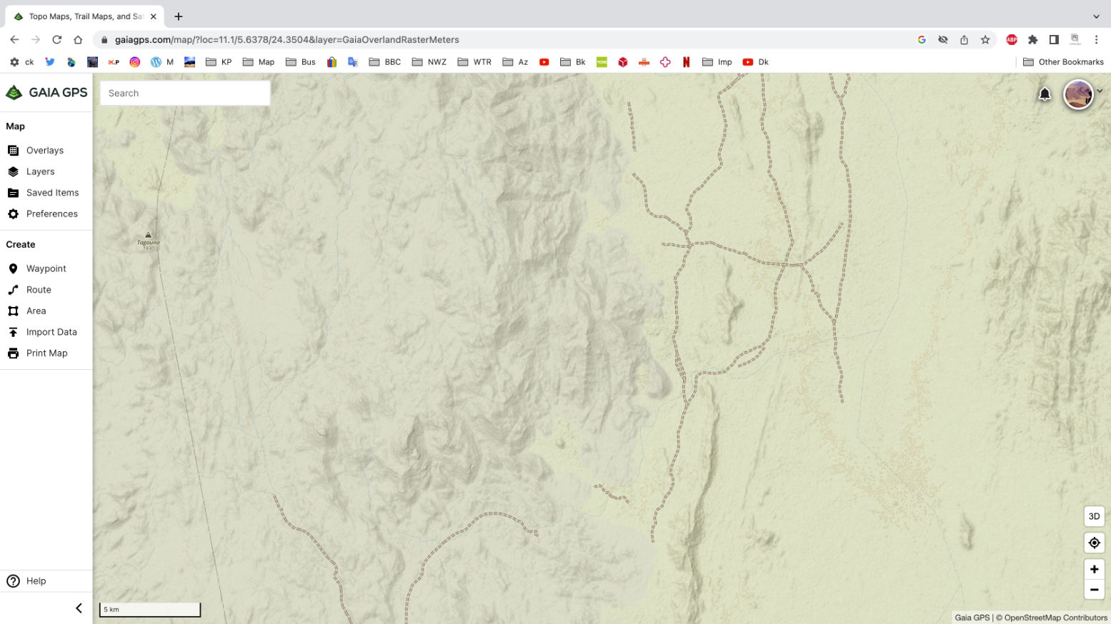
Update Algeria 2025 with Tablet and Gaia On this trip I was passengering in a car, following roads mostly, but doing some off road and off piste nav to new places. As always, loading and labelling your data beforehand (below) saves teeth gnashing in the field. I renewed my sub and downloaded huge slabs of Topo (1.25GB) and low-res Sat (250mb) mapping for offline use (below). I also borrowed an InReach2 to display our position for those back home
Screenshot
Gaia/tablet conclusions • Can take 20 mins to work properly some mornings (not just getting a fix). A combo of tablet CPU and huge offline maps – or is it just Gaia? I suspect the latter • Stops track recording out of the blue – could be me but annoying • Great to use offline sat mapping – and the Topo map layer is pretty good for Algeria • Imported track gets broken up into several segments. Annoying • Next time will use a proper windscreen mount • Would a Garmin 710i be the answer? Sat tracking/messaging included (so InReach not needed), plus a bit bigger and much brighter screen than 650 but still with good battery life? Only £700
For the moment the Montana is a reliable recorder, the Gaia tablet is much nicer to nav off.
In Chapter 10 of Desert Travels the cantankerous 101 leading my first desert bike tour was stranded at the Tin Taradjeli pass (above). As so often happens in the Sahara, the next person to turn up happened to be a diesel mechanic. Steve soon got the 101 running and, long story short, the following year we decided to team up and do a big Sahara trip together: him in his Land Cruiser, me in an old Land Rover 109.
For both of us this was the desert trip we’d each been planning in our heads for years. When travelling together briefly with my bike tour the previous year, we’d quickly established a shared passion for exploring the Sahara and set about doing a big trip together, each with his own 4×4. Though I’d been keen to head for the Ténéré Desert in Niger, we’d settled on keeping off the tarmac where possible and decided to head down to the Guinea’s highland jungles and the Mauritanian Sahara.
Nineteen ninety was not such a good year for me: post bike-tour debt, a bad crash leading to hospitalisation, followed by homelessness, a smaller bike crash which at least put an end to my dozen years of despatching. And finally my Land Rover, all set for a desert adventure with Steve, blew up in darkest Sussex at 2am, while I was doing some late deliveries.
As a way of keeping the tip on the rails Steve invited me to ride his XT600Z instead. I wasn’t that keen on bikes by that time, plus it would leave me dependent on him. But I accepted his offer and we met up in France, the bike towed on its back wheel with a similar arrangement I’d used on the 101.
Unfortunately, as so often happened in those days, all my films were lost on a flight in Mauritania. Since then I’ve learned: do not put things you cannot afford to lose in the hold baggage. What few photos I have were shot by Steve.
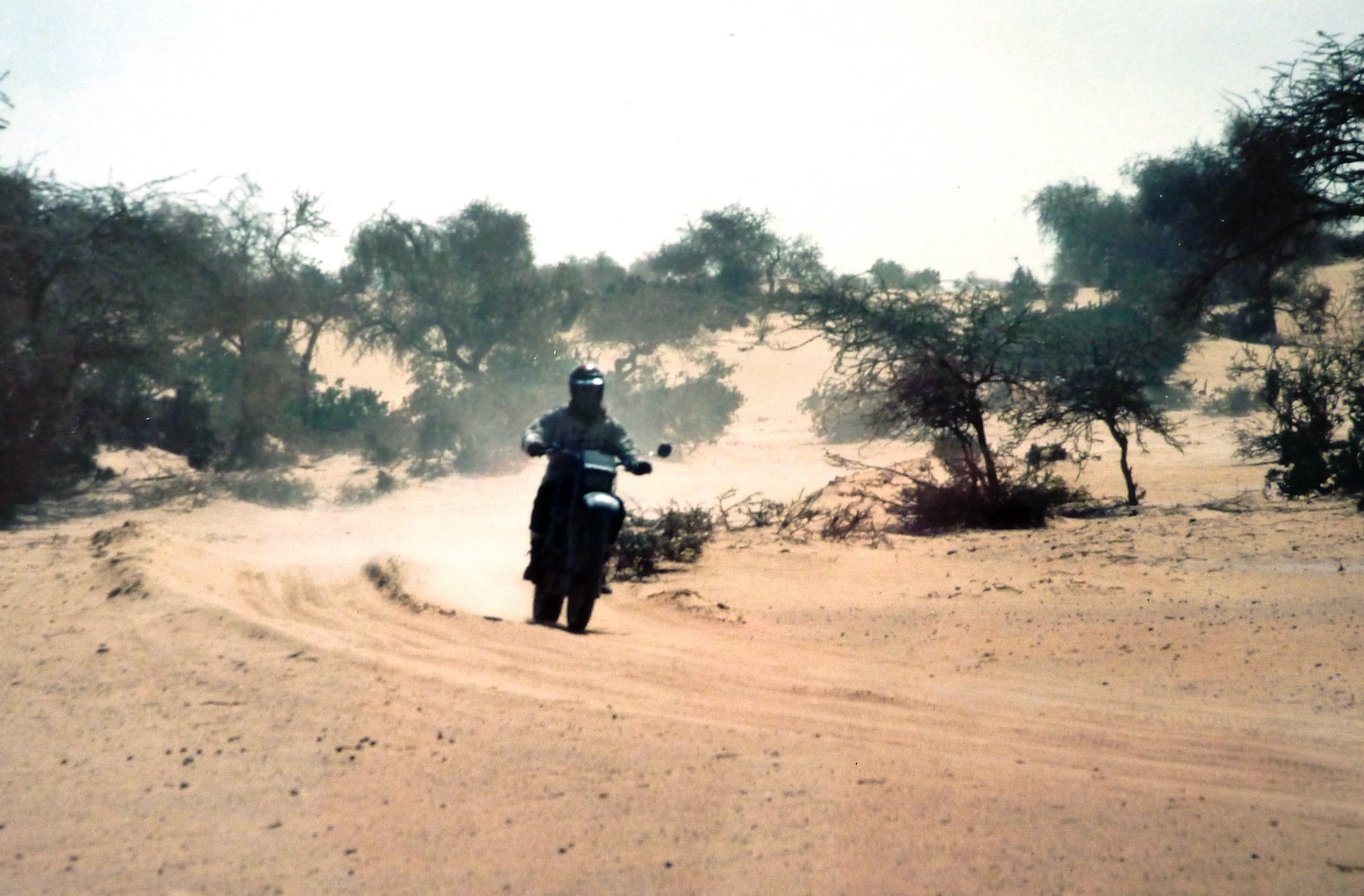
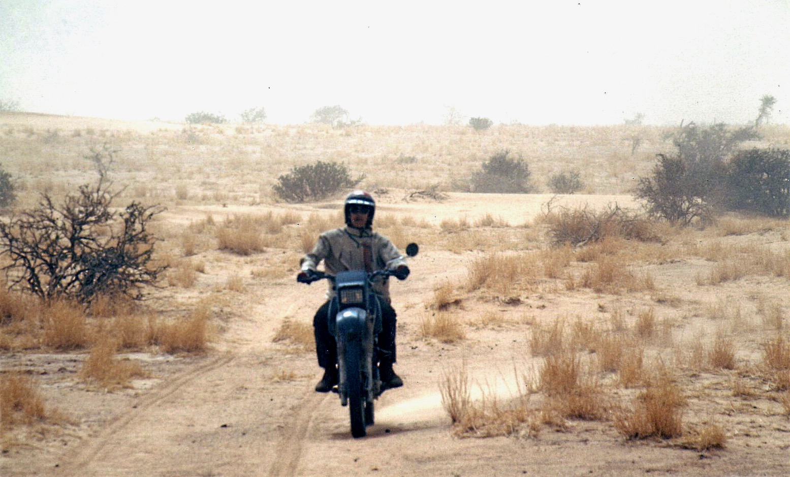
On the ‘closed’ piste between Fort Mirabel and Hassi bel Guebbour. Steve’s XT was nicely set up and of course all the essential gear was carried by the car. I’m wearing my airey, paper-thin Swedish Tenson jacket. Beyond wearing a lid, gloves and boots, the idea of wearing any sort of armour never occurred to me.On the gnarly piste up from Hirhafok to Assekrem deep in the Hoggar.I found this picture recently on the internet and am pretty sure it’s the same ancient Beetle we saw at Hassi Tabelbalet, just after the Gara Khanfoussa dune crossing on the Graveyard Piste.
“… A couple of hours later we reached Tabelbalet well on the far side of the erg and were dumbfounded to come across an eccentric German father and son in a ratty VW Beetle. Amazed that a forty-year-old 2WD had made it through the dunes, Steve confessed later that the Germans’ presence had soured his crossing…” One of the easier sections on the sandy trail along the Niger river from Bourem to Timbuktu.Tooling around in the dunes somewhere near Timbuktu where our trip was about to unravel.
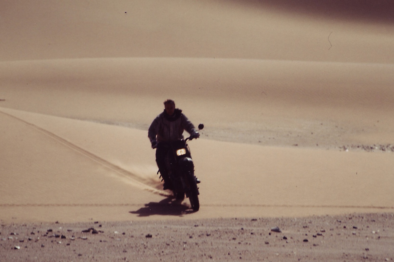
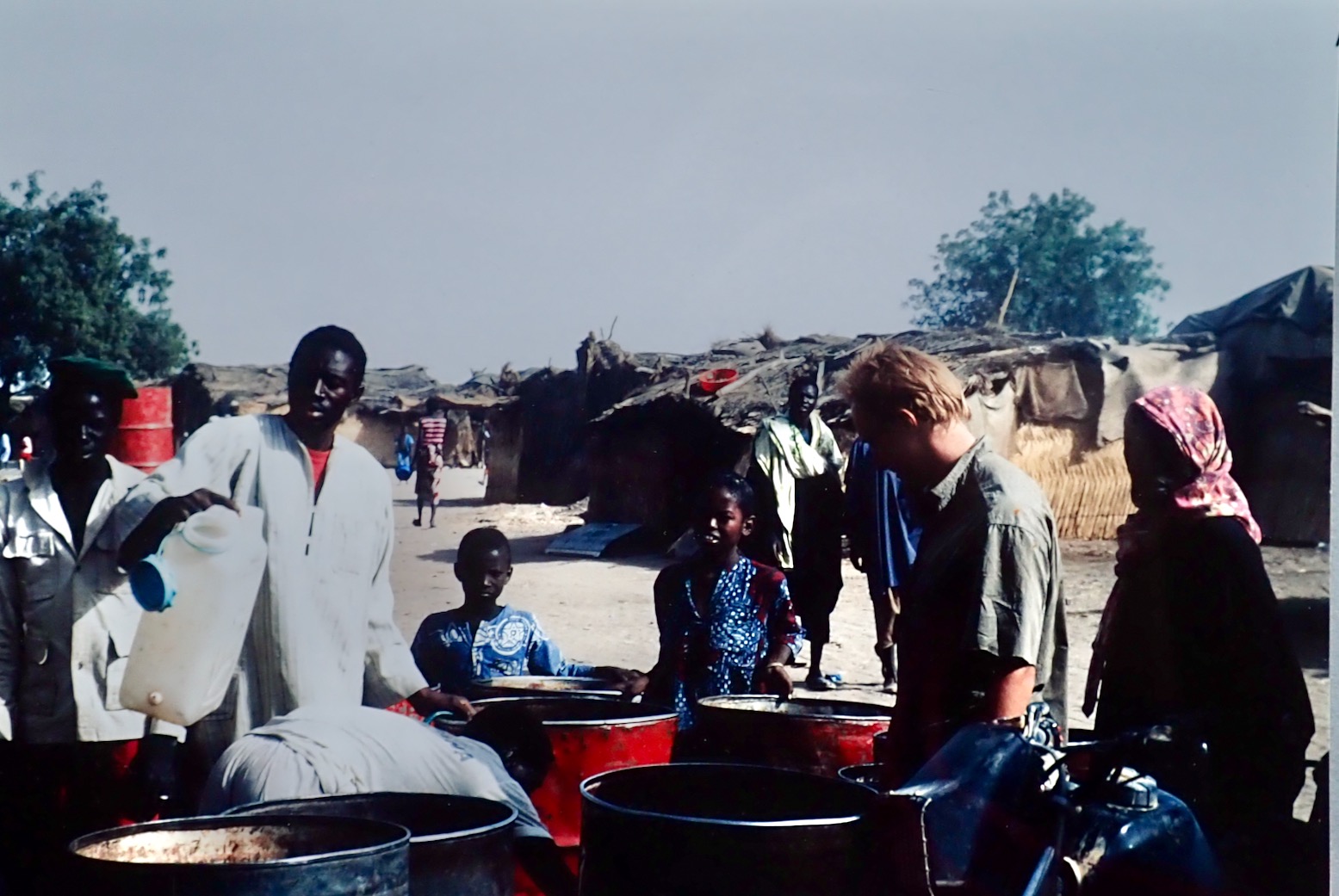
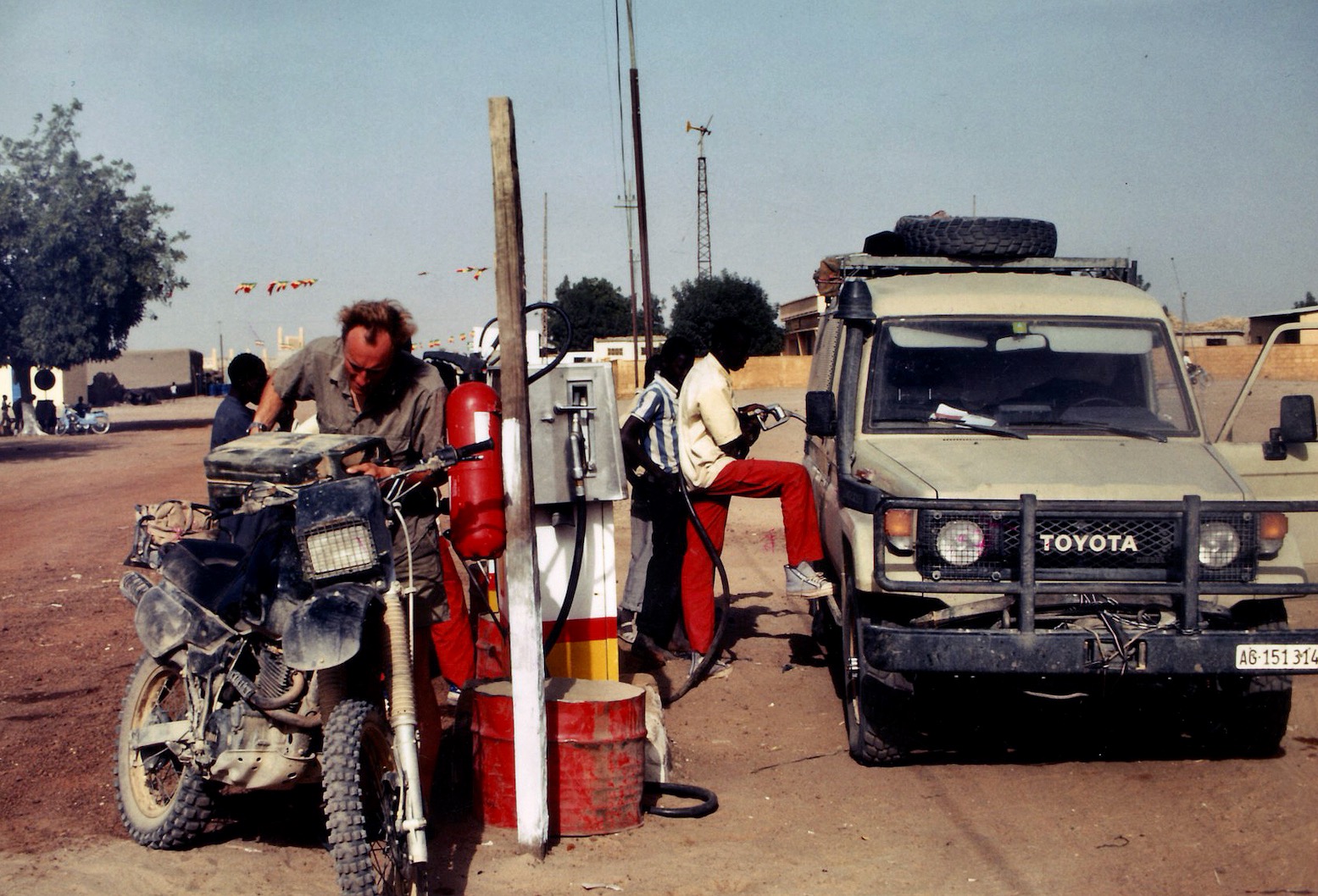
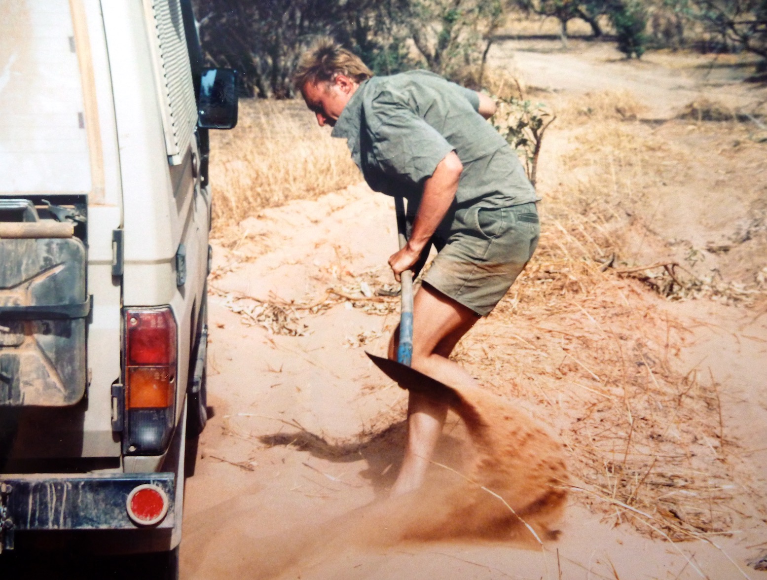
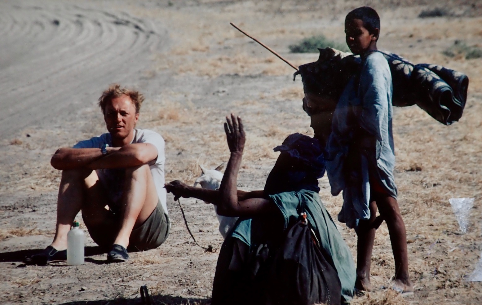
‘I think I’ll head off when we get to Ségou [the next major town]. I’m not really enjoying all this riding around after you. I want to go off and do my own thing.’ I was determined to salvage the trip for my own ends. The shared driving had not materialised, the pace was ridiculous (we’d done around 4000 kilometres in less than two weeks) and everything I did was wrong or not enough. I didn’t see such a separation as a failure, it was merely the right thing to do if I was not to end up feeling resentful. Somewhere near Timbuktu. Too much vegetation for my likingGetting water in a village in the Malian Sahel.Fuelling up in Nara, just before the Mauritanian border.Digging out on the way to Adel Bagrou, the Mauritanian border post where we managed to talk our way in without a Carnet de Passages.Trackside break on the way to Nema.In Nema we picked up the Ghandi-like guide called Nani for the 800-km crossing to Tichit. Just as well; there is no way we could have found the way without him as most of the time there was no track (or he rarely followed it).Steve and Nani have a brew near Oualata.I remember this bit well – a steep sandy pass called ‘Enji’ about 300km from Nema by which time I was riding the unladen XT like a Dakar vet. When you’re good it feels like ski-ing.Enji is the plateau at the bottom right. This 1960s map shows a track, but in 1990 most of the time there was nothing but sand and annoying tussocks.Sunk down to the axle in the soft sands west of Tichit.
As agreed near Timbuktu, in Tidjika Steve went his way towing the XT, and I went mine. I met some American Peace Corps Volunteers and my travels in Mauritania took on a whole new direction.
Once in Tidjikja, I flogged my crash helmet to a delighted policeman. This time Steve didn’t even try to persuade me and drove off towards Nouakchott.