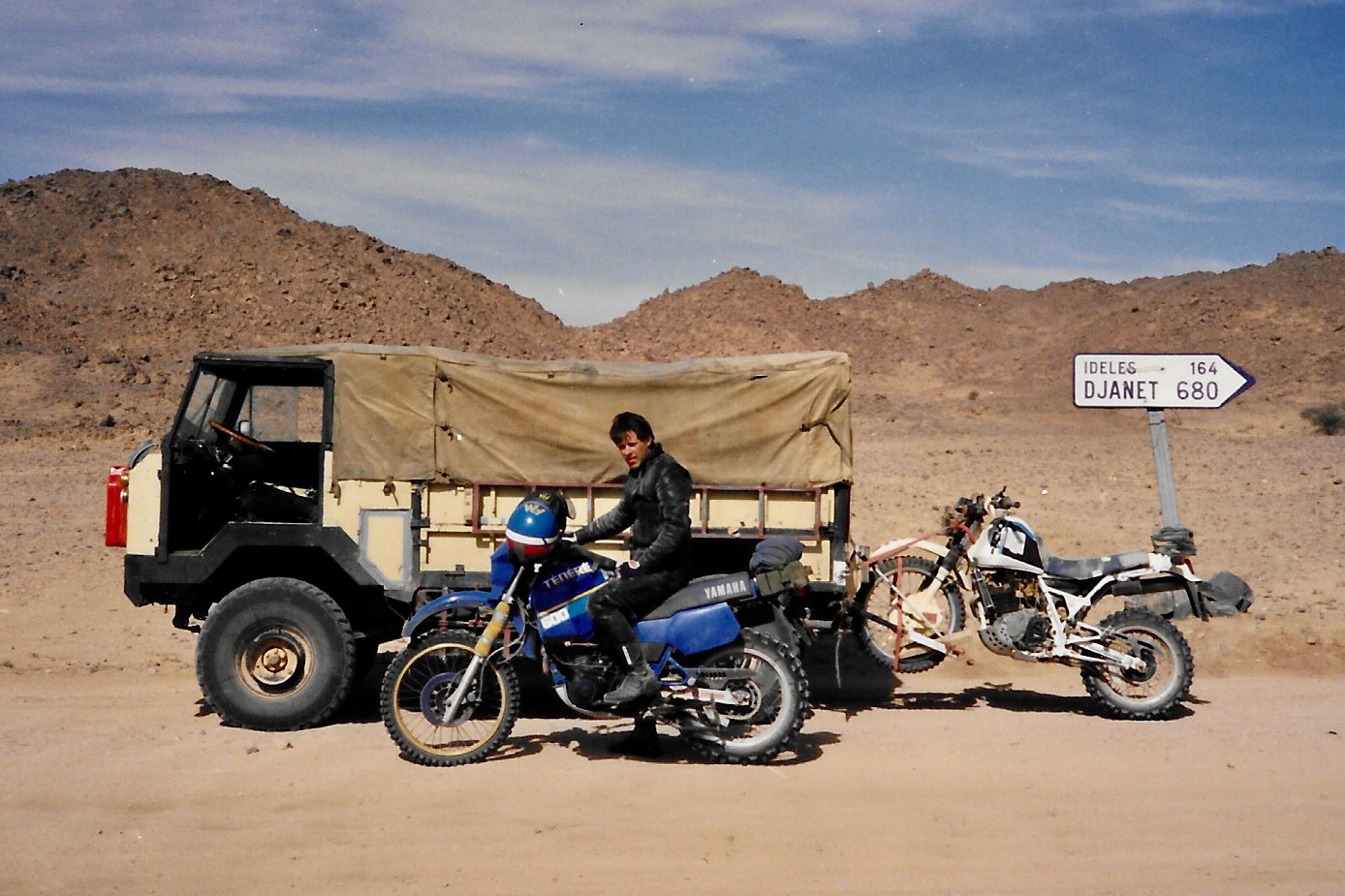
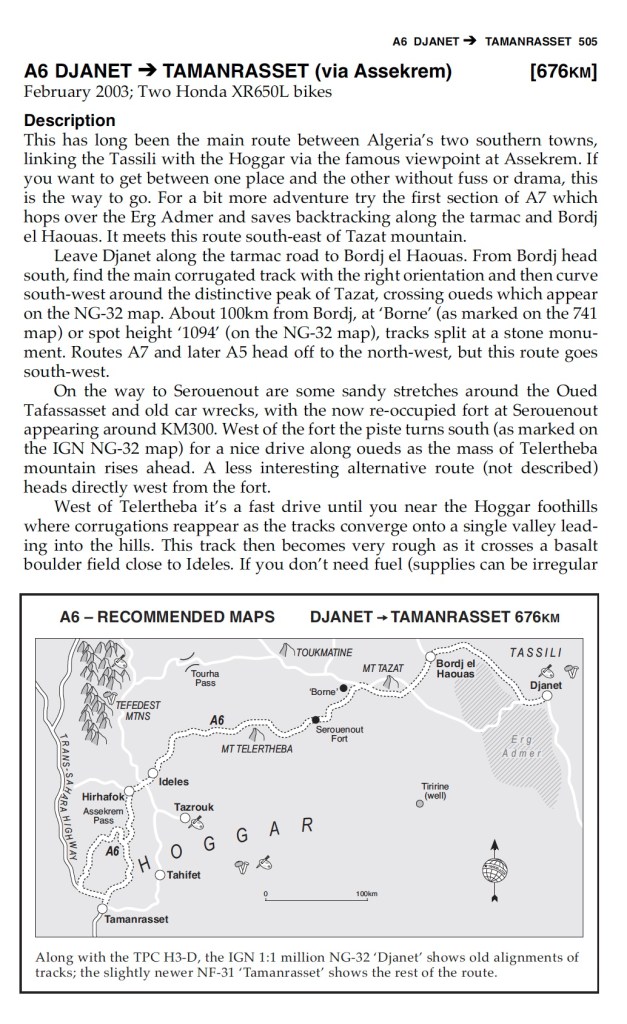
For centuries camels were the way to go in the Sahara. Introduced from Arabia around 0AD, they proved to be ideally adapted to transporting heavy loads without needing water (providing they was daily herbage or straw). A couple of centuries ago huge caravans numbering thousands of camels would transport salt, slaces or sold from the souks of the Sahel. Today, camelling is still a satisfying way to travel in the desert. You don’t ride; the camels carry all the provisions. But besides the obvious motos, 4x4s and aircraft, here are some other ways people have chosen to cross the great Sahara.
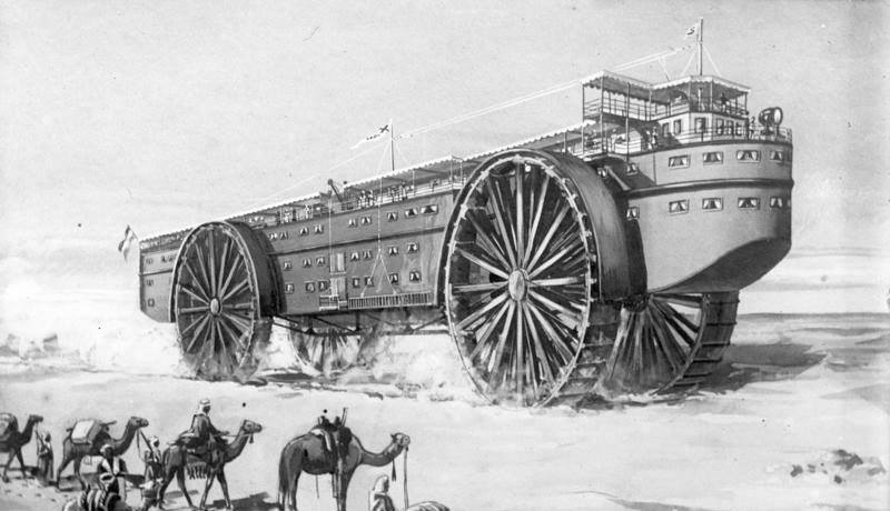
Steam Powered Landship
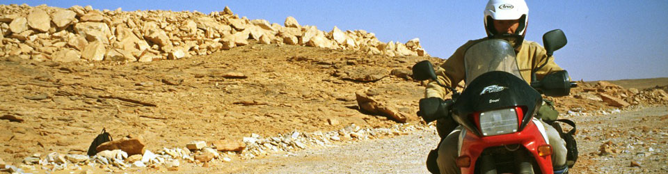
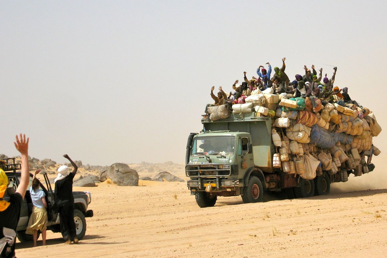
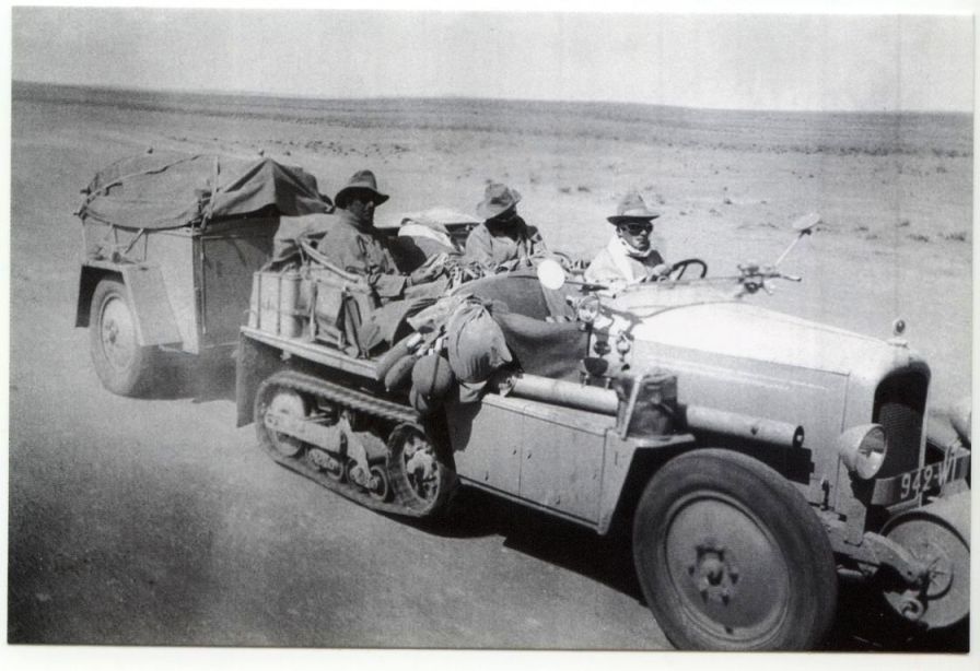
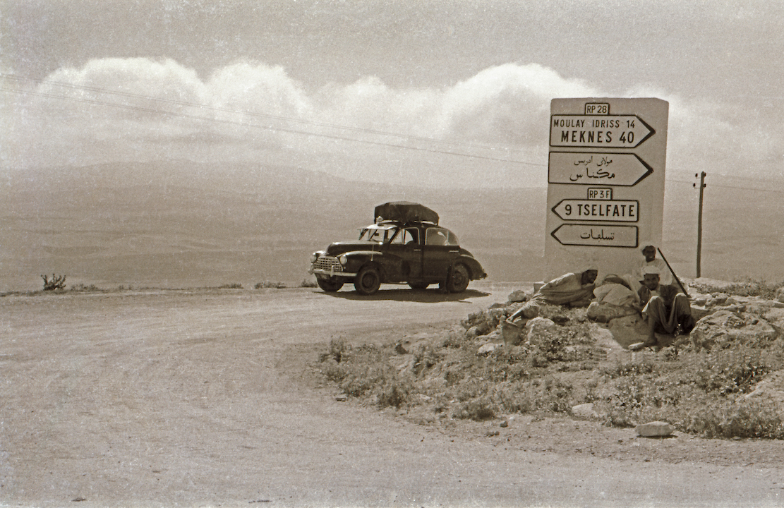
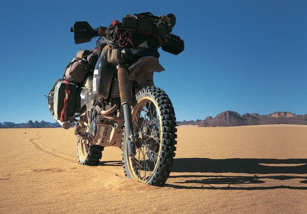
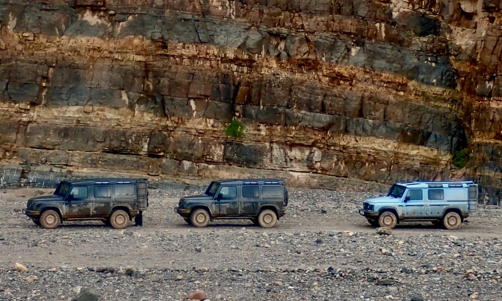
Gros porteur heading back to Agadez
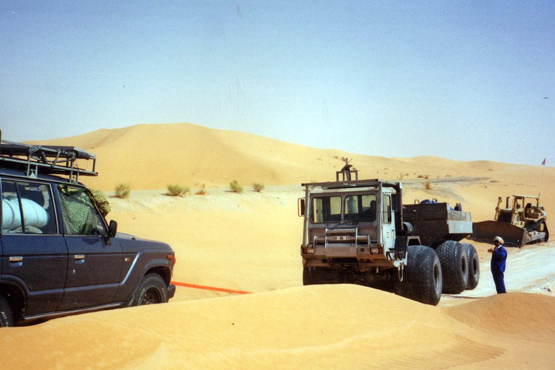
In the Edwardian era of luxurious, steam powered ocean liners, why not a desert liner to tame the vast sand oceans of Sahara? Like something from a Jules Verne novel, giant traction wheels would glide over the sands while desert tribesmen looked on in awe. This one never got beyond the drawing board, but today massively overloaded gros porteurs (left) from the pre-electronic 1980s diesel apogee still grind across the desert sands.
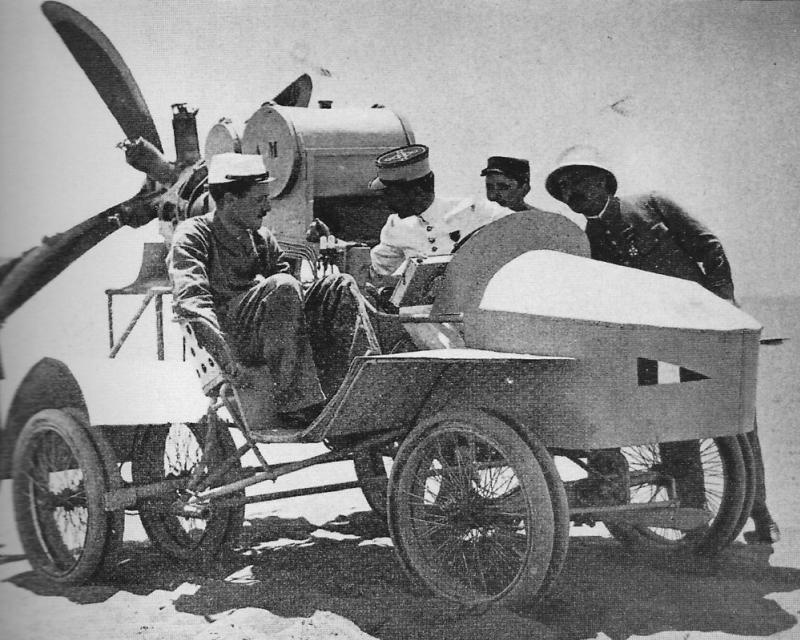
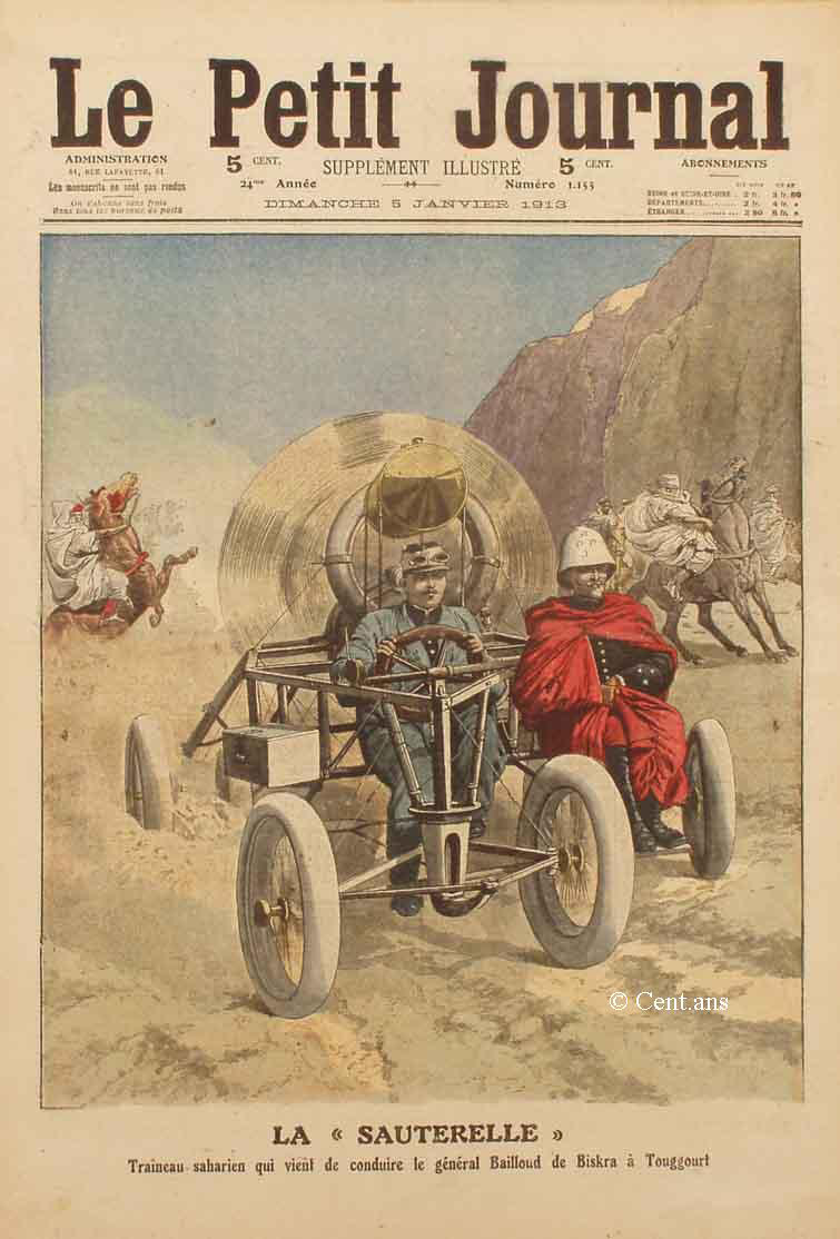
Sauterelle Propeller Car
With the advent of the gasoline-powered motorised cart, or ‘car’ for short, traction in the desert sand was the problem with early, low-powered and inefficient engines. Those new fangled flying machines never this issue, so how hard can it be to combine the two? Behold the wingless, deafening wonder known as the Sauterelle propeller car of 1912 which could literally put the wind up you. Nicknamed the ‘mobile guillotine’ (not really ;-) it was tested near Ouargla and never heard of again. Read more here.
Citroen Half Tracks & Renault Type MH ‘Douze-Pneus’
Motor cars were catching on but traction in the desert remained a problem. During WW1 the Brits under Pat Clayton adapted ultra light, 2WD Model T Fords for the Light Car Patrols in Egypt (left). Desert adventurer Ralph Bagnold used these Fords to travel deep into the hitherto unexplored Libyan Desert.
Around this time Citroen were the first to cross the great desert via the largely flat but very long Tanezrouft Piste in a vehicle fitted with ‘autochenille’ or Kegresse half=tracks (below). Very slow but not as noisy or deadly as la Sauterelle, they crawled across the desert and were used by Prince Kemal el Din (left) to ‘discover’ the lost plateau of the Gilf Kebir in southwestern Egypt.
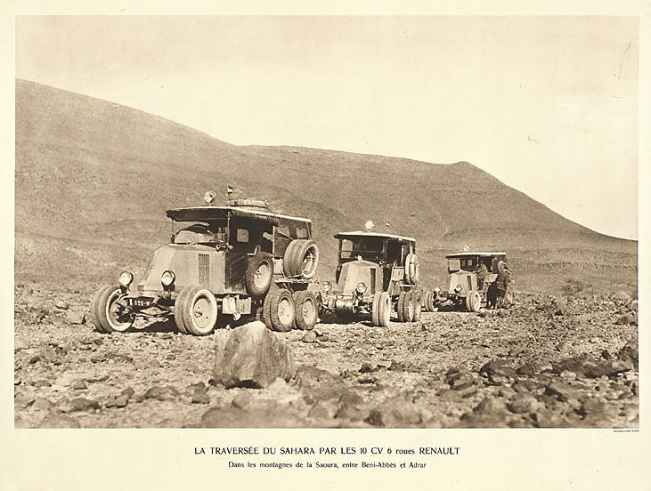
Competitor Renault’s solution to the traction problem was the 6×4 10CV Type MH featuring doubled wheels rubber and twin rear axles. Nicknamed ‘le douze pneus‘ (not really ;-), Renault trounced Citroen’s trans Sahara expedition of 1922 with a full, 23,000-mile trans Africa in 1925, the first cars to cross the continent.
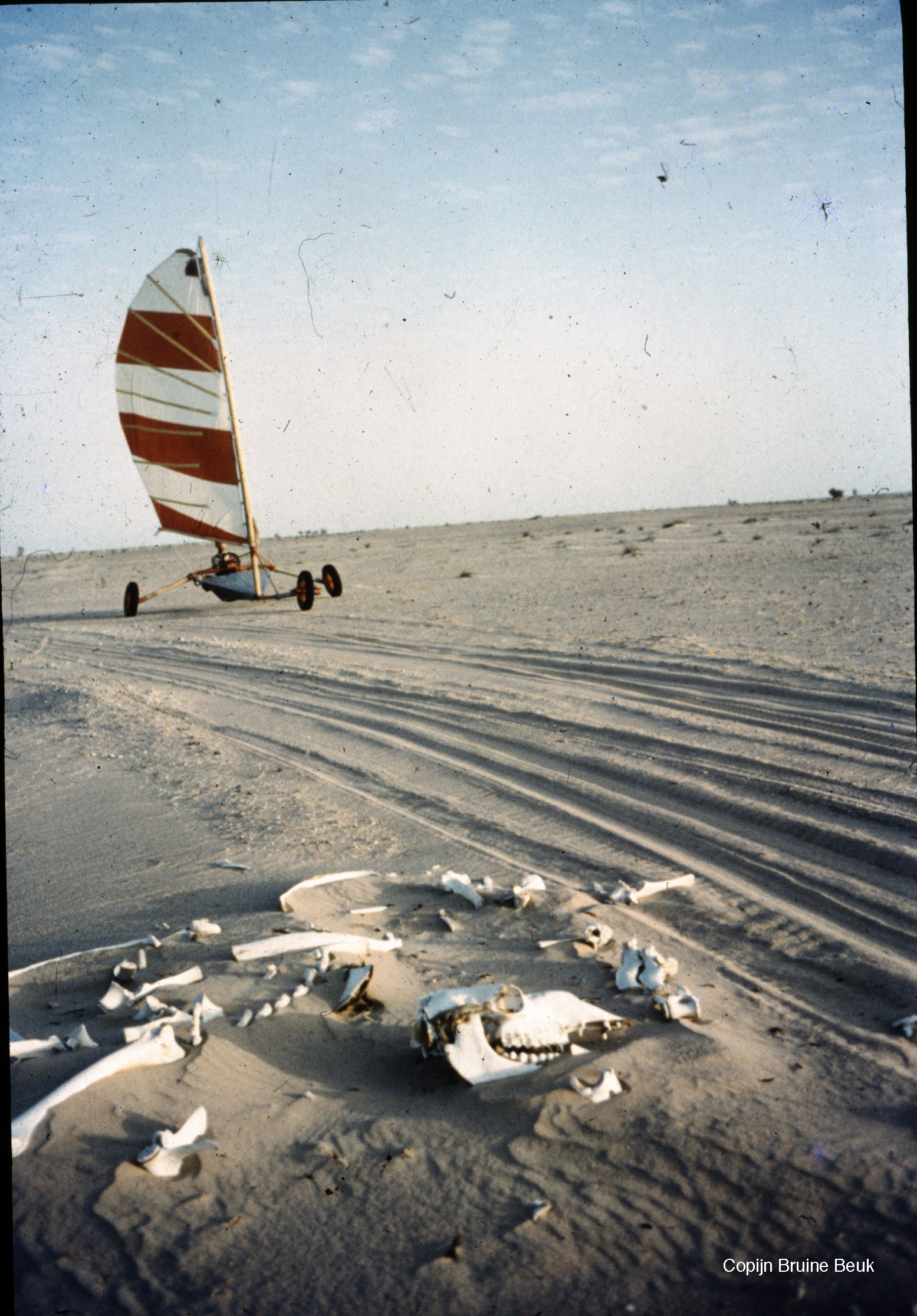
Sand Yachts
You got wind, you got sand, so why not Sand Yacht across the Sahara to Mauritania? Full story.
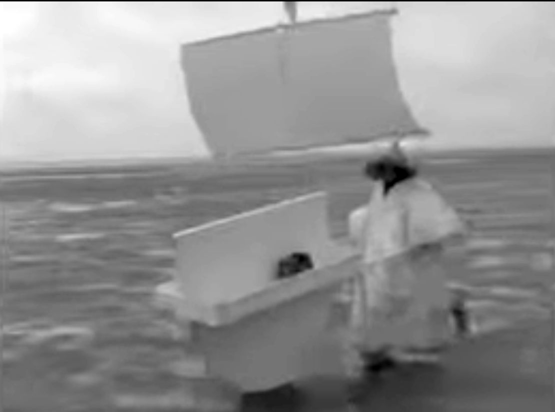
Chinese Wind Barrow
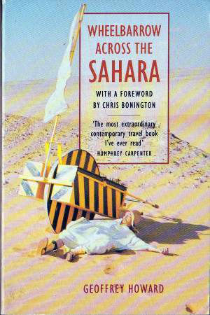
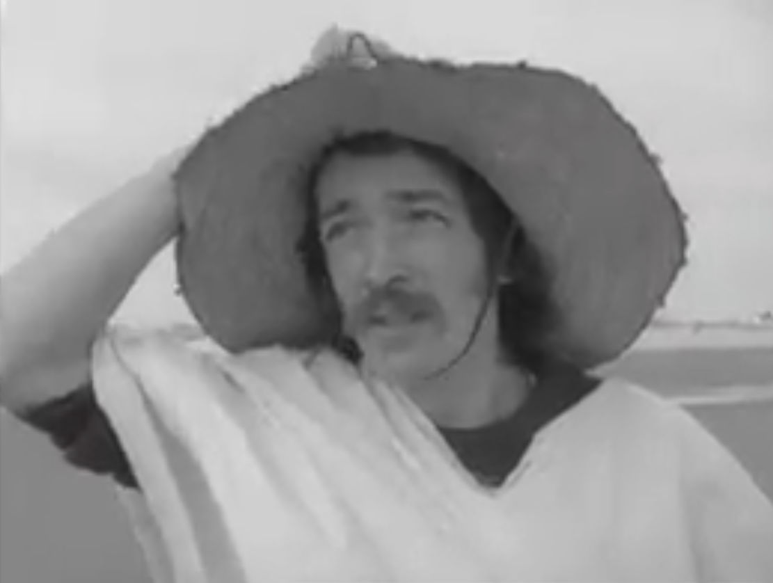
Regular family cars like Morris Oxfords were now commonly used to cross the Sahara (sometimes ending in tragedy), so lorry manufacturers among others, undertook costly, promotional but essentially pointless Sahara west to east expeditions. People were running out of stunts to stage in the Sahara until 1974 when priest Geoffrey Howard came up with a new angle that sounded like a lost sketch from Monty Python. Lately back from volunteering in Nigeria with his wife, he had a Chinese sailing wheelbarrow built, then set off to cross the Sahara ‘unaided’ from Beni Abbes to Kano, raising money for the poor while also positing a new means for locals to transport their goods (not unlike the initial motivation of the 1980s Africar project). As one reviewer observes: ‘That he was assisted by two British soldiers … in a Land Rover and accompanied him most of the way makes it sound easier – but this was a safety consideration, and he made his own complex rules about how and when they could assist.’
National mountaineering treasure Chris Bonington contributed a harsh foreword: ‘Not much of an adventure’ I thought, ‘pushing this ridiculous wheelbarrow along a well travelled road or track with a [support] Land Rover in constant attendance.’ You’d hope that line is followed by ‘… but Howard’s monumental endeavour changed the face of human powered adventuring…” or some such. I can’t recall, but do remember similar conclusions to CB on reading the book decades ago: a silly stunt that turned into an endurance test. The sail idea soon proved useless so he had to resort to pushing the barrow for the three-month, 2000-mile crossing in his flapping get up. There’s some grainy archive film on the BBC of a lightly mocking Bob Wellings (remember him?) interviewing Rev. Howard training on Morecombe Sands in full costume. He ends with ‘I have no fears whatsoever’ The 1990 book is easily found online, new or used.
Three wheel- 2WD FatBike
A regular bicycle will struggle on the piste to carry more than a couple of days of water. One answer: Jean Naud’s 2WD, three-wheeled fatbike replicating the multi-tyred Renaults of yore. And like a modern lorry, to reduce the pedalling effort, one axle on Naud’s contraption could be lifted and disengaged (left) when payloads dropped or the terrain allowed. It worked too, he crossed the Sahara twice on fat bikes. Read more.
Microlight
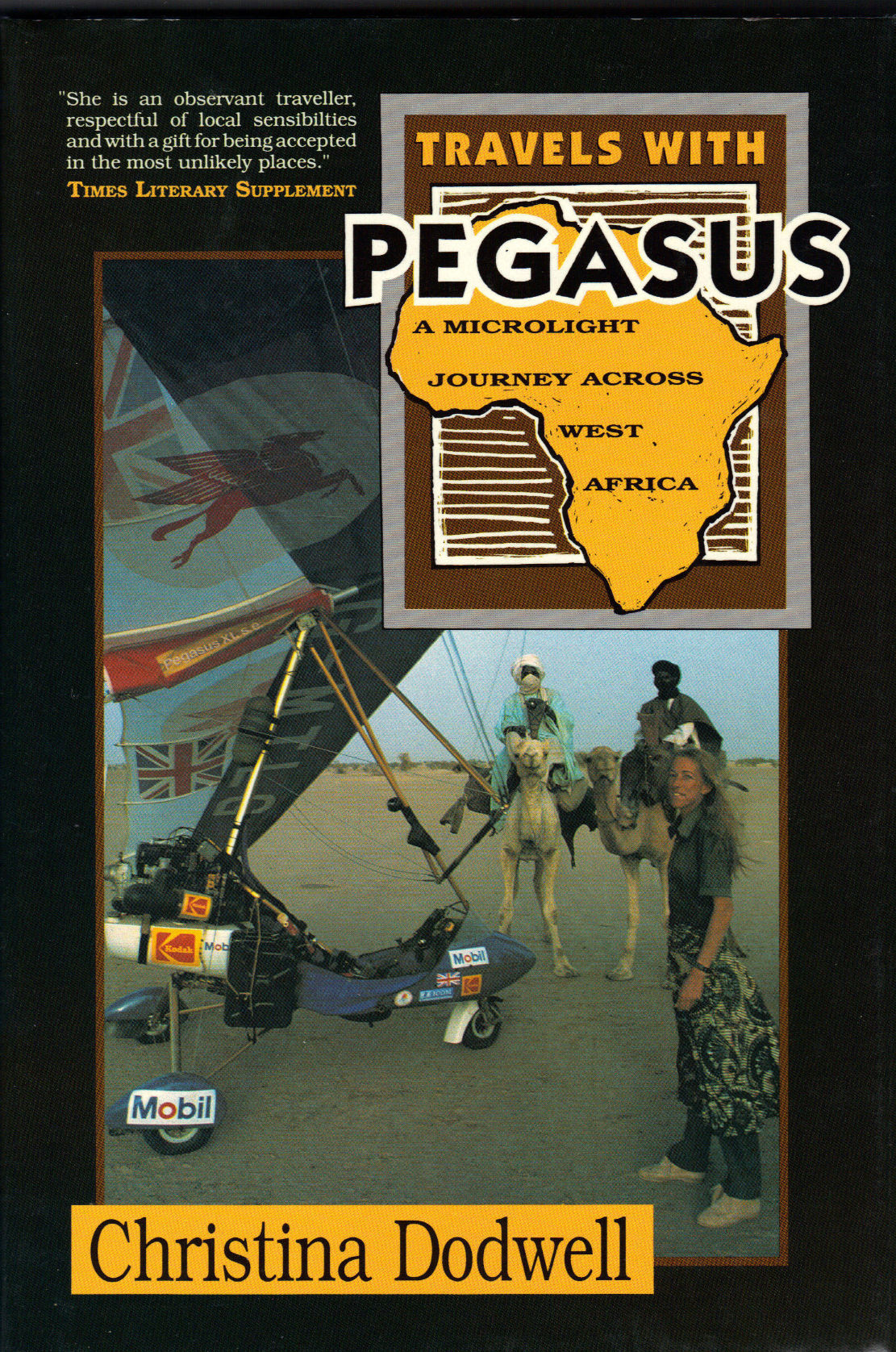
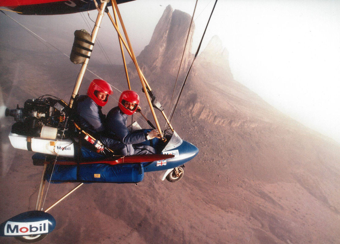
In 1988 prolific adventure travel writer Christina Dodwell teamed up with experienced microlight pilot David Young (recently back from a close shave in Nepal) to fly 7000 miles in a Pagasus XL from Cameroon to the Atlantic in what was still the pioneering era of microlighting. I knew of it but never read this one; it’s not a trans-Sahara, more of a Sahel traverse via the Aïr mountains and Timbuktu. From the back cover map it looks like they followed roads and main tracks for navigation, maybe due to range and landing issues. Luckily they didn’t do an Icarus and all ended well in Dakar four months later. There’s a book of course (right), one of Dodwell’s many which is widely available online.
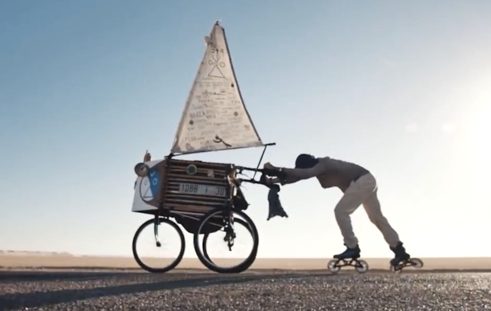
With the 21st century bringing a choice of no less than three asphalt roads spanning the Sahara at 1500-mile intervals, it was time for the rollerblade (or ‘inline skate’) and the humble push-cart sail-tricycle to have their day in the sun. It’s what rollerblades and bitumen were made for. Five thousand clicks from Spain to Dakar, watch Mark Heuss’ cool short film below.
Did I miss any other batty trans Sahara crossings?
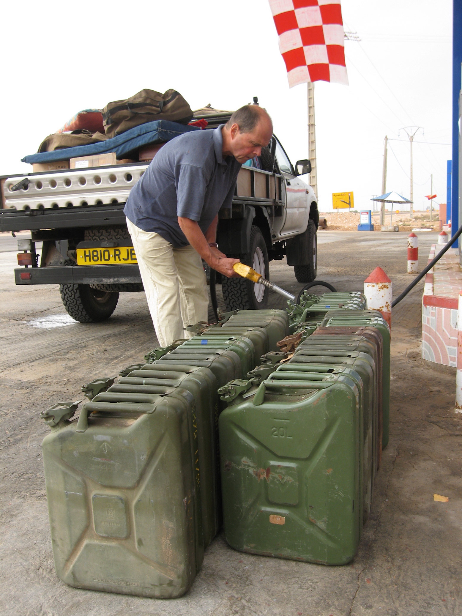
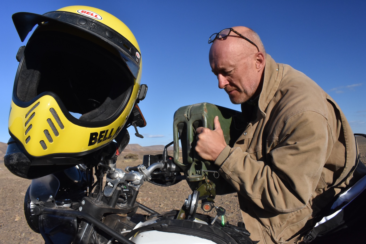
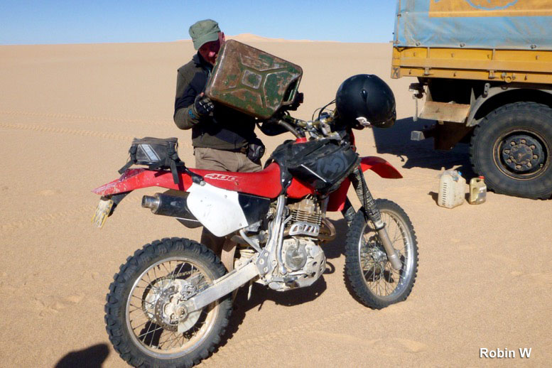
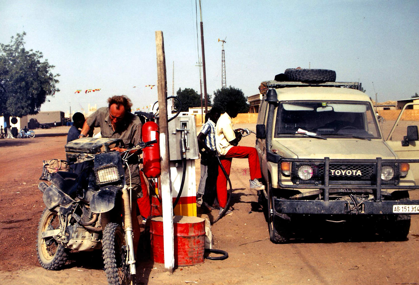
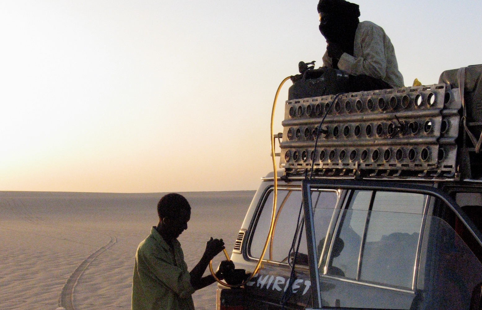
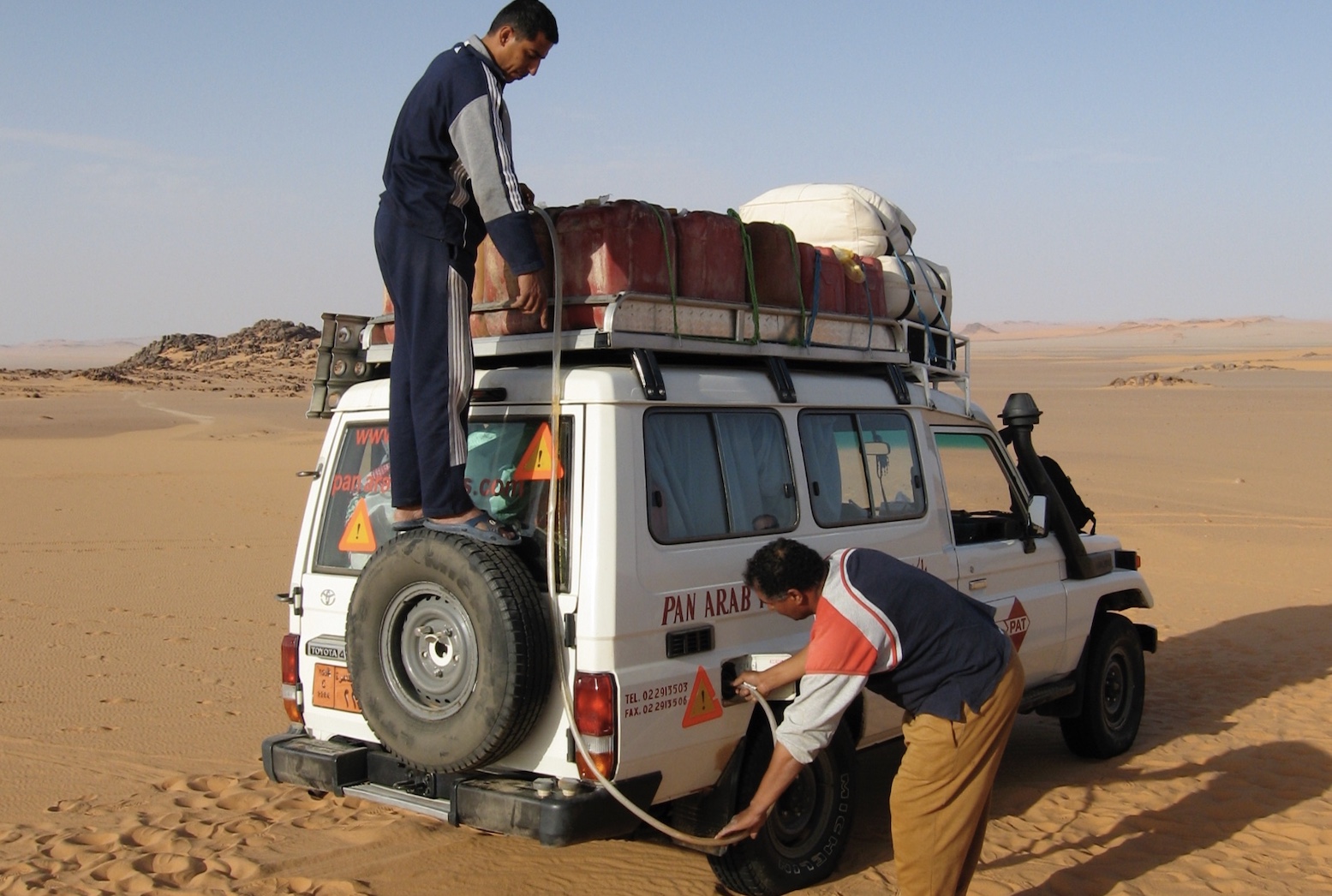
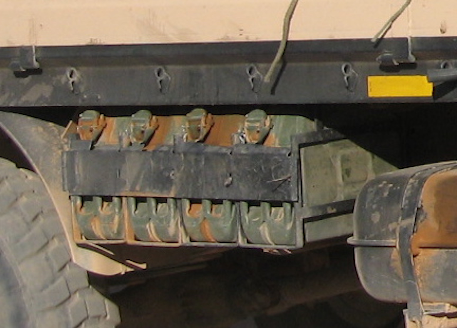
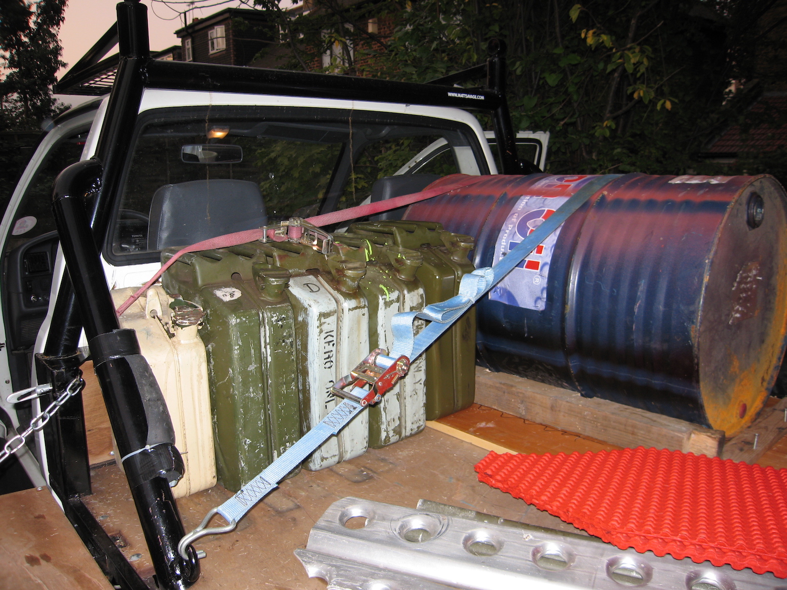
For travellers who don’t expect to be making a lifetime of Sahara travel and haven’t got limitless funds, jerricans provide the simple answer to increasing your vehicle’s range. Available sometimes still unused from military surplus outlets for around £10, they make reliable and robust fuel containers.
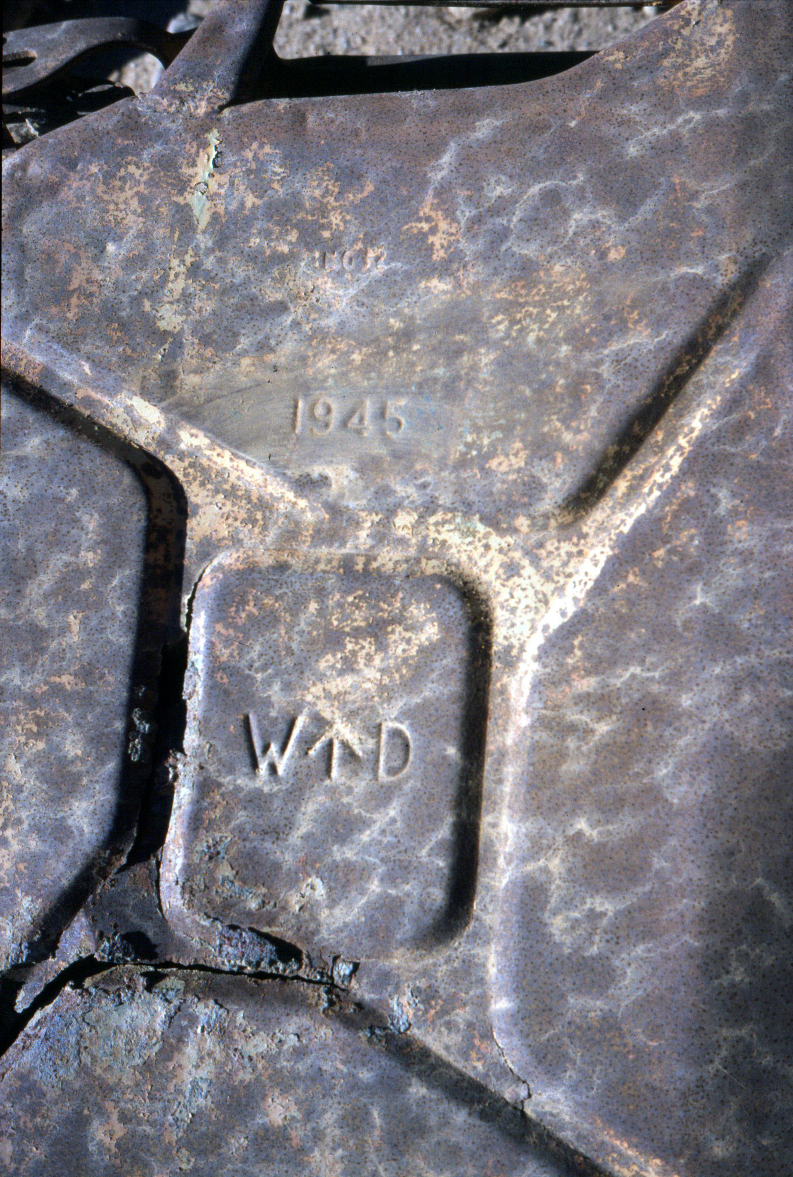
Captured WW2 kannister
The standard steel jerrican is a German design (hence the name) from the late 1930s, developed to support their blisteringly effective blitzkrieg invasions. The fact that the design remains unchanged today shows how well they succeeded with the ergonomics of carrying, pouring, sealing and storing fuel. During the war in North Africa, the LRDG prized the discovery of any jerricans, while the Germans were ordered to destroy them on retreat.
LibyaWestern SaharaAlgeriaMali
A jerrican holds 20 litres (4.45 gallons; 5.28 US gallons) when filled in the upright position. This leaves an air gap just below the handles which shouldn’t be filled with fuel (by tipping the can backwards) unless you’re really desperate. The air pocket, as well as the X-shaped indentations on the sides, enable the can’s sides to bulge as fuel expands; especially the case with petrol which is more volatile than diesel. Once warmed and shaken on your roof, take care to open the cap very slowly (the cap’s clamp design makes this easy) to avoid a spurt of fuel, which, besides being dangerous, is messy and wasteful.
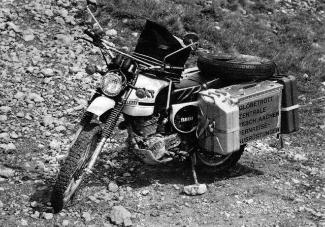
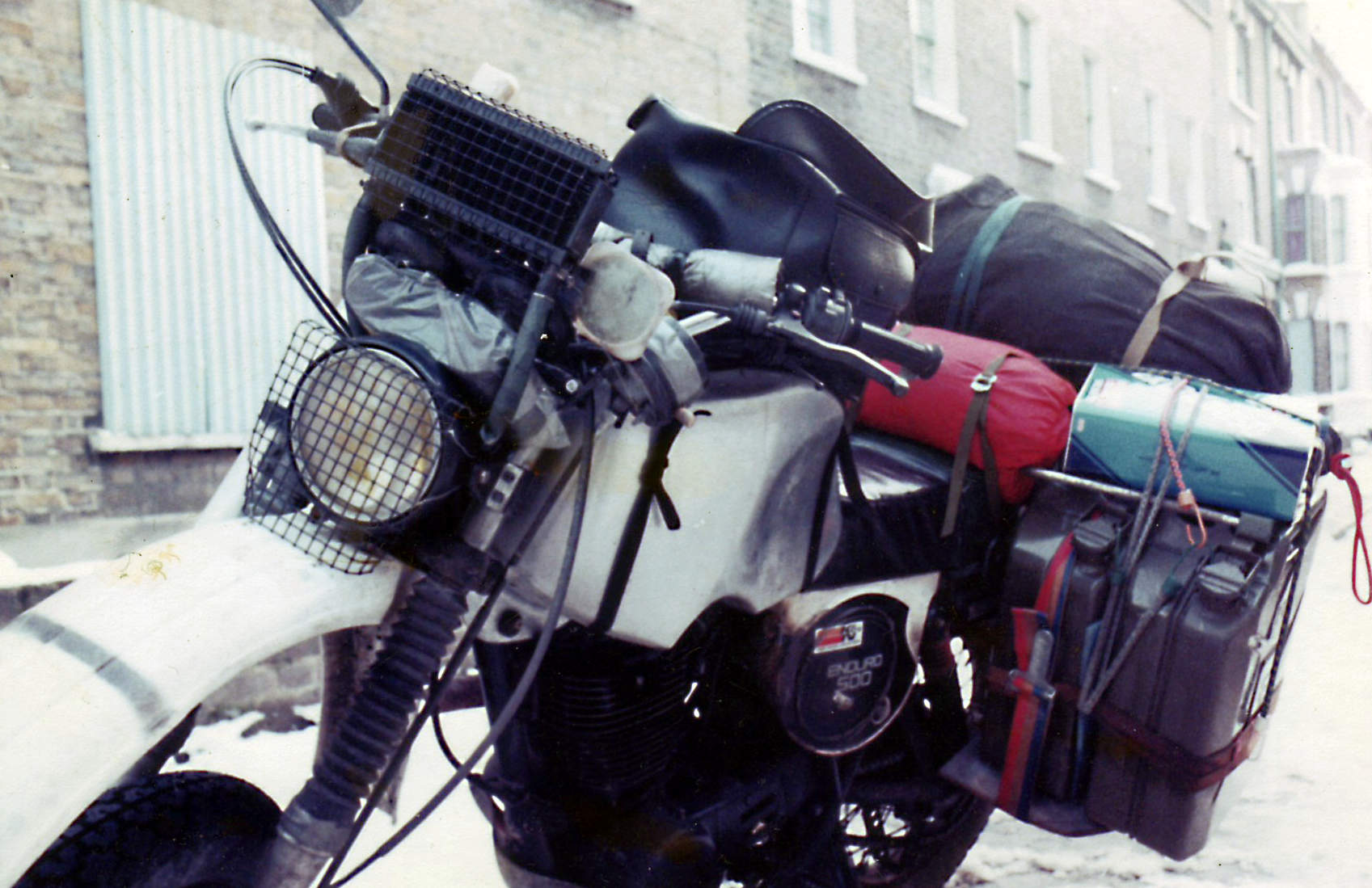
Bernd Tesch’s XT500, 1976My XT500, 1982. The jerries were soon sold.
Algeria
A clamp-on spout (some with an integral gauze and breather tube) should make topping-up while holding a heavy can easier. But I find these clamp-on spouts often don’t seal well, fuel runs down your leg and their internal gauze slows down the flow rate, prolonging the effort in holding them up. A wide-bore funnel takes half the time. Rigid funnels get messy with diesel and are awkward to stow, so I prefer the ‘collapsible’ vinyl items with the end snipped off to make the hole bigger. Store them in a plastic bag or flat lunch box. Cutdown mineral water bottles will also do the job.
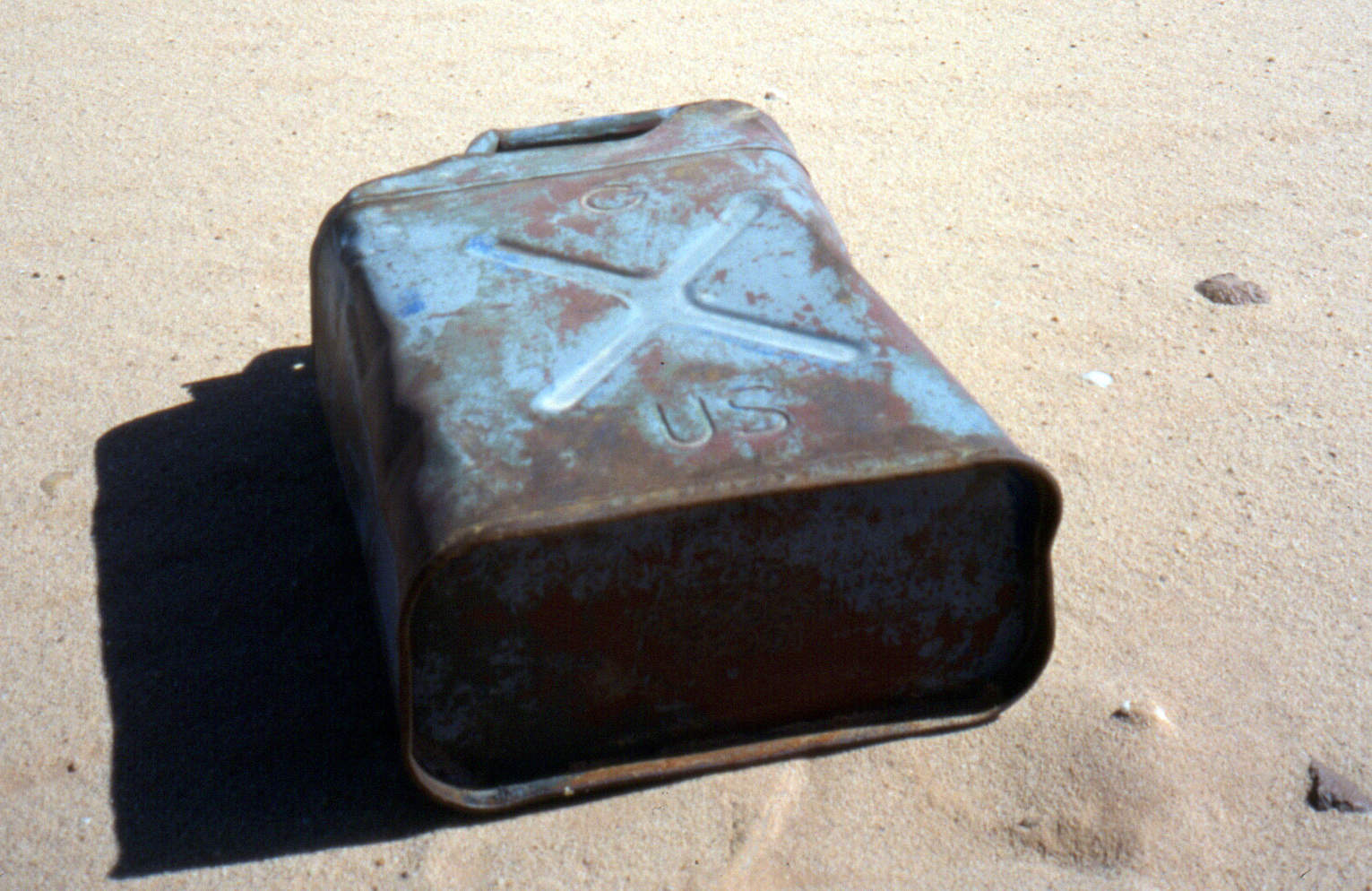
Pinched or copied following Al Alamein, a Brit WD jerry at Jebel Uweinat (Sudan).A US-army ‘Ameri-can’. Not quite as good. Or not as legendary.
Better still, leave the can where it’s stashed on the car and siphon the fuel into the tank either with a simple tube or a manual siphon-pump. Until mastered, the mouth-sucking method to get a siphon going is understandably unpopular with motor fuel. If you have no siphon pump bury the whole hose into a full jerrican (a flexible, clear, thin-walled hose is best). With the other end fully submerged, put your thumb over the end and draw out the tube which should stay full of fuel. Poke the tube into the fuel tank filler and the weight of the dropping fuel will create a siphon.
Tenere (Niger)Sudan (Selima)
Jerricans themselves can be knocked about for years: I’ve never seen a welded seam leak, though cap seals do leak. You can buy spare seals or, failing that, a chopped-up inner tube clamped across the mouth will work.
Treat ’em rough (laying a fuel cache, Algeria)
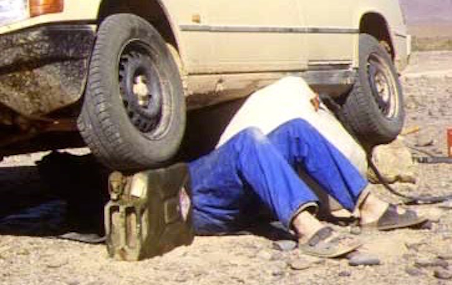
Once rust or flaking paint begin to come out of a jerry, either make sure you use a fine pre-filter or get another jerrican. Neat ten-litre versions are available and even mini five-litre models, all using the same clamping cap. They can also be robust containers for spare motor oils and other fluids and make good jack stands when working under a car.
Ten-litre jerries on a Land Rover101FCHandy wheel-stand (Morocco)
There is said to be a small risk from static electricity in the dry desert atmosphere when refuelling vehicles, especially petrol. Earth the car by touching it before opening the cap and pouring in the fuel.
Cheap plastic jerricans (Egypt)Heat up, expand and leak. A few days later
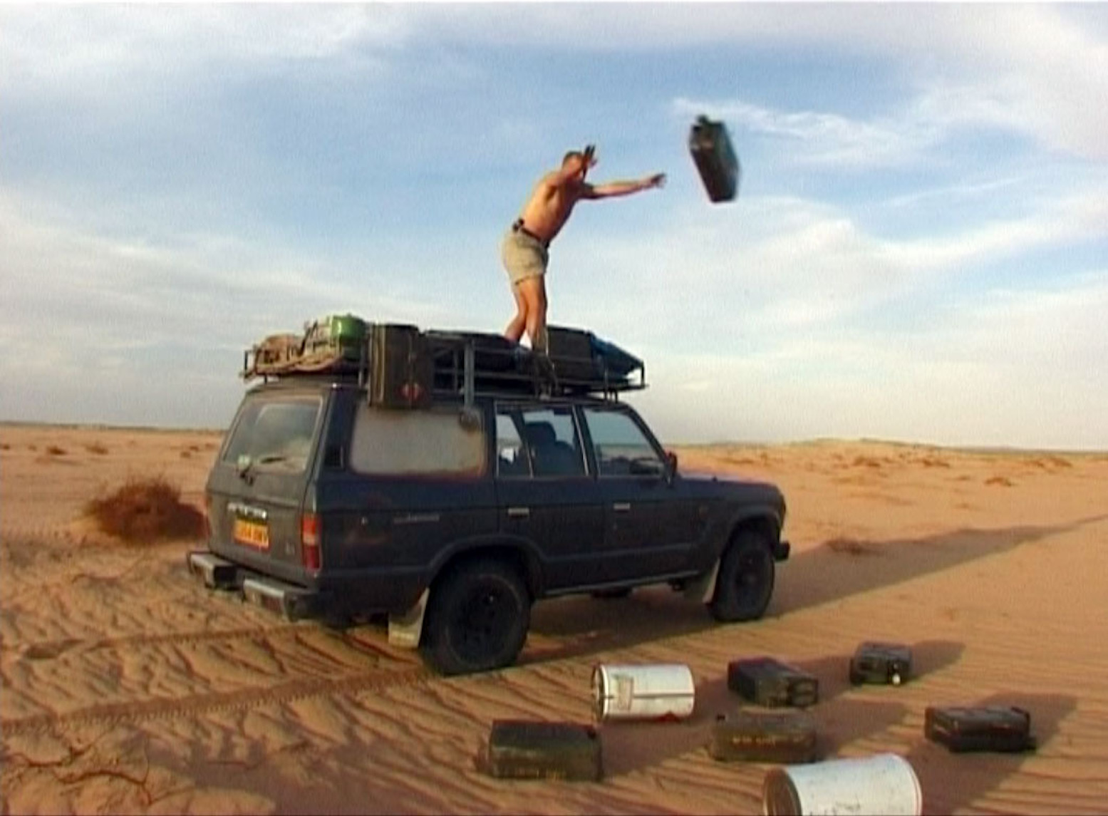
‘Jerricans’ copied in plastic should never be used for long-term fuel storage. The soft slab sides and screw-on caps are unsuited to the expansion and will swell like a balloon before splitting, leaking or bursting. I once drove a car carrying nearly three dozen cheap plastic jerries on the roof. Within a couple of days fuel was running down the sides of the car as the liquid expanded and caps leaked; I even had to use the wipers as it ran down the windscreen. It was very messy and bad for the rubber components.
Rack of easily accessible jerries under an M.A.N.After jerricans come oil drums. Ten times bigger and as cheap or free.
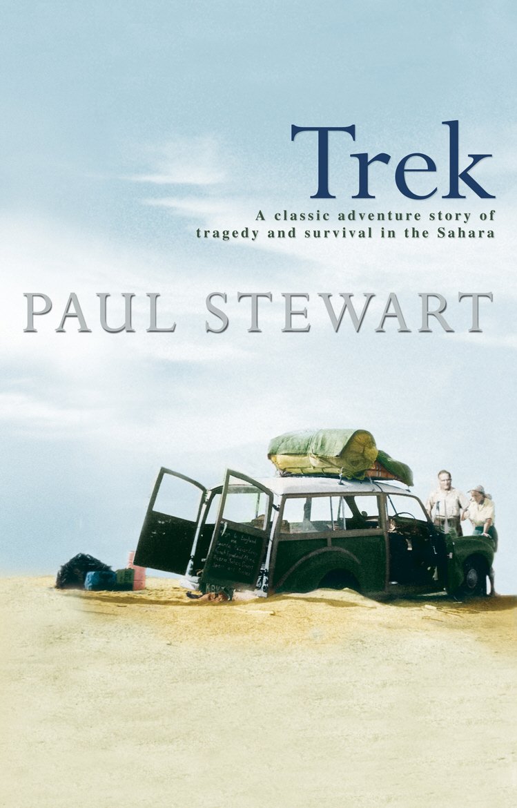
I was working at London’s Travellers’ Bookshop when Trek came out in 1991 and of course, I gobbled up the desert drama, painstakingly researched by Paul Stewart (better known for the Edge Chronicles young adult book series). The book came about after Stewart had the story recounted one of the expedition’s survivor’s at her Kenyan guesthouse in the 1980s. He soon realised it was a headline on a June 1955 ‘day of your birth’ newspaper reprint he’d been gifted decades later. Stewart was born on the day the sensationalised events broke across the UK press (see bottom of the page). Recently writing up the similar Danish story which took place a year earlier in 1954, I realised I’d never reviewed Trek, so recently blitzed through it recently. Only this time I had a slightly more knowledgeable eye, having evolved into a Sahara and overland know-all in the intervening decades.
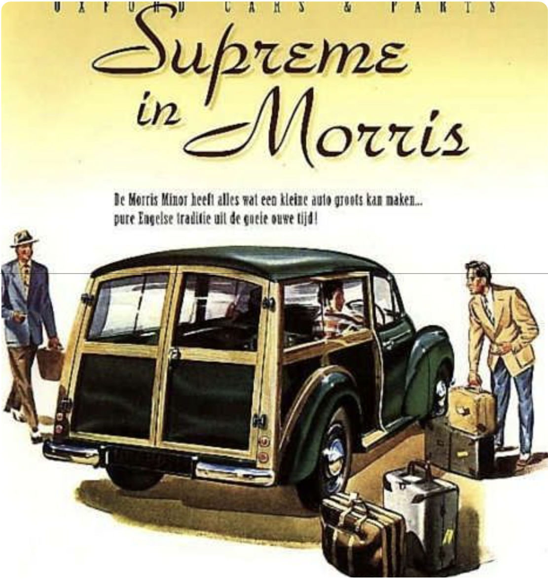
Morris Traveller, pitched as ‘the small car for big jobs’. Like trans Africa, perhaps?
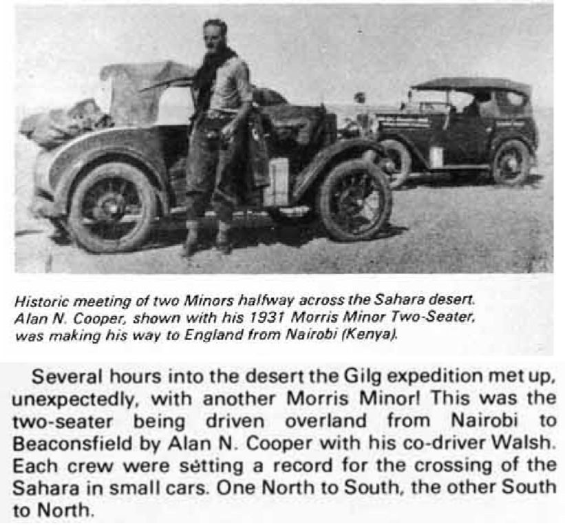
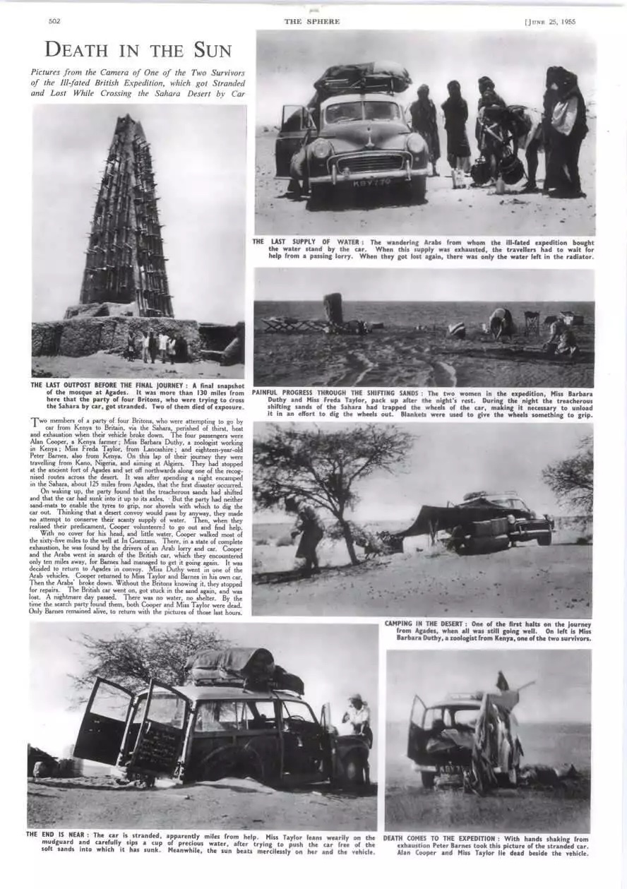
Trek tells the story of an ex-pat foursome who, in April 1955, set off in a near-new Morris Traveller (like above) to drive from Kenya via the Congo and the Sahara back to the UK. They were led by Alan Cooper, a self-confident but irresponsible bon viveur who’d farmed, ran hotels or led safaris, all with little success (forthright bio from his old school). Perpetually short of money, he wanted to visit his ageing mother back in the UK and perhaps kick-off another business scheme. Back then driving overland was the cheapest option. To cover the trip’s costs he advertised places at £175 a seat in a local paper, but on the day delivered much less than promised: a single small, inadequately prepared car, far less any hired locals to undertake the chores. The three passengers were 17-year-old Peter Barnes, despatched by his mother to man him up (and whose detailed diary was a gold mine for the author years later), a genteel spinster Freda Taylor who’d erased 17 years off her true age of 55, was captivated by the idea of the Sahara, and was caught in Cooper’s spell. Barbara Duthy was a more independent-minded woman, a scientist and pilot, who from the start challenged Cooper’s incompetence and cavalier practices. It was the ageing Barbara whom the author met in Kenya in the 1980s.
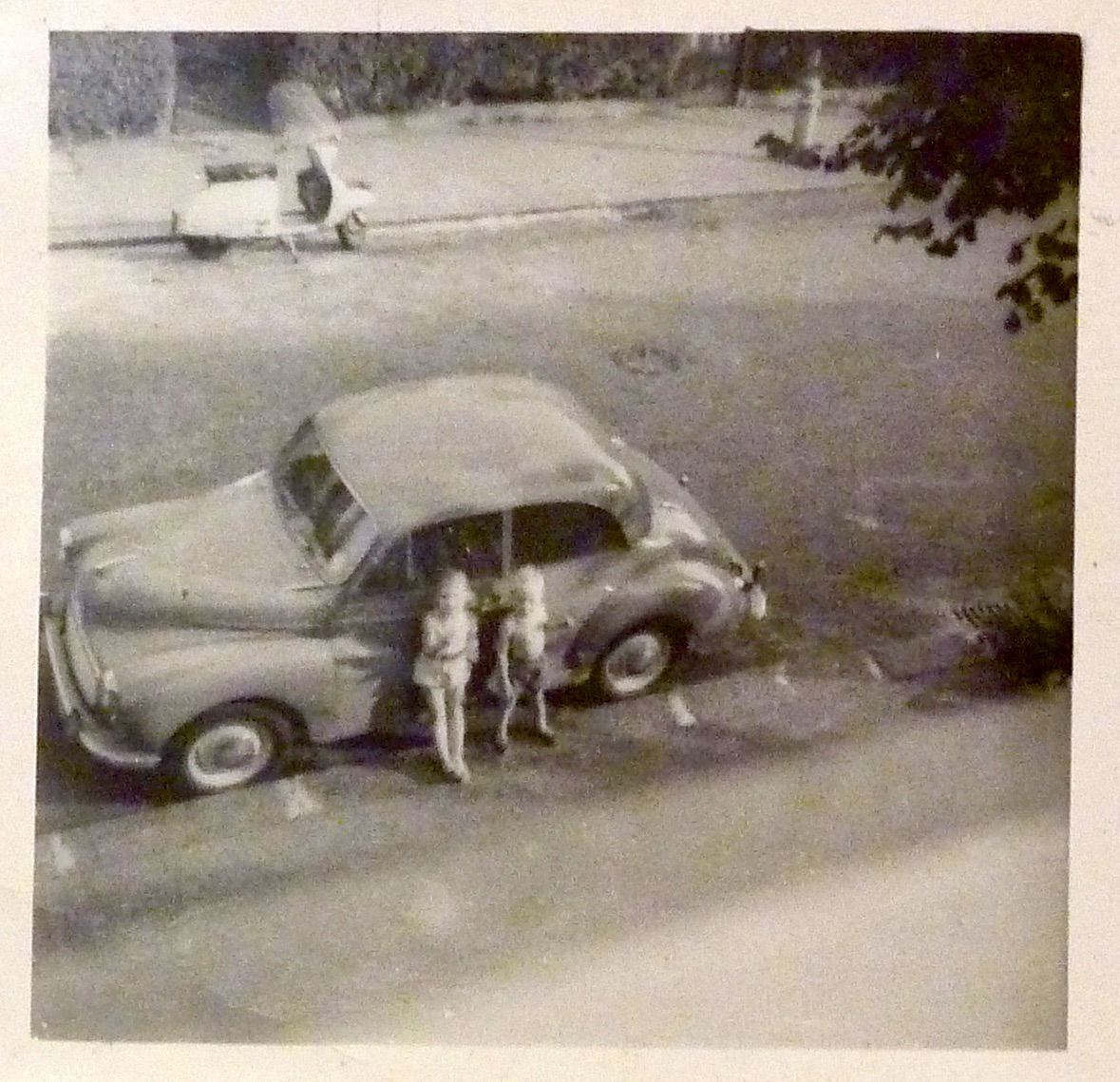
Our Moggie in the Sixties
To his credit, over 20 years earlier Alan Cooper had completed a similar African crossing in a two-seater Morris Minor, even getting this achievement featured in The Times as the smallest car to cross the Sahara to date. The original Minor was more Model T Ford than the rounded post-war ‘Moggie’ we know and love. By 1961 that famous model became the first British car to sell a million, and was my parent’s first car (left). On that first crossing the young Cooper had just one passenger via the Tanezrouft crossing from Gao to Colomb Bechar in March, the time of year when temperatures in the Sahara begin to escalate quickly. Near Reggane he ran into two other Brits and a desert guide in a bigger Morris car heading south for the Cape (pix below; 1978 documentary on YT). Both Morris crossings occurred barely a decade after Citroen half-tracks had been the very first ‘cars’ to cross the Sahara north to south, pioneering the long, bleak, waterless but flat Tanezrouft route to Mali and the Niger river. On the way they established the famous ‘Bidon’ staging posts which were to feature on future maps. In the 1930s I don’t think the Hoggar route between Agadez and Tamanrasset was yet regarded as motorable.
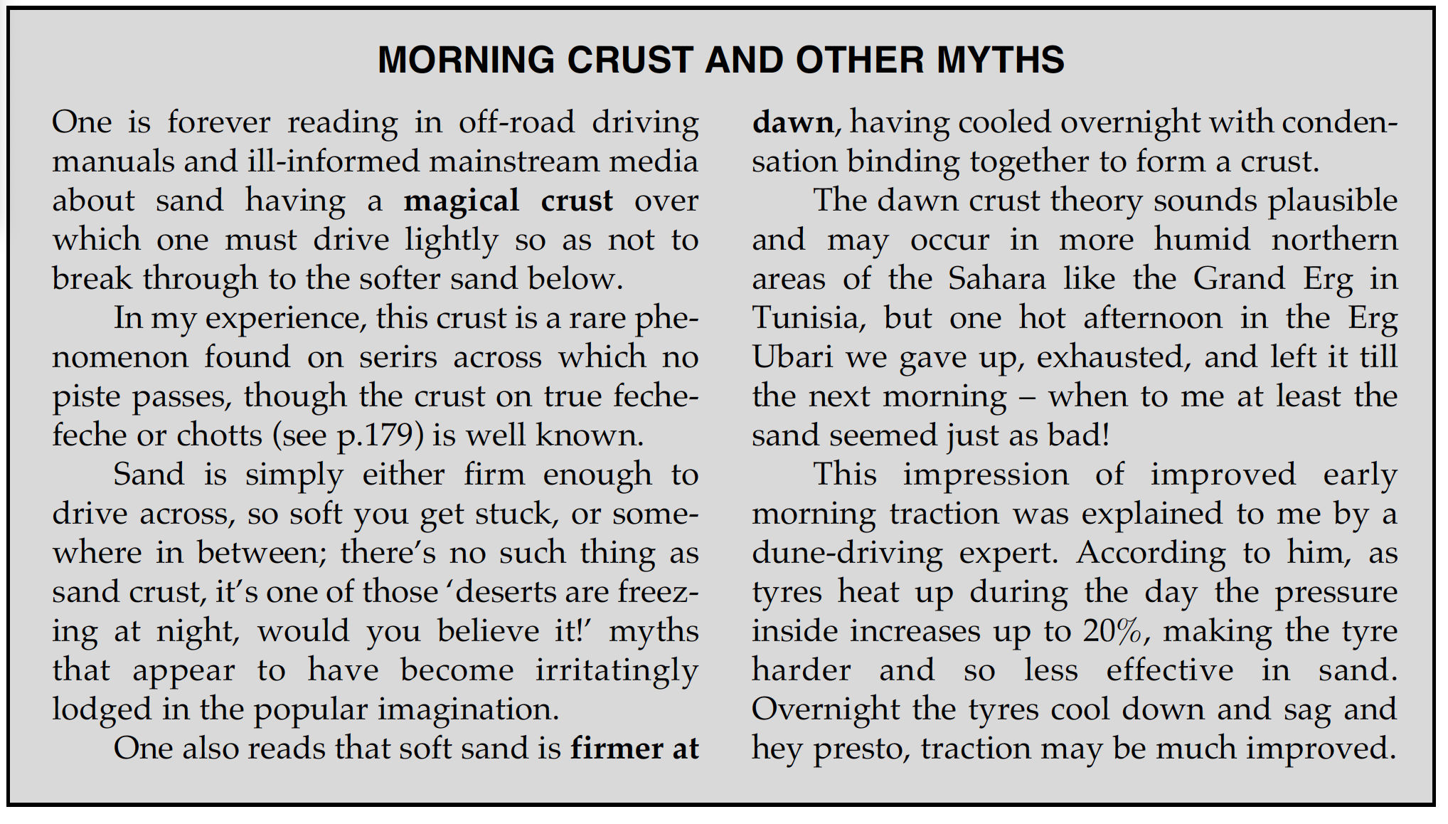
The ‘8hp’ question In Trek a highly unlikely ‘8hp’ gets attributed to Cooper’s 1950’s Traveller. It’s hard to think how, other than the author spotted it in a 1955 newspaper headline (below) and thought nothing of it. These days a suped-up moped could make 8hp, but throughout Trek ‘8hp’ gets much repeated to underline the Traveller’s crushing unsuitability for the task it had set itself. Was there ever a mass-produced, post-war car that made just 8hp? Actually there was, (thank you internet): the ultra-basic 1949, 375cc 2CV put out 9hp, was much ridiculed at the time and soon became the butt of ‘does it come with a can opener’ jokes. As Frenchman Cyril Ribas has proved over many decades, a 2CV does actually make an effective desert car. A bit more interneting soon reveals even Cooper’s 1931 side-valve Minor pushed out a healthy 19hp while weighing less than 600kg. His near-new, 800-cc, engined Traveller clocked in at 28hp. A two-litre Series 1 Landrover of the day made 55hp, so 28 was about right, and far from a puny 8hp. Oh M G, Paul Stewart does not get cars! Like most people, nor is he a desert driver. Irksomely, along with other tenuous suppositions and repeated myths (like wandering dunes making tracks unrecognisable within days) he goes on repeatedly about the perils of breaking through the thin ‘sand crust’ which formed each night under the star-lit desert. Don’t start me on sand crust (see below).
I admit all this will go over most readers’ heads because they will find Trek an engaging read of how one person’s behaviour can lead to an all too predictable disaster. One thing the author does well is paint a vivid picture of colonial Africa at that time, and why so many Europeans chose to live there, enjoying a standard of living they’d never have back home. In the mid-Fifties that era of privilege was coming to an end as demands for independence spread across the continent – not least from Kenya’s Mau Mau insurgency. As you’d expect, Peter Barnes’ diary recorded little interaction with locals, either Africans or colonial administrators, so the author cooks up period dialogue to help jazz up the tale. Sometimes it passes unnoticed, at other times it jars. It’s a bit different from an author lightly embellishing their own memoirs or travelogue with their own voice.
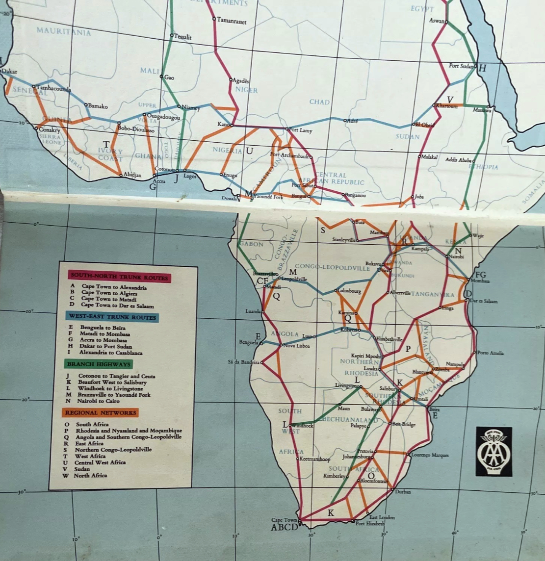
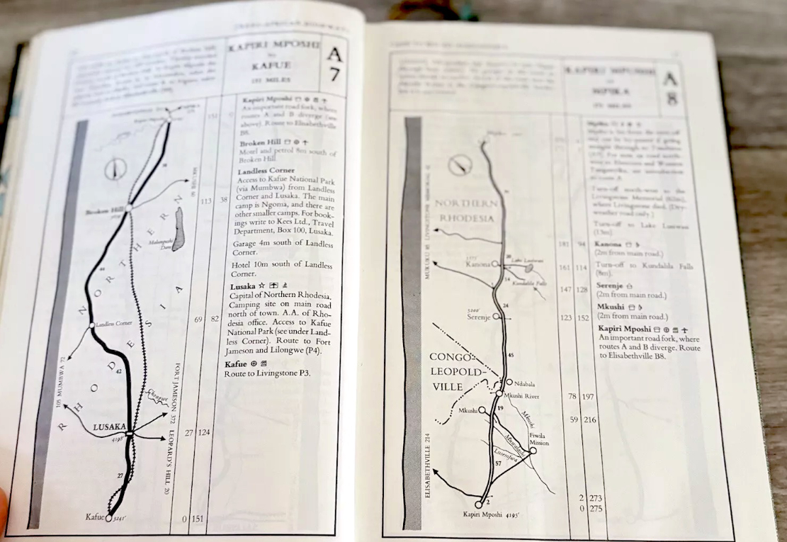
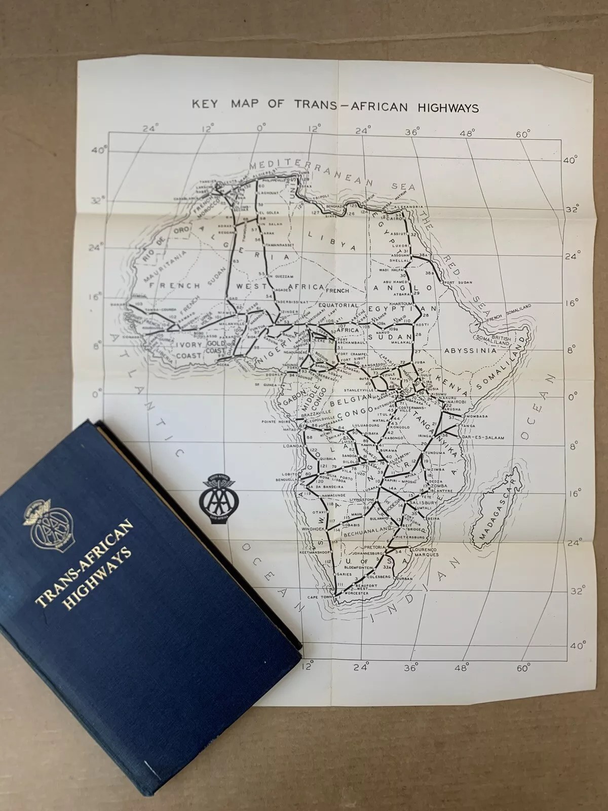
African highways from the final, 1963 AASA edition of the Trans-African Highways road book
The Travelling foursome left Nairobi in mid-April, almost exactly a year after the Danes and, in my opinion, an usually late departure if intent on tackling the Sahara a month later. Unlike the Danes, Cooper was far more casual if not outright reckless in his planning and preparation, sparing little room for vital provisions, spares and equipment to fill his paying seats. Under pressure to reach Agadez before French authorities suspended desert crossings from mid-May to November, the group averaged up to 200 miles a day across equatorial and Sahelian tracks. As a result, four weeks later, both passengers and car arrived at the desert’s southern edge, weary and exhausted.
Like the Danes’ near-new Morris Oxford, Cooper’s 6000-mile-old Traveller needed new big end bearings. Except in his case the cause was, bizarrely, not stopping after smashing the sump on a rock in Cameroon (the Danes carried a spare sump for this very reason). The Traveller’s oil drained away and inevitable engine damage occurred. Limping on to Kano in then British Nigeria, the wrong spares eventually got flown in so a proper repair was bodged to save more waiting. Heading north for Agadez, the engine was soon knocking again.
Trans Africa Routes 1963
The French requirement of a £1000 bond to cover a desert rescue described in the Danish article did seem unusually high. In Trek, a more plausible refundable £50 per person is mentioned to cover a search, should a vehicle be overdue at the next checkpoint. With new bearings fitted in Agadez, but just a week before the desert closed for months, Cooper tricked his group by claiming they’d been given the all-clear to leave but they had to go right now. In truth he knew he’d never have got official approval to cross the desert. Along with the imminent closure, it was this deceit which may have forced Cooper to push on into the desert, when turning back would have been wiser. Because of his actions, no official departure record was logged and so no rescue mission was launched until news of the lost Morris reached Agadez, a week so so later.
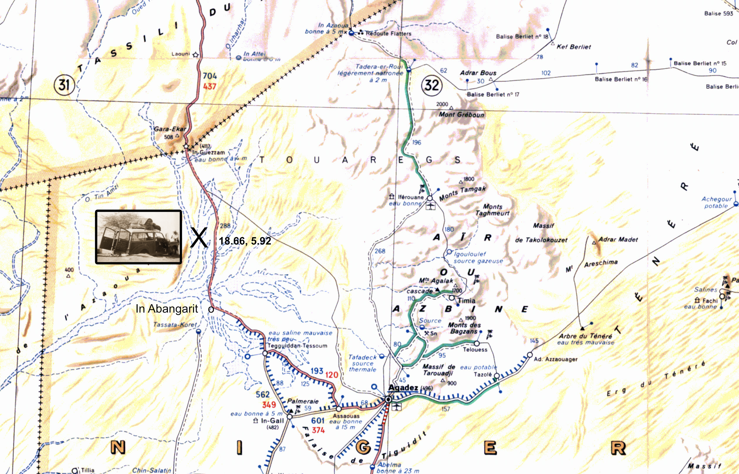
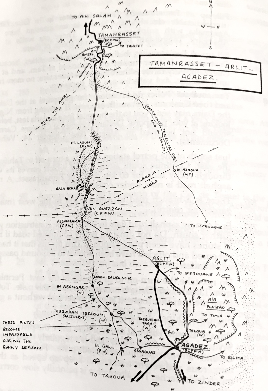
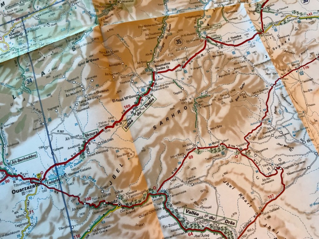
In Abangarit piste from Agadez via In Guezzam to Tamanrasset (900km). The current Arlit piste is not shown.
In the 1950s the piste from Agadez to Tamanrasset went west past the salines of Tegguidam Tessoum before turning north at In Abangarit well for In Guezzam on the Algerian border. This was long known as a sandy route, tougher but shorter than the original Tanezrouft across Mali and Algeria. When the uranium mine opened in Arlit, north of Agadez, in 1971, the primary crossing switched to that route over less sandy, or at least more travelled terrain.
In Abangarit piste, Sahara Handbook
The 1990 edition of the Sahara Handbook (left) claimed ‘4×4 vehicles are not necessary’ on the In Abangarit piste (right). The Swiss Beetle (see below) proved that and the book’s original authors undertook most of their travels in a Kombi van. But the Handbook went on to advise, from Assamaka ‘… head south on a bearing of 170°. Keep speed up… Several big sandy patches and seas of bull dust, especially [110km] south of In Guezzam‘. There was no Assamaka back in the 1950s, but by the 1980s the Handbook warned ‘Niger frontier officials [at Assamaka] have been known to force … travellers to go via Arlit… [to Agadez]. Subsequent landmarks given on the now little-used In Abangarit route description are spaced up to 100 or 150km apart, with balises as every 5km, too far to see one from the next. In 1986 on the the shorter Arlit piste I myself soon lost track of the balises, but that’s another story (below).
BMW BBQ
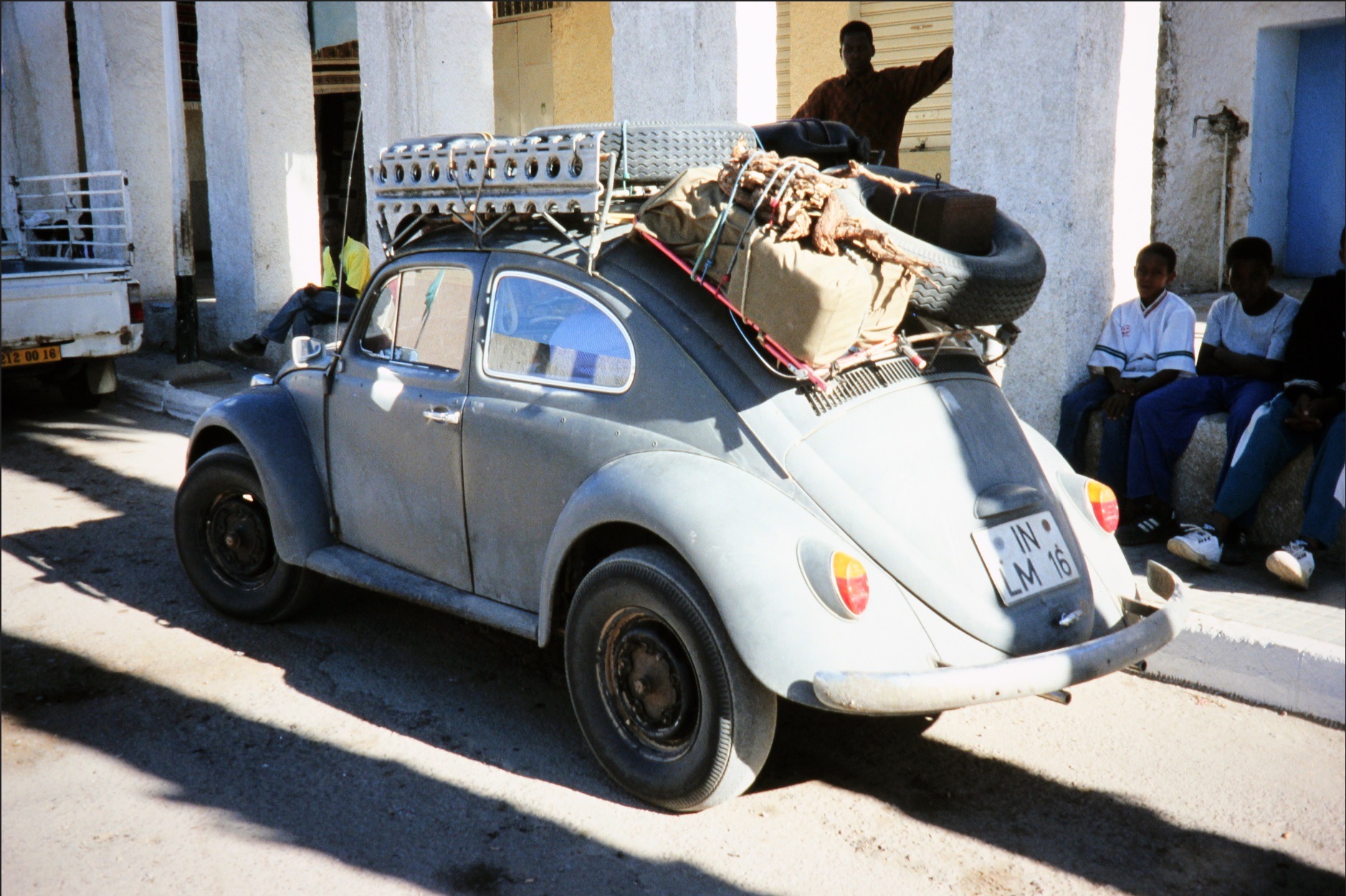
Like a 2CV or Renault 4, with the engine’s weight over the powered axle and good clearance, a VW Beetle made a surprisingly effective desert car. The VW Kombi vans even more so.
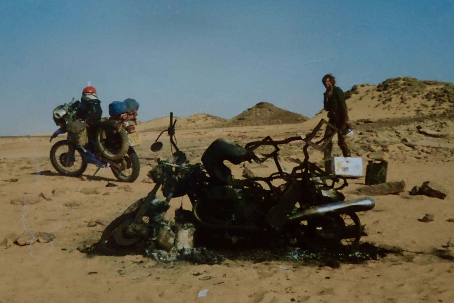
In the enervating, pre-monsoonal heat, the foursome did manage to stagger across the desert to within 50km of In Guezzam. But getting that far had entailed a lot of digging and pushing, decimating their inadequate water reserves. It was at this point the Traveller caught up with a lorry rescuing the nearly dead Cooper, who 50km earlier had set off north on foot from the then bogged car to get help. The other three got the car moving again and caught up. Cooper was found delirious by the southbound Algerian driver in a resupply truck (a Citroen Type 32 perhaps) carrying masses of water and recovery gear, and accompanied by a Swiss couple in a VW Beetle. Much against Cooper’s demands, the group insisted on carrying on south to Agadez to get Cooper urgent medical attention. Once in Agadez, the lack of permission would have come to light and they’d all miss the desert crossing window for sure. A compromise was agreed: they’d backtrack together about 150km to the well at In Abangarit where the Traveller would wait to join the returning Citroen heading back to Tam. To reduce weight in the Morris, Barbara chose to ride in the truck – a decision which probably saved her life. Peter ends up driving the Morris at the front of the convoy, while Freda tended to the semi-conscious Cooper in the back. But on losing sight of the following vehicles, at the still domineering Cooper’s insistence, fatally, they kept going. This rashness is hard to explain other than a bloody-minded craving to control events, no matter the risks. The Morris strayed off track, as is so easily done, got badly bogged again and, with all the water in the truck, first the severely dehydrated Cooper and the frail Freda died by the car. These deaths were almost certainly hastened by the colonial-era outfits shown in photographs: baggy shorts, short sleeves and frequently no headwear which all accelerate the body’s water transpiration in an effort to keep cool. It’s why Tuaregs are covered head to toe. With just hours to live, Peter was found a day or two later by a search party of Legionnaires sent from Agadez.
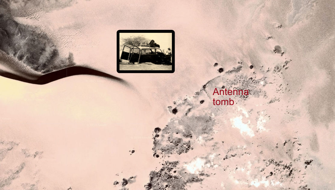
Burial location N18° 40′ E5° 55′
Cooper and Freya were buried by the Legionnaires at a waypoint given in the book as 5.55’N x 18.40’W. Even once corrected to N5° 55′ W18° 40′, this is way out in the Atlantic, some 600km off the coast of Guinea. I suppose in 1991 verifying a waypoint was less easy than now, but wasn’t anyone in production even curious? Jumble it about some more and you get N18° 40′ E5° 55′ which looks about right: a point among low dunes 10km west of the current piste and halfway between In Abangarit and In Guezzam (see map above). The book makes a lot of the doomed expedition’s ill omens; perhaps the final one is that the car came to rest just half a mile from from a cluster of pre-Islamic tombs, including a classic, east-facing antenna (above).
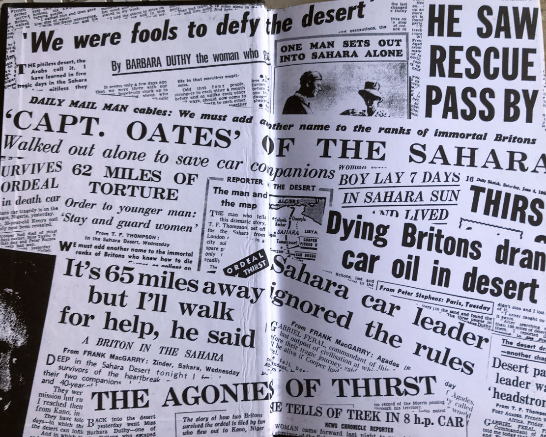
Hard to believe but UK tabloids were a lot more sensational back then. Note ‘SHE TELLS OF TREK IN 8 h.p CAR.’ mention.
Cracking yarns of abject overlanding folly like Trek have all helped entrench the Sahara’s mystique and notoriety, and the British papers of the Fifties had a field day: ‘drinking engine oil…’, ‘Oates of the Sahara…’ with some even inventing foul play to explain the deaths. You can buy Trek for a few pounds. What a great movie it would make.
‘… His heroic rescue bid will always be remembered by the two survivors…’
Thanks to Danish journalist, Anders Nielsen (a friend of one of the protagonists) for passing on this fascinating article and photos. I tidied up a Google translation and added [my annotations] for added clarity. Seventy years ago, on finishing a lengthy contract in the late-colonial sub-Saharan Africa, taking on such trans-African adventures was not uncommon. It was assumed a regular car might manage as in many colonies parts of the road network were well maintained and superior to what exists today. But as you’ll read, the near-new Morris Oxford still got quite a beating. The yarn reminds me of Paul Stewart’s Trek (below right; to be reviewed), also in a Morris just a year later, but which ended in tragedy north of Agadez in the Sahara. And of course David Newman’s demented The Forgotten Piste a few years later.
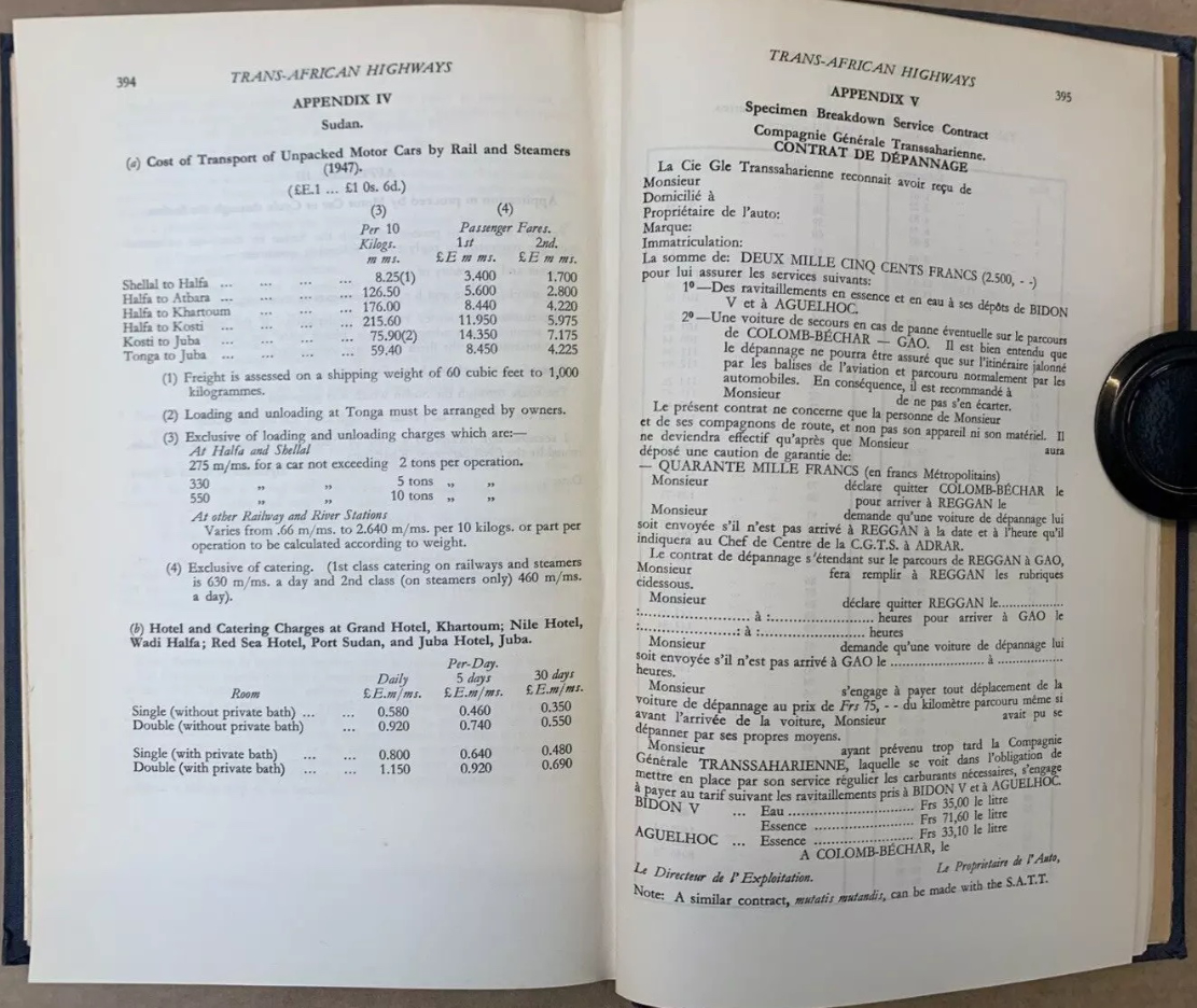
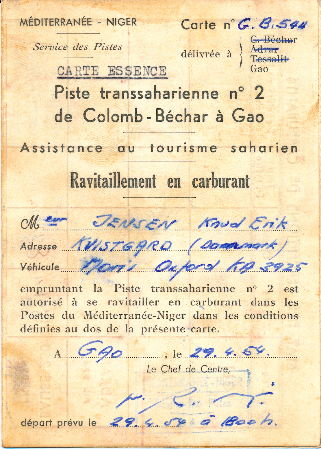
From Kenya to Morocco you’re reminded this era was marked by widespread anti-colonial unrest. It’s also interesting to learn of the huge £1000 bond (2500F + 40,000F) for the Contrat de Depannage (assistance) required to cross the French-controlled Sahara to cover the cost of possible rescues. The Trans-Africa Highways route guide (below) was first published in 1949 by the Automobile Association of South Africa. There are loads of copies online from £25: I bought the final, 5th edition published in 1963, by which time the vast majority of the European colonies (list with dates) were independent. The preface to the 5th edition explained the laborious task of redrawing all the guide’s maps to conform with the new nations. The guide closely resembles the French Shell Guide to the Sahara published since the mid-1930s: page after page of annotated strip maps along a given route. Knud and Svend used the 1949 edition of Trans-African Highways which Anders still owns.
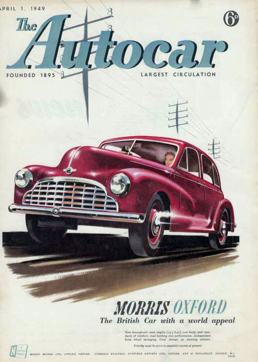
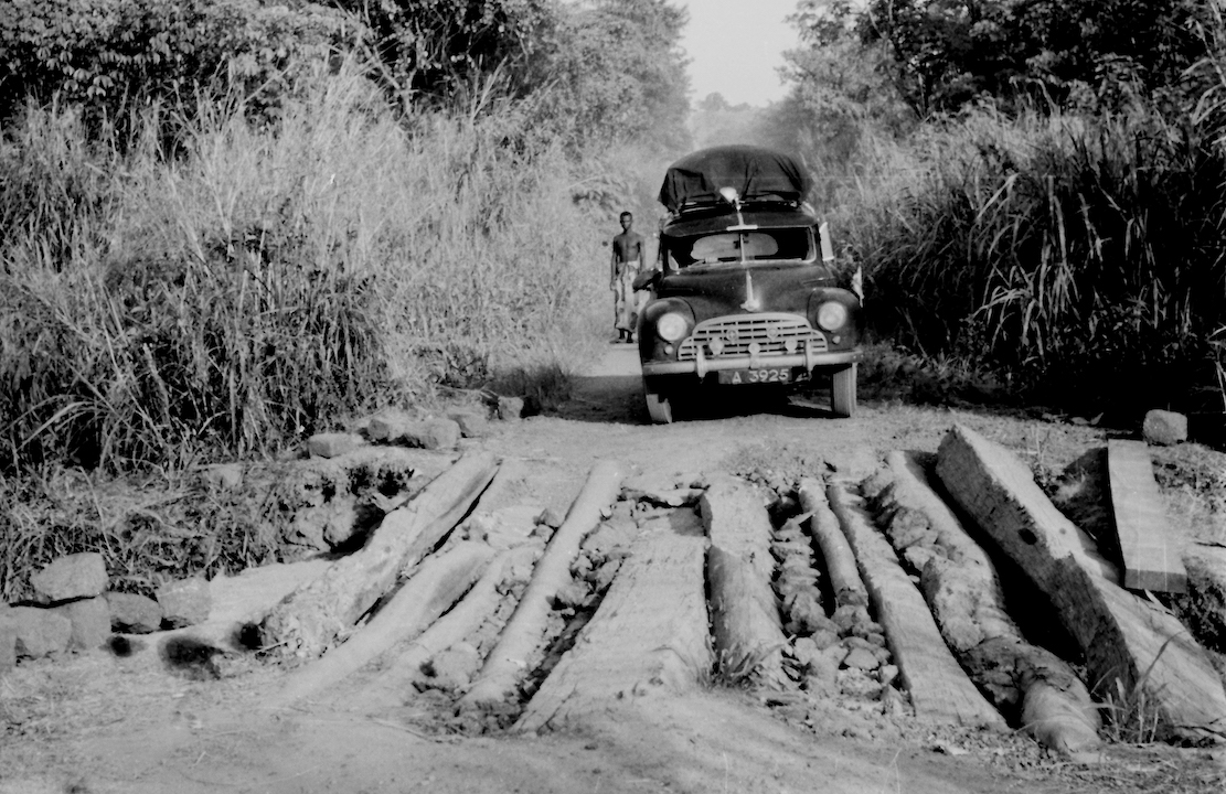
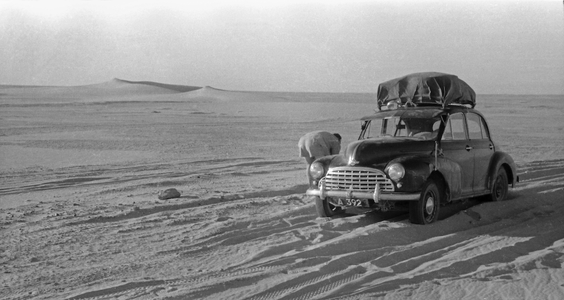
In 1954 two Danes, Knud Jensen and Svend Nielsen, drove a Morris Oxford from Kampala Uganda through equatorial Africa and across the Sahara to Kvistgård in Denmark. The 14,373 kilometre adventure nearly cost the lives of all three.
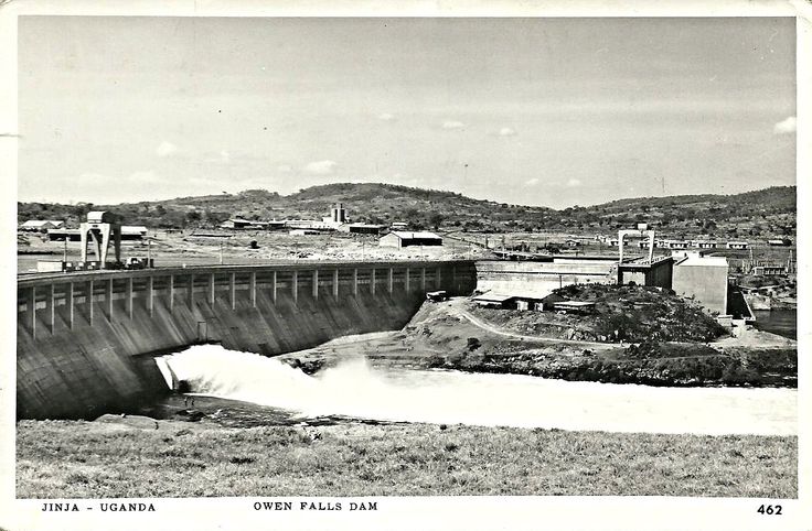
Owen Falls Dam
For three years, Knud and Svend had worked as carpenters for Christiani & Nielsen on the construction of the Owen Falls Dam (left) in Jinja, Uganda. This is where the Nile flows out of Lake Victoria to continue north to the Mediterranean. [An old treaty between Uganda and Egypt endured the Nile’s flow was unaffected, though during the 1956 Suez Crisis the Brits considered cutting the flow so to oust Nasser, even at the cost of flooding around Lake Victoria.]
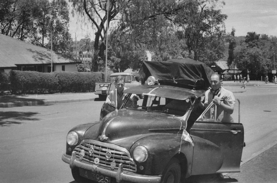
Morris Oxford
Along with their last salary, they received two plane tickets back home to Denmark, but they chose to cash these in instead. The two young men decided to drive home to Denmark. Knud had an almost new Morris Oxford [Series MO, left] and when you’re young, the spirit of adventure trounces reason.
The direct route was via Sudan and Egypt [with the option of putting the car on a train across the desert from Khartoum to Wadi Halfa], but Egyptian President Nasser was in the process of kicking the British out (the Suez Crisis occurred in 1956). Meanwhile Sudan was also wearying of the British and refused permission to transit the country. The only alternative led west across the Belgian Congo [today’s DRC] and on through French Equatorial Africa [CAR, Cameroon], British Nigeria, French West Africa [Niger] to Algeria and Tangier in Morocco.
First, 1949 edition of Trans-African Highways as used by Knud and Svend
The expedition required a huge amount of planning. Were there reliable maps? What were the roads like? When would the rainy season flood the rivers? What documents would be needed? Would the Morris even survive the trip and what spare parts would be needed? The 406-page guidebook, Trans-African Highways (left), published by the Automobile Association of South Africa, provided many answers. The rainy season in central Africa began in April, and the route through the Sahara would be closed from June to October due to sandstorms and intense heat. This still gave the pair a few months to get organised. Costly permits to pass through French territories were obtained in Nairobi, Kenya – a round trip of nearly 1500km along wretched roads. In Kenya, the Mau-Mau uprising was underway, resulting in a driving ban after sunset. Knud recalled stayed overnight in a small hotel in Nukuru, where the white guests were hanging out in the bar with rifles close at hand. In another town, the police station had been burned down.
Leaving Kampala, April 1954
Back in Kampala, the Oxford was given a major makeover, and many spares were thrown into a back-up engine sump, which produced a metallic clatter all the way to Denmark. The spare sump served as insurance against a possibility of damage on rutted tracks. An auxiliary petrol tank was fitted in the spare wheel well, and four spare wheels were lashed to the roof rack. Typically, the car did not get a single flat, even though they didn’t see asphalt until they reached Morocco, 8000km later. With a Danish pennant on the left front fender, Knud and Svend left Kampala on 3 April 1954. Ahead awaited massive rivers, equatorial jungle, harsh desert, isolated tribes and miles of rough tracks.
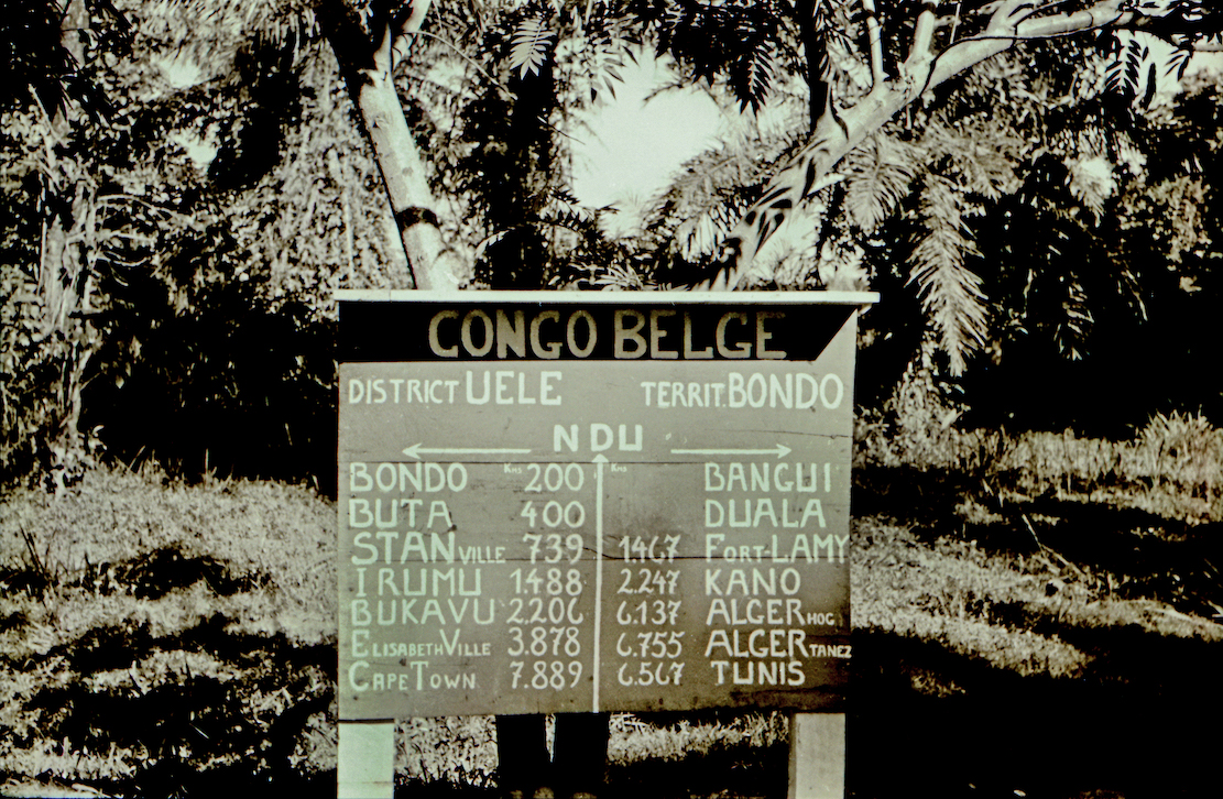
Ndu junction in the northern Congo
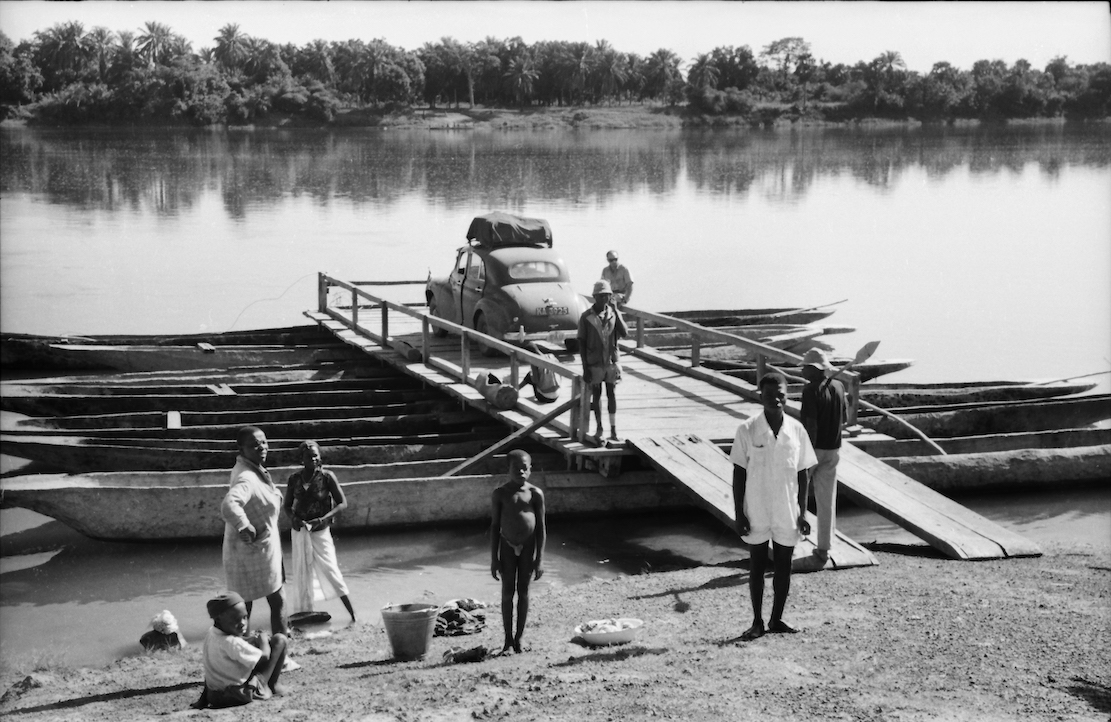
Soon they entered the Congo, where a rebellion against the Belgian colonial rule was already smouldering. But Knud and Svend were more concerned by the Pygmies’ evil glances. The road passed through dense jungle, and several rivers were crossed on small barges made of joined-up dugouts (below). The propulsion was a rower in a canoe on each side, directed rhythmically by the captain’s drum.
Kudu encounter While still in the Congo, one of the Oxford’s front axles broke. The two had agreed they’d take turns in getting help so with the axle under his arm, Svend got a lift to the nearest town, while Knud set up camp in a clearing. The natives gestured loudly to move the tent, but Knud refused, assuming they were trying to lure him away from the stranded car. That night he found himself camped in the middle of a forest full of snorting, growling and unnerving brushing against the tent, but otherwise the parade of unseen beasts passed without incident. The next day the locals returned to see if he was still alive. Knud emerged from the tent in good form.
Pygmies in the Congo
A few days later the Morris hit a kudu (a large, spiral horned antelope). The kudu trotted off unharmed, but they did not. The collision had shoved the fan back into the radiator leaving them to repair the damaged cells ‘the African way’. Being carpenters, they figured out how to knock some wooden plugs into the radiator at the bottom and squeeze the cells together at the top so water still flowed through. Miraculously, the repair lasted until they replaced the radiator in Spain.
Log bridge in the jungle
In French West Africa [Niger] they ran out of drinking water. Thirst became such an acute problem they drew lots to see who’d try some murky ditch water. The idea was that if the one who drank got sick, the other might be able to continue. Knud was given the honour of the dirty water, filtered through a handkerchief soaked up with red wine to cover the bad taste, while Svend had to make do with a mouthful of wine every now and then. The days passed, and when they finally found fresh water, Svend was so dehydrated he was hallucinating.
On the verge of giving up, they were under pressure to cross Nigeria before the rainy season broke. In Niger, the U-bolts holding one of the rear leaf springs snapped. According to the map, the nearest town was at least 60km away and the temperature was reaching 45°C in the shade. Now it was Knud’s turn to seek help; a truck gave him a lift to Dosso which in 1954 turned out to be just a junction. The next day he got another lift to Niamey, Niger’s capital, but it being the weekend, everything was closed. On Monday, he finally managed to get a workshop to fabricate two new U-bolts. Knud had wanted to wait until the next day, but realised Svend would have been impatient after waiting five days in the bush. The truck Knud returned on was the only vehicle Svend had seen in all that time, and he didn’t want to rot there any longer. While waiting, he’d crawled under the car for some respite from the heat, but the next morning found his body covered in rashes. Unfortunately, he’d shared his space under the car with a dozen rats.
After 6000km and three weeks on the road, the two exhausted Danes reached Gao on the Niger river [present day Mali], the southern terminus of the 1800-km Tanezrouft piste across Sahara to Algeria [the route of the original crossing of the Sahara with Citroëns in the early 1920s]. Here they met four Englishmen in a well-equipped 4WD, one of whom was a mechanic. They’d driven up from the Gold Coast (a former Danish colony, today Ghana) but had already blown four tyres. Although their original plan had also been to cross the Sahara, they’d lost their nerve and planned to sell the car and fly home.
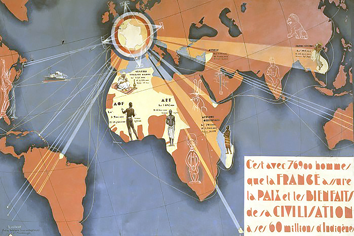
France shining it’s light upon their colonial world
This encounter made a sobering impression. Here they were stuck with an ailing ordinary family car with a broken rear spring, unstable steering and wheel bearings grinding with sand. Crossing the vast Sahara suddenly seemed like a daunting prospect. The only problem was the price they’d get for the clapped-out Austin wouldn’t even cover a single flight home. In silence they tried again to secure the broken spring by wrapping the handbrake cable around the broken leaves along with a pair of old trousers. At first glance, the repair seemed adequate.
Crossing the Sahara With permission to cross the Sahara came a requirement that the police in Gao verified at least 60 litres of drinking water was carried. However, the police did not seem so bothered in how careless travellers might be, so most of the water reserve was replaced with petrol as fuel was expensive at the military checkpoints further north in the desert. These checkpoints were up to 400km apart and, according to the regulations, travellers had up to 36 hours to reach each one. If they didn’t show up, the military would launch a search at the drivers’ expense. However, one of the checkpoints explained this never really happened. Soldiers serving in the Foreign Legion had not signed up to be tourist guides.
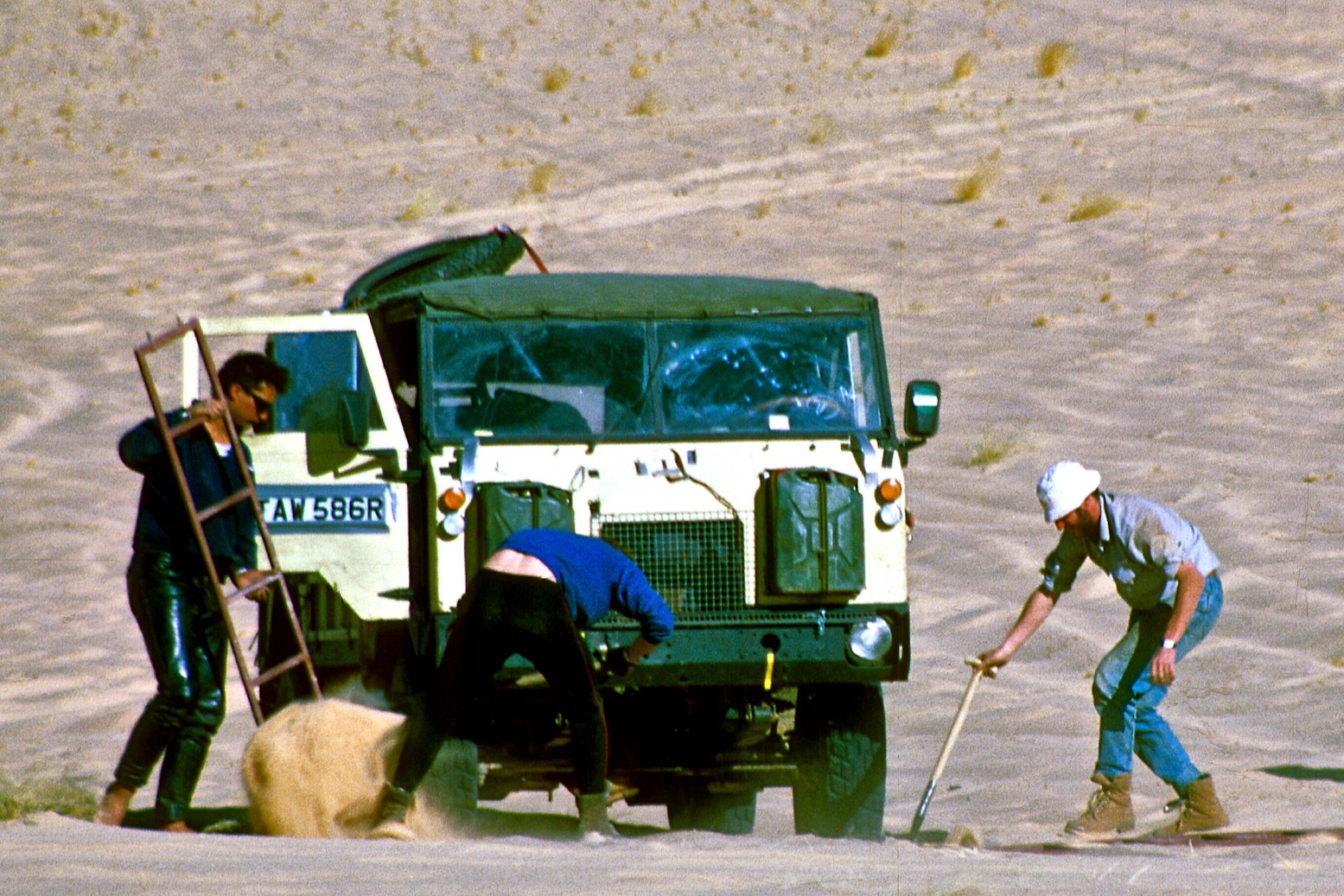
Stuck in the sand
The track through the Sahara was marked with single oil barrels [‘bidon’] every 2.5km and two stacked barrels every 5km. The sand-blasted wrecks of vehicles from unsuccessful transits also helped mark the route. For the first few days the track was corrugated – not so easy with a broken rear spring. Later they entered areas of loose sand which they tried to avoid while keeping in sight of the bidons. It became a struggle to shovel their way free, and the camaraderie became strained. When they got badly stuck for the third time on May 1st, Svend threw away his shovel and refused to work – this being International Workers’ Day. Knud assured him it was hardly likely the Danish Carpenters’ Association would find out about his shameful betrayal of the proletariat.
Border with Algeria near Bordj Moktar but still only halfway across the desert.
Despite these challenges, the journey through the harsh and beautiful landscape was a memorable experience. The great silence when they took a coffee break or ate beef straight from the can was indescribable. Then they’d sit in the sand with their feet in the ruts while the fiery red sun set, as it only does in Africa. When they got tired, they would burrow into the sand and look at the billions of stars overhead.
Crossing the Tropic of Cancer, north of Bidon V in Algeria.
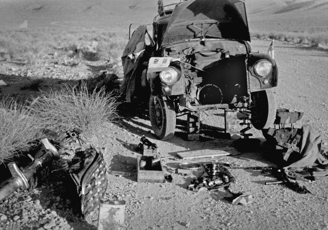
Major repairs in the Sahara Every now and then the engine would cut-out due to vapour-lock in the fuel pump struggling in the immense heat. Cooling it with a wrapped wet cloth helped a little, but the engine was also losing power and knocking loudly until they could only run for 3km at a time. Now the spare parts they brought from Uganda became invaluable. The engine was removed and disassembled in the desert and a destroyed main bearing was was replaced with a lot of filing and hammering. It took hours, but when the car started on the first try, the proud smiles lasted the rest of the day. The broken spring still had to be re-tied constantly, but after seven days they finally reached Reggane with a hotel and a proper meal.
Finances were tight if they were to get home. In Nairobi they’d paid a deposit of £1000 for permission to cross the desert, which they could claim back at any French government office north of the Sahara. But in Colomb-Bechar they didn’t have pounds. A detour was taken to Oudja in Morocco, but the consulate was closed, and the following day there were violent anti-French riots. And when the consulate finally opened, they didn’t have any pounds either. In Tangier it was the same story, and the Danish consulate could not help.
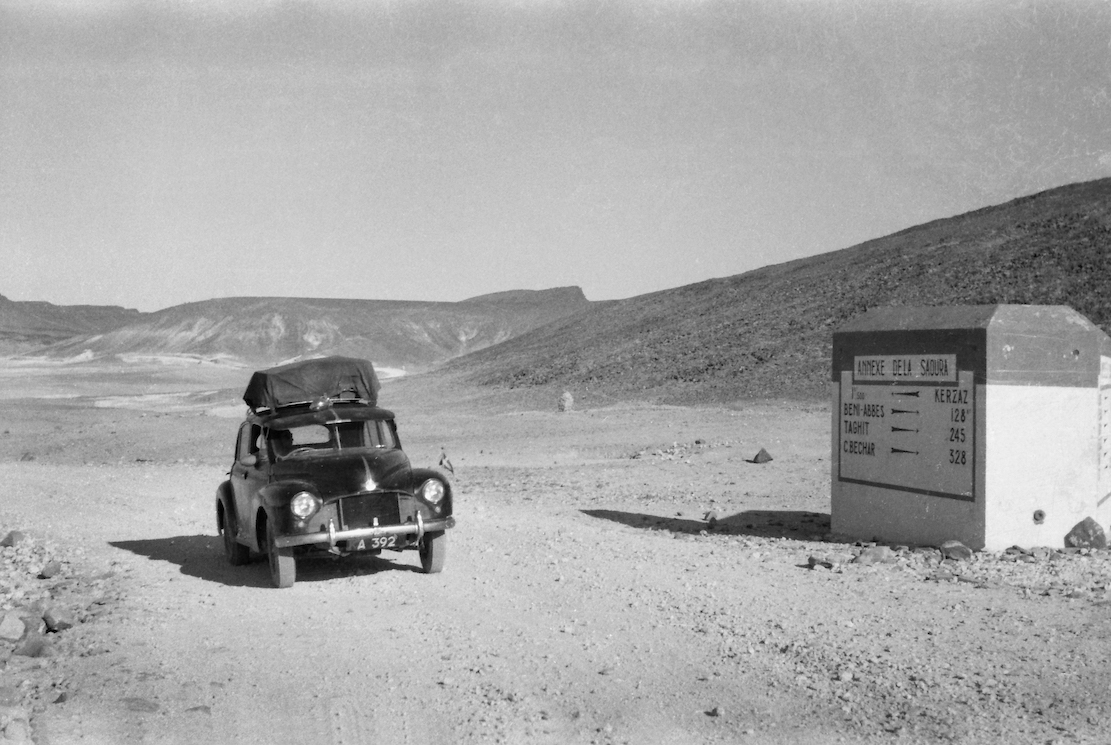
Near Kerzaz, heading for Colomb-Bechar and the Moroccan border
In the end, by exchanging their remaining African currencies, they were able to buy a ferry ticket across the Straits of Gibraltar, then at least they were in Europe. In Malaga, Svend sent a telegram asking for money, and while they waited, they stayed in a small hotel in town. The money took three weeks to arrive, and by the time the hotel bill was settled, there was barely enough left to reach Denmark. In Madrid, they pawned binoculars, cameras and a tent to get a little further north.
North of Meknes and the road to Tangier.
Late one evening in Germany they were stopped by the police on the Autobahn because both rear lights were out. They promised to fix the mess at the next fuel station, unable to admit that both headlight housings were rattling around in the trunk. To their great frustration, they only had enough fuel to reach the border in Kruså, but the Danish customs officers showed a rarely cheerful side. Despite the early hour they were fascinated to learn of the duos’ arduous adventure from Uganda. And when Knud and Svend explained they had to wait for money for fuel, the customs officers offered to lend them the cash so that they could drive home.
The two adventurers never forgot their welcome to Denmark. In Hillerød they sat in silence for half an hour, looking across the lake towards Frederiksborg Castle. It was June 5, 1954 – two months and two days since they’d left Kampala, and a beautiful summer day. It was hard to believe the adventure had reached its final chapter. Twelve minutes later, they rolled up in front of Knud’s parents’ house in Kvistgård, where the mother came out onto the steps, clapped her hands together and exclaimed: “Well, you’re finally here – you must be very hungry!”
These two southern Algeria towns will soon be joined with a ribbon of asphalt called the N55. In fact it’s said in April 2026 the job has been done, though it has yet to be independently verified. It’s worth knowing that according to the Djanet gendarmerie who give permissions, for some baffling reason, from Djanet this road is closed to tourists, even with a guide. We drove it eastbound in 2025 with a guide with no problems. Maybe eastbound from Tam makes a difference, as you can say that from Bordj you’re heading north to Illizi, even though it’s straightforward (and an amazing drive) to carry on east to Djanet which is a dead end (no open borders to Libya or Niger). In April 2026 sat imagery showed the gap in the tarmac had shortened in the west by about 9km to 85km. But as said, it may all be sealed. Soon we will know for sure.
How the surface with survive the baking summers and pummelling of trucks remains to be seen, but that’s been an issue since they finished Trans Sahara Highway from Algiers to Tam in the early 1980s. It’s said the TSH remained intact over its 2000-km distance for just one year before flash floods, poor engineering and overloaded trucks beat the bitumen back into rubble. In January 2025 we did the full TSH too; there’s probably 100km of diversions over sand and gravel.
Djanet to Tam This description may be out of date now but about 8km west of Serouenout checkpoint (270km from Djanet) the tarmac ended in 2025. After 24km there was a short, 20-km section of tarmac, and then you’re back on the piste south of the new road’s alignment for about 70km. Once back on the road around 24.264, 6.4864 (if not already), it’s about 80km to Ideles roundabout (fuel in town) and another 140km on to Tam via In Amguel on the TSH, or about 190km along the scenic ‘Hoggar Ring Road’ via Col Azrou and Tahifet.
Puzzled near Borne; 1987
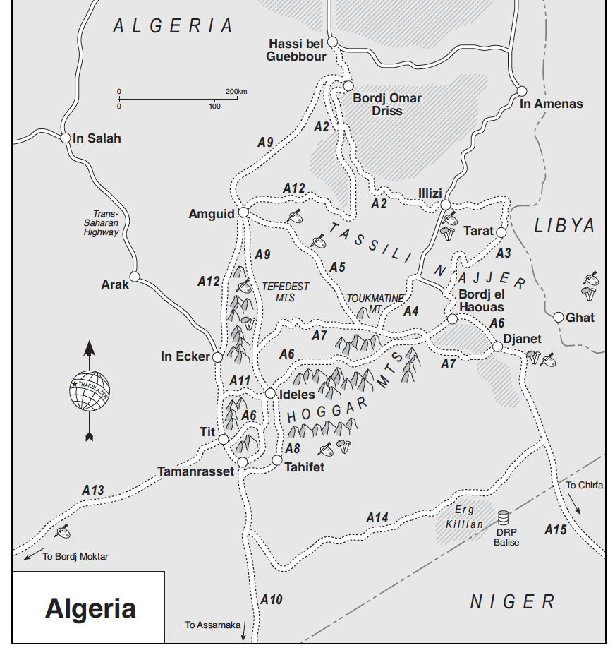
Sahara OverlandRoute A6 In the good years (1970s, 80s and 2000s) various tracks between Djanet and Tamanrasset and Hoggar mountains all combined to make classic multi-day adventures in southern Algeria.
Heading west on Route A6, (the current N55 road), you traversed below the ramparts of the Tassili N’Ajjer plateau, long famed for its prehistoric rock art, then either turned southwest at Bordj el Haouas for Tazat mountain (below right), or used the same mountain as a landmark after crossing the dunes of the Erg Admer (below left; Route A7),
Admer 1989Tazat mountain, 2002
Passing isolated volcanic cones, plugs and other outliers, the basalt rubble from the once molten Hoggar raised you up to Assekrem, a few hours from Tamanrasset and a refuel. The main route used by non-clandestine locals (A6 in my old Sahara Overland guidebook bottom of the page) was still nearly 700 kilometres or two desert nights for most. It was also on the limit of what a moto could manage alone.
Sands of the Ajjer, 1987
When I first did it in 1987, the road from the north ended in Illizi, 400km from Djanet over the Fadnoun plateau. That all added up to over 1000km and one of the best all-dirt stages in southern Algeria (above), with just enough pre-GPS navigational challenges to keep you on your toes. It was rare to pass more than one or two other vehicles during the transit.
Nearing Tam (1989)Descent from Assekrem (2003)
Fallen MAN
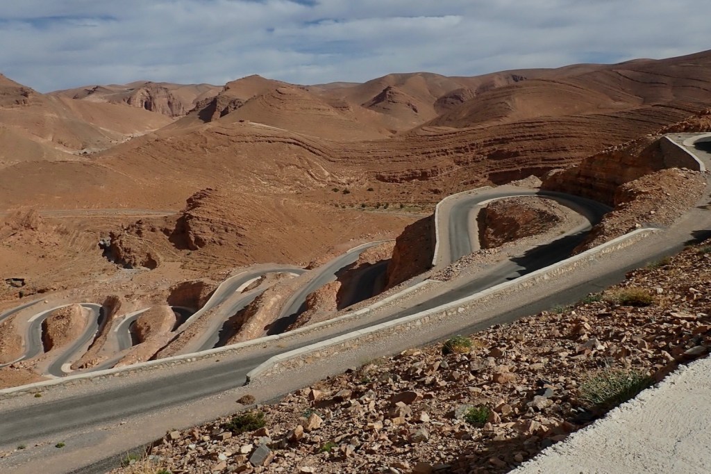
In the 1980s the army were tasked with building a road over the Fadnoun’s switchback escarpments. Up to that point, trucks supplying isolated Djanet had to take a huge, sandy detour to the west via Amguid, nearly doubling the road distance. After about ten years the Fadnoun (below) got sealed and today is still a great drive, even if the road is breaking up here and there and occasionally lorry drivers fall foul of the Fadnoun’s curves (left).
Gara Ihadja n Kli, one of the Fandoun’s escarpments, 2018
Morocco is famed for sealing it’s southern desert pistes faster than we can keep up, but Algeria has been catching up, only over vastly greater distances and probably with access restrictions to the military. A whole network of ‘hidden’ border highways, remote military bases as well as vast defensive sand berms (below) have emerged in recent years to control migrant traffickers coming up from the south.
Border road and berm with Niger, far south of Djanet
Even though they’ve succeeded in sealing this traverse, A6 Tam-Djanet (N55) still remains one of the great routes in the Sahara and there’s no need to follow the new road. There is A7 to the north which we also partly did in 2025, A14 in the deep south I last did in 2007, and at least one more route via Tiririne, Tarabine which we did in 1989 and again in 2006 on the way back back from Mauritania on Sahara: The Empty Quarter. For me this was all before gpx tracklogs but these routes are probably traced on OSM maps or Wikilocs. So do not be put off by the road being officially closed to tourists. As long as you (and your guide, if present) are prepared and equipped to tackle these pistes, they still offer some of the best, long-range routes in the central Sahara.
Rubble tracks into the Hoggar (’87)Desert Riders camp south of Tazat ’03)
In a line Well after 14 editions the paper feels thicker but in the south much detail remains missing or well over a decade out of date.
Cheap Big (1 x 1.5m) Detailed key in many languages Intuitive 1:1m scale Doesn’t need batteries
So out of date in the south it’s not funny anymore
Big and 1.3 m wide, but years out of-date
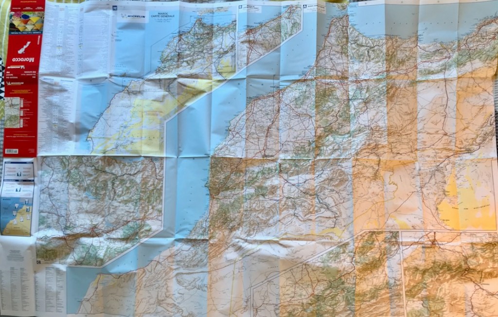
Review Michelin the best map for Morocco, right? Not for many years, I’m afraid, unless you’re following the main highways. The late 2024 edition’s paper feels thicker – an age-old complaint. You also get five sub-regions at 600k scale. Plus points are the intuitive 1:1m scale, clear Michelin design and the fact that it goes right down to Laayoune which means you can view all of Morocco 4’s routes on one sheet – except that I’d guess less than half on them exist on this map. And at from £6.50 in the UK, it’s cheap. But many easily navigable market roads and tracks mentioned in my M4 book or on the digital maps below are missing, and some roads and tracks either don’t exist or get misleading prominence. In places this data is nearly 20 years out of date so once you get far of road, it’s unusable.
Jebel Saghro: nothing to see here – at least on the Mich 742
Look at a region like Jebel Saghro (above) about which complete piste guides have been published (and which in Morocco 4 get 32 pages and 11 routes). On the Mich map even the main roads is incomplete.
You’d think one day they’ll go all out and improve the 742, like RK-H did in 2019. That has not happened for years at Michelin. Perhaps the best thing to do with the latest Mich 742 is mark the many, many missing roads and pistes from other sources all on one big and inexpensive map to become a handy reference to what is possible and where. That’s what I’ll probable do with mine.
To paraphrase the cop addressing Jack Nicholson’s character at the end of Chinatown: ‘Forget it Jake, it’s the internet.’
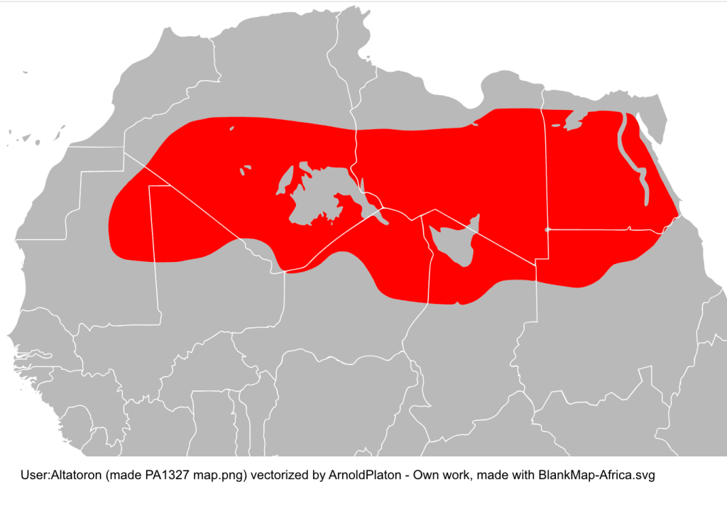
Exactly where does the iconic and eminently Instagramable majesty of Sahara start in Morocco? Like Keyser Söze, is it even there at all? Years ago I came across an internet forum argument on the now defunct LP Thorn Tree (I gave my 2ç then left them to it). There, a couple of know-alls lambasted the callow innocents daring to enquire where they could ‘see the Sahara in Morocco’ – in most cases referring to the famous Erg Chebbi dunes. ‘I told you: there is no Sahara in Morocco!’. All concerned have now migrated to TripAdvisor from where the quotes below were copied. It staggers me that some of these individuals can assert their unsubstantiated beliefs with such conviction, but such are the times. According to one of TA’s wise owls, ‘Erg Chebbi is not in Sahara, desert it is but not Sahara‘. So the Sahara is ringed by an unnamed desert that is not the Sahara?
… neither … Erg Chebbi/Erg Chigaga are the Sahara. For that you need to head to Western Sahara. Ok, we know that but we want just see Sahara and ride camel The limit of the Sahara is classified by the limit of the Date Palms the Sahara,… lies 100 km or more to the south in Algeria. Although not part of the Sahara , the dunes are pretty amazing. It also corresponds to the 100mm isohyet in the north and the 150mm isohyet in the south. Long term average rainfall. A further definition is where the evaporation potential exceeds the presipitation [sic]. I don’t care what “Sahara” means. I am talking about the actual geographical boundaries of the area. And your definition of those boundaries is as incorrect and misleading as that of the ridiculous tour companies’ one. Erg Chebbi is not in Sahara, desert it is but not Sahara. If you by reading see on website about Sahara tour, then it is only marketing to attract customers. But Sahara begin first in Algeria or you have to go to the South of Guelmim, to Western Sahara. Here we go again with the “Erg (Chebbi/Chiggaga) is not the Sahara” brigade. What’s wrong with you? What’s a few hundred miles between friends? Jesus H. Christ. May I just make one thing clear? You will not be travelling through the Sahara desert until you have gone south of La’ayoune. References to the Sahara in other places such as Erg Chebbi and so on are simply concoctions dreamt up by tour companies to fool their victims into thinking that they have been to the Sahara – they haven’t. To the east, the Sahara starts way over the other side of the border, deep into Algeria. the Sahara if [sic] 100’s of kilometers away from the big dune areas over the border in Algeria and not in Morocco [continues] ... [Chebbi] is more spectacular than any of the places in the Moroccan Sahara that I have visited.
This way please.
This knotty problem of the Sahara’s precise extent may be unique to Morocco. You start with the very concept’s compelling mystique. It’s hard to think of other wilderness regions that conjure up such strong imagery and notions, maybe because it’s so close to Europe compared to other iconic wastelands. Then you mix in the unceasing clash between gullible bucket listers wanting to definitively tick off the Sahara – and devious local tour ops who promise the earth and deliver a turd. One wily tour agency has even managed to insert themself as a ‘reference’ on Wiki’s ‘Sahara desert (ecoregion)’ page. This seems to be the angled grinder which the naysayers above fixate on: if some Moroccan cat in an oversized cheche strolls up and says ‘Hello my friend. Come, we will drink tea with nomads and I will show you Sahara’, you can expect to be a little disappointed.
As with all geographical features (seas, mountains, etc), it’s tempting but futile to apply fixed boundaries to their precise extent, as if they were a country. Where exactly does the Southern Ocean become the Atlantic? Where does the Karakoram become the Himalaya, or the High Atlas become the Anti Atlas for that matter (along the N10 highway, of course!).
It’s only rain
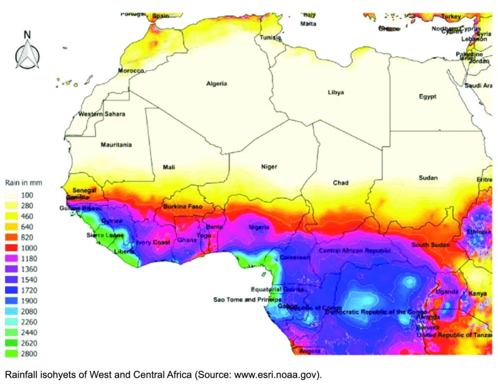
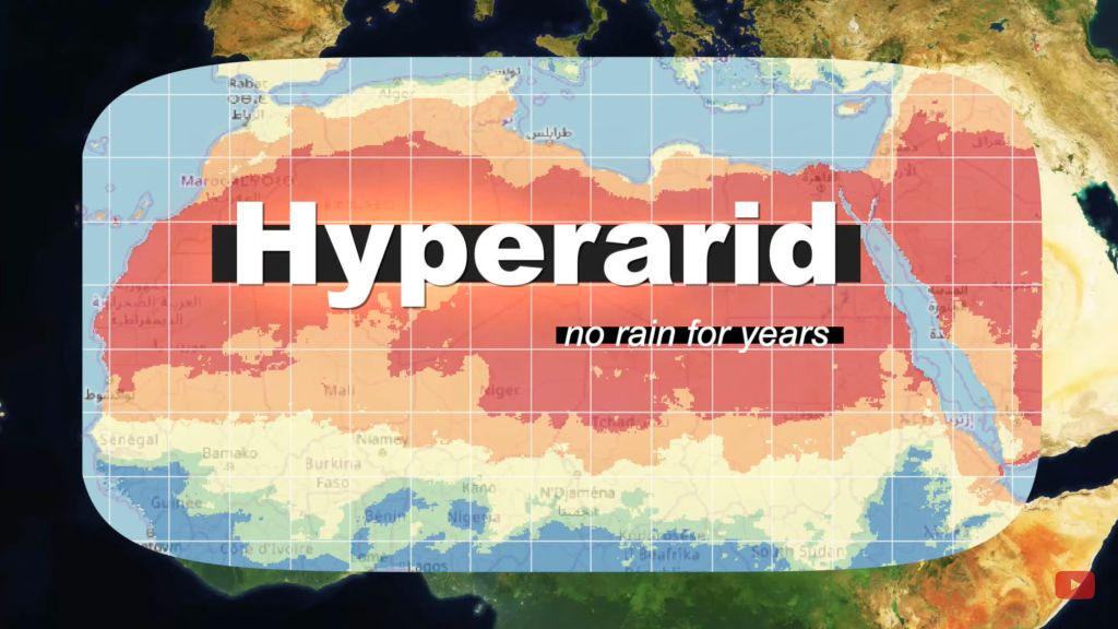
It’s the same with hot deserts, commonly defined as arid regions with less than 100mm of average annual precipitation. Unlike a sea shore, there can be no finite edges identifying this change in rainfall; to imply otherwise would be absurd. In this way the NOAA map (above) is rather more nuanced, showing blurred transitions, not fixed isohyets (rainfall contours) between regions. Both the hard-edged yellow and red maps below could benefit from the same idea.
Sahara map from Wiki The hyper-arid Saharan core from another Wiki
Chebbi-aye-yay
According to this ridiculous website, (sadly, the first that popped up on my Google) it appears to rain every other day in Merzouga/Erg Chebbi. (The ‘sea temperature’ there gets pretty balmy too – or maybe they mean ‘sand sea’). This source for Merzouga looks rather more plausible: 65mm. Another estimates 53mm. yet another 172mm. This French Wiki gives 59mm. Let’s assume it’s not Kew Gardens down there and it comes in under a 100 mil most years.
Another map with a red zone straying over the Moroccan border. Can’t be right! Source
Archway into the desert, south of Guelmim (iirc)
Not all accept the level of aridity as a definition (‘I don’t care what “Sahara” means…‘), but they don’t cite any sources to explain their assertions about the Sahara’s boundaries. Instead, some of the TA dolts avow the Sahara lies ‘100km south of Erg Chebbi’ (ie: in Algeria). Others insist ‘200 miles’ from Chebbi. Final answer: ‘100’s of kilometers away’. Some even proclaim they magically entered the Sahara at Guelmim in western Morocco because ‘it is officially known as ‘The Gateway to the Sahara’’, surely a bald, tourist-oriented claim in a town famously thick with faux Tuaregs.
Leaving the clammy Tropics. Scorchio!
Others insist that, to be in the Sahara in Morocco, you must go ‘beyond Layounne’ (left), a fairly boring road trip, even for a dedicated bucketeer. What will they see on the way there? It may look like a desert, walk like a desert and quack like a desert, but it sure won’t be the Sahara! No matter – give it a few decades because it’s said the climate in Morocco will see the Sahara creep over the berm and into Morocco.
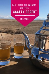
You can see why some of your forum know-alls get cynical, myself included, even if I believe they’re dying on the wrong hill on this one. Lately, some canny marketing has designated an area of eroded wasteland ever so conveniently close to Marrakech’s gated resorts as ‘the Agafay Desert’ or ‘le petit Sahara’ which ‘extends over several hundred acres’. There you can do all your favourite deserty things: sip tea in a tent, wear a cheche or ride camels, quads and 4x4s across a landscape where the barren rounded hillocks of dried mud resemble dunes. Insta heaven!
Some academics have sought to reclassify the liminal sweep in question as the ‘North Saharan steppe and woodlands‘. Aka: the edge of the Sahara where things gradually become less arid, like the Sahel in the south. But looking at the zone on the map below, ‘woodland’ is not a word which springs to mind. The band encompasses the vast Grand Erg Oriental spreading across Algeria (left) and southern Tunisia – about as Saharan an expanse anyone could wish for which would swallow up hundreds of Chebbis. The only woodland here is of the petrified fossil variety, west of Hassi bel Guebbour.
Selima
Me? Having travelled much of the Sahara over the last five decades, if you pushed me blindfolded out the back of a Hilux behind Erg Chebbi and removed the hood, I’d get up, smell the air, squint at the sun and guess I was in the Sahara. It may transpire to be the edge of the Sahara in boring old Marrokie, because vegetation and rainfall change in a very short distance (by Saharan standards) in the mountains to north. But from Chebbi south and west along the Algerian border all the way to Tan Tan, it all resembles the Sahara I’ve seen – often dreary, sometimes epic, often barren, vegetated in patches, hyper arid elsewhere – all the way from Mauritania’s Adrar plateau to the Selima Sand Sheet (left) close to the Nile.
Camels? Dunes? Palms? What else could be be?
If anything, Erg Chebbi is just too darn Saharan for school and so has become one trampled terminus of Morocco’s Axis of Tourism, a quad-busting desert resort. I avoid the place. Over the years the pretty cluster of dunes at the end of the road has become choked with desert camps, kasbah-hotels, a few opportunist sharks and us tourists doing the dunes by various means. In that sense it is very much not what I know of the real Sahara, but caught right, Chebbi can still be an amazing sight for a desert first timer. You’re on the very edge of the Sahara. Which side you’re on is up to you.
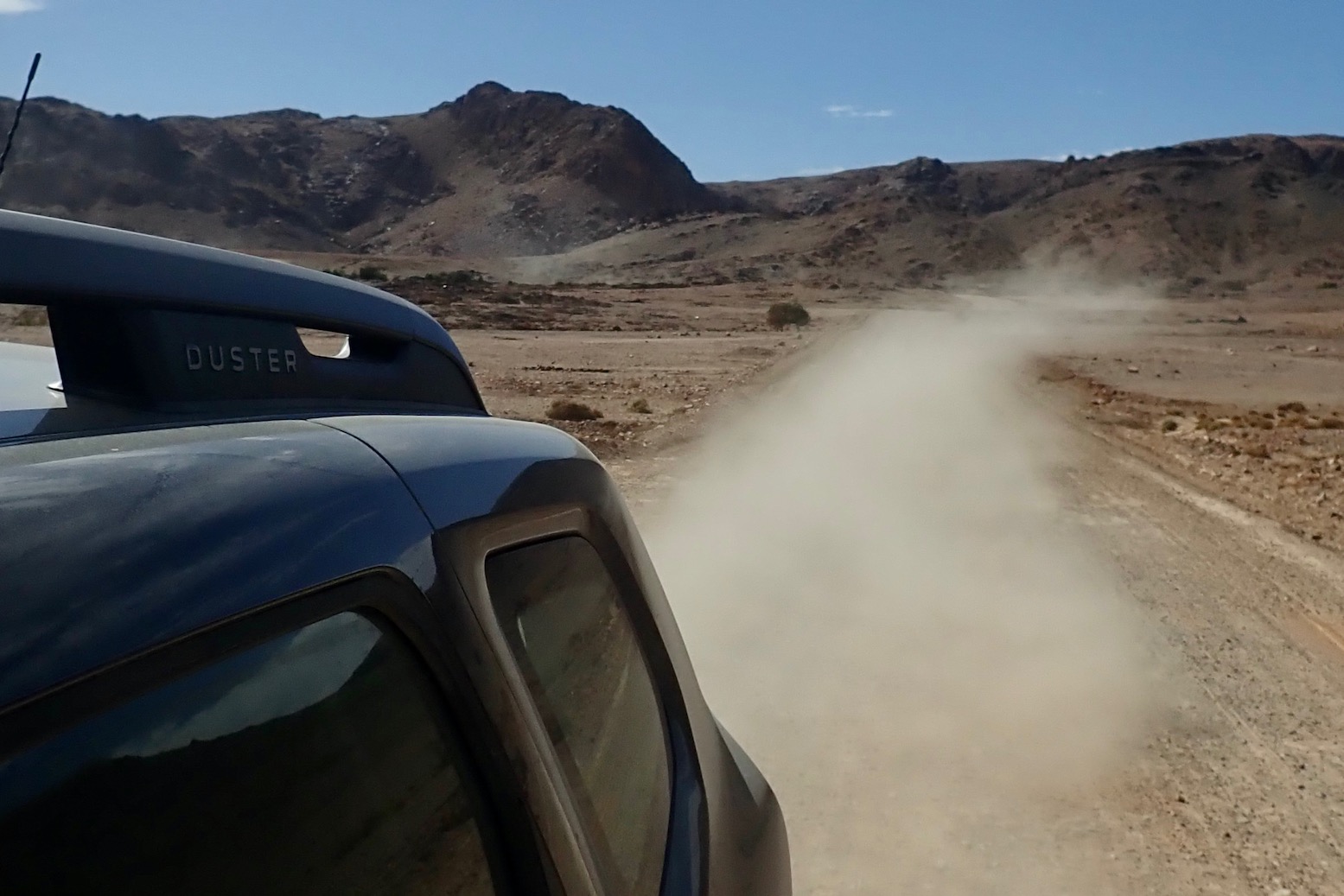
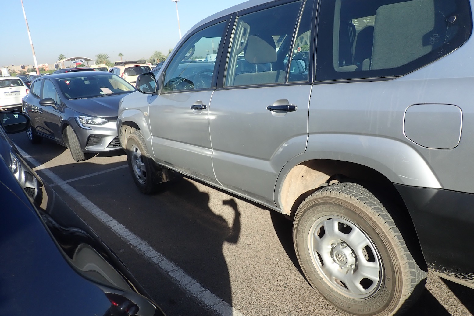
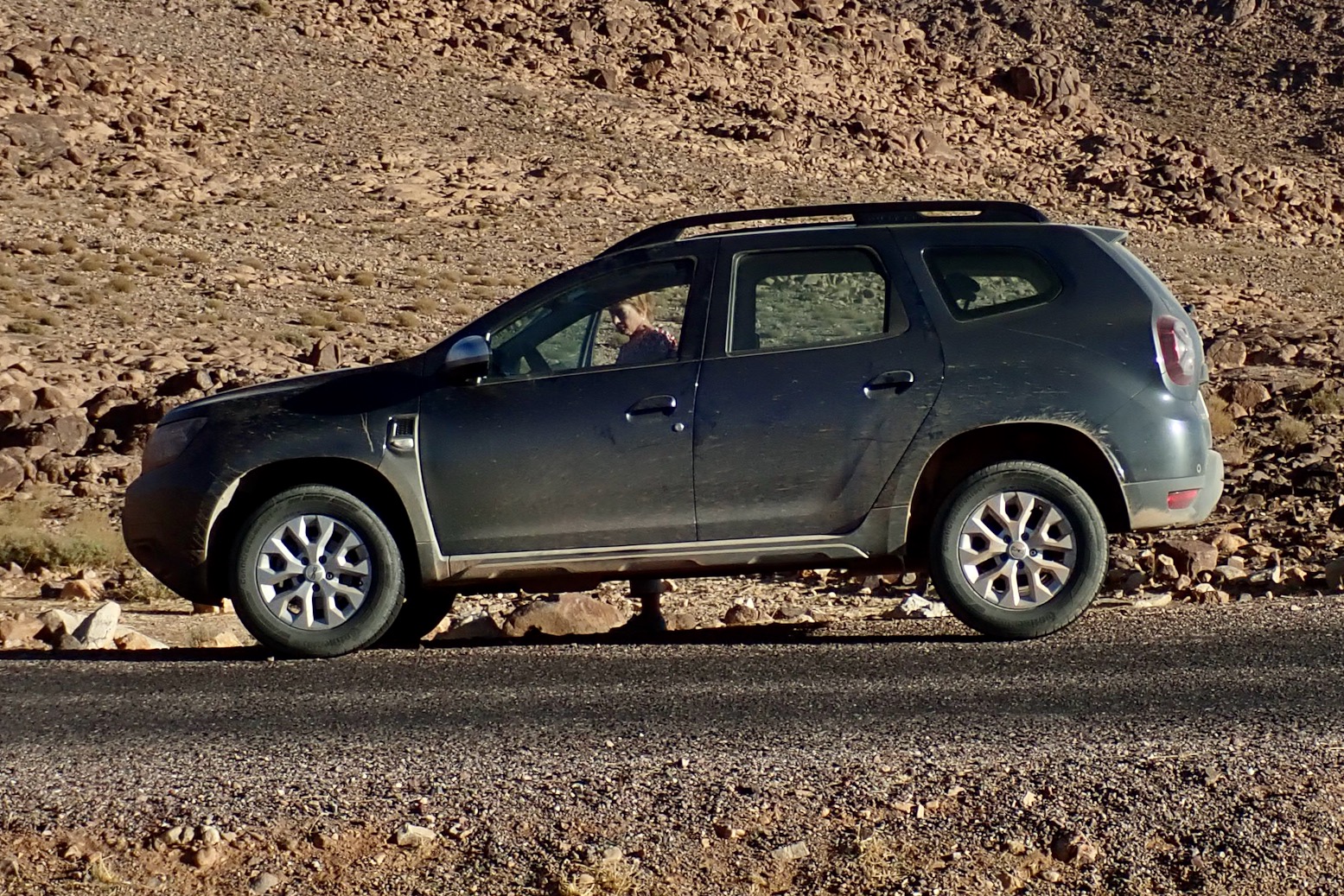
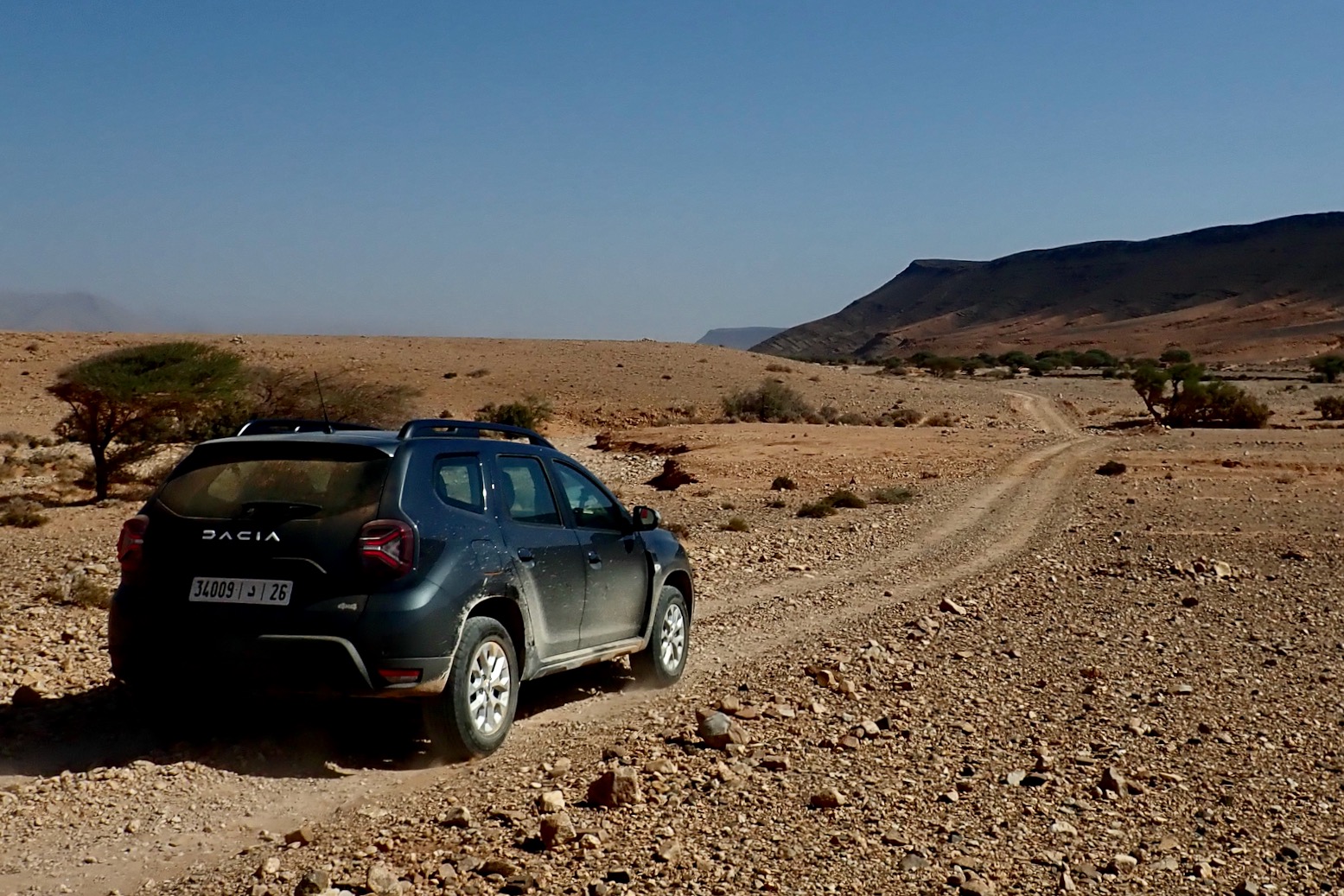
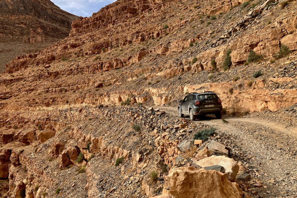
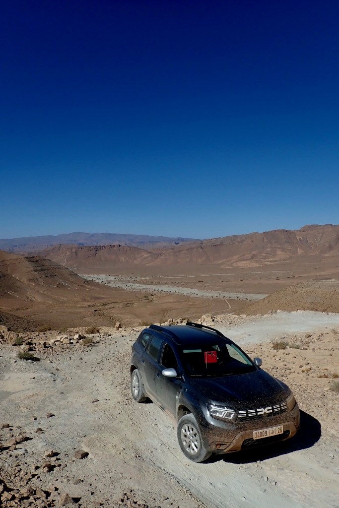
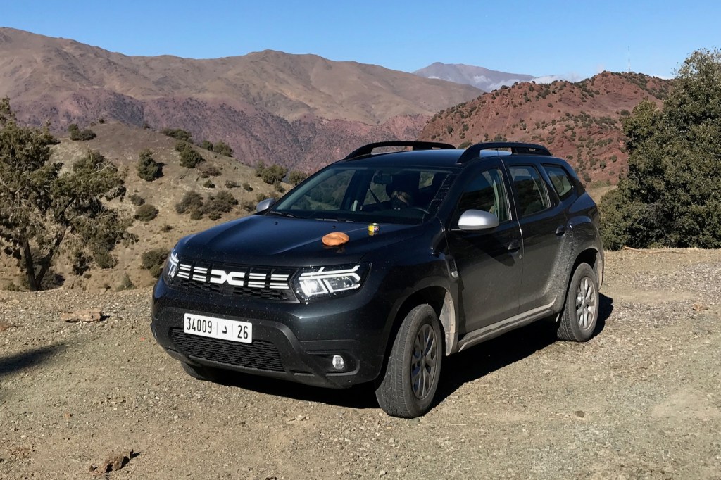
In November the Mrs flew in between my moto tours and we hired another Morocco-built Duster from Medloc Marrakech to scout routes for the M4 book, covering the western corner of Morocco to the Atlantic and within an hour of Smara. Only this time they had a 2023 model with just 14,000km on the clock, but still just €65 a day – about half the price of a Toyota TXL. For more on the rental experience and my unchanged pros and cons, read Duster 1 from earlier this year when we drove a 100,000-km far, but got little done due to preceding rains having damaged many roads and tracks. By the time we got this newer model all the tracks we tried to do and more were in great shape, and so were able to push the car less hard.
A Duster can restore you cynicism in the SUV craze by having genuinely utility on regular tracks (but see below), plus enough power to sit at 130kph on the desert highway – as fast as you’d want to go with camels roaming about. At the same time it’ll reliably do up to 45mpg or 15kpl giving a massive 800km range. And these modern diesels are quite amazing: torquey, quiet and nippy. With an auto box it would have been even better.
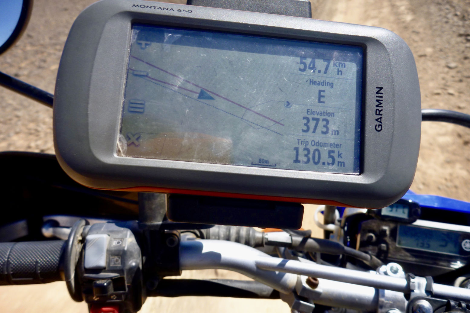
On our one the air-con actually cooled properly which was a relief, the switches and dash have been re-organised, but the fitted satnav was bogus. Yes there was a map displaying our position on an unnamed road or track most of the time, but there was no other info at all and no routing function. This confused us until we read you have to visit the Renault (Dacia’s owners) website to download a map/app? onto a USB stick or some such. You couldn’t even pair a smartphone screen (or we failed). Be warned: unless we got something wrong you will need your own nav device. We had my Garmin Montana, as well as a more readable Samsung tablet running Gaia maps (above). I did happen to have my music on a USB stick and that system worked intuitively, through the speakers are not the best.There was music pairing off one iPhone too.
Toyota’s Prado TXL is the other main 4×4 rental in Morocco but tough though it may be by reputation, the autos can be comparatively portly slugs and unless lifted (left), are also bottom scrapers. As it is, I’d not be surprised if the 1.5 litre, 110-hp 6-speed TD Duster has a superior power to weight ratio than a TXL. It certainly takes off and overtakes effortlessly out on the road and handles bends well thanks to anti-roll bars. Only for deep sand or exceedingly rocky climbs – rare or avoidable in Morocco – might a Prado’s Low Range be needed.
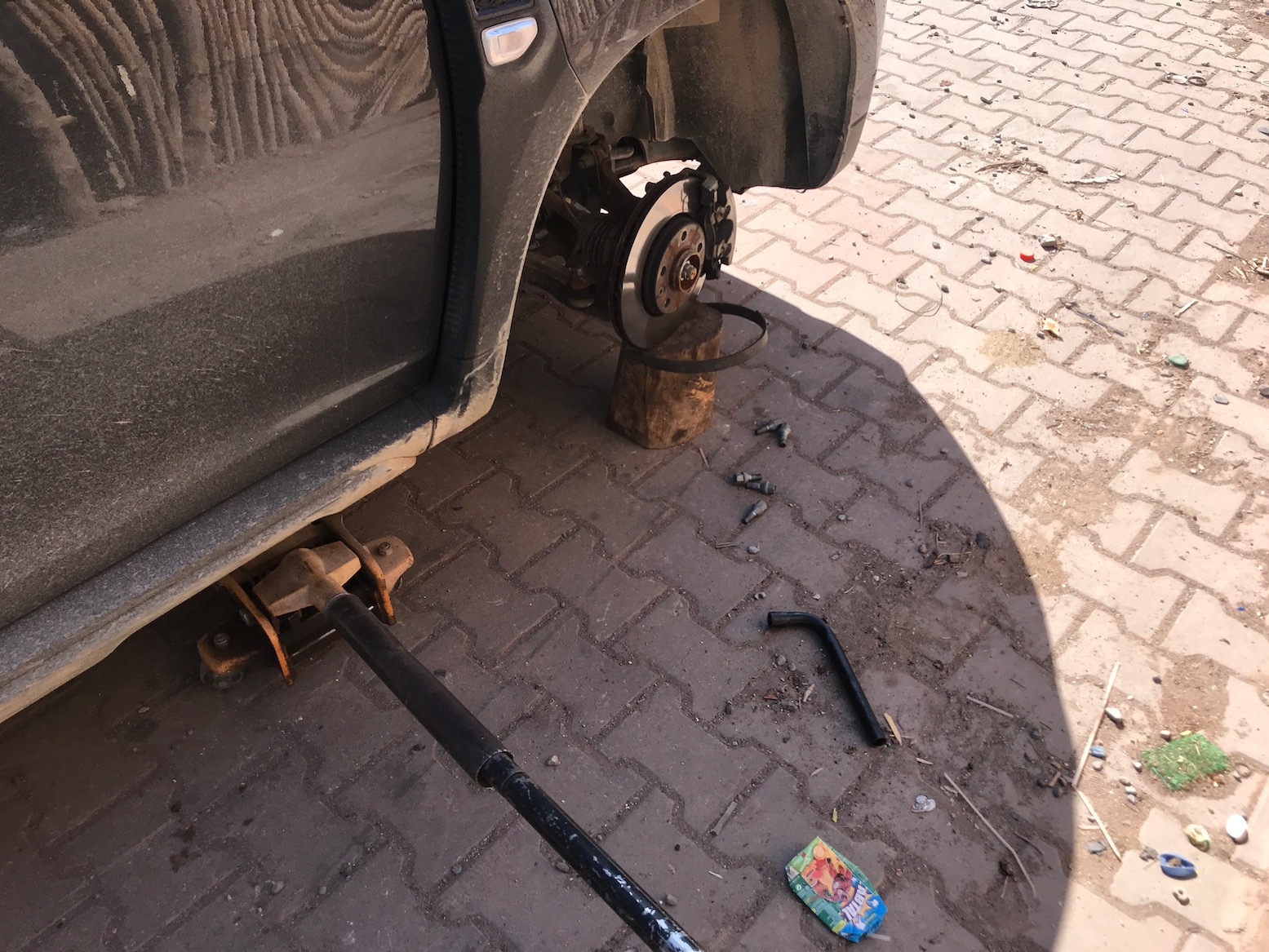
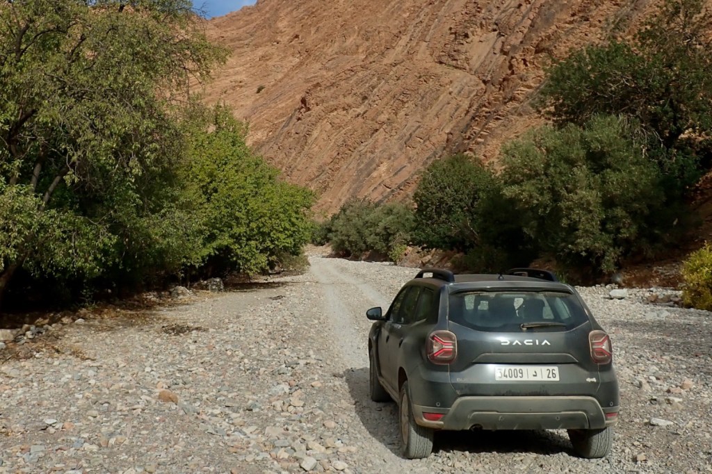
Within hours we got a flat on the ropey Tizi n Test road, luckily just as we stopped in Ijoukak for supplies and close to a tyre repair shop. This was a bit worrying on the road; were the Continental tyres cheapies? I had the means to plug flats with a spike/worm, but better to get a shop to remove a tyre and vulcanise a patch from the inside.
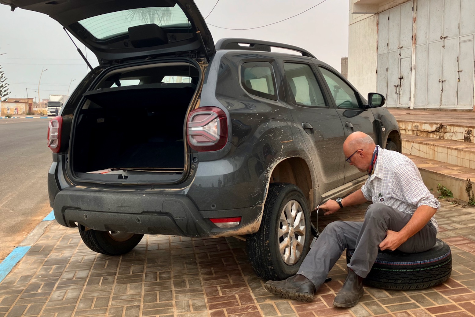
We had another flat in Tan Tan Plage which needed the spare fitting to drive to the tyre shop. This spare is speed limited to 120kph which seems fast enough, and looked the same size tyre, but on a steel rim. Note that the scissor jack has only just enough reach to lift the rear, and be careful about positioning it correctly until the metal sill, not the plastic trim.
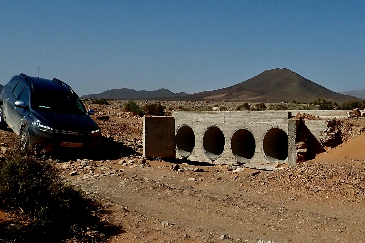
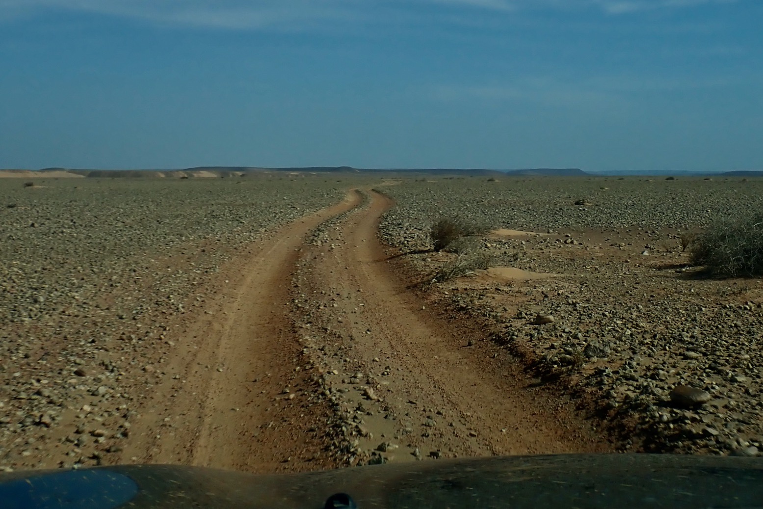
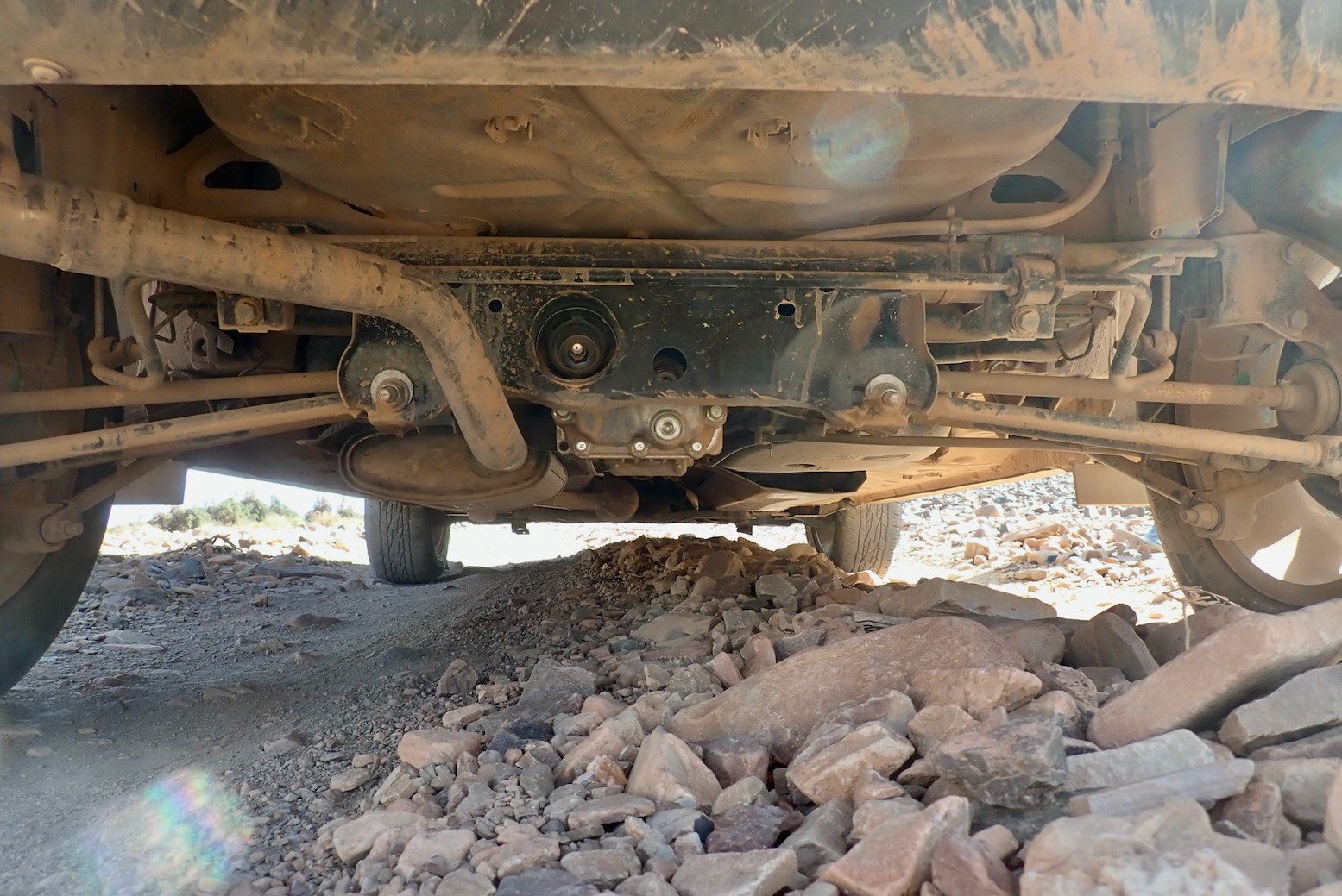
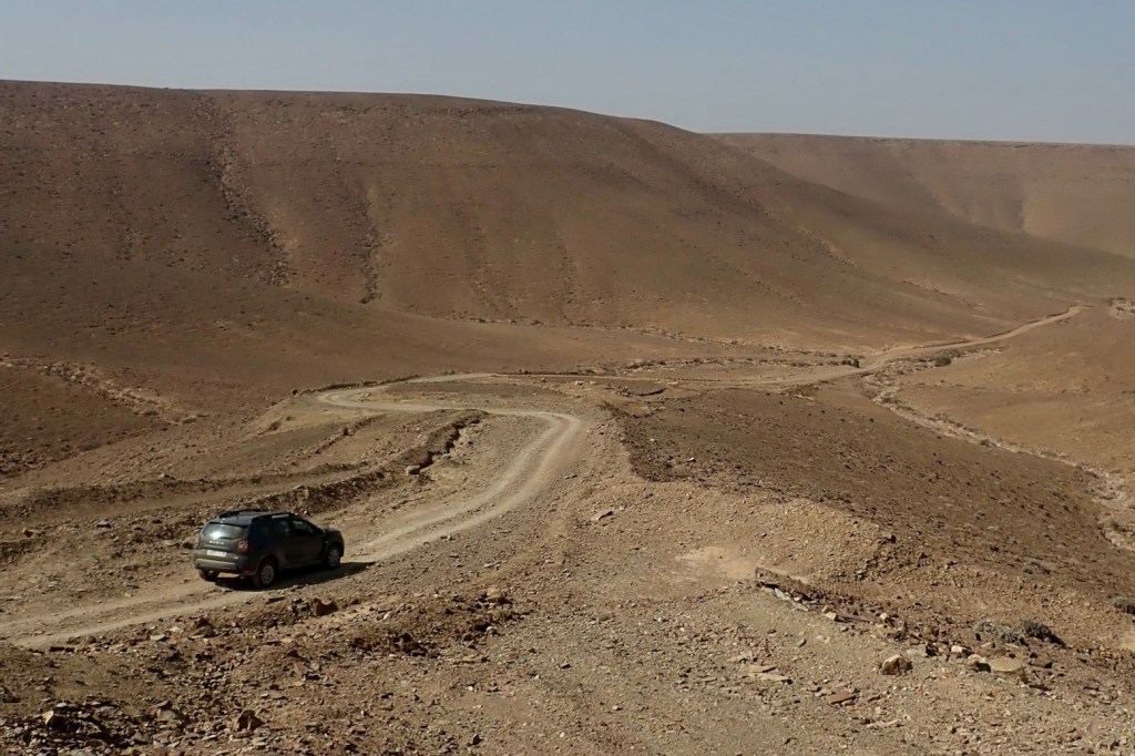
Off road obviously you take it easy in a rental when alone in the desert. So many SUVs, even AWDs have disastrous frontal overhangs but I never scraped the front or rear bumpers driving in and out of ditches or oueds. Same with the ramp clearance. But as before, the ‘axle’ clearance is oddly not as good as it looks and you find yourself having to straddle ruts to one side (above) to maintain clearance. A full tank may not help, but we just had two bags in the back. As you can see below it’s quite tidy and nothing sticks out – it must be down to the plush suspension so you just need to slow down to limit compression and contact. We left the tyres are 2 bar road pressures.
The scraping was frequent until I got a feel for the clearance but the noise is probably amplified by the protection hardware, and we’re talking piled rocks, not solid impacts. Dust crept into the covered boot space so the rear hatch door seal may not be so good. Had I remembered, I’d have done that trick of parking on a bank with one wheel in the air, then closed/opened a door to evaluate body twist as we did with th TXl a few months later. Door closing cleanly = good stiffness.
In 3000km I probably turned on ‘4WD Lock‘ for about 500 metres, mostly to spread traction while crawling out of stony oueds and on one sandy climb in the wastes of Western Sahara.
All up, I’d happily rent a Duster again from Medloc. If you have experience driving 4x4s effectively you soon recognise the limits of a Duster (largely no Low Range). If you’re new to off-road but want to go in hard, you might feel better in an automatic Toyota. Having done a few thousand kilometres in both over the last year, for normal road and track exploring, a Duster is more than adequate and better value for money.
I was involved as one of the guides on the recce for the Hard Way Home back in October 2022, repeating the course again just before following the actual filmed event in February from Ouarzazate to Marrakech. The first three Grenadier customers picked up their brand new cars from the middle of nowhere in Morocco and drove them home. The 500-km route we mapped out was a spectacular mix of mountain and desert, but as you’ll see, with snow down to 1800 metres, bad weather disrupted the actual launch event. ‘The Grenadier Route’ will be in 4th edition of Morocco Overland, due early 2025. see also: Scott Brady from OJ in the Ineos.
Fyi, I do this all on a desktop computer or a laptop at a pinch. It may well be possible on a mouseless smartphone or tablet but would drive me nuts. Also, note this is a reliable but labour intensive procedure which may not align with modern ‘I-want-it-all-I-want-it-now’ sensibilities.
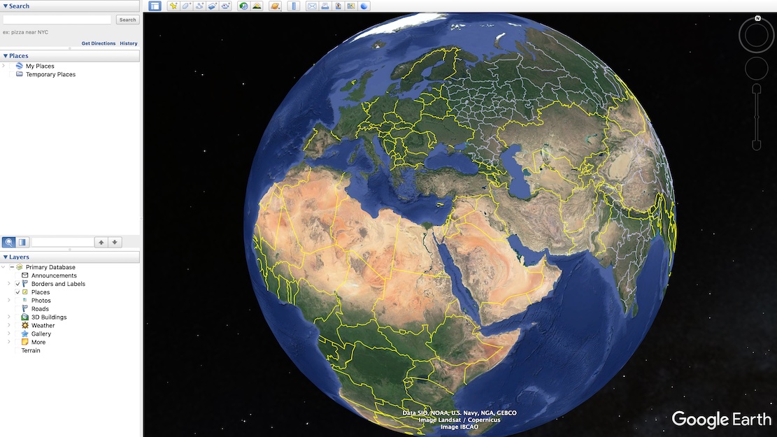
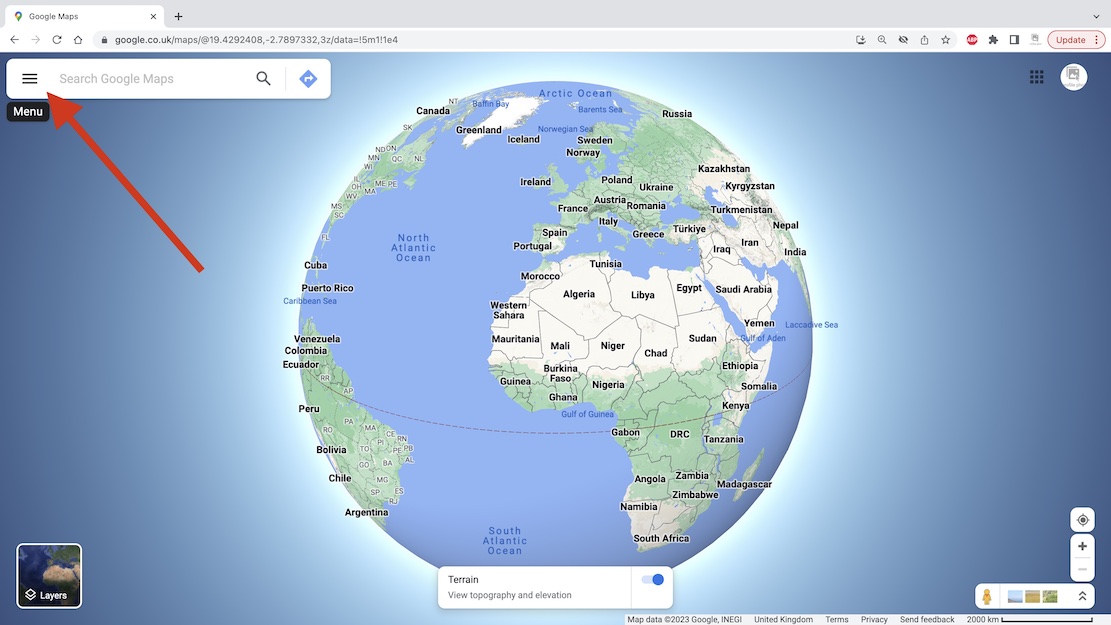
Particularly in the desert, these days aerial or satellite imagery from Google Maps and ESRI (Bing, etc) is so good you can spot passing vehicles and whether a road is sealed, a car track or even a little used donkey trail. This is the sort of age-sensitive information you won’t always get from maps, digital or printed. When planning new off-road routes, I find tracing the probable orientation in advance helpful for all the obvious reasons. It also provides a good preview of the area and what features I might come across (mineral mines; climbs, gorges, junctions).
Using Google satellite mapping services, tracklogs can be drawn, saved and exported in two ways: Using Google Earth Pro – no Google account needed but your annotated maps won’t be automatically saved online/in the cloud. I’ve drawn tracklogs using this method in Moroccan hotel rooms prior to setting off along remote tracks (above left), benefitting from the reassurance of knowing a track exists and where the key junctions are. See the images and captions below for more. Note: this is a reliable but labour intensive way of doing it but does not align with modern ‘I-want-it-all-and-I-want-it-now’ sensibilities. You can trace a route much more quickly off something like Garmin Basecamp using the ‘Create a Route’ tool. It takes seconds. But afaik Basecamp doesn’t have an all important satellite layer to verify against an actual track on the ground. Somethng like the subscription Gaia app can do this, but you have to pay.
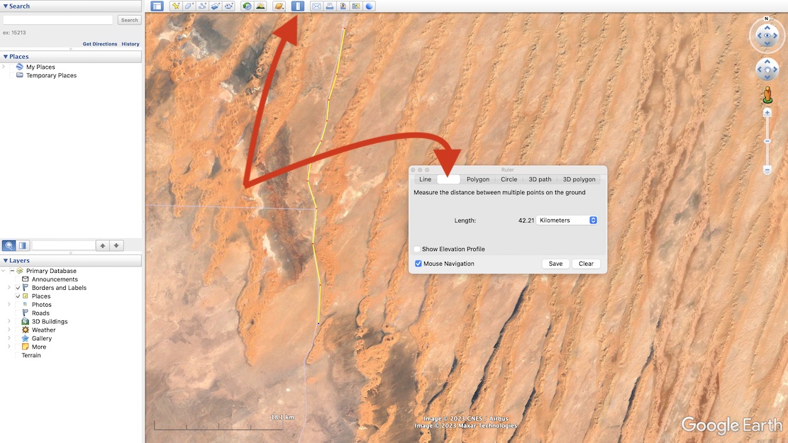
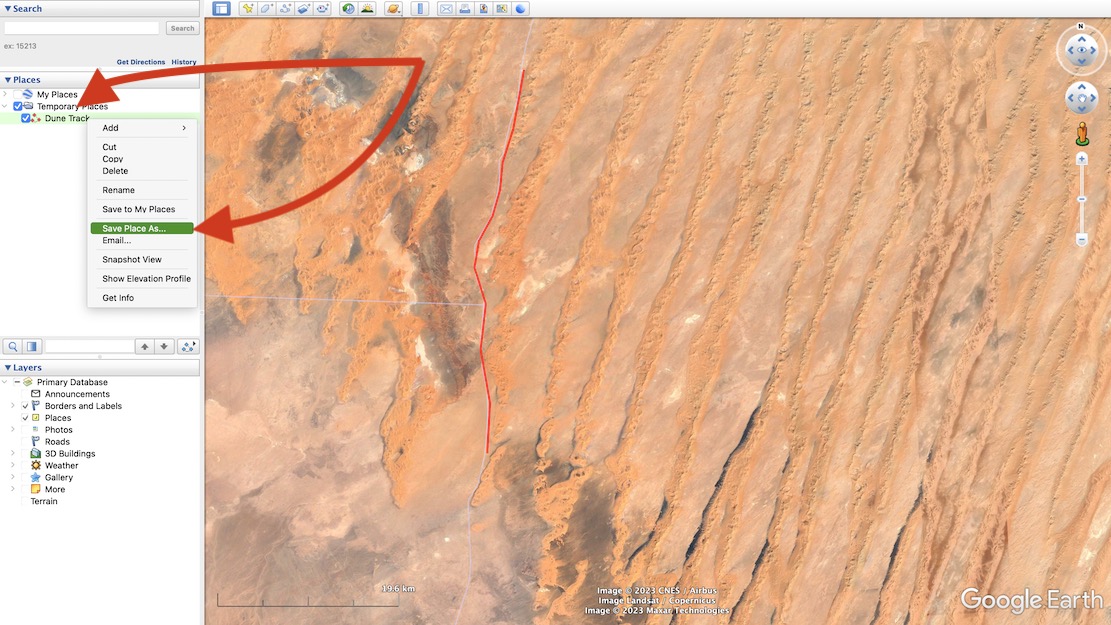
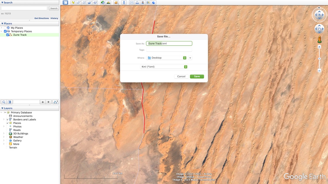
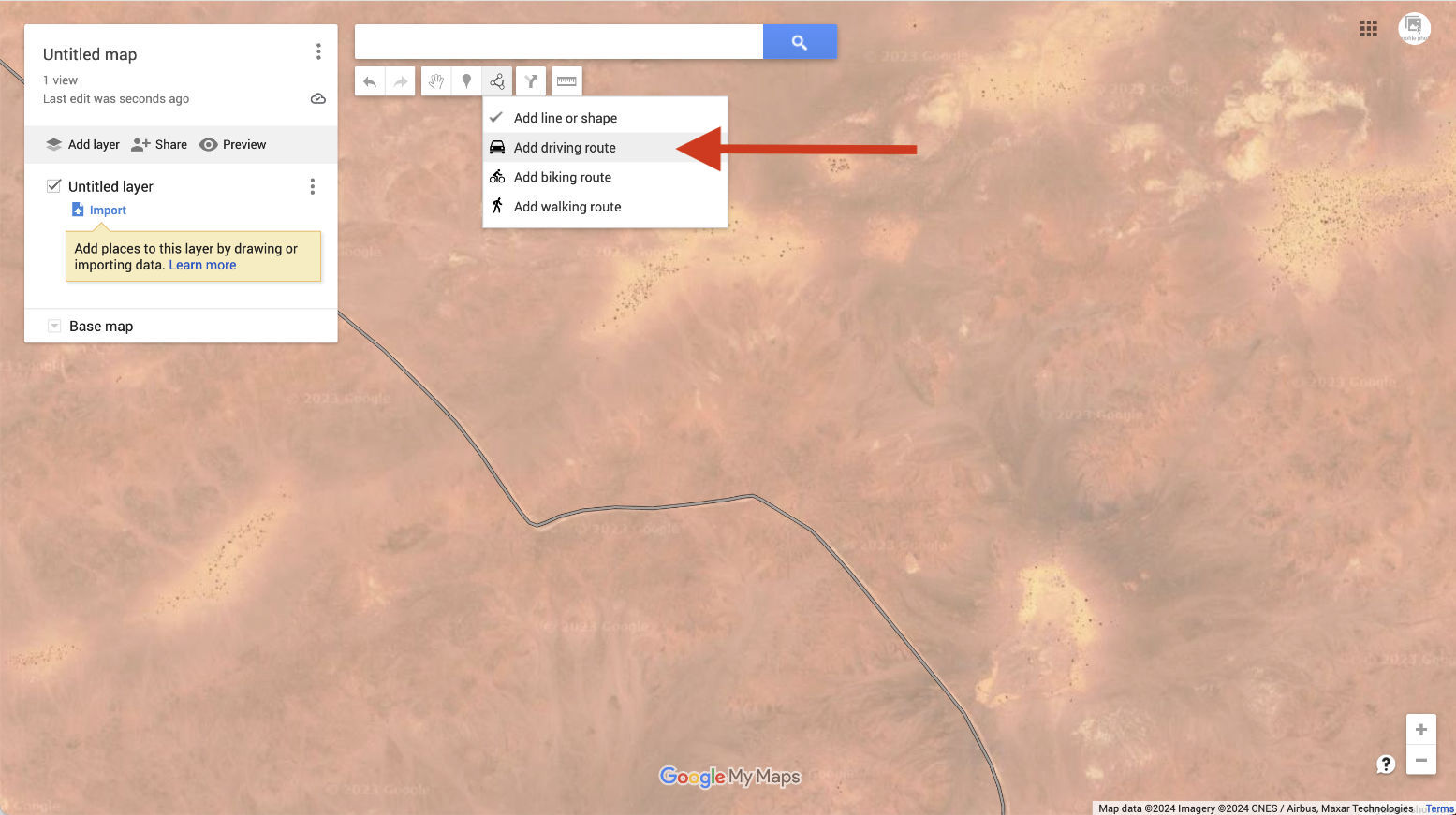
First: download Google Earth Pro (it’s free).Either search for your place or zoom in on your start point. Now choose the Ruler in the top tool bar and then select Path (blanked out above when selected). With your mouse trace a path click by click, point by point along the track you want along the ground. The extent of precision is up to you. When you’ve finished, Save.The tracklog your drew is saved. Now right-click and choose Save Place As…It saves as a .kml or .kmz file (same difference, more or less). You may now need to convert the Google .kml file format to .gpx to import into Garmin satnavs and smartphone/phablet nav apps. Garmin BaseCamp (free) can do it, or use also free online converter like GPS Visualizer. Import the .gpx into your device and you can now set off to navigate your MYO tracklog.
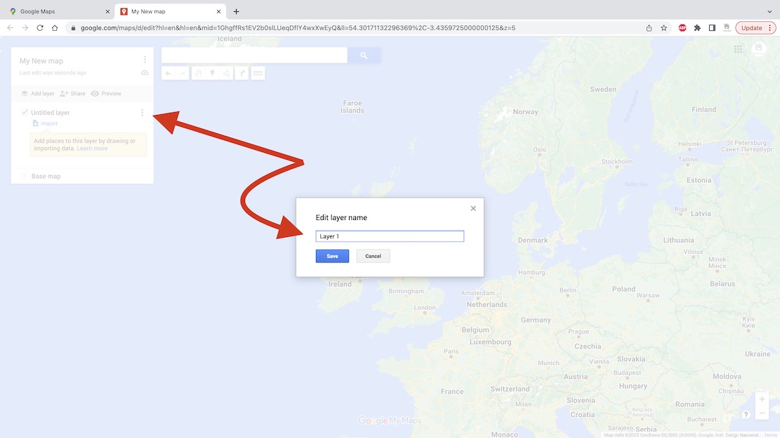
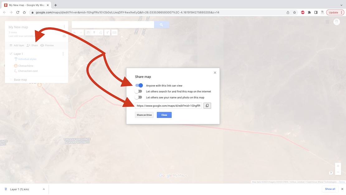
With a Google account (…@gmail, etc) you can save your routes on a Google ‘My Map‘ as has been done for the Trans Morocco Trail. It can have as much detail (tracklogs and waypoints) as you like, but Google ‘My Maps‘ are limited to about 10 layers. Layers are a bit like folders (with infinite capacity) and sometimes you have to shift tracklogs or waypoints into a pre-existing layer to free up a new layer so you can import more. This map can be shared or exported but will be saved online and be viewable/editable wherever you have internet.
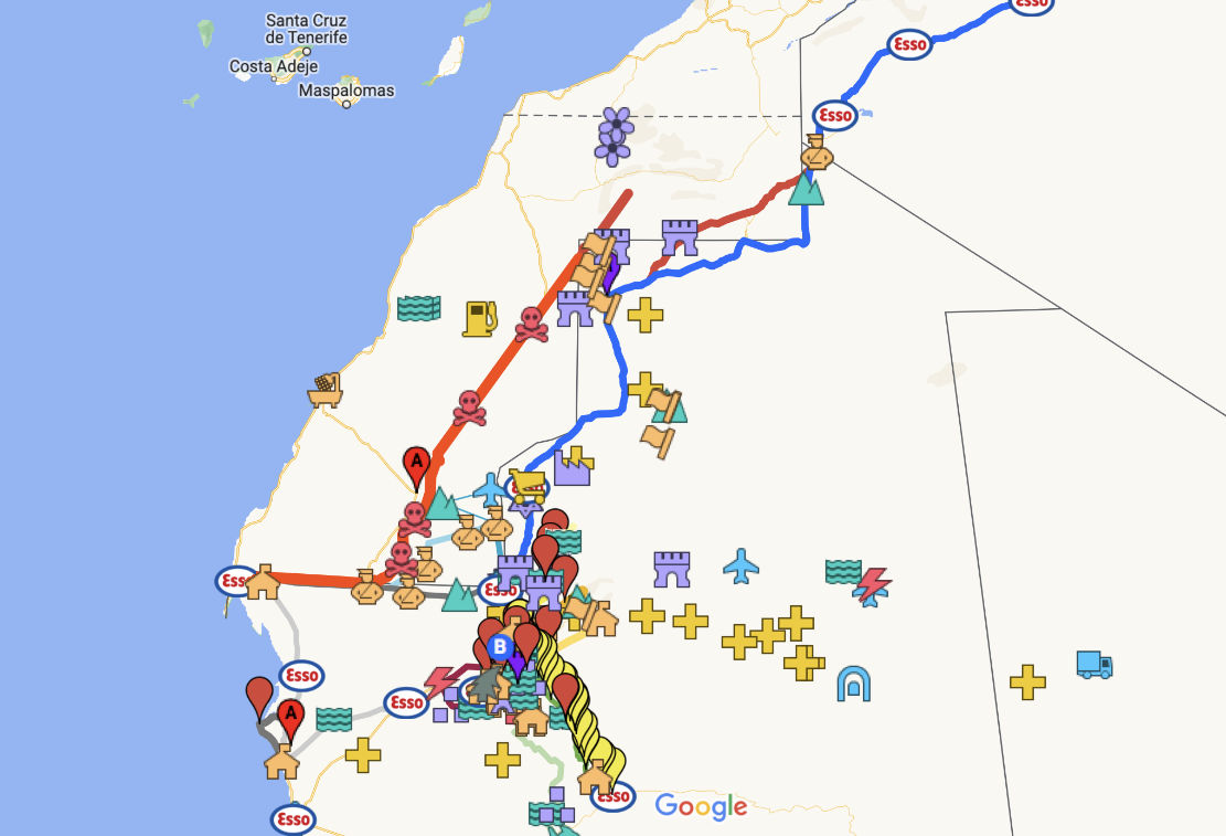
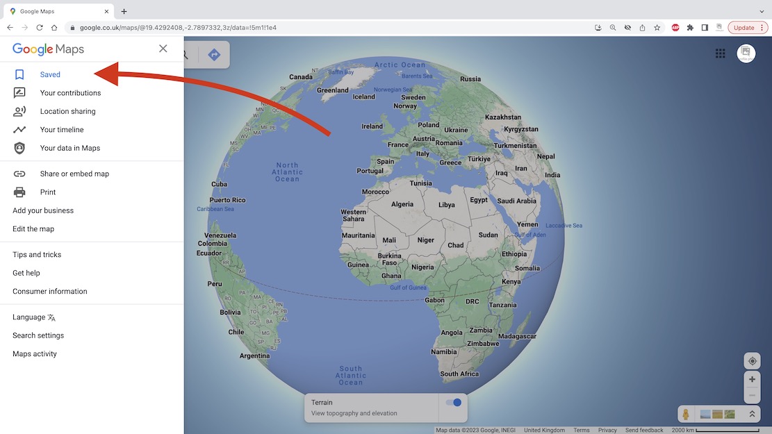
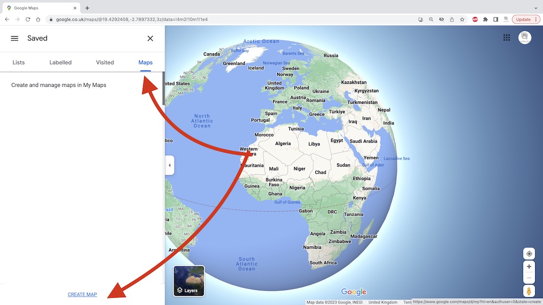
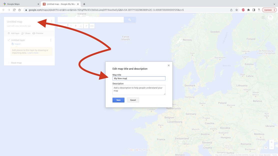
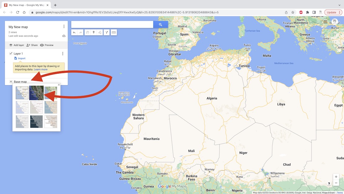
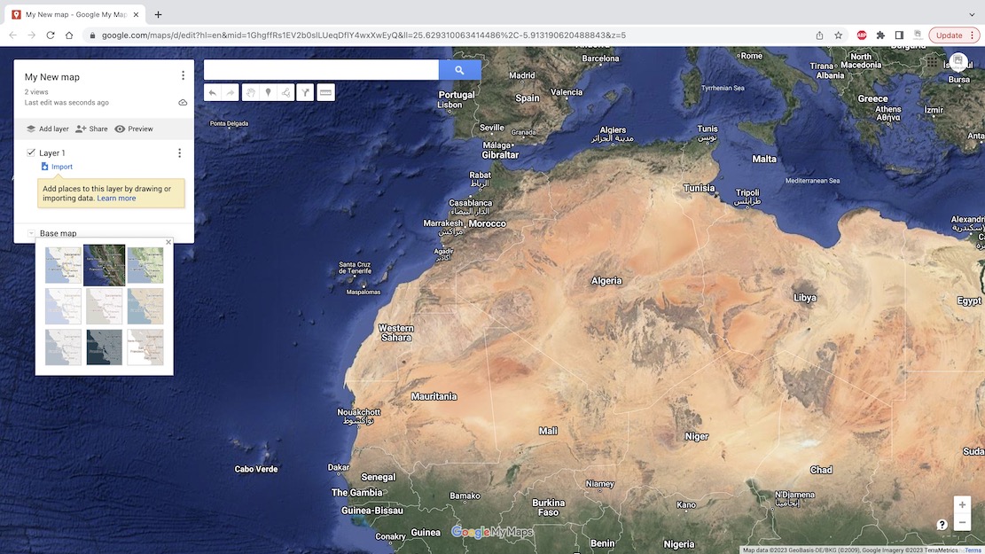
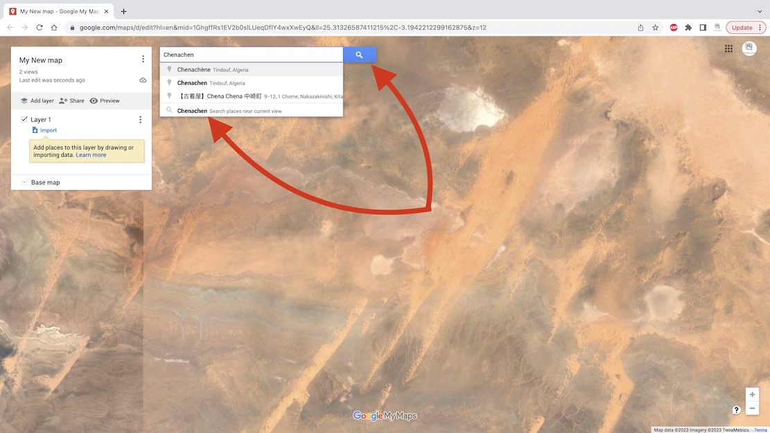
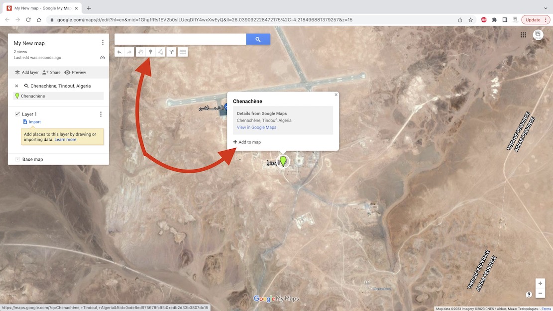
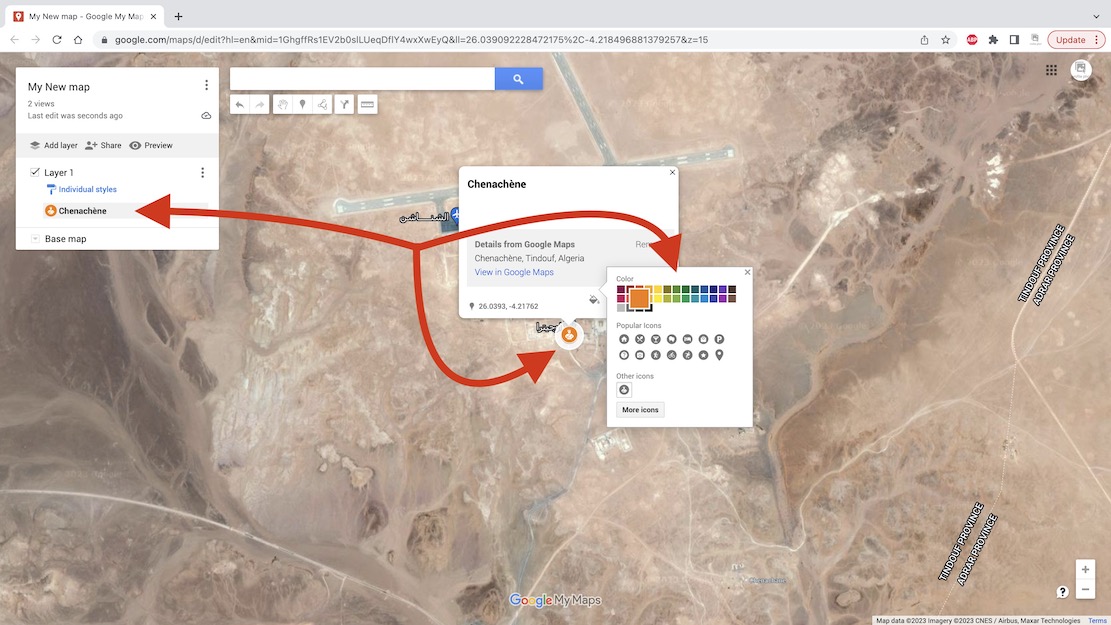
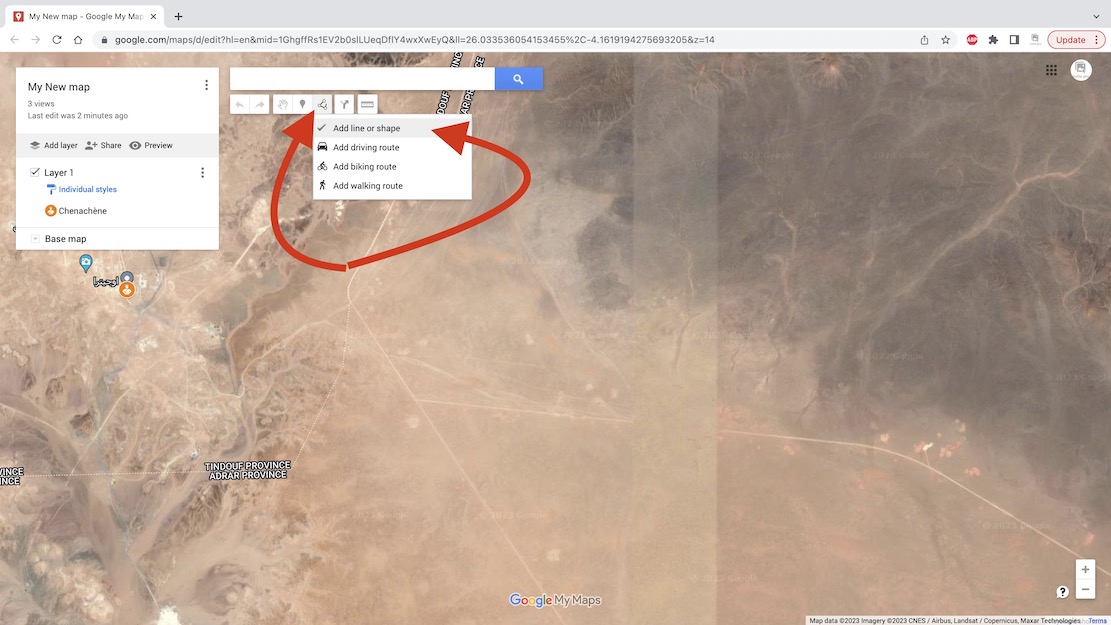
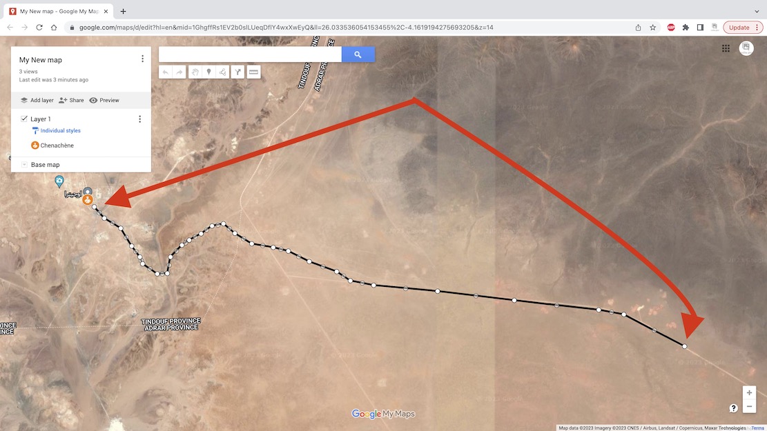
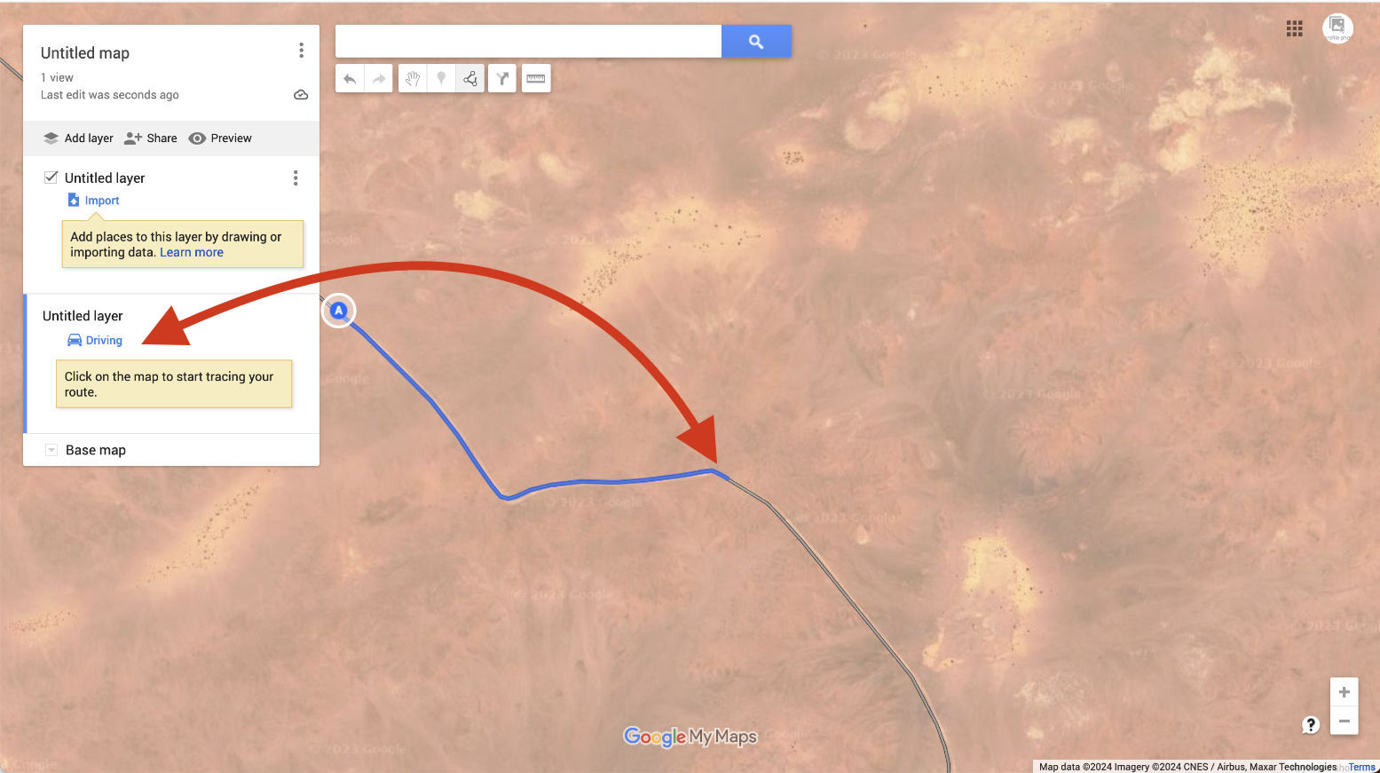
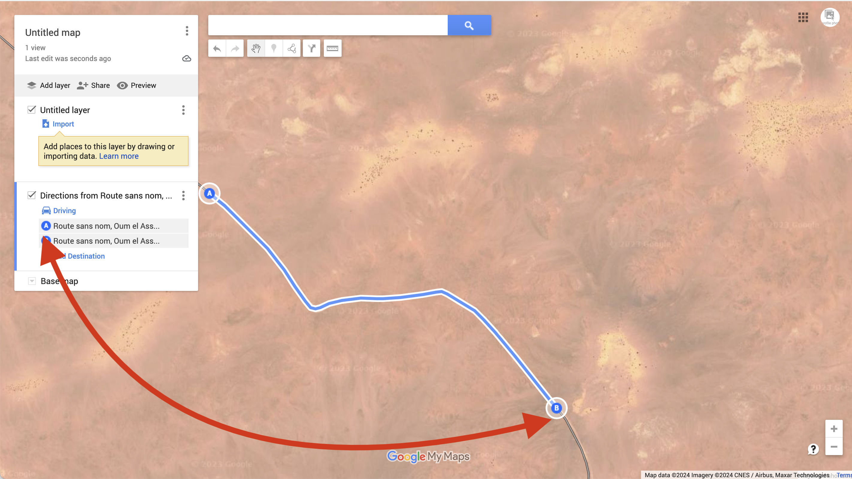
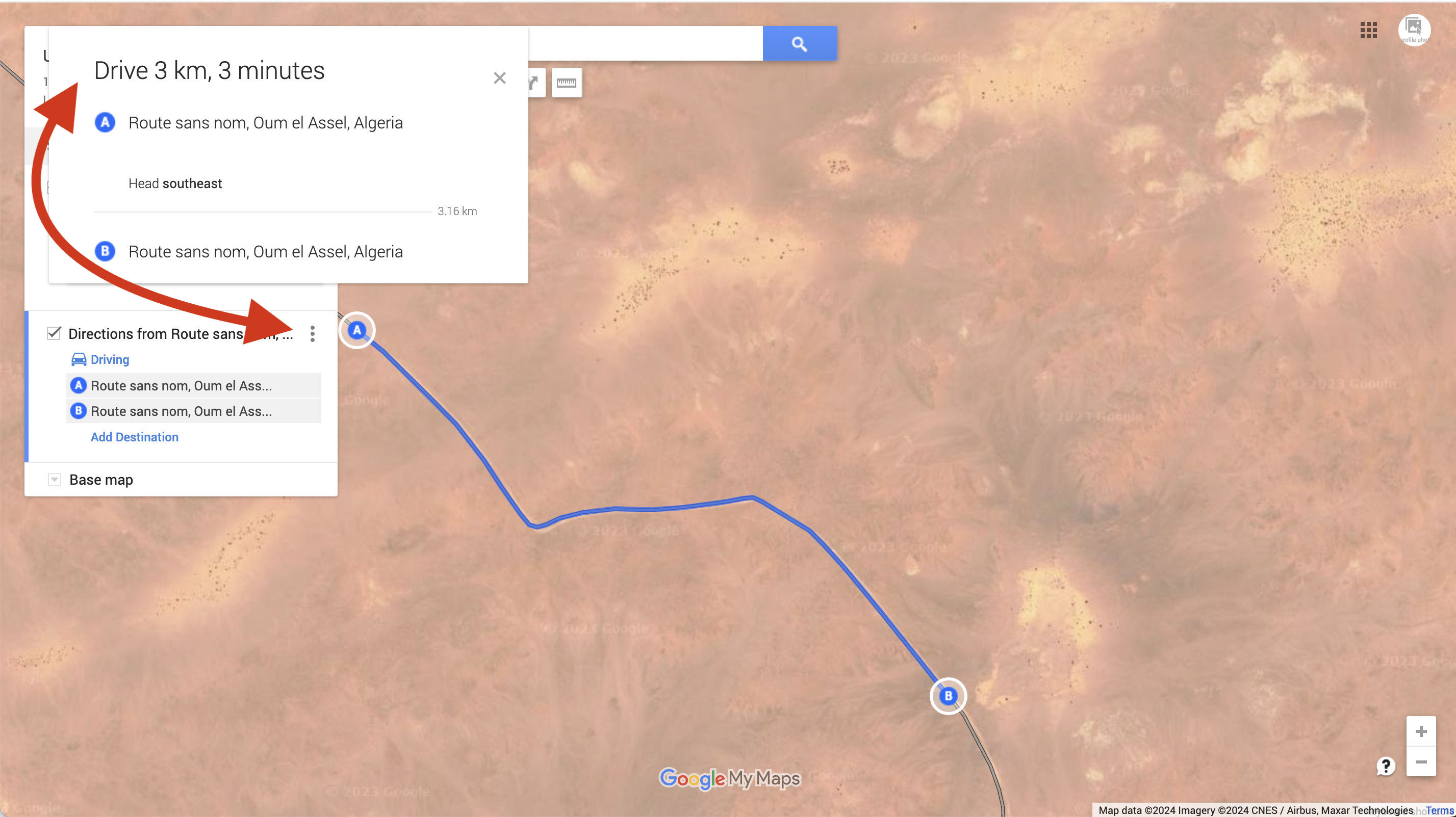
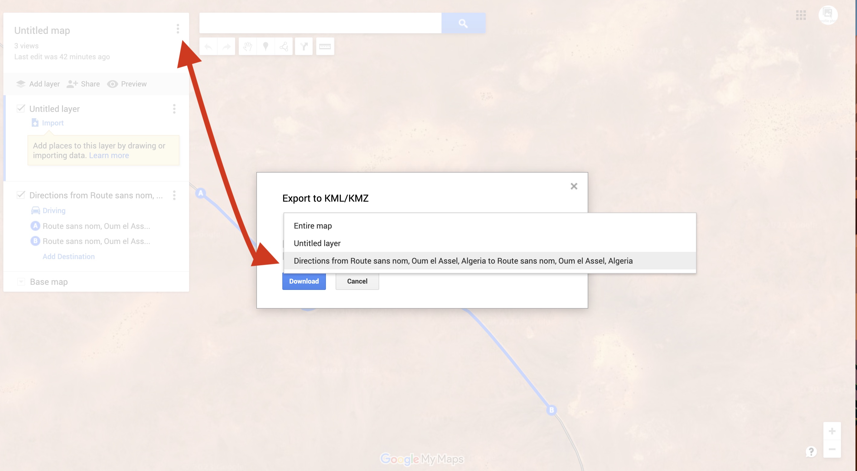
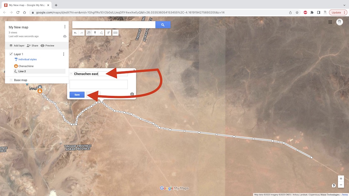
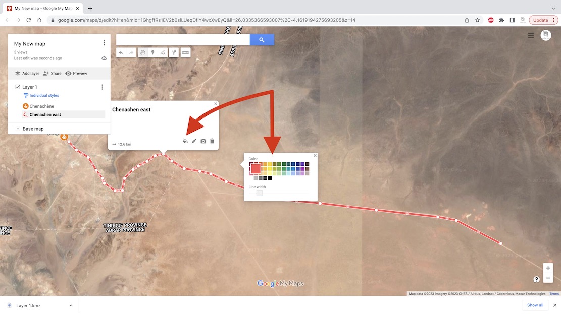
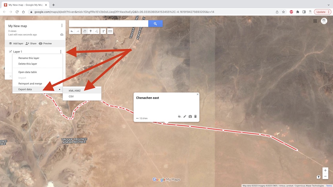
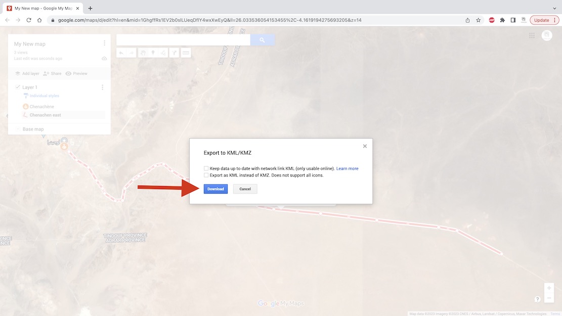
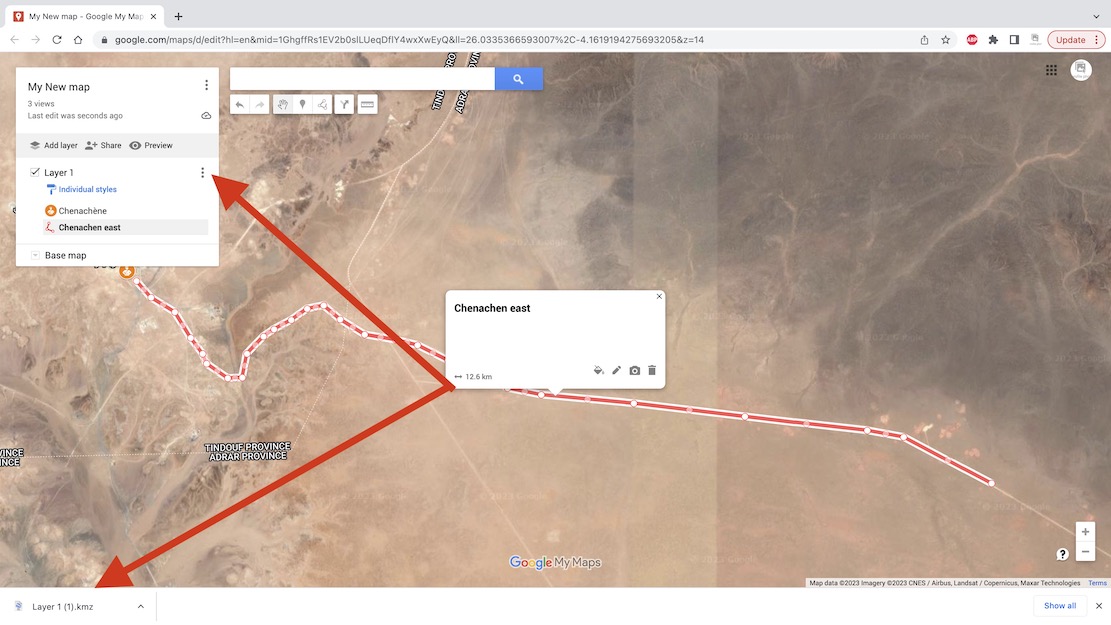
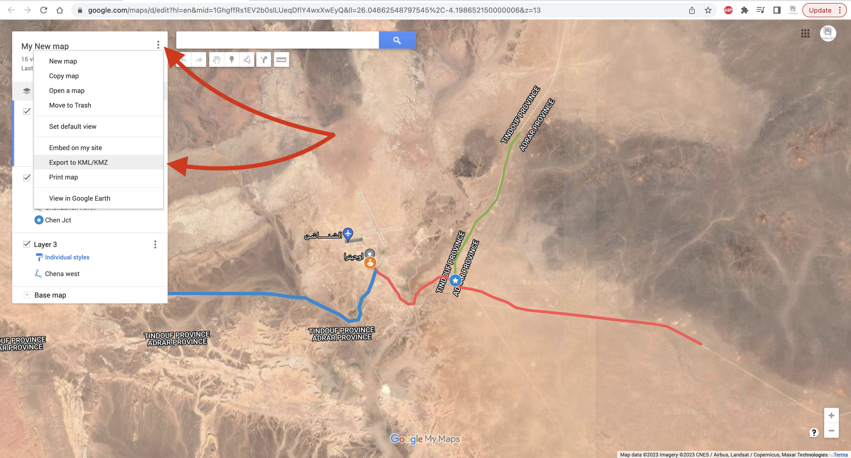
Open Google Maps and once signed in, click the Menu top left.I already have Saved maps so look for My Places or My Maps and click.In the sidebar click Maps and Create New Map.You can give your map a name and save. Google autosaves every few seconds so long as there is internet.You may also like to Name your first layer in your map and Save.To trace a tracklog you need to change the map’s base layer to Satellite.It looks like this – people often call this ‘Google Earth’ though that’s actually the app above.If you don’t know where your start point is and it’s waypoint, use Search. I chose Chenachen base, as close as I’m ever likely to get to this place.It’s not strictly necessary, but click Add to Map to save your searched place as a waypoint. You can also add and name a waypoint anywhere using the toolbar above (top arrow). Useful for important junctions, I find.Right-click and you can edit a waypoint’s Icon and Colour for better visibility and classification.Now, to draw a tracklog along a desert track, click the Draw icon in the toolbar and choose ‘Draw a line or shape‘.Trace the track with successive mouse clicks. As before, levels of precision are up to you. Unless you are going cross-country there will be a clear track on the ground.Or, if the track is shaded by Google, it means it is ‘routable‘. You can automatically trace it, up to a point. This method is much less tedious but hard to control.Click on a start point on the shaded track. It will be saved as ‘Point A’. A new ‘Driving’ layer (not ‘Import’) will be created. Now follow the track with the cursor; it automatically highlights it in blue and keeps going as long as it lasts. The problem is, the track may not go the way you are.At the end click again on the track and ‘Point B‘ is created and the track’s directions are saved as whatever Google calls it: ‘route sans nom’ in this case.Click on the 3 dots and the distance and other data are shown. You can export this Driving Route (not a hand-drawn track) by clicking the 3 dots alongside the map’s name at the top. Choose the layer you want: ‘Directions from Route sans… and it will save as a Google format kml file which you can then convert to .gpx to be read by a GPS or non Google mapping.Back to hand-drawn. Click the track’s end point to Save and give your track a name.Again, you can edit your track’s width and colour to make it more visible on screen.The contents (waypoints; tracks) of an individual layer can be saved and exported by clicking on the layer’s 3 dots sub menu, choose Export Data and save as KML/KMZ.Download your kml or kmz to the desktop.The layer’s data is downloaded as a kml/kmz.You can also Share your data online in various ways.If you have saved several layers and tracks, you can save and export the entire built up map as a kml. Then convert to .gpx as explained above and import into your nav device.Above, the top red line is the tracklog I traced the night before. The second red line with an arrow is the ‘live’ or ‘true’ tracklog I am recording. And the grey line below is the same unverified track as depicted on my digital map and which sort of eliminates the need for your own tracklog, assuming you trust the map. In some cases, not a good idea.