Category Archives: Desert bikes

1985 Grand Erg Imps Trike Expedition Film

An enquiry revived memories of a 1980s Sahara ‘quad’ bike expedition across the Grand Erg Occidental in Algeria involving ‘Wheelie King’ Dave Taylor (left) and which I recalled was a bit of a cock up.
Then, a connection, Paul Blezard (below right) set me straight on the Honda 250 ATC trikes they used, plus the link to the Channel 4 doc above which features Paul as expedition translator. After watching the doc, I thought it was no more of a cock-up than my first Sahara trip or three which routinely set out with equally over-ambitious goals and inappropriate equipment. The ferryman must be paid a few times before you venture across the sand seas.
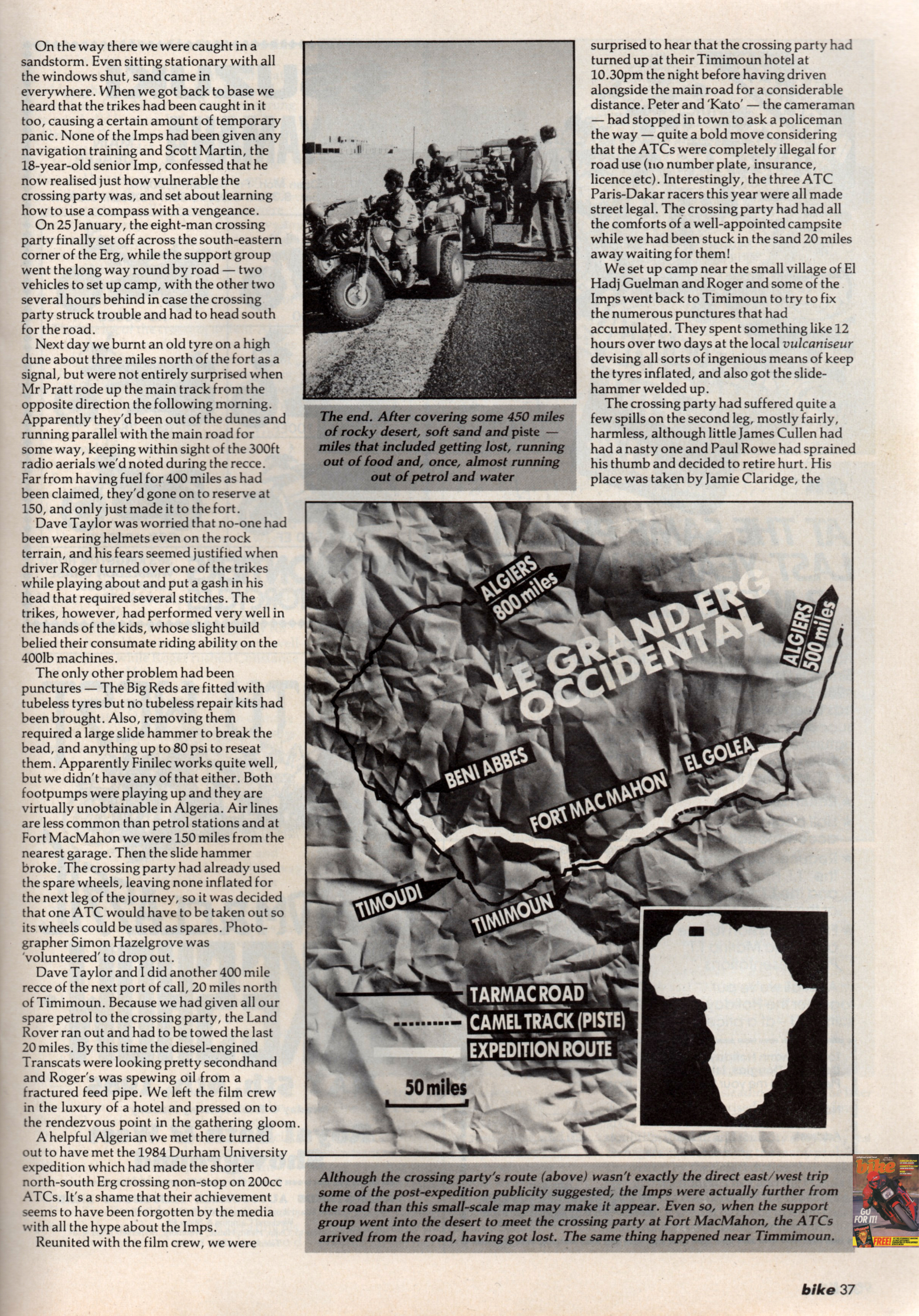
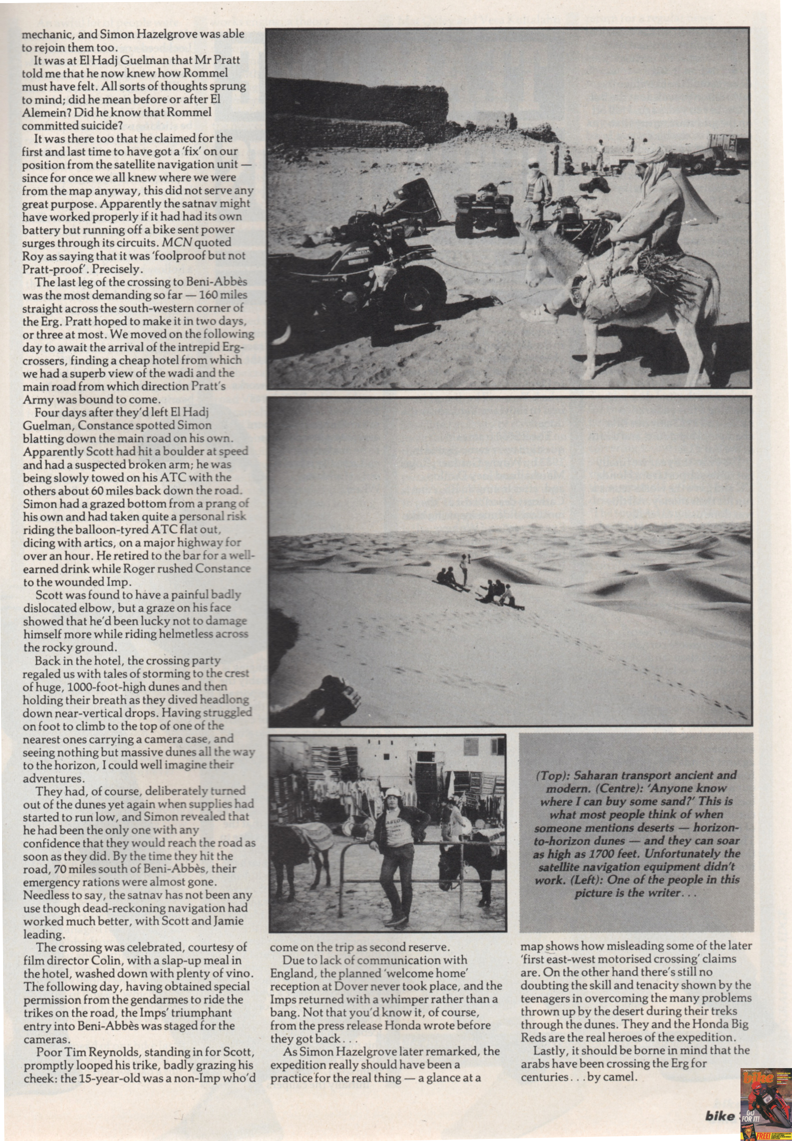
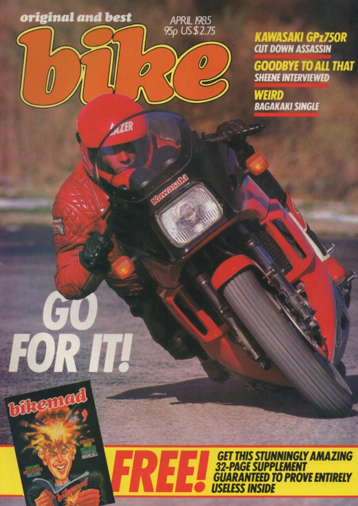
But after posting this page I read Paul’s forthright accounts published in the biking press (below; Bike 1985; more to come). Yes indeed it was a rolling calamity from start to finish, led by poor planning, preparation and logistics, followed by opportunistic thefts and irksome breakdowns leading to subterranean morale among the harried support crew. It might not have been helped by, as Blez calls him, ‘Mr Pratt’s’ leadership style. As Paul wrote for Trials & Motocross News (TMX) around Christmas 1985, just after the film aired:

To sum up, the first successful east-west crossing of the Grand Erg Occidental, as the TV film proclaimed, was only really successful in that no-one died and the trikes came out of it still running well.
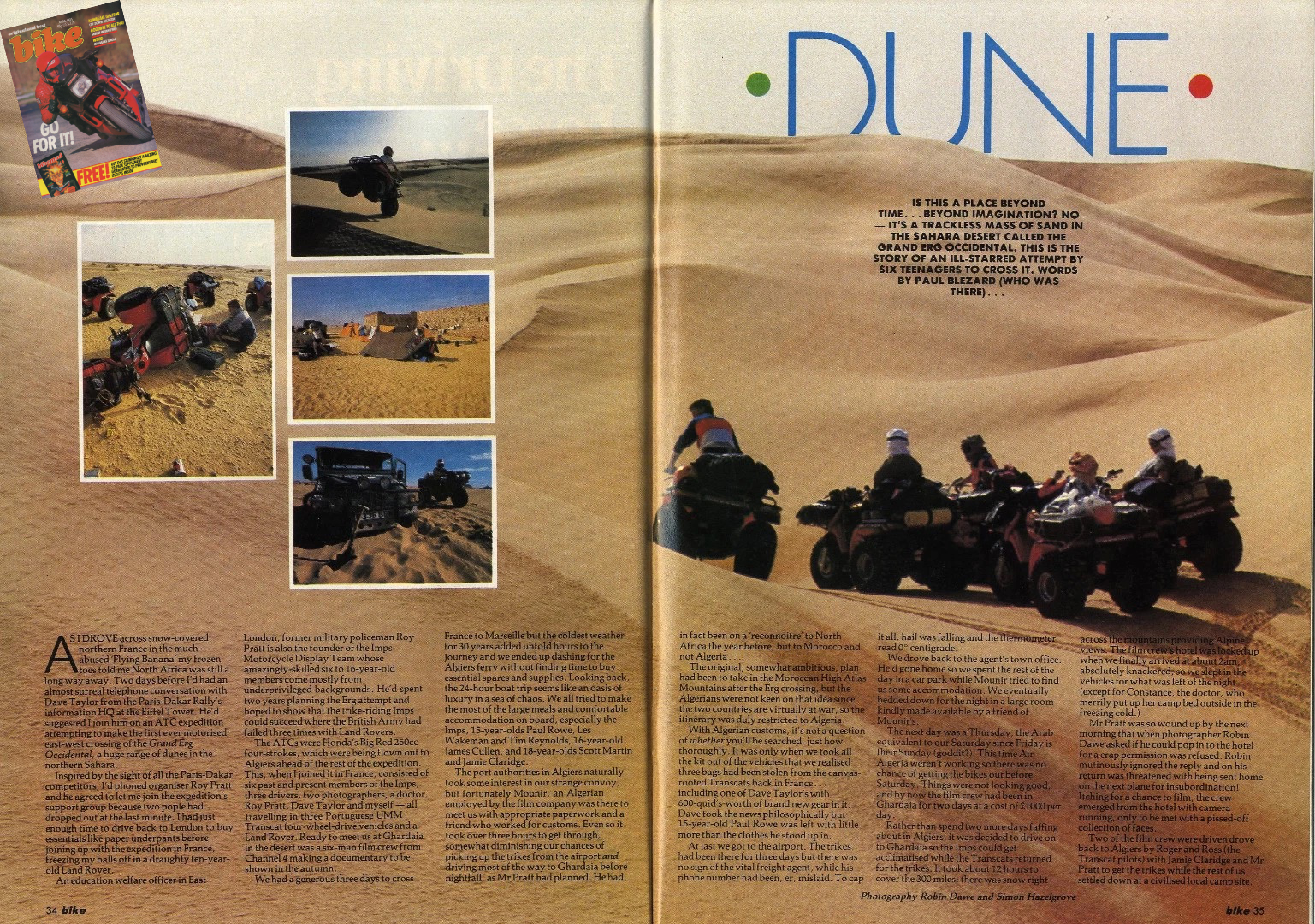
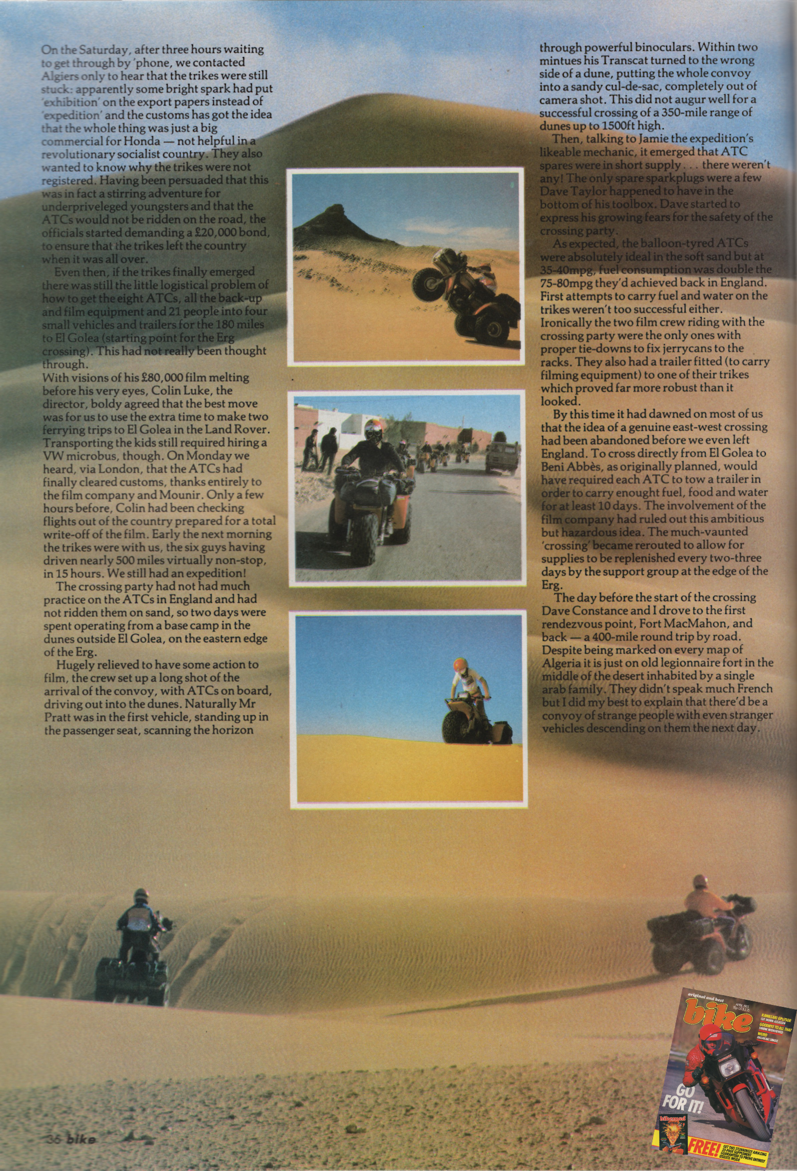
Never mind the C4 doc. Blezard tells it like it was in Bike mag.

The adventure was the idea of the late Roy Pratt MBE, a former military policeman and army display rider. Now a social worker, he founded the Imps charity in 1970, a youth motorcycle display team (left), like the adult White Helmets of that time. Pratt sought to rehabilitate and inspire disadvantaged east London boys with his two-wheeled initiative.
After over 50 years, in 2025 the Imps charity closed down in accordance with Roy Pratt’s last wishes and soon after his death, aged 86. During that time well over 2000 boys from as young as six years old had been part of the Imps, learning important life skills like teamwork. bike maintenance and constructing human pyramids.

Trikes – Yikes!
An ATC trike was a motorised recreational or utility tricycle, especially popular in the 1980s North America until issues with inherent unstability saw them axed. Originally pitched as all-season, ‘snow & sand’ scoots which even children could ride, like the Reliant Robin car, trikes proved to be deceptively dangerous when too deviating sharply from a straight line, leading to countless injuries, deaths and law suits. By 1988 new sales were banned in the US (or production was voluntarily suspended) by which time better turning quads had gained a foothold – but without trapping your actual foot.

Despite being geared to only reach 45mph, the tubeless-tyred 250s used by the Imps would certainly have offered great traction in sand without a motorbike’s need for momentum to avoid getting bogged. Roy Pratt must have encountered the phenomenon at its peak and like many, assumed three wheels were safer and easier to ride than two. He was not alone: as Paul Blezard wrote, that year three riders entered Honda ATCs in the Dakar Rally (#156, #157 and #158). All were ATC dirt racing pros who’d mastered the all-or-nothing skid-steering technique mentioned in the F9 vid above to get the trikes to corner on all three wheels. One racer, Paul Bonnet, even squeezed what may have been an XR600 motor into his trike (below). None of the Dakar trikers got any further than the Algeria-Niger border which was already 2000km over just four days of flat-out riding across the desert. But then again, of the 135 bikes which entered the Dakar in ’85, only 25 made it to the Senegalese capital.
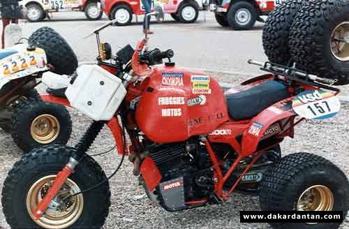
XR600 trike, anyone? Source

It’s unclear if Pratt had any desert experience (perhaps from the army, like Tom Sheppard?) or why he settled on leading a bunch of hand-picked former Imps to be the first to cross the width of the Grand Erg Occidental – one of several huge sand seas that fills the Algerian Sahara. There’s talk of a failed ‘Guards Regiment’ attempt on the GEO, as well as a Durham University expedition in 1982 which, among other things, proved the efficacy of trikes in on a shorter, north-south GEO crossing.
I wonder if crossing a sand sea is what a person who doesn’t know the Sahara thinks of as the ultimate desert challenge, until reality whacks them in the face like a garden rake. Like an avalanche slope, normally you avoid dunes where at all possible, or at least minimise your time there. The Dakar Rally of that era knew this, as do many visitors to Erg Chebbi in Morocco.

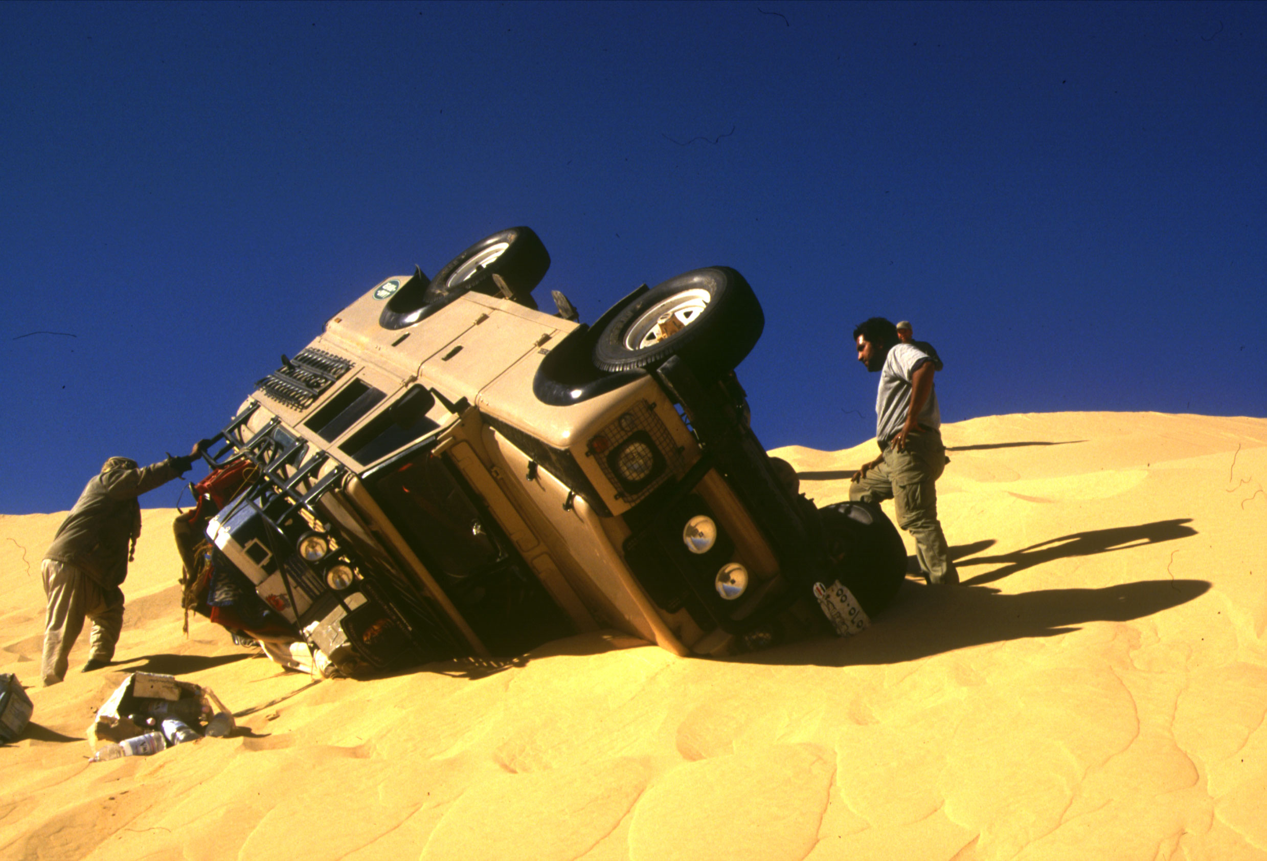
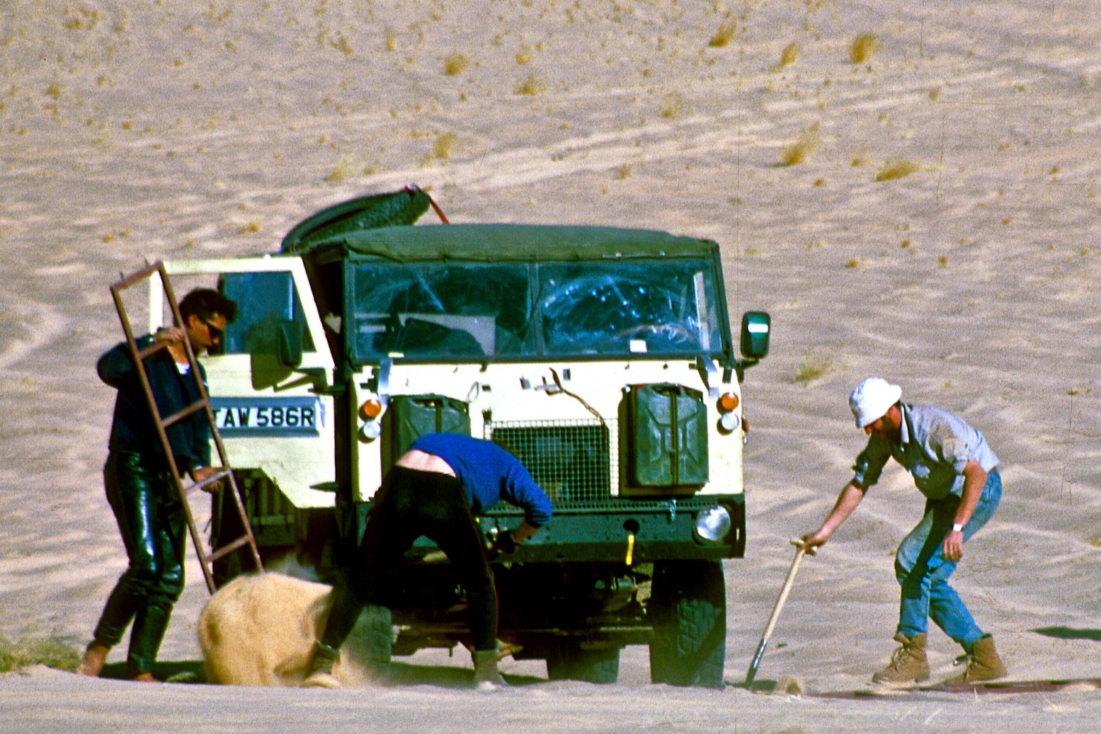
Car, bike or anything in between, dunes are where the accidents happen. The paradoxical need to maintain speed in a 4×4 to avoid getting bogged (and the laborious digging which follows), must be balanced with going slowly enough to spot and navigate over slip faces which can be invisible at certain sun angles. Once inadvertently airborne on a moto, very often it’s a tumbling machine that causes the injury. In a car it’s the impact of a nose-dive or fully somersaulting while battered by loose items. Above left: way too fast: vehicle destroyed, driver lucky to be alive. Above right: relatively harmless fall roll over descending a slip face a little too briskly and at an angle. No harm done.

Probable route as interpreted from watching the film. Inset bottom left: fantasy route from the doc.
Great Sand Sea

The Imps’ original plan had been to plough west directly across the erg from El Golea to Beni Abbes like a fat-tyred Columbus. A distance of nearly 500km, as Paul wrote this would have required days of towing power-sapping trailers. Wisely, that plan was ditched before leaving the UK.
Apart from being a very long way, it would also have been ‘across the grain’ of the dunes’ SSW/NNE linear orientation, something that’s visible when zoomed in on sat imagery. We found that out for ourselves one morning in Egypt’s Great Sand Sea in 2000. Driving over successive dune cordons makes for extremely slow and at times risky progress (right). On that occasion we gave up and followed the inter-dune corridors south and out of the Sand Sea. It seems the Imps ended up doing the same during much of this trip.
After suffering a series of ongoing thefts, the unregistered trikes were now stuck in Algiers Customs. Early on in the doc and with group tensions and low morale already flagged up, Dave Taylor, a well known stunt rider turned motorcycle safety campaigner, presses Roy Pratt on contingency plans if things went wrong. With too much post-reality-TV cynicism, you wonder if it’s a genuine exchange or a staged conflict set up by the TV people. Reading Paul’s accounts, it was almost certainly the former – and was just the tip of the tottering iceberg.
All the support cars towed trailers for the trikes, but even an unhitched 4×4 would have struggled to reach, let alone keep up with the trikes in the dunes. So two C4 TV cameramen followed the Imps on their own ATCs, one towing a small trailer. You imagine they had a story of their own to tell at the end of it all.

The four-vehicle convoy merely followed the Timimoun road south of the erg. I’d ridden that road three years earlier until I ran out of fuel. The dunes were unseen, far to the north.
On top of everything else, we’re told radios were playing up as radios do, putting the Imp support cars even further from being able to offer assistance. Instead, there was talk of burning tyres at pre-arranged times, as well as flashing mirrors. Both were possibly set-ups for the TV because at any point all the trikes had to do was head south to the nearby road.
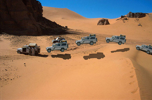
I was thrilled to see three new UMM 4x4s (below) making up the support convoy. Never seen those used in the Sahara, or indeed anywhere. A UMM was a slab-sided Portuguese built, Peugeot engined workhorse based on the 1960s French Cournil with nods to Jeeps of that era. With the Peugeot 504’s solid reputation in the desert, I’d looked into getting a UMM for my own group of two-wheeled ch’imps in 1989, but ended up with a Land Rover 101FC for a bigger payload. From what Paul wrote later, it sounds like I made the right choice. The Imps support crew also included a 1973 SWB Landie which at one point seems to have given its frazzled driver a black eye (left), but which is probably still running today.

The team had flown directly to Ghardaia and after a mooch around the market (‘ain’t no gews nowhere…’) and with the bikes released from Customs, they based themselves outside of El Golea before setting off along the erg’s southeastern perimeter towards semi-abandoned Fort Mac Mahon.
From here they continued west along the Meguidene gravel plain (see yellow map below), ending up riding alongside the road to Timimoun because the trikes were struggling but not road legal. On the way they suffered a staggering ’27 punctures’ resulting in a 16 hour day, but as Paul wrote, they’d forgotten the vital plugs which makes tubeless tyre repairs so effortless, providing you have a compressor. Desert sand soon ruins foot pumps, as I’d also found myself in ’82.

A Navstar antenna? (11:41)

Once in Timimoun (where in ’82 I got dropped off after a creepy lift late night lift, having left my bike in the desert), the Duneriders move up to El Hadj Guelmane oasis, in the erg north of town. After two long days having punctures repaired, this was the last point where Pratt managed to get a fix out of his sat nav, as it’s claimed the trikes lacked the battery power to fire it up. I didn’t know there was land-based sat nav in 1985, unless it was an earlier version of the pre-GPS Navstar we used in 1990. Early on in the film, the antenna on Pratt’s Honda (left) resembles a Navstar unit.

Judging by the film, it seems only from El Hadj Guelmane that the trikes – we’re told without even working odometers so unable to record distance – get stuck into dune riding (above) like you’d see in today’s Dakar Rally in Saudi. They give themselves three days to cover the 250km to Beni Abbes, a very long distance to navigate hundreds of dunes without a mishap. In dunes like this the Big Reds’ 12-litre tanks would have given the 250s about a 300km range, plus another 300 from a jerry.

Click for Ksar Draa location


This whole area north of Timimoun is fascinating, dotted with small, date-producing oases and ancient fortified ksars. The Duneriders’ camp at Guelmane was just 15km from what’s become called the Ksar Draa of Timimoun (above), which looks like something from a fantasy film set.
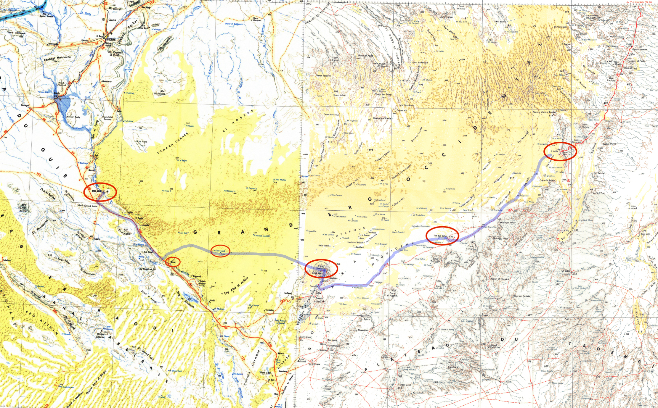
IGN maps NH30 ‘Bechar’ and NH31 ‘Ouargla’. Probable actual route shown

Dead Reckoning into the Erg
Initially we’re told the Imps follow a bearing of 290° then 285° (~WNW), possibly aiming for Hassi ben Taleb. At the end of that day Pratt plays the ‘guess where you think we are’ navigation game which we also played with the Navstar in 1990 while waiting the half an hour or more for it to get a fix.
Pratt has no working sat-nav of course, but estimates ‘to the right of that highpoint, 424’, pointing to an IGN NH-30 Bechar map (left). Spot height ‘424’ on that map is just to the right of Hassi ben Taleb (on the map above). Although there’s no talk of this marked well being a destination, it’s amazing to think they might have covered the 90km of dead reckoning through the dunes and got so close. Of course they might have been anywhere in the GEO, and Taleb as a destination is just my guess.

Unless you know better dead reckoning – estimating a position from just a bearing held and distance covered – is an exceedingly sketchy way to navigate while winding through chaotic sand seas. The self-effacing Pratt credits the boys with the route finding then spells out the impossibility of accurately estimating their position after all the zig-zagging to find rideable passages.
Their key nav aid would have been knowing the N6 highway was just a couple of hours to the southwest, albeit through possibly massive dunes. These can appear daunting, but are actually easier to manage than the small dunes further north (as we found in 2002 entering the Grand Erg Oriental from El Oued; left).
Towards the end the film seeks to jack up the ante as the anxious support crew search the horizon from the Beni Abbes hotel terrace. But then we cut back to the trikes and the narrator suddenly throws in: ‘… the one safe course to follow is south, down from the dunes towards the plain and hopefully the road. After two days they’d supposedly run out of food, despite Pratt’s baffling instruction telling the support crew to wait eight days before coming to help. You wonder if Roy & the Imps could see the writing on the slip faces: this sort of riding was not sustainable. Although it’s not evident on sat imagery, the IGN map above (and which Pratt had) shows a band of even higher dunes blocking their way to Beni Abbes.
But it’s a happy ending as the riders appear right on schedule, having bailed from the Erg and headed for the road, maybe because of– or just before another accident. We’re told they hit the N6 about 80km from Beni Abbes, so just northwest of Kerzaz (below).

Kerzaz 1982

After recovering and refuelling my abandoned bike and getting going again in Timimoun, in 1982 I well recall stopping in amazement at Kerzaz to crawl up the monumental dune behind the town (above). Whatever lay in the erg behind there, it’s no surprise that triking it eventually ended with a suspected broken arm, one of countless tumbles suffered by the Imp trikers while riding the comically unstable three wheelers.

The film can’t disguise that in the end, by mostly tracking the erg’s southern perimeter, the Imp’s expedition was no more a triumphant crossing of the Grand Erg Oriental than the JSE ‘west-east Sahara’ crossing a decade earlier.
But more importantly, Roy Pratt (right) did succeed in delivering an adventure and hopefully a life-changing outlook for a small group of young ‘ackney teenagers which you imagine they’ll remember to this day.

Algeria’s ‘Graveyard Piste’ 2026 • Route CW2/CP2

Gunning through the Hadjhadj valley, 2003, just before the party ended

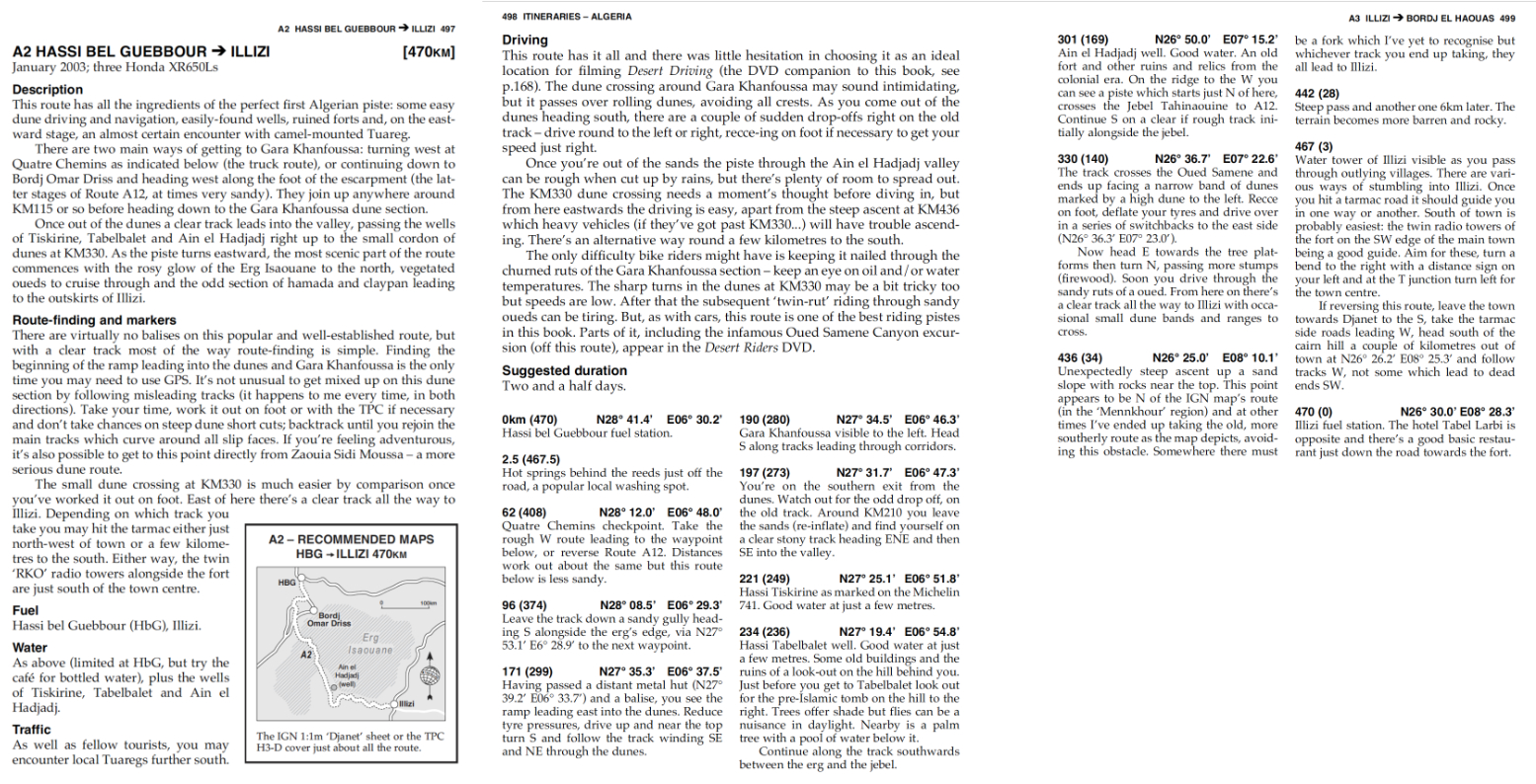
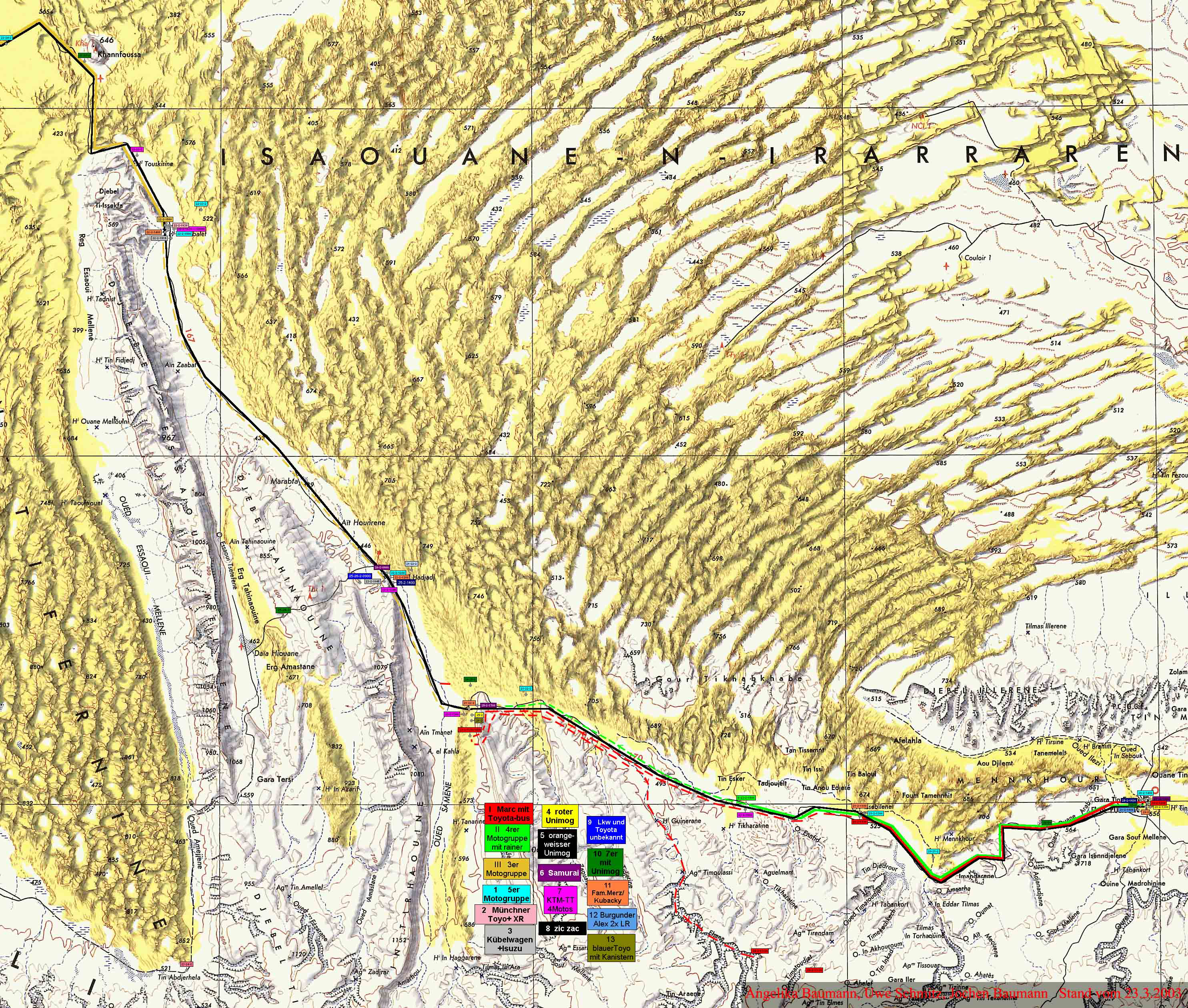
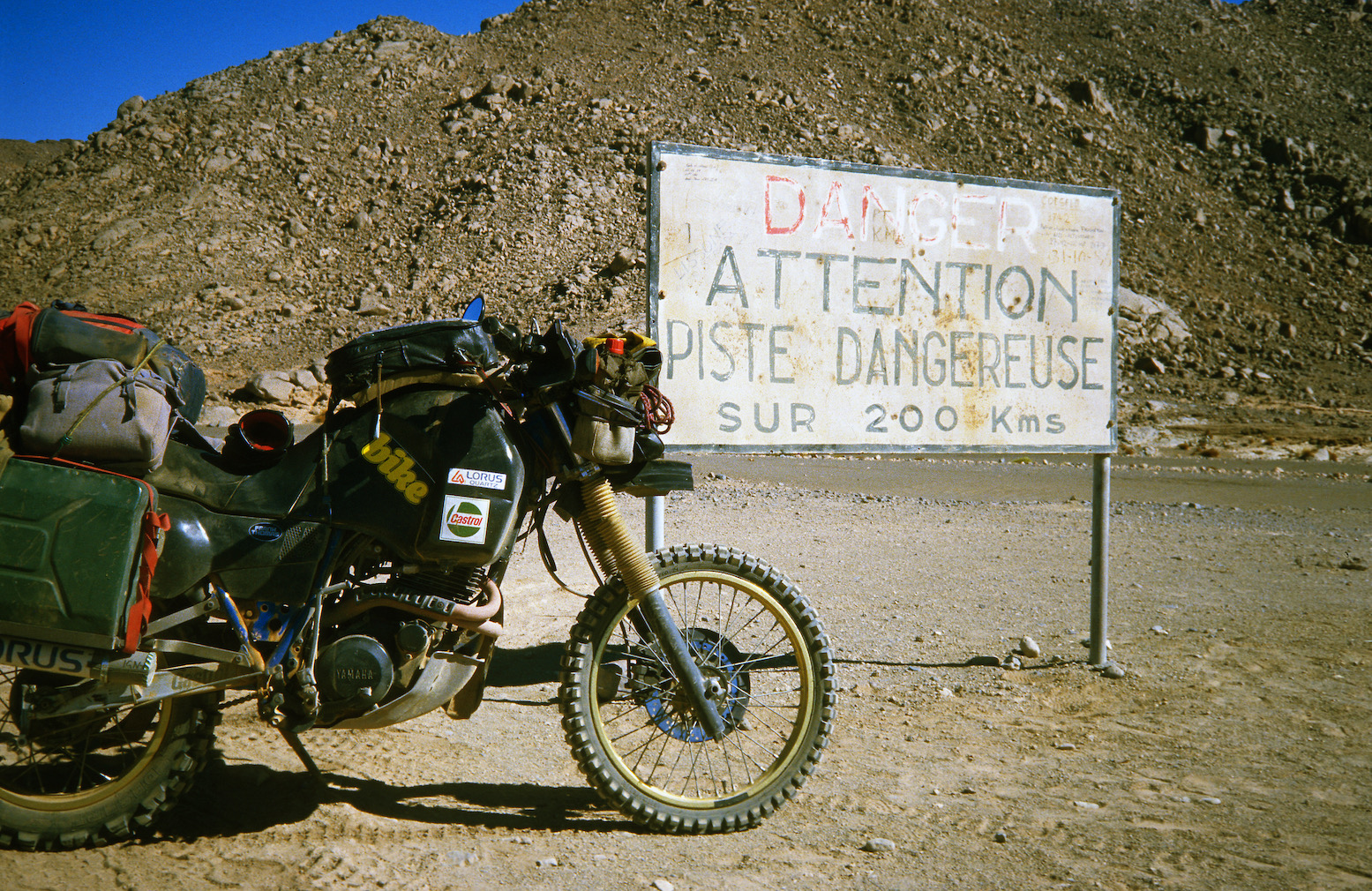
Many old Algeria hands will fondly remember what I called the 470-km Graveyard Piste from Hassi bel Guebbour (‘HbG’) to Illizi, just before the epic Fadnoun plateau crossing to Djanet. We first did it in 1990 and, with a combination of dunes, jebels, nomads and wells, it added up to the best 1000km of off-roading in Algeria at the time.
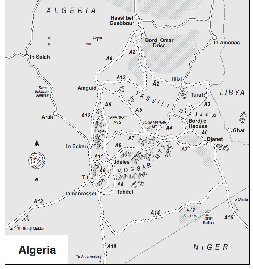
In Sahara Overland It was called Route A2 (below); the macabre name giving it an added cachet. When it came to covering Dunes for the Desert Driving dvd in 2002 (below), Toby Savage and I shot it along the ‘Graveyard Piste’.
In fact I’m told the true Gräberpiste was coined by a German guidebook writer in the early 1980s and refers to Route A12 from Amguid which after passing under Erg Tiffernine then cut across the Jebel Tahinaouine to join A2 at Ain el Hadjadj via the Erg Amastane (above right), passing this unusual structure, a probable vestige of the Senussi battles which raged in this valley in 1916. a link I’ve always wanted to make. From there it continued to Illizi along A2. There’s a whole Wikipage on the Gräberpiste and France’s battles with the Tuareg there.

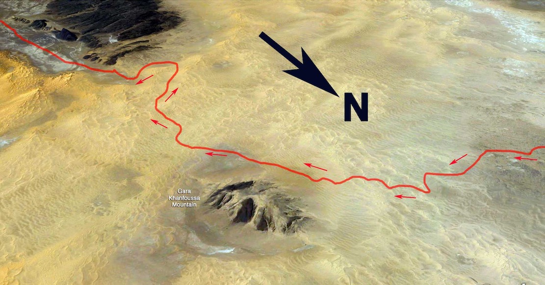
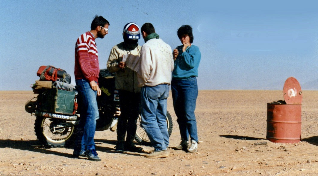
Back then to access the dune-rimmed ‘Hadjadj’ valley which led to Illizi, you had to turn west at Quatre Chemins junction south of HbG and head out towards Amguid until you saw a metal hut. Here, you headed east up a sandy ramp that led into the rolling Erg Issaouane dunes until you saw Gara Khanfoussa hill (below). At this point you turned south. You usually followed tracks in the loose sand and passed a pole or two, but in the pre-tracklog era, in the three or four times I did this crossing, it was always nerve-wracking navigating the maze while maintaining momentum to avoid getting stuck. Car or moto, I never went the same way twice.

Old A2 dune crossing of Erg Issaouane to Tabelbalet well

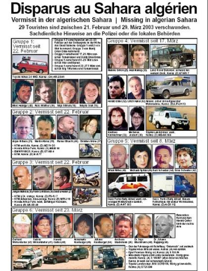
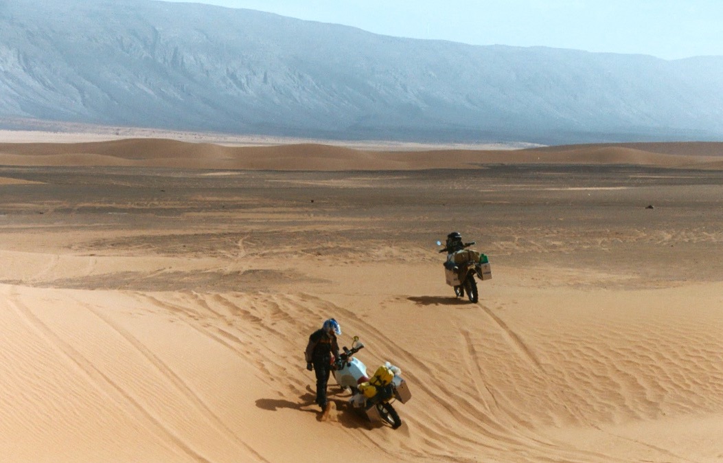
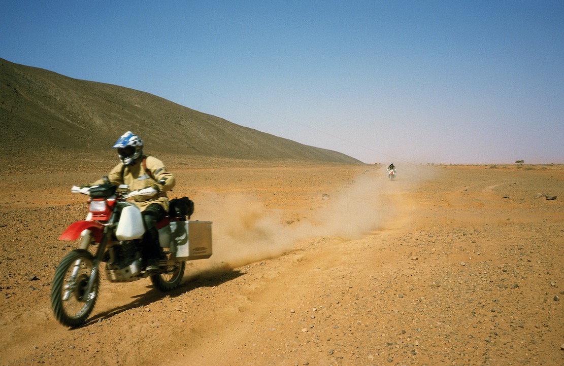
The ‘Graveyard Piste’ – so named because of the pre-Islamic tombs and even Christian colonial soldier graves in the vicinity – became so popular it gained unwelcome notoriety in 2003 when the GSPC Islamist group kidnapped several tourists near the small dune crossing at KM330 (below left). We’d ridden this way on Desert Riders about three weeks earlier (left), aiming for a food and fuel cache before continuing south along Oued Samene in a doomed attempt break through the watershed to the Fadnoun.

Today a compacted track has been laid across the sands directly south of Bordj Omar Driss towards Gara Khanfoussa (below). This new route is also on OSM maps and is labelled CW2/CP2. It passes east of the hill then turns to meet the old A2 route at a rejuvenated Hassi Tabelbalet well. Cantone came up this way in April 2024 in windy conditions and had a good look around Gara Khan before continuinh north to BoD.

CW2 plies the sands from Bordj Omar Driss
Stuck at KM330

Ain el Hadjadj well (below right, 2003) is now an army base, and the tricky dune crossing at KM330 (left) has also been graded and stabilised just to the north of the old crossing.
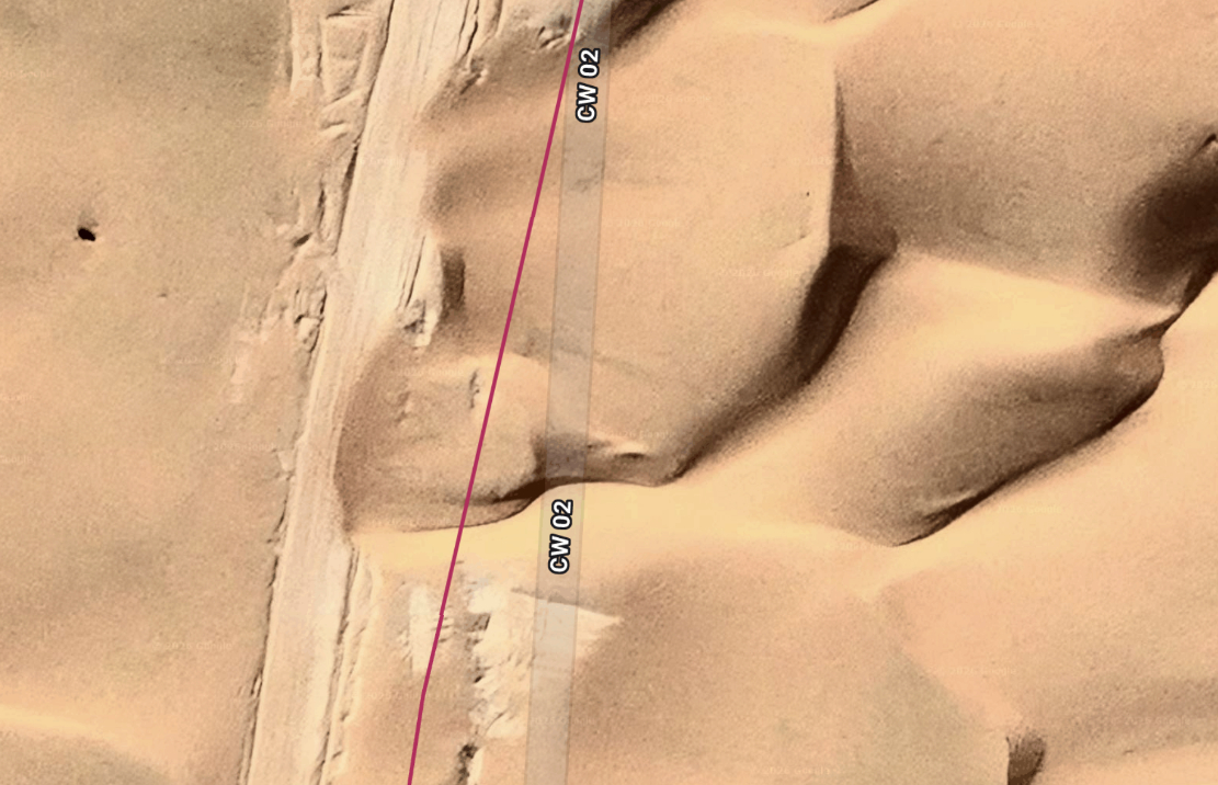
I do wonder how you lay a track over dunes that’s strong enough to support trucks. Maybe a metre of rocky rubble does the job? But even then, as shown in the satellite screen grab below, as all over the Sahara, dunes will eventually creep back over the track, requiring regular clearing.

At this point the route gets renamed ‘CW2’, and the last 100km east to Illizi are sealed, making the distance now just 330km, fuel to fuel and doable in a day. You won’t see all the route on Google; it’s clearer on ESRI sat platforms, like Apple Maps or Bing.
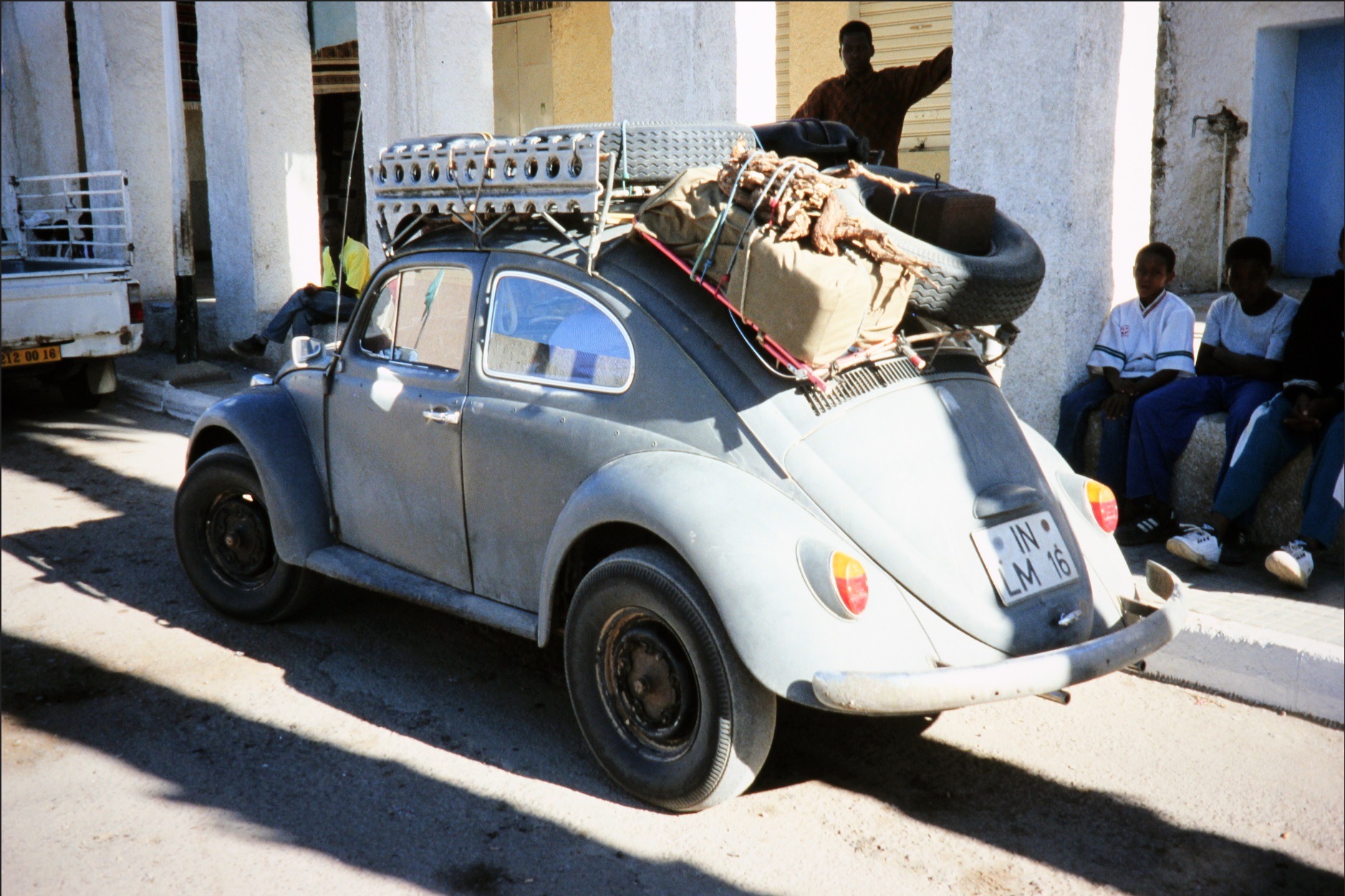
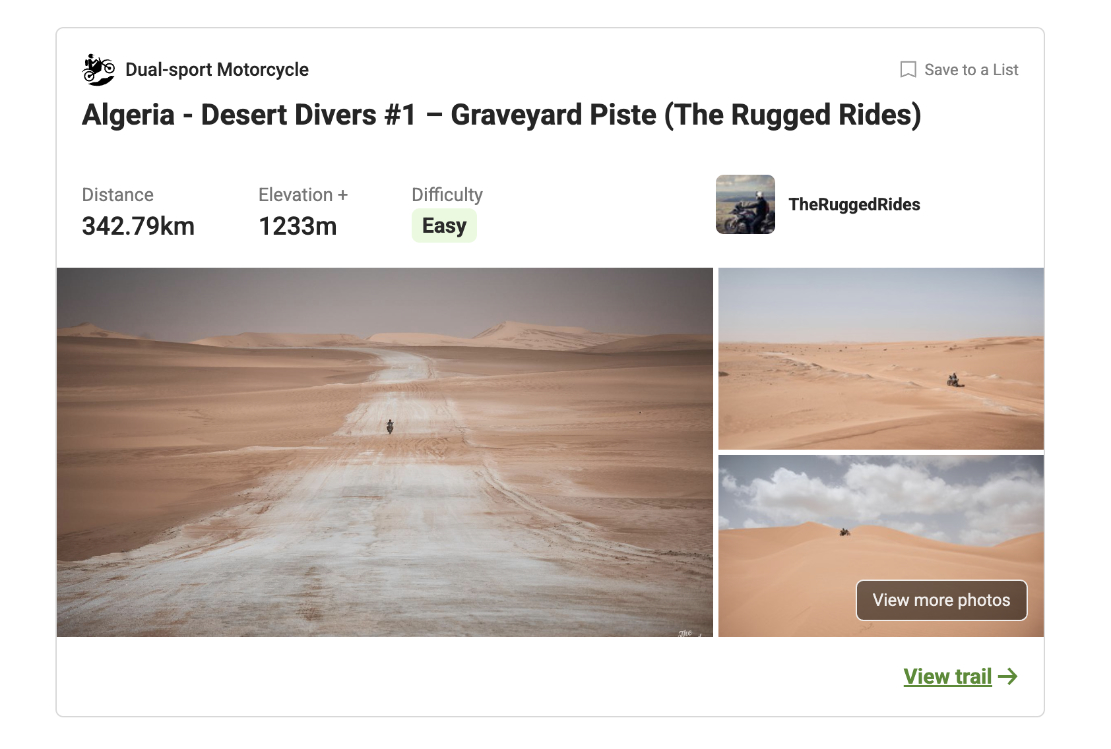
In 2026 a group of intrepid, escort-dodging Polish riders managed to be, afailk, the first party in years to follow A2 from BoD to Illizi, which has been off limits to tourists since the kidnappings (depending on which agency you ask). The old and new routes join near Tabelbelet well where in 1990 we met a jacked-up VW Beetle (left) that had come across the Khanfoussa crossing just ahead of us.
You can view the Polish riders’ raw gpx with photos on Wikilocs and read about their ride and a whole lot more here.

Night out on Mt Tiska

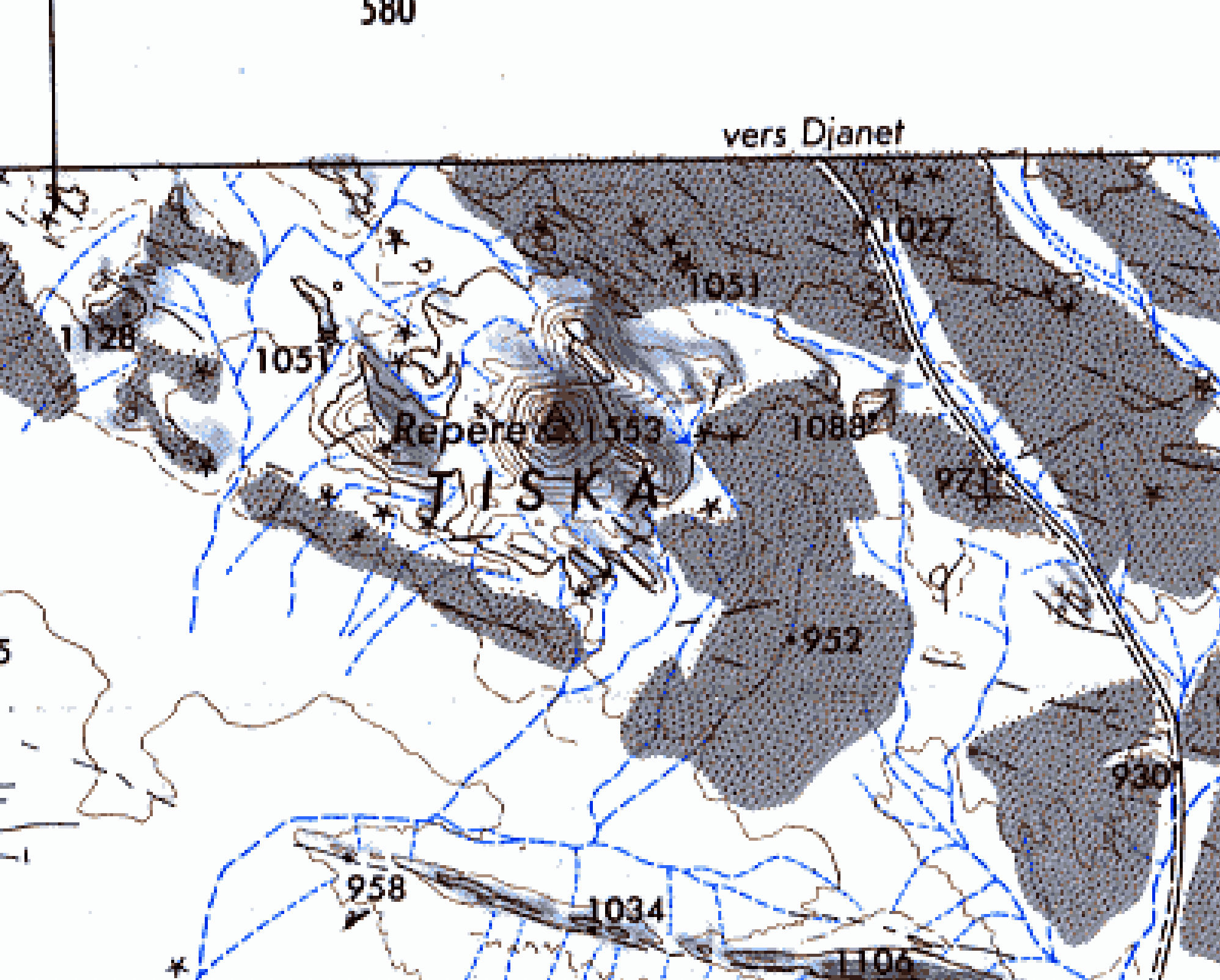
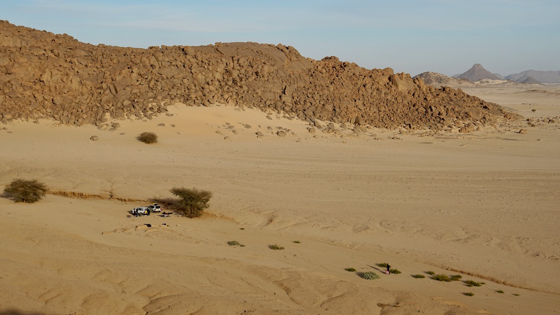
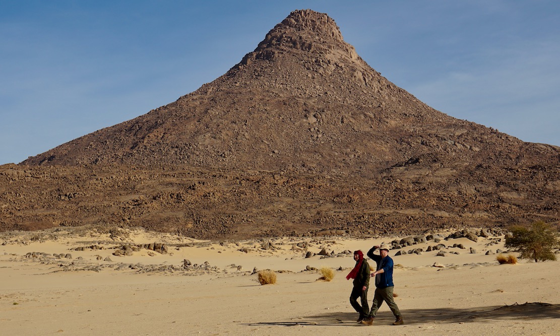
In early 2025 we pulled off a deserted new road and headed across the sands to camp at the foot of Mt Tiska.
I’d been looking forward to this moment for nearly 40 years. My first view of Tiska’s distinctive but distant conical form was from Djanet’s old aerodrome way back in 1987. As I write in Desert Travels:

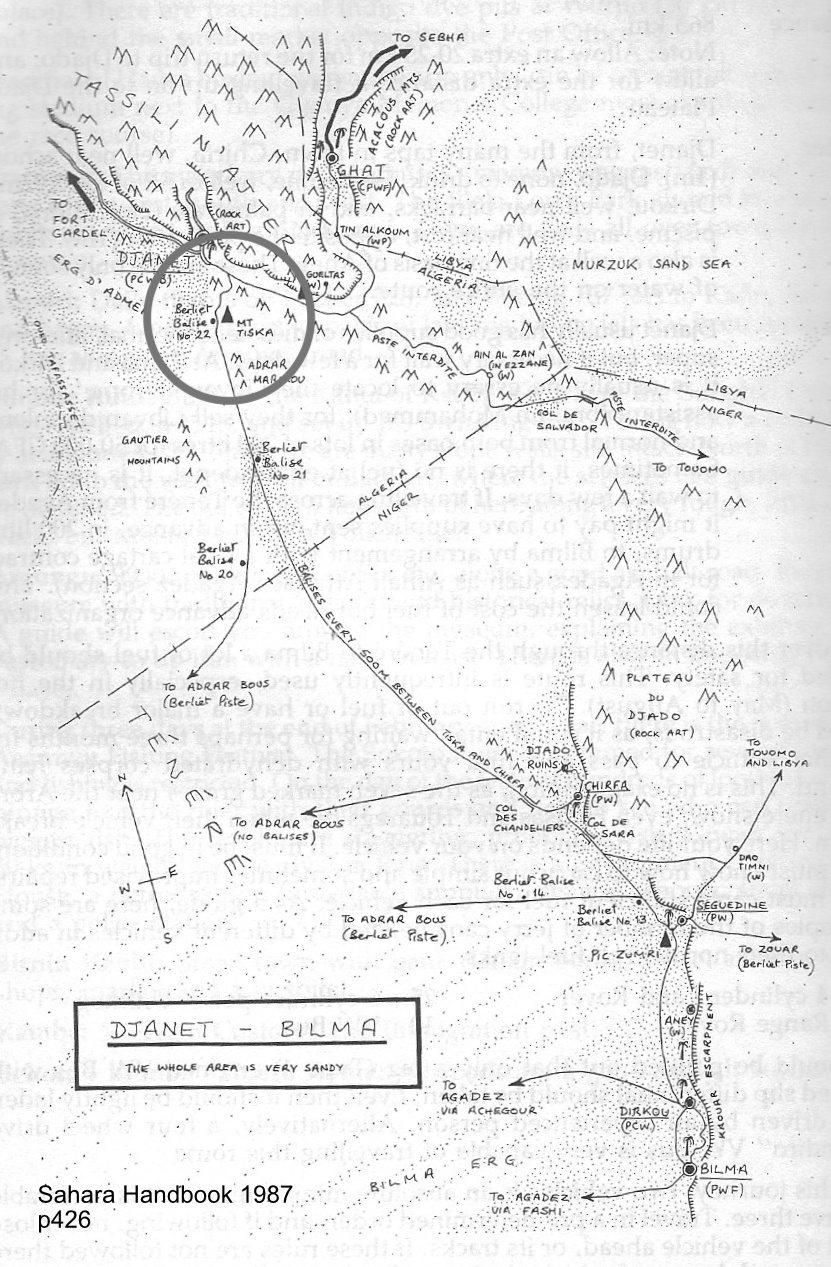
One evening Philippe, a skinny middle-aged Frenchman who had the habit of walking around the campsite in a saggy pair of Y-fronts, invited us to the airport to inspect his old aeroplane. He was immensely proud of his historic plane, a twin-engined machine from the Golden Age of Aviation. He was keen to point out the enlarged fuel tank which former owner, Lady Vanderbildt or some such, had fitted for a one-hop flight to the States as the war turned on Germany… Philippe started up the engines, but I was far more interested in the view down the runway. From this flat vantage point … south of Djanet you could clearly see the unmistakable conical profile of Mount Tiska … the first and only landmark in the featureless expanse which lead across the Ténéré to Chirfa and ultimately Bilma, nearly 900 kilometres away.
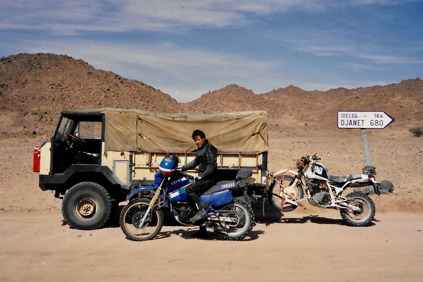
A waterless expanse of flat, soft, sand, this was the route I’d planned to follow with the only partly cognisant Pete: Yamaha Teneres to the Tenere Desert: it could have been adventure biking gold until his breakdown near Illizi had sunk that idea. At that time I knew only a little more than Pete about the realities of remote desert crossings, and it’s no more likely we’d have made it to Bilma than if we’d tried to paddle to Tristan da Cunha in an upturned umbrella.  
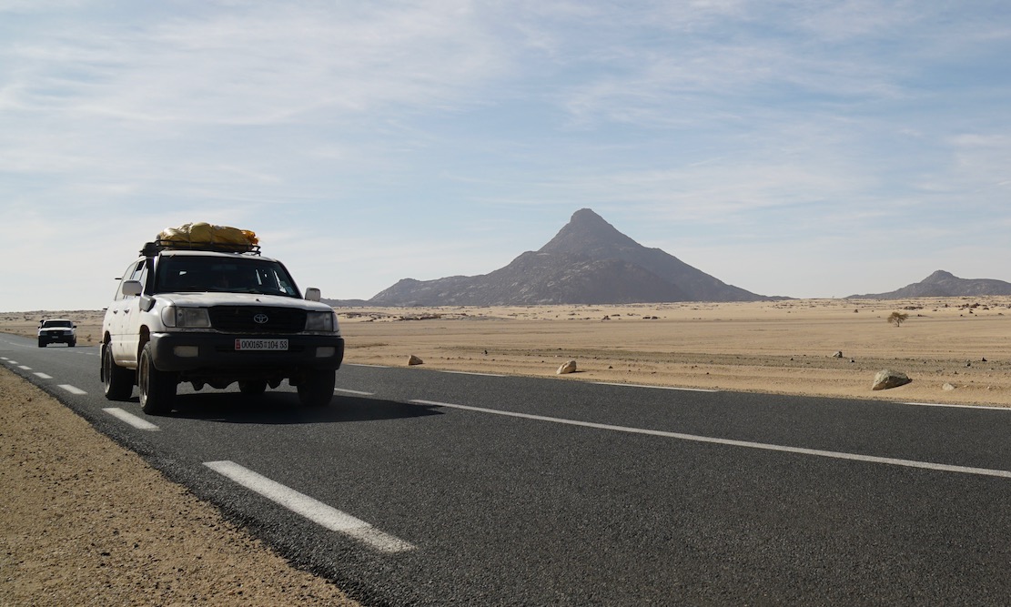
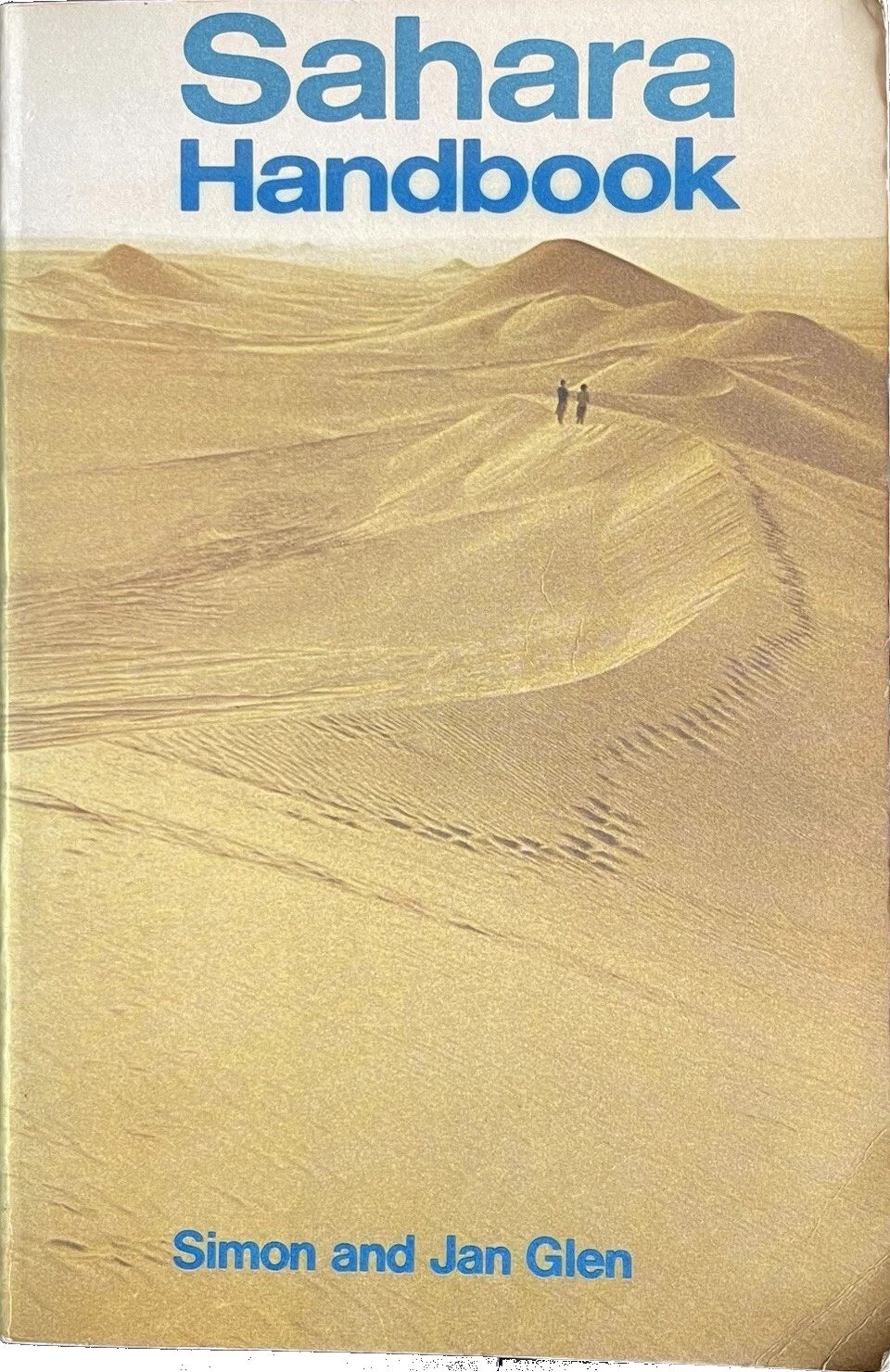
An ancient, pre-GPS landmark, I’d read of Tiska’s significance while leafing back and forth through the original Sahara Handbook (right) in the early 1980s.
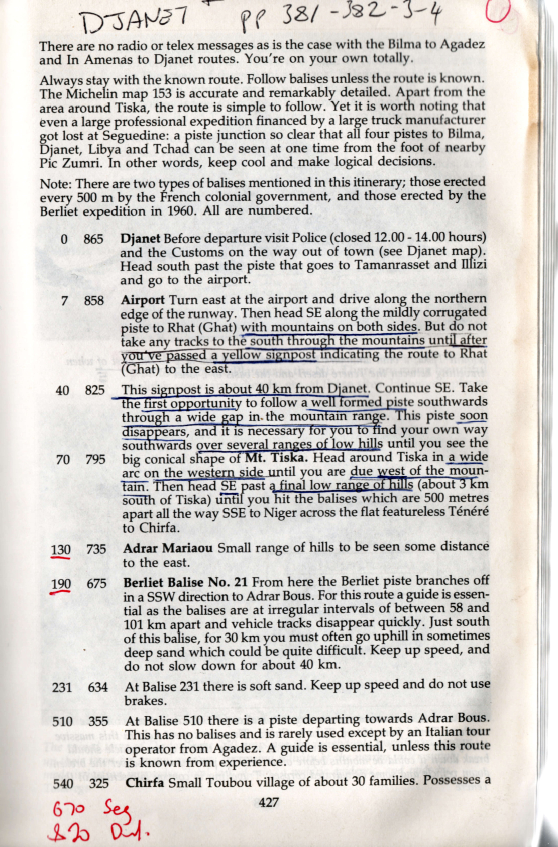
We all have books that leave strong impressions in our early years; the first Sahara Handbook would be high on my list. In it Simon and Jan Glen’s description of ‘Itinerary No. 19: Djanet – Bilma’, reads like call to adventure. You can see my annotated pages notes left, and might marvel at the sparse landmarks including Mt Tiska, with some spaced up to 200km apart. At no less than 865km, this was a serious desert crossing and the Glens did not mince their words.

To run out of fuel or have a major breakdown could be disastrous, as it could entail waiting for perhaps three months for another vehicle to pass and find tours with dehydrated corps lying around. This is no exaggeration, as the seven marked graves near Arbre du Ténéré show… Here your life depends on your vehicle.
On leaving Djanet for the south, no authorities are interested in how well your vehicle is equipped … [nor] interested in whether you make the journey or not. There are no radio of telex messages as in the case with Bilma to Agadez and In Amenas to Djanet routes. You’re on your own totally.

By the time that was written (final edition three, 1990) the piste to Bilma was little used. It’s said that in 1979 four Land Rovers were lost without trace on this route, and as a result the Algerians closed the crossing and pulled up many of the balises (three-metre-high steel marker posts, below) which the French had erected every 500m from Mt Tiska to Chirfa, the first outpost in Niger and a distance of nearly 600km.
That information was not known to Pete and myself when in 1987 we set off with plans to blithely ride across the Tenere from Djanet to Niger on Yamaha XT600Z Tenere motorcycles. It was a very long way on a bike, but with a balises every half kilometre, it felt doable providing we had visibility and could carry enough fuel and water.

About 1200 of these balises once marked the entire Tiska–Chirfa crossing, like buoys at sea. You can just see the next one, 500m in the distance.
Mt Tiska 1860, H. Barth

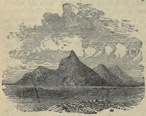
Coming up from Niger, the cone of Mt Tiska (and larger mass of Adrar Mariaou 34km to the south) had long been important landmarks on the caravan route between Ghat and Agadez. In 1860 Heinrich Barth wrote.

August 2 After a stretch of nine miles, an interesting peak called Mount Tiska, rising to an elevation of about six hundred feet, and surrounded by some smaller cones, formed the conspicuous limit of the rocky ridges. The country became entirely flat and level … and there was nothing to interrupt the monotonous plain but a steep ridge, called Mariaw, at the distance of about five miles to the east [probably Adrar Mariaou; 34km south].
The nature of this desert region is well understood by the nomadic Tuarek or Imóshagh, who regard the Mariaw as the landmark of the open, uninterrupted desert plain, the “ténere;” .

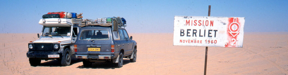
But in 1987 Pete didn’t even make it to Djanet on his Tenere. And soon after I arrived I learned what I now know. Since that aborted crossing, I’ve met others who tackled the route anyway and either got in big trouble in Dirkou in Niger (2001), or got brutally robbed before they even made it to the Niger cut line (2002; probably following a tip off in Djanet). Also in 2002, we came up the balise line from Erg Killian, the Monts Gautier and Berliet Balise 21 (below), but from Mariaou headed directly to Djanet across the very soft sands, bypassing Tiska.

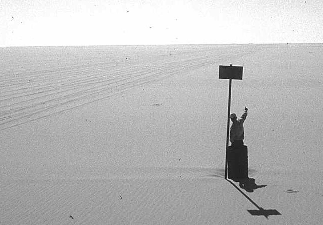
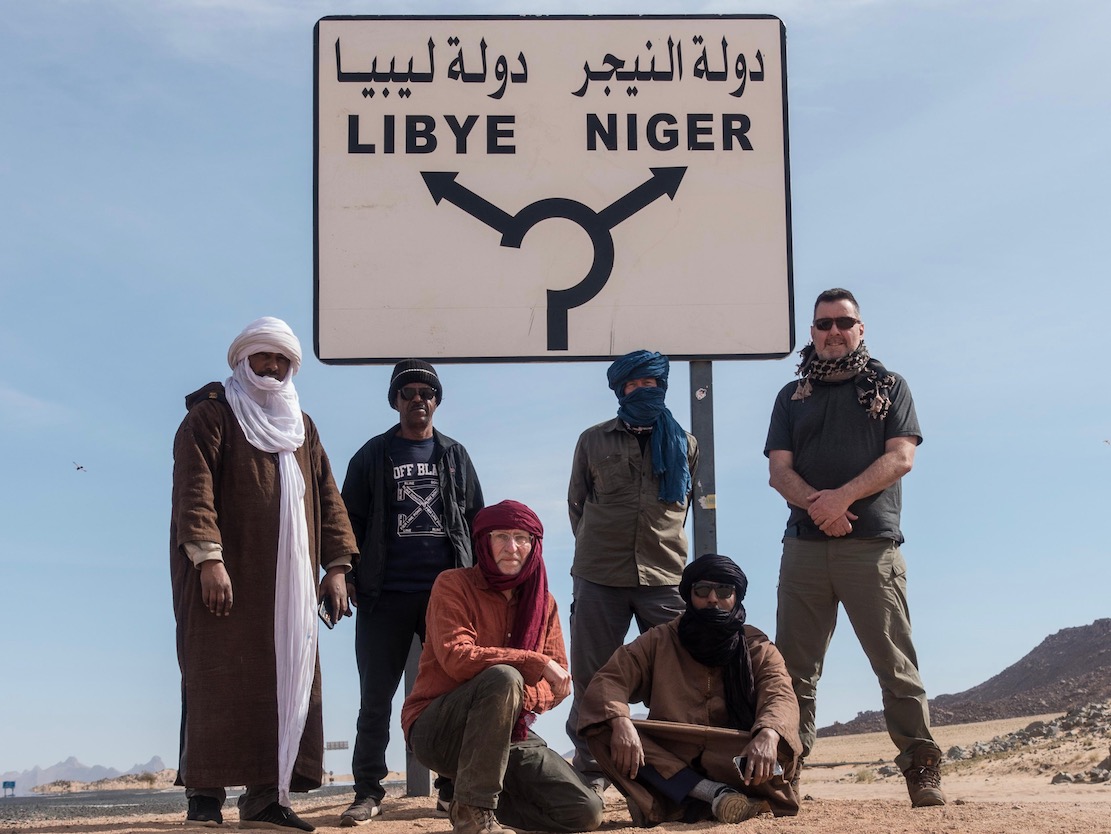
Today, an hour or two from Djanet a tarmac road leads off a roundabout in the middle of nowhere near the famous sign (left) and heads south to pass right by Tiska.

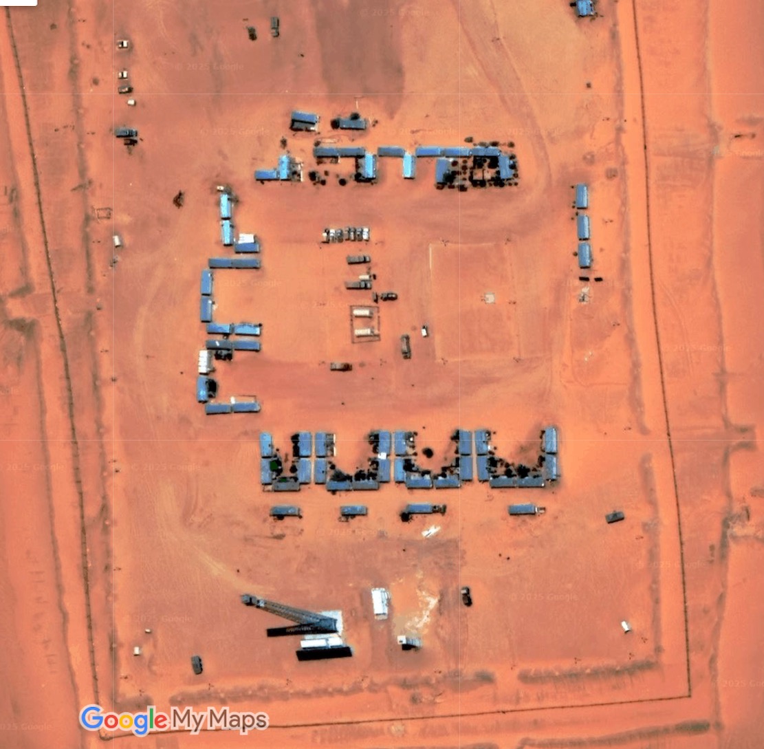
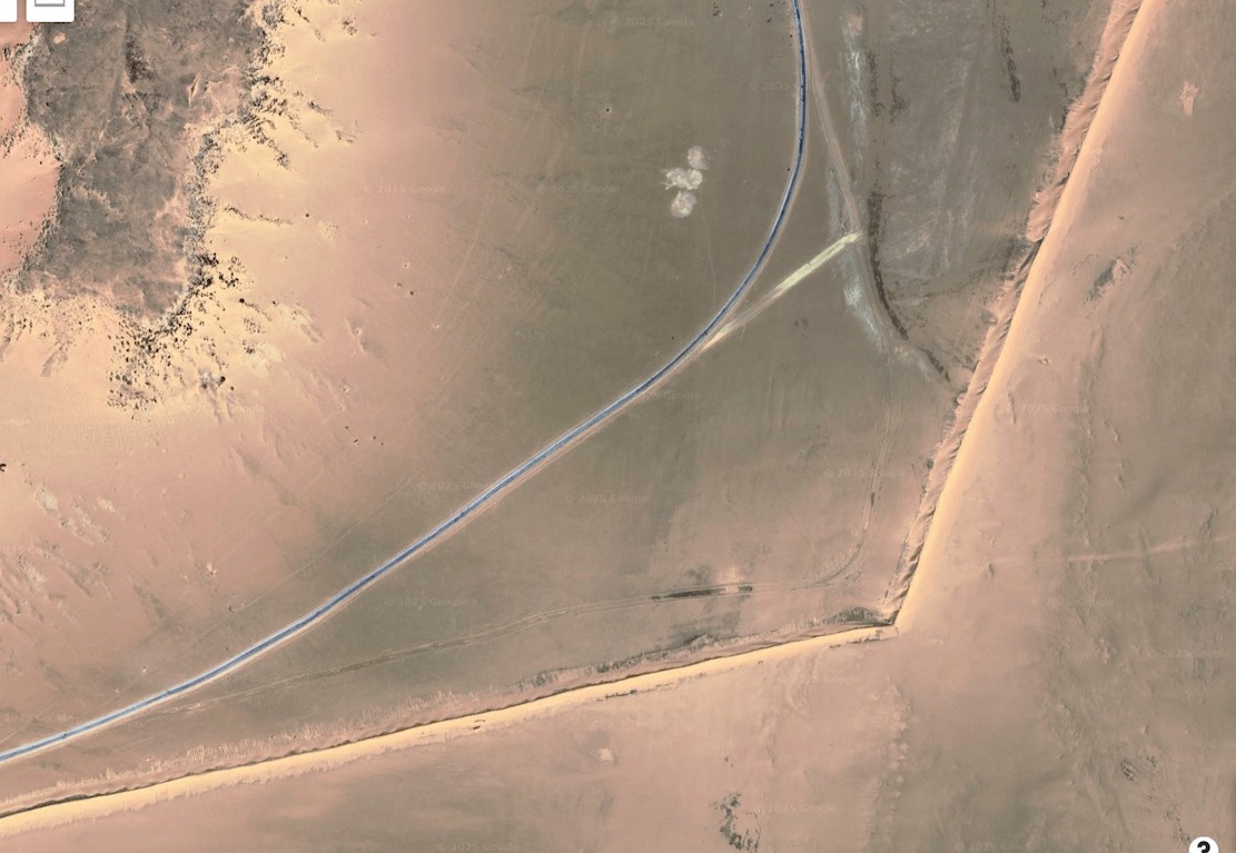
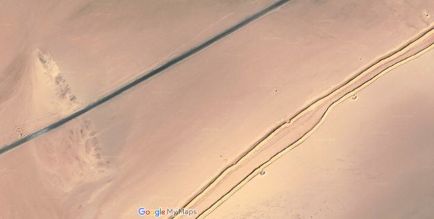
It’s part of a vast network of military roads, remote bases or perhaps migrant camps or prisons, and berms (sand walls) which Algeria has put up in the deep south to control smuggling, migration and jihadist movements.

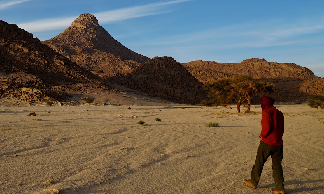
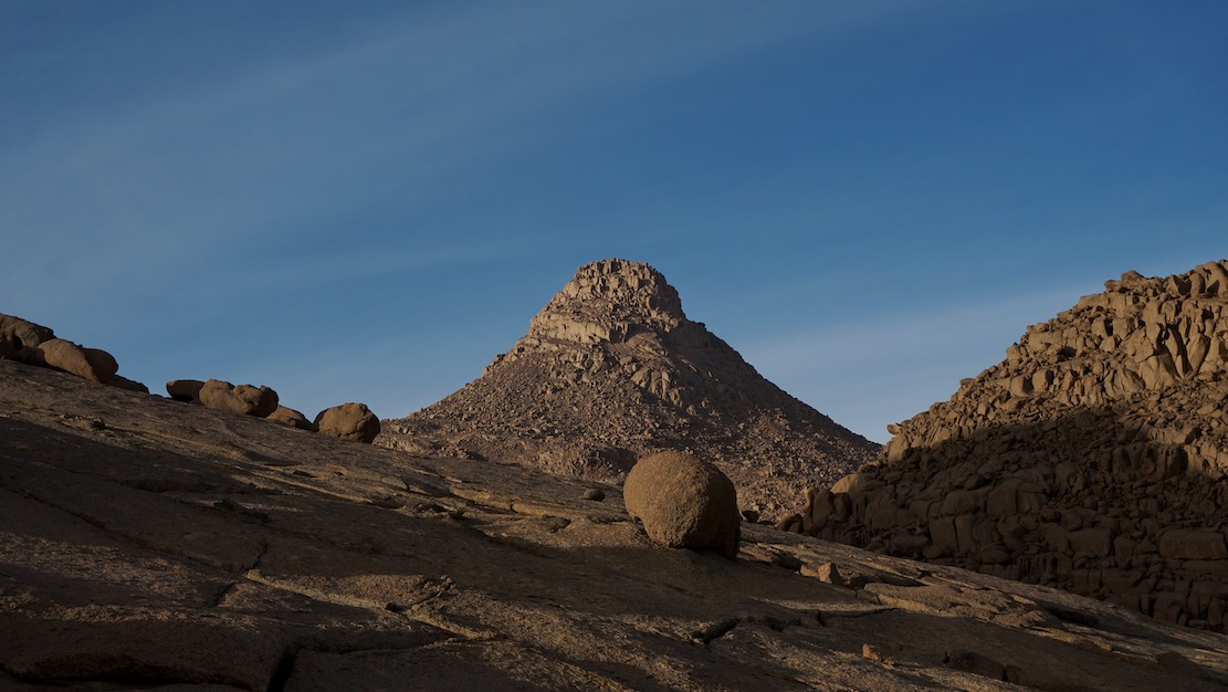
We pulled into a sheltered dip at the southern edge of the hill (below) and the cook got a fire going. Normally I’d have at least tried to climb to the top but at 500m above the desert floor, Tiska is bigger than it looks, one of the last outliers of the Tassili N’Ajjer before the ocean of sand that is the Tenere runs south to the Kaouar hills behind Bilma and the isolated Termit massif which is already in the Sahel, close to Lake Chad.

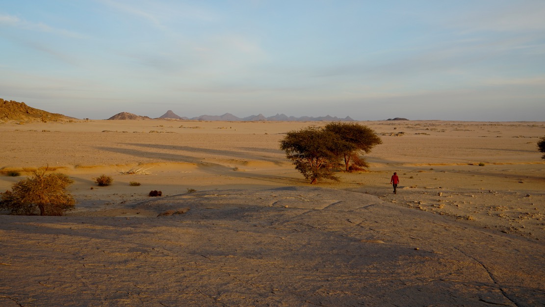
It was sure nice to stretch the limbs after being cooped up in the car for days, but it’s these cars which get us to such places. As always walking in the desert, it’s the tiniest things which catch your eye in the void.

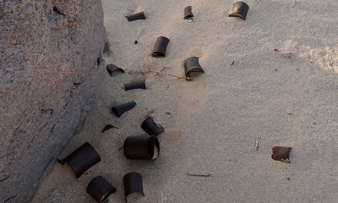
A trove of tin cans dumped by who knows who and who knows when. Anywhere else they’d be rubbish.
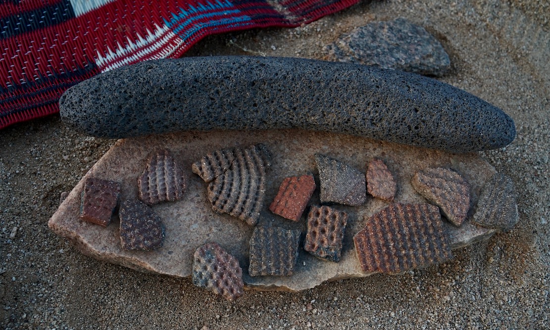
More rubbish perhaps dating back to the Neolithic era or earlier when the Sahara was less arid. Ceramic pottery fragments (commonly found) and some sort of grinding tool I’ve not seen before.
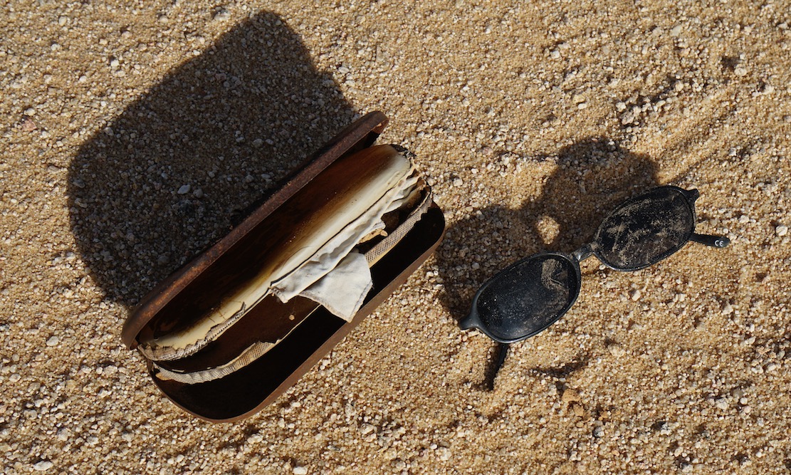
Cheap shades probably dropped by a migrant heading north to the Libyan border and a boat to Europe. Long before the current waves we met lines of migrants way back in in 2002, boldly marching over the Tassili towards Ghat.
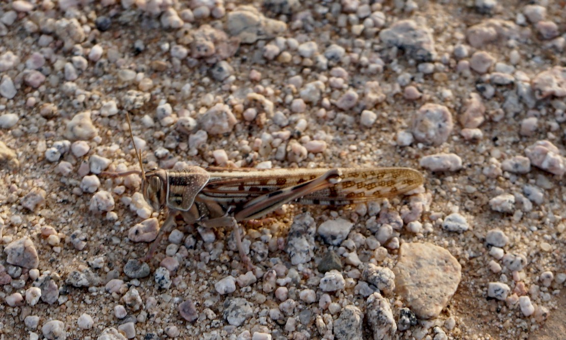
A locust takes a breather
In the foreground the balise line used to start just beyond the ridge. And on the horizon, the mass of Adrar Mariaou and the piste to Chirfa in Niger.
The granite cone of Tiska. I could run a tour in south Algeria hoping from one granite T-mountain to the next.
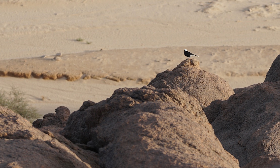
Moula Moula bird, the pigeon of the Sahara.
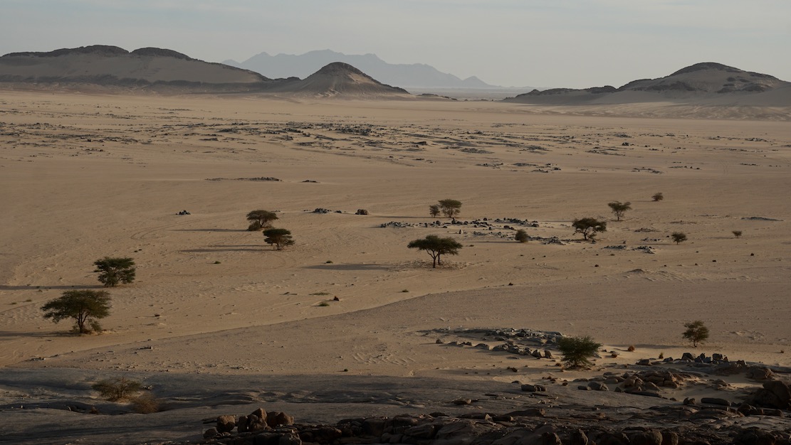
Sunset across the desert sands
Next morning the three of us set off to walk around the mountain while the crew pack up and catch us up. We carried on clockwise round the mountain, into a hidden bandit valley on the north side, and then back to the road.
Heading back to Djanet after a night out on Mt Tiska.

N55: the Road between Djanet and Tamanrasset

Updated September 2026

South of Tazat, 1987
Ideles

These two southern Algeria towns will soon be joined with a ribbon of asphalt called the N55. I was told in September 2026 that 40km remained, though it has yet to be independently verified. Soon we will know for sure.
It’s worth knowing that according to the Djanet gendarmerie who give permissions, for some baffling reason, from Djanet this road is closed to tourists, even with a guide. We drove it eastbound in 2025 with a guide with no problems. Maybe eastbound from Tam makes a difference, as you can say that from Bordj you’re heading north to Illizi, even though it’s straightforward (and an amazing drive) to carry on east to Djanet which is a dead end (no open borders to Libya or Niger).

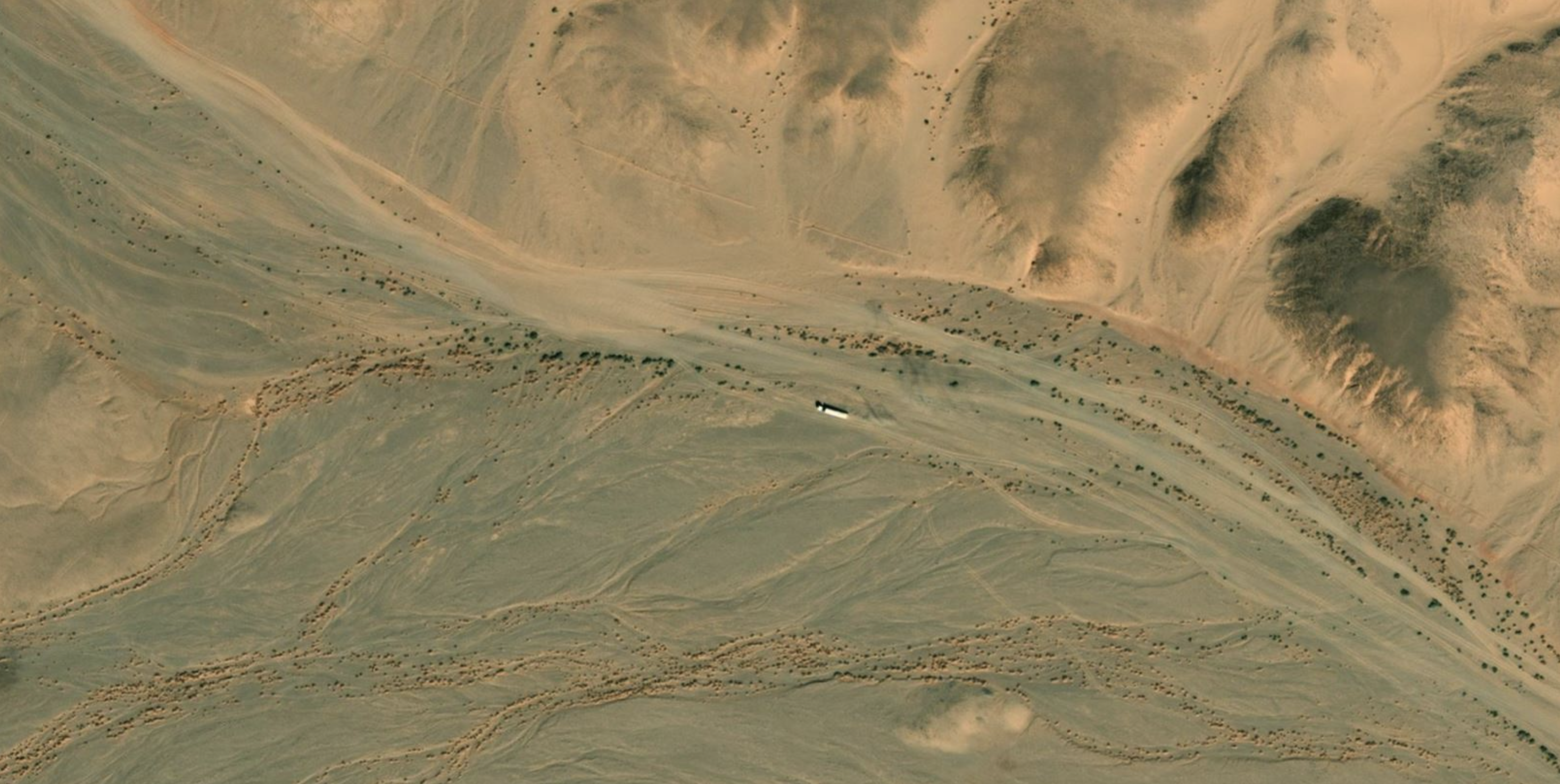
Caught on camera west of Serouenout (Bing Maps)

How the surface with survive the baking summers and pummelling of trucks remains to be seen, but that’s been an issue since they finished Trans Sahara Highway from Algiers to Tam in the early 1980s. It’s said the TSH remained intact over its 2000-km distance for just one year before flash floods, poor engineering and overloaded trucks beat the bitumen back into rubble. In January 2025 we did the full TSH too; there’s probably 100km of diversions over sand and gravel.

Djanet to Tam
This description may be out of date now but about 8km west of Serouenout checkpoint (270km from Djanet) the tarmac ended in 2025. After 24km there was a short, 20-km section of tarmac, and then you’re back on the piste south of the new road’s alignment for about 70km. Once back on the road around 24.264, 6.4864 (if not already), it’s about 80km to Ideles roundabout (fuel in town) and another 140km on to Tam via In Amguel on the TSH, or about 190km along the scenic ‘Hoggar Ring Road’ via Col Azrou and Tahifet.

Puzzled near Borne; 1987

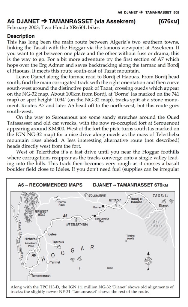
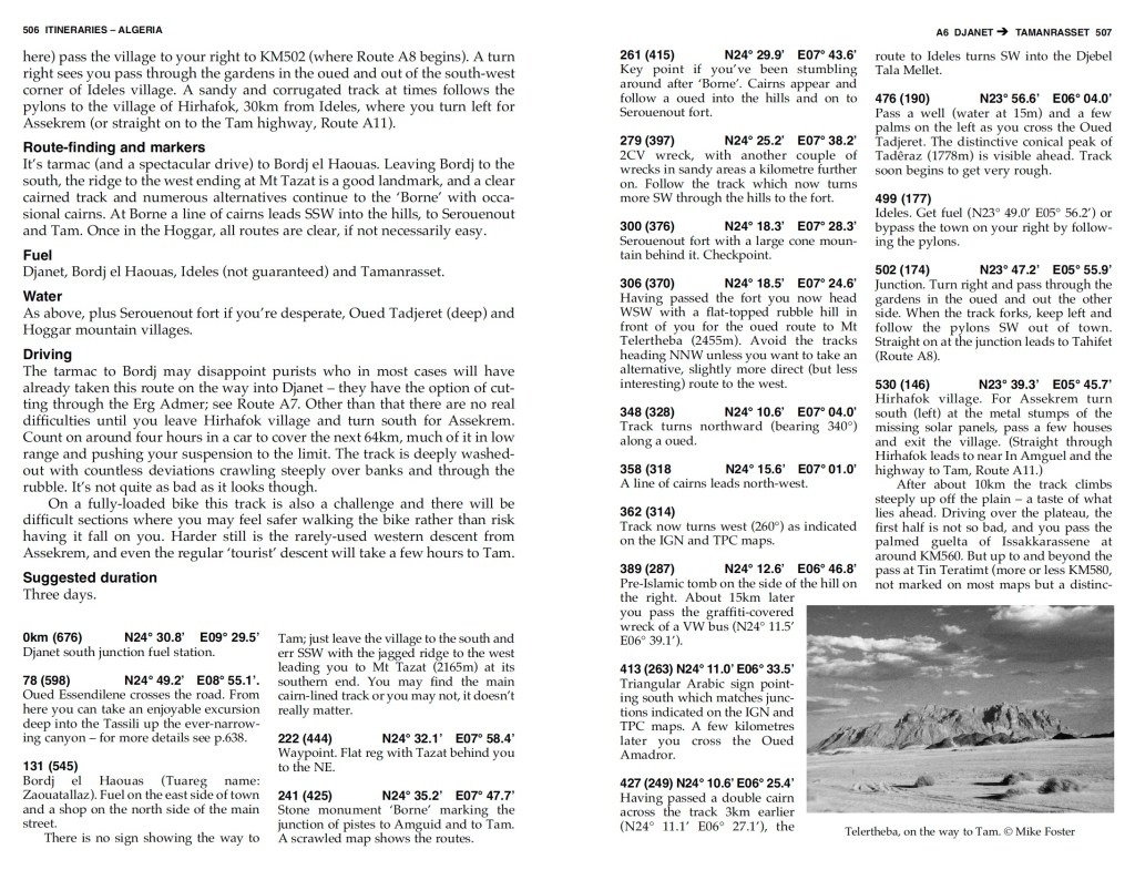
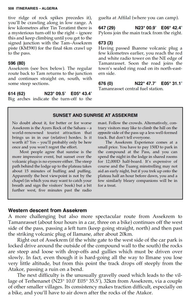
Sahara Overland Route A6
In the good years (1970s, 80s and 2000s) various tracks between Djanet and Tamanrasset and Hoggar mountains all combined to make classic multi-day adventures in southern Algeria.

Heading west on Route A6, (the current N55 road), you traversed below the ramparts of the Tassili N’Ajjer plateau, long famed for its prehistoric rock art, then either turned southwest at Bordj el Haouas for Tazat mountain (below right), or used the same mountain as a landmark after crossing the dunes of the Erg Admer (below left; Route A7),

Passing isolated volcanic cones, plugs and other outliers, the basalt rubble from the once molten Hoggar raised you up to Assekrem, a few hours from Tamanrasset and a refuel. The main route used by non-clandestine locals (A6 in my old Sahara Overland guidebook bottom of the page) was still nearly 700 kilometres or two desert nights for most. It was also on the limit of what a moto could manage alone.

Sands of the Ajjer, 1987

When I first did it in 1987, the road from the north ended in Illizi, 400km from Djanet over the Fadnoun plateau. That all added up to over 1000km and one of the best all-dirt stages in southern Algeria (above), with just enough pre-GPS navigational challenges to keep you on your toes. It was rare to pass more than one or two other vehicles during the transit.

Fallen MAN

In the 1980s the army were tasked with building a road over the Fadnoun’s switchback escarpments. Up to that point, trucks supplying isolated Djanet had to take a huge, sandy detour to the west via Amguid, nearly doubling the road distance.
After about ten years the Fadnoun (below) got sealed and today is still a great drive, even if the road is breaking up here and there and occasionally lorry drivers fall foul of the Fadnoun’s curves (left).

Gara Ihadja n Kli, one of the Fandoun’s escarpments, 2018

Morocco is famed for sealing it’s southern desert pistes faster than we can keep up, but Algeria has been catching up, only over vastly greater distances and probably with access restrictions to the military. A whole network of ‘hidden’ border highways, remote military bases as well as vast defensive sand berms (below) have emerged in recent years to control migrant traffickers coming up from the south.

Border road and berm with Niger, far south of Djanet

Even though they’ve succeeded in sealing this traverse, A6 Tam-Djanet (N55) still remains one of the great routes in the Sahara and there’s no need to follow the new road. There is A7 to the north which we also partly did in 2025, A14 in the deep south I last did in 2007, and at least one more route via Tiririne, Tarabine which we did in 1989 and again in 2006 on the way back back from Mauritania on Sahara: The Empty Quarter. For me this was all before gpx tracklogs but these routes are probably traced on OSM maps or Wikilocs. So do not be put off by the road being officially closed to tourists. As long as you (and your guide, if present) are prepared and equipped to tackle these pistes, they still offer some of the best, long-range routes in the central Sahara.

The Men Who Ride Like Goats

… until Tizi n Telouet: there, all greenery ceases; the burning breath of southern winds denudes the mountain’s rocky skeleton.
Charles de Foucauld’s Reconnaissance au Maroc, 1883–1884

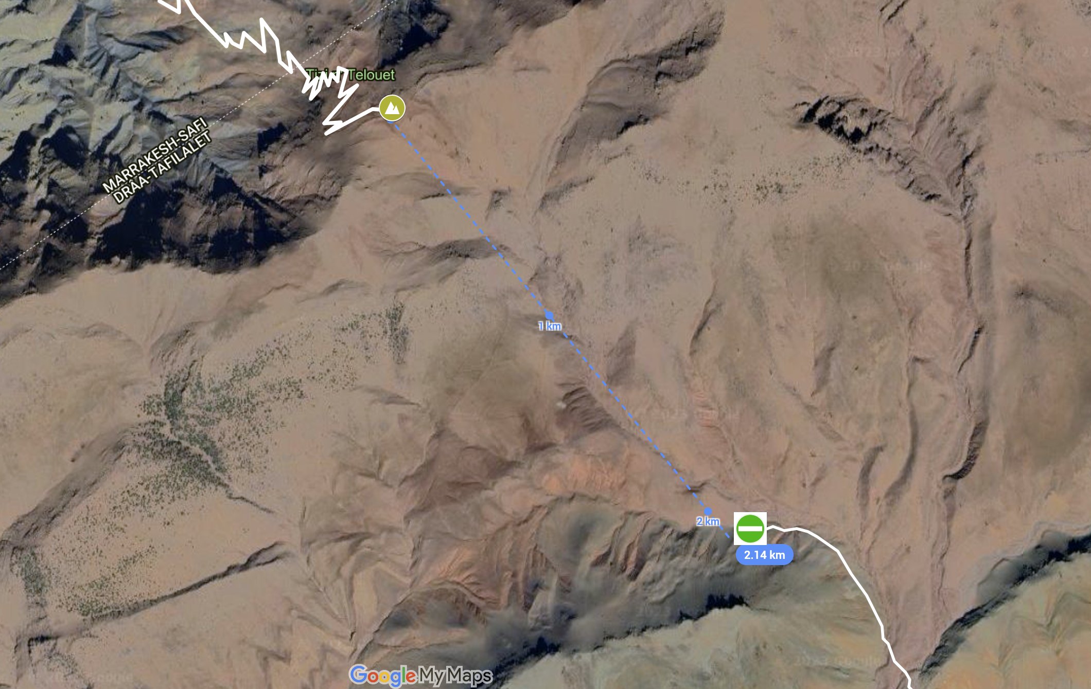
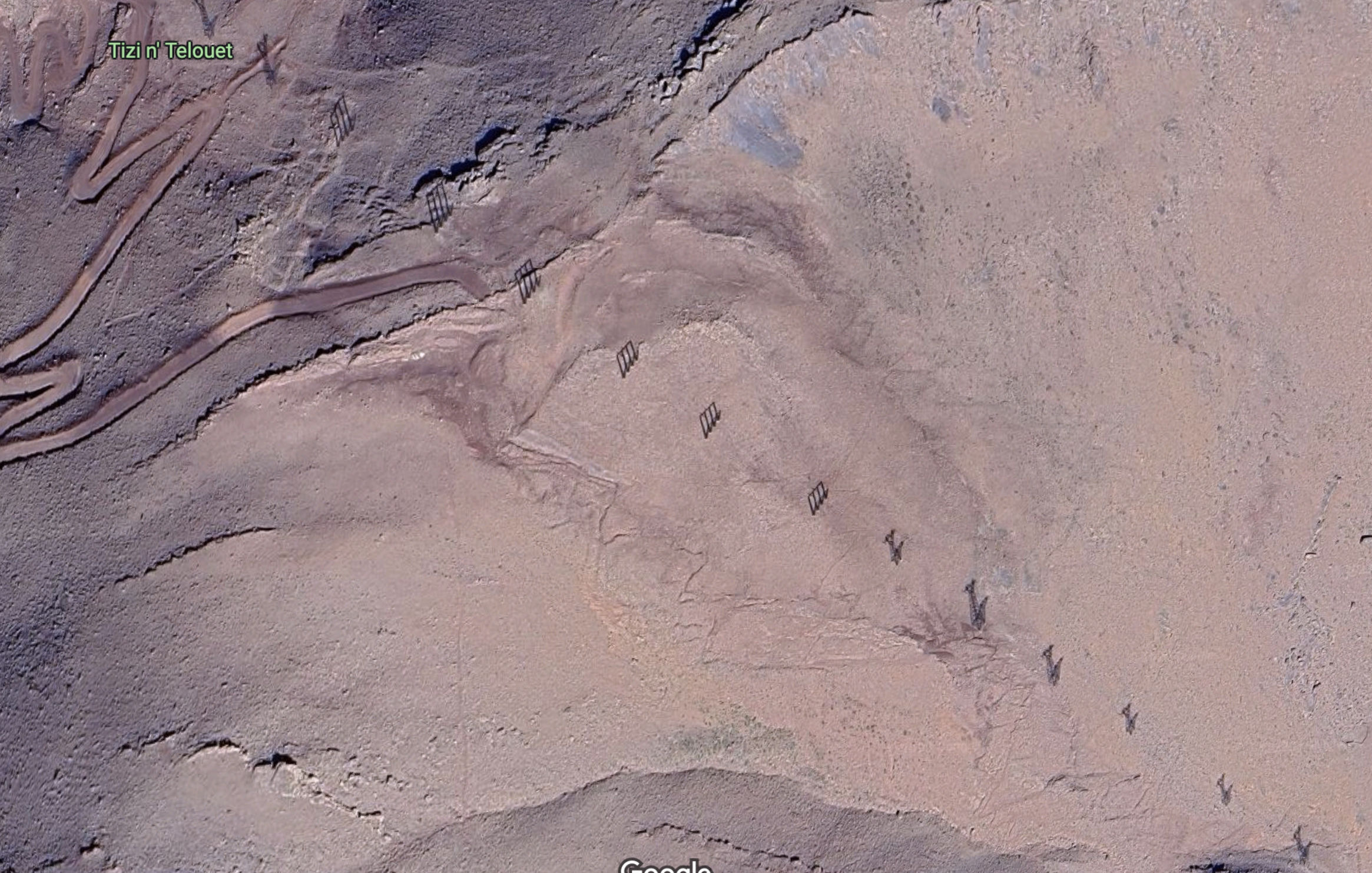
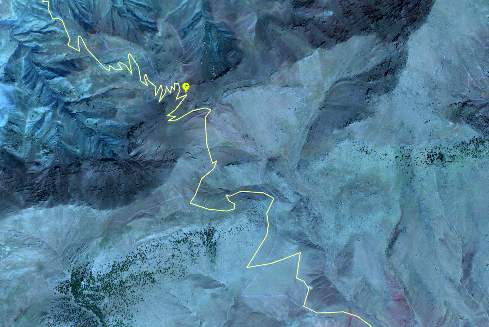
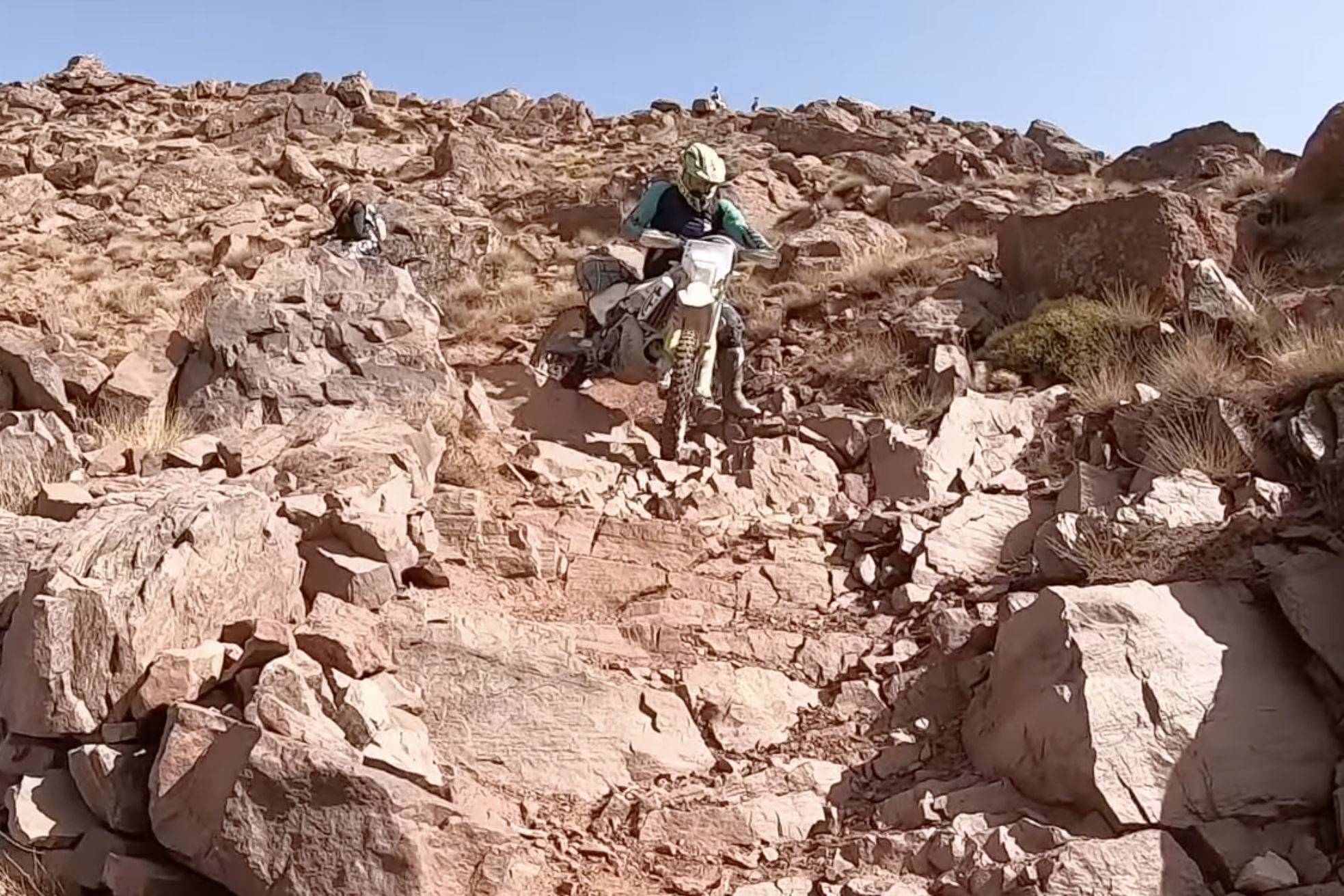
While scanning aerial mapping for new pistes in the High Atlas I came across an intriguing possibility. A seemingly good track lead 24km off the N9 via a village or two to the 2450-m Tizi Telouet pass on the High Atlas watershed (31.3372, -7.2663), a few miles east of the Tichka pass on the N9 trans Atlas. From that point southwards the way ahead was an obliterated mule path, but picked up rideable terrain in just two kilometres, with Telouet town visible nearby. Downhill on a light bike, walking where necessary, it might be doable, no? ‘Who wants to go first?’, I quipped on Twitter.

Once it was mule trains of salt from Telouet’s mines, but today, like the grand old Duke of York and his 10,000 men, a column of pylons marches up and over the col, bringing power from the massive Nour solar plant, 50km away near Ouarzazate.
You’d assume some sort of vehicle crawled up the slopes to erect the pylons, but no service track is evident on the south side. Still, at the very least, riding the switchbacks up to the col for a quick look might be possible. In my experience damage from water run-off gets less severe the higher you go, as the volume, momentum and sludge density all decrease with elevation. The real damage gets done down in the valleys.

I mentioned this recce to a mate who’ll join me out there next week. He soon found some Spanish KTM-ers – a YT channel called Enduro Aventura – who pulled off the Tizi n’Telouet descent (and a whole lot more) in 2002, filmed it all and capped it off with a tracklog on Wikiloc, classified as ‘Very Difficult’.
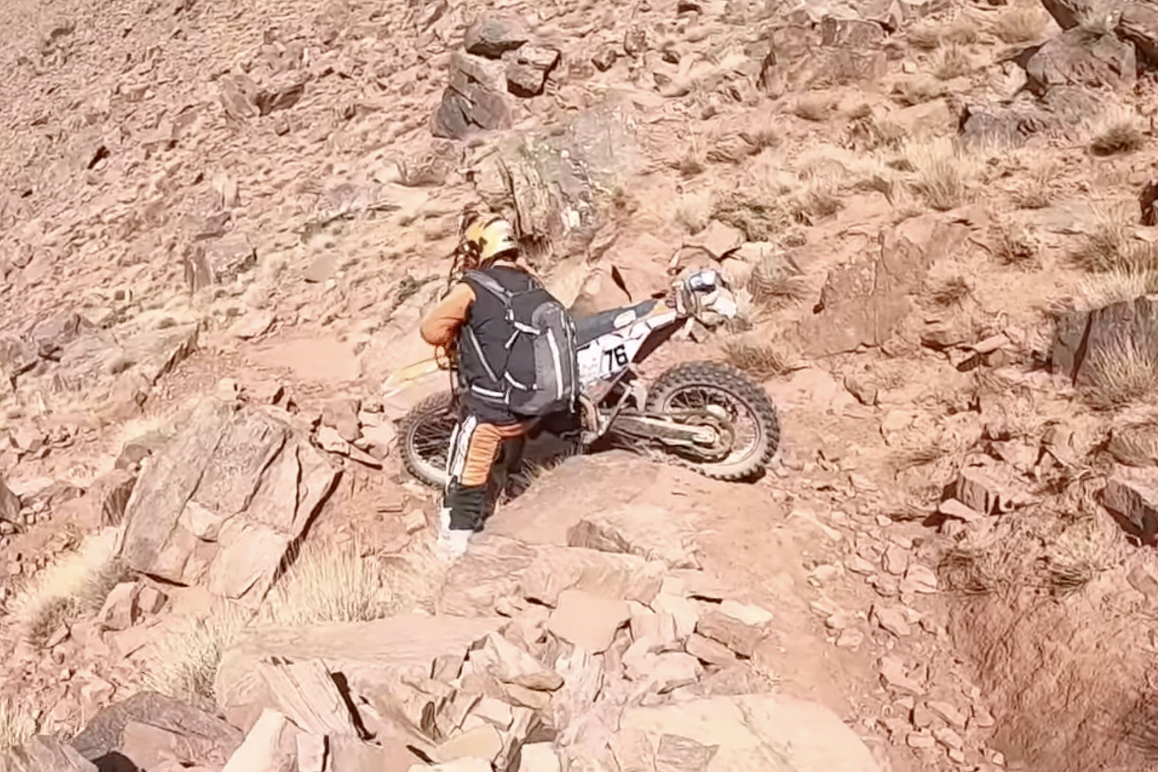
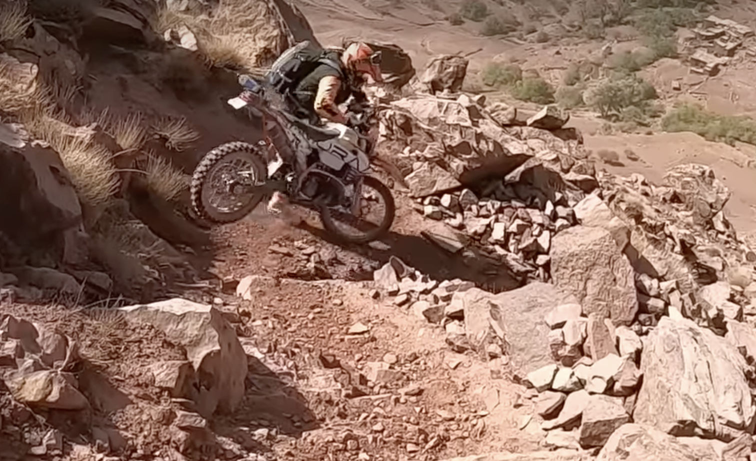
They call the Tizi Telouet ‘Collado Torretas’ or ‘tower/pylon col’? They confirm ‘the north face has been fixed with a track with a thousand curves and somewhat broken by the rain‘ but continue… ‘the south face on the way to Telouet is a narrow and broken trail with a lot of stones… This hill [trail] seems to be disappearing…‘. They speculate that a new road might get put in as the truncated northside track suggests, but I’ve found tracks or roads often come to a dead halt at provincial boundaries, which this watershed is. The col was just an efficient, ‘as-the-crow-flies’ route for the power cables from Nour to Marrakech.

On the track to Tizi n’Telouet. Though we knew we’d never manage the descent with my 300L, let alone James’ 890, we had half a mind to reach the col for a look, so took the track at Ait n Amer off the N9. We did a few clicks but realistically, it was late in the day and we probably wouldn’t have got back to the N9 before dark.

Their 80-minute vid below is timed to start at the Collado Torretas stage (covering just a few minutes). It’s soon turns gnarly af (stills above). But scan any other random minute in the vid and you’ll see just what light and lightly-loaded KTMs (including 2T) can achieve off-road in the hands of a fit and determined crew. You’ll be staggered to see what these guys blithely attempt. Chapeau to Enduro Aventura I say! The Men who Ride like Goats. Me, I think I’ll take the long way round.

Riding Sand

Just the right amount of momentum is key

As we all know, there are a lot of moto vlogging know-alls out there whose sketchy credentials don’t necessarily affect their channel’s popularity.
But in a well produced 9-minute vid on sand riding, this guy below gets it and keeps to the point. He won me over when he advised: ‘if you see a patch of sand on the road, avoid it if you can’; ‘hop off and push when you must’ and ‘you can get away with less airing down on knobbly tyres’ [because traction is innately better].
That said, I don’t know what GS12 tyres runs normally, but I was surprised he recommended two bar (29psi) on the sands. Even just 5psi less would make a big difference, but perhaps that bike’s huge weight has something to do with it. I bet there’s at least another 9 minutes of bogged-down outtakes ;-)

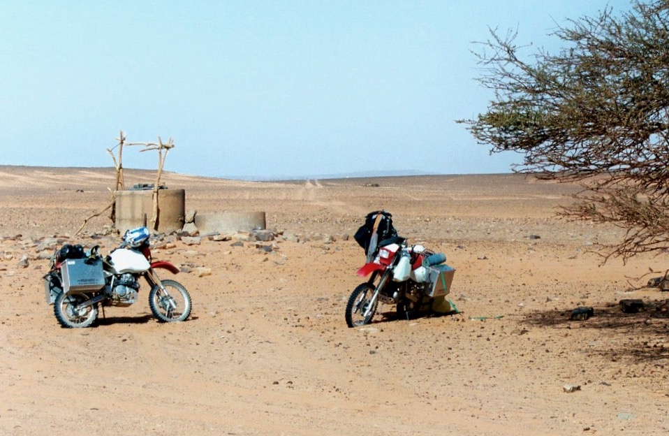
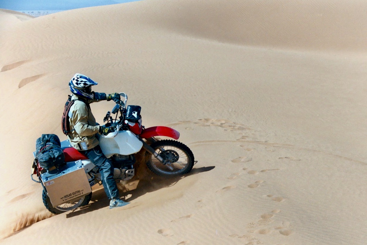
The film’s setting in a low-risk play area of small dunes drops the ante somewhat, but that’s probably where most curious big-bike riders would start – and very soon get it out of their system. Engaged in a long-distance travel adventure, like our 2003 Desert Riders trip across Algeria and into the Tenere Desert (below), I would add.

  • Avoid big dunes, where possible – it’s not a game
  • Keep out of sandy car ruts, where possible [rarely so, that’s why they form]
  • If you can’t, air down to 1.5 bar and deploy all the tips the video mentions
  • Air back up, asap (carry a good tyre pump)
  • Metal side cases? What were we thinking?! Go soft off road

Overlanding in the desert, once you add the need to keep tabs on navigation, water, fuel and energy levels, your fellow riders, and even visa durations, it all becomes quite a challenge. Which is why, without support, you don’t want to add avoidable technical difficulties when it comes to terrain. Bike or 4×4, in my experience dunes are where all the accidents happen. That’s how Desert Riders ended for me ;-)