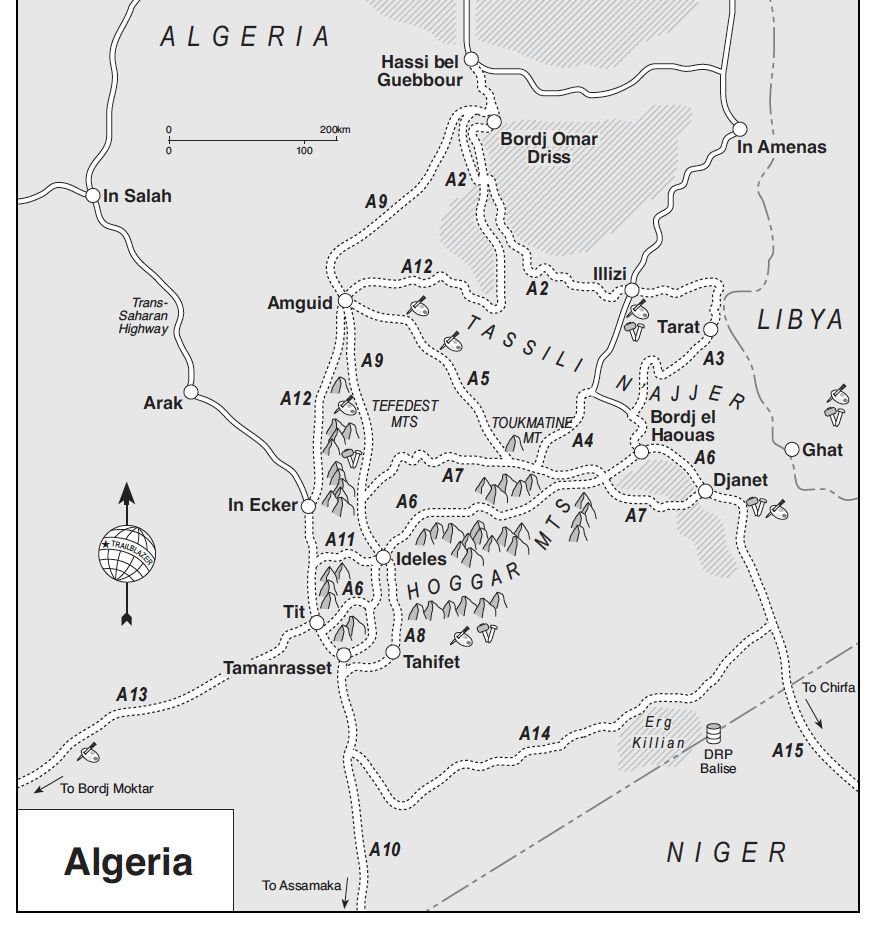
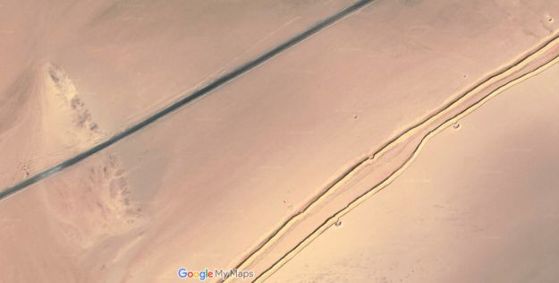
These two southern Algeria towns will soon be joined with a ribbon of asphalt called the N55. In fact it’s said in April 2026 the job has been done, though it has yet to be independently verified. It’s worth knowing that according to the Djanet gendarmerie who give permissions, for some baffling reason, from Djanet this road is closed to tourists, even with a guide. We drove it eastbound in 2025 with a guide with no problems. Maybe eastbound from Tam makes a difference, as you can say that from Bordj you’re heading north to Illizi, even though it’s straightforward (and an amazing drive) to carry on east to Djanet which is a dead end (no open borders to Libya or Niger). In April 2026 sat imagery showed the gap in the tarmac had shortened in the west by about 9km to 85km. But as said, it may all be sealed. Soon we will know for sure.
How the surface with survive the baking summers and pummelling of trucks remains to be seen, but that’s been an issue since they finished Trans Sahara Highway from Algiers to Tam in the early 1980s. It’s said the TSH remained intact over its 2000-km distance for just one year before flash floods, poor engineering and overloaded trucks beat the bitumen back into rubble. In January 2025 we did the full TSH too; there’s probably 100km of diversions over sand and gravel.
Djanet to Tam This description may be out of date now but about 8km west of Serouenout checkpoint (270km from Djanet) the tarmac ended in 2025. After 24km there was a short, 20-km section of tarmac, and then you’re back on the piste south of the new road’s alignment for about 70km. Once back on the road around 24.264, 6.4864 (if not already), it’s about 80km to Ideles roundabout (fuel in town) and another 140km on to Tam via In Amguel on the TSH, or about 190km along the scenic ‘Hoggar Ring Road’ via Col Azrou and Tahifet.
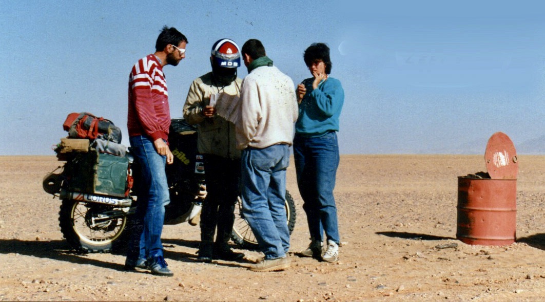
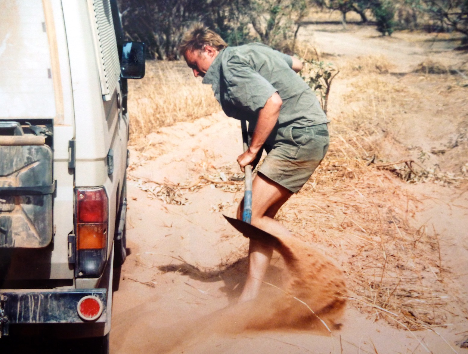
Puzzled near Borne; 1987
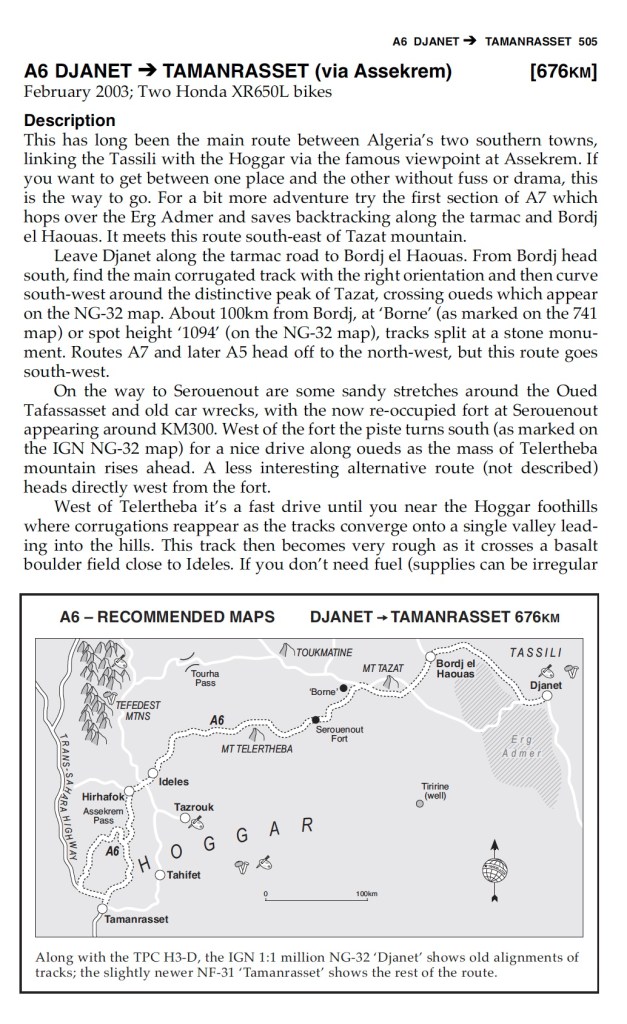
Sahara OverlandRoute A6 In the good years (1970s, 80s and 2000s) various tracks between Djanet and Tamanrasset and Hoggar mountains all combined to make classic multi-day adventures in southern Algeria.
Heading west on Route A6, (the current N55 road), you traversed below the ramparts of the Tassili N’Ajjer plateau, long famed for its prehistoric rock art, then either turned southwest at Bordj el Haouas for Tazat mountain (below right), or used the same mountain as a landmark after crossing the dunes of the Erg Admer (below left; Route A7),
Admer 1989Tazat mountain, 2002
Passing isolated volcanic cones, plugs and other outliers, the basalt rubble from the once molten Hoggar raised you up to Assekrem, a few hours from Tamanrasset and a refuel. The main route used by non-clandestine locals (A6 in my old Sahara Overland guidebook bottom of the page) was still nearly 700 kilometres or two desert nights for most. It was also on the limit of what a moto could manage alone.
Sands of the Ajjer, 1987
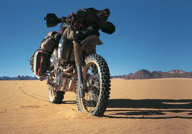
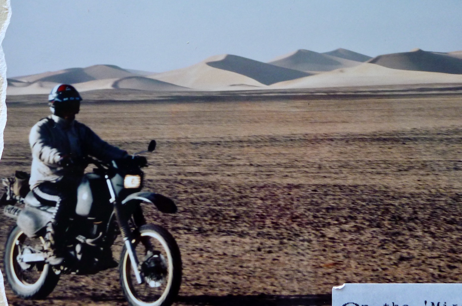
When I first did it in 1987, the road from the north ended in Illizi, 400km from Djanet over the Fadnoun plateau. That all added up to over 1000km and one of the best all-dirt stages in southern Algeria (above), with just enough pre-GPS navigational challenges to keep you on your toes. It was rare to pass more than one or two other vehicles during the transit.
Nearing Tam (1989)Descent from Assekrem (2003)
Fallen MAN
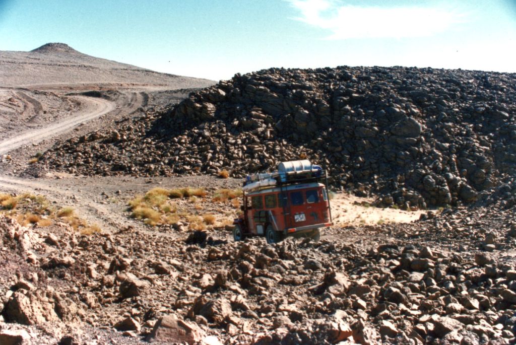
In the 1980s the army were tasked with building a road over the Fadnoun’s switchback escarpments. Up to that point, trucks supplying isolated Djanet had to take a huge, sandy detour to the west via Amguid, nearly doubling the road distance. After about ten years the Fadnoun (below) got sealed and today is still a great drive, even if the road is breaking up here and there and occasionally lorry drivers fall foul of the Fadnoun’s curves (left).
Gara Ihadja n Kli, one of the Fandoun’s escarpments, 2018
Morocco is famed for sealing it’s southern desert pistes faster than we can keep up, but Algeria has been catching up, only over vastly greater distances and probably with access restrictions to the military. A whole network of ‘hidden’ border highways, remote military bases as well as vast defensive sand berms (below) have emerged in recent years to control migrant traffickers coming up from the south.
Border road and berm with Niger, far south of Djanet
Even though they’ve succeeded in sealing this traverse, A6 Tam-Djanet (N55) still remains one of the great routes in the Sahara and there’s no need to follow the new road. There is A7 to the north which we also partly did in 2025, A14 in the deep south I last did in 2007, and at least one more route via Tiririne, Tarabine which we did in 1989 and again in 2006 on the way back back from Mauritania on Sahara: The Empty Quarter. For me this was all before gpx tracklogs but these routes are probably traced on OSM maps or Wikilocs. So do not be put off by the road being officially closed to tourists. As long as you (and your guide, if present) are prepared and equipped to tackle these pistes, they still offer some of the best, long-range routes in the central Sahara.
Rubble tracks into the Hoggar (’87)Desert Riders camp south of Tazat ’03)
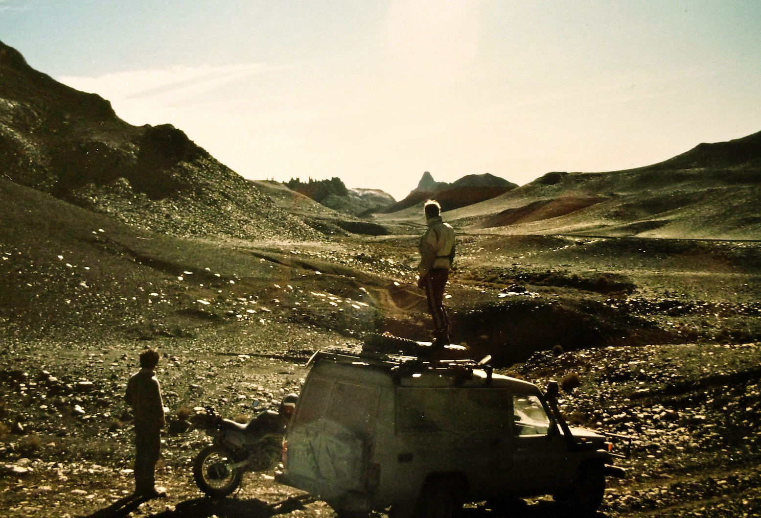
In Chapter 10 of Desert Travels the cantankerous 101 leading my first desert bike tour was stranded at the Tin Taradjeli pass (above). As so often happens in the Sahara, the next person to turn up happened to be a diesel mechanic. Steve soon got the 101 running and, long story short, the following year we decided to team up and do a big Sahara trip together: him in his Land Cruiser, me in an old Land Rover 109.
For both of us this was the desert trip we’d each been planning in our heads for years. When travelling together briefly with my bike tour the previous year, we’d quickly established a shared passion for exploring the Sahara and set about doing a big trip together, each with his own 4×4. Though I’d been keen to head for the Ténéré Desert in Niger, we’d settled on keeping off the tarmac where possible and decided to head down to the Guinea’s highland jungles and the Mauritanian Sahara.
Nineteen ninety was not such a good year for me: post bike-tour debt, a bad crash leading to hospitalisation, followed by homelessness, a smaller bike crash which at least put an end to my dozen years of despatching. And finally my Land Rover, all set for a desert adventure with Steve, blew up in darkest Sussex at 2am, while I was doing some late deliveries.
As a way of keeping the tip on the rails Steve invited me to ride his XT600Z instead. I wasn’t that keen on bikes by that time, plus it would leave me dependent on him. But I accepted his offer and we met up in France, the bike towed on its back wheel with a similar arrangement I’d used on the 101.
Unfortunately, as so often happened in those days, all my films were lost on a flight in Mauritania. Since then I’ve learned: do not put things you cannot afford to lose in the hold baggage. What few photos I have were shot by Steve.
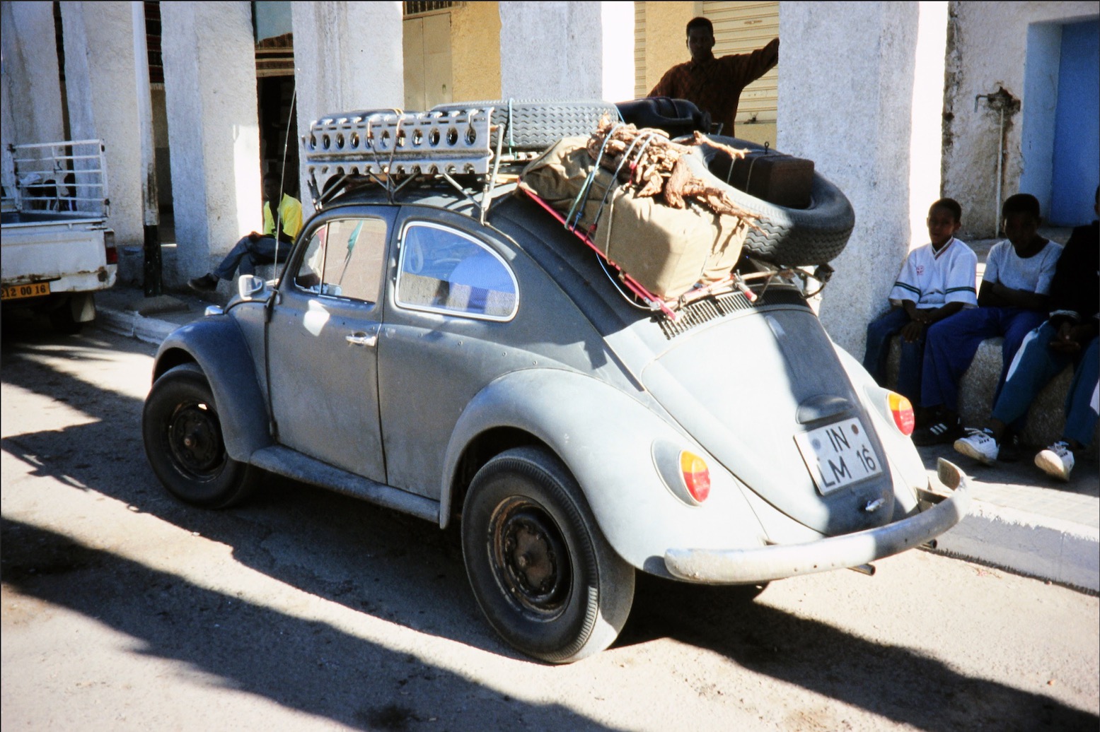
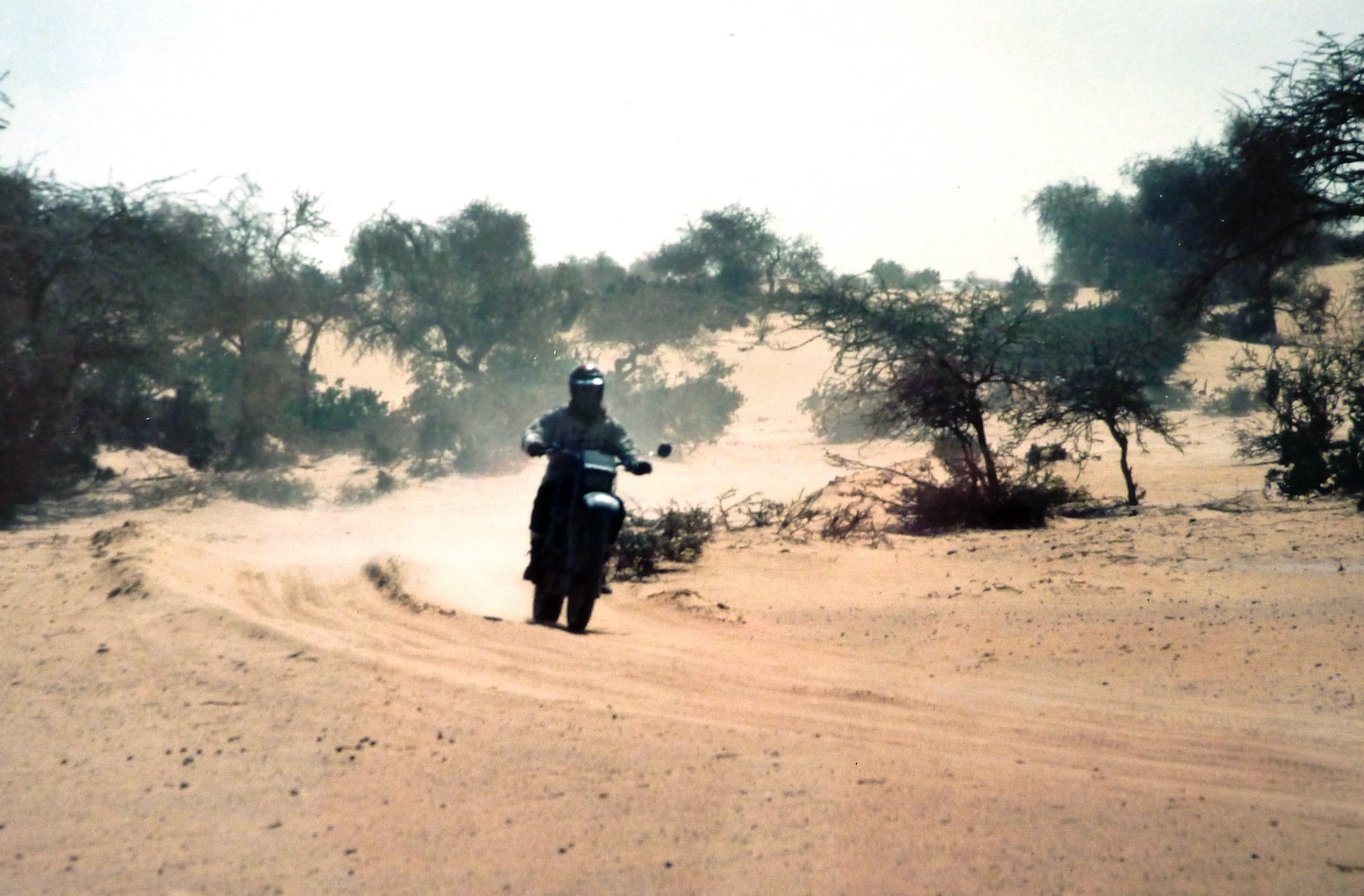
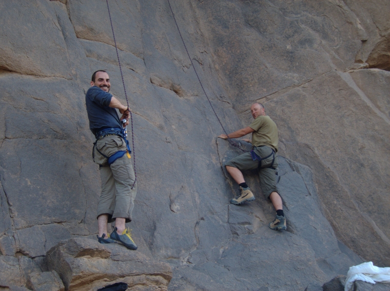
On the ‘closed’ piste between Fort Mirabel and Hassi bel Guebbour. Steve’s XT was nicely set up and of course all the essential gear was carried by the car. I’m wearing my airey, paper-thin Swedish Tenson jacket. Beyond wearing a lid, gloves and boots, the idea of wearing any sort of armour never occurred to me.On the gnarly piste up from Hirhafok to Assekrem deep in the Hoggar.I found this picture recently on the internet and am pretty sure it’s the same ancient Beetle we saw at Hassi Tabelbalet, just after the Gara Khanfoussa dune crossing on the Graveyard Piste.
“… A couple of hours later we reached Tabelbalet well on the far side of the erg and were dumbfounded to come across an eccentric German father and son in a ratty VW Beetle. Amazed that a forty-year-old 2WD had made it through the dunes, Steve confessed later that the Germans’ presence had soured his crossing…” One of the easier sections on the sandy trail along the Niger river from Bourem to Timbuktu.Tooling around in the dunes somewhere near Timbuktu where our trip was about to unravel.
‘I think I’ll head off when we get to Ségou [the next major town]. I’m not really enjoying all this riding around after you. I want to go off and do my own thing.’ I was determined to salvage the trip for my own ends. The shared driving had not materialised, the pace was ridiculous (we’d done around 4000 kilometres in less than two weeks) and everything I did was wrong or not enough. I didn’t see such a separation as a failure, it was merely the right thing to do if I was not to end up feeling resentful. Somewhere near Timbuktu. Too much vegetation for my likingGetting water in a village in the Malian Sahel.Fuelling up in Nara, just before the Mauritanian border.Digging out on the way to Adel Bagrou, the Mauritanian border post where we managed to talk our way in without a Carnet de Passages.Trackside break on the way to Nema.In Nema we picked up the Ghandi-like guide called Nani for the 800-km crossing to Tichit. Just as well; there is no way we could have found the way without him as most of the time there was no track (or he rarely followed it).Steve and Nani have a brew near Oualata.I remember this bit well – a steep sandy pass called ‘Enji’ about 300km from Nema by which time I was riding the unladen XT like a Dakar vet. When you’re good it feels like ski-ing.Enji is the plateau at the bottom right. This 1960s map shows a track, but in 1990 most of the time there was nothing but sand and annoying tussocks.Sunk down to the axle in the soft sands west of Tichit.
As agreed near Timbuktu, in Tidjika Steve went his way towing the XT, and I went mine. I met some American Peace Corps Volunteers and my travels in Mauritania took on a whole new direction.
Once in Tidjikja, I flogged my crash helmet to a delighted policeman. This time Steve didn’t even try to persuade me and drove off towards Nouakchott.
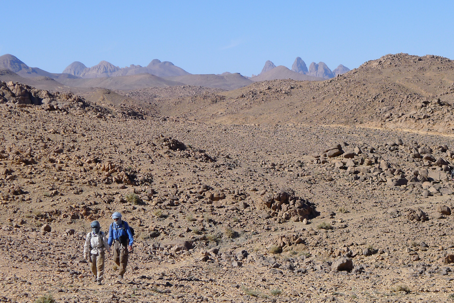
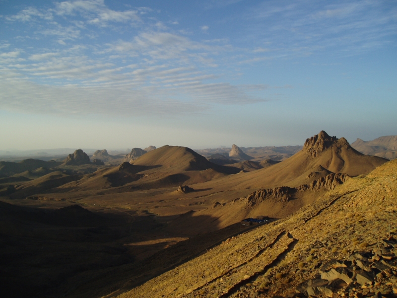
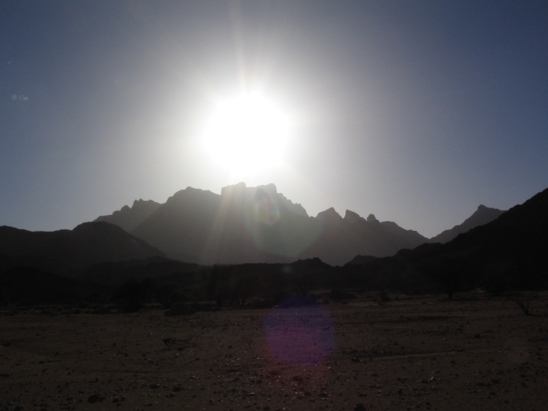
In just about the geographical centre of the Sahara lie the Hoggar mountains. Compared to the tawny sandstone of the Tassili N’Ajjer further east or the granite domes of the Tefedest and Tesnou, it’s a bleak, harsh landscape of basalt buttes erupting vertically from the barren landscape.
In the heart of the Hoggar massif is a dramatic cluster of eroded volcanic cores overlooked by the 9000-foot high Assekrem Pass, part of the Ahaggar National Park. Some maps call it the Atakor.
There are three ways to get to Assekrem: the regular 85-km eastern route up from Tam via Iharen peak. A gnarlier and slightly shorter western route which starts near the airport, then passes Terhenanet, though is usually taken as the descent from Assekrem to make a loop back to Tam as it’s easier to manage going down. Another route comes in from the north from Hirafok over the Tin Teratimt Pass (above).
Or you can follow a network of camel tracks (above). It takes a week or more, depending where your start.
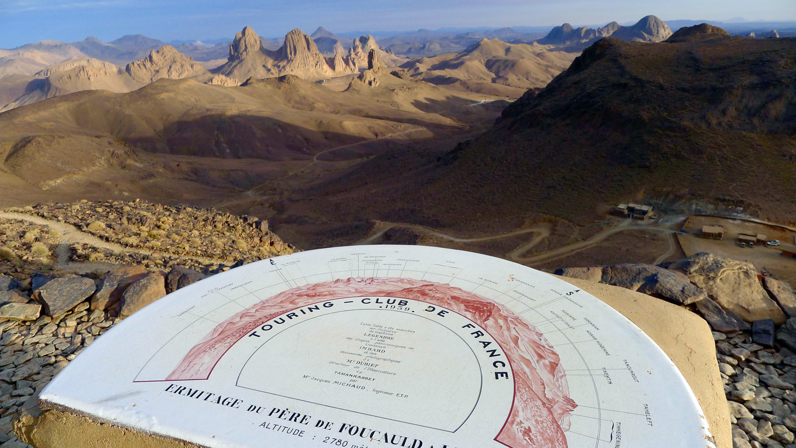
Assekrem is the best known of the many wonders of southern Algeria. A lodge sits on the saddle of the pass (above) where tourists spend the night to enjoy the stunning sunset and sunrise across the brooding volcanic monoliths from the plateau above the Pass.
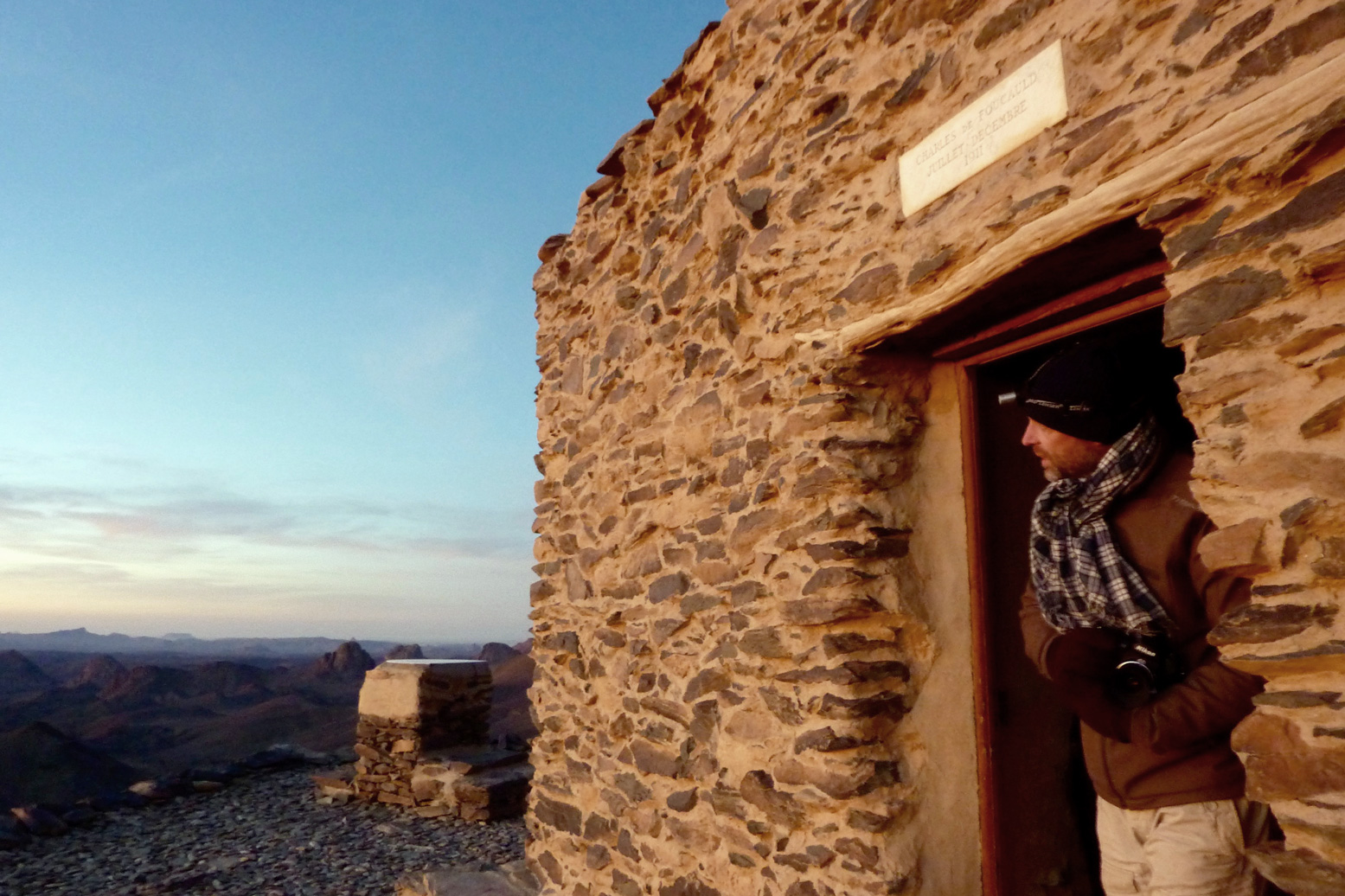
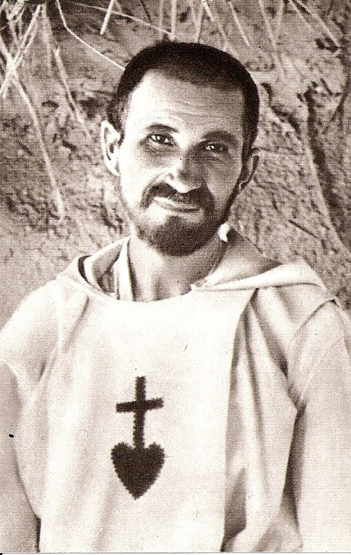
Though he spent most of his time in Tam, early in the early 20th century Charles de Foucauld, a French bon viveur and soldier turned missionary, built a crude stone hermitage on this plateau (above).
Among other things, Foucauld was responsible for the first Tamachek-French dictionary, and his house still stands in Tam. It was here in 1916 that Foucauld was assassinated as a suspected French spy, during the Senussi uprisings in Libya and Egypt. He was beatified in 2005 and the hermitage is still tended today by a couple of aged members of the order of Les Petites Frères de Jésus, who were inspired by Foucauld’s life.
Que dit Mohamed? Mohamed, il dit qu’il accepte de vous conduire ou vous voulez, du Tenere, aux Azzjers, du Mouydir aux Iforas, il crevera s’il le faut son chameau pour vous plaire; mais vous accompagner a la Garet, jamais!… Il y a des Djenouns mon Captan… Pas un homme du Hoggar ne vous accompagnera sur les flancs de la Garet…
Garet, first ascent, 1935. Carnets Saharienesby Roger Frison-Roche
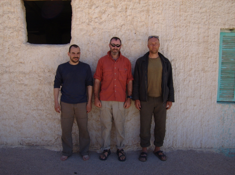
November 2005. Photos me, Jon and Nick
Jon, me and Nick-the-Cam flew into Tam to shoot Mountain of Spirits (MoS), another ageing idea of mine brushed down, spruced up and slotted into the ‘let’s do it’ category. Unable to find a cast, Jon and I worked through our inherent modesty and decided to be in it ourselves. In 2003 Desert Riders ended with me crashing out as Jon and I neared Garet with the intention of climbing it. So our film had a theme. Indeed my interest in Garet ran back to my first Saharan trip in ’82.
Tam airport car park 3am and a whole bunch of French and German fly-ins dispersed with us into the desert, to regroup a fortnight later for the flight back, some limping, some in slings, most with suntans and chi-chi headwear.
By the skin of our teeth we managed to slip thousands of pounds of camera gear and other restricted items through the scanners and past Customs, and spent the night in a house in Tam. Wanting to keep it simple and being hard men of the desert (or attracted to that idea on film!) the original plan had been to do it all out the back of a pickup; us three in the back, the crew up front. But the permit people were appalled at the idea: “Tourists are NOT goats” they exclaimed, so a station wagon was roped in. Just as well, the brief sessions filming in the back proved it would have been a rough fortnight indeed.
We headed up to Tahat (2908m), Atakor west side, for a warm-up slog into the Saharan Death Zone. It should have been an easy walk but luck – or was it the djenouns? – was against us. Lots of rain in 2005 and amazingly streams were still running out of the Hoggar. Tahat base camp we could have made at a pinch, but on up to Assekrem was washed-out (never easy at the best of times). Not wanting to lose time, we grabbed a few shots, scooted back to town and took the regular way up to Assekrem for a cozy night in the lodge and the dramatic sunset/sunrise.
The descent to Hirafok is still a spring-munching crawl at times. In places smoother than when I last did it in 2000, elsewhere cut up by the recent run-off. Still, as I was already finding, you sure notice a whole lot more when you’re not driving. Nevertheless, I was reminded that the Atakor is a grim and rough place where you’re jammed on the pistes. If it wasn’t for Assekrem being a ‘must-do’, I wouldn’t bother when you compare it to the lovely sandstone and granite ranges nearby.
By now I was gripped by le grippe and with time lost, was not fired up enough to shoot over to Telertheba (2455m) to see how far we’d get up that one. Almost certainly we would not have made the summit, first climbed by Conrad Killian in the 1920s, but it would have been fun trying. So we thought, let’s head straight for Garet and get stuck in; it was the focus of the film after all. Filming properly and not in my practiced fast-and-loose style, was taking a whole lot more time, but part of the project’s purpose was a curiosity to appraise the results of shooting a film with proper attention to detail.
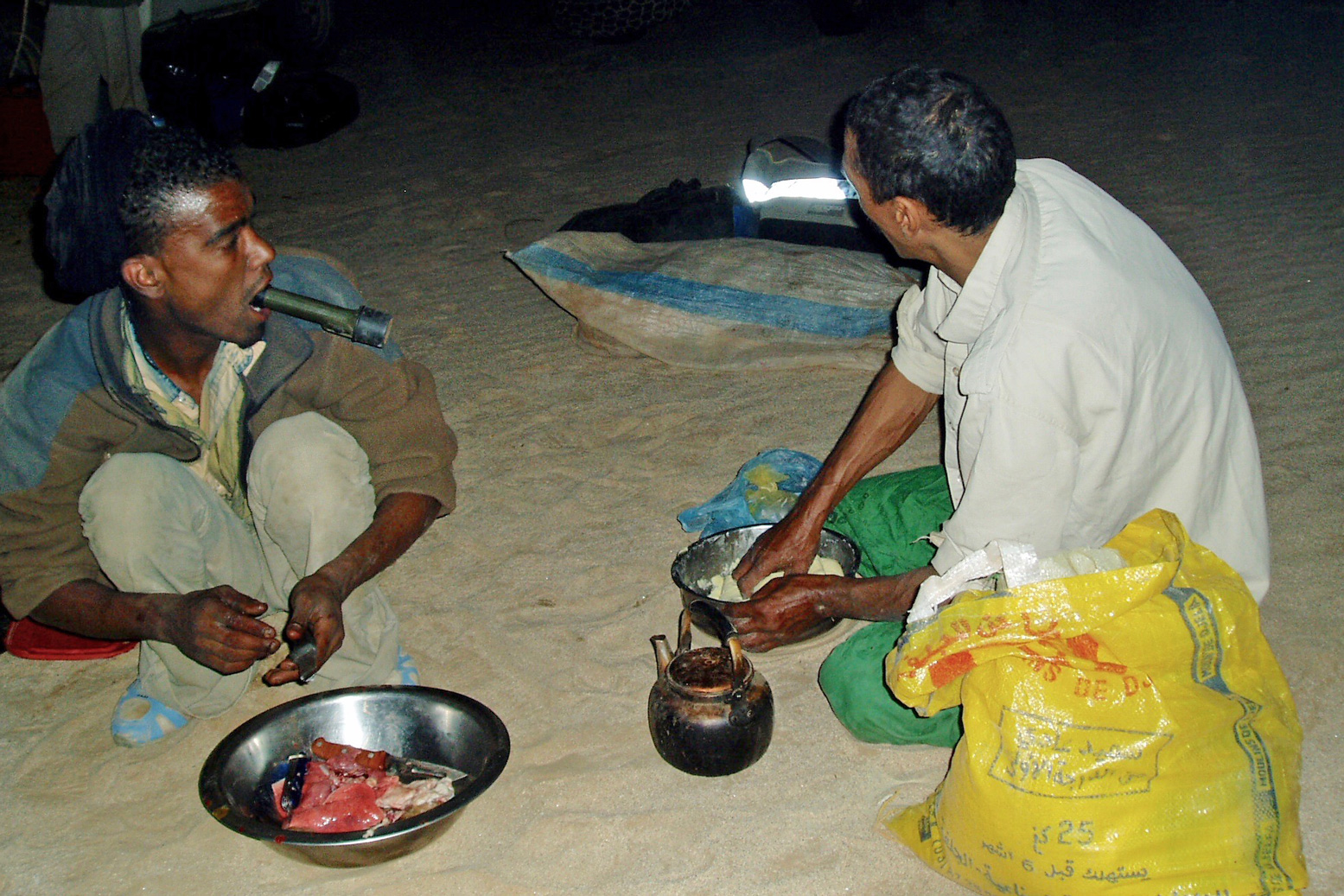
We took the Hassi Dehine piste, camping near the well. Being end of Ramadan I bought a goat off some nomads and our crew spent the the rest of the night tearing it to bits and cooking it up. The liver (or some such organ) grilled in fat-wraps was very tasty. We met up with the nomads next morning and gave them a lift to another nearby camp for some festive socialising. They all knew Mohamed our guide – or his late father, a nomad of note from the In Salah area.
It’s a lovely drive up the Tefedest west side as always and after a while the distinctive turret of Garet juts up from the ridge line. Over the next few days we ended up driving right round the Tefedest, and Garet is always prominent, even 100kms away. It may not be the highest point but, like the Matterhorn or Ayers Rock, its elemental presence casts a spell of its own.
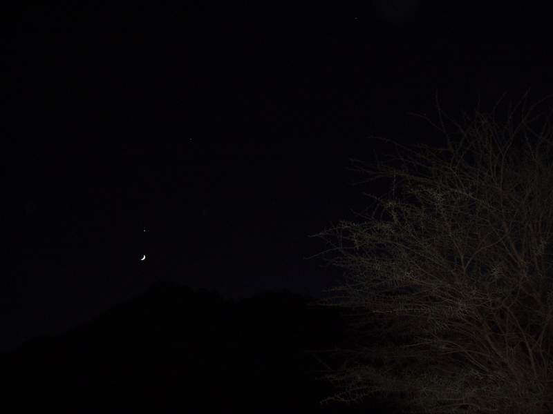
But the pesky djenoun were still trifling with us. We proceeded to spend half a day pushing into dead end oueds, failing to locate the point which I stumbled on easily with my 2000 tour group, close to the mountain’s foot. We did have an actual waypoint for a base camp attainable by vehicle, but could not get nearer than an adjacent valley, 2km away, due to flood-washed banks. Two clicks was near enough though, so that evening we set off on foot over the pass with all the water we could carry plus Abdelsalaam with another waterbag on his head. Even then, I had a suspicion water was going to be an issue and when we got to the base camp waypoint we texted for another bag to be brought up. Water was low but Mohamed knew of a well on the other side of the Igharhar valley. As darkness fell the crescent moon emerged from behind Garet’s flanks, hanging directly below Venus – a diabolical alignment considered inauspicious since before the days of Babylon.
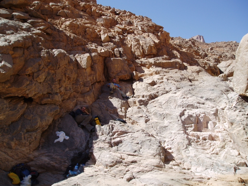
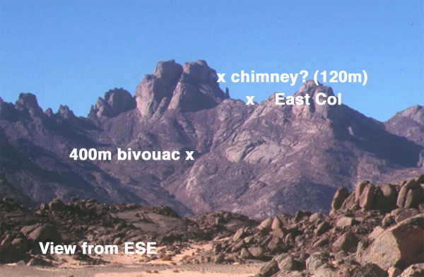
We loaded up and set off around dawn, up the boulder-chocked east oued, hoping we were following an Italian route description I’d found in a climbing magazine. It quickly reminded me of our attempt on Jebel Uweinat early in 2004 where the broken terrain at the end of a much longer approach walk wore us down. Here on Garet, we were soon hogging the shade, detesting our overnight backpacks and stopping for breathers every 20 mins. Clearly our recent colds and lack of exercise on other mountains was having an effect, added to the suspicion that this was not going to be the pleasingly videogenic cakewalk we’d imagined.
Between filming and panting it took us most of the day to get just 400m above the plain! Another 1000m of ascent over less than 2km remained, including, as far as we knew, a pitch of roping up a chimney and a traverse followed by a scramble up a cleft onto the summit plateau. A big French party had come through in April, on the 60th anniversary of Roger Frison-Roche’s first ascent (his, via an obsolete western route) so how hard could it be for a lightweight alpine-style crew? The problem (or my excuse) was we’d misunderstood the translated Italian and French descriptions: a ‘bivouac’ to which the French party had portaged water was probably the 400m height we’d just attained, not our base camp that morning. It was from the bivi, rested and replete with water, that one set out to summit and return to base in a long, 14-hour day.
As on Uweinat, water was the problem, along with the fatiguing terrain. Here, I did not want to take a similar chance and plough on regardless to the point where we’d run out of water and food to stagger back. A braver attitude perhaps, and one that can get results, but the reality of an accident up here would be tiresome at the very least; knowing when to turn back was something I’d learned on my first Saharan trip. Better to accept it as a recce and use what time we had left to nip up north to the equally intriguing Amguid crater trek.
So we bounced back down from rock to rock in half the time, picking up what we’d left on the way. There were a few gueltas, and next time I’d take a chance and tap them with a good water filter to save carrying the stuff. Back at the base camp it was getting dark and our water hadn’t been delivered, although there was a pot of still-warm rice. After a breather we loaded up and hiked back to the cars in the dark. Turned out the well on the far side wasn’t usable and now water was a priority.
Next morning we headed for the reliable nomad’s wells on the edge of the Gharis or Immidir escarpment in whose canyon’s Group 1 of the 2003 hostages had been stashed and then released in a raid. We had a good wash at the Tabariq well as a quick rain shower passed over, let some nomads use the Thuraya sat phone to get their tea on, and that night, halfway to the Foum Mahek fuel dump, the far distant profile of Garet loomed in the dusk, like a passing submarine. The djenoun were not finished with us yet.
We headed for a fuel cache I’d left among some rocks in 2002 for the Desert Riders (we never got that far). I like to think I may have even recognised it without GPS. The six jerries were mostly full – some had leaked under pressure and a plastic water bottle cracked at the first touch. This stuff had endured three summers, including the notoriously hot summer of 2003 which spread as far as Europe (41°C in London, remember…). Fuelled up and with a nice ‘cache recovery’ shot in the bag, we set off towards Foum Mahek, at last some new terrain for me.
As we ate lunch under a shade tree a pickup pulled up fast on seeing us. Smugglers said Mohamed. As is often the case, they were more alarmed by us then we were by them (same story at Kemal al Din in the Gilf, 2004). Their new Tojo pickup – bought from the proceeds of cig smuggling – still had the dockside stock numbers scrawled on the windscreen, but they were actually just ‘searching for a lost camel’. The news they had was that a checkpoint at a pass on the way to the crater was making passage difficult for travellers and was turning back tourists. A day or two getting official permission may have brought them round, but time was short and the fact that we were also carrying clearly non-amateur filming gear may have got us into trouble.
OK, forget that idea too. Looks like it was becoming one of those trips… I suppose I was overdue for one. We trudged back south along the edge of the scarp and curved round towards the highway. Next day near Asseksam well we were mirror-flashed by some nomads. No souvenir-n-scrounging ploy this, but a request to transport a sick old man to the daily Tam bus at Moulay Lahsene. No probs, it was right on our way, passing through the rounded inselbergs and bright granite sands west the Tidikmar which reminded me of our memorable ride through the Taffassasset down to Erg Killian in 2003.
At Moulay they still circle the old marabout’s tomb three times for good luck. When I first spotted people doing that in the 80s I thought they were merely hoons. For us though, it was getting too late to invoke the blessings of the saintly Lahsene to save our project. Hoping to shake off the djinns, we headed west round the back of Tesnou through more exfoliating granite domes and camped near ‘Elephant Rock’, so named by some Italian climbers who’d pegged up the sides.
Here we were free of the corrugations and run-off channels of the Hoggar and Tefedest, out in the open and felt the much better for it. Nothing for it now but to take an idle 3-day drive back south to In Amguel oued and Tam; 10 o’clock mornings, 3 o’clock evenings, exploring, lazing about, filming, even some rock climbing. It was a nice spin down to a frustrating trip.
Though there seemed little point, we shot what was to have been the spine-chilling opening sequence of MoS where a fire-lit nomad (Mohamed in a blanket) spookily recounted the legend of the lost boys of Garet, lured to their deaths by a mendacious mouflon (barbary sheep or waddan; ‘Oudane’ is the Tuareg name for Garet). Their trapped spirits were symbolised by Garet’s twin turrets.
One day near a lunchtime hill Jon found a carefully-engraved Tuareg spear head, and another day we dozed in a broad oued sprinkled with lighter-than-water pumice, flushed out of the Hoggar by the recent floods. Despite the strict protocols laid out in my book, a rounded piece of aerated lava now sits alongside the bath at home.
Another sunny evening in the dunes west of Ouassdert well, Jon and I even managed to get the dunes ‘singing’, a phenomenon I’d read and written of but never experienced. Indeed it sounded like the passing rumble of a distant propeller plane, but was clearly caused by out feet disturbing the sands. With a couple of new intros for the Desert Driving 2 dvd caught on tape, we rolled back into Tam, had a great feed and hopped on the 3am redeye back to Paris.
Bit of an expensive flop, this one, but you got to try these things and as always there was a positive side. We saw some nice new desert in the last few days west of the Highway and I was impressed with Mohamed’s enthusiasm for exploring – not the usual quick-buck/tramline guide mentality. We’ve since cooked up a couple of meaty tours for the coming year, and though a film about not climbing a mountain through lethargy and disorganisation is probably not worth the effort of editing, doubtless Garet will be in touch for another crack.
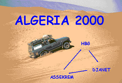
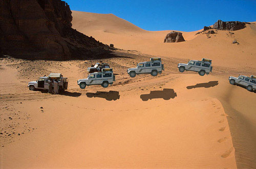
Route Genoa – Tunis – Nefta – El Oued – Hassi Messaoud – Hassi bel Guebbour (HbG) – Quatre Chemins – Gara Khanfoussa – Ain el Hadjadj – Illizi – Iherir – Djanet – Tadrart (Oued In Djerane, T-in Merzouga) – Bordj el Haouas – Serenout – Ideles – Hirafok – Assekrem – Ideles – Tefedest east (Garet el Djenoun) – Erg Amguid west – HbG – El Oued – Tunis. About 2500km off-road
Vehicles Land Cruiser HJ61, Land Cruiser HDJ80, Discovery Tdi and three 110 Defenders.
The film of this tour, Algeria 2000 (as seen on Sky TV), is featured on the Desert Driving dvd.
Ferry and Tunisia It’s still the same story on the Carthage as described in the book, hours of queuing for forms. Not all of us got our Permit de Conduire before the ship docked, but they were quickly obtained from the Customs booths once in the port.
Before that, at the police booths in the first shed it helps not to imply you’re transiting Tunisia fast for Libya or Algeria. To keep them happy make out you’re spending some time (and money) in Tunisia too. One of our group got tricked on the exchange; led to a certain bureau de change by one of the orange boiler-suited guys. Be alert, they’ll get you if they can. And another was told to pay 10 dinars for his Permit de C. (it’s officially 1d or free on the boat).
Fuel prices in Tunisia: Diesel 41d, petrol about 70d.
We covered the 470km from Tunis to Nefta in about 8 hours and stayed at the Hotel Marhala in the zone touristique west of town, opposite the Caravanserai. Half board was around 40d for two people. It’s a clean new hotel with unusually good food (but what isn’t after the Amilcar in Carthage?).
The Border We set off at 8.30am hoping to get a good start into Algeria but the border still took most of the day. The Tunisian frontier at Haouza was pretty straightforward. At Taleb Larbi on the Algerian side things move slowly. You do police forms for you and your car (white and green forms), move on to the Customs declaration (currency and valuables like video cameras or whatever you profer/they find). I was aware of the binoculars (jumelles) ban but was careless in hiding them and so they were confiscated with a receipt and returned on the way out. The others hid their binoculars better.
Each car was searched with a few suggestive jokes about whisky, but bury it deep and they won’t find it because you don’t get taken apart as can happen to locals. With your carte gris (vehicle logbook) you then fill out a Titre de Passage en Douane (TPD) form which eventually gets printed out.
Next is money changing. This seems to be a problem at Taleb Larbi. As Yves found, they claim not to have enough in the office and there’s no bank at Taleb. In our case I got 400FF’s worth but the others got only enough to buy insurance (about 200FF) and the last lot had none. It then transpired that the guy in the insurance office (‘SAA’) took FF anyway. This is probably best paid out of your declared FFs, not your stash.
While I was waiting, taxis drivers just past the gates offered to buy clothes and exchange black market money, offering around 10-20% more. If you’ve arrived low on fuel and you have insufficient official dinars you may need to buy some black to move on. The fuel station is just down the road. We left Taleb round 3pm.
At some stage of course you must buy official dinars (it looks good on your declaration – keep receipts). We did this at the bank in Debila, the first main town after the border. It had just closed but the guy saw the ten of us and generously opened up again to do a quick change for us all.
Stone throwing kids I’d read about the stone throwing villages west of the border on sahara.info.ch and sadly the reports were true. For once I was spared but the Discovery at the back got hit hard two or three times. Most of the kids wave but the ones who throw mean business as the heavy dents in the Discovery’s door proved. Had it gone through a window and struck the driver it would have been nasty. The last car is usually the target because there are no following cars to see who throws it, I suppose.
Unless you’re lucky, trying to catch the culprits or going to the police is a waste of time, but I guess that some irate tourist with a smashed window will do this some day soon and hopefully something will be done. On the ferry back I spotted a tourist car with a smashed window and heard of serious stone throwing in Kufra (Libya) and even at a local guide’s car in Dakhla (Egypt).
Laisser Passer and Gassi Touil convoy We spent the first night in Algeria in the sands just south of Touggourt (although there is the Hotel Oasis in town somewhere).
At Square Bresson (just a junction) there are masses of sand roses laid out for display. Soon after, at a checkpoint just before Hassi Messaoud we had to get our permit for the south – about an hour of writing everyone’s details down in Arabic. But the laisser passer was only requested a couple of times in the Gassi Touil over the next day or two. No one bothered with it or even passport checks south of the oil zone.
We got caught up in a military escort at the Gassi Touil checkpoint, halfway between Hassi Messaoud and Hassi bel Guebbour (HbG). It meant waiting until 3pm (or 9am) for a 100 km drive to another checkpoint or base and continuing the next morning at 10am to HbG. We were told only ‘Toyotas and fuel tankers’ must join the convoy as these have been preyed on by bandits (from ‘Mali’ or course). But while waiting plenty of Toyotas and tankers went through so who knows… It delayed us by about half a day so schedule this into your plans or go via Deb Deb (Libyan border route).
Unlike many other towns in Algeria, HbG is still the one-camel truckstop it was ten years ago. Just a couple of cafes and a checkpoint. There was no problem with us heading down to Bordj Omar Driss (stopping for a wash at the warm spring 2km from Hassi).
On the piste at last We left the tarmac at Quatre Chemins (checkpoint) and headed west along the very rough Amguid track, leaving it early down a sandy ramp towards the Gara Khanfoussa dune crossing and the 410-km-run (fuel to fuel) to Illizi. Once you find the entry point for GK and the old piste rising up over the dunes, with 1.5 bar the crossing is very easy (in our case perhaps helped by the recent heavy rains). There are many recent tracks winding their way over the easiest dunes and by following them you encounter no dangerous crests to speak of. After the first section you drive into the Gara Khan clearing and then keep on the west side to head directly south (a mistake we made when I did it ten years ago). Beware of sharp ‘crests’ as you drive back onto the old orange built-up piste on the way out of the dunes.
Once in the valley we passed Tabelbalet well (good water at 6m), tried to drive along the dunes on the east side (as advised because of flood damage on the track). But the dune banks were tiresome and we found the track OK. Next day we passed Ain el Hadjadj (ruins, good water) and followed the track right to the point where you cross the strip of dunes at around N26 38′. It helps to walk these first to work out the way through. Once you know which way to go it can be done in 10 minutes. No one got stuck except me!
From here east to Illizi is one of the most beautiful pistes in these parts, with the rosey dunes of the Erg Issaouane glowing to the north, a clear track and plenty of nomads camelling around. Just when you think it’s all over there is a steep sand slope to ascend about an hour from Illizi (waiting for GPS info). You’ll need to degonflate to get up this one – watch out for the rocks on top.
If you’re heading south via HbG then this piste certainly beats the tarmac to Illizi.
Illizi to Djanet In Illizi we were lucky enough to get fuel, water, bread and even a restaurant lunch (250d each) without getting hauled in to the police and army as Yves reports on point 11. If they don’t ask don’t offer. From here it was tarmac all the way to Djanet, covering in two hours what took a gruelling day a decade ago. We visited the village of Iherir (basic camping at the north end of the settlement – introduce yourself to the teacher, Ibrahim Kadri). The road to this canyon oasis is much improved (30 mins) and may well be tarmaced by next year.
We did the Tuareg tea thing with Ibrahim that evening and next morning went for a walk with a guide up the valley to see the guelta, gardens, rock art and the old Turkish fort (700D for our group of ten). We also left some old clothes with Ibrahim for the villagers.
Down the road, Dider looks as lovely a lunch/camp spot as ever and there is now fuel at what has become the small refugee town of Bordj el Haouas (checkpoint). You could do Illizi – Djanet in a day.
Djanet The new tarmac makes a lovely drive into Djanet – now you can look around at the countryside instead of the piste. There was no checkpoint on entering Djanet (though there were frequent night time roadblocks) or need to get permits for fuel, as before. We stayed at the only place in town: Hotel Zeribas (250d to camp per person, cars free, basic rooms around 500d) right in the town centre next to the post office. I was told the place was dump a year ago but it looked fine to me, with hot water, plenty of shade and good security. They’ll try and rope you in for a cous-cous meal in their restaurant, nothing special and overpriced at 500d pp. There are restaurants just out the door. The Hotel Tenere, miles south out of town, appeared to be closed or waiting for the Xmas charters. There’s a shadeless campsite near it, but it looked deserted too.
Guided excursion to the Tadrart I organised a guide with Agence Essendilene for a tour of the Tadrart (SE of Djanet) and Alidemma arch. We were advised that my proposed route would take much longer than planned (although a friend did the full tour a year ago in 4 days). It was a guide’s ploy to get more days out of us (a new one me!). In the end we settled on 4 days, Tadrart only at 1200FF a day. We also paid 25d per person per day in the national park at the park office/museum in town. Once we got to the Tadrart it was clear the guides were stringing out the route to fill 4 days, crawling along at times at 10kph. We would have rather driven at a normal speeds and camped early to enjoy time out of the cars, which we later did.
I was looking forward to the Tadrart but to be honest I was disappointed. The sandy drive out towards Mt Tiska and following oueds south of the corrugated Ghat piste was great (and driven at normal speeds). But Oued In Djerane was very dusty and for the price I paid, the region did not quite have the edge over the very similar (and contiguous) Akakus in Libya. Of course, unlike the Akakus, the Tadrart has zero tourists. The ochre dunes at T-in Merzouga were the highlight. Our guides Ahmed and Slimane were a good bunch of guys and, with an email contact in Germany, I may hire them again directly, at a more normal price.
Unfortunately one of our group was injured an accident on Day 3 and we had to return directly to Djanet. Amazingly the Defender nearly made it back in 2WD, at which point the severely traumatised transmission finally gave up the ghost. The doctors at Djanet hospital were extremely helpful and confidence inspiring. The injured driver eventually flew back to the UK via Algiers, with the aid of his travel insurance and looks like making a full recovery. The car was a write-off. There are no modern Land Rovers in Algeria, only ancient Series IIIs. Recovery to the coast was not worthwhile and so it had its contents and components ‘optimised’ and was left with the Customs. Vehicles cannot be sold in Algeria. The Douane huffed and puffed a bit about parts missing from their new ‘present’ (what a nerve!), but once they realise it’s more wrecked than it looks they won’t be quite so thrilled.
Telephoning from Djanet Trying to organise the repatriation exposed the near impossibility of telephoning out of Djanet, even just to the next town. The problem seems to be many new private telephones but just one inadequate satellite/radio dish. I was on the verge of driving 400km to Illizi (linked by land lines and therefore much more reliable), but had one more go at sundown – Ramadan eating time when all goes quite. However the insurance never managed to call back. So despite what I say in the book on p.276, a sat phone would have been useful here. (incidentally the hypothetically described Medevac procedure on the opposite page – outlined to me by a Loss Assessor – proved to be pretty accurate. Getting to a town/phone/hospital is the key. However, the insurance insist on proof that the claimant cannot continue the tour as well as a doctor’s report to prove they are safe to fly. This is what cost us days and why we gave up in Djanet – they could not get through).
Not surprisingly, GSM mobiles don’t work in Algeria (they do in Tunisia), but I was told that next year they will, even down in the south.
Route A2 to the Hoggar With the injured driver slowly on the mend, two cars from the group offered to help assist his recovery to the UK while I continued with the VX and Discovery to the Hoggar. We managed to get diesel at Bordj el Haouas (Ramadan shuts everything down at 3pm) and then headed south along the chain of mountains that end in the landmark of Tazat (an interesting area to explore for another time I think). Mistakenly thinking we needed to move fast to catch up for lost time, we drove from Tazat almost to Assekrem in a long 400km-day. As described in the book the junction at ‘Borne’ is still confusing and we dithered around a bit before heading resolutely SSW over confusing tracks with another lost G-Wagen crossing out bows. Soon we found the crucial cairns and balises that lead into the valleys all the way to Serenout fort (quick passport check) and on past Telertheba. Despite what it says on p.397, the southern route from Serenout (as marked on the IGN) seems to be the main way and is a lovely drive with the 2455m Telertheba looming ever larger up ahead. The sandy sections mentioned on A2 in the book didn’t cause any problems – one wonders if a flat sandy track improves with little passing traffic.
There is diesel only at Ideles from where a corrugated track leads to Hirhafok. At Hirhafok we turned south for Assekrem.
I knew this piste would be washed-out, but the closer we got to Assekrem the worse it got, to the point where one could barely believe anything less tha a Unimog could drive it. The last 50kms took 4 hours in Low Range with extremely slow and rocky going up to and beyond the Tin Teratimt Pass. From here on it was so damaged one could hardly work out the original track among the many deviations.
We had Assekrem to ourselves but there is a whole menu of prices there: parking, parking more than an hour, breathing, etc. The ‘chatty’ guy in charge tried to charge us for camping, too… To be fair it can’t be cheap to run the place and the lovely lodge is well worth an overnight (even at nearly 1000ds demi-pension) so you can see dawn over the plugs.
Tefedest East We returned down the track from hell (not so bad this time but I doubt any local would use it), fuelled up at Ideles, getting caught up with the bored police opposite the pumps for a tiresome “what’s your job, address, mother and father’s name” check. Backtracking, the turn off north for Mertoutek is clear if you’re looking for it and the track unrolls clearly, passing through some lovely spots to a turn-off at a big green sign a few kilometres before Mertoutek (as marked on the TPC). From here twin ruts lead north to Dehine and continue all the way along the east flank of the Tefedest range past the distinctive peak of Garet el Djenoun at its northern end.
The Discovery’s rear radius arm broke, probably as a result of the exertions of the previous day, and with me taking on the car’s fuel and water payload, my 61’s rear main spring also snapped a day later. The flat helper springs had also snapped off I discovered, but the second spring sort of winds round the mount so I could carry on without much problem. The other rear main spring has since broken. I never rated these two-year-old Ironman rear springs for heavy load carrying (front are fine) and will be getting some heavy-duty OMEs.
We had a day off by Garet and then continued north along the west of the Amguid erg, through the pass and northwest back to HbG, a clear if corrugated track marked with oil drums much of the way.
This is a lovely way back north, easy to follow with no GPS needed – 710kms from Ideles to HbG. The last 150km are a flat and dull and after the final rise, the eastbound track back to 4 Chemins is very rough but can be avoided by going via Bordj Omar Driss, I’m told.
Back north We just about managed to wangle our way out of a return convoy north, and continued slowly with the four-wheel steering Discovery all the way from Gassi Touil to Nefta in one very long day. Getting out of Algeria took two hours with no searches or money checks (the same as years ago), just very slow-witted officials at Taleb. At Haouza they asked for Green Card insurance (a first) so those without had to buy a week’s worth for 10Td. After 1200km of hairy handling with just a winch cable and a chain holding the axle in place, the Discovery got its radius arm welded in Nefta and we met up with the rest of the group at La Goulette for the ferry back to Genoa.
Weather Following the severe October rains west of Illizi, we were blessed with no daytime wind and amazing clarity the like of which I’ve never seen in the Sahara. You just could not help staring in amazement at the crisp profiles of the ergs and the mountains. Temperatures were mild too, even at 1800m in the Hoggar it only dropped to 7C.
We also saw plenty of dorcas gazelles which I’d never noticed before and of course thriving Tuareg nomad activity here and there which, along with the famously diverse landscape, is what makes Algeria so special.
Conclusion While it was a shame not to be able to complete the tour with the whole group, Algeria is as good as I remembered: the desert has plenty of tracks, as easy or as hard as you want, and all without excessive hassles with guides or permits. I would not choose to visit the Tadrart again, instead I’d rather explore places like Erg Tifernine and Tihodaine, and the Tazat and Tefedest mountains, as well as more southern routes linking Djanet with Tam. This will be the basis of my 2001 tour.
The most tiresome element is, as always, border stuff on the Carthage and at Taleb, but then if it was easy everyone would go here! I met Gerhard Gottler on the ferry back, updating an old Algerian guide and preparing a new Sahara-wide guide (in German). He agreed the southeast of Algeria is the ‘fillet mignon’ of the Sahara. With one easily obtained visa you get a lot for your money in Algeria, and you can always spice things up by pushing further south to the Tenere in Niger.
While the north and the far west may be risky, security in the southeast was never an issue. The gendarmes bombing around in their green Land Cruisers (a cut above the average army and police) inspired confidence and greeted us warmly, as did everyone.
It was a full, two-day drive from Bit Outene at the end of our 12-day Immidir trek to the base camp east of Tam airport for our walk up to Assekrem (map below) and down again. On the way we overnighted at Erg Mehajibat (left) and stopped off for some wafers and fizz at Arak where we said goodbye to Mohamed our Immidir guide. As always, these are curt, brief affairs, but he knew we’d all had a great time with him and his crew who were now trekking back from Bit Outene with the caravan, about a week’s journey.
Just before Tam airport we were met by Ben Kada’s boss, another Mohamed, who had more juice and biscuits for us – a nice touch. He invited me into his pickup and within an hour we were dropped in a oued to meet the new Kel Ahaggar camel crew and set off scratching around for firewood which would be lean in the Hoggar. As expected, it was a freezing night at 1550m (left) and we set off next morning along a oued leading north towards a piton of rock alongside a massif, one of the many column-clad volcanic plugs which give this central core of the Hoggar – the Atakor – its distinctive look.
After an early lunch (left) we continued our climb onto the evocatively named Plateau of the Sky Wind, composed of basalt rubble the size of baby’s heads. As with many mountain treks, we gained our altitude in sudden steps rather than a gradual ascent. The Sky Wind in turn led to our camp for the night (left), a nest of tan, granite boulders overlooking the cone of Adrar Hedjrine. Compared to basalt, granite is a much friendlier rock to spend time on. Once our pitches were set and with little firewood, we hunkered down under blankets, solved problem of Middle Eastern politics once and for all, and waited for another great dinner.
We stayed on the granite next morning as Honi our guide led us up, over and down into a basin called The Palm (left), from which we scrambled back out to rest under a smooth-lipped cave adorned with pre-historic cattle images. I can’t say I recall seeing rock art painted on coarse granite before, but supposing it was at least 5000 years old, it had lasted well. I always understood that ochre and other pigments survived so well on sandstone because of a chemical bond with the rock surface – could it be the same on less fine and less porous granite? We continued our scramble and emerged on another ankle-testing basalt plateau at 2000m (left). Below us the caravan passed along an easier route and led us to a palmy spring of Tin Amelout in the Oued Amsa for lunch.
As we washed and waited to be fed, a group of camels including a mother and her calf wandered by. The young animal was duly snared, knocked down and trussed up with much commotion, and then branded with a bar. Initially I thought this was an opportunistic grab of an unbranded ‘cleanskin’, but it turned out the mother shared the brand of our caravan’s camels, so the crew were just marking what was theirs.
Back in the Immidir I’d mentioned to the group that our Ahaggar crew might be more tourist savvy or weary than the Ahnet bunch, because in the good years this route would have been frequently taken by tourists. Honi, his young son, brother and brother in law were old timers with the agency (unlike the Arak crew), but for some reason they remained a reserved and occasionally unfriendly bunch, as in sneering: ‘Are you looking for something?’ as I helped unpack a heavily-loaded camel at the end of a day. Even Tayub who was from around here, knew the crew and had done this route 40 times, was more reserved. The cause of all this perplexed us but was either low pay or just tourist fatigue and boredom. It certainly wasn’t us who, after a fortnight in the desert, were an undemanding and acclimatised group. As on previous occasions, it was clear that they got the gist when we talked about this [in English] and occasionally made an effort, but really their heart wasn’t in it, unlike the Ben Kada agency itself or the guys from Arak.
The odd staging, with early or very long lunches also took some getting used to. We concluded that we were following an easy, ‘starter’ circuit aimed at recently flown-in tourists, and not hardened desert vets like us. The glum crew, dearth of firewood, occasional rubbish and car tracks, plus the sometimes bleak surroundings took the edge off the walk, but as a well-bonded throng, we took it all without complaint because it sure was better to be walking out here in the Hoggar than most other things.
After lunch the guides hooked the mother and newly branded calf onto the caravan and tried to shoo away the other roaming camels who’d lost part of their troupe. Even that evening at our camp by a chilly guelta of Talmest, the herd stalked us from the ridge top, like Apache’s about to attack. At one point the young calf escaped its tether and made a dash for the ridge, but was chased and retrieved by Honi’s 18 year-old-son. As in the Immidir, the ways of camel trekking were being passed down to the next generation. With tourism crippled year by year, whether they’d get as much of a chance to put it into practise, like their aged fathers, was another matter.
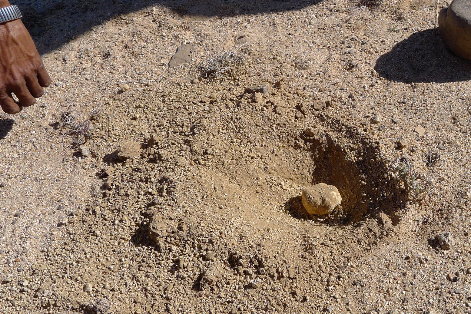
Flowering Sodom AppleDesert truffle
Cooler, less arid and twice the elevation of the Immidir, there were a lot more flowers (left) up here in the Hoggar, even though we were told it had not rained since the summer. I don’t know what any of them were but we were told it was the reason the hobbled camels set off up the rubble clad hillsides for a nibble every chance they got. At one point, after burning some plastic rubbish he came across, Honi stopped at a bulge of sand and carefully dug up a dense mushroom which I realise now was a truffle (left). Within a few minutes he had a few more and pointed to where rabbits had been digging others up. Just as he said that, a big rabbit or hare broke its cover and dashed off. I’ve never seen one before out here. Grilled on coals, the mushies made a delicious snack in the lunch oued an hour or two later.
That night’s camp at around 2200 metres was a grubby oued just short of the Assekrem track. This time we scoured the vicinity for scrub to burn, and using the oued bank wall, managed to keep ourselves warm under blankets (left) until Tayub brought over the dinner. Once the tea was served, we all made a dash for our sleeping bags.
Jackals howled overnight but by lunchtime next day we were at a cleared patch of ground by a small ruin, just below the col of Assekrem. Clearly it wasn’t going to be too balmy here tonight so we figured we’d earned a night indoors up at the auberge on the pass – all the better positioned to strike out for sunset and sunrise duties, too.
Up on top (left and below) a rowdy bunch of Turkish tourists were also enjoying the spectacle. Some of the world’s well known touristic wonders can lose their magic or be over-rated, but for me, like Ayers Rock or Monument Valley, Assekrem is no less amazing, even if you’ve been here half a dozen times. As expected, the ordinary meal we got back down in the lodge underlined what a great job Tayub our cook was doing in feeding us off the back of a camel for weeks at a time.
We all bundled into one room while the Turks sang and hollered till the early hours – and then before 6am the dedicated hauled themselves up again to stake their claims on the dawn. I took off up the rock opposite the hermitage (the lump on the right of the picture, left) where most go, sat myself in an enclosure against the wind and fired the camera into the primeval scene emerging from the night. I can’t say this vantage point is any better then the usual one, except that you’ll probably be alone.
After brekkie in the lodge, we traipsed back down to the caravan camp as arranged, but they were having a slow morning and the camels were still all over the mountainside (right), looking for those flowers. Once they were eventually brought in and loaded, we backtracked from Assekrem and set off for the three day descent, along a steep valley peppered with more flowers. Narrow clefts led over thick pools of ice, and out onto a plain we passed a nomad camp. As the day ended we set down in another oued with the Atakor’s spires behind us (left) for another freezing night mitigated by a bush scrub fire. A changeable wind rose after sunset and by 4am it was howling a gale. The empty tent I was using as a windbreak flapped remorselessly, making a racket; in future I’d be better off just huddling down under a quiet blanket like the nomads.
The secret of a good group is that they remain cheerful even after a grim night where few had slept well. Some had crawled in to share tents, and others had their tents snap over them, making an even worse din. Breakfast was delivered with stuff flying past and we then set off down the valley. Soon we joined the main, eastern arm of the car track to Assekrem which we followed briefly and then turned off at the twin ‘Mac D’s’ arches for the guelta at Afilal.
I’d never stopped here before. I think I tried to once but was shooed away by the army. Even then, I assumed it would be a grubby, rubbish-strewn dump, especially if army were camped nearby. In fact the Ahaggar national park guardian based there in an old portacabin was thrilled to see tourists and grabbed a photo with us for his next newsletter while behind us volunteers (or possibly miscreants) lethargically collected rubbish scattered around the main guelta. In fact there’s a lot more to Afilal than that waterhole and with Tayub and the lunch camel alongside, we followed the source downstream past trickling waterfalls, deep green pools and smooth, flood-washed granite until we found a wind free corner for another great salad lunch. I’ve never seen so much running water in the Sahara.
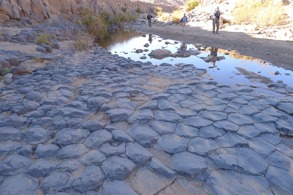
That afternoon was one of the best of the walk, not least because we put in a good 15 clicks after lunch. We followed the Afilal valley until it petered out and then crawled over low ridges into adjacent valleys and basins separated by more hills. Away from the grim basalt plateaux, we explored the granite ranges, passing a cobbled stone circle (left) just like the one we saw in Tadant oued, some 200km east of here at the tail end of SEQ in 2006. What they are exactly is still a mystery. A tomb is the most obvious answer, as these are the structures which most commonly survive, but most tombs have a focal point like a mound; this was just a very finely set flat ring of stones. It may just have been a pilot’s marker like this, but they are usually much bigger and out on the plain. Nearby, less well made examples had broken up over the years and in a nearby guelta, a flood-carved basalt pavement (below) added a natural wonder to the scene.
The caravan had taken a more direct route, but Honi was unsure where they had made camp. He crissed crossed the terrain, looking for tracks just we were beginning to creak a bit after hours of walking. Eventually we backtracked (see the map track) and staggered into another perfect camp in a oued set among beige granite boulders. Here we managed to scrape together enough acacia to encircle a fire ahead of our last day of trekking. That night it was probably minus 5.
Another great morning led us through the boulders to Akar Akar mountain to cross over the car track and get back inside the Hoggar ‘loop’. Steve had chosen to ride a camel that morning, little did he know he would be sat on the acacia plank till lunchtime, but when we caught him up he was fine. To the south lines of cones marched across the horizon in the blue haze and by mid-afternoon one more basalt rubble ascent and descent brought us above the last oued camp near the distinctive cone of Adaouda where Patrick found a fine Tuareg dagger while looking for fire wood.
I’d long wanted to try this walk and the Hoggar trek had passed through some amazing country side. But we couldn’t help compare it with the wild Immidir we’d just visited where the most conspicuous signs of man were usually 6000-year-old tombs. Tayub kept us as well fed as before, but the grumpy crew too took the edge off the experience and the sun rising or dropping over Assekrem is no less amazing for having driven up there so I’m not sure I’d do this trek again.
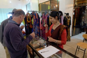
So, after 200 miles walking and nearly three weeks of bush camping, all that remained was a long overdue hose down at Loukmane’s house in Tam, followed by a haircut, some interneting, shopping (left) and a non-goat based feed at a resto in town. The night plane flew us back to Algiers via Djanet which gave us an extended chance to doze. A few hours later we were all on our way home while I conjured up plans for next time.
From the centre spiralling out anti-clockwise: RobUK, Rob, Diane, Hannah, Patrick, Mike, Steve (on top), Honi (below).