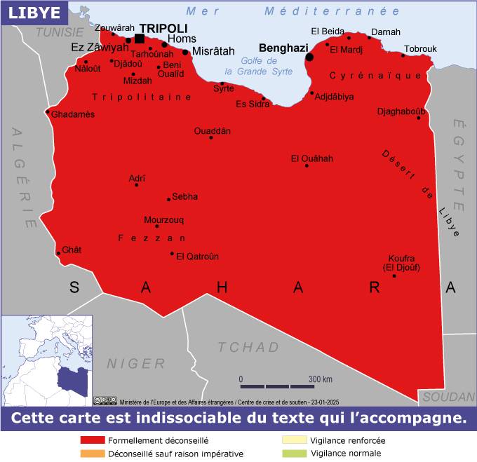
July 2026
See also:
Atlantic Route
Tindouf Piste
Railway Piste (RIM)
An informed but personal interpretation of travel access across the Sahara, believed to be correct at the date above. For Saharan travel in a specific country click ‘Country Info’ above or visit the forum.
Government travel advice websites, Some exaggerate restrictions and risks
UK FCDO • US DoS • French MAE
For centuries crossing the Sahara has been limited to a handful of routes. In the old days camel caravans followed a string of reliable wells, while circumventing difficult terrain like mountain ranges or sand seas. Prevailing routes also shifted according to political alliances and the activities of bandits.
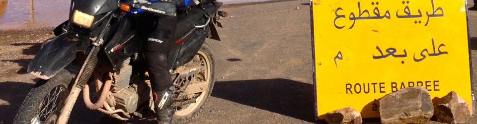
It’s not an exaggeration to say the situation today is broadly similar. The Sahara remains by and large, a huge unpoliced wilderness where the security risks to the traveller are not to be underestimated. Following the desert tourist-kidnapping era of the Noughties, overland travellers and tourists are now rare outside of Morocco.

The map above shows the current Atlantic Route and the newer Tindouf Route. These border crossings are currently the only way motor tourists can cross the Sahara. Formerly safe tourist routes are in red, central ones have not been used since 2011. Right now there are just two desert border crossings on these routes:
• Morocco–Mauritania Guergarat – Nouadhibou on the Atlantic Route
• Algeria–Mauritania Tindouf – Bir Mogrein – Zouerat (little used piste)
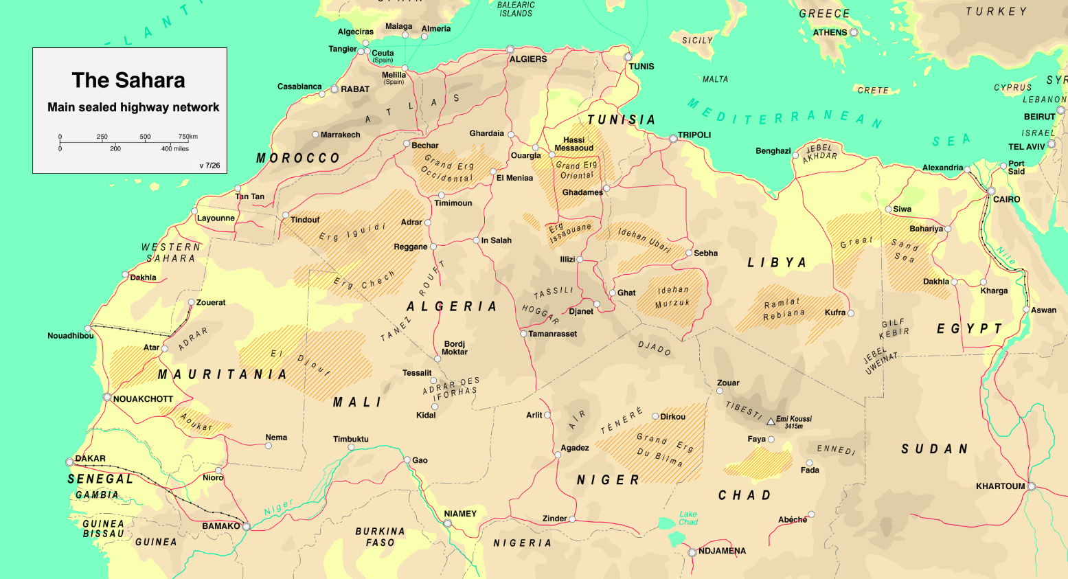
Atlantic Route: Morocco – Mauritania
When Algeria initially closed to tourism in the 1990s, the flow of trans-Saharan traffic, both commercial and touristic, shifted west via Morocco and Western Sahara to Mauritania. This is now a sealed road across the desert, barring a kilometre of piste through No Man’s Land (technically, Polisario territory, not NML). I rode nearly all of it in 2020 and unless you slow down in Morocco, or head inland once in Mauritania, the Atlantic Route can be unsatisfactory if you’re looking to experience the real Sahara. Fuel and lodgings are no more than 250–300-km apart.

Note that despite what many maps show, ‘Western Sahara‘ is not a country but a name applied to the former colony of Spanish Sahara, part-occupied since the 1980s by Morocco to the west and the Algerian-supported SADR (‘Polisario’) inland. Between the two Morocco built a 1500-km long defensive Berm or sand wall.
The Tindouf Route: Algeria – Mauritania
Read more here.

Nile Route: Egypt – Sudan

In the 1970s, crossing the Nubian desert from Egypt right through Sudan to Uganda was the main route to East Africa until the Sudanese civil war put an end to that. A war now rumbles along in South Sudan which separated from Sudan in 2011 and, at the date of this update, it seems civil war in Ethiopia has blocked the route to East Africa. See here.

The current war in Sudan is the impediment, but in 2014 a land border finally opened between Egypt and Sudan, though it still required a short ferry crossing between Abu Simbel and Qustul port (see map above) on the lake’s east shore. Reports from 2018 mentioned the ferry still ran the full length of Lake Nasser from Wadi Halfa to Aswan, but maybe only for passengers and trucks.
Private cars and buses used Argeen or Qustul. In 2017 Argeen was used without the former extortionate fees and so as predicted, this could have become an all-land crossing between Sudan and Egypt, though one gets the feeling the Wadi Halfa crossing prevails. Report and costs here (go to latest post).
Even with Syria opening up, Egypt may again be accessible via Turkey, (definitely not from Libya), but essentially Egypt’s a dead end for African transits.
Trans-Sahara Highway: Algeria – Niger
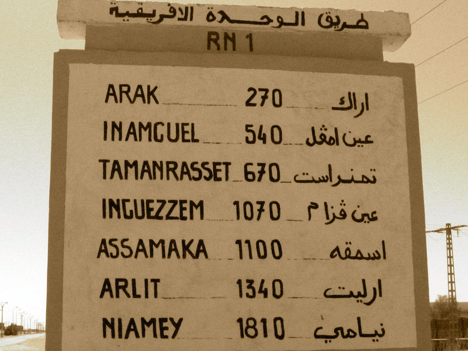
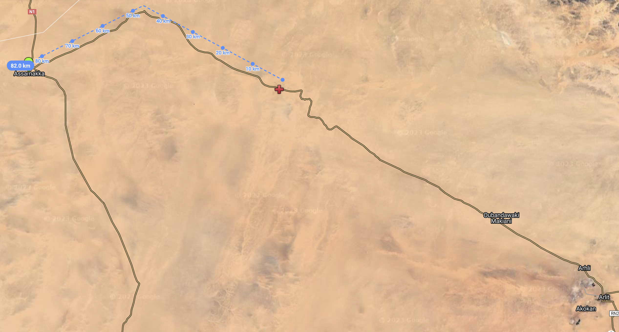
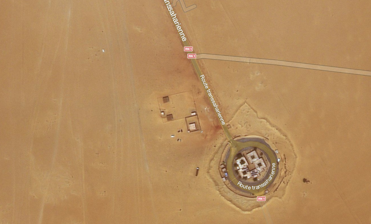
The Trans Sahara Highway (‘TSH’) is now sealed from Algiers to the Niger border just south of In Guezzam, but there are frequent diversions onto the dirt. From IGZ it’s 15 sandy km to the Niger border post at Assamaka from where it’s now less than 100km to where tarmac leads to Arlit, 250km from Assamaka.
In January 2025 we drove the entire 1950-km TSH from Algiers to Tamanrasset over 2½ very long days. Every town has a gendarmerie checkpoint, and from Laghouat it’s just two lanes. The 400-km stage from El Menia to In Salah over the Tademait plateau has at least a dozen off-road diversions and will take 8 hours.
From In Salah to Tam – doable in 12 hours with some diversions – we were escorted by gendarmerie via Arak and Moulay Lahcene as far as In Amguel, 130-km from Tam.
No tourist has crossed into Niger since 2011 and escorts were required in Algeria when it was last done, plus a military escort (convoys) in the northeast of Niger. It’s said that army escorted commercial convoys leave Tam for Agadez every 15 days, swapping at In Guezzam or Assamaka for a Niger army escort to Arlit and Agadez. I’ve not heard of any tourists being able to join this convoy.
The isolated border post of Assamaka has been attacked several times, and today Point Zero (below) has become a place where 1000s of northbound migrants are regularly expelled from Algeria and left in the desert to walk back to Assamaka.
Tanezrouft Route: Algeria – Mali
Although it was never that popular, following the 1990s the Algerian stage of the Tanezrouft Route south of Reggane (and west of the TSH) got closed to tourists, and even trying to get to Bordj Moktar from Tam became risky or forbidden. The north Malian portion of the Tanezrouft route is a war zone, and for years north Mali was where most hostages ended up in the hands of AQIM or similar groups. For years, the French and now Africa Corps (Wagner) have been unsuccessfully engaged in controlling this territory.
There are other trans-Saharan routes that you might think possible, but for tourists these routes are marginal, dangerous or…
For recent information visit the Sahara Forum or follow the links at the top of this page.


Pingback: Border Crossing Algeria-Mauritania? - Horizons Unlimited - The HUBB
Pingback: 30 days! | Dove Step
Pingback: Horizons Unlimited - The HUBB
Pingback: Horizons Unlimited - The HUBB
Pingback: Maps of the Sahara | Sahara Overland
Pingback: dakar, 18 may | crossroadsofempires
Pingback: Sahara by 2WD Fat Bike | Sahara Overland
Pingback: Book review: The Forgotten Path ~ David Newman | Sahara Overland
Pingback: Y is for: Land Yachting, Sahara, 1967 | Sahara Overland
Pingback: Palin ‘Sahara’ TV reminiscences (BBC) | Sahara Overland
Pingback: ‘S’ is for Shell’s Guide to Sahara Motor Tourism, 1955 | Sahara Overland
Pingback: Sahara Camel Trek • Immidir Plateau | Sahara Overland
Pingback: A is for Atlantic Highway to Mauritania | Sahara Overland
Pingback: Overlanding with Chris Scott, Saharan Expert – News Media
Pingback: Sahara Overland A6: Djanet to Tamanrasset | Sahara Overland
Pingback: Map review: Reise Know-How Morocco 1:1m (2023) | Sahara Overland
Pingback: Ten Positively Insane Facts about the Sahara Desert - Listverse - USMAIL24.COM
Pingback: ▷ Diez datos realmente locos sobre el desierto del Sahara - Listas10Blog