Part of the Sahara A to Z series
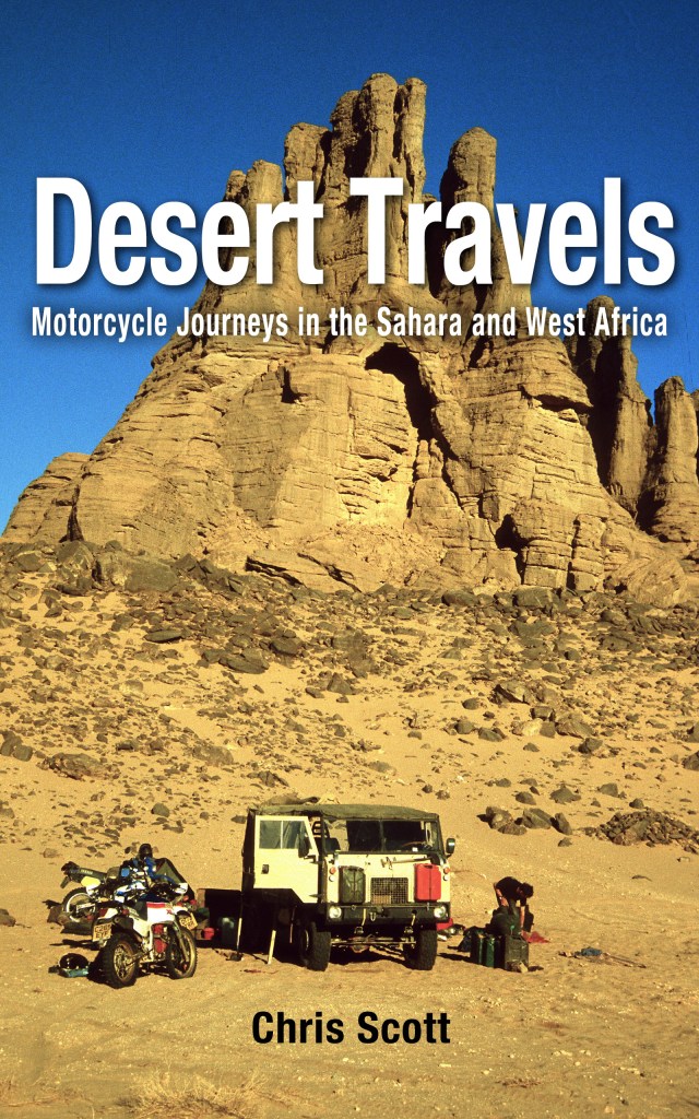
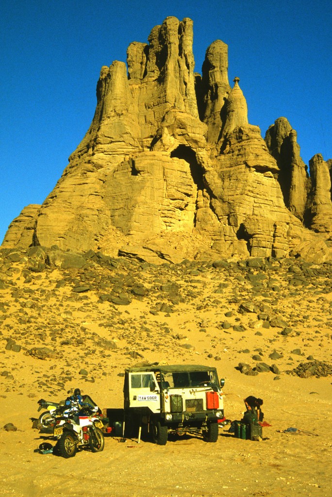
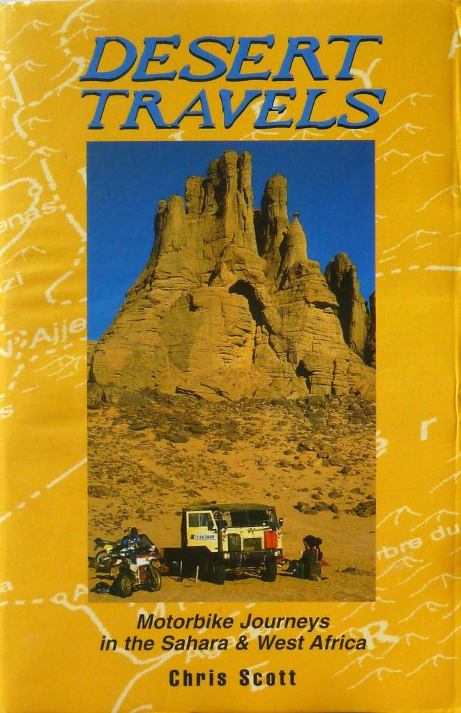
The original 1996 paperback edition of Desert Travels (and an earlier version of the ebook, left) featured us camped below a striking cathedral-like formation.
I’d always wondered where that place was. The relevant chapter in the book is called The Cathedral, referring to the spires and church-like ‘portal’ of the pinnacle-capped outcrop. It was shot by Mike Spencer who had a proper camera and slide film.
This was before GPS and at the time I was too preoccupied keeping track of the bikes and my Landrover’s numerous issues to attempt to follow our progress on a map with dead reckoning. Our guide, Chadli, knew his stuff but was rather reticent – they teach them that in guide school. I knew the vague location within 50 square miles – the photo credit in the book says ‘near Tin Tarabine’ which is true enough, but that area, if not the whole Tassili-Hoggar southeast of Tam, is famed for unusual rock formations.
https://www.google.com/maps/d/u/1/edit?mid=1WqqAR1dEfOU981GPRfUezdQs_DU&usp=sharing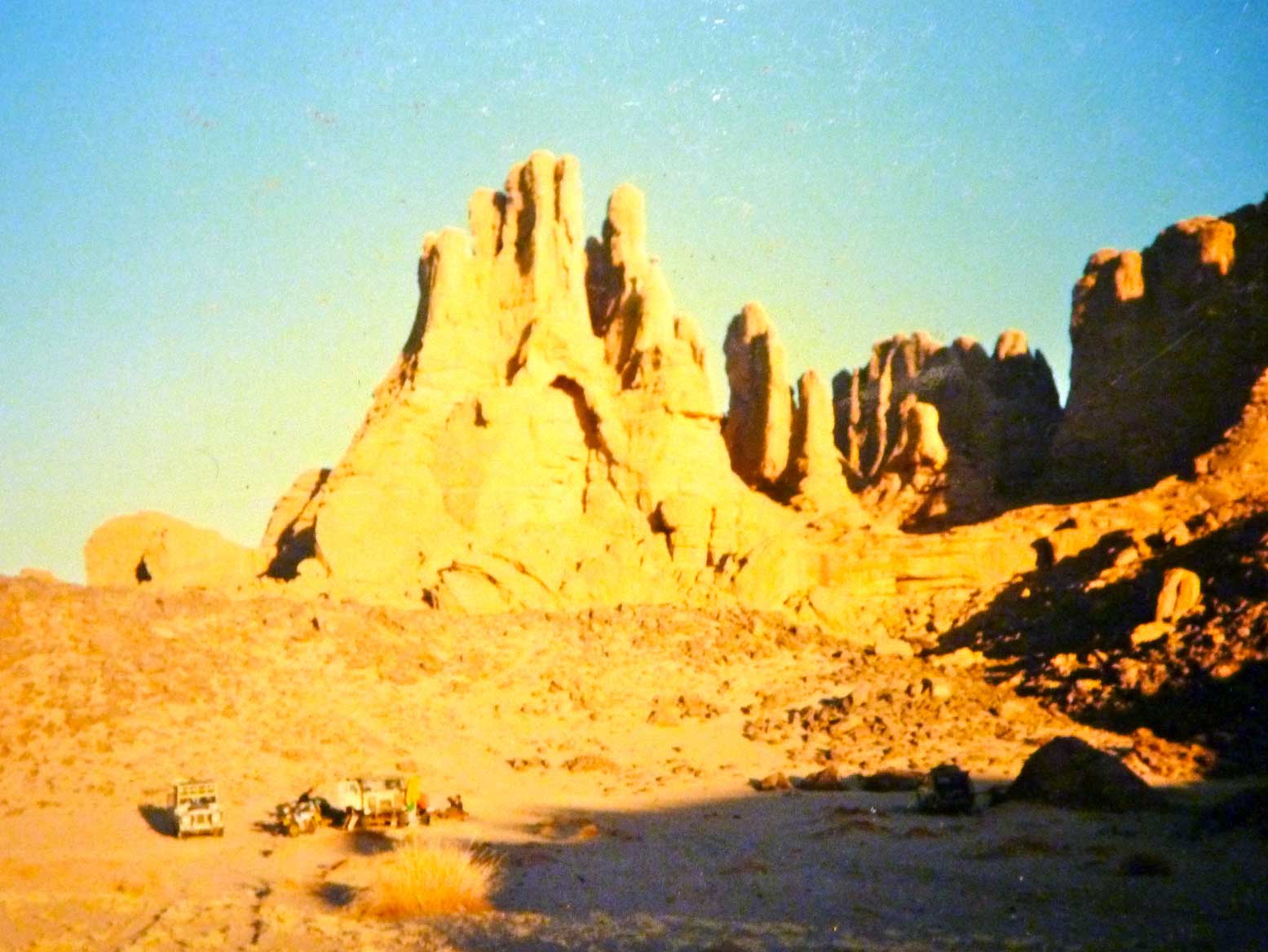
I had a rough idea the cathedral (above, with my crumby camera) was somewhere after Tadant canyon well and before Tin Tarabine oued. Then in 2006, coming towards the end of our epic traverse from Mauritania across Mali and Algeria towards the Libyan border (see: Sahara: The Empty Quarter) we passed through that area. I’d not been there since 1988, but coming at it from a different direction, it was all new to me.
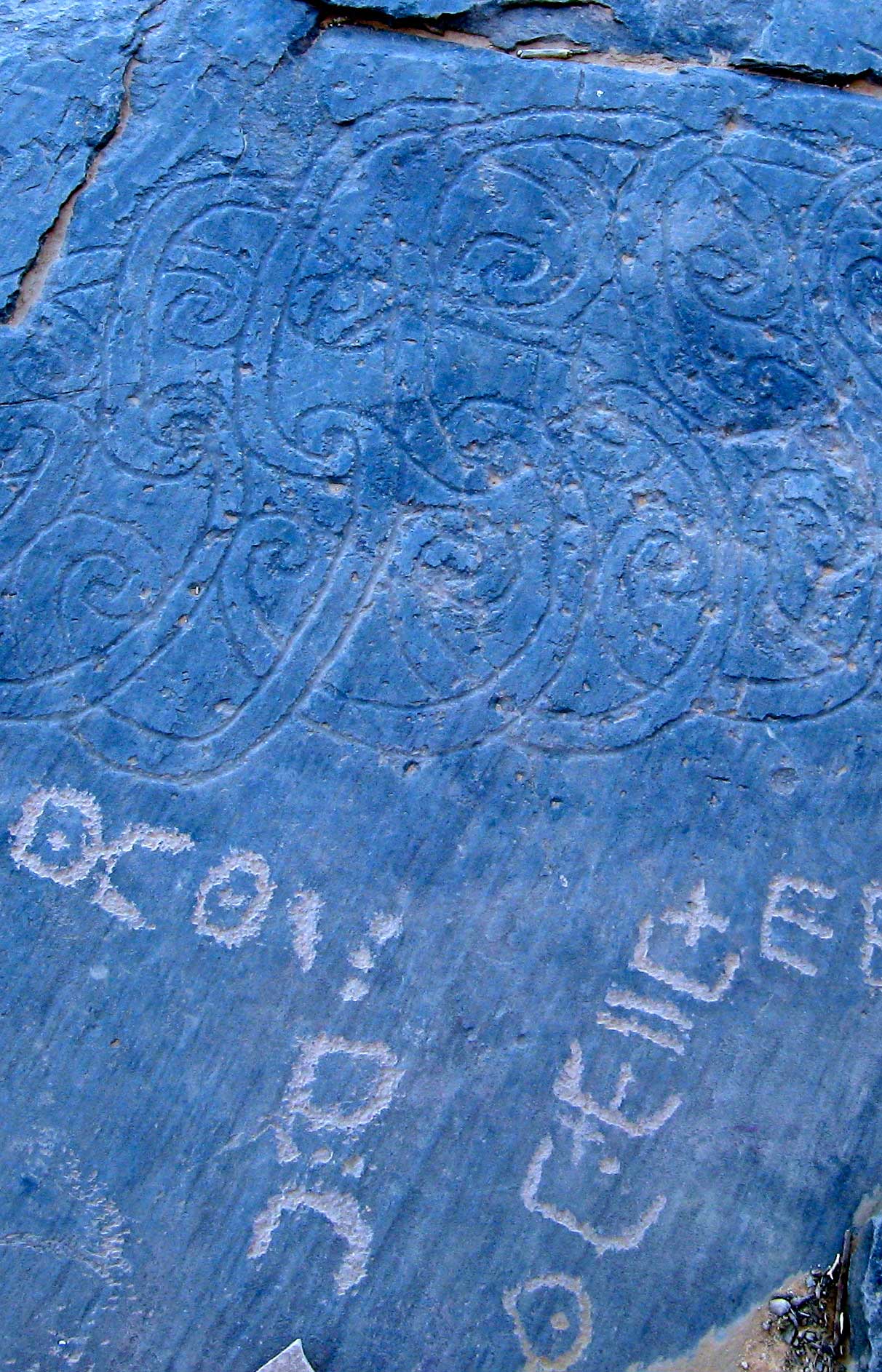
As we’d crawled steeply out of Tin Tarabine oued and away from the famous Youf Ehakit – an amazing area of eroded rocks and bizarre, neo-Celtic engravings (left) – our escort’s car needed the clutch repaired yet again.
They pulled up onto a flat rock shelf to to a proper job this time, while I and the others dispersed for a wander. Climbing the outcrop up above the cars, I spotted some intriguing spire-like formations across a plateau a few kilometres to the north. Could I have stumbled on the location of the original DT cathedral cover after all these years?
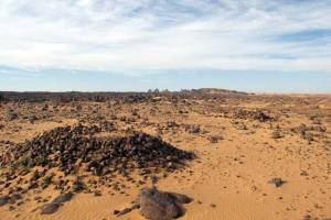
I grabbed a water and the GPS and set off cross-country, passing pre-Islamic tombs (left), then dodging down into little canyons and over outcrops as the terrain became rougher. I didn’t have a copy of DT with me, but the huge, hand-like pinnacles in the far distance looked very familiar.
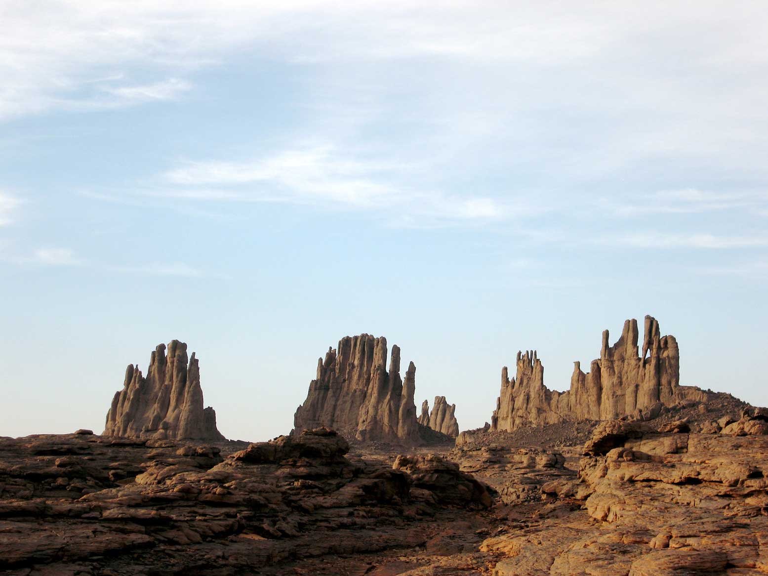
After about an hour and a half I was running out of daylight to get back, but got close enough to the weathered spires. I took a few hurried shots (above) and the following waypoint which I see now is actually just a kilometre from the formations. But when I got home and looked at the book’s cover closely, I realised they were similar but were not the Cathedral, even if I was looking at them from behind.
I forgot all about it for a few years then began to wonder again if the Cathedral could be tracked down now that we have masses of imagery of everything everywhere and any time. I scanned people’s Panoramio and Flicker albums as well as the embedded photos on Google Earth (often irritatingly misplaced, as we all know…). There were plenty of amazing rock formations in the Tassili-Hoggar vicinity, but no distinctive Cathedral.
In the end I knew the best people to ask were the Germans – der uber-Saharans. I may know the Sahara well, but in Germany there are hundreds more experienced and better travelled Saharans than me. In the good years they explored every corner of the desert, but most didn’t feel the need to write guidebooks about it afterwards.
I posted my question with a picture on Wuestenschiff, one of the main German Sahara forums. Within a couple of days I had a name for my location: the Cathedrals of Tin Eggoleh and the waypoint: N22°21’6.75″ E007°5’12.20″. About 50km to the northeast of the ‘false-sprires’ of 2006.
Mystery solved and somewhere good to aim for next time…
Discover more from Sahara Overland
Subscribe to get the latest posts sent to your email.
