See also:
Shell Guide (with map)
Old Saharan Trade Routes Map
‘V’ is for Vintage Sahara Maps
Sahara – Blanks on the Map
‘I’ is for IGN and their amazing Sahara maps
University of Texas Collection
When I started travelling in the Sahara the Michelin’s 153 (left, now 741) was all I knew. Later I discovered IGN’s superb series of 1-million scale maps (see below), and then GPS came along. Initially it was only useful in pointing out waypoints used in close combination with paper maps and a ruler.
Now a GPS or a phone can have a map in it almost as good as those below, or you can simply trace a route off Google or other satellite imagery, then save and import the tracklog into your device and just follow the line displayed on the screen. Not much nav skill required. But a good paper map is still a useful for visualising the big picture in the planning stage.
Digital maps and apps for your devices
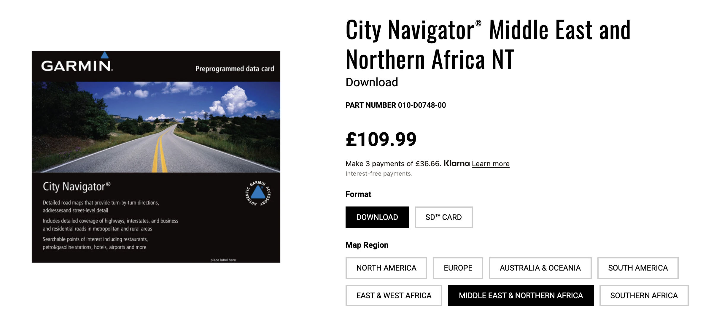
For years buying Garmin maps for anywhere outside of developed nations wasn’t worthwhile. Even their Morocco map – largely ripped off from Olaf (last updated in 2008) was said to be an inferior version and cost over £100 for a map you could get for free.
Then Garmin used OSM to produce a huge map covering the Maghreb (right), initially for a very reasonable £20. (Review of v3) until the 2023, v5 price shot back up to £110. Lately I’ve found remote route planning with satellite imagery (Google or ESRI) combined with a working knowledge of old paper maps works well. Here are free African country maps but they don’t show up on Mac BaseCamp. More here which will work but you now have to pay €12-18. There are loads, all based on the constantly updated OSM database but rendered in different ways, with some better than others.
I use a Garmin Montana so just need to import a map, but many use much cheaper and clearer phones or tablets which require an app that’s usually free in basic form or – quelle horreur! – requires a paid subscription to unlock full features. I’ve liked the look of GaiaGPS maps, did not like DMD2, and hear mapy.com (behind the innovative Windy weather app) could be good. Here’s a list from a thread. It all depends on how the info is rendered (displayed) for user legibility. Some are terrible, Gaia is great.
Sahara Paper Maps
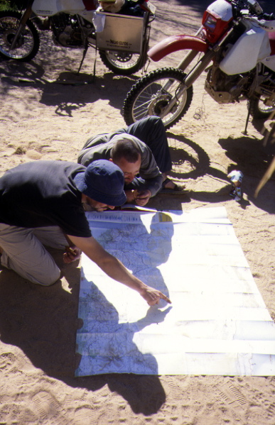
For a vehicle-based Sahara journey, in the old days you got a large-scale Sahara map covering the whole area you planned to visit, then added one- or half-million scale maps (left) for all the areas you planned to cover off-road. In rare instances these were backed up by a selection of 1:200,000 maps for areas of special interest or for trekking. These days country maps described below are less useful for travel in the Sahara, but help give the big picture. Some points to consider.
- Up to date information in new editions (a common failing)
- Accurate and consistent hierarchy of roads and pistes (a common failing)
- Clear depiction of relief (some better than others)
- An idea of the surface terrain like dunes (very useful but often overlooked)
- Reliable information on wells (a tall order, but frequently guesses are made)
- Gridlines across the map face to aid positioning with GPS, if needed
The better Sahara maps are reviewed below. Only a couple are really useful to desert travellers while other maps may be more easily found and offer a good background or modern overlay, while some other Sahara maps are of limited value to an actual desert traveller, as opposed to pinning on a classroom wall for a project.
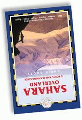
The maps below are reviewed specifically in regard to their utility as navigational aids for independent desert travellers, less so for conventional fly-in tourists most of who will have little need of maps, or for groups who will have an escort/guide, as in Algeria. Each of the 70-odd GPS routes detailed in my old Sahara Overland guidebook (left, long out of print) included a recommendation to one of the maps below. Of course paper maps are old school and old tech now. But we still love them! Here’s the full list which includes digital download sources.
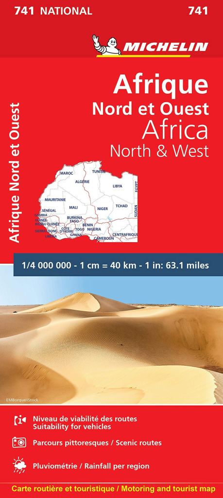
Michelin 741
1:4 million, (edition 7; 2020)
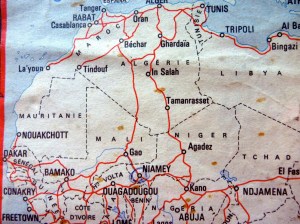
The 741 covers 80% of the Sahara from the Atlantic to western Egypt (28°E). Compared to other offerings, the 700 series is renowned for its detail, readability and reasonable accuracy given the huge task involved. This review concentrates on the Saharan portion of the map.
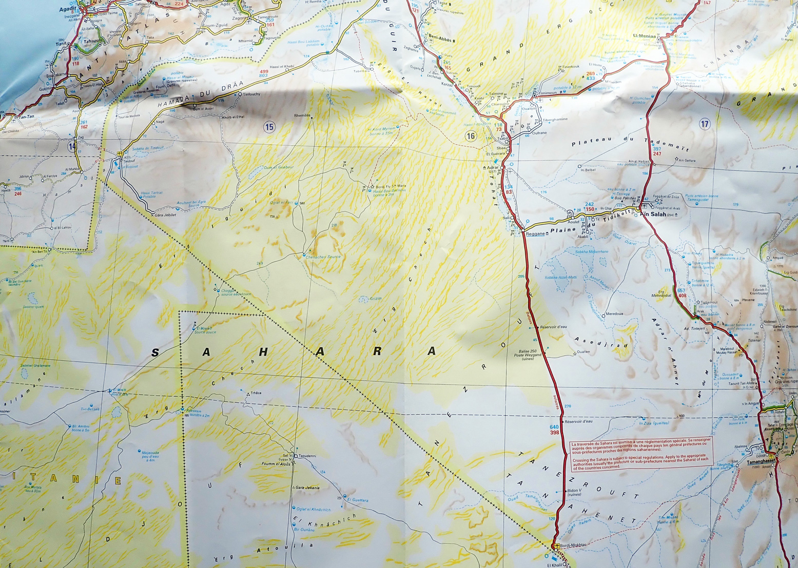
Although it’s not been properly updated for years, the Michelin 741 is the best planning map for Saharan travels (were they possible), giving you a good overview of the Sahara west of Egypt, accurate relative distances, borders, major roads and some pistes, as well as settlements and surface features. You even get the depth and mineral composition of some wells. This is not a map for off-highway navigation, although over the years many novice Saharans have tried! I see the red ‘Crossing the Sahara…’ warning label has not changed in over 40 years!
The 2020 edition still shows non-existing or obsolete pistes from the colonial era, pistes which are now roads and most annoyingly, roads which are definitely still tracks and will ruin your rental car. But now the Sahara is no longer popular with tourists, fixing that is a low priority. You’ll just have to find out the hard way or double check on Google Earth of the superior Bing Aerial (ESRI) where WYSIWYG.
The other problem with all these Michelins is the thin paper which means your map will fall apart if you use it too much. These nitpickings apart, the 741 remains the definitive map for the Sahara and West Africa, offering a quick way of getting to know this huge region.
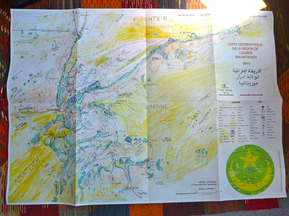
Adrar, Mauritania
Scale 1:600,000 2015, €10
Third edition of a hand drawn map from the Bab Sahara auberge in Atar. Probably not good enough to navigate with by itself (no long/lat grid) but presumably uses local knowledge and so gives a useful and more up to date ‘big picture’ than anything from IGN. The IGN’s old 200k series would fill in the gaps.
Institute Geographique Nationale (IGN)
Scales 1m; 1:500,000; 1:200,000
Early 1960s to mid-1970s. €8
Yes they’re old but the one million IGNs are to general purpose desert navigation with GPS what the 741 is to planning. They are great maps but only cover the former French African colonies as well as the western reaches of Libya (up to 12°E). Readability from 1964 up to the last sheets in 1975 is very good. The few 1961 sheets covering ever-overlooked Mauritania are a little basic by comparison.
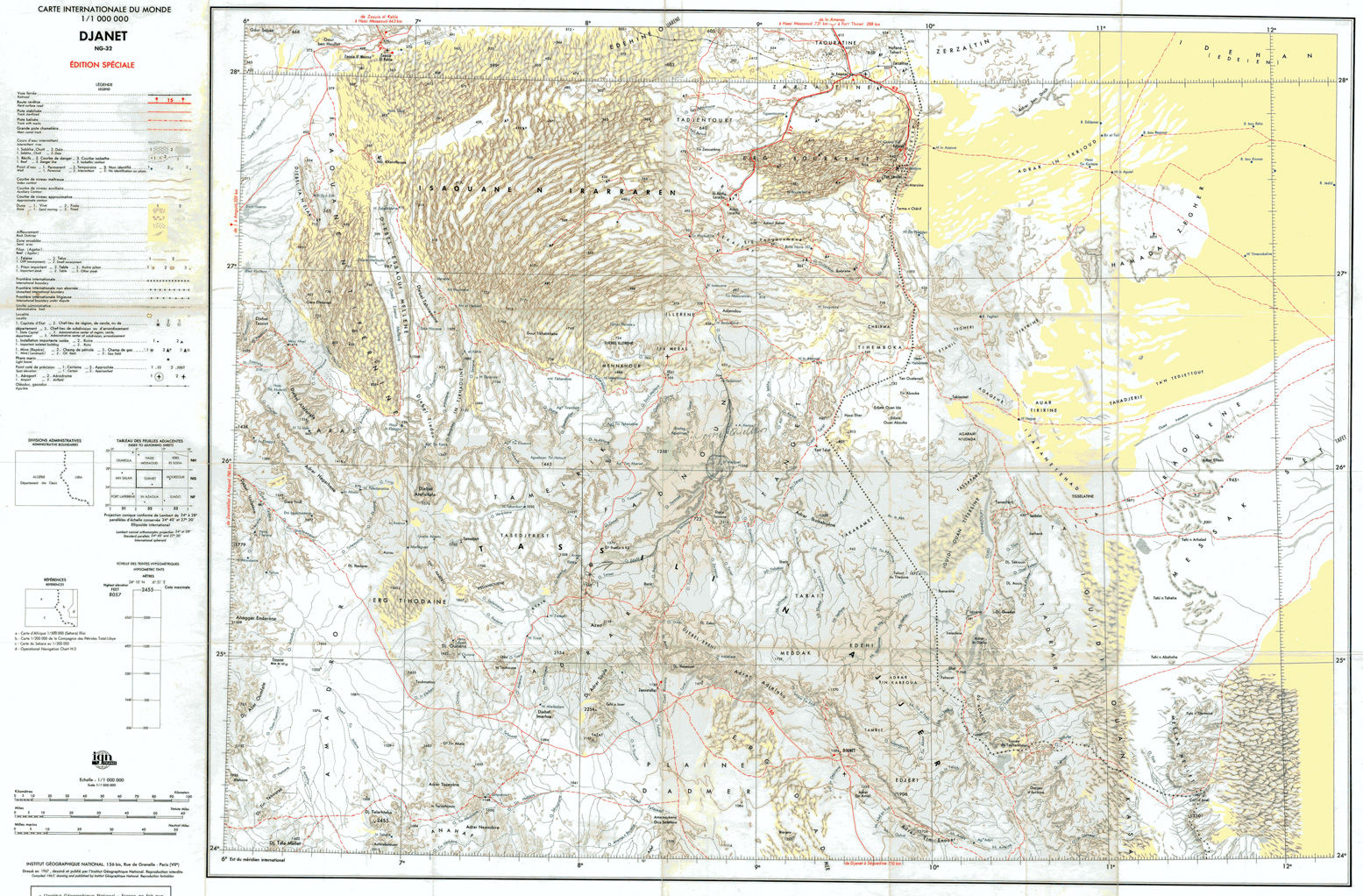
The advent of GPS brought up a few errors: mountains misplaced by a few kilometres – but overall the detail and accuracy is outstanding as subsequent satellite imagery has proved. Changes in roads are best cross-referenced on Google, and don’t expect all the marked wells to have been maintained over the decades, while many new ones will have appeared. Particularly in the more populous Sahel, the position of tracks and other man-made features may have altered over the last few decades. Excepting parts of Libya and all of Egypt, these excellent maps are ideal for the basic level of exploration and travel that Sahara Overland used to represent. For Morocco there are far better maps.
Coverage of 1:500,000 IGNs was always patchy, these days are hard to find and not really worth the bother. For some odd reason detail is cut off at country boundaries, even adjacent former French ones, though of course you’d assume the extra detail makes these the best scale of all for piste driving.
Half millions are not available at the Espace IGN Cartothèque in Paris last time I looked but they are to be found as bootleg digitals (Algeria only, as far as I know.)
Just about all the original 1:200,000s have been sold or stock returned to the relevant Saharan countries. Theoretically still available from the relevant ministries in Algeria, Niger and Mali, their ‘strategic’ detail makes obtaining them a hit-and-miss affair.
Nevertheless, when you can find them, the colour originals are real works of map art, especially in mixed dune and rocky terrain. They are the finest maps of the Sahara ever made, obliterating the more recent Soviet equivalents at the same scale which were only based on aerial or satellite photography. IGN’s were checked on the ground too, and it shows. Black-and-white copies of the full set were available from the IGN Cartothèque in Paris at around 7 euro each – you’re much better off with colour scans sold or available in digital format. Some avoid the copyright issue by not crediting the maps as IGNs.
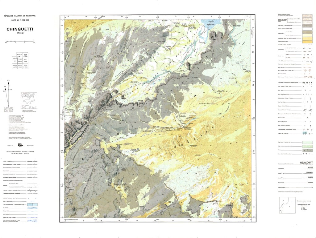
The biggest drawback with the 200,000s is that there are no- or limited grid lines across the face of the map and each degree is only marked in 10-minute increments along the borders. If you look closely there are actually faint crosses also at ten minute intervals on the map face, so it’s possible to mark your own grid – but draw from cross to cross and not straight across, even though, given their UTM projection, lines are almost straight.
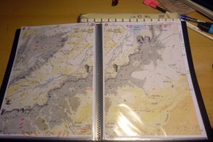
For a serious mission you can print off the digital scans into an A4 map booklet (left) but you’ll need to mess about a bit to correct the print size so as to reflect the original 200k scale.
Price for paper 1 mils is around €9 in Paris. 1:500,000 and 1:200,000 sheets about the same or there are many similar 250k free to download here.
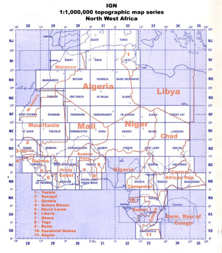
IGN country maps
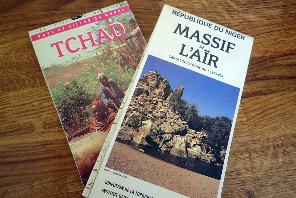
IGN also produced a modern series of country maps in the Sahara including Chad, Egypt, Mali, Morocco, Mauritania (1993!), Niger and Tunisia with scales ranging from one- to 2.5 million. Easily available in Europe, they’re probably far inferior to more recent RK-H maps. ‘Chad’ has no grid lines for example. I spotted the hard-to-find 500k Air Massif (pictured right) at Agadez airport years ago for 12 euros – an especially handy map for camelling or trekking in the region, were you be able to get there.
Reise Know-How series
For the 1:1m scale Morocco map see here. About £9 or €9.
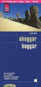
In 2011 RKH optimistically released a 1:200,000 map of the Hoggar around Tamanrasset in southern Algeria. Plastic and double-sided like all the rest, it covers a once commonly visited region for fly-in tours; namely the Atakor massif (Assekrem), and the so-called ‘Tassili-Hoggar’ region southeast of Tam – a fabulous area of outcrops, dunes and prehistoric engravings along the Tin Tarabine oued, the Youf Ehakit nearby, and the famed Taghera and El Ghessour outcrops just to the southwest.
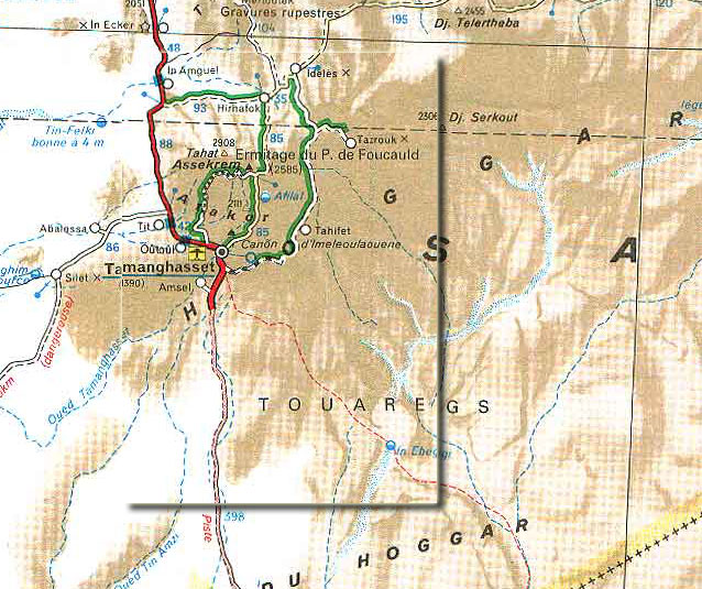
The extent (right) runs from 5°E to 6° 50’E and 21°N to 24°N, the southern tip of the Tefedest, with grid lines every 10 degrees – very nice. The image left shows a rough depiction. What few dune areas there are, are not depicted (as they are, vaguely, on the 1 million IGNs) and on close comparison with the ancient IGN 200,000s, it transpires RKH have merely copied many of the incompletely depicted routes shown on the 200s which were last updated in the 1960s, rather than researching and adding some of the regular tourist trails which have developed in the Taghera since that time, and are doubtless accurately recorded on countless GPS track logs. So the map is based on 50-year-old IGNs, rather than adding anything new; no great surprise there and not that important as most visitors will be led here anyway. And for 8 quid it’s a bit of a souvenir treat, anyway.
Sadly, the collapse of fly-in tourism to this specific area at around the time the map was probably commissioned, means they may not sell as many as they hoped. For those like me, it makes a great souvenir on which to plot and relate to various points visited over the years. The scale (1cm = 2km) is obviously a bit OTT for independent driving (were it possible), but it would work well while being led trekking around the region. You need a guide anyway to get to all the best spots. We used this map to plot our route up to Assekrem in Jan 2012 along unmarked trails.
The colouration and detail is too subtle by far. Some well-established pistes are missing, the Tefedest range seems to have a new pass halfway up, but the worse thing in the overpowering anaemia of this map – all the same pale washed-out tan tone with no discernible definition for the dominant ergs and a way too-large contour interval of 250m for the 1.200k scale – a map that clearly did not eat enough fruit and veg during its production. You do get a handy 1° grid (but no sub-calibration, like a TPC or IGN 1m). With the wealth of Algeria know-how in Germany, this map is a missed opportunity.
Review copy of this map supplied by The Map Shop.

The double-sided RK-H Algeria 1:1.7m scale map is dated 2010 and as expected has the usual flaws which are seeing paper maps lose out against digital user-supported OSMs and the like. Is it because they print thousands at a time but make few easily researched corrections during reprints? Who knows.
Best thing of course is the tough plastic paper printed on both sides which makes it compact but at a still nearly useful scale. In the south which I know better, some so-called ‘secondary roads’, like Djanet to Libyan border (below right; actually a national road so should be red) are now sealed.
It’s also a shame they don’t depict sand seas any differently than a plateau or any other type of adjacent relief; it would make the map so much more readable.
And although there’s a grid, the vague orientation of pistes along with the small scale wouldn’t make this map actually useful for navigating off-road; a 1m IGN nearly as old as me would be much better. One fringe benefit is that you get a useful map of Tunisia.

Sahara – International Travel Map (ITM)
Scale ~ 1:3.4m – 2015
Despite being double-sided and on plastic paper (like an RK-H) the original ITM Sahara map was a failed attempt to outdo the long-established Michelin 741. In 2015 they had one last go and on the ITM website you could view a pretty big scan (left) of either side.
At a glance all looks good, with a pleasing muted relief. But look closer and soon the errors and sloppiness jump out. First off is the odd use of light greeny-blue to show a level of elevation between green and browny-orange, giving the mistaken impression of huge lakes. And the only way of spotting sand seas the size of small countries is from a label, not shading, which is much less usefully used to depict ‘national parks’. We all know what an NP indicates in the Sahara.
The map also cuts-off at the edges; coverage has been dictated by an immutable scale and available paper size. So the 800km from Dakhla to Nouakchott (the main Sahara crossing) are missing, as is the Nile east of Wadi Halfa. Had they picked a slightly larger scale – say 4 million – it would all fitted, but perhaps Michelin own that scale size.
Morocco and all of Western Sahara are shown as one big country, giving you the impression that the Berm is a dream and you can roll into the PFZ without getting apprehended by the Moroccan army, far less caught in a mine field. You wonder if ITM just asked the Moroccans for a country map and they happily sent one, grinning from ear to ear. A ‘Chinguetti’ pops up east of Zug in the PFZ.
Roads are as good as can be expected, notwithstanding detail and orientations that are 40 years out of date in places and the hierarchy is all mixed up. You will also find total cobblers such as ‘Area of extremely high and permeative sand dunes roads usually impassable [sic]’ on the sealed road across the flat sand sheet to Zouerat – hundreds of miles from any erg matching that description. Like Chinguetti, Ain ben Tili gets shown twice, in case you miss one.
In northern Mali the map is mismatched east of the prime meridian and nearby, Bordj Moktar in Algeria is misplaced. The T-SH to In Guezzam was sealed decades ago, but there’s no such road continuing to Arlit yet. Bordj el Haous and Zaoutallaz (same place; two names) are shown as different places miles apart (the road here is confusing, too). And newsflash: Hassi Messaoud is now a village, not Algeria’s Houston.
On it goes eastwards, with random inconsistencies and ludicrous errors. Stick with a 741.
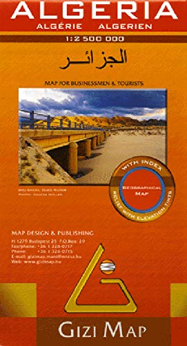
Gizi Map Algeria
1.2.5m, 2012
The 2006 edition of this map had a 1° grid and was not bad at all. A new edition came out in 2012. Usefully, all have place names in Arabic but the paper is old-fashioned thick and glossy which you feel won’t last if used too much, and I found the colouration of the relief a bit over the top (the terrain, dunes, reg, were not well depicted).
Gizi also did a Libya map at 1:1.75. as well as Mauritania (2009; 1:1.25m) and Mali (1:1.2m, 2010).
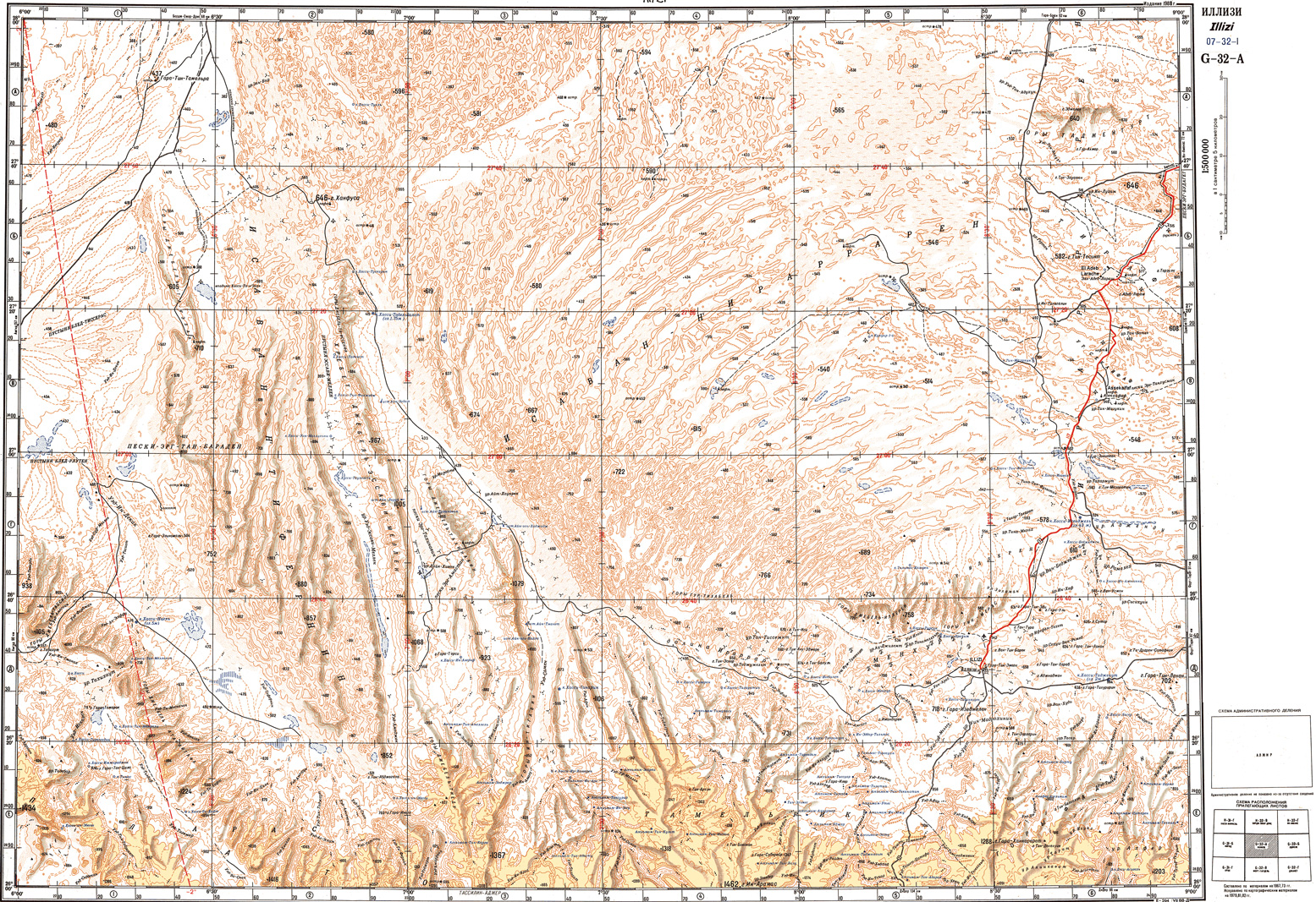
Soviet World Series
Scales 1 million
1:500k; 1:200k
From the early 1970s to mid-1980s
The Soviet Union produced a range of topographic maps covering the world at the above scales, making them the only ones to cover Libya, where they matched IGN’s earlier efforts to the west but at a lower quality.
Drawbacks include the Cyrillic (Russian) text, awful two-colour printing and worse still, representing dunes as a series of still more orange contours rather than with colour and shade as with IGNs. Some sources sold black-and-white copies which made them even harder to read. Nevertheless, they’re the best there was for Libya, with the half-million originals noticeably easier to read than the one millions, and now all downloadable for free if you know where to look or who to ask.
‘Geo referenced’ versions are also available but I’m not sure what this means – calibrated? They were saved as a .map file which I couldn’t open. With reduced copyright restrictions, enterprising individuals and organisations like Quo Vadis (later, Touratech QV) scanned the entire Russian series to sell. All of Africa at 1:500,000 would cost over £1500 in paper but could be bought from Touratech for around 100 euros. This may sound a bargain but would still require printing off several sheets of paper and joining them together to make one complete sheet. assuming you want that.
If buying these maps on paper, always go for the semi-colour originals if you can and expect to spend an evening familiarising yourself with place names and the Russian alphabet plus writing the translations onto the maps, where necessary. The TTQV CD maps featured overprinted names of major towns in Roman alphabet and incorporated GPS plotting software for PCs – another story.
Now free on the internet if you dig around.

US Defence Mapping Agency
Operational Navigation Charts (ONC) 1:1m
Tactical Pilotage Charts (TPC) 1:500,000
Produced in the 1960s and 70s and revised in the late 1980s, while they are of a seemingly useful scale, widely sold as ‘Sahara maps’ and open out to the size of a small bed sheet, ONCs and TPCs are pilots’ maps and much over-rated for terrestrial use.
Differentiation of relief and surface type is poor and, in the Sahara at least, no attempt is made to distinguish between a mule track or a six lane motorway with regular rest areas. Settlements, where they appear, are rated chiefly by their airport and radio facilities. Terrain is not so clearly depicted and well information is particularly hit-and-miss: some wells I’ve used are missing while others which are marked may no longer exist.
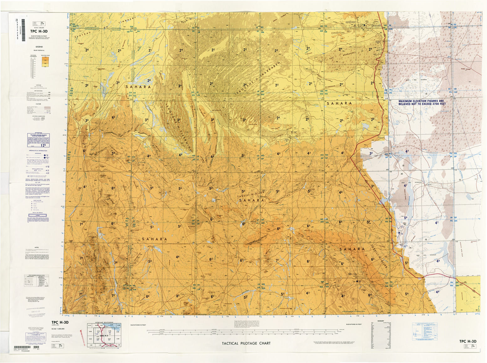
Despite all that, one sheet I grew fond of in the good years is the TPC H-3D (above) and the ONC H3 in west Libya was surprisingly accurate on tracks. They’re all best used as back-ups to other maps, ideally IGNs. ONCs and TPCs maps also show the UTM grid overprinted in blue, as well as lines of magnetic variation which are also irrelevant with a GPS’s built-in true-north pointing compass.
Being flyers’ maps, they’re pretty hot on maximum elevations in given grid squares – little use on the ground. However, as with the Russian maps, an evening’s close scrutiny sorting out which track might be yours can be profitable. In some instances the ONC or TPC will give an absolutely accurate orientation of a track (Route L1 being a case to point), but most of the time they’re confusing and need to be made sense of with another definitive map or Google Earth on zoom.
Good things about ONCs and TPCs is that each grid line across the map has an incremental scale of one minute making accurate position-marking very easy. The size can be awkward, but the half-million TPCs, make useful ‘master maps’ to mark up and plot your own routes over a large area. They’re certainly not much use for actual desert navigation compared to the Russian and French alternatives. I’m told in the UK TPC/ONC have been phased so availability will be increasingly bad.
See what you can download here for free (not all listed last time I checked).
British MoD
Scale 1:2 million
Late 1960s
Though a red herring and hard to find, at 1:2 million these maps cover the same area as an ONC but at half the size and without the aeronautical overlay.
On the piste they’re little use, with detail in ‘non-formerly-British’ regions much patchier than Sheet 9, ‘Dakhla Oasis’. Here the Brits’ intimate knowledge of the region dating back to the Bagnold era is evident with heart-warming detail totally absent further west: ‘Soft ground’, ‘Dunes difficult to cross’, ‘Soft clays, Wellingtons advisable’. It even describes the Darb el Arbain caravan route coming up for Sudan (the ‘Forty Days Road’) as ‘Camel route, 1 mile wide marked with camel bones’. Now you know. Great great detail and cartography but for Sahara map collectors only.
Survey of Egypt
Scale 1:500,000
Mid-1930s to mid-1970s
These maps were originally drawn for the Survey of Egypt in the 1930s by Clayton, with a few details added by Bagnold and Almasy, and may still be in print in Egypt. The relevant sheets for the Western and Libyan Deserts are ‘Siwa’, ‘Farafra’, ‘Dakhla’ ,’Uweinat‘ (biggish file, below), ‘Qena’ and ‘Aswan’.
The unavailable Uweinat sheet dates from 1942 is very good, with neat contour colours and good accuracy. The Dakhla sheet has inferior printing and the newer editions get progressively worse. In this region you’re better off with Russian maps (see above) and maybe a TPC H4-C for back-up and marking.

