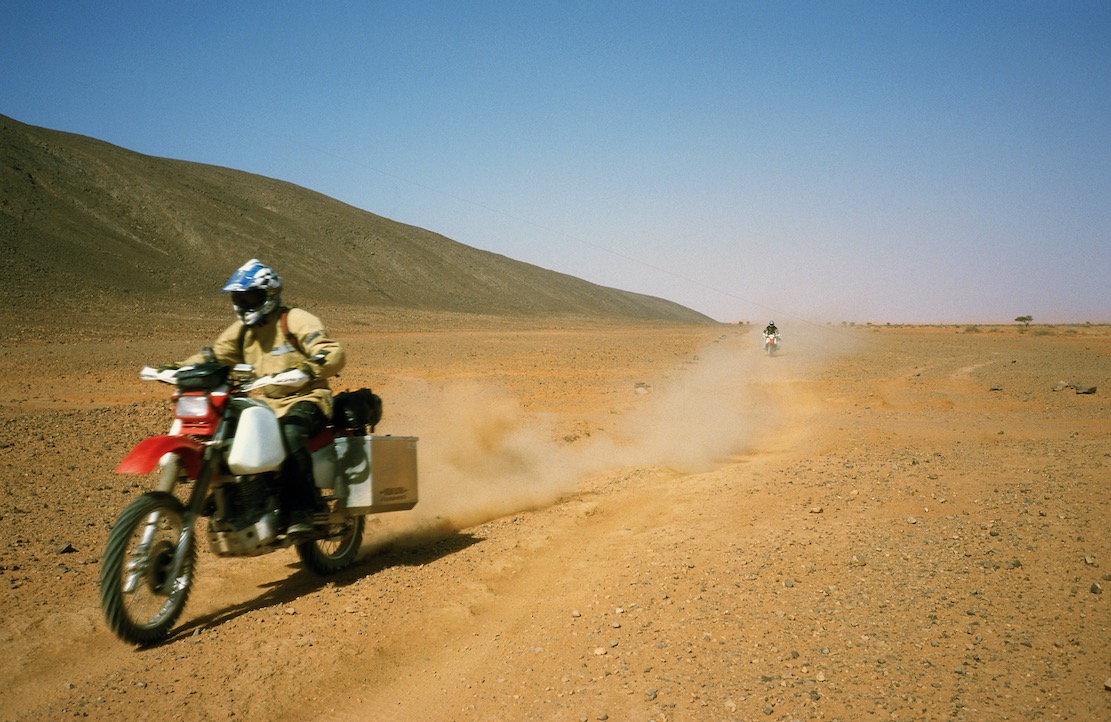
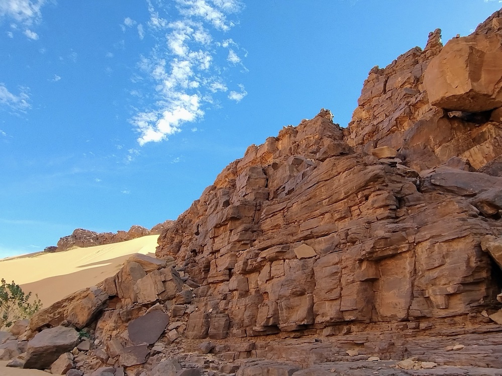
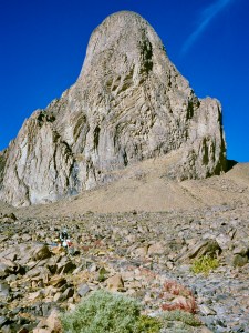
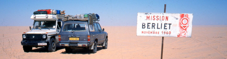
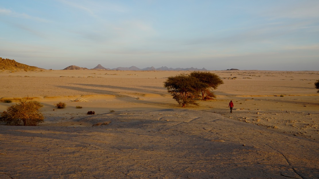
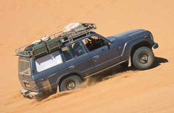
Gunning through the Hadjhadj valley, 2003, just before the party ended
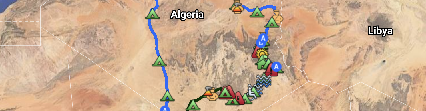
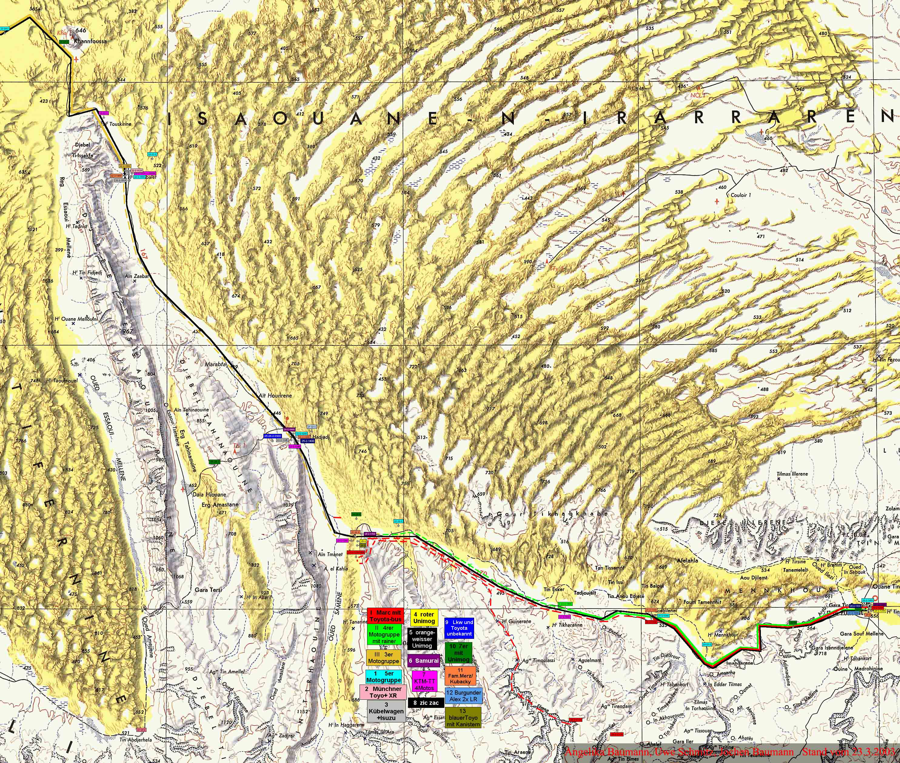
Many old Algeria hands will fondly remember the 470-km Graveyard Piste from Hassi bel Guebbour (‘HbG’) to Illizi, just before the Fadnoun plateau crossing to Djanet. We first did it in 1990 and, with a combination of dunes, jebels, nomads and wells, it added up to the best 1000km of off-roading in Algeria at the time. It was called Route A2 in Sahara Overland, with the macabre name giving it all an added cachet. When it came to covering Dunes for the Desert Driving dvd in 2002 (below), Toby Savage and I shot it along the Graveyard Piste.
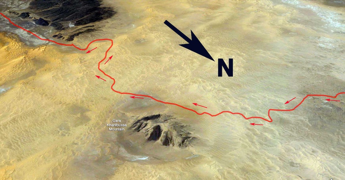
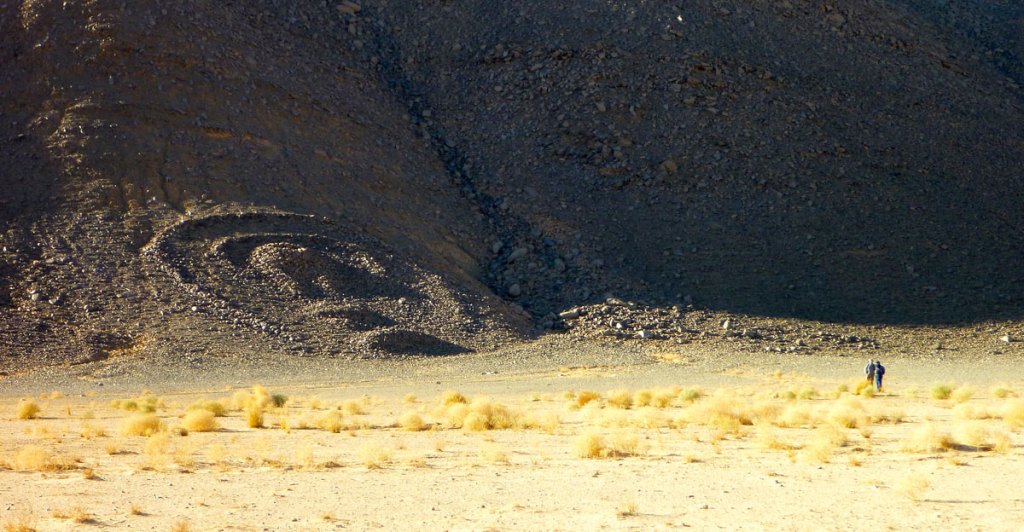
Back then to access the dune-rimmed ‘Hadjhadj’ valley which led to Illizi, you had to turn west at Quatre Chemins junction south of HbG and head out towards Amguid until you saw a metal hut. Here, you headed east up a sandy ramp that led into the rolling Erg Issaouane dunes until you saw Gara Khanfoussa hill (below). At this point you turned south. You usually followed tracks in the loose sand and passed a pole or two, but in the pre-tracklog era, in the three or four times I did this crossing, it was always nerve-wracking navigating the maze while maintaining momentum to avoid getting stuck. Car or moto, I never took the same way.
Old A2 dune crossing of Erg Issaouane to Tabelbalet well
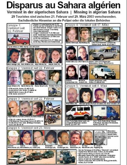
The Graveyard Piste – so named because of the many pre-Islamic tombs in the vicinity, but in fact widespread right across the Tassili – became so popular it gained unwelcome notoriety in 2003 when the GSPC Islamist group kidnapped several tourists near the small dune crossing at KM330 (below left). We’d ridden this way on Desert Riders about three weeks earlier (left), aiming for a food and fuel cache before continuing south along Oued Samene in a doomed attempt break through the watershed.
Stuck at KM330
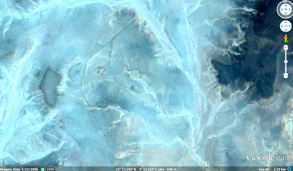
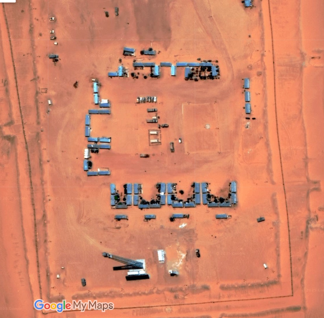
South of Tabelbalet, today Ain el Hadjhadj well (below right, 2003) is an army base, and the tricky dune crossing at KM330 (left) has also been graded and stabilised just to the north of the old crossing. I do wonder how you lay a track over dunes that’s strong enough to support trucks. Maybe a metre of rocky rubble does the job? But even then, as shown in the satellite screen grab below, as all over the Sahara, dunes will eventually creep back over the track, requiring regular clearing.
Hassi Tabelbalet, 2003Ain el Hadjhadj well and fort, 2003
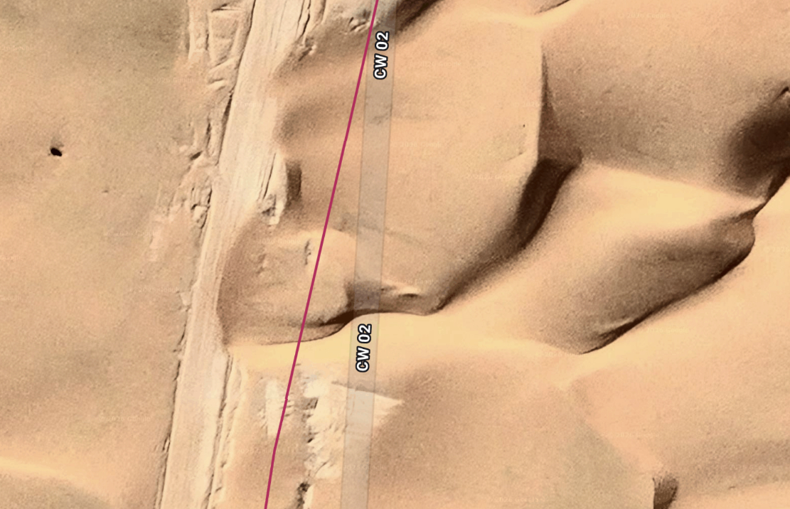
At this point the route gets renamed ‘CW2’, and the last 100km east to Illizi are sealed, making the distance now just 330km, fuel to fuel and doable in a day. You won’t see all the route on Google; it’s clearer on ESRI sat platforms, like Apple Maps or Bing maps.
CW2 plies the sands from Bordj Omar Driss
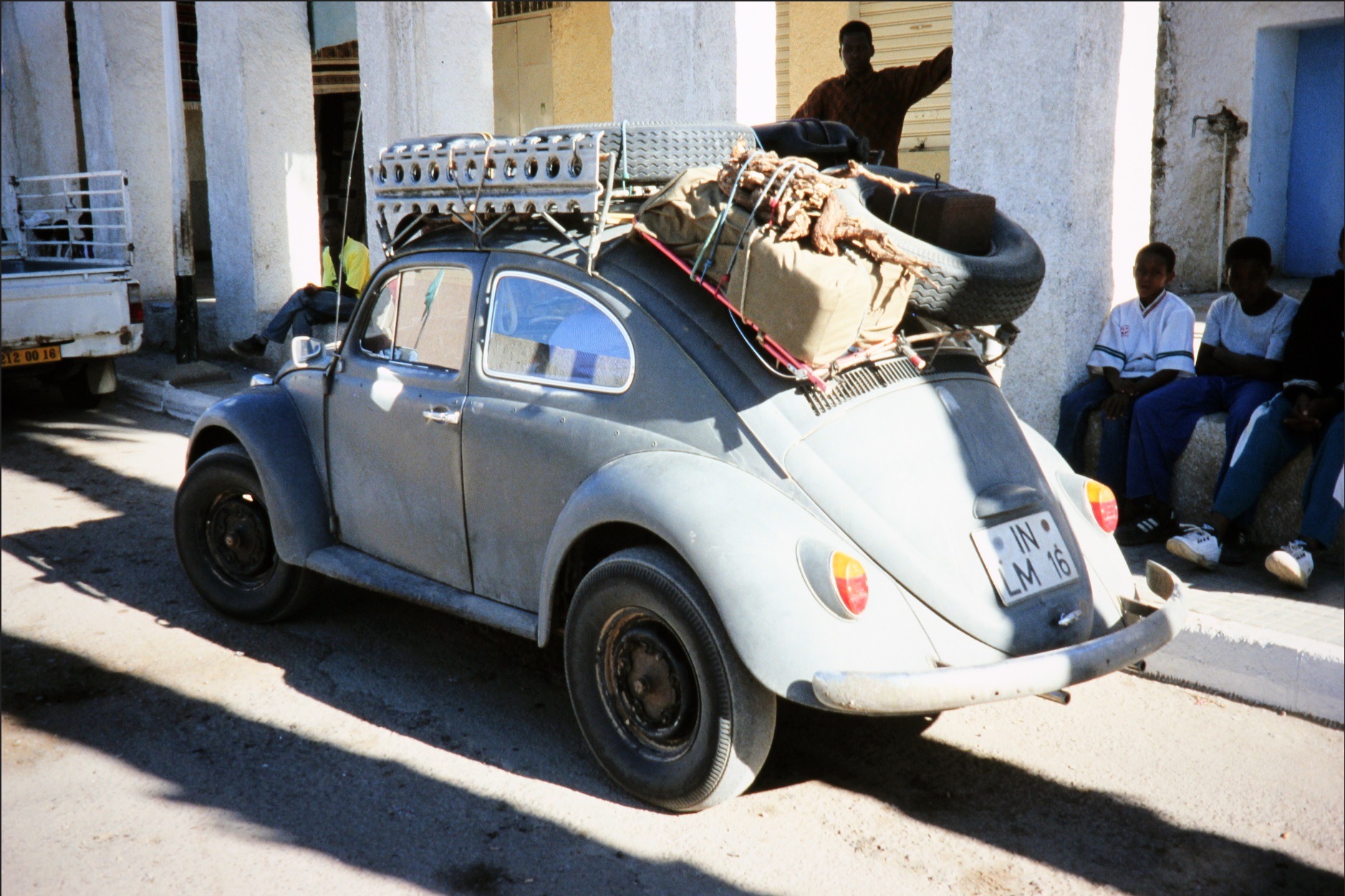
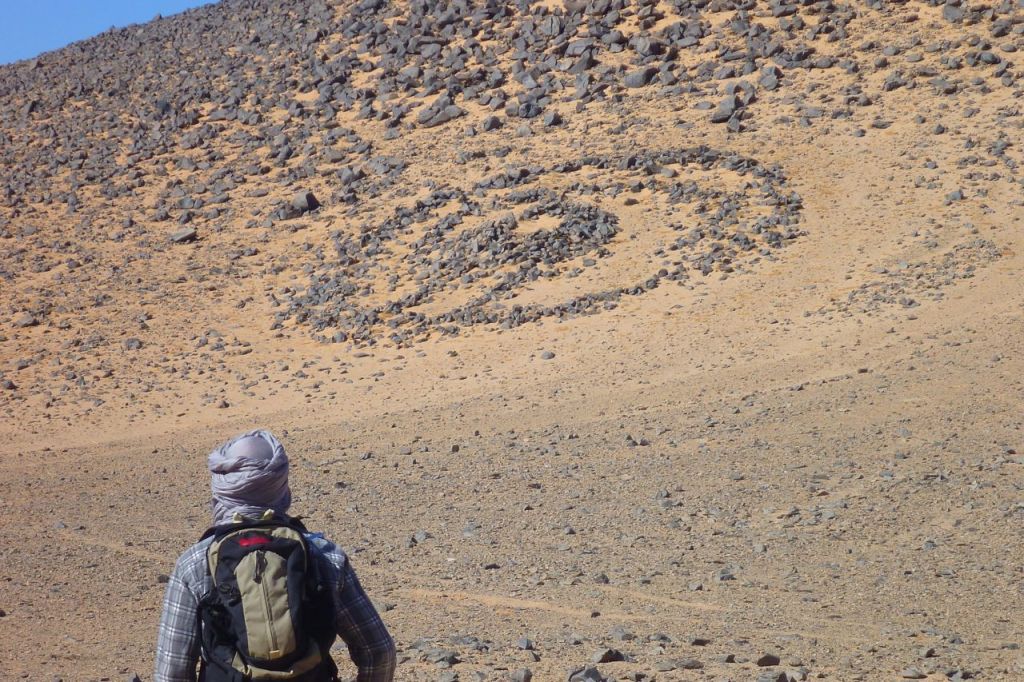
In 2026 a group of intrepid, escort-dodging Polish riders managed to be the first tourists in years to follow the Graveyard Piste to Illizi, which has been off limits to tourists since the kidnappings. Only now a gravel track has been laid across the sands directly south of Bordj Omar Driss towards Gara Khanfoussa (above). It passes east of the hill and meets the old A2 route at Hassi Tabelbalet well, where we once met a jacked-up VW Beetle (left) that had come across the Khanfoussa crossing just ahead of us. This route is also on OSM maps and is labelled CW2/CP2. You can view the Polish riders’ raw gpx with photos on Wikilocs and read about their ride here.
Exped 233; a 700-km walk from the Eye of the Sahara to Nouakchott
by Simon Cope
December 2025-January 2026
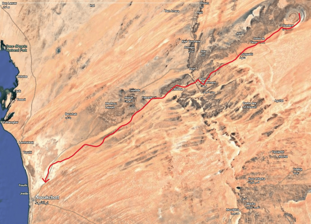
The Richat Structure, often called the ‘Eye of Africa’ is a prominent circular geological feature at the northwestern edge of the Taoudeni Basin, on the Adrar Plateau of the Sahara. The structure gained international attention in the 1960s when astronauts spotted it from space during early space missions. The name of our expedition (233 Degrees) refers to the bearing we followed for much of the latter half of the route as we made a direct line to Nouakchott. The estimated distance was around 700km. The actual distance walked was 679km due to short-cuts taken where possible.
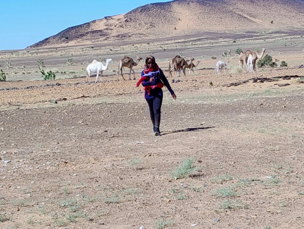
Expedition members Husband and wife team: Fatuma Babirye and Simon Cope, FRGS
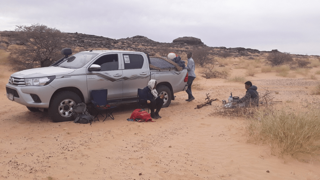
We started walking from the Richat Structure on 17 December 2025. We arrived on the outskirts of Nouakchott on 1 January 2026. The last day was notable due to thunderstorms in the area. In order to avoid camping in the rain (which would be miserable since our camping kit was not designed for heavy rain), we walked 47km on 1 January to finish the walk ahead of schedule.
Islamic (as opposed to pre-Islamic) grave site
Dangers and difficulties
The main challenge was being able to sustain walking 35-40km per day. This necessitated considerable walking in the afternoon into the sun at its most intense. Although the air temperature was rarely above 29C, the desert sun was strong. In addition, there was no breeze since we were walking in the direction of the prevailing wind. We therefore found many afternoons to be unpleasant. Navigation was not a significant problem since the support vehicle was normally ahead of us at prominent locations (track junctions, crests of dunes or hilltops) to guide us. There were times when we had no support vehicle for navigation, such as first thing in the morning since they were dismantling the camp or collecting supplies. On these occasions navigation was by compass bearing (often 233 degrees) and was relatively straightforward. Fortunately, we did not encounter any sandstorms.
One of the greener areas we walked through
The need for local support
A local tour company, “Tour in Mauritania” was contracted to provide vehicle support, food and water and camping equipment. We considered using camel support instead of vehicle support for a more authentic experience. However, camels would be restricted to 20-25 km per day and would need regular food breaks. Having a vehicle would give us more flexibility as well as the ability to cover longer daily distances.
Big skies on the coastal plain
Terrain
Minimal elevation gain/loss. The start of the trip near the Richat structure was around 550m whereas Nouakchott was at sea level. The second half of the trip was almost completely flat. The first third of the trip had some areas of deep sand, which considerably reduced our daily distances. Wherever possible we would seek firmer ground such as tracks and trails. Once on the coastal plain, we were able to travel cross-country relatively easily since the terrain was much firmer.
Not all was flat
Observations
Lessons learned. – The trip was planned to travel in a southwesterly direction to keep the prevailing wind behind us and to traverse deep sandy areas during the first part of the expedition when we were fresher. On reflection, the expedition would have been more enjoyable if done in reverse since we would have the sun to our rear in the afternoon when it was at its most intense ands we would also be cooled by the prevailing wind. There would have more deep sand towards the end of the trip, however on balance it would have been more pleasant.
Deep sand
– Ensure that the support team understands the nature of the expedition and the calorific and nutritional requirements of walking 35-40km per day in a desert environment. There were a few occasions where food supplies were running a little low.
– Kit we did not bring but would be useful on future trips:
– Many thanks for Hadrami Bouh, owner of Tour in Mauritania, for vehicle and logistic support and to Imane Kaa who provided accommodation and hospitality in Nouakchott and was able to accommodate our earlier than anticipated arrival.
– Would we do it again? Yes, but a different route. We heard from Hadrami about a previous expedition from Chinguetti to Timbuktu (an estimated distance of 1,200 km) many years ago. This route follows historic caravan trade routes and the pilgrimage route to Mecca. We would love to do this, however, the security situation in eastern Mauritania and northern Mali means this is extremely unlikely to happen in our lifetimes.
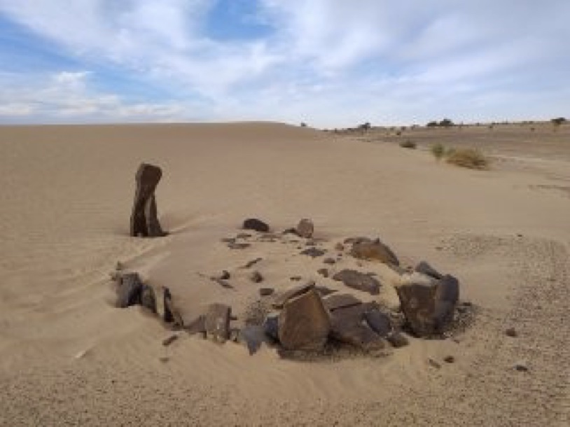
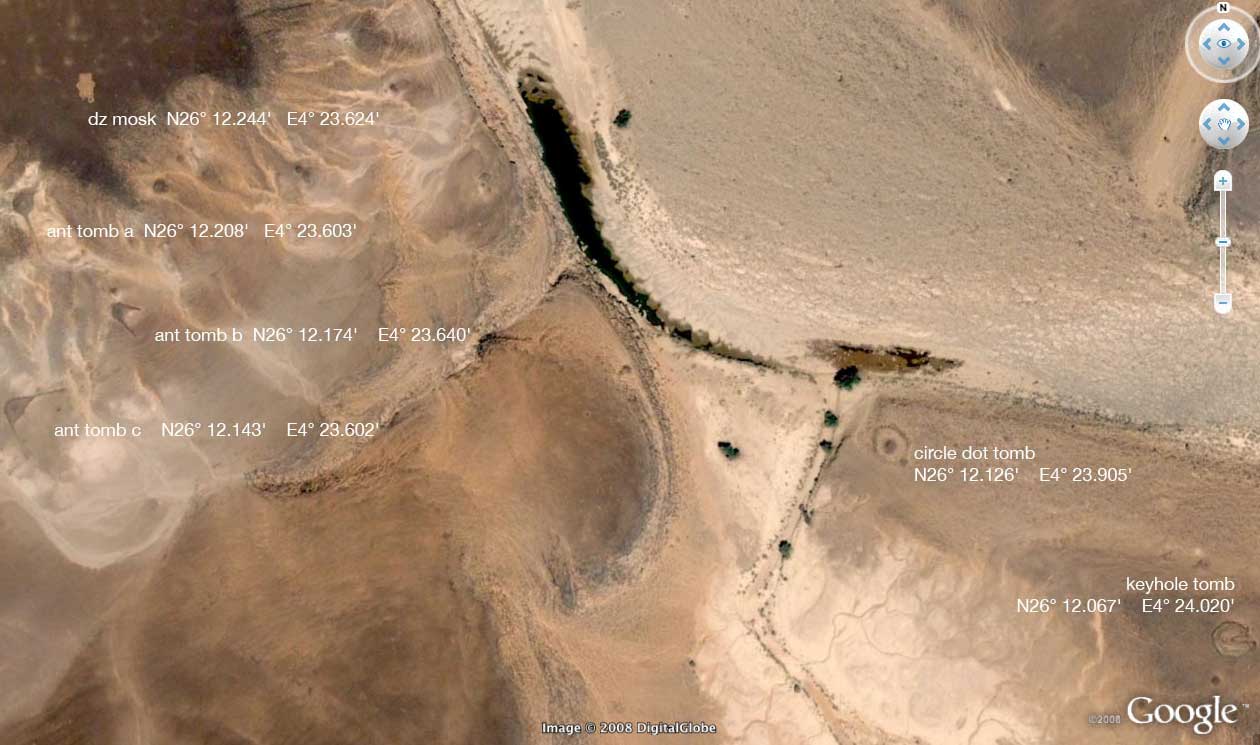
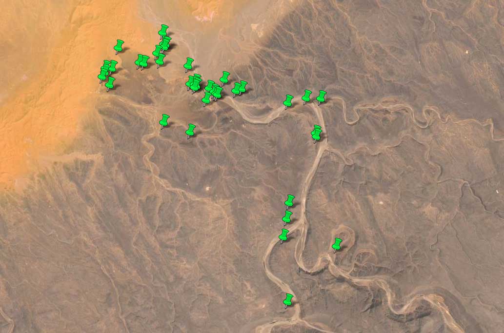
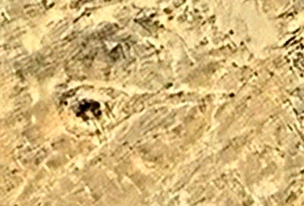
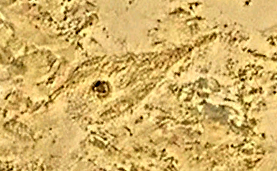
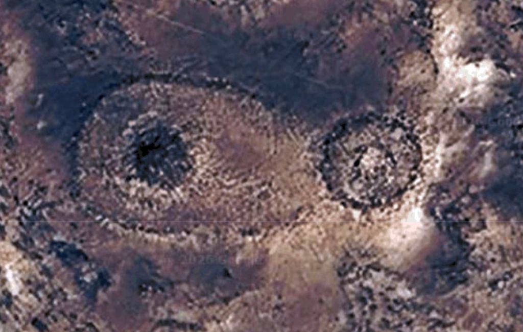
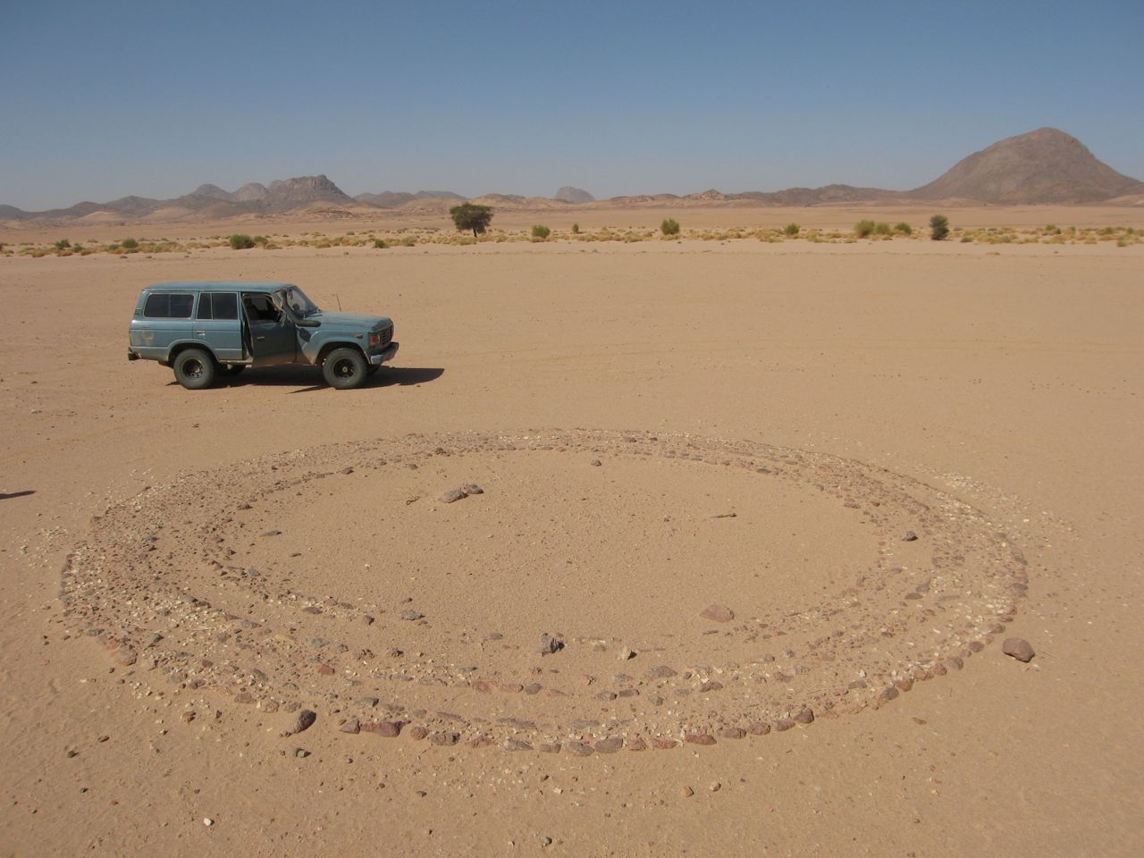
As on previous occasions, the route of our camel trek through the Immidir will rest a day at Aguelmam Rahla, a reliable waterhole at the mouth of the Oued Tafrakrek canyon (blue line on map, left) where the Tissedit plateau drops down to meet a band of dunes. I’d been wanting to make a diversion here since scanning Google Earth a few years back and noticing the innumerable pre-Islamic tombs (‘PIZ’) in the area (below).
Tombs around Aguelmam (‘waterhole’) Rahla.
Looking again on Google Earth some time later, less than an hour of nosing around revelled three dozen keyhole, antenna or mound-ring tombs within a few kilometres of the waterhole. I didn’t bother counting the less distinctive mound tombs or just plain tumuli. In fact the proliferation of tombs here isn’t so unusual, given the topographic features already listed: edge of a plateau, former river mouth, band of dunes – all common factors found at former Neolithic occupation sites.
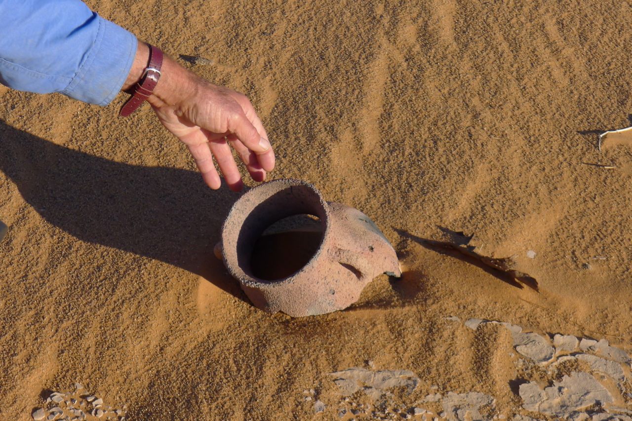
On the first crater tour in 2007 we walked along the base of the dunes, northeast from Aguelmam Rahla, and discovered several grinding stones and other artefacts at the foot of the dunes. And in 2012 one of us came across a near intact pot (left) at the foot of a dune, as well as napping (stone tool chipping) sites. You commonly find ceramic shards or even larger pieces, but I’ve never found an intact pot.
Location of tombs along the Oued Tafrakrek canyon and on the Tissedit plateau, with a cluster around Aguelmam Rahla at the canyon mouth.
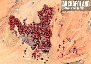
There’s something compulsive about Sahara tomb spotting on Google Maps, searching the featureless desert floor for the clear signs of prehistoric human activity. Once out there it can give a purpose to a journey that’s otherwise just agreeable recreation and adds a hint of treasure hunting. It reminds you that the Sahara of 6000 years ago was not a desert, but a much less arid savannah. Among others, KenGrok spent years scanning and collating unusual imagery on Google Earth’s layers, including pre-Islamic tombs in the Sahara. In 2019 Google erased his work, but his baton has been picked up by ‘syzygy‘ on Google Earth Community, as well as Manfred Boelke at archaeoland.eu (his image below).
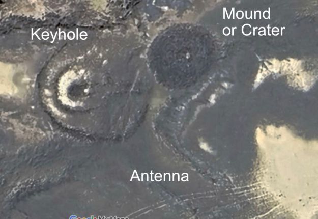
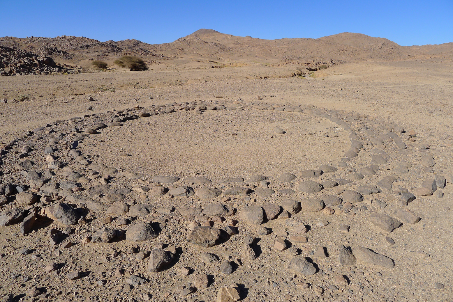
Broadly speaking, half a dozen tombs styles have been identified with clear regional limits as shown above. The most common is simply a mound of stones or tumulus which can be huge and can have a central depression to resemble a volcanic crater. Sometimes the mound may be surrounded by a ring – a mound-ring tomb. All over the Sahara tombs are usually found in clusters; find one and you’ll find others nearby. It suggests an auspicious place for burials or just a former occupation site with an adjacent burial ground.
A very unusual assembly of three types of tomb on the edge of the Tassili plateau near Djanet. The superimposed mound suggest the keyhole is older. As we know from rock art found in the same area, it’s common to cover what came before.
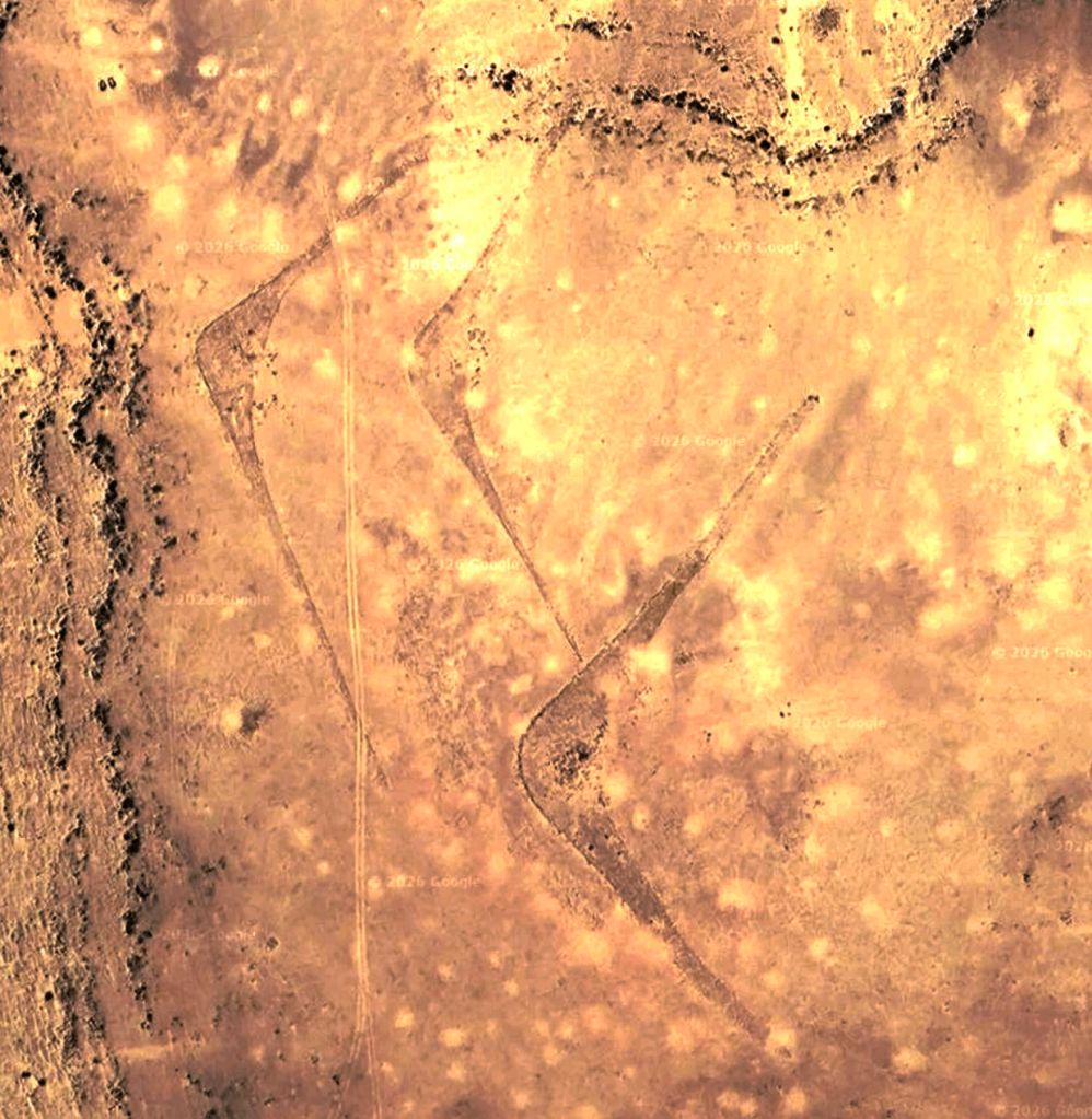
Antenna or crescent tombs have open arms spanning out from a tomb mound apex at around 120° and can be up to 250 metres or more, end to end. They are prolific in southeastern Morocco (bottom left; 27.6971, -10.8665), but are also found in Algeria by the thousand (25.86007, 4.36847). The finest ones have long, slender arms while small ones can be stumpy and even almost simple hemispheres.
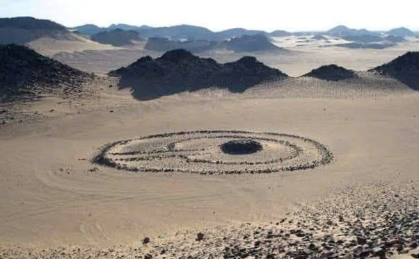
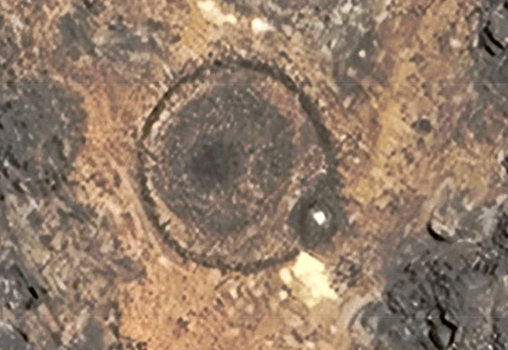
Keyhole tombs are two concentric round or oval rings with the tomb mound near the middle and a corridor leading to the outer ring. Below is a famous keyhole near Djanet at the base of the Tassili n Ajjer plateau where you’ll find them in their hundreds.
A version of the keyhole is called a goulet tomb (below; French for narrow passage, as in ‘gullet’). They have a large perimeter ring with the tomb mound on the ring’s edge and a line or corridot of stones bisecting the circle. I find these much less common.
Huge goulet tomb in the Immidir
A version I’ve read about but not seen is called the rather ill-named compass tomb which is found exclusively in the Tibesti massif of northern Chad (left). In the clearest examples like below, an arm or spike extends from the oval ring to one side, resembling a tadpole, tennis racket or snow show. As always, in the centre of the ring you will see the tomb mound.
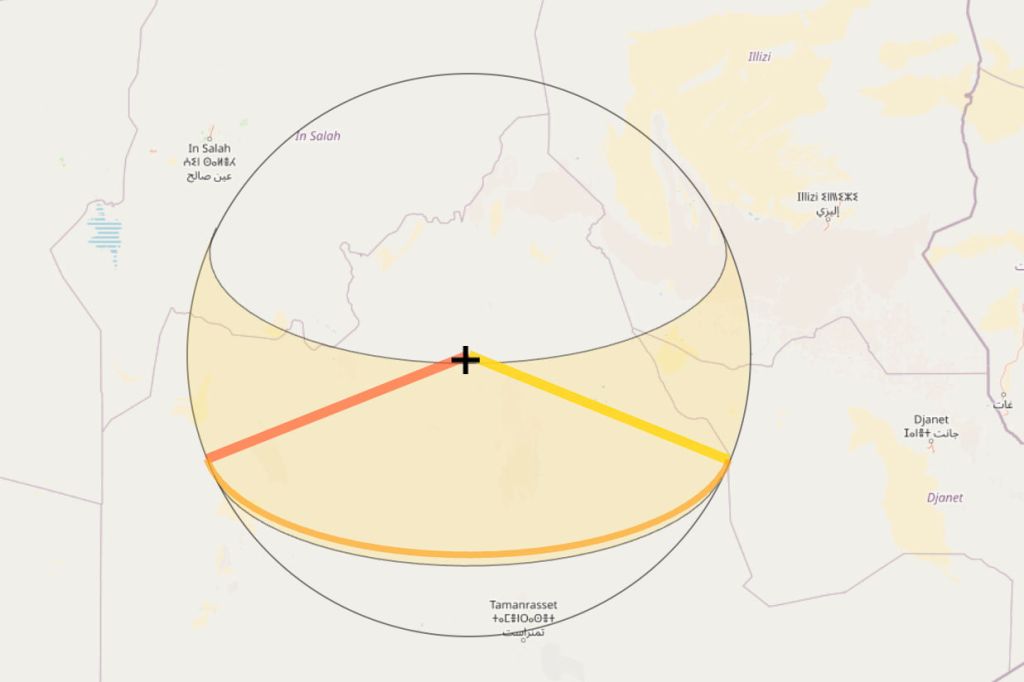
Sunrise orientation By now you may have spotted a common directional theme among the non purely circular pre-Islamic tombs: they all have orientations and elements which point at about 110° which, at these latitudes of around 25°N is towards the rising sun. Just as with many ancient, pre-monotheistic civilisations, the sun was the key element in their cosmology, with ‘the way to rising sun’ suggesting rebirth or afterlife. But just like builders, occasionally they got it wrong, like the compass tomb above right in the sands of the western Tibesti.
Sunrise and sunset points on the horizon at 25°N (Ie: much of the Sahara)
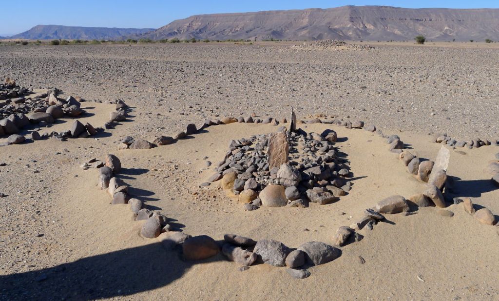
There is one final category of tomb which is also commonly foiund in the Sahara. The Islamic tomb. Contemporary Moslem cemeteries on the edge of desert towns are relative plain affairs, cleared rough ground covered in plain head stones. The ornate tombs below are out in the desert, far from the nearest village (Arak, Algeria). Usually the headstone is at the eastern end of the tomb, though of course with Islam that’s related to the direction of Mecca, not sunrise. These tombs, which might be said to have an entrance on the left and an east-pointing mihrab (‘altar’ niche) in the perimeter ring, will be a few hundred years old.
Islamic tomb
Not all pre-Islamic tombs fit the above categories. Below left, a keyhole shape but with no corridor, overlapped by a mound-ring tomb. Perhaps the corridor stones were reused for the mound-ring. Below right, a mound-ring with a perimeter mound like a goulet – a descendant’s tomb? I read here that excavated tombs in the Oued Draa of southern Morocco were more like mausolea, with a walled crypt under the stone mound where successive generations were interred. I’ve never read of a tomb being excavated like this in the Sahara, though I’m sure it must have been done, by either grave robbers, archeologists or the curious. I remember one time in the exceedingly remote Gilf Kebir, we came across a plain, desolate tomb (rare in that area) on a day-walk. Someone half-heartedly dug it up but found neither bones nor treasure. It didn’t seem like the right thing to do.
Antenna; unimpressive at ground level
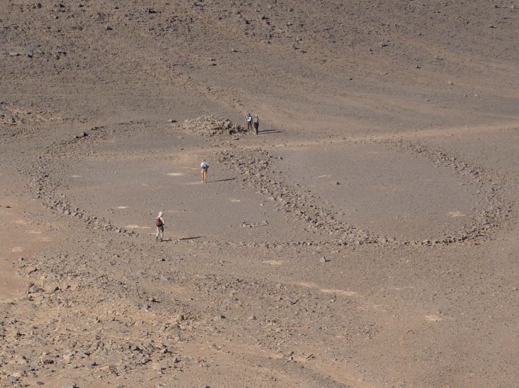
Often this fascination and excitement with pre-Islamic tombs falls a little flat on actually finding one on the desert floor. On a 2012 Immidir trip I was excited about finding a huge antenna tomb that lay close our path on Day 6 or so. On Google (above) the massive structure with a span of over 300m looked amazing, but by the time we tracked it down (left), it was too big to appreciate from ground level. My group seemed to say… ‘and the purpose if this diversion was…?’. ‘Flying’ over these tombs on satellite imagery, like Peru’s Nazca lines, is how they’re best appreciated.
How old are these ‘pre-Islamic’ tombs? Well in the central Sahara I’d say the Islamic era began to have an impact a couple of hundred years after the Arab Conquest of North Africa between AD 647–709. I imagine this swept like a tide west along the south Mediterranean coast, down the Atlantic to present-day Mauritania and then ‘eddied’ back west towards places like Timbuktu. Other eddies may have spun off sooner to places like Ghadames in Libya, following trans-Saharan trade routes into the interior.
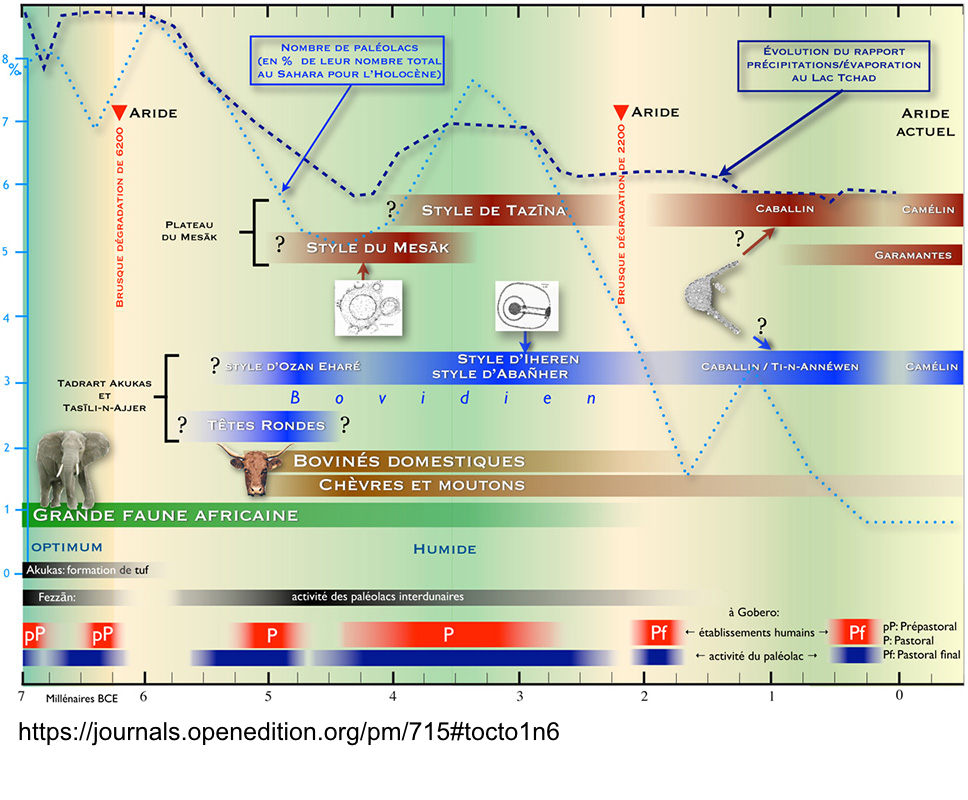
Chances are these tombs, like the huge keyhole on the right in the Immidir (above), are only around 4000 years old, maybe double that. That means they followed the apogee of rock art some 6000 years ago following a climate change (the ‘Humide’ in the image below) which briefly repopulated populated what is now the Sahara. By this time megalithic tombs and temples became widespread across the ancient world, most spectacularly in ancient Egypt and western Europe.
You don’t have to venture into the deep Sahara to see keyhole tombs. In southern Morocco, just a short distance from Erg Chebbi and three miles west of Taouz, on the west side of the Oued Ziz are a cluster of tombs. Like Aguelmam Rahla they’re situated on the edge of a plateau and by a former big river as well as an erg – and not all with entrance ways pointing east.
Below, a curious structure on the Oued Tagant valley midway between Tam and Djanet. And below that, another in the Hoggar, just southeast of Assekrem. I’ve seen these elsewhere in southern Algeria but their meaning is unknown. The guides and old Saharan expeditions just call them ‘tombs’ but they look different and newer than PIZs. More about them here.
Eighteen years after the first edition (review), original author Anthony Ham returns with new co-authors to give this huge country another sweep. In that time guidebook sales have collapsed, but by all means knock yourself out online trying to collate the broad spread of information amassed here. Providing it’s done well – never an easy job, even with today’s internet resources and let alone in Algeria – this is why a pocket-sized guidebook still works. And after half a century in the business, LP have a new look which has refined the art of laying out a guidebook to be eminently ‘dippable’ while perhaps dumbing down on old-school authoritative content which made LP the leader in this field. This unimpressed poster on Trip Advisor describes the new look as ‘experience-focussed design’ but flick open any spread and you’ll be drawn to something of interest. My pros and cons below:
Great price for what you get despite the flaws listed below
Reader-friendly design
I don’t know the north, but it looks superficially well covered and interesting
Need for guided tours plus escort aggro not glossed over
Locals’ and influencers PoV and contributions a nice touch.
As before, fails to get the big picture down south
Maps are plain, many with small errors, don’t distinguish main highways from tracks (some non existent), nor show road numbers or some places referenced in the text
Couldn’t find a legend for the tiny, inscrutable map icons
Generic library photos feel disconnected from body text – as if there were two separate editors at work
Loads of repeated info/boxes (eg: Foucauld) plus a few pointless or obsolete boxes carried over too, like 153 Club
Despite apparently being in the Immidir for ‘1000s of years’ (p259), you’d think the Tuareg (pictured on the cover) would make a good two-page spread
Many place names or spellings are unknown or unrelated to long-established mapped precedents
Grumbles about sourcing ancient paper maps; so why not research/suggest an alternative for a device?
‘Bedouin’ tents/tea/etc – in Algeria?
Detailed maps of ‘Sefar plateau’ and Tadrart would be helpful to ID the many places mentioned
Insistence on amusingly alliterative headings doesn’t always work and makes what follows all the more fluffy
Odd absence of other/European sources of background, history, adventure, reading, coffee-table books and so on. Deliberate or just an oversight?
1990s civil war and resultant contemporary social issues also overlooked
Confusion about travelling with ‘… Camel or on Foot’. Despite what’s implied for Sefar (p300), ‘Camp[ing] out under Saharan skies‘ (to quote the back cover) is contingent on pack animals or a jeep. You won’t survive long in the desert without either
To people like me who’ve visited le Grand Sud dozens of times over several decades, Algeria is the Sahara and the Sahara is Algeria. Scenically, culturally and historically it’s all here in one huge, relatively safe and welcoming country. But this being an LP, the populated north (not so safe at the time of the first edition, iirc) gets the full treatment: coastal cities, Roman ruins, Kabylia and the Aures mountains and beaches. We must have beaches. The far west (Tindouf and the the way to Mauritania is not covered nor explained. Despite global tourism’s onward spread, your average Planeteer may need reminding that Algeria resembles Iran, Myanmar or North Korea in terms of visa applications and travel restrictions. Since the 2003 mass kidnappings, you need a local travel agency invite with an approved itinerary followed by chaperoning in the deep south. On a fly-in tour or in a big group, that’s not a problem and can be fun. For travellers used to independence, especially in an enticing expanse like the Sahara, it soon gets costly and frustrating, especially if lumbered with a crap tour agency crew. Dodging the agency escort rule is possible in the north (and, for a couple of years recently, in the south too), but down south there’s a good chance you’ll also get roped into pointless gendarmerie (not ‘police’) highway escorts (including protracted changeover waits), even when travelling with an approved agency. This is addressed openly and repeated often, and is what holds back Algeria’s overseas tourism potential.
What They Say Discover Algeria’s most popular experiences and best kept secrets from sandboarding or quad biking in the spectacular desert oasis of Timimoun; to exploring Tlemcen, an architectural jewel of medieval mosques and palaces; and gazing in awe at the 15,000 prehistoric petroglyphs [sic] at Tassili N’Ajjer National Park. Build a trip to remember with Lonely Planet’s Algeria travel guide:Covers: Algiers, Tipaza, Constantine, Djemila, Annaba, Timgad, Tlemcen, Oran, M’Zab Valley, Timimoun, Beni Abbès, El-Oued, Tassili N’Ajjer National Park, Assekrem, Tassili du Hoggar [not covered].
Review The guidebook is divided into into four sections. Only bold sections below were read end to end; the rest was scanned. Added up, the two Sahara chapters cover about 40% of the Guide section.
PLAN YOUR TRIP – 50pp (Highlights) THE GUIDE 230pp – Algiers – 28pp – Northeast – 42pp Algeria (Roman ruins) – Oran – 20pp – Northwest Algeria – 18pp – Central Algeria and the Grand Ergs – 44pp (Northern Sahara) – Tamanrasset, Djanet and the Sahara – 48pp (Deep south and southwest) TOOLKIT – 14pp (Travel practicalities) STORYBOOK – 14pp (Cultural background)
Opening the book, a striking Shutterstock image of granite monoliths (below) jumps off the Contents page and is reused here. Captioned ‘Tassili N’Ajjer NP’, it didn’t resemble the distinctive sandstone ‘tassili’ ramparts and canyons I knew. Searching online drew no answers, except for this similar image by Tom Sheppard, which I’m fairly sure is in the distinctive Tesnou region west of the TSH and miles from the Tassili NP. This isn’t the first guidebook I’ve reviewed recently that’s entirely illustrated with library photos, with authors now template-filling content providers. But as listed above, it’s common to read an evocative description and think ‘I wonder where that is or what it looks like’. The text and imagery, even the maps, often feel disconnected.
Tassili NP?
Ilmane
Upfront, Plan your Trip lays out highlights of the Guide’s five regions followed by suggested Itineraries. The northern ones look good, but what do I know? Down south ‘Into the Heart of the Atakor’ oddly suggests going from Tam up to Assekrem, then coming back 80km and back up the western approach as far as isolated Ilmane peak (left) which is just 22km west of Assekrem. It’s hard to think why this wasn’t a straightforward 200-km overnight loop via both locales, except later on the missing link is described as a ‘dangerous short-cut’ or ‘perilous clifftop traverse’. Really? There follow spreads including when to go, Ramadan, dress and manners, visiting the desert and choosing an agency (I tried a few; only two replied; usual story), the food scene, getting a visa (pre-approved VoA a staggering €365 for 30 days, vs £85 at a consulate) and the Outdoors.
Algiers kasbah
After the Guide Toolkit practicalities cover arriving, getting around, money (black market recommended, but why US dollars?), lodgings, health and safety (‘avoid Algeria’s border with ‘Western Sahara’; except there isn’t one), women travellers, language and so on. The book ends with Storybook articles which tackle a sketchy History in 15 Places rather than chronologically, a skimpy ‘Meet the Algerians’, Algiers artists, prehistoric rock art and the Algiers Casbah (left) – site of bitter independence battles in the early 1960s and now an ‘old town’ tourist attraction. Storybook would have been a perfect place to expand on the Tuareg, their enduring mystique, origins, traditions, clans, rebellions, persecution and all the rest. Libraries and the web are awash with material. Backing up to the two Saharan sections of the Guide, the Ergs and Oases looks like a pretty good account from El Oued to Taghit via Ghardaia and Timimoun. In El Oued the ‘Top Experience’ spread covering camping and quad biking in the dunes is rather reluctantly rendered, and there’s confusion about the location of the Tademait as well as Ghardaia being ‘south’ of Ouargla (it’s WNW). On p212 there’s another typical example of repetition: a column on the left talks of Convoys (escorts) while the body text alongside has a heading ‘Police escort’ – the same thing. They mean the paramilitary gendarmerie (a big difference), but where is an editor? I also get the feeling that too many of author’s subjective encounters are passed off as typical reader experiences because of a lack of actual background knowledge or context. In the meantime, it looks like I’ve long missed the boat to visit once lovely Taghit; now reduced to a dune-bashing desert resort, like Erg Chebbi, just 190km to the west. Moving on to ‘Tam, Djanet & the Sahara’, as with the previous edition it’s either one or the other with no connection between the two towns or ‘hubs’, other than proposing a flight, which if in daylight ought to be amazing. As mentioned above, the suggested convoluted itinerary into the Atakor (Assekrem) seems odd, and is there really a place called ‘Guelta’ near Terhenanet? Maybe authors no longer get to check finished proofs. And you’d think the beautiful Tazrouk loop out of Tam, let alone the N55 to Djanet would’ve been a great desert itinerary too. Meanwhile, the distinctive Tefedest and Arak Gorge (marked earlier on the ‘Action Areas’ map as an ‘extreme adventure’ locale) share a sentence, then don’t get another word. In Salah turns into a masterful exercise in padding – another sunset dune venue (yawn), while dodging actual POIs, scant though they are. It may only be listed to pitch as a hub to visit the nearby Immidir (below), by which time the author is definitely winging it in full flow. One person can’t be expected to visit every amazing corner of the desert, so why not track down contributors to fill the gaps? In Djanet the famous Tassili plateau walk is listed and illustrated with stock images of the best known places, but doesn’t seem like it was actually done. The now over popular Tadrart (Oued In Djerane canyon, not ‘plateau’) may have been visited – maps for here and the plateau rock art walks would help readers visualise these regions. After that it seems the author was taken on a random drive to Tasset on the Fanoun (no mention of amazing Afara round the corner) followed continuation to dead-end Ifni, of all places. Around here I realised there was not a single image nor mention of the massive megalithic pre-Islamic tombs (below) which you drive right past in these areas.
Pre-Islamic tombs
In the face of hotel booking websites, the formerly tedious job of researching the best lodgings for the reader has been revised down to a quick handful of ‘Places we Love to Stay’, even in the north where you might wander unchaperoned and value curated suggestions. There are only eight in the entire South – three a-piece in Djanet and Tam where the old town centre Hotel Tinhinan is described as a right dump. Thanks for the tip: in five seconds great alternatives where I would love to stay spring up on Google.
Box canyon behind Arak, southern Immidir
In the end the desert south reads too much like a quick update to the first edition which itself was skimpy. A night in In Salah, a couple in Tam ticking off Assekrem, with a bit more time rightly spent in the Djanet area. No serious attempt has been made to get under this amazing region’s skin. That’s a shame but may be the reality of today’s budget-constrained guidebook research and production. To be fair that’s also reflected in the book’s price where you’ll still find 15 quids’ worth (or less on amazon) of ideas and inspiration between the covers.
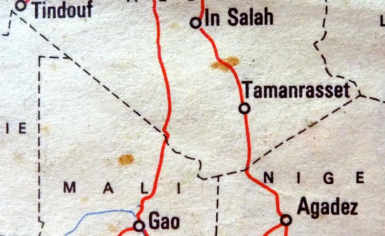
Over the span of some 2300km, along Algeria’s southern perimetre two largely straight lines (below) radiate northwest to Tindouf and northeast to the Salvador-Anai border tripoint. They mark Algeria’s desert frontier with Mali and Niger. For decades as porous as a string vest, they’re crossed by the original trans Sahara routes established at the dawn of the motor car era in the 1920s: the Trans-Sahara Highway from Algiers via Tamanrasset to Agadez in Niger, and the more desolate Tanezrouft from Reggane via Tessalit to Gao in Mali (below). Both are now largely sealed in Algeria but for years have been off limits to travellers.
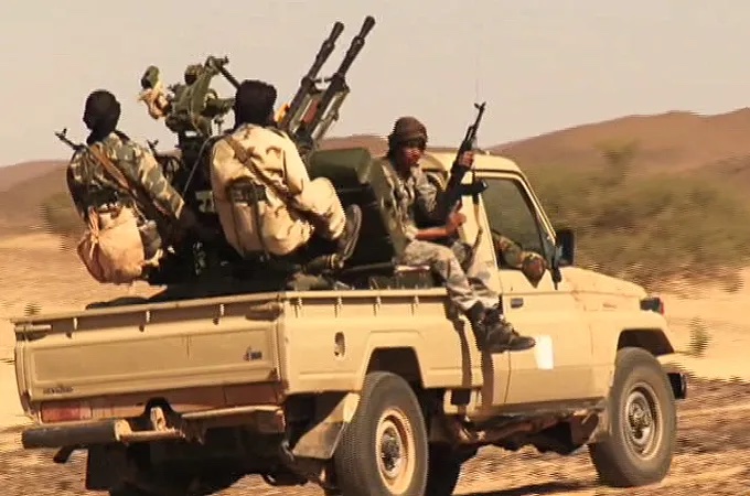
In 2011 the already dangerous Sahara was further unsettled as Gaddafi’s regime collapsed, and militias raided arms depots across Libya. Much of that weaponry flowed west across the desert to northern Mali, long controlled by Islamist insurgents (left) or Tuareg separatists.
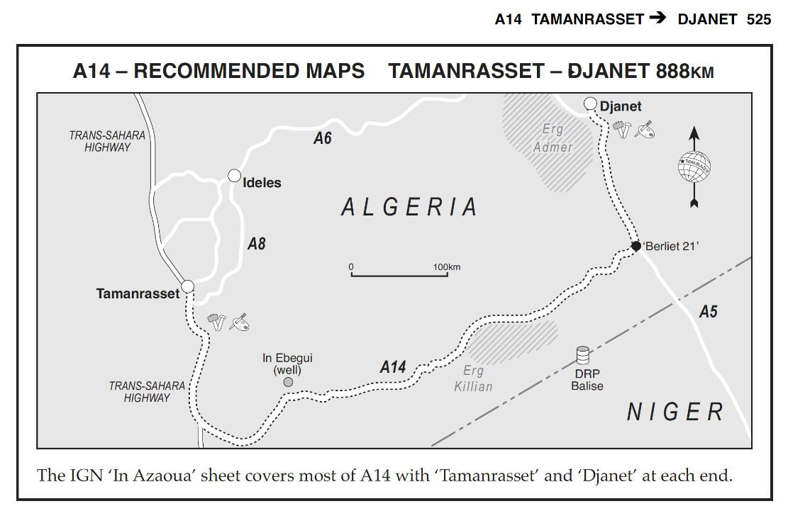
The quickest route was across southern Algeria, because south of the well-used road between Tam and Djanet, the 200 kilometre band of desert to the unmarked Niger border was entirely unpopulated but easily navigable. Even when we did Route A14 (left) in the early 2000s, we were surprised how well developed and even corrugated parts of this obscure track was. At that time Algeria had its own smuggling networks running between Mali and Niger, but come 2011 had nothing to gain and much to lose from the added instability brought about by the redistribution of Libyan arms. These days controlling the flow of sub-Saharan migrants is probably the bigger concern. In Algeria most come up from Niger around In Guezzam (TSH) or the Chirfa piste (route A3 from the book), and are openly seen walking along the road or wrapped under a speeding pickup tray’s sheet, on the TSH north of Tam, or hanging out in Bordj el Haouas bound for the Fadnoun plateau on the N3, before being rounded up and deported en masse at In Guezzam. I remember way back in 2002 encountering what I later realised where dumped migrants on the Fadnoun, an hour south of Illizi, and later sharing the cliff path climb with others on the ascent to Jabbaren. For migrants this was a short-cut to Ghat in Libya and – long before the advent of Med boat crossings – the possibility of work there.
Berm and patrol road, alongside the Niger border in the northern Tenere close to the Chirfa piste.
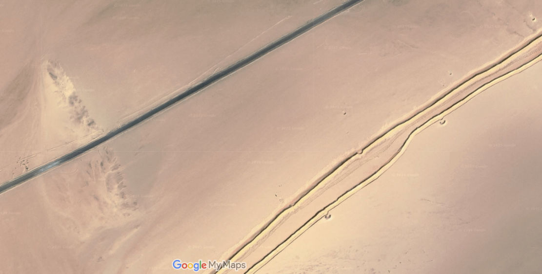
The answer to the latter has been an attempt to seal the exposed southern border with a series of double berms (car-blocking sand ridges; above) filling out the long gaps between impassable natural topography. This is just what Morocco did in the Western Sahara decades ago to define a de facto border with the PFZ, and what Algeria has also done along its Moroccan border to reduce illicit traffic.
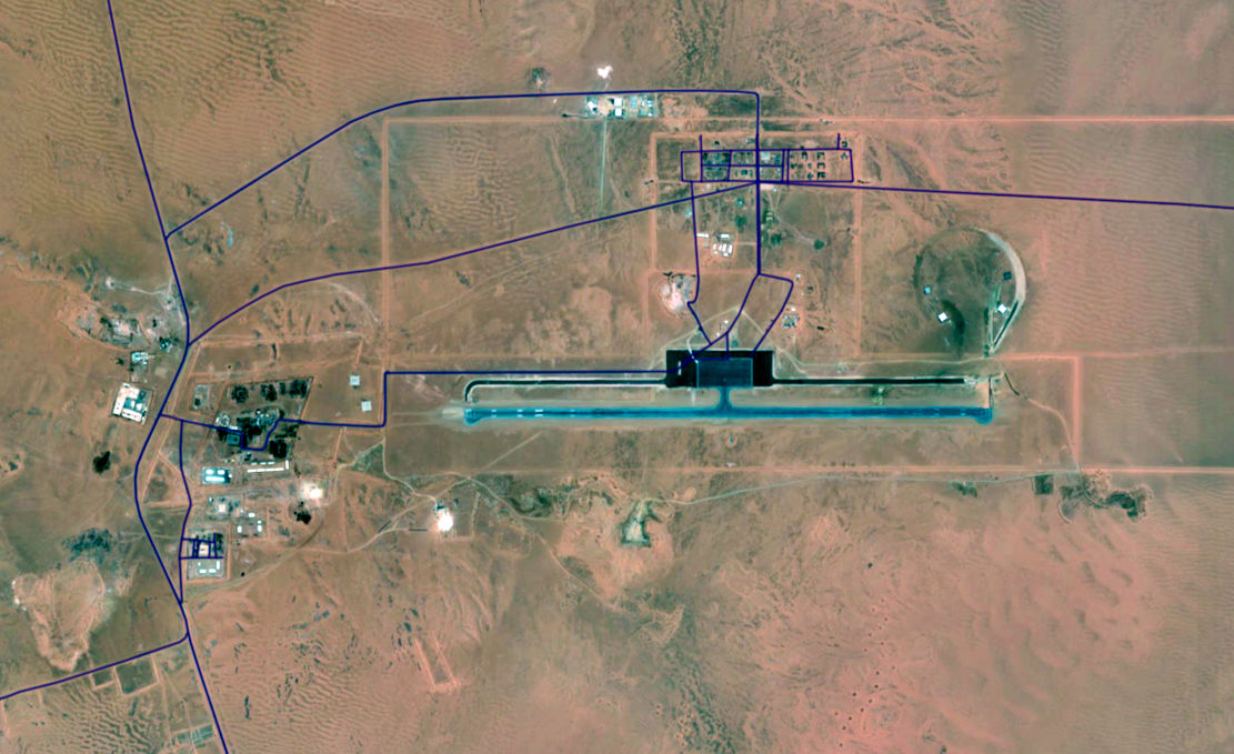
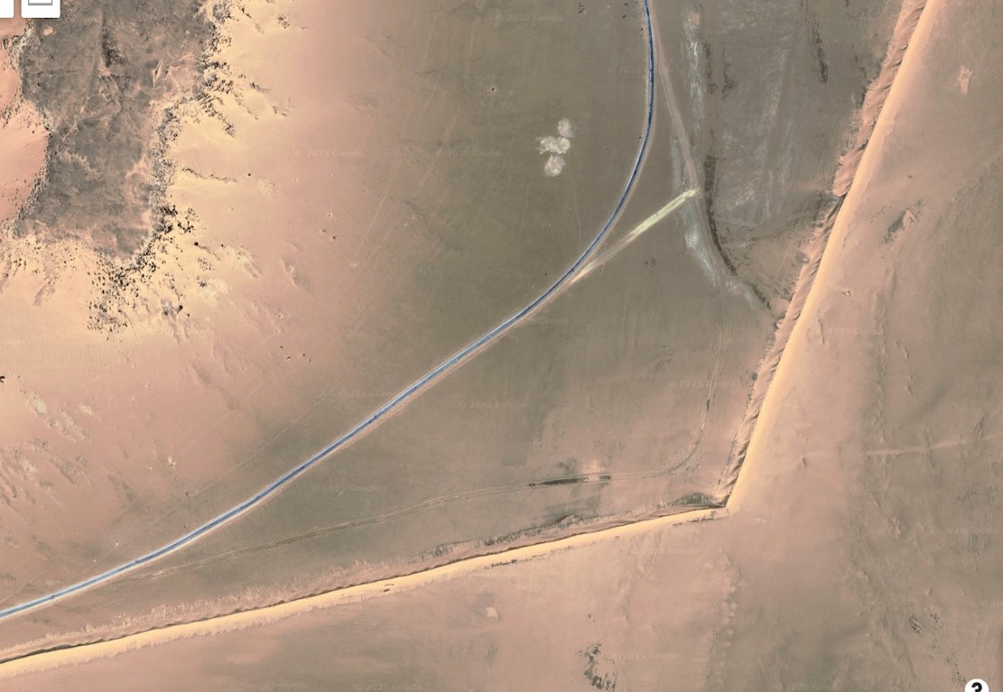
These efforts may be funded by the EU or other agencies and the berms (part-mapped below, in black) are backed up by new military access- and patrol roads (red, below), all linking scores of bases, some with huge runways (above) in the middle of nowhere. They run near continuously from the In Amenas oil producing area south of Ghadames in Libya, all the way round to Bordj Moktar and beyond. West of there towards Chenachen or Tindouf, the Erg Chech acts as a natural berm.
Berm in black. National highways blue. Border patrol roads in red. Not all roads and places shown. ‘Bases’ may be other, non-military installations.
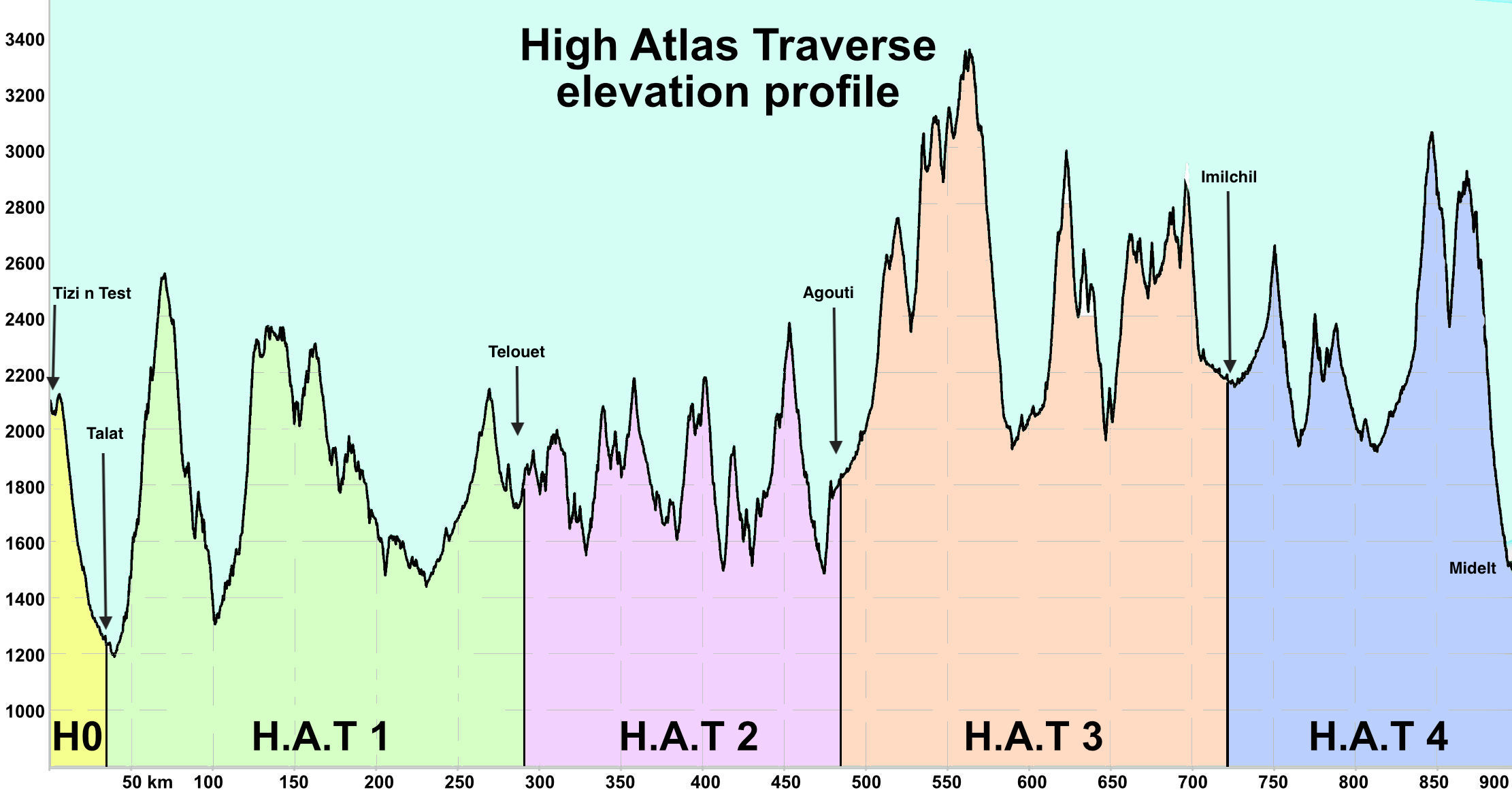
The 900km High Atlas Traverse is now online with the maop getting 1000 views a day. Download the gpx files at the link above. The H.A.T is like the TMT: quiet backroads and mostly easy trails – but it follows the mountain watershed via the highest motorable passes. Only about 15% overlaps the TMT and it reaches up to 3340 metres (nearly 11,000′) and permanently stays above 1500m from Stage 1 onwards. Bigger bikes and longer vehicles may struggle on some of the climbs. More on the link above and some pics from our recce below.
ScreenshotTime to leave the mothershipH0 near the TestH1 out of IjoukakH1 Coming into AbdallaFuel and coffee break in Aguim (H1)Way above the tree line on H3H3 Zerkane crossingSimon gets mobbed by his TikTok fansH3 The trail sweeps down into DadesHighest through trail in MoroccoOver the OuanoBob & a mosqueH3 Hidden valley on the Zerkane crossingH3 Breather on the Zerkane colLast few chilly miles to Bou AzmouTilmiH2 Looking down on the old Demnate roadH0, KM0. The H.A.T lays before usTTR still breathing at 11,000′Chilly auberge near Bou AzmouH1 near TiliwineH3 First 3000-m colJob done. Enjoy the H.A.T!H3 Leaving Ism Souk for the high crossingH2 Lunch on the Demnate roadH1 Jebel RhatCafe Louta in Tilmi2963mRoad finished east of ZerkaneImilchil, start of H4A shot of v-fuel in AnerguiH3 Nearing the Zerkane colH1 Ait QallaH1 Ait Qalla plateauH3 The high trail goes on for 65km
For centuries camels were the way to go in the Sahara. Introduced from Arabia around 0AD, they proved to be ideally adapted to transporting heavy loads without needing water (providing they was daily herbage or straw). A couple of centuries ago huge caravans numbering thousands of camels would transport salt, slaces or sold from the souks of the Sahel. Today, camelling is still a satisfying way to travel in the desert. You don’t ride; the camels carry all the provisions. But besides the obvious motos, 4x4s and aircraft, here are some other ways people have chosen to cross the great Sahara.
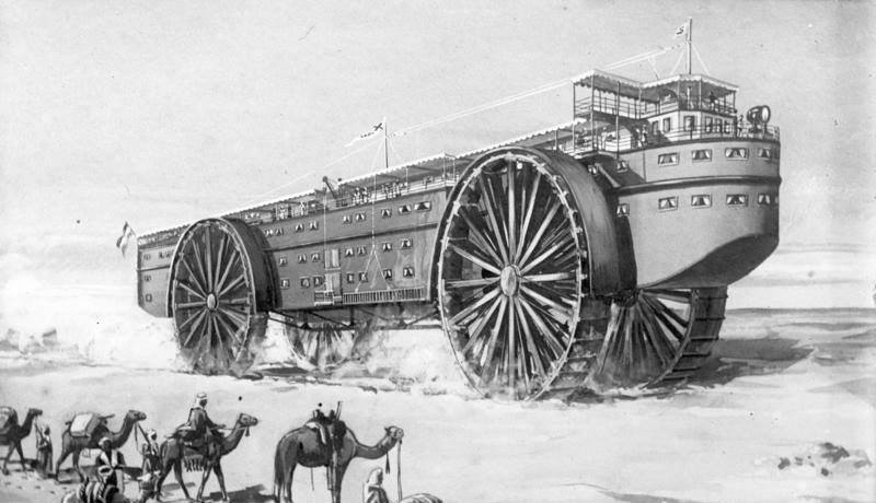
Steam Powered Landship
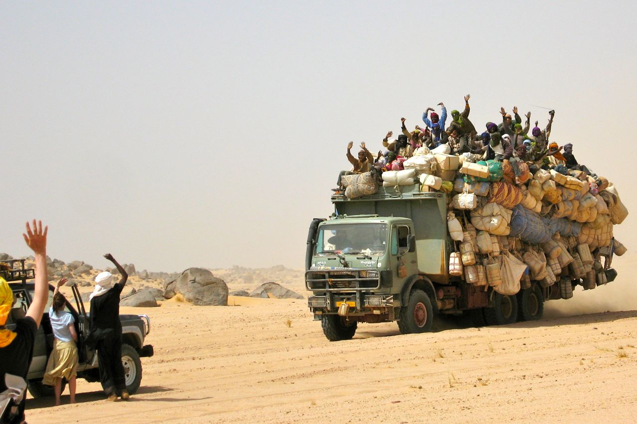
Gros porteur heading back to Agadez
In the Edwardian era of luxurious, steam powered ocean liners, why not a desert liner to tame the vast sand oceans of Sahara? Like something from a Jules Verne novel, giant traction wheels would glide over the sands while desert tribesmen looked on in awe. This one never got beyond the drawing board, but today massively overloaded gros porteurs (left) from the pre-electronic 1980s diesel apogee still grind across the desert sands.
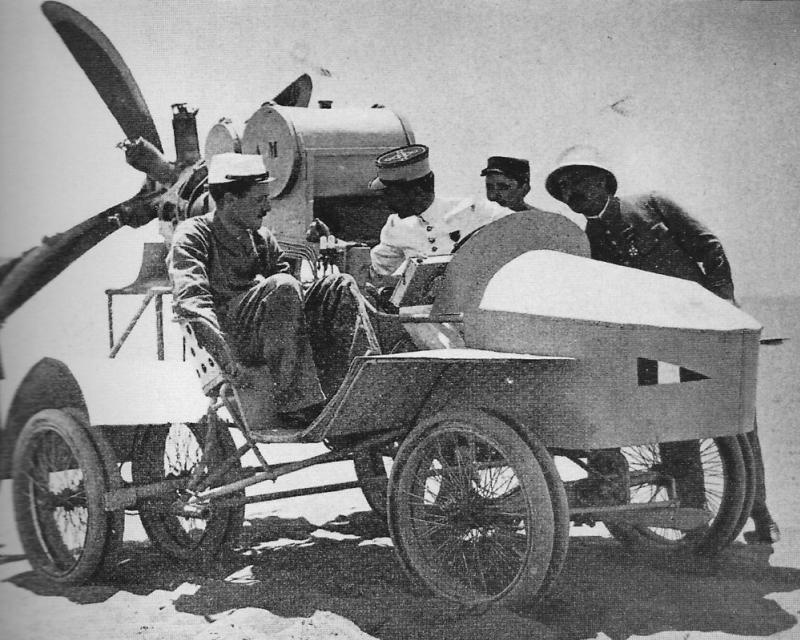
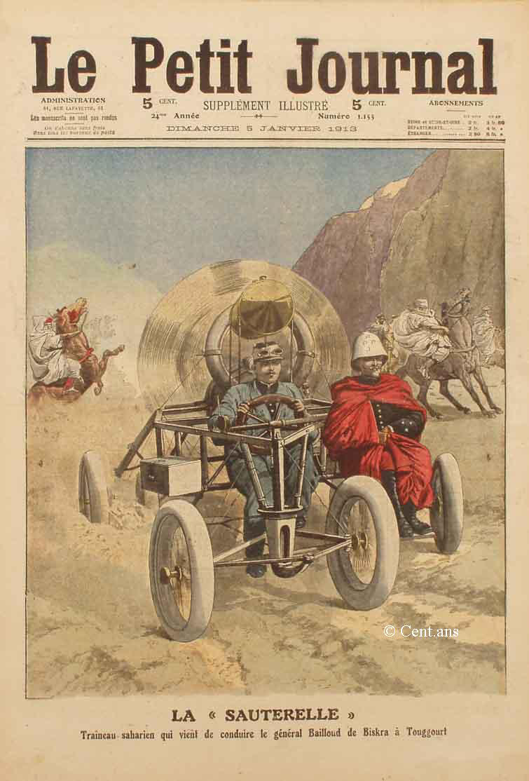
Sauterelle Propeller Car
With the advent of the gasoline-powered motorised cart, or ‘car’ for short, traction in the desert sand was the problem with early, low-powered and inefficient engines. Those new fangled flying machines never this issue, so how hard can it be to combine the two? Behold the wingless, deafening wonder known as the Sauterelle propeller car of 1912 which could literally put the wind up you. Nicknamed the ‘mobile guillotine’ (not really ;-) it was tested near Ouargla and never heard of again. Read more here.
Citroen Half Tracks & Renault Type MH ‘Douze-Pneus’
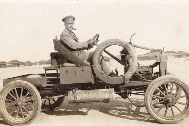
Motor cars were catching on but traction in the desert remained a problem. During WW1 the Brits under Pat Clayton adapted ultra light, 2WD Model T Fords for the Light Car Patrols in Egypt (left). Desert adventurer Ralph Bagnold used these Fords to travel deep into the hitherto unexplored Libyan Desert.
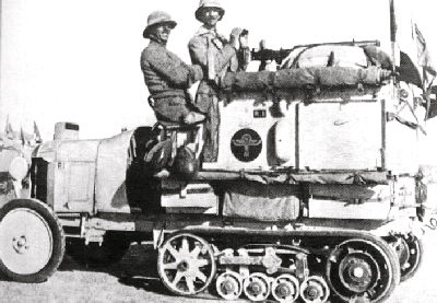
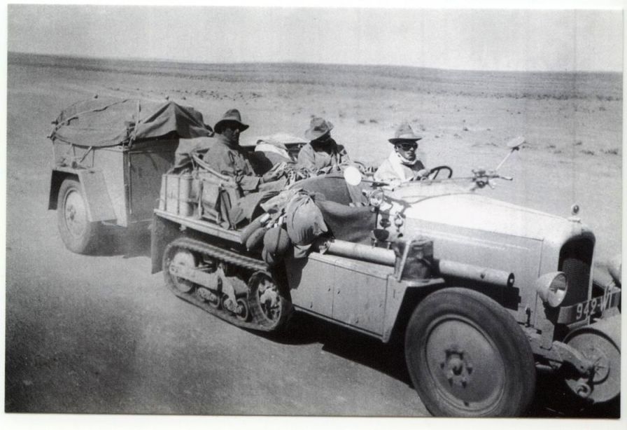
Around this time Citroen were the first to cross the great desert via the largely flat but very long Tanezrouft Piste in a vehicle fitted with ‘autochenille’ or Kegresse half=tracks (below). Very slow but not as noisy or deadly as la Sauterelle, they crawled across the desert and were used by Prince Kemal el Din (left) to ‘discover’ the lost plateau of the Gilf Kebir in southwestern Egypt.
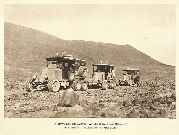
Competitor Renault’s solution to the traction problem was the 6×4 10CV Type MH featuring doubled wheels rubber and twin rear axles. Nicknamed ‘le douze pneus‘ (not really ;-), Renault trounced Citroen’s trans Sahara expedition of 1922 with a full, 23,000-mile trans Africa in 1925, the first cars to cross the continent.
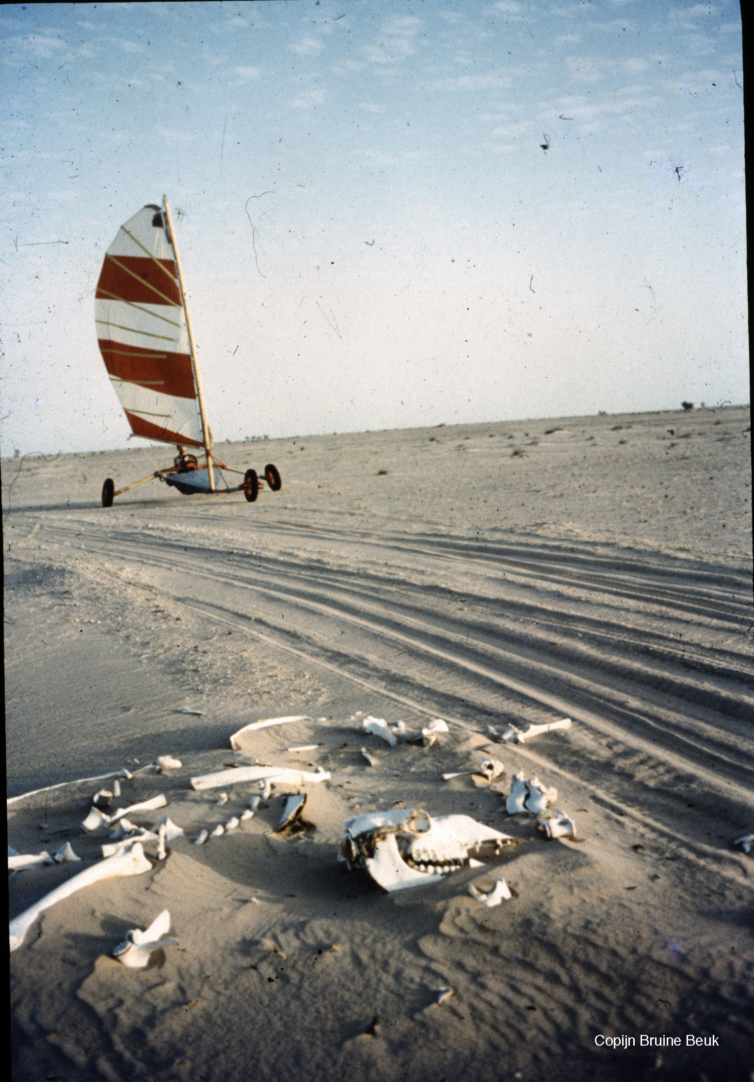
Sand Yachts
You got wind, you got sand, so why not Sand Yacht across the Sahara to Mauritania? Full story.
Chinese Wind Barrow
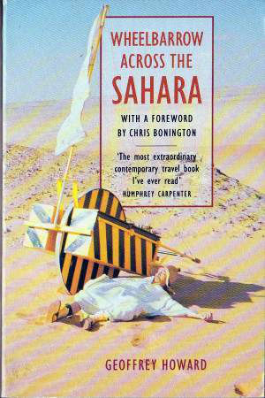
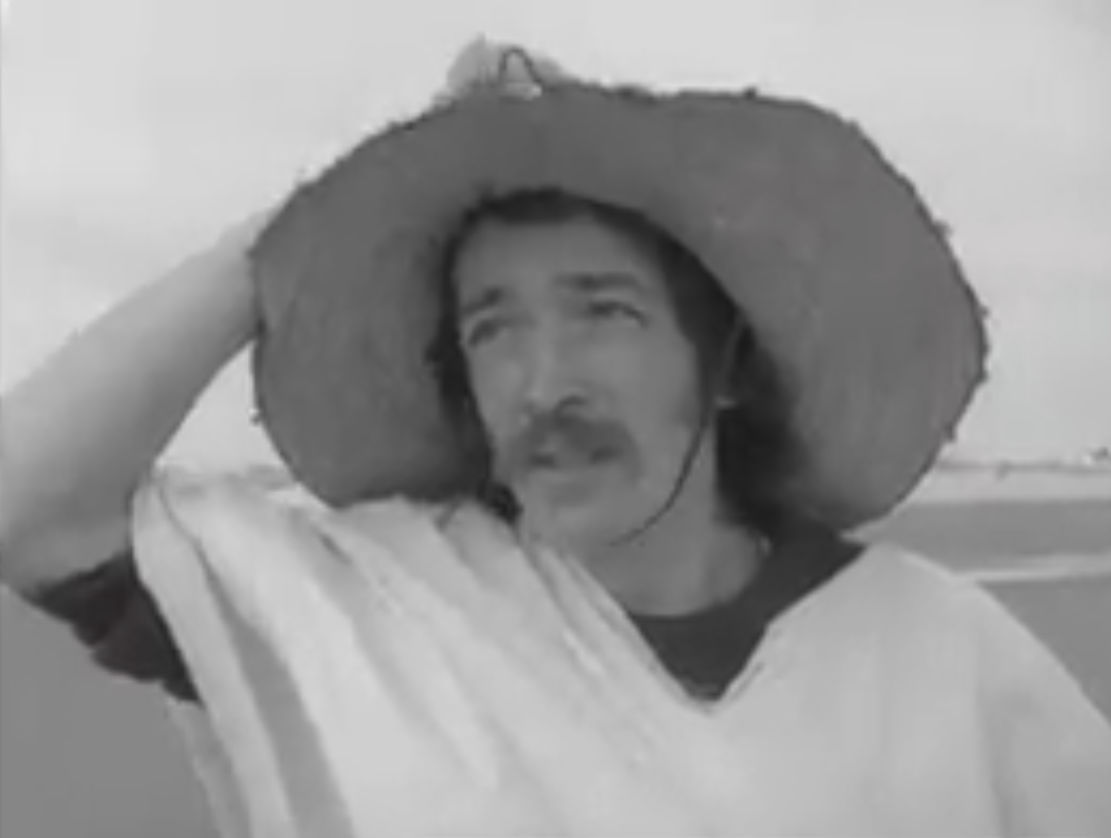
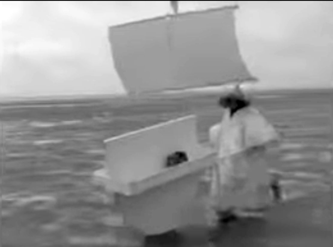
Regular family cars like Morris Oxfords were now commonly used to cross the Sahara (sometimes ending in tragedy), so lorry manufacturers among others, undertook costly, promotional but essentially pointless Sahara west to east expeditions. People were running out of stunts to stage in the Sahara until 1974 when priest Geoffrey Howard came up with a new angle that sounded like a lost sketch from Monty Python. Lately back from volunteering in Nigeria with his wife, he had a Chinese sailing wheelbarrow built, then set off to cross the Sahara ‘unaided’ from Beni Abbes to Kano, raising money for the poor while also positing a new means for locals to transport their goods (not unlike the initial motivation of the 1980s Africar project). As one reviewer observes: ‘That he was assisted by two British soldiers … in a Land Rover and accompanied him most of the way makes it sound easier – but this was a safety consideration, and he made his own complex rules about how and when they could assist.’
National mountaineering treasure Chris Bonington contributed a harsh foreword: ‘Not much of an adventure’ I thought, ‘pushing this ridiculous wheelbarrow along a well travelled road or track with a [support] Land Rover in constant attendance.’ You’d hope that line is followed by ‘… but Howard’s monumental endeavour changed the face of human powered adventuring…” or some such. I can’t recall, but do remember similar conclusions to CB on reading the book decades ago: a silly stunt that turned into an endurance test. The sail idea soon proved useless so he had to resort to pushing the barrow for the three-month, 2000-mile crossing in his flapping get up. There’s some grainy archive film on the BBC of a lightly mocking Bob Wellings (remember him?) interviewing Rev. Howard training on Morecombe Sands in full costume. He ends with ‘I have no fears whatsoever’ The 1990 book is easily found online, new or used.
Three wheel- 2WD FatBike
A regular bicycle will struggle on the piste to carry more than a couple of days of water. One answer: Jean Naud’s 2WD, three-wheeled fatbike replicating the multi-tyred Renaults of yore. And like a modern lorry, to reduce the pedalling effort, one axle on Naud’s contraption could be lifted and disengaged (left) when payloads dropped or the terrain allowed. It worked too, he crossed the Sahara twice on fat bikes. Read more.
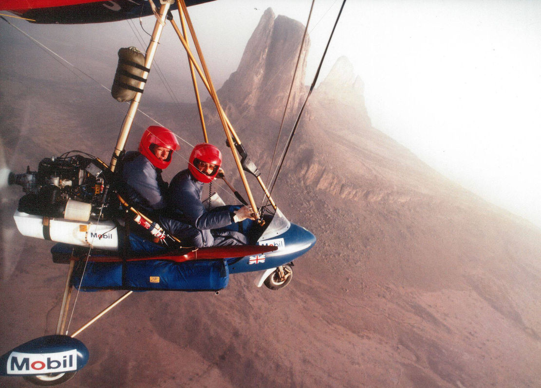
Microlight
In 1988 prolific adventure travel writer Christina Dodwell teamed up with experienced microlight pilot David Young (recently back from a close shave in Nepal) to fly 7000 miles in a Pagasus XL from Cameroon to the Atlantic in what was still the pioneering era of microlighting. I knew of it but never read this one; it’s not a trans-Sahara, more of a Sahel traverse via the Aïr mountains and Timbuktu. From the back cover map it looks like they followed roads and main tracks for navigation, maybe due to range and landing issues. Luckily they didn’t do an Icarus and all ended well in Dakar four months later. There’s a book of course (right), one of Dodwell’s many which is widely available online.
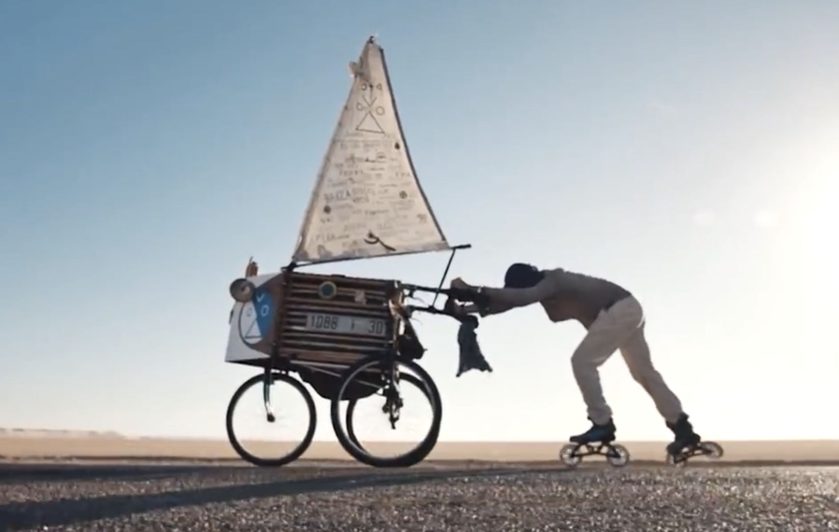
With the 21st century bringing a choice of no less than three asphalt roads spanning the Sahara at 1500-mile intervals, it was time for the rollerblade (or ‘inline skate’) and the humble push-cart sail-tricycle to have their day in the sun. It’s what rollerblades and bitumen were made for. Five thousand clicks from Spain to Dakar, watch Mark Heuss’ cool short film below.
Did I miss any other batty trans Sahara crossings?
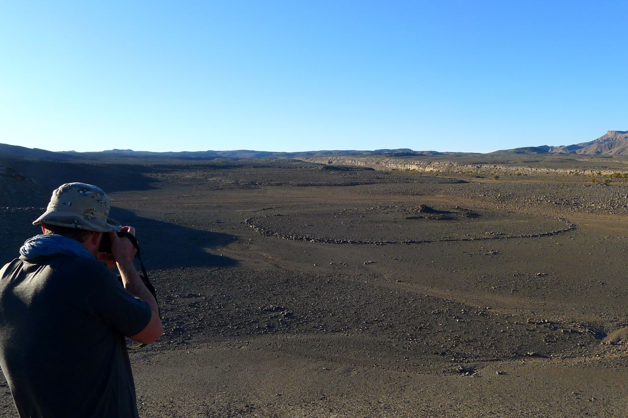
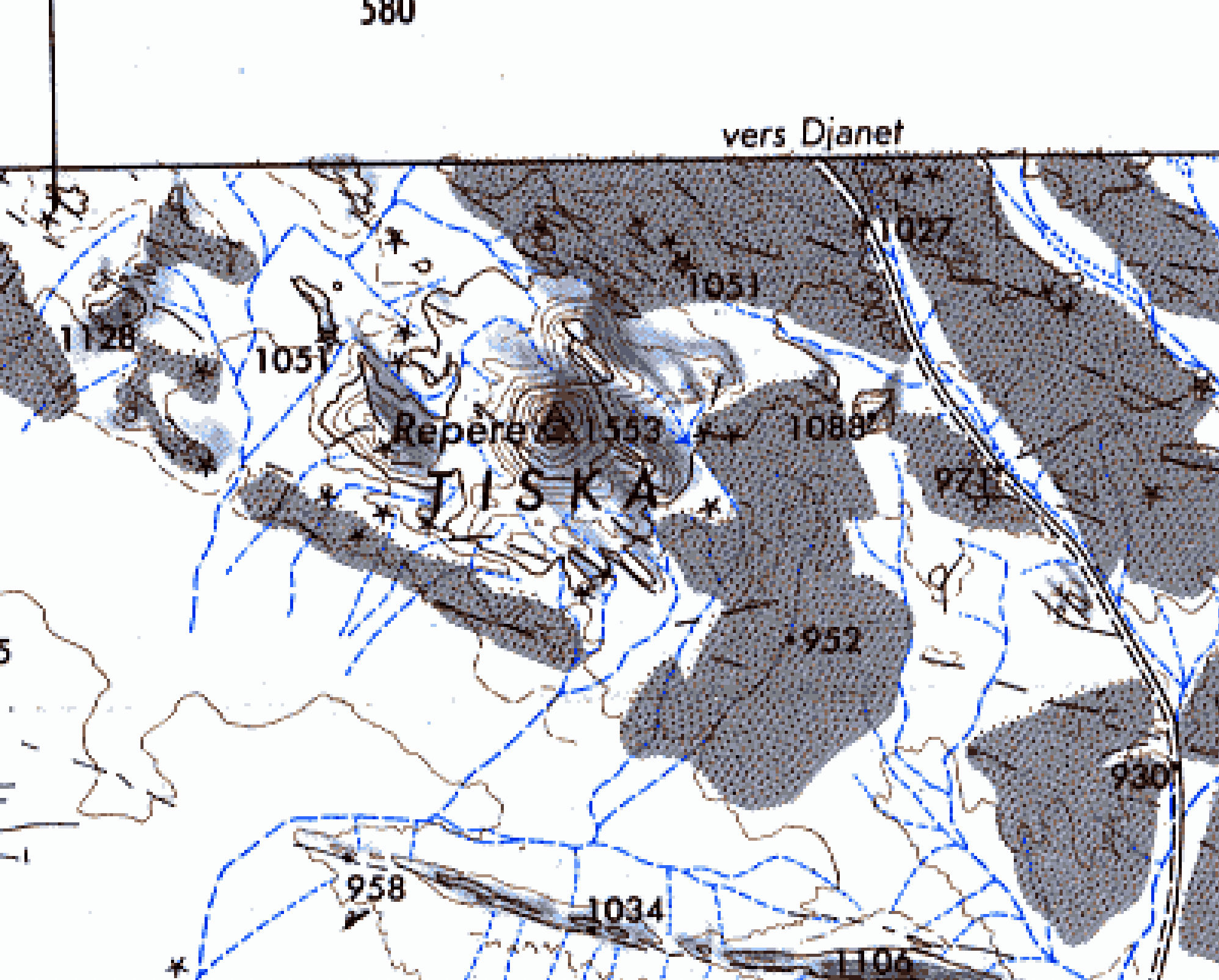
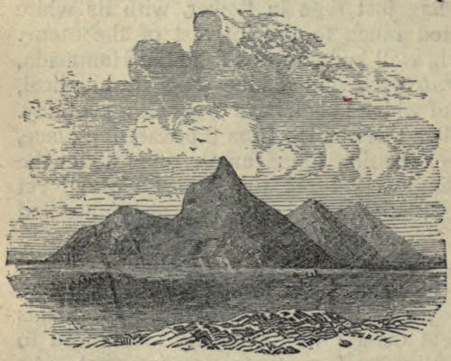
In early 2025 we pulled off a deserted new road and headed across the sands to camp at the foot of Mt Tiska. I’d been looking forward to this moment for nearly 40 years. My first view of Tiska’s distinctive but distant conical form was from Djanet’s old aerodrome way back in 1987. As I write in Desert Travels:
One evening Philippe, a skinny middle-aged Frenchman who had the habit of walking around the campsite in a saggy pair of Y-fronts, invited us to the airport to inspect his old aeroplane. He was immensely proud of his historic plane, a twin-engined machine from the Golden Age of Aviation. He was keen to point out the enlarged fuel tank which former owner, Lady Vanderbildt or some such, had fitted for a one-hop flight to the States as the war turned on Germany… Philippe started up the engines, but I was far more interested in the view down the runway. From this flat vantage point … south of Djanet you could clearly see the unmistakable conical profile of Mount Tiska … the first and only landmark in the featureless expanse which lead across the Ténéré to Chirfa and ultimately Bilma, nearly 900 kilometres away. A waterless expanse of flat, soft, sand, this was the route I’d planned to follow with the only partly cognisant Pete: Yamaha Teneres to the Tenere Desert: it could have been adventure biking gold until his breakdown near Illizi had sunk that idea. At that time I knew only a little more than Pete about the realities of remote desert crossings, and it’s no more likely we’d have made it to Bilma than if we’d tried to paddle to Tristan da Cunha in an upturned umbrella.
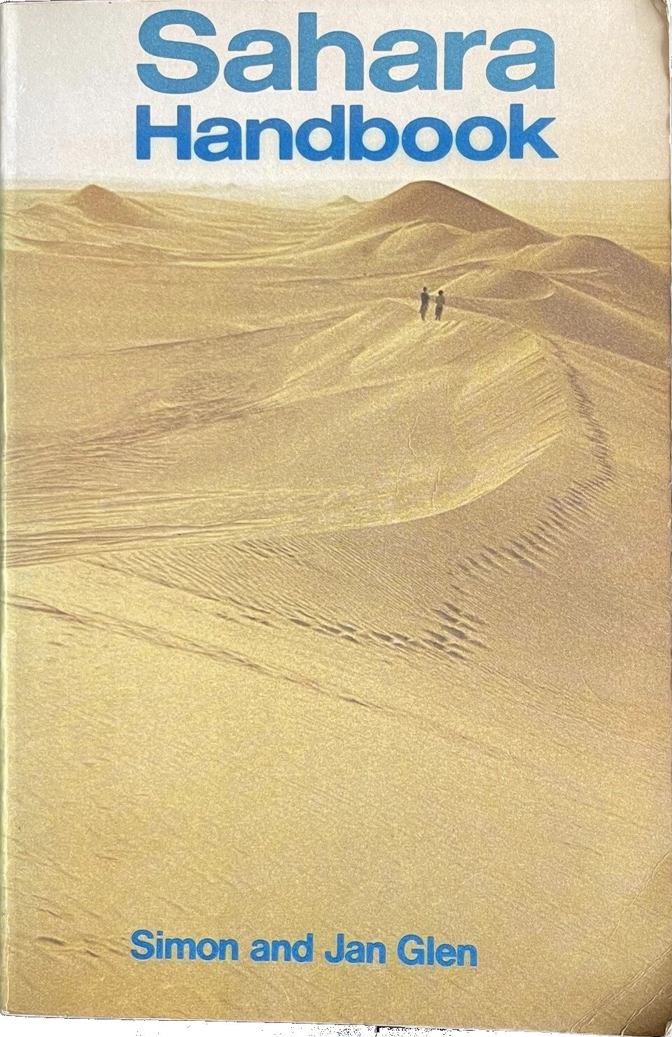
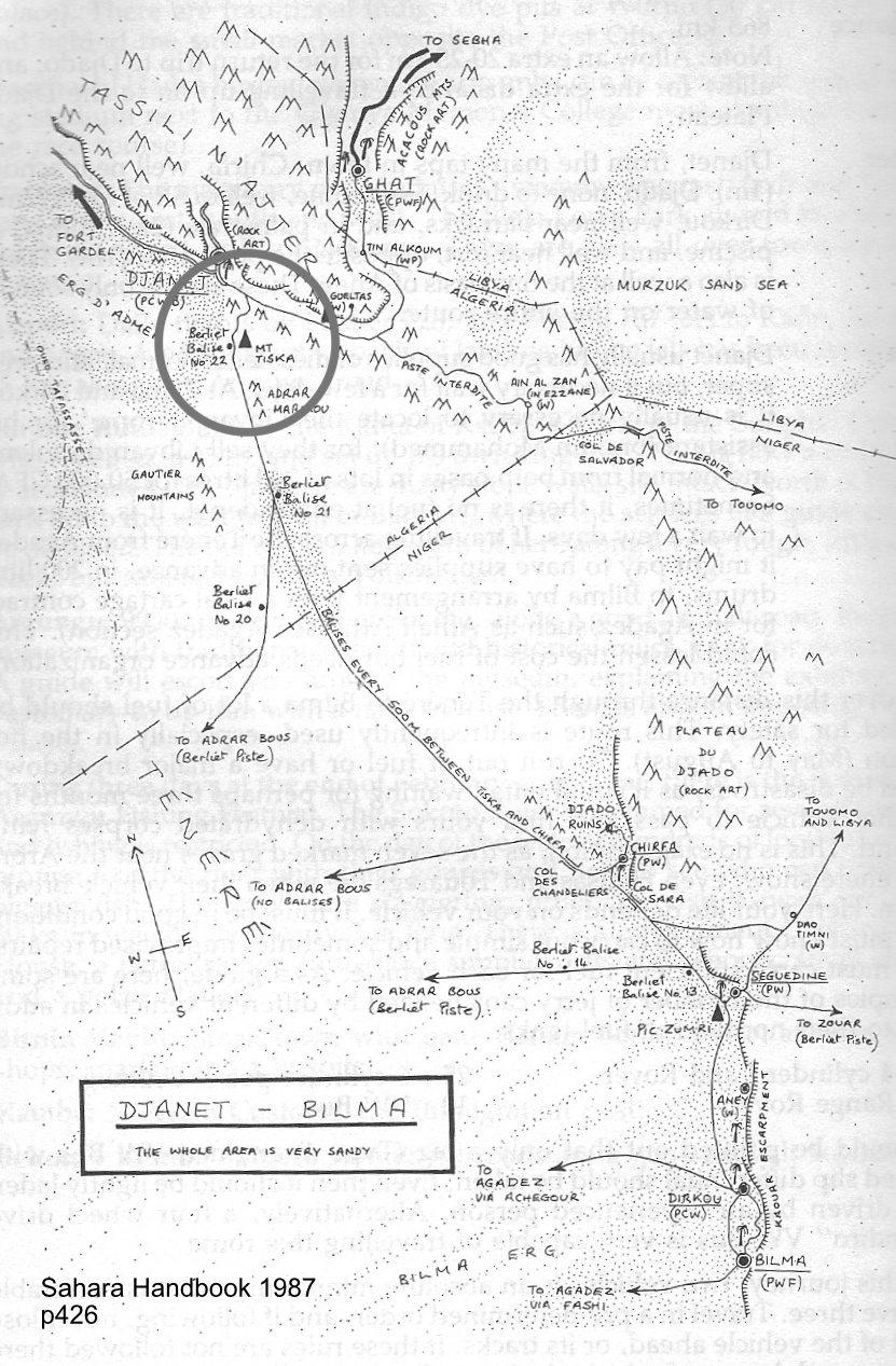
An ancient, pre-GPS landmark, I’d read of Tiska’s significance while leafing back and forth through the original Sahara Handbook (right) in the early 1980s. We all have books that leave strong impressions in our early years; the first SaharaHandbook would be high on my list. In it Simon and Jan Glen’s description of ‘Itinerary No. 19: Djanet – Bilma’, reads like call to adventure. You can see my annotated pages notes left, and might marvel at the sparse landmarks including Mt Tiska, with some spaced up to 200km apart. At no less than 865km, this was a serious desert crossing and the Glens did not mince their words.
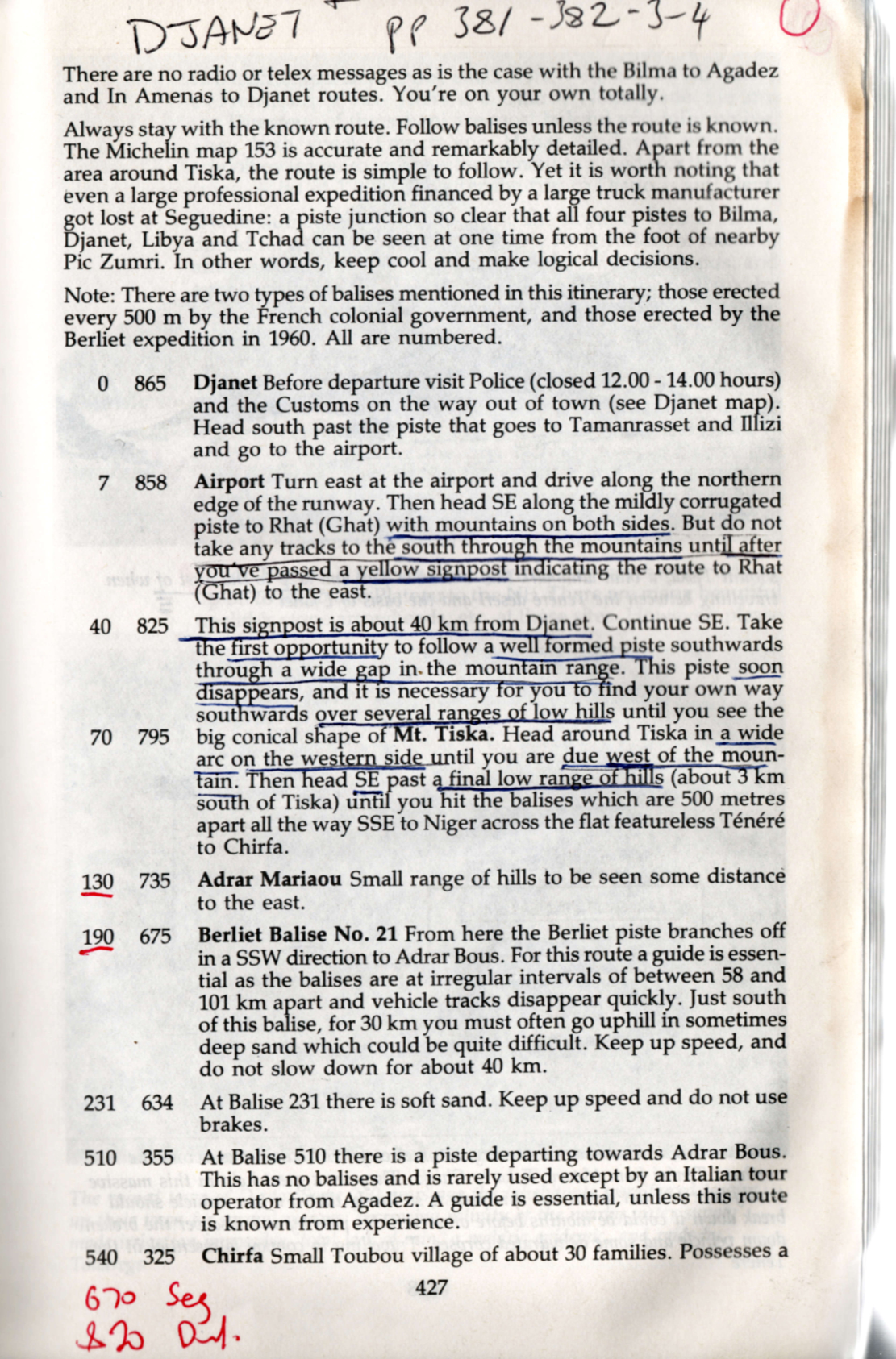
To run out of fuel or have a major breakdown could be disastrous, as it could entail waiting for perhaps three months for another vehicle to pass and find tours with dehydrated corps lying around. This is no exaggeration, as the seven marked graves near Arbre du Ténéré show… Here your life depends on your vehicle. On leaving Djanet for the south, no authorities are interested in how well your vehicle is equipped … [nor] interested in whether you make the journey or not. There are no radio of telex messages as in the case with Bilma to Agadez and In Amenas to Djanet routes. You’re on your own totally.
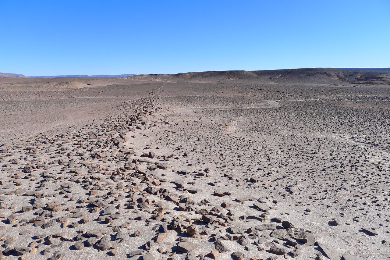
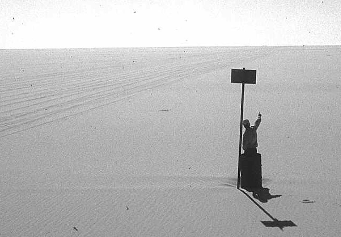
By the time that was written (final edition three, 1990) the piste to Bilma was little used. It’s said that in 1979 four Land Rovers were lost without trace on this route, and as a result the Algerians closed the crossing and pulled up many of the balises (three-metre-high steel marker posts, below) which the French had erected every 500m from Mt Tiska to Chirfa, the first outpost in Niger and a distance of nearly 600km. That information was not known to Pete and myself when in 1987 we set off with plans to blithely ride across the Tenere from Djanet to Niger on Yamaha XT600Z Tenere motorcycles. It was a very long way on a bike, but with a balises every half kilometre, it felt doable providing we had visibility and could carry enough fuel and water.
About 1200 of these balises once marked the entire Tiska–Chirfa crossing, like buoys at sea. You can just see the next one, 500m in the distance.
Coming up from Niger, the cone of Mt Tiska (and larger mass of Adrar Mariaou 34km to the south) had long been important landmarks on the caravan route between Ghat and Agadez. In 1860 Heinrich Barth wrote.
August 2 … After a stretch of nine miles, an interesting peak called Mount Tiska, rising to an elevation of about six hundred feet, and surrounded by some smaller cones, formed the conspicuous limit of the rocky ridges. The country became entirely flat and level … and there was nothing to interrupt the monotonous plain but a steep ridge, called Mariaw, at the distance of about five miles to the east [probably Adrar Mariaou; 34km south]. The nature of this desert region is well understood by the nomadic Tuarek or Imóshagh, who regard the Mariaw as the landmark of the open, uninterrupted desert plain, the “ténere;” .
But in 1987 Pete didn’t even make it to Djanet on his Tenere. And soon after I arrived I learned what I now know. Since that aborted crossing, I’ve met others who tackled the route anyway and either got in big trouble in Dirkou in Niger (2001), or got brutally robbed before they even made it to the Niger cut line (2002; probably following a tip off in Djanet). Also in 2002, we came up the balise line from Erg Killian, the Monts Gautier and Berliet Balise 21 (below), but from Mariaou headed directly to Djanet across the very soft sands, bypassing Tiska.
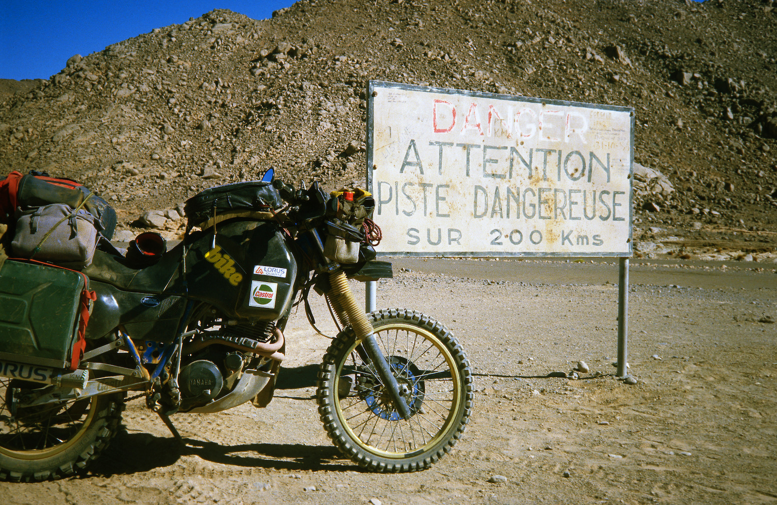
Today, an hour or two from Djanet a tarmac road leads off a roundabout in the middle of nowhere near the famous sign (left) and heads south to pass right by Tiska.
It’s part of a vast network of military roads, remote bases or perhaps migrant camps or prisons, and berms (sand walls) which Algeria has put up in the deep south to control smuggling, migration and jihadist movements.
BaseSand berm and border road
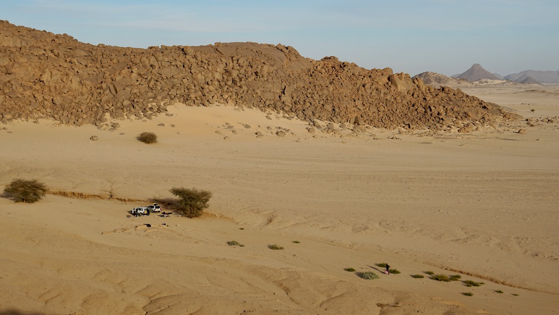
We pulled into a sheltered dip at the southern edge of the hill (below) and the cook got a fire going. Normally I’d have at least tried to climb to the top but at 500m above the desert floor, Tiska is bigger than it looks, one of the last outliers of the Tassili N’Ajjer before the ocean of sand that is the Tenere runs south to the Kaouar hills behind Bilma and the isolated Termit massif which is already in the Sahel, close to Lake Chad.
It was sure nice to stretch the limbs after being cooped up in the car for days, but it’s these cars which get us to such places. As always walking in the desert, it’s the tiniest things which catch your eye in the void.
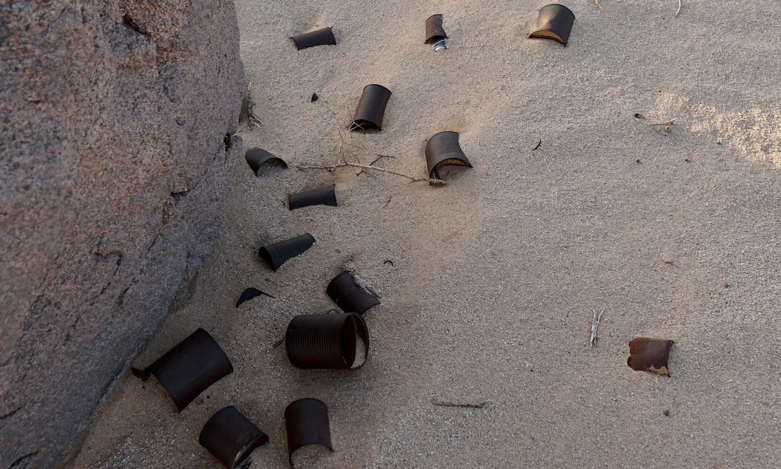
A trove of tin cans dumped by who knows who and who knows when. Anywhere else they’d be rubbish.
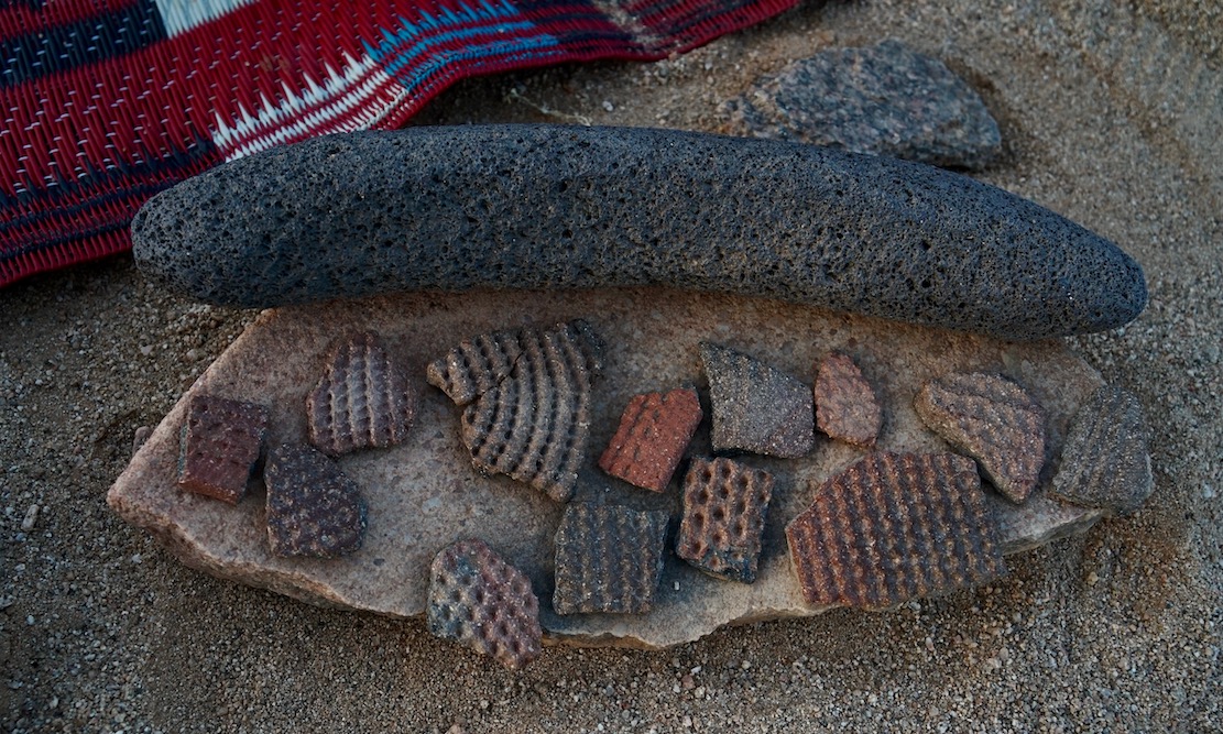
More rubbish perhaps dating back to the Neolithic era or earlier when the Sahara was less arid. Ceramic pottery fragments (commonly found) and some sort of grinding tool I’ve not seen before.
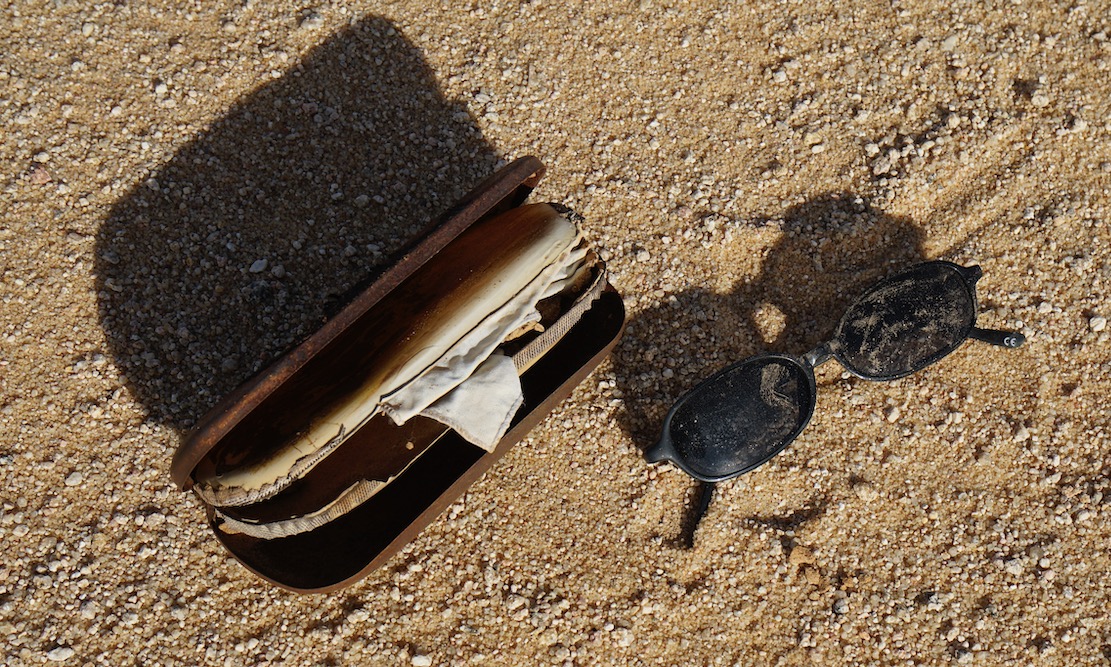
Cheap shades probably dropped by a migrant heading north to the Libyan border and a boat to Europe. Long before the current waves we met lines of migrants way back in in 2002, boldly marching over the Tassili towards Ghat.
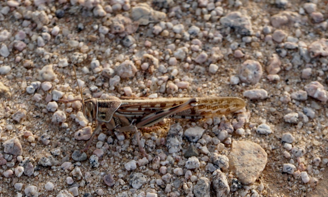
A locust takes a breather
In the foreground the balise line used to start just beyond the ridge. And on the horizon, the mass of Adrar Mariaou and the piste to Chirfa in Niger.
The granite cone of Tiska. I could run a tour in south Algeria hoping from one granite T-mountain to the next.
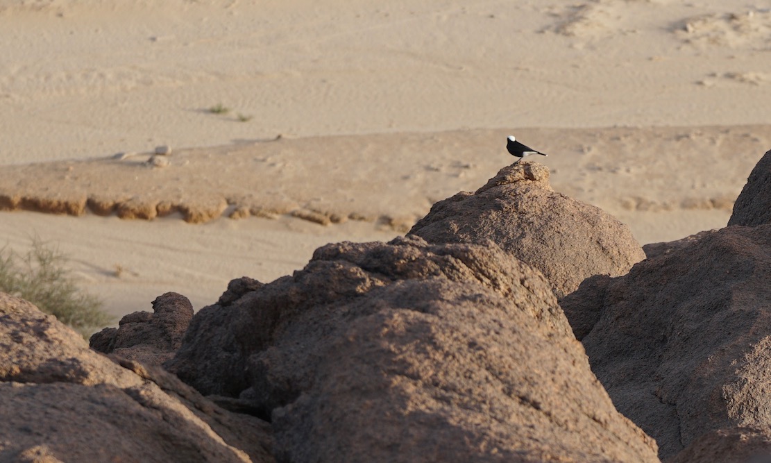
Moula Moula bird, the pigeon of the Sahara.
Sunset across the desert sands
Next morning the three of us set off to walk around the mountain while the crew pack up and catch us up. We carried on clockwise round the mountain, into a hidden bandit valley on the north side, and then back to the road.
Heading back to Djanet after a night out on Mt Tiska.
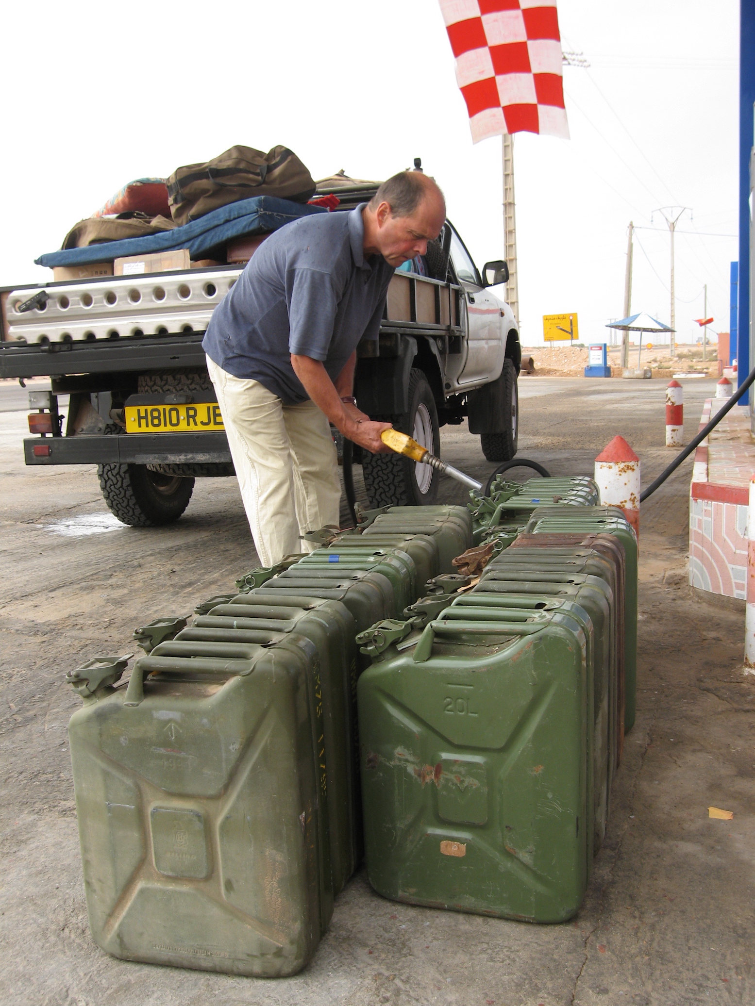
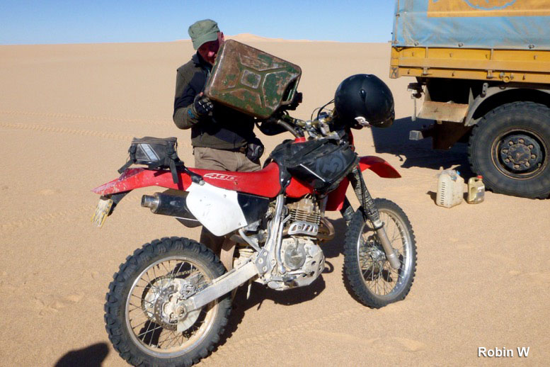
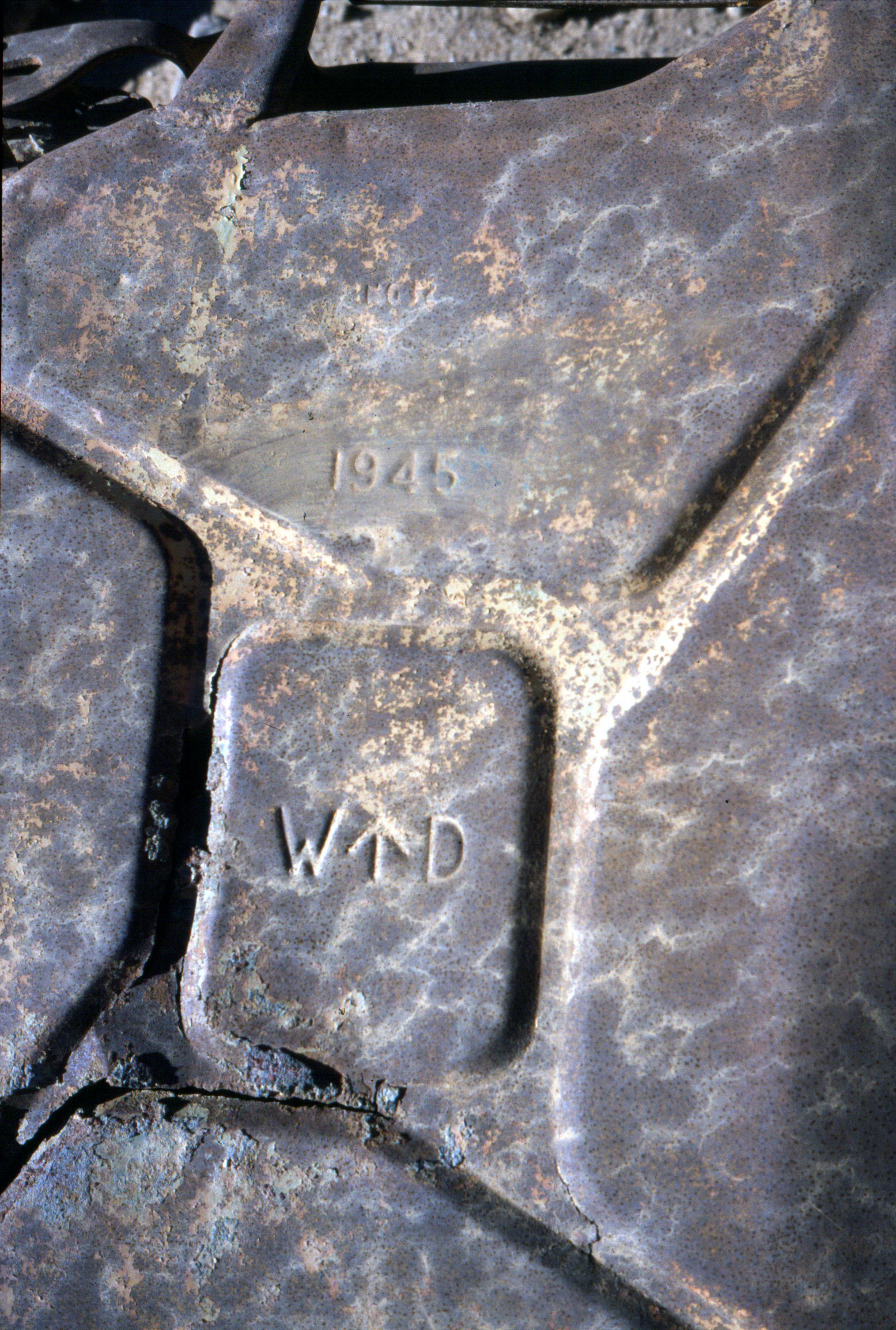
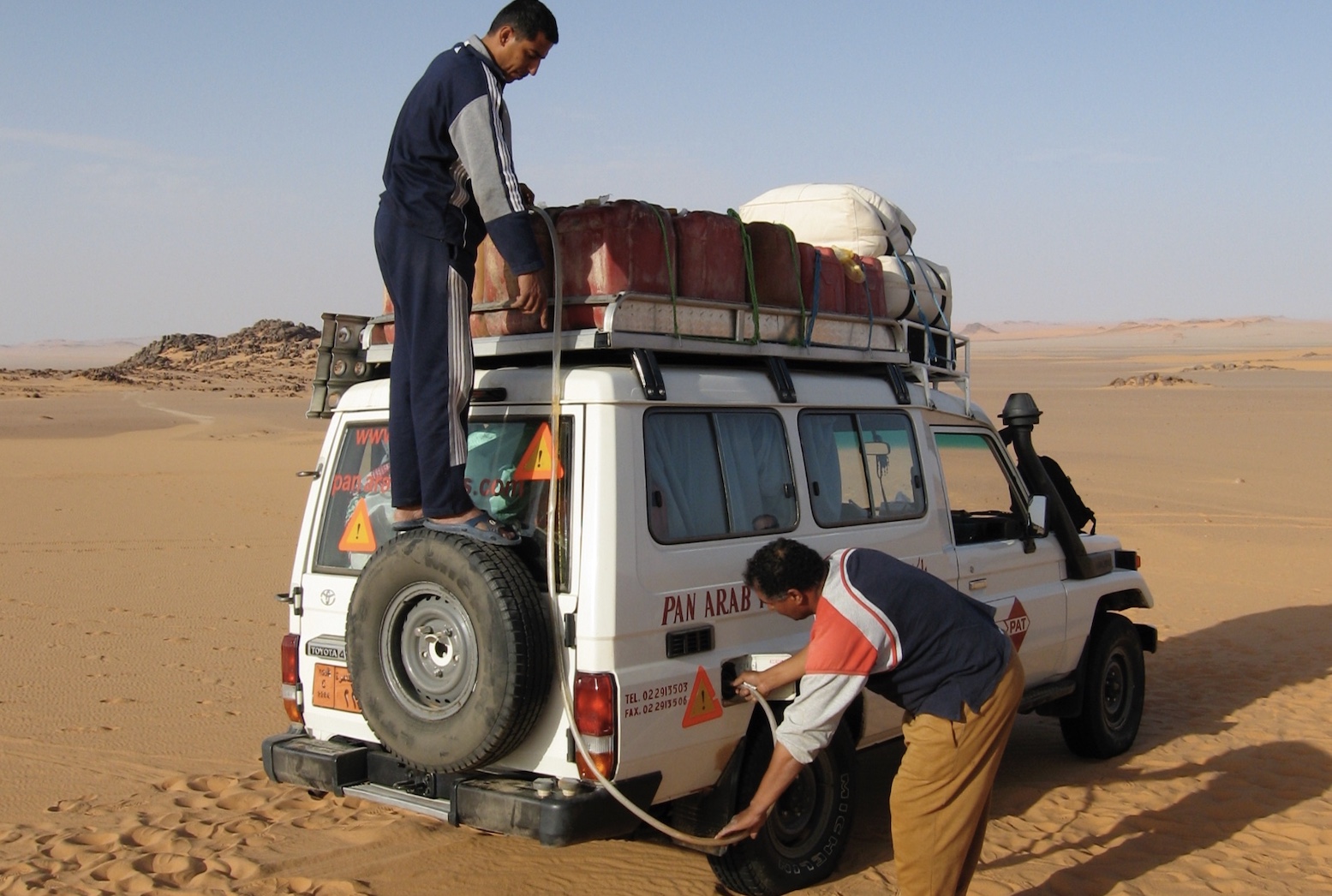
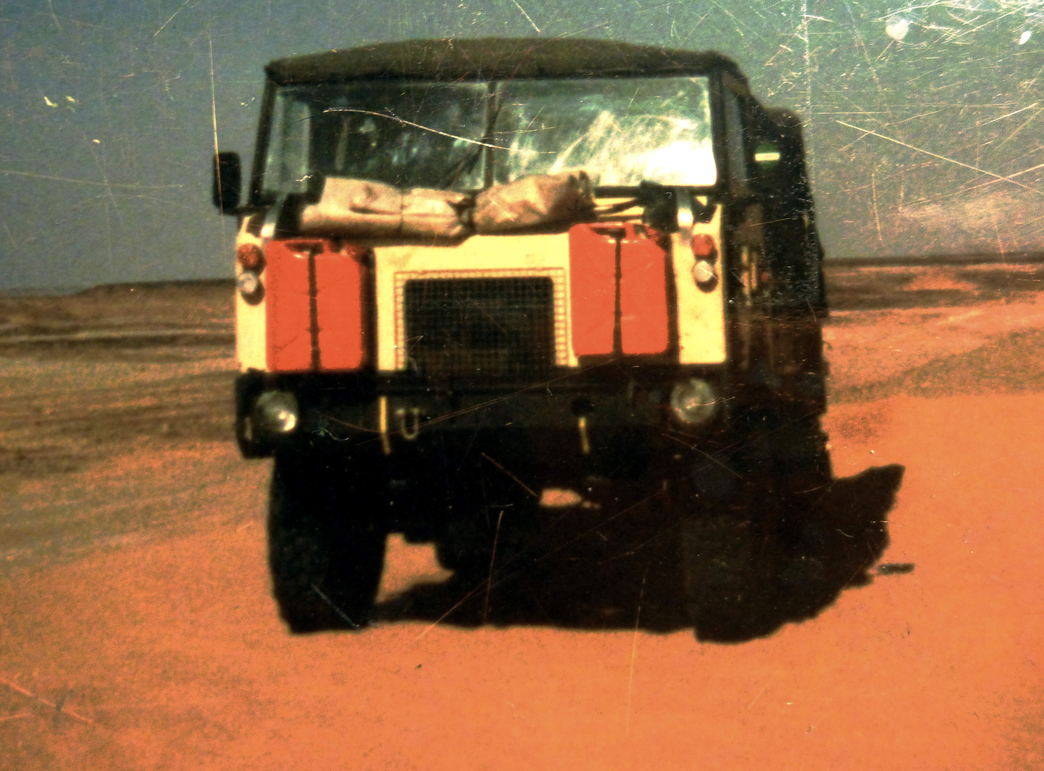
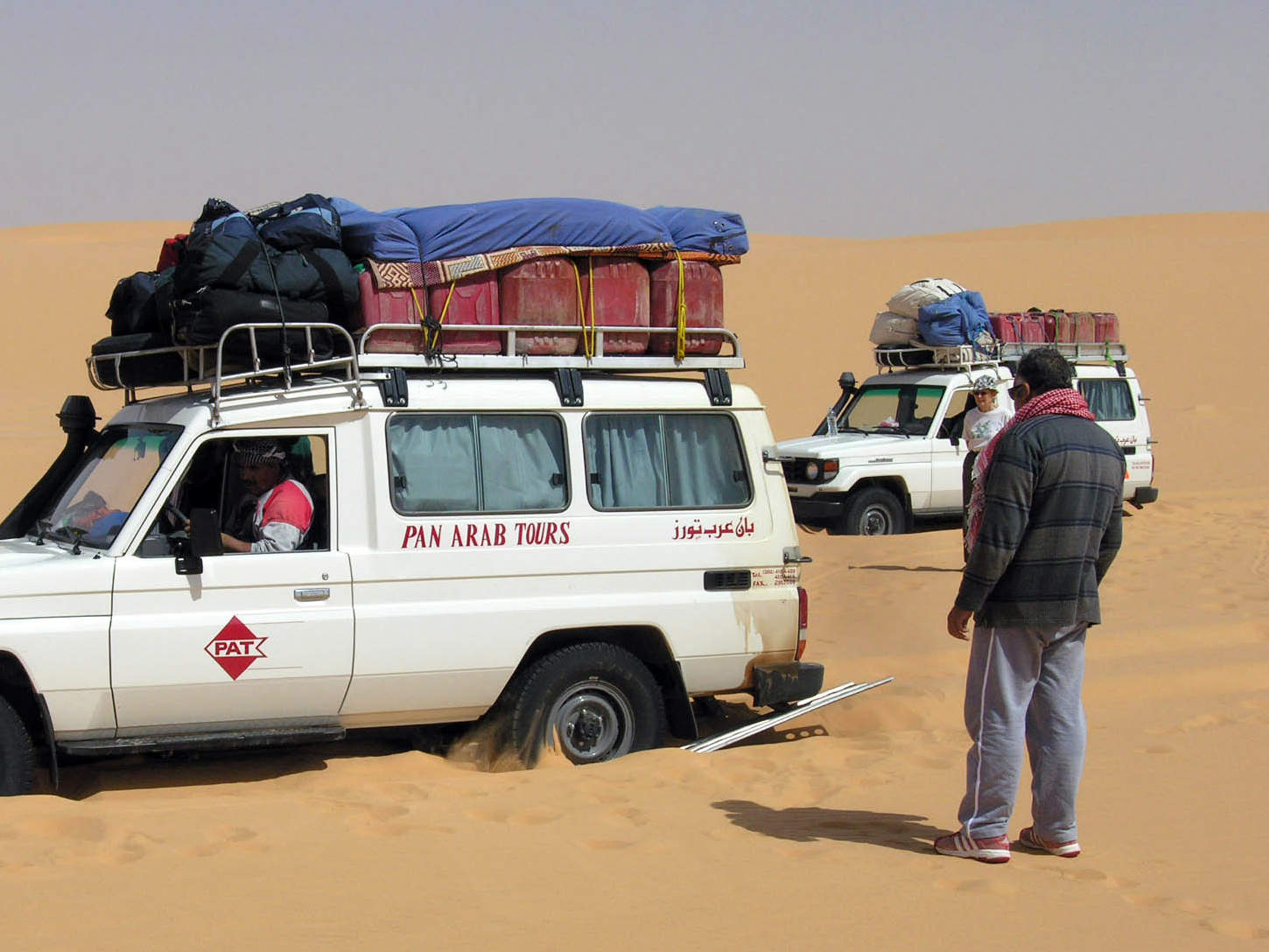
For travellers who don’t expect to be making a lifetime of Sahara travel and haven’t got limitless funds, jerricans provide the simple answer to increasing your vehicle’s range. Available sometimes still unused from military surplus outlets for around £10, they make reliable and robust fuel containers.
Captured WW2 kannister
The standard steel jerrican is a German design (hence the name) from the late 1930s, developed to support their blisteringly effective blitzkrieg invasions. The fact that the design remains unchanged today shows how well they succeeded with the ergonomics of carrying, pouring, sealing and storing fuel. During the war in North Africa, the LRDG prized the discovery of any jerricans, while the Germans were ordered to destroy them on retreat.
LibyaWestern SaharaAlgeriaMali
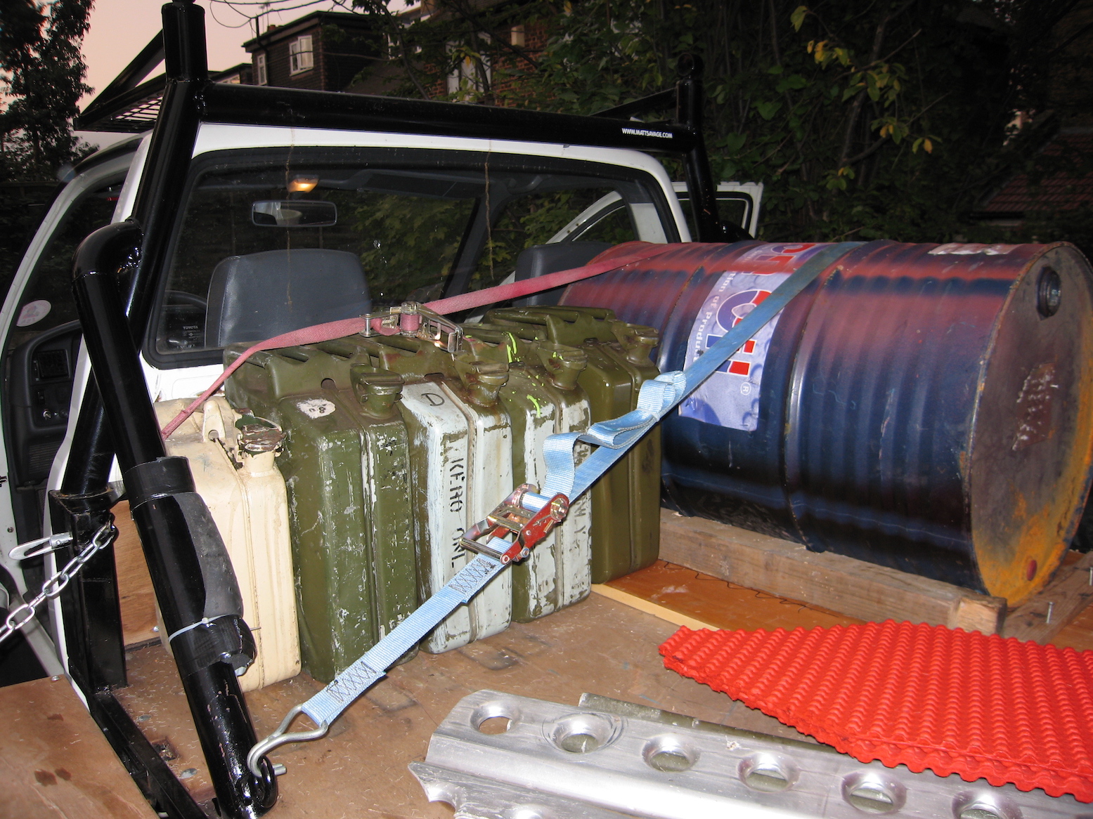
A jerrican holds 20 litres (4.45 gallons; 5.28 US gallons) when filled in the upright position. This leaves an air gap just below the handles which shouldn’t be filled with fuel (by tipping the can backwards) unless you’re really desperate. The air pocket, as well as the X-shaped indentations on the sides, enable the can’s sides to bulge as fuel expands; especially the case with petrol which is more volatile than diesel. Once warmed and shaken on your roof, take care to open the cap very slowly (the cap’s clamp design makes this easy) to avoid a spurt of fuel, which, besides being dangerous, is messy and wasteful.
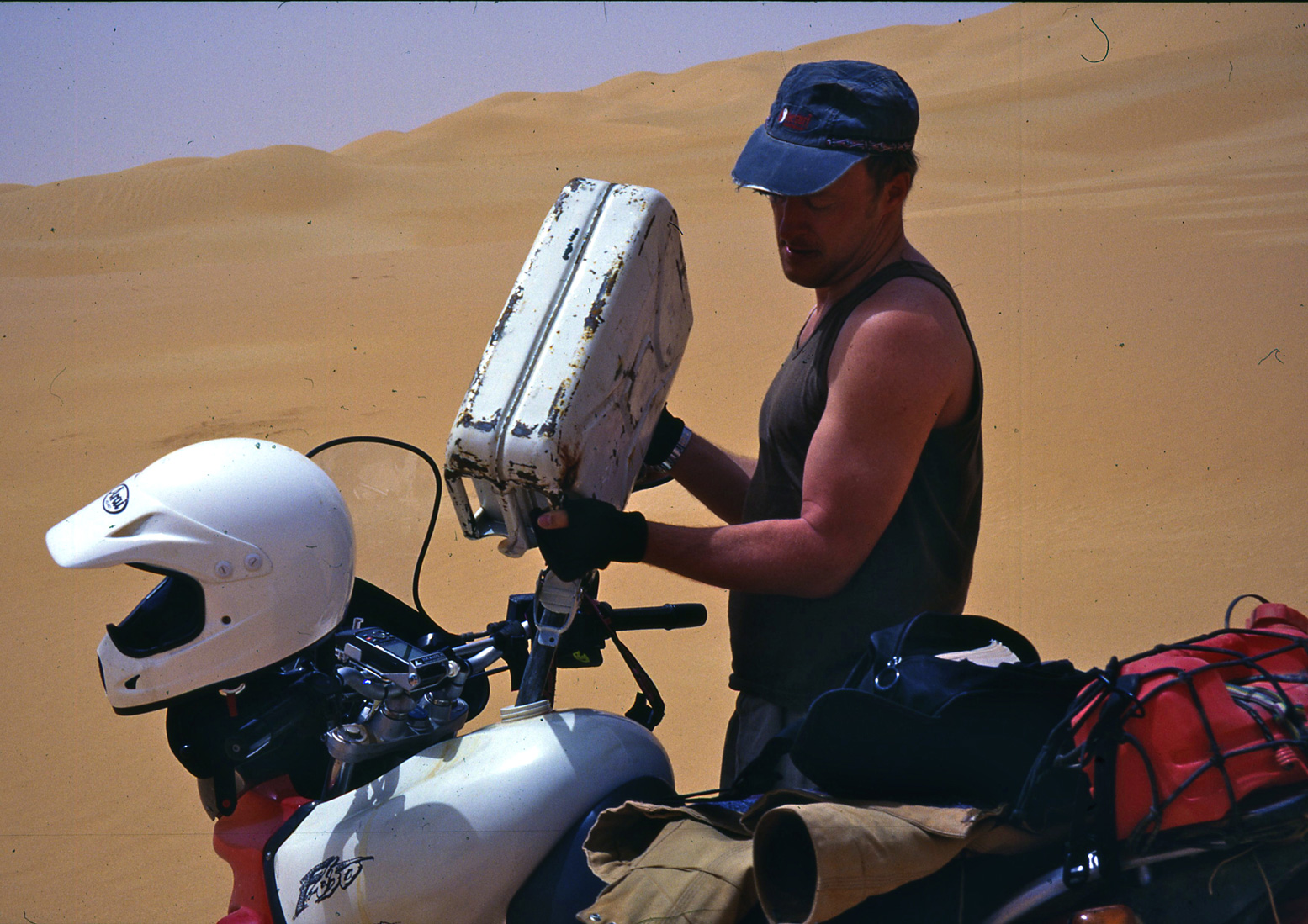
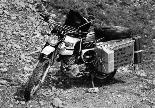
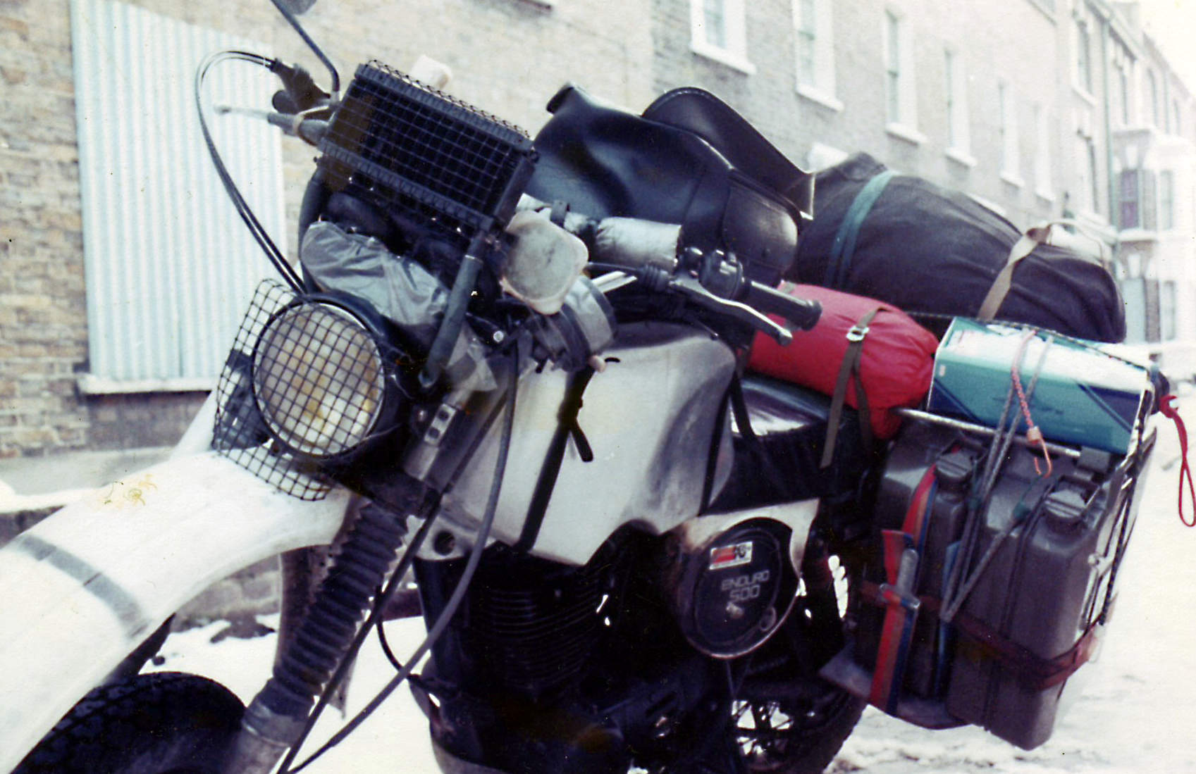
Bernd Tesch’s XT500, 1976My XT500, 1982. The jerries were soon sold.
Algeria
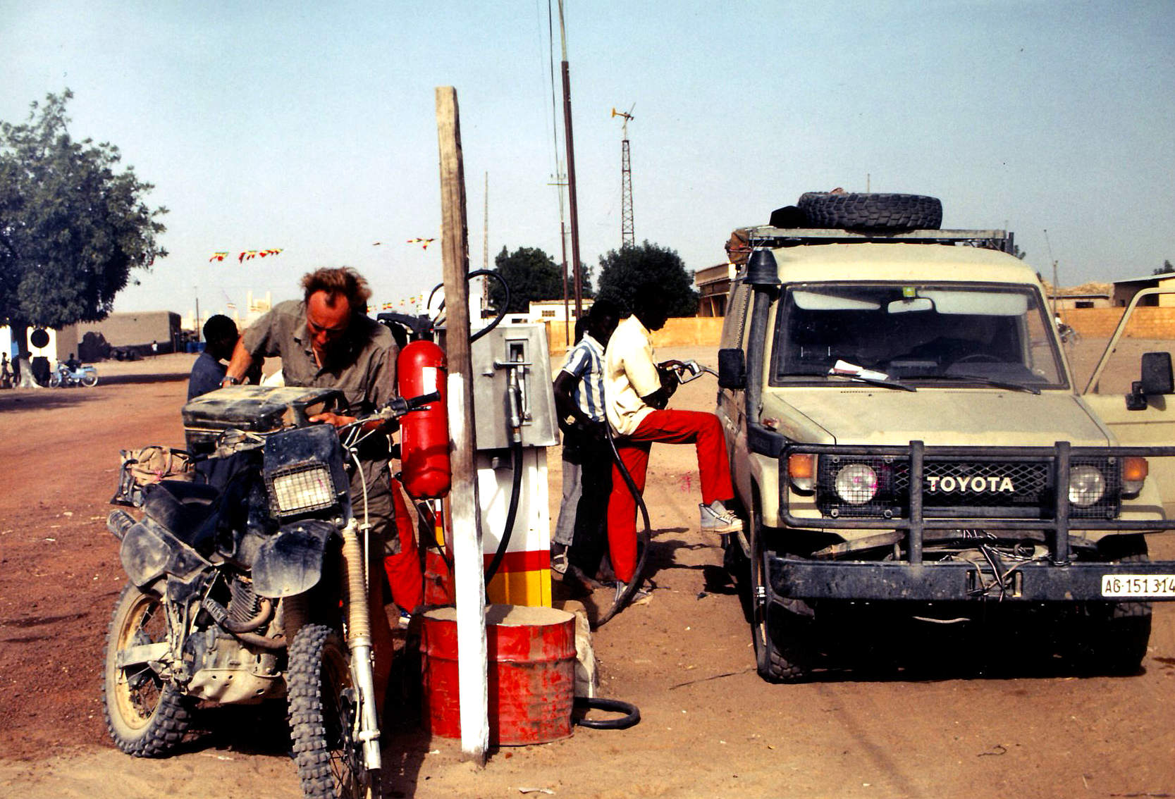
A clamp-on spout (some with an integral gauze and breather tube) should make topping-up while holding a heavy can easier. But I find these clamp-on spouts often don’t seal well, fuel runs down your leg and their internal gauze slows down the flow rate, prolonging the effort in holding them up. A wide-bore funnel takes half the time. Rigid funnels get messy with diesel and are awkward to stow, so I prefer the ‘collapsible’ vinyl items with the end snipped off to make the hole bigger. Store them in a plastic bag or flat lunch box. Cutdown mineral water bottles will also do the job.
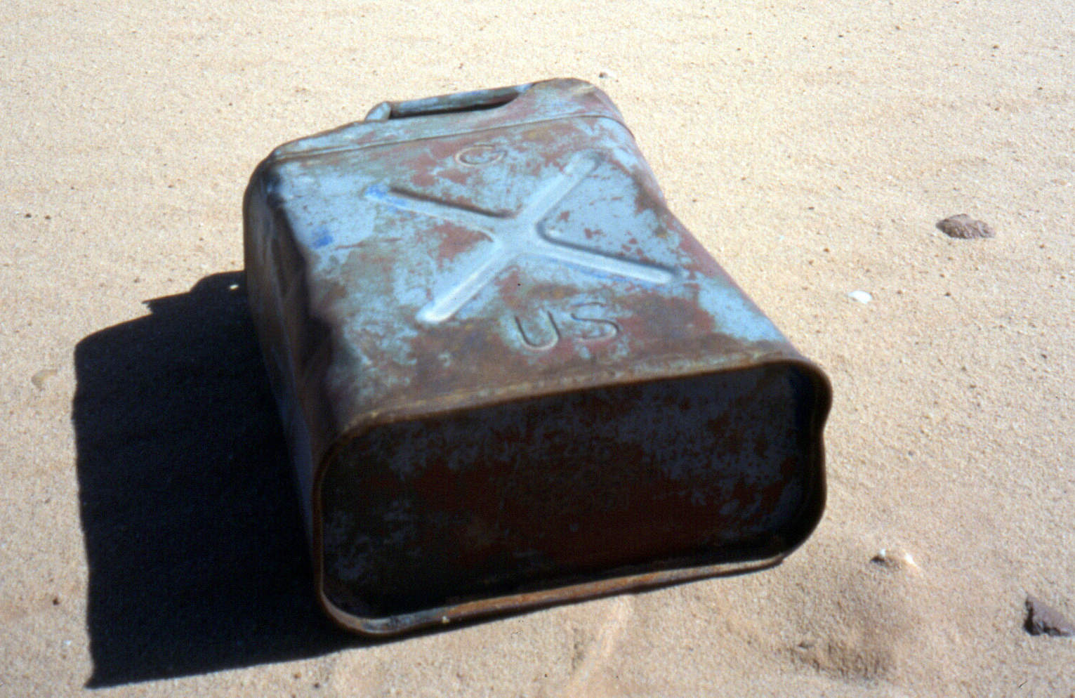
Pinched or copied following Al Alamein, a Brit WD jerry at Jebel Uweinat (Sudan).A US-army ‘Ameri-can’. Not quite as good. Or not as legendary.
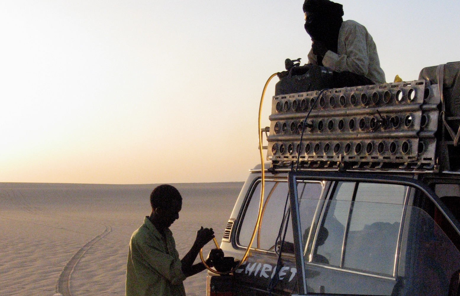
Better still, leave the can where it’s stashed on the car and siphon the fuel into the tank either with a simple tube or a manual siphon-pump. Until mastered, the mouth-sucking method to get a siphon going is understandably unpopular with motor fuel. If you have no siphon pump bury the whole hose into a full jerrican (a flexible, clear, thin-walled hose is best). With the other end fully submerged, put your thumb over the end and draw out the tube which should stay full of fuel. Poke the tube into the fuel tank filler and the weight of the dropping fuel will create a siphon.
Tenere (Niger)Sudan (Selima)
Jerricans themselves can be knocked about for years: I’ve never seen a welded seam leak, though cap seals do leak. You can buy spare seals or, failing that, a chopped-up inner tube clamped across the mouth will work.
Treat ’em rough (laying a fuel cache, Algeria)
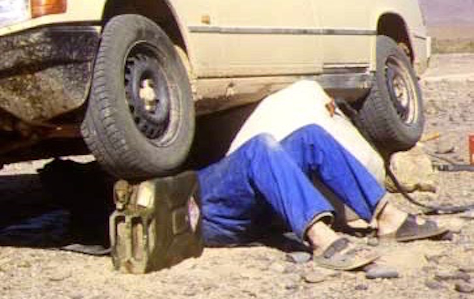
Once rust or flaking paint begin to come out of a jerry, either make sure you use a fine pre-filter or get another jerrican. Neat ten-litre versions are available and even mini five-litre models, all using the same clamping cap. They can also be robust containers for spare motor oils and other fluids and make good jack stands when working under a car.
Ten-litre jerries on a Land Rover101FCHandy wheel-stand (Morocco)
There is said to be a small risk from static electricity in the dry desert atmosphere when refuelling vehicles, especially petrol. Earth the car by touching it before opening the cap and pouring in the fuel.
Cheap plastic jerricans (Egypt)Heat up, expand and leak. A few days later
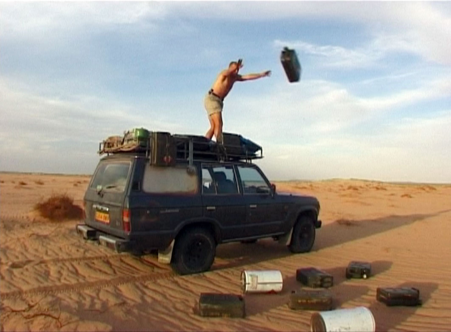
‘Jerricans’ copied in plastic should never be used for long-term fuel storage. The soft slab sides and screw-on caps are unsuited to the expansion and will swell like a balloon before splitting, leaking or bursting. I once drove a car carrying nearly three dozen cheap plastic jerries on the roof. Within a couple of days fuel was running down the sides of the car as the liquid expanded and caps leaked; I even had to use the wipers as it ran down the windscreen. It was very messy and bad for the rubber components.
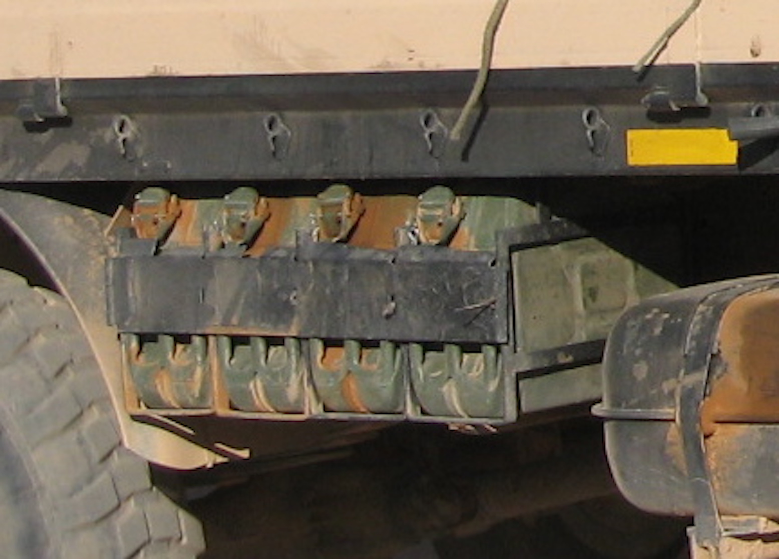
Rack of easily accessible jerries under an M.A.N.After jerricans come oil drums. Ten times bigger and as cheap or free.