Part Five of Peter Reif’s report and maps recalling ÖSEWO: an Atlantic-to-Red Sea crossing of the Sahara in 1983-4. The team have arrived in Tamanrasset where they meet many other desert overlanders, as well as the Dakar Rally and three VW friends from Austria who’ve brought spare passports for Libya. The four vans tick off the Hoggar Loop, then headed east for Djanet, close to the Libyan border. For other parts, click the Index Page.
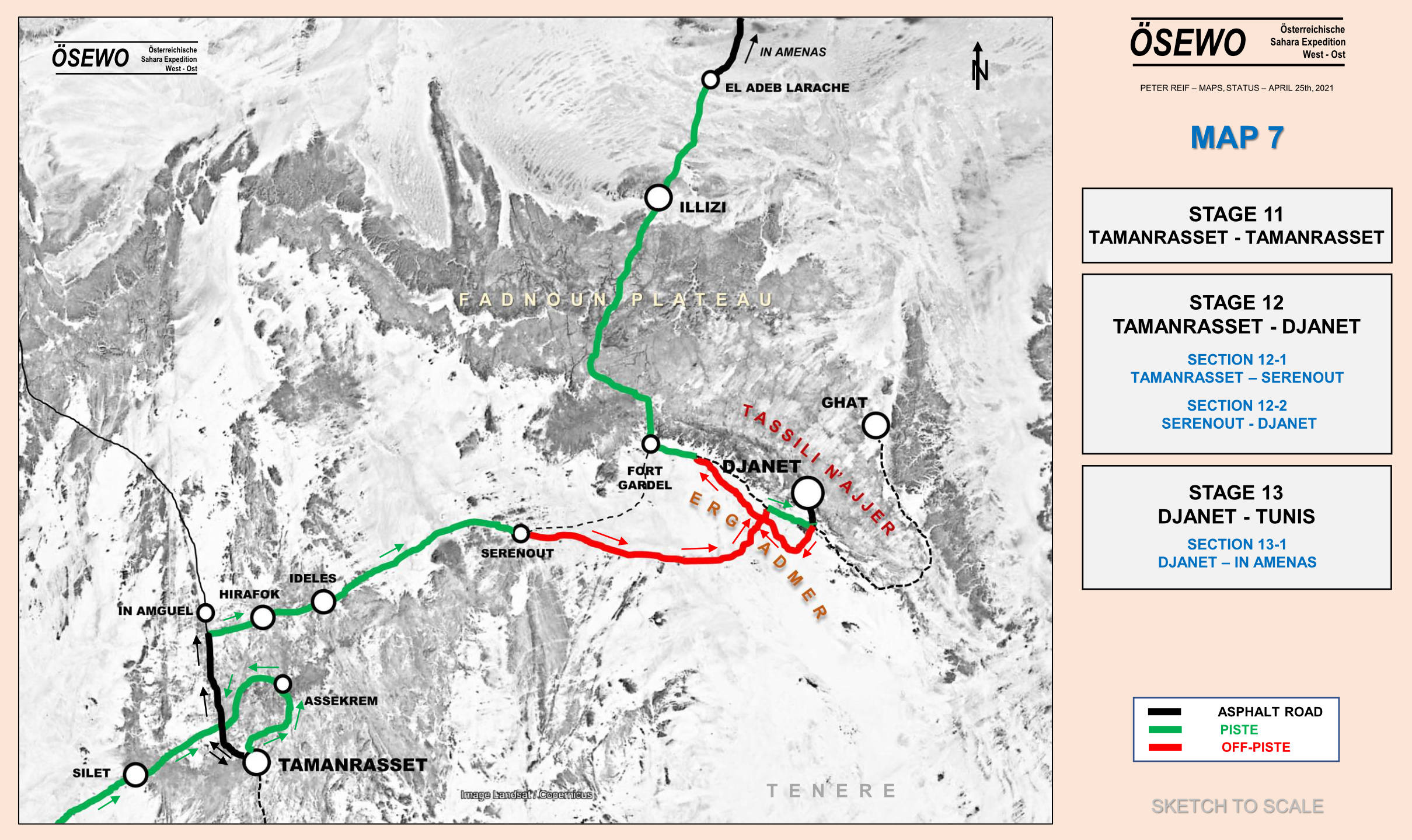
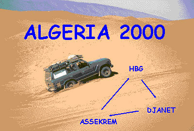
Route Genoa – Tunis – Nefta – El Oued – Hassi Messaoud – Hassi bel Guebbour (HbG) – Quatre Chemins – Gara Khanfoussa – Ain el Hadjadj – Illizi – Iherir – Djanet – Tadrart (Oued In Djerane, T-in Merzouga) – Bordj el Haouas – Serenout – Ideles – Hirafok – Assekrem – Ideles – Tefedest east (Garet el Djenoun) – Erg Amguid west – HbG – El Oued – Tunis. About 2500km off-road
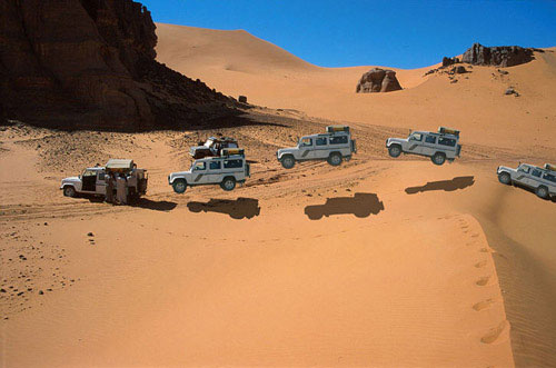
Vehicles Land Cruiser HJ61, Land Cruiser HDJ80, Discovery Tdi and three 110 Defenders.
The film of this tour, Algeria 2000 (as seen on Sky TV), is featured on the Desert Driving dvd.
Ferry and Tunisia It’s still the same story on the Carthage as described in the book, hours of queuing for forms. Not all of us got our Permit de Conduire before the ship docked, but they were quickly obtained from the Customs booths once in the port.
Before that, at the police booths in the first shed it helps not to imply you’re transiting Tunisia fast for Libya or Algeria. To keep them happy make out you’re spending some time (and money) in Tunisia too. One of our group got tricked on the exchange; led to a certain bureau de change by one of the orange boiler-suited guys. Be alert, they’ll get you if they can. And another was told to pay 10 dinars for his Permit de C. (it’s officially 1d or free on the boat).
Fuel prices in Tunisia: Diesel 41d, petrol about 70d.
We covered the 470km from Tunis to Nefta in about 8 hours and stayed at the Hotel Marhala in the zone touristique west of town, opposite the Caravanserai. Half board was around 40d for two people. It’s a clean new hotel with unusually good food (but what isn’t after the Amilcar in Carthage?).
The Border We set off at 8.30am hoping to get a good start into Algeria but the border still took most of the day. The Tunisian frontier at Haouza was pretty straightforward. At Taleb Larbi on the Algerian side things move slowly. You do police forms for you and your car (white and green forms), move on to the Customs declaration (currency and valuables like video cameras or whatever you profer/they find). I was aware of the binoculars (jumelles) ban but was careless in hiding them and so they were confiscated with a receipt and returned on the way out. The others hid their binoculars better.
Each car was searched with a few suggestive jokes about whisky, but bury it deep and they won’t find it because you don’t get taken apart as can happen to locals. With your carte gris (vehicle logbook) you then fill out a Titre de Passage en Douane (TPD) form which eventually gets printed out.
Next is money changing. This seems to be a problem at Taleb Larbi. As Yves found, they claim not to have enough in the office and there’s no bank at Taleb. In our case I got 400FF’s worth but the others got only enough to buy insurance (about 200FF) and the last lot had none. It then transpired that the guy in the insurance office (‘SAA’) took FF anyway. This is probably best paid out of your declared FFs, not your stash.
While I was waiting, taxis drivers just past the gates offered to buy clothes and exchange black market money, offering around 10-20% more. If you’ve arrived low on fuel and you have insufficient official dinars you may need to buy some black to move on. The fuel station is just down the road. We left Taleb round 3pm.
At some stage of course you must buy official dinars (it looks good on your declaration – keep receipts). We did this at the bank in Debila, the first main town after the border. It had just closed but the guy saw the ten of us and generously opened up again to do a quick change for us all.
Stone throwing kids I’d read about the stone throwing villages west of the border on sahara.info.ch and sadly the reports were true. For once I was spared but the Discovery at the back got hit hard two or three times. Most of the kids wave but the ones who throw mean business as the heavy dents in the Discovery’s door proved. Had it gone through a window and struck the driver it would have been nasty. The last car is usually the target because there are no following cars to see who throws it, I suppose.
Unless you’re lucky, trying to catch the culprits or going to the police is a waste of time, but I guess that some irate tourist with a smashed window will do this some day soon and hopefully something will be done. On the ferry back I spotted a tourist car with a smashed window and heard of serious stone throwing in Kufra (Libya) and even at a local guide’s car in Dakhla (Egypt).
Laisser Passer and Gassi Touil convoy We spent the first night in Algeria in the sands just south of Touggourt (although there is the Hotel Oasis in town somewhere).
At Square Bresson (just a junction) there are masses of sand roses laid out for display. Soon after, at a checkpoint just before Hassi Messaoud we had to get our permit for the south – about an hour of writing everyone’s details down in Arabic. But the laisser passer was only requested a couple of times in the Gassi Touil over the next day or two. No one bothered with it or even passport checks south of the oil zone.
We got caught up in a military escort at the Gassi Touil checkpoint, halfway between Hassi Messaoud and Hassi bel Guebbour (HbG). It meant waiting until 3pm (or 9am) for a 100 km drive to another checkpoint or base and continuing the next morning at 10am to HbG. We were told only ‘Toyotas and fuel tankers’ must join the convoy as these have been preyed on by bandits (from ‘Mali’ or course). But while waiting plenty of Toyotas and tankers went through so who knows… It delayed us by about half a day so schedule this into your plans or go via Deb Deb (Libyan border route).
Unlike many other towns in Algeria, HbG is still the one-camel truckstop it was ten years ago. Just a couple of cafes and a checkpoint. There was no problem with us heading down to Bordj Omar Driss (stopping for a wash at the warm spring 2km from Hassi).
On the piste at last We left the tarmac at Quatre Chemins (checkpoint) and headed west along the very rough Amguid track, leaving it early down a sandy ramp towards the Gara Khanfoussa dune crossing and the 410-km-run (fuel to fuel) to Illizi. Once you find the entry point for GK and the old piste rising up over the dunes, with 1.5 bar the crossing is very easy (in our case perhaps helped by the recent heavy rains). There are many recent tracks winding their way over the easiest dunes and by following them you encounter no dangerous crests to speak of. After the first section you drive into the Gara Khan clearing and then keep on the west side to head directly south (a mistake we made when I did it ten years ago). Beware of sharp ‘crests’ as you drive back onto the old orange built-up piste on the way out of the dunes.
Once in the valley we passed Tabelbalet well (good water at 6m), tried to drive along the dunes on the east side (as advised because of flood damage on the track). But the dune banks were tiresome and we found the track OK. Next day we passed Ain el Hadjadj (ruins, good water) and followed the track right to the point where you cross the strip of dunes at around N26 38′. It helps to walk these first to work out the way through. Once you know which way to go it can be done in 10 minutes. No one got stuck except me!
From here east to Illizi is one of the most beautiful pistes in these parts, with the rosey dunes of the Erg Issaouane glowing to the north, a clear track and plenty of nomads camelling around. Just when you think it’s all over there is a steep sand slope to ascend about an hour from Illizi (waiting for GPS info). You’ll need to degonflate to get up this one – watch out for the rocks on top.
If you’re heading south via HbG then this piste certainly beats the tarmac to Illizi.
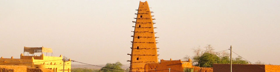
Illizi to Djanet In Illizi we were lucky enough to get fuel, water, bread and even a restaurant lunch (250d each) without getting hauled in to the police and army as Yves reports on point 11. If they don’t ask don’t offer. From here it was tarmac all the way to Djanet, covering in two hours what took a gruelling day a decade ago. We visited the village of Iherir (basic camping at the north end of the settlement – introduce yourself to the teacher, Ibrahim Kadri). The road to this canyon oasis is much improved (30 mins) and may well be tarmaced by next year.
We did the Tuareg tea thing with Ibrahim that evening and next morning went for a walk with a guide up the valley to see the guelta, gardens, rock art and the old Turkish fort (700D for our group of ten). We also left some old clothes with Ibrahim for the villagers.
Down the road, Dider looks as lovely a lunch/camp spot as ever and there is now fuel at what has become the small refugee town of Bordj el Haouas (checkpoint). You could do Illizi – Djanet in a day.
Djanet The new tarmac makes a lovely drive into Djanet – now you can look around at the countryside instead of the piste. There was no checkpoint on entering Djanet (though there were frequent night time roadblocks) or need to get permits for fuel, as before. We stayed at the only place in town: Hotel Zeribas (250d to camp per person, cars free, basic rooms around 500d) right in the town centre next to the post office. I was told the place was dump a year ago but it looked fine to me, with hot water, plenty of shade and good security. They’ll try and rope you in for a cous-cous meal in their restaurant, nothing special and overpriced at 500d pp. There are restaurants just out the door. The Hotel Tenere, miles south out of town, appeared to be closed or waiting for the Xmas charters. There’s a shadeless campsite near it, but it looked deserted too.
Guided excursion to the Tadrart I organised a guide with Agence Essendilene for a tour of the Tadrart (SE of Djanet) and Alidemma arch. We were advised that my proposed route would take much longer than planned (although a friend did the full tour a year ago in 4 days). It was a guide’s ploy to get more days out of us (a new one me!). In the end we settled on 4 days, Tadrart only at 1200FF a day. We also paid 25d per person per day in the national park at the park office/museum in town. Once we got to the Tadrart it was clear the guides were stringing out the route to fill 4 days, crawling along at times at 10kph. We would have rather driven at a normal speeds and camped early to enjoy time out of the cars, which we later did.
I was looking forward to the Tadrart but to be honest I was disappointed. The sandy drive out towards Mt Tiska and following oueds south of the corrugated Ghat piste was great (and driven at normal speeds). But Oued In Djerane was very dusty and for the price I paid, the region did not quite have the edge over the very similar (and contiguous) Akakus in Libya. Of course, unlike the Akakus, the Tadrart has zero tourists. The ochre dunes at T-in Merzouga were the highlight. Our guides Ahmed and Slimane were a good bunch of guys and, with an email contact in Germany, I may hire them again directly, at a more normal price.
Unfortunately one of our group was injured an accident on Day 3 and we had to return directly to Djanet. Amazingly the Defender nearly made it back in 2WD, at which point the severely traumatised transmission finally gave up the ghost. The doctors at Djanet hospital were extremely helpful and confidence inspiring. The injured driver eventually flew back to the UK via Algiers, with the aid of his travel insurance and looks like making a full recovery. The car was a write-off. There are no modern Land Rovers in Algeria, only ancient Series IIIs. Recovery to the coast was not worthwhile and so it had its contents and components ‘optimised’ and was left with the Customs. Vehicles cannot be sold in Algeria. The Douane huffed and puffed a bit about parts missing from their new ‘present’ (what a nerve!), but once they realise it’s more wrecked than it looks they won’t be quite so thrilled.
Telephoning from Djanet Trying to organise the repatriation exposed the near impossibility of telephoning out of Djanet, even just to the next town. The problem seems to be many new private telephones but just one inadequate satellite/radio dish. I was on the verge of driving 400km to Illizi (linked by land lines and therefore much more reliable), but had one more go at sundown – Ramadan eating time when all goes quite. However the insurance never managed to call back. So despite what I say in the book on p.276, a sat phone would have been useful here. (incidentally the hypothetically described Medevac procedure on the opposite page – outlined to me by a Loss Assessor – proved to be pretty accurate. Getting to a town/phone/hospital is the key. However, the insurance insist on proof that the claimant cannot continue the tour as well as a doctor’s report to prove they are safe to fly. This is what cost us days and why we gave up in Djanet – they could not get through).
Not surprisingly, GSM mobiles don’t work in Algeria (they do in Tunisia), but I was told that next year they will, even down in the south.
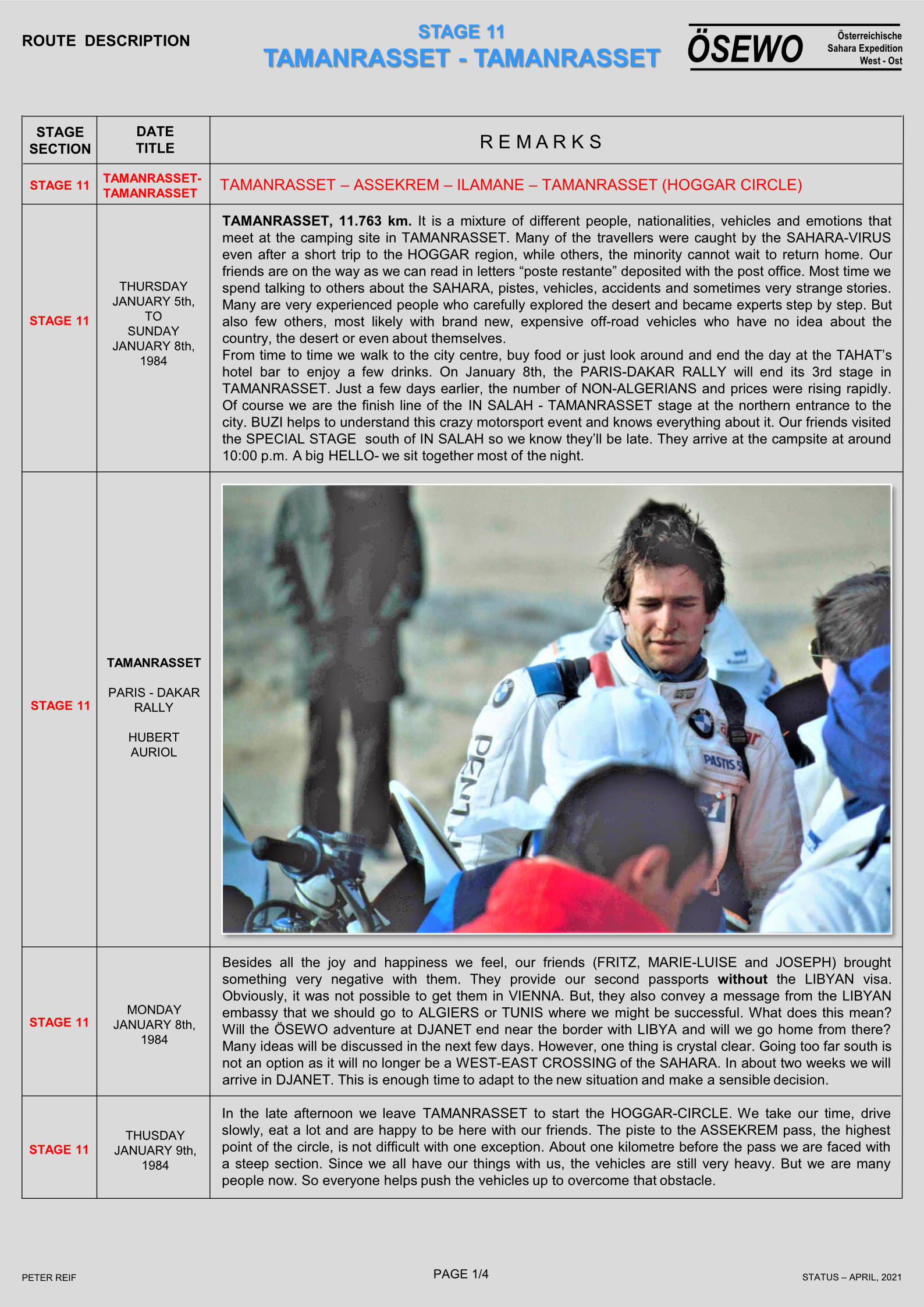
Route A2 to the Hoggar With the injured driver slowly on the mend, two cars from the group offered to help assist his recovery to the UK while I continued with the VX and Discovery to the Hoggar. We managed to get diesel at Bordj el Haouas (Ramadan shuts everything down at 3pm) and then headed south along the chain of mountains that end in the landmark of Tazat (an interesting area to explore for another time I think). Mistakenly thinking we needed to move fast to catch up for lost time, we drove from Tazat almost to Assekrem in a long 400km-day. As described in the book the junction at ‘Borne’ is still confusing and we dithered around a bit before heading resolutely SSW over confusing tracks with another lost G-Wagen crossing out bows. Soon we found the crucial cairns and balises that lead into the valleys all the way to Serenout fort (quick passport check) and on past Telertheba. Despite what it says on p.397, the southern route from Serenout (as marked on the IGN) seems to be the main way and is a lovely drive with the 2455m Telertheba looming ever larger up ahead. The sandy sections mentioned on A2 in the book didn’t cause any problems – one wonders if a flat sandy track improves with little passing traffic.
There is diesel only at Ideles from where a corrugated track leads to Hirhafok. At Hirhafok we turned south for Assekrem.
I knew this piste would be washed-out, but the closer we got to Assekrem the worse it got, to the point where one could barely believe anything less tha a Unimog could drive it. The last 50kms took 4 hours in Low Range with extremely slow and rocky going up to and beyond the Tin Teratimt Pass. From here on it was so damaged one could hardly work out the original track among the many deviations.
We had Assekrem to ourselves but there is a whole menu of prices there: parking, parking more than an hour, breathing, etc. The ‘chatty’ guy in charge tried to charge us for camping, too… To be fair it can’t be cheap to run the place and the lovely lodge is well worth an overnight (even at nearly 1000ds demi-pension) so you can see dawn over the plugs.
Tefedest East We returned down the track from hell (not so bad this time but I doubt any local would use it), fuelled up at Ideles, getting caught up with the bored police opposite the pumps for a tiresome “what’s your job, address, mother and father’s name” check. Backtracking, the turn off north for Mertoutek is clear if you’re looking for it and the track unrolls clearly, passing through some lovely spots to a turn-off at a big green sign a few kilometres before Mertoutek (as marked on the TPC). From here twin ruts lead north to Dehine and continue all the way along the east flank of the Tefedest range past the distinctive peak of Garet el Djenoun at its northern end.
The Discovery’s rear radius arm broke, probably as a result of the exertions of the previous day, and with me taking on the car’s fuel and water payload, my 61’s rear main spring also snapped a day later. The flat helper springs had also snapped off I discovered, but the second spring sort of winds round the mount so I could carry on without much problem. The other rear main spring has since broken. I never rated these two-year-old Ironman rear springs for heavy load carrying (front are fine) and will be getting some heavy-duty OMEs.
We had a day off by Garet and then continued north along the west of the Amguid erg, through the pass and northwest back to HbG, a clear if corrugated track marked with oil drums much of the way.
This is a lovely way back north, easy to follow with no GPS needed – 710kms from Ideles to HbG. The last 150km are a flat and dull and after the final rise, the eastbound track back to 4 Chemins is very rough but can be avoided by going via Bordj Omar Driss, I’m told.
Back north We just about managed to wangle our way out of a return convoy north, and continued slowly with the four-wheel steering Discovery all the way from Gassi Touil to Nefta in one very long day. Getting out of Algeria took two hours with no searches or money checks (the same as years ago), just very slow-witted officials at Taleb. At Haouza they asked for Green Card insurance (a first) so those without had to buy a week’s worth for 10Td. After 1200km of hairy handling with just a winch cable and a chain holding the axle in place, the Discovery got its radius arm welded in Nefta and we met up with the rest of the group at La Goulette for the ferry back to Genoa.
Weather Following the severe October rains west of Illizi, we were blessed with no daytime wind and amazing clarity the like of which I’ve never seen in the Sahara. You just could not help staring in amazement at the crisp profiles of the ergs and the mountains. Temperatures were mild too, even at 1800m in the Hoggar it only dropped to 7C.
We also saw plenty of dorcas gazelles which I’d never noticed before and of course thriving Tuareg nomad activity here and there which, along with the famously diverse landscape, is what makes Algeria so special.
Conclusion While it was a shame not to be able to complete the tour with the whole group, Algeria is as good as I remembered: the desert has plenty of tracks, as easy or as hard as you want, and all without excessive hassles with guides or permits. I would not choose to visit the Tadrart again, instead I’d rather explore places like Erg Tifernine and Tihodaine, and the Tazat and Tefedest mountains, as well as more southern routes linking Djanet with Tam. This will be the basis of my 2001 tour.
The most tiresome element is, as always, border stuff on the Carthage and at Taleb, but then if it was easy everyone would go here! I met Gerhard Gottler on the ferry back, updating an old Algerian guide and preparing a new Sahara-wide guide (in German). He agreed the southeast of Algeria is the ‘fillet mignon’ of the Sahara. With one easily obtained visa you get a lot for your money in Algeria, and you can always spice things up by pushing further south to the Tenere in Niger.
While the north and the far west may be risky, security in the southeast was never an issue. The gendarmes bombing around in their green Land Cruisers (a cut above the average army and police) inspired confidence and greeted us warmly, as did everyone.