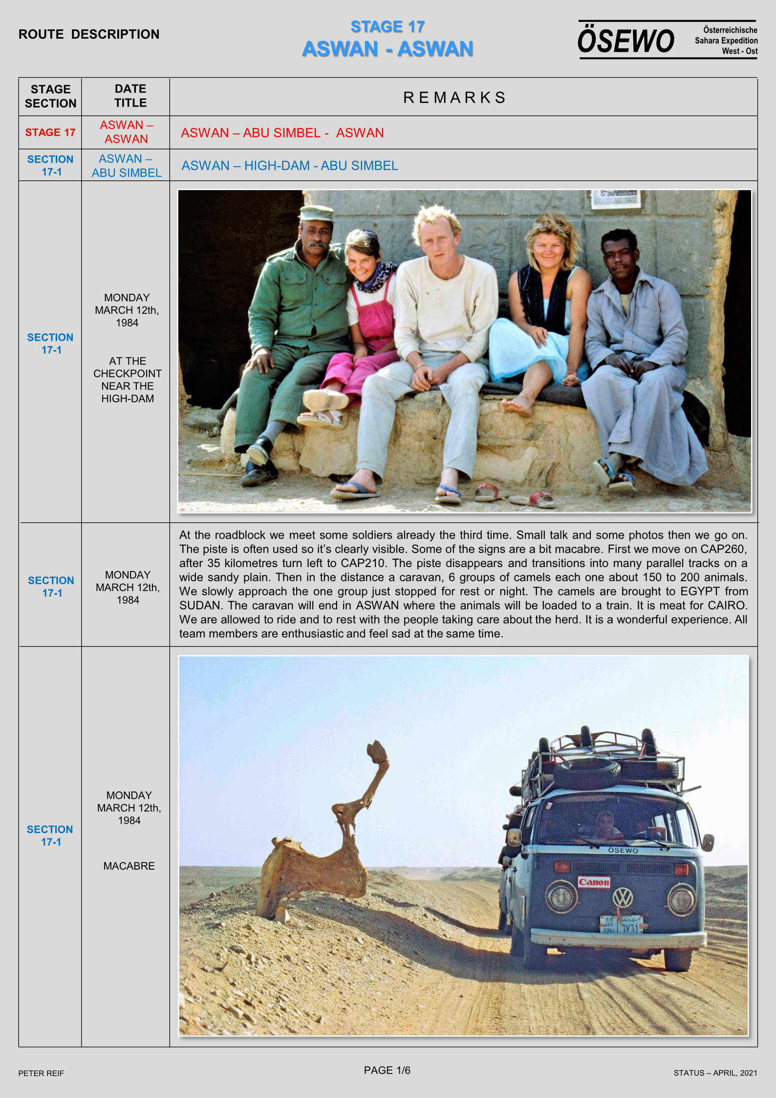
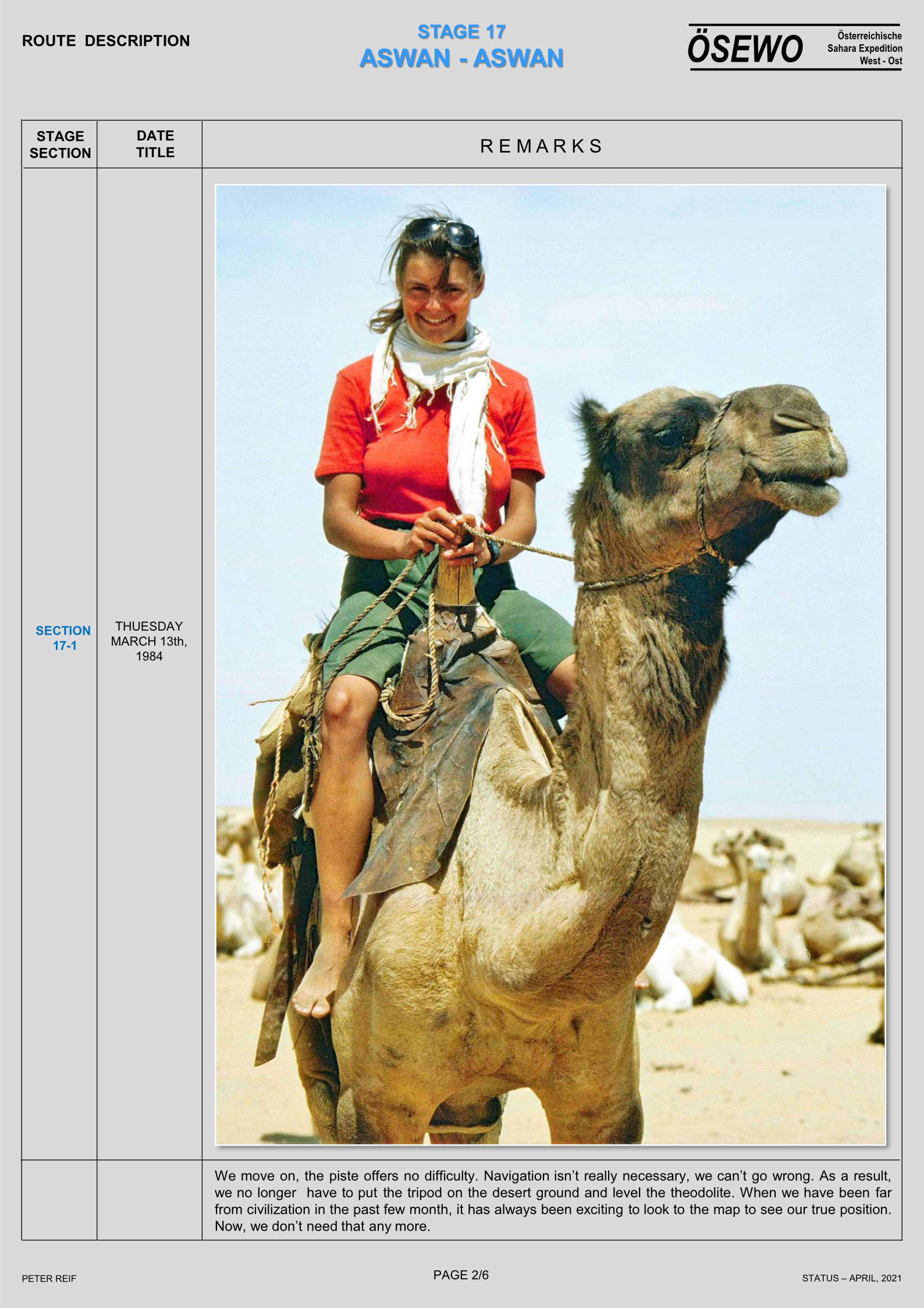
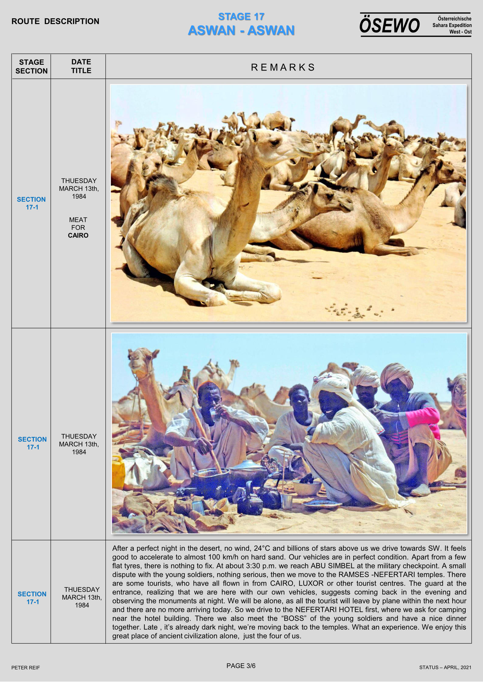
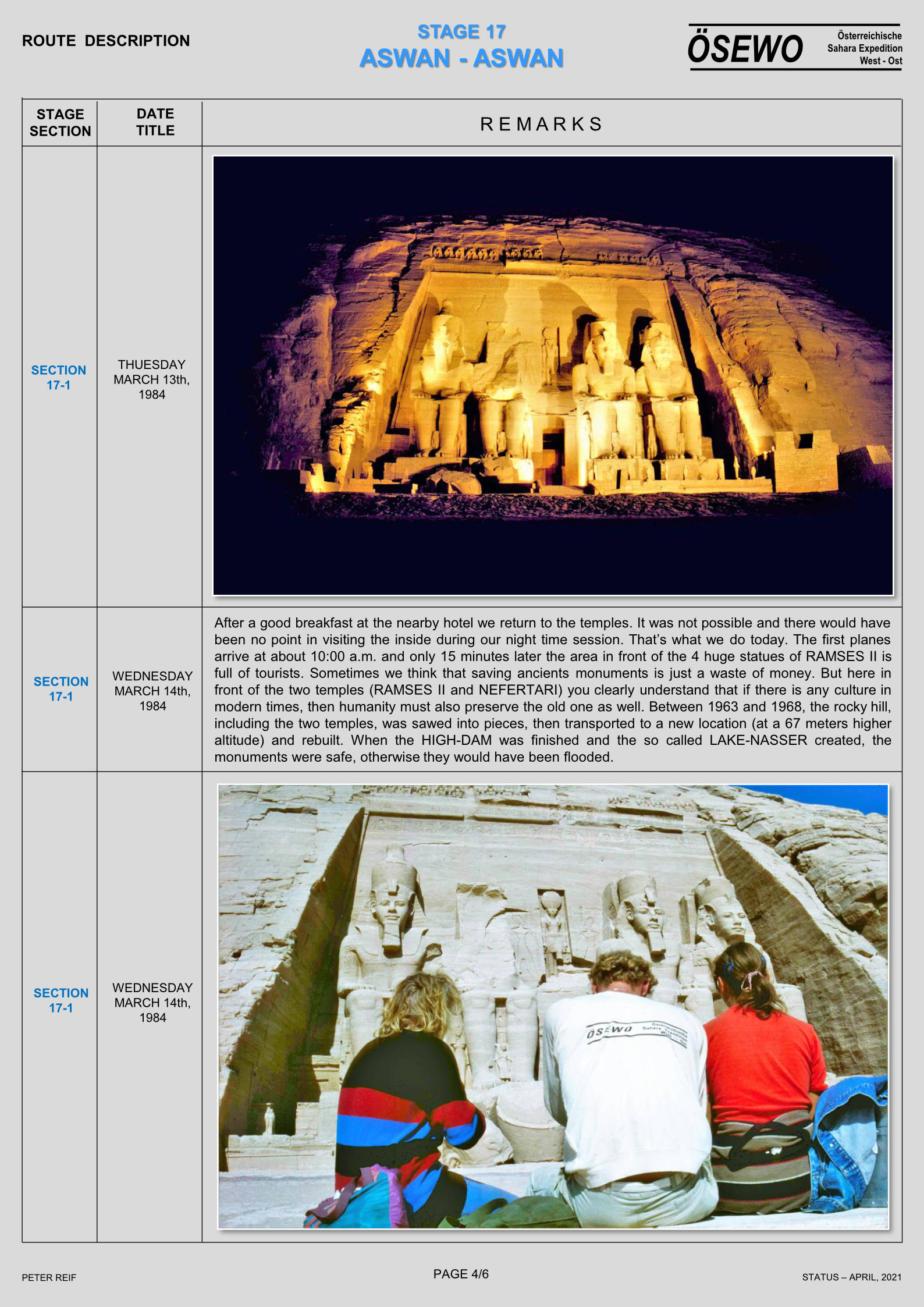
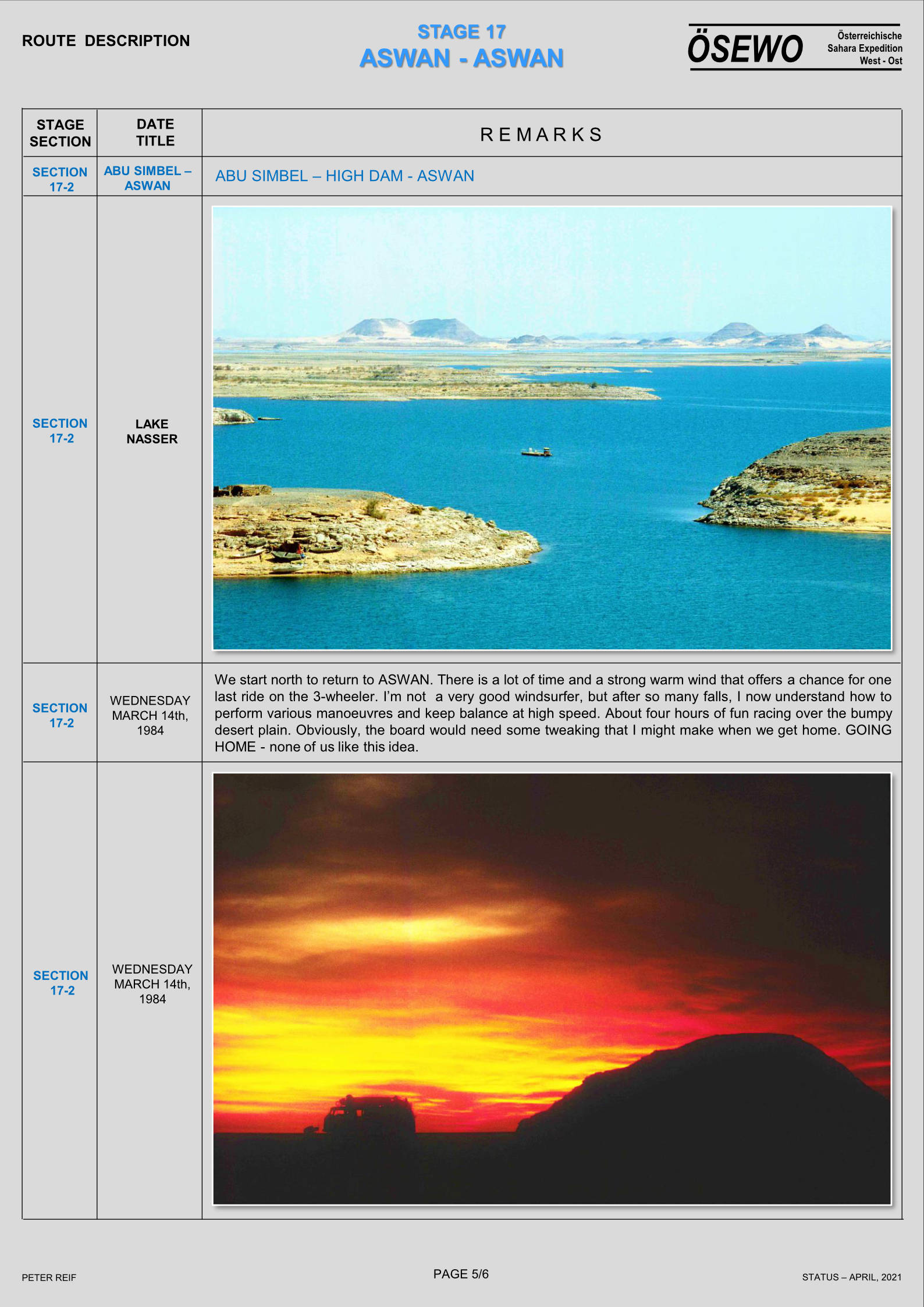
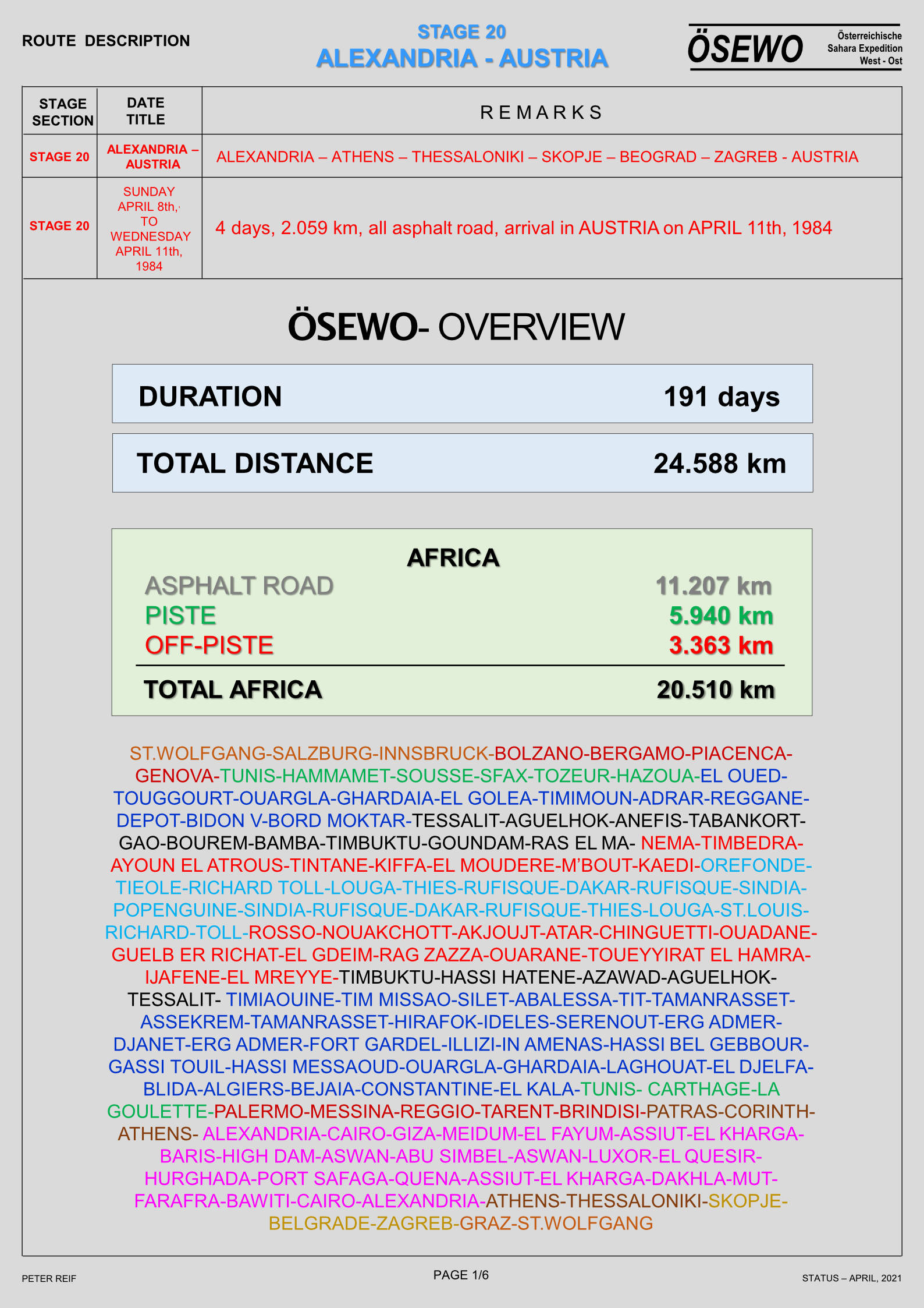
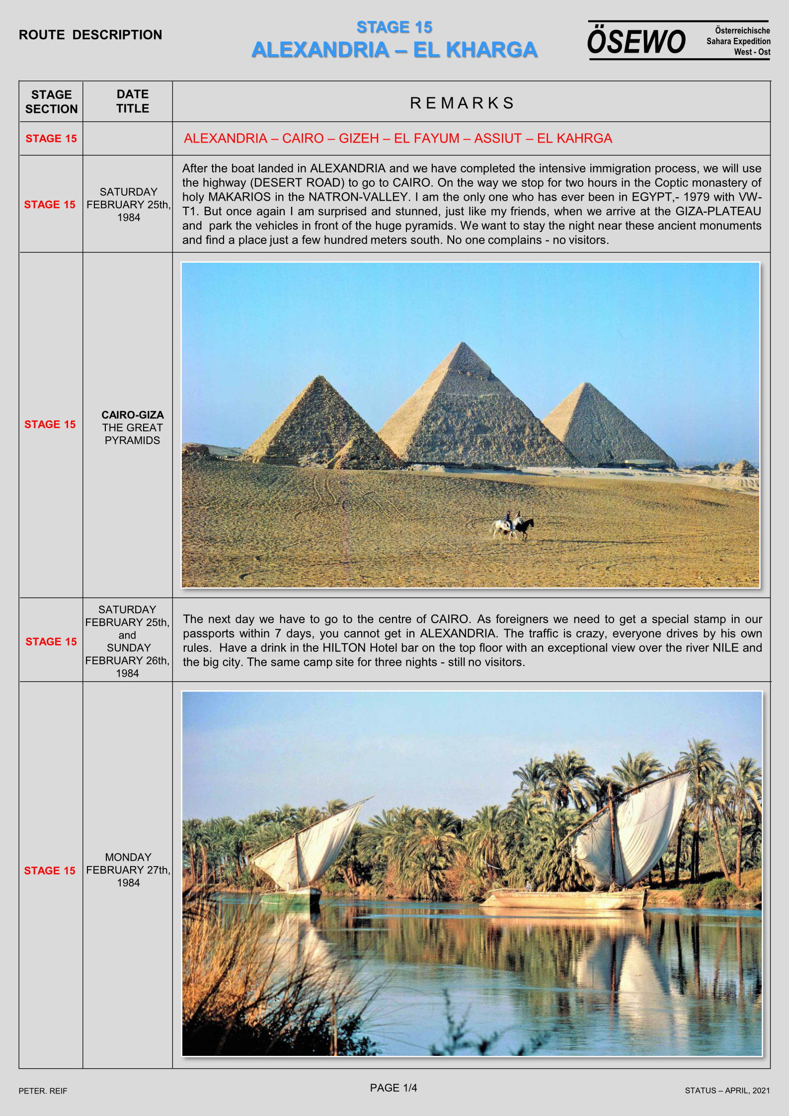
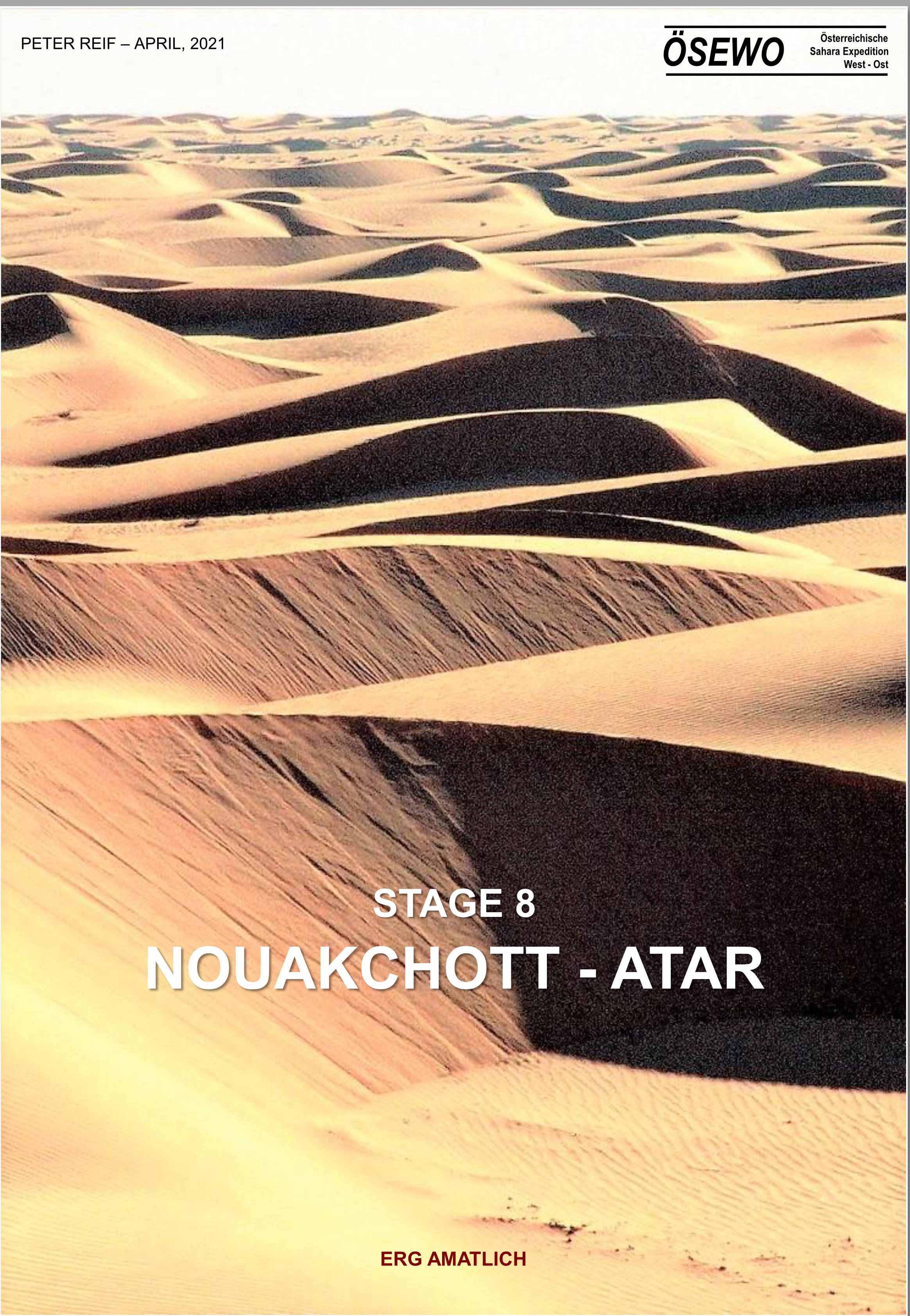
The final instalment of Peter Reif’s report and maps recalling ÖSEWO: an Atlantic-to-Red Sea crossing of the Sahara in 1983-4 with VW T2 Kombis. From Aswan the foursome visit the temple of Abu Simbel, passing Sudanese camel meat caravans on the way. Then, after six months and some 12,000km from the Atlantic, they cross the Nile and take a well-earned dip in the Red Sea. For earlier parts, click the Index Page.
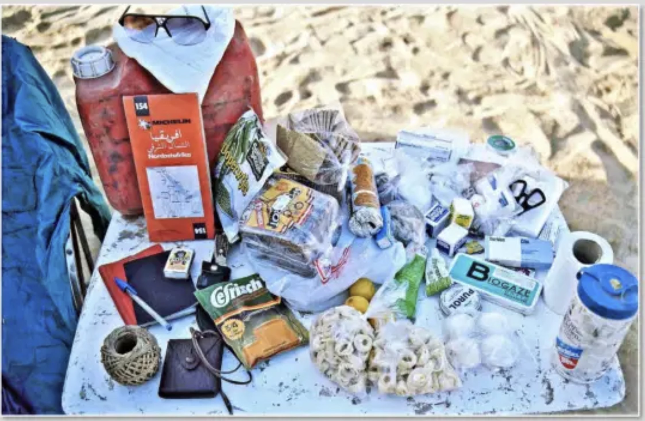
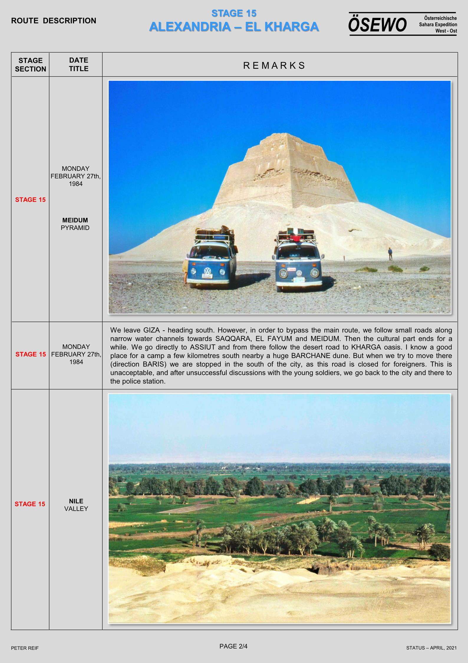
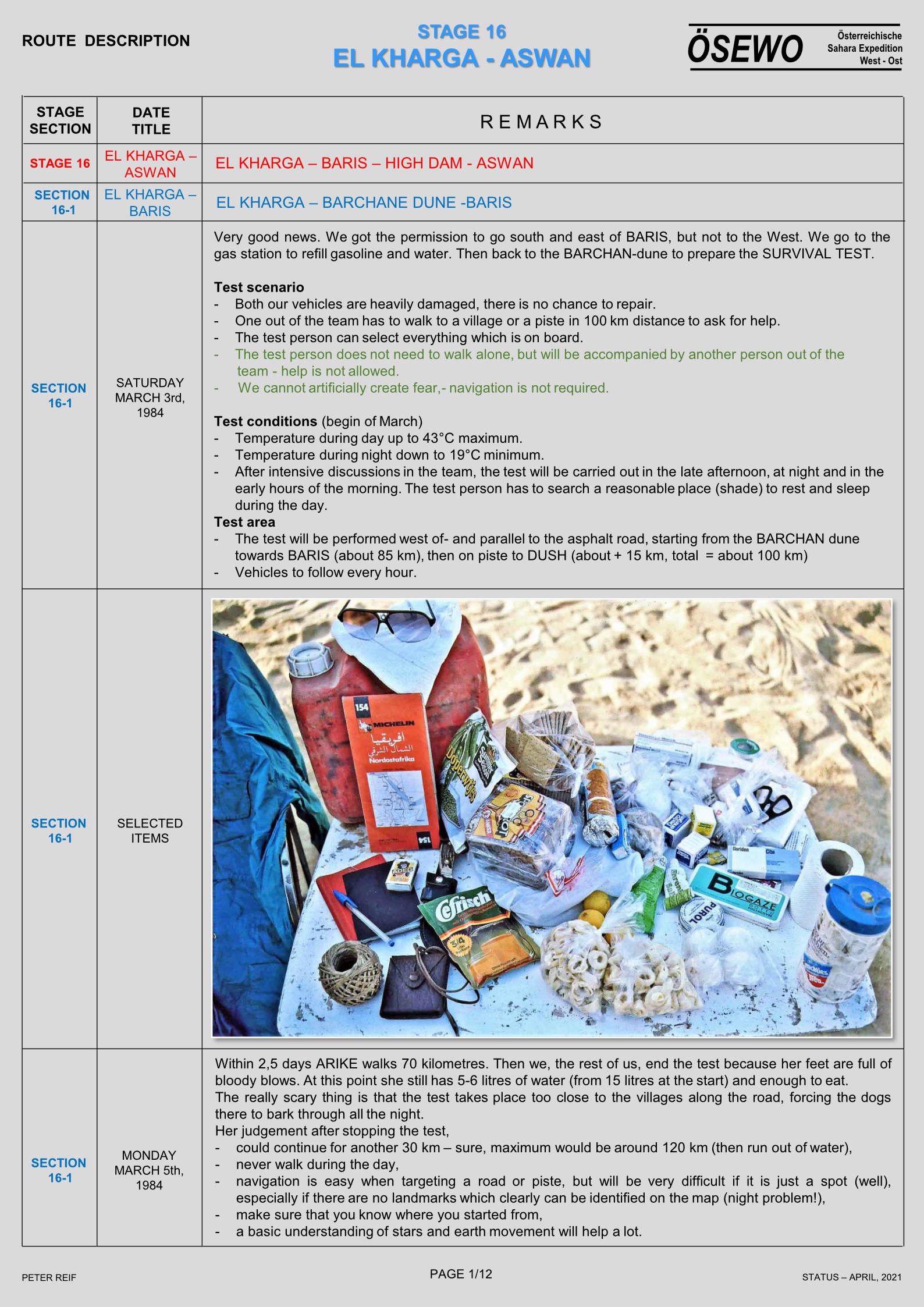
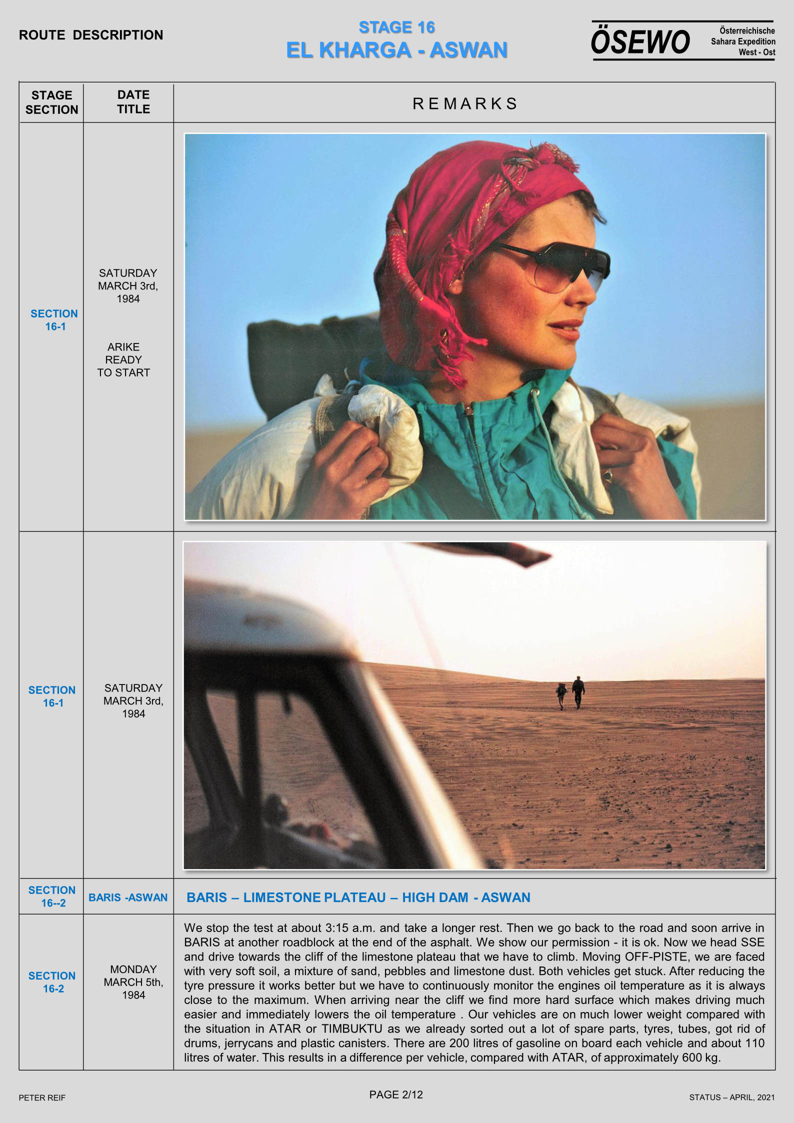
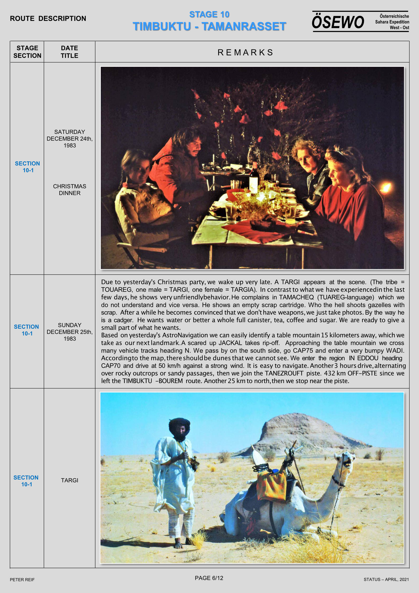
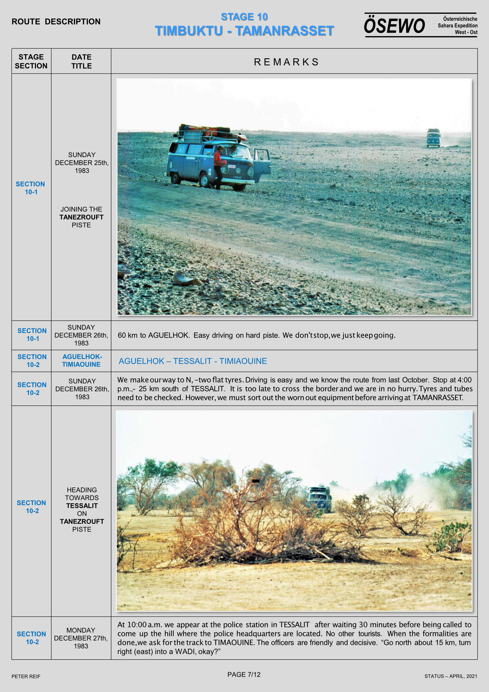
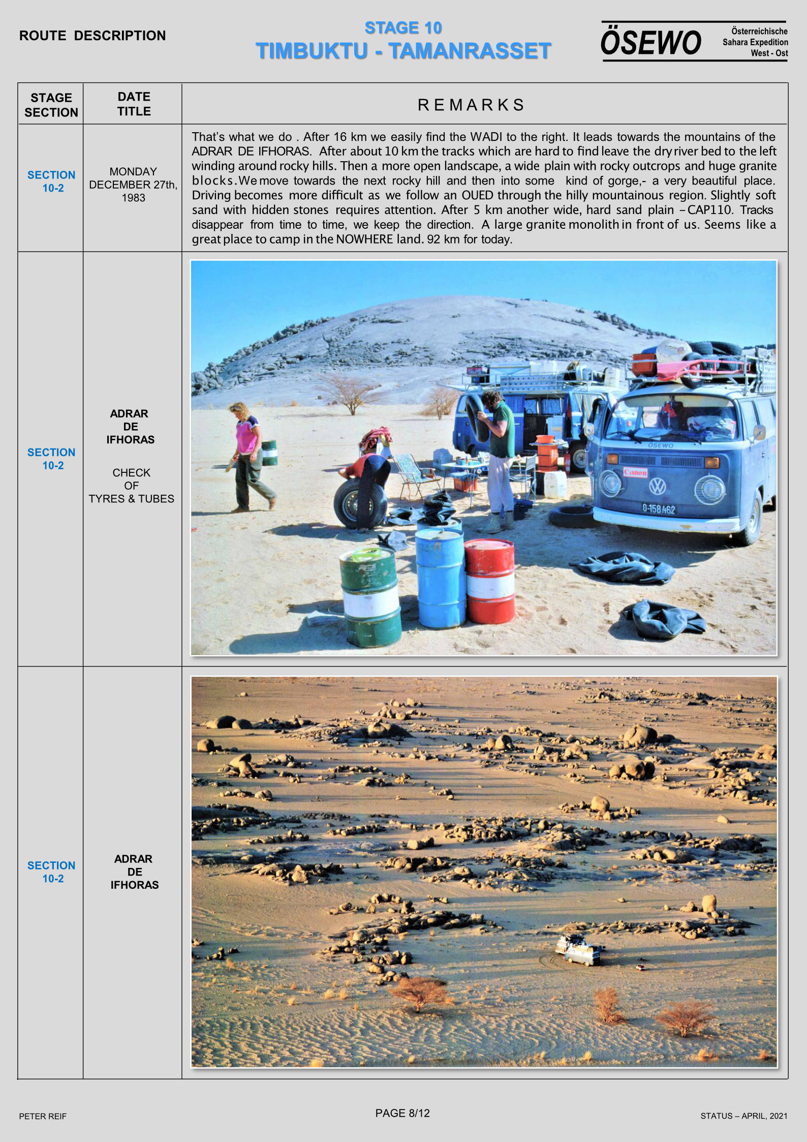
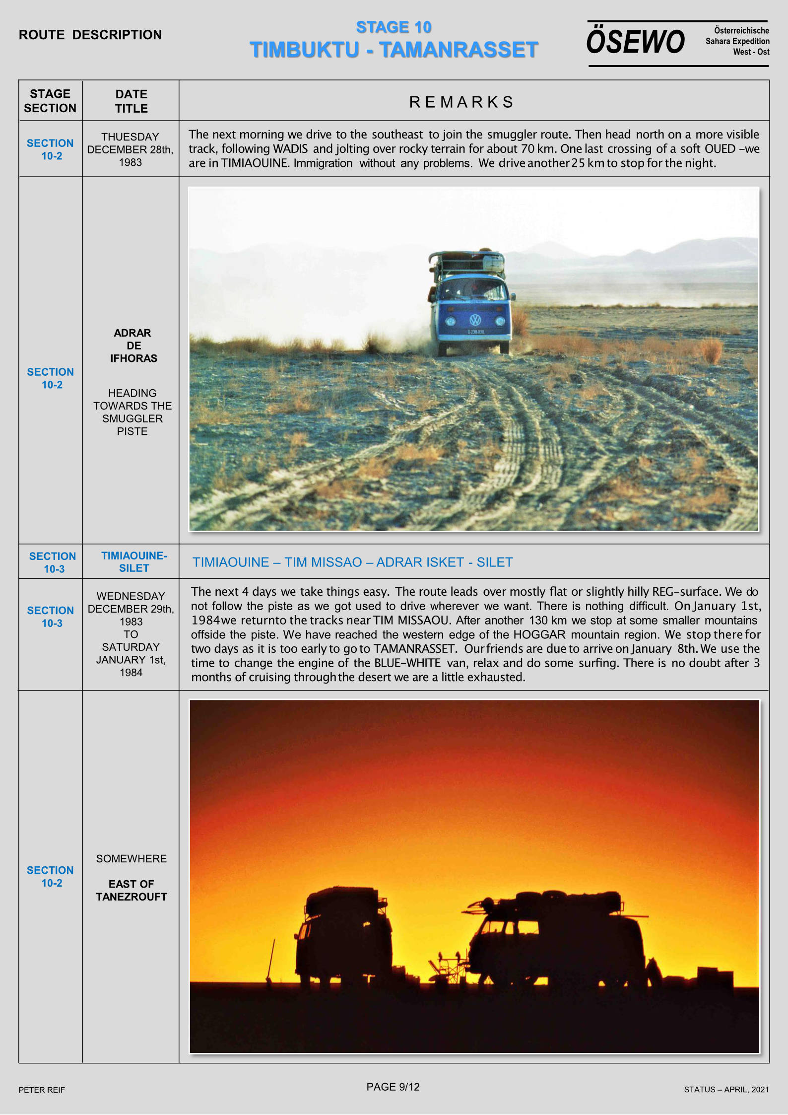
Part Seven of Peter Reif’s report and maps recalling ÖSEWO: an Atlantic-to-Red Sea crossing of the Sahara in 1983-4. After having to divert around Libya via the Mediterranean, the flat-four foursome are back in the desert to tackle on of the hardest stages so far. But not before they conduct a desert survival experiment to see how far one of the team can walk with what they can carry (above left). For other parts, click the Index Page.
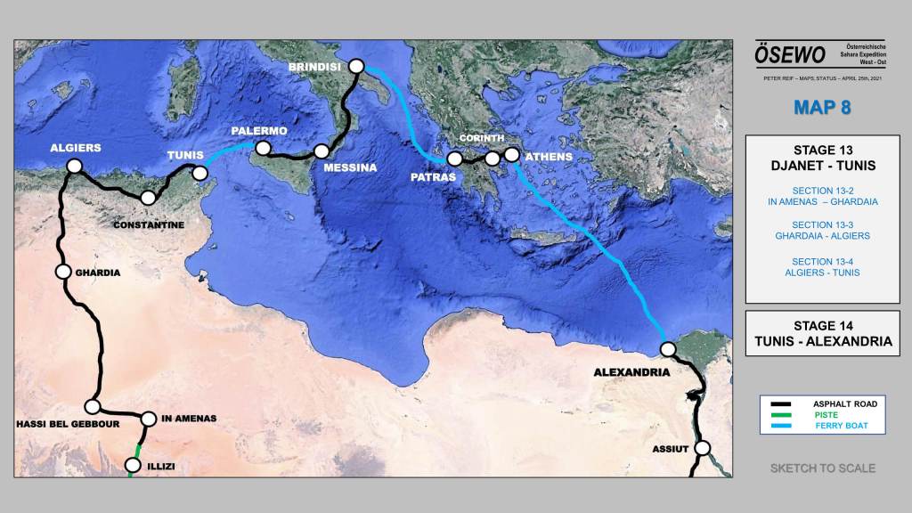
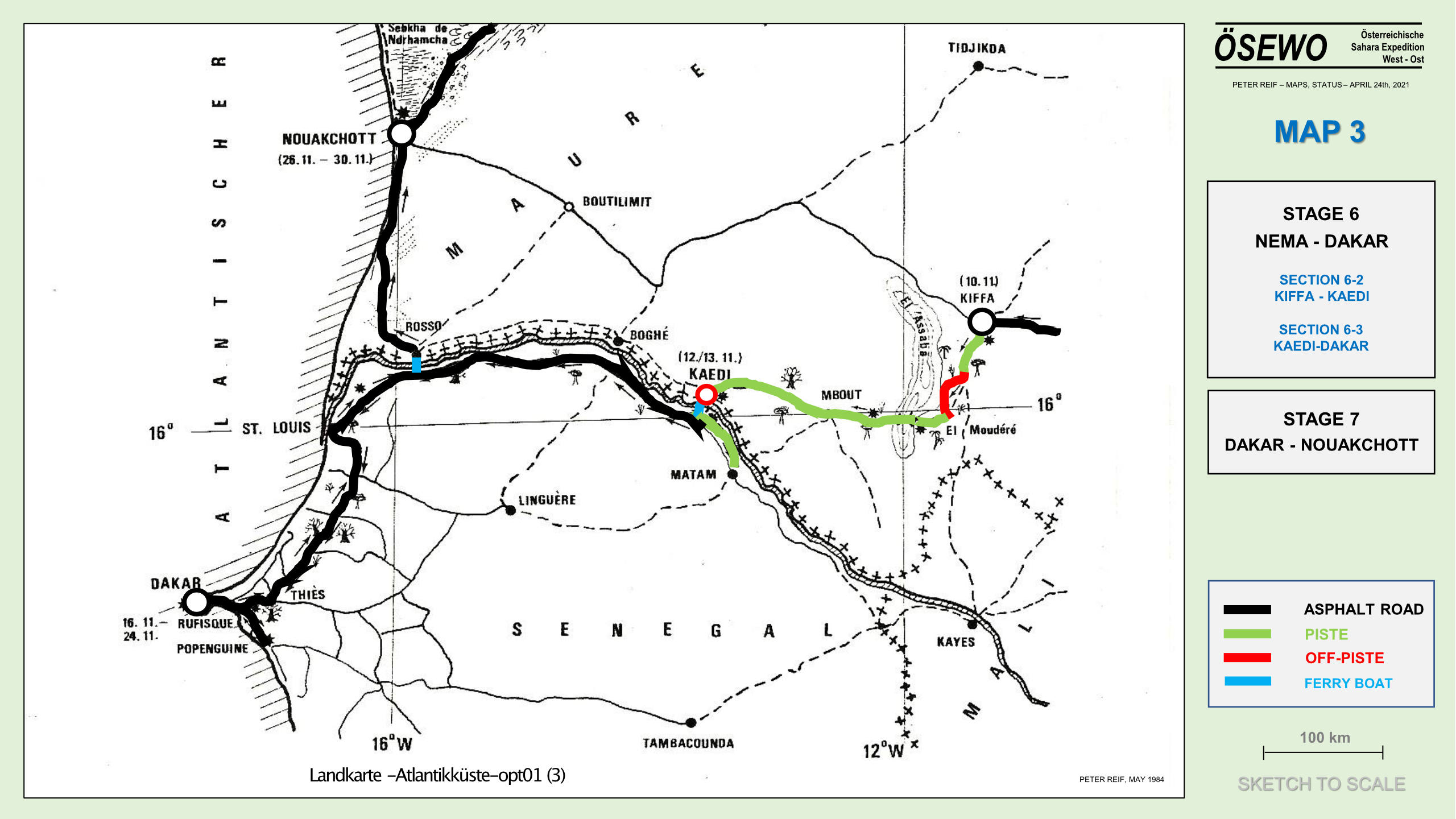
Part Six of Peter Reif’s report and maps recalling ÖSEWO: an Atlantic-to-Nile crossing of the Sahara in 1983-4. Despite their best efforts to acquire Libyan visas in Djanet, Algiers and Tunis, an escalation in the Libyan war with Chad means they can’t cross overland to Egypt and so have to ferry around across the Mediterranean. For other parts, click the Index Page.
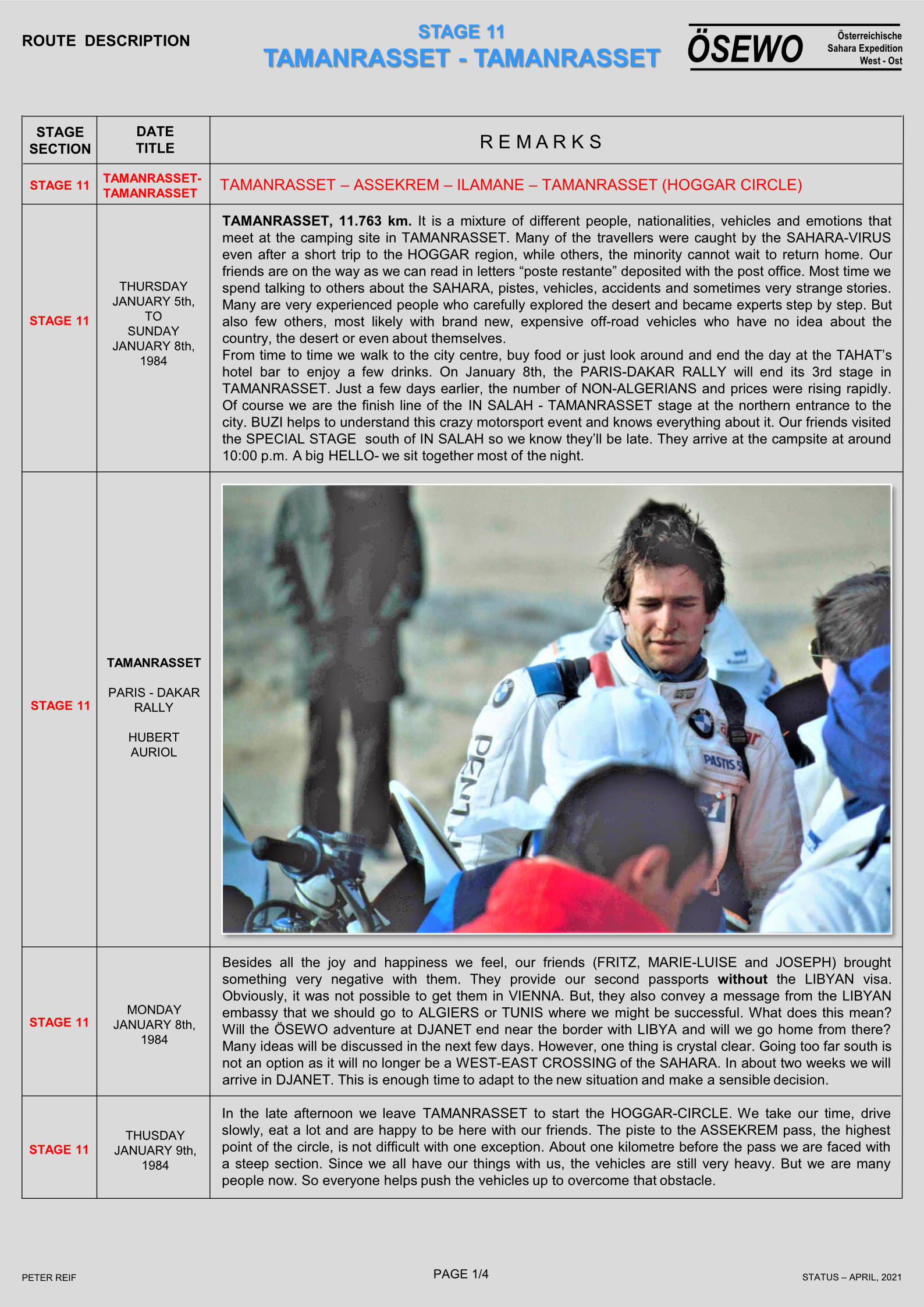
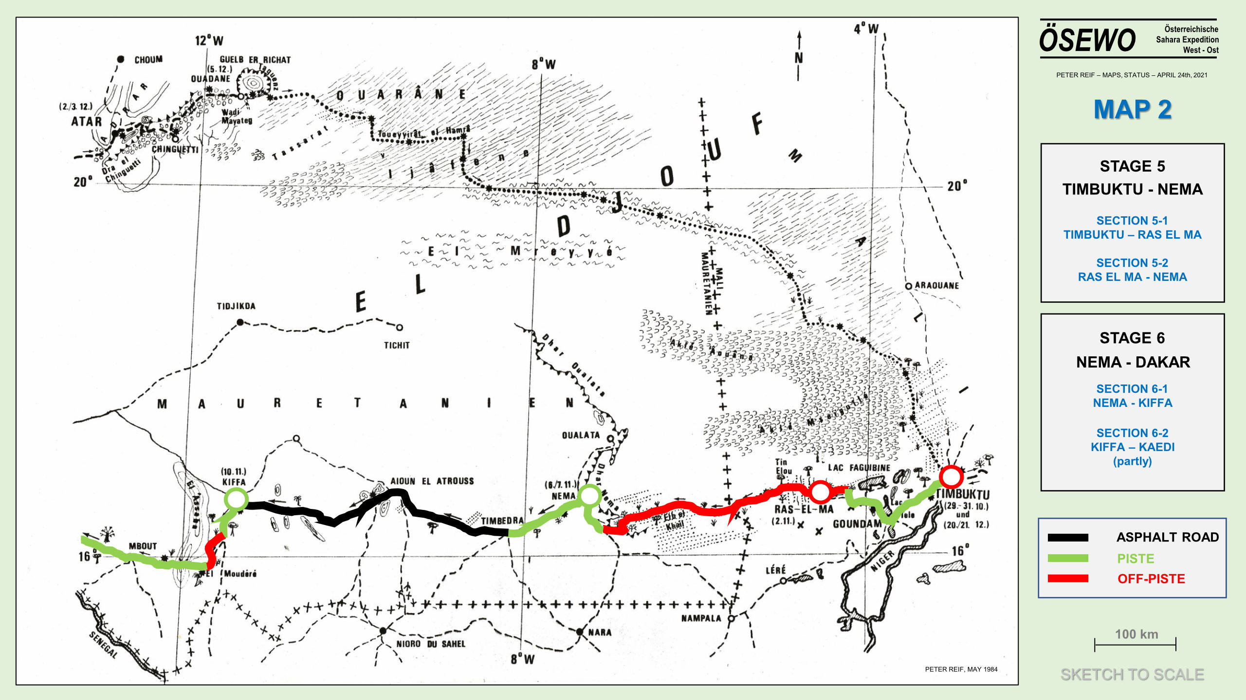
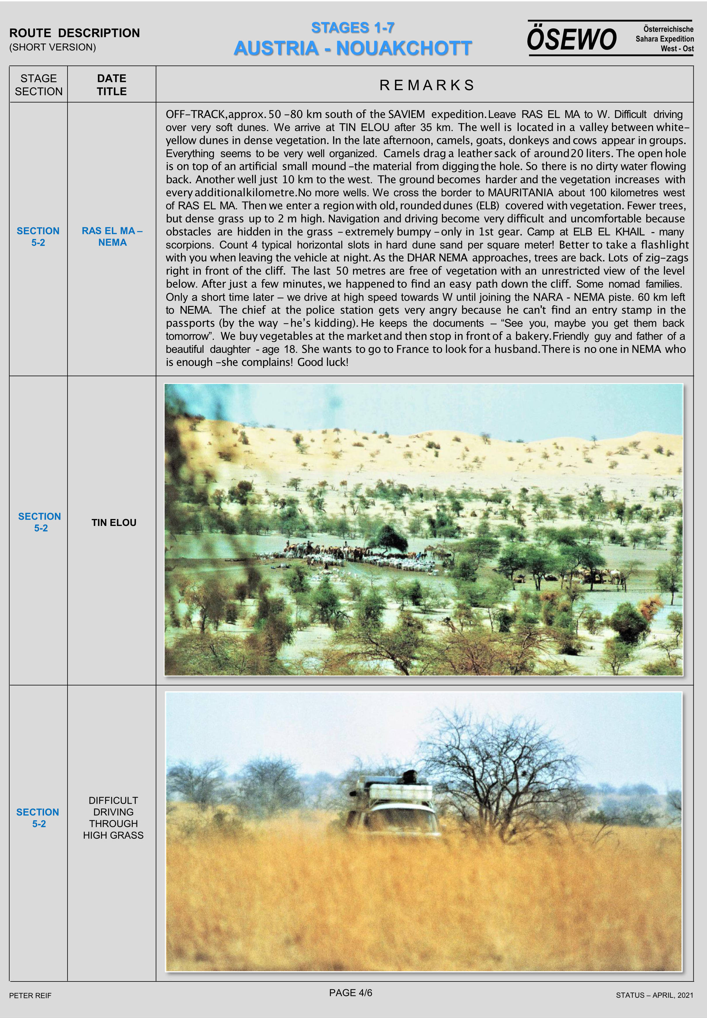
Part Five of Peter Reif’s report and maps recalling ÖSEWO: an Atlantic-to-Red Sea crossing of the Sahara in 1983-4. The team have arrived in Tamanrasset where they meet many other desert overlanders, as well as the Dakar Rally and three VW friends from Austria who’ve brought spare passports for Libya. The four vans tick off the Hoggar Loop, then headed east for Djanet, close to the Libyan border. For other parts, click the Index Page.
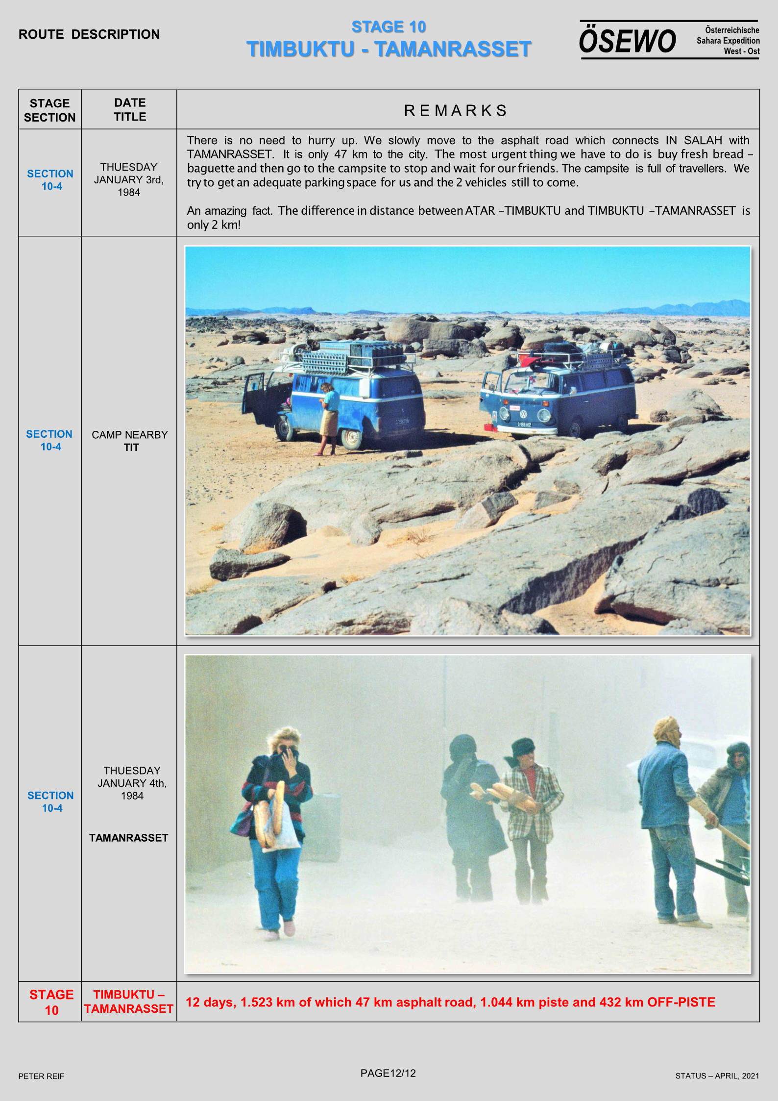
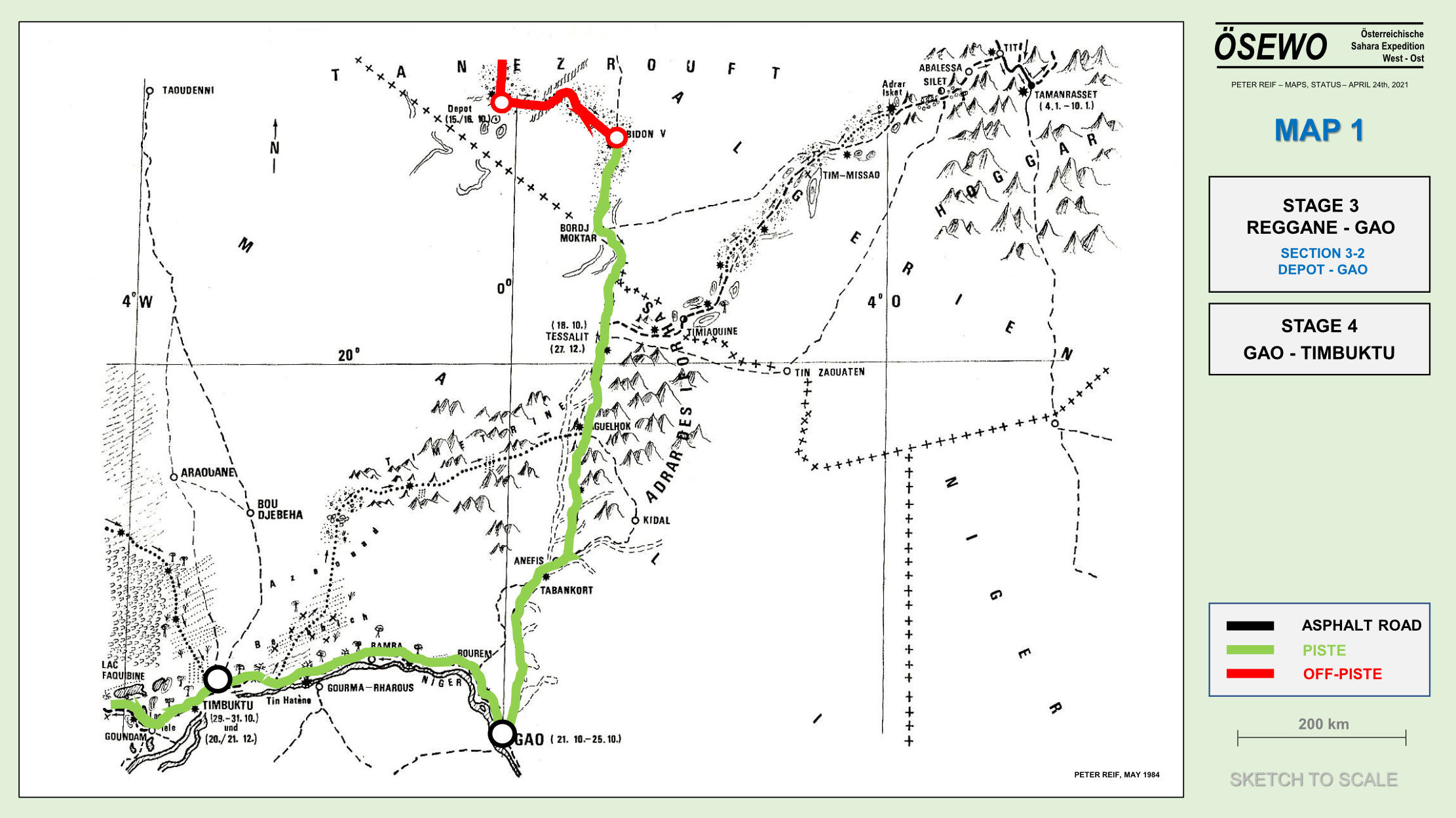
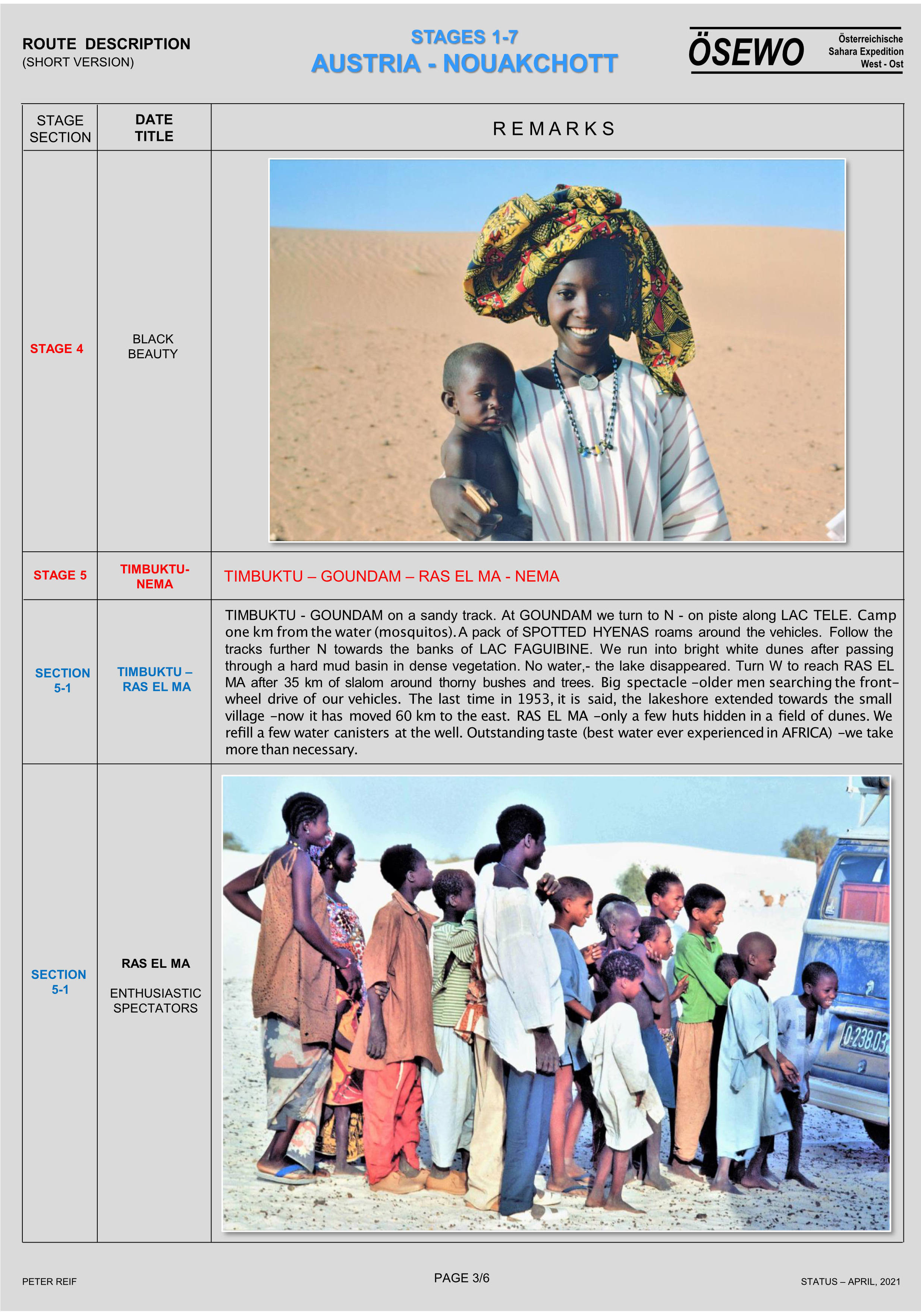
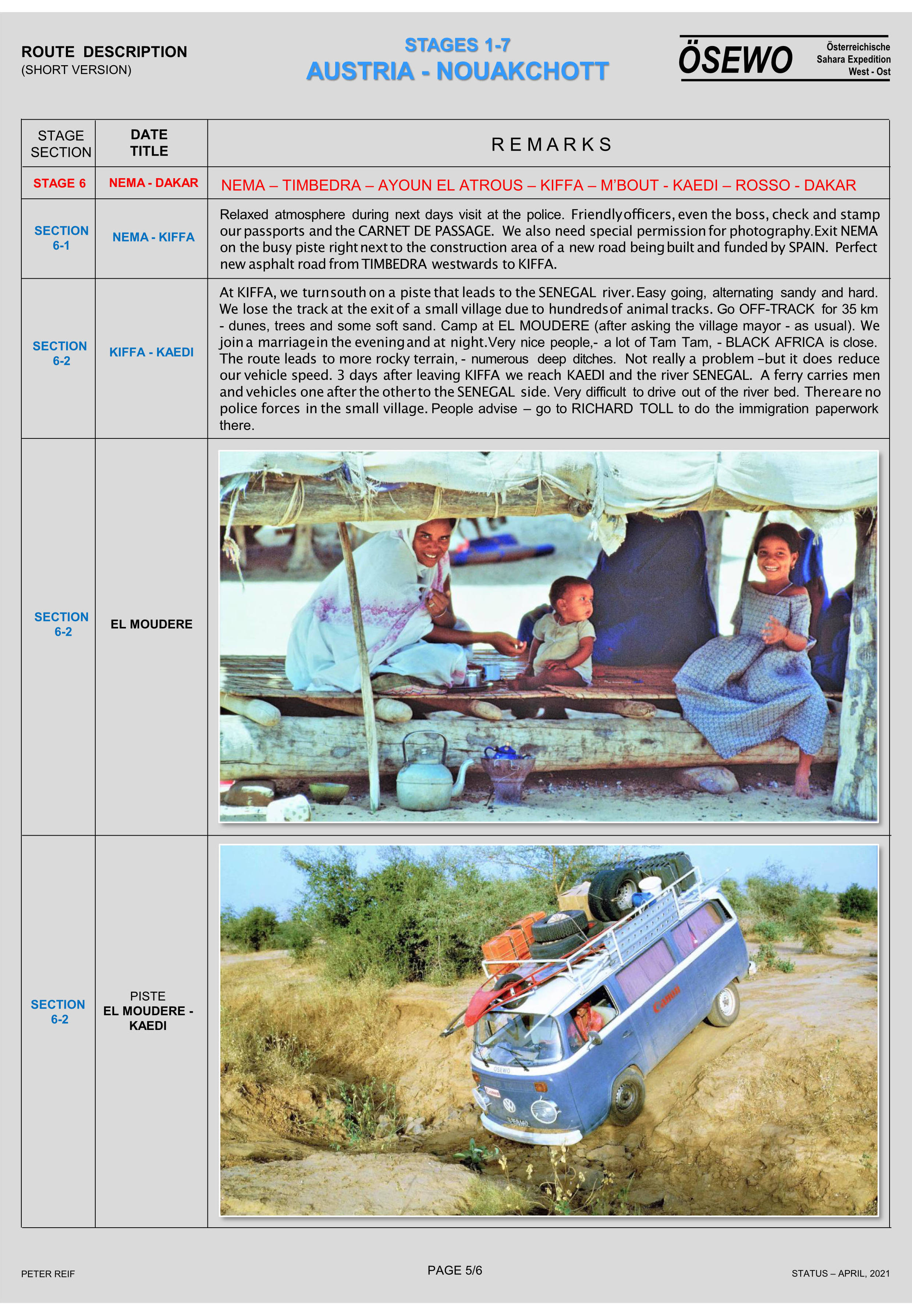
Part Four of Peter Reif’s report and maps recalling ÖSEWO: an Atlantic-to-Red Sea crossing of the Sahara in 1983-4. Following the tough, three-week crossing of the Majabat al Koubra to Timbuktu, the two VWs head northeast back into the desert for the Algerian border they crossed two months earlier on the way down. For other parts, click the Index Page.
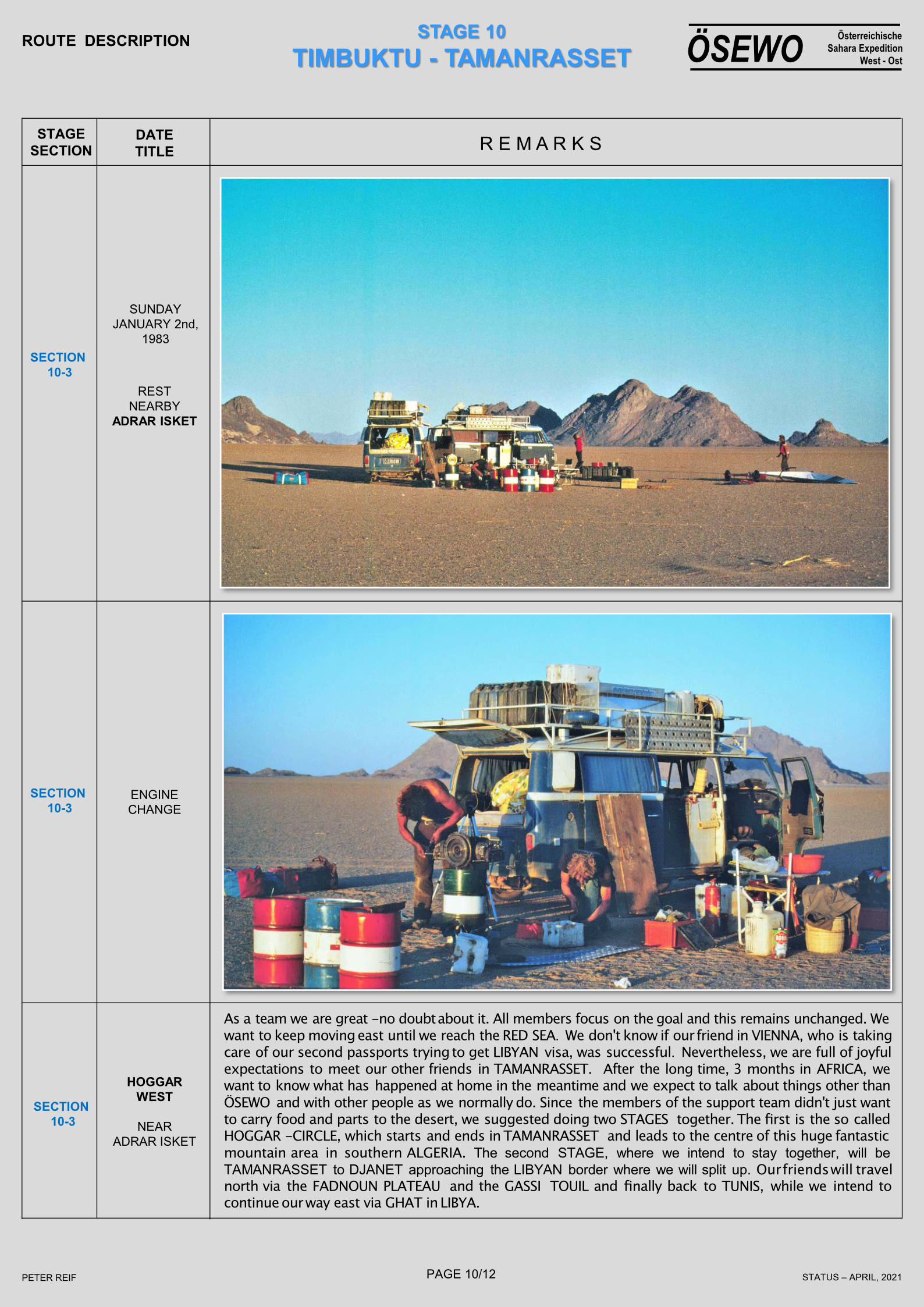
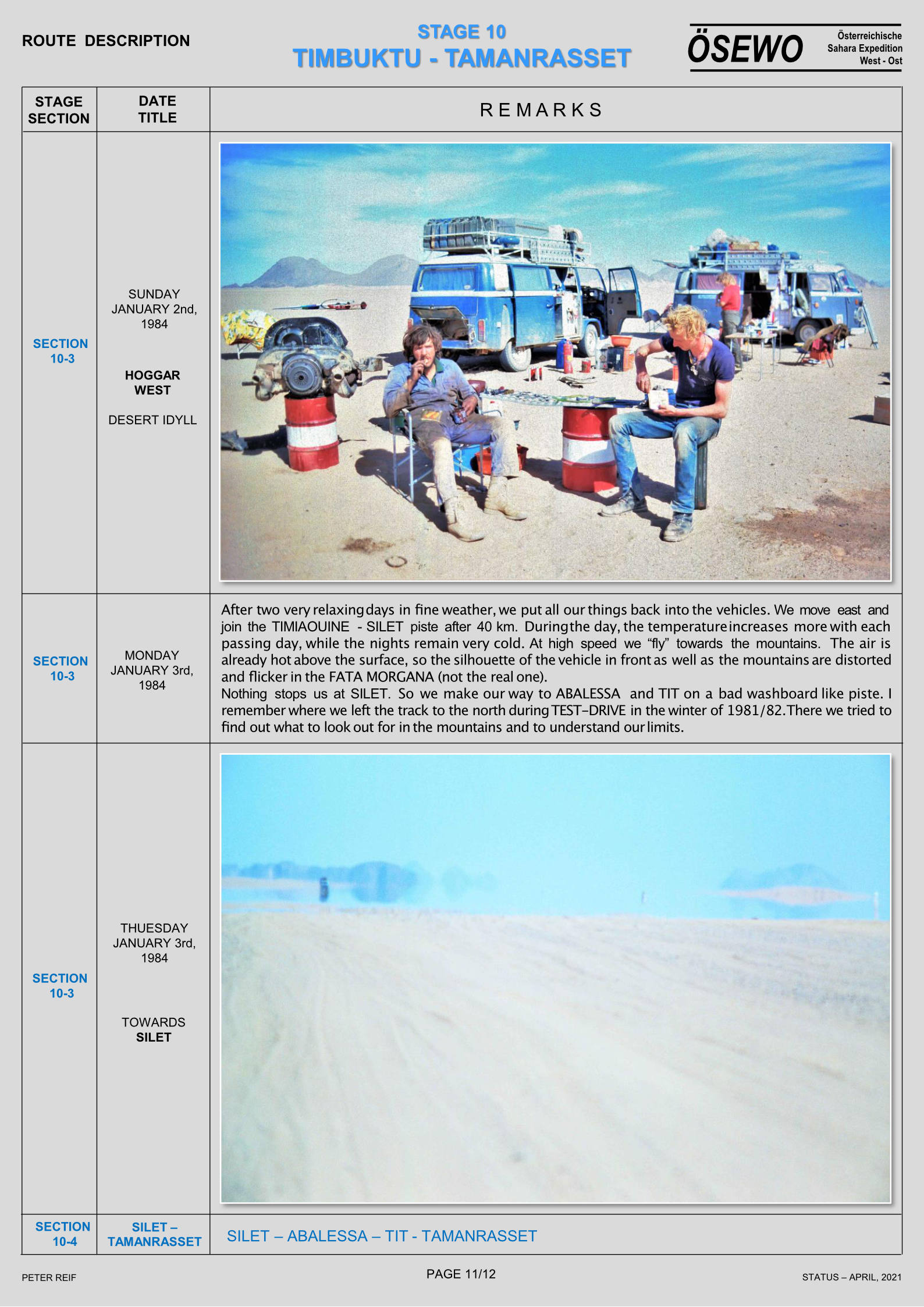
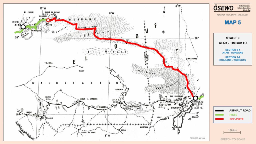
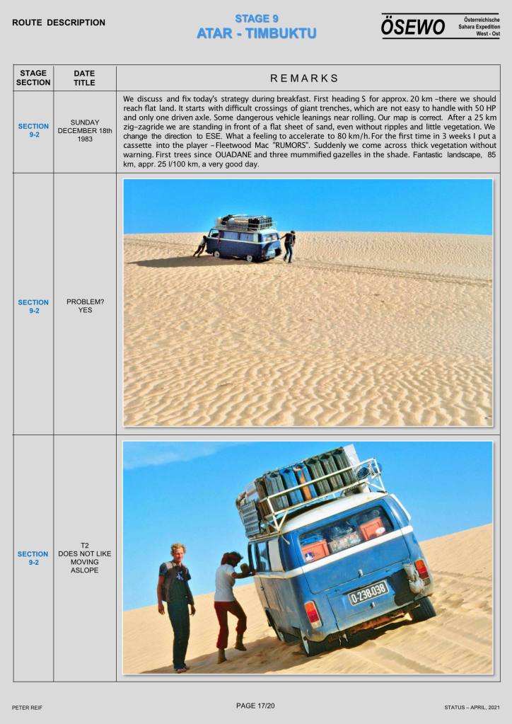
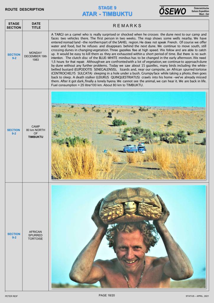
Part Three of Peter Reif’s report and maps recalling ÖSEWO: an Atlantic-to-Red Sea crossing of the Sahara in 1983-4. The VWs load up and tackle the big 1500-km dune crossing of the Majabat al Koubra or Empty Quarter from Atar to Timbuktu. For other parts, click the Index Page.
Part Two of Peter Reif’s report and maps recalling ÖSEWO: an Atlantic-to-red Sea crossing of the Sahara in 1983-4. The team get in position for the first big desert crossing. For other parts, click the Index Page.
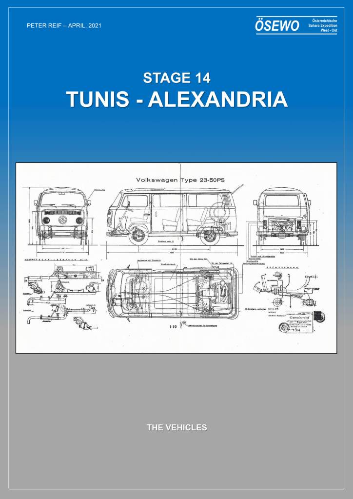
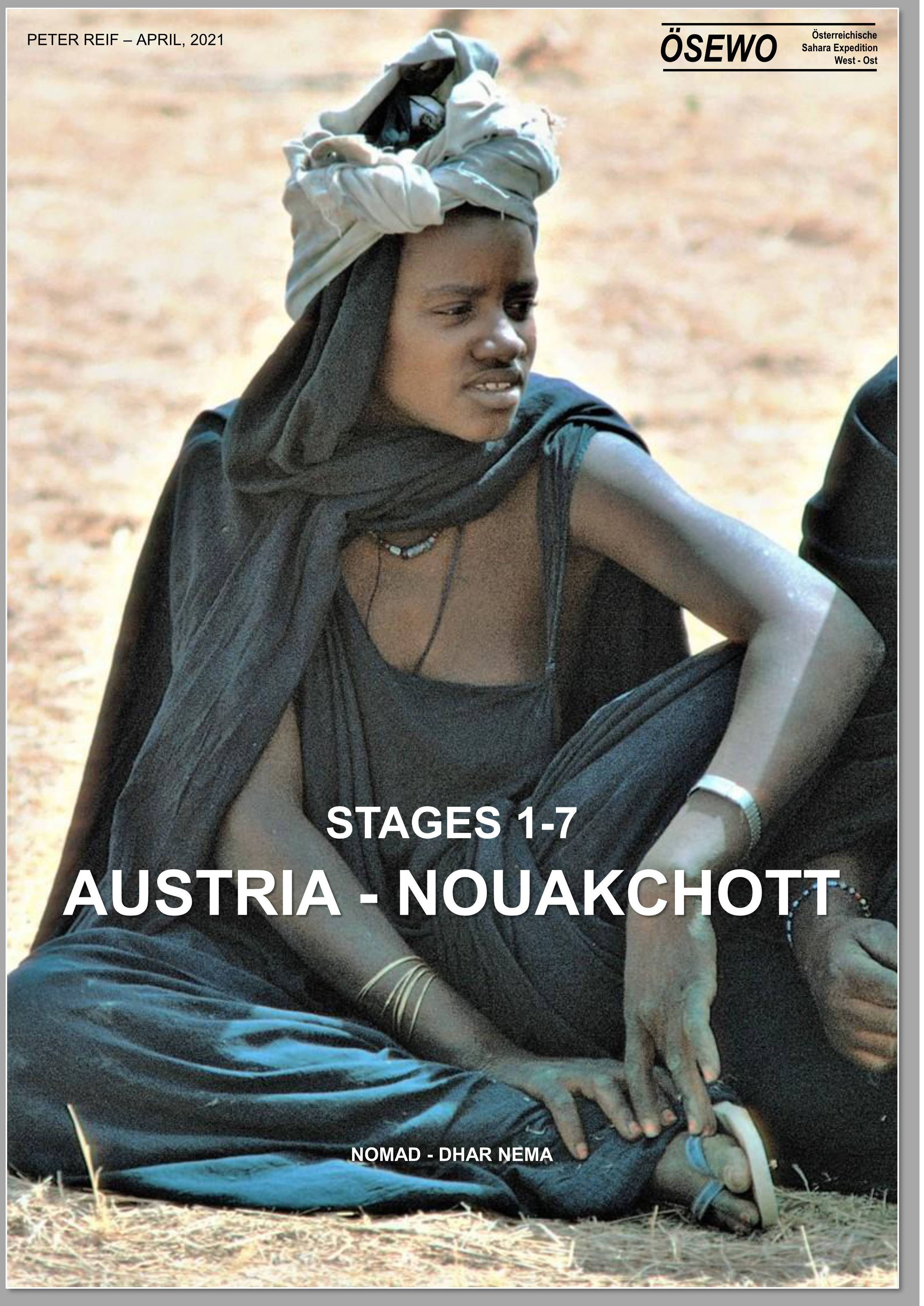
Austrian, Peter Reif spent his Lockdown formatting a series of detailed reports and maps recalling ÖSEWO: an Atlantic-to-Red sea crossing of the Sahara in 1983-4. Volkswagen’s T2 Kombi was an unorthodox choice, especially as much of the route was off-piste, but as you’ll read over the next few posts, the vehicles managed better than you’d expect.
Half a century ago when the Sahara was more accessible, lateral crossings, all of them west to east, used to capture the imagination of adventurists, both private and corporate. Although such transits aren’t what it’s about to me, I wrote a box for the final edition of Sahara Overlandabout the four best-known vehicular transits which, broadly speaking, set out with this goal in mind, and expand on this page:
As I suggested in the book, a true, unbroken, all-desert lateral crossing of the Sahara with vehicles had yet to be achieved and as things stand, never will be in our time. If you combined the British route across Mauritania and Mali, then follow the French or Germans to Dirkou in Niger and the French or Belgians east of there, you have a pretty good line. As it is, even with a lot of road-driving in Algeria, I’d say from Tan Tan 9000km east to Port Safaga near Hurghada on the Red Sea, the Belgies get the nod (map below but note the oddly misaligned borders, not least Niger-Chad).
The chances of achieving a true Saharan traverse are currently about as slim as they’ve ever been. Much of the Sahara of Mali, southern Libya, northern Niger and Egypt are unsafe or off-limits. Eastern Far western Mauritania is said to be the same, and much of southern Algeria between Bordj east towards Djanet (as we did in 2006) is now restricted.
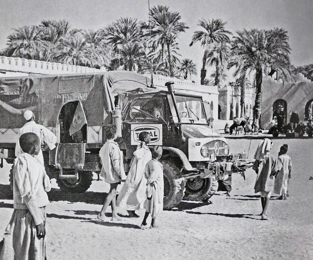
Unimog in Faya, 1965
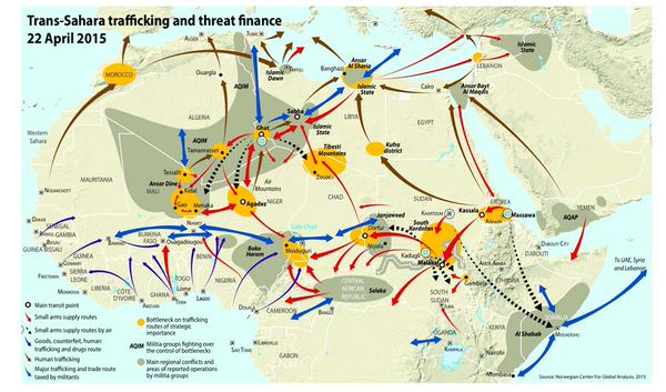
Northern Chad always presented difficulties from the mountainous terrain, let alone permissions and security issues. Meanwhile, people smuggling convoys still roll into Libya across northern Sudan above Darfur and are preyed on by bandits.
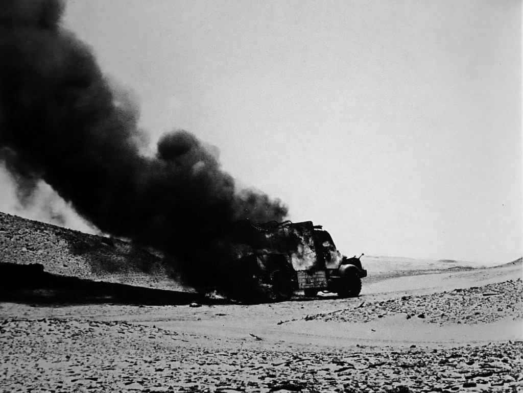
One Hanomag burned out in the Gilf or thereabouts.
JSE 1975 route
In southern Egypt the Gilf has so many access regulations that few bother any more. Even in the west-east expedition era, permissions heavily restricted access: the Belgians had to enter Algeria from Spanish Sahara, not Morocco; the Brits couldn’t enter Algeria at all which kiboshed their plans and they went via Nigeria (left). Meanwhile the Hanomagers bounced for over 16,000km between the Maghreb and the Sahel like pinballs, but did a whole lot of classic desert routes; and the French seemed to dodge Algeria and Chad.
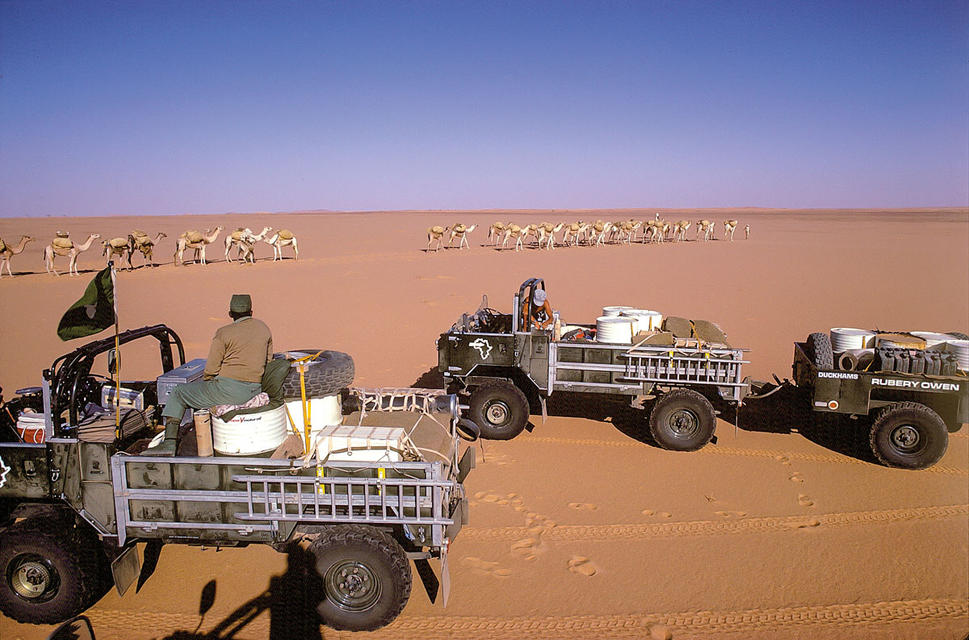
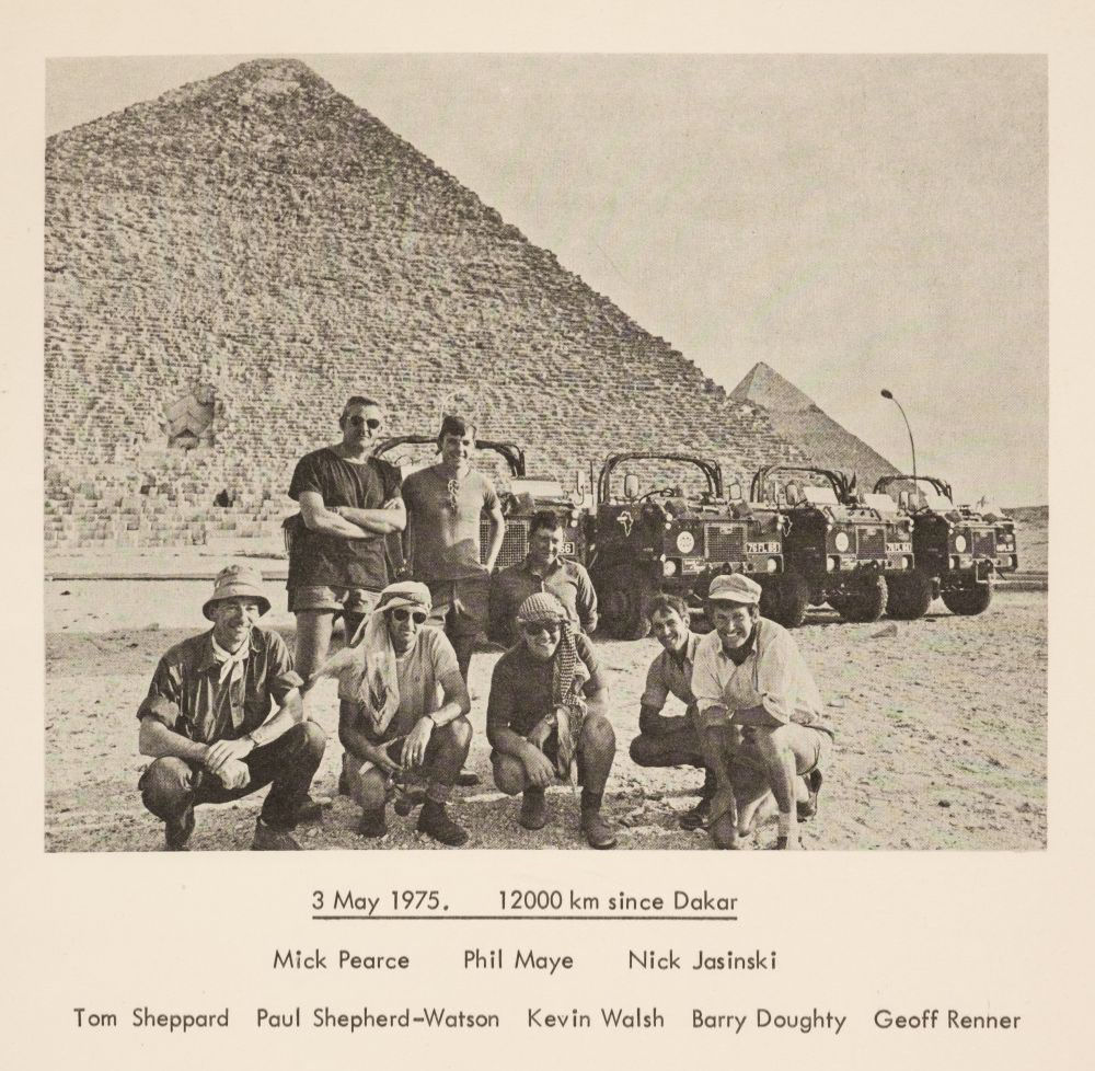
British Joint Services 101s in Sudan, 1975. More here
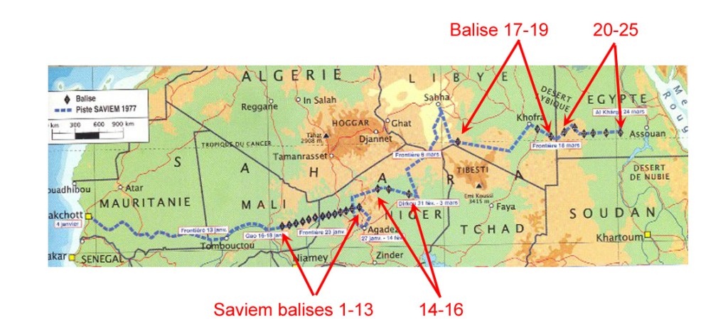
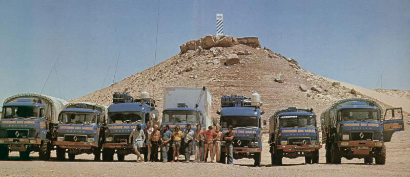
The Saviems of 1997 made a pretty good job of it once they left Mali, planting at least 25 of their distinctive blue and white balises across the desert is a bid to establish a new lateral trade route across the width of the Sahara. The value of that is clearly rather dubious, but it was a good excuse to promote the lorries and have a big Sahara nadventure, using trials bikes and even parascenders to help recce the route ahead.
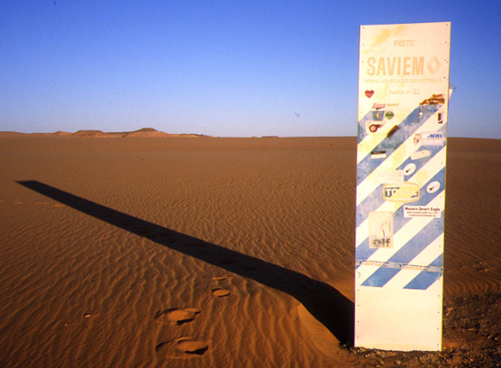
In my travels I’ve come across remnants of Saviem #16 in Niger, as well as an intact Saviem #22 east of the Gilf Kebir (below). And there’s a photo here of Saviem #10 just a couple of years after it was installed.
Saviem balise #22 in Egypt’s Libyan DesertSaviem TP3 vans and SM8 trucks spinning down in southern Egypt, 1977, below the final balise #25, somewhere south of Kharga on the Darb el Arbain around here.
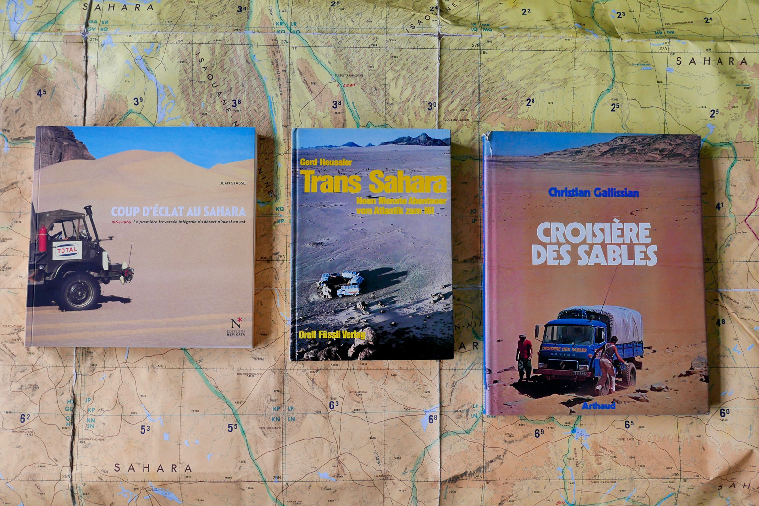
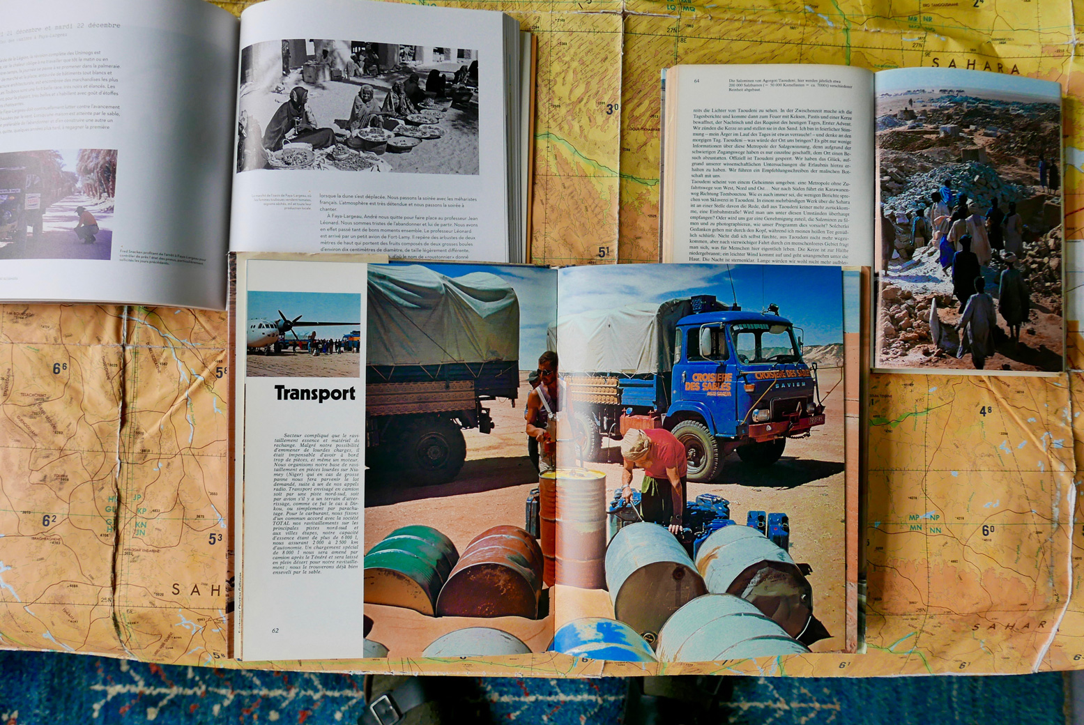
Of the four expeditions mentioned here, the three continental ones produced illustrated books in French and German (below). If you don’t read either language any better than me, the big-format Croisiere des Sables is a good one to get – mostly pictures and under a tenner on abebooks last time I looked.
Coup d’Eclat au Sahara, Jean Stasse (2011, available new) Trans Sahara – vom Atlantik zum Nil, Gerd Heussler (1978) Croisiere des Sables, Christian Gallissian (1977)
Even though Tom Sheppard has published a couple of lavish Sahara picture books on his own travels, it looks like we’ll never get a full account of the JSE 101 crossing (but see below). There was an appropriately dry expedition report for the Geographical Journal in 1976 which you can read on JSTOR (map below).
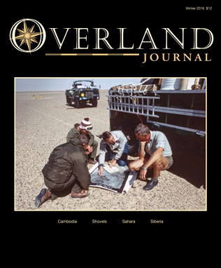
Tom Sheppard also wrote a well illustrated summary in the winter 2016 issue of Overland Journal (right). In 2022 I received an email from a reader who’d just acquired the full and exceedingly rare 150-page report which was being auctioned here. Looking further, it seems there may be a hard copy at the National Archives in Kew, too. Watch an interview with Tom here.
My own lateral crossings
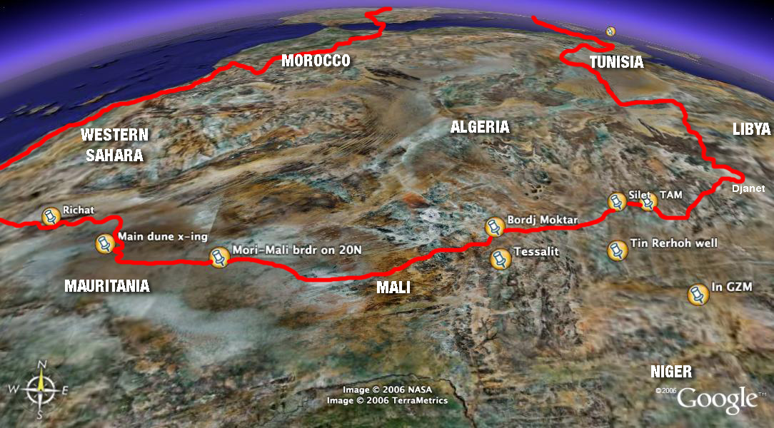
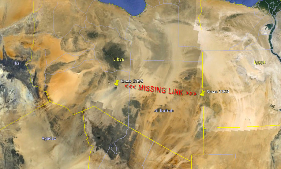
A while back, before things really got bad in the Sahara (right) it occurred to me that, with one small effort I could link up my own lateral crossing of the Sahara between the Nile and Atlantic. Of course it would have taken me several years, but mainly across three trips: Libya 1998 (researchingSahara Overland);Egypt 2004 and our big SEQ 2006 crossing (below) I’ve covered all bar around 800km of the distance.
Part of my informal west -east crossing
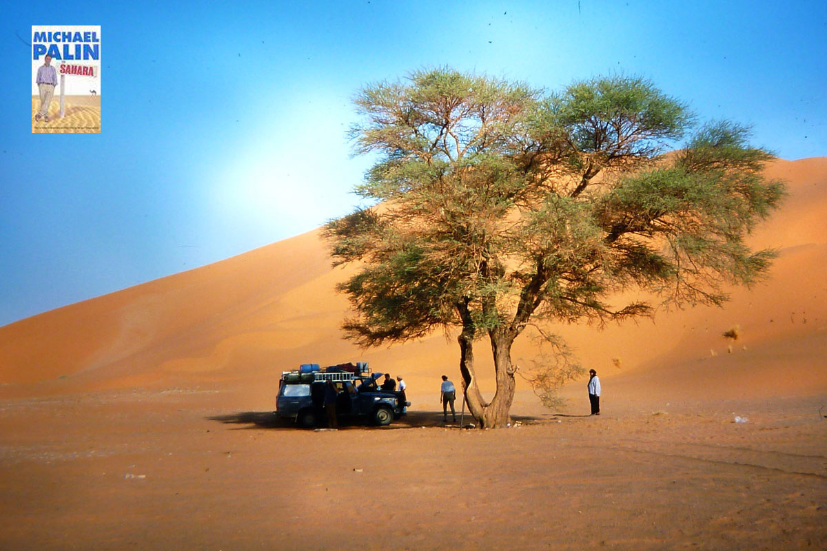
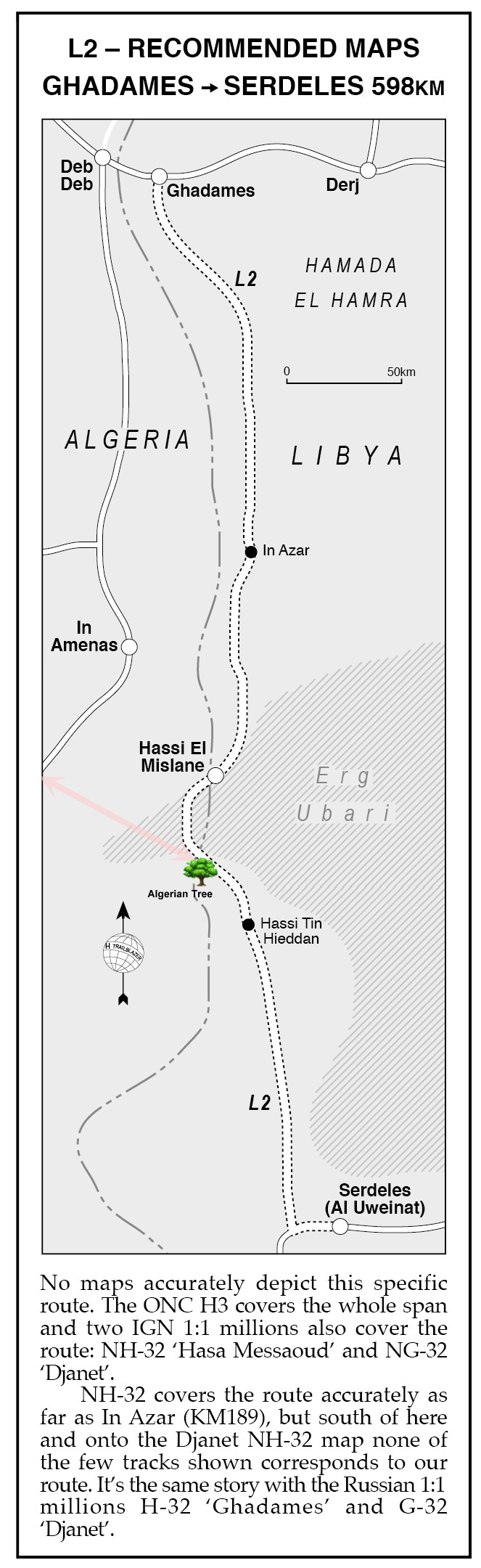
All that remained was a short, 70-km gap in the far eastern Algerian oilfields near In Amenas to the Algerian Tree (visible on Google sat and pictured left in 1998). It was whereRoute L2 from Sahara Overland (below right) strayed briefly into Algerian territory to avoid the worst of the Idehan Ubari’s dunes. Some may recall Michael Palin visited this very tree for his Sahara TV show in 2002 and on arriving proclaimed:
‘this spare, uncluttered, beautiful spot was one of my favourite places in the Sahara‘. Well, he’s easy to please!
And in fact, I’ve since realised that when we treked with mules to Sefar on the Tassili plateau in 2013, I was within sight our 1998 route into the Libyan Akakus.
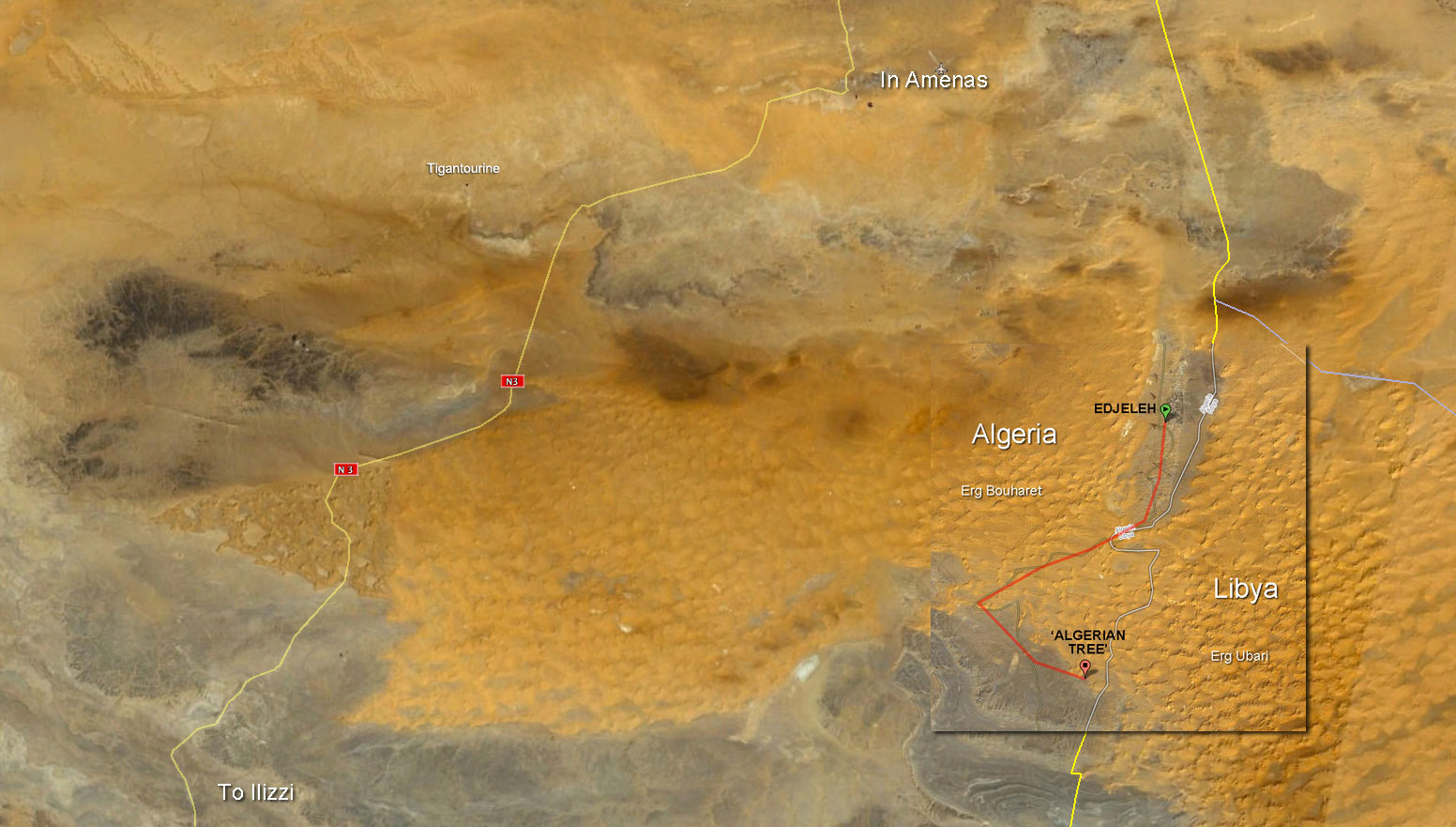
Up until the gas plant attack at Tigantourine that year, I could probably have knocked out my crossing to the Algerian Tree at any time. Either driving down to Edjeleh oil camp right on the Libyan border then scooting over the dunes as shown below).
I recall making contact with an oil worker based in Edjejeh one time, asking him about civilian access in the area but he wasn’t very forthcoming. Alternatively, one could just nail it 100km east from the N3 highway south of Erg Bourharet. The stony reg thereabouts is criss-crossed with oil exploration tracks, but, post-Tigantourine that area will now be closely watched.
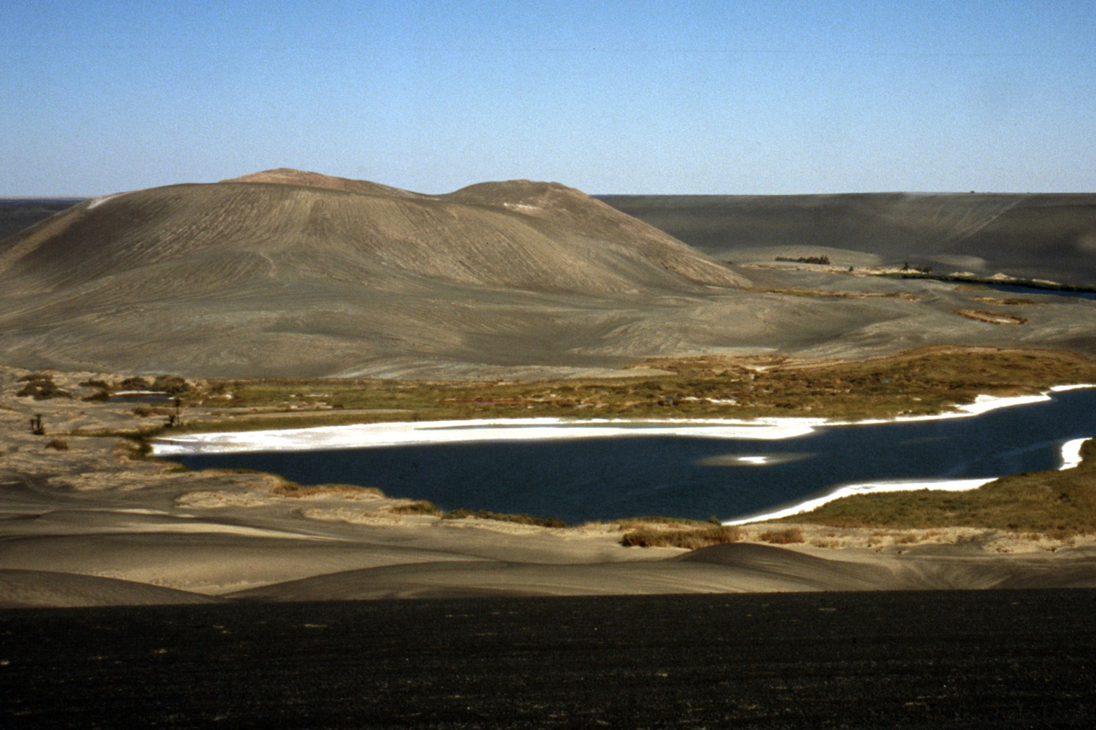
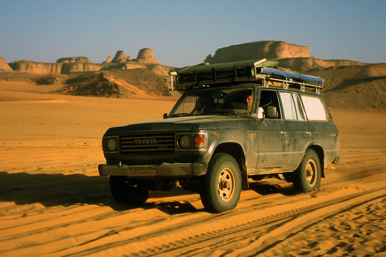
Then there’s a much more substantial missing section to get my West-East certificate in eastern Libya: from Waw Namus crater which we visited in 1998 (below) …
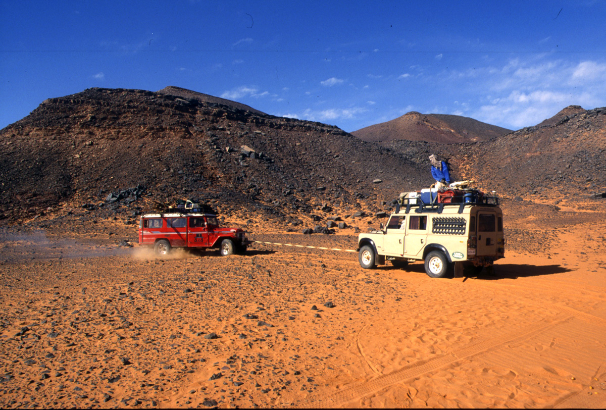
I remember that Christmas well; we had more trouble than normal getting Mahmoud’s Toyota-engined Series III running, dragging it to life with the Land Cruiser (below) after setting a fire under the chilled engine. With us that time was Toby Savage (my Desert Driving dvd co-presenter) who in 2012 travelled through the Gilf with WWII-era Jeeps, while possibly outnumbered by escorts and soldiers.
Staaaart you bastard!
No tourist has driven in southern Libya since the fall of Gaddafi in 2011. The south was now controlled by the Tuareg (with a bit of AQIM and IS) and the Tubu who battle it out for the control of lucrative people-trafficking and other commodities coming up from Niger. As things stand now in Libya, ticking off that final 720-km stage from Waw crater to Xmas Camp may have to wait for a rainy day in the Sahara.