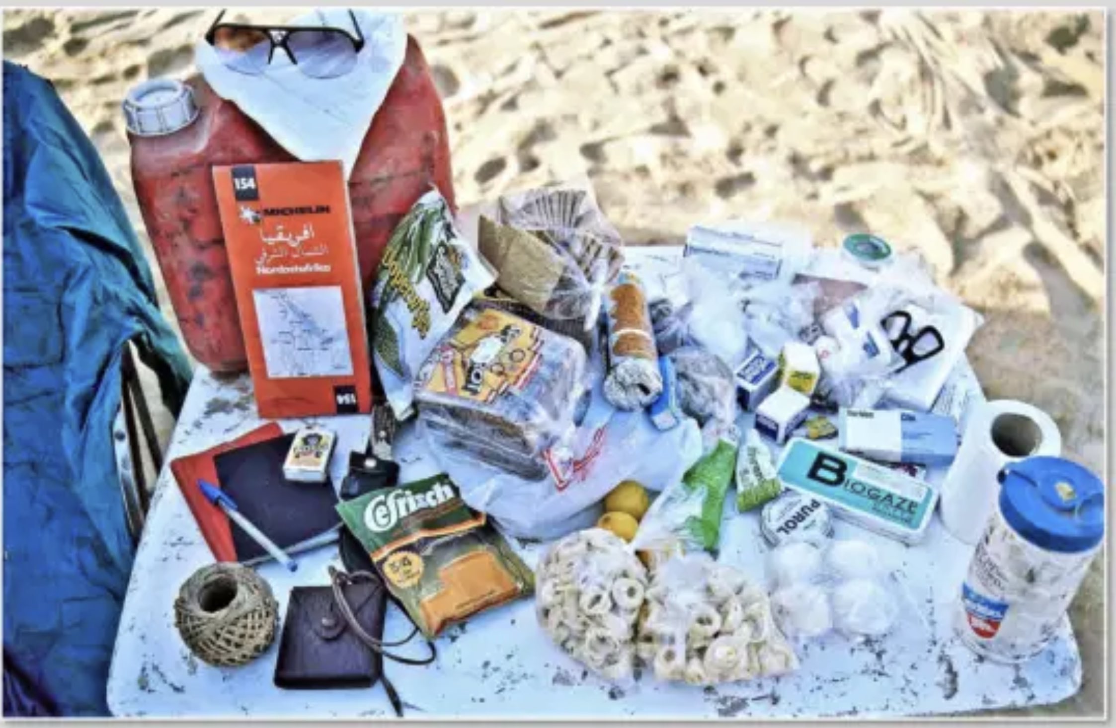
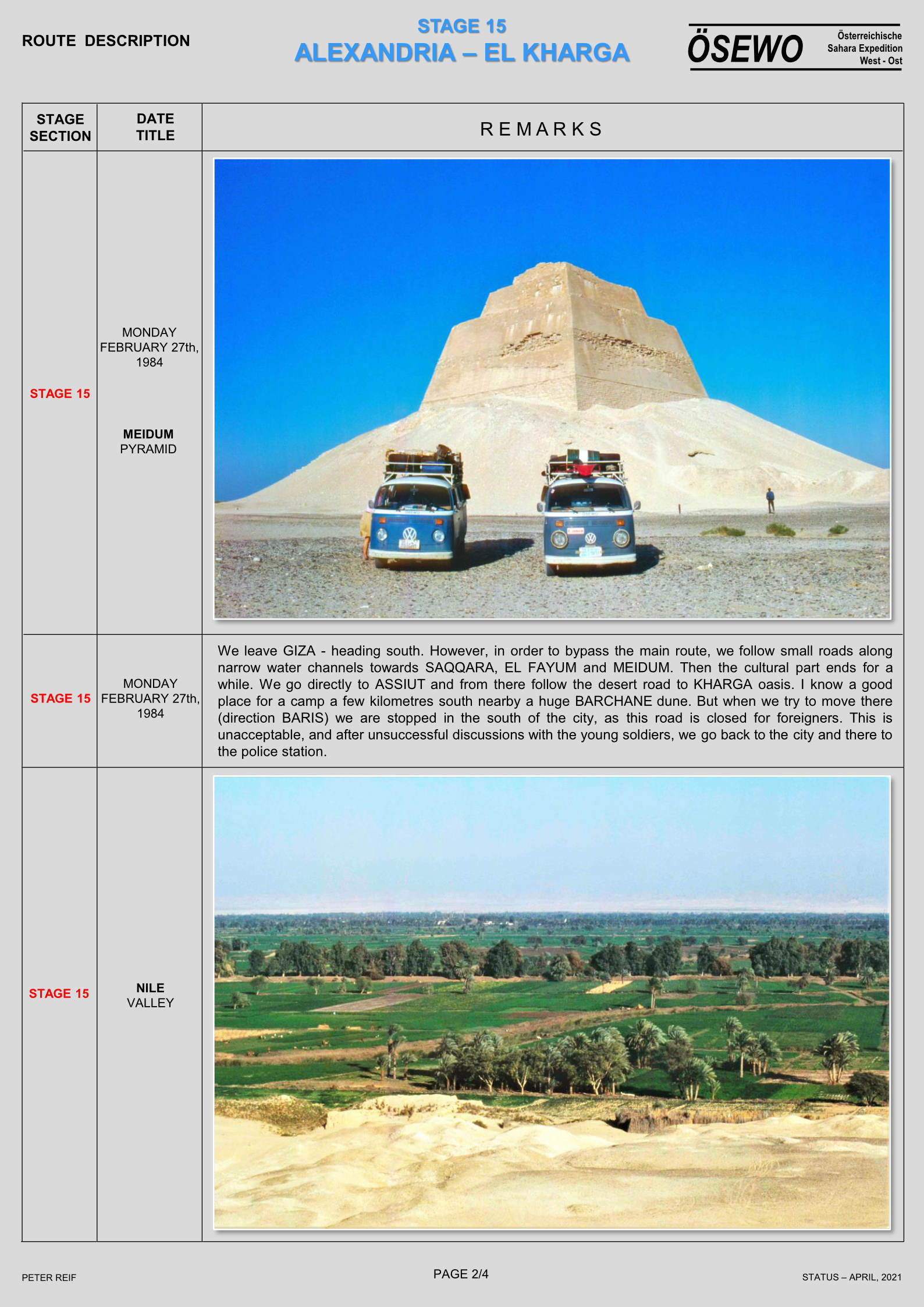
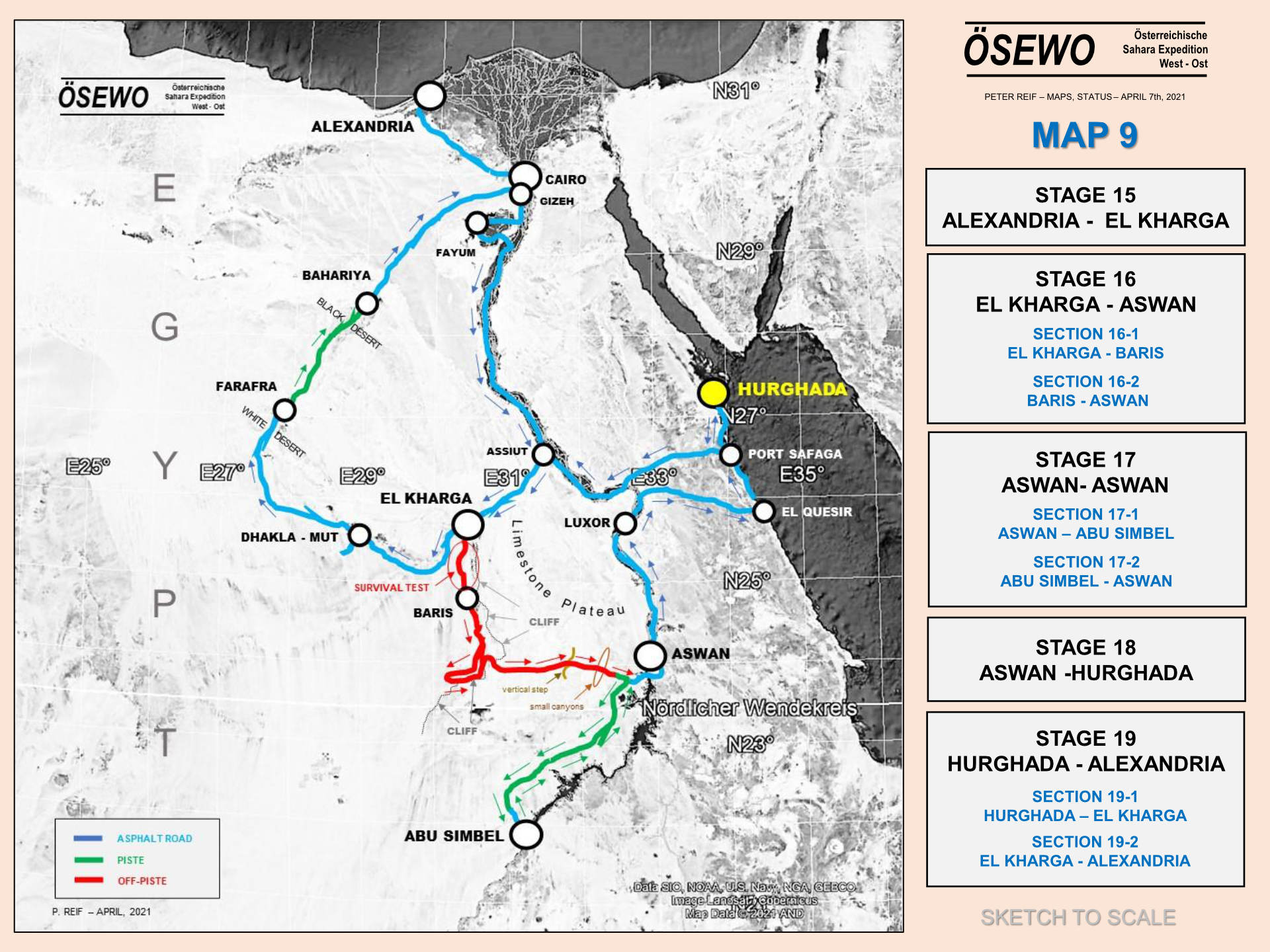
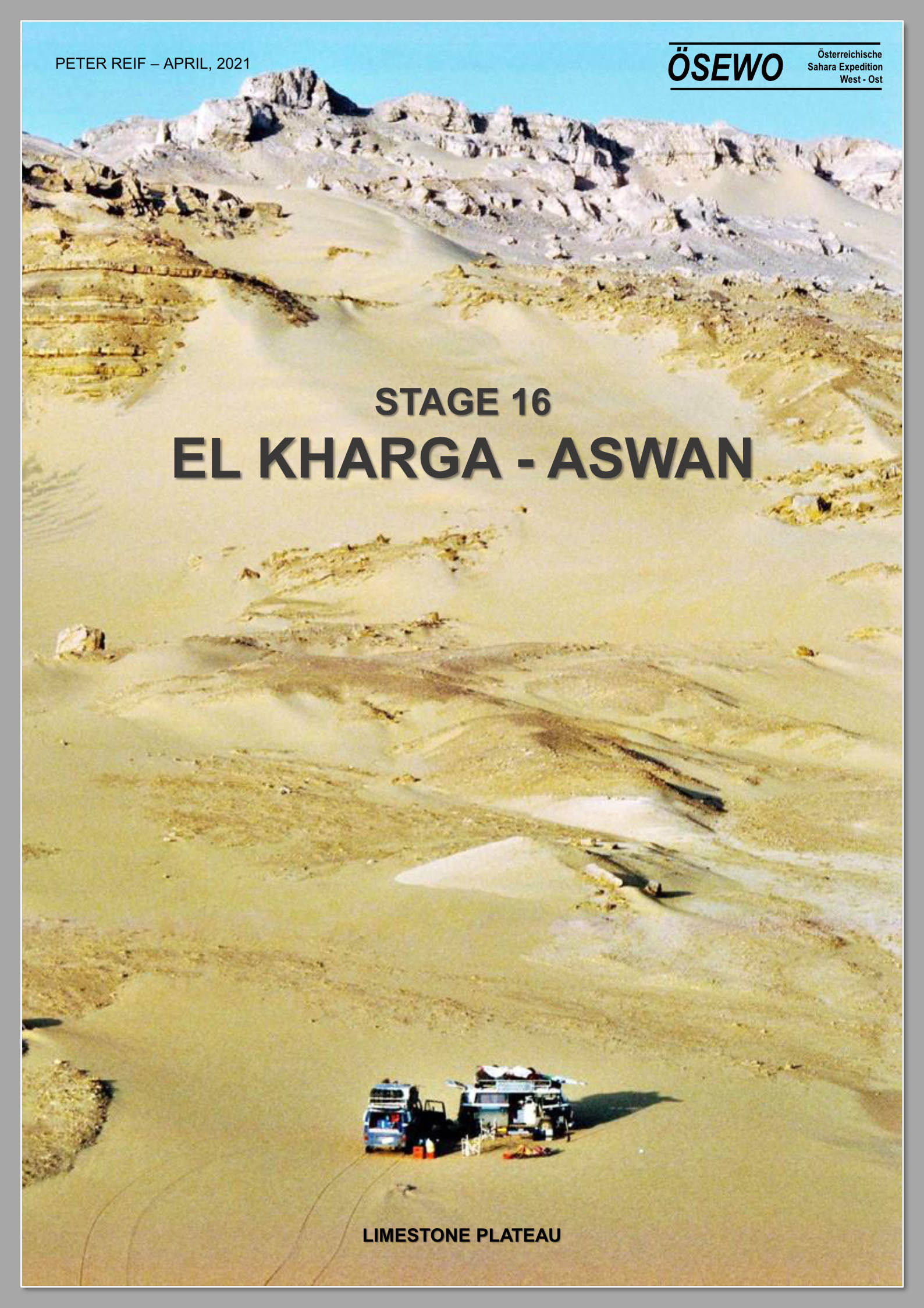
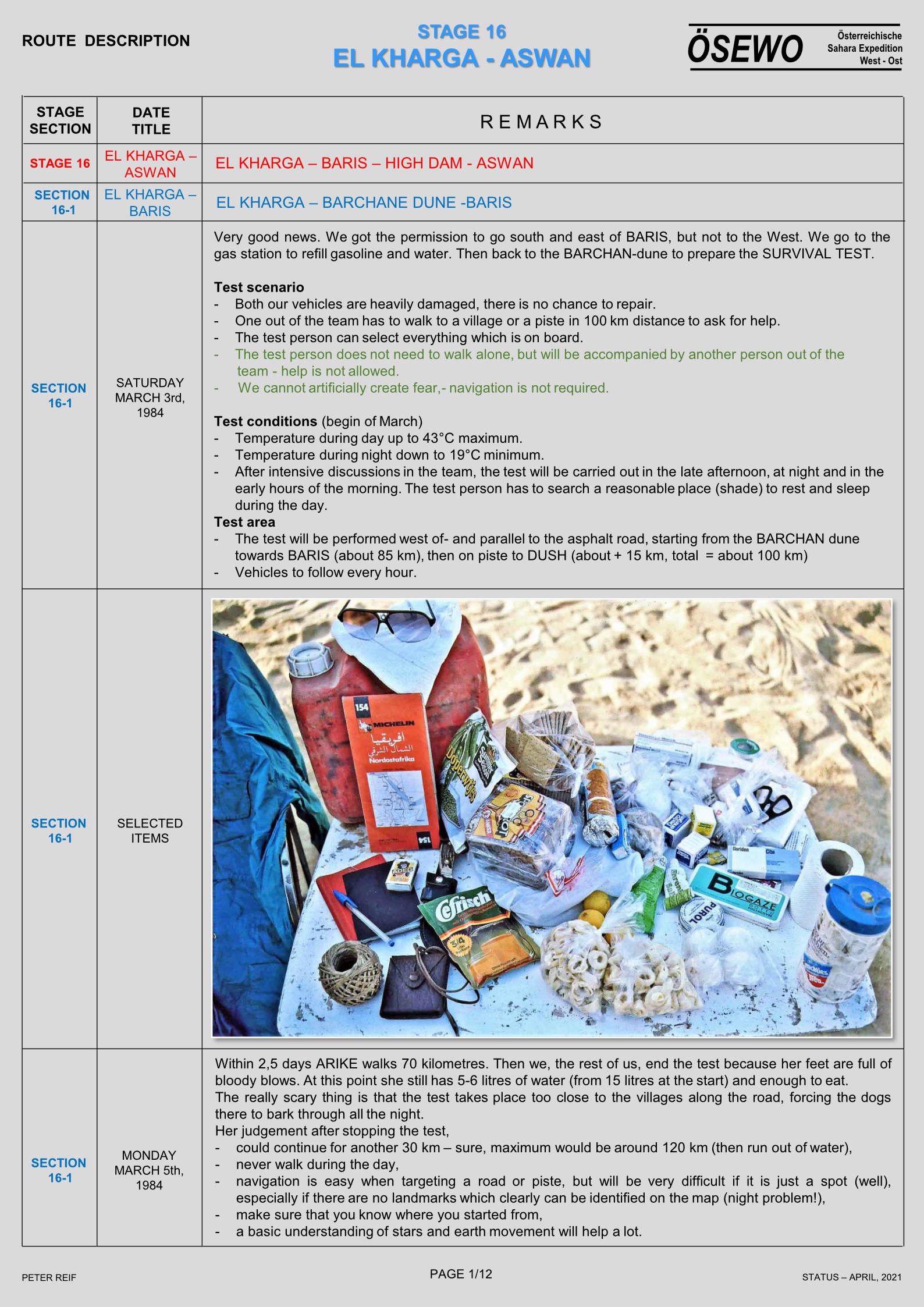
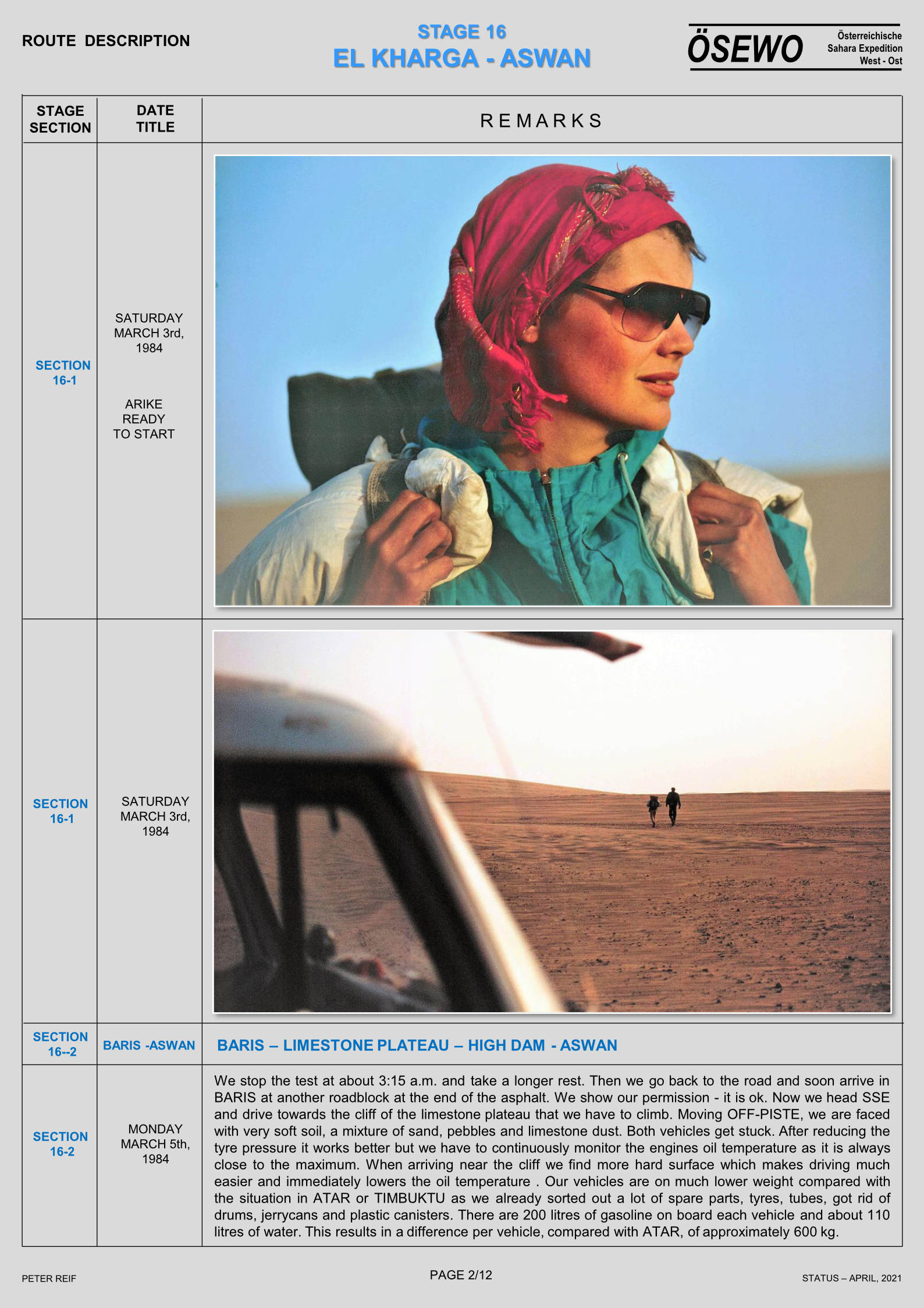
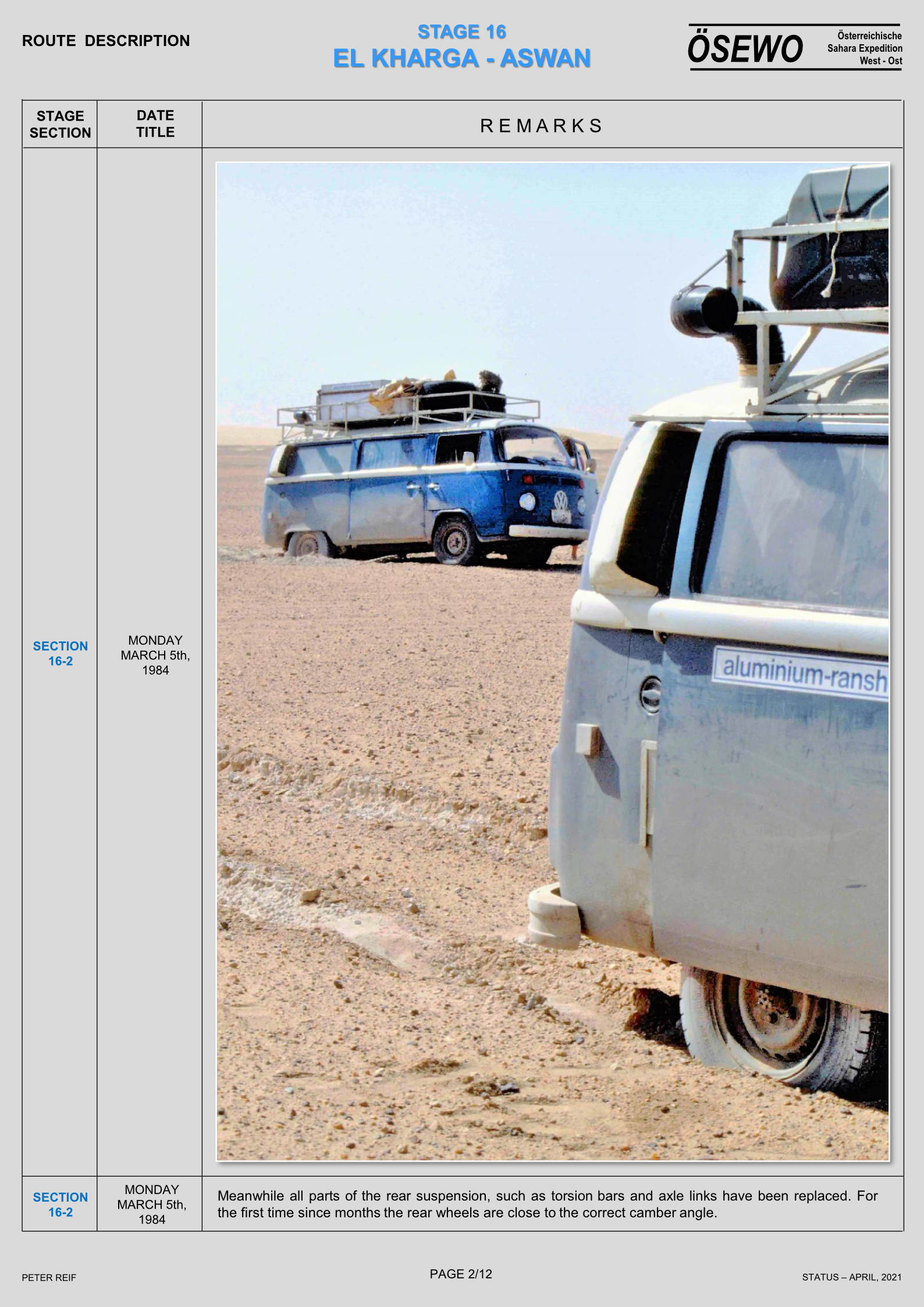
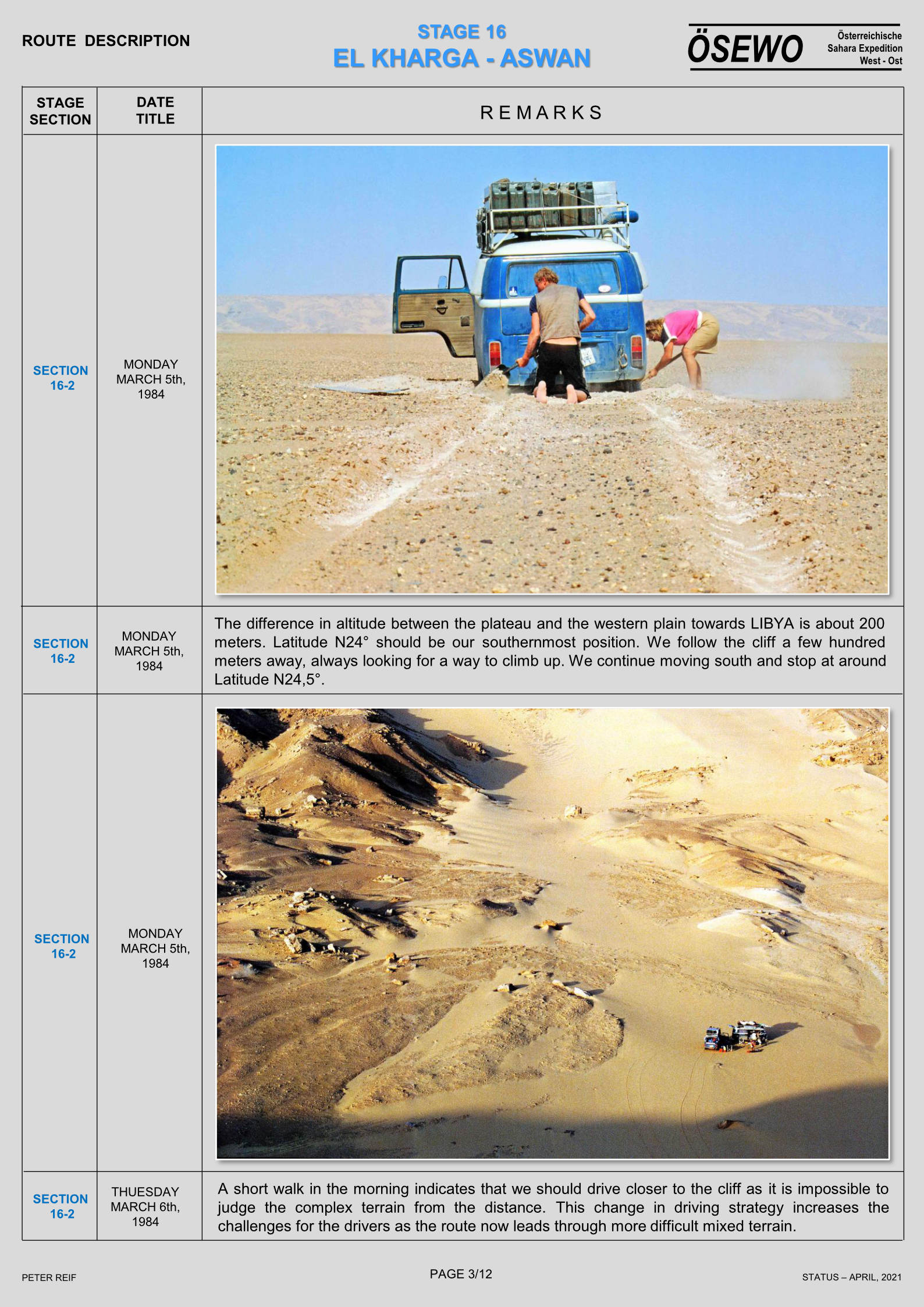
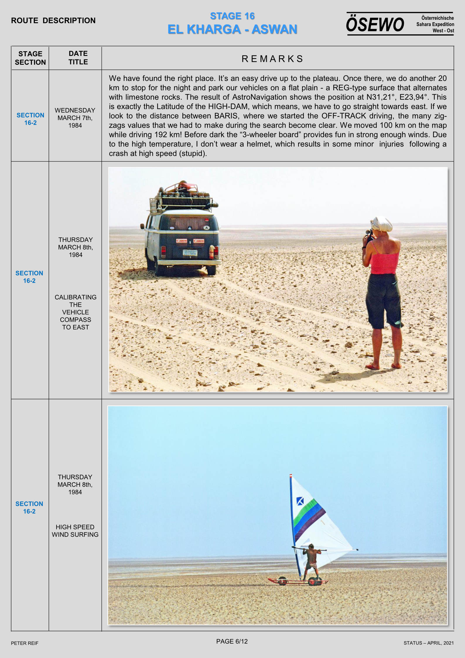
Part Seven of Peter Reif’s report and maps recalling ÖSEWO: an Atlantic-to-Red Sea crossing of the Sahara in 1983-4. After having to divert around Libya via the Mediterranean, the flat-four foursome are back in the desert to tackle on of the hardest stages so far. But not before they conduct a desert survival experiment to see how far one of the team can walk with what they can carry (above left). For other parts, click the Index Page.
In 2000 I joined a two-week tour visiting the Egyptian part of the Libyan Desert, or the ‘Western Desert’. The trip was organised by Andras Zboray and his new FJ Expeditions. He’s since become an expert on this fascinating region and back then contributed the ‘Egypt’ section to my Sahara Overland book. Even though I’d only just come back from Libya researching the book, part of the appeal of Egypt was that this was then a very rarely visited corner of the Sahara. FJ had problems with permits to visit this ‘military’ or more correctly border area, but once there, we saw no one, let alone a well or a regular piste for the entire two weeks.
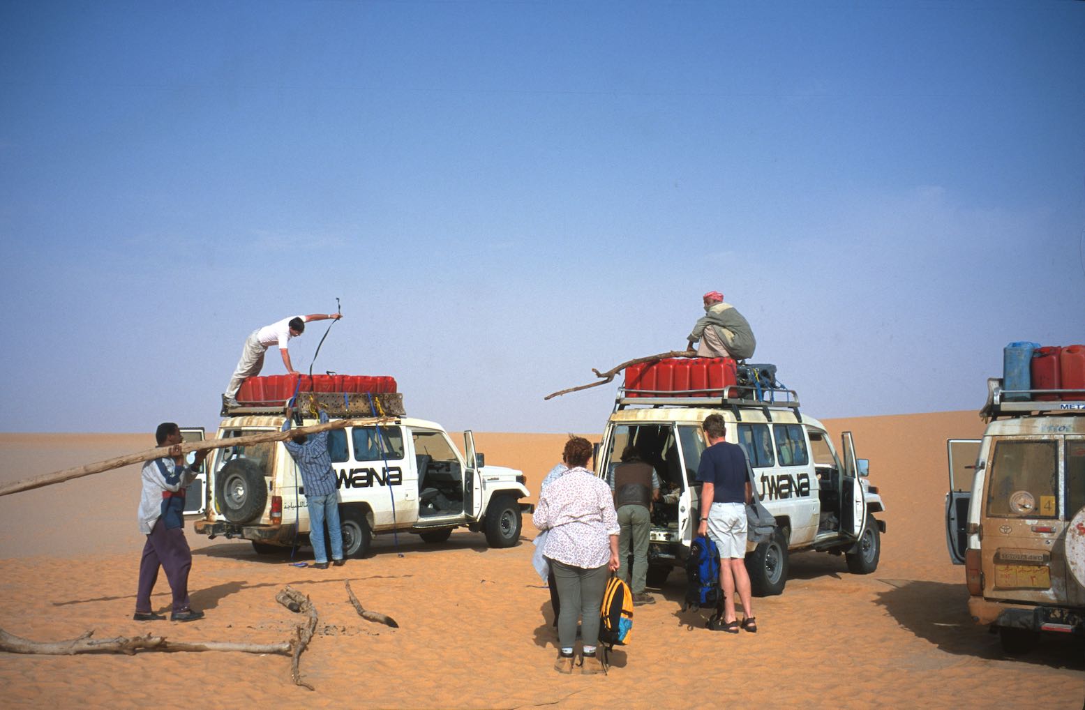
Our three locally hired Toyota Troop Carriers left Cairo sharing a ton of water and half a ton of food, along with fourteen (mostly German) passengers and three Egyptian drivers. Two days later we left Dakhla with another half-ton of fuel on each car’s roof. Amazingly the Toyota 75s handled this mind-bending payload without a whimper.
Shell tin
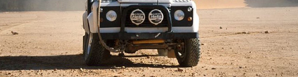
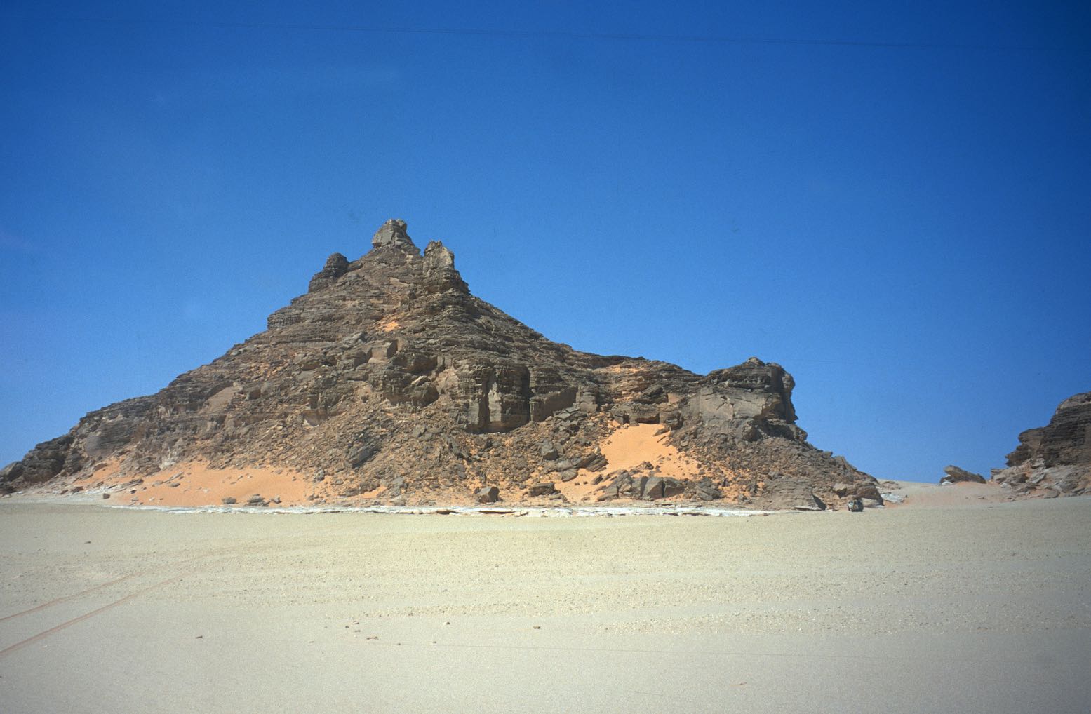
On reaching Bir Terfawi we left the tarmac and set off west across the Selima Sand Sheet, arriving at the isolated landmark of Jebel Kamil after a day and a half. This cone-shaped hill was a wartime fuel dump from the Sudan Defence Force convoys supplying Kufra from the Nile, and is still littered with Shell petrol tins. I was invited to drive one of the 75s, Andras having had not such good experiences with local drivers off road. I was told under no circumstances to use the air-con; there being some urban myth about revs rising dramatically as the pump kicks in. But the risk of an overburdened, 130-hp 70-series lurching uncontrollably off a dune lip seemed far fetched.
Shaw’s Cave
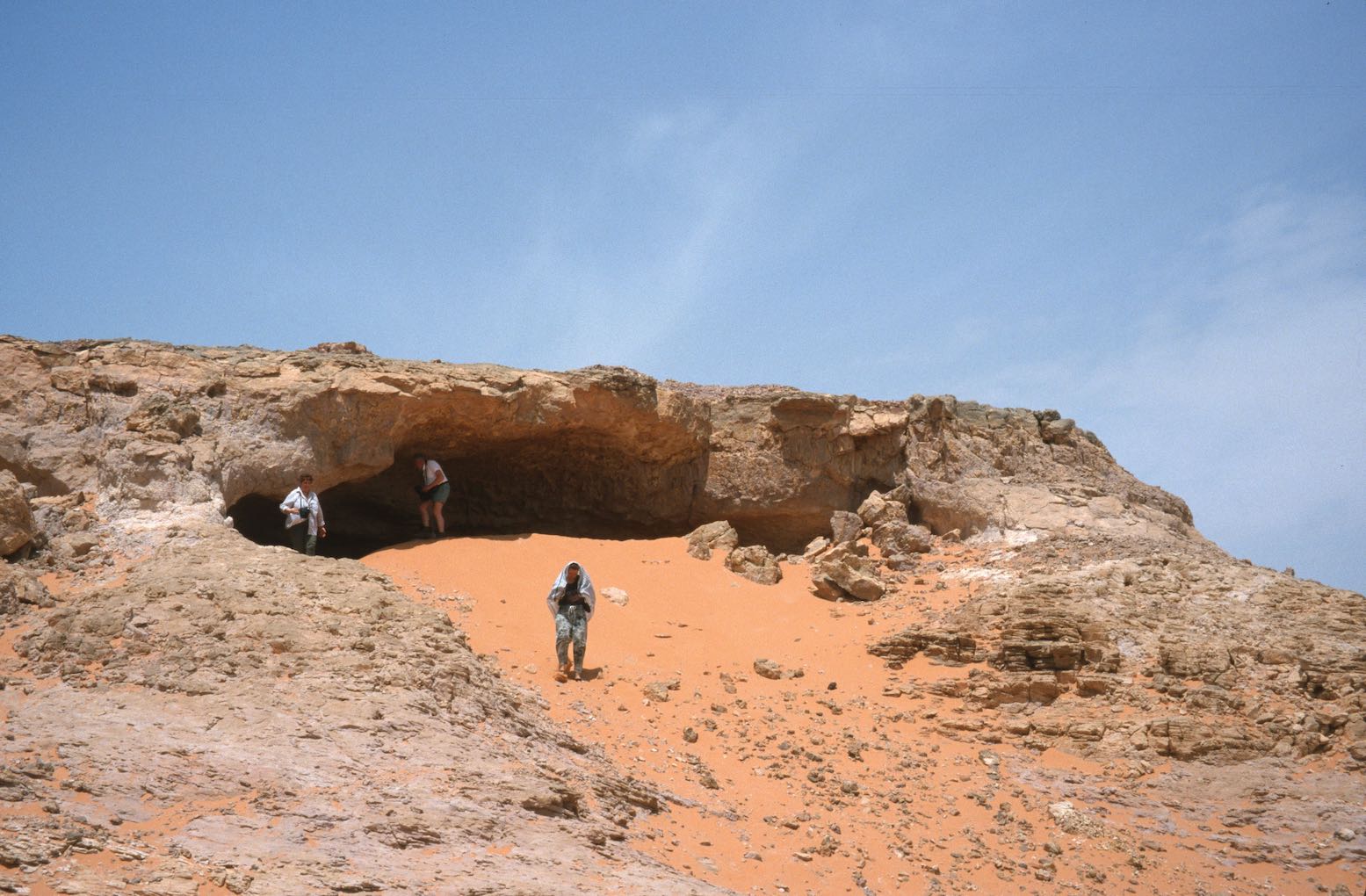
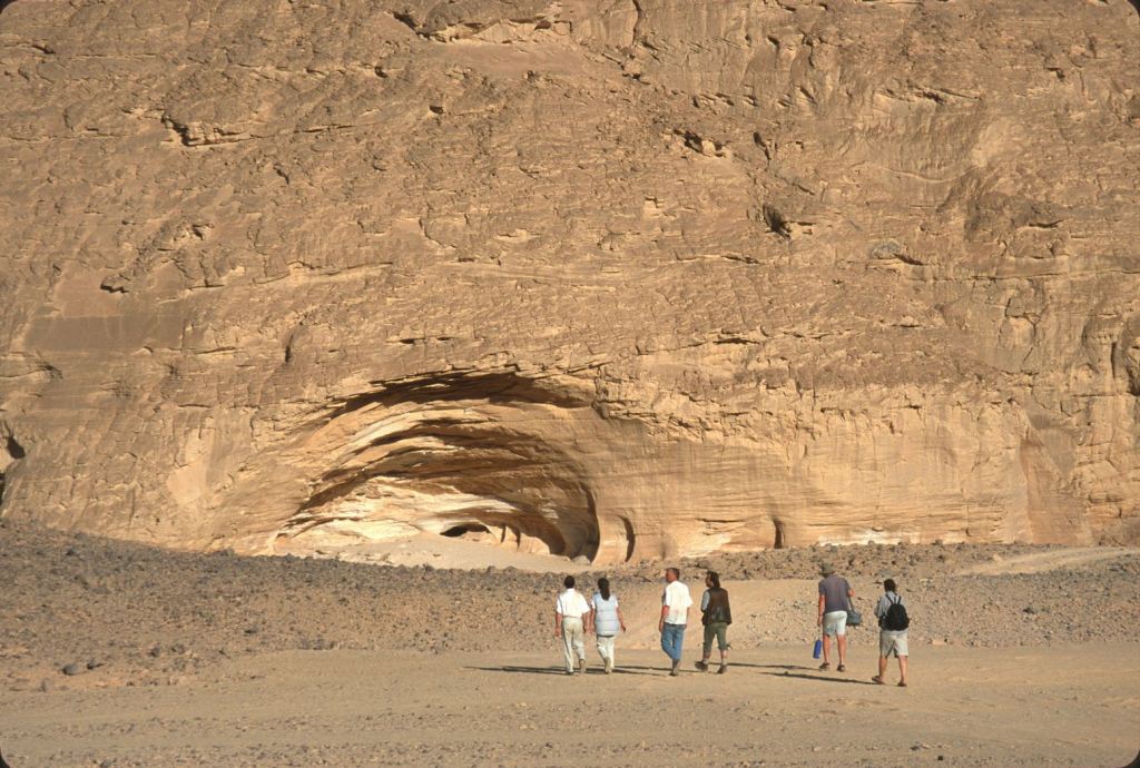
From Jebel Kamil we headed northwest on a GPS bearing to Eight Bells on the eastern edge of the Gilf Kebir from where Andras had a written description to a cave of paintings discovered by Shaw in the 1930s. We drove over a pass into the stunning Wadi Wassa and followed it west, crested another pass with little difficulty.
After locating the cave, we continued cross-country into a hot south wind over broken country to Karkur Talh, a clearly mined wadi which cuts into the 1934-metre-high massif of Jebel Uweinat. That evening, on a tip from Bagnold, Andras located some beautifully preserved Cattle Period paintings on the west side of the well-known cove. The quality was the best I’ve encountered (which isn’t much!) and showed similarities to the ‘Cave of the Swimmers’ or Wadi Sora style, we were to see a few days later.
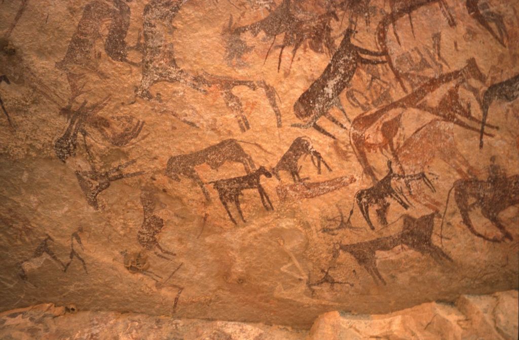
The next day we continued further down Karkur Talh on foot, over the Sudanese border (passing a spoof CCTV camera, left) and, with the aid of Rhotert’s ‘The Rock Art of the Jebel Uweinat’ (Graz, 1978), soon found an rich trove of engravings and paintings spread along the walls of the wadis first discovered by Ahmed Hassanein in the 1920s and fully recorded by a Belgian expedition in the 1960s. It’s unlikely many other tourists have got this far since that time, and for all of us this wonderful day of discovery was the highlight of the trip.
Cows
Giraffes
Grinder
Waddan
We enjoyed it so much we came back into Sudan next day to find more rock art, including an amazing tableaux dubbed ‘Red Cow Cave’. We also spotted an amusing engraving possibly showing man’s failed attempt in giraffe domestication as mentioned in the Lutz’s book on the Libyan Messaks, as well as the foundations of Tubu dwellings who lived here up until the 1930s. A few very old waddan (mouflon, or Barbary sheep) horns were spotted, as well as a perfectly preserved cadaver tucked under an overhang. Tools were very rare, but right on top of our campsite back in Egypt, I found a milling stone, grinder and pottery.
Left Google (years later)’ right, in real life
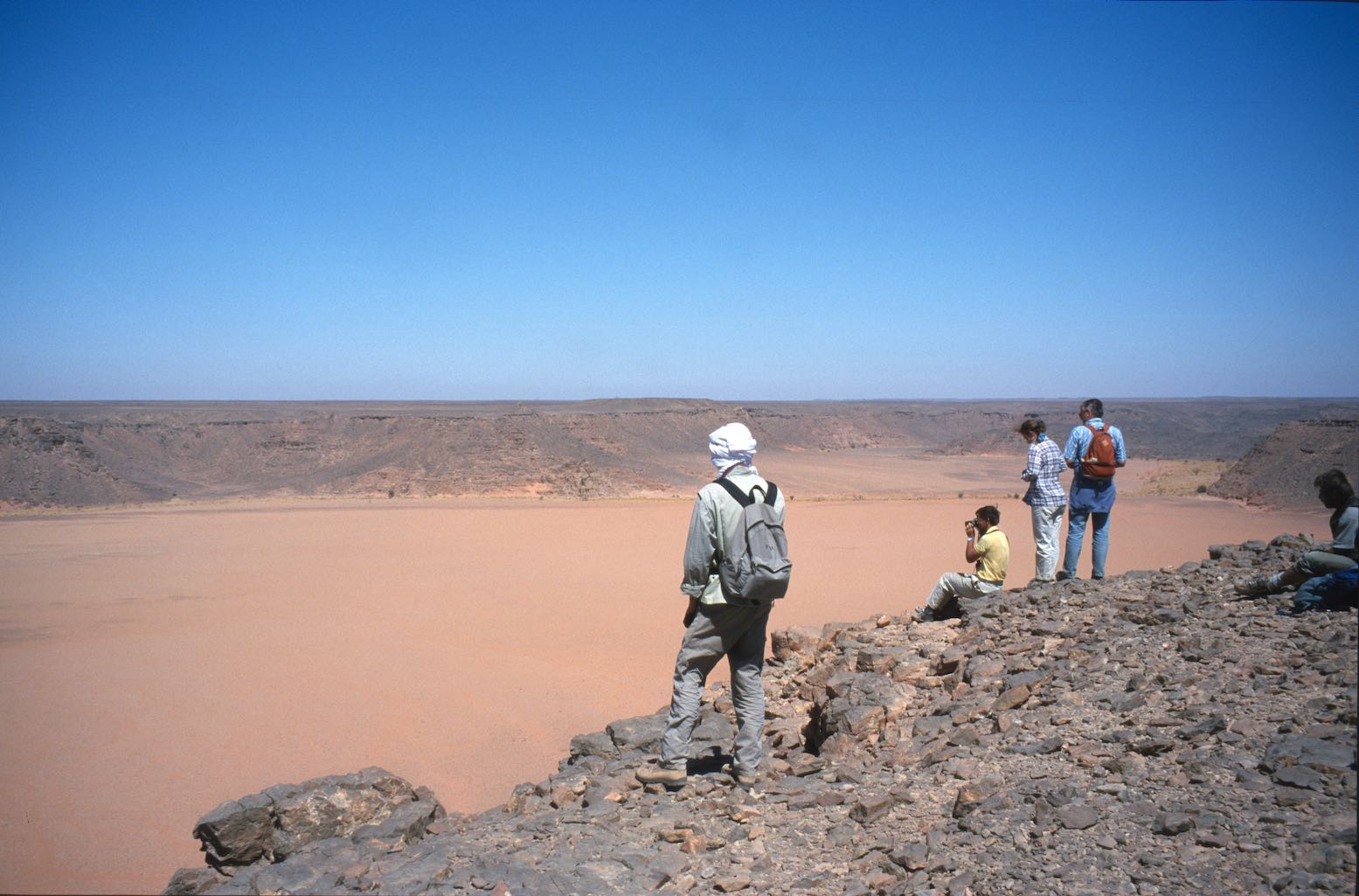
From Karkur Talh we headed back north, overnighting at Clayton’s Craters where an afternoon was spent climbing or circumnavigating the barren craters. Out of the big wadis the Libyan Desert really is utterly bereft of vegetation to an extent you rarely see in the Sahara further west. I spotted more Stone Age tools, another milling stone and just as I’d hoped, a very worn biface or hand axe, the original multi-tool which may be tens of thousands of years old.
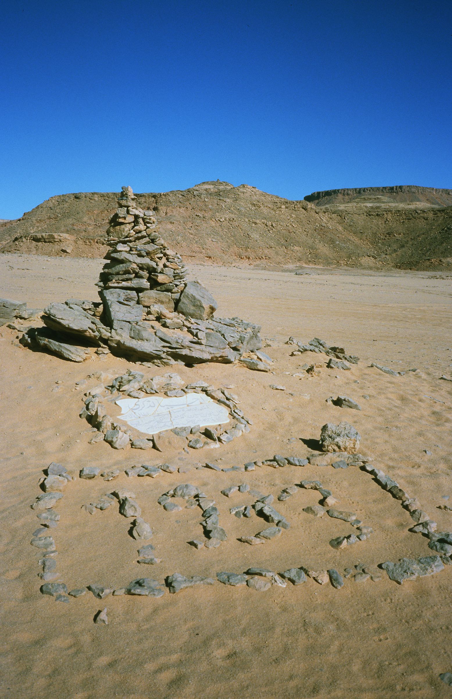
We moved north again, making the obligatory pilgrimage to the Kamal El Din monument (left) built by Almasy on the southern tip of the Gilf. Messages are still left in a bottle by passing travellers; a custom started by Rohlfs at the cairn of Regenfeld, further north. We now followed the southern edge of the Gilf to the northwest, past an old American SDF truck from the war and more Shell tins. We stopped at the Three Castles landmark where one of the group found one of Almasy’s water tins as accurately described in his ‘Unknown Sahara’ book. In case you don’t know Laszlo Almasy was the basis of the ‘English Patient’ character in that very fictional book and movie, and a contemporary of Bagnold, Shaw and Clayton. For me the famous Wadi Sora discovered by Almasy and romanticised in the movie was nothing special; the ‘cave’ has flaked badly but the swimming figures are still very distinctive.
Cave of
the Swimmers
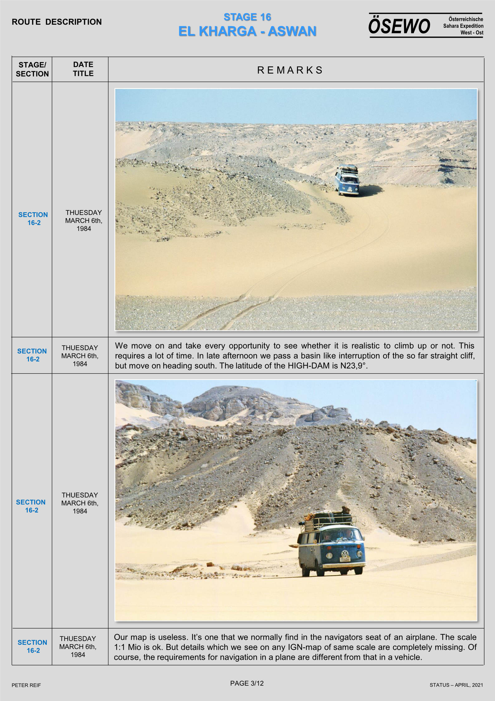
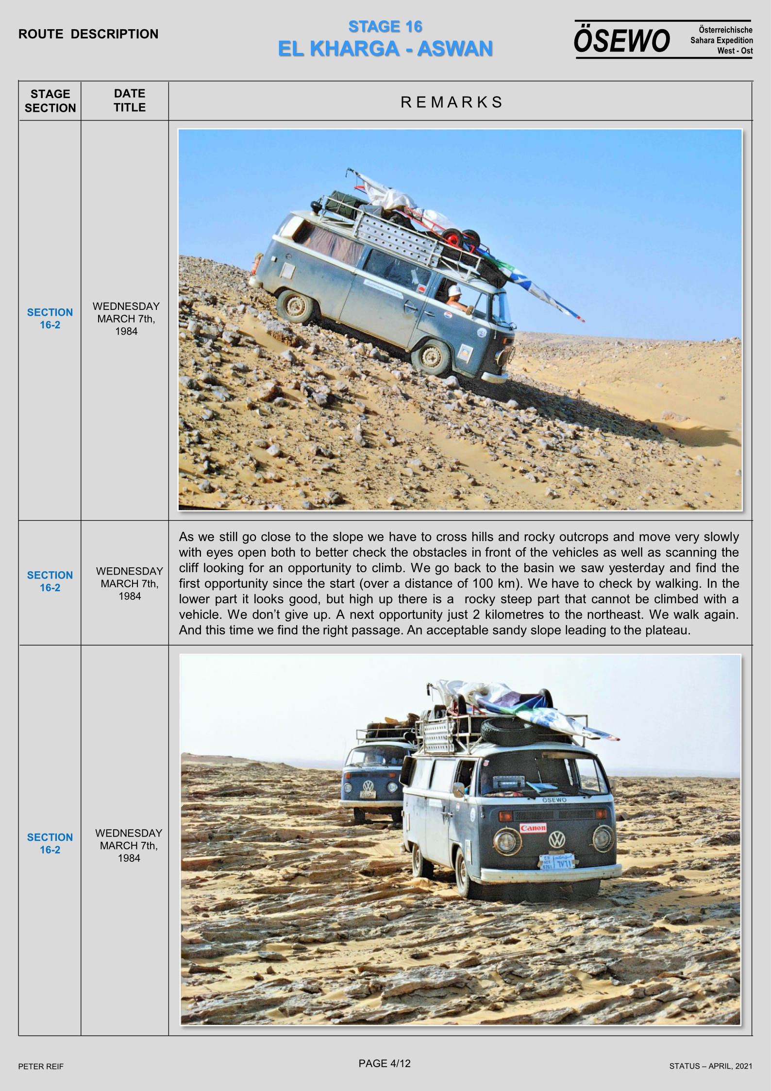
We headed back east to the dreaded Aqaba Pass, an unmined five kilometre sand ramp providing access into the central rift of the Gilf. Foot on the floor in Low 2nd and rocking hard on the steering wheel, I just scraped through to the summit, much to my surprise. Werner, driving the other heavy car got himself mired near the top and we all made a meal of getting the ‘fuel mule’ to the summit. Along with the other-worldly panoramas surrounding Clayton’s Craters, the central Gilf north of the Pass was one of the most beautiful landscapes we encountered – we’d obviously hit it at the right time of day.
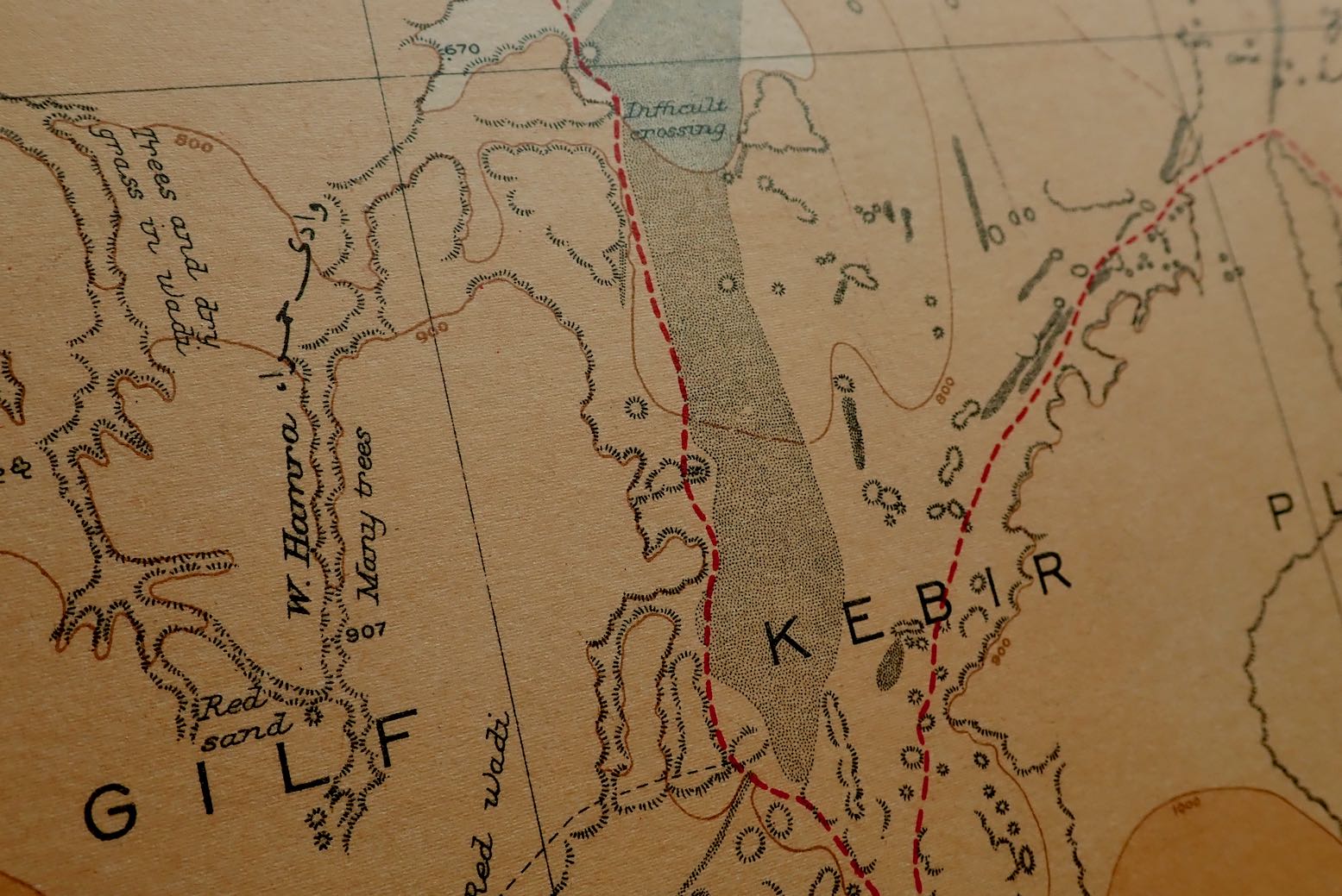
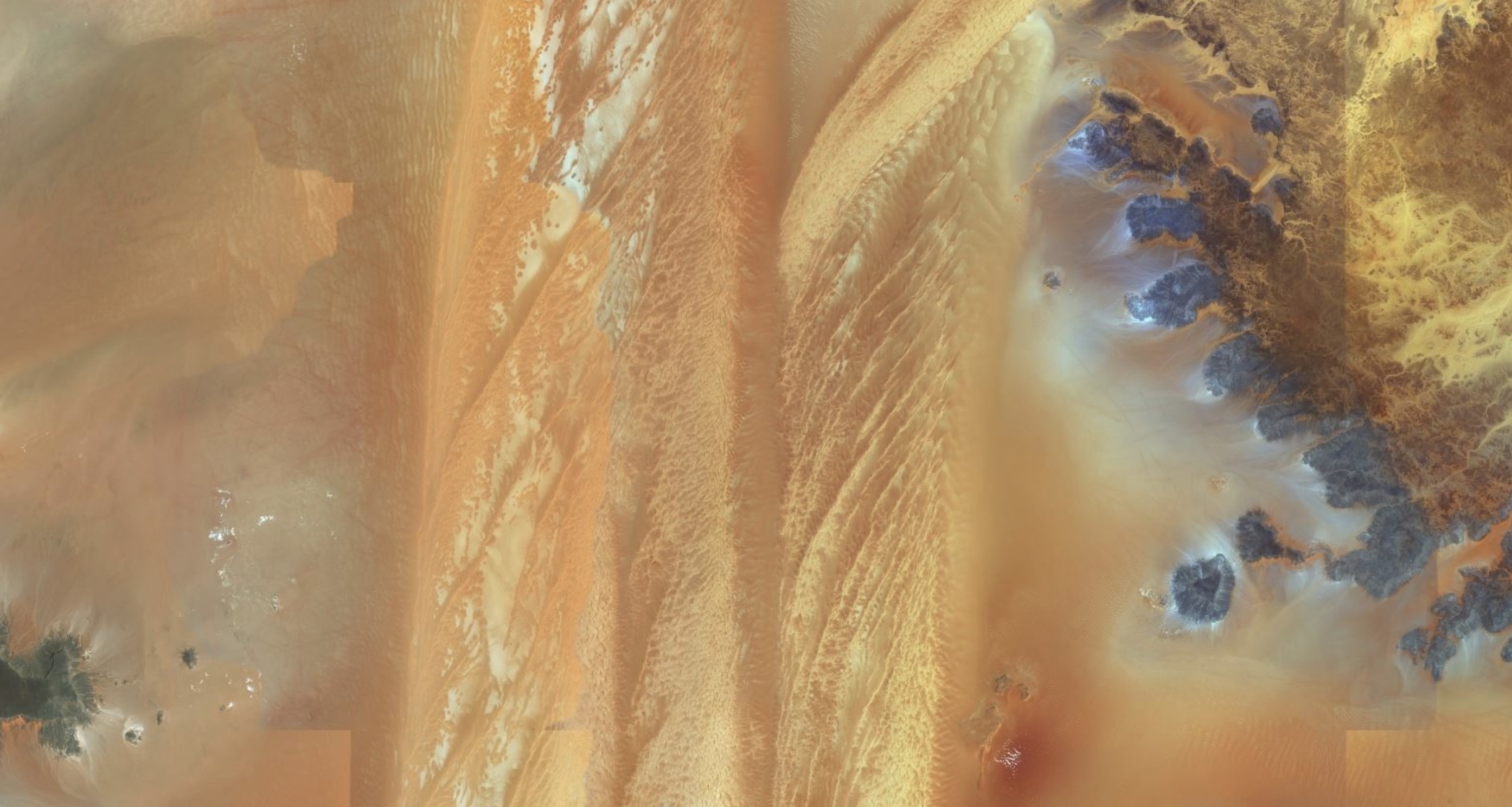
We camped in a valley bizarrely dammed by a perfectly dune of sand 200 feet high and now clearly visible online. We rose early next day to attempt to cross the cordon of dunes blocking access to the northwestern Gilf valleys, dryly annotated as ‘Difficult Crossing’ on the 1942 British Survey map, still one of the best for the area. They were first crossed in 1935 by WB Kennedy Shaw and his group using Model A Ford.
Using from NASA satellite imagery [this was all pre-Google Earth] and the British Survey map, Andras led us through the erg’s seven-kilometre width in six hours, notwithstanding a freak out by one of the Egyptians who, along with a wheel brace, grabbed the keys from two cars and yelled “We’re all going to die if we go there”. Discussing this with Reinhart Mazur on my return, he observed that most Egyptians are river dwellers very much not ‘of the desert born’, unlike the Tubu, Tuareg or Moors further west. Ahmed was eventually calmed but later, navigating the Sand Sea, this was to be a recurring problem. Exhausted after the digging and pushing of the crossing, we headed south deep into Wadi Hamra, then spent another very enjoyable day walking over the tool-scattered plateau to the adjacent Wadi Abdel Malik, spotted by Almasy and others from a biplane in the early 1930s and named after the last Tubu grazer who lived there. Almazy also believed this to be a most likely location of the ‘lost oasis’ of Zerzura, used by Tubu raiders who set off to attack Dakhla oasis.
The Lost Oasis of Zerzura?
Our next destination was the Silica Glass Field located in a 100km circle around N25° 18′ E25° 32′, among the parallel dune lines of the Great Sand Sea. We all spent a satisfying few hours picking out pieces of this clear green glass, ranging from the size of a penny to a grapefruit. I also found some Palaeolithic nick-nacks and on a dune crest one of the others found several pencil-thin tubes of fulgarite: sand grains vitrified by lightening.
For me, our fossiking was overshadowed by the long dune lines running north-south alongside the pebbly flats. An inspection on foot confirmed that these were not simple ‘up and down’ barchans but a complex, weaving band of crests and troughs a few hundred metres wide and clearly beyond the ability of the still heavy Land Cruisers. The original plan to drive up to Siwa had been abandoned, but a no less ambitious decision was taken to try and cross the dunes to the northeast up to Ammonite Hill and on to the well at Ain Dalla, near Farafra, just as Bagnold, Shaw and there chums used to do in the 1930s with stripped-down 2WD Fords.
In Werner’s and my opinion, such a task is best left to lighter vehicles and, lacking a decent compressor, proper tyre deflation was not allowed, leading to inevitable boggings. I‘d let mine down at Shaw’s Difficult Crossing a few days earlier, but even then, every eastbound cordon was hard won, with the aid of hand held radios, foot recces and passengers strung out as markers to guide the white-knuckle driving around the soft spots. After an exhausting day, more arguments and attempted sabotage of the tyre valves by the nervous Egyptians, the idea was dropped and we headed back south towards the northern banks of the Gilf to pick up the track to Abu Ballas. All of us were very relived to be out of the dunes.
Abu Ballas
‘Pottery Hill’
Apart from the food, for me the trip was a great experience. It was the first time I’d driven entirely off piste which I found surprising easy. I was merely following a lead car of course, but the almost complete lack of wadis in the hyper arid Libyan Desert makes cross country travel using GPS and maps or satellite imagery straightforward. Day walks away from the car where also a novelty to me. Near pistes I’d always been nervous about leaving the ‘mother ship’, be it car or bike. But here there was no one for hundreds of kilometres in any direction and there’s no doubt that the desert is best appreciated at walking pace. Interestingly Werner and I both recognised that even though we were as a far out as we’d ever been in the Sahara (certainly for me), we didn’t feel the remoteness. The fact that the organisation was Andras’ responsibility reduced the impression of deep wilderness experienced when you do it independently, at of course, some cost to your nerves. In this instance we were both happy that someone else – and better still, someone else’s car – where carrying that heavy loads.