Tag Archives: amguid crater

Sahara Camel Trek • Immidir Plateau

amgheader

How quickly the landscape changes, even when one travels on foot.
Phillipe Diole, The Most Beautiful Desert Of All (1956) 

Trek2Cam

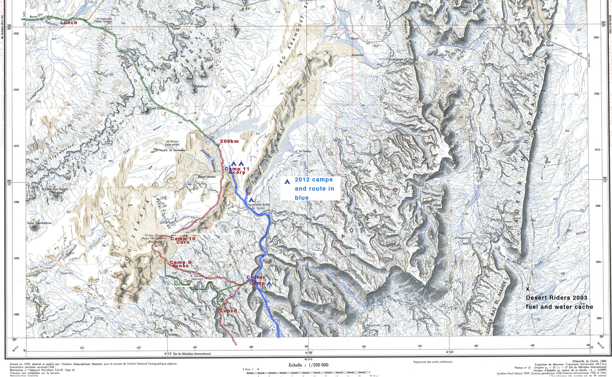
In November 2007 I joined a recce organised by London-based Simoon Travel and Tanezrouft Voyages. Over 11 days we walked about 200kms from south of Arak through the northeastern Immidir to the Amguid Crater and the Bou Zerafa dunes beyond.

In January 2009 I led Simoon’s first tour with 8 clients, Photo report here. And a slide show from the 2010 tour is here

imimap

The Immidir, aka the ‘Monts du Mouydir‘ on the Mich map, left, is a region of plateaux, escarpments and canyons that spread north and east of the Arak Gorge on the Trans-Sahara Highway.
To the south are the lovely exfoliated granite domes around Tidikmar and Moulay Hassan which we visited in 2005, and to the north and west of the TSH are a number of low plateaux, sand sheets and small ergs of the Adrar Ahnet.

A few groups have followed part of our route through the Immidir before, and I know of a few others who’ve approached the crater from the Habedra piste by car and walked the last 10-20 kms, but no one has combined both. It was an idea I’d offered a couple of years ago with Tanezrouft and then proposed to Libya specialists Simoon. They liked it, found some people and so here we were.

IM0

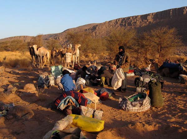
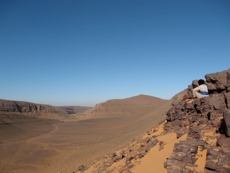
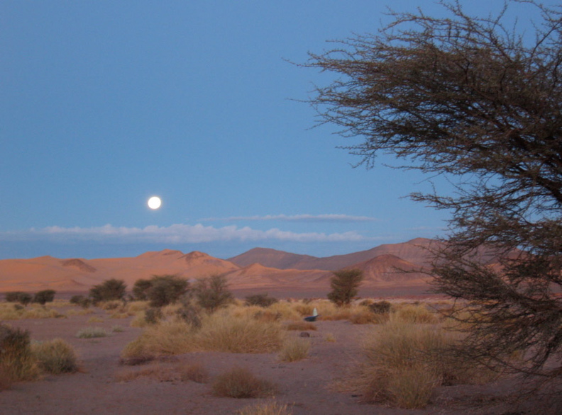
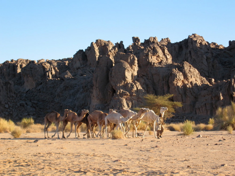
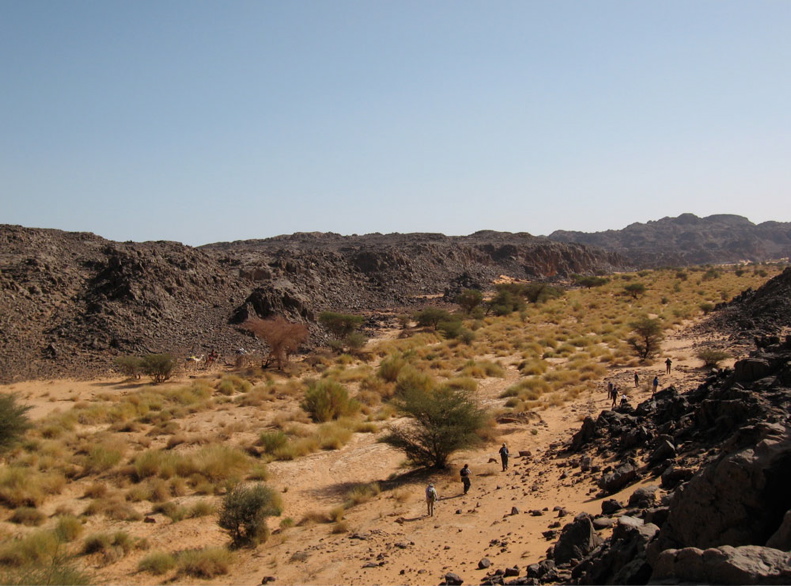
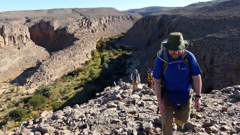
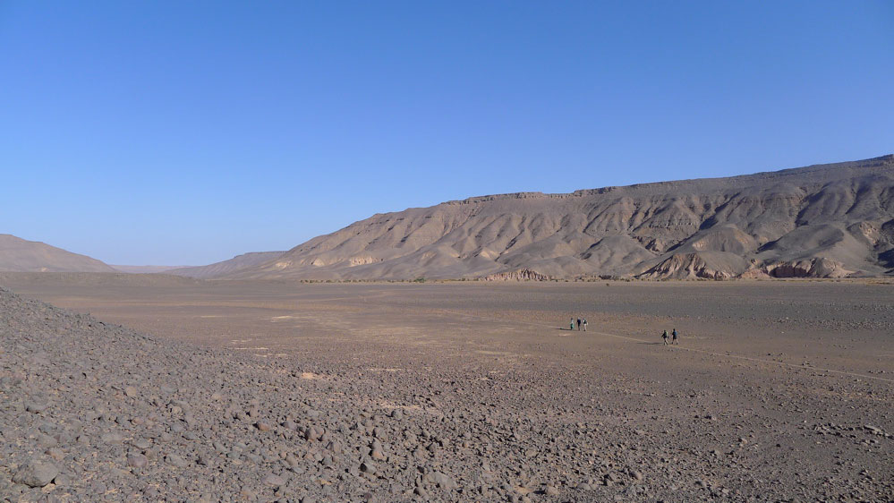
After arriving at In Salah, we drove south 300kms along the Trans Sahara Highway to this valley a few kms beyond Arak settlement. The camels and crew had been waiting a couple of days. Next morning we set off north up the Ighaghar valley in the middle left of the picture.

IM01

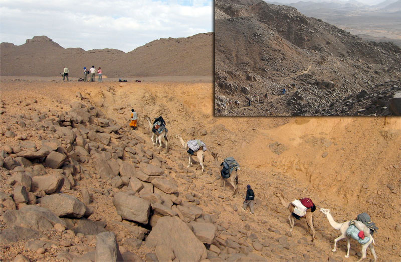
The first few days with a south wind were hot and at times the terrain proved to be tougher for the camels than I expected. On Day 1 a few camels stumbled and lost their loads getting to the top of the Taflout Pass pictured above.

IM02

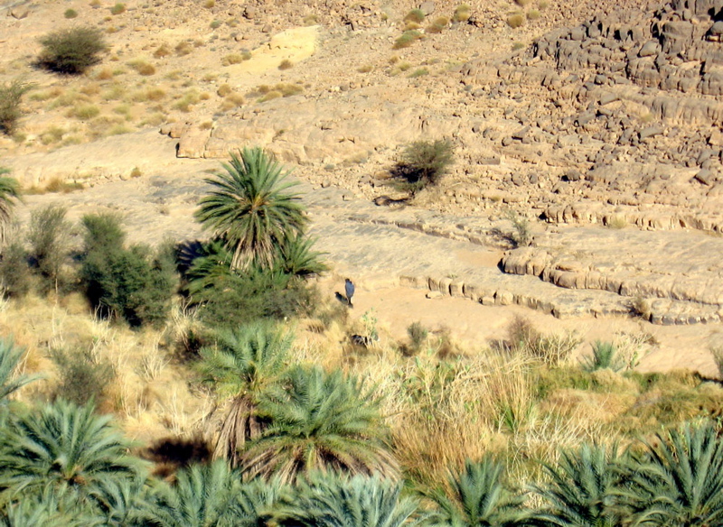
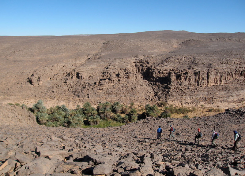
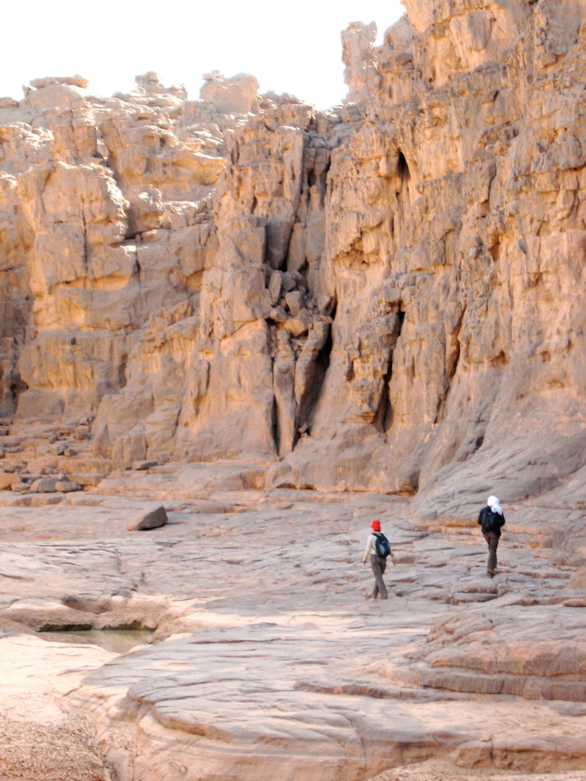
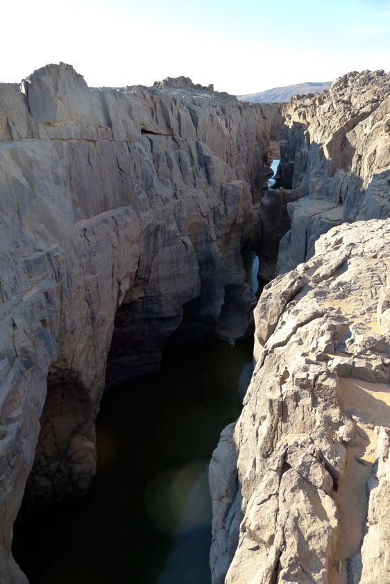
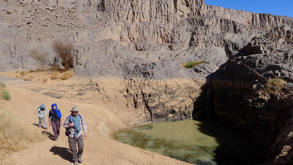
By the next day we had a morning wandering through the cool box canyons and welcome gueltas or aguelmam for which the Immidir is best known. This place is just behind the Arak Gorge.

IM022

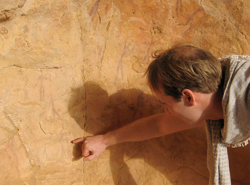
Although there was rock art to be found, what we saw wasn’t really up to the quality and density of the eastern N’Ajjer, Akakus or the Gilf.

IM03

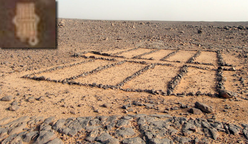
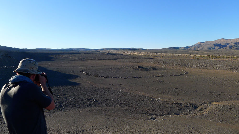
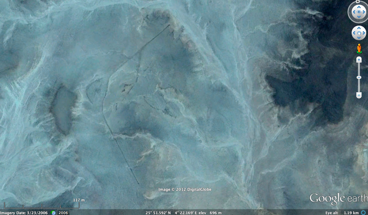
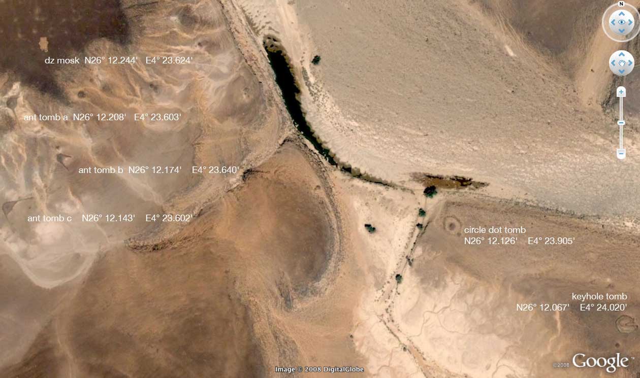
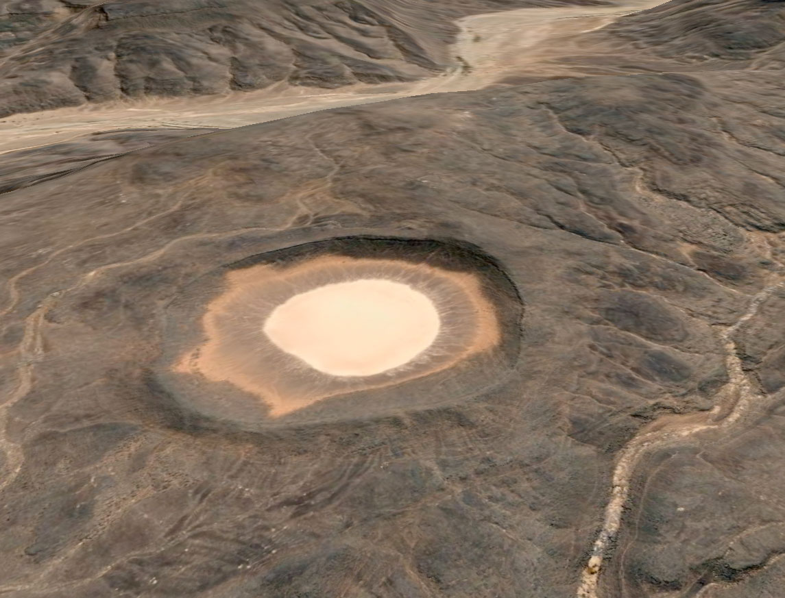
Most days we came across a desert mosque or some sort, although I’ve never seen the ‘pewed’ examples we found in the Immidir. The inset shows a similar structure viewed from Google Earth at Aguelman Rahla guelta, 13kms directly north of the crater at the mouth of Oued Tafrakrek (see Google image below). Google Earth shows the permanent guelta surrounded by pre-islamic tombs (including the less common keyhole type) which suggests like many Sahara oueds, the place has long been inhabited.

IM05

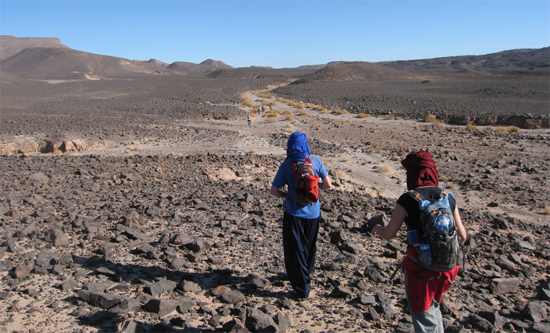
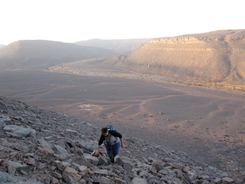
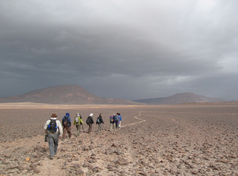
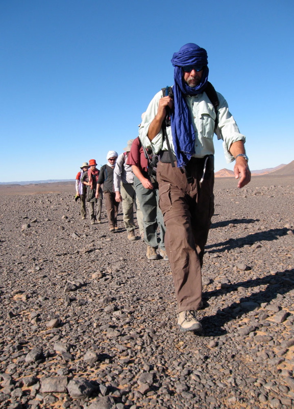
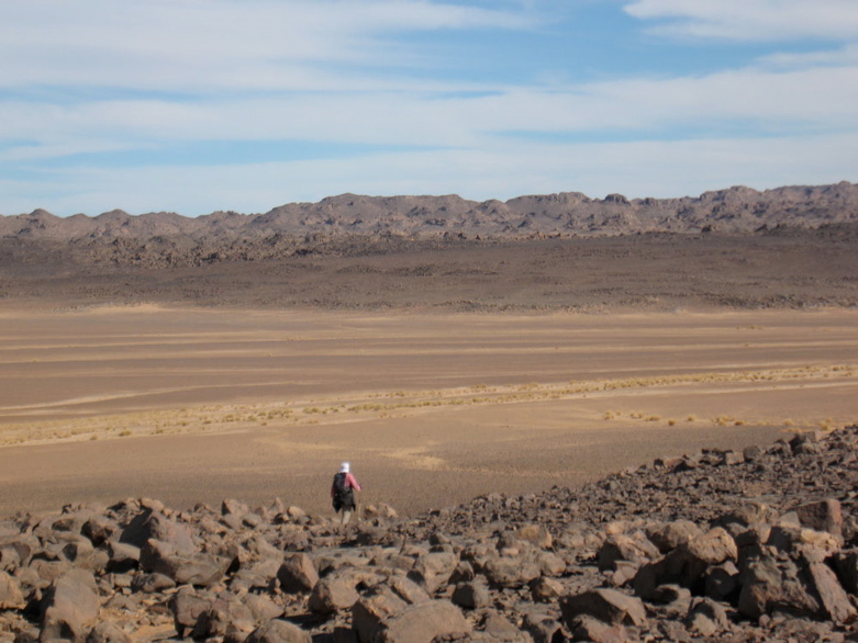
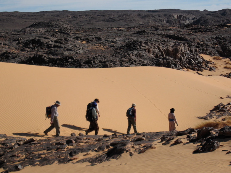
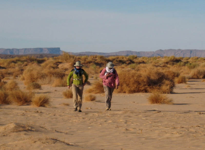
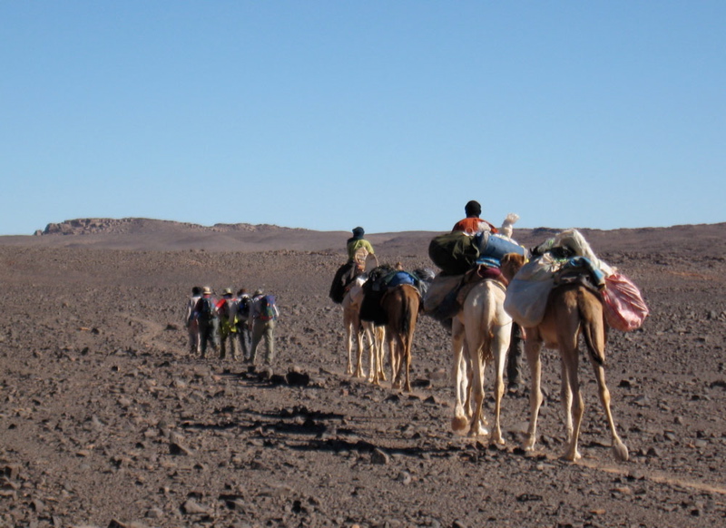
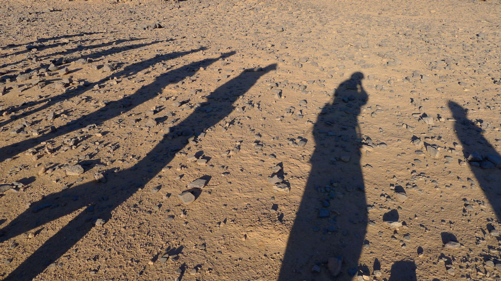
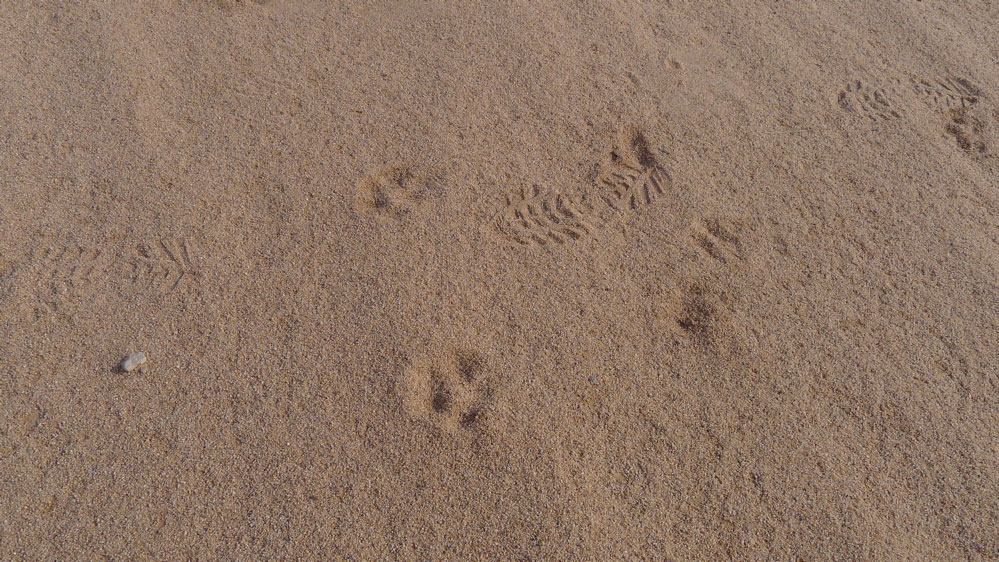
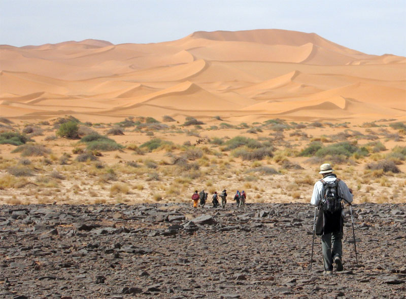
What tracks there were were old camel pistes across the hammada. Rubble like this was tough on boots and feet; most of us got blisters. Even the camels needed treating for cuts and one night the guides made them some hide socks. Some days the caravan took alternative, easier routes. Daily distances varied between 14 and 24kms. By the end we didn’t even notice a 14-km morning. The route is inaccessible to vehicles but we passed plenty of mouflon, jackal, gazelle and fennec trails and once saw camel tracks other than our own.

IM4444

This was a nice day; about 24 clicks round the back of the guelta below, over a ridge where one camel collapsed and needed unpacking and a gentle kicking. Then round to the big oued above which fed the gorge pictured below and into a series of small valleys where I found an intact pot.
Later it was fun marching on alone trying to catch up the caravan somewhere up ahead with the security of knowing the others were following. At times it took a little tracking to uncover the lead camels’ trail. Easy in sand, trickier on rock.

IM044

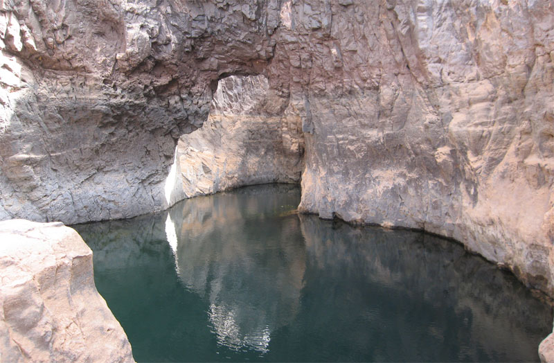
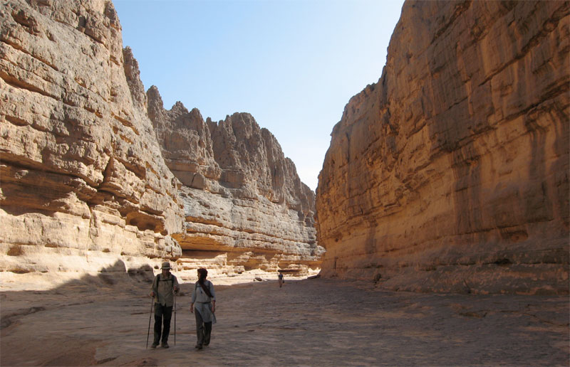
One lunch stop was by a deeply-carved gorge strung out with several waterholes (gueltas) and this arch.

IM44

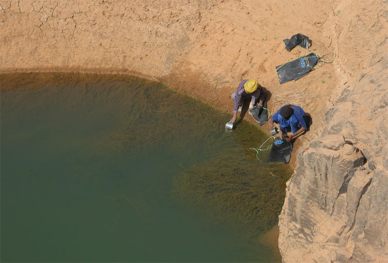
With no wells along the walking stage, the crew refilled from sources like this. People are put off by the colour but of course what makes you ill you can’t see, even in crystal clear water. Being early in the cool season following the summer rains, the water was probably fresh enough and if the crew could drink it so ought I. So as an experiment I drank the water as it came but didn’t get ill.
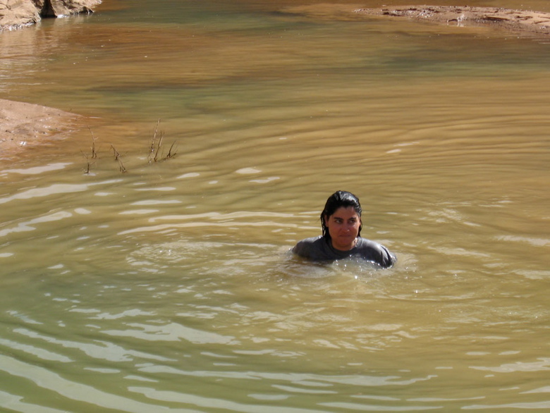
Interestingly ‘flying’ over our route on Google Earth reveals the region awash with gueltas. The gorge above (N24.317′ E 03° 58.506′) is almost one long pool and elsewhere we or the camels would not have got through some valleys and gorges without swimming.

IM22

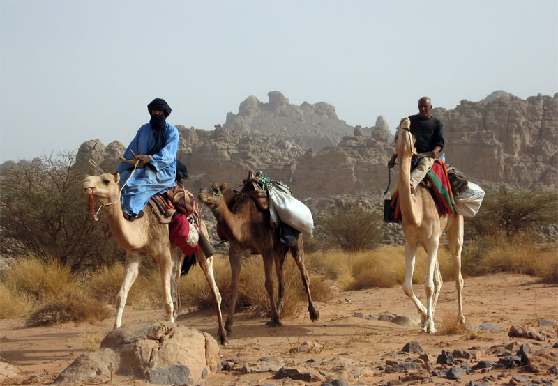
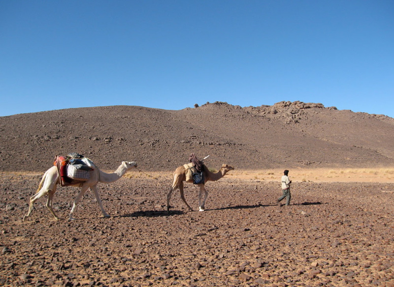
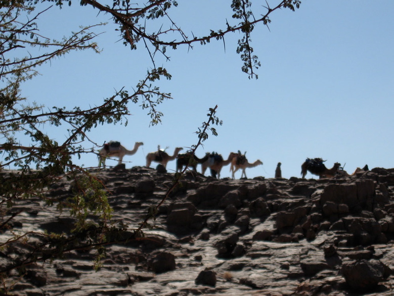
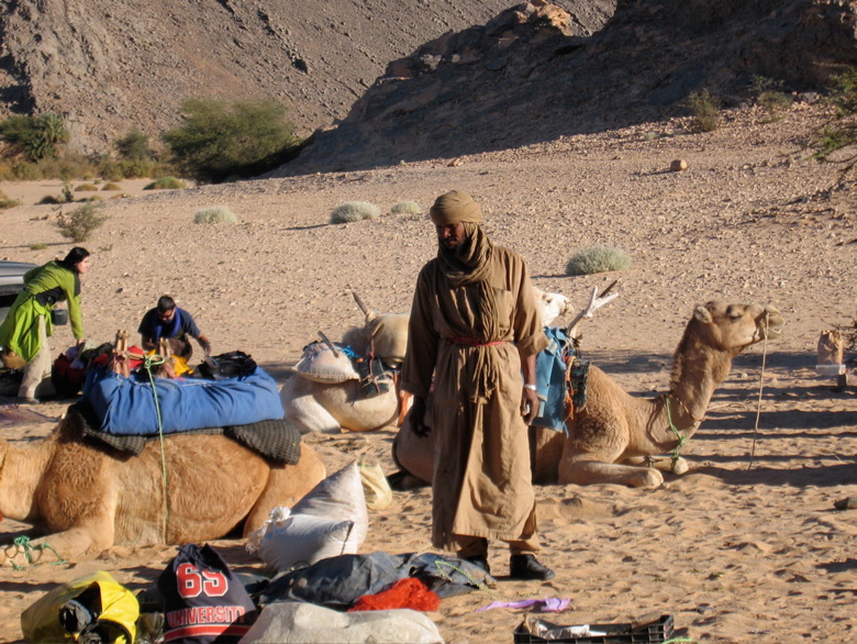
Mohamed H of Agence Tanezrouft and Sidi Ali our cook coming through. Sidi and the crew’s work started when we stopped walking for the day and carried on until we set off before them next morning so we didn’t resent them riding. We could too and those that did remarked what a relief it was to be able to look around at the scenery instead of dodging the next rock underfoot.

IM06

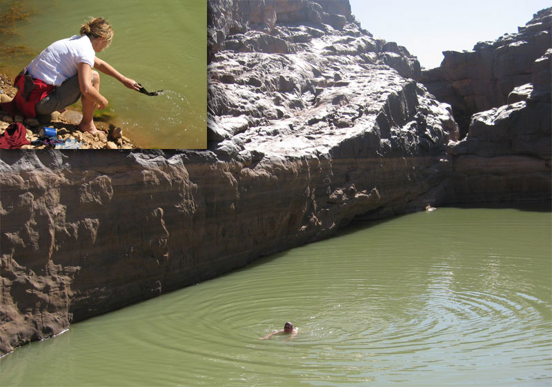
After a while it didn’t take much hesitation for us to grab a quick wash or launder at any guelta we came across, or even dive in for a swim. Like all tassilis, the Immidir has countless gueltas which make it suited to camel trekking. You can see from the ‘tide lines’ how deep this one fills after heavy rains.

IM66

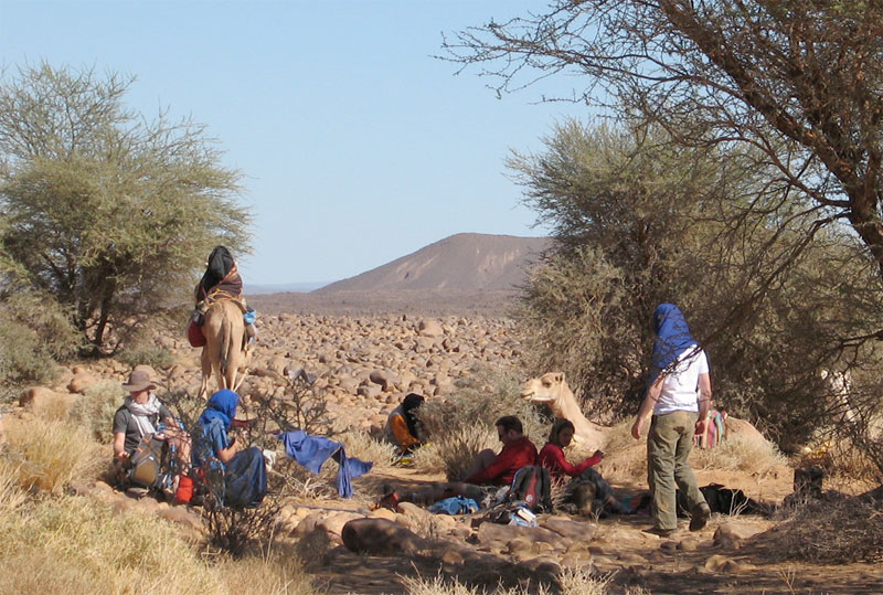
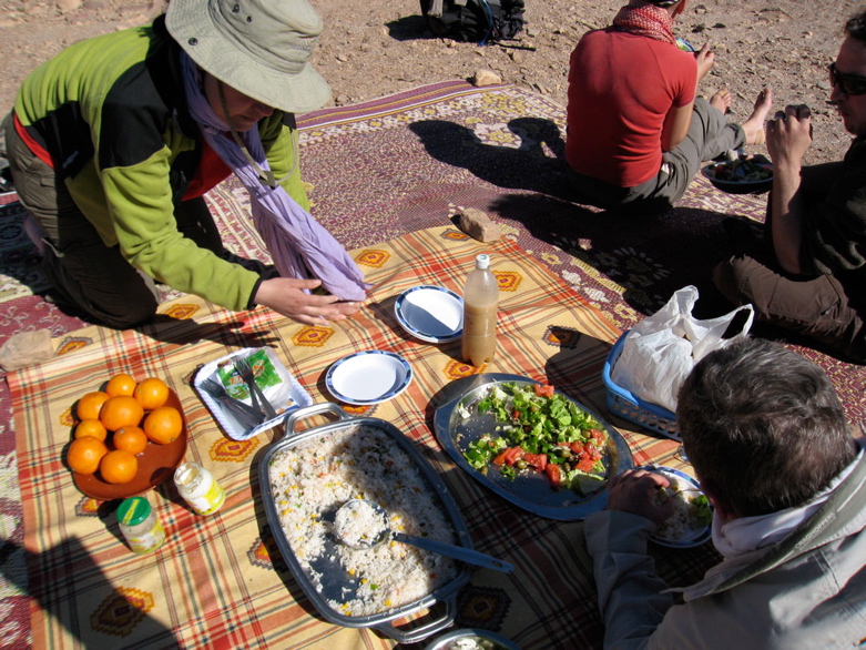
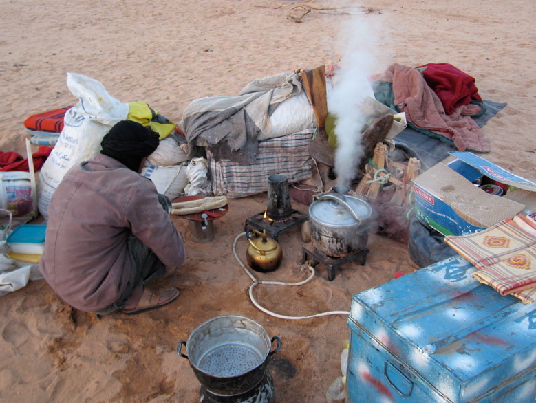
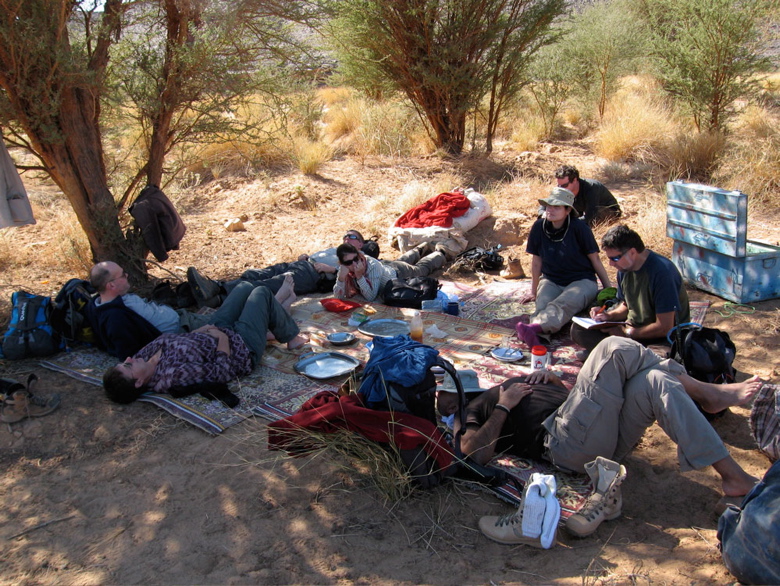
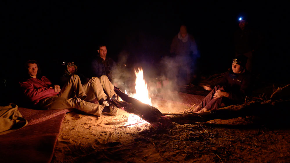
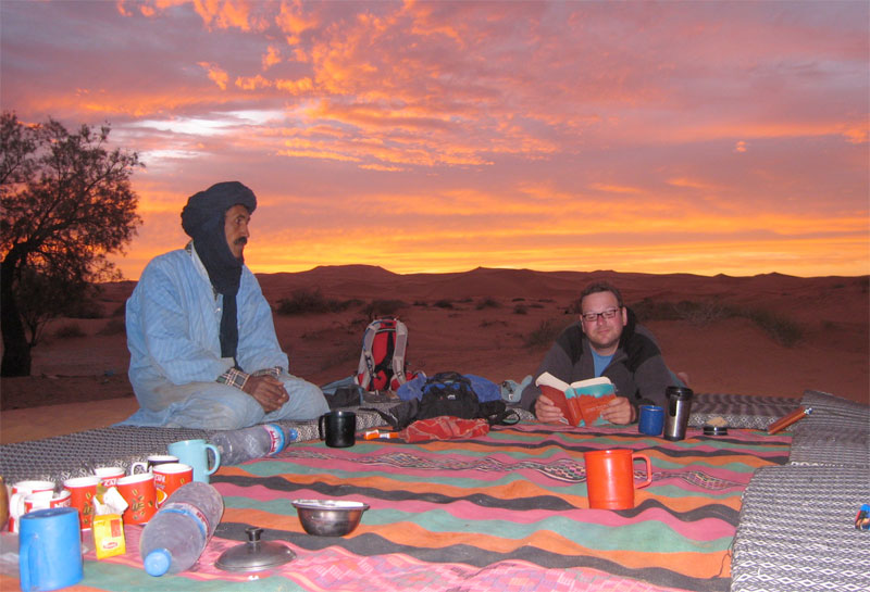
Some shade always cropped up around lunchtime or ‘midi’. Usually we’d have to wait for Sidi Ali and his lunch camels to catch up. Then while we siesta’d the main caravan might pass through and keep going, usually getting to our evening camp ahead of us.

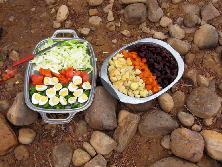
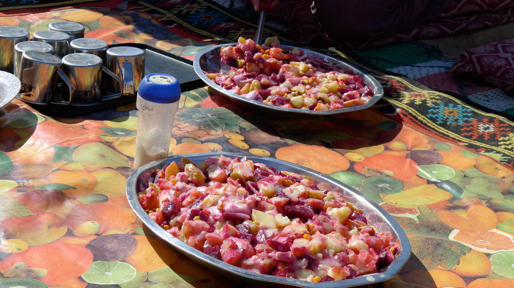
Food. Breakfast was light: coffee with hot milk and baguettes, sand bread or pancakes with jam and marg. We were sometimes given dates and a soft drink for the road. Lunch was a heap of mixed salad or veggie rice followed by mint tea and an orange while they lasted. We has more tea/coffee and biscuits soon after we stopped walking for the day. Dinner was soup and bread, a main course of cous cous/rice/pasta and stew – all variations on dried goat meat followed by an orange and mint tea. Most of us brought some sort of snacks and I brought my v-kettle (right) with drinks/soups which came in handy while waiting for the lunch camel to turn up.

Although I ate much less then I normally do, I eat too much anyway and saw the trek as a chance for a bit of a detox. I lost about half a stone but was never hungry. The daily ritual of walking, sleeping, chatting, eating and resting was very satisfying; as always the desert demonstrates how little you need to be content.
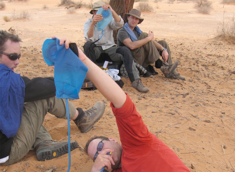
I carried about 2.5 litres of water in a Camelbak (bigger than most) and never ran out. On the earlier hotter days at about 30°C I got through 2L a day, later in the low 20s it was about a litre. About the same as summer in England.

IM08

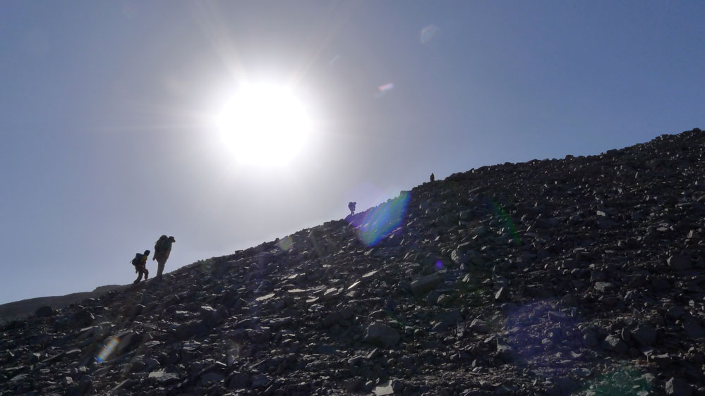
Come the big day the chattering subsided but we were still smiling when we got to the top of this gnaaarly climb, having unnecessarily gone up and down another ridge (see map below). With us we carried overnight gear, a bit of food and -no surprise to me having done these sort of walks before – not enough water. At the top of the climb we got our first sight of the Bou Zerafa dunefield 20 kms to the north and from this picture overlooking the camel route below the crater was only about 6km to the east.

Before we set off from Arak I didn’t have a clue which way our guide Yahia was going to reach Bou Zerafa other than north some way. A map didn’t mean much to him so there was little point asking or pointing and Tamachek names don’t always match the map’s Arabic. I presume then it was a total fluke when his route led far to the east below the Adrar Tassedit escarpment before turning north up the Oued Bou Zerafa – or Oued Tassedit as they called it. It could not have passed closer to the crater site.

IM88

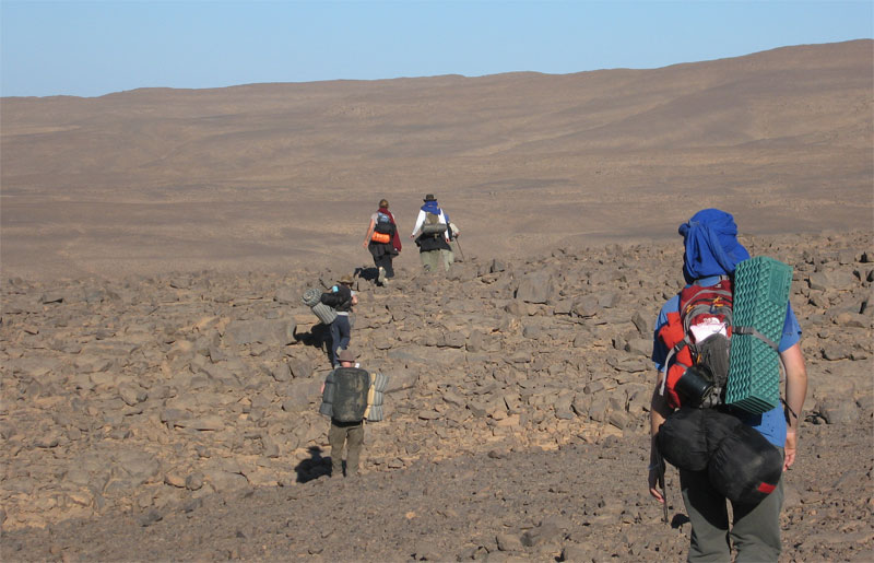
So east we went. The broken terrain reminded me of a mild version of Ginge Fullen’s attempt to climb Bittu Bitti, Libya’s highest peak (see p.377 in the book). Between us and the horizon where the crater surely lay were any number of chasms, clefts and gorges. Near this point we passed the 150-km mark which put the crater at nearly 100 miles from our departure point near Arak.

IM888

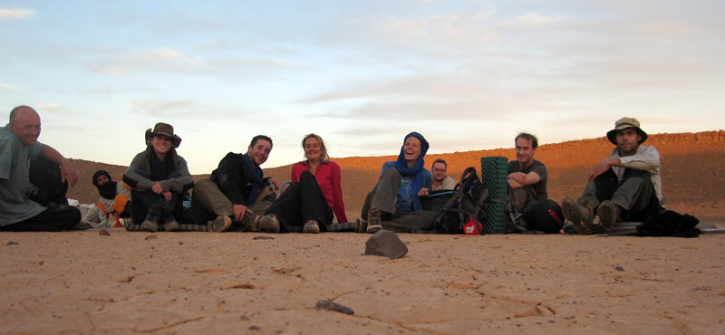
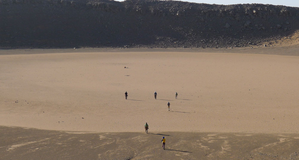
Just on sunset and having covered 7 tough kms in 3.5 hours, we sat ourselves down in the middle of the crater pan. Not sure what we’re all laughing about; we each have less than a litre of water left so tomorrow was going to be a bit of a march but our goal had been accomplished.
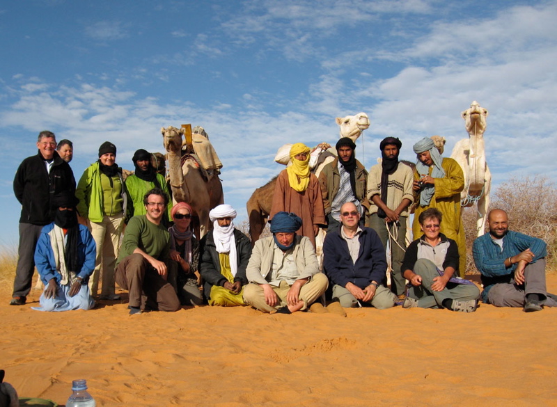
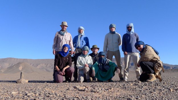
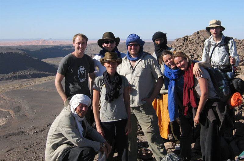
From the left: me, Yahia the guide, Francoise, Jon the photographer, Imogen, Amelia of Simoon, Bob, Amelia’s husband Lex who tracked the whole route on GPS and Tom.

IMxyxy
goocrate

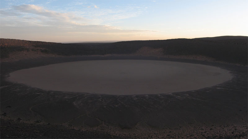
The crater is thought to have been formed less than 100,000 years ago and the first recorded visit was by a French geologist in 1969. For us it would have been nice to explore it in sunlight and I’d also hoped to take a hike over to the Oued Tafrakrek rim a couple of clicks to the east. But having chatted with Mohamed on the sat phone, Yahia explained to us the camels were already heading for the dunes so to intercept them we had a longer cross-country walk the next day. I went to sleep thirsty, woke up thirsty and at first light decided to drink my last cupful while others chose to save a few drops for the hike. To make the most of the cool morning we climbed out of the unlit crater at first light and set off northwest to the dunes.

IMcrmap

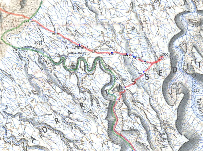
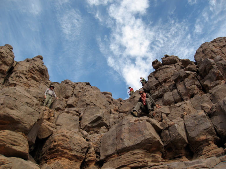
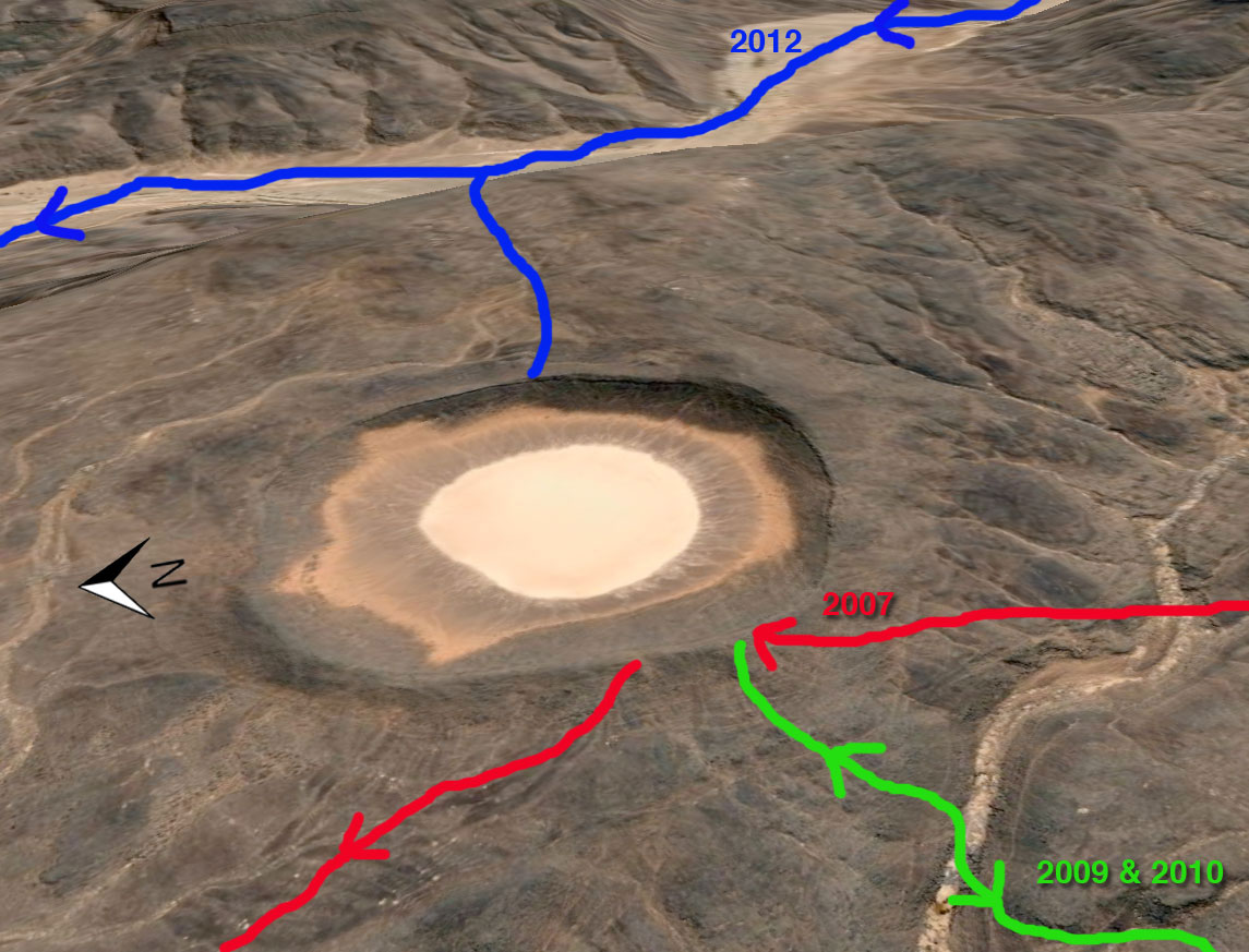
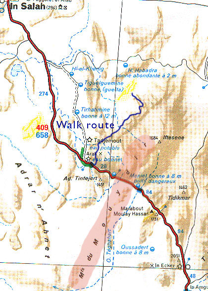
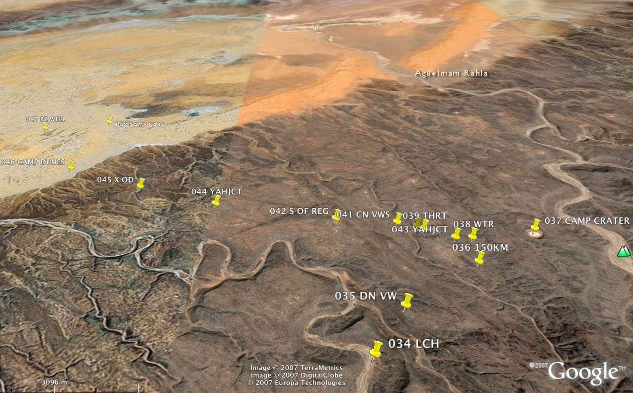
Here’s part of our route in red over the Adrar Tassedit plateau 8 days after leaving Arak. After lunch (009 LCH if you have bionic eyes) and repacking our gear we left the caravan trail in green, crossed a needless ridge (below the ‘A’ and then climbed back onto the plateau (‘009 DN VW’; the group shot 4 pics above) and then went up and down past ‘009 150KM’ to the crater at ‘706’. The map above is about 15 miles/25kms wide.

IMgoocrat

Although we were unsure to put our trust in Yahia as he’d never been here either, next day he led us to the dunes where our camels were waiting. Knowing water was scarce he lured us on, keeping just out of reach so there was no discussion about which way to go. As the return route and waypoints show, his Tuareg ‘GPS’ was spot on. Apart from the easily-remedied water issues our route to the crater was as good as could be expected.

In 2009 we started at dawn at ‘557’ a bit to the north of our lunch spot, above the meander of the ‘T’ on the map. We climbed up the valley side with a bit of scrambling and had a much easier 2.5hr/6km each way walk to the crater. Next day we followed the green route along the canyon to the dunes and beyond, probably 30km but no one noticed by now.

IMxxx

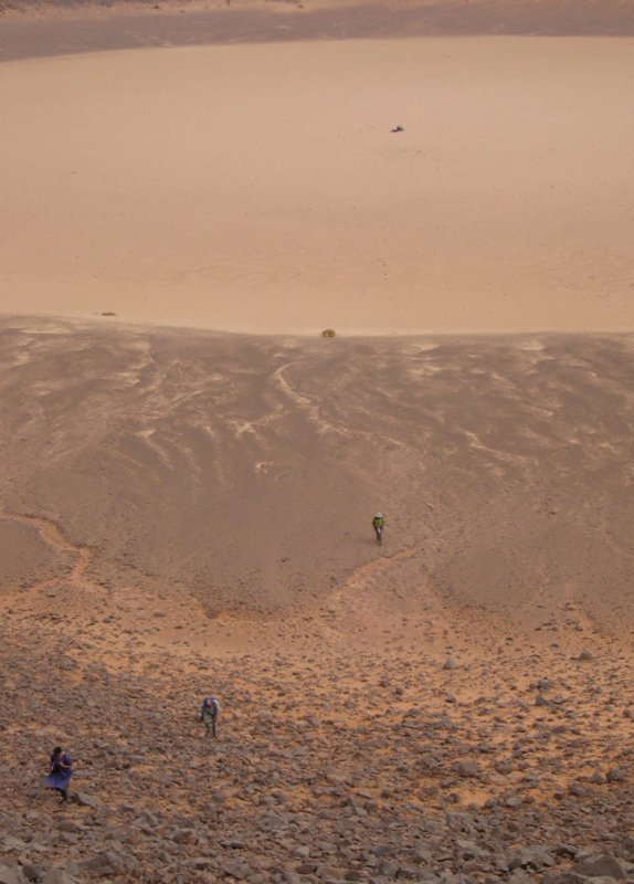
With some (myself included) a bit more parched than others (notably the women), we finally staggered off the plateau and onto the sands some 6 hours and 16 kms from the crater – much further than we imagined and having drunk no- or just a couple of sips of water. Everyone had quietly focused on the task. Luckily it was another cool day and of course we knew the crew was out there somewhere with water.

AMxxy

Once on the sands some desperados cracked and drained the last gritty dregs from their hydrators while Yahia dashed off to track down the caravan out in the sands. A few minutes later Mohamed came galloping in with some water.

IM04

We spent the rest of the day idling about and drinking everything they brought us. That evening, while contemplating the transit of Orion and Copernicus’ theory that meteorites never strike in the same place twice, a shooting star tore in low over the Tassedit plateau above the crater. With a bright green trail breaking up behind it, somewhere out there a new sprinkling of space debris had scattered itself across the desert floor. As we discussed the startling phenomenon a sonic ‘b-boom’ rippled over the sands, suggesting a meteorite had indeed breached the atmosphere. Someone knew the speed of sound and estimating the time after the sighting, Tom worked out it had fallen about 50 miles away, well beyond the crater. With this suitably astral climax to our crater day, Copernicus was proved right – again.

IMz

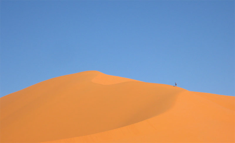
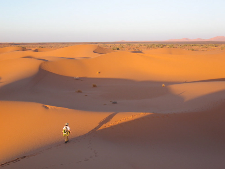
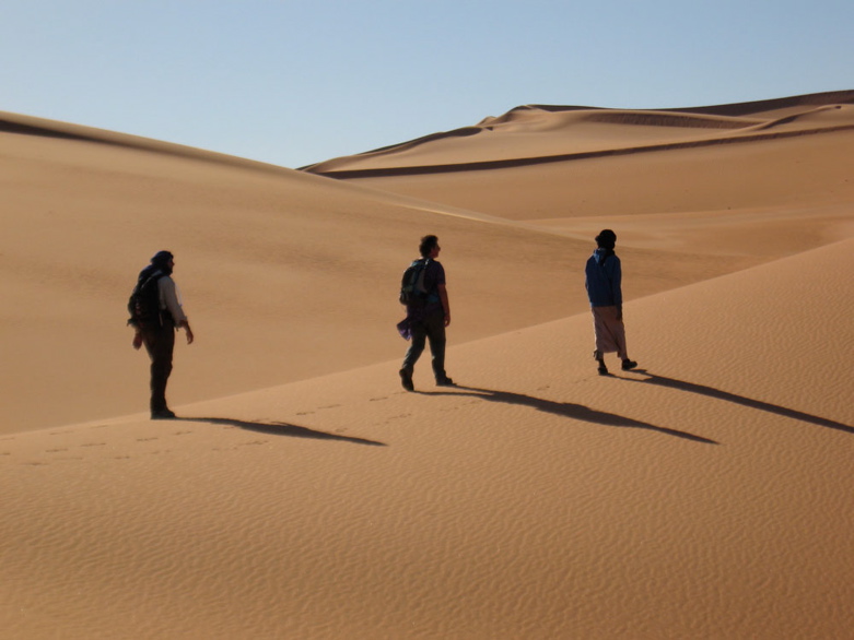
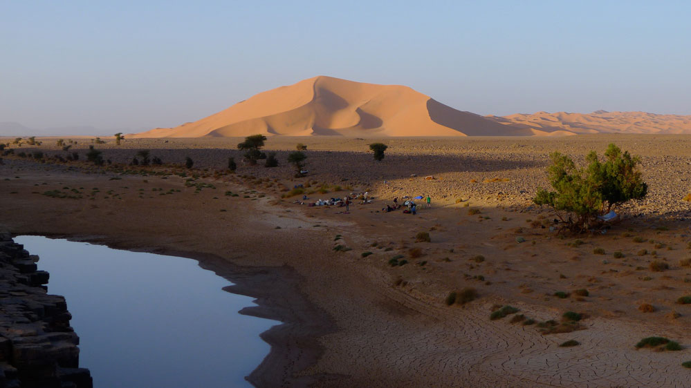
Next day we headed into the dunes for some exercise. Some took the high road…

IMxyz

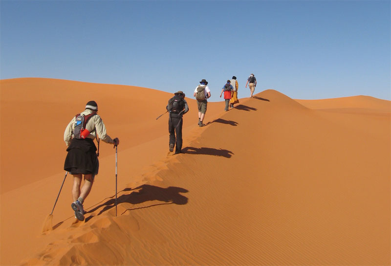
… some took the low. We passed Bou Zerafa well marked on the maps. It was sanded over but Yahia assured us there was water a metre below. Winding up our 10-day rocky plateau trek in the glowing orange sands of an erg was perfect – another highlight after the crater.

IMzz

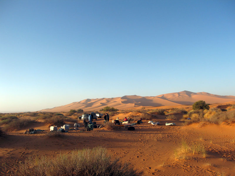
Next morning the cars turned up from In Salah with fresh food and water. At this point my camera passed out but we carried on northeast alongside a dune ridge to one more camp (passing some lovely pestle-like moules to go with the countless grinders lying around). Another short morning followed to knock off ‘200kms’ according to Lex’s GPS tracking, right by an unmarked well with good water.

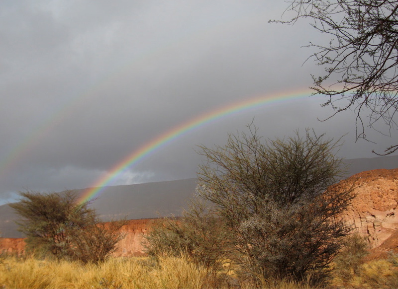
We drove from there northwest to Tin Habedra well (sanded in) and then directly west along the Habedra piste passing escarpments lined with tall cairns and small, palmy sources while chased by a storm front. It showered a bit that evening and most took to the tents for the first time as lightning flashes circled us along the horizon. Then at 2am a bolt exploded nearby and a heavy shower drenched the camp. The tents held off the worst of it but next morning by the time we’d got the fire lit most weren’t in the mood for the planned splash about at Tiguelmine guelta on the old Hoggar route. We headed directly back for In Salah, a great feast at Mohamed’s, a plane to Algiers and home.

The Empty Crater – 2009

tecbanner

A few shots from our 2009 camel trek across the Immidir plateau in Algeria.

See also our 2007 trek and 2010 video

Sahara Camel Trek ~ Amguid Crater 2010

cTWO5


It takes about 11 days to cover the rough 180-kilometres to the Amguid crater in southern Algeria. The Immidir plateau is inaccessible to cars so the camel caravan carries all our gear and food and the crew draw water from natural waterholes or ‘gueltas’ ever other day. These guetas as well as daily grazing for the camels are key to staging the trek.
Our route follows canyons, dry valleys and escarpments as well as old camel and game trails where present. Along the way we pass several pre-Islamic tombs and often come across Neolithic artifacts, as well as tracks of gazelles, jackals and even a leopard.
The crater is thought to be 100,000 years old and is about half a kilometre wide. It’s filled with rain-washed sand over the millennia and is the only level part of the whole walk!
A day later we rendezvous with the cars on the far side of the Bou Zerafa dune field, about 700km north of Tamanrasset.

Algeria – For a Few Dollars More

Marseille – Tunis – Nefta – El Oued – Grand Erg Oriental – Deb Deb – Illizi – Djanet – Essendilene – Bordj el Haouas – Tazat – Amadror – Tourha – Tefedest east – Ideles – Tahifet – Tamanrasset – Assekrem – Tam – In Ecker – Amguid – Erg Tifernine – Gara Khanfoussa – Bordj Omar Driss – HbG – El Oued – Tunis – Genoa

Land Cruiser HJ61, Land Cruiser HDJ80 auto, Defender 300 Tdi

With just a couple of cars booked on the March tour, I planned to make the most of a small group and explore new areas that would be problematical with a bigger group. At Marseille Lucy and I met up with Ian and Elke from Wales in a well set-up Defender, and retirees Peter and David in an auto 80 TLC with nothing more than a second spare and a box for the jerries. Peter had bought the 80 just for the tour and preferred the low key ‘school run’ look.
The Marseille crossing was deserted and as flat as it gets. And better still, filling out the Tunisian immigration forms took just 20 minutes, whereas on the more popular Genoa run it can take six tedious hours. I guess it’s because Genoa is a funnel for the hoards of German-speaking Saharans, and of course that crossing costs 25% less.
But Marseille has other advantages apart from less crowds: it leaves earlier in the day so it gets in to Tunis early too, making a daylight run to the Algerian border possible. Rural traffic in Tunisia may not be so mental, but if it’s your first African driving experience you don’t want to be doing it in the dark. So after a hot, windy day we arrived at Nefta just on sunset and early next morning got through the borders in a couple of hours.
My plan was to avoid the long schlep south down past Hassi Messaoud and try one of the lately ‘fashionable’ pistes that cut through the northern Grand Erg Oriental down to the El Borma Road. These routes have the attraction of getting off the highway early, but involve traversing the northern Oriental Erg’s notorious small dunes. The problem with small dunes – as we were soon to find out – is that they have no clear form, being just a chaotic jumble of akle, rather like driving through a very heavy swell. Big dunes (as found in the southern Oriental) may have more scary descents but at least form into regular ridges (seifs) separated by gassis or corridors. You roll along a corridor and once in a while hop over a ridge of dunes to the adjacent gassi. If only…
Planning to get all the way to Hassi bel Guebbour through the Grand Erg (500km), we fuelled up at El Oued and turned off the highway near Oued Allenda village. By then a hot wind was blowing from the south reminding us the hot season was on its way. I had a dozen waypoints from a friend and soon we were in the dunes, riding through the swell.


After a few kilometres the tracks veered west but I made the mistake of heading directly for the next waypoint (this route was to be a reminder in reading the terrain first, then a GPS!). Twenty minutes of that saw me battling the Land Cruiser from one dune to the next. I knew this route was no cake-walk, but 200kms of this made 600kms of tarmac to HbG extremely alluring. We returned to the tracks (easier said than done) and I recce’d ahead with Ian in the Land Rover to discover the tracks did indeed turn our way after a few kilometres.


That night scorpions visited our camp. No one was more surprised or repelled than me, having never seen one in 20 years of desert travels. Yellow and only about an inch or two long, they put the dampers on our first desert camp as those of us in bare feet tiptoed gingerly towards their footwear. Lucy had lately read about Lhote killing 168 scorpions on the Tassili plateau in one sitting so Peter and David postponed sleeping out and put up a tent.
Next morning the hot south wind continued to blow, obscuring the sky and horizon and offering me another novelty; static electricity. On some days, every time I got out of my car I got zapped.
The tracks we’d recce’d the previous evening led into a tussocky flat area (as gassi as

it gets around here) which circumnavigated the dunes I’d tried to plough though yesterday. Presently they led to the well of Thleth el Biar where some Chaamba nomads were watering their herds. Compared to affable (or more tourist-trained) Tuaregs down south, these guys didn’t have much to say and indifferently took a bag of clothes we left by their car.
Nearby Ian spotted some sand roses growing in the sand. Being more humid than the deep south, the northern Erg is famous for these unusual crystalline gypsum formations which at best can resemble a pink rose. Firstly scorpions and now static and wild sand roses, what other novelties awaited?
None I cared for. From the well the sand was trackless so we muddled south into dunes, passing another well surrounded by nomads. For me the dilemma was: get stuck in to whatever led to the next waypoint, or follow the easier ground and risk getting led off route. Often we’d work our way into a mass of dunes only to see the preferred flat tussocky area half a kilometre to either side but still 20 minutes low ranging to get there. On the flat ground, such vantage points were not possible.
I’d driven in terrain similar to this, but never as the lead car, a big difference. Following someone takes a bit of concentration but is easy: whatever the lead car gets through you can usually follow, and where it gets stuck you have time to think and find a better way.


Both Ian and Peter thought this was all brilliant, real desert driving! but I just chewed my lip and wondered how bad it would get. I’ve never been keen on dune driving, it’s no surprise that it’s where all accidents happen and dunes are hard on the transmission and your nerves. In the Nefta hotel we’d met a Belgian guy who’d rolled his 80 in the Grand Erg near HbG. He was hanging out there while they replaced all the windows and bashed it back into shape…
Not only was the driving demanding but the terrain was pretty dull too, not helped by the dreary visibility and hot winds. Dunes tussocks, dunes tussocks. Occasionally we’d come across a gravel patch with clear tracks which confirmed we were on target, even if we felt lost most of the time.
Luckily both Ian and Peter (who’d never driven off-road before) seemed to manage it fine. I assured them this sort of driving was not the norm, but it being the start of the trip, they didn’t seem to mind being thrown in the deep end. My idea to come this way with six bikes a couple of months earlier would have been a disaster for sure.

We covered just 100km that day and another 100 the next, getting close to the El Borma road. And by the afternoon of the second day the dunes where getting higher, more spaced out and more regular, which made the terrain easier to negotiate. But not that easy. At one point I was working my way through a pile of dunes en route to the next putative waypoint. Trying to keep moving in Low 2nd, I rode from one crest through a bowl to the next, higher and higher until it was clear it wasn’t going to work out. There seemed no order or pattern, I was just a cork bobbing around in a pail of boiling water. I found myself doing something I’d only discussed hypothetically in the book: “wall of deathing” around the rim of a bowl in an attempt to maintain momentum and height while trying to work out what next. In the end I fell off the tightrope, almost willingly, with the car beached diagonally near a crest at a jaunty angle. And again. from this skewed vantage point one could spy the flat valley of t••••••s just half a click to the east.
We extracted ourselves and worked our way round, but a while later the same happened and I found myself mired in a bowl of custard powder with no room to move forward or back. Having never used them in three years, I’d left my sand plates at home but even Ian’s sand ladders couldn’t give the 61 the lift it needed. Towing merely pulled both cars into the sand, so we resorted to dragging the sunken Cruiser out by the arse with Ian’s winch. Handy thing in this situation, a winch!

With the weather almost brightening up and the dunes now rising into impressive formations, we counted the kilometres to the road and decided to leave the southern 300km stage to HbG for another time. Unused to his car, Peter had kept the auto in Low Range rather too much and would not have had enough fuel anyway. And we didn’t want to risk another 2 days in the dunes and get behind schedule.


But instead of scurrying back to Hassi Messaoud, we turned east along the pipeline to El Borma and then down towards Deb Deb, another new route for me and one which I’d heard was notoriously buried in sand. South of Sif Fatimah the buried road section began. Bulldozers and JCBs were working to clear the side track and one amazing articulated 6×6 machine with ex-747 tyres gently pulled me through a bank. The tarmac is built on an embankment through huge dunes, but for kilometres at a time it disappears under the sand, with the side piste not always being much easier. Peter was eyeing his fuel gauge but we made it into the nice-looking border town of Deb Deb next morning, filled up with water, fuel and bread, and trundled on down the dull highway through the eastern oilfields to Illizi and a hotel.
Over the Fadnoun the weather was still overcast and dull, to be expected as the seasons change in springtime, but still disappointing. Lack of blue skies really does dampen one’s impression of the desert. Near Tin Taradjeli where the plateau ends we turned off to check out the Sleeping Antelope engravings in Oued Dider, but were content to stop by a two-tier guelta for lunch.
We also decided not to spend a night in a Tassili canyon and pressed on for Djanet and a rest day before a planned 4-day plateau walk. Just as well as what is usually a wonderful drive along the Tassili’s southern scarp soon became lost as an afternoon sandstorm swept in from the south, obliterating the tarmac itself.
In Djanet I set to changing my back springs. I’d been given a set of parabolics to try out. The fronts seemed to work OK but the back ones (fitted just before I left) were clearly not up to it, especially if I was to return home with enough Algerian diesel to last the summer. Expecting such problems, I’d brought along my trusty Old Man Emus and Hey Presto! the Tojo had some air in the wheel arches again. I flogged the back paras to the car spares shop near the market. Djanet is chock-a-block with erstwhile TLC 60s, though those mushy back springs will be as much use to most Djaneteers as fishing lessons.
It became likely that the guide I’d booked for the plateau walk was not going to turn up – oh well, that’s Africa, none of us really minded. And for me, four extra days meant less rushing around the desert. I’ve waiting 20 years to see the plateau, it will be there next time.

We popped down next afternoon to check out the Crying Cow and again another mid-afternoon storm blew in. I tried out the auto 80 and I must say I was not that enamoured. It felt like a heavy slug, very comfy and quiet of course, and featuring a lot of dashboard action. Pete was not that impressed either, finding the lack of pick-up at very low speeds (a feature of 80 engines, compared to earlier 12HTs) in dunes a problem. But either way Ian and I assured Peter just 20-30 seconds in either the Tdi or my 61 would soon highlight the 80s overall appeal.
Although the campsite guys were keen to offer us a plateau deal, we decided to move on and left Djanet under blue skies. On the recommendation of a couple of French guys, we took off up Essendilene Canyon (80-odd kms from Djanet, not 30 as in the book, p. 406), a lovely drive into the Tassili’s interior ending at a fern-lapped guelta.
Following another couple of tips I decided to concoct a new route to Ideles. First through a pass north of Mt Tazat which Richard Washington had found over Christmas, and then across the Amadror plain directly to the Tefedest and down A6 to Ideles.
I made a bit of a mess getting to the Tazat Pass, coming too much from the northeast across all sorts of rubble which slowed tyre-twitchy Peter down to glacial speeds. But by sundown we were 10kms from the mountain and a recce up a nearby hill showed a likely way in.
That night was clear but soon after we went to bed a gale blew in from the east and kept up the whole night. It’s one of the advantages of sleeping in a car as Ian and Elke did. Our tent flapped annoyingly all night while Peter and David rose after a night on the sand like a pair of crustaceans.


Stout old cairns marked the way into the pass next morning. Who knows why the French bothered establishing this route while the main piste passed south of Tazat. Whatever, it was a lovely, quiet drive and nice to be off the corrugated piste, even if it had now become oddly cold for mid-March. On the far side I returned to Borne junction after many years to find the old orange drum long gone and a chunky stone monument in its place. From here we took the route northwest towards Amguid, passing a nice Pre-Islamic tomb on a hillside. At a cone mountain south of Toukmatine we then cut out across the Amadror plain where Colonel Flatters and his crew met their end in 18 seventy whatever. It was a weird sensation driving across the flat plain with distant mountains bobbing on the horizon’s mirage. Slowly, as the afternoon wore on the Tourha range rose in the west, a bit like Adrar Bous as you come across the Tenere. There’s even a lone tree at KM321. Ian was leading for a change (he found trailblazing hard work too) and came across a gang of gazelles which inhabit this relatively secluded region.
As the day ended we reached the ‘Tourha Pass’ on a lovely evening and camped by a sun-warmed outcrop. Before dinner Lucy and I went for a wander into the hills and watched a little nervously as three cars drove past our camp without seeing it. Smugglers, locals or tourists? Who knows but we were glad they missed us. It being Mother’s Day, Peter could not resist my extortionate fee for the sat phone and called his mum in Surrey.
Even though we were only at 1000m, it froze that night to minus 2 or 3 and next day we carried on through the lovely pass and cut down towards the Tefedest proper, stopping frequently just to admire the grandeur of it all in the clear, crisp weather. On the far side of the Oued Igharghar we picked up A6 which I’d done with some bikes a few weeks earlier, met some smiley Targuias and their goats and followed this picturesque route to lunch at the green sign.
It’s interesting reversing a route you know well – you see so much more; new pistes and unusual rocks and even a new way into Ideles past a well I never knew about.
Ideles for me was the usual run around town trying to find the Tazrouk junction. I know where it is but never know how to get there from the west.

We were now on the outer ring road via Tahifet (A4) which I’d done for the first time in years with the bikes in January. Up to Tazrouk it’s a great track and this time Ian and I half-climbed the 150-metre old radio mast near Azrou to affirm that our arms and legs still worked after 2500km of driving.

But after Tahifet the wide track becomes Corrugation Central and we were glad to get to the highway south of Tam, pass the dozens of trans-Saharan trucks queuing for fuel and reached Agence Tarahist’s gite near Hadriane mountain. We’d just missed Moktar going out that morning with Jeremy Keenan (a controversial figure) and a group of no less than nine Brits, surely a record!
Tamanrasset merely reminds you how nice Djanet is, through it’s a good place to get stuff. Elke and I had had a running joke (well, it was to me) that the Hoggar was not worth visiting and we should spend more time in the wonderful Tassili. It’s a preference I’ve established on previous tours, but one that can only be made once one has seen both places. And Elke had been wanting to visit the Hoggar since she was a teenager.
So we trundled out of Tam next afternoon, chattering over the corrugations to the ever more dramatic ascent to Assekrem, seemingly smoother than when I last came this way in ’86. Up at the pass, we checked in full-board into the overpriced lodge and hiked up to the plateau. While the others primed their lens caps and took positions I went over to the north side of the plateau, having read of an alternative view in Sahara Man. In the end, it was nothing special but it was nice to get away from the others for an hour or so.
Evenings in the lodge follow a standard pattern. A faux Tuareg twatted about and took the piss out of a Chinese family. On a world tour, they’d tried to go to Egypt, settled for Tangiers but ended up in Algiers which sounded the same to their travel agent. What to do in Algiers but get sent down to Tam for the Assekrem Experience.
I’ve never seen dawn at Assekrem. The bikers (whose cutting limerick about my tour I’d uncovered in the lodge’s guest book the previous evening) had told me it was the one to watch. And they weren’t wrong. A little light cloud made for an amazing sight, even as the chill pre-dawn wind riffled through our blanket.
We returned to Tam the same way as Peter was worried about the tough western decent on his low and already dune-bashed 80. In Tam we had a bit of argy-bargy getting fuel. Peter’s row of empty jerries did not go down well at the back of the queue, even if other guys we’re rocking up with 50-gallon drums in the boot of their Renault 12s. A sack of bread and some veggies and it was off to In Ecker for another new piste.
On this stage Peter and I achieved a faintly phenomenal 36-40 mpg while Ian’s Tdi got it’s best at 26. The Tdi’s mediocre mpg puzzled me, although my experience on other tours is Tdis are usually the same as my 61. Was it Ian’s heavy tyres and rims and all those tanks, or the alloy roof wedge? Not likely. Overall, apart from in the Grand Erg, Peter’s cushy auto was usually tops: 5% better than my 61, with the Tdi around 25% below.
At In Ecker mountain we took off onto the Amguid piste, but I soon lost the track and wandered around most unprofessionally, while Lucy got to grips with reading waypoints off a map. Still, it all ended happily at a lovely campsite below a hill a few kilometres off the piste overlooking In Ecker mountain, still fenced off after a nuclear accident in the 1960s.
Up to Amguid the going was fast, passing the odd Dakar Rally wreck and the mysterious village of Abdemezeh where a German biker tour was having a cuppa. But by lunchtime a south wind was blowing again, hazing the sky.
At Ain Kerma well we barged in on the local Gendarmeries’ weekly wash and then headed for Amguid, Years ago I recall reading (in the Sahara Handbook?) that Amguid was populated by obnoxious children, not normally found in Algeria. I joked about this to the others who noted that these children would have grown up by now. How wrong we were. We stopped in the dilapidated once abandoned village to hand out the last of our clothes and were immediately besieged by clawing hands. This was not the exuberant ‘toubabery’ of West Africa but manic desperation. The adults pulled back the youngsters only to snatch into the cars themselves and it all got faintly scary as they surrounded Peter’s car where all the goodies were. We raced off, left our cadeaux on the ground and moved on as the crowd ripped into the bags.
Just north of Amguid we crossed over a pass onto the ‘Graben Piste’ which I’d wanted to do for many years. But that night another sandstorm blew up, this time from the west, and kept blowing all next day. It was dreary driving over rocky tracks with little to see, but that’s the desert: not every day’s a winner and some days are worse than others…
At Hassi Ntsel a band of dunes ran across the track. Unable to see an alternative route clearly, the dunes, no more than a kilometre wide, looked no worse than those we’d driven over in the Grand Erg. So rather hastily I got stuck in, got stuck, backed up, recce’d a way on foot using the others to stand as markers and bundled the cars through. On the final dunelette my car came down hard on the front corner: result, both front leaves (there are only two with parabolics) snapped though. With sand blowing all around, getting under the car was uncomfortable, but Ian and I managed a good bodge from a block of wood and a spare bump stop, a chain and a ratchet strap. I doubt the block lasted more than a few kilometres, but with the axle lashed to the chassis with chain and strap, we carried on at a much slower pace while I tried to visualize various meltdown scenarios and how I’d deal with them.

In the end, renewing the ratchet strap ever day or so, the car got all the way back to London on the bump stop with the broken leaves flapping. Whatever rubber they use to make Tojo bump stops, you’d better hope you have some on your parabolic car… The break was not a total surprise as the same happened to Yves’ parabolicked 109″ a couple of months earlier.

Thankfully next day the storm had blown itself out, just in time for us to round the rocky spur of Erg Tifernine, the most spectacular sections of this route where the stunningly red dunes flow over an old colonial track winding through the rocky hills.

From there right up the east flank of the Erg to Gara Khanfoussa was smooth sand, ideal for three-leafed Land Cruisers as well as a good place to spot Neolithic detritus.

Like I said, reversing known routes can be interesting, but it can also get confusing. Having come down through Khanfoussa a couple of times recently, coming back was a whole new game, especially with all traces blown away by yesterday’s storm. At one point I got to a huge dip that I didn’t recall and doubted I could get through. I tried to keep high and ride round one side, a possible way out. But with the car tipping ever further and Lucy getting ready to lower the lifeboat, I gave in just as we neared the crest, and swerved down into the pit. In fact getting out was not so hard, but watching Ian come through, a tiny Land Rover rolling down a 40-metre slope was scary.


Getting into Gara Khan’ hill, the halfway point in the dune crossing, had been easyish, getting out was not. I followed what faint tracks there were, tried to visualize the route in reverse, but soon got in a muddle and ended up following day-old tracks to another thought-provoking slip face. An overdue check on the GPS proved that we’d overshot the western exit by 10kms. Worn out by nursing the car and irritated by my confusion, we set course for a known waypoint at the western entry and rolled over the hills and dunes to a sheltered camp nearby.I was in no hurry to drive my limping car along the rubble track to Quatre Chemins and so next day, out of necessity and a bit of curiosity, we took the piste directly into Bordj Omar Driss along the base of the escarpment. Some nasty soft sand apart, it was a nicer route, passing by an amazing cliff of red, green and white interlaced strata that would have geologists drooling.


With every mile it seemed likely that the bump stop would not disintegrate and once we got back on the tarmac near BoD, I was sure the 61 would make it back the 1500kms to Tunis, and beyond.

On the boat I met up with some bikers including a Lido who’d come up from SA with a mate in a troublesome Td5. La Goulette had been packed out with 10 times the vehicles we’d seen coming out of Marseille. The Tunisians were making even more of a meal of boarding than usual and we didn’t leave until 11pm. As the boat eased into Genoa next day, Lido and his mate congratulated each other on making it across Africa to Europe. Me, I felt sorry for them. What were they going to make of Europe after nearly a year in the bush? They’d been given some skimpy directions for a campsite that might be open nearby. They reminded me of my own early Saharan rides. Bugger that I thought. Lucy and I said our goodbyes to Ian, Elke, Pete and David and attacked Genoa’s one-way system like a band of small dunes in search of the Novotel.

Algerian Sahara Camel Trek (video)

Trek2Cam

I was back in Tamanrasset, this time with a small group of camel trekkers. Year by year it gets more difficult to travel out here and a few weeks earlier Algeria cancelled all tourist visas to the desert– most probably due to weapons slipping out of Libya west towards Mali where some kind of rebellion has already broken out. As a result three missed out and only 7 got visas: 3 Americans: Diane and Steve from Tuscon and Patrick (later just ‘Rick’) from NYC, plus Rob from Bermuda, Hannah from Alderney, Rob from Bristol and Mike from Staffs who’d been on a 2006 Gilf trip I’d led for a tour agency. Right: Camel trekking ebook.

It’s nice to drive cars and ride bikes in the desert, but these days that can feel rather conspicuous as you come down from the north. With camels you slip into Tam on the midnight plane from Algiers, and 24 hours later are out in the sticks, largely unnoticed. Any anxieties I had about the ‘Grand Sud’ being closed and us getting stuck- or sent back from Tam came to nothing. And I knew once we were out bush all would be fine.

I’d originally planned a meaty 4-week trek from Tam to Djanet, but decided mid-ye that left us exposed along the Niger border where an Italian woman had been grabbed a year ago. She’s now one of 12 Europeans (as well as local police and others) in the hands of AQIM in north Mali. I’ve just started reading this book about the history behind these events and if nothing else, it underlines how dire it would to be dragged around the oueds of northern Mali for months at a time, suffering injuries and other ailments, with no shelter, terrible food and dirty water.

So, with Tam-Djanet a bit sketchy, the plan boiled down to repeating the reliable Amguid Crater trek I’d done a couple of times over the years for Simoon, then drive back down to the Hoggar and spend a week walking up to Assekrem and back (report on that later). I was using a new agency this time, Ben Kada, an established operator recommended by a friend of a friend and so, along with all the other unknowns, I was hoping they were going to deliver – which in the end they did better than I’d expected. Last November a fake guide who’d infiltrated a well-known agency in Tam to set up a kidnap had been sent down, so it’s hard not to be a little paranoid these days, even if the Algerian security services are on it.

7


Next evening ee arrived at the same camp south of Arak (left) which we’d used on the recce tour in 2007 with Simoon. The first day kicked off a stiff climb around midday which had been tough on the fully loaded camels, but this time our caravan managed fine. New Year’s Day followed, a spectacular amble through the box canyons of Tissadout, with lunch under a lone tree, a guelta swim and a rock art cave all ending at a great camp spot in the Adjror valley (home of Beetle guelta; these names established on the 2007 recce). Here we met the only other tourists in Algeria who were taking a two-weeker out of Arak. There followed a long haul to Igharghar valley, past the Haribo Tree, the Lunch Cave and the desert mosque, before diverting to a deep slot canyon and tombs which I’d missed on previous visits. Interestingly the deep cleft (left) is actually the river which breaks out through the gap in the ranges at Tadjemout, where we’ve started the tour on previous occasions. Once at camp I got rather lost in the dark while looking for firewood, returning to the camp from the opposite direction, but no one seemed to notice.

13

Next day I asked to Mohamed, our genial 72-year old guide, to visit the impressive three-tiered gueltas (rain-fed waterhole) we’d lunched at in 2007, but which had been skipped by subsequent guides. On the way there ‘Rick’ lost us while engrossed in the manual of his new Nikon Tankbuster, but did the right thing by getting onto high ground and was back on our trail by the time Moh had backtracked to find him. The same had happened to me hereabouts a tour or two ago when I’d stopped off and ended up chasing half-burned toilet paper in the breeze. Now Rick also knew that chilling feeling when you lose sight of the group, any trace of their tracks, and haven’t got a clue which way is up.

9

As it happens the many tiered gueltas of Tin Karabatine were very low on water – as were many other rock pools in the region this year – but we managed to launder and wash anyway, while Moh instructed us to follow the canyon’s right rim upstream for 30 minutes to meet him and Tayeb the cook with the lunch camel later, in the valley above. It seemed a bit of a leap of faith, but we passed the test and met up close to the ever-serendipitous acacia which crops up at these times. Later on Tayeb was similarly tested by Mohamed, with less success.

11

I knew well that the afternoon ahead was one of the nicest stages of the walk, made all the better by spotting a galloping mouflon (barbary sheep) as big as a donkey, as well as cheetah tracks (right), before we wound our way through the sandy outcrops down to woodless Camp IV. Next day was another long walk, 25km over to Tahaft; down into the big valley with a lazy lunch under a thorn-free tamarisk while the crew filled up from the soak.
As on previous walks, we staggered in as the sun was setting behind us but very soon Tayeb had the tea and biscuits laid out while we waited for dinner. Up till that day, as with all that followed, there was very little wind until maybe the late afternoon which kept things warm, though it dropped to near-freezing most nights, and sometimes below.

6

Even with a waypoint, I blundered around next morning to locate our discrete 100KM marker from 2007, until Diane spotted it and we lined up for the now traditional photo (left). Mohamed diverted soon after to chat up a couple of bedraggled goat nomads about pasture and water up ahead. He’d been here once in the last 25 years if I understood him correctly, but knew all the spots and was still showing me new places and routes, even on my fourth visit here. After a splash in the Tahaft slot-guelta and another lazy lunch, Moh led us on a great cross-country scramble down to the ‘lost oasis’ of Tin Djerane

22djerane.jpg

where birds twittered and jackal tracks set hard in the mud. We heard their yelps on a few nights, but I’ve never actually seen one out in the desert. Along the camel trails you’ll regularly find stone slabs laid up into conical ‘goat holders’ to protect them from the overnight jackals.

24

More sparkling gueltas and even flower-clad lawns led to Camel Branding Camp V along the south edge of the Tissadert escarpment. This place is surrounded by ancient tombs, many of which have been annotated on Google Earth by ‘Ken Grok’. There’s
a ‘keyhole tomb’ a couple of minutes from camp (above left), another 700 metres away which we passed close by later, but the strikingly huge antenna tomb (right, on GE) I led us to with the GPS was so big it was hard to visualise at ground level.

ant

Following another swim at a big guelta, we failed to meet up with Tayeb and the lunch camel. Tayeb was from Tazrouk down in the Hoggar and this was his first visit to the Immidir which Mohamed and his aged crew, Halil and Ahmed, knew well. So it was a bit of a reach asking him to meet us up ahead in a creek he’d never seen. We zig-zagged around while Moh tried to pick up the trail and at one point I strolled right across another huge keyhole tomb. Eventually Mohamed found fresh tracks and around 3pm we spotted Tayeb sat patiently alongside an acacia-lined oued. Ravenous by now, he got an unfair bollocking while we tucked into the heaped platters of salad which Tayeb prepared for us daily.

32salad.jpg

Moh had suggested that to get to the crater we take the next oued east after Tissadert, the Oued Taferekrak (according to the IGN map, below). Approaching the crater from this side was something I’d wanted to try for a while as the site lies just 500 metres from the canyon rim and ends up at the interesting Aguelman Rahla, surrounded by more pre-islamic tombs as well as dunes.

kranguet

This also happened to be along the approach route to the crater we’d planned on Desert Riders back in 2003, going as far as leaving a fuel and water cache at Foum el Mahek gap to the east a year earlier (see map, right). That trip did not end so well, but having now walked up it, I’m not so sure riding the lardy Honda XRLs would have been at all easy up here.


27valley.jpg

After a light overnight freeze, we set off up the wide canyon (left) and as expected, met some goat nomads who agreed to sell us an animal for a hefty €75. It had been the same price last year, but down in the Hoggar I was later quoted €50. Still, for a tenner each we ate well for three days and the crew got an unexpected treat too.

28

So, while the old men and Tayeb prepared to chop up the goat, we set off for the crater up the steep canyonside (right) with Salah, Mohamed’s 18-year-old son. After just an hour of huffing and puffing we looked down onto the crater (below), since sullied with stone-stencilled graffiti.

29

Some, including myself, thought it should be obliterated to return the crater (left) to its natural form, but as some of it was clearly the work of Algerians from Ghardaia, others argued that, as foreigners, it was not our place to be meddling with local ‘Kilroys’ wanting to lift their leg on the place. And at least the loose stones were not permanent. Maybe someone else will do the right thing.

crate-1.jpg

A dust haze had drifted up the valley that day, reminding me of the near disaster (from a visibility PoV) we’d had on the Eclipse tour in Niger back in 2006. Undeterred, Salah leapt back down to the canyon floor like a rubber gazelle where sure enough, a fresh goat stew was bubbling on the coals.

30dune.jpg

The following day we emerged from the Tafrakerk canyon at Aguelmam Rahla guelta (right) where we were in a little too much of a rush to wash off the dust of several days, much to the displeasure of Mohamed. He was quite right, we should have filled up and taken a bucket elsewhere, this waterhole is a key point for nomads topping off their goats prior to collection by Arab traders coming in from In Salah, two days drive northwest. A mile away, the terminal dune of the Erg Teganet (right) made a great backdrop to our camp as well as a challenge for some next morning, while I wandered around looking for the tombs I recalled seeing clearly on Google Earth a while back (left). More on tombs here.

aguelmam

After lunch we continued for half a day up the sandy Teganet oued (right) in the direction of  Bir Outene at around 200km (see map). Here we had a day off waiting for the cars to arrive, as we’d saved a day taking the new route to the crater.

We sat around, moving with the shade while reading our books or Kindles until the late afternoon brought the distinctive hum of 4WDs churning up the river bed in low range. Too late to pack up now, one of the drivers had a guitar and later that evening around the fire we listened to him and Mohamed drumming on a plastic water can. Then as the sands sucked in the cold we headed for our dispersed camps. It was an early start next morning for the long run to Mehajibat dunes and another day’s drive down the TSH to our Hoggar base camp. More about that here.

From the back: me, RobUK, ‘Rick’, Steve, Sharif, Mohamed, Halil, Salah,
Ahmed, Rob, Mike, Hannah, Diane, Tayeb, Loukmane, Said.

Immidir practicalities
Tam-based Ben Kada agency had never run- or probably even heard of the crater route before, so I presume they took it upon themselves to travel up to Arak, track down Mohamed and his crew and ascertain that they could lay on the gear and knew the way. Ben Kada drivers dropped us off with the caravan and picked us up 11 days later, leaving it to the Arak guys to do the job.

We ate around 7.30, just around dawn and walked between 15 and 25km a day (10-15 miles), which was plenty given the terrain at times, although lunches were often 2 hours long. Most of the time we did not travel with the caravan and often took detours which the camels did not or need not follow. Sometimes we travelled with the kitchen camel and Tayeb the cook who prepared lunch, very often the best meal of the day. Breakfast was lean: tea or coffee, bread (baguettes or tagela), a solid block of marg, jam and Vache. As suggested beforehand, a couple BYO muesli or instant porridge. Once we had pancakes or French toast (eggy bread) or omlettes. Many carried day snacks, though I mostly went without as I had some weight to spare but was pretty hungry at most meals. Hot drinks, peanuts and biscuits were laid out soon after we arrived at the camp – most welcome – and dinner was ready 2 hours later: soup followed by a muttony stew, sometimes with pasta or cous cous or rice or bread, plus dates or oranges – and glasses of tea later. Most were asleep by 10pm.

Once water was taken from gueltas we filtered, though we all agreed it was more to get rid of unsightly sediment than microbes which might make us ill. We drunk enough untreated water from other sources and no one got ill. The sediment makes filters clog up within a litre or two so the uncleanable ‘squeeze bottle’ type got blocked early on, while the cleanable Katadyn and MSR ceramic core jobbies carried on working with regular cleaning.

Most of us had small blisters by the end and could do nothing about them except plaster them and keep them clean. No one’s walking was really affected; I had a really raw small toe but that recovered well enough on the 2-day drive to Hoggar. I had a feeling my feet swelled up after a few days which may have led to this – thinner socks did the trick until they wore out. Interestingly Bermuda Rob did the whole walk in a $70 pair of Nikes – they survived, were very comfy and he had no blisters! There were no other injuries even though we worked out there had been no less than 4 million opportunities to miss a step and sprain an ankle

Most found it got pretty cold around 6am: the mats supplied were pretty thin but once I recalled we had them, the extra blankets laid on were a great help with warmth (under or over).

The cook spotted one small, harmless snake on the trail which he killed without thought. Some were surprised by this, but desert dwellers have a different attitude to these and scorpions (none seen).