Author Archives: Chris S

Desert Travels • Bénélé 1984 Part II

Desert Travels Index Page

Buy Desert Travels 2021 on Amazon

Did you miss Part 1?

Recap: I’m taking a two-week touring holiday in Algeria, late summer 1984 and it has become very hot indeed. I’m riding a 200cc mash up of AJS, Honda CD200, VW and Yamaha with enough ground clearance to become an Olympic event but barely enough power to stir a tea bag.

Yesterday I rode through a tornado and right now I’m just south of the Tademait plateau: Day 3 in Algeria.

This is part two of a bonus chapter which does not appear in the book.

I got up before sunrise but it was still warm a hot summer’s day in the UK. I packed up and rode towards In Salah, a hour or so down the road. Soon I came across a French guy on a Z750LTD – that’s a Kawasaki early 80s mock-chop in case you’ve forgotten. Clearly 1984 was the year to ride the Sahara on dumb bikes.
He was sat by the side of the road looking a bit how I felt: shell shocked. Yesterday on the Tademait, the satanic sand storms had also freaked him out and he was beginning to realise his bike, a spine-wrecking ‘factory custom’ (as was the fashion at the time) was not such a cool highway cruiser after all. He’d had enough and was heading back north.


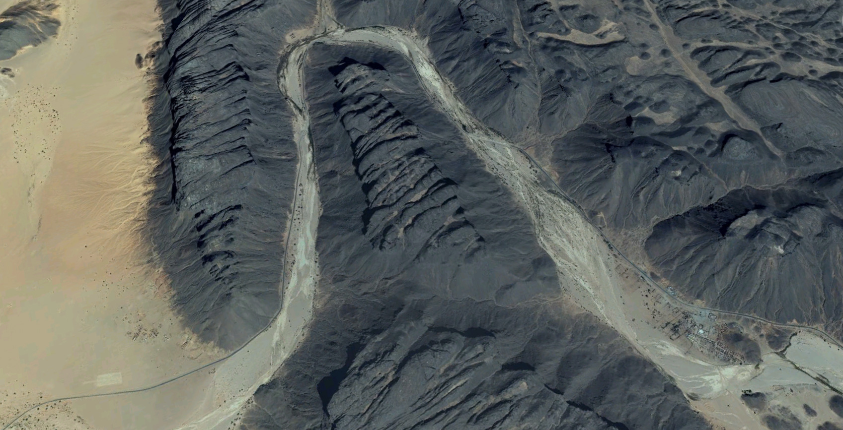
I carried on south, passing the denuded outliers of the Tademait plateau. The old fuel station in In Salah was always fighting to keep its chin above the sands, and I pulled in to fill up for the next stage: 270km along the Trans Sahara Highway to Arak Gorge with not so much as a well on the way.

A short distance out of town I passed another fallen truck, as I’d done near here in 1982 in the XT, only that time it was flat on its back with its wheels were up in the air.
As before, the road perfectly flat and straight. You presume the driver had dozed off in the heat of his cab and jack-knifed.
It’s not the greatest picture I’ve ever taken but you’ll notice there’s someone camped by the truck – maybe the driver. He’s watching the wreck so it doesn’t get stripped bare before someone comes along with whatever it takes to get it back on its wheels.

Time for a quick pose why not. Young kids these days think they invented self obsession and selfies! We were doing that years ago! And probably our parents before us, if they had a camera.

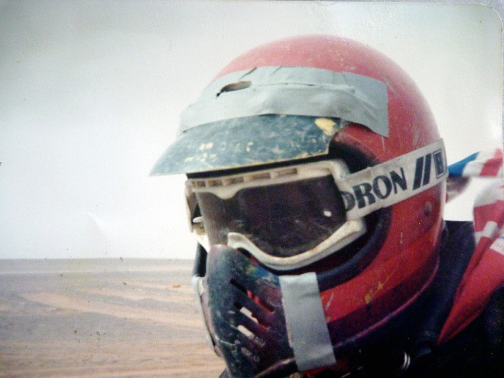
I liked my trusty Bell Moto 3 but I’m sure glad I never had a crash in it. The padding inside was about as inviting as the inside of a cylinder head. I also see I’m wearing a natty nylon British Airways cabin steward’s scarf picked up in Laurence Corner’s army surplus ‘boutique’ in Camden, just up the road from our Blooomsbury squat.

They say the Beatles bought their Sgt. Pepper outfits there, and the likes of, Adam Ant, Kate Moss (possibly still in nappies at the time) and Jean-Paul Gaultier (older, but probably also in leopardskin nappies) have all rummaged around in the junk at LC, looking for something to cut a dash. As trendy despatchers looking for the ultimate outfit, we did too, and I think the scarf was an impulsive £1 purchase.

Back to the desert where the only fashion was to get from water to water before what you had ran out. The low elevation hereabouts meant it was becoming exceedingly hot. I’m guessing about 45°C or over 110 F.
That’s nothing unusual at these latitudes I’m sure, but I’d never experienced temperatures hotter than I was. I was being baked alive by the air I was riding through and so I wrapped up tight to keep the blast from turning me into a shrivelled Peruvian mummy.

In this pre-Camelbak era, every half hour or so I just had to stop for a drink. I was getting through water at a rate of 2–3 gallons (10+ litres) a day which was all I could carry. As I rode along, by the time I could stand it no more I’d feel the desiccation creeping down my throat, and realised how fatal dehydration actually gets you from the insides out as you helplessly breath in air at well over body temperature (36°C). It was clear that the survival manuals were right all along: without water or shelter, consciousness could be measured in a matter of hours in this sort of heat.

At one point I thought I simply must cool myself down and poured a helmet’s worth of water into my Bell and put it on. The delicious effect soaked down through my clothes with a steamy hiss, but half an hour later I was again throat-parched and dry as a roadside baguette.

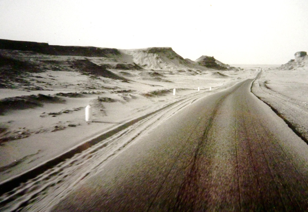
The Trans-Sahara Highway that had finally linked Algiers with Tamanrasset just a couple of years earlier was already breaking up, and in this heat, you could see why. Black tar which sizzled as you spat on it wouldn’t stand a chance as another over-loaded lorry hammered the scorching highway to a pulp. Diversions shoved traffic onto the sands so repairs could be undertaken, and I had my first chance to be forced to ride the Benele off road. All things considered it managed well enough, even with horsepower barely into double figures. The trials tyres and light baggage all helped.

Then, as I neared Arak something changed in the ride, the suspension seemed to tighten up. I hopped off, dreading some problem with the Honda motor which could surely not handle such heat for much longer. It was a simpering commuter hack brutally abused by being thrown into the deep end of a Saharan summer.
A quick look revelled the chain was as tight as a bow string. On this trip I was experimenting running a non-o-ring chain dry to avoid oily sand wrecking the seals. I can tell you now that was a bad idea. years later rode a BM in Morocco with an o-ring that got plastered in sand and even with daily oiling it needed adjustment once in 4000 miles.

Modern chains are incredible, but back then I was worried my hyper-taught chain and bouncing suspension – three times longer than any CD200 had imagined in its worse malarial dream – might rip out the engine sprocket and ping it across the desert floor. I soothed the creaking chain with engine oil and watched it sag before my eyes. Now it was way too slack but the AJS frame had some nutty eccentric swingarm pivot like 1970s Ducatis which was a faff to adjust in the state I was in.
I was out of water and the mercury was again pushing at the end of the dial. Just as I’d panicked when my XT500 had leaked away half its fuel on the way to Niger in ’82, I felt the compulsion to flee towards shelter so rode on to Arak just a few miles down the road, with a slap-slapping chain.

Relieved that I’d just caught the bike in time, I decided to remount the barred blacktop under repair to save any extra strain on the transmission. The gorge walls of Arak rose up ahead but then the tar suddenly took on a darker shine and I sunk into a sludge of thick, freshly laid bitumen as the gutless Benele lurched to a crawl. I yanked on the single carb to spur the slug onward, the tyres pushed a trench through the oily slush and bitumen sprayed across the mudguards with a clatter of sticky gravel. What a mess. I steered off the unset mush and continued to the roadhouse, hoping my tar trench would melt back smooth, like divided custard.

Now safely at the roadhouse I crouched in the shade clutching a drink and looked forward to a rest before the final stage on to the Cone Mountains, 100km down the road and just where the desert landscape begins to bet interesting. As I pondered my near miss with wrecking the bike, an army jeep pulled up, two guys jumped out and marched up to me.

‘Is this your moto?’
‘Yes.’
‘Why did you drive on the closed road!’
I may have pathetically tried to play dumb until they pointed our the sticky black splat coating the undersides of my bike.
‘I am sorry. I was panicking. You see my chain was…’
‘Did you not see the signs ‘Road Closed? and the stones blocking the road’
‘Yes. Sorry. Look I will go back and repair it myself’, I reasoned, thinking I could smooth it all back with a plank of wood.
‘Shut up! You will pay for this. Give me your passport!’

One of them snatched it out of my had and they stormed off back to the fort in a flurry of wheel-spin. The other people in the roadhouse looked down at me with the pity of one who was rightly in the dog house, gagged up and tied down. Another heat-frazzled wannabe adventurer disrespecting locals regs.
There began my three day ‘hut arrest’ in Arak.

Everything I had was hot all the time. Nothing had cooled down for days. As I unpacked my stuff I found candles had drooped into Dali-esque blobs and weirder still, opening a tin of luncheon meat or ‘Spam’, the contents poured out like water, flecked with pink particles of fat-saturated gristle. I’ve not eaten that stuff since!
I spent the days reading J. P. Donleavy or chatting with other similarly heat-struck bikers passing through, while dust storms periodically ripped through the gorge. By night it was just too hot inside the hut, so I slept outside in what little breeze there was.
Even then, I’d wake up once in a while with my lips and throat parched fit to crack, and struggle to remoisten my mouth from the water bottle.

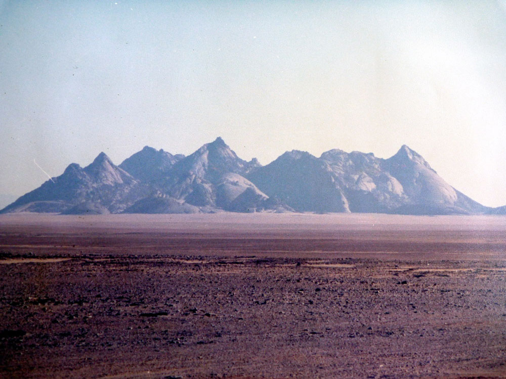
As the days passed I knew I was running out of time to visit my goal: the mini massif I now know as Sli Edrar (left).
Then one morning the jeep returned and my passport was returned with nothing more than an admonition no to do it again.
Ashamed of my stupidity, I’d got off lightly and vowed to oil the chain as often as it damn well liked.
I packed my ragged bags and set off on the 1000-mile ride back to Algiers port where a boat left in four days time

A day or so later I wasn’t feeling well. I got past In Salah and was lightheaded, stumbling and weak. Just up ahead was the climb back onto the dreaded Tademait plateau, not a place I wanted to tackle in the shape I was in. So halfway up the switchback climb I pulled off the road and crawled into the shade of a metre-high culvert.
What was wrong with me? I was surely drinking enough: 10 litres a day and a couple more by night. Then it struck me. Water was not enough. I needed to ingest salt and other essential minerals flushed out in my sweat which evaporated unseen. That must be it. I made myself a salty-sugary drink and lay back while it took effect, wary that this was just the sort of place snakes and scorpions might also like to pass a siesta.
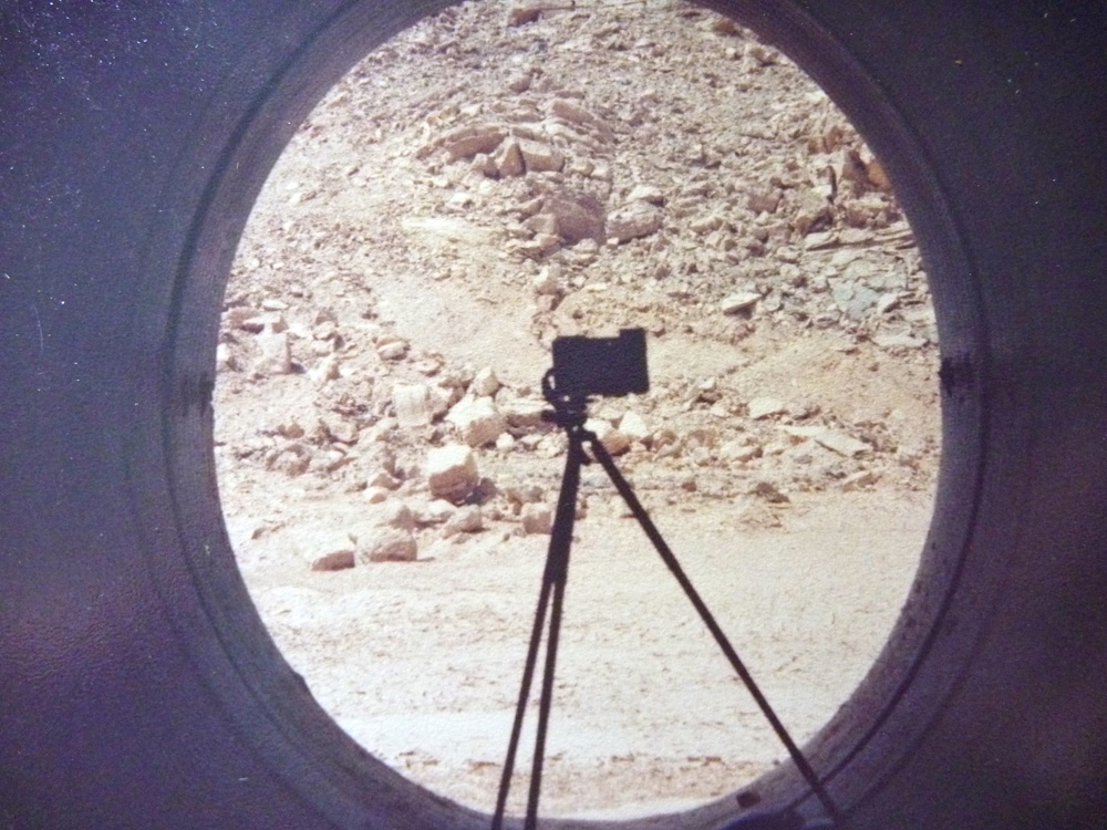
Despite, or perhaps because of my dozy state, I clearly thought a picture of my other camera on a tripod would be a fitting souvenir of my in-culvert recuperation.


The drink did the trick and revived and I set off across the Tademait, tensed up in readiness for something bad to happen – a piece of the sky falling on my head, perhaps? Nagging me were the 1100km that still lay between me and the Algiers boat that left in two day’s time. It was time to put some miles in.
For once the 400-km crossing of the the Tademait passed without event and which in itself felt creepy. I filled up in El Golea and another 250 clicks got me past Ghardaia, the gateway to the Sahara. Only now it was late afternoon, time for the headwinds to kick up. At times the feeble motor strained to reach 25mph while I crouched over the bars, crippled with stiffness, watching the odometer numbers click by in slow motion.

By now the UV had seen paper-thin Times delivery bag had fallen apart. I lashed it to the bike with a piece of plank and some nice 7mm climbing rope.
Around Berriane the wind sucked in a dust storm and visibility dropped to a few feet. I edged to the side of the road, wondering what would be thrown at me next and if I should get off the road altogether, not least because cars still rushed past me, confident that whatever risk they took, it was OK because All Was Written.
By Laghouat I’d caught up with myself and had taken a good 1000-km chunk out of the map. I unclawed my hands from the ‘bars and tracked down the only hotel in town. But the uppity ponce behind reception had no room for the likes of me, so I rode out to some edge-of-town wasteland more suited to my kind. As I slumped against a litter-strewn, shit-riddled ruin, an old guy living in a cardboard hovel I’d not even noticed hailed me over.

I’d never actually met a regular Algerian civilian before. He invited me in and we chatted as well we could while his unseen wife prepared a meal. He proudly told me how he’d fought in the recent Western Sahara war against Morocco (Algeria lost that one), and when the time came I was invited to sleep on his living room carpet.
Sadly, it turned out to be agonisingly flee-ridden and try as I might, I could not drop off as another bug took a jab. I moved out into the donkey yard but it was too late, the fleas had latched on and in turn went on to infest my lovely old mattress back in my London squat for many months. I did everything I could to delouse it, repeated dousing of flea powder and even gently torching it with hairspray and a lighter. But as the flames licked over it, those Algerian bloodsuckers just yawned and sharpened their mandibles. Eventually I had to chuck it.

Thanks to the killer, 12-hour, day from Arak, only 400kms remained. I was well on target for the boat the day after tomorrow,. After a week of relentless day and night heat, the temperatures finally began to drop as I rose back into the Atlas mountains north of Ain Oussera. Unready to face the congested capital, I bought myself a roadside melon and bounced over some roadside scrub down into a ditch, stalled the bike, and passed the night there.

Another big mistake. I’d carelessly left the ignition on (something I’ve caught myself doing since, when dirt camping). Next morning the battery was as dead as roadkill and, try as I might, no amount of jump starting could get the Benele going.

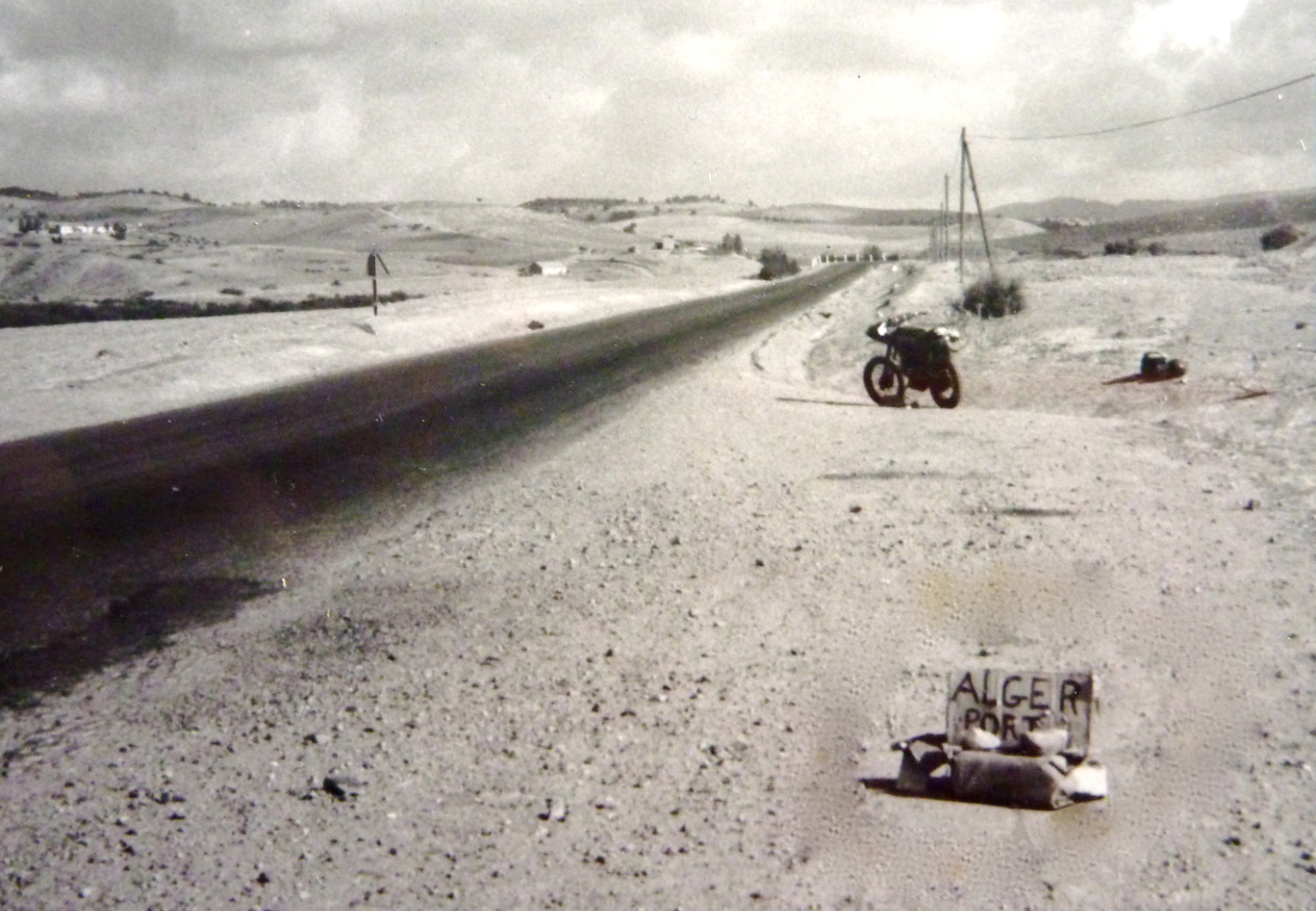
It was just 100km to the port and hours before the ferry left. I pushed the bike into a layby, made a sign ‘Alger port SVP’ and eventually two kind blokes responded to my plea and loaded the Benele into their pickup.
’What’s with all this tar all over the bike?’
Don’t ask, mon brave…
Following a battery acid transfusion and a cafe noire injection in Medea, I was good to go. I spun down the Atlas bends into Algiers and blundered my way to the port gates. I was late but so was the ferry.

Even today I can tell you: nothing beats the feeling of a ferry steaming away from a North African port. Did I say that already about the 1982 trip? Well it was even more true in 1984 and on most years since. Let Somali pirates steal us to their thorny lairs; let sudden storms hail down brimstone and flip the ferry. I was out of Algeria. Yippey–I-yay!

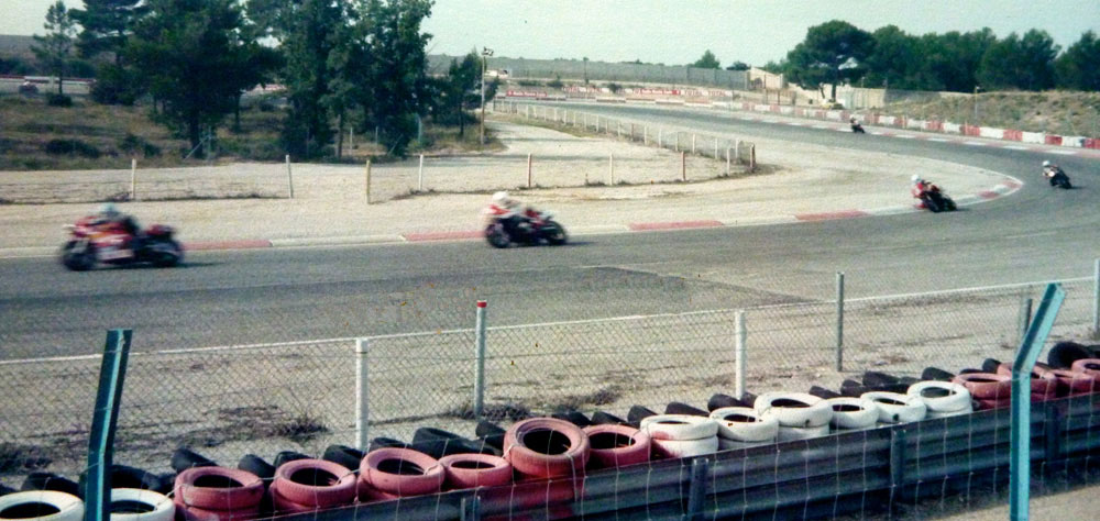
A day later the boat docked in Marseille. It was probably Friday, I had to be back at work on Monday. So I’m still not sure what possessed me to make a casual visit to the Bol d’Or 24-hour endurance race set for that weekend nearby, at Le Castellet raceway, except that Bike magazine had enshrined it as a biker’s rite of passage – France’s one-day equivalent of the Isle of Man or Daytona, as much a moto-carnival as a race spectacle.
I rode in and watched the 3-man teams flip their slick tyred UJM’s from bend to bend and also enjoyed some baffled looks at my odd bike, battle scarred from its recent desert detour. The trail-bike loving Frenchies who went on to buy more Ténérés than anyone at least would get some like Le Bénélé.

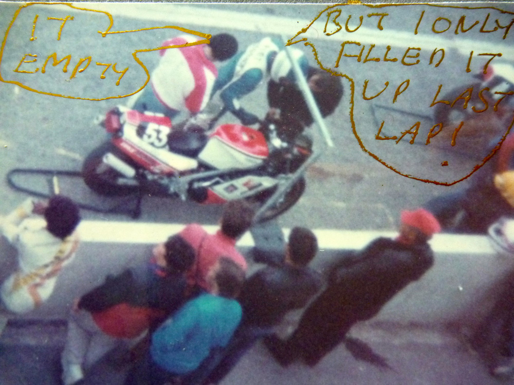
I even had the presence of mind to check out #53 on an RD500LC popping in for a fill up. I bet the team spent more time filling that tank than he did on the track.

But my abiding memory from the ’84 Bol was a vision of my desert biking future. In fact it was a future that was already two years old, and its name was Yamaha. XT600Z. Ténéré.
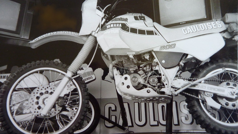
On the Sonauto Yamaha stand was TT-Z Dakar factory racer looking slick in the sexy, pale blue Gauloise livery which we never got in the UK. It has it all: 55-litre tank, discs all round, 12-volt lights and a side stand as long as a pool cue. Even if the road-going XT-Z was less extreme, what was not to like?
My Bénélé joke-bike had been a cocky imbecile’s two-fingers flicked at the Yam. Why? Search me but 30 years later I found myself engaged in a similarly pointless project.

More pix of that bike – or one just like it – here

OK, I concede. The Tenere ticked all the boxes, but it had been fun doing it my way. I’m sure there’s some pithy Armenian proverb that spells it all out, something like:
‘The eagle never lost so much time as when he submitted to learn from the crow‘. Actually that’s William Blake as quoted in Dead Man movie.

Anyway, a Tenere could (and did) come later, right now It was time for the final haul, another 1100 clickety-clicks to Calais and a boat back to the UK.
I spent that night in some slug-riddled fores and Sunday morning saddled up bright and early to get a good run up for the ferry ramp. Tonight I’d be back home, but as I’ve learned so well over the years: it’s never over till it’s over.
I don’t know where I was – the middle of France somewhere – but within an hour or two of setting off a slate-grey death cloud crawled up onto the horizon, unzipped itself with a shrug and proceeded to empty its bladder straight in my face. My desert desiccated leathers soaked up what they could, before dutifully passing it onto my next layer of clothing, until within just a few minutes I was a sodden spongebag of saturated rags.

Splashing through a village, I overcame my reserve, swung into a farmyard and rode the bike into a barn. Inside was an old steam powered lettuce thrasher. There I slumped, dripping on a workbench, exhaustion welling up from the previous fortnight’s moto mania. I was dropping off and ready to tip over in a heap when the farmer wandered in and said coolly:
‘Fatiguée, eh?’
Damn right mon ami.
I perked up with glazed eyes and luckily looked the part of a road-weary, waterproof-scorning wayfarer, rather than some deviant trespasser. He let me be.

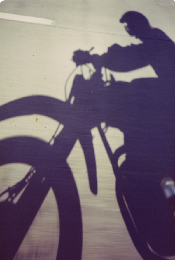
By late afternoon the P&O disgorged me at the end of the A2 which reeled me back into London. Spinning along at 45-50, clogging up the inside lane, I snapped this defiant shadow shot as I went by.

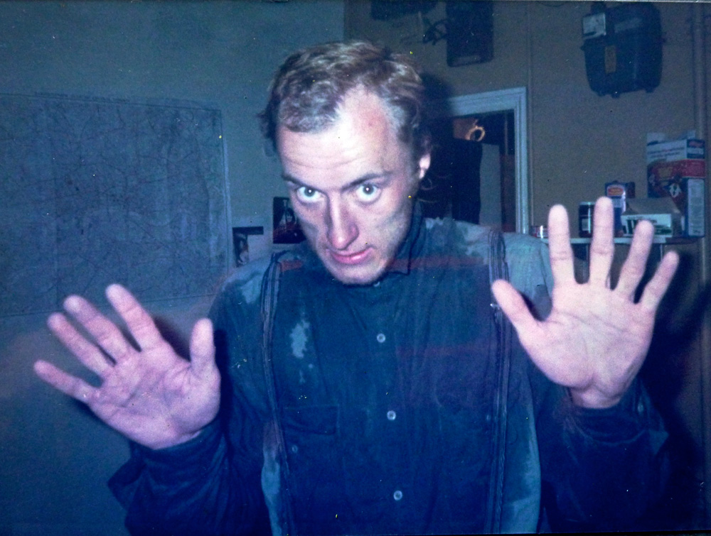
Back home, what the Germans call the durchfall began to form, as my shrunken stomach reacted violently with longed-for snacks. My drenched leather coat fell to the floor with a thud and I was surprised to see there were still dry patches on some parts of my clothes.
I had just enough energy left in me to glare at the camera and snarl like an alcoholic on New year’s Day:
No more sodding motorbikes! Ever again!
Well, not until 8am tomorrow, that is.

Buy Desert Travels 2021 on Amazon

Desert Travels • Bénélé 1984 • Part 1

Desert Travels Index Page

Buy Desert Travels 2021 on Amazon

This is part one of a bonus chapter which does not appear in the book.

You’d think I’d have learned something after my 1982 Saharan fiasco on the XT500. Well I did. Despite it all, I was still fascinated by the Sahara and wanted to go back and do it properly this time. When it was good it was epic and other-worldly, and if you came from one of the less edgy suburbs of South London, the Sahara made quite an impression: nature stripped back to its raw bones of sand and rock. Across it lay the frail ribbon of road they called the Trans Sahara Highway which I’d ridden off the very end of a couple of years earlier on the XT.

By 1984 I’d settled for an easy way of despatching for a living: working long but steady hours for a London typesetting outfit, delivering advertising copy on the one mile between Holborn and the West End. (You can read all about that and a whole lot more in The Street Riding Years.)
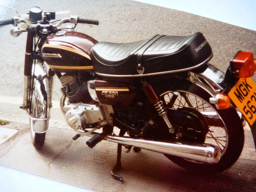
There was no longer a need to ride an IT250 or a 900SS should you get sent to the other side of the country on a wet Friday evening. For this job a dreary commuter bike was sufficient. And none came drearier than Honda’s CD200 Benly twin (below left), a single-carbed commuter ridden by stoical Benlymen. Riding up to 12 hours a day on a hyper-dull CD can drive you a bit crazy at 24 years of age.

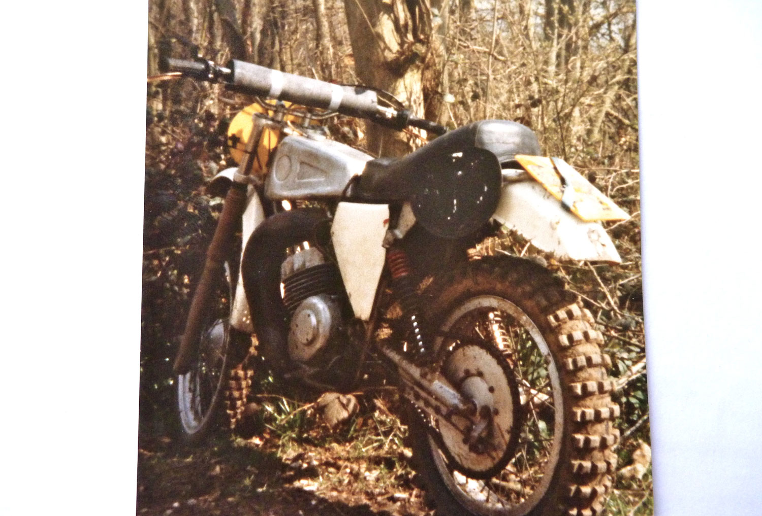
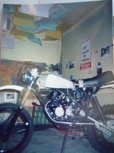
Knowing I was into dirt bikes, a mate put me on to a mate flogging an AJS 370 Stormer (right) for fifty quid. The Stormer was a vile, shin-kicking British two-stroke motocrosser that was the polar extreme of the Benly. In a flash of brilliance which years ago had given birth to the Triton cafe racer cult, I figured I could marry the two and make something more desert rideable and less boring: a Benly-engined, MX-framed desert racer!

Over the summer of 1984 the machine took shape in my artfully appointed bike design studio in London’s literary Bloomsbury district. It took two goes to get a bike shop to correct the engine alignment mistakes of the former. But here it was, suspended by some Honda XL250S shocks as long as truncheons, and silenced by VW Beetle tailpipes, a cunning, lightweight trick you may recall from the BMW I rode with in Algeria in 1982.

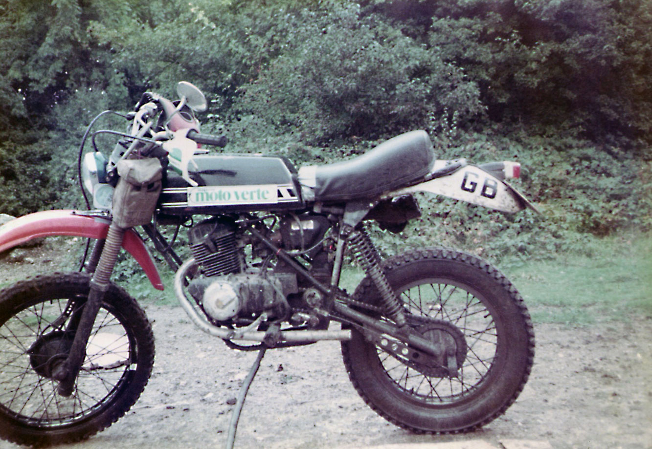
Later on, the job was finished off with gearing more suited to horizontal applications, and an RD250 tank with a sexy ‘Moto Verte’ sticker so there’d be no mistaking what an international, Franchophilious guy I was. I took it out to the woods near Addington to see what it could do.
The answer was similar to dragging a dead dog around on a lead. The VW pipes reduced the power at the rear wheel to quite possibly single figures. The foot of clearance needed a running jump to get on the bike. And the AJS conical hub brakes where a requirement by the then powerful Ambulance Drivers’ Union to ensure their members were never without work scraping Stormer riders off the sides of buildings.

I dubbed the bike a ‘Bénélé‘ in envious recognition of Yamaha’s near-perfect XT600Z Ténéré which I’d spotted in a Sydney bike shop a year earlier, and which was itself based on Yamaha’s Dakar Rally desert racers. More about them, later.

So what do you do with a dumb-arsed desert racer? You ride it to the Sahara of course, in a little less time than was available. You pack a 3500-mile trip to North Africa into two-weeks and you schedule it for September when you imagine peak summer temperatures are on the wane. This time there’d be no fear of enduring the mid-winter transit of Europe and the northern Sahara, as in 1982.

My goal that year was a mysterious massif of conical peaks which I’d passed by, south of Arak on my way to Tamanrasset in 1982 and which I’ve since learned is called Sli Edrar.
The Bénélé’s top speed was no more than 53mph, and even at that speed it felt unsafe, should a squirrel run out in front of me. So to get a good run-up I rode straight from work on Friday night down to a mate’s in Canterbury, close to the port of Dover, ready to catch an early Dover ferry next morning.

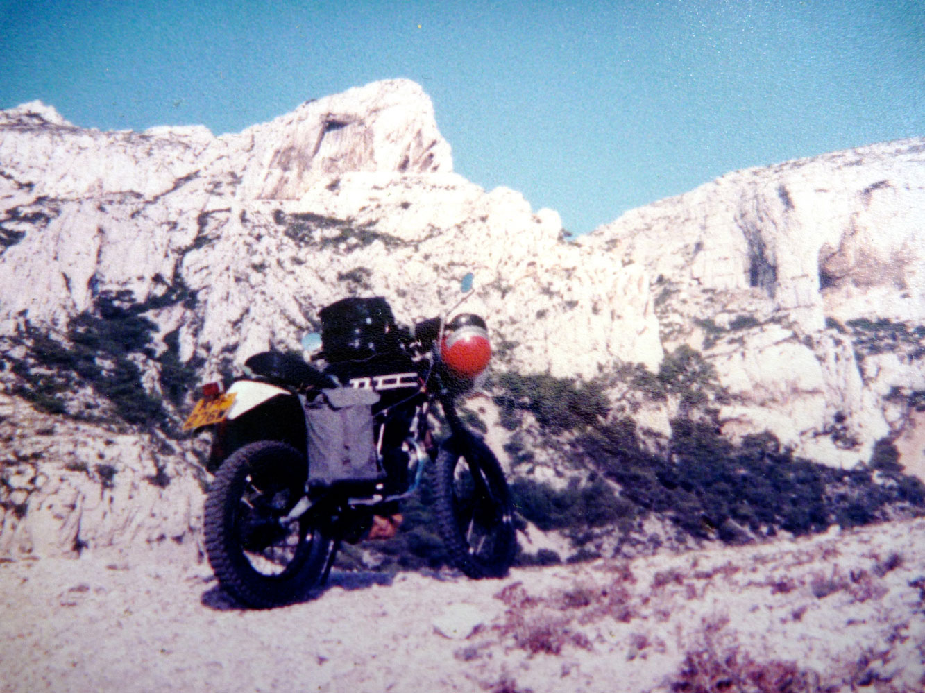
By maintaining momentum, Monday night found me camped back among the magical limestone outcrops of Cassis, near Marseille, ready to hop on the ferry to Algiers the following morning.

You can see I had an all-new soft luggage set up. No more sawn-off chemical tins poorly lashed to Dexion racking.
This time I had a small canvas pannier hanging on one side where a 10-litre jerrican slipped in; a thin cotton Times newspaper delivery bag dangling off the other with 10 litres of water, and an over-huge tank bag which sat on the flat-topped RD tank. A sleeping bag in front of the headlight – Easy Rider style – kept the bugs off the Benly headlight. Cunningly, I lashed a tool bag with other heavy items under the lofty engine. If my mass had been any more centralised I’d have become a Black Hole right there and then.

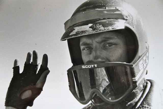
hi-res-c-scott-1984

My first memory of Algeria that year was being a little unnerved that as far north as El Golea it was already 35°C by 9am. If you live in Yuma that’s probably no big deal in September, but for a South London boy it was a bit of a shock.
I filled up in in town and set off across the Tademait plateau which had spooked me on my first transit in ’82. The town (or anything) was 400km away. I buzzed along at 9.8hp/hour and by early afternoon dust devils or mini tornadoes were whipping across the baking gibber to either side. I recalled how a mate said he’d been knocked off his XS650 by one in Turkey earlier that year.

I was already tired, thirsty, sore and hot when up ahead what looked like a huge wall of sand hundreds of feet high hurtled right across the blacktop. Only as I neared it did I realise it was the mother of all whirlwinds, a huge cauldron of rotating sand. I turned the wick up and and the motor droned as I punched the Benele into the sand wall.
Inside, all visibility was lost as grains pelted me from all directions and I struggled to keep upright or even know which way it was. And then, as I slipped into the windless eye of the maelstrom, the sand grains briefly turned into pelting raindrops. WT jolly old F was going on!? Search me but before I knew it, I’d blasted out of the tornado’s far wall, this time shoved left onto the roadside gravel. Now I knew how those roadsigns got flattened into the dirt…

Just as in 1982, the Tademait had terrorised me and I vowed I’d ride into the dark to be off the plateau before stopping. I rode into the dusk, pulling up briefly with the engine running to remove the sleeping bag off the headlight, before pushing on into the big switchback descent from the Tademait to the desert floor.

That night I stripped off and lay in the dirt by the bike, listening to what sounded like the oil boiling in the crankcases, hours after switching off.

I wasn’t hungry but I drank and drank and soon fell asleep where I lay. Tomorrow I was heading past In Salah, the hottest town in Algeria, before heading deeper into the Sahara.

Benele 1984 Part II

S is for Shell’s Guide to Sahara Motor Tourism, 1955

Part of the Sahara A to Z series

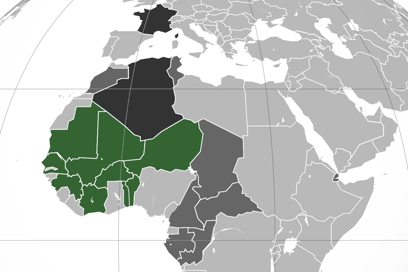
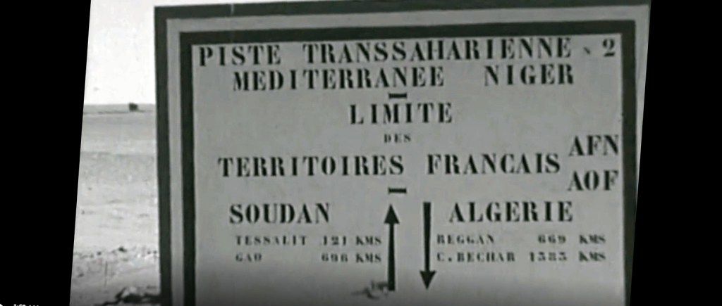
In the last decade of France’s colonial presence in North Africa, their part of Sahara was divided between three territories: Algeria, Tunisia and Morocco (‘AFN’), ‘AOF’ (French West Africa) from Mauritania to Niger, and ‘AEF’ or French Equatorial Africa which included present-day Chad.
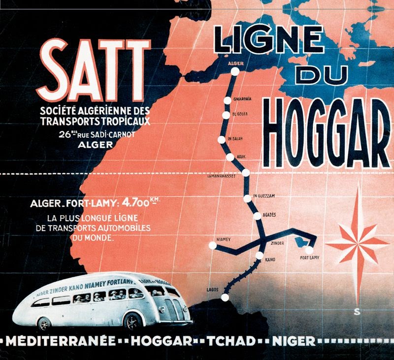
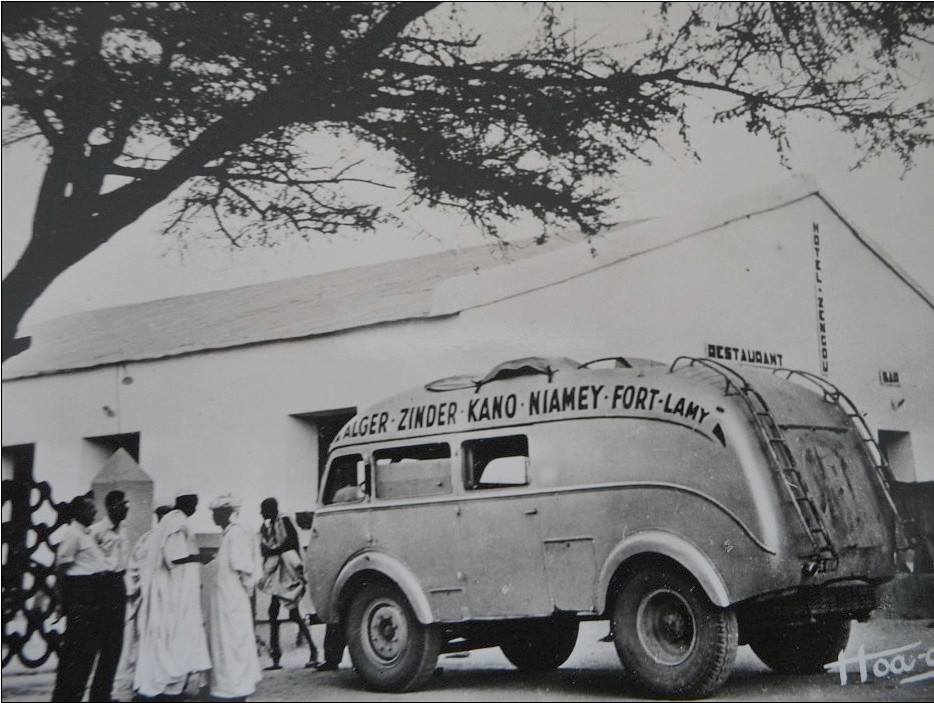
One could travel the pistes across the desert between the Mediterranean coast and the Sahel, and even scheduled bus services traversed these ‘Imperial Routes’ to the sub-Saharan capitals.

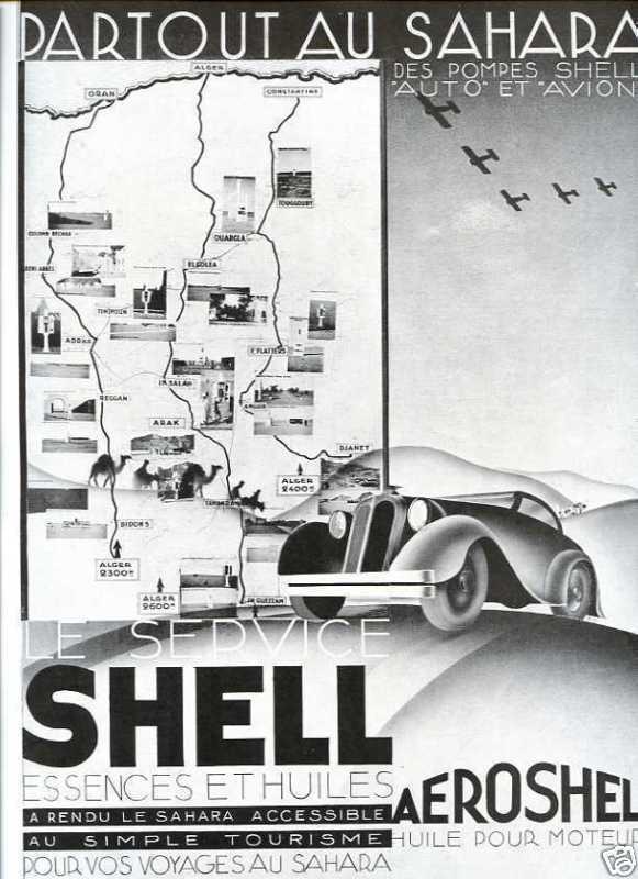
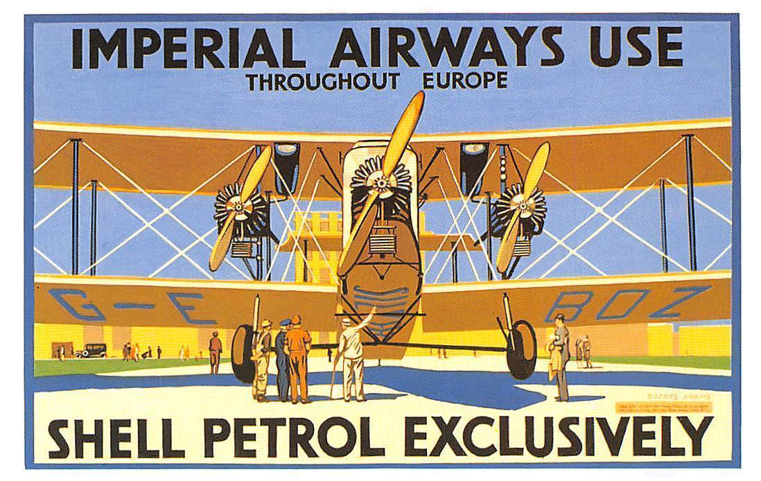
Pre-war editions were more aviation based

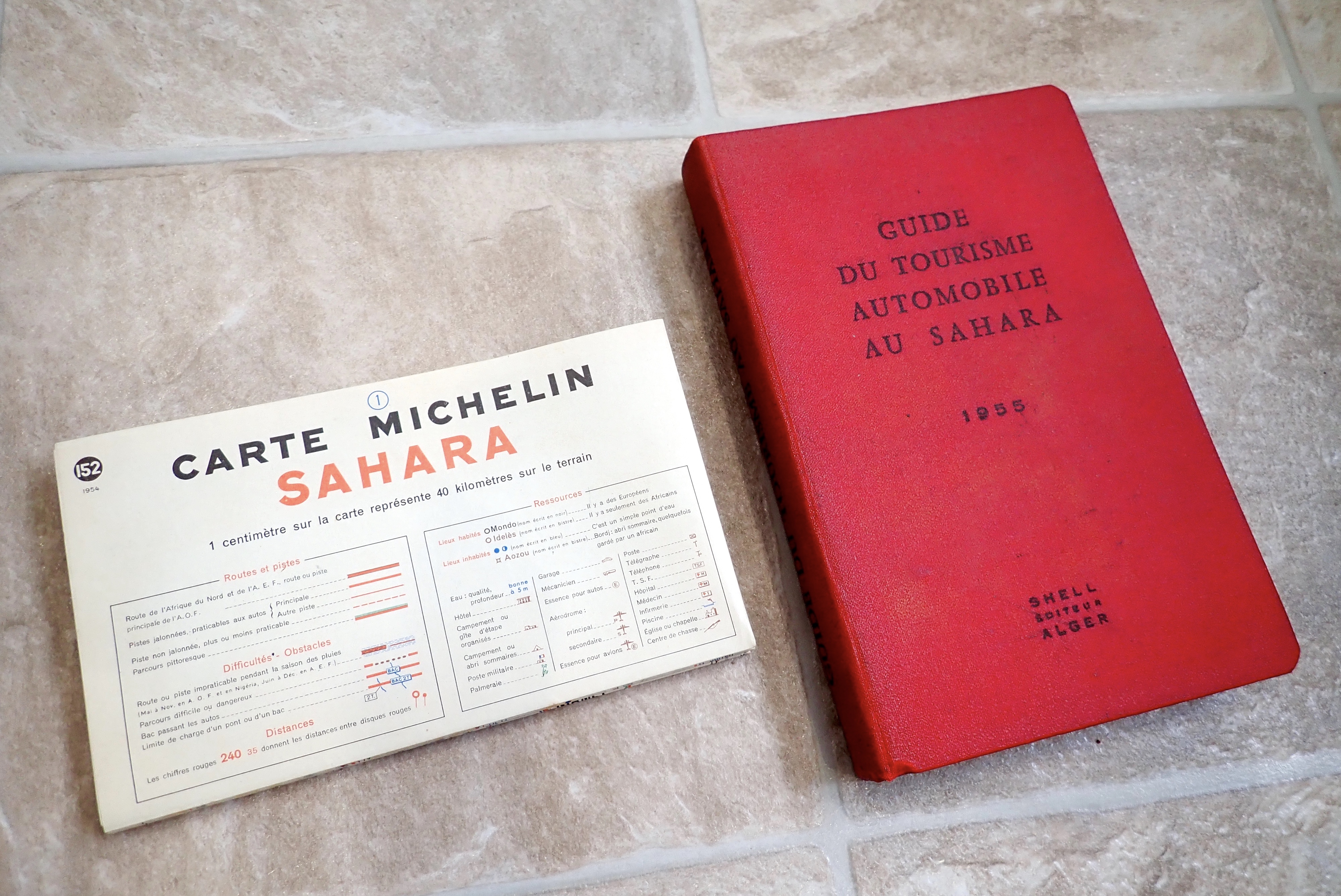
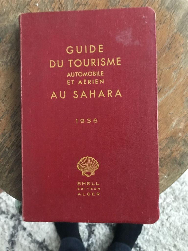
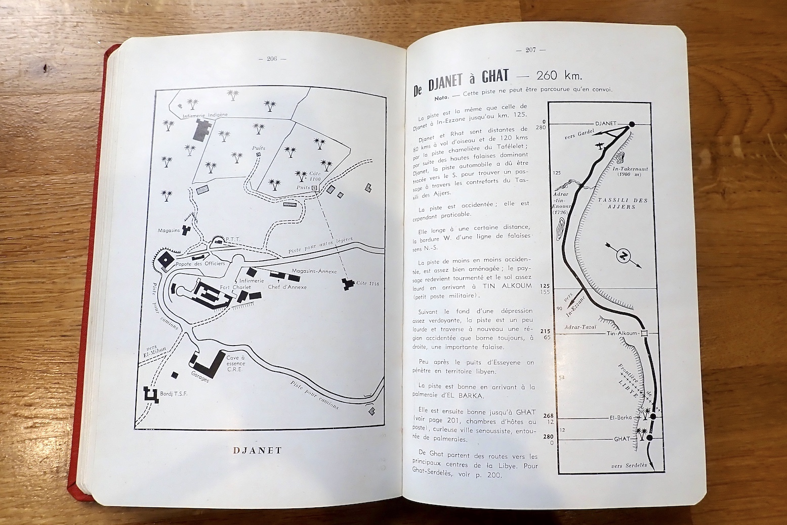
Just a couple of years before these colonies were dissolved and became the independent countries we know today, Shell released its fifth and final edition of the Guide du Tourisme Automobile au Sahara. The 345-page book is in French and there are still plenty around; mine cost me €25 from France, althpugh make sure you get the lovely map inside the back cover sleeve.
Originally published way back in 1934 (link to pdf) and just seven years after Shell started distributing fuel in Algeria, it must have been the first guidebook of its kind, preceding my own Sahara Overland by nearly seven decades.

The three pre-war editions (1934-5 pdf; 1936 below and 1938) were thinner books but also covered aerial tourism: fuel and landing strip information. Perhaps back then private planes were still seen as comparable or superior to with cars for getting to remote places. By the mid-50s commercial flying had taken off across the world, and flying around the desert was no longer a thing, unless you were very rich.

Even if it was nothing more than fully funded exercise in self-promotion, it’s still odd that an Anglo-Dutch oil company produced such a presumably prestigious project to showcase an important French colony, especially as it had the feel of an official handbook. In the 1930s Shell became well known for their illustrated guidebooks to Britain; perhaps publishing was not a thing that interested French oil companies like Total and Elf. Only Shell produced guidebooks, although road maps were widely branded by some of the oil companies of the era.

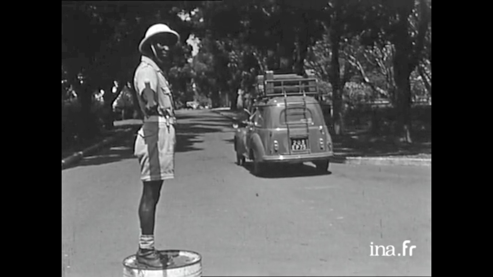
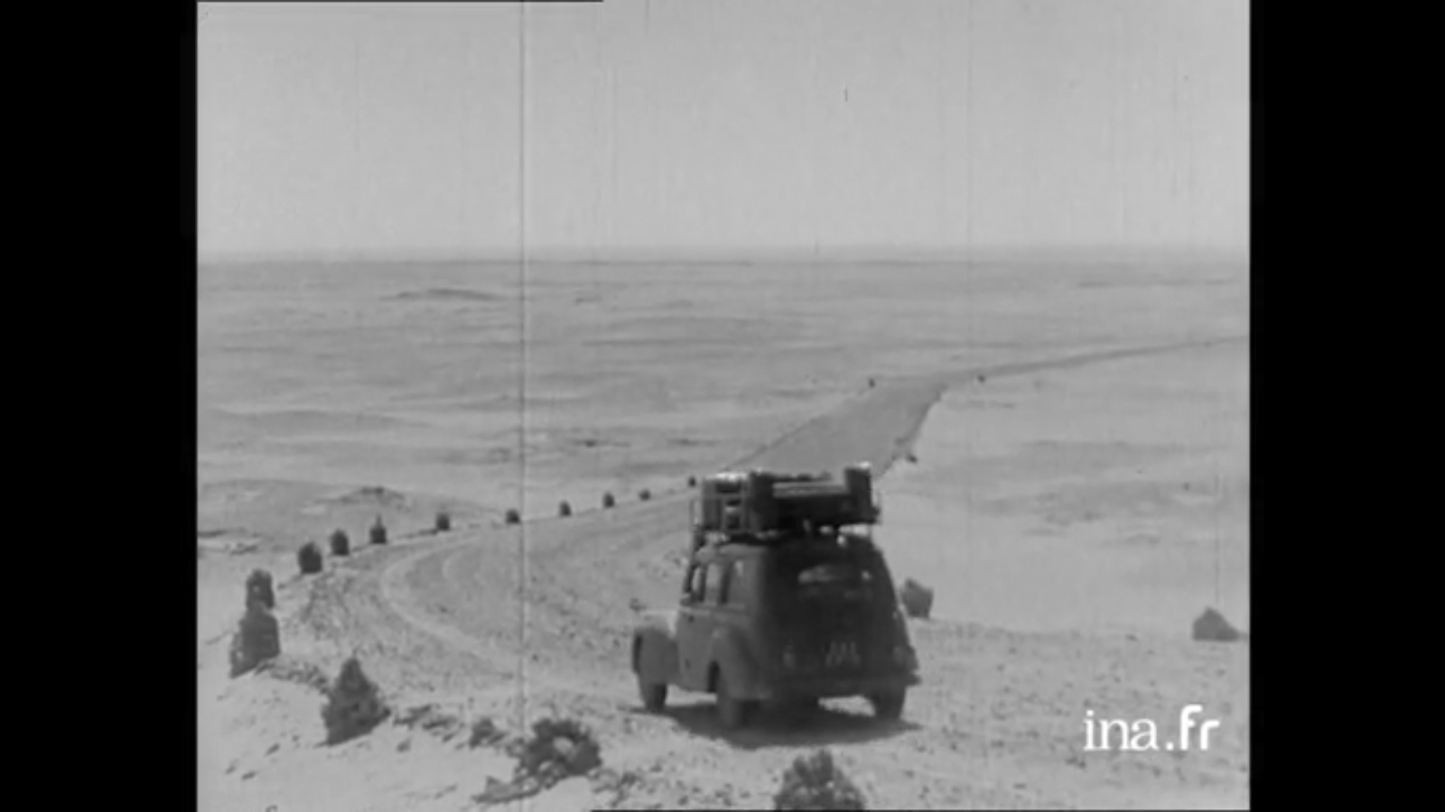
You can imagine the three French women (France Degand, Janine Delbert and Michèle Cancre d’Orgeix) had a copy of a Shell in the glovebox of their Peugeot 206 wagon before setting out their double crossing of the Sahara in 1956 (video below).

https://player.ina.fr/player/embed/CPF86641516/

The 1950s were the apogée of the colonial era when, even in the Belgian Congo, trains ran through the jungle on time and roads drivable by regular cars snaked over the equatorial escarpments.
In the Sahara pistes were well maintained, regularly patrolled and for the most part, well marked too. The Sahara still had its rough edges and expansive voids, but had been effectively tamed by the colonial administration, including a desert-wide network of Shell stations: ‘In the Sahara, as in your garage‘ the guidebook boasts.
It was the vestiges of this investment in desert infrastructure which we inherited in the 1970s and 80s by which time the whole region had seen 15-20 years of independent rule. The Shell emblem was long gone, replaced by nationalised fuel companies distributing the commodity with had become integral with global progress and development.

The Guidebook

Until 1939… the book starts… conditions for the harmonious development of winter tourism were coming together in the Sahara. Excellent temperatures, admirable sites, distant horizons, interesting populations, verdant palmeries [and] distinctive architecture: behold the country.

It then goes on to introduce the Sahara, using a flowery style which I’ve seen in more recent French guides to the Sahara. The book doesn’t miss a chance to include an exposition of the magnificent French achievements in the Sahara since 1919.

A year after this edition was published, after decades of searching (during which time French explorer and geologist Conrad Killian mysteriously met his death) prospectors finally struck oil in Edjeleh near In Amenas, and a short time later in Hassi Messaoud. By the end of the next decade Algeria became a major oil producer in North Africa.

It’s interesting to see how the content of the guidebook conforms with a modern day equivalent: a geographical breakdown of the desert’s geology, relief and topography, river courses and wells; ethnicities add up to either Arab or Berber, with pre-colonial history leading to exploration, colonisation and pacification right up to the period of the automobile and the aeroplane.

Short sections cover local artisans and the souvenirs they made, a bibliography, recreation and sports and not least hunting for hides, heads, horns and ivory. Happy days!


As for vehicle choice, the guide advised not to worry about using touring cars, by which I think then meant a regular RWD sedan or estate, like the Peugeot 206, above. Rightly it said the 4x4s of the time: Land Rover, Jeep, Willys and the near identical Delahaye V.L.R were significantly less comfortable.

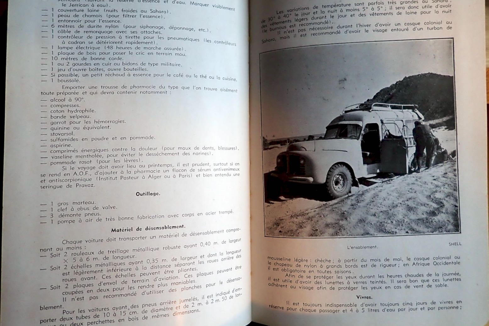
It’s worth recalling that many regular cars of that era had bigger wheels and better ground clearance – garde du sol – ‘an important factor in vehicle choice‘… ‘Consider fitting bigger tyres, but not too much or you’ll stress the transmission and steering.’ ‘Power to weight is also a factor for tackling soft passages.’ …’avoid dual rear wheels…’ It’s interesting to see all these strategies were well known, even back then. It does however list a long and very heavy list of spare parts. Durability must be one thing that’s improved over the decades. In a way today’s SUVs have similar characteristics, but of course no one would consider taking one somewhere as outlandish as the Sahara, not least because 4x4s have improved to become much less utilitarian.

Code Saharien de la Route
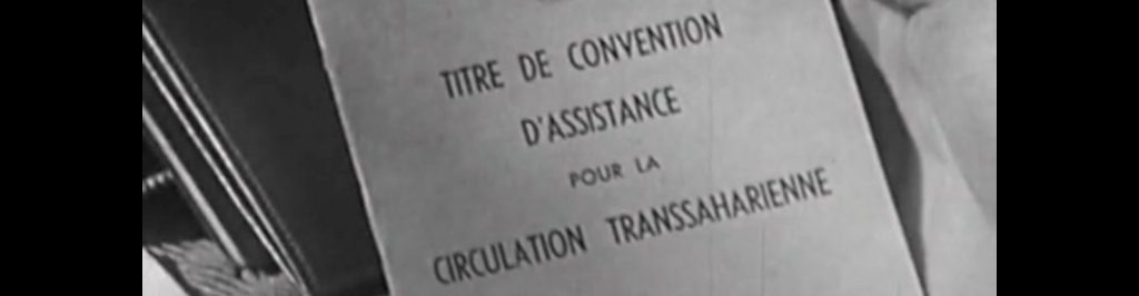
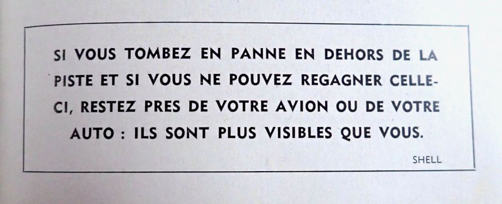
In that time of French control a detailed list of safety protocols needed to be followed before before setting off along a piste. ‘Pour votre securite‘ as they used to say to us in Algeria where the system endured into the 1980s (but without any actual back-up or support; you were on your own). The Code was a check on whether you were equipped to tackle what lay ahead, followed by the requirement to check on on arrival. If you followed the rules and were overdue, they’d come and look for you. You also needed some sort of contract with a local recovery service in case of a breakdown. The last 40 pages of the book detail the full list of these requirements for each of the three territories.

The Itineraries

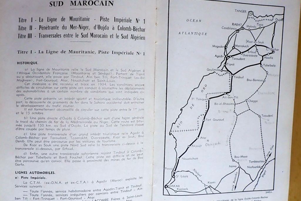
The route guide breaks down the Sahara into four sections: southern Morocco along tracks which are now mostly roads. Then came the grandly named Imperial Tracks, starting with N°1: the Mauritania Line (above) which was recently reopened by Algeria. Back then, this was the direct route through all-French territory from Tiznit in Morocco or Colomb Bechar in Algeria, to St Louis or Dakar which circumvented the Spanish Rio de Oro colony on the Atlantic coast. Closed between June and mid-October, this was also the ‘Forgotten Path‘ which David Newman followed in his Ford Corsair touring car in 1959, just as the territories were breaking up.

The route description for the 2550km from Tiznit to St Louis goes on for 15 pages including a few photos and plain maps. It left Moroccan territory south of today’s Foum el Hassan, a small town between Akka and Assa on what I call the Desert Highway in the Morocco guide. I noted a passing reference to ‘Merkala‘; an escarpment watchtower marking the border between Morocco and Algeria which still survives as the enigmatic ‘Tour de Merkala’ on the Michelin 741 map.
In Tindouf we learn that prior to the French establishing a garrison in 1934, the settlement, had been abandoned for three decades due to persistent raids by the nomadic Reguibat. The Berbers must have welcomed a bit of law and order.
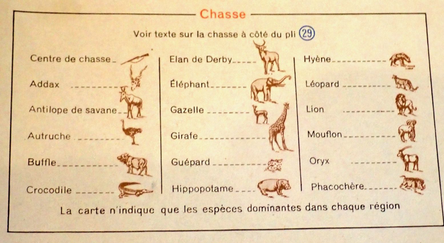
From here the lonesome track led to Ait ben Tili on the Spanish Sahara (today’s PFZ) border, with balises (marker posts) every 5km, but plenty of tole ondulee: ‘corrugated iron’ or washboard/corrugations to you and me. Like today, there’s nothing much for the traveller at AbT. Back then wild game added up to gazelles and long-gone ostriches. Once you got to Fort Trinquet (Bir Mogrein) you could add moufflon and leopards to that list.

From here it was 405km south to Fort Gouraud (Fderik) and the piste was poorly marked, sandy and rutted. The old route ran for another 310km from Fort Gouraud via Char fort to Atar didn’t get any less sandy, and the iron ore railway was still another 8 years away. Maybe a touring car, even with good clearance, wasn’t such a good idea after all.

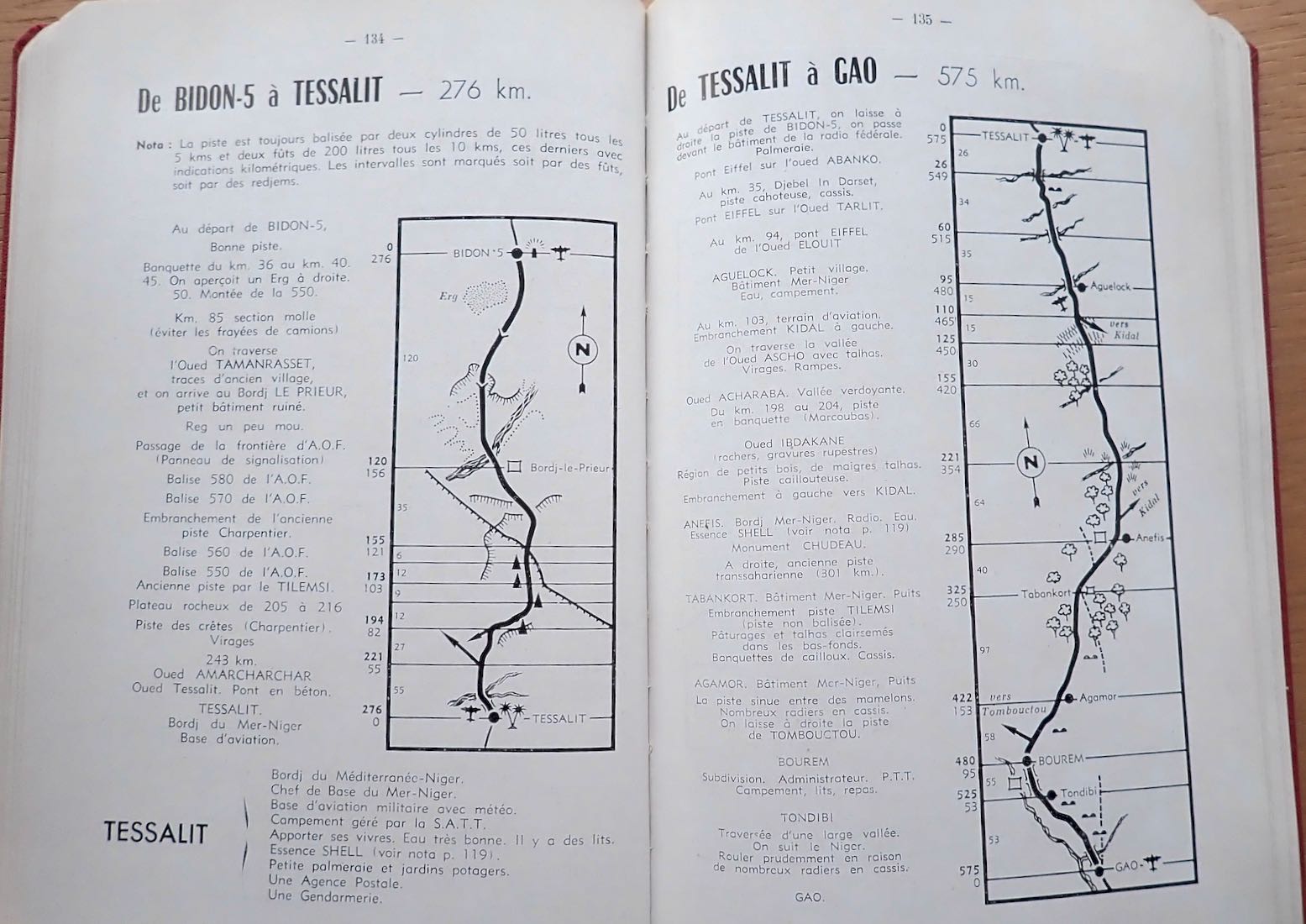
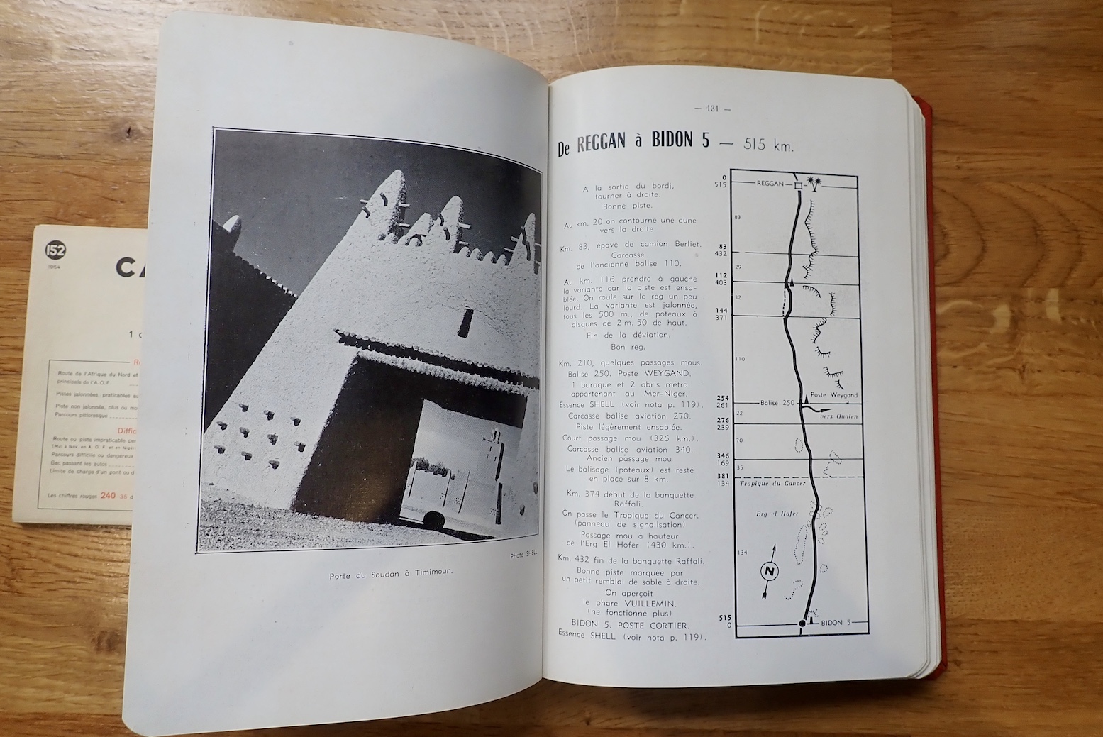
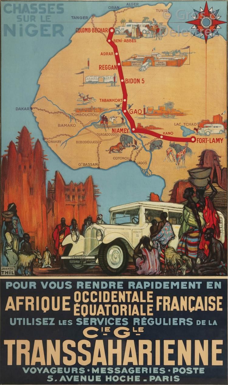
Imperial Track N°2 was the Tanezrouft Line from Colomb-Bechar to Gao on the Niger river. This was the route chosen by the first cars to cross the Sahara in the early 1920s. It’s interesting to see how quickly the commercial drive towards tourism follows what was once terra incognita. You could say we’re seeing the same today in space; something which would have been hard to imagine in the middle of the Apollo programme.
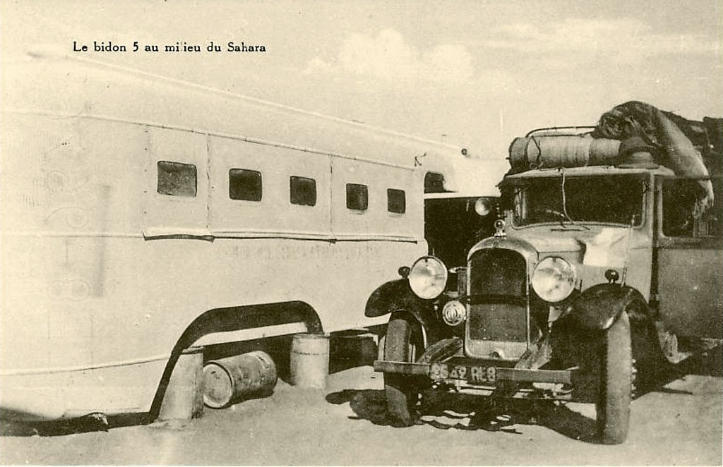
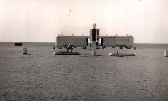
It was on this desolate route that Bidon V (‘Oil drum 5’, below) made a name for itself as a desolate travellers way-station between Reggane and Tessalit in present day Mali. At one point the lighthouse shone into the night, planes could land for a refuel and a couple of bus bodies where parked up on oil drums to provide lodgings for passengers the Mer-Niger bus route.

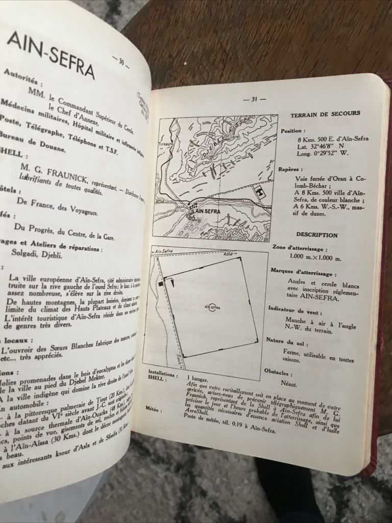
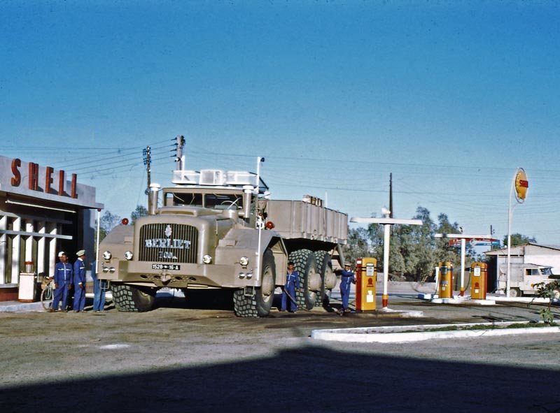
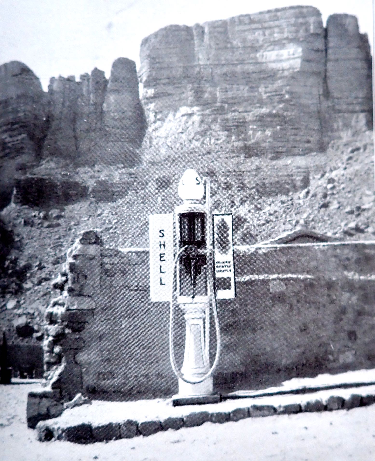
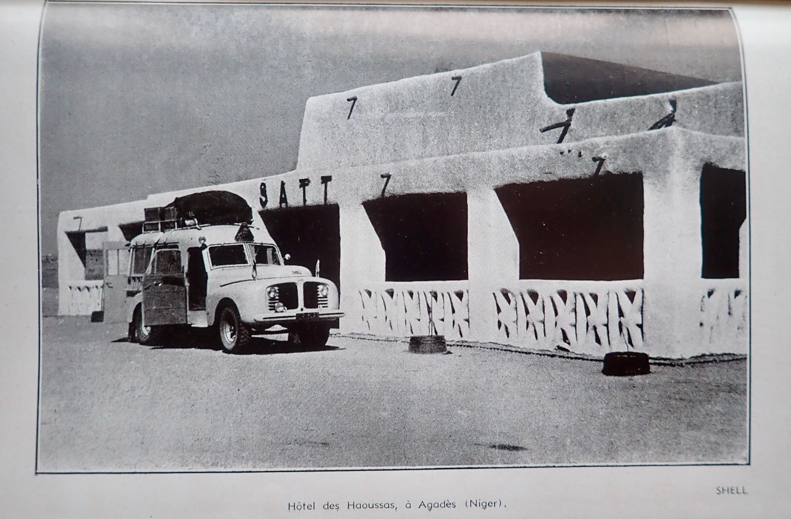
The book continues with other well known routes in the Algerian Sahara, though not exactly what we have today. Imperial Route 3; the Hoggar Line – today’s Trans Sahara Highway – ran further east between El Golea to In Salah, and again on to the Arak Gorge where a friendly Shell bowser (left) stood by at your service.

From Tamanrasset, excursions up to Assekrem along today’s route were already established (fold out map included), and the now paved track to the border via Laouni was the same, but once in AOF, the track went straight to Agadez via In Abangarit to the south. It was on this route that the drama vividly described in Trek, met its climax. There was no Arlit until uranium was discovered there about 15 years later. Zinder, close to the Nigerian border, was the end of that road.

The Ajjer and Tibesti Line was Imperial Route 4: from Biskra all the way to Fort Lamy (N’djemana) in Chad. From Djanet the route dropped down to Bilma, the long established administrative capital of the eastern Tenere, before you back-tracked north to Seguedine to head east for Zouar, Faya and even Fada before turning down to Abeche and Fort Lamy. This was the route which the lavishly equipped Berliet expeditions of 1960 sought to open up for trade, just as France’s overt control over the Sahara slipped away.

Back then getting to Djanet meant dodging the Fadnoun Plateau (Tassili N’Ajjer). From Fort Flatters (today’s Bordj Omar Driss) you headed out over the sands southwest to Amguid, then southeast along the base of the plateau. Right up to the 1980s this was truck route to Djanet until they sealed the winding road over the Fadnoun which to this day still catches some truckers out.

If you could get to Fort Polignac (Illizi), a car route did actually cross the Fadnoun. You left Polignac to the east then either pitted yourself against the very sandy Imirhou gorge (left) , or all the way to Tarat fort on the Libyan border, before turning south to join today’s route at Dider.
On bikes for Desert Riders in 2003 (the full movie is on YouTube), this was a tough but epic ride across the tumbled escarpments of the Tassili which took us two hard days. But the time we reached the final descent from the plateau at the Tin Taradjeli Pass, we couldn’t wait for the sands of the wide open Tenere.

From 1943 up to 1951 the French administered the Fezzan province of Libya and may have had had hopes of annexing it. But by the time this edition was published, growing calls for independence put an end to that idea. Meanwhile. the northern deserts of Chad remained as obscure and little visited as they are today.

The Map

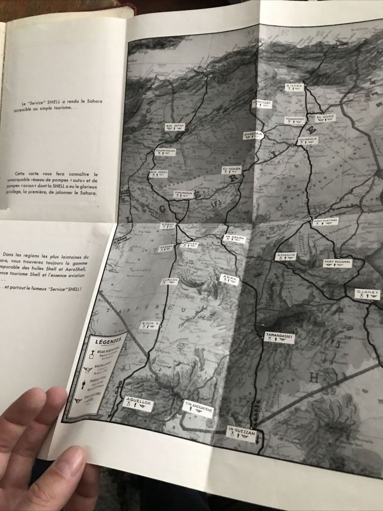
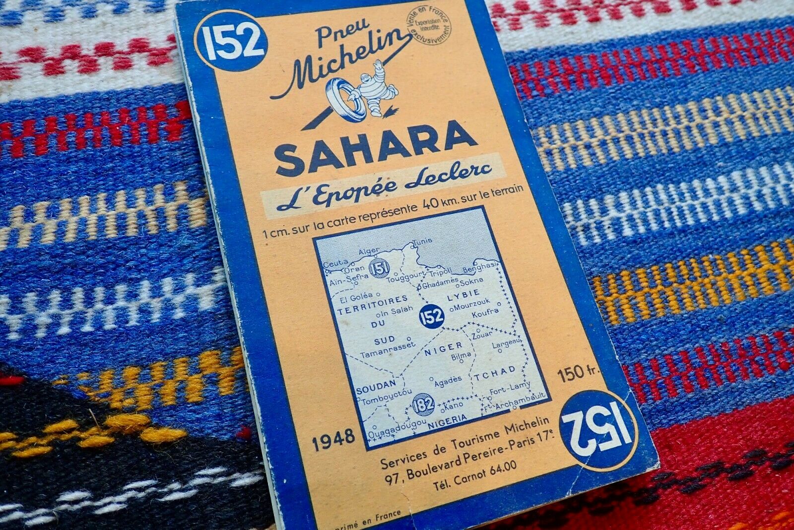
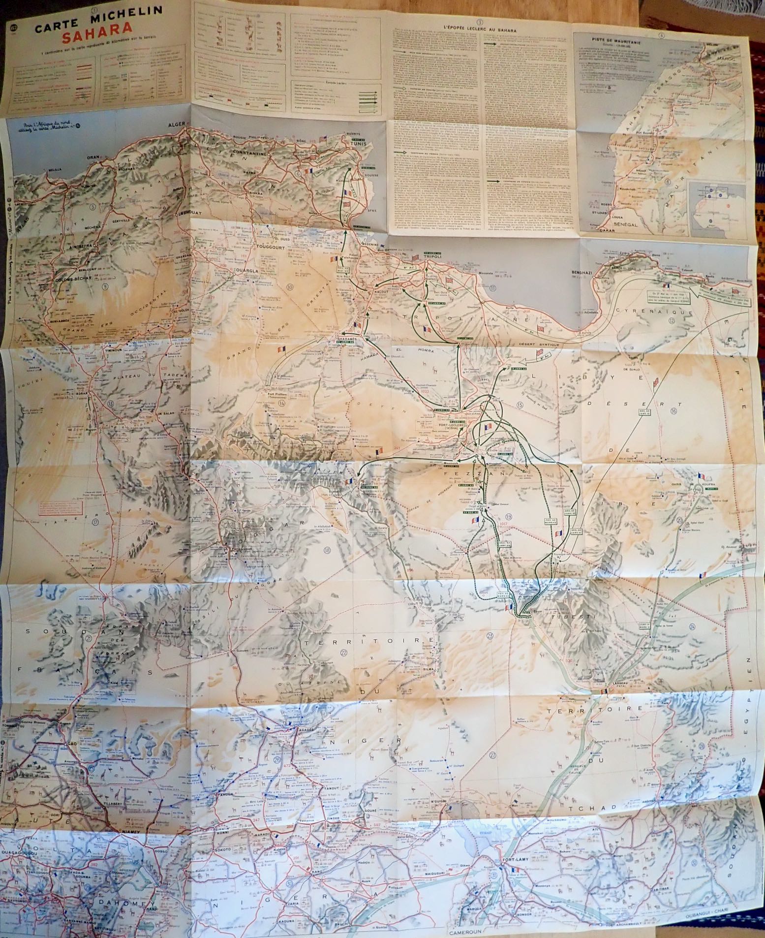
The Shell guide includes a 1:4m scale map folded into the back cover. It’s more or less Michelin’s 152 of 1948 which to some may alone be worth it the price of the guide.
It doesn’t have the full coverage of the 153 North & West Africa which came later, but shows the routes described, and much more. This detail has long made the Michelin map indispensable in the Sahara, even if it is a rather skimpy navigation aid to setting off along one of the Imperial routes.
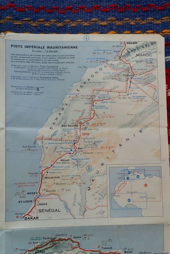
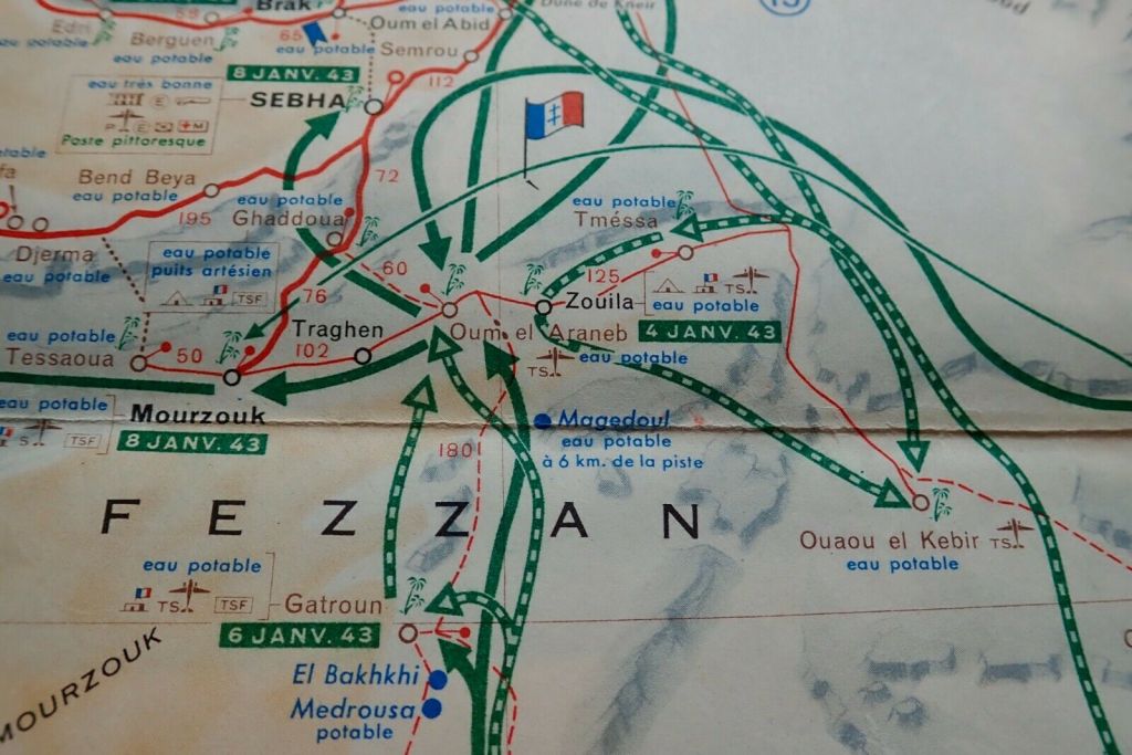
The Mauritanian Line gets a 1:9m inset (below left) while in Libya (never a French territory) the map proudly shows the routes of General Leclerc’s desert campaign during WW2 which ended in the famous raid on Murzuk in co-ordination with the Long Range Desert Group.

‘C’ is for Chocolaterie Aiguebelle: a vintage Map of the Sahara

Part of an occasional series: Sahara A to Z 

See also this
And this

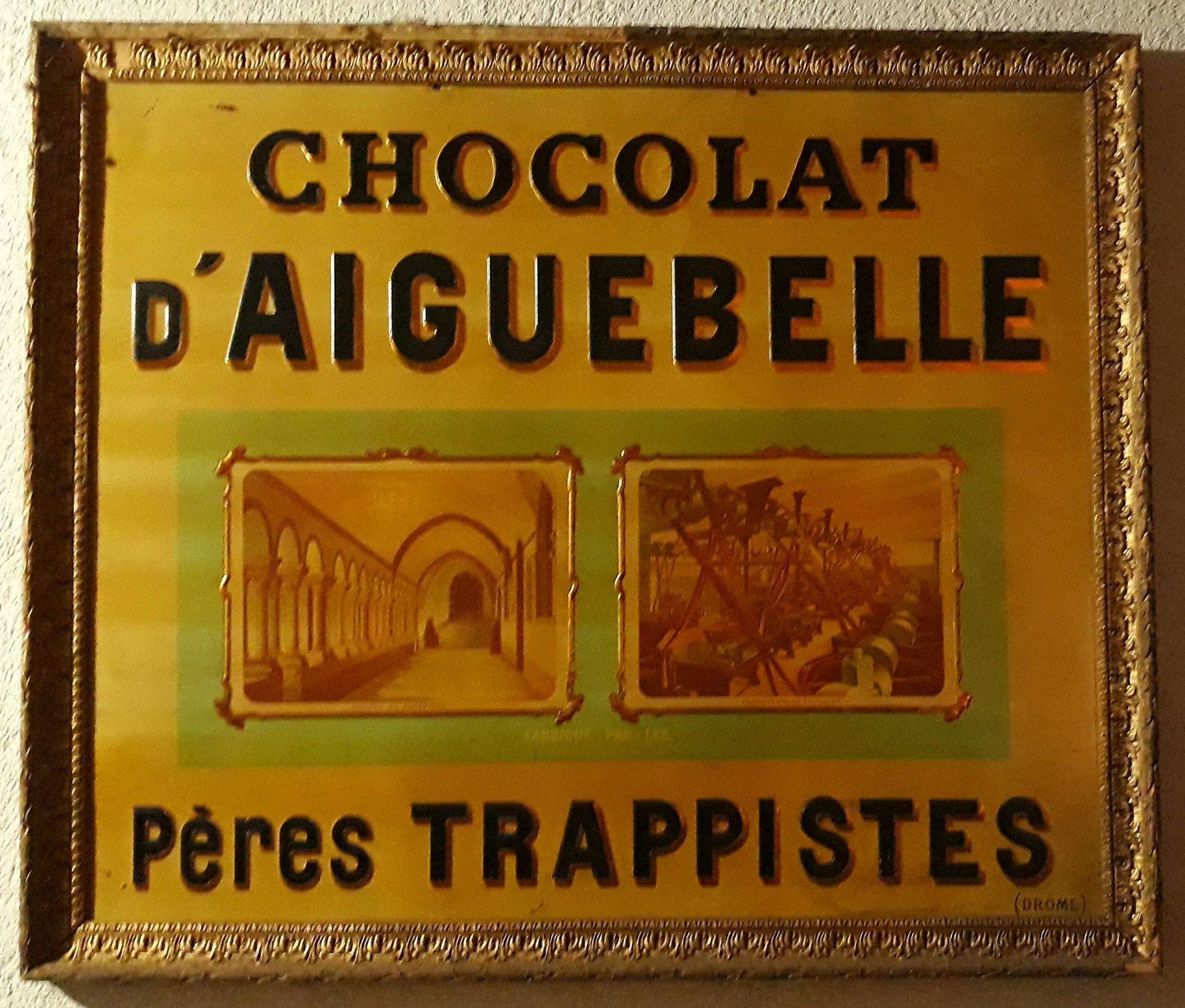
With the help of the internet I can affirm that the Chocolaterie Aiguebelle was founded by a medieval order of French Trappist monks in the mid 19th century to make a bit of money on the side.
As explained here, they also got into producing advertising cards to entertain, educate and inform.
It’s unclear whether these cards came with your chocolates or were distributed from hot air balloons. Probably the former, as that’s what drove me to collect inducements in the 60s and 70. You”l find loads of Chocolaterie Aiguebelle cards on ebay.

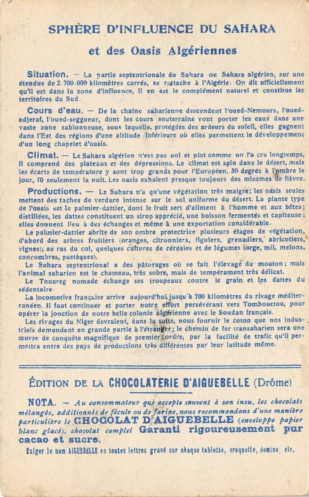
The operation shipped out to North Africa at some point where it’s still around today and which may explain the card below. Yes it’s another interesting map of the Sahara. No date is given but it looks like the state of colonial expansion in the late 19th century.

As always it’s interesting to see what is shown and what is not.
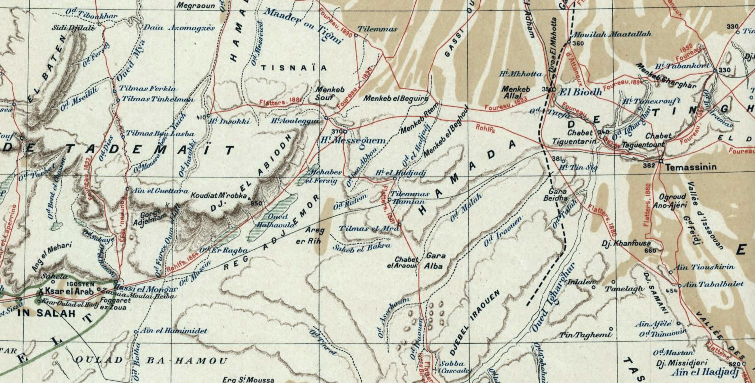
Ancient Timbuktu seems an odd omission (though it’s mentioned on the back as a worthwhile destination for the trans-Sahara railroad). Tamanrasset was just a village at this time so gets skipped and Timassin is Timassinin, later Fort Flatters under the French and today Bordj Omar Driss (BoD). Not far to the west, Messagem and El Biodh were nothing but wells on the caravan route from In Salah to Ghadames, but it seems if early European explorers were led through these places by their guides, then they acquired a cartographic life of their own. They’re all on the map below from 1898.
In the late 1980s we travelled this ‘forbidden’ piste from Fort Mirabel to below the westernmost ribbons of the Grand Erg, coming out at the checkpoint of Hassi bel Guebbour, just north of BoD. By the post war era these obscure wells had slipped off the maps and back into obscurity.

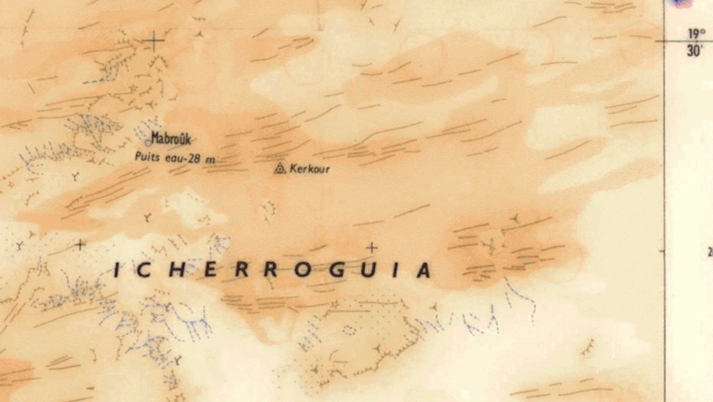
Interesting that remote In Ziza waterhole features, even though it’s not on any trade route, while Taoudenis was then still an important point on the 52 Days Road between Morocco and Timbuktu. East of there, it’s hard to think of today’s lonely well of Mabrouk being any sort of piste junction. Although the wiki waypoint matches the map below, today there aren’t any tell tale vehicle tracks, even though it’s not far from Timetrine where western hostages got shuffled around during their long captivities with AQIM.

On the Atlantic coast Tarfaia is there with more about it here. Never heard of Groha near or maybe Smara, not Djorf el Asfar near present day Bir Lehlou in the PF Zone.
Further east in present day Niger, the Oasis of Djebado is the old name for Djado looks as important as Bilma and the other Kaour oases, but not enough get a marker point. It’s hard to know what Yat might be other than Seguedine or a misplaced and misspelt Ghat, or Tao which appears on other old maps (maps often repeat their predecessors mistakes).Maybe it’s Dao Timni, today a military base in the middle of nowhere.

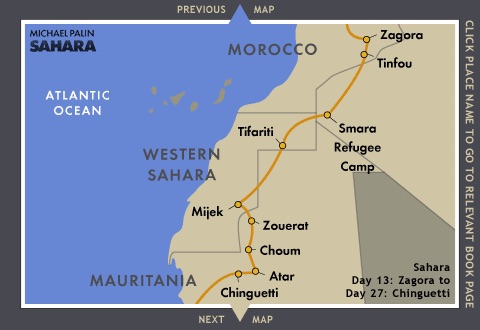
Palin ‘Sahara’ TV reminiscences (BBC)

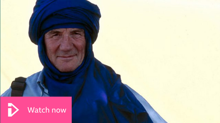
I recently watched Michael Palin looking back on his Sahara TV series of 2002. I think it was the last of his big travel shows for the BBC.

I remember thinking there was more ‘Sahara’ in the show’s title than the actual programmes, and watching what they chose to use in the recap, it looks again like he – along with most people – was more at home in cities like Fez, St Louis and Algiers, or places like Gibraltar than in the desert.

I must admit I never fell for the Palin ‘nicest-man-on-TV’ schtick, though I haven’t watched his other travel series. Palin was born in 1943 so it could be a generational thing with me: many encounters felt set-up and shallow. Perfect Sunday Night telly, then and now. I remember him bristling a bit when this necessary fakery came up as an audience question at a talk he gave in London to promote the Sahara show.
Similar TV travel presenters like Bruce Parry (what happened to him?) and even Simon Reeves were among some fawning luvvies wheeled on to shower accolades. Both of them come across as equally genial and far more intrepid, immersive and engaged in their similar TV travels. But all this is a bit like complaining about the Long Way… Ewan & Charlie motorbiking shows relying heavily on back-up vehicles. It’s a mainstream TV show, not Storyville. Get over it!

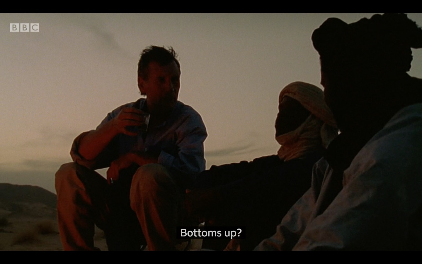
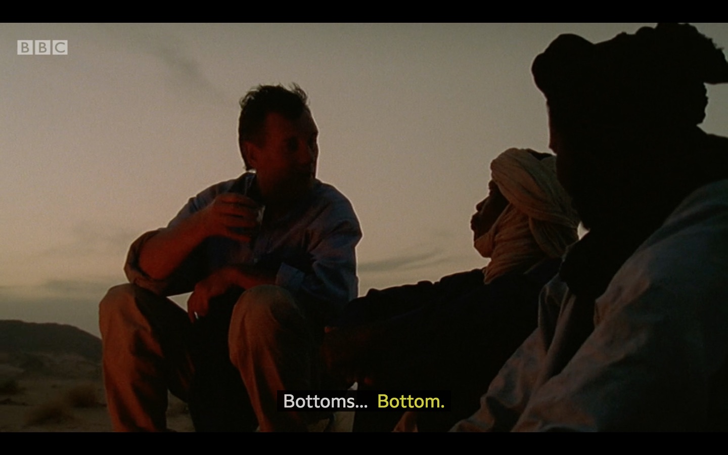
As for Sahara, I can’t help thinking he didn’t like the actual desert. Fair enough; not everyone does. During the Niger episode (as deep into the Sahara as he got, afaik: a night or two in the Tenere (and just after 9/11) he sits on a stool and sleeps in a tent rather than getting down with the Tuareg. Disingenuously or not, over a snack he assumes they’re mocking him while teaching him local words. I’ve commonly experienced this ribbing and take it as no more than that.
He gets his own back later by getting them to repeat ‘bottom’ – as in ‘Bottoms Up’ which all Brits say several times a day when having a cuppa.

‘Such a lovely scene…’ chirps Parry.
‘That’s what you get when you put the time in.’

Do me a favour, Bruce!

He observes that the locals in Agadez seemed barely moved by 9/11 (or were less exposed to saturation the news we had) and he resented this insensitivity. You get the feeling that like so many with a travel icons list to tick off, he was attracted by the romance of the Sahara: its mysterious veiled nomads and shimmering front-of-a-date-packet oases. Then he got there and found it hot and dusty, poor and dirty, with tiresomely chauvinistic guides, begging children, toilets from hell and altogether gradually exhausting when you have a film to shoot. To his credit, the online diary certainly doesn’t hold back as the book did (as I recall) and the TV show had to do, of course.

Oddly skipped in the show and the book is the fact that he travelled with Polisario escorts 1000-km overland from Tindouf down to Zouerat, partly along a route which has now re-opened. It was perhaps played down to appease the Moroccans, but also our man had a bad set of the runs which, as we all know, makes life miserable. Then he took the train to Choum and carried on to West Africa. Even with regular breaks back in the UK, by the time he got to Niger (‘in temperatures of up to 55°C…’ – a world record it would seem), he must have had enough.

l2

‘It’s a bare, dispiriting place.‘

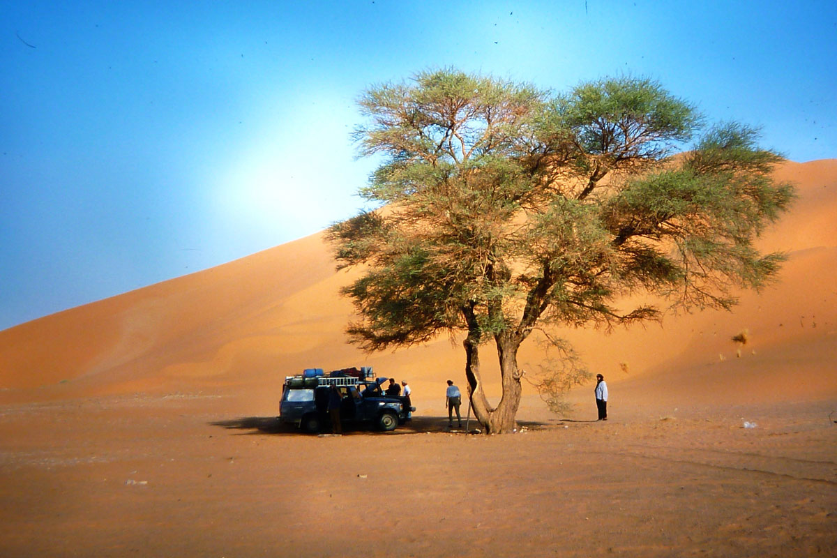
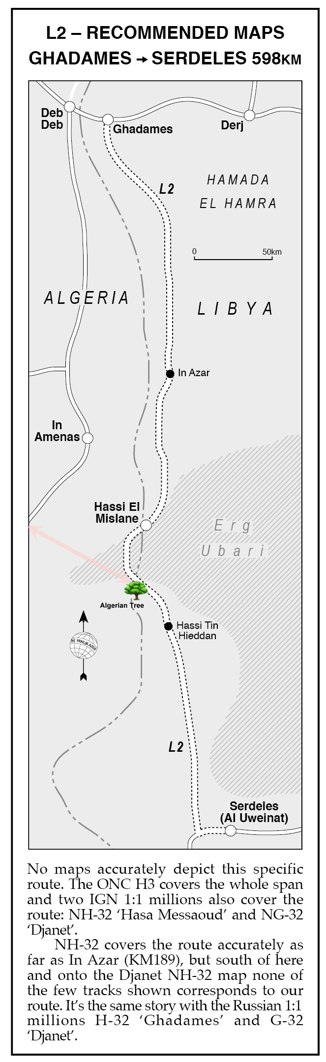
So it can be if you’re there in the wrong season with a busy agenda of encounters to record. As mentioned elsewhere, I was struck that the Algerian Tree on Route L2 from my old book (visible on Google sat and pictured above in 1998) epitomised the essence of the desert for Michael Palin.
He proclaimed:

‘… this spare, uncluttered, beautiful spot was one of my favourite places in the Sahara‘.

Well, he’s easily pleased, a!

‘D’ is for the Lost City of Djado [video]

Part of the Sahara A to Z series

‘Le ksar de Djado. Mont Saint Michele du Tenere‘ (see vid below)

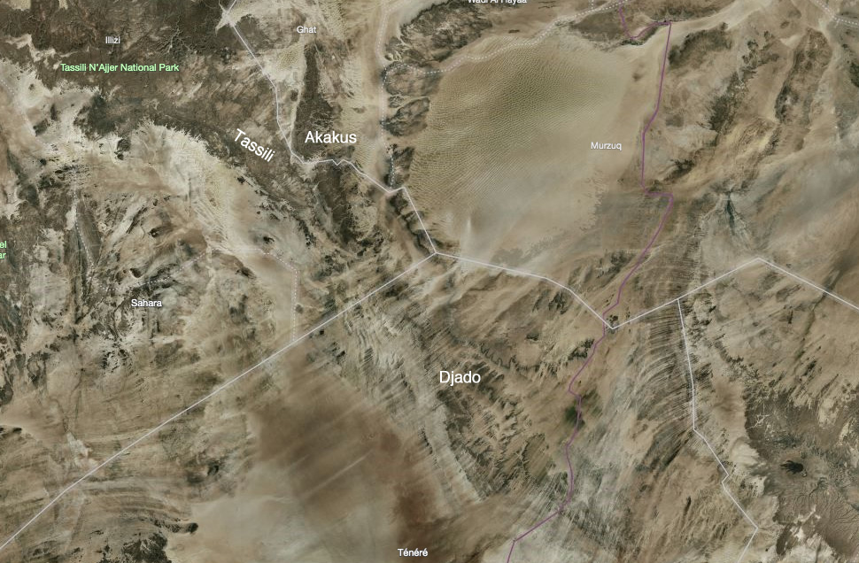
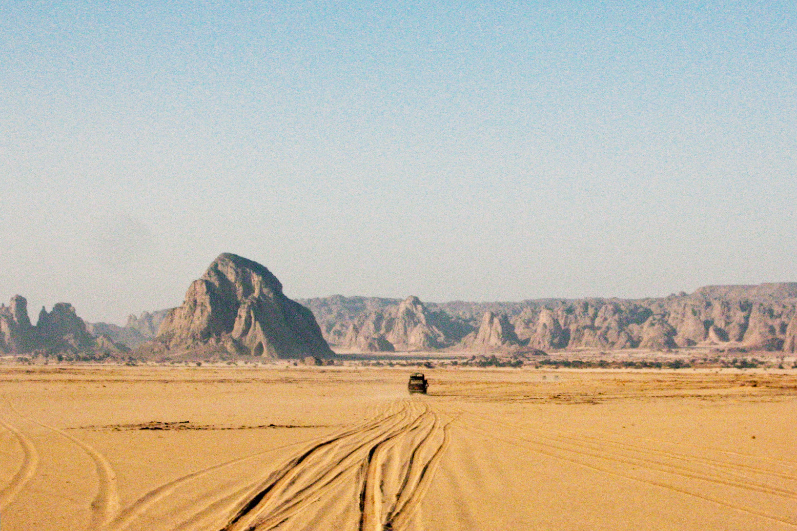
On the far side of Niger’s Tenere Desert lies the Djado Plateau, a frayed maze of low escarpments, sand-choked canyons and wind-carved outcrops, geologically contiguous with Algeria’s Tassili N’Ajjer and Libya’s Akakus (right).

Approaching Orida from the Col des Chadeliers.

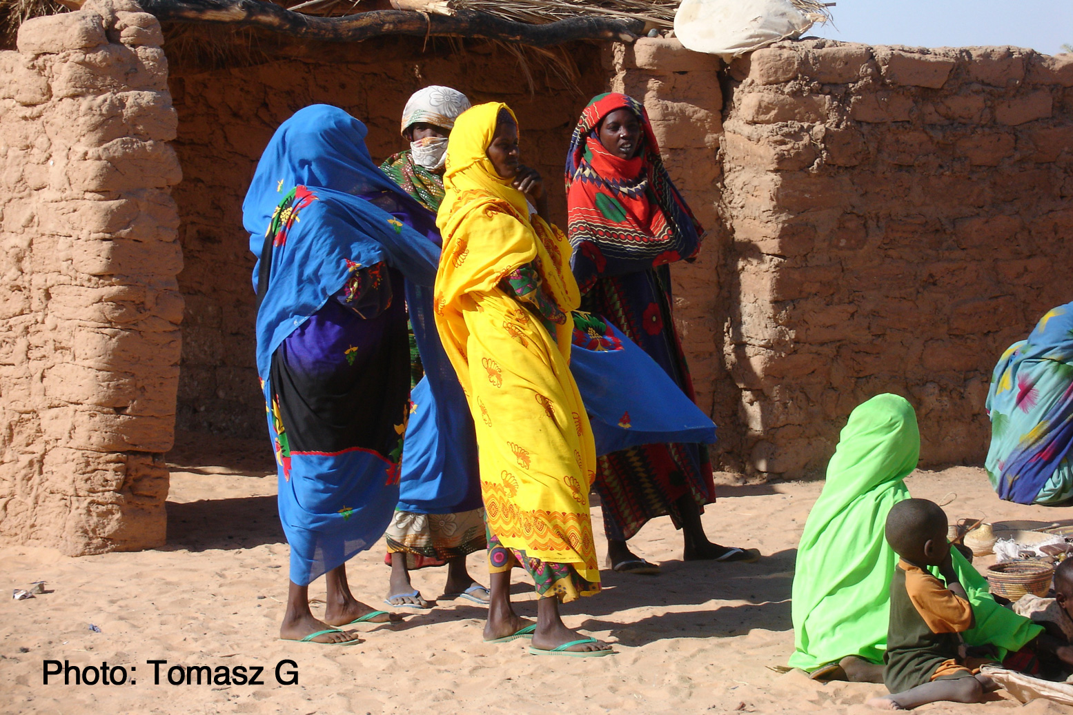
This is Tubu and Kanuri country. The latter are an ethnically related group originating from Kanem or Kano in northeastern Nigeria. Tubu nomads are best known in northern Chad and, unlike the arriviste Tuareg, are the Sahara’s original inhabitants.
When I first visited this area the Tubu of far-eastern Niger where in revolt and a ‘checkpoint’ at Orida took tribute from passing tour groups, all led by Tuareg from Agadez. East of here was a no-go area and was mined, by either the rebels or the Niger army.
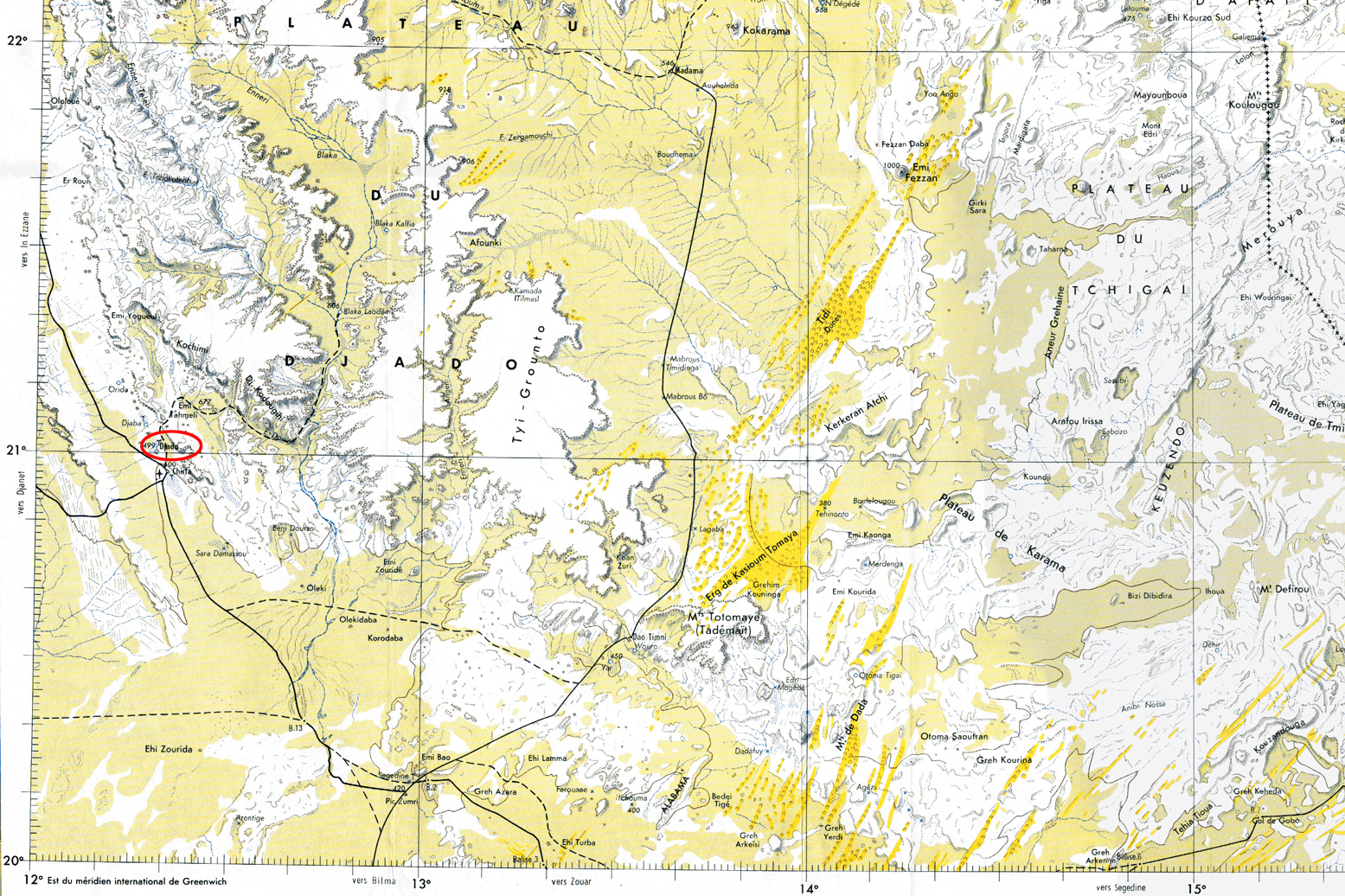
On old IGN maps the topographic names are derived from the Tuburi language: a peak or hill is ‘Emi’ rather than the Tuareg ‘Adrar’ or Arabic ‘Jebel’, and ‘Enneri’ is a valley, like a ‘oued’ or ‘wadi’.

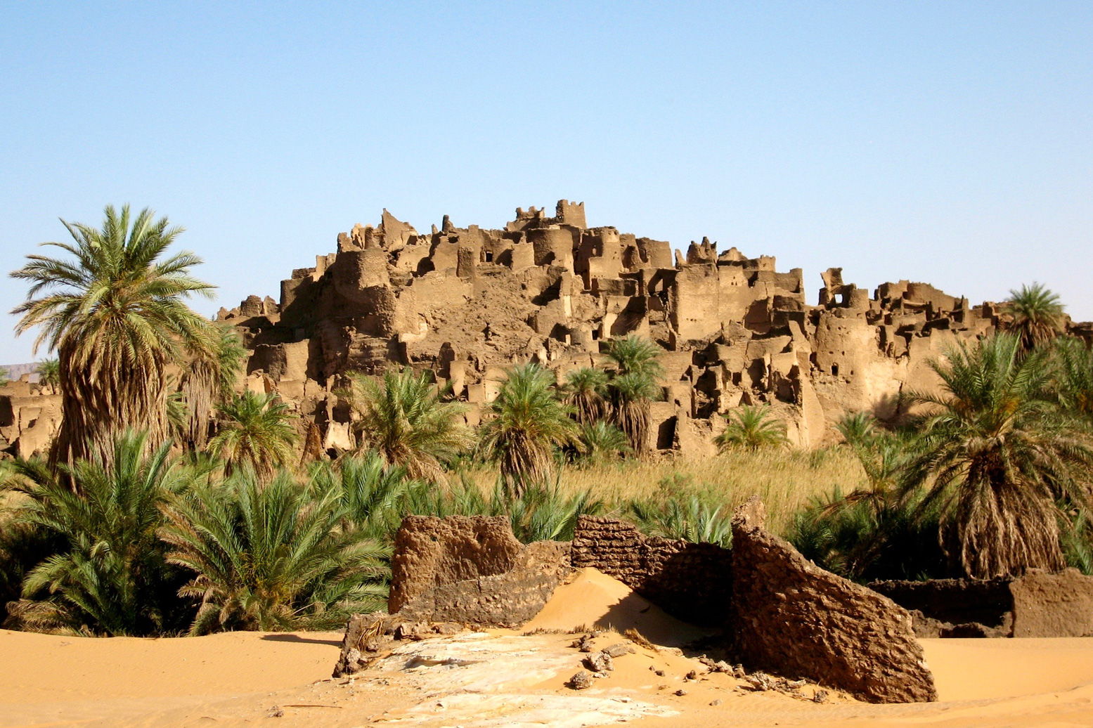
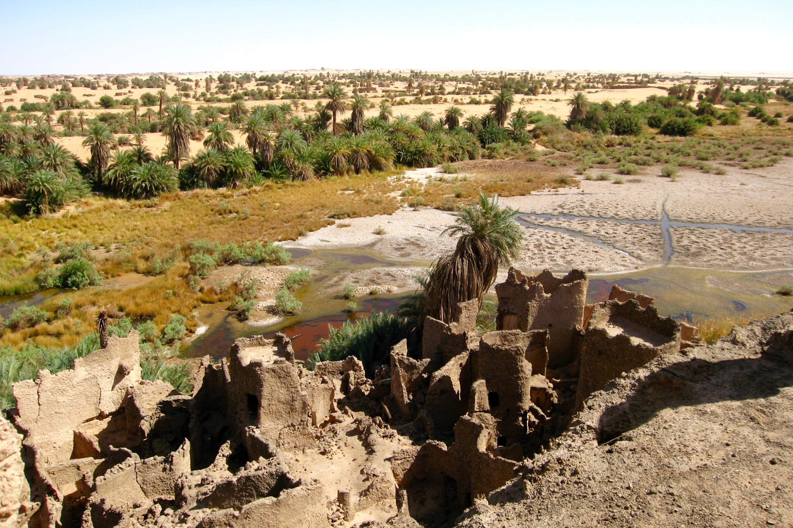
Perched on an outlying outcrop at the plateau’s edge, like something out of a Tolkein novel is the ruined citadel of Djado (21.016 12.308), a mudbrick warren of passages and collapsed chambers worn ragged by the weathering of passing centuries. Below the fortress, a shallow seasonal pool of brackish water is ringed by reeds and palms.

Such fortified ksars are not unusual in many old Sahara towns like Djanet, Ghat, Dakhla in Egypt and Ouadane in Mauritania. But all are adjacent to a modern town which has since grown up around them. That such a large citadel should located hundreds of miles from the nearest town appears an enigma. Djado personifies the Sahara’s romantic mystique, a Lost City crumbling into the sands. Who lived here, what did they do and where did they all go?

It’s origin may well date back to the late Kanem-Bornu Empire as a station on the trans-Sahara trade route which evolved between Lake Chad and Tripoli. Any place in the Sahara where the groundwater reaches the surface becomes important. By the 17th century, Tripoli – the capital of Ottoman Tripolitania – became the Mediterranean’s busiest slave market. From Lake Chad a line of wells and oases run north via Agadem to the salt mines of Bilma, Aney and on to the smaller salines of Seguedine. Here the route split: the busier arm led northeast to Tumu and the famed slave trading post of Murzuk. The other branched northwest towards Ghat. All of these places would have had a fortified ksar similar to Djado, though not so dramatically isolated.

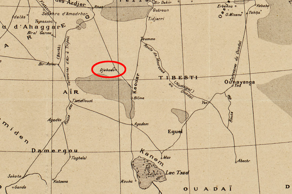
Around the 18th century it’s probable the inhabitants of ‘Djebado’ (as it’s called on the 1888 map, above) either gradually lost out to the dominant Murzuk trade route, were harassed by Tuareg or Tubu raiding parties, or just succumbed to the growing infestations of malarial mosquitoes which still inhabit the reedy lake today.

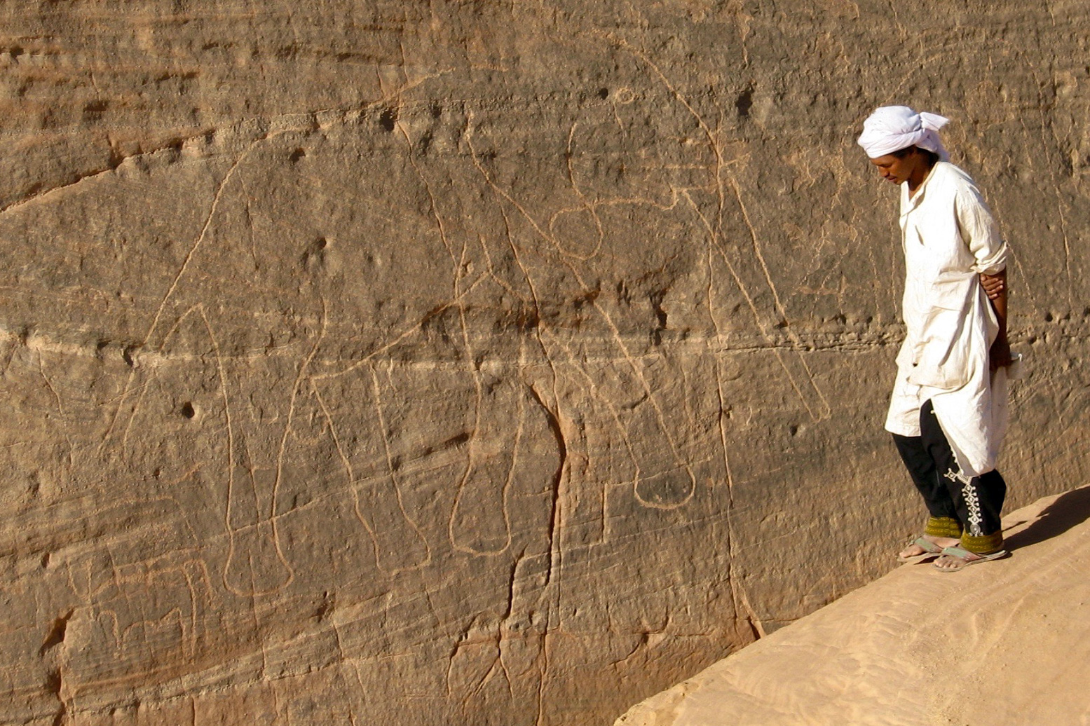
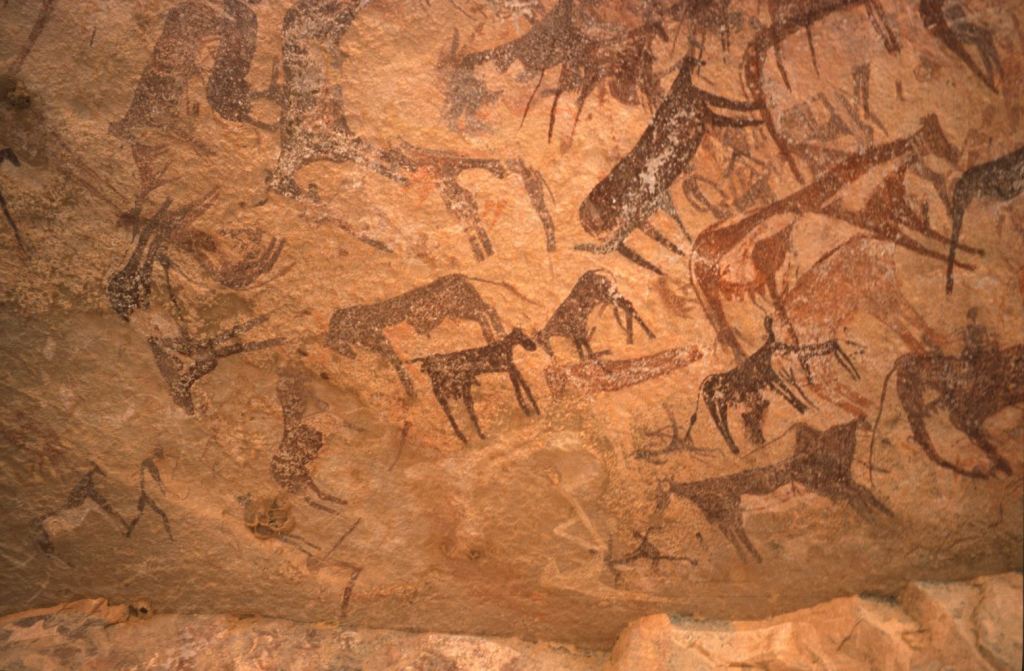
The Djado plateau, and more especially the Aïr mountains on the far side of the Tenere, are rich with ancient petroglyphs (left) and other rock art, some 6-8000 years old. At this time the Sahara was a savannah widely populated by the last of the nomadic hunters or early pastoralists. Many show animals long since extinct in the desert: bovids, crocodiles, giraffes or elephants (left).
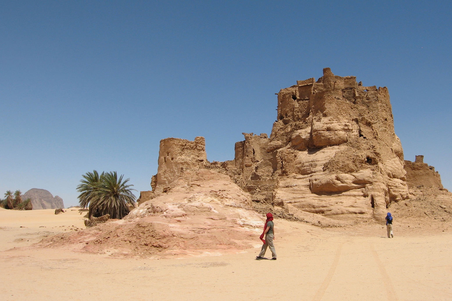
But it is a mistake to conflate the medieval ruins of Djado with the relics of the prehistoric era. The ksar is no more than a 1000 years old and much more likely, half that. To the north is a smaller are more intact ruins of Djaba (below) and beyond that, the well at Orida, 500km from Ghat.

Today the Kanuri whose ancestors were said to have inhabited Djado, live out on the desert plain in the nearby village of Chirfa, though annually they return to harvest the dates which grow alongside the ruins.

Below: an excerpt from the film of the 1960 Berliet Tenere Expedition. An accompanying helicopter surveys ‘Le Mont Saint Michele du Tenere’.

E is for Tin Eggoleh – In Search of the Cathedral

Part of the Sahara A to Z series

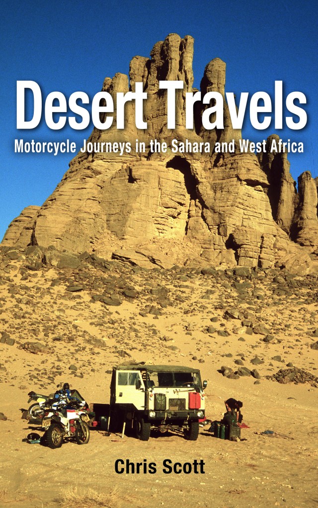
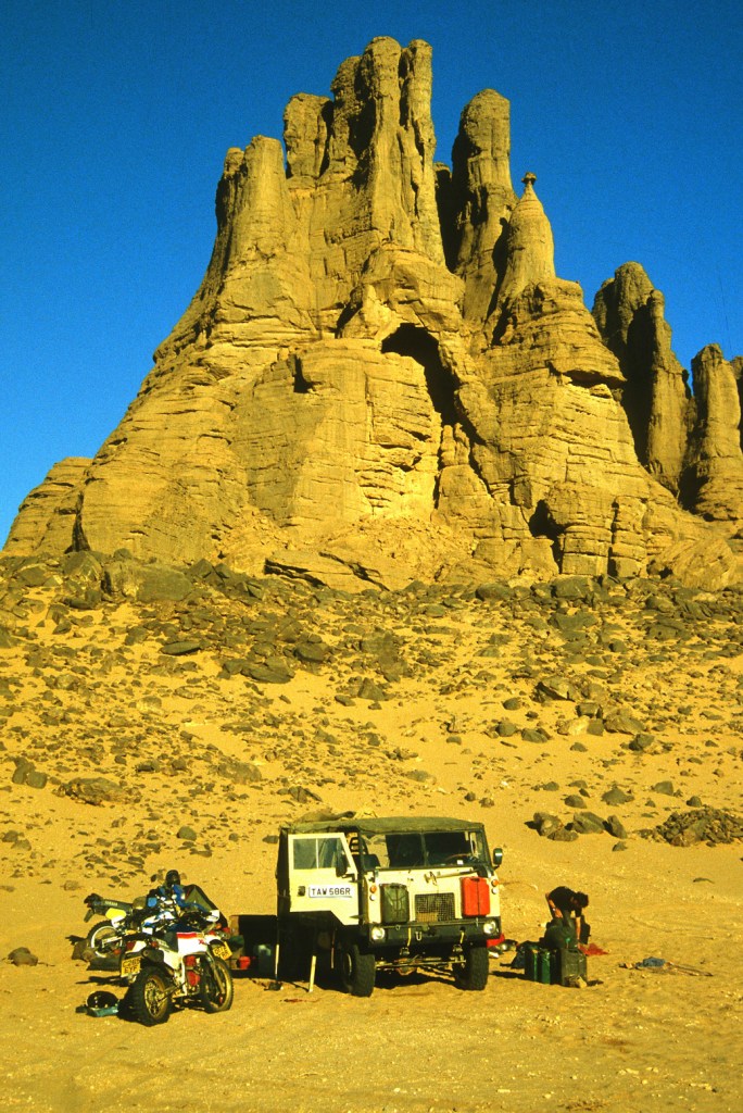
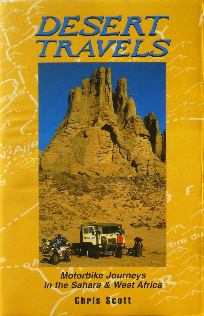
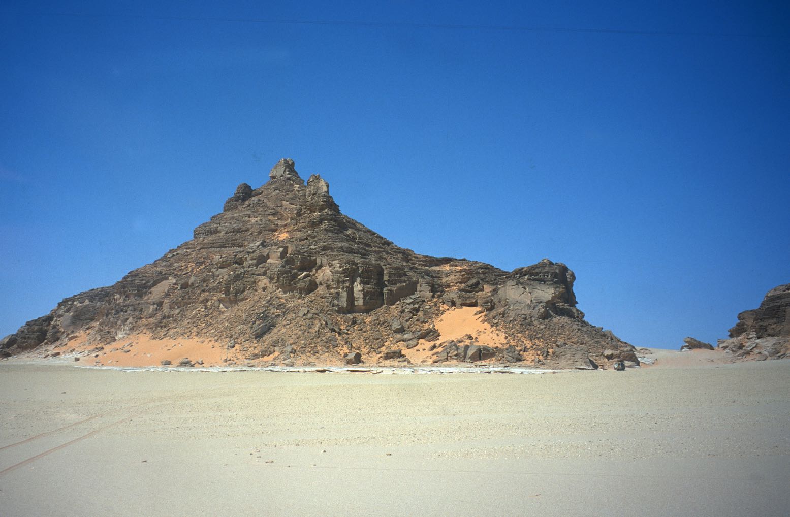
The original 1996 paperback edition of Desert Travels (and an earlier version of the ebook, left) featured us camped below a striking cathedral-like formation.
I’d always wondered where that place was. The relevant chapter in the book is called The Cathedral, referring to the spires and church-like ‘portal’ of the pinnacle-capped outcrop. It was shot by Mike Spencer who had a proper camera and slide film.

This was before GPS and at the time I was too preoccupied keeping track of the bikes and my Landrover’s numerous issues to attempt to follow our progress on a map with dead reckoning. Our guide, Chadli, knew his stuff but was rather reticent – they teach them that in guide school. I knew the vague location within 50 square miles – the photo credit in the book says ‘near Tin Tarabine’ which is true enough, but that area, if not the whole Tassili-Hoggar southeast of Tam, is famed for unusual rock formations.

https://www.google.com/maps/d/u/1/edit?mid=1WqqAR1dEfOU981GPRfUezdQs_DU&usp=sharing
tinegoleh

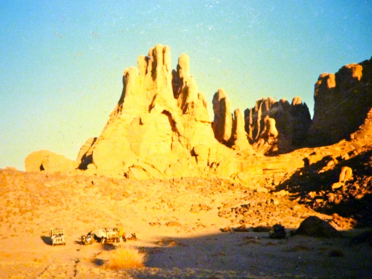
I had a rough idea the cathedral (above, with my crumby camera) was somewhere after Tadant canyon well and before Tin Tarabine oued. Then in 2006, coming towards the end of our epic traverse from Mauritania across Mali and Algeria towards the Libyan border (see: Sahara: The Empty Quarter) we passed through that area. I’d not been there since 1988, but coming at it from a different direction, it was all new to me.

cv-tyoufehakit

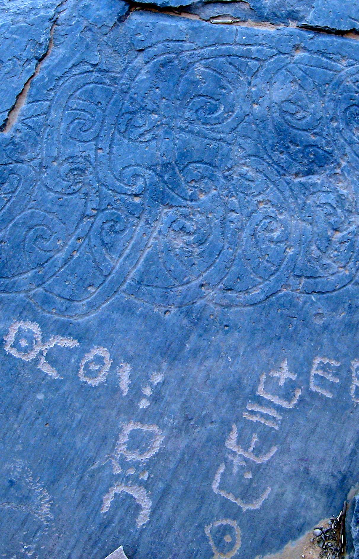
As we’d crawled steeply out of Tin Tarabine oued and away from the famous Youf Ehakit – an amazing area of eroded rocks and bizarre, neo-Celtic engravings (left) – our escort’s car needed the clutch repaired yet again.

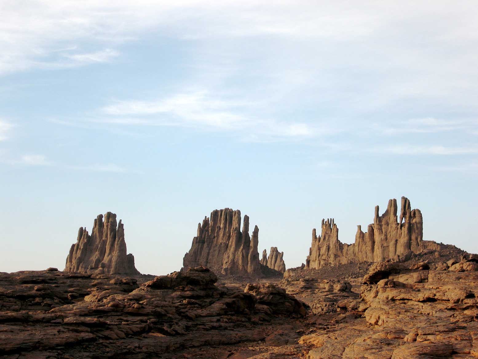
They pulled up onto a flat rock shelf to to a proper job this time, while I and the others dispersed for a wander. Climbing the outcrop up above the cars, I spotted some intriguing spire-like formations across a plateau a few kilometres to the north. Could I have stumbled on the location of the original DT cathedral cover after all these years?

cv-piz

I grabbed a water and the GPS and set off cross-country, passing pre-Islamic tombs (left), then dodging down into little canyons and over outcrops as the terrain became rougher. I didn’t have a copy of DT with me, but the huge, hand-like pinnacles in the far distance looked very familiar.

cv-fingers

After about an hour and a half I was running out of daylight to get back, but got close enough to the weathered spires. I took a few hurried shots (above) and the following waypoint which I see now is actually just a kilometre from the formations. But when I got home and looked at the book’s cover closely, I realised they were similar but were not the Cathedral, even if I was looking at them from behind.

I forgot all about it for a few years then began to wonder again if the Cathedral could be tracked down now that we have masses of imagery of everything everywhere and any time. I scanned people’s Panoramio and Flicker albums as well as the embedded photos on Google Earth (often irritatingly misplaced, as we all know…). There were plenty of amazing rock formations in the Tassili-Hoggar vicinity, but no distinctive Cathedral.

In the end I knew the best people to ask were the Germans – der uber-Saharans. I may know the Sahara well, but in Germany there are hundreds more experienced and better travelled Saharans than me. In the good years they explored every corner of the desert, but most didn’t feel the need to write guidebooks about it afterwards.

I posted my question with a picture on Wuestenschiff, one of the main German Sahara forums. Within a couple of days I had a name for my location: the Cathedrals of Tin Eggoleh and the waypoint: N22°21’6.75″ E007°5’12.20″. About 50km to the northeast of the ‘false-sprires’ of 2006.

Mystery solved and somewhere good to aim for next time…

‘M’ is for Mysterious Circles: Adrar Madet, Timetrine

Part of the Sahara A to Z series

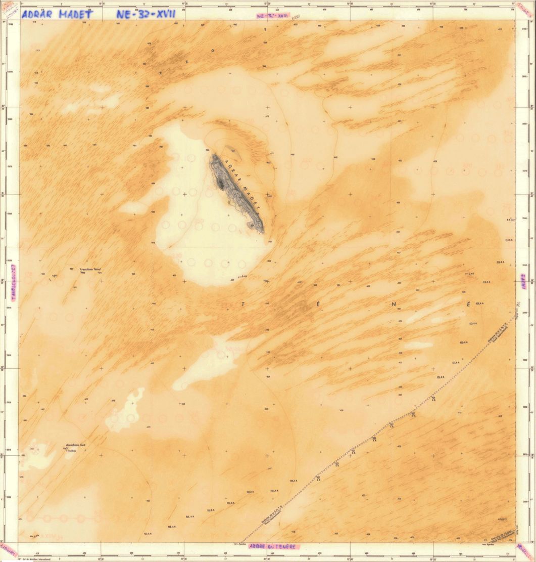
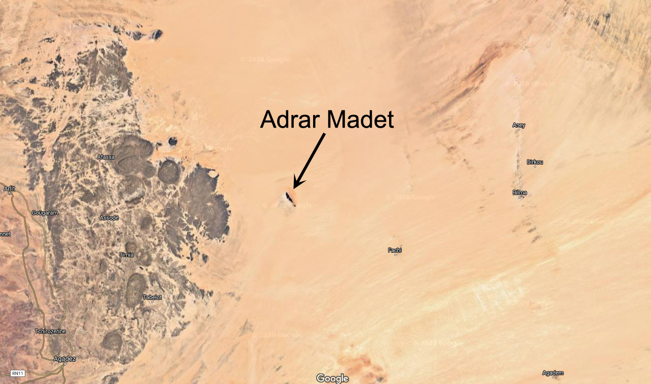
Out in Niger’s Tenere desert, east of the Aïr mountains lies the isolated massif of Adrar Madet (see map below).
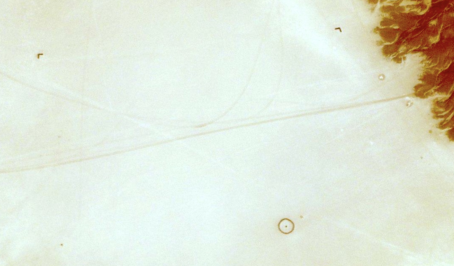
About 2.5 kilometres directly west of the 20-km long massif’s northern tip, a perfect stone circle lies in the sand.
The circle is about 20m in diametre and some 600m from the circle and more or less at each cardinal point is a small arrow. You can see all five points here on Bing. You won’t see them on Google last time I looked.

The lone ridge of Adrar Madet (and it’s northeasterly wind shadow), north of the Arbre du Tenere

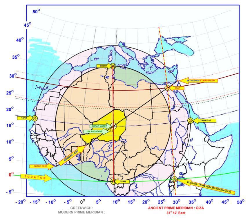
I’ve not been there but have known about it for years. Some speculate that it could a sacred pre-historic marker associated with prime meridians and ancient Egyptian knowledge, marking the ‘middle of North Africa’ (left).
It is a huge coincidence that the circle is – within a few kilometres – exactly halfway between the equator and Ras Angela near Bizerte in Tunisia, the northernmost point of Africa. And it’s nearly directly south (178.4°) of Ras Angela, too. (Fwiw, it’s 64km west to the actual point directly south of Ras Angela, just south of Arakao on the edge of the Aïr.)

I err more towards the theory of a much less ancient aviation landmark from the French colonial era, one of many located in the Sahara and still being found, including less ambiguous examples where names of nearby outposts are stencilled inside the circles. Fellow Saharaholic, Yves Rohmer confirms this fact. Rubbish from that era: tin cans, bottles of Pastis, berets, garlic and so on, littered the Madet site. A similar circle exists in nearby Fachi, with that name stencilled in it and close to an old airstrip. Another plausible explanation made in the discussion linked above was a drop zone for parachute or dummy bomb training.

Not so mysterious after all then, but you do wonder, with the distinctive and isolated 20-km-long Madet ridge angled NW/SE and the Aïr massif to the west, what value the tiny 20-m stone compass actually added to aerial navigation? And why put an airstrip there if anywhere flat in this part of the Sahara can be an ’emergency airstrip’. And would they have spent days building a parachute or bomb drop zone circle when a ring of smoking oil drums would have sufficed? Trop mystérieuse…

Another possibility I like to entertain is of a playful or geographically inclined Colonel stationed in the Sahara. He’d spent his lovelorn honeymoon in Bizerte near Cap Angela and, looking at his Michelin map one hot day, noticed Adrar Madet’s central position. He decided it would be a good morale-building (or time-killing) exercise to have the circle and cardinal points marked in the desert for posterity. But as Adrar Madet is far from any route or useful resource, the purpose and meaning of his enigmatic earth sculpture has been lost in the sands of time.

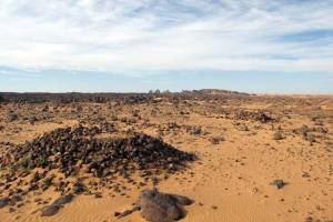
That’s as may be, but what about the other similar but smaller cobbled stone circles I’ve seen in the mountains of southern Algeria (below)? Neither could be described as aviation markers. Rock art hunter, Andras Zboray, found another in 2023 by the Oued Torset in the central Tassili, northwest of Dider. ‘Tombs’ said the guides, but they’re not like the usual pre-Islamic tombs one sees in the desert.

Timetrine, Mali

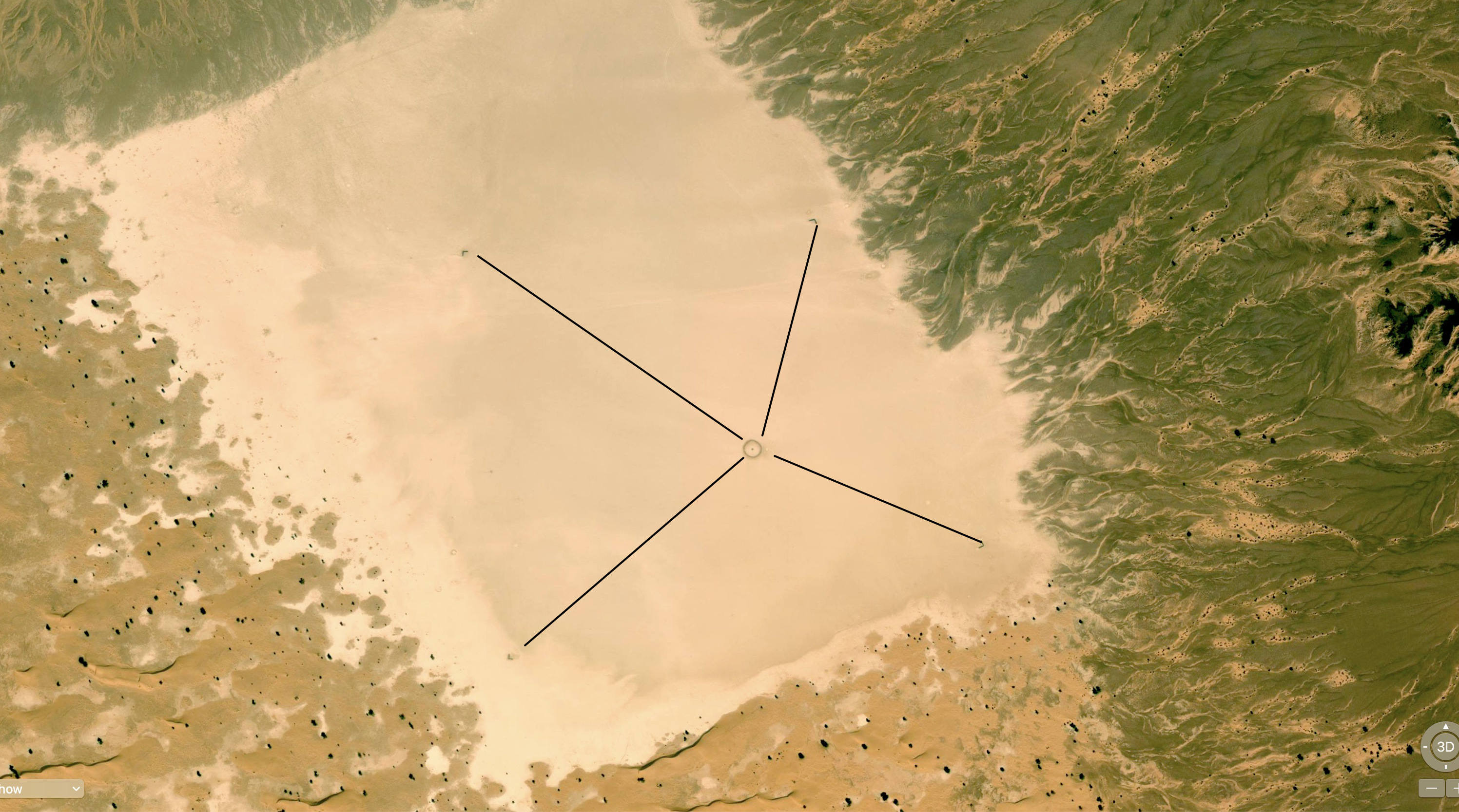
Here’s another curious circle, spotted by a mate in the remote wastes of Timetrine, northern Mali, coincidentally one place where AQIM kept European hostages up to a few years ago.

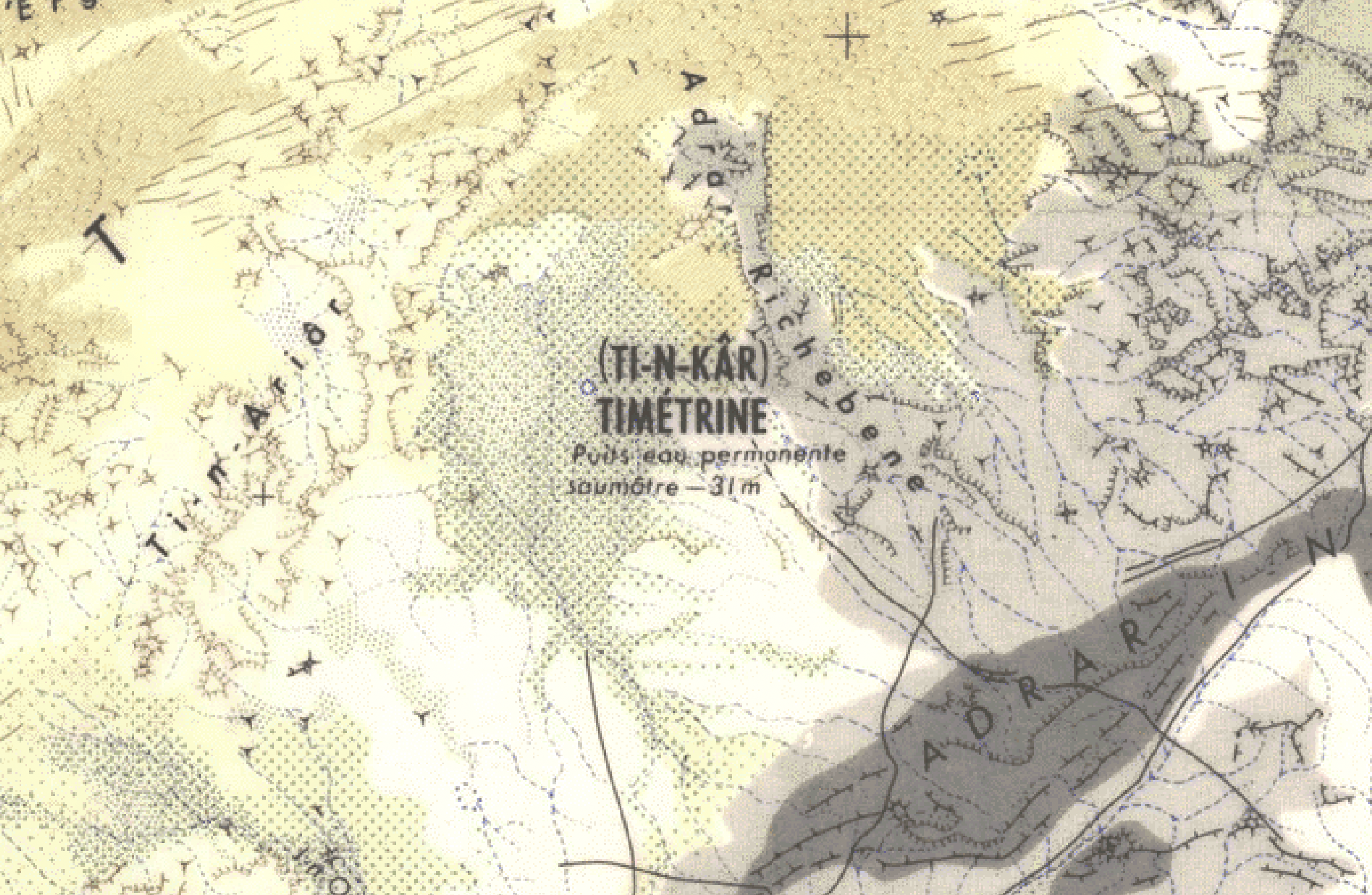
19.455065, -0.422889; It’s a lot clearer on Bing Maps than Google (LTIL). According to the old 200k IGN map, this is actually the brackish (saumâtre) well of T-in Kar (wrongly positioned on Bing), so marking it for pilots may make sense for emergencies.

You will see four points a couple of hundred metres from the circle set in the middle of a distinctively rectangular clay pan covering about half a square kilometre. But they seem so vaguely positioned as to be pointless. Some have speculated the four points may mark the fringes of a smooth landing strip.

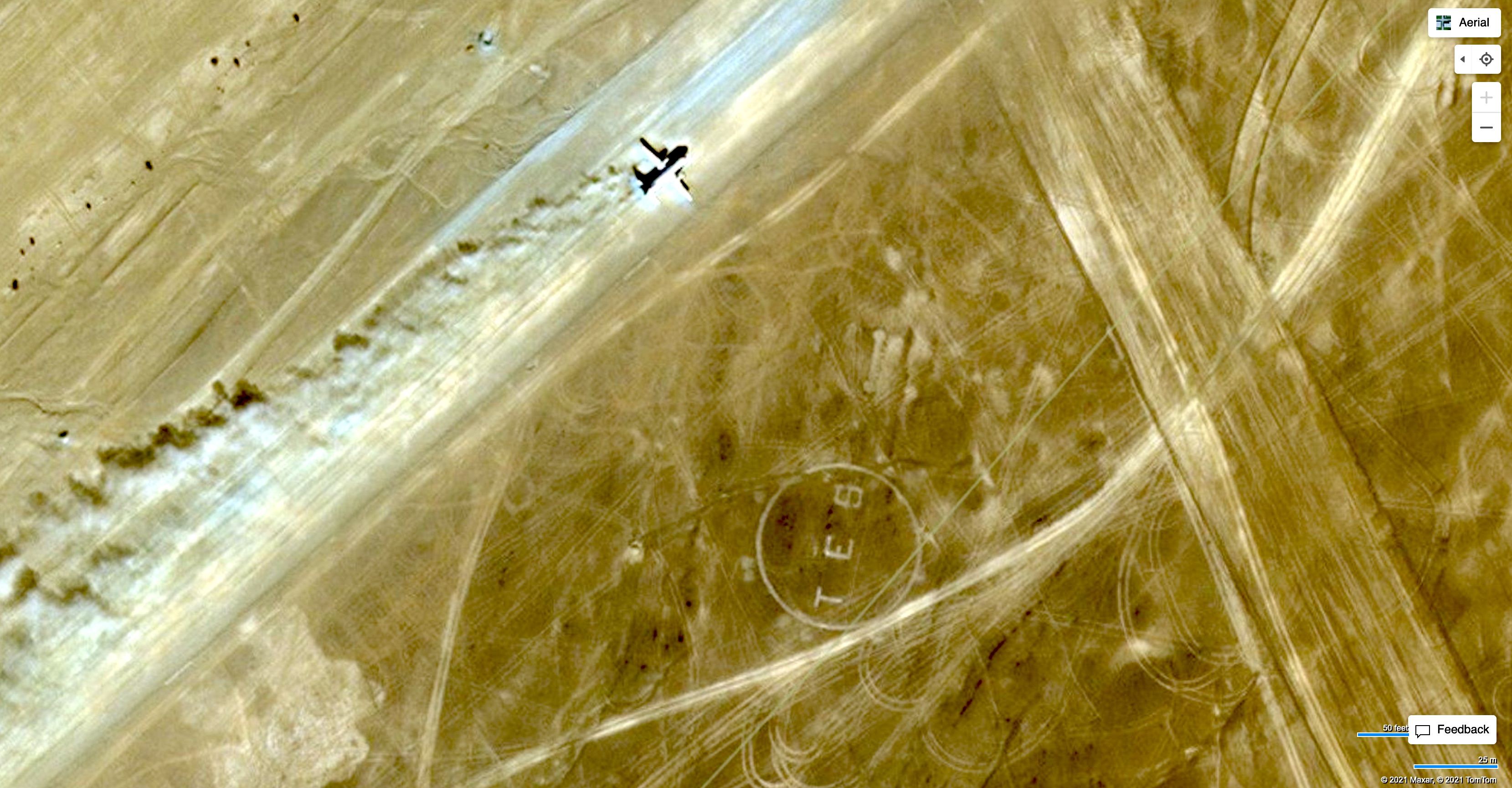
The clay pan is on a more-or-less direct line between Timbuktu and Tessalit where there is also a ‘TES’ marker by the current airfield (left). In those days (pre-War) they would have navigated as much by landmarks as a bearing.
Since around 2013 this whole area has been a war zone between French force having it out with AQIM, ISGS and the like. This intervention has proved as successful as similar operations in Iraq and Afghanistan. By 2023 they’d left and Russian state mercenaries took over.

Uweinat, Gilf Kebir and the Great Sand Sea (2000)

See also:
Libyan Desert Master Map
G is for Gilf

Palm trunks burn poorly, we learned

In 2000 I joined a two-week tour visiting the Egyptian part of the Libyan Desert, or the ‘Western Desert’. The trip was organised by Andras Zboray and his new FJ Expeditions. He’s since become an expert on this fascinating region and back then contributed the ‘Egypt’ section to my Sahara Overland book.
Even though I’d only just come back from Libya researching the book, part of the appeal of Egypt was that this was then a very rarely visited corner of the Sahara. FJ had problems with permits to visit this ‘military’ or more correctly border area, but once there, we saw no one, let alone a well or a regular piste for the entire two weeks.

Our three locally hired Toyota Troop Carriers left Cairo sharing a ton of water and half a ton of food, along with fourteen (mostly German) passengers and three Egyptian drivers. Two days later we left Dakhla with another half-ton of fuel on each car’s roof. Amazingly the Toyota 75s handled this mind-bending payload without a whimper.

Shell tin

On reaching Bir Terfawi we left the tarmac and set off west across the Selima Sand Sheet, arriving at the isolated landmark of Jebel Kamil after a day and a half. This cone-shaped hill was a wartime fuel dump from the Sudan Defence Force convoys supplying Kufra from the Nile, and is still littered with Shell petrol tins. I was invited to drive one of the 75s, Andras having had not such good experiences with local drivers off road. I was told under no circumstances to use the air-con; there being some urban myth about revs rising dramatically as the pump kicks in. But the risk of an overburdened, 130-hp 70-series lurching uncontrollably off a dune lip seemed far fetched.

Shaw’s Cave

From Jebel Kamil we headed northwest on a GPS bearing to Eight Bells on the eastern edge of the Gilf Kebir from where Andras had a written description to a cave of paintings discovered by Shaw in the 1930s. We drove over a pass into the stunning Wadi Wassa and followed it west, crested another pass with little difficulty.

After locating the cave, we continued cross-country into a hot south wind over broken country to Karkur Talh, a clearly mined wadi which cuts into the 1934-metre-high massif of Jebel Uweinat. That evening, on a tip from Bagnold, Andras located some beautifully preserved Cattle Period paintings on the west side of the well-known cove. The quality was the best I’ve encountered (which isn’t much!) and showed similarities to the ‘Cave of the Swimmers’ or Wadi Sora style, we were to see a few days later.

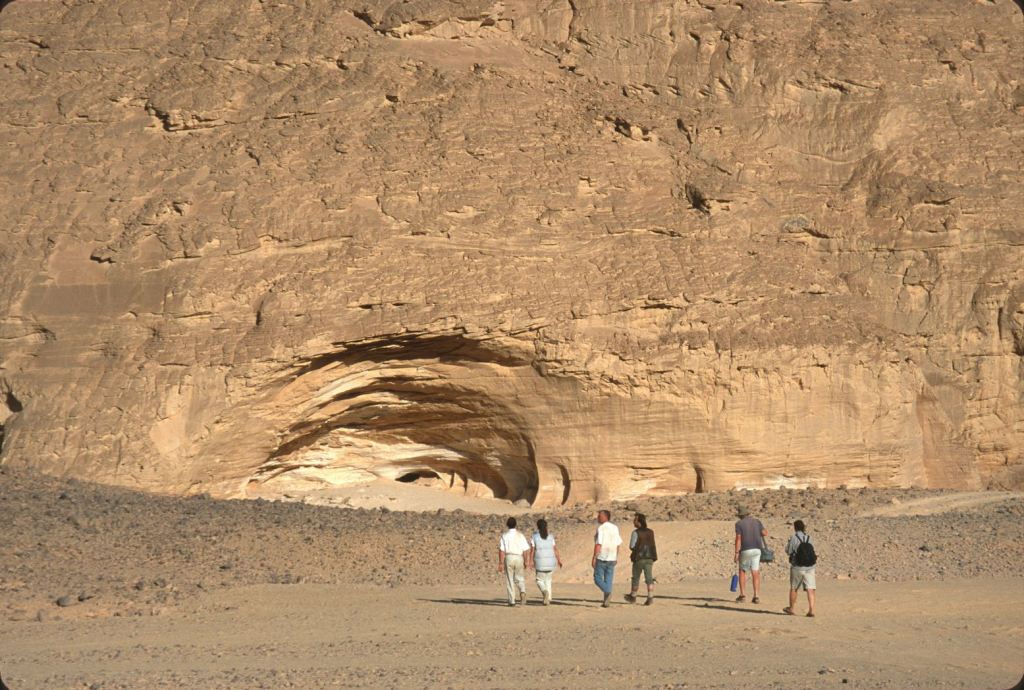
The next day we continued further down Karkur Talh on foot, over the Sudanese border (passing a spoof CCTV camera, left) and, with the aid of Rhotert’s ‘The Rock Art of the Jebel Uweinat’ (Graz, 1978), soon found an rich trove of engravings and paintings spread along the walls of the wadis first discovered by Ahmed Hassanein in the 1920s and fully recorded by a Belgian expedition in the 1960s. It’s unlikely many other tourists have got this far since that time, and for all of us this wonderful day of discovery was the highlight of the trip.


We enjoyed it so much we came back into Sudan next day to find more rock art, including an amazing tableaux dubbed ‘Red Cow Cave’. We also spotted an amusing engraving possibly showing man’s failed attempt in giraffe domestication as mentioned in the Lutz’s book on the Libyan Messaks, as well as the foundations of Tubu dwellings who lived here up until the 1930s. A few very old waddan (mouflon, or Barbary sheep) horns were spotted, as well as a perfectly preserved cadaver tucked under an overhang. Tools were very rare, but right on top of our campsite back in Egypt, I found a milling stone, grinder and pottery.

Left Google (years later)’ right, in real life

From Karkur Talh we headed back north, overnighting at Clayton’s Craters where an afternoon was spent climbing or circumnavigating the barren craters. Out of the big wadis the Libyan Desert really is utterly bereft of vegetation to an extent you rarely see in the Sahara further west. I spotted more Stone Age tools, another milling stone and just as I’d hoped, a very worn biface or hand axe, the original multi-tool which may be tens of thousands of years old.

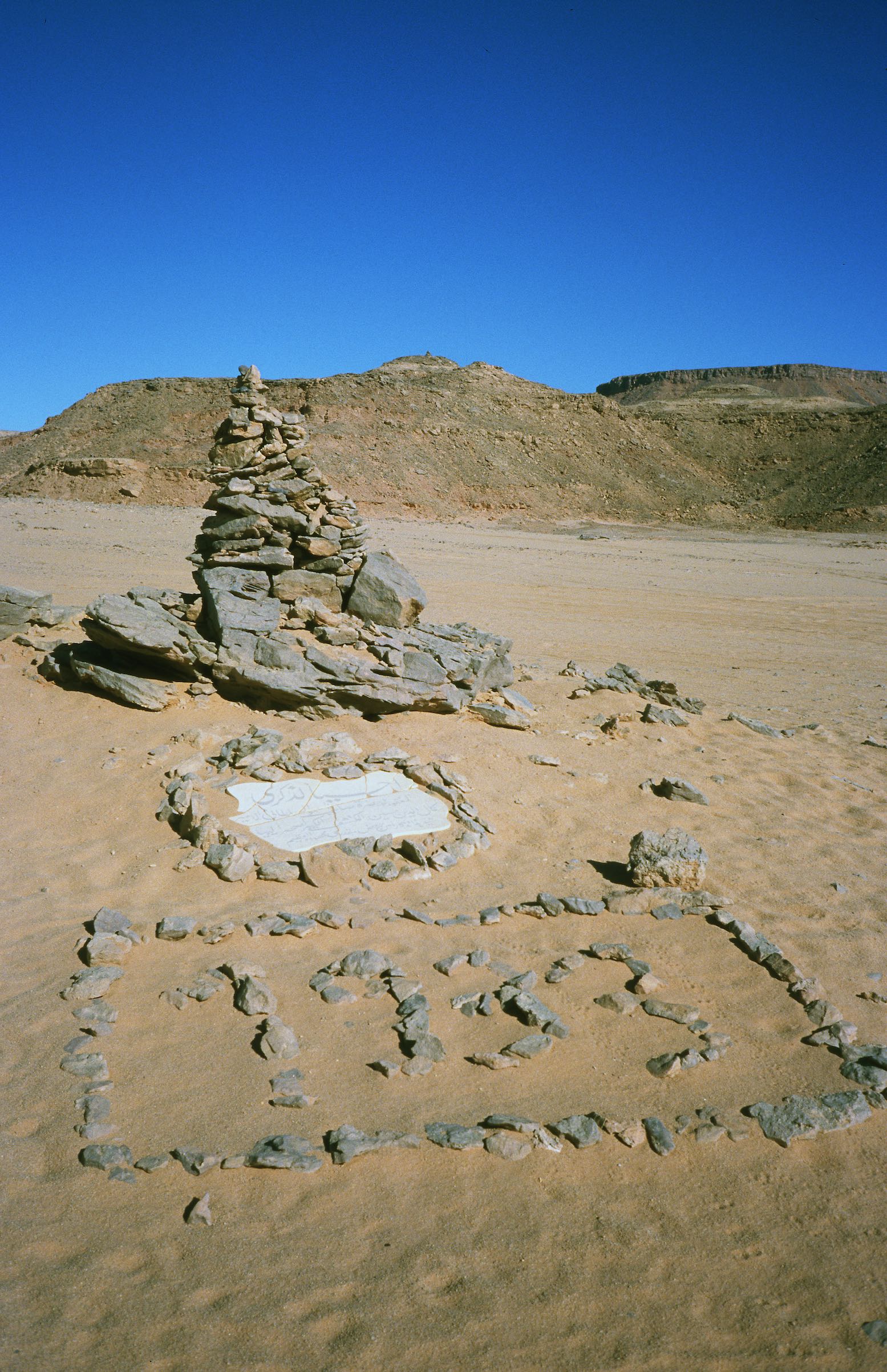
We moved north again, making the obligatory pilgrimage to the Kamal El Din monument (left) built by Almasy on the southern tip of the Gilf. Messages are still left in a bottle by passing travellers; a custom started by Rohlfs at the cairn of Regenfeld, further north.
We now followed the southern edge of the Gilf to the northwest, past an old American SDF truck from the war and more Shell tins. We stopped at the Three Castles landmark where one of the group found one of Almasy’s water tins as accurately described in his ‘Unknown Sahara’ book. In case you don’t know Laszlo Almasy was the basis of the ‘English Patient’ character in that very fictional book and movie, and a contemporary of Bagnold, Shaw and Clayton. For me the famous Wadi Sora discovered by Almasy and romanticised in the movie was nothing special; the ‘cave’ has flaked badly but the swimming figures are still very distinctive.


We headed back east to the dreaded Aqaba Pass, an unmined five kilometre sand ramp providing access into the central rift of the Gilf. Foot on the floor in Low 2nd and rocking hard on the steering wheel, I just scraped through to the summit, much to my surprise. Werner, driving the other heavy car got himself mired near the top and we all made a meal of getting the ‘fuel mule’ to the summit. Along with the other-worldly panoramas surrounding Clayton’s Craters, the central Gilf north of the Pass was one of the most beautiful landscapes we encountered – we’d obviously hit it at the right time of day.

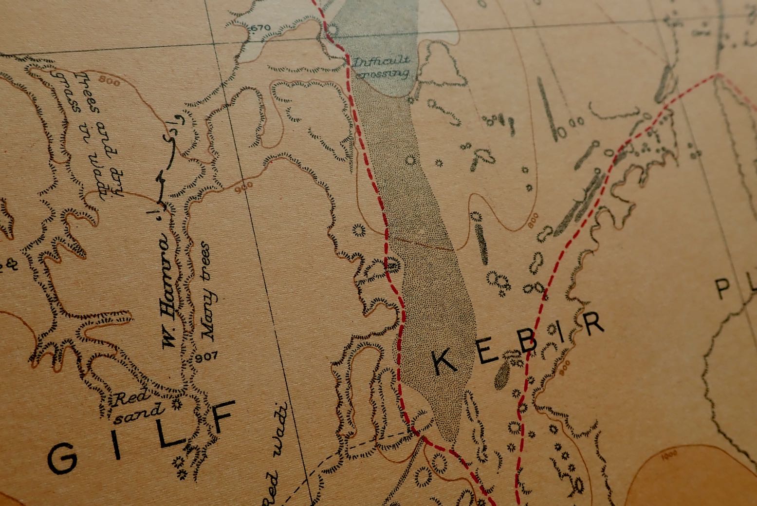
We camped in a valley bizarrely dammed by a perfectly dune of sand 200 feet high and now clearly visible online. We rose early next day to attempt to cross the cordon of dunes blocking access to the northwestern Gilf valleys, dryly annotated as ‘Difficult Crossing’ on the 1942 British Survey map, still one of the best for the area. They were first crossed in 1935 by WB Kennedy Shaw and his group using Model A Ford.

Using from NASA satellite imagery [this was all pre-Google Earth] and the British Survey map, Andras led us through the erg’s seven-kilometre width in six hours, notwithstanding a freak out by one of the Egyptians who, along with a wheel brace, grabbed the keys from two cars and yelled “We’re all going to die if we go there”.
Discussing this with Reinhart Mazur on my return, he observed that most Egyptians are river dwellers very much not ‘of the desert born’, unlike the Tubu, Tuareg or Moors further west. Ahmed was eventually calmed but later, navigating the Sand Sea, this was to be a recurring problem.
Exhausted after the digging and pushing of the crossing, we headed south deep into Wadi Hamra, then spent another very enjoyable day walking over the tool-scattered plateau to the adjacent Wadi Abdel Malik, spotted by Almasy and others from a biplane in the early 1930s and named after the last Tubu grazer who lived there. Almazy also believed this to be a most likely location of the ‘lost oasis’ of Zerzura, used by Tubu raiders who set off to attack Dakhla oasis.
The Lost Oasis of Zerzura?

Our next destination was the Silica Glass Field located in a 100km circle around N25° 18′ E25° 32′, among the parallel dune lines of the Great Sand Sea. We all spent a satisfying few hours picking out pieces of this clear green glass, ranging from the size of a penny to a grapefruit. I also found some Palaeolithic nick-nacks and on a dune crest one of the others found several pencil-thin tubes of fulgarite: sand grains vitrified by lightening.

For me, our fossiking was overshadowed by the long dune lines running north-south alongside the pebbly flats. An inspection on foot confirmed that these were not simple ‘up and down’ barchans but a complex, weaving band of crests and troughs a few hundred metres wide and clearly beyond the ability of the still heavy Land Cruisers. The original plan to drive up to Siwa had been abandoned, but a no less ambitious decision was taken to try and cross the dunes to the northeast up to Ammonite Hill and on to the well at Ain Dalla, near Farafra, just as Bagnold, Shaw and there chums used to do in the 1930s with stripped-down 2WD Fords.
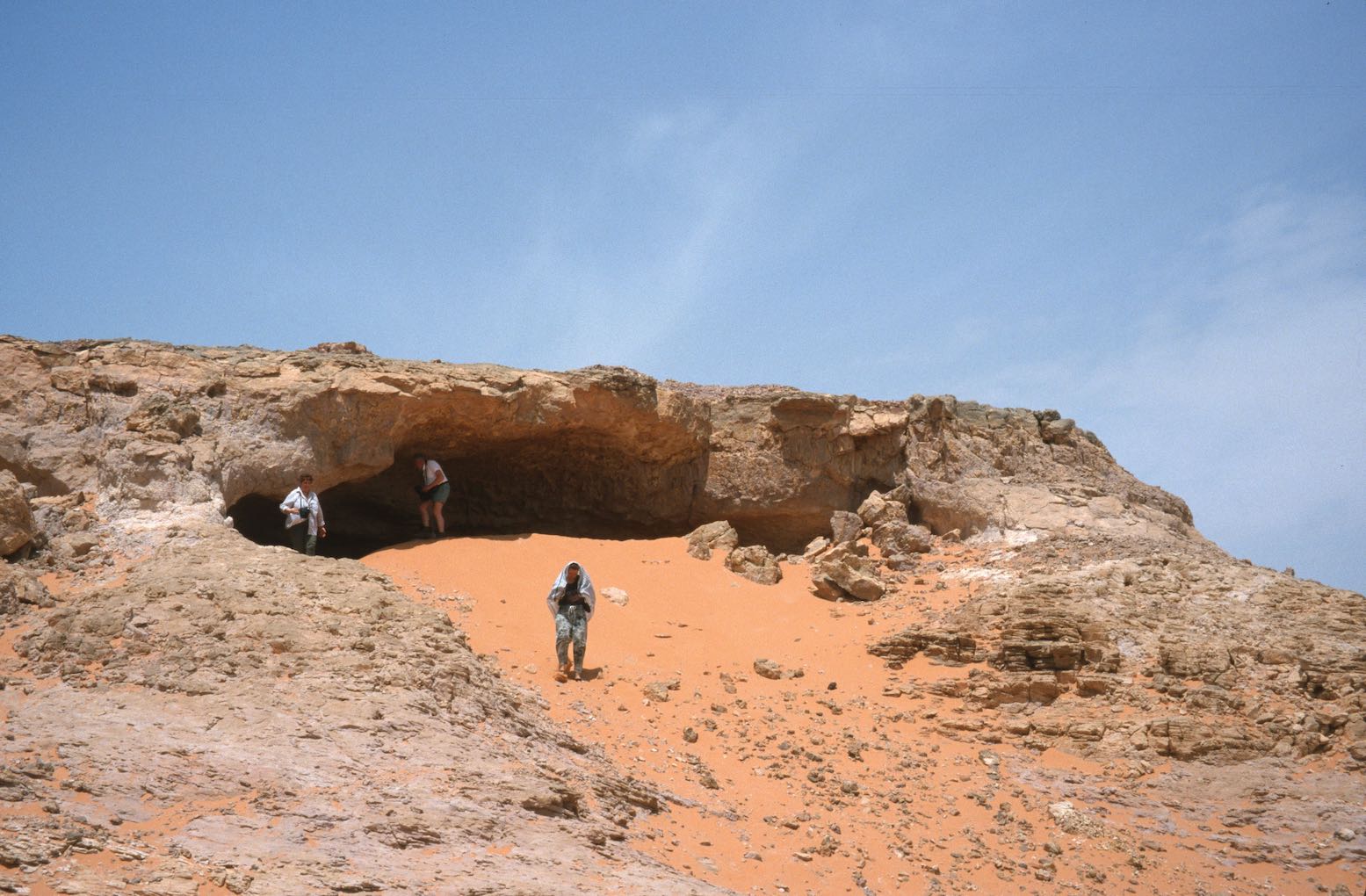
In Werner’s and my opinion, such a task is best left to lighter vehicles and, lacking a decent compressor, proper tyre deflation was not allowed, leading to inevitable boggings. I‘d let mine down at Shaw’s Difficult Crossing a few days earlier, but even then, every eastbound cordon was hard won, with the aid of hand held radios, foot recces and passengers strung out as markers to guide the white-knuckle driving around the soft spots. After an exhausting day, more arguments and attempted sabotage of the tyre valves by the nervous Egyptians, the idea was dropped and we headed back south towards the northern banks of the Gilf to pick up the track to Abu Ballas. All of us were very relived to be out of the dunes.
Apart from the food, for me the trip was a great experience. It was the first time I’d driven entirely off piste which I found surprising easy. I was merely following a lead car of course, but the almost complete lack of wadis in the hyper arid Libyan Desert makes cross country travel using GPS and maps or satellite imagery straightforward.
Day walks away from the car where also a novelty to me. Near pistes I’d always been nervous about leaving the ‘mother ship’, be it car or bike. But here there was no one for hundreds of kilometres in any direction and there’s no doubt that the desert is best appreciated at walking pace.
Interestingly Werner and I both recognised that even though we were as a far out as we’d ever been in the Sahara (certainly for me), we didn’t feel the remoteness. The fact that the organisation was Andras’ responsibility reduced the impression of deep wilderness experienced when you do it independently, at of course, some cost to your nerves. In this instance we were both happy that someone else – and better still, someone else’s car – where carrying that heavy loads.

A is for Assekrem

Part of the Sahara A to Z series

In just about the geographical centre of the Sahara lie the Hoggar mountains. Compared to the tawny sandstone of the Tassili N’Ajjer further east or the granite domes of the Tefedest and Tesnou, it’s a bleak, harsh landscape of basalt buttes erupting vertically from the barren landscape.

In the heart of the Hoggar massif is a dramatic cluster of eroded volcanic cores overlooked by the 9000-foot high Assekrem Pass, part of the Ahaggar National Park. Some maps call it the Atakor.

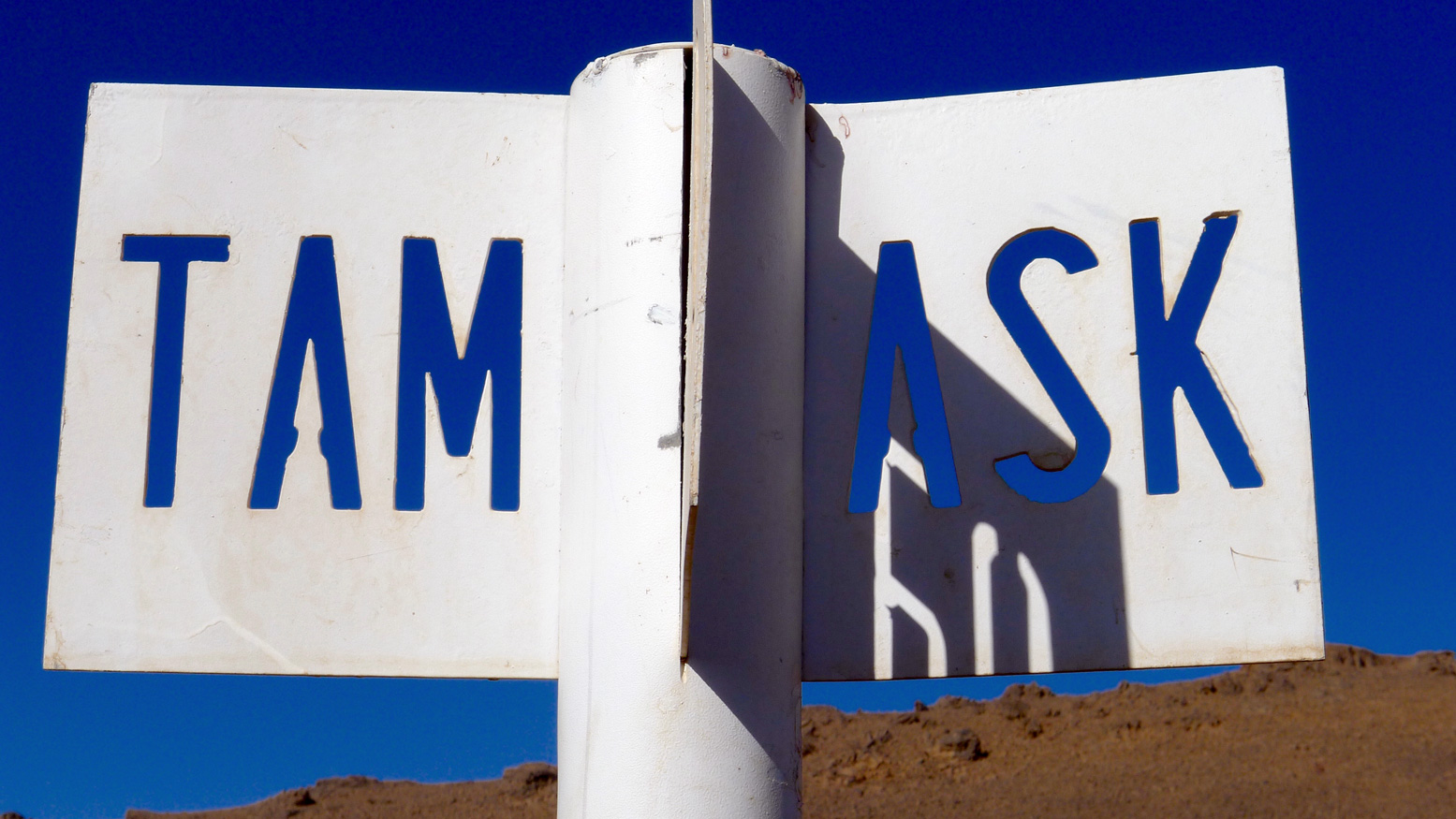
There are three ways to get to Assekrem: the regular 85-km eastern route up from Tam via Iharen peak. A gnarlier and slightly shorter western route which starts near the airport, then passes Terhenanet, though is usually taken as the descent from Assekrem to make a loop back to Tam as it’s easier to manage going down. Another route comes in from the north from Hirafok over the Tin Teratimt Pass (above).

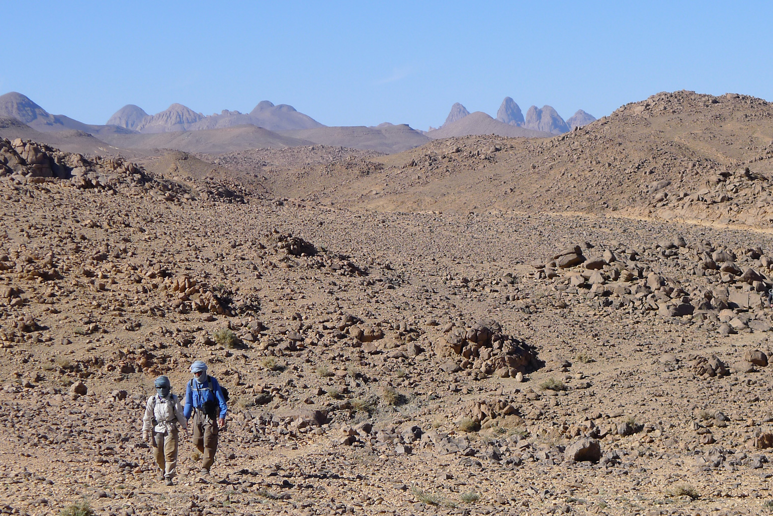
Or you can follow a network of camel tracks (above). It takes a week or more, depending where your start.

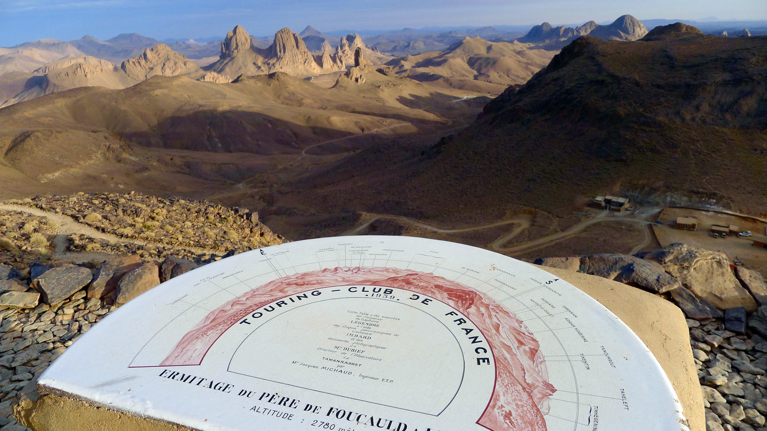
Assekrem is the best known of the many wonders of southern Algeria. A lodge sits on the saddle of the pass (above) where tourists spend the night to enjoy the stunning sunset and sunrise across the brooding volcanic monoliths from the plateau above the Pass.

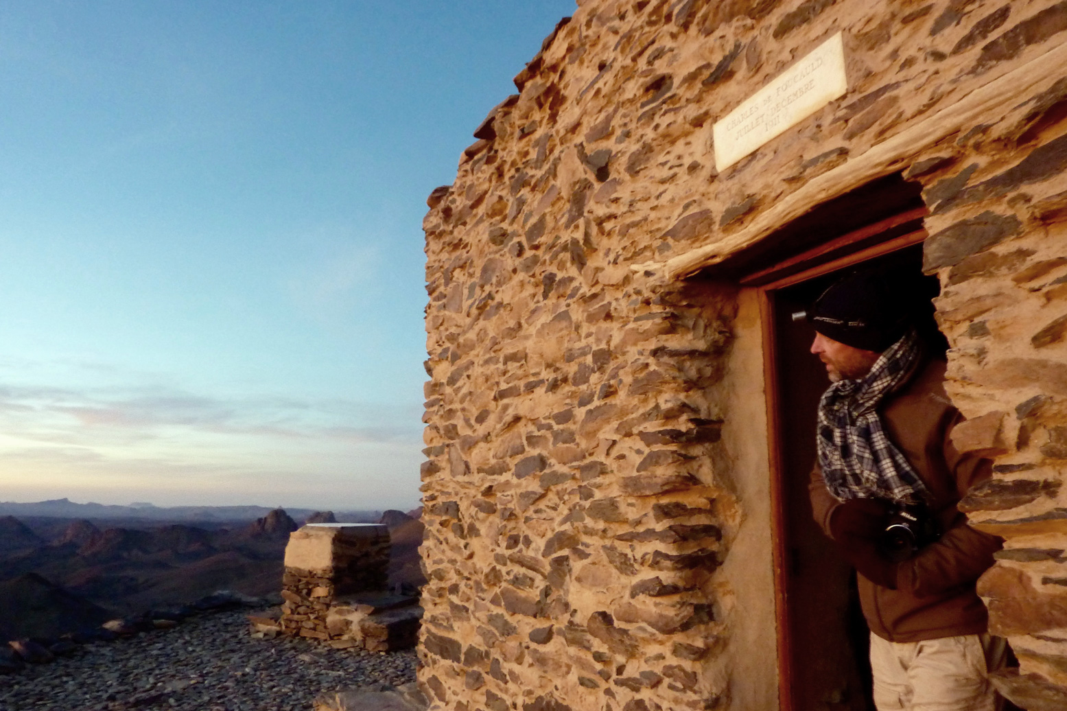
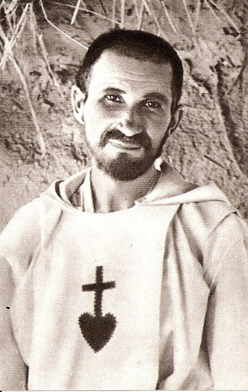
Though he spent most of his time in Tam, early in the early 20th century Charles de Foucauld, a French bon viveur and soldier turned missionary, built a crude stone hermitage on this plateau (above).

Among other things, Foucauld was responsible for the first Tamachek-French dictionary, and his house still stands in Tam. It was here in 1916 that Foucauld was assassinated as a suspected French spy, during the Senussi uprisings in Libya and Egypt. He was beatified in 2005 and the hermitage is still tended today by a couple of aged members of the order of Les Petites Frères de Jésus, who were inspired by Foucauld’s life.