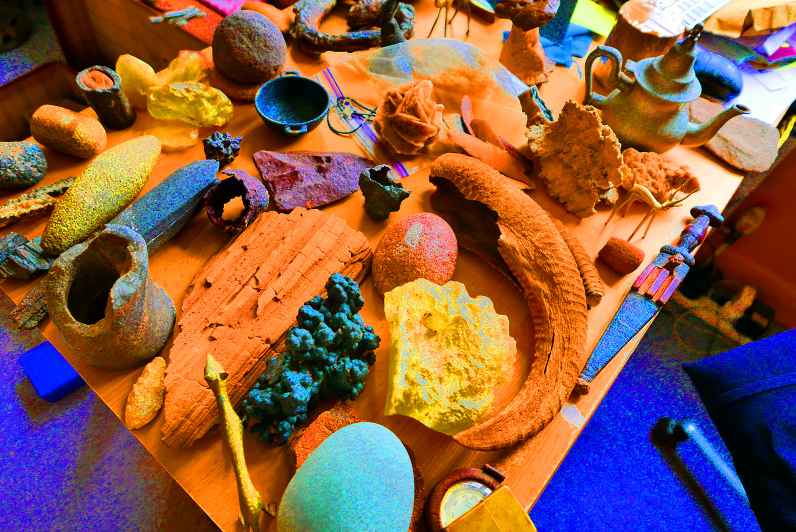
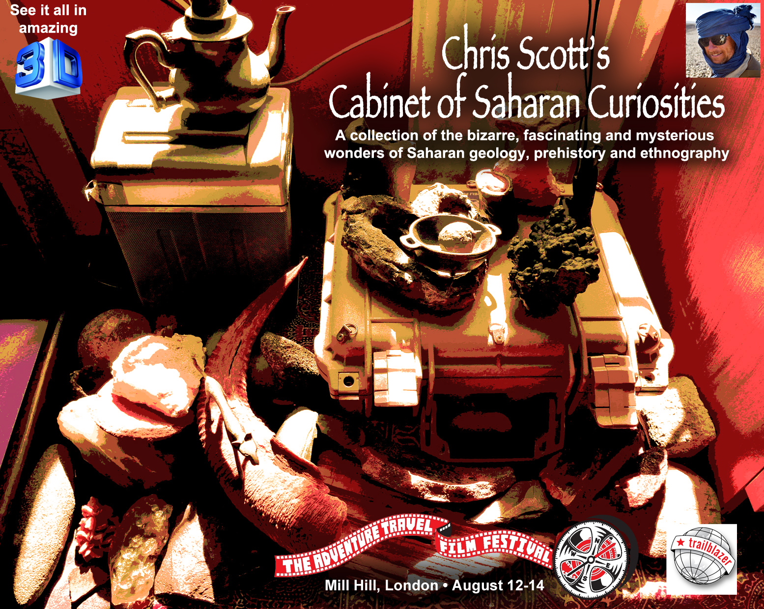
Come see my collection of Saharan curios at the Adventure Travel Film Festival next weekend at Mill Hill, north London. Over the years I’ve picked up numerous artefacts on the desert floor – from the tiniest, finely chipped arrowheads in the Bilma Erg to grinding stones on the Admer Plain, Palaeolithic hand axes in the Gilf Kebir, bizarre hematoidal concretions in the Libyan Desert, salt cake from the lost salines of Seguedine, fulgarites from the Tenere and the Great Sand Sea, and stone-age tools spanning eons of homo sapien activity from the Mauritania’s Adrar plateau to the Akakus and Jebel Uweinat beyond. Lots of other great stuff to see at the ATFF too.
The earliest old map I have looks like it’s from the medieval era, but was probably based on Herodotus’ Histories which was getting on for 2000 years old by this time. It was he that brought terms like ‘Libya’ (North Africa) and ‘Aethiopia’ (sub-Saharan Africa) into common usage.
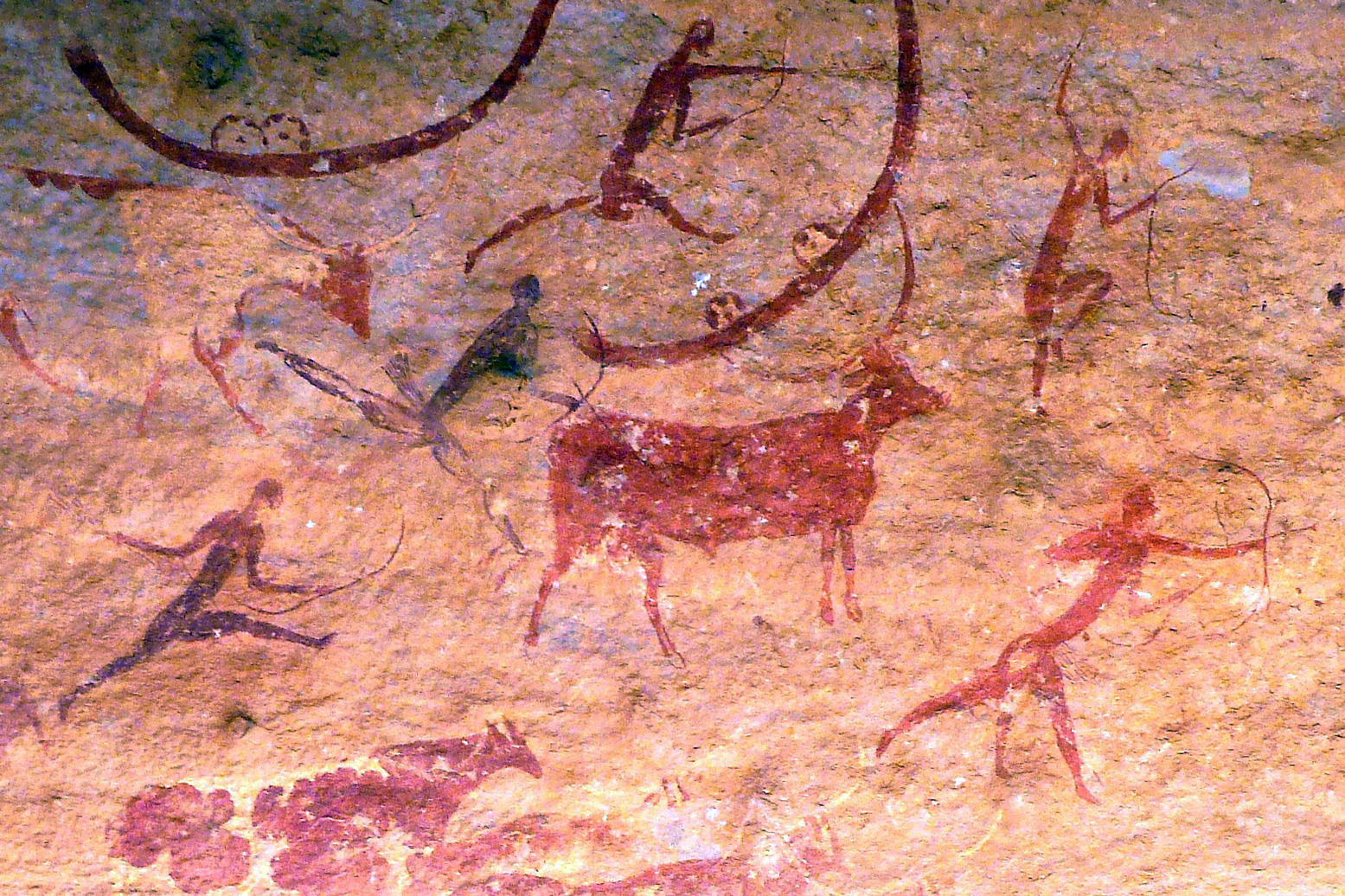
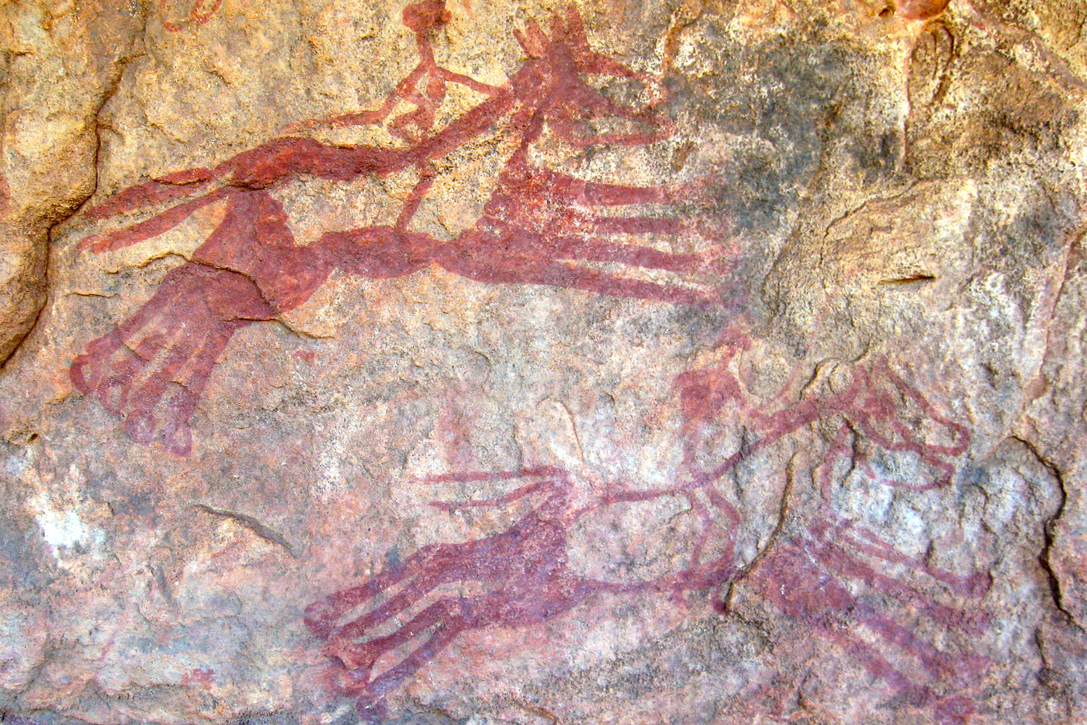
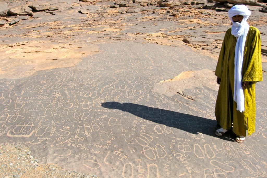
On this map ‘Mauritania’ is today’s Morocco, while the chariot-riding Garamanteans are correctly located around present day Germa in the Libyan Fezzan. It’s probably coincidental, but the ‘Barditi Montef’ (mountains) could be the Tibesti around Bardai – actually only 700km southeast of ancient Garama. (Left: rock art depicting chariots at Tim Missao well, 1200km southwest of Germa on the way to Mali. The Garamanteans are said to have got around.)
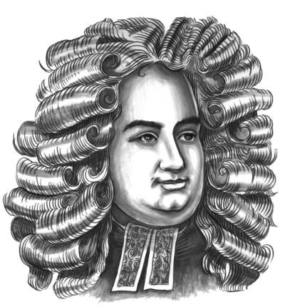
This map, but not 1554 Munster map above, may have been the best that Moorish wanderer, Leo Africanus’ (BBC doc) had to go on for his 16th-century travels across the region, venturing as far as Timbuktu, Cairo and possibly even Mecca. Along with Ibn Battuta’s travels a couple of centuries earlier, it was Africanus’ Description of Africa (1550) which expanded knowledge of the Sahara. But despite the efforts of Africanus, even by 1700 or so, satirists like Jonathan Swift (right) were said to have quipped:
So Geographers in Afric maps With Savage Pictures fill their Gaps
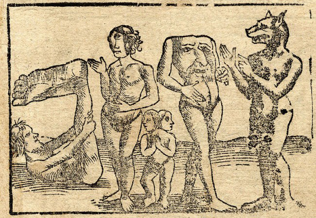
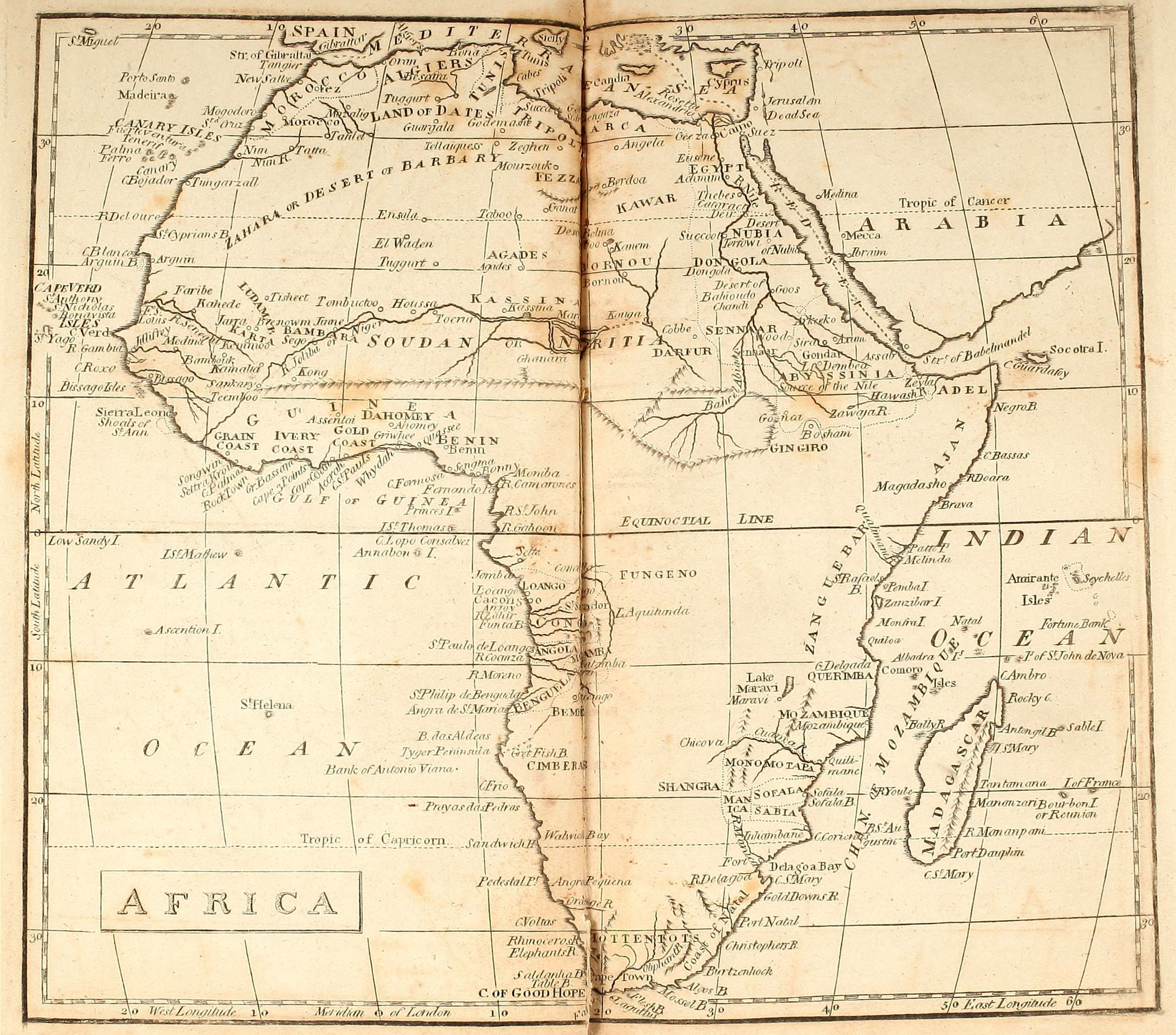
Fast forward a few centuries and there be no dragons or other medieval monsters (left) on this map of Africa dating from an atlas produced in 1803. It’s credited to William Kneass who later became Chief Engraver of the U.S. Mint in Philadelphia. Instead, the advent of scientific enlightenment had brought us longitude, latitude and the ‘Equinoctial Line’.
The mariners of the era had succeeded in very accurately mapping the outline of the African continent, but the interior, including the ‘Zahara or Desert of Barbary‘, remained blanks. South of the Sahara the most notable inland incursions were made by the early European colonies around Cape Verde and Guinea Bissau, Angola, the Cape and Mozambique. In the north Egypt and the Nile are better mapped all the way into the Biblical lands of Abyssinia. The Moroccan imperial cities are present: ‘New Salle’ being Rabat, with Marrakech labelled as ‘Morocco’. Never linked those two words before, but presumably they’re both based on ‘Moor’ so it makes sense.
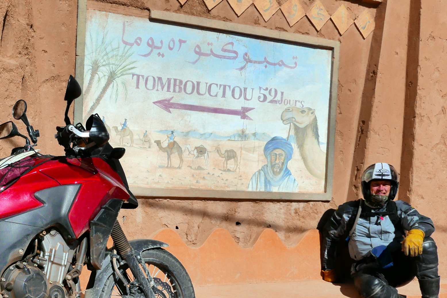
South of the Atlas ‘Tatta’ appears to be close to Tata, with the Oued Draa known as the ‘Nun’. The 16th-century Portuguese trading post of ‘Mogodoro’ is Essaouira, and Tarfaya at Cape Bojador was then called ‘Tungarzall’. To the east you’d have thought that Sijilmassa near Erfoud might have got a mention. It was the northern terminus on the ’52 day’ caravan route from Timbuktu.
Further south in Western Sahara and Mauritania, ‘St Cyprian’s Bay’ became Golfe de Cintra after a Portuguese mariner and slaver got killed nearby at Arguin (also labelled). Inland from here, only ancient ‘Tisheet‘ gets a mention, on the old Dhar Tichit caravan route.
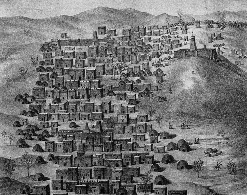
I remember going to a talk in Nouakchott about the medieval glass trading links between Tichit and Venice. Tichit didn’t look like much when we were there in 1990 (right; it’s all in D. Travels), but it’s a historic settlement on a par with Timbuktu (above left; as seen by Caillé in 1830), Oualata, Chinguetti and Ouadane. The latter may be the ‘El Waden’, misplaced way north of Timbuktu and not far from ‘Ensala’ which could be even more distant In Salah in Algeria. At this point it was still a couple of years before the American sailor, Robert Adams briefly ended up a slave in Timbuktu. Among other things, his account helped kick off the race to reach this fabled Saharan ‘Shangri La’ and with that, the great age of European Saharan exploration as listed rather Francocentrically on the 1898 map below.
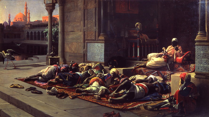
Eastwards on this 1803 map, many places in Algeria are recognisable: ‘Tuggurt’, ‘Guargala’, (Ouargla) and over the border in present day Libya: ‘Godemashe’ (Ghadames), ‘Mourzouk’ and ‘Ganat’ (Ghat). ‘Zeghen’ was less easy to pinpoint, visited by James Richardson while on the road from Tunis to Ghat and back up to Tripoli in 1845-6. At the time Richardson estimated Zeghen’s population at ‘200 men, 300 women, and 700 children and slaves‘. Our man Duveyrier (see below) locates it for us a short distance northwest of Sebha in the Wadi Ash-Shati, on the way to ‘Sockna‘. Here Richardson spent some time as a guest of the Turkish Caid and his comely concubines.
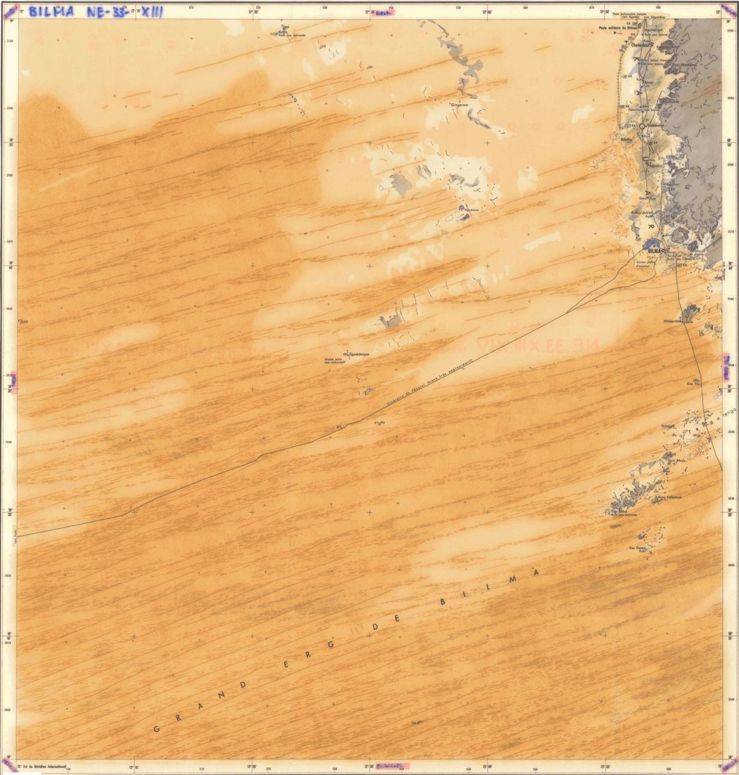
‘Berdoa’ is the old name for Kufra in southeast Libya, and south of there, on the page’s fold, is the enduring salt oasis of ‘Belma’ (left) at the base of Niger’s ‘Kawar’ escarpment. The hyper-arid and largely uninhabited Libyan Desert around Jebel Uweinat wasn’t to be explored until the 20th century.
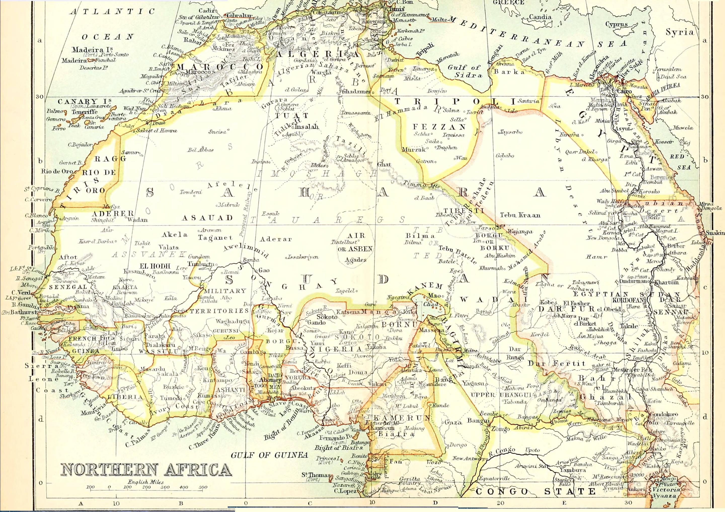
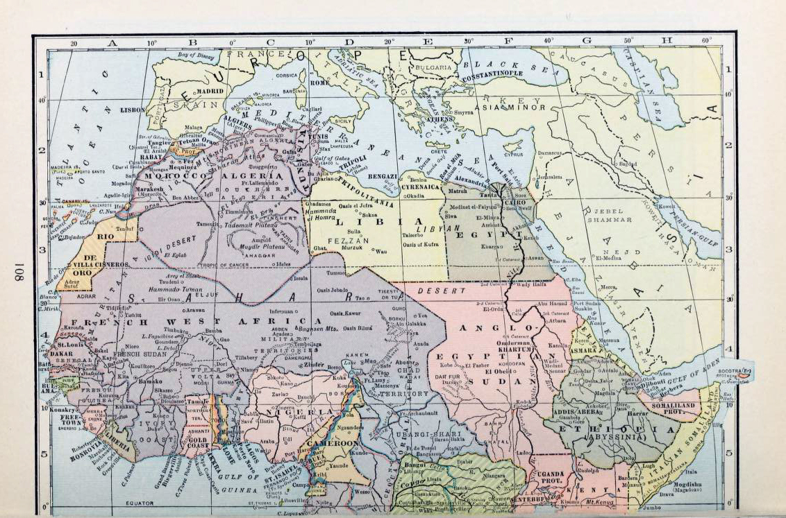
Fast forward a hundred and one years and the Saharan blanks begin to fill up. Below is the ‘Northern Africa’ plate extracted from a Bartholomew’s Handy Reference Atlas of the World dated 1904 (source) and which differs very little from my 1888 version.
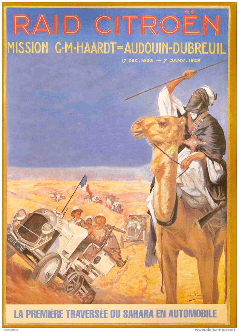
The interior is still sparse, but the proposed trans-Saharan railway gets a mention. Running across the flat plain of the Tanezrouft, in 1922 it was the actual route taken by the first cars – Citroen Kegresse autochenilles (half tracks; left) – to cross the Sahara north to south and back. In the west ‘Shinghit’ is a bit out of line with Atar and Wadan, but in the ball park. To the south is the ghost town of Ksar el Barka and ‘Portendik’ must be early Nouakchott, though you wonder what became of ‘Mufga’ near grubby Choum of today. Ancient Taghaza (as visited by Ibn Battuta) never gets a mention on any of these maps, but it’s replacement, the newer salt mine at ‘Towdeni’ was a key point on the ’52 days’ caravan route to Sijilmassa. In northern Mali, ‘Essuk‘ whch hosted the early Tuareg music festivals before they moved to Timbuktu and long predates today’s Kidal. Meanwhile in Algeria the Amadror salt mines get one of their last calls. Wau crater in Libya gets a name check too, there’s brackish water there, but due to the mosquitoes it was never a settlement. Up in the Mediterranean, Crete is oddly identified by its ancient name of Candia, perhaps intended as a poke at the despicable Ottomans?
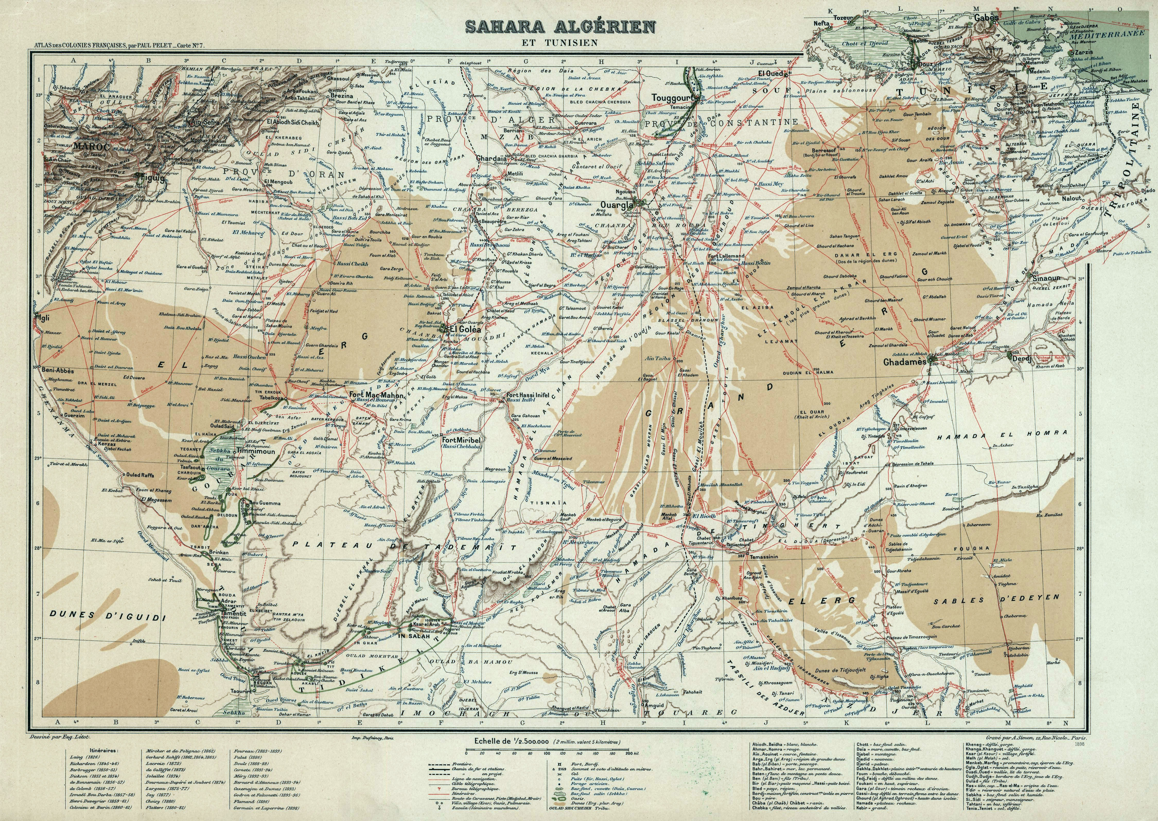
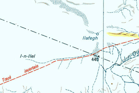
Above,Dufrenoy’s intriguing and amazingly detailed map from 1898, centred on the southern limits of French-controlled Algeria. The red lines identify the itineraries of that busy century’s wave of Sahara explorers, from Laing’s fatal excursion to Timbuktu in 1826, right up to Laperrine, who in 1898 set out to quell the southern Tuareg with his Méhariste Camel Corps and died in a plane crash southwest of Tam in 1920. Note too the route of Flatters’ disastrous missions of 1880-1 (as described in Desert Travels) when the handful of harried survivors crawled back to Ouargla, having out-run the Tuareg who’d trailed and picked them off one by one.
Back-tracking a bit, the 1881 Flatters Mission – partly intent on reconnoitring a railway route between the Maghreb and France’s territories in West Africa – wouldn’t have got half as far as it did without Henri Duveyrier’s amazingly detailed map of1864. It was based on his journeys there a few years earlier, described in Les Touaregs du Nord. Tamanrasset was merely a oued; Silet, In Amguel and Ideles on the other side of the Hoggar were established settlements. The tomb of Tin Hinan (left) even gets a mention, though it’s a bit misplaced from actual Abalessa.
Further out on the Tanezrouft the strategic well of Tim Missao (the chariots, above) and the waterhole at In Ziza (left) are labelled, but in Libya the Murzuk sand sea is just an ‘unnamed hammada’ separating the Tuareg from Tubu. There’s plenty more mouth-watering detail if this area means anything to you, and Duveyrier’s inset helpfully lays the ancient geographical names alongside their modern counterparts.
Not a Sahara map but a world map from 1914 as the British Empire began the descent from it’s late-Victorian apogee. In an era before flight and in the golden age of ocean liners, it illustrates just long it took a citizen of Albion to reach the far flung corners of the world. Central Sahara is up there at the end of the scale, alongside the Amazon, Outback, Congo, Tibet and Siberia. The widespread adoption of the motor car would soon change that.
How time flies. It’s now 1933 and above, France’s African colony encompasses half the Sahara and most of West Africa. Tamanrasset and Djanet, which even then must have been the biggest towns in southern Algeria, are still missed out, but then this isn’t a French map. In Mauritania Tidjikja makes an appearance, so does Iferouane in the Aïr and Tindouf up in Algeria. ‘Marakesh’ looks like it’s still ‘aka Morocco’ where the Spanish cling on to protectorates in western Sahara (Rio de Oro), Sidi Ifni and on the north coast, but not for long. Within 25 years the Sahara would take on the borders and principal towns with which we’re familiar today.
Who can resist the superb ‘Uweinat’ map (below) originally published by the Survey of Egypt in 1945. One of the most fascinating corners of the Sahara, much of its detail was based on the intrepid explorations of Ralph Bagnold in the 1920s, as well as later Brits, some of who were fictionalised in The English Patient movie. The last time we travelled there (left), it was still the best paper map available for that area, notwithstanding the newer aeronautical TPCs.
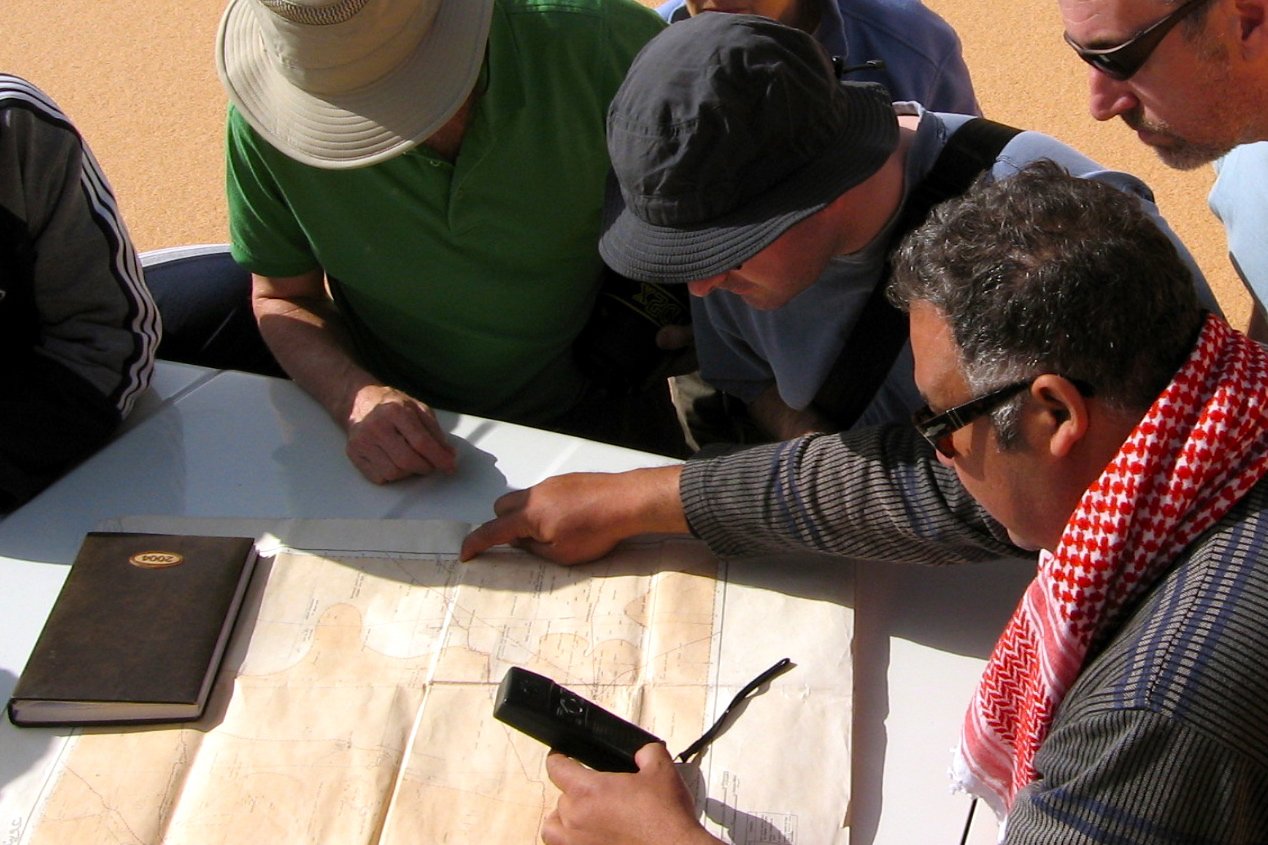
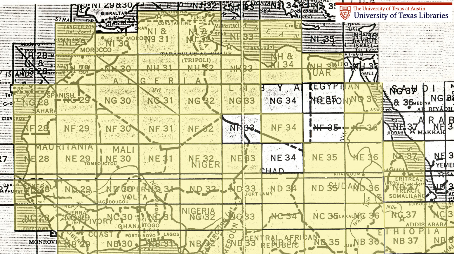
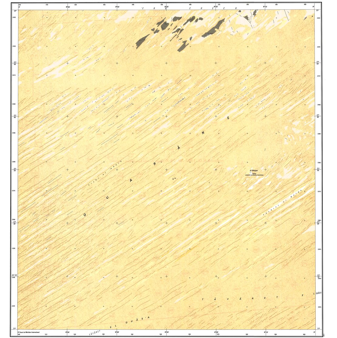
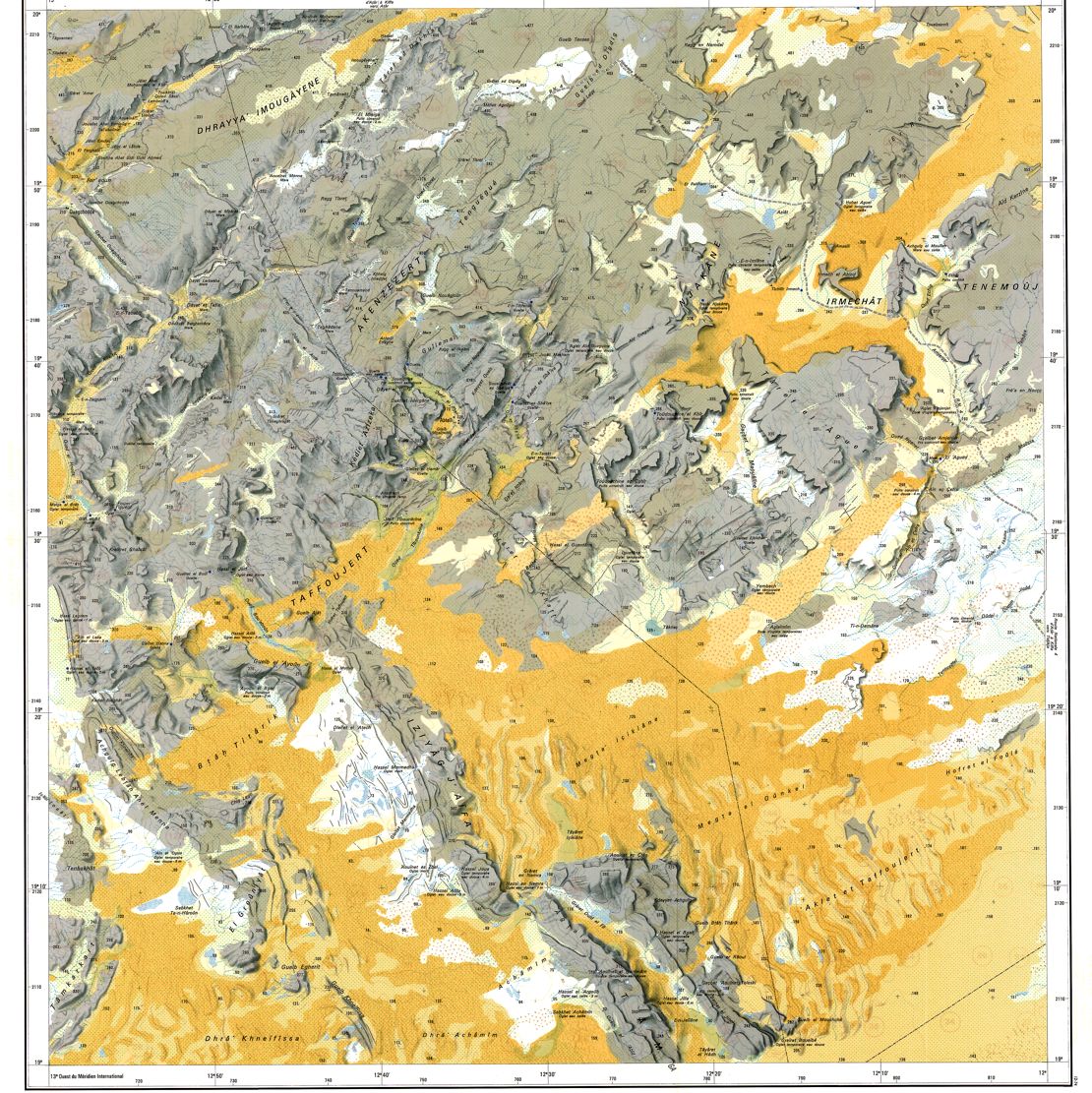
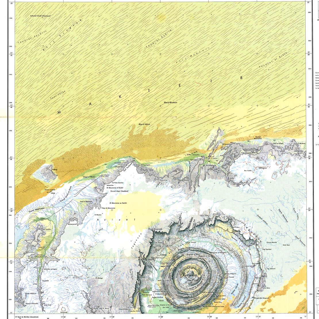
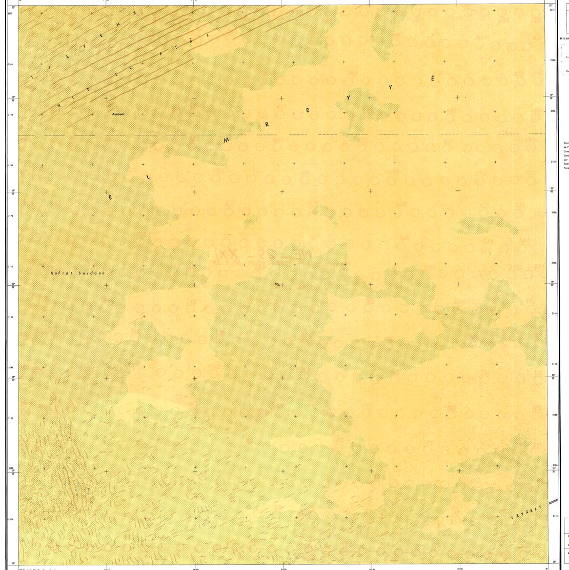
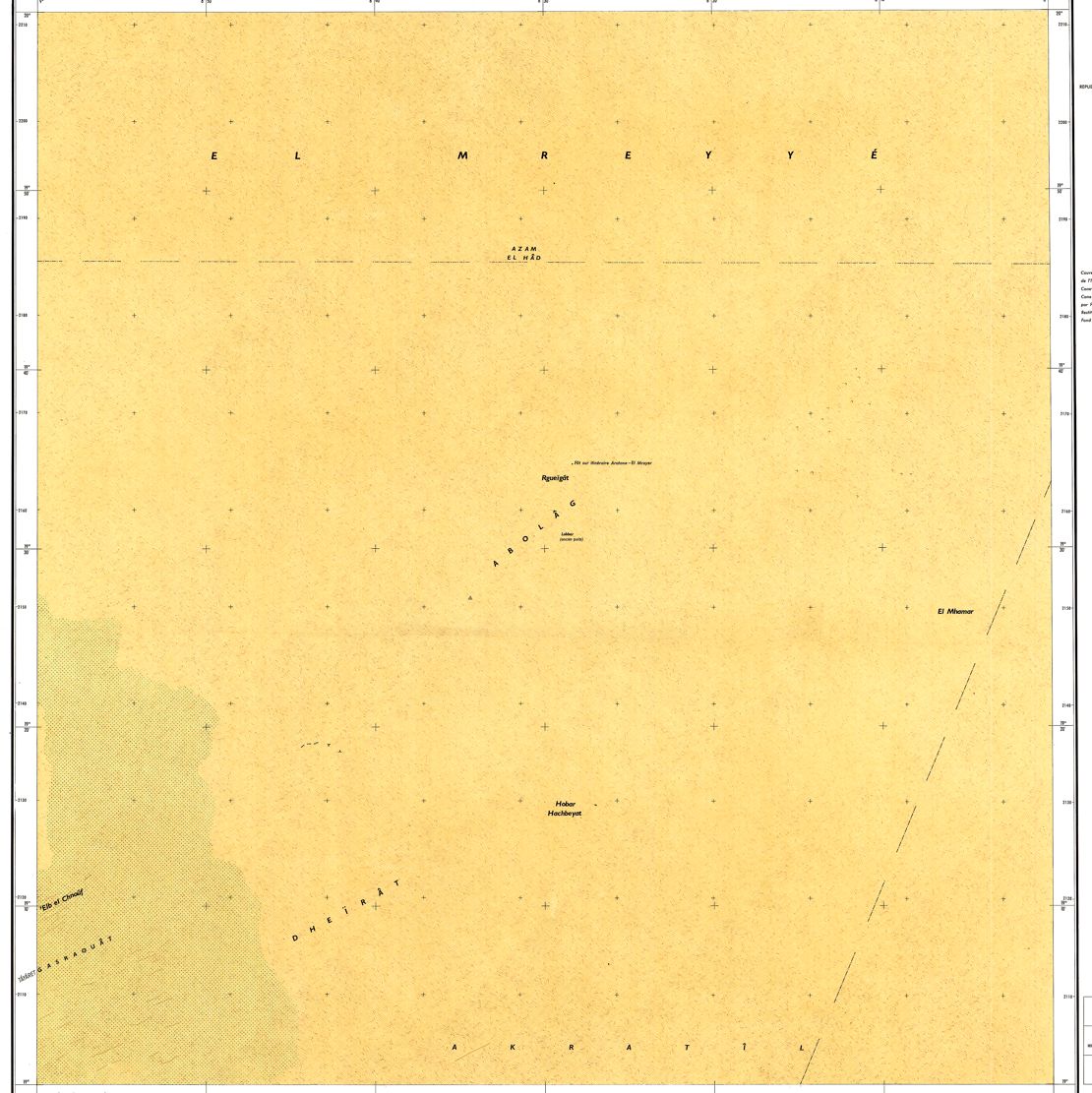
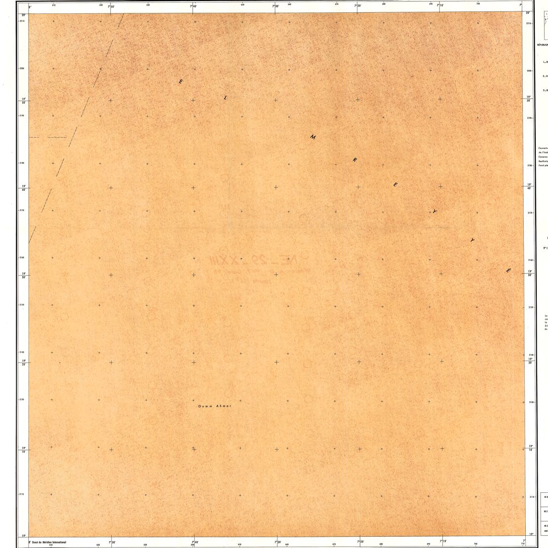
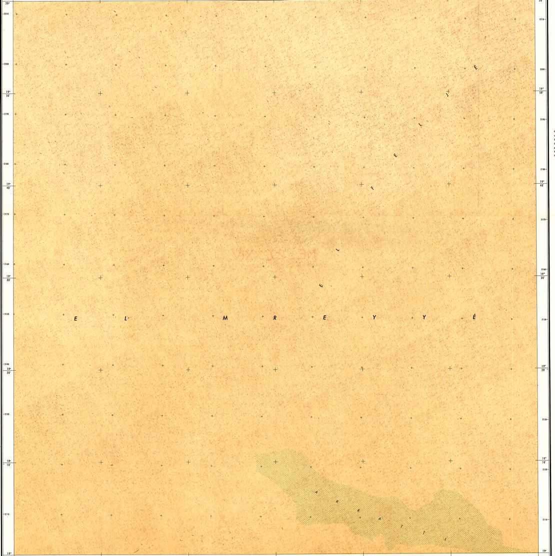
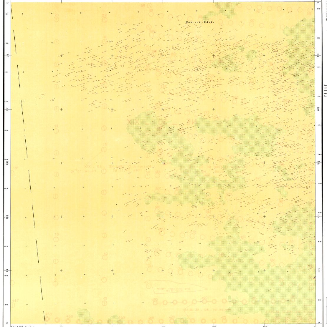
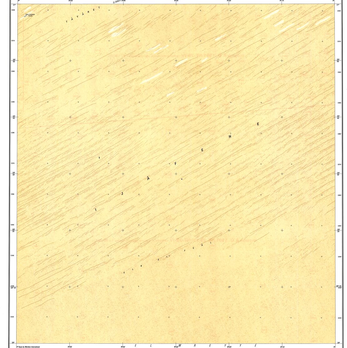
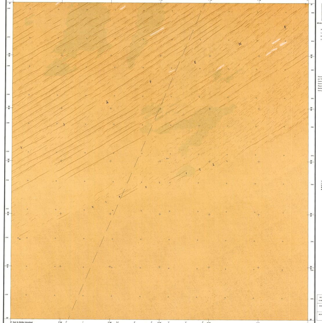
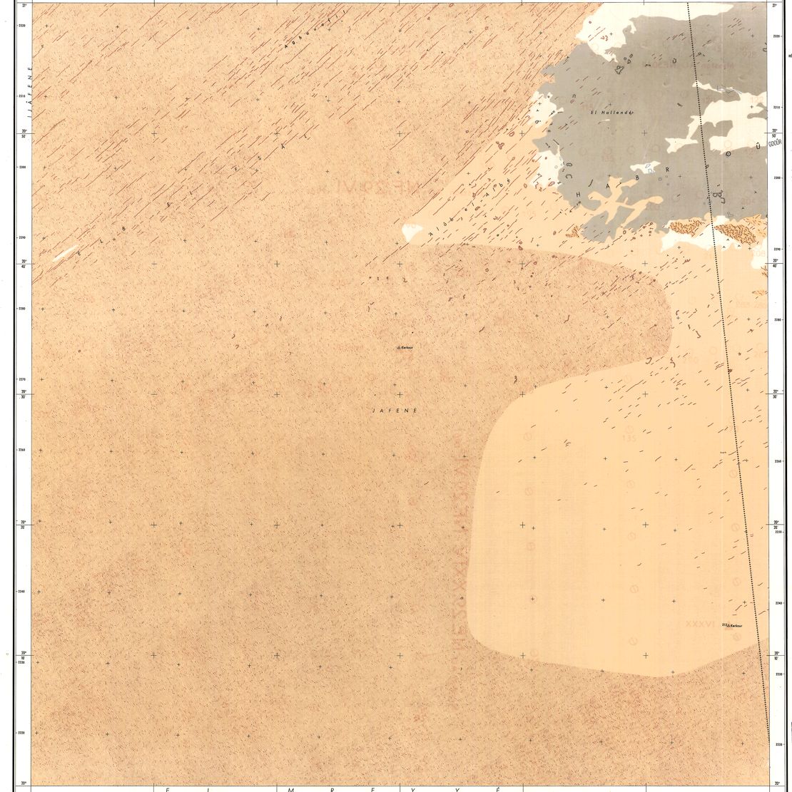
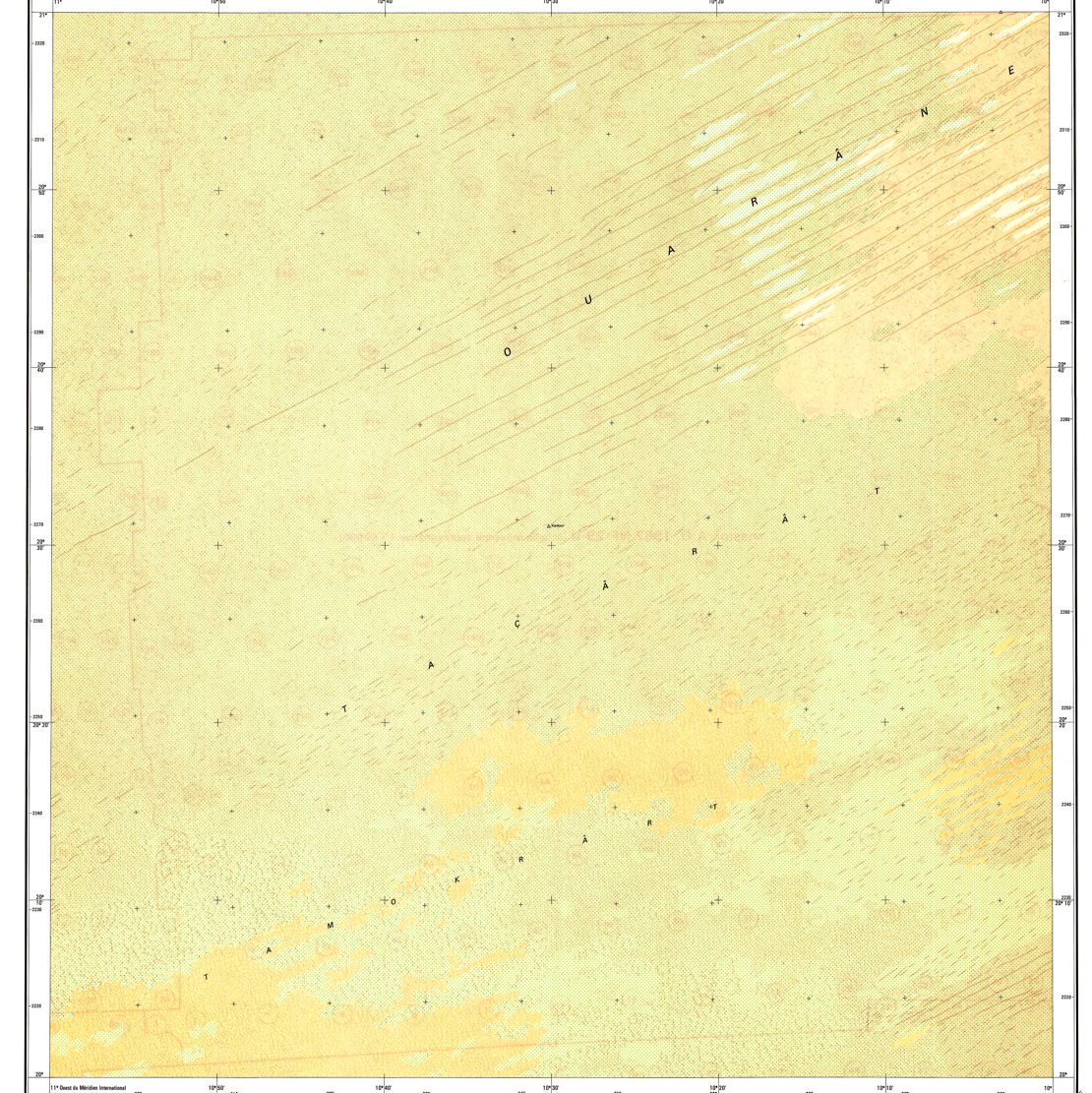
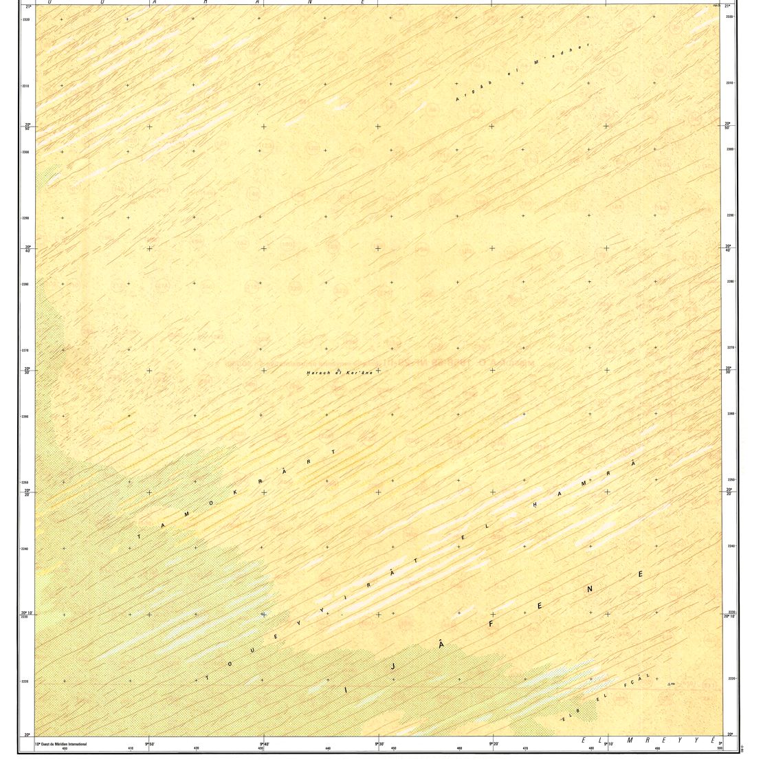
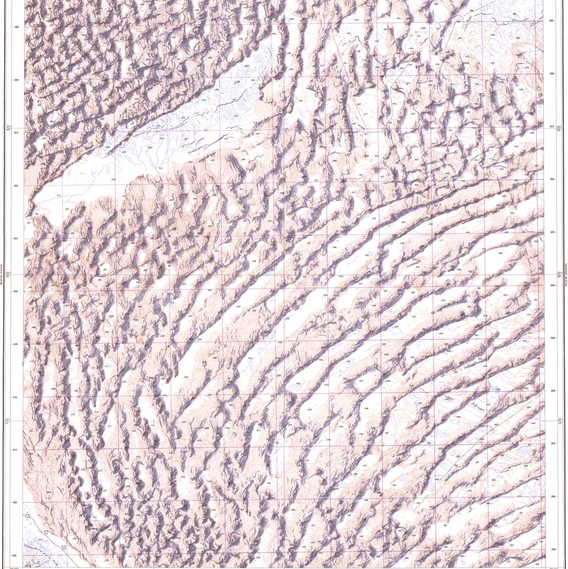
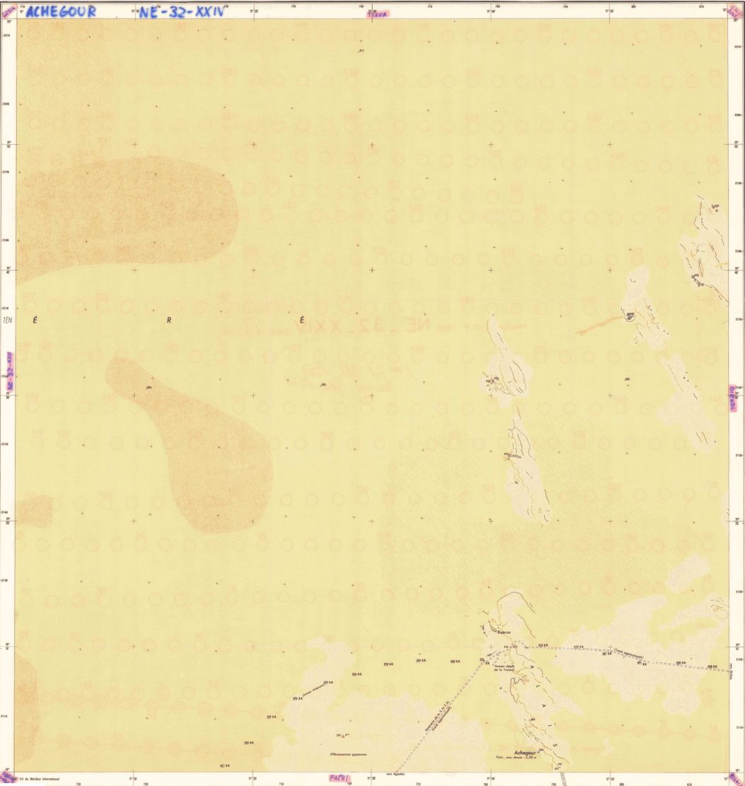
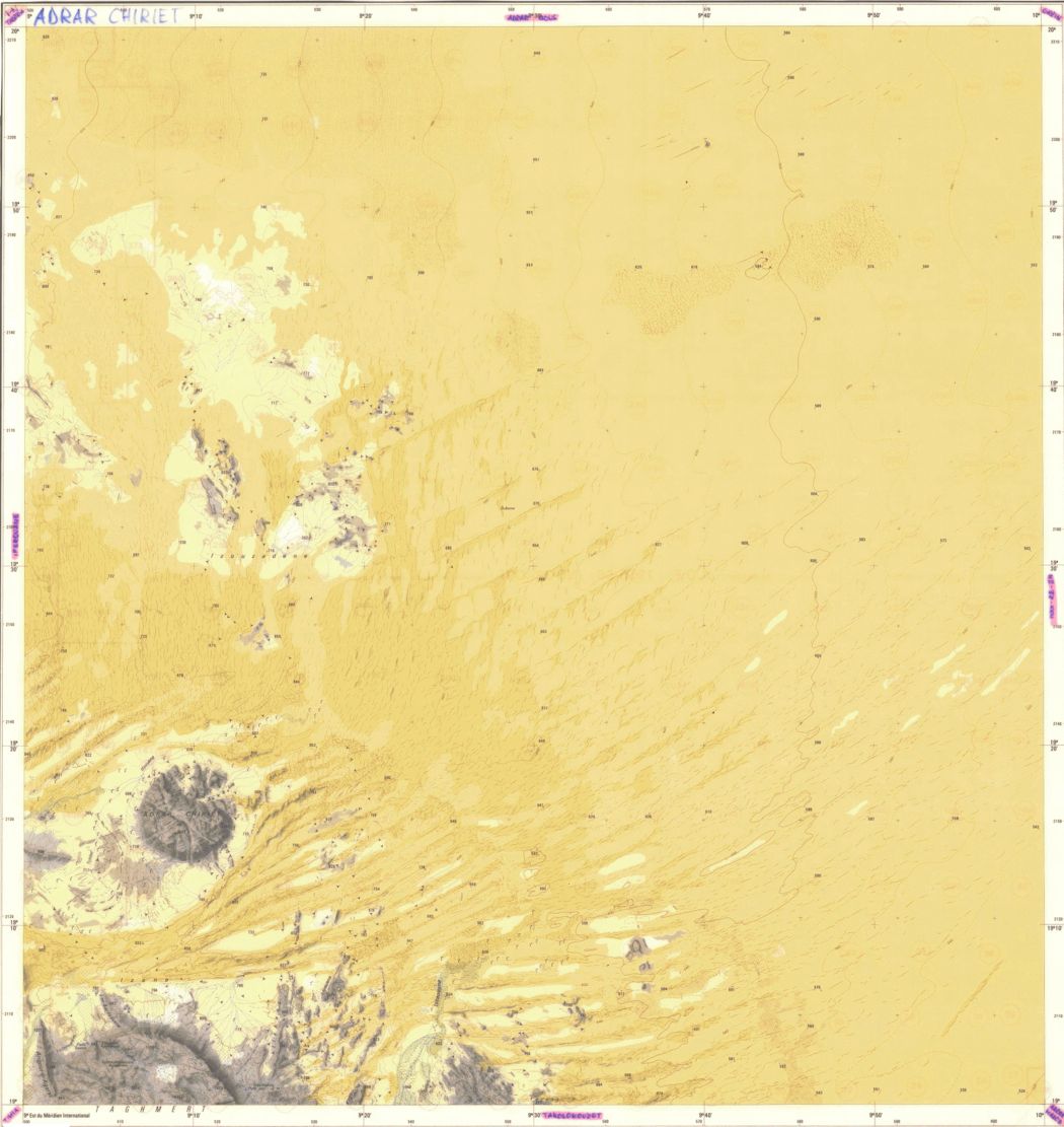
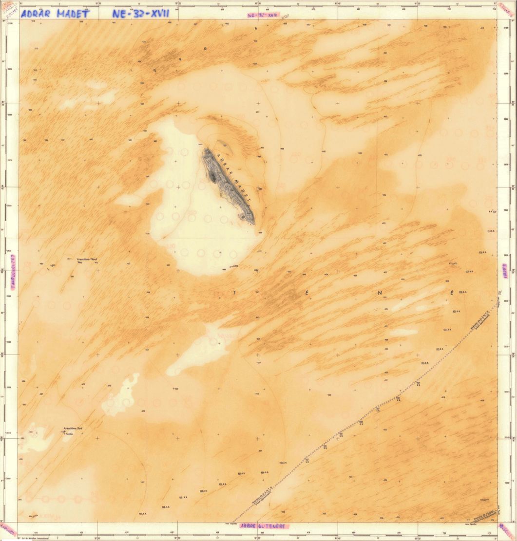
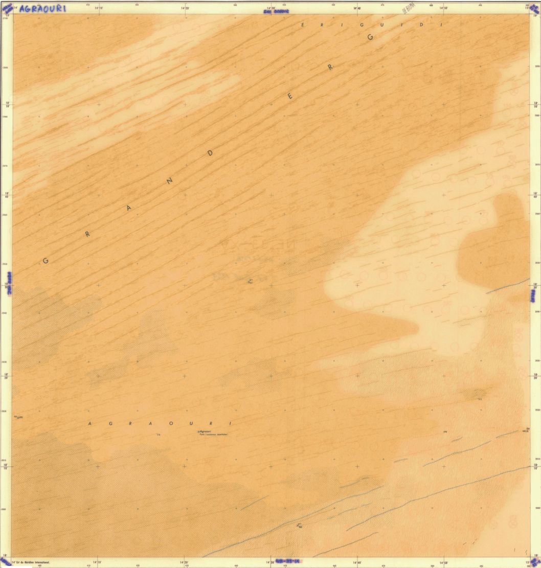
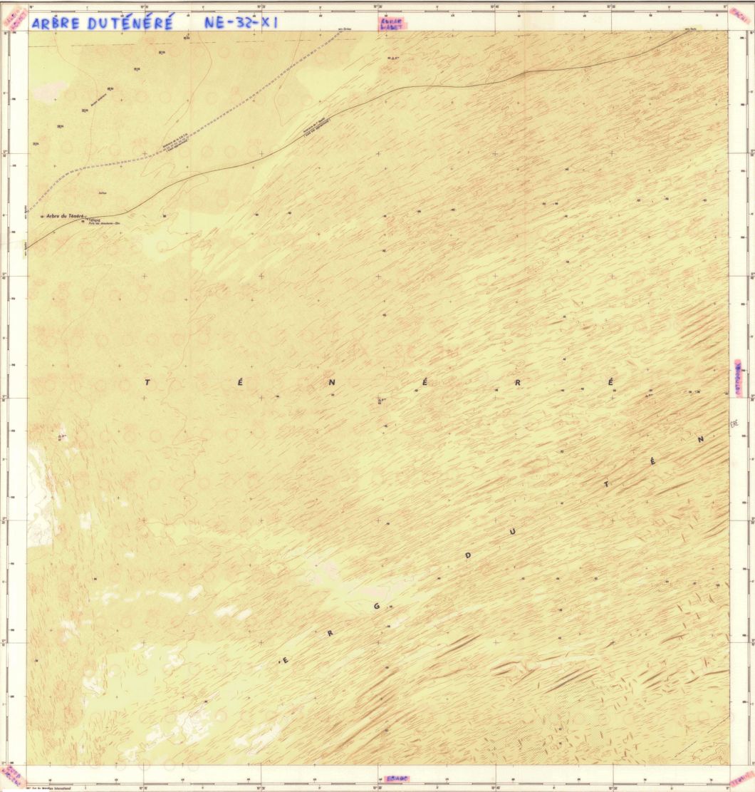
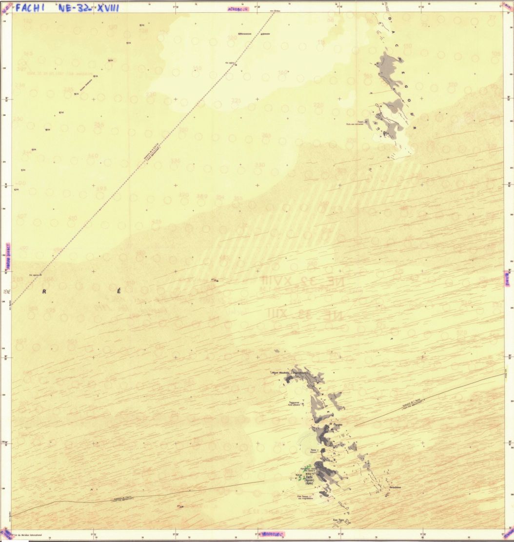
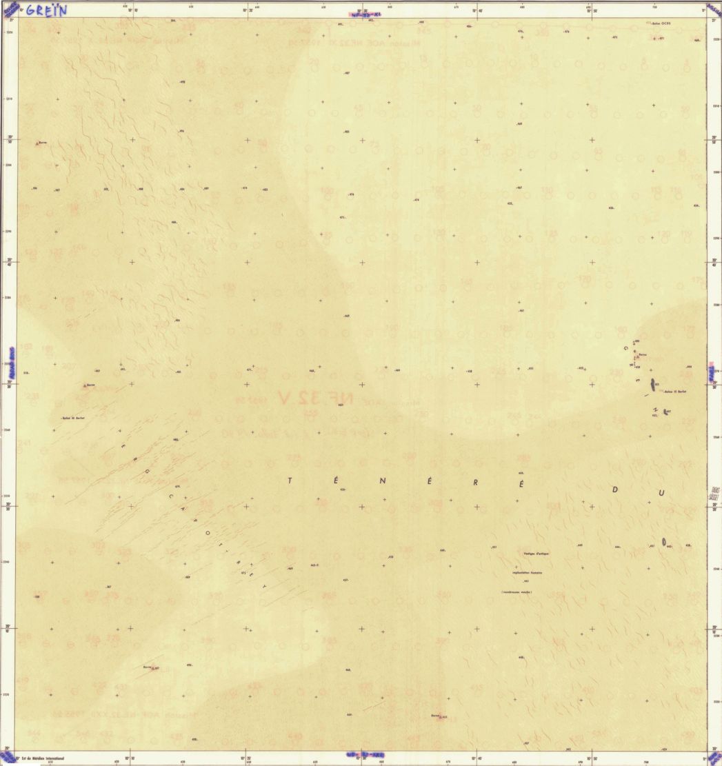
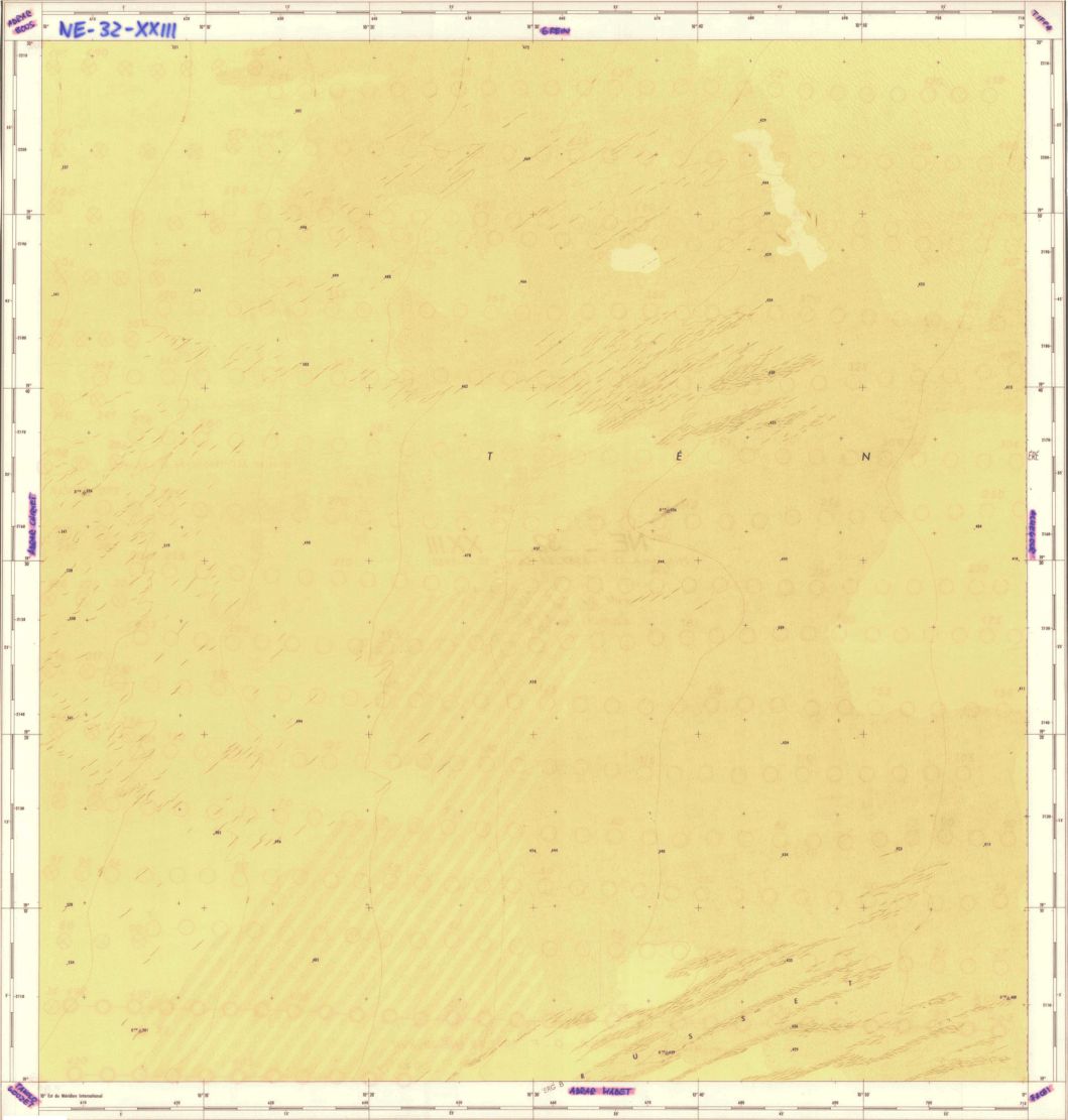
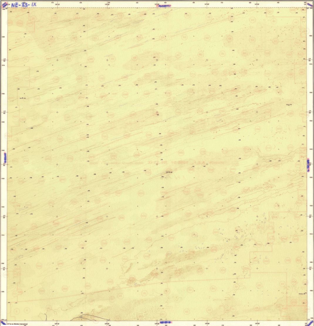
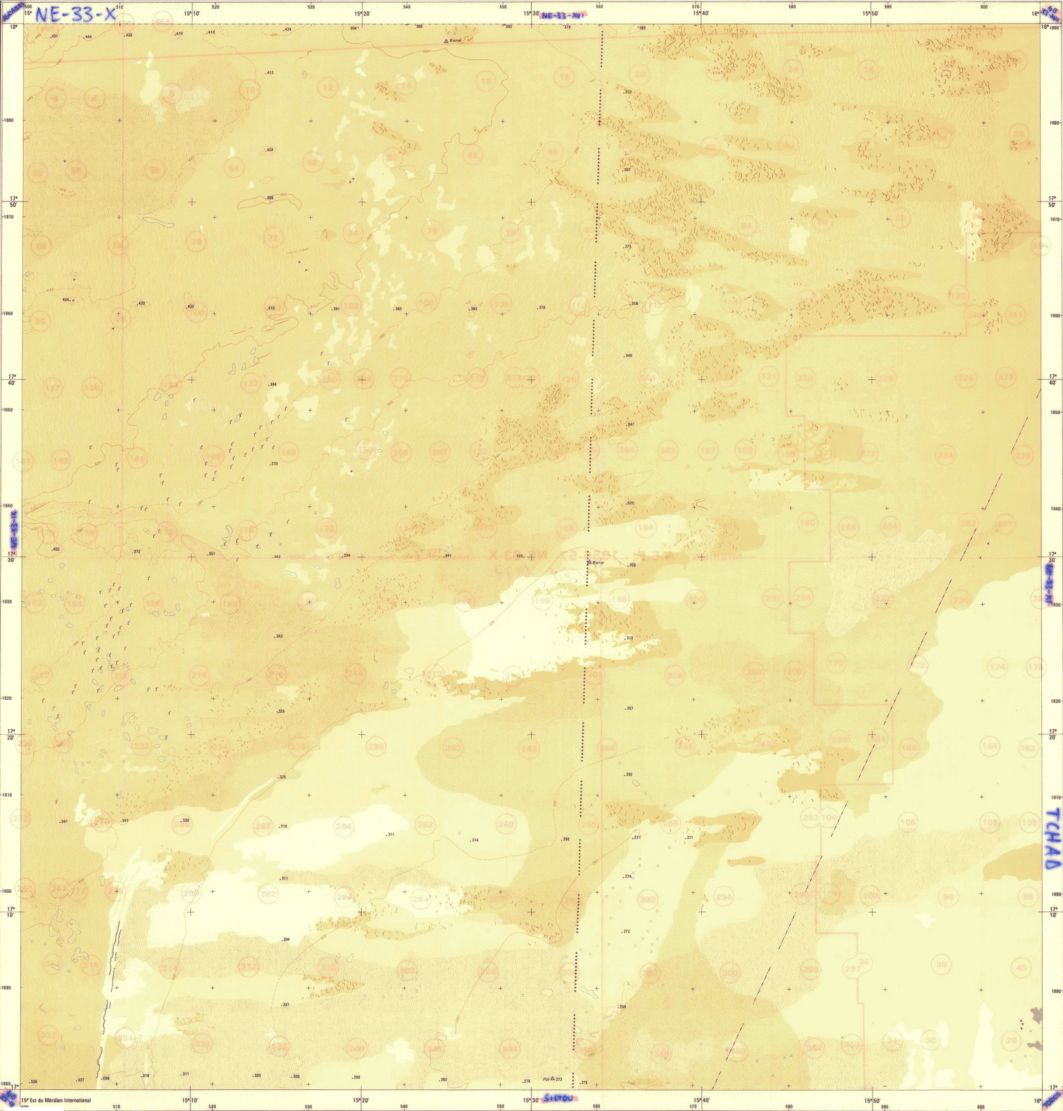
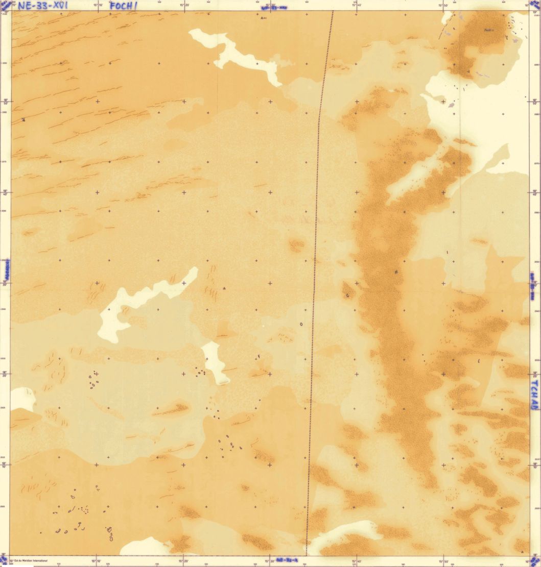
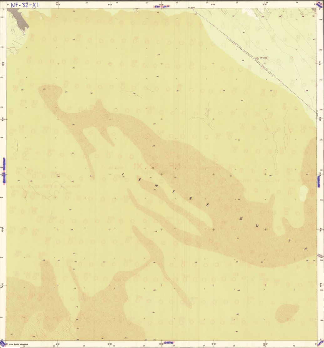
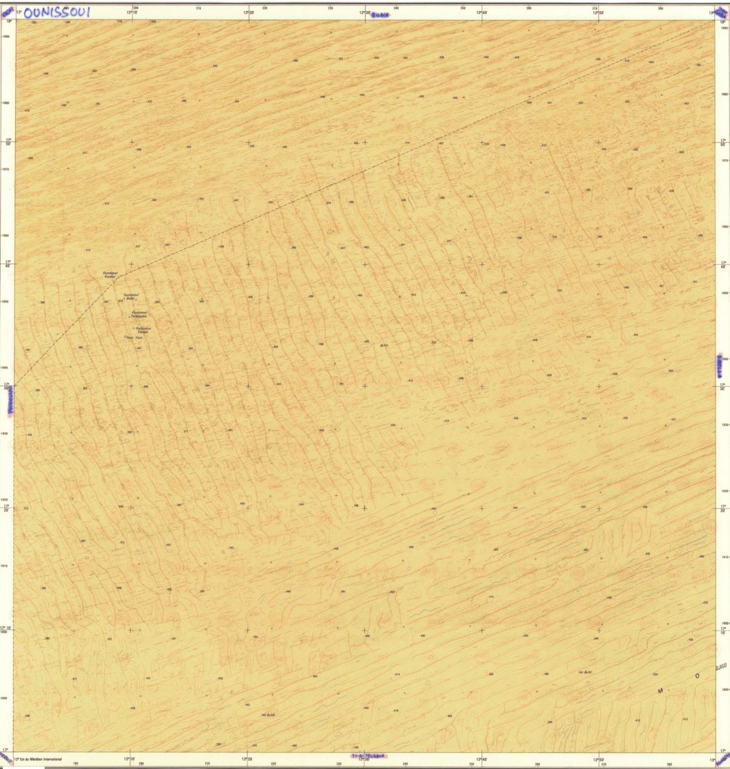
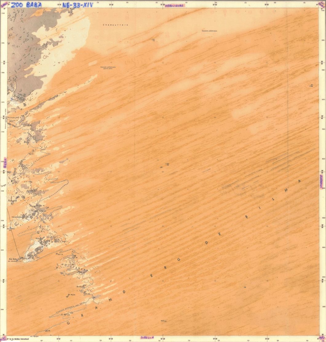
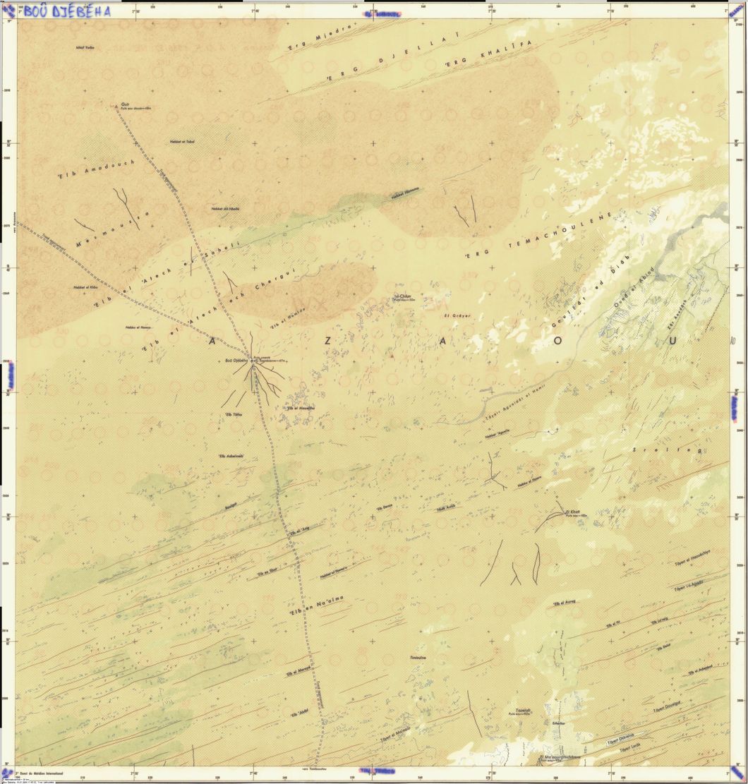
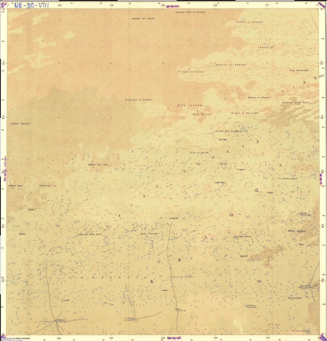
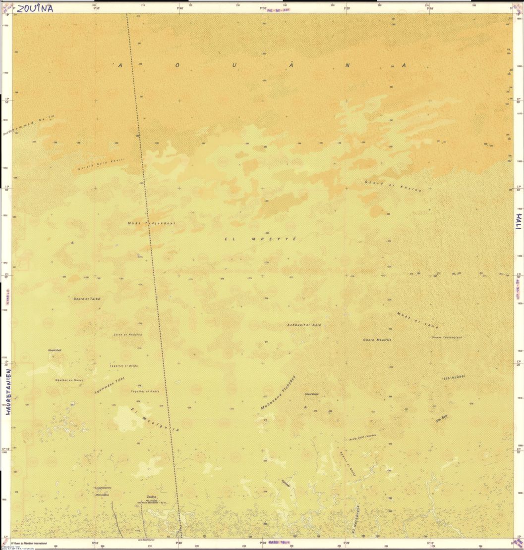
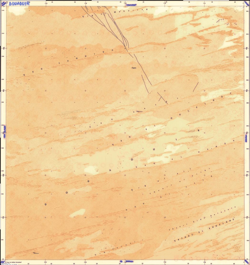
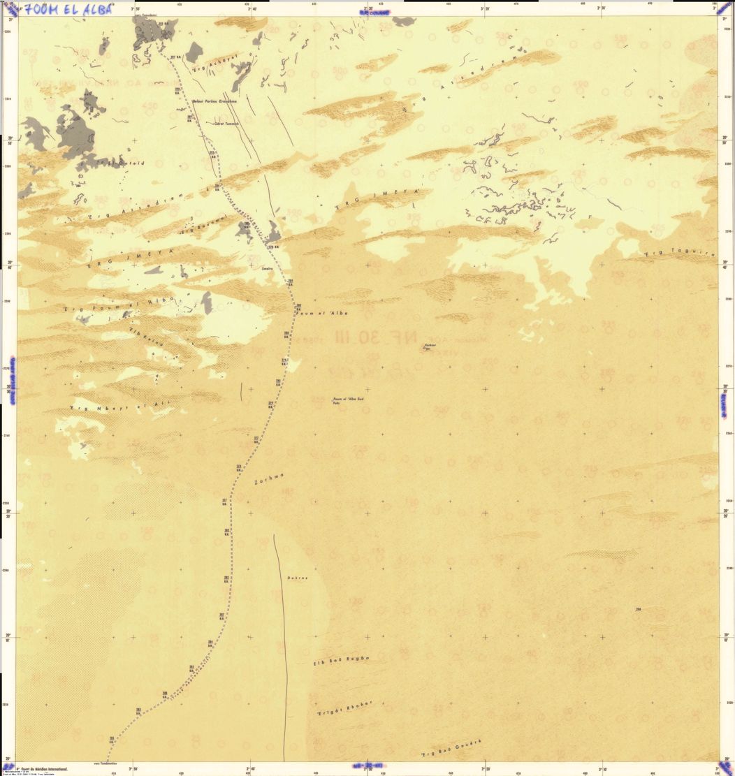
Old Saharan mapoholics will be familiar with the Austin TX university’s comprehensive online database of full-sized Saharan maps dating more or less from the early 1940s. Click this to get to the index pictured below and thank you Austin.
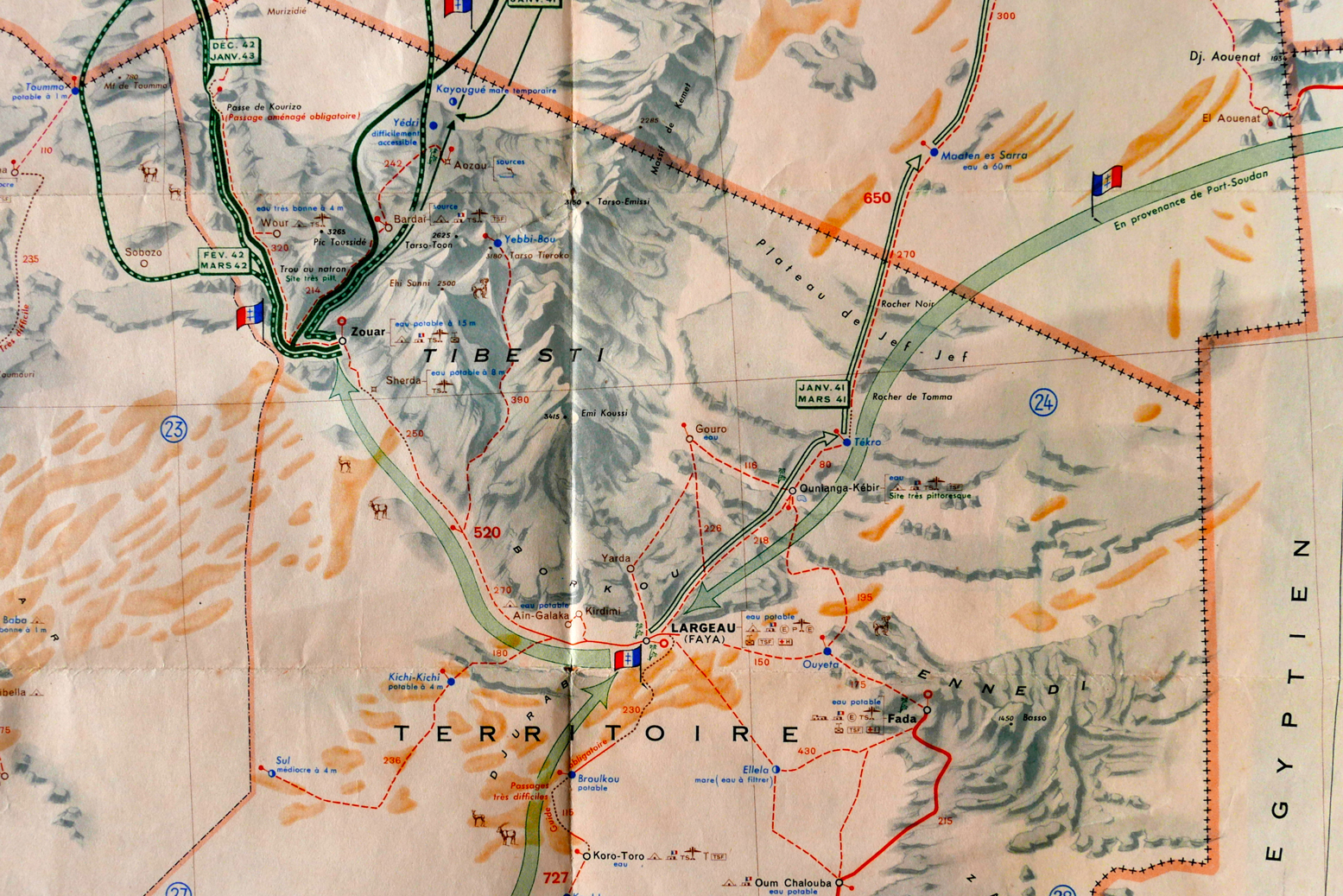
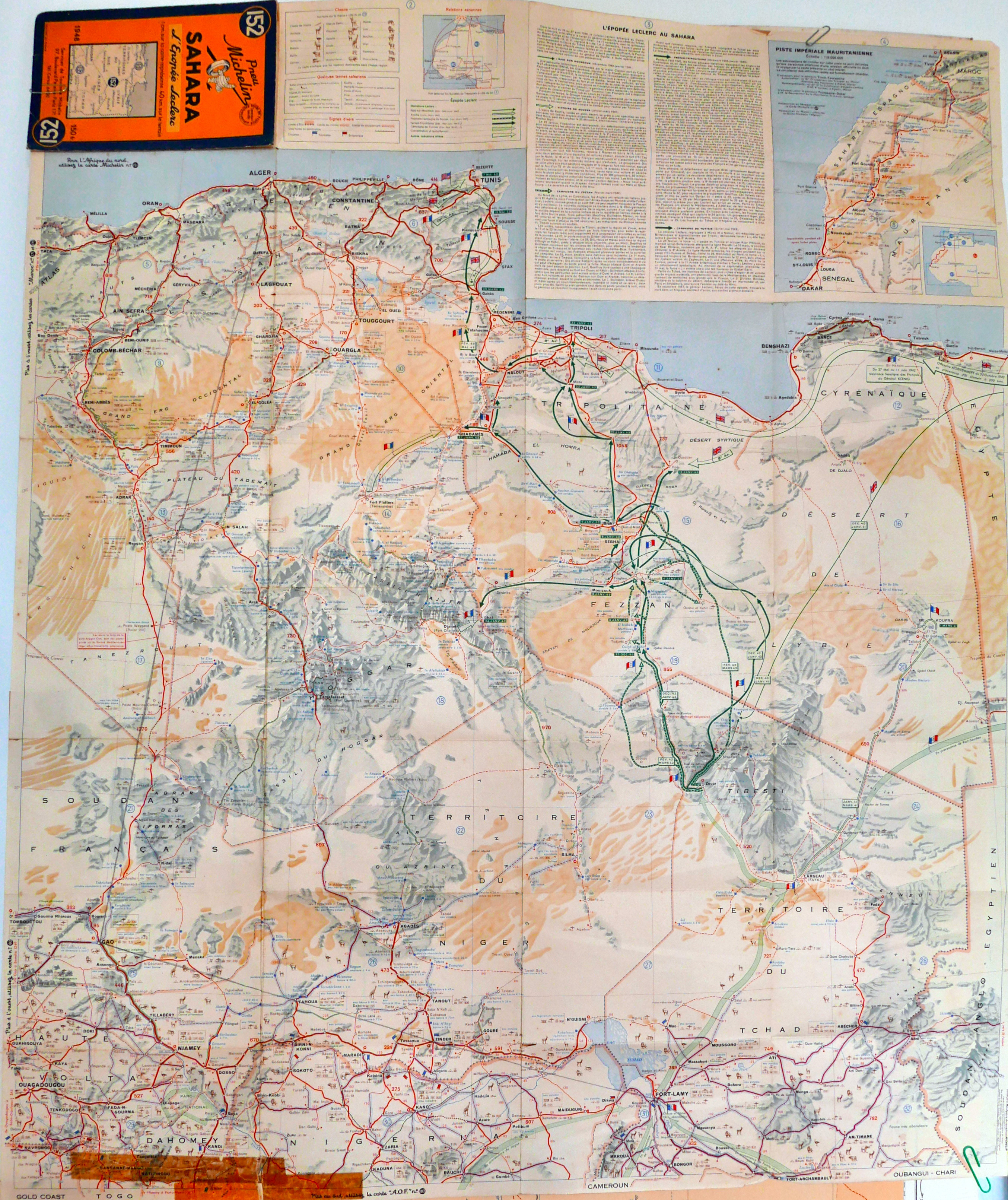
And finally, a forerunner to the famous 4-million scale Michelin 153 map (now the 741) that covered the French Sahara: an ageing Michelin 152 from 1948. It was the best photo I could manage – scanning will have to wait for a very rainy day.
You get the feeling that this may have been a commemorative special edition to celebrate General Leclrec’s heroic achievements in the Sahara during WWII, when a small column managed to take Kufra and then Murzuk from the Italians, and then push north to help expel the Axis forces from North Africa along with the 8th Army.
Like the LRDG map, the 152 has helpful detail like ‘piste tres difficile‘ as well as the famous info on water resources ‘tres mauvais a 50m‘, that we recognise from the later editions which covered the Sahara all the way to the Atlantic.
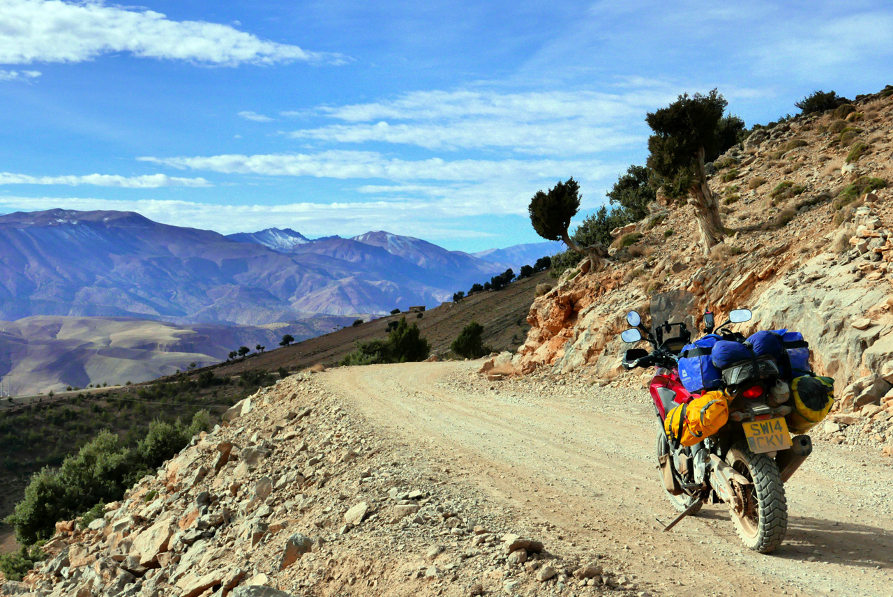
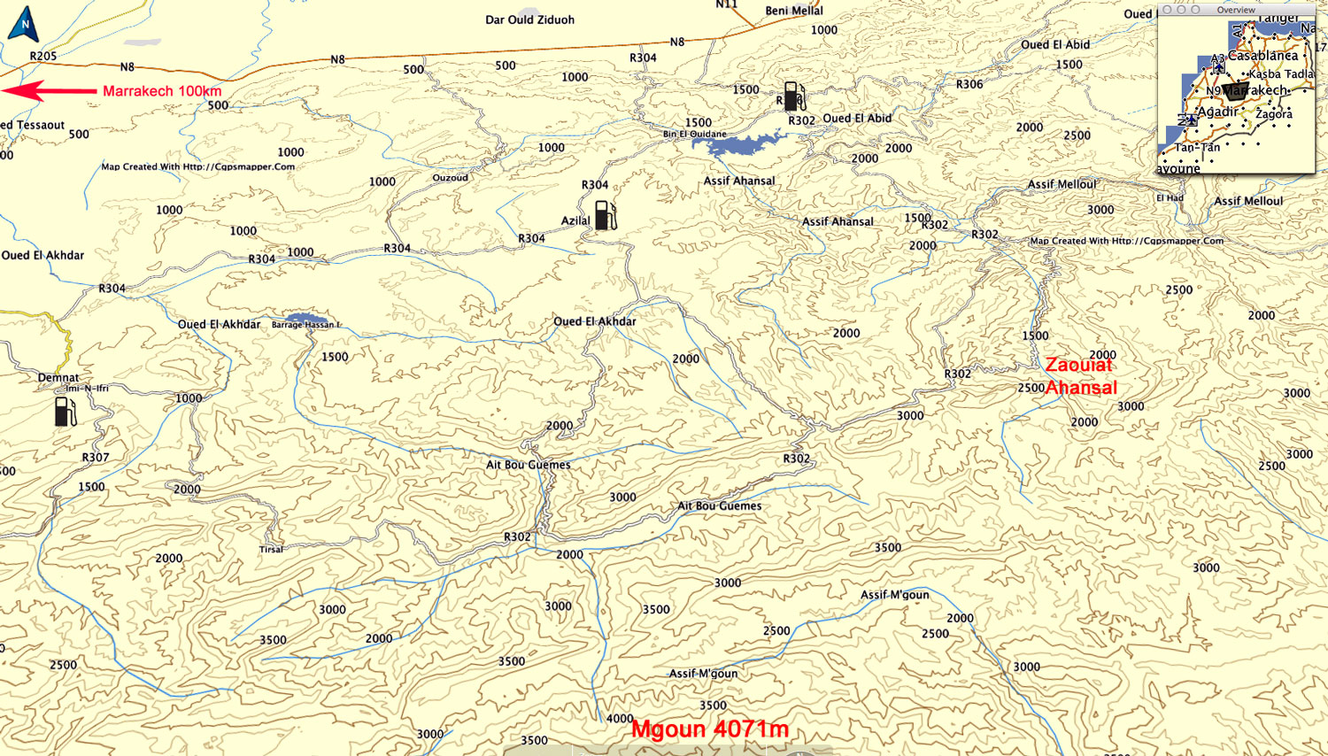
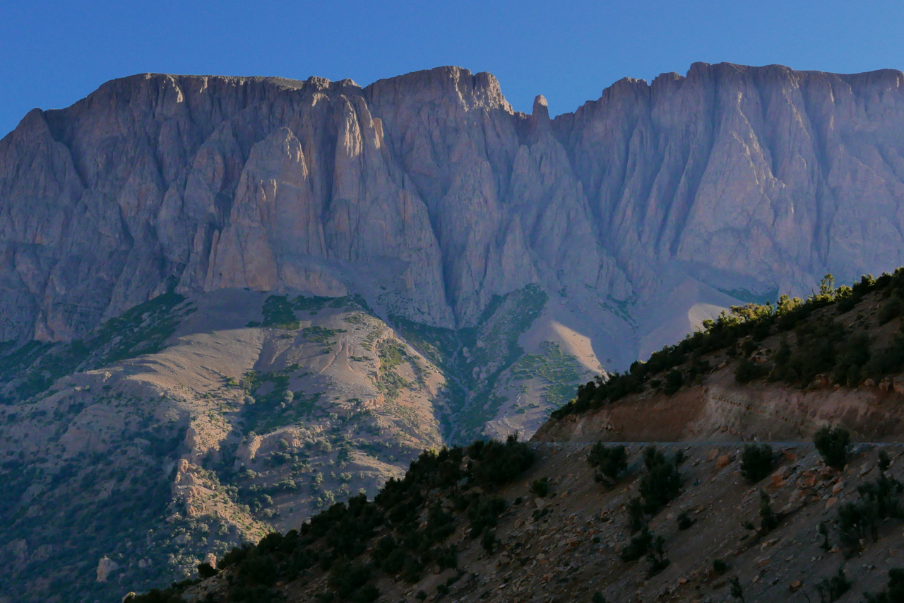
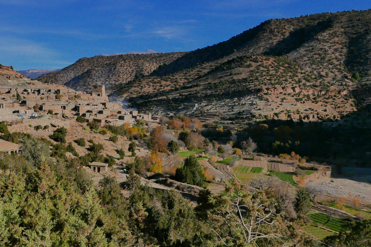
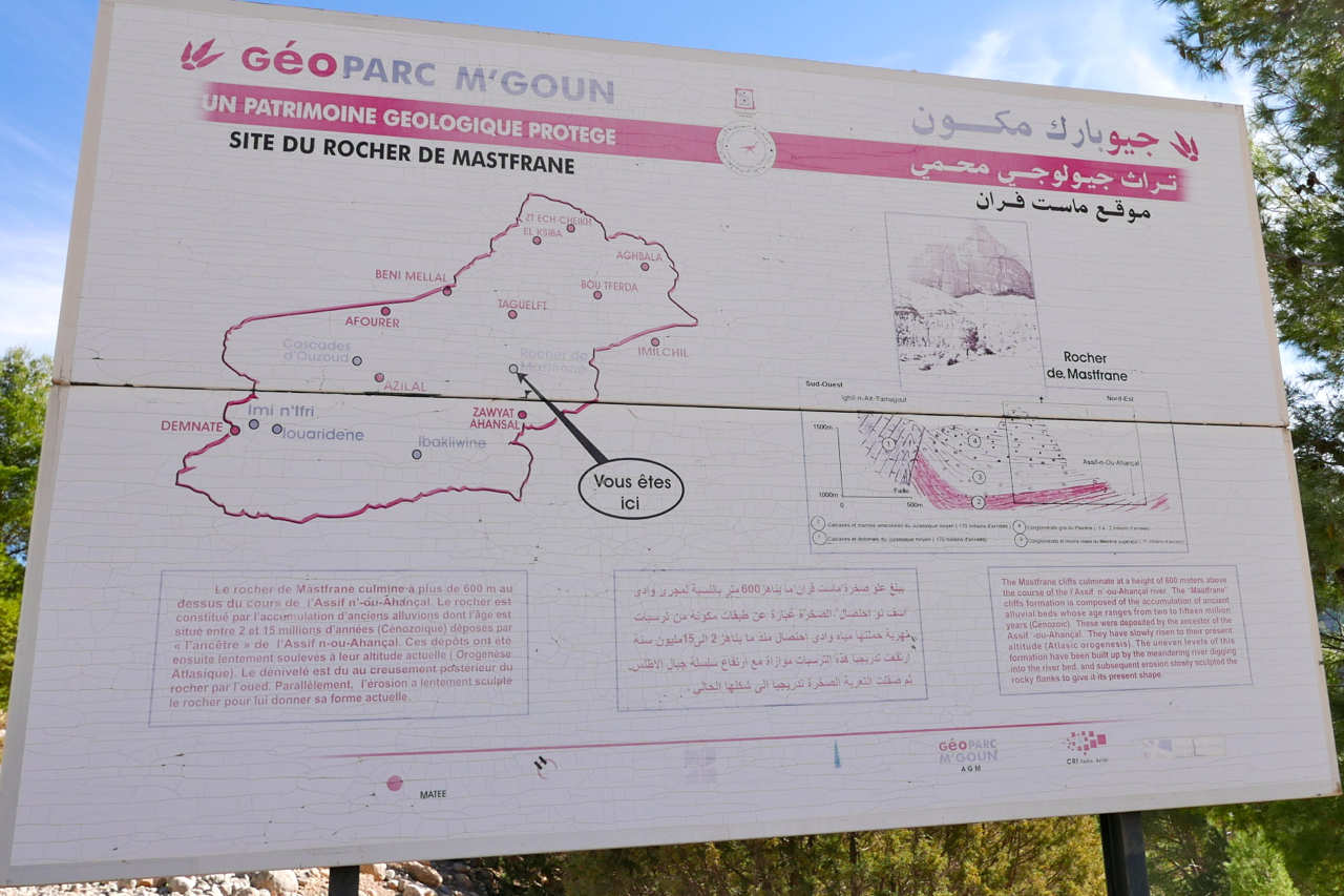
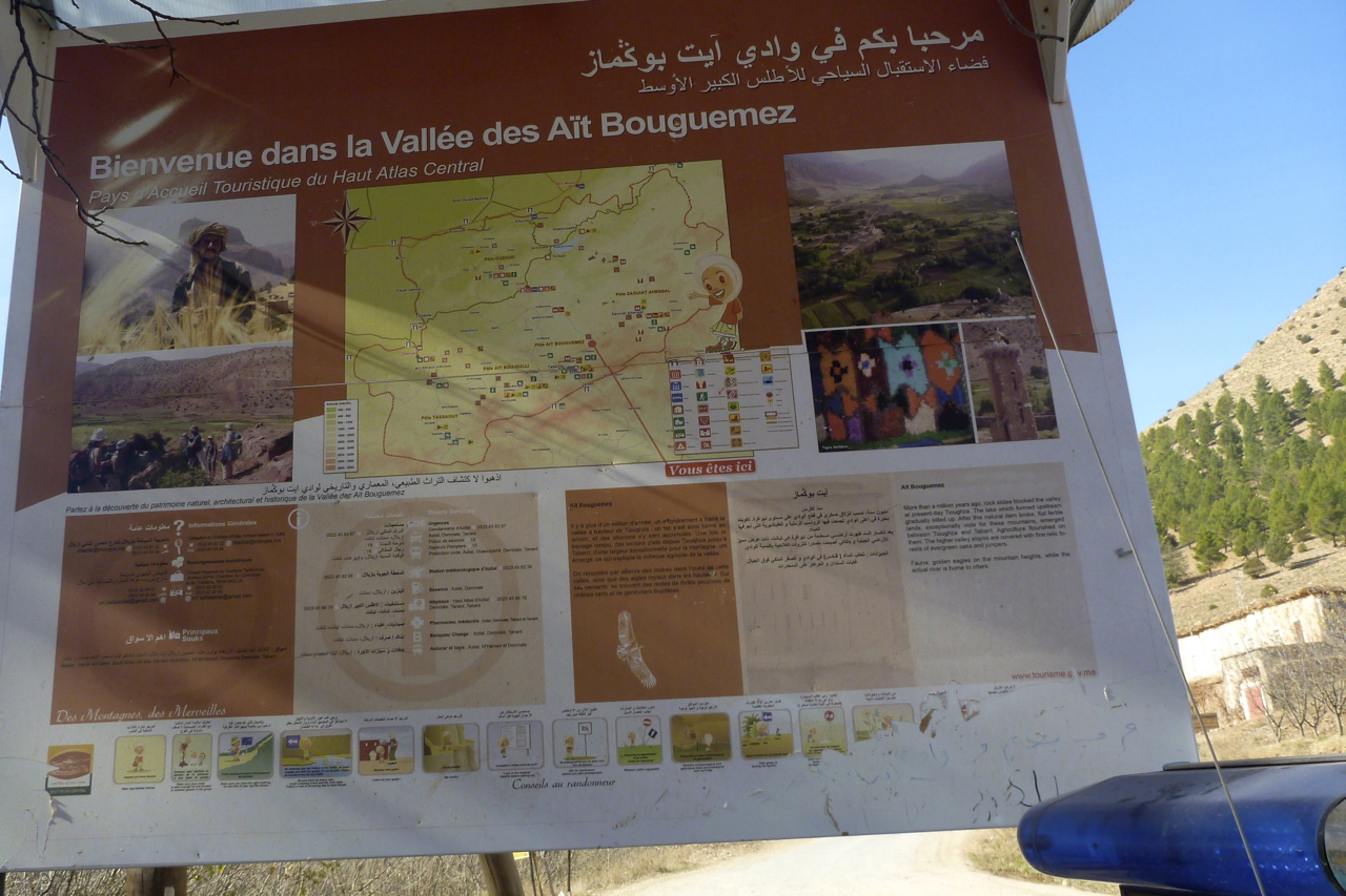
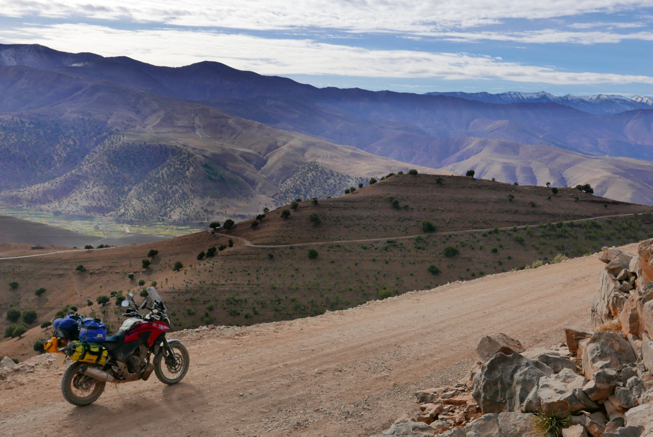
After my 2015 one-week tours, on the suggestion of a Morocco Overland reader, I rode over to have a look around the Mgoun area of the High Atlas, about 150-km east of Marrakech. The better known Jebel Toubkal is only 65km directly south of Marrakech; Mgoun makes up the other big massif of the High Atlas, with the 4071-metre high point on the ridge only 100m less than Toubkal.
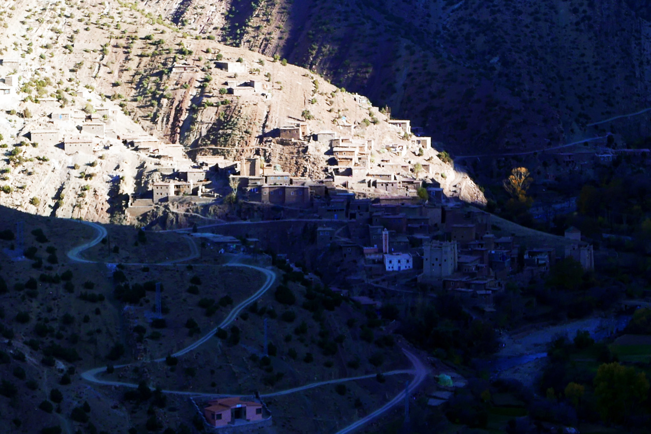
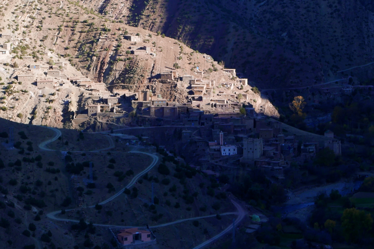
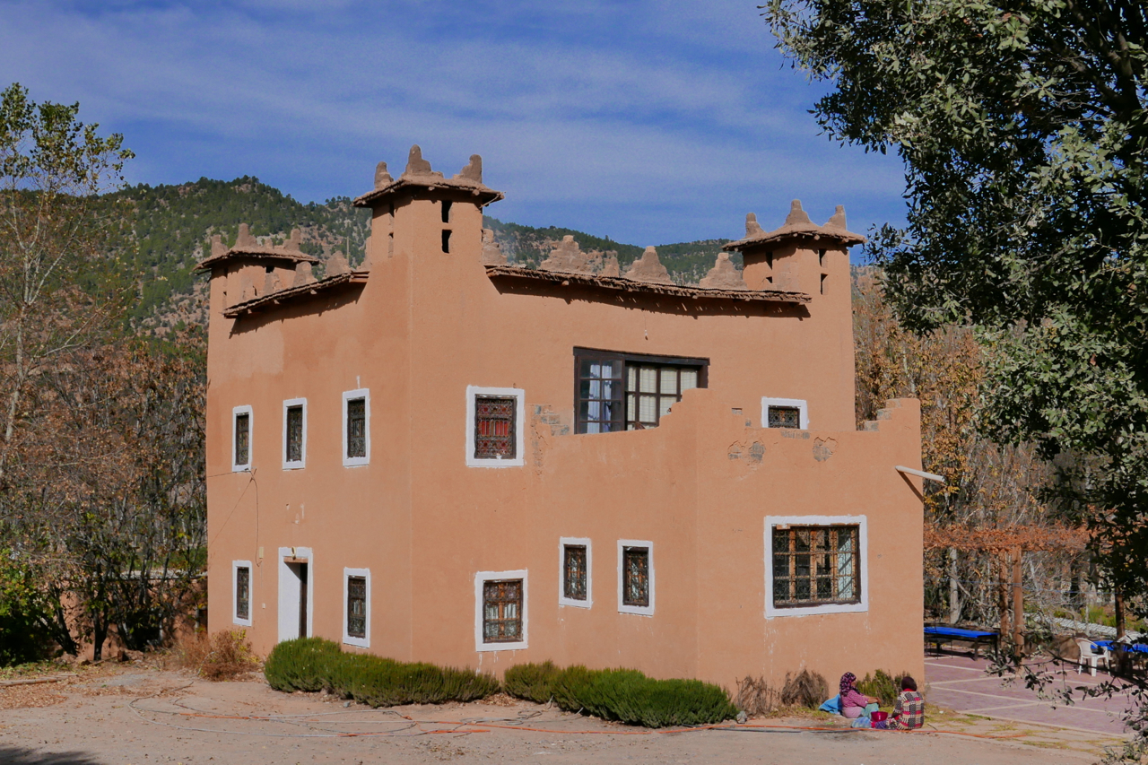
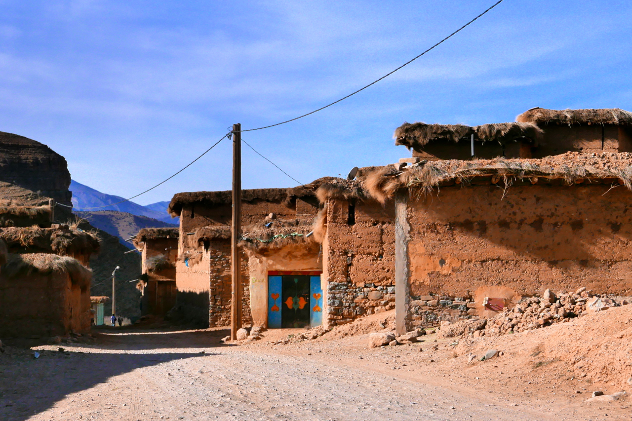
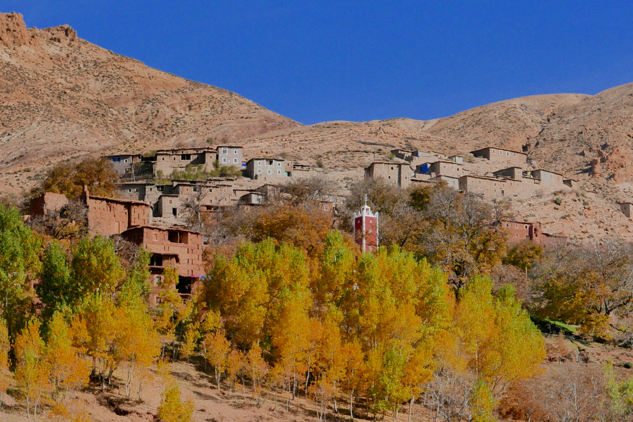
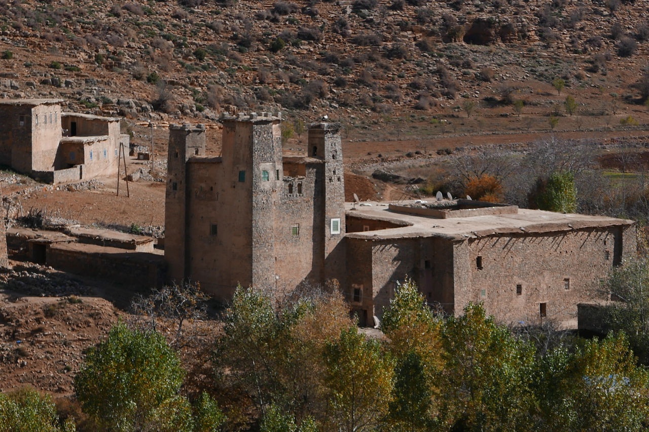
I spent a couple of days based near the hamlet of Zaouiat Ahansal (left), joining up the dots visible on the Olaf map (below), or whatever I found. Tucked up the head of the valley, as the same suggests, the Berber settlement of Ahansal is the site of a religious institution – or Zaouiat – founded back in the 13th century.
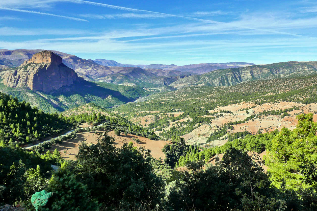
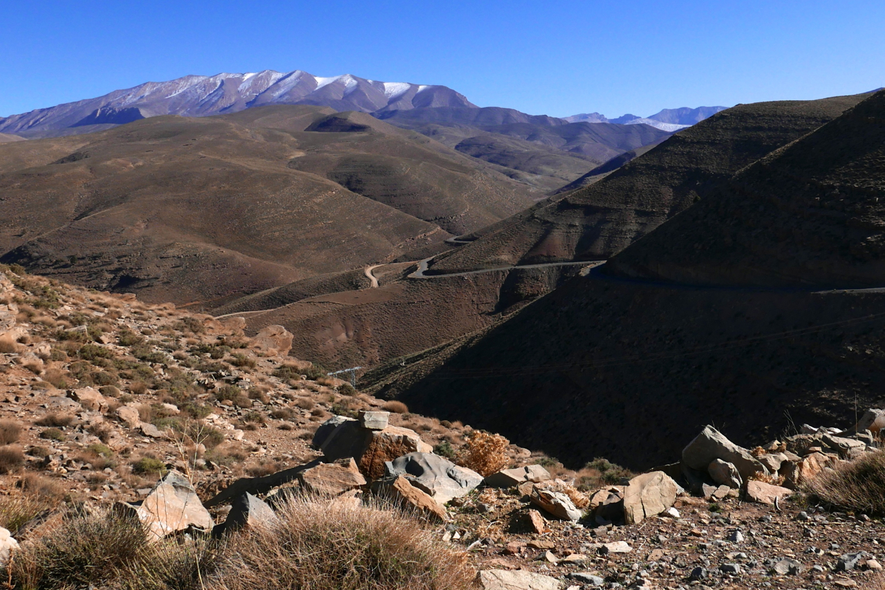
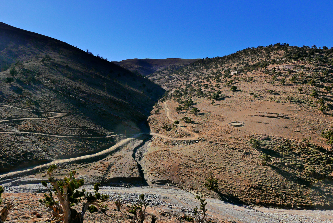
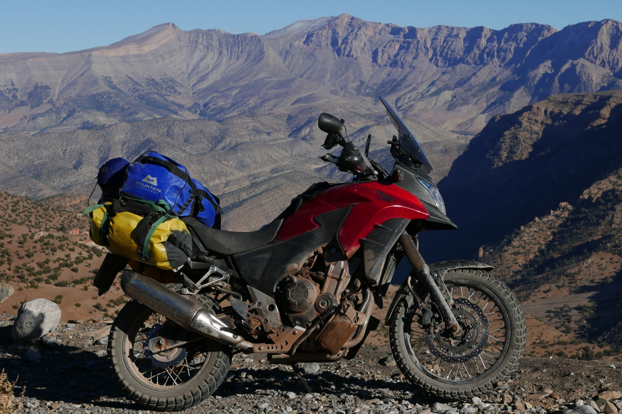
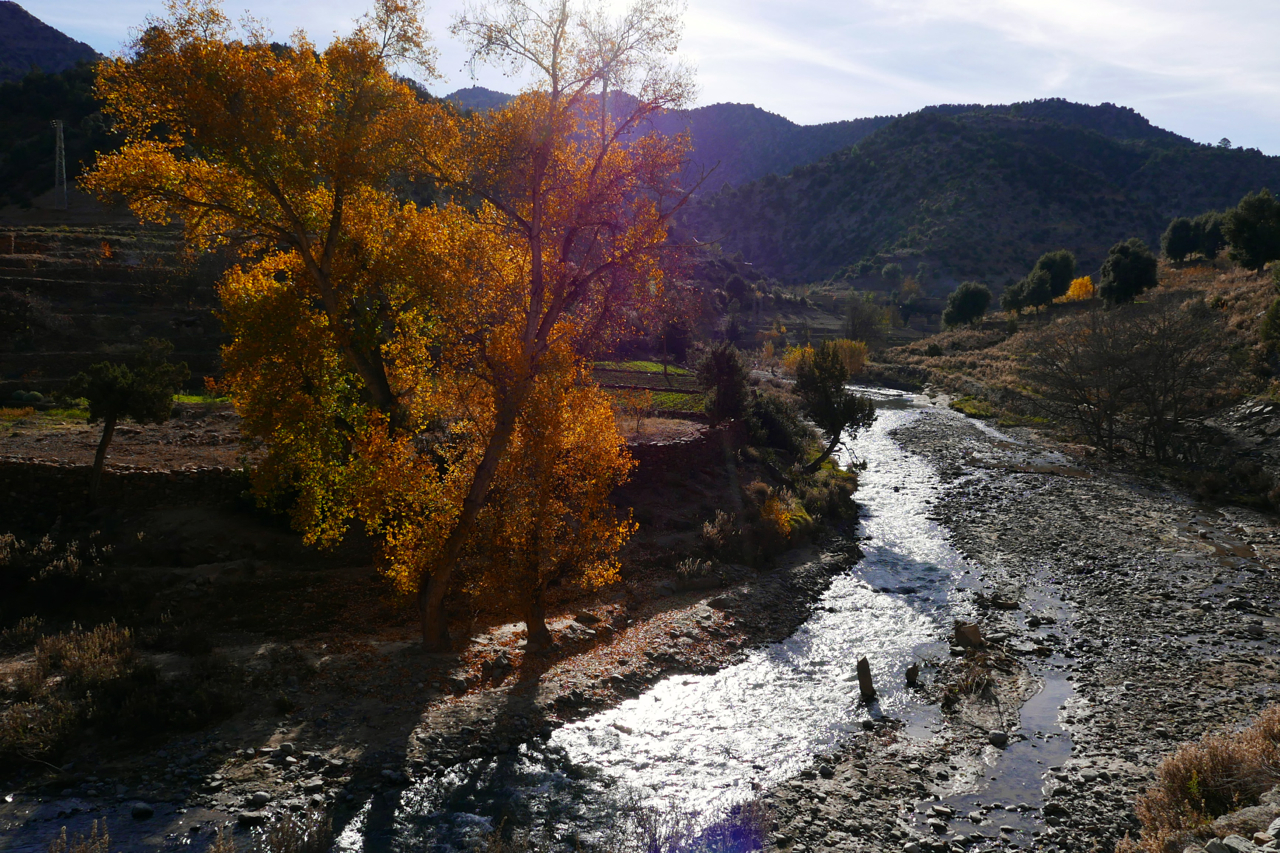
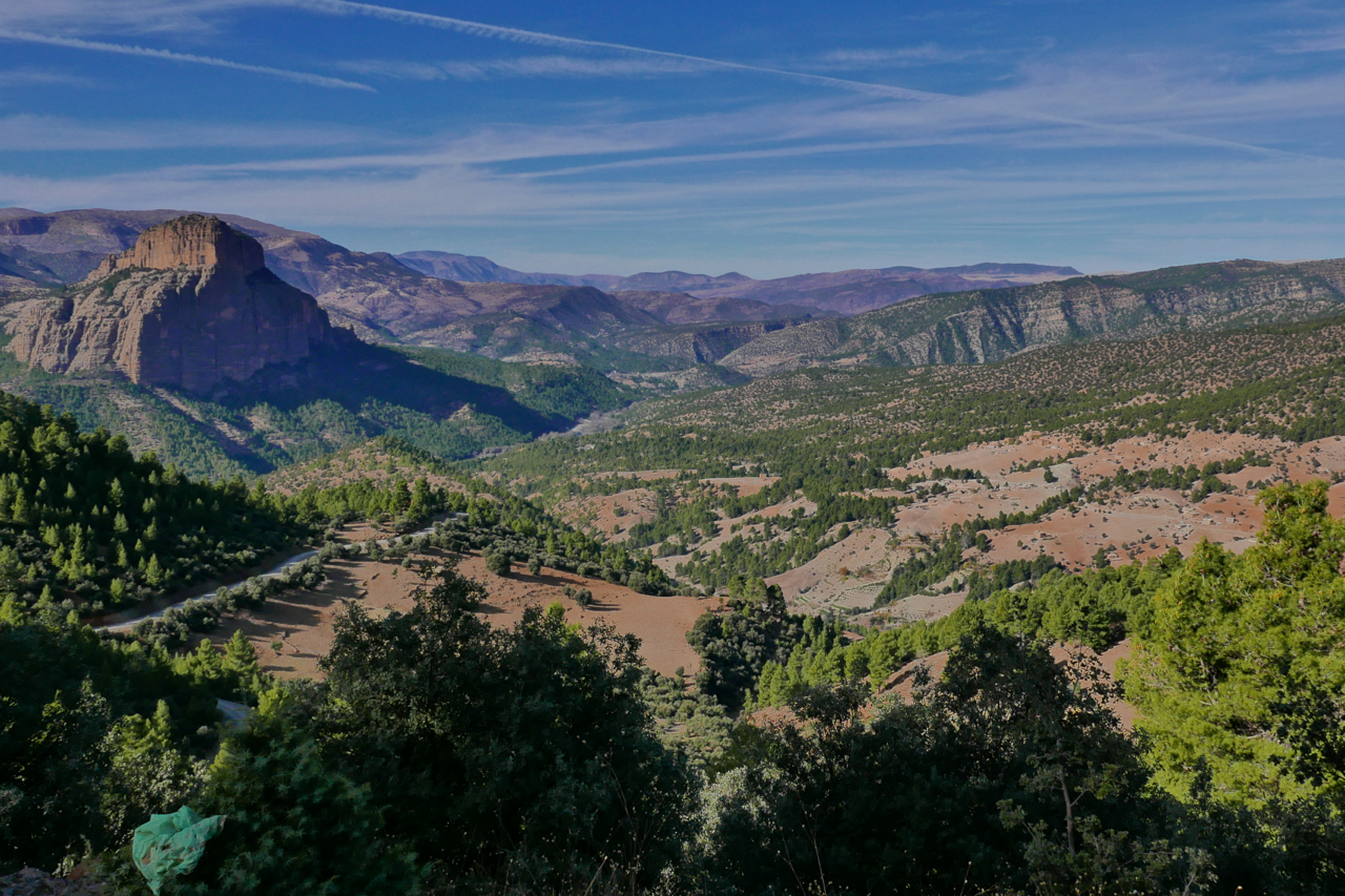
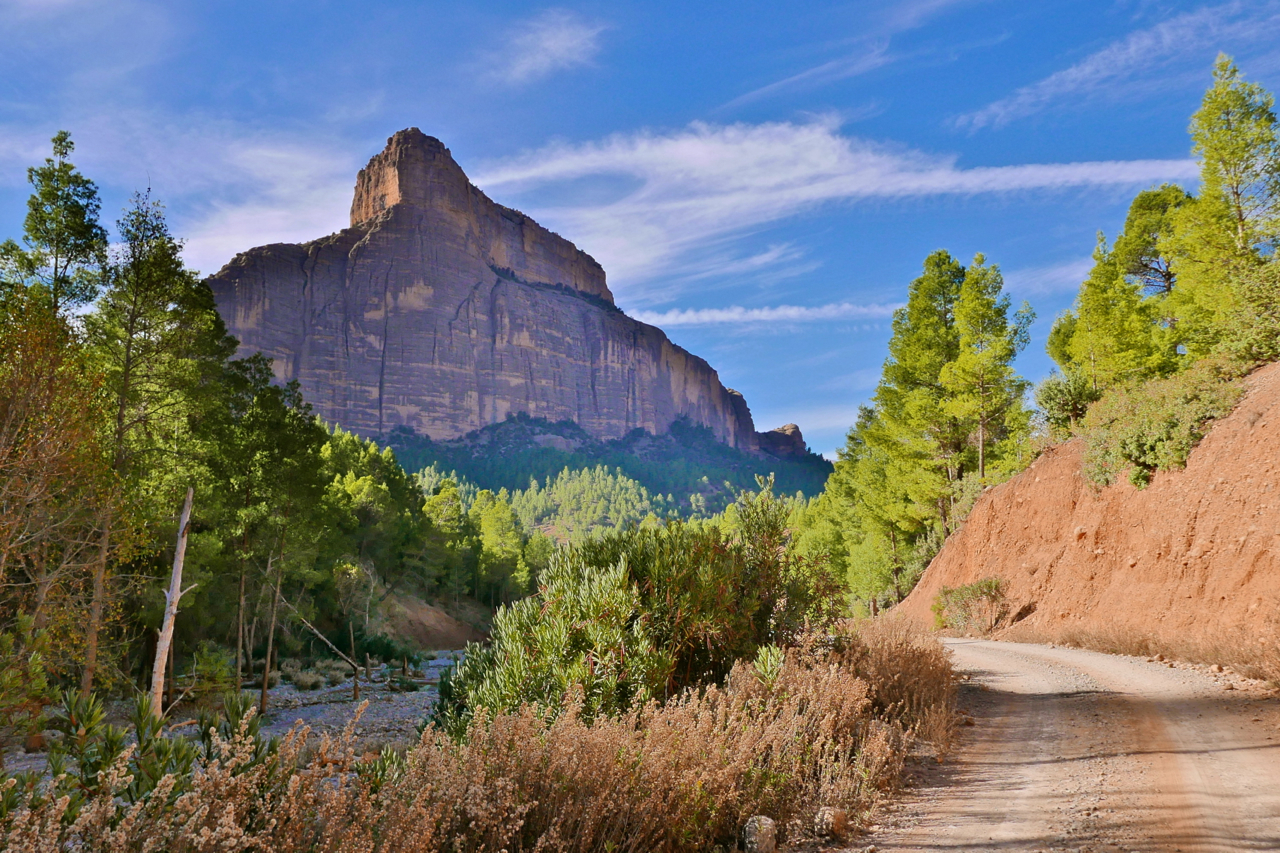
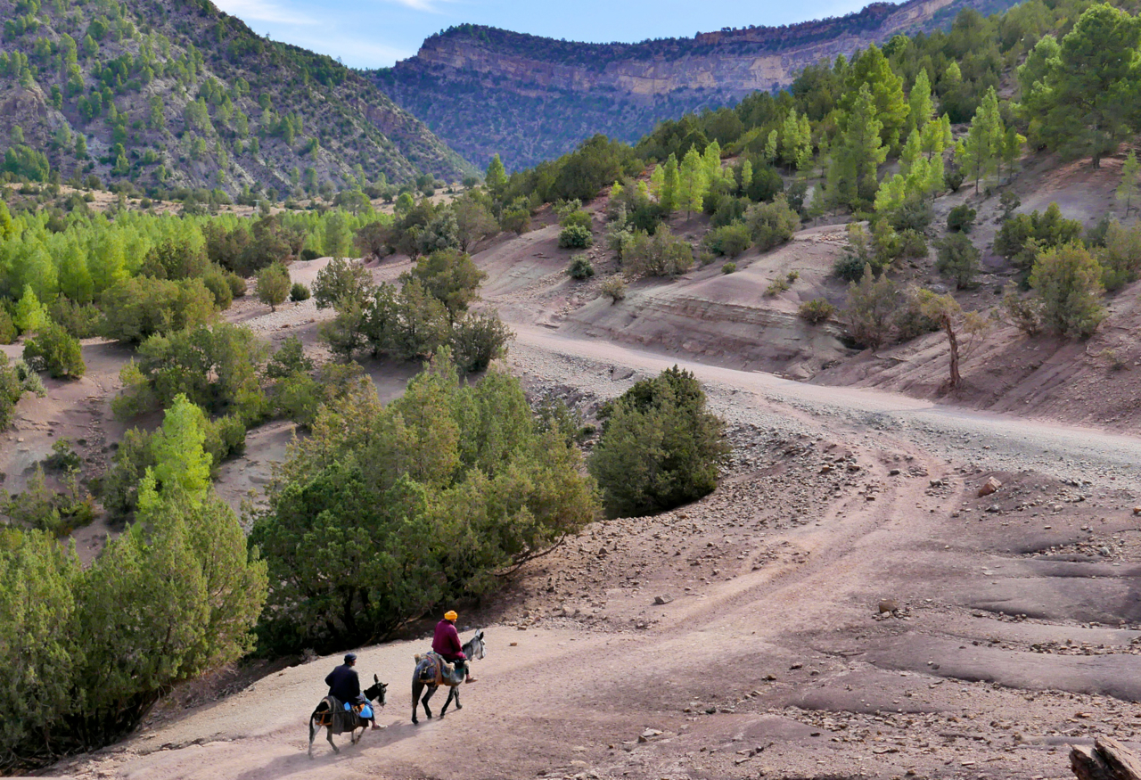
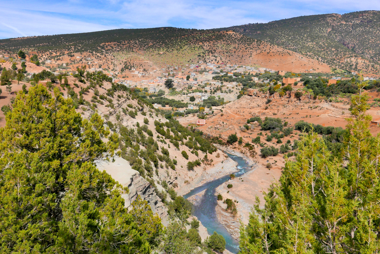
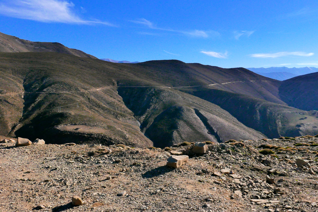
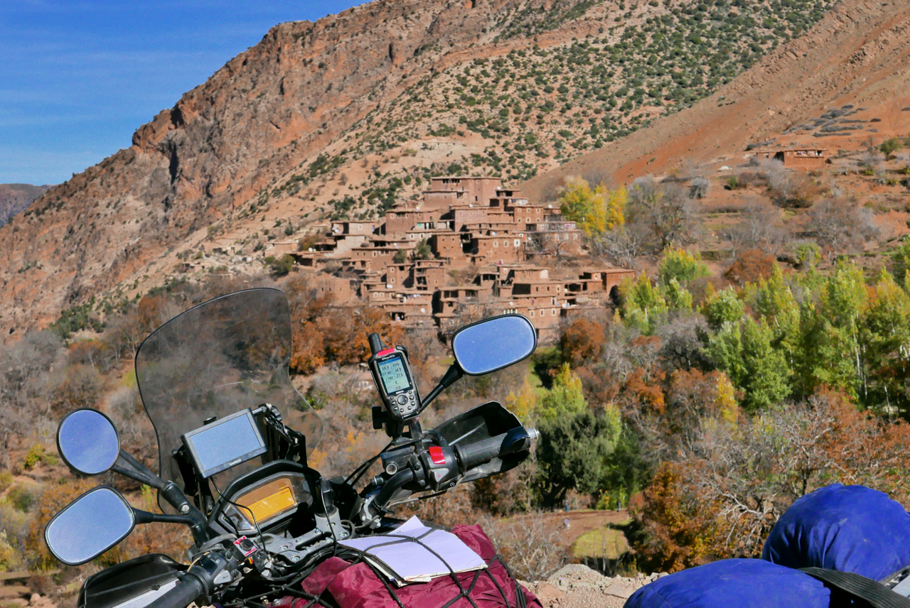
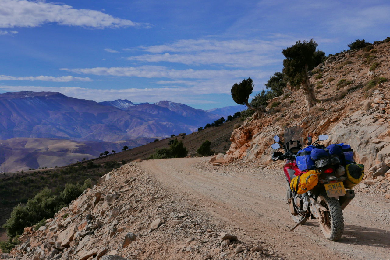
In the area is the famous Cathedral crag (left) well-known to rock climbers, and from where intrepid piste-bashers have sought links east to Imilchil or south over the Atlas to the Dades valley. As usual with Olaf, some tracks have been sealed, some have been abandoned and found new routes, and some were never really passable with anything more than a donkey on stilts. And even with my bike’s potential 500-km range and backroad-and-piste speeds, I still had to make use of the fuel stops indicated on the map below. Amazingly, the weather continued to hold out with bright sunshine, but as soon as you ride into the shadows temperatures dropped. The roads and tracks got up to 2700-metres of 9000 feet and revealed yet another one of Morocco’s incredible diverse landscapes.
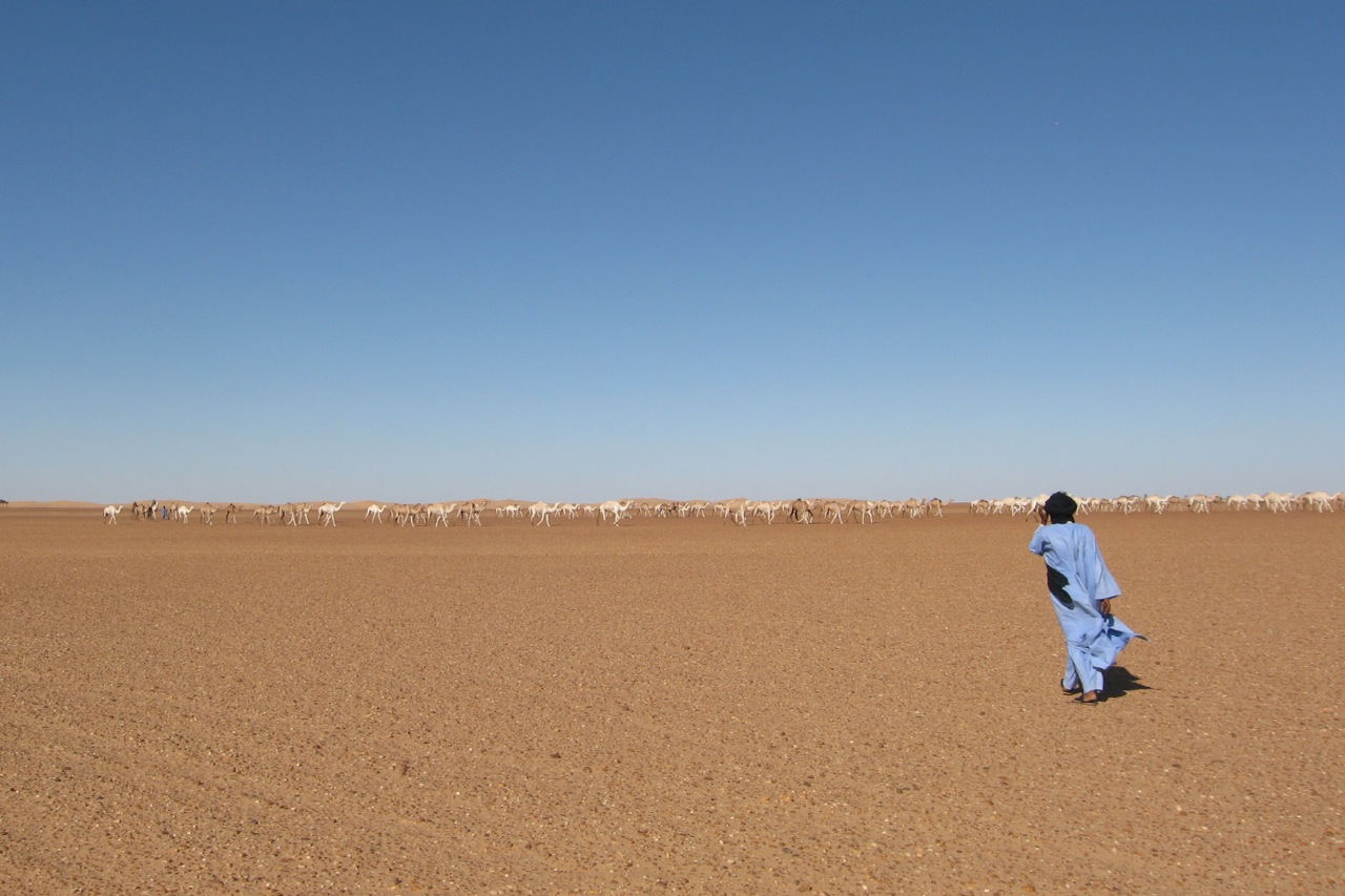
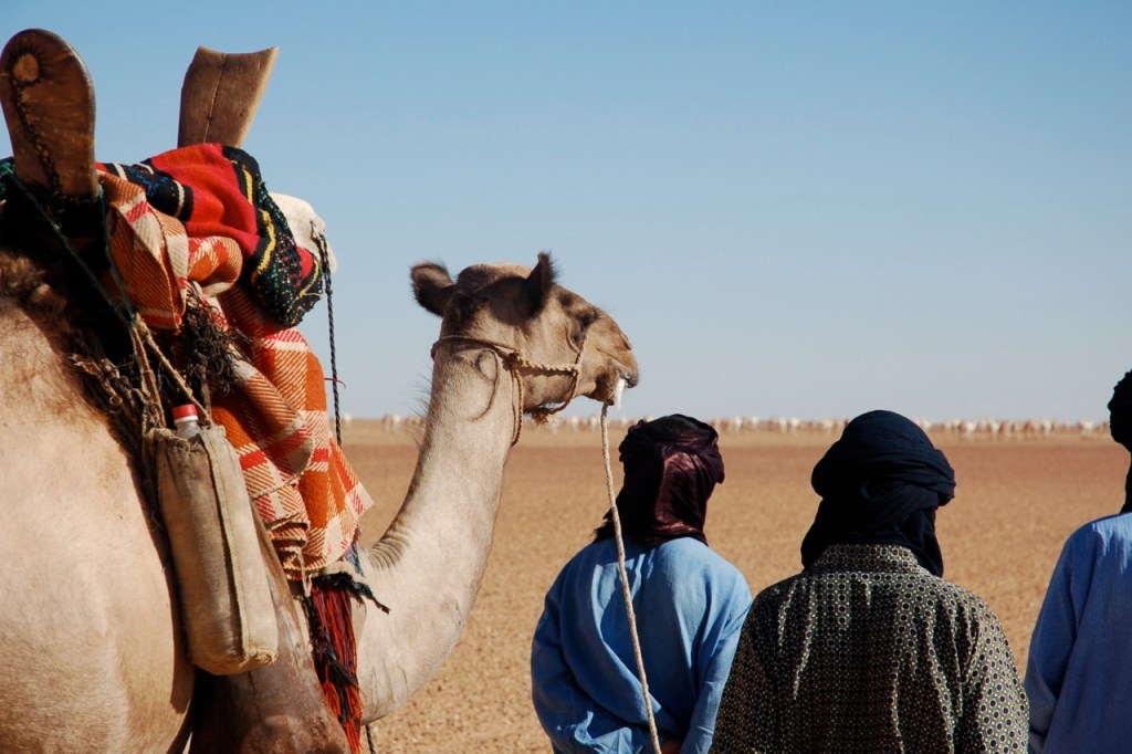
Sahara Overland camel contributor Alistair Bestow gives an account of the Bilma salt caravan in Niger. See also the Sahara Trekking ebook
For a few years now, on my office wall at work I have had a Jean-Luc Manaud calendar, with evocative images of Niger, particularly of the Tenere Desert. It is well out of date, and has been stuck on the image of Fachi for months. I had resolved to get there this winter, and to see both Bilma and Fachi, by camel if that was possible.
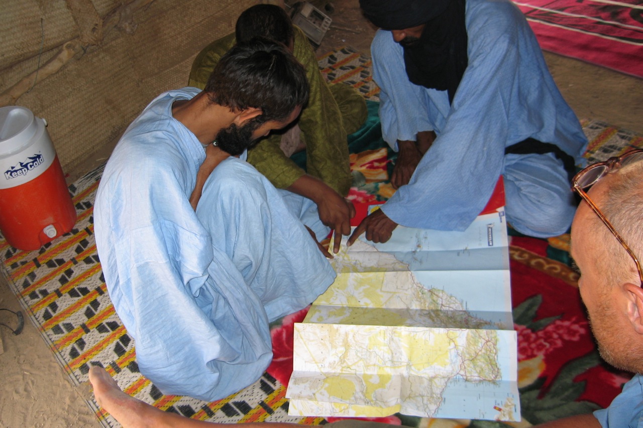
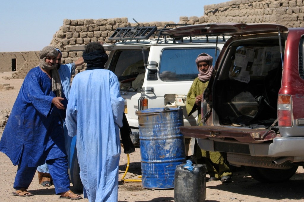
I arrived in Agadez on 30th December 2005, after having travelled from Niamey by bus, and hunted down one of the guides recommended by Lonely Planet. Moussa Touboulou was in town and available to be my guide, if we could work out an itinerary for such a trip at a reasonable price. I was told that it was only really possible to travel both to, and from, Bilma by camel caravan, if I arrived in Agadez in October. There is apparently an ‘October Rush’ being the most favourable time to go for the camels. Therefore it would be possible to go to Bilma by vehicle, and then wait for a caravan to leave Bilma for Agadez.
We nutted out a deal, whereby Moussa would organise the travel by truck to Dirkou (600+km), and then 4WD from Dirkou to Bilma (40km) and then by camel from Bilma back to Agadez. He would travel with me for the full distance, organise the permit -still required for travel in this area- food, water and accommodation, if needed in Dirkou and Bilma. His fee was CFA55000 per day (approx £55 per day). We worked out a daily rate, because the number of days to undertake the travel was not certain, and I have had experience in a guide wildly over-estimating the number of days for a journey, thereby making the daily cost quite expensive. It proved to be the case here too, -Moussa estimating 30 days, but in fact the trip took only 20 days in all.
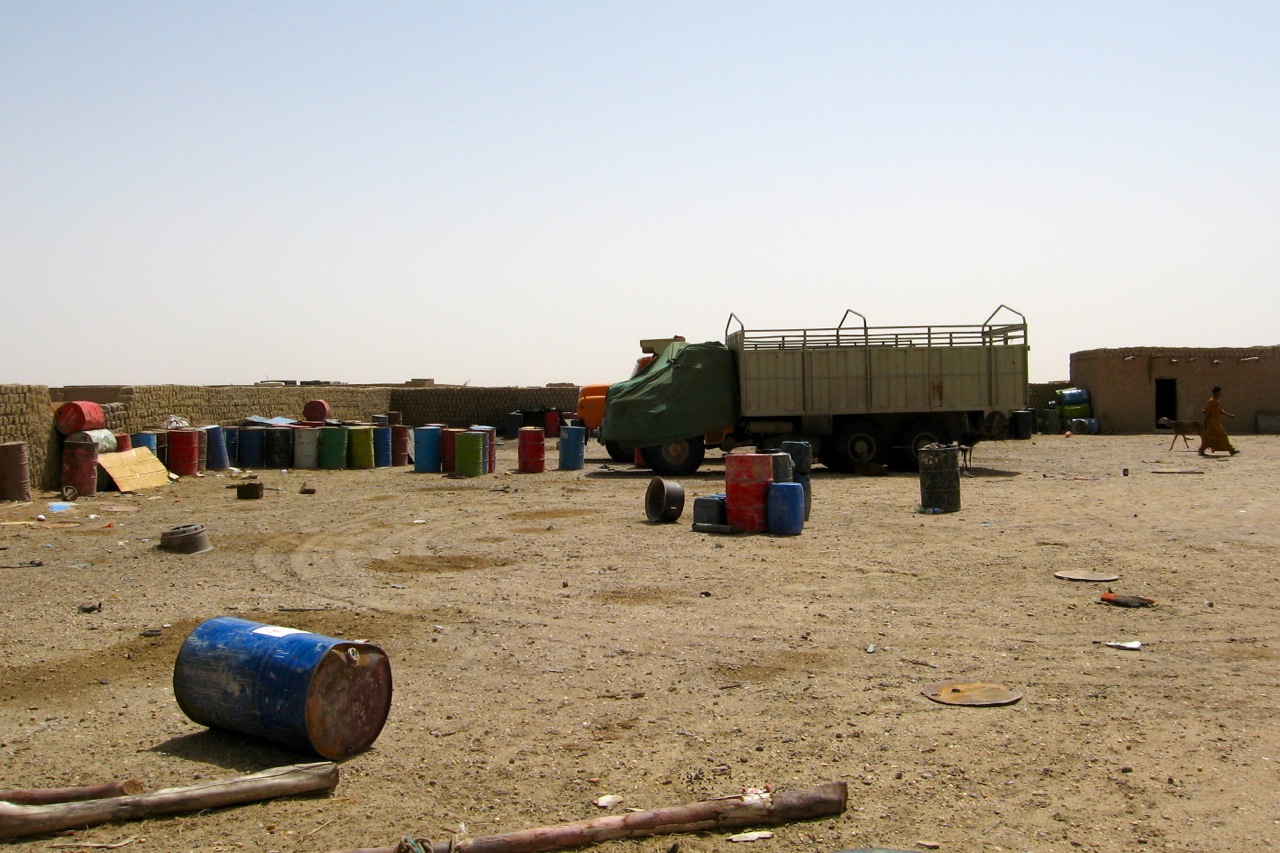
There was a few days to wait in Agadez before a truck was going to leave for Dirkou, but one was located, and on Wednesday 4th Jan 2006, we went by taxi to the edge of town where indeed a large Mercedes truck was waiting. We climbed aboard on top of the goods, along with 30 or so others for the journey to Dirkou. It proved to be nearly two days travel, the truck being overloaded, and lumbering along quite slowly over the flat, flat desert. It was quite an experience to travel this way, being crushed in with everyone else, but was thankful that it was only 2 days, and that we were not as overloaded as some of the other trucks that we saw en-route.
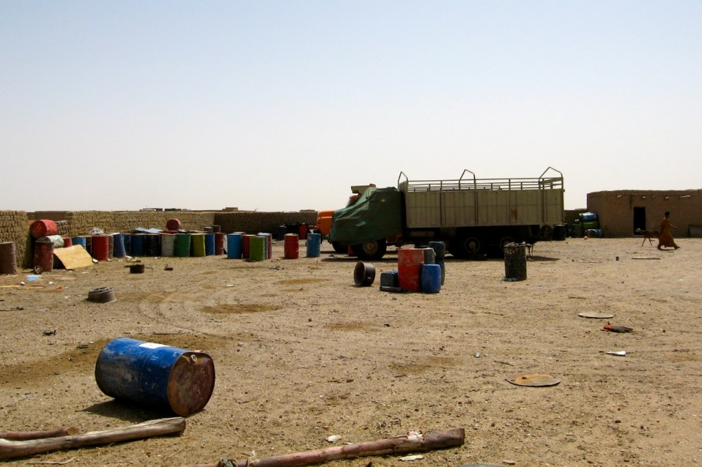
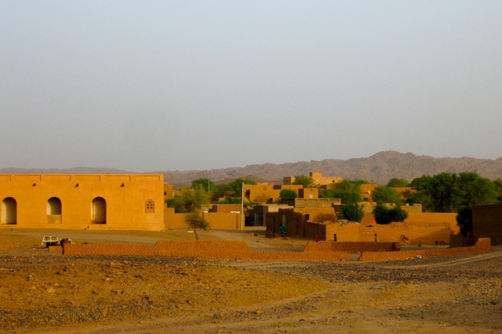
We arrived in Dirkou, being a surprisingly large town, on the morning of Jan 6th. We stayed overnight at a ‘friends’ house, which left me time to explore the markets under the shady trees, and to marvel at the flat absolute desert to the west. Moussa organised a lift in a 4WD the next day for Bilma, and we arrived there on Jan 7th.
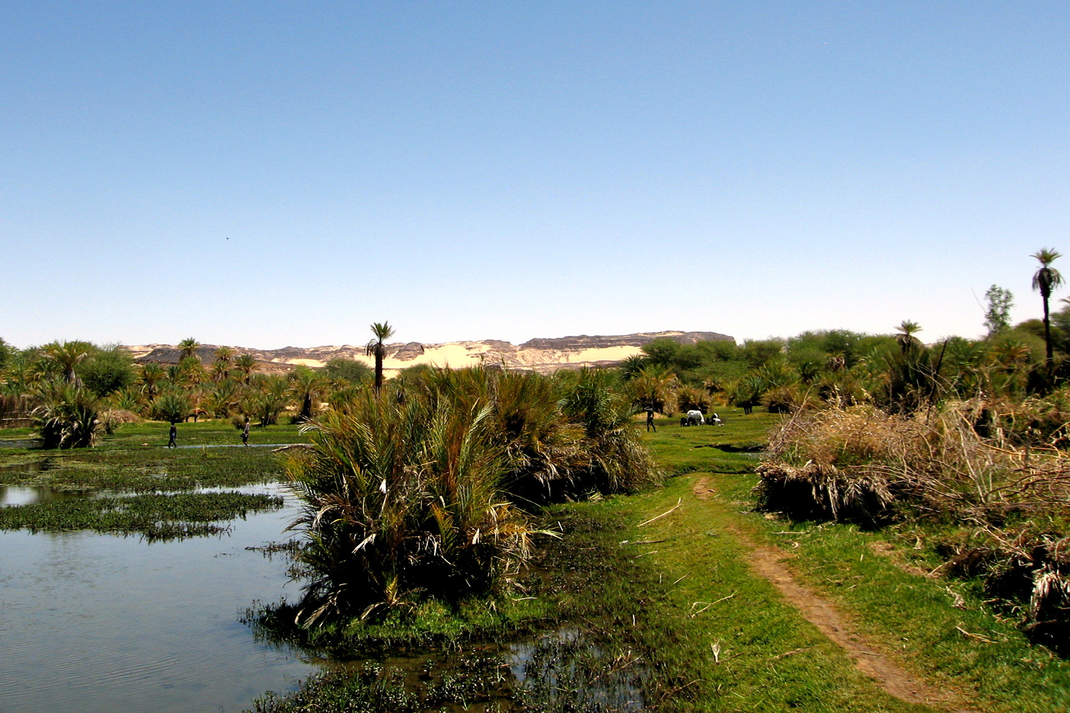
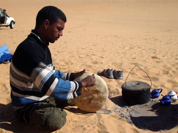
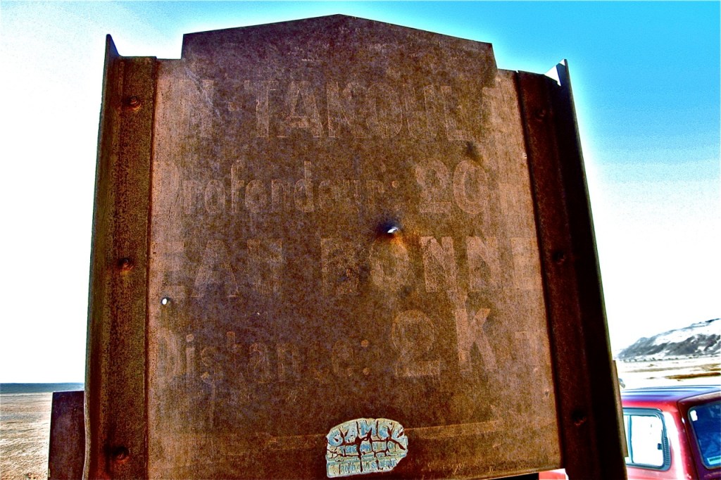
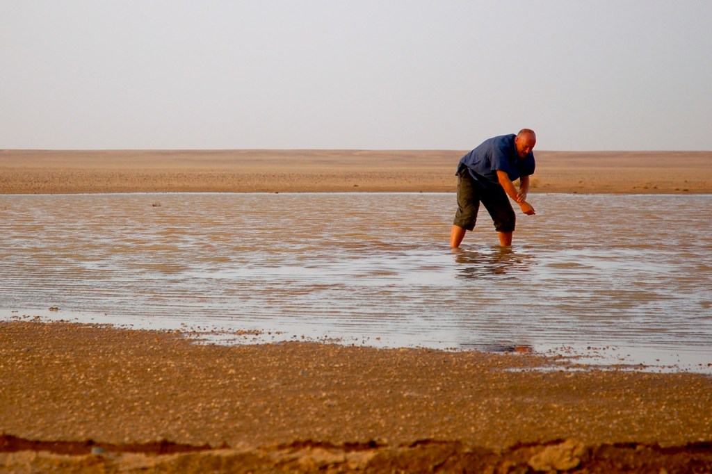
Bilma is everything I had imagined of an oasis, but being larger than I expected. There are shady sandy streets -large trees I think which may have been planted by the French, groves of date palms, watered gardens of fruit and vegetables, an aging, crumbling fort, and a Grand Source of water, being a large pool of water inhabited by small fish, and frequented by birds including a spoonbill. To the north west of the oasis, are the salt works, where pools of saline water are created to allow the salt to crystallise on the surface. The workers then disturb the crystals on the surface, sending them to the bottom from where they are collected and dried. These crystals are then broken up by a hammer, have water added to them, and than are placed in moulds of one shape or another. The moulds are either a basin or two sizes, or a cone, made from the truck of a palm tree and covered with leather. The salt is turned out, and then dried into the robust forms which are carried by caravan to Agadez and beyond.
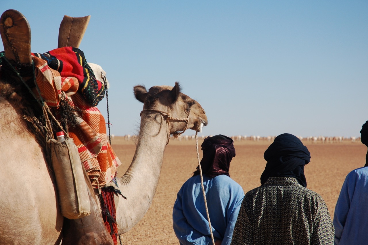
I was in Bilma for 2 days, before the caravan Moussa had located and negotiated with, was due to leave. The day before our departure, I went to the salt works where the caravan was located, and watch the parcels of salt being made ready for transport. Generally two or three cones, were packed with several basin forms of salt, in damp palm matting, and tied up with rope. The large parcels were barely able to be lifted by a man. The salt is supported, when on the camel by goat skins filled with dates -also being sent to Agadez and beyond.
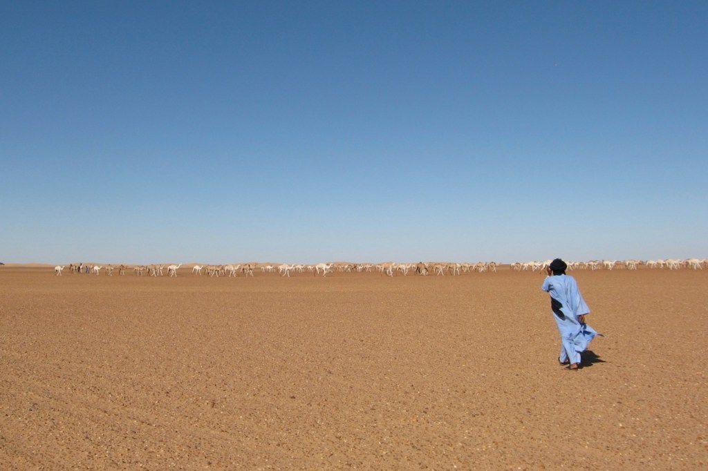
On Monday 9th Jan, we joined the caravan, and at 1.00pm said farewell to Bilma. It is noted that in contrast to the caravan travel I have done in Mali, to Timbuktu-Taoudenni, that this trip saw us rent some capacity from the caravan itself, rather than having our own camels. This meant that Moussa and I were ’embedded’ in the caravan. On the Timbuktu-Taoudenni trips it has been difficult sometimes to convince the guide to travel with the salt caravans, because it is easier and faster to travel with the guides own camels.
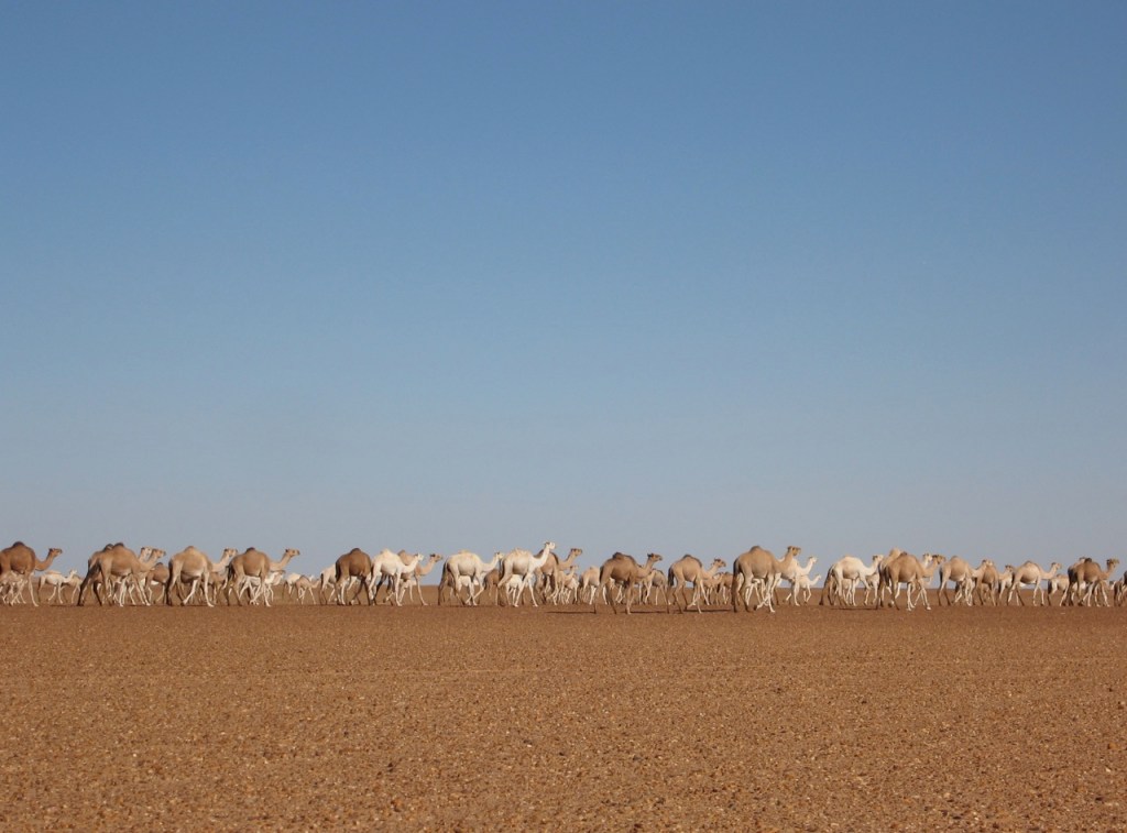
The desert here was quite different from that of Mali, the Tenere being much sandier, having less vegetation, and more dunes, but at the same time being less variable in its appearance, than the desert of Mali. It was four days of travel to reach Fachi,. There was plenty of time to admire the wonderful creamy dunes along the way, of which there are many. We travelled from 9 in the morning to about 10 at night non-stop. It was clearly well planned, as the caravan carried exactly the correct amount of feed for this sector, until they picked up another 4 days worth of feed that they had left in Fachi on the way to Bilma. After the eighth day, we reached the Arbre du Tenere monument, and there after there was sufficient feed to be found for the camels en-route for the last 7 days of travel to Agadez, making a total of 15 days by camel.
The last 6 days of travel was through stony desert, with frequent patches of vegetation for the camels to eat, and we passed a number of villages, and nomadic Tuareg with their sheep and goats. We also travelled for a few less hours per day than had been the case for the first 8 days.
The caravan actually was not going to finish its journey until Tahoua, some few hundred kilometers later. On the last night , I said my farewells to the camelliers whom I had got to know over the previous 2 weeks. They had made me feel very welcome, and it was a great journey.
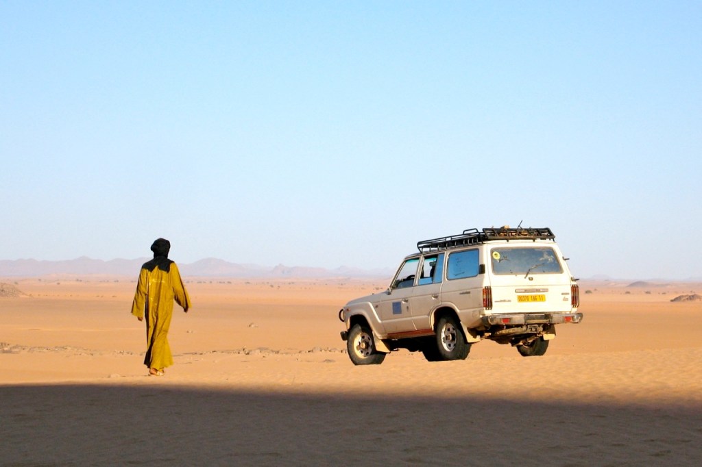
In November 2007 I joined a recce organised by Amelia Stewart Travel and Tanezrouft Voyages. Over 11 days we walked about 200kms from south of Arak through the northeastern Immidir to the Amguid Crater and the Bou Zerafa dunes beyond.
In January 2009 I led Amelia Stewart Travel’s first tour: photo report here. And there’s a slide show from the 2010 tour here
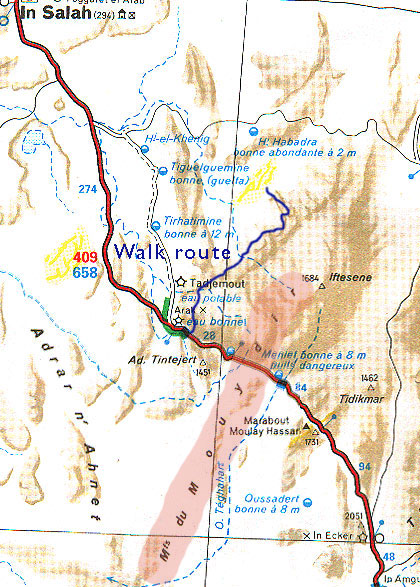
The Immidir, aka the ‘MontsduMouydir’ on the Mich map, left, is a region of plateaux, escarpments and canyons that spread north and east of the Arak Gorge on the Trans-Sahara Highway. To the south are the lovely exfoliated granite domes around Tidikmar and Moulay Lahcen which we visited in 2005, and to the north and west of the TSH are a number of low plateaux, sand sheets and small ergs making up the Adrar Ahnet.
A few groups have followed part of our route through the Immidir before, and I know of a few others who’ve approached the crater from the Tin Habedra piste by car, and walked the last 10-20 kms, but no one combined both. It was an idea I’d proposed to Amelia Stewart Travel. She liked it, found some people and here we were. Right now in 2026, the Immidir has been closed for many years, as Algerian authorities seek to limit the infinite range of locales accessible to tourists across it’s vast southern provinces.
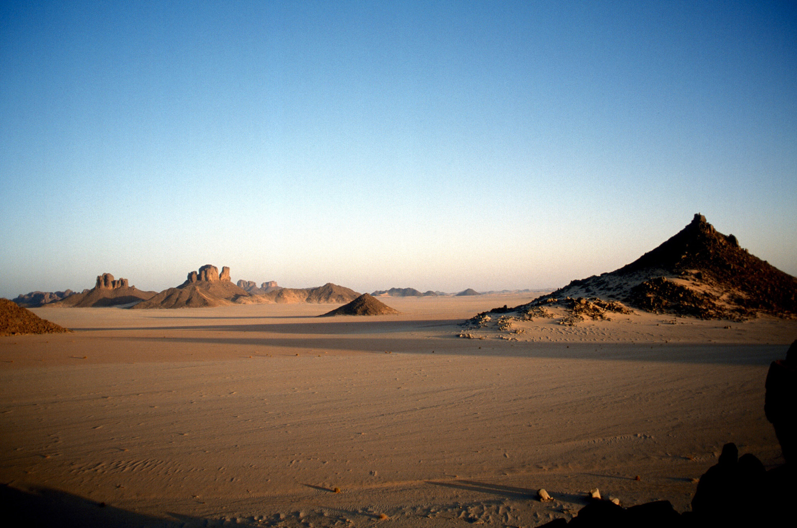
After arriving at In Salah, we drove south 300kms along the Trans Sahara Highway to this valley a few kms beyond Arak settlement. The camels and crew had been waiting a couple of days. Next morning we set off north up the Ighaghar valley in the middle left of the picture.
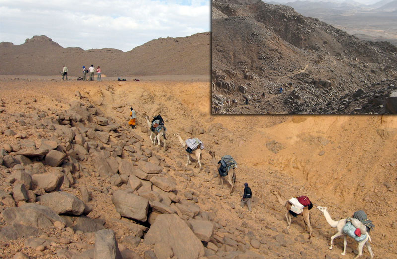
The first few days with a south wind were hot and at times the terrain proved to be tougher for the camels than I expected. On Day 1 a few camels stumbled and lost their loads getting to the top of the Taflout Pass pictured above.
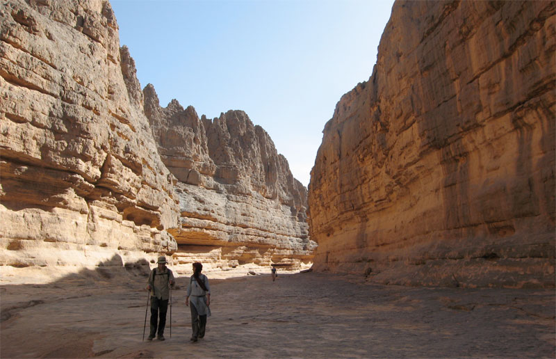
By the next day we had a morning wandering through the cool box canyons and welcome gueltas or aguelmam for which the Immidir is well known. This place is just behind the Arak Gorge.
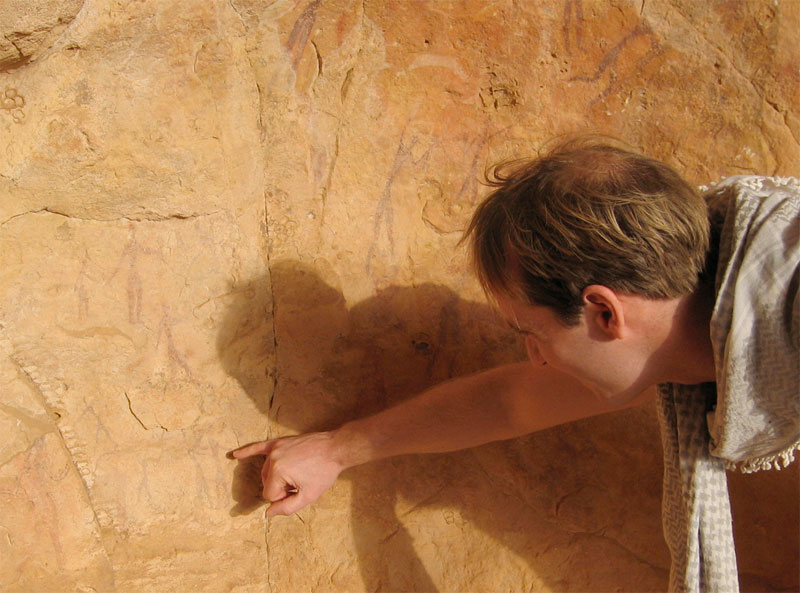
Although there was rock art to be found, what we saw wasn’t a patch on the quality and density of the famous Ajjer plateau above Djanet, Libya’s Akakus or the Gilf and Jebel Uweinat (Egypt/Sudan).
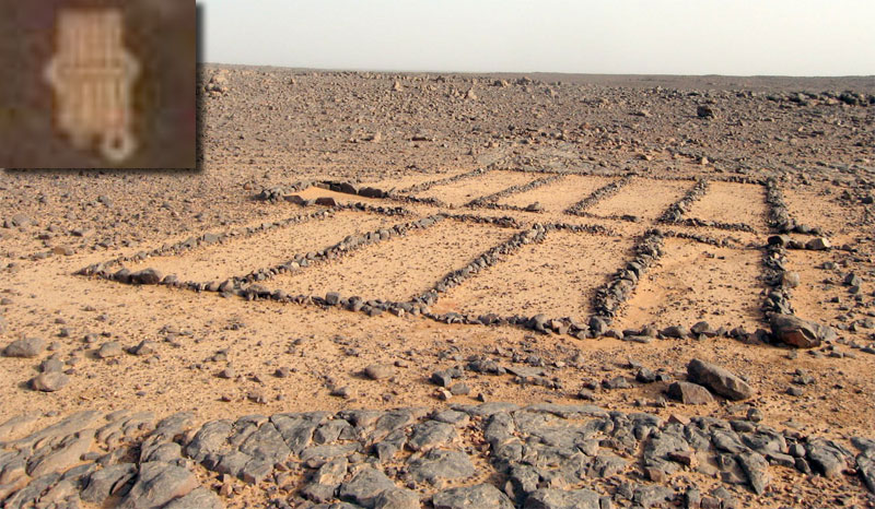
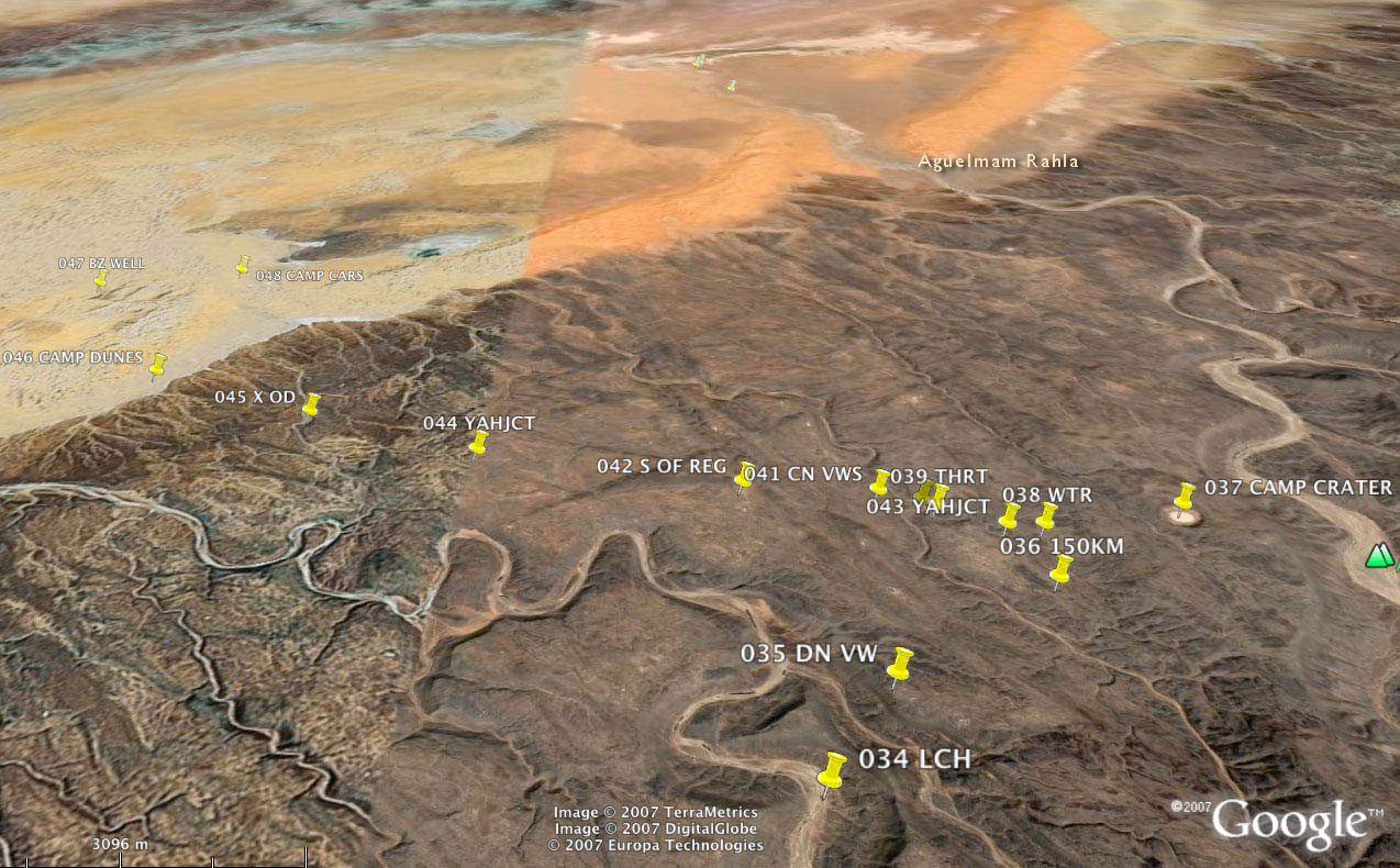
Most days we came across a desert mosque of some sort, although I’ve never seen the ‘pewed’ examples we found in the Immidir. The inset shows a similar structure viewed from Google Earth at Aguelman Rahla guelta, 13kms directly north of the crater at the mouth of Oued Tafrakrek (see Google image below). Google Earth shows the permanent guelta surrounded by pre-islamic tombs (including the less common keyhole type) which suggests that like many Sahara oueds, the place has long been inhabited.
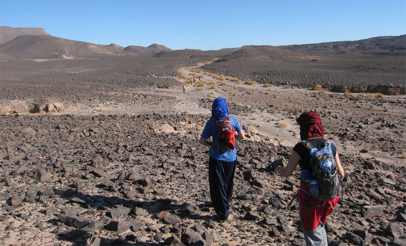
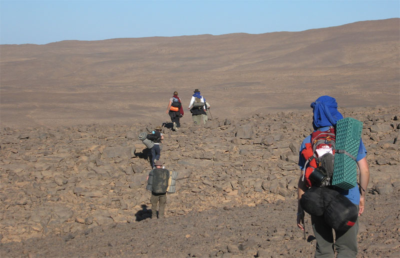
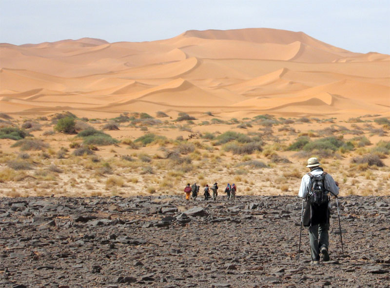
What tracks there were were old camel pistes across the hammada. Rubble like this was tough on boots and feet; most of us got blisters. Even the camels needed treating for cuts and one night the guides made them some hide socks. Some days the camel caravan took alternative, easier routes. Daily distances varied between 14 and 24kms. By the end we didn’t even notice a 14-km morning. The route is inaccessible to vehicles, but we passed plenty of mouflon, jackal, gazelle and fennec trails and once saw camel tracks other than our own. On a later tour we even saw cheetah tracks which are said to inhabit the area.
This was a nice day; about 24 clicks round the back of the guelta below, over a ridge where one camel collapsed and needed unpacking and a gentle kicking. Then round to the big oued above which fed the gorge pictured below and into a series of small valleys where I found an intact pot.
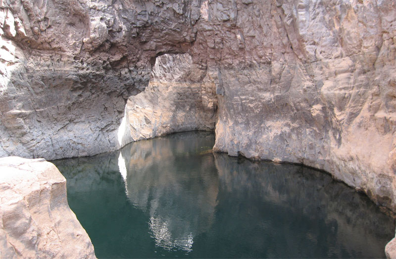
One lunch stop was by a deeply-carved gorge strung out with several waterholes (gueltas) and this arch.
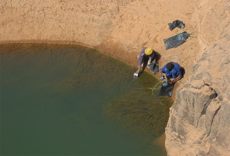
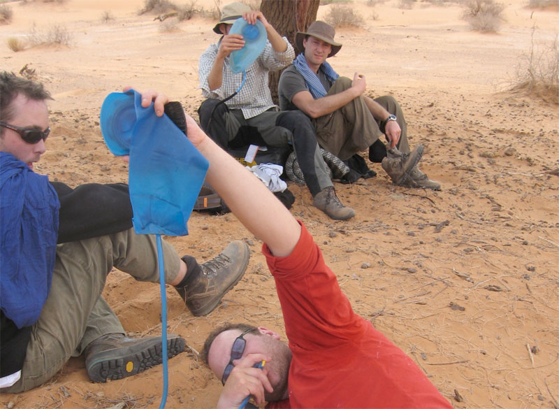
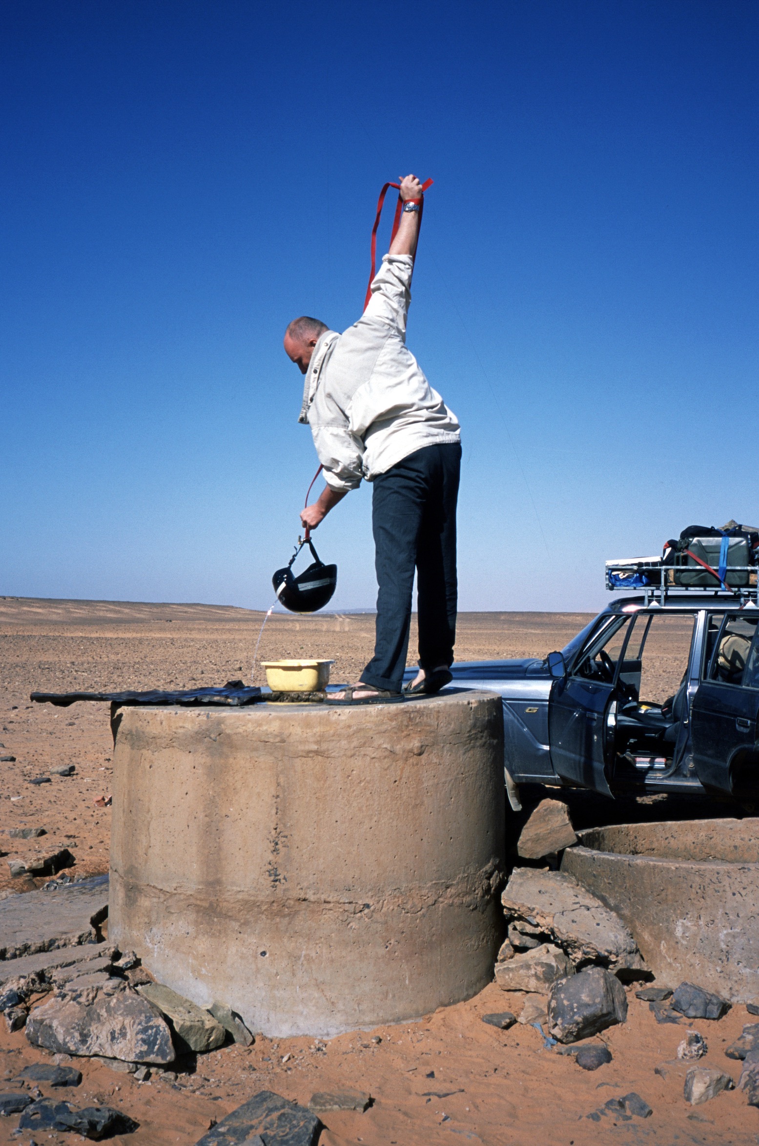
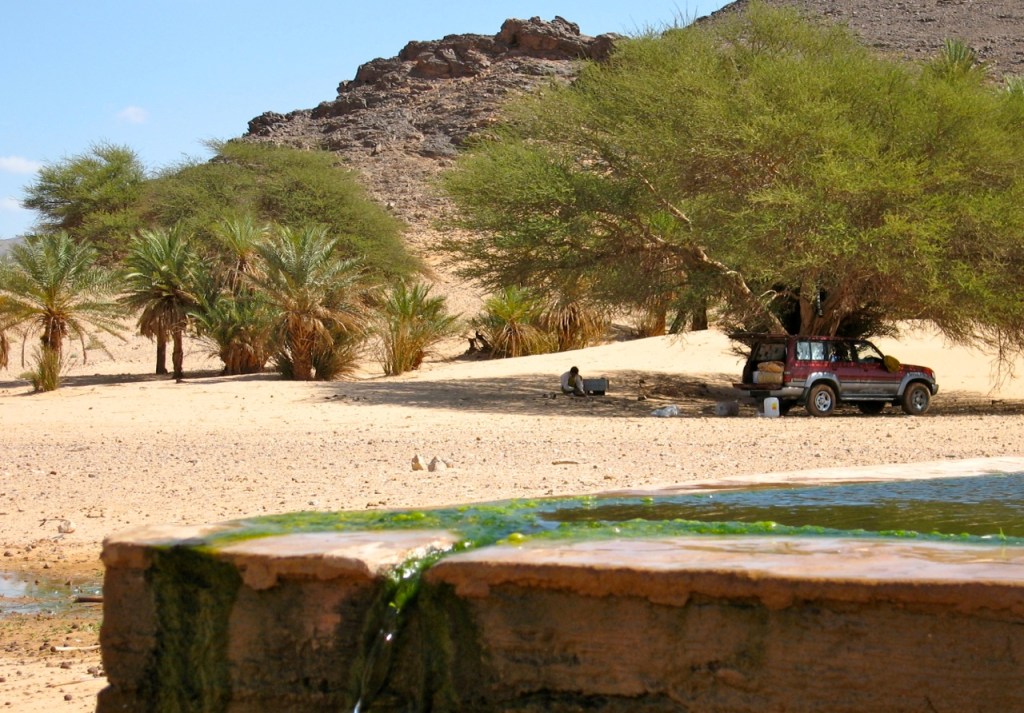
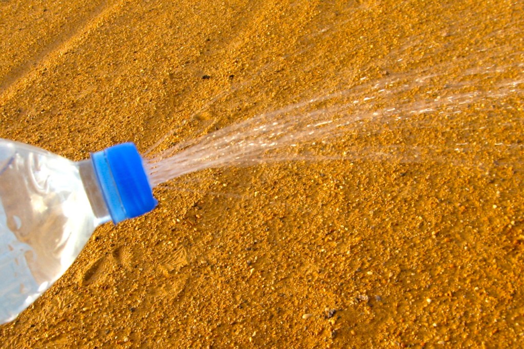
With no wells along the walking stage, the crew refilled from sources like this. People are put off by the green colour but of course what makes you ill you can’t see, even in crystal clear water. Being early in the cool season following the summer rains, the water was probably fresh enough and if the crew could drink it so ought I. As an experiment I drank some as it came but didn’t get ill.
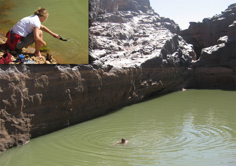
Interestingly ‘flying’ over our route on Google Earth reveals the region awash with gueltas. The gorge above is almost one long pool, and elsewhere we or the camels would not have got through some valleys and gorges without swimming.
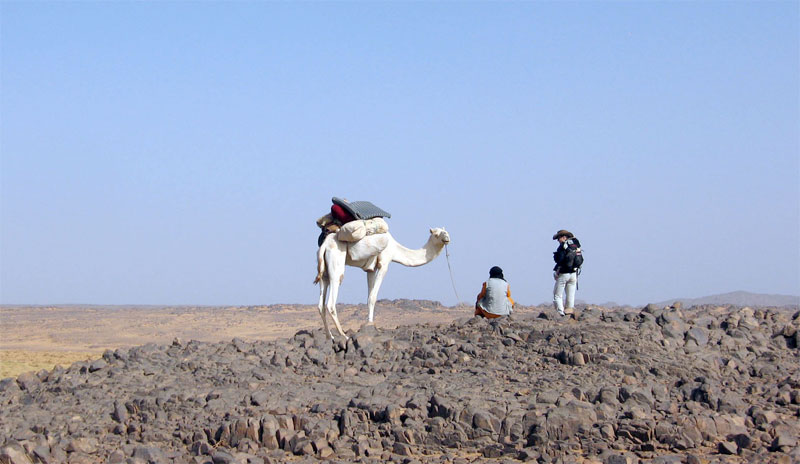
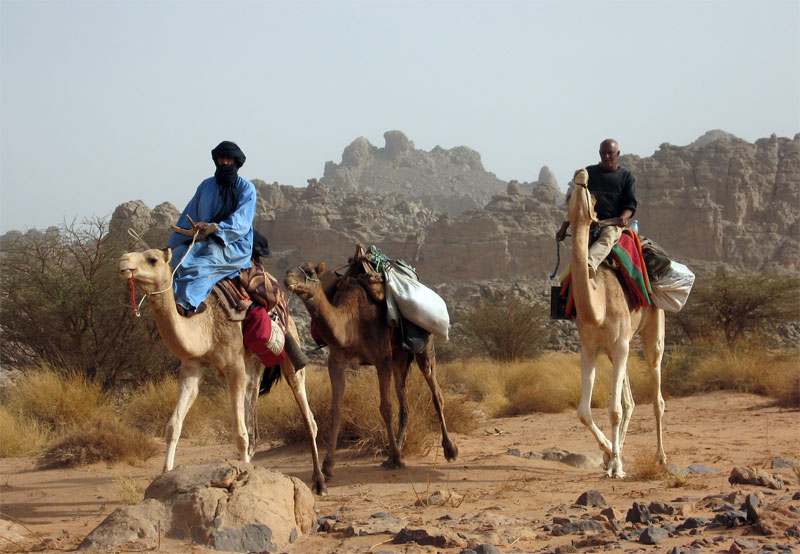
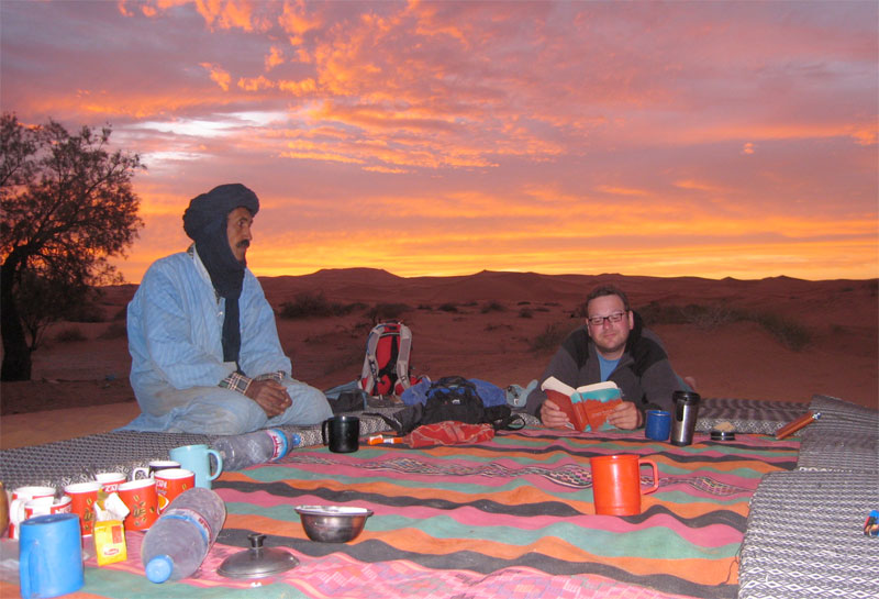
Mohamed H of Agence Tanezrouft and Sidi Ali our cook coming through. Sidi and the crew’s work started when we stopped walking for the day, and carried on until we set off before them next morning, so we didn’t resent them riding once in a while. We could too and those that did remarked what a relief it was to be able to look around at the scenery instead of dodging the next rock underfoot. But the wooden saddles are hard on the butt.
After a while it didn’t take much hesitation for us to grab a quick wash or launder at any guelta we came across, or even dive in for a swim. Like all tassilis, the Immidir has countless gueltas which make it suited to camel trekking. You can see from the ‘tide lines’ how deep this one fills after heavy rains.
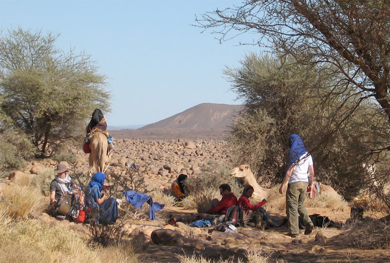
Some shade always cropped up around lunchtime or ‘midi’. Usually we’d have to wait for Sidi Ali and his lunch camels to catch up. Then, while we siesta’d the main caravan might pass through and keep going, usually getting to our evening camp ahead of us.
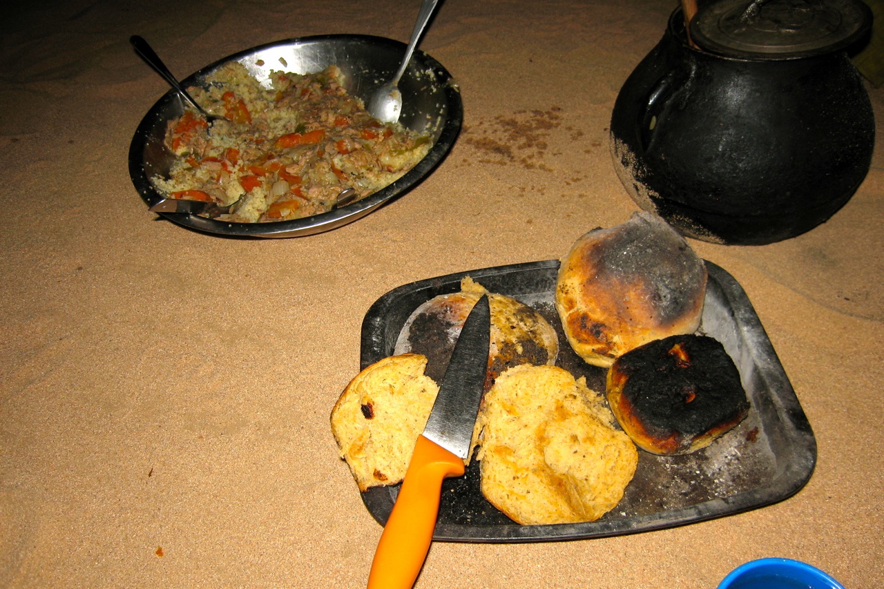
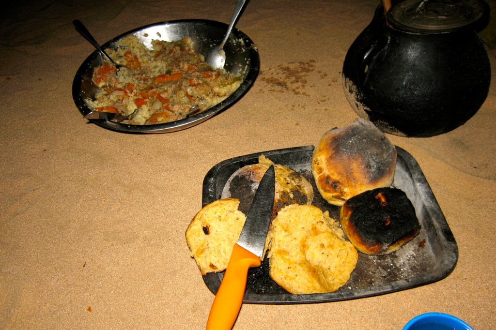
Food. Breakfast was light: coffee with hot milk and baguettes, sand bread or pancakes with jam and marg. We were sometimes given dates and a soft drink for the road. Lunch was a heap of mixed salad or veggie rice followed by mint tea and an orange while they lasted. We has more tea/coffee and biscuits soon after we stopped walking for the day. Dinner was soup and bread, a main course of cous cous/rice/pasta and stew – all variations on dried goat meat followed by an orange and mint tea. Most of us brought some sort of snacks and I brought my v-kettle (right) with drinks/soups which came in handy while waiting for the lunch camel to turn up.
Although I ate much less then I normally do, I eat too much anyway and saw the trek as a bit of a detox. I lost about half a stone but was never hungry. The daily ritual of walking, sleeping, chatting, eating and resting was very satisfying; as always the desert demonstrates how little you need to be content.
I carried about 2.5 litres of water per day in a Camelbak (bigger than most) and never ran out. On the earlier hotter days at about 30°C I got through 2L, later in the low 20s it was about a litre. About the same as summer in England.
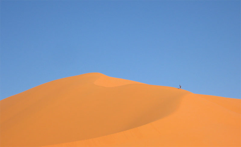
Come the big day the chattering subsided but we were still smiling when we got to the top of this gnaaarly climb, having unnecessarily gone up and down another ridge (see map below). With us we carried overnight gear, a bit of food and -no surprise to me having done these sort of walks before – not enough water. At the top of the climb we got our first sight of the Bou Zerafa dunefield 20 kms to the north and from this picture overlooking the camel route below the crater was only about 6km to the east.
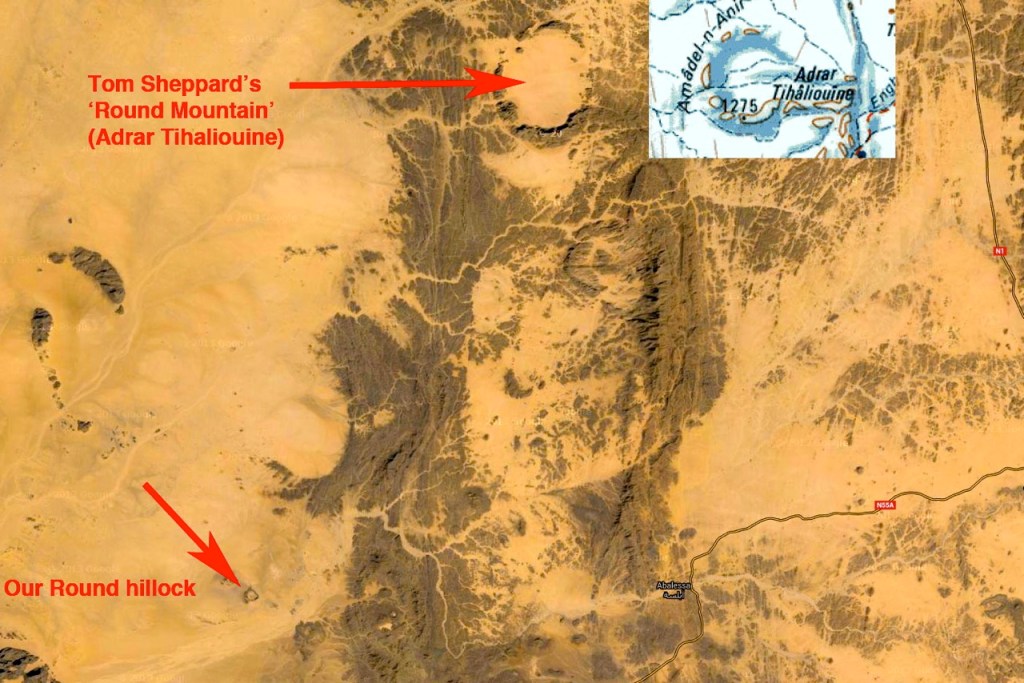
Before we set off from Arak I didn’t have a clue which way our guide Yahia was going to reach Bou Zerafa other than north some way. A map didn’t mean much to him so there was little point asking or pointing and Tamachek names don’t always match the map’s Arabic. I presume then it was a total fluke when his route led far to the east below the Adrar Tassedit escarpment before turning north up the Oued Bou Zerafa – or Oued Tassedit as they called it. It could not have passed closer to the crater site.
So east we went. The broken terrain reminded me of a mild version of Ginge Fullen’s attempt to climb Bittu Bitti, Libya’s highest peak (see p.377 in the Sahara book). Between us and the horizon where the crater surely lay were any number of chasms, clefts and gorges. Near this point we passed the 150-km mark which put the crater at nearly 100 miles from our departure point near Arak.
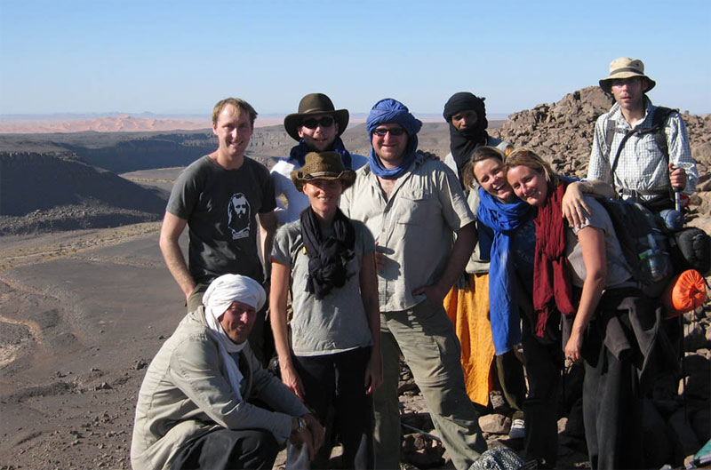
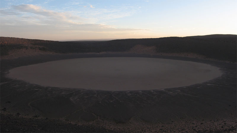
Just on sunset and having covered 7 tough kms in 3.5 hours, we sat ourselves down in the middle of the crater pan. Not sure what we’re all laughing about; we each have less than a litre of water left so tomorrow was going to be a bit of a march but our goal had been accomplished.
From the left: me, Yahia the guide, Francoise, Jon the photographer, Imogen, Amelia, Bob, Amelia’s parner Lex who tracked the whole route on GPS and Tom.
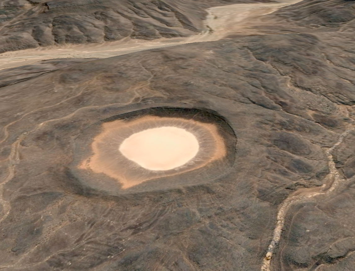
The crater is thought to have been formed less than 100,000 years ago with the first recorded visit by a French geologist in 1969. For us it would have been nice to explore it in sunlight and I’d also hoped to take a hike over to the Oued Tafrakrek rim a couple of clicks to the east. But having chatted with Mohamed on the sat phone, Yahia explained to us the camels were already heading for the dunes so to intercept them we had a longer cross-country walk the next day. I went to sleep thirsty, woke up thirsty and at first light decided to drink my last cupful while others chose to save a few drops for the hike. To make the most of the cool morning we climbed out of the crater at first light and set off northwest to the dunes.
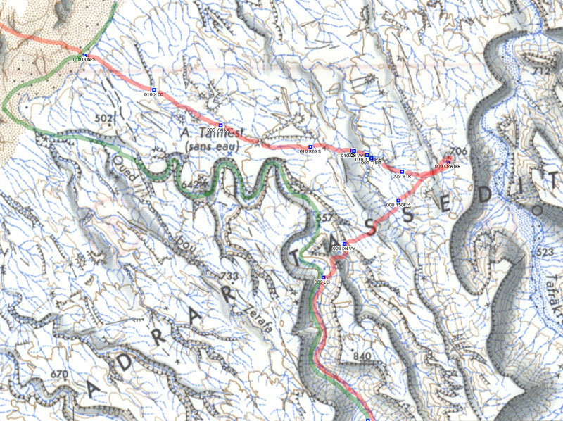
Here’s part of our route in red over the Adrar Tassedit plateau 8 days after leaving Arak. After lunch (009 LCH if you have bionic eyes) and repacking our gear we left the caravan trail in green, crossed a needless ridge (below the ‘A’ and then climbed back onto the plateau (‘009 DN VW’; the group shot 4 pics above) and then went up and down past ‘009 150KM’ to the crater at ‘706’. The map above is about 15 miles/25kms wide.
Although we were unsure to put our trust in Yahia as he’d never been here either, next day he led us to the dunes where our camels were waiting. Knowing water was scarce he lured us on, keeping just out of reach so there was no discussion about which way to go. As the return route and waypoints show, his Tuareg ‘GPS’ was spot on. Apart from the easily-remedied water issues our route to the crater was as good as could be expected.
In 2009 we started at dawn at ‘557’ a bit to the north of our lunch spot, above the meander of the ‘T’ on the map. We climbed up the valley side with a bit of scrambling and had a much easier 2.5hr/6km each way walk to the crater. Next day we followed the green route along the canyon to the dunes and beyond, probably 30km but no one noticed by now.
With some (myself included) a bit more parched than others (notably the women), we finally staggered off the plateau and onto the sands some 6 hours and 16 kms from the crater – much further than we imagined and having drunk no- or just a couple of sips of water. Everyone had quietly focused on the task. Luckily it was another cool day and of course we knew the crew was out there somewhere with water.
Once on the sands some desperados cracked and drained the last gritty dregs from their hydrators while Yahia dashed off to track down the caravan out in the sands. A few minutes later Mohamed came galloping in with some water.
We spent the rest of the day idling about and drinking everything they brought us. That evening, while contemplating the transit of Orion and Copernicus’ theory that meteorites never strike in the same place twice, a shooting star tore in low over the Tassedit plateau above the crater. With a bright green trail breaking up behind it, somewhere out there a new sprinkling of space debris had scattered itself across the desert floor. As we discussed the startling phenomenon a sonic ‘b-boom’ rippled over the sands, suggesting a meteorite had indeed breached the atmosphere. Someone knew the speed of sound and estimating the time after the sighting, Tom worked out it had fallen about 50 miles away, well beyond the crater. With this suitably astral climax to our crater day, Copernicus was proved right – again.
Next day we headed into the dunes for some exercise. Some took the high road…
… some took the low. We passed Bou Zerafa well marked on the maps. It was sanded over but Yahia assured us there was water a metre below. Winding up our 10-day rocky plateau trek in the glowing orange sands of an erg was perfect – another highlight after the crater.
Next morning the cars turned up from In Salah with fresh food and water. At this point my camera passed out but we carried on northeast alongside a dune ridge to one more camp (passing some lovely pestle-like moules to go with the countless grinders lying around). Another short morning followed to knock off ‘200kms’ according to Lex’s GPS tracking, right by an unmarked well with good water.
We drove from there northwest to Tin Habedra well (sanded in) and then directly west along the Habedra piste passing escarpments lined with tall cairns and small, palmy sources while chased by a storm front. It showered a bit that evening and most took to the tents for the first time as lightning flashes circled us along the horizon. Then at 2am a bolt exploded nearby and a heavy shower drenched the camp. The tents held off the worst of it but next morning by the time we’d got the fire lit most weren’t in the mood for the planned splash about at Tiguelmine guelta on the old Hoggar route. We headed directly back for In Salah, a great feast at Mohamed’s, a plane to Algiers and home.
Oxford, Portsmouth, Le Havre, Marseille, Tunis, Taleb Larbi, El Oued, Hassi Massoud, Illizi, Djanet, Mt Tiska, Erg D’Admer, Oued Sersouf, Mt Tazat, Amadror, Garet El Djenoun, Tefedest East, Tam, Ain Salah, Ghardaia, Taleb Larbi, Tunis, Marseille, Oxford.
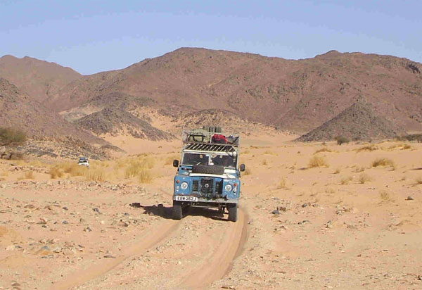
Land Rover Series 2A 1970 109 Petrol 2.25 • December 2007 – January 2008
Richard Washington
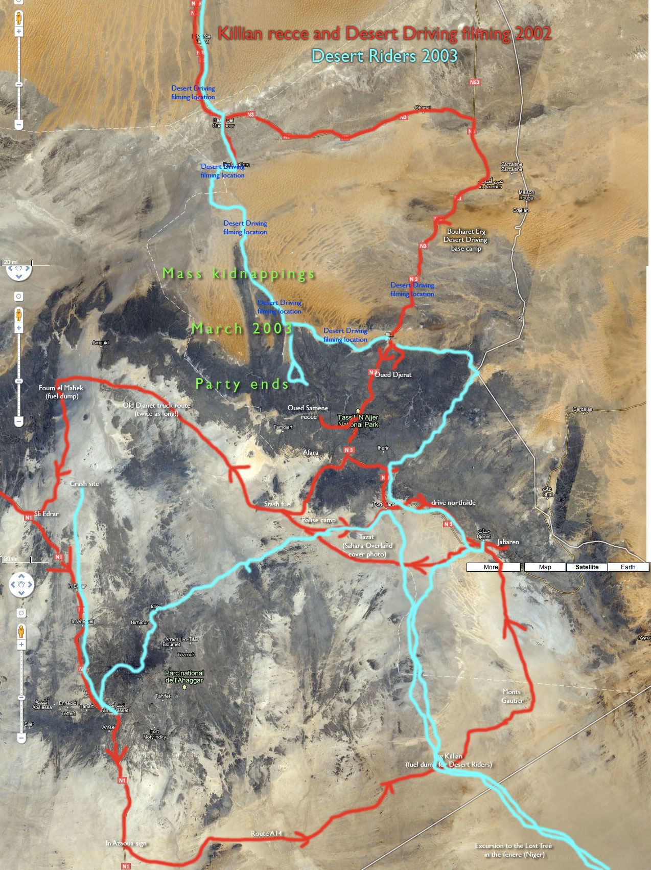
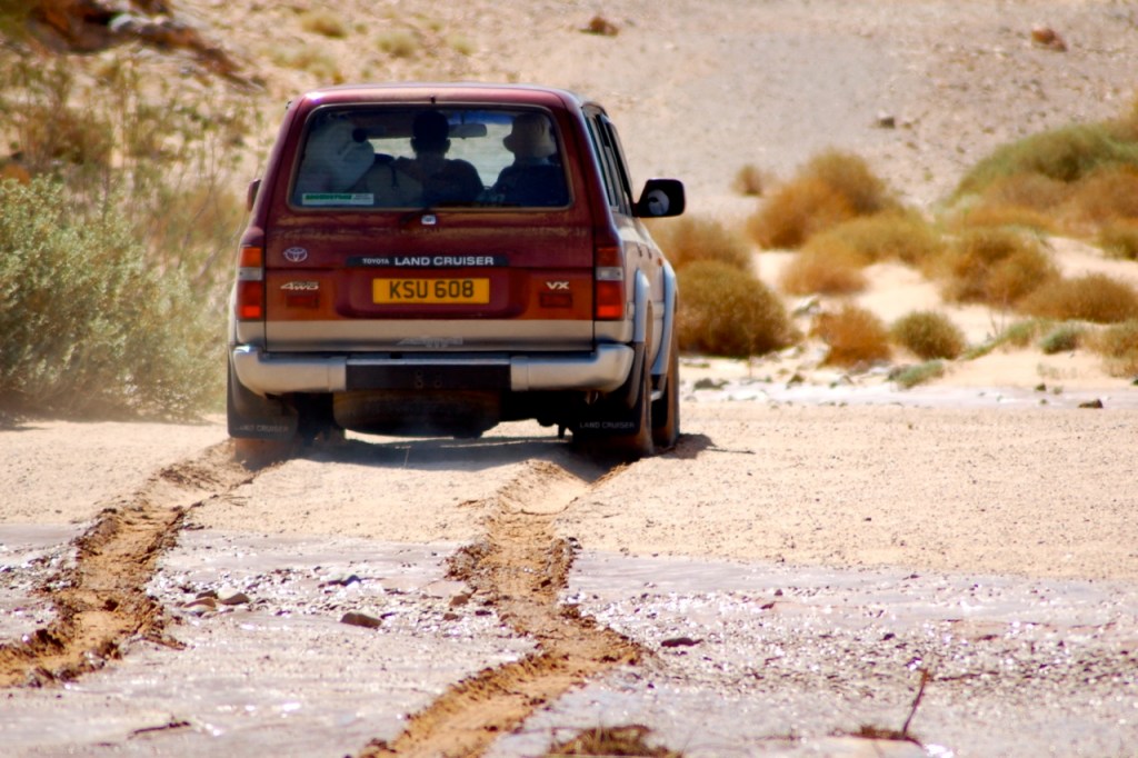
The last time I was in Algeria was in late 2002 on a round trip of the south in the fuel-dump stage of the Desert Riders trip. The kidnappings in March 2003 in the Algerian Sahara led to a bit of a wait-and-see approach for me but provided the opening for desert trips to the Gilf (2003/4), Chad (2005) and Morocco (2005/6). The combination of time-elapsed-since-kidnappings and a relative disappointment (I was warned) with Morocco’s desert (though not the country), resulted in a return to Algeria. To be fair, the decision was more than helped along by our extended Australian family’s curiosity with the Sahara and their idea that we all get together there in the winter of 2007/8. Happily we did, making it my 6th visit to Algeria. The desert there is better than ever.
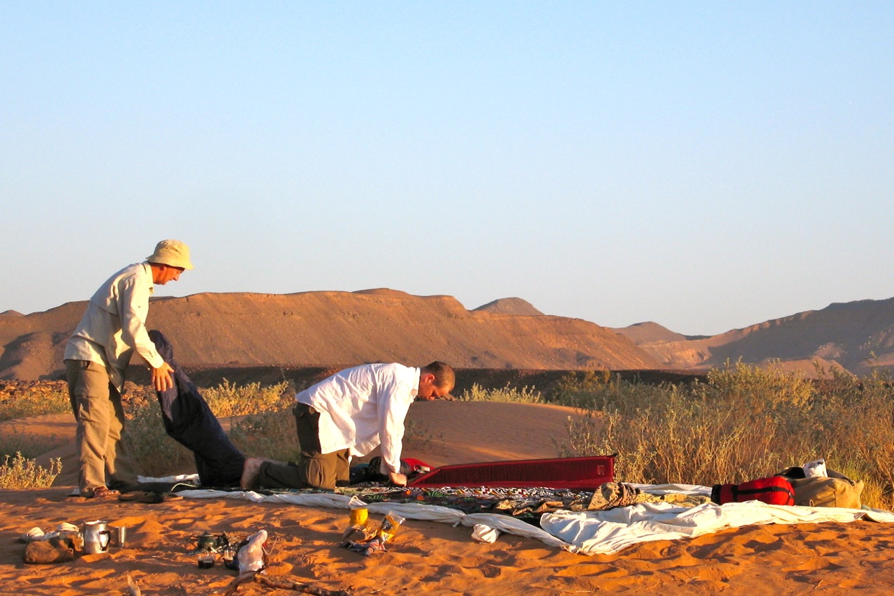
Our Route and Our Group We followed the usual route down to Djanet in the south-east via the sealed roads from the Tunisian-Algerian border at Taleb Larbi, taking about 4 days from the Tunisian border. There’s more on this part of the trip, including the state of the road, status of the check points and so on later in this S-File. We spent a good two weeks knocking around the Djanet region, including both day and overnight trips. Djanet is a great setting for this sort of thing – the landscape within 100 km is astonishingly varied. We went up the Tassili escarpment on an overnight walk with donkeys, out to Mount Tiska a couple of times – including a brief visit to the great northern Tenere plain, several nights in the canyons west of Djanet (Sersouf), a day in the Erg D’Admer as well as a few evening braais (South African for bbq) in scenic spots around Djanet. During this time we either camped out in the desert or stayed in the Hotel Tenere – a break from the usual Hotel Zeriba. Actually we did spend a couple of nights there. The Zeribas are all but gone and the nights pretty noisy (dogs go from 11-2, chickens from 2-5, and then the Mosque wakes up the truck drivers). But Zeribas is still a nice location in the heart of town. Hotel Tenere was a pleasant surprise. Working out at about 10 euros per person for a 4 person bungalow, we enjoyed the peace and quiet, awesome views on the breakfast balcony, and freedom to cook up our suppers in the quiet hotel gardens. The place had always been a ghost town when I passed by on previous trips. It was this time too, apart from the nights when aircraft landed in Djanet – then it was fully booked for a few hours (the flights arrive after midnight).
Our Djanet to Tam route took in the pass just north of Mount Tazat on A7 in Sahara Overland, two nights at a beautiful spot just west of Tazat, a day driving up the old truck piste from Djanet (A7 in Sahara Overland) and on to the centre of the Amadror plain (a striking camp in the middle of nowhere), on through to the Tefedest East valley, a couple of days on a detour north to Garet El Djenoun from where we headed south to Hirafok back along the Tefedest east and then west across the corrugated piste to the sealed road to Tam. It was a purposefully slow drive, taking a full 7 nights to do what many parties would want to cover in three days. But this part of the Algeria trip was the highlight of the holiday and, increasingly, the pace at which I enjoy moving through the desert. On the days when we did drive we got going at 10am and finished by 2 or 3pm – some days a lot earlier.
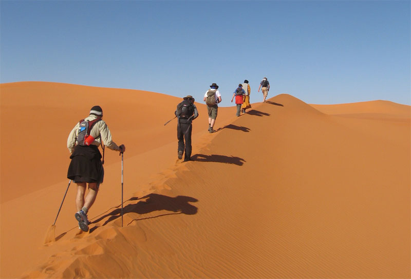
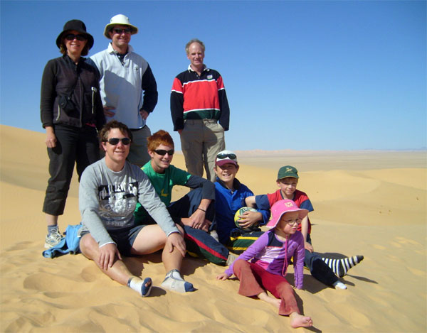
For the leg from Marseille to Djanet I was joined by Spook. Meg, our two children, Josh (7) and Kate (4) flew into Djanet via Paris and Algiers, along with Meg’s sister (Clare), her husband (Mike) and their children James (about to start uni), Nic (16) and Rob (12). The age range coupled with it being Clare and Mike’s family’s first desert trip made me wonder how we’d fair, especially for things like the Tassili escarpment walk.
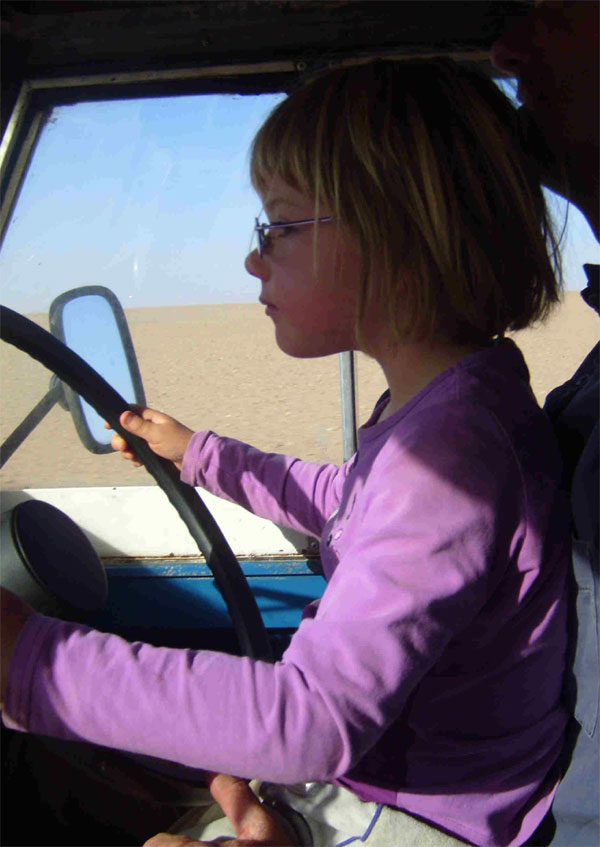
Kate and Josh are probably amongst the younger tourists to have made it up the Tassili escarpment. Josh made sure he walked up and down while Kate took advantage of Meg’s fitness with long piggy back rides. Kids this young tend to focus on the very small scale. This became obvious to us when looking through the extremely detailed diary that Josh kept during the trip. He seldom commented on the grand views or the expanse of the desert but wrote a lot about our camp sites, cooking on the fire, the Algerians who were with us and so on. Josh was absorbed for hours looking for bones, old pottery, fossils and unusual rocks around the camps and, towards the end, went off with Kate on longer walks up surrounding hills. Having a camera also kept him busy. We also took a rugby ball and cricket bat which kept us all entertained for hours. Kate was perhaps less interested in the desert itself. For her, having the company of an extended family for 24 hours a day was a great treat. One indulgence we took with us was a portable DVD player. Kate watched the Sound of Music often enough to learn the words to most of the songs. There is no doubt that this helped us through some of the longer driving days. The children slept some nights in a tent, some nights under the stars and many nights on the mattress in the back of the Land Rover. This provided them with a cosy and familiar setting which was marginally warmer and certainly less windy than outside. There was never any hint in the time we were there that the children were not having a great time. Without exception, the Algerians were simply great with the kids, and Mike and Clare as uncle and aunt, were very helpful and attentive which no doubt helped.
A question the people I work with always ask when they hear I am heading for Algeria goes along the lines of “so what do you do all day when you’re in the desert?” I think there is a general concern that you’ll be bored out of your mind. Funnily enough, we were all too busy in Algeria for the question to arise. The desert just seems to soak up your time in a nicely passive kind of way.
Roads, Borders and Ferries The sealed roads through Tunisia were excellent, better than I remember them on previous trips when there was a lot of construction going on either side of Gafsa, The good roads allowed us to reach the Algerian border from the port in Tunis on the same day.
We arrived at Taleb Larbi (Algerian border) at about 10:30 pm having docked in Tunis shortly after noon. That night we slept near the Algerian immigrations building having exited through the Tunisian border. Unusually, the Tunisians kept us waiting about an hour before stamping our exits. They checked and re-checked our papers while heading off to the Land Rover a few times without doing very much when they got there. It wasn’t ever clear what the problem was though we speculated that arriving in Tunis port and then checking out of Tunisia a few hours later had scared the horses a bit – especially when we’d asked for a 12 day stay – as you do in case the Land Rover wrapped itself round a camel on the way passed Gafsa.
Processing through the port in Tunis wasn’t too bad – taking just under 2 hours, slower than it might have been because Spook needed to get a visa for his S African passport. It continues to amaze me though, that there is no readily apparent system for dealing with immigrations and customs in Tunis port. The ensuing madness of cars, converging lanes and hooting makes it seem like its all happening for the first time. That said, getting on to the Ferry in France was little different. First we were sensibly shuffled into two lines, one for Algiers and one for Tunis. A little later on the lines converged from 10 to 1 as we went through immigration but not before the cars were put through an S-bend carefully calculated to be too tight for most 4X4s. Its not easy reversing in an S-bend with 5 lanes converging to one. Getting off the ferry from Tunis in Marseille on the way back had its own surprises too. Lanes of cars were dealt with in order by immigration officials in booths – a sensible approach given that cars at least stay in order that way. A key problem at the Tunis end is that drivers are processed away from their cars. Needless to say, people from the back of the car queue can be dealt with before those whose cars are ahead of them in the queue – so lines of cars tend to become a jam of angry drivers who can’t move in any direction because many of the drivers are still on foot in the queues. It was good to see that the French had this part of the production line sorted out. But French customs instead had something in the pipeline for us. They were stopping cars in the lanes and searching through them so that the entire queue of cars had to wait until the cars in front had been cleared. We watched in amazement as a panel van was unloaded in front of us and every bag and hiding place in the van thoroughly searched. After that we were waived through in a second. But why not pull these cars out of the queue first – and then dismantle them? That would save everyone a couple of hours and there was plenty of room to do so.
Algerian sealed roads are a mixed bag. The Taleb Larbi to Djanet and Tam to Taleb Larbi (trans-Sahara highway) sealed roads seemed to be in a much worse state than in any of my previous visits to Algeria. In particular, the road at the south end of the Fadnoun plateau (between Illizi and Djanet to within about 50km of Djanet) is badly broken up and cost us a good tyre and tube, even with slow and careful driving. I was also surprised at the condition of the road south of Hassi Massoud to Hassi Bel Gebour. This stretch takes a lot of oil traffic now and is a pretty poor state. With the oil price having trebled since I was last in Algeria and with the industry making heavy use of these roads, one wonders where the cash is going.
Likewise, the sealed road between Tam and Ain Salah, apart from a new section 100 km north of Tam, is full of deep pot holes. It is particularly bad around Arak where the problem of the river and the road sharing the same valley still hasn’t been sorted out. It looks like they are having a serious go now though, with some complicated elevated sections under construction. But then they were busy with this in 2002.
Our drive north took us from Ain Salah to Ghardaia and from there on to El Oued and Taleb Larbi. At Dahaj (from Tanezrouft’s) recommendation, we took the road 40km north of Ghardaia before turning east through a string of pretty Berber towns via Guerrara on a smooth, quiet and very scenic alternative to the Ouargla route through from the Trans Saharan Highway to El Oued and Taleb Larbi. This route is not only more interesting but cuts out that demoralising southward dogleg west of Ouargla on the way to El Oued. There were also no military checkpoints between Ghardaia and Toggourt.
Its still all Toyota, Toyota in Algeria. The shops in Djanet and Tam seem to have more spares than ever. Fuel queues in Tam were back – or never went away. Luckily we had the range to get north to Arak on Djanet fuel otherwise it would have been about 2 hours or more of waiting for us.
A marked change from 2002 is the amount of traffic on the roads at night. We slept about 3km off the road about 15 km south of Hassi Massoud but could hear the trucks on the road throughout the night. I remember the traffic pretty much stopping at sunset on these stretches before. We also drove at night, leaving Ain Salah at midnight (for reasons that I will explain later) and arriving in Ghardaia at about 9am. This all seemed OK with the checkpoints along the way and we passed traffic throughout the night.
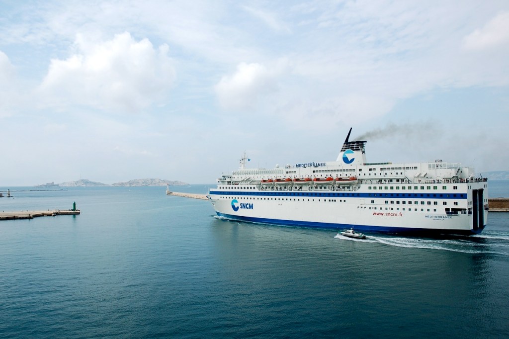
SNCF are running a new ferry on the Marseille to Tunis line – the Danielle Casanova. She’s not exactly new, having served on some other route for a few decades – probably the run out to Corsica. But she’s bigger, most likely faster and quite a bit grander than the Liberte which used to ply the crossing to Tunis. A ‘new’ line is also running from Portsmouth to Le Havre (LD Lines) with fewer crossings per day (just one) compared with P&O.
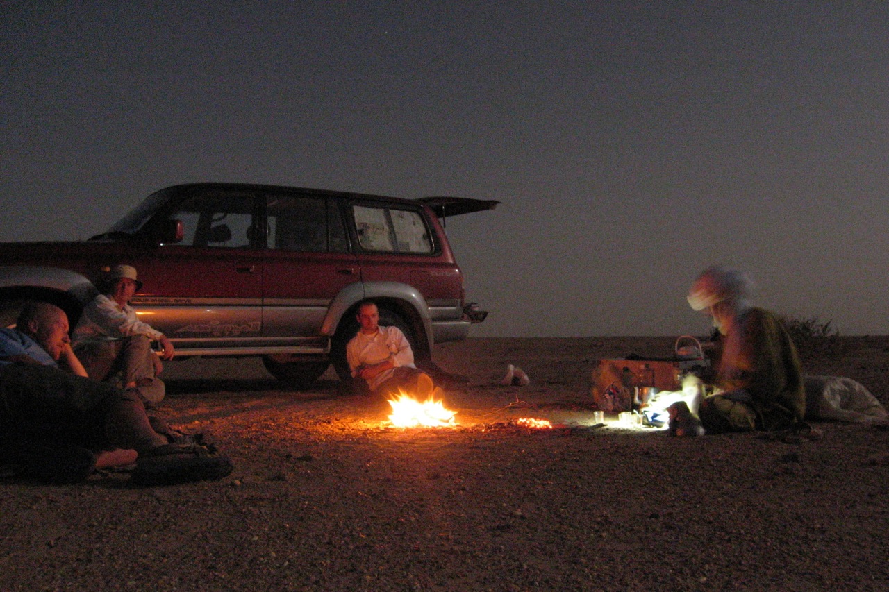
Tanezrouft Voyages The invitations, permits, two Toyotas (for the Djanet to Tam leg), drivers and guides necessary for an Algerian trip these days were all arranged by Tanezrouft Voyages. Our itinerary was complicated. It included two arrival dates for our party, one in our own car, three departure dates and several unique groups of names for the various legs (two arriving in Taleb Larbi, one leaving in Djanet, 8 arriving in Djanet, 7 leaving in Tam, 2 leaving in Taleb Larbi!). The paper work was taken care of by Yves at Tanezrouft and any changes, including a few that we had to make late in the day, were resolved very promptly. The Tanezrouft drivers (Dahaj and Moktar) were the best you get for these kinds of trips. Their outlook and temperament are very well suited to desert driving and desert trips. They obviously enjoyed being in the desert, were ever patient and unhurried, good with the kids, and sensitive to us wanting to drive slowly and take ages over the piste from Djanet to Tam. They were not once late. Srouffi, the guide provided by Tanezrouft, stayed with us from Taleb Larbi to Tam. Srouffi is a lovely man who knows the pistes extremely well. He went the extra mile in looking after us in the camps, especially around the fire on cold nights. He is quite a character. Overall it would be a priority for us to work with Tanezrouft on our next visit to Algeria.
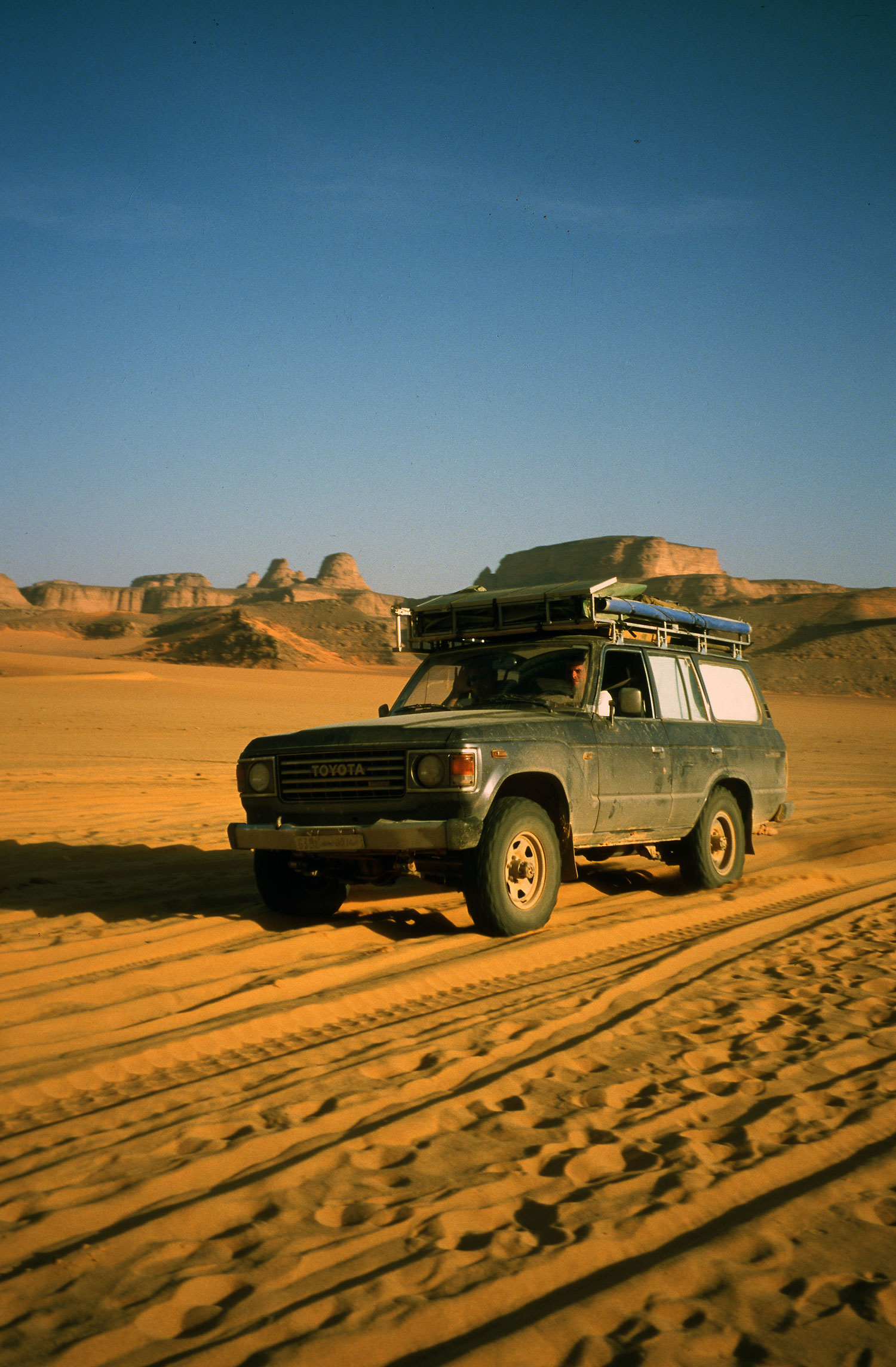
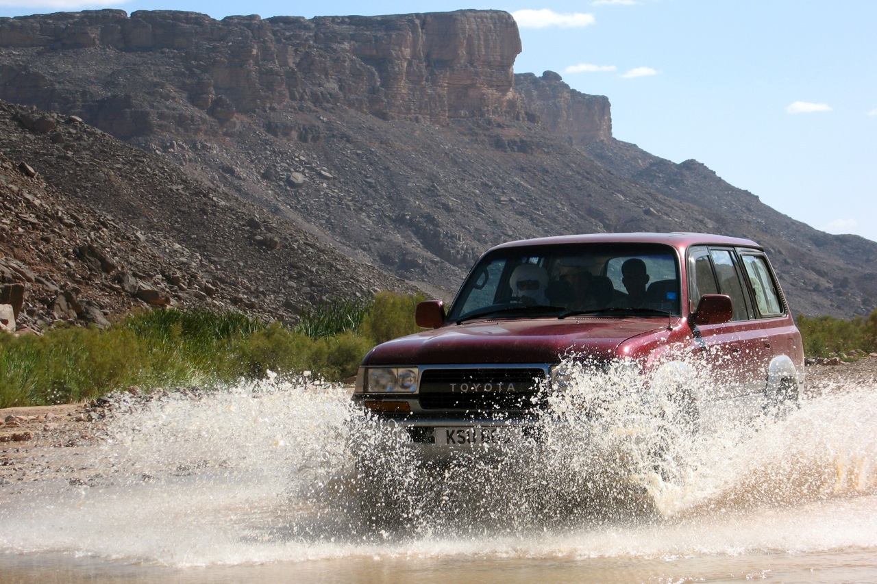
Cars We took my old 1970 Series 2A 109 Land Rover (petrol 2.25L) from the UK but also had two Toyotas from Tanezrouft for the Djanet to Tam leg. The Toyotas were a pair of Landcruisers, a GX 80 series with 400 000+ km on the odo and an 80 VX with about 250 000 miles.
The VX did the job in a comfortable VX kind of way. It does sit like a frog when loaded though. The extremely cold weather led to an oil leak near the front pulley which was active for a few days but went away once the weather eventually warmed.
The Land Rover went fine, covering the 10 000 km return trip without any majors. Only the routine manifold gasket job half way through the trip in Tam caused us to get the big box of tools out. I say routine because this bug crops up every 4 000 km or so – the back exhaust outlet burns through on the manifold gasket and it starts to sound like a Merlin engine after that. Anyone who knows what could be the cause, do let me know. I’ve changed the inlet and exhaust manifold itself (not just the gasket) twice now and three different people have been involved in doing the job. Anyway, its easy enough to do and gave us a bit of street cred at camping Dassine in Tam when our sleeves were rolled up.
We had two punctures on the Land Rover – the first on the Fadnoun plateau which ruined the tyre too. The second in the middle of the Amadror which we fixed that night. Like many others I have thought long and hard about the number of spares to take. For the last three Saharan trips in the Land Rover I have settled on one made up spare and one additional tyre with no rim (plus a few tubes). The reasoning is that its easy enough to fix punctures (providing one has some levers, patches and so on) but its very unlikely that a rim will become impossible to repair – especially steel rims. I carried 2 made up spares on over 70 000 km of piste on previous trips in the Land Rover, but never needed them.
The Land Rover had a couple of interesting and unique tricks too. One was a potent smell of petrol which was beginning to strip the last of the blue paint work off the doors it was so strong. The issue had started in Morocco on an earlier trip and I thought I had it sorted after changing the back tank (which was obviously leaking) and adding some additional seals to the fuel caps (the Land Rover has 3 on-board fuel tanks). Everything smelt like roses when I did the test drives round Oxford in the summer, but by Hassi Massoud it was clear that Spook’s eyes were starting to water in the passenger seat. We by-passed the complicated fuel delivery set up (involving tank switch and independent fuel pumps and filters) with new fuel line all the way from the rear fuel pump to the carb – and still it stank! We finally diagnosed the problem in Sersouf canyon near Djanet where we noticed that the stink was a lot stronger with a closed throttle than an open throttle – a bit counter intuitive really. It turned out that the new replacement Weber carb had some kind of an ill-fitting adapter collar where the air filter pipe joins it. When hot enough, the adapter collar becomes loose, allowing the entire air filter pipe to detach along with the collar from the carb top. Removing the collar made for the simple fix. It probably never got warm enough round Oxford in the summer for the problem to develop. So we’d spent all our efforts looking for leaks in the fuel line when the problem actually lay in the air feed. There’s something new on every trip and, as they say, its never over in a rover.
The Land Rover also developed a leak in the exhaust pipe just short of the silencer box. This was sorted out in Tam by the first set of fixers on the right hand side on the way in to Tam from camping Dassine. They are worth a mention because they took the pipe and silencer box apart, welded in a replacement piece of pipe (found on the roof of a house nearby) and welded it all up again over the course of 2 hours, asking only 8 euros for the job. There is nowhere I know of near Oxford that will do anything other than throw away as many sections of exhaust pipe as they can and bolt on new parts while some gum- chewing youngster with spots and a bolt through his eye rubs runs up an outrageous bill. No one welds exhausts where I live anymore. So hats off to the guys in Tam. That’s where I’m going next time the exhaust develops a leak and I find myself in the UK.
While the Land Rover threw up minor niggles to keep us entertained on the long sections, the GX had a more spectacular episode coded up in its DNA and ready to be unleashed at 426,515 km. About 100 km out from Djanet the GX transfer box shaft opted for its very last rotation. The car stopped so suddenly in front of us that we nearly absorbed the Toyota’s spare tyre in our front grill – it was all we could do to miss it. The box was terminal – actually Moktar had been struggling to find both first and second gear ever since the aging GX had arrived in Djanet. I was a bit surprised that it was the transfer box that finally finished it off. After we had disconnected the front and back props – which hilariously involved Srouffi – not much of a mechanic on a good day – as chief conductor and interpreter using all the 11 French words the team had by then worked up in common, the VX towed its work-horse counterpart to Djanet on a very short 4m strap I’d dug out of the Land Rover. With a delay of a week likely to replace the box (which eventually came via Tam from Ouargla), Dehaj set about finding a replacement car. This is where Isak from Djanet (not his real name) with a newer GX belonging to his brother, stepped in to help and Moktar, sadly, vanished from the scene for a couple of weeks. I have to say that Dahaj and Moktar alike did nothing but reassure us that everything would be fine and that our schedule would be unaffected – more than I would be capable of if my transfer box had just jammed solid such a long way from home. The substitution of cars and drivers led to a bit of an unusual situation because Isak was not in the employ of Tanezrouft, other than in an ad hoc sub-contract kind of way –as far as we could tell that was- and the car belonged to someone in his family. So when, during the rest of the trip, the day’s driving was done, he felt as though he was free to do what he liked with is families car. Which, in fairness, he was. At least until an event on the Amadror plain changed things a little.
Isak had been on a number of ‘drives’ on his own to go and ‘fetch firewood’ since he joined us in Djanet. He normally came back to camp with firewood although it had never been necessary to fetch any as we’d always camped next to trees where firewood was plentiful– as you so often do on these trips. We knew it wasn’t the real reason he went off, but it never resulted in anything more than a topic of curiosity amongst us. We arrived in the Amadror plain campsite at about 4pm – one of our longer drives. Within 5 minutes of getting there, Isak went off to find firewood. Anyone who has crossed the Amadror plain knows that there just isn’t any. We hadn’t seen a tree in about 100 km and the landscape is flat, empty and stark. When he wasn’t back 3 and a bit hours later, Srouffi began to worry in as much as Srouffi ever worried about things. Also James and Nic were without some of their kit as they’d been travelling with Isak that day and he’d left so smartly that it hadn’t occurred to them to remove everything from the GX. Now that it was dark, Srouffi walked a few 100 meters from the camp and waved a dying-yellow head torch about a bit, hoping that if Isak was lost, the head torch would draw him home. I also switched on my Thuraya sat phone, having swapped numbers with Isak before setting off on the trip. Round about this time we spotted a number of vehicles, about 10 km away moving towards our camp. It was then that I decided to SMS our GPS position to third parties as we really weren’t sure what was going on. It turned out that Isak hadn’t been able to find our campsite in the darkness – he only found it when I switched on the headlights of the VX. Looking back, the cars we’d seen must have been on the piste from Illizi to Tam which crosses the Amadror (its not one I’d known about before). Over the days we got to know Isak better and he turned out to be a likeable guy that Josh and Kate, the youngsters in the group, were especially fond of. He didn’t come across as anything like the usual piste driver with his smart clothes, shades and leather Thuraya case. But he did help us out of a spot in Djanet at a moments notice and for that we were grateful.
Taking a car down to southern Algeria from the UK is, when you add up the costs of a guide from the border, the ferries and the fuel through Europe, only marginally less expensive than spending 130 euros a day on a local vehicle. Given the wear and tear to your own vehicle, it probably works out to be a lot more expensive. But a number of things make it attractive to drive down. First, one can take a lot of things with you that are nice to have. We took camping chairs, a table, tents for nights when the wind was strong, food that you can’t get in the south (including coffee, tea, savoury biscuits, packet soup), Christmas presents for the kids, balls to mess about with, medical kit, water containers for the piste, a cooking stove, GPS, satellite phones, books for the children to read. All these things helped to smooth out the bumps but would have been difficult to include in the 20kg baggage allowance. Also, as mentioned earlier, the Land Rover was a home away from home for the youngsters. They really enjoyed sleeping in the back.
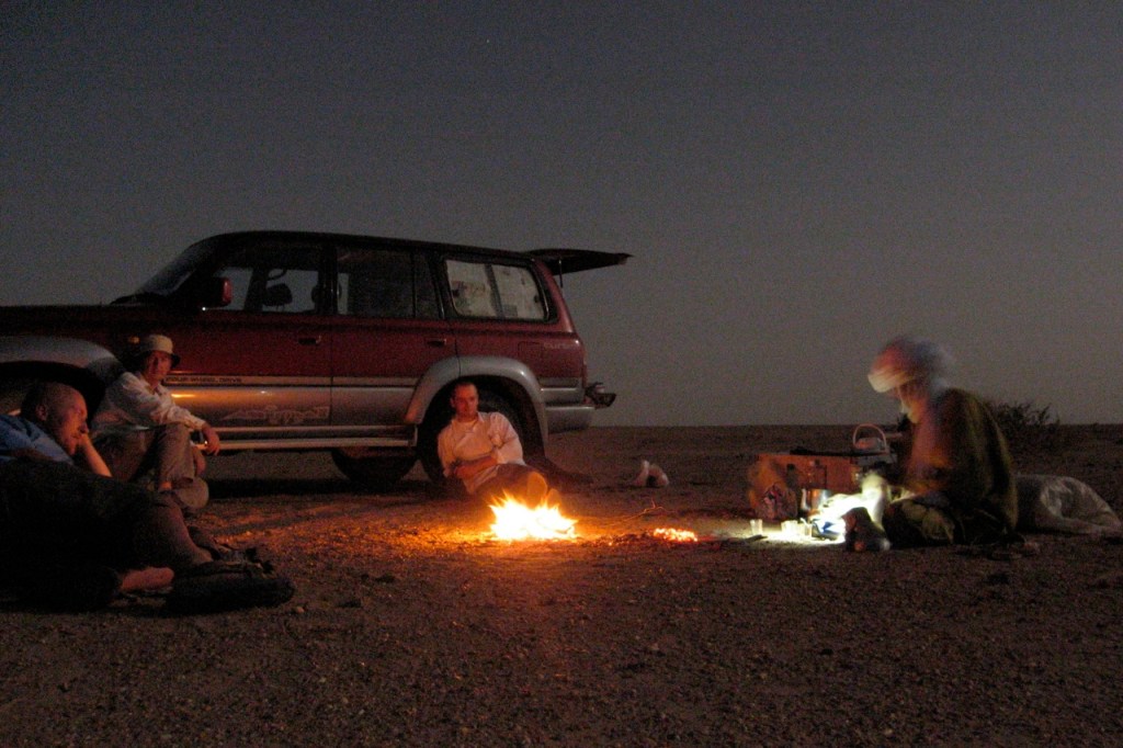
Algerian Security Situation It was the Algerian consulate in Canberra who rang Clare up in Sydney and asked her if she knew what she was doing taking her children to Algeria. The London office was a bit more detached but a bomb killing nearly 70 people at the UNHCR in Algiers did manage to get on the news just before the party of 8 flew through the capital on the way to Djanet. Sleepy Djanet had its own share of action a few weeks before when a group of insurgents in 3 Toyotas fired RPGs at an Algerian military plane before fleeing on foot into the hills. All of this is good news when you are about to head off because the effort needed by the insurgents to mount such complicated raids normally means that the ensuing months will be much quieter while they regroup – and the security situation heightened. To be honest it didn’t seem to be round Djanet. The night Meg and the others flew in to Djanet, we took our 3 cars and cooked supper on a fire in the desert just 5 km from the airport fence. We might well have been the return party eyeing out the Mi-17s that sit on Djanet runway. No one seemed to be very bothered and we stayed there from sunset till the plane landed at about 3am.
Compared with 2002 there are certainly more barrages (military road blocks) on the sealed roads, although our passage through them was faster than before owing to the paper work (names, passport numbers, date of birth etc of all in the party) Tanezrouft dished out at every stop.
Our time in Tam coincided with the President’s visit and sharp shooters on street corners and roof tops. We’d thought we’d escaped the fuss in Tam but rolling in to Ain Salah we noticed the familiar flags and hurried look on the painters tarting up the town. Our afternoon in Ain Salah on the way north was meant to be followed by an early exit the next morning but later that night rumours spread around town that the road either way out of Ain Salah was closed for 24 hours. This made me think for the first time about my own timing (having been carefully aware of everyone else’s flight dates) and it soon occurred to me that my 30 day visa was to expire in 24 hours time. A trip to the Police (guys with the blue cars) with Dahaj confirmed the road closure as well as the fact that they weren’t willing to give us a letter explaining that the road had closed and that we’d been delayed by the official Presidential visit. Whilst on the phone to Yves that night from Dahaj’s family’s house, Yves recounted the story of a party of tourist who had overstayed their visa and ended up in court. So we visited the Gendarmerie (the guys with the green cars) who explained that the road was closed but would open 100 km from Ain Salah (the big checkpoint on the way up the Tademait plateau) at 5am. This sounded unlikely given that a hit and run/bomb planter was designed to be delayed by the road closure until the president had safely left town, but it was enough of an opening for us and Dahaj kindly agreed that we could leave town at midnight on the Monday/Tuesday change over. I felt bad because he’d been away from his family and home town for weeks and here we were snatching him away a few hours later. That night was a real stinker with a blistering northerly gale, dust storms and temperatures near freezing. But we were waived through the check point 100 km from Ain Salah and all others that night too. In the end I drove from Arak (250 km north of Tam) to Nefta in Tunisia in one go. A 37 hour stretch at the wheel of the old Land Rover was enough for reality to parse through my head in strange, interrupted packets of information rather than the normal steady stream we know. It was like the jangly world had adopted a 1-3-4-2 firing order on a point gap that was way too big. Tunisian immigration were unusual helpful that night. Just as well.
Weather Mid-winter in southern Algeria normally brings warm, cloud free days and cold to cool nights. We had some of those. But almost all the nights in the south were below freezing and many nights much more windy than average. Several of the days were very dusty too. A cold, northerly wind tended to spin up the dust.
On Guides I have already commented on how pleasant Dahaj, Moktar, Isak (once we got to know him) and Srouffi were in the desert. And just how helpful Tanezrouft were. So these comments go beyond Tanezrouft to the general case of guides in the desert and come, in part, from the fact that I’ve been to the Algerian desert several times on my own trips without guides, sometimes into uncharted territory well off piste.
There certainly are times when having a guide adds to ones enjoyment of the desert substantially. An example is the pass west through mount Tazat which we’d done once on our own by accident a few years before. I had the GPS points for the route as well as those in ‘Sahara Overland’ (part of A7). But that afternoon we were in the mood to hand over to Srouffi and set sail for the pass knowing that he’d find the smoothest way through – which he did. Yet other times I was up for a bit of my own exploring and that becomes difficult to do because the guide loses the mojo for a while and doesn’t like not being in charge or understand what we are trying to do. It is genuinely difficult to explain an intended route to someone who doesn’t do maps, route descriptions or a GPS. Exploring is a very real part of the enjoyment of a trip like this and I keenly felt the loss of what is an important component for me. Perhaps its possible to strike a deal with a tour company in the beginning where one pays for a guide that is happy enough to take a back seat (literally and figuratively) for the trip. On the other hand maybe Saharan guides are just part of the irreversible shift towards the taming of the desert and removal of the isolation that draws one to the desert in the first place. The trips I’ve done where the desert was the closest companion for us all was when we went off-piste in one vehicle with no satellite phone or GPS. The days of heading off without a GPS or sat phone are over now but there may be a way round the personality of the guide.
Best campsites: Mount Tazat (couldn’t leave – stayed two days), Mnt Tiska (always a favourite of mine) Worst days: Figuring out Isak’s antics on the Amadror Best days: Climbing mount Tiska with Spook and just about all the days with family. Wish I’d brought: a blanket – those seriously cold nights would have been better with a blanket both round the fire and over a frozen sleeping bag. Didn’t need: used just about everything bar a fairly long list of spares (water pump, alternator, carb, distributor, fuel pump….) Cheapest supper: Chicken and chips for 9 in Tam: 24 euros.
“It’s never over till it’s over” I’ve learned to say to myself over the years but it had barely begun when at Tunis port they whipped away my newly illegal GPS “telephone” unless I chose to arse about getting a permit from the Ministry of Stupid Ideas. I deposited it in a room full of CB radios (fair enough) while others did the same, a bit stunned about how to navigate down south. Luckily my real sat phone (which I had the presence of mind not to declare) had a rudimentary GPS.
Coming off the boat I’d met the famous David Lambeth coming back from supporting a bike rally – he was not keen on lending me his bells and buzzers Garmin 5, but another departee in a pink 110 kindly lent me an eTrex to back up the untried Thuraya sat phone navigator.
Then, trying to call g-friend down the road it turned out my PAYG Thuraya had expired its SIM (don’t use it much in London). This undermined the security of my solo route plans somewhat until my rendezvous with Prof. Nimbus in Djanet in ten days time. I was beginning to wonder was this going to be “one of those” trips – after all, all had gone remarkably to plan these past couple of years …
A fax to g-friend from Nefta saw some new SIMs on the way to Nimbus. Until then I was out of comms. Part of my job on this trip – my first solo car venture into the desert it transpired – was to dump food and fuel for my upcoming Desert Riders caper, scheduled for early 2003. D. Rider Jon had gone shopping for food just before I left and had been called by DR Andy asking him to buy one more of everything. I then spent a night by the Grand Erg scoffing at their tasty food choices and sorting the stuff out into packages we’d be able to carry on a bike from the fuel drops.
Next morning more problems. After fueling up for 1500km plus half a dozen petrol jerries to bury, HbG checkpoint made me take a soldier to Bordj Omar Driss but failed to tell me the piste from there was closed to Amguid (otherwise I’d not have bothered with the lift of course!). I’d heard this piste had been closed (due to smugglers he told me on the way back) and a barrier was pushed up against the piste at Quatre Chemins. It was the direct route to my planned fuel dump south of Amguid but anyway the weather was oddly hot, windy, hazy and even spitting rain. If nothing else my three Algerian trips this year have confirmed the unpredictability of Saharan weather. It boded ill for our much-postponed filming of Desert Driving in a couple of weeks…
I’d half expected a closed piste so had plans to hit Amguid from the Djanet side. I had a hot/cold, windy/rainy night near Ohanet in the back of the car, and with time to kill before meeting Nimbus, soon got to savour the relaxed non-tour-leading pace while driving alone in the desert. I checked out the hotel at In Amenas (a dump, fyi) and explored Erg Bouharet as a great location for some planned DD scenes. We camped here in 1988 on my first bike tour (described in Desert Travels) and I was amazed to see my so-called “apostrophe dune” pictured on my g-friend’s wall unchanged in 14 years. As I suspected, the myth of dune mobility is much exaggerated, especially if part of an erg rather than stranded on a plain.
That night I popped out to Oued Djerat east of Illizi, the site for much rock art, it is said. Clear tracks lead into the canyon and after it got narrow I parked up but found nothing but a quiet night out. Next morning a Tuareg cameleer creeped up on me as they do while I was finishing off Michael Palin‘s book. I’d left a colourful array of kids’ clothes hanging from the nearby trees. He helped himself to the booty and told me the art was a bit further up the canyon where I’d spotted an encampment earlier on. Now that I knew where, it was one for next time.
Over the Fadnoun the weather was still hot and windy from the south. I washed the car in a guelta and recced a D Riders route along which we planned to emerge from Oued Samene (to Ifni). It looked good, as the TPC map suggested. Down the road at Afara junction I headed right onto the piste. I rode this route in 1990 with Steve in his car and some images remained: the nice dune/outcrops where I camped that night and a very steep descent to the Afara plain which I managed to negotiate without a scrape next morning, despite the half ton of fuel on board. I even had the presence of mind to film the undercarriage with a bullet cam taped to the chassis to use in the Desert Driving film later.
Afara
Afara north is pretty amazing – like Monument Valley but without Navajo souvenirs, and the southern bit coming onto the ‘Borne’ plain is nice too, but in between it’s a basalt bashing butt-jabber (something that had not affected me on a bike in 90). Still, at least the weather was now as blue as it gets.
More Afara
I came off this slow route in mid-afternoon trying to find the sandy pass on Route A7 KM195 (link below) with my sat phone GPS (I couldn’t work it out how to get the eTrex to do a “go to”). I’d been here a few months earlier on a tour, but still stumbled around until I found the pass. Then, again I got off track not concentrating on the compass or GPS, but finally picked up A7 and with the sun setting, dumped six cans for Amguid on a outcrop for collection later with Nimbus. I then retraced the route back east, enjoying the 120kgs missing off the roof.
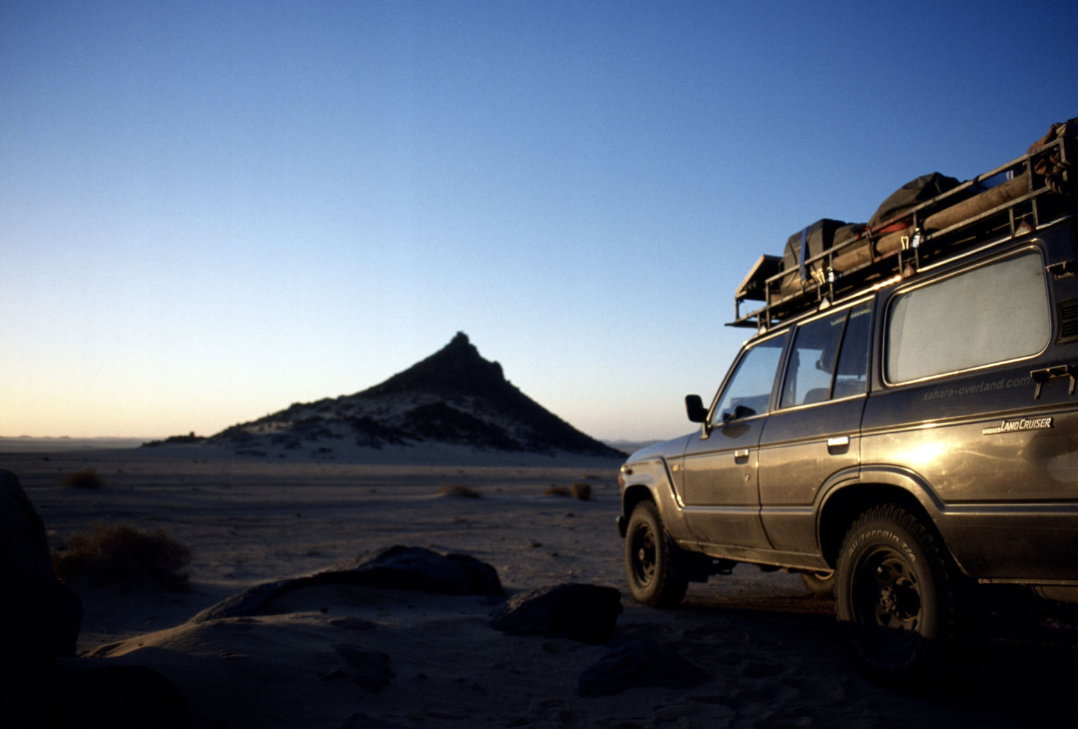
Camping behind a fin of rock just past the KM195 pass, I decided to re-erect a fallen balise (steel post) to assist others. Even first time last March it had been tricky finding our way here. I excavated an old truck tyre and dragged the fallen balise over to the pass “gateway”. The balise had three sticky-out feet and by hoicking the truck tyre over the balise, it rested on the feet and, once filled with sand, held up the balise, sort of, now at KM 195 on A7.
Afara? Yes
That night I was freaked out by a car coming off the pass at 2am. It didn’t spot me behind my fin, but seeing the ‘new’ balise, circled it and swept me in its lights. By then I was already dressed and poised for a locked-in get-away, but the Patrol carried on back the way it came …. phew … and then came back! I was now slinging stuff into the car and ready to move out when it turned north before reaching me. I watched it trundle away for half an hour to make sure. Turns out they were probably as lost as I’d been earlier. Maybe a lot of night driving goes on in Ramadan. Or maybe it was connected with the mass kidnappings that were to occur near here a few months later.
On the way back to Djanet I explored north of Tazat, looking for the pass to Bordj el Haous (Zaoutallaz) as indicated on the TPC map. Climbing an outcrop and surveying the supposed Tehe-N-Essegh pass. it was all sanded up, no way from this side but maybe coming from the east with a slide down. I then slipped through the regular Tazat back corridor and followed a clear track almost all the way to Bordj, dumping the rest of my stash of old clothes with some hyena-like Tuareg kids.
With the plateau to the left and the dunes to the right, the run from Bordj El H’ to Djanet is one of the loveliest drives in the Sahara, even if it’s now sealed. Even though I’d done it several times over the years it still looks amazing and I enjoyed doing most of it on the sands north of the road, looking for new camps and generally marvelling at the scenery.
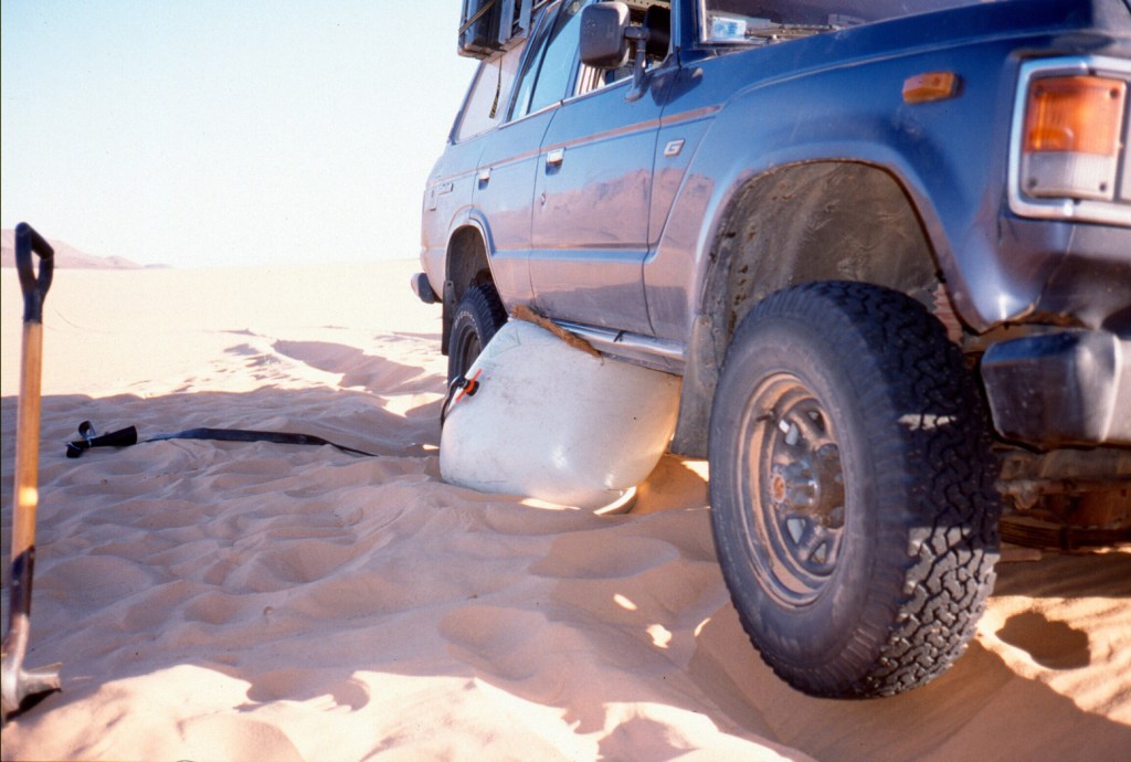
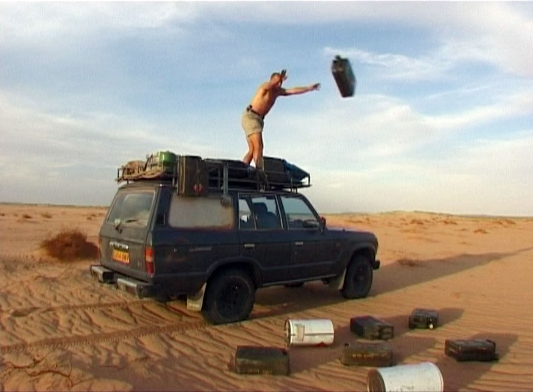
Move over hi-lift jackers; we’re air bagging
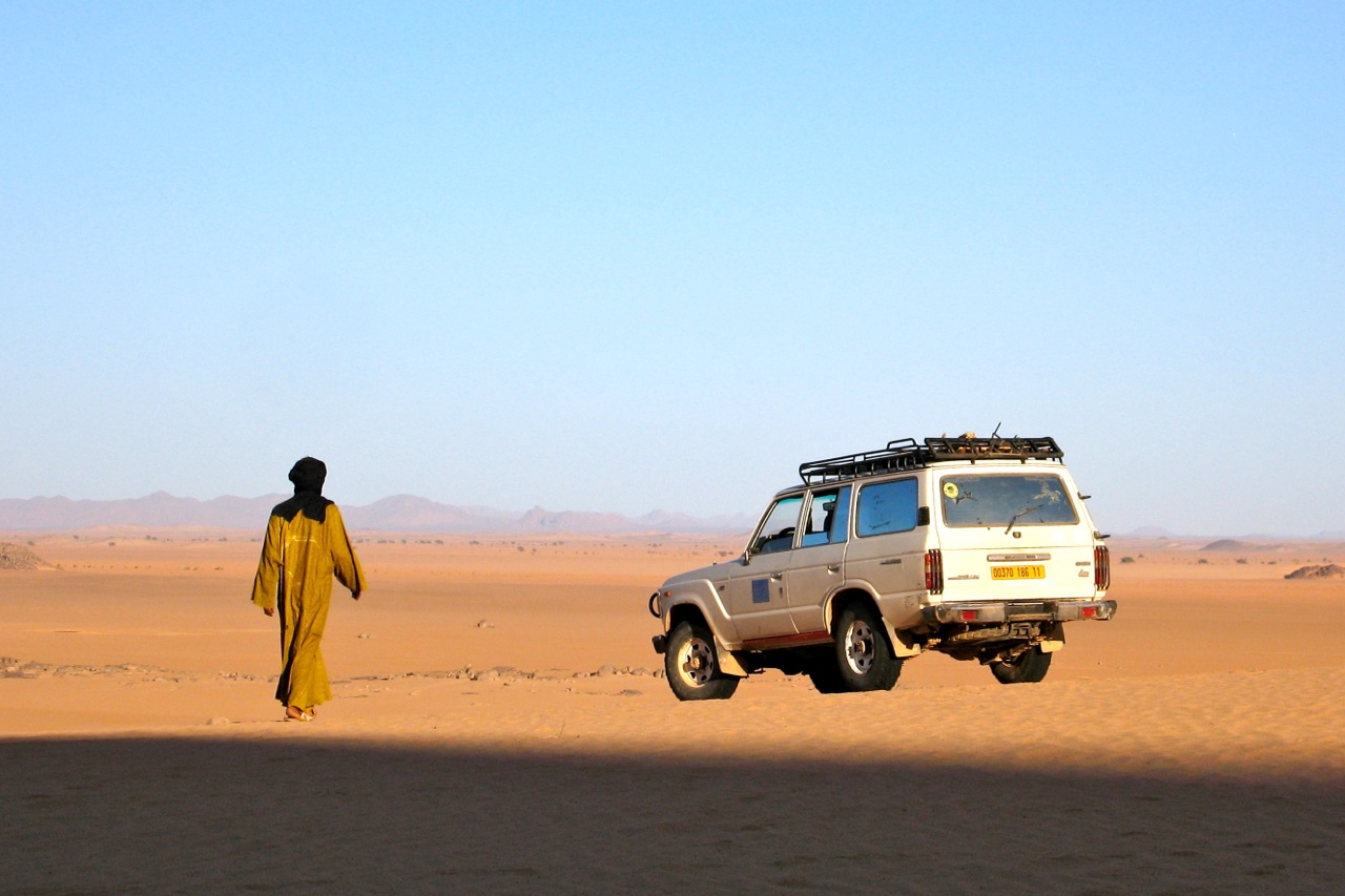
A couple of days later Prof. Nimbus, laden with Thuraya SIMs arrived at Djanet airport and I gave him the news: our double deep-southern run to Tam and back had been changed to a loop: up to Amguid then down to Tam and then back to Djanet, dropping fuel and food all along the way. Naturally, he was not bothered, it was all desert to him. We camped below Tazat that night, on the way trying out my airbag jack for the first time when I got sunk on a knoll of soft stuff. “I’ve never seen a car sink so deep” observed Nimbus without sarcasm. Turns out his petrol 2A hasn’t got the poke to sink itself like my tractor-engined TLC. I found this out for myself a few years later with an old Hilux, it’s an interesting benefit of a modestly powered 4×4, but at the time not enough to p-ex my 61 for a Series 2A. The airbag was nifty in the extreme, as you can see in the Desert Driving dvd which is now on youtube.
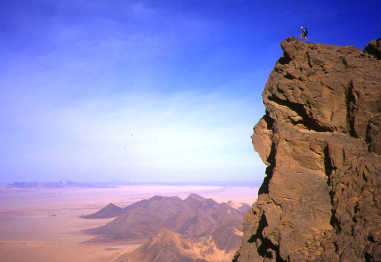
Next day we tried to climb Tazat mountain (2165m), but things got as complicated as they looked near the summit, so we satisfied ourselves with some low-angled shots that looked as good. Far below, ribbons of oueds rolled off towards the hazy horizon and the portly Tojo was but a speck. A smashing picture Nimbus took out there turned out to be the cover of the blue edition of Sahara Overland.
Tazat mountain
We carried on along A7, eventually locating the jerries I’d dumped a few days ago without needing a GPS (all hillocks don’t look the same it seems…). Then carried on up a new track to me – A5 up past Toukmatine ridge and Tiodane Erg. We lost the balises for a while but it was fast going until the complicated hills and knackered tracks which jam the entrance to the Amguid valley. Clouds rolled in that night and a mini sandstorm hit next day as we emerged onto the valley and set course for Foum el Mahek on the other side of the big valley. What a trucking slog this former route to Djanet would have been in the old – pre-Fadnoun – days!
The Foum emerged from the haze, bigger than I’d imagined and – bollocks – a family of Tuaregs camped by the mouth. Not a good spot to dump fuel then, so we blundered around and that night – 28°C at 8pm – crawled up a stony hill to stash 120 litres and a bottle of Dubonet, followed by a hot, windy night.
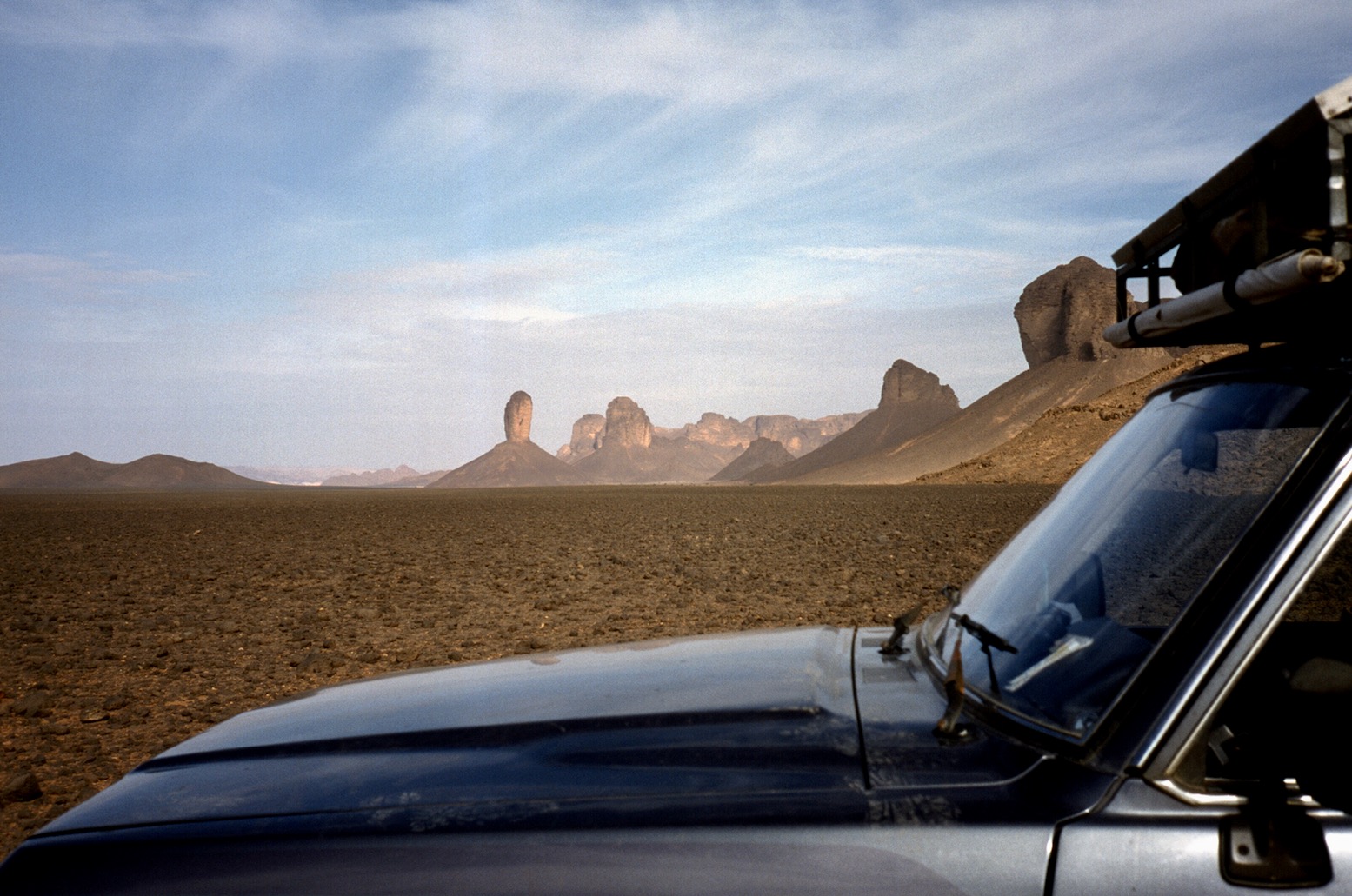
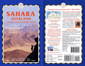
Sli Edrar 1982
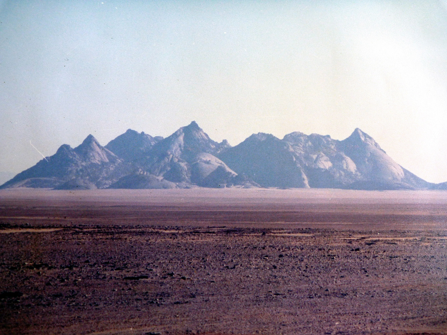
Sli Edrar On my very first trip to the desert in 1982 I’d photographed a distinctive cluster of cone mountains (left) near Moulay Lahsane on the Trans Sahara highway, and always vowed to go back one day for a look around. Nimbus reckoned he’d visited Sli Edrar last year, so we set course alongside Tefedest westside. Other granite inselbergs proved to be decoys, but when we finally rolled up it was getting clearer that my 20-year old aspiration was about to be fulfilled. The flies were a pain and caterpillars were crawling all around, dying in the sands. I went for a wander and found some Neolithics in the crunchy granite sands, including a nice bone cruncher, and for sunset we climbed up to spot an unnoticed old camp in our hidden valley below.
On Sli Edrar’s granite flanks, View from above…
… view from below
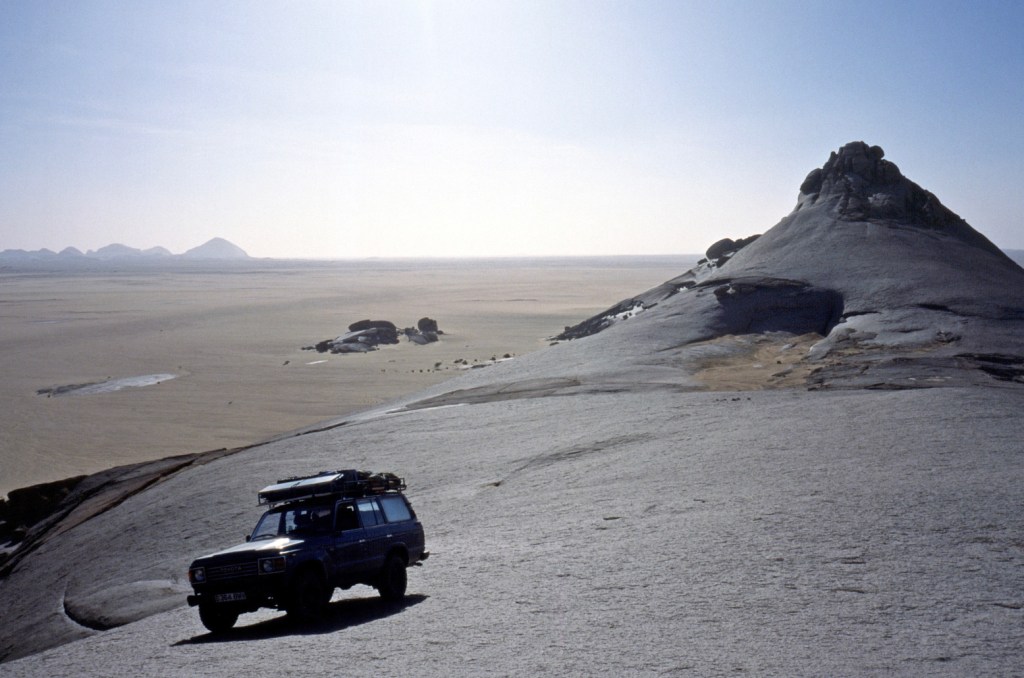
Sli Edrar is just a few clicks off the highway, but hearing of fuel probs in Tam, we turned north 100km to Arak and tanked up there with 250 litres of diesel, plus another 120 of petrol and rolled down the highway to Tam, arguing bitterly whether In Ecker mountain was visibly shaken by its nuking in the early 1960s (below). In Tam cars where indeed queuing out into the hills for fuel – not due to washed-out supply routes but local politics.
Nuking ‘In Ecker’ mountain in 1962. Yes it did accidentally blow the doors off.
Spend too long near In Ecker and this happens
From Tam we were taking on an ambitious route back east to Djanet – 900kms via Erg Killian in the deep south, using a 20-year-old route description (RD) in German including five NavStar (pre-Garmin GPS) waypoints. Nimbus was worried about my fatalistic attitude to spares and safety “I can’t believe you wrote that book!” he said in horror as he trapped me in an arm lock and forced me to buy an engine’s worth of motor oil. It began an interesting branch to the erstwhile LR/TLC debate. Nimbo carries a complete change of undies for his antediluvian Series 2A. Me, I’ve long forgotten what I stashed in the back wings of my Eocene HJ61 many years ago. Radiator hoses and some Haribos perhaps?
Seriously though, we were much encouraged by our Thurayas. If the Tojo soiled itself we could ring any agency in south Alg or even get a message on the web for an eventual rescue. A pre-departure check revealed the 61’s front wheel bearings were pretty floppy. I’m sure I had them done once – or was that the TLC before? We tried to tighten them but some annoying ‘cone washers’ in the hub made it too hard. Destiny it seems wanted them left untouched. Anyway, the other 60s in Moktar’s stable were all as loose and in the end the car got all the way here with only a tad of shimmy @ 101kph.
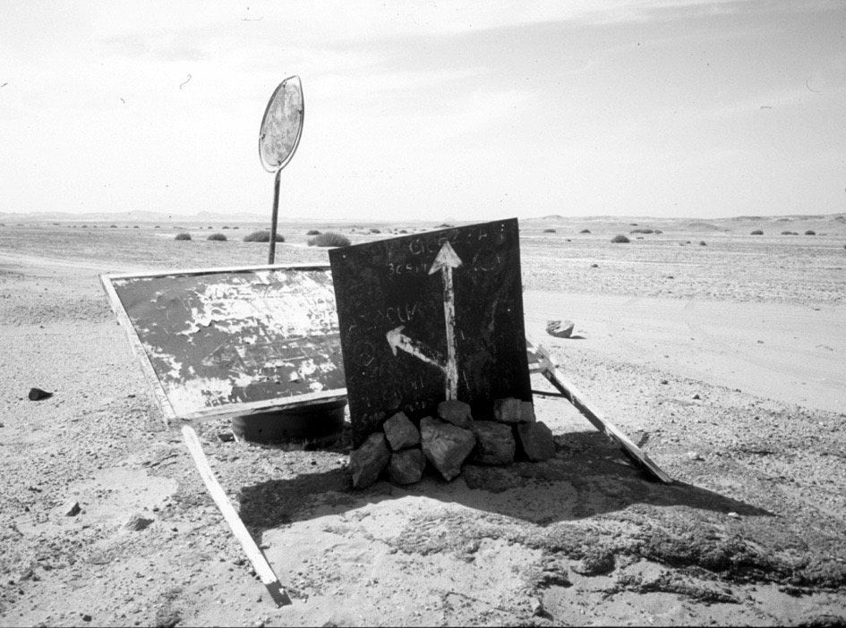
The famous In Azaoua sign south of Tam on the way to the Niger border. One of two in 400km. Many missed it and inadvertently strayed left to their doom.
We’d used a lot of water on the Amguid truck piste and with no known wells till Djanet, four unknown days away, we stocked up with plenty and some fizzy drinks besides. Down out of town, past the south fuel station queues, people were running amok. Good tarmac led to bad and then none at all right up to the ancient In Azaoua sign right on cue.
Heading east towards Killian
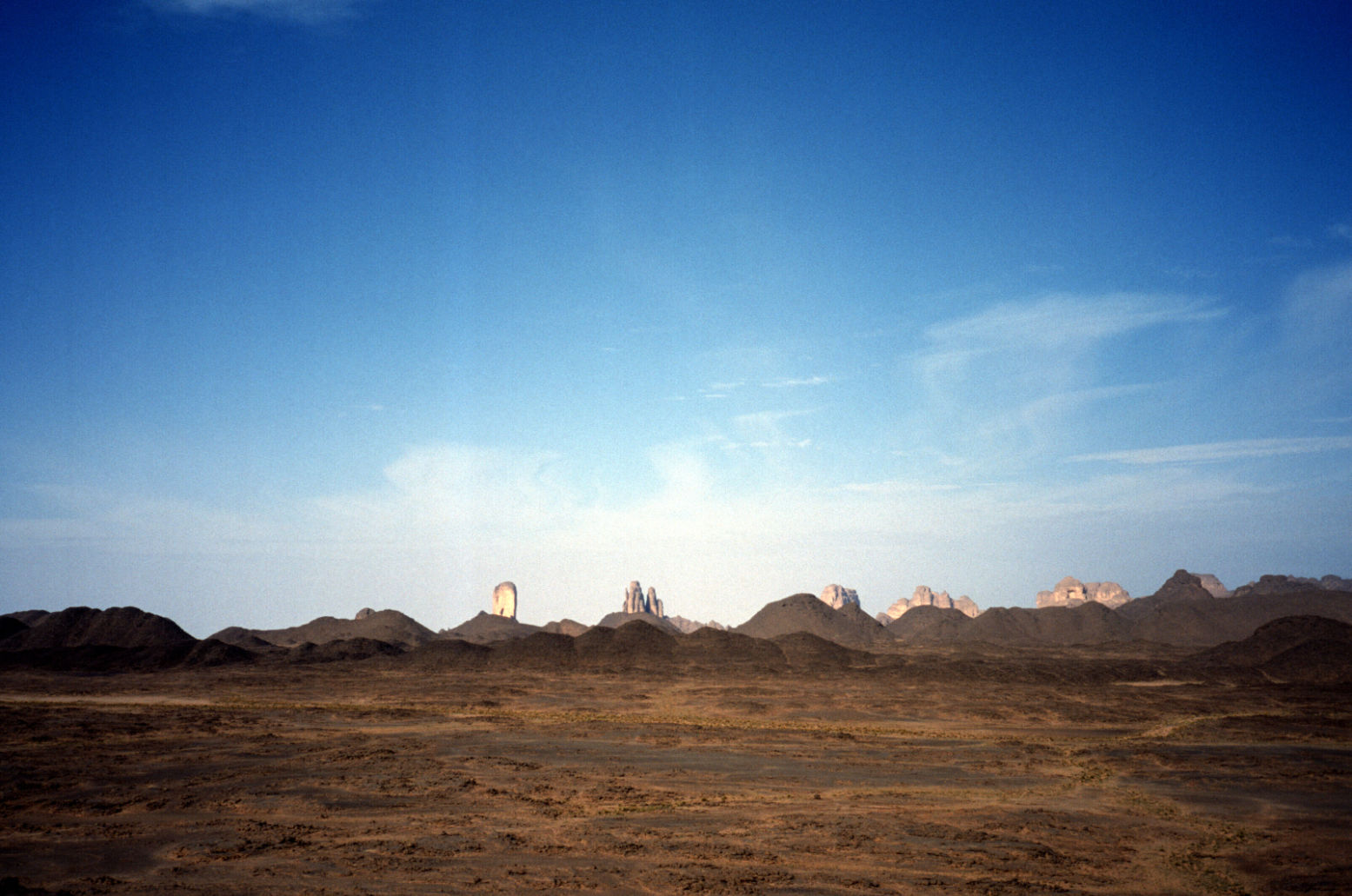
From here it was fast SE, past a Dakar truck wreck down to a hook where we crossed a pass into the Taghrera (green sign) and headed north over grassy power-sapping sands with the classic Taghrera mushroom outcrops beyond. With half a mind to check out In Ebeggui well, we eventually found a little outcrop of our own, changed the TLCs oil for Algerian honey and enjoyed a nice desert camp.
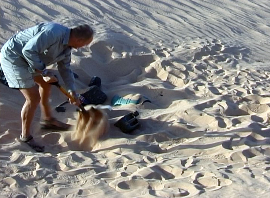
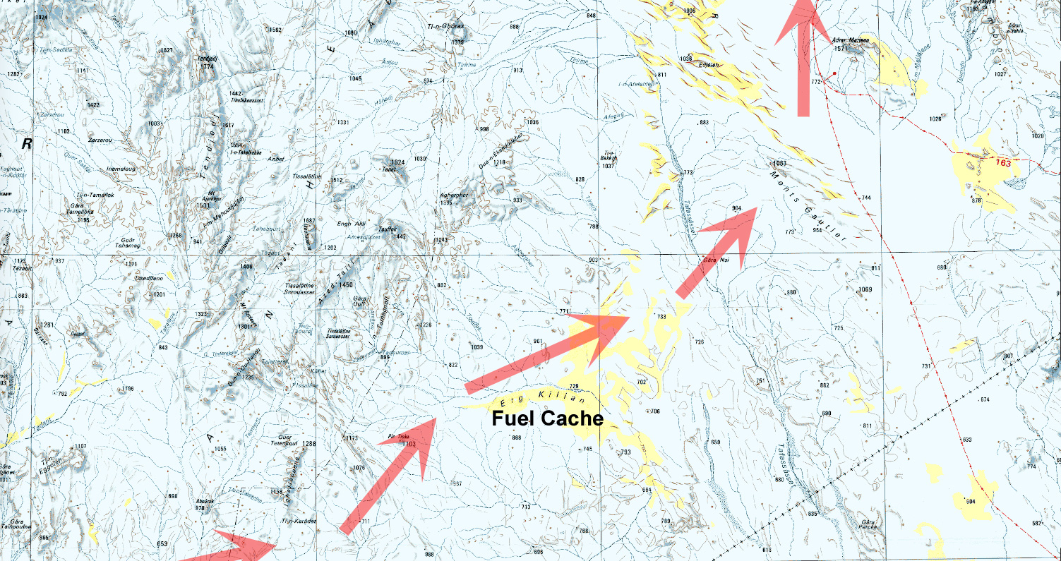
Next day, into the unknown. We weaved through some barchans and got stuck in a nasty sandy/rocky pass (our old RD was not too specific) where you have to choose soft sand or tyre-shredding rocks. Further south we found a better crossing (which I was to use again with the MAN in 2007) and headed east from ridge to ridge to ridge – very nice driving cutting across masses of north-south tracks (some even corrugated!) used by what must be contrabanders. A full RD will follow (this is Route A14) but several passes later we rocked up at Killian Erg and headed for a good spot to dump a barrel of nosh and a pile of jerries for us to dig up in February 2003.
With the cache buried, we rode on east over the Taffassasset oued towards the bailse line. It was was eerily fast until we spotted some striking mountains unnamed on any map I’ve got of the area (the TPC J3B is particularly crap). Were they the insignificant-looking Monts Gautiers? Who knows, we tucked up under the cliff in this spectacular setting, satisfied that we’d broken the back of the Deep South link from Tam to Djanet.
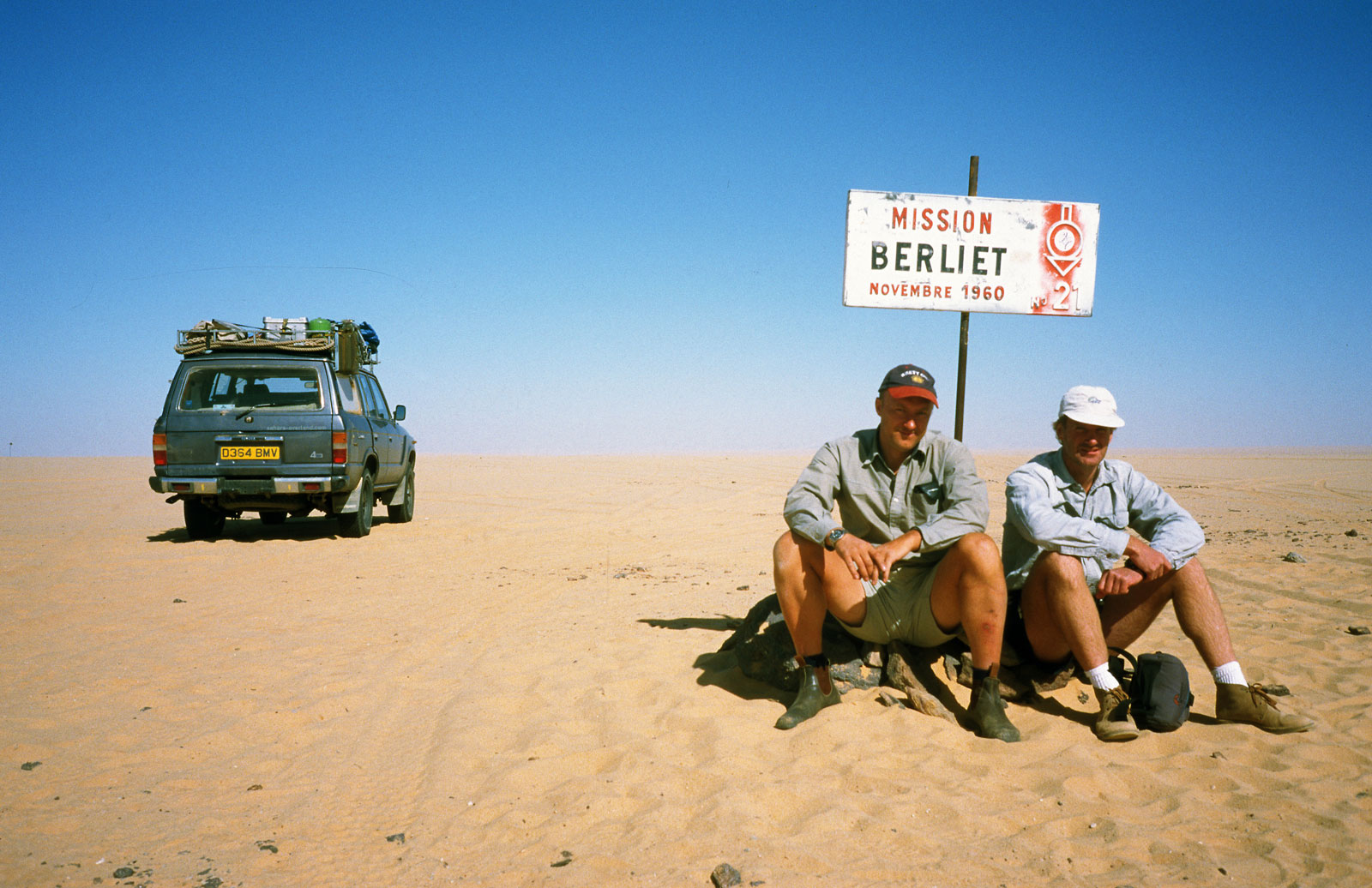
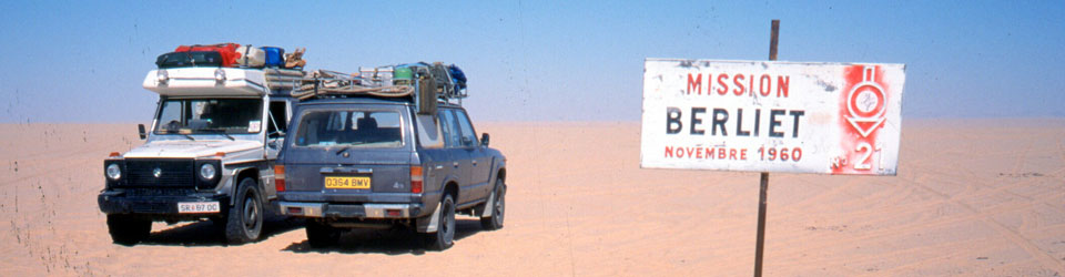
Heading for the Niger Balise Line (Route A15) we got stuck again, filmed it for posterity and hit the Line (over a 1000 markers planted every half km all the way to Chirfa!) just below Berliet 21. If anyone’s still reading, I left a Special Object in the drum at Balise 112, a bit south of Berliet 21. Retrieve it or present evidence of it and you can claim a prize.
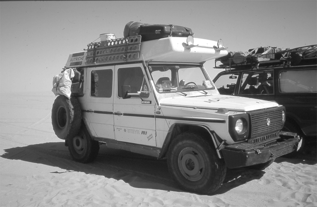
Hitting the Balise Line after so many years trying was another seminal Saharan experience. Nimbus had rolled down this way and into a whole lot of bother a couple of years back and at the famous Berliet Balise 21 we took some commemorative pics and met a tooled-up Austrian G-Wagen with a nice 16mm Bolex retracing our route to Tam. It even had a laptop displaying a live position on a scanned IGN map.
Nim had buried water along the Line in 2000 and we were interested to see if his GPS location worked 40 paces east off the balise. No such luck, After much prodding at two locations, we decided in a featureless area like to north Tenere (as some like to call it!) you need a discreet stone marker or something to pull off a fuel dump with any hope of retrieval. This I’d done yesterday with the cache at Erg Killian.
We eased past Adrar Mariaou checkpoint without being machine gunned to bits and hit the very soft sands near Djanet which, I like to think, killed the kpl down to a pretty poor 5.8 (16.5mpg) since topping up at Killian. We blundered around all sorts of unknown back tracks (including Djanet’s clandestine bitumen depot) until we hit the Libyan Piste and rolled into Djanet for some calamari and chips.
With a couple of days to spare, we organised a day out to Jabbaren with the Zeriba guys – only 30 euros and well worth it. A pre-dawn drive to the foot of the Tassili is followed by a lung-stretching slog up to the plateau – leaving smoking bikers Ahmed and Ian T (and the guide) far below. We shared the path with sub-Saharan migrant workers being guided along a short-cut to Ghat in Libya. I’d never actually been on the plateau but some of the rock art at Jabbaren (let alone the weird rock shapes) is quite amazing – even if you do get “cattled out” after a couple of hours. More here from a decade later.
Nimbus flew back to his day-job and I rolled back out to the Tassili plateau, exploring some nice canyons and slowly over the Fadnoun to Erg Bouharet camp (below), south of In Amenas, where I was set to meet Toby Savage and Rich to film the long-awaited sequel to Lawrence of Arabia: Desert Driving.
My mission this time: to hand over a desirable 80 series Land Cruiser to Mohamed in return for guiding and other duties on my forthcoming big Sahara crossing. He can’t buy the car in Algeria, even by shifty means – no one outside le pouvoir can. So it needed me the overseas owner, to drive it just over the border into Mali where it could get ringed and brought back into Algeria under some other Algerian documentation. Selling cars is an old game in West Africa, though not quite like this. I’d joined a similar run flogging old Mercedes in Mauritania a decade ago. With me along for the ride to Mali, Zander and Martin.
At Algiers port they were a bit bemused by a tourist car (we were the only foreigners on the boat), but despite 4-5 hours queuing, we got to In Salah the next afternoon and from there took a great run along the Old Hoggar piste east of the TS highway, past old Hassi el-Khenig to a camp and a splash at the lovely guelta of Tiguelguemine (right). Next morning a little scorpion ran out from under the mattress to be nabbed in seconds by a pair of moula moula birds.
Just down the track is Tadjemout fort and source, (left), a place I’d use to launch camel tours a few years later. Then on to Arak Gorge (below) where I got in trouble in 1984 and which now has a bridge or two over the creek. Down the TSH to Elephant Rock behind Tesnou then past In Ecker and into Tam.
We’d missed a whole lot of rain by a couple of days and only on one night among some Tanezrouft dunes did the night-time temperature drop below 24°C. Even though I expected a humdrum run along mostly known routes, as always the desert delivered and we saw many unusual things and had some interesting encounters.
We took the high route to Bordj BM out via Abalessa, through the still-muddy oued and out onto the wide open Tanezrouft, passing a pre-Islamic tomb (below) on an isolated hill. It’s funny how I can spot these easily now. On my first Sahara trips just hanging onto the bike was hard enough and I noticed nothing. The hot run out across the Tanezrouft unrolled, and a day later dusty Bordj didn’t seem to have changed much over the years. We checked out of Algeria. We’d be checking back in shortly, but – ahem… sans voiture.
A few clicks south of BBM, Ikhalil (In Kalil; El Khalil; not on any paper map) is home of the Ambassade, a chummy contrabanders compound – one of a few here in No Man’s Land which was then seemingly tolerated by the nearby towns. Goods pass in and out of here: fuel, cigs and other subsidised commodities from Algeria southwards. And from Mali goat meat and cloth comes north. As for the serious stuff, it seemed impolite to ask.
Ikhalil looked like a Van Damme movie set where, if you let your imagination off the leash, a dusty cover gets pulled back off a Merc truck to reveal a shiny Russian Vympel A-350 missile for sale to the highest bidder. The guys here were all Mohamed’s mates, Berabish traders from Timbuktu doing direct runs there and back, and even across to Zouerat (Mauritania) with cigs and other contraband. Their welcome was warm and we discussed my forthcoming crossing of northern Mali from Mauritania. To get bossman Bou on my side I’d brought him a nice solar panel and a couple of Thuraya sat phones – the ‘iPhones’ of the Sahara. He and his cohorts will prove to be a useful contacts if we got in trouble in Mali next month [we did and they were…] as well as being a source of much-needed fuel after our 2000-km crossing from Atar. Ikhalil 2010 – not so rosey
Tessalit (left) also looked the same after 15 years or more. Apparently it was ransacked and abandoned during the 1990s Tuareg rebellion and never really recovered. I let the guides sort out the laisser passez with the help of a big box of dates for the police chief. But up on the hill fort, the chef de poste could not wait to get his bite out of our cake and played all the usual power games once he clocked what was going on (flash car; quick sale).
“Ou est moncadeau!” he roared as he feigned an inspection of the back of the car. The nearest thing to hand was a jar of Bertolli sauce which he snatched disinterestedly. Back then Bertolli was good stuff, the Cirio of its day.
Back up on the terrace we sweated it out; it was a relief to leave most of the grubby negotiations to Omar who was taking the Tojo away to recondition its identity. In the end, despite a visit to the mayor, Tessalit proved too greedy for Omar to complete the transfer so I signed a bit of paper back up at the Ambassade next day and left it with Omar to take down to his home town of Gao to get re-registered. We turned back for Tam in his 600,000-km-old Tojo 60 which I soon christened Le Chien. And that was before I even drove it…
On the way back through Bordj, the Algerian police sort of knew what had gone on but could do nothing about it as my car had left Alg legitimately. As we waited, some shifty-looking foreign guys with beards turned up off a Timbuktu truck and put me in mind of a GSPC desert training camp, probably not so far fetched. Nearby, a week earlier some GSPC had reportedly been shot up by Malian Tuareg. These were the days when the Kel Iforghas Tuareg put up a fight against the incoming jihadists. Kidal continued to be tense after the events of the summer and now is a war zone. Of course the beardos at Bordj may have been nothing more than devout students coming back from some Koranic school, but these days this is how the mind whirs away on seeing bearded South Asians at an outback Saharan border post.
Out of Bordj we spent the night among the dunes near Ilafegh wells where we saw a huge camel train leaving after being watered. As always, Mohamed couldn’t resist his nomad’s instincts and chatted up the camel herders to see what and where and who. I never imagined camels out in the utterly barren Tanezrouft, but the recent rains (there were pools here and there) had driven the nomads down in anticipation of a feed. It was to be our only cool night and a real tonic after the unrelenting heat and associated locusts, mozzies, small scorpions and other irksome bugs. Hot days are fine I decided, but hot nights are a drag.
On the way up we came across an old M.A.N tanker and ever-chummy Mohamed got out for a chat, having run such a lorry himself back in the day. The shady guys were taking Algerian fuel down to Ikhalil or somewhere like that, and when I got out to stretch my legs and eye up the front of the truck, the edgy driver gunned the engine and slipped the clutch as a warning to clear off and get back in the car. We spent the next night among some granite hills near Abalessa where I finally got round to experimenting with making bread in preparation for SEQ. And for a first go it turned out pretty well, a very passable combination of burned dough cooked in a tin on the embers.
Next morning we visited a crater hill. Years ago I remember reading an article by Tom Sheppard about his quest to reach a curious crater formation he’d spotted northwest of Tam. ‘Journey to the Round Mountain‘ he called it, riding there on his XT600 Tenere. That was probably Adrar Tihaliouine to the northeast, and this similar crater reminded me of it. A good place to stash rustled camels!
In Abalessa Mohamed led us to the tomb on Queen Tin Hinan (left). Interesting little museum with the rocky tomb round the back, but only pics of the treasures remain; everything was pinched by Prorok and his cohorts in the 1920s (his book, Mysterious Sahara reviewed).
All that remained was a bone shaking ride back into Tam in the no-brakes, clockwise-only power steering Chien, followed by two days idling in the old Camping Dessine, the original campsite I used to use in the 1980s. It’s still home of the old Trans Saharienne bus (below), rusty away slowly by the reception.
We killed time by following the shade, watching our clothes dry before our eyes, waiting for Ramadan cafes to open up and cruising around town in the Chien, logging a GPS map for future use. Then, when the time came we flew up to Algiers, Europe and home.
October 2006. Some pics by Martin and Zander.
A round mountainLeaving MarseilleGhardaiaShopping in In SalahTiguelguemine GueltaOld French colonial sign Sahara shoe shopDeadly effelellah plantTadjemout oasisMuddy goingArak car washOn the piste to MaliHot lunch on the TanezrouftPre-Islamic tombQuick wash by the beachHot night on the TanezrouftHand showerIkhalil compoundDodgy dealingsScorpion camp at Tig gueltaChai at IkhalilPlanning the big crossingBou testing out his new ThurayaTessalitMore dodgy dealings at Ikhalil‘You can take a nomad out of the desert but…’Le ChienMohamedZan, me, MartinMohamed and Le ChienDesert Bake OffGranite camp neat AbalessaTin Hinan tombThe old bus at Camping DessineRound Mountain, Adrar Tihaliouine
Below, a series of French 1:200,000 maps of the Sahara – from Mauritania to the western frontier of Chad. Though the maps date from the 1950s, it’s very unlikely that Google Earth would reveal any more detail today. A couple of sheets from the central Mauritanian plateau and an eastern Algerian erg are included to show the mapmakers weren’t just being lazy – there really was nothing to show. Each map covers one square degree of the Earth’s surface, which in Saharan latitudes adds up to over 12,000 km2. Just two of these maps would cover Wales (right).