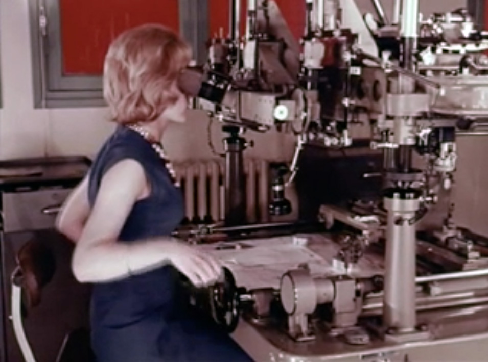
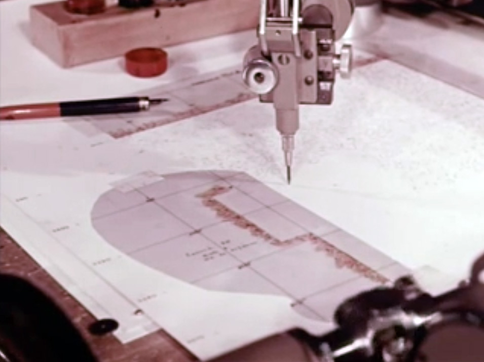
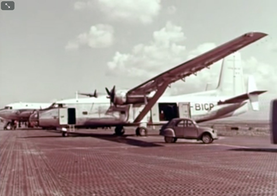
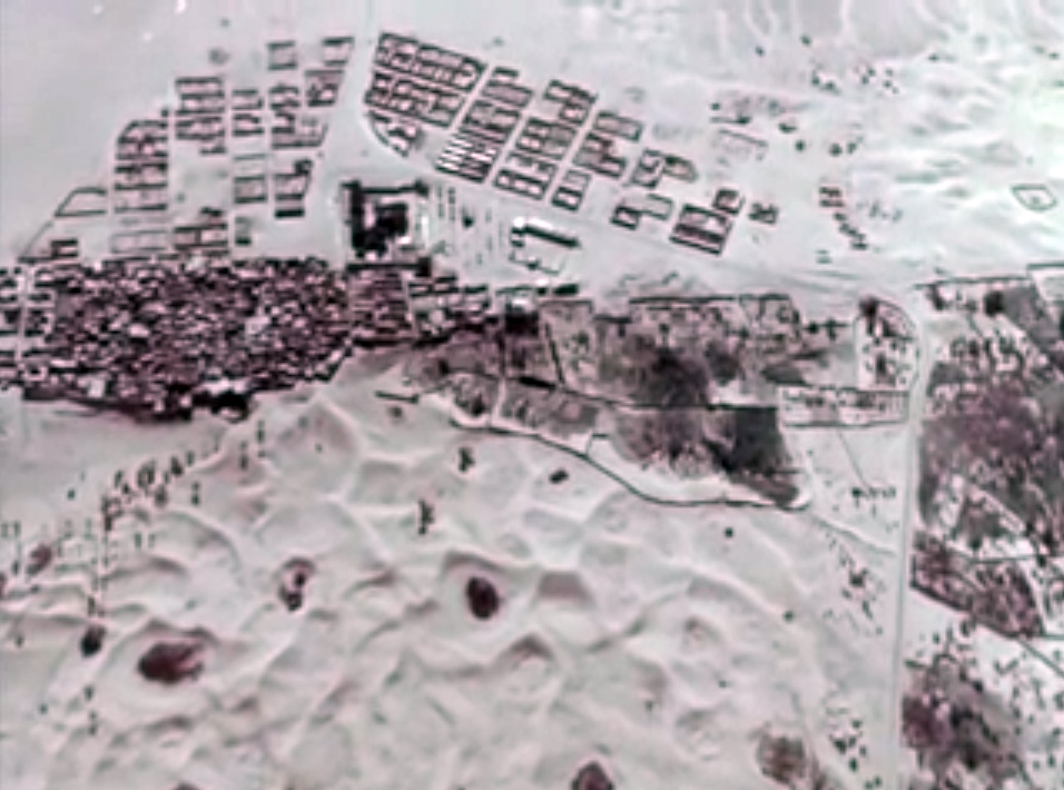
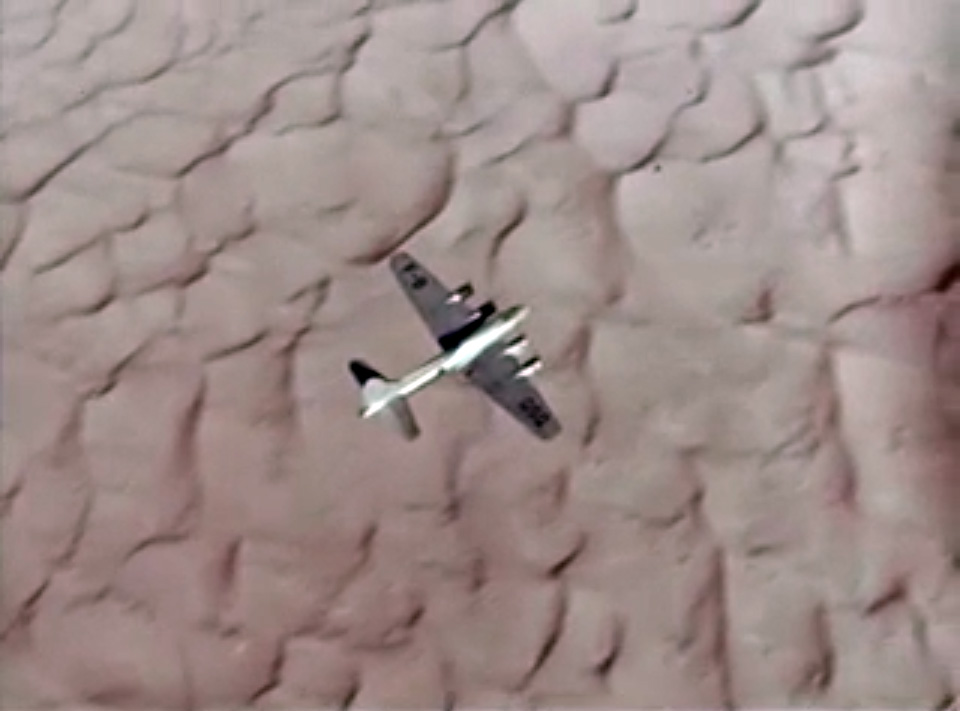
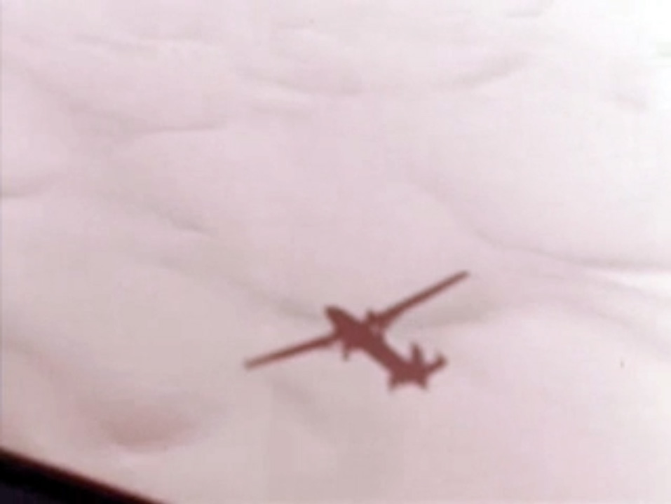
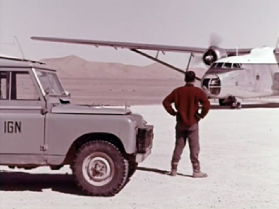
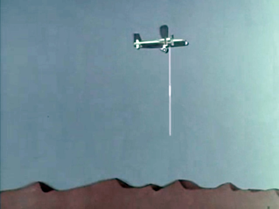
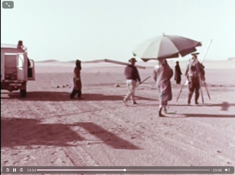
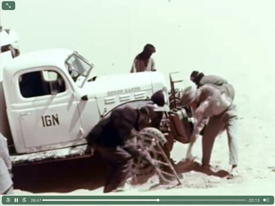
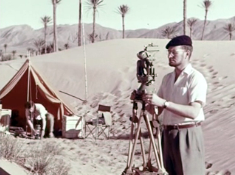
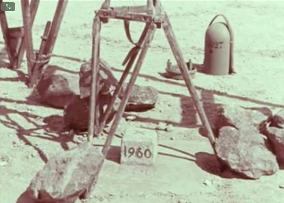
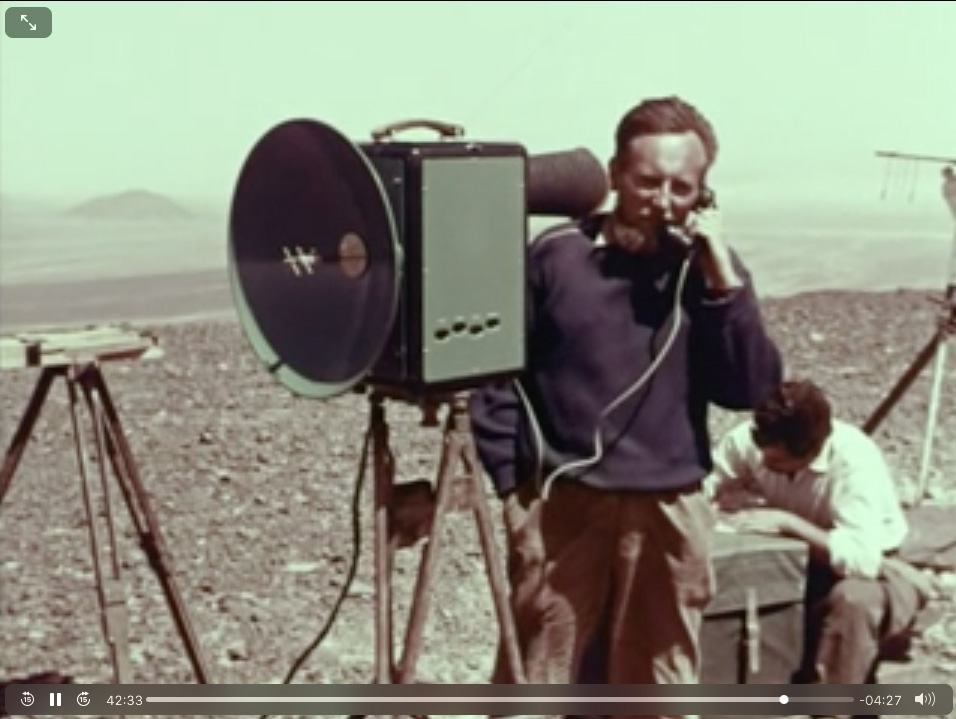
Here a fascinating 1960s vintage film (45 mins; French) on the work it took IGN to produce their brilliant 1:200,000 scale Sahara maps from thousands of aerial photos, sonar readings and laborious ground surveys. Direct link to video.
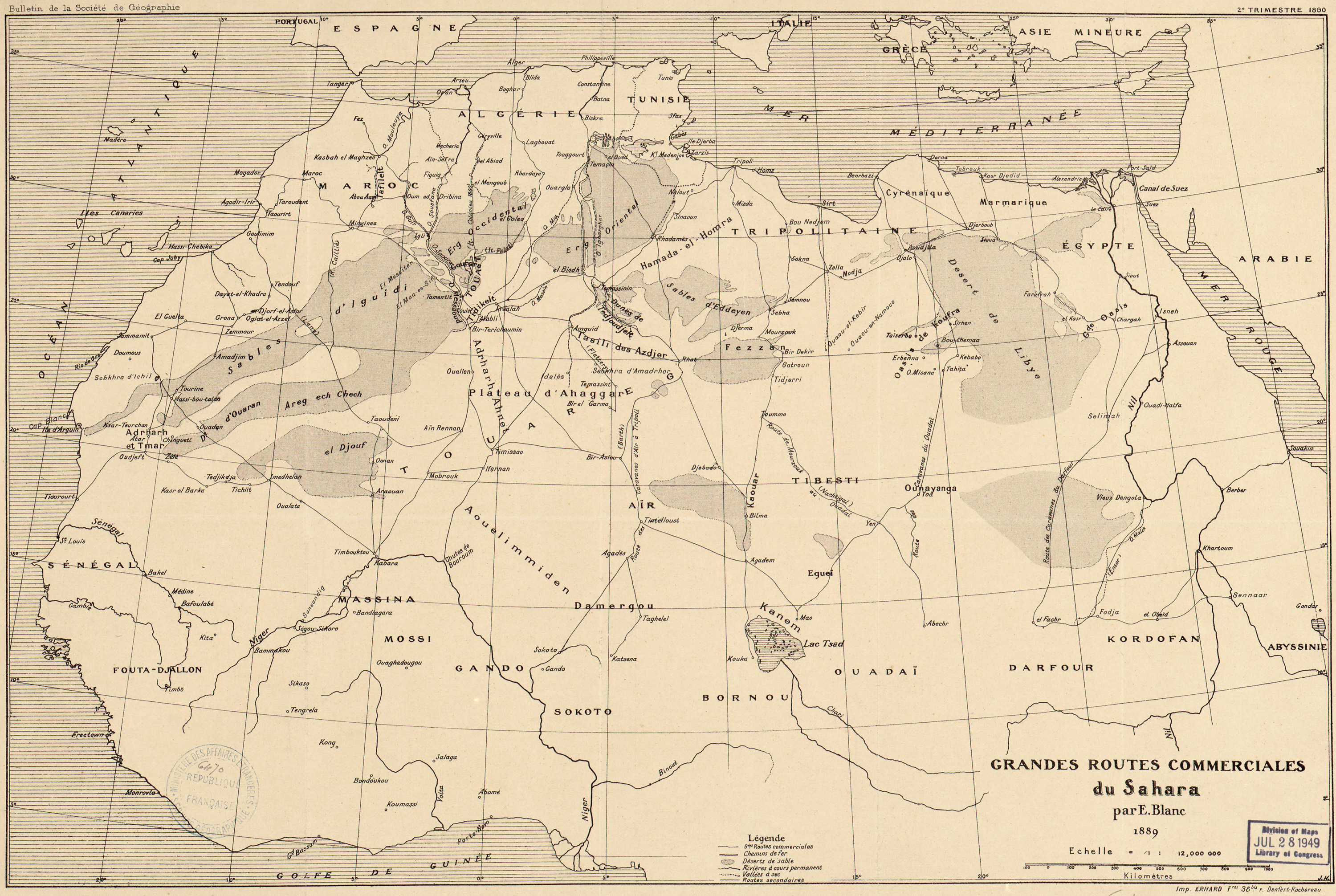
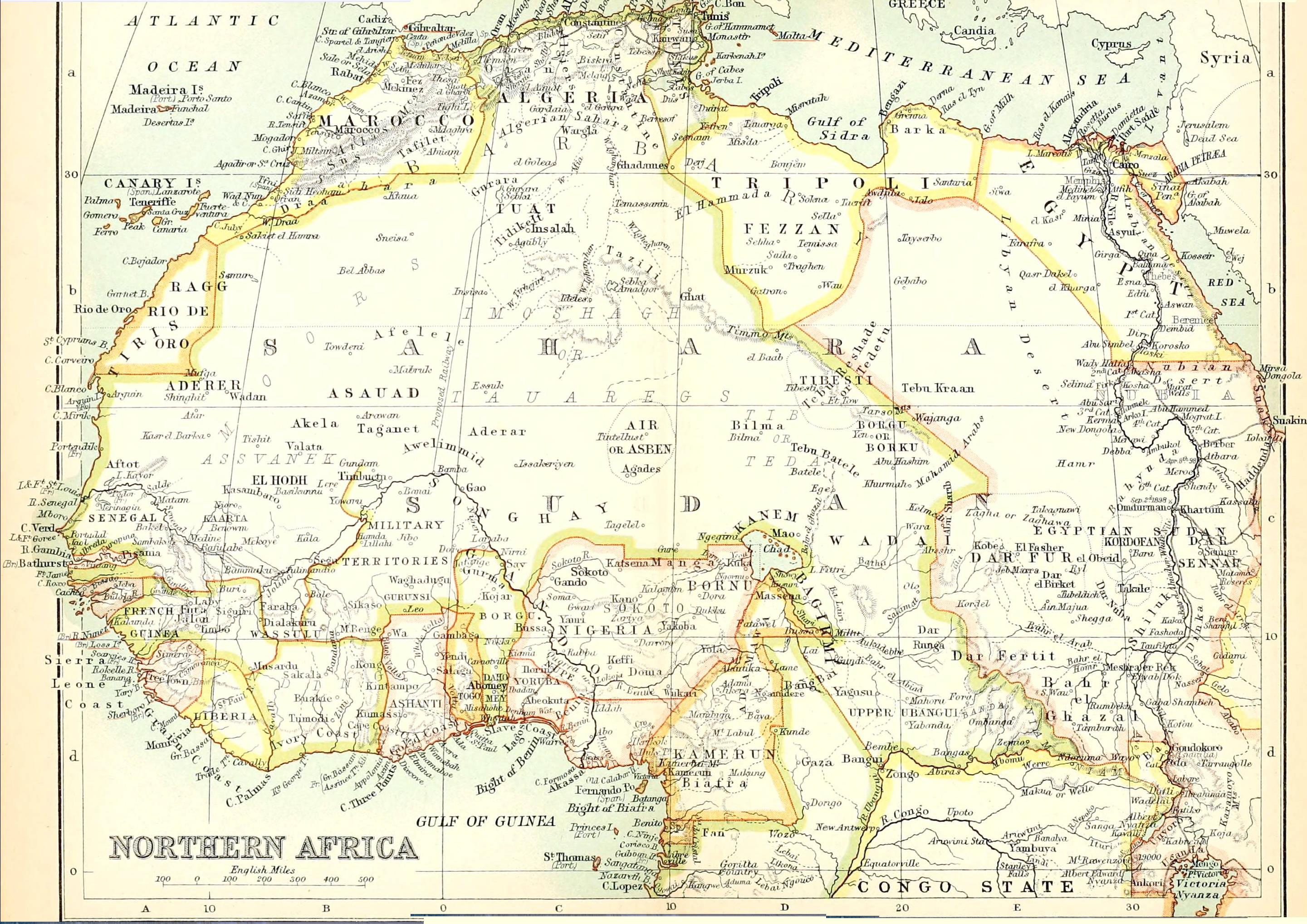
I came across this old French map of the Saharan trade routes from 1889 [full-size source]. As always, it’s interesting to see where was prominent then and what has come since. Old spellings and some names differ.
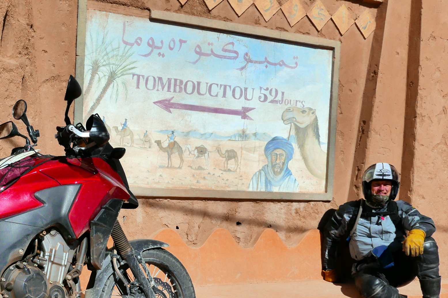
Not a lot of people know that an earlier name for Marrakech was ‘Maroc’ or Morocco. Once this area was all known as ‘Mauretania’ – the Land of the Moors (Blacks) from which all these names derive. Mogador is today’s Essaouira. Other well-known Moroccan towns are present, as well as the 52-days road to Timbuktu from Zagora or Sijilmassa (Rissani), all depicted with other names. By this time most camel trade took the western route to Goulimim (Wadi Noun), which explains the vestiges of the tourist camel market there today. The original site is actually here.
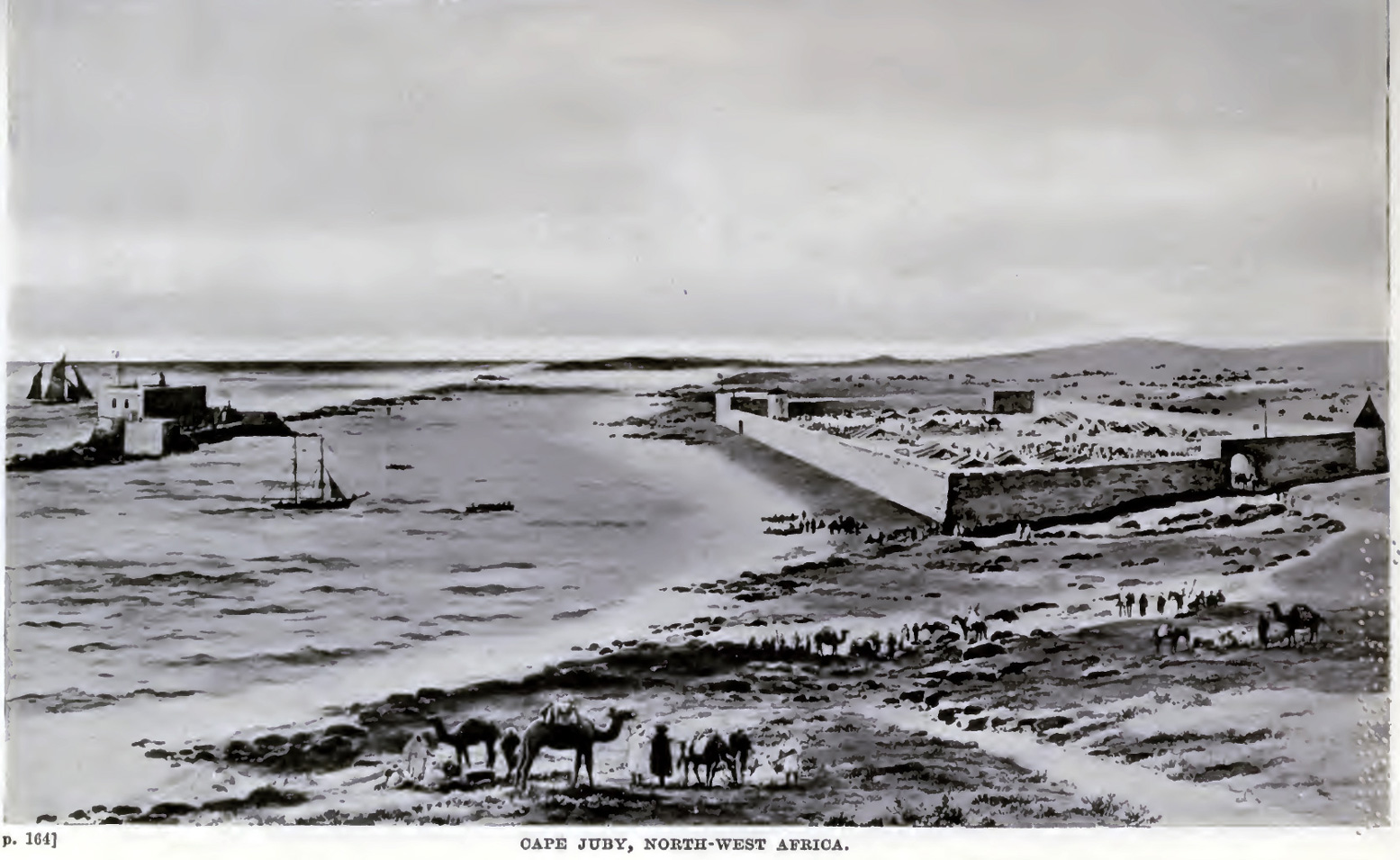
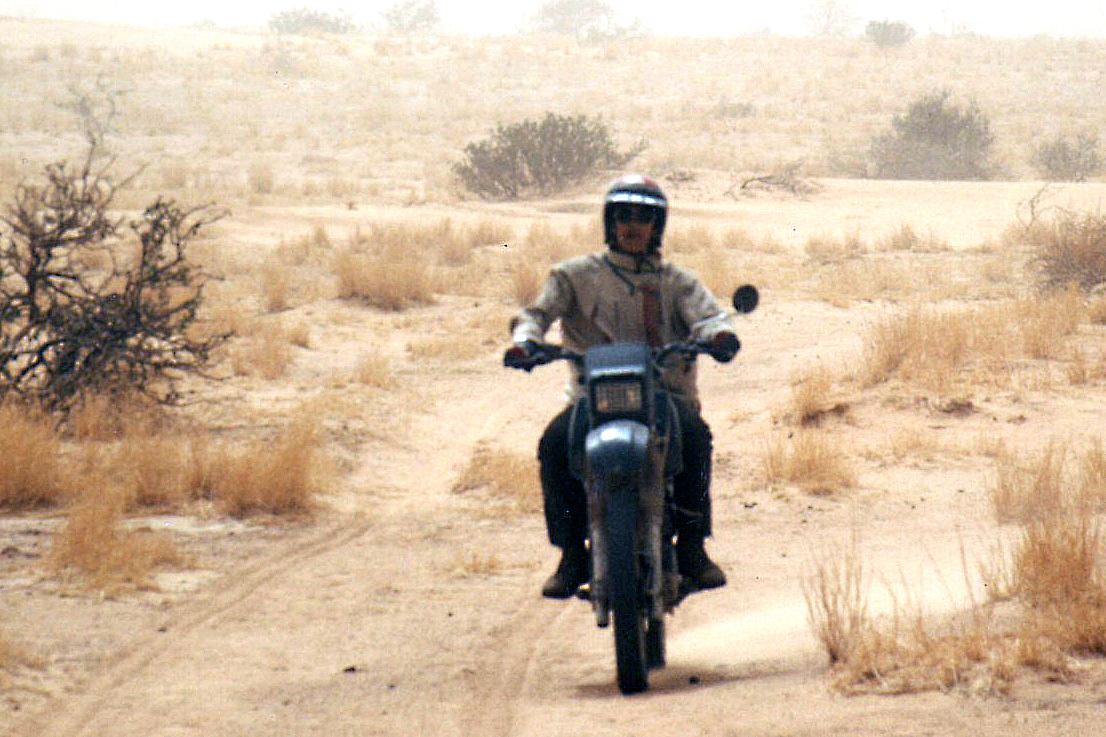
Cap Juby (today’s Tarfaya) we’ll be hearing more about shortly, but inland from here a tough route from Tindouf led to Taoudeni and also Timbuktu. Southwest from Tindouf another track leads to Mauritania, the old colonial overland route to Dakar mid-last century, as driven by this nutter.
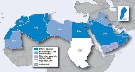
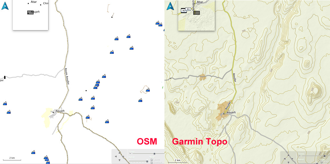
Mauritania has many familiar places like Atar, Chinguetti (right), Ouadane (left, where we coninued east across the Majabat for Algeria in 2006) as well as Oujeft leading to the ruins of Ksar el Barka, Tidjikja, Tichit, and Oualata for Timbuktu. But no Nouadhibou (Cap Blanc) or Nouadhibou (Tiourourt) yet, far less Zouerat. And no Dakar back then; St Louis was the colonial capital of French West Africa.
In Mali Timbuktu is central, with trade routes leading north via Araouane, or Tim Missao well (left) in Algeria where we stopped in 2006 and 1989 (right). No Tamanrasset or Djanet – the two biggest towns in southern Algeria today, but In Salah, Amguid and Temassinin (Bordj Omar Driss) are present.
In Libya little seems to have changed: Ghat and Ghadames are there, as well as Germa (Ubari) and Murzuk on the route for Lake Chad via Bilma (left). To the east the oases making up Kufra lead down to the Ounianga lakes in northern Chad. And east of there is the Darb al Arbain (Road of Forty Days) from El Fasher in Sudan, via Selima across the sand sheet (right) towards Kharga and Asyut on the Nile.
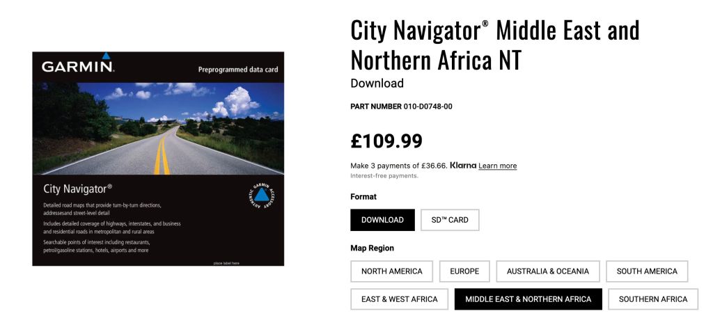
This review was originally for Garmin’s2016 Topo North Africa v3 Light map and compared it with easily downloadedfree OSMs, Garmin’s basic global base map and other digital maps, where available. V5 was the last version in 2023 still a £20 bargain, then the priced jumped back up to £110 for the current ME&NA map which I suspect is little changed. At the current price I’d save your money
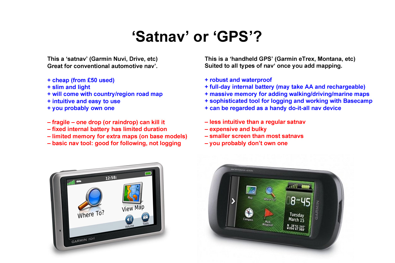
Navigating the Sahara Having used them since before the advent of GPS, I’ve got to know my Sahara paper maps well. Then, when GPS came along, I could pinpoint my position on a paper map with an accuracy that was more than adequate for desert travel. Some of these colonial-era maps such as the IGN 200s are cartographic works of art, and unlike current nav technology, in the deep Sahara topography changes at a geological pace. In other words: a paper map of the deep Sahara from 1960 may still be accurate today. Tracks may become roads and villages become towns and even cities, but the open desert itself remains relatively unchanged. Is there a benefit in having a tiny map on your GPS rather than simply a waypoint to aim for or a tracklog to follow, even if your position on the map is displayed live? That’s essential for navigating a busy city with a Nuvi, but the Sahara is more like the sea where more often what you want is…
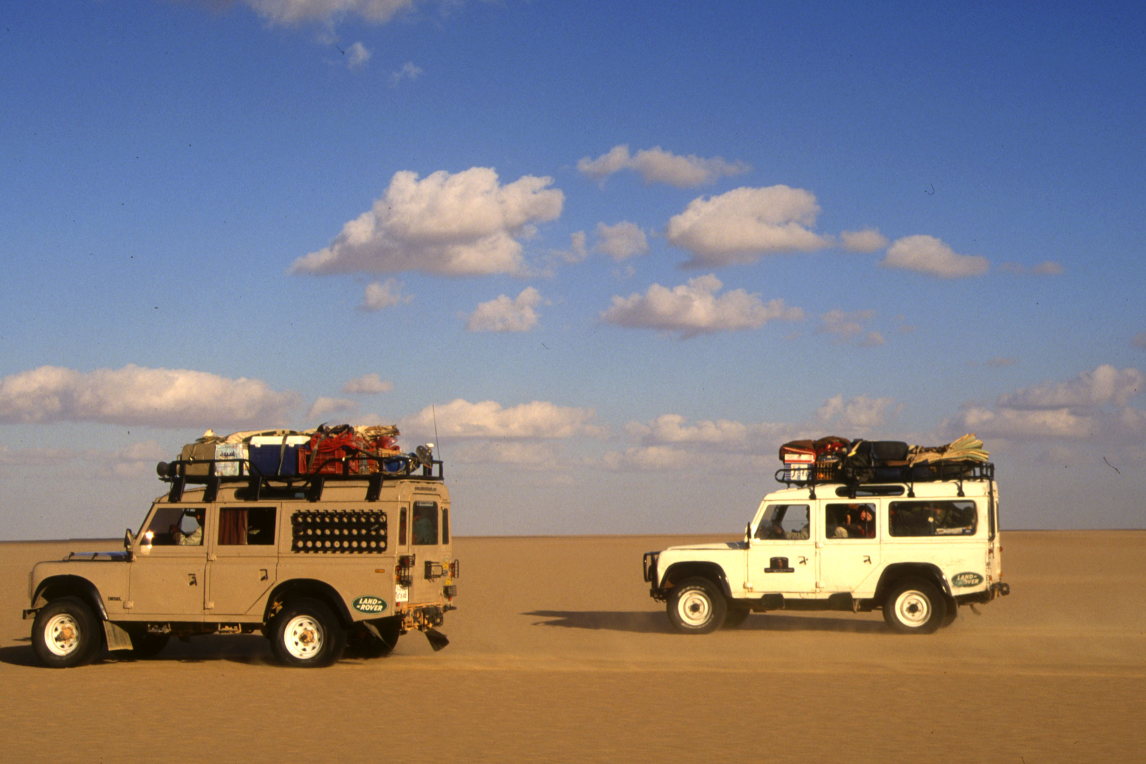
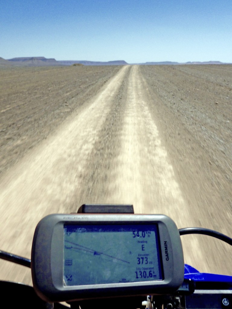
… the big picture A typical handheld device like my Garmin Montana (left) has a screen a little bigger than a playing card and which is hard to read on the move – especially on a bike. For me a ‘GPS’ (as opposed to a ‘satnav’ like a Nuvi – see below) is best at displaying simple data like how far, how fast, how high or which way, not fine topographic detail. A paper TPC map can display six square degrees over some 18 square feet – what you call ‘the big picture’. That’s what you need travelling with a vehicle in an expansive area like a desert, while at close range concentrating on negotiating the terrain.
On top of excellent paper mapping (now widely digitised), we also have the wonder of Google or Bing sat imagery (Bing was often better, now Garmin have the edge) providing a clarity that varies from stunning (being able to trace car tracks) to a brown mush (both shown left). Google sat is great when planning, and now for a reasonable annual subscription, Garmin offer Birds Eye satellite imagery for the whole globe; the long-sought after ‘Google sat in your GPS’. With all these resources navigating in the Sahara couldn’t be easier.
Garmin Topo North Africa v3 Light (now ME&NA, see above)
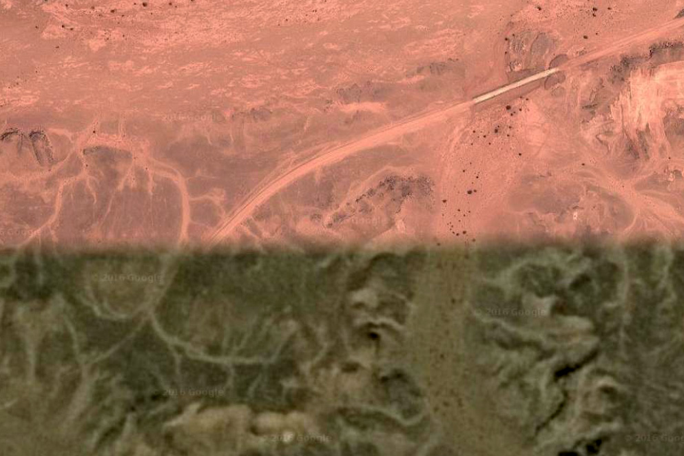
Current ME & NA coverage
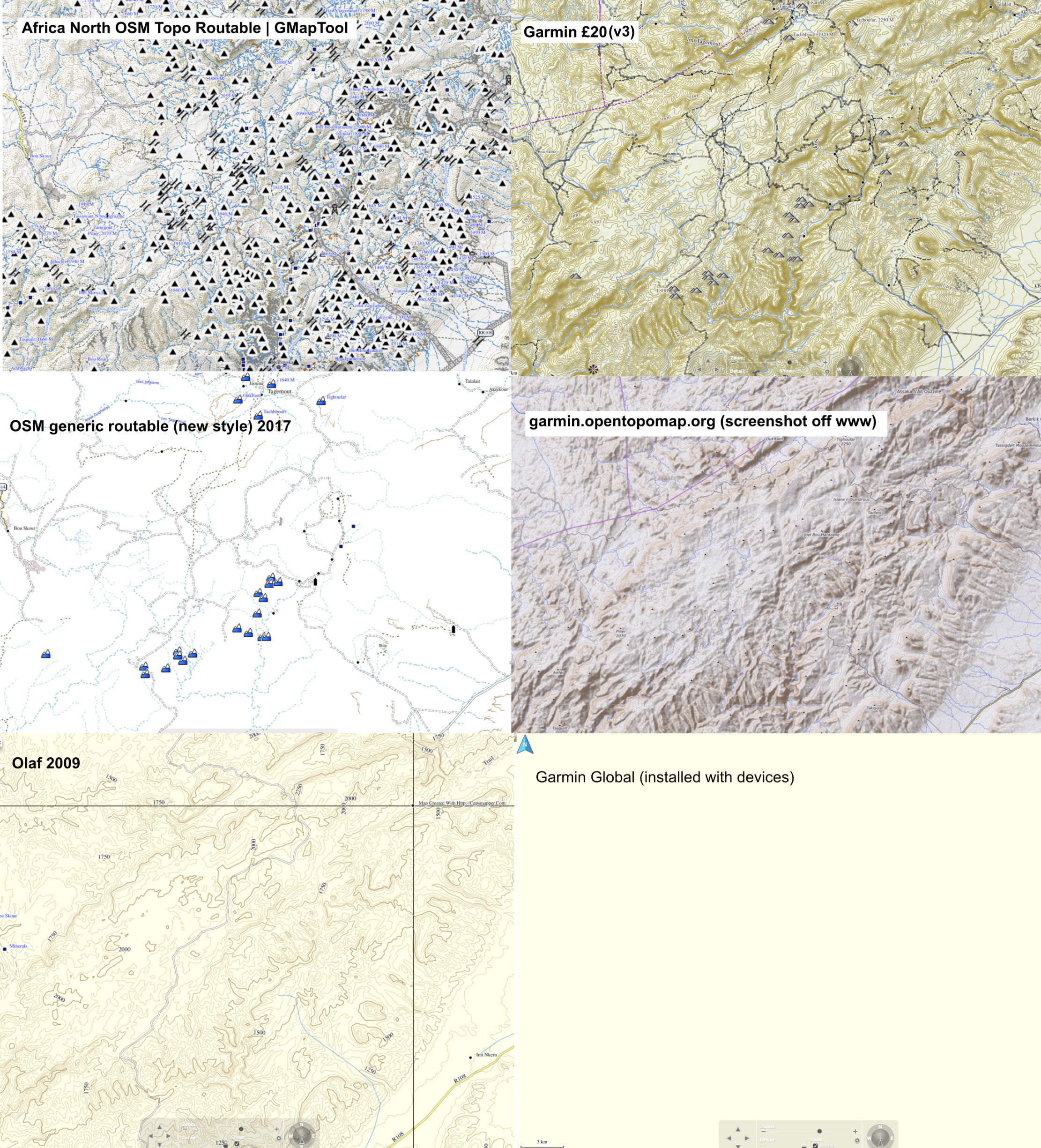
Short version Even though in 2021 old Olaf from 2009 still measures up well, the similar topographic detail of the Garmin means it’s well worth £20, certainly over the plainer, but also free OSMs. In 2018, following a refurb/repair of my Montana, the v1 2016 version of this map was lost or could not be reloaded. I had to buy the v3 version for another £20. A quick scan shows that not much changed, but if it has (based on OSM user updates), it will be in Morocco – the place where most users of this map will visit.
Long version You download the Garmin Topo map directly into your device (takes about an hour) and only when your GPS device is plugged into a computer, will it display on BaseCamp. Unplug the GPS and the map disappears from BaseCamp.
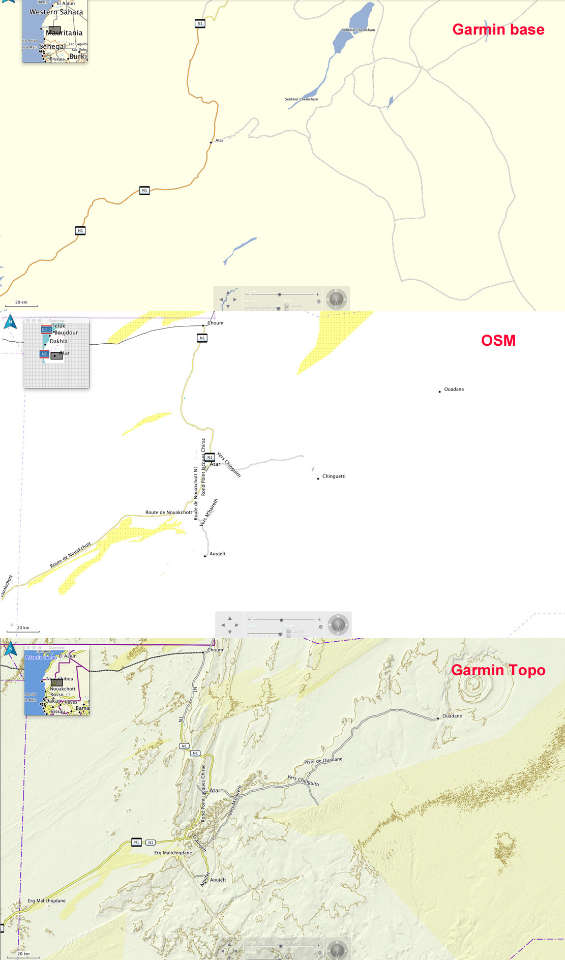
Switching BaseCamp between Olaf, OSMs and even the Garmin base map which comes free with a GPS unit, it soon becomes clear that the Garmin Topo has a level of detail and refinement that’s superior to the next best thing at the time: Olaf.
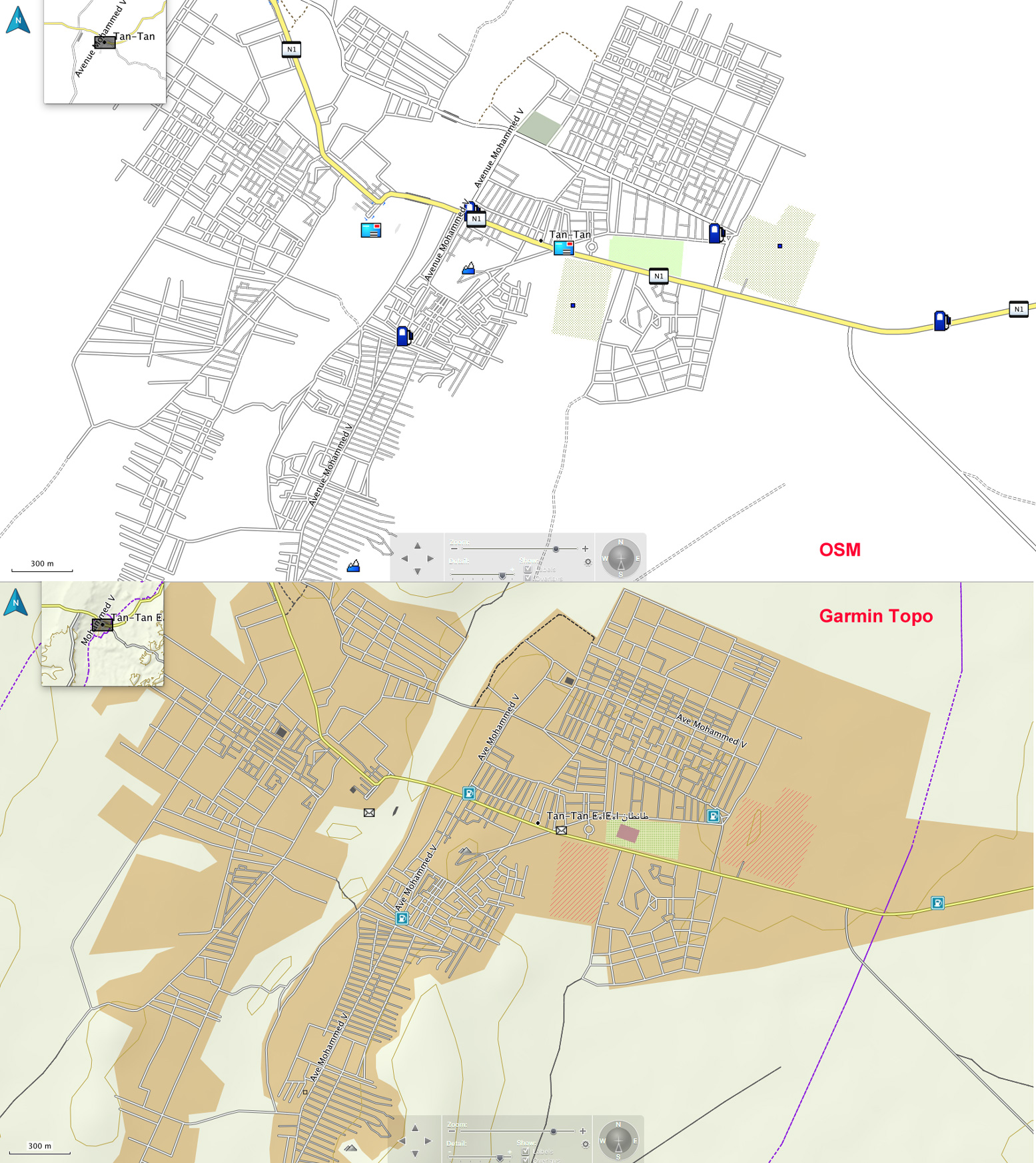
Occasionally at village level the OSM’s street-by-street detail is better, but that’s hardly vital. In towns and cities the extra shading distinguishes the Garmin from the plainer OSM, as shown for Tan Tan, left.
Tan Tan
The chief difference is in the desert where the Garmin depicts relief and surface with more detail and clarity using shading, contours and colour where OSMs only use colour and Olaf only used contour lines which can be distracting. Look at the Atar region (RIM) above right – an area of escarpments, canyons and dunes – all are reasonably accurately shown on the Garmin Topo. There’s an anomaly on the Topo map on the left (bottom panel) in that the (presumably automatically recorded) elevation variation in dunes depicts them as lots of small hills (which in a way, they are), but only once they’re above a certain height. Identifying dunes with contours is not helpful nor a cartographic convention. Shade and colour is best.
Six digital maps compared 2021– screenshots of Jebel Saghro, Morocco. Garmin v3 is #2.
The piste and road detail on the Topo is pretty good: yellow for national highways, twin lines for secondary roads or piste, and a single line for a less used piste. A quick check in Morocco shows they’re all there; most of the ones I know are there in Mauritania too. In southern Algeria only a few main pistes are shown and certain ‘national highways’ are actually remote pistes never likely to be sealed. The Topo map would not be so useful here. In any country dashed lines may well be walking trails, but as far as I can see, there is no key or legend with the Topo map. Some POIs are there too – just fuel stations and post offices as shown on the Tan Tan map, above.
In places the Garmin copies OSM’s annoying habit of again, marking high points (automatically?) as mountains which is a distraction, let alone inaccurate – for example when an escarpment gets shown as a string of peaks. If you drop the detail level enough notches on BaseCamp, these peaks (left) only disappear once all the useful tracks and place names have gone too. It’s great (and a bit puzzling) that this stuff is produced for free at all by OSM supporters, but the quickest flip to sat imagery would reveal the true nature of the relief.
So does the Garmin Topo map mean I’ll stop using Google or Bing imagery in the planning, or paper maps on the piste? The former, I don’t think so; the later in Morocco yes, but elsewhere in the Sahara I’d still rely on paper maps. In places like Morocco the extent of marked pistes can be converted into accurate tracklogs, but with better surrounding detail than OSMs. And, unlike Olaf, there’s no aggro importing into a modern, touch-screen GPS. When I want to quickly verify where I am, a glance at the Garmin Topo will may be adequate.
I’ve been using the Garmin Topo map quite heavily on BaseCamp last couple of days, preparing a new edition of Morocco Overland. It’s an intuitive-reading map and I’ve found one benefit of using a Garmin map on Garmin software is that when stringing out a track with the ‘create a route’ tool, it automatically snaps onto even the thinnest track on the map just like Google maps. But the BaseCamp tool won’t do that with other installed maps like OSM or Olaf, or even the basic Garmin base map. Sometimes you have to trick the tool to go the way you want, but it makes stringing together hopefully accurate routes (as well as distances) very easy. Occasionally only Olaf will show a route you want to follow, in which case you make the route with lots of short, straight lines. No so hard.
Getting routed: As the track was clearly visible, I traced the route I’m logging above (MW7) off Google Earth the previous evening (internet required), saved and exported the kml then imported it (as a gpx) into my Montana via BaseCamp. This was pushing the outer limits of my tech ability with this sort of stuff. GPS digital maps not really needed as I had the largely accurate self-drawn tracklog on the screen to follow, while recording my own live tracklog. Years later I used this same system (pre-trace route off Google Earth) again while logging MH23. The great thing with satellite is WYS is usually WYG, whereas with maps (paper or digi) WYS can be nothing at all.
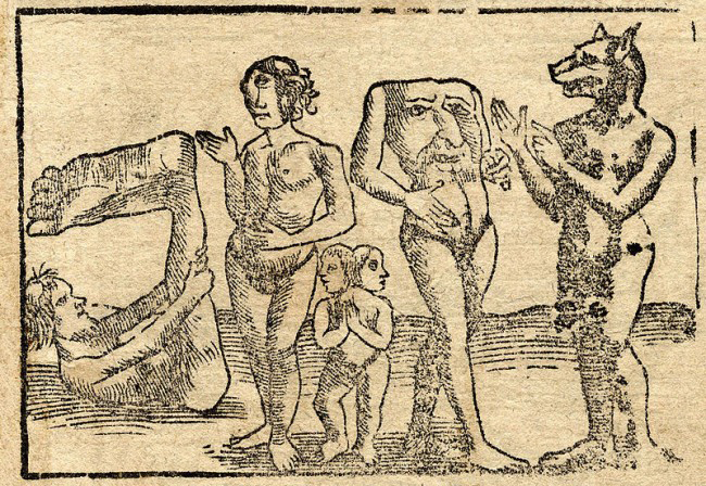
The earliest old map I have looks like it’s from the medieval era, but was probably based on Herodotus’ Histories which was getting on for 2000 years old by this time. It was he that brought terms like ‘Libya’ (North Africa) and ‘Aethiopia’ (sub-Saharan Africa) into common usage.
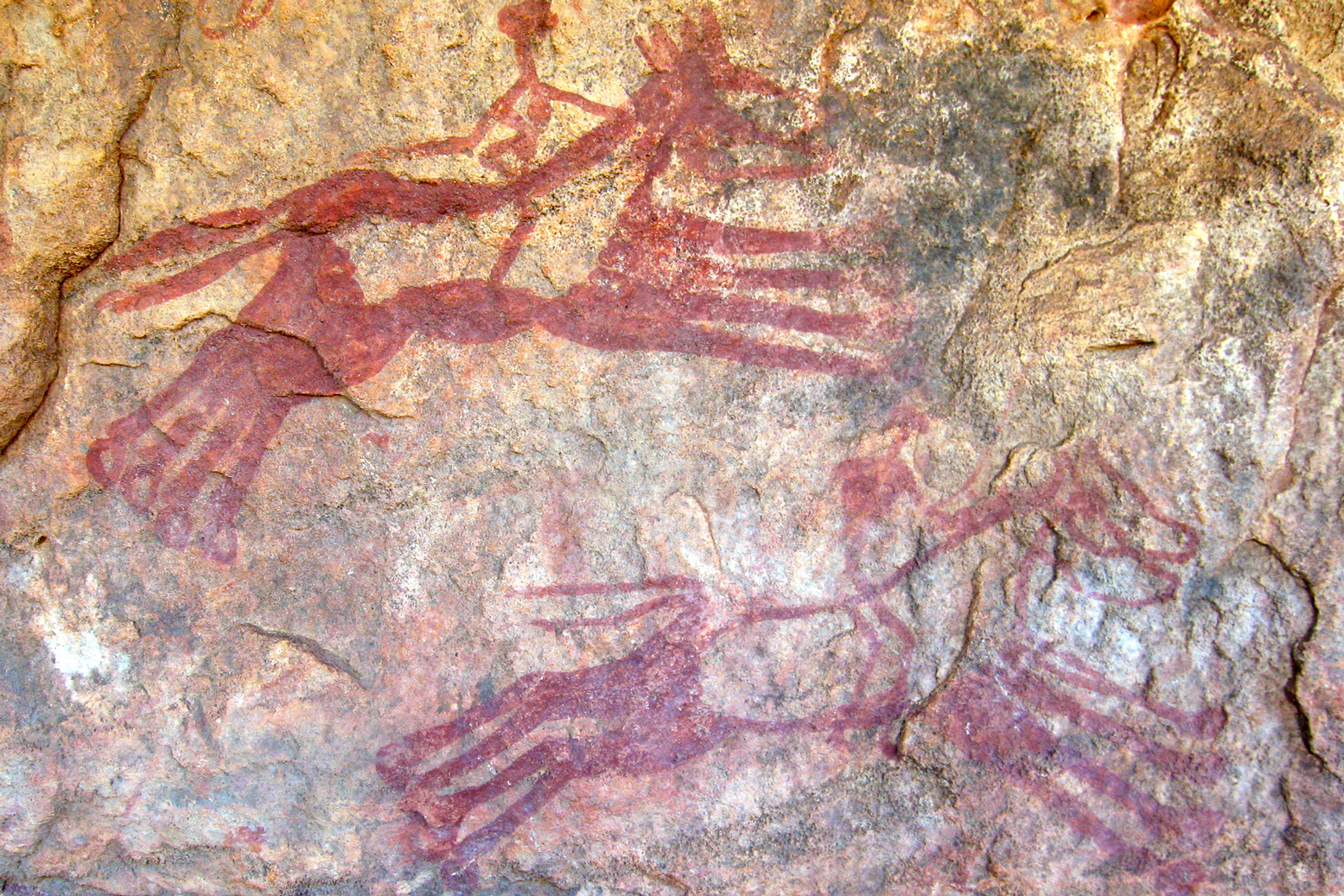
On this map ‘Mauritania’ is today’s Morocco, while the chariot-riding Garamanteans are correctly located around present day Germa in the Libyan Fezzan. It’s probably coincidental, but the ‘Barditi Montef’ (mountains) could be the Tibesti around Bardai – actually only 700km southeast of ancient Garama. (Left: rock art depicting chariots at Tim Missao well, 1200km southwest of Germa on the way to Mali. The Garamanteans are said to have got around.)
This map, but not 1554 Munster map above, may have been the best that Moorish wanderer, Leo Africanus’ (BBC doc) had to go on for his 16th-century travels across the region, venturing as far as Timbuktu, Cairo and possibly even Mecca. Along with Ibn Battuta’s travels a couple of centuries earlier, it was Africanus’ Description of Africa (1550) which expanded knowledge of the Sahara. But despite the efforts of Africanus, even by 1700 or so, satirists like Jonathan Swift (right) were said to have quipped:
So Geographers in Afric maps With Savage Pictures fill their Gaps
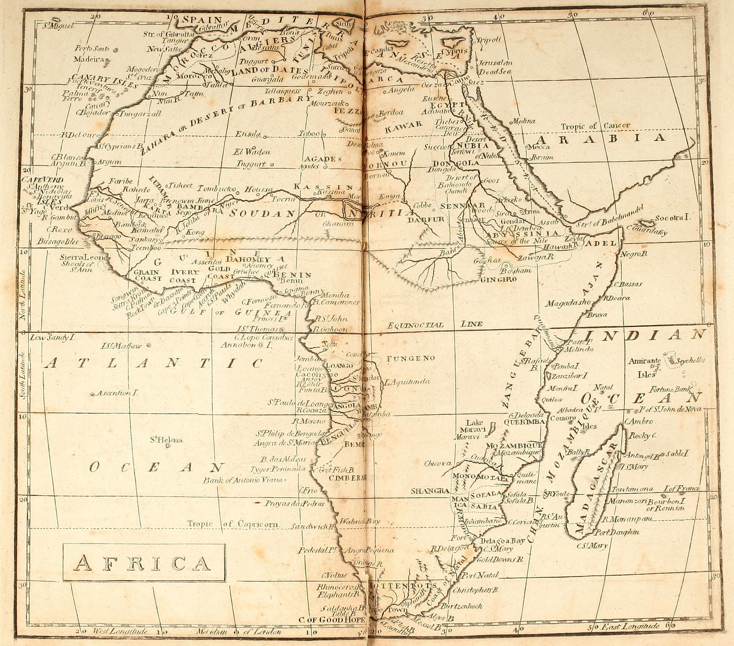
Fast forward a few centuries and there be no dragons or other medieval monsters (left) on this map of Africa dating from an atlas produced in 1803. It’s credited to William Kneass who later became Chief Engraver of the U.S. Mint in Philadelphia. Instead, the advent of scientific enlightenment had brought us longitude, latitude and the ‘Equinoctial Line’.
The mariners of the era had succeeded in very accurately mapping the outline of the African continent, but the interior, including the ‘Zahara or Desert of Barbary‘, remained blanks. South of the Sahara the most notable inland incursions were made by the early European colonies around Cape Verde and Guinea Bissau, Angola, the Cape and Mozambique. In the north Egypt and the Nile are better mapped all the way into the Biblical lands of Abyssinia. The Moroccan imperial cities are present: ‘New Salle’ being Rabat, with Marrakech labelled as ‘Morocco’. Never linked those two words before, but presumably they’re both based on ‘Moor’ so it makes sense.
South of the Atlas ‘Tatta’ appears to be close to Tata, with the Oued Draa known as the ‘Nun’. The 16th-century Portuguese trading post of ‘Mogodoro’ is Essaouira, and Tarfaya at Cape Bojador was then called ‘Tungarzall’. To the east you’d have thought that Sijilmassa near Erfoud might have got a mention. It was the northern terminus on the ’52 day’ caravan route from Timbuktu.
Further south in Western Sahara and Mauritania, ‘St Cyprian’s Bay’ became Golfe de Cintra after a Portuguese mariner and slaver got killed nearby at Arguin (also labelled). Inland from here, only ancient ‘Tisheet‘ gets a mention, on the old Dhar Tichit caravan route.
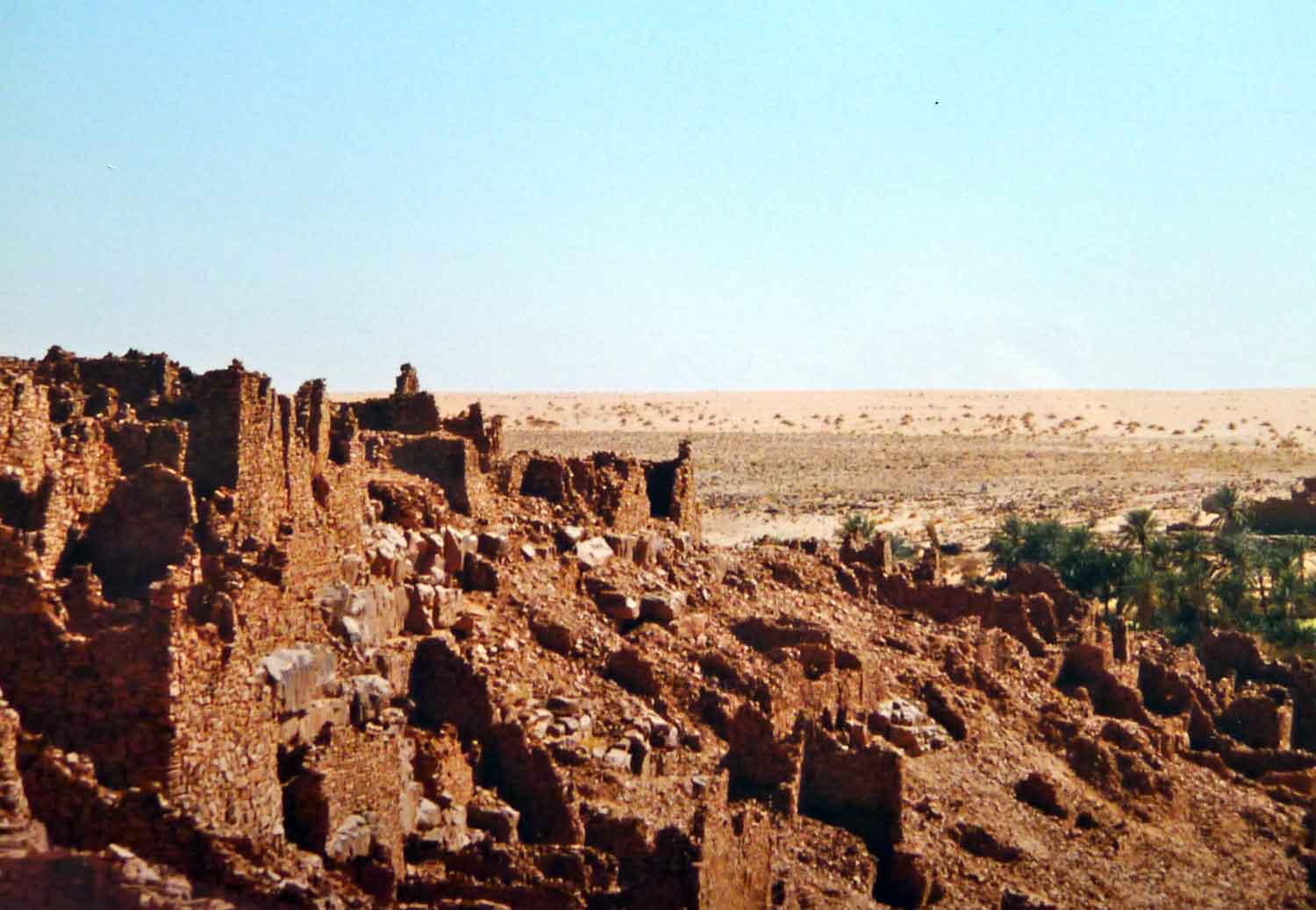
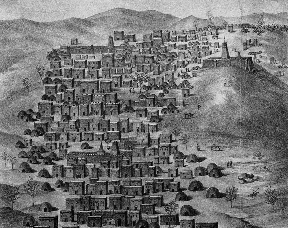
I remember going to a talk in Nouakchott about the medieval glass trading links between Tichit and Venice. Tichit didn’t look like much when we were there in 1990 (right; it’s all in D. Travels), but it’s a historic settlement on a par with Timbuktu (above left; as seen by Caillé in 1830), Oualata, Chinguetti and Ouadane. The latter may be the ‘El Waden’, misplaced way north of Timbuktu and not far from ‘Ensala’ which could be even more distant In Salah in Algeria. At this point it was still a couple of years before the American sailor, Robert Adams briefly ended up a slave in Timbuktu. Among other things, his account helped kick off the race to reach this fabled Saharan ‘Shangri La’ and with that, the great age of European Saharan exploration as listed rather Francocentrically on the 1898 map below.
Eastwards on this 1803 map, many places in Algeria are recognisable: ‘Tuggurt’, ‘Guargala’, (Ouargla) and over the border in present day Libya: ‘Godemashe’ (Ghadames), ‘Mourzouk’ and ‘Ganat’ (Ghat). ‘Zeghen’ was less easy to pinpoint, visited by James Richardson while on the road from Tunis to Ghat and back up to Tripoli in 1845-6. At the time Richardson estimated Zeghen’s population at ‘200 men, 300 women, and 700 children and slaves‘. Our man Duveyrier (see below) locates it for us a short distance northwest of Sebha in the Wadi Ash-Shati, on the way to ‘Sockna‘. Here Richardson spent some time as a guest of the Turkish Caid and his comely concubines.
‘Berdoa’ is the old name for Kufra in southeast Libya, and south of there, on the page’s fold, is the enduring salt oasis of ‘Belma’ (left) at the base of Niger’s ‘Kawar’ escarpment. The hyper-arid and largely uninhabited Libyan Desert around Jebel Uweinat wasn’t to be explored until the 20th century.
Fast forward a hundred and one years and the Saharan blanks begin to fill up. Below is the ‘Northern Africa’ plate extracted from a Bartholomew’s Handy Reference Atlas of the World dated 1904 (source) and which differs very little from my 1888 version.
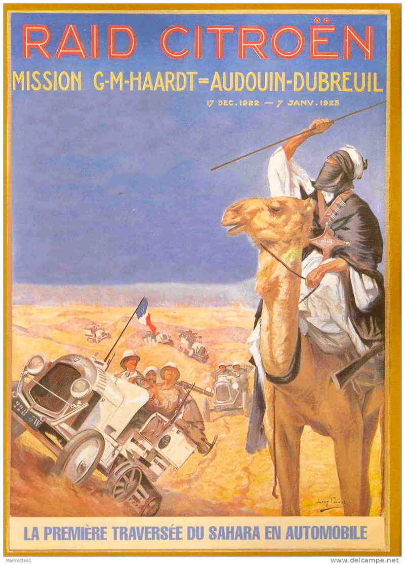
The interior is still sparse, but the proposed trans-Saharan railway gets a mention. Running across the flat plain of the Tanezrouft, in 1922 it was the actual route taken by the first cars – Citroen Kegresse autochenilles (half tracks; left) – to cross the Sahara north to south and back. In the west ‘Shinghit’ is a bit out of line with Atar and Wadan, but in the ball park. To the south is the ghost town of Ksar el Barka and ‘Portendik’ must be early Nouakchott, though you wonder what became of ‘Mufga’ near grubby Choum of today. Ancient Taghaza (as visited by Ibn Battuta) never gets a mention on any of these maps, but it’s replacement, the newer salt mine at ‘Towdeni’ was a key point on the ’52 days’ caravan route to Sijilmassa. In northern Mali, ‘Essuk‘ whch hosted the early Tuareg music festivals before they moved to Timbuktu and long predates today’s Kidal. Meanwhile in Algeria the Amadror salt mines get one of their last calls. Wau crater in Libya gets a name check too, there’s brackish water there, but due to the mosquitoes it was never a settlement. Up in the Mediterranean, Crete is oddly identified by its ancient name of Candia, perhaps intended as a poke at the despicable Ottomans?
Above,Dufrenoy’s intriguing and amazingly detailed map from 1898, centred on the southern limits of French-controlled Algeria. The red lines identify the itineraries of that busy century’s wave of Sahara explorers, from Laing’s fatal excursion to Timbuktu in 1826, right up to Laperrine, who in 1898 set out to quell the southern Tuareg with his Méhariste Camel Corps and died in a plane crash southwest of Tam in 1920. Note too the route of Flatters’ disastrous missions of 1880-1 (as described in Desert Travels) when the handful of harried survivors crawled back to Ouargla, having out-run the Tuareg who’d trailed and picked them off one by one.
Back-tracking a bit, the 1881 Flatters Mission – partly intent on reconnoitring a railway route between the Maghreb and France’s territories in West Africa – wouldn’t have got half as far as it did without Henri Duveyrier’s amazingly detailed map of1864. It was based on his journeys there a few years earlier, described in Les Touaregs du Nord. Tamanrasset was merely a oued; Silet, In Amguel and Ideles on the other side of the Hoggar were established settlements. The tomb of Tin Hinan (left) even gets a mention, though it’s a bit misplaced from actual Abalessa.
Further out on the Tanezrouft the strategic well of Tim Missao (the chariots, above) and the waterhole at In Ziza (left) are labelled, but in Libya the Murzuk sand sea is just an ‘unnamed hammada’ separating the Tuareg from Tubu. There’s plenty more mouth-watering detail if this area means anything to you, and Duveyrier’s inset helpfully lays the ancient geographical names alongside their modern counterparts.
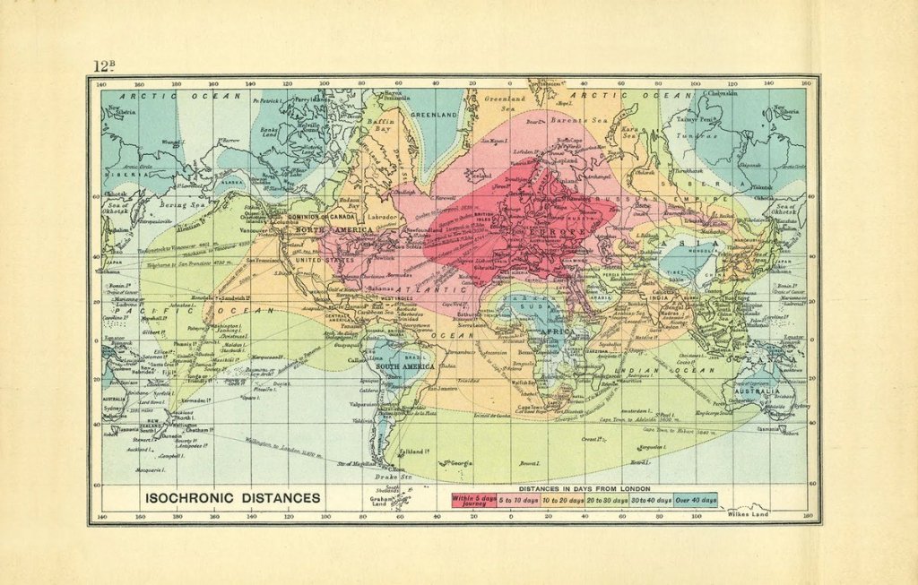
Not a Sahara map but a world map from 1914 as the British Empire began the descent from it’s late-Victorian apogee. In an era before flight and in the golden age of ocean liners, it illustrates just long it took a citizen of Albion to reach the far flung corners of the world. Central Sahara is up there at the end of the scale, alongside the Amazon, Outback, Congo, Tibet and Siberia. The widespread adoption of the motor car would soon change that.
How time flies. It’s now 1933 and above, France’s African colony encompasses half the Sahara and most of West Africa. Tamanrasset and Djanet, which even then must have been the biggest towns in southern Algeria, are still missed out, but then this isn’t a French map. In Mauritania Tidjikja makes an appearance, so does Iferouane in the Aïr and Tindouf up in Algeria. ‘Marakesh’ looks like it’s still ‘aka Morocco’ where the Spanish cling on to protectorates in western Sahara (Rio de Oro), Sidi Ifni and on the north coast, but not for long. Within 25 years the Sahara would take on the borders and principal towns with which we’re familiar today.
Who can resist the superb ‘Uweinat’ map (below) originally published by the Survey of Egypt in 1945. One of the most fascinating corners of the Sahara, much of its detail was based on the intrepid explorations of Ralph Bagnold in the 1920s, as well as later Brits, some of who were fictionalised in The English Patient movie. The last time we travelled there (left), it was still the best paper map available for that area, notwithstanding the newer aeronautical TPCs.
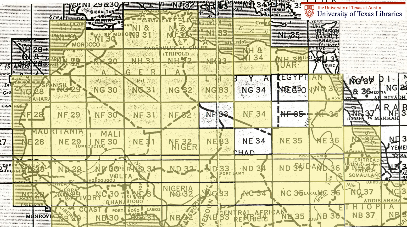
Old Saharan mapoholics will be familiar with the Austin TX university’s comprehensive online database of full-sized Saharan maps dating more or less from the early 1940s. Click this to get to the index pictured below and thank you Austin.
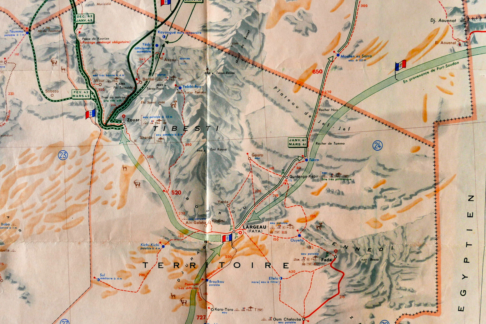
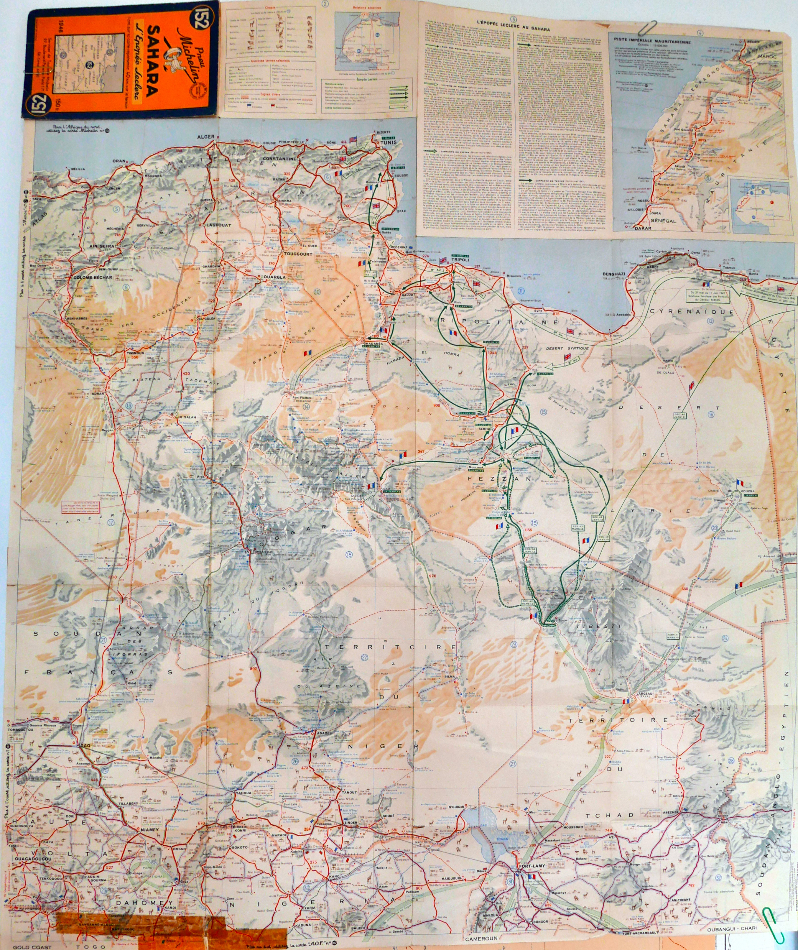
And finally, a forerunner to the famous 4-million scale Michelin 153 map (now the 741) that covered the French Sahara: an ageing Michelin 152 from 1948. It was the best photo I could manage – scanning will have to wait for a very rainy day.
You get the feeling that this may have been a commemorative special edition to celebrate General Leclrec’s heroic achievements in the Sahara during WWII, when a small column managed to take Kufra and then Murzuk from the Italians, and then push north to help expel the Axis forces from North Africa along with the 8th Army.
Like the LRDG map, the 152 has helpful detail like ‘piste tres difficile‘ as well as the famous info on water resources ‘tres mauvais a 50m‘, that we recognise from the later editions which covered the Sahara all the way to the Atlantic.