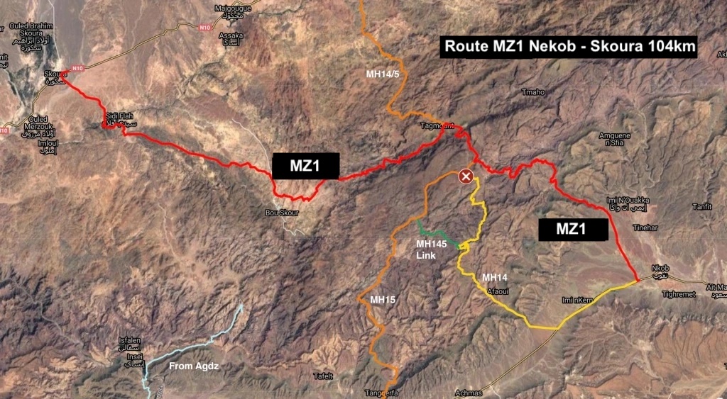
Z1 (formerly MH23; MZ1, ZR1)
Nekob > Skoura • 104km
Last ridden: January 2024
Description
Now that the once classic MH4 from Nekob to Tinerhir (or Dades) is fully sealed, the southern sections of MH14 and MH15 still offer challenging off road crossings of the western Saghro mountains, with more routes to the east.
This route offers an easy way to access the range, initially following a well-maintained haul route west into the hills and down the other side on an easily followed mountain track.
You get all the distinctive drama which make the volcanic ranges of Jebel Saghro but since I first road it, haul truck axles (combined with a lack of rain?) have ground almost all the bends into deep powder. This has now made the route tiresome on a bike; you won’t fall off unless you’re careless, but any flow is disrupted as you slither or paddle your way through the powder, bend after bend after bend. Coming into Tagmout from the west in January 2024, the ride was no fun; heading back north along MH14/15 towards Kella was loads more enjoyable, like MZ1 used to be. Even the col (not even a bend) just west of Tagmout on MZ1 is now thick with powder. In a car it’s not an issur; just expect clouds of dust.
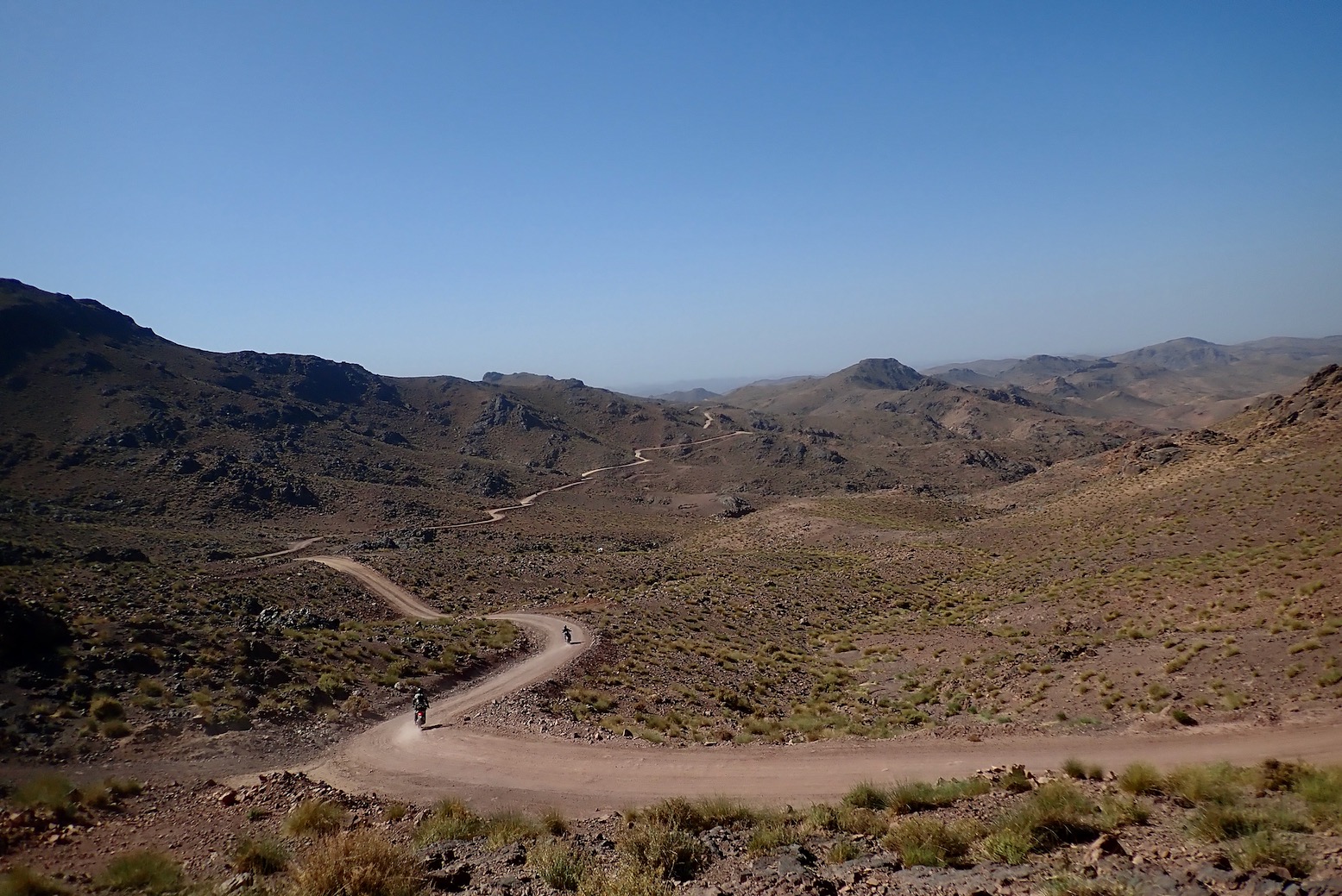
Westbound, the drama subsides around KM70 heading towards Skoura, but in that time, above 1600m you’ll have passed several epic vistas that can make it all worthwhile. Thanks to local geologist Saad B for pointing out this route.
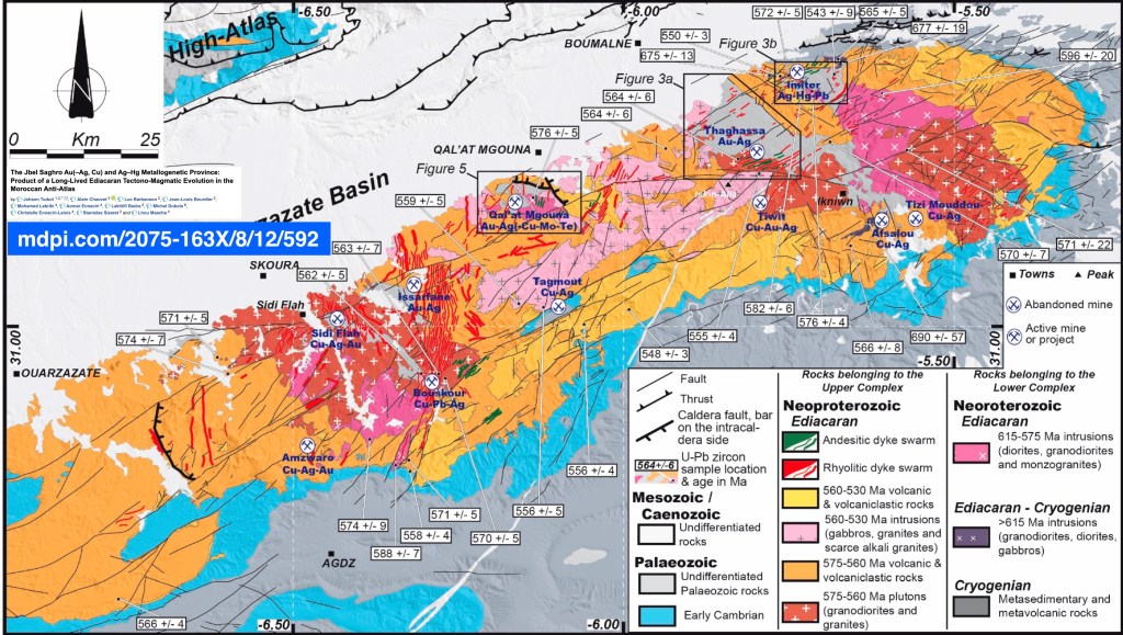
Away from either end, the only ‘village’ is Tagmout (KM43), a few smallholdings and a mosque strung out in the basin and overshadowed by the gold/copper excavation just to the north. This mine must be why the eastbound part of the track got carved out of the hills; it’s not like there are a string of others lonesome hamlets up here needing a link to the outside world..
Mapping
There’s nothing on paper of course, unless you print it yourself, but you can track it clearly on Google satellite and Apple Maps, as well as free digital maps like the particularly good GarminOpenTopo. There were only a few scraps of trail showing on my v3 Garmin Topo (v4 is current).
Off-Road
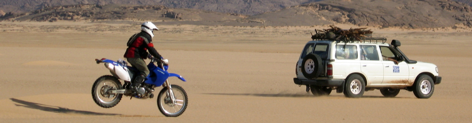
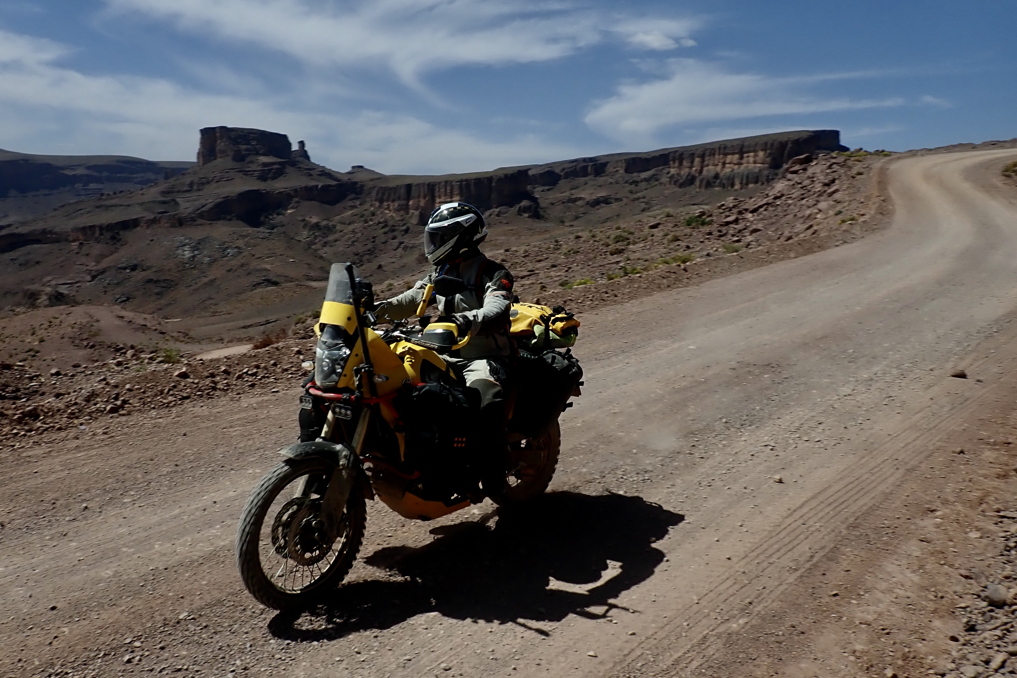
Because the east section is used by mining dump trucks (I saw three just as I left Nekob in 2021; one in 2022), east of Tagmout this track is wide and in great shape and so remains doable with any car or bike. On an Africa Twin in 2021 I did find the countless western switchbacks – ground down to powder by the trucks’ scrubbing tyres – needed to be inched around. A more stable KTM 890 (with a group) made easier work of these in 2022, and a week later 310GSs were easier still to manage but riding in spring 2023, I had the feeling it was getting pretty sandy on the west stage and was pretty awful by January 2024; with the wrong front tyre it will be tiring. A 4×4 will barely break into a sweat or low range.
Route finding
After studying Google satellite I traced a putative kml along what looked like the clearest route, and it all panned out fine with no wrong turns. Westbound, you can’t go wrong up to the blue sign in the Tagmout basin (KM42; Berber women selling trinkets) and beyond here most forks of substance are to the right on the downward section, passing north of Bou Skour village and mine site (which you don’t see) to the big village of Sidi Flah.
I saw no other traffic bar the three dump trucks rolling into Nekob in 2021 and in 2022 we saw a couple of Berber shepherd 125s and a lorry.
Suggested duration
Allow half a day in a car or 4 hours on a bike with scenic stops.
Route Description
0km (104) Nekob west Afriquia fuel. On the other side of the main road, 200m to the west, a tarmac side road leads north to villages.
5.5 (98) A track splits left off the tarmac. There was some roadworks here in late 2022; work your wat round towards the pass to the northwest. Soon you cross a oued and enter a small palm gorge at which point the climb begins.
19 (85) Col at 1420m.
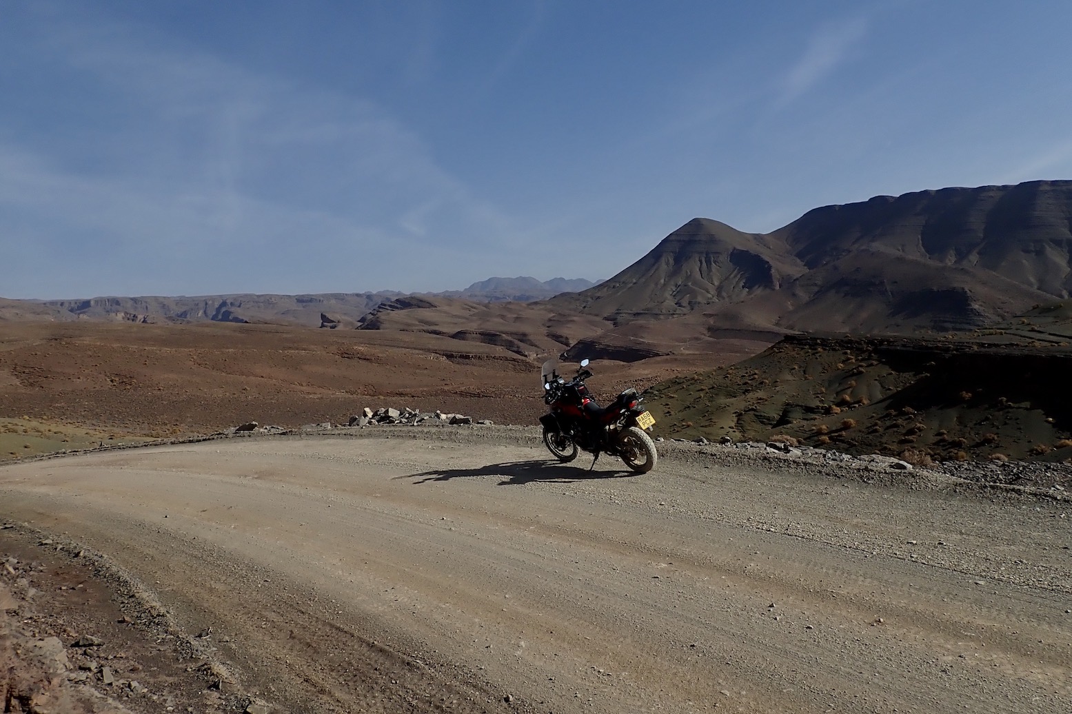
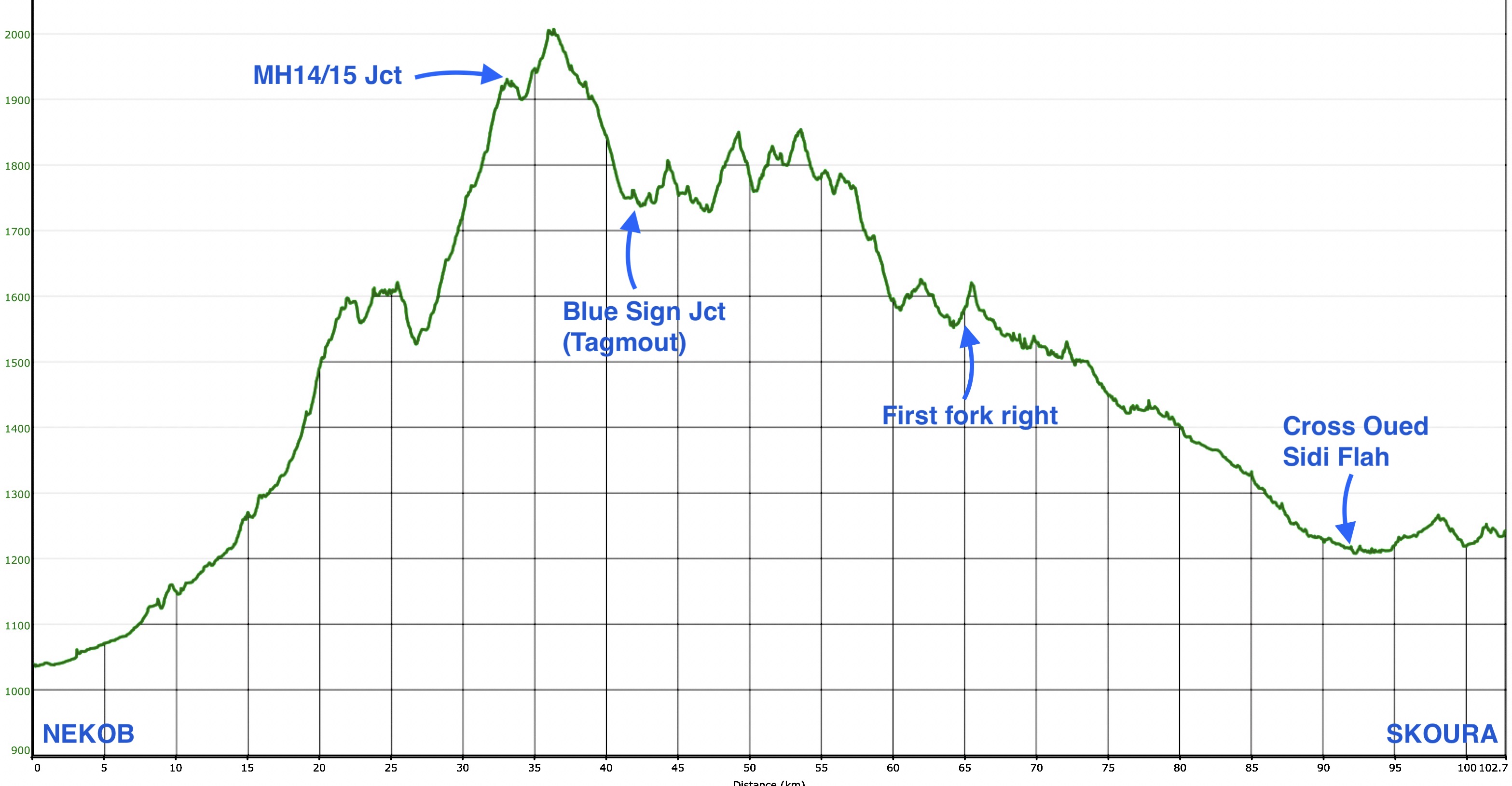
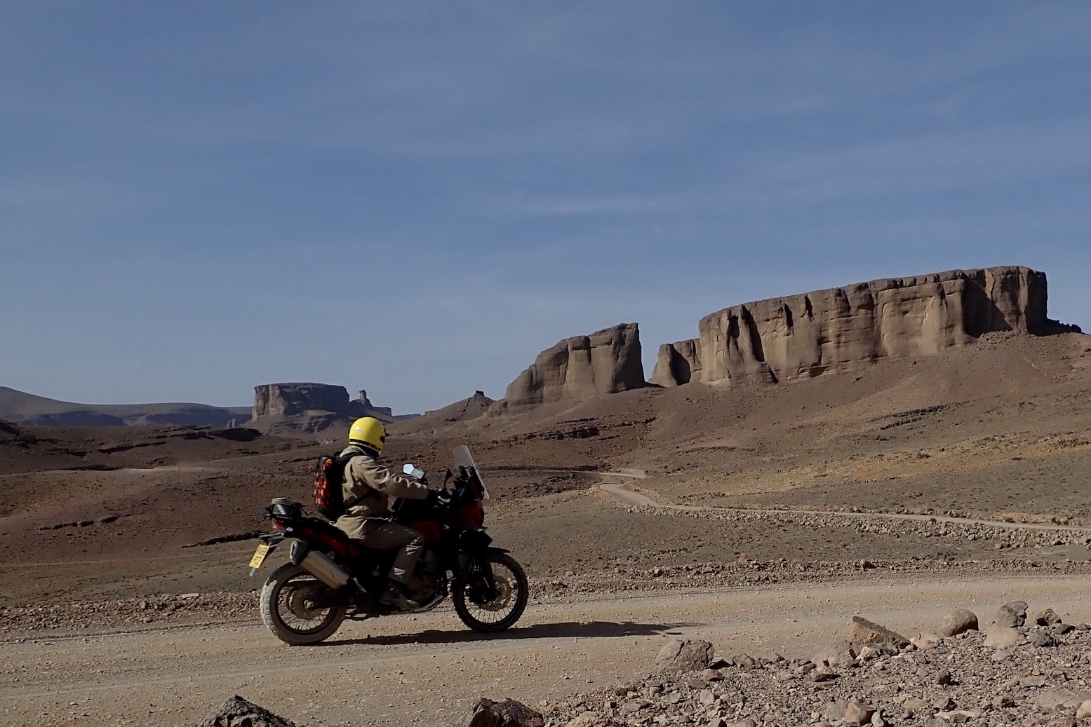
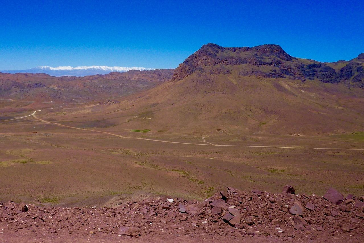
25 (79) Approach the impressive buttes of Jebel Agoulzi to the southwest (below). More noteworthy vistas follow.
33 (71) Reach a junction with tyres on cairns which is a 3-km link SW to MH14. MH15 comes in about 3km later (KM36) up from the south. You now head north for 9km, on the way passing the 2004-m high point with great views of the snowy High Atlas (below), if the season and conditions are right.
You then work your way down sweeping bends into the Tagmout basin with a mine on its northern flank and where tracks diverge.
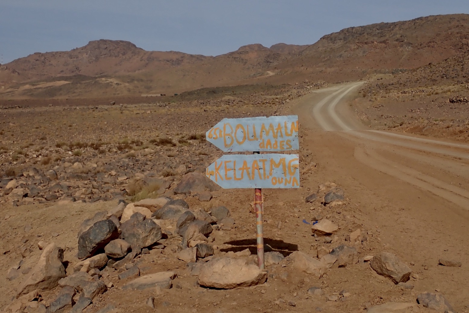
42 (62) Blue sign junction just east of Tagmout ‘village’, such as it is. Turn left for both Kelaa (as signed; MH14/15) and almost immediately left again (no sign) up to the Tachbouft Pass (KM45; 1805m) visible to the southwest for the run west to Bou Skour.
Over the next 20km the track rises and drops over the ranges with several impressive viewpoints (below).
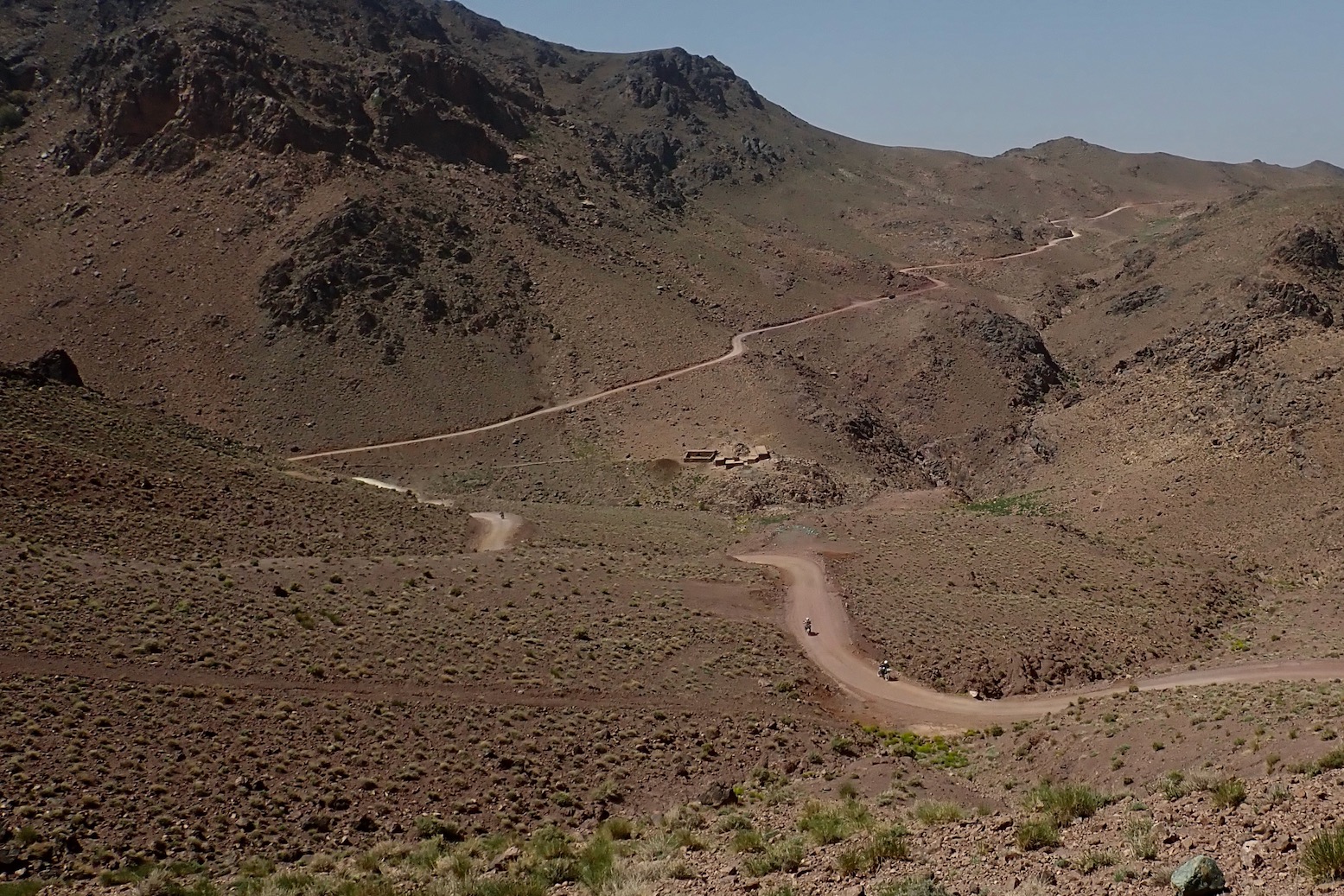
65 (39) Fork right. (Left leads down to Bou Skour village south of the mine). The most dramatic part of the crossing is over as the terrain loses elevation.
69 (35) Fork right again north of Bou Skour mine. In a kilometre keep right again just before some trackside machinery, and soon (around KM70) the main track from the mine (P1514 on Google) joins up from the left (south). You now follow the P1514 heading north then west.
79 (25) Fork. Keep left on the main track.
86 (18) Converge with a minor track coming from your left and where a red sign says ‘Bouskour 18,4km’ (pointing the way you’ve come from).
88 (16) Track joins from your right. All these three side tracks over the last 10km are minor: the main track is clear.
91 (13) Just after a passage alongside a farm wall, you cross a tributary of the nearby Oued Dades and swing north. Soon you pass through the small town of Sidi Flah. In 3km cross a bridge over the Oued Dades.
103 (1) Near a power station, at a lone, unconnected orange pylon keep right to reach the N10 visible up ahead. Once there, turn right for the Inov roadhouse on the eastern outskirts of Skoura. Left is for Skoura and the N10 to Ouarzazate. Straight across leads up to the actual town centre and Amzeria (Amerzi; see update Update 3.0.14 – May 2019)
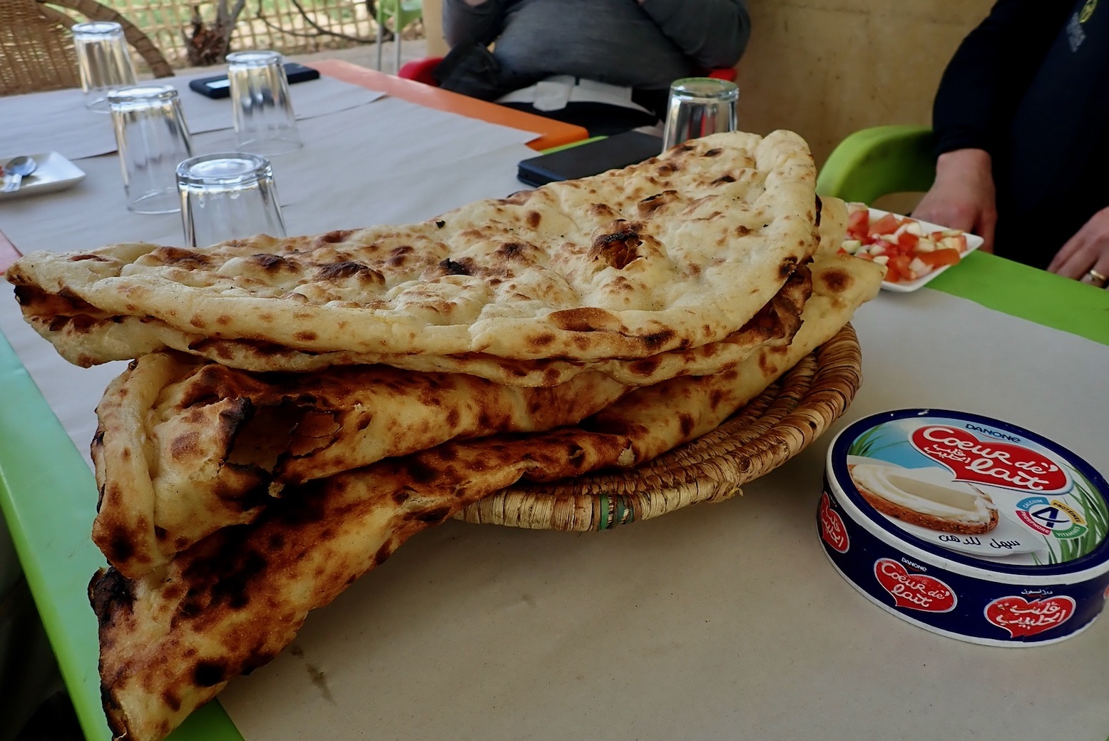
104 Inov roadhouse. (100km from Nekob on a 310GS odo). Lovely fresh tafernoute bread if you time it right.
Discover more from Sahara Overland
Subscribe to get the latest posts sent to your email.

Pingback: Garmin TOPO North Africa Light map review | Sahara Overland
Pingback: Morocco Maps | Sahara Overland
Pingback: Book review: Gandini Jebel Sagho off-road guide | Sahara Overland