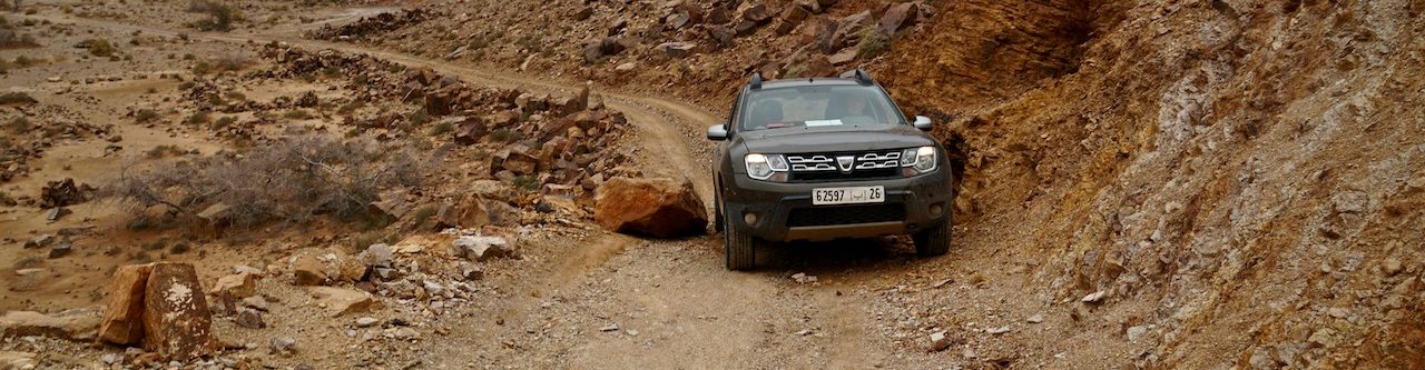
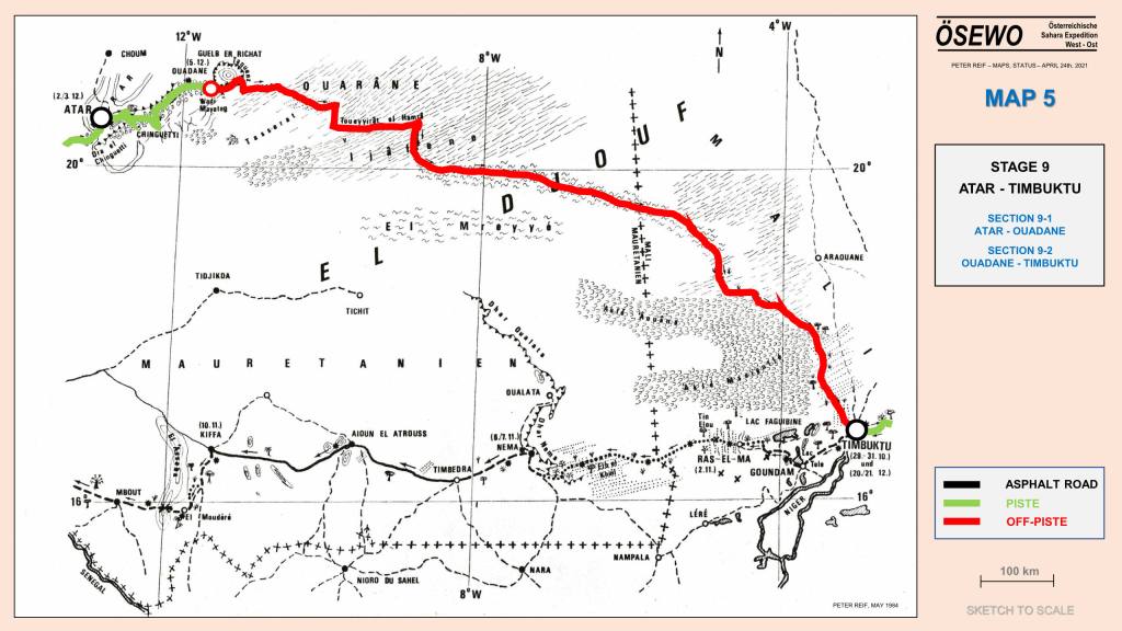
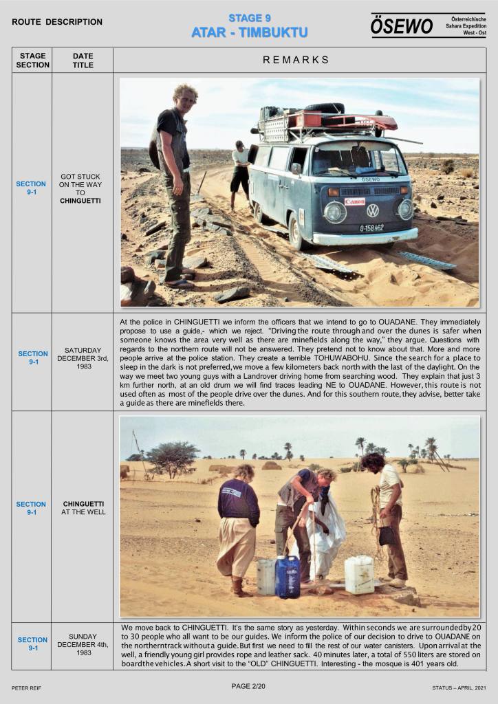
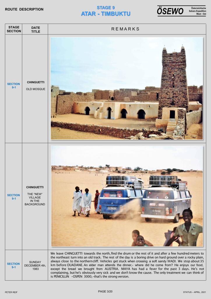
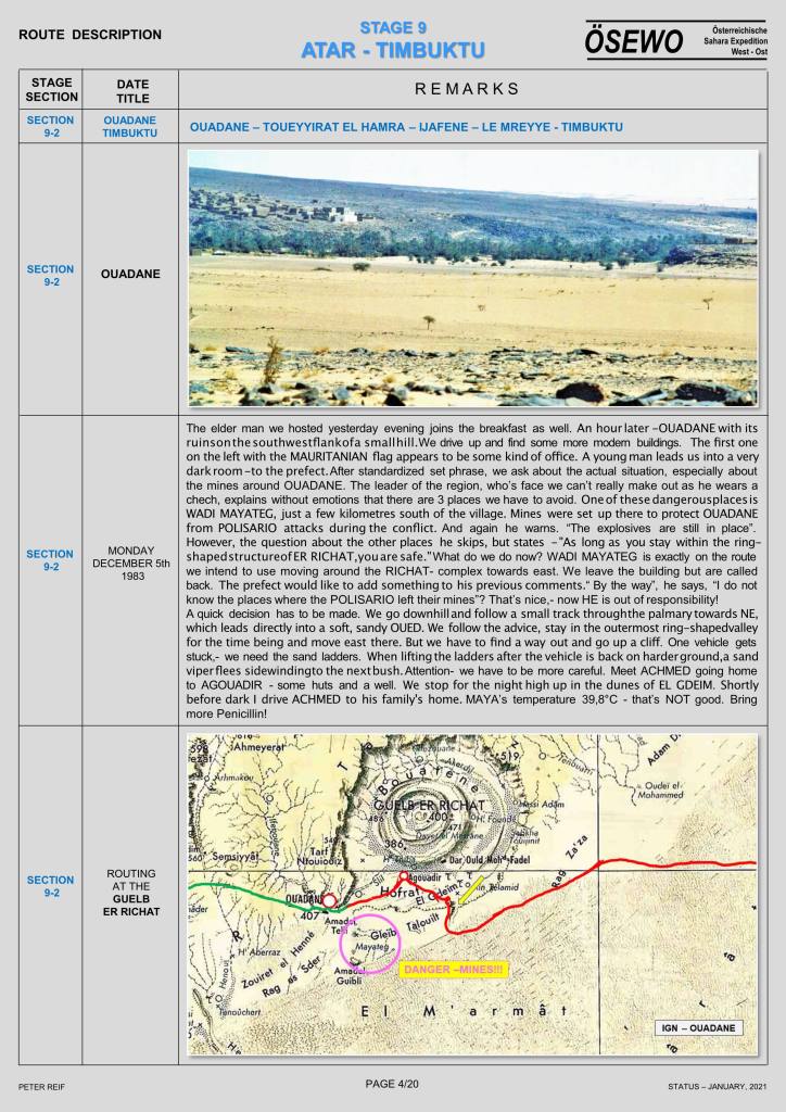
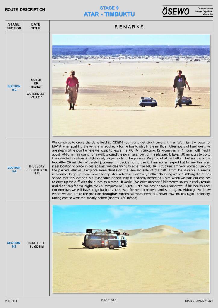
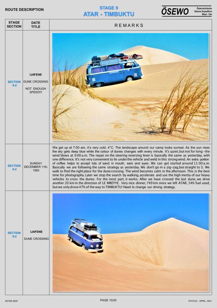
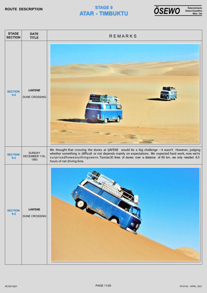
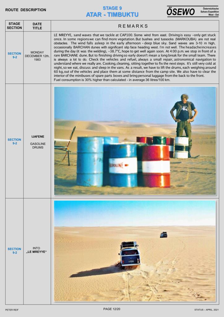
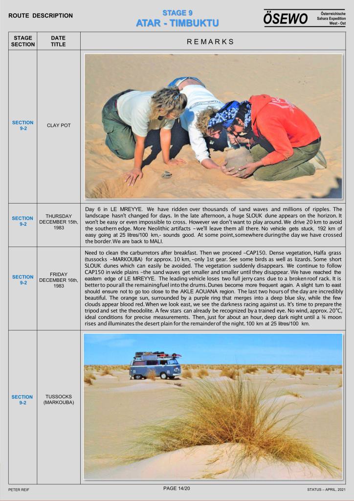
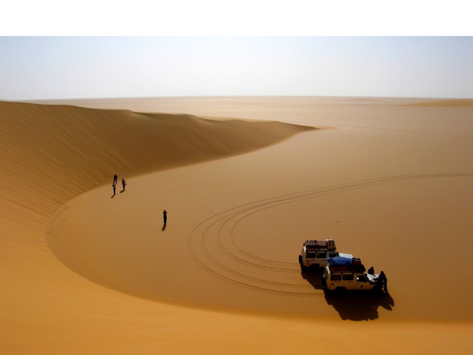
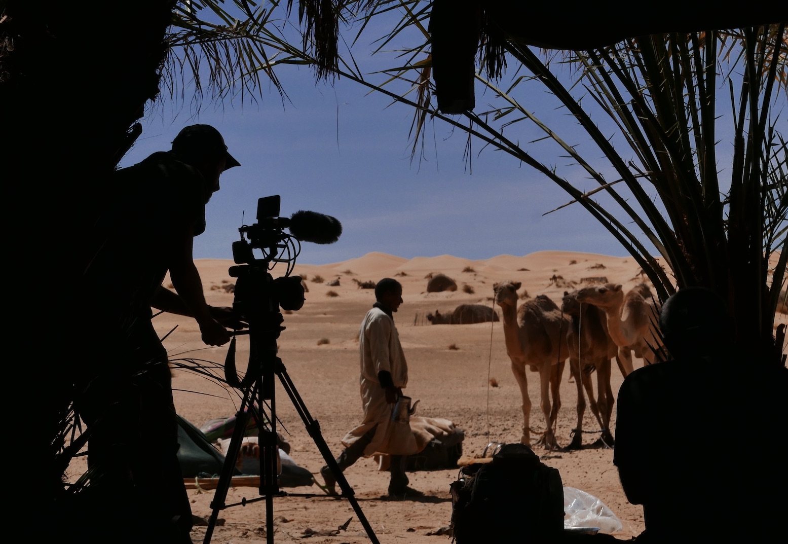
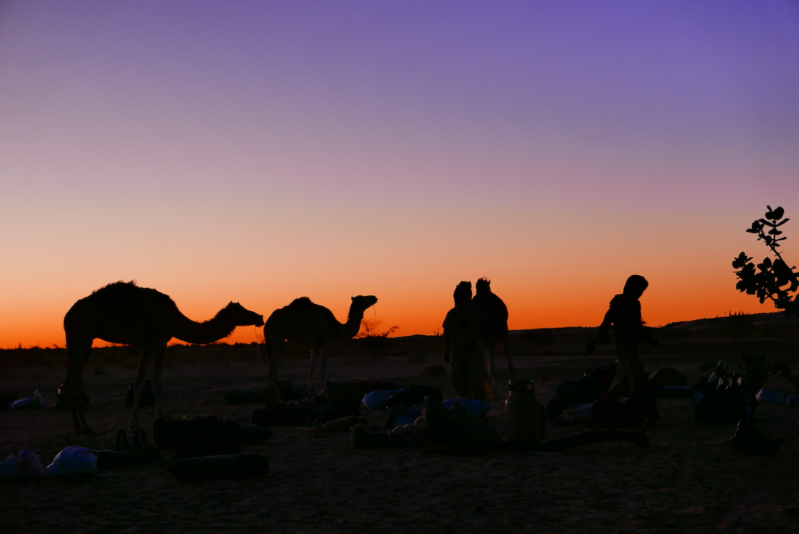
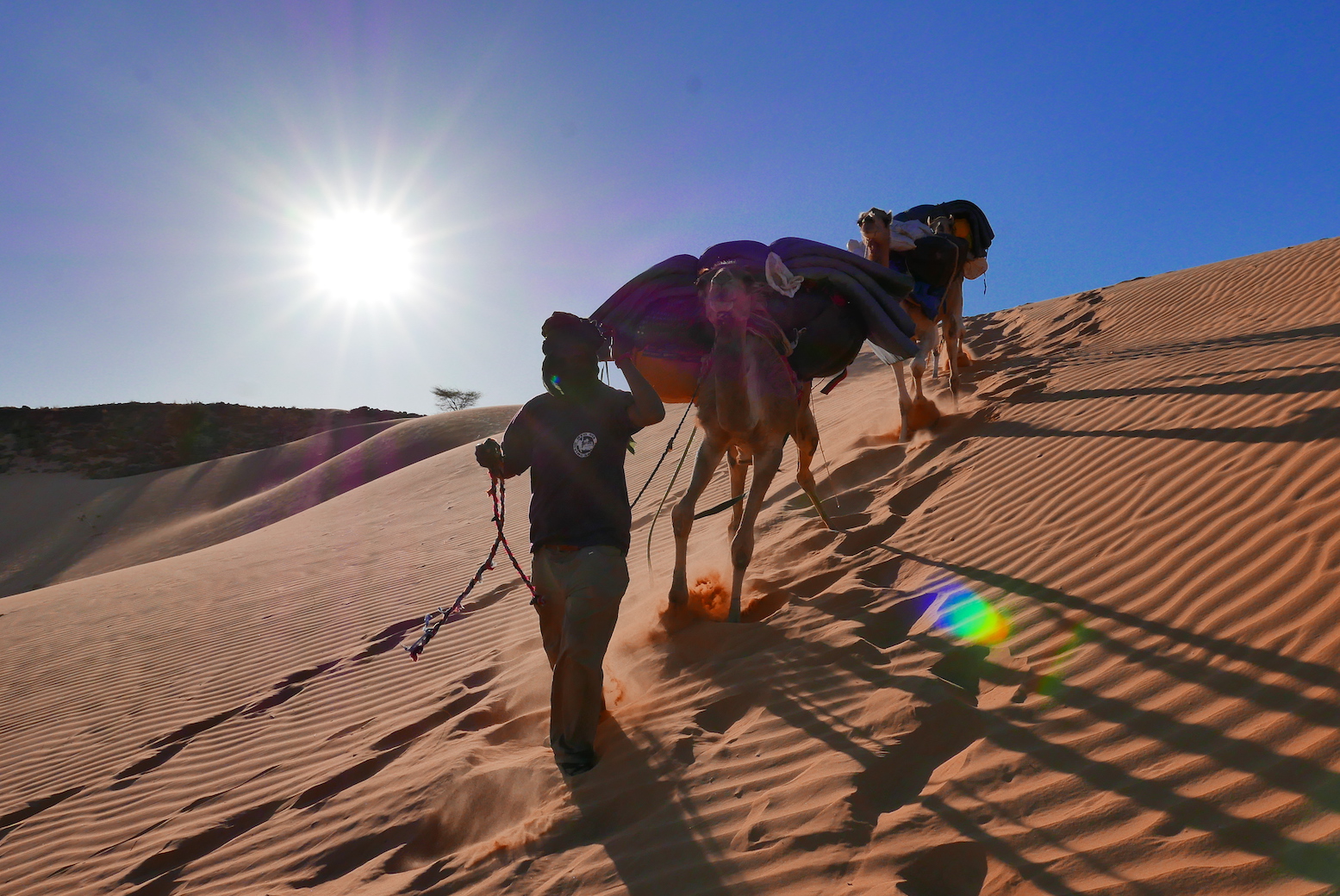
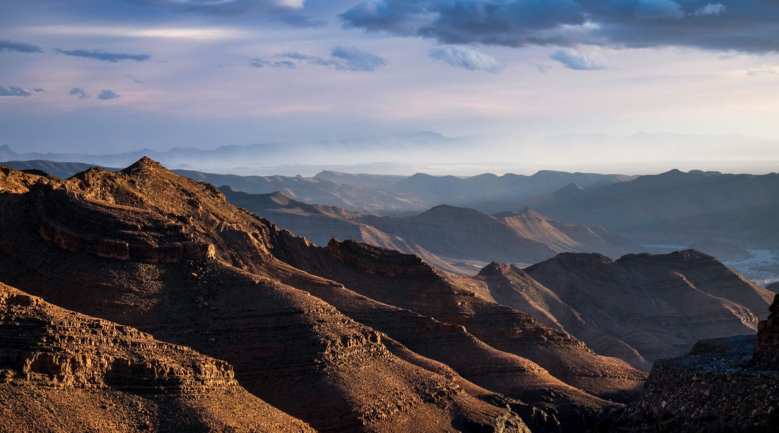
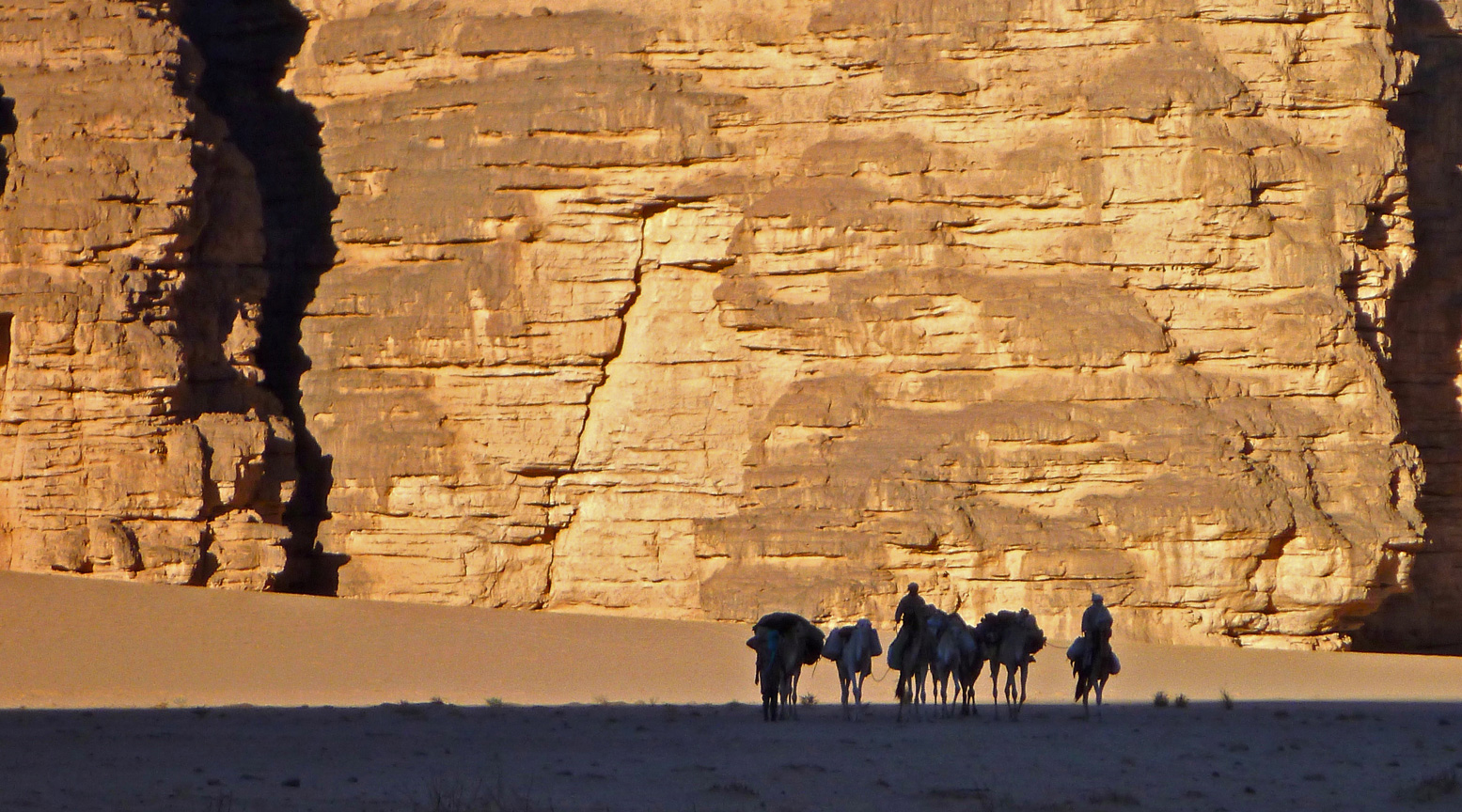
Part Three of Peter Reif’s report and maps recalling ÖSEWO: an Atlantic-to-Red Sea crossing of the Sahara in 1983-4. The VWs load up and tackle the big 1500-km dune crossing of the Majabat al Koubra or Empty Quarter from Atar to Timbuktu. For other parts, click the Index Page.
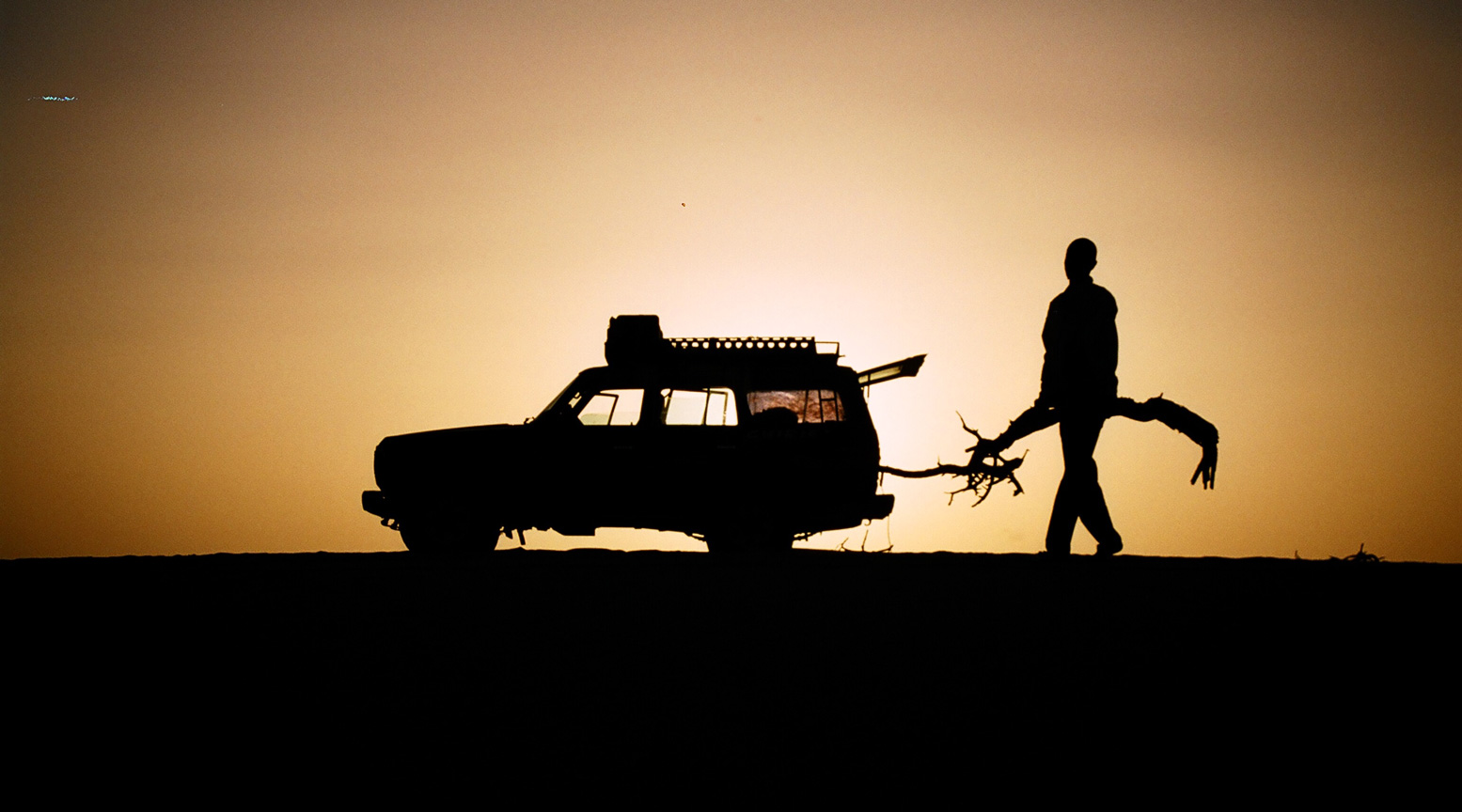
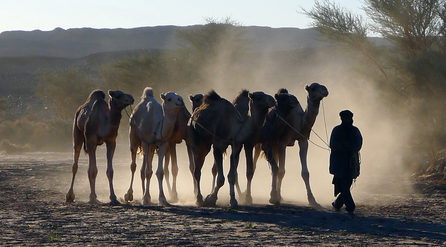
Part Two of Peter Reif’s report and maps recalling ÖSEWO: an Atlantic-to-red Sea crossing of the Sahara in 1983-4. The team get in position for the first big desert crossing. For other parts, click the Index Page.
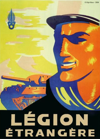
Austrian, Peter Reif spent his Lockdown formatting a series of detailed reports and maps recalling ÖSEWO: an Atlantic-to-Red sea crossing of the Sahara in 1983-4. Volkswagen’s T2 Kombi was an unorthodox choice, especially as much of the route was off-piste, but as you’ll read over the next few posts, the vehicles managed better than you’d expect.
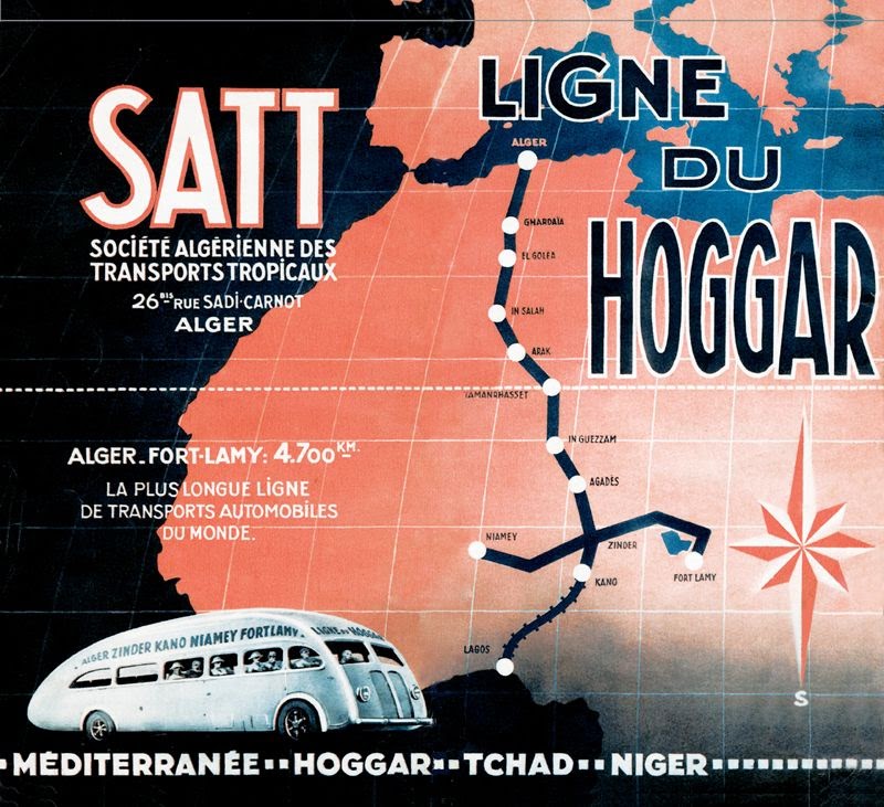
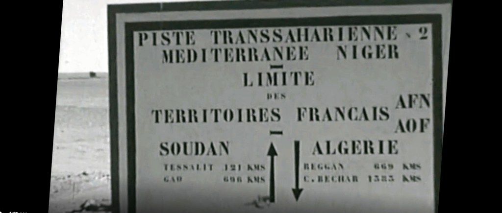
In the last decade of France’s colonial presence in North Africa, their part of Sahara was divided between three territories: Algeria, Tunisia and Morocco (‘AFN’), ‘AOF’ (French West Africa) from Mauritania to Niger, and ‘AEF’ or French Equatorial Africa which included present-day Chad. One could travel the pistes across the desert between the Mediterranean coast and the Sahel, and even scheduled bus services traversed these ‘Imperial Routes’ to the sub-Saharan capitals.
Pre-war editions were more aviation based
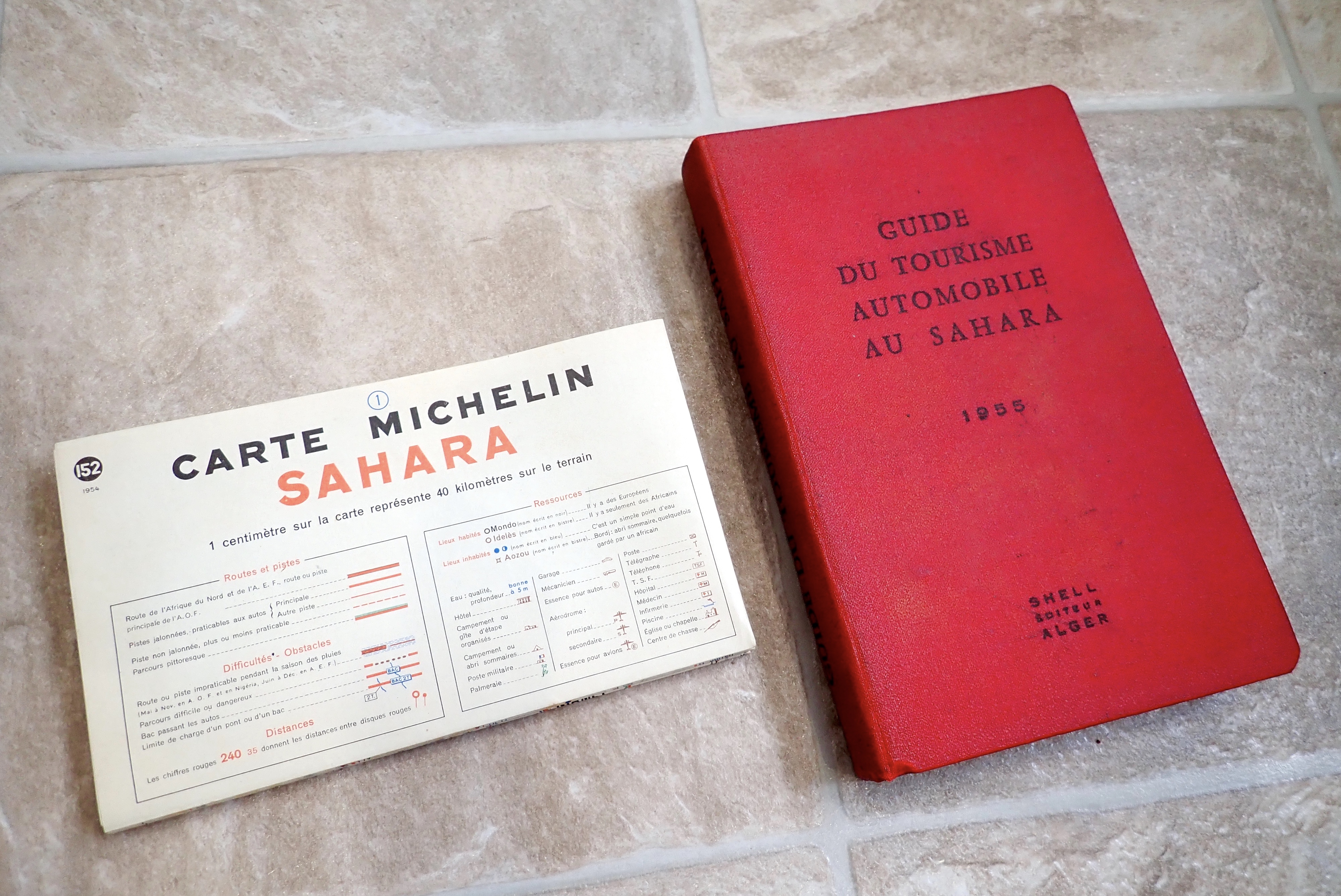
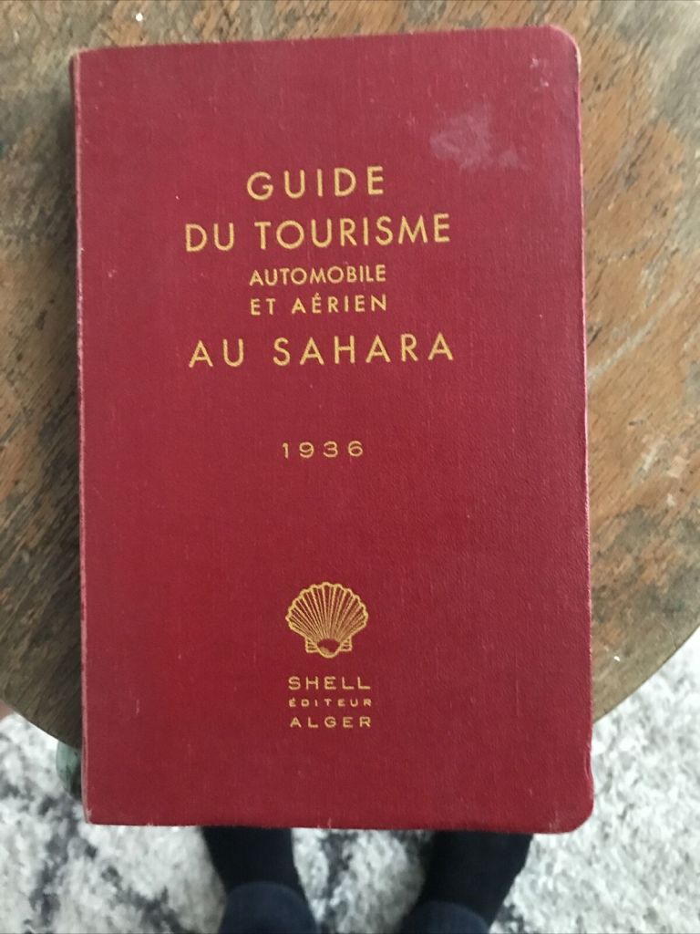
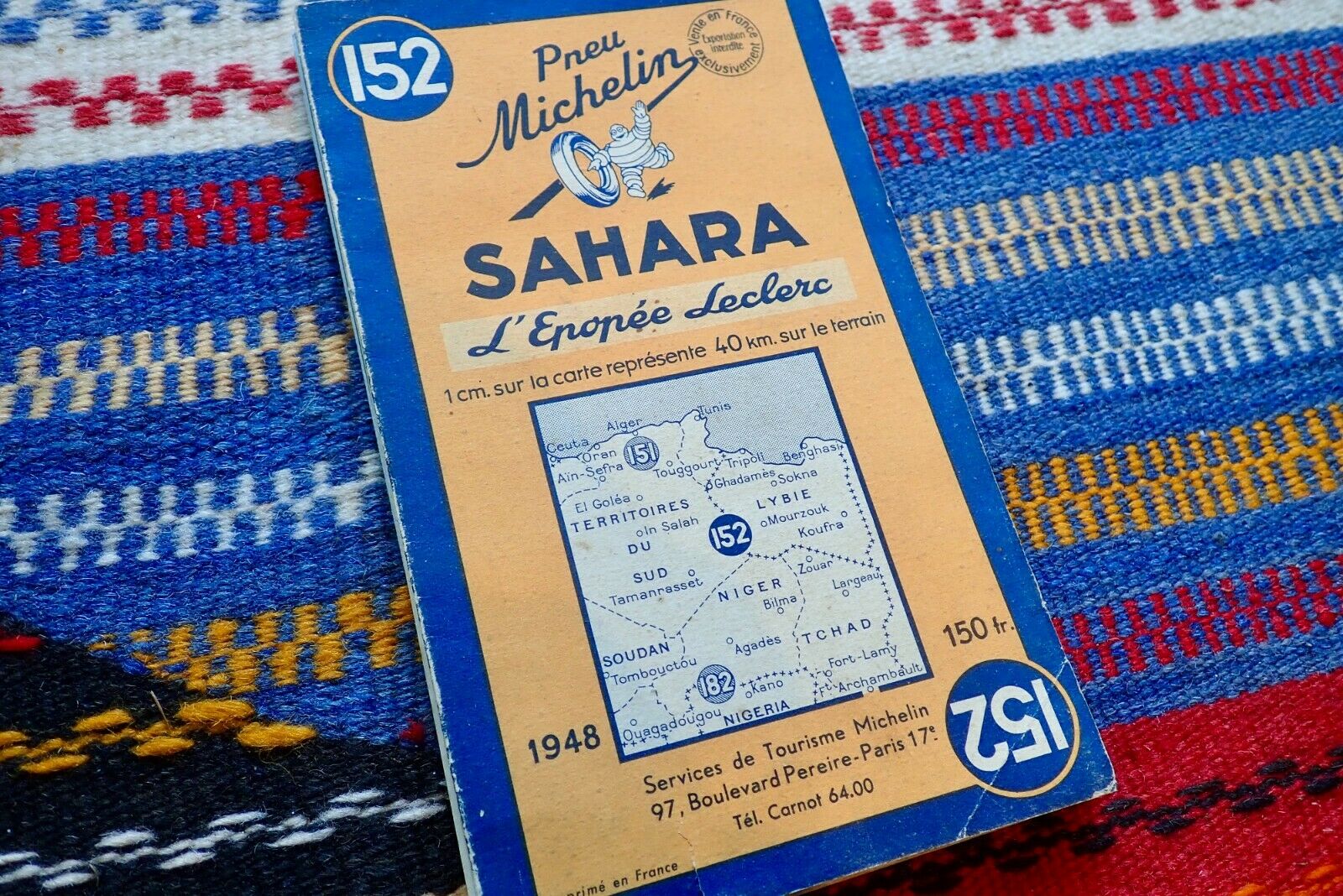
Just a couple of years before these colonies were dissolved and became the independent countries we know today, Shell released its fifth and final edition of the Guide du Tourisme Automobile au Sahara. The 345-page book is in French and there are still plenty around; mine cost me €25 from France, althpugh make sure you get the lovely map inside the back cover sleeve. Originally published way back in 1934 (link to pdf) and just seven years after Shell started distributing fuel in Algeria, it must have been the first guidebook of its kind, preceding my own Sahara Overland by nearly seven decades.
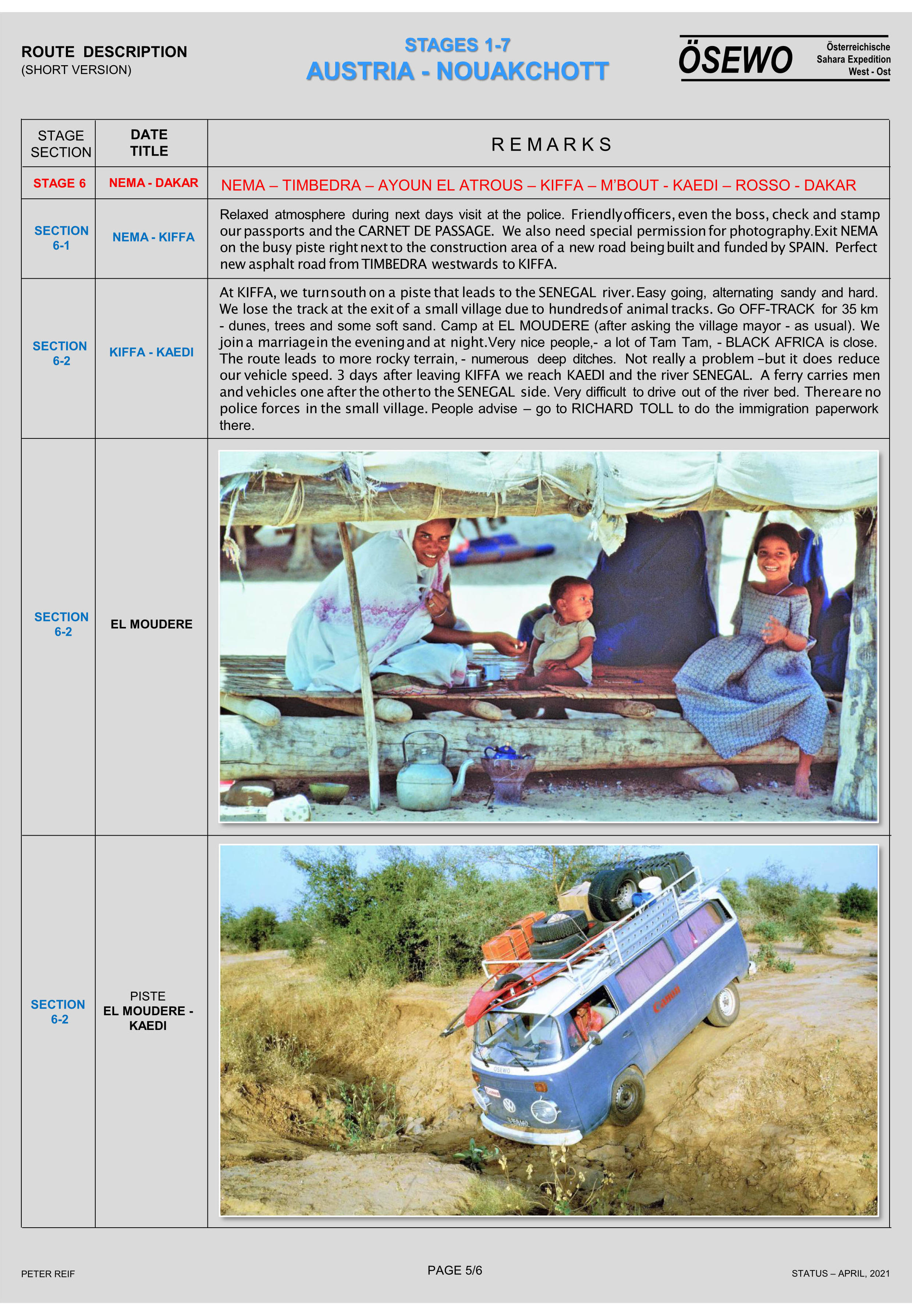
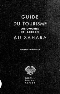
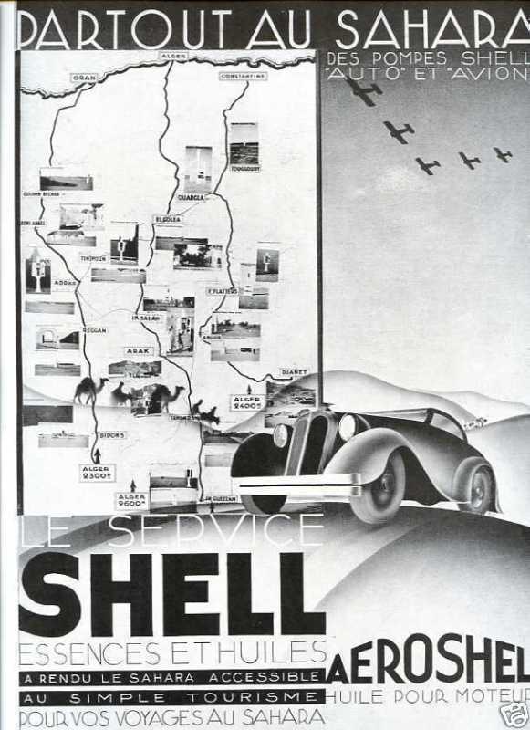
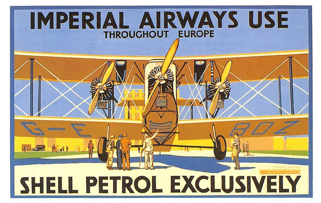
The three pre-war editions (1934-5 pdf; 1936 below and 1938) were thinner books but also covered aerial tourism: fuel and landing strip information. Perhaps back then private planes were still seen as comparable or superior to with cars for getting to remote places. By the mid-50s commercial flying had taken off across the world, and flying around the desert was no longer a thing, unless you were very rich.
1936 2nd aero edition
Even if it was nothing more than fully funded exercise in self-promotion, it’s still odd that an Anglo-Dutch oil company produced such a presumably prestigious project to showcase an important French colony, especially as it had the feel of an official handbook. In the 1930s Shell became well known for their illustrated guidebooks to Britain; perhaps publishing was not a thing that interested French oil companies like Total and Elf. Only Shell produced guidebooks, although road mapswere widely branded by some of the oil companies of the era.
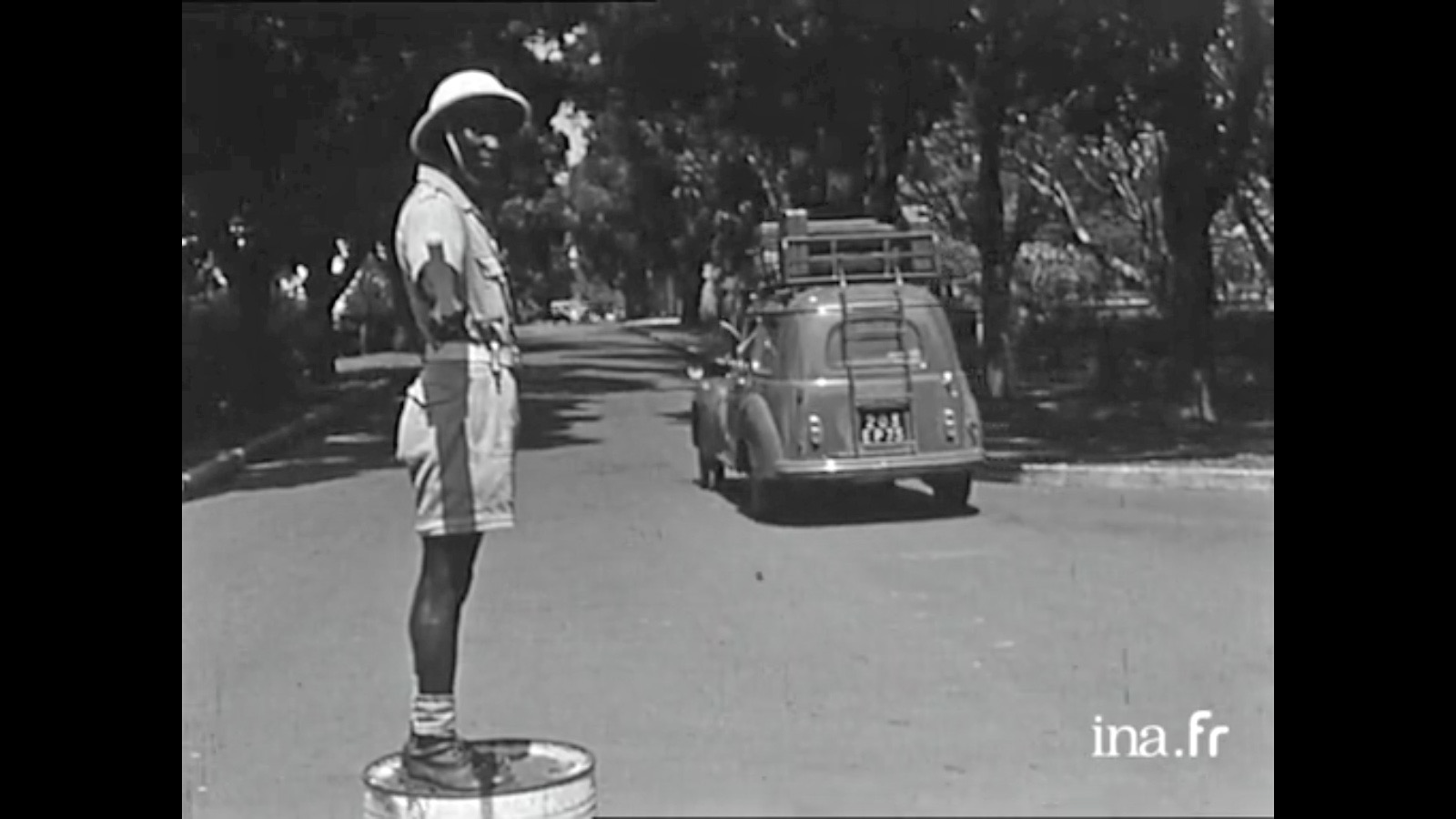
You can imagine the three French women (France Degand, Janine Delbert and Michèle Cancre d’Orgeix) had a copy of a Shell in the glovebox of their Peugeot 206 wagon before setting out their double crossing of the Sahara in 1956 (video below).
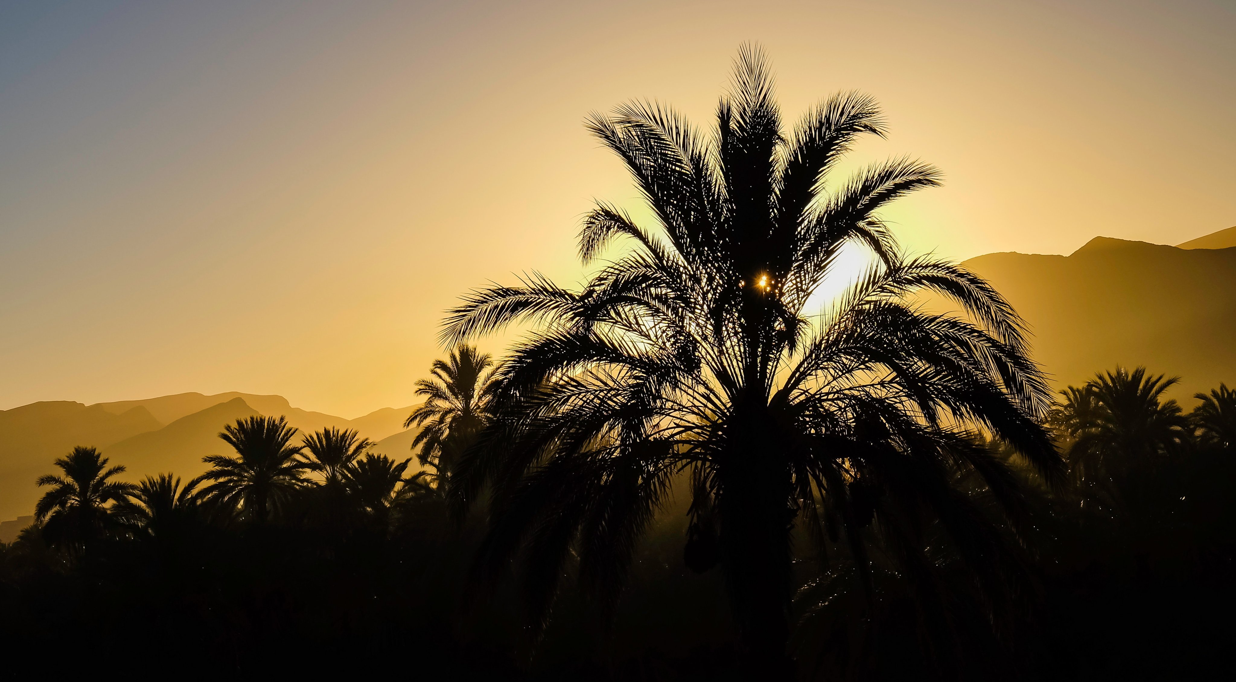
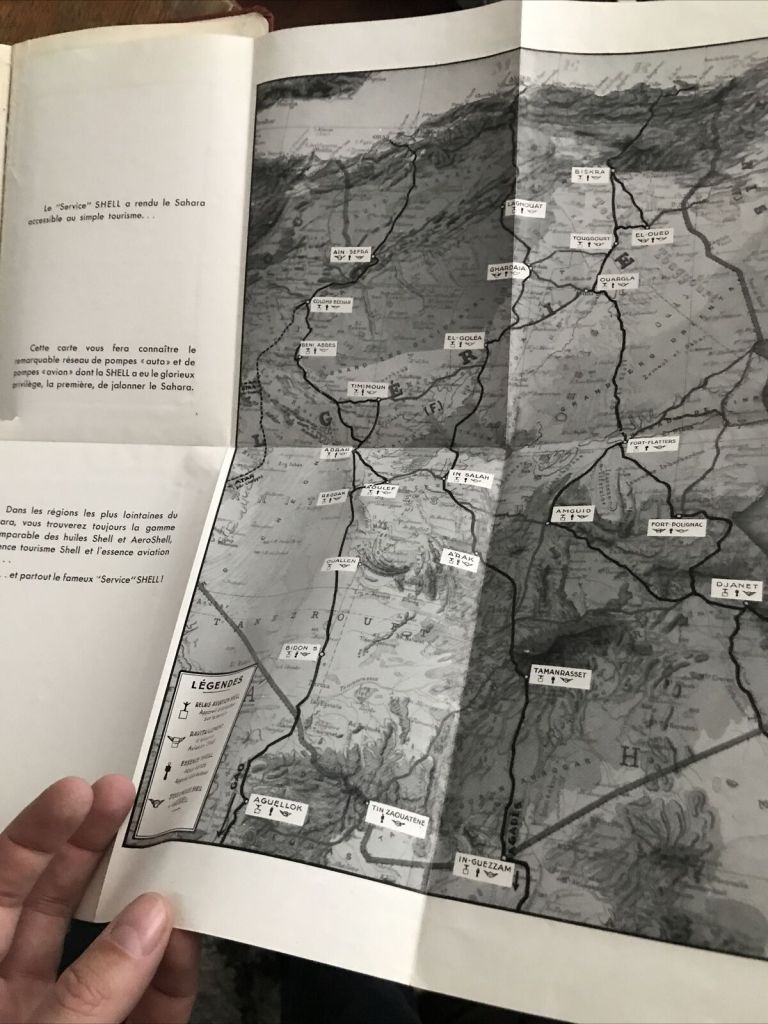
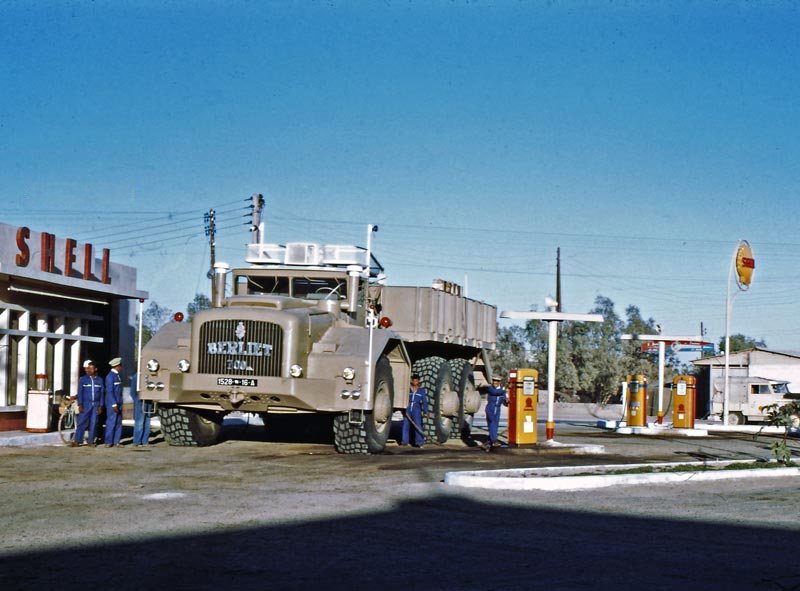
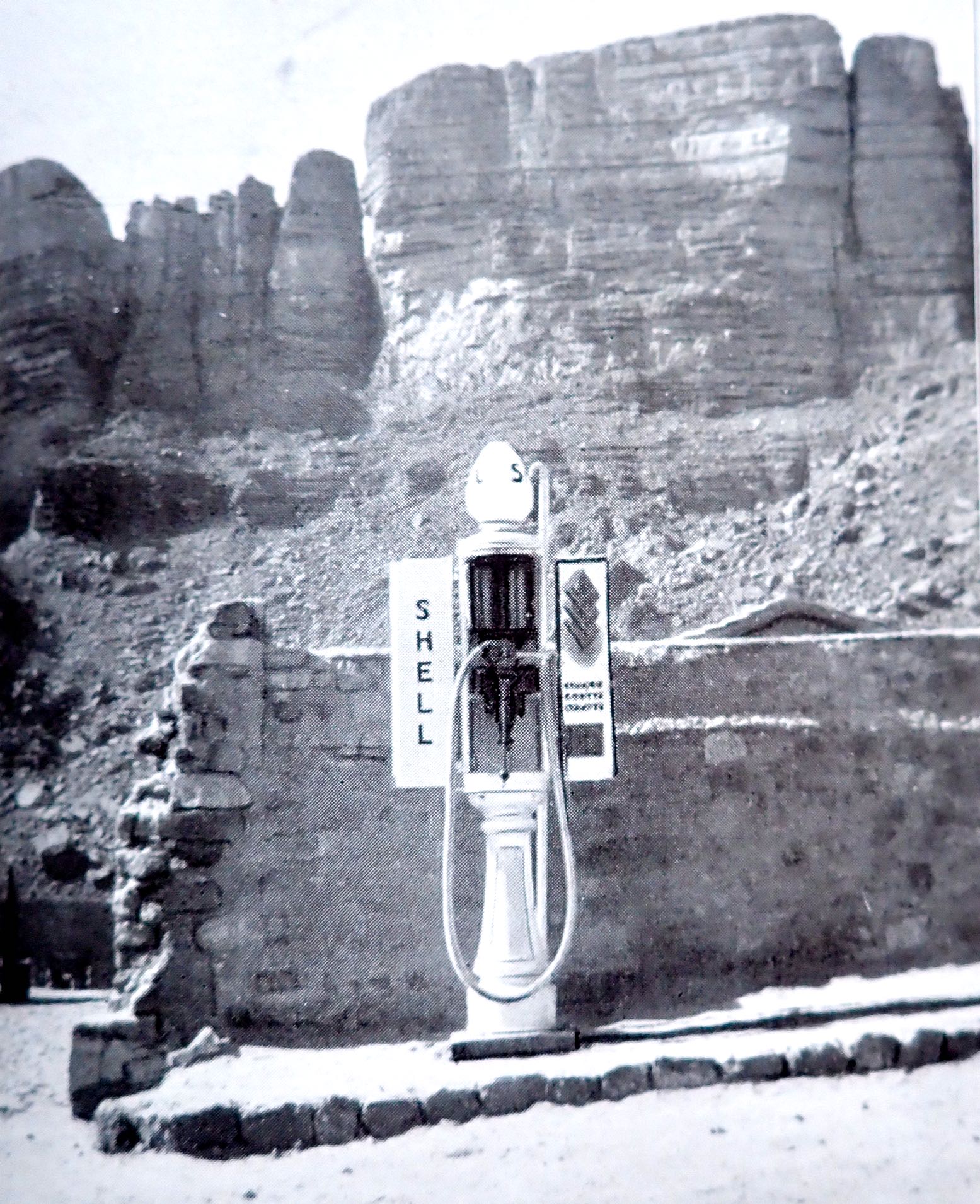
The 1950s were the apogée of the colonial era when, even in the Belgian Congo, trains ran through the jungle on time and roads drivable by regular cars snaked over the equatorial escarpments. In the Sahara pistes were well maintained, regularly patrolled and for the most part, well marked too. The Sahara still had its rough edges and expansive voids, but had been effectively tamed by the colonial administration, including a desert-wide network of Shell stations: ‘In the Sahara, as in your garage‘ the guidebook boasts. It was the vestiges of this investment in desert infrastructure which we inherited in the 1970s and 80s by which time the whole region had seen 15-20 years of independent rule. The Shell emblem was long gone, replaced by nationalised fuel companies distributing the commodity with had become integral with global progress and development.
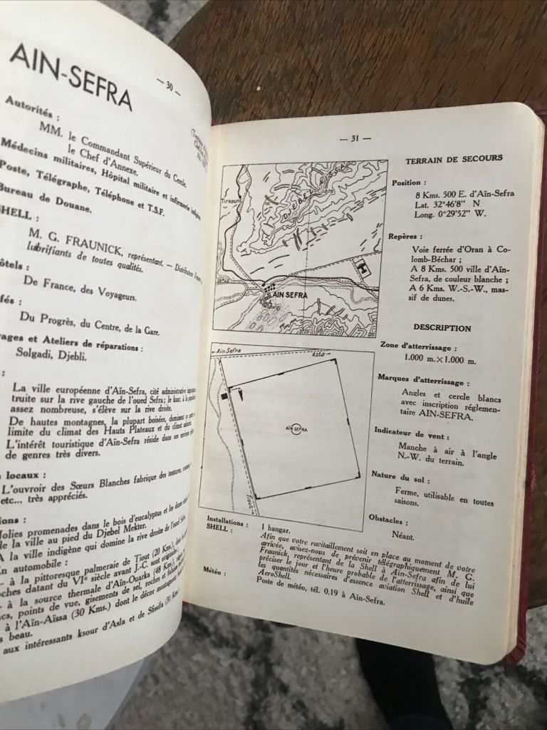
The Guidebook
Until 1939… the book starts… conditions for the harmonious development of winter tourism were coming together in the Sahara. Excellent temperatures, admirable sites, distant horizons, interesting populations, verdant palmeries [and] distinctive architecture: behold the country.
It then goes on to introduce the Sahara, using a flowery style which I’ve seen in more recent French guides to the Sahara. The book doesn’t miss a chance to include an exposition of the magnificent French achievements in the Sahara since 1919.
A year after this edition was published, after decades of searching (during which time French explorer and geologist Conrad Killian mysteriously met his death) prospectors finally struck oil in Edjeleh near In Amenas, and a short time later in Hassi Messaoud. By the end of the next decade Algeria became a major oil producer in North Africa.
It’s interesting to see how the content of the guidebook conforms with a modern day equivalent: a geographical breakdown of the desert’s geology, relief and topography, river courses and wells; ethnicities add up to either Arab or Berber, with pre-colonial history leading to exploration, colonisation and pacification right up to the period of the automobile and the aeroplane.
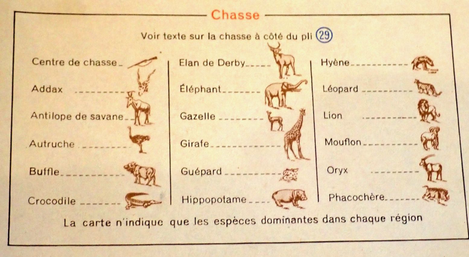
Short sections cover local artisans and the souvenirs they made, a bibliography, recreation and sports and not least hunting for hides, heads, horns and ivory. Happy days!
As for vehicle choice, the guide advised not to worry about using touring cars, by which I think then meant a regular RWD sedan or estate, like the Peugeot 206, above. Rightly it said the 4x4s of the time: Land Rover, Jeep, Willys and the near identical Delahaye V.L.R were significantly less comfortable.
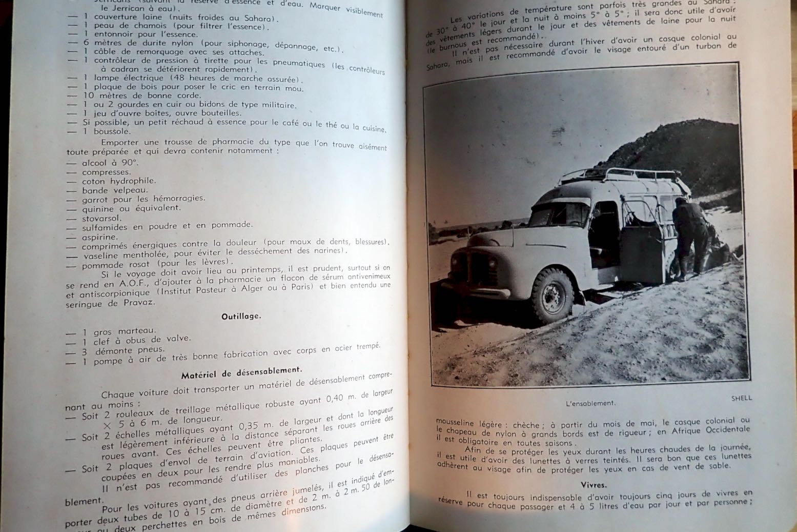
It’s worth recalling that many regular cars of that era had bigger wheels and better ground clearance – garde du sol – ‘an important factor in vehicle choice‘… ‘Consider fitting bigger tyres, but not too much or you’ll stress the transmission and steering.’ ‘Power to weight is also a factor for tackling soft passages.’ …’avoid dual rear wheels…’ It’s interesting to see all these strategies were well known, even back then. It does however list a long and very heavy list of spare parts. Durability must be one thing that’s improved over the decades. In a way today’s SUVs have similar characteristics, but of course no one would consider taking one somewhere as outlandish as the Sahara, not least because 4x4s have improved to become much less utilitarian.
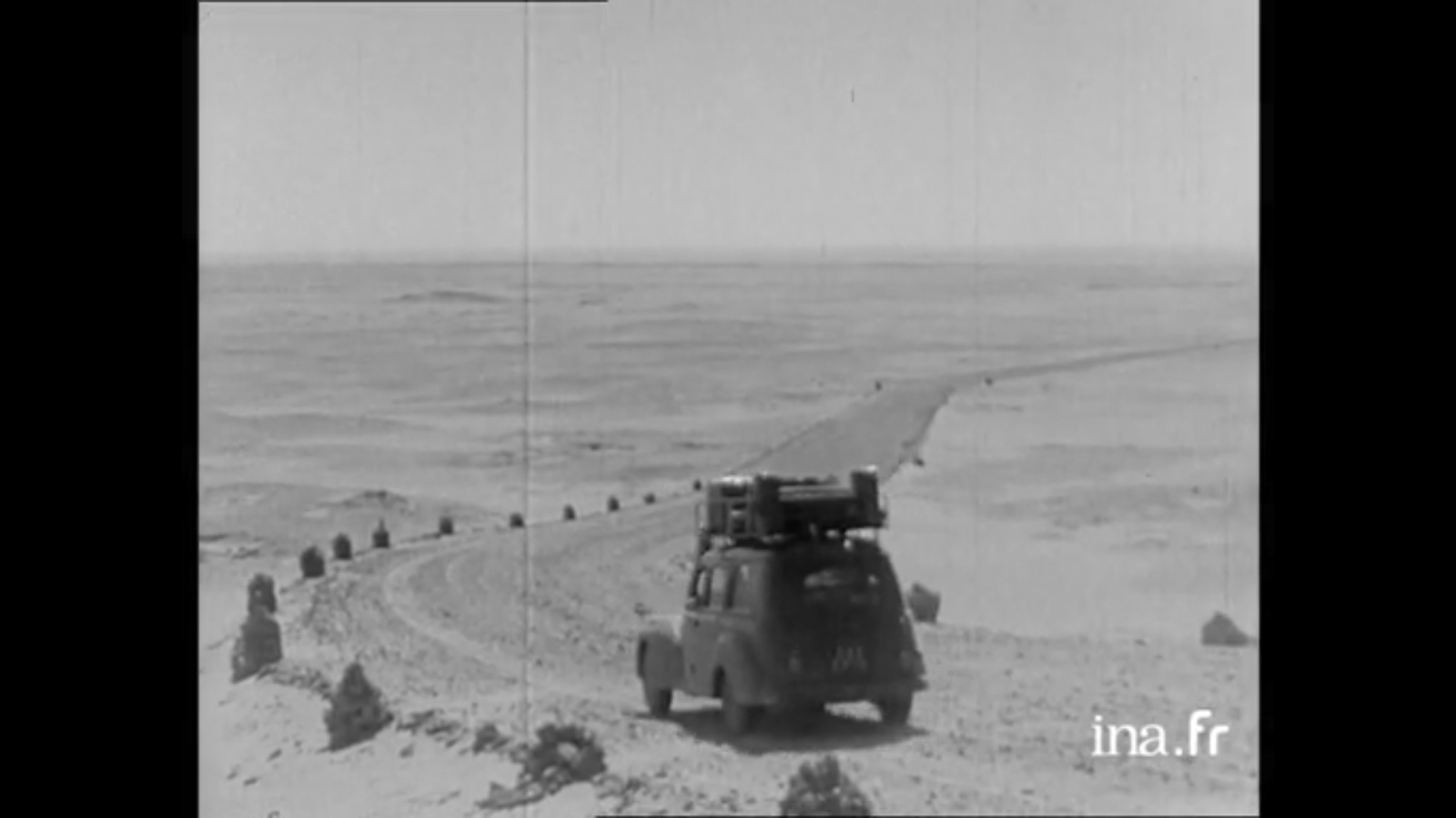
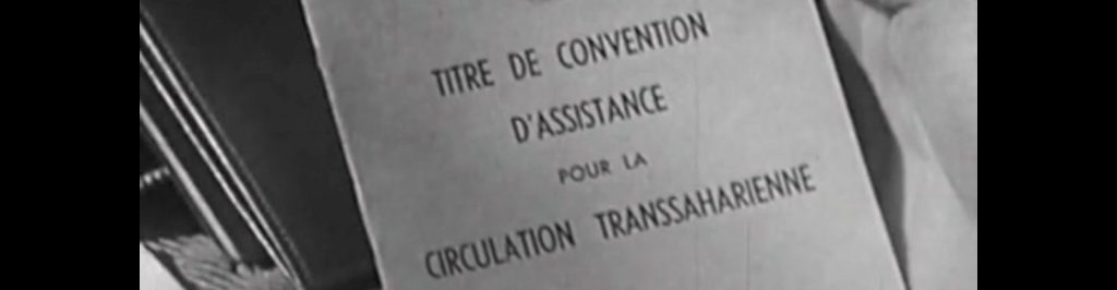
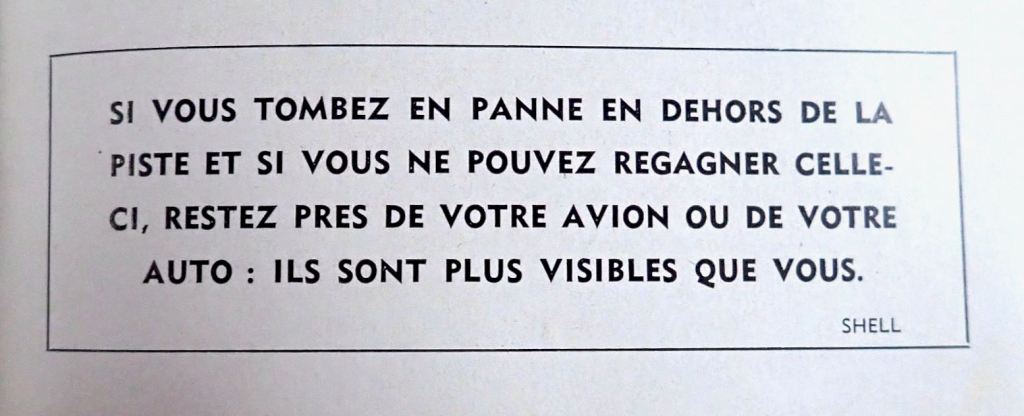
Code Saharien de la Route In that time of French control a detailed list of safety protocols needed to be followed before before setting off along a piste. ‘Pour votre securite‘ as they used to say to us in Algeria where the system endured into the 1980s (but without any actual back-up or support; you were on your own). The Code was a check on whether you were equipped to tackle what lay ahead, followed by the requirement to check on on arrival. If you followed the rules and were overdue, they’d come and look for you. You also needed some sort of contract with a local recovery service in case of a breakdown. The last 40 pages of the book detail the full list of these requirements for each of the three territories.
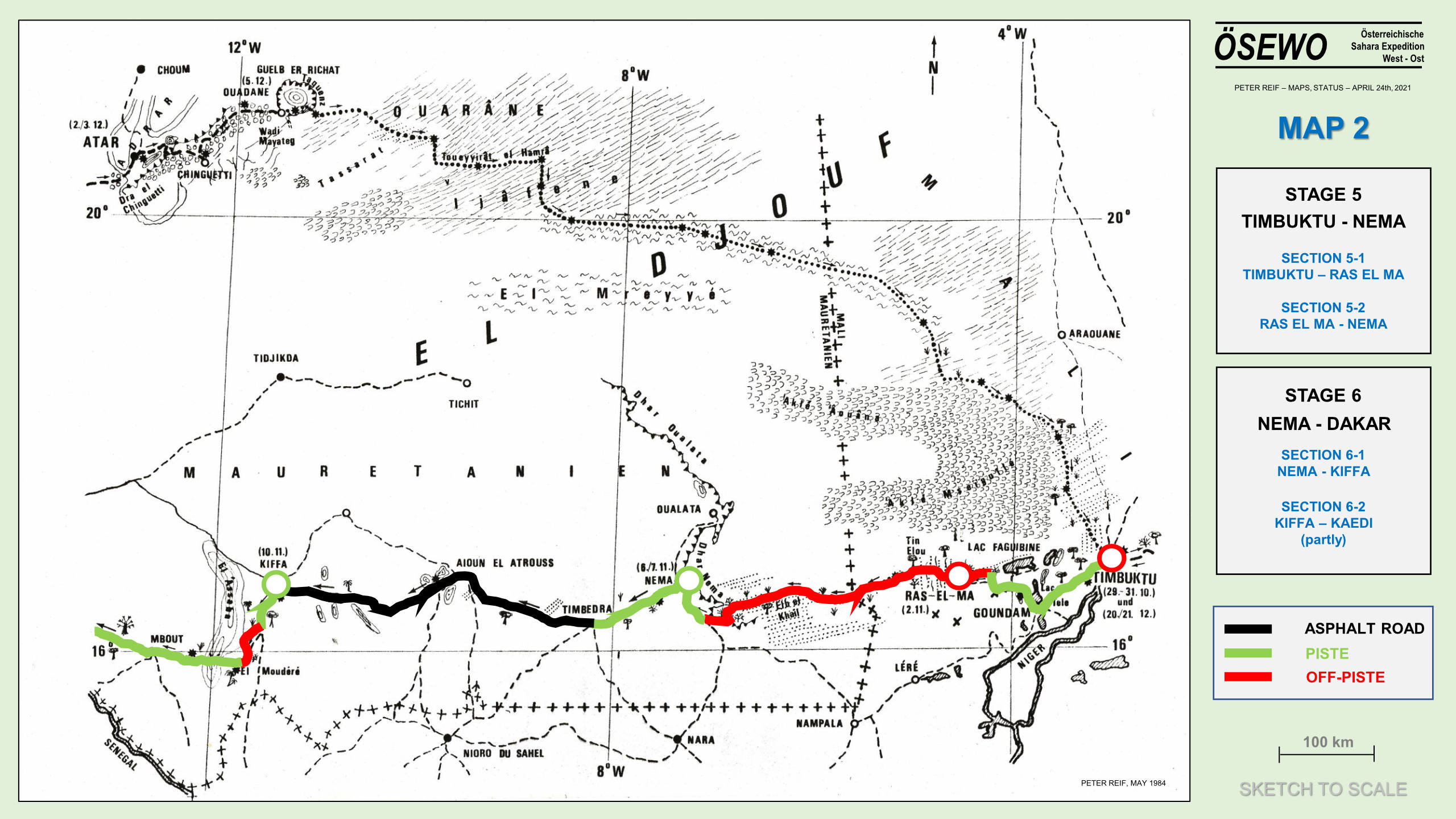
You might be able to see someone pencilled in additional points along the hyper-remote Ligne du Djouf to Nema.
The Itineraries
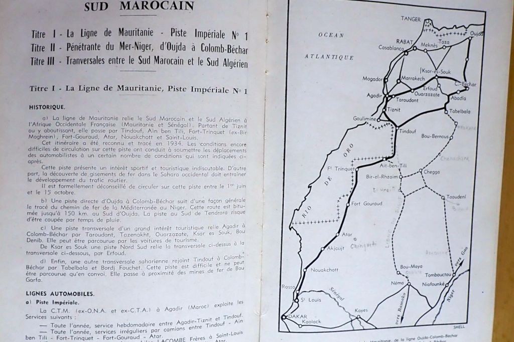
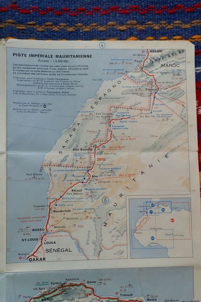
The route guide breaks down the Sahara into four sections: southern Morocco along tracks which are now mostly roads. Then came the grandly named Imperial Tracks, starting with N°1: the Mauritania Line (above) which was recently reopened by Algeria. Back then, this was the direct route through all-French territory from Tiznit in Morocco or Colomb Bechar in Algeria, to St Louis or Dakar which circumvented the Spanish Rio de Oro colony on the Atlantic coast. Closed between June and mid-October, this was also the ‘Forgotten Path‘ which David Newman followed in his Ford Corsair touring car in 1959, just as the territories were breaking up.
The route description for the 2550km from Tiznit to St Louis goes on for 15 pages including a few photos and plain maps. It left Moroccan territory south of today’s Foum el Hassan, a small town between Akka and Assa on what I call the Desert Highway in the Morocco guide. I noted a passing reference to ‘Merkala‘; an escarpment watchtower marking the border between Morocco and Algeria which still survives as the enigmatic ‘Tour de Merkala’ on the Michelin 741 map. In Tindouf we learn that prior to the French establishing a garrison in 1934, the settlement, had been abandoned for three decades due to persistent raids by the nomadic Reguibat. The Berbers must have welcomed a bit of law and order. From here the lonesome track led to Ait ben Tili on the Spanish Sahara (today’s PFZ) border, with balises (marker posts) every 5km, but plenty of tole ondulee: ‘corrugated iron’ or washboard/corrugations to you and me. Like today, there’s nothing much for the traveller at AbT. Back then wild game added up to gazelles and long-gone ostriches. Once you got to Fort Trinquet (Bir Mogrein) you could add moufflon and leopards to that list.
From here it was 405km south to Fort Gouraud (Fderik) and the piste was poorly marked, sandy and rutted. The old route ran for another 310km from Fort Gouraud via Char fort to Atar didn’t get any less sandy, and the iron ore railway was still another 8 years away. Maybe a touring car, even with good clearance, wasn’t such a good idea after all.
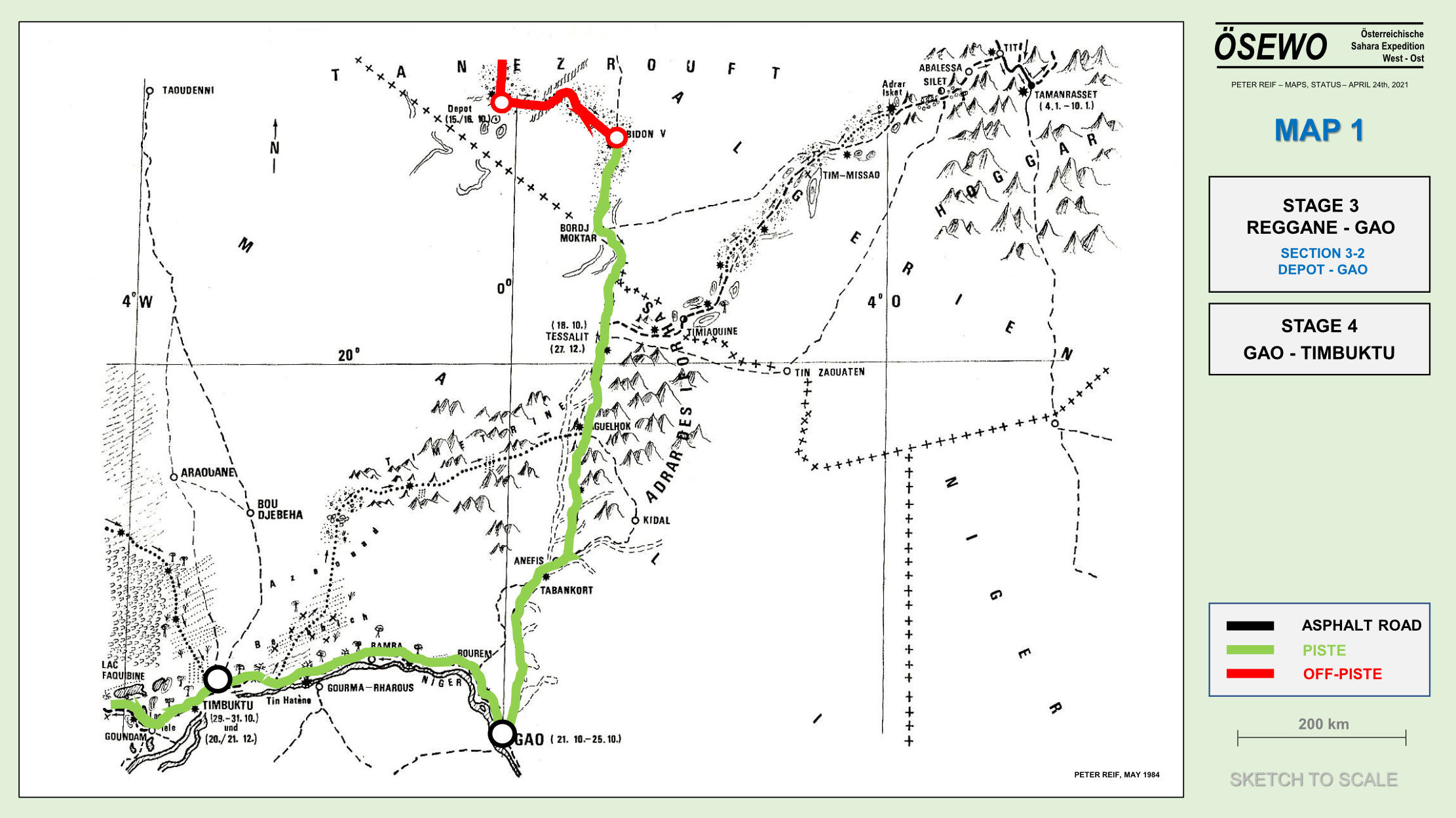
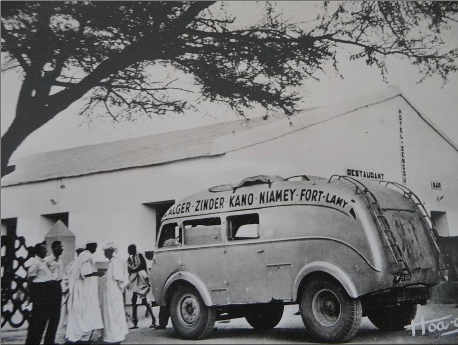
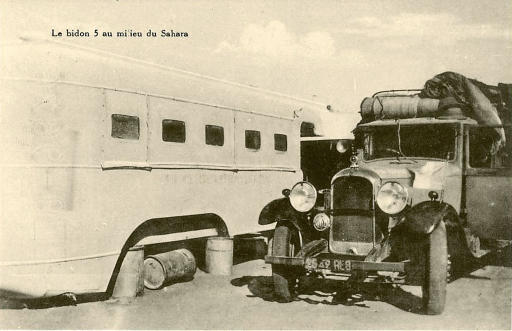
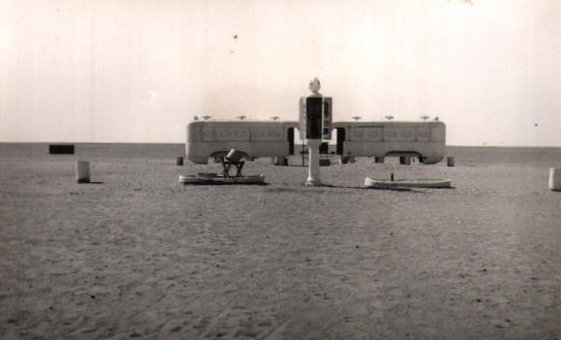
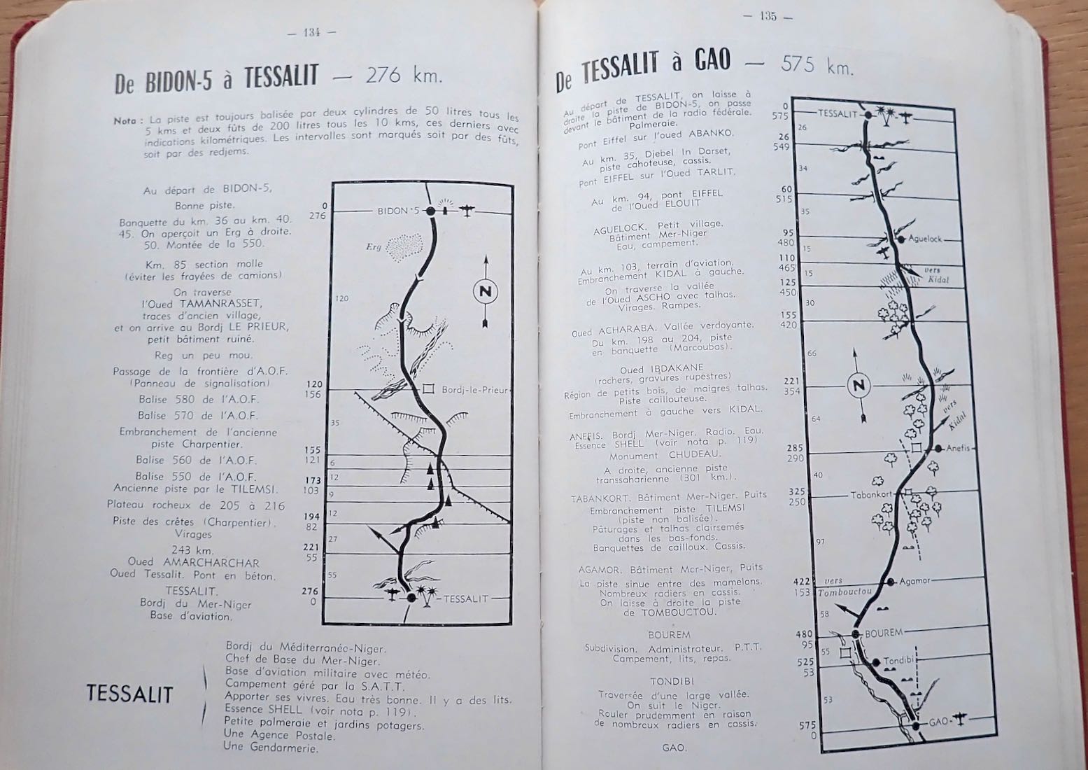
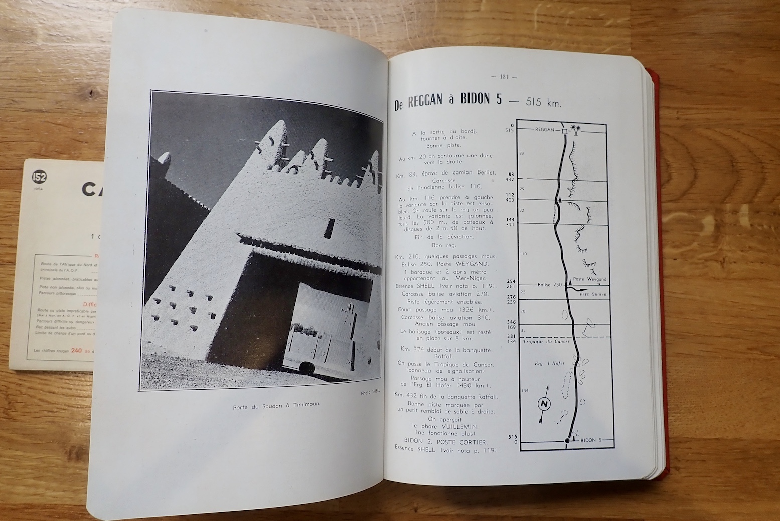
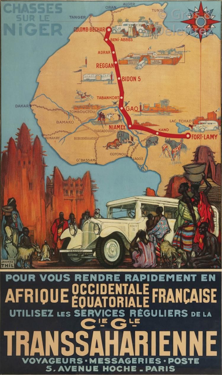
Imperial Track N°2 was the Tanezrouft Line from Colomb-Bechar to Gao on the Niger river. This was the route chosen by the first cars to cross the Sahara in the early 1920s. It’s interesting to see how quickly the commercial drive towards tourism follows what was once terra incognita. You could say we’re seeing the same today in space; something which would have been hard to imagine in the middle of the Apollo programme. It was on this desolate route that Bidon V (‘Oil drum 5’, below) made a name for itself as a desolate travellers way-station between Reggane and Tessalit in present day Mali. At one point the lighthouse shone into the night, planes could land for a refuel and a couple of bus bodies where parked up on oil drums to provide lodgings for passengers the Mer-Niger bus route.
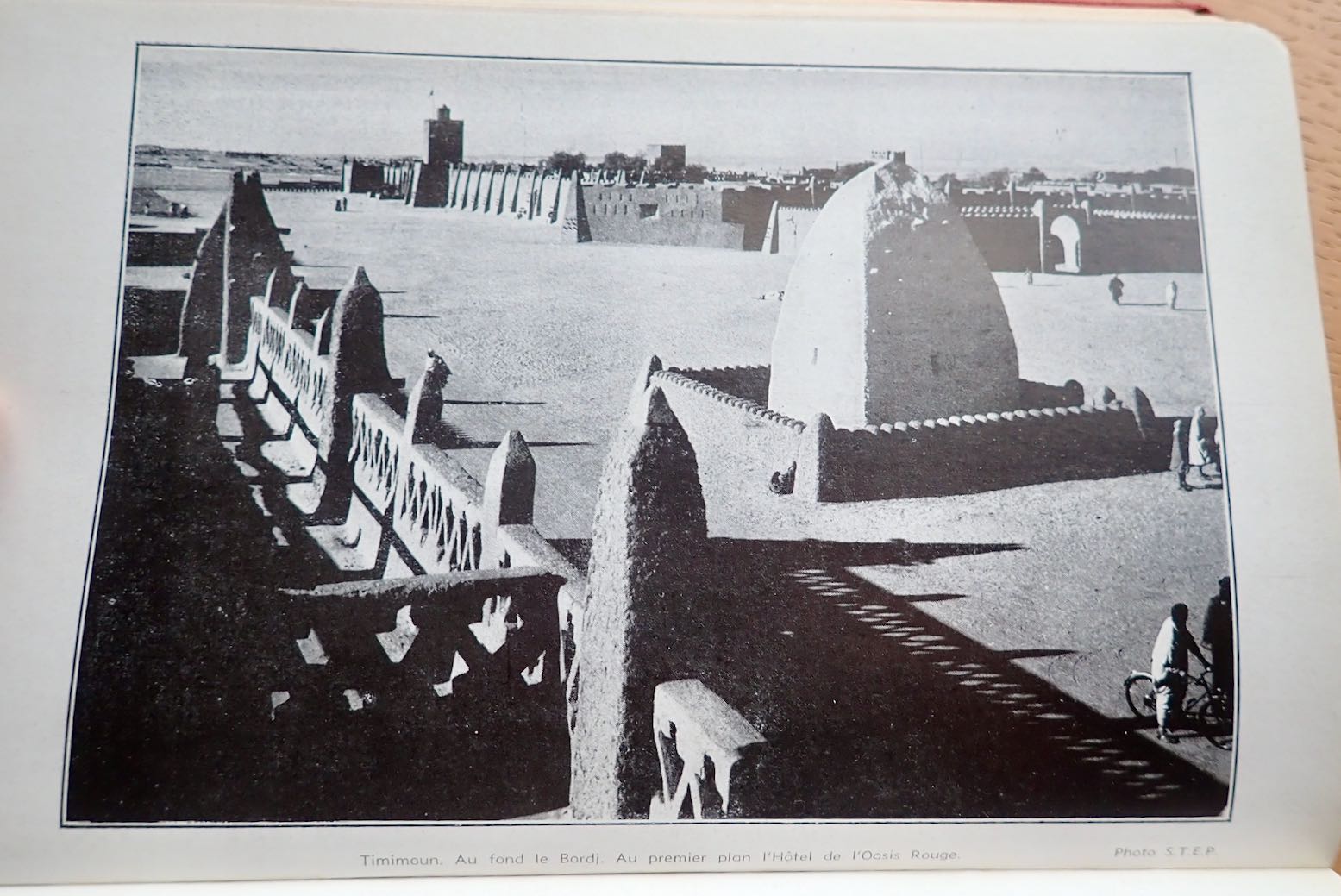
Timimoun
The book continues with other well known routes in the Algerian Sahara, though not exactly what we have today. Imperial Route 3; the Hoggar Line – today’s Trans Sahara Highway – ran further east between El Golea to In Salah, and again on to the Arak Gorge where a friendly Shell bowser (left) stood by at your service.
From Tamanrasset, excursions up to Assekrem along today’s route were already established (fold out map included), and the now paved track to the border via Laouni was the same, but once in AOF, the track went straight to Agadez via In Abangarit to the south. It was on this route that the drama vividly described in Trek, met its climax. There was no Arlit until uranium was discovered there about 15 years later. Zinder, close to the Nigerian border, was the end of that road.
The Ajjer and Tibesti Line was Imperial Route 4: from Biskra all the way to Fort Lamy (N’djemana) in Chad. From Djanet the route dropped down to Bilma, the long established administrative capital of the eastern Tenere, before you back-tracked north to Seguedine to head east for Zouar, Faya and even Fada before turning down to Abeche and Fort Lamy. This was the route which the lavishly equipped Berliet expeditions of 1960 sought to open up for trade, just as France’s overt control over the Sahara slipped away.
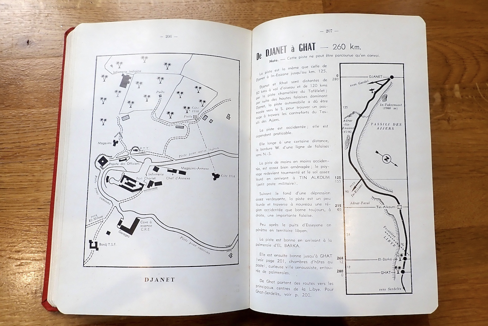
Back then getting to Djanet meant dodging the Fadnoun Plateau (Tassili N’Ajjer). From Fort Flatters (today’s Bordj Omar Driss) you headed out over the sands southwest to Amguid, then southeast along the base of the plateau. Right up to the 1980s this was truck route to Djanet until they sealed the winding road over the Fadnoun which to this day still catches some truckers out.
If you could get to Fort Polignac (Illizi), a car route did actually cross the Fadnoun. You left Polignac to the east then either pitted yourself against the very sandy Imirhou gorge (left) , or all the way to Tarat fort on the Libyan border, before turning south to join today’s route at Dider. On bikes for Desert Riders in 2003 (the full movie is on YouTube), this was a tough but epic ride across the tumbled escarpments of the Tassili which took us two hard days. But the time we reached the final descent from the plateau at the Tin Taradjeli Pass, we couldn’t wait for the sands of the wide open Tenere.
From 1943 up to 1951 the French administered the Fezzan province of Libya and may have had had hopes of annexing it. But by the time this edition was published, growing calls for independence put an end to that idea. Meanwhile. the northern deserts of Chad remained as obscure and little visited as they are today.
The Map
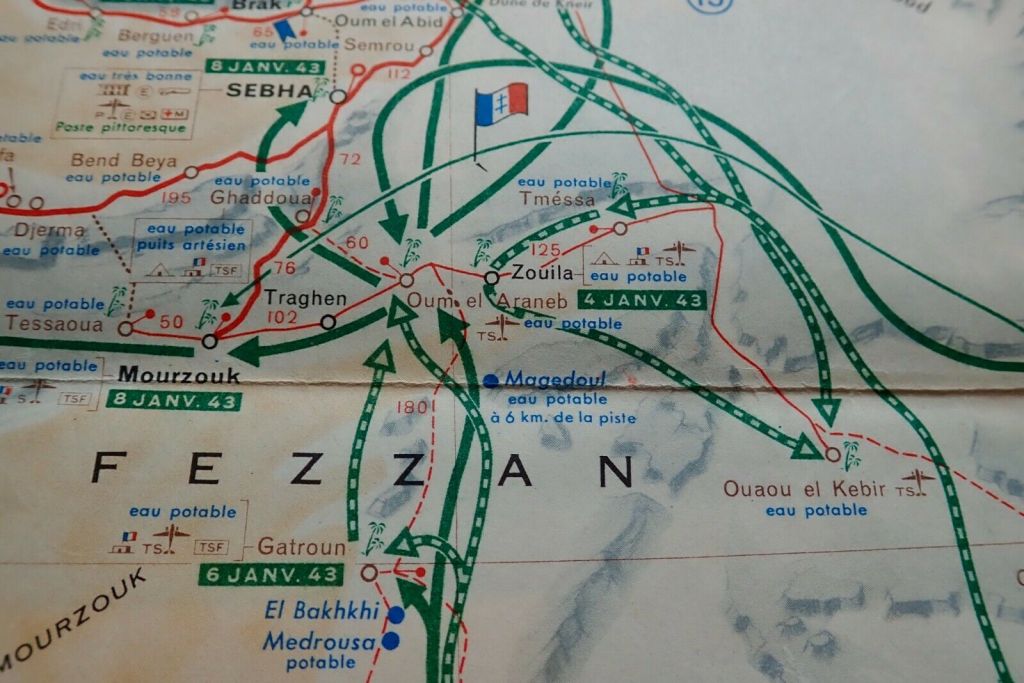
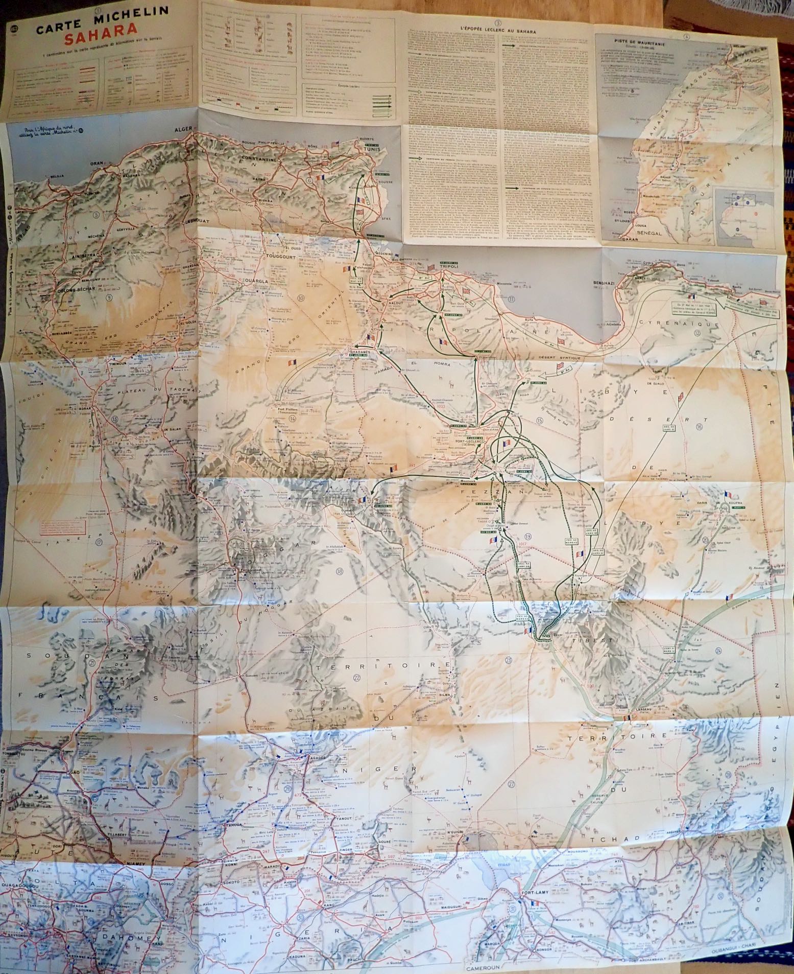
The Shell guide includes a 1:4m scale map folded into the back cover. It’s more or less Michelin’s 152 of 1948 which to some may alone be worth it the price of the guide. It doesn’t have the full coverage of the 153 North & West Africa which came later, but shows the routes described, and much more. This detail has long made the Michelin map indispensable in the Sahara, even if it is a rather skimpy navigation aid to setting off along one of the Imperial routes. The Mauritanian Line gets a 1:9m inset (below left) while in Libya (never a French territory) the map proudly shows the routes of General Leclerc’s desert campaign during WW2 which ended in the famous raid on Murzuk in co-ordination with the Long Range Desert Group.
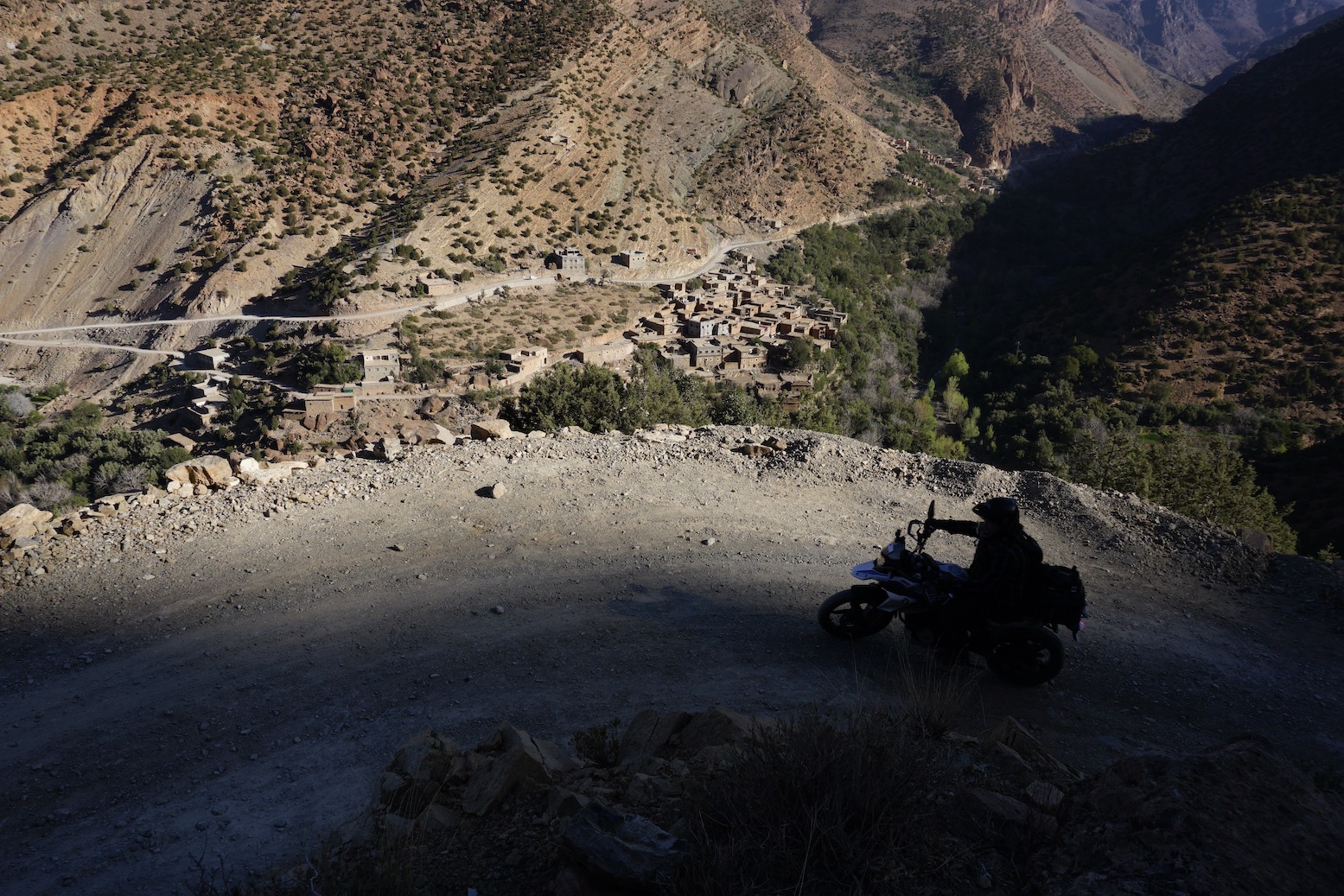
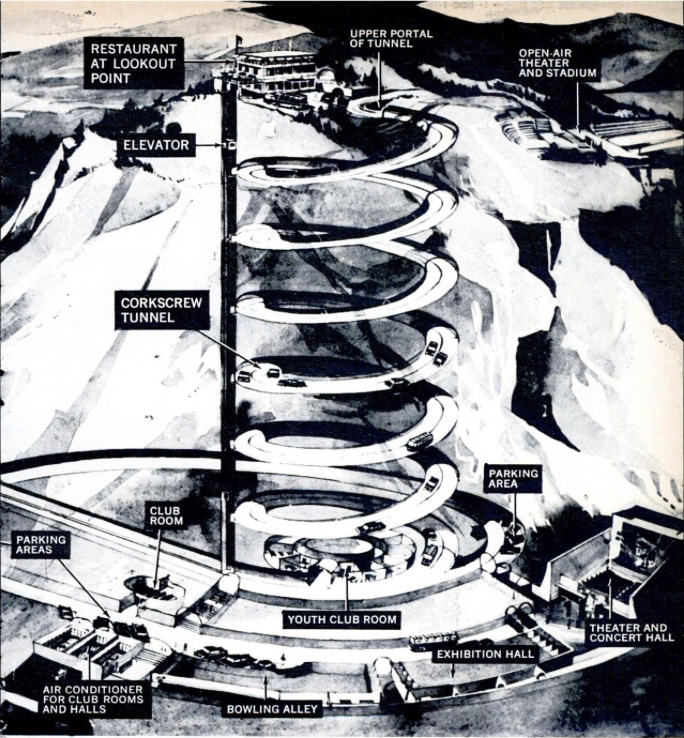
High up on the side of a remote High Atlas valley is an engineering marvel – hewn through the cliff face a spiral tunnel manages to curl down through the rock and emerge underneath itself.
I was told about this curiosity in 2012 by the chap at the cozy Chez Moha auberge (right) in Aït Youb while researching the second edition of Morocco Overland. Riding a BMW F650GS, I followed his directions with the usual route-finding issues and then, beyond the last village, hacked up a stony disused track to the 2250-m (7340′) Tagountsa Pass. From the cliff edge I recall the timeless view stretching east up the Plain d’Amane valley towards Rich, pictured below and on p128 in the current book. A short distance later I spun through the tunnel and rolled down a series of switchbacks back to the valley floor and a tasty tajine back at the auberge.
Spiral tunnels have been a long-established solution to constricted route building challenges across mountains. You could even say that your typical complex freeway intersection where the road winds back under itself to change direction tightly is the same thing in flyover form. But you must admit that hacking out any type of tunnel – let alone one where there’s no room to dig out a regular switchback – is an impressive task.
Not for the first time on this website, I’m able to benefit from research of Yves Rohmer (right) on his always fascinating collection of old Saharan curiosities at Saharayro, including the Tagountsa tunnel. Viewed on Google Earth, the big picture is more vividly rendered setting View > Historical Imagery back a few years.
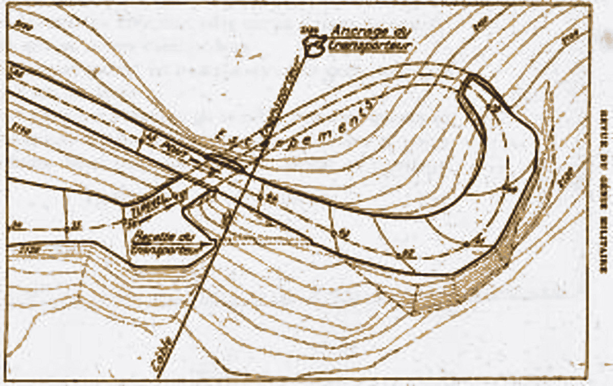
Even then it’s hard to visualise what’s happening until you look at the old plan, right. You can see the anticlockwise descent of the bore and just work out that it starts with a short separate concrete bridge over the lower mouth of the tunnel. The daylight streaming down the gap can be seen in the image repeated on the left (and as a slim shadow in the round inset, above)
Built in 1933 over a period of just three months by some 3000 labourers from local and French regiments, few realise that at this time the French were still fighting to subdue renegade Berber tribes in the mountains of Morocco.
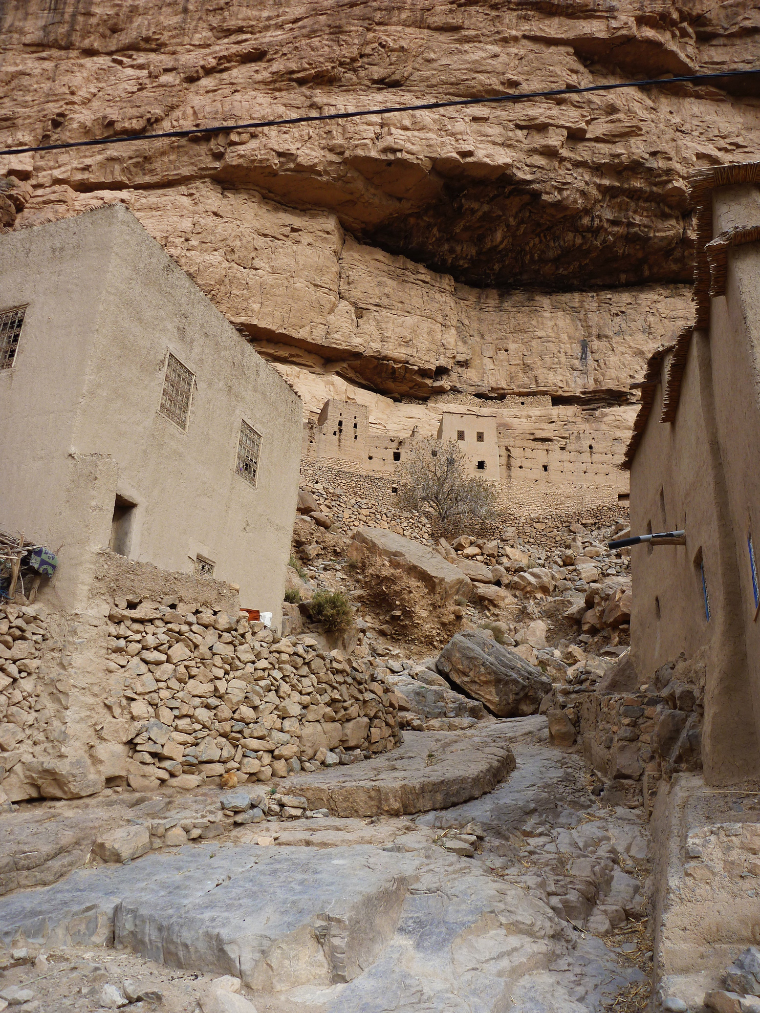
As you can see on Yves pages, the engineers, sapeurs and legionnaires passed their spare time commemorating their achievement by engraving regimental emblems in and around the structure. I was told the motivation for all this effort was to enable a secure, high transit of the valley, so avoiding protracted Berber ambushes at the narrow Imiter Gorge (left; ~KM70) with it’s Mesa Verde-like dwellings.
The same crew probably built the better known 62-metre Tunnel de Legionnaires five years earlier at Foum Zabel now on the main N13 highway north of Errachidia. A plaque there boldly states:
“The mountain barred the way.
Nonetheless the order was given to pass…
The Legion executed it.”
The Tagountsa tunnel the Legion helped build is at KM102 on Route MH13 in the book, though if you reverse the route it’s only a 10-km off-road drive off the Rich road just east of Amellago, turning north onto the dirt at KM113. Depending on storm damage, an ordinary car or a big bike should manage it, but note that you’ll be negotiating all those hairpins on the Google image above. From the west side (as Route MH13 describes the loop) it was a rougher and slightly more complicated ride on the BMW up to the pass.
Perhaps because trains can’t negotiate hairpins or climb very steep grades, it seems that spiral or helicoidal tunnels have been a much more common feature on mountain railways than roads, particularly in the Rockies.
Norway’s Drammen Spiral (left), some 50km southwest of Oslo is a notable example, dug we’re told, as an alternative to disfiguring effects of open quarrying on the landscape back in the 1950s while at the same time producing a revenue-producing tourist attraction in the process.
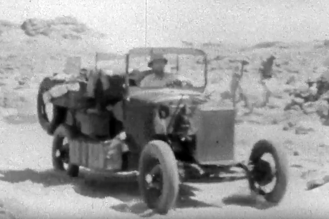
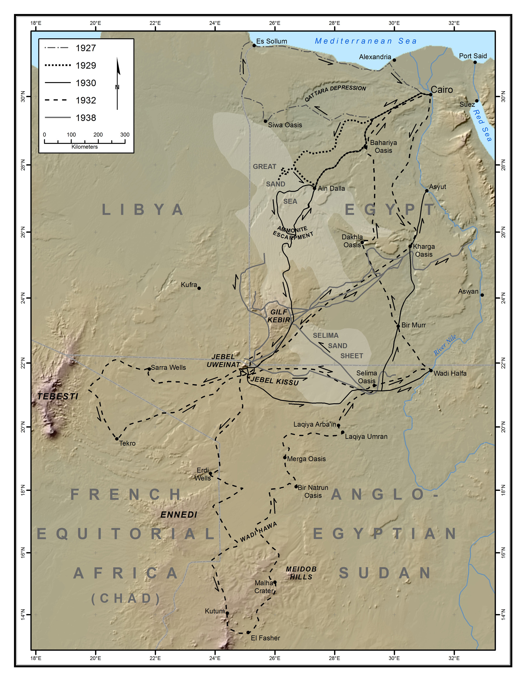
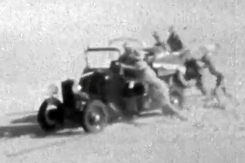
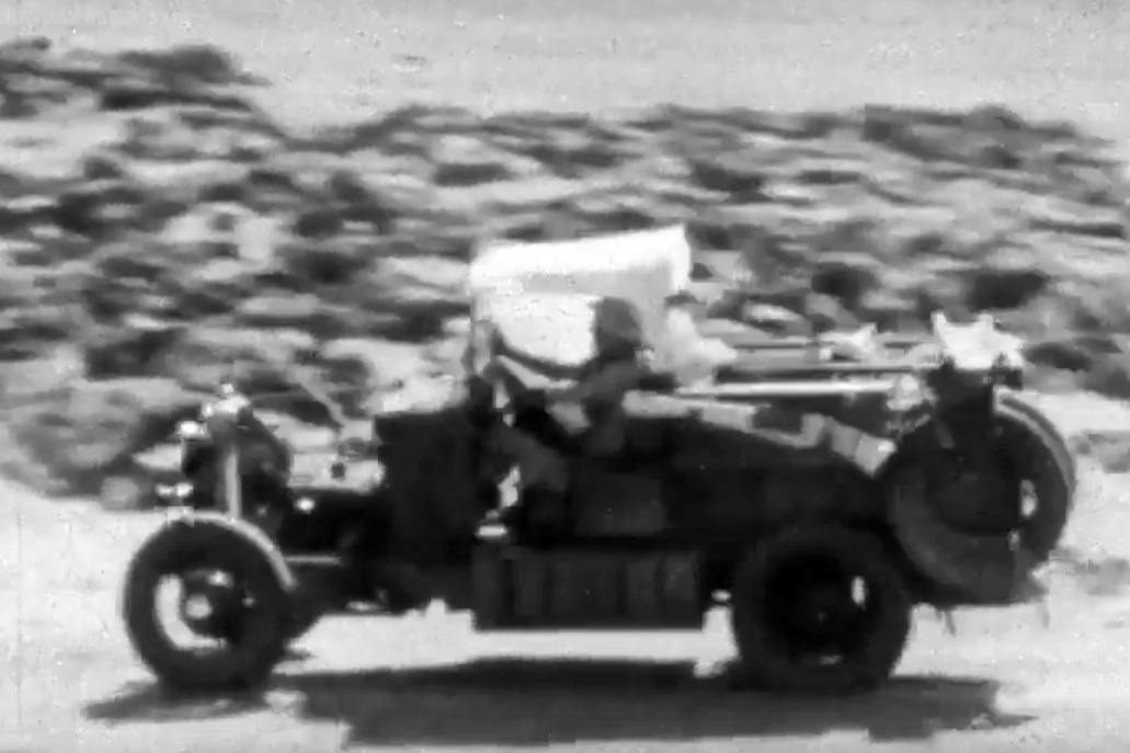
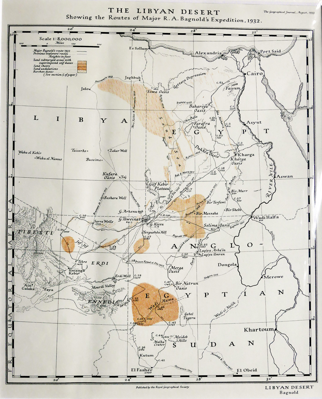
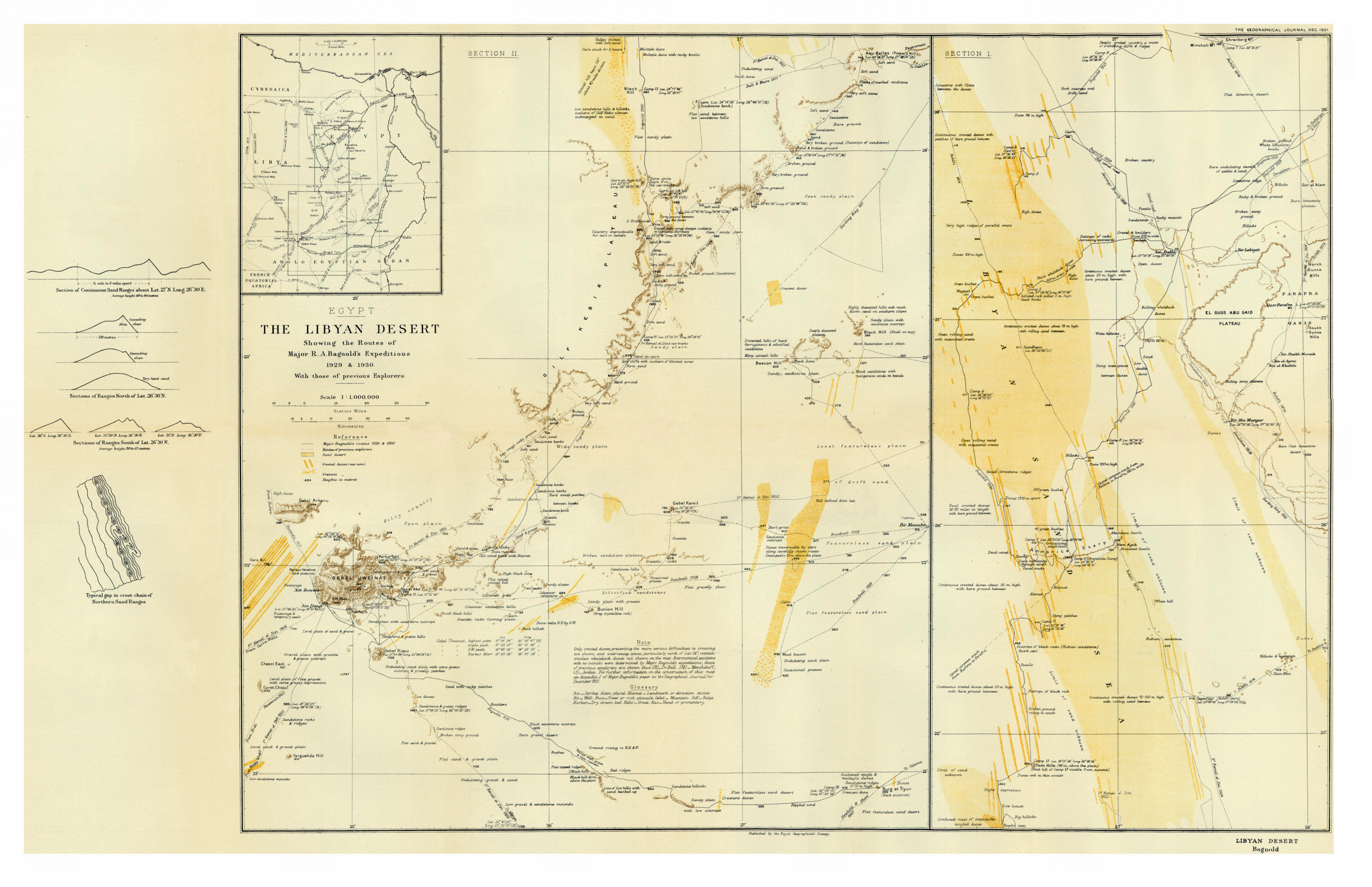
A few months ago the British Film Institute released an archive film of the early motor expeditions of Ralph Bagnold and his crew, exploring deepinto the Libyan Desert. (Click BFI if youtube below gets deleted). The map below shows all his expeditions in the 1930s, and there are more, original maps further down.
The 49-minute-long film describes the original recce in 1929 into the Great Sand Sea of the Western Desert via Ain Dalla spring. It was here that Bagnold’s group found lowering tyre pressures, as well as using sand plates and rope ladders, enabled heavy vehicles to traverse soft dunes.
A year later they set off towards Jebel Uweinat, a massif located by Ahmed Hassanein less than a decade earlier during a camel trek along Libya’s eastern borders. At Ain Dalla camels brought in extra fuel, and the cars continued to Jebel Kissu in today’s Sudan and south of Uweinat, then east for the Nile via Selima oasis.
In 1932 they based themselves again at Jebel Kissu where they refuelled from Selima, then explored the Sarra Triangle (now in Libya) as well as northeastern Chad.
Heading south to El Fasher, they passed herds of ostrich and oryx, since shot out by rifle hunters, before heading north for Merga, back to Selima and home via Wadi Halfa for a tot of rum.
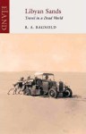
The maps on the left and below show the routes of all these trips and Bagnold’s book, Libyan Sands (right) covering all these expeditions and more and is well worth reading. Reviewed here. Short bio of Ralph Bagnold.
Part of the occasional Sahara A to Z series Hang around long enough and you’ll get the full set
Pictures from Emile Leray’s website [dead link] and the web
In July 2012, a couple of years before fake news had become a thing, online media tripped over itself to syndicate a compelling Saharan survival story evoking the gripping 1965 desert drama, Flight of the Phoenix. Then, five years later a video appeared on youtube (below) where the aged and batty-looking French adventurer again recounted his incredible desert caper.
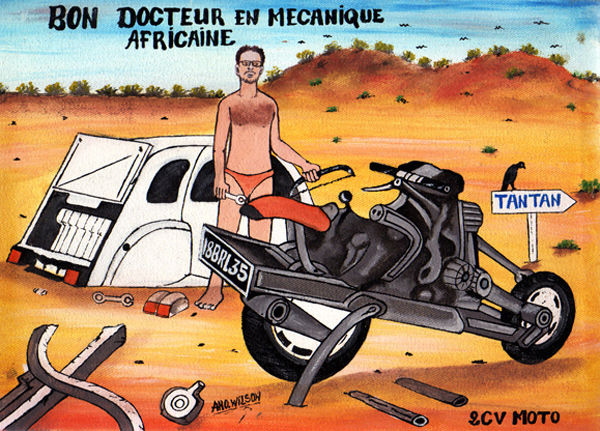
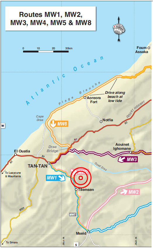
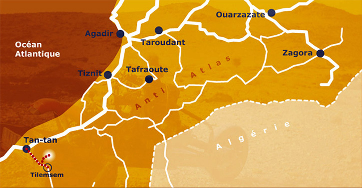
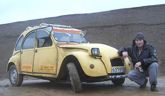
Back in 2012 full details and motivations were skimmed over, but the story goes that in March 1993, 43-year-old Frenchman Emile Leray set off from Tan-Tan near the Moroccan coast to drive his Citroen 2CV east to Zagora – more or less Route MW2 from my Morocco guidebook (below), followed by MS8 from Tata.
But with the Polisario ceasefire just 18 months old and frequently being broken, at Tilemsen the Moroccan army stopped him from continuing south towards Mseid, the former Polisario front line. Leray turned back towards Tan-Tan, but not before incurring some animosity from the army by refusing to give a soldier a lift back to town – a common request at remote Saharan checkpoints.
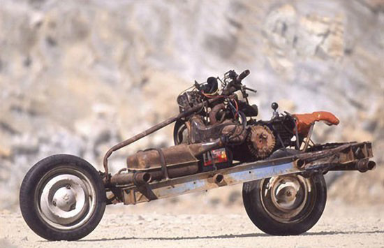
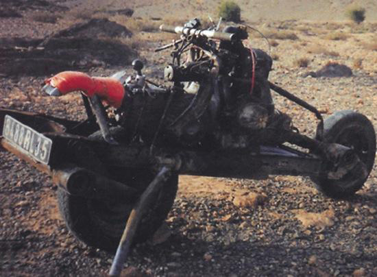
Just west of Tilemsen, Leray ‘had an idea’. He decided to circumvent the checkpoint to the north (see MW1 KM22), and rejoin MW2 eastwards. But once on the piste (or ‘off-piste’, as claimed) one of the 2CV’s suspension arms broke after hitting a hole too hard. With ten days’ provisions on board but reluctant to easily walk-out and leave his car vulnerable to theft, he decided to strip his crippled Citroen and rebuild it into a rudimentary motorcycle, then ride out as if nothing much happened. The unusual powertrain and suspension arrangement of a 2CV makes such a conversion plausible.
The way the story was initially reported in English – using images shot later in a quarry (above) – Saharan know-alls like myself were initially sceptical. If it really happened why not just walk back half a day to the road? I researched the yarn more closely for my Morocco guidebook and came across his own account published in a 2CV enthusiasts’ magazine a decade after the events. A faint ring of truth came through. Perhaps he did build the 2CV bike, but not in quite the circumstances he claimed.
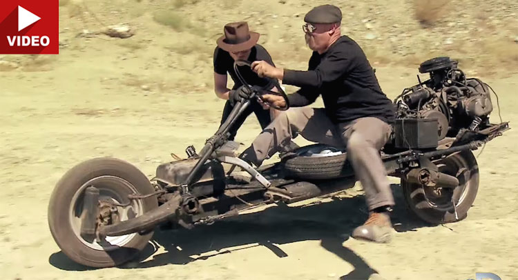
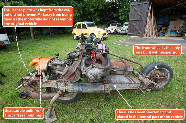
As the TV show, Mythbusters proved for themselves, his contraption was barely rideable (left) and within a day of leaving the rebuild site, Leray says he was caught by a patrol while camping in the desert and instructed to lead them back to the car’s remains to corroborate his story. Ironically, he goes on to claim (with convincing documentary evidence) that he ended up paying a 4500-dh fine (about €450) for driving a vehicle which did not conform to the one he originally imported to Morocco a few weeks earlier, even though he’d taken pains to tack on his ‘Steel Camel’s’ original license plate.
I believe the 2CV bike was indeed built in the desert, much as Leray claims, but he set out from France with the explicit intention of performing this task. Otherwise he’d have walked out like any normal person in a similar situation. His claimed unease about leaving his stricken car doesn’t ring true, let alone the spontaneous idea of making it into a two-wheeler. Tellingly, in 2006 Leray went on to build a ‘2CV boat’ in Mali. He clearly likes mucking about with 2CVs. Fair play to him!
Below is the translated story as posted on Leray’s website so you can form your own impression. Bear in mind there’s no reason to believe this account, but it may have been the original version.
In March 1993 Emile Leray set off to follow a route from Tan-Tan to Zagora. He left Tan-Tan with the required reserves of fuel and provisions as well as tools to keep his old 2CV on the road. As soon as the Royal Gendarmerie arrives, they strongly discourage him from continuing further because the zone beyond Tilemsem is prohibited, following new developments in the conflict between Morocco and Western Sahara.Emile must obviously turn around and the soldiers are asking him to take a passenger back to Tan-Tan.
Analyzing the situation, and seeing his project thwarted, Emile claims an insurance problem that does not allow him to take passengers, arguing that his 2 CV is already very loaded. He knows full well that in Africa it’s seen very badly to not take soldiers aboard his car in these circumstances. He claims naivety and misunderstanding in adopting the attitude of a tourist not familiar with local customs. Emile then returns to Tan-Tan under the disgruntled and disapproving look of the soldiers. He starts off at a good pace as he’s afraid he will be followed and he wants to remain out of sight of those whom he has just left. His plan is to bypass the area off-piste and return to his original direction … After a few kilometres he leaves the track to the north and traverses uneven and rocky ground.
After bouncing more strongly, the car jumps and brutally strikes a rock. He must stop because the 2CV does not respond very well. And for good reason – a folded wheel arm and broken spar … Émile organizes his encampment around the broken 2 CV and reflects on the situation. He is a few miles from Tan-Tan which he could reach on foot, but he runs the risk of leaving is car certainly in bad point but still able to attract theft, including its equipment. In the desert nothing is permanently lost, especially for the one who knows where to look.
He has enough food and water so makes a decision which is to say the least, amazing: from his wreck, he will build a two-wheeled machine! One by one he carefully considered all the technical obstacles that this entails, and this master of African bush mechanics has all the tools and the elements to succeed in the task. The next morning he began to dismantle the 2CV, first removing the body which he will use as shelter against the cool nights and sandstorms. Having no long-sleeved shirts, against the burning sun he makes sleeves from a pair of socks.With what remains of the car, Emile Leray will try to build a motorcycle. Overnight he mentally reviewed all the stages and difficulties involved in this rather crazy project … A project that he had probably imagined for a long time but without having had the opportunity to realize it.
The wheel arms (to be removed with a hacksaw) are nested upside down on a reduced chassis of the front and rear side rails. The engine and the gearbox are then placed on the chassis in the center. Space should be reserved for the battery and the fuel tank and to keep space for luggage without neglecting the layout of the steering system.
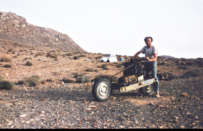
The most surprising thing about this 2CV motorcycle is the transmission. It was inspired by the Vélosolex moped idea (right): the engine drives a drum which in turn turns the tyre by friction, and which, by the laws of physics and mechanics, obliges it to roll with the reverse. Disassembling the gearbox to reverse the differential would have been too risky in this universe of sand …
It seems unthinkable to assemble this machine in the desert without the help of a drill and welding station. All parts were assembled by screwing. When drilling, it will be done in the African way: the piece of metal is folded to 90 ° to form an edge. At a fixed point this edge is weakened by a hacksaw or round file. At the limit of the drilling, the piece must be replaced flat to perforate the filed point with a hammer or a needle. The assemblies were made as much as possible according to the original holes of the chassis or engine-box unit. The rest is only a matter of time dependent on the quantity of his provisions. Émile believes he must spend three days building his bike – in reality it will take twelve … There was a great deal of uncertainty to carry out this project and it wasn’t so easy to realize as one might think. The possibility of failure remained present throughout the adventure, giving some anguish to the stranded mechanic.
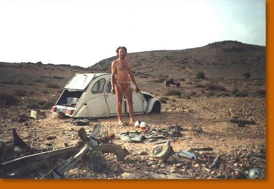
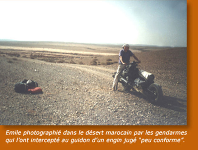
The 2CV motorcycle was obviously not conceived for the sake of comfort, it is a rather secondary notion that was not imperative in what we can call the specifications. The prototype has therefore not benefited from some desirable improvements. It should be noted that, for example, the exhaust is free, so the nose and the ears are affected greatly by the engine’s gases. The bike does not have a brake, nor does it have foot rests which allow some control of the trajectory with the feet, because the craft lacks stability. On the first test the bike fell over, causing a great scare to Emile, who almost found himself crushed under his 200-kilo machine. The arrangement of the clutch and accelerator controls were particularly tedious. It was necessary to dismantle, adjust and reassemble the parts for optimum operation. Similarly, the tests were punctuated by frequent falls. To lift the two-wheeled steel camel proved particularly physically difficult … All these circumstances contributed to prolong Emile stay in the desert. The final day was be spent adjusting and testing and cleaning the bivouac site. It was an occasion to immortalize the moment thanks to a small camera with the trigger connected by a long wire. Émile poses in the middle of a place that in March 1993 was the theatre of his unusual feat.
He leaves the next afternoon leaving the parts that he will not use in the body shell of the 2CV. He takes with him the rest of his food (more than a litre and a half of water), the bed, the tool box, not forgetting maps and compass. A small foam mattress and a towel sewn together will serve as a tent. After a bumpy ride and a few stops for mechanical improvements, he encamped and slept at the edge of a track. In the night, he is awakened by three soldiers in 4×4, one of which immediately recognizes the “tourist” of Tilemsem. Very irritated to find him in the forbidden zone, he strongly doubts Emile Leray’s explanations; an accident followed by the transformation into a motorcycle. Intrigued by the machine, but totally incredulous, the soldier demands to see the carcass of the 2CV to have proof of this incredible story. The officer puts an armed guard by the tent and the motorcycle, then embarks with Émile in the 4×4. After an hour of research in the dark, the remains of the 2 CV cannot be found. Back at the camp, Émile is allowed to rest near the motorcycle until dawn, guarded a hundred meters away by the military in their 4×4. The next day, the carcass was found and the soldiers relax. Émile will learn later that his interlocutor wanted to recover the abandoned pieces for his brother-in-law …
In the early morning, Emile was ordered to take his motorcycle back, and ride in front of the 4×4. The convoy sets off slowly towards Tan-Tan but several falls seriously annoy the soldier, pestering against this unstable machine. Eventually the soldier calls by radio for another 4×4 to come to recover the 2CV motorcycle. Arriving at Tan-Tan on April 6th, things get complicated with a lot of bureaucratic hassles. At the provincial governor’s office, a report is drawn up, as well as by the Royal Gendarmerie. The vehicle is impounded
Emile has the disagreeable surprise of learning that he has to pay a tax of 4500 dirhams. He is very unhappy because the customs officers had spoken to him on the eve of mere formalities. The vehicle is regarded as dangerous and no longer corresponds to the description of the registration documents. “Delay in importing a non-conforming vehicle” is the charge, and by paying the fine he can regain his freedom and recover his contraption, but not be allowed to drive it.One could say a lot from this misadventure about the complicated relations between Africans and Europeans on the issue of money ...
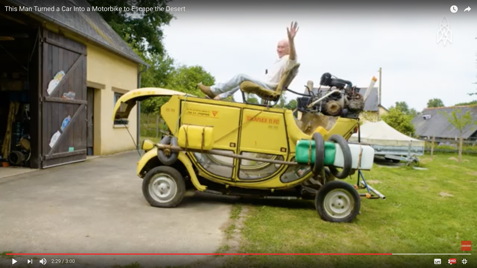
The next day Emile is summoned to sign the forms to exit the territory, and leave for France. He thinks he should come back as soon as possible to get the bike back, but by then he must find a place to park it. There is no question that he leaves her in the pound, it may cost him dearly, and the place is not guarded. A customs officer who is more sympathetic than his colleagues offers to take the steel camel home while waiting for him to return to Morocco. A month later Emile made the 3500-km journey between Rennes and Tan-Tan with another 2CV to pick up his motorcycle, now dismantled in three parts … Since then, the steel-motorcycle camel has enjoyed the honors of the press and participated in a few events such as the Aventure and the Inventors of Rennes, the fiftieth anniversary of the 2 CV in Saint-Quentin-en-Yvelines, Without forgetting the Motards have heart. Émile returned several times to Africa, and in 2006 took a new opportunity for the Doctor of African mechanics to exercise his transformational talents on the steel camel [below]…
For more information: full story and technical details in 2CV Magazine March-April 2003.
In 2006 Leray went on to build a 2CV boat in Mali. He clearly likes mucking about with 2CVs!