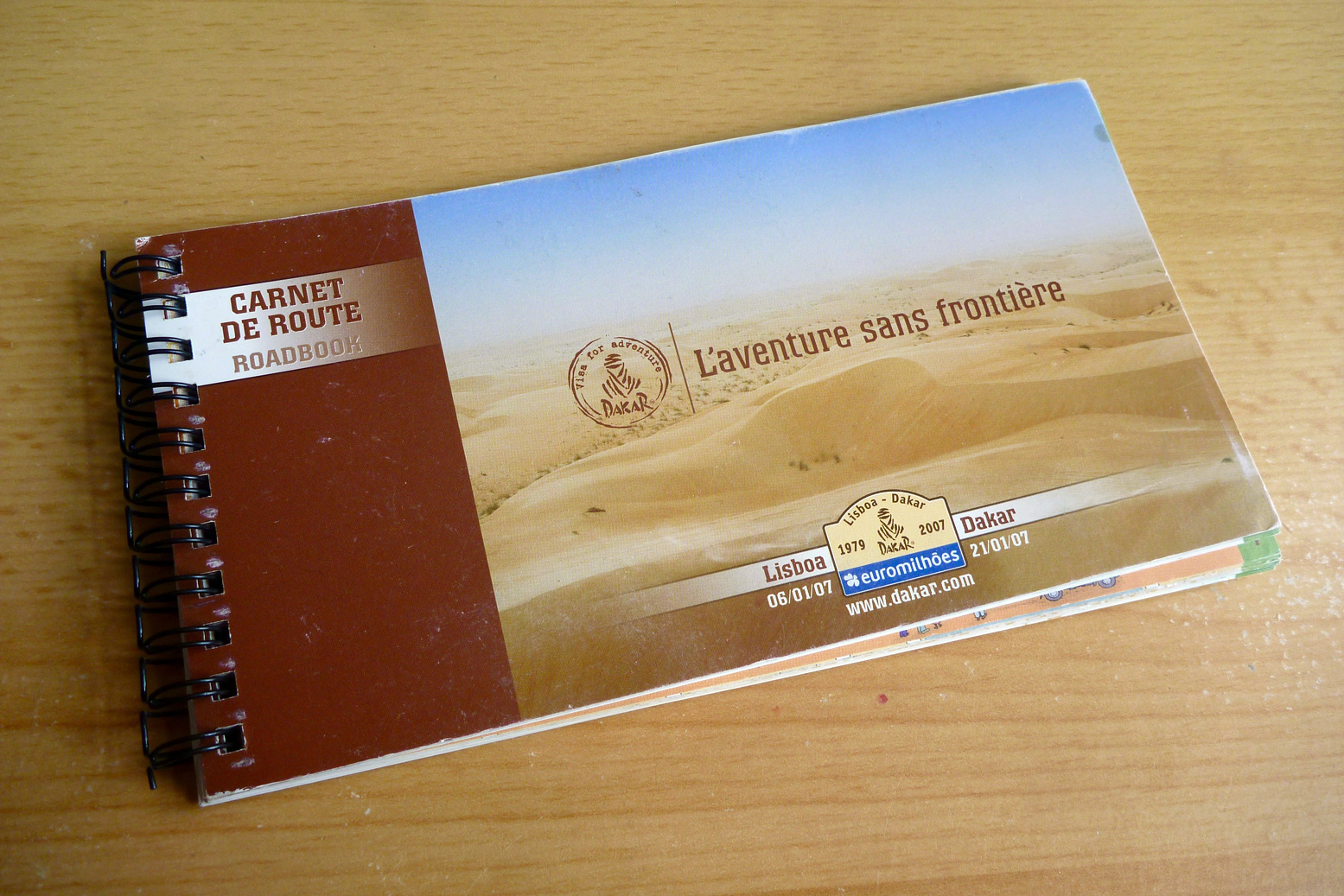
Some time ago someone kindly gave me the official ASO roadbook from the 2007 Lisbon-Dakar Rally, the last one to be held in the Sahara.
Following the murder of a French family in Mauritania just before the Rally (actually thought to be criminals not terrorists), additional threats saw the 2008 event cancelled at the last minute. The following year the Rally moved to South America where it continued to thrive with less controversy until it moved again to Saudi in 2020.
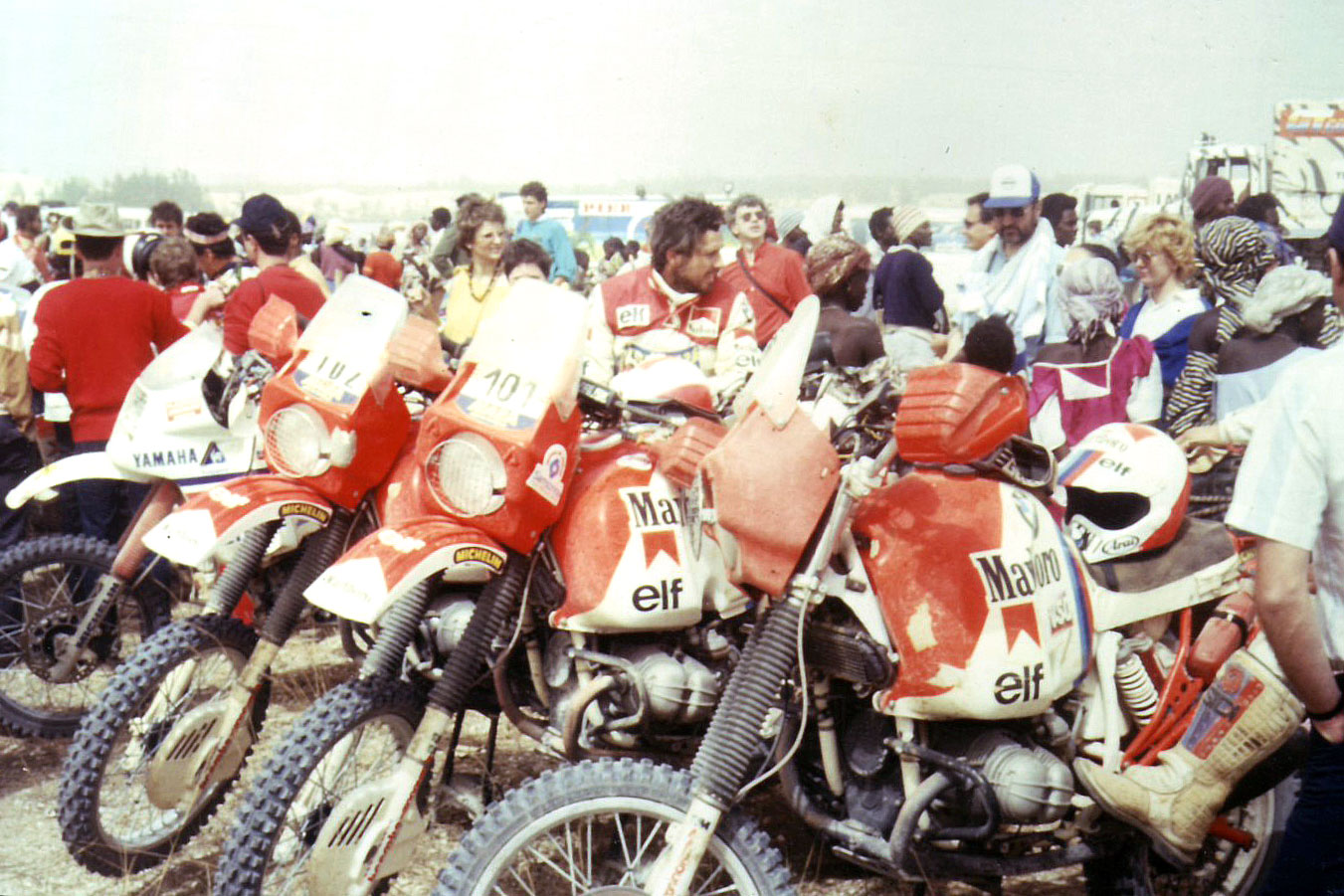
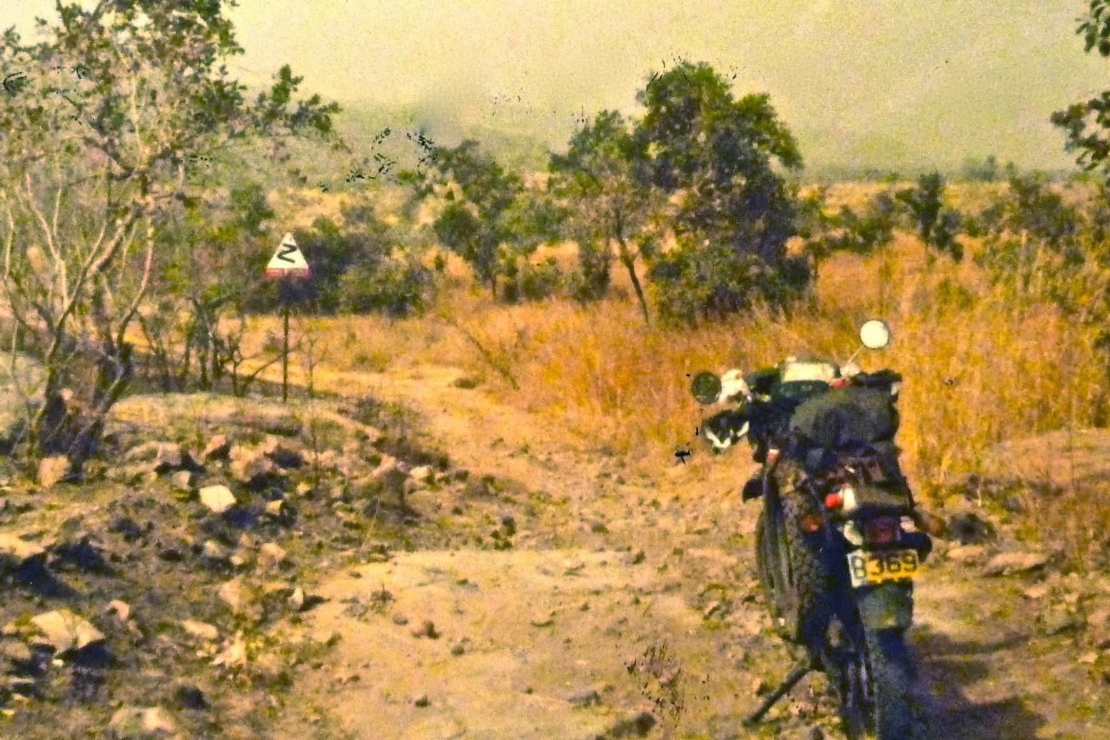
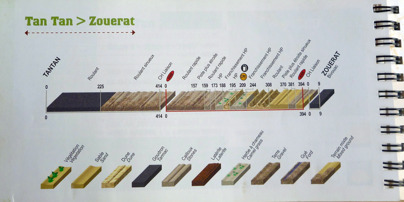
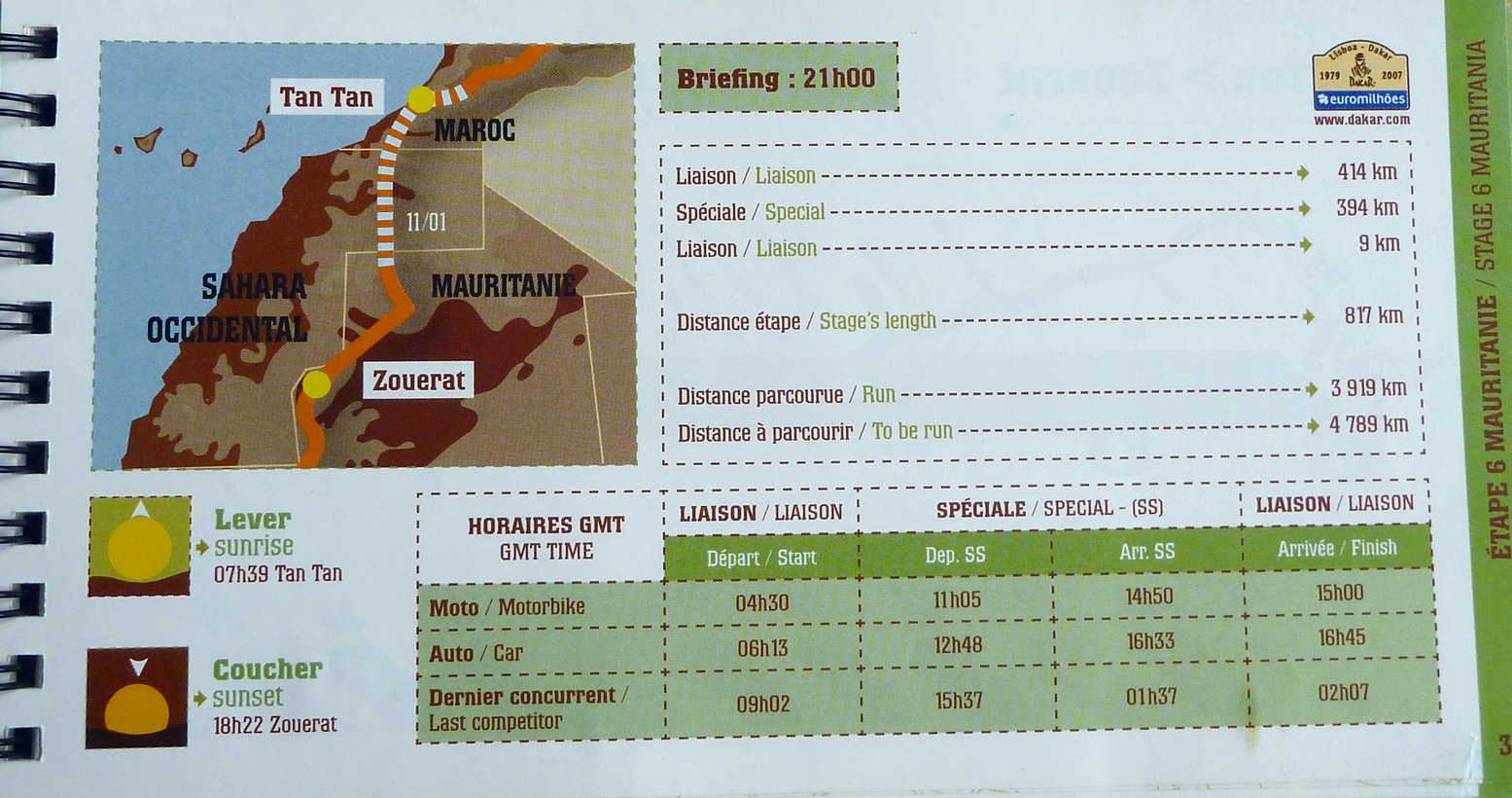
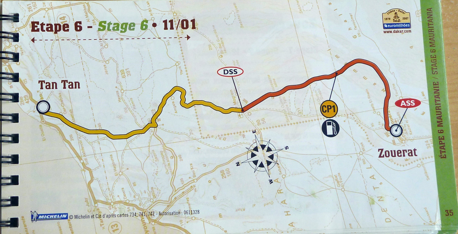
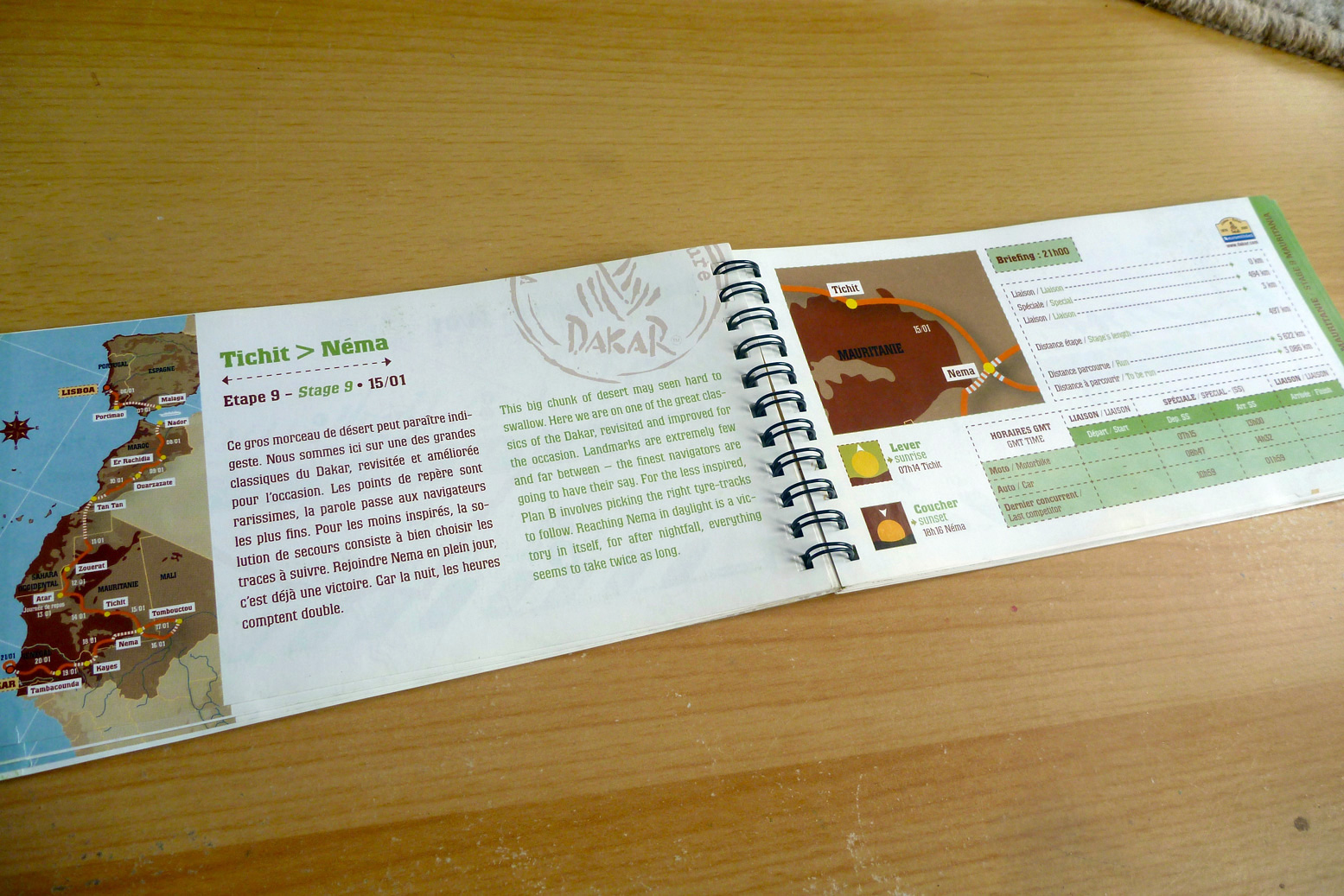
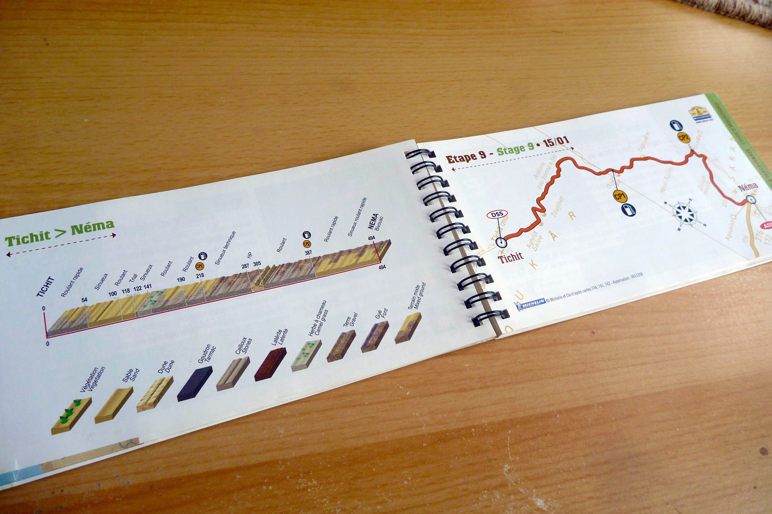
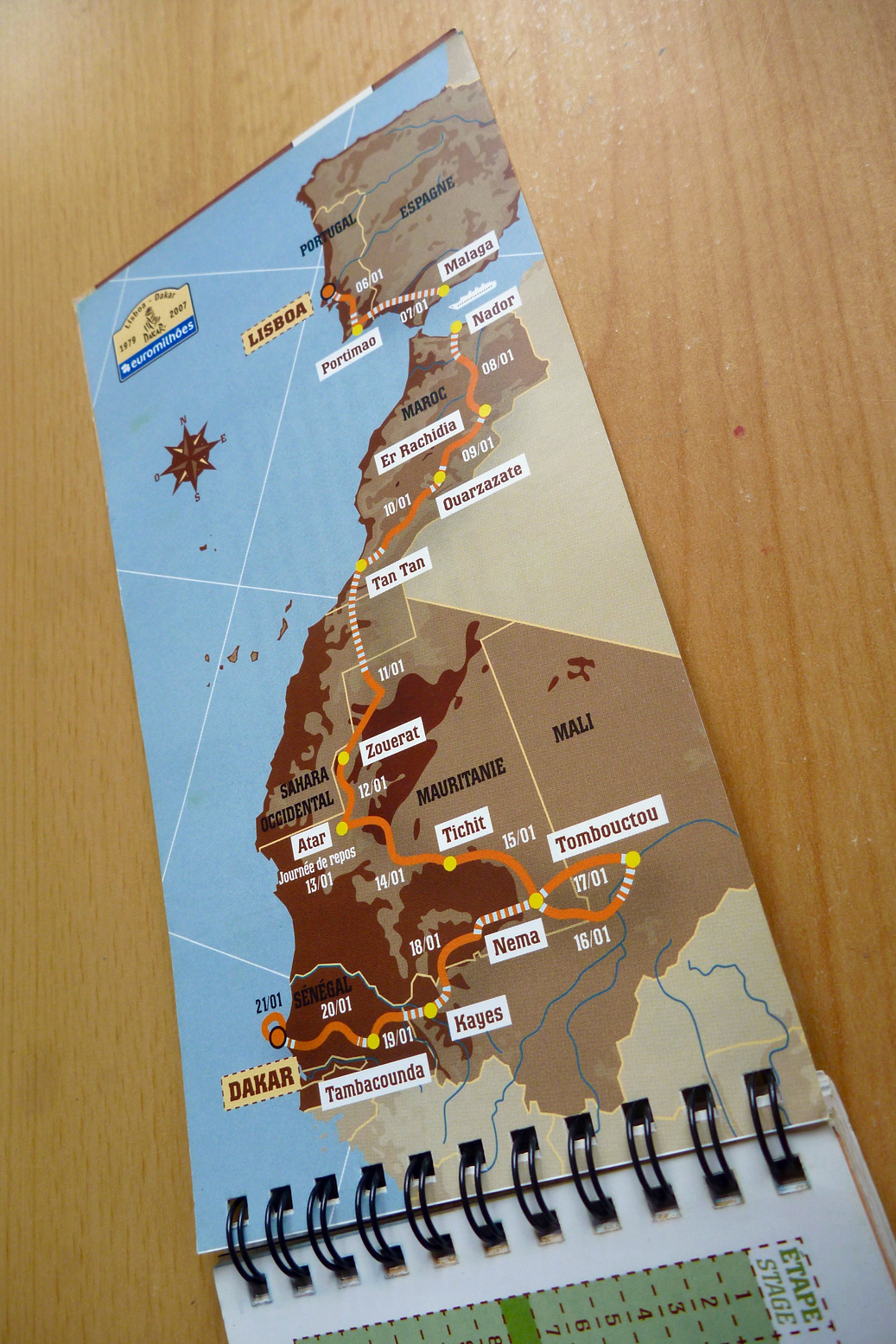
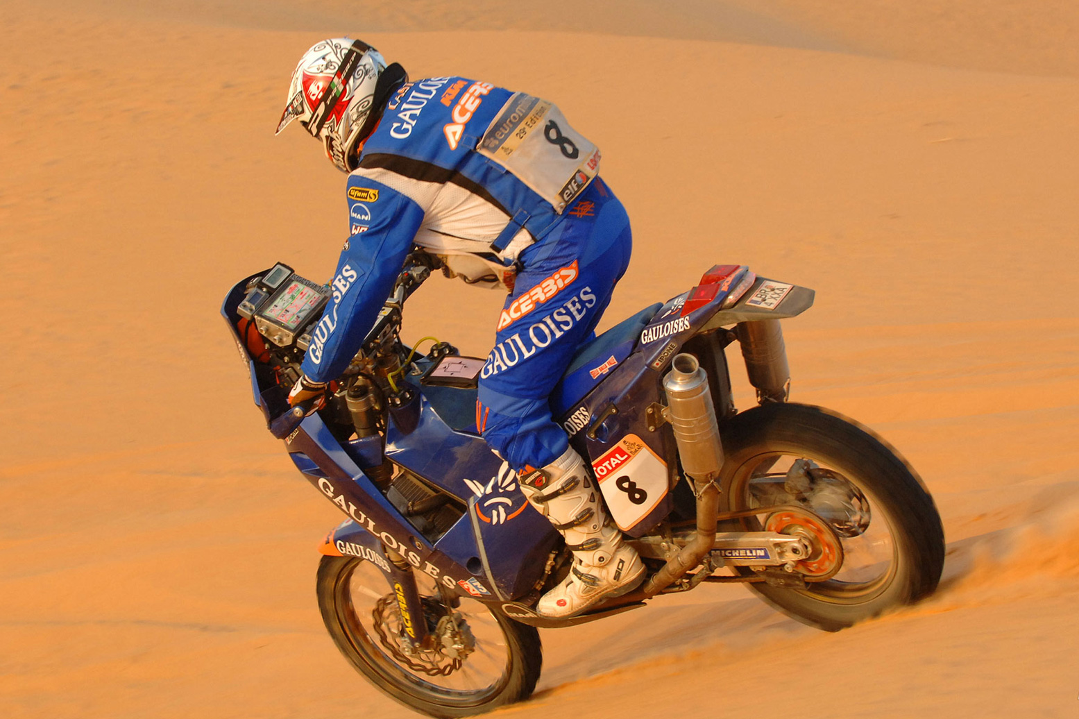
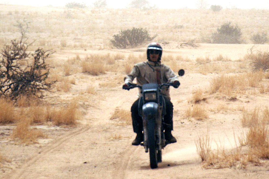
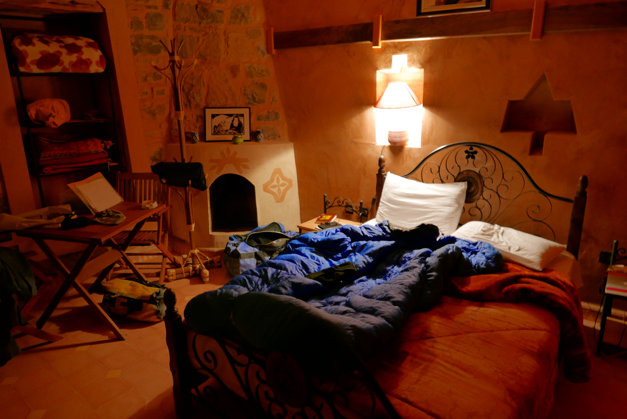
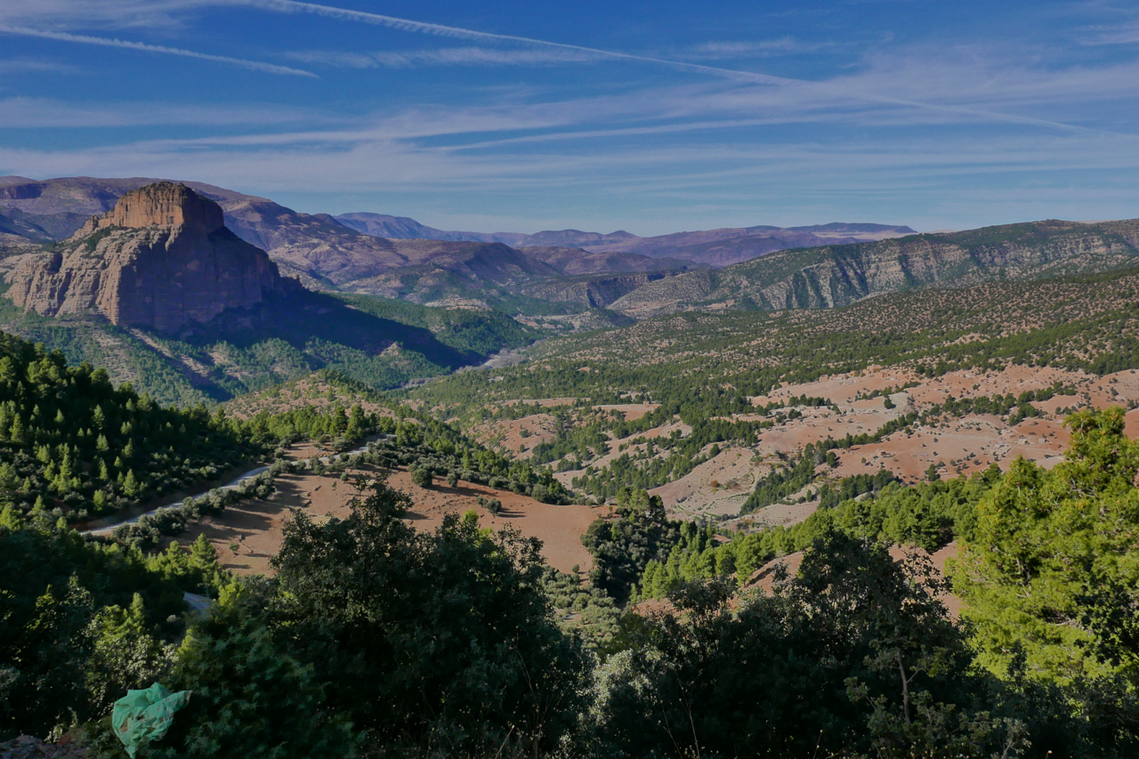
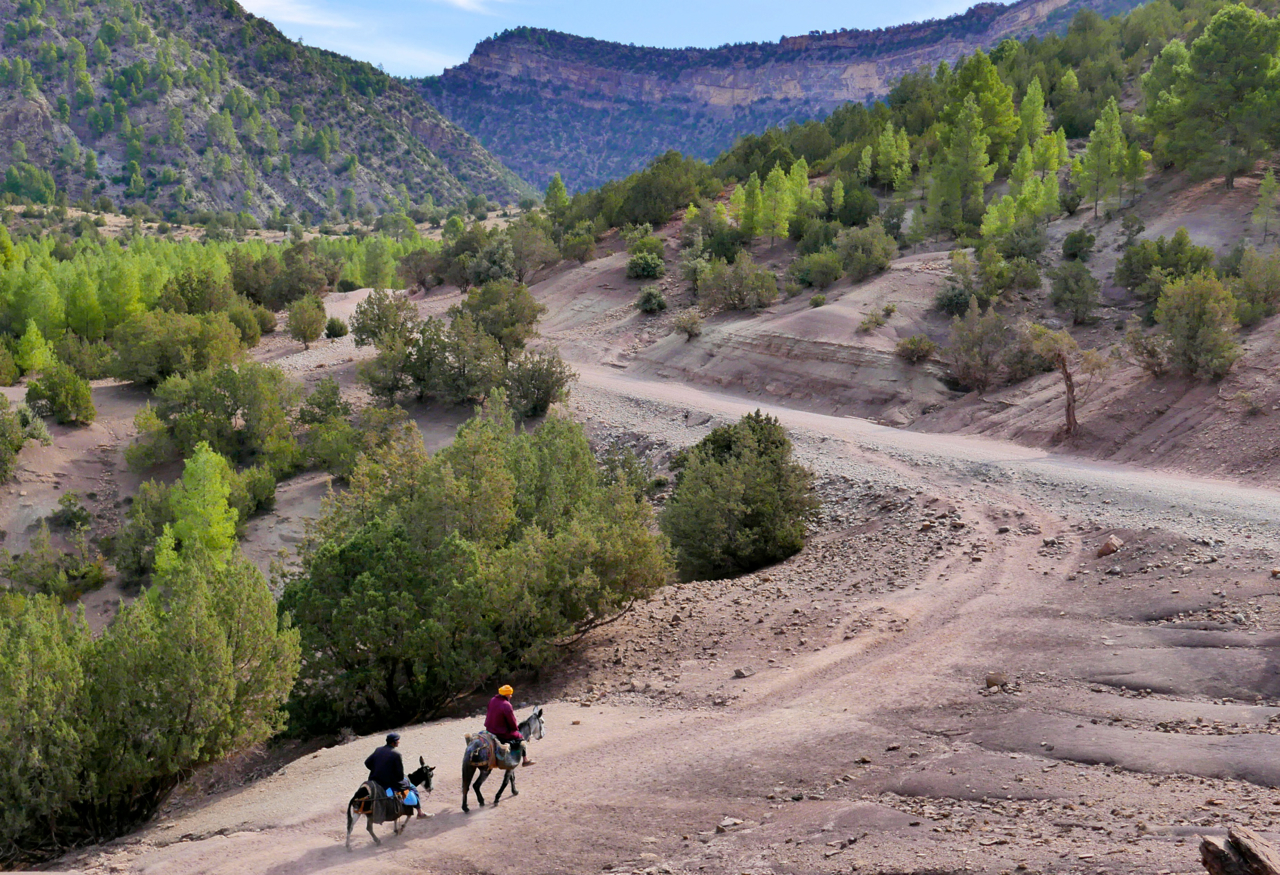
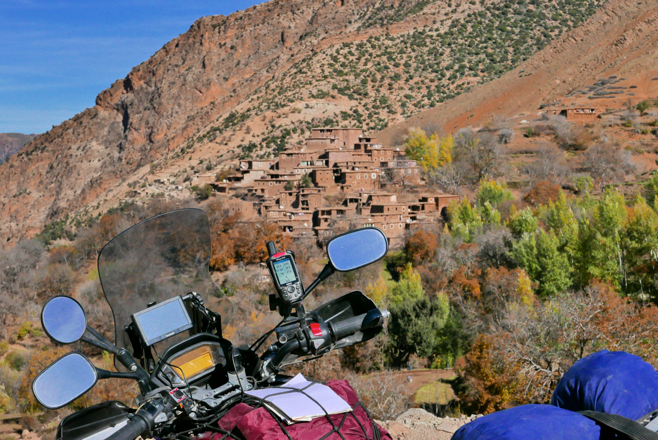
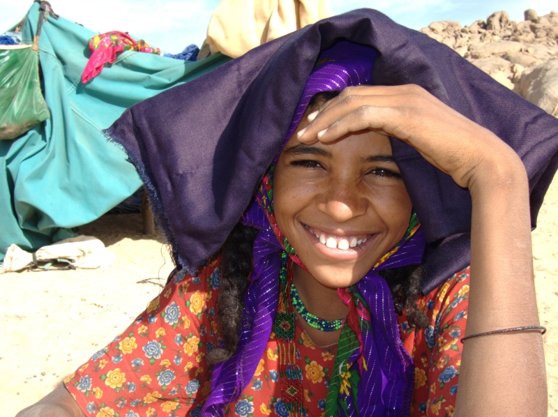
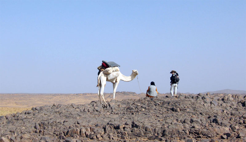
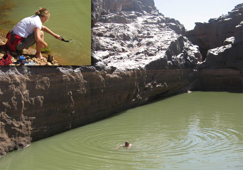
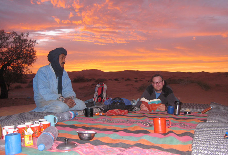
The longest stage in 2007 was across the top of Western Sahara from Tan Tan on the Atlantic to the Mauritanian mining town of Zouerat – 817km via Smara with a tea break at Bir Mogrein. The shortest stage was still 500km long, through the light jungles of western Mali and Senegal where I limped over the border into Senegal some thirty years earlier on two flat tyres (right). I passed plenty of Dakar racers that year too, and eventually ended up in Dakar myself (above left), but not on any sort of podium. Below some snapshots from the Last Roadbook from what many still feel was the last real Dakar.
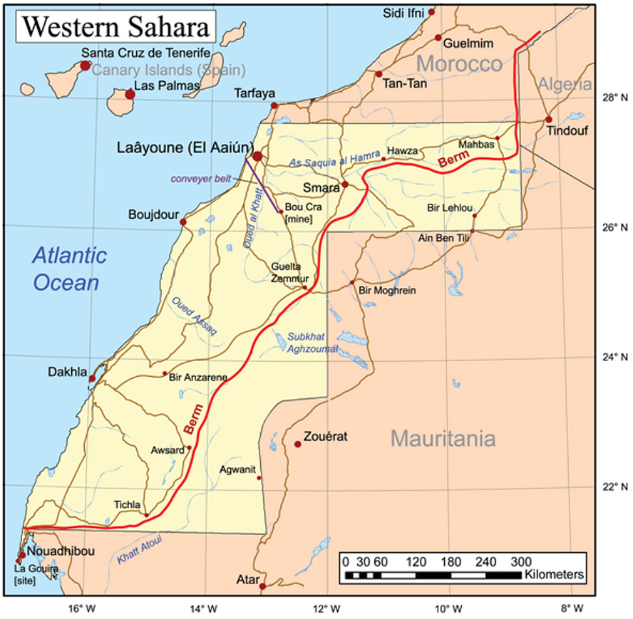
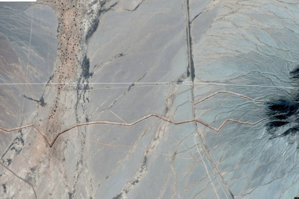
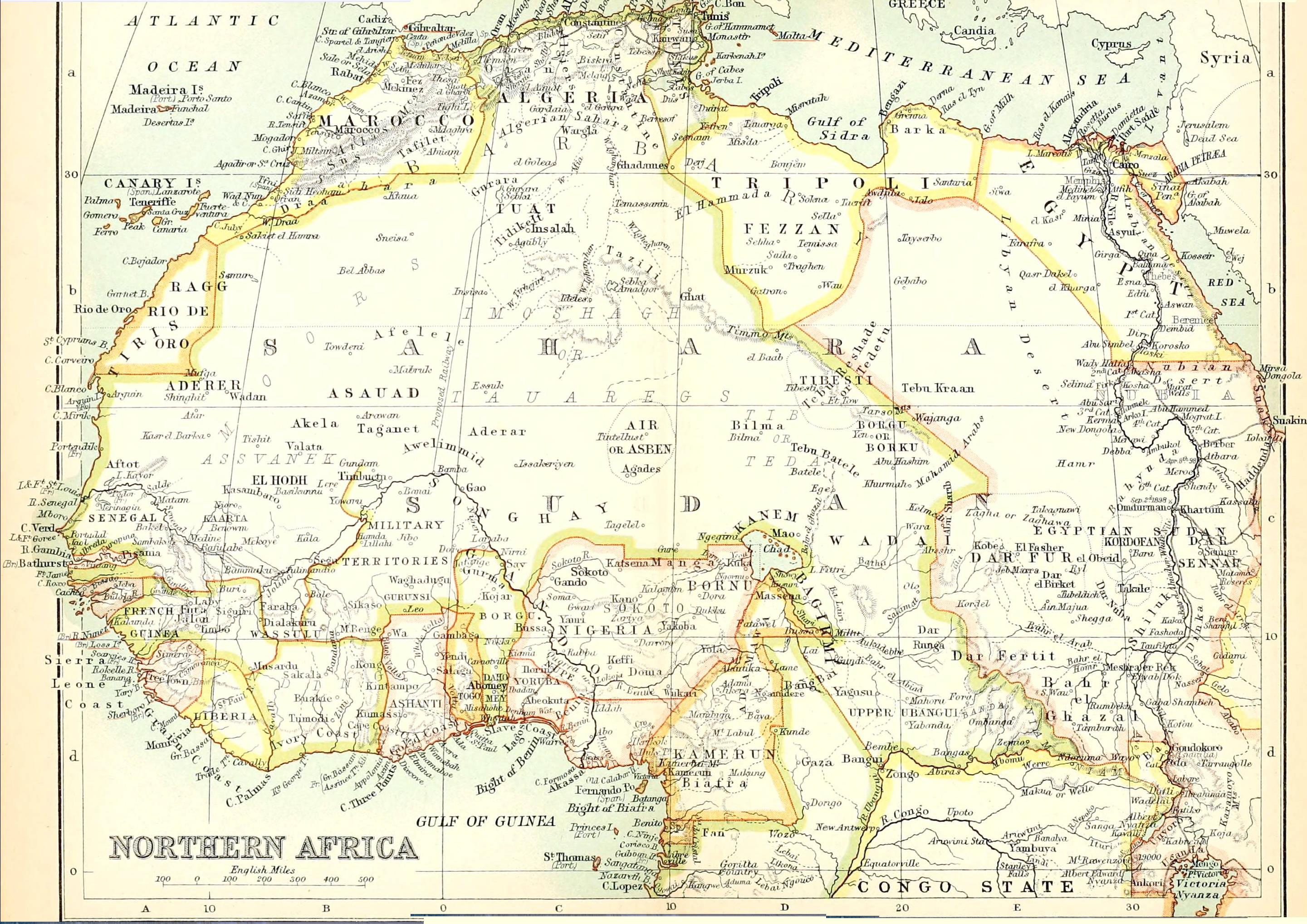
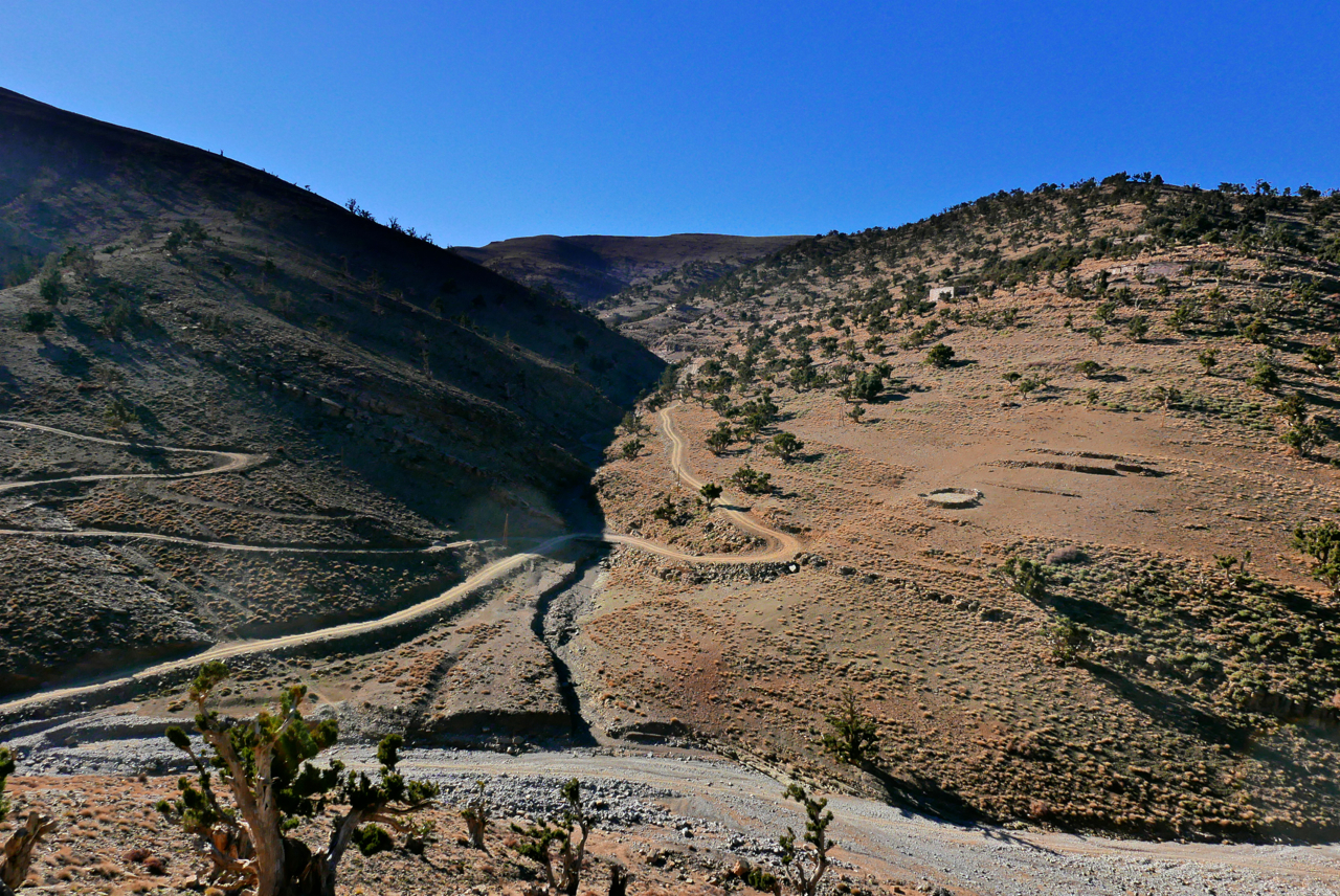
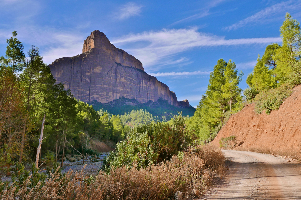
It’s well know that in the 1980s the Moroccans pushed up successive waves of fortified and mined sand walls or berms (left and right) until they their part of the Western Sahara and the remains of the Polisario-controlled lands to the east. It stretches from the Atlantic border with Mauritania northeast towards Smara, on the way cheekily chopping off the desolate corner of Mauritania (not shown on all maps). After Smara it then runs up towards Zag until it reaches the natural barrier of the Jebel Ouarkaziz ridge – the southernmost outlier of the Atlas mountains – right around here and just 22 miles from southern Morocco’s N12 highway.
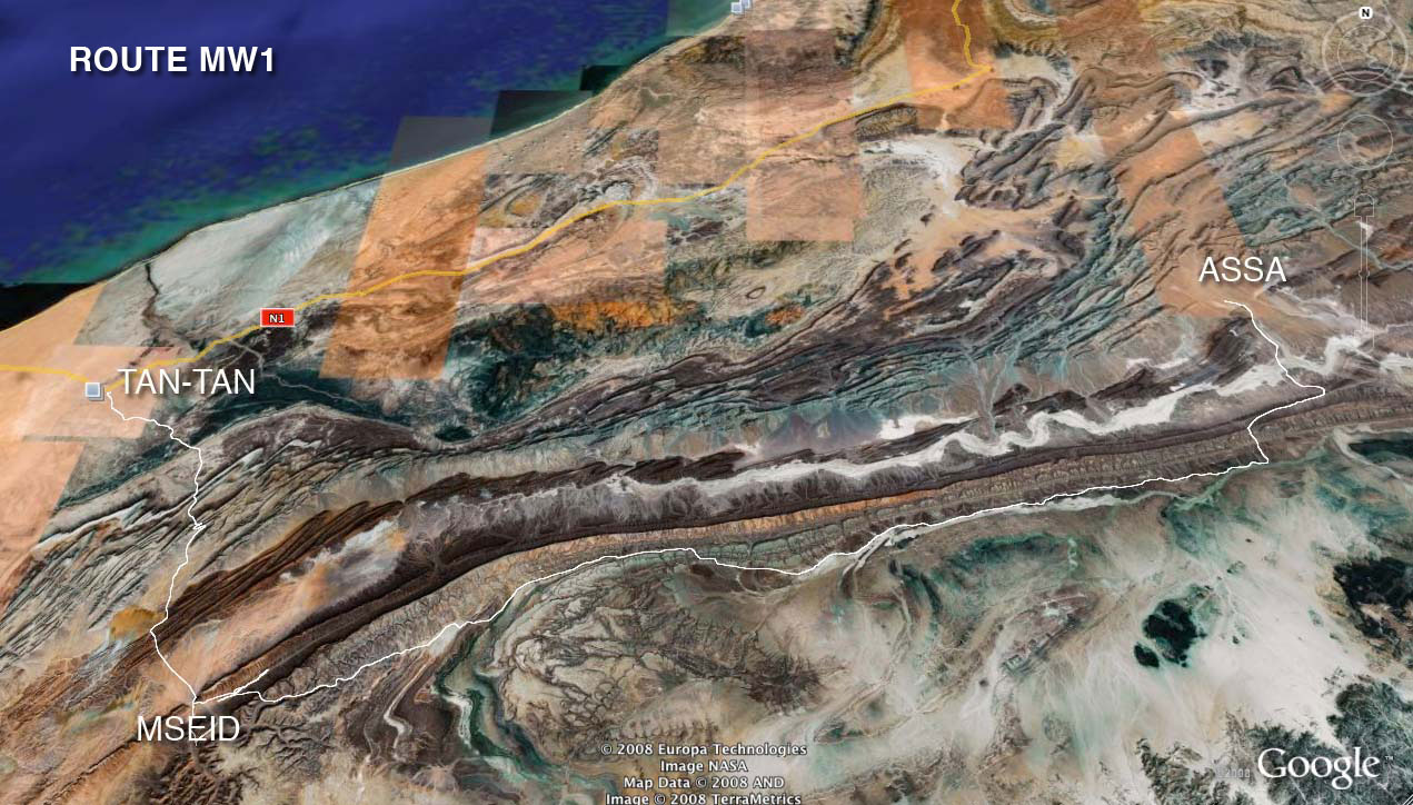
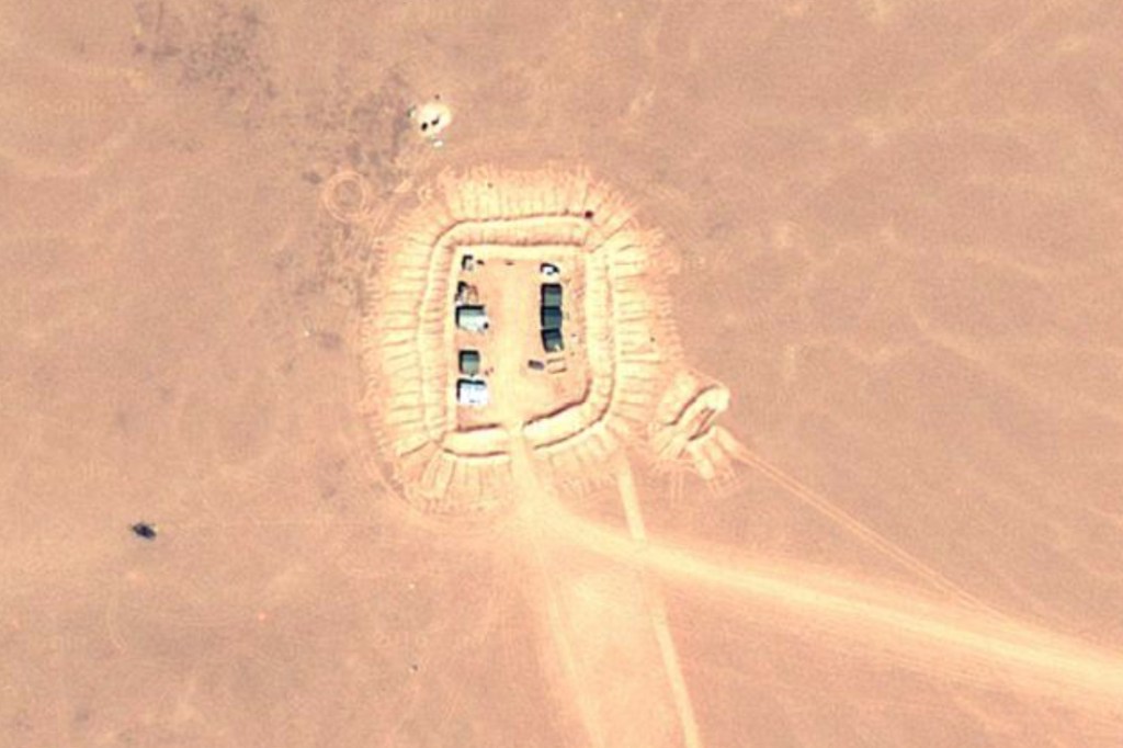
The periodic foums and oums (natural gaps in the ridge) sometimes become locations for strategic forts or installations, like the abandoned one at KM227 on Route MW1 in Morocco (above) from the Polisario war.
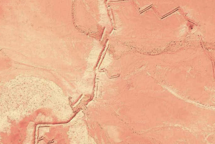
It seems the Algerians have got the same idea and have been building an intermittent berm of their own along exposed sections of their border with Morocco where foums in the Ouarkaziz or later, Jebel Bani, would have allowed easy motorised passage.
Click on this point in Algeria some 40km southeast of Mhamid in Morocco, and you can follow the zig-zagging berm northeast for some 40km via a small erg, until it stops near a ridge where rough terrain resumes the job. Branch berms break off to make enclosures or to complicate scouting along the main berm for a gap, and every once in a while there’s some sort of installation, fort or look-out post pushed up by the bulldozer. They even incorporated little gaps for the oueds to flow though (above right) and which are quite possibly mined. Any passages through the small erg are also blocked with a berm (below right).
Way further east towards Figuig, a gap in the jebel there demarking the Moroccan border where the old Oran–Colomb-Bechar rail line used to run has been bermed too (above left).
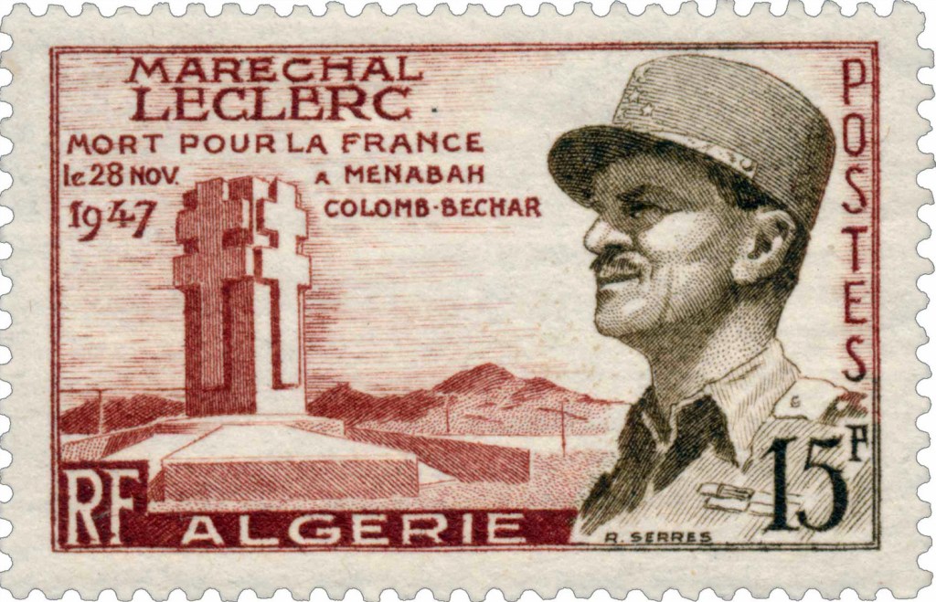
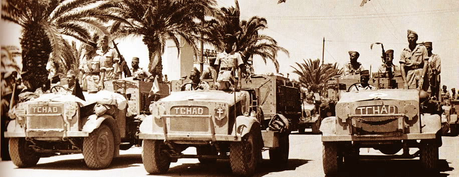
Nearby, just to the south in Algeria is a monument to General Leclerc whose plane crashed near here in 1947 – it’s pictured on a commemorative stamp. Among other heroic wartime deeds, he’s famed for leading an armoured column up though Chad to help the LRDG attack the Axis forces based in Murzuk, Libya. There are many more monuments to the WW2 liberator of Paris in North Africa and France.
Reading the article linked at the top of the page and it becomes clear traffic flows both ways over the long-closed border. Algeria claims Morocco smuggles loads of hashish southwards to befoul it populace, or to get it to European markets via other routes. You imagine a berm is fairly easy to make once you order a conscript with a D6 to get on with it. There’s been bad blood with Morocco for as long as the two countries have existed. Despite Morocco’s wishes, the border with Algeria has been closed to all since the mid-1990s.
More berm activity way down south at Bordj Moktar and I’ve also noticed new border roads and berms plugging the gaps along the Libyan border.
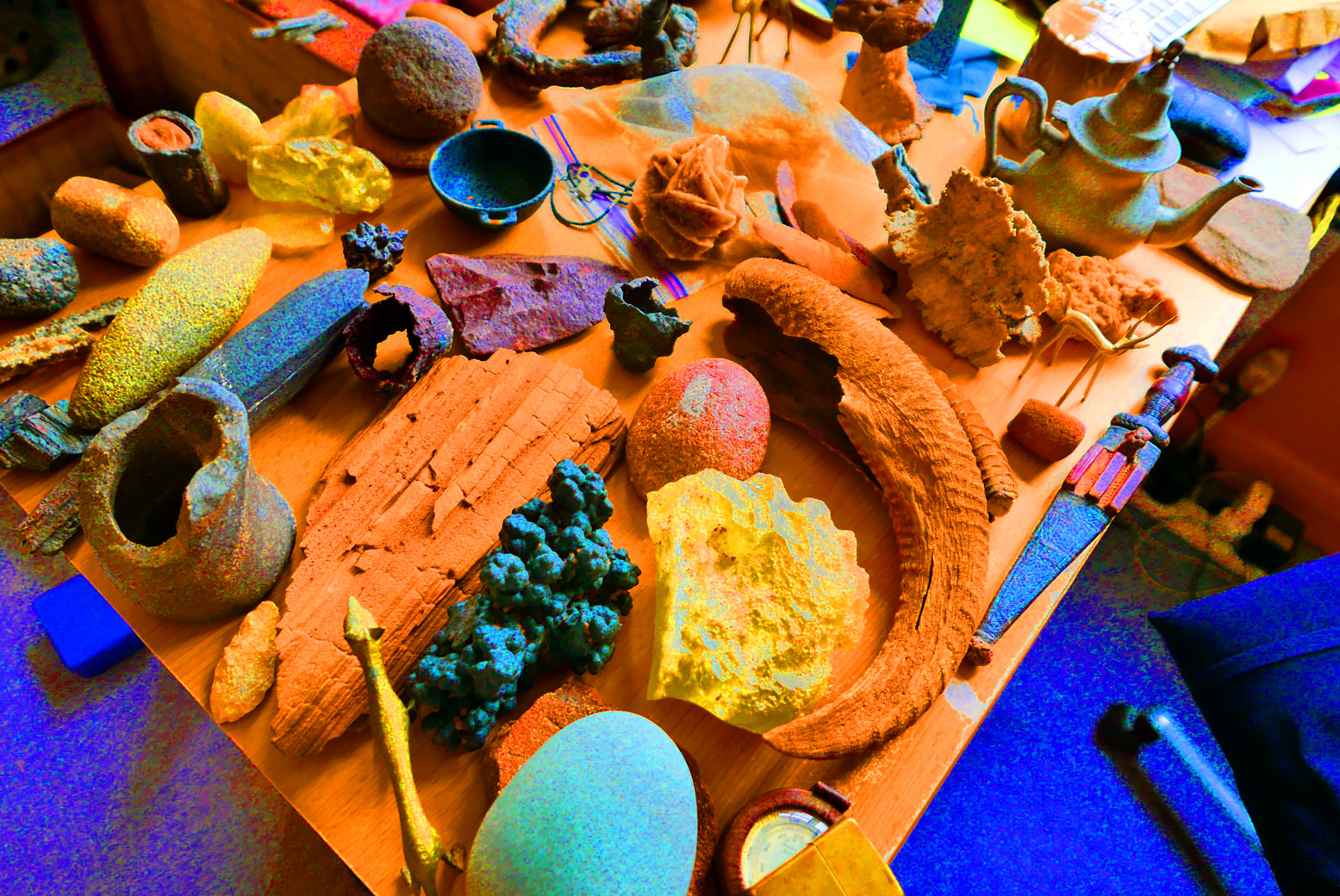
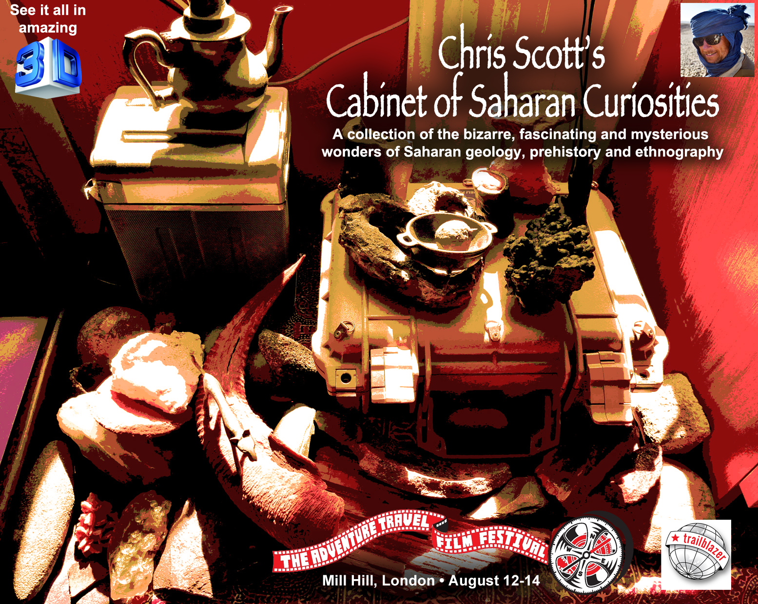
Come see my collection of Saharan curios at the Adventure Travel Film Festival next weekend at Mill Hill, north London. Over the years I’ve picked up numerous artefacts on the desert floor – from the tiniest, finely chipped arrowheads in the Bilma Erg to grinding stones on the Admer Plain, Palaeolithic hand axes in the Gilf Kebir, bizarre hematoidal concretions in the Libyan Desert, salt cake from the lost salines of Seguedine, fulgarites from the Tenere and the Great Sand Sea, and stone-age tools spanning eons of homo sapien activity from the Mauritania’s Adrar plateau to the Akakus and Jebel Uweinat beyond. Lots of other great stuff to see at the ATFF too.
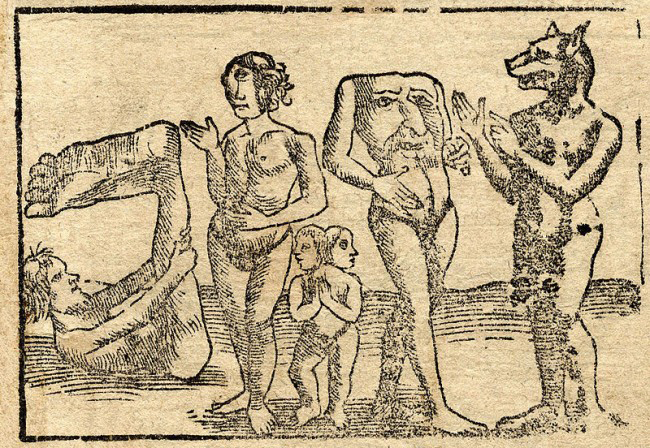
The earliest old map I have looks like it’s from the medieval era, but was probably based on Herodotus’ Histories which was getting on for 2000 years old by this time. It was he that brought terms like ‘Libya’ (North Africa) and ‘Aethiopia’ (sub-Saharan Africa) into common usage.
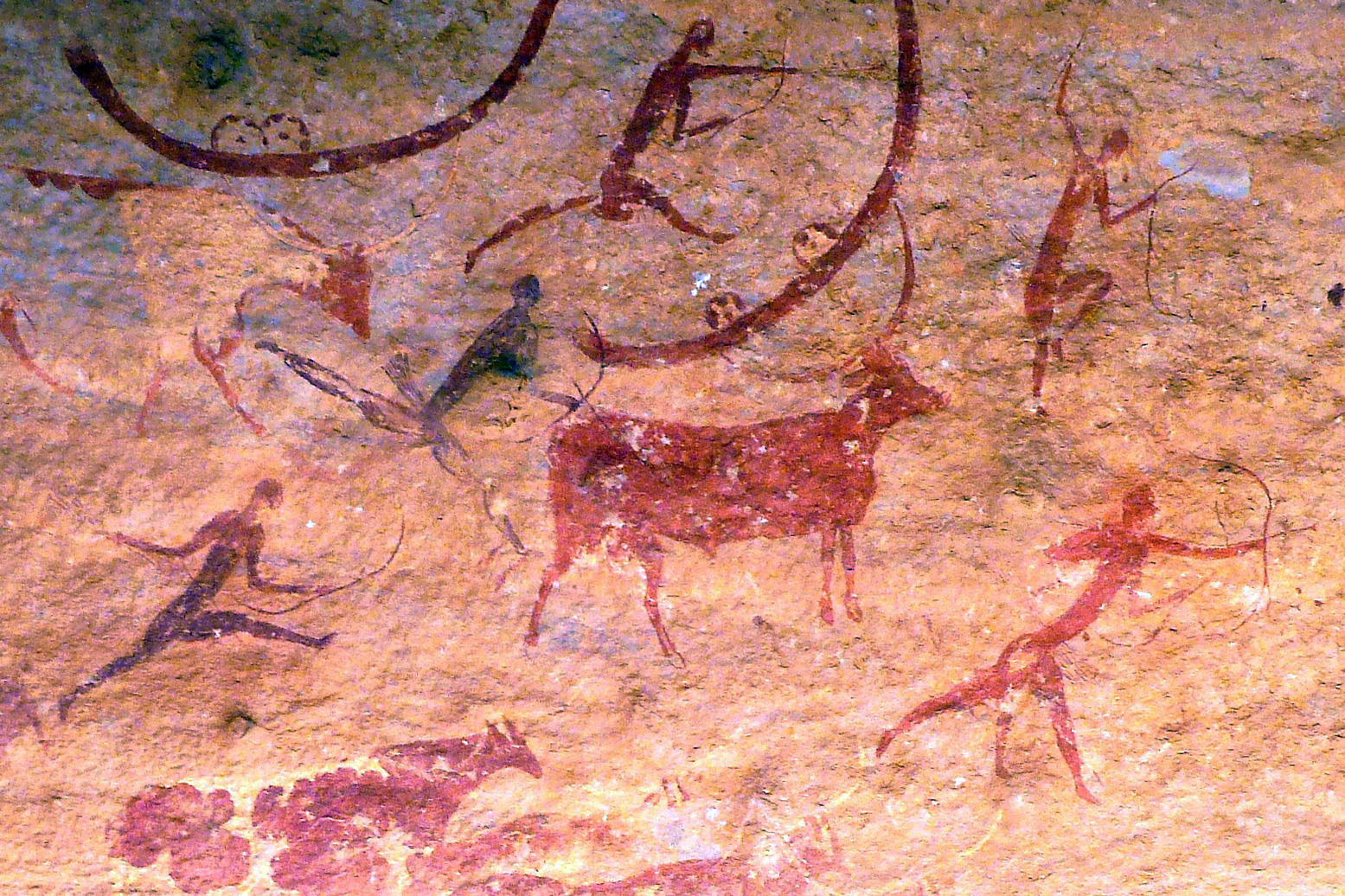
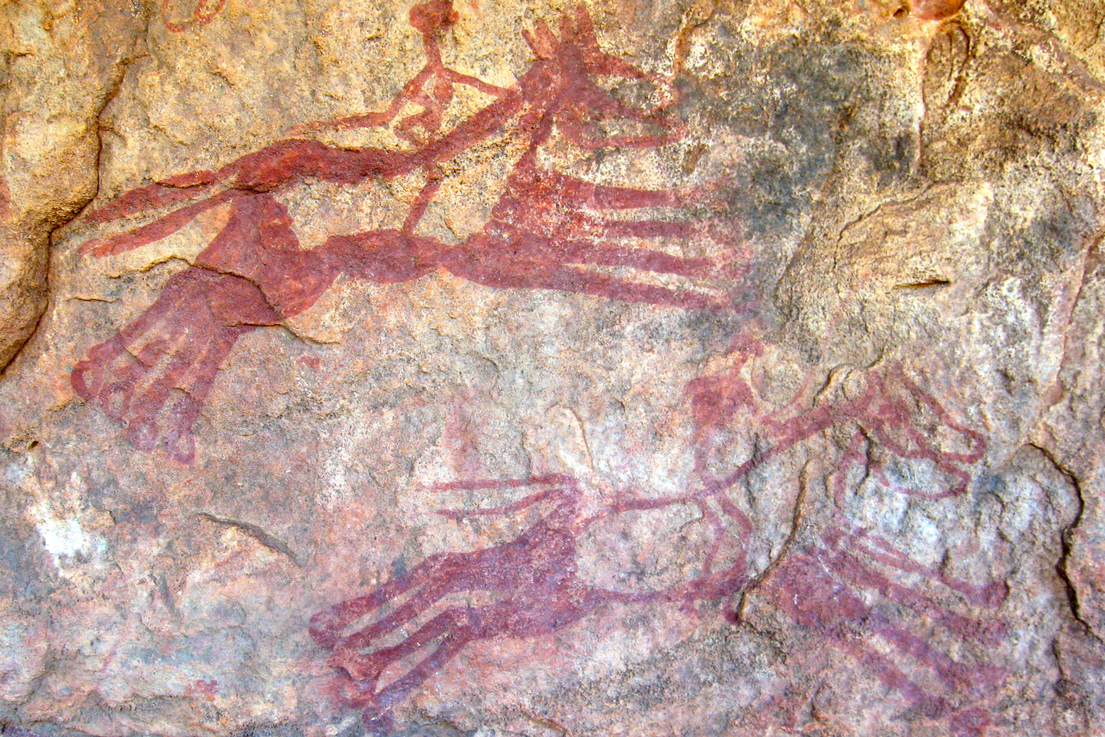
On this map ‘Mauritania’ is today’s Morocco, while the chariot-riding Garamanteans are correctly located around present day Germa in the Libyan Fezzan. It’s probably coincidental, but the ‘Barditi Montef’ (mountains) could be the Tibesti around Bardai – actually only 700km southeast of ancient Garama. (Left: rock art depicting chariots at Tim Missao well, 1200km southwest of Germa on the way to Mali. The Garamanteans are said to have got around.)
This map, but not 1554 Munster map above, may have been the best that Moorish wanderer, Leo Africanus’ (BBC doc) had to go on for his 16th-century travels across the region, venturing as far as Timbuktu, Cairo and possibly even Mecca. Along with Ibn Battuta’s travels a couple of centuries earlier, it was Africanus’ Description of Africa (1550) which expanded knowledge of the Sahara. But despite the efforts of Africanus, even by 1700 or so, satirists like Jonathan Swift (right) were said to have quipped:
So Geographers in Afric maps With Savage Pictures fill their Gaps
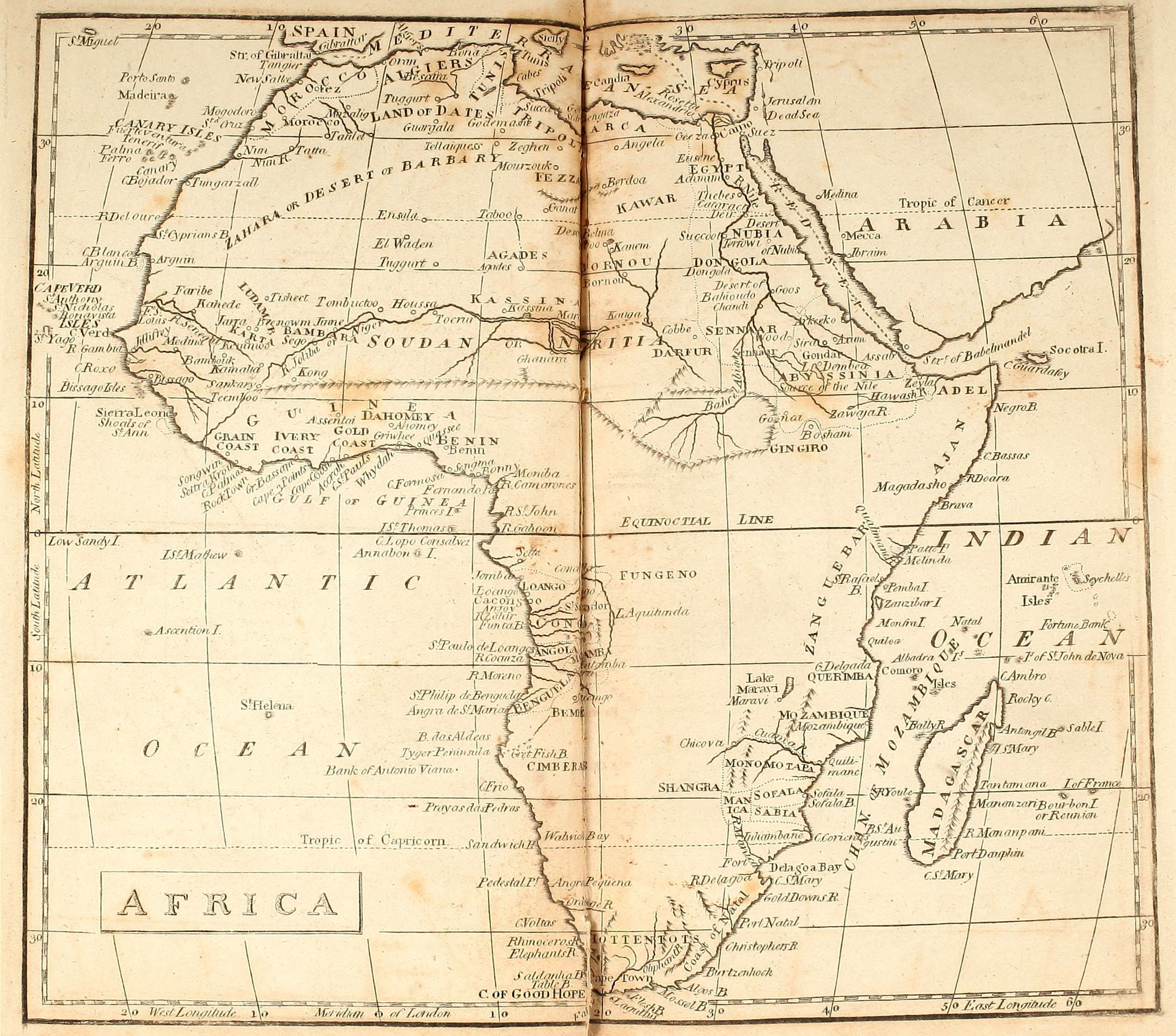
Fast forward a few centuries and there be no dragons or other medieval monsters (left) on this map of Africa dating from an atlas produced in 1803. It’s credited to William Kneass who later became Chief Engraver of the U.S. Mint in Philadelphia. Instead, the advent of scientific enlightenment had brought us longitude, latitude and the ‘Equinoctial Line’.
The mariners of the era had succeeded in very accurately mapping the outline of the African continent, but the interior, including the ‘Zahara or Desert of Barbary‘, remained blanks. South of the Sahara the most notable inland incursions were made by the early European colonies around Cape Verde and Guinea Bissau, Angola, the Cape and Mozambique. In the north Egypt and the Nile are better mapped all the way into the Biblical lands of Abyssinia. The Moroccan imperial cities are present: ‘New Salle’ being Rabat, with Marrakech labelled as ‘Morocco’. Never linked those two words before, but presumably they’re both based on ‘Moor’ so it makes sense.
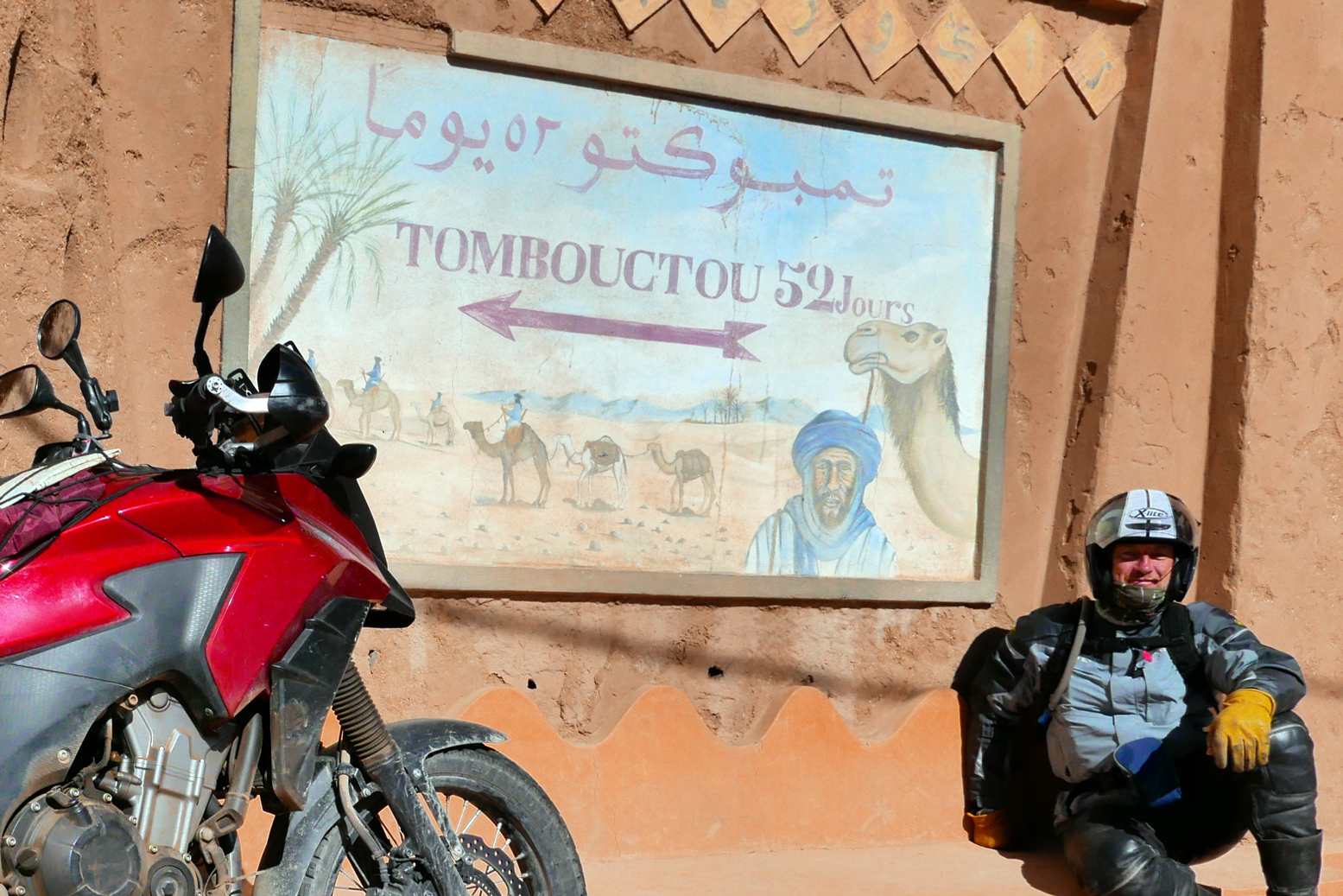
South of the Atlas ‘Tatta’ appears to be close to Tata, with the Oued Draa known as the ‘Nun’. The 16th-century Portuguese trading post of ‘Mogodoro’ is Essaouira, and Tarfaya at Cape Bojador was then called ‘Tungarzall’. To the east you’d have thought that Sijilmassa near Erfoud might have got a mention. It was the northern terminus on the ’52 day’ caravan route from Timbuktu.
Further south in Western Sahara and Mauritania, ‘St Cyprian’s Bay’ became Golfe de Cintra after a Portuguese mariner and slaver got killed nearby at Arguin (also labelled). Inland from here, only ancient ‘Tisheet‘ gets a mention, on the old Dhar Tichit caravan route.
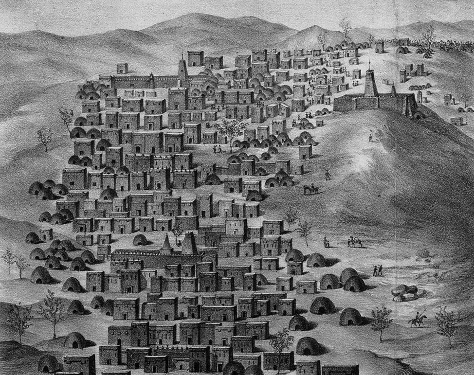
I remember going to a talk in Nouakchott about the medieval glass trading links between Tichit and Venice. Tichit didn’t look like much when we were there in 1990 (right; it’s all in D. Travels), but it’s a historic settlement on a par with Timbuktu (above left; as seen by Caillé in 1830), Oualata, Chinguetti and Ouadane. The latter may be the ‘El Waden’, misplaced way north of Timbuktu and not far from ‘Ensala’ which could be even more distant In Salah in Algeria. At this point it was still a couple of years before the American sailor, Robert Adams briefly ended up a slave in Timbuktu. Among other things, his account helped kick off the race to reach this fabled Saharan ‘Shangri La’ and with that, the great age of European Saharan exploration as listed rather Francocentrically on the 1898 map below.
Eastwards on this 1803 map, many places in Algeria are recognisable: ‘Tuggurt’, ‘Guargala’, (Ouargla) and over the border in present day Libya: ‘Godemashe’ (Ghadames), ‘Mourzouk’ and ‘Ganat’ (Ghat). ‘Zeghen’ was less easy to pinpoint, visited by James Richardson while on the road from Tunis to Ghat and back up to Tripoli in 1845-6. At the time Richardson estimated Zeghen’s population at ‘200 men, 300 women, and 700 children and slaves‘. Our man Duveyrier (see below) locates it for us a short distance northwest of Sebha in the Wadi Ash-Shati, on the way to ‘Sockna‘. Here Richardson spent some time as a guest of the Turkish Caid and his comely concubines.
‘Berdoa’ is the old name for Kufra in southeast Libya, and south of there, on the page’s fold, is the enduring salt oasis of ‘Belma’ (left) at the base of Niger’s ‘Kawar’ escarpment. The hyper-arid and largely uninhabited Libyan Desert around Jebel Uweinat wasn’t to be explored until the 20th century.
Fast forward a hundred and one years and the Saharan blanks begin to fill up. Below is the ‘Northern Africa’ plate extracted from a Bartholomew’s Handy Reference Atlas of the World dated 1904 (source) and which differs very little from my 1888 version.
The interior is still sparse, but the proposed trans-Saharan railway gets a mention. Running across the flat plain of the Tanezrouft, in 1922 it was the actual route taken by the first cars – Citroen Kegresse autochenilles (half tracks; left) – to cross the Sahara north to south and back. In the west ‘Shinghit’ is a bit out of line with Atar and Wadan, but in the ball park. To the south is the ghost town of Ksar el Barka and ‘Portendik’ must be early Nouakchott, though you wonder what became of ‘Mufga’ near grubby Choum of today. Ancient Taghaza (as visited by Ibn Battuta) never gets a mention on any of these maps, but it’s replacement, the newer salt mine at ‘Towdeni’ was a key point on the ’52 days’ caravan route to Sijilmassa. In northern Mali, ‘Essuk‘ whch hosted the early Tuareg music festivals before they moved to Timbuktu and long predates today’s Kidal. Meanwhile in Algeria the Amadror salt mines get one of their last calls. Wau crater in Libya gets a name check too, there’s brackish water there, but due to the mosquitoes it was never a settlement. Up in the Mediterranean, Crete is oddly identified by its ancient name of Candia, perhaps intended as a poke at the despicable Ottomans?
Above,Dufrenoy’s intriguing and amazingly detailed map from 1898, centred on the southern limits of French-controlled Algeria. The red lines identify the itineraries of that busy century’s wave of Sahara explorers, from Laing’s fatal excursion to Timbuktu in 1826, right up to Laperrine, who in 1898 set out to quell the southern Tuareg with his Méhariste Camel Corps and died in a plane crash southwest of Tam in 1920. Note too the route of Flatters’ disastrous missions of 1880-1 (as described in Desert Travels) when the handful of harried survivors crawled back to Ouargla, having out-run the Tuareg who’d trailed and picked them off one by one.
Back-tracking a bit, the 1881 Flatters Mission – partly intent on reconnoitring a railway route between the Maghreb and France’s territories in West Africa – wouldn’t have got half as far as it did without Henri Duveyrier’s amazingly detailed map of1864. It was based on his journeys there a few years earlier, described in Les Touaregs du Nord. Tamanrasset was merely a oued; Silet, In Amguel and Ideles on the other side of the Hoggar were established settlements. The tomb of Tin Hinan (left) even gets a mention, though it’s a bit misplaced from actual Abalessa.
Further out on the Tanezrouft the strategic well of Tim Missao (the chariots, above) and the waterhole at In Ziza (left) are labelled, but in Libya the Murzuk sand sea is just an ‘unnamed hammada’ separating the Tuareg from Tubu. There’s plenty more mouth-watering detail if this area means anything to you, and Duveyrier’s inset helpfully lays the ancient geographical names alongside their modern counterparts.
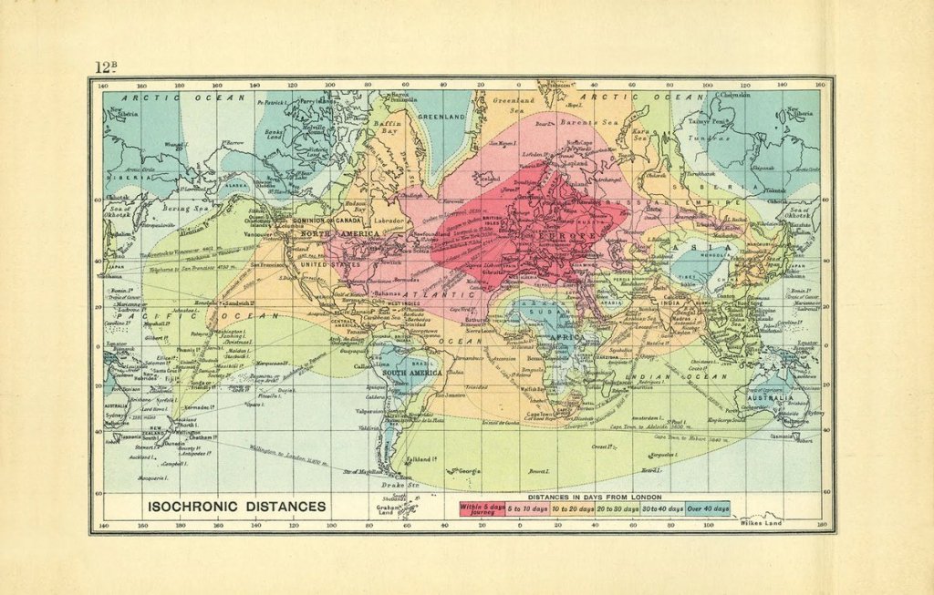
Not a Sahara map but a world map from 1914 as the British Empire began the descent from it’s late-Victorian apogee. In an era before flight and in the golden age of ocean liners, it illustrates just long it took a citizen of Albion to reach the far flung corners of the world. Central Sahara is up there at the end of the scale, alongside the Amazon, Outback, Congo, Tibet and Siberia. The widespread adoption of the motor car would soon change that.
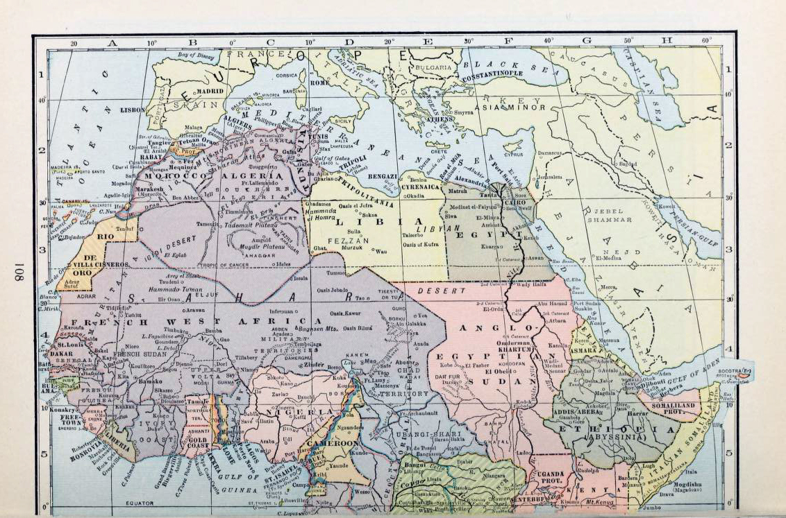
How time flies. It’s now 1933 and above, France’s African colony encompasses half the Sahara and most of West Africa. Tamanrasset and Djanet, which even then must have been the biggest towns in southern Algeria, are still missed out, but then this isn’t a French map. In Mauritania Tidjikja makes an appearance, so does Iferouane in the Aïr and Tindouf up in Algeria. ‘Marakesh’ looks like it’s still ‘aka Morocco’ where the Spanish cling on to protectorates in western Sahara (Rio de Oro), Sidi Ifni and on the north coast, but not for long. Within 25 years the Sahara would take on the borders and principal towns with which we’re familiar today.
Who can resist the superb ‘Uweinat’ map (below) originally published by the Survey of Egypt in 1945. One of the most fascinating corners of the Sahara, much of its detail was based on the intrepid explorations of Ralph Bagnold in the 1920s, as well as later Brits, some of who were fictionalised in The English Patient movie. The last time we travelled there (left), it was still the best paper map available for that area, notwithstanding the newer aeronautical TPCs.
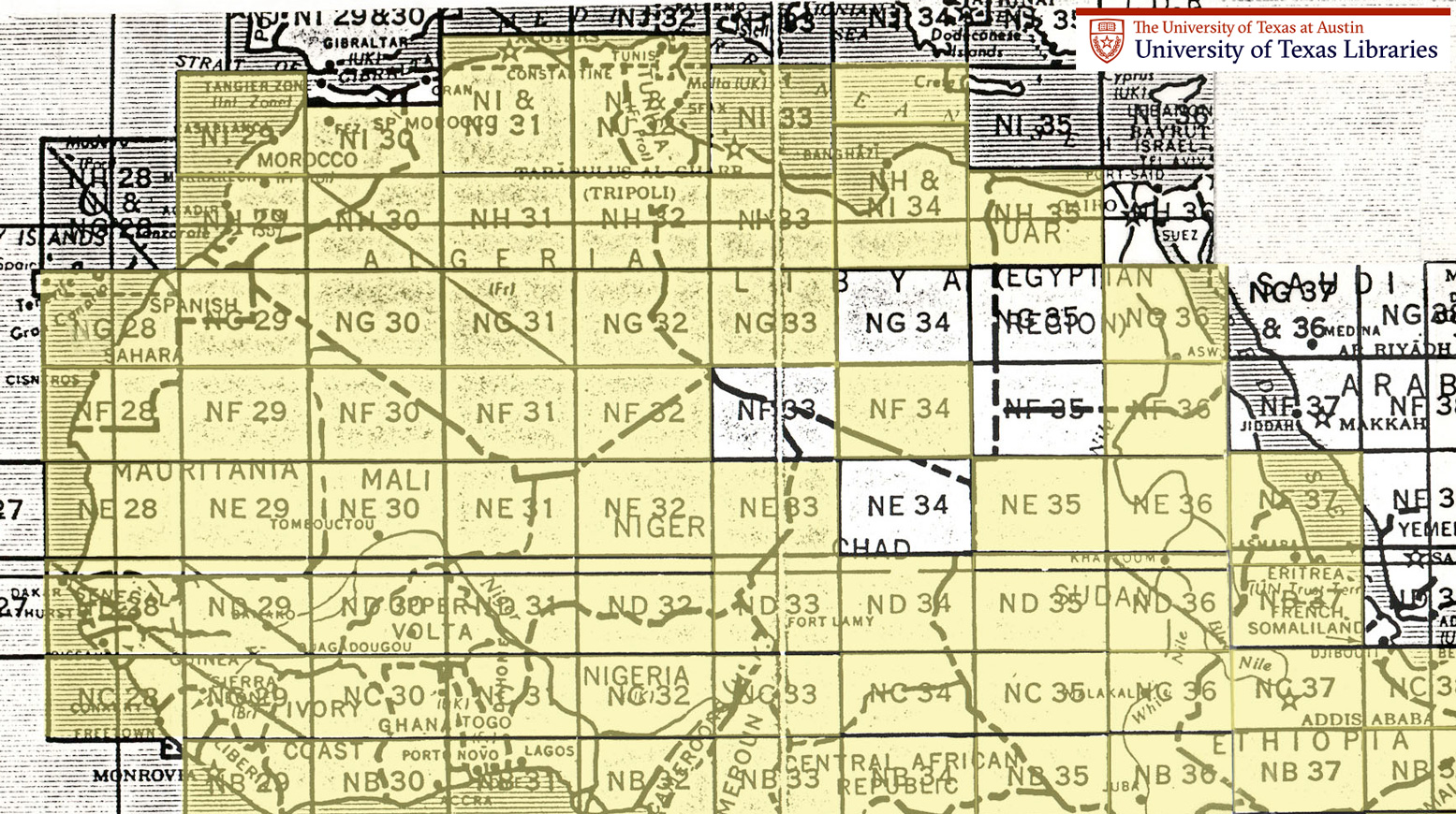
Old Saharan mapoholics will be familiar with the Austin TX university’s comprehensive online database of full-sized Saharan maps dating more or less from the early 1940s. Click this to get to the index pictured below and thank you Austin.
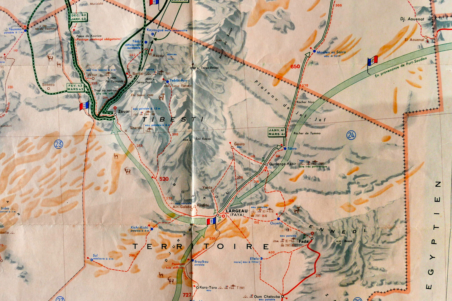
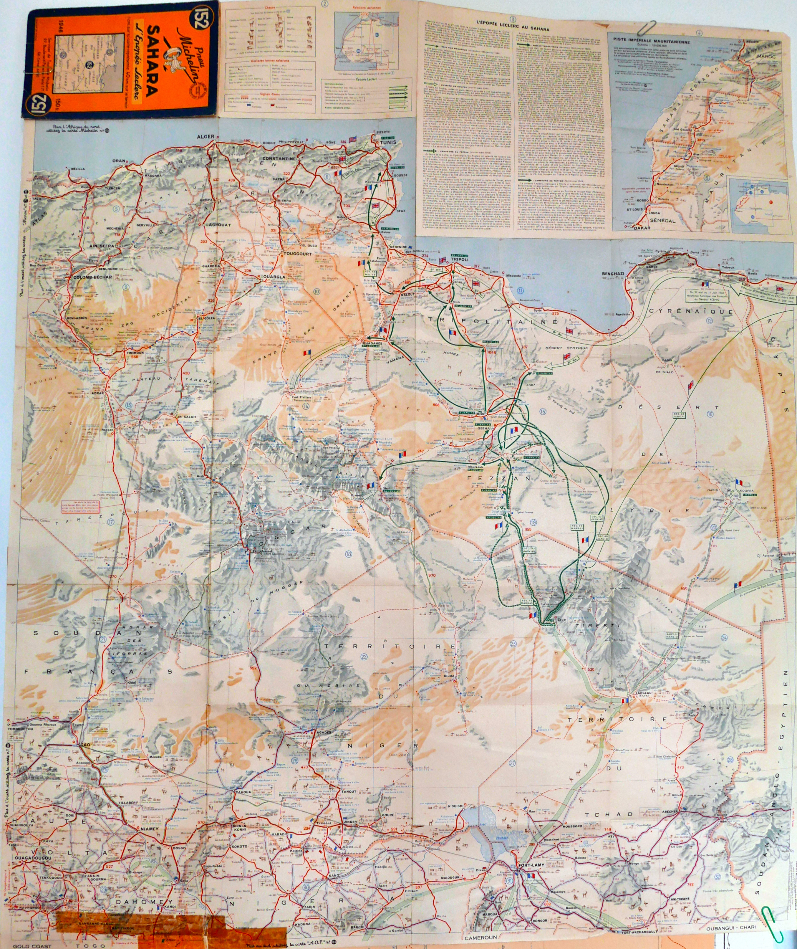
And finally, a forerunner to the famous 4-million scale Michelin 153 map (now the 741) that covered the French Sahara: an ageing Michelin 152 from 1948. It was the best photo I could manage – scanning will have to wait for a very rainy day.
You get the feeling that this may have been a commemorative special edition to celebrate General Leclrec’s heroic achievements in the Sahara during WWII, when a small column managed to take Kufra and then Murzuk from the Italians, and then push north to help expel the Axis forces from North Africa along with the 8th Army.
Like the LRDG map, the 152 has helpful detail like ‘piste tres difficile‘ as well as the famous info on water resources ‘tres mauvais a 50m‘, that we recognise from the later editions which covered the Sahara all the way to the Atlantic.
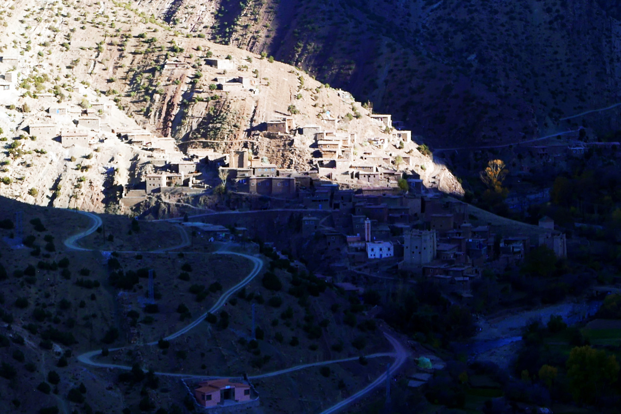
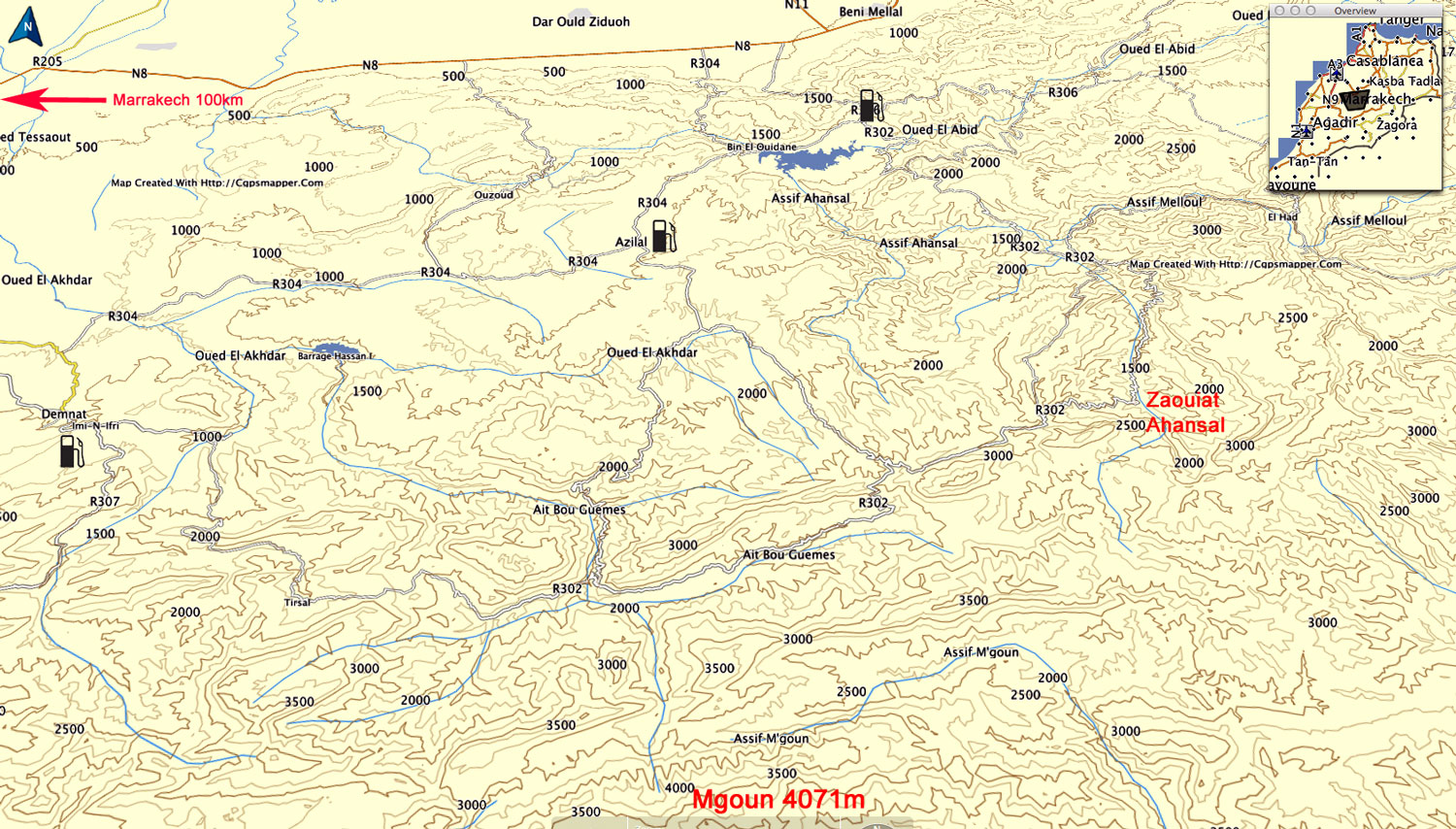
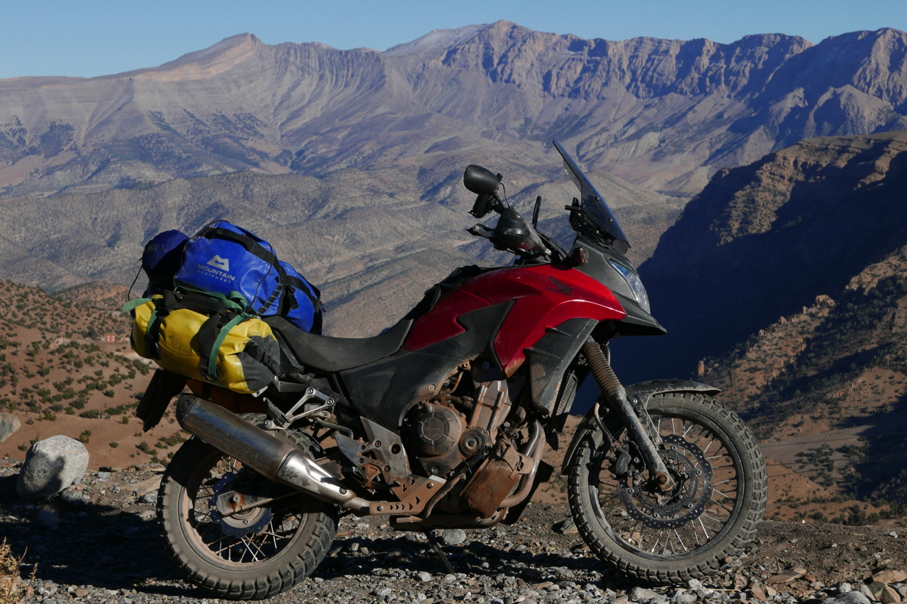
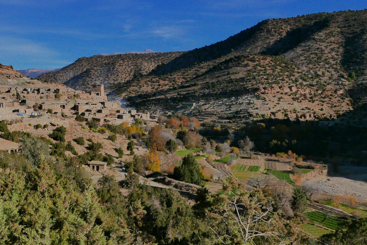
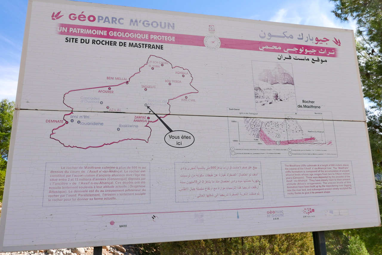
After my 2015 one-week tours, on the suggestion of a Morocco Overland reader, I rode over to have a look around the Mgoun area of the High Atlas, about 150-km east of Marrakech. The better known Jebel Toubkal is only 65km directly south of Marrakech; Mgoun makes up the other big massif of the High Atlas, with the 4071-metre high point on the ridge only 100m less than Toubkal.
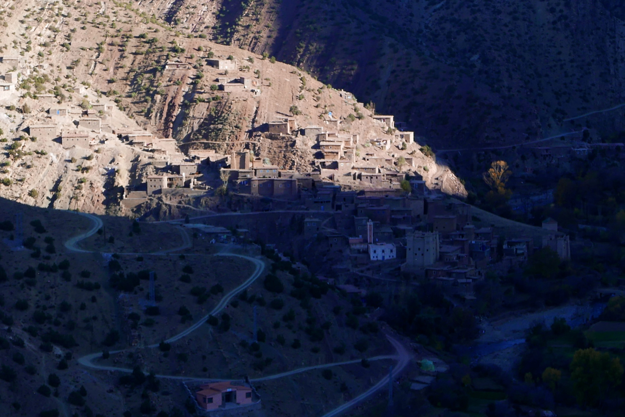
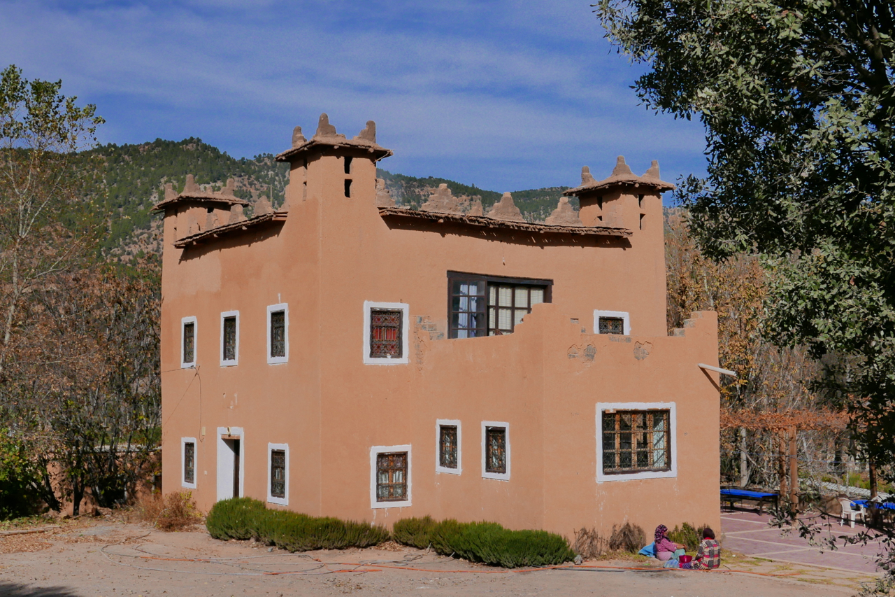
I spent a couple of days based near the hamlet of Zaouiat Ahansal (left), joining up the dots visible on the Olaf map (below), or whatever I found. Tucked up the head of the valley, as the same suggests, the Berber settlement of Ahansal is the site of a religious institution – or Zaouiat – founded back in the 13th century.
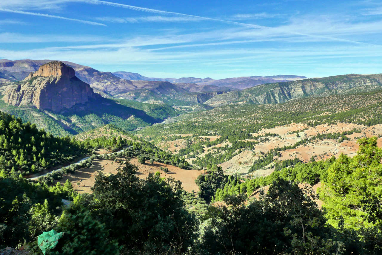
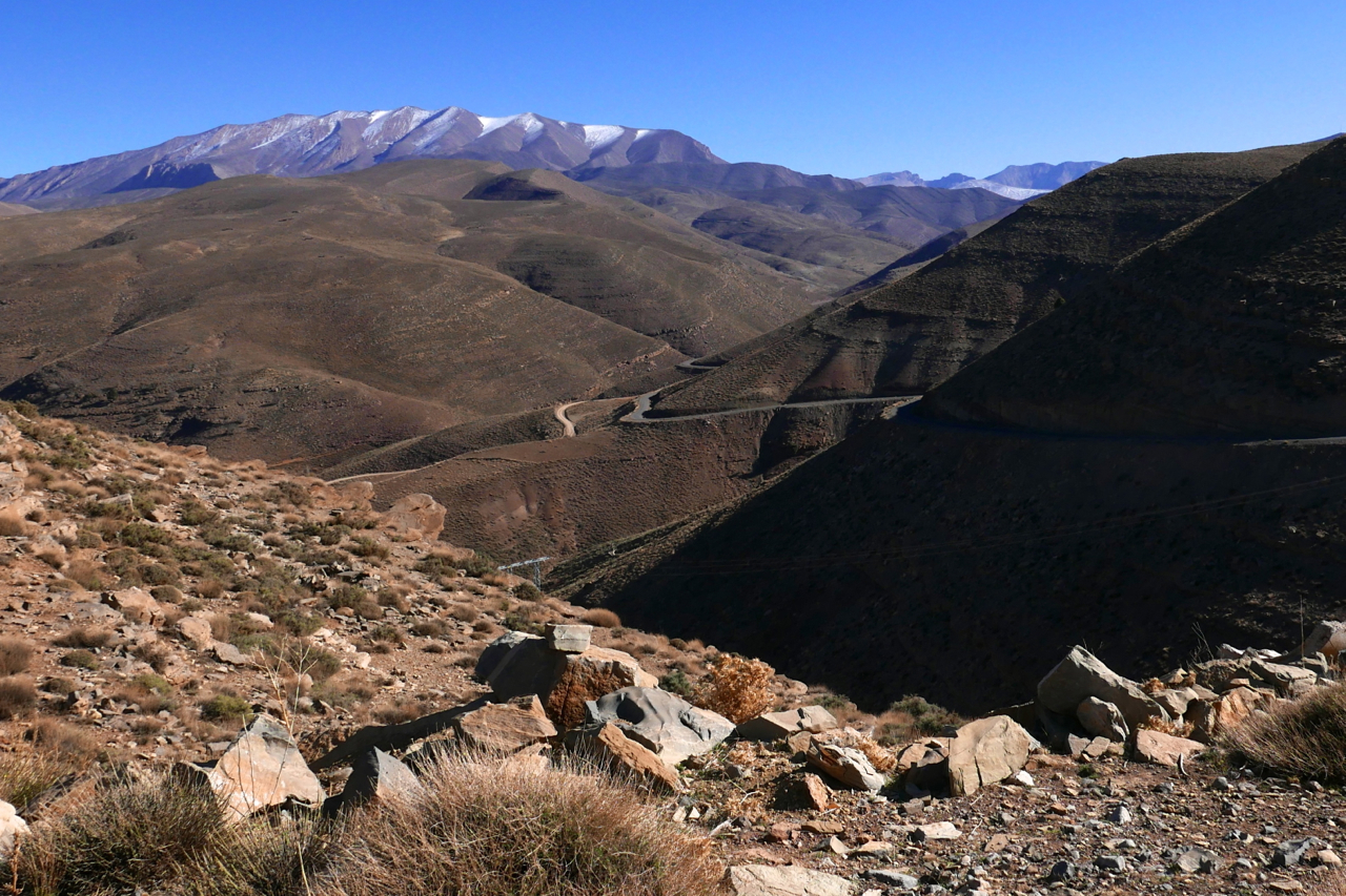
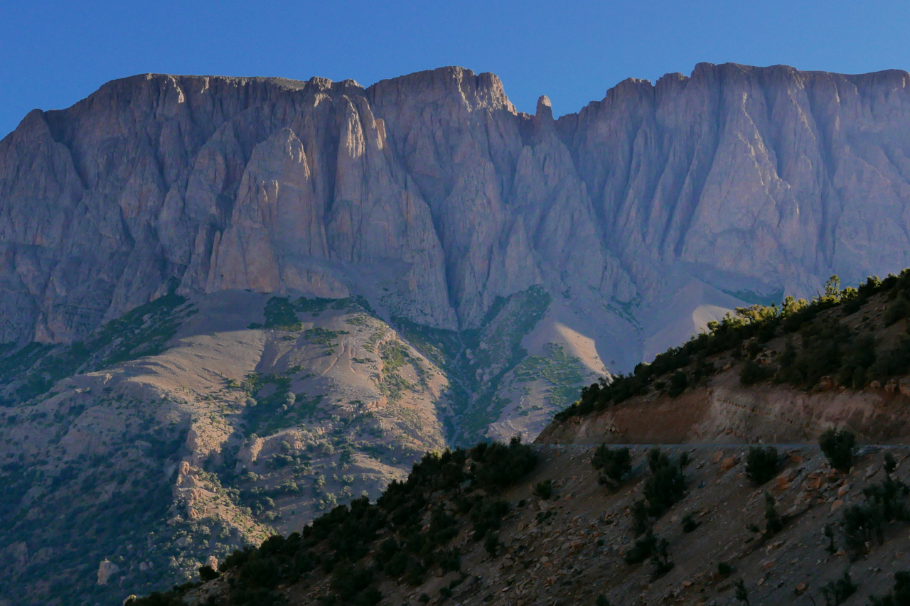
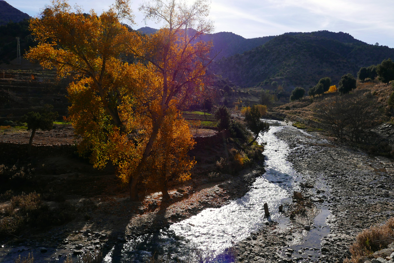
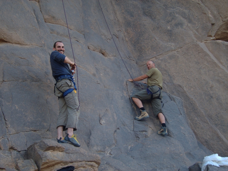
In the area is the famous Cathedral crag (left) well-known to rock climbers, and from where intrepid piste-bashers have sought links east to Imilchil or south over the Atlas to the Dades valley. As usual with Olaf, some tracks have been sealed, some have been abandoned and found new routes, and some were never really passable with anything more than a donkey on stilts. And even with my bike’s potential 500-km range and backroad-and-piste speeds, I still had to make use of the fuel stops indicated on the map below. Amazingly, the weather continued to hold out with bright sunshine, but as soon as you ride into the shadows temperatures dropped. The roads and tracks got up to 2700-metres of 9000 feet and revealed yet another one of Morocco’s incredible diverse landscapes.
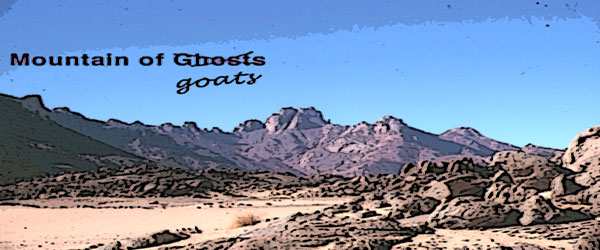
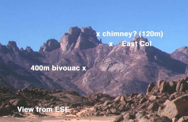
Que dit Mohamed? Mohamed, il dit qu’il accepte de vous conduire ou vous voulez, du Tenere, aux Azzjers, du Mouydir aux Iforas, il crevera s’il le faut son chameau pour vous plaire; mais vous accompagner a la Garet, jamais!… Il y a des Djenouns mon Captan… Pas un homme du Hoggar ne vous accompagnera sur les flancs de la Garet…
Garet, first ascent, 1935. Carnets Saharienesby Roger Frison-Roche
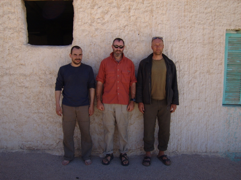
November 2005. Photos me, Jon and Nick
Jon, me and Nick-the-Cam flew into Tam to shoot Mountain of Spirits (MoS), another ageing idea of mine brushed down, spruced up and slotted into the ‘let’s do it’ category. Unable to find a cast, Jon and I worked through our inherent modesty and decided to be in it ourselves. In 2003 Desert Riders ended with me crashing out as Jon and I neared Garet with the intention of climbing it. So our film had a theme. Indeed my interest in Garet ran back to my first Saharan trip in ’82.
Tam airport car park 3am and a whole bunch of French and German fly-ins dispersed with us into the desert, to regroup a fortnight later for the flight back, some limping, some in slings, most with suntans and chi-chi headwear.
By the skin of our teeth we managed to slip thousands of pounds of camera gear and other restricted items through the scanners and past Customs, and spent the night in a house in Tam. Wanting to keep it simple and being hard men of the desert (or attracted to that idea on film!) the original plan had been to do it all out the back of a pickup; us three in the back, the crew up front. But the permit people were appalled at the idea: “Tourists are NOT goats” they exclaimed, so a station wagon was roped in. Just as well, the brief sessions filming in the back proved it would have been a rough fortnight indeed.
We headed up to Tahat (2908m), Atakor west side, for a warm-up slog into the Saharan Death Zone. It should have been an easy walk but luck – or was it the djenouns? – was against us. Lots of rain in 2005 and amazingly streams were still running out of the Hoggar. Tahat base camp we could have made at a pinch, but on up to Assekrem was washed-out (never easy at the best of times). Not wanting to lose time, we grabbed a few shots, scooted back to town and took the regular way up to Assekrem for a cozy night in the lodge and the dramatic sunset/sunrise.
The descent to Hirafok is still a spring-munching crawl at times. In places smoother than when I last did it in 2000, elsewhere cut up by the recent run-off. Still, as I was already finding, you sure notice a whole lot more when you’re not driving. Nevertheless, I was reminded that the Atakor is a grim and rough place where you’re jammed on the pistes. If it wasn’t for Assekrem being a ‘must-do’, I wouldn’t bother when you compare it to the lovely sandstone and granite ranges nearby.
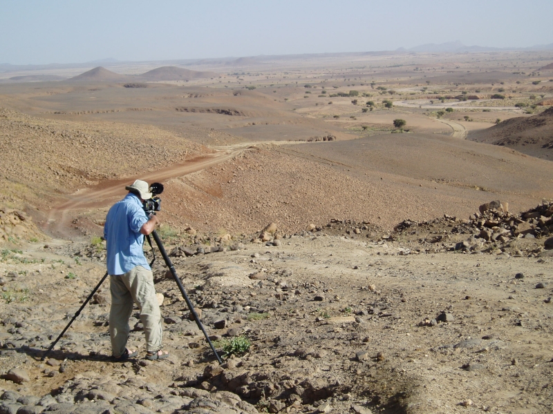
By now I was gripped by le grippe and with time lost, was not fired up enough to shoot over to Telertheba (2455m) to see how far we’d get up that one. Almost certainly we would not have made the summit, first climbed by Conrad Killian in the 1920s, but it would have been fun trying. So we thought, let’s head straight for Garet and get stuck in; it was the focus of the film after all. Filming properly and not in my practiced fast-and-loose style, was taking a whole lot more time, but part of the project’s purpose was a curiosity to appraise the results of shooting a film with proper attention to detail.
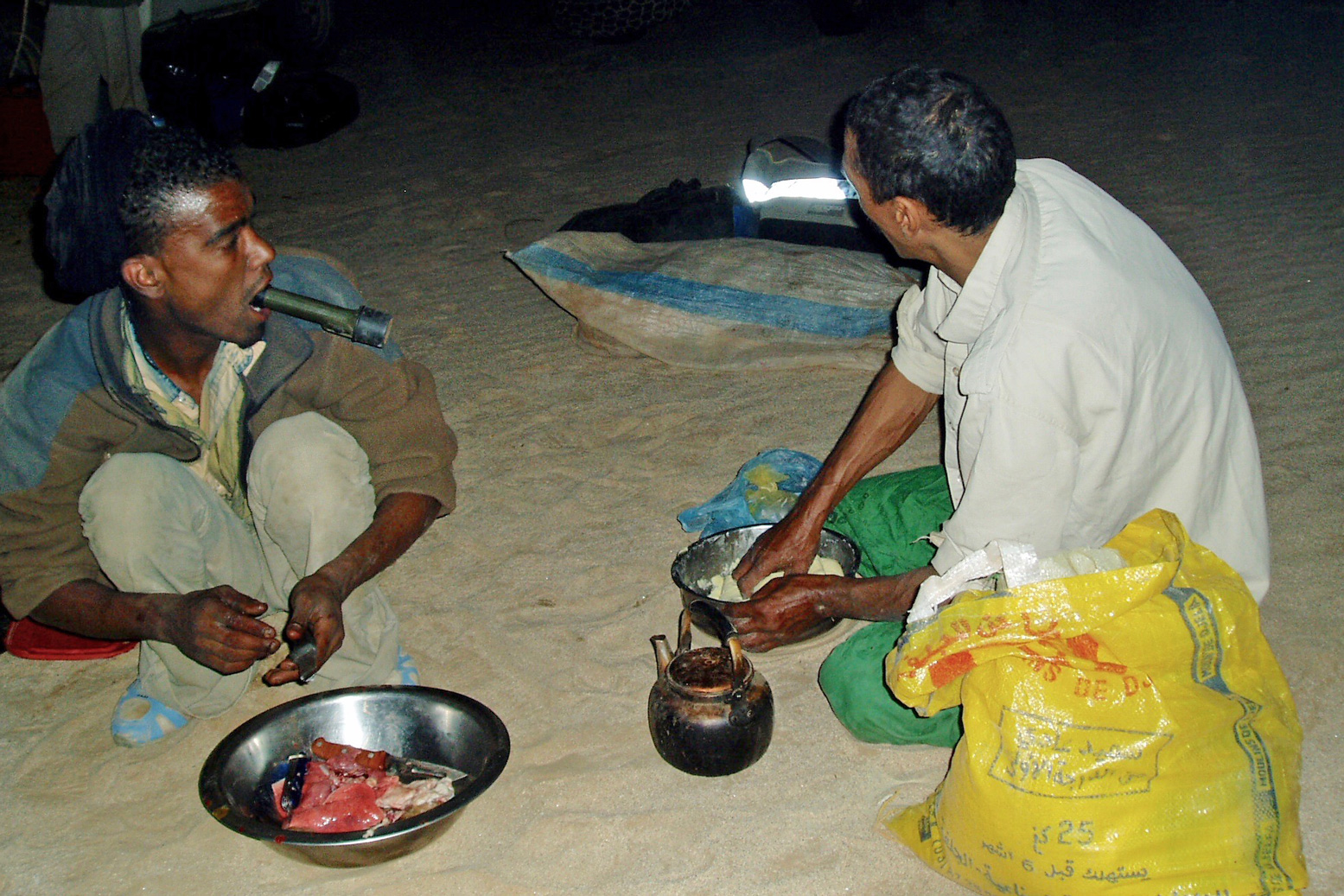
We took the Hassi Dehine piste, camping near the well. Being end of Ramadan I bought a goat off some nomads and our crew spent the the rest of the night tearing it to bits and cooking it up. The liver (or some such organ) grilled in fat-wraps was very tasty. We met up with the nomads next morning and gave them a lift to another nearby camp for some festive socialising. They all knew Mohamed our guide – or his late father, a nomad of note from the In Salah area.
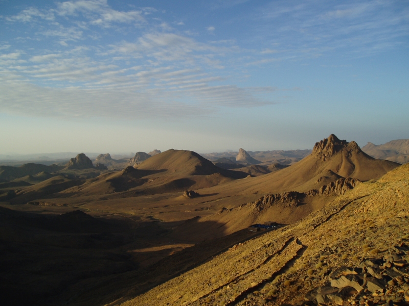
It’s a lovely drive up the Tefedest west side as always and after a while the distinctive turret of Garet juts up from the ridge line. Over the next few days we ended up driving right round the Tefedest, and Garet is always prominent, even 100kms away. It may not be the highest point but, like the Matterhorn or Ayers Rock, its elemental presence casts a spell of its own.
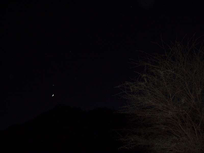
But the pesky djenoun were still trifling with us. We proceeded to spend half a day pushing into dead end oueds, failing to locate the point which I stumbled on easily with my 2000 tour group, close to the mountain’s foot. We did have an actual waypoint for a base camp attainable by vehicle, but could not get nearer than an adjacent valley, 2km away, due to flood-washed banks. Two clicks was near enough though, so that evening we set off on foot over the pass with all the water we could carry plus Abdelsalaam with another waterbag on his head. Even then, I had a suspicion water was going to be an issue and when we got to the base camp waypoint we texted for another bag to be brought up. Water was low but Mohamed knew of a well on the other side of the Igharhar valley. As darkness fell the crescent moon emerged from behind Garet’s flanks, hanging directly below Venus – a diabolical alignment considered inauspicious since before the days of Babylon.
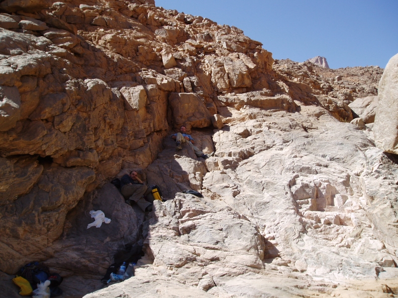
We loaded up and set off around dawn, up the boulder-chocked east oued, hoping we were following an Italian route description I’d found in a climbing magazine. It quickly reminded me of our attempt on Jebel Uweinat early in 2004 where the broken terrain at the end of a much longer approach walk wore us down. Here on Garet, we were soon hogging the shade, detesting our overnight backpacks and stopping for breathers every 20 mins. Clearly our recent colds and lack of exercise on other mountains was having an effect, added to the suspicion that this was not going to be the pleasingly videogenic cakewalk we’d imagined.
Between filming and panting it took us most of the day to get just 400m above the plain! Another 1000m of ascent over less than 2km remained, including, as far as we knew, a pitch of roping up a chimney and a traverse followed by a scramble up a cleft onto the summit plateau. A big French party had come through in April, on the 60th anniversary of Roger Frison-Roche’s first ascent (his, via an obsolete western route) so how hard could it be for a lightweight alpine-style crew? The problem (or my excuse) was we’d misunderstood the translated Italian and French descriptions: a ‘bivouac’ to which the French party had portaged water was probably the 400m height we’d just attained, not our base camp that morning. It was from the bivi, rested and replete with water, that one set out to summit and return to base in a long, 14-hour day.
As on Uweinat, water was the problem, along with the fatiguing terrain. Here, I did not want to take a similar chance and plough on regardless to the point where we’d run out of water and food to stagger back. A braver attitude perhaps, and one that can get results, but the reality of an accident up here would be tiresome at the very least; knowing when to turn back was something I’d learned on my first Saharan trip. Better to accept it as a recce and use what time we had left to nip up north to the equally intriguing Amguid crater trek.
So we bounced back down from rock to rock in half the time, picking up what we’d left on the way. There were a few gueltas, and next time I’d take a chance and tap them with a good water filter to save carrying the stuff. Back at the base camp it was getting dark and our water hadn’t been delivered, although there was a pot of still-warm rice. After a breather we loaded up and hiked back to the cars in the dark. Turned out the well on the far side wasn’t usable and now water was a priority.
Next morning we headed for the reliable nomad’s wells on the edge of the Gharis or Immidir escarpment in whose canyon’s Group 1 of the 2003 hostages had been stashed and then released in a raid. We had a good wash at the Tabariq well as a quick rain shower passed over, let some nomads use the Thuraya sat phone to get their tea on, and that night, halfway to the Foum Mahek fuel dump, the far distant profile of Garet loomed in the dusk, like a passing submarine. The djenoun were not finished with us yet.
We headed for a fuel cache I’d left among some rocks in 2002 for the Desert Riders (we never got that far). I like to think I may have even recognised it without GPS. The six jerries were mostly full – some had leaked under pressure and a plastic water bottle cracked at the first touch. This stuff had endured three summers, including the notoriously hot summer of 2003 which spread as far as Europe (41°C in London, remember…). Fuelled up and with a nice ‘cache recovery’ shot in the bag, we set off towards Foum Mahek, at last some new terrain for me.
As we ate lunch under a shade tree a pickup pulled up fast on seeing us. Smugglers said Mohamed. As is often the case, they were more alarmed by us then we were by them (same story at Kemal al Din in the Gilf, 2004). Their new Tojo pickup – bought from the proceeds of cig smuggling – still had the dockside stock numbers scrawled on the windscreen, but they were actually just ‘searching for a lost camel’. The news they had was that a checkpoint at a pass on the way to the crater was making passage difficult for travellers and was turning back tourists. A day or two getting official permission may have brought them round, but time was short and the fact that we were also carrying clearly non-amateur filming gear may have got us into trouble.
OK, forget that idea too. Looks like it was becoming one of those trips… I suppose I was overdue for one. We trudged back south along the edge of the scarp and curved round towards the highway. Next day near Asseksam well we were mirror-flashed by some nomads. No souvenir-n-scrounging ploy this, but a request to transport a sick old man to the daily Tam bus at Moulay Lahsene. No probs, it was right on our way, passing through the rounded inselbergs and bright granite sands west the Tidikmar which reminded me of our memorable ride through the Taffassasset down to Erg Killian in 2003.
At Moulay they still circle the old marabout’s tomb three times for good luck. When I first spotted people doing that in the 80s I thought they were merely hoons. For us though, it was getting too late to invoke the blessings of the saintly Lahsene to save our project. Hoping to shake off the djinns, we headed west round the back of Tesnou through more exfoliating granite domes and camped near ‘Elephant Rock’, so named by some Italian climbers who’d pegged up the sides.
Here we were free of the corrugations and run-off channels of the Hoggar and Tefedest, out in the open and felt the much better for it. Nothing for it now but to take an idle 3-day drive back south to In Amguel oued and Tam; 10 o’clock mornings, 3 o’clock evenings, exploring, lazing about, filming, even some rock climbing. It was a nice spin down to a frustrating trip.
Though there seemed little point, we shot what was to have been the spine-chilling opening sequence of MoS where a fire-lit nomad (Mohamed in a blanket) spookily recounted the legend of the lost boys of Garet, lured to their deaths by a mendacious mouflon (barbary sheep or waddan; ‘Oudane’ is the Tuareg name for Garet). Their trapped spirits were symbolised by Garet’s twin turrets.
One day near a lunchtime hill Jon found a carefully-engraved Tuareg spear head, and another day we dozed in a broad oued sprinkled with lighter-than-water pumice, flushed out of the Hoggar by the recent floods. Despite the strict protocols laid out in my book, a rounded piece of aerated lava now sits alongside the bath at home.
Another sunny evening in the dunes west of Ouassdert well, Jon and I even managed to get the dunes ‘singing’, a phenomenon I’d read and written of but never experienced. Indeed it sounded like the passing rumble of a distant propeller plane, but was clearly caused by out feet disturbing the sands. With a couple of new intros for the Desert Driving 2 dvd caught on tape, we rolled back into Tam, had a great feed and hopped on the 3am redeye back to Paris.
Bit of an expensive flop, this one, but you got to try these things and as always there was a positive side. We saw some nice new desert in the last few days west of the Highway and I was impressed with Mohamed’s enthusiasm for exploring – not the usual quick-buck/tramline guide mentality. We’ve since cooked up a couple of meaty tours for the coming year, and though a film about not climbing a mountain through lethargy and disorganisation is probably not worth the effort of editing, doubtless Garet will be in touch for another crack.
Sahara Overland camel contributor Alistair Bestow gives an account of the Bilma salt caravan in Niger. See also the Sahara Trekking ebook
For a few years now, on my office wall at work I have had a Jean-Luc Manaud calendar, with evocative images of Niger, particularly of the Tenere Desert. It is well out of date, and has been stuck on the image of Fachi for months. I had resolved to get there this winter, and to see both Bilma and Fachi, by camel if that was possible.
I arrived in Agadez on 30th December 2005, after having travelled from Niamey by bus, and hunted down one of the guides recommended by Lonely Planet. Moussa Touboulou was in town and available to be my guide, if we could work out an itinerary for such a trip at a reasonable price. I was told that it was only really possible to travel both to, and from, Bilma by camel caravan, if I arrived in Agadez in October. There is apparently an ‘October Rush’ being the most favourable time to go for the camels. Therefore it would be possible to go to Bilma by vehicle, and then wait for a caravan to leave Bilma for Agadez.
We nutted out a deal, whereby Moussa would organise the travel by truck to Dirkou (600+km), and then 4WD from Dirkou to Bilma (40km) and then by camel from Bilma back to Agadez. He would travel with me for the full distance, organise the permit -still required for travel in this area- food, water and accommodation, if needed in Dirkou and Bilma. His fee was CFA55000 per day (approx £55 per day). We worked out a daily rate, because the number of days to undertake the travel was not certain, and I have had experience in a guide wildly over-estimating the number of days for a journey, thereby making the daily cost quite expensive. It proved to be the case here too, -Moussa estimating 30 days, but in fact the trip took only 20 days in all.
There was a few days to wait in Agadez before a truck was going to leave for Dirkou, but one was located, and on Wednesday 4th Jan 2006, we went by taxi to the edge of town where indeed a large Mercedes truck was waiting. We climbed aboard on top of the goods, along with 30 or so others for the journey to Dirkou. It proved to be nearly two days travel, the truck being overloaded, and lumbering along quite slowly over the flat, flat desert. It was quite an experience to travel this way, being crushed in with everyone else, but was thankful that it was only 2 days, and that we were not as overloaded as some of the other trucks that we saw en-route.
We arrived in Dirkou, being a surprisingly large town, on the morning of Jan 6th. We stayed overnight at a ‘friends’ house, which left me time to explore the markets under the shady trees, and to marvel at the flat absolute desert to the west. Moussa organised a lift in a 4WD the next day for Bilma, and we arrived there on Jan 7th.
Bilma is everything I had imagined of an oasis, but being larger than I expected. There are shady sandy streets -large trees I think which may have been planted by the French, groves of date palms, watered gardens of fruit and vegetables, an aging, crumbling fort, and a Grand Source of water, being a large pool of water inhabited by small fish, and frequented by birds including a spoonbill. To the north west of the oasis, are the salt works, where pools of saline water are created to allow the salt to crystallise on the surface. The workers then disturb the crystals on the surface, sending them to the bottom from where they are collected and dried. These crystals are then broken up by a hammer, have water added to them, and than are placed in moulds of one shape or another. The moulds are either a basin or two sizes, or a cone, made from the truck of a palm tree and covered with leather. The salt is turned out, and then dried into the robust forms which are carried by caravan to Agadez and beyond.
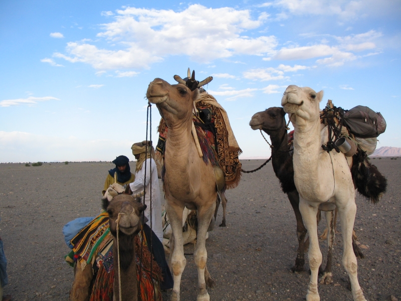
I was in Bilma for 2 days, before the caravan Moussa had located and negotiated with, was due to leave. The day before our departure, I went to the salt works where the caravan was located, and watch the parcels of salt being made ready for transport. Generally two or three cones, were packed with several basin forms of salt, in damp palm matting, and tied up with rope. The large parcels were barely able to be lifted by a man. The salt is supported, when on the camel by goat skins filled with dates -also being sent to Agadez and beyond.
On Monday 9th Jan, we joined the caravan, and at 1.00pm said farewell to Bilma. It is noted that in contrast to the caravan travel I have done in Mali, to Timbuktu-Taoudenni, that this trip saw us rent some capacity from the caravan itself, rather than having our own camels. This meant that Moussa and I were ’embedded’ in the caravan. On the Timbuktu-Taoudenni trips it has been difficult sometimes to convince the guide to travel with the salt caravans, because it is easier and faster to travel with the guides own camels.
The desert here was quite different from that of Mali, the Tenere being much sandier, having less vegetation, and more dunes, but at the same time being less variable in its appearance, than the desert of Mali. It was four days of travel to reach Fachi,. There was plenty of time to admire the wonderful creamy dunes along the way, of which there are many. We travelled from 9 in the morning to about 10 at night non-stop. It was clearly well planned, as the caravan carried exactly the correct amount of feed for this sector, until they picked up another 4 days worth of feed that they had left in Fachi on the way to Bilma. After the eighth day, we reached the Arbre du Tenere monument, and there after there was sufficient feed to be found for the camels en-route for the last 7 days of travel to Agadez, making a total of 15 days by camel.
The last 6 days of travel was through stony desert, with frequent patches of vegetation for the camels to eat, and we passed a number of villages, and nomadic Tuareg with their sheep and goats. We also travelled for a few less hours per day than had been the case for the first 8 days.
The caravan actually was not going to finish its journey until Tahoua, some few hundred kilometers later. On the last night , I said my farewells to the camelliers whom I had got to know over the previous 2 weeks. They had made me feel very welcome, and it was a great journey.
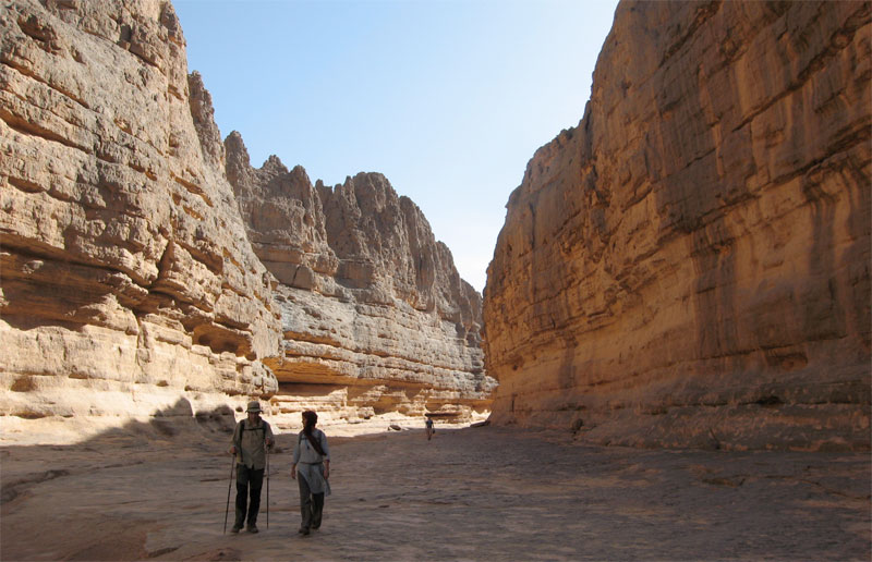
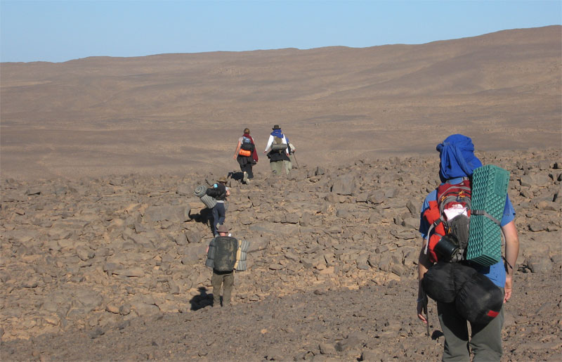
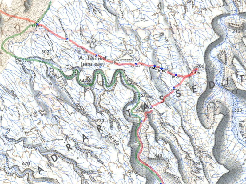
In November 2007 I joined a recce organised by Amelia Stewart Travel and Tanezrouft Voyages. Over 11 days we walked about 200kms from south of Arak through the northeastern Immidir to the Amguid Crater and the Bou Zerafa dunes beyond.
In January 2009 I led Amelia Stewart Travel’s first tour: photo report here. And there’s a slide show from the 2010 tour here
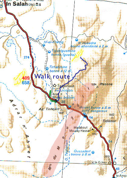
The Immidir, aka the ‘MontsduMouydir’ on the Mich map, left, is a region of plateaux, escarpments and canyons that spread north and east of the Arak Gorge on the Trans-Sahara Highway. To the south are the lovely exfoliated granite domes around Tidikmar and Moulay Lahcen which we visited in 2005, and to the north and west of the TSH are a number of low plateaux, sand sheets and small ergs making up the Adrar Ahnet.
A few groups have followed part of our route through the Immidir before, and I know of a few others who’ve approached the crater from the Tin Habedra piste by car, and walked the last 10-20 kms, but no one combined both. It was an idea I’d proposed to Amelia Stewart Travel. She liked it, found some people and here we were. Right now in 2026, the Immidir has been closed for many years, as Algerian authorities seek to limit the infinite range of locales accessible to tourists across it’s vast southern provinces.
After arriving at In Salah, we drove south 300kms along the Trans Sahara Highway to this valley a few kms beyond Arak settlement. The camels and crew had been waiting a couple of days. Next morning we set off north up the Ighaghar valley in the middle left of the picture.
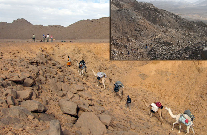
The first few days with a south wind were hot and at times the terrain proved to be tougher for the camels than I expected. On Day 1 a few camels stumbled and lost their loads getting to the top of the Taflout Pass pictured above.
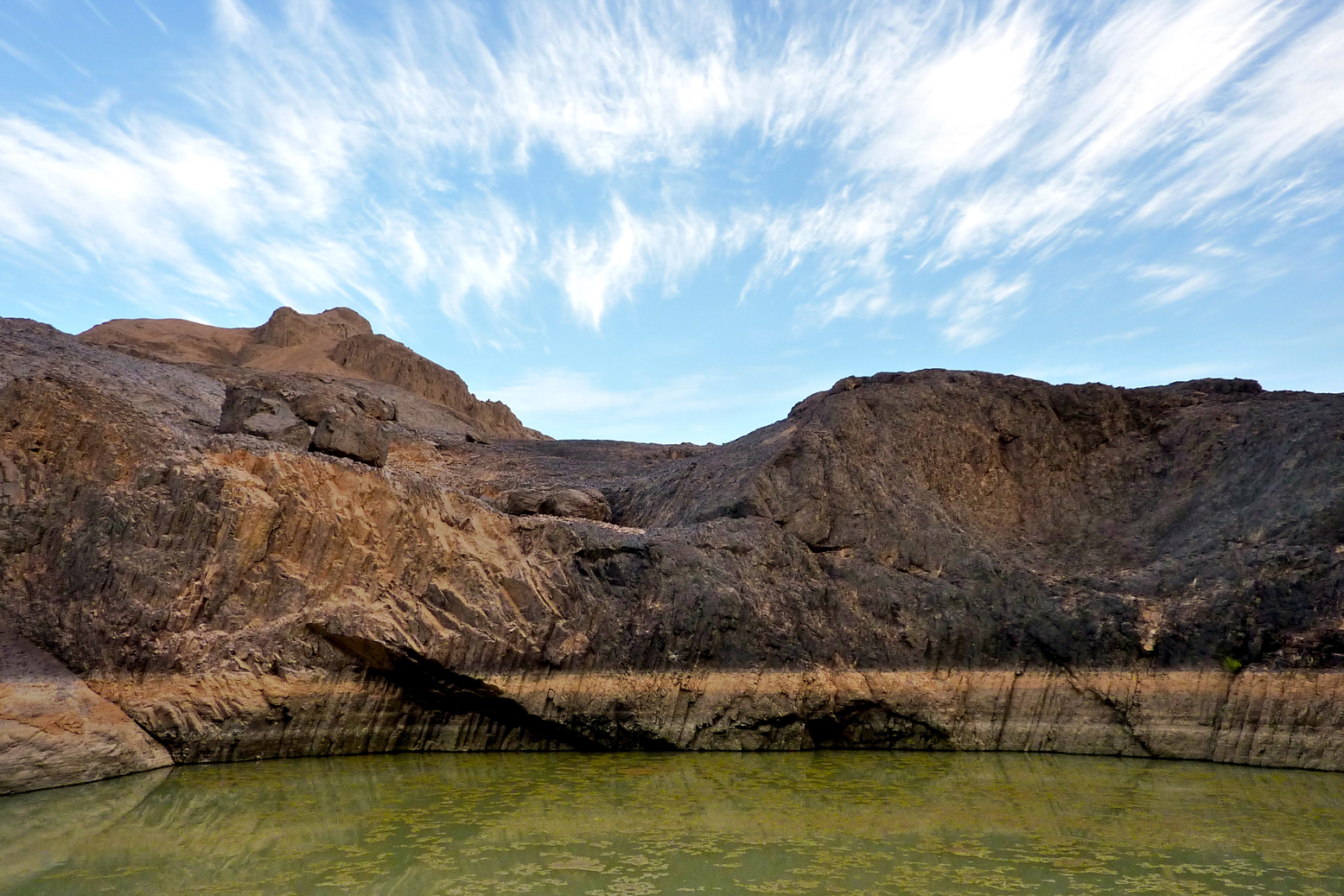
By the next day we had a morning wandering through the cool box canyons and welcome gueltas or aguelmam for which the Immidir is well known. This place is just behind the Arak Gorge.
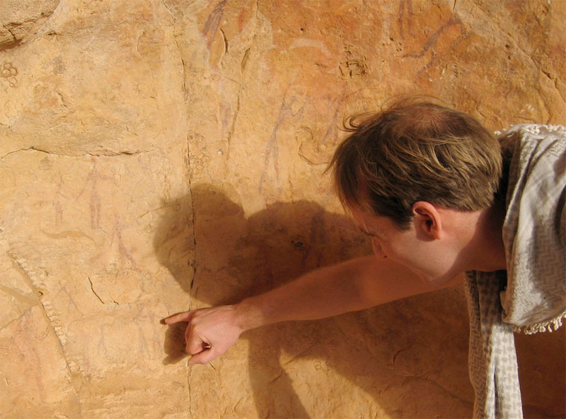
Although there was rock art to be found, what we saw wasn’t a patch on the quality and density of the famous Ajjer plateau above Djanet, Libya’s Akakus or the Gilf and Jebel Uweinat (Egypt/Sudan).
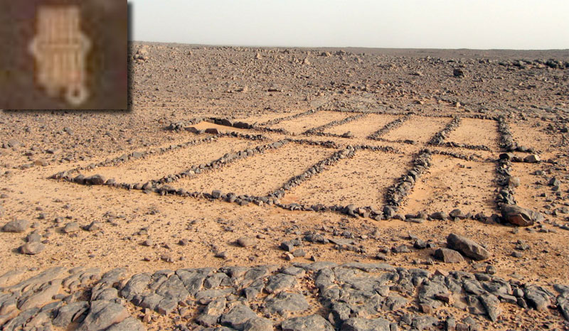
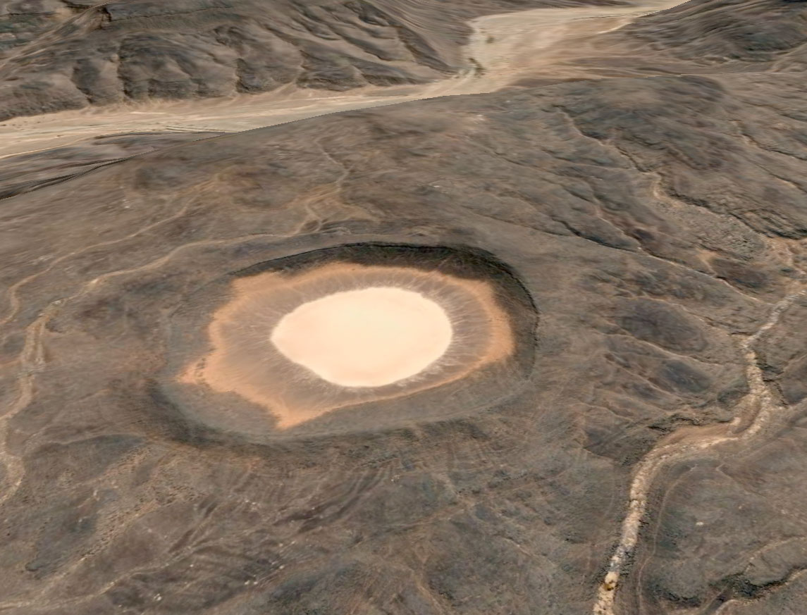
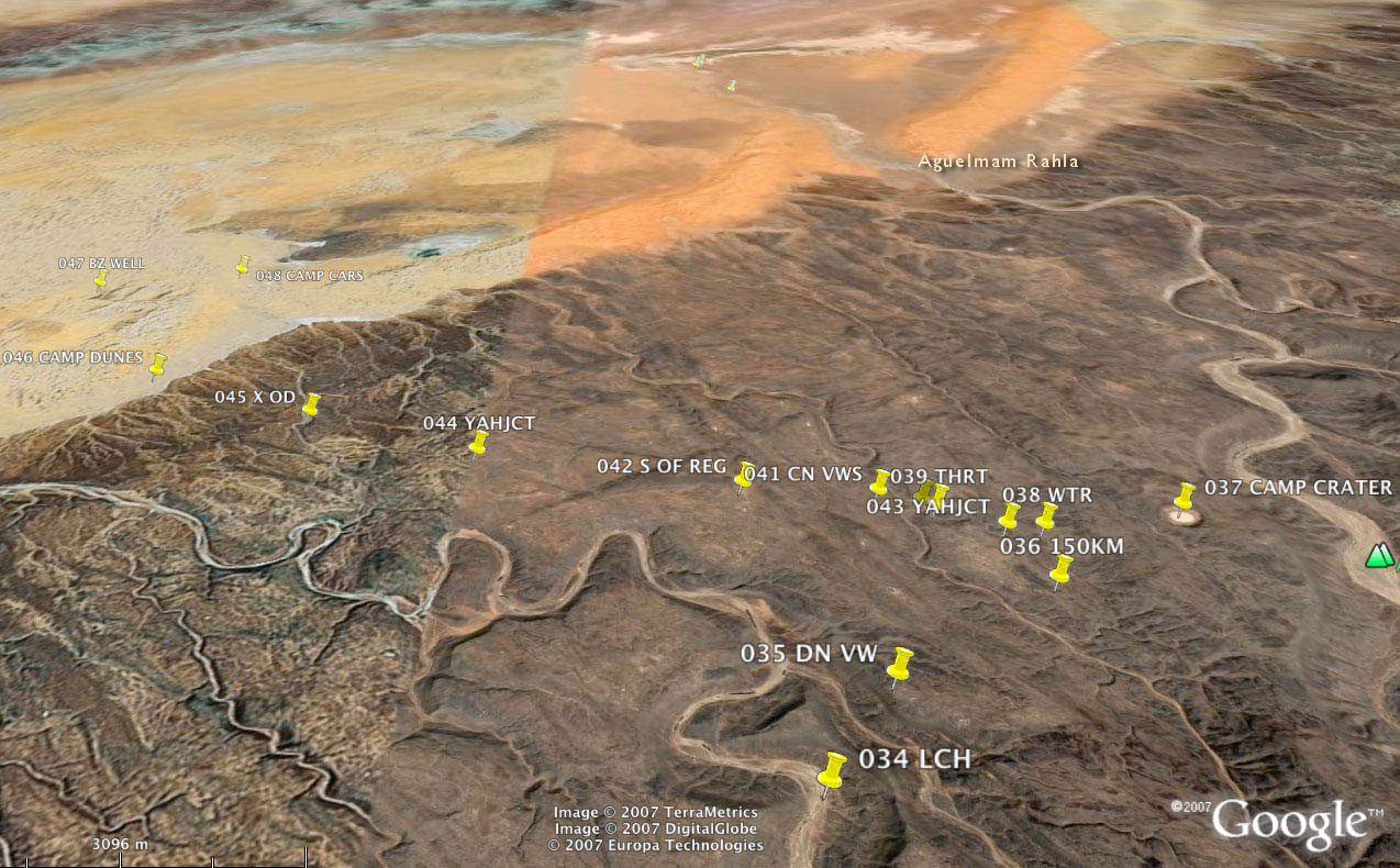
Most days we came across a desert mosque of some sort, although I’ve never seen the ‘pewed’ examples we found in the Immidir. The inset shows a similar structure viewed from Google Earth at Aguelman Rahla guelta, 13kms directly north of the crater at the mouth of Oued Tafrakrek (see Google image below). Google Earth shows the permanent guelta surrounded by pre-islamic tombs (including the less common keyhole type) which suggests that like many Sahara oueds, the place has long been inhabited.
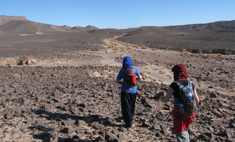
What tracks there were were old camel pistes across the hammada. Rubble like this was tough on boots and feet; most of us got blisters. Even the camels needed treating for cuts and one night the guides made them some hide socks. Some days the camel caravan took alternative, easier routes. Daily distances varied between 14 and 24kms. By the end we didn’t even notice a 14-km morning. The route is inaccessible to vehicles, but we passed plenty of mouflon, jackal, gazelle and fennec trails and once saw camel tracks other than our own. On a later tour we even saw cheetah tracks which are said to inhabit the area.
This was a nice day; about 24 clicks round the back of the guelta below, over a ridge where one camel collapsed and needed unpacking and a gentle kicking. Then round to the big oued above which fed the gorge pictured below and into a series of small valleys where I found an intact pot.
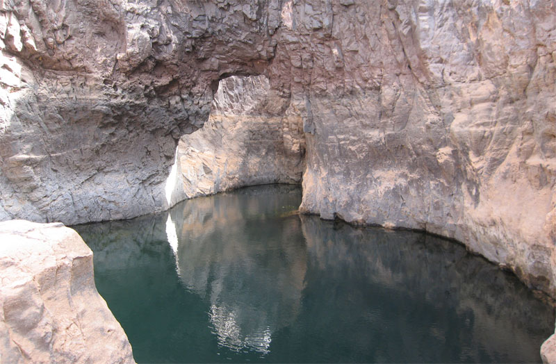
One lunch stop was by a deeply-carved gorge strung out with several waterholes (gueltas) and this arch.
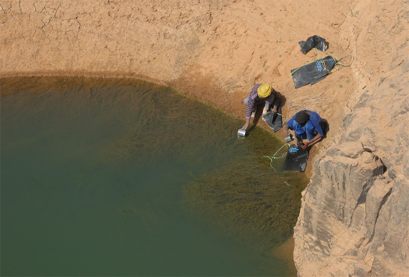
With no wells along the walking stage, the crew refilled from sources like this. People are put off by the green colour but of course what makes you ill you can’t see, even in crystal clear water. Being early in the cool season following the summer rains, the water was probably fresh enough and if the crew could drink it so ought I. As an experiment I drank some as it came but didn’t get ill.
Interestingly ‘flying’ over our route on Google Earth reveals the region awash with gueltas. The gorge above is almost one long pool, and elsewhere we or the camels would not have got through some valleys and gorges without swimming.
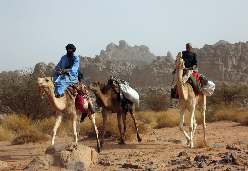
Mohamed H of Agence Tanezrouft and Sidi Ali our cook coming through. Sidi and the crew’s work started when we stopped walking for the day, and carried on until we set off before them next morning, so we didn’t resent them riding once in a while. We could too and those that did remarked what a relief it was to be able to look around at the scenery instead of dodging the next rock underfoot. But the wooden saddles are hard on the butt.
After a while it didn’t take much hesitation for us to grab a quick wash or launder at any guelta we came across, or even dive in for a swim. Like all tassilis, the Immidir has countless gueltas which make it suited to camel trekking. You can see from the ‘tide lines’ how deep this one fills after heavy rains.
Some shade always cropped up around lunchtime or ‘midi’. Usually we’d have to wait for Sidi Ali and his lunch camels to catch up. Then, while we siesta’d the main caravan might pass through and keep going, usually getting to our evening camp ahead of us.
Food. Breakfast was light: coffee with hot milk and baguettes, sand bread or pancakes with jam and marg. We were sometimes given dates and a soft drink for the road. Lunch was a heap of mixed salad or veggie rice followed by mint tea and an orange while they lasted. We has more tea/coffee and biscuits soon after we stopped walking for the day. Dinner was soup and bread, a main course of cous cous/rice/pasta and stew – all variations on dried goat meat followed by an orange and mint tea. Most of us brought some sort of snacks and I brought my v-kettle (right) with drinks/soups which came in handy while waiting for the lunch camel to turn up.
Although I ate much less then I normally do, I eat too much anyway and saw the trek as a bit of a detox. I lost about half a stone but was never hungry. The daily ritual of walking, sleeping, chatting, eating and resting was very satisfying; as always the desert demonstrates how little you need to be content.
I carried about 2.5 litres of water per day in a Camelbak (bigger than most) and never ran out. On the earlier hotter days at about 30°C I got through 2L, later in the low 20s it was about a litre. About the same as summer in England.
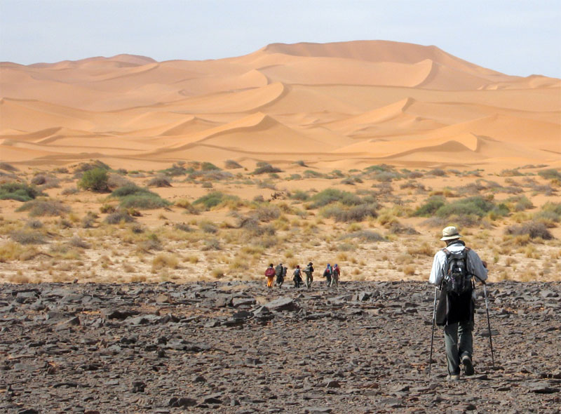
Come the big day the chattering subsided but we were still smiling when we got to the top of this gnaaarly climb, having unnecessarily gone up and down another ridge (see map below). With us we carried overnight gear, a bit of food and -no surprise to me having done these sort of walks before – not enough water. At the top of the climb we got our first sight of the Bou Zerafa dunefield 20 kms to the north and from this picture overlooking the camel route below the crater was only about 6km to the east.
Before we set off from Arak I didn’t have a clue which way our guide Yahia was going to reach Bou Zerafa other than north some way. A map didn’t mean much to him so there was little point asking or pointing and Tamachek names don’t always match the map’s Arabic. I presume then it was a total fluke when his route led far to the east below the Adrar Tassedit escarpment before turning north up the Oued Bou Zerafa – or Oued Tassedit as they called it. It could not have passed closer to the crater site.
So east we went. The broken terrain reminded me of a mild version of Ginge Fullen’s attempt to climb Bittu Bitti, Libya’s highest peak (see p.377 in the Sahara book). Between us and the horizon where the crater surely lay were any number of chasms, clefts and gorges. Near this point we passed the 150-km mark which put the crater at nearly 100 miles from our departure point near Arak.
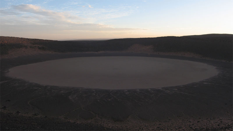
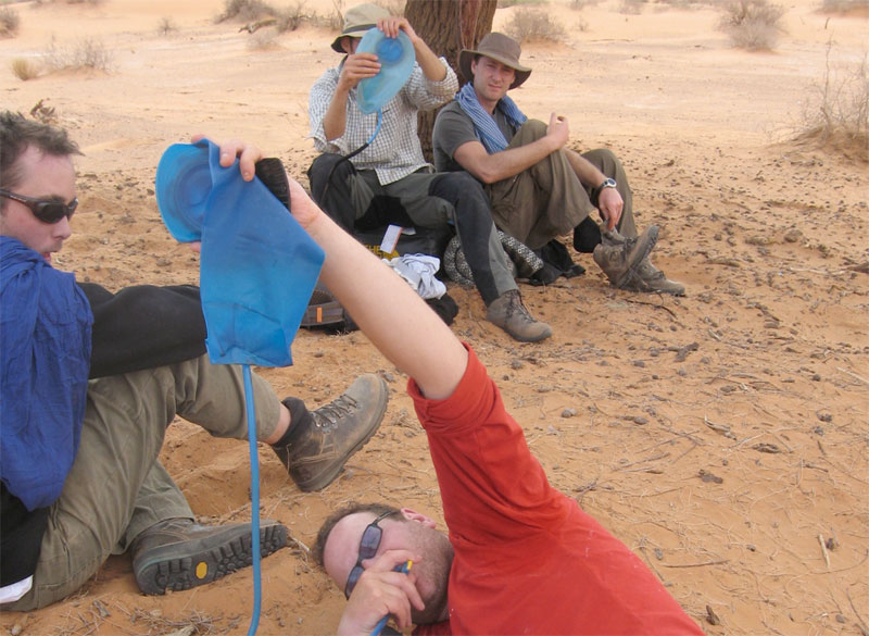
Just on sunset and having covered 7 tough kms in 3.5 hours, we sat ourselves down in the middle of the crater pan. Not sure what we’re all laughing about; we each have less than a litre of water left so tomorrow was going to be a bit of a march but our goal had been accomplished.
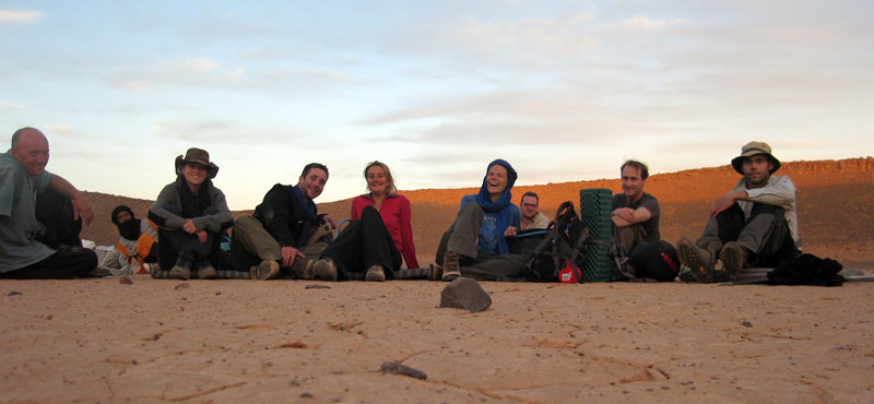
From the left: me, Yahia the guide, Francoise, Jon the photographer, Imogen, Amelia, Bob, Amelia’s parner Lex who tracked the whole route on GPS and Tom.
The crater is thought to have been formed less than 100,000 years ago with the first recorded visit by a French geologist in 1969. For us it would have been nice to explore it in sunlight and I’d also hoped to take a hike over to the Oued Tafrakrek rim a couple of clicks to the east. But having chatted with Mohamed on the sat phone, Yahia explained to us the camels were already heading for the dunes so to intercept them we had a longer cross-country walk the next day. I went to sleep thirsty, woke up thirsty and at first light decided to drink my last cupful while others chose to save a few drops for the hike. To make the most of the cool morning we climbed out of the crater at first light and set off northwest to the dunes.
Here’s part of our route in red over the Adrar Tassedit plateau 8 days after leaving Arak. After lunch (009 LCH if you have bionic eyes) and repacking our gear we left the caravan trail in green, crossed a needless ridge (below the ‘A’ and then climbed back onto the plateau (‘009 DN VW’; the group shot 4 pics above) and then went up and down past ‘009 150KM’ to the crater at ‘706’. The map above is about 15 miles/25kms wide.
Although we were unsure to put our trust in Yahia as he’d never been here either, next day he led us to the dunes where our camels were waiting. Knowing water was scarce he lured us on, keeping just out of reach so there was no discussion about which way to go. As the return route and waypoints show, his Tuareg ‘GPS’ was spot on. Apart from the easily-remedied water issues our route to the crater was as good as could be expected.
In 2009 we started at dawn at ‘557’ a bit to the north of our lunch spot, above the meander of the ‘T’ on the map. We climbed up the valley side with a bit of scrambling and had a much easier 2.5hr/6km each way walk to the crater. Next day we followed the green route along the canyon to the dunes and beyond, probably 30km but no one noticed by now.
With some (myself included) a bit more parched than others (notably the women), we finally staggered off the plateau and onto the sands some 6 hours and 16 kms from the crater – much further than we imagined and having drunk no- or just a couple of sips of water. Everyone had quietly focused on the task. Luckily it was another cool day and of course we knew the crew was out there somewhere with water.
Once on the sands some desperados cracked and drained the last gritty dregs from their hydrators while Yahia dashed off to track down the caravan out in the sands. A few minutes later Mohamed came galloping in with some water.
We spent the rest of the day idling about and drinking everything they brought us. That evening, while contemplating the transit of Orion and Copernicus’ theory that meteorites never strike in the same place twice, a shooting star tore in low over the Tassedit plateau above the crater. With a bright green trail breaking up behind it, somewhere out there a new sprinkling of space debris had scattered itself across the desert floor. As we discussed the startling phenomenon a sonic ‘b-boom’ rippled over the sands, suggesting a meteorite had indeed breached the atmosphere. Someone knew the speed of sound and estimating the time after the sighting, Tom worked out it had fallen about 50 miles away, well beyond the crater. With this suitably astral climax to our crater day, Copernicus was proved right – again.
Next day we headed into the dunes for some exercise. Some took the high road…
… some took the low. We passed Bou Zerafa well marked on the maps. It was sanded over but Yahia assured us there was water a metre below. Winding up our 10-day rocky plateau trek in the glowing orange sands of an erg was perfect – another highlight after the crater.
Next morning the cars turned up from In Salah with fresh food and water. At this point my camera passed out but we carried on northeast alongside a dune ridge to one more camp (passing some lovely pestle-like moules to go with the countless grinders lying around). Another short morning followed to knock off ‘200kms’ according to Lex’s GPS tracking, right by an unmarked well with good water.
We drove from there northwest to Tin Habedra well (sanded in) and then directly west along the Habedra piste passing escarpments lined with tall cairns and small, palmy sources while chased by a storm front. It showered a bit that evening and most took to the tents for the first time as lightning flashes circled us along the horizon. Then at 2am a bolt exploded nearby and a heavy shower drenched the camp. The tents held off the worst of it but next morning by the time we’d got the fire lit most weren’t in the mood for the planned splash about at Tiguelmine guelta on the old Hoggar route. We headed directly back for In Salah, a great feast at Mohamed’s, a plane to Algiers and home.