Category Archives: Sahara News

Moroccan Sahara – Are we there yet?

To paraphrase the cop addressing Jack Nicholson’s character at the end of Chinatown
Forget it Jake, it’s the internet.’

Exactly where does the iconic and eminently Instagramable majesty of Sahara start in Morocco? Like Keyser Söze, is it even there at all?
Years ago I came across an internet forum argument on the now defunct LP Thorn Tree (I gave my 2ç then left them to it). There, a couple of know-alls lambasted the callow innocents daring to enquire where they could ‘see the Sahara in Morocco’ – in most cases referring to the famous Erg Chebbi dunes. ‘I told you: there is no Sahara in Morocco!’. All concerned have now migrated to TripAdvisor from where the quotes below were copied. It staggers me that some of these individuals can assert their unsubstantiated beliefs with such conviction, but such are the times. According to one of TA’s wise owls, ‘Erg Chebbi is not in Sahara, desert it is but not Sahara‘. So the Sahara is ringed by an unnamed desert that is not the Sahara?

… neither … Erg Chebbi/Erg Chigaga are the Sahara. For that you need to head to Western Sahara.
Ok, we know that but we want just see Sahara and ride camel
The limit of the Sahara is classified by the limit of the Date Palms
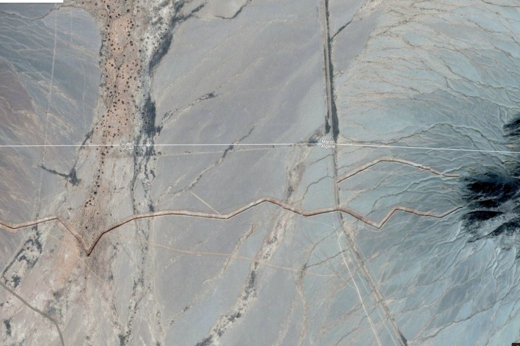
the Sahara,… lies 100 km or more to the south in Algeria.
Although not part of the Sahara , the dunes are pretty amazing.
It also corresponds to the 100mm isohyet in the north and the 150mm isohyet in the south. Long term average rainfall. A further definition is where the evaporation potential exceeds the presipitation [sic]. 
I don’t care what “Sahara” means. I am talking about the actual geographical boundaries of the area. And your definition of those boundaries is as incorrect and misleading as that of the ridiculous tour companies’ one.
Erg Chebbi is not in Sahara, desert it is but not Sahara. If you by reading see on website about Sahara tour, then it is only marketing to attract customers. But Sahara begin first in Algeria or you have to go to the South of Guelmim, to Western Sahara.
Here we go again with the “Erg (Chebbi/Chiggaga) is not the Sahara” brigade. What’s wrong with you? What’s a few hundred miles between friends? Jesus H. Christ.
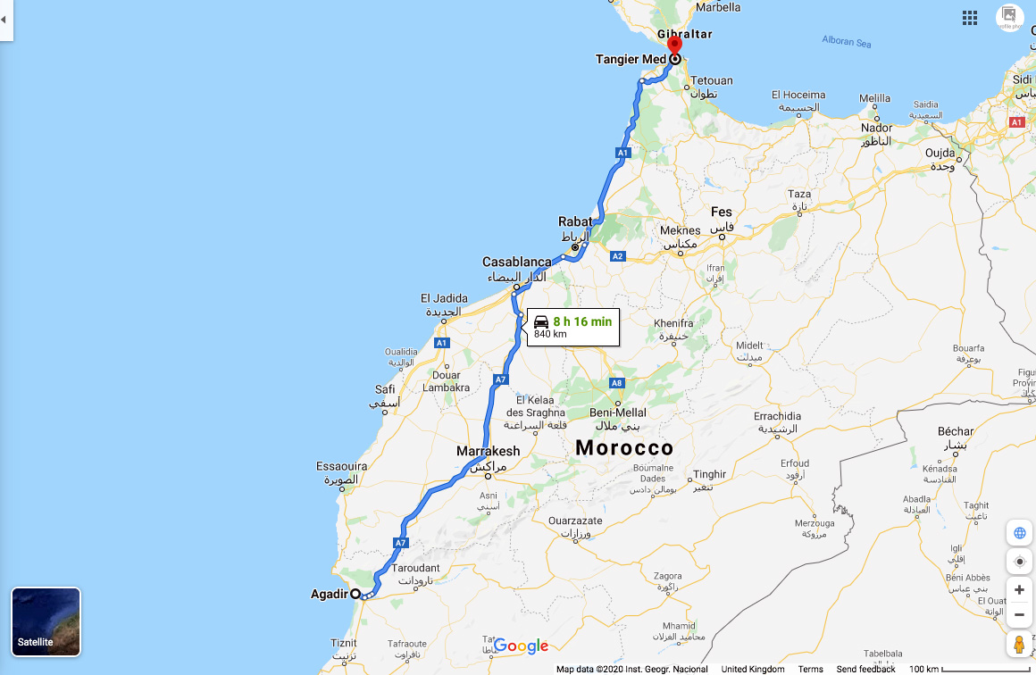
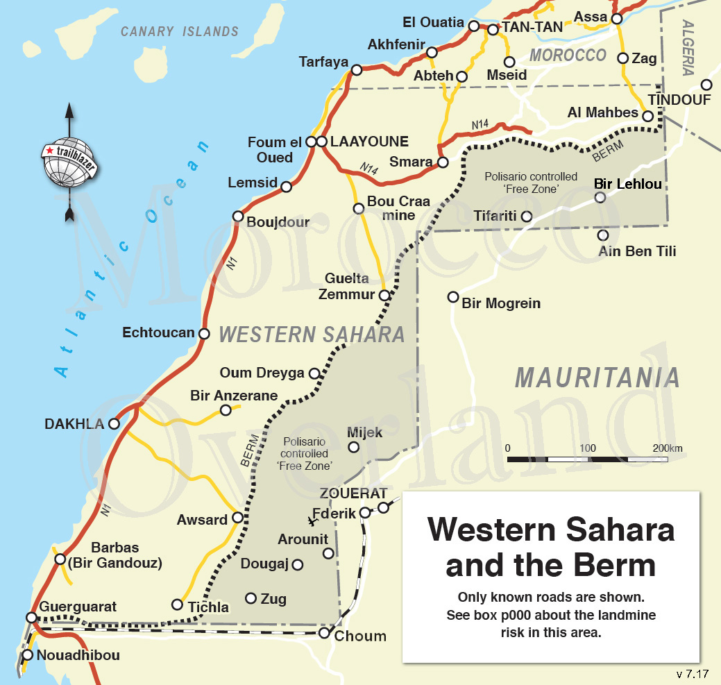
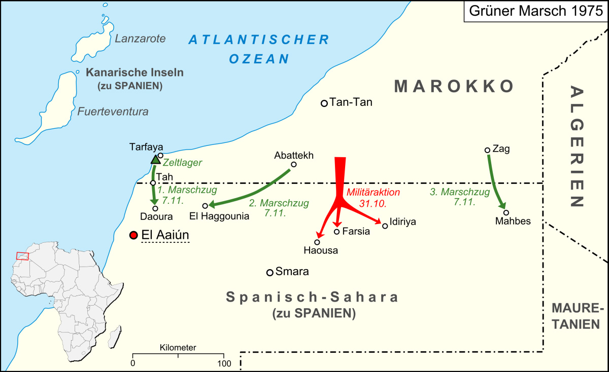
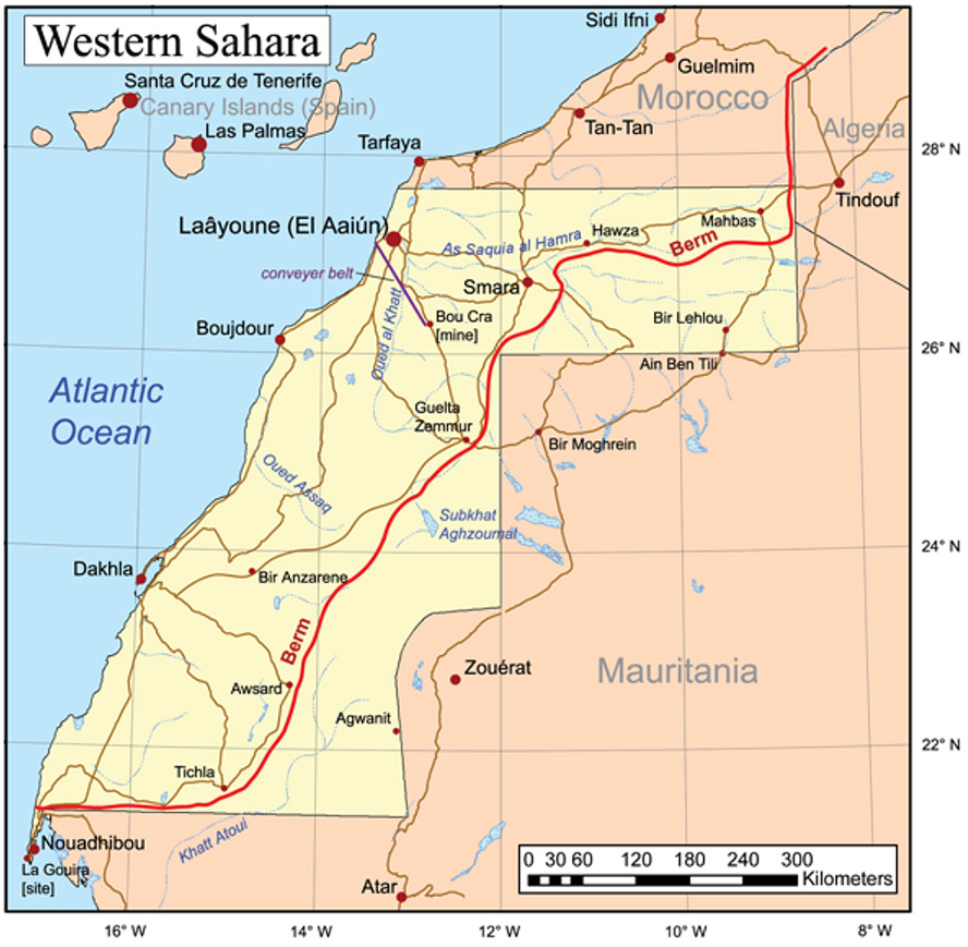
May I just make one thing clear? You will not be travelling through the Sahara desert until you have gone south of La’ayoune. References to the Sahara in other places such as Erg Chebbi and so on are simply concoctions dreamt up by tour companies to fool their victims into thinking that they have been to the Sahara – they haven’t. To the east, the Sahara starts way over the other side of the border, deep into Algeria.
the Sahara if [sic] 100’s of kilometers away from the big dune areas over the border in Algeria and not in Morocco [continues] ... [Chebbi] is more spectacular than any of the places in the Moroccan Sahara that I have visited.

This way please.

This knotty problem of the Sahara’s precise extent may be unique to Morocco. You start with the very concept’s compelling mystique. It’s hard to think of other wilderness regions that conjure up such strong imagery and notions, maybe because it’s so close to Europe compared to other iconic wastelands.
Then you mix in the unceasing clash between gullible bucket listers wanting to definitively tick off the Sahara – and devious local tour ops who promise the earth and deliver a turd. One wily tour agency has even managed to insert themself as a ‘reference’ on Wiki’s ‘Sahara desert (ecoregion)’ page.
This seems to be the angled grinder which the naysayers above fixate on: if some Moroccan cat in an oversized cheche strolls up and says ‘Hello my friend. Come, we will drink tea with nomads and I will show you Sahara’, you can expect to be a little disappointed.

As with all geographical features (seas, mountains, etc), it’s tempting but futile to apply fixed boundaries to their precise extent, as if they were a country. Where exactly does the Southern Ocean become the Atlantic? Where does the Karakoram become the Himalaya, or the High Atlas become the Anti Atlas for that matter (along the N10 highway, of course!).

It’s only rain

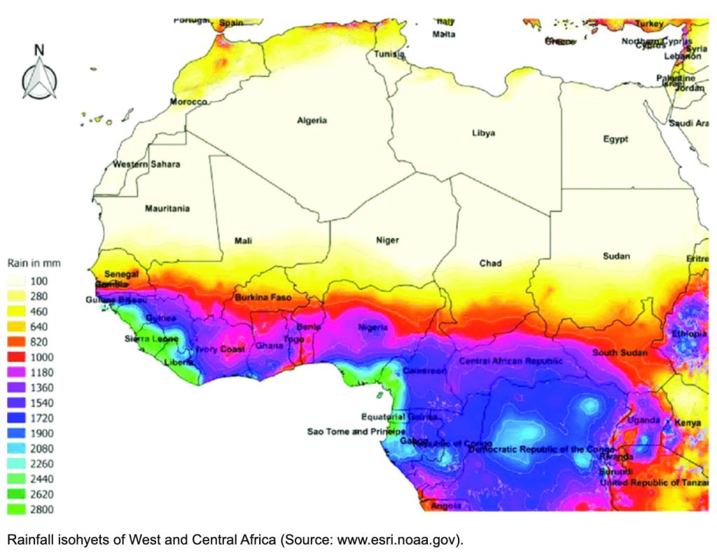
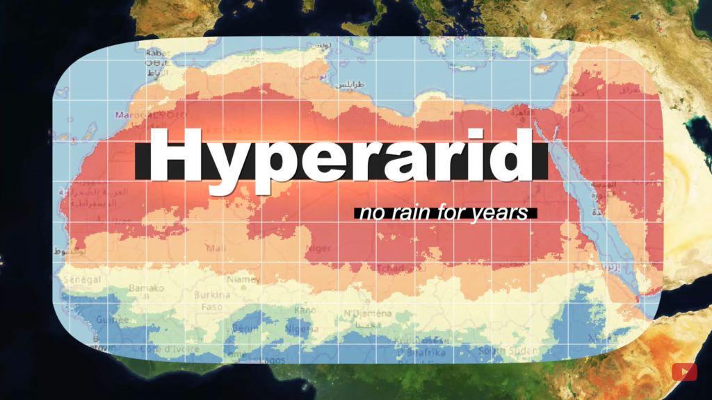
It’s the same with hot deserts, commonly defined as arid regions with less than 100mm of average annual precipitation. Unlike a sea shore, there can be no finite edges identifying this change in rainfall; to imply otherwise would be absurd. In this way the NOAA map (above) is rather more nuanced, showing blurred transitions, not fixed isohyets (rainfall contours) between regions. Both the hard-edged yellow and red maps below could benefit from the same idea.
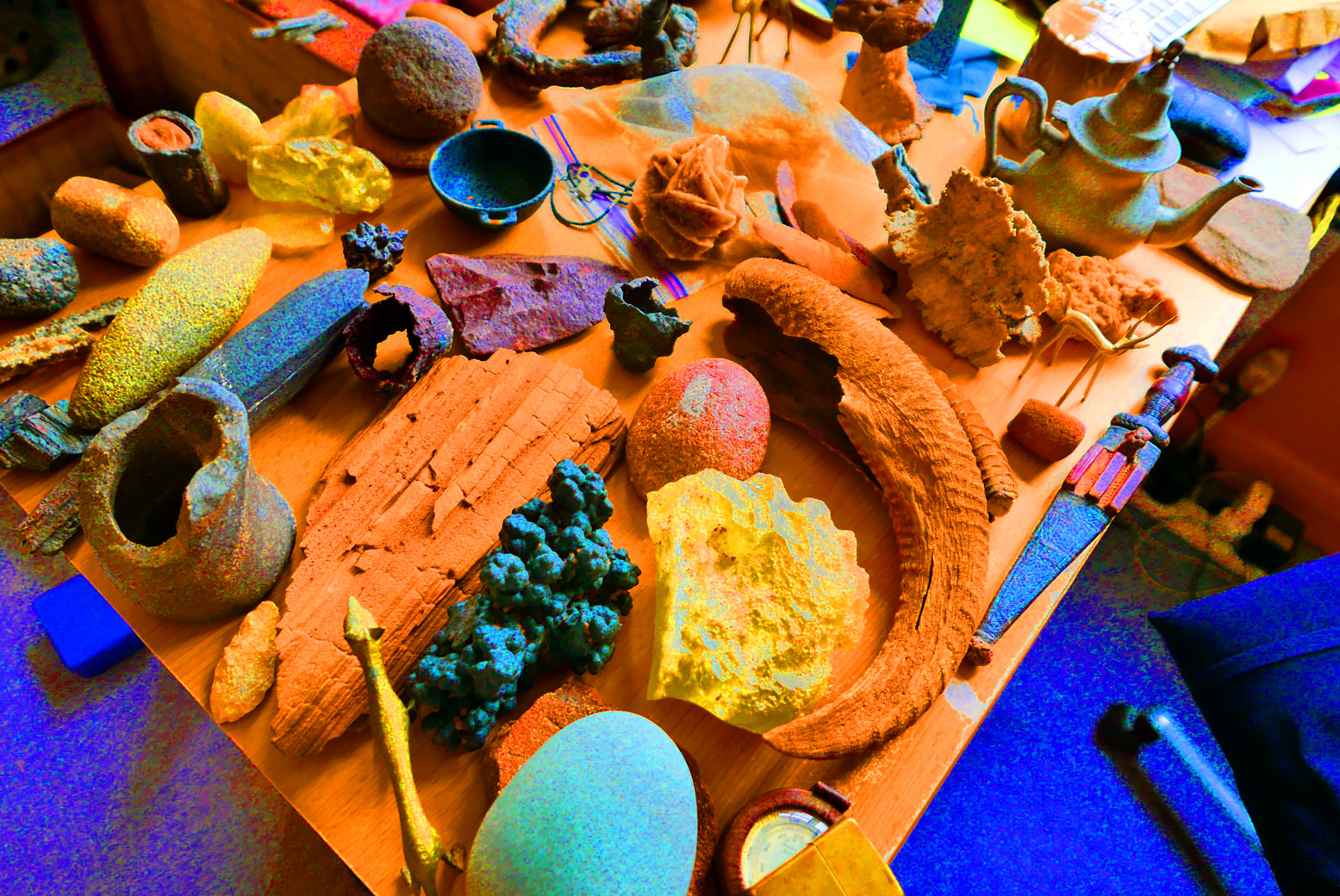
Chebbi-aye-yay

According to this ridiculous website, (sadly, the first that popped up on my Google) it appears to rain every other day in Merzouga/Erg Chebbi. (The ‘sea temperature’ there gets pretty balmy too – or maybe they mean ‘sand sea’).
This source for Merzouga looks rather more plausible: 65mm. Another estimates 53mm. yet another 172mm. This French Wiki gives 59mm. Let’s assume it’s not Kew Gardens down there and it comes in under a 100 mil most years.

Another map with a red zone straying over the Moroccan border. Can’t be right! Source
Archway into the desert, south of Guelmim (iirc)

Not all accept the level of aridity as a definition (‘I don’t care what “Sahara” means…‘), but they don’t cite any sources to explain their assertions about the Sahara’s boundaries. Instead, some of the TA dolts avow the Sahara lies ‘100km south of Erg Chebbi’ (ie: in Algeria). Others insist ‘200 miles’ from Chebbi. Final answer: ‘100’s of kilometers away’. Some even proclaim they magically entered the Sahara at Guelmim in western Morocco because ‘it is officially known as ‘The Gateway to the Sahara’’, surely a bald, tourist-oriented claim in a town famously thick with faux Tuaregs.

Leaving the clammy Tropics. Scorchio!

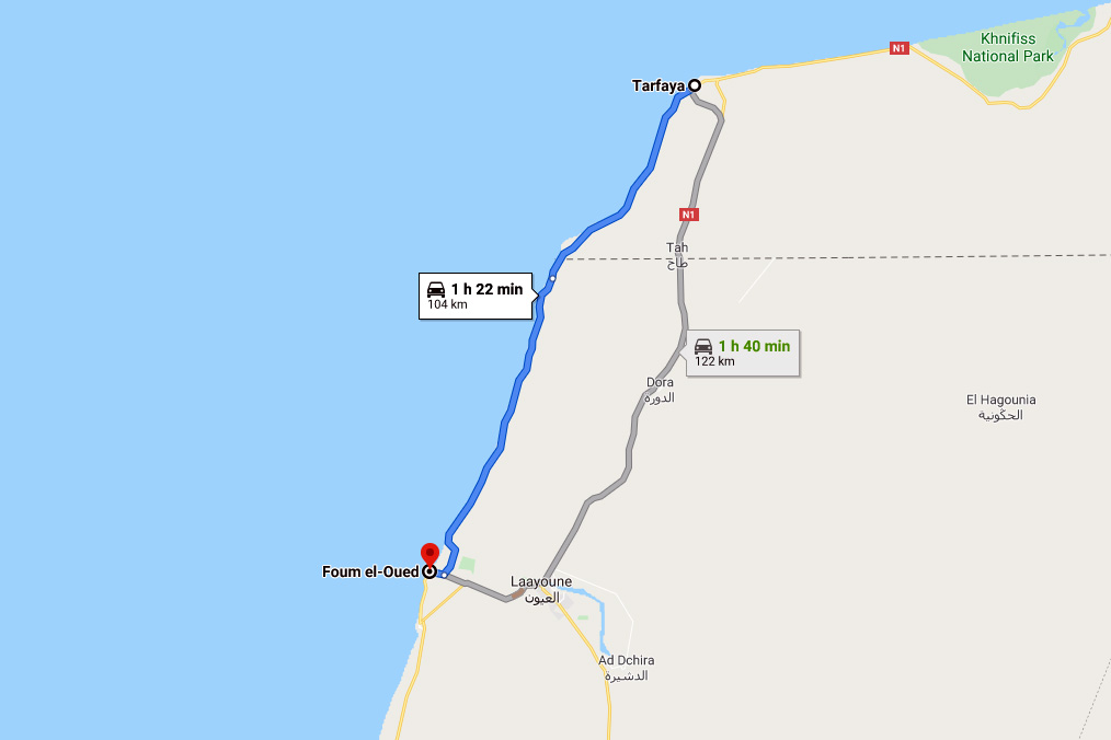
Others insist that, to be in the Sahara in Morocco, you must go ‘beyond Layounne’ (left), a fairly boring road trip, even for a dedicated bucketeer. What will they see on the way there? It may look like a desert, walk like a desert and quack like a desert, but it sure won’t be the Sahara!
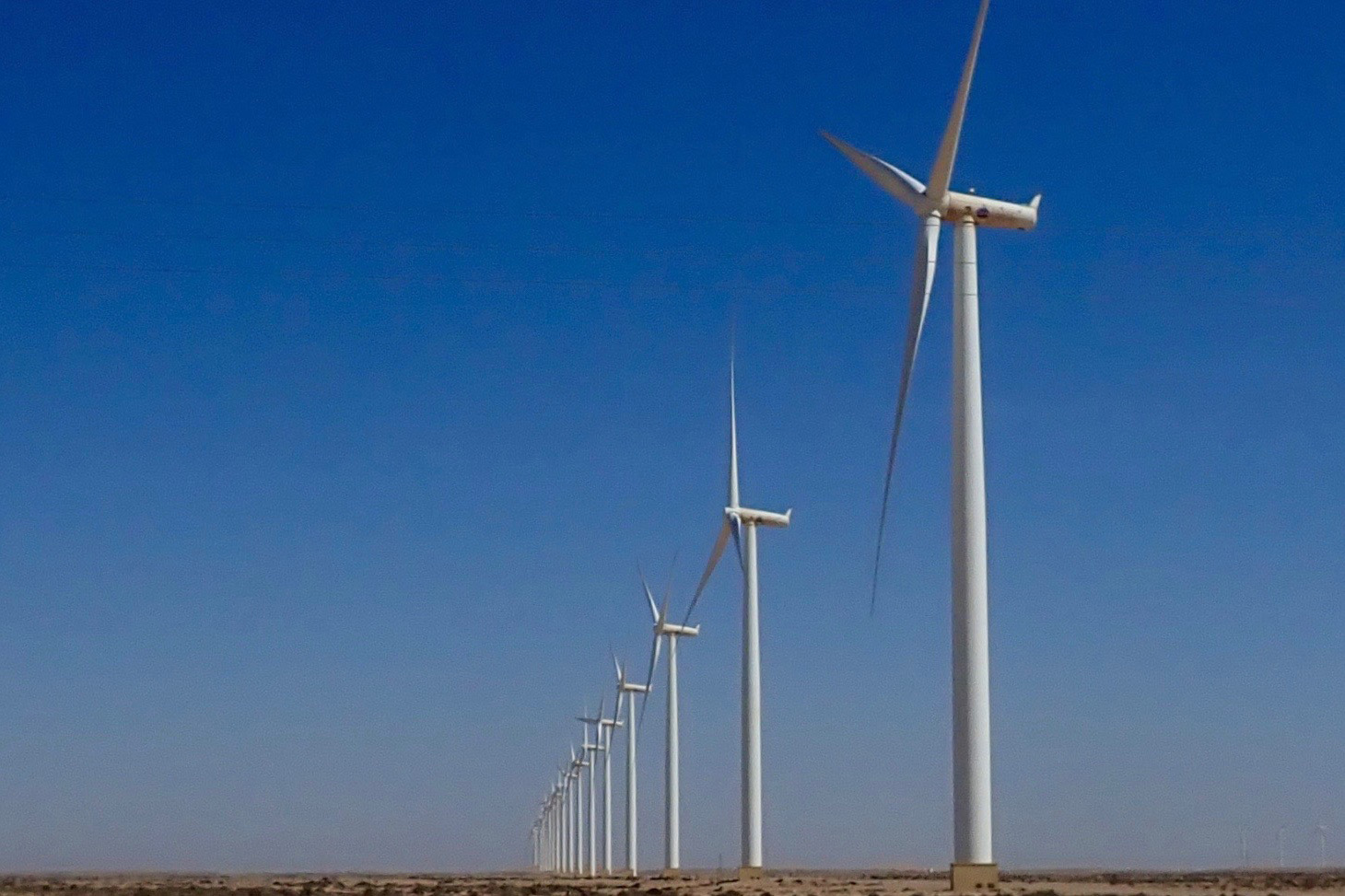
No matter – give it a few decades because it’s said the climate in Morocco will see the Sahara creep over the berm and into Morocco.

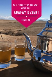
You can see why some of your forum know-alls get cynical, myself included, even if I believe they’re dying on the wrong hill on this one. Lately, some canny marketing has designated an area of eroded wasteland ever so conveniently close to Marrakech’s gated resorts as ‘the Agafay Desert’ or ‘le petit Sahara’ which ‘extends over several hundred acres’.
There you can do all your favourite deserty things: sip tea in a tent, wear a cheche or ride camels, quads and 4x4s across a landscape where the barren rounded hillocks of dried mud resemble dunes. Insta heaven!

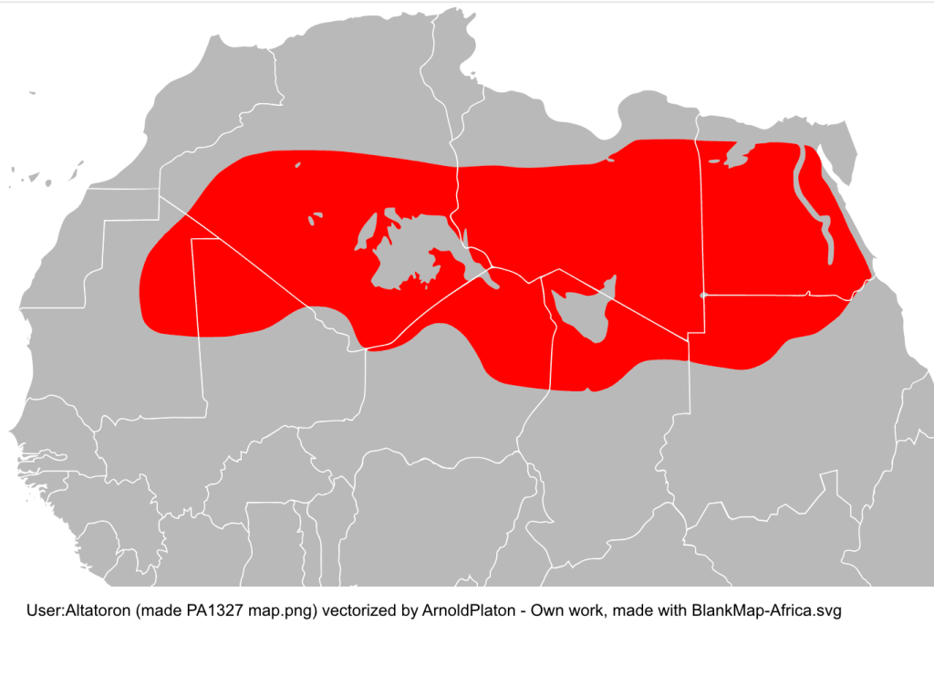
Some academics have sought to reclassify the liminal sweep in question as the ‘North Saharan steppe and woodlands‘. Aka: the edge of the Sahara where things gradually become less arid, like the Sahel in the south. But looking at the zone on the map below, ‘woodland’ is not a word which springs to mind. The band encompasses the vast Grand Erg Oriental spreading across Algeria (left) and southern Tunisia – about as Saharan an expanse anyone could wish for which would swallow up hundreds of Chebbis. The only woodland here is of the petrified fossil variety, west of Hassi bel Guebbour.

Selima

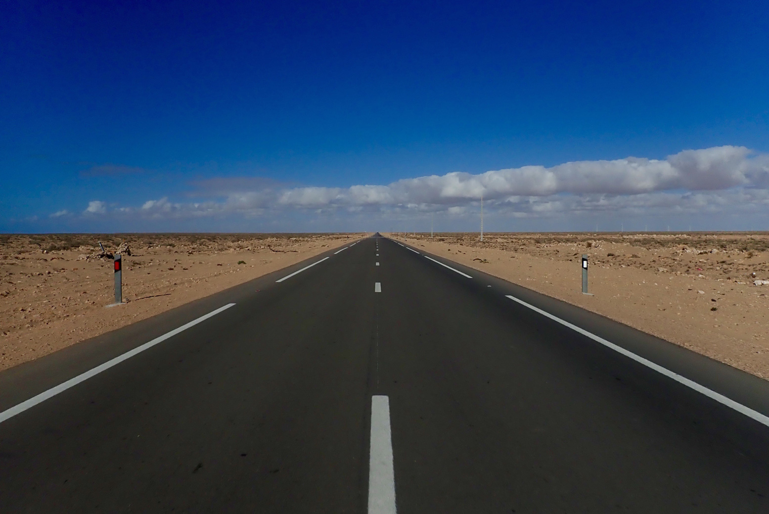
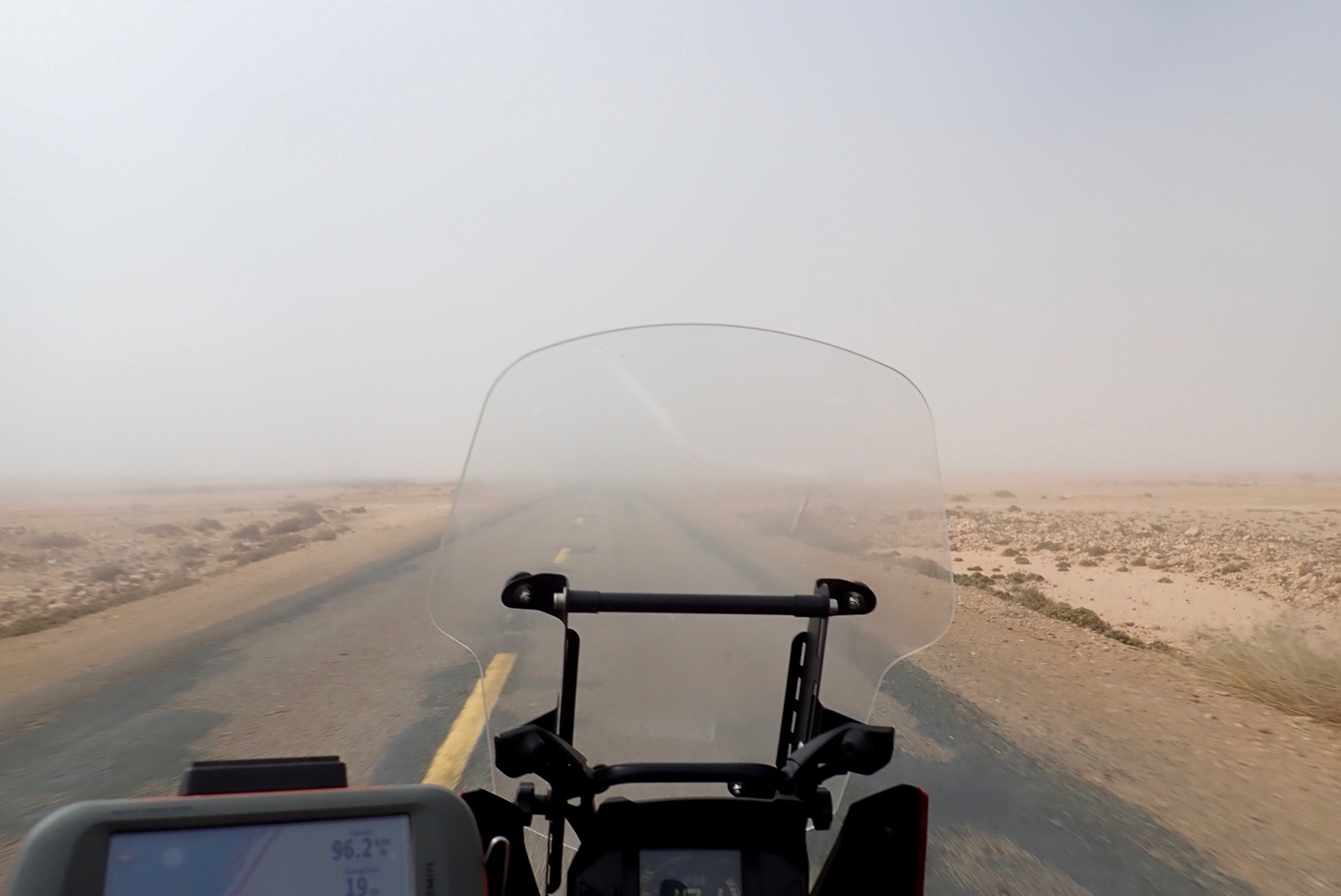
Me? Having travelled much of the Sahara over the last five decades, if you pushed me blindfolded out the back of a Hilux behind Erg Chebbi and removed the hood, I’d get up, smell the air, squint at the sun and guess I was in the Sahara. It may transpire to be the edge of the Sahara in boring old Marrokie, because vegetation and rainfall change in a very short distance (by Saharan standards) in the mountains to north.
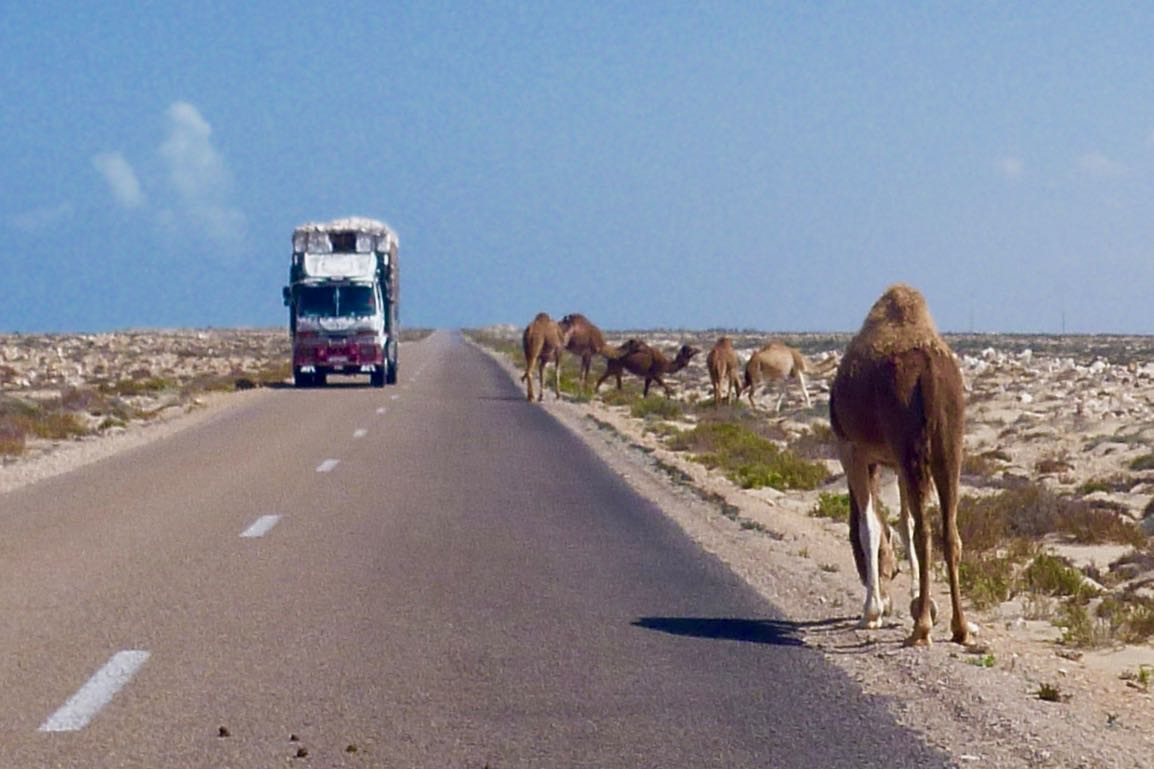
But from Chebbi south and west along the Algerian border all the way to Tan Tan, it all resembles the Sahara I’ve seen – often dreary, sometimes epic, often barren, vegetated in patches, hyper arid elsewhere – all the way from Mauritania’s Adrar plateau to the Selima Sand Sheet (left) close to the Nile.

Camels? Dunes? Palms? What else could be be?

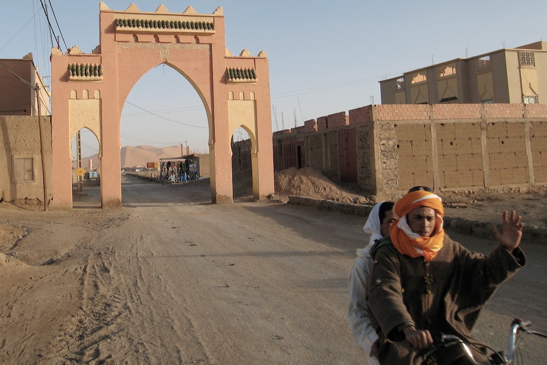
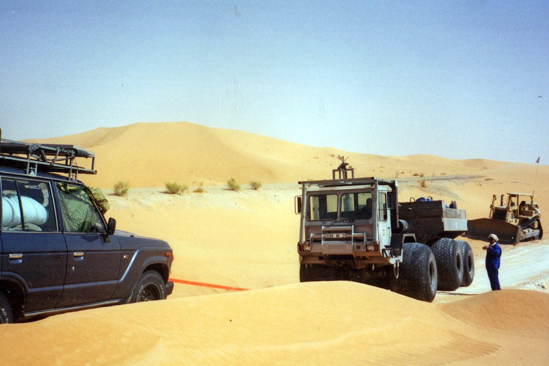
If anything, Erg Chebbi is just too darn Saharan for school and so has become one trampled terminus of Morocco’s Axis of Tourism, a quad-busting desert resort. I avoid the place. Over the years the pretty cluster of dunes at the end of the road has become choked with desert camps, kasbah-hotels, a few opportunist sharks and us tourists doing the dunes by various means.
In that sense it is very much not what I know of the real Sahara, but caught right, Chebbi can still be an amazing sight for a desert first timer. You’re on the very edge of the Sahara. Which side you’re on is up to you.

A is for Atlantic Highway to Mauritania

Part of the Sahara A to Z series

See also:
Western Sahara
Trans Sahara Routes
The Railway Piste
Tindouf Piste
Atlantic Route
Trans Sahara Highway
Hotel Sahara
The Dig Tree

In March 2020 I rode Morocco’s 2300-kilometre Atlantic Highway nearly all the way to the southern border and nearly all the way back. I last came this way in 2019 (as far as Gueltat Zemmour) but have not done the whole crossing into RIM since 2006 heading for our Empty Quarter transit.
I knew it then, I know it now: scenically, mile for mile, the Atlantic Highway is pretty dull by Saharan standards – a drab limestone plain where, encounters aside, sea-cliff viewpoints and a few barchan dunes are as good as it gets. If you’re on a mission to get to Mauritania – as I was on this occasion – here’s what I found.

Up north, use the autoroutes to dodge the N1 and speed traps
It’s a long way so coming from the northern ports, I recommend sitting on the deserted A1 and A7 motorways all the way to Agadir where the A7 ends, even though you pay tolls (about £30 for a moto/car). South of here traffic thins right out. The alternative coastal N1 trunk road is slower, less safe (in a driving sense) and is commonly staked out by cops with radar guns, especially around Essaouira and Agadir.
Otherwise, there are any number of great ways of exploring inland Morocco, across the Atlas mountains all the way south to the Desert Highway along the Algerian border.

The speed cops are creeping south
Even though I was hyper-aware of radar cops, I still got caught leaving Tan Tan doing 80 in a 60. That would have been 300d, but deploying the usual techniques – basically: humility in the face of the obvious – he let me off. All the way to Layounne and Dakhla, be wary of lurking speed cops, especially as you approach or leave settlements but even out in the desert too. Crossing solid white lines is another favourite trap; easily done when stuck behind a soot-spewing lorry crawling up an incline,

Western Sahara checkpoints and fiches
As ‘Western Sahara‘ is a Moroccan military zone, checkpoints increase south of Tan Tan, and unlike up north, they don’t just wave foreigners through but want your passport details. Handing over a pre-printed ‘fiche‘ (French for ‘form’; below) helps speed up the process. Hand one over and they can log you into the ledger once you’ve gone.
It seems fiches are less needed these days; I got through only about six on the way down – the last one at Dakhla Junction. Some checkpoints will insist on seeing your passport anyway; others just want a chat.

On the N1, subsidised fuel begins 92km south of Tan Tan
Along with a few other key commodities, fuel is subsidised by about 30% in Moroccan Western Sahara. The first discounted fuel station is just after you cross a causeway and climb out of a sea inlet, right by a checkpoint.

Fish & Chips at Afknenir
Make sure you pull in for a poisson-frites in Afkhenir, 20 kms from the checkpoint above. For some reason streetside fish restos here are like casinos on the California-Nevada border. You may think there’ll be loads more down the coastal highway, but there aren’t.
You can thank the upwelling of nutrients from the cold Canary Current which gets funnelled by the Canaries themselves onto this near-north-facing section of coast before Cape Juby. Or maybe local demand supports the informal shore-casting fishing economy. You’ll see loads of scooterists with rods as well as the crude clifftop shelters where they live.

They’re rebuilding the N1
South of Guelmim a new, wider road is being built in stages, sometimes alongside the old one – certainly as far as Layounne. Around the dunes of the windy Khnifiss lagoon past Tan Tan, when I was there roadwork embankments see sand get blown across the two-lane road – not a good place to meet an oncoming truck while checking your likes.


Fog

It’s very windy – day and night
They say March is especially bad, but south of Guelmim where the desert sets in, it’s windy day and night. Normally in the Saharan interior the wind stops at dusk. In late February 2020 a huge Saharan sandstorm (below) made the news when holidaymakers on the Canaries were stranded. Close to the coast the cold current produces fog (right), certainly between Guelmim and Tarfaya. Within a kilometre of the coast a northerly sea breeze can also blow up to 10°C cooler than an easterly from the dry interior – which might be just a mile or two inland. But generally, the wind is behind you; on a pushbike (I saw a few), that’s important.

The flat landscape of Western Sahara can’t help, but when you realise the whole 3000-mile width of the Sahara has been steadily heated by the rising sun before it reaches the Atlantic coast, the wind has had plenty of time to get a good run up.
On the move it’s not so bad, but outside of a car, camping can be pretty miserable. Even the trees are bent southwards.

All this wind is good for the economy: Dakhla has long been a kiters’ resort (below) and there’s a huge installation of wind turbines south of Tarfaya, helping keep the lights on in Laayoune. Soon they say that array of turbines (or one like it) will feed electricity to the UK via an undersea cable.

The monument at Tah
On the N1 for Laayoune you’ll pass through nondescript Tah with no fuel and barely a cafe and shop to rub together. In the middle of town is a granite monument covered in Arabic inscriptions. It marks the spot where in November 1975, some 350,000 Moroccan civilians symbolically marched over the then border into Spanish Sahara.

This was the Green March (map left): three co-ordinated and tactical mass demos mobilised by the wily King Hassan in response to rumours of Spain considering handing over its marginal colony to the indigenous Saharawi and Polisario Front. The marches were followed by the 16-year Western Sahara War which Morocco effectively won by annexing most of the territory (see map,above). It’s why the UN still hang out in Western Sahara and why unmapped landmines are still a menace. Otherwise, not much appears to have happened in Tah since that glorious November day.

Laayoune
Laayoune is the provincial capital and biggest settlement in WS by far, with a prosperous frontier-town vibe to it. At least from what I perceived; life in the Saharawi shantytowns may not be so rosy and civil disturbances are not uncommon. Riot police lurk on standby in the town centre (below). The UN’s MINURSO mission is based here, monitoring the Polisario ceasefire.
Passing through the city, the transit is not an obvious single main road. Without a satnav, follow signs for the airport, or back right up and take the Laayoune bypass (see below).

The Laayoune bypass
At Tarfaya (former Cap Juby) you can turn into the town, head for the shore ath-laybypast the St Exupery museum, his monument, and the 19th-C curiosity of Mackenzie’s Factory). Following the coastal road 90km to Foum El Oued (‘river mouth’) brings you back to the N1 just south of Laayoune city.
It would be nice to report this is a quiet byway passing idyllic beaches, but the wind is ever-present and trucks use this narrow road to avoid Laayoune. Dunes also get bulldozed off the road, especially south where the road gets narrower. I suppose it might be cooler than the inland route and the beached Armas ferry is a site to behold. There’s more here.

The longest fuel range is 162km but may be 250km
This is between Tchika (Imlili) near some big white barchans on the north edge of the Gulf of Cintra, and Bir Gandouz, the last town, 80km from the border. There is nothing at all along this section except the howling wind. However, the Tchika station and the two similarly old and grubby Atlas Sahara stations to the north near El Agroub (see map right) may be empty.
Stations may get upgraded, but for the moment this means from Dakhla Junction roundabout (two fuel stations) to Bir Gandouz is 252km (via the Tropic of Cancer). I covered that distance northbound into the wind and go in with a pint in the tank.

Is Dakhla worth the 90-km round trip?
No so sure, but then I took the cheap hotel thing a bit far in the old town. Next time it might be more fun to check out the kiters’ resorts at the head of the lagoon. On the other hand, up north, Boujdour was a fun stop for an evening wander.

Plan a break at the Hotel Barbas in Bir Gandouz
Maybe it was just me on the day, but the Hotel Barbas was an oasis in a duststorm. And once inside shimmered into a veritable mirage. We stayed here in 1997 but the place has been transformed to the point of incongruity. They built a two–storey U-shaped bank of rooms around a planted courtyard but then, ingeniously, draped the entire thing in a huge shade-net. Result: a large, cool space where courteous waistcoated waiters flit about at your service. Rooms are good, prices are normal, food is good too and so is the wi-fi. Tourist, traveller, refugee or trader, some of the characters that roll through add to the place’s edgy ambience. The south end of Morocco, not the Mediterranean coast, marks the true border with Africa.
Bir Gandouz is an easy day from Boujdour which itself is an easy day from Tan Tan. With an early start and an hour to the border, you’ll easily get to Nouadhibou or on the road to Nouakchott.

What is ‘La Gouira’ you see on the road signs?
The ‘Lagouira’ you’ll see listed on some old Atlantic Highway road signs indicates the short-lived Spanish base at La Agüera on the Ras Nouadhibou peninsula opposite today’s Nouadhibou. See map inset below. Effectively it indicates the distance to Nouadhibou which is not always listed.
Abandoned at the turn of the century, today it’s a collection of ruins which are actually in the Polisario Free Zone, commonly mistaken for No-Man’s-Land which separates Morocco from Mauritania. Some have managed, but the Mauritanians won’t allow casual visits from the Nouadhibou side.

For Mauritania, see here.


How to be safe in Morocco

Like most people, I was shocked by the brutal murders of the two Scandinavian women camping in the High Atlas in December 2018. Sadly it was another attack attributed to young men seeking to show solidarity with violent Islamist causes.
One assumes the two women were stalked by the perpetrators from Marrakech, and so the attack might as well have happened anywhere once an opportunity presented itself.
Morocco has been largely free of the types of the attacks which became commonplace in western Europe at this time, and yet tourists who’ve long been targets elsewhere in North Africa and the Sahara, are thick on the ground in all the usual Moroccan places because they feel safe. The last reported terrorist attacks were a bomb targeting tourists in Marrakech in April 2011 and a bigger wave of bombings in Casablanca way back in 2003, mostly aimed at Jewish interests. Unlike the rest of the Sahara, to date no tourist has ever been kidnapped in Morocco.

firstime

How to be safe in Morocco
As a tourist, maintaining your safety in Moroccan cities is no different to any other unfamiliar place. Hustlers are common in certain areas; traffic appears chaotic; pickpockets exist and cheap hotels can feel insecure. And out of the cities mountain roads may not all be velvet-smooth Alpine super highways. All these issues have long been far greater threats to visitors in Morocco than Islamist violence.
Being a Muslim country does give Morocco an edge to those unfamiliar with Islamic culture, particularly women, but the Islam practised here is a lot less severe than in Saudi or Iran, for example. Read the blue box, left, extracted from my Morocco guidebook. Also read the sensible guidelines given on the British FCO website, to give one example. They spell out all how to be aware of the most common risks.

toubka

In a crime sense, the popular hiking area below Mt Toubkal (left) where the women were murdered is not dangerous compared to a big Moroccan city. It is probably its popularity and proximity to Marrakech which make it an easy, adventurous destination.
Occasional unnerving but actually harmless encounters over the years have long led me to advise the following: when wild camping, do so unseen and completely out of sight if possible, and if not then camp close to or in a settlement. This way either everyone knows you’re there or no one does. I give similar advice in both my global overlanding books and would act like this anywhere in the world, just for peace of mind.
In Morocco many have found undisturbed wild camping can be quite hard to achieve. Even in the desert, travellers commonly report someone popping up out of nowhere, usually a curious nomad or villager, or sometimes police checking up on you. It should be understood that in North Africa and the Sahara, camping alone in the middle of nowhere away from other people is regarded by locals as suspicious or odd.
For us Euro-tourists camping has long been regarded as a money-saving adventure, but because hotels and auberges can be so numerous and inexpensive in southern Morocco (from <€5), I’ve long preferred the comfort and security they offer to all the clobber and faffing required with camping, especially if not travelling in a spacious car, or when travelling in the cool season when mountain nights get chilly and drag on for 12 hours. In a cozy auberge you get to meet local people or fellow travellers, eat well, rest properly and recharge your gadgets.

m17-P1210574

Another practise desert travellers like me have adopted since the deep Sahara became FUBAR’d, is not to share detailed travel plans with strangers or online, especially on publicly readable social media. I don’t do Facebook or Whatsapp, but by all means keep friends and family in a closed group appraised of your movements. In Morocco the reach of the mobile network is far greater than you’d expect, not least in remote rural areas where locals depends on it. A local SIM card costs from €2 which includes €2 of credit. You may need the vendor’s help in setting it up.

No one could have anticipated the appalling murders in the High Atlas any more than crossing a bridge in London, backpacking in New Zealand, visiting a market in Strasburg, attending a Baltic island retreat, or a school or place of worship in the US. Morocco remains one of the few countries in North Africa where tourism continues to thrive despite anxieties about ‘Muslim countries’. It helps sustain the local economy, particularly in rural areas where the true level of poverty is much greater than it looks. Don’t let this tragic event unsettle your plans to visit a wonderful country, any more than any of the other places listed above.

P1310022

Tis the Spiral Tunnel of Tagountsa

Part of the Sahara A to Z series

spirtuna
spirmoha

High up on the side of a remote High Atlas valley is an engineering marvel – hewn through the cliff face a spiral tunnel manages to curl down through the rock and emerge underneath itself.
I was told about this curiosity in 2012 by the chap at the cozy Chez Moha auberge (right) in Aït Youb while researching the second edition of Morocco Overland. Riding a BMW F650GS, I followed his directions with the usual route-finding issues and then, beyond the last village, hacked up a stony disused track to the 2250-m (7340′) Tagountsa Pass. From the cliff edge I recall the timeless view stretching east up the Plain d’Amane valley towards Rich, pictured below and on p128 in the current book. A short distance later I spun through the tunnel and rolled down a series of switchbacks back to the valley floor and a tasty tajine back at the auberge.

tang

Spiral tunnels have been a long-established solution to constricted route building challenges across mountains. You could even say that your typical complex freeway intersection where the road winds back under itself to change direction tightly is the same thing in flyover form. But you must admit that hacking out any type of tunnel – let alone one where there’s no room to dig out a regular switchback – is an impressive task.

spirplak
yvrom

Not for the first time on this website, I’m able to benefit from research of Yves Rohmer (right) on his always fascinating collection of old Saharan curiosities at Saharayro, including the Tagountsa tunnel. Viewed on Google Earth, the big picture is more vividly rendered setting View > Historical Imagery back a few years.

spir
spirplan
spirtuna

Even then it’s hard to visualise what’s happening until you look at the old plan, right. You can see the anticlockwise descent of the bore and just work out that it starts with a short separate concrete bridge over the lower mouth of the tunnel. The daylight streaming down the gap can be seen in the image repeated on the left (and as a slim shadow in the round inset, above)

spirimit
legion

Built in 1933 over a period of just three months by some 3000 labourers from local and French regiments, few realise that at this time the French were still fighting to subdue renegade Berber tribes in the mountains of Morocco.
As you can see on Yves pages, the engineers, sapeurs and legionnaires passed their spare time commemorating their achievement by engraving regimental emblems in and around the structure. I was told the motivation for all this effort was to enable a secure, high transit of the valley, so avoiding protracted Berber ambushes at the narrow Imiter Gorge (left; ~KM70) with it’s Mesa Verde-like dwellings.
The same crew probably built the better known 62-metre Tunnel de Legionnaires five years earlier at Foum Zabel now on the main N13 highway north of Errachidia. A plaque there boldly states:
The mountain barred the way.
Nonetheless the order was given to pass…
The Legion executed it.”

spirtun

The Tagountsa tunnel the Legion helped build is at KM102 on Route MH13 in the book, though if you reverse the route it’s only a 10-km off-road drive off the Rich road just east of Amellago, turning north onto the dirt at KM113. Depending on storm damage, an ordinary car or a big bike should manage it, but note that you’ll be negotiating all those hairpins on the Google image above. From the west side (as Route MH13 describes the loop) it was a rougher and slightly more complicated ride on the BMW up to the pass.

spirdram

Perhaps because trains can’t negotiate hairpins or climb very steep grades, it seems that spiral or helicoidal tunnels have been a much more common feature on mountain railways than roads, particularly in the Rockies.

Norway’s Drammen Spiral (left), some 50km southwest of Oslo is a notable example, dug we’re told, as an alternative to disfiguring effects of open quarrying on the landscape back in the 1950s while at the same time producing a revenue-producing tourist attraction in the process.

Morocco Overland: Route J2, J3

Updated December 2025

Trans Atlas: J2

Talat n Yacoub (Ijoukak) > Ouneine basin > Ouaougdimt valley > Aoulouz • 88km
Last run October 2023 – CRF300L

Following the September 2023 earthquake, the steeper north slope of this track is almost immedaitely blocked and remains unused. To get to Ouneine take the bypass and cut back west via the road or the MH212 link route.

a310-7

Description
High Atlas crossing parallel to the nearby Tizi n’ ‘Test which peaks at the 2200-m Tizi n Oulaoune (30.940222, -8.125111), following a steep climb: some 500m in 8km after leaving the road SE of Ijoukak (right).
You may find the looser parts of this climb a struggle in a 2WD or on a heavy, wide bike, but this was not the case on 2022 in a 4×4. It’s probable that local 2WD vans only do it downhill (northbound) to Ijoukak. Track immediately blocked by post-earthquake debris (below; 6 months later) and remains abandoned.

In 2022 the track was rougher as it rolled down to the Ouneine basin and the P1735 whose extension eastwards to Igli on (J3) is now sealed. Keep right at the fork with an illegible sign. At the bottom just before it joins the road you have to detour south around the boundary fence of a new small mine,

Once in the basin carry on SW along the P1735, and at Sidi ali ou Brahim swing sharp left off the road, cross the stream and follow the Ouaougdimt valley 24km SE (not fully shown on most paper maps) to join the road coming down from Aguim on the N9 Marrakech–Ouarzazate road.
Or, if you’re in a rush or heading towards Taroudant, at Sidi ali ou Brahim carry on 23km south on the ever-bendy P1735 to Sidi Ouaziz (fuel) on the N10. Otherwise, it would be a shame to miss out on the scenic Ouaougdimt valley stage, as it rises onto a terrace high above the valley floor.

mhh20

Mapping
Parts of the route are just about legible on paper maps, least badly on the inset ‘High Atlas’ panel on the Michelin. But none show the full Ouaougdimt valley route. It’s all on Google and the OSM/Garmin digitals.

Off-Road
The climb up to the 2200-m Tizi n Oulaoune pass from KM11 starts a steeply but is now blocked. From the pass the gradient eases off with great views doiwn to the basin while you’ll find the Ouaougdimt valley stage no harder than anything you’ve just done. Carefully ridden, a big bike might manage the loose hairpins; so could a 2WD with low first and clearance, though as always, these mountain tracks require concentration. On an MTB it will be a slog if not a push up to the Tizi n Oulaoune, followed by a rough freewheeling reward to the basin and no more huge grades thereafter. Bikes might have more fun following J3 to the high P1735 road, turning left or right.

Route finding
Easy enough. We winged it just by studying Google satellite imagery beforehand, jotting down some distances between junctions. That’s now all listed below. Download the kml file.

Suggested duration
Half a day will do you.

Route Description
0km
 (88) Talat n Yacoub fuel station (village destroyed but still serving) on the N7 Tizi n Test road. Head north to Ijoukak village.

3 (85) Pass through Ijoukak, cross the bridge and turn immediately right up the side road now thronged with relief tents. Soon you’ll pass Houssain’s agreeable mountain lodge (repaired; reopened). Huge boulders have fallen on the road.

11 (77) At the fork before a village turn right, drop down over a bridge and carry on. Soon there’s a sign right: ‘Ouneine? 24km’. The 500m climb to the pass begins. (Ahead, MH21 continues). To reach Ouneine take the J2 bypass and take the road, or link track which comes in to Map Junction below.

19 (69) Tizi n Oulaoune 2200-m high point with views of Toubkal (4167m) 20km to the northeast. The track now eases off as it descends.

mh20km23
KM23 Map Junction
feb20 - 36

23 (65) Fork with sign (photo above: ‘Map Junction’). East at this fork is a rough track (MH212) which in 9km joins J2 to Igli. Keep right (south) to continue descending to the Ouneine basin visible to the west. At a small mine work your way round the fence to the south. to rejoin the track. Eventually, at a junction around KM35 you join the P1735 road which goes E towards Igli/Iguidi over a 2500-m terrace. This is a spectacular high mountain road (J2).
Meanwhile, the P1735 crosses the Ouneine (shops and cafes) basin SW and threads through a small pass back into the hills.

mh20ouaval

54 (34) Sidi ali ou Brahim. The tarmac carries on 23km to Sidi Ouaziz (fuel) on the R110/N10 but you turn sharp left here, drop down to the stream and up the other side. The track is initially a bit eroded and loose as it climbs to the first village, but that’s why they invented suspension. It then eases off as it rises above the valley on a terrace (right) with great views down to the villages below. You could be in the Cevennes or the Pyrenees, but you’re in the High Atlas. It could be worse.

78 (10) Join the tarmac (J4) by the reservoir. Turn right (west).

83 (5) Roundabout on the R110/N10.

88 Aoulouz fuel stations.

mh20desc

Trans Atlas: J3

Ijoukak > Igli/Iguidi > Askaoun > Taliouine • 170km
Last run: October 2023: CRF300L

At the ‘Ouneine’ turn-off for the blocked track up to Tizi n Oulaoune, carry on southeast on tarmac for a few km until it ends at a village (green mark on map above). Keep going along an easy piste rising up the valley and past a couple more villages all surrounded by relief tents in 2023. Just before one village keep right (downwards); sharp back left leads up to who knows where. Your route climbs to meet the end of the J2 link track close to the Ouneine-Igli tarmac.
Turn left then at the tarmac nearby it’s left up to over 2550m then a long wind down to Igli/Iguidi (hotel/cafe) on the Aquim-Aoulouz road J4.
From here carry on south then west down the valley and turn left at a sign to cross below the dam wall (long term roadworks) and wind your way up to up to Askaoun (KM120) then 45km down to Taliouine.
Total 170KM, fuel to fuel.
I did versions of this route three times in November 2022 with a lunch in Igli. A great ride with a dizzying number of bends in one day.

A few photos   A few more

Looking down on the new bypass from the high route

2 is for: the 2CV Motorcycle Survival Story

Part of the occasional Sahara A to Z series
Hang around long enough and you’ll get the full set

Pictures from Emile Leray’s website [dead link] and the web

2cvcart

In July 2012, a couple of years before fake news had become a thing, online media tripped over itself to syndicate a compelling Saharan survival story evoking the gripping 1965 desert drama, Flight of the Phoenix.
Then, five years later a video appeared on youtube (below) where the aged and batty-looking French adventurer again recounted his incredible desert caper.

Back in 2012 full details and motivations were skimmed over, but the story goes that in March 1993, 43-year-old Frenchman Emile Leray set off from Tan-Tan near the Moroccan coast to drive his Citroen 2CV east to Zagora – more or less Route MW2 from my Morocco guidebook (below), followed by MS8 from Tata.

But with the Polisario ceasefire just 18 months old and frequently being broken, at Tilemsen the Moroccan army stopped him from continuing south towards Mseid, the former Polisario front line. Leray turned back towards Tan-Tan, but not before incurring some animosity from the army by refusing to give a soldier a lift back to town – a common request at remote Saharan checkpoints.

Just west of Tilemsen, Leray ‘had an idea’. He decided to circumvent the checkpoint to the north (see MW1 KM22), and rejoin MW2 eastwards. But once on the piste (or ‘off-piste’, as claimed) one of the 2CV’s suspension arms broke after hitting a hole too hard. With ten days’ provisions on board but reluctant to easily walk-out and leave his car vulnerable to theft, he decided to strip his crippled Citroen and rebuild it into a rudimentary motorcycle, then ride out as if nothing much happened. The unusual powertrain and suspension arrangement of a 2CV makes such a conversion plausible.

2cv1

The way the story was initially reported in English – using images shot later in a quarry (above) – Saharan know-alls like myself were initially sceptical. If it really happened why not just walk back half a day to the road?
I researched the yarn more closely for my Morocco guidebook and came across his own account published in a 2CV enthusiasts’ magazine a decade after the events. A faint ring of truth came through. Perhaps he did build the 2CV bike, but not in quite the circumstances he claimed.

2cvbust

As the TV show, Mythbusters proved for themselves, his contraption was barely rideable (left) and within a day of leaving the rebuild site, Leray says he was caught by a patrol while camping in the desert and instructed to lead them back to the car’s remains to corroborate his story. Ironically, he goes on to claim (with convincing documentary evidence) that he ended up paying a 4500-dh fine (about €450) for driving a vehicle which did not conform to the one he originally imported to Morocco a few weeks earlier, even though he’d taken pains to tack on his ‘Steel Camel’s’ original license plate.

I believe the 2CV bike was indeed built in the desert, much as Leray claims, but he set out from France with the explicit intention of performing this task. Otherwise he’d have walked out like any normal person in a similar situation.
His claimed unease about leaving his stricken car doesn’t ring true, let alone the spontaneous idea of making it into a two-wheeler. Tellingly, in 2006 Leray went on to build a ‘2CV boat’ in Mali. He clearly likes mucking about with 2CVs. Fair play to him!

Below is the translated story as posted on Leray’s website so you can form your own impression. Bear in mind there’s no reason to believe this account, but it may have been the original version.


2cvthen

In March 1993 Emile Leray set off to follow a route from Tan-Tan to Zagora. He left Tan-Tan with the required reserves of fuel and provisions as well as tools to keep his old 2CV on the road. As soon as the Royal Gendarmerie arrives, they strongly discourage him from continuing further because the zone beyond Tilemsem is prohibited, following new developments in the conflict between Morocco and Western Sahara. Emile must obviously turn around and the soldiers are asking him to take a passenger back to Tan-Tan.

2cvpants

Analyzing the situation, and seeing his project thwarted, Emile claims an insurance problem that does not allow him to take passengers, arguing that his 2 CV is already very loaded. He knows full well that in Africa it’s seen very badly to not take soldiers aboard his car in these circumstances. He claims naivety and misunderstanding in adopting the attitude of a tourist not familiar with local customs.
Emile then returns to Tan-Tan under the disgruntled and disapproving look of the soldiers. He starts off at a good pace as he’s afraid he will be followed and he wants to remain out of sight of those whom he has just left. His plan is to bypass the area off-piste and return to his original direction … After a few kilometres he leaves the track to the north and traverses uneven and rocky ground.

After bouncing more strongly, the car jumps and brutally strikes a rock. He must stop because the 2CV does not respond very well. And for good reason – a folded wheel arm and broken spar …
Émile organizes his encampment around the broken 2 CV and reflects on the situation. He is a few miles from Tan-Tan which he could reach on foot, but he runs the risk of leaving is car certainly in bad point but still able to attract theft, including its equipment. In the desert nothing is permanently lost, especially for the one who knows where to look.

He has enough food and water so makes a decision which is to say the least, amazing: from his wreck, he will build a two-wheeled machine! One by one he carefully considered all the technical obstacles that this entails, and this master of African bush mechanics has all the tools and the elements to succeed in the task.
The next morning he began to dismantle the 2CV, first removing the body which he will use as shelter against the cool nights and sandstorms. Having no long-sleeved shirts, against the burning sun he makes sleeves from a pair of socks. With what remains of the car, Emile Leray will try to build a motorcycle. Overnight he mentally reviewed all the stages and difficulties involved in this rather crazy project … A project that he had probably imagined for a long time but without having had the opportunity to realize it.

The wheel arms (to be removed with a hacksaw) are nested upside down on a reduced chassis of the front and rear side rails. The engine and the gearbox are then placed on the chassis in the center. Space should be reserved for the battery and the fuel tank and to keep space for luggage without neglecting the layout of the steering system.

2cvdrive
2cvveloso

The most surprising thing about this 2CV motorcycle is the transmission. It was inspired by the Vélosolex moped idea (right): the engine drives a drum which in turn turns the tyre by friction, and which, by the laws of physics and mechanics, obliges it to roll with the reverse. Disassembling the gearbox to reverse the differential would have been too risky in this universe of sand …

It seems unthinkable to assemble this machine in the desert without the help of a drill and welding station. All parts were assembled by screwing. When drilling, it will be done in the African way: the piece of metal is folded to 90 ° to form an edge. At a fixed point this edge is weakened by a hacksaw or round file. At the limit of the drilling, the piece must be replaced flat to perforate the filed point with a hammer or a needle. The assemblies were made as much as possible according to the original holes of the chassis or engine-box unit.
The rest is only a matter of time dependent on the quantity of his provisions. Émile believes he must spend three days building his bike – in reality it will take twelve …
There was a great deal of uncertainty to carry out this project and it wasn’t so easy to realize as one might think. The possibility of failure remained present throughout the adventure, giving some anguish to the stranded mechanic.

2cvdez

The 2CV motorcycle was obviously not conceived for the sake of comfort, it is a rather secondary notion that was not imperative in what we can call the specifications. The prototype has therefore not benefited from some desirable improvements. It should be noted that, for example, the exhaust is free, so the nose and the ears are affected greatly by the engine’s gases. The bike does not have a brake, nor does it have foot rests which allow some control of the trajectory with the feet, because the craft lacks stability. On the first test the bike fell over, causing a great scare to Emile, who almost found himself crushed under his 200-kilo machine.
The arrangement of the clutch and accelerator controls were particularly tedious. It was necessary to dismantle, adjust and reassemble the parts for optimum operation. Similarly, the tests were punctuated by frequent falls. To lift the two-wheeled steel camel proved particularly physically difficult … All these circumstances contributed to prolong Emile stay in the desert. The final day was be spent adjusting and testing and cleaning the bivouac site.
It was an occasion to immortalize the moment thanks to a small camera with the trigger connected by a long wire. Émile poses in the middle of a place that in March 1993 was the theatre of his unusual feat.

2cvv

He leaves the next afternoon leaving the parts that he will not use in the body shell of the 2CV. He takes with him the rest of his food (more than a litre and a half of water), the bed, the tool box, not forgetting maps and compass. A small foam mattress and a towel sewn together will serve as a tent.
After a bumpy ride and a few stops for mechanical improvements, he encamped and slept at the edge of a track. In the night, he is awakened by three soldiers in 4×4, one of which immediately recognizes the “tourist” of Tilemsem. Very irritated to find him in the forbidden zone, he strongly doubts Emile Leray’s explanations; an accident followed by the transformation into a motorcycle. Intrigued by the machine, but totally incredulous, the soldier demands to see the carcass of the 2CV to have proof of this incredible story.
The officer puts an armed guard by the tent and the motorcycle, then embarks with Émile in the 4×4. After an hour of research in the dark, the remains of the 2 CV cannot be found. Back at the camp, Émile is allowed to rest near the motorcycle until dawn, guarded a hundred meters away by the military in their 4×4. The next day, the carcass was found and the soldiers relax. Émile will learn later that his interlocutor wanted to recover the abandoned pieces for his brother-in-law …

2cv2

In the early morning, Emile was ordered to take his motorcycle back, and ride in front of the 4×4. The convoy sets off slowly towards Tan-Tan but several falls seriously annoy the soldier, pestering against this unstable machine. Eventually the soldier calls by radio for another 4×4 to come to recover the 2CV motorcycle.
Arriving at Tan-Tan on April 6th, things get complicated with a lot of bureaucratic hassles. At the provincial governor’s office, a report is drawn up, as well as by the Royal Gendarmerie. The vehicle is impounded

Emile has the disagreeable surprise of learning that he has to pay a tax of 4500 dirhams. He is very unhappy because the customs officers had spoken to him on the eve of mere formalities. The vehicle is regarded as dangerous and no longer corresponds to the description of the registration documents.
“Delay in importing a non-conforming vehicle” is the charge, and by paying the fine he can
 regain his freedom and recover his contraption, but not be allowed to drive it.One could say a lot from this misadventure about the complicated relations between Africans and Europeans on the issue of money ...

2cvmail

The next day Emile is summoned to sign the forms to exit the territory, and leave for France. He thinks he should come back as soon as possible to get the bike back, but by then he must find a place to park it. There is no question that he leaves her in the pound, it may cost him dearly, and the place is not guarded. A customs officer who is more sympathetic than his colleagues offers to take the steel camel home while waiting for him to return to Morocco.
A month later Emile made the 3500-km journey between Rennes and Tan-Tan with another 2CV to pick up his motorcycle, now dismantled in three parts …
Since then, the steel-motorcycle camel has enjoyed the honors of the press and participated in a few events such as the Aventure and the Inventors of Rennes, the fiftieth anniversary of the 2 CV in Saint-Quentin-en-Yvelines, Without forgetting the Motards have heart.
Émile returned several times to Africa, and in 2006 took a new opportunity for the Doctor of African mechanics to exercise his transformational talents on the steel camel [below]… 

For more information: full story and technical details in 2CV Magazine March-April 2003.

2cvmbotIn 2006 Leray went on to build a 2CV boat in Mali. He clearly likes mucking about with 2CVs!

Sahara by 2WD Fat Bike

Some images and info from Cyclo Long Cours and Blida Nostalgie

See also: Fat-e-Bike 2022

fatfat

In 1986, long before the current fat-bike fashion (left), Jean Naud, a 55-year-old Frenchman set off to ride his three-wheeled bicycle 3200-km across the Sahara from Algiers to Timbuktu.

Brought up in Blida, just south of Algiers at the foot of the Atlas mountains, Jean Naud had made two previous cycle tours in the Sahara. Once, as a 23-year-old way back in 1954, from Algiers as far as Ghardaia where he was born in 1931. And another in 1980 (below) from Zinder in Niger, north via Agadez and across the Sahara to Tamanrasset – a distance of some 1300-km. This time he was riding a bike running prototype, low-pressure Michelin fat tyres. At that time this route would have been just about all piste, but he recalls passing some Brits stuck in the sand near the Algerian border in their Peugeot 404, as he cycled silently past.

Although the Sahara isn’t all a wasteland of soft sand dunes, the thin tyres of a regular bike would easily sink or damage the rims on rocks under the required loads needed for desert travel.
I’ve met the odd cyclist in the Sahara. The big problem with off-highway pushbiking is the load needed to maintain autonomy, not least, water. On a conventional bike it’s barely possible without relying on passing traffic, because the tougher the terrain the greater your water consumption. Even in winter in the central Sahara, I’d guess you’d need five litres to cover about 60 kilometres on a sandy piste. And that would be a long day.

An automotive engineer, Jean Naud’s initial solution was to run fat tyres in 1980 in NIger. This time he added a second driven rear wheel to improve traction and aid flotation at pressures as low as 7psi. He then went one step further and devised a hefty hinged subframe (above) which could both raise and disengage drive from the middle wheel to reduce the drag and pedalling effort on firmer surfaces, or when running lighter loads. Mechanically, disengaging axles (as well as hubs) was commonly done on pre-electronic 4x4s in the 1980s, for the same energy-saving reasons. And today on lorries we commonly see lifting axles.

naud-bob

Using the modern Bob trailer on a fat bike (left) is a similar and probably more efficient solution. The added effort in towing the loaded-down third wheel, rather than powering it as Naud’s 2WD bike could have done, is negated by the weight savings and the lower centre of gravity. You get the feeling Naud was merely experimenting with novel engineering solutions, as he discusses in the video below.

Naud’s three-wheel ride to Timbuktu (below) included at least 2000-km of piste. The route he took to the Mali border across the Tanezrouft is actually a firm gravel plain, about as easy surface to ride or drive as you get in the Sahara. Naud reckoned 20kph was easy. Beyond that, it gets progressively rougher and sandier down towards the Niger River and, having ridden it on a moto in 1989, it’s hard to believe he managed to cycle the final section west along the Niger’s north bank to Timbuktu. It’s very sandy.

Even then, the Tanezrouft was the preferred route of the earliest Saharan motor crossings from the 1920s onwards by Citroen and Renaults (left; also using a ‘double-wheel’ idea to spread loads). The only problem in Naud’s time, was the Tanezrouft route lacked regular wells compared to the sandier but shorter Hoggar Route which Naud rode in 1980.

After visiting his childhood home in Blida, early in the trip while still unfit, it took Naud no less than eight hours to cover 14km on the climb to the 1300-m Col de Medea where the N1 tops out in the Atlas, before descending to the Saharan peneplain. Once fully loaded with 72 litres of water and another 60kg of gear, his 50-kilo monotrack three-wheeler weighed in at 180 kilos. That’s at least three times more than a modern touring bike, or five or six times heavier once fully loaded. Or, about the same as a small lightly loaded motorcycle ready for the desert. Imagine pedalling that!

Jean Naud died in 2011 aged 80. You can find his 1987 book covering all his Saharan cycling adventures, on amazon France.

His bike may still be on display at the Museum of Sport in Paris

Garmin TOPO North Africa Light map review

See also:
Morocco Maps
Time for my Tablet: Samsung Tab + Gaia GPS vs Garmin Montana
How to trace a tracklog
Michelin 742 Morocco (2024) map review
Map review: Reise Know-How Morocco 1:1m (2023)

Screenshot

This review was originally for Garmin’s 2016 Topo North Africa v3 Light map and compared it with easily downloaded free OSMs, Garmin’s basic global base map and other digital maps, where available. V5 was the last version in 2023 still a £20 bargain, then the priced jumped back up to £110 for the current ME&NA map which I suspect is little changed. At the current price I’d save your money

Navigating the Sahara
Having used them since before the advent of GPS, I’ve got to know my Sahara paper maps well. Then, when GPS came along, I could pinpoint my position on a paper map with an accuracy that was more than adequate for desert travel. Some of these colonial-era maps such as the IGN 200s are cartographic works of art, and unlike current nav technology, in the deep Sahara topography changes at a geological pace.
In other words: a paper map of the deep Sahara from 1960 may still be accurate today. Tracks may become roads and villages become towns and even cities, but the open desert itself remains relatively unchanged. Is there a benefit in having a tiny map on your GPS rather than simply a waypoint to aim for or a tracklog to follow, even if your position on the map is displayed live? That’s essential for navigating a busy city with a Nuvi, but the Sahara is more like the sea where more often what you want is…

garminmap

… the big picture
A typical handheld device like my Garmin Montana (left) has a screen a little bigger than a playing card and which is hard to read on the move – especially on a bike. 
For me a ‘GPS’ (as opposed to a ‘satnav’ like a Nuvi – see below) is best at displaying simple data like how far, how fast, how high or which way, not fine topographic detail. A paper TPC map can display six square degrees over some 18 square feet – what you call ‘the big picture’. That’s what you need travelling with a vehicle in an expansive area like a desert, while at close range concentrating on negotiating the terrain.

mush

On top of excellent paper mapping (now widely digitised), we also have the wonder of Google or Bing sat imagery (Bing was often better, now Garmin have the edge) providing a clarity that varies from stunning (being able to trace car tracks) to a brown mush (both shown left).
Google sat is great when planning, and now for a reasonable annual subscription, Garmin offer Birds Eye satellite imagery for the whole globe; the long-sought after ‘Google sat in your GPS’. With all these resources navigating in the Sahara couldn’t be easier.

satnavorgps

Garmin Topo North Africa v3 Light (now ME&NA, see above)

Current ME & NA coverage

Short version
Even though in 2021 old Olaf from 2009 still measures up well, the similar topographic detail of the Garmin means it’s well worth £20, certainly over the plainer, but also free OSMs. In 2018, following a refurb/repair of my Montana, the v1 2016 version of this map was lost or could not be reloaded. I had to buy the v3 version for another £20. A quick scan shows that not much changed, but if it has (based on OSM user updates), it will be in Morocco – the place where most users of this map will visit.

gar-atar

Long version
You download the Garmin Topo map directly into your device (takes about an hour) and only when your GPS device is plugged into a computer, will it display on BaseCamp. Unplug the GPS and the map disappears from BaseCamp.

Switching BaseCamp between Olaf, OSMs and even the Garmin base map which comes free with a GPS unit, it soon becomes clear that the Garmin Topo has a level of detail and refinement that’s superior to the next best thing at the time: Olaf.

Occasionally at village level the OSM’s street-by-street detail is better, but that’s hardly vital. In towns and cities the extra shading distinguishes the Garmin from the plainer OSM, as shown for Tan Tan, left.

gar-tantan
Tan Tan

The chief difference is in the desert where the Garmin depicts relief and surface with more detail and clarity using shading, contours and colour where OSMs only use colour and Olaf only used contour lines which can be distracting.
Look at the Atar region (RIM) above right – an area of escarpments, canyons and dunes – all are reasonably accurately shown on the Garmin Topo. There’s an anomaly on the Topo map on the left (bottom panel) in that the (presumably automatically recorded) elevation variation in dunes depicts them as lots of small hills (which in a way, they are), but only once they’re above a certain height. Identifying dunes with contours is not helpful nor a cartographic convention. Shade and colour is best.

Six digital maps compared 2021– screenshots of Jebel Saghro, Morocco. Garmin v3 is #2.

The piste and road detail on the Topo is pretty good: yellow for national highways, twin lines for secondary roads or piste, and a single line for a less used piste. A quick check in Morocco shows they’re all there; most of the ones I know are there in Mauritania too. In southern Algeria only a few main pistes are shown and certain ‘national highways’ are actually remote pistes never likely to be sealed. The Topo map would not be so useful here.
In any country dashed lines may well be walking trails, but as far as I can see, there is no key or legend with the Topo map. Some POIs are there too – just fuel stations and post offices as shown on the Tan Tan map, above.

gar-px

In places the Garmin copies OSM’s annoying habit of again, marking high points (automatically?) as mountains which is a distraction, let alone inaccurate – for example when an escarpment gets shown as a string of peaks. If you drop the detail level enough notches on BaseCamp, these peaks (left) only disappear once all the useful tracks and place names have gone too. It’s great (and a bit puzzling) that this stuff is produced for free at all by OSM supporters, but the quickest flip to sat imagery would reveal the true nature of the relief.

So does the Garmin Topo map mean I’ll stop using Google or Bing imagery in the planning, or paper maps on the piste? The former, I don’t think so; the later in Morocco yes, but elsewhere in the Sahara I’d still rely on paper maps.
In places like Morocco the extent of marked pistes can be converted into accurate tracklogs, but with better surrounding detail than OSMs. And, unlike Olaf, there’s no aggro importing into a modern, touch-screen GPS. When I want to quickly verify where I am, a glance at the Garmin Topo will may be adequate.

I’ve been using the Garmin Topo map quite heavily on BaseCamp last couple of days, preparing a new edition of Morocco Overland. It’s an intuitive-reading map and I’ve found one benefit of using a Garmin map on Garmin software is that when stringing out a track with the ‘create a route’ tool, it automatically snaps onto even the thinnest track on the map just like Google maps. But the BaseCamp tool won’t do that with other installed maps like OSM or Olaf, or even the basic Garmin base map. Sometimes you have to trick the tool to go the way you want, but it makes stringing together hopefully accurate routes (as well as distances) very easy. Occasionally only Olaf will show a route you want to follow, in which case you make the route with lots of short, straight lines. No so hard.

Getting routed: As the track was clearly visible, I traced the route I’m logging above (MW7) off Google Earth the previous evening (internet required), saved and exported the kml then imported it (as a gpx) into my Montana via BaseCamp. This was pushing the outer limits of my tech ability with this sort of stuff.
GPS digital maps not really needed as I had the largely accurate self-drawn tracklog on the screen to follow, while recording my own live tracklog. Years later I used this same system (pre-trace route off Google Earth) again while logging MH23. The great thing with satellite is WYS is usually WYG, whereas with maps (paper or digi) WYS can be nothing at all.

The Algerian Berm

Interesting 2019 report on the Mk-Alg smuggling scene.

bermberm
dakinberm

It’s well know that in the 1980s the Moroccans pushed up successive waves of fortified and mined sand walls or berms (left and right) until they their part of the Western Sahara and the remains of  the Polisario-controlled lands to the east. It stretches from the Atlantic border with Mauritania northeast towards Smara, on the way cheekily chopping off the desolate corner of Mauritania (not shown on all maps). After Smara it then runs up towards Zag until it reaches the natural barrier of the Jebel Ouarkaziz ridge – the southernmost outlier of the Atlas mountains – right around here and just 22 miles from southern Morocco’s N12 highway.

mw1g


The periodic foums and oums (natural gaps in the ridge) sometimes become locations for strategic forts or installations, like the abandoned one at KM227 on Route MW1 in Morocco (above) from the Polisario war.

It seems the Algerians have got the same idea and have been building an intermittent berm of their own along exposed sections of their border with Morocco where foums in the Ouarkaziz or later, Jebel Bani, would have allowed easy motorised passage.

Click on this point in Algeria some 40km southeast of Mhamid in Morocco, and you can follow the zig-zagging berm northeast for some 40km via a small erg, until it stops near a ridge where rough terrain resumes the job. Branch berms break off to make enclosures or to complicate scouting along the main berm for a gap, and every once in a while there’s some sort of installation, fort or look-out post pushed up by the bulldozer. They even incorporated little gaps for the oueds to flow though (above right) and which are quite possibly mined. Any passages through the small erg are also blocked with a berm (below right).

Way further east towards Figuig, a gap in the jebel there demarking the Moroccan border where the old Oran–Colomb-Bechar rail line used to run has been bermed too (above left).

Nearby, just to the south in Algeria is a monument to General Leclerc whose plane crashed near here in 1947 – it’s pictured on a commemorative stamp. Among other heroic wartime deeds, he’s famed for leading an armoured column up though Chad to help the LRDG attack the Axis forces based in Murzuk, Libya. There are many more monuments to the WW2 liberator of Paris in North Africa and France.

Reading the article linked at the top of the page and it becomes clear traffic flows both ways over the long-closed border. Algeria claims Morocco smuggles loads of hashish southwards to befoul it populace, or to get it to European markets via other routes. You imagine a berm is fairly easy to make once you order a conscript with a D6 to get on with it.
There’s been bad blood with Morocco for as long as the two countries have existed. Despite Morocco’s wishes, the border with Algeria has been closed to all since the mid-1990s.

More berm activity way down south at Bordj Moktar and I’ve also noticed new border roads and berms plugging the gaps along the Libyan border.

Cabinet of Saharan Curiosities

mep
curios
archers

Come see my collection of Saharan curios at the Adventure Travel Film Festival next weekend at Mill Hill, north London.
Over the years I’ve picked up numerous artefacts on the desert floor – from the tiniest, finely chipped arrowheads in the Bilma Erg to grinding stones on the Admer Plain, Palaeolithic hand axes in the Gilf Kebir, bizarre hematoidal concretions in the Libyan Desert, salt cake from the lost salines of Seguedine, fulgarites from the Tenere and the Great Sand Sea, and stone-age tools spanning eons of homo sapien activity from the Mauritania’s Adrar plateau to the Akakus and Jebel Uweinat beyond.
Lots of other great stuff to see at the ATFF too.

curio