Updated December 2025
Trans Atlas: J2
Talat n Yacoub (Ijoukak) > Ouneine basin > Ouaougdimt valley > Aoulouz • 88km
Last run October 2023 – CRF300L
Following the September 2023 earthquake, the steeper north slope of this track is almost immedaitely blocked and remains unused. To get to Ouneine take the bypass and cut back west via the road or the MH212 link route.
Description
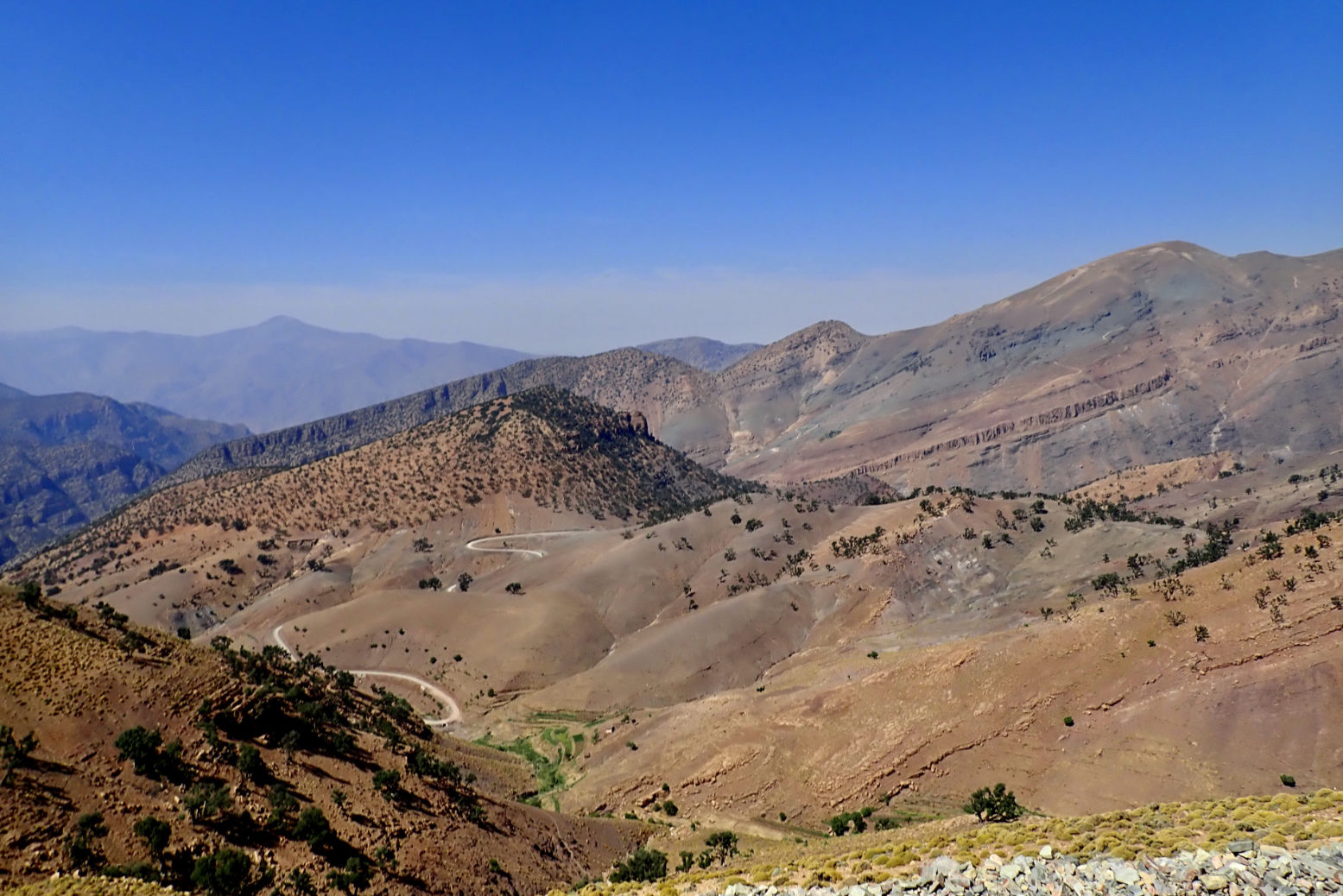
High Atlas crossing parallel to the nearby Tizi n’ ‘Test which peaks at the 2200-m Tizi n Oulaoune (30.940222, -8.125111), following a steep climb: some 500m in 8km after leaving the road SE of Ijoukak (right).
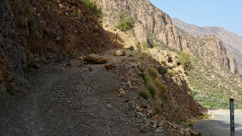
You may find the looser parts of this climb a struggle in a 2WD or on a heavy, wide bike, but this was not the case on 2022 in a 4×4. It’s probable that local 2WD vans only do it downhill (northbound) to Ijoukak. Track immediately blocked by post-earthquake debris (below; 6 months later) and remains abandoned.
In 2022 the track was rougher as it rolled down to the Ouneine basin and the P1735 whose extension eastwards to Igli on (J3) is now sealed. Keep right at the fork with an illegible sign. At the bottom just before it joins the road you have to detour south around the boundary fence of a new small mine,
Once in the basin carry on SW along the P1735, and at Sidi ali ou Brahim swing sharp left off the road, cross the stream and follow the Ouaougdimt valley 24km SE (not fully shown on most paper maps) to join the road coming down from Aguim on the N9 Marrakech–Ouarzazate road.
Or, if you’re in a rush or heading towards Taroudant, at Sidi ali ou Brahim carry on 23km south on the ever-bendy P1735 to Sidi Ouaziz (fuel) on the N10. Otherwise, it would be a shame to miss out on the scenic Ouaougdimt valley stage, as it rises onto a terrace high above the valley floor.
Mapping
Parts of the route are just about legible on paper maps, least badly on the inset ‘High Atlas’ panel on the Michelin. But none show the full Ouaougdimt valley route. It’s all on Google and the OSM/Garmin digitals.
Off-Road
The climb up to the 2200-m Tizi n Oulaoune pass from KM11 starts a steeply but is now blocked. From the pass the gradient eases off with great views doiwn to the basin while you’ll find the Ouaougdimt valley stage no harder than anything you’ve just done. Carefully ridden, a big bike might manage the loose hairpins; so could a 2WD with low first and clearance, though as always, these mountain tracks require concentration. On an MTB it will be a slog if not a push up to the Tizi n Oulaoune, followed by a rough freewheeling reward to the basin and no more huge grades thereafter. Bikes might have more fun following J3 to the high P1735 road, turning left or right.
Route finding
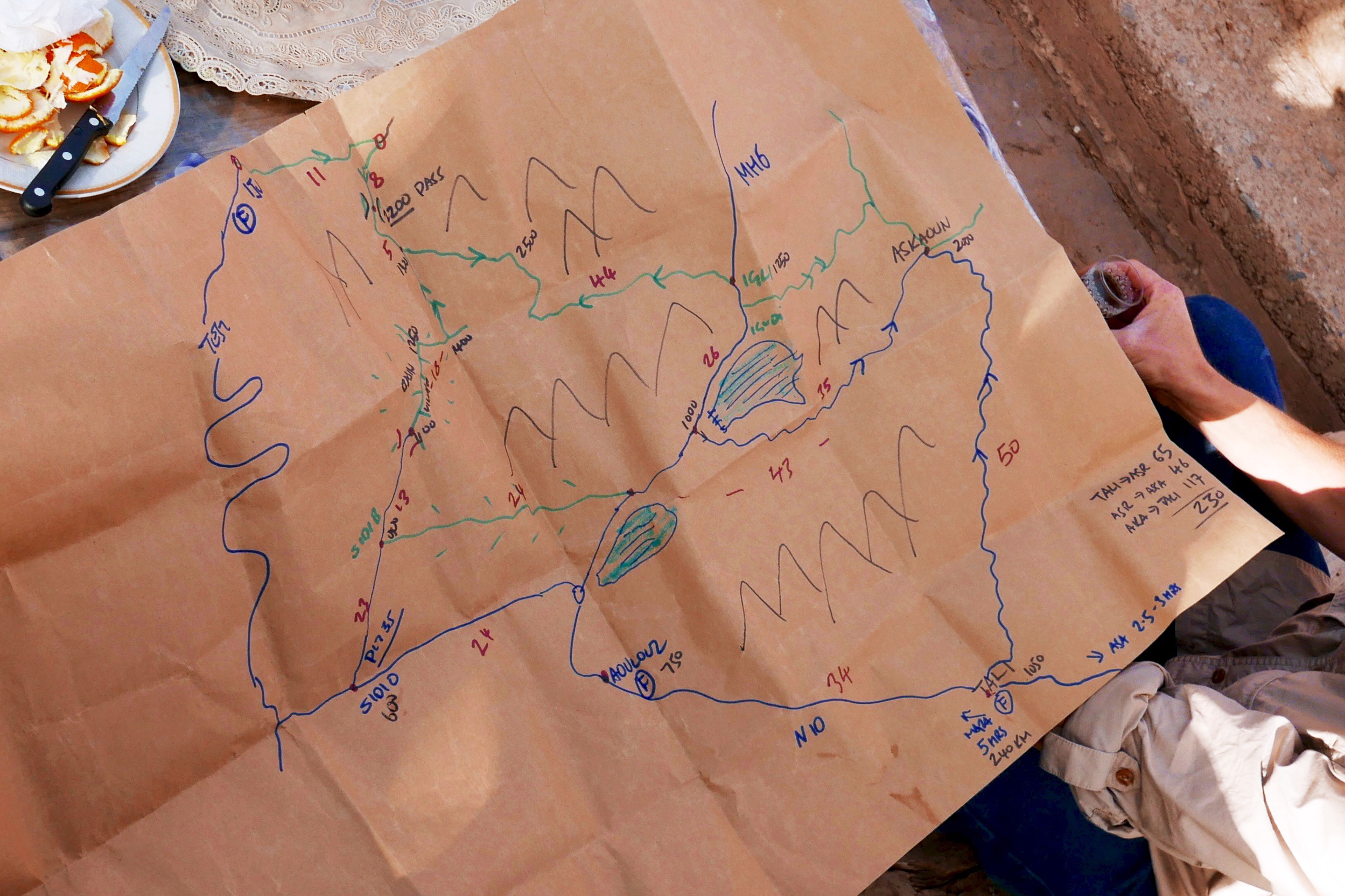
Easy enough. We winged it just by studying Google satellite imagery beforehand, jotting down some distances between junctions. That’s now all listed below. Download the kml file.
Suggested duration
Half a day will do you.
Route Description
0km (88) Talat n Yacoub fuel station (village destroyed but still serving) on the N7 Tizi n Test road. Head north to Ijoukak village.
3 (85) Pass through Ijoukak, cross the bridge and turn immediately right up the side road now thronged with relief tents. Soon you’ll pass Houssain’s agreeable mountain lodge (repaired; reopened). Huge boulders have fallen on the road.
11 (77) At the fork before a village turn right, drop down over a bridge and carry on. Soon there’s a sign right: ‘Ouneine? 24km’. The 500m climb to the pass begins. (Ahead, MH21 continues). To reach Ouneine take the J2 bypass and take the road, or link track which comes in to Map Junction below.
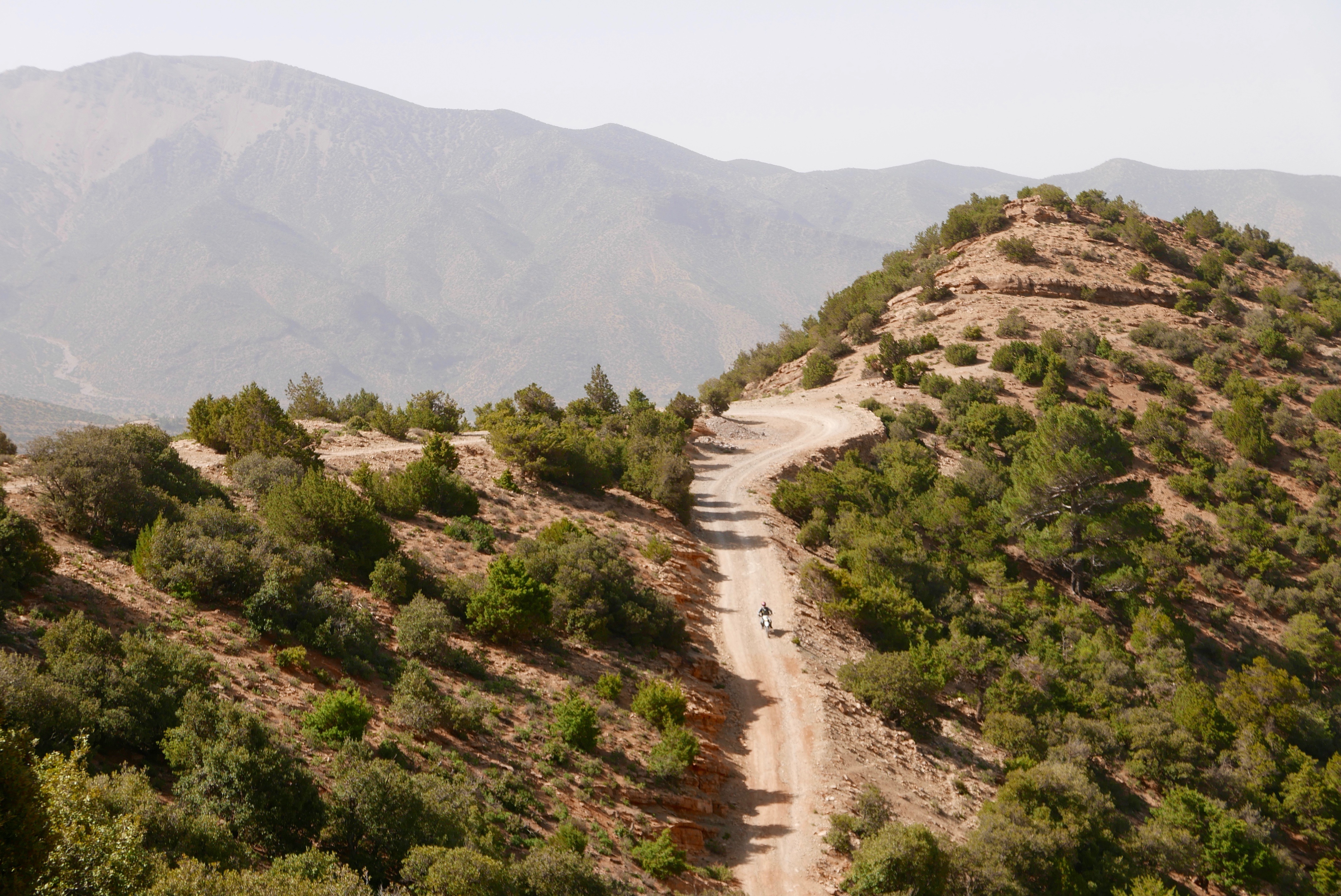
19 (69) Tizi n Oulaoune 2200-m high point with views of Toubkal (4167m) 20km to the northeast. The track now eases off as it descends.
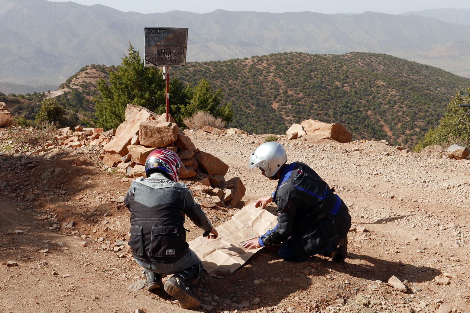
23 (65) Fork with sign (photo above: ‘Map Junction’). East at this fork is a rough track (MH212) which in 9km joins J2 to Igli. Keep right (south) to continue descending to the Ouneine basin visible to the west. At a small mine work your way round the fence to the south. to rejoin the track. Eventually, at a junction around KM35 you join the P1735 road which goes E towards Igli/Iguidi over a 2500-m terrace. This is a spectacular high mountain road (J2).
Meanwhile, the P1735 crosses the Ouneine (shops and cafes) basin SW and threads through a small pass back into the hills.
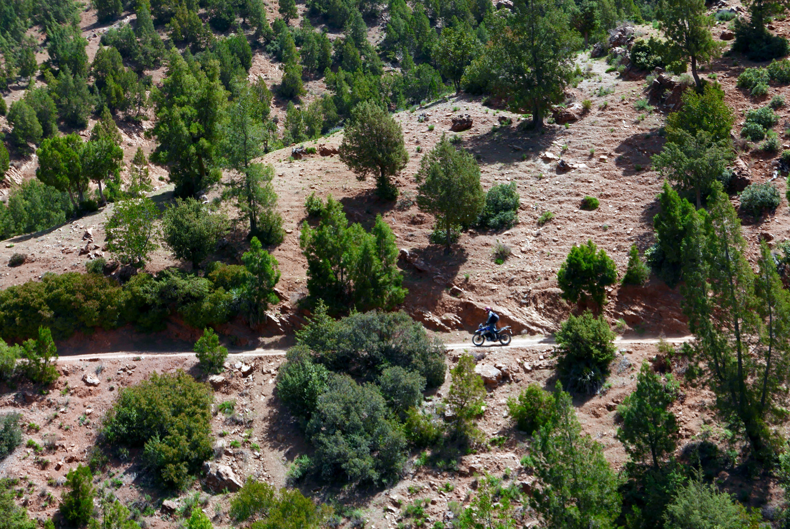
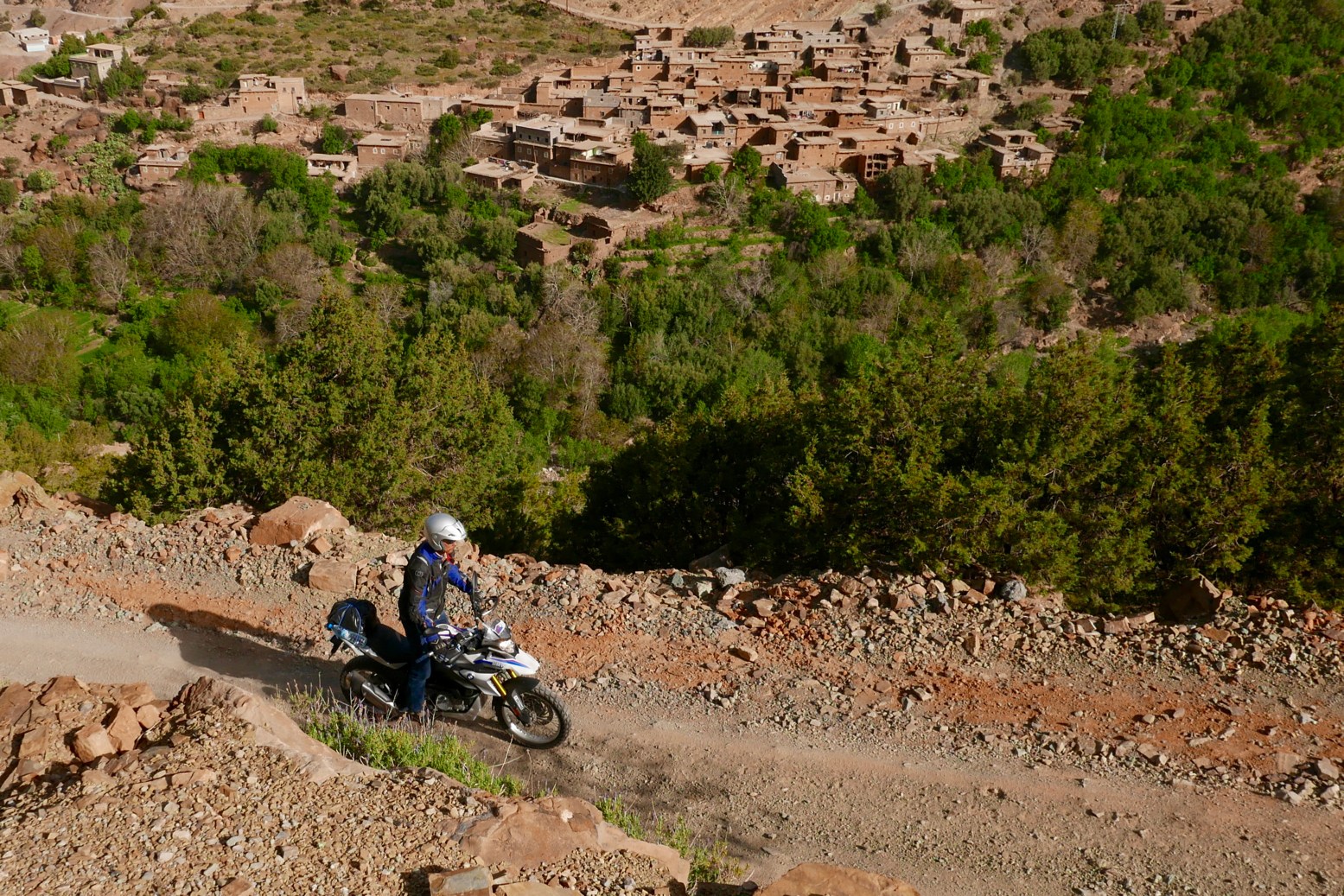
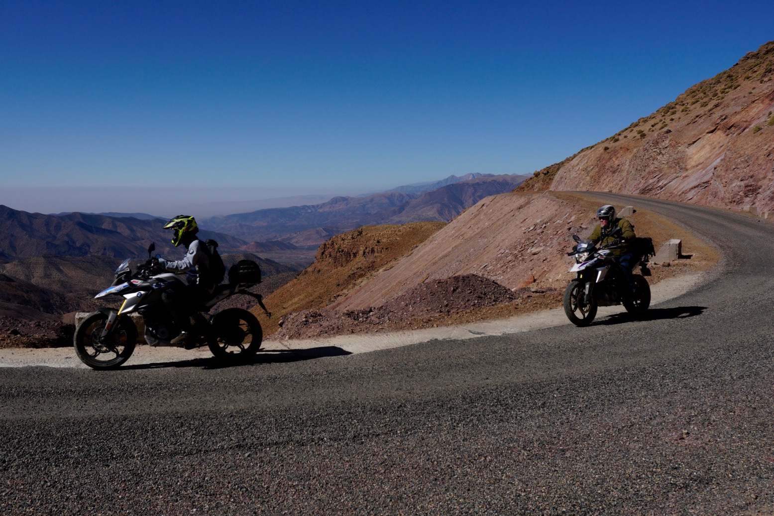
54 (34) Sidi ali ou Brahim. The tarmac carries on 23km to Sidi Ouaziz (fuel) on the R110/N10 but you turn sharp left here, drop down to the stream and up the other side. The track is initially a bit eroded and loose as it climbs to the first village, but that’s why they invented suspension. It then eases off as it rises above the valley on a terrace (right) with great views down to the villages below. You could be in the Cevennes or the Pyrenees, but you’re in the High Atlas. It could be worse.
78 (10) Join the tarmac (J4) by the reservoir. Turn right (west).
83 (5) Roundabout on the R110/N10.
88 Aoulouz fuel stations.
Trans Atlas: J3
Ijoukak > Igli/Iguidi > Askaoun > Taliouine • 170km
Last run: October 2023: CRF300L
At the ‘Ouneine’ turn-off for the blocked track up to Tizi n Oulaoune, carry on southeast on tarmac for a few km until it ends at a village (green mark on map above). Keep going along an easy piste rising up the valley and past a couple more villages all surrounded by relief tents in 2023. Just before one village keep right (downwards); sharp back left leads up to who knows where. Your route climbs to meet the end of the J2 link track close to the Ouneine-Igli tarmac.
Turn left then at the tarmac nearby it’s left up to over 2550m then a long wind down to Igli/Iguidi (hotel/cafe) on the Aquim-Aoulouz road J4.
From here carry on south then west down the valley and turn left at a sign to cross below the dam wall (long term roadworks) and wind your way up to up to Askaoun (KM120) then 45km down to Taliouine.
Total 170KM, fuel to fuel.
I did versions of this route three times in November 2022 with a lunch in Igli. A great ride with a dizzying number of bends in one day.