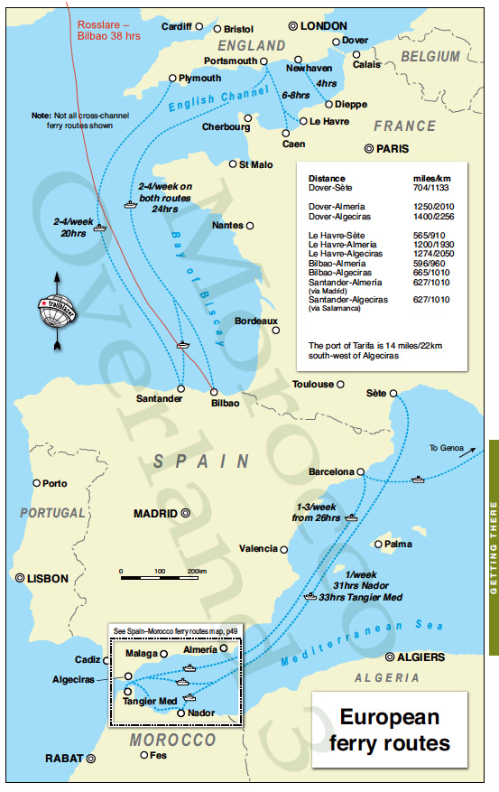
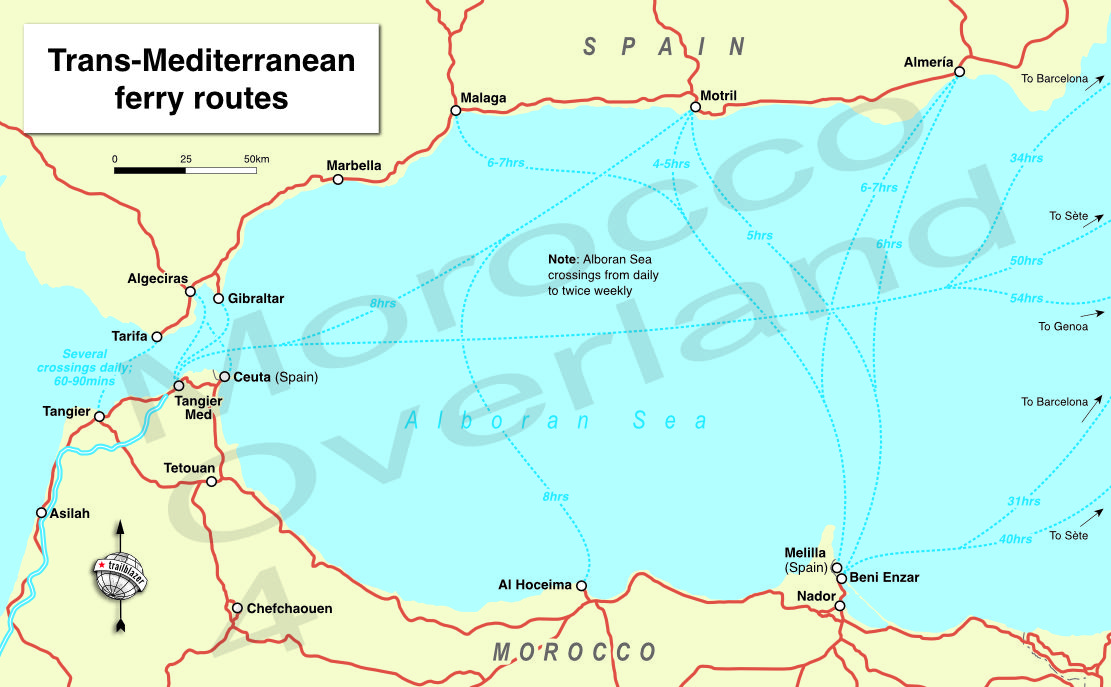
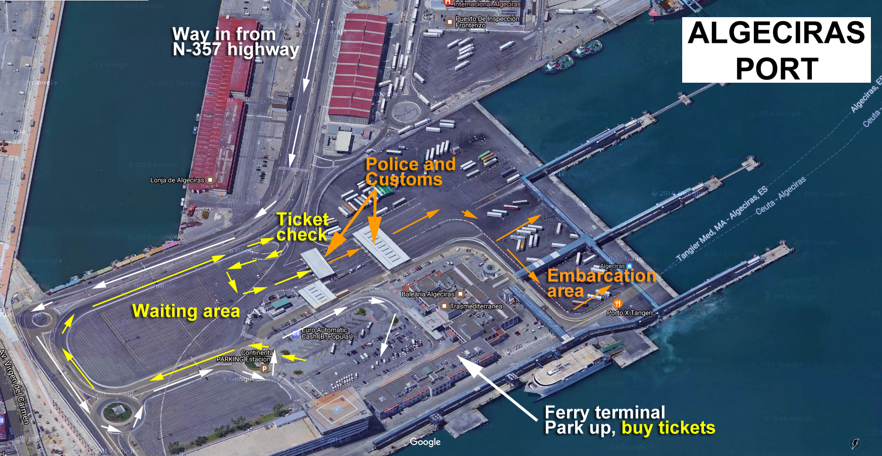
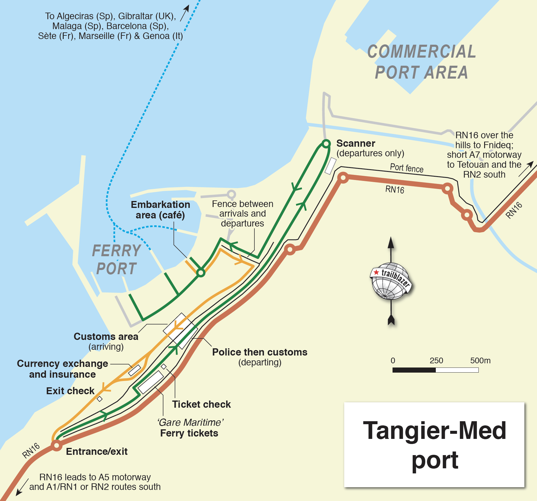
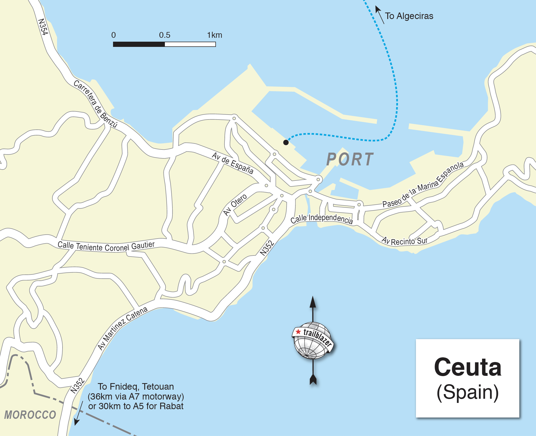
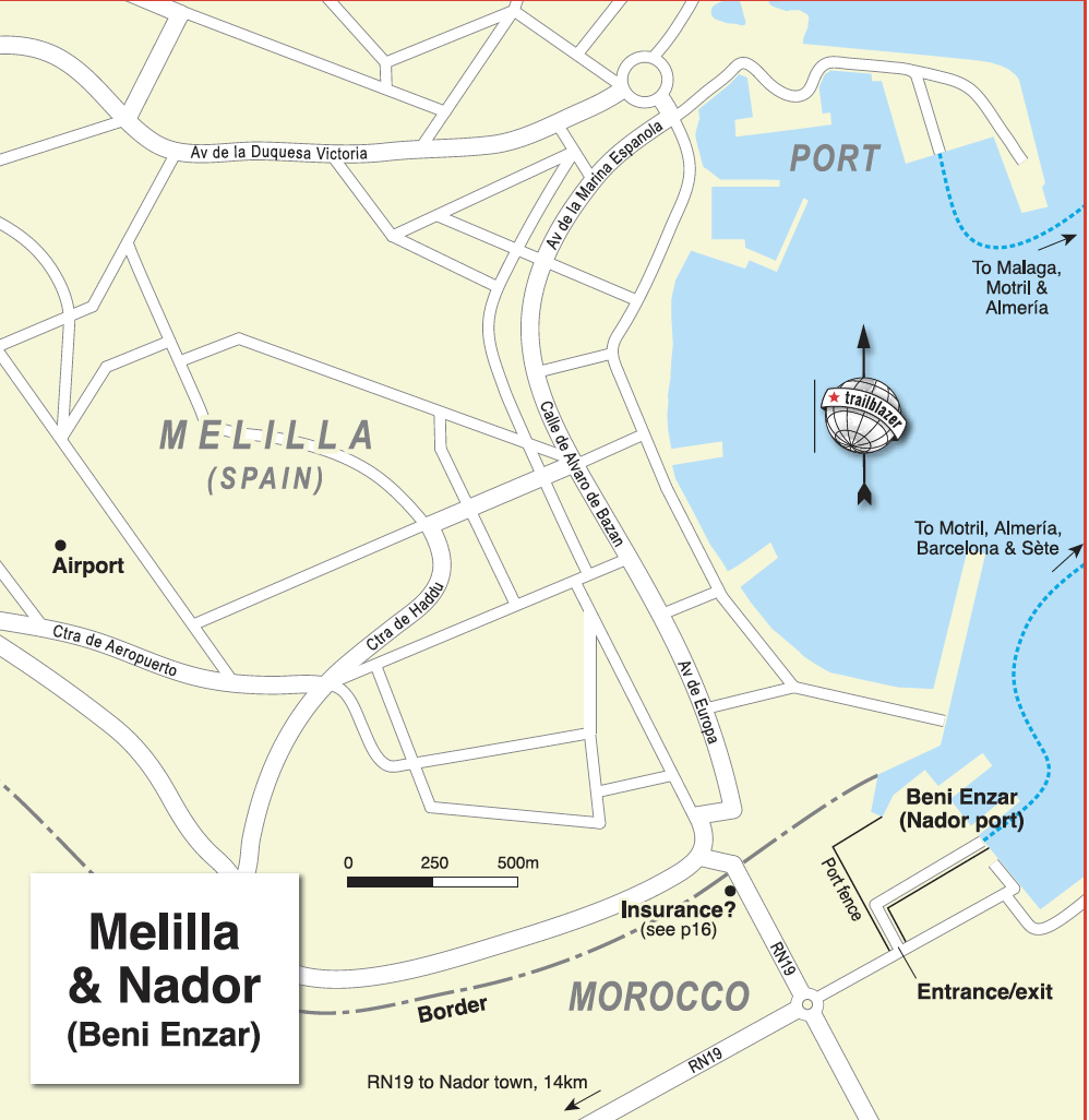
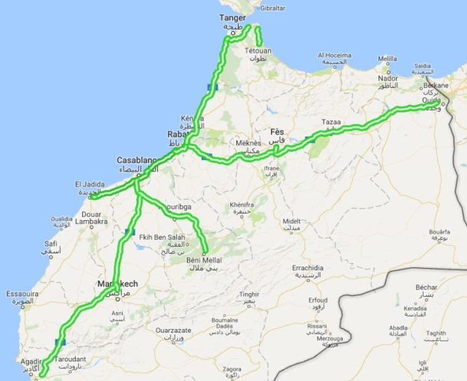
Category Archives: Morocco Overland

Garmin TOPO North Africa Light map review

See also:
Morocco Maps
Time for my Tablet: Samsung Tab + Gaia GPS vs Garmin Montana
How to trace a tracklog
Michelin 742 Morocco (2024) map review
Map review: Reise Know-How Morocco 1:1m (2023)

Screenshot

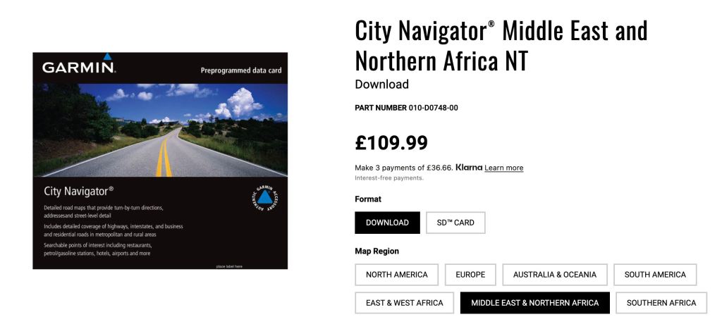
This review was originally for Garmin’s 2016 Topo North Africa v3 Light map and compared it with easily downloaded free OSMs, Garmin’s basic global base map and other digital maps, where available. V5 was the last version in 2023 still a £20 bargain, then the priced jumped back up to £110 for the current ME&NA map which I suspect is little changed. At the current price I’d save your money

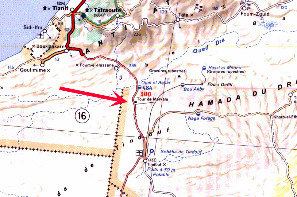
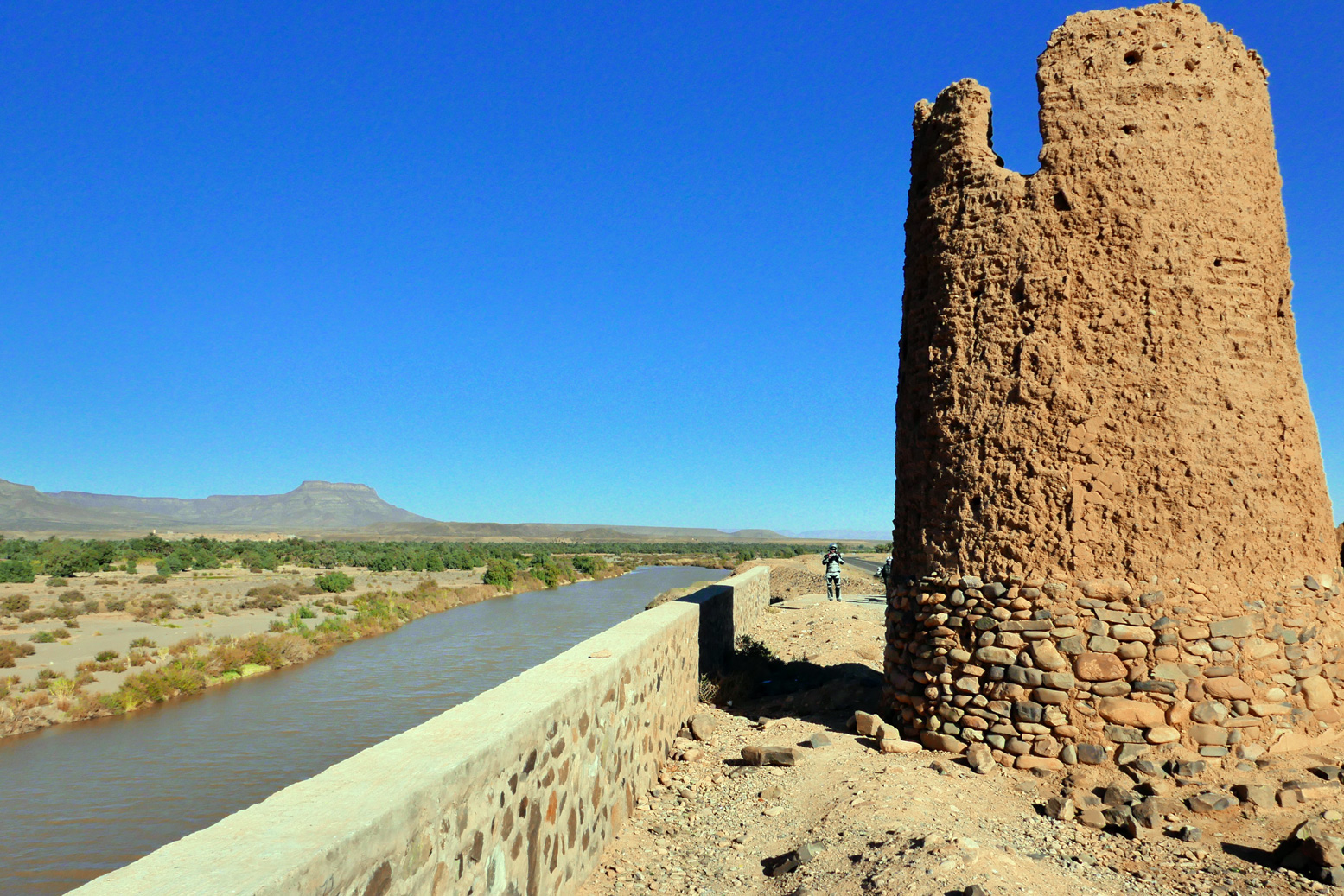
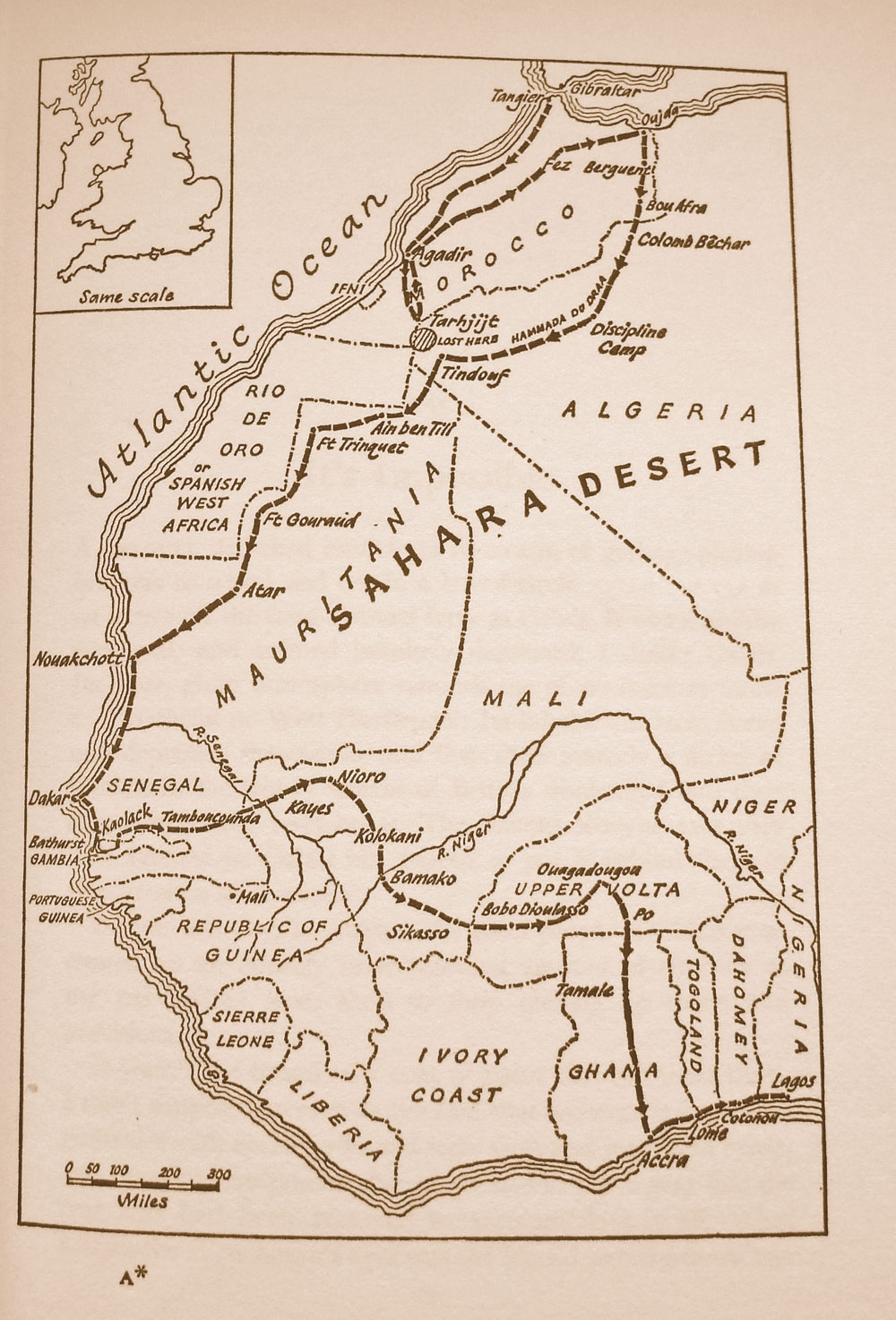
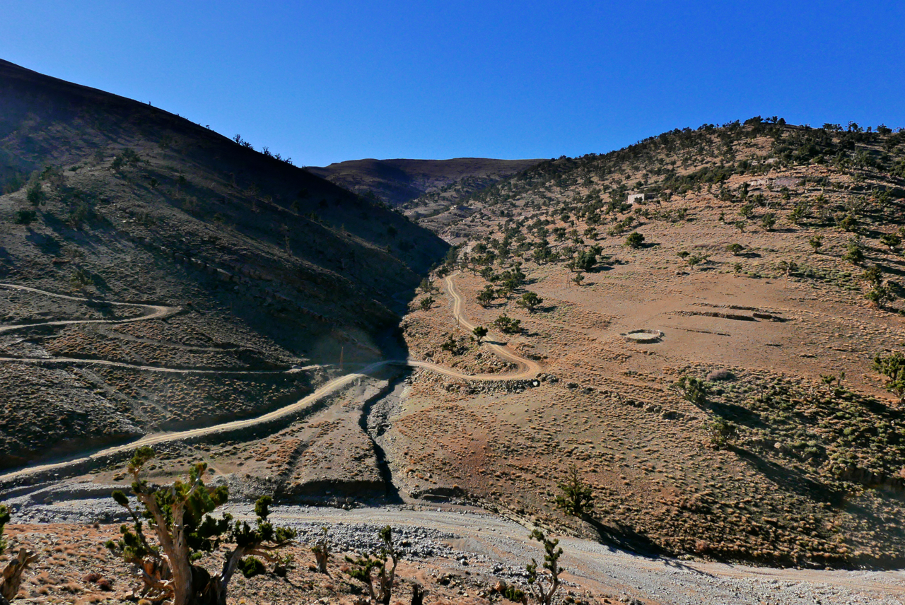
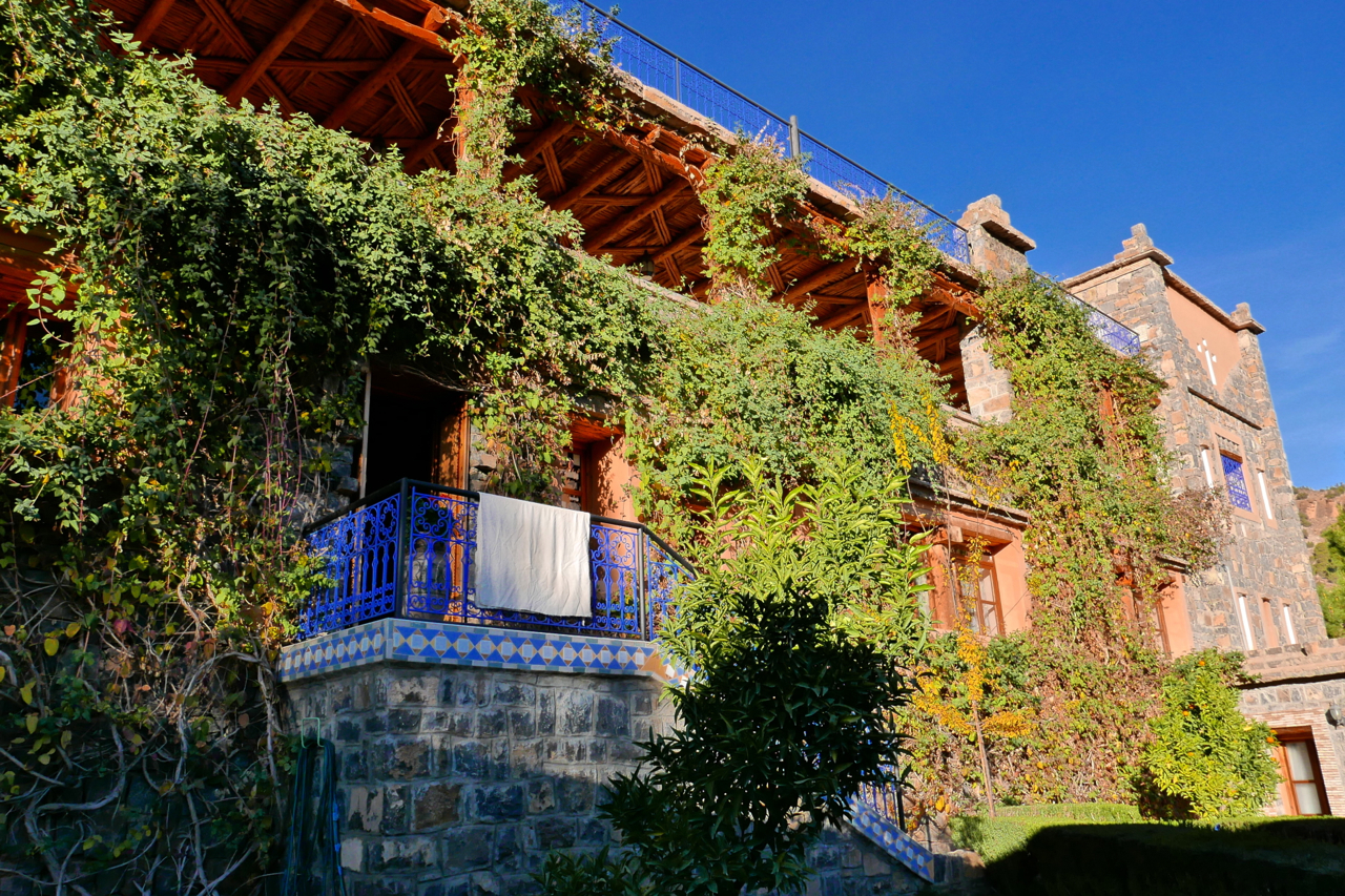
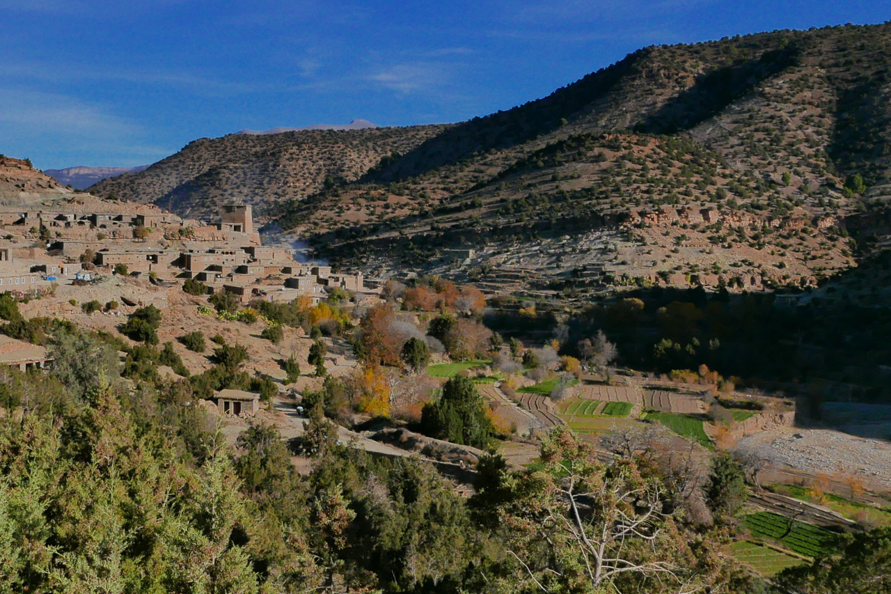
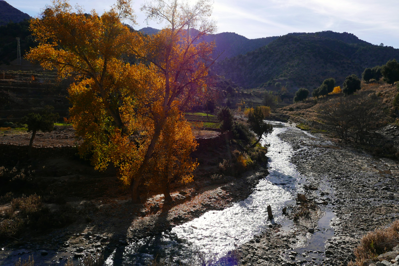
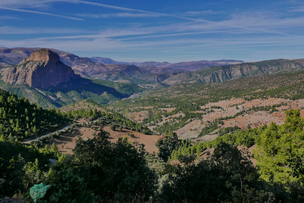
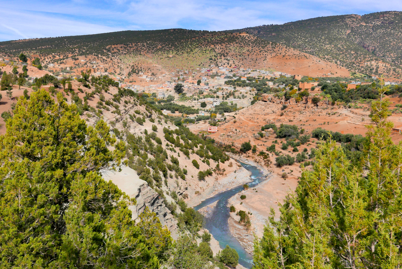
Navigating the Sahara
Having used them since before the advent of GPS, I’ve got to know my Sahara paper maps well. Then, when GPS came along, I could pinpoint my position on a paper map with an accuracy that was more than adequate for desert travel. Some of these colonial-era maps such as the IGN 200s are cartographic works of art, and unlike current nav technology, in the deep Sahara topography changes at a geological pace.
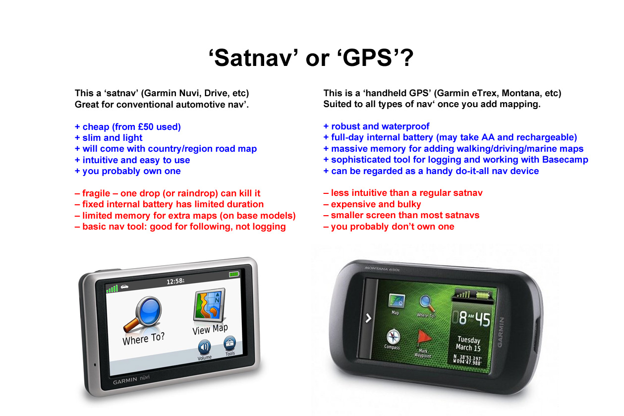
In other words: a paper map of the deep Sahara from 1960 may still be accurate today. Tracks may become roads and villages become towns and even cities, but the open desert itself remains relatively unchanged. Is there a benefit in having a tiny map on your GPS rather than simply a waypoint to aim for or a tracklog to follow, even if your position on the map is displayed live? That’s essential for navigating a busy city with a Nuvi, but the Sahara is more like the sea where more often what you want is…

garminmap

… the big picture
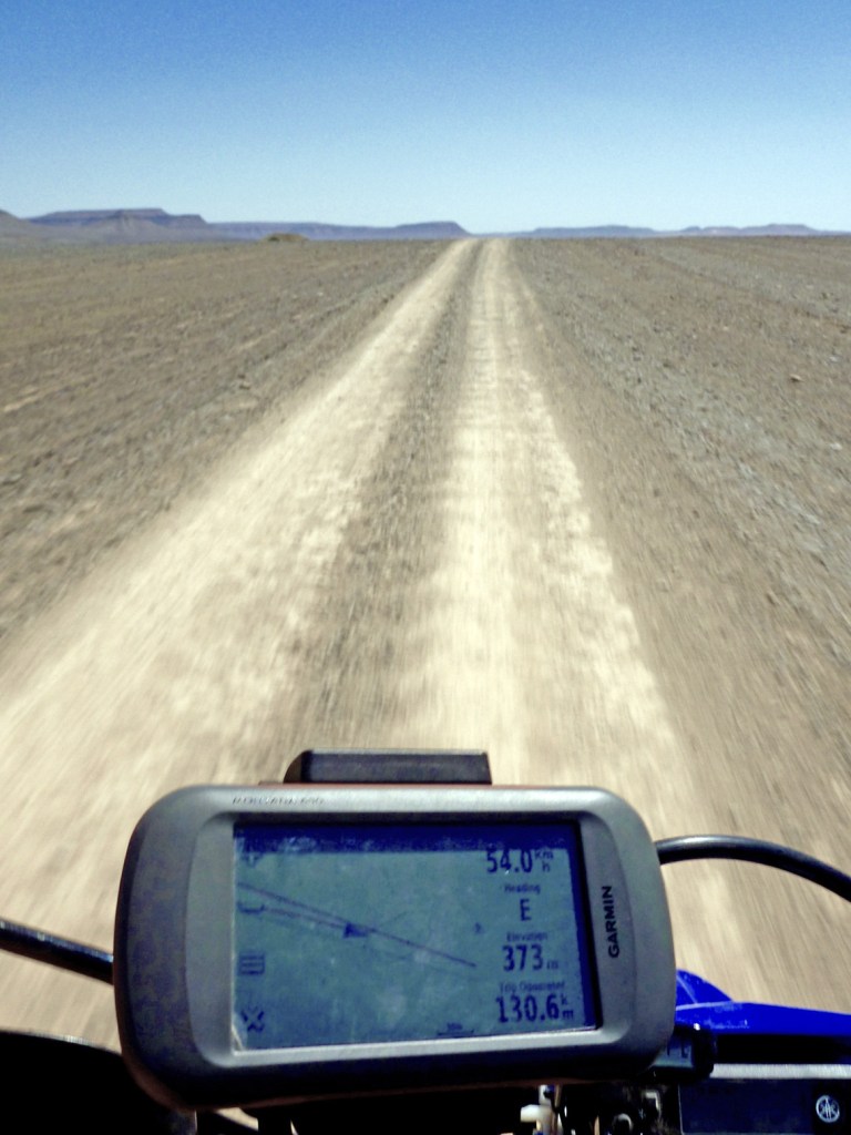
A typical handheld device like my Garmin Montana (left) has a screen a little bigger than a playing card and which is hard to read on the move – especially on a bike. 
For me a ‘GPS’ (as opposed to a ‘satnav’ like a Nuvi – see below) is best at displaying simple data like how far, how fast, how high or which way, not fine topographic detail. A paper TPC map can display six square degrees over some 18 square feet – what you call ‘the big picture’. That’s what you need travelling with a vehicle in an expansive area like a desert, while at close range concentrating on negotiating the terrain.

mush

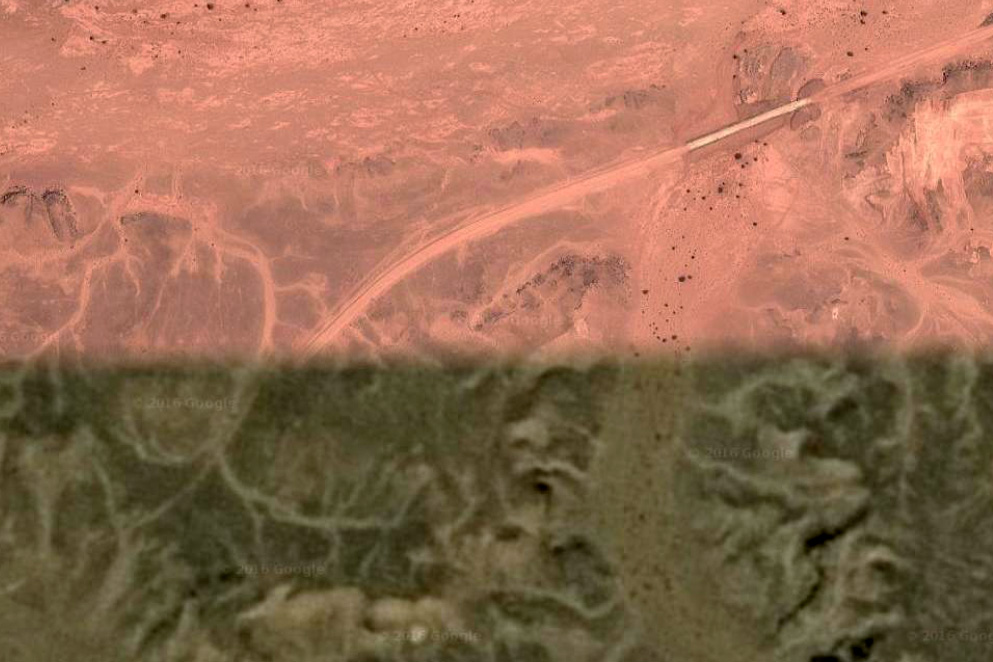
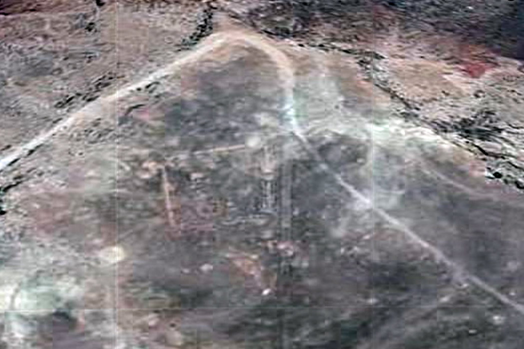
On top of excellent paper mapping (now widely digitised), we also have the wonder of Google or Bing sat imagery (Bing was often better, now Garmin have the edge) providing a clarity that varies from stunning (being able to trace car tracks) to a brown mush (both shown left).
Google sat is great when planning, and now for a reasonable annual subscription, Garmin offer Birds Eye satellite imagery for the whole globe; the long-sought after ‘Google sat in your GPS’. With all these resources navigating in the Sahara couldn’t be easier.

satnavorgps

Garmin Topo North Africa v3 Light (now ME&NA, see above)

Current ME & NA coverage

Short version
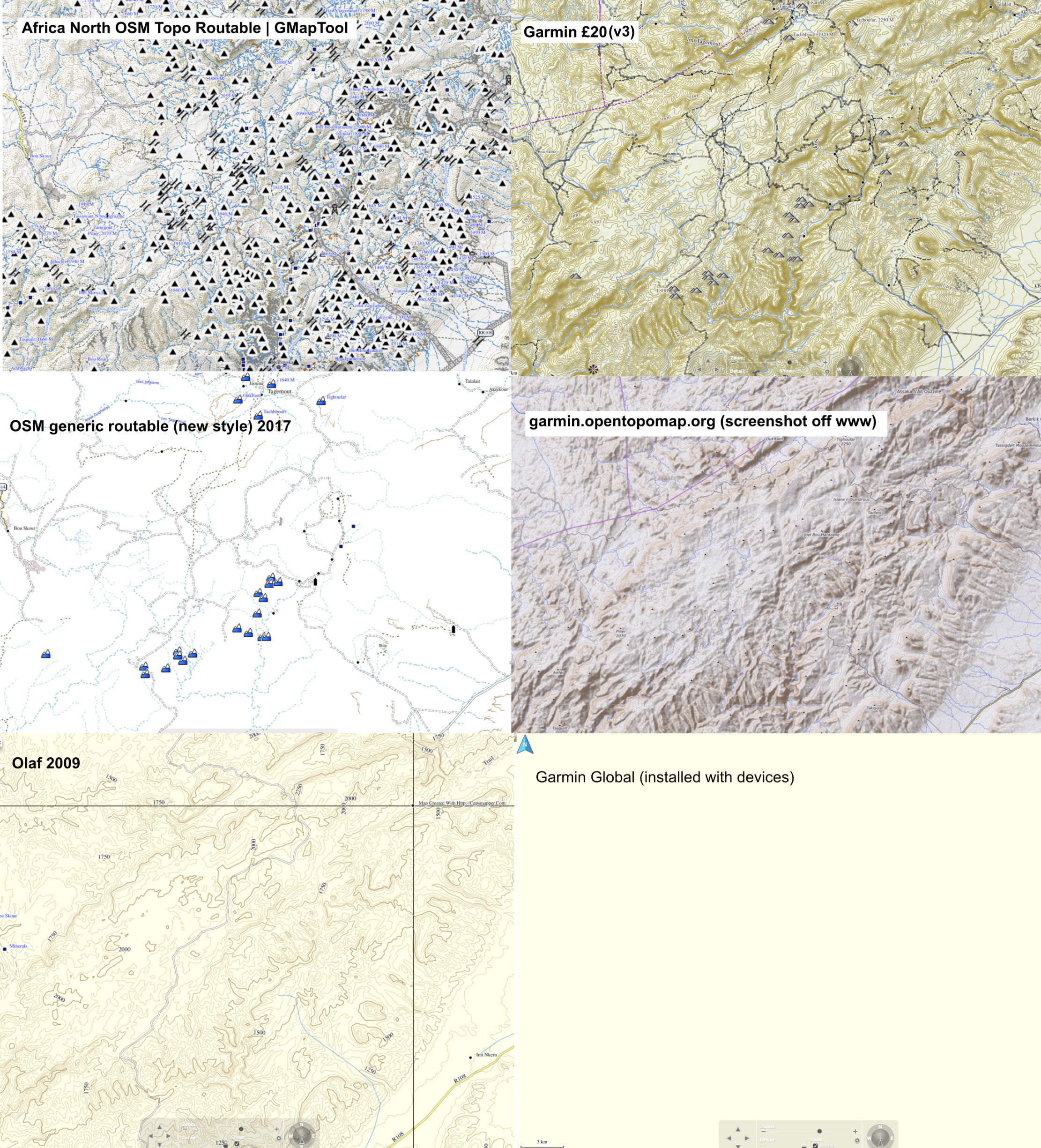
Even though in 2021 old Olaf from 2009 still measures up well, the similar topographic detail of the Garmin means it’s well worth £20, certainly over the plainer, but also free OSMs. In 2018, following a refurb/repair of my Montana, the v1 2016 version of this map was lost or could not be reloaded. I had to buy the v3 version for another £20. A quick scan shows that not much changed, but if it has (based on OSM user updates), it will be in Morocco – the place where most users of this map will visit.

gar-atar

Long version
You download the Garmin Topo map directly into your device (takes about an hour) and only when your GPS device is plugged into a computer, will it display on BaseCamp. Unplug the GPS and the map disappears from BaseCamp.

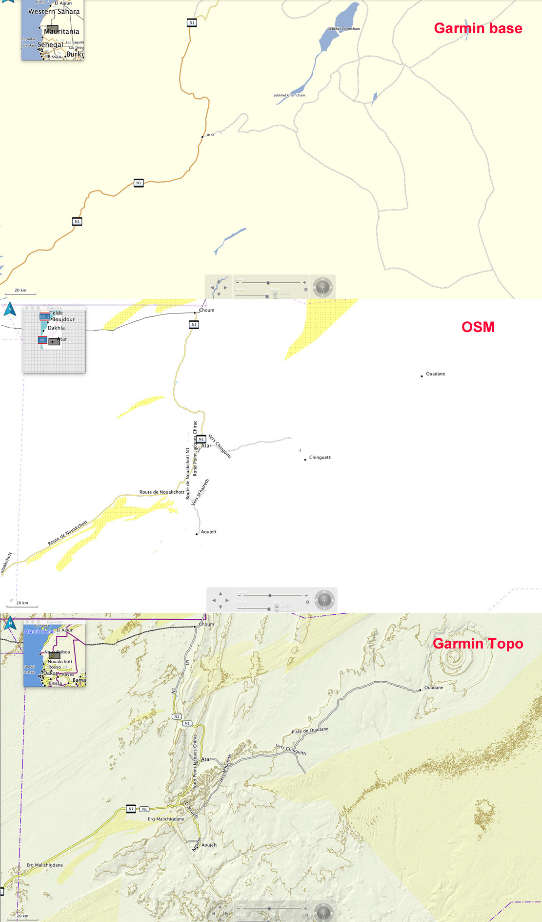
Switching BaseCamp between Olaf, OSMs and even the Garmin base map which comes free with a GPS unit, it soon becomes clear that the Garmin Topo has a level of detail and refinement that’s superior to the next best thing at the time: Olaf.

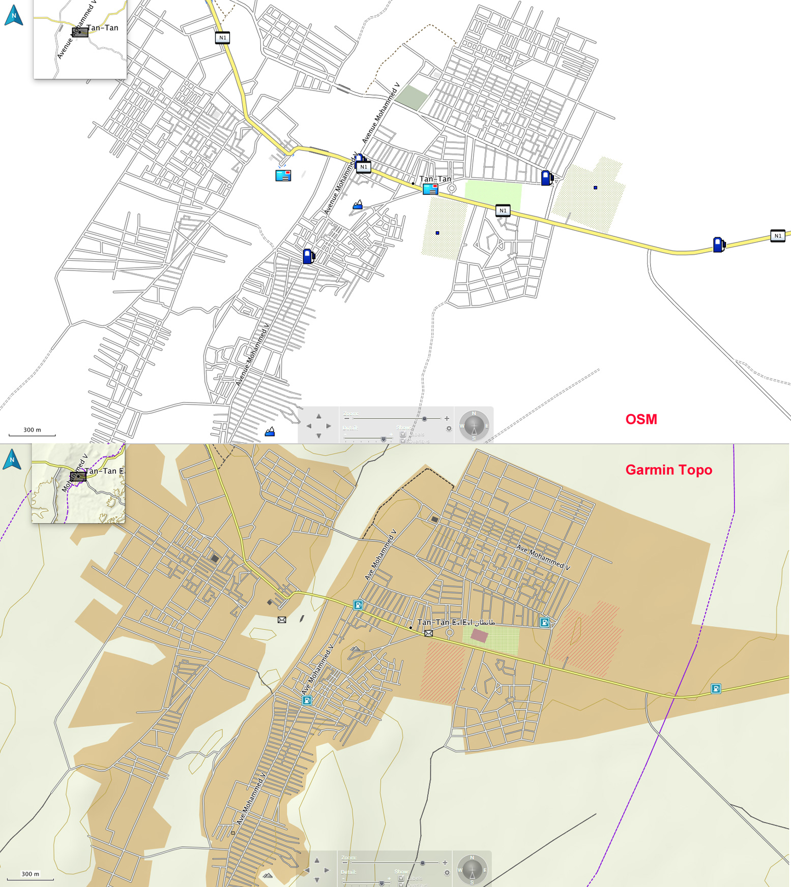
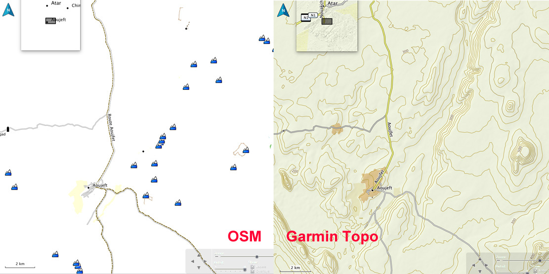
Occasionally at village level the OSM’s street-by-street detail is better, but that’s hardly vital. In towns and cities the extra shading distinguishes the Garmin from the plainer OSM, as shown for Tan Tan, left.

gar-tantan
Tan Tan

The chief difference is in the desert where the Garmin depicts relief and surface with more detail and clarity using shading, contours and colour where OSMs only use colour and Olaf only used contour lines which can be distracting.
Look at the Atar region (RIM) above right – an area of escarpments, canyons and dunes – all are reasonably accurately shown on the Garmin Topo. There’s an anomaly on the Topo map on the left (bottom panel) in that the (presumably automatically recorded) elevation variation in dunes depicts them as lots of small hills (which in a way, they are), but only once they’re above a certain height. Identifying dunes with contours is not helpful nor a cartographic convention. Shade and colour is best.

Six digital maps compared 2021– screenshots of Jebel Saghro, Morocco. Garmin v3 is #2.

The piste and road detail on the Topo is pretty good: yellow for national highways, twin lines for secondary roads or piste, and a single line for a less used piste. A quick check in Morocco shows they’re all there; most of the ones I know are there in Mauritania too. In southern Algeria only a few main pistes are shown and certain ‘national highways’ are actually remote pistes never likely to be sealed. The Topo map would not be so useful here.
In any country dashed lines may well be walking trails, but as far as I can see, there is no key or legend with the Topo map. Some POIs are there too – just fuel stations and post offices as shown on the Tan Tan map, above.

gar-px

In places the Garmin copies OSM’s annoying habit of again, marking high points (automatically?) as mountains which is a distraction, let alone inaccurate – for example when an escarpment gets shown as a string of peaks. If you drop the detail level enough notches on BaseCamp, these peaks (left) only disappear once all the useful tracks and place names have gone too. It’s great (and a bit puzzling) that this stuff is produced for free at all by OSM supporters, but the quickest flip to sat imagery would reveal the true nature of the relief.

So does the Garmin Topo map mean I’ll stop using Google or Bing imagery in the planning, or paper maps on the piste? The former, I don’t think so; the later in Morocco yes, but elsewhere in the Sahara I’d still rely on paper maps.
In places like Morocco the extent of marked pistes can be converted into accurate tracklogs, but with better surrounding detail than OSMs. And, unlike Olaf, there’s no aggro importing into a modern, touch-screen GPS. When I want to quickly verify where I am, a glance at the Garmin Topo will may be adequate.

I’ve been using the Garmin Topo map quite heavily on BaseCamp last couple of days, preparing a new edition of Morocco Overland. It’s an intuitive-reading map and I’ve found one benefit of using a Garmin map on Garmin software is that when stringing out a track with the ‘create a route’ tool, it automatically snaps onto even the thinnest track on the map just like Google maps. But the BaseCamp tool won’t do that with other installed maps like OSM or Olaf, or even the basic Garmin base map. Sometimes you have to trick the tool to go the way you want, but it makes stringing together hopefully accurate routes (as well as distances) very easy. Occasionally only Olaf will show a route you want to follow, in which case you make the route with lots of short, straight lines. No so hard.

Getting routed: As the track was clearly visible, I traced the route I’m logging above (MW7) off Google Earth the previous evening (internet required), saved and exported the kml then imported it (as a gpx) into my Montana via BaseCamp. This was pushing the outer limits of my tech ability with this sort of stuff.
GPS digital maps not really needed as I had the largely accurate self-drawn tracklog on the screen to follow, while recording my own live tracklog. Years later I used this same system (pre-trace route off Google Earth) again while logging MH23. The great thing with satellite is WYS is usually WYG, whereas with maps (paper or digi) WYS can be nothing at all.

‘M’: the mysterious Tour de Merkala

Part of the Sahara A to Z series

merkala-1

I’ve always been curious about the Tour de Merkala, identified on the Michelin 741 Sahara map (and left) on the Algeria-Morocco border, south of Foum el Hassan.
Was it some ancient caravanserai or watchtower, like the one right, alongside the Oued Draa north of Zagora, which guided caravans in along the 52-days road from Timbuktu? Or perhaps just a French observation post from the colonial era?

tourdraa

No surprise that this time I searched, it was Yves Rohmer’s encyclopaedic Sahara pages where the answer lay, and there’s more here. In the 1930s the French were still busy subduing tribal resistance in the southern mountains of Morocco in the region between Tata and Assa, and while there decided Tindouf far to the south needed occupation too. But between southern Morocco and Tindouf lay the Jebel Ouarkaziz which still serves at a natural barrier today between the two countries.

berlietvudb

A column consisting of Berliet VUDB light armoured cars (left – note the big roll of chicken wire to use for sand boggings) set out from Akka and wound their way through the foums or gaps in the ranges until they came to the impenetrable cliff below Jebel Merkala. Here they spent a few days enlarging an old camel trail into a ramp to support their armoured cars, over two kilometres and 220m up the escarpment to the Hammada du Draa plateau on top. Once here the way to Tindouf was clear and a fort was established at Merkala.

merkalabing

Even if there was a tower (unnecessary on top of a pass, you’d think), why they didn’t call it Fort or Bordj Merkala? Or Fort ‘Commanding-Officer’s-Name’, as was the custom at the time? Many former French forts in Algeria – Fort Lapperine, Polignac or Flatters – became villages and even cities (respectively: Tamanrasset, IIlizi, Bordj Omar Driss). I’ve yet to find an old picture of the actual fort at Merkala and there’s nothing much to see on Google. But as is sometimes the case, Bing has better resolution and shows faint traces of skewed-rectangular fort-like foundations at the top of the pass (right), as well more modern ramparts pushed up nearby. Click the Flatters link above to see what a fort from this era may have looked like.

newmanmap

Very soon this route was extended and improved to become part of the primary imperial N1 highway from Morocco into the AOF French colonies to the south, running from Agadir via Foum el Hassan over Merkala to Tindouf, then down via Bir Mogrein, Atar and eventually Dakar.

the-forgotten-path

The Atlantic Route we know today wasn’t an option for the French back then as the Spanish colony of Rio de Oro. – today’s Western Sahara – was in the way (left).
It was the N1 inland highway which David Newman took in his Ford Zephyr in the late Fifties, vividly described in The Forgotten Path, a somewhat unhinged account of his drive to Nigeria. He’d tried to go via Foum el Hassan and the Merkala tower, but to his fury was turned back as the area was harbouring the FLN who were battling the French in Algeria at the time.
The Tour de Merkala became a battleground again a few years later during the so-called 1963 War of the Sands between newly independent Morocco and Algeria. No fixed border line across the barren desert had been thought necessary between the two nations until valuable minerals were discovered (you’ll see no border defined on the late 1940s Michelin 153 at the top of the page). For some reason Algeria attempted to annexe the village of Iche near Figuig, as well as a creek called Tindoub and the nearby well of Hassi Beida, some 35km south of Mhamid. The Moroccans responded by trouncing the Algerians, so  establishing an enmity that fed into the Polisario war a decade or so later and which remains entrenched today with closed borders. You can still see the Hassi Beida bump in the border today.

Getting back to Merkala’s prominence on maps. Perhaps it’s just an anomaly not unlike Hassi bel Guebbour in Algeria. Looks like an important place on the map but once you get there it’s nothing but a checkpoint at an albeit strategic crossroads with a couple of chip- omelette cafes.

hbg

High Atlas recce

harek-23


After my 2015 one-week tours, on the suggestion of a Morocco Overland reader, I rode over to have a look around the Mgoun area of the High Atlas, about 150-km east of Marrakech. The better known Jebel Toubkal is only 65km directly south of Marrakech; Mgoun makes up the other big massif of the High Atlas, with the 4071-metre high point on the ridge only 100m less than Toubkal.

harek-05


I spent a couple of days based near the hamlet of Zaouiat Ahansal (left), joining up the dots visible on the Olaf map (below), or whatever I found. Tucked up the head of the valley, as the same suggests, the Berber settlement of Ahansal is the site of a religious institution – or Zaouiat – founded back in the 13th century.

harek-10


In the area is the famous Cathedral crag (left) well-known to rock climbers, and from where intrepid piste-bashers have sought links east to Imilchil or south over the Atlas to the Dades valley.
As usual with Olaf, some tracks have been sealed, some have been abandoned and found new routes, and some were never really passable with anything more than a donkey on stilts. And even with my bike’s potential 500-km range and backroad-and-piste speeds, I still had to make use of the fuel stops indicated on the map below.
Amazingly, the weather continued to hold out with bright sunshine, but as soon as you ride into the shadows temperatures dropped. The roads and tracks got up to 2700-metres of 9000 feet and revealed yet another one of Morocco’s incredible diverse landscapes.

HighMgounmap

Morocco: Getting There + Mobile phone SIMs

March 2025

See also:
Documents and Port Immigration
Buying and using a Moroccan SIM card

Most travellers from the UK heading to Morocco in the cooler months take ferries from Portsmouth to northern Spain: Bilbao or better still, Santander. When you add up tolls and fuel and time across France it works out the same price for less driving or riding.
The Brittany ferries on this route are well-equipped cruise ships with plenty to occupy you over ~22 hours at sea, while doing a great job of smoothing the voyage across the Bay of Biscay. Brittany also have a no-frills ferry route between Rosslare, Ireland, and Bilbao.

traspain

From Santander to Algeciras (the most-used port) is about 1000km, and the empty and fast network of roads west of Madrid (A67, A62, A66 and A381 – right) can get you between the two ports in one long day.

malagawear

On a motorcycle, from the UK you can save at least two days each way but getting it trucked to a warehouse near Malaga. I’ve used Fly and Ride. I delivered my bike loaded up to a warehouse near Gatwick, then flew in and picked it up next to Malaga airport a week later. Post Brexit it now costs from £700 one-way. See this thread.

Toll motorways. Quick ways to get south or east.

Moroccan Ports
Now that Tan Med port is so easy, few go via ‘Tangier Ville‘ or the nearby Spanish enclave of Ceuta (Sp), although from Alicante, ferries to Melilla enclave (Sp) are often much cheaper than adjacent Nador. The payback can be that on the Spanish side of the land border with Morocco you’ll have annoying ‘helpers’ offering their services. They’re just looking for a tip at the end of it, but on a quiet day, you can manage without them.

Algeciras-port
White line then to buy ticket, yellow line to waiting area, orange line to embark

Moroccan port maps

nadorins1

Morocco Maps

Morocco Overland Maps has moved

Getting routed: As the track was clearly visible, I traced the route I’m logging above (MW7) off Google Earth the previous evening (internet required), saved and exported the kml then imported it (as a gpx) into my Montana via BaseCamp. This was pushing the outer limits of my tech ability with this sort of stuff.
GPS digital maps not really needed as I had the largely accurate self-drawn tracklog on the screen to follow, while recording my own live tracklog. Years later I used this same system (pre-trace route off Google Earth) again while logging MH23. The great thing with satellite is WYS is usually WYG, whereas with maps (paper or digi) WYS can be nothing at all.

Morocco Overland videos

ma6-7g
morocco22s

Here’s Ian Chappel’s short video as he reaches the impressive overlook at KM78 on Route MA7. You look down from the top of Jebel Timouka over the Issil Plain following a couple of hours rough riding. Good work on a hefty GS12! MA6 proved even tougher on the BMW but can also surprise you with a similarly impressive vista at KM48 if you’re heading north.

Ian’s other vids include pistes from the book and thankfully cut to the action.

We’re back in this area over the next few days with a few small XRs plus a couple of 650 singles. They’ll be a report here or on the AMWebsite. And maybe some vids too.


Maps of the Sahara

Sahara Maps have moved here