Part of the Sahara A to Z series
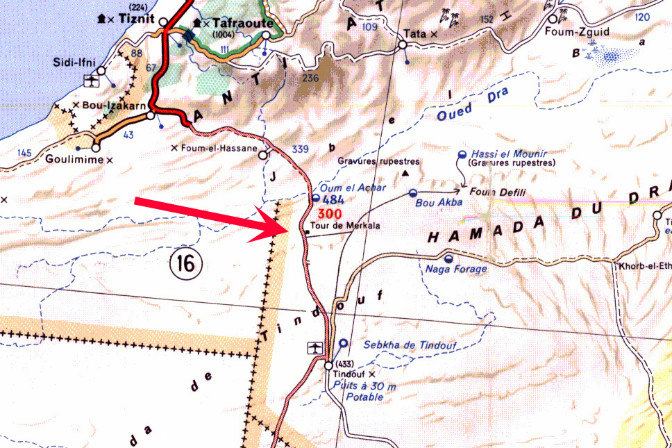
I’ve always been curious about the Tour de Merkala, identified on the Michelin 741 Sahara map (and left) on the Algeria-Morocco border, south of Foum el Hassan.
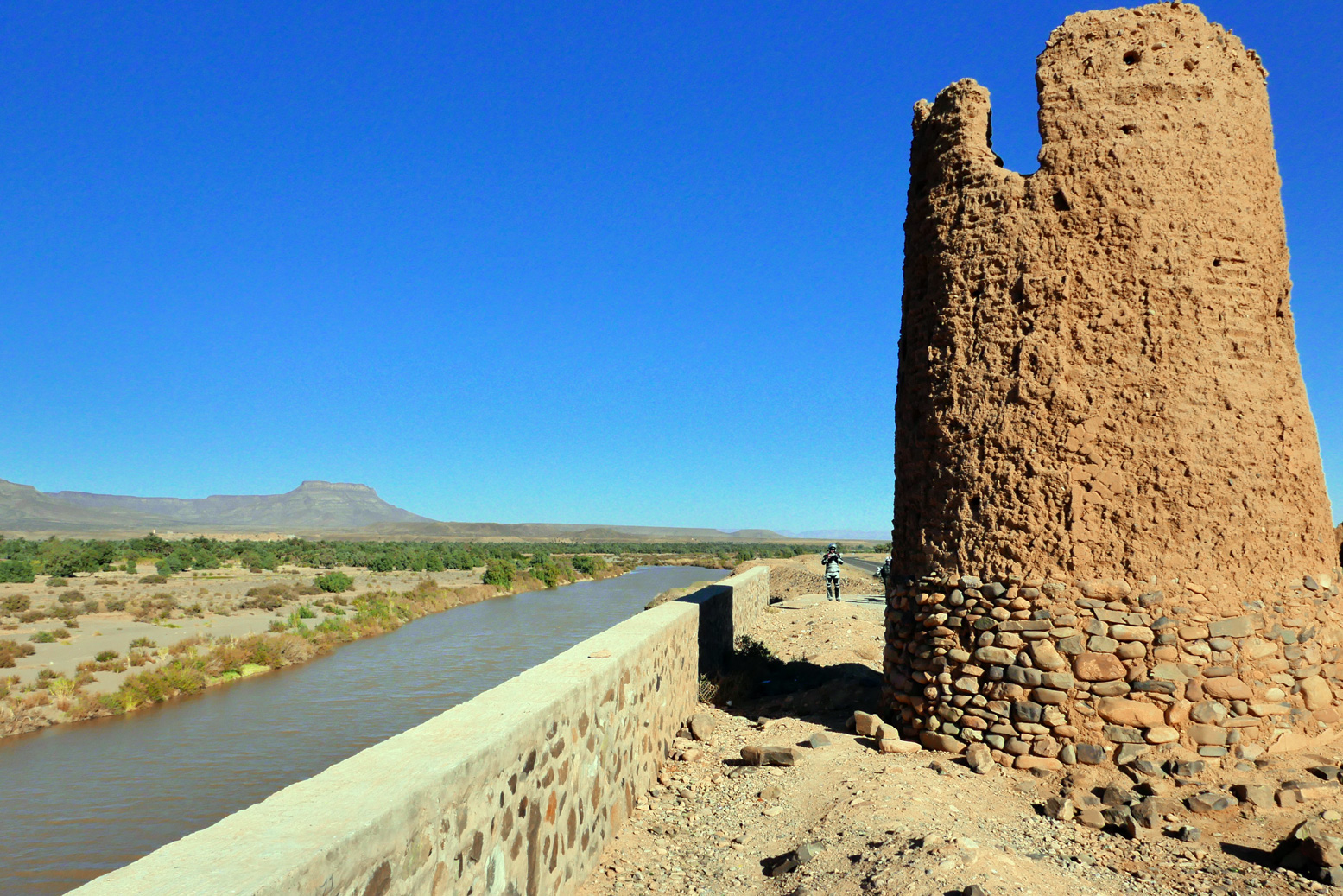
Was it some ancient caravanserai or watchtower, like Afghanistan’s famous Minaret of Jam, or the one below, alongside the Oued Draa north of Zagora, which may have observed caravans coming in along the 52-days road from Timbuktu? Or perhaps just a French observation post from the colonial era?
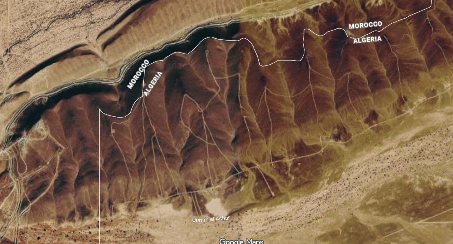
No surprise that the answer lay on Yves Rohmer’s encyclopaedic Sahara pages, and there’s more here. In the 1930s the French were still busy subduing tribal resistance in the southern mountains of Morocco in the region between Tata and Assa and, while there, decided Tindouf far to the south (and in present day Algeria) needed occupation too. But between southern Morocco and Tindouf lay the Jebel Ouarkaziz which still serves at a natural barrier today between the two countries. Below, the border ‘corner’ about 40km SSW of Foum el Hassan, you can see how Algerian tracks rise right up to the escarpment edge, while below the rim and along the south bank of the Oued Draa you can see part of the Moroccan berm (wall) which runs unbroken all the way to the Atlantic border with Mauritania.
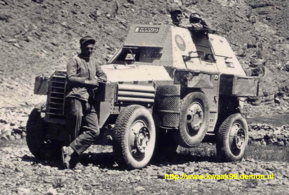
A column consisting of Berliet VUDB light armoured cars (left; note the big roll of chicken wire to use for sand boggings) set out from Akka and wound their way through the foums or gaps in the ranges until they came to the impenetrable cliff below Jebel Merkala. Here they spent a few days enlarging an old camel trail into a ramp to support their armoured cars, over two kilometres and 220m up the escarpment to the Hammada du Draa plateau on top. Once here, the way to Tindouf was clear and a fort was established at Merkala.
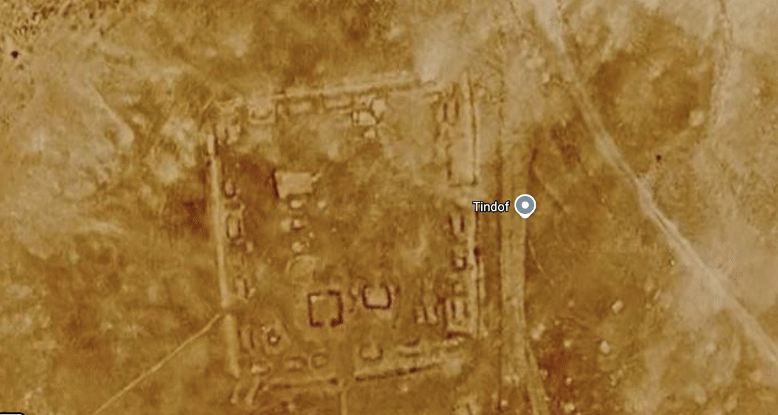
Even if there was a tower (unnecessary on top of a pass, you’d think), why they didn’t call it Fort or Bordj Merkala? Or Fort ‘Commanding-Officer’s-Name’, as was the custom at the time? Many former French forts in Algeria – Fort Lapperine, Polignac or Flatters – became villages and even cities (respectively: Tamanrasset, IIlizi, Bordj Omar Driss). I’ve yet to find an old picture of the actual fort at Merkala, but since I wrote this ten years ago the resolution on Google is much improved (above) and shows the traces of fort-like foundations at the top of the pass, as well a more modern defensive emplacement a few hundred metres to the south. Click the Flatters link above to see what a fort from this era may have looked like.
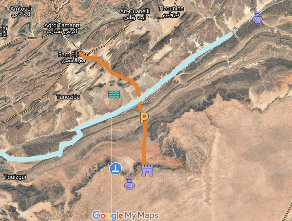
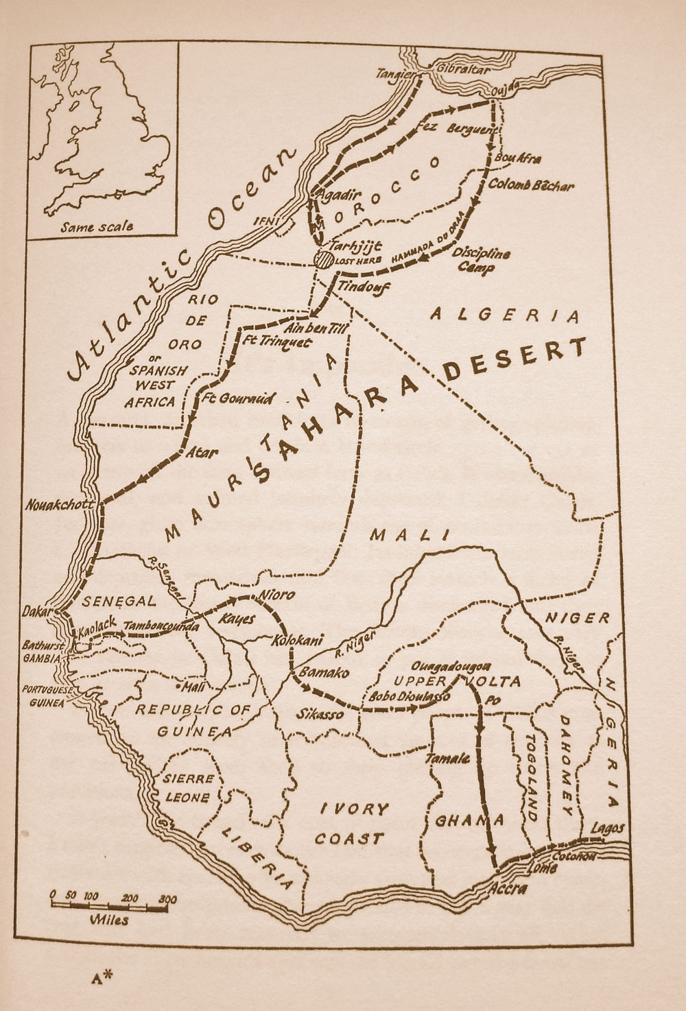
Very soon this route was extended and improved to become part of the primary imperial N1 highway from Morocco into the ‘AOF’ French colonies to the south, running from Agadir via Foum el Hassan over Merkala to Tindouf, then down via Bir Mogrein, Atar and eventually Dakar.
The Atlantic Route we know today wasn’t an option for the French back then as the Spanish colony of Rio de Oro. – today’s Western Sahara – was in the way (left).
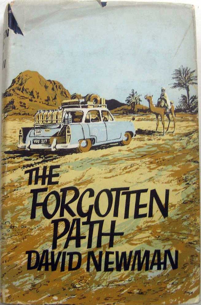
It was the N1 inland highway which David Newman took in his Ford Zephyr in the late Fifties, vividly described in The Forgotten Path, a somewhat unhinged account of his drive to Nigeria. He’d tried to go via Foum el Hassan and the Merkala tower, but to his fury was turned back as the area was harbouring the FLN resistance who were battling the French in Algeria at the time.
The Tour de Merkala became a battleground again a few years later during the so-called 1963 War of the Sands between newly independent Morocco and Algeria. No fixed border line across the barren desert had been thought necessary between the two nations until valuable minerals were discovered (you’ll see no border defined on the late 1940s Michelin 153 at the top of the page). For some reason Algeria attempted to annexe the village of Iche near Figuig (far to the east), as well as a creek called Tindoub and the nearby well of Hassi Beida, some 35km south of Mhamid, south of Zagora. The Moroccans responded by trouncing the Algerians, so establishing an enmity that fed into the Polisario war a decade or so later and which remains entrenched today. You can still see the Hassi Beida bump in the border today.
Getting back to Merkala’s prominence on maps. Perhaps it’s just an anomaly not unlike Hassi bel Guebbour in Algeria. Looks like an important place on the map but once you get there (below, 2003) it’s nothing but a checkpoint at an albeit strategic junction, with a couple of chip & omelette cafes.