Author Archives: Chris S

The Road to Timbuktu

Tony van Gastel – 2002

Long associated with mysterious beauty, Islamic learning and enormous wealth, Timbuctu the Forbidden City has always fascinated outsiders. Early European travellers were determined to reach it, but many did not make it. Between the late 16th century and the middle of the 18th century at least 43 travellers made an attempt to reach it, of whom just four succeeded. The first European, Gordon Laing, who reached Timbuctu in 1826, never returned. Rene Caillie reached Timbuctu in 1828 and came back to tell his story.

Timbuctu fascinated all of us and we were set to reach it. The city has achieved a legendary reputation and ‘Going to Timbuctu’ is similar to going to the end of the world, one of the most desolate places on earth.

Even today it is still a challenge to get there. Roads are said to be non-existent; Timbuctu can hardly be reached by land. Our objective was to get to Timbuctu without the help of a tourist guide.

We were with two Dutch families in two strong 4-wheel drive vehicles: a Toyota Land Cruiser and a Nissan Patrol.

Furthermore, some spare parts should be taken along. It is difficult to decide which parts to take. We had spare fan belts for both cars, break/clutch fluid and extra oil. For the Toyota, I decided to take spare shock absorbers, because on a previous trip to Mali (November 1997), we had ruined both rear shock absorbers.

Travel documents/car papers: For a Ghana-registered car, in addition to a Ghana driving licence and car insurance, the following documents are required:

International driving licence;

International Certificate for Motor Vehicles (Carte grise);

ECOWAS insurance, from the Ghana insurance company possible for a period as short as 14 days (Cedis 25,000 = 10 US$);

Multiple entry visa for Burkina Faso, easily obtained in Accra (CFA 15,000 = 30 US$); and

Visa for Mali, also easy to get in Accra (US$ 40).

How to sleep?: We had fitted a roof rack on the car over which a mosquito net could be arranged. The second couple had arranged and packed the car in such a way that they could easily sleep inside.

Enough fuel?: Both cars were running on diesel. The Toyota had, in addition to its main 95-litres tank, a second 55 litres tank. We would carry along two extra jerricans, which we would fill up in Segou. After Segou it is not sure if fuel will be available. The Nissan had a regular 90-litres tank and an additional 110 litres in jerricans.

Driving through sand: We had a locally-made set of sand ladders and carried a shovel along. Since one of the secrets is to lower the tyre pressure when driving through deep and soft sand, we also had purchased a small compressor to re-inflate the tyres. Lastly, we carried a long towing rope to be able to pull a car out off a sandy patch.

Navigation: To drive from Accra to Segou the only tool really needed is a good road map. We took the following maps along:

Ghana: the Shell map, available from book shops in Ghana,

Burkina Faso: the IGN (country) map 1:1,000,000,

Mali: the IGN country map 1:2,000,000, and

West Africa: the Michelin North West Africa map (1:4,000,000).

Passing through larger cities such as Kumasi, Ouagadougou and Bobo Dioulasso could be difficult, but the West Africa Rough Guide and the Lonely Planet Travel Survival Kit both provide good city plans.

The main problem is to get from Niono to Timbuctu and back. The IGN 1:200,000 maps are extremely useful, but outdated. Furthermore, tracks in the desert do change from year to year and from season to season, so that one can never completely rely on these maps. However, reaching Timbuctu without hiring a tourist guide (one of our objectives) requires a complete set of these IGN 1:200,000 maps.

Global Positioning System: The most useful piece of navigation equipment is a GPS. It is based on 24 satellites orbiting the earth at a very high altitude. A GPS serves as an extremely powerful compass.

In preparation for the trip, we had entered the complete route (the best track seen on the 1:200,000 maps) from Nampala – via Lere, Tonka and Goundam – to Timbuctu in the GPS. Approximately every 5 to 20 km a waypoint had been selected and the co-ordinates (longitude and latitude) entered in routes.

During the trip the GPS was mounted on the dashboard of the car and it permanently determined the location where we were on the map.

Water and Food: When travelling out into the bush plenty of water and enough food should be carried. The temperature during the day is extremely high (high forties) and a human being will at least need 6 litres of water per day (if not more). Furthermore, water is required for washing and cooking. We had a capacity of 120 litres water (60 litres in each car). In addition, we would buy (if available) bottled mineral water.

The food supply consisted of rice, spaghetti, soup, baked beans, corned beef, tinned fish and sausages, cream crackers, etc. Furthermore, coffee, sugar, milk powder, and tea are essential.

Day 1: Saturday April 25, 1998; Accra – Bolgatanga; 850 km

Over tarred roads in reasonable condition, the first day brought us to Bolgatanga 850 km from Accra, where we arrived at 5:45 pm, almost 12 hours after leaving Accra. Accommodation in Bolgatanga was at the guesthouse of the Presbyterian Primary Health Care Centre.

Coffee break, lunch break, as well as an afternoon rest stop, were all taken along the road, searching for a quiet place and some shade. In fact, we would take off as early as possible and also have breakfast at the roadside.

Day 2: Sunday April 26; Bolgatanga – Bobo Dioulasso, 560 km

On the second day we departed at 6:00 am and travelled, again over tarred roads in good condition, from Bolgatanga in Ghana, via Ouagadougou, to Bobo Dioulasso in Burkina Faso; a total of 560 km which we covered in 10.5 hrs. Approximately 45 km after Bolgatanga (on an excellent road), the Ghana departure formalities had to be carried out in the border village of Paga, which included:

Health control. It is totally unclear and ridiculous why – when leaving Ghana – the yellow fever vaccination has to be valid. The health people also had to write all the passports in a large book.

Passport control. For each passport a disembarkation card had to be filled out, after which the Chief Officer stamped the passports.

Registration of the vehicle. The international driving licence and the ECOWAS insurance had to be registered. You would expect them to look at the Ghana national driving licence and national insurance. Anyhow, it did not take much time.

Custom inspection of the vehicle. An officer had to inspect the contents of the car.

Immediately after leaving the Ghana border, the Burkina Faso passport control (visa control), as well as the control of the car papers (carte grise, international driving licence and ECOWAS insurance) took place. A fee of CFA 1000 per vehicle was charged for “stationnement”.

The whole procedure took less than 45 minutes. Both Ghana and Burkina authorities were correct and friendly, except for the usual attempt to extort a little bribe (called dash in Ghana and cadeau in Burkina) when the custom officer was inspecting the vehicle.

Approximately 18 km further, in the village of Po, the last official formality to enter Burkina Faso took place, i.e. buying a Laisser-Passer (CFA 5000). This important document allows the import and export of the car free of charge for the period of the validity of the Laisser-Passer. It is similar to the Carnet the Passage, which travellers coming from Europe will usually carry.

Along the stretch Po-Ouagadougou, a lot of photogenic villages with huts and (hopefully fully filled) grain stores can be seen. Since it was the end of the dry season, huts were freshly thatched and some walls were newly decorated with geometric patterns. In general, the vegetation is becoming less and less. This is sorghum/millet country, but crops had been harvested some months earlier. Many Eucalyptus and Neem trees are growing along the road. Furthermore, we saw several water pumps and water ponds.

Breakfast was taken at 9:00 am somewhere along the excellent tarred road between Po and Ouagadougou. Coffee later in the patisserie La Bonbonniere in Ouagadougou. The patisseries in Ouaga are highly recommended. We slept in Bobo Diaoulasso at the compound of Casa Africa on the roof rack of the car.

Day 3: Monday April 27; Bobo Dioulasso – Niono; 420 km

That day we wanted to reach Segou. We departed from Bobo at 7:15 am and the city plan in the Lonely Planet Guide helped us to leave the city. Via Bama (big irrigation scheme) and

Dande to Fo (93 km from Bobo), where you surrender the Laisser-Passer to the authorities. This office is rather easy to miss, since there is no clear indication where to stop. After Fo you continue for another 25 km to Faramana, where the rest of the Burkina Faso exit formalities have to be completed:

  • passport control
  • car papers (carte grise, international driving licence).
  • Again the Burkina Faso authorities are very friendly and leaving Burkina Faso does not pose any problem. A few kimetres further in Sona (not indicated on the map) the entry formalities for Mali have to be completed. In the first office:
  • passports are examined, but -this time not entered into a big book- just stamped
  • international driving licences entered in a big book.

In the second office:

  • a custom officer enters the details of the car papers in the now well-known big book
  • prepares a Bulletin the Control (a piece of paper given to you, which includes destination and contents of car; i.e. personal effects).

Finally, just before Kouri (a number of kilometres after Sona), the Laisser-Passer for Mali (CFA 2000) has to be purchased.

During a previous visit to Mali they tried to cheat us by having us pay an additional exit fee, since we departed on a holiday (Sunday); this time we were treated correctly, if slowly. Via Kouri, Koutiala and Bla we travelled to Segou over usually good roads (under construction here and there; potholes before crossing the Bani river). We arrived in Segou at 2:00 pm; seven hours after departure from Bobo Dioulasso (310 km behind us).

In Segou we did some shopping (a.o. boxes of mineral water). We filled all water jerrycans. We filled the cars up with fuel and -this time- also the two spare jerrycans. Two hundred litres would bring us to Timbuctu (700 km away) and -if needed- back to the tarred road in Douentza, provided the fuel consumption would not exceed 5 km to a litre.

Segou is the second largest city in Mali (after Bamako) and we paid a visit to the waterfront, where most of Segous activities are taking place. Pirogues and pinasses are loaded for trips up and down the Niger. It seems that such boats are never full; people of all ages, bicycles, motor bikes, goats, large bags with all kind of stuff and more people, bicycles, motor bikes and goats are loaded again and again. Finally, when you start thinking it may sink, it takes off. In the river, people are doing the laundry, bathing and relieving themselves. Not a place to swim, it must be a serious health risk. On the banks of the Niger a lively trade is going on and women in colourful clothes are moving around.

Since it was still early we decided not to stay in Segou but push on to Niono; approximately 110 km north of Segou. This road, again tarred and in good condition, follows the Niger up to Markala, where we crossed the river on a dam. The landscape is not changing much and is mainly rain-fed agriculture, sorghum and millet, with the occasional tree. After Markala the road gets worse and we drove through a large irrigation scheme, where sugarcane and rice are grown.

In Niono, where we arrived at 5:20 pm we checked out the Campement (the local government establishment in town) and decided to spend the night in the air-conditioned rooms (CFA 15,000 – 17,500). We enjoyed the cold beer and soft drinks as well as a dinner of fish, beef or chicken with either rice or chips. There were quite a lot of mosquitoes in and around the Campement, which bothered us a little, but all in all an enjoyable stay.

In Niono, there are three fuel stations, of which one had a good supply. Of course we filled up our fuel tanks to the brim.

Day 4: Tuesday April 28; Niono – Sanbani; 300 km

To Nampala (154 km from Niono)
We left Niono at 6:10 am for the first leg to Timbuctu. People had mentioned that it would be possible in one (long) day, but only if you knew the road; something we certainly did not. We would see how far we would reach and were prepared to camp out in the desert.

Immediately out of Niono the dirt road begins. The road runs north along a main irrigation channel and at both sides of the road rice and some maize is grown. The road is firm, but rather dusty. We did not use the A/C of the car, because it was rather cool. Later on we decided not to use the A/C to save fuel, because fuel consumption is considerably higher when running the A/C. Along the road were many small villages, which reminded us of the Nile delta in Egypt.

After 33 km the road becomes poor and we drove along a minor irrigation channel. The surface of the road is sometimes very loose; very fine dust completely covers the back and the sides of the cars when driving through. Approximately 81 km after Niono (two hours drive), the irrigation channel ends and the landscape becomes drier and drier; very bushy indeed.

We were heading almost east and getting closer to Nampala. The road has deep potholes and gullies and the going is sometimes very slow. We often had to leave the main track, searching for a better one. During the rainy season this road must be very difficult to negotiate; cars and lorries will seriously get stuck during that period. The track then turned more and more north and the GPS indicated that we were heading straight towards Nampala. The last 30 km was on a firm dirt road (sometimes a bit sandy) with a lot of corrugation; keeping up speed (50-60 km/hr) is the best medicine for corrugation, but watch out for gullies and potholes.

Five hours after leaving Niono, we reached Nampala. The average speed had been approximately 30 km/hr (including a short breakfast stop). We had seen a lot of villages, people and taxis on the first 60 km, but the last 100 km were completely desolated; no villages, no cars, no human beings, only a few goats.

Nampala: In Nampala (not much more than a few huts) there was fuel (guidebooks indicate there usually is not) and they filled up our tanks from a drum .We discussed the road to Lere and were told that it was no problem at all. They pointed out which direction to go (was there a track?).

To Lere (95 km from Nampala)
Based on the track indicated on the IGN 1:200,000 (Nampala) map, the co-ordinates of 16 waypoints between Nampala and Lere had been entered in the GPS.

The first 10 km were somewhat sandy, but further on were long stretches of firm surface, where we could drive 80 km/hr. We did not meet any cars, only very few people (inhabitants of the few hut villages) and goats (who are able to survive in almost any environment). The landscape is very dry and bushy; vegetation very sparse.

On this stretch we learnt to appreciate the GPS. It gave us peace of mind; we never worried that we were on the wrong track. The compass-page of the GPS always indicated the direction to go, as well as the distance to the next waypoint. When we reached a junction (and there are many) we usually let the GPS decide which track to take. Once we ended up on a secondary track, which ended in the middle of nowhere, but the compass-page of the GPS brought us again straight to the next waypoint.

We also learnt that the majority of tracks, indicated on the 1:200,000 maps, do not exist. On the other hand, there are many other tracks, often just a footpath.

At 2:20 pm (8 hours after leaving Niono; average speed 40 km/hr) we reached Lere. The temperature was 43oC and relative humidity approximately 5%.

Lere is a small village with a few very small shops and a market place. It was a surprise to hear that there was fuel, but we had just filled up in Nampala. We had to stop at the police to register the car and at customs, who recorded the Laisser-Passer.

To Niafounke
According to guidebooks the route from Lere to Niafounke is difficult and you may easily get lost. A guide is, therefore, recommended. We decided to try it by ourselves. The co-ordinates of more than 30 waypoints of the route indicated on the 1:200,00 map (Sa) had been entered (in Accra) in the GPS. With the experience of the previous day, when we drove from waypoint to waypoint, it could not be too difficult. The distance (Lere-Niafounke) indicated on the 1:2,000,000 Mali map was 214 km. After asking a few people in Lere the direction we took off to Niafounke.

Immediately after leaving the village, the track headed into a total different direction (the GPS indicated we should go north, while we were clearly heading south).

Soon it appeared that we were following a track along the south shore of Lake Tanda (it had no water and did not look like a lake) on the 1:200,000 map (Sa). Via the very small village of Tirna, we drove to Diartou. Just after Tirna, we knew that we were on the correct track, because a signpost indicated the direction to Niafounke.

The track continued South of the next lake (Lake Kabara). We camped approximately 5 km east of the village of Sanbani. All in all, we had only driven 70 km since Lere (including all detours); it was 5:00 pm and still hot (high thirties).

It turned out to be one of the best nights; nobody bothered us, the temperature dropped and early in the morning it was only 23.5oC. We needed our sleeping bags.

Day 5: Wednesday April 29: Sanbani – Timbuktu; 250 km

To Niafounke (65 km from Sanbani)
We had an excellent night and left after breakfast our one-million star hotel. We kept following the main track, which headed east straight into the direction of Niafounke. We drove along the northern shores of a number of small lakes. Some water was still present, but in the rainy season these must be large lakes or gullies. After Dabi, the road (over a dyke) is going straight to Niafounke, which is situated on the Niger. We arrived in Niafounke at 09:00 am, approximately 2 hours after departure from our desert camp. The distance was only 65 km, but we spent some time along the lake and had a second breakfast along the road.

In conclusion, the track Lere to Niafounke is not bad. However, it is rather easy to loose your way. Do not follow the track indicated on the 1:200,000 map (Sa); it either does not exist or is not used this time of the year. It is also clear that there is no fixed track to Niafounke, it varies depending on the season. In the rainy season the track probably follows a more northerly course, while at the end of the dry season it follows the shores of the lakes. The present route is an advantage in terms of distance; the route indicated on the IGN Mali 1:2,000,000 map is 214 km, while this one is only 120 km.

Niafounke
Niafounke is a pleasant town located on the banks of the Niger. It has a Campement. Single rooms are available for 6,500 CFA and doubles for 10,000 CFA; clean rooms with fan (no A/C), toilet, shower and running water. In the Campement we had cold drinks, bought small flat breads and talked to the captain of the Niafounke ferry. He was slightly drunk, but argued that the best way to Mopti was crossing the Niger with him; another two hours would then bring us to Mopti. People claimed there was fuel in Niafounke. We discussed the road to Tonka and it appeared that there was a short direct route to Tonka (35 km) and a much longer one.

camp

To Tonka (42 km from Niafounke)
We decided to take the shorter one and departed from Niafounke at 10:00 am. The track runs initially along the Niger. Just before the irrigation scheme we turned left into a more northerly direction (this junction is not easily recognised). Again the track out of Niafounke can not be found on the IGN 1:200,000 maps (Niafounke and Tombouctu-Ouest). However, in the small village of Temba (31 km after Niafounke) we joined the track on the 1:200,000 map (Timbouctou-Ouest) and reached Tonka at approximately 11:10 am (1 hour after departure from Niafounke; the distance being 42 km). The road was excellent, certainly the last stretch after Temba.

Tonka
Upon entering Tonka, we stopped at a police post to inquire about the road to Goundam. The police officer must have been in a bad mood, because he wanted to give us a ticket for parking the car in the middle of the road. Middle of the road? We had to argue a long time. The nasty officer also told that it was impossible to travel alone to Timbuctu; it was too hot, dangerous and forbidden to travel without guide. Finally, a more senior officer came and asked whether our papers were in order (which they were) and told us we could leave.

Temperature

  • 11:00 am 41oC
  • 2:00 pm 47.3oC
  • RH: < 5%

We drove through the village of Tonka, which is also located on the banks of the Niger. We were lucky to find somebody who could indicate the direction to Goundam; the temperature had reached approximately 47oC.

To Goundam (35 km from Tonka)
A track leading north brought us out of the village and we followed a different track to Goundam from the one indicated on the 1:200,000 (Tombouctou-Ouest) map. The GPS indicated that we were heading towards Goundam.

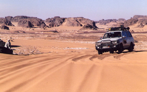
The real sandy part of the Timbuctu trip started soon after Tonka. We engaged the freewheeling hubs and used almost permanently the 4-wheel drive and occasionally low gear. At times the sand was very deep and only keeping up speed would avoid getting stuck. High sand dunes had to be negotiated and only speed would get you to the top. Occasionally we had to reverse and give it another try or take a different track. There are many parallel tracks and permanently choices have to be made which track to take. Sometimes you are right, sometimes wrong, resulting in not being able to get uphill or getting stuck. This was really the first part of the trip were a 4-wheel drive vehicle was required.

The track follows Lake Fathi and sometimes we were driving on firm underground, which is the bottom of the dried-up lake. The lake, at this time of the year, has little water, but it must be huge during the rainy season. Approximately 7 km before Goundam, we joined the track on the 1:200,000 map (Timbouctou-Ouest) and were again driving from waypoint to waypoint.

We took off from Tonka at 11:30 am and reached Goundam at 12:30 pm. So far, it was one of the most interesting parts of the trip. The desert environment really makes an impression. The landscape is interesting with often Lake Fathi in the background. It was hot (47oC) and the driving tough. Finding a tree for the coffee break not possible.

Goundam
Goundam is an interesting village, but we did not see a soul. You must be crazy to venture outside at midday. We stopped at Place de lIndependence, were an old sign indicated that the distance to Timbuctu was still 77 km. Somebody told us there were two routes to Timbuctu; one being much sandier than the other. We never knew which one we took, but sandy it was!

Out of Goundam there are two other tracks. One leads to Dire, which is on the banks of the Niger. According to information from travellers there is a track from Dire to Timbuctu. The second track out of Goundam goes to Lake Faguibine, approximately 70 km to the north. It is the largest natural lake in West Africa and one of the best places to watch migratory birds. According to guidebooks the track is difficult to find and a Tuareg guide should be hired. The book also indicates that this track definitely requires a 4-wheel drive (low gear). Initially we intended to go to the lake, but decided against it because of time constraints.

To Timbuctu
At 12:30 am we departed from Goundam for the last 90 km to Timbuctu; the temperature was around 46oC. All the way we used the 4-wheel drive and lowered the pressure of the tyres (to approximately 20 PSI). It was sandy and hilly all the way and there were a large number of parallel tracks. We did not really get stuck, since we kept up speed. The route had been entered in the GPS and we followed exactly the same course

The last 4 km from the airport to the centre of Timbuctu is on an excellent tarmac road; the 8 km before has a very firm underground, but before that there is approximately 10-15 km of very deep sand and high sand dunes. With our experience, we had no problems negotiating these and at 3:30 pm we arrived in Timbuctu!

Since Segou (700 km from Timbuctu), we had not used the A/C and really got the taste of the desert; dusty at times, dry (RH 5%), hot during the day (close to 50oC), and cool in the morning (22oC). We all felt, however, that a dry and hot climate is preferred over the Accra climate (less hot, but very humid).

We drove straight to the best hotel in Timbuctu (got stuck in front of the hotel, which is situated on a hill) and had very cold beer and soft drinks. This may have been the best beer we ever had.

Timbuctu, founded about 1100 AD as a seasonal camp by Tuareg nomads, is located on the edge of the Sahara about 13 km north of the Niger river. It was historically important as a post on the Trans-Saharan caravan route. In the 14th century it became a focal point of the gold and salt trade. Merchants from various places, including Moroccan cities, gathered to buy gold and slaves in exchange for Saharan salt and North African cloth and horses.

Regarding accommodation two options are available, a hotel or out in the desert. The best hotel in town is Hotel Azalai, which charges 27,500 CFA for a double. One of the guidebooks indicated that it would be possible to sleep on the roof of the Annex of Hotel Bouctou. They asked 18,000 CFA for a double room, but if we wished we could sleep on the roof. We negotiated and brought the price for the roof down to 4500 CFA per person. We decided to sleep in the open, someway out of Timbuctu. We drove 15-20 km back in the direction of Goundam and found a quiet place where we were not bothered by anybody. In the far distance we could see the city of Timbuctu.

We set up camp and then opened the bottle of white wine, kept to celebrate our arrival in Timbuctu. The temperature of the wine was close to 35 C, but we did enjoy it.

Day 6: Thursday April 30; Timbuctu – Bambara Maounde; 120 km.

We got up early and to celebrate our Queens birthday and National Day inflated red, white, blue and orange balloons, which we attached to the cars aerial. After breakfast we packed the cars and drove again to Timbuctu to visit the town.

The first stop was at the police station, where you have to register (passports and Laisser-Passer), which costs 1000 CFA per passport. The officers are extremely friendly and happy to see some tourists. Very few tourists visit Timbuctu this time of year. The majority arrives by plane or by boat on the Niger during the cooler months.

Registration with police

According to guidebooks you have to register with the police in the following places:

Timbuctu (which we did), Mopti (which we did not), Bandiagara (which we did not either).

Concerning registration, in case you would not do so, it may get you into trouble later. We got our passports stamped, so that we could actually prove back home that we had been in Timbuctu.

We wandered through the narrow alleys of Timbuctu; all houses built of grey-brownish mudbricks. We passed many Koran schools (madrasses). It was very hot (45oC).

The streets in Timbuctu are not tarred and sandy at times. As mentioned, we got stuck in front of the Azalai Hotel and again in front of the Shell petrol station The Shell station appeared to be out of order. However, fuel was available at another station in the centre of town, close to the market. From Segou to Timbuctu we had driven 706 km and used 113.6 litres of fuel; an average of 6.2 km to 1 litre.

We visited the museum (CFA 1000), bought mineral water and post cards before returning to Azalai Hotel. Postcards were written and brought to the postoffice to get them Timbuctu-stamped.

We inquired about the road to Mopti. The information we gathered was that we would have to cross the Niger, then almost straight on to Bambara Maounde and again straight on to Douentza, where the tarred road to Mopti starts. It would be no problem, but they all offered to be our guide, which we politely refused. This route could not be found on any of our maps. In fact the 1:200,000 maps (Tombouctou-Est and Bambara Maounde) did not show any track at all to Bambara Maounde and Douentza.

We departed from Timbuctu at 11:00 am; 15 km on the tarmac brought us to the Niger, where we could not spot any ferry. After driving a few hundred meters east we found the ferry.

Crossing the Niger River

The ferry did not look very reliable, but we had no choice if we wanted to get to the other side of the Niger river. The ferry was at least 20 metre away from the bank out in the water and the ferry ramp was rather steep; luckily the water was not too deep for the cars. The Toyota drove up the ramp, where the muffler of the exhaust hit the edge and got dented. The Nissan with a slightly longer wheelbase and less ground clearance, was not able to get on; the cross-beam of the chassis hitting the edge of the ferry. We off-loaded the jerrycans (100 litres fuel and 60 litres water) and boxes with food, trying to raise the Nissana bit. Without result. Then the ferry people tried to lift the ramp (with the car on it) using the winch, but the cable broke immediately. It took them some time to get it repaired, using our spanners. Also this whole exercise did not help to lift the car onto the ferry.


The ferry should be moved to a better location, but they claimed there was not enough petrol. Petrol was only sufficient to take the ferry to the other side of the river. After paying 5000 CFA to purchase petrol (we did not see them add fuel), the ferry was moved with help of a small outboard engine. This was fitted on a pirogue, which was attached alongside the ferry (The large diesel engine on the ferry must have stopped operating ages ago). It took considerable time and a lot of assistance from people using poles to get the ferry on its way. Very slowly the ferry moved to the new location. This time it worked; the ramp was slightly less steep and the clearance of the Nissan slightly more.

Finally we were on our way to the other side of the Niger. The cost was 8,500 CFA per vehicle and we paid them 10,000 CFA, but they were still not satisfied. Getting off the ferry was not difficult and finally we were on our way to Bambara Maounde at 12.55 am; approximately 1.45 hours after arrival at the ferry.

To Bambara Maounde (95 km from ferry)

We headed straight to Bambara Maounde. The track was again very sandy with a lot of sand dunes. We used permanently 4-wheel drive and tyre pressure was lowered. It did not matter where you are driving; the track is about 500 meter wide. Just select the best, least sandy and hilly track. After 38 km you find an old signpost in the middle of nowhere indicating straight to Bambara and left to Gourma Rharous. We had very few problems; got stuck only twice while going up a sand dune. We did not meet any cars; only two large camel caravans which were moving in the direction of Timbuctu.

The Toyota got its first flat tyre; a large (7 cm) thorn had pushed its way into the inner tube. It was a rather tiring job, changing a tyre midday at a temperature of approximately 45oC. Initially the jack sunk into the sandy underground. We had to get a piece of wood (from the car) before we could lift the car sufficiently high to be able to change the tyre.

We drove along Tin Bedaouin and on to Bambara Maounde, which is a very small village. A dozen kilometres after Bambara at 5:00.pm, we decided to stop for the night; our third night out in the desert. The trip from Timbuctu to the desert camp had taken 8 hours, while the distance was only 120 km; an average of 15 km/hr.

Meanwhile, a caravan of more than 25 camels walked by and the two camel drivers visited us shortly; they got water, bread, and aspirins. It was another sweaty night, unfortunately the temperature did not drop as much as previous nights, due to the fact that the wind had changed. At 9:00 pm it was still 38oC and in the morning at 5:00 am 28oC. The humidity was also considerably higher (approximately 50% in the morning

Day 7: Friday May 1; Bambara Maounde – Douentza (95 km)

At 7:00 am in the morning we left our campsite and headed for Douentza. The co-ordinates of Douentza had been entered in the GPS and all the way we were heading straight to our destination. Again there was no track on the 1:200,000 map (Bambara Maounde). We drove through the Reserve des Elephants; Route Touristic and saw rather fresh (less than 24 hrs old) elephant droppings and spotted an interesting ground bird; the Sudan Bustard.

Fuel Consumption

  • Niono – Timbuctu: 1:6.2
  • Timbuctu – Douentza: 1:5.6
  • Overall (Accra – Accra): 1:6.7

The first part of the 95 km to Douentza was still very sandy and hilly. The closer to Douentza, the firmer the underground and we were often driving over the dry lake beds. The vegetation becomes slightly denser, but it still remains a clear Sahelian landscape. In the distance an escarpment could be seen and we drove straight to the west tip of those hills. Right behind the hills is Douentza, were we arrived at 9.45 am.

In Douentza we reached the tarmac again (900 km after Segou and 200 km after Timbuctu) and felt that we had achieved our objective, i.e. visiting Timbuctu and returning to the inhabited world.
Crossing the Tenere

Tony and Elly van Gastel (2000)

Agadez – Arbre du Tenere – Fachi – Bilma – Dirkou – Seguedine – Oleki – Sara – Chirfa – Djado Djaba – Orida – Enneri Domo – Enneri Blaka – Chirfa – Tassafasset – Arbre Perdu – Grein – Adrar Bous – Temet – Agadez

The Long Haul to Agadez
It is a very long haul from Accra in Ghana to Agadez in Niger, but finally, on October 17, our group of seven in three 4WDs (Toyota Land Cruiser, Nissan Patrol, and Landrover Defender SWB) got there. In Agadez we stayed at the Fantasia camping (highly recommended). Very good potable water. After a few hours, cold (well, lukewarm) beer and soft drinks were even available from the ‘bar’.

We fuelled the cars (CFA 359 per litre); each car had to carry 220 litres; fuel would only be available in Dirkou and Iferouane. Against all advice, we put the 6 jerricans on the roofrack; we would use them as soon as possible. We arranged the compulsory guide from the very reliable ‘Dunes Voyages’ (CFA 21,000 per day); the travel agency had arranged our travel permit. We had dinner in the excellent ‘Le Pilier’ restaurant. Ask for double portions of chips, otherwise you go hungry.

Agadez is a great place to hang around for a few days. It is very comparable to towns like Gao and Timbuktu. Everything is available, fuel and other supplies. The temperature is great this time of the year (low 30s during the day; around 20 at night). People are very friendly.

Crossing the Desert
The first day we did approximately 120 km. Immediately after leaving Agadez, there is a checkpoint, which will only let you proceed if you have a guide and have at least two cars. Particulars of cars and passengers were recorded and the travel permit was carefully studied. Officers are always very friendly. We were travelling through a bushy (very little vegetation) desert, alternating with grassy plains and stony (pulverised lava rock) plains. Usually there is a clear track. We drove along some completely barren cliffs and made a small detour to the Tuiguidit mountain range to visit some rock engravings.

We met two of those amazing trucks, loaded to the maximum, with maybe a hundred people on top and all their belongings. You hardly recognise the lorry; it is just one heap of people, bags, mattresses, and jerrycans. A really great sight! The lorries come from Libya. We saw several others, but none was as beautiful as the first one. We also noted that one lorry was accompanied by an army jeep with machine gun [these were probably West African workers being expelled from Libya].

The day was crowned by seeing a camel caravan on its way to Bilma: 40-50 camels moving very slowly, carrying grass (the feed for their trip). They carry goat cheese, millet and groundnuts to Bilma and come back with salt and dates.

During our second day, we got to the real desert. We had to deflate our tyres (18 PSI, back; 15 PSI, front), long before we reached the famous Arbre du Tenere. We got stuck occasionally but a shovel and a little push did the trick. Initially we still followed a clear track, but when the main track continues NE to Dirkou (via Achegour) you turn off towards Arbre du Tenere, thye track ends. The scenery is great, sandy plains with low dune ridges here and there, occasionally fine gravel. The plains are slightly undulating. At times the piste is marked with balises.

In the afternoon we reached Arbre du Tenere (270km from Agadez), a metal tree and well in the middle of nowhere.

Filling up our water supplies was not easy at Arbre du Tenere. We had no bucket and the water was 43 meters down. We used one of our cooking pots (now famous, because it has seen the well of Arbre du Tenere – very few cooking pots have). We needed all our ropes to get that deep, but managed to fill the jerricans; a very safe feeling in the desert.

Next morning it was sand all the way to Bilma, not a single tree, no track or piste, just choosing a not too sandy path. We drove through a gassi with sand ridges at both sides, sometimes crossing the sandy ridge to go to a parallel gassi. We got stuck every now and then, but usually a little push would do the job. Twice we needed sand ladders and the shovel to get us moving again.

We met more camel caravans, sometimes with hundreds of camels, on their way to either Bilma or Agadez. We wonder how long such beautiful scenes can still be seen.

Just before entering Fachi we met large numbers of camel caravans, which are resting outside Fachi. The Tuaregs are preparing their tea, the camels are resting and feeding, preparing for the next leg of their long trip.

In Fachi (170 km from Arbre du Tenere and 440 km from Agadez) we reported to the gendarmerie and visited the old fort (pay CFA 500 per person to the Chief of the village). We were invited to tea with the chief. Fachi has 2500 inhabitants, a school, a dispensary and a number of mosques. Water is available everywhere from wells (we replenished our stocks). Flour comes from Libya, millet, groundnuts, and wheat from the ‘gardens’ in the Air Mountains. Vegetables and dates are produced in their own gardens.

Next day, we cut through the mountains north of Fachi (stony, be careful with deflated tyres) and on to Bilma. More sand and caravans. Again stuck occasionally when climbing a dune. One looses touch with reality.. We entered Bilma through the site where salt is exploited. Lots of camel caravans are waiting here to take the salt to Agadez. Tuaregs have constructed makeshift huts with water storage (goats hides), plenty of dates and everywhere the kettle is on.

In Bilma (610 km from Agadez) we reported to the gendarmerie in the old fort dating from the French period (ca. 1900) – no photographs allowed. Bilma is a bigger than Fachi, with 12,000 inhabitants; many gardens were plenty of vegetables are grown. What they cannot grow comes mainly from Libya. Bilma looks like a very quiet but friendly village, with sandy streets lined with mudbrick houses. It is off the main route, which goes from Dirkou via Achegour to Agadez.

Before taking off to Dirkou, we visited the salt works; very interesting. The salt basins are very colourful. Different types of salt are produced. Big white crystals of kitchen salt for human consumption and salt for the cattle. The last type is not refined and still mixed with a lot of mud. It is molded in the kantu form (pieces of hollow date palm trunks).

In conclusion, crossing the Tenere from Agadez to Bilma was a great experience.

North to Chirfa, along the Falaise Kaouar
Just before Dirkou we met two Austrian cars. They had come from Europe, via Algeria and Tunisia to Agadez and were now, like us, exploring the Tenere.

In Dirkou we reported to gendarmerie. They keep your passport till you leave Dirkou. The place also seems to double as a gare routiere; full of people with bags and plenty bush taxis and lorries are loaded or off-loaded [probably more expelled workers]. Diesel comes from Libya and is cheap (CFA 300 per litre) – available from the well-known Jerome. Fuel is taken from a drum, which is put on top of another to provide gravity. Our Toyota took almost a full drum and we calculated that fuel consumption between Agadez and Dirkou had been around 4.5kpl. Fuel is also available per jerrycan.

Dirkou is much bigger than Bilma and it has a bar (run by Nigerians). We visited the market to buy a well bucket and onions.

The track north of Dirkou is a big flat sand plain, with a clear track occasionally. The hill of Pic Zumri is a good landmark and then Seguedine is not far. In Seguedine we took water, visited the old fort (probably from the same period as Djado). To Chirfa our guide took a route which was much more to the east than the track on the IGN 1:200,000 map. It brought us to the Oleki mountain. Our guide suggested that we should cut through the mountainous area, keeping to the track would make us reach Chirfa after dark. This appeared to be a big mistake, the guide should have turned west, just before or after Mount Oleki; this would have saved a lot of time. Thirty kilometres before Chirfa we found a beautiful camping spot (by far the best so far) in an area with a few trees and where years of wind erosion had shaped the rocks into nice ‘kopjes’ as the South Africans say.

Via the Oasis of Sara and Dabasa we drove to the fort just before Chirfa. At the military post our passports were kept till we would leave Chirfa. Chirfa is a very nice desert village; built from mudbricks with maybe a few hundred inhabitants. Almost each house has its own well and in the walled gardens vegetables and maize are grown. All other needs come from Libya.

Djaba

Djado, Djaba and Orida
In Chirfa we hired a second guide; a Tubu who knows the area very well. He was an old freedom fighter commandant costing CFA 10,000 per day. According to our guide it was the Tuaregs who are stealing cars from tourists, not Tubus. There is peace now; the former rebels are almost all integrated in the police force and the army.

We took off to see the places of interest around Chirfa and our first stop was at the Arch de Fadagana; a wonderful arch shaped by millions of years of wind erosion. Yes the wind, it is the first time that we felt the strong wind blowing, carrying lots and lots of sand and making it rather unpleasant to be outside. The rock formations in this area are most bizarre; all have interesting shapes. We also visited some rock engravings (elephants and giraffes).

A very sandy track leads through a green area to the fortified village of Djado. Ancient Djado, built from mudbricks, is situated on the top of a small hill. In its 18th century heyday it must have housed more than 1000 inhabitants. It has many small streets, houses, etc. The complete village could be sealed off to protect it from attackers. The village had its own well, which looks very dirty today. Interestingly the area around the village is under 1 meter of water from December to April. We also visited Djaba, a similar fortified town.

Behind Djaba there is a well, which you can hardly find; in the centre of an old tyre lying in the middle of nowhere, similarly there is a well at the foot of the Ouarek. Between the two wells there is a Tubu military post. We made camp at a superb site at the foot of the distinctive Orida outcrop.

The scenery in the Chirfa, Djado, Djaba area is magnificent, with steep, wind-eroded hills (Ouarek, Ehi Guezebida and Orida) rising up from sandy plains interspersed with small oases and mountains in the background. The only disadvantage was the strong wind that was blowing. In fact, it was extremely uncomfortable and it had a negative influence on the spirit of the group. Did we really have to go all the way to Enneri Blaka? But it was less than 100 km away! We would go. 

Enneri Blaka
Enneri means valley, while Blaka is the name of a famous Tubu freedom fighter. Dunes Voyages had indicated that security in the mountains was no problem; except for a few tribesmen the Tubu were at peace with the Niger government. Take a Tubu guide and you are OK. We had to climb the ridge to get into the Enneri Domo, which leads to Enneri Blaka. The ascent (550 metre) is difficult; sand, with rocks then just sand. Once up, we followed the Enneri Domo, a wide valley with black mountains all around. The going is very slow and the landscape – although an interesting moonscape – does not change anymore and becomes monotonous. The valley is extremely dry; there is hardly any vegetation; just an occasional tree or bush. It has not rained in Chirfa for 11 years; in the mountains it rained only once during that period.

Then we joined the Enneri Blaka and the scenery changed to white/yellow sand alongside the very black hills. It was worth the five hour drive. To get to the ‘submarine’ rock formation which holds the rock paintings, we had to drive up a sand dune.

We decided to take a different route back and took the turn off to Seguedine, up to the Oleki, where we were two days before. This time we did not need the guide to tell us how to get to Chirfa. We decided to go cross-country, just before the Oleki and had a great experience, by complete off-road desert driving without the help of the Tubu guide. In fact, the waypoints of two days ago were used to get us to the site were we camped two nights before. This was the track the guide should have taken the first time.

Next morning we drove to Chirfa, using a track, which passes the oasis of Sara, as well as Dabasa at the left side. This track avoids the military checkpoint. In Chirfa we said farewell to our Tubu guide, took fuel (CFA 400 per litre; we were told that there is always fuel in Chirfa) and water. Returned to the military post to get our passports back and ready for the crossing east. We were promised that we would see ‘beaucoup de rien du tout’.

Crossing the Tenere du Tafassasset
We left the military post, passed through the Col de Chandelier where rock formations are again carved by years of wind erosion into fascinating objects. From here the real Tenere starts. It becomes flatter, less stony and more sandy. Initially, we could only reach 35-40 kph, but later we drove at 80. Soft sand does not permit the car to reach higher speeds. In fact, do not stop, keep speed or get stuck. The car was using lots of fuel. It all is very unreal; sometimes you think you go uphill, but you’re not; sometimes downhill, but no. All around it is flat, sandy and barren. We met nobody no other life sign. Suddenly we saw a falcon flying; what is it looking for? It means there must be something to feed on in the desert.

Then vaguely, far ahead of us a small hill appeared. Was this Grein? No Grein was still too far away. It was Arbre Perdu. How was our guide able to find this small hill in a vast sea of nothing? Arbre Perdu is nowadays called Arbre Thierry Sabine (originator of the Paris-Dakar rally). It is not much of a tree, but there is a little greenery that tries to survive. Then, after more driving through a sea of sand, we reached Grein, a series of hills 165km away from Chirfa; we took 4 hours to reach it. It was midday and the temperature was pleasant, mid-30s.

Off for the last 200 km to Adrar Bous; stopping remained risky, keep going. As soon as the hills of Adrar Bous came in view, the landscape became stunning. A number of individual, black hills were rising from the sand. It all looked like an ocean of sand with a few rocks. Crossing the Tenere du Tassafasset took a little more than 7 hours.

We camped near Adrar Bous. It was the first cold night, approximately 12C. Near our campsite we found Neolithic arrowheads. From Adrar Bous, we drove to the Dunes de Temet. Then in four days back to Accra in Ghana, completing a 7500-km trip.

Summary
The crossing of the Tenere from Adagez to Bilma and from Chirfa to Adrar Bous was a great experience. It was the first time that we were in a real desert. You are really on your own out there. While crossing such an immense sand sea you realise how small human beings are. The camel caravans are a sight not easily forgotten. All along it felt like being in a little boat on a big ocean. Anything could go wrong and what next? Security wise, we always felt safe and never had the feeling that we had embarked on something that was dangerous. One must however be well prepared; it is not a trip that can be undertaken without thorough preparation.

A guide more than one car are essential. Cars must carry up to 240 litres of fuel. Deflated tyres, almost all the way, are essential. Expect heavy fuel consumption of around 4.5 kpl (14 mpg).

September/October is indeed a good period to visit this area. The temperature during the day is in the 30s (up to 40) and not colder than 10 during the night. We only had a very nasty wind in the Chirfa area.

Millennium the Aïr and Tenere

Aïr and Tenere

Tony and Elly van Gastel

Surfing the Internet produced many disturbing messages such as:
“Avoid the tracks round Agadez absolutely”
“Tuaregs steal cars”
“An Italian died who was hit by a bullet between Niamey and Agadez”
“Police are corrupt and arrogant”
“It’s dangerous to travel in Niger”
“Only travel in convoy with a guide is allowed”

Then we contacted several people for more information. Here are a few of the responses:
“I can – with complete peace of mind – invite you to visit this wonderful country.”
“A lot of people will spend the new millenium in the desert.”
“There is still some risk, which can be minimised by hiring an experienced guide.”
“Bandit Tuaregs steal cars, if you are not accompanied by a Tuareg guide. If this happens, give up the car. The Italian who died, refused to give up his car and raced off.”
“Two cars are not really a luxury, but a safety measure.”

Based on these responses Niger’s Air Mountains and Tenere Desert was on.

To arrange a guide, we tried to contact several travel agencies by fax. We got only one reply and the agency wanted to charge 70 FF/per person/per day. While we were in Niger, we realised that travel agencies are not interested in providing a guide only; they like to arrange a complete package, including cars, tents, food, drivers, guides, etc. In the end we arranged a guide through friends in Niamey (using e-mail) for which we paid CFA 24,000 per day for the group.

The trip would take us from Agadez into the Air Mountains (Elmeki, Timia, Assode, Tchintoulous, Zagado valley) and then to to the Arakao Crater, Adrar Chiriet, Tezirzek, and Temet. Then back via Iferouane to Agadez.

On December 21, 1999 we departed with 5 persons in 2 cars (one Toyota Landcruiser and one Land Rover Defender 90) . It took us 4 very long days to get to Agadez (2500 km from Accra). We had a few problems on the way, which almost made us abandon the whole trip. Just before Bolgatanga, the Land Rover developed an electrical problem. The car had been in the workshop in Accra for exactly the same problem and it had taken 4 days to rectify it. We were worried that nobody would be able to fix this in a ‘remote’ area like north Ghana. We all had visions of an early end of our desert trip. It appeared a fuse, which kept on blowing and we fixed it by putting a 20 amp fuse instead of the recommended 5 amp one. We all hoped that this would keep us going. And it did!

On on to Niger
All the way from Accra the road had been good, but immediately after the Burkina Faso border with Niger the road deteriorated enormously. We had our next serious problem when the Defender’s roofrack came almost off the car. It jumped out of the gutter of the car, after the mounts got completely bent. We moved the roof tent onto the roofrack of the Toyota and completely dismantled the 90’s roofrack. Three hours of hard work and we were on the road again. We spent the night at the completely empty ‘Niamey’ camping. We noticed that the temperature at night got cooler and cooler. We wondered what it would be out in the desert. We were not really prepared for cold weather. Next day we drove to Agadez (950 km), where we arrived one day too late.

Departure from Agadez
Our Tuareg guide had been waiting for us all day. The travel agency insisted we must carry 285 litres of diesel per vehicle, when leaving Agadez. Fuelling and stowing the 570 litres for the two cars took quite some time. With four persons (including the guide) in our car, 285 l of fuel, 80 litters of water, the luggage, spare parts, sand ladders, spare tyres and food, the car was fully loaded. We wondered how it would be able to travel through soft sand.
The travel agency had arranged the travel permit for our trip. It seems that unauthorised travel is not allowed.
We still had another problem. Our Laissez Passer would expire before returning to Agadez. At the border they could only issue a Laissez Passer with a validity of 7 days. We discussed this with the travel agency and they would arrange the ‘prolongation’. They kept the original and we travelled with a copy. They advised us to give a little ‘cadeau’ to police officers, when necessary.
It was completely dark when we finally left Agadez. We camped approximately 6 km out of Agadez.

Christmas in the Air Mountains
The track was going through the typical transitional zone between the Sahel savannah and the real desert with a few bushes. Occasionally we had to cross a very sandy wadi (4WD necessary). Along the wadis, where the water is not far down, sedentary Tuaregs have their ‘jardins’ (gardens), were they grow tomatoes, onions, peppers, and dates. Soon the track became stony and small, completely barren hills could be seen in the distance. Then we drove on a plateau (500-600 m high) with black basalt hills all around us.
We met several Tuaregs on their camels and took many photographs. The mountains got higher and more impressive. We stopped at one of the ‘jardins’ to see how they use a camel to pull the water from a waterhole to irrigate the field.
The mountains were now almost completely barren without any vegetation, except along the wadis. At one time we went up to almost 900 meters. We spent the night in a beautiful wadi with trees to protect us from the cold desert wind. We all enjoyed the Christmas dinner of baked beans and a bottle of wine. In the evening a nasty cold wind started blowing and we changed into long trousers, extra pullovers and shawls. Our guide Ahmed told us that this would be only the beginning; it would be much colder once we were out in the real desert.
Next day the route continued over a plateau; sometimes stony, sometimes less, always with beautiful black or reddish mountains around us. Occasionally we had to climb a hill. In the village of Kripkrip we saw again a lot of ‘jardins’. We climbed up to almost 1000 meters before descending to the village of Timia. Just before Timia, in the middle of a very stony area, is a small waterfall. It must be fun to take a swim in the small lake when visiting the place during the hot season (if it has not dried up by then).
Timia is a real oasis. An restored fort from the French period is overlooking the wadi and the village. In the background is the peak of Adrar Egalh (1974 m). Everywhere are ‘jardins’ along the wadi. From the waterhole of one of these gardens we replenished our water supply. From Timia, we continued to the ruins of Assode, the old capital of the area some 100 years ago. Only some remains of walls are left. The area is littered with pottery sherds.
We then followed the Zilalet wadi. Far in the distance is the Agueraguer mountain (1730m) with the village of Tchintoulous (not more than a few huts; but quite a number of gardens) at its foot. A few kilometres east of the village we set up camp for the night (altitude 875m). Empty plastic jerrycans were given away to the occasional ‘visitor’ of our campsite. Often they ask for medicines and small gifts are always welcome. That evening a very cold desert wind kept the temperature low. We slept in our sleeping bags with all our clothes on. Next morning it was approximately 5°C (Brrrrr).

Through the Zagado Valley to the Tenere Desert
We would finally go to the real desert; the Tenere. First we drove through the Zagado valley. Very sandy but with beautiful white sand and with black mountains at both sides. Then, slowly we drove away from the Air Mountains and entered the real Tenere. The scenery is exactly as you see on photographs; endless undulating sand hills, devoid of any vegetation. Nothing to see, but unbelievably beautiful. We spotted a desert fox. We had to use 4WD all the way. The route goes uphill and downhill; kilometre after kilometre. The guide warned, that we had to be careful when driving uphill. Before descending you have to ensure that the wind has not converted the sand dune at the backside into a descent too steep for cars.

Arakao Crater
We had to negotiate a lot more of soft sand before reaching the huge sandy Arakao Crater with a diameter of 10 km and rock formations around it. We made camp at a beautiful location. Ahmed had warned us that it would be cold, since we were now in the desert. We, therefore, collected lots of firewood and lit a fire when it started to get cold. It became colder and colder and next morning it was below zero degrees.
We were only one week from home, but felt that Accra hardly existed and that we were away from all civilisation. In the morning we got the fire going again, had hot coffee and prepared for departure. An Egyptian Vulture was soaring overhead. The Toyota battery did not seem very happy because of the cold, but the car did start (only just).

Adrar Chiriet
We were driving along the Taghmert (1637m) in the direction of the Tamgak (with peaks between 1600 and almost 2000m), when we passed a group of camels, carrying the baggage of a group of tourists, who were making a camel tour.
Somewhere at the foot of the Taghmert we drove to a waterhole to replenish our water supply. Then we followed the Wadi Tchou-m-degdeg in a northerly direction. At last we turned east and drove straight towards the Adrar Chiriet. It looked like an 8 lane highway; completely flat and you could drive were you wished. We made camp in the centre of the mountain, under one of the few trees that could be found. We pulled a big dead tree to the campsite, so we would have a fire to keep us warm in the evening.

Rock Engravings
Early in the morning we drove back towards the Tamgak. The sun was still very low, and drew fantastic shadows on the sand dunes; we do not make much progress, because we made one stop after the other to take photographs. This really was worth all the trouble (mainly the cold) we had gone through. We were now on our way to the rock engravings in Tezirzek. Several articles with beautiful pictures have been published in the National Geographic over the past few years. It was impressive indeed.

Temet
After Tezirzek we headed for Adrar Greboun with peaks between 1500m and 1950m. When leaving the Greboun behind, it becomes more sandy and the scenery gets better. When reaching the Col de Temet, we were surrounded by 200-300 meter high sand dunes. Beautiful, the best we had seen so far. In this superb setting, we made camp. The altitude was 950m; the temperature still 27°C. We climbed one of the high sand dunes, a tough job; there are more sand dunes further afield, undulating like an ocean.
The day before we had seen our first ‘gazelle’ (Dorcas antelope) and we now saw many more. According to the books there are more species of antelopes around. At dusk we spotted two silver-backed jackals near our campsite.
Early next morning, we left our campsite. We reached Iferouane, a nice village, with only mudbrick buildings, where we had to report to the police. We worried a bit, because we only had a copy of the Laissez Passer. However, they only asked for the travel permit and we had to pay CFA 1000 per passport. Then 140 km over a dirt road and 185 km over an excellent tarmac road took us back to Agadez.

Agadez again
Agadez also has a mysterious connotation, like Timbuktu. An intriguing city, with mainly mudbrick houses and with a beautiful Sudanese-style minaret on the great mosque. Decorations on mudbrick houses and doors are, however, minimal. Still, it is good to wander around in the old city, where it seems that time has not moved much. The famous Air Hotel is supposedly the place to be. The hotel looks dilapidated, but sitting on the roof terrace and watching the Tuaregs go about their business is a nice experience. For the extension of the Laissez-Passer we had to pay CFA 10,000.

Back to Accra
In three days we drove back from Agadez to Accra. We had been away for 15 days, driven 6200 km and been in the car for 123 hours.
For us none of the disturbing messages found on the Internet were true; police officers were correct and friendly, and we never had the feeling that it was dangeous. We had a very good time in Niger; it was the best trip we had made in the last 10 years. However, we decided never to travel in December ever again. It was just too cold at night!

Waypoints
Where there was a clear track on the 1:200,000 IGN maps, we had entered the waypoints in the GPS before departure from Accra. These were generally accurate enough to travel without the help of a guide, which would have been more fun. However, the 1:200,000 maps do not show the track from Assode, via the Zagado valley, Kogo, Arakaou Crater, and Adrar Cheriet to Temet and it would not have been possible to do this stretch without a guide. 

M is for Marlboro piste: Libya to Agadez – 1999

 Part of the Sahara A to Z series

I met Belgian couple Luc and Catherine in Sebha last November where they were planning to cross the Ténéré to Agadez and then sell their old BJ40 Land Cruiser in Togo. Had it not been for the fortune I’d spent just getting that far myself I’d have gladly joined them. As we parted Luc and Catherine were heading up to Ghadames to meet some friends for the drive down to Ghat. Here they hoped to continue south. Five months later I got this message…

Ghat did not seem to be a good place to travel to Niger via Algeria, so we decided to return to Sebha to get more information about the conveys going to Dirkou. The advice was that we should go to Al Gatrun and wait there for the trucks going to Niger. Arriving in Al Gatrun, little more than a desert village with one filling station and a Niger consulate we soon met Mohammed Tager of the Wadi Alhikma Travel & Tourism Agency (Tel/Fax: 0735-2901). He ran a camping ground in the old Italian Fort which is very nice. Mohammed offered to organise guides for Chad ($600) or Niger ($400). This was much too expensive for us so we decided to do it our own way. We went to Tajarhi, 80km south of Gatrun to wait there for the convoys that did not come. The only traffic was Niger-bound smugglers passing through at night.

We waited patiently in Tajarhi for four days during which time we got talking with people in the village. We met some Toubous who were planning to drive to Niger with four Toyotas. They were smuggling stuff that they get almost for free from the government: rice, flour, diesel. We also saw a brand new car covered on a truck. They invited us to join them.

Like everyone else it seemed, we left one evening at 9pm. The first part of the piste was terrible, about 100 km. of very soft sand. After one hour we had only covered about 500 metres and could still see the lights of Tajarhi behind us. The others seemed unruffled and unbelievably navigated following a single star. There were no tracks.

After two hours the conditions improved so were able to keep moving. Suddenly, while we’d stopped to check the engines five military Toyotas pick ups fitted with machine guns tore out of the darkness and surrounded us. Catherine and I nervously listened to them talking over the radios and at this moment thought our trip was at an end. But after a brief talk with the others and some shaking of hands we were allowed to continue. Clearly some arrangement had been made. In fact the army knew the smugglers, because we saw one of the soldiers the day before taking money from the Toubous. The reason stopping us in the night was in my opinion to show they could find us anyway, even in the middle of the desert at night. So leaving without their permission would be impossible.

The drive to Madama unfolded exceptional landscapes and every day we met yet another overloaded truck taking Africans to Libya. It’s not a highway but there is traffic anyway We ended the next day just before Madama where we spent the night with the Toubous. In the morning we drove up to the military post and handed over our passports. At long last, after several weeks we were officially in Niger! At Madama we met up with a big Slovenian truck carrying eight tourists and we decided to continue with them as we still had another 500 km to get to Dirkou. Their truck was an old military TAM, about the size of a new Unimog, but with only 120 PS for 10 tonnes! On the way south we passed through two more military check points in Dao Timmi and Dirkou.

In Dirkou we met the famous fuel dealer Jerome the Libyan who sold us diesel in 205-litre drums. Luckily we were able to share it with the Slovenian truck as we had no room for so much fuel. Jerome is a very strange and funny man, he is about 84 years old and tells stories about the second World War during the battle with Rommel and Montgomery in Tobruk. He has lived in Dirkou since 1958. We rested two days in Dirkou during which time we checked over our vehicles and visited the very nice market.

Eventually we managed to find a guide to take us across the Ténéré to Agadez. Mohammed Toufoutou was very good but expensive, charging 1500FF for the 650km trip no matter how long it took. The Ténéré seemed to us very easy driving. We had the impression that it was very flat and only once in a while did we hit patches of soft sand. Some of the parts were so flat and featureless it was hard to keep in a straight line. The guide was incredible. We drove 250 km straight to the Arbre du Ténéré which we found a very dirty place, but anyway we saw it. On our way to Agadez we passed many Africans going north to Libya to find work, perched on the top of big 6×6 trucks overloaded to the hilt.

Very impressive were the salt caravans, some of more than 200 camels heading for Bilma via Arbre du Ténéré and Fachi: 450 km in just fifteen days. At one stage they have to cover about fifty kilometres a day through the dunes to get between the wells of Arbre du Ténéré and Fachi.

When the camels leave Tazolé (160 km east of Agadez) apparently they can become nervous. We saw many dead beasts that did not make it to the next well abandoned by the piste.

The second day, about 200 km from Agadez, the Slovenian truck’s alternator expired. Three times I had to tow-start it to get the engine running. Later when I noticed the whole roof of the BJ shaking, I realised pulling the 10-ton truck over the sand had torn away the rear chassis cross-member.

Arriving in Agadez there was a good ambience but as we were the only tourists, they all jumped on us to sell something.

Having made our repairs the Slovenians found someone to drive with them to Arlit and on to Tamanrasset. From there they planned to continue back up to El Oued and Tunisia. We were going south to Togo, so we said our goodbyes. How they did work out, I don’t know, but I knew that together we had done something special. We were very pleased with our achievement, to have crossed the Sahara and the famous Tenere from Libya to Agadez. I surely want to do it again sometime!

Luc DE WULF and Catherine THOMAS

PS. The Slovenians arrived home safely after their trip through Algeria


Gerbert Van der Aa (see Chad with Mercs) also did this route in October, 1999

Last October I travelled from Libya to Niger with my girlfriend. We had a 15 year old Nissan Patrol diesel. We bought our Niger visa in Sebha (100 dinars each). It took just half an hour. We did not take the carnet as we thought 250 dinars was too expensive. In Gatrun we stayed in the old Italian fort which is something of campsite now. Some bad stories circulate about the owner Mohamed Tahar, but I think he’s really okay. We paid 35 dinars search for the formalities. Staying at the fort was free. Mohamed Tahar offered to organise a guide for the trip to Niger, but did not bother when we said we didn’t need one.

We left Gatrun alone, two people in one car. The sandfield just after Tajarhi is easy with 0.5 bar in the tyres. We drove on the truck piste and saw about four other cars every day. We did not follow the old Marlboro-piste, but drove 20km further west. We reached Tumu in two days and then drove on to Madama, where we were met by some nervous soldiers who initially seemed to think we were Tubu rebels.

We bought insurance for 450 FF. Still alone we continued to Dao Timni, Seguedine and Dirkou.

The piste was clear. Only shortly after Madama we took a wrong branch, and probably arrived on a smugglers piste. We did not really know if the real piste was to the west or to the right. We decided to stop for the night and watch for trucks. In the night it’s much easier to see cars passing by. At the beginning of the night we saw them miles away to the west. So then we knew we had to go west in the morning. We slept well.

We arrived in Dirkou early in the morning, two nights later. We met Jerome and bought petrol with loads of sand in it. We ate something and left in the afternoon. No one told us to take a guide. If we had stayed in town longer, things may have turned out differently. We crossed the Tenere on the truck piste via Achegour. A lot of soft sand, but our Patrol did not have any problems, even without sand tyres (we had 215 R 16 Bridgestones M&S!).

Agadez was calm. We bought a carnet for 50 FF and continued south. We drove to Niamey, Gao and Bamako There we wanted to sell the car, but no one was interested. So we decided to continue to Nara, Nema and Nouackchott. Finally we sold the car in Dakar for 12.000 FF (the same price we paid in the Netherlands).

I don’t think it was dangerous to do Libya-Niger with just one car. Local truck-drivers do the same. As long as you stay on the tracks nothing can go wrong. Tuareg-rebels do not seem to be a problem anymore. Although I wonder what’s going to happen to the Paris-Dakar when they travel through the north of Niger in January 2000. I suppose some people will get robbed. The target is just too easy.

Idehan Murzuk (1998, Libya)

idehan

Ursula Steiner

We set off to cross the Idehan Murzuk from Murzuk town to a supposed fort near Tilemsin on the western edge of the sand sea, a distance of around 300km direct. Although it’s not expressly forbidden, officially the erg is off limits. Things will probably stay that way until the first tourists have to be rescued. So if heading this way keep your plans to yourself.

Our group in 1998 comprised of four cars: a Dodge RAM, a Hilux, a Discovery, a G-Wagen and a Quad, Nine people (four female and five male Saharans). Having found the tap water salty, no bottled water and little food to buy, we left Murzuk late one afternoon in mid-October, heading towards Traghan/Tmissah, but soon turned off southwest across a soft sand plain. Tyre pressures were lowered but we got stuck anyway, so we made camp.

The next day was cold and windy but we made very good progress of about 100km along a broad valley. On the days that followed we managed about a third of that distance between camps, though of course driving distance with all the zig-zaging and backtracking was at times double that. We followed fresh car tracks up and over small dunes until the Dodge got stuck on the crest of a seif and the others in a dip, due to driving too close together.

We passed dry lagoons between beautiful dune chains and from time to time had to surmount barrier dunes which blocked the valleys. There were still fresh 4×4 tracks which was comforting, but in the heat of the afternoon one car slid into a vortex or hole and it took a long time to get it out. We camped, exhausted on the beach of a dry lake. In the Neolithic era these lakes dried out into ponds and swamps ringed with beaches around which we had our camp.

Day three dawned hot; already 25°C by 8am. Now the dune chains were getting higher but the car tracks were still plentiful. We got stuck several times; hard work in this heat but the colours of the sand, orange, beige, grey were amazing! We rode up high over sparsely vegetated dunes and slithered down the slip face into another flat lagoon.

These lakes got smaller and the dunes closed in, no more broad valleys to cruise through. From the summits the chaotic dunescape looked like boiling water. We camped near a small oued with green grass, a little more tired and tense, but happy to be here. Mouse tracks covered the ground and nearby the brittle white skull of a gazelle lay half buried in the sand.

Up and down, again and again the next day. If you hesitate you get stuck on the crest – but charging over is dangerous. There is no easy way. Often in the depressions there are soft sand fields with white-greyish fesh-fesh covered with innocuous-looking sand waiting just for us… We’re now in the midst of very high dunes, no way to drive around or to turn back. Sometimes one car is already on the other side but we’re unable to follow. It’s hardest for the last car as the narrow passage over the crest gets churned up with every passing vehicle. But once over we float down the terraces of sand, silently, elevator-like. Golden sand pours away like water. It’s absolutely spectacular!

We camp in the dunes near a lagoon filled with white sand. Evidence of Stone Age occupation is everywhere to be seen, from Acheul to Aterien to Neolithic eras: 300 000-4 500 years BC! That evening the G-Wagen crew gets a bit of a fright when they realise their fuel consumption has shot through the roof.

Our fifth day in the erg was cold but we’re only 80km from the ‘fort’ at Tilemsin as the crow flies. We can’t go straight on of course, there are a lot of narrow low dunes in front of us. We decide to attack a huge dune like ants and once down the other side we find several old lorry tracks. Relieved, we follow this unexpected highway which later disappears into the side of a dune… So we climb a very soft dune, over the crest and down the other side, carefully avoiding a few more craters. Sliding into these does not bare thinking about. We even have to dig away a small dune to push our way through.

After more effort than anyone wants we finally arrive at a dry lake several kilometres long and make camp. We’ve travelled only 30 km since the morning and the cold evening brings out our sweaters. The atmosphere around the fire is a little edgy. We’re close, but not quite there yet

Day Six. Cold. Loud music for breakfast but then we have to jump start the speaker-car. We set off but after an hour must turn back, it’s impossible to go on. For one hour we wait while the quad searches the dunes for a way through. And he does a good job, leading us out of this cul-de-sac like Moses parting the Red Sea. Another lagoon with yellow, red and white sand under the blue sky – colours we never saw before. Unforgettable landscapes. Some crests, some slopes, some precipices – we’re getting used to it now.

But the last pass is the most difficult of the whole expedition. Soft, and after trying again and again softer still. There’s no room for ‘contour driving’ to get a run up but somehow, as always, and after a lot of pushing, reversing and flat-out acceleration we get through to enjoy the thrill of cascading down to the next dry lake.

The last day and the dunes get smaller, more muddled. Up and down we go, but have to turn back again. Then suddenly a valley and – STONES ! A wave of relaxation and also a little sadness passes over us as we follow the valley winding through the low dunes. Only at the last minute do we spot, very far away at the edge of a plain, the low dark line of the Messak Mellet on the horizon. We pump up the tyres and find the so-called fort (just a pile of stones) at N 24° 43,49988′ E 011° 40,15987′

It’s nice to be out of the sands at last but for the evening camp we return back into the dunes!  

Ursula Steiner

‘K’ is for KTM 450 EXC in the Algerian Sahara

by Dan Ward ~ September 2007

dandan

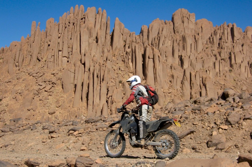
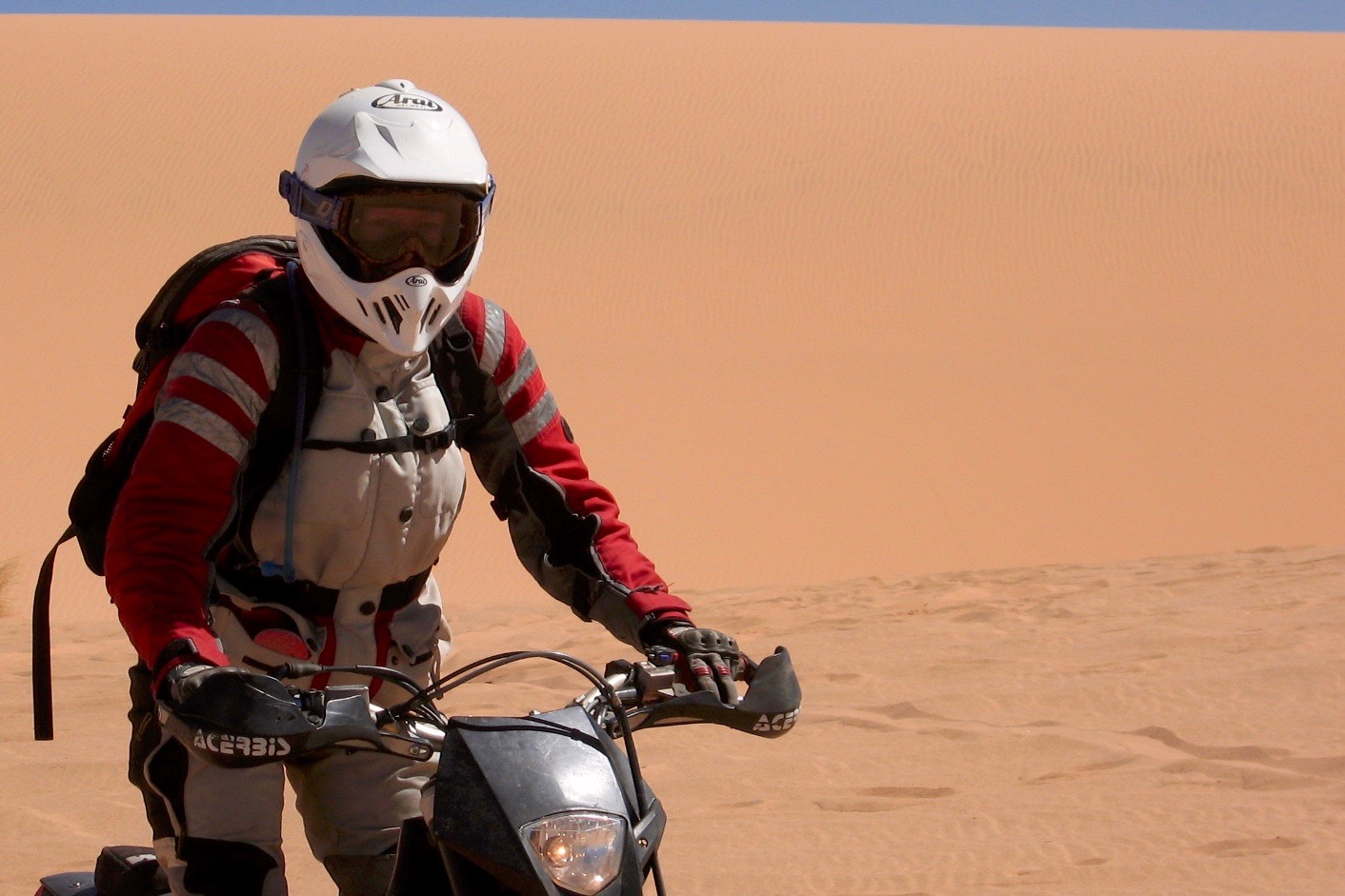
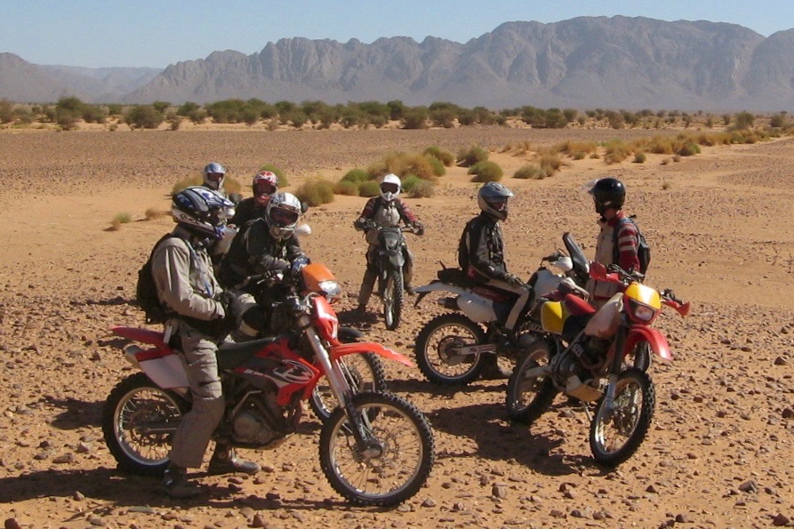
Riding a bike in the desert is almost the most fun a person can have, so when I saw an advert in TBM for a three week trip to the Algerian Sahara, I jumped at the chance. The trip offered a rare opportunity to travel with legendary desert rider Chris Scott, author of ‘Adventure Motorcycle Handbook’ and ‘Sahara Overland’.
Chris is a well known figure in the Sahara (which became clear when he was mobbed by a group of adoring fans during the trip, at a roadside café in Arak). He isn’t a professional tour operator, but he does occasionally take groups out into the desert to help fund his own adventures. Chris is a very easy going character who doesn’t take himself or anything else too seriously.

DRT07map

The route chosen by Chris took us in a 2600km anticlockwise loop, heading west from a pretty oasis town of Djanet in the south of Algeria, and stopping halfway at Tamanrasset to visit the Assekrem (a hermitage in the Hoggar mountains), before looping back east to Djanet (click map right). Chris’s unique experience and knowledge enabled us to explore remote and normally inaccessible regions, riding largely off-piste in the most beautiful desert I have ever seen.  Apart from Djanet and Tamanrasset we spent all of our nights camping out in the desert under the stars.

MAN-lorry-rox

Support
During the trip, Chris drove the MAN support lorry which carried all our food, water and fuel, and occasionally, the odd broken bike. Experienced desert rider Jon Escombe was the pace bike rider, and, since it has been obligatory in Algeria to have a local escort after the tourist kidnappings there in 2003, we were also accompanied by two entertaining local guides in a 4WD Toyota Land Cruiser.

Riders and Bikes
The seven riders on the trip were a very experienced group, most having previously ridden enduros or desert rallies, and all had travelled a fair bit. Oddly enough, out of seven riders – five were TRF members: Mike (who is now TBM’s ‘Mud Life Crisis’ columnist), Nick and Gerald from Cornwall, and Dave and myself from Surrey. Sean from Surrey and Ken from Scotland completed the group.

2007-riders

We each rode our own bikes on this trip. Chris drove the bikes to Djanet in the MAN and we flew out to meet them. There were two KTM 450s, one Beta 525, one Dominator and almost the complete range of Honda XRs (250, 400, 600 and a 650L  with 40l tank!).

Preparation
I had decided to splash out on a KTM 450EXC for this trip, as the horrors of kick-starting my recalcitrant XR250R in the desert didn’t appeal. Chris Hockey, aka Dr Shox, did a great job of lowering the KTM (as I’m just 5’6”) and set it up for my weight and the type of riding I do. (Chris sorted out my shocks and forks by POST!).

I fitted a beautiful Scott steering damper to calm the legendary KTM speed wobble, and this also had the beneficial side-effect of raising the bars to a much better position. I also fitted Michelin Desert tyres, a KTM cooling fan (essential) and a 13l Clarke fuel tank.

Bike Performance
The KTM turned out to be a great choice for the desert – its light weight, electric start, fantastic suspension and responsive ‘point and squirt’ power characteristics made riding a joy. The steering damper took the big impacts, and kept the bike on line with much less effort on my part, greatly reducing fatigue. The combination of Excel rims, heavy duty spokes and stiff Desert tyres meant that I didn’t have to worry too much about punctures or dented rims when riding at speed over the more rugged terrain, although the Deserts might sometimes have been a little too stiff for the light bike to gain enough traction in the really soft sand.

The KTM ran well on the local Algerian fuel (89 octane), and the need for bike maintenance was minimal. A daily check of oil and water, chain tension, nuts and bolts and spoke tension, plus a single air filter skin change and engine oil change was all that was needed. The chain didn’t need any adjustment. The bike didn’t use any oil, and the water needed topping up only once when the radiator boiled over (after the cooling fan became accidentally disconnected during a slight tumble.) Odd spokes and the one or two nuts which I had missed with the Loctite came loose due to the heavy pounding the bike took.

Dave’s XR400 probably had the best size, power and handling characteristics for this type of ride, but all bikes performed well, although Mike’s XR250 was nailed the whole way as his KTM 525EXC hadn’t been ready in time for the trip. Gerald’s four year old KTM 450EXC was the only bike to have any mechanical problems, although this might have been due to lack of cooling fan. The bike overheated and ran completely dry, resulting in its ultimate demise, and the end of the trip for Gerald at Tamanrasset.

Routine
During the trip, the days and nights quickly settled into a routine. Each morning, we were woken in our tents by the distant burble of the volcano kettle, signalling the imminent possibility of hot tea and breakfast.  I would then emerge from my layers of sleeping bag, bag liner, thermal clothing, rustling emergency space blanket and bike jacket. Yes, the nights were a bit cold!

After breakfast, we would pack up and ride out with Jon, meeting up with Chris and the truck at agreed waypoints for lunch and the evening camp. In the evening, Chris cooked the dinner while we rested and munched on snacks. After dinner, we would sit around the camp fire to chat and watch the stars.

Catering for nine people is a challenge in the desert. There are no shops, no refrigeration and no water, but oddly enough, Chris’ claim that the desert is a sterile environment is perfectly true. UHT milk kept very well decanted into a plastic bottle on the lorry, as did a 3kg block of cheddar. Baguettes also kept well in a black bin liner. Chris baked fresh bread for us a couple of times which was lovely (both the act and the bread), and one evening our guides went off into the desert and came back with warm camel milk – though, sadly, the taste fell somewhat short of my romantic expectations.

Riding
I found the trick on this trip (as any other) was to relax and try to ride with maximum technique and minimum effort. You can’t ride flat out for three weeks without becoming exhausted. The remoteness of the region and lack of possibility of any medical intervention in the event of accident means extra care is needed at all times.  The riding requires constant vigilance, constantly re-checking the foreground looking for ridges, boulders and ditches, and looking well ahead for larger obstructions like oueds or dunes which may need to be skirted, and in which the unwary can be separated from the group. The weird optical effects of the desert also mean it’s difficult to judge distances.

The bikes mostly travelled independently of the truck, so were able to travel off piste, which provided some great technical riding over a huge variety of terrain. There are fast, exhilarating sand plains, sometimes with unexpected flood channels and ditches which are very difficult to see. There are island outcrops of basalt and exfoliated granite in golden white sand seas, and beautiful sandstone formations and arches reminiscent of the Utah Arches national park. (Mike couldn’t resist exploring one). In between the larger outcrops and formations there are valleys of soft sandy ruts. Often there are enormous boulder fields or lava fields where the outcrops have broken down over thousands of years and become spread out in a carpet over the desert floor. The black lava fields are sometimes marked by white, narrow, twisty camel trails, formed over centuries by each passing camel shuffling its feet in the footsteps of the preceding camel to form a path through the shattered, pointy rocks.
Dune fields are the most fun, it’s incredibly exhilarating playing in the dunes, but they can be dangerous. In the really big ones, it’s easy to get disoriented with no sense of which way is up or down, just white sand in all directions, and on all dunes the crests can hide unexpected vertical drops, so it pays to stop or ride along the crest first to check the descent before going over the top.

Oueds were the particular feature of the desert that provided most entertainment for our group. Oueds are dried out river beds, containing channels, ledges and deep ditches, and boulders which have been washed down from the mountains many miles away. In between the boulders, acacia bushes have sprung up and become covered with sand, forming close-spaced soft sandy clumps and humps. These features all combine to form an interesting enduro course, where picking a line is sometimes impossible and it’s often easier just to ride straight over everything except the very deepest troughs and channels. The oueds became a familiar experience on the trip, and became known as the ‘boondocks’. Crossing the wider boondocks caused the group to scatter in all directions in a mad scramble, to emerge erratically on the other side with wild grins.

Parallel and close spaced fields of transverse sand ridges (giant sharp-edged ripples) up to five feet high were a particularly dangerous feature of the terrain. They are usually found in the areas between large rocks or dunes, and are difficult or impossible to see, especially with the sun behind or above, when there is no shadow.

We had one serious crash during the trip when Sean hit a series of the afore-mentioned sand ridges and launched his XR600 30 yards over the top, suffering a broken shoulder, other minor fractures and 2 sprained ankles. There was no possibility of being airlifted out as only the military have helicopters in Algeria, so Sean had to endure an uncomfortable couple of days being driven out of the desert in the Toyota.

Crises do bring out the best in people though. Chris showed great calmness and pragmatism, and also sensitivity, when looking after Sean after his accident. Sean was incredibly strong and stoic. Even when helpless with painful injuries, hanging half off a makeshift orthopaedic board/sand ladder in the middle of the night in the desert, he was reluctant to wake anyone up to help, and suffered in silence. The guides were also really kind looking after Sean during the following days, and even gave up their sleeping blankets.

Conclusion
I was originally slightly wary of going to Algeria in the current political climate, and, being female, I was concerned about how I would be treated. However the reality of the trip was far removed from my fears, and full of lovely surprises, including the fantastic riding, the genuine warmth and generosity of the local people who made tea for us in the desert and invited us into their homes, and the staggering beauty and purity of the landscape. Oh, and finding hedgehogs in the sand dunes was a bit of a surprise too.

I would do this trip again in a heartbeat. For me there were moments of sheer joy and exhilaration, and also a sense of personal achievement. I am really grateful to the people who made this trip possible and enjoyable. Chris’ openness and willingness to share his world with us for a short while, Jon’s capable care, and the Algerian guides’ concern, generosity and humour, and of course, my fellow riders for their company and willingness to chip in and look out for each other in true TRF fashion made the whole thing a brilliant experience I will never forget.

Of all the many bike trips I have been on, this was definitely the ultimate off road bike trip.

D is for Dust: Understanding the Saharan Climate

Part of the Sahara A to Z series
Saharan-duster

Considering its influence on global weather patterns, very little data exists about the climate of the Sahara.

saharan dust in uk

Dust plumes from summertime sand storms can reach right across the Atlantic to the Americas, having a bearing on the formation of hurricanes in the Gulf of Mexico as well as a beneficial effect on the ecology of the Caribbean and Amazon basin. In western Europe we’re familiar with occasional reports of ‘Sahara dust rain’ settling on smooth surfaces like car bodies. In March 2014 the Daily Mail reported on the outrage of Saharan dust settling on then Prime Minister Cameron’s car in Downing Street (right).

wef

bookmaproads
sahara automated weather station

In 2011 and 2012 Project Fennec set out to expand the knowledge of this area by gathering climatic and aerosol data across the arid ‘Empty Quarter’ of the western Sahara. Covering northern Mauritania, northern Mali and western Algeria, it’s known to meteorologists as the ‘Saharan Heat Low’ (SHL) and is the world’s largest source of airborne dust. Manned weather stations were established in Zouerat, Mauritania and Bordj Moktar (‘BBM’) on the Algeria-Mali border (see map above left), while automated weather stations (AWS, above right) were planted across the 1000 miles between the two bases, in the remote Erg Chech region.

SEQroute

In 2006 we traversed the southern edge of this ‘Empty Quarter‘ between Ouadane and BBM, crossing only the infrequently travelled Timbuktu-Taoudenni piste in some 2000 km of off-piste driving. On the way we collected dust samples for what became Fennec.

ewf
wef3

Following its 2005 Bodele dust-research expedition to Chad (BodeX), in 2012 the Fennec ground observations were backed up by a series of flights at high and low altitude across the region using aircraft crammed with recording instruments (above right).

Below is a short film about the Fennec project. It’s not click and play; it has to download itself.

itc

Morocco: Getting There + Mobile phone SIMs

See also:
Documents and Port Immigration
Buying and using a Moroccan SIM card

Most travellers from the UK heading to Morocco in the cooler months take ferries from Portsmouth to northern Spain: Bilbao or better still, Santander. When you add up tolls and fuel and time across France it works out the same price for less driving or riding.
The Brittany ferries on this route are well-equipped cruise ships with plenty to occupy you over ~22 hours at sea, while doing a great job of smoothing the voyage across the Bay of Biscay. Brittany also have a no-frills ferry route between Rosslare, Ireland, and Bilbao.

traspain

From Santander to Algeciras (the most-used port) is about 1000km, and the empty and fast network of roads west of Madrid (A67, A62, A66 and A381 – right) can get you between the two ports in one long day.

malagawear

On a motorcycle, from the UK you can save at least two days each way but getting it trucked to a warehouse near Malaga. I’ve used Fly and Ride. I delivered my bike loaded up to a warehouse near Gatwick, then flew in and picked it up next to Malaga airport a week later. Post Brexit it now costs from £700 one-way. See this thread.

Toll motorways. Quick ways to get south or east.

Moroccan Ports
Now that Tan Med port is so easy, few go via ‘Tangier Ville‘ or the nearby Spanish enclave of Ceuta (Sp), although from Alicante, ferries to Melilla enclave (Sp) are often much cheaper than adjacent Nador. The payback can be that on the Spanish side of the land border with Morocco you’ll have annoying ‘helpers’ offering their services. They’re just looking for a tip at the end of it, but on a quiet day, you can manage without them.

Algeciras-port
White line then to buy ticket, yellow line to waiting area, orange line to embark

Moroccan port maps

nadorins1

Morocco Maps

Morocco Overland Maps has moved

Getting routed: As the track was clearly visible, I traced the route I’m logging above (MW7) off Google Earth the previous evening (internet required), saved and exported the kml then imported it (as a gpx) into my Montana via BaseCamp. This was pushing the outer limits of my tech ability with this sort of stuff.
GPS digital maps not really needed as I had the largely accurate self-drawn tracklog on the screen to follow, while recording my own live tracklog. Years later I used this same system (pre-trace route off Google Earth) again while logging MH23. The great thing with satellite is WYS is usually WYG, whereas with maps (paper or digi) WYS can be nothing at all.