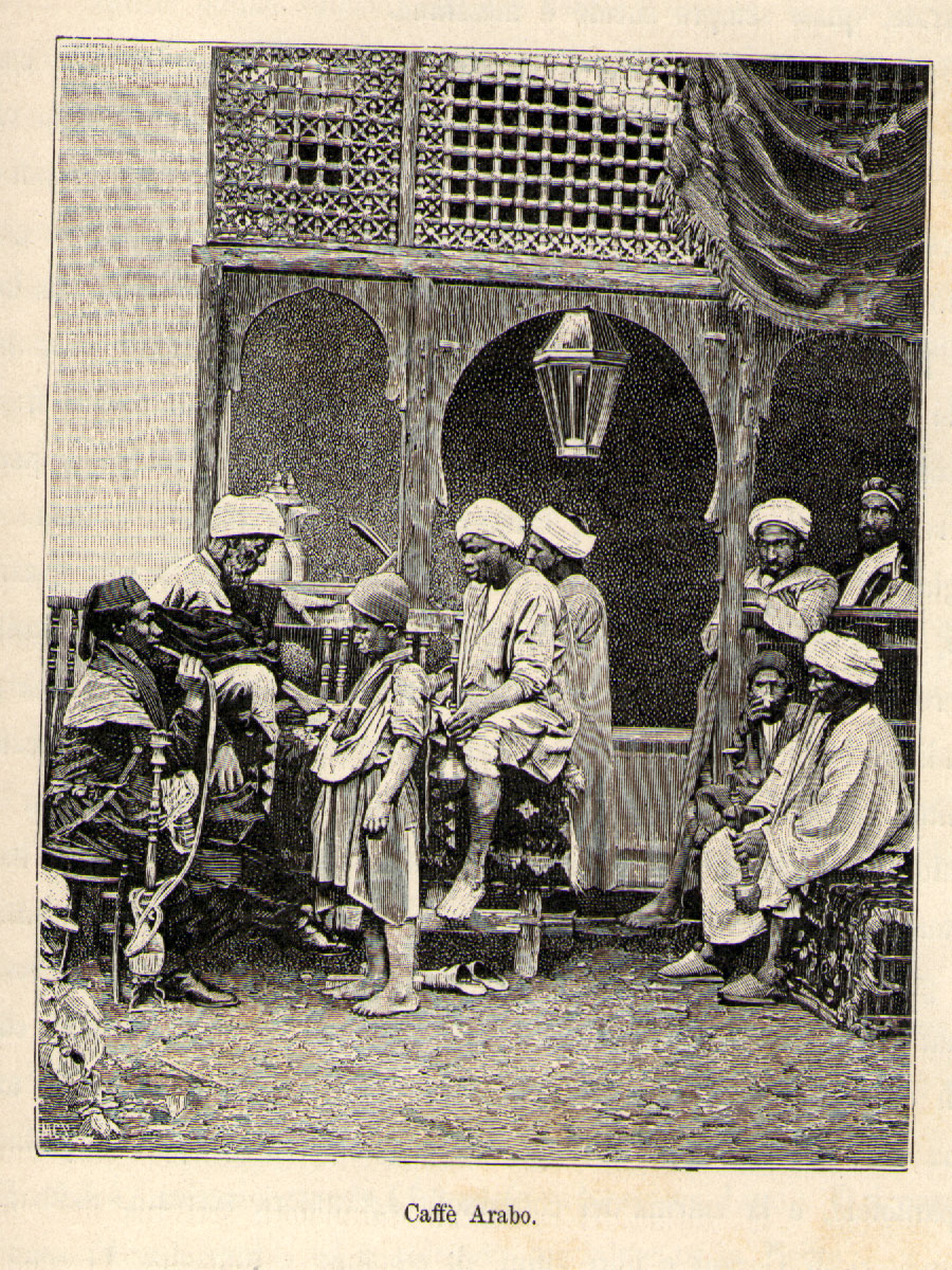
Part or the Sahara A to Z series
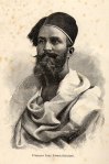
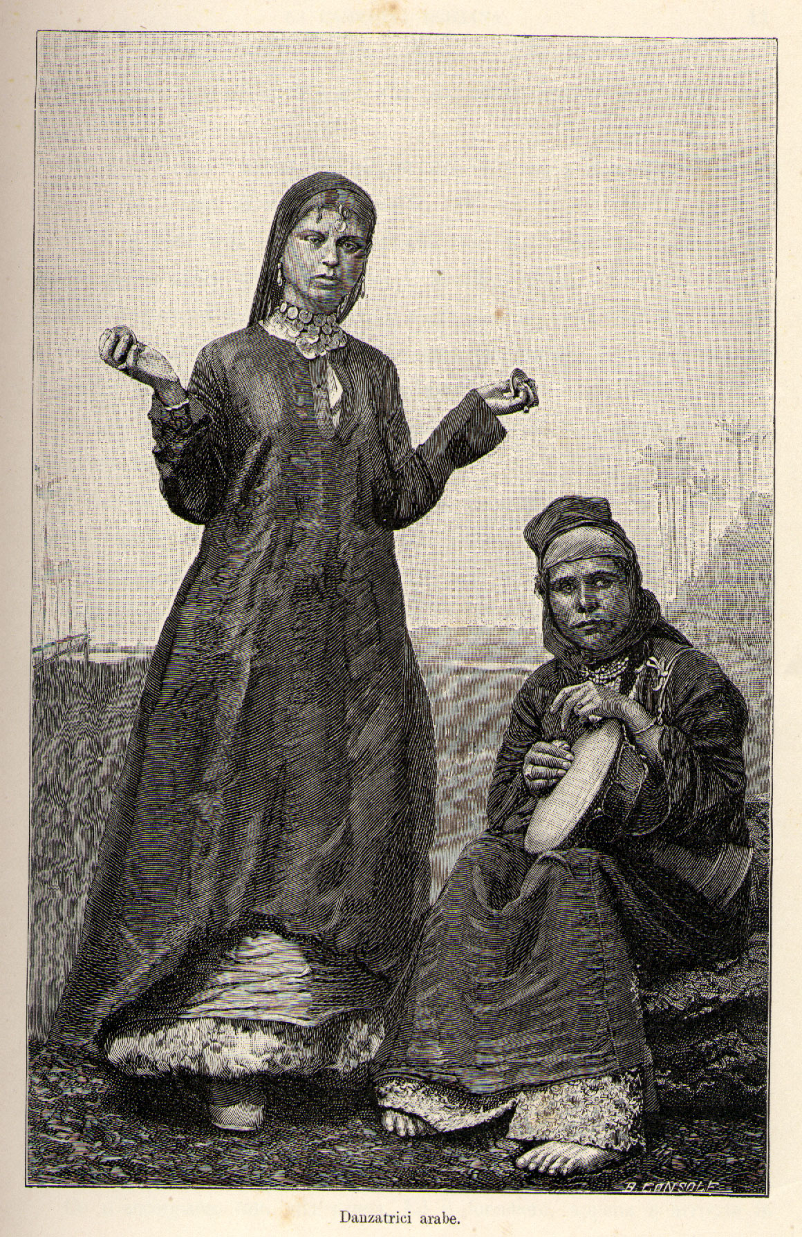
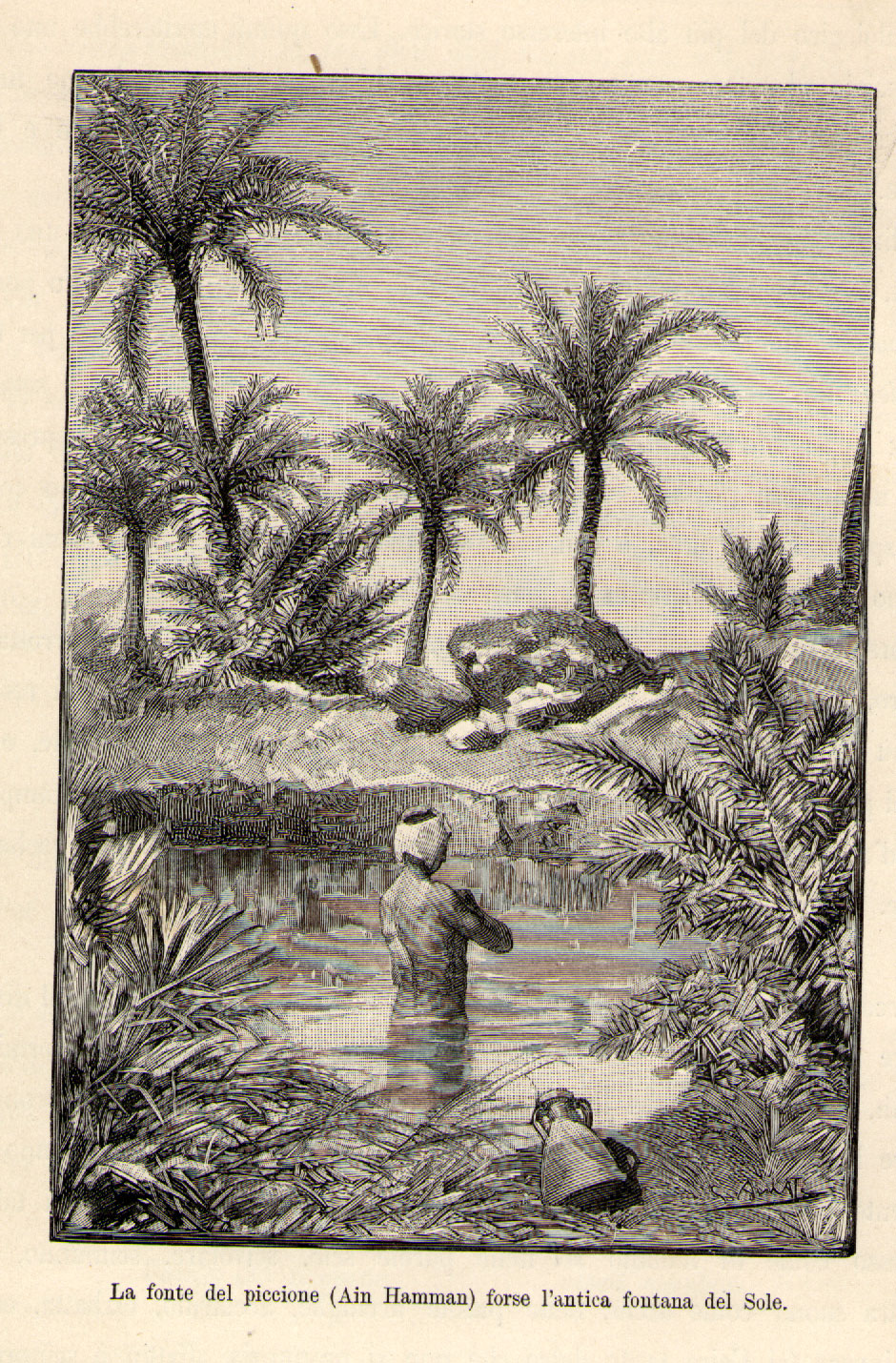
Taken from the book All’oasi Di Giove Ammone
(At the Oases of Jupiter Ammon)
by Luigi Robecchi-Bricchetti (right)
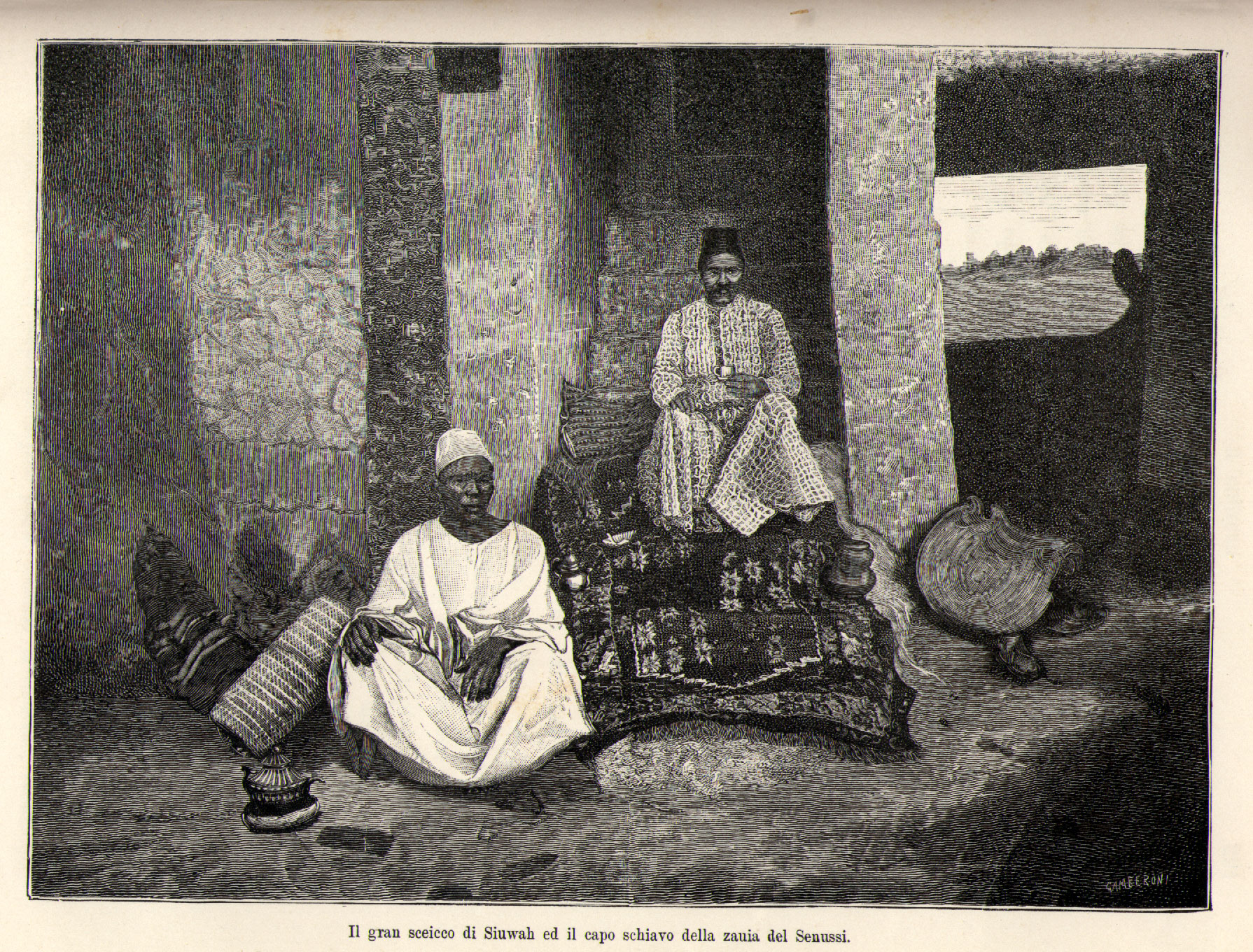
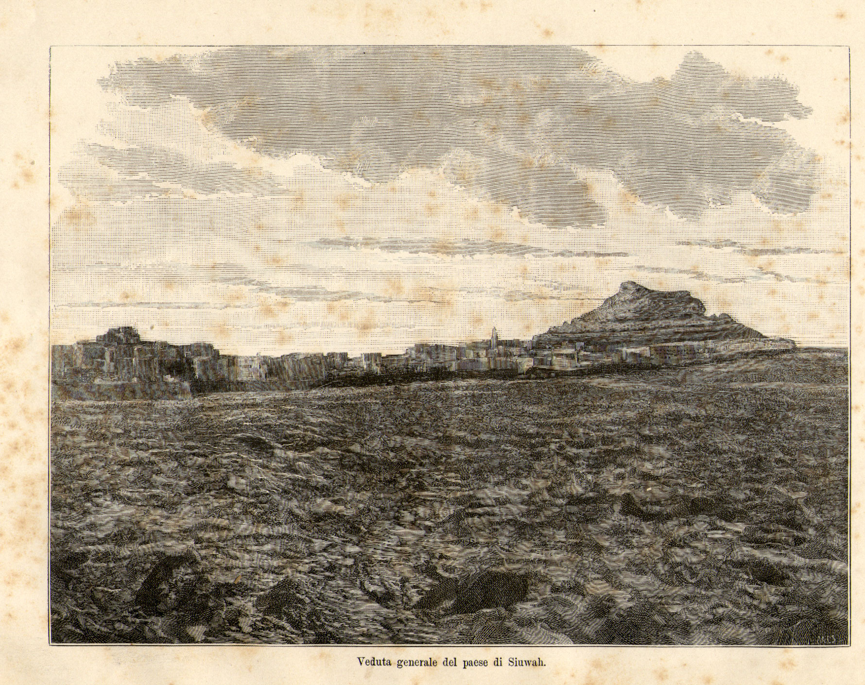
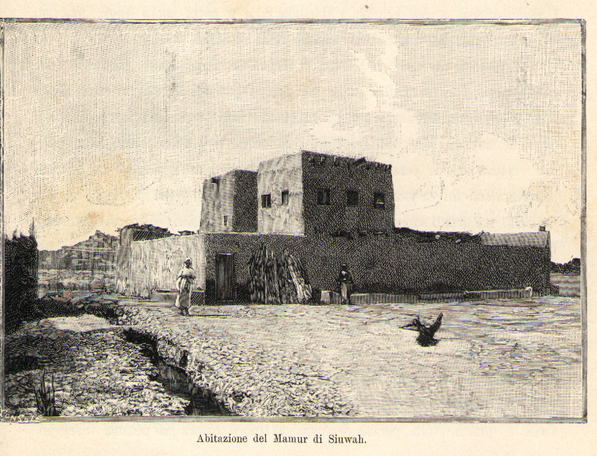
Part or the Sahara A to Z series
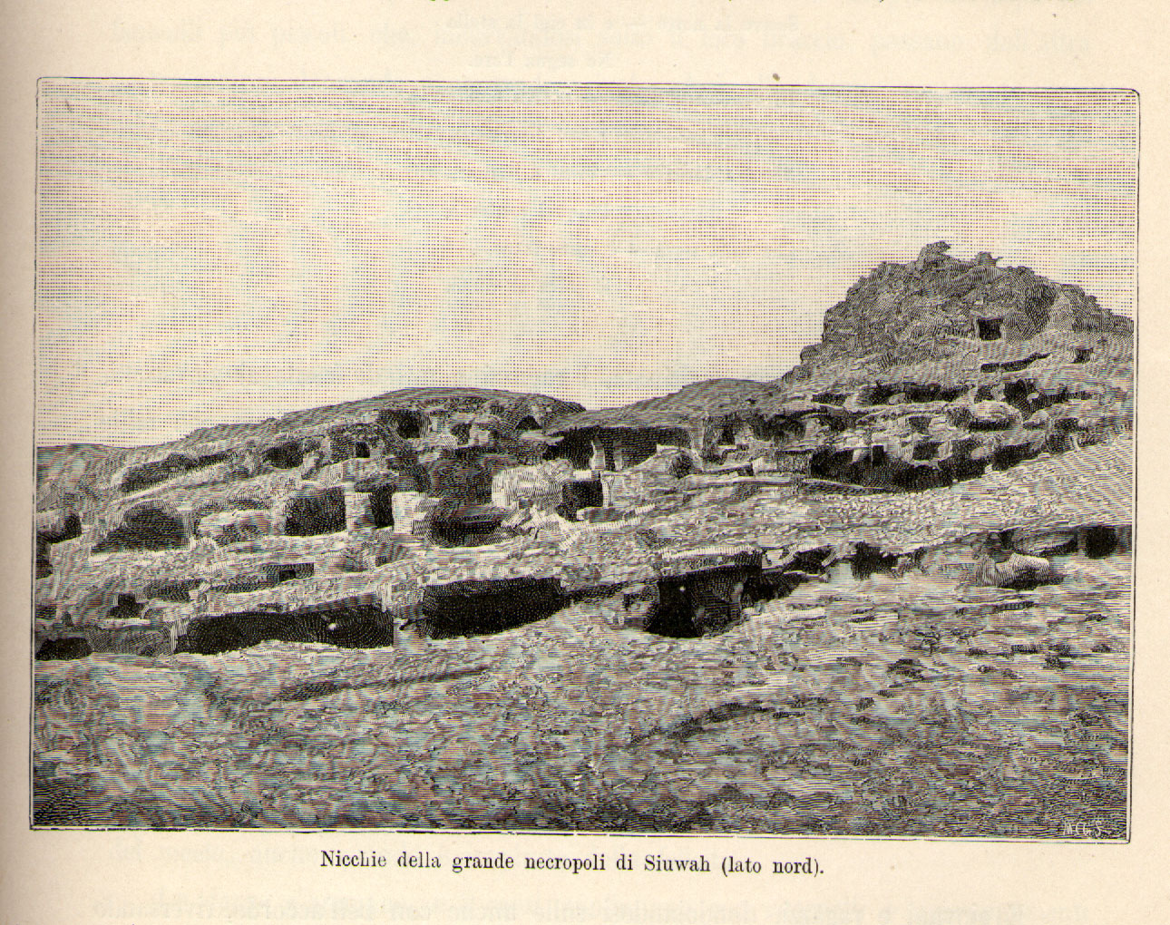
Taken from the book All’oasi Di Giove Ammone
(At the Oases of Jupiter Ammon)
by Luigi Robecchi-Bricchetti (right)
L’Universo is a journal of the Italian Istituto Geografico Militare in Florence and the current 160-page special edition features the 1933 expedition to Libya led by Captain Oreste Marchesi.
Sahara specialist Michele Soffiantini organised a special visit to the Uweinat area from the Libyan side in 2010 while researching the Marchesi expedition in detail. The journal includes an in-depth analysis of the mission’s objectives in reaching to the southernmost corner of Libya, most probably to gain a foothold at the strategic landmark of Jebel Uweinat mountain, beyond the oases of Kufra which itself had only been wrested from the Senussi by the Italians in 1931. The cartographical aspects of the survey are also described as well as a study of the mission’s surveying equipment.
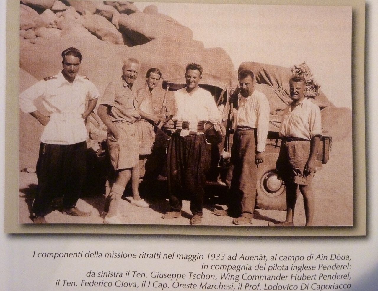
It’s all in Italian of course, so I’m not much the wiser, but it’s interesting to parallel it with the better known explorations of around the same time by Ralph Bagnold from the Egyptian side, as well as Laszlo Almasy. The glossy journal reproduces some great archive photos by Giuseppe Tschon from the ground and the air, as well as some fine maps produced as a result of the expedition.
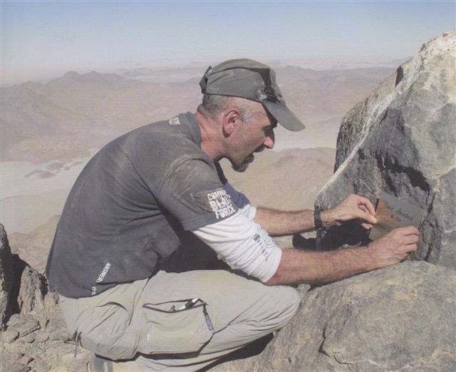
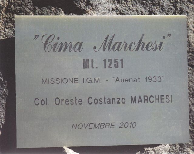
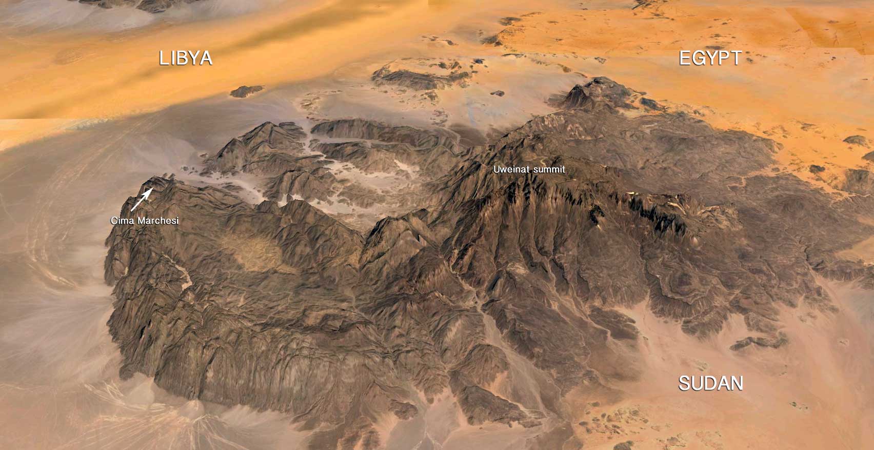
Uweinat expert Andras Zboray of FJ Expeditions was part of 2010 trip with Michele and describes their finds here, along with scores of great photos – some of which also appear in the journal. On that occasion Michele and a pal climbed the 1251-metre Cima Marchesi, a peak on the very western edge of the Jebel Uweinat massif (1934m) and therefore well inside Libya, then and now.
Further information from: Istituto Geografico Militare
casezcomm AT geomil.esercito.difesa.it
 of this trip appears on the Desert Driving dvd. Additional maps at the bottom of the post
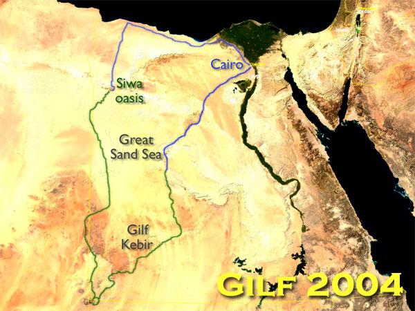
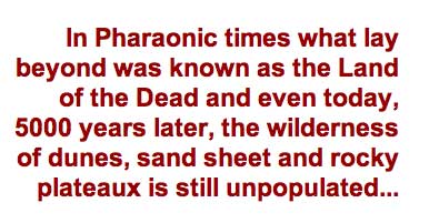
What sets the Libyan Desert apart is that it is ten times more arid than the rest of the Sahara: the Libyan Desert is the über Sahara. In an area the size of the UK through which we’d be travelling there is just one usable well and that single well outnumbers the permanent population. Looking out my window I can see more trees than we saw in two weeks and 2500km of travel. Even by Saharan standards, the Libyan Desert is extreme.

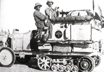
Abbreviated to ‘the Gilf’, the Egyptian part of the Libyan Desert is a mini Sahara in itself, encapsulating all the archetypal desert landforms. The Great Sand Sea lived up to its name, a dune field 200 kilometres wide and 600 long with dunes 200-feet high. It was here where the earliest experiments in driving cars on sand were made in the 1920s by the likes of Clayton and Bagnold (left). Its southern edge spilled over the massive Gilf Kebir plateau only discovered by Egyptian explorer Kemal el Din in 1925 using Citroen half-tracks.
South of the Gilf a sand sheet led to the isolated mountain of Jebel Uweinat which sits right across the borders of Egypt, Sudan and Libya. Our 2003-4 expedition was to last a fortnight and cover some 2500 kilometres. The plan was to pass down the east side of the Sand Sea to the Gilf, explore its eastern valleys and push on south to Uweinat mountain which we hoped to climb. From there we’d head back up to the southern cliffs of the Gilf, visiting the real Cave of the Swimmers made famous in the English Patient movie, and then skirt up the western edge of the plateau and plough through the heart of the Sand Sea for a couple of days to the oasis of Siwa, famed since the visit of Alexander the Great.
Our crack team of Saharaholics included photographer Toby Savage who co-presents my Desert Driving dvd, Dr Kevin White who’d worked with Toby on the Fezzan Project in Libya over several seasons searching for prehistoric lake beds, and Oxford climatologist Richard Washington whose bedtime reading included Applied Principles of Arid Zone Aeoleonics, or ‘dust storms’ to you and me.
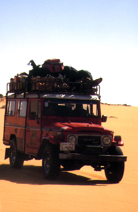
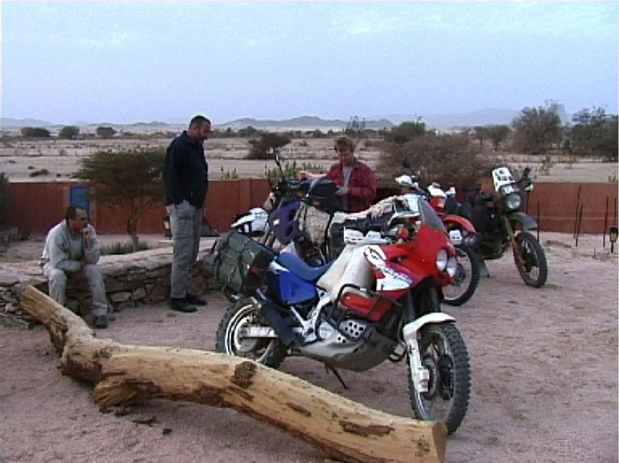
We’d all travelled in the Sahara with our own four-wheelers, but shipping them to Egypt was never an option: too far, too expensive and, for the three weeks we’d given ourselves, bureaucratically maddening. Better by far to get Toby’s Egyptian mate Mahmoud to lay on three vehicles for the 2500km trip. Mahmoud already had plenty of experience exploring the area himself in his old Series III. For all of us used to looking after ourselves on our own desert trips, being pampered in this way was a bit luxury. Normally navigation, the vehicle, cooking and everything else would be down to us; on this trip we could sit back, enjoy the desert scenery and let someone else carry the load for a change.
A week before Christmas, Mahmoud met us at Cairo airport in a suped-up minibus and whisked us off for lunch on the Nile before we set off for the 400-km slog south to Bahariya oasis where the vehicles awaited us. On the way we speculated as to what those machines might be because, as I knew myself from a recce tour three years earlier, the ‘Gilf’ was tough on cars. Six hundred litres of fuel – 130 gallons per vehicle – was a typical payload, let alone food and water for a fortnight. We’d expect to see no one during out travels, with only the wadis around Jebel Uweinat offering the chance to replenish the single resource: firewood.

Driving desert highways at night is always a spooky experience. Small dunes shone in the moonlight and up ahead a cluster of lights signalled a lonely roadhouse, surrounded by trucks and vans serving the towns of the Western Oases. We pulled over for a brew to find everyone on both sides of the counter huddled around a dusty TV screen, On it a hirsute and spaced-out Sadaam Hussein was getting his gums probed by Special Forces, having just been dragged out of his lair.
Next morning in Bahariya we met up with Mahmoud’s pumpkin-bellied mate Loutfi who ran a local hotel and tourist excursions into the desert and nearby hot springs. Mahmoud and the vehicles were down the road a way: he had left before dawn for Dakhla to pick up the military escort which every tour in the Gilf requires. So we bundled into Loutfi’s 60-series Land Cruiser for the drive south to Abu Mungar and a rendezvous with Mahmoud in the desert.
All around us lay barren desert sands rimmed by the arching 600km escarpment that defines the Western Oases of Bahariya, Farafra Dakhla and Kharga.
In Pharaonic times what lay beyond was known as the Land of the Dead and even today, 5000 years later, the wilderness of dunes, sand sheet and rocky plateaux is still unpopulated, with just half a dozen towns of any size lay between ourselves and the Atlantic, 2000 miles to the west.
Loutfi’s 60 had just had an engine transplant, a grunty 12HT 4-litre turbo diesel, but by lunchtime it was getting distinctly hot. The needle was sitting in the red, there were burning rubber smells coming through the vents and the turbo was making an audible whine. Maybe this wasn’t the machine we’d be wanting in the Gilf after all.
Our quartet of backseat drivers watched the needle and muttered, waiting for the turbo or head gasket to blow. Loutfi pulled over to let the machine cool down and, once satisfied the needle had backed off, headed on south. Again the Tojo was cooking itself but Loutfi then confounded us by pulling off the road into the desert. None of us knew quite what was going on, but heading solo off-road with overheating problems seemed unorthodox. We churned over a few sandy passes, stopped off at the famous White Desert chalk outcrops and then bundled on to who knows where.
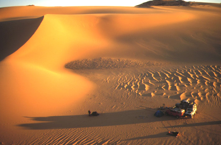
Presently we got back to the highway where Loutfi seemed unsure whether to turn left or right. He drove down the road a bit, looking out west, then turned back north. He spoke no English so we had no idea what was going on; had he lost something? Then he turned round once more, looking hard out to the west. He slammed on the brakes and did a U-ey. Ah ha, there it was: a hooned-out sand circle, a small cairn and three sets of tracks leading out into the void. Following these, within a few clicks we came upon a desert camp, the cars locked in the customary Gilf ‘U’ formation against the northerly wind. Mahmoud was there to greet us with smiley Ibrahim in his Bedouin head-dress, our ‘guard’ Hamed in a snazzy maroon shellsuit, Faraq the mechanic and Aisa, a cool dude in a pair of knackered cowboy boots and matching hat who was to be our cook for the next fortnight.
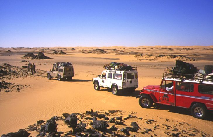
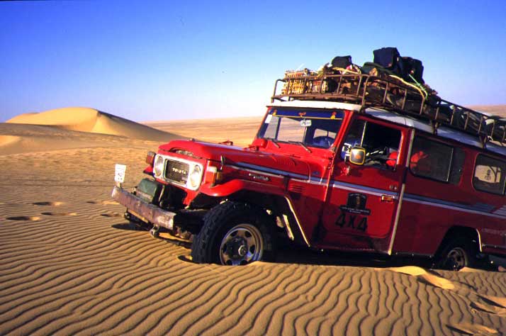
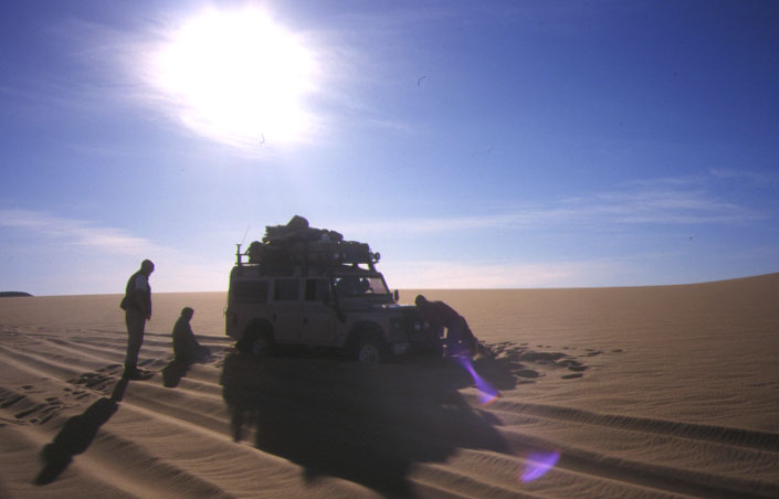
The identity of our three desert machines was revealed: Mahmoud’s Series III-bodied Toyota, a 110 Land Rover, which also had a 3.5 litre Tojo bus engine and gearbox, and Loutfi’s other car, a red HJ45, the old squared-off Land Cruiser from the late Seventies, but also with a newer six-cylinder 12HT turbo engine crammed under the lid. With potentially the best engine, the 45 was the load carrier; inside it, three 200-litre drums of diesel were lashed down with rope while on the roofs of all cars were additional jerries of fuel which, with the full tanks, added up to 2000 litres, more than enough for as many kilometres over the next fortnight. But with no car running an original engine or less than two decades old, we could see that spannerman Faraq wasn’t going to have a holiday.
That evening, in the cozy shelter of the U-camp, Richard and I keyed in our sat phones with Mahmoud’s so we’d have some sort of comms if we got separated and things turned pear-shaped. Mahmoud outlined tomorrow’s route: we were in the very edge of a series of parallel dunes running north-south; crossing the dunes would be impossible with the cars in their current overloaded state, but we could hopefully run down the 500m-wide corridors between the dunes as far as possible and ease over any low passes to gain ground to the west.
Next morning, knowing that things would get off to a slow start, Toby, Wash and I set off for a wander into the dunes to let the cars catch us up. After an hour there was still so sign of them, so we sat down on a high dune and scanned to the east, ears primed. Finally about 10am they turned up, having had problems getting one of the engines to fire up. We all hopped in and set off down the nearest corridor to see how far we could get. I was in the white 110 which inside looked like it had been a prop in The Birds, with every surface pecked to bits and wires hanging off the dash like splashed spaghetti. Still, the engine sounded good and it carried its weight well.
It didn’t take long before one of the vehicles struck trouble: the 45 had brake problems, but whatever it was Faraq fixed it in a jiffy and we moved on until the next: Mahmoud’s ‘Lanyota’ could not shift into low range. Faraq crawled in and tightened up the linkage with a bit of wire. The rack was also sagging in the alloy roof gutters which, on Defenders, means you can’t open the doors. (You couldn’t anyway as the door handles were buggered.) And the air bags which were backing up the rear parabolic springs were squeezing out like bars of wet soap.
These were fixed as best they could be and we moved on. Even in dune corridors the sand can change imperceptibly; one minute you’re clawing along at a decent pace, next thing the car sinks like a stone – but if you’re fast with the shifting and accelerator you’ll get through it. Momentum is the key to dune driving; once you’ve lost it you may as well pull up and put the kettle on. All of the vehicles got mired in soft patches several times and we all got stuck into pushing the cars back out, the quickest way of getting going if the driver has stopped early enough.
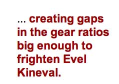
Part of the problem was that the Toyota gearboxes in the two Land Rovers were not optimised to the Land Rover axles, creating gaps in the gear ratios big enough to frighten Evel Kineval. Mahmoud’s Land Rover had an even more alarming habit of getting on two wheels while cornering hard, something which Mahmoud tended to do with gusto; I sure was glad I wasn’t in his car. By comparison, Ibrahim in the white 110 was a steady and smooth driver, never taking risks while struggling with the same mixed-up gearing and, it turned out later, no power steering.
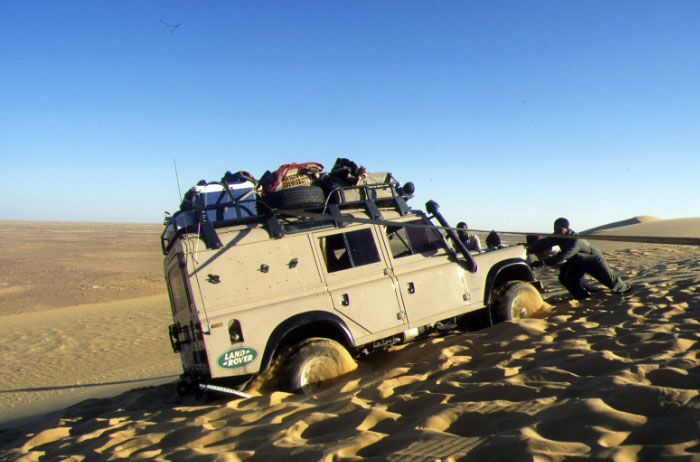
By late afternoon we needed to get west, but high dunes were blocking the way. Mahmoud was nosing about for a way through but the heavy vehicles were struggling in the corridors, let alone trying to get up the sand banks. At one point Mahmoud took an oblique blast at a low dune but his angle was all wrong: halfway up, the wheels on the low side hit a soft patch and the vehicle keeled over to within a couple of degrees of tipping (it’s the front cover of Desert Driving). I knew from personal experience that these sort of recoveries where very tricky. Loufti’s 45 blasted up the dune to help and got mired too, but Ibrahim managed to get the 110 into position to fix a rope on the high side of the Leaning Rover. By backing up, the Series III was heaved up to a less jaunty angle and then, after a bit of digging and with Ibrahim holding it in tension, Loufti pulled it back down onto level ground. Back on the flat, Mahmoud spun round for a good run up, this time getting the wheels a foot in the air, and made it over. Me, I was happy to be in the car with Ibrahim behind the wheel.
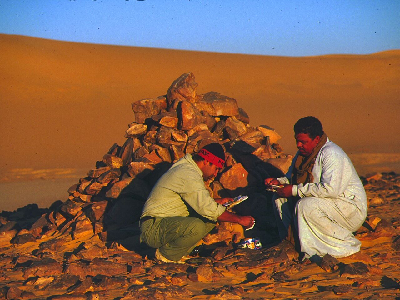
That evening we camped at the cairn of Regenfeld, built by the German explorer Gerhard Rholfs in 1872, the first European to venture west into the Libyan Desert. It was here that his party gave up and turned north with their camels, weeks later reaching Siwa by the skin of their teeth. Rholfs left a message in a bottle in the cairn, and since then it’s been the custom for the few passing travellers to do likewise. We left our regards to whoever came next and then spent the night by the dunes as Rholfs and his crew had done 140 years earlier.

Next morning we carried on south and emerged from the dune corridors into a sandy plain dotted with cone hills; outliers of a long-since eroded plateau. One of these cone hills was Abu Ballas, or Pottery Hill. In 1912 the British explorer, Dr John Ball, discovered a cache of smashed clay urns at the foot or the hill and the truth behind an ancient local myth was revealed. Legends had it that for centuries the people of Dakhla suffered raids from “the black raiders from the west” even though everyone knew that ‘west of Dakhla’ was a waterless sea of sand, well beyond the range of a camel caravan. One day the Dakhlans decided to follow their tormentors into the feared desert. They never caught them but their tracks led to Abu Ballas hill and the stash of water urns. They smashed all the urns, destroying the vital water cache, and the raiders never returned, probably dying of thirst on their next raid. Today the remains of urns still litter the base of the outcrop while on its flanks delicate engravings of Ancient Egyptian deities survive.
Well out of the dunes by now, from Abu Ballas we turned west, following what might be called the only track in the Gilf, a braided network of ruts use by the occasional military patrols and exploratory tours like ours.

At one point we passed a perfectly straight line of 5-gallon Shell petrol tins, half a kilometre long. Marking a temporary WWII landing strip, these flimsy fuel containers date from the 1930s before the superior ‘jerrican’ was pinched from the Germans (hence “gerry can”) and adopted by the Eighth Army, LRDG and Halfords. Like the AK-47 or Douglas Dakota, the original jerrican is a functional design classic, unchanged and unimprovable.
Negotiating our way around low outcrops, isolated hills and small dunes ranges, our next destination was the Gilf Kebir plateau. By that evening we were close and camped in the lee of a dune close to Saviem Balise 22. Balise is French for marker post and in 1975 Saviem (later Renault) sponsored an expedition that tried to establish a new trans-Saharan route from the Atlantic to the Nile (see Sahara: West to East). About as useful as a fridge to an Eskimo, the Piste Saviem ‘from nowhere to nowhere’ was never used. All that remains today are the blue and white beacons they left to posterity along the way.
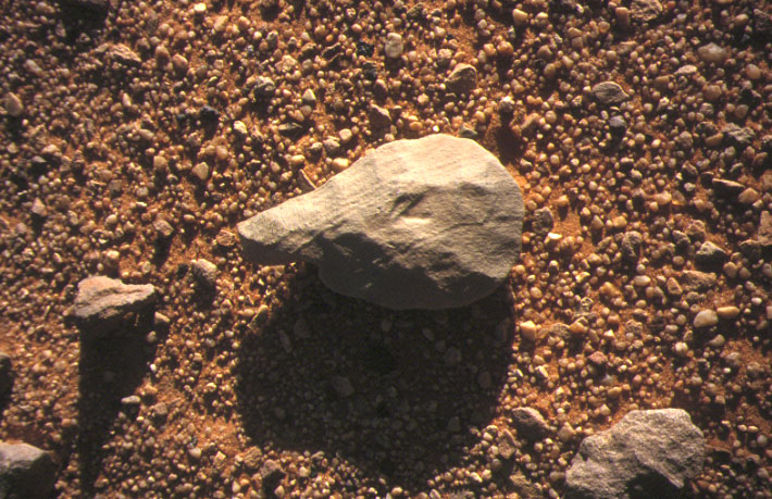
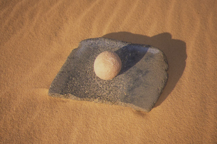
Leaving the lone marker post, we continued west and slowly, from the horizon’s haze, the low ramparts of the eastern Gilf began to rise. By mid-afternoon we were driving up Wadi Bakht, one of the three major valleys that drain their sands onto the plain. Six thousand years ago, during the brief humid phase before the Sahara reached its current state of desiccation, this valley was occupied by Neolithic hunter-gatherers, much like the Bushmen of the Kalahari. We camped that night at the site of a major Neolithic occupation, where we kicked up stone tools (above) and grinding stones (left) left by the ancestors of the pharaohs. It was a cold, windy night so Ibrahim grabbed an empty jerry and got a Bedouin singalong underway while we wrapped ourselves in everything we had and eyed-up Aisa’s bubbling stew longingly.
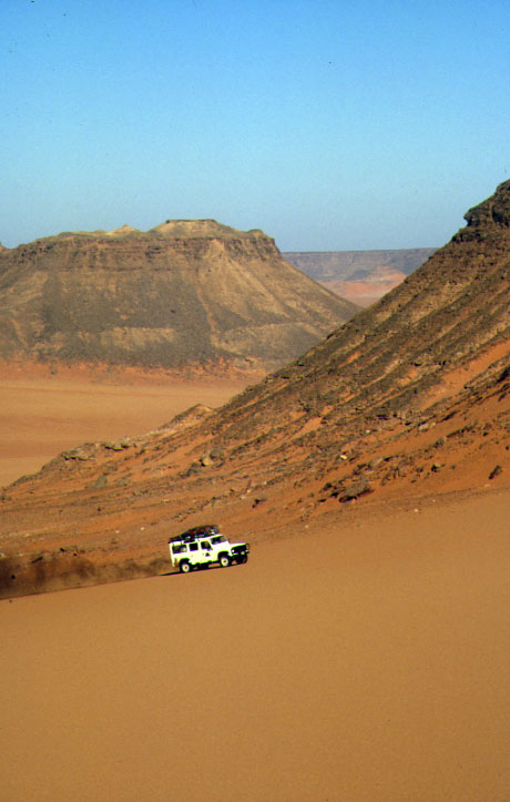
Having spent the previous night in one of the valleys winding into the Gilf Kebir plateau, we rounded a spur and powered up the sand banks to the dissected summit of the plateau. Some of the cars had trouble getting a good clear run and so to lighten the load we walked while they took a few runs. Approaching the plateau top required some hairy driving over nasty wavelets of sand and Mahmoud’s Land Rover was again getting on two wheels. We discussed what the cause might be and decided the vehicle was way over-sprung at the front. Throw in the more flexible parabolics plus a heavy roof load and it didn’t take much cornering force to get some air under the tyres.
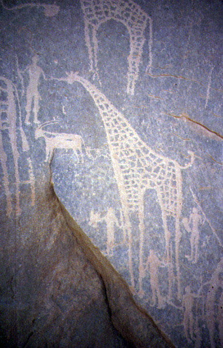
We parked up near the summit where a cave looked out to the south like a gun emplacement. Inside, the ceiling was adorned with finely drawn beasts which would have grazed here 6000 years ago, something that was hard to imagine as we gazed out across the arid landscape of isolated hills and the distant sand sheet.
From the cave we descended the west side of the plateau and made our way south towards the Prince Kemal el Din Monument, a cairn built in 1932 by the real English Patient, the Hungarian explorer Laszlo Almasy, to honour this Egyptian royal who gave up the Egyptian throne for a life of freedom and desert exploration.
The monument is tricky to find, hidden among low hills, and as darkness encroached we blundered around looking for a way through. Suddenly our cars stopped; up ahead the drivers had spotted some lights below the cliffs that had gone out as soon as they saw our group.
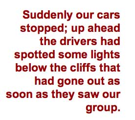
The Sahara is still a wild enough place to be unnerved when you see other vehicles, and in places banditry prevails as it always did, but such encounters are unknown in the hyper remote Gilf. This lot appeared more nervous of us than we were of them; they were almost certainly smugglers. A lot of trafficking goes on between Libya and Sudan, avoiding the Libyan border posts around Uweinat by slipping through far to the south via Chad or around the Egyptian Gilf, as was happening here.
Mahmoud flashed his lights to draw them out and eventually a Toyota pick-up drew up out of the dark with a bunch of people perched on stack of drums in the back, wrapped up in blankets. Mahmoud had to coax them into talking as they were clearly edgy and wanted to press on, but once they realised we were just tourists and our military escort was packing nothing more than a notebook and a woolly hat, they relaxed a bit. The other two or three vehicles stayed out of sight. It transpired they were Sudanese guest workers taking a short cut home from Libya with more duty-free items than the transit lounge at Dubai airport. As soon as they could, they sped off into the dark to regroup with the other vehicles and moved on out of sight.
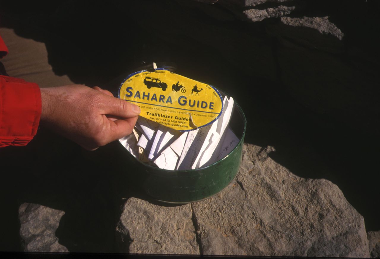
Next morning Richard and I walked the few kilometres to the monument on a GPS bearing and got there just as the cars arrived. Inside, just as at Regenfeld, an old tin contains notes from passers-by, including one of the old promotional stickers for my Sahara guidebook.
We turned southwest now for Jebel Uweinat, 150-km away, passing isolated volcanic craters poking out of the sand sheet like blisters. As we neared the mountain Mahmoud decided to skirt round the east side into Sudan to pay a visit to the Ain Murr well as our guard seemed OK about it. We spotted a long-abandoned border post right on 22°N, some old portacabins and other junk, and crawled through the rubble foothills until we were back on the sand sheet, with the fin-like outcrop of Jebel Kissu a few miles away. We turned west again and soon located the entrance to the shallow valley below the southern cliffs of Uweinat. As the valley narrowed and got stonier we passed some stone ruins and a stripped-out aeroplane fuselage. Once the cars could not continue, we walked on to discover the distinctly manky, algae-rimmed soak that was Ain Murr well – not a water source to rely on out here.

The bones of a dead Barbary sheep lay by the track and Ain Murr was the only place we heard the buzz of flies on the whole trip. Rubbish left by previous visitors underlined how much better it is to camp out in the wild desert. That night Aisa took even longer than usual to serve the meal, by which time some of us had turned in. But then again, he was up till 1am making his delicious flat breads, rolled out with a jack handle and fried on the lid of an old oil drum. Slow though he was some nights, Aisa managed to serve fresh food for the entire two-week trip, pulling it out from his various roof rack crates. I had endured awful food on my previous visit to the Gilf and Aisa’s far superior offerings reminded me that, just like an army, an expedition also travels on its stomach.
Near the camp we found a jerrican stamped ‘WD 1945’ and a pair of engine cowlings, probably part of the fuselage that later research revealed to be an Italian Savoia bomber sabotaged in 1942 during an LRDG raid when the place had been an Italian base.
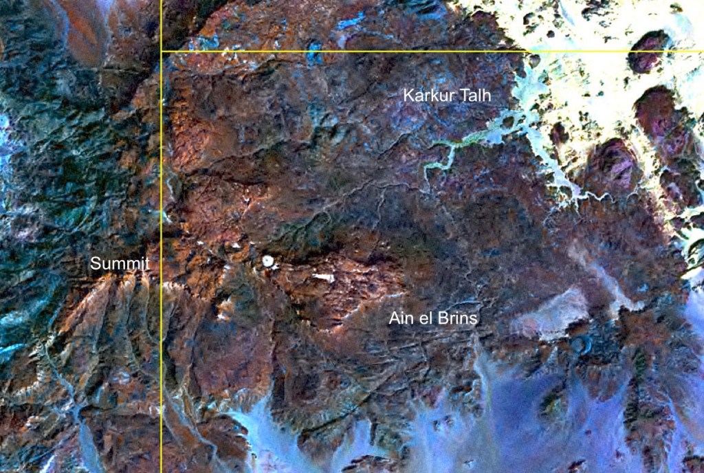
We drove back round to the Egyptian side next day and into the much bigger valley of Karkur Talh. The valley is half blocked by a minefield, though why mine a dead-end valley with no water was anybody’s guess. Keeping a wide berth between us and the skull and crossbones signs, we powered over the sandy banks as Toby clung on in the back of the red Cruiser, doors flapping, to get some full-frontal action shots of the Rover-bodied cars.
Around here it rains about once a decade and the valley of Karkur Talh drains the entire eastern side of Uweinat mountain, the only haven of vegetation and talh or acacia trees in the entire arid expanse of the Libyan Desert. It wasn’t only us that appreciated it. Several thousand years ago Neolithic people grazed his animals here and, as at similar sites elsewhere in the Sahara, evidence of his life survives in the painted and engraved rock art on the cave walls and the odd stone tool.
A couple of us were hoping to have a crack at climbing to the 1932m-summit of Jebel Uweinat, a demanding two-day trek along whatever route the mountain offered. In a bit of a strop with his car, Mahmoud needed some persuading to continue up the valley far enough so we could have a shot at it, but as the sky lightened next morning, Richard and I strode up the dry creek bed with three bottles of water and a sleeping bag, soon followed by Toby and even Mahmoud who decided to come along too.
One of the big frustrations on this trip had been the slowness of the crew to pack up and get going in the morning. In the desert it’s customary to get up just after dawn and move off an hour or so later, parking up to enjoy some daylight before sunset. On this trip the drivers were still snoring away at 9am and, with regular problems getting one vehicle or another to fire up, it was always mid-morning before they set off. On Uweinat we were determined to seize the day!
This was all before the miracle of Google Earth so I carried a pixelated print of a sat photo showing a route taken a year or so earlier by another group which followed a likely looking valley up to the summit plateaux. Unfortunately I’d failed to lay an accurate long-lat grid onto this image and so, even with GPS, our position was just an estimate. In the end we started the day in Sudan, wandered north in to Egypt and, after an agonising late-afternoon up a boulder-filled valley, camped in Libya, about 500m below but still three kms direct from the summit – quite possibly the first people to camp there since the late Holocene. On the way up Mahmoud had discovered a new art site and our clearing even came with a bit of firewood. We were all knackered from staggering around all day on the rubble slopes and as the route onward was no less clear and would get much steeper, we returned to base next morning, getting back to the cars on the last dregs in our water bottles. The mountain would be there next time.
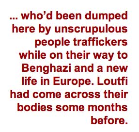
Uweinat was our southernmost point and from here it was north all the way, around the Gilf Kebir plateau to Siwa, still about 1000 miles away. We headed for the Gilf and the Wadi Sora cave, made famous as the ‘Cave of the Swimmers’ in the English Patient movie. As we neared the cave later that day we passed some clothes scattered in the sands, the remains of Somalian refugees who’d been dumped here by unscrupulous people traffickers while on their way to Benghazi and better opportunities in Europe. Loutfi had come across their bodies some months before. Besides the old favourites of guns and drugs, right across the Sahara it is now migrants from sub-Saharan Africa and Asia who made money for the smuggling mafias. I’d passed a similar group in Algeria a year earlier, dumped the night before on a plateau, 100km from the nearest town.
The famous ‘swimming’ figures in the cave at Wadi Sora are nothing special compared to the wonders in Karkur Talh, but the cove scooped into the south-facing escarpment of the Gilf made a great place to camp. It was Christmas Eve and from my suitcase I pulled out a pyramid of Ferrero Rocher chocolates to pass among the desert ambassadors settled around the fire.
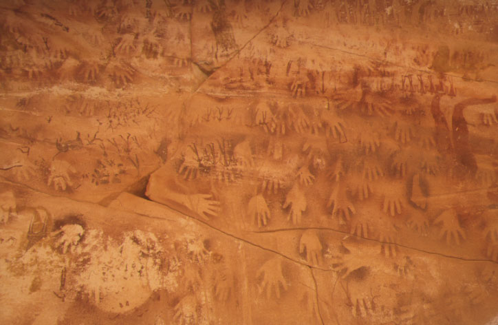
Before I’d left the UK I’d been given a mysterious waypoint, said to be for an intriguing and at that time secret new rock art site discovered nearby, just a year earlier. Not knowing quite what to expect, we were amazed at what we found when we located the point: an overhanging shelter 30 feet wide covered in layers of rock paintings and engravings, both mundane and obscure, and all like nothing I’d seen before. We sat back in amazement, snapping away, again and again finding new detail and connections. Mysterious headless creatures shared the wall with handprints, rows of dancing figures and long-vanished beasts. Said to be the most significant rock art discovery in the Sahara in 40 years, it shows that the Sahara has many secrets to give up yet.
We were now heading around the west side of the Gilf, at times creeping over the Libyan border on to easier terrain, not that there was anyone there to stop us. Without the plateau’s protection, the north winds blew down on us and chilled the day, and next morning Mahmoud’s Land Rover was so groggy it needed a good session with the gas stove under the sump before being towed reluctantly into life.
We curved back east towards the edge of the Gilf and found ourselves on a trail of camel bones: the old raiding route from Kufra in Libya to Dakhla (via Abu Ballas, see above). By mid-afternoon the plateau receded and before us the pale dunes emerged: the final run through the Great Sand Sea to Siwa which, even with the now lightened cars, would be the most difficult part of the route.
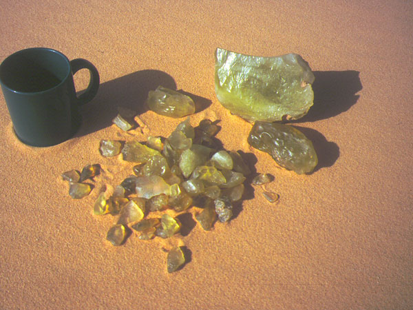

We came upon a group of cairns marking an entry point to a northbound corridor which led to the so-called Libyan Desert Glass Field, discovered in the 1930s by one of Bagnold’s chums. At the time the origin of the pale green LDG (above) was still a mystery: the result of melted sand following an extra-terrestrial impact, or a more prosaic flint-like concretion of sediments? Kevin had his ideas as we strolled around the gravel corridor like beachcombers, unearthing fragments of glass. Even though no evidence of an actual crater has been found, since out visit shocked quartz has been detected in the bedrock of the LDG field. This supports the theory that it was indeed formed by a meteor impact some 28.5 million years ago, rather than an atmospheric airburst (passing airborne meteor) which can also melt the surface rocks. Similar green glass is found in heat-fused sand at nuclear bomb test sites.
Some bits had even been carved into Neolithic tools, and a few years ago it transpired that an emerald-like gem in a piece of Tutankamun’s jewellery (left) was in fact LDG, suggesting the pharaohs (or people they traded with) roamed further west of the Nile than was originally thought.
We left the glass field, with 500km of dune driving ahead of us. The Great Sand Sea is composed of dunes that run in parallel lines for hundreds of kilometres from the Siwa Depression to the Gilf Kebir in the south. But the further north you go the more confused the dunes become; the easy corridors close up so that by the time you near Siwa the dunes are in a complex, non-linear jumble that makes progress very slow and dangerous, even with our greatly reduced payloads.
I’ve never been a fan of dune driving and was not looking forward to this section; besides the dangers, dune driving is hard on the cars and your nerves, and is not even that interesting. Although it’s exhilarating when you get it right, because of the need to maintain speeds or sink, it’s only a matter of time before you blow it.
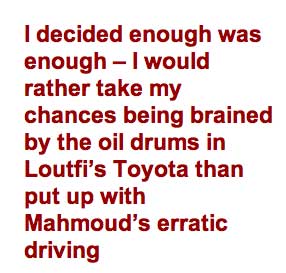
It was my turn to be in Mahmoud’s car that morning and I wasn’t thrilled by the prospect. Over the previous few days, either the flexing body or the need to really slam the doors shut had cracked the windscreen which was now held together with stick-on shading. Then, when the back passenger door I was leaning on flew open as Mahmoud executed one of his signature swerving manoeuvres, I decided enough was enough – I would rather take my chances being brained by the oil drums in Loutfi’s Toyota than put up with Mahmoud’s erratic driving.
By the end of the day the gravel corridors closed up and filled with sand and we began to tackle the dune banks to reach the adjacent corridor leading north. We were all secretly pleased when Mahmoud decided against pushing on for the direct route to Siwa and instead chose to skirt around the less severe formations to the west, along the Libyan border. Even then, the cars regularly sank into unseen soft patches. We ended the day close to the Libyan border, knowing that tomorrow there was no choice and we’d have to head northeast, back into the Sand Sea, to reach Siwa.
A heavy dew covered us all the following morning, a sign that we were in the more humid Mediterranean climatic zone. The dune lines kept pushing us away as the drivers scanned for a low pass to make a hop to the east. At one point Mahmoud was on the very crest of a drop when a harsh gear change popped a half shaft – not surprising with a 3.5-litre bus engine turning the original Rover axle. In fact, it turned out to be only a stripped hub drive flange and was easily changed while we warmed ourselves in the sands over a quick brew.
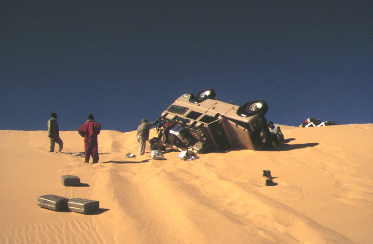
With drive restored Tobe got into position to film the cars coming down the slope. Loutfi rolled down in the red Tojo then Mahmoud eased over the crest, but for some daft reason eased to the left where a slight hump pushed up the wheels and slowly tipped the top-heavy Land Rover on its side with a thump and a clatter.

For a few seconds the upside down engine turned over, sucking sand through the snorkel and oil into the cylinders. A few moments later it stalled and Mahmoud emerged from the capsized wagon unhurt and flopped down in the sand in shock, followed by Aisa and Faraq the mechanic. Luckily Mahmoud had had a cargo barrier fitted which had stopped gas bottles and the like bouncing off their heads, but the roof rack’s contents spilled down the side of the dune.
While these were collected, Ibrahim brought the white Rover down the dune with no drama and a rope was run from the fallen car to the powerful Tojo. The conspicuous silence from the crew made it clear that they too thought that Mahmoud had been an accident waiting to happen, though as it turned out it was his pride which received the biggest dent. Excuses that the parabolics sprang back and pushed him over were diplomatically dealt with as the car was dragged down the slope and pulled back onto its wheels (see video below). Faraq set about ejecting the oil from the cylinders and removed the sand-caked air filter which could be cleaned later. Just an hour after the tumble the Mahmoudmobile started with a puff of black smoke and settled down to a steady tickover.

Chastened by his experience, we continued cautiously northeast, now recce-ing possible passes on foot and easing gently down the slip faces, knowing that it wasn’t over until it was over. Limestone pavements protruded from the dunes and bits of vegetation popped up here and there. At one point we discovered some fulgarites (sand petrified by lightning into a glassy helix tube) as big as an arm. Our homesick crew could smell Siwa and were keen to press on, not least Ibrahim whose wife was expecting their seventh child any day. But by dusk we did the right thing and stopped a couple of hours out of Siwa on a chalky outcrop studded with fossilised sea-shells.
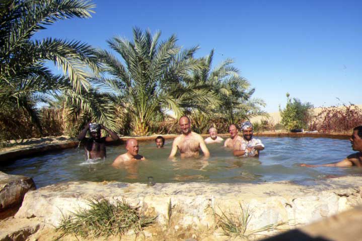
By mid-morning next day we’d worked our way through the dune maze and were looking down on the inky blue lake which led to Siwa, feeling like we’d finally come ashore from a long sea voyage. On his home turf now, Ibrahim led the way through the dunes to the hot spring of Bir Wahed (above) where were scrubbed off a fortnight of Saharan grime and ordered a string of Oranginas and crisps as if they were the very fruits of Eden.


See also: Sahara Kidnappings
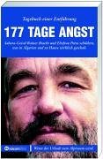
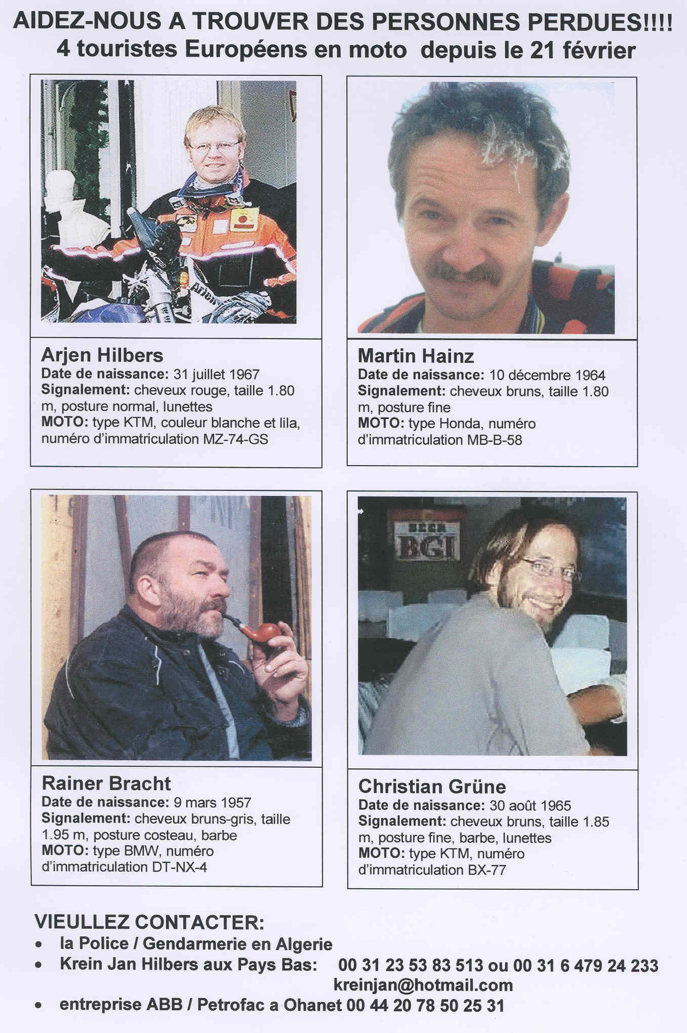
Towards the end of Desert Riders in 2003, Jon and I met Rainer Bracht and his party in Tam (left), a couple of weeks before they were all abducted off the Graveyard Piste (Route A2 in the book) along with what eventually proved to be 27 other tourists.
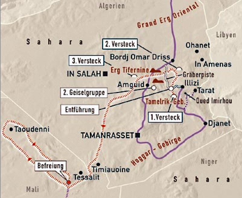
Part of ‘Group 2’ who did the full six months and ended up in far northern Mali, rainer co-wrote 177 Tage Angst with his wife Petra who waited in Germany for his release. At the time I considered having their book translated, but in 2004 was told by my German reader (a bike rider but not a Saharan) that is wasn’t so good.
Then in 2015 I came across parts of their story archived on a German Motorrad (page now a 404) magazine’s website from 2004. Even reading it through Google translators helped fill in the many gaps in their baffling ordeal – not least how they got from a canyon near Illizi, right across Algeria to northern Mali as far as Taoudenni (see map above).
In 2019 the links were no more (actually they got renamed) but I had the foresight to copy the translations and pictures which are a gallery at the bottom of the page. As you can read, I didn’t make any attempt to tidy up the translation.
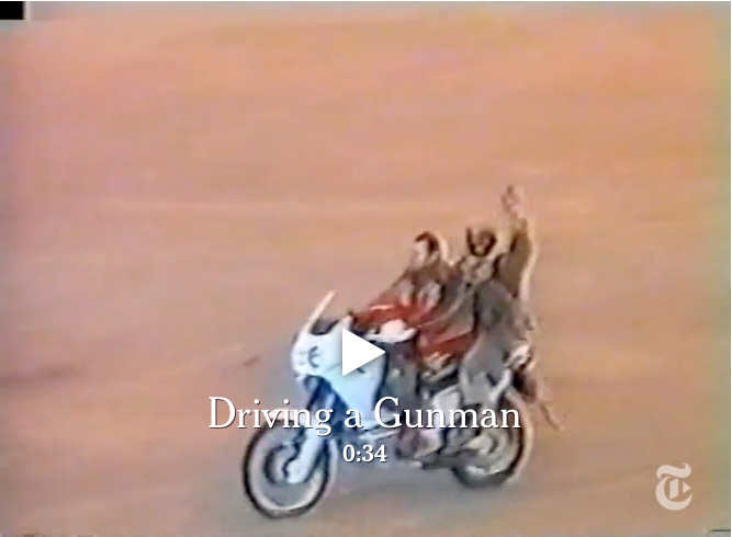
At this time I also came across this interesting article (now paywalled) in the New York Times, which includes video footage from the event.
Hostage drama in the Sahara, Part 1
The Nightmare
177 days of the Sahara driver Rainer Bracht was with 31 other hostages in the hands of Algerian terrorists. At home, his wife Petra experienced during its one of the most spectacular search and rescue operations in postwar history. In a multi-part documentary MOTORCYCLE now published the records of the two. What happens when a motorcycle vacation for inferno?
Sahara hostages
Petra: Tomorrow is Sunday, the 9th March Rainer’s birthday. Slowly, I am in great trouble. For a week of Rainer and the other three boys no sign of life from Algeria. On 7 they wanted to be on the ferry. Something’s not right. Yesterday called on Christian’s friend Esther, totally excited. Christian was overdue for a week. I reassured her still, he was sure stayed with Rainer, Martin and Arjen longer. But the latest from Genoa to Tunis or Rainer would have reported it! He has frequently called by this tour. Said that I’m missing him. Normally we always travel together, but due to a surgery I’m not going this time. In his penultimate call from Djanet he raved about the beautiful dunes that told how well run everything, the mopeds, the tour. From Illizi he reported yet, that they have abandoned the planned route over Tarat or Qued Imirhou – the Tarat-east route is only an unattractive junk slopes and Qued impassable after heavy rains. There go to the graves runway tomorrow. As much as I would like! As much as I love myself on a previous trip to Africa into this landscape, the red sand with black stones and green bushes. And then he added that he call back from Tunisia! And would never go on vacation without me, because that would somehow nothing! Thanks, Rainer. I am glad that he missed me! Arjen friend Marten ringing through. Where is Arjen? In the night I call the emergency number of the embassy in Algiers. Everything in me is terrified! I feel that something has happened. Petra Bracht senses instinctively that Rainer can not stop calling. However, they do not know that he is being held by Islamist militants for the past two weeks. Approximately 24 hours after the call from Illizi was the holiday of four desert rider with one blow to end. Rainer: It is the evening of 23 February. We camp just before the fountain Ain el Hadjadj in the dunes. Suddenly bikes are heard. Really strange, because usually no one goes in the twilight. I look carefully and discover a convoy on the graves slopes. Several pick-ups with fitted machine guns, a red Toyota Hiace and three bikes. Back top long-bearded passenger with Kalashnikovs slung. Does not look good. When I turn around, I discover my passengers are visible from afar on a dune. Damn! The convoy promptly turn off in our direction, the armed men grouped around us. Strangely, I have no fear. If it were fundamentalists of the GIA, it would not have taken the other, but equal murdered. As it turns out, they belong to a Salafist Group for Preaching and Combat, GSPC. We have nothing to fear, they assert. Once a few “little things” would be regulated, we could go again. But first we have to come. We pack and start each with a guard on the bike after a short runway graves to the south. These side slope is extremely difficult and the pillion-riding in the dark plus hairy. In a heavy rock passage Arjen crashes, dislocated his arm. He can drive, but has a lot of pain. At least the shoulder is not dislocated. Completely exhausted we camp at daybreak in hiding. We are to eleventh. The Swiss Toyota crew Marco Hediger, Reto Walter, Sibylle Graf and Silja Stäheli and Frank Gottlöber, Jürgen Matheis and Sascha Notter with two KTM and a Africa Twin. They were taken the night before us. Under cover of darkness, the convoy sneaks into the next night on. We build on the desert slopes just 20 km until dawn. Three nights is the way until we reach the final hiding place. We must be about 90 kilometers southwest of Illizi. Petra: On Monday, the 10th March Algiers confirmed that the four men did not leave the country. I totally messed up. What do you do now? The Foreign Office has been informed by Christian’s mother. The idea of going to the police, I reject. ‘m Afraid to hear my husband had grown up, and anyway, who go to Algeria would not be surprised. The sub-forum on the web! That are closer! Who has the four Endurists Martin Hainz, Christian Green, Rainer Bracht and the Dutchman Arjen Hilbers last? On the same day we put the members first demand the net. The Foreign Office to take the matter seriously, however, not really. They probably have their reasons, but at the moment I am almost mad. It will be better when we explain to assume the cost of cars and helicopters. Finally, the search begins. On the graves runway first. A friend of Tamanrasset reports by mail from previous heavy rains in the region. They may have difficulty getting by. Let there be progress but also bandits and raid possible. Esther thinks about flying to Illizi. She speaks fluent French and has a valid visa for Algeria. I ponder half the night: When the four a technical problem forced to stay in an unhappy place … We had Qued Imirhou years ago just such a situation. Nightmare! The idea of being surprised in the night by a half meter high mud avalanche … Meanwhile, more and more people are signing in forum Sahara give untold information. The nights I sit at the computer during the day often up to eleven hours on the phone. Can call, call: the information go back and forth. And Martin’s parents in Bad Tolz do not have an internet connection! I think they laboriously by phone to date. Martin was always of the view that the Internet is a waste of time killing machine. For me it has become the hub of the world. Rainer: By day, our hiding place turns out to be a partially covered with stone slabs crevice in a canyon of Tamelrik Mountains. Two meters wide and 20 to 30 feet long. »Hotel mujahedin,” as it is called our guards. Since October live some of them here, even built the connection to the graves slopes and managed everything you need for a hostage-taking approach. Within sight of the guards we can move relatively freely in the canyon, build a stone seating set and table out of my tent over a solar sail. Loamy brown water, there are a few holes in the bottom of the gorge. Some of us are disgusted, but I decided to drink and eat everything that is there. In the morning there is bread as much as we like, noon and night lentils, beans, rice, pasta and cereal in various combinations. Marc conveniently, nor can save jam, cereal and other goodies from his Toyota before the car was left on the road with motorcycles. We were allowed to take our luggage. Some even still cheat by camera and film, while GPS, maps and guidebooks migrate to the kidnappers stocks. The one needed for the jihad, the Holy Krieg.Petra: Search on the graves runway is terminated unsuccessfully! Meanwhile, the sub-forum announces another missed group: four Swiss Toyota driver, also overdue since the end of February. I’m in the greatest excitement. When the storm had passed through a disaster, but then you would have to find something! Garments, motorcycle parts, tents … something! One could certainly save themselves! It just can not be that all fall at the same time a mud avalanche victim. Arjen’s relatives say suddenly, our people had never arrived in Illizi! Arjen’ve only spoken of Tarat and Qued Imirhou and this is also stored in his computer. Ominously, provide neither tents nor sleep in Illizi proof of the group. Maybe the stupid registration forms were not merely been filled … I’m now almost crazy because it all depends on my memory of the last call. Rainer was Illizi – I’m sure. Repeatedly call people who were themselves in Algeria or tell me who might have seen her last. Including tour professionals like Gerhard Göttler, Axel Därr, Dieter Werner and Hoepfner Nöther. Especially they are important people! I do not know what I do without them würde.Rainer: Soon we come with our guards talking and find out that their organization GSPC, an offshoot of the Islamic FIS party was, who won the early 90s, the elections in Algeria. However, this was subsequently annulled by the military, after which the GSPC moved against the regime in Algiers in underground fights. A motley group sits around us, from the farmer to the university graduates, only united by the belief that an Islamic society is the solution to all problems. The GSPC is organized into nine divisions, each comprising 40 to 50 fighters and a commanding Emir. We are prisoners of the 5th Division with the Emir Abd el Razak Amaria Abu Haidara – as a former paratrooper and Army deserter also called Para el. He is regarded as extremely ambitious, experienced in abductions and manages our action supposedly alone. The troupe was apparently been on his way to Niger to buy weapons. As they hit the slopes the graves, they came up with the brilliant idea to fund their arms purchases by kidnapping tourists who are traveling on the slopes. Petra: A new motorcycle group is missing. Jürgen Matheis, Frank Gottlöber and Sascha Notter. They are not on the 14th for Booked ferry and arrived in March were also on the graves piste. In the opposite direction, from Bordj Omar Driss to Illizi. When I think of the German Embassy in Algiers by giving the new development Maas woman, she almost loses his composure. Now is finally clear that something very different is behind it as getting lost or mishaps. Rainer 9 March, today is my 46th Birthday. It’s pretty bad. Although Sibyl and Silja even muster a bouquet of desert flowers, I can not repress the thought of home. Normally, I would come home today, and we would have celebrated. Petra is now final for a certainty that something bad must have happened. I hope she keeps it by. The next day the Mudjahs appear with four other hostages. Accidentally discovered by our guards, as they sought an escape route for road Illizi Fort Gardel. A path through the deep canyons they did not, but the four Augsburger, who made their all-wheel Iveco’s on a guelta, a water point, pause. With Kurt and Erna Schuster and Michaela Spitzer and Witek Mitko we are now to the fifteenth. It is tight in the Felsspalte.Petra: To limit the search area, we ask Ms. Maas on scanned again that our people may have entered at a military outpost in Hassi Bel Guebbour, El Adeb or Larache In Amenas. The thing now seems to be taken more seriously. Zermürbenderweise are the Dutchman Arjen records unchanged for the view that our group had never arrived in Illizi! The chaos in my head is continually increasing. Why I remembered the last phone call not accurate? But who would ever have guessed how important this would not? The search is directed to the opposite direction. Esther has now finally flown to Algiers. Messed with the nerves she called. I do not get it right what she wants. Just that it is now looking even. With Mr. Zegri, the campground operator of Illizi, she drives two days long from the Tarat-piste, while helicopters and search there on Qued Imirhou from the air. Mr. Rainer Zegri knows, and I put all hopes on him. But the search has no result, after two days they returned with ruined tires back from driving too fast on the crummy slopes. So also on the route Tarat nothing. I am driven by the fear that we are looking in the wrong place. I express the Foreign Office to assume that they may have been arrested by the military near the Libyan border. Could not be, it is from Berlin, an incident should be reported within three days of the German authorities! Well, the good man has never been outside Europas.Rainer: With a small radio we hear German wave. Thus we learn that we are at least missing. Apparently, there are suspicions that we had lost our way, as the Americans would eventually shut off the GPS because of the early Iraq war. Or be drowned in a wadi or left lying without gasoline. No word of a Bekennerschreiben.Petra: In sub-forum, travelers who have obviously made the last picture of our boys report. It shows it on the afternoon of 21 On February Tin Taradjelli Pass. Tragically, the pass is before the crucial bifurcation Tarat slope or Illizi. So the key question remains open. Now all three groups. All disappeared between 23 and 25 February and must have been in the area of the dunes along the Oued By Stieges Samene. Arjen’s members have taken leave and research team. I find it even more difficult for alone, either friends or traveling far away. Finally I will make with our brothers and sisters the “free table everyday crisis.” We try to give each other and Rainer Kraft. Rainer: Finally! With the disappearance of the Augsburg seems to be clear that a crime exists. Algerian army helicopters circling suddenly over the region. We must now crevice day no longer leave. First, we are totally euphoric, try to enter characters, painting at night SOS in the sand. But they circle and circle, turn off again. They need to see us! Eventually, they stay away. Frustrated, we slump back into the now adopted lethargy. Almost a month it is now already. Up the smokes tobacco, read everything readable, already played the homemade card games list x times. Some shimmy from day to day, hoping constantly new, I’m trying rather to adjust to the situation. Worst of all, never to be alone. As the source dries up under the rock with the beginning of the summer, I volunteer to fetch water at a guelta. An hour way. Easy. But it’s a change of pace. But when others then wash with the high difficulty towed water hair or feet, it is difficult to remain friendly. X. will tablets. We have a few, but ration them for really severe pain. X. is depressed, it was probably before. An attempt to break the journey, which now went completely wrong. I do not know how you have to be built to endure this eternal waiting. Unstable anyway nicht.Petra: In sub-forum offer all people who wanted to continue for now to Algeria, their help! We ask them to warn other tourists, because so far hardly anyone knows about the matter. They distribute leaflets with messages Search on the ferry, beat them on the campsites in Tunisia and Algeria. However, in Algeria they disappear immediately. On 17 March brings PICTURE first little article. The beginning of an avalanche! Rainer: On the fiftieth day a helicopter lands near and burns down a pick-up of fundamentalists. They see us in the rugged terrain not? We must immediately leave the hideout and pull 500 meters into a cave. Petra: On 19 March flies Maas woman from the embassy with a Swiss colleague itself to Illizi. You rent cars at all, which can roll and provide Mr. Zegri commissioned to conduct the search operation. Weird is how I learn later that all search teams, 17 against clock every day back. Strange in the size of the area. I often wonder which side of the Algerians are actually. It was decided to send out a camel caravan that was to scour the area for two weeks. So you would see more than cars, they say. Luckily, the Swiss have money there. The people down there so far, all expenses on their cap. Sometimes I am speechless. On 24 March breaks up the caravan. Parallel to this increase helicopter with thermal imaging cameras. And by the night when Illizi there is still no evidence. Rainer: On 30 April 19th is our Wedding day. A day that we hardly register at home. Here it feel quite different. To me it goes bad, and I’m afraid Petra also. I think a lot of sie.Vor some time, the Emir has disappeared with 20 fighters, only runs via radio contact. Finally, the message is that this squad has taken 17 other tourists as hostages. Now there are 32 prisoners, but not claiming responsibility. Meanwhile, food is scarce, rationed the bread and the water content in the soup steadily larger. Christian tries to speed up negotiations by our release. As a result, our leader Osama comes to such useful things like new shoes, otherwise nothing will change. In my opinion we do not negotiate, but other than us. With this view I am quite alone. That would probably beyond my horizon of “wait and see”, they say. I hate illusions. But I’m pretty patient and keep good relations with ordinary warriors more important. Like Osama, who regularly zusteckt us something, or Abu Hafsa, who sometimes secretly bread for us backt.Petra: More and more tourists are reported missing! Now the authorities are wide awake, so many well-equipped teams can not just disappear. On 1 April is the Foreign Office a crisis. Slowly all understand what happened. But if it’s a kidnapping – why is there no demands? Police report, I must now make a missing persons report. Note Rainer’s personal information. And take fingerprints and hair for DNA analysis … I hope that you will not ever need. I know they live! Part 2 follows in MOTORCYCLE 25/2003
The hostage drama in the Sahara, Part 2
The Wait
In the second diary part of the 177 days’ duration abduction by the mujahedin Rainer Bracht depicts the liberation of the hostages and the first subsequent grueling run through the Algerian desert. Meanwhile, his wife Petra followed the increasingly complex rescue attempts by the German government. And both try to survive the months of anxiety and waiting. He in Algeria, they in Detmold.
Rainer: For nearly three months, we are now sitting in the holes of the rocks Tamelrik Mountains, and nothing moves. The search helicopter not come for a long time, the food is scarce and nothing more depressing. We just doze off in front of us. The Constitution in our group is different. I, by nature, more patient, it is quite good, the other is our captivity to pretty. Some are depressed. The heat is more extreme. It’s almost May soon as the summer begins. Some time ago, the boss of the kidnappers has gone to a second group hostage, holding only by radio contact. Petra: The matter has now reached the highest levels. Foreign Minister Joschka Fischer and Schily were in Algiers, Chief Federal Prosecutor Kay participants initiated an investigation against an unknown terrorist organization, GSG 9 is located in Algiers on standby as well as officials from the Federal Criminal Police Office and Interpol. No one would have ever expected such a thing! One suspects a daunting logistics behind it all. There are now 31 people disappeared, including vehicles. 15 German, ten Austrians, four Swiss, a Swede and a Dutchman. And to hide and care for them is not so easy in the Sahara. It is now convinced that the disappeared live. But there is still no claim of responsibility. Rainer: On 5/13/03 added a radio and a radio message saying our guards into euphoria: the other 17 hostages were free. They congratulate us, in three to four days was safe for us all over. Our group is in high spirits. Only Martin and I remain skeptical. We believe that only if the Mudjas without us disappear on the horizon, we are truly free. The hiding place we have to evacuate in haste and join the rest of the remaining troops. After four days of runway wild ride we meet the emir (commander) in Erg Issouane, north slope of the graves. What we learn is disillusioning: Non negotiations had our fellow redeemed, but the Algerian military. The hostages were unharmed, but some of it Mudjas to-come. Now there’s danger, the kidnappers are now on the run. Spread over several pick-ups, a new hiding is searched. Petra: Meanwhile, the detectives take care of the matter in Germany. Twice a week they come over, are quite touching. With them, everything will be better. I finally contact. The previously competent Foreign Office moved out voluntarily not a syllable. The officials also help me as mundane things like Rainer’s work situation, to regulate the health insurance and pensions. The absences are always longer, and besides, no one knows what state he comes back … Thank god Rainer employer behaves extremely fair.Rainer: After a few days we find a small and steep dunes boiler, which is available only from the air. By radio Mudjas order the food and spare parts that a little later – brought – presumably by members of the base of supporters. The kidnappers are well organized. Already on the way here we passed depots with fuel and food. We remain five days to repair the dilapidated and battered car accidents. Since Arabs only screws, if properly what is broken, there are regular periods. To pass the time we help. Missing a hole somewhere, it is promptly shot into the Kalashnikov. The heat is bad. We only have one side attached to one of Toyota’s plans, under which we crowded together like sardines squat. The water is transported in 200 liter barrels that previously fuel, oil or chemicals contained, thus affecting the taste impact is not always positive. One of the women prisoners, the question arises whether it is possible for the drink, but it was a health hazard. Leave it, I tell her, then you’re thirsty tomorrow, or drink it, then you might get in 30 years Krebs.Petra: We have an appointment at the Foreign Office! He-wait, I was not too much of it. However, I’m getting ready for the day as much as possible. We learn to work with the Algerians course good, everyone give his best. But it was a lot of tact necessary in order not to bite on granite. Even if we had trained hostage rescue teams like the GSG 9th From the family circle, I’m the only one who was ever in Algeria and can not imagine working with African authorities halfway. Rainer: Finally we leave, head north-west through the erg, again crossing the graves in the north runway and pass the dunes of Erg Tifernine. From there it goes through the slopes of Bordj Omar Driss to Amguid, direction Arak. Sometimes we are on the go 36 hours without a break, the day in the meantime mercilessly scorching sun. The pace is grueling, often we can just cling to the open shop space. Multiple roll over the pick-ups, but miraculously no one is seriously injured. It is really bad when the Mudjas see gazelles. Gazelle meat tastes delicious, like deer. With up to 100 km / h then rush yourself otherwise level-headed driver with us through the terrain, firing wildly until the animal killed ist.Petra: The press has finally added weather and reporters stationed in Illizi. As they get little information as soon circulate more audacious speculation. In general I can put away the things. But if in local stations now and leaves strangers any bullshit about Rainer tell me sometimes go through the nerves. On 5/16/03 we are in-vited to Berlin again. The atmosphere is more relaxed than last time I trust gradually, that everything possible is being done to rauszuholen our people there. In the evening I write a letter to the Algerian President Abdelaziz Bouteflika, thank him for his cooperation with Germany, hit him my trust and hope from. Maybe it helps. Meanwhile, another German is still missing. Klaus Bockelmann, Archaeologist. I ver-seeking, endure with Arab peace. Oddly enough, I am convinced that the hostages are not abused. As past kidnappings in Yemen have shown that. I know Rainer is alive and strong in crisis situations. This also makes me strong! He is with me every second, we are one. Rainer: After a few days we will reach a water point in the Mouydir mountains, north of Arak. But all around is Kamelkot, the water is contaminated by urine. Hassan, with 72 of the elders assured, the Qur’an says, camel urine is healthy … Maybe rub the warts, but to drink? Two days later, we prefer to walk another hour to three beautiful lakes. Paradise we call this place, where we will stay for three weeks. There are water without end, we can even swim. In addition, we are out of sight of Mudjas and may move freely. Only at mealtimes, we come together to see about three months finally almost like privacy. How we have longed for it! Each dozing in a corner, up to 16 hours a day. However, there are poisonous vipers horn. Their tracks are visible in the morning sometimes 20 to 30 inches from the head end of the sleeping bag. In three weeks, we killed nine pieces. But since we are not on the menu for the Vipers, only danger is when one enters or proposes to one. But probably not affect us anyway too viel.Petra: On 13/05/03 logs suddenly by 21 clock the Cid Bielefeld. There had been a hostage rescue in Algeria. But not all are free. Whether they are still likely to come over? Course. Keep calm! It does not feel as if it would be Rainer. Confirm it when they arrive. There were two groups, and one had been freed by the military. All the hostages alive. One officer stayed here. No one knows what will happen in the next few hours. As of now, there is a news blackout – no info, even to close family members no longer. The next morning, it’s the top news on the radio, the freed Austrian ex-hostages texteten it euphoric in the mics at the airport, all are free. Unfortunately, only all Austrians. The phone is ringing is hot – endless calls and congratulations I must reject, no, Rainer is not there. Despite a news blackout, I now inform the next of kin. Rainer: The Mudjas were shopping. In addition to clothing and food they bring a large bottle of perfume for each of the women. Touching! In the ver-western clothes we suspect that it is the “estate” of the freed hostages. A camel is killed, which greatly improved the supply situation again. Only our vegetarian feels weak because he refuses even pasta and rice that have been cooked with the meat. Poorly comprehensible principles. As an avowed hater now I would eat carrots and carrots. Petra: 05/15/03. The Austrian newspaper Krone sold the expedition leader Gerhard winter dish exclusively the terrible experiences of the ten Austrian hostages under the scorching desert sun, Michaela and Andrew Joubert Kiehlechner also report on the weeks in the hands of the Mujahideen and their happy deliverance. It is almost unbearable. At 16.5. We are once again loaded into the Foreign Office. The relatives of the freed hostages no more. Foreign Minister Joschka Fischer talks about his recent visit to Algiers and a long conversation with President Abdelaziz Bouteflika. Again, they emphasize the loading hutsamkeit, which must be negotiated with. The following Sunday, I write one more time to Bouteflika, but also to Joschka Fischer, Gerhard Schröder and Schily. I am now convinced that everything conceivable is done to bring back the remaining hostages unharmed. Wait, wait again. I grit my teeth. The rest I can do also, definitely. I have to stay strong! Rainer will take me when he comes back. In the evening, I ask the police to talk to Rainer’s parents. I think she does not trust me anymore. The cops can something beruhigen.Rainer: On 06/25/03 our guards shoot a video and write a letter of confession with our help. Addressed to the Swiss and the German Embassy. Arjen gets nothing because his Dutch representative is not in the guide. When we read that the Emir calls for 45 million euros for us, we are horrified. His confidants reassure us. Firstly, three million per person would be clear, on the other hand it was indeed only the basis for negotiation. Originally, he had wanted to extort 150 million and the release of Algerian GSPC members from custody. Of which they would have dissuaded him. We also have the opportunity to write a personal letter. Sybille my translated into French, so that it can be controlled. I report that we have no worries, because our “tour guide” takes care of everything. Even the weather was good, no one would freeze. With such stupid jokes Petra will notice that I hale and hearty bin.Petra: On Monday, 05/19/03, chaos breaks out again! The remaining hostages were on their way home, it trumpeted from all channels. The phone is not standing still. But again, it’s not true. An unconfirmed report, many of which could be carried away. Even Claudia Roth announced that four Augsburg were on their way home. It is their constituency. The children have decorated the apartment. A day later we can see in “Beckmann” Family Bleckmann in the ARD. At 21.5. Family Rupping on ZDF in “Johannes B. Kerner.” Day after, there is a major earthquake in the near Algiers. But I’m sure the hostages are far enough away. On Friday, 5/23/03, there are 90 days! I am getting tired, which is not to describe. The moment at which we can take us back into the arms will come. And only ours. Our 19 Wedding day! Somehow I pack also. Send love letters friends. Rainer: When the written letter of confession and our belongings stowed in the car, nor will quickly patched the tire, then we leave. Add up to 48-hour marathon stages we race towards the southwest. To Mali, as we suspect. The water supplies are replenished way. In a former French nuclear test site. No problem, the secretary of the Emir claiming radioactivity is washable. Petra: Gerhard Schröder and Joschka Fischer Schily have meanwhile written back. I have read several times Mr. Schilys letter. It is very personal and helps me badly. Meanwhile, soon is Pentecost. With the Africa Festival in Lißberg to which we have been going for many years. Since I can not away, I pray, read a message. Also, in the Sahara Club and the “DÄRR ‘meeting. There they even want to take a minute of silence for the hostages. I can not put into words how I am pleased that! Thank you that it is people like you! Soon available on my second hip replacement surgery. I’m afraid not to be there at the crucial moment and have to force myself not to cancel the surgery. Today is the 113th Day since the last time we talked. We have not seen us already four and a half months. At that time there was snow. The almond tree that Rainer so like, he did not see bloom. Meanwhile, we already harvest the cherries. Rainer: The Sahara summer is upon us, and the heat becomes increasingly worse. Often prevail loose 50 degrees in the shade. It exists only rarely. With us on the open shop space, the kidnappers chase through the desert südalgerische. As the water points are far apart, they ration the water. Sometimes two liters per day. I share it in, every hour a sip, the chewing and long in the mouth for. It is grausam.Petra: On 17.6.03 I have to go to the hospital. A serious way. I explain the situation in which I am, and it shields me, as much as possible. The operation runs smoothly, and I’m recovering surprisingly quickly. One less problem! The last day I treat myself to a visit to the hairdresser. It is glorious. After two weeks, I’m back home with crutches. Everyday life is arduous. I learn that a member wishes to be self initiative now, with an Austrian expedition and without professional police force. I hold my breath, people do not know this country. The parents of Martin and Arjen put him gently back against it. It should go well and it will turn out good, everything possible is being done – I leave no other thoughts. And I am convinced Rainer also nicht.Rainer: The 29.6.03 is one of those unbearably hot days. On an ongoing basis wältigen me obsessions of cold drinks – beer, water, milk shakes. Afternoon we rest scattered in sparse shade of acacia and tamarisk. Suddenly, someone hears a scream. Sascha, paramedic by profession, Michaela found before in a coma. Together with Abd el Aziz, the chef and physician, they give her a bag of saline infusion. More is not there. To save them, two to three liters would have been necessary. After an hour she dies, having obtained without consciousness. We buried her at night in the headlights of Iveco. It is awful. The Mudjas affected. Even completely exhausted, comes to me for the first time, the idea that our abduction could take a bad end. Not by violence of the fundamentalists, but I do not know how long we the heat and still withstand inhuman driving around. Not death scares me, Michaela died peacefully and without pain, but not afford to let alone the feeling of Petra. I feel that she needs me, waiting for me. Charged me very much that I could not help her with her surgery. The next day we reach a What-serstelle. So we could have had enough reserves to prevent Michaela’s death. Sasha is not about long hinweg.Petra: In Berlin letters have been received! The abductees re-port that they go well and they were well treated. I am infinitely glad Rainer buy new shoes. At 26.7. notify the police with me, there was a call. In Esther, Green Christian friend: all are healthy, have reported on a French. Not more. But it is enough. The police is preparing for further calls. The 155 Day. I have completely retired. Think of experiences that Rainer and I had together. Also funny that I have to laugh again. Presumably, they tell each other stories in the desert also. Three days later, on 7/29/03, the police shows up again. Michaela Spitzer was dead apparently died of heat stroke before some time. I’m as stunned. The rumor of a death already circulated a while. Christian Schuster, the son of the elderly couple Augsburg is, almost by-shot it. I have said repeatedly, without confirmation, I do not believe it. Now it is there. I’m hard to get over. Once again I call the family to free daily crisis table together. I would love to scream so loud that they can hear it to the Sahara: Stop finally on! It is enough to come to an end Rainer: We race on towards Mali. The kidnappers hoped to better negotiate there, the government is more cooperative. On the radio I get the message, the Algerian military would consider a corridor open to allow our passage to the neighboring country. Someone caught a glimpse of a GPS – we are located 35 kilometers south of Timiaouine. We did it, we are on Malian territory. First part and last part 23/2003.Dritter MOTORCYCLE MOTORBIKE in 26/2003
The hostage drama in the Sahara, Part 3 (archive version)
The exemption
In the last diary of the nearly six-month kidnapping by Algerian terrorists Rainer Bracht portrays the grueling escape through Mali. Petra Bracht persecuted under which the struggle of the German Government to a breakthrough in the negotiations. As on 17th August finally the saving “You are free,” sparks through the airwaves, it can no longer really believe.
Rainer: Finally we have crossed the border to Mali and may a few days to rest near a fountain. For weeks we have been in the now red-hot South Algeria with our kidnappers on the run. At the well succeeds Sascha, unnoticed to make a Tuaregs attention to our situation. In fact, the message a little later reached the mayor of Tessalit. There comes a radio message that we should contact you. But not as hoped by the German authorities, but the mayor of Illizi in Algeria. The kidnappers are now back on his feet! Way immediately! The limit is still too close to prevent access to the Algerian army. Petra: On 29 7 03, the 158 Day at 20.30 clock calls to the police. I would have the opportunity to write a letter Rainer. In half an hour they would fax it to Berlin. In my mind, chaos breaks out – there’s so much to ask and tell. And now find the right words in a hurry …. Actually ringing half an hour later a police officer to pick up the letter. Shortly after, it occurs to me that I have not even thought about kissing mitzuschicken! Rainer: A grueling long-distance journeys further phase begins. Up to 36 hours we will be shaken up in the SUV without a break. After a few days we arrive exhausted a dry river bed, where we stayed for some time. Fighters of 9 Rebel Division are with us for a while. You should support the action because they know here and allegedly have connections in Mali. Eventually a young Tuaregs marched boldly with his camel through our warehouse. Only when he has all greeted with a handshake, discover the Mudjas him and send him away. Petra: Only a day later he receives a letter from Rainer. It is overwhelming! Amazingly, he is exactly the questions that I have answered yesterday. I call on parents and siblings and I read each and every one before the letter. Our parents come immediately want to see the list with your own eyes. He reassures her, even if he spent five weeks old ist.Rainer: The kidnappers turn again a video. First a group shot, then everyone should greet his family. In a written statement, they explain that Michaela Spitzer’s death was a tragic accident bedauerter by themselves and we were well treated. We must all sign. We fervently hope that Michaela’s death was at least the sense to clarify the seriousness of our situation. As the kidnappers set we now all hopes for the Malian government. It is regarded as cooperative as the Algerian and could finally get things moving. Even I am cautiously optimistic. The next day, the emir (commander) breaks up with a squad to negotiate. Our fellow Christian Green take them with you. He and his girlfriend in Berlin fluent in French, so that the Mudjas hope to establish direct contact with the German government. Petra: On 31 7 03 announces the police a video of the hijackers. I am extremely anxious and drum up the rest of the family together. Nobody knows what to expect. How will they look like? I’m afraid. By 18 clock are all there. Also the police. We can not imagine the band would leaked to the media. It was eleven days old, all the hostages are to see it, and everyone says a short sentence. »Rainer Bracht, Allemagne, many greetings to the family and to Petra,” Then said Christian, that they needed medication, the extreme heat and the food supply are problematic and they mourn Michaela Spitzer’s death. And hoped for a speedy end. You see relatively good, are neatly dressed and not emaciated. But tired and annoyed. When the family is away, I am a completely hedgehogs, need rest, absolutely. My thoughts are with Rainer. Rainer: is brought to Bamako Even during the film to the German Embassy, we set off. 36 hours non-stop, it goes in the northwest Mali. A total of 600 miles. For the first time it starts to rain and we have water in abundance can swim and even do laundry. Petra: On Friday, the first 8 03, an interview with me, which I have never been displayed in the “world.” I think you can not sink deeper in journalism. Over the weekend I try to find my energy and patience again. I succeed, but there is also no other way. Hopefully Rainer and the others have not yet lost their. In Heiligenkirchen a memorial service for the hostages will be held, and a lady of a sect called already for the third time. You have written poems and wanted to help with the proceeds of the hostages … In the evening, the PC crashes. Diagnosis: disk is destroyed and all data gone. So start from scratch and re-enter everything. On Tuesday, the computer has made so far that you can work on it. My navel to the world. A day after another goes by, and I fall into a depression for a week, want to talk to anyone because I just constantly erupting into tears. Feel empty, tired and beaten. I mobilize all forces to get out of the hole. The only one who could comfort me, sits in Mali. Rainer: After two weeks of popping a few faithful of the Emir on again. Together with the SUV of the Malian government. Now what really seems to move. We are almost euphoric. They not only medicines and bottled mineral water, but letters from home! Petra! She answered my questions. How they survived the operation, which make the family and especially my ailing grandmother, as my pay comes without ends meet and so on. Only much later did I learn that at that time they had not even my letter. They just knew what would move me. I’m happy how close we stehen.Petra: On 9 8 03 held another meeting at the Foreign Office. Since I am handicapped by the operation, it sent me home a summary of the conversation. This finally the persistent rumor is denied, some hostages were sick. Only sciatic pain from a few hard chairs seem to plague, otherwise all are ok. Furthermore, Christian Green has apparently made telephone contact between the kidnappers and the German government, and the negotiations that have been conducted, a Tuareg leader named Iyad Ag Agaly, now governs the governor of Gao. A military action may not be remembered in Mali in order not to endanger the life of the 14th I sometimes think that Rainer and this fate will never leave me. Rainer: The Islamists are now as excited as we constantly have the radio on the ear, so not to miss a message. Partial several times daily sparked with the Emir. However, I am now experiencing the only threatening the entire hostage situation that emanated from the kidnappers themselves: When we want to look during the rain in one of the SUVs protection as agreed, trying to stop us because a fighter. Angrily, I reminded him of our agreement, which he in turn uses a Kalashnikov furiously and loaded by in front of me. Fortunately, his colleagues overwhelm him in time. What had happened? Amazingly, they believe my statement and apologize for their quick-tempered buddy. Why I was not afraid? With a joke I Wiegele the thing ab.Petra: State Chrobog flies on 12 8 03 to Algiers and then on to Malian President Amadou Toumani Toure in Bamako. The talks take hours, but then Chrobog expressed very optimistic. It will not be long. A few weeks, maybe even days. I hangele me from one branch to another. Chrobog send a postcard with the image of a rusty padlock. Feel the need to thank him. Rainer: After two weeks, we set off again, roaring back in a southwesterly direction. Something seems to have changed, because the kidnappers not to hide, but to use for the first time normal slopes. However, they continue until a fatigued driver overlooks a wave and the car almost rolls over. Only then slept. And then repaired the Toyota. Mostly it would go faster if they drive a little slower, but that contrary to Arab mindset. Petra: The 175 Day I suddenly feel that something is happening. And my feeling has always been the most reliable indicator. I know Chrobog get the thing out. How difficult the negotiations must be, can be only guessed. In Algeria, the government could be dissuaded with difficulty by a second military operation. Then – as should all arrive intact to Mali? And there will be rebuilt trust between kidnappers and negotiating partners? As a transfer can take place without the kidnappers fear of being shot immediately? The Algerian military had reluctantly an escape corridor for terrorists held open – but they are still on the Mali border on the lookout. I’m afraid that in the end even use weapons is commanded. But I was assured that just should not happen … Rainer: We stock at an agreed meeting point, wait for the Emir. It is the same place where we had parted from him two weeks ago. A good sign. I just bring in the Mudjas to eat, sounds as motor noise. They immediately jump into their battle vests and shoot into the air. Intended for professional reception Emir Abd El Razak, who returns with his negotiating team. Personally, he appears to us prisoners, and solemnly declares that everything is regulated, we would be free! Petra: On Saturday evening, 16 8 03, a journalist friend informs me that the release was at hand, probably in the night from Sunday to Monday. It would be nice, but for me, it’s just THE call. The police asked me to now be available continuously. I can feel it tingle formally. Then it happens, on 17 8 03 calls to the CID at 22.37 clock – they are free! Berlin just have it officially confirmed. I weep with happiness. Rainer: We have to pack up and merged a few miles away with a group of Malian military and Tuareg. Including Ag Agaly, a legendary leader of the Tuareg rebellion in the early nineties. They had taken over the role of mediator, and to them we are now passing. It’s really over. Most fundamentalists say goodbye with Arab courtesy and friendly pats on the back from us, invite us even like to come back to Algeria, nothing would happen to us. However, other travelers threaten our fate, they emphasize the same time. Express, the driver with lenses like glass blocks, thinking about my health and forcefully admonished me not to smoke and to avoid pork and alcohol in the future. I promise to do my best, but suspect that I will not succeed. Recently, the Emir still want my email address to let them know, if they had recovered my BMW, if the Algerian military to take care not drum. The situation is grotesque. I’m not even angry them – they probably do not even know what they did to us haben.Petra: at 22.45 clock, it comes in the news. I stare numbly at the screen where Chrobogs is to see happy face in front of the cameras – he has really come, the moment. After 177 days and nights. I just celebrate a little with Andrew and Steffi from our house, as once again the phone is ringing at midnight. Who is calling now for? “Hello,” “Hello, it’s me, Rainer” In my mind there is complete emptiness? “Rainer, which Rainer” “Yes, Rainer, your husband,” Then I break into tears, immediately followed by croaking connection together!. He was, THE call. And I do not even know Rainer vote! Incredible! When he calls shortly afterwards a second time, I am aggregated. He says that he’s fine, if they had just eaten and went to sleep right now. For some reason, I wonder if he still had his sleeping bag. No, long gone. They slept so in the sand. Out of sheer noise I understand very little, but it’s overwhelming. Rainer: With the onset of darkness, we set off on our last trip. Around midnight stop the Tuaregs at a water point with dry wood to make tea. By satellite phone we can call home. Petra’s turn, but stunned, probably did not expect me. But it is wonderful to hear them. Petra: A little later, the first journalist to dive in front of the house, there’s no dodging, “How do you feel, how’s your man, you already had contact” day they assail Steffi in going for shopping right at the seventh?. She takes with Andreas incessantly bimmelnde the phone that can not be stopped because of possible further calls by Rainer. The next morning, the aircraft is expected to arrive in Cologne. Two CID officers want to go with me. I am pleased when I hear who it is: it all started with these two, they had made contact with me and helped more than once, to prevent the worst. Rainer: At dawn we set off, to Gao is 500 kilometers to go. Lunch will be served up in a village tea, milk and cookies, then it goes on as soon as possible. At dusk we reach the city and a little later the governor’s palace. After several speeches, during which I yearn mainly after a beer, it goes on by plane to the president in the capital, Bamako. He was instrumental in our release, as I hear from people mitfliegenden by the Foreign Office in Berlin. They tell me of Petra, what great job they made in Germany, how much optimism and replaced it had spread. Petra! Thankfully, I lean back. My worry about them falling off with talents seriousness, I am happy and a little proud. She seems to have moved a lot for us. Petra: With a pocket full of clothes, pipes, gummy bears, chocolate and the shoes that I had bought a few weeks ago, we set off at dawn to the airport. When we arrive, there is still enough time, and I watch the window, as the machine from Bamako lands. Now there are no search images on TV, now it’s reality. The moment when Rainer comes through the door, finally overwhelmed me. Very narrow and deep brown, he has become, has trained as a marathon runner. A mattress and a bag he still has one left not left of his possessions. Therein some clothes that never belonged to him, two stones from the desert, half a bangle and a small fossilized spine … When I take him in the arm, I still smell the dust and the dry air of the Sahara. “Finally,” I do not bring out more. I will never forget is his happy laughter at this moment. It is vorbei.Rainer: Now it’s finally back home to Germany. Of sleep is not to think of many conversations the night passes literally flew by. Suddenly a final conflict among us surges 14 – one of the Swiss do not want to pass on to the police, the coordinates of Michaela’s grave. Only needs to be discussed in the group what to do with it. My God! I am infinitely glad that it is over. But before I can really upset me, I discover Petra. And everything else faded to nothingness. I have arrived.
Conclusions
It is my great desire to thank all the people and agencies whose work ultimately led to our rescue. I’m overwhelmed by solidarity and support that Petra has received from the Sahara Club, the company Därr and countless private individuals members. If I had all of this would be even suspected, I liked my odyssey easier. Is difficult to accept, however, that local agencies and tour guides, months before the kidnapping of “peculiar people” did to the graves runway, but did not pass on the information. In addition, the Algerian military ignored the Tuareg messages in Tamelrik Mountains camps would create. And despite great gratitude that there later everything possible was done for us – the Federal Foreign Office travel warning for southern Algeria was definitely too late. The Sahara Club had already on 19 3 03 pointed out some missing.
Rainer Bracht
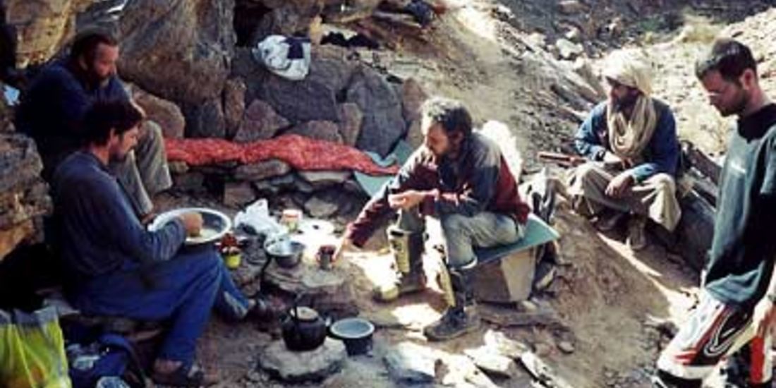
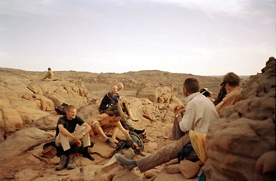
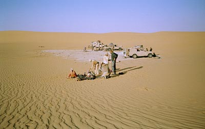
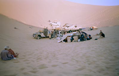
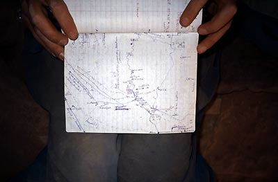
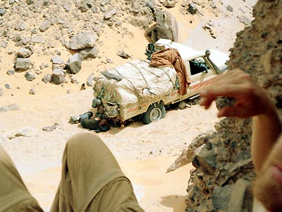
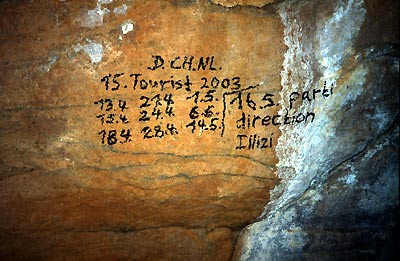
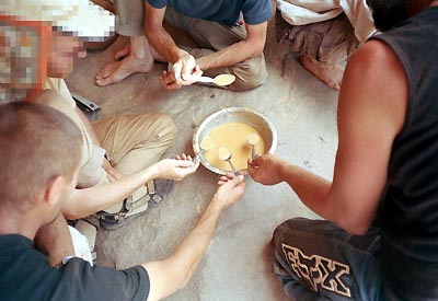
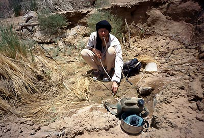
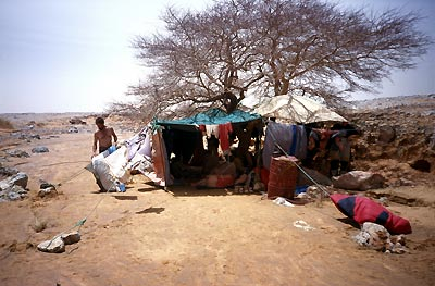
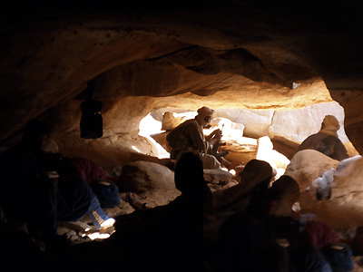
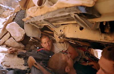
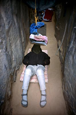
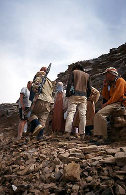
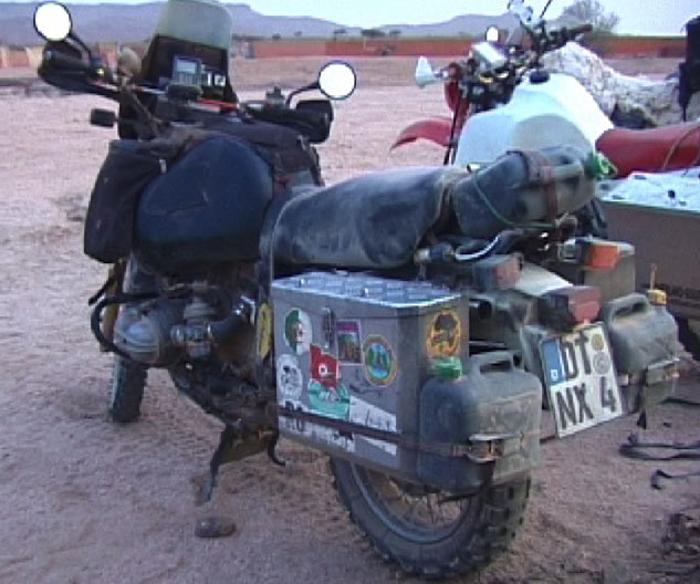
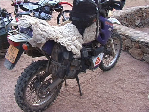
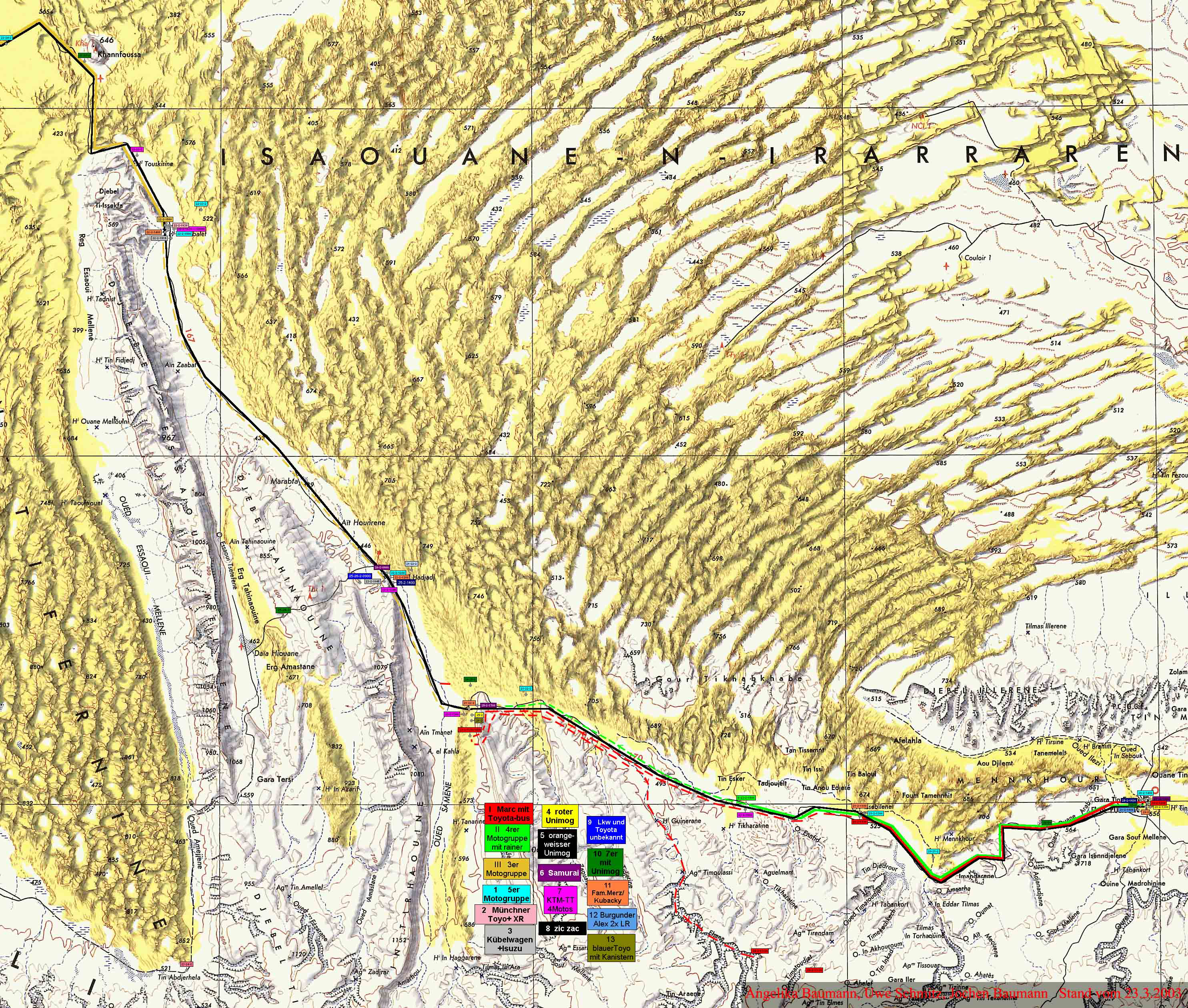
You may also like… Chants du Hoggar – the artwork of Paul Élie Dubois
And this too
Some attractive cards featuring Saharan themes dating from around the middle of the 20th century. They’re being sold inexpensively by euro-cards on ebay. I have to say on the bottom one it looks like they have have got their tribal categories mixed up, but the Dutch ones (5 and 6) are especially attractive to an ex Tintin/Look & Learn fan.

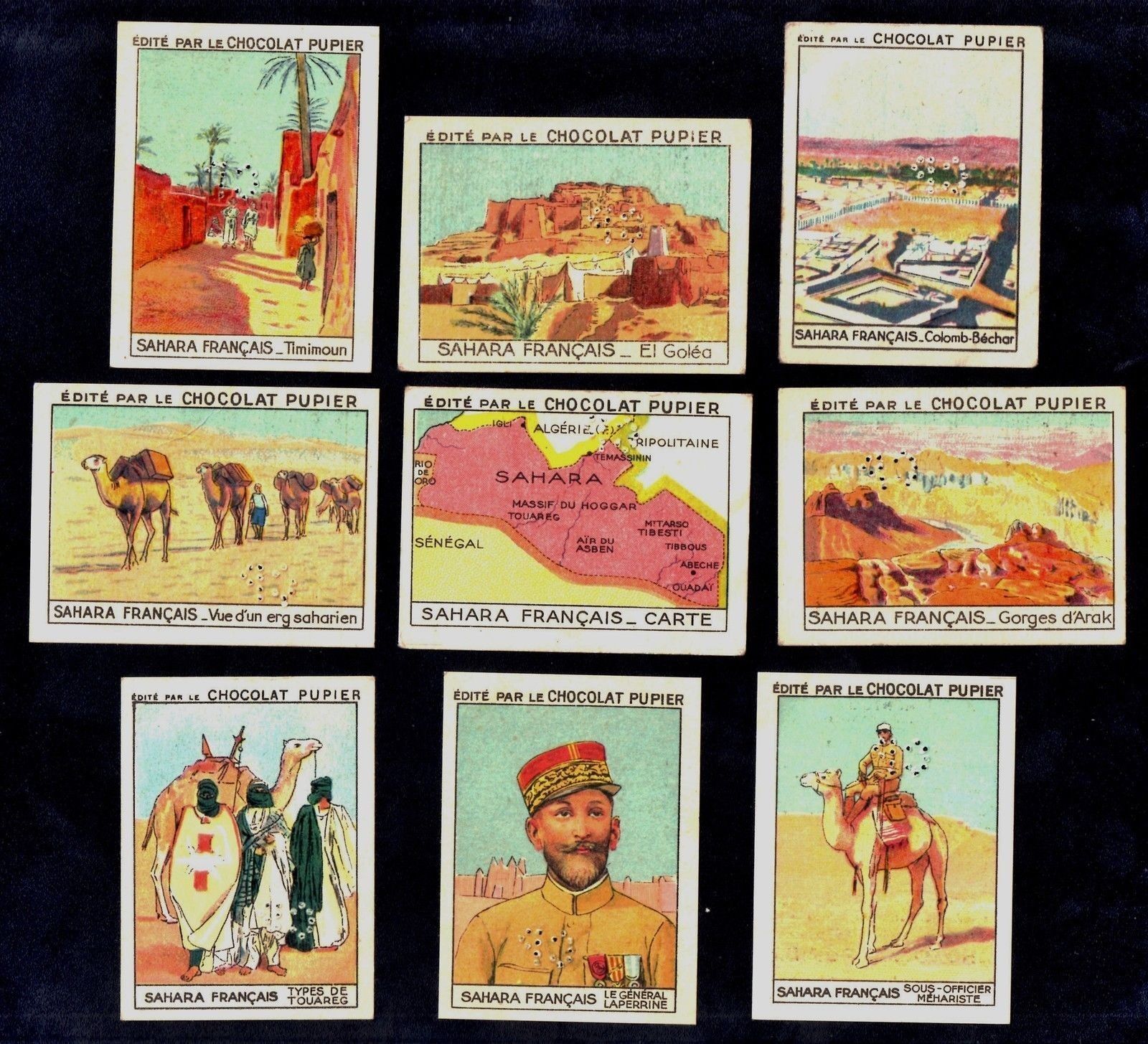
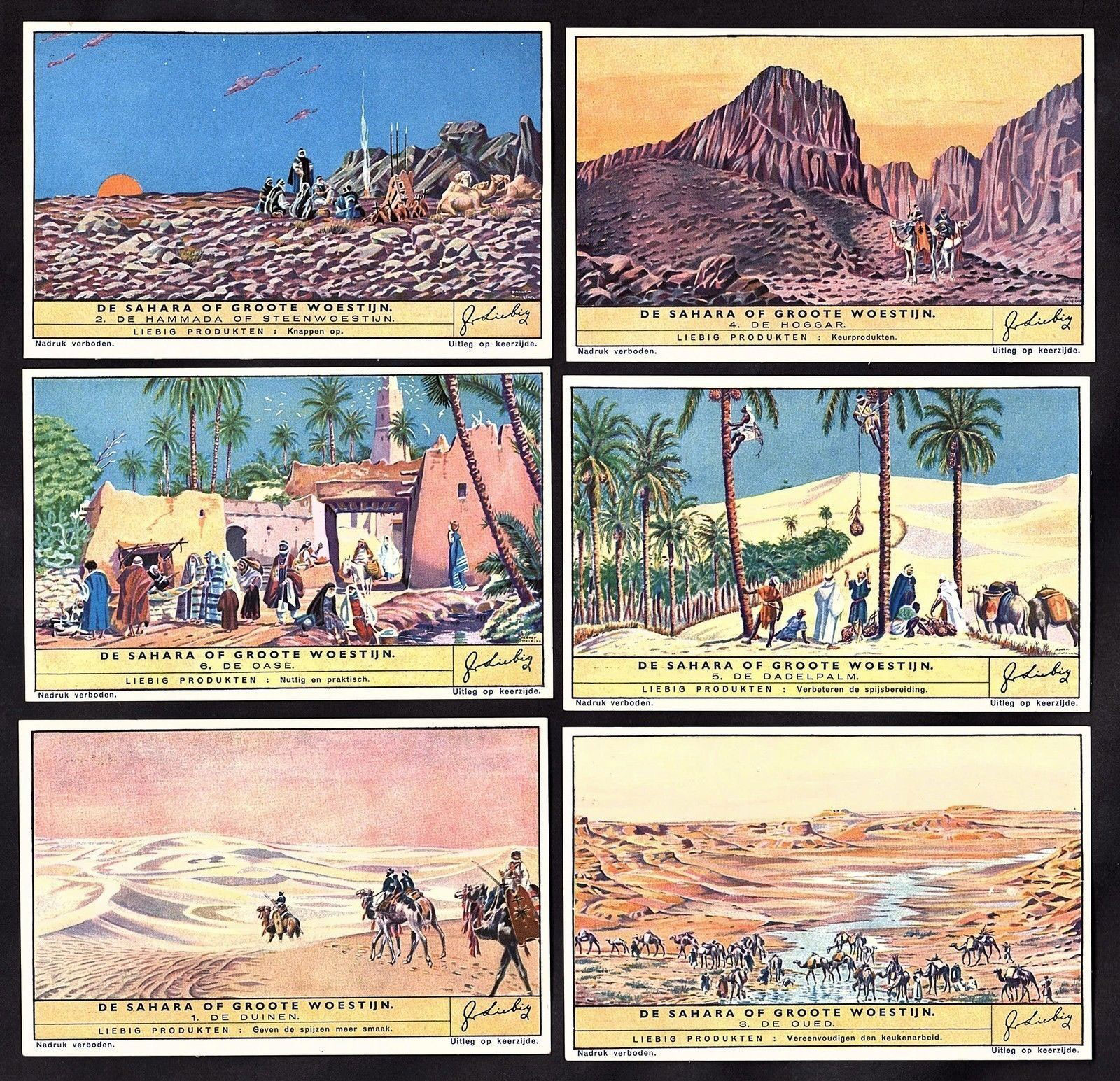


Tunis
We left Marseille on 10 December ferry to Tunis. The ferry was only about 1/3 full making the loading in Marseille uneventful compared with our trip a week closer to Christmas in 1999. The ship docked in Tunis at noon with clearance through Tunisian immigration and customs taking a mere 30 minutes (compared to 5 hours in 1999) allowing us to reach the salt pan of Chott El Jerid near Nefta (Algerian frontier) shortly after dark. We camped on the salt pan, leaving early for the border crossing the next morning.
Algeria
Clearance out of Tunisia took about 30 minutes but entry into Algeria just over 4 hours. In that time the officials processed only 3 cars, two of which were Algerian. The officials were nevertheless friendly. Two German bikers were crossing into Tunisia as we were leaving. They had ridden a loop from El Oued to Djanet then onto Tam and back along main route through In Salah (which included a convoy).
The Algerian border formalities correspond exactly with those described elsewhere on this website (immigration, customs, compulsory money change and car insurance). The only problem we had was with customs insisting on us filling in the form to reflect ‘Landrover’ as the type of car but ‘Toyota’ as the make. I guess this finally signifies the death of the British automotive legend, in this part of North Africa at least. [It was the same story with one of the LRs on my tour too, but caused no probs. CS]
From the Algerian border we headed on towards El Oued. There seemed to be few camping possibilities along this stretch given the awkward hummocky dunes lining the road and the proximity of villages. About 20 or 30km from El Oued, while entering one of the small villages, a group of youngsters aged less than 10, stoned the Landrover. No windows were broken but a bit more topography was added to the body work – never a serious issue in a 30-year-old vehicle with an aluminium body. We were welcomed into El Oued by the police and local businessmen alike. El Oued was calm and the streets clean and quite empty. We changed money at one of the banks.
That night we slept on the south side of the road 60km short of Hassi Messaoud. A strong north-easterly was drifting sand in a conveyor about 1m deep so we were looking for shelter behind south-facing hills. There is a small escarpment out of view of the road (N32° 10′ 37” E5° 52′ 23”) which served the purpose on a stretch that offered few alternatives. We arrived in Hassi shortly after 8am the next day. Here the military checkpoint issued our laissez passer in about 20 minutes. It was valid for a month. We were waved through the south side of Hassi en route to Hassi Bel Guebbour. The next check point was at Gassi Touil. Here the military spoke very little French, but seemed to want us to return 3km and wait at the side of the road. We went back, found nothing at the road side and so returned to the checkpoint. After a bit of discussion amongst themselves we were eventually waved through. We now know that a convoy operates on this stretch and may entail a delay of several hours until the convoy leaves.
If you have ever looked out of the window of a 747 on a night time trans Africa flight and seen two tiny pin pricks of light in the insanely massive blackness of the Sahara, the chances are that you are looking at somewhere like Hassi Bel Guebbour – with the two lights shared between the fuel station and the shop, this being the first fuel after Hassi M. It has a great sense of isolation and the interdune corridor that the tarmac follows south from Gassi is stunning.
Some 50km east of Bel Guebbour (28 36′ 10”N, 7 5′ 27”E) we passed large pools of water in an otherwise dry river bed. Although it was fairly early in the day we couldn’t pass the opportunity by and so set up a pleasant camp a few kms clear of the road out of the still strong north-easterly. A piste runs south to Bordj Omar Driss which starts parallel to the road [I have been told to avoid this piste – plenty of oilfield security].
The next day we called in at In Amenas (the bakery was selling awesome custard slices) and headed south through the huge dune field which seems to be the far western limb of the Ubari sand sea, eventually camping off the road in a sand field in the lee of a shady glade of trees (N26° 56′ 23″ E8° 41′ 54″). Firewood was plentiful. From our campsite we drove early the next day to Illizi for fuel and then on across the Fadnoun Plateau. The new road is a bonus but twists sharply without warning. It is rather like a pub video game where a blind rise could be followed by a sharp left, u-turn or a stranded truck jack-knifed across the road. The whole route from Illizi to Djanet is beautiful. We camped about 100km short of Djanet in a large dry river bed (N24° 54′ 56″, E8° 45′ 87î”). It was a stunning setting and well worth a few weeks stay. In Djanet we had a pleasant stay at Hotel Zeribas, camping in the far corner under the reed shelters. Djanet offered a great selection of fresh veggies, telephones which work given a bit of patience and pleasant temperatures. South of Djanet the daily temperatures were well over 30 degrees.
Whilst settling down for a quiet brew of tea in our campsite at Hotel Zeribas, Andy Pag drew up in a blast of diesel from the old Datsun he had brought down from Belgium. By this stage he was travelling alone and therefore keen to join us across the Northern Tenere to Chirfa and Dirkou. This was the planned next leg of the trip. We were glad for his company because the piste from Djanet to Dirkou is a lonely 850km stretch (we passed no traffic on this entire route).
Although our time in Algeria was much shorter than planned (for reasons explained later), we found the country calm and enjoyable to travel in. The only military checks we passed through were at Hassi M, Gassi Touil, and Hassi Bel Guebbour. Apart from this stretch, we were free to come and go as we pleased. Whenever we encountered police we found them very helpful and accommodating. From a tourist perspective, everything is in place for Algeria’s recovery – all that is missing are tourists. We saw none between the Tunisian border and Agadez (about 5000km) except for Andy in Djanet.
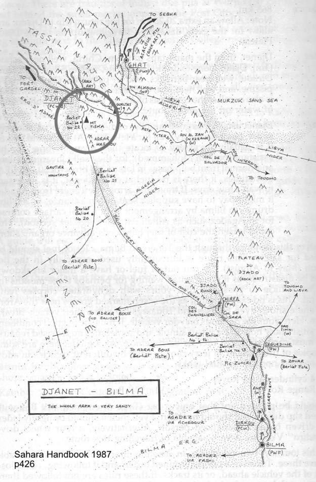
After some time to rest and check out Djanet, we took off for Niger, leaving by the piste to Libya (a left turn off the new airport road past the old aerodrome). We turned off this mildly corrugated piste about 35km from Djanet, taking tracks through a gap in the mountains towards Mount Tiska. Once the tracks join, the piste is surprisingly well formed. After about an hour (roughly 40km) the piste turned east of Mount Tiska. The area is very beautiful with just about every spot a perfect campsite. We spent the night here with Andy cooking up a great veg stew. During the night we saw three vehicles approaching the Mount Tiska foothills some 10km to the south. They stopped when in view of our fire although we couldn’t be sure they saw us. They set off again well after midnight once the moon was up, passing within a few kilometres of us with their lights off. This all seemed to point to smugglers bringing Marlboro cigarettes into Algeria, possibly via a piste through the Djado plateau.
We continued on the well-formed piste the next day. Within an hour it was obvious that the piste would pass well east of the Adrar Mariaou. The piste is not marked on the Michelin or the TPC maps. Since we wanted to hook up with the balise line across the northern Tenere (which lies west of Adrar Mariaou) we left what seems to be a smugglers’ piste, taking a drainage line out onto the flat northern Tenere. The surface was better than any tarmac we had driven since France. While the route sounds complicated, the desert is very open with the Mount Tiska and Adrar Mariaou mountains clearly visible all the time. All the driving was easy. Within an hour we had gained the Tenere and found the first balise. There we several old (and a little indistinct) tracks along the balise line. Our GPS position showed us to be on the eastern most of the two pistes entering the Tenere which are marked on the TPC J 3B map. As the balise line piste appeared to be the western most piste on this map, we seemed to be on the wrong line, and so headed south-west to see if we intersected any other piste (although we were sure that there was only one balise line across the Tenere and that the TPC marked piste was wrong – but the check was easy to make and the surface pretty hard). It turned out that the piste marked on the TPC is wrong.
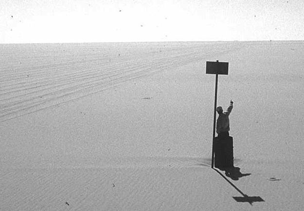
After about half an hour four Toyota Land Cruiser pick-ups could be seen driving straight at us from the northern base of the Adrar Mariaou mountains. They were travelling at speeds up to 160km/hr. The group turned out to be the Algerian police. After making their AK-47s clear to us and checking our papers (carte de grise, visas, insurance etc) they waved us on cheerfully. We should point out that it is not possible to leave Algeria officially along the northern Tenere route south of Djanet. While the police don’t mind, the Algerian customs do not permit official exit.
The northern Tenere is simply awesome. It is difficult to put words to the vastness of the place. It is impossible at times to tell whether you can see 50m, 500m or 50km off the piste. There are three wrecks on the balise line, two from the 1988 Paris-Dakar race. The shot-blasted dark silver chassis gleaming in the bleached light. For the most part the northern Tenere is very easy driving. The first few hundred kilometres out of Djanet were softer, the Landrover not being powerful enough to plane over the surface. Immediately south of Berliet balise 21 the sand becomes deep and powdery. It was the only time between Djanet and Agadez that we needed low range. The soft sand persists for 40km south of Berliet Balise 21. In a newish Toyota the northern Tenere could probably be crossed in a day. We took two days of driving, but three days altogether.
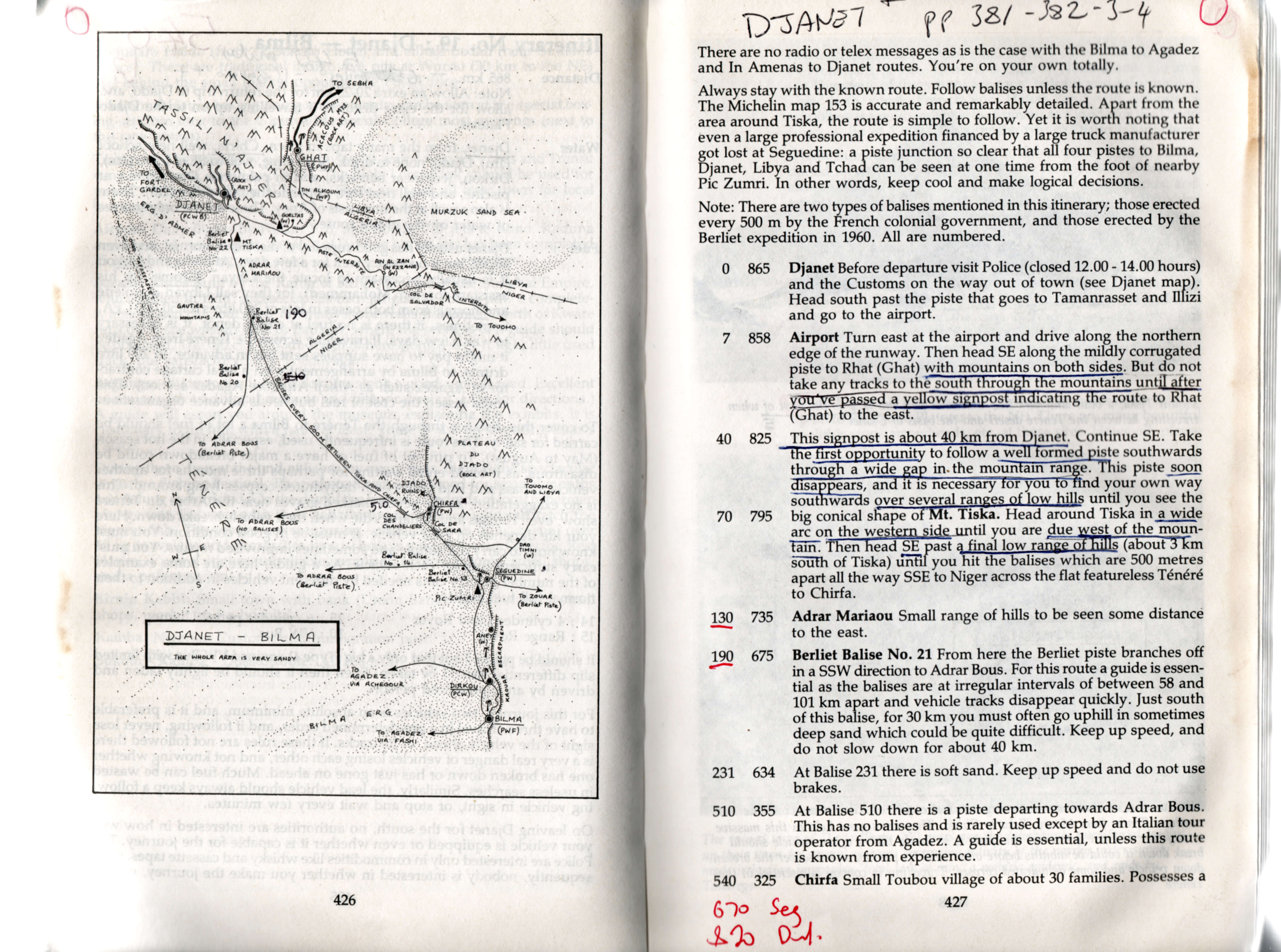
Niger
The exit from the northern Tenere to Chirfa is clearly marked – nearly all the balises are in place across the orthern Tenere. On arrival in Chirfa we drove directly to the military checkpoint. They stamped our passports while looking over the vehicles, asking if we had any sat phones, short wave transmitters as so on. We helped the commander with his GPS as he had no manual for it. We left our passports with the military overnight, thinking that this was routine practice in Niger. We drove through the village and checked out the impressive Djado ruins. The next day we returned to the military post for our passports. By then the mood had changed and we were ordered to drive directly to Dirkou, not to leave the piste and to arrive there no later than 4pm. As it was already getting on to 10am it was a tall ask in our old vehicles. We assumed Dirkou was the first official border post (as marked on the Michelin map) on this route and hence the requirement that we shouldn’t linger on the piste. We found the piste south of Seguedine very sandy. Again it would be very difficult to get lost on this route – in fact we hardly bothered with the GPS. We arrived in Dirkou a little after 4pm, handed over our passports (which were again kept overnight), met with Jerome [the fuel trader] and drove off to town for the night. The military checkpoint was pretty chaotic as several 10-wheel-drive Merc trucks loaded to the hilt were about to leave for Libya.
We returned to the military post early the next day, waited around before asking for and being given back our passports (they now had stamps from both Dirkou and Chirfa). From there we headed up the hill to refuel (we had used about 220 L of petrol since Djanet; that’s 3.7kpl or 10.4mpg) at Jerome’s fuel dump. Make sure you take your own pipe / 12V pump as Jerome’s assistants seem to have sucked too much fuel through their brains over the years. They are several sandwiches short of a picnic!
Whilst we were refueling the military drove up in a Landcruiser and took back our passports and vehicle papers. Once we had finished refueling the military impounded our vehicles. We now had no passports, no vehicles and no vehicle papers. Things weren’t looking good. No explanation was given but we were told to wait until 3:30pm. We waited in a barbed wire area between the passport shack and the military base. This is a stinking hot, dusty, shadeless area surrounded by feche feche that we grew to hate over the next few days. At 5pm were we told that there was a problem and that we would have to wait until 9am the next morning. We later found out that the Minister of Defence in Niamey had already phoned the French Ambassador in Niamey to say that European nationals were being held in the north. The French Embassy in Niger deals with all European nationals in Niger.
The next morning we were told to wait until 3:30 pm as the commander of the military base in Dirkou was waiting for instructions from Niamey. Most of our dealings had been with the Chef de Transit at the passport shack on the outskirts of the military base. He had been telling us all sorts of lies about why we were being held and when we would be released. He was a very difficult person to deal with – at one point gesturing to me that he would tear up my passports if we didn’t leave him alone. Our main effort at this stage was to speak to the Military commander of Dirkou. Of course we could get nowhere near his office. Our vehicle papers, passports and visas were all in order and we wanted to know what we were being held for.
The commander finally agreed to see us late that afternoon. It was rather like meeting Kurtz. We were shown into this darkened, blue room with padded doors. The commander greeted us and asked what our problem was as he had heard we were anxious! We explained that our vehicle papers, passports and visas were in good order and that we were uncertain what the problem was. He explained that the situation in the north is difficult, that tourists coming into Niger from the north were a problem and that the only way to enter this region was through Agadez where all the necessary paper work was available and where guides could be hired. He assured us that he was working on a solution for us. We asked if it was possible to simply deport us from Niger and we would leave immediately back to Djanet the way we had come (this had been our plan all along).
Fortunately we had managed to get permission to be taken to Bilma (45km to the south) to phone our embassies. With our vehicles still impounded we had to find a way of getting there. The distinction between who was military and who was a tour operator was extremely blurred. We were charged 30 quid one way for the trip although we returned with a tour operator anxious for our business. They were an unpleasant mafia-like gang and things turned sour shortly after they dropped us off. Interestingly, we were taken to the military commanders office in the military base in the same tour operator’s Landcruiser. In Bilma we managed to call the German consulate in Niamey (there is only an unofficial representative for British nationals who is a businessmen in Niamey – he didn’t want to know our case!). I managed to get a line out to my wife who was in Cape Town at the time. Megan phoned the German and British Embassies in South Africa as well as the German Consulate in Niamey, eventually being put on to the French Embassy in Niamey. This helped our case enormously, although we had no way of knowing she had achieved all this until our problems were nearly over.
Early in the afternoon of our fourth day in Dirkou we were told that we were being taken to Agadez. Remembering that the Commander of the military camp in Dirkou had told us that Agadez had all the services necessary to help us, we were relieved that the problems from their side seemed to be coming to an end. This soon changed when a Land Cruiser with a machine gun and live ammo chain mounted on the back rolled up. They were our escorts, so at least we didn’t have to take a guide! Our passports were still being held, so it was clear we were simply being transferred to Agadez. We protested that our 30-year-old series 2A was not up to the Dirkou to Agadez crossing of the Tenere, but we were told that there was no option: take the vehicle or leave it behind. It was do or die time for the 1950s transmission.
We left Dirkou at about 4pm. Although there was still problems to come, it was good to leave that stinking hot, dust riddled, barbed wire camp. The military Land Cruiser drove in front but waved us past in frustration at our pace. We drove on to the wells at Achegour which we reached by about 7:30 pm. It was amazing to be crossing the central Tenere although it was a pity it was not in circumstances of our own choosing. We drove through the night, following a star but basically heading west south-west. Again we didn’t bother with a GPS. With no sign of the military we decided to savour our freedom and drove on into the morning light taking a dune corridor about 30km north of Arbre de Tenere (make sure you are in the correct corridor if you want to see this place otherwise you need to back track about 30km). The going in the central Tenere is much softer than the northern Tenere. Our consumption dropped to about 3km per litre [8mpg]. We hardly ever got out of second gear although we didn’t ever get stuck. Where the sand is very soft all the truck tracks merge. Apart from a very high median strip the going is OK on the tracks.
We emerged from the sandy desert at about noon the next day to find the military waiting for us. The piste is up to 50km wide in the Tenere so they must have passed us in the night. We drove on to Agadez arriving in the early evening. The commander of the military camp in Agadez then met with us. He simply said that after a day’s rest we would be taken on to Niamey 900km away. This was probably the low point of the trip! After a few days we had another military escort down to Niamey. We left on Christmas day at 9am and arrived in Niamey at about 8pm. We had a young soldier in our Land Rover but separated from the others over the distance. We were held at the outskirts of Niamey as our passport were in the other vehicle. Then we decided enough was enough and I negotiated for a passport substitute, giving them some paper with work letter heads. From there we basically made a run for the French Embassy – the soldier protesting from the back of the Land Rover while we made out we didn’t know what he wanted us to do. We arrived at the French Embassy at 11:30 pm Christmas night and were greeted by the French Ambassador, the head of the French Military attache in Niger and the Head of the Internationale Police in Niger. They were all amazingly helpful. Details began to emerge that we were suspected spies/gun runners. The piste from Djanet to Chirfa is never crossed from north to south these days and so our arrival out of the northern Tenere had aroused much suspicion. There was also a suggestion that we had been picked up by a military patrol in the Northern Tenere. This might have been the commander at Chirfa trying to win himself a promotion, but it was certainly not how it happened as we had driven directly to the military checkpoint at Chirfa and found them all lazing about in the sun.
A meeting was set up with the Niger Chief of Police for the next day. The arrangements were made from the French Embassy shortly after midnight. We were very surprised when the meeting went ahead as it was taking place at lunchtime on the Islamic equivalent of Christmas day. It was at that meeting that our passports were returned. We had been held for nine days and had been required to drive about 2000km for the ceremony. The Chief of Police of Niger pointed out to us that he didn’t know why we were being held by the Military.
From Niamey we took the shortest route out of Niger – to Ouagadougou in Burkina Faso.
So if you want a trip across the Tenere from Dirkou to Agadez without the official guide, then just cross the northern Tenere from Djanet to Chrifa and the military is bound to oblige. The downside is that the trip goes at their pace! Our original trip had been planned to take in Libya, Niger and Algeria, so crossing the northern Tenere from south to north. Others have done parts of this route. Although the Niger military clearly don’t like tourists in the northeast, they seem to tolerate the route this way round. Our plans had to change when the Libyans refused our visas.
Route
Genoa – Tunis – Nefta – El Oued – Hassi Messaoud – Hassi bel Guebbour (HbG) – Quatre Chemins – Gara Khanfoussa – Ain el Hadjadj – Illizi – Iherir – Djanet – Tadrart (Oued In Djerane, T-in Merzouga) – Bordj el Haouas – Serenout – Ideles – Hirafok – Assekrem – Ideles – Tefedest east (Garet el Djenoun) – Erg Amguid west – HbG – El Oued – Tunis.
About 2500km off-road
Vehicles
Land Cruiser HJ61, Land Cruiser HDJ80, Discovery Tdi and three 110 Defenders.
Ferry and Tunisia
It’s still the same story on the Carthage as described in the book, hours of queuing for forms. Not all of us got our Permit de Conduire before the ship docked, but they were quickly obtained from the Customs booths once in the port.
Before that, at the police booths in the first shed it helps not to imply you’re transiting Tunisia fast for Libya or Algeria. To keep them happy make out you’re spending some time (and money) in Tunisia too. One of our group got tricked on the exchange; led to a certain bureau de change by one of the orange boiler-suited guys. Be alert, they’ll get you if they can. And another was told to pay 10 dinars for his Permit de C. (it’s officially 1d or free on the boat).
Fuel prices in Tunisia: Diesel 41d, petrol about 70d.
We covered the 470km from Tunis to Nefta in about 8 hours and stayed at the Hotel Marhala in the zone touristique west of town, opposite the Caravanserai. Half board was around 40d for two people. It’s a clean new hotel with unusually good food (but what isn’t after the Amilcar in Carthage?).
The Border
We set off at 8.30am hoping to get a good start into Algeria but the border still took most of the day. The Tunisian frontier at Haouza was pretty straightforward. At Taleb Larbi on the Algerian side things move slowly. You do police forms for you and your car (white and green forms), move on to the Customs declaration (currency and valuables like video cameras or whatever you profer/they find). I was aware of the binoculars (jumelles) ban but was careless in hiding them and so they were confiscated with a receipt and returned on the way out. The others hid their binoculars better.
Each car was searched with a few suggestive jokes about whisky, but bury it deep and they won’t find it because you don’t get taken apart as can happen to locals. With your carte gris (vehicle logbook) you then fill out a Titre de Passage en Douane (TPD) form which eventually gets printed out.
Next is money changing. This seems to be a problem at Taleb Larbi. As Yves found, they claim not to have enough in the office and there’s no bank at Taleb. In our case I got 400FF’s worth but the others got only enough to buy insurance (about 200FF) and the last lot had none. It then transpired that the guy in the insurance office (‘SAA’) took FF anyway. This is probably best paid out of your declared FFs, not your stash.
While I was waiting, taxis drivers just past the gates offered to buy clothes and exchange black market money, offering around 10-20% more. If you’ve arrived low on fuel and you have insufficient official dinars you may need to buy some black to move on. The fuel station is just down the road. We left Taleb round 3pm.
At some stage of course you must buy official dinars (it looks good on your declaration – keep receipts). We did this at the bank in Debila, the first main town after the border. It had just closed but the guy saw the ten of us and generously opened up again to do a quick change for us all.
Stone throwing kids
I’d read about the stone throwing villages west of the border on sahara.info.ch and sadly the reports were true. For once I was spared but the Discovery at the back got hit hard two or three times. Most of the kids wave but the ones who throw mean business as the heavy dents in the Discovery’s door proved. Had it gone through a window and struck the driver it would have been nasty. The last car is usually the target because there are no following cars to see who throws it, I suppose.
Unless you’re lucky, trying to catch the culprits or going to the police is a waste of time, but I guess that some irate tourist with a smashed window will do this some day soon and hopefully something will be done. On the ferry back I spotted a tourist car with a smashed window and heard of serious stone throwing in Kufra (Libya) and even at a local guide’s car in Dakhla (Egypt).
Laisser Passer and Gassi Touil convoy
We spent the first night in Algeria in the sands just south of Touggourt (although there is the Hotel Oasis in town somewhere).
At Square Bresson (just a junction) there are masses of sand roses laid out for display. Soon after, at a checkpoint just before Hassi Messaoud we had to get our permit for the south – about an hour of writing everyone’s details down in Arabic. But the laisser passer was only requested a couple of times in the Gassi Touil over the next day or two. No one bothered with it or even passport checks south of the oil zone.
We got caught up in a military escort at the Gassi Touil checkpoint, halfway between Hassi Messaoud and Hassi bel Guebbour (HbG). It meant waiting until 3pm (or 9am) for a 100 km drive to another checkpoint or base and continuing the next morning at 10am to HbG. We were told only ‘Toyotas and fuel tankers’ must join the convoy as these have been preyed on by bandits (from ‘Mali’ or course). But while waiting plenty of Toyotas and tankers went through so who knows… It delayed us by about half a day so schedule this into your plans or go via Deb Deb (Libyan border route).
Unlike many other towns in Algeria, HbG is still the one-camel truckstop it was ten years ago. Just a couple of cafes and a checkpoint. There was no problem with us heading down to Bordj Omar Driss (stopping for a wash at the warm spring 2km from Hassi).
On the piste at last
We left the tarmac at Quatre Chemins (checkpoint) and headed west along the very rough Amguid track, leaving it early down a sandy ramp towards the Gara Khanfoussa dune crossing and the 410-km-run (fuel to fuel) to Illizi. Once you find the entry point for GK and the old piste rising up over the dunes, with 1.5 bar the crossing is very easy (in our case perhaps helped by the recent heavy rains). There are many recent tracks winding their way over the easiest dunes and by following them you encounter no dangerous crests to speak of. After the first section you drive into the Gara Khan clearing and then keep on the west side to head directly south (a mistake we made when I did it ten years ago). Beware of sharp ‘crests’ as you drive back onto the old orange built-up piste on the way out of the dunes.
Once in the valley we passed Tabelbalet well (good water at 6m), tried to drive along the dunes on the east side (as advised because of flood damage on the track). But the dune banks were tiresome and we found the track OK. Next day we passed Ain el Hadjadj (ruins, good water) and followed the track right to the point where you cross the strip of dunes at around N26 38′. It helps to walk these first to work out the way through. Once you know which way to go it can be done in 10 minutes. No one got stuck except me!
From here east to Illizi is one of the most beautiful pistes in these parts, with the rosey dunes of the Erg Issaouane glowing to the north, a clear track and plenty of nomads camelling around. Just when you think it’s all over there is a steep sand slope to ascend about an hour from Illizi (waiting for GPS info). You’ll need to degonflate to get up this one – watch out for the rocks on top.
If you’re heading south via HbG then this piste certainly beats the tarmac to Illizi.
Illizi to Djanet
In Illizi we were lucky enough to get fuel, water, bread and even a restaurant lunch (250d each) without getting hauled in to the police and army as Yves reports on point 11. If they don’t ask don’t offer. From here it was tarmac all the way to Djanet, covering in two hours what took a gruelling day a decade ago. We visited the village of Iherir (basic camping at the north end of the settlement – introduce yourself to the teacher, Ibrahim Kadri). The road to this canyon oasis is much improved (30 mins) and may well be tarmaced by next year.
We did the Tuareg tea thing with Ibrahim that evening and next morning went for a walk with a guide up the valley to see the guelta, gardens, rock art and the old Turkish fort (700D for our group of ten). We also left some old clothes with Ibrahim for the villagers.
Down the road, Dider looks as lovely a lunch/camp spot as ever and there is now fuel at what has become the small refugee town of Bordj el Haouas (checkpoint). You could do Illizi – Djanet in a day.
Djanet
The new tarmac makes a lovely drive into Djanet – now you can look around at the countryside instead of the piste. There was no checkpoint on entering Djanet (though there were frequent night time roadblocks) or need to get permits for fuel, as before. We stayed at the only place in town: Hotel Zeribas (250d to camp per person, cars free, basic rooms around 500d) right in the town centre next to the post office. I was told the place was dump a year ago but it looked fine to me, with hot water, plenty of shade and good security. They’ll try and rope you in for a cous-cous meal in their restaurant, nothing special and overpriced at 500d pp. There are restaurants just out the door. The Hotel Tenere, miles south out of town, appeared to be closed or waiting for the Xmas charters. There’s a shadeless campsite near it, but it looked deserted too.
Guided excursion to the Tadrart
I organised a guide with Agence Essendilene for a tour of the Tadrart (SE of Djanet) and Alidemma arch. We were advised that my proposed route would take much longer than planned (although a friend did the full tour a year ago in 4 days). It was a guide’s ploy to get more days out of us (a new one me!). In the end we settled on 4 days, Tadrart only at 1200FF a day. We also paid 25d per person per day in the national park at the park office/museum in town. Once we got to the Tadrart it was clear the guides were stringing out the route to fill 4 days, crawling along at times at 10kph. We would have rather driven at a normal speeds and camped early to enjoy time out of the cars, which we later did.
I was looking forward to the Tadrart but to be honest I was disappointed. The sandy drive out towards Mt Tiska and following oueds south of the corrugated Ghat piste was great (and driven at normal speeds). But Oued In Djerane was very dusty and for the price I paid, the region did not quite have the edge over the very similar (and contiguous) Akakus in Libya. Of course, unlike the Akakus, the Tadrart has zero tourists. The ochre dunes at T-in Merzouga were the highlight. Our guides Ahmed and Slimane were a good bunch of guys and, with an email contact in Germany, I may hire them again directly, at a more normal price.
Unfortunately one of our group was injured an accident on Day 3 and we had to return directly to Djanet. Amazingly the Defender nearly made it back in 2WD, at which point the severely traumatised transmission finally gave up the ghost. The doctors at Djanet hospital were extremely helpful and confidence inspiring. The injured driver eventually flew back to the UK via Algiers, with the aid of his travel insurance and looks like making a full recovery. The car was a write-off. There are no modern Land Rovers in Algeria, only ancient Series IIIs. Recovery to the coast was not worthwhile and so it had its contents and components ‘optimised’ and was left with the Customs. Vehicles cannot be sold in Algeria. The Douane huffed and puffed a bit about parts missing from their new ‘present’ (what a nerve!), but once they realise it’s more wrecked than it looks they won’t be quite so thrilled.
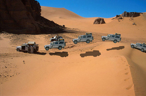
Telephoning from Djanet
Trying to organise the repatriation exposed the near impossibility of telephoning out of Djanet, even just to the next town. The problem seems to be many new private telephones but just one inadequate satellite/radio dish. I was on the verge of driving 400km to Illizi (linked by land lines and therefore much more reliable), but had one more go at sundown – Ramadan eating time when all goes quite. However the insurance never managed to call back. So despite what I say in the book on p.276, a sat phone would have been useful here. (incidentally the hypothetically described Medevac procedure on the opposite page – outlined to me by a Loss Assessor – proved to be pretty accurate. Getting to a town/phone/hospital is the key. However, the insurance insist on proof that the claimant cannot continue the tour as well as a doctor’s report to prove they are safe to fly. This is what cost us days and why we gave up in Djanet – they could not get through).
Not surprisingly, GSM mobiles don’t work in Algeria (they do in Tunisia), but I was told that next year they will, even down in the south.
Route A2 to the Hoggar
With the injured driver slowly on the mend, two cars from the group offered to help assist his recovery to the UK while I continued with the VX and Discovery to the Hoggar. We managed to get diesel at Bordj el Haouas (Ramadan shuts everything down at 3pm) and then headed south along the chain of mountains that end in the landmark of Tazat (an interesting area to explore for another time I think). Mistakenly thinking we needed to move fast to catch up for lost time, we drove from Tazat almost to Assekrem in a long 400km-day. As described in the book the junction at ‘Borne’ is still confusing and we dithered around a bit before heading resolutely SSW over confusing tracks with another lost G-Wagen crossing out bows. Soon we found the crucial cairns and balises that lead into the valleys all the way to Serenout fort (quick passport check) and on past Telertheba. Despite what it says on p.397, the southern route from Serenout (as marked on the IGN) seems to be the main way and is a lovely drive with the 2455m Telertheba looming ever larger up ahead. The sandy sections mentioned on A2 in the book didn’t cause any problems – one wonders if a flat sandy track improves with little passing traffic.
There is diesel only at Ideles from where a corrugated track leads to Hirhafok. At Hirhafok we turned south for Assekrem.
I knew this piste would be washed-out, but the closer we got to Assekrem the worse it got, to the point where one could barely believe anything less tha a Unimog could drive it. The last 50kms took 4 hours in Low Range with extremely slow and rocky going up to and beyond the Tin Teratimt Pass. From here on it was so damaged one could hardly work out the original track among the many deviations.
We had Assekrem to ourselves but there is a whole menu of prices there: parking, parking more than an hour, breathing, etc. The ‘chatty’ guy in charge tried to charge us for camping, too… To be fair it can’t be cheap to run the place and the lovely lodge is well worth an overnight (even at nearly 1000ds demi-pension) so you can see dawn over the plugs.
Tefedest East
We returned down the track from hell (not so bad this time but I doubt any local would use it), fuelled up at Ideles, getting caught up with the bored police opposite the pumps for a tiresome “what’s your job, address, mother and father’s name” check. Backtracking, the turn off north for Mertoutek is clear if you’re looking for it and the track unrolls clearly, passing through some lovely spots to a turn-off at a big green sign a few kilometres before Mertoutek (as marked on the TPC). From here twin ruts lead north to Dehine and continue all the way along the east flank of the Tefedest range past the distinctive peak of Garet el Djenoun at its northern end.
The Discovery’s rear radius arm broke, probably as a result of the exertions of the previous day, and with me taking on the car’s fuel and water payload, my 61’s rear main spring also snapped a day later. The flat helper springs had also snapped off I discovered, but the second spring sort of winds round the mount so I could carry on without much problem. The other rear main spring has since broken. I never rated these two-year-old Ironman rear springs for heavy load carrying (front are fine) and will be getting some heavy-duty OMEs.
We had a day off by Garet and then continued north along the west of the Amguid erg, through the pass and northwest back to HbG, a clear if corrugated track marked with oil drums much of the way.
This is a lovely way back north, easy to follow with no GPS needed – 710kms from Ideles to HbG. The last 150km are a flat and dull and after the final rise, the eastbound track back to 4 Chemins is very rough but can be avoided by going via Bordj Omar Driss, I’m told.
Back north
We just about managed to wangle our way out of a return convoy north, and continued slowly with the four-wheel steering Discovery all the way from Gassi Touil to Nefta in one very long day. Getting out of Algeria took two hours with no searches or money checks (the same as years ago), just very slow-witted officials at Taleb. At Haouza they asked for Green Card insurance (a first) so those without had to buy a week’s worth for 10Td. After 1200km of hairy handling with just a winch cable and a chain holding the axle in place, the Discovery got its radius arm welded in Nefta and we met up with the rest of the group at La Goulette for the ferry back to Genoa.
Weather
Following the severe October rains west of Illizi, we were blessed with no daytime wind and amazing clarity the like of which I’ve never seen in the Sahara. You just could not help staring in amazement at the crisp profiles of the ergs and the mountains. Temperatures were mild too, even at 1800m in the Hoggar it only dropped to 7C.
We also saw plenty of dorcas gazelles which I’d never noticed before and of course thriving Tuareg nomad activity here and there which, along with the famously diverse landscape, is what makes Algeria so special.
Conclusion
While it was a shame not to be able to complete the tour with the whole group, Algeria is as good as I remembered: the desert has plenty of tracks, as easy or as hard as you want, and all without excessive hassles with guides or permits. I would not choose to visit the Tadrart again, instead I’d rather explore places like Erg Tifernine and Tihodaine, and the Tazat and Tefedest mountains, as well as more southern routes linking Djanet with Tam. This will be the basis of my 2001 tour.
The most tiresome element is, as always, border stuff on the Carthage and at Taleb, but then if it was easy everyone would go here! I met Gerhard Gottler on the ferry back, updating an old Algerian guide and preparing a new Sahara-wide guide (in German). He agreed the southeast of Algeria is the ‘fillet mignon’ of the Sahara. With one easily obtained visa you get a lot for your money in Algeria, and you can always spice things up by pushing further south to the Tenere in Niger.
While the north and the far west may be risky, security in the southeast was never an issue. The gendarmes bombing around in their green Land Cruisers (a cut above the average army and police) inspired confidence and greeted us warmly, as did everyone.
Tony van Gastel – 2002
Long associated with mysterious beauty, Islamic learning and enormous wealth, Timbuctu the Forbidden City has always fascinated outsiders. Early European travellers were determined to reach it, but many did not make it. Between the late 16th century and the middle of the 18th century at least 43 travellers made an attempt to reach it, of whom just four succeeded. The first European, Gordon Laing, who reached Timbuctu in 1826, never returned. Rene Caillie reached Timbuctu in 1828 and came back to tell his story.
Timbuctu fascinated all of us and we were set to reach it. The city has achieved a legendary reputation and ‘Going to Timbuctu’ is similar to going to the end of the world, one of the most desolate places on earth.
Even today it is still a challenge to get there. Roads are said to be non-existent; Timbuctu can hardly be reached by land. Our objective was to get to Timbuctu without the help of a tourist guide.
We were with two Dutch families in two strong 4-wheel drive vehicles: a Toyota Land Cruiser and a Nissan Patrol.
Furthermore, some spare parts should be taken along. It is difficult to decide which parts to take. We had spare fan belts for both cars, break/clutch fluid and extra oil. For the Toyota, I decided to take spare shock absorbers, because on a previous trip to Mali (November 1997), we had ruined both rear shock absorbers.
Travel documents/car papers: For a Ghana-registered car, in addition to a Ghana driving licence and car insurance, the following documents are required:
International driving licence;
International Certificate for Motor Vehicles (Carte grise);
ECOWAS insurance, from the Ghana insurance company possible for a period as short as 14 days (Cedis 25,000 = 10 US$);
Multiple entry visa for Burkina Faso, easily obtained in Accra (CFA 15,000 = 30 US$); and
Visa for Mali, also easy to get in Accra (US$ 40).
How to sleep?: We had fitted a roof rack on the car over which a mosquito net could be arranged. The second couple had arranged and packed the car in such a way that they could easily sleep inside.
Enough fuel?: Both cars were running on diesel. The Toyota had, in addition to its main 95-litres tank, a second 55 litres tank. We would carry along two extra jerricans, which we would fill up in Segou. After Segou it is not sure if fuel will be available. The Nissan had a regular 90-litres tank and an additional 110 litres in jerricans.
Driving through sand: We had a locally-made set of sand ladders and carried a shovel along. Since one of the secrets is to lower the tyre pressure when driving through deep and soft sand, we also had purchased a small compressor to re-inflate the tyres. Lastly, we carried a long towing rope to be able to pull a car out off a sandy patch.
Navigation: To drive from Accra to Segou the only tool really needed is a good road map. We took the following maps along:
Ghana: the Shell map, available from book shops in Ghana,
Burkina Faso: the IGN (country) map 1:1,000,000,
Mali: the IGN country map 1:2,000,000, and
West Africa: the Michelin North West Africa map (1:4,000,000).
Passing through larger cities such as Kumasi, Ouagadougou and Bobo Dioulasso could be difficult, but the West Africa Rough Guide and the Lonely Planet Travel Survival Kit both provide good city plans.
The main problem is to get from Niono to Timbuctu and back. The IGN 1:200,000 maps are extremely useful, but outdated. Furthermore, tracks in the desert do change from year to year and from season to season, so that one can never completely rely on these maps. However, reaching Timbuctu without hiring a tourist guide (one of our objectives) requires a complete set of these IGN 1:200,000 maps.
Global Positioning System: The most useful piece of navigation equipment is a GPS. It is based on 24 satellites orbiting the earth at a very high altitude. A GPS serves as an extremely powerful compass.
In preparation for the trip, we had entered the complete route (the best track seen on the 1:200,000 maps) from Nampala – via Lere, Tonka and Goundam – to Timbuctu in the GPS. Approximately every 5 to 20 km a waypoint had been selected and the co-ordinates (longitude and latitude) entered in routes.
During the trip the GPS was mounted on the dashboard of the car and it permanently determined the location where we were on the map.
Water and Food: When travelling out into the bush plenty of water and enough food should be carried. The temperature during the day is extremely high (high forties) and a human being will at least need 6 litres of water per day (if not more). Furthermore, water is required for washing and cooking. We had a capacity of 120 litres water (60 litres in each car). In addition, we would buy (if available) bottled mineral water.
The food supply consisted of rice, spaghetti, soup, baked beans, corned beef, tinned fish and sausages, cream crackers, etc. Furthermore, coffee, sugar, milk powder, and tea are essential.
Day 1: Saturday April 25, 1998; Accra – Bolgatanga; 850 km
Over tarred roads in reasonable condition, the first day brought us to Bolgatanga 850 km from Accra, where we arrived at 5:45 pm, almost 12 hours after leaving Accra. Accommodation in Bolgatanga was at the guesthouse of the Presbyterian Primary Health Care Centre.
Coffee break, lunch break, as well as an afternoon rest stop, were all taken along the road, searching for a quiet place and some shade. In fact, we would take off as early as possible and also have breakfast at the roadside.
Day 2: Sunday April 26; Bolgatanga – Bobo Dioulasso, 560 km
On the second day we departed at 6:00 am and travelled, again over tarred roads in good condition, from Bolgatanga in Ghana, via Ouagadougou, to Bobo Dioulasso in Burkina Faso; a total of 560 km which we covered in 10.5 hrs. Approximately 45 km after Bolgatanga (on an excellent road), the Ghana departure formalities had to be carried out in the border village of Paga, which included:
Health control. It is totally unclear and ridiculous why – when leaving Ghana – the yellow fever vaccination has to be valid. The health people also had to write all the passports in a large book.
Passport control. For each passport a disembarkation card had to be filled out, after which the Chief Officer stamped the passports.
Registration of the vehicle. The international driving licence and the ECOWAS insurance had to be registered. You would expect them to look at the Ghana national driving licence and national insurance. Anyhow, it did not take much time.
Custom inspection of the vehicle. An officer had to inspect the contents of the car.
Immediately after leaving the Ghana border, the Burkina Faso passport control (visa control), as well as the control of the car papers (carte grise, international driving licence and ECOWAS insurance) took place. A fee of CFA 1000 per vehicle was charged for “stationnement”.
The whole procedure took less than 45 minutes. Both Ghana and Burkina authorities were correct and friendly, except for the usual attempt to extort a little bribe (called dash in Ghana and cadeau in Burkina) when the custom officer was inspecting the vehicle.
Approximately 18 km further, in the village of Po, the last official formality to enter Burkina Faso took place, i.e. buying a Laisser-Passer (CFA 5000). This important document allows the import and export of the car free of charge for the period of the validity of the Laisser-Passer. It is similar to the Carnet the Passage, which travellers coming from Europe will usually carry.
Along the stretch Po-Ouagadougou, a lot of photogenic villages with huts and (hopefully fully filled) grain stores can be seen. Since it was the end of the dry season, huts were freshly thatched and some walls were newly decorated with geometric patterns. In general, the vegetation is becoming less and less. This is sorghum/millet country, but crops had been harvested some months earlier. Many Eucalyptus and Neem trees are growing along the road. Furthermore, we saw several water pumps and water ponds.
Breakfast was taken at 9:00 am somewhere along the excellent tarred road between Po and Ouagadougou. Coffee later in the patisserie La Bonbonniere in Ouagadougou. The patisseries in Ouaga are highly recommended. We slept in Bobo Diaoulasso at the compound of Casa Africa on the roof rack of the car.
Day 3: Monday April 27; Bobo Dioulasso – Niono; 420 km
That day we wanted to reach Segou. We departed from Bobo at 7:15 am and the city plan in the Lonely Planet Guide helped us to leave the city. Via Bama (big irrigation scheme) and
Dande to Fo (93 km from Bobo), where you surrender the Laisser-Passer to the authorities. This office is rather easy to miss, since there is no clear indication where to stop. After Fo you continue for another 25 km to Faramana, where the rest of the Burkina Faso exit formalities have to be completed:
In the second office:
Finally, just before Kouri (a number of kilometres after Sona), the Laisser-Passer for Mali (CFA 2000) has to be purchased.
During a previous visit to Mali they tried to cheat us by having us pay an additional exit fee, since we departed on a holiday (Sunday); this time we were treated correctly, if slowly. Via Kouri, Koutiala and Bla we travelled to Segou over usually good roads (under construction here and there; potholes before crossing the Bani river). We arrived in Segou at 2:00 pm; seven hours after departure from Bobo Dioulasso (310 km behind us).
In Segou we did some shopping (a.o. boxes of mineral water). We filled all water jerrycans. We filled the cars up with fuel and -this time- also the two spare jerrycans. Two hundred litres would bring us to Timbuctu (700 km away) and -if needed- back to the tarred road in Douentza, provided the fuel consumption would not exceed 5 km to a litre.
Segou is the second largest city in Mali (after Bamako) and we paid a visit to the waterfront, where most of Segous activities are taking place. Pirogues and pinasses are loaded for trips up and down the Niger. It seems that such boats are never full; people of all ages, bicycles, motor bikes, goats, large bags with all kind of stuff and more people, bicycles, motor bikes and goats are loaded again and again. Finally, when you start thinking it may sink, it takes off. In the river, people are doing the laundry, bathing and relieving themselves. Not a place to swim, it must be a serious health risk. On the banks of the Niger a lively trade is going on and women in colourful clothes are moving around.
Since it was still early we decided not to stay in Segou but push on to Niono; approximately 110 km north of Segou. This road, again tarred and in good condition, follows the Niger up to Markala, where we crossed the river on a dam. The landscape is not changing much and is mainly rain-fed agriculture, sorghum and millet, with the occasional tree. After Markala the road gets worse and we drove through a large irrigation scheme, where sugarcane and rice are grown.
In Niono, where we arrived at 5:20 pm we checked out the Campement (the local government establishment in town) and decided to spend the night in the air-conditioned rooms (CFA 15,000 – 17,500). We enjoyed the cold beer and soft drinks as well as a dinner of fish, beef or chicken with either rice or chips. There were quite a lot of mosquitoes in and around the Campement, which bothered us a little, but all in all an enjoyable stay.
In Niono, there are three fuel stations, of which one had a good supply. Of course we filled up our fuel tanks to the brim.
Day 4: Tuesday April 28; Niono – Sanbani; 300 km
To Nampala (154 km from Niono)
We left Niono at 6:10 am for the first leg to Timbuctu. People had mentioned that it would be possible in one (long) day, but only if you knew the road; something we certainly did not. We would see how far we would reach and were prepared to camp out in the desert.
Immediately out of Niono the dirt road begins. The road runs north along a main irrigation channel and at both sides of the road rice and some maize is grown. The road is firm, but rather dusty. We did not use the A/C of the car, because it was rather cool. Later on we decided not to use the A/C to save fuel, because fuel consumption is considerably higher when running the A/C. Along the road were many small villages, which reminded us of the Nile delta in Egypt.
After 33 km the road becomes poor and we drove along a minor irrigation channel. The surface of the road is sometimes very loose; very fine dust completely covers the back and the sides of the cars when driving through. Approximately 81 km after Niono (two hours drive), the irrigation channel ends and the landscape becomes drier and drier; very bushy indeed.
We were heading almost east and getting closer to Nampala. The road has deep potholes and gullies and the going is sometimes very slow. We often had to leave the main track, searching for a better one. During the rainy season this road must be very difficult to negotiate; cars and lorries will seriously get stuck during that period. The track then turned more and more north and the GPS indicated that we were heading straight towards Nampala. The last 30 km was on a firm dirt road (sometimes a bit sandy) with a lot of corrugation; keeping up speed (50-60 km/hr) is the best medicine for corrugation, but watch out for gullies and potholes.
Five hours after leaving Niono, we reached Nampala. The average speed had been approximately 30 km/hr (including a short breakfast stop). We had seen a lot of villages, people and taxis on the first 60 km, but the last 100 km were completely desolated; no villages, no cars, no human beings, only a few goats.
Nampala: In Nampala (not much more than a few huts) there was fuel (guidebooks indicate there usually is not) and they filled up our tanks from a drum .We discussed the road to Lere and were told that it was no problem at all. They pointed out which direction to go (was there a track?).
To Lere (95 km from Nampala)
Based on the track indicated on the IGN 1:200,000 (Nampala) map, the co-ordinates of 16 waypoints between Nampala and Lere had been entered in the GPS.
The first 10 km were somewhat sandy, but further on were long stretches of firm surface, where we could drive 80 km/hr. We did not meet any cars, only very few people (inhabitants of the few hut villages) and goats (who are able to survive in almost any environment). The landscape is very dry and bushy; vegetation very sparse.
On this stretch we learnt to appreciate the GPS. It gave us peace of mind; we never worried that we were on the wrong track. The compass-page of the GPS always indicated the direction to go, as well as the distance to the next waypoint. When we reached a junction (and there are many) we usually let the GPS decide which track to take. Once we ended up on a secondary track, which ended in the middle of nowhere, but the compass-page of the GPS brought us again straight to the next waypoint.
We also learnt that the majority of tracks, indicated on the 1:200,000 maps, do not exist. On the other hand, there are many other tracks, often just a footpath.
At 2:20 pm (8 hours after leaving Niono; average speed 40 km/hr) we reached Lere. The temperature was 43oC and relative humidity approximately 5%.
Lere is a small village with a few very small shops and a market place. It was a surprise to hear that there was fuel, but we had just filled up in Nampala. We had to stop at the police to register the car and at customs, who recorded the Laisser-Passer.
To Niafounke
According to guidebooks the route from Lere to Niafounke is difficult and you may easily get lost. A guide is, therefore, recommended. We decided to try it by ourselves. The co-ordinates of more than 30 waypoints of the route indicated on the 1:200,00 map (Sa) had been entered (in Accra) in the GPS. With the experience of the previous day, when we drove from waypoint to waypoint, it could not be too difficult. The distance (Lere-Niafounke) indicated on the 1:2,000,000 Mali map was 214 km. After asking a few people in Lere the direction we took off to Niafounke.
Immediately after leaving the village, the track headed into a total different direction (the GPS indicated we should go north, while we were clearly heading south).
Soon it appeared that we were following a track along the south shore of Lake Tanda (it had no water and did not look like a lake) on the 1:200,000 map (Sa). Via the very small village of Tirna, we drove to Diartou. Just after Tirna, we knew that we were on the correct track, because a signpost indicated the direction to Niafounke.
The track continued South of the next lake (Lake Kabara). We camped approximately 5 km east of the village of Sanbani. All in all, we had only driven 70 km since Lere (including all detours); it was 5:00 pm and still hot (high thirties).
It turned out to be one of the best nights; nobody bothered us, the temperature dropped and early in the morning it was only 23.5oC. We needed our sleeping bags.
Day 5: Wednesday April 29: Sanbani – Timbuktu; 250 km
To Niafounke (65 km from Sanbani)
We had an excellent night and left after breakfast our one-million star hotel. We kept following the main track, which headed east straight into the direction of Niafounke. We drove along the northern shores of a number of small lakes. Some water was still present, but in the rainy season these must be large lakes or gullies. After Dabi, the road (over a dyke) is going straight to Niafounke, which is situated on the Niger. We arrived in Niafounke at 09:00 am, approximately 2 hours after departure from our desert camp. The distance was only 65 km, but we spent some time along the lake and had a second breakfast along the road.
In conclusion, the track Lere to Niafounke is not bad. However, it is rather easy to loose your way. Do not follow the track indicated on the 1:200,000 map (Sa); it either does not exist or is not used this time of the year. It is also clear that there is no fixed track to Niafounke, it varies depending on the season. In the rainy season the track probably follows a more northerly course, while at the end of the dry season it follows the shores of the lakes. The present route is an advantage in terms of distance; the route indicated on the IGN Mali 1:2,000,000 map is 214 km, while this one is only 120 km.
Niafounke
Niafounke is a pleasant town located on the banks of the Niger. It has a Campement. Single rooms are available for 6,500 CFA and doubles for 10,000 CFA; clean rooms with fan (no A/C), toilet, shower and running water. In the Campement we had cold drinks, bought small flat breads and talked to the captain of the Niafounke ferry. He was slightly drunk, but argued that the best way to Mopti was crossing the Niger with him; another two hours would then bring us to Mopti. People claimed there was fuel in Niafounke. We discussed the road to Tonka and it appeared that there was a short direct route to Tonka (35 km) and a much longer one.

To Tonka (42 km from Niafounke)
We decided to take the shorter one and departed from Niafounke at 10:00 am. The track runs initially along the Niger. Just before the irrigation scheme we turned left into a more northerly direction (this junction is not easily recognised). Again the track out of Niafounke can not be found on the IGN 1:200,000 maps (Niafounke and Tombouctu-Ouest). However, in the small village of Temba (31 km after Niafounke) we joined the track on the 1:200,000 map (Timbouctou-Ouest) and reached Tonka at approximately 11:10 am (1 hour after departure from Niafounke; the distance being 42 km). The road was excellent, certainly the last stretch after Temba.
Tonka
Upon entering Tonka, we stopped at a police post to inquire about the road to Goundam. The police officer must have been in a bad mood, because he wanted to give us a ticket for parking the car in the middle of the road. Middle of the road? We had to argue a long time. The nasty officer also told that it was impossible to travel alone to Timbuctu; it was too hot, dangerous and forbidden to travel without guide. Finally, a more senior officer came and asked whether our papers were in order (which they were) and told us we could leave.
Temperature
We drove through the village of Tonka, which is also located on the banks of the Niger. We were lucky to find somebody who could indicate the direction to Goundam; the temperature had reached approximately 47oC.
To Goundam (35 km from Tonka)
A track leading north brought us out of the village and we followed a different track to Goundam from the one indicated on the 1:200,000 (Tombouctou-Ouest) map. The GPS indicated that we were heading towards Goundam.
The real sandy part of the Timbuctu trip started soon after Tonka. We engaged the freewheeling hubs and used almost permanently the 4-wheel drive and occasionally low gear. At times the sand was very deep and only keeping up speed would avoid getting stuck. High sand dunes had to be negotiated and only speed would get you to the top. Occasionally we had to reverse and give it another try or take a different track. There are many parallel tracks and permanently choices have to be made which track to take. Sometimes you are right, sometimes wrong, resulting in not being able to get uphill or getting stuck. This was really the first part of the trip were a 4-wheel drive vehicle was required.
The track follows Lake Fathi and sometimes we were driving on firm underground, which is the bottom of the dried-up lake. The lake, at this time of the year, has little water, but it must be huge during the rainy season. Approximately 7 km before Goundam, we joined the track on the 1:200,000 map (Timbouctou-Ouest) and were again driving from waypoint to waypoint.
We took off from Tonka at 11:30 am and reached Goundam at 12:30 pm. So far, it was one of the most interesting parts of the trip. The desert environment really makes an impression. The landscape is interesting with often Lake Fathi in the background. It was hot (47oC) and the driving tough. Finding a tree for the coffee break not possible.
Goundam
Goundam is an interesting village, but we did not see a soul. You must be crazy to venture outside at midday. We stopped at Place de lIndependence, were an old sign indicated that the distance to Timbuctu was still 77 km. Somebody told us there were two routes to Timbuctu; one being much sandier than the other. We never knew which one we took, but sandy it was!
Out of Goundam there are two other tracks. One leads to Dire, which is on the banks of the Niger. According to information from travellers there is a track from Dire to Timbuctu. The second track out of Goundam goes to Lake Faguibine, approximately 70 km to the north. It is the largest natural lake in West Africa and one of the best places to watch migratory birds. According to guidebooks the track is difficult to find and a Tuareg guide should be hired. The book also indicates that this track definitely requires a 4-wheel drive (low gear). Initially we intended to go to the lake, but decided against it because of time constraints.
To Timbuctu
At 12:30 am we departed from Goundam for the last 90 km to Timbuctu; the temperature was around 46oC. All the way we used the 4-wheel drive and lowered the pressure of the tyres (to approximately 20 PSI). It was sandy and hilly all the way and there were a large number of parallel tracks. We did not really get stuck, since we kept up speed. The route had been entered in the GPS and we followed exactly the same course
The last 4 km from the airport to the centre of Timbuctu is on an excellent tarmac road; the 8 km before has a very firm underground, but before that there is approximately 10-15 km of very deep sand and high sand dunes. With our experience, we had no problems negotiating these and at 3:30 pm we arrived in Timbuctu!
Since Segou (700 km from Timbuctu), we had not used the A/C and really got the taste of the desert; dusty at times, dry (RH 5%), hot during the day (close to 50oC), and cool in the morning (22oC). We all felt, however, that a dry and hot climate is preferred over the Accra climate (less hot, but very humid).
We drove straight to the best hotel in Timbuctu (got stuck in front of the hotel, which is situated on a hill) and had very cold beer and soft drinks. This may have been the best beer we ever had.
Timbuctu, founded about 1100 AD as a seasonal camp by Tuareg nomads, is located on the edge of the Sahara about 13 km north of the Niger river. It was historically important as a post on the Trans-Saharan caravan route. In the 14th century it became a focal point of the gold and salt trade. Merchants from various places, including Moroccan cities, gathered to buy gold and slaves in exchange for Saharan salt and North African cloth and horses.
Regarding accommodation two options are available, a hotel or out in the desert. The best hotel in town is Hotel Azalai, which charges 27,500 CFA for a double. One of the guidebooks indicated that it would be possible to sleep on the roof of the Annex of Hotel Bouctou. They asked 18,000 CFA for a double room, but if we wished we could sleep on the roof. We negotiated and brought the price for the roof down to 4500 CFA per person. We decided to sleep in the open, someway out of Timbuctu. We drove 15-20 km back in the direction of Goundam and found a quiet place where we were not bothered by anybody. In the far distance we could see the city of Timbuctu.
We set up camp and then opened the bottle of white wine, kept to celebrate our arrival in Timbuctu. The temperature of the wine was close to 35 C, but we did enjoy it.
Day 6: Thursday April 30; Timbuctu – Bambara Maounde; 120 km.
We got up early and to celebrate our Queens birthday and National Day inflated red, white, blue and orange balloons, which we attached to the cars aerial. After breakfast we packed the cars and drove again to Timbuctu to visit the town.
The first stop was at the police station, where you have to register (passports and Laisser-Passer), which costs 1000 CFA per passport. The officers are extremely friendly and happy to see some tourists. Very few tourists visit Timbuctu this time of year. The majority arrives by plane or by boat on the Niger during the cooler months.
Registration with police
According to guidebooks you have to register with the police in the following places:
Timbuctu (which we did), Mopti (which we did not), Bandiagara (which we did not either).
Concerning registration, in case you would not do so, it may get you into trouble later. We got our passports stamped, so that we could actually prove back home that we had been in Timbuctu.
We wandered through the narrow alleys of Timbuctu; all houses built of grey-brownish mudbricks. We passed many Koran schools (madrasses). It was very hot (45oC).
The streets in Timbuctu are not tarred and sandy at times. As mentioned, we got stuck in front of the Azalai Hotel and again in front of the Shell petrol station The Shell station appeared to be out of order. However, fuel was available at another station in the centre of town, close to the market. From Segou to Timbuctu we had driven 706 km and used 113.6 litres of fuel; an average of 6.2 km to 1 litre.
We visited the museum (CFA 1000), bought mineral water and post cards before returning to Azalai Hotel. Postcards were written and brought to the postoffice to get them Timbuctu-stamped.
We inquired about the road to Mopti. The information we gathered was that we would have to cross the Niger, then almost straight on to Bambara Maounde and again straight on to Douentza, where the tarred road to Mopti starts. It would be no problem, but they all offered to be our guide, which we politely refused. This route could not be found on any of our maps. In fact the 1:200,000 maps (Tombouctou-Est and Bambara Maounde) did not show any track at all to Bambara Maounde and Douentza.
We departed from Timbuctu at 11:00 am; 15 km on the tarmac brought us to the Niger, where we could not spot any ferry. After driving a few hundred meters east we found the ferry.
Crossing the Niger River
The ferry did not look very reliable, but we had no choice if we wanted to get to the other side of the Niger river. The ferry was at least 20 metre away from the bank out in the water and the ferry ramp was rather steep; luckily the water was not too deep for the cars. The Toyota drove up the ramp, where the muffler of the exhaust hit the edge and got dented. The Nissan with a slightly longer wheelbase and less ground clearance, was not able to get on; the cross-beam of the chassis hitting the edge of the ferry. We off-loaded the jerrycans (100 litres fuel and 60 litres water) and boxes with food, trying to raise the Nissana bit. Without result. Then the ferry people tried to lift the ramp (with the car on it) using the winch, but the cable broke immediately. It took them some time to get it repaired, using our spanners. Also this whole exercise did not help to lift the car onto the ferry.
The ferry should be moved to a better location, but they claimed there was not enough petrol. Petrol was only sufficient to take the ferry to the other side of the river. After paying 5000 CFA to purchase petrol (we did not see them add fuel), the ferry was moved with help of a small outboard engine. This was fitted on a pirogue, which was attached alongside the ferry (The large diesel engine on the ferry must have stopped operating ages ago). It took considerable time and a lot of assistance from people using poles to get the ferry on its way. Very slowly the ferry moved to the new location. This time it worked; the ramp was slightly less steep and the clearance of the Nissan slightly more.
Finally we were on our way to the other side of the Niger. The cost was 8,500 CFA per vehicle and we paid them 10,000 CFA, but they were still not satisfied. Getting off the ferry was not difficult and finally we were on our way to Bambara Maounde at 12.55 am; approximately 1.45 hours after arrival at the ferry.
To Bambara Maounde (95 km from ferry)
We headed straight to Bambara Maounde. The track was again very sandy with a lot of sand dunes. We used permanently 4-wheel drive and tyre pressure was lowered. It did not matter where you are driving; the track is about 500 meter wide. Just select the best, least sandy and hilly track. After 38 km you find an old signpost in the middle of nowhere indicating straight to Bambara and left to Gourma Rharous. We had very few problems; got stuck only twice while going up a sand dune. We did not meet any cars; only two large camel caravans which were moving in the direction of Timbuctu.
The Toyota got its first flat tyre; a large (7 cm) thorn had pushed its way into the inner tube. It was a rather tiring job, changing a tyre midday at a temperature of approximately 45oC. Initially the jack sunk into the sandy underground. We had to get a piece of wood (from the car) before we could lift the car sufficiently high to be able to change the tyre.
We drove along Tin Bedaouin and on to Bambara Maounde, which is a very small village. A dozen kilometres after Bambara at 5:00.pm, we decided to stop for the night; our third night out in the desert. The trip from Timbuctu to the desert camp had taken 8 hours, while the distance was only 120 km; an average of 15 km/hr.
Meanwhile, a caravan of more than 25 camels walked by and the two camel drivers visited us shortly; they got water, bread, and aspirins. It was another sweaty night, unfortunately the temperature did not drop as much as previous nights, due to the fact that the wind had changed. At 9:00 pm it was still 38oC and in the morning at 5:00 am 28oC. The humidity was also considerably higher (approximately 50% in the morning
Day 7: Friday May 1; Bambara Maounde – Douentza (95 km)
At 7:00 am in the morning we left our campsite and headed for Douentza. The co-ordinates of Douentza had been entered in the GPS and all the way we were heading straight to our destination. Again there was no track on the 1:200,000 map (Bambara Maounde). We drove through the Reserve des Elephants; Route Touristic and saw rather fresh (less than 24 hrs old) elephant droppings and spotted an interesting ground bird; the Sudan Bustard.
Fuel Consumption
The first part of the 95 km to Douentza was still very sandy and hilly. The closer to Douentza, the firmer the underground and we were often driving over the dry lake beds. The vegetation becomes slightly denser, but it still remains a clear Sahelian landscape. In the distance an escarpment could be seen and we drove straight to the west tip of those hills. Right behind the hills is Douentza, were we arrived at 9.45 am.
In Douentza we reached the tarmac again (900 km after Segou and 200 km after Timbuctu) and felt that we had achieved our objective, i.e. visiting Timbuctu and returning to the inhabited world.
Tony and Elly van Gastel (2000)
Agadez – Arbre du Tenere – Fachi – Bilma – Dirkou – Seguedine – Oleki – Sara – Chirfa – Djado Djaba – Orida – Enneri Domo – Enneri Blaka – Chirfa – Tassafasset – Arbre Perdu – Grein – Adrar Bous – Temet – Agadez
The Long Haul to Agadez
It is a very long haul from Accra in Ghana to Agadez in Niger, but finally, on October 17, our group of seven in three 4WDs (Toyota Land Cruiser, Nissan Patrol, and Landrover Defender SWB) got there. In Agadez we stayed at the Fantasia camping (highly recommended). Very good potable water. After a few hours, cold (well, lukewarm) beer and soft drinks were even available from the ‘bar’.
We fuelled the cars (CFA 359 per litre); each car had to carry 220 litres; fuel would only be available in Dirkou and Iferouane. Against all advice, we put the 6 jerricans on the roofrack; we would use them as soon as possible. We arranged the compulsory guide from the very reliable ‘Dunes Voyages’ (CFA 21,000 per day); the travel agency had arranged our travel permit. We had dinner in the excellent ‘Le Pilier’ restaurant. Ask for double portions of chips, otherwise you go hungry.
Agadez is a great place to hang around for a few days. It is very comparable to towns like Gao and Timbuktu. Everything is available, fuel and other supplies. The temperature is great this time of the year (low 30s during the day; around 20 at night). People are very friendly.
Crossing the Desert
The first day we did approximately 120 km. Immediately after leaving Agadez, there is a checkpoint, which will only let you proceed if you have a guide and have at least two cars. Particulars of cars and passengers were recorded and the travel permit was carefully studied. Officers are always very friendly. We were travelling through a bushy (very little vegetation) desert, alternating with grassy plains and stony (pulverised lava rock) plains. Usually there is a clear track. We drove along some completely barren cliffs and made a small detour to the Tuiguidit mountain range to visit some rock engravings.
We met two of those amazing trucks, loaded to the maximum, with maybe a hundred people on top and all their belongings. You hardly recognise the lorry; it is just one heap of people, bags, mattresses, and jerrycans. A really great sight! The lorries come from Libya. We saw several others, but none was as beautiful as the first one. We also noted that one lorry was accompanied by an army jeep with machine gun [these were probably West African workers being expelled from Libya].
The day was crowned by seeing a camel caravan on its way to Bilma: 40-50 camels moving very slowly, carrying grass (the feed for their trip). They carry goat cheese, millet and groundnuts to Bilma and come back with salt and dates.
During our second day, we got to the real desert. We had to deflate our tyres (18 PSI, back; 15 PSI, front), long before we reached the famous Arbre du Tenere. We got stuck occasionally but a shovel and a little push did the trick. Initially we still followed a clear track, but when the main track continues NE to Dirkou (via Achegour) you turn off towards Arbre du Tenere, thye track ends. The scenery is great, sandy plains with low dune ridges here and there, occasionally fine gravel. The plains are slightly undulating. At times the piste is marked with balises.
In the afternoon we reached Arbre du Tenere (270km from Agadez), a metal tree and well in the middle of nowhere.
Filling up our water supplies was not easy at Arbre du Tenere. We had no bucket and the water was 43 meters down. We used one of our cooking pots (now famous, because it has seen the well of Arbre du Tenere – very few cooking pots have). We needed all our ropes to get that deep, but managed to fill the jerricans; a very safe feeling in the desert.
Next morning it was sand all the way to Bilma, not a single tree, no track or piste, just choosing a not too sandy path. We drove through a gassi with sand ridges at both sides, sometimes crossing the sandy ridge to go to a parallel gassi. We got stuck every now and then, but usually a little push would do the job. Twice we needed sand ladders and the shovel to get us moving again.
We met more camel caravans, sometimes with hundreds of camels, on their way to either Bilma or Agadez. We wonder how long such beautiful scenes can still be seen.
Just before entering Fachi we met large numbers of camel caravans, which are resting outside Fachi. The Tuaregs are preparing their tea, the camels are resting and feeding, preparing for the next leg of their long trip.
In Fachi (170 km from Arbre du Tenere and 440 km from Agadez) we reported to the gendarmerie and visited the old fort (pay CFA 500 per person to the Chief of the village). We were invited to tea with the chief. Fachi has 2500 inhabitants, a school, a dispensary and a number of mosques. Water is available everywhere from wells (we replenished our stocks). Flour comes from Libya, millet, groundnuts, and wheat from the ‘gardens’ in the Air Mountains. Vegetables and dates are produced in their own gardens.
Next day, we cut through the mountains north of Fachi (stony, be careful with deflated tyres) and on to Bilma. More sand and caravans. Again stuck occasionally when climbing a dune. One looses touch with reality.. We entered Bilma through the site where salt is exploited. Lots of camel caravans are waiting here to take the salt to Agadez. Tuaregs have constructed makeshift huts with water storage (goats hides), plenty of dates and everywhere the kettle is on.
In Bilma (610 km from Agadez) we reported to the gendarmerie in the old fort dating from the French period (ca. 1900) – no photographs allowed. Bilma is a bigger than Fachi, with 12,000 inhabitants; many gardens were plenty of vegetables are grown. What they cannot grow comes mainly from Libya. Bilma looks like a very quiet but friendly village, with sandy streets lined with mudbrick houses. It is off the main route, which goes from Dirkou via Achegour to Agadez.
Before taking off to Dirkou, we visited the salt works; very interesting. The salt basins are very colourful. Different types of salt are produced. Big white crystals of kitchen salt for human consumption and salt for the cattle. The last type is not refined and still mixed with a lot of mud. It is molded in the kantu form (pieces of hollow date palm trunks).
In conclusion, crossing the Tenere from Agadez to Bilma was a great experience.
North to Chirfa, along the Falaise Kaouar
Just before Dirkou we met two Austrian cars. They had come from Europe, via Algeria and Tunisia to Agadez and were now, like us, exploring the Tenere.
In Dirkou we reported to gendarmerie. They keep your passport till you leave Dirkou. The place also seems to double as a gare routiere; full of people with bags and plenty bush taxis and lorries are loaded or off-loaded [probably more expelled workers]. Diesel comes from Libya and is cheap (CFA 300 per litre) – available from the well-known Jerome. Fuel is taken from a drum, which is put on top of another to provide gravity. Our Toyota took almost a full drum and we calculated that fuel consumption between Agadez and Dirkou had been around 4.5kpl. Fuel is also available per jerrycan.
Dirkou is much bigger than Bilma and it has a bar (run by Nigerians). We visited the market to buy a well bucket and onions.
The track north of Dirkou is a big flat sand plain, with a clear track occasionally. The hill of Pic Zumri is a good landmark and then Seguedine is not far. In Seguedine we took water, visited the old fort (probably from the same period as Djado). To Chirfa our guide took a route which was much more to the east than the track on the IGN 1:200,000 map. It brought us to the Oleki mountain. Our guide suggested that we should cut through the mountainous area, keeping to the track would make us reach Chirfa after dark. This appeared to be a big mistake, the guide should have turned west, just before or after Mount Oleki; this would have saved a lot of time. Thirty kilometres before Chirfa we found a beautiful camping spot (by far the best so far) in an area with a few trees and where years of wind erosion had shaped the rocks into nice ‘kopjes’ as the South Africans say.
Via the Oasis of Sara and Dabasa we drove to the fort just before Chirfa. At the military post our passports were kept till we would leave Chirfa. Chirfa is a very nice desert village; built from mudbricks with maybe a few hundred inhabitants. Almost each house has its own well and in the walled gardens vegetables and maize are grown. All other needs come from Libya.
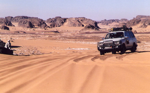
Djado, Djaba and Orida
In Chirfa we hired a second guide; a Tubu who knows the area very well. He was an old freedom fighter commandant costing CFA 10,000 per day. According to our guide it was the Tuaregs who are stealing cars from tourists, not Tubus. There is peace now; the former rebels are almost all integrated in the police force and the army.
We took off to see the places of interest around Chirfa and our first stop was at the Arch de Fadagana; a wonderful arch shaped by millions of years of wind erosion. Yes the wind, it is the first time that we felt the strong wind blowing, carrying lots and lots of sand and making it rather unpleasant to be outside. The rock formations in this area are most bizarre; all have interesting shapes. We also visited some rock engravings (elephants and giraffes).
A very sandy track leads through a green area to the fortified village of Djado. Ancient Djado, built from mudbricks, is situated on the top of a small hill. In its 18th century heyday it must have housed more than 1000 inhabitants. It has many small streets, houses, etc. The complete village could be sealed off to protect it from attackers. The village had its own well, which looks very dirty today. Interestingly the area around the village is under 1 meter of water from December to April. We also visited Djaba, a similar fortified town.
Behind Djaba there is a well, which you can hardly find; in the centre of an old tyre lying in the middle of nowhere, similarly there is a well at the foot of the Ouarek. Between the two wells there is a Tubu military post. We made camp at a superb site at the foot of the distinctive Orida outcrop.
The scenery in the Chirfa, Djado, Djaba area is magnificent, with steep, wind-eroded hills (Ouarek, Ehi Guezebida and Orida) rising up from sandy plains interspersed with small oases and mountains in the background. The only disadvantage was the strong wind that was blowing. In fact, it was extremely uncomfortable and it had a negative influence on the spirit of the group. Did we really have to go all the way to Enneri Blaka? But it was less than 100 km away! We would go.
Enneri Blaka
Enneri means valley, while Blaka is the name of a famous Tubu freedom fighter. Dunes Voyages had indicated that security in the mountains was no problem; except for a few tribesmen the Tubu were at peace with the Niger government. Take a Tubu guide and you are OK. We had to climb the ridge to get into the Enneri Domo, which leads to Enneri Blaka. The ascent (550 metre) is difficult; sand, with rocks then just sand. Once up, we followed the Enneri Domo, a wide valley with black mountains all around. The going is very slow and the landscape – although an interesting moonscape – does not change anymore and becomes monotonous. The valley is extremely dry; there is hardly any vegetation; just an occasional tree or bush. It has not rained in Chirfa for 11 years; in the mountains it rained only once during that period.
Then we joined the Enneri Blaka and the scenery changed to white/yellow sand alongside the very black hills. It was worth the five hour drive. To get to the ‘submarine’ rock formation which holds the rock paintings, we had to drive up a sand dune.
We decided to take a different route back and took the turn off to Seguedine, up to the Oleki, where we were two days before. This time we did not need the guide to tell us how to get to Chirfa. We decided to go cross-country, just before the Oleki and had a great experience, by complete off-road desert driving without the help of the Tubu guide. In fact, the waypoints of two days ago were used to get us to the site were we camped two nights before. This was the track the guide should have taken the first time.
Next morning we drove to Chirfa, using a track, which passes the oasis of Sara, as well as Dabasa at the left side. This track avoids the military checkpoint. In Chirfa we said farewell to our Tubu guide, took fuel (CFA 400 per litre; we were told that there is always fuel in Chirfa) and water. Returned to the military post to get our passports back and ready for the crossing east. We were promised that we would see ‘beaucoup de rien du tout’.
Crossing the Tenere du Tafassasset
We left the military post, passed through the Col de Chandelier where rock formations are again carved by years of wind erosion into fascinating objects. From here the real Tenere starts. It becomes flatter, less stony and more sandy. Initially, we could only reach 35-40 kph, but later we drove at 80. Soft sand does not permit the car to reach higher speeds. In fact, do not stop, keep speed or get stuck. The car was using lots of fuel. It all is very unreal; sometimes you think you go uphill, but you’re not; sometimes downhill, but no. All around it is flat, sandy and barren. We met nobody no other life sign. Suddenly we saw a falcon flying; what is it looking for? It means there must be something to feed on in the desert.
Then vaguely, far ahead of us a small hill appeared. Was this Grein? No Grein was still too far away. It was Arbre Perdu. How was our guide able to find this small hill in a vast sea of nothing? Arbre Perdu is nowadays called Arbre Thierry Sabine (originator of the Paris-Dakar rally). It is not much of a tree, but there is a little greenery that tries to survive. Then, after more driving through a sea of sand, we reached Grein, a series of hills 165km away from Chirfa; we took 4 hours to reach it. It was midday and the temperature was pleasant, mid-30s.
Off for the last 200 km to Adrar Bous; stopping remained risky, keep going. As soon as the hills of Adrar Bous came in view, the landscape became stunning. A number of individual, black hills were rising from the sand. It all looked like an ocean of sand with a few rocks. Crossing the Tenere du Tassafasset took a little more than 7 hours.
We camped near Adrar Bous. It was the first cold night, approximately 12C. Near our campsite we found Neolithic arrowheads. From Adrar Bous, we drove to the Dunes de Temet. Then in four days back to Accra in Ghana, completing a 7500-km trip.
Summary
The crossing of the Tenere from Adagez to Bilma and from Chirfa to Adrar Bous was a great experience. It was the first time that we were in a real desert. You are really on your own out there. While crossing such an immense sand sea you realise how small human beings are. The camel caravans are a sight not easily forgotten. All along it felt like being in a little boat on a big ocean. Anything could go wrong and what next? Security wise, we always felt safe and never had the feeling that we had embarked on something that was dangerous. One must however be well prepared; it is not a trip that can be undertaken without thorough preparation.
A guide more than one car are essential. Cars must carry up to 240 litres of fuel. Deflated tyres, almost all the way, are essential. Expect heavy fuel consumption of around 4.5 kpl (14 mpg).
September/October is indeed a good period to visit this area. The temperature during the day is in the 30s (up to 40) and not colder than 10 during the night. We only had a very nasty wind in the Chirfa area.
Tony and Elly van Gastel
Surfing the Internet produced many disturbing messages such as:
“Avoid the tracks round Agadez absolutely”
“Tuaregs steal cars”
“An Italian died who was hit by a bullet between Niamey and Agadez”
“Police are corrupt and arrogant”
“It’s dangerous to travel in Niger”
“Only travel in convoy with a guide is allowed”
Then we contacted several people for more information. Here are a few of the responses:
“I can – with complete peace of mind – invite you to visit this wonderful country.”
“A lot of people will spend the new millenium in the desert.”
“There is still some risk, which can be minimised by hiring an experienced guide.”
“Bandit Tuaregs steal cars, if you are not accompanied by a Tuareg guide. If this happens, give up the car. The Italian who died, refused to give up his car and raced off.”
“Two cars are not really a luxury, but a safety measure.”
Based on these responses Niger’s Air Mountains and Tenere Desert was on.
To arrange a guide, we tried to contact several travel agencies by fax. We got only one reply and the agency wanted to charge 70 FF/per person/per day. While we were in Niger, we realised that travel agencies are not interested in providing a guide only; they like to arrange a complete package, including cars, tents, food, drivers, guides, etc. In the end we arranged a guide through friends in Niamey (using e-mail) for which we paid CFA 24,000 per day for the group.
The trip would take us from Agadez into the Air Mountains (Elmeki, Timia, Assode, Tchintoulous, Zagado valley) and then to to the Arakao Crater, Adrar Chiriet, Tezirzek, and Temet. Then back via Iferouane to Agadez.
On December 21, 1999 we departed with 5 persons in 2 cars (one Toyota Landcruiser and one Land Rover Defender 90) . It took us 4 very long days to get to Agadez (2500 km from Accra). We had a few problems on the way, which almost made us abandon the whole trip. Just before Bolgatanga, the Land Rover developed an electrical problem. The car had been in the workshop in Accra for exactly the same problem and it had taken 4 days to rectify it. We were worried that nobody would be able to fix this in a ‘remote’ area like north Ghana. We all had visions of an early end of our desert trip. It appeared a fuse, which kept on blowing and we fixed it by putting a 20 amp fuse instead of the recommended 5 amp one. We all hoped that this would keep us going. And it did!
On on to Niger
All the way from Accra the road had been good, but immediately after the Burkina Faso border with Niger the road deteriorated enormously. We had our next serious problem when the Defender’s roofrack came almost off the car. It jumped out of the gutter of the car, after the mounts got completely bent. We moved the roof tent onto the roofrack of the Toyota and completely dismantled the 90’s roofrack. Three hours of hard work and we were on the road again. We spent the night at the completely empty ‘Niamey’ camping. We noticed that the temperature at night got cooler and cooler. We wondered what it would be out in the desert. We were not really prepared for cold weather. Next day we drove to Agadez (950 km), where we arrived one day too late.
Departure from Agadez
Our Tuareg guide had been waiting for us all day. The travel agency insisted we must carry 285 litres of diesel per vehicle, when leaving Agadez. Fuelling and stowing the 570 litres for the two cars took quite some time. With four persons (including the guide) in our car, 285 l of fuel, 80 litters of water, the luggage, spare parts, sand ladders, spare tyres and food, the car was fully loaded. We wondered how it would be able to travel through soft sand.
The travel agency had arranged the travel permit for our trip. It seems that unauthorised travel is not allowed.
We still had another problem. Our Laissez Passer would expire before returning to Agadez. At the border they could only issue a Laissez Passer with a validity of 7 days. We discussed this with the travel agency and they would arrange the ‘prolongation’. They kept the original and we travelled with a copy. They advised us to give a little ‘cadeau’ to police officers, when necessary.
It was completely dark when we finally left Agadez. We camped approximately 6 km out of Agadez.
Christmas in the Air Mountains
The track was going through the typical transitional zone between the Sahel savannah and the real desert with a few bushes. Occasionally we had to cross a very sandy wadi (4WD necessary). Along the wadis, where the water is not far down, sedentary Tuaregs have their ‘jardins’ (gardens), were they grow tomatoes, onions, peppers, and dates. Soon the track became stony and small, completely barren hills could be seen in the distance. Then we drove on a plateau (500-600 m high) with black basalt hills all around us.
We met several Tuaregs on their camels and took many photographs. The mountains got higher and more impressive. We stopped at one of the ‘jardins’ to see how they use a camel to pull the water from a waterhole to irrigate the field.
The mountains were now almost completely barren without any vegetation, except along the wadis. At one time we went up to almost 900 meters. We spent the night in a beautiful wadi with trees to protect us from the cold desert wind. We all enjoyed the Christmas dinner of baked beans and a bottle of wine. In the evening a nasty cold wind started blowing and we changed into long trousers, extra pullovers and shawls. Our guide Ahmed told us that this would be only the beginning; it would be much colder once we were out in the real desert.
Next day the route continued over a plateau; sometimes stony, sometimes less, always with beautiful black or reddish mountains around us. Occasionally we had to climb a hill. In the village of Kripkrip we saw again a lot of ‘jardins’. We climbed up to almost 1000 meters before descending to the village of Timia. Just before Timia, in the middle of a very stony area, is a small waterfall. It must be fun to take a swim in the small lake when visiting the place during the hot season (if it has not dried up by then).
Timia is a real oasis. An restored fort from the French period is overlooking the wadi and the village. In the background is the peak of Adrar Egalh (1974 m). Everywhere are ‘jardins’ along the wadi. From the waterhole of one of these gardens we replenished our water supply. From Timia, we continued to the ruins of Assode, the old capital of the area some 100 years ago. Only some remains of walls are left. The area is littered with pottery sherds.
We then followed the Zilalet wadi. Far in the distance is the Agueraguer mountain (1730m) with the village of Tchintoulous (not more than a few huts; but quite a number of gardens) at its foot. A few kilometres east of the village we set up camp for the night (altitude 875m). Empty plastic jerrycans were given away to the occasional ‘visitor’ of our campsite. Often they ask for medicines and small gifts are always welcome. That evening a very cold desert wind kept the temperature low. We slept in our sleeping bags with all our clothes on. Next morning it was approximately 5°C (Brrrrr).
Through the Zagado Valley to the Tenere Desert
We would finally go to the real desert; the Tenere. First we drove through the Zagado valley. Very sandy but with beautiful white sand and with black mountains at both sides. Then, slowly we drove away from the Air Mountains and entered the real Tenere. The scenery is exactly as you see on photographs; endless undulating sand hills, devoid of any vegetation. Nothing to see, but unbelievably beautiful. We spotted a desert fox. We had to use 4WD all the way. The route goes uphill and downhill; kilometre after kilometre. The guide warned, that we had to be careful when driving uphill. Before descending you have to ensure that the wind has not converted the sand dune at the backside into a descent too steep for cars.
Arakao Crater
We had to negotiate a lot more of soft sand before reaching the huge sandy Arakao Crater with a diameter of 10 km and rock formations around it. We made camp at a beautiful location. Ahmed had warned us that it would be cold, since we were now in the desert. We, therefore, collected lots of firewood and lit a fire when it started to get cold. It became colder and colder and next morning it was below zero degrees.
We were only one week from home, but felt that Accra hardly existed and that we were away from all civilisation. In the morning we got the fire going again, had hot coffee and prepared for departure. An Egyptian Vulture was soaring overhead. The Toyota battery did not seem very happy because of the cold, but the car did start (only just).
Adrar Chiriet
We were driving along the Taghmert (1637m) in the direction of the Tamgak (with peaks between 1600 and almost 2000m), when we passed a group of camels, carrying the baggage of a group of tourists, who were making a camel tour.
Somewhere at the foot of the Taghmert we drove to a waterhole to replenish our water supply. Then we followed the Wadi Tchou-m-degdeg in a northerly direction. At last we turned east and drove straight towards the Adrar Chiriet. It looked like an 8 lane highway; completely flat and you could drive were you wished. We made camp in the centre of the mountain, under one of the few trees that could be found. We pulled a big dead tree to the campsite, so we would have a fire to keep us warm in the evening.
Rock Engravings
Early in the morning we drove back towards the Tamgak. The sun was still very low, and drew fantastic shadows on the sand dunes; we do not make much progress, because we made one stop after the other to take photographs. This really was worth all the trouble (mainly the cold) we had gone through. We were now on our way to the rock engravings in Tezirzek. Several articles with beautiful pictures have been published in the National Geographic over the past few years. It was impressive indeed.
Temet
After Tezirzek we headed for Adrar Greboun with peaks between 1500m and 1950m. When leaving the Greboun behind, it becomes more sandy and the scenery gets better. When reaching the Col de Temet, we were surrounded by 200-300 meter high sand dunes. Beautiful, the best we had seen so far. In this superb setting, we made camp. The altitude was 950m; the temperature still 27°C. We climbed one of the high sand dunes, a tough job; there are more sand dunes further afield, undulating like an ocean.
The day before we had seen our first ‘gazelle’ (Dorcas antelope) and we now saw many more. According to the books there are more species of antelopes around. At dusk we spotted two silver-backed jackals near our campsite.
Early next morning, we left our campsite. We reached Iferouane, a nice village, with only mudbrick buildings, where we had to report to the police. We worried a bit, because we only had a copy of the Laissez Passer. However, they only asked for the travel permit and we had to pay CFA 1000 per passport. Then 140 km over a dirt road and 185 km over an excellent tarmac road took us back to Agadez.
Agadez again
Agadez also has a mysterious connotation, like Timbuktu. An intriguing city, with mainly mudbrick houses and with a beautiful Sudanese-style minaret on the great mosque. Decorations on mudbrick houses and doors are, however, minimal. Still, it is good to wander around in the old city, where it seems that time has not moved much. The famous Air Hotel is supposedly the place to be. The hotel looks dilapidated, but sitting on the roof terrace and watching the Tuaregs go about their business is a nice experience. For the extension of the Laissez-Passer we had to pay CFA 10,000.
Back to Accra
In three days we drove back from Agadez to Accra. We had been away for 15 days, driven 6200 km and been in the car for 123 hours. For us none of the disturbing messages found on the Internet were true; police officers were correct and friendly, and we never had the feeling that it was dangeous. We had a very good time in Niger; it was the best trip we had made in the last 10 years. However, we decided never to travel in December ever again. It was just too cold at night!
Waypoints
Where there was a clear track on the 1:200,000 IGN maps, we had entered the waypoints in the GPS before departure from Accra. These were generally accurate enough to travel without the help of a guide, which would have been more fun. However, the 1:200,000 maps do not show the track from Assode, via the Zagado valley, Kogo, Arakaou Crater, and Adrar Cheriet to Temet and it would not have been possible to do this stretch without a guide.
