Author Archives: Chris S

Desert Travelling – Geographical magazine 2001

Readers of Wilfred Thesiger’s Arabia journeys may recall the value his Bedu companions placed on their camels. Although they were at times driven to death (and thereupon eagerly eaten), the camels’ well-being came before that of their bearers, for without camels they were doomed. Steadily hauling loads across vast distances, desert nomadism could reach beyond the systematic walkabouts from waterhole to waterhole. “Ships of the desert” is an apt proverb, for who could cross an ocean without a ship.
While caravans traversing the deserts of North Africa and Asia conjure up a romantic image, the advent of motor vehicles has relegated camels to touristic excursions, a ‘back to my roots’ status symbol in some Saharan countries or merely just meat. The hardship which Thesiger and Asher tasted is a thing of the past and most nomads, ever pragmatic, don’t regret it. For outsiders the idea of camel travel is undoubtedly rewarding, but successfully buying and managing some beasts takes experience.
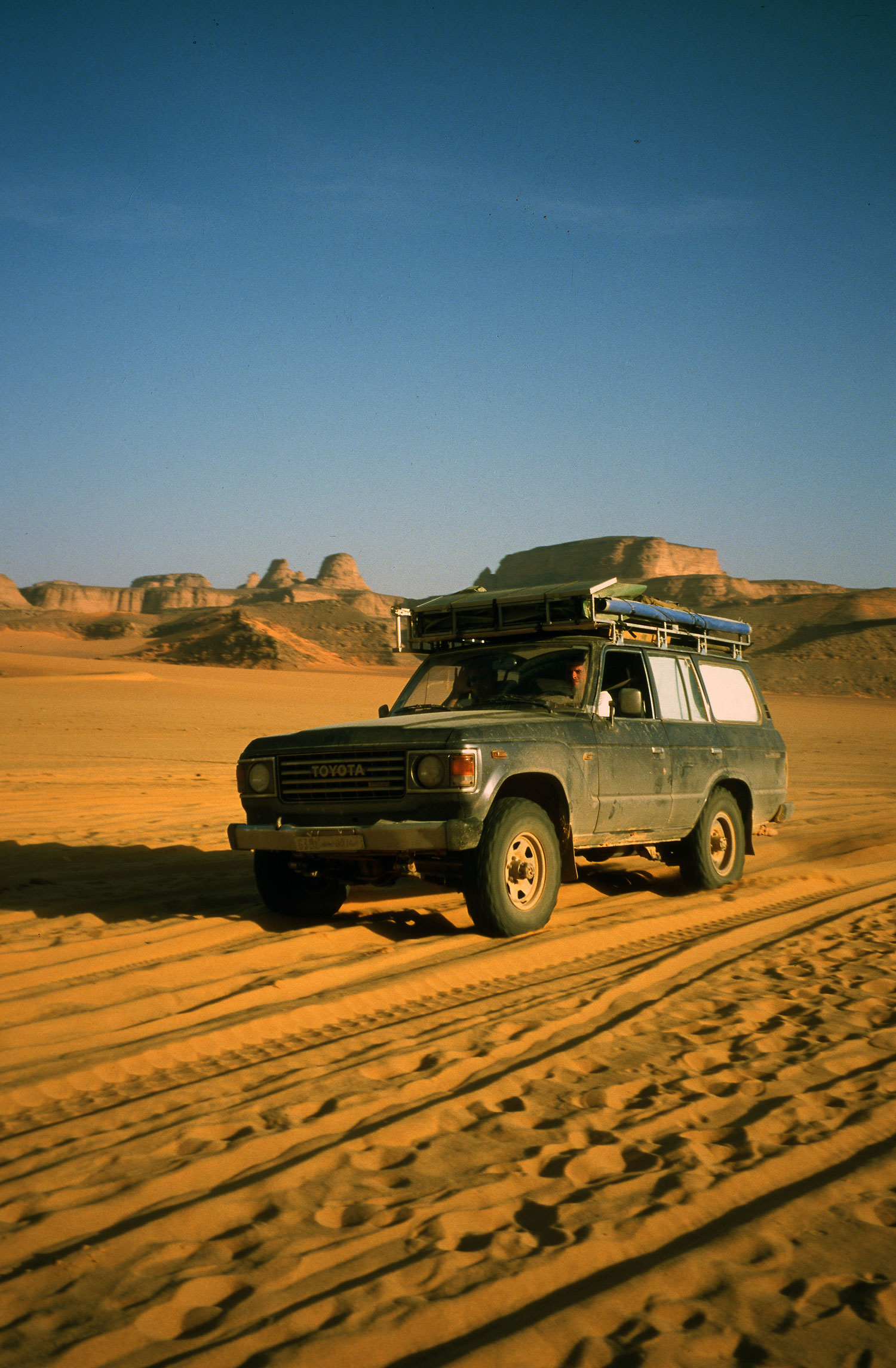
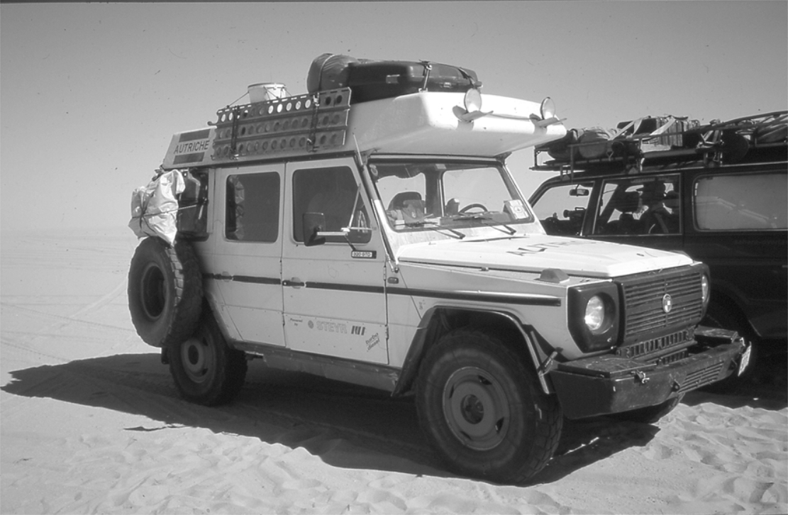
For most of us then, an all-terrain vehicle adapted for payload and long range fits the bill. 4WD sales flourish as emblems of macho ‘go-anywhere’ chic, but the best models make ideal transportation for a desert adventure, as well as day-to-day runabouts.
Desirable qualities include: payload and space – choose LWB models with heavy-duty suspension capable of carrying up to 500kg without sagging; robustness – not all 4WD-badged vehicles are fit for the desert; mechanical simplicity no longer sells new cars but it’s what most drivers and bush mechanics can fix; ground clearance is much more useful than all-wheel drive (which explains the efficacy of certain 2WDs in deserts; performance – power to get you over dunes with 400 litres of fuel and water, plus the economy to make that fuel last. Turbo diesels are superior in this respect and the norm for working 4WDs. Finally, consider parts availability and interchangeability. A GM Humvee may turn heads down the Kings Road but you won’t find it’s unusual 17″ tyres or much else GM in the Sahara. Here, as in most other remote areas, Toyotas and Land Rovers rule the roost and there’s a good chance of finding spares or know-how if you need it.
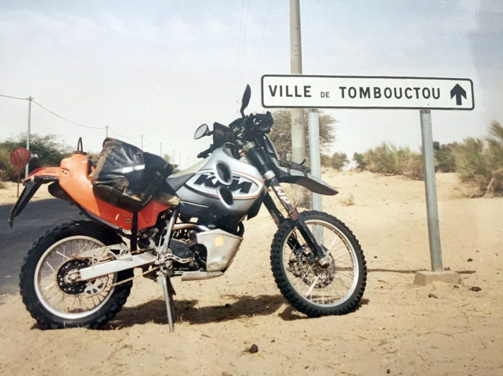
All-terrain trail bikes are closer to the dromedary experience and can reach places 4WDs cannot. For the desert a four-stroke single of around 600cc offers the best power and economy-to-weight ratio; a critical factor when riding off road with a 50kg payload. So too are knobbly tyres – anything else is unstable on sand and gravel. Note that models (and so parts) over 125cc are rare outside the developed world so choose simple and reliable Japanese or European examples.
The limitations of two-wheeled freedom is range (typically around 600km/3-4 days in winter, about 30% of a 4WD) – and the riding skill needed to keep a loaded machine upright in soft sand. However, an agile unloaded enduro bike can make a useful addition to a conventional expedition, saving hours by reconnoitring the best route through difficult terrain or nipping into town on an errand.
Thorough and appropriate vehicle preparation is at the core of a trouble-free trip. A car doesn’t need winches, bull bars or banks of spotlights (there’s nothing to winch off, nothing to crash into except each other and night driving should be avoided at all costs). Focus on fundamental things like the condition of the radiator, hoses, belts and transmission as well as suspension and tyres.
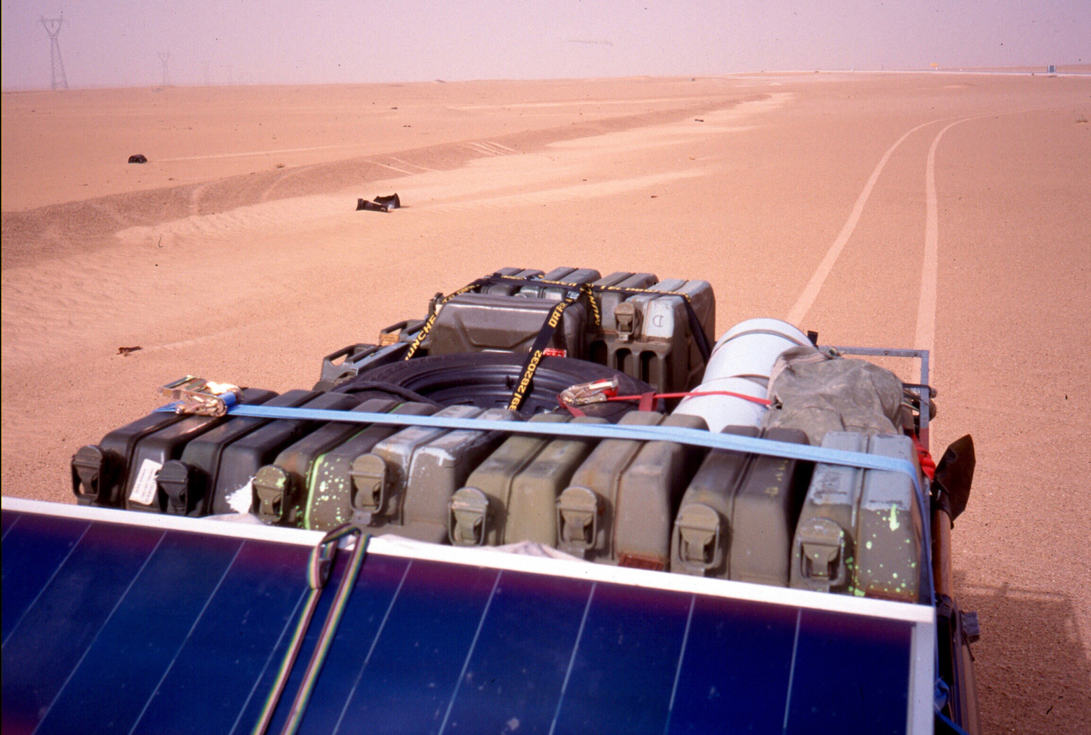
Securing your payload while maintaining day-to-day accessibility is an art. On both cars and bikes mount heavy items like fuel and water low and between the axles. Avoid overloaded roof racks which reduce stability and fuel economy – most desert returnees barely use them. A fully-loaded test drive incorporating an overnight camp will highlight the effectiveness or otherwise of your set-up while giving you a chance to revise it. Start packing gradually a couple of weeks before departure, ahead of the inevitable nerves when mistakes can be made. Calculate fuel needs at 5kpl (15mpg) for a turbo diesel or 15kpl for a bike. This covers occasional dune crossings and so includes a healthy reserve. In winter, water capacity should be 10 litres per person per day – leaving you plenty for emergencies or the ability to pass on impure sources. For various reasons, (quadrupled water consumption being just one) summertime desert travel should be left to scorpions and snakes (which, incidentally, you’ll never encounter in winter).
Long before your vehicle is adapted or even purchased, information about your region must be sourced and may decide your route or even destination. A realistic itinerary and schedule (not a publicity-seeking stunt – even for charity) is as vital as a sound vehicle. I was recently asked to advise a group intent on crossing Mauritania in summer in a double-decker bus! (a prank, I assumed) and another wanting to follow the Saharan Tropic of Cancer (just look at the map…).
I’m no stranger to over-ambitious planning but vague, outdated or inaccurate information, often from official sources, is prolific. One magazine recently discouraged travel through Western Sahara (now essentially Morocco) – a region that’s hosted the main trans-Sahara route for the last decade! So we can be grateful to actual travellers and the Internet which, for all it’s junk, can tell it like it is.
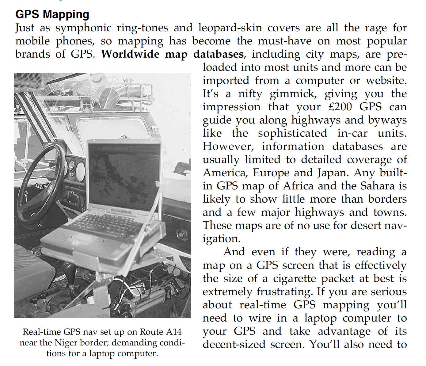
Desert navigation adds up to more than owning a GPS. Without good maps (or a local guide) you’re helpless. For much of the planet the best maps (1:1 million scale is ideal) were meticulously compiled at the end of the colonial era. The Cold War which followed bought about an unprecedented programme of satellite mapping. Neither of these feats are ever likely to be repeated but now stunning satellite imagery is available free on the Web (try http://images.jsc.nasa.gov).
With maps, satellite data and, of course, a GPS to confirm your position and orientation, the desert is yours. In most cases routes follow a recognised track, but in areas of mineral exploration these can get confusing. A good navigator always has a finger on the map and never makes assumptions.
Desert driving is technically simple. Tracks are mostly well formed and level, natural obstacles are avoided, with visibility and weather usually perfect. About 200 kms per day is an average maximum in the Sahara. Dunes are another matter, demanding an incompatible blend of momentum and caution. At times crests must be laboriously recce’d on foot to prevent disastrous tumbles. GPS is of minimal use as passable routes change but reducing tyre pressures to 30% transforms your vehicle’s traction. In my experience a powerful compressor to control pressures is far more useful than sand ladders. Short range radios are also a boon, but may need to be discretely used and stashed.
Much of the exhilaration of desert travel derives from confidence inspiring navigation, traversing challenging terrain and the satisfaction of self sufficiency. The cost of all this adventuring is the price you pay when things go wrong (or indeed just worrying about it). The stories we occasionally read in the Sunday papers about tourists ‘burned alive’ in the Sahara or the Outback are usually holidaymakers in a rented hatchback who bite off more than they can chew, not those engaged in thoughtfully-planned adventures. Then again, earlier this year three experienced Dutch travellers were robbed and murdered in northern Mali along a smuggler’s route long avoided by tourists.
A typical survival scenario develops from a combination of bad luck and poor decisions, planning and preparation (as with the Dutch). Mishaps can happen to us all but avoiding hasty judgements &endash; understandable when in a mild panic) &endash; may your life. On my first Sahara trip I broke down halfway across. Having repaired my cracked fuel tank I decided to turn back. Things didn’t get any easier from that point but knowing when to turn back has enabled another two decades of fabulous desert travel (plus the bits in between!).
Like GPS, satellite telephones make it sound easy, but without a contingency plan in place who are you going to call? The deserts of developing countries have no rescue service. You’re on your own, but with reserve water and other vehicles the danger is minimised.
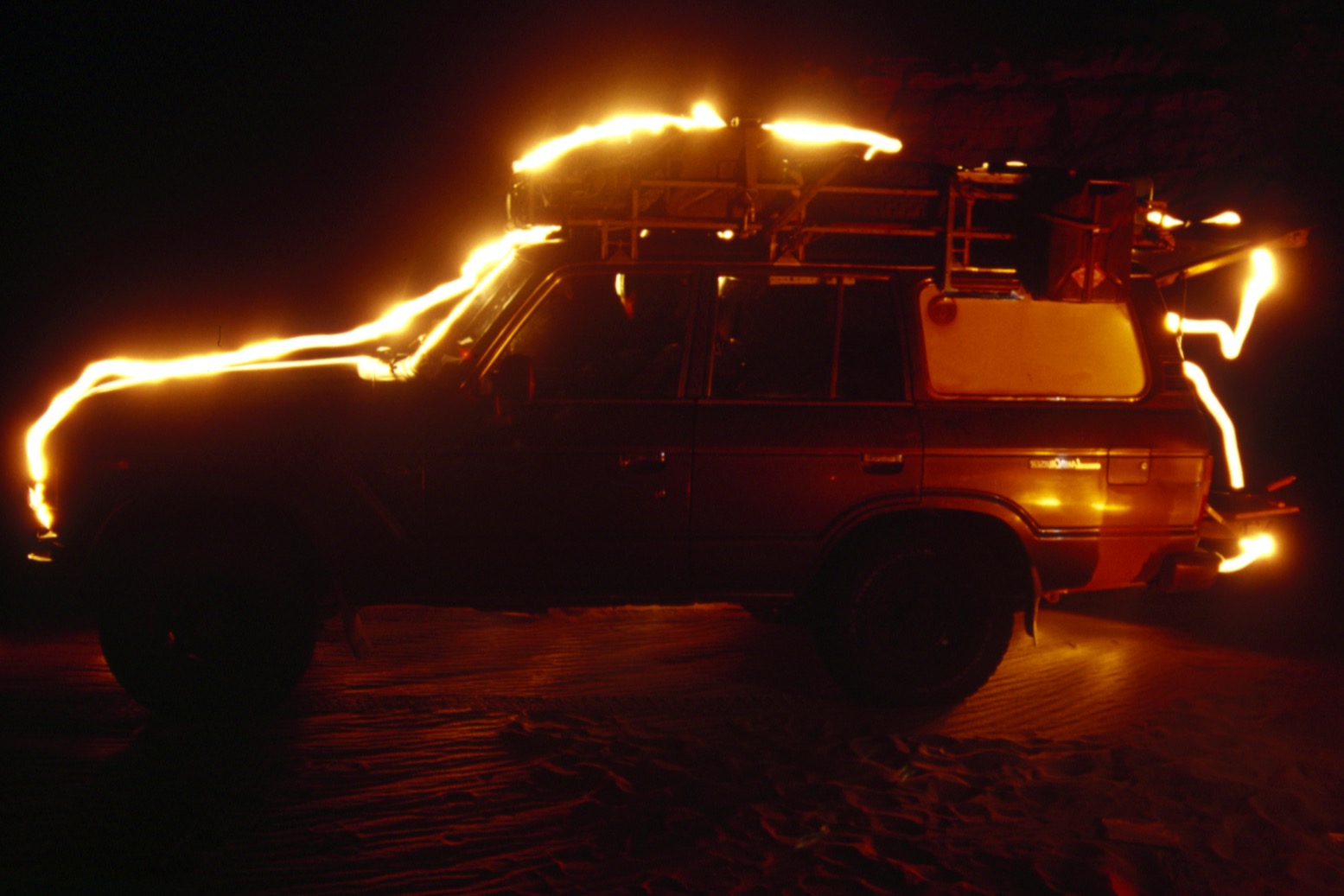
An absolute meltdown scenario might be wrecking a vehicle in the dunes while lost, alone and off-route. Without a mobile vehicle you’re in the hands of the gods so, as in the Flight of the Phoenix movie, or a Bedu thrashing an exhausted camel, do whatever it takes. If rescue seems possible have a fuel-soaked tyre or seat ready to ignite – or a head lamp and battery at night. Signal only when signals might be noticed, not on the off chance or at distant aircraft. Conserve energy and water by lying in the shade, but don’t underestimate your ingenuity in a crisis – a strength few of us know we possess. Walking out, unless you’re certain of reaching an attainable destination, is a last resort during which most people perish.
An arid wilderness is unforgiving and the crux of desert survival will not be found in an SAS manual, but stems from an appropriate vehicle, season and destination.

Originally published in Geographical magazine, January 2001


Libya – Niger – Algeria (2002)

Charles Megaw and Jo Butler

Crossing the Sahara desert had long been an ambition of ours. In autumn 2001 we bought a Toyota HJ60 and arranged to take some time off work to do the trip. We wanted to cross the desert north to south, tarmac to tarmac, but didn’t want to do too much backtracking. We settled on attempting to head south through Tunisia and Libya to Agadez in Niger, returning north through Tamanrasset and the Hoggar to Tunis. This route had the advantages of enabling us to fully explore Libya, a country only just opening up to tourism, cross the remote Ténéré and make a return crossing via one of the classic trans-Saharan routes, itself only recently considered safe after the Algerian civil war and Tuareg rebellion. On January 10th 2002 we left home.
Our first challenge was to replace a Michelin XS tyre which blew out on the French autoroute. We found one in Lyon at a considerable discount to what we had paid for new ones in the UK – we should have bought them all in France which would have saved us money and reduced the risks involved in driving on sand tyres on wet winter roads through Europe.
The CTN Ferry, the Carthage, to Tunis was much less eventful and we rolled off at 4pm and spent the first night in Hammamet, 60 kms southeast of Tunis. Hammamet seems a good stopping point for people heading south. We got good value accommodation at the Résidence Hammamet (22 TD a double ~£11), had a large beer at the bar overlooking the Medina followed by a splash-out meal at Les Trois Moutons, reputably rated one of Tunisia’s top dozen restaurants.
We then spent an enjoyable few days meandering down the east of Tunisia visiting the Roman ruins at El Jem, the Berber towns of Matmata, Chenini and Tataouine, the fort at Ksar Ghilane and the island of Jerba.
Leaving Tunisia was reasonably straightforward although customs made us sit around for half an hour for no apparent reason before letting us leave. All the local cars heading to Libya were being pushed to conserve the last drops of fuel before they reached cheap Libyan supplies.

Libya
Getting Libyan visas had been a rather tortuous and expensive affair. We hooked up with two other travellers, met through the Sahara-overland forum, and got Jamal Fteis of Arkno Tours to send an invitation for the four of us to the Libyan Embassy in London (US$100 per visa). Having got template stamps for an Arabic translation of our passports at the Passport Office, we got Hamed Kalifa to do the translations and manage the process through the Libyan Embassy (£130 per person for an Express Service). We got the visas back within five days, and given one of these was New Year’s day, we were pretty happy.
We also used Arkno to help us get into Libya at the Raj Adjar border (US$270 – ostensibly 120 for the guide and 150 for the cost of paperwork). Nabil, our guide was excellent. He met us just after we left Tunisan customs and we waited while he did all the paperwork for us. This is all in Arabic and given the border officials weren’t especially welcoming and spoke very little English or French we were glad of his help. We got Libyan number plates, a carnet de passage with insurance, a permit which we assume is similar to a permit de conduire in Tunisia and a copy of the Arkno Tours invitation as well as stamps in our passport. Having paid Jamal in advance we had no money to pay and therefore did not change any money at the border. Customs was straightforward – no currency declaration and we were asked only to open the car doors and confirm that we weren’t carrying alcohol. The whole process took a bit over an hour.
We then followed Nabil to Zuara (60km towards Tripoli), had a coffee with him, changed some money and said our farewells. The currency black market in Libya seems to have dried up. We had ignored the swarms of money changers waving wads of Libyan dinars in Ben Guerdane on the Tunisian side of the border offering 1.3 for a dollar. We got 1.45 with the money changer in Zuara. In Tripoli the money changers in the Medina wouldn’t go above 1.5 so we changed at the bank in the al Kabir hotel for 1.53.
Despite what we had heard, we were surprised by how easy it was to get around Libya on our own. We were waved through most checkpoints and when asked to stop, it was only for the routine name, profession, father’s name etc. The only bureaucratic pain we encountered was the need to re-register with the police within five days. We ended up doing it on our own in Tripoli because we weren’t staying long enough at our hotel (the Qasr Libya) for them to do it for us. We followed the Footprint guide recommendation and got a taxi to the passport office (the Jawazat) – it would be impossible to find on your own. It was quite a palaver given the language difficulties but we eventually worked it out. You need to get two copies of two forms from a hut at the front gate (1 LD), have the forms filled in by a translator who sits under a tree outside the main building (2 LD) and then have your passports stamped in the office up the stairs round the side of the large building (5 LD). You can also get the registration done in Ghadames if you are going straight there and probably in most other major towns which may be more straightforward.
We had stopped at the Roman ruins of Sabratha on the way to Tripoli and were keen to continue on along the coast to Leptis Magna before heading back to Ghadames. Both sets of ruins are really remarkable and definitely worth the detour however keen you are to get into the dunes.
On the way to Ghadames we explored the ksour in the Berber villages of Yefren, Kabao and Nalut. Nalut’s ksar is a particularly fine example and has had some restoration work done recently. The Nalut Hotel, overlooking the ksar, is currently closed for renovations but should be a great place when it’s finished. We tried to get the Café Nassen el Jebel to put us up but although they were very friendly, they weren’t keen. We therefore had no option but to stay at Funduq Nasim (10 LD pp), which was disgusting. In retrospect, we should have driven on and camped.
After exploring Ghadames, we crossed the Hamada al Hamra from Derj to Idri. Apart from straying onto a newer more southerly piste soon after leaving the tarmac which required a bit of slow cross-country to get back to the old piste, navigation was straightforward. Traffic was light and we didn’t see another vehicle the first day and only a couple of local cars on the second. The army at the remote Uweinat Whin checkpoint were particularly friendly, especially as we were able to lend them a 12mm spanner which enabled them to get one of their Land Cruisers going again!
After a night in Sebha, we went on to the Dawada lakes in the Erg Ubari. We should probably have taken a guide here as this was our first real session in the dunes. Our first day was pretty eventful with 3 hours of digging and we strayed into the wrong gassi while trying to get to Gabraoun al Jadid and ended up driving directly to Um al Ma. The upside was a night at Um al Ma lake, a magical place. We returned the following morning and got the right gassi and made it to Gabraoun without further problem. The tracks to the northern side of Um al Ma from Gabraoun had been covered over by the wind but we found the route after a walk and held our breath down the steep descents to the lake. When we finally got back to the Africa Tours campsite that night, we were exhausted but exhilarated at what had been a remarkable introduction to dune driving.
The following day we went on to see the prehistoric rock art at the Wadi Mathendous. We asked the caretaker of the Germa museum about permits for the site and he sold us two tickets for 6 LD. The police at the Km 128 checkpoint didn’t recognise these and wanted us to have a permit from the Germa police but they let us through anyway. We shared the Wadi with a pair of howling jackals that night.
We motored on to Ghat for a tour of the Jebel Akakus. The road to Ghat is very fast with the exception of the last 50 km which is broken up. The Akakus was the only place we used a guide in Libya. It is compulsory and would be very difficult to do solo given the numerous control posts in the mountains.
We did a three day circuit with a guide from Awiss tours, based at Mohammed’s campsite in Ghat. Awiss Tours are a family of Tuareg who clearly know the area well and entertained us royally. Camel tours appear to be their specialty. The landscape was stunning and we think we saw most of the highlights but four days would have been more comfortable. Our only gripe was that our guide, Cheick, the youngest brother, wouldn’t stop talking and he became very irritating.
We really enjoyed Libya. The desert scenery was fantastic. We felt perfectly safe driving on our own, camping where and when we wanted. The people were exceptionally friendly and despite the difficulty of getting visas and getting across the border, we didn’t feel the bureaucracy too stifling. The downsides are soulless hotels, a lack of vibrancy in the towns and difficulty in communicating in languages other than Arabic.

Al Gatrun to Agadez – the Marlboro Piste
Throughout our time in Libya we had been trying to gather information on the safety of the border areas and routes south. It was difficult to get reliable information and we received a whole range of advice on the security of the Marlboro piste. We also had the option of crossing the border to Djanet in Algeria or, allegedly, even going directly to Agadez across the Northern Ténéré from Ghat. However, we resolved to stick to our plan and returned to Sebha before heading south to Murzuk.
Turning off the main Murzuk-Timsah road, we knew we were heading into frontier territory. The tarmac roads in Libya are generally in good condition but this section is appalling and after a few kilometres we took to the sand to save our suspension – the eastern side of the road was easiest to drive on. It took us nearly 3 hours to get the 150 kms from the junction to Al Gatrun.
We arrived in Al Gatrun to find there was no fuel there or further south in Tajarhi and no prospect of any arriving in the near future. Although we could have got a few jerries from truck drivers in the town, we decided to do a return trip the following day to Zuweila to get the additional 150 litres we required – another day on the road from hell.
In Al Gatrun, we were soon directed to Mohammed Tager who lives in the old Italian fort on top of the hill in the centre of town. Mohammed has done a good job keeping the place in good repair and caters for the few tourists visiting the town. He put us up in the fort and charged us 17 LD per night (5 LD per person and 7 LD for the car).
Mohammed also helped us with the exit formalities which were as convoluted as the entrance. We managed to negotiate three different sets of police, customs and immigration in about three hours. The Tourist police required two photocopies of our passport and visas (Libyan and Nigerienne) which we were able to do in town. We didn’t get our 50 LD deposit for the car number plates back from customs despite our protestations. We were even forced to sign forms to say we had received the money!
Whilst in Al Gatrun we received a formal warning from the Tourist Police that we could have problems as a single vehicle, hardening our resolve to find a travelling companion. With very few tourists in Libya as a whole, let alone Al Gatrun, it quickly became apparent that going with a big Mercedes 6×6 truck was our only option. These huge trucks usually leave in the early evening as it takes them a whole day to unload, have their cargo inspected by customs, and reload. We introduced ourselves to the driver of one and he was very happy for us to join them as if it was the most natural thing in the world for two tourists in a TLC to want to travel with his truck.
We rolled out of town at 4pm but didn’t get more than 10km before stopping. We waited until nightfall and then the lorry was repacked with further cargo loaded on, beyond the view of customs. Packing continued through the night and we eventually headed off the following morning to Tajarhi. The going was painfully slow. We averaged 30 kph as the Mercedes groaned under the weight of its load and the 75 returning immigrant workers perched precariously on the roof.
The sand fields beyond Tajarhi were a graveyard for trucks. We passed four that had been broken down for days. The occupants of our truck enjoyed throwing cigarettes and dates to the stricken passengers and watching the ensuing scramble. We had to choose between driving in the firm truck tracks with the risk of bottoming out or making our own tracks in the sand and getting stuck. We used both methods and got through needing only two quick recoveries. Once through the sand fields we kept driving along a rockier piste before stopping at midnight for the night.
We continued our slow progress the following day on a much more westerly route than the piste shown on the IGN map.
By lunchtime we reached a Libyan military base with a temporary airstrip (N22° 47.8 E14° 01.3). Customs officers were in evidence and serious negotiations were required to prevent the Mercedes being unloaded for a further inspection.
By early evening we reached a further Libyan army checkpoint right on the border (N22° 39.2 E14° 05.4) where we were warned of local bandit activity and were advised to stop for the night. We pulled up just off the piste within sight of the army base and were joined by a further Mercedes – other trucks however continued past us during the night.
We finally reached Madama by lunchtime the following day and formally entered Niger a full three days after leaving Libya.
In Madama, a convoy of five empty cigarette lorries and two military Toyota pickups had just left for Seguedine. We were keen to join this faster group and tried to get through the formalities as quickly as possible. Customs charged us 20,000 CFA for a laisser passer – with no exchange facilities, they let us pay US$30. The police gave us an arrival stamp and we ended up giving them US$10 in lieu of a random demand for 10,000 CFA so we could get away and catch up with the convoy which we did after a frantic 12km dash.
The terrain here was much easier and the lorries charged south at high speed quickly losing the army escort after one of the Toyotas got a puncture. We regrouped at the Mabrous well and then it was the turn of the Toyotas to tear off, leaving us behind when we stopped to make repairs to one of the lorries. We were left wondering whether there was any logic to the escort at all. After a lengthy stop to fix an ailing lorry transmission, we kept going through the night to arrive at the Dao Timmi military base at 2am. The piste between Mabrous and Dao Timmi is rough and heavily rutted with lots of risks of bottoming out. The lorries were pushing on in terrain that was much easier for them. We narrowly escaped being shunted from behind by a brakeless lorry several times.
We descended to the picturesque oasis at Seguedine, with small fort and saline, around lunchtime on the fifth day. There we were forced to employ a local Tubbu guide, Laouel Barka, in line with the current stipulation that all tourists should be accompanied by a guide when traveling in the Ténéré (15,000 CFA per day). Although initially exasperated by this demand, given we already had an escort and only wanted to continue for a further half day to Dirkou with the same convoy, we decided to use it as an opportunity to explore Djado and we waved goodbye to the trucks.
The local army chief, Lieutenant Ahmoudou Bossi, who had tried to help us reach a compromise with Laouel, invited us to spend the night in his compound and arranged for us to do a day trip to Djado without obtaining the requisite “feuille” in Dirkou. The following day we set out with Laouel to Chirfa, Djado, Djaba and Orida. The hassle factor seemed high in Chirfa and we were glad of having a local guide. Even though Djado is the most famous sight, we thought it definitely worth the extra effort to make it to Djaba and Orida and were disappointed we could not spend more time here. The army say that this area is now free of rebel activity and the Tubu checkpoint before Orida has gone – they wanted to make sure we weren’t going up to the plateau though. We bought two jerries of diesel in Chirfa on the way back (US$26 in lieu of 17,000 CFA), continued on to Seguedine for another night with the Lieutenant, and on to Dirkou with Laouel.
In Dirkou, we got a “feuille” to cover the rest of the journey to Agadez for 20,000 CFA – the price seems absolutely random. We stayed at Jerome the fuel seller’s compound. Jerome died in late 2001 and the place is now run by his son, Sergeant Boubacar Mohamed. We paid 65,000 CFA for a meal, a place to sleep and 200 litres of diesel. We thought this was generous as our friendly Libyan trucks had by now turned up in town and were willing to sell us a drum of diesel for 45,000 CFA. We also took the opportunity to grab a beer at Mariama’s Bar, our first for weeks.
Laouel, who had turned out to be somewhat mercurial, decided he did not want to continue to Agadez and we were also happy to be rid of an unstable character. Sergeant Boubacar arranged a new guide for us and we visited Bilma and then continued to Agadez via Achegour and the Arbre (50,000 CFA for the guide for however long it took). We were taken on a route that followed the balises between Kafra and Achegour. The sand was pretty soft and the going was slow at high revs and high fuel consumption. 50km after the Achegour well we came across a broken-down truck with 70 people who had run out of water. In exchange for some diesel we did a return trip to the well and brought them 250 litres of water. After spending the night with the truck, we continued on to the surreal Arbre de Ténéré. The section between the dunes just southeast of Adrar Madet and the vegetation-covered dunes close to the Arbre was very fast on hard flat sand.
We spent the final night at the small Tuareg settlement at Barghot. We had bought a gazelle during the day so feasted on gazelle stew, a great change from tuna pasta. Arriving in Agadez, it had taken us ten days to cover the 2200 kilometres from Al Gatrun with remarkable traveling companions and fantastic scenery. We were tired but triumphant.

Agadez to Tunis
We celebrated our successful desert crossing by booking into the Pension Tellit. This Italian-owned small hotel with only five rooms overlooking the Grande Mosque is beautiful and was a great escape from the stresses of travel – we paid 30,000 CFA per night for Room 4. The linked Restaurant Pillier is also excellent and equally expensive.
We used our time in Agadez to rest up and prepare for the next leg. We were able to refill a Camping Gaz 907 cylinder in the market but the internet has yet to come to town – the tour agencies are supposedly trying to organise the establishment of a connection.
We were aware of recent robberies, including the armed carjacking of a TLC from an Italian woman in the centre of Agadez in January, and felt nervous about security. There were unsavoury characters hanging around both the Hotel d’Aïr and Pension Tellit wanting to “buy” our car. The hotel organise a couple of policeman to sit outside to keep husslers away from their guests so they are also clearly concerned. We stored the car in the hotel’s secure compound on the outskirts of town. We also used the well-established French-run Dunes Voyages to get us a Tuareg guide for a two-and-a-half day trip in the Aïr through Timia and Iferouane, ending in Arlit (70,000 CFA including feuille) and left discretely early one morning.
We were a little disappointed with the Aïr mountains. The driving was hard over slow rocky terrain – it took 8 hours to do the 235km to Timia. The mountains and irrigated gardens were beautiful however and maybe we were just tired. We were told of continued bandit activity in parts of the Aïr, but our guide, Issaka, was excellent and we felt fine – maybe we just got lucky though.
We arrived in Arlit on the morning of the third day and didn’t stop. Entering town, we were hassled by a policemen because we hadn’t bought any insurance but the police in the centre were more friendly and let it pass given we were on our way out. We were now on our own again. The piste to the Assamaka border post was fast and easy to follow and we breezed through the exit formalities. There was one money changer selling Algerian dinar and euros.
The border area here is annoyingly off the edge of the Agadez and Tamanrasset IGN maps and with no waypoint we just headed north following tracks. We ended up missing the border post and drove straight into In Guezzam unchallenged. With the help of a local we tracked back the 10 or so kms and found the checkpoint (N19° 28.9 E05° 47.5).
Entering Algeria was easy with very friendly officials. We got the usual stamps, certificate and did a currency declaration. Customs asked us about cigarettes and “red” (whisky), but only wanted to check the chassis tied up with the number on our Vehicle Registration Certificate and didn’t do a full search. We were told to buy insurance in Tamanrasset which we subsequently did at CIAR near the Tourist Office (2,112 Algerian Dinar for 10 days). There was no fuel at In Guezzam but we could have got some at the police station if we needed it – this time we were prepared and had enough to get us to Tam.
There is lots of evidence of roadbuilding between In Guezzam and Tam with three different companies working on different sections. We didn’t find any ready to drive on and used the piste until 40 kms before Tam. We found route finding and driving very easy and we did Arlit to Tam in under two days including a night on the piste in Algeria.
In Tamanrasset we stayed at the Gite Saharienne run by the Bahedis. We had used their agency, Agence Tarahist, to get a certificate d’herbegement faxed to the Algerian Consultate in London so they would issue our visas. We had tried just a straight faxed reservation from a hotel but the Consulate wanted a certificate. Agence Tarahist charged us 330 CHF (205 Euros) for the invitations and a night’s dinner, bed and breakfast at the their lodge. This seems expensive in retrospect, but at the time, we were quite happy to pay for Agence Tarahist’s efficiency when we needed it. The lodge is also a great retreat and the food exceptional.
There were long queues for diesel in town but we were ushered to the front, afterwards leaving to do the Assekrem circuit, up by the Afîlal guelta and down via Ilâmane. Sunset and sunrise at Assekrem was fantastic and we had to adjust to being part of a group of tourists for the first time on the trip. The way down was very slow on an atrocious track but it was just about manageable (5 hrs). One of our side bars broke off but we put it down to 3,500 km of piste.
After a four hour delay waiting for diesel in Tam, we set off the next day on the easterly piste via Temékerest to Ideles. We got only a little beyond the Temékerest “waterfalls” before our exhaust began to give us major trouble, presumably another casualty of the return from Assekrem. Makeshift repairs the following morning didn’t last so we returned to Tam to get a new section brazed on.
When we finally got going, we found the piste to Djanet very enjoyable. We passed through Ideles (diesel available, no petrol) and we spent a stunning evening by a small dune bank under Telertheba mountain. We made Djanet the following day via the Erg Admer. Driving in the erg was pretty easy but we were glad of 1.2 bar to get up the first ascent. We stayed in the Hotel Zeriba in Djanet (1,200 AD for double with breakfast). The place was full of tourists which seemed to reflect lack of alternatives rather than the quality of the accommodation.
Short of time we got the Zeriba to organise a one day walk on the Tassili Plateau to Jabbaren, supposedly the second most important site of prehistoric rock art (5,700 AD for the two of us with a guide). The walk was beautiful and if you are time-constrained, there is a lot of art in a small area. One day was manageable – we left at 0600 and were back by 1730, tired but certainly not shattered. We didn’t want to spend another night at the Zeriba so camped in the dunes just outside Djanet.
We then headed north via Illizi and the piste to HBG. Driving out of Illizi, we found it hard to locate the piste and found ourselves too close to the dunes which ended up in difficult terrain. We tracked back and once we found the piste the route was obvious all the way. We found the driving slow on day one but enjoyed the opportunity to spend more time in the dunes.
We sped through the Gassi Touil and after a night in Hassi-Messaoud went on to the Tunisian border. Stone-throwing kids were well in evidence all the way from Touggourt to the border. We avoided damage through a combination of speed and screaming at kids about to hurl rocks. The police are well aware but don’t seem to want to do anything about it.
Leaving Algeria was slow with incompetent immigration and customs officers but we made it through in an hour and were back to the comparative civility of Tunisia. We mosied back to Tunis and reflected on our travels at Restaurant Dar el-Jeld in the medina, a fittingly grand place to end what was a remarkable and unique journey.

Traveller Magazine, Autumn 2003

trav

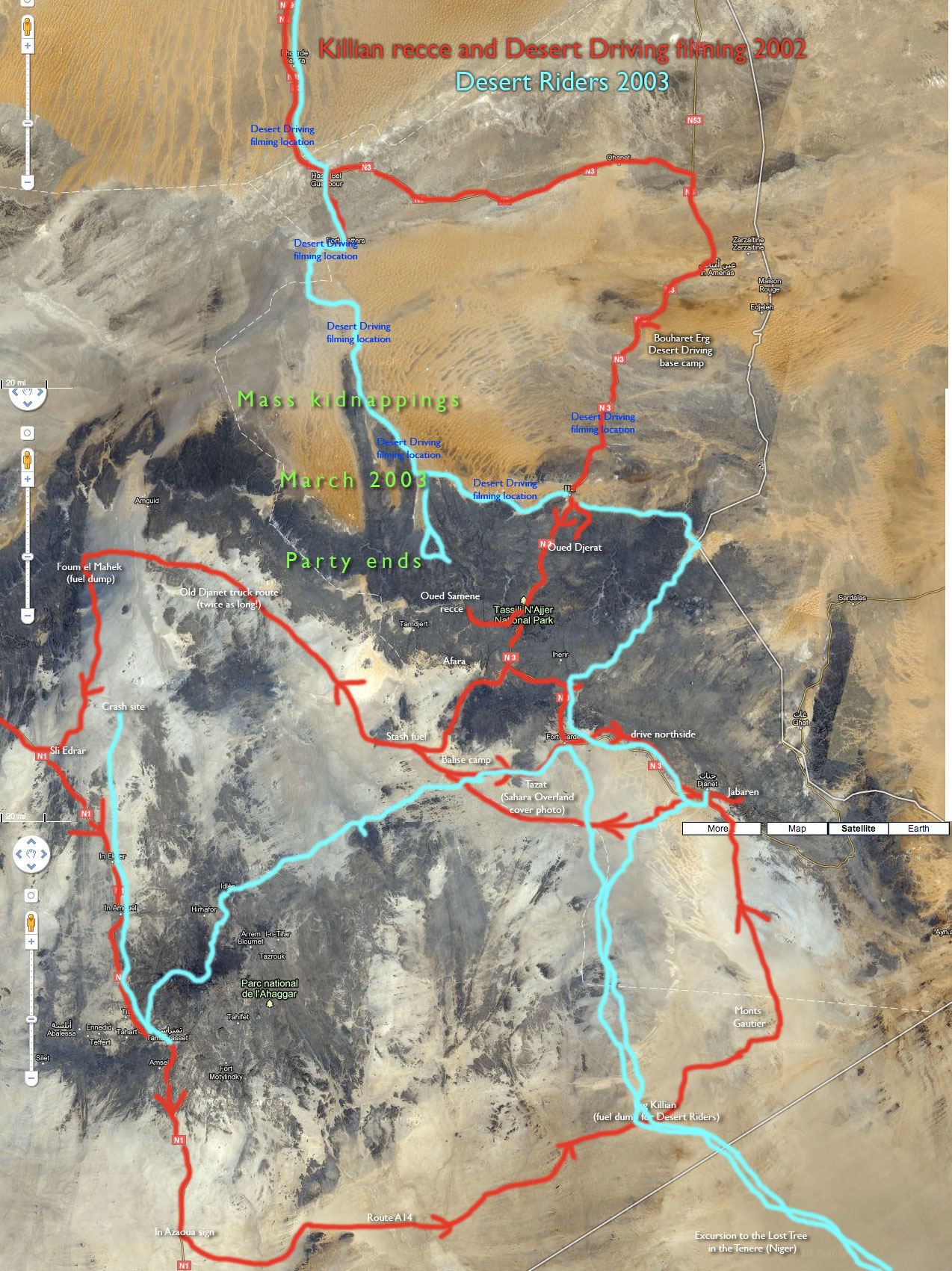
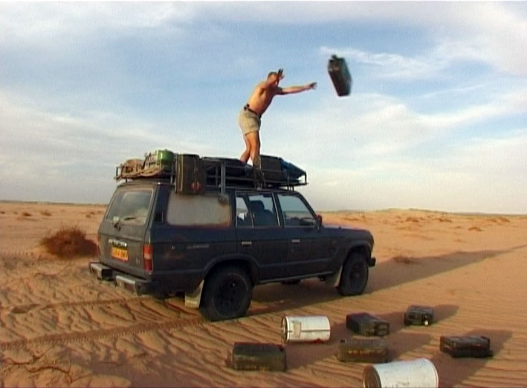
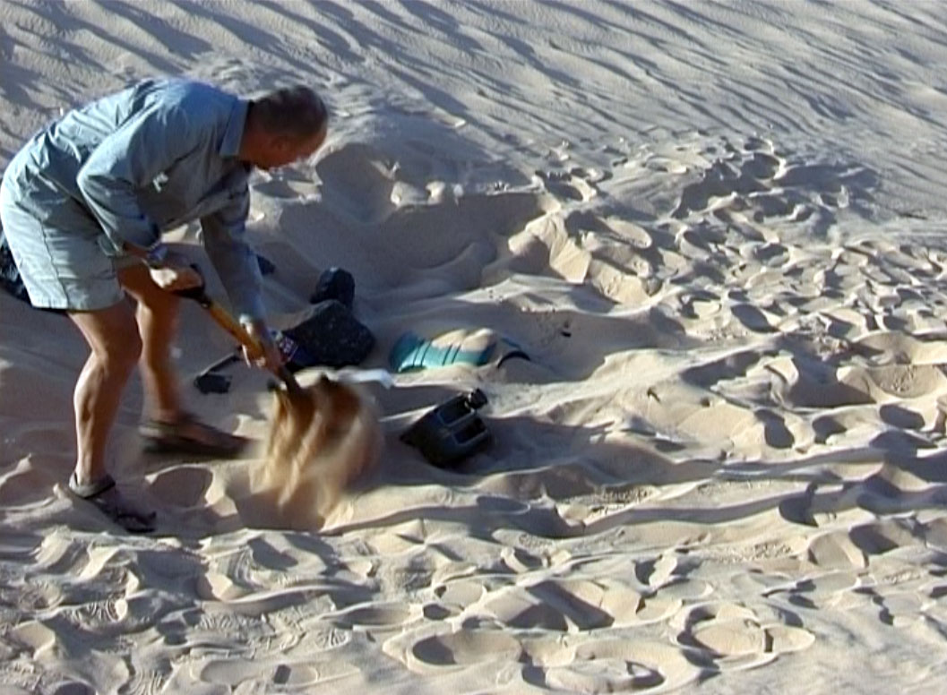
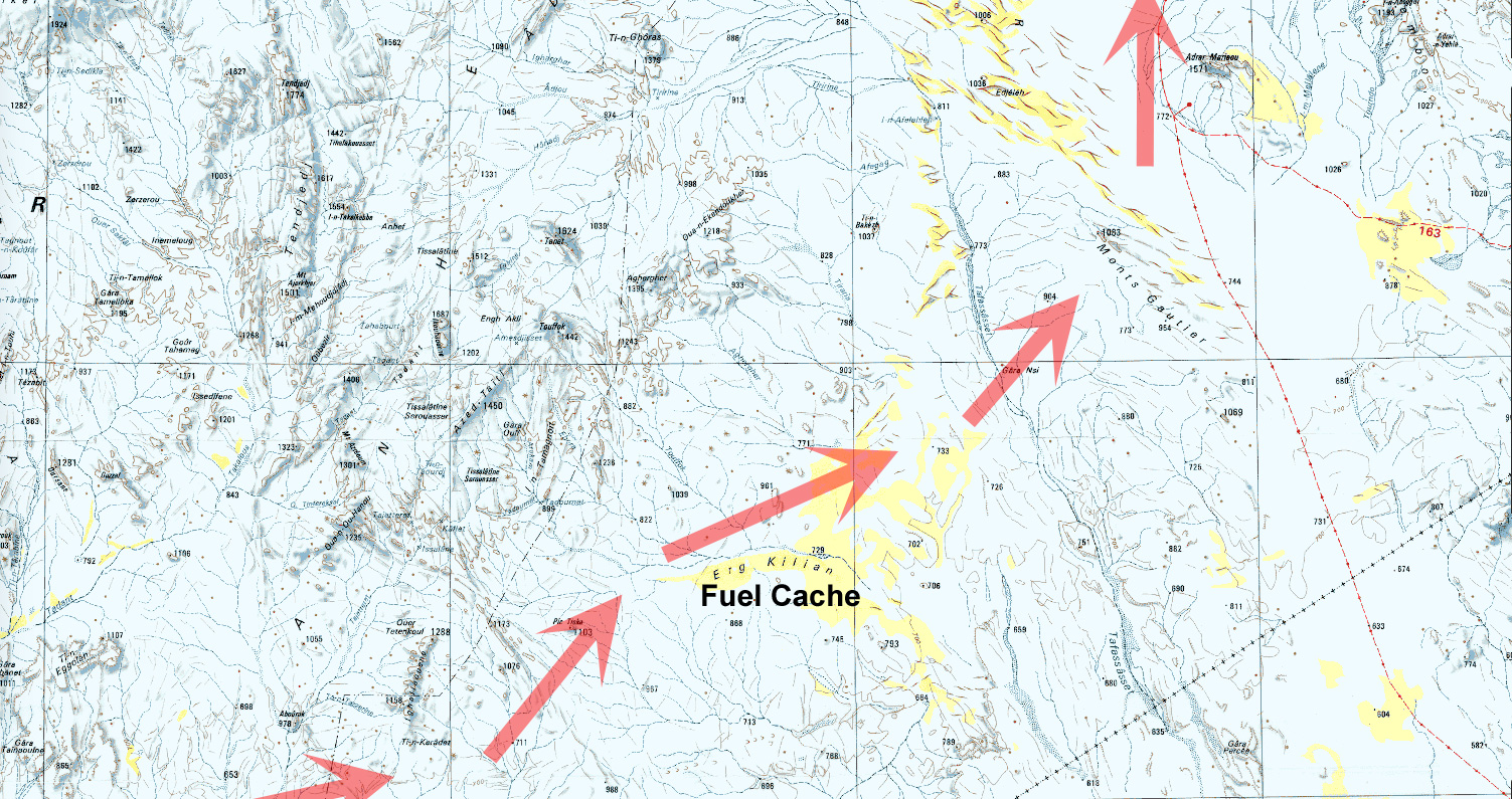
We parked the motorbikes and trudged up to the crst of the sand dune. Sure enough, down in the depression below, a jerrycan handle poked out above the windblown sand. Below the surface lay more fuel, some vital water and a barrel of food.

We excavated the cache and gorged ourselves like fools, relieved to have reached the Erg Killian, a sand sea close to Algeria’s border with Niger. This was the sharp end of our illicit excursion into Niger, destination Arbre Perdu, an isolated landmark in the featureless Ténéré Desert.

With the fuel cache (buried months earlier during a 4WD recce) we could now continue our 1500-kilometre round trip to the Tree and back. We had no visas for Niger, but as expected saw no one for five days.

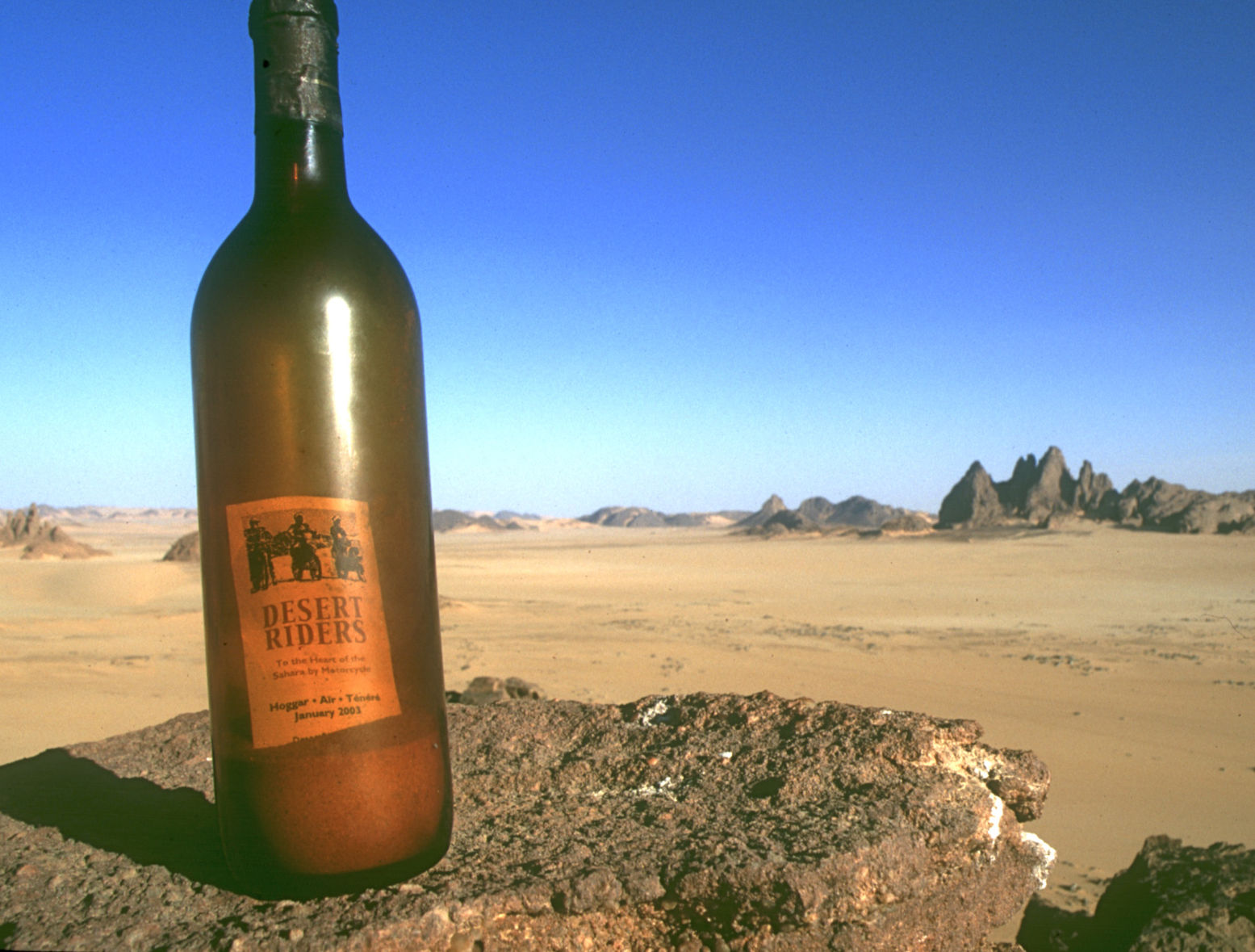
I’d cooked up the radical Desert Riders Project with a couple of friends, to motorbike off-piste in the heart of the Sahara. At one stage we’d managed just four kilometres in a day before collapsing in an exhausted heap, but out here on the wild borderlands of Algeria the riding was exhilarating and serene.

It seemed like a good time to explore the remote reaches of Algeria, the perfect Saharan country. Desert tourism was returning to its late-Eighties heyday and, while the troubles in the north had barely touched the desert, it was only a matter of time.

In late February, just a week after we’d got back from Desert Riders, four bikers we’d met in Tamanrasset were reported missing in the ravines of the Tassili N’Ajjer plateau on a route we’d travelled ourselves just weeks before. In the following weeks party after party disappeared inexplicably, 32 desert tourists abducted, it transpired, by a little-known Islamic group.

After two months in captivity, half were rescued in an army raid after a camel they’d shot for food was tracked by a nomad they’d stole it from, who contacted the police. Of the remaining fifteen hostages there are still only rumours of Libyan mediators and huge ransoms*.

And so for desert travellers, Algeria slips into the shadows once more. Countries open up gradually, then close for years in a matter of days. But, as the Tuareg observe, “the desert endures”.

Chris Scott first visited the Sahara aged 21. Twenty years and as many trips later he’s written the Adventure Motorcycling Handbook and Sahara Overland while organising tours, filming, or simply exploring. His books and dvds, including Desert Riders, are available from sahara-overland.com.

* All but one of the remaining hostages were released in late August after this was written. Michaela Spritzer died of heatstroke in June.

Tunisia to Agadez

Tunisia to Agadez

Jonathan Stonestreet,
November 2003. Information dates from February-March 2003.

Crossing the Sahara via Algeria without your own vehicle is neither as difficult nor dangerous as some imagine. As big as the Sahara is, the access points and the routes across it are few for the solo traveller, meaning that getting lost or stranded is unlikely. In towns, there is usually some infrastructure in the way of accommodation, food, and onward transport to support you, and a little preparation and a lot of patience should get you through any tight spots. Moreover, the people are generally friendly and helpful, and there is little of the hassle that you encounter in some parts of North Africa.

Transport
Shared taxi: On paved roads (north of In Salah) shared taxis are usually rattletrap yellow Peugeot 504 station wagons carrying 7 passengers. On the piste, (from In Salah south), the shared taxis are 4 wheel drive Toyotas. In most places, shared taxis leave from a central station (gare routiere). Upon arriving at the taxi station, just ask for your destination, and you will soon be taken in hand by the next driver headed that way. Since shared taxis have no set schedule but leave when full, you may leave within minutes, hours, or if unlucky, you could end up waiting a whole day. The drivers will almost never leave without a full complement, although they will often offer to leave immediately if you (the foreigner) pay the outstanding fares. Sometimes, all the passengers will agree to split the remaining fare when it looks as if the wait will be futile, which is fair enough. The best time to go is early in the morning, when most Algerians travel (at least in winter). On routes where there is a convoy (as of February 2003 this was El Golea-In Salah and In Salah-Tam), you have to book the taxi in advance and get police permits.

Bus. Slower than taxis and less frequent, but cheaper and some are air-conditioned. Buses run as far south as Tam.

Hitch-hiking: Useful for short distances, say from a town to a nearby village, and necessary for certain stretches without any other means of transport &endash; for example, crossing from In Guezzam&endash;Assamaka&endash;Arlit. Otherwise, police/military checkpoints may make drivers reluctant to pick up foreigners.

For all land travel, buy a cheche to keep the dust out of your mouth and always carry a bottle of water and something to eat. Biscuits, chocolate, and cigarettes are good icebreakers or for reciprocating generosity.

By air: internal Air Algerie flights are ridiculously cheap (30 euros Tam-Djanet). If you buy at the Air Algerie offices, they will send you to the bank to change the exact amount required and bring back a special stamped receipt (as opposed to the normal stamped receipt). Niger Air exists only on paper &endash; they have no planes. I did see fliers advertising flights between Agadez and Niamey, but that is probably wishful thinking since the Agadez airport is still being rebuilt.

Orientation, communications, banks
Orientation: None of the towns in the Sahara are large enough to require a map. Just ask and you will be pointed in the right direction. Except for Tam, tourist offices in the Algerian Sahara seem to be shut down. If the one in Tam is anything to go by, it’s no loss.

Communication: Every town I stayed in (except Djanet) has at least one internet cafe, although the connections are often slow. Telephone centres abound as well. Post offices can be found in all towns.

Banks: Offers to change money are frequent. There is a currency declaration that must be filled in when entering Algeria; no one looked at mine, but there is always a chance. Before leaving Tam towards Niger, check the going rate for CFA, and try to change with someone before crossing; ask around in the market, as many vendors are from Niger. Assamaka is not the most promising place to arrive without local currency.

Authorities: By the end of your trip, you may feel as if your passport details and other assorted trivia are recorded in every police station and military outpost in Algeria. There are several different varieties of police, but I found most to be surprisingly professional and helpful. There was never even a hint at a bribe request. Niger was the same story &endash; the police were professional. Respect, a smile and a few friendly words open a lot of doors. Algerian border police in particular helped me get reliable rides. South of El Golea/El Mineaa to Tam, independent travellers need a written permit – “laissez passer” – from the police, which they are for some reason reluctant to provide. Insist politely, otherwise it is likely that you will be turned back at the first police or military checkpoint. From Tam south, no permit is needed (as of Feb 2003).

Other Comments: One of the advantages of travelling by public transport is the opportunity to talk to local people you would be unlikely to meet travelling in your own vehicle. The main disadvantage is that, unfortunately, it is entirely possible for the solo traveller to cross the Sahara and see nothing of the desert apart what can be seen from the road. That would be a shame, since part of the Sahara’s interest is the sense of vastness and solitude that you won’t get in town. Hiring a guide for a long excursion is expensive for one person, but well worth it if you can afford to do that for even two or three days. Joining a group is cheaper, but not necessarily easy to do, since someone else’s pre-planned trip may not fit your schedule or budget. Going out to little villages outside the towns is worthwhile, as is hiring a taxi driver for a few hours and having him to show you around.

Entering Algeria
For the Sahara-bound, the most common point of entry from Tunisia is Hazoua, a short shared taxi ride from Nefta. There is no public transport between the Tunisian and Algerian border posts, but the Tunisian border police will ask someone to take you the couple of kilometres across. After formalities on the Algerian side, there should be a share taxi waiting to go to El Oued (about an hour), but it can be a long wait. Once there, ask the driver to take you to a hotel and save yourself a walk from the gare routiere on the outskirts of El Oued.

You can also fly into Algiers. Definitely intriguing, it is still probably not a safe place to linger. However, the solo traveller can quickly get from Algiers into the Sahara. A regular taxi from the airport to the city center (bus station; railway station; Square Port Said) costs about AD 600. There are a number of hotels around Square Port Said. Or, go directly to the bus or taxi station and head for Ghardaia (600 km). If you are flying into Algiers and looking to go to Tunisia, the overnight train goes as far east as Annaba, where various drivers will solicit you at the station for onward travel to Tunisia. The price of a first class couchette Algiers-Annaba is AD 1146, second-class couchette AD 866, and a normal fare is AD 627. There is no baggage storage at the station, but the people who run the newspaper kiosk will let you keep your bag there for the day. Crossing into Tunisia, your bags will be thoroughly searched.

El Oued
There are at least 4 hotels. The Si Moussa is basic, cheap and clean enough for about 4.5 euro a night. About a 10 minute walk from the center; no hot water. The Hotel du Souf is the state-run-down tourist hotel; a bit more comfortable, centrally located, and costs about 10 euros a night for a single. Shared taxis to villages around El Oued leave by the post office in the center. A few hours in Rubbah or Nakhla will give a sense of the expanse of the sand sea surrounding El Oued. For onward travel, the station for shared taxis is a 20-30 minute walk from the center &endash; a local taxi is the best option. Taxis go to Ouargla, and from there to Ghardaia and possibly El Golea/El Mineaa. (El Oued-Ghardaia, approx 350 km).

Ghardaia
The M’Zab is home to seven villages of the prosperous Mozabites, who retain traditional practices. Beni Isguin is the most famous of these villages, but the others (e.g., El Atteuf) are friendlier and equally as interesting. Most of the villages require that outsiders be accompanied by a guide, which costs about 1 euro. The taxi/bus station is just on the other side of the bridge across the oued, a five minute walk from the center. The are a few hotels in the center, but the Hotel du Gare, about 50 meters away from the taxi station, was relatively cheap (AD 1400), clean and secure. Hot water and heating in the winter. The owner of the hotel, Mr. Makhloufi Boumedienne, may be able to assist in getting a letter of invitation. Tel/Fax: 00 213 29 96 43 15. Email: b.universal@caramail.com. An Internet cafe is between the hotel and the taxi station. Several restaurants. From Ghardaia taxis and buses are available north to Algiers and south to El Golea/El Mineaa (263 km). There are supposedly long distance buses that go all the way to Tam.

El Golea/El Mineaa
The section of the Trans-Saharan connecting this oasis town with Ghardaia is well-maintained. There are a couple of hotels: the Vieux Ksar is meant to be cheaper but is far from the center; and the Boustan, a state-run place about 5 minutes from the taxi station. A single in the Boustan costs 5 euros, and the staff are helpful and speak English. The town, on the eastern edge of the Grand Erg Occidental, boasts a lovely palmeriae, an old fort (the Vieux Ksar), a church and the grave of Charles de Foucauld. There is a tea place in the center with a small collection of exotic birds and other animals, which the staff are proud to show to visitors. There is a bar in the Hotel Boustan.

Getting out of El Golea/El Mineaa is a bit confusing. Although there are specific days for foreigners with their own vehicles to join convoys south, the independent traveller is an oddity and not necessarily tied to this schedule. Go to the police station on the road into town, about 300 meters north of the Hotel Boustan and ask for a laissez passer to leave by shared taxi or bus. Neither are inclined to take you without this document. Recent events may have restricted the relative freedom of the solo traveller.

Taxis leave from a dusty square a couple of blocks west of the Hotel Boustan. The road divides south of town, going south to In Salah (400 km) and west to Timimoun (350 km) and Adrar.

Timimoun
Timimoun is one of the most attractive towns in the Sahara, with its peculiar architecture in the old town, intricate irrigation schemes, and beautiful setting. Peaceful and isolated, with numerous places of interest in the surrounding area, Timimoun is recovering some of its tourist trade. There are flights from France. The town also has a small community of artists and intellectuals, some of whom are northeners who have sought refuge from persecution.

The loop running El Golea-Timimoun-Adrar-Reggane-In Salah is well paved, and it takes a taxi about 5 hours to get from El Golea to Timimoun. Taxis to Timimoun drop you near the market. The Hotel Ighzer, which is cheap and has friendly staff but is very basic, is about a 5 minute walk down the main drag from the market. The Hotel Gourara, state-run but decently maintained, is a 10-15 minute walk. It’s more expensive (20-25 euro a night for a single), but the rooms have spectacular views out over the palmeraie, the valley and the dunes beyond. A good restaurant and an occasionally lively bar. (Tel: 00 213 49 90 26 27 or 49 90 08 66. Fax: 00 213 49 90 02 62. Email: hotelgourara@hotmail.com).

The restored Hotel Oasis Rouge, the striking building in the center of town, was built in the 1920’s. No longer a hotel, it is now an exhibition center worth having a look around. The manager speaks English. Amar, the friendly owner of the restaurant a few doors down from the market on the main street also speaks English. There is an internet cafe several blocks east of the market.

There are several agencies in town organizing camel and 4×4 treks in the desert and nearby villages, but this is costly for one person. Another option is to hire a taxi for the day (20-30 euros); agree on an itinerary in advance. From the Hotel Gourara, you can walk out across the valley to the dunes of the Grand Erg Occidental.

Timimoun to In Salah via Adrar (575 km)
This trip can be done in a day, leaving early from Timimoun. Taxis run to Adrar (about 200 km), but once in Adrar, there is a different station for taxis heading south to Reggane or Aoulef. Either walk south to the T- intersection and turn left (at least 15 minutes) or take a normal taxi. In Reggane, I saw minibuses heading south towards Mali, but don’t know if it is possible for solo travellers to travel that way. Taxis and buses run to In Salah from Aoulef &endash; there is apparently no hotel in Aoulef should you get stuck there. I didn’t encounter any police checkpoints between Timimoun and In Salah, so hitchhiking may be an option.

In Salah
A very neglected town belonging to the wilaya of far-off Tamanrasset. For accommodation, there is the state run hotel (Tidikelt) on the main highway (10-15 minute walk from the center) and not much else. A camping is advertised in the center, but it looked desolate when I passed by. Somewhat surprisingly, there is an internet cafe. The bus and taxi station is 5 minutes north from the hotel on the trans-Saharan Highway; some people sleep outside there.

You definitely need to make reservations for onward travel to Tam the day before. Most vehicles leave around 0400 &endash; 0500. Besides the official shared taxis (Toyota Landcruisers) and the buses, there are illegal taxis which run this route. Try to reserve the front seat in advance, even if you have to pay a bit extra &endash; sitting in the very back of a 4×4 for 12 hours at speed down a rutted piste loses its charm after the first 5 minutes. The military post on the southern edge of In Salah may turn you back if you don’t have a permit from the police station (center of town).

Tamanrasset
There are several hotels and campgrounds. The Hotel Ahaggar, across the oued from the center and near the market, is fine. Hotel Tinhinane is centrally located. Tam has pretty much everything you might want &endash; shops, restaurants, tour agencies, internet cafes, and consulates for Mali and Niger. A visa for Niger, single entry, costs 50 euros and is issued the same day. Definitely go to Assekrem, even if you have to go on your own; there is no public transport. The state-run agency ONAT, located on the main drag, has the cheapest prices for excursions.

Aside from hitching a ride with other foreigners or organizing a trip through an agency, it is difficult to go overland from Tam to Djanet. There are illegal taxis, but they are hard to find and seem reluctant to take foreigners. Fortunately, the flights are dirt cheap (30 euros).

South to In Guezzam-Assamaka-Arlit
For onward travel to In Guezzam from Tam, the taxi station is located at the southern edge of town, across from the customs terminal. I didn’t ask about getting a lift with a truck to In Guezzam or Arlit, but the customs terminal would be the best place to look. A 4×4 share taxi is AD 1200, about 10 hours. There is no place to stay in In Guezzam; the best option is to arrange something with the driver, if possible.

For a solo traveller without a vehicle, the short distance from In Guezzam to the Algerian border post is a nuisance, since the latter is now located a few inconvenient km south of town. In case your ride to In Guezzam is not going on to Niger, try waiting for a ride to the border post at the petrol station on the road south out of In Guezzam.

The Algerian border police helped me get a lift to Assamaka and Arlit in a local vehicle. In any event, traffic is fairly regular. Note that on the first of each month, the border police in Assamaka rotate back to Arlit, and you may be able to get a lift with them. I had no red tape or hassles at either border post. In Assamaka, I was told to check in with the police in Arlit, which I did not do and which did not cause any problems later. In a good vehicle, the trip from Assamaka to Arlit is about 4 hours. In my case, I left Tam about 1200 on one day and was in Arlit by 1600 the next, including a few hours wait at the Algerian border. Carry water and sufficient food in case the trip doesn’t go so smoothly.

From Arlit south, things are very straightforward. Buses run south to Agadez, Zinder, and Niamey. The Uranium Highway is good pretty much all the way to Niamey. In Agadez, there are trucks making the illegal run to Djanet. Theoretically one could get a truck from Djanet to Agadez, though this risks trouble with the police in both countries.

For a trip in the Tenere, I can recommend Touareg Tours in Agadez. run by Aghali Alambo.
Algeria – For a Few Dollars More

Marseille – Tunis – Nefta – El Oued – Grand Erg Oriental – Deb Deb – Illizi – Djanet – Essendilene – Bordj el Haouas – Tazat – Amadror – Tourha – Tefedest east – Ideles – Tahifet – Tamanrasset – Assekrem – Tam – In Ecker – Amguid – Erg Tifernine – Gara Khanfoussa – Bordj Omar Driss – HbG – El Oued – Tunis – Genoa

Land Cruiser HJ61, Land Cruiser HDJ80 auto, Defender 300 Tdi

With just a couple of cars booked on the March tour, I planned to make the most of a small group and explore new areas that would be problematical with a bigger group. At Marseille Lucy and I met up with Ian and Elke from Wales in a well set-up Defender, and retirees Peter and David in an auto 80 TLC with nothing more than a second spare and a box for the jerries. Peter had bought the 80 just for the tour and preferred the low key ‘school run’ look.
The Marseille crossing was deserted and as flat as it gets. And better still, filling out the Tunisian immigration forms took just 20 minutes, whereas on the more popular Genoa run it can take six tedious hours. I guess it’s because Genoa is a funnel for the hoards of German-speaking Saharans, and of course that crossing costs 25% less.
But Marseille has other advantages apart from less crowds: it leaves earlier in the day so it gets in to Tunis early too, making a daylight run to the Algerian border possible. Rural traffic in Tunisia may not be so mental, but if it’s your first African driving experience you don’t want to be doing it in the dark. So after a hot, windy day we arrived at Nefta just on sunset and early next morning got through the borders in a couple of hours.
My plan was to avoid the long schlep south down past Hassi Messaoud and try one of the lately ‘fashionable’ pistes that cut through the northern Grand Erg Oriental down to the El Borma Road. These routes have the attraction of getting off the highway early, but involve traversing the northern Oriental Erg’s notorious small dunes. The problem with small dunes – as we were soon to find out – is that they have no clear form, being just a chaotic jumble of akle, rather like driving through a very heavy swell. Big dunes (as found in the southern Oriental) may have more scary descents but at least form into regular ridges (seifs) separated by gassis or corridors. You roll along a corridor and once in a while hop over a ridge of dunes to the adjacent gassi. If only…
Planning to get all the way to Hassi bel Guebbour through the Grand Erg (500km), we fuelled up at El Oued and turned off the highway near Oued Allenda village. By then a hot wind was blowing from the south reminding us the hot season was on its way. I had a dozen waypoints from a friend and soon we were in the dunes, riding through the swell.


After a few kilometres the tracks veered west but I made the mistake of heading directly for the next waypoint (this route was to be a reminder in reading the terrain first, then a GPS!). Twenty minutes of that saw me battling the Land Cruiser from one dune to the next. I knew this route was no cake-walk, but 200kms of this made 600kms of tarmac to HbG extremely alluring. We returned to the tracks (easier said than done) and I recce’d ahead with Ian in the Land Rover to discover the tracks did indeed turn our way after a few kilometres.


That night scorpions visited our camp. No one was more surprised or repelled than me, having never seen one in 20 years of desert travels. Yellow and only about an inch or two long, they put the dampers on our first desert camp as those of us in bare feet tiptoed gingerly towards their footwear. Lucy had lately read about Lhote killing 168 scorpions on the Tassili plateau in one sitting so Peter and David postponed sleeping out and put up a tent.
Next morning the hot south wind continued to blow, obscuring the sky and horizon and offering me another novelty; static electricity. On some days, every time I got out of my car I got zapped.
The tracks we’d recce’d the previous evening led into a tussocky flat area (as gassi as

it gets around here) which circumnavigated the dunes I’d tried to plough though yesterday. Presently they led to the well of Thleth el Biar where some Chaamba nomads were watering their herds. Compared to affable (or more tourist-trained) Tuaregs down south, these guys didn’t have much to say and indifferently took a bag of clothes we left by their car.
Nearby Ian spotted some sand roses growing in the sand. Being more humid than the deep south, the northern Erg is famous for these unusual crystalline gypsum formations which at best can resemble a pink rose. Firstly scorpions and now static and wild sand roses, what other novelties awaited?
None I cared for. From the well the sand was trackless so we muddled south into dunes, passing another well surrounded by nomads. For me the dilemma was: get stuck in to whatever led to the next waypoint, or follow the easier ground and risk getting led off route. Often we’d work our way into a mass of dunes only to see the preferred flat tussocky area half a kilometre to either side but still 20 minutes low ranging to get there. On the flat ground, such vantage points were not possible.
I’d driven in terrain similar to this, but never as the lead car, a big difference. Following someone takes a bit of concentration but is easy: whatever the lead car gets through you can usually follow, and where it gets stuck you have time to think and find a better way.


Both Ian and Peter thought this was all brilliant, real desert driving! but I just chewed my lip and wondered how bad it would get. I’ve never been keen on dune driving, it’s no surprise that it’s where all accidents happen and dunes are hard on the transmission and your nerves. In the Nefta hotel we’d met a Belgian guy who’d rolled his 80 in the Grand Erg near HbG. He was hanging out there while they replaced all the windows and bashed it back into shape…
Not only was the driving demanding but the terrain was pretty dull too, not helped by the dreary visibility and hot winds. Dunes tussocks, dunes tussocks. Occasionally we’d come across a gravel patch with clear tracks which confirmed we were on target, even if we felt lost most of the time.
Luckily both Ian and Peter (who’d never driven off-road before) seemed to manage it fine. I assured them this sort of driving was not the norm, but it being the start of the trip, they didn’t seem to mind being thrown in the deep end. My idea to come this way with six bikes a couple of months earlier would have been a disaster for sure.

We covered just 100km that day and another 100 the next, getting close to the El Borma road. And by the afternoon of the second day the dunes where getting higher, more spaced out and more regular, which made the terrain easier to negotiate. But not that easy. At one point I was working my way through a pile of dunes en route to the next putative waypoint. Trying to keep moving in Low 2nd, I rode from one crest through a bowl to the next, higher and higher until it was clear it wasn’t going to work out. There seemed no order or pattern, I was just a cork bobbing around in a pail of boiling water. I found myself doing something I’d only discussed hypothetically in the book: “wall of deathing” around the rim of a bowl in an attempt to maintain momentum and height while trying to work out what next. In the end I fell off the tightrope, almost willingly, with the car beached diagonally near a crest at a jaunty angle. And again. from this skewed vantage point one could spy the flat valley of t••••••s just half a click to the east.
We extracted ourselves and worked our way round, but a while later the same happened and I found myself mired in a bowl of custard powder with no room to move forward or back. Having never used them in three years, I’d left my sand plates at home but even Ian’s sand ladders couldn’t give the 61 the lift it needed. Towing merely pulled both cars into the sand, so we resorted to dragging the sunken Cruiser out by the arse with Ian’s winch. Handy thing in this situation, a winch!

With the weather almost brightening up and the dunes now rising into impressive formations, we counted the kilometres to the road and decided to leave the southern 300km stage to HbG for another time. Unused to his car, Peter had kept the auto in Low Range rather too much and would not have had enough fuel anyway. And we didn’t want to risk another 2 days in the dunes and get behind schedule.


But instead of scurrying back to Hassi Messaoud, we turned east along the pipeline to El Borma and then down towards Deb Deb, another new route for me and one which I’d heard was notoriously buried in sand. South of Sif Fatimah the buried road section began. Bulldozers and JCBs were working to clear the side track and one amazing articulated 6×6 machine with ex-747 tyres gently pulled me through a bank. The tarmac is built on an embankment through huge dunes, but for kilometres at a time it disappears under the sand, with the side piste not always being much easier. Peter was eyeing his fuel gauge but we made it into the nice-looking border town of Deb Deb next morning, filled up with water, fuel and bread, and trundled on down the dull highway through the eastern oilfields to Illizi and a hotel.
Over the Fadnoun the weather was still overcast and dull, to be expected as the seasons change in springtime, but still disappointing. Lack of blue skies really does dampen one’s impression of the desert. Near Tin Taradjeli where the plateau ends we turned off to check out the Sleeping Antelope engravings in Oued Dider, but were content to stop by a two-tier guelta for lunch.
We also decided not to spend a night in a Tassili canyon and pressed on for Djanet and a rest day before a planned 4-day plateau walk. Just as well as what is usually a wonderful drive along the Tassili’s southern scarp soon became lost as an afternoon sandstorm swept in from the south, obliterating the tarmac itself.
In Djanet I set to changing my back springs. I’d been given a set of parabolics to try out. The fronts seemed to work OK but the back ones (fitted just before I left) were clearly not up to it, especially if I was to return home with enough Algerian diesel to last the summer. Expecting such problems, I’d brought along my trusty Old Man Emus and Hey Presto! the Tojo had some air in the wheel arches again. I flogged the back paras to the car spares shop near the market. Djanet is chock-a-block with erstwhile TLC 60s, though those mushy back springs will be as much use to most Djaneteers as fishing lessons.
It became likely that the guide I’d booked for the plateau walk was not going to turn up – oh well, that’s Africa, none of us really minded. And for me, four extra days meant less rushing around the desert. I’ve waiting 20 years to see the plateau, it will be there next time.

We popped down next afternoon to check out the Crying Cow and again another mid-afternoon storm blew in. I tried out the auto 80 and I must say I was not that enamoured. It felt like a heavy slug, very comfy and quiet of course, and featuring a lot of dashboard action. Pete was not that impressed either, finding the lack of pick-up at very low speeds (a feature of 80 engines, compared to earlier 12HTs) in dunes a problem. But either way Ian and I assured Peter just 20-30 seconds in either the Tdi or my 61 would soon highlight the 80s overall appeal.
Although the campsite guys were keen to offer us a plateau deal, we decided to move on and left Djanet under blue skies. On the recommendation of a couple of French guys, we took off up Essendilene Canyon (80-odd kms from Djanet, not 30 as in the book, p. 406), a lovely drive into the Tassili’s interior ending at a fern-lapped guelta.
Following another couple of tips I decided to concoct a new route to Ideles. First through a pass north of Mt Tazat which Richard Washington had found over Christmas, and then across the Amadror plain directly to the Tefedest and down A6 to Ideles.
I made a bit of a mess getting to the Tazat Pass, coming too much from the northeast across all sorts of rubble which slowed tyre-twitchy Peter down to glacial speeds. But by sundown we were 10kms from the mountain and a recce up a nearby hill showed a likely way in.
That night was clear but soon after we went to bed a gale blew in from the east and kept up the whole night. It’s one of the advantages of sleeping in a car as Ian and Elke did. Our tent flapped annoyingly all night while Peter and David rose after a night on the sand like a pair of crustaceans.


Stout old cairns marked the way into the pass next morning. Who knows why the French bothered establishing this route while the main piste passed south of Tazat. Whatever, it was a lovely, quiet drive and nice to be off the corrugated piste, even if it had now become oddly cold for mid-March. On the far side I returned to Borne junction after many years to find the old orange drum long gone and a chunky stone monument in its place. From here we took the route northwest towards Amguid, passing a nice Pre-Islamic tomb on a hillside. At a cone mountain south of Toukmatine we then cut out across the Amadror plain where Colonel Flatters and his crew met their end in 18 seventy whatever. It was a weird sensation driving across the flat plain with distant mountains bobbing on the horizon’s mirage. Slowly, as the afternoon wore on the Tourha range rose in the west, a bit like Adrar Bous as you come across the Tenere. There’s even a lone tree at KM321. Ian was leading for a change (he found trailblazing hard work too) and came across a gang of gazelles which inhabit this relatively secluded region.
As the day ended we reached the ‘Tourha Pass’ on a lovely evening and camped by a sun-warmed outcrop. Before dinner Lucy and I went for a wander into the hills and watched a little nervously as three cars drove past our camp without seeing it. Smugglers, locals or tourists? Who knows but we were glad they missed us. It being Mother’s Day, Peter could not resist my extortionate fee for the sat phone and called his mum in Surrey.
Even though we were only at 1000m, it froze that night to minus 2 or 3 and next day we carried on through the lovely pass and cut down towards the Tefedest proper, stopping frequently just to admire the grandeur of it all in the clear, crisp weather. On the far side of the Oued Igharghar we picked up A6 which I’d done with some bikes a few weeks earlier, met some smiley Targuias and their goats and followed this picturesque route to lunch at the green sign.
It’s interesting reversing a route you know well – you see so much more; new pistes and unusual rocks and even a new way into Ideles past a well I never knew about.
Ideles for me was the usual run around town trying to find the Tazrouk junction. I know where it is but never know how to get there from the west.

We were now on the outer ring road via Tahifet (A4) which I’d done for the first time in years with the bikes in January. Up to Tazrouk it’s a great track and this time Ian and I half-climbed the 150-metre old radio mast near Azrou to affirm that our arms and legs still worked after 2500km of driving.

But after Tahifet the wide track becomes Corrugation Central and we were glad to get to the highway south of Tam, pass the dozens of trans-Saharan trucks queuing for fuel and reached Agence Tarahist’s gite near Hadriane mountain. We’d just missed Moktar going out that morning with Jeremy Keenan (a controversial figure) and a group of no less than nine Brits, surely a record!
Tamanrasset merely reminds you how nice Djanet is, through it’s a good place to get stuff. Elke and I had had a running joke (well, it was to me) that the Hoggar was not worth visiting and we should spend more time in the wonderful Tassili. It’s a preference I’ve established on previous tours, but one that can only be made once one has seen both places. And Elke had been wanting to visit the Hoggar since she was a teenager.
So we trundled out of Tam next afternoon, chattering over the corrugations to the ever more dramatic ascent to Assekrem, seemingly smoother than when I last came this way in ’86. Up at the pass, we checked in full-board into the overpriced lodge and hiked up to the plateau. While the others primed their lens caps and took positions I went over to the north side of the plateau, having read of an alternative view in Sahara Man. In the end, it was nothing special but it was nice to get away from the others for an hour or so.
Evenings in the lodge follow a standard pattern. A faux Tuareg twatted about and took the piss out of a Chinese family. On a world tour, they’d tried to go to Egypt, settled for Tangiers but ended up in Algiers which sounded the same to their travel agent. What to do in Algiers but get sent down to Tam for the Assekrem Experience.
I’ve never seen dawn at Assekrem. The bikers (whose cutting limerick about my tour I’d uncovered in the lodge’s guest book the previous evening) had told me it was the one to watch. And they weren’t wrong. A little light cloud made for an amazing sight, even as the chill pre-dawn wind riffled through our blanket.
We returned to Tam the same way as Peter was worried about the tough western decent on his low and already dune-bashed 80. In Tam we had a bit of argy-bargy getting fuel. Peter’s row of empty jerries did not go down well at the back of the queue, even if other guys we’re rocking up with 50-gallon drums in the boot of their Renault 12s. A sack of bread and some veggies and it was off to In Ecker for another new piste.
On this stage Peter and I achieved a faintly phenomenal 36-40 mpg while Ian’s Tdi got it’s best at 26. The Tdi’s mediocre mpg puzzled me, although my experience on other tours is Tdis are usually the same as my 61. Was it Ian’s heavy tyres and rims and all those tanks, or the alloy roof wedge? Not likely. Overall, apart from in the Grand Erg, Peter’s cushy auto was usually tops: 5% better than my 61, with the Tdi around 25% below.
At In Ecker mountain we took off onto the Amguid piste, but I soon lost the track and wandered around most unprofessionally, while Lucy got to grips with reading waypoints off a map. Still, it all ended happily at a lovely campsite below a hill a few kilometres off the piste overlooking In Ecker mountain, still fenced off after a nuclear accident in the 1960s.
Up to Amguid the going was fast, passing the odd Dakar Rally wreck and the mysterious village of Abdemezeh where a German biker tour was having a cuppa. But by lunchtime a south wind was blowing again, hazing the sky.
At Ain Kerma well we barged in on the local Gendarmeries’ weekly wash and then headed for Amguid, Years ago I recall reading (in the Sahara Handbook?) that Amguid was populated by obnoxious children, not normally found in Algeria. I joked about this to the others who noted that these children would have grown up by now. How wrong we were. We stopped in the dilapidated once abandoned village to hand out the last of our clothes and were immediately besieged by clawing hands. This was not the exuberant ‘toubabery’ of West Africa but manic desperation. The adults pulled back the youngsters only to snatch into the cars themselves and it all got faintly scary as they surrounded Peter’s car where all the goodies were. We raced off, left our cadeaux on the ground and moved on as the crowd ripped into the bags.
Just north of Amguid we crossed over a pass onto the ‘Graben Piste’ which I’d wanted to do for many years. But that night another sandstorm blew up, this time from the west, and kept blowing all next day. It was dreary driving over rocky tracks with little to see, but that’s the desert: not every day’s a winner and some days are worse than others…
At Hassi Ntsel a band of dunes ran across the track. Unable to see an alternative route clearly, the dunes, no more than a kilometre wide, looked no worse than those we’d driven over in the Grand Erg. So rather hastily I got stuck in, got stuck, backed up, recce’d a way on foot using the others to stand as markers and bundled the cars through. On the final dunelette my car came down hard on the front corner: result, both front leaves (there are only two with parabolics) snapped though. With sand blowing all around, getting under the car was uncomfortable, but Ian and I managed a good bodge from a block of wood and a spare bump stop, a chain and a ratchet strap. I doubt the block lasted more than a few kilometres, but with the axle lashed to the chassis with chain and strap, we carried on at a much slower pace while I tried to visualize various meltdown scenarios and how I’d deal with them.

In the end, renewing the ratchet strap ever day or so, the car got all the way back to London on the bump stop with the broken leaves flapping. Whatever rubber they use to make Tojo bump stops, you’d better hope you have some on your parabolic car… The break was not a total surprise as the same happened to Yves’ parabolicked 109″ a couple of months earlier.

Thankfully next day the storm had blown itself out, just in time for us to round the rocky spur of Erg Tifernine, the most spectacular sections of this route where the stunningly red dunes flow over an old colonial track winding through the rocky hills.

From there right up the east flank of the Erg to Gara Khanfoussa was smooth sand, ideal for three-leafed Land Cruisers as well as a good place to spot Neolithic detritus.

Like I said, reversing known routes can be interesting, but it can also get confusing. Having come down through Khanfoussa a couple of times recently, coming back was a whole new game, especially with all traces blown away by yesterday’s storm. At one point I got to a huge dip that I didn’t recall and doubted I could get through. I tried to keep high and ride round one side, a possible way out. But with the car tipping ever further and Lucy getting ready to lower the lifeboat, I gave in just as we neared the crest, and swerved down into the pit. In fact getting out was not so hard, but watching Ian come through, a tiny Land Rover rolling down a 40-metre slope was scary.


Getting into Gara Khan’ hill, the halfway point in the dune crossing, had been easyish, getting out was not. I followed what faint tracks there were, tried to visualize the route in reverse, but soon got in a muddle and ended up following day-old tracks to another thought-provoking slip face. An overdue check on the GPS proved that we’d overshot the western exit by 10kms. Worn out by nursing the car and irritated by my confusion, we set course for a known waypoint at the western entry and rolled over the hills and dunes to a sheltered camp nearby.I was in no hurry to drive my limping car along the rubble track to Quatre Chemins and so next day, out of necessity and a bit of curiosity, we took the piste directly into Bordj Omar Driss along the base of the escarpment. Some nasty soft sand apart, it was a nicer route, passing by an amazing cliff of red, green and white interlaced strata that would have geologists drooling.


With every mile it seemed likely that the bump stop would not disintegrate and once we got back on the tarmac near BoD, I was sure the 61 would make it back the 1500kms to Tunis, and beyond.

On the boat I met up with some bikers including a Lido who’d come up from SA with a mate in a troublesome Td5. La Goulette had been packed out with 10 times the vehicles we’d seen coming out of Marseille. The Tunisians were making even more of a meal of boarding than usual and we didn’t leave until 11pm. As the boat eased into Genoa next day, Lido and his mate congratulated each other on making it across Africa to Europe. Me, I felt sorry for them. What were they going to make of Europe after nearly a year in the bush? They’d been given some skimpy directions for a campsite that might be open nearby. They reminded me of my own early Saharan rides. Bugger that I thought. Lucy and I said our goodbyes to Ian, Elke, Pete and David and attacked Genoa’s one-way system like a band of small dunes in search of the Novotel.

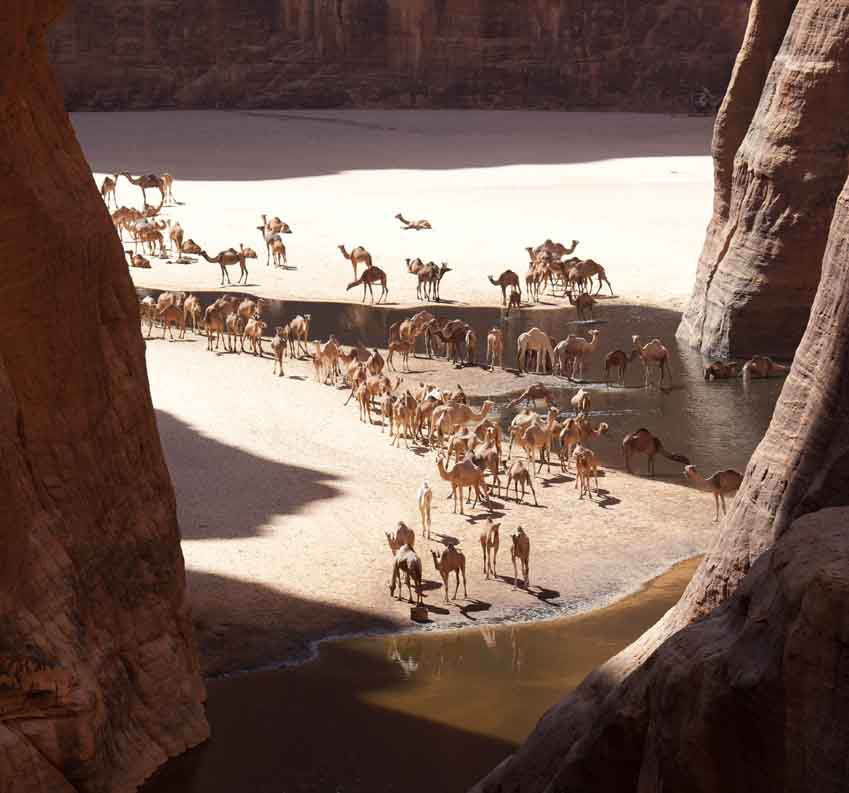
Chad: Tibesti, Ennedi – 2002

Siân Pritchard-Jones and Bob Gibbons 

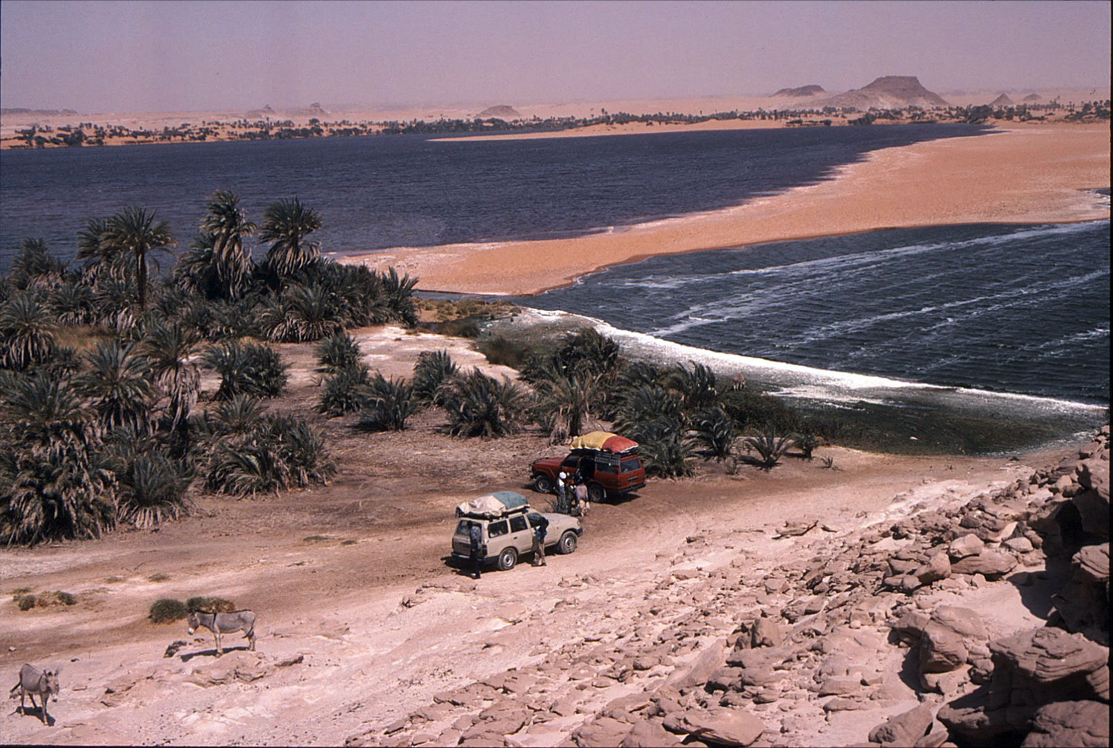
spbg-Chad-Guelta-d'Archei
spbg-Chad-Ounianga-Kebir-lunch
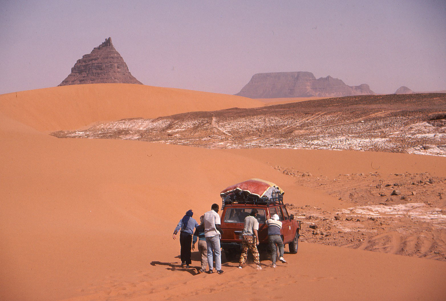
spbg-Chad-Mourdi-pushing-in-the-sand

As an overland driver during the late seventies and early eighties, Bob drove across the Sahara four times en route to Kenya and Johannesburg and became fascinated by the variety, colour and people of the desert. On one trip, in 1978, he visited N’djamena, but that was as far as he got. It’s taken a long time to return, but the fabulous landscapes and mystery of unknown Chad did not disappoint.
Perhaps the most difficult thing about trying to visit Chad is finding enough like-minded people to fill the absolute minimum of two cars. (Three would be wiser &emdash; there is virtually no traffic anywhere). Our trip only came together with less than two weeks notice and planning time, although we had been desperately holding on to a provisional air booking to N’djamena. We had been contacting a couple of agents in N’djamena since 1997, and again in 2001, so it was quite a shock when one agent found three other participants and agreed to do the trip for five people. The director, Moussa, then informed us he would be in Mecca on the annual Haj at the time of our trip, but no problem!
We flew to Chad from Paris on Air France at a very reasonable price and used some Air Miles to get to Paris. Luckily the agent in Chad had said he was able to sort out our visas on arrival. Nobody questioned our hurriedly faxed invitation papers from Chad at the Paris check-in, though it was certainly with some trepidation that we landed in N’djamena, visa-less and clutching tacky bits of paper called documentation. But a man was there to meet us! And the visas were sorted out the next morning.
Our travelling companions were all French. Thierry and Christophe both worked at the French school in N’djamena. Our third French member, Marie-France, had a daughter and son-in-law working in Chad. They had also only very recently signed up for the trip, which the agent had decided to promote after our repeated requests.
Our first three days followed the well-worn piste through Moussoro, across the dusty Bahr el Ghazal and into the sands of the Erg du Djourab dunes. Bypassing all the main settlements after Moussoro meant we avoided unnecessary hassles and demands for money from bored, underpaid officials. However there were plenty of nomadic herders, camels and goats before Koro Toro, where the short fine yellow-coloured grasses of the dry savannah gave way to true desert. Here among the dunes we met one of the heavily-laden trucks loaded with Africans bound for Libya in search of a better life; unfortunately the truck had a very sorry-looking set of battery leads and had been stuck for three days. We took one of the driver’s mates on to Faya to get help.A fiery sunset marked our arrival at the oasis of Faya, in a spectacular setting below the rugged escarpments and outlying crags of the Tibesti. At dawn we set off to explore the oasis, before the guides suggested we shouldn’t wander about on our own. With a fairly reticent population, we suppose they need to be a little cautious and we ourselves were careful not to offend with our cameras. However we did encounter some friendly curiosity. We camped in the grounds of the appropriately-named Emi Koussi hotel, with bucket showers and bags of run-down decaying atmosphere.
From Faya we were surprised not to be taking the direct route to Ounianga Kebir, close to the Tibesti. We headed generally southeast and made a large loop, later heading north and then northwest to within five kilometres of the Wadi Doum military camps and oasis. We were told that rebel activity in the Tibesti, although curtailed since the new ceasefire, had resulted in a lot of mines still remaining along that route. In Ounianga Kebir we visited the fantastic lake and heard first-hand accounts of the trouble caused by mines. We met a young man from Cameroon who had recently arrived there. His truck had driven over a mine, resulting in a few deaths and some bad injuries not far from the oasis. In good spirits, he was still hoping to continue his journey northwards when he had earned sufficient money to pay his fare.
On leaving Ounianga Kebir, we were therefore somewhat concerned when the GPS readings indicated we were heading northeast and not east for Ounianga Serir. Somehow in the poor visibility we had missed the ill-defined piste, and were heading towards Libya across some very nasty sand loaded with fractured boulders and very sharp debris. Not much point in worrying by now. Eventually we dropped off the escarpment down a fantastic sandy corridor between dark rugged crags and towers. Back on track, we soon arrived in Ounianga Serir, where the different lakes were if anything more spectacular. The most easterly lake was a gem, ringed by orange dunes, bright green reeds and multicoloured rock outcrops. A truly stunning place. Our camp on the sandy rocky area high above and just south of the lakes was another spectacular spot to wander at sunset, watching the red and orange shades of the rocky towers become deeper and deeper, before finally fading away into the evening light.
From Ounianga Serir we headed southeast into the region of the Depression de Mourdi, hoping to take a track directly from the north into the Ennedi to Fada. En route we visited another superb lake below an escarpment at Tegguidei, a place not shown on any of our maps. Here a small transient population mine white salt beside the lake, surviving on just one tiny mosquito-infested pool of fresh water. Nobody was here in early March, but we saw the grain stores and evidence of recent visitors.Just after the lake we became hopelessly bogged in deep orange sand below a jagged black spire of rock. Travelling on southeast we reached Demi, another small settlement, again set below spectacular outcrops. Here a very reticent and unfriendly population ekes out a poor existence, mining red rock salt. The people claim to be not Tubu but Gorane, and absolutely refused to let anyone even so much as get a camera out.
From Demi there were absolutely no vehicle tracks and no piste; we were just heading vaguely south and southwest across the most tortuous terrain. A mixture of sand and broken rocks, low crags and dunes constantly blocked the way forward, necessitating some backtracking, diversions and some truly skilful driving. A careless driving mistake in this terrain would have very serious consequences. Indeed at one point in the middle of nowhere we came across an abandoned fully-loaded old Toyota, complete with sacks of grain and a guerba on the side. But there was no sign of human life. Had it been recently left there while the driver went for help? We will never know…
All the next day a raging hot wind blew, with heavy stifling clouds and very poor visibility. Occasionally rain fell as huge droplets of sand-filled water, leaving thick opaque spots on the side windows and windscreen. In the distance we could make out the silhouette of the northern cliffs of the Ennedi, with finger-like towers and broken outcrops where the plateau has eroded. Here we met a solitary overloaded vehicle coming from an oasis deep in the Depression de Mourdi. They advised us not to continue to Fada by this route, as it could take two or three days via a rocky track, so we retreated westerly.
A vague piste eventually led us down an amazing sandy corridor of dunes and rocky towers that marked the western edge of the Ennedi. The scene was quite surreal in the yellow hazy light of the storm. We stopped briefly at Wadi Wei, an isolated well with acacias and tamarisk trees. From here to Fada the scenery was dominated by rocky towering outcrops and quite hilly areas of sand piled against the rocks. It was dark by the time we approached Fada, and somewhat intimidating to drive through the narrow gorge surrounded by minefields, marked by large signs, barrels, tyres and wire. (These mines are currently being removed, so hopefully it should soon be much safer.) As we came closer to Fada, some military vehicles shot out of the bush to check us out, but we soon arrived in the mud-brick settlement. Our camp was in the courtyard of a house belonging to a relative of one of our drivers, at the eastern end of the village.
South and east of Fada lies the spectacularly and justifiably famed scenery of the Ennedi. Here are the fiery red rock walls and canyons, rock towers, rock art and other amazing erosion features which are being slowly engulfed by sand and dunes. We camped of course in the Guelta d’Archei! Here the canyon walls provided an eerie watch in the moonlight. Every day the goats and camels of the herders come to water at the black turgid pools of the canyon, in a riot of confusion. During our visit some goats had become trapped on the steep vertical cliffs of the canyon and we spent a somewhat sleepless night listening to their tortured cries. Sadly a couple had already fallen to their deaths, but the rest performed amazing feats of mountaineering and communications in their attempts to escape the clutches of the forbidding cliffs. Alas the famous dwarf crocodiles remained elusive, but tracks and droppings gave some indication of their unseen activities.
In the morning we trekked for a couple of hours each way to the north side of the pools to a high vantage point overlooking the guelta and the canyon, which is at its most spectacular from this point. It is also far enough away from the herders to take pictures of the camels watering, pictures which were vehemently resisted down at the pools. (Though when they saw us up on the cliffs, they walked out into the black waters to draw their camels back out of sight!)
The rest of the time in the Ennedi was spent exploring the many canyons and some amazing natural rock arches, as well as visiting some excellent rock art sites. The paintings here are certainly to be considered the equal of those in the Tassili n’Ajjer around Tamrit and Sefar in Algeria.
The last three days of the trip took us south to the village of Kalait, shown on some maps as Oum Chalouba or thereabouts. Then we turned west across the scrub to Kouba and back to N’djamena the same way. We had hoped to return to the capital via Biltine and Abeche, but the route is said to be bad and time-consuming after Abeche on the main road. Most traffic appears to be going further south from Abeche through Mongo to N’djamena.
Just one hour before our flight back, we had an urgent phone call from Moussa, who was very keen to meet us; he had been delayed in Addis Ababa for two days on his return from Saudi Arabia.
All in all it was a fabulous trip, and we are now keenly waiting for the Tibesti to be cleared of mines and re-opened… maybe in two years.

Notes: Our papers were checked in Moussoro, Faya, Fada and Kalait.
We refuelled in Faya, Ounianga, Fada and Kalait on the trip – all from barrels.
Most food was brought with us from N’djamena, but occasionally bread and fresh chickens were purchased in the villages.

CHAD: OUNIANGA – ENNEDI – GPS READINGS

N’djamena N 12º 06.534 E 15º 02.814
306km – Erg – N 16º 37.716 E 18º 42.238 – sand dunes en route to Faya
Faya – N 17º 56.155 E 19º 06.723
Lunch 4 – N 17º 51.415 E 19º 55.672 SE of Faya
401km – N 18º 02.487 E 20º 07.240
402km – N 18º 09.505 E 20º 16.878
Wadi Doum – N 18º 22.609 E 20º 27.652 – view of Wadi Doum, app. 5 km to west – military camp best avoided
403km – N 18º 31.653 E 20º 25.090
Camp 4 – N 18º 42.907 E 20º 21.003
501km – N 18º 46.472 E 20º 22.181
Ounianga Kebir – N 19º 03.314 E 20º 29.544 – village, water, fuel, large lake
507km – N 18º 54.572 E 20º 45.480 – interesting canyon N of piste
Ounianga Serir – N 18º 54.823 E 20º 52.561 lakes
Oun Ser Lake – 2 N 18º 54.888 E 20º 54.619 – another smaller lake
Camp 5 – N 18º 53.917 E 20º 55.449
Teggedei – N 18º 51.605 E 21º 23.196 – salt mine, lake, also date palms
 no permanent habitation – mosquitoes
605km – N 18º 46.520 E 21º 40.035 – pointed outcrops
Demi – N 18º 45.904 E 21º 40.334 – salt in earth, village
608km – N 18º 41.398 E 21º 42.571 – view of large u-shaped gap in mountains
Camp 6 – N 18º 05.273 E 21º 11.053 – below small dune
713km – N 17º 46.400 E 20º 55.253 – spectacular rocks
Wadi Wei – N 17º 31.349 E 21º 01.375 – water hole
716km – N 17º 16.203 E 21º 13.624 – minefield marked after here
Wadi Inu – N 17º 12.213 E 21º 23.125 – vegetated wadi
Fada – N 17º 11.106 E 21º 35.245 – minefield at entrance to town, marked
 now being clearedGuelta d’Archei – N 16º 53.964 E 21º 46.607
902km Paintings – N 16º 51.269 E 21º 48.361
903 Arch – N 16º 48.873 E 21º 50.965
904km Well – N 16º 48.617 E 21º 52.410
905km – N 16º 47.502 E 21º 51.668
906km – Arch N 16º 46.280 E 21º 49.944
907km Archkm – N 16º 45.630 E 21º 50.541
908km – Tower N 16º 44.043 E 21º 50.575 rocky tower
Tokou – N 16º 45.299 E 21º 48.301 well
910km Paintings N 16º 44.318 E 21º 42.157
Camp 9 – N 16º 44.342 E 21º 42.374 superb camp site in all respects
1002km Arch – N 16º 43.007 E 21º 40.378
1003km Military – N 16º 43.893 E 21º 38.165 military hardware lying around
1004km Arch/Paint – N 16º 44.199 E 21º 37.574
Deli – N 16º 50.272 E 21º 27.729 spring; not much water
1005km Paintings – N 16º 50.678 E 21º 27.519
1006km Tower – N 16º 49.616 E 21º 20.617
1007km Road – N 16º 48.523 E 21º 16.436 main piste from Fada to Abeche
Kalait – N 15º 50.358 E 20º 53.678 village; water, fuel
Oum Chalouba – N 15º 48.134 E 20º 46.230 military camp
Pirtodi – N 15º 56.306 E 19º 25.199 very deep well, camels
1105km – N 15º 48.419 E 18º 42.236 hard to follow piste round here
1108km – N 15º 49.335 E 18º 23.168 main piste to Faya
Kouba – N 15º 44.906 E 18º 17.892
Salal – N 14º 50.640 E 17º 13.578
Gosbela – N 14º 04.674 E 16º 32.384
Moussoro – N 13º 40.086 E 16º 29.627 west of Moussoro
Kouri – Kouri N 13º 40.309 E 16º 12.754
Chedra – N 13º 26.619 E 16º 02.732
1202km Well – N 13º 22.700 E 16º 00.399
Massakory – N 13º 00.354 E 15º 44.685
Massaguet – N 12º 29.051 E 15º 25.058
Djermaya – N 12º 23.694 E 15º 03.152
N’djamena – N 12º 06.534 E 15º 02.814


Fuel Caching in Algeria – Toyota HJ61 – 2002

Tunis – Hassi Messaoud – Quatre Chemins – Illizi – Fadnoun – Afara junction – Tazat – Djanet airport – Tazat – Toukmatine – Erg Tiodane – Amguid piste – Foum Mahek – Sli Edrar – Arak – TSH to Tam – Taghera – Erg Killian – Monts Gautier – Balise Line – Djanet airport – Fanoun – Erg Bouharet (Desert Driving base camp)

This page: the red route

“It’s never over till it’s over” I’ve learned to say to myself over the years but it had barely begun when at Tunis port they whipped away my newly illegal GPS “telephone” unless I chose to arse about getting a permit from the Ministry of Stupid Ideas. I deposited it in a room full of CB radios (fair enough) while others did the same, a bit stunned about how to navigate down south. Luckily my real sat phone (which I had the presence of mind not to declare) had a rudimentary GPS.

Coming off the boat I’d met the famous David Lambeth coming back from supporting a bike rally – he was not keen on lending me his bells and buzzers Garmin 5, but another departee in a pink 110 kindly lent me an eTrex to back up the untried Thuraya sat phone navigator.

Then, trying to call g-friend down the road it turned out my PAYG Thuraya had expired its SIM (don’t use it much in London). This undermined the security of my solo route plans somewhat until my rendezvous with Prof. Nimbus in Djanet in ten days time. I was beginning to wonder was this going to be “one of those” trips – after all, all had gone remarkably to plan these past couple of years …

HJ61

A fax to g-friend from Nefta saw some new SIMs on the way to Nimbus. Until then I was out of comms. Part of my job on this trip – my first solo car venture into the desert it transpired – was to dump food and fuel for my upcoming Desert Riders caper, scheduled for early 2003. D. Rider Jon had gone shopping for food just before I left and had been called by DR Andy asking him to buy one more of everything. I then spent a night by the Grand Erg scoffing at their tasty food choices and sorting the stuff out into packages we’d be able to carry on a bike from the fuel drops.

Next morning more problems. After fueling up for 1500km plus half a dozen petrol jerries to bury, HbG checkpoint made me take a soldier to Bordj Omar Driss but failed to tell me the piste from there was closed to Amguid (otherwise I’d not have bothered with the lift of course!). I’d heard this piste had been closed (due to smugglers he told me on the way back) and a barrier was pushed up against the piste at Quatre Chemins. It was the direct route to my planned fuel dump south of Amguid but anyway the weather was oddly hot, windy, hazy and even spitting rain. If nothing else my three Algerian trips this year have confirmed the unpredictability of Saharan weather. It boded ill for our much-postponed filming of Desert Driving in a couple of weeks…

I’d half expected a closed piste so had plans to hit Amguid from the Djanet side. I had a hot/cold, windy/rainy night near Ohanet in the back of the car, and with time to kill before meeting Nimbus, soon got to savour the relaxed non-tour-leading pace while driving alone in the desert. I checked out the hotel at In Amenas (a dump, fyi) and explored Erg Bouharet as a great location for some planned DD scenes. We camped here in 1988 on my first bike tour (described in Desert Travels) and I was amazed to see my so-called “apostrophe dune” pictured on my g-friend’s wall unchanged in 14 years. As I suspected, the myth of dune mobility is much exaggerated, especially if part of an erg rather than stranded on a plain.

That night I popped out to Oued Djerat east of Illizi, the site for much rock art, it is said. Clear tracks lead into the canyon and after it got narrow I parked up but found nothing but a quiet night out. Next morning a Tuareg cameleer creeped up on me as they do while I was finishing off Michael Palin‘s book. I’d left a colourful array of kids’ clothes hanging from the nearby trees. He helped himself to the booty and told me the art was a bit further up the canyon where I’d spotted an encampment earlier on. Now that I knew where, it was one for next time.

Over the Fadnoun the weather was still hot and windy from the south. I washed the car in a guelta and recced a D Riders route along which we planned to emerge from Oued Samene (to Ifni). It looked good, as the TPC map suggested. Down the road at Afara junction I headed right onto the piste. I rode this route in 1990 with Steve in his car and some images remained: the nice dune/outcrops where I camped that night and a very steep descent to the Afara plain which I managed to negotiate without a scrape next morning, despite the half ton of fuel on board. I even had the presence of mind to film the undercarriage with a bullet cam taped to the chassis to use in the Desert Driving film later.

Afara

Afara north is pretty amazing – like Monument Valley but without Navajo souvenirs, and the southern bit coming onto the ‘Borne’ plain is nice too, but in between it’s a basalt bashing butt-jabber (something that had not affected me on a bike in 90). Still, at least the weather was now as blue as it gets.

More Afara

I came off this slow route in mid-afternoon trying to find the sandy pass on Route A7 KM195 (link below) with my sat phone GPS (I couldn’t work it out how to get the eTrex to do a “go to”). I’d been here a few months earlier on a tour, but still stumbled around until I found the pass. Then, again I got off track not concentrating on the compass or GPS, but finally picked up A7 and with the sun setting, dumped six cans for Amguid on a outcrop for collection later with Nimbus. I then retraced the route back east, enjoying the 120kgs missing off the roof.

Camping behind a fin of rock just past the KM195 pass, I decided to re-erect a fallen balise (steel post) to assist others. Even first time last March it had been tricky finding our way here. I excavated an old truck tyre and dragged the fallen balise over to the pass “gateway”. The balise had three sticky-out feet and by hoicking the truck tyre over the balise, it rested on the feet and, once filled with sand, held up the balise, sort of, now at KM 195 on A7.

Afara? Yes

That night I was freaked out by a car coming off the pass at 2am. It didn’t spot me behind my fin, but seeing the ‘new’ balise, circled it and swept me in its lights. By then I was already dressed and poised for a locked-in get-away, but the Patrol carried on back the way it came …. phew … and then came back! I was now slinging stuff into the car and ready to move out when it turned north before reaching me. I watched it trundle away for half an hour to make sure. Turns out they were probably as lost as I’d been earlier. Maybe a lot of night driving goes on in Ramadan. Or maybe it was connected with the mass kidnappings that were to occur near here a few months later.

On the way back to Djanet I explored north of Tazat, looking for the pass to Bordj el Haous (Zaoutallaz) as indicated on the TPC map. Climbing an outcrop and surveying the supposed Tehe-N-Essegh pass. it was all sanded up, no way from this side but maybe coming from the east with a slide down. I then slipped through the regular Tazat back corridor and followed a clear track almost all the way to Bordj, dumping the rest of my stash of old clothes with some hyena-like Tuareg kids.

With the plateau to the left and the dunes to the right, the run from Bordj El H’ to Djanet is one of the loveliest drives in the Sahara, even if it’s now sealed. Even though I’d done it several times over the years it still looks amazing and I enjoyed doing most of it on the sands north of the road, looking for new camps and generally marvelling at the scenery.

Move over hi-lift jackers; we’re air bagging

A couple of days later Prof. Nimbus, laden with Thuraya SIMs arrived at Djanet airport and I gave him the news: our double deep-southern run to Tam and back had been changed to a loop: up to Amguid then down to Tam and then back to Djanet, dropping fuel and food all along the way. Naturally, he was not bothered, it was all desert to him. We camped below Tazat that night, on the way trying out my airbag jack for the first time when I got sunk on a knoll of soft stuff. “I’ve never seen a car sink so deep” observed Nimbus without sarcasm. Turns out his petrol 2A hasn’t got the poke to sink itself like my tractor-engined TLC. I found this out for myself a few years later with an old Hilux, it’s an interesting benefit of a modestly powered 4×4, but at the time not enough to p-ex my 61 for a Series 2A. The airbag was nifty in the extreme, as you can see in the Desert Driving dvd which is now on youtube.

Next day we tried to climb Tazat mountain (2165m), but things got as complicated as they looked near the summit, so we satisfied ourselves with some low-angled shots that looked as good. Far below, ribbons of oueds rolled off towards the hazy horizon and the portly Tojo was but a speck. A smashing picture Nimbus took out there turned out to be the cover of the blue edition of Sahara Overland.

tazat-mountain
Tazat mountain

We carried on along A7, eventually locating the jerries I’d dumped a few days ago without needing a GPS (all hillocks don’t look the same it seems…). Then carried on up a new track to me – A5 up past Toukmatine ridge and Tiodane Erg. We lost the balises for a while but it was fast going until the complicated hills and knackered tracks which jam the entrance to the Amguid valley. Clouds rolled in that night and a mini sandstorm hit next day as we emerged onto the valley and set course for Foum el Mahek on the other side of the big valley. What a trucking slog this former route to Djanet would have been in the old – pre-Fadnoun – days!

The Foum emerged from the haze, bigger than I’d imagined and – bollocks – a family of Tuaregs camped by the mouth. Not a good spot to dump fuel then, so we blundered around and that night – 28°C at 8pm – crawled up a stony hill to stash 120 litres and a bottle of Dubonet, followed by a hot, windy night.

Sli Edrar 1982

Sli Edrar
On my very first trip to the desert in 1982 I’d photographed a distinctive cluster of cone mountains (left) near Moulay Lahsane on the Trans Sahara highway, and always vowed to go back one day for a look around. Nimbus reckoned he’d visited Sli Edrar last year, so we set course alongside Tefedest westside. Other granite inselbergs proved to be decoys, but when we finally rolled up it was getting clearer that my 20-year old aspiration was about to be fulfilled. The flies were a pain and caterpillars were crawling all around, dying in the sands. I went for a wander and found some Neolithics in the crunchy granite sands, including a nice bone cruncher, and for sunset we climbed up to spot an unnoticed old camp in our hidden valley below.

On Sli Edrar’s granite flanks, View from above…
… view from below

Sli Edrar is just a few clicks off the highway, but hearing of fuel probs in Tam, we turned north 100km to Arak and tanked up there with 250 litres of diesel, plus another 120 of petrol and rolled down the highway to Tam, arguing bitterly whether In Ecker mountain was visibly shaken by its nuking in the early 1960s (below). In Tam cars where indeed queuing out into the hills for fuel – not due to washed-out supply routes but local politics.

Nuking ‘In Ecker’ mountain in 1962. Yes it did accidentally blow the doors off.
Spend too long near In Ecker and this happens

From Tam we were taking on an ambitious route back east to Djanet – 900kms via Erg Killian in the deep south, using a 20-year-old route description (RD) in German including five NavStar (pre-Garmin GPS) waypoints. Nimbus was worried about my fatalistic attitude to spares and safety “I can’t believe you wrote that book!” he said in horror as he trapped me in an arm lock and forced me to buy an engine’s worth of motor oil. It began an interesting branch to the erstwhile LR/TLC debate. Nimbo carries a complete change of undies for his antediluvian Series 2A. Me, I’ve long forgotten what I stashed in the back wings of my Eocene HJ61 many years ago. Radiator hoses and some Haribos perhaps?

Seriously though, we were much encouraged by our Thurayas. If the Tojo soiled itself we could ring any agency in south Alg or even get a message on the web for an eventual rescue. A pre-departure check revealed the 61’s front wheel bearings were pretty floppy. I’m sure I had them done once – or was that the TLC before? We tried to tighten them but some annoying ‘cone washers’ in the hub made it too hard. Destiny it seems wanted them left untouched. Anyway, the other 60s in Moktar’s stable were all as loose and in the end the car got all the way here with only a tad of shimmy @ 101kph.

The famous In Azaoua sign south of Tam on the way to the Niger border. One of two in 400km.
Many missed it and inadvertently strayed left to their doom.

We’d used a lot of water on the Amguid truck piste and with no known wells till Djanet, four unknown days away, we stocked up with plenty and some fizzy drinks besides. Down out of town, past the south fuel station queues, people were running amok. Good tarmac led to bad and then none at all right up to the ancient In Azaoua sign right on cue.

Heading east towards Killian

From here it was fast SE, past a Dakar truck wreck down to a hook where we crossed a pass into the Taghrera (green sign) and headed north over grassy power-sapping sands with the classic Taghrera mushroom outcrops beyond. With half a mind to check out In Ebeggui well, we eventually found a little outcrop of our own, changed the TLCs oil for Algerian honey and enjoyed a nice desert camp.

DR-dig

Next day, into the unknown. We weaved through some barchans and got stuck in a nasty sandy/rocky pass (our old RD was not too specific) where you have to choose soft sand or tyre-shredding rocks. Further south we found a better crossing (which I was to use again with the MAN in 2007) and headed east from ridge to ridge to ridge – very nice driving cutting across masses of north-south tracks (some even corrugated!) used by what must be contrabanders. A full RD will follow (this is Route A14) but several passes later we rocked up at Killian Erg and headed for a good spot to dump a barrel of nosh and a pile of jerries for us to dig up in February 2003.

With the cache buried, we rode on east over the Taffassasset oued towards the bailse line. It was was eerily fast until we spotted some striking mountains unnamed on any map I’ve got of the area (the TPC J3B is particularly crap). Were they the insignificant-looking Monts Gautiers? Who knows, we tucked up under the cliff in this spectacular setting, satisfied that we’d broken the back of the Deep South link from Tam to Djanet.

Heading for the Niger Balise Line (Route A15) we got stuck again, filmed it for posterity and hit the Line (over a 1000 markers planted every half km all the way to Chirfa!) just below Berliet 21. If anyone’s still reading, I left a Special Object in the drum at Balise 112, a bit south of Berliet 21. Retrieve it or present evidence of it and you can claim a prize.

2002-balise

Hitting the Balise Line after so many years trying was another seminal Saharan experience. Nimbus had rolled down this way and into a whole lot of bother a couple of years back and at the famous Berliet Balise 21 we took some commemorative pics and met a tooled-up Austrian G-Wagen with a nice 16mm Bolex retracing our route to Tam. It even had a laptop displaying a live position on a scanned IGN map.

Nim had buried water along the Line in 2000 and we were interested to see if his GPS location worked 40 paces east off the balise. No such luck, After much prodding at two locations, we decided in a featureless area like to north Tenere (as some like to call it!) you need a discreet stone marker or something to pull off a fuel dump with any hope of retrieval. This I’d done yesterday with the cache at Erg Killian.

We eased past Adrar Mariaou checkpoint without being machine gunned to bits and hit the very soft sands near Djanet which, I like to think, killed the kpl down to a pretty poor 5.8 (16.5mpg) since topping up at Killian. We blundered around all sorts of unknown back tracks (including Djanet’s clandestine bitumen depot) until we hit the Libyan Piste and rolled into Djanet for some calamari and chips.

With a couple of days to spare, we organised a day out to Jabbaren with the Zeriba guys – only 30 euros and well worth it. A pre-dawn drive to the foot of the Tassili is followed by a lung-stretching slog up to the plateau – leaving smoking bikers Ahmed and Ian T (and the guide) far below. We shared the path with sub-Saharan migrant workers being guided along a short-cut to Ghat in Libya. I’d never actually been on the plateau but some of the rock art at Jabbaren (let alone the weird rock shapes) is quite amazing – even if you do get “cattled out” after a couple of hours. More here from a decade later.

Nimbus flew back to his day-job and I rolled back out to the Tassili plateau, exploring some nice canyons and slowly over the Fadnoun to Erg Bouharet camp (below), south of In Amenas, where I was set to meet Toby Savage and Rich to film the long-awaited sequel to Lawrence of Arabia: Desert Driving.

Flying a bike out of Tam

The practicalities of flying a bike out of Algeria. Summer 2003

Desert Riders

If you’ve crashed out (as I did) or have irresolvable mechanical problems then flying a bike out of Algeria is a surprisingly cheap and moderately efficient way of getting your bike home. What follows is also a useful guideline about flying yourself out of Algeria.
Flying it back cost me £120 Tam-Algiers-London
50 euros to a Mr Fixit at Algiers airport
And £22 to the freight people at Heathrow.
The flight for me was £200.

All in all it’s a good deal when you consider you can get a refund on the unused return of your Med ferry (in our case half of £275 each).
Here’s how it worked for us, bearing in mind we had large amounts of help from Claudia from Tarahist in Tam who knew the right people and how to handle them.
Buying the air tickets from Air Algerie
Quite an arseache as the Tam office is not so efficient (better in Djanet we hear). There are flights from Tam to Algiers at least once a day but flights Algiers to London only on Friday, Sunday and Tuesday, leaving at 10.40am.
You can only buy a ticket with dinars which have been officially exchanged using foreign currency. But this does not include the dinars you may have exchanged when you entered Algeria and so the entire amount must be paid for with your declared but unchanged foreign currency as appears on your “half white” Customs declaration form; the dregs of the foreign currency your brought into Alg, declared but did not exchange.
In my case I did not have enough declared foreign cash (Tunisian does not count, btw and you can forget credit cards in Tam) to pay for the tickets, but I did have enough (sort of) when I took into account my undeclared ‘rainy day’ stash. The problem with handing over what is clearly more money than you had declared at the border was simply sidestepped by adding the ‘stash’ to the half white Customs declaration. Realistically the individual in the Tam bank or Air Alg office is not bothered by the discrepancies with extra entries for a bunch of euros, pounds or whatever. In case you don’t know they never verify your white form on the way out at Talen Larbi by asking you to re-present your declared foreign currency.
So you are told the price in dinars by Air Algerie, go to the bank and hand in foreign currency to that value and come back to Air Alg with the dinars and, most importantly the “attestation de cession de devise” (change receipt) to prove that you changed it at the bank and not in some back street. With this money you can now buy the tickets and fly back.

Air freighting the bike
You need to get a freight quote for the bike (all the way to London) based on its weight. In out case they took our 170kg estimate at face value. It may well go on the same plane. The tricky part is to get the Customs in Tam to stamp out your bike from Algeria. For this you will need your passport, vehicle ownership papers (logbook); copies of both will help – and the yellow Titre de Circulation or Passage or Conduire you got on the way in (the Algerian temporary importation document – like a carnet).
In our case the Customs jobsworth in Tam would not stamp our bikes out of Tam so they could have been transferred without delay onto the London leg at Algiers. However, again at Djanet we heard from Richard Lees that the Customs were more sympathetic and did this (an owner with a broken leg may have helped). So this meant we had to Customs clear the bikes in Algiers – a bit tricky as we would get to Alg after customs closed there at 4pm, but had to catch the 10.40 plane next morning. Nevertheless we managed this with the help of Claudia’s Algiers airport contact. For 20 euros he will transfer you from one flight to another if you are passing through. We actually gave him 50eu each (he’d asked for 40) to help us sort the bike clearance too. Without him we would have easily missed a London plane or three.
Transporting the bike. We had to:
• Drain the fuel
• Drain the engine oil
• Remove the battery
• Deflate the tyres
• We also removed mirrors, nav gadgets and other damageable/pilferable bits.

Like ordinary baggage he bike gets shoved in through the cargo door off a mobile conveyor belt on its side and alu panniers or giant bikes like BMWs may not fit (removing one box worked for us with a squeeze). If you have to remove a box get a luggage sticker/ticket/receipt for it.

At Algiers airport
Kader met us, quickly located out alu boxes which did not turn up on the carousel and also found that out bikes had not been removed from the plane and were back in Tam! As it happens this was quite handy for us as Jon’s van was still in Italy. By the time they arrived, four days later, he’d recovered it and was able to pick them up from Heathrow).
Kader bought us a coffee, drove us to the seen-better-days Aeroport Hotel (5 mins drive from arrivals – £20 pp for a small en suite small room with TV – nice pizza joint next door) as there was nothing to be done that day, Customs having closed at 4pm.
Next morning half 7 he picked us up to get stuck into Air Alg freight and Customs before we flew of at 10.40. Kafkaesque is the thought that springs to mind, as I shuffled with him from one office to another, getting sent back, turning round three times with our hands on our head saying the magic word, going somewhere else, etc. But with Kader’s help we managed it. I had to sign a form stating that even thought I was leaving the country without my bike (apostacious in the extreme), Algiers Customs would clear it when it turned up. I left them copies copies of my logbook and the Titre de Whatever.
Had we been lucky enough to get the bikes Customs-cleared out of Tam this business would not have been necessary, but it all worked out OK. We checked in our loose boxes as baggage (over the limit but no one minded) and got on board the plane just as they were pulling away the steps (not unlike our departure from Genoa port a few weeks earlier).

Getting the bikes out of Heathrow
No one official actually called me to tell me the bikes arrived on an Air Alg Saturday freight flight four days later, but I’d already faxed Air Algerie’s LHR freight man who called back Monday saying they were at Menzies World Cargo at Heathrow cargo and to avoid charges we had better be quick about getting them out. Unfortunately I was too quick to get to LHR Cargo that day and forgot my logbook (it was the medication). Menzies World Cargo gave us the waybill to get the bikes cleared from Customs at Wayfarer House a couple of miles down the road on the A30 (they give you a map). It’s possible for an agent to do this for a fee but clearing ourselves was easy enough (show ID and fill out a form) and free. If you want to ride away (you’ll need oil, fuel, a pump and battery of course) they will want to see your motor insurance too. Alas my lack of logbook got us stuck so we came back next morning (less of a queue anyway) and were cleared in an hour. With the Customs-stamped waybill and some other receipt we went back to Menzies, paid £43.18p and loaded the bikes into Jon’s van.
Considering the manhandling on their sides only Jon’s bike had a damaged hand guard and grip and my ‘dashboard’ had bent forward on it’s bolts. No big deal as any other scuffs were hard to distinguish from the desert riding preceding the flight.
Moral: Stashed currency can be brazenly added to your official amount on the half white if need be – no one really cares as the black market is barely +10% in Algeria these days.

FYI, Andy flew his bike baclk from Tunis for around 250 pounds but two weeks later it had still not left Tunis.

KTM from Douentza to Timbuktu (2003)

In January 2003 I was riding a KTM west through Mali en route to Guinea, and thought it would be worth the 225 km trip from Douentza, located on the sealed road from Gao to Bamako, to Timbuktu.

There are a few reasonable campsites in Douentza and the track starts next to the fuel station in the centre of town at N15 00.7′ W2 57.0′. For the first 116km it’s easy to follow and in relatively good condition with just a few corrugations. Thereafter, it’s a different story with soft sand setting in nearly all the way to the southern bank of the river Niger at km 205. There are many deviations in all directions but none of them offer much relief. I wouldn’t like to attempt it in a 2WD or on a heavily loaded bike, or in the wet season. The track passes through many creek beds that are dry in the winter months, but which may well make the route impassable during the rains. The scenery is typically Sahelian but quite densely vegetated in places.

Navigation was relatively easy, with the clearly defined track heading in a northerly direction most of the time. There was one major junction on the route, a track heading off to the east at km105. Ignore this and continue to head north. At km139 you’ll pass through the village of Gare where the sand is at it’s worse, and shortly afterwards at km171 there’s a few houses and a tourist campsite, but in January 2003 this looked deserted and closed.

As you near the river the going gets easier, or you’ve just got used to it, before you arrive at the point where you board the ferry to Korioume at km205. When I crossed the small harbour wasn’t in use. Instead everyone boarded at a point on the bank a few hundred metres further east. It was difficult to ascertain the correct price for the ferry, but at the time it was 12000CFA split equally between each vehicle being carried, regardless of the size.

From Korioume there’s a sealed road all the way to the centre of Timbuktu, but you’re back in soft sand when driving around the town. Despite its reputation for hassle, in my experience it was certainly no worse than any other part of Africa. To make things easy on yourself, it’s worth hiring a guide to show you round the sights, some of which can be quite difficult to find. Expect to pay between 3000 and 7000 CFA for half a day. You can also get your passport stamped free of charge at the local tourist information office.

If you’re travelling by public transport or on two wheels then you might consider leaving by boat from Kourioume to Mopti or Gao. I managed to get myself and my motorcycle on a cargo carrying pinasse to Mopti for 55000CFA, although I’m sure with some negotiation you could get a much better price. The voyage took about 50 hours, and included frequent and long stops at towns and villages on the way, and for the numerous occasions that the boat ran aground.

Basic meals in the form of rice three times a day, twice with fish, were provided by the friendly crew, as were endless glasses of Chinese tea. This is normally included in the price. Accommodation was very basic-I slept on the roof above the engine room. In January there were very few if any mosquitoes due to the generally cold temperature and the wind that forced me to stay fully clothed in my riding suit and in my sleeping bag for most of the trip. Outside of the winter months I guess it would be a different story.

Ian Thompson

Desert Riders Return

Problems really began for Andy Bell when he left the Desert Riders
south of Bordj el Haouas with tyre trouble.

I was always told that there comes a time in every man’s life when he has to put the greater good first. For me, this time came some 40km South of Bordj El Haouas when, after my fourth puncture in 24 hours, I bade farewell to my Desert Riding comrades and tottered up the piste on my own. An earlier rock-strike had cut the beading in my rear tyre causing the wall to begin to split. As the split grew, the frayed belting would rub the tube raw, eventually causing a hole. As the tyre went flat, the split would grow….and so on. The upshot of this was that I wrecked my main and spare rear tubes in only 250km, and was now eating horribly into Chris’. To try to get through the Hoggar mountains via Assekrem in this state, would have been to court disaster and rob the ‘Project’ of its last spare ‘chambre d’air’.

Before I set off on my own, Jon and Chris had helped to ‘double skin’ my rear tube, wrapping a ruined spare around it and securing it in place with insulating tape. This, I was assured was standard practise in enduro circles, and in any case would guarantee me a few extra k’s before everything went bang.

I left the guys with a feeling of mild shame, as if I’d somehow let them down, and rode gingerly toward BEH. Lacking Chris’ considerable route-finding instinct, I rode into town through the municipal rubbish tip and a sort of shanty-suburb, making it onto the road amid a flock of jeering urchins. As I was filling up with fuel, I began to hear the unmistakable ‘stealth fart’ sound of two Honda XRLs approaching. The Desert Remnants had decided to head north and have a few days R&R in Djanet before heading West. I felt grateful for this second chance to bid them a proper ‘farewell and bon voyage’, and before long was en route to Illizi with a happy heart.

It didn’t last though. After a couple of hours of tripping merrily through the incredible scenery which bounds the southern rim of the Tassili-N-Ajjer plateau, the shadows began to grow longer and I was left to contemplate the fact that for the first time in a month I was totally without the comrades who’d I’d come to depend on for company, morale and occasional arguments. The road began to climb, gently at first but later becoming an Alpine-style pass with sweeping S-bends and nosebleed-inducing drops. It was on this later section that I broke the First Rule of Good Karma, allowing myself to think ‘This would be about the worst place you could possibly have a….’, ‘Aaagh!’. The rear tyre had blown pretty fast, sending the back end of the bike into a nasty oscillation. As it lurched across the road toward the crash barrier, I managed to jump clear, ripping the leather ‘backside protection’ out of my riding pants as I threw myself over the Armco.

Looking up, I saw the bike, now on its side, begin to slide slowly down the steep road. After stopping this ‘slippage’ by wedging it against some roadside boulders, I got busy with fixing the flat. After much internal debate, I decided to keep my multi-patched spare rear tube and instead fit the front one, this being standard procedure in all ‘get-you-home’ type tales of puncture repair. The 21 inch tube fitted the 18 inch rim surprisingly well and with no patches on this tube, I was surely onto a winner. As I set about re-inflating the tyre with a Chinese compressor that Chris had given me, after I left my pump at home, a new silver 100-series Land Cruiser pulled up. The driver appeared to be wearing a chauffer’s uniform and seated next to him was a soldier. In the back was another soldier and a small chap in an immaculate brown three-piece suit. It was this latter chap who lowered his window and asked me in a perfect BBC-English accent if his men could help me. I explained rather nervously that everything was okay, and that I would soon be mobile again. To this, he leant forward earnestly and said, ‘May I ask you if everything is alright for you in Algeria?’. When I replied that everything was fine, and I was enjoying my visit, he smiled and nodded as if he had laid on the entire country specifically for my amusement. He then asked his driver in Arabic to give me food and water, which he duly did and bade me a ‘pleasant evening’. In the barren wilderness of that mountain side, it was a surreal experience.

Setting off again, my sole thought was ‘please let this repair last until I get back onto the flat’. I must have asked the wrong god though, as 5 km later and still on a steep climb, I felt the unmistakable ‘duh-duh duh-duh’ of knobbly tyre running on rim…

By now, it was getting dark, meaning that my only practical option was to get a good night’s sleep and attack the problem in the morning with a fresh zeal. Unfortunately however, Algerian mountain passes aren’t widely renowned for their sleep-giving properties, with my entire available world consisting of a cliff face, a narrow road, a crash barrier, 18 inches of gravel and a 200 foot drop. Electing not to sleep on either the cliff face or the road left me with the option of a night in Hobson’s Hotel &endash; so I set up my sleeping mat and bag on the gravel ‘shoulder’ and hoped to hell that I didn’t roll to the left while I was asleep. As it turned out, the prospect of actually getting any sleep was wildly optimistic, so I needn’t have worried.

As the evening turned to night, I lay there in stupefied boredom, listening out for the sound of a diesel engine that might be my salvation. Every now and again, a truck did pass, always heading east to Djanet and always crammed full to bursting point. The drivers however were fantastic, and each, having first overcome his surprise at having a waving maniac jump out in front of him on this lonely pass, gave me food and water and promised to collect me on their return from Djanet when his truck was empty. Eventually, the vehicles thinned out from their rush-hour frequency of about 1 an hour and I decided to stop waving down any that did come, and instead just try to get some rest. Even this however, was not to be as, on three further occasions, I was woken by the rough hands of a passing trucker, plying me with oranges and bottled water and words of good will. When morning came I had enough fresh fruit to open an East-End market stall and a decidedly more optimistic view of my trip. After all, at least it was no longer freezing cold. I took care with my puncture repair, first super-gluing a layer of inner tube to the gash in the tyre wall, and then fitting my last spare tube. With no more tubes and no patches left, this one had to last.

Setting off again through the brightening morning air, I reached the top of the plateau and swooped joyfully through chicanes bordered by red wild flowers and stark black rocks. I was going home. Oh no I wasn’t. The next puncture came after around 100km and at enough speed to nearly remind me that stark rocks = sore rocks. Now I had no option to but await help, so I sat by the side of the road and tried to give myself a vitamin C overdose with my newly acquired supply of citrus sustenance. After about half an hour, a ratty HJ61 Land Cruiser came along. The Tuareg driver and his passenger were transporting a load of goats (in the boot) to Illizi and couldn’t fit either me or my bike into the car. They did however offer the promise that a truck would come along soon and the driver would help me. At the time, I took this to be some sort of mystical prophecy, completely forgetting that in all probability, they would have overtaken such a truck in their relatively fast car a few kilometers back. After kicking my rear tyre and giving me three more oranges, the Tuaregs left with a wave, and I sat down again in anticipation of the camion.

Sure enough, just as I’d finished my umpteenth orange of the morning, a high-bed truck of some unfamiliar French vintage appeared. I shook the driver’s hand nearly off his shoulder and asked in my best French (which I’d been practicing in anticipation of this happy event) if he could take me and my bike the 80k’s or so to Illizi, where I would find a vulcanasiteur. The driver nodded and bade his ‘son’, who must have been in his late fifties, to help me load the bike. He climbed down from the cab and opened a small side door in the rear, the floor of which was about 6 feet off the ground. From behind the door a scrawny example of Algerian ‘yoof’ appeared and was instructed to stand by to pull the bike in. My heart sank as I realized the improbability of two people being able to lift a 200kg bike into this small aperture, but when we tried, it seemed like some invisible force was at work, for we did it easily and before long, I was reclining in the back of the truck with the ‘yoof’, eating biscuits and drinking Orangina and covering the remaining distance to Illizi in what seemed like decadent luxury.

The truck dropped me at a local tyre repair shop, whose owner was nearly killed by a falling XR650L as we unloaded the bike. I thanked the Grandfather-Father-Son team who had brought me and headed off to a local café for a ‘crème’ and a pastry while the punctures were fixed. As I sat in the early afternoon sun, a mere 24 hours after leaving Chris and Jon, I reflected on the kindness that had been heaped on me in this short time and couldn’t help but wonder whether I’d have got the same aid on the A34.