Part of the occasional Sahara A to Z series
See also:
Tenere Eclipse 2006
Desert Riders 2003
Marlboro Piste 1999
Yamaha Teneres to the Tenere 1987
Mysterious Djado
Angus Buchanan, Sahara (1923)
Desert Riders 2003
Sahara Eclipse 2006
February-March 2001
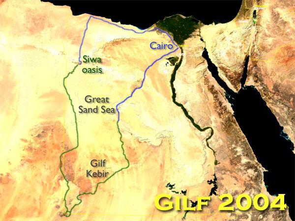
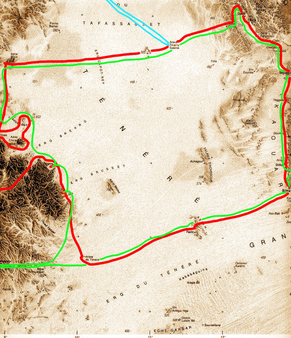
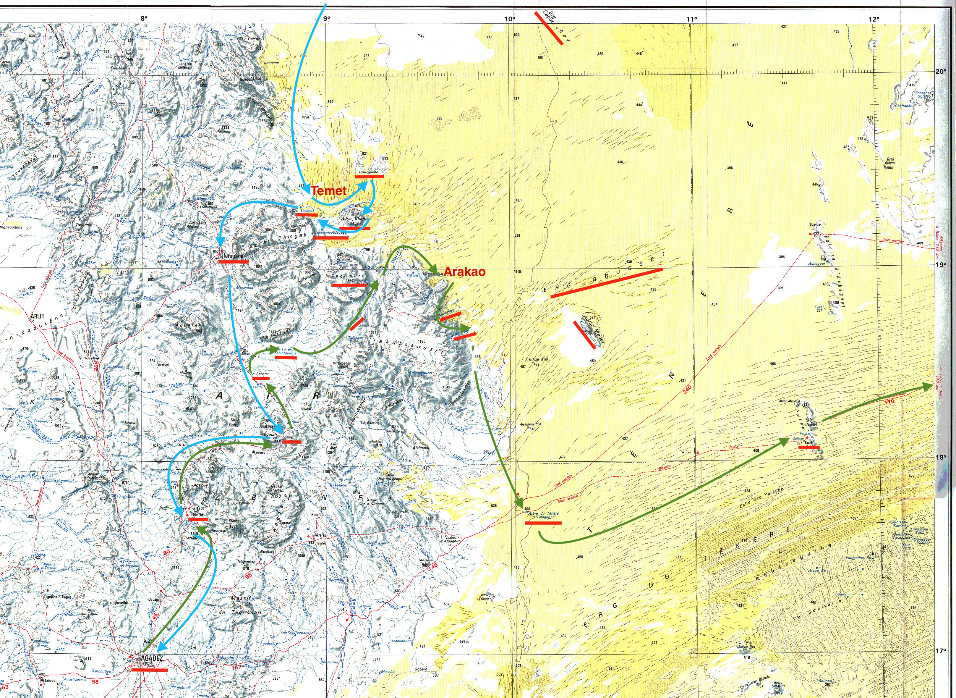
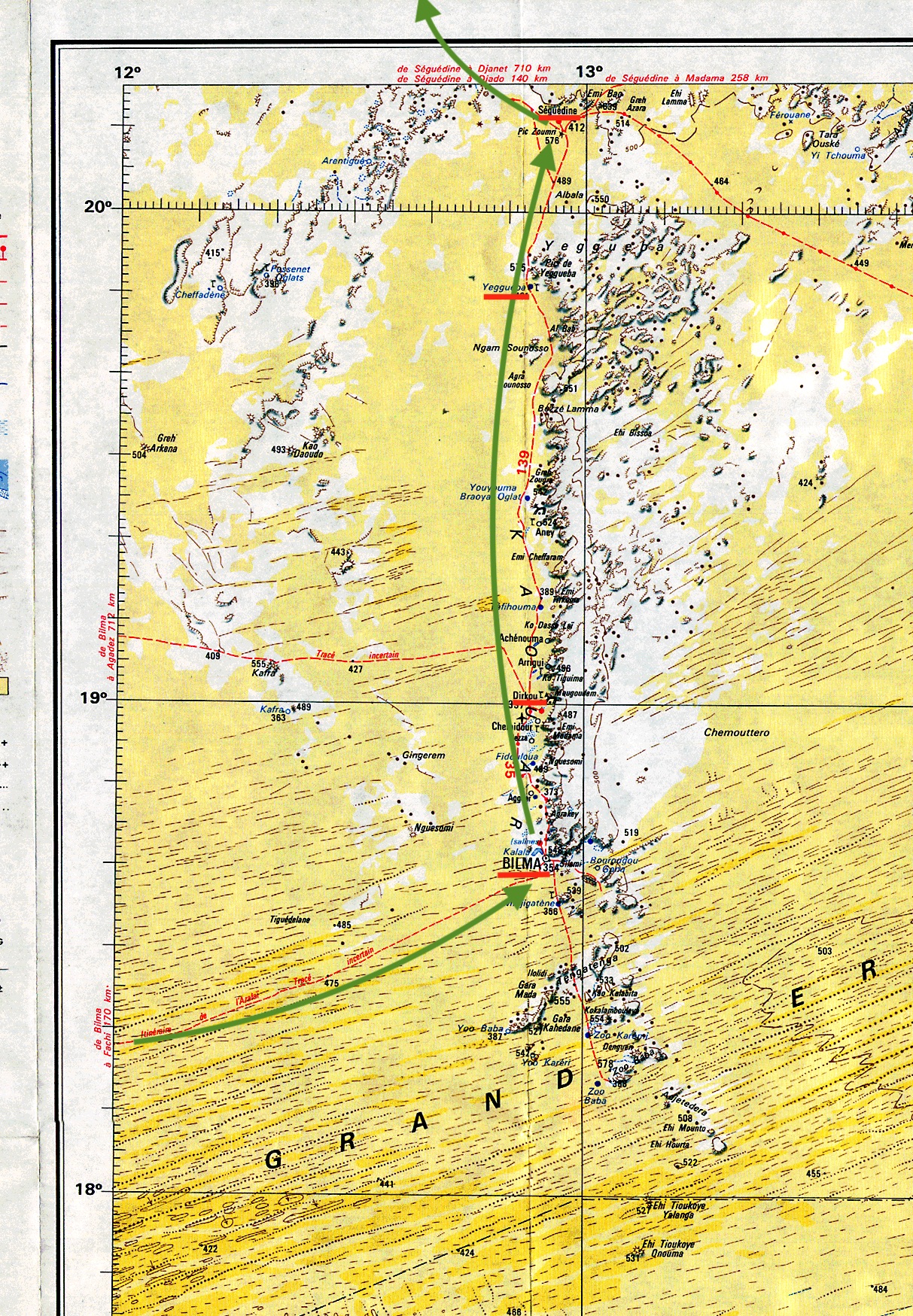
Niamey – Agadez – El Meki – Timia – Assode – Zagado – Arakao – Agamgam – Oued Tanakom – Anakom – Arbre du Tenere – Fachi – Bilma – Dirkou – Yegueba – Seguedine – Chirfa – Djado – Orida – Djaba – Chirfa – Col de Chandeliers – Arbre Perdu – Grein – Adrar Bous – Temet – Izouzadene (Blue Mountains) – Adrar Chiriet – Tezirzek – Iferouane – El Meki – Agadez – Niamey (red route on map, left)
Update 2025: no one’s been here for years and years
My fascination with the Tenere probably started after reading the alluringly sparse route descriptions in the old Sahara Handbook in the early 1980s.
Several stillborn attempts followed, resulting in a clearly inadequate description in my own Sahara Overland guidebook of 2000. I decided it was time to cough up two grand on a tour and enjoy a relaxed recce that wouldn’t put my own Toyota at risk (there was a high chance of losing your car in this area at the time).

No Brit operators covered this part of the Sahara and, looking at various itineraries and prices, I chose Suntours, a German operator long established in the region. I may have communicated better with a French-speaking group, but Suntours’ 22-day itinerary looked the most thorough, including the lost valley or Enneri Blaka deep in the Djado plateau, with its mysterious ‘submarine’ formation which would have got Clive Cussler going. See the vintage helicopter video bottom of the page.
I met the group in Paris and we flew straight down the Tanezrouft (no window seat, alas…), reaching Niamey at sunset where it transpired half of the group of nine’s baggage was missing. We had to hang around next day in the hope the bags might turn up from Abidjan that evening. Like most sub-Sahara capitals, Niamey isn’t what you come to Africa for, but for 20p, the museum was a bargain, while brochettes at sunset on the terrace of the Grand Hotel is the done thing.
That night a few more bags turned up and, with only three missing, it was decided to take the 1000-km drive to Agadez; the luggageless ones would have to make do. This long drive is a drag. Flying direct to Agadez from Paris would be ideal, though I can see why Suntours don’t trust the Le Pointe’s charters who had a bad reputation for cancelling flights if not full enough. The American tour that got robbed at Temet (more below) suffered a typical, late Le Pointe cancellation on the way out, then had to cough up for a scheduled flight. Glad I missed that trip!
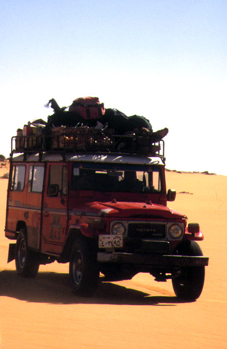
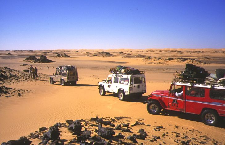
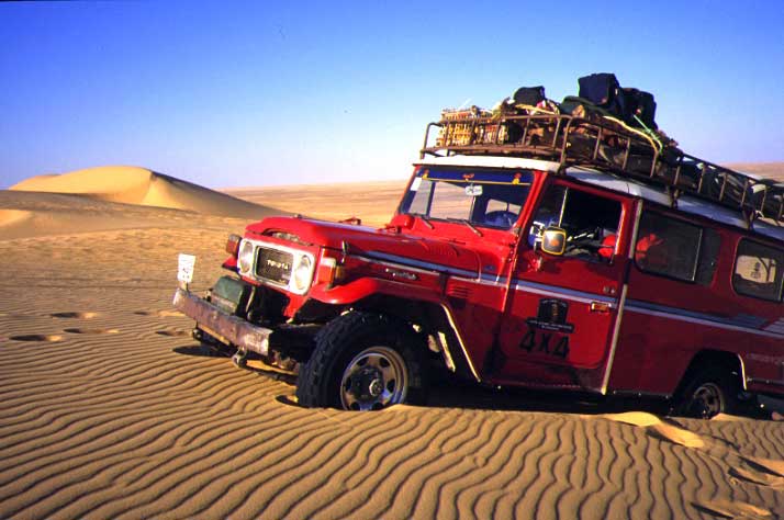
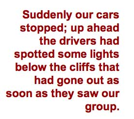
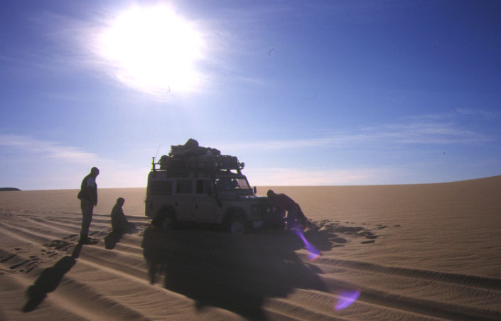
As it happens, the night drive in two minibuses wasn’t so bad as most of us could stretch out on a bench seat and get some sleep. Leaving around midnight, we got to Agadez thirteen hours later for lunch at Ewaden Voyages’, the local partner of Suntours. Soon after, two old Sixty-series Land Cruisers and a Patrol were loaded up and we headed for the hills.
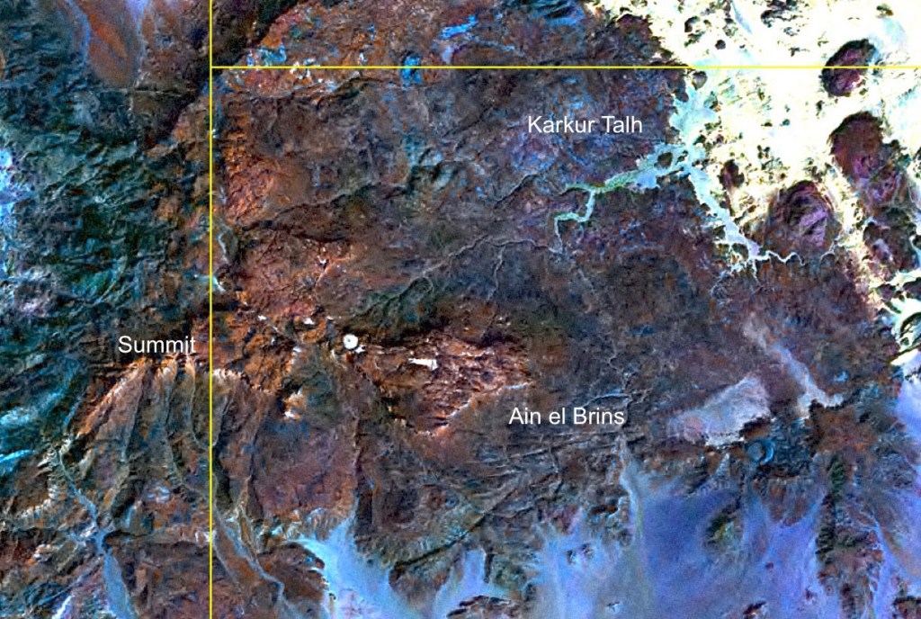
AïR
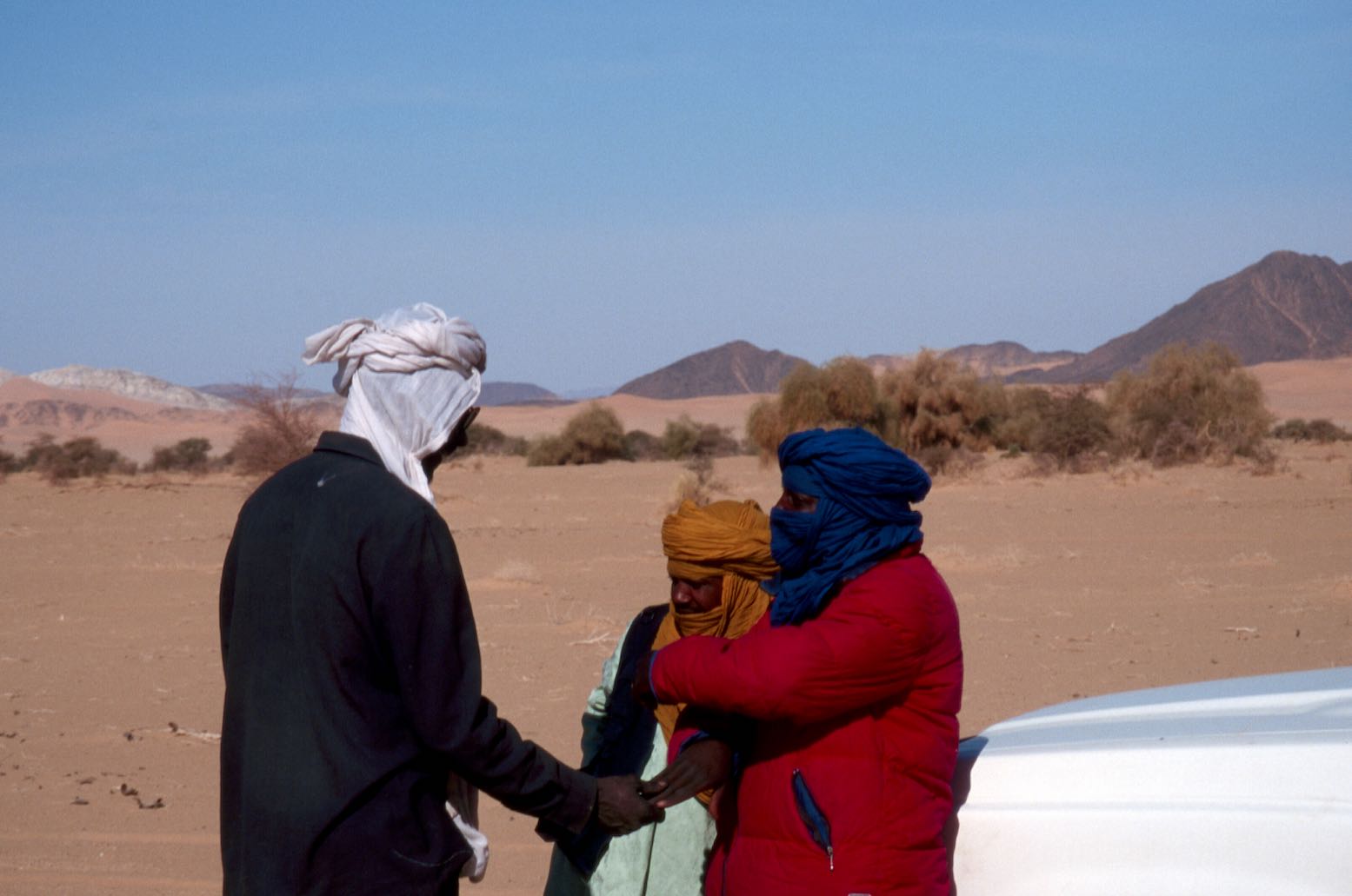
I’d been warned that I might find the Aïr a rough and dull drive – it’s not the Tenere. In fact, it was quite satisfying on the way out at least, when it was all new. Out here Tuareg dudes really do wander around from village to village on camels with their takouba swords by their side. I’ve never encountered the semi-sedentary ‘Kel Aïr’ Tuareg before, but now realise how much Tuareg mythology might be based on the colourful culture of this region’s accessible clan.
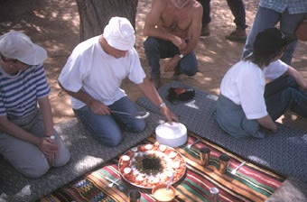
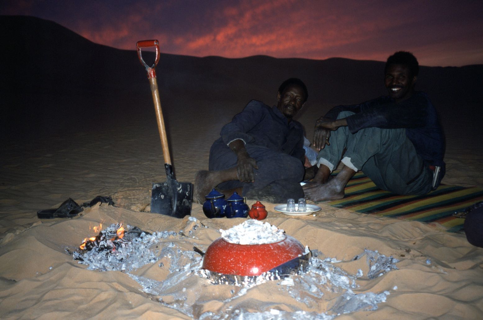
We camped in a oued (“never camp in a oued!”) where Ibrahim cooked the first of many spectacular meals. How long could this last I wondered, and sure enough, by the time we got to the Kaouar in the east, things got a bit plainer, but his outstanding lunchtime salads were works of art, composed of fresh ingredients for much longer than you’d expect in fridge-free motoring.
Another great aspect of this tour was letting us loose on foot while the morning (and sometimes lunchtime) camp was packed up by the crew. With a bit of luck you could get a quiet couple of miles under your soles before the cars caught up.
No one could have complained that too much time was spent cooped up in the cars, although the constant attention the old bangers needed added to frequent cig’ breaks. On the whole trip I doubt if we drove more than half an hour without one car stopping to fix something. That said, it was soon clear these drivers drove their vehicles with great care; a first for me in Africa. I was in the Patrol where Madougou treated the machine like his own. I’d have been happy for him to drive my car (and if you know most desert drivers, that’s quite an admission!).
The southern Aïr is a Sahel of low reddish hills which darken and rise towards Timia and the volcanic extrusions thereabouts. Settlements and nomadic encampments focus round the gravely oueds, some with nearby gardens and enclosures. You’re never far from others in the Aïr.
With the frequent stops, at times I suspected we were hung out to dry among the cadeau-crazed village kids a little too long for comfort, as if it was pre-arranged ploy so we’d crack and splash out on Tuaregobilia. By the time we got to Timia I sensed the group had had enough of this, and being sent off on a futile tour of this unremarkable village had us all pining for the desert.


“Do you know Alex Marr?” a young Timia boy asked me in French. Well, as it happened I did. I’ve never actually met him, but Alex was on the front cover of my fourth Adventure Motorcycling Handbook. He came through here on his way to Bilma in 1999, thinking he could ride from there to Lake Chad because of a black line on the Michelin map; not the first to make that mistake. (I noticed Alex also entered the Dakar Rally in 1988). I had the novel experience of receiving a cadeau to pass on to Alex.
While deflecting vendors’ parries, I got talking with a French visitor to Timia and an elder Targui, and asked about the robbery at Temet dunes a couple of weeks earlier. Who were the culprits and had they been caught? The old Tuareg shyly slid behind his cheche at the mere mention of the event, while the French guy realised it was associated with the ‘Madame Tortoise’ (Turtle Tours) he’d heard so much about in the village. She worked with Dunes Voyages, an established Agadez agency, but you can see from that link, Irma Turtle’s customers were not a happy bunch, even when they weren’t being robbed.
I’d already asked Hans our guide about it, but he pretended not to understood me. I never found out if the rest of our group knew of the raid (known chiefly to the Saharan online community), and if they were bothered about it. Two months later another tourist group like ours was turned over close to where we’d spoken.
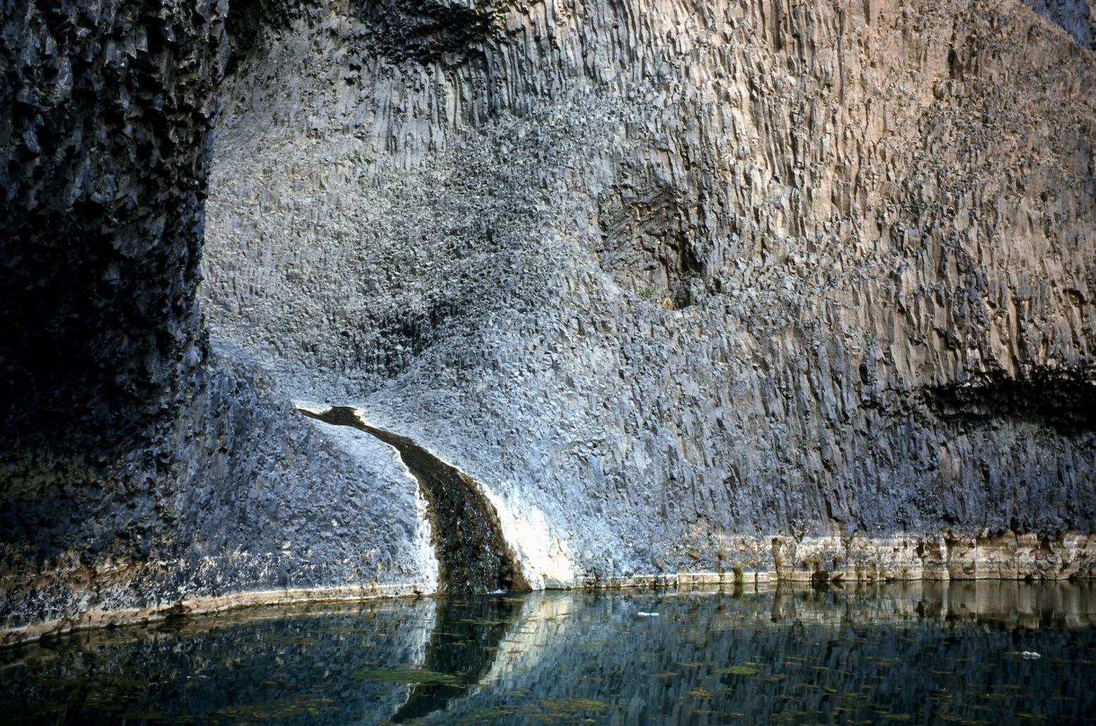
The volcanic geology around Timia is interesting, including the cascade which reminded me of Mutujulu Springs running off Uluru (Ayers Rock). At this beauty spot an orderly line of vendors sat behind a line of rocks imposed by the European agencies on pain of dropping this stopover from their itineraries. Next day we visited the surprisingly substantial ruins of Assode, the old capital of the Aïr before Agadez became pre-eminent a few centuries ago. With that ticked off, by lunch time we watched the women watering their goats at Tchintoulous well, enjoying more relaxed shopping opportunities as they discreetly laid out their wares near us. Then, at the top end of the Zagado valley we spent out last night in the Aïr facing the Taghmert plateau (below).

ARAKAO TO THE TENERE TREE
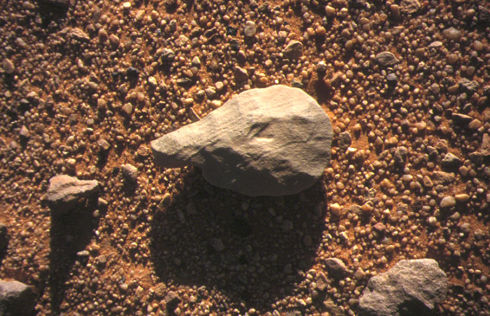
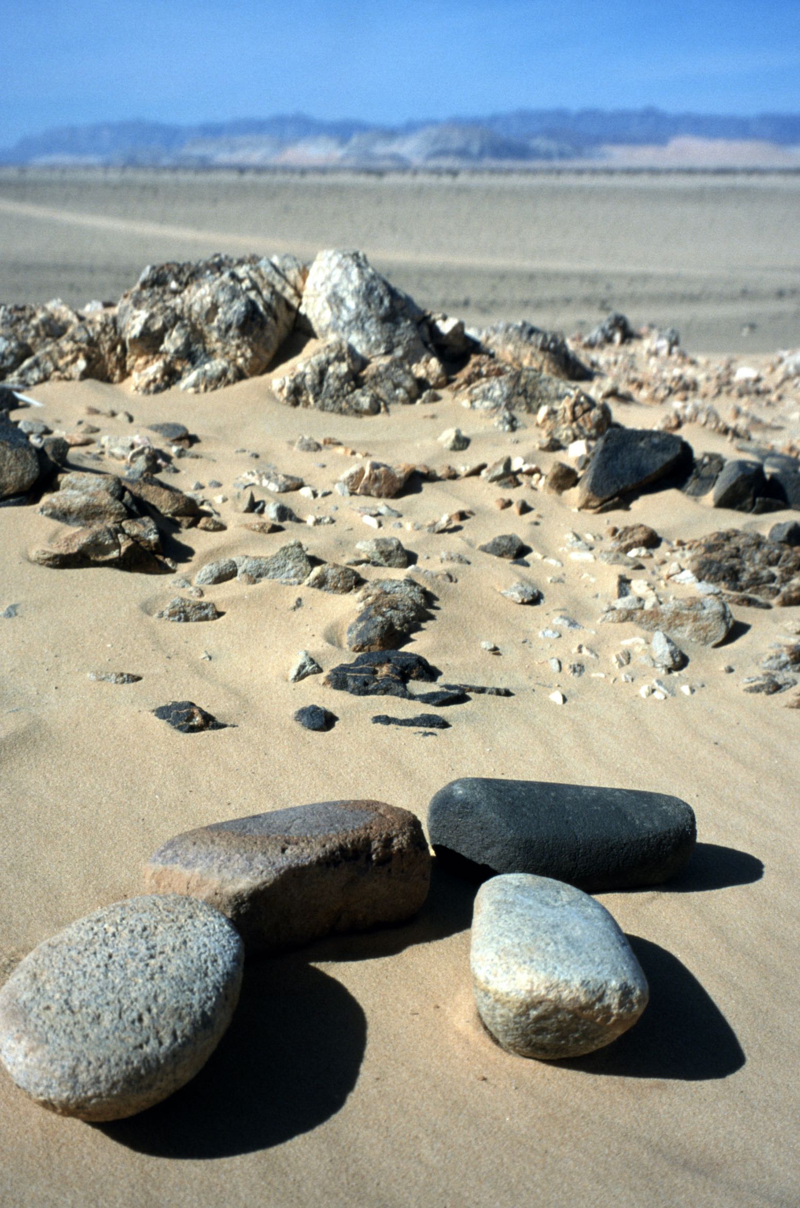
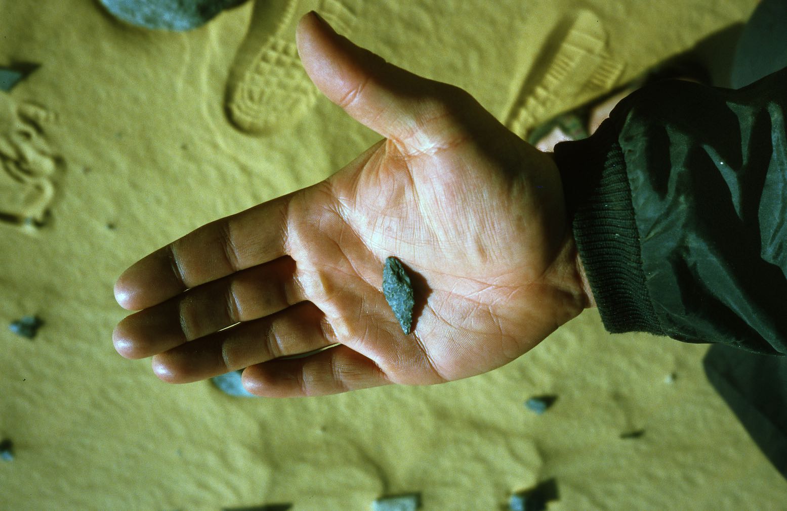
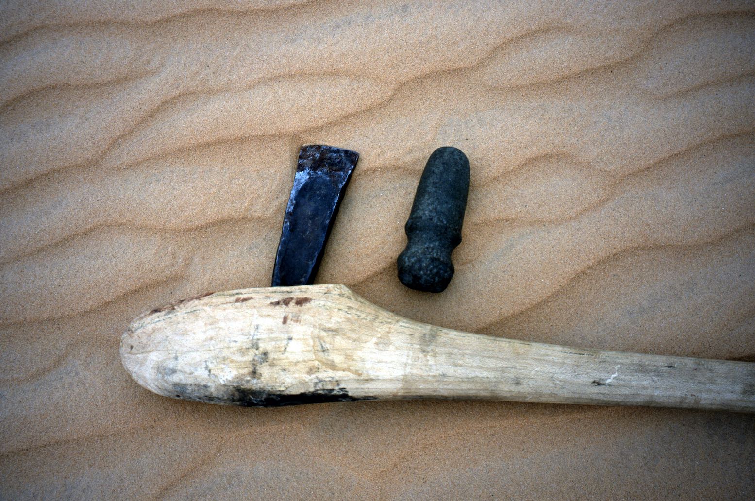
We were now traversing the Neolithic borderlands of the western Tenere and soon pre-Islamic tombs became discernible on the hillsides. Stops hereabouts revealed the usual Neolithic artefacts and at one point I found four grinding stones (left), their easily found milling stone (or moule) plates having long ago been grabbed by collectors.
Some consider the collection of Stone Age artefacts tantamount to grave robbery, but to me they’re just non-degradable Neolithic relics that tell a story. Finding them is like beach combing and a lot more satisfying than haggling over a silver Tuareg cross. And it’s more acceptable that pinching Tuareg heirlooms like swords and camel saddles from impoverished villagers. But, although the collection of artefacts was not discouraged on our tour, I’ve changed my mind on this practice now. Leave these things in the desert. In many countries it has become illegal to remove them.

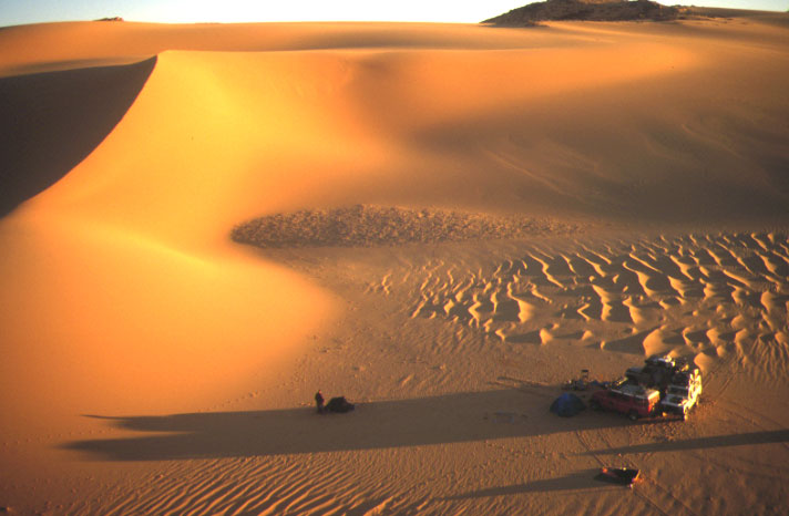
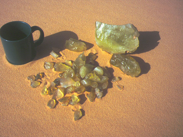
A tongue of jumbled dunes spill through the mouth of the cirque of Arakao (above), dividing the easily visited south side from the less accessible northern half. We camped on the crest of the dune cordon and spread out to explore. As one would expect, a sheltered site like Arakao was inhabited during Neolithic times and probably long before that. We visited several tombs in the southeast corner and kicked about for more artefacts, usually made from the distinctively green flint-like jasperite found in this region.
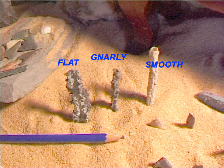
Hans, always energetically scanning the sands, found me an amazing rod of fulgarite in the dunes: a brittle, pencil-thin tube of petrified sand caused by a lightning strike. Since I first found some on the edge of Algeria’s Oriental Erg years ago (without then knowing what it was), this stuff has always amazed me: lightning turned into stone: a true wonder of nature. Walking back from a dune summit I found Hans’ spot and excavated another slender undisturbed twig over half a metre long. Who knows how deep it went.
Traditionally Ibrahim always baked a pizza at Arakao we were told, keeping up the circular theme. A thick and chewy Margarita the size of a Land Cruiser wheel is quite an achievement using just enamel trays and embers, and while we all gave him full marks for audacity and presentation, sadly the dough didn’t quite make it.

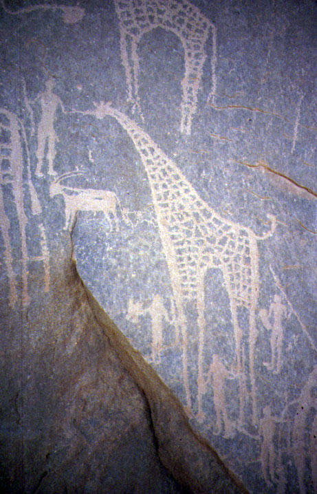
We cruised down the east side of the Aïr, stopping to admire the amazingly and bizarre engravings at Oued Tanakom and Anakom, at times driving continuously over stones all fashioned into tools over the millennia. One can visualise the Neolithic settlements spread out by a long-gone river running out of the mountains, while wild game and herds grazed on the plains of the Tenere, now covered in sand.
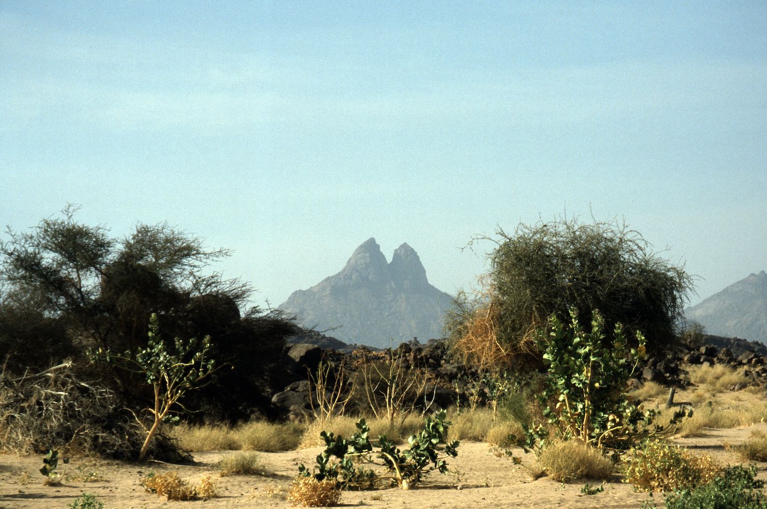
At ‘Long Stones Pass’ we could make out the mass of Adrar Madet and the Erg Brusset to the east, and later that afternoon finally shook off the Aïr’s margins and headed across the serir for the Tree.

THROUGH THE ERG TO BILMA
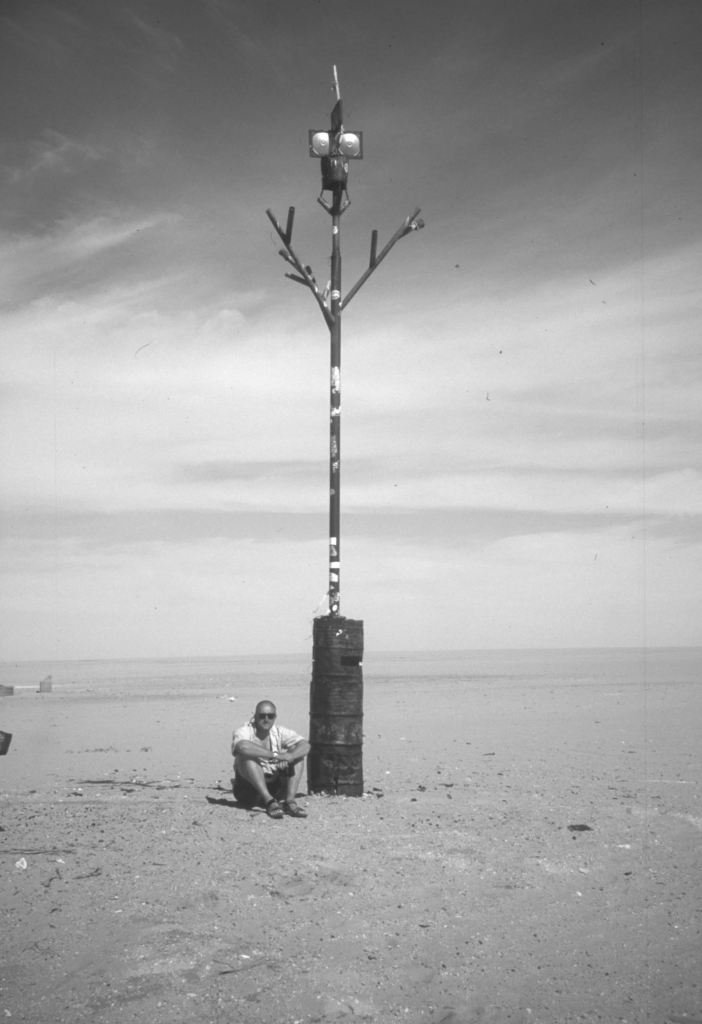
To finally see the Arbre du Tenere after reading about it over the years was quite a buzz. These days there’s a lot more there than just a bad well and the old metal tree (the original is in Niamey Museum looking as interesting as a bag of crisps). Some Japanese recently built a wacky pylon, and there’s the usual litter, other structures and a water tank. There are even a couple of new trees (“tropical species, pah!” exhorted our biologist guide, Hans) which you’re asked to water when you are there. As Tony Gastel reported in 2000, the water is far from ‘tres mauvais’ as the Michelin map states, but it is very deep, taking three men to haul up the bucket nearly 150 feet. While they watered the cars, we had a chance to wash and then headed along the dune corridors towards Fachi.


At first we drove over irritating tussocks and I had the impression we were going south. A lunchtime GPS check validated my preternatural sense of direction; Abdullai the local guide having deliberately dropped down a few corridors to pick one which lead directly to Fachi.
Soon the vegetation disappeared and we were passing among the low, pale yellow dunes of the northern Tenere Erg with very few tracks and no balises. To me, sat in the passenger seat, the driving and navigation of this famous route appeared relatively easy, with the odd bogging easily reversed. Occasionally we came across an old azelai salt caravan camp with masses of camel dung and other rubbish, and a little later some abandoned kantus (salt pillars) with the dead camel nearby. But we encountered no actual caravans as Tony had last October: the azelai season.

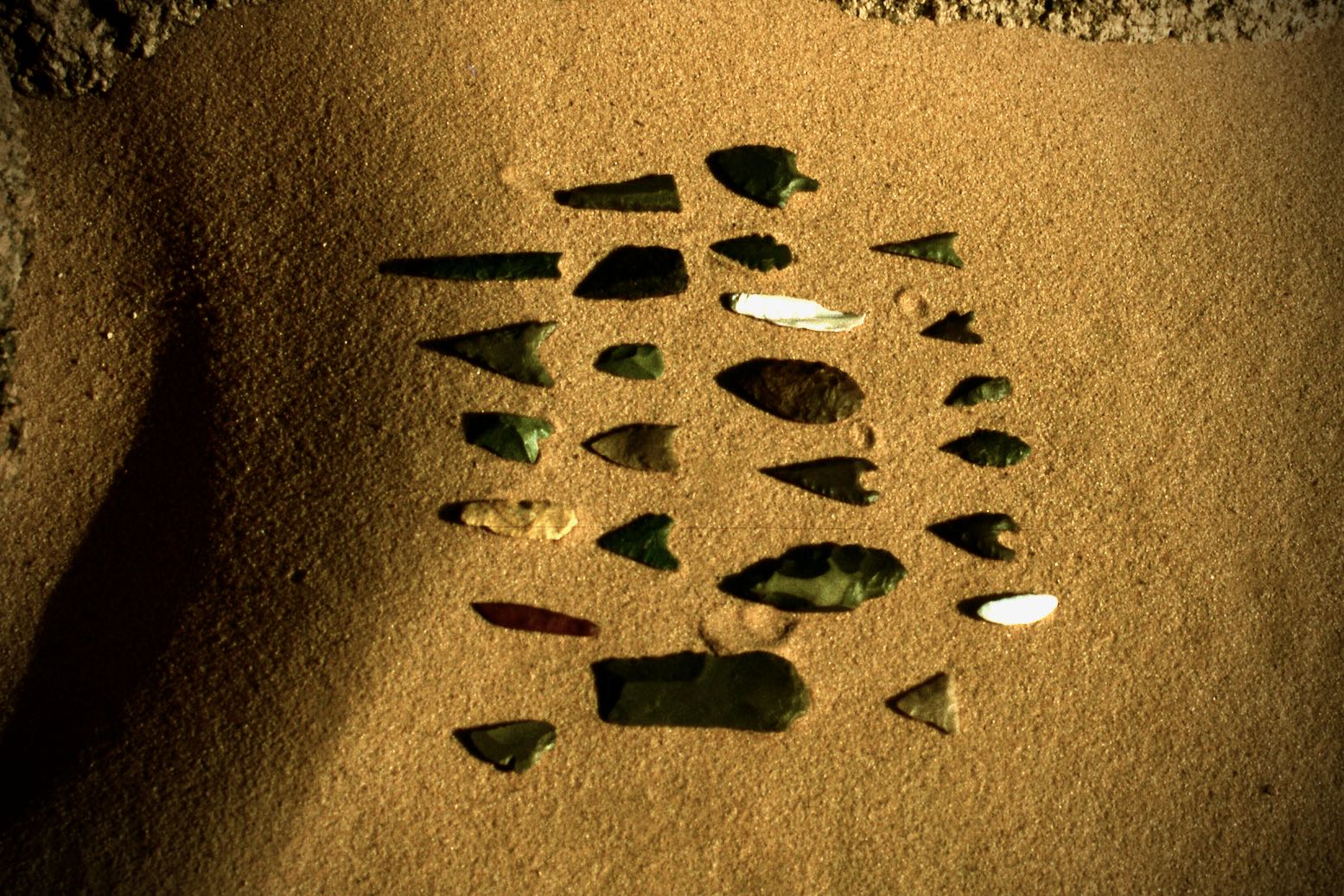
Some gravel pans in the corridors harbour the odd patch of Neolithic chippings. We found tiny arrowheads, something I thought all but impossible with casual fossicking. The fine craftsmanship and variety of these centimetre-long spikes is nothing short of amazing. They may only be a century old of course, but are probably much older. I imagine like moules, they were found and reused for centuries and centuries.
We camped in the lee of a dune. Next morning we approached Fachi – lovely in Jean Luc Manaud’s famous image, but well camouflaged below the Agram escarpment. The sand-filled streets and tamarisk trees give Fachi a nice, ex-colonial appearance. This was Kanuri (or Beri-Beri) country, not Tuareg nor Tubu, though Hans suggested that Kanuri are merely Tubus of the Kaouar region of eastern Niger. I have read that Kanuri (‘from Kano’) like to deny this. We got watered at the well, checked in with the sultan who was entertaining a Spanish TV crew, and then went for a look around the old town escorted by the sulky sultan’s son. Although I find old ksars as evocative of the Sahara’s romance as anyone, the giant wheat urns inside the old fort was about as interesting as Old Fachi got.

Back by the cars, we were left to stew among the cadeau kids until nice and tender. I went for a wander up a street, looked down an avenue and got spotted whereupon a tidal wave of kids surged towards me. I wouldn’t be surprised if each of us was asked 50-100 times for bics or whatever. It’s all part of being a tourist in Africa, but what was the delay? Having had a quiet time since Timia a few days ago, it was clear that the group was getting irritated by this. Maybe it was a way to string out the tour for three weeks.
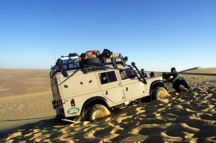
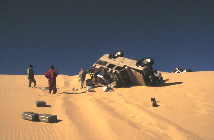
After a visit to Fachi’s salt evaporation pits (salines) round the back, and lunch in the palms north of town, we headed up a sandy pass in the Agram escarpment where the sand softened noticeably. All the cars struggled and Kaiou’s red HJ60 – which at the best of times smoked like a Ukrainian steelworks – started frying its clutch. We could smell it burning from our car, but he kept pushing and eventually it disintegrated down to bare metal. Luckily Abdullai has a spare and, with the aid of ropes, two jacks and some legs, Kaiou’s Cruiser was running again four hours later.
The cars drove in strict formation. Abdullai up front, Madougou with us in the Patrol and Kaiou last. But Madougou was a bit slow and sometimes Kaiou got ahead, belching his unburned black puke all over us. Sensing our latest irritation, they half-heartedly tried to fix it later, but the car ran so what was the problem? Worn diesel injector pumps are the problem in the Sahara, and the mixture on his car was far too rich. Kaiou ran out of fuel before Bilma.
With the ridge of the Kaouar behind it, Bilma is easy to spot. I had the impression that crossing from the Tree was relatively easy. The corridors line up just right and in good visibility you can’t miss the Agram or Kaouar escarpments. Finding the Tree without GPS if coming from the east would not be so easy, but even then, grasses and converging tracks would be a clue that you’re close.
Hans described Bilma as a dead town and I find Tony’s figures of 12,000 population unlikely (even for the massive Bilma district). We stopped at a garage for water. An HJ75 was getting fresh oil and a 109 Land Rover waited outside: two classic Saharan cars. On this side of the Tenere you also find plenty of Nigerians washed up on the road to Libya and so English is spoken, but as in much of West Africa, everyone speaks several languages. Our guides chatted in a mixture of Tamachek, Arabic, French, Djerma, Hausa and Tuburi (or ‘Kanuri’).
With the jerries full, we drove round to the fort to hand in our passports and pay the provincial tax. Out here you officially need stamps in Bilma, Dirkou and Chirfa which takes up a good page or two of your passport. Near the fort are a couple of market stalls full of Nigerian goods and junk sold by Hausas who I get the impression, are like ‘Moorish traders’ on this side of the Sahara. Knowing this, it made sense to learn that the famous Bilma salt caravans or azelais are organised and managed by Hausa or Peul, not Tuareg, though Tuareg camels and guides are hired for the job. And the good news is that these caravans are far from the dying tradition many think. Tony’s reports of seeing several caravans was no fluke.
DIRKOU TO DJADO AND ORIDA
Next day we hit Dirkou, a thriving frontier town that’s the true capital of the Kaouar. Nigerians and other desperadoes head north on top of Mercedes lorries to a life of slavery in Libya, only to get sent back following one of Gaddafi’s purges, sat on the piles of subsidised or stolen goods on the same Mercedes gros porteurs that pass daily through Dirkou.

By the compound where Andy and Richard spent their Dirkou detention, is a Tubu technical shot to smithereens and left as a reminder that the government won that particular rebellion. Passports handed in, I had a choice to go see Jerome or check out the town. Lively though Dirkou looked (and free of hassle, I was told later), I went to pay my respects to the late Diesel Prince of the Tenere, finding a friendly old man instead of the money grabbing Shylock I’d expected. He can afford to smile, selling Libyan fuel at a 1000% mark up, but still a tad less than the official Nigerien price.
A big Mercedes was unloading and I got talking with the driver who originally came from Djelfa in northern Algeria, while his two boys bounced oil drums off their heads, Tubu daggers tucked in their belts. He was full of praise for ‘Le System Mercedes’ but didn’t have much to say about the run down from Sebha that I could understand; some diesel may have seeped into our brains over the years.
Although 75 years old, Jerome was lucid and delighted to meet a Brit, claiming to have fought for Monty at El Alamein and all the rest. He rolled off a string of generals’ names and dates which sounded plausible, but later Hans suggested had I been German it would have been the same story under Rommel. In fact, a mate who has since met Jerome found out he is indeed an Anglophile, proudly showing an old WWII photo of himself in a Brit uniform. Gerbert van Der Aa, another S-Files Tenere contributor, interviewed Jerome for a Dutch paper a year or two ago before he died in 2003.
Back with the group, Luggageless Erich had bought himself a Hausa outfit, complete with hat. Erich was not all there following a bungled operation in his early forties, and was quite a laugh in a subversive, boyish way. Vendors zoned in on his naïveté and he ended the trip, grinning and draped in Nomadobilia.
The landscape of the Kaouar was a bit grubby for my liking. We dropped into the salt works north of Dirkou where natron salt was mined. I noticed Madougou took some with his chewing tobacco, as they do in these parts. By the time we got to Yeguebba – the northern end of the Kaouar escarpment – the colour of the sand was a pleasingly orange again. We stopped to collect some firewood (there’s plenty of firewood here and masses in the Aïr) and drove across to a soak where the last car mired. What a mess, the quicksands wobbled like jelly and it makes you appreciate how easy and clean dry desert sand is to get out of. But with sand plates and a tow, the car was out and we spent the night nearby in the rocks where a fennec (desert fox, sort of) popped in for a visit.
Since Bilma it had become clear our drivers were getting tired and probably anxious at being out on the far side of the Tenere in their old bangers. Their banter became restrained and you could see they longed to be back in their own country. We were having an easy time of course, waited on hand and foot and with nothing to worry about other than, for some, grabbing the best camp spot for the night. I couldn’t join in the evening chatter but it didn’t bother me, though I can now say ‘schpoon’ in German. Anyway, with time to myself I had a fresh batch of hare-brained schemes to nurture through their delicate development stage.
Years ago, I recall reading in the Sahara Handbook about the importance of finding Pic Zumri to get to Seguedine from the north and now, there it was and the village laid out in the dip below. Here, the Adadez truck piste from Achegour splits, heading northeast behind the Djado plateau for Tumu and Libya or even east for Chad – a long closed route. Following a visit to Seguedine’s checkpoints, multi-coloured salines, and some gentle bartering with the wily Tubu women, we set off northwest across stony plains, passing petrified wood, the landmark of Oleki peak, and stopping for lunch at Sara ‘oasis‘. A hot wind was blowing from the southwest today, hazing the sky and raising the temperature to the high 30s.
But lunch with Suntours was never less than a shady two-hour siesta, finished off with three glasses of ‘chai’. On this occasion Abdullai resoldered his burst radiator on the fire. Earlier, I noticed he’d tried to use clay dust as we’d done in Algeria years ago. I can report that bodge is no less effective at the hands of a wizened Tuareg desert driver than in mine…
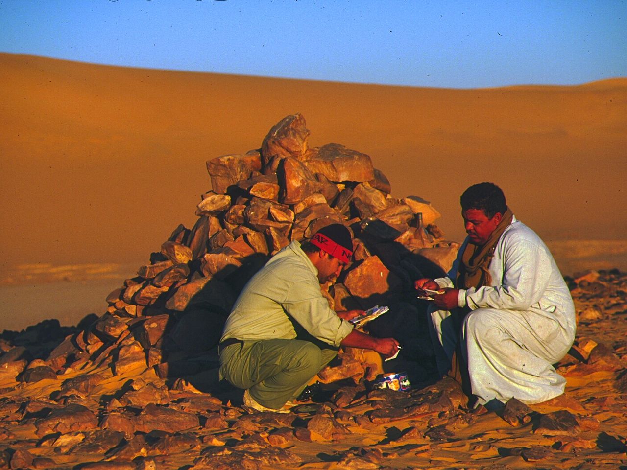
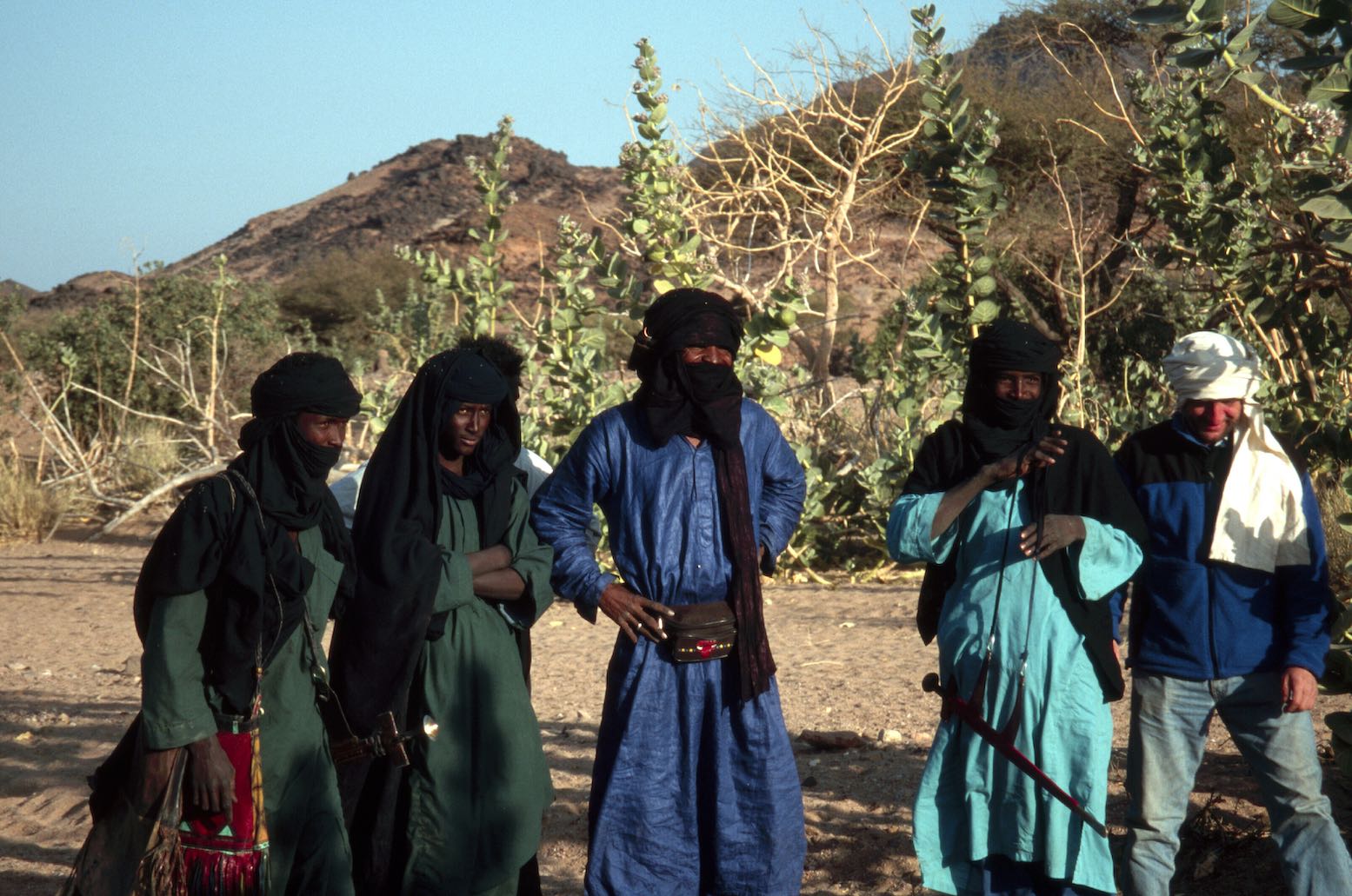
Hans was a great guide and had a good way of melting the ice at checkpoints by bringing photos from previous visits (this was still the camera film era). At the Chirfa control post, where the guys in their football kit always have a gun close by, the photos caused much delight, as they did in Chirfa village where we picked up some water and veggies from the garden. All through this trip it was clear that Suntours has developed a close rapport with many communities and individuals over the years. At many places Hans discreetly handed over medicaments to the village pharmacy (eye drops and aspirins were much in demand).
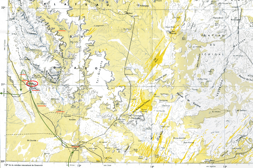
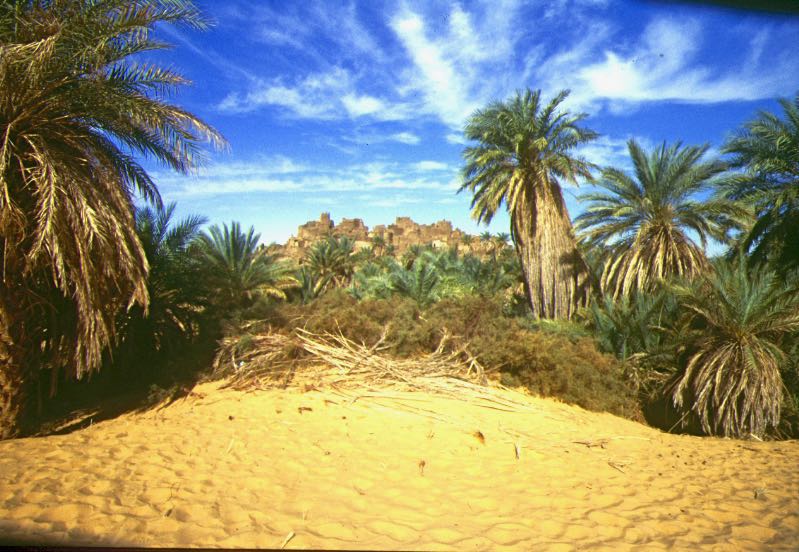
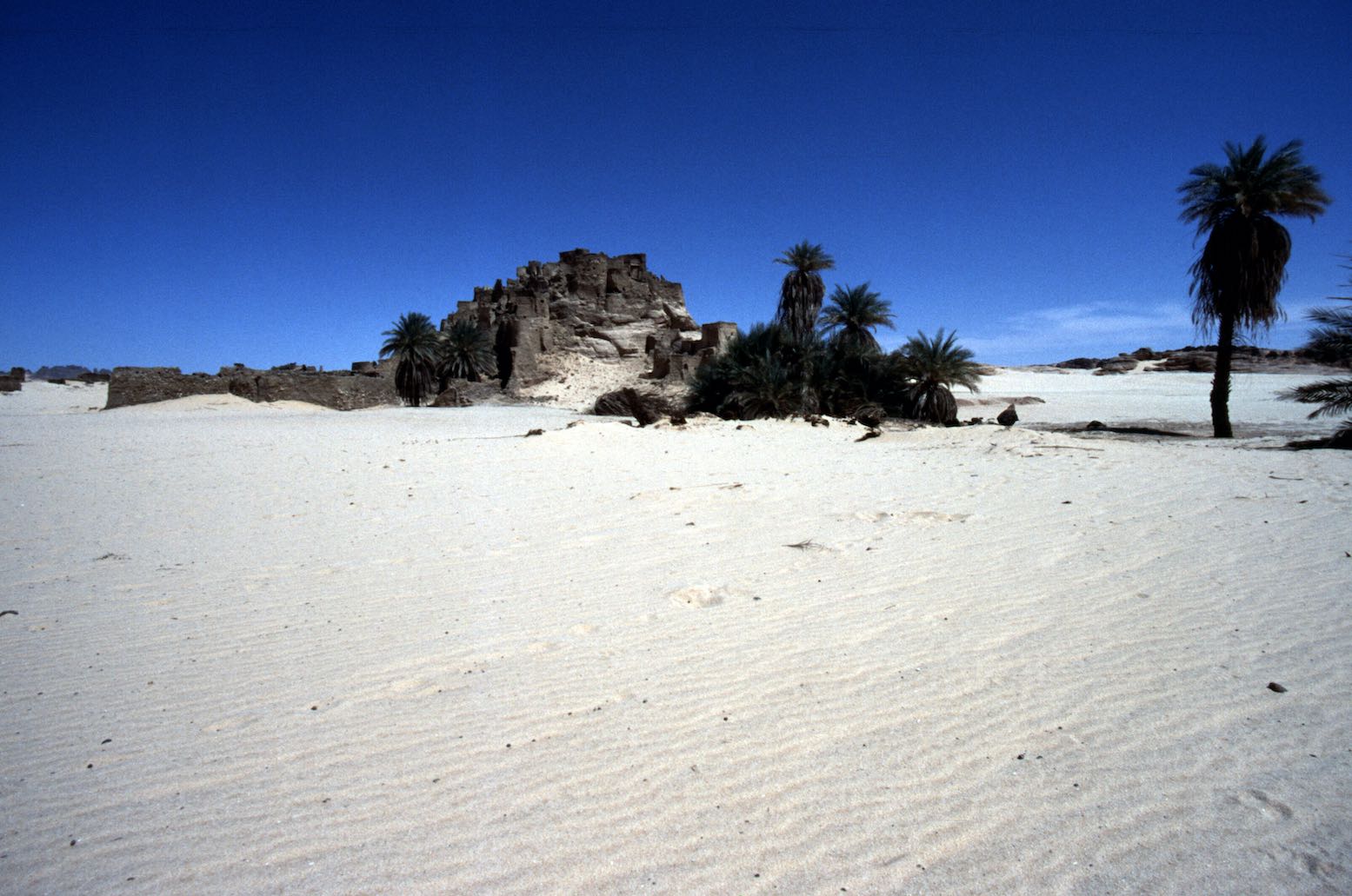
I’d been urged to make sure our tour visited Old Chirfa (aka ‘Tebeza’) a short distance from Chirfa village, and sure enough, it was on our itinerary. The old citadel is part of a string of medieval fortified towns that run up from Seguedine and maybe once even Bilma and further south, tracing a defunct trading route which explorers Clapperton and Oudney followed in the 1820s down to Lake Chad, later followed by Barth and Hans Vischer in 1906 (see Shadows Across the Sahara). Strolling around Old Chirfa was thrilling but for me the true highlight of the trip, as expected, was mysterious Djado, the following morning.

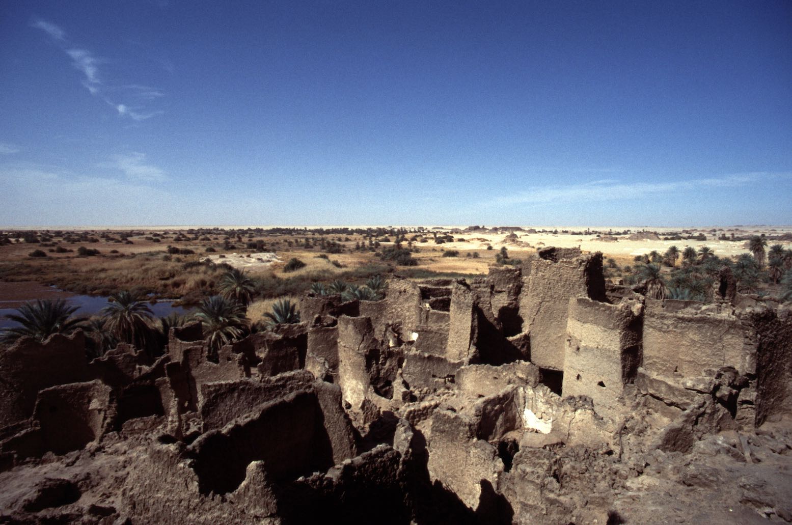

Djado (photo Klaus W.) is a huge complex which must have housed thousands a few centuries ago. In winter it’s surrounded by a lake of brackish water which I’m told oddly, disappears in the rainy season. In autumn the whole of Chirfa moves here to harvest the dates from the many palms; their zeriba huts ring the ancient ruins.
Exploring the crumbling town was incredible, every corner revealed a stunning view of distant escarpment, desert sands and waving date palms. My camera had passed out in Fachi, but luckily Klaus had a bag full of lenses and film and agreed to keep shooting for me. Hans poured scorn on the theory of pseudo archeologist Uwe George in Geo magazine. He’s discovered a room with a cross relief (now called the ‘eglise’) and who went on to claim that Christians migrated here from Ethiopia in the first millennium. I’m all for interesting theories, but it does indeed sound implausible if not an outright publicity stunt which some publicity-savvy academics are fond of pulling off.
We were about to enter a region controlled [at that time] by unreconstructed Tubu outlaws – an anomaly tolerated by the Niger government who let them have the remote Djado plateau to themselves (and maybe pull off the odd tourist and car heist on the edge of the Aïr?). No longer did our guides stop to chat with every passing car, mumbling a string of greetings. Now it was just ‘get out of my way’ crabbiness you’ll find in any city. We crossed a sandy ridge near the no less photogenic ksar of Djaba and stopped at a Tubu checkpoint where Abdullai gruffly handed over a 5000 CFA ‘tax’ without so much as a “Sallam alei…
Ahead of us rose the massive monolith of Orida prominent since yesterday, and behind it the arch and the forbidden rim of the Djado plateau beyond. The landscape and warm colours evoke the tassilis of the Ajjer and Akakus with which the Djado plateau is contiguous. Most Ewaden guides would not come this far into Tubu territory, let alone reach out towards the intriguing Enneri Blaka (which was listed on our itinerary but we didn’t visit).
Lunch was under the palms near Djaba. Some Tubu girls parked up and set up their trinkets on a mat. This sort of ‘silent trading’ was much more agreeable and relaxed than the bombardment we got in the Aïr villages. But it works both ways: Tuareg tend to make more agreeable company than grouchy Tubu.
We returned to Chirfa to pick up more water and our passports, then headed out along the Djanet track to the Col de Chandeliers (aka ‘Pass de Orida‘). A cozy camp was set up among the sun-warmed rocks while to the west, the plain of the Tenere du Tafassasset spread out like a becalmed ocean. It’s a corny simile for the desert I know, but this is the first place I’ve seen in the Sahara where it was appropriate. This was the real Tenere – a word usually used to describe the whole of northeast Niger and the Tamachek translation of the Arabic ‘Sah’ra’ or empty quarter.
ADRAR BOUS, TEMET AND CHIRIET
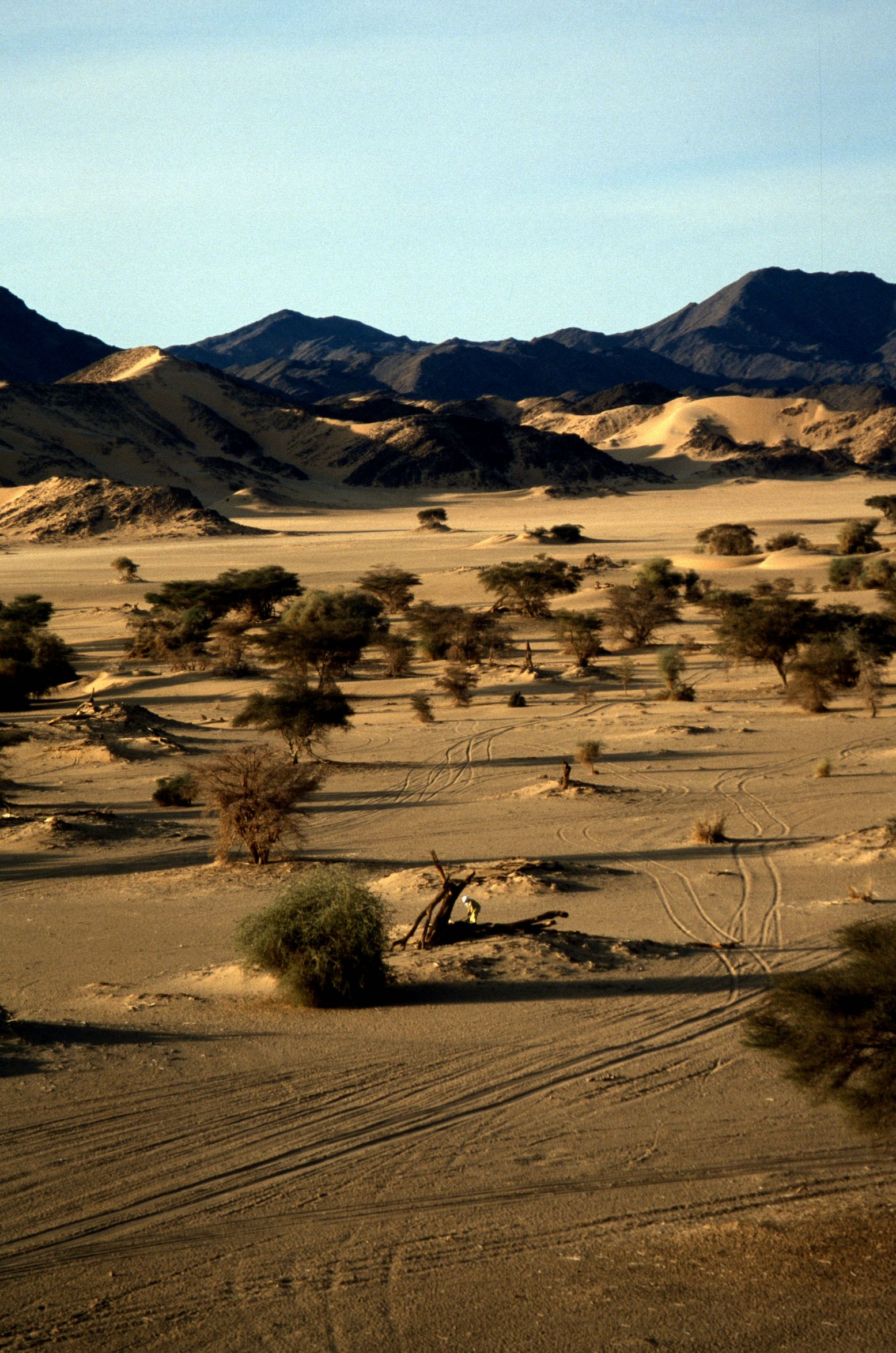
The awe of this emptiness was lessened next day by the clear tracks running west to Arbre Perdu (which we visited on bikes in 2003) and on to the isolated hills of Grein. But further on, beyond the northern outliers of Erg Capot Rey, even the tracks and wind-aligned ripples disappeared until it was hard to tell if we were moving at all, baring the drone of the engine as it hit a soft patch. Running at these high speeds caused a whole new set of problems for the aged Toyotas and while a puncture was fixed, Ibrahim prepared a quick lunch in the shade of the cars. We continued west through the void and in the late afternoon the profile of Adrar Bous mountain loomed out of the western haze.
Adrar Bous is well known as a locality of Neolithic knick-knacks, and we parked up by a Stone Age ‘chip pan’ and shuffled around for more arrowheads, then camped in a sheltered creek; an old Tuareg hide-out from the days of the rebellion. All of our crew were former rebels who’d fought in the bitter war of the early 1990s. Since then, the Tuareg of the Aïr have won some concessions on the organisation of tourism; the whole of Niger’s tourism depends on their kudos after all. But in the poor villages of the Aïr, aid still struggles to make much impact. All the better then is tourism like this where our money goes straight into the hills.
From Adrar Bous we were back on the tramlines of the Tenere Loop which winds down the eastern side of the Aïr into the dunes of Temet where the Austrian and American groups had been robbed a couple of weeks earlier. I’ve since got the full story from one of the people involved (see link above) and it was no hit and run raid, but a thorough and thoroughly intimidating robbery of all involved, and in which the drivers of the American group from Dunes Voyages excelled themselves in stopping all the cars being taken. One hears it may have been renegade Mali Tuareg behind it; they’ve been behind most of the tourist (and rally) robberies over the last couple of years, though such events are always blamed on ‘foreigners’. I’ve since read the ‘leader has been caught’, hopefully not just any old Tuareg in the wrong place at the wrong time. We had lunch at the site of the robbery where I probed our drivers, but didn’t get much of a response so left it and walked up the huge dune with the rest of the group. Since then, there was another raid of a German group in Timia in March.
A winding corridor led east out through the dunes and we spent the evening at Izouzadene, the striking outcrop of marble veined with cobalt salts known as the Blue Mountains. From a distance they do have a distinctive pale blue hue, but close up the grey veins look less impressive and the masses of tracks in the area could almost make it Morocco.
From here we drove south through the dunes to Adrar Chiriet, visible from the summits of Izouzadene, enjoying the classic east Aïr panoramas of dunes lapping against a backdrop of purple-grey plateaux. Driving into the massif, Ibrahim stopped to grab a bunch of wild grass to concoct a herbal infusion for later; a change from the endless Tuareg tea we drank daily. West of Chiriet, a rocky track led to Tchou-m Adegdeg well. Just on the other side of the Teghmert plateau was the point at the Zagado valley where we’d emerged from the Aïr nearly a fortnight ago. Here Tuareg nomads watered their herds and a camel sipped from the bowl in which my shirt stewed in detergent.
Between here and the nearby Tezerzik well is a lovely scenic drive through dunes featuring a distinctive lip below their crests. At Tezerzik the drivers bought a nomad’s sheep for a tenner and slung it on the roof. At the nearby camp in the dunes I watched them slaughter and butcher it with the same casual effortlessness they’d employed to repair the clutch a few days earlier. Interestingly, there’s not much blood when the throat is cut and once the hide has been peeled back the thing in hung on a stake, its ribs pulled apart and the innards removed for the drivers subsequent delectation; we got the tender meat in a cous-cous. Normally I find cous-cous an over-rated North African ‘must-eat’, but the way Ibrahim prepared it, both the millet and the sauce were as good as it gets.
BACK INTO THE AïR FOR AGADEZ
From here the desert section of the tour was over and we had a dreary three-day drive back down through Iferouane and the main track via El Meki to Agadez. It was March now and the nights were irritatingly windy, but the drivers were brightening up, pleased to be back on home turf.
I had the feeling these last days to Agadez were strung out with unnecessary stops to fill the time. The third night in yet another creek full of thorns and dung, just a couple of clicks out of Agadez seemed unnecessarily stingy. In my experience a tour should end on an upbeat note if possible, not dribble away the final days. I gather the others also complained about this retracing through the Aïr – ‘for fresh vegetables’ they were told, but our last lunch in the bush was all tinned. Despite the day lost in Niamey, maybe we could have nipped out to Enneri Blaka, after all, but I know well you do need to keep a few days in hand, especially somewhere edgy like the Djado plateau. I’m sure Suntours have developed their itinerary carefully over the years, but leaving the desert at the very last minute – along the track from the Tree to Agadez for example, would have been more satisfying.

We had an option for a hotel in Agadez that night and, wanting to check the town out in my own time, I took up the offer with the two couples and spent the night the Hotel Tidene near the mosque. I checked out some other agencies but as advised, Agadez itself doesn’t have much to offer. Next day the tour regrouped and set off for the long hot slog back to Niamey, getting home by the skin of our teeth following an Air Afrique strike and cancelled flights.
Should I return with my own vehicle I think I’d repeat the recent tour of an Italian friend: leave Djanet without checking out and with stacks of diesel and a Niger visa, then do my own thing in the northern Tenere around Grein, Adrar Bous and down as far as Chiriet maybe. If you get caught at least you have a visa and if you don’t, no one knows any better and you slip back into Algeria (as we did in 2003 on Desert Riders). If anything, doing it this way is less prone to getting hijacked than the local tours whose timetables and routes make them easy targets. But it’s a risk that will probably never go away (and within two years got very much worse).
SUMMARY
This tour indeed proved to be a great recce of the famous Tenere I had long wanted to visit. I found the Aïr and its Tuareg life more interesting than I thought, and the run in both directions across the Tenere less impressive than I imagined.
The whole Djado region is of course amazing, as are parts of the eastern Tenere bordering the Aïr, but the Tenere is no longer the wild Sahara of my imagination. TV crews and tours have put the place firmly on the map and, beautiful though it is in its entirety, getting off the tracks would have been more fun, something that you can only do yourself and in good vehicles.
I found this nice IGN half million map of the Air in Niamey. Dating from 1991, it’s a similar style to the Niger country map from IGN but I can’t say I’ve ever seen this one in Paris. In many ways it’s superior to the one million IGNs which are pretty old now and don’t show recent roads. Mine cost me 50FF, plus old paperback and a small argument from the side of the Grand Hotel.
I returned to the Tenere with my own tour for the Eclipse of 2006, and visited many of the same amazing places with another great crew (and ran into Abdullai in Chirfa). Our two-weeker was a perfect Saharan adventure.