Category Archives: Sahara A to Z…

2 is for: the 2CV Motorcycle Survival Story

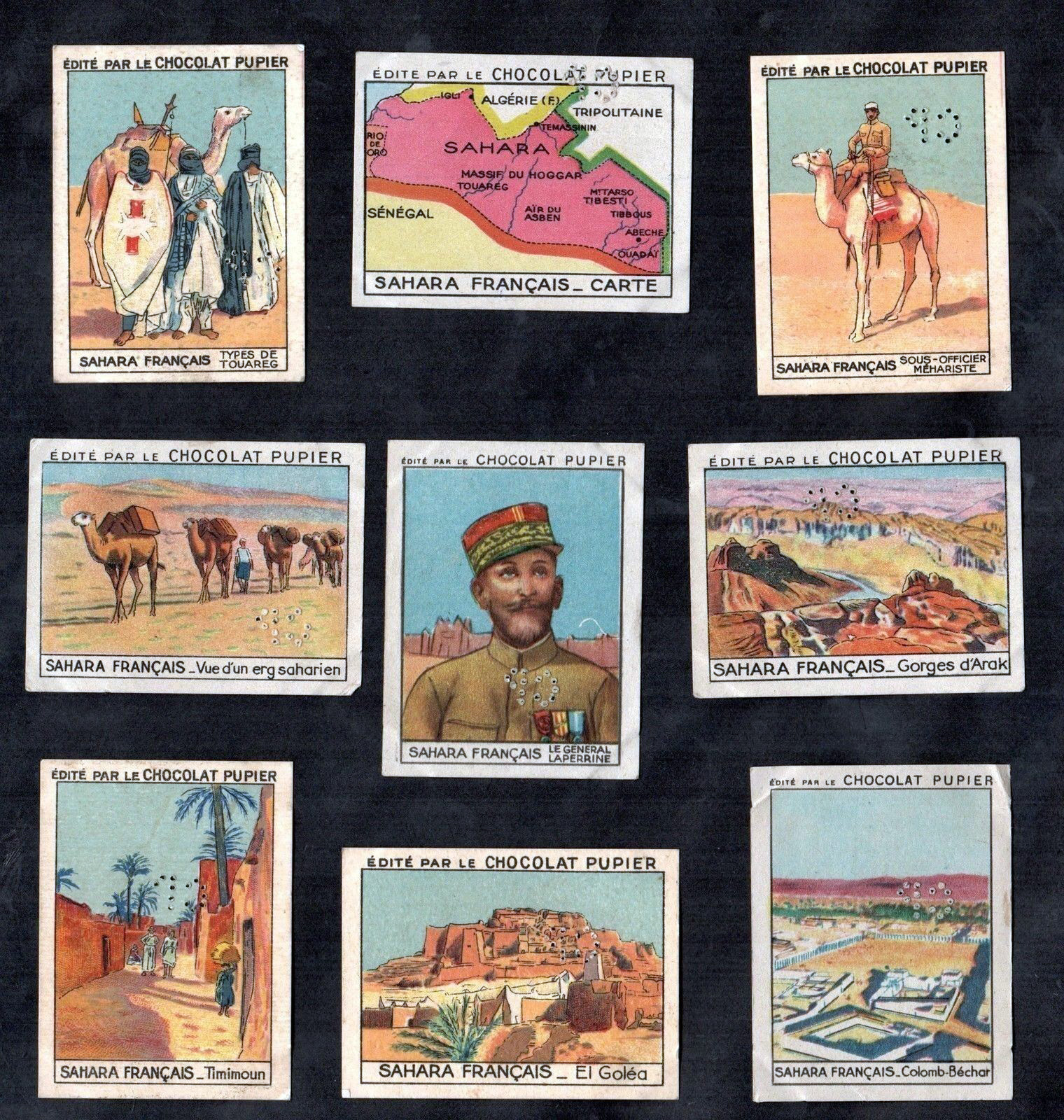
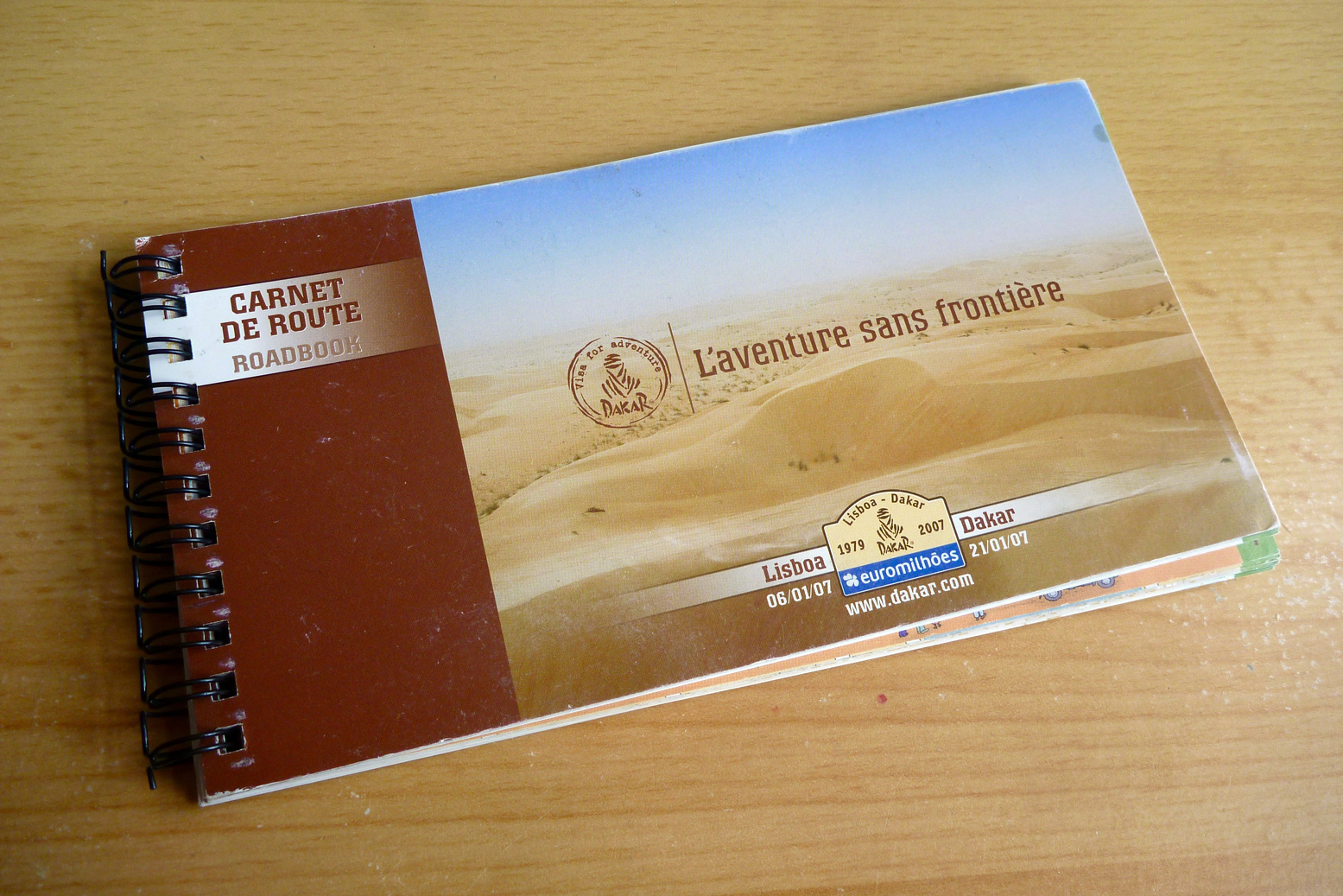
Part of the occasional Sahara A to Z series
Hang around long enough and you’ll get the full set

Pictures from Emile Leray’s website [dead link] and the web

2cvcart

In July 2012, a couple of years before fake news had become a thing, online media tripped over itself to syndicate a compelling Saharan survival story evoking the gripping 1965 desert drama, Flight of the Phoenix.
Then, five years later a video appeared on youtube (below) where the aged and batty-looking French adventurer again recounted his incredible desert caper.

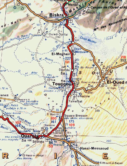
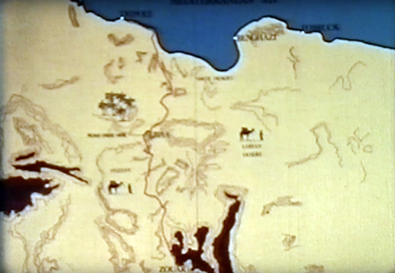
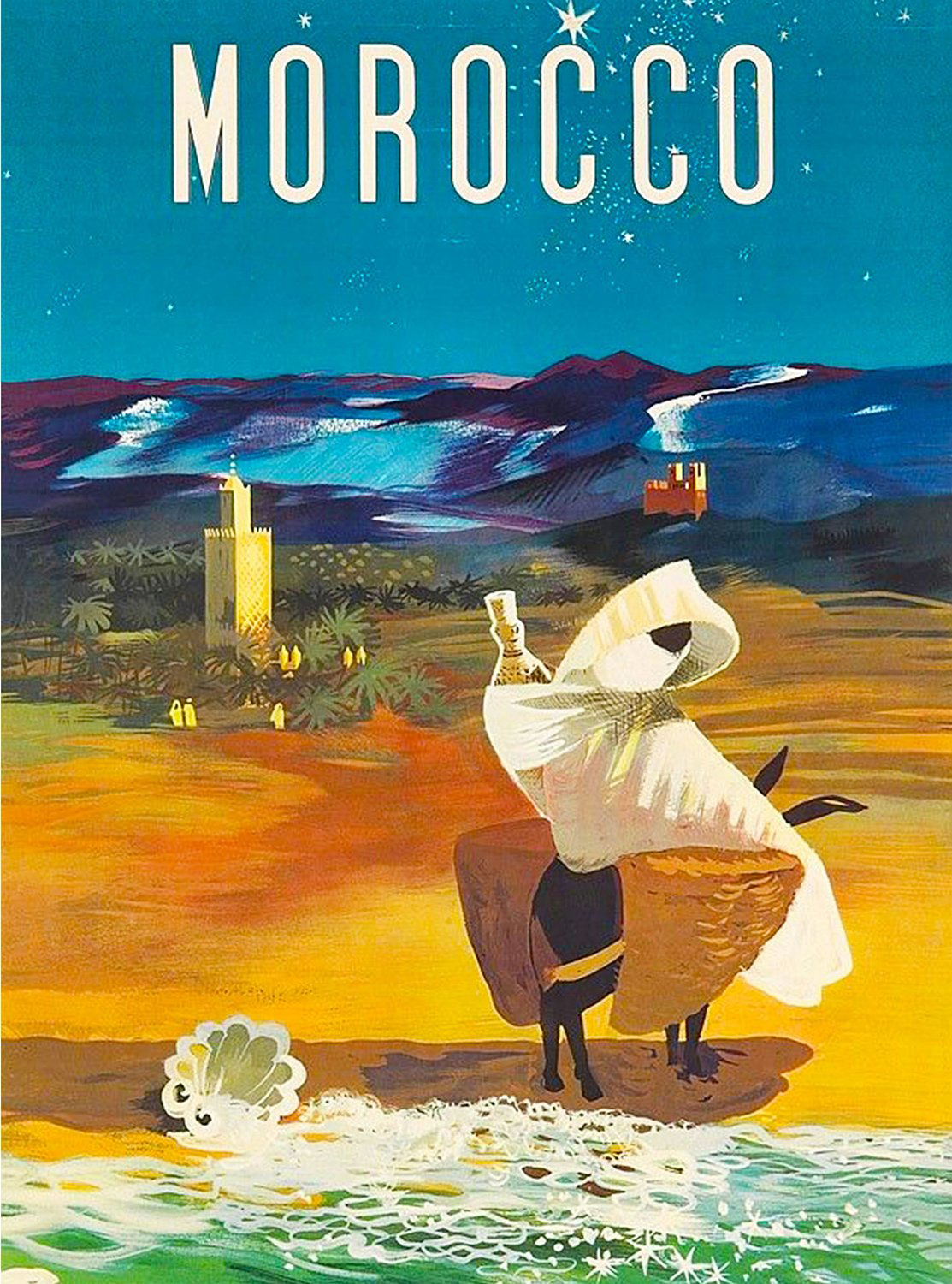
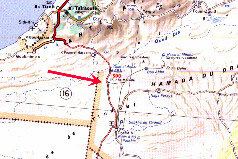
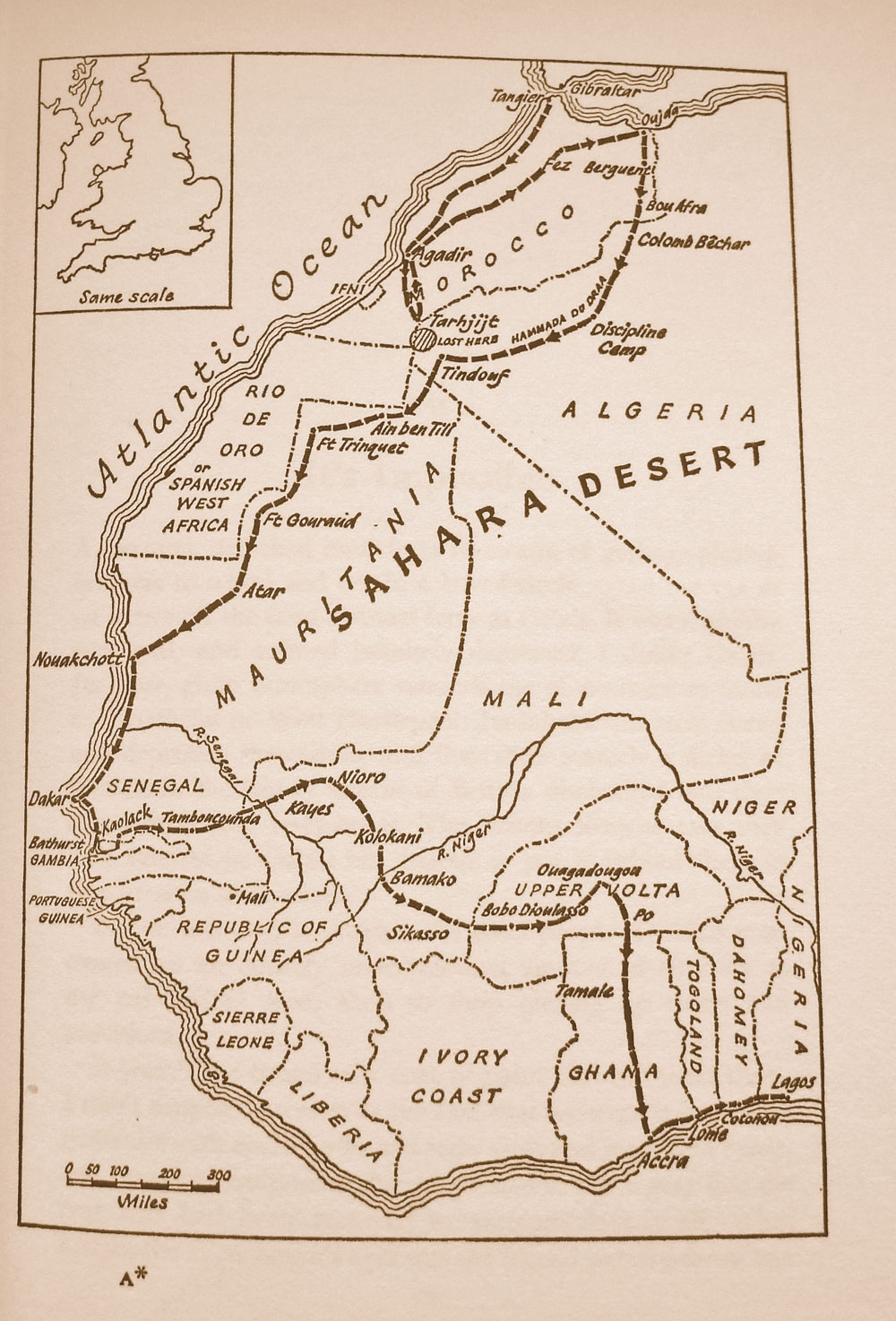
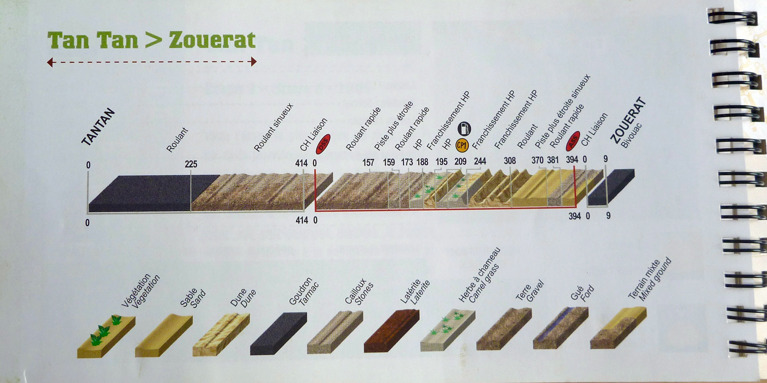
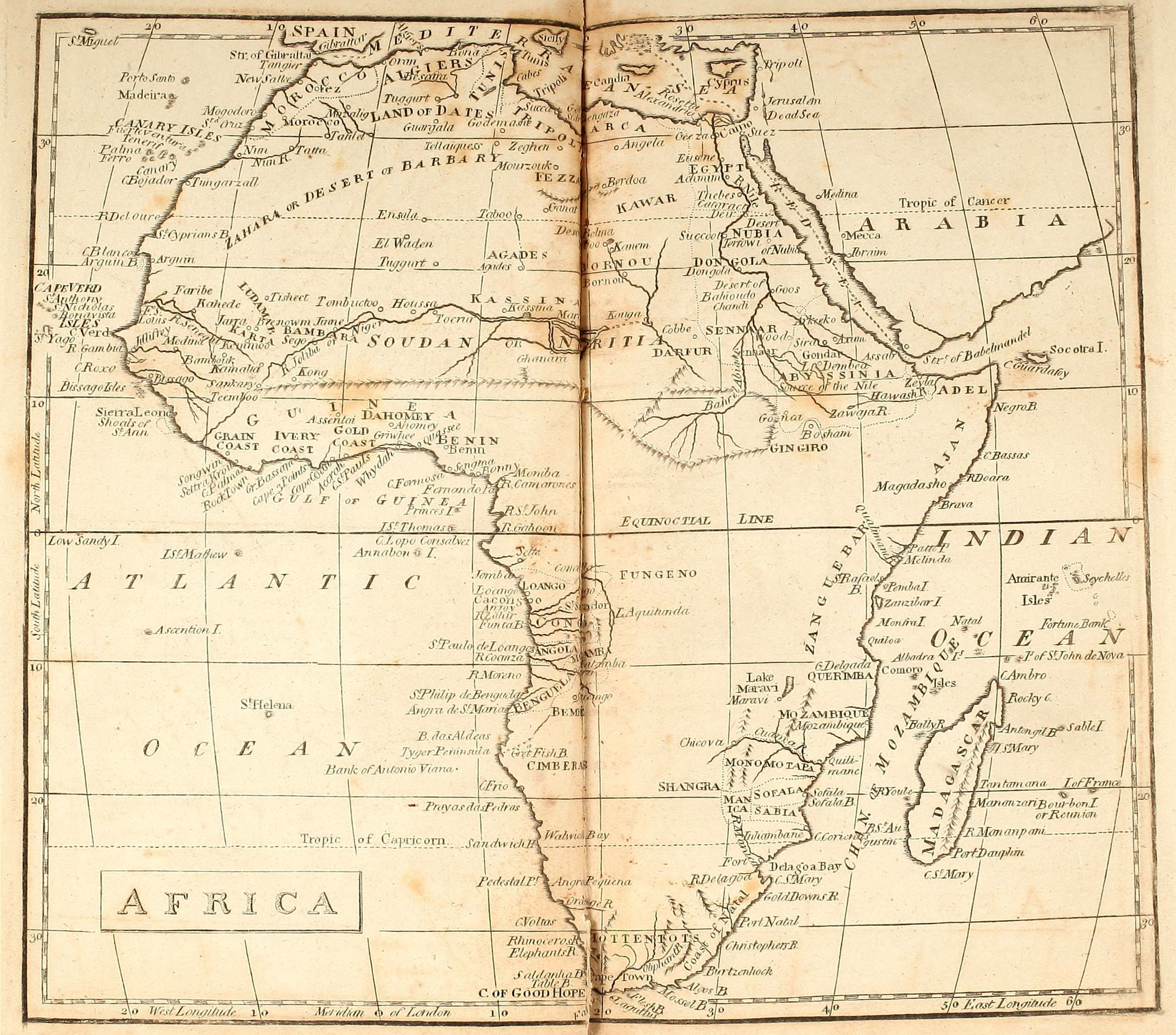
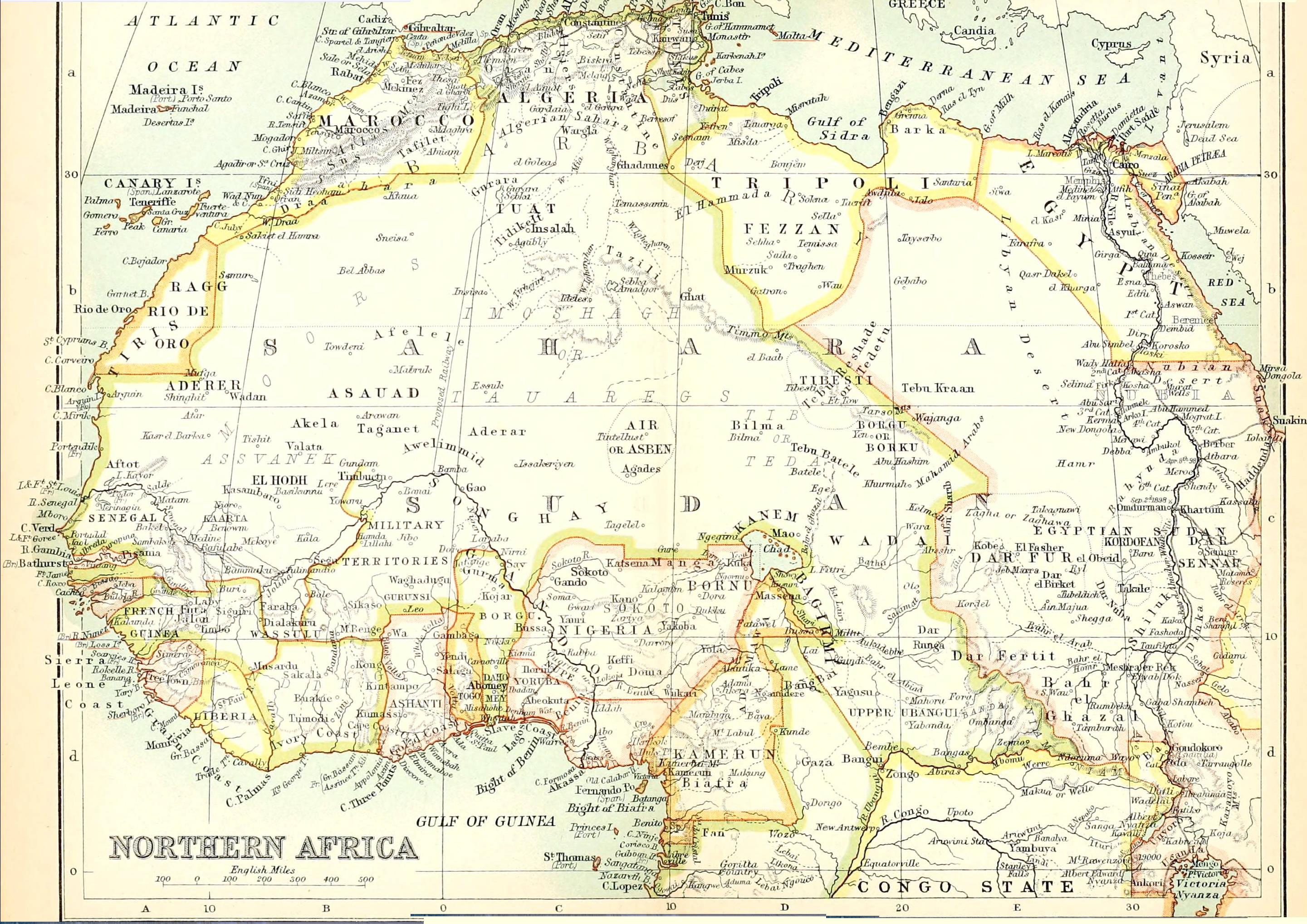
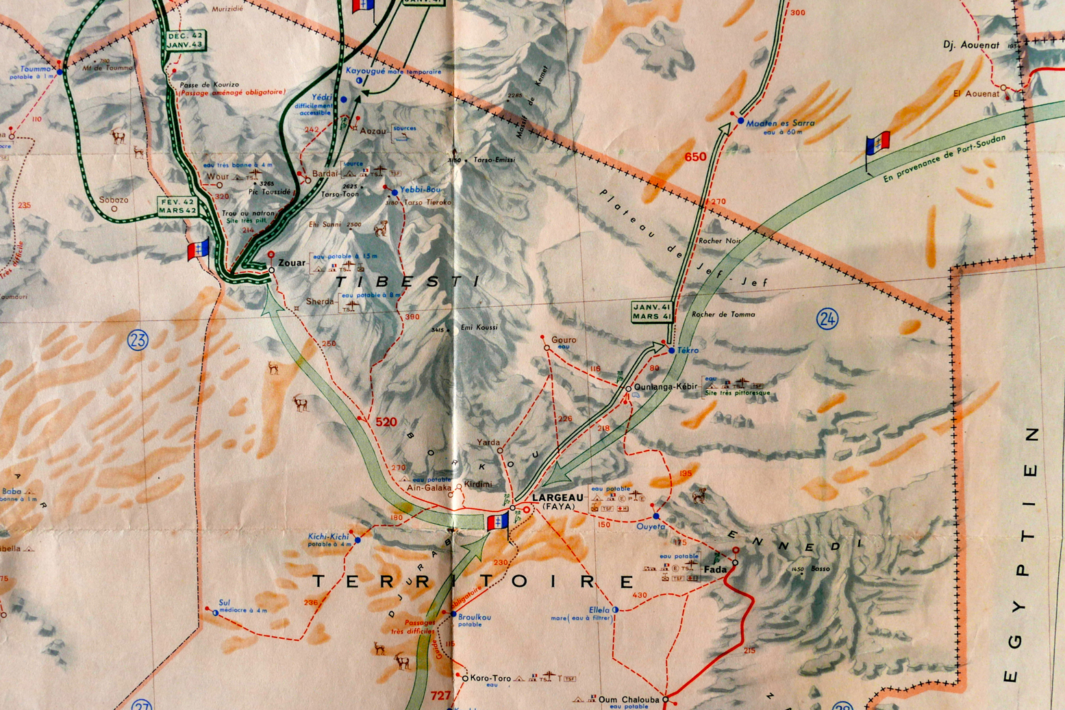
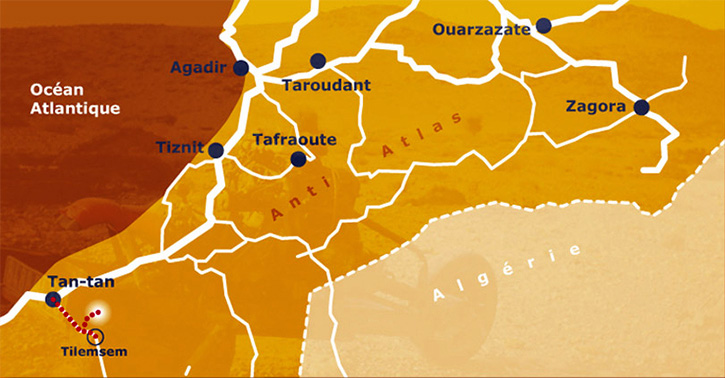
Back in 2012 full details and motivations were skimmed over, but the story goes that in March 1993, 43-year-old Frenchman Emile Leray set off from Tan-Tan near the Moroccan coast to drive his Citroen 2CV east to Zagora – more or less Route MW2 from my Morocco guidebook (below), followed by MS8 from Tata.

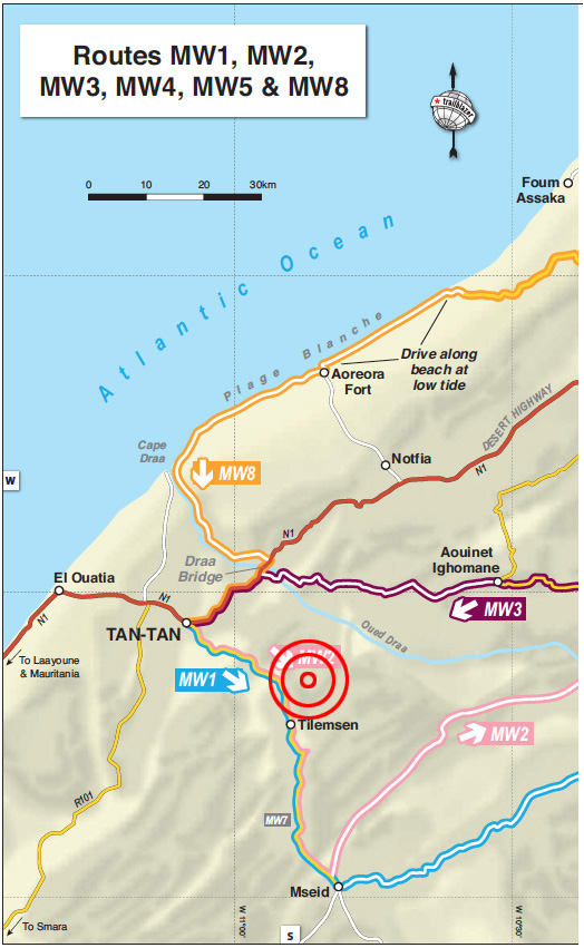
But with the Polisario ceasefire just 18 months old and frequently being broken, at Tilemsen the Moroccan army stopped him from continuing south towards Mseid, the former Polisario front line. Leray turned back towards Tan-Tan, but not before incurring some animosity from the army by refusing to give a soldier a lift back to town – a common request at remote Saharan checkpoints.

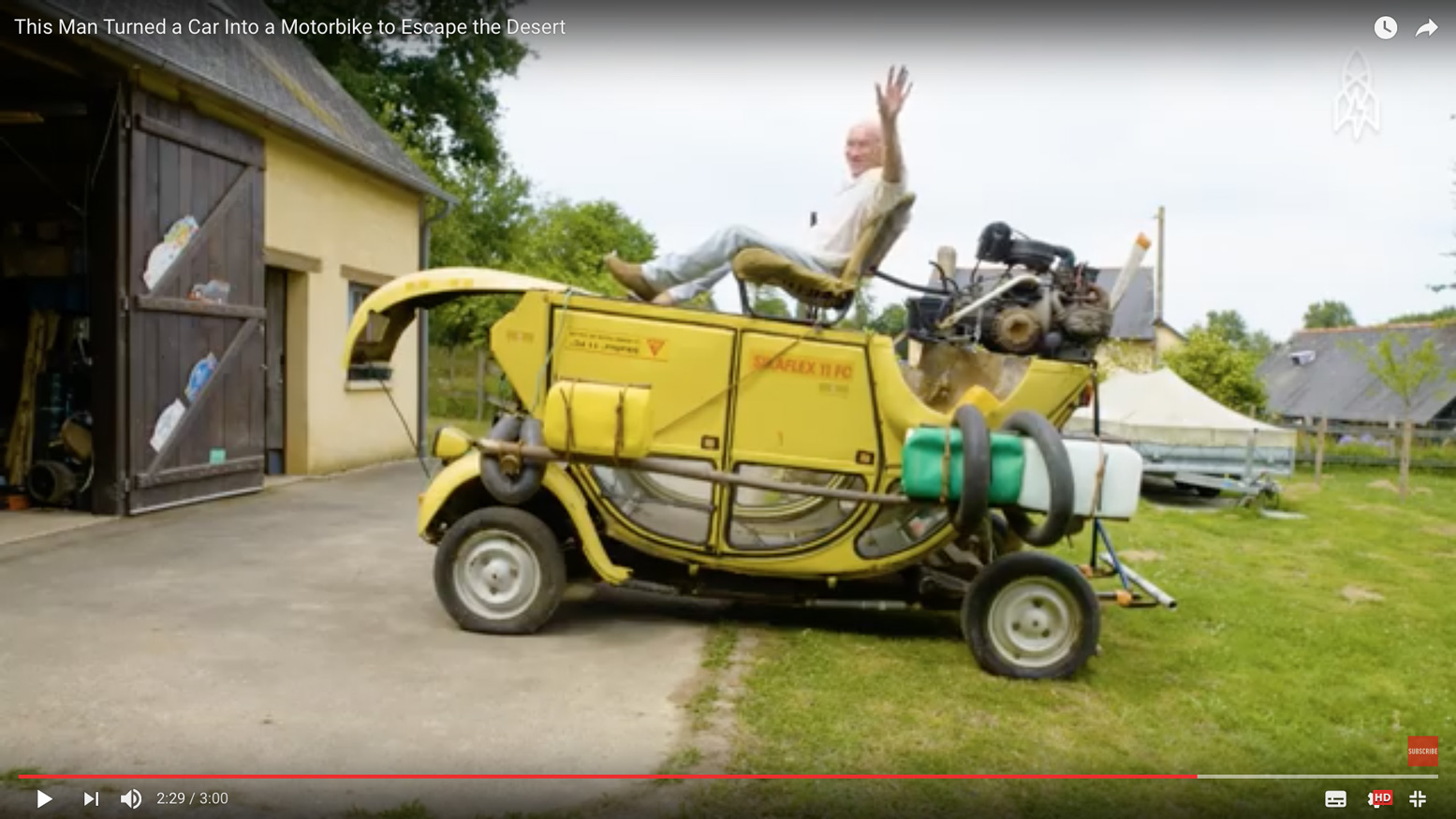
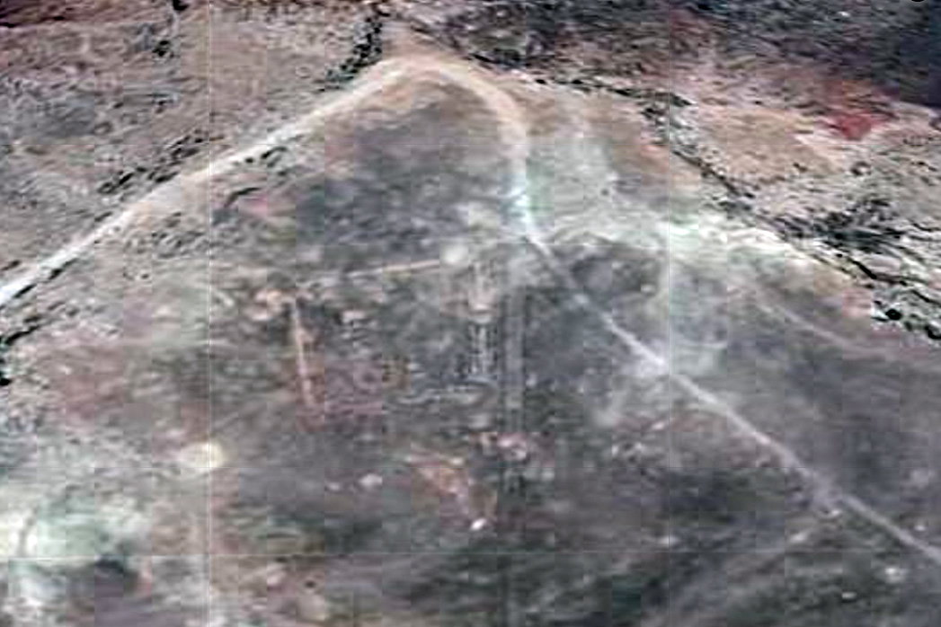
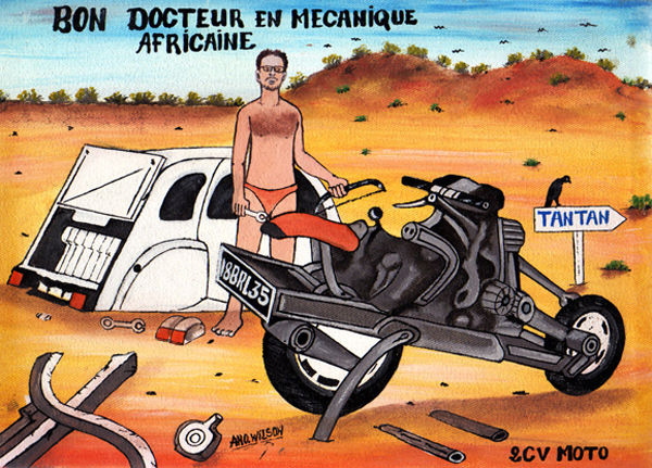
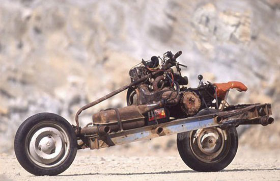
Just west of Tilemsen, Leray ‘had an idea’. He decided to circumvent the checkpoint to the north (see MW1 KM22), and rejoin MW2 eastwards. But once on the piste (or ‘off-piste’, as claimed) one of the 2CV’s suspension arms broke after hitting a hole too hard. With ten days’ provisions on board but reluctant to easily walk-out and leave his car vulnerable to theft, he decided to strip his crippled Citroen and rebuild it into a rudimentary motorcycle, then ride out as if nothing much happened. The unusual powertrain and suspension arrangement of a 2CV makes such a conversion plausible.

2cv1

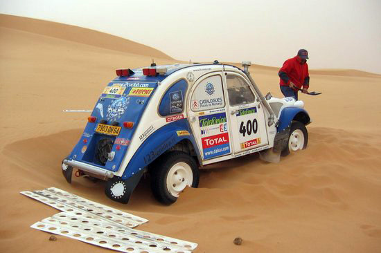
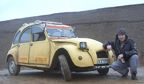
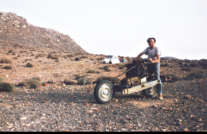
The way the story was initially reported in English – using images shot later in a quarry (above) – Saharan know-alls like myself were initially sceptical. If it really happened why not just walk back half a day to the road?
I researched the yarn more closely for my Morocco guidebook and came across his own account published in a 2CV enthusiasts’ magazine a decade after the events. A faint ring of truth came through. Perhaps he did build the 2CV bike, but not in quite the circumstances he claimed.

2cvbust

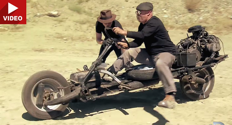
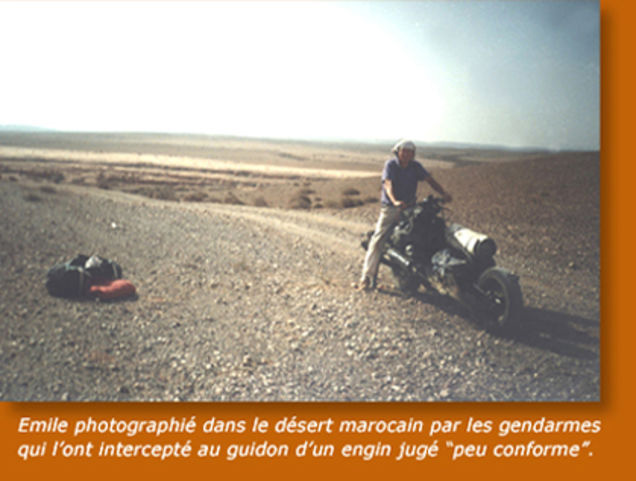
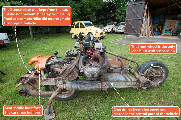
As the TV show, Mythbusters proved for themselves, his contraption was barely rideable (left) and within a day of leaving the rebuild site, Leray says he was caught by a patrol while camping in the desert and instructed to lead them back to the car’s remains to corroborate his story. Ironically, he goes on to claim (with convincing documentary evidence) that he ended up paying a 4500-dh fine (about €450) for driving a vehicle which did not conform to the one he originally imported to Morocco a few weeks earlier, even though he’d taken pains to tack on his ‘Steel Camel’s’ original license plate.

I believe the 2CV bike was indeed built in the desert, much as Leray claims, but he set out from France with the explicit intention of performing this task. Otherwise he’d have walked out like any normal person in a similar situation.
His claimed unease about leaving his stricken car doesn’t ring true, let alone the spontaneous idea of making it into a two-wheeler. Tellingly, in 2006 Leray went on to build a ‘2CV boat’ in Mali. He clearly likes mucking about with 2CVs. Fair play to him!

Below is the translated story as posted on Leray’s website so you can form your own impression. Bear in mind there’s no reason to believe this account, but it may have been the original version.


2cvthen

In March 1993 Emile Leray set off to follow a route from Tan-Tan to Zagora. He left Tan-Tan with the required reserves of fuel and provisions as well as tools to keep his old 2CV on the road. As soon as the Royal Gendarmerie arrives, they strongly discourage him from continuing further because the zone beyond Tilemsem is prohibited, following new developments in the conflict between Morocco and Western Sahara. Emile must obviously turn around and the soldiers are asking him to take a passenger back to Tan-Tan.

2cvpants

Analyzing the situation, and seeing his project thwarted, Emile claims an insurance problem that does not allow him to take passengers, arguing that his 2 CV is already very loaded. He knows full well that in Africa it’s seen very badly to not take soldiers aboard his car in these circumstances. He claims naivety and misunderstanding in adopting the attitude of a tourist not familiar with local customs.
Emile then returns to Tan-Tan under the disgruntled and disapproving look of the soldiers. He starts off at a good pace as he’s afraid he will be followed and he wants to remain out of sight of those whom he has just left. His plan is to bypass the area off-piste and return to his original direction … After a few kilometres he leaves the track to the north and traverses uneven and rocky ground.

After bouncing more strongly, the car jumps and brutally strikes a rock. He must stop because the 2CV does not respond very well. And for good reason – a folded wheel arm and broken spar …
Émile organizes his encampment around the broken 2 CV and reflects on the situation. He is a few miles from Tan-Tan which he could reach on foot, but he runs the risk of leaving is car certainly in bad point but still able to attract theft, including its equipment. In the desert nothing is permanently lost, especially for the one who knows where to look.

He has enough food and water so makes a decision which is to say the least, amazing: from his wreck, he will build a two-wheeled machine! One by one he carefully considered all the technical obstacles that this entails, and this master of African bush mechanics has all the tools and the elements to succeed in the task.
The next morning he began to dismantle the 2CV, first removing the body which he will use as shelter against the cool nights and sandstorms. Having no long-sleeved shirts, against the burning sun he makes sleeves from a pair of socks. With what remains of the car, Emile Leray will try to build a motorcycle. Overnight he mentally reviewed all the stages and difficulties involved in this rather crazy project … A project that he had probably imagined for a long time but without having had the opportunity to realize it.

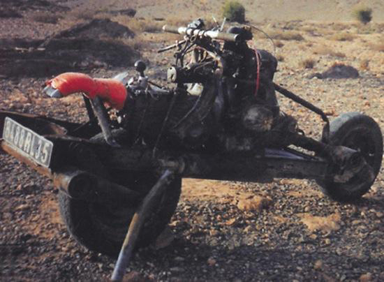
The wheel arms (to be removed with a hacksaw) are nested upside down on a reduced chassis of the front and rear side rails. The engine and the gearbox are then placed on the chassis in the center. Space should be reserved for the battery and the fuel tank and to keep space for luggage without neglecting the layout of the steering system.

2cvdrive
2cvveloso

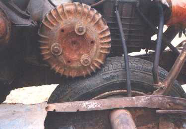
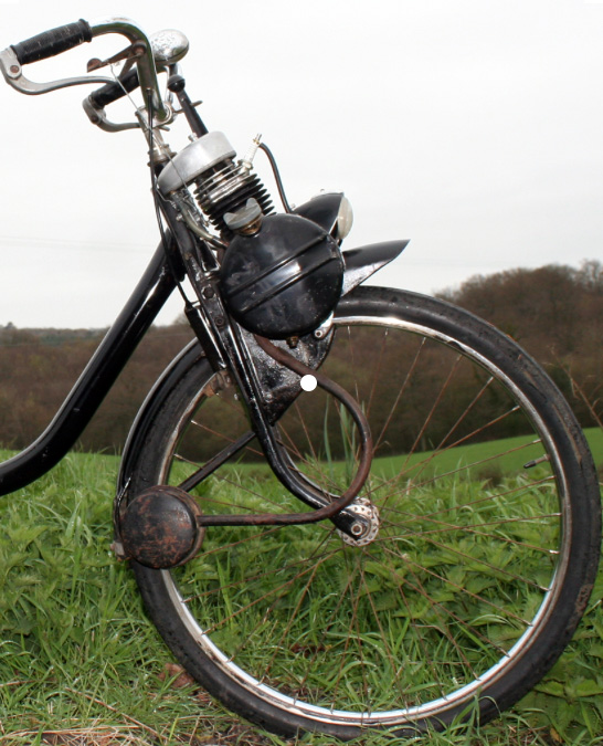
The most surprising thing about this 2CV motorcycle is the transmission. It was inspired by the Vélosolex moped idea (right): the engine drives a drum which in turn turns the tyre by friction, and which, by the laws of physics and mechanics, obliges it to roll with the reverse. Disassembling the gearbox to reverse the differential would have been too risky in this universe of sand …

It seems unthinkable to assemble this machine in the desert without the help of a drill and welding station. All parts were assembled by screwing. When drilling, it will be done in the African way: the piece of metal is folded to 90 ° to form an edge. At a fixed point this edge is weakened by a hacksaw or round file. At the limit of the drilling, the piece must be replaced flat to perforate the filed point with a hammer or a needle. The assemblies were made as much as possible according to the original holes of the chassis or engine-box unit.
The rest is only a matter of time dependent on the quantity of his provisions. Émile believes he must spend three days building his bike – in reality it will take twelve …
There was a great deal of uncertainty to carry out this project and it wasn’t so easy to realize as one might think. The possibility of failure remained present throughout the adventure, giving some anguish to the stranded mechanic.

2cvdez

The 2CV motorcycle was obviously not conceived for the sake of comfort, it is a rather secondary notion that was not imperative in what we can call the specifications. The prototype has therefore not benefited from some desirable improvements. It should be noted that, for example, the exhaust is free, so the nose and the ears are affected greatly by the engine’s gases. The bike does not have a brake, nor does it have foot rests which allow some control of the trajectory with the feet, because the craft lacks stability. On the first test the bike fell over, causing a great scare to Emile, who almost found himself crushed under his 200-kilo machine.
The arrangement of the clutch and accelerator controls were particularly tedious. It was necessary to dismantle, adjust and reassemble the parts for optimum operation. Similarly, the tests were punctuated by frequent falls. To lift the two-wheeled steel camel proved particularly physically difficult … All these circumstances contributed to prolong Emile stay in the desert. The final day was be spent adjusting and testing and cleaning the bivouac site.
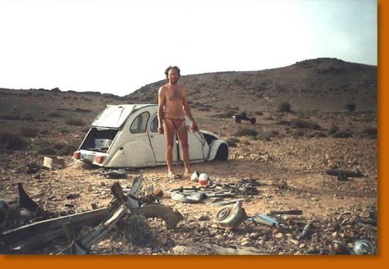
It was an occasion to immortalize the moment thanks to a small camera with the trigger connected by a long wire. Émile poses in the middle of a place that in March 1993 was the theatre of his unusual feat.

2cvv

He leaves the next afternoon leaving the parts that he will not use in the body shell of the 2CV. He takes with him the rest of his food (more than a litre and a half of water), the bed, the tool box, not forgetting maps and compass. A small foam mattress and a towel sewn together will serve as a tent.
After a bumpy ride and a few stops for mechanical improvements, he encamped and slept at the edge of a track. In the night, he is awakened by three soldiers in 4×4, one of which immediately recognizes the “tourist” of Tilemsem. Very irritated to find him in the forbidden zone, he strongly doubts Emile Leray’s explanations; an accident followed by the transformation into a motorcycle. Intrigued by the machine, but totally incredulous, the soldier demands to see the carcass of the 2CV to have proof of this incredible story.
The officer puts an armed guard by the tent and the motorcycle, then embarks with Émile in the 4×4. After an hour of research in the dark, the remains of the 2 CV cannot be found. Back at the camp, Émile is allowed to rest near the motorcycle until dawn, guarded a hundred meters away by the military in their 4×4. The next day, the carcass was found and the soldiers relax. Émile will learn later that his interlocutor wanted to recover the abandoned pieces for his brother-in-law …

2cv2

In the early morning, Emile was ordered to take his motorcycle back, and ride in front of the 4×4. The convoy sets off slowly towards Tan-Tan but several falls seriously annoy the soldier, pestering against this unstable machine. Eventually the soldier calls by radio for another 4×4 to come to recover the 2CV motorcycle.
Arriving at Tan-Tan on April 6th, things get complicated with a lot of bureaucratic hassles. At the provincial governor’s office, a report is drawn up, as well as by the Royal Gendarmerie. The vehicle is impounded

Emile has the disagreeable surprise of learning that he has to pay a tax of 4500 dirhams. He is very unhappy because the customs officers had spoken to him on the eve of mere formalities. The vehicle is regarded as dangerous and no longer corresponds to the description of the registration documents.
“Delay in importing a non-conforming vehicle” is the charge, and by paying the fine he can
 regain his freedom and recover his contraption, but not be allowed to drive it.One could say a lot from this misadventure about the complicated relations between Africans and Europeans on the issue of money ...

2cvmail

The next day Emile is summoned to sign the forms to exit the territory, and leave for France. He thinks he should come back as soon as possible to get the bike back, but by then he must find a place to park it. There is no question that he leaves her in the pound, it may cost him dearly, and the place is not guarded. A customs officer who is more sympathetic than his colleagues offers to take the steel camel home while waiting for him to return to Morocco.
A month later Emile made the 3500-km journey between Rennes and Tan-Tan with another 2CV to pick up his motorcycle, now dismantled in three parts …
Since then, the steel-motorcycle camel has enjoyed the honors of the press and participated in a few events such as the Aventure and the Inventors of Rennes, the fiftieth anniversary of the 2 CV in Saint-Quentin-en-Yvelines, Without forgetting the Motards have heart.
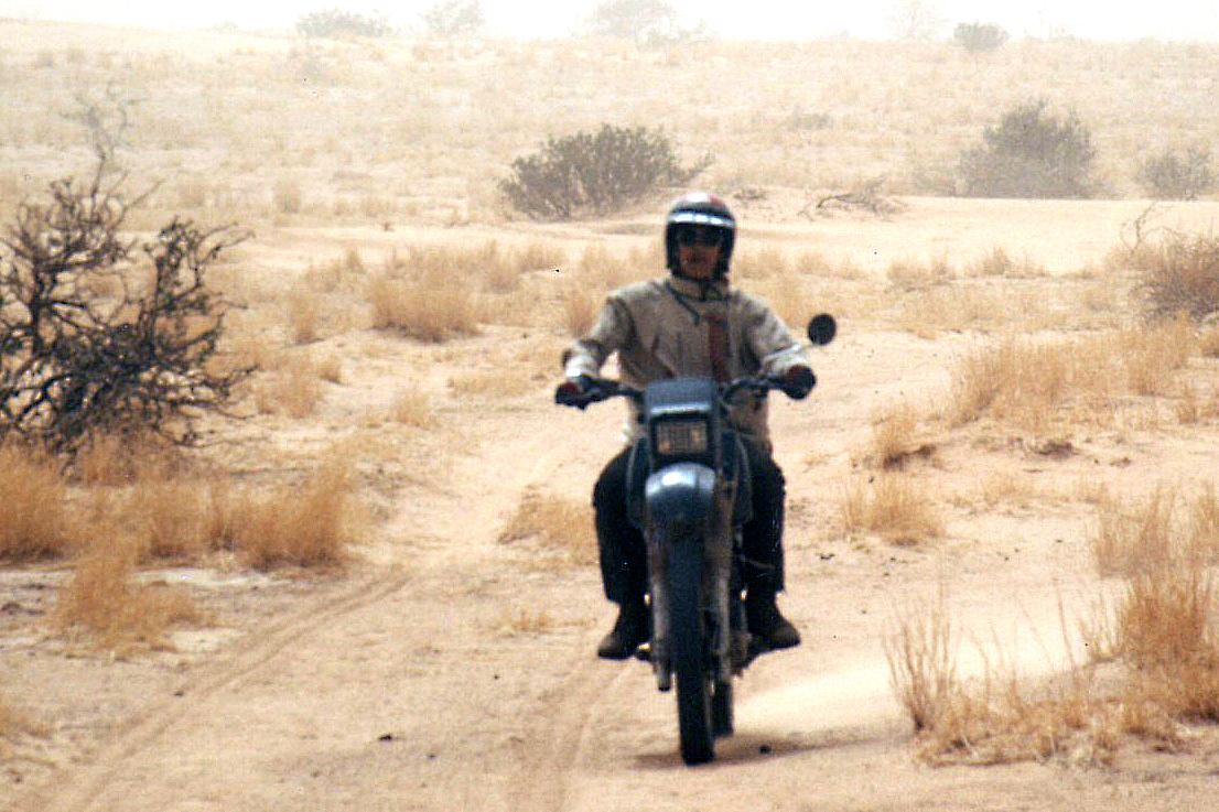
Émile returned several times to Africa, and in 2006 took a new opportunity for the Doctor of African mechanics to exercise his transformational talents on the steel camel [below]… 

For more information: full story and technical details in 2CV Magazine March-April 2003.

2cvmbotIn 2006 Leray went on to build a 2CV boat in Mali. He clearly likes mucking about with 2CVs!

S is for the Sauterelle Propeller Car – Sahara 1912

Part of the Sahara A to Z series

saturmap“We left Biskra with Corporal Dewoitine as a mechanic, and took hours to reach Touggourt, averaging 50kph, despite a trail of frightful ruts. Our arrival was all the more sensational than in an airplane because I drove right down the main street in a torrent of dust, skimming past walls and passers-by with with my propeller, causing burnous, guenours and chèches to fly in all directions. It was a beautiful panic!

The two adventurers quickly left Touggourt in a cloud of dust, heading for Ouargla, but the infernal locust began to show its first signs of fatigue: sand gnawed the leading edge of the propeller and the engine dropped to half power. De La Fargue ordered Dewoitine to head for Square Bresson, a junction and small oasis 50km away.”

propcar

Just before WWI, at the motor era matured on land sea and air, various self-propelled contraptions came to be tested as a means of penetrating France’s vast Saharan territory. Lacking the railways which by then traversed America and southern Asia, up to that time columns of men had to trudge alongside huge camel caravans, making them vulnerable to still hostile desert tribes.

sg-satbok

An ingenious combination of airplane landing gear with a cab stuck on top, the distinctive propeller car was one short-lived solution to enable rapid communication across the desert. Invented by Corporal Gustave Cros, the chassis was an elongated triangle on three axles, each carrying twin wheels, while a propeller directly fixed to a 50-hp motor thrust the vehicle forward. It’s said an ingenious form of highly articulated independent suspension allowed each of the wheels to track the terrain, however rough.

sat

This curious but surely deafening machine proceeded in a series of jumps which supposedly allowed it to cross large sand dunes, hence the name Sauterelle or ‘grasshopper’. You’d hope seat belts were mandatory, less an unexpected lurch while climbing a steep dune launched you backwards…

helice

Early models, like the one right, were considered too light to be stable but nevertheless progressed from two to four to six blades. Capable of 60kph, in the summer of 1914 the Sauterelle left the rail terminus at Biskra for a 200-km test run to Touggourt. The main difficulty was said to be slowing down and stopping, but that didn’t stop a chap called De La Fargue modifying a 60-hp Brasier car; his six-bladed ‘Aerosable’ hopped its way to Touggourt in just two hours. Encouraged by this achievement, he went on to consider an amphibious vehicle whose wheels could be replaced by a wooden hull for sliding over the salty Saharan chotts where even camels feared to tread.

renault
halftrak

You do wonder what they were thinking. Presumably it was a solution to the problem of powered axles digging in to soft terrain. Perhaps pneumatic tyres were crude and couldn’t reliably be run at low pressures to  elongate the footprint and so increase flotation, or that idea was not yet known (in Libyan Sands Ralph Bagnold wrote of discovering this technique in the 1920s). Hence, doubled wheels all round, like the Renault (above left), or the Citroen half-track desert taxis (right) which were also used on epic trans-continental proving expeditions, long after the Sauterelle had hopped itself  into the scrapheap of automotive dead-ends.

modelt

By the end of the 1920s, this period of wacky inventions had run its course while several esteemed French Saharans died in lonely desert plane crashes, But from as early as 1916, on the other side of the Sahara, the British Light Car Patrols were successfully deploying conventional but stripped-down Model T Fords  deep across the Libyan Desert, and all without trailing a deafening sandstorm wherever they went.

Translated and adapted from this post by Oliver Boul where you’ll find lots more interesting stuff.

Z is for Zouar – Oxford Uni Expedition 1965

Part of the Sahara A to Z series
oxchad13

Back in 1965 the pro-Western Kingdom of Libya was just fourteen years old. US and UK military bases used the desert for training and testing, then the discovery of high-quality, low-sulphur oil just 200km from the coast transformed Libya’s fortunes. 

Gaddafi’s coup was still a few years away.

oxchadmap


Like many former french colonies, Chad had gained independence in 1960 but, as has been the case on and off since then, France retained military and Foreign Legion bases there. In the film you’ll see a French tricolour still flying in Zouar.

oxchad12

And best of all, the Chadian civil war was still a few months away, so what better time for a bunch Oxford university students to drive 5000 miles to Zouar for their summer hols in a a couple of 88 Landies and a 2WD Ford D-series lorry loaned by Ford. This was a time when it was still common for truck manufacturers to prove their vehicles on Sahara expeditions.

oxchad1

The film includes episodes of Tubu horseplay, lashings of corned beef and a Landrover door that just will not shut!

46-grinder

Interestingly you’ll also see a woman making flour with a grinding stone of the sort still commonly found abandoned all over the Sahara, wherever people once lived. As the narrator says ‘in remote parts of the world it’s hard to tell when such [Neolithic] tools were last used.’ At 14:20 there’s also an engraving of what might be a Garamantean chariot. Germa, the former Garamantean capital in southern Libya, is not so far from Zouar.

S is for ‘Sahara’ ~ the mystique of the desert

Part of the Sahara A to Z series

The desert is ruthless
It strips you of your vanities
Your illusions
Gives you the opportunity to see yourself for who you really are


Character addressing Jesus figure in The Last Days in the Desert (2016)

sol-tazat

More than other wilderness environments, the desert is commonly seen as a place for spiritual rebirth or just some contemplation. Some speculate that it’s no coincidence the world’s great monotheistic religions originated in the desert. Or perhaps it was the other way round: the Fertile Crescent along with timely wheat mutations and climatic cycles spawned great civilisations from which monotheism evolved. Anyway, just being in the desert it’s commonly thought one can be purged, cleansed and reborn. When striped of familiar surroundings and associations, you commonly hear travellers professing an awareness of their insignificance in the great scheme of things. Whatever, it’s always been seen as a good place to get away from it all, including other people.

In the desert you can remember your name
Coz their ain’t no one for to give you no pain

sol-boa

Another one of those periodic ‘I want to cross the Sahara by camel’ posts popped up on the forum the other month. The OP ‘…thought to myself ‘I want to have a life changing experience’ and thought this would be just that adventure.’ Across the width of the Sahara from Atlantic to Red Sea. There followed some clarification, good advice and some scorn, and within a few days the thread blew itself out.
What is it about crossing the Sahara? Why do ordinary individuals get fixated on the idea of ‘crossing the Sahara’ at all costs? I know when I first went there the Sahara was something that was on the way to where I thought I was going, but so was France and the Mediterranean. I didn’t see crossing the Sahara as a life-affirming achievement or any sort of event – I was more looking forward to the simple challenge of some desert biking.
Perhaps the words ‘cross’ + ‘sahara’ add up to a compelling soundbite that anyone anywhere will get instantly, like ‘climbing Everest’ or ‘rowing the Atlantic’, but perceived as a whole lot easier.
I received a similar enquiry. A chap wanted to cross the Sahara with camels – it didn’t really matter where, it was the crossing that mattered. He suggested some catchy start and end points like Casablanca to Dakar without really thinking it through – padding alongside Morocco’s busy N1 highway with a troop of dromedaries strung out nose to tail. I made what I thought were some better suggestions that would give a real sense of travelling in the desert with camels while dodging the worst of the current political complications. I even sent him the camel chapter from the book (short version of this). I never heard back.

sol-rep1
impjor

Above is my answer to another enquiry which boldly stated the intention to pull off a hare-brained scheme so I’d have no doubt of the total commitment. ‘Nothing is impossible!’ Never heard  from her again, either. Maybe I am too blunt but I keep these emails as evidence of ‘well, I did warn them’ should they ever crop up in the news.
It seems that people hungry for adventure lose something of their reason when it comes to crossing the you-know-what. They’re carried away by the concept which ignites the dream and set about with a steely determination to make it happen.
To my mind camel crossing the Sahara north to south and especially laterally requires a solid background of experience which is why I respect the achievement of Michael Asher and Mariantonietta Peru when they did it in the 80s and went on to write Impossible Journey. At least they had a good idea of what they were taking on. These days the journey is a whole lot more impossible.

There must be something about camel trekking across the Sahara that makes it sound relatively uncomplicated and easily done alone. You traverse the wilderness with the unspoken companionship of your caravan and maybe a nomad guide whose language you don’t speak: ‘horses with no names’ who won’t question insecurities or flakey motivation.

sol-cam

Aside from the practicalities or logistics of such a monumental task, what irks me is that very often there’s little curiosity about the environment or the cultures they’re passing through. The conquest trounces all, and the empty Sahara is just a backdrop for a monumental vanity project, as it was for Geoffrey Moorhouse back in the 70s and several others before or since.
As I was told recently by an individual who came close to death in his quest: It was a bad time and I made poor decisions. I desperately wanted it to be “me and the desert” and to have my own experience in solitude. I’m wiser now.

sol-xt

Once I get used to it and feel comfortable I like to be alone out there too, and in the desert that’s not hard to do. If anything it helps you re-evaluate human companionship which may be part of the catharsis some seek out there. But I find there’s no need to go to extremes to do this. One memorable desert camp is all that’s required to consolidate a feeling of well being. For me the image below sums it up nicely. Only a mile off the track to Djanet in 1988. For the moment the bike was running well and so was I. It was nice spot for the evening – comfortably alone. There have been many more nights like that out in the Sahara, with or without other people.

djanet88

Usually though I’ve found travelling alone with a vehicle tends to extinguish any mystical retrospection. On a bike you’re totally preoccupied with keeping upright, not getting lost  and all the rest – and in a car it’s the same plus the noise and the shaking. It is the evenings that are a blessed respite from the task, the heat and the wind and when the appeal of the desert is easily felt.
In a group, walking with camels and crew is a far more satisfying way to enjoy the desert day or night, most probably because there’s so very little to worry about. You don’t have to know any more than how to walk, sleep and eat. It’s the very simplicity of such desert travels that strikes the chord, even if this is a fantasy enabled by the hired crew of desert nomads. The actual practicalities of making it happen and sustaining camelling independently get quite complex as many accounts that I’ve read have shown. And now you have to account for the unglamorous and unromantic political overlay.

I suppose the hope is that when one gets to the Other Side one is reborn or cleansed or at the very least feels a sense of achievement which ought to trump all insecurities. But no account I’ve ever read has admitted to that. Or perhaps midway through the journey there is some sort of epiphany with a closure and acceptance and an understanding that life must go on, at which point the epic challenge may lose its purpose.

After nine days, I let the horse run free,
‘Coz the desert had turned to sea.

Me, I just like being in wild places including the desert. It doesn’t have to get complicated.

sol-edg

Y is for Yamaha: Trans-Africa, 1989

By Heinz Endler, from a Bike magazine supplement, June 1989.

af89-2
af89-3
af89-4
af89-5

‘G’ is for Greeves 250s across Western Sahara, 1973

Part of the Sahara A to Z series

And in summer, too. Slide show of a great story.
Music from Sona Jabarteh, among others.

‘M’: the mysterious Tour de Merkala

Part of the Sahara A to Z series

merkala-1

I’ve always been curious about the Tour de Merkala, identified on the Michelin 741 Sahara map (and left) on the Algeria-Morocco border, south of Foum el Hassan.
Was it some ancient caravanserai or watchtower, like the one right, alongside the Oued Draa north of Zagora, which guided caravans in along the 52-days road from Timbuktu? Or perhaps just a French observation post from the colonial era?

tourdraa

No surprise that this time I searched, it was Yves Rohmer’s encyclopaedic Sahara pages where the answer lay, and there’s more here. In the 1930s the French were still busy subduing tribal resistance in the southern mountains of Morocco in the region between Tata and Assa, and while there decided Tindouf far to the south needed occupation too. But between southern Morocco and Tindouf lay the Jebel Ouarkaziz which still serves at a natural barrier today between the two countries.

berlietvudb

A column consisting of Berliet VUDB light armoured cars (left – note the big roll of chicken wire to use for sand boggings) set out from Akka and wound their way through the foums or gaps in the ranges until they came to the impenetrable cliff below Jebel Merkala. Here they spent a few days enlarging an old camel trail into a ramp to support their armoured cars, over two kilometres and 220m up the escarpment to the Hammada du Draa plateau on top. Once here the way to Tindouf was clear and a fort was established at Merkala.

merkalabing

Even if there was a tower (unnecessary on top of a pass, you’d think), why they didn’t call it Fort or Bordj Merkala? Or Fort ‘Commanding-Officer’s-Name’, as was the custom at the time? Many former French forts in Algeria – Fort Lapperine, Polignac or Flatters – became villages and even cities (respectively: Tamanrasset, IIlizi, Bordj Omar Driss). I’ve yet to find an old picture of the actual fort at Merkala and there’s nothing much to see on Google. But as is sometimes the case, Bing has better resolution and shows faint traces of skewed-rectangular fort-like foundations at the top of the pass (right), as well more modern ramparts pushed up nearby. Click the Flatters link above to see what a fort from this era may have looked like.

newmanmap

Very soon this route was extended and improved to become part of the primary imperial N1 highway from Morocco into the AOF French colonies to the south, running from Agadir via Foum el Hassan over Merkala to Tindouf, then down via Bir Mogrein, Atar and eventually Dakar.

the-forgotten-path

The Atlantic Route we know today wasn’t an option for the French back then as the Spanish colony of Rio de Oro. – today’s Western Sahara – was in the way (left).
It was the N1 inland highway which David Newman took in his Ford Zephyr in the late Fifties, vividly described in The Forgotten Path, a somewhat unhinged account of his drive to Nigeria. He’d tried to go via Foum el Hassan and the Merkala tower, but to his fury was turned back as the area was harbouring the FLN who were battling the French in Algeria at the time.
The Tour de Merkala became a battleground again a few years later during the so-called 1963 War of the Sands between newly independent Morocco and Algeria. No fixed border line across the barren desert had been thought necessary between the two nations until valuable minerals were discovered (you’ll see no border defined on the late 1940s Michelin 153 at the top of the page). For some reason Algeria attempted to annexe the village of Iche near Figuig, as well as a creek called Tindoub and the nearby well of Hassi Beida, some 35km south of Mhamid. The Moroccans responded by trouncing the Algerians, so  establishing an enmity that fed into the Polisario war a decade or so later and which remains entrenched today with closed borders. You can still see the Hassi Beida bump in the border today.

Getting back to Merkala’s prominence on maps. Perhaps it’s just an anomaly not unlike Hassi bel Guebbour in Algeria. Looks like an important place on the map but once you get there it’s nothing but a checkpoint at an albeit strategic crossroads with a couple of chip- omelette cafes.

hbg

L is the Last Roadbook: Lisbon-Dakar 2007

Part of the Sahara A to Z series

Dakarlogojpg

Some time ago someone kindly gave me the official ASO roadbook from the 2007 Lisbon-Dakar Rally, the last one to be held in the Sahara.

Following the murder of a French family in Mauritania just before the Rally (actually thought to be criminals not terrorists), additional threats saw the 2008 event cancelled at the last minute. The following year the Rally moved to South America where it continued to thrive with less controversy until it moved again to Saudi in 2020.

dak0
marlborodakarteam
dak86

The longest stage in 2007 was across the top of Western Sahara from Tan Tan on the Atlantic to the Mauritanian mining town of Zouerat – 817km via Smara with a tea break at Bir Mogrein. The shortest stage was still 500km long, through the light jungles of western Mali and Senegal where I  limped over the border into Senegal some thirty years earlier on two flat tyres (right). I passed plenty of Dakar racers that year too, and eventually ended up in Dakar myself (above left), but not on any sort of podium.
Below some snapshots from the Last Roadbook from what many still feel was the last real Dakar.

dakwins

V is for Vintage Sahara Maps

Part of the Sahara A to Z series

See also:
Vintage posters
Old Saharan Trade Routes Map
Sahara – blanks on the map
Maps of the Sahara
I is for IGN and their Sahara Maps

The earliest old map I have looks like it’s from the medieval era, but was probably based on Herodotus’ Histories which was getting on for 2000 years old by this time. It was he that brought terms like ‘Libya’ (North Africa) and ‘Aethiopia’ (sub-Saharan Africa) into common usage.

Medieval-sahara


On this map ‘Mauritania’ is today’s Morocco, while the chariot-riding Garamanteans are correctly located around present day Germa in the Libyan Fezzan. It’s probably coincidental, but the ‘Barditi Montef’ (mountains) could be the Tibesti around Bardai – actually only 700km southeast of ancient Garama. (Left: rock art depicting chariots at Tim Missao well, 1200km southwest of Germa on the way to Mali. The Garamanteans are said to have got around.)

TimMissaoChariot

This map, but not 1554 Munster map above, may have been the best that Moorish wanderer, Leo Africanus’ (BBC doc) had to go on for his 16th-century travels across the region, venturing as far as Timbuktu, Cairo and possibly even Mecca.
Along with Ibn Battuta’s travels a couple of centuries earlier, it was Africanus’ Description of Africa (1550) which expanded knowledge of the Sahara. But despite the efforts of Africanus, even by 1700 or so, satirists like Jonathan Swift (right) were said to have quipped:                        

Jonathan-Swift

So Geographers in Afric maps 
With Savage Pictures fill their Gaps


Fast forward a few centuries and there be no dragons or other medieval monsters (left) on this map of Africa dating from an atlas produced in 1803. It’s credited to William Kneass who later became Chief Engraver of the U.S. Mint in Philadelphia. Instead, the advent of scientific enlightenment had brought us longitude, latitude and the ‘Equinoctial Line’.

Sahara-map-1803

The mariners of the era had succeeded in very accurately mapping the outline of the African continent, but the interior, including the ‘Zahara or Desert of Barbary‘, remained blanks. South of the Sahara the most notable inland incursions were made by the early European colonies around Cape Verde and Guinea Bissau, Angola, the Cape and Mozambique. In the north Egypt and the Nile are better mapped all the way into the Biblical lands of Abyssinia.
The Moroccan imperial cities are present: ‘New Salle’ being Rabat, with Marrakech labelled as ‘Morocco’. Never linked those two words before, but presumably they’re both based on ‘Moor’ so it makes sense.

52J

South of the Atlas ‘Tatta’ appears to be close to Tata, with the Oued Draa known as the ‘Nun’. The 16th-century Portuguese trading post of ‘Mogodoro’ is Essaouira, and Tarfaya at Cape Bojador was then called ‘Tungarzall’. To the east you’d have thought that Sijilmassa near Erfoud might have got a mention. It was the northern terminus on the ’52 day’ caravan route from Timbuktu.

Caillie_1830_Timbukt

Further south in Western Sahara and Mauritania, ‘St Cyprian’s Bay’ became Golfe de Cintra after a Portuguese mariner and slaver got killed nearby at Arguin (also labelled). Inland from here, only ancient ‘Tisheet‘ gets a mention, on the old Dhar Tichit caravan route.

tichita

I remember going to a talk in Nouakchott about the medieval glass trading links between Tichit and Venice. Tichit didn’t look like much when we were there in 1990 (right; it’s all in D. Travels), but it’s a historic settlement on a par with Timbuktu (above left; as seen by Caillé in 1830), Oualata, Chinguetti and Ouadane. The latter may be the ‘El Waden’, misplaced way north of Timbuktu and not far from ‘Ensala’ which could be even more distant In Salah in Algeria.
At this point it was still a couple of years before the American sailor, Robert Adams briefly ended up a slave in Timbuktu. Among other things, his account helped kick off the race to reach this fabled Saharan ‘Shangri La’ and with that, the great age of European Saharan exploration as listed rather Francocentrically on the 1898 map below.

GateotHarem-duNouy

Eastwards on this 1803 map, many places in Algeria are recognisable: ‘Tuggurt’, ‘Guargala’, (Ouargla) and over the border in present day Libya: ‘Godemashe’ (Ghadames), ‘Mourzouk’ and ‘Ganat’ (Ghat). ‘Zeghen’ was less easy to pinpoint, visited by James Richardson while on the road from Tunis to Ghat and back up to Tripoli in 1845-6. At the time Richardson estimated Zeghen’s population at ‘200 men, 300 women, and 700 children and slaves‘. Our man Duveyrier (see below) locates it for us a short distance northwest of Sebha in the Wadi Ash-Shati, on the way to ‘Sockna‘. Here Richardson spent some time as a guest of the Turkish Caid and his comely concubines.

‘Berdoa’ is the old name for Kufra in southeast Libya, and south of there, on the page’s fold, is the enduring salt oasis of ‘Belma’ (left) at the base of Niger’s ‘Kawar’ escarpment. The hyper-arid and largely uninhabited Libyan Desert around Jebel Uweinat wasn’t to be explored until the 20th century.

Fast forward a hundred and one years and the Saharan blanks begin to fill up. Below is the ‘Northern Africa’ plate extracted from a Bartholomew’s Handy Reference Atlas of the World dated 1904 (source) and which differs very little from my 1888 version.

Sahara-map-1904
citroen1922

The interior is still sparse, but the proposed trans-Saharan railway gets a mention. Running across the flat plain of the Tanezrouft, in 1922 it was the actual route taken by the first cars – Citroen Kegresse autochenilles (half tracks; left) – to cross the Sahara north to south and back.
In the west ‘Shinghit’ is a bit out of line with Atar and Wadan, but in the ball park. To the south is the ghost town of Ksar el Barka and ‘Portendik’ must be early Nouakchott, though you wonder what became of ‘Mufga’ near grubby Choum of today.
Ancient Taghaza (as visited by Ibn Battuta) never gets a mention on any of these maps, but it’s replacement, the newer salt mine at ‘Towdeni’ was a key point on the ’52 days’ caravan route to Sijilmassa.
In northern Mali, ‘Essuk‘ whch hosted the early Tuareg music festivals before they moved to Timbuktu and long predates today’s Kidal. Meanwhile in Algeria the Amadror salt mines get one of their last calls. Wau crater in Libya gets a name check too, there’s brackish water there, but due to the mosquitoes it was never a settlement.
Up in the Mediterranean, Crete is oddly identified by its ancient name of Candia, perhaps intended as a poke at the despicable Ottomans?

North Sahara 1898

Above, Dufrenoy’s intriguing and amazingly detailed map from 1898, centred on the southern limits of French-controlled Algeria. The red lines identify the itineraries of that busy century’s wave of Sahara explorers, from Laing’s fatal excursion to Timbuktu in 1826, right up to Laperrine, who in 1898 set out to quell the southern Tuareg with his Méhariste Camel Corps and died in a plane crash southwest of Tam in 1920. Note too the route of Flatters’ disastrous missions of 1880-1 (as described in Desert Travels) when the handful of harried survivors crawled back to Ouargla, having out-run the Tuareg who’d trailed and picked them off one by one.

Henri Duvyerier Map 1864

Back-tracking a bit, the 1881 Flatters Mission – partly intent on reconnoitring a railway route between the Maghreb and France’s territories in West Africa – wouldn’t have got half as far as it did without Henri Duveyrier’s amazingly detailed map of 1864. It was based on his journeys there a few years earlier, described in Les Touaregs du Nord.
Tamanrasset was merely a oued; Silet, In Amguel and Ideles on the other side of the Hoggar were established settlements. The tomb of Tin Hinan (left) even gets a mention, though it’s a bit misplaced from actual Abalessa.

inziza

Further out on the Tanezrouft the strategic well of Tim Missao (the chariots, above) and the waterhole at In Ziza (left) are labelled, but in Libya the Murzuk sand sea is just an ‘unnamed hammada’ separating the Tuareg from Tubu. There’s plenty more mouth-watering detail if this area means anything to you, and Duveyrier’s inset helpfully lays the ancient geographical names alongside their modern counterparts.

Not a Sahara map but a world map from 1914 as the British Empire began the descent from it’s late-Victorian apogee. In an era before flight and in the golden age of ocean liners, it illustrates just long it took a citizen of Albion to reach the far flung corners of the world. Central Sahara is up there at the end of the scale, alongside the Amazon, Outback, Congo, Tibet and Siberia. The widespread adoption of the motor car would soon change that.

Sahara-map-1933

How time flies. It’s now 1933 and above, France’s African colony encompasses half the Sahara and most of West Africa. Tamanrasset and Djanet, which even then must have been the biggest towns in southern Algeria, are still missed out, but then this isn’t a French map. In Mauritania Tidjikja makes an appearance, so does Iferouane in the Aïr and Tindouf up in Algeria. ‘Marakesh’ looks like it’s still ‘aka Morocco’ where the Spanish cling on to protectorates in western Sahara (Rio de Oro), Sidi Ifni and on the north coast, but not for long. Within 25 years the Sahara would take on the borders and principal towns with which we’re familiar today.

sahara-maplid

Who can resist the superb ‘Uweinat’ map (below) originally published by the Survey of Egypt in 1945. One of the most fascinating corners of the Sahara, much of its detail was based on the intrepid explorations of Ralph Bagnold in the 1920s, as well as later Brits, some of who were fictionalised in The English Patient movie.
The last time we travelled there (left), it was still the best paper map available for that area, notwithstanding the newer aeronautical TPCs.

Uweinat 2006

Old Saharan mapoholics will be familiar with the Austin TX university’s comprehensive online database of full-sized Saharan maps dating more or less from the early 1940s. Click this to get to the index pictured below and thank you Austin.

texasindexer

And finally, a forerunner to the famous 4-million scale Michelin 153 map (now the 741) that covered the French Sahara: an ageing Michelin 152 from 1948. It was the best photo I could manage – scanning will have to wait for a very rainy day.

leclerctibesti

You get the feeling that this may have been a commemorative special edition to celebrate General Leclrec’s heroic achievements in the Sahara during WWII, when a small column managed to take Kufra and then Murzuk from the Italians, and then push north to help expel the Axis forces from North Africa along with the 8th Army.

Like the LRDG map, the 152 has helpful detail like ‘piste tres difficile‘ as well as the famous info on water resources ‘tres mauvais a 50m‘, that we recognise from the later editions which covered the Sahara all the way to the Atlantic.

Mich 152

Too much information? Then this may interest you.
Want modern maps? Go here.