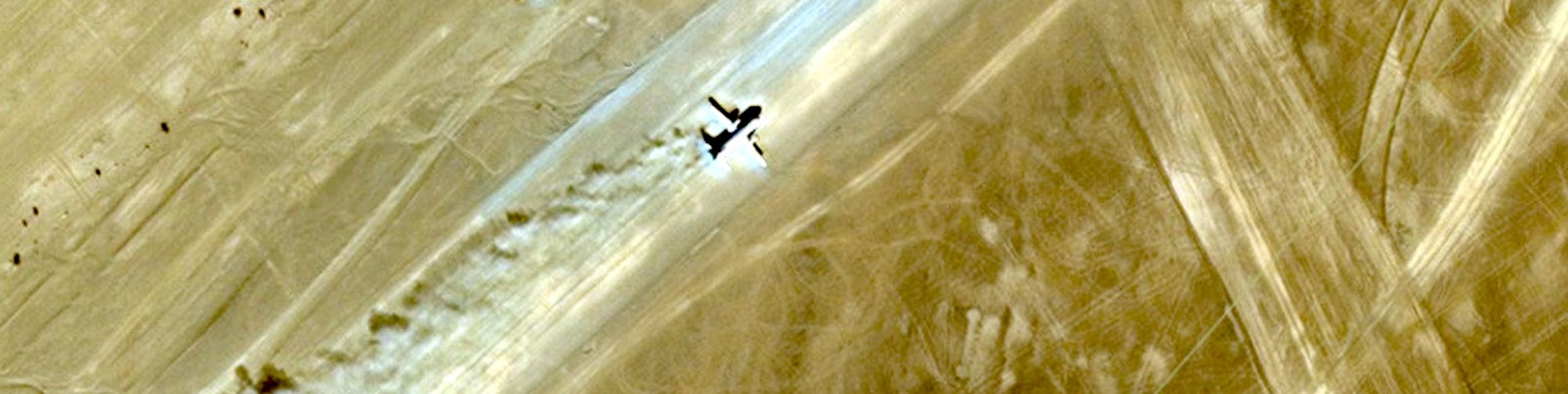
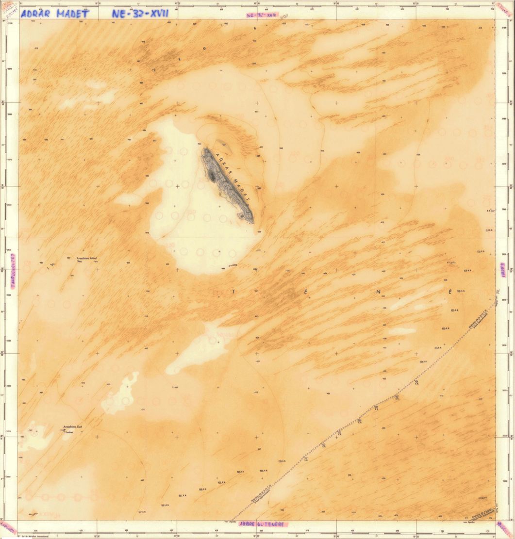
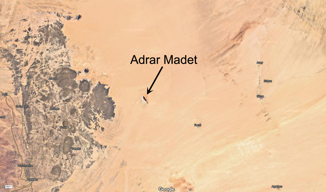
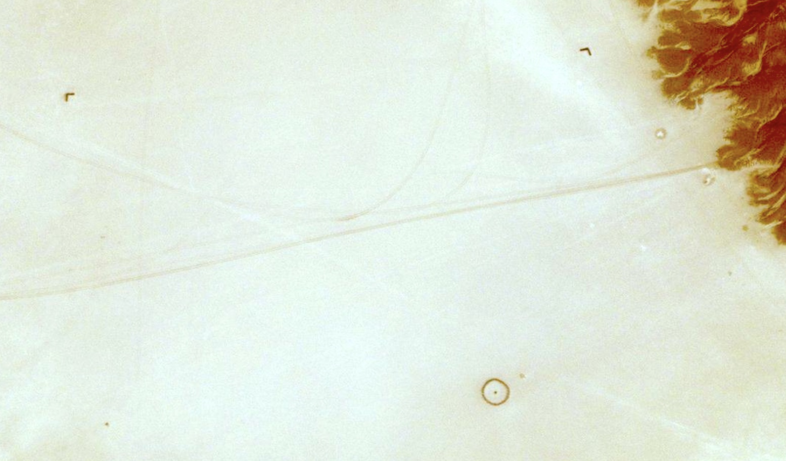
Out in Niger’s Tenere desert, east of the Aïr mountains lies the isolated massif of Adrar Madet (see map below). About 2.5 kilometres directly west of the 20-km long massif’s northern tip, a perfect stone circle lies in the sand. The circle is about 20m in diametre and some 600m from the circle and more or less at each cardinal point is a small arrow. You can see all five points here on Bing. You won’t see them on Google last time I looked.
The lone ridge of Adrar Madet (and it’s northeasterly wind shadow), north of the Arbre du Tenere
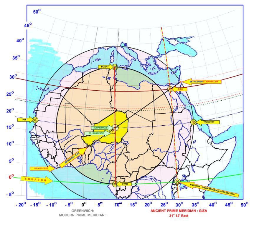
I’ve not been there but have known about it for years. Some speculate that it could a sacred pre-historic marker associated with prime meridians and ancient Egyptian knowledge, marking the ‘middle of North Africa’ (left). It is a huge coincidence that the circle is – within a few kilometres – exactly halfway between the equator and Ras Angela near Bizerte in Tunisia, the northernmost point of Africa. And it’s nearly directly south (178.4°) of Ras Angela, too. (Fwiw, it’s 64km west to the actual point directly south of Ras Angela, just south of Arakao on the edge of the Aïr.)
I err more towards the theory of a much less ancient aviation landmark from the French colonial era, one of many located in the Sahara and still being found, including less ambiguous examples where names of nearby outposts are stencilled inside the circles. Fellow Saharaholic, Yves Rohmer confirms this fact. Rubbish from that era: tin cans, bottles of Pastis, berets, garlic and so on, littered the Madet site. A similar circle exists in nearby Fachi, with that name stencilled in it and close to an old airstrip. Another plausible explanation made in the discussion linked above was a drop zone for parachute or dummy bomb training.
Not so mysterious after all then, but you do wonder, with the distinctive and isolated 20-km-long Madet ridge angled NW/SE and the Aïr massif to the west, what value the tiny 20-m stone compass actually added to aerial navigation? And why put an airstrip there if anywhere flat in this part of the Sahara can be an ’emergency airstrip’. And would they have spent days building a parachute or bomb drop zone circle when a ring of smoking oil drums would have sufficed? Trop mystérieuse…
Another possibility I like to entertain is of a playful or geographically inclined Colonel stationed in the Sahara. He’d spent his lovelorn honeymoon in Bizerte near Cap Angela and, looking at his Michelin map one hot day, noticed Adrar Madet’s central position. He decided it would be a good morale-building (or time-killing) exercise to have the circle and cardinal points marked in the desert for posterity. But as Adrar Madet is far from any route or useful resource, the purpose and meaning of his enigmatic earth sculpture has been lost in the sands of time.
That’s as may be, but what about the other similar but smaller cobbled stone circles I’ve seen in the mountains of southern Algeria (below)? Neither could be described as aviation markers. Rock art hunter, Andras Zboray, found another in 2023 by the Oued Torset in the central Tassili, northwest of Dider. ‘Tombs’ said the guides, but they’re not like the usual pre-Islamic tombs one sees in the desert.
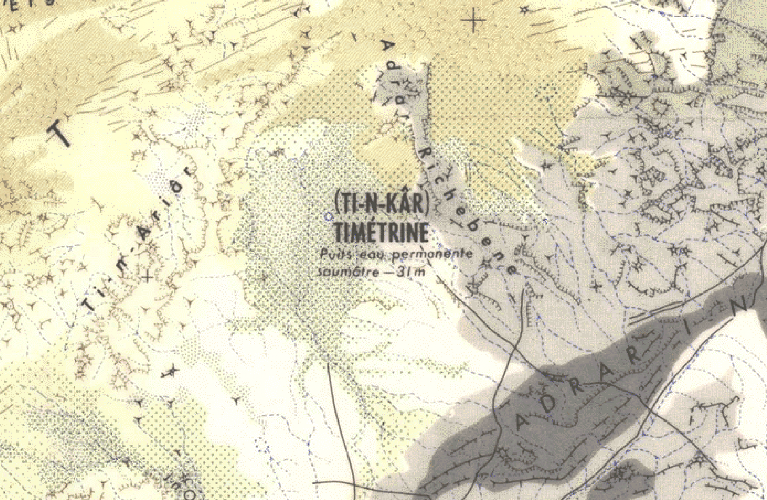
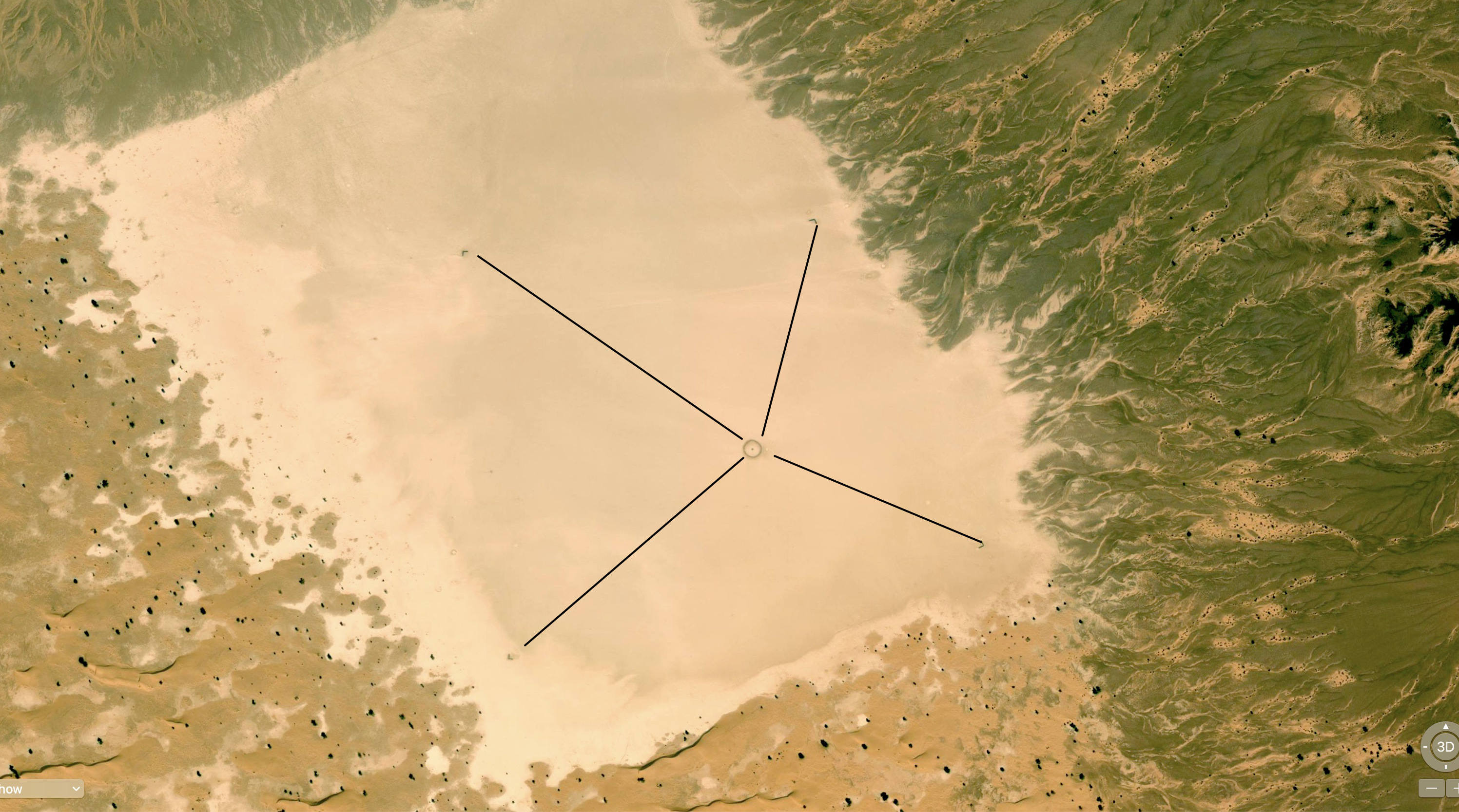
Here’s another curious circle, spotted by a mate in the remote wastes of Timetrine, northern Mali, coincidentally one place where AQIM kept European hostages up to a few years ago.
19.455065, -0.422889; It’s a lot clearer on Bing Maps than Google (LTIL). According to the old 200k IGN map, this is actually the brackish (saumâtre) well of T-in Kar (wrongly positioned on Bing), so marking it for pilots may make sense for emergencies.
You will see four points a couple of hundred metres from the circle set in the middle of a distinctively rectangular clay pan covering about half a square kilometre. But they seem so vaguely positioned as to be pointless. Some have speculated the four points may mark the fringes of a smooth landing strip.
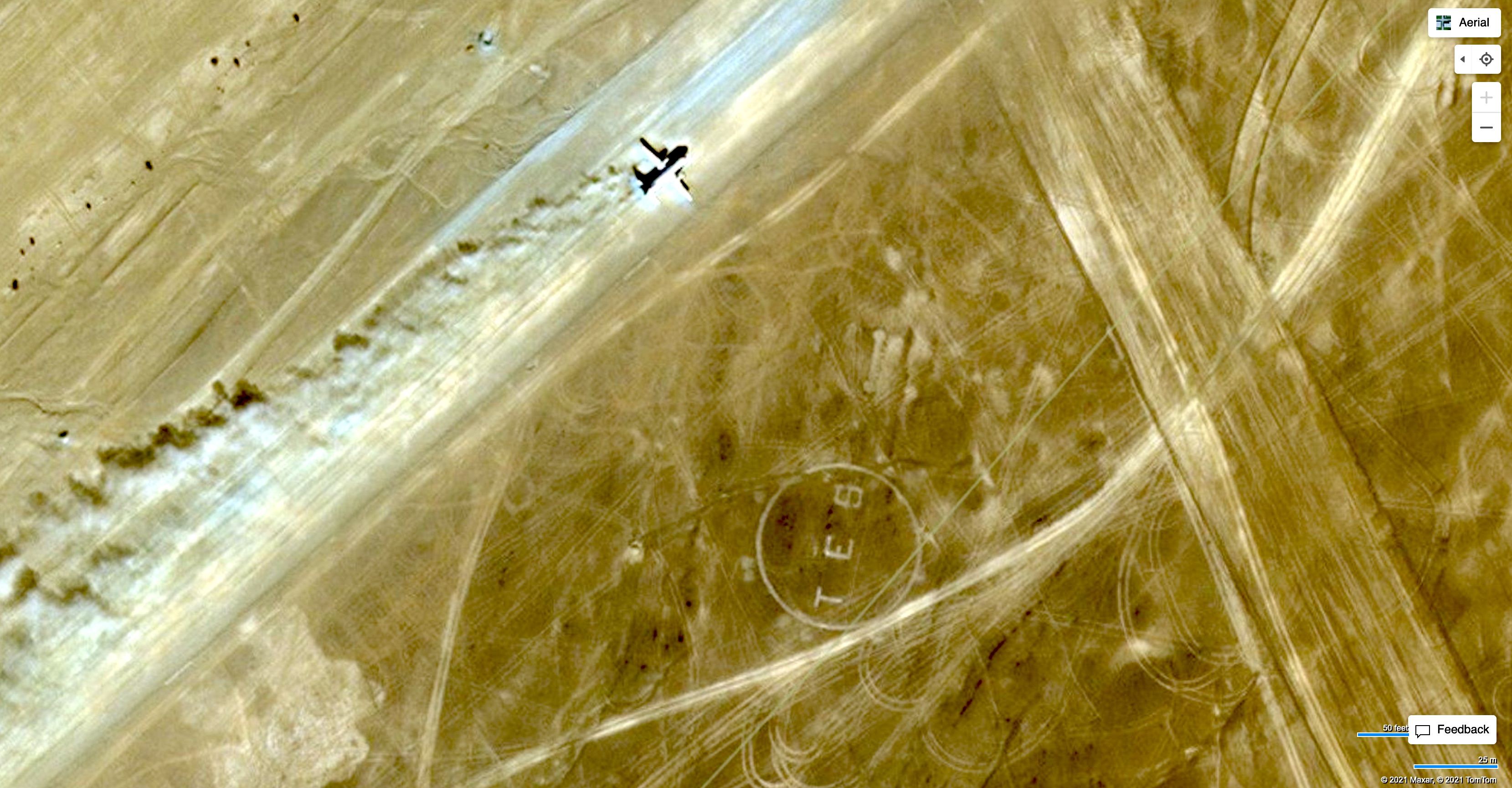
The clay pan is on a more-or-less direct line between Timbuktu and Tessalit where there is also a ‘TES’ marker by the current airfield (left). In those days (pre-War) they would have navigated as much by landmarks as a bearing. Since around 2013 this whole area has been a war zone between French force having it out with AQIM, ISGS and the like. This intervention has proved as successful as similar operations in Iraq and Afghanistan. By 2023 they’d left and Russian state mercenaries took over.
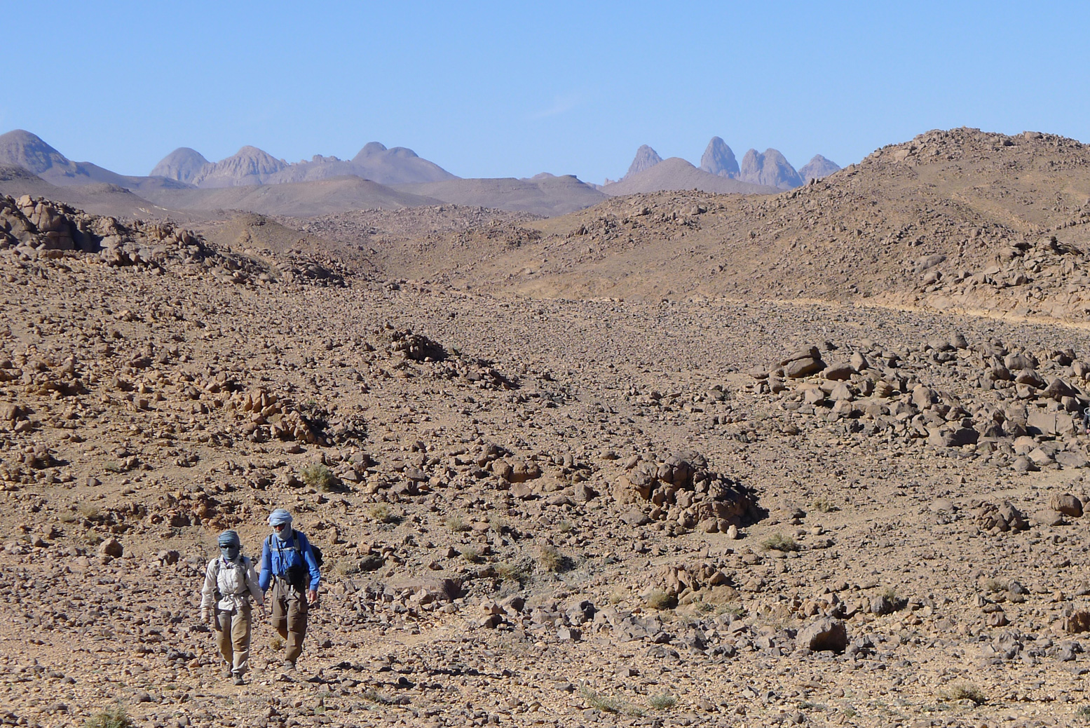
In just about the geographical centre of the Sahara lie the Hoggar mountains. Compared to the tawny sandstone of the Tassili N’Ajjer further east or the granite domes of the Tefedest and Tesnou, it’s a bleak, harsh landscape of basalt buttes erupting vertically from the barren landscape.
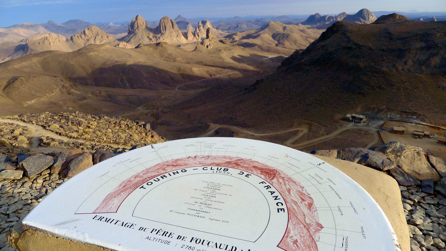
In the heart of the Hoggar massif is a dramatic cluster of eroded volcanic cores overlooked by the 9000-foot high Assekrem Pass, part of the Ahaggar National Park. Some maps call it the Atakor.
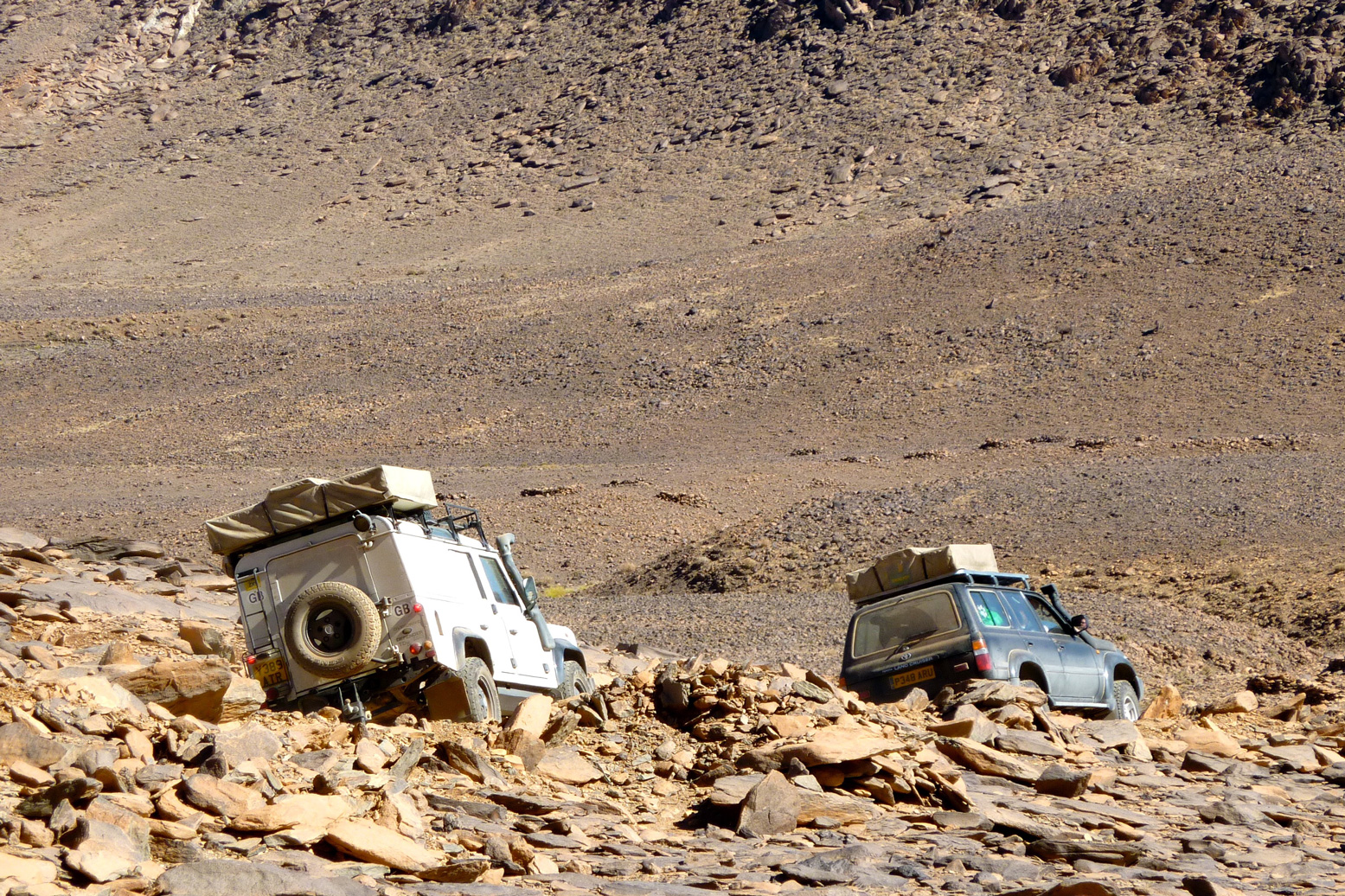
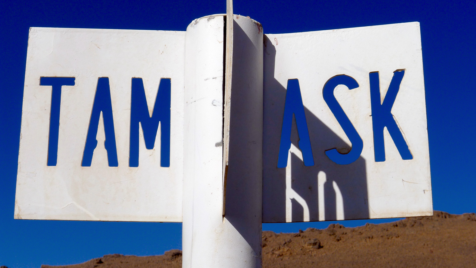
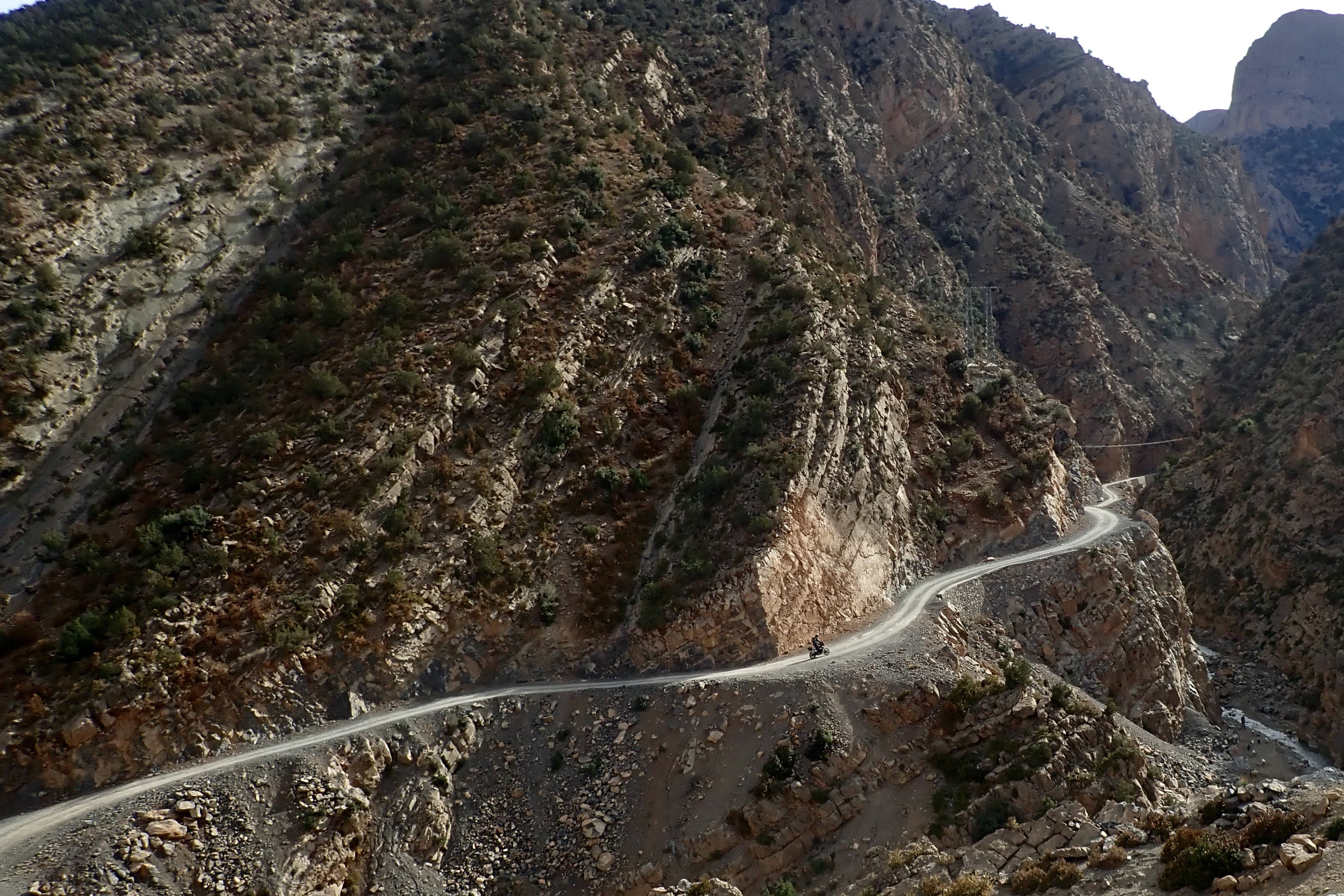
There are three ways to get to Assekrem: the regular 85-km eastern route up from Tam via Iharen peak. A gnarlier and slightly shorter western route which starts near the airport, then passes Terhenanet, though is usually taken as the descent from Assekrem to make a loop back to Tam as it’s easier to manage going down. Another route comes in from the north from Hirafok over the Tin Teratimt Pass (above).
Or you can follow a network of camel tracks (above). It takes a week or more, depending where your start.
Assekrem is the best known of the many wonders of southern Algeria. A lodge sits on the saddle of the pass (above) where tourists spend the night to enjoy the stunning sunset and sunrise across the brooding volcanic monoliths from the plateau above the Pass.
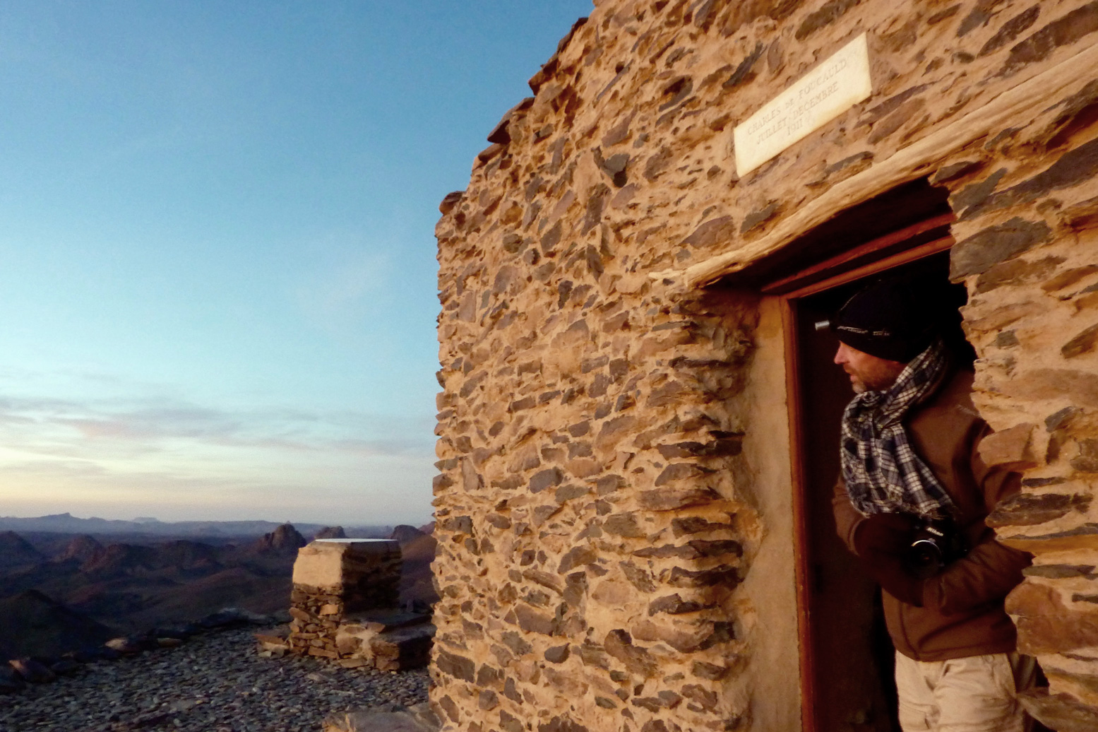
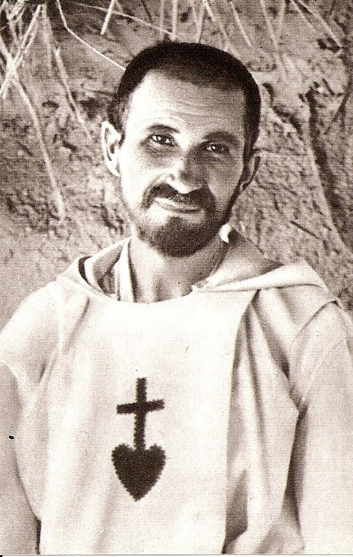
Though he spent most of his time in Tam, early in the early 20th century Charles de Foucauld, a French bon viveur and soldier turned missionary, built a crude stone hermitage on this plateau (above).
Among other things, Foucauld was responsible for the first Tamachek-French dictionary, and his house still stands in Tam. It was here in 1916 that Foucauld was assassinated as a suspected French spy, during the Senussi uprisings in Libya and Egypt. He was beatified in 2005 and the hermitage is still tended today by a couple of aged members of the order of Les Petites Frères de Jésus, who were inspired by Foucauld’s life.
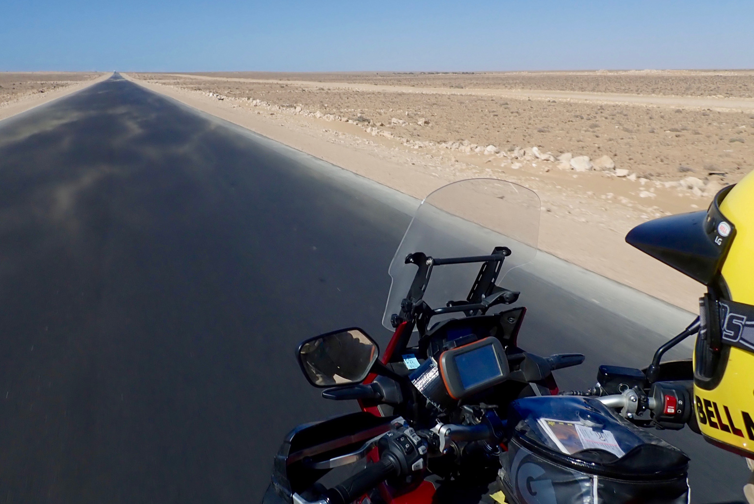
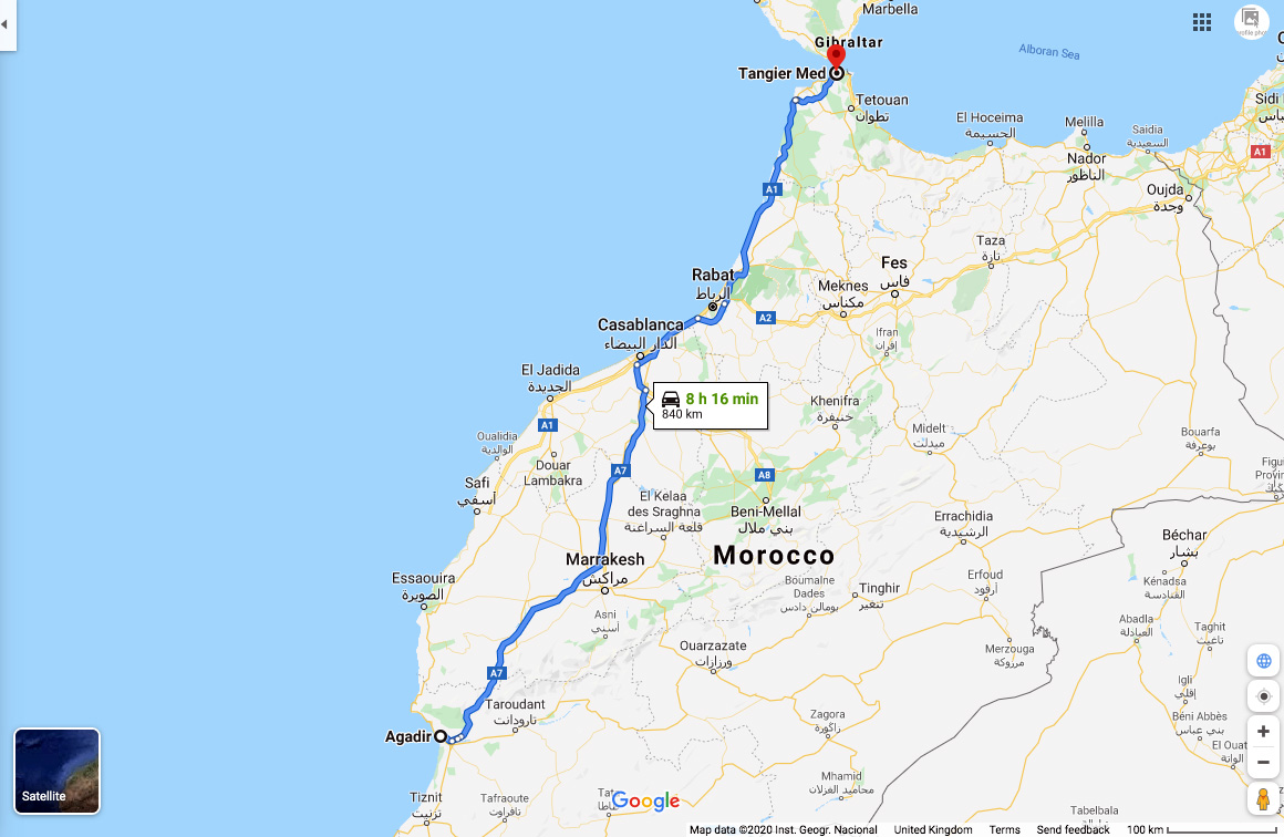
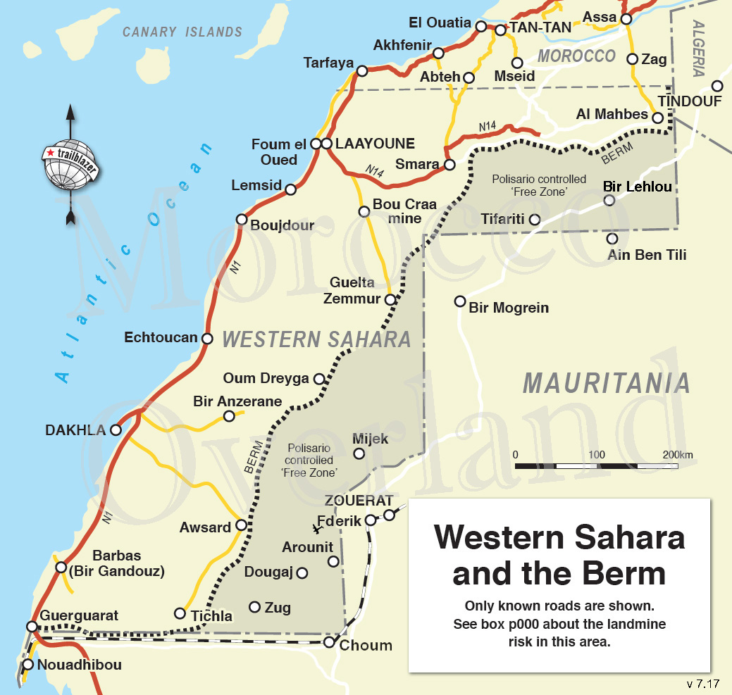
In March 2020 I rode Morocco’s 2300-kilometre Atlantic Highway nearly all the way to the southern border and nearly all the way back. I last came this way in 2019 (as far as Gueltat Zemmour) but have not done the whole crossing into RIM since 2006 heading for our Empty Quarter transit. I knew it then, I know it now: scenically, mile for mile, the Atlantic Highway is pretty dull by Saharan standards – a drab limestone plain where, encounters aside, sea-cliff viewpoints and a few barchan dunes are as good as it gets. If you’re on a mission to get to Mauritania – as I was on this occasion – here’s what I found.
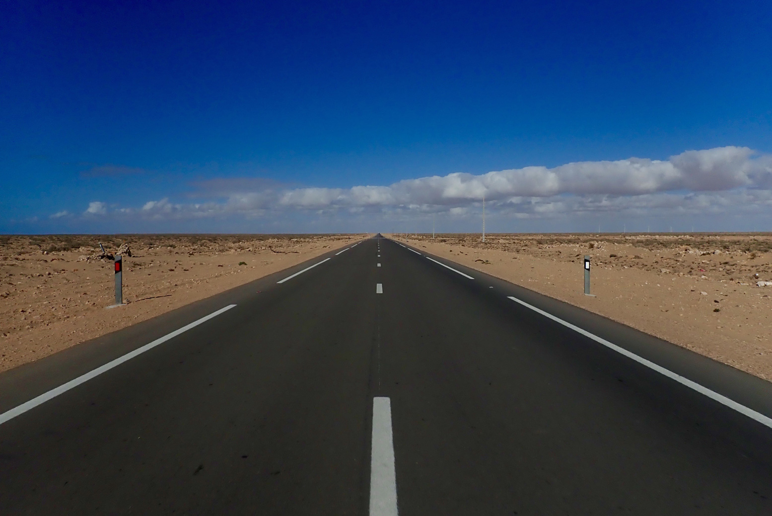
Up north, use the autoroutes to dodge the N1 and speed traps It’s a long way so coming from the northern ports, I recommend sitting on the deserted A1 and A7 motorways all the way to Agadir where the A7 ends, even though you pay tolls (about £30 for a moto/car). South of here traffic thins right out. The alternative coastal N1 trunk road is slower, less safe (in a driving sense) and is commonly staked out by cops with radar guns, especially around Essaouira and Agadir. Otherwise, there are any number of great ways of exploring inland Morocco, across the Atlas mountains all the way south to the Desert Highway along the Algerian border.
Stick to the autoroutes up north
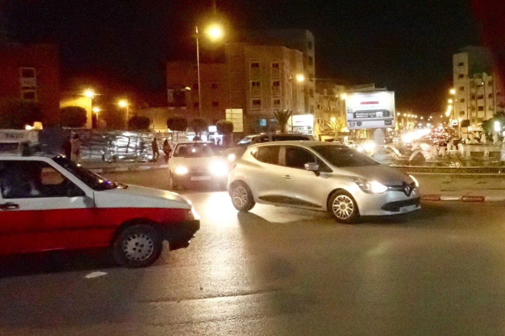
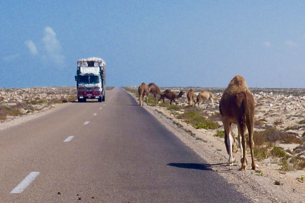
The speed cops are creeping south Even though I was hyper-aware of radar cops, I still got caught leaving Tan Tan doing 80 in a 60. That would have been 300d, but deploying the usual techniques – basically: humility in the face of the obvious – he let me off. All the way to Layounne and Dakhla, be wary of lurking speed cops, especially as you approach or leave settlements but even out in the desert too. Crossing solid white lines is another favourite trap; easily done when stuck behind a soot-spewing lorry crawling up an incline,
At your service
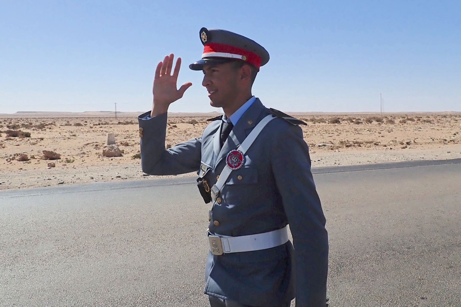
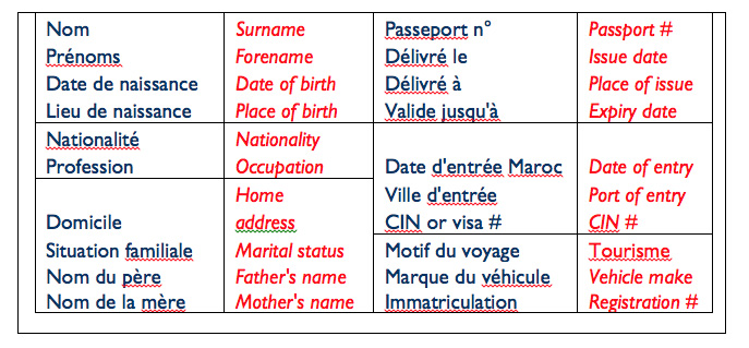
Western Sahara checkpoints and fiches As ‘Western Sahara‘ is a Moroccan military zone, checkpoints increase south of Tan Tan, and unlike up north, they don’t just wave foreigners through but want your passport details. Handing over a pre-printed ‘fiche‘ (French for ‘form’; below) helps speed up the process. Hand one over and they can log you into the ledger once you’ve gone. It seems fiches are less needed these days; I got through only about six on the way down – the last one at Dakhla Junction. Some checkpoints will insist on seeing your passport anyway; others just want a chat.
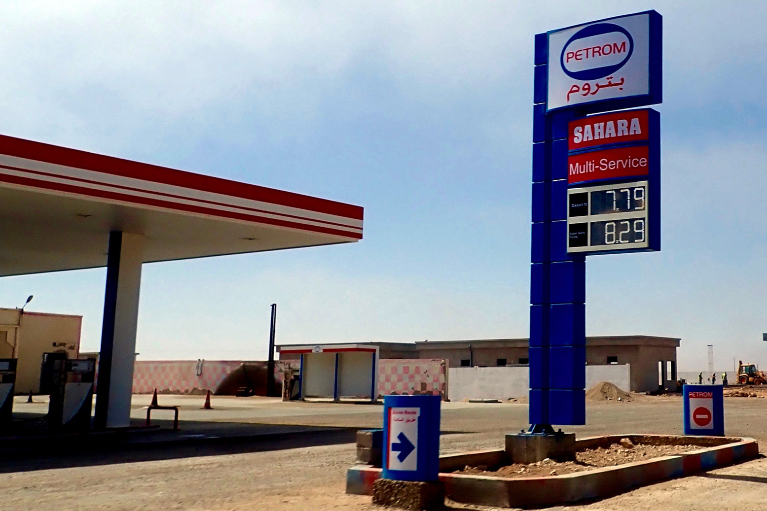
On the N1, subsidised fuel begins 92km south of Tan Tan Along with a few other key commodities, fuel is subsidised by about 30% in Moroccan Western Sahara. The first discounted fuel station is just after you cross a causeway and climb out of a sea inlet, right by a checkpoint.
First subsidised fuel south of Tan Tan
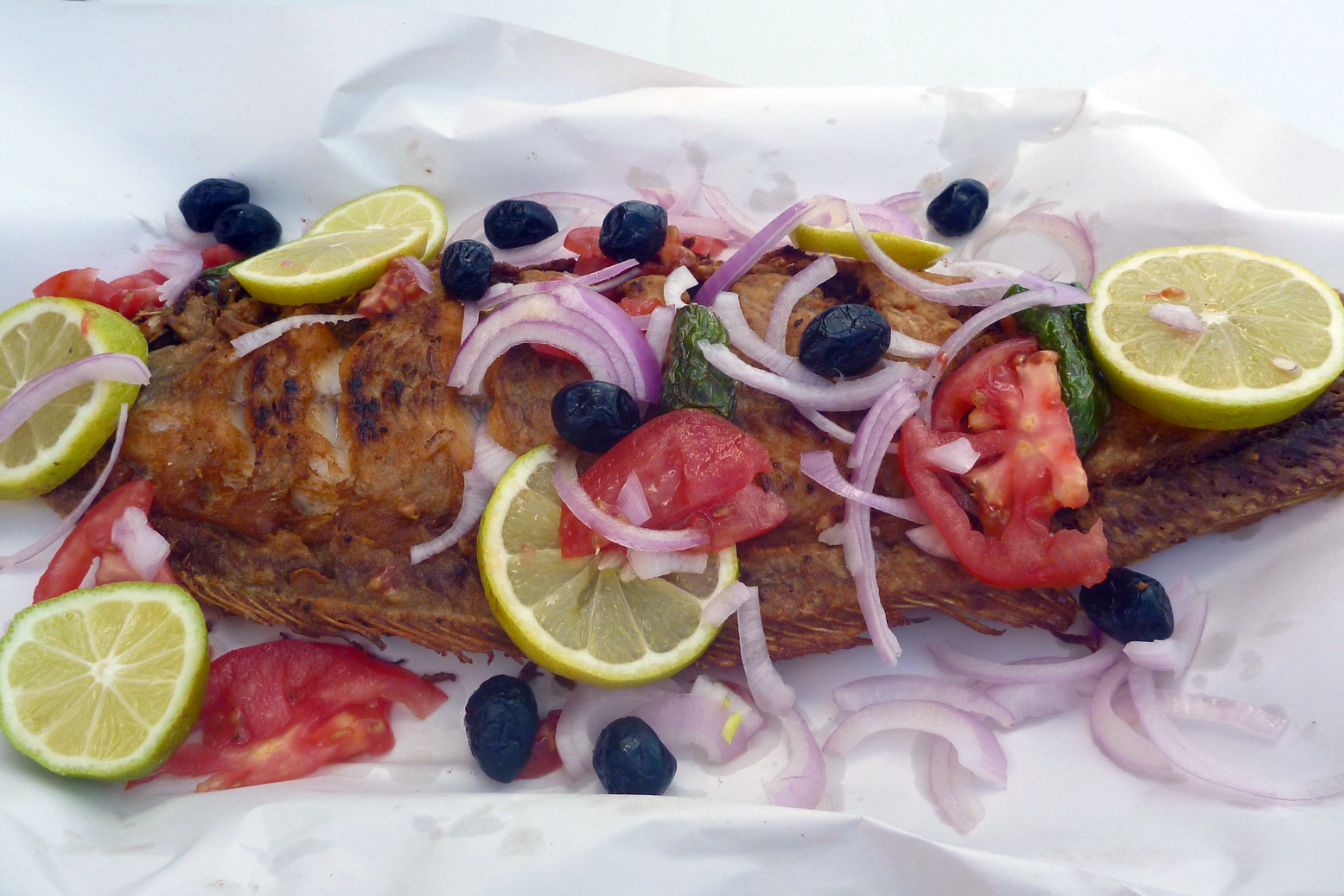
Fish & Chips at Afknenir Make sure you pull in for a poisson-frites in Afkhenir, 20 kms from the checkpoint above. For some reason streetside fish restos here are like casinos on the California-Nevada border. You may think there’ll be loads more down the coastal highway, but there aren’t. You can thank the upwelling of nutrients from the cold Canary Current which gets funnelled by the Canaries themselves onto this near-north-facing section of coast before Cape Juby. Or maybe local demand supports the informal shore-casting fishing economy. You’ll see loads of scooterists with rods as well as the crude clifftop shelters where they live.
Fresh fish in Afkenir – not to be missed
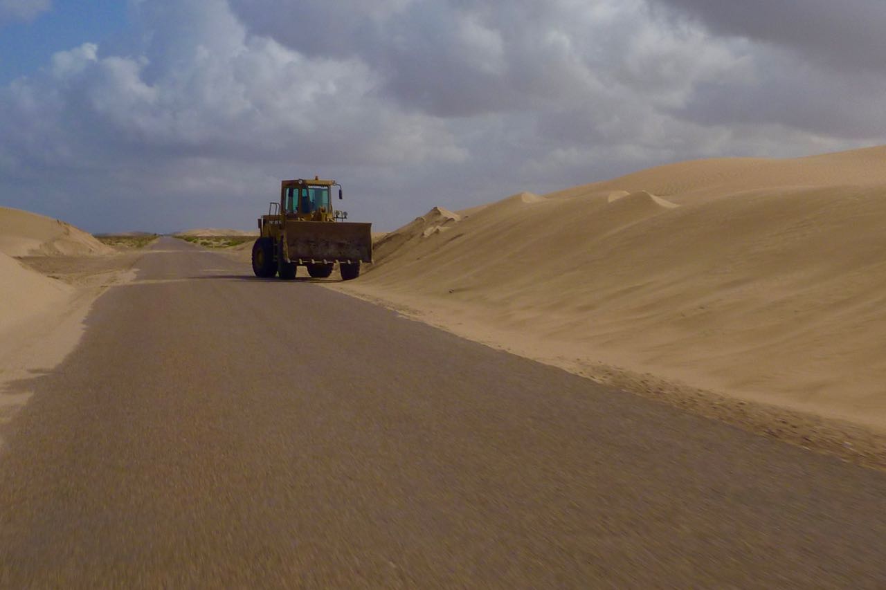
They’re rebuilding the N1 South of Guelmim a new, wider road is being built in stages, sometimes alongside the old one – certainly as far as Layounne. Around the dunes of the windy Khnifiss lagoon past Tan Tan, when I was there roadwork embankments see sand get blown across the two-lane road – not a good place to meet an oncoming truck while checking your likes.
New road north of Laayoune
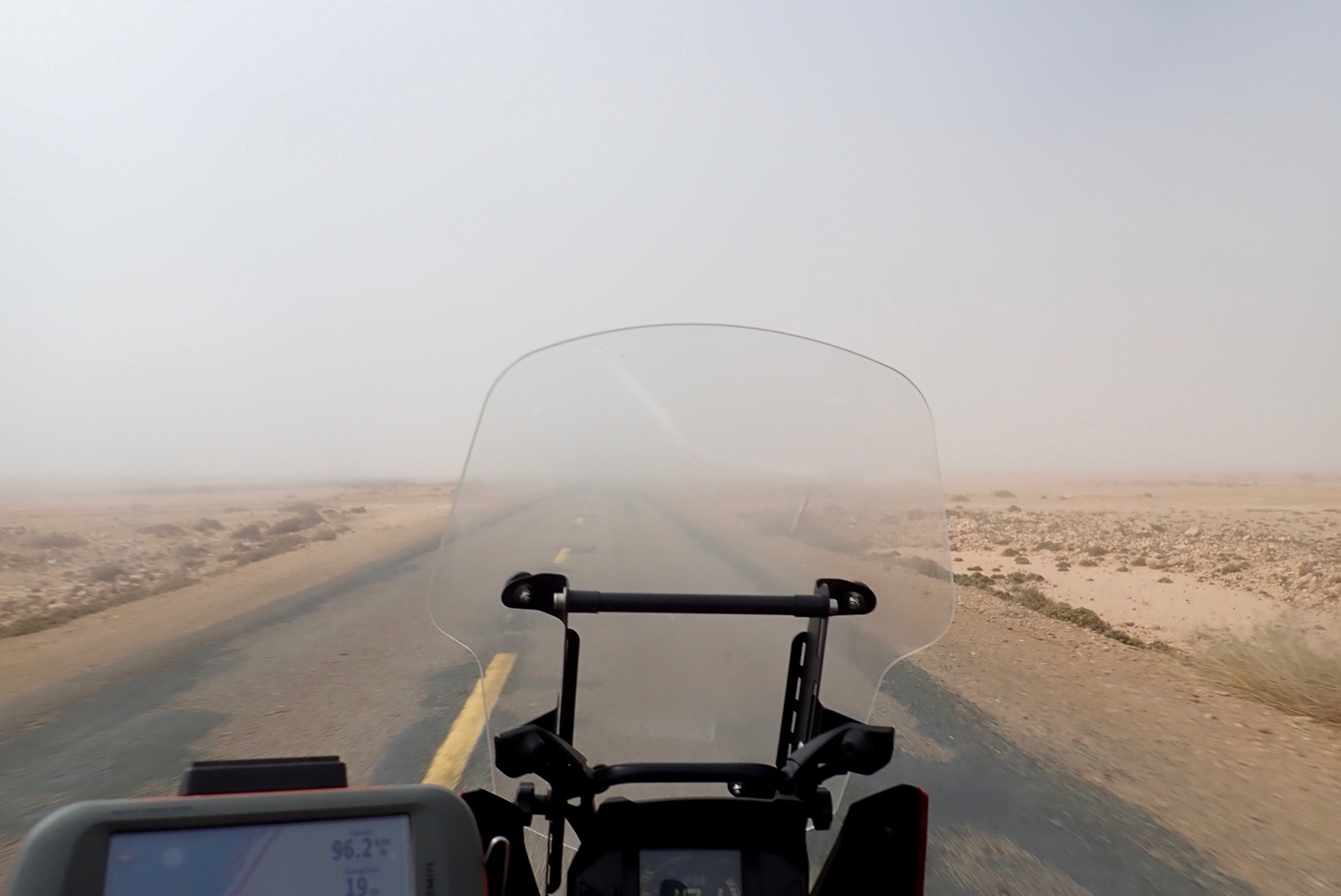
Fog
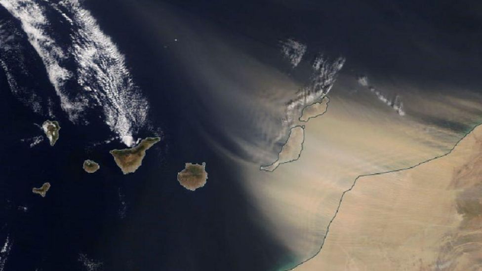
It’s very windy – day and night They say March is especially bad, but south of Guelmim where the desert sets in, it’s windy day and night. Normally in the Saharan interior the wind stops at dusk. In late February 2020 a huge Saharan sandstorm (below) made the news when holidaymakers on the Canaries were stranded. Close to the coast the cold current produces fog (right), certainly between Guelmim and Tarfaya. Within a kilometre of the coast a northerly sea breeze can also blow up to 10°C cooler than an easterly from the dry interior – which might be just a mile or two inland. But generally, the wind is behind you; on a pushbike (I saw a few), that’s important.
The flat landscape of Western Sahara can’t help, but when you realise the whole 3000-mile width of the Sahara has been steadily heated by the rising sun before it reaches the Atlantic coast, the wind has had plenty of time to get a good run up. On the move it’s not so bad, but outside of a car, camping can be pretty miserable. Even the trees are bent southwards.
Sandstorm February 2020
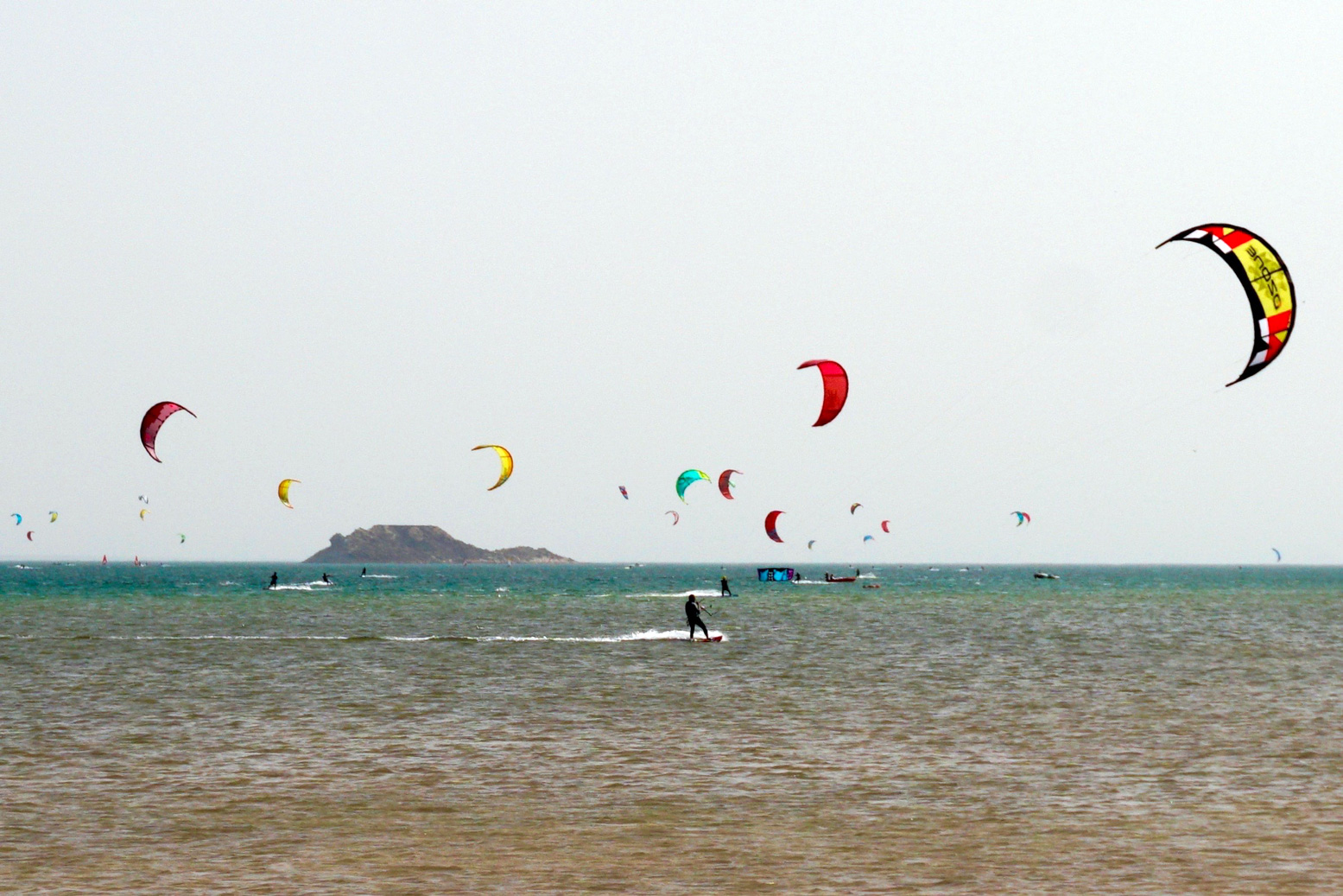
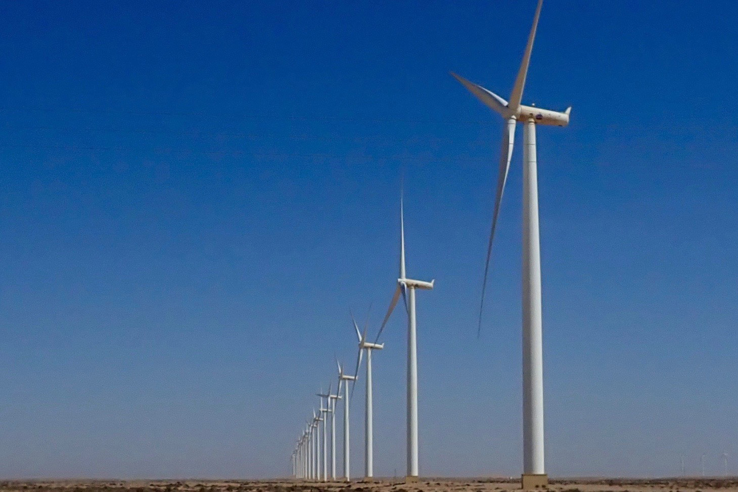
All this wind is good for the economy: Dakhla has long been a kiters’ resort (below) and there’s a huge installation of wind turbines south of Tarfaya, helping keep the lights on in Laayoune. Soon they say that array of turbines (or one like it) will feed electricity to the UK via an undersea cable.
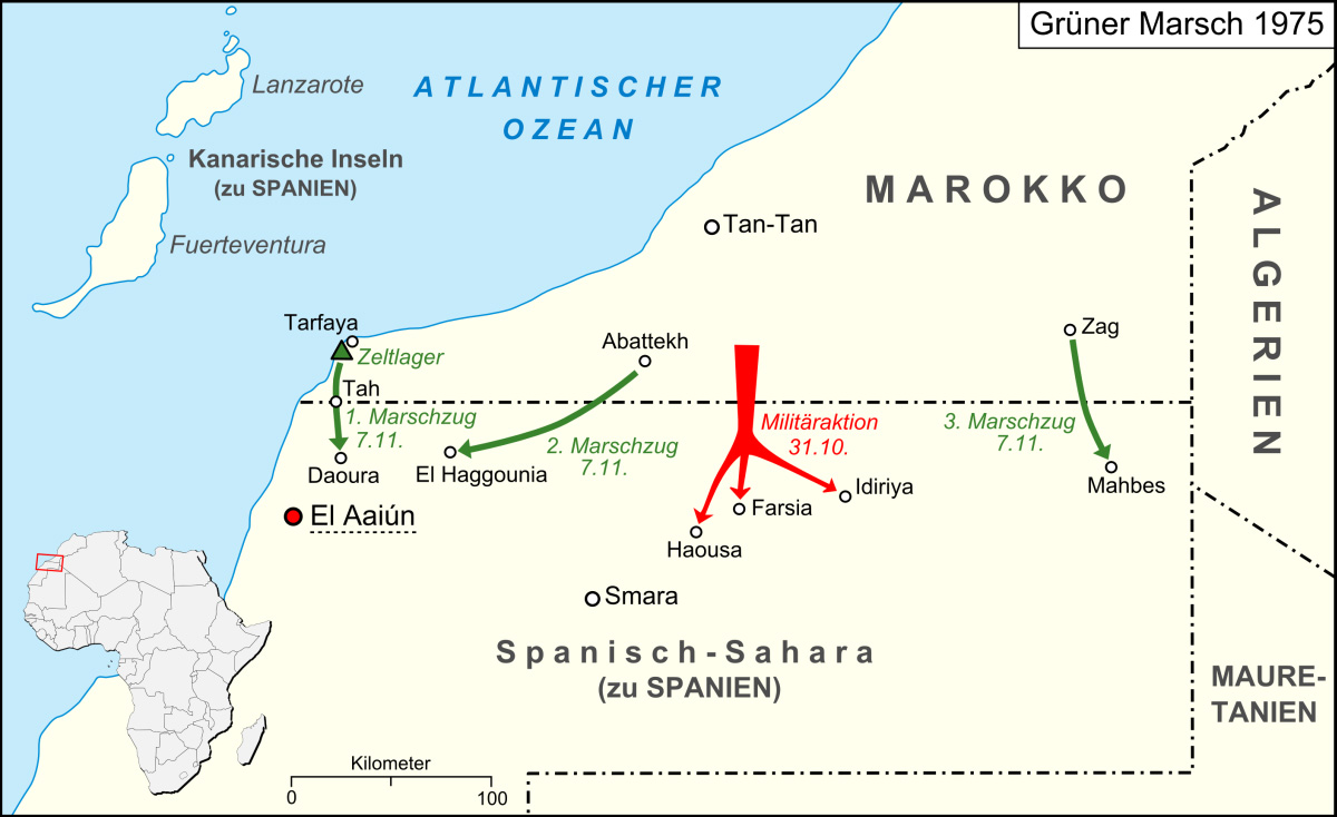
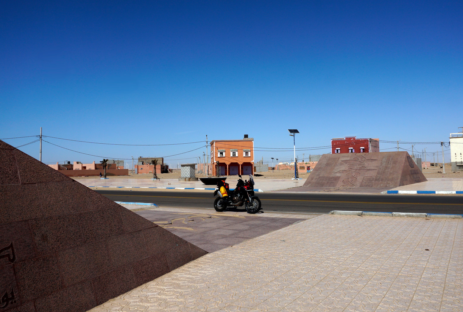
The monument at Tah On the N1 for Laayoune you’ll pass through nondescript Tah with no fuel and barely a cafe and shop to rub together. In the middle of town is a granite monument covered in Arabic inscriptions. It marks the spot where in November 1975, some 350,000 Moroccan civilians symbolically marched over the then border into Spanish Sahara.
This was the Green March (map left): three co-ordinated and tactical mass demos mobilised by the wily King Hassan in response to rumours of Spain considering handing over its marginal colony to the indigenous Saharawi and Polisario Front. The marches were followed by the 16-year Western Sahara War which Morocco effectively won by annexing most of the territory (see map,above). It’s why the UN still hang out in Western Sahara and why unmapped landmines are still a menace. Otherwise, not much appears to have happened in Tah since that glorious November day.
Laayoune Laayoune is the provincial capital and biggest settlement in WS by far, with a prosperous frontier-town vibe to it. At least from what I perceived; life in the Saharawi shantytowns may not be so rosy and civil disturbances are not uncommon. Riot police lurk on standby in the town centre (below). The UN’s MINURSO mission is based here, monitoring the Polisario ceasefire. Passing through the city, the transit is not an obvious single main road. Without a satnav, follow signs for the airport, or back right up and take the Laayoune bypass (see below).
Downtown Layounne
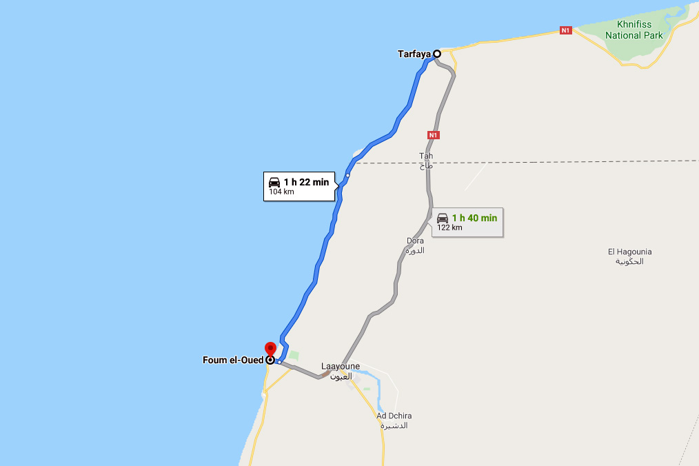
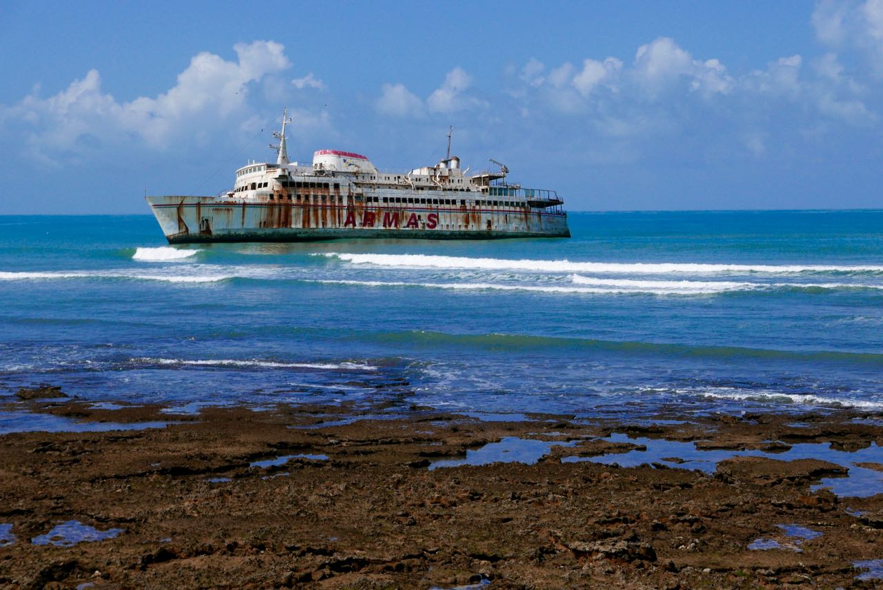
The Laayoune bypass At Tarfaya (former Cap Juby) you can turn into the town, head for the shore past the St Exupery museum, his monument, and the 19th-C curiosity of Mackenzie’s Factory). Following the coastal road 90km to Foum El Oued (‘river mouth’) brings you back to the N1 just south of Laayoune city. It would be nice to report this is a quiet byway passing idyllic beaches, but the wind is ever-present and trucks use this narrow road to avoid Laayoune. Dunes also get bulldozed off the road, especially south where the road gets narrower. I suppose it might be cooler than the inland route and the beached Armas ferry is a site to behold. There’s more here.
Laayoune coastal bypassAeropostaleCap Juby Armas ferryDunes on the roadMackenzie’s Factory
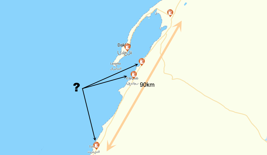
The longest fuel range is 162km but may be 250km This is between Tchika (Imlili) near some big white barchans on the north edge of the Gulf of Cintra, and Bir Gandouz, the last town, 80km from the border. There is nothing at all along this section except the howling wind. However, the Tchika station and the two similarly old and grubby Atlas Sahara stations to the north near El Agroub (see map right) may be empty. Stations may get upgraded, but for the moment this means from Dakhla Junction roundabout (two fuel stations) to Bir Gandouz is 252km (via the Tropic of Cancer). I covered that distance northbound into the wind and go in with a pint in the tank.
Is Dakhla worth the 90-km round trip? No so sure, but then I took the cheap hotel thing a bit far in the old town. Next time it might be more fun to check out the kiters’ resorts at the head of the lagoon. On the other hand, up north, Boujdour was a fun stop for an evening wander.
Plan a break at the Hotel Barbas in Bir Gandouz Maybe it was just me on the day, but the Hotel Barbas was an oasis in a duststorm. And once inside shimmered into a veritable mirage. We stayed here in 1997 but the place has been transformed to the point of incongruity. They built a two–storey U-shaped bank of rooms around a planted courtyard but then, ingeniously, draped the entire thing in a huge shade-net. Result: a large, cool space where courteous waistcoated waiters flit about at your service. Rooms are good, prices are normal, food is good too and so is the wi-fi. Tourist, traveller, refugee or trader, some of the characters that roll through add to the place’s edgy ambience. The south end of Morocco, not the Mediterranean coast, marks the true border with Africa. Bir Gandouz is an easy day from Boujdour which itself is an easy day from Tan Tan. With an early start and an hour to the border, you’ll easily get to Nouadhibou or on the road to Nouakchott.
Barbas hotel: an outpost in the wilderness
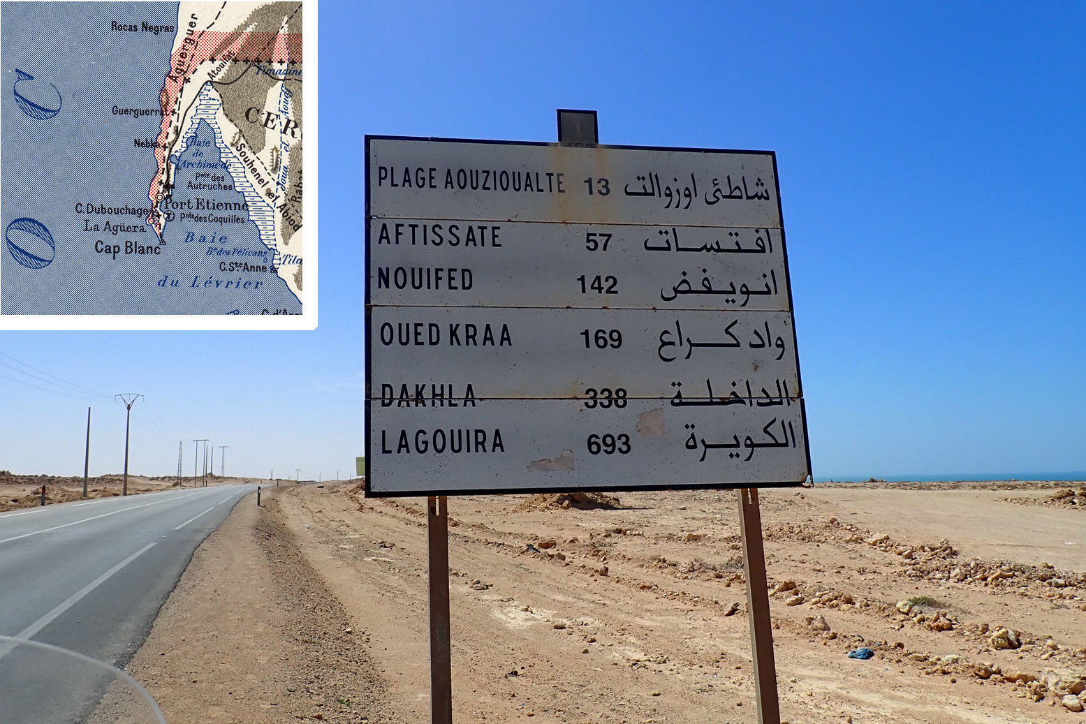
What is ‘La Gouira’ you see on the road signs? The ‘Lagouira’ you’ll see listed on some old Atlantic Highway road signs indicates the short-lived Spanish base at La Agüera on the Ras Nouadhibou peninsula opposite today’s Nouadhibou. See map inset below. Effectively it indicates the distance to Nouadhibou which is not always listed. Abandoned at the turn of the century, today it’s a collection of ruins which are actually in the Polisario Free Zone, commonly mistaken for No-Man’s-Land which separates Morocco from Mauritania. Some have managed, but the Mauritanians won’t allow casual visits from the Nouadhibou side.
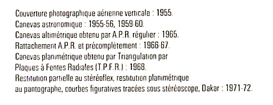
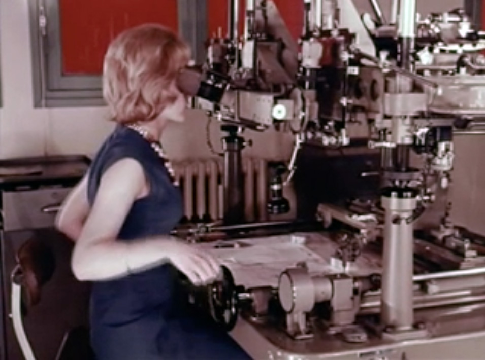
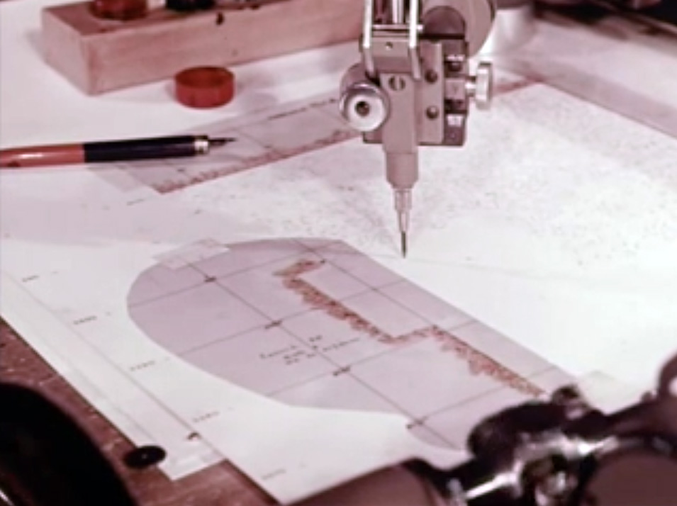
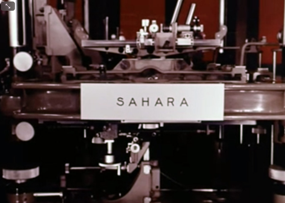
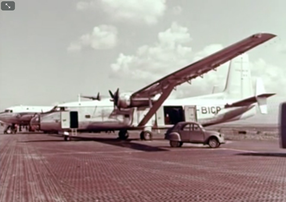
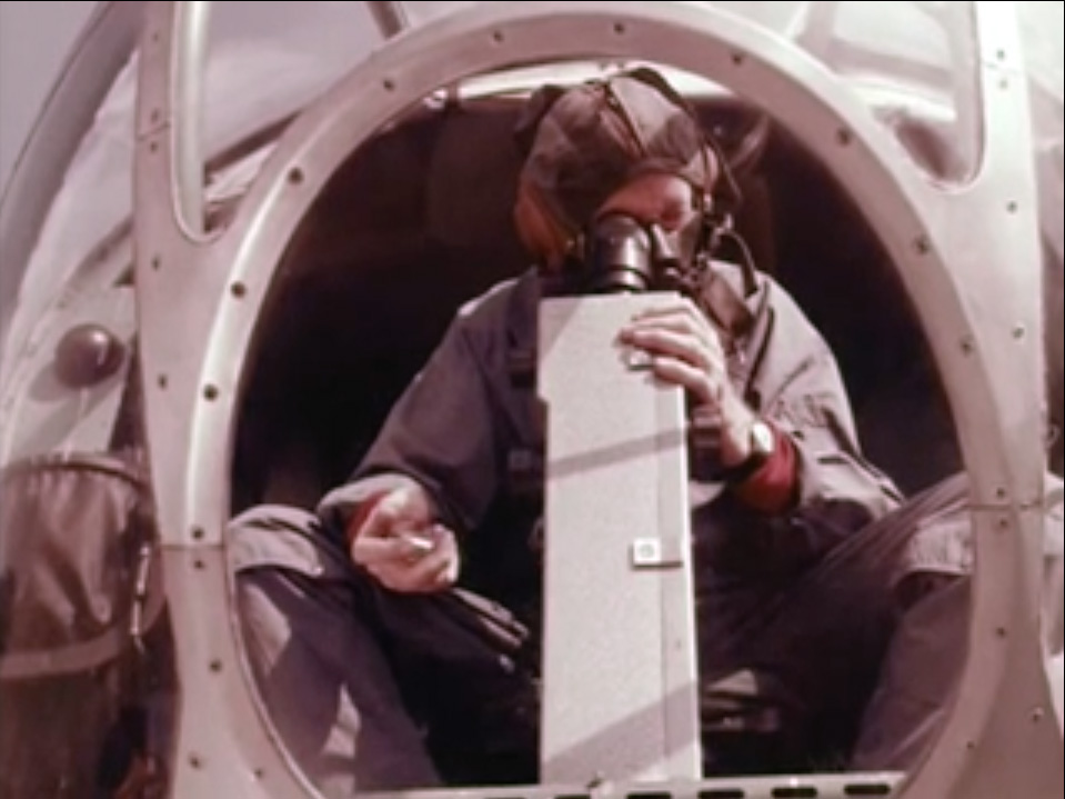
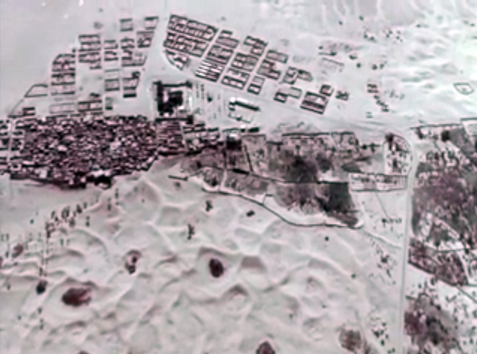
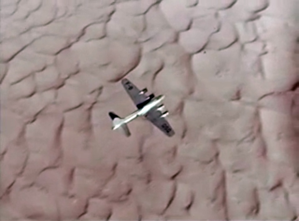
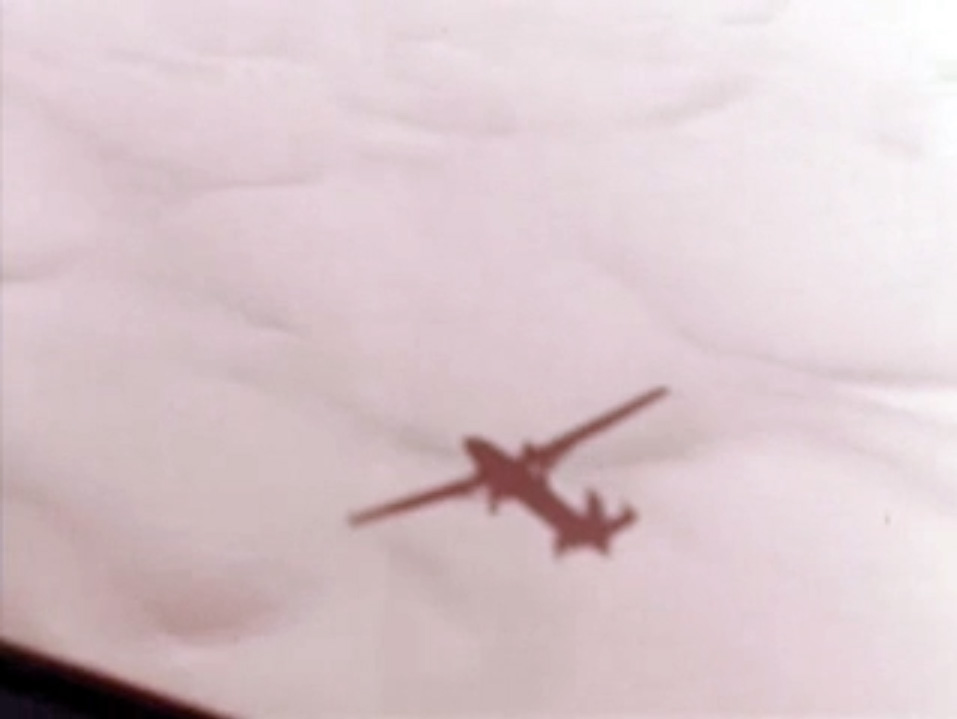
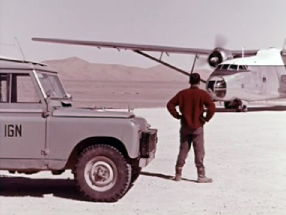
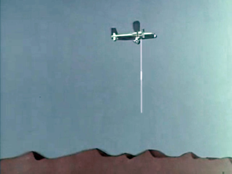
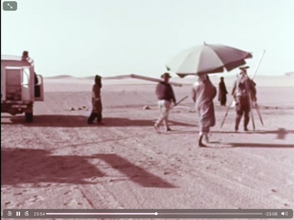
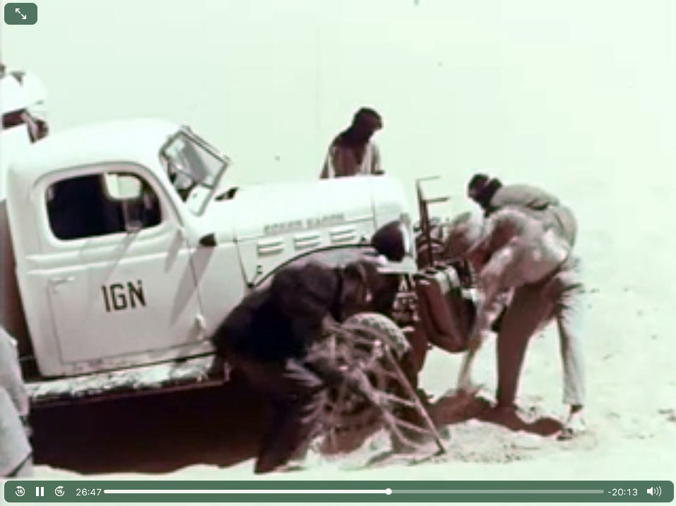
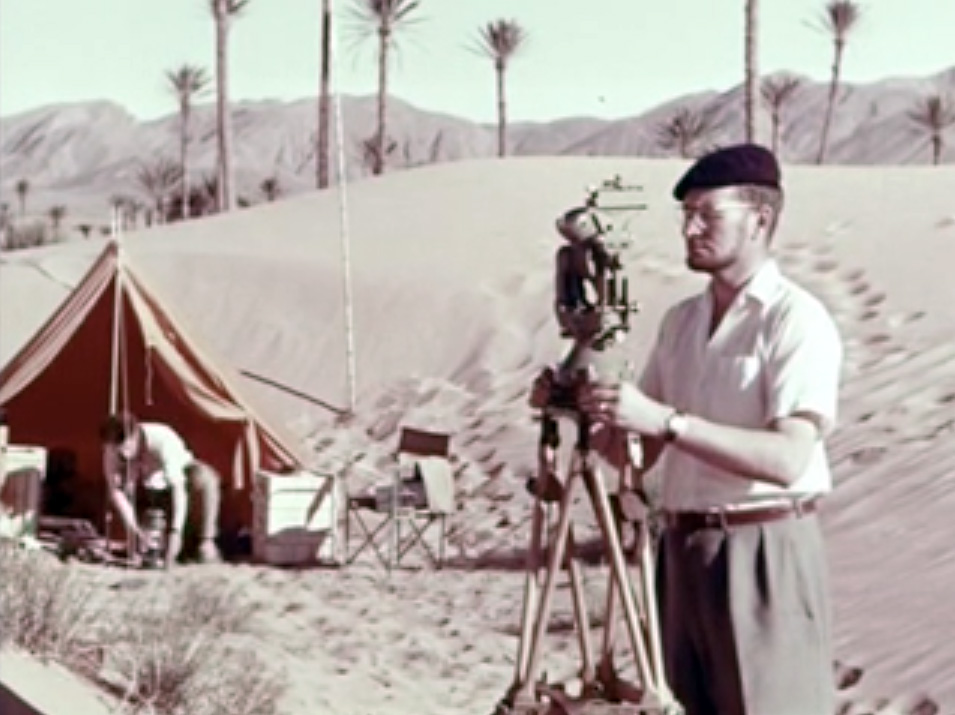
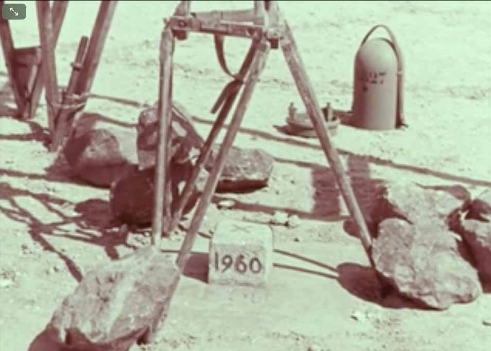
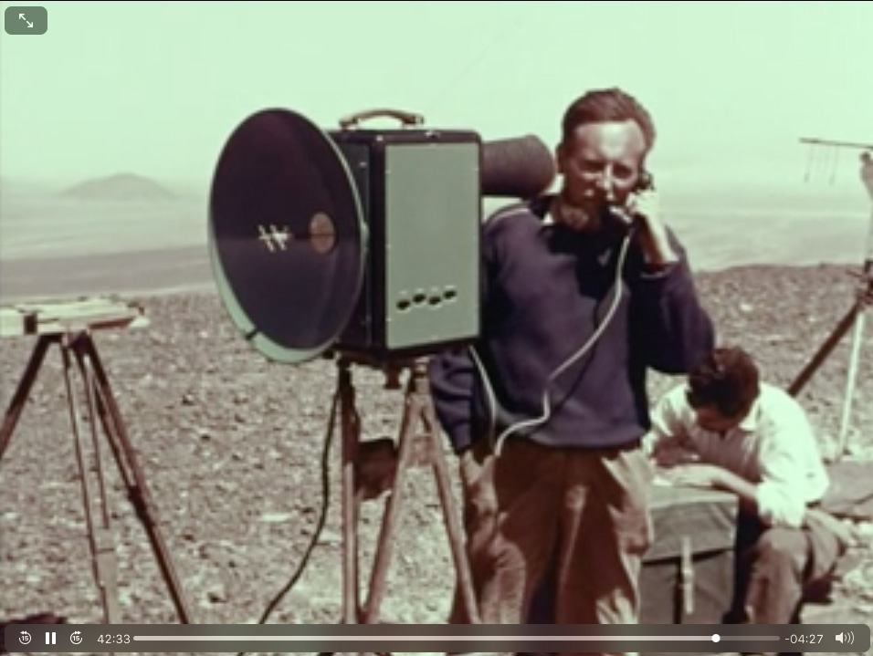
Here a fascinating 1960s vintage film (45 mins; French) on the work it took IGN to produce their brilliant 1:200,000 scale Sahara maps from thousands of aerial photos, sonar readings and laborious ground surveys. Direct link to video.
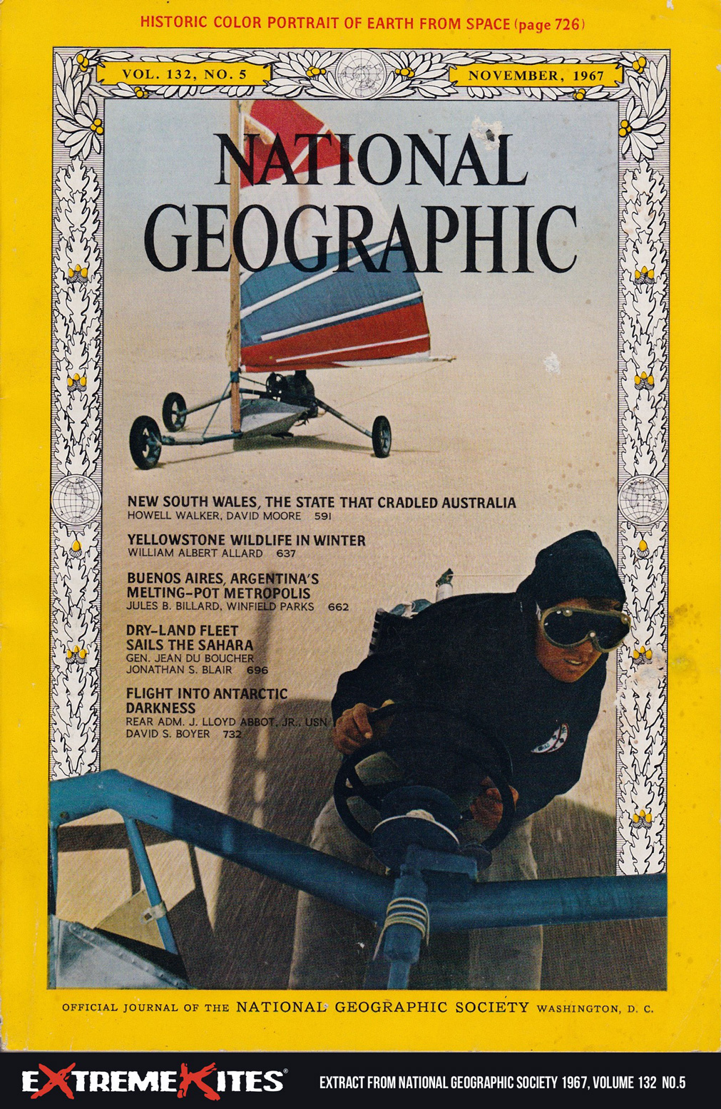
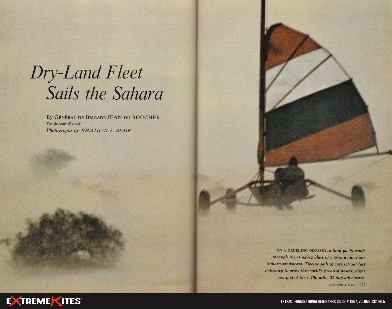
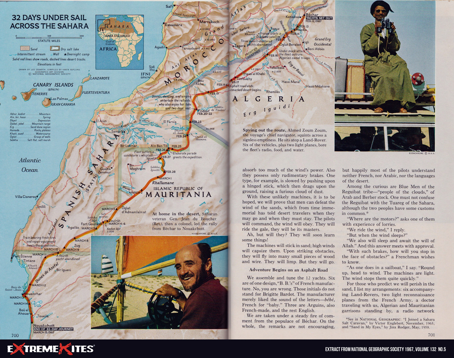
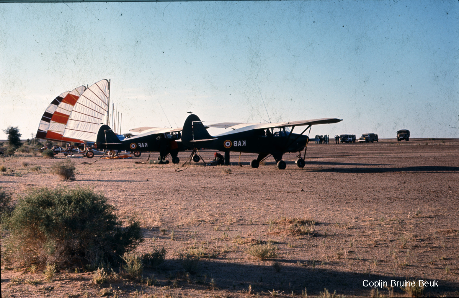
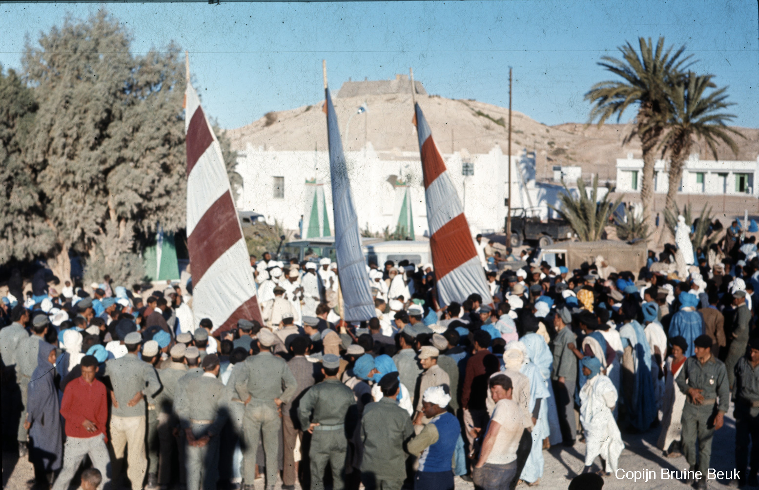
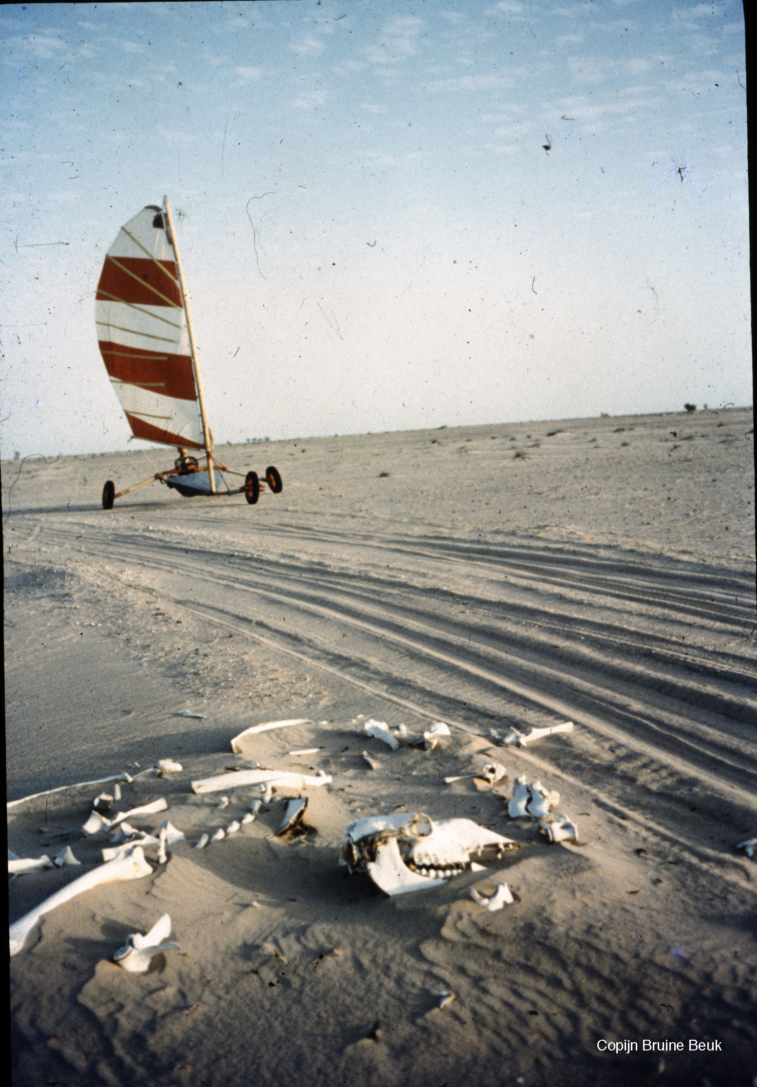
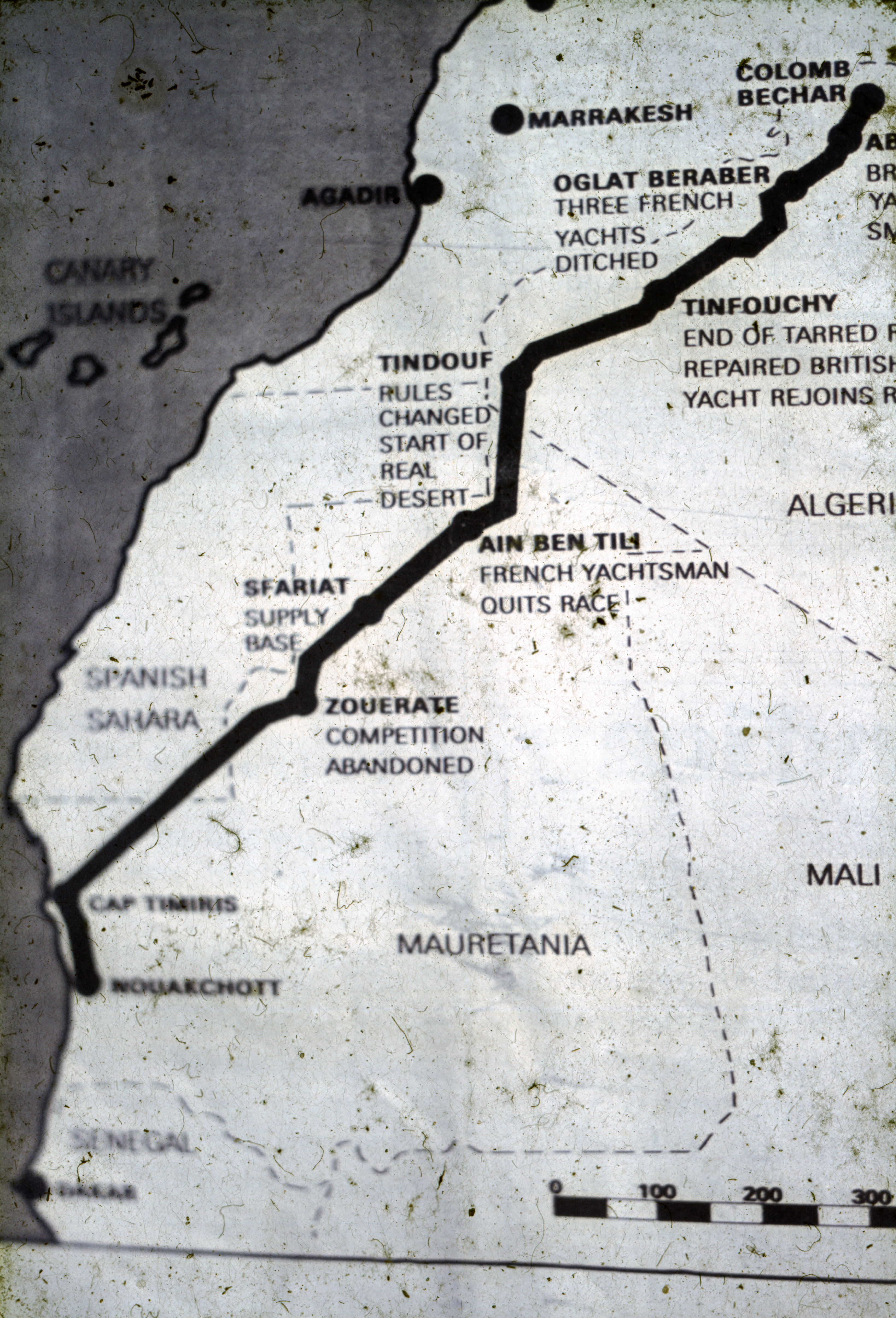
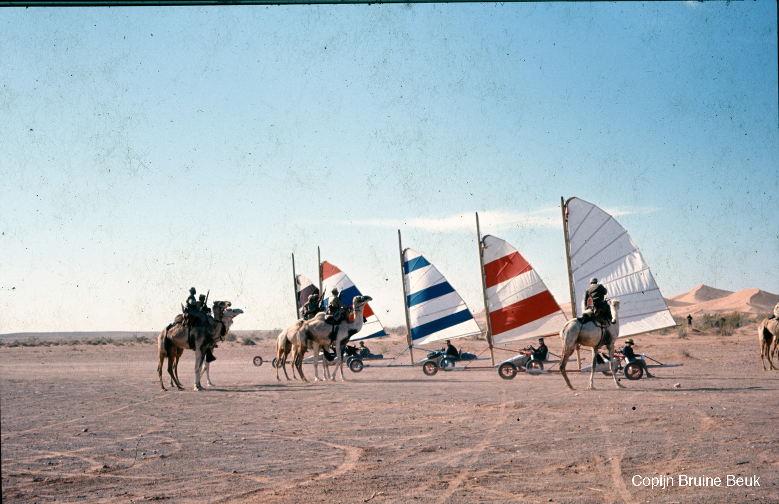
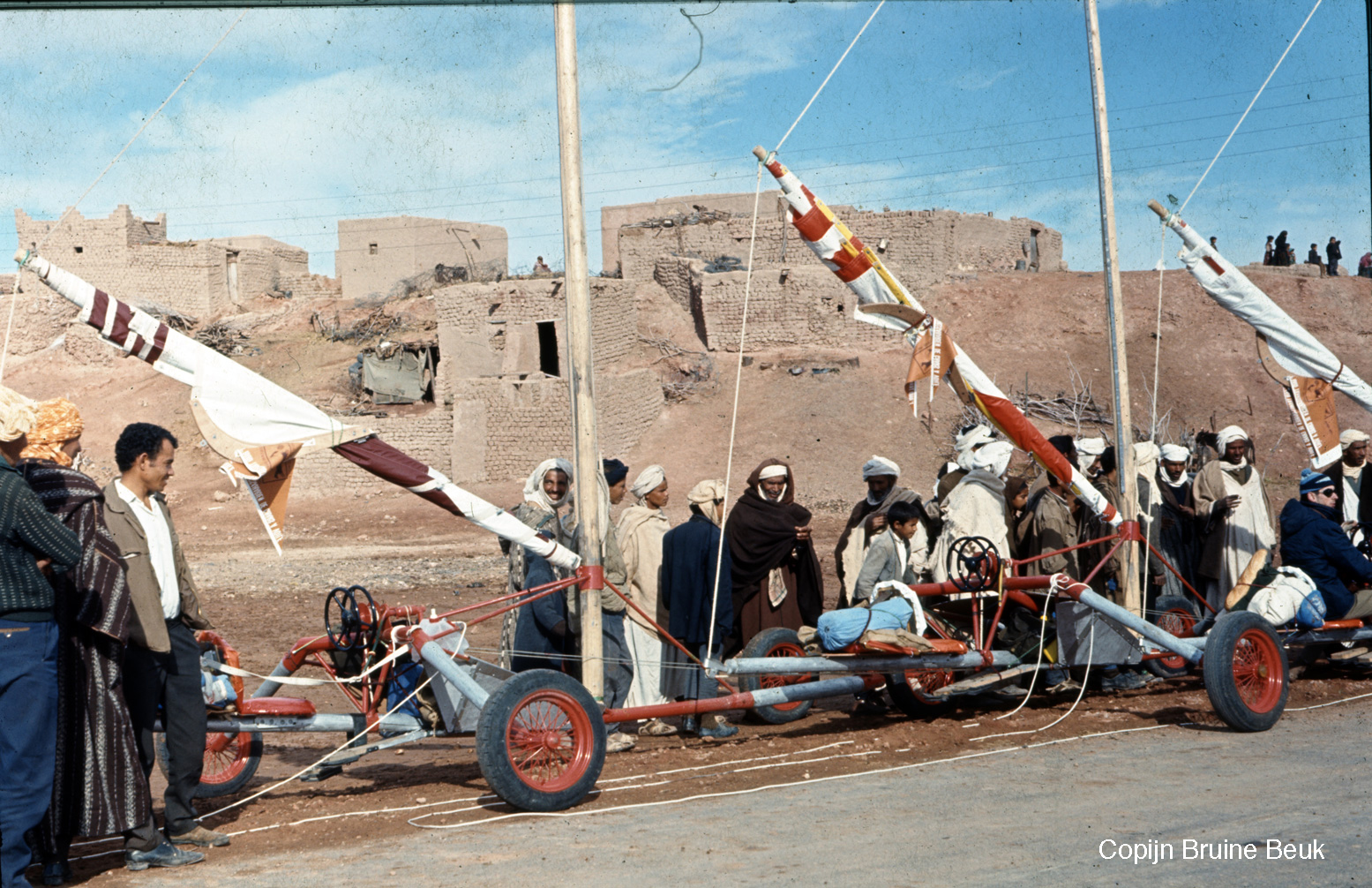
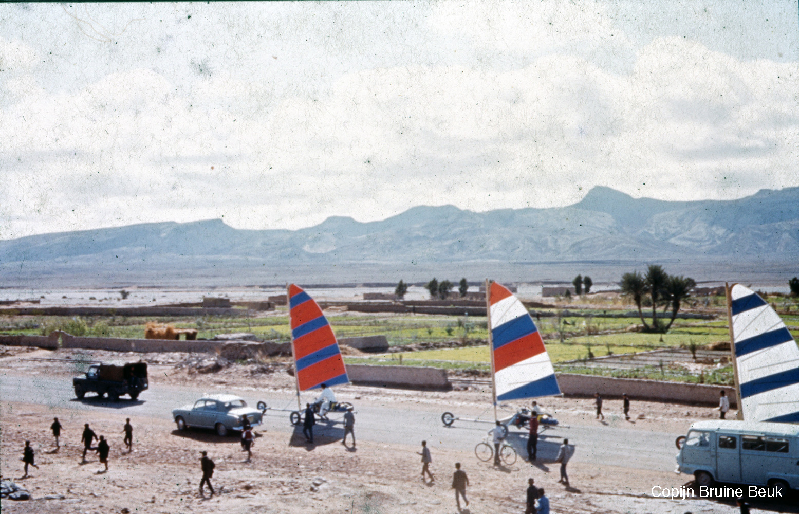
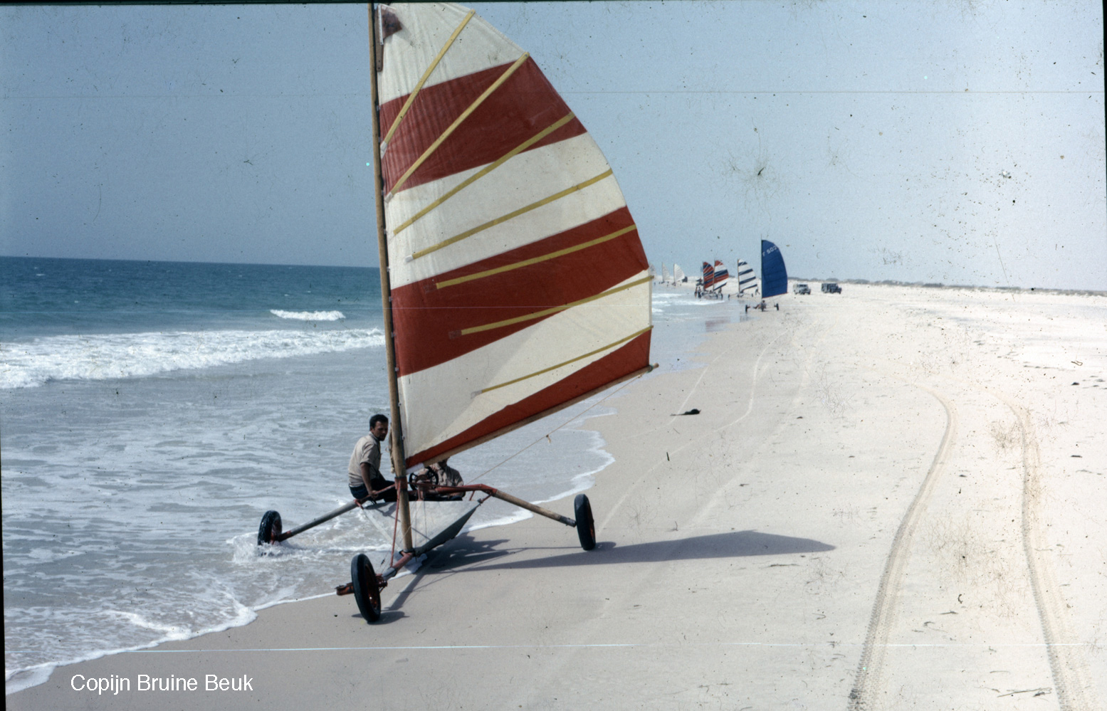
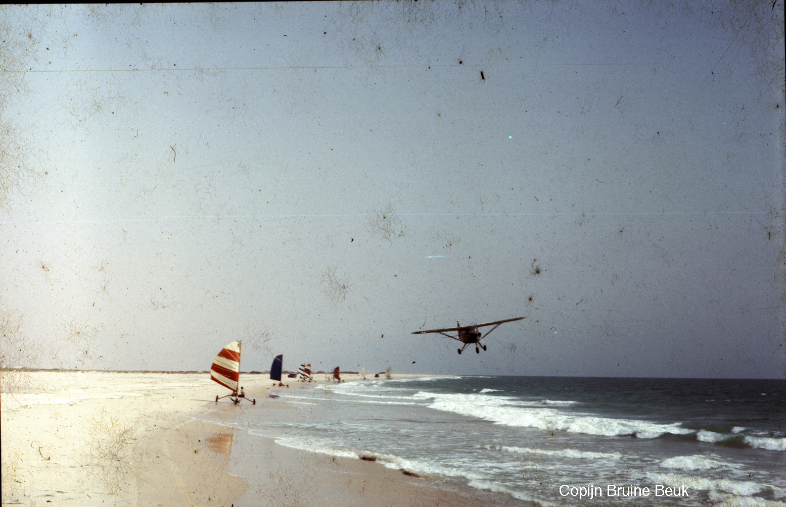
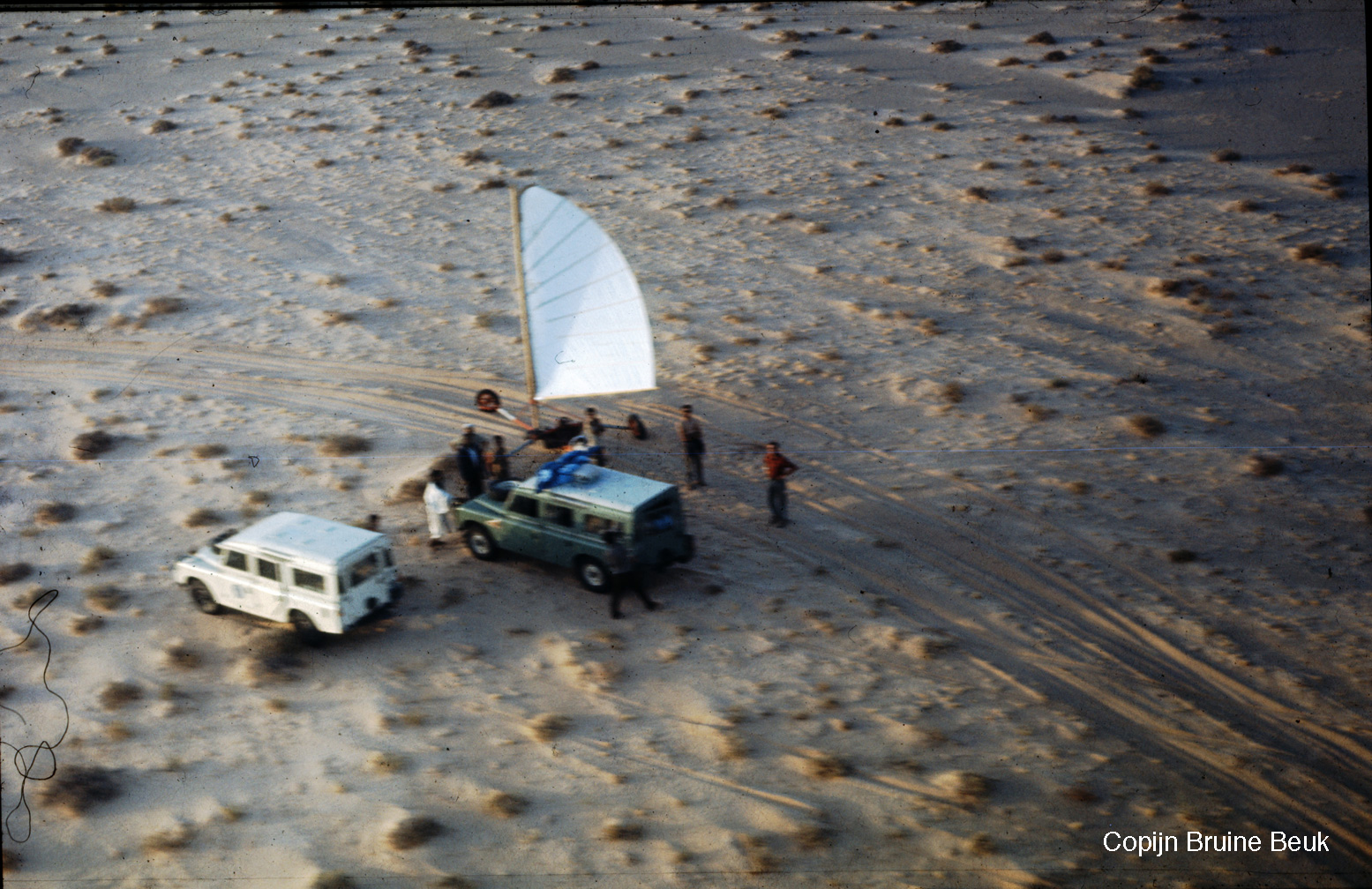
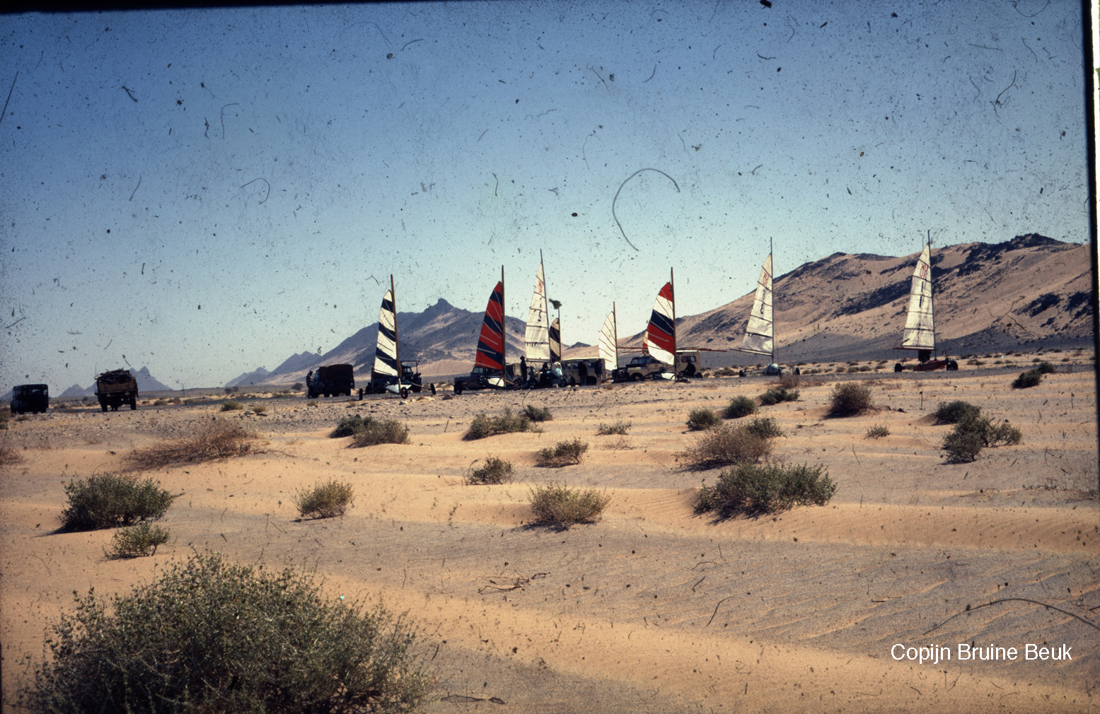
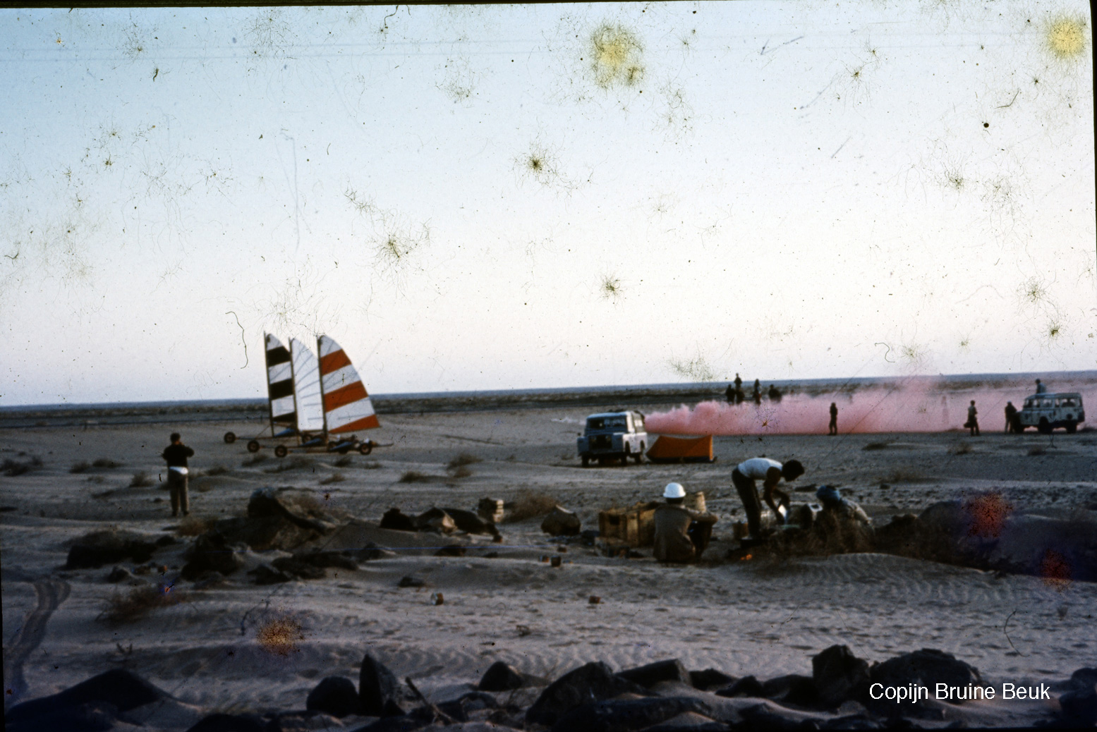
Organised by French ex-army Saharienne, Jean de Boucher, in February 1967 twelve land yachts with pilots from half-a-dozen countries set off on a 2500-km rally from Colomb Bechar (then linked by rail from Oujda on the Mediterranean) to Nouakchott on the Atlantic coast, at times following today’s recently reopened Tindouf Route via Algeria. It seems the race element of the rally was abandoned after some 2000km in Zouerat following several DNFs, but some carried on down the coast, cutting across what was then Spanish Sahara (‘PFZ’), on to the beach at Nouamghar and down the beach to Nouakchott. At this time most of Mauritania’s population still lived in the desert as nomads. The rally was supported by a couple Land-Rovers, small planes and surviving French military garrisons with which General de Boucher presumably had good connections.
The adventure featured in the November 1967 issue of National Geographic magazine (left, right, below). A couple of images are used here; read the full 30-page article scanned on the Extreme Kites website. There are more reminiscences here by American competitor, Larry P featured on the magazine’s cover.
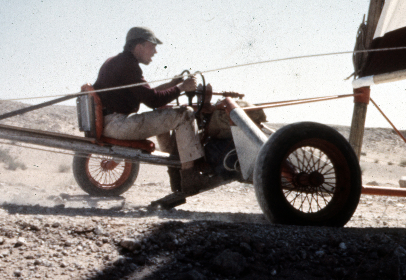
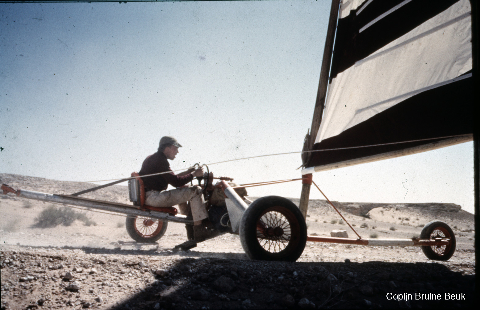
Thanks to Dutch participant, Copijn Bruine Beuk for turning me on to this little-known story and sharing his own pictures of the event (below). Besides hundreds of punctures, as the article recalls, early on Copijn had a close shave with an overhead electricity wire – luckily it wasn’t live. The same happened to a few others who ended up with snapped masts. Once it gets going, a land yacht can hit 60mph or more, but back then brakes added up to little more than a hinged footboard you pressed into the dirt (left), like pressing your feet on the ground to slow an out-of-control pushbike. So you can see why half the field DNF’d. Other hazards included side gusts blowing a land yacht over – February-March were chosen as the time of the strongest northeasterlies. Note also the twin steering wheels: one to steer the front wheel and the other to adjust the sail’s trim: pressing on the footbrake for all your worth, that’s quite a lot to think about when hurtling towards a steep oued bank or into a small dune field. Makes desert biking look positively benign!
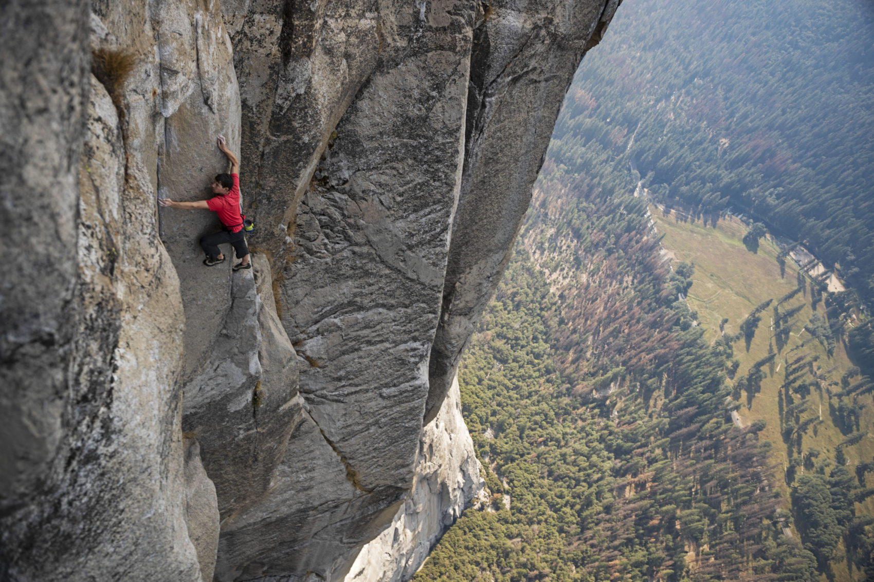
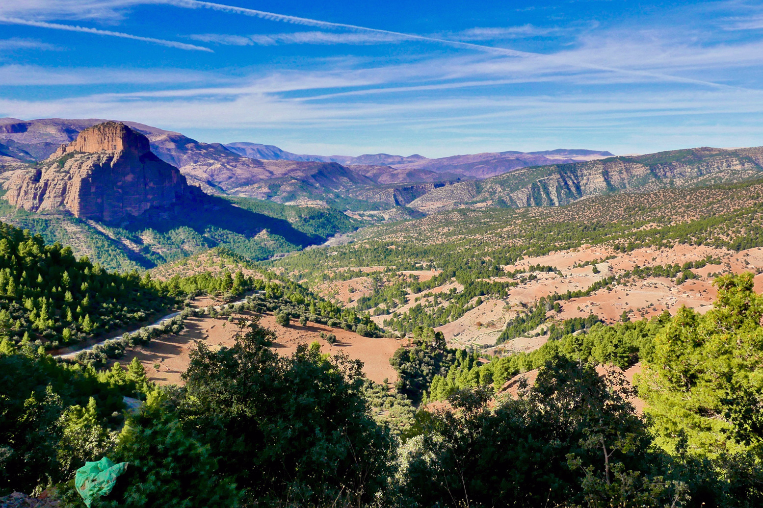
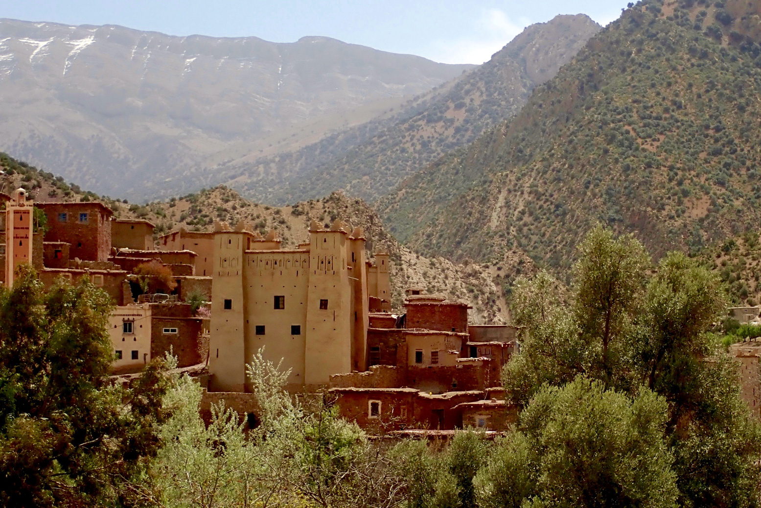
‘Free Solo’ is a documentary covering Alex Honnold’s mind-boggling, rope-free ascent of El Capitan in Yosemite, California in 2017 (left). If you’ve seen it you may recall that, among other places, Honnold practised on a hidden cirque of cliffs surrounding the scattered hamlet of Taghia, buried about as deep in Morocco’s High Atlas as you can get. A couple of rudimentary gites cater for visitors but, even among Moroccan know-alls, unless you’re a rock climber you’ll have never heard of Taghia. The only way in is a four-mile mule trek through a canyon from the valley head at the equally obscure outpost of Zuweiat Ahansal, an hour or two’s ride south of Rocher de Mastfrane, better known as the ’Cathedral’ (below).
I rocked up at Zuweiat one lunchtime just as a group of young American climbers were spilling out of a taxi, and continued over the bridge to the edge of the old town. I pulled over for a snack and, unsure of the way and not wanting to blunder on, asked a passing local whether it was possible to ride a bike to Taghia and if yes, which way?
‘Oh no’ said the old man. ‘You can only get there on foot.’
I finished my snack and thought it over. Back by the bridge, I sought a second opinion from some more worldly looking dudes hanging out outside the post office. They were eyeing up the new, North Face-clad arrivals and one spoke good English.
‘Yes, I saw you pass and was going to say, you can’t ride your moto to Taghia.’
It turned out he’d worked on the Honnold doc as well as other National Geographic features (below) and, reading his manner with my finely tuned bullshit detector (which they now hand out free at the border), it didn’t sound like the usual bragging. After that, he switched seamlessly into sales mode, offering lodgings and guides.
‘Maybe next time’, I said. I genuinely did hope to visit the mysterious valley, but the weather forecast was a bit shaky for the next couple of days. I wanted to get out of the mountains, not stuck in them.
A year or two earlier a bike-riding climber who’d visited Taghia suggested to me that a small bike (like my Himalayan) could probably reach the cirque following the riverside mule path.
While that may be true, I figured just because I could, did I have to – or even, should I? The local guide may merely have been protecting his mule-trekking services, but I like the idea of leaving some of the world’s wild corners unspoiled by the putter of mechanized transport. As I was about to be reminded, there’s plenty to see in Morocco on a bike or in a 4×4, but there are many places in the world which are best reached by less intrusive human-powered transportation. That’s what makes them special.
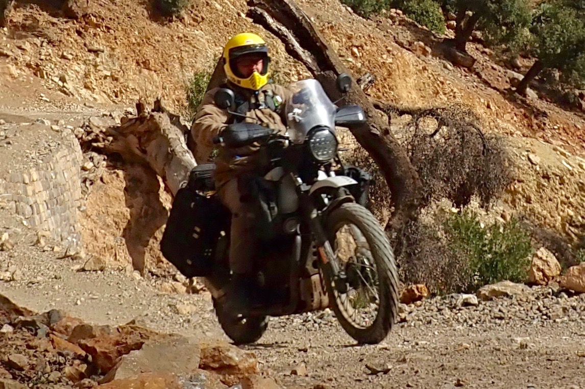
2024 and I heard they’d finished the track into Taghia. James and I were in the area recce-ing route for the M4 book. A few months later I wrote this in Adventure Rider magazine.
Add a few wraiths of mist plus some digitally enhanced pterodactyls, and the narrow chasm which leads into the Taghia gorge could pass for a scene from Game of Thrones. Burrowed deep in Morocco’s High Atlas, the isolated Berber hamlet beyond was only accessible by mule. So I was told in 2018 when I tried to reach Taghia on my Himalayan. Now they’ve carved a motorable track, so we rode down through the defile, crossed and recrossed a stream, and found ourselves in a small cirque or valley head surrounded by sheer, 3000-foot limestone terracotta crags. I’d not seen a place like this in Morocco. Alex Honnold came here to train in seclusion, prior to soloing Yosemite’s El Cap for the Free Solo movie. He did so by free climbing all three of Taghia’s hardest faces – 6000 feet of big wall soloing – in a single day. “It’s pretty freakin’ next level” he observes with characteristic humility in Before Free Solo, Edge of the Unknown’ (on YouTube).
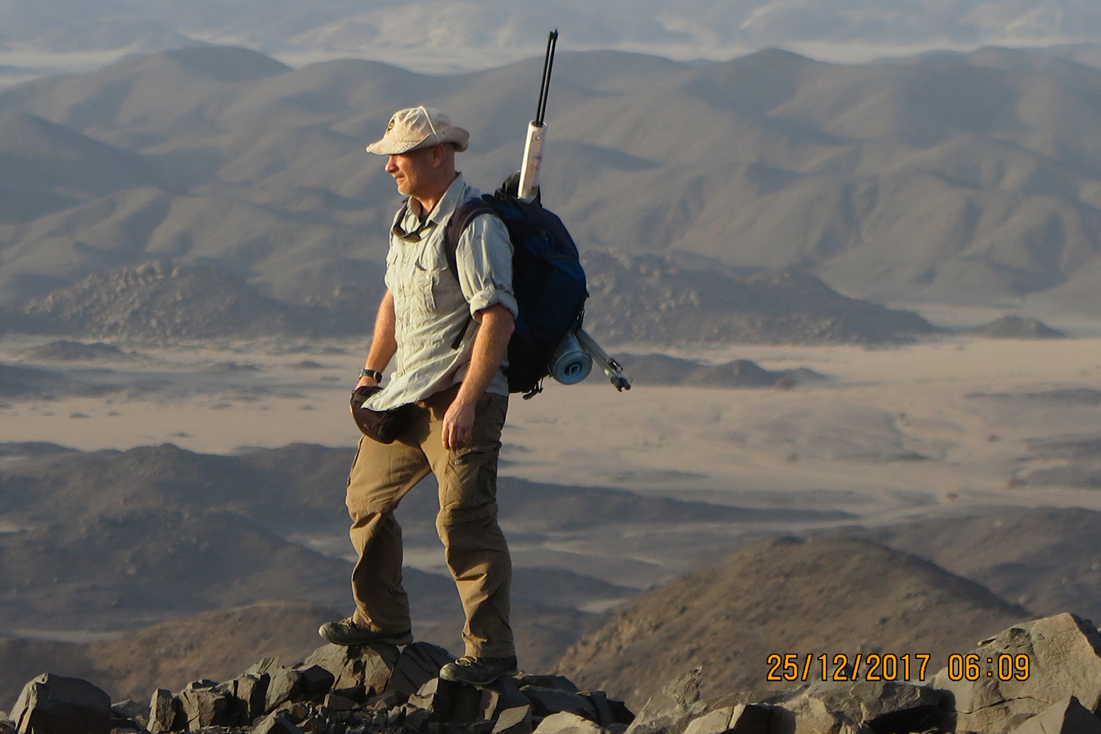
Ginge Fullen (right) is a Guinness-record holding mountaineer and adventurer who among other things, has climbed the highest peak in every African country. Bir Tawil has long been on his radar and the recent division of Sudan sees him planning to visit the Deriba caldera in Darfur in the near future.
In the northern Nubian desert between Egypt and Sudan lies Bir Tawil, an unoccupied 800-square mile quadrangle claimed by neither state. It’s a bureaucratically difficult and potentially dangerous place to reach but has been on my list for some time.
Terra Nullius is a Latin expression for ‘nobody’s land’; it was how Cook described Australia in 1770. Here in the Nubian Desert, it originates from a bizarre situation stemming from the simplest of borders: a straight line along the 22nd parallel drawn in 1899 when Britain formed Anglo-Egyptian Sudan following Kitchener’s campaigns in Sudan. In 1902 Britain sought to modify that boundary to reflect the actual use of the land by the region’s tribes. It counters a complaint commonly made these days about Foreign Office officials blithely marking maps with rulers and in part causing the current grief in the Middle East and Africa.
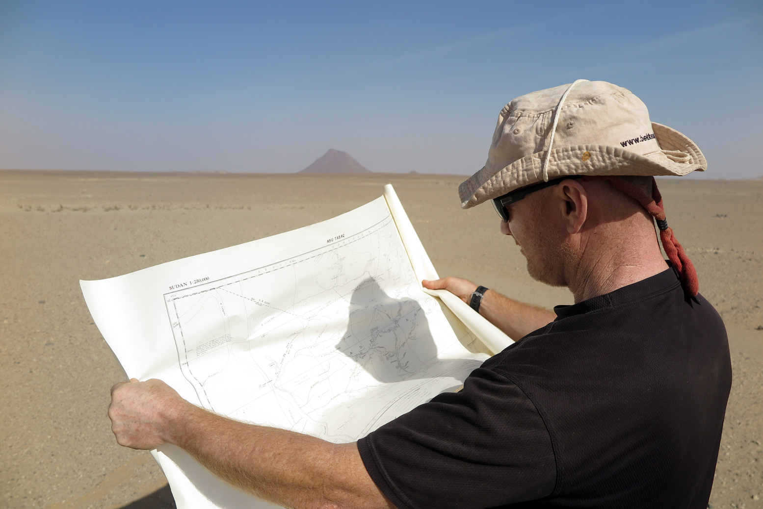
Bir Tawil lies below the 22nd parallel but the land was traditionally grazd by the Ababdu tribe from Aswan in Egypt. Similarly the adjacent Halaib Triangle, a much bigger area to the east and above the parallel was placed under British Sudanese control as its Beja inhabitants were culturally and ethnically closer to Sudan. Today Egypt resolutely claims the 1899 border including the Halaib Triangle, whilst Sudan sticks to the administrative border of 1902. As a result both claim the Halaib Triangle with its 130 miles of Red Sea shore, but neither are interested in the barren wastes of Bir Tawil. Bir Tawil is not an easy place to reach, requiring permission from either government to visit; a two-day trip into the desert risking encounters with armed gangs or smugglers. I opted for Sudan as I wanted to get a feel for the country to which I plan to return to climb the highest peak in the troubled Darfur region. (In 2004, before Sudan divided to form South Sudan, I climbed Mount Kinyeti, then the highest point in that country). In Khartoum I organised everything through Tour-Sudan agency. The owner Midhat Mahir was by far the most pro-active individual I contacted and as it turned out, the best connected. In Sudan government permits are required for everything from registering lodgings outside Khartoum to photography and even permission to buy a detailed map from the Surveyor’s Office. The Sudanese clearly like their paperwork as well as keeping track of you. I needed a dozen copies of my travel permit to hand out to checkpoints along the way.
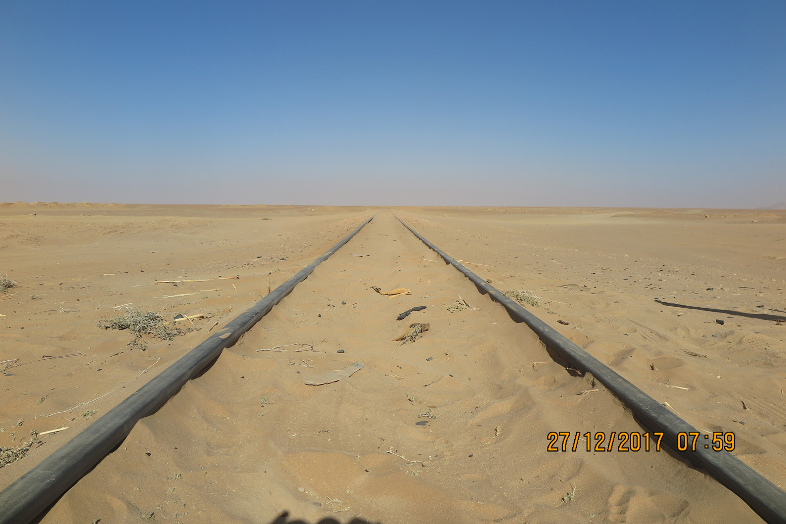
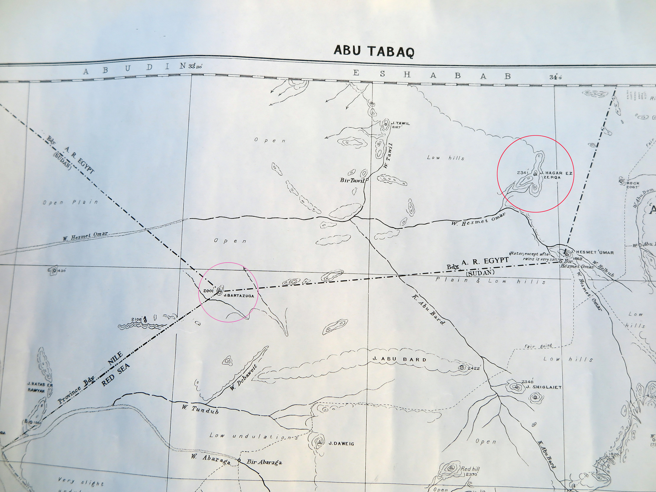
The plan was a week’s trip leaving me two days in Bir Tawil to locate and climb the highest point. Midhat’s brother Moez would accompany me with two drivers on the 500-mile trek north of Khartoum, around half of it on tarmac the rest across the Nubian desert. Forget snakes and scorpions or the possibility of breakdown and never being found, the road to Abu Hamed felt like the most dangerous part of this little adventure. Terrible driving and being forced off the road by unlit vehicles was the nearest brush with death I’ve had in a while. In Abu Hamed we filled up with fuel and water and a few miles north of town left the road and crossed over the railway lines for the last time. I input some coordinates from Grant, my go-to person when tackling unclimbed peaks in dodgy countries. You can’t beat the thrill of heading into a remote place with little available information. We headed north along flat desert towards the Wadi Gabgaba which would bring us to within 20 miles of our objective. Very soon we started to pass gold miners and for the next hundred miles found the desert had been turned upside down. A gold rush was underway and several thousand men were working hundreds of excavators while individuals were trying their luck with metal detectors. All unlicensed and unregulated, with tons of litter blew across the desert it looked very ugly indeed. Hoping to keep a low profile, that night we camped well off the main route and away from the miners. In Khartoum I’d gotten hold of a colonial-era 1:25,000 map from the National Survey and the next morning we found ourselves on old routes marked as ‘fair going’ by surveyor W Jennings-Bramley back in 1925. By camel he might have covered 20 miles a day; we did the same distance in just an hour. Our initial destination was the 609-metre peak of Jebel Bartazuga marking the southernmost corner of the Bir Tawil quadrangle. It came into view, very prominent in the otherwise flat desert. I thought we had left the last of the gold miners but I was wrong; a camp had set up here too on the very boundary of Bir Tawil. On my return leg I climbed Jebel Bartazuga, topped with an old trig point by the British to mark the boundary when they surveyed the area. Flags have also been placed here from others who’ve recently been laying claims to the territory, but they’ve all long since blown away. Probably the first westerner here in recent times was former Guardian journalist Jack Shenker in 2011. American Jeremiah Heaton followed in 2014, claiming the area as the ‘Kingdom of North Sudan’, thus delivering on a promise to make his daughter a ‘princess’. He’s in dispute with a Russian called Dmitry Zhikharev who made similar claims, and in 2017 Indian adventurer Suyash Dixit planted a tree and put up yet another flag. There are other claimants including the ‘Kingdom of the State of Bir Tawil’ with its own national anthem and the ‘Empire of Bir Tawil’. I wasn’t interested in such claims but was of course intent on climbing Bir Tawil’s highest peak which I believed had yet to be done.
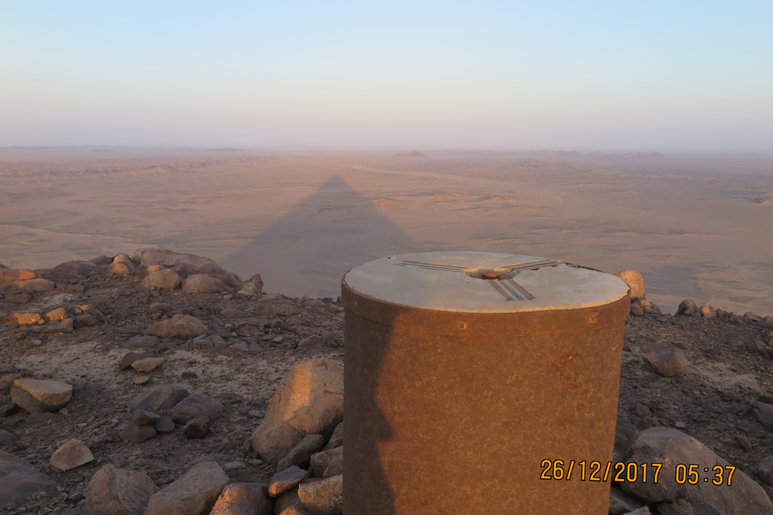
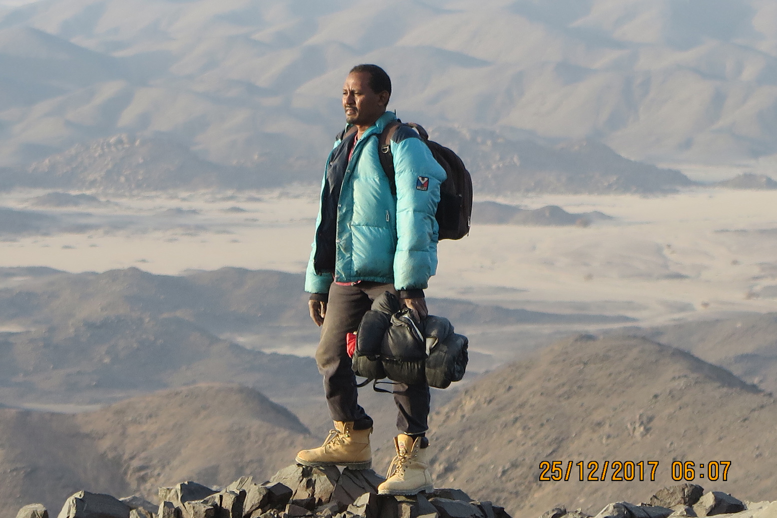
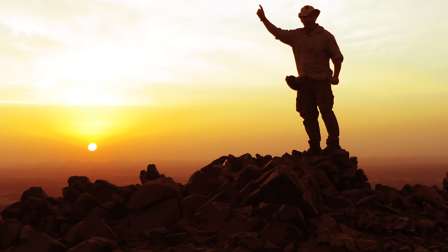
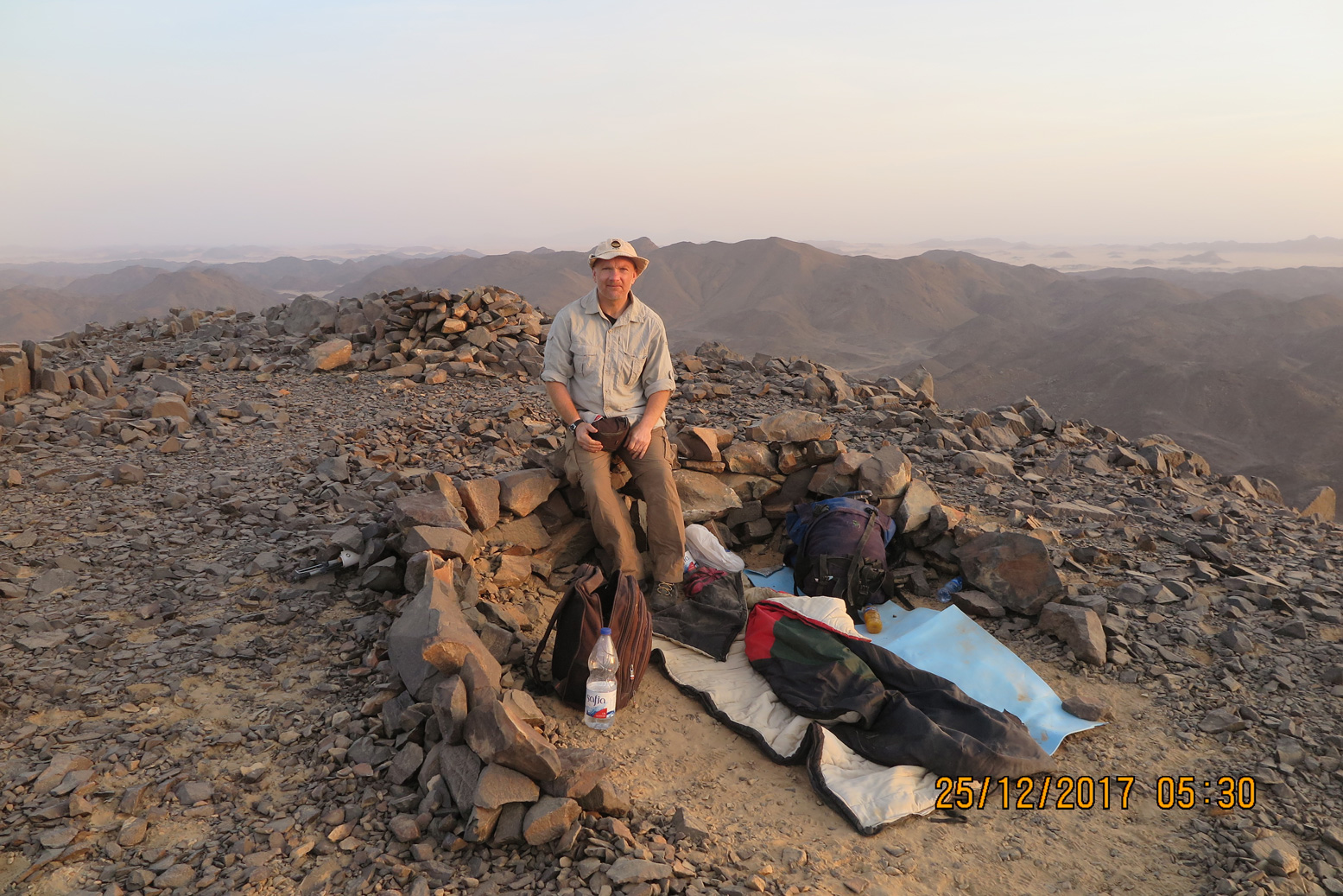
Once over the border we headed towards the eastern end of the territory and Jebel Hagar el Zarqa. On the 1925 map it was shown as the highest point in the land at just 705m (2313’), but one man’s hill is another man’s mountain. It lay some 30 miles away and we headed straight for it; in reality zigzagging through a maze of sandy wadis. Just five miles away our target came in sight and, as I’ve said before on my travels in Africa, once I was so close it would take an army of natives riding a herd of wild elephants and throwing landmines to stop me. Given that we saw no one during our time in Bir Tawil, I felt confident. We weaved our way nearer and nearer and by mid-afternoon on Christmas Eve parked up at the base of the mountain. My aim was to sleep on summit but Moez my guide warned it might be chilly. It may the mid-winter but this is still the Sahara so I replied I’d probably survive but suggested he took his big down jacket. Around 4pm, as the sun’s heat diminished we set off, following the edge of a gully until we met a ridge about half way up. Here it was mostly scree but in less than an hour we were on the summit. With a new African peak ticked off, Moez and I shook hands. Low hills surrounded us and Egypt’s actual border was just eight miles to the north. There was a cairn here so I was not the first, but probably the first in a very long time. Moez suggested we drop down a little out of the wind but he knew what my answer would be: we would build a windbreak right on the summit. We set about clearing an area for our wall and once done, even Moez seemed reassured. The wind did pick up later but our wall did its job.
That night the stars were bright as they always are in the desert and some 100,000 light years away The Milky Way beamed over us like a highway to another world. I envied the future explorers and slept well in our starlit bedroom. As often, the desert brings on reflective thoughts. I was now 50 years old; where had all the time gone? It’s scary that you’re over half way through your life and find yourself looking more to the past than the future. When you’re young the world is infinite and filled with mystery – immortality beckons. As years roll on the world remains thankfully mysterious but feels less big and the impression of immortality slips through your hands. Death was something that only happened to other people and time was unlimited so you don’t push yourself or do the things you promised you would. But once you grasp mortality good things can result – the ticking clock helps you focus on new challenges. The sun rose around six and was all ours to see; our bivi on top of Jebel Hagar had served us well. After a few more photos we headed down for our Christmas breakfast of coffee, porridge and eggs. I spent the next two days exploring wadis I’m sure no one has seen in decades and hiking a few other peaks to make sure there was nothing higher. With my short visit to Bir Tawil coming to an end, we headed back to Jebel Bartazuga for our last desert night. I enjoyed my time back in the Sahara; it reaffirmed my view that there’s still adventure to be had in this world, you just have to get out and find it. The greater the effort, the more worthwhile the journey. A good friend of mine who died on Everest in 1997 certainly lived his life that way. Mal Duff was old enough to be wise yet far too young to die. His gravestone bears the following words from a poem by fellow Scot, James Graham and twenty years on, it feels a good time to remember his epitaph:
He either fears his fate too much, Or his deserts are small, That dares not put it to the touch To win or lose it all
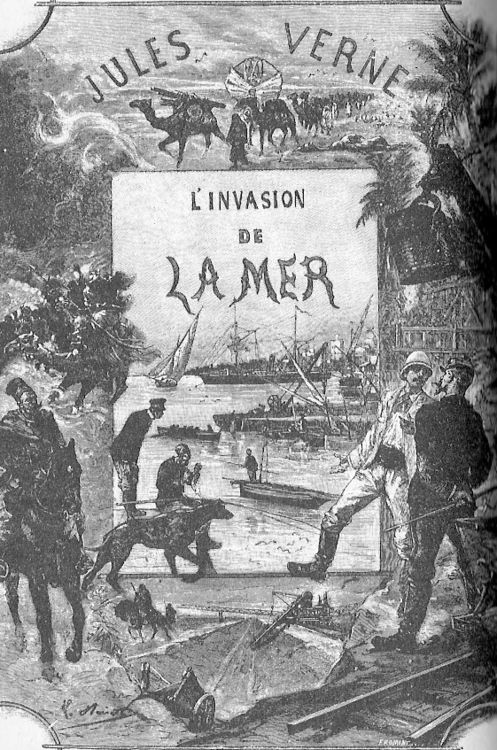
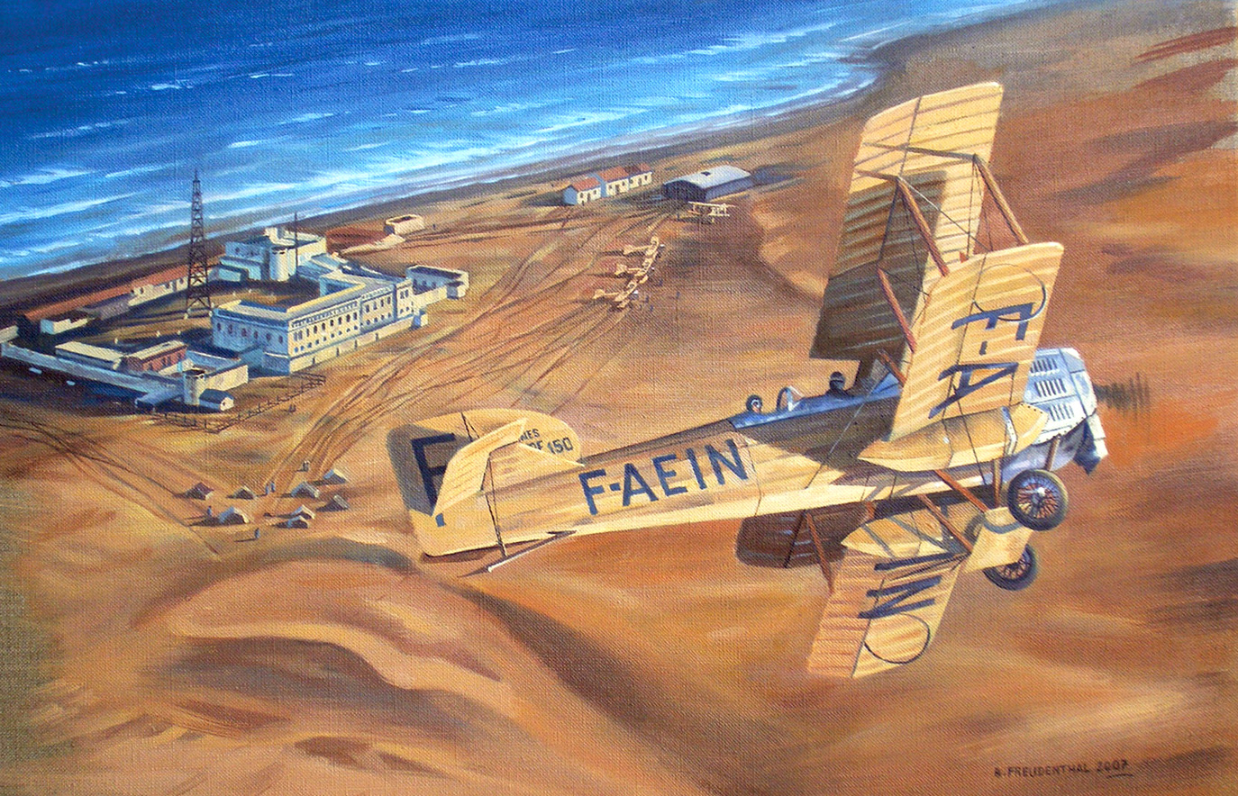
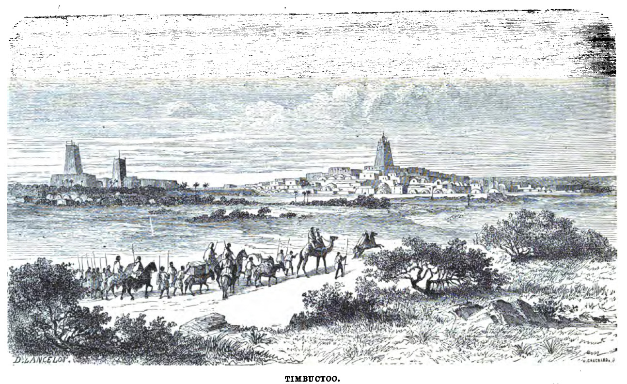
… I had reason to believe that there existed, in the Western Sahara, a vast depression which might be submerged by the waters of the Atlantic, thus opening a navigable way to [Timbuktu]…
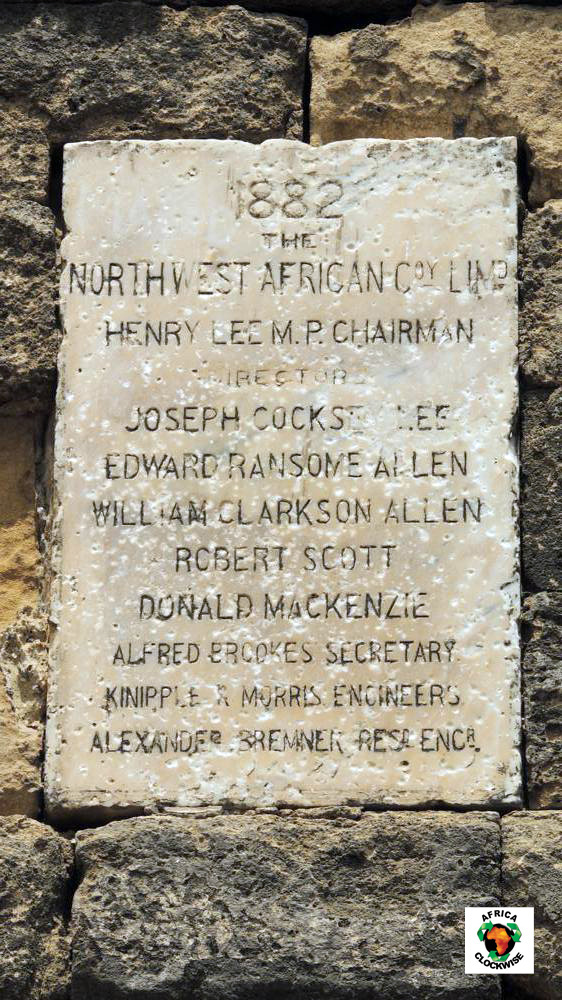
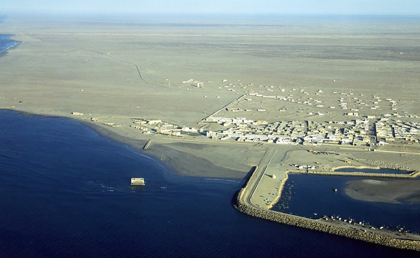
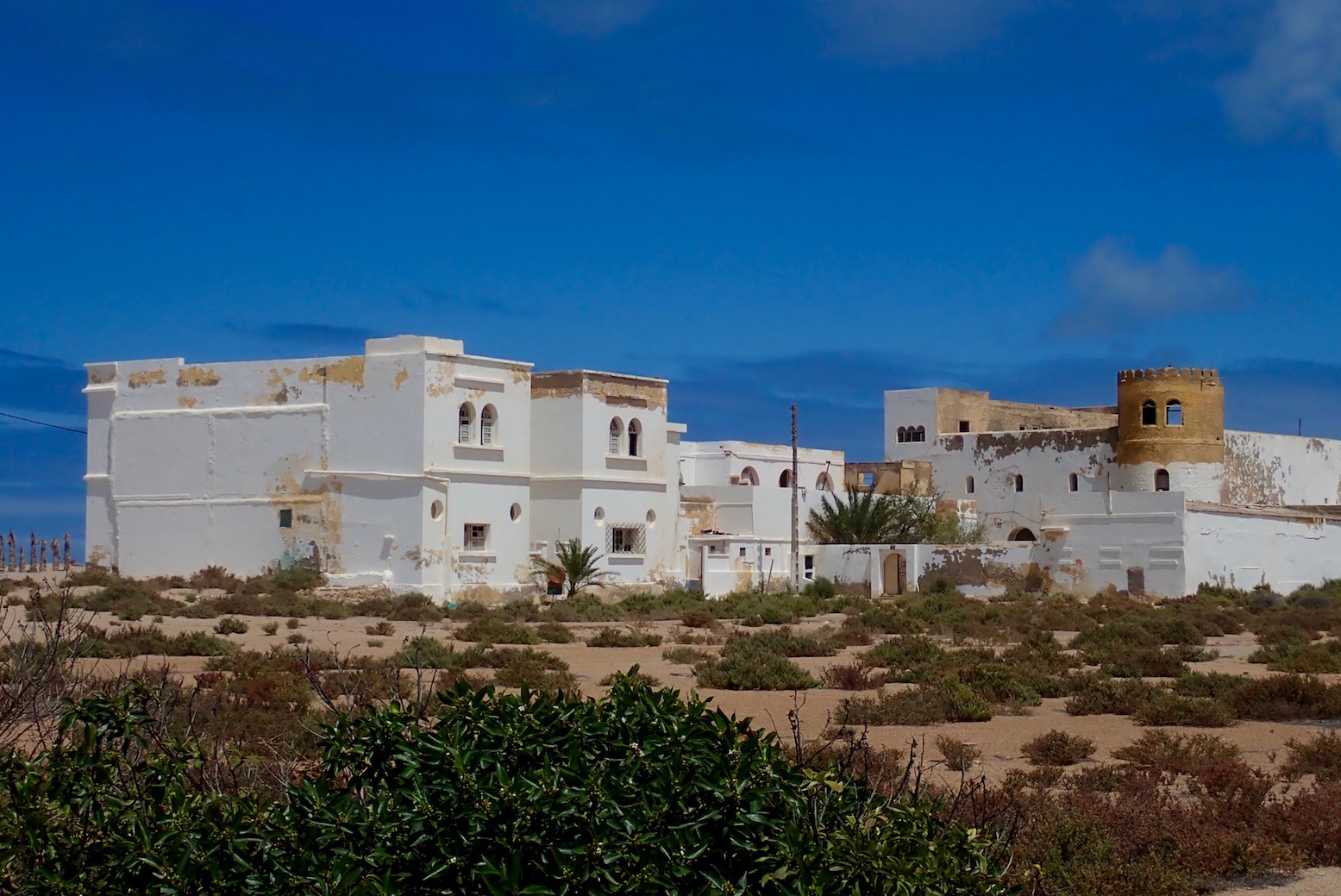
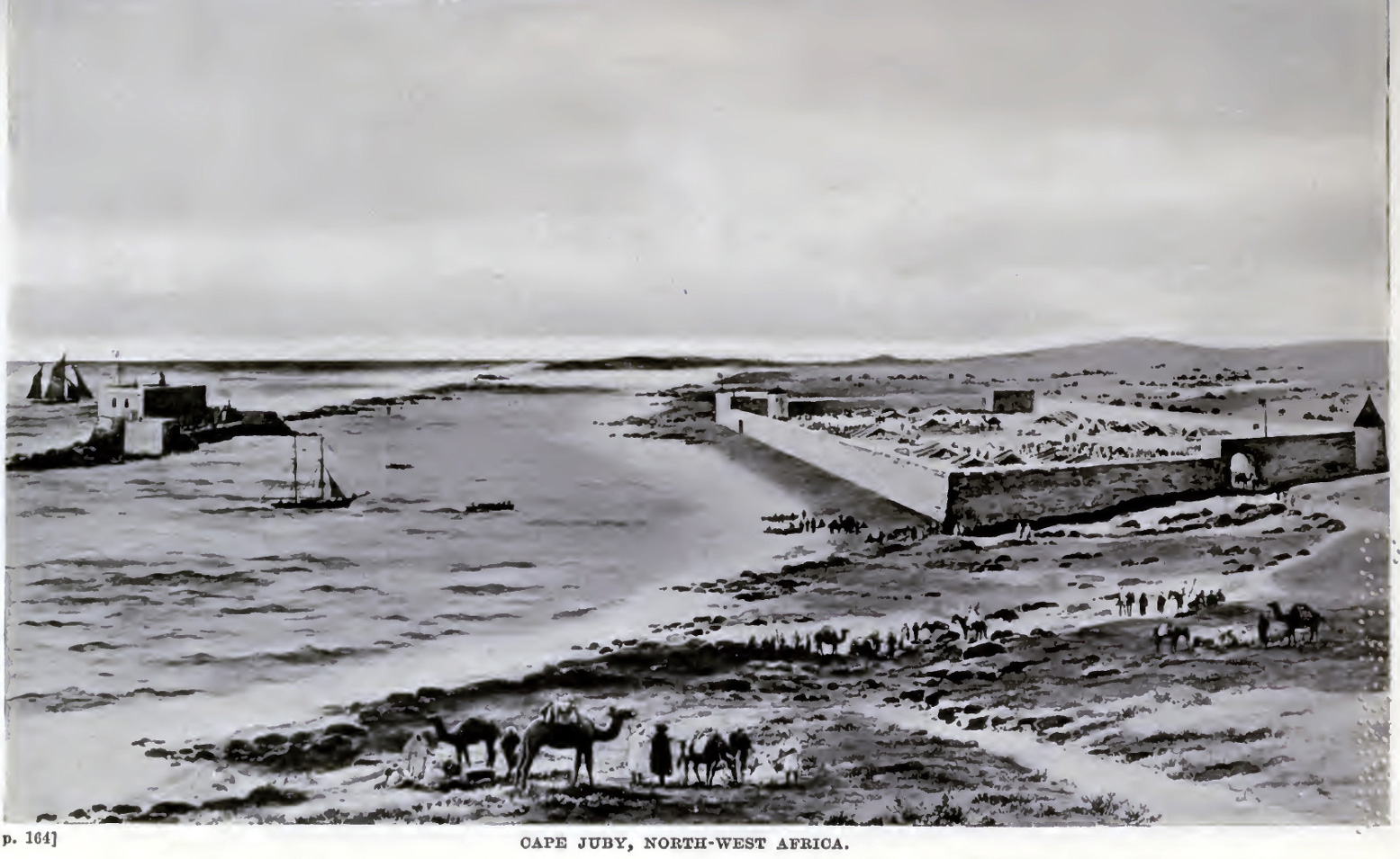
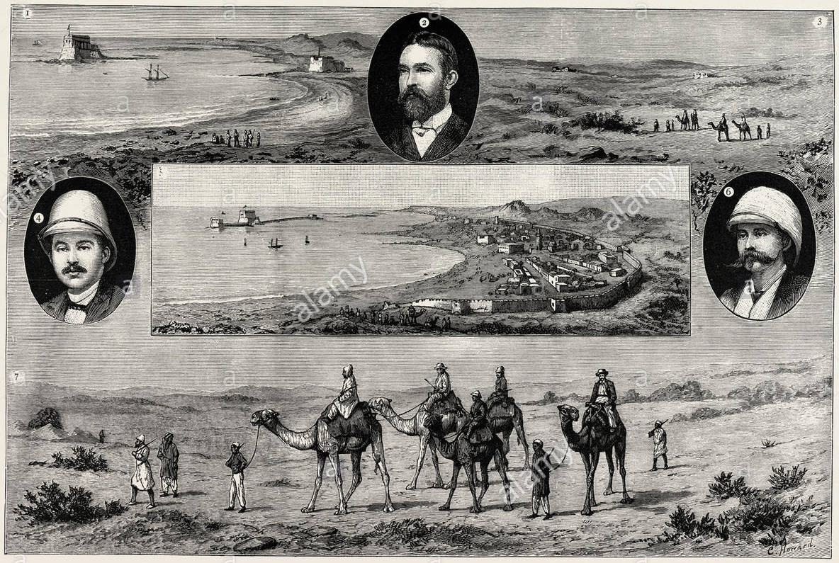
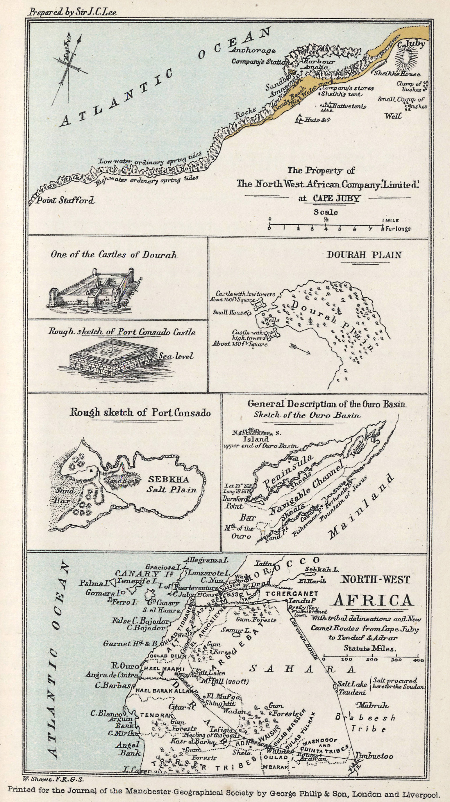
Visit Tarfaya on Cape Juby and just offshore you will see the curious Casa del Mar fort, beyond the St Exupery monument. Port Victoria or Mackenzie’s factory are other names for the trading post of the North West Africa Trading Company, established by Scotsman, Donald Mackenzie in 1882 during the ‘Scramble for Africa’.
Mackenzie’s venture hoped to capitalise on the recent westward swing of the trans-Saharan caravan trade emanating from Timbuktu, by intercepting caravans before they reached the terminus at Wadi Noun (near today’s Guelmin). In fact, in a decade or more the NWAT Co barely covered its costs after compensation was finally agreed against an earlier raid and to abandon the post in favour of the Moroccan sultanate.
It reminds you that colonisation at the time wasn’t purely a state affair, where armies marched off to conquer distant lands and bring back the spoils. Ahead of them strode adventurer-entrepreneurs with funds raised from venture capitalists and who gambled everything on striking it rich. It was their reports, or better still, securing a government charter to supply a commodity or service, which preceded more cautious colonisation, very often spurred by other European rivals nosing around for an as yet unclaimed slice of the cake.
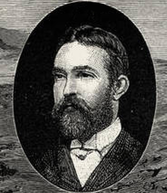
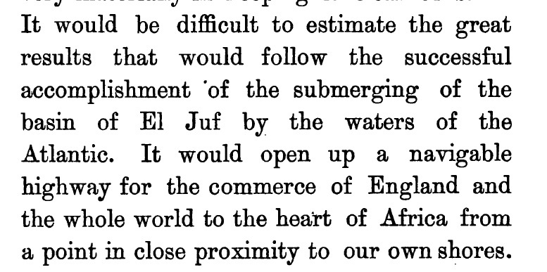
It’s hard to find out much about Donald Mackenzie, but in 1877, a few years before he set up the North West Africa Trading Company, he had a far more radical idea to capitalise on the trans-Saharan trade. He proposed nothing less than flooding the interior of the Sahara from the Atlantic so that, with the addition of a few canals which had proved so successful in Britain prior to the age of rail, ships could sail directly to Timbuktu and the Niger river in a matter of days, avoiding the arduous overland journey of weeks. As a side benefit the flooding would ‘green’ the Sahara, enabling agriculture to thrive across the wind-blown sands.
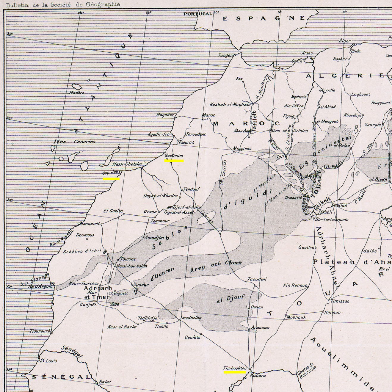
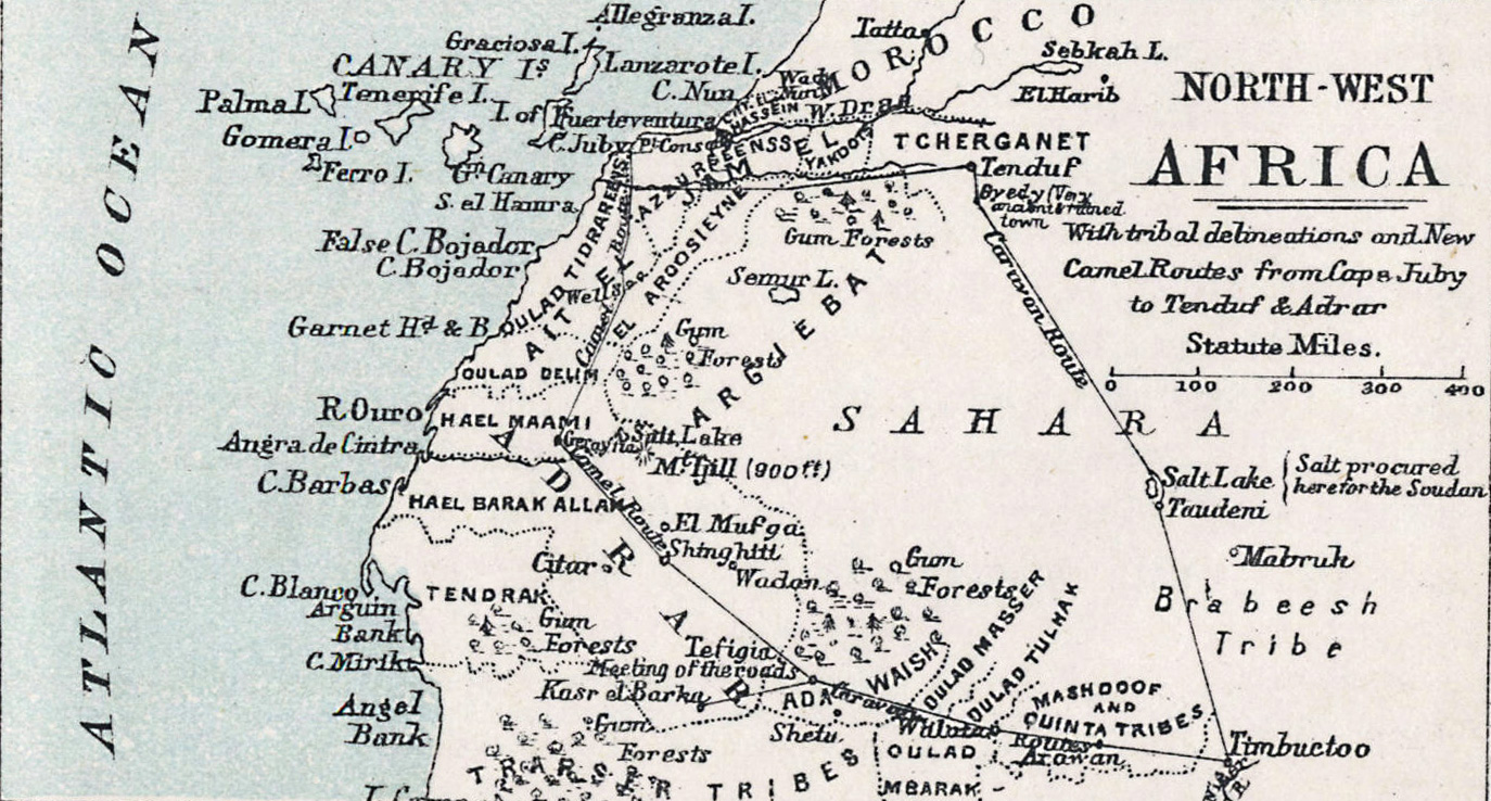
This was the era of grand engineering projects like the Suez Canal (completed 1869) and the Panama Canal (first serious attempt 1881). A canal to the trading heart of West Africa could be a similar commercial coup. It’s hard to think what gave Mackenzie this idea, other than conflating lurid traders’ descriptions of El Djouf (left) with the small depressions or sebkhas found near Cape Juby. The biggest of these is the Sebkha Tah, some 55m below sea level and just 15km from the Atlantic, but still no bigger than Malta. For some reason he believed that the vast El Djouf (part of the million-square-kilometre Majabat al Koubra or ‘Empty Quarter’) was one huge depression which had been connected to the Atlantic via the Seguia el Hamra or some such, but had become cut off and dried out.
Mackenzie had never actually travelled in this area (other than a camel tour up to Port Consado (present day Khenifiss) and down to Layounne during the NWAT Co era (map above and right) but had read of other larger desert depressions in Tunisia and Egypt, similar to those near Cape Juby. All these basins held seasonally dry salt lakes which may have suggested that flooding was plausible. He believed an inland sea the size of Tunisia or Oklahoma would soon be formed, paving an inland seaway to Timbuktu.
Mackenzie diligently read up on all your great 19th-century Saharan explorers: Barth, Rohlfs, Caille, Duveyrier, Clapperton, and in 1877 published an exhaustive proposal [available online] to ‘The Presidents and Members of the Chambers of Commerce of Great Britain‘ stressing ‘the importance of holding commercial intercourse with the interior‘. Vividly detailing at third hand the riches, economy, geography and ethnicities in this corner of Africa, he firmly believed his northern route reaching down into the African interior was the key, avoiding the disease-ridden equatorial jungles and pagan tribes further south in favour of the more sophisticated vestiges of the West African Islamic states. Under his proposal, land distances for the annual camel caravans from Timbuktu would be halved, with Cape Juby just nine sea days from Britain. De Lesseps himself, the force behind the Suez and original Panama canals, supported the idea of Saharan flooding, believing a side benefit would somehow improve the European climate while greening the desert for agriculture.
Mackenzie also thought that trade and communications would help liberate the sub-Sahran population from the slave trade. And this wasn’t just a ploy to appeal to investors’ morals or religious beliefs – Mackenzie’s later work in East Africa long after the NWAT Company dissolved suggested he was always a genuine abolitionist.
According to his upbeat proposal (is there any other kind?) Mackenzie has it all worked out: do a recce to get the tribal chiefs on board at Cape Juby and Timbuktu, locate the channel in El Djouf and unplug that Atlantic cork. I have no doubt of the ultimate achievement of this project, he wrote in the proposal’s introduction. But investors seemed less keen and, were it even possible, you’d think by creating a shallow, hyper-saline lake, the only thing that would grow would be salt crystals. The fact is the interior of the Sahara, including the dune-filed expanse of El Djouf spanning the Mali-Mauritania border, is a low plateau some 3-500 metres above sea level. Someone ought to tell Conde Nast Traveler.
Mackenzie had slightly less difficulty finding investors for Port Victoria a few years later, and decade or three after that, Jules Verne fictionalised the idea of a flooded Sahara in his last published book, The Invasion of the Sea, set in Tunisia.
Present-day Tarfaya or Cape Juby, with Mackenzie’s fort visible offshore.
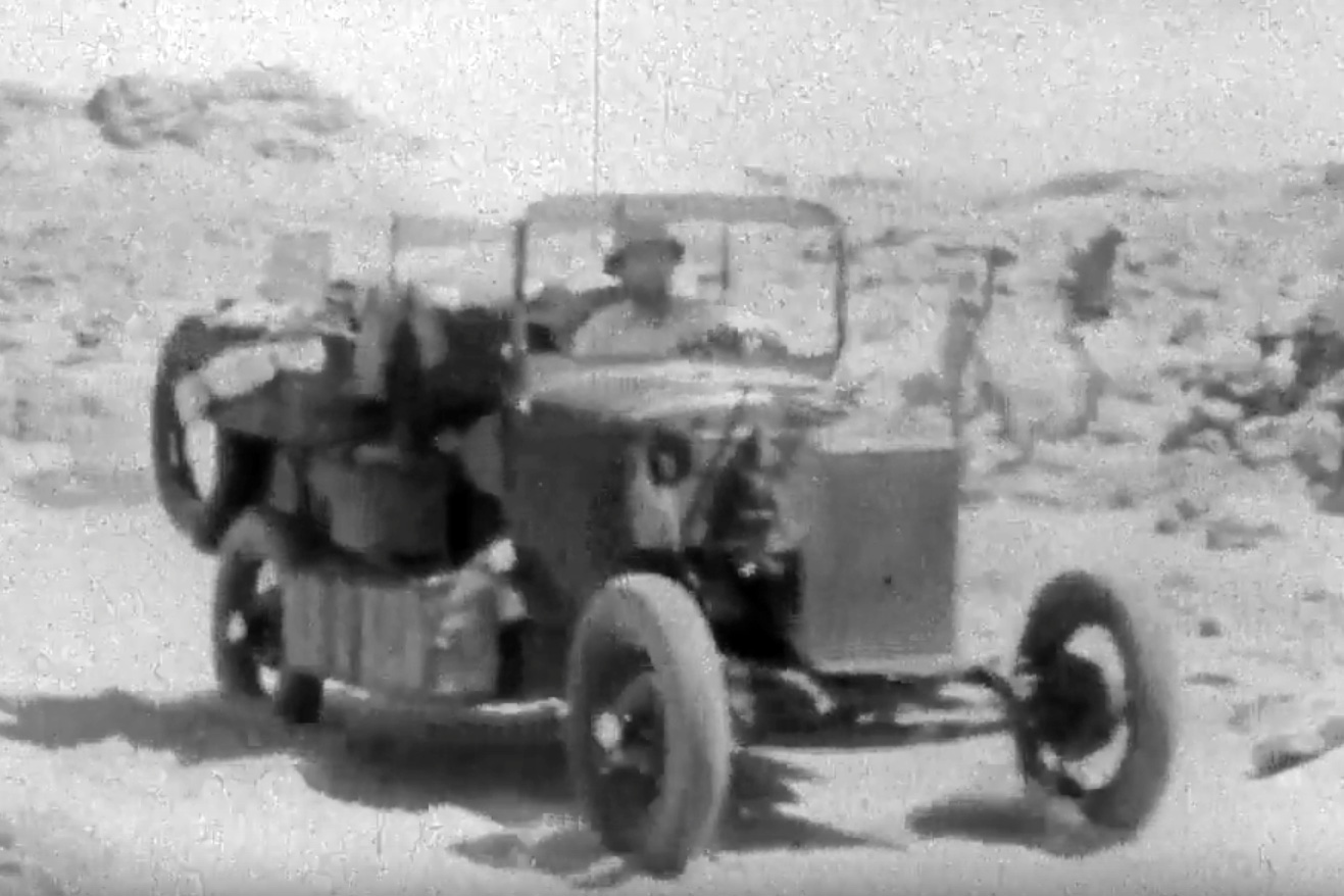
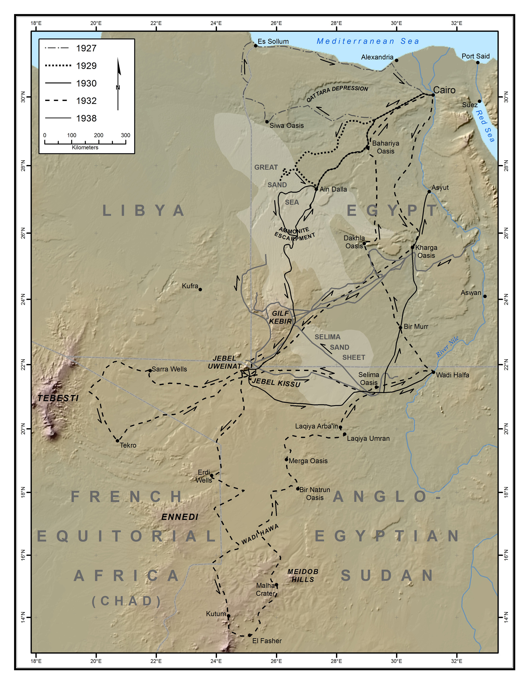
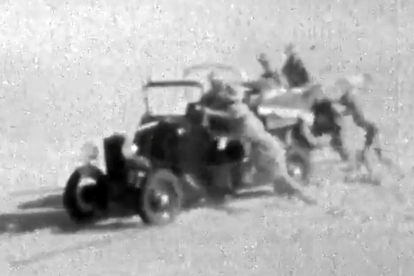
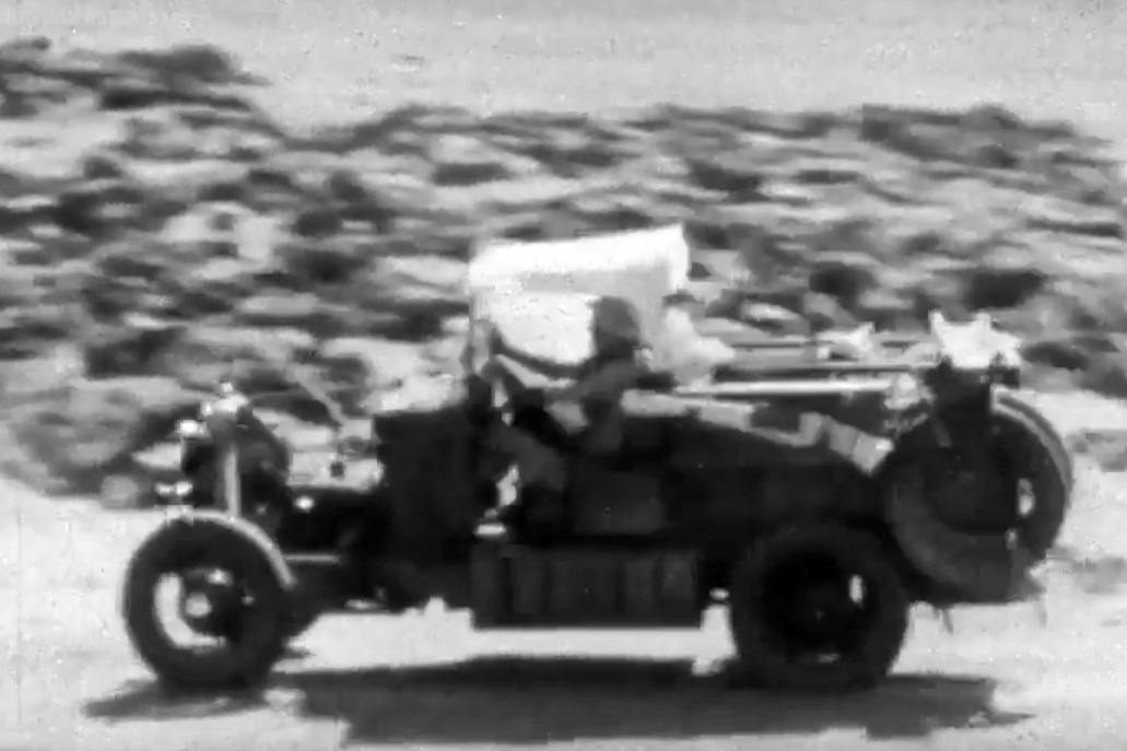
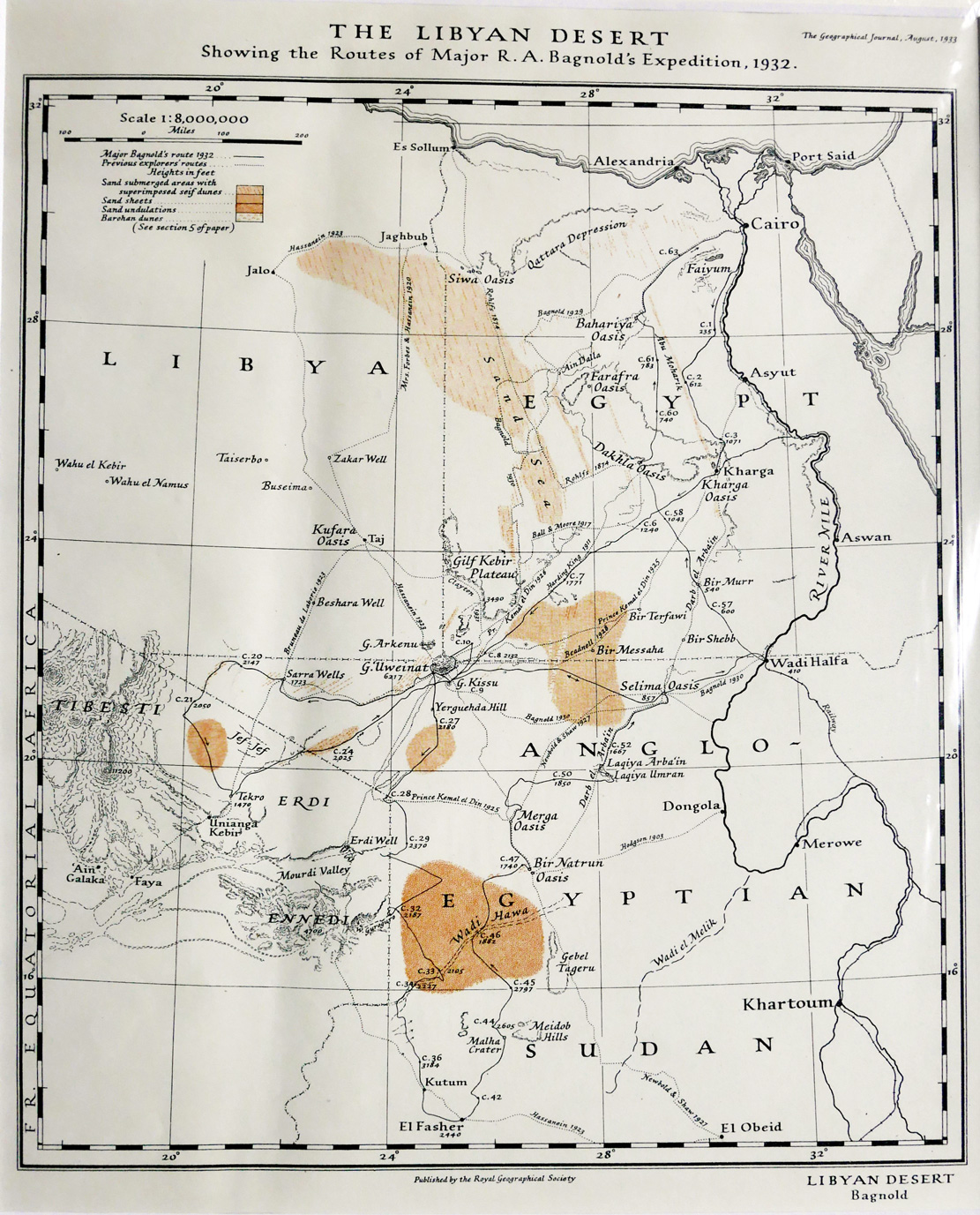
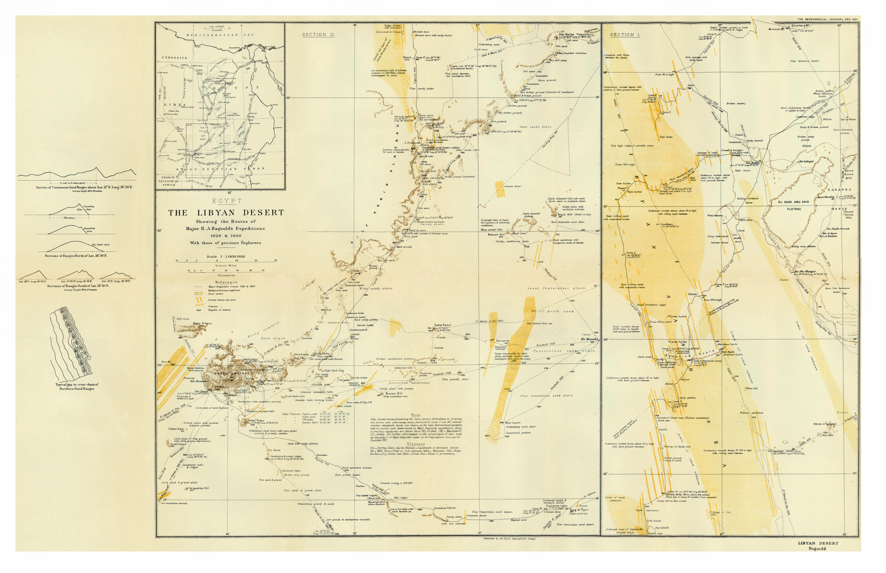
A few months ago the British Film Institute released an archive film of the early motor expeditions of Ralph Bagnold and his crew, exploring deepinto the Libyan Desert. (Click BFI if youtube below gets deleted). The map below shows all his expeditions in the 1930s, and there are more, original maps further down.
The 49-minute-long film describes the original recce in 1929 into the Great Sand Sea of the Western Desert via Ain Dalla spring. It was here that Bagnold’s group found lowering tyre pressures, as well as using sand plates and rope ladders, enabled heavy vehicles to traverse soft dunes.
A year later they set off towards Jebel Uweinat, a massif located by Ahmed Hassanein less than a decade earlier during a camel trek along Libya’s eastern borders. At Ain Dalla camels brought in extra fuel, and the cars continued to Jebel Kissu in today’s Sudan and south of Uweinat, then east for the Nile via Selima oasis.
In 1932 they based themselves again at Jebel Kissu where they refuelled from Selima, then explored the Sarra Triangle (now in Libya) as well as northeastern Chad.
Heading south to El Fasher, they passed herds of ostrich and oryx, since shot out by rifle hunters, before heading north for Merga, back to Selima and home via Wadi Halfa for a tot of rum.
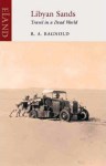
The maps on the left and below show the routes of all these trips and Bagnold’s book, Libyan Sands (right) covering all these expeditions and more and is well worth reading. Reviewed here. Short bio of Ralph Bagnold.
Part of an occasional Sahara A to Z series. Hang around long enough and you’ll get the full set.
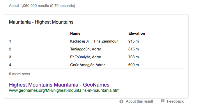
Search Google for the highest peaks in Mauritania, and the list on the left from Geonames pops up – and the same data gets propagated ad-internetum.
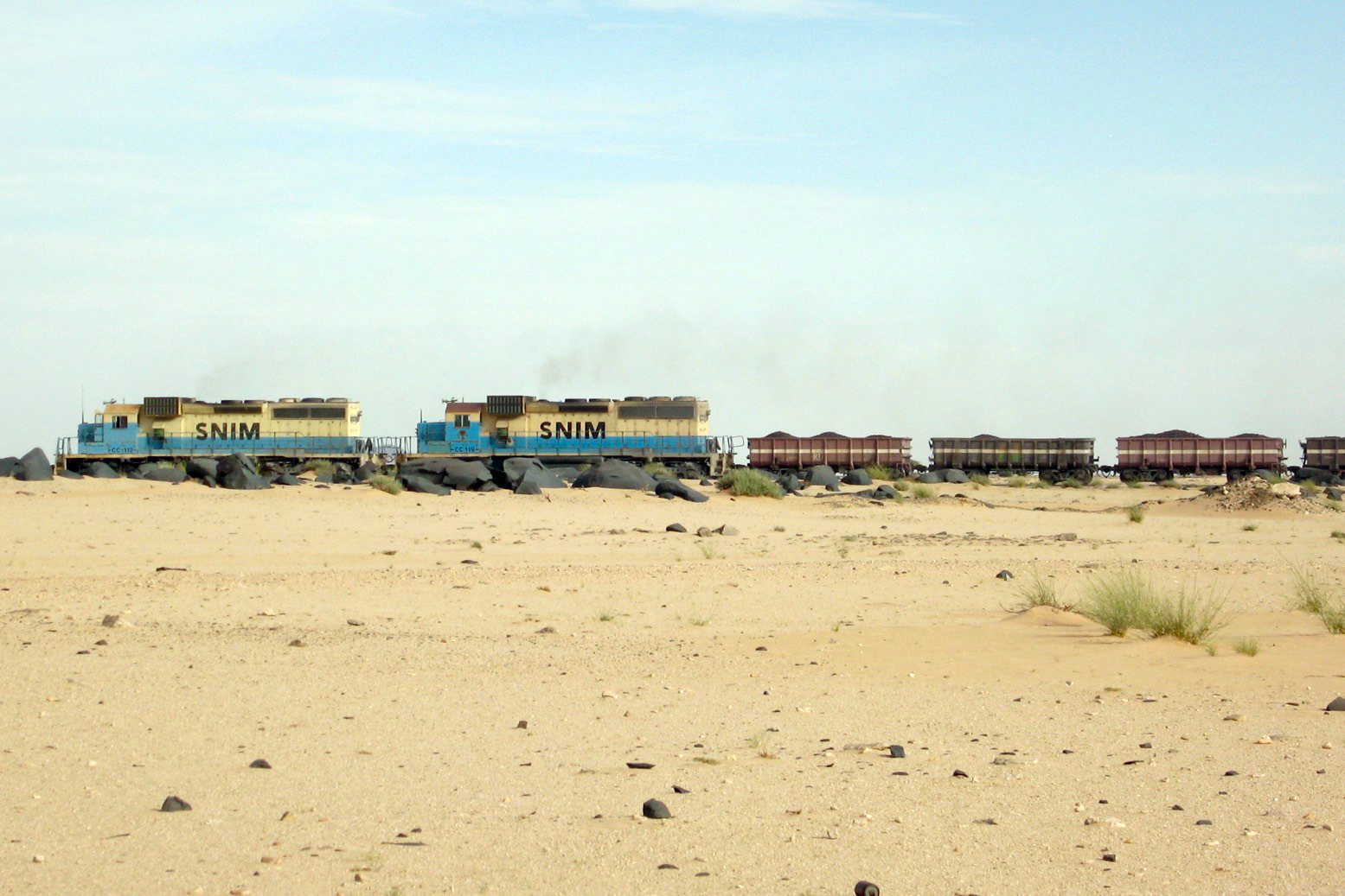
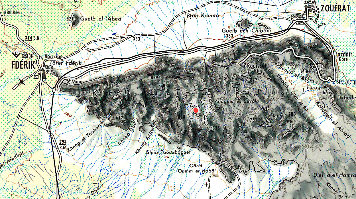
The tallest point is on the massif of Kediet ej Jill, rising above Zouerat mine site; a metal mountain that’s slowly having its iron-rich core eviscerated and railed across the desert (right) to the port of Nouadhibou. The actual high point is often erroneously pinpointed online. Not here it isn’t! It’s quite hard to find on the old 200k IGN map, below.
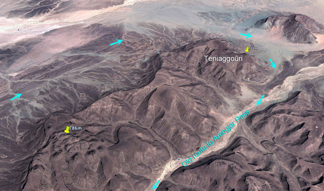
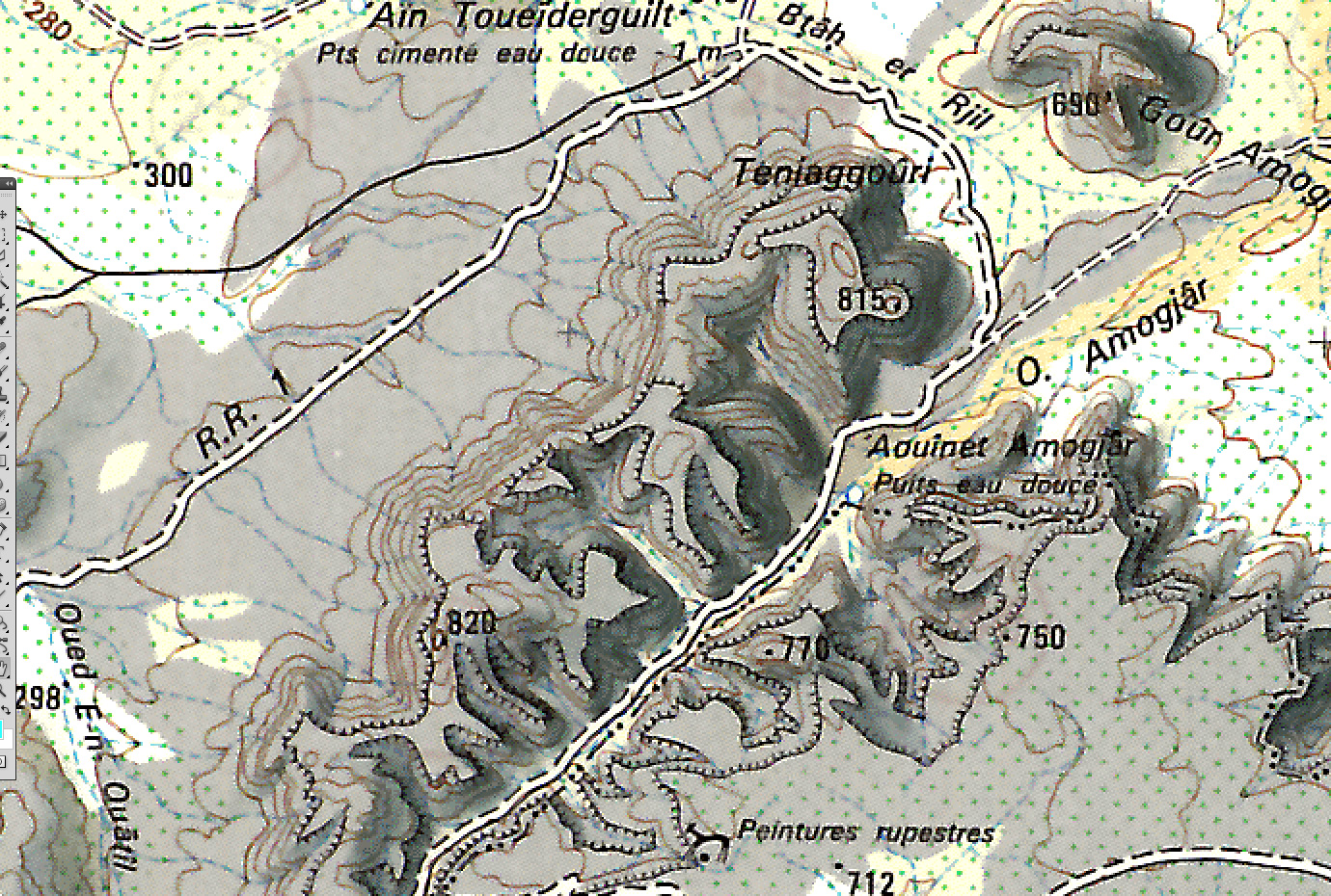
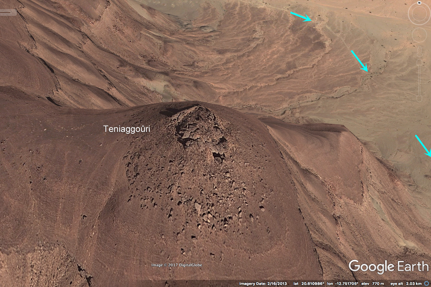
The second highest peak is listed as Teniaggoûri at 815m. That’s 815m as probably copied from the French IGN 200k map surveyed in the 1960s (right and below). This time IGN got it a little wrong.
In the old days you curved round this flat-topped outlier of the Adrar massif on the way to the rough climb up the Amogjar Pass for Chinguetti and Oudane. The distinctive summit of Teniaggoûriwould have been a key landmark if coming round from Atar or in from the arid playa of El Beyyid to the east. Now the newer and more direct Ebnou Pass (right) climbs straight onto the plateau out of Atar.
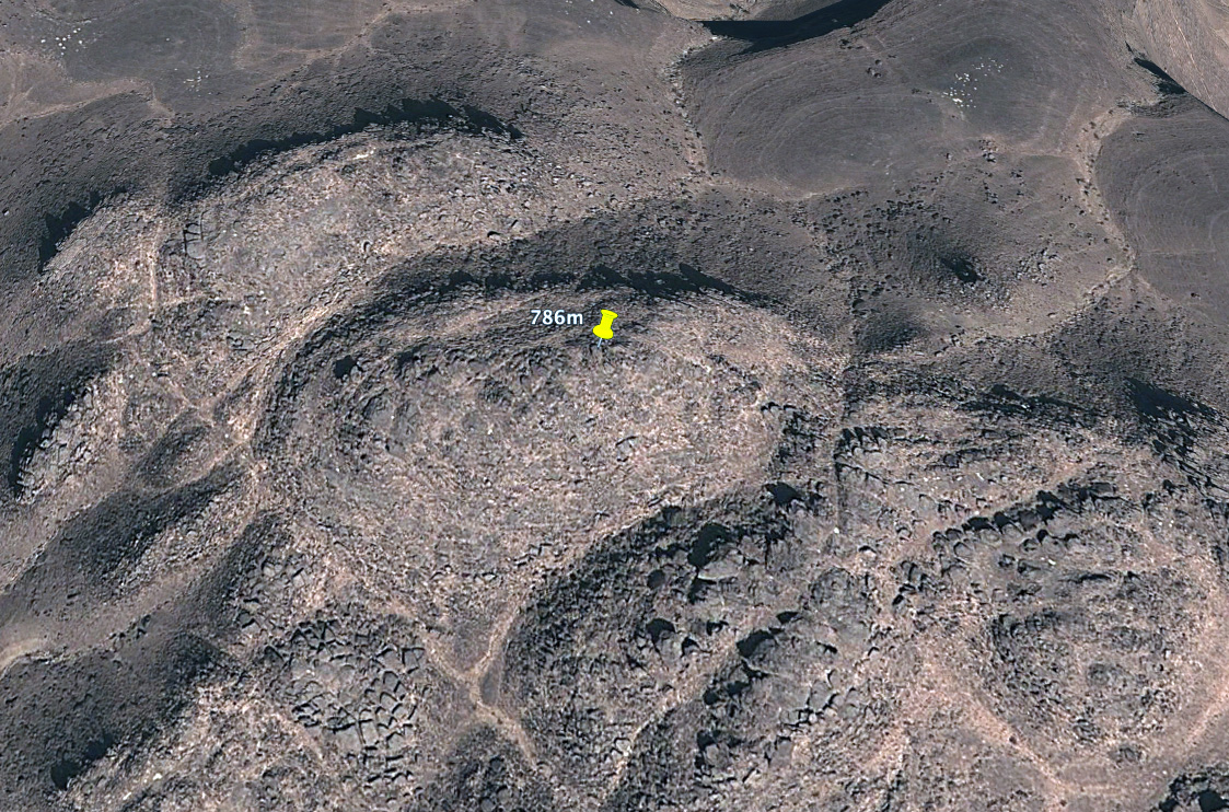
But a quick look at a French 200k map (above) shows an unnamed spot height, 7km to the southwest of Teniaggoûri and which is labelled at no less than 820m. Set in the middle of the ridge, it may not be a prominent prow and landmark like Teniaggoûri, but even Google Earth’s estimated elevation data shows comparative heights of 771m for Teniaggoûri and 786m for the dome cluster. From the Oued Amogjar valley to the south, either point is little over a hundred metres elevation and a couple of miles walk above the desert floor. Left; just north of Zarga, the peaks on the horizon are what out guides called ‘Amogjar’ and what could be Teniaggoûri given the impression of additional elevation in the heat mirage.
Of course, it’s quite possible the local name for this entire ridge may be Teniaggoûri (as with Kediet). Nomads don’t give a toss about actual high points, but sure have a use for landmarks. So there may be no real need to rename the point, just the location. Now we know.


 Mackenzie also thought that trade and communications would help liberate the sub-Sahran population from the slave trade. And this wasn’t just a ploy to appeal to investors’ morals or religious beliefs – Mackenzie’s later work in East Africa long after the NWAT Company dissolved suggested he was always a genuine abolitionist.