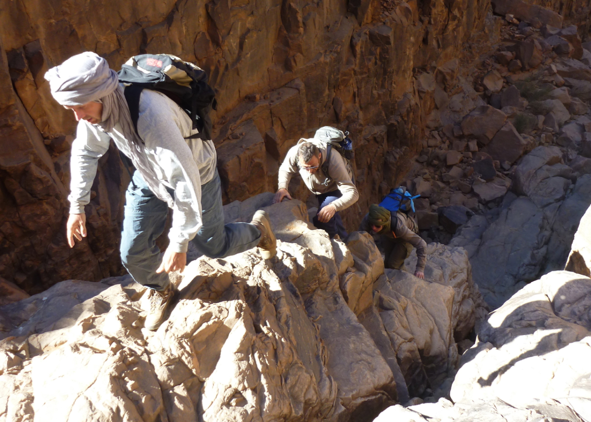
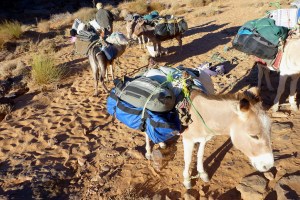
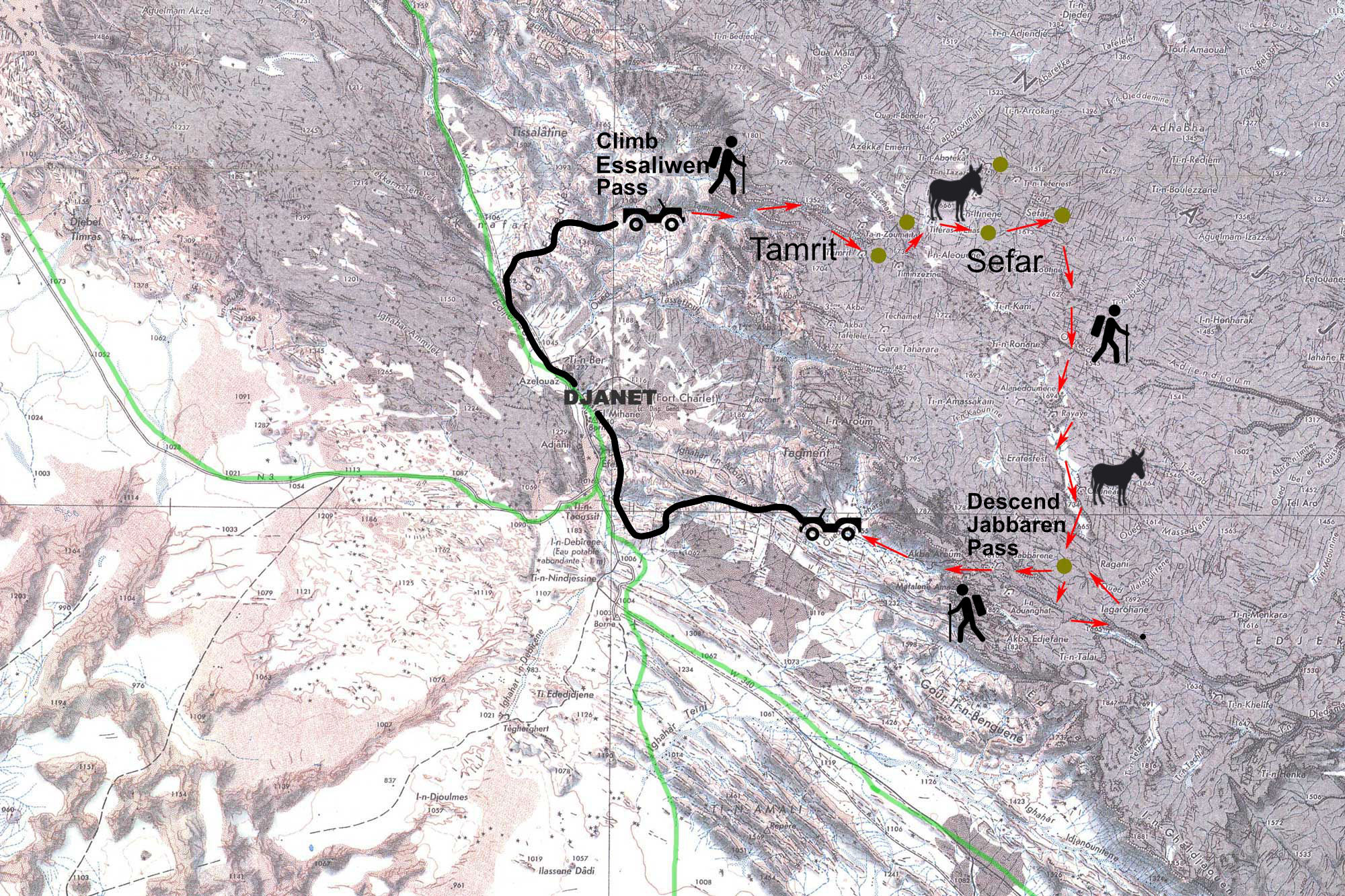
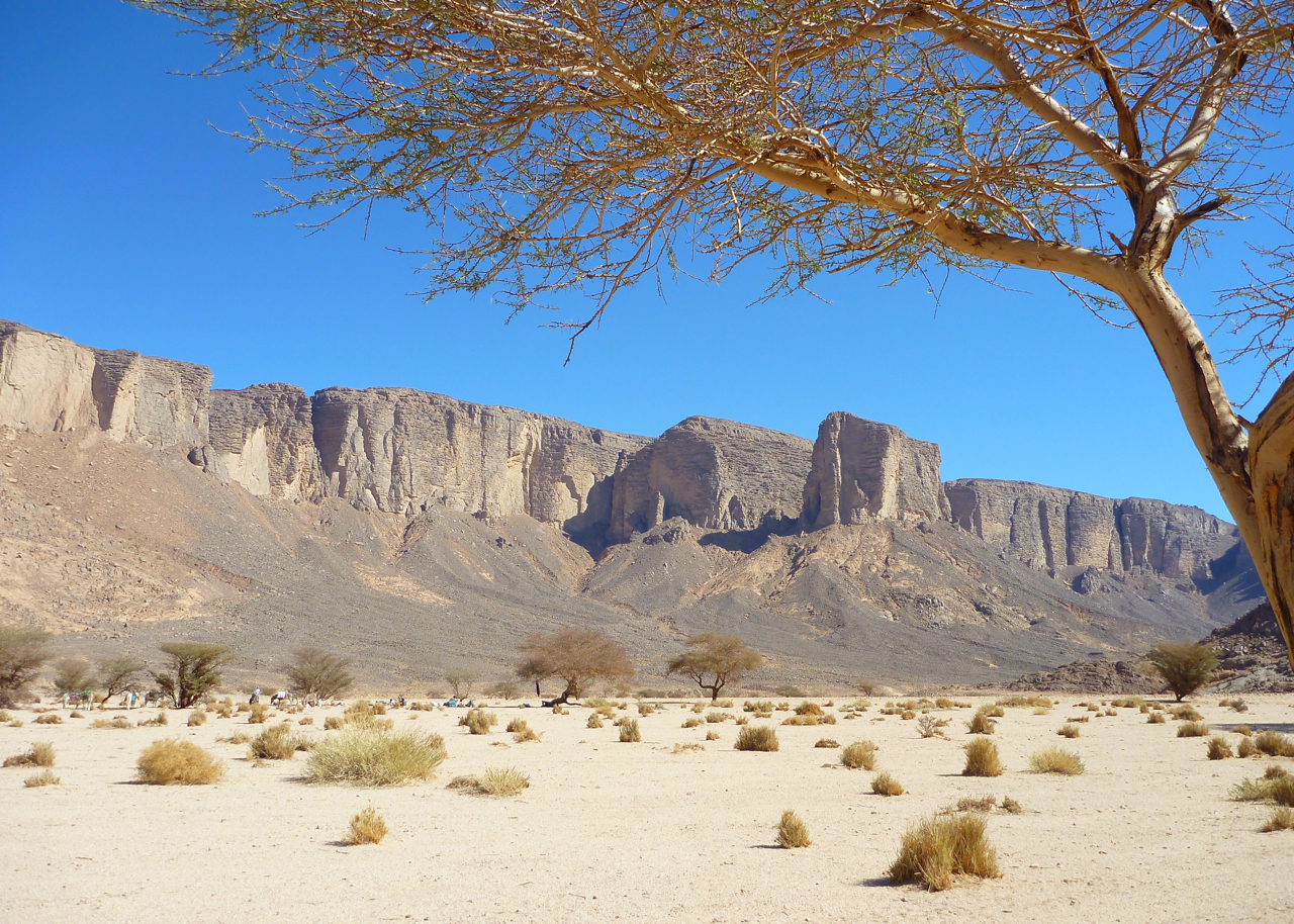
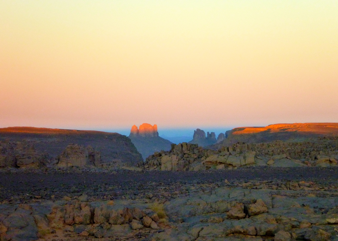
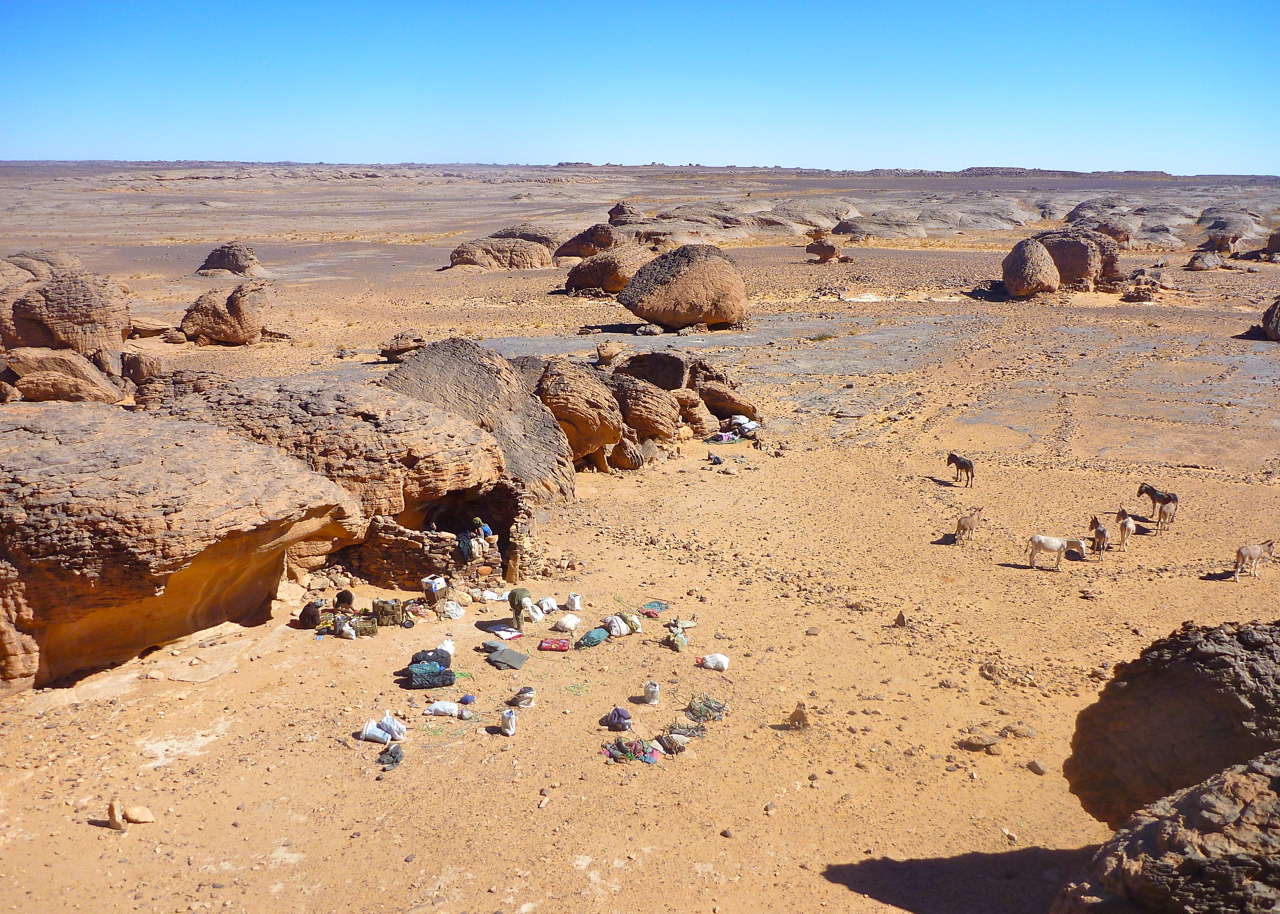
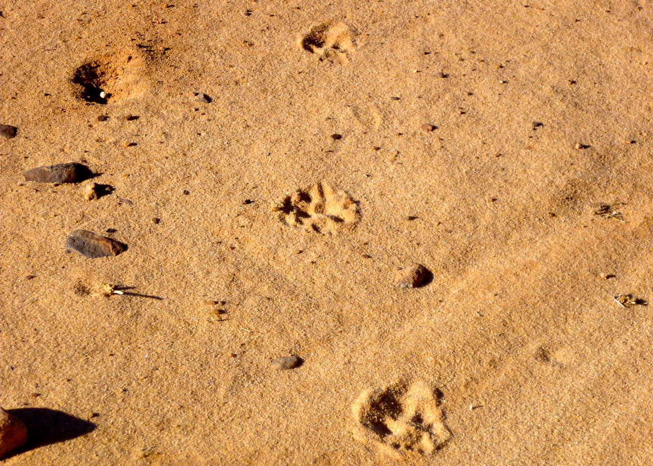
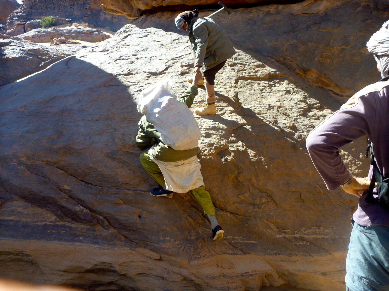
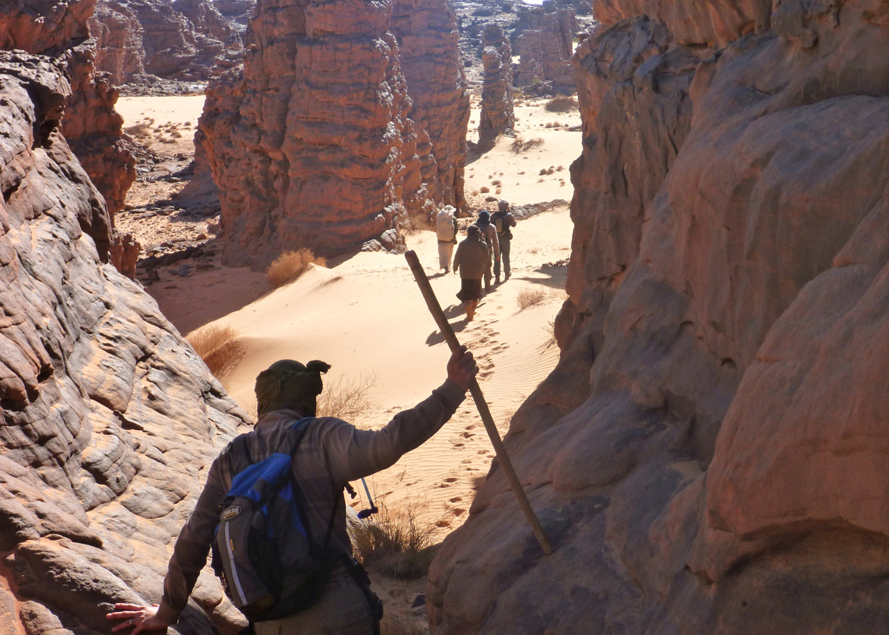
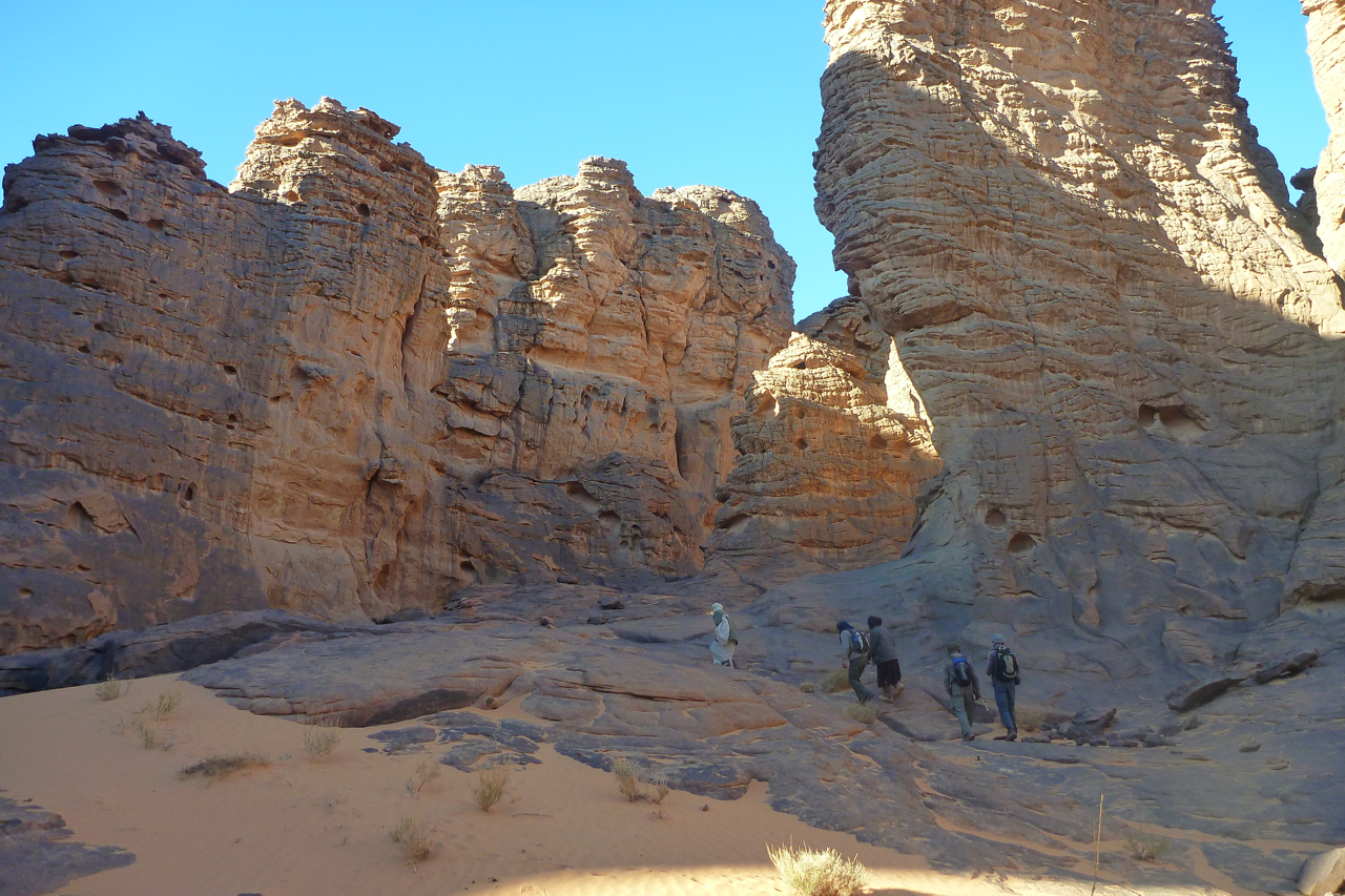
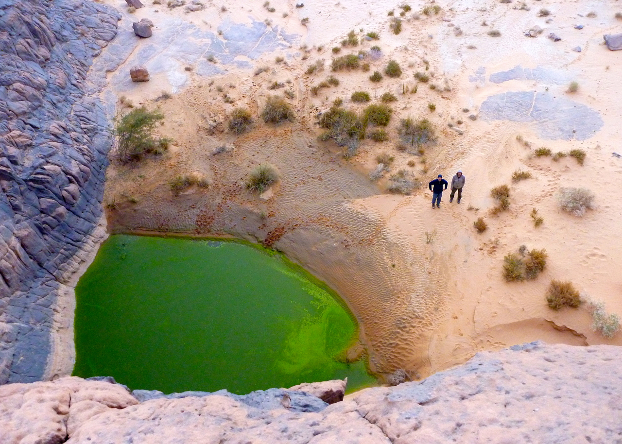
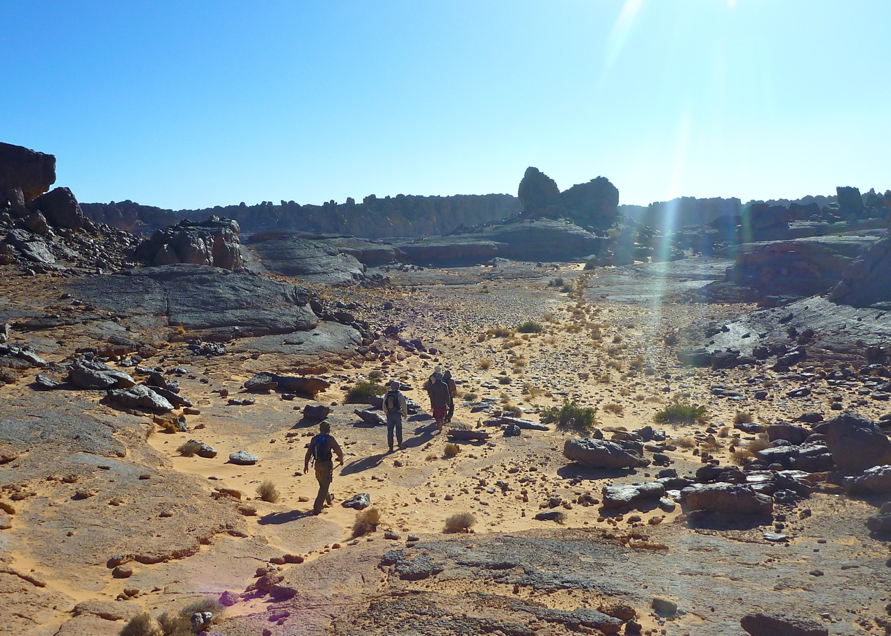
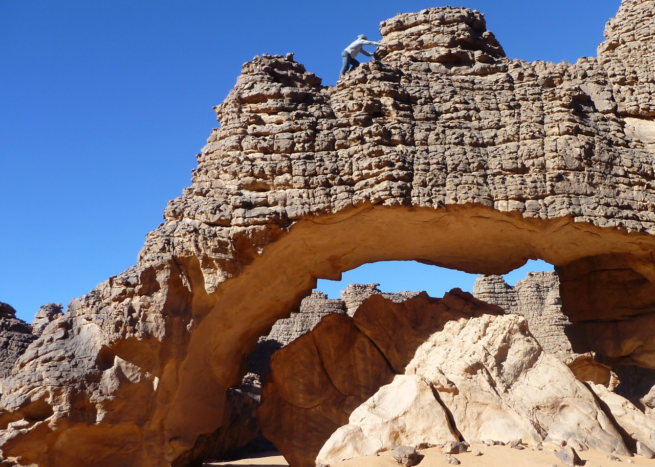
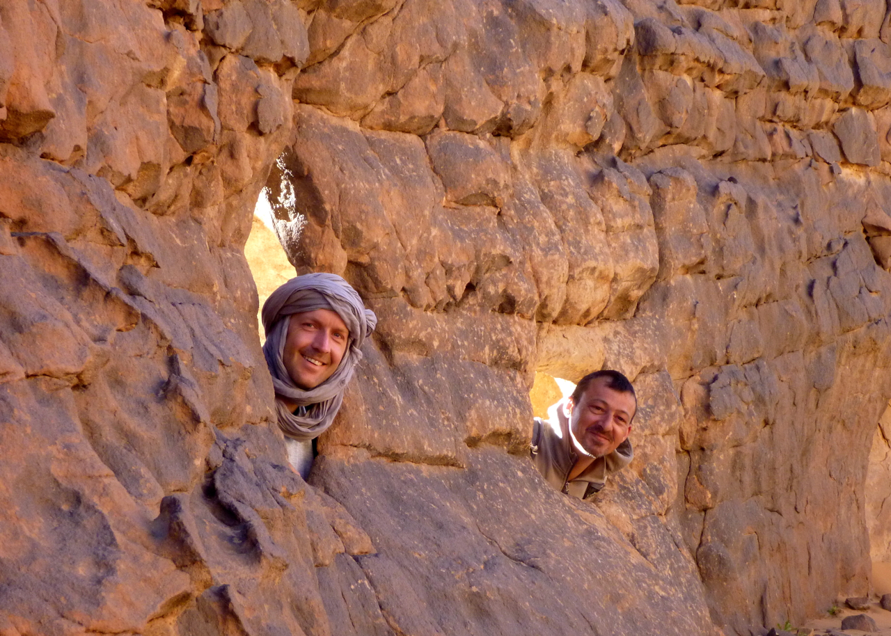
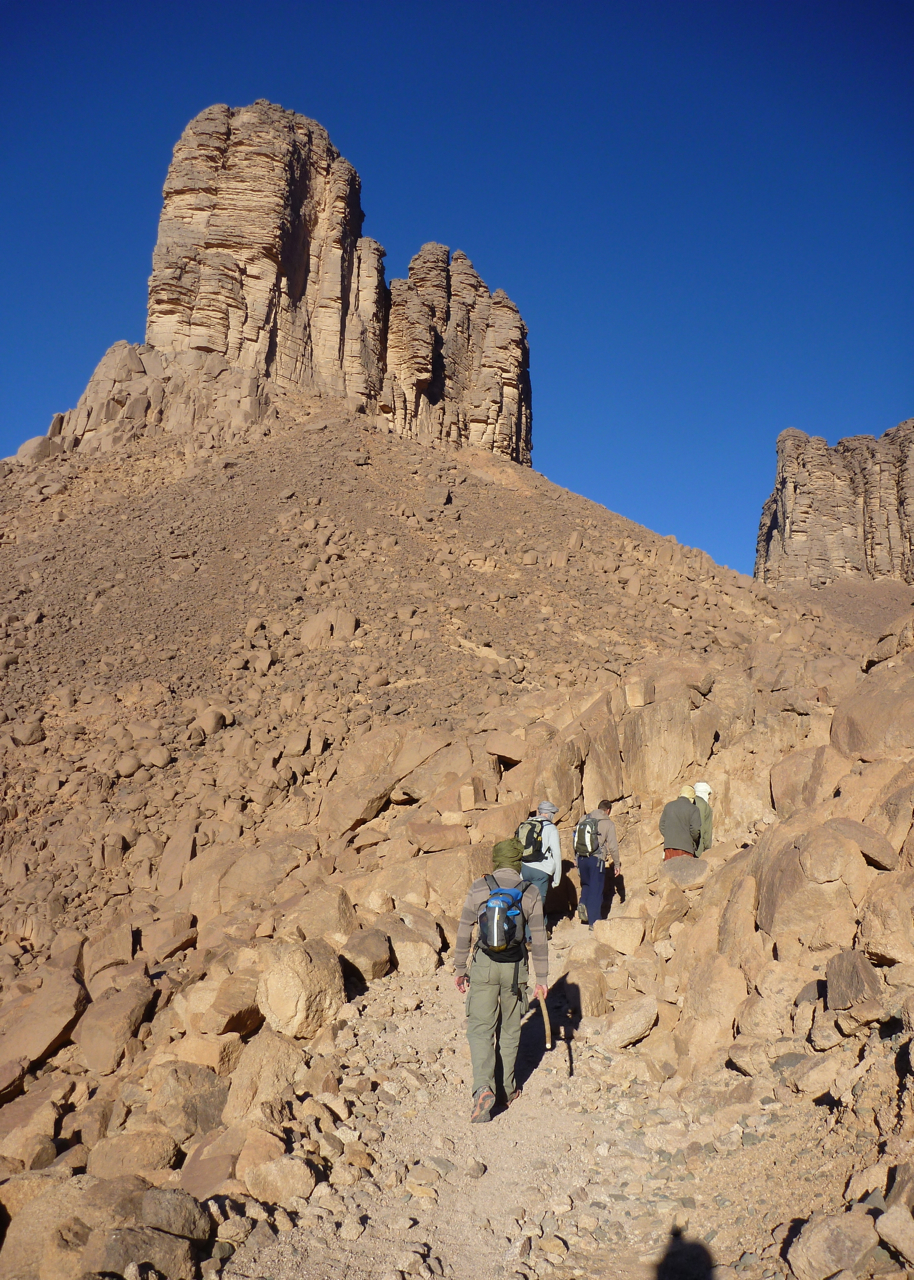
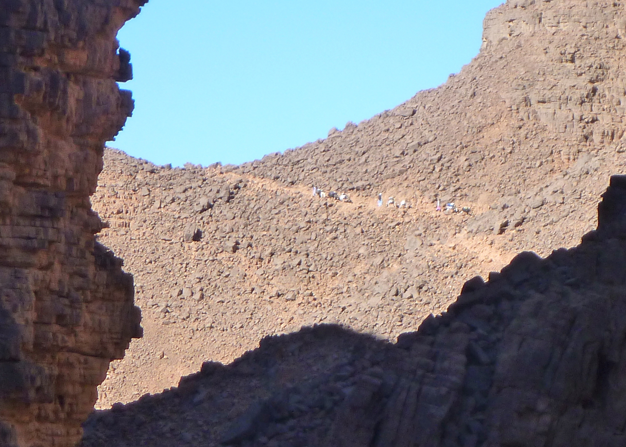
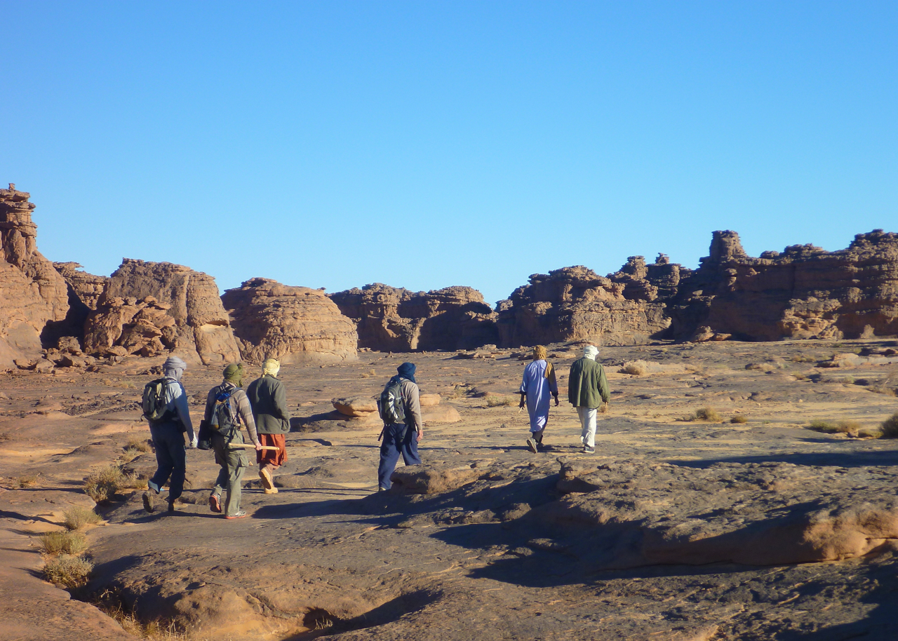
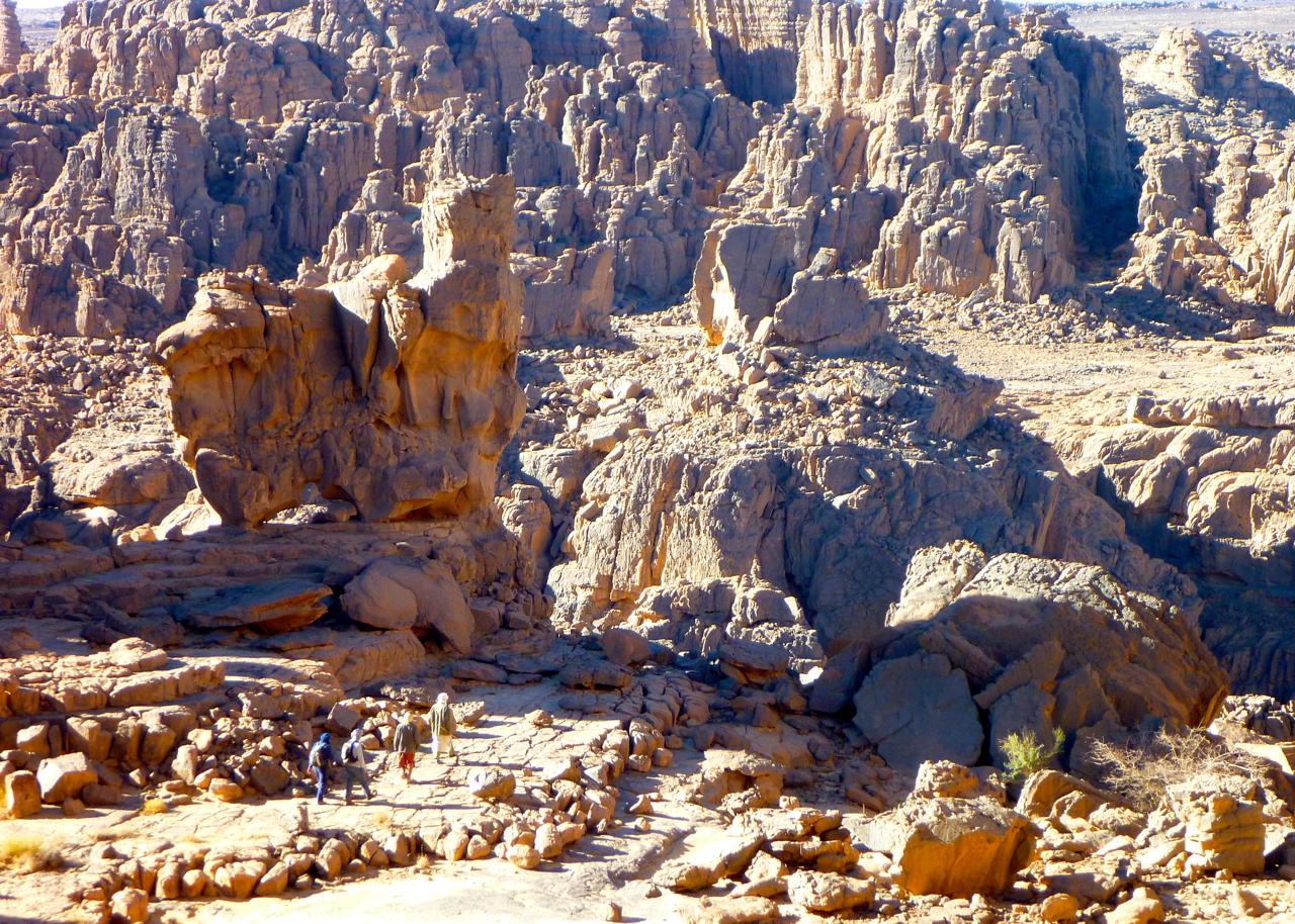
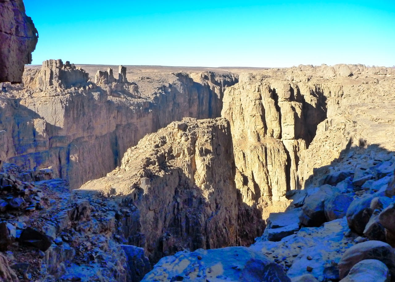
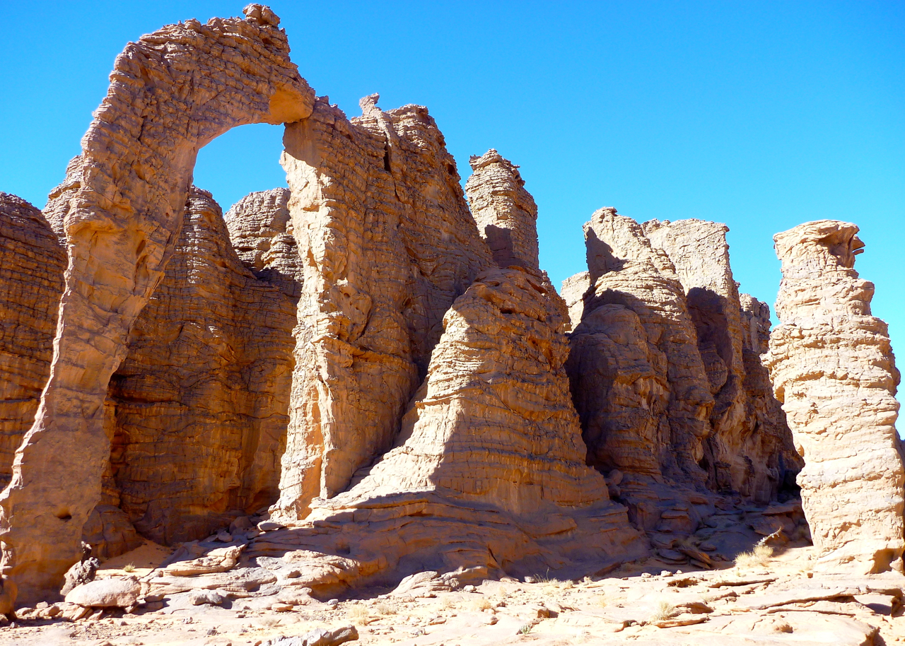
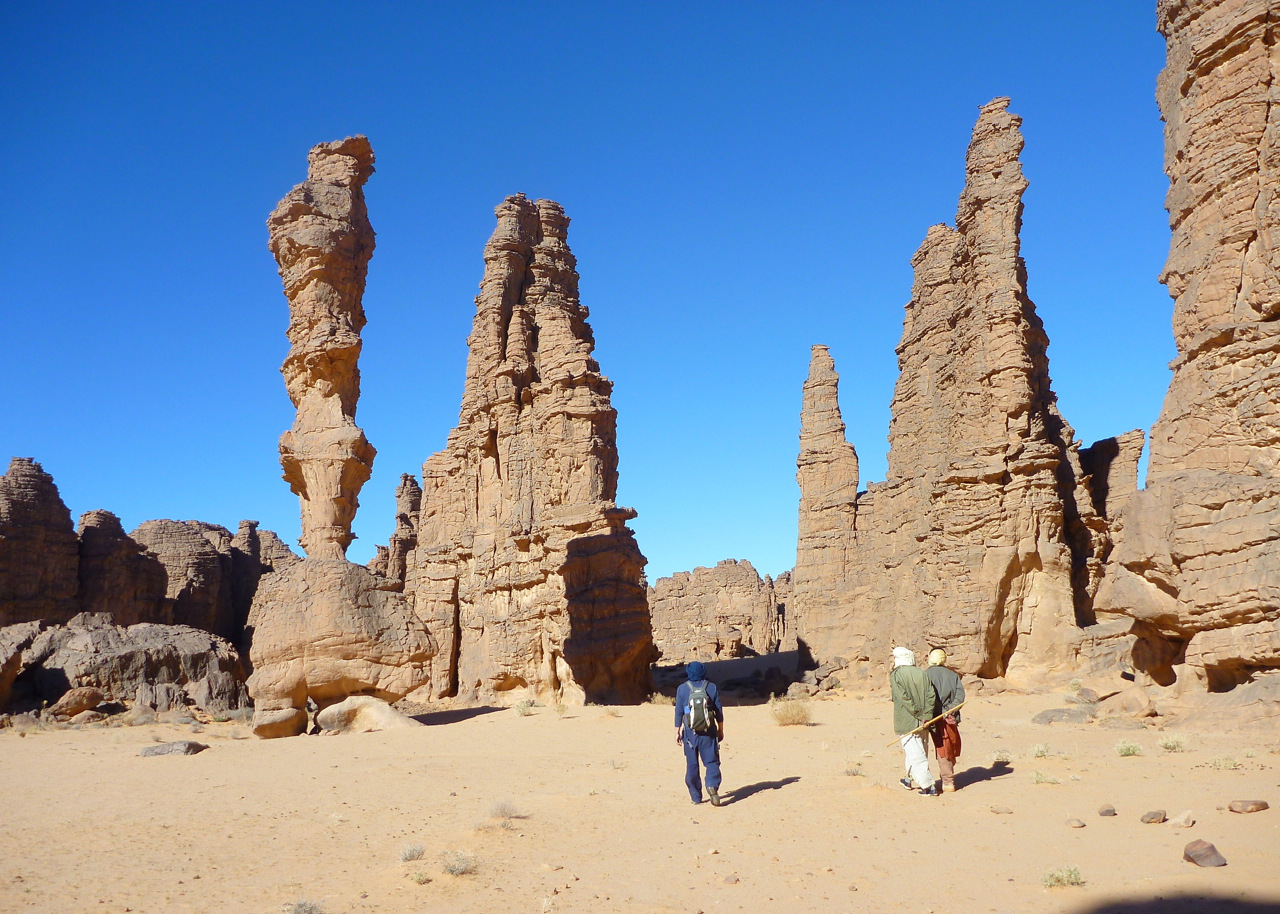
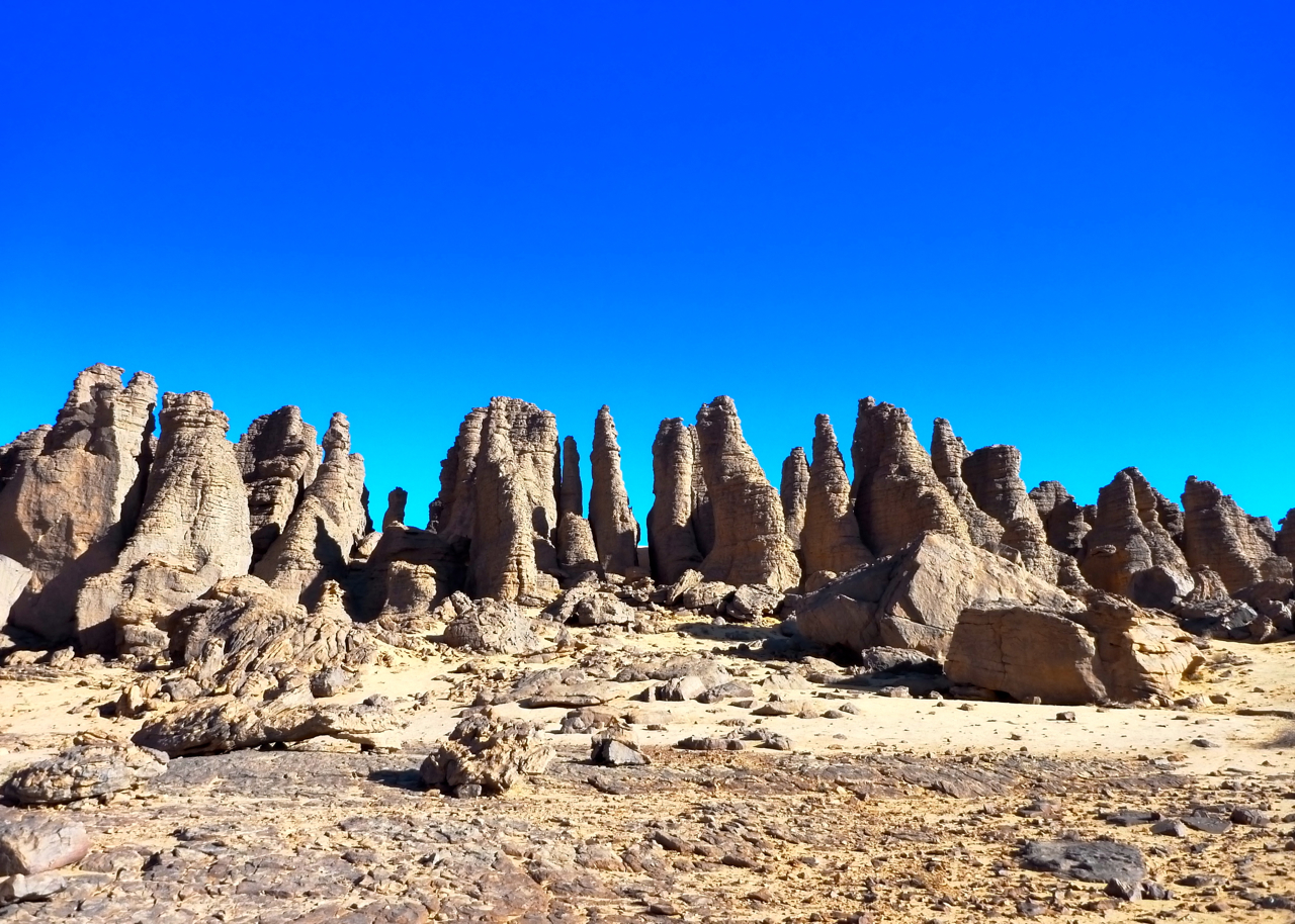
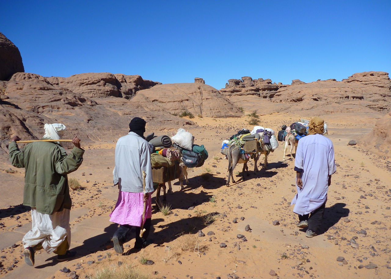
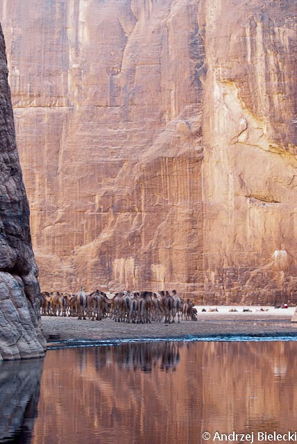
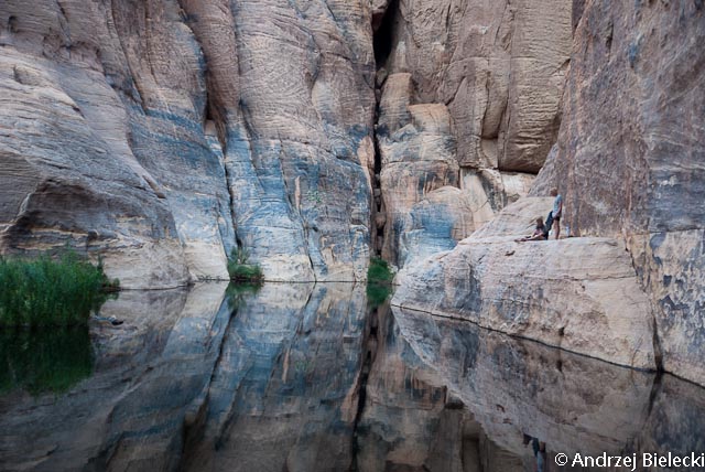
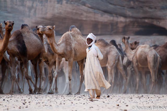
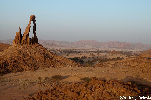
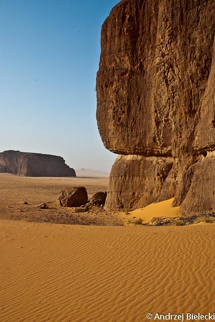
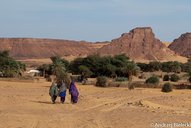
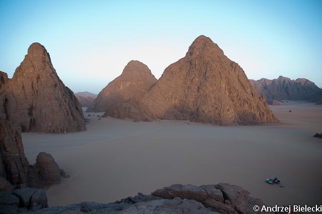
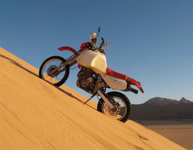
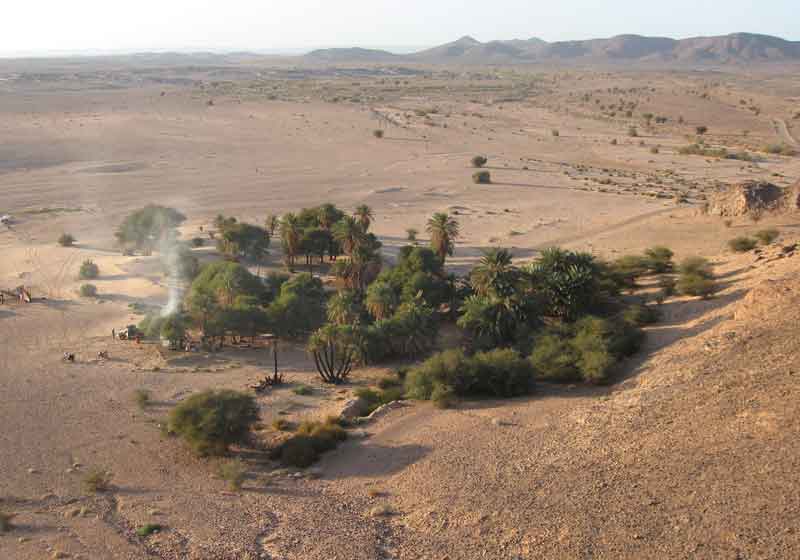
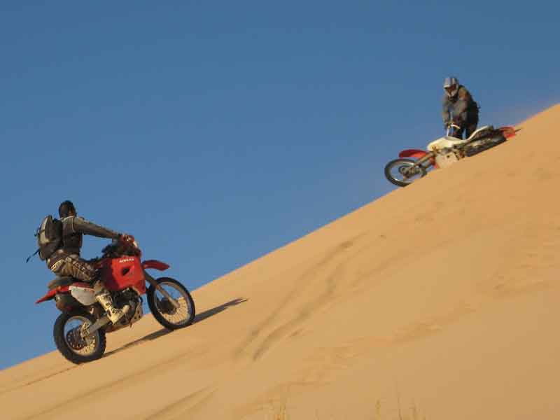
Gallery from our one-week, 60-km donkey trek on the Tassili plateau in late 2013, following our camel walk to Essendilene. We took the classic route, up the Akba Essaliwen near Djanet onto the escarpment for Tamrit, then over to amazing Sefar and down and out via Jabbaren. See map below. Loaded camels can’t manage the climb we took to the plateau (left), far less the descent at Jabbaren. So pack donkeys take a longer, less steep path ascent and, with much coaxing, down the Jabbaren trail with us.
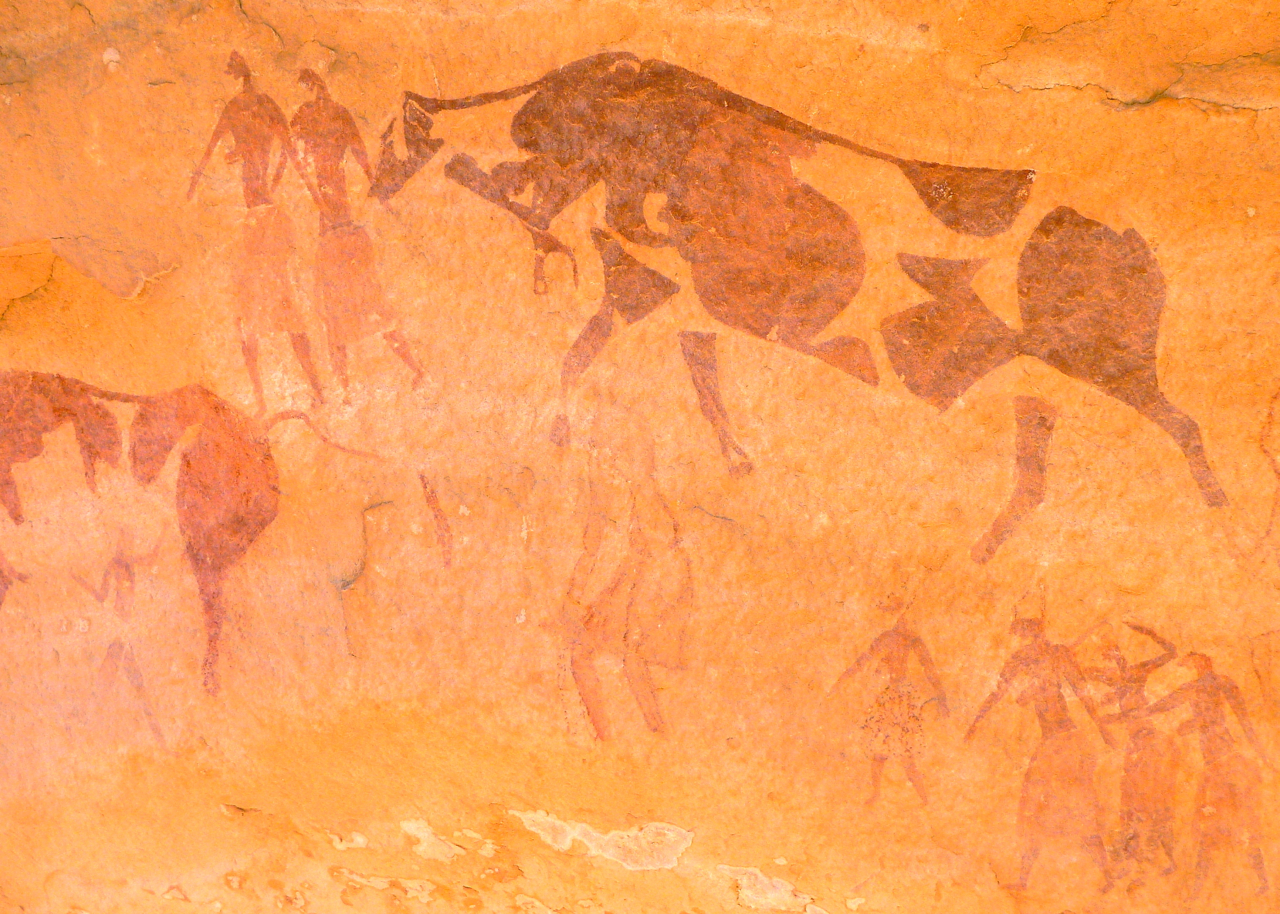
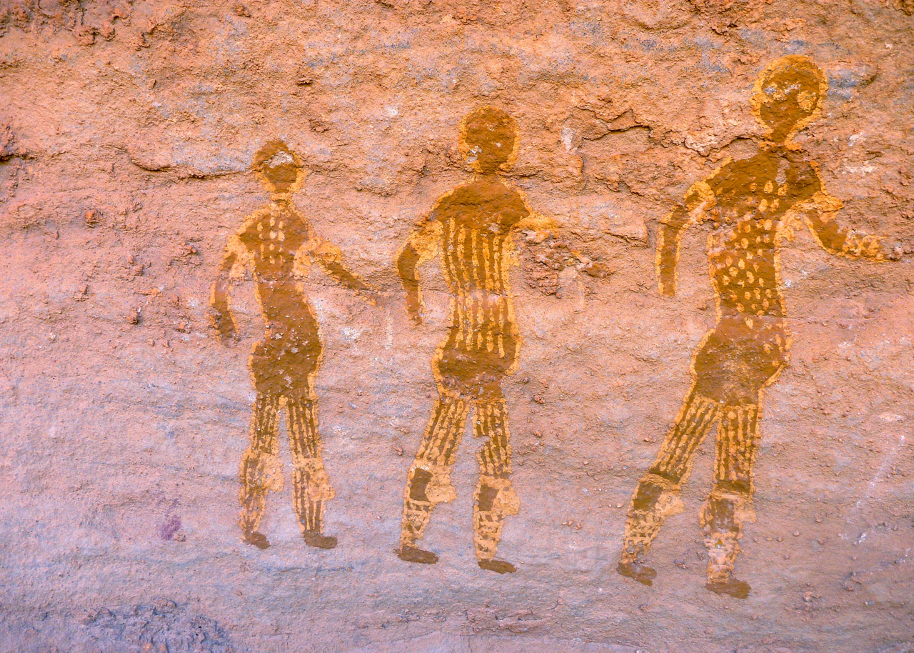
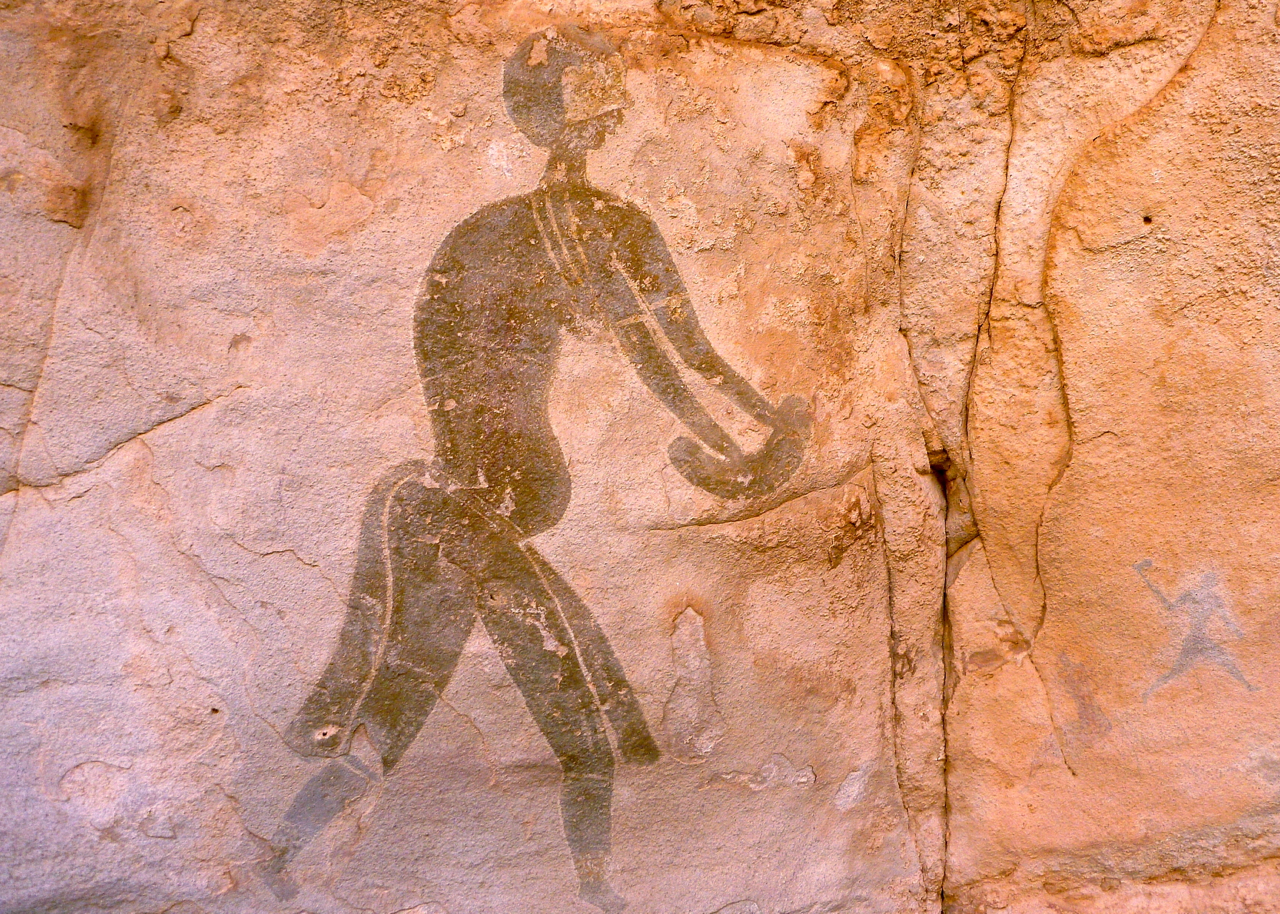
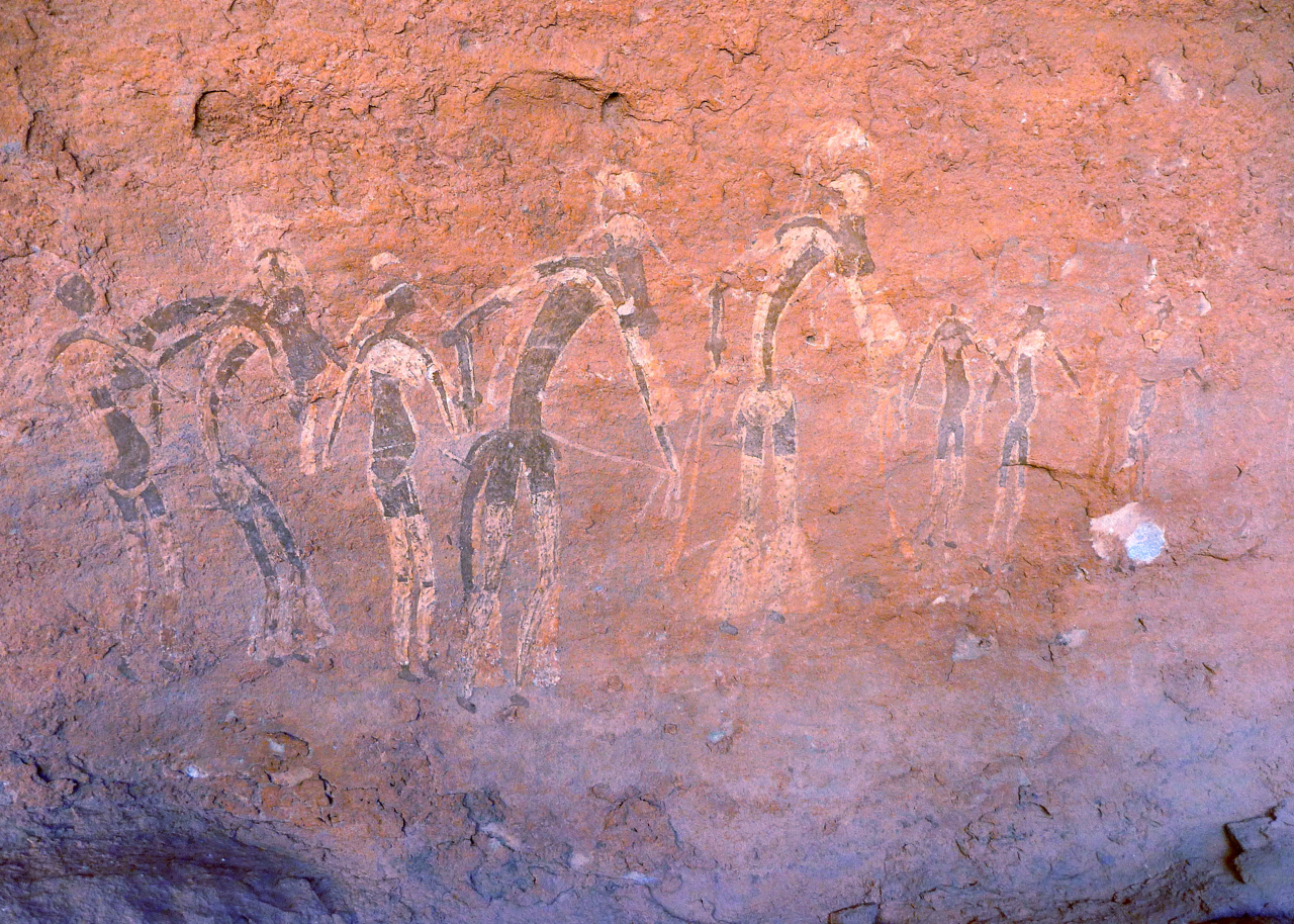
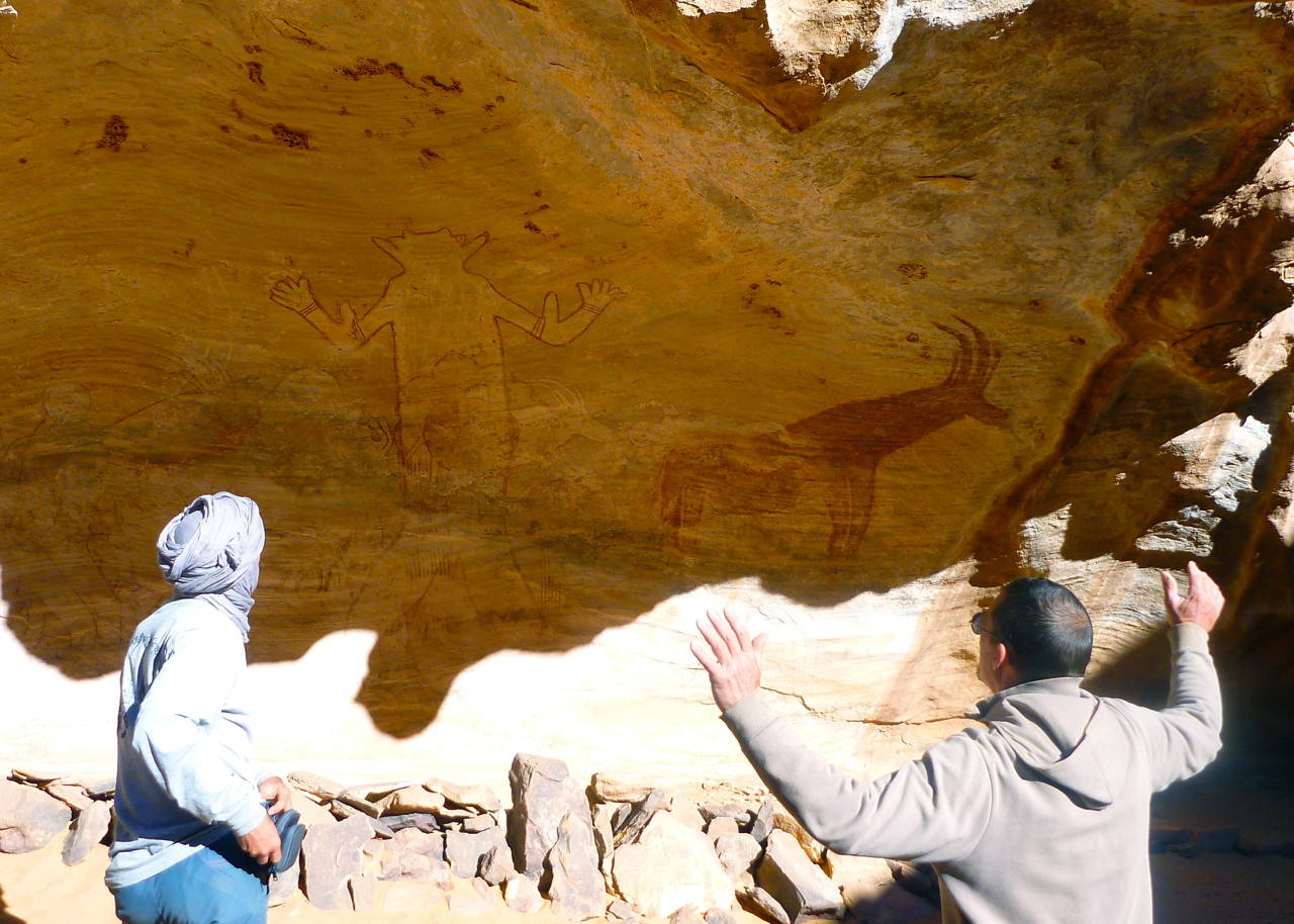
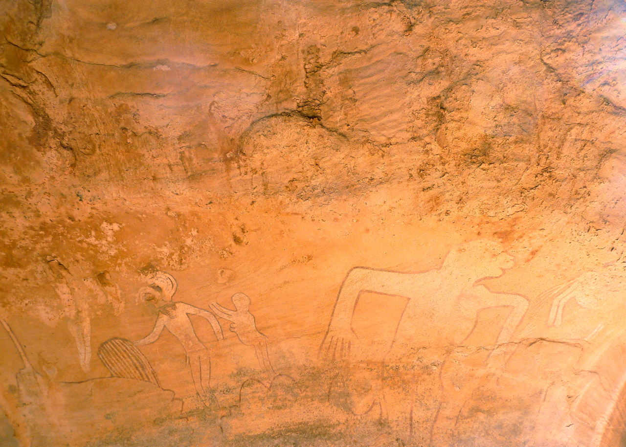
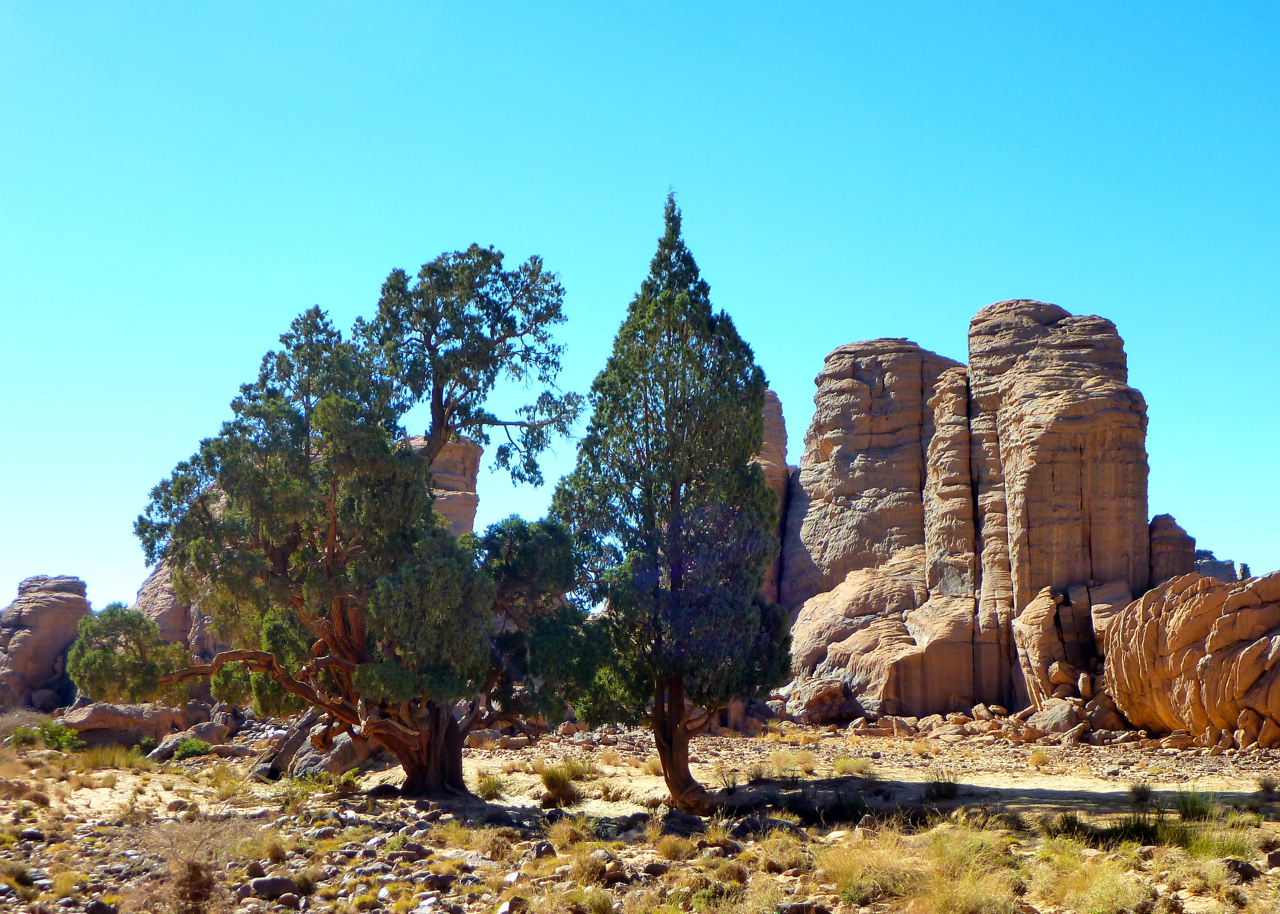
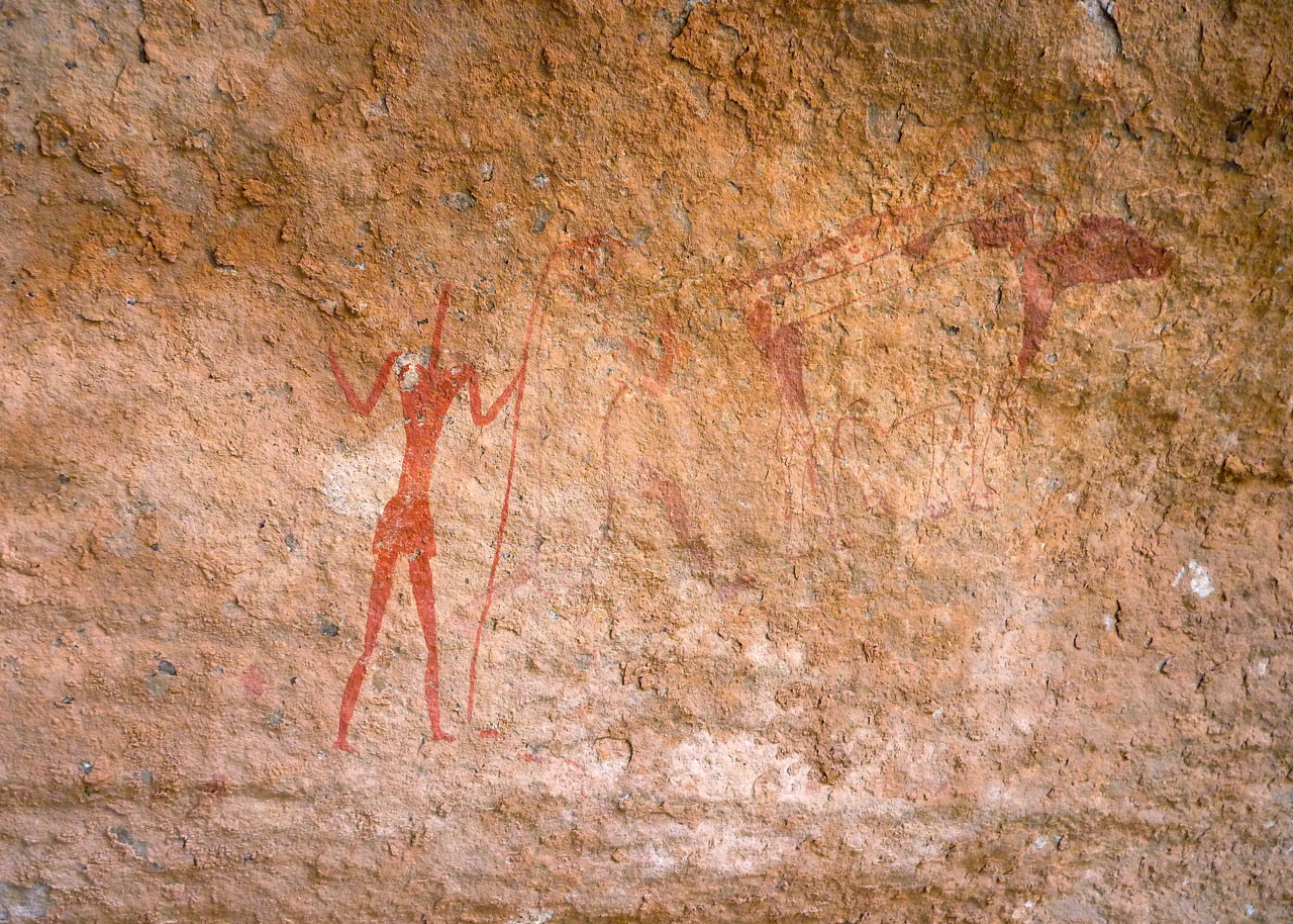
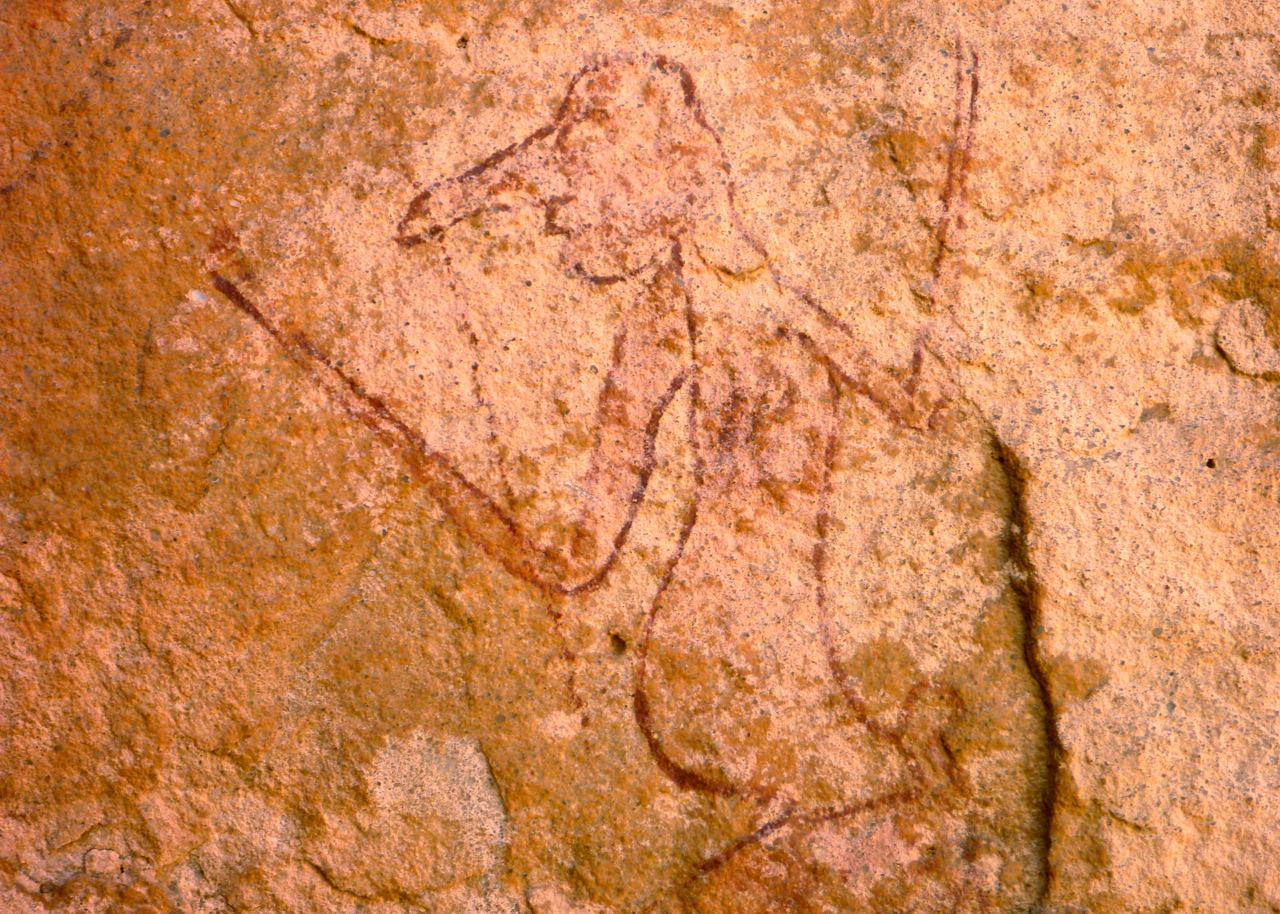
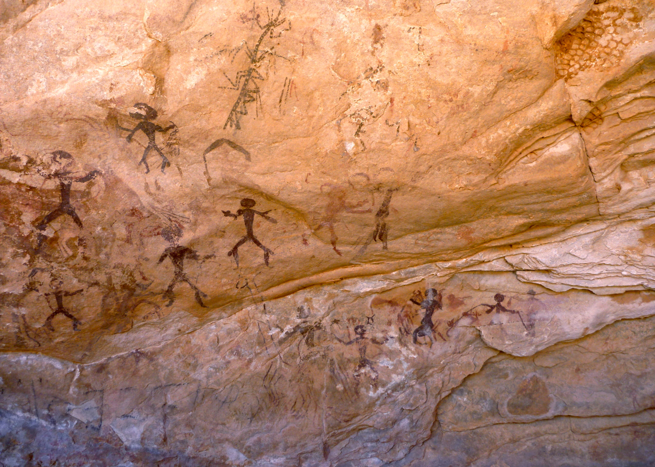
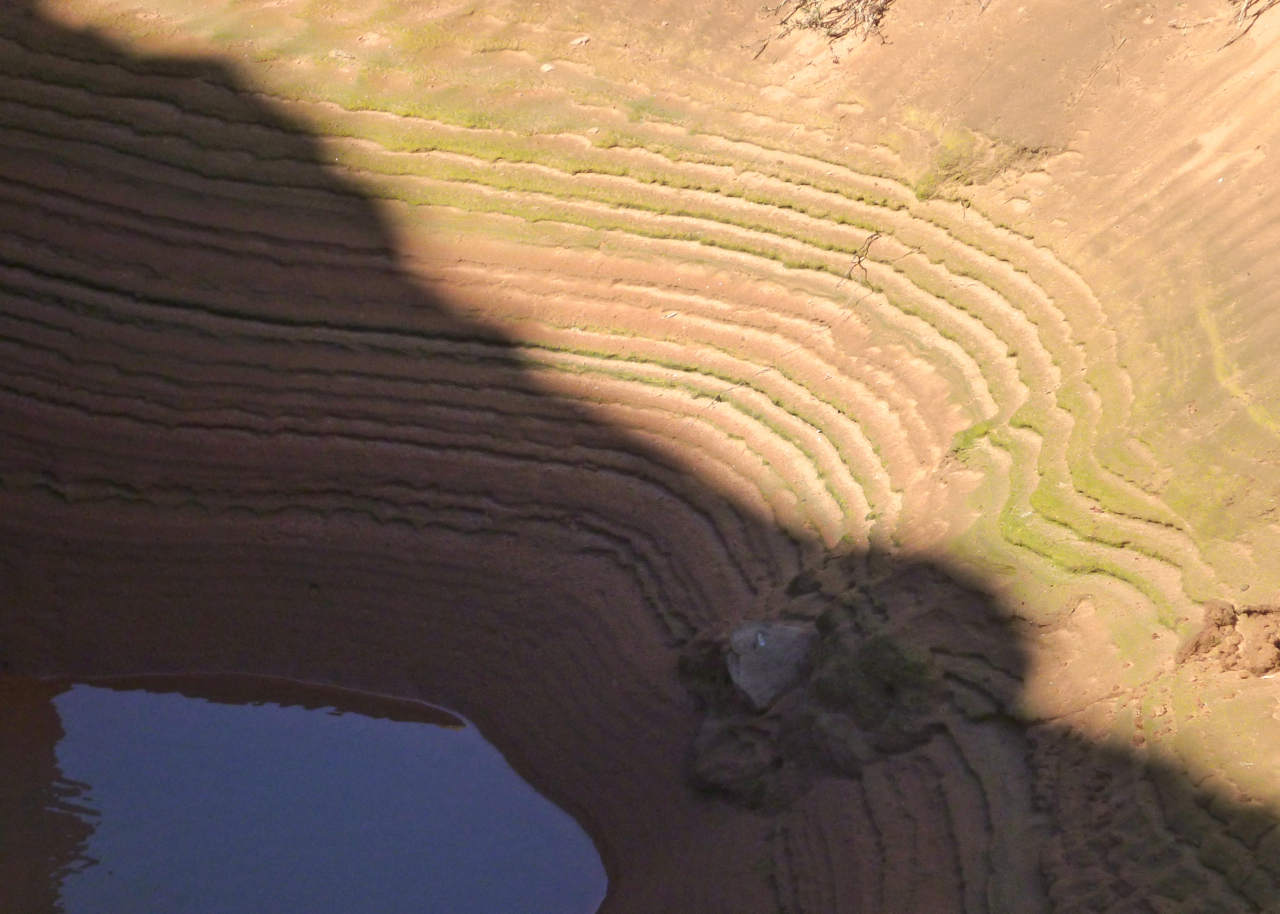
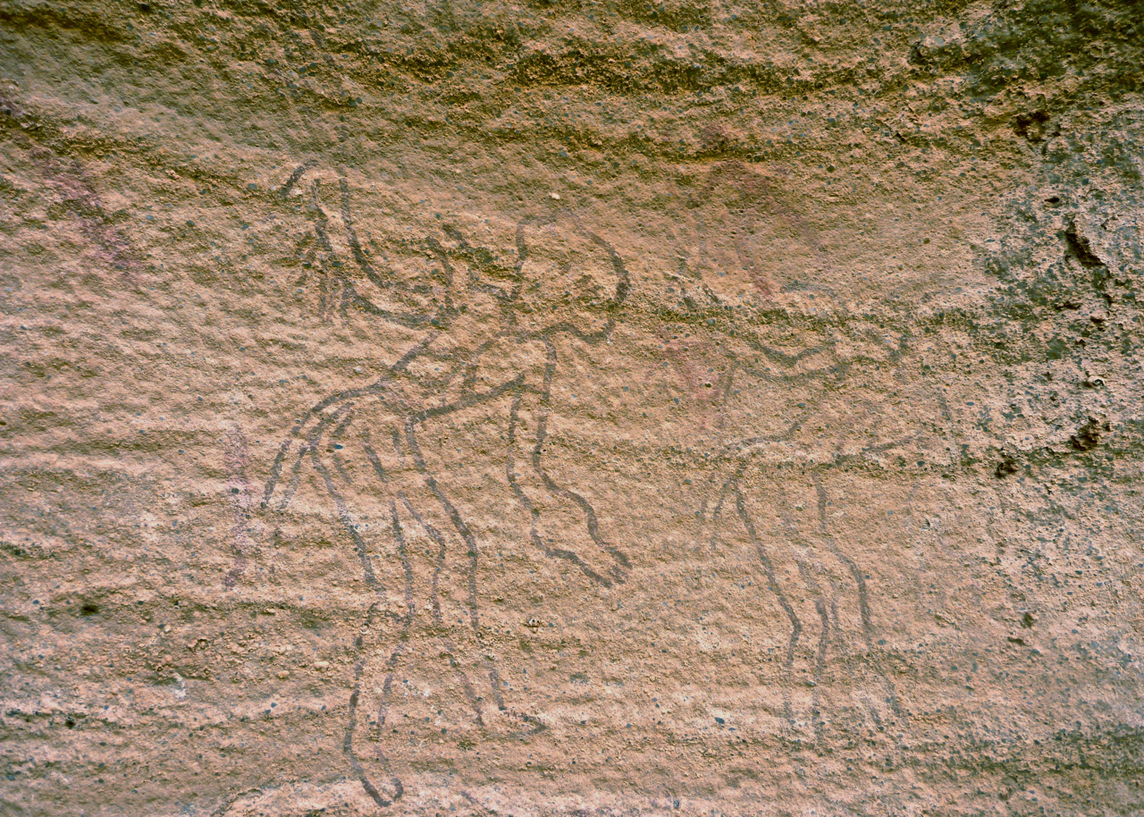
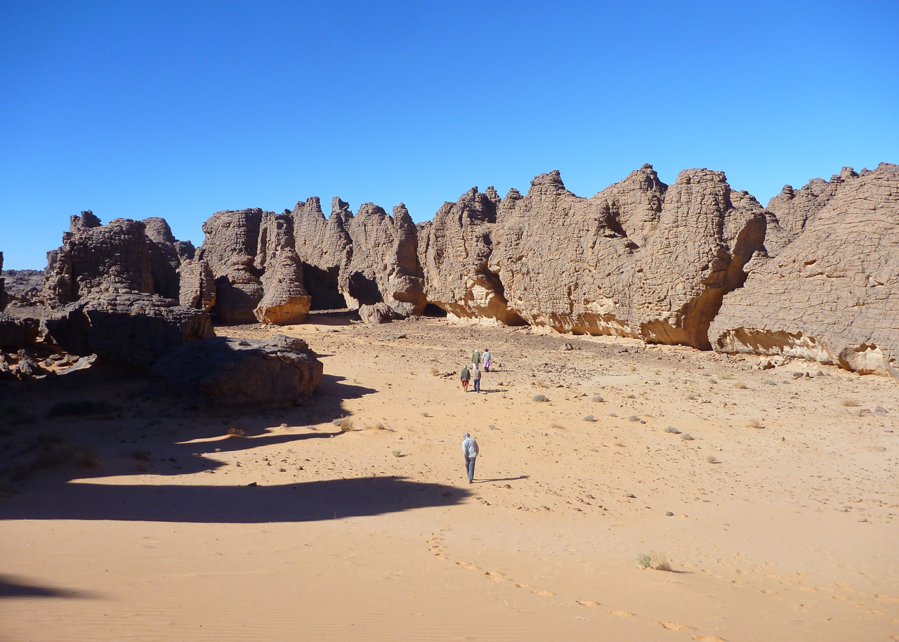
Once on top it’s a Lost World of gnared outcrops, rock art caves, weathered canyons and ancient trees where people thrived 10,000 years ago. And less than 10,000 years after my first visit to Djanet, I was thrilled to finally to tick off the famous Tassili plateau trek. Like Assekrem, it’s the another Must See in the Algerian Sahara, but I hear these days is getting like the Lake District. Not got a week for the full lap? Do a one-day up to Jabbaren and back.
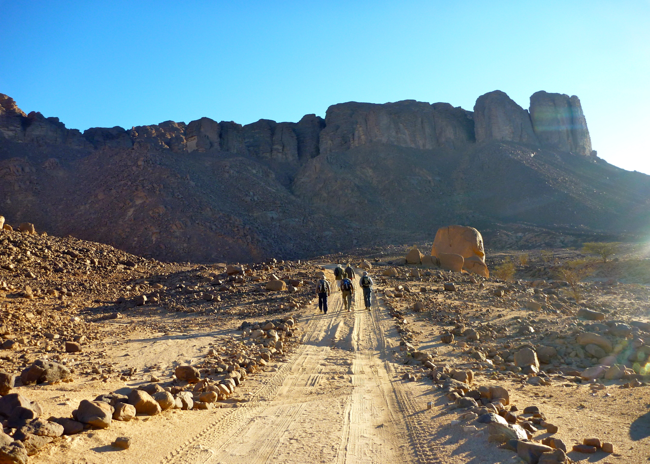
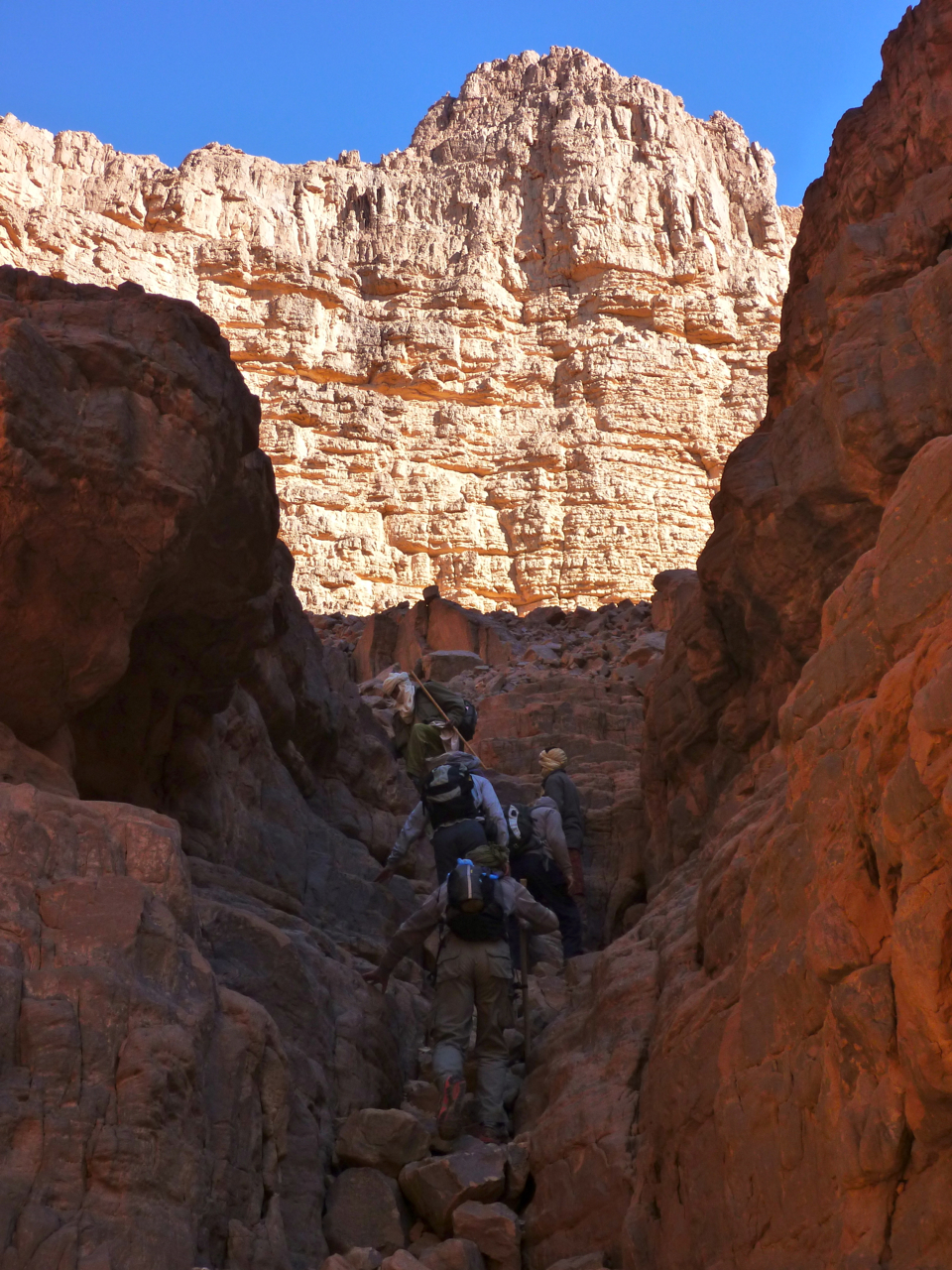
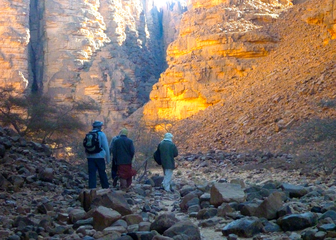
Tamrit, Sefar, Jabbaren trek
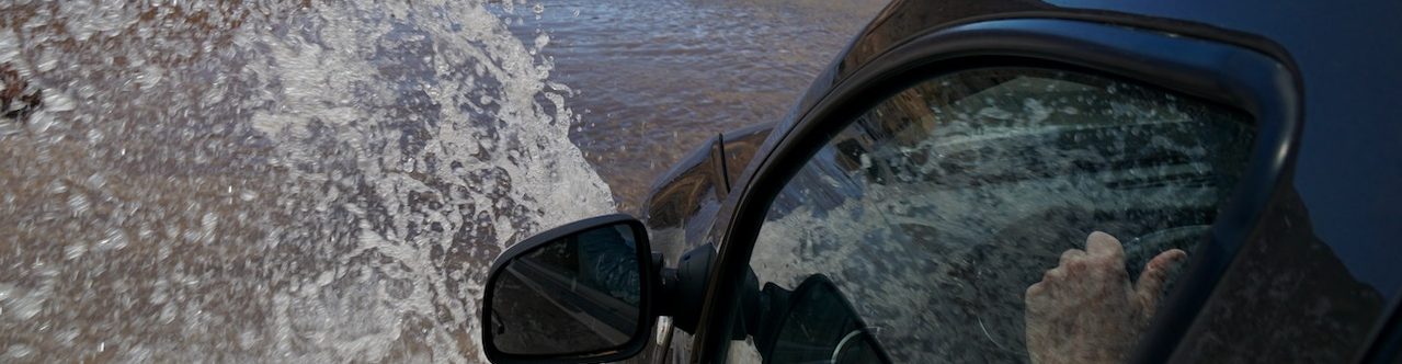
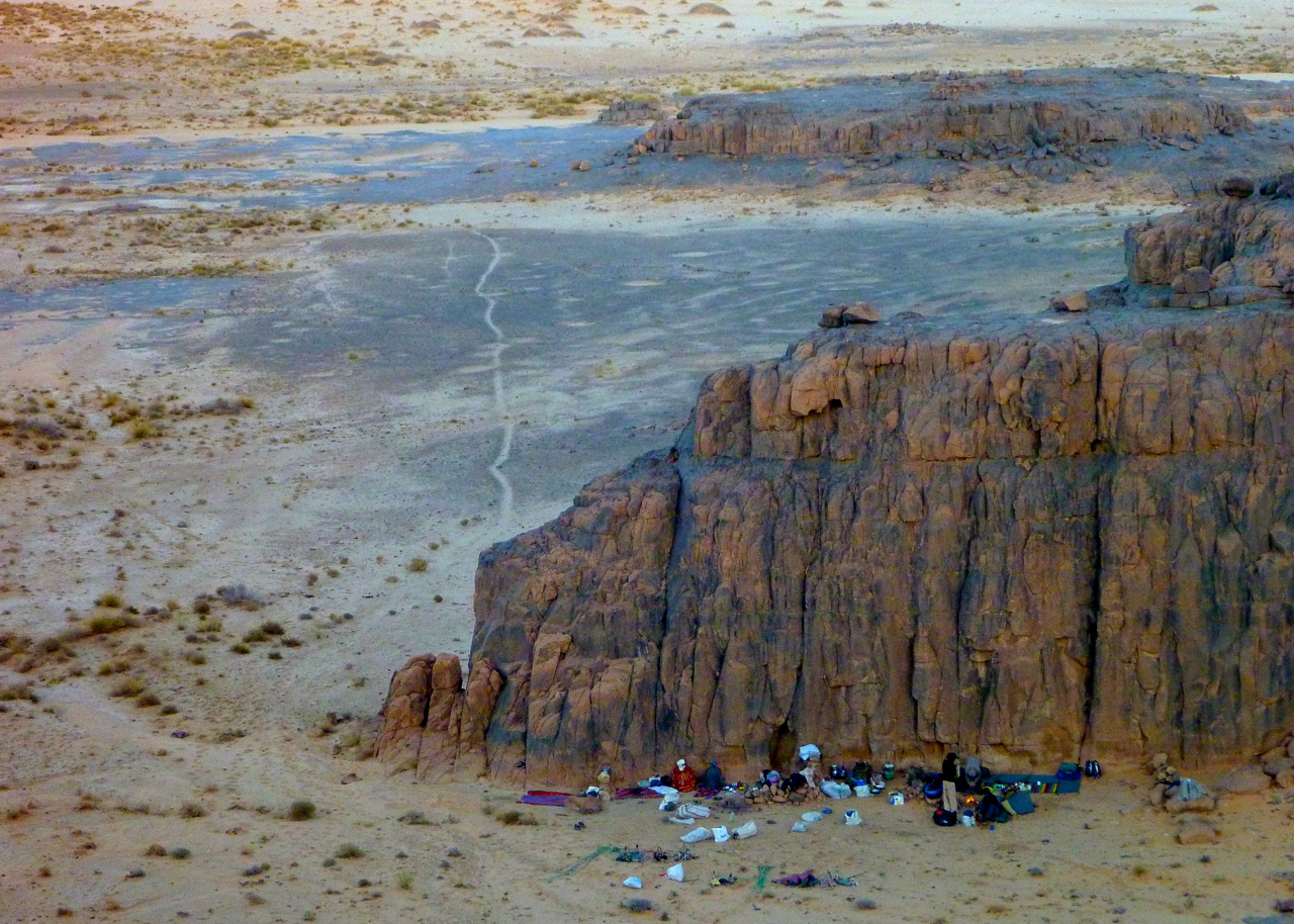
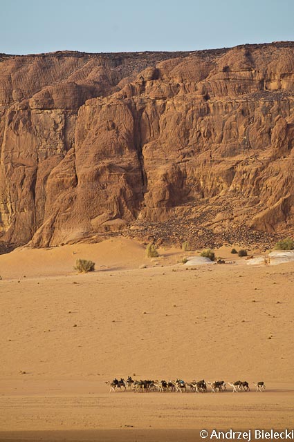
As we were approaching Jabbaren before the steep descent back to the plain at the end of our trek, I heard later that my Spot tracking dropped out for those following it back home. At this time Tigantourine oil base near In Amenas was getting attacked by the Algerian army following a raid by an AQIM group led by the notorious Mokhtar Belmokhtar out of Libya. Even though 400km to the south, I presumed the Algerians temporarily blocked all satellite signals across the region. Checking in unshaven at Algiers airport a couple of days later, the bloke at the desk grinned and asked ‘you were there?’. Turns out it was nothing to smile about.
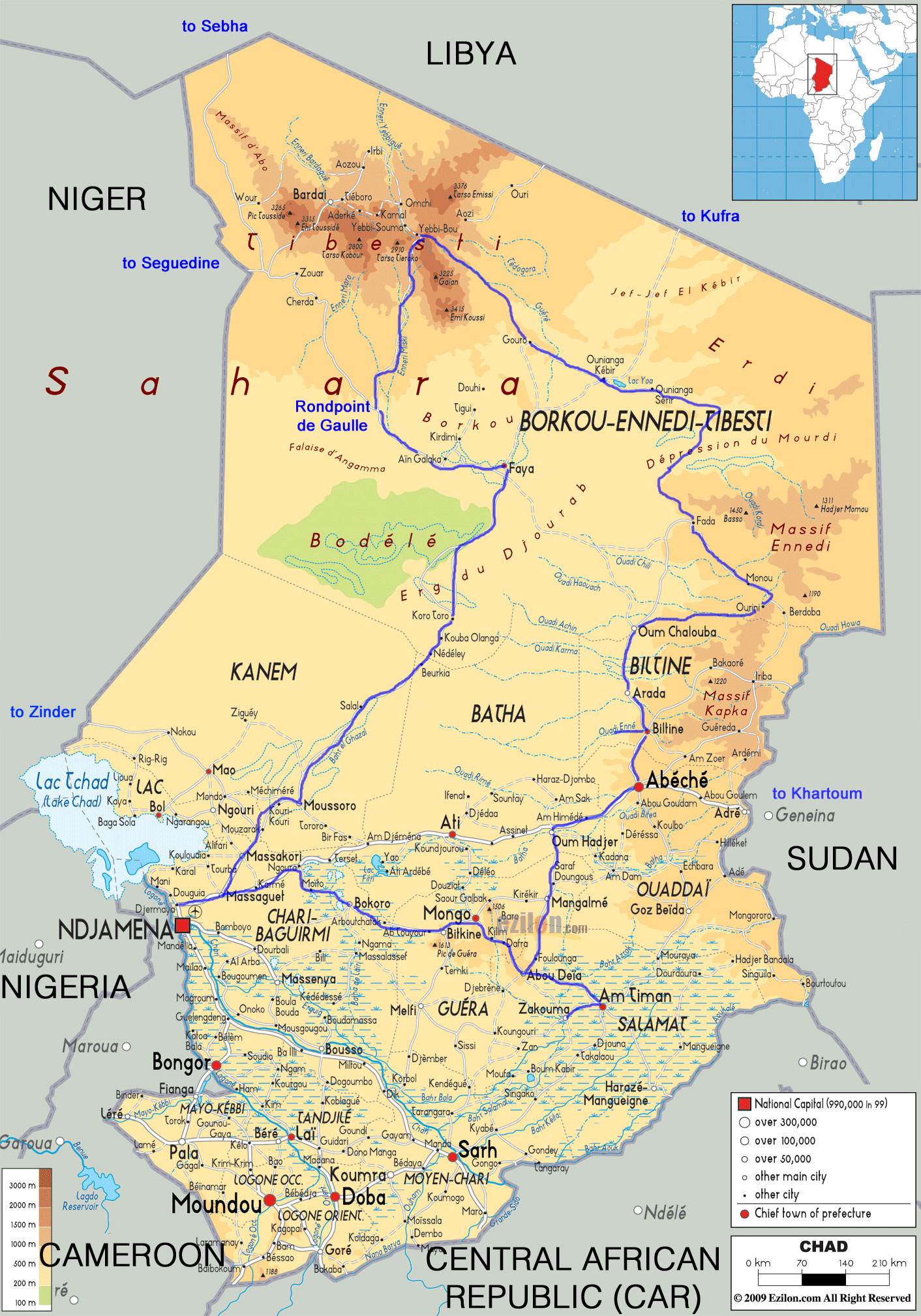
Together with four friends, I recently completed a four-week tour in Chad. One car came from Belgium via the Atlantic Route and then through West Africa. A second car was rented (with the compulsory driver) for 80,000 FCFA/day (‘XAF’; €120).
Our itinerary (see map, right) took us from Ndjamena anticlockwise down to Mongo, Zakouma NP, up to Abéché, Kalait, Ennedi, Fada, Demi, the Ounianga lakes, Gouro, Yebbi Bou in the Tibesti then Faya, Moussoro and back to Ndjamena.
Although the era of ‘mass tourism’ might be said to have arrived to northern Chad, the Authorisation de Circuler is still compulsory, as is the registration in Ndjamena (procedure still the same). However, we didn’t have a single police/gendarmerie check during the whole stay. Only the newly created Office du Tourisme Tchadien (known to everybody as ‘OTT’) checks the AdC in Fada and Ounianga. In Gouro and Yebbi Bou the Gendarmerie/Sous-préfet were vaguely interested in it too.
During the season the main sites around the Ounianga Lakes and in the Ennedi massif are visited on a daily basis by the tour groups of Point Afrique. Seven sites in this region now charge 5000 FCFA/person (€7.5; change from the former 50,000 FCFA per group policy) and even issue receipts. Some souvenir sellers have also have appeared. In Bachikele, near Guelta d’Archei, the chef du canton tried to charge us the old rate; we refused and left but were still, apparently, chased by young men with AK47s. We complained to OTT in Fada and the ‘délégué regional au tourisme’ admitted this was the fourth time this season this happened at Bachikele. But OTT does seem to have some kind of authority; they quickly found our guide in Fada and all of a sudden every Chadian that argues with tourists becomes very easy-going when OTT is mentioned (concrete example taken from a discussion with a guide we hired that wanted more than the agreed price…).
We took a guide from Fada to Gouro through Demi and the Ounianga lakes which is not absolutely essential but was still very useful (six days – 140,000 FCFA). The second guide (Gouro to Yebbi Bou, Meski, Rond Point de Gaulle and Faya) cost us 170,000 FCFA for five days. A guide south through the Erg du Djourab is not necessary unless there’s a sand storm; the tracks are very obvious and the balises clearly visible.
The three-day route from Ounianga Kebir to Kufra in southeast Libya sees only erratic traffic since 2011 and merchants were complaining. However, the Sebha to Faya piste through the Passe de Kourizo sees quite a few Mercedes trucks plying the route in about five days. We saw a few en route and about a dozen Libyan trucks in Faya. There is a Libyan consulate in Faya but only Tubus risk this drive (see also this).
As it probably comes from Libya, fuel is much cheaper in the north, but as before is sold only in 220-litre drums for between 75,000 and 90,000 FCFA. In the north it’s also much easier to find petrol as many cars are imported from Libya. In the Tibesti it might even be difficult to find diesel. In Ndjamena a litre costs about 550 FCFA (€0.84) in a fuel station.
Mobile coverage was widely available in the south. In northern Chad Salal, Faya, Gouro, Ounianga Kebir, Fada and Kalait had signals. The network broke down in Gouro three days before we came.
Road to Sudan From Abéché it’s possible to drive to Sudan; the border seems open. However, the Sudan embassy in Ndjamena only issues visas to residents of Chad. There’s also a consulate in Abéché but we weren’t able to check with them. There seems to be tarmac from El Geneina to Khartoum, but the trucks go in a convoy escorted by the Sudanese army every week or fortnight. I imagine one could show up in El Geneina and join the convoy or pay the army for a private escort. Abéché to Adré takes 3-4 hours. The road from Ndjamena through Mongo to Abéché is tarred almost all the way (will be finished in a few months). There are about six toll stations, each is 500 FCFA/vehicle and a receipt is issued.
AQIM Travel in the Sahara has long been disrupted by the activities of AQIM and similar groups including Boko Haram based in nearby northeastern Nigeria. And as we all know, Chadian troops are currently engaged with French and Malian forces in Operation Serval in northern Mali and there was a coup in CAR a few days ago, and you wonder if this might lead to a resumption of the normal Chadian state of affairs. Hopefully not. Our conviction was that as long as we stayed clear of border areas we would minimise the risks.
President Deby has recently decided on the creation of many new Départements, Régions and Sous-préféctures. Almost all villages in the north are now virtually sous-préféctures where the sous-préfet (usually a local elder barely speaking French) appreciates visits from the foreigners. They are the link between the State and the local tribal authorities and get new Land Cruisers, offices and even a residence. I imagine this is another way for Deby to strengthen his grip on the north. He himself originates from just south of the Ennedi and his tribe, the Zaghawa, extends as far as Bachikele and Monou. I cannot imagine that some of the revenue from tourism doesn’t flow back to high circles in Ndjaména. I therefore think there is a major interest in safeguarding security and preventing foreign infiltrations in Chad by ensuring a revenue and the preserving the power base of the President. That’s the assumption under which we travelled but only the future will tell if we were right.
This Business Week article paints a grim picture for the future of tourism in Algeria following the In Amenas gas plant attack. But Algeria is not new to atrocities like this, and unless such dramatic events become regular I think there’s still hope for small ventures.
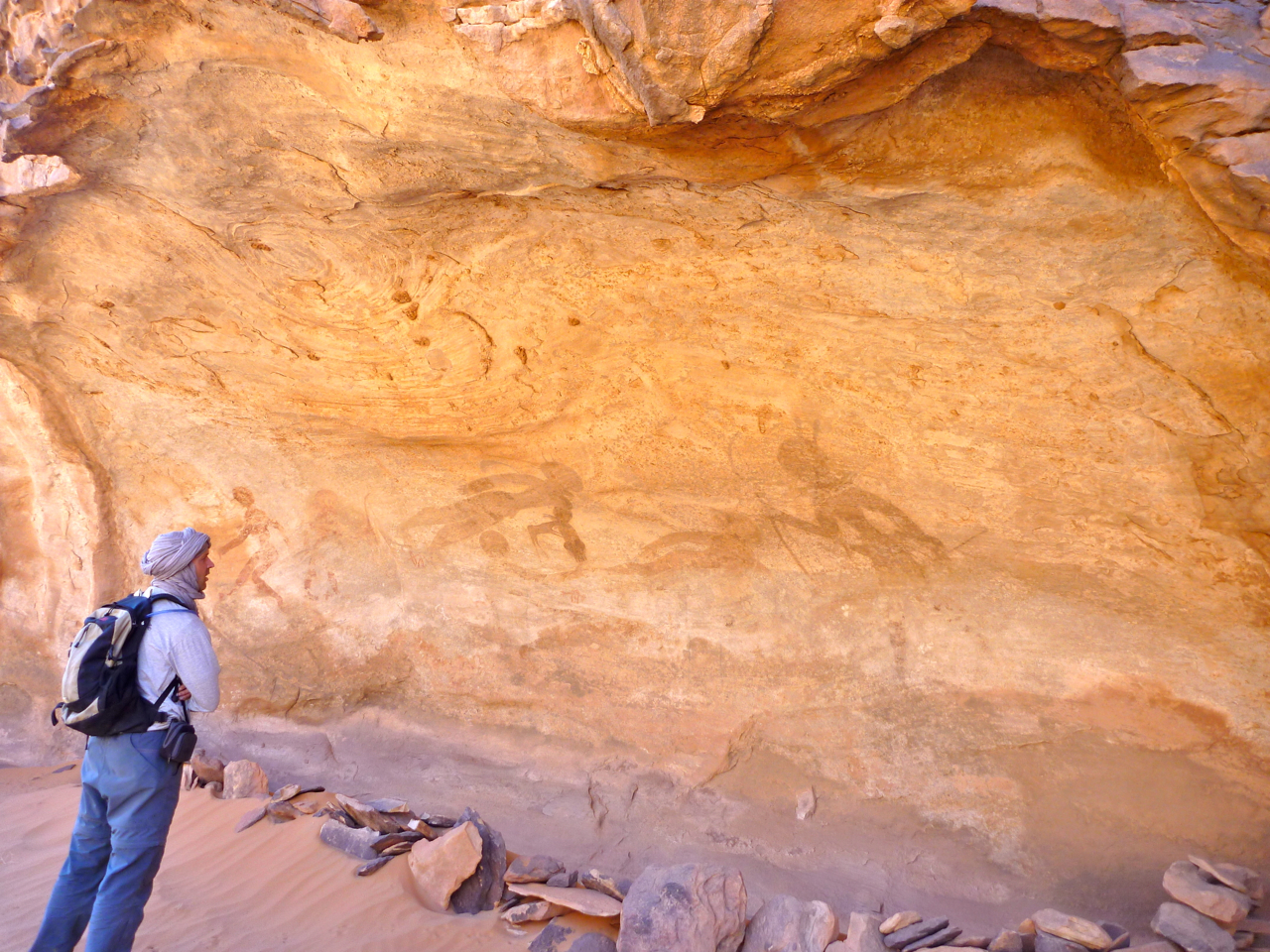
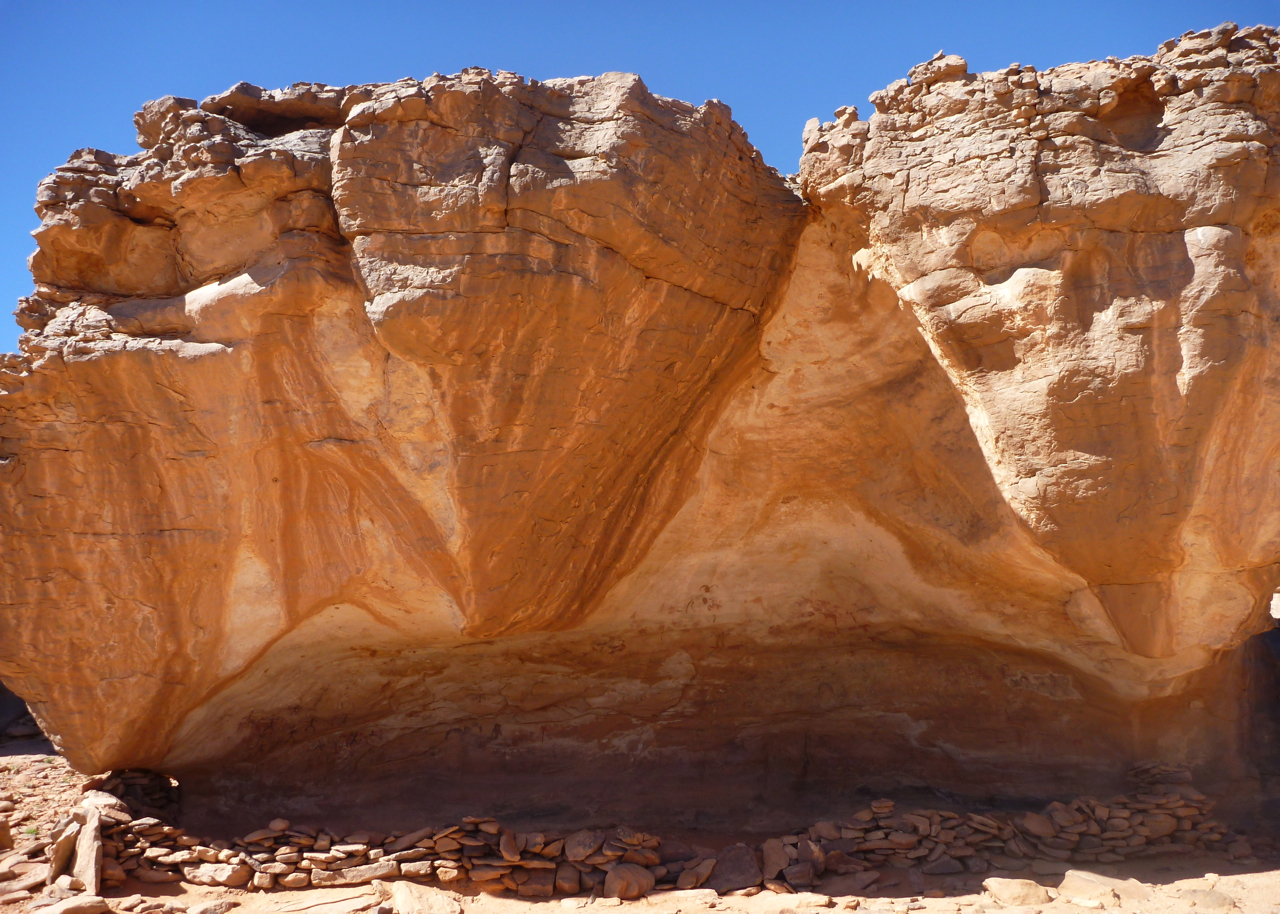
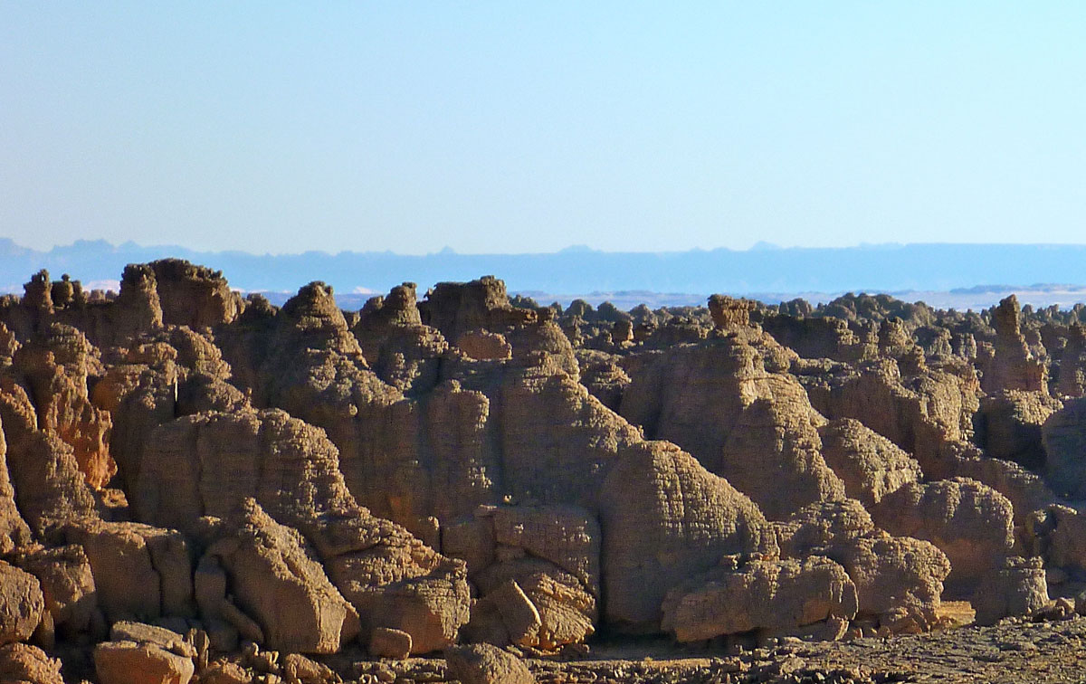
In Djanet a week or two earlier the agent joked with us that at least they were now targeting the far more crucial gas industry instead tourism which never really recovered following ‘2003’. It was a hollow joke of course if your sole business is tourism. I suspect the agencies that have scraped by and are still be able to offer a service are those for whom tourism is not the sole source of revenue. What that other revenue might be to some it’s better not to ask. Both the freelance guides we used on our recent camel- and donkey treks moonlighted as plateau guides for smugglers from nearby Libya in the lean years of the 1990s, and at least one had a couple of spells in prison on account of it. These days such ventures are far more risky of course. The picture above right is the view east from Sefar, showing the Libyan Akakus about 50km away and the town of Ghat at it’s foot.
The golden era of the 1980s tourism may be over in Algeria, but as I suggest in that article enough expertise, great destinations and circuits have built up over the years to offer a solid foundation for those who still believe the deserts of Algeria are a worthwhile destination.
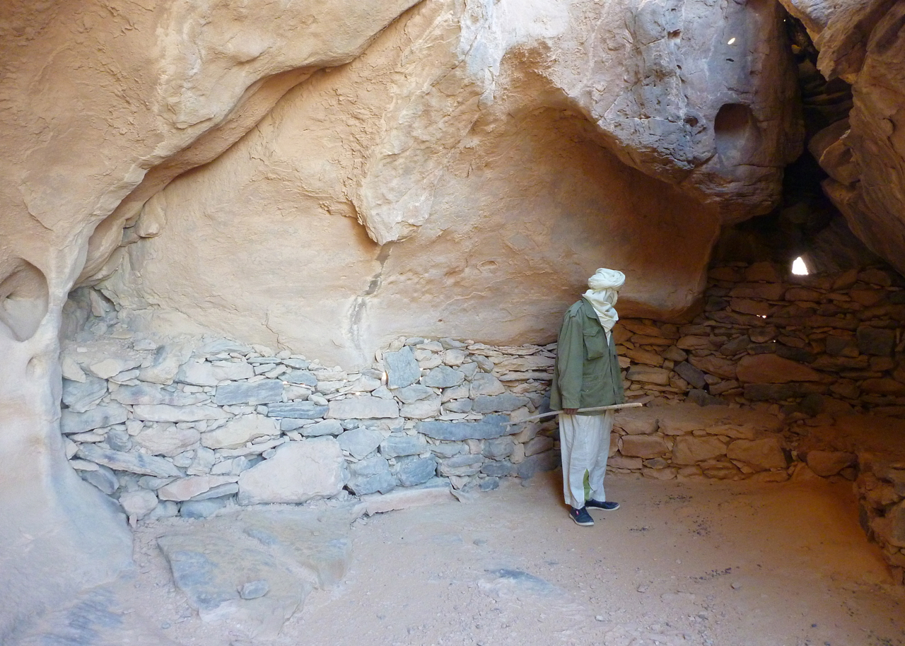
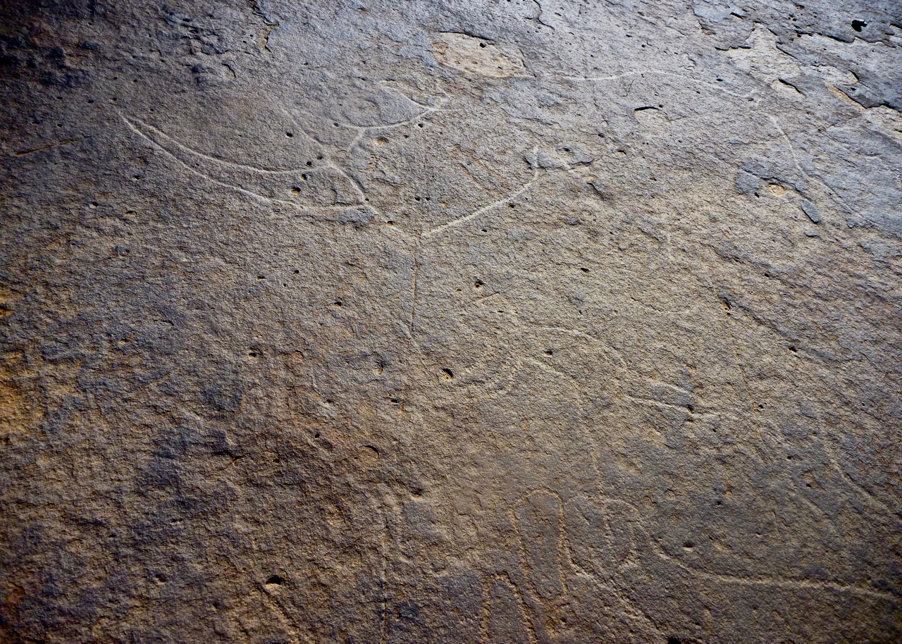
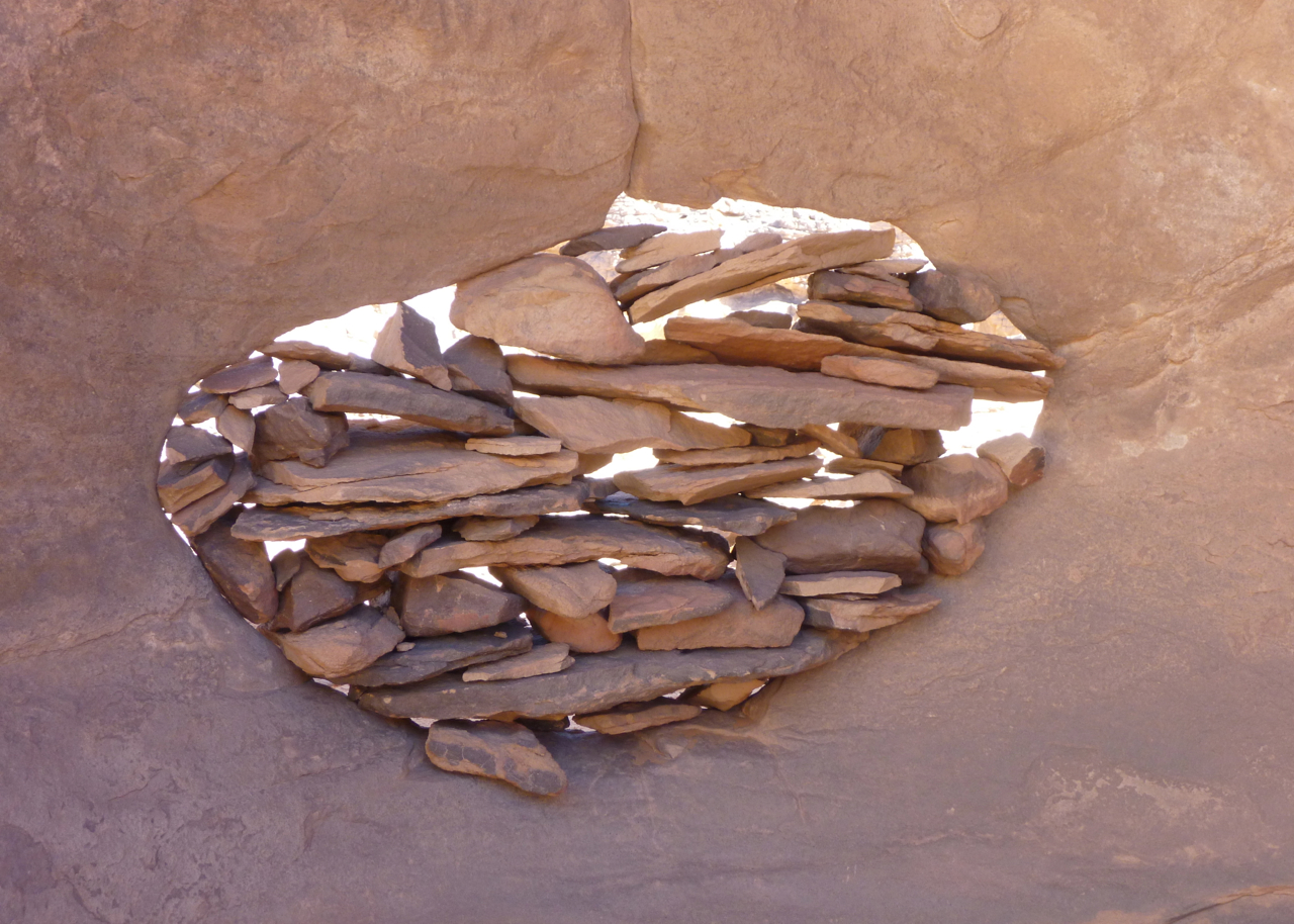
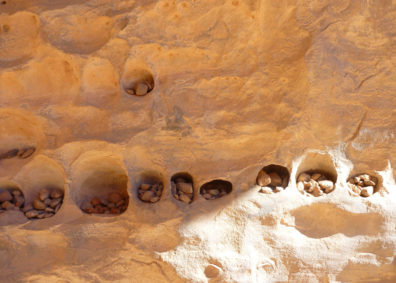
Picture below: Pre-Islamic tomb in the Tassili N’Ajjer. Also visible on Google Sat.
Having got to know Algeria as a commercial pilot (or so one presumes, we learn nothing about the author apart from the existence of a wife and son), William Langewiesche travels from Algiers to Dakar around 1990, as Islamic revolution and Tuareg unrest spread paranoia along the trans-Saharan Highway.
He revisits old friends, including the neglected and now destitute wife of a once respected Mr Fixit who suffered brain damage following a car crash with his mistress. Along the way we learn about former visits to the Algerian desert town of Adrar as well as Mauritania, some cautionary parables à la Paul Bowles, and deserty topics like dunes, rock art, Tuaregs (including the late Mano Dayak), plus the staple of good old Foucauld.
Langewiesche’s local connections provide him with a unique insight into the bitter unravelling of Algerian society at the time. In Tamanrasset he takes an excursion east to explore some remote art, but is used as an unwitting decoy to enable his truly odious guide to smuggle in Libyan arms for the Tuareg cause. The festering acrimony between the two is laid bare after Langewiesche is abandoned in a canyon for a couple of days where he’s forced to confront his own death.
Mirroring local attitudes, he writes without sentimentality about the Sahara and its inhabitants: wily opportunists, smug entrepreneurs, mendacious braggarts, ‘Camel [cig] commercial’ adventurers and sun-fried ex-pats. There’s a lip-smacking ‘I-told-you-so’ sensationalism used to recount several tales of travellers perishing in the desert, embellishing the deadly glamour of the pitiless Sahara.
Having crossed the Sahara and now without the privilege of local friends, the mood grows gloomier and possibly resentful as the author has to fend for himself and becomes preoccupied with the incompetence and corruption of the desiccated Sahel. Weakened by illness, the book speeds towards a quick end in Dakar. A back cover quote from Newsweek suggests the book “makes the desert’s exoticism bloom…”, a nice idea but not how I saw it. Langewiesche writes unsentimentally and with a sparse, gritty realism, whether describing the futility of the Tuareg rebellion and overseas aid, the short-sighted ‘Inshallah-syndrome’ and, ultimately, the desert’s crushing indifference.
Readers familiar with the Sahara will become easily absorbed with the many familiar characters and situations described during this unhappy episode of Saharan history. While Langewiesche prefers to remain studiously enigmatic and, at his worst, comes across as patronising and condescending (other tourists become an easy target, as they do in so many books like this, such as Quentin Crewe’s In Search of the Sahara). But I found this book true to its title and a worthwhile addition of any Saharophile’s library.
It was a full, two-day drive from Bit Outene at the end of our 12-day Immidir trek to the base camp east of Tam airport for our walk up to Assekrem (map below) and down again. On the way we overnighted at Erg Mehajibat (left) and stopped off for some wafers and fizz at Arak where we said goodbye to Mohamed our Immidir guide. As always, these are curt, brief affairs, but he knew we’d all had a great time with him and his crew who were now trekking back from Bit Outene with the caravan, about a week’s journey.
Just before Tam airport we were met by Ben Kada’s boss, another Mohamed, who had more juice and biscuits for us – a nice touch. He invited me into his pickup and within an hour we were dropped in a oued to meet the new Kel Ahaggar camel crew and set off scratching around for firewood which would be lean in the Hoggar. As expected, it was a freezing night at 1550m (left) and we set off next morning along a oued leading north towards a piton of rock alongside a massif, one of the many column-clad volcanic plugs which give this central core of the Hoggar – the Atakor – its distinctive look.
After an early lunch (left) we continued our climb onto the evocatively named Plateau of the Sky Wind, composed of basalt rubble the size of baby’s heads. As with many mountain treks, we gained our altitude in sudden steps rather than a gradual ascent. The Sky Wind in turn led to our camp for the night (left), a nest of tan, granite boulders overlooking the cone of Adrar Hedjrine. Compared to basalt, granite is a much friendlier rock to spend time on. Once our pitches were set and with little firewood, we hunkered down under blankets, solved problem of Middle Eastern politics once and for all, and waited for another great dinner.
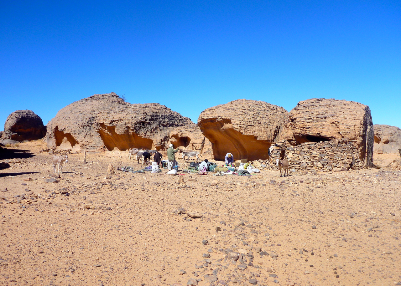
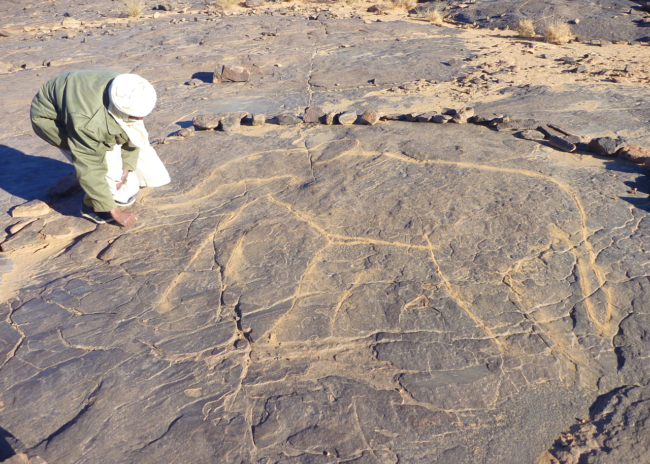
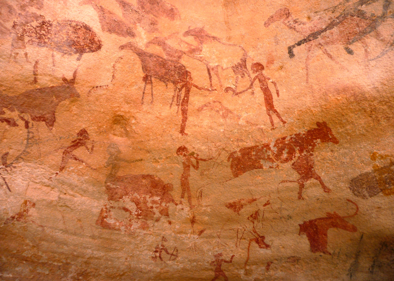
We stayed on the granite next morning as Honi our guide led us up, over and down into a basin called The Palm (left), from which we scrambled back out to rest under a smooth-lipped cave adorned with pre-historic cattle images. I can’t say I recall seeing rock art painted on coarse granite before, but supposing it was at least 5000 years old, it had lasted well. I always understood that ochre and other pigments survived so well on sandstone because of a chemical bond with the rock surface – could it be the same on less fine and less porous granite? We continued our scramble and emerged on another ankle-testing basalt plateau at 2000m (left). Below us the caravan passed along an easier route and led us to a palmy spring of Tin Amelout in the Oued Amsa for lunch.
As we washed and waited to be fed, a group of camels including a mother and her calf wandered by. The young animal was duly snared, knocked down and trussed up with much commotion, and then branded with a bar. Initially I thought this was an opportunistic grab of an unbranded ‘cleanskin’, but it turned out the mother shared the brand of our caravan’s camels, so the crew were just marking what was theirs.
Back in the Immidir I’d mentioned to the group that our Ahaggar crew might be more tourist savvy or weary than the Ahnet bunch, because in the good years this route would have been frequently taken by tourists. Honi, his young son, brother and brother in law were old timers with the agency (unlike the Arak crew), but for some reason they remained a reserved and occasionally unfriendly bunch, as in sneering: ‘Are you looking for something?’ as I helped unpack a heavily-loaded camel at the end of a day. Even Tayub who was from around here, knew the crew and had done this route 40 times, was more reserved. The cause of all this perplexed us but was either low pay or just tourist fatigue and boredom. It certainly wasn’t us who, after a fortnight in the desert, were an undemanding and acclimatised group. As on previous occasions, it was clear that they got the gist when we talked about this [in English] and occasionally made an effort, but really their heart wasn’t in it, unlike the Ben Kada agency itself or the guys from Arak.
The odd staging, with early or very long lunches also took some getting used to. We concluded that we were following an easy, ‘starter’ circuit aimed at recently flown-in tourists, and not hardened desert vets like us. The glum crew, dearth of firewood, occasional rubbish and car tracks, plus the sometimes bleak surroundings took the edge off the walk, but as a well-bonded throng, we took it all without complaint because it sure was better to be walking out here in the Hoggar than most other things.
After lunch the guides hooked the mother and newly branded calf onto the caravan and tried to shoo away the other roaming camels who’d lost part of their troupe. Even that evening at our camp by a chilly guelta of Talmest, the herd stalked us from the ridge top, like Apache’s about to attack. At one point the young calf escaped its tether and made a dash for the ridge, but was chased and retrieved by Honi’s 18 year-old-son. As in the Immidir, the ways of camel trekking were being passed down to the next generation. With tourism crippled year by year, whether they’d get as much of a chance to put it into practise, like their aged fathers, was another matter.
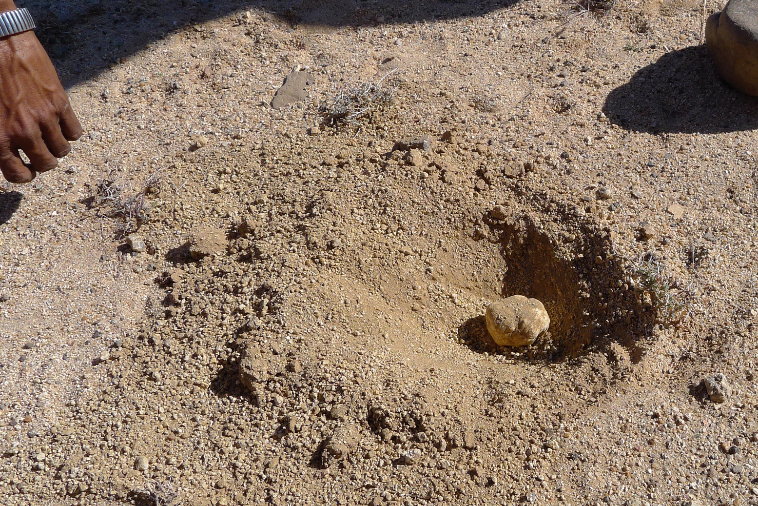
Flowering Sodom AppleDesert truffle
Cooler, less arid and twice the elevation of the Immidir, there were a lot more flowers (left) up here in the Hoggar, even though we were told it had not rained since the summer. I don’t know what any of them were but we were told it was the reason the hobbled camels set off up the rubble clad hillsides for a nibble every chance they got. At one point, after burning some plastic rubbish he came across, Honi stopped at a bulge of sand and carefully dug up a dense mushroom which I realise now was a truffle (left). Within a few minutes he had a few more and pointed to where rabbits had been digging others up. Just as he said that, a big rabbit or hare broke its cover and dashed off. I’ve never seen one before out here. Grilled on coals, the mushies made a delicious snack in the lunch oued an hour or two later.
That night’s camp at around 2200 metres was a grubby oued just short of the Assekrem track. This time we scoured the vicinity for scrub to burn, and using the oued bank wall, managed to keep ourselves warm under blankets (left) until Tayub brought over the dinner. Once the tea was served, we all made a dash for our sleeping bags.
Jackals howled overnight but by lunchtime next day we were at a cleared patch of ground by a small ruin, just below the col of Assekrem. Clearly it wasn’t going to be too balmy here tonight so we figured we’d earned a night indoors up at the auberge on the pass – all the better positioned to strike out for sunset and sunrise duties, too.
Up on top (left and below) a rowdy bunch of Turkish tourists were also enjoying the spectacle. Some of the world’s well known touristic wonders can lose their magic or be over-rated, but for me, like Ayers Rock or Monument Valley, Assekrem is no less amazing, even if you’ve been here half a dozen times. As expected, the ordinary meal we got back down in the lodge underlined what a great job Tayub our cook was doing in feeding us off the back of a camel for weeks at a time.
We all bundled into one room while the Turks sang and hollered till the early hours – and then before 6am the dedicated hauled themselves up again to stake their claims on the dawn. I took off up the rock opposite the hermitage (the lump on the right of the picture, left) where most go, sat myself in an enclosure against the wind and fired the camera into the primeval scene emerging from the night. I can’t say this vantage point is any better then the usual one, except that you’ll probably be alone.
After brekkie in the lodge, we traipsed back down to the caravan camp as arranged, but they were having a slow morning and the camels were still all over the mountainside (right), looking for those flowers. Once they were eventually brought in and loaded, we backtracked from Assekrem and set off for the three day descent, along a steep valley peppered with more flowers. Narrow clefts led over thick pools of ice, and out onto a plain we passed a nomad camp. As the day ended we set down in another oued with the Atakor’s spires behind us (left) for another freezing night mitigated by a bush scrub fire. A changeable wind rose after sunset and by 4am it was howling a gale. The empty tent I was using as a windbreak flapped remorselessly, making a racket; in future I’d be better off just huddling down under a quiet blanket like the nomads.
The secret of a good group is that they remain cheerful even after a grim night where few had slept well. Some had crawled in to share tents, and others had their tents snap over them, making an even worse din. Breakfast was delivered with stuff flying past and we then set off down the valley. Soon we joined the main, eastern arm of the car track to Assekrem which we followed briefly and then turned off at the twin ‘Mac D’s’ arches for the guelta at Afilal.
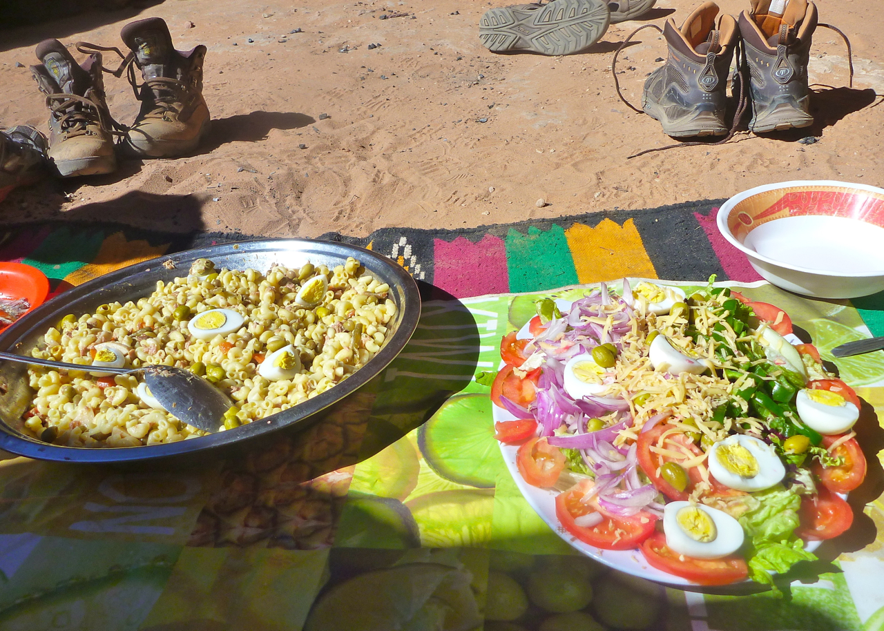
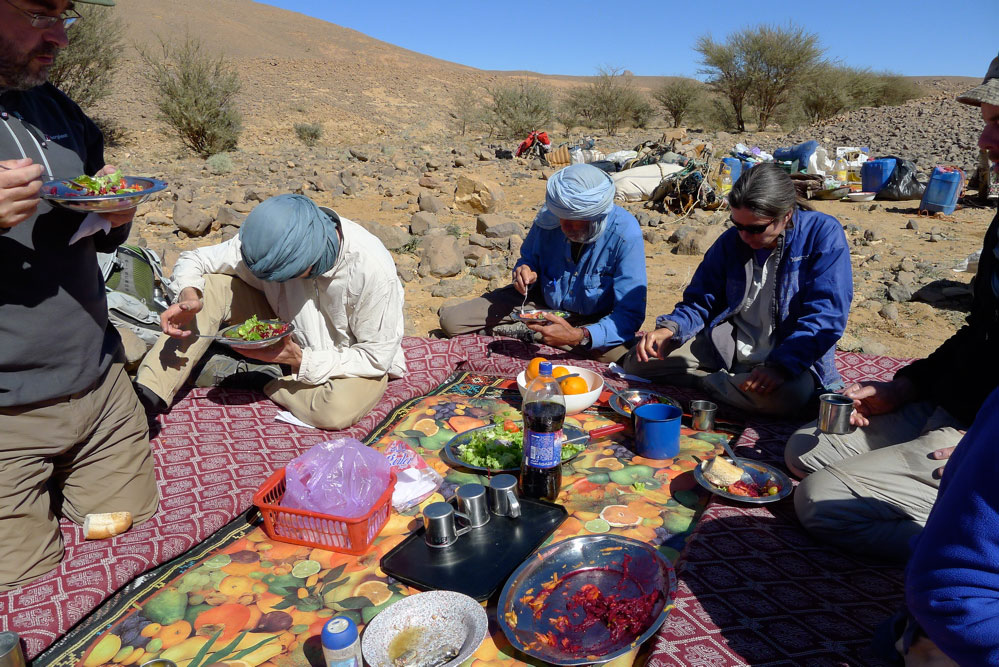
I’d never stopped here before. I think I tried to once but was shooed away by the army. Even then, I assumed it would be a grubby, rubbish-strewn dump, especially if army were camped nearby. In fact the Ahaggar national park guardian based there in an old portacabin was thrilled to see tourists and grabbed a photo with us for his next newsletter while behind us volunteers (or possibly miscreants) lethargically collected rubbish scattered around the main guelta. In fact there’s a lot more to Afilal than that waterhole and with Tayub and the lunch camel alongside, we followed the source downstream past trickling waterfalls, deep green pools and smooth, flood-washed granite until we found a wind free corner for another great salad lunch. I’ve never seen so much running water in the Sahara.
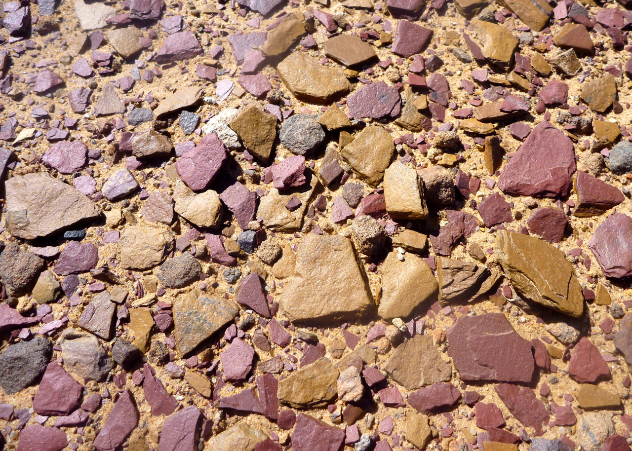
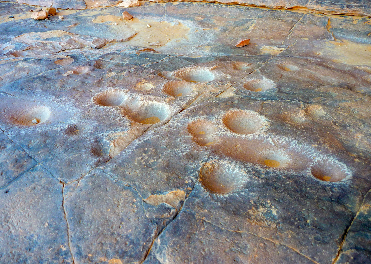
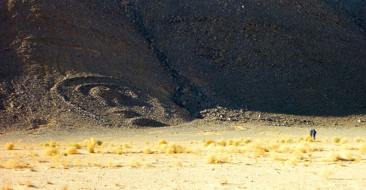
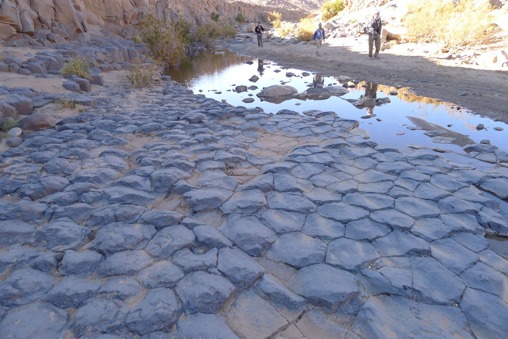
That afternoon was one of the best of the walk, not least because we put in a good 15 clicks after lunch. We followed the Afilal valley until it petered out and then crawled over low ridges into adjacent valleys and basins separated by more hills. Away from the grim basalt plateaux, we explored the granite ranges, passing a cobbled stone circle (left) just like the one we saw in Tadant oued, some 200km east of here at the tail end of SEQ in 2006. What they are exactly is still a mystery. A tomb is the most obvious answer, as these are the structures which most commonly survive, but most tombs have a focal point like a mound; this was just a very finely set flat ring of stones. It may just have been a pilot’s marker like this, but they are usually much bigger and out on the plain. Nearby, less well made examples had broken up over the years and in a nearby guelta, a flood-carved basalt pavement (below) added a natural wonder to the scene.
The caravan had taken a more direct route, but Honi was unsure where they had made camp. He crissed crossed the terrain, looking for tracks just we were beginning to creak a bit after hours of walking. Eventually we backtracked (see the map track) and staggered into another perfect camp in a oued set among beige granite boulders. Here we managed to scrape together enough acacia to encircle a fire ahead of our last day of trekking. That night it was probably minus 5.
Another great morning led us through the boulders to Akar Akar mountain to cross over the car track and get back inside the Hoggar ‘loop’. Steve had chosen to ride a camel that morning, little did he know he would be sat on the acacia plank till lunchtime, but when we caught him up he was fine. To the south lines of cones marched across the horizon in the blue haze and by mid-afternoon one more basalt rubble ascent and descent brought us above the last oued camp near the distinctive cone of Adaouda where Patrick found a fine Tuareg dagger while looking for fire wood.
I’d long wanted to try this walk and the Hoggar trek had passed through some amazing country side. But we couldn’t help compare it with the wild Immidir we’d just visited where the most conspicuous signs of man were usually 6000-year-old tombs. Tayub kept us as well fed as before, but the grumpy crew too took the edge off the experience and the sun rising or dropping over Assekrem is no less amazing for having driven up there so I’m not sure I’d do this trek again.
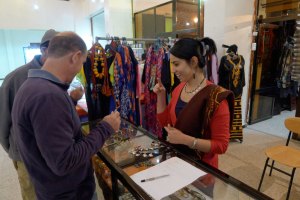
So, after 200 miles walking and nearly three weeks of bush camping, all that remained was a long overdue hose down at Loukmane’s house in Tam, followed by a haircut, some interneting, shopping (left) and a non-goat based feed at a resto in town. The night plane flew us back to Algiers via Djanet which gave us an extended chance to doze. A few hours later we were all on our way home while I conjured up plans for next time.
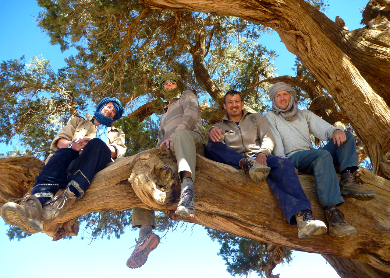
From the centre spiralling out anti-clockwise: RobUK, Rob, Diane, Hannah, Patrick, Mike, Steve (on top), Honi (below).