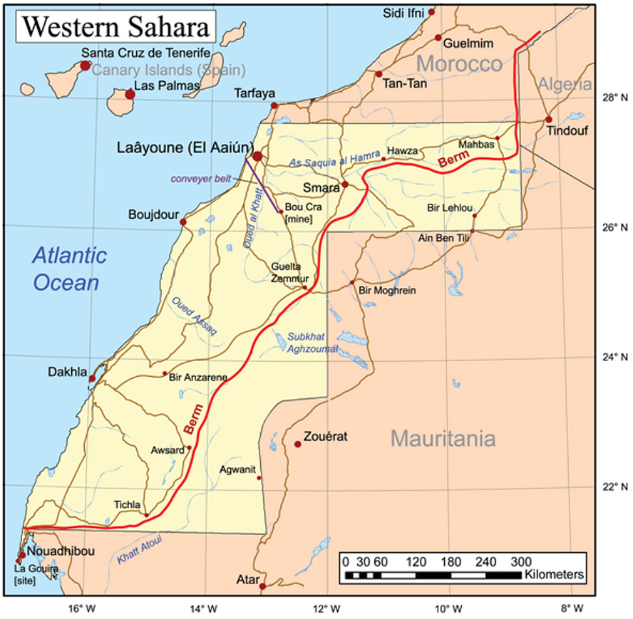
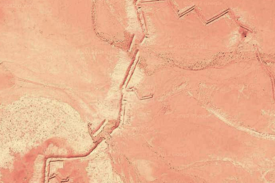
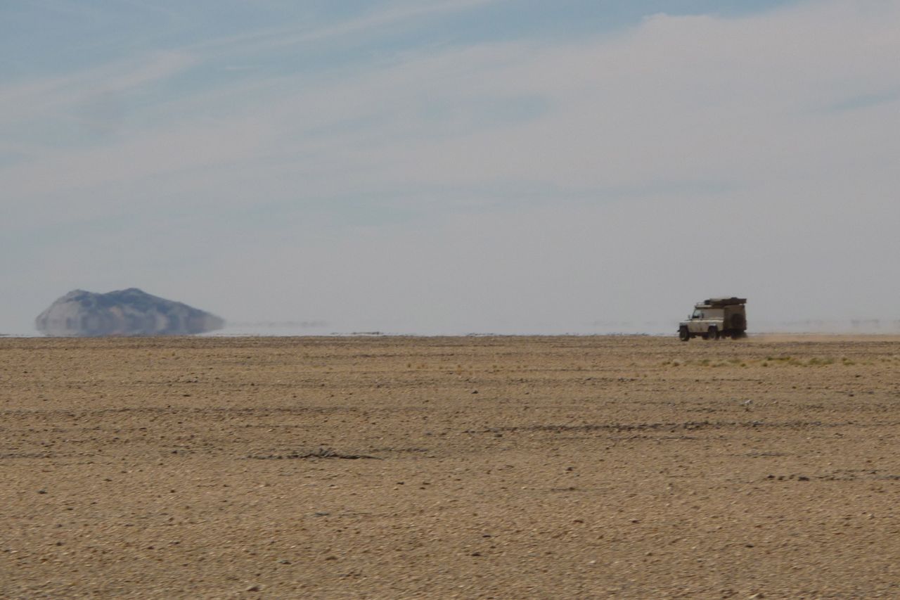
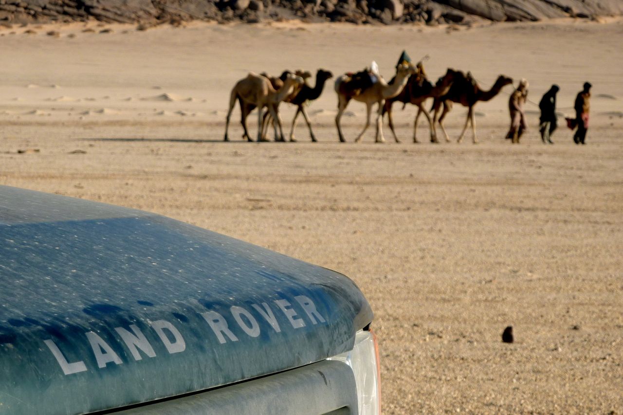
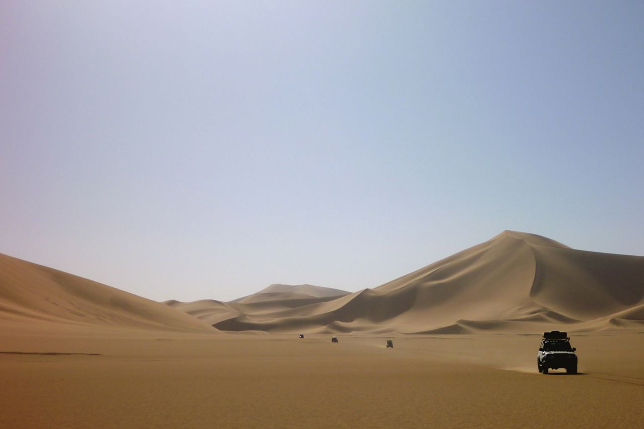
It’s well know that in the 1980s the Moroccans pushed up successive waves of fortified and mined sand walls or berms (left and right) until they their part of the Western Sahara and the remains of the Polisario-controlled lands to the east. It stretches from the Atlantic border with Mauritania northeast towards Smara, on the way cheekily chopping off the desolate corner of Mauritania (not shown on all maps). After Smara it then runs up towards Zag until it reaches the natural barrier of the Jebel Ouarkaziz ridge – the southernmost outlier of the Atlas mountains – right around here and just 22 miles from southern Morocco’s N12 highway.
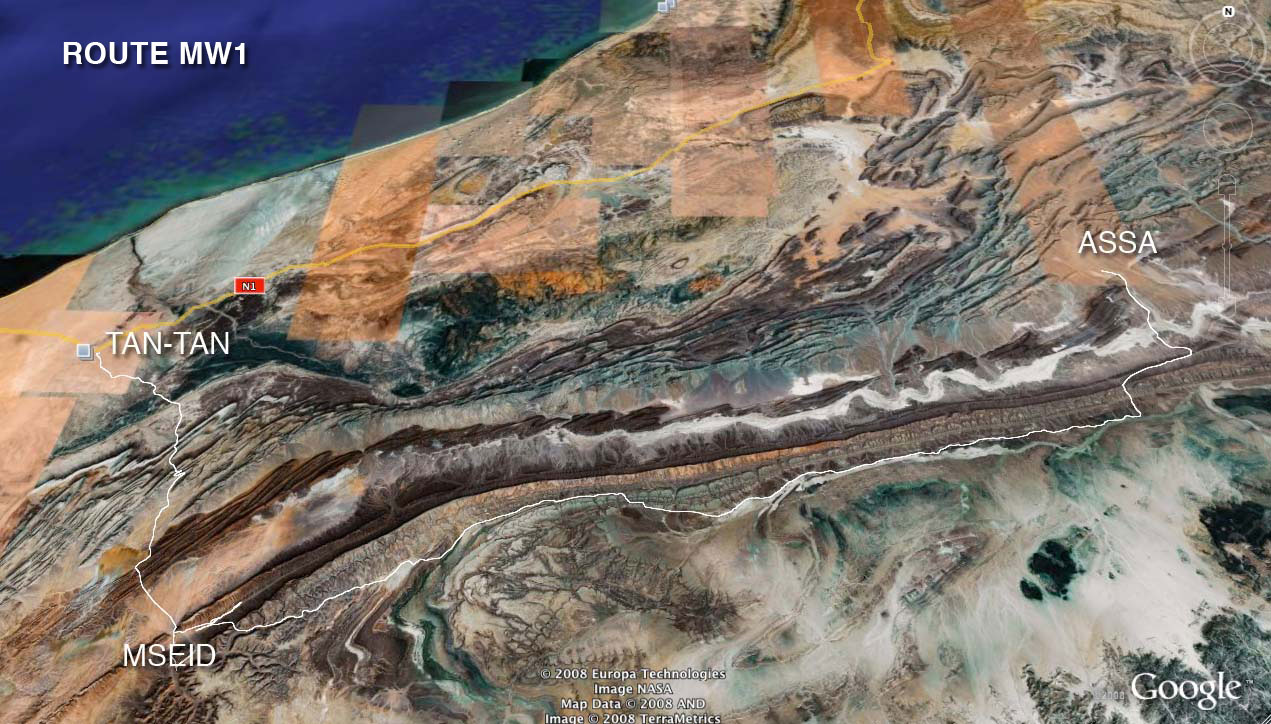
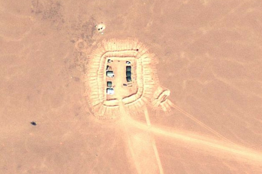
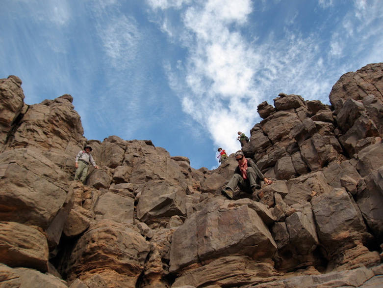
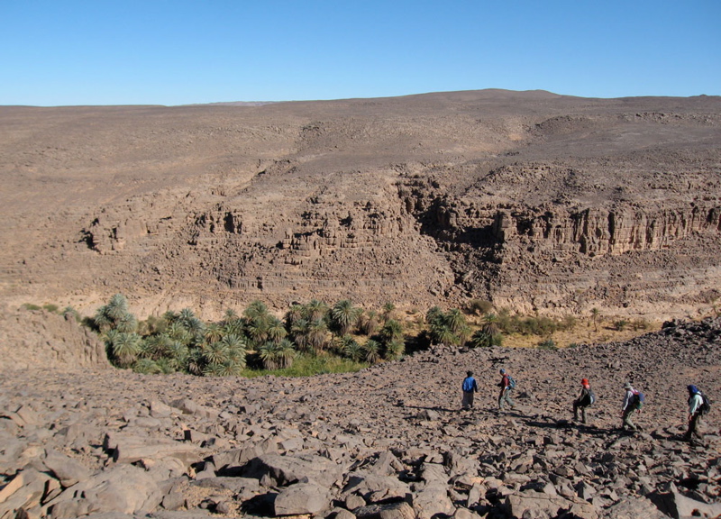
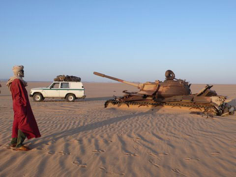
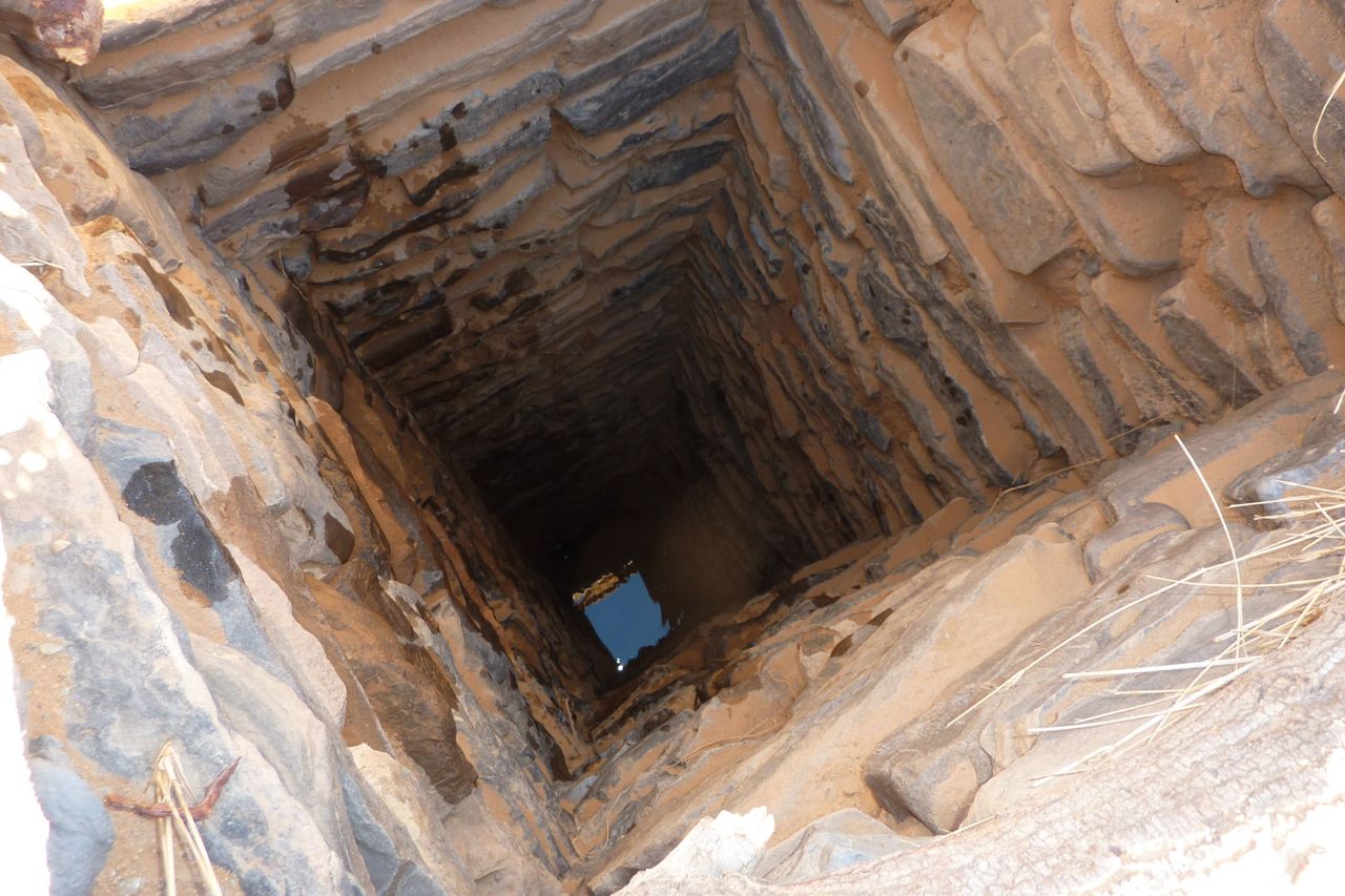
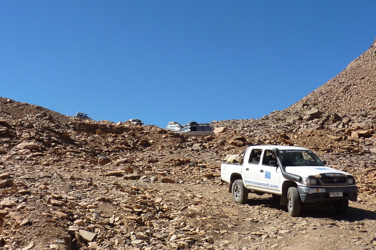
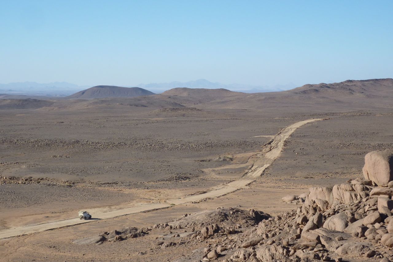
The periodic foums and oums (natural gaps in the ridge) sometimes become locations for strategic forts or installations, like the abandoned one at KM227 on Route MW1 in Morocco (above) from the Polisario war.
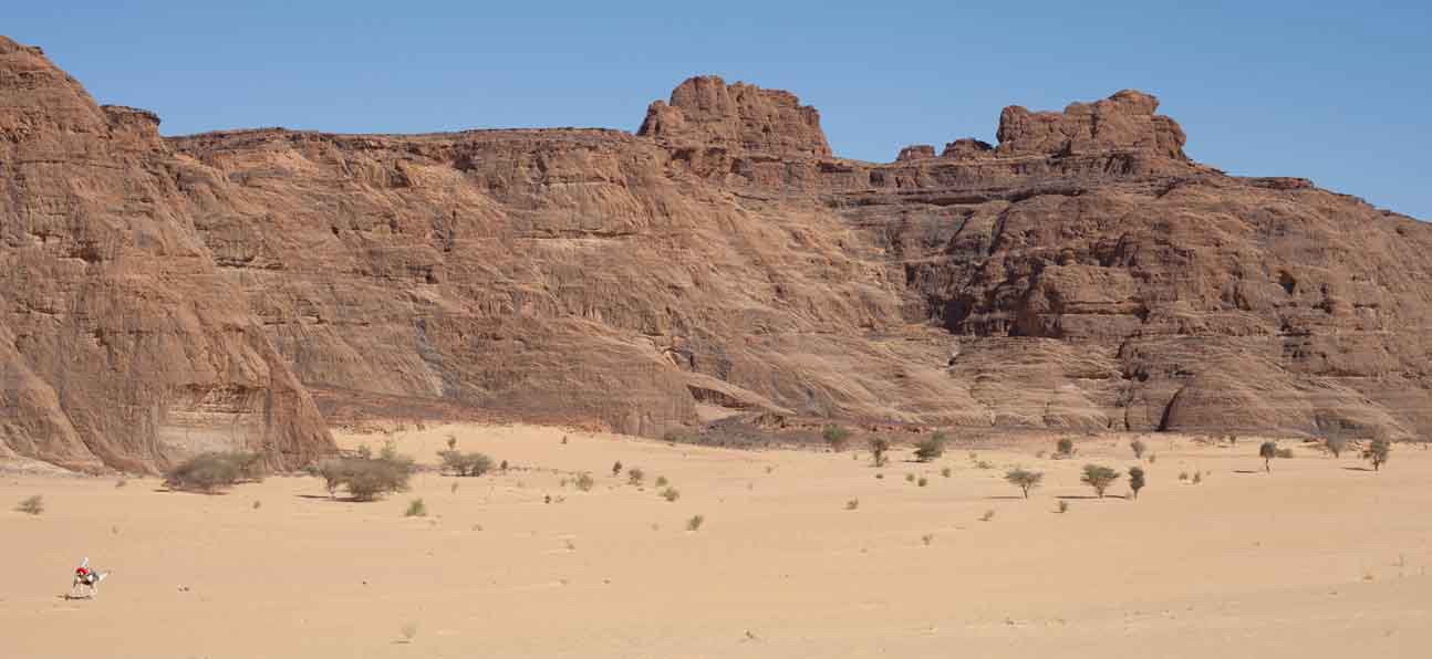
It seems the Algerians have got the same idea and have been building an intermittent berm of their own along exposed sections of their border with Morocco where foums in the Ouarkaziz or later, Jebel Bani, would have allowed easy motorised passage.
Click on this point in Algeria some 40km southeast of Mhamid in Morocco, and you can follow the zig-zagging berm northeast for some 40km via a small erg, until it stops near a ridge where rough terrain resumes the job. Branch berms break off to make enclosures or to complicate scouting along the main berm for a gap, and every once in a while there’s some sort of installation, fort or look-out post pushed up by the bulldozer. They even incorporated little gaps for the oueds to flow though (above right) and which are quite possibly mined. Any passages through the small erg are also blocked with a berm (below right).
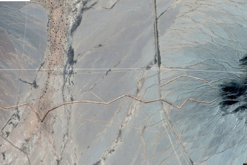
Way further east towards Figuig, a gap in the jebel there demarking the Moroccan border where the old Oran–Colomb-Bechar rail line used to run has been bermed too (above left).
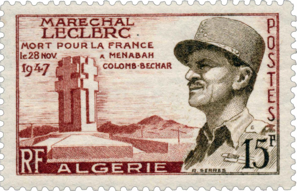
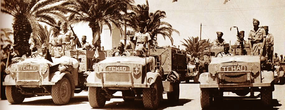
Nearby, just to the south in Algeria is a monument to General Leclerc whose plane crashed near here in 1947 – it’s pictured on a commemorative stamp. Among other heroic wartime deeds, he’s famed for leading an armoured column up though Chad to help the LRDG attack the Axis forces based in Murzuk, Libya. There are many more monuments to the WW2 liberator of Paris in North Africa and France.
Reading the article linked at the top of the page and it becomes clear traffic flows both ways over the long-closed border. Algeria claims Morocco smuggles loads of hashish southwards to befoul it populace, or to get it to European markets via other routes. You imagine a berm is fairly easy to make once you order a conscript with a D6 to get on with it. There’s been bad blood with Morocco for as long as the two countries have existed. Despite Morocco’s wishes, the border with Algeria has been closed to all since the mid-1990s.
More berm activity way down south at Bordj Moktar and I’ve also noticed new border roads and berms plugging the gaps along the Libyan border.
Que dit Mohamed? Mohamed, il dit qu’il accepte de vous conduire ou vous voulez, du Tenere, aux Azzjers, du Mouydir aux Iforas, il crevera s’il le faut son chameau pour vous plaire; mais vous accompagner a la Garet, jamais!… Il y a des Djenouns mon Captan… Pas un homme du Hoggar ne vous accompagnera sur les flancs de la Garet…
Garet, first ascent, 1935. Carnets Saharienesby Roger Frison-Roche
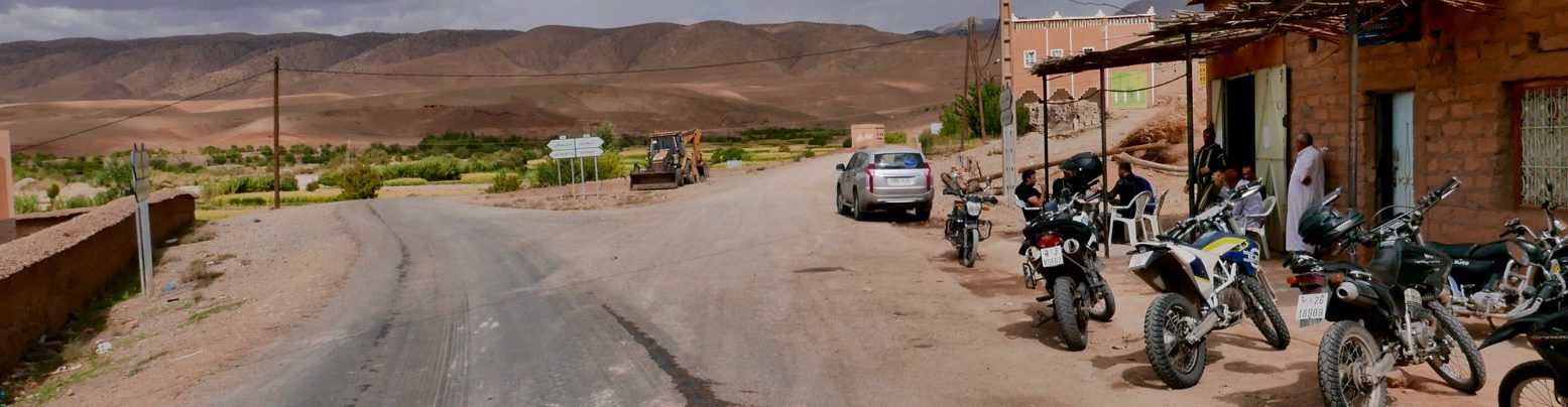
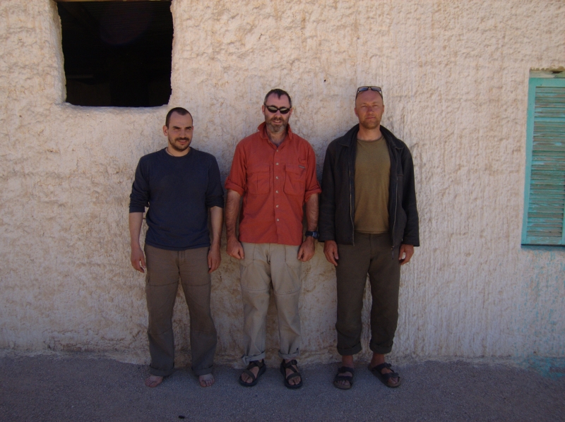
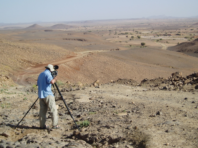
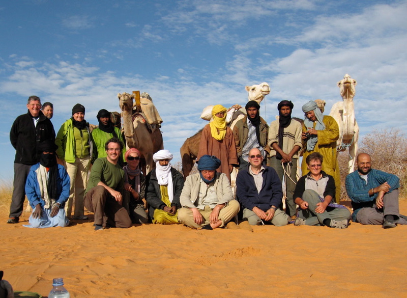
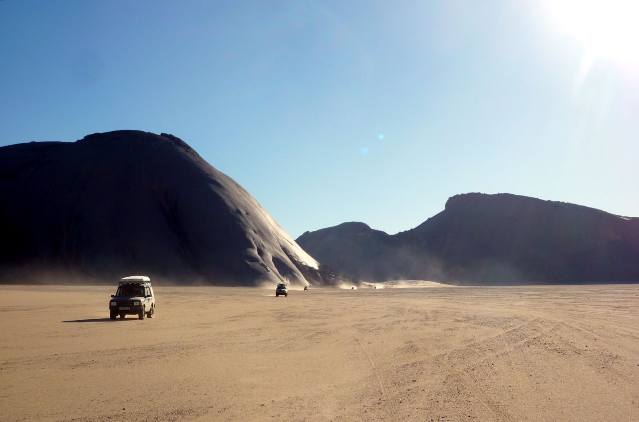
November 2005. Photos me, Jon and Nick
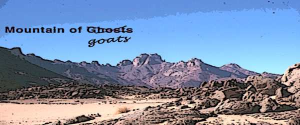
Jon, me and Nick-the-Cam flew into Tam to shoot Mountain of Spirits (MoS), another ageing idea of mine brushed down, spruced up and slotted into the ‘let’s do it’ category. Unable to find a cast, Jon and I worked through our inherent modesty and decided to be in it ourselves. In 2003 Desert Riders ended with me crashing out as Jon and I neared Garet with the intention of climbing it. So our film had a theme. Indeed my interest in Garet ran back to my first Saharan trip in ’82.
Tam airport car park 3am and a whole bunch of French and German fly-ins dispersed with us into the desert, to regroup a fortnight later for the flight back, some limping, some in slings, most with suntans and chi-chi headwear.
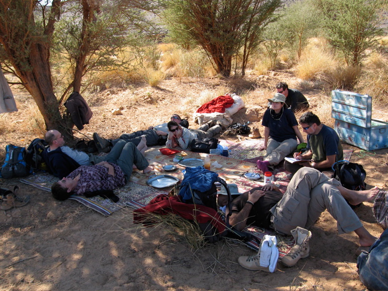
By the skin of our teeth we managed to slip thousands of pounds of camera gear and other restricted items through the scanners and past Customs, and spent the night in a house in Tam. Wanting to keep it simple and being hard men of the desert (or attracted to that idea on film!) the original plan had been to do it all out the back of a pickup; us three in the back, the crew up front. But the permit people were appalled at the idea: “Tourists are NOT goats” they exclaimed, so a station wagon was roped in. Just as well, the brief sessions filming in the back proved it would have been a rough fortnight indeed.
We headed up to Tahat (2908m), Atakor west side, for a warm-up slog into the Saharan Death Zone. It should have been an easy walk but luck – or was it the djenouns? – was against us. Lots of rain in 2005 and amazingly streams were still running out of the Hoggar. Tahat base camp we could have made at a pinch, but on up to Assekrem was washed-out (never easy at the best of times). Not wanting to lose time, we grabbed a few shots, scooted back to town and took the regular way up to Assekrem for a cozy night in the lodge and the dramatic sunset/sunrise.
The descent to Hirafok is still a spring-munching crawl at times. In places smoother than when I last did it in 2000, elsewhere cut up by the recent run-off. Still, as I was already finding, you sure notice a whole lot more when you’re not driving. Nevertheless, I was reminded that the Atakor is a grim and rough place where you’re jammed on the pistes. If it wasn’t for Assekrem being a ‘must-do’, I wouldn’t bother when you compare it to the lovely sandstone and granite ranges nearby.
By now I was gripped by le grippe and with time lost, was not fired up enough to shoot over to Telertheba (2455m) to see how far we’d get up that one. Almost certainly we would not have made the summit, first climbed by Conrad Killian in the 1920s, but it would have been fun trying. So we thought, let’s head straight for Garet and get stuck in; it was the focus of the film after all. Filming properly and not in my practiced fast-and-loose style, was taking a whole lot more time, but part of the project’s purpose was a curiosity to appraise the results of shooting a film with proper attention to detail.
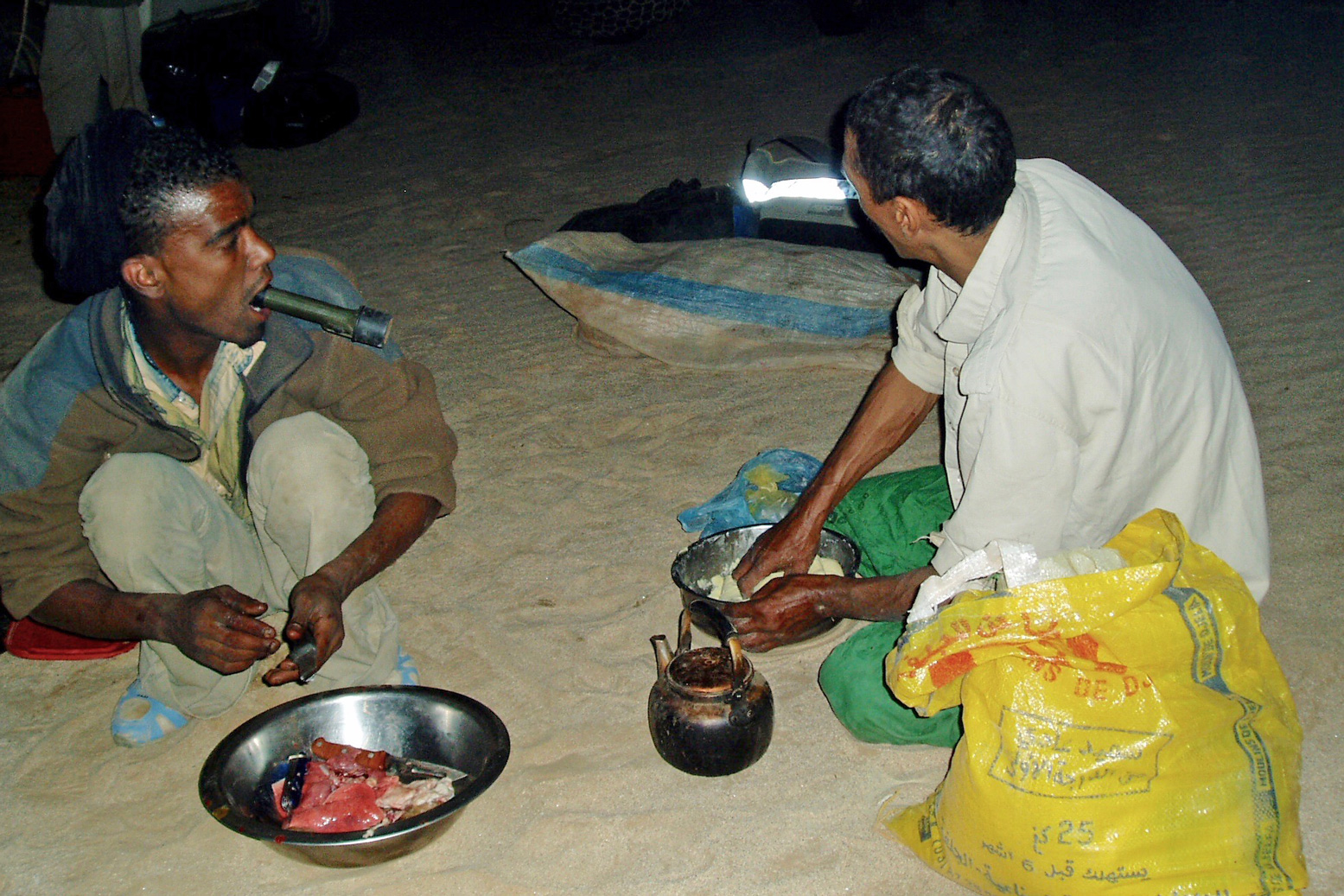
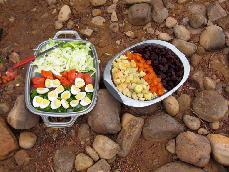
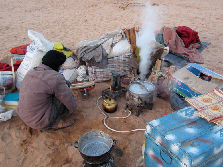
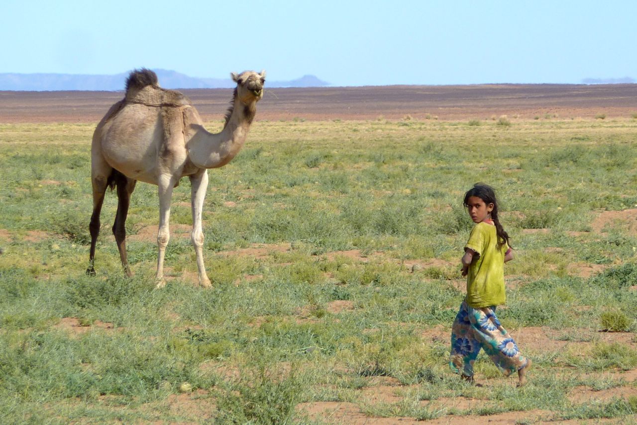
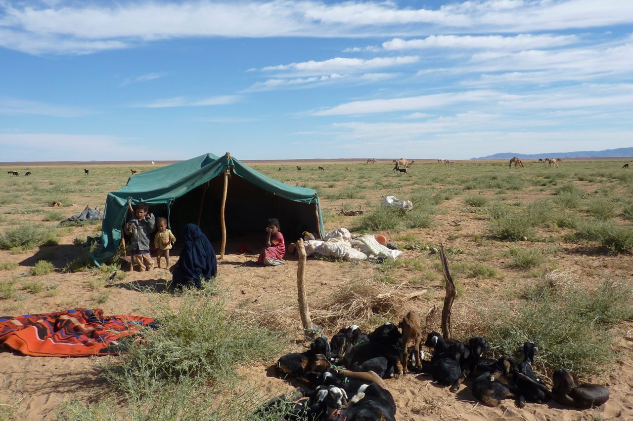
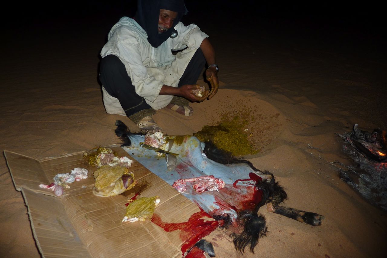
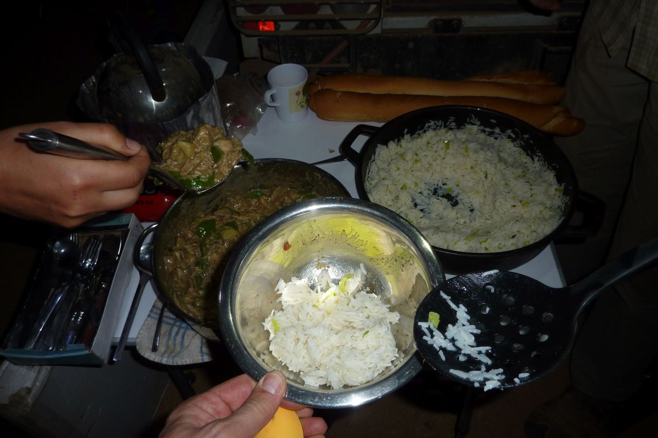
We took the Hassi Dehine piste, camping near the well. Being end of Ramadan I bought a goat off some nomads and our crew spent the the rest of the night tearing it to bits and cooking it up. The liver (or some such organ) grilled in fat-wraps was very tasty. We met up with the nomads next morning and gave them a lift to another nearby camp for some festive socialising. They all knew Mohamed our guide – or his late father, a nomad of note from the In Salah area.
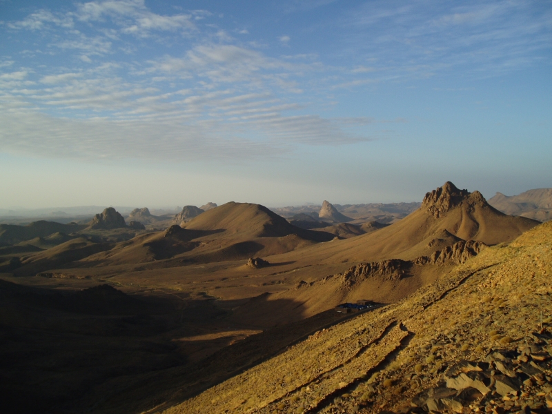
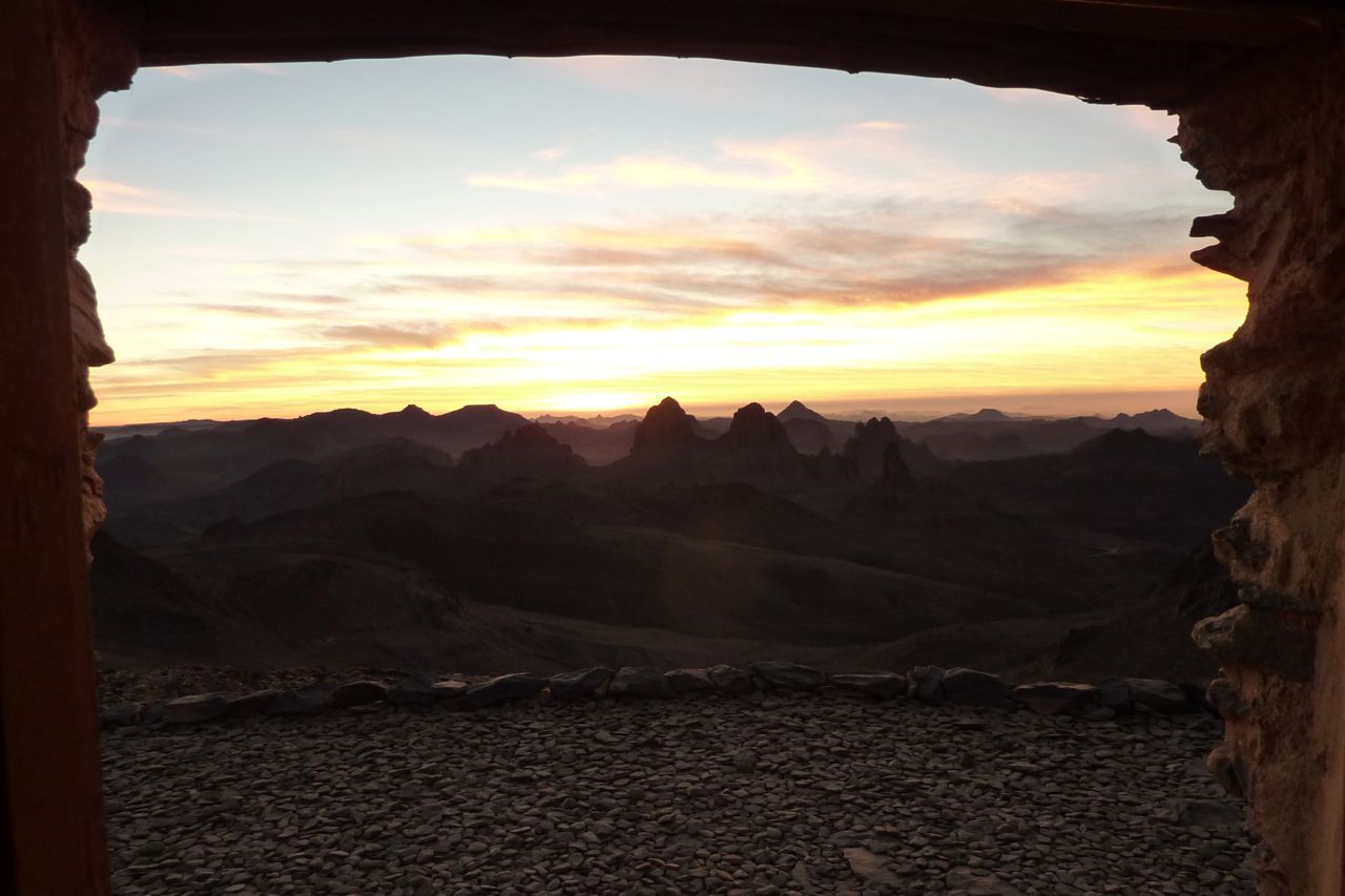
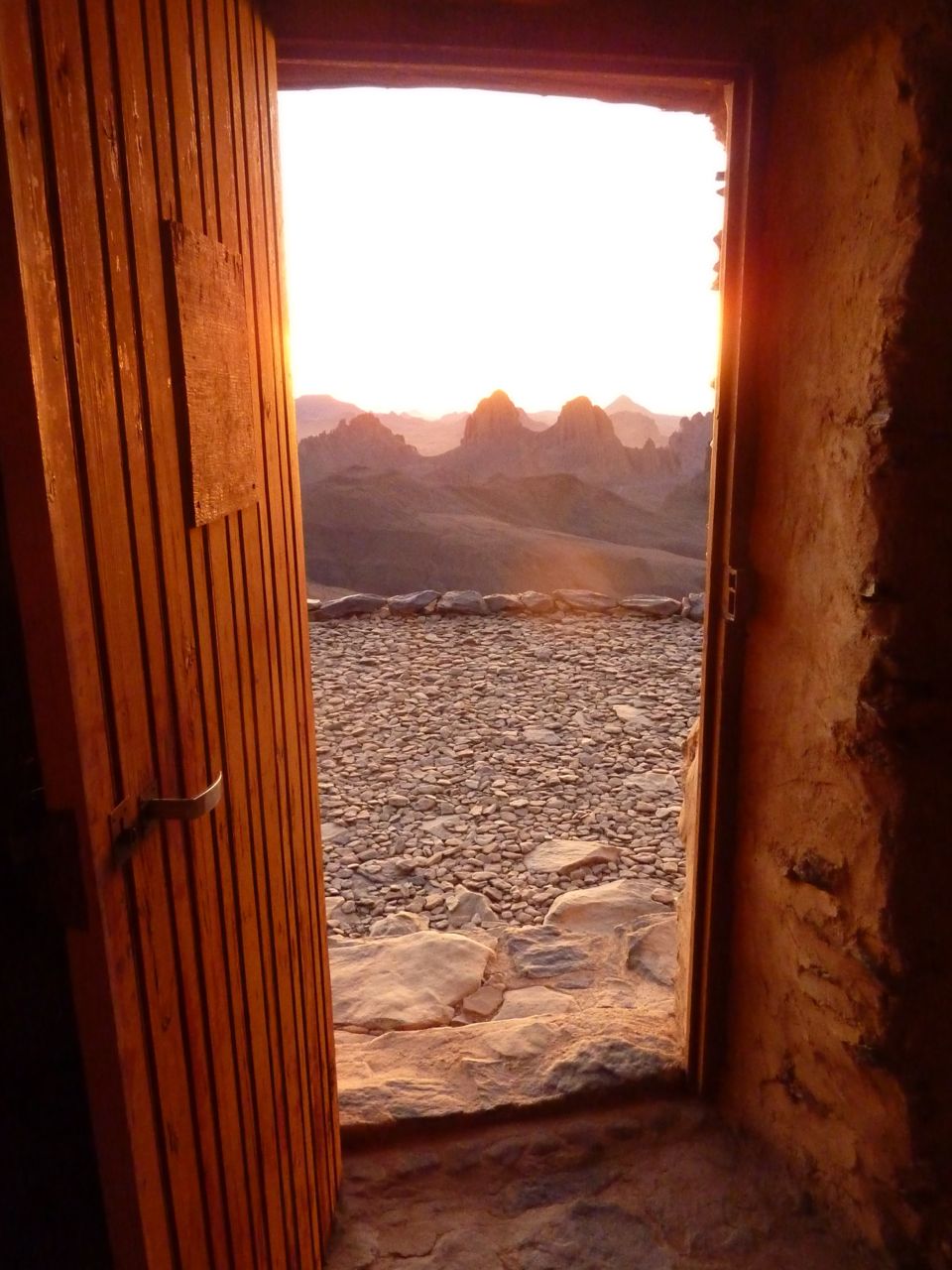
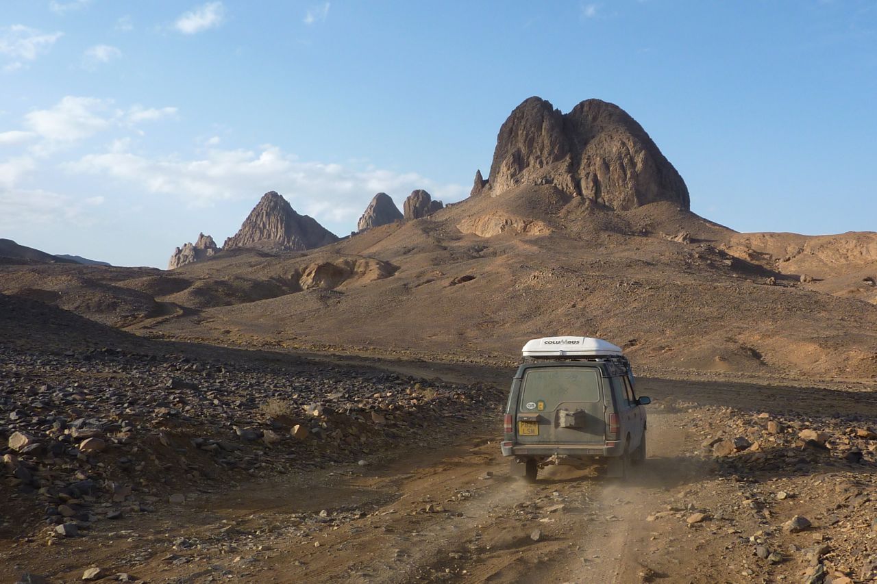
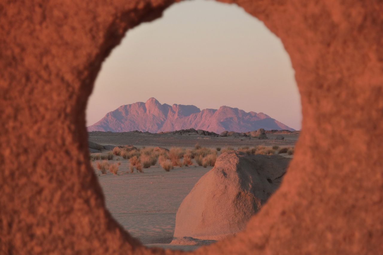
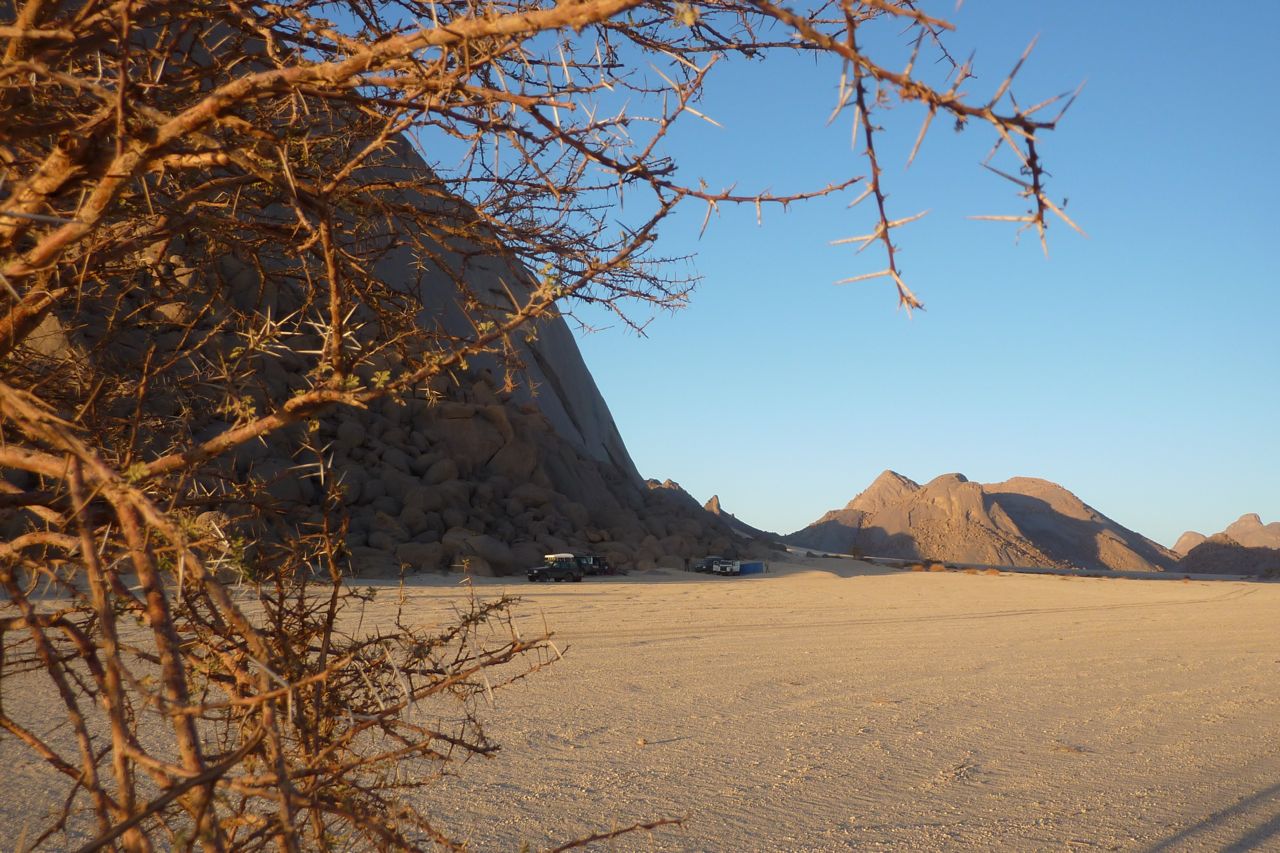
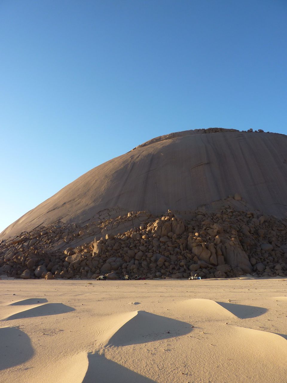
It’s a lovely drive up the Tefedest west side as always and after a while the distinctive turret of Garet juts up from the ridge line. Over the next few days we ended up driving right round the Tefedest, and Garet is always prominent, even 100kms away. It may not be the highest point but, like the Matterhorn or Ayers Rock, its elemental presence casts a spell of its own.
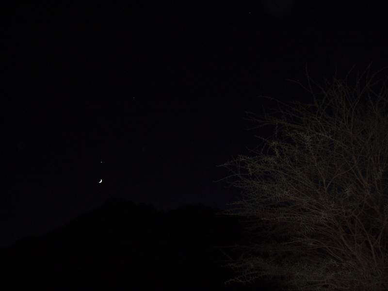
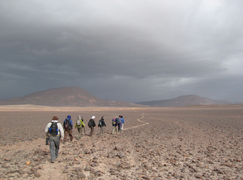
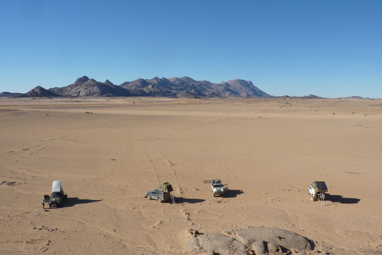
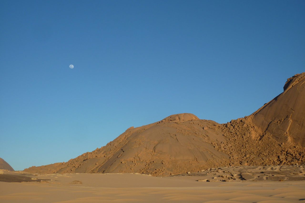
But the pesky djenoun were still trifling with us. We proceeded to spend half a day pushing into dead end oueds, failing to locate the point which I stumbled on easily with my 2000 tour group, close to the mountain’s foot. We did have an actual waypoint for a base camp attainable by vehicle, but could not get nearer than an adjacent valley, 2km away, due to flood-washed banks. Two clicks was near enough though, so that evening we set off on foot over the pass with all the water we could carry plus Abdelsalaam with another waterbag on his head. Even then, I had a suspicion water was going to be an issue and when we got to the base camp waypoint we texted for another bag to be brought up. Water was low but Mohamed knew of a well on the other side of the Igharhar valley. As darkness fell the crescent moon emerged from behind Garet’s flanks, hanging directly below Venus – a diabolical alignment considered inauspicious since before the days of Babylon.
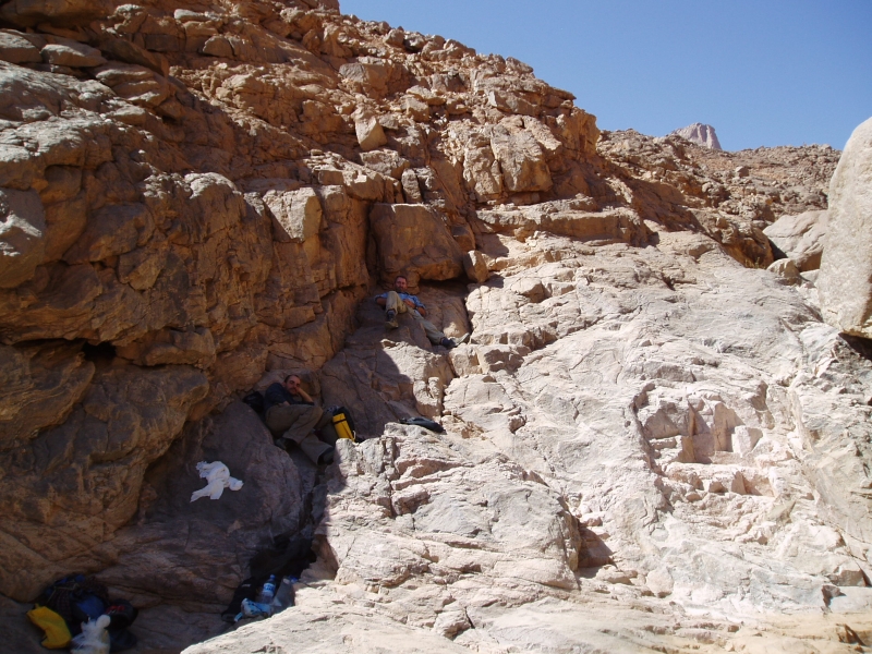
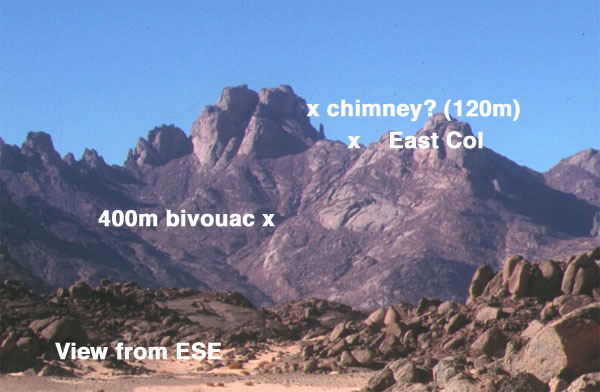
We loaded up and set off around dawn, up the boulder-chocked east oued, hoping we were following an Italian route description I’d found in a climbing magazine. It quickly reminded me of our attempt on Jebel Uweinat early in 2004 where the broken terrain at the end of a much longer approach walk wore us down. Here on Garet, we were soon hogging the shade, detesting our overnight backpacks and stopping for breathers every 20 mins. Clearly our recent colds and lack of exercise on other mountains was having an effect, added to the suspicion that this was not going to be the pleasingly videogenic cakewalk we’d imagined.
Between filming and panting it took us most of the day to get just 400m above the plain! Another 1000m of ascent over less than 2km remained, including, as far as we knew, a pitch of roping up a chimney and a traverse followed by a scramble up a cleft onto the summit plateau. A big French party had come through in April, on the 60th anniversary of Roger Frison-Roche’s first ascent (his, via an obsolete western route) so how hard could it be for a lightweight alpine-style crew? The problem (or my excuse) was we’d misunderstood the translated Italian and French descriptions: a ‘bivouac’ to which the French party had portaged water was probably the 400m height we’d just attained, not our base camp that morning. It was from the bivi, rested and replete with water, that one set out to summit and return to base in a long, 14-hour day.
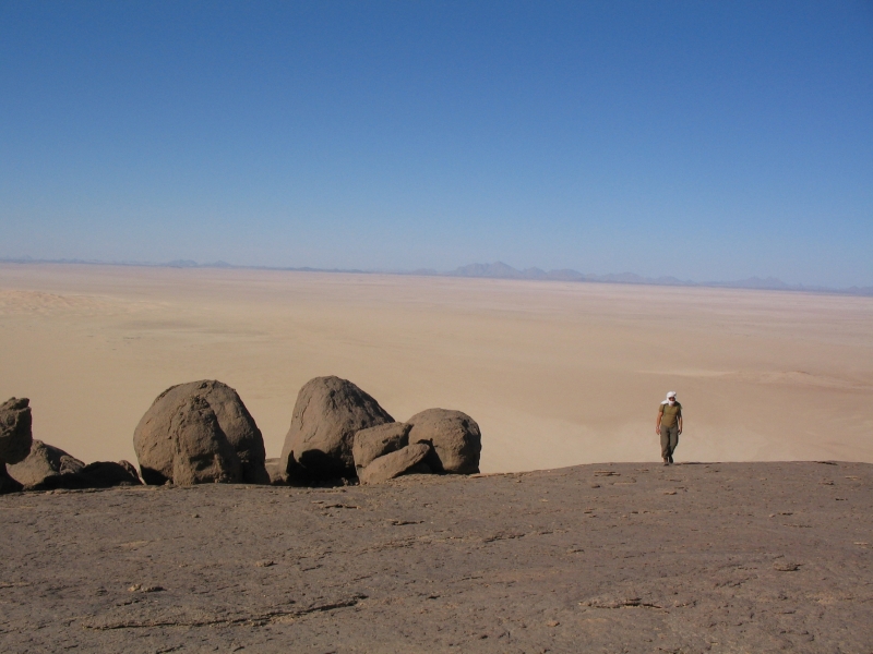
As on Uweinat, water was the problem, along with the fatiguing terrain. Here, I did not want to take a similar chance and plough on regardless to the point where we’d run out of water and food to stagger back. A braver attitude perhaps, and one that can get results, but the reality of an accident up here would be tiresome at the very least; knowing when to turn back was something I’d learned on my first Saharan trip. Better to accept it as a recce and use what time we had left to nip up north to the equally intriguing Amguid crater trek.
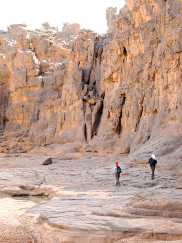
So we bounced back down from rock to rock in half the time, picking up what we’d left on the way. There were a few gueltas, and next time I’d take a chance and tap them with a good water filter to save carrying the stuff. Back at the base camp it was getting dark and our water hadn’t been delivered, although there was a pot of still-warm rice. After a breather we loaded up and hiked back to the cars in the dark. Turned out the well on the far side wasn’t usable and now water was a priority.
Next morning we headed for the reliable nomad’s wells on the edge of the Gharis or Immidir escarpment in whose canyon’s Group 1 of the 2003 hostages had been stashed and then released in a raid. We had a good wash at the Tabariq well as a quick rain shower passed over, let some nomads use the Thuraya sat phone to get their tea on, and that night, halfway to the Foum Mahek fuel dump, the far distant profile of Garet loomed in the dusk, like a passing submarine. The djenoun were not finished with us yet.
We headed for a fuel cache I’d left among some rocks in 2002 for the Desert Riders (we never got that far). I like to think I may have even recognised it without GPS. The six jerries were mostly full – some had leaked under pressure and a plastic water bottle cracked at the first touch. This stuff had endured three summers, including the notoriously hot summer of 2003 which spread as far as Europe (41°C in London, remember…). Fuelled up and with a nice ‘cache recovery’ shot in the bag, we set off towards Foum Mahek, at last some new terrain for me.
As we ate lunch under a shade tree a pickup pulled up fast on seeing us. Smugglers said Mohamed. As is often the case, they were more alarmed by us then we were by them (same story at Kemal al Din in the Gilf, 2004). Their new Tojo pickup – bought from the proceeds of cig smuggling – still had the dockside stock numbers scrawled on the windscreen, but they were actually just ‘searching for a lost camel’. The news they had was that a checkpoint at a pass on the way to the crater was making passage difficult for travellers and was turning back tourists. A day or two getting official permission may have brought them round, but time was short and the fact that we were also carrying clearly non-amateur filming gear may have got us into trouble.
OK, forget that idea too. Looks like it was becoming one of those trips… I suppose I was overdue for one. We trudged back south along the edge of the scarp and curved round towards the highway. Next day near Asseksam well we were mirror-flashed by some nomads. No souvenir-n-scrounging ploy this, but a request to transport a sick old man to the daily Tam bus at Moulay Lahsene. No probs, it was right on our way, passing through the rounded inselbergs and bright granite sands west the Tidikmar which reminded me of our memorable ride through the Taffassasset down to Erg Killian in 2003.
At Moulay they still circle the old marabout’s tomb three times for good luck. When I first spotted people doing that in the 80s I thought they were merely hoons. For us though, it was getting too late to invoke the blessings of the saintly Lahsene to save our project. Hoping to shake off the djinns, we headed west round the back of Tesnou through more exfoliating granite domes and camped near ‘Elephant Rock’, so named by some Italian climbers who’d pegged up the sides.
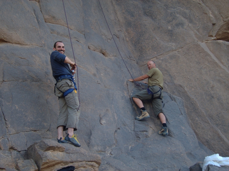
Here we were free of the corrugations and run-off channels of the Hoggar and Tefedest, out in the open and felt the much better for it. Nothing for it now but to take an idle 3-day drive back south to In Amguel oued and Tam; 10 o’clock mornings, 3 o’clock evenings, exploring, lazing about, filming, even some rock climbing. It was a nice spin down to a frustrating trip.
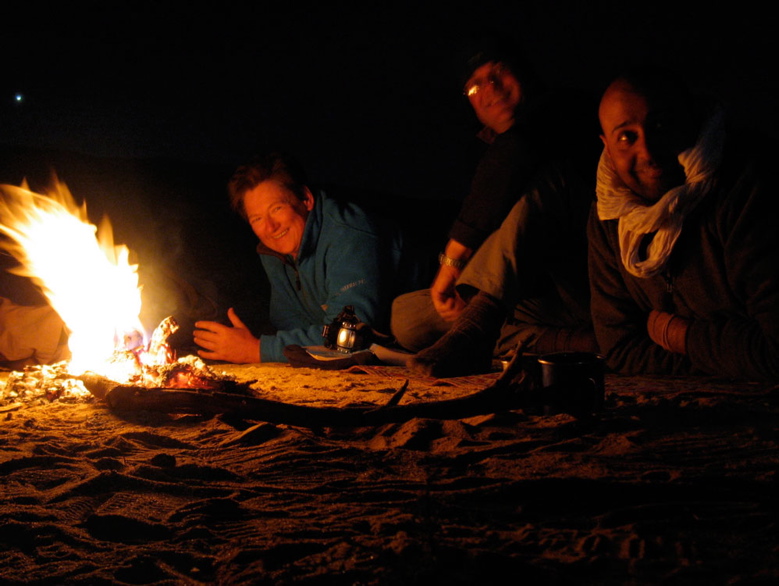
Though there seemed little point, we shot what was to have been the spine-chilling opening sequence of MoS where a fire-lit nomad (Mohamed in a blanket) spookily recounted the legend of the lost boys of Garet, lured to their deaths by a mendacious mouflon (barbary sheep or waddan; ‘Oudane’ is the Tuareg name for Garet). Their trapped spirits were symbolised by Garet’s twin turrets.
One day near a lunchtime hill Jon found a carefully-engraved Tuareg spear head, and another day we dozed in a broad oued sprinkled with lighter-than-water pumice, flushed out of the Hoggar by the recent floods. Despite the strict protocols laid out in my book, a rounded piece of aerated lava now sits alongside the bath at home.
Another sunny evening in the dunes west of Ouassdert well, Jon and I even managed to get the dunes ‘singing’, a phenomenon I’d read and written of but never experienced. Indeed it sounded like the passing rumble of a distant propeller plane, but was clearly caused by out feet disturbing the sands. With a couple of new intros for the Desert Driving 2 dvd caught on tape, we rolled back into Tam, had a great feed and hopped on the 3am redeye back to Paris.
Bit of an expensive flop, this one, but you got to try these things and as always there was a positive side. We saw some nice new desert in the last few days west of the Highway and I was impressed with Mohamed’s enthusiasm for exploring – not the usual quick-buck/tramline guide mentality. We’ve since cooked up a couple of meaty tours for the coming year, and though a film about not climbing a mountain through lethargy and disorganisation is probably not worth the effort of editing, doubtless Garet will be in touch for another crack.
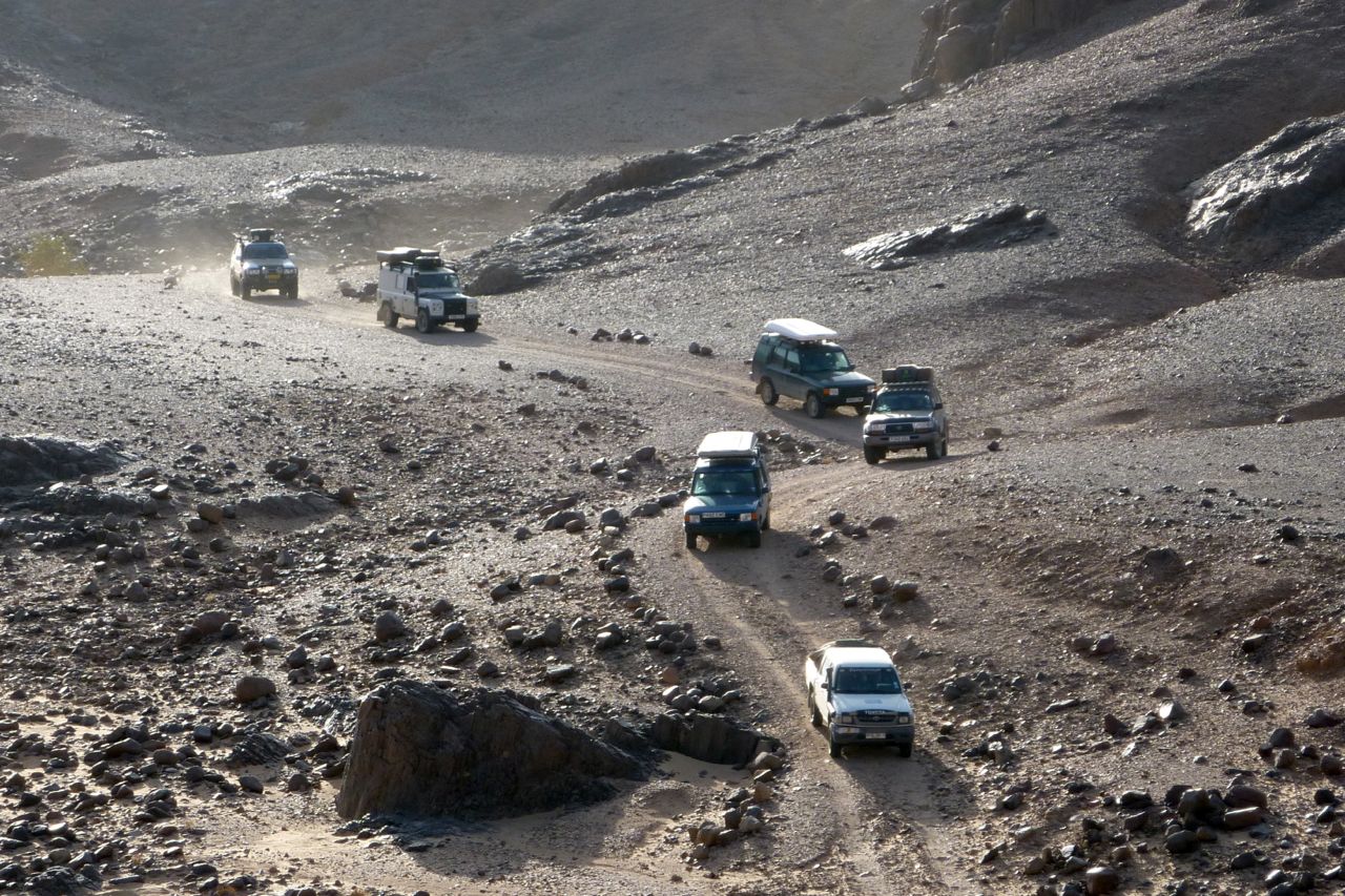
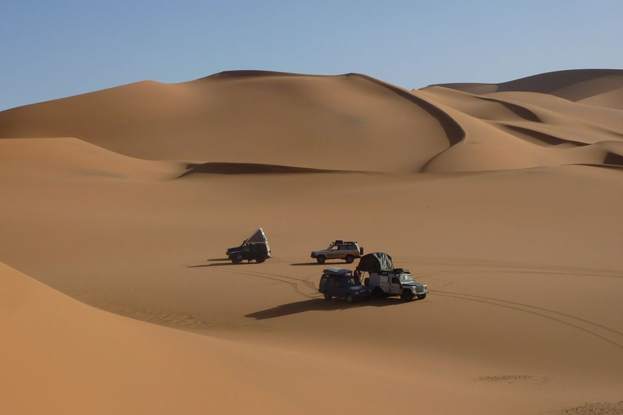
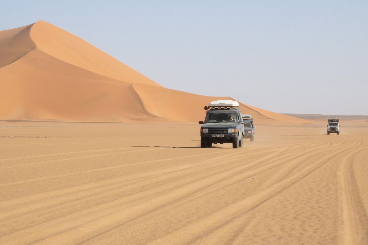
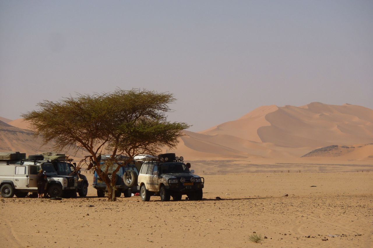
3 80 Land Cruisers 3 Land Cruisers 75 Pickups Land Rover Carawagon 200 Tdi.
January 2008
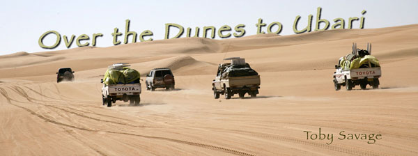
A group of us had completed Derj to Idri just after Christmas ‘07. It certainly shook the turkey down and a few weeks without alcohol did us all the world of good. Idri to Germa, our final destination, had two possibilities. A long trudge east on blacktop, then round in a big loop south and west again would be the sensible way, but our desert driving was as good as it was going to get and we were running light having used most of our fuel and supplies. In the bookOver the Dunes to Ubari (p.553) is described thus: ‘Many travellers find the final dunes at the southern edge the hardest to cross.’
Easy to see why. The dunes are big and run NE to SW and we wanted to go directly south. Picking our way out of Idri through remarkably lush greenery our guides took a rather convoluted route, but we emerged into a big inter dune corridor on the southern edge of town. From here it looked pretty easy. Cruise along at 50 mph on a wide inter dune corridor for what seems like eternity, the dunes offering no menace in the distance. Confidence boosted by a simple hop over some low dunes and into the next corridor. Easy. We bumped into an Franco/Italian mixed group in Tojos and a 130 Crew Cab Landy, which looked heavy. Swapped tales and departed with a wave and a ‘see you in Germa’.
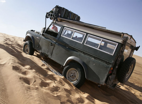
After than fateful meeting things got a little harder. The Tojos had to take several runs at a dune crossing. Their 4.2 engines had plenty of power, but the sand was soft and cut up into deep ruts, made worse by them digging themselves in. By my turn a combination of ruts on the summit and giving away 2 litres to the Tojos had me beached near the top. Three attempts still couldn’t get me over and for the first time ever in the dunes, I used the winch to haul me over, anchored to a Tojo on the other side. Thankfully the winch made light work of it and we carried on. Same again at the next crossing. The guides were taking the dunes at an angle to reduce the steepness. Seemed at odds with how I like to drive. I prefer straight up and straight down again. Reduces the risk of rolling. It seemed to work for them, but they had the power advantage. I tried, but just stuck near the top at a jaunty angle. Winched again.
Next big crossing it was sweet revenge. One of the Cruisers stuck and I had to winch him back out of a hole. Made even sweeter by the driver being genuine Toureg and an accomplished driver. We stopped at a well and had a long lunch break expecting the Franco/Italian convoy to catch us up, but we never saw them again and suspect they were defeated by the first major dune crossing. I don’t remember any of them having a winch so getting the 130 over could have defeated them.
After lunch it was easier and faster. We made the big descent into the Wadi El Agile well before dark and meandered through the outskirts of town, scattering chickens and waving at locals to complete our 100 mile dune bash in time for tea.
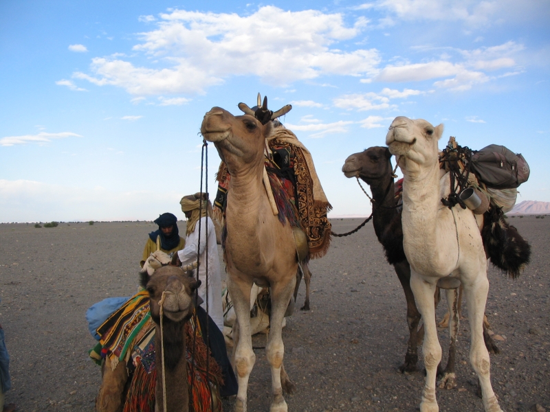
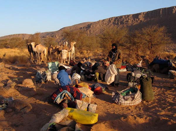
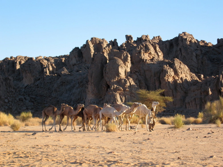
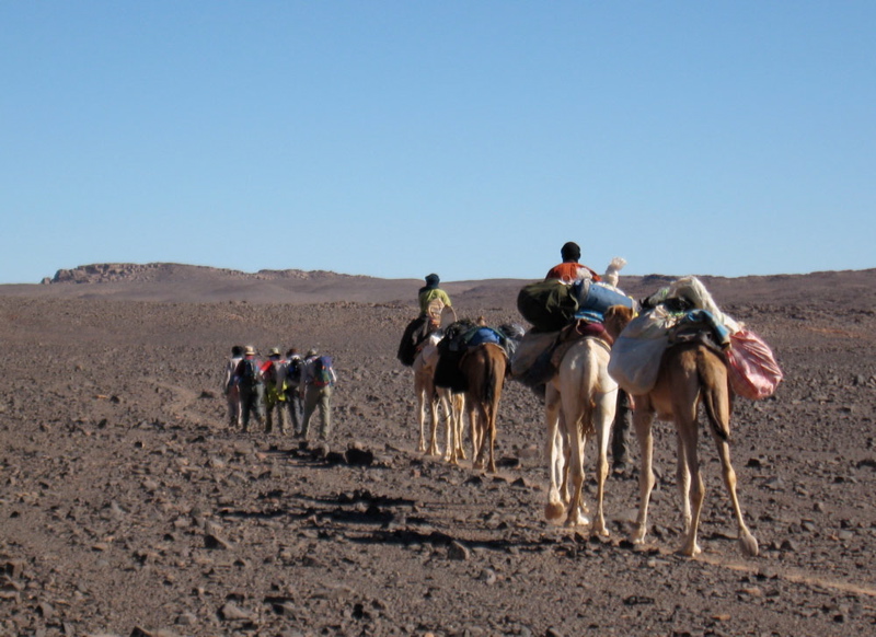
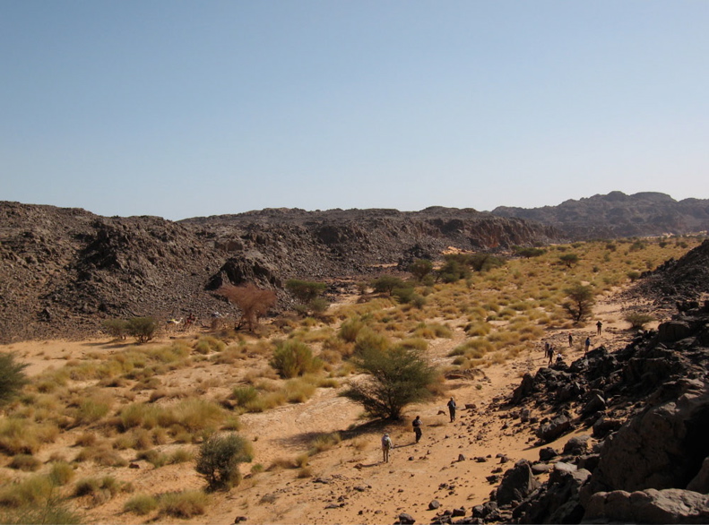
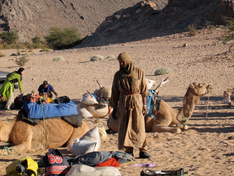
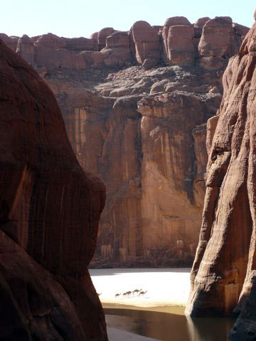
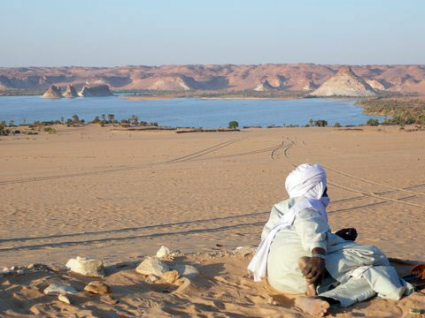
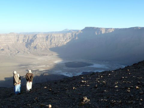
It takes about 11 days to cover the rough 180-kilometres to the Amguid crater in southern Algeria. The Immidir plateau is inaccessible to cars so the camel caravan carries all our gear and food and the crew draw water from natural waterholes or ‘gueltas’ ever other day. These guetas as well as daily grazing for the camels are key to staging the trek. Our route follows canyons, dry valleys and escarpments as well as old camel and game trails where present. Along the way we pass several pre-Islamic tombs and often come across Neolithic artifacts, as well as tracks of gazelles, jackals and even a leopard. The crater is thought to be 100,000 years old and is about half a kilometre wide. It’s filled with rain-washed sand over the millennia and is the only level part of the whole walk! A day later we rendezvous with the cars on the far side of the Bou Zerafa dune field, about 700km north of Tamanrasset.
Visiting Tibesti has not really been an option these last few years; an ongoing civil war made it too risky. But around the beginning of 2010 I received signs that things were settling down, which was confirmed when I read a report of a visit to Emi Koussi by Italian tour operator and Chad specialist, Spazi d’Avventura. I decided to contact Jorge, a Portuguese guy that used to live in Chad, with the question of whether he knew a good guide. He directed me to Tchad Evasion, the main operator in Chad, but when I contacted them they said a travel permit for Tibesti would be difficult. They could could only guarantee a permit for Ennedi.
I contacted Jorge again, and asked if he knew some other people that could help me. He gave me the name of an American expat in Ndjamena, who has been studying the Tubu language since 1993. The American turned out to be a great guy. The situation in Tibesti was not really stable, he said, but if we contacted the right people a touristic visit should be possible. He said he knew a Tubu colonel in the Chadian army who could be our guide. After some discussions the colonel agreed. We would pay him 150 euros a day, all local taxes and permissions included.
Together with Ab, a Dutch friend we has been travelling all over the Sahara, I decided to look for other people to come along. We wanted six people in total. I would drive my Toyota HJ61 along the Atlantic from Holland to Ndjamena, Ab would ship his Nissan Patrol to Cameroon. We would all meet in Ndjamena. From there we planned to travel north to Mao, Zouar, Bardai, Faya, Ounianga, Fada and Guelta Archei in the Ennedi, then via Abeche to return to Ndjamena. We thought the 4000 kilometers would take us about 30 days.
Once in Chad it turned out the colonel was busy with his work, which made him decide to send two of his cousins. One of them turned out to be a really nice guy, the other one wasn’t. The colonel gave our guides a Thuraya sat phone so they could call him if necessary. Before we left Ndjamena we visited the governor of Tibesti, who happened to be in town. Like the colonel he assured us our safety would be guaranteed. He hoped many more tourists would come to Tibesti in the near future, so that the local population would have a new source of income.
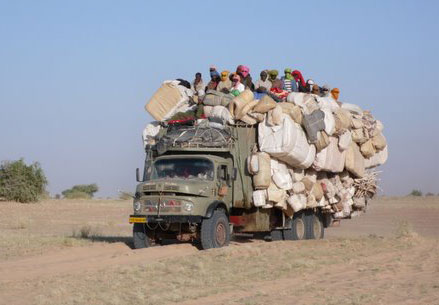
The first couple of days of the trip were not easy. The truck tracks north of Mao were often too deep for our cars, so progress was slow. But we enjoyed the many camels along the route and the famously overloaded trucks coming down from Libya. Unfortunately the engine of the Nissan got very hot, which caused us to stop frequently. After five days we finally arrived in Zouarké, a police checkpoint about 30 kilometers west of Zouar. The cousins of the colonel were received warmly by the police officers, also we in turn were treated very well.
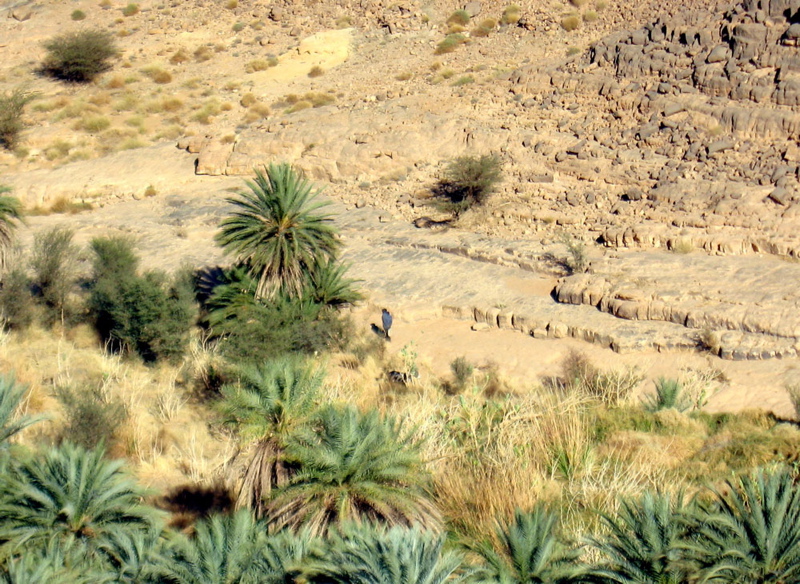
The next day we visited Zouar, where we spent the night. From there we went back to Zouarké and continued to the Trou Natron, an volcano crater about one kilometre deep. The road was awful, with many big rocks, but the barren landscape was amazing. The 90 kilometres took us about six hours. From Trou we continued to Bardai, a beautiful oasis surrounded by strange-shaped rocks. The market was full of Libyan goods. We spent the night in the garden of a building that until 1999 was used by the French military who still have close connections with Chad.
We could not continue east to Yebbi Bou as planned, because Tubu rebels are causing problems there. In 2007 they kidnapped an American missionary, who was only liberated after nine months. So we drove back to Zouarké, and continued from there southeast to Faya. The Nissan, that was doing well in the mountains, started overheating again in the soft sand. To cool down the engine we drove a lot at night. At one point we passed one of the many Soviet tanks abandoned following the Libyan war with Chad during the 1980s when the Chadian Toyotas proved far more mobile in the desert.
In Faya we took two days rest and decided to sell the Nissan, after we found out we could hire a car with driver for about 100 euros a day. We continued to Ounianga, Fada and the famous Guelta Archei where we met other tourists for the first time during our trip. All my travel companions spotted the crocodiles in the guelta, I missed them because I was not patient enough. When visiting some natural arches in Ennedi we also met a French television team, making a documentary on the touristic potential of Chad. From the guelta it took us four days to drive back to Ndjamena.
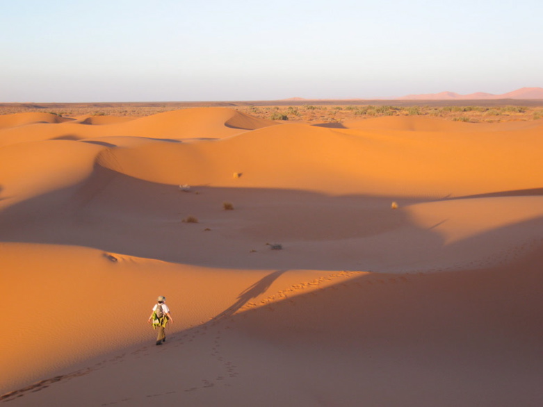
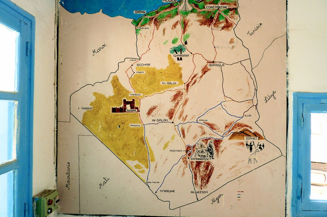
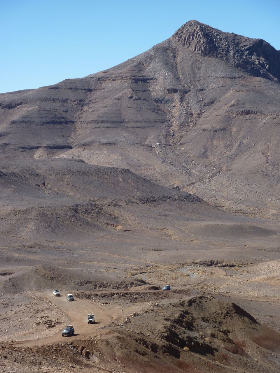
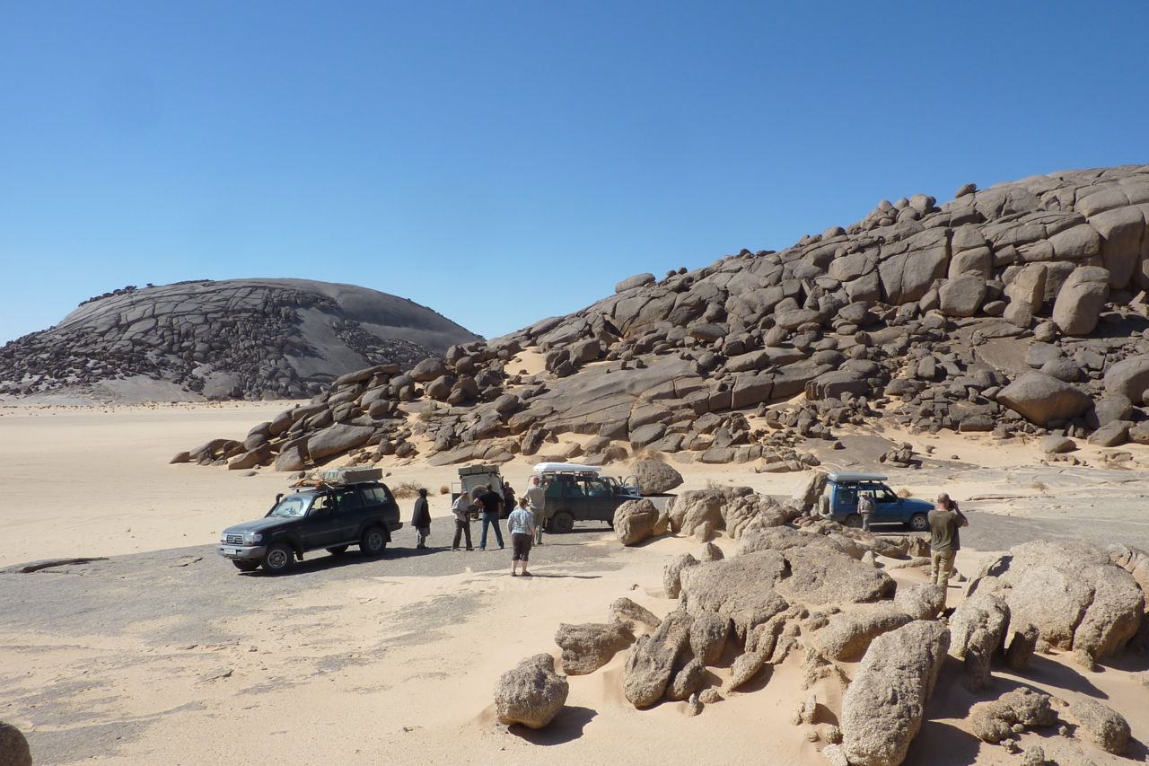
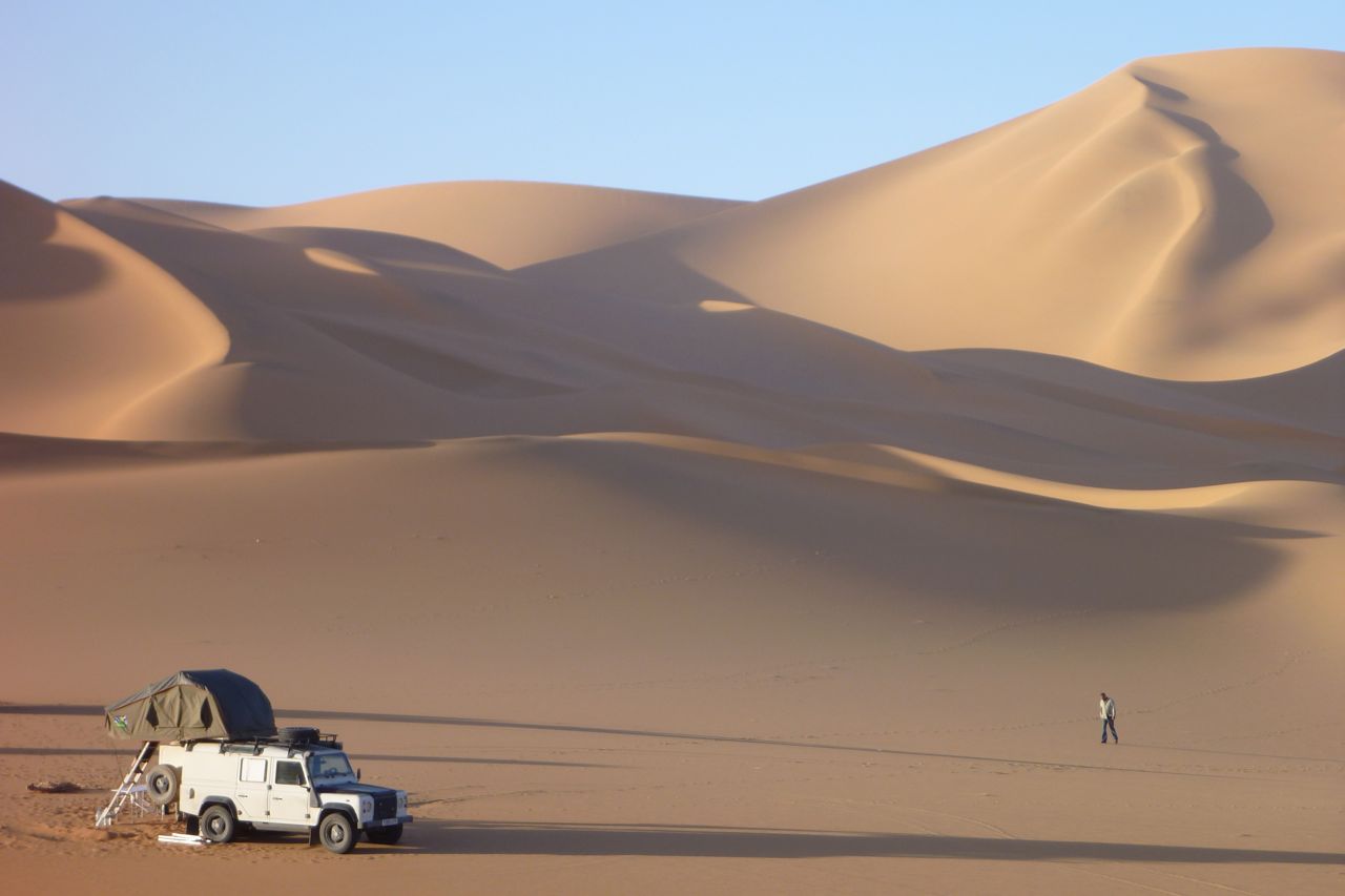
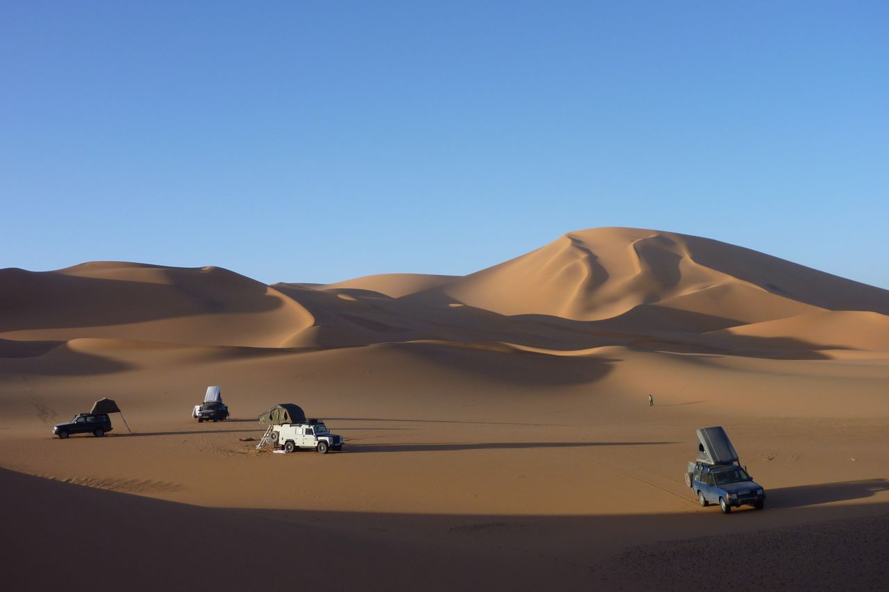
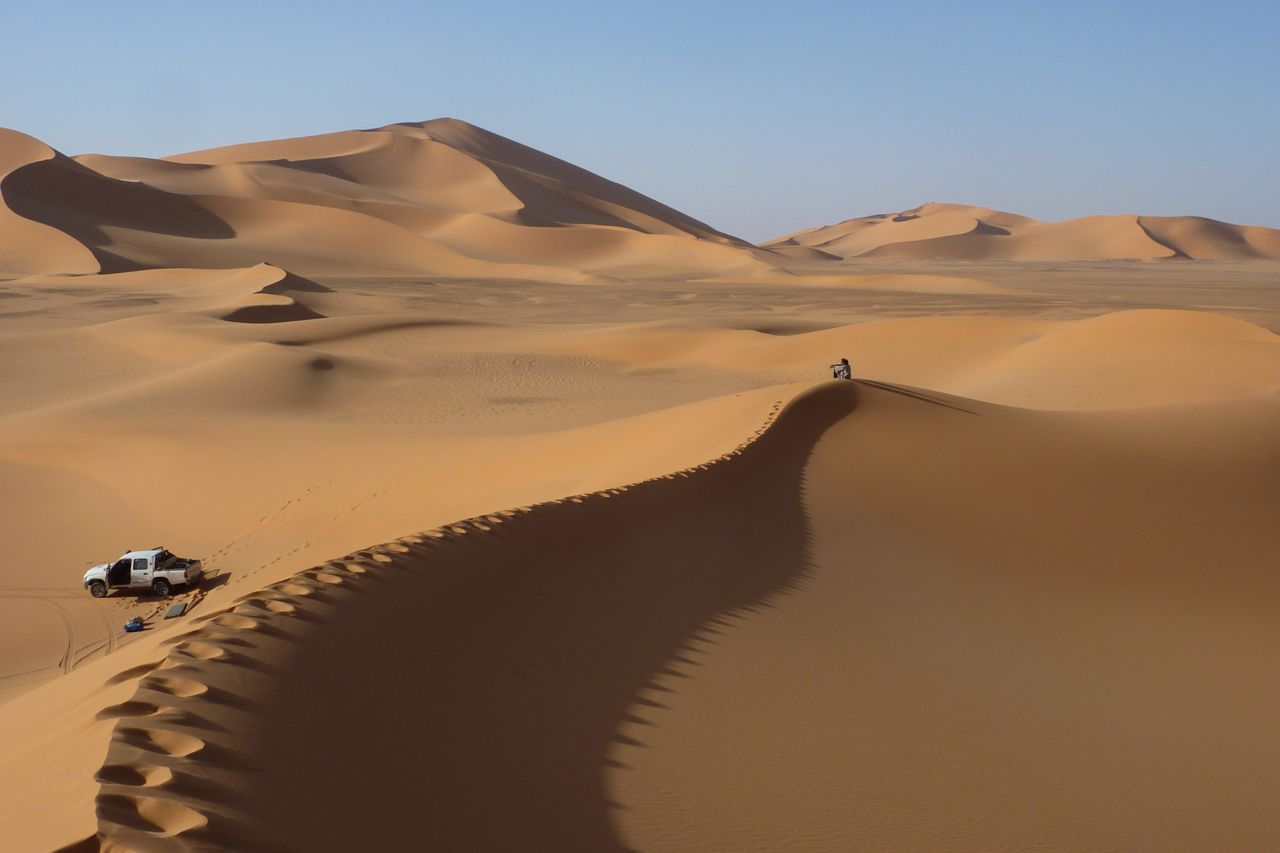
It’s only the middle-west side of Algeria that is widely open to unrestricted off-highway driving at the moment. Just as well as it coincided with my interest in that area, having done most of the canyon-bound routes in the Tassili N’Ajjer. Great though the Tassili is, the more open Ahnet and western Tefedest also have their attractions, primarily the granite monoliths and the surrounding glare of the white sands shed by those rounded outcrops. You can pretty much point your car in any direction and drive to that place across a trackless, sugary sand sheet.
My group was composed of 7 Scottish off-roaders who’d done a self-organised trip in Libya as well as the usual Morocco. The fifth car was a Dutch guy and mate who were going to come on a similar tour I’d pulled a year earlier in what was probably an over-reaction to security worries at that time. Now, things aren’t looking so good in southern Algeria while the Maghreb goes through political upheavals.
A different last-minute panic this time: big changes in obtaining Algerian visas in London (full details here). Luckily the guy there recognised me from previous years so I got our visas in days rather than weeks and the passports got delivered to the Brit contingent as they headed for the Eurotunnel while I lay in a bed with an ear infection, throwing up, dizzy and unable to walk straight. A week later it had mostly cleared and I caught to group up in Adrar, four days in, flying in over the Grand Erg – you would not want to drive in there. On this trip I was sitting in the agency escort’s Hilux. There’s an 8-minute movie above, a gallery at the bottom of the page and a write up in the July 2011 issue of 4×4 magazine.
Click to enlarge and see the route
ORAN FERRY
I wanted to try the Oran crossing as an alternative to petty shake downs in Tunis, slow processing in Algiers and high prices on both routes. Of course you pay more in fuel to get down to Alicante, but my route in Algeria was down the west side through Taghit, Timimoun and Adrar; so it seemed worthwhile.The El Djazair II ferry works out around £700 for 2 people in an en suite first class cabin with dinner and breakfast included, and driving a <2.3-metre high 4×4. The ferry is comparable with any sub-Carthage ferry serving Tunis or Algiers. It leaves Alicante 7pm 2-3 times a week and returns from Oran at 6pm. Of course you can count on it leaving from 2 to 5 hours late, but on both stages it arrived on time about 7am. Oran is about the size of Ceuta and once there, it’s a police form per person and one for the car, a TVIP, customs declaration, money exchange (10eu = 1 dinar official) and insurance – 3000d for a month. All listed here. On the way back they asked about diesel but those with up to 4 jerries got away with it. Either play dumb or say it’s only 60L, no big deal. In Alicante a token bag per car was put through a scanner but there was no jerry grief. In both directions we were the only 4×4 tourists on a half-full boat of Algerians.
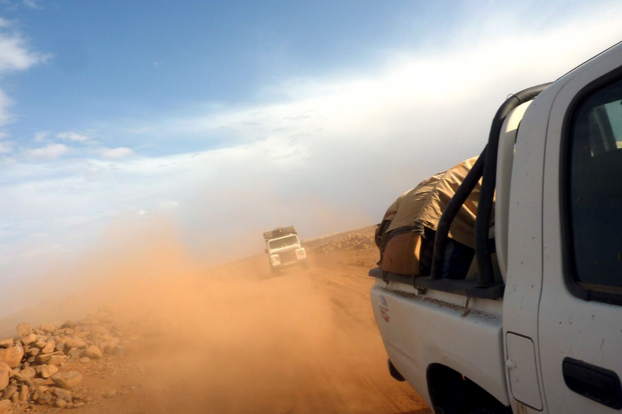
NORTH ALGERIA Calais to Alicante is 1000 miles; it’s the same distance from Oran to In Salah before you can get on the piste. The Tanezrouft agency car was 2 hours late arriving in Oran and without me there to reassure the police and so on, the group speculated that this delay may have given the police the idea that they needed an escort. Then again, there had been rioting in Oran a few weeks earlier and perhaps as a result of the whole North African situation, the group ended up with escorts all the way to Adrar where I caught up with them. And on that day the news of the Italian woman’s kidnapping hit the local papers which made things worse. On the way down the group stayed in Saida (rough hotel) then late to Taghit camping, short village tour next morning then slow gendarmerie green & white (G&W) escort to Beni Abbes (overpriced hotel), then Timimoun camping, then very slow escort to Ardar where they met me for lunch, by now all thoroughly fed up with Algeria. We carried on to Aoulef where we met Mohamed and our desert guide but were then told we had to go on to In Salah, another 160km, to get permission from the brigade to go into the desert. It was arriving in In Salah in the dark or camp by the Aoulef police station in the cold wind. Luckily Mohamed had a mate with an auberge for the night (see below). I had heard that there were G&W escorts around Adrar with slow and frequent change overs, but to get led down 1000 miles from Oran for 5 days and told where to stay was not in the plan and was not helped by me not being there to at least try and manipulate things in our favour. Unfortunately the group never got over it.
Coming back, the plan was always TSH from In Salah up to Ghardaia (8+hr), town tour then off to Laghouat and back roads via Aflou to Tiaret overnight (6hr) for Oran next day (5hr). Plenty of checkpoints (CPs), and up north, plus more traffic and speed humps at each village make it slow, but it took 2.5 days with only a few awkward CPs requiring a stack of fiches. My advice: use Oran port if you like, but stay clear of the Bechar-Adrar axis. Instead, take our return route from Oran via Tiaret to the TSH at Laghouat.
Driving through north Algeria is pretty grim or just agriculturally dull. Don’t kid yourself that the appeal of this country is anything other than the desert in the deep south, far from half-built towns swamped in their own rubbish.
ACCOMMODATION (that I used) Algiers airport Ibis hotel, £80 booked online from Expedia (same rate posted in reception). Free unmarked shuttle van for the 10-min drive to/form the airport. Room like anything in Europe for £50. Breakfast an extra 900d! The Mercure rates next door (same shuttle) are nearly double.
Aoulef. Unmarked auberge north end of town 26°58.568′ 1°05.159′ Walled compound, dorms, OK ablutions, 200d per car and about 200d? per person. Tidy enough.
Tamanrasset Camping Dassine southeast end of town over the newly bridged oued. My usual place since 1982 and still a good spot. Plain, two-bed cabins are 1000d a night with nice breakfast next day in the salle. Car RTT camping 500d. Hot showers get hit and miss, sit down toilets and all clean enough. Good grocer 10 mins walk to town opposite a cheap cafe. Town itself is 25 mins walk. Traffic and parking is getting worse in central Tam.
Assekrem Dorms at the auberge 600d pp. Toilets pretty good. No food to spare do we DIY’d. Tea and bikkies served at dawn from the monks up top.
In Salah Camping Palmerie. The same place it was in the 80s but with 30 years of added neglect; a semi-derelict scrap heap for 300d pp or 1000d for a 2-child bedded a/c cell. Smelly toilets, junk all around, but the auberge in town is always full I’m told and the Hotel Tidikelt on the highway is 6-7000ds. IS itself is not exactly Palm Springs; the only reason you’d stay here is that it’s hundreds of kms to anywhere else, the desert around is pretty exposed and Tanezrouft agency are based here, change drivers and may offer a free dinner.
Ghardaia Hotel Atlantide in the town centre. 32°29.215′ 3°40.678′. A lovely old tiled joint from 1800ds or a bit more for en suites, all with TVs and heating. Small breakfast room plus plenty of restos on the street below. Secure garage parking 10 mins walk away for 100d a night (32°29.473′ 3°40.907‘). Good unmarked resto leaving Ghardaia to the north at 32°31.501′ 3°40.237′ by a roundabout.
Tiaret Hotel Bouazza (35°21.284′ 1°20.252′). Five storey, south end of town, can’t miss it. Single occupancy en suite with TV and wi-fi from 2020d. Resto dinner for 900d, breakfast buffet included and secure parking round the back. Probably the best value place we stayed in – almost normal but still with plumbing issues. Allow 4-5 hours for the 220km to Oran port.
OTHER PRICES Diesel still 13.7d, petrol 22-25d. A one-way flight to Adrar with an overnight in Algiers cost about £320 booked a week before with Trailfinders. At the airport btw, I was not asked for my escort as I’ve been done before, and walked straight through. Exchange was 100 dinar to a euro, or 113d to a pound.
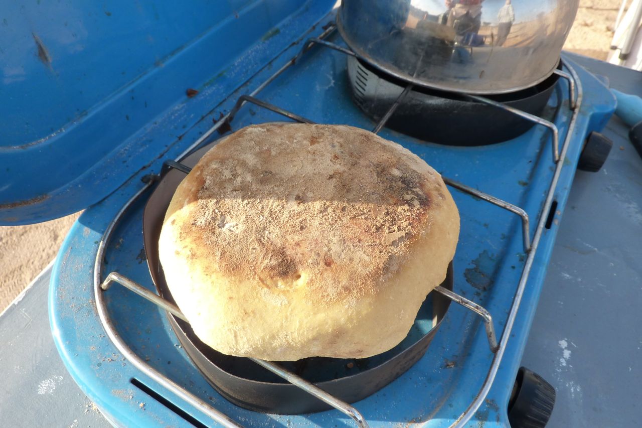
Despite the talk of riots over ‘food prices’ up north, they seemed much the same down south as a year or three ago. In Tam imported things can cost more than in Europe. Up north not so bad. Lots of fresh fruit and veg in In Salah market (oranges 70d a kilo), bread 10d (great bakery in In Salah with more than the usual baguettes). Interestingly with desert bread, sealed in a bag it just goes dry but never moulds like bread back home which ironically is full of ‘preservatives’. Desert bread can last for up to 5 days sealed in a roll top dry bag.
Meals: omelette frites with loubia (chick peas in sauce) plus drinks was <200d pp, roadside in Outoul. Chicken and chips 400d in a ‘workers’ café in Tam – all with bread. Same price for an evening meal in Tam with drinks and salad – and meat stew or chops with pasta or rice or potatoes in Ghardaia. Salad in Ghardaia 150d. The Brits in my group were very enterprising with cooking and bought frozen chickens and meat to make great stews. We even had bruscetta one night with dry bread – as well as dry bread soaked in eggs (250d for a tray of 30) and fried for breakfast – a trick I picked up on the camel tours. A young goat bought from desert nomads was 3000d and lasted the guides a few days. Internet. From In Salah south don’t bother. In Ghardaia it was 50d an hour of which at least 15 mins was waiting.
WEATHER We had it all. The group had snow over the Atlas, then we had windy nights, days up to 30° and nights down to -2°, an all-day dust storm from In Ziza with viz down to 20m. There was a 10-minute dawn shower in Tam which did not quite clean the cars, and a howling gale up at Assekrem as well as pristine clear blue wind-free days. On the way back there was usual dust haze near Laghouat, more rain over the Atlas and a lot of wind in general. The guides said March and April were the worst months for winds.
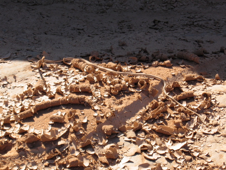
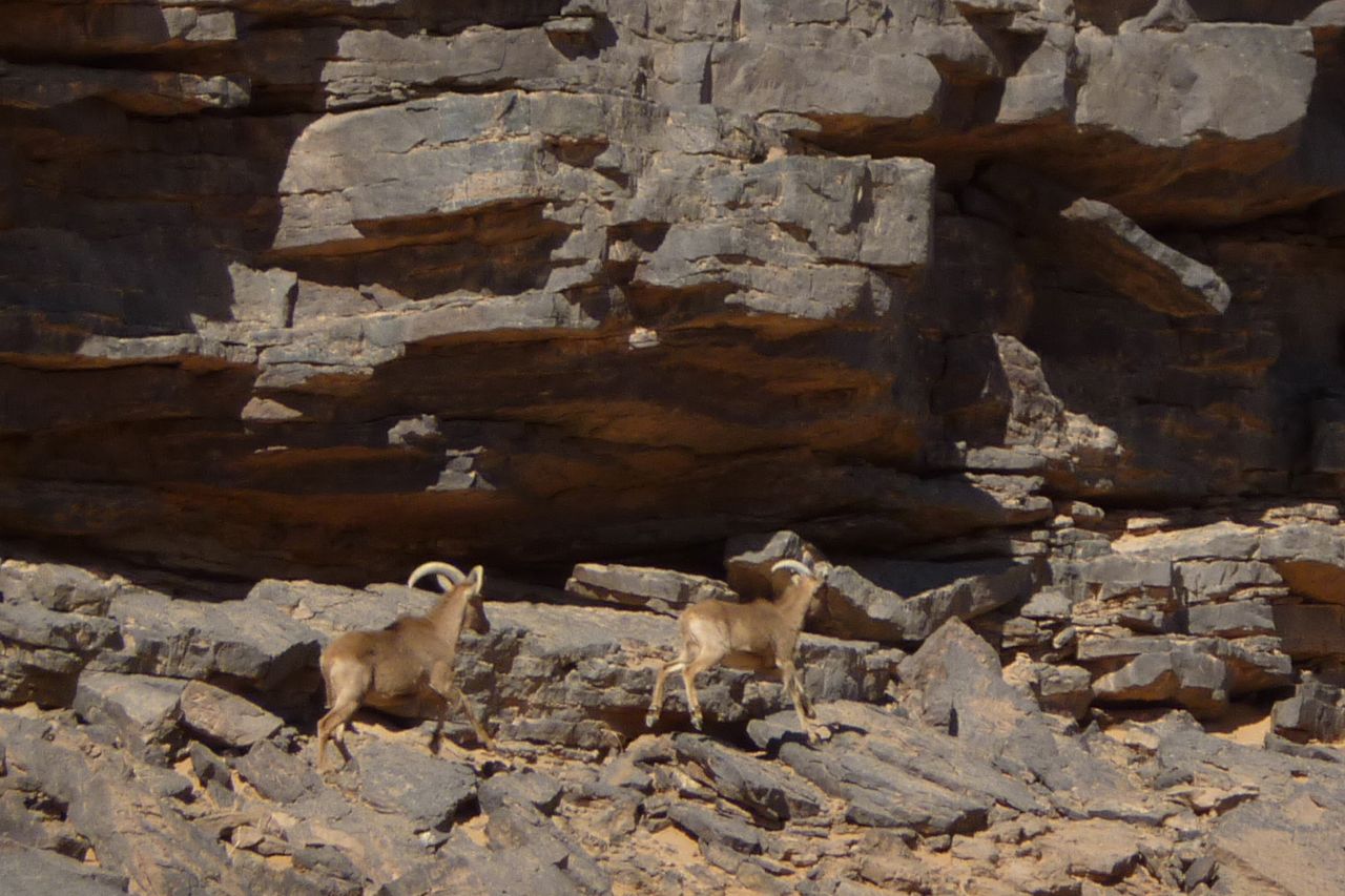
WILDLIFE We spotted gazelles on at least three occasions up to four at a time. Then driving up one canyon in the Ahnet we came close on four mouflons. Two managed to dash vertically up the cliff side and the other two along it, giving me a chance to shoot some pics. We also saw a few small lizards here and there, on another occasion one of the group came across a small snake and one night by a dry well was pierced by the howl of jackals. The feral donkeys are still there in the Hoggar. There is a running joke in south Algeria right now that the Chinese pipeline builders are eating them all. lls mangez tout, tout! The drivers joked that they’d offer to fix up the Hirafok-Assekrem track for free just to get to the donkeys.
SECURITY & ESCORT EVASION Recent events across North Africa including Algeria did not seem to make the police jumpy down south, but the announcement of the Italian kidnapping did not help us, especially as we were probably one of very few self-drive tourist groups in the country. I arrived on that day and most of the group seemed to appreciate it was a single event on the far side of a very big country. Our planned route through the Ahnet and western Tefedest was as good as it could be in terms of safety while following an unobvious itinerary. I had visions of sleeping with a SPOT and Thuraya in hand, but though kidnapping worries were soon forgotten, getting bogged down with more escorts and being told to stick to the highway would have ruined the tour. In Aoulef we could not head into the Ahnet until we got permission from the brigade in In Salah. Another 2-hour escorted drive next morning, but at least IS was Tanezrouft agency’s home town with presumably good relations with the G&Ws and the Ahnet was their home turf. Eventually permission was granted without any conditions. G&W tourist escorts off road are unknown – these guys are not set up for desert camping and are more a highway and frontier patrol while police cover the towns and the army does the rest. A week later, once back in mobile range at Abalessa I got a text that the kidnappers were after a group (of Italians) not a single person so we decided to spend only one night in Tam and walk- not drive around. As it was, arriving at lunchtime and leaving same time next day for Assekrem was enough to catch up on chores. Anyway, a grab in Tam would be pretty hard to pull off, packed as it is with various barracks and compounds and with choppers stationed at the airport. Doing the same south of Djanet – 10 times smaller than Tam – gives a fast run to the unmanned Niger border in 2 hours. The same goes for the run up and down from Assekrem – predictable sure, but a hard place to set up an ambush unnoticed. And beyond the Hoggar we were making it up day by day and often off piste, so even if we’d been spotted we’d be hard to find.
Checking in with the brigade was required in either Ideles or In Amguel on the TSH. I chose In Amguel to save having the group wait for the guide to do Ideles. In retrospect maybe not a good decision as at least in Ideles we were far from the TSH and so could not be told to stay on it (though they may have asked where we were going which would have been awkward – I had an off piste stage in the western Tefedest lined up).
In In Amguel the driver was formally instructed to stay on the TSH all the way to In Salah (via Arak) but had his own ideas about that, and after a fill up and a staggered dash up the highway, he found a gap in the water pipeline (which limits entry points to the west) and we headed back into Ahnet for another great week, avoiding Arak. There were no consequences of doing this once we got to In Salah, so it seems the G&W brigades are not in serial contact with each other up the road; it’s just a commander playing it safe.
Back on the highway north of In Salah some police or G&W CPs let us though, some asked a few questions, some called someone for confirmation that we could proceed and some sour-faced jobsworths asked where was out escort. All wanted a copy of our fiche. The good thing was we were leaving the ‘dangerous desert’ so got away with it right the way into Oran which showed no signs of any post riot tension.
With fewer and fewer tourists heading to Algeria, the biggest restriction on self drivers is not so much the risk of kidnapping. As things stand now the danger areas are well known. It’s the possibility of escorts limiting you to highways, as well as further regional closures which could ruin your holiday. With a 1000-km range, a maze of routes can be followed in the relatively secure Ahnet for up to a week. and out here there is no one. Until AQIM start coming up deep from Mali, you’re safe from a chance grab and safe from the G&Ws too. My original route had us going down to Tim Missao and even Tin Rerhoh, but was pulled back months ago. Just as well, the piste to Bordj Moktar from Tam has recently proven to be no longer safe.
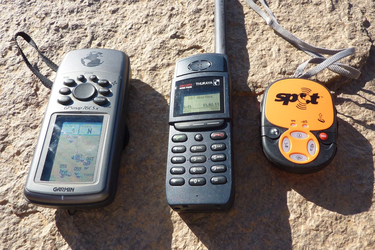
To reassure the group’s people back home I used aSpot Tracker on this trip, sending in locations twice daily which appeared on a password-protected Google Map as well as alerting selected contacts by email and SMS. Short version: it was unreliable in sending an SMS even when a location appeared on the map and it became inconsistent in even logging locations on the online map. If you need to reliably record a daily position with someone back home, just call them on a sat phone or mobile where possible, with a waypoint read off a GPS. With a Thuraya you can get a lat/long on the phone and forward it as an SMS. Of course this means work for someone at home to spread the word. The good thing with a SPOT is it’s easy to use and is automated – but it can’t be relied on. I go on more about it in this interesting discussion on GPS tracking devices.
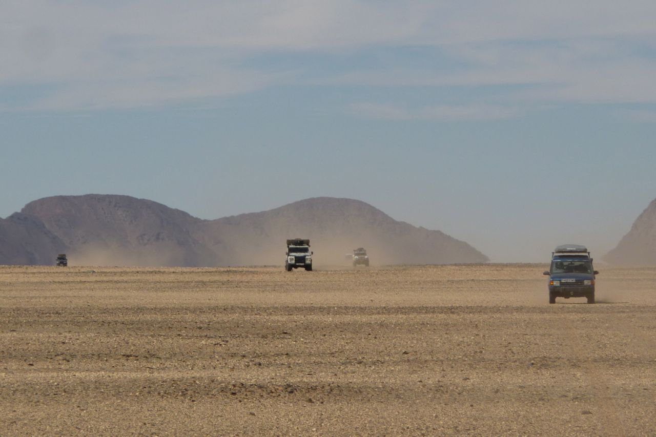
ROUTE See the big map up top for the off-highway stage. Basically we took a 1000-km run out of in Salah to Abalessa as far at 2°W and via in Ziza canyon, making it up with the help of the guide day by day and more or less as fuel and water required. From Tam we went up to Assekrem (track missing on the big map) – piste in the usual condition – and down to Hirafok – piste in as good condition as it gets, with clearly defined deviations around the many wash outs. Hirafok to the TSH looks like it may be getting sealed as far as Ideles. North of In Amguel we went back into Ahnet via, Tesnou, Assouf Melloul and the back of Erg Mehajebat. All great but undemanding off roading through some fantastic landscapes.
We only saw one other tourist car – a Swiss couple in Tam with a Santana who I’d met before in Algeria – and also travelling with Tanezrouft.
VEHICLES (oldest first, all vehicles had high mileages)
Early TLC 80 on big tyres and heavy bumpers, no RTT
Discovery 1 manual (since sold for £400). Most economical with Colombus RTT
Discovery 1 auto, Jap import, with Colombus RTT
Late 24v TLC 80 with canvas RTT
Suped-up Land Rover Td5 110 with canvas RTT
Hilux 2.8D aspirated (2005). The agency car which I rode in.
No serious vehicle problems – a split PAS hose on the old 80 at Assekrem took a couple of hours to fix, mostly due to difficult access. At Abalessa it was calculated that after some 950km the manual Discovery was the most economical at 7.8kpl/22.5mpg and the old TLC was worst at 5.2kpl/15mpg (pretty bad but as the driver expected). The other three were within 5 litres of each other at around 6.9kpl/20mpg. The Hilux was not measured but may have been more economical still, doing the trip on the tank plus 40 litres (100L in total? = 9.5kpl/27mpg).
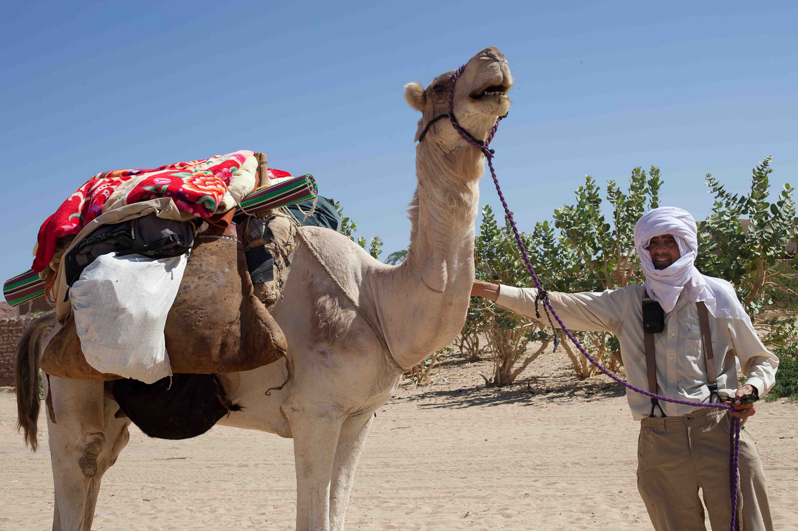
I travelled by camel on a 28-day journey with one camel and a guide departing and returning to Fada. The trip started on 8th December 2011, and finished on 4 January 2012. The journey was excellent, the guide very good (although he could not speak any French or English, and I could not speak Goorani).
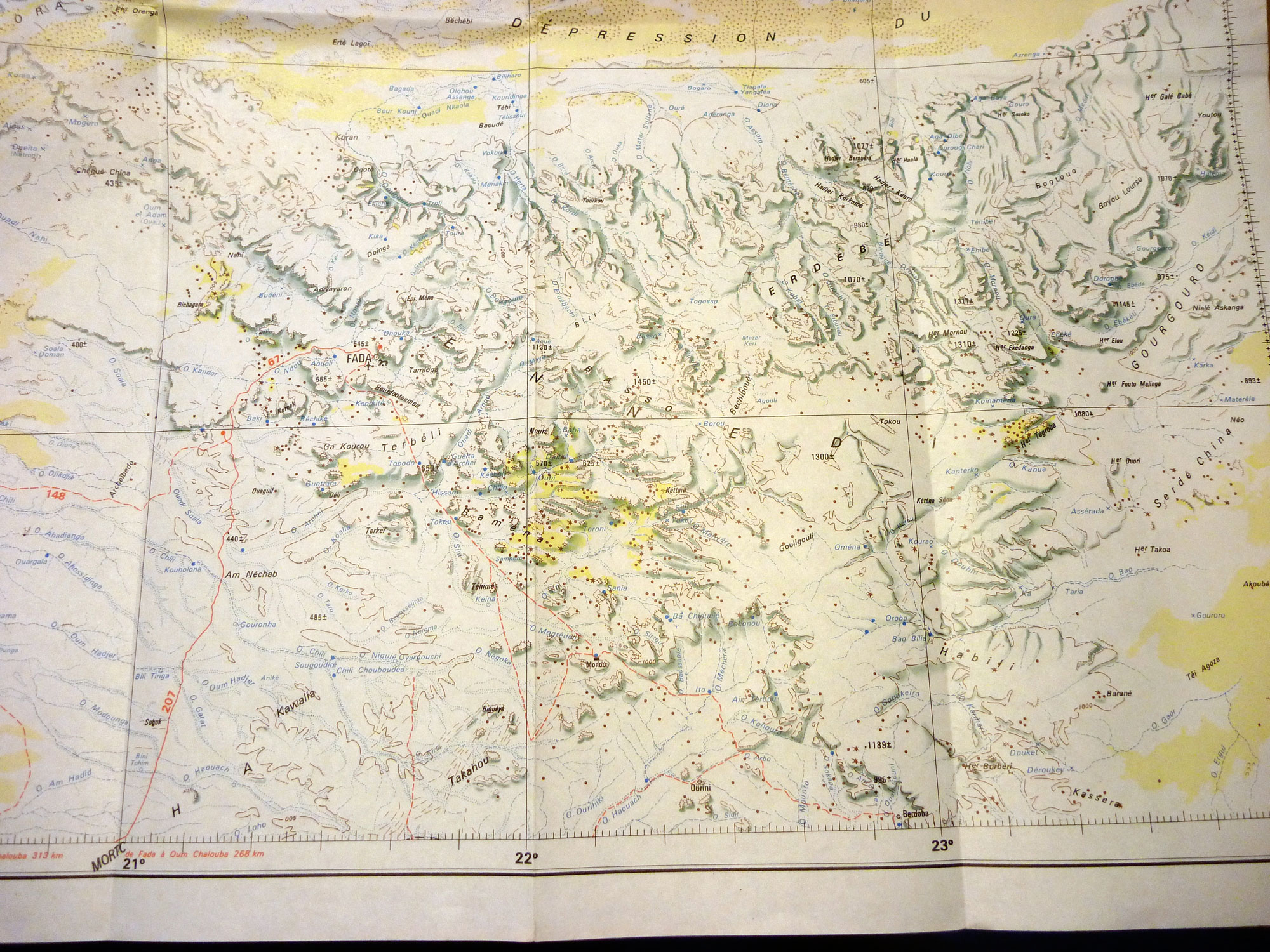
The trip covered several of the Ennedi highlights, including Guelta Archei (3 nights), Puit de Tokou (2 nights), Guelta Bachekele (noted as ‘Ba Chekele’ on the 1974 IGN 1:1m NE34‘Largeau’ sheet – top left, click to enlarge), 4 nights, Monou, Rocks of Terkei (2 nights), Guelta Deli, Baki and then returning to Fada. We travelled about 5-6 hours a day but spent several days at some sites. The weather was excellent, with only 2-3 days of quite strong wind. Food for the trip was basic, based on variations of spaghetti, rice, sardines, dried tomatoes, onions and tinned peas.
The trip was easier to organise than I had expected. I arrived in Fada on one day, discussed my reasons for coming to Fada with the Police, and they produced a guide for me. I suspect a relative of one of the Police. I organised a written contract, outlining a rough itinerary, stating the price, start and finish dates on my second day in Fada, and started the trip the third day. I was conscious for my own security that the Police should be aware of my travel plans, and the identity of my guide; this was all done before I departed.
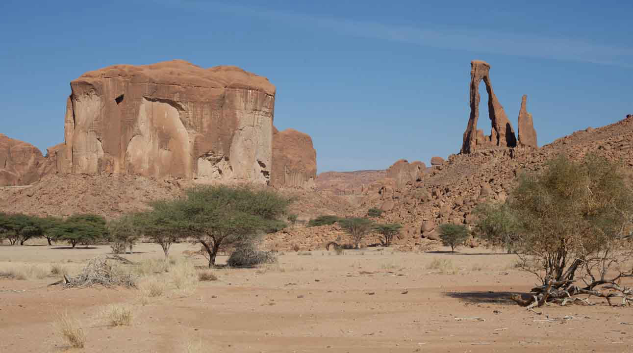
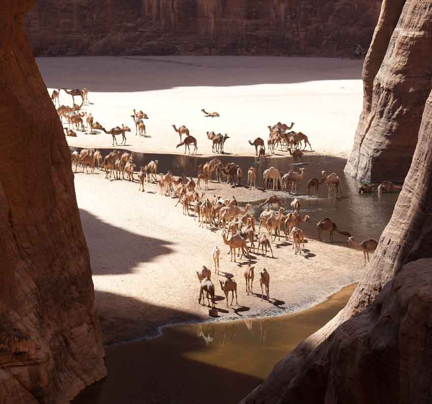
The region is quite spectacular, with huge vistas of the desert with great rocks worn into all sorts of shapes, along with cliffs, arches, overhangs, ‘organ pipe’ stands of rock, and it was also enriching to see and meet the people who make their lives in this harsh environment. There were rock paintings to be found in caves – it was good to be able to have time to ‘discover’ my own as well as those known to the guide. There were many camels, all looking in very fine condition as well as goats and sheep. There was some wildlife to be seen – Dorcas Gazelle, crocodile (Guelta Archei -I had most success seeing the crocodiles early in the morning before the camels arrived), Hyrax, Fennec Fox, Jackal and Barbary Sheep (mouflon) at Guelta Deli. I am sure they were Barbary Sheep, but I need to do some research when I return home. Owls often called from the cliffs at night. I had a great time, and we returned on the 4th January to Fada, as agreed.
Practicalities I obtained a 3 month visa from Brussels, and travelled to Ndjamena on Air France from Paris. You need to report to Immigration Office in Ndjamena upon arrival. You need an Autorisation de Circuler (A. de C.) before leaving Ndjamena. This takes a minimum of three days. Day 1 visit the Tourism Office near the airport to explain your itinerary to the official. When discussing the itinerary, make it clear that you expect to finish the trip by a particular date – probably the date on which you plan to leave Chad. They then prepare the A. de C., and you collect it the next working day. You then take it to the Office of Public Security 300 metres down the road for official stamping, and return there the next working day to collect the A. de C. It is advisable to take several copies of the A. de C., as it can save time when you report to the Police/Public Securite in towns along the way. Then you can go. (Hence it is best to start this process on a Monday, Tuesday or Wednesday – not on a Thursday or Friday, as you will have to sit out the weekend for the next working day.)
I took with me the inadequate very short chapter on Chad from Lonely Planet, as well as the very informative ‘Petit Fute Guide to Tchad 2011-2012’ 3rd Edition (2010). This 240 page guide has lots of information about things to see and do in Chad, as well as accommodation and GPS waypoints, but assumes that you have your own vehicle, so is not very good for getting about using local transport.
I travelled by bus from Ndjamena to Abeche (last internet). I then found a 4WD going north to Biltine, where I stopped overnight at the Restaurant Al Afia. (There is no accommodation in Biltine). I found other transport going to Kalait further north. (It is not marked on all maps, but is located a little further north than Oum Chalouba). There I stayed with the driver of the 4WD, as again there is no accommodation there. Transport to and from Fada is not available every day. I was lucky, and got a ride on an ancient Toyota Land Cruiser the next day. I arrived in Fada the following day. There is no accommodation in Fada, and was given the OK to stay in a Police cell at the Commissariat. Neither is there a restaurant in Fada so note that eating options here are limited. Cell telephone service is available in Fada and Faya.
To leave Fada, I had to wait for three days before I found an empty supply truck returning to Kalait. I then travelled from Kalait to Faya on top of an ageing Mercedes truck with 40 others, and stayed in Faya for 4 nights. Again, there is no accommodation in Faya – the only Auberge mentioned in guide books – the Emi Koussi – has closed. I stayed with a family near the Place de Marche for 4 nights. The people of Chad were very helpful and accommodating. To return to Ndjamena, I went by 4WD which took 2 days, although can take longer. I had thought about visiting Tibesti, but decided to see Ennedi ‘properly’, and to see Tibesti on another trip. This is as well, because when in Faya 10-13th January it was very windy and very cold, making sightseeing very unpleasant to say the least.
The Camel Trip Costs. I paid CFA 10,000 or €15 per day (CFA655 = €1) for the camel, another CFA 10,000 per day for the guide, a lump sum of CFA150,000 (€235) for the basic food (sugar, spaghetti, sardines, tea, onions), and I spent another CFA 50,000 (€75) on ‘extra’ food, including tinned peas, biscuits, several kilos of dried milk, dried tomatoes and some extra sardines. (The options are very limited in Fada). The sting in the costs was the Tourist Tax levied at both Guelta Archei AND Guelta Bachekele. It is charged ‘per group’ – so if you are a ‘group’ of one then you have the honour of paying the whole fee. The tax is CFA50,000 (€75) per group at Guelta Archei, and I paid CFA40,000 (€63) at Bachekele, although the Police advised that it was CFA50,000.
We had one large camel, which I was free to ride, on a shared basis with the guide. Mostly I preferred to walk, because although a great baggage camel, it needed work to make sure it kept walking at a reasonable rate in the correct direction. You are also freer to take photographs while walking. Take a warm sleeping bag, as some nights were quite cold – say around 5-8 degrees C. My guide Karli Kallia – known by the Police as a camel guide, was excellent.
Readers of Wilfred Thesiger’s Arabia journeys may recall the value his Bedu companions placed on their camels. Although they were at times driven to death (and thereupon eagerly eaten), the camels’ well-being came before that of their bearers, for without camels they were doomed. Steadily hauling loads across vast distances, desert nomadism could reach beyond the systematic walkabouts from waterhole to waterhole. “Ships of the desert” is an apt proverb, for who could cross an ocean without a ship. While caravans traversing the deserts of North Africa and Asia conjure up a romantic image, the advent of motor vehicles has relegated camels to touristic excursions, a ‘back to my roots’ status symbol in some Saharan countries or merely just meat. The hardship which Thesiger and Asher tasted is a thing of the past and most nomads, ever pragmatic, don’t regret it. For outsiders the idea of camel travel is undoubtedly rewarding, but successfully buying and managing some beasts takes experience. For most of us then, an all-terrain vehicle adapted for payload and long range fits the bill. 4WD sales flourish as emblems of macho ‘go-anywhere’ chic, but the best models make ideal transportation for a desert adventure, as well as day-to-day runabouts. Desirable qualities include: payload and space – choose LWB models with heavy-duty suspension capable of carrying up to 500kg without sagging; robustness – not all 4WD-badged vehicles are fit for the desert; mechanical simplicity no longer sells new cars but it’s what most drivers and bush mechanics can fix; ground clearance is much more useful than all-wheel drive (which explains the efficacy of certain 2WDs in deserts; performance – power to get you over dunes with 400 litres of fuel and water, plus the economy to make that fuel last. Turbo diesels are superior in this respect and the norm for working 4WDs. Finally, consider parts availability and interchangeability. A GM Humvee may turn heads down the Kings Road but you won’t find it’s unusual 17″ tyres or much else GM in the Sahara. Here, as in most other remote areas, Toyotas and Land Rovers rule the roost and there’s a good chance of finding spares or know-how if you need it. All-terrain trail bikes are closer to the dromedary experience and can reach places 4WDs cannot. For the desert a four-stroke single of around 600cc offers the best power and economy-to-weight ratio; a critical factor when riding off road with a 50kg payload. So too are knobbly tyres – anything else is unstable on sand and gravel. Note that models (and so parts) over 125cc are rare outside the developed world so choose simple and reliable Japanese or European examples. The limitations of two-wheeled freedom is range (typically around 600km/3-4 days in winter, about 30% of a 4WD) – and the riding skill needed to keep a loaded machine upright in soft sand. However, an agile unloaded enduro bike can make a useful addition to a conventional expedition, saving hours by reconnoitring the best route through difficult terrain or nipping into town on an errand. Thorough and appropriate vehicle preparation is at the core of a trouble-free trip. A car doesn’t need winches, bull bars or banks of spotlights (there’s nothing to winch off, nothing to crash into except each other and night driving should be avoided at all costs). Focus on fundamental things like the condition of the radiator, hoses, belts and transmission as well as suspension and tyres. Securing your payload while maintaining day-to-day accessibility is an art. On both cars and bikes mount heavy items like fuel and water low and between the axles. Avoid overloaded roof racks which reduce stability and fuel economy – most desert returnees barely use them. A fully-loaded test drive incorporating an overnight camp will highlight the effectiveness or otherwise of your set-up while giving you a chance to revise it. Start packing gradually a couple of weeks before departure, ahead of the inevitable nerves when mistakes can be made. Calculate fuel needs at 5kpl (15mpg) for a turbo diesel or 15kpl for a bike. This covers occasional dune crossings and so includes a healthy reserve. In winter, water capacity should be 10 litres per person per day – leaving you plenty for emergencies or the ability to pass on impure sources. For various reasons, (quadrupled water consumption being just one) summertime desert travel should be left to scorpions and snakes (which, incidentally, you’ll never encounter in winter). Long before your vehicle is adapted or even purchased, information about your region must be sourced and may decide your route or even destination. A realistic itinerary and schedule (not a publicity-seeking stunt – even for charity) is as vital as a sound vehicle. I was recently asked to advise a group intent on crossing Mauritania in summer in a double-decker bus! (a prank, I assumed) and another wanting to follow the Saharan Tropic of Cancer (just look at the map…). I’m no stranger to over-ambitious planning but vague, outdated or inaccurate information, often from official sources, is prolific. One magazine recently discouraged travel through Western Sahara (now essentially Morocco) – a region that’s hosted the main trans-Sahara route for the last decade! So we can be grateful to actual travellers and the Internet which, for all it’s junk, can tell it like it is. Desert navigation adds up to more than owning a GPS. Without good maps (or a local guide) you’re helpless. For much of the planet the best maps (1:1 million scale is ideal) were meticulously compiled at the end of the colonial era. The Cold War which followed bought about an unprecedented programme of satellite mapping. Neither of these feats are ever likely to be repeated but now stunning satellite imagery is available free on the Web (try http://images.jsc.nasa.gov). With maps, satellite data and, of course, a GPS to confirm your position and orientation, the desert is yours. In most cases routes follow a recognised track, but in areas of mineral exploration these can get confusing. A good navigator always has a finger on the map and never makes assumptions. Desert driving is technically simple. Tracks are mostly well formed and level, natural obstacles are avoided, with visibility and weather usually perfect. About 200 kms per day is an average maximum in the Sahara. Dunes are another matter, demanding an incompatible blend of momentum and caution. At times crests must be laboriously recce’d on foot to prevent disastrous tumbles. GPS is of minimal use as passable routes change but reducing tyre pressures to 30% transforms your vehicle’s traction. In my experience a powerful compressor to control pressures is far more useful than sand ladders. Short range radios are also a boon, but may need to be discretely used and stashed. Much of the exhilaration of desert travel derives from confidence inspiring navigation, traversing challenging terrain and the satisfaction of self sufficiency. The cost of all this adventuring is the price you pay when things go wrong (or indeed just worrying about it). The stories we occasionally read in the Sunday papers about tourists ‘burned alive’ in the Sahara or the Outback are usually holidaymakers in a rented hatchback who bite off more than they can chew, not those engaged in thoughtfully-planned adventures. Then again, earlier this year three experienced Dutch travellers were robbed and murdered in northern Mali along a smuggler’s route long avoided by tourists. A typical survival scenario develops from a combination of bad luck and poor decisions, planning and preparation (as with the Dutch). Mishaps can happen to us all but avoiding hasty judgements &endash; understandable when in a mild panic) &endash; may your life. On my first Sahara trip I broke down halfway across. Having repaired my cracked fuel tank I decided to turn back. Things didn’t get any easier from that point but knowing when to turn back has enabled another two decades of fabulous desert travel (plus the bits in between!). Like GPS, satellite telephones make it sound easy, but without a contingency plan in place who are you going to call? The deserts of developing countries have no rescue service. You’re on your own, but with reserve water and other vehicles the danger is minimised. An absolute meltdown scenario might be wrecking a vehicle in the dunes while lost, alone and off-route. Without a mobile vehicle you’re in the hands of the gods so, as in the Flight of the Phoenix movie, or a Bedu thrashing an exhausted camel, do whatever it takes. If rescue seems possible have a fuel-soaked tyre or seat ready to ignite – or a head lamp and battery at night. Signal only when signals might be noticed, not on the off chance or at distant aircraft. Conserve energy and water by lying in the shade, but don’t underestimate your ingenuity in a crisis – a strength few of us know we possess. Walking out, unless you’re certain of reaching an attainable destination, is a last resort during which most people perish. An arid wilderness is unforgiving and the crux of desert survival will not be found in an SAS manual, but stems from an appropriate vehicle, season and destination.
Originally published in Geographical magazine, January 2001


