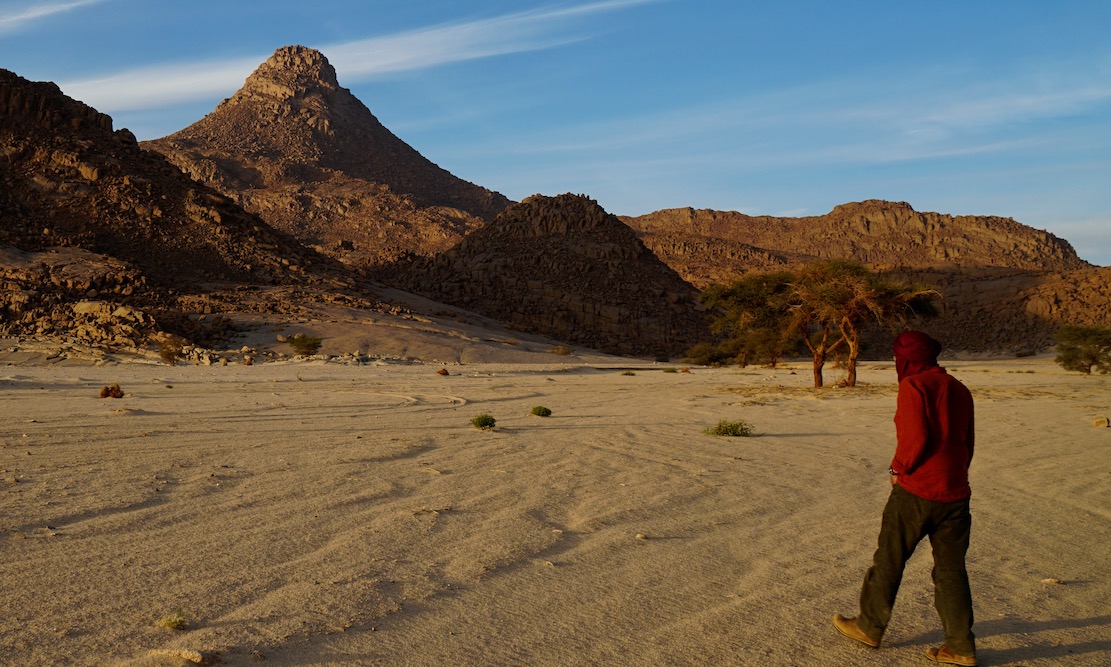
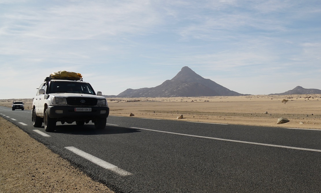
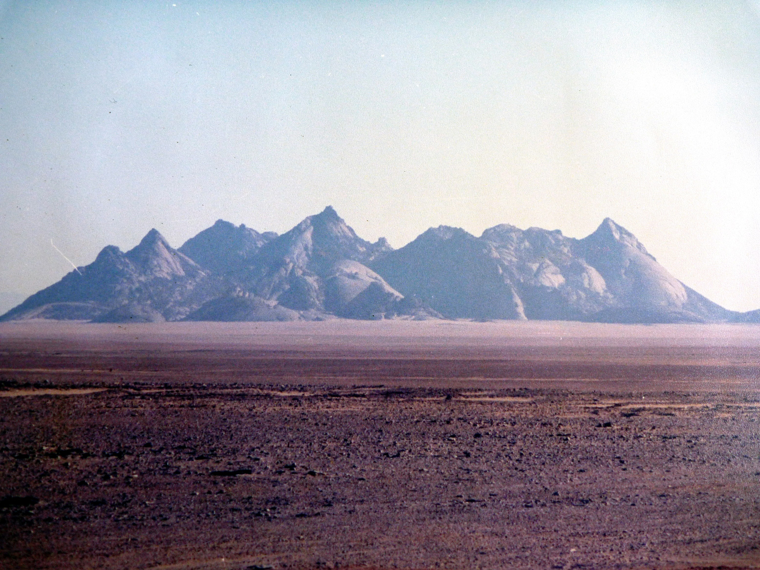
In early 2025 we pulled off a deserted new road and headed across the sands to camp at the foot of Mt Tiska. I’d been looking forward to this moment for nearly 40 years. My first view of Tiska’s distinctive but distant conical form was from Djanet’s old aerodrome way back in 1987. As I write in Desert Travels:
One evening Philippe, a skinny middle-aged Frenchman who had the habit of walking around the campsite in a saggy pair of Y-fronts, invited us to the airport to inspect his old aeroplane. He was immensely proud of his historic plane, a twin-engined machine from the Golden Age of Aviation. He was keen to point out the enlarged fuel tank which former owner, Lady Vanderbildt or some such, had fitted for a one-hop flight to the States as the war turned on Germany… Philippe started up the engines, but I was far more interested in the view down the runway. From this flat vantage point … south of Djanet you could clearly see the unmistakable conical profile of Mount Tiska … the first and only landmark in the featureless expanse which lead across the Ténéré to Chirfa and ultimately Bilma, nearly 900 kilometres away. A waterless expanse of flat, soft, sand, this was the route I’d planned to follow with the only partly cognisant Pete: Yamaha Teneres to the Tenere Desert: it could have been adventure biking gold until his breakdown near Illizi had sunk that idea. At that time I knew only a little more than Pete about the realities of remote desert crossings, and it’s no more likely we’d have made it to Bilma than if we’d tried to paddle to Tristan da Cunha in an upturned umbrella.
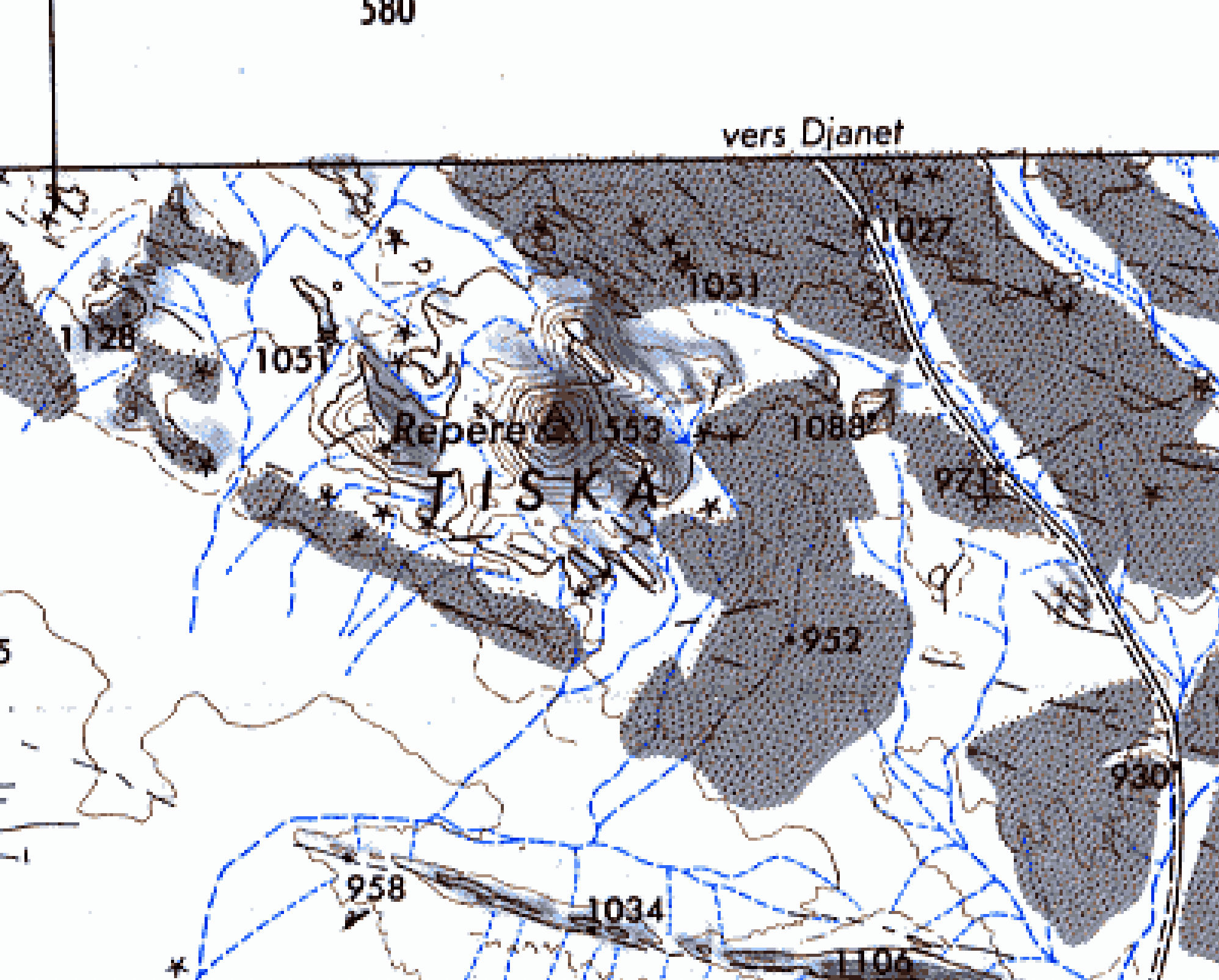
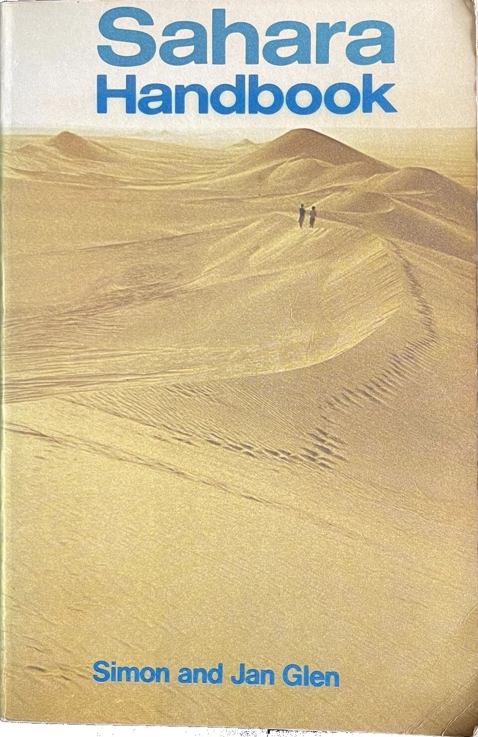
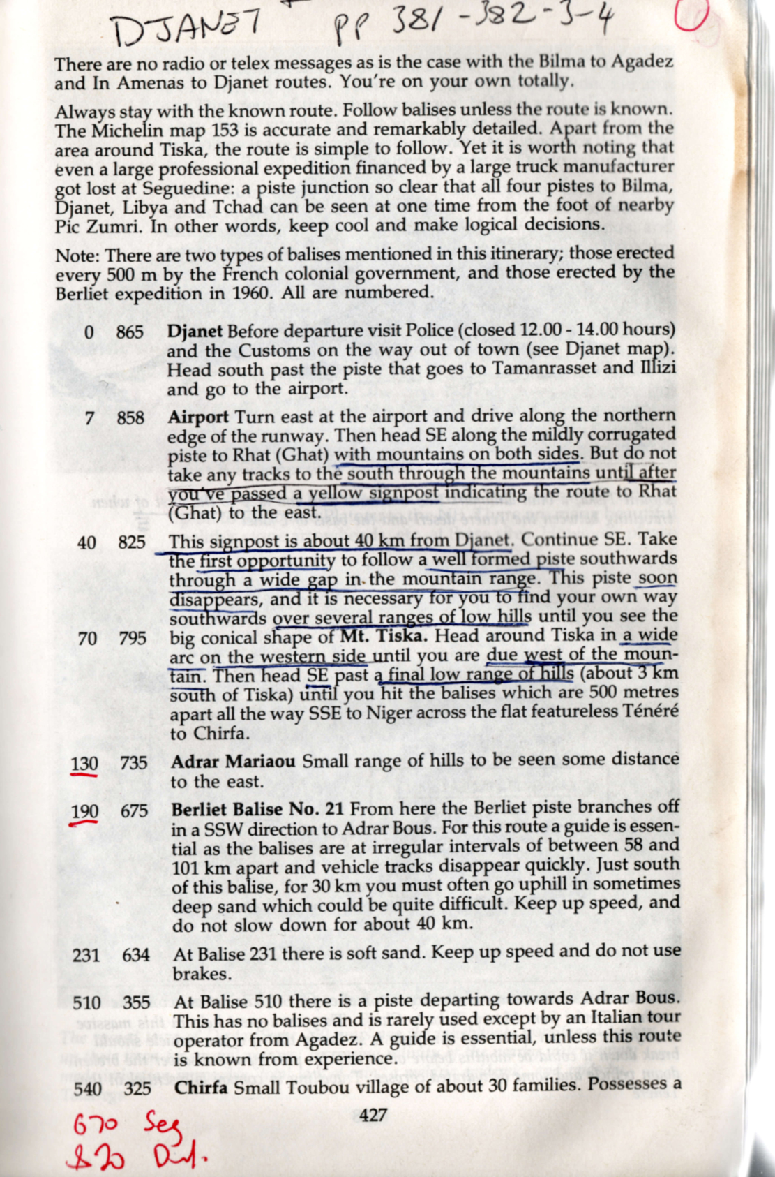
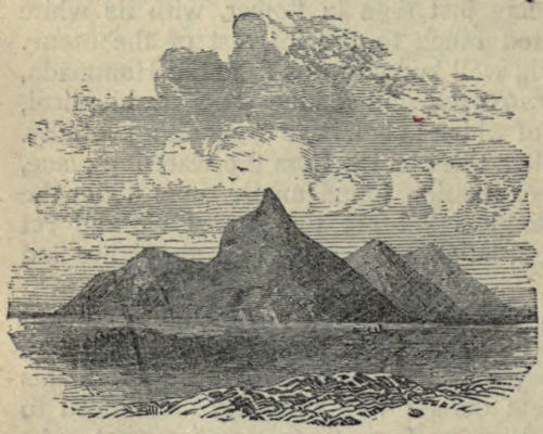
An ancient, pre-GPS landmark, I’d read of Tiska’s significance while leafing back and forth through the original Sahara Handbook (right) in the early 1980s. We all have books that leave strong impressions in our early years; the first SaharaHandbook would be high on my list. In it Simon and Jan Glen’s description of ‘Itinerary No. 19: Djanet – Bilma’, reads like call to adventure. You can see my annotated pages notes left, and might marvel at the sparse landmarks including Mt Tiska, with some spaced up to 200km apart. At no less than 865km, this was a serious desert crossing and the Glens did not mince their words.
To run out of fuel or have a major breakdown could be disastrous, as it could entail waiting for perhaps three months for another vehicle to pass and find tours with dehydrated corps lying around. This is no exaggeration, as the seven marked graves near Arbre du Ténéré show… Here your life depends on your vehicle. On leaving Djanet for the south, no authorities are interested in how well your vehicle is equipped … [nor] interested in whether you make the journey or not. There are no radio of telex messages as in the case with Bilma to Agadez and In Amenas to Djanet routes. You’re on your own totally.
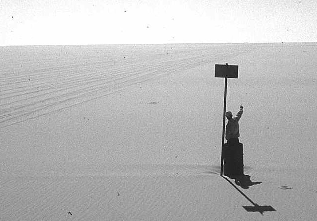
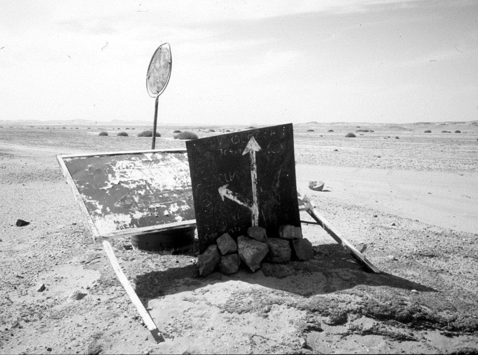
By the time that was written (final edition three, 1990) the piste to Bilma was little used. It’s said that in 1979 four Land Rovers were lost without trace on this route, and as a result the Algerians closed the crossing and pulled up many of the balises (three-metre-high steel marker posts, below) which the French had erected every 500m from Mt Tiska to Chirfa, the first outpost in Niger and a distance of nearly 600km. That information was not known to Pete and myself when in 1987 we set off with plans to blithely ride across the Tenere from Djanet to Niger on Yamaha XT600Z Tenere motorcycles. It was a very long way on a bike, but with a balises every half kilometre, it felt doable providing we had visibility and could carry enough fuel and water.
About 1200 of these balises once marked the entire Tiska–Chirfa crossing, like buoys at sea. You can just see the next one, 500m in the distance.
Coming up from Niger, the cone of Mt Tiska (and larger mass of Adrar Mariaou 34km to the south) had long been important landmarks on the caravan route between Ghat and Agadez. In 1860 Heinrich Barth wrote.
August 2 … After a stretch of nine miles, an interesting peak called Mount Tiska, rising to an elevation of about six hundred feet, and surrounded by some smaller cones, formed the conspicuous limit of the rocky ridges. The country became entirely flat and level … and there was nothing to interrupt the monotonous plain but a steep ridge, called Mariaw, at the distance of about five miles to the east [probably Adrar Mariaou; 34km south]. The nature of this desert region is well understood by the nomadic Tuarek or Imóshagh, who regard the Mariaw as the landmark of the open, uninterrupted desert plain, the “ténere;” .
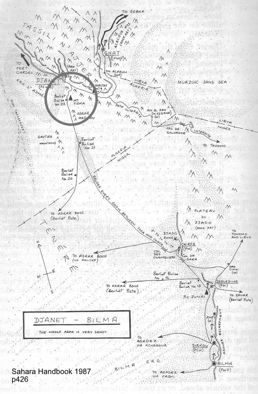
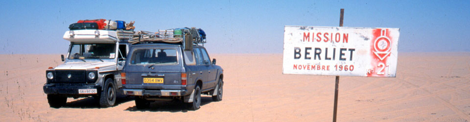
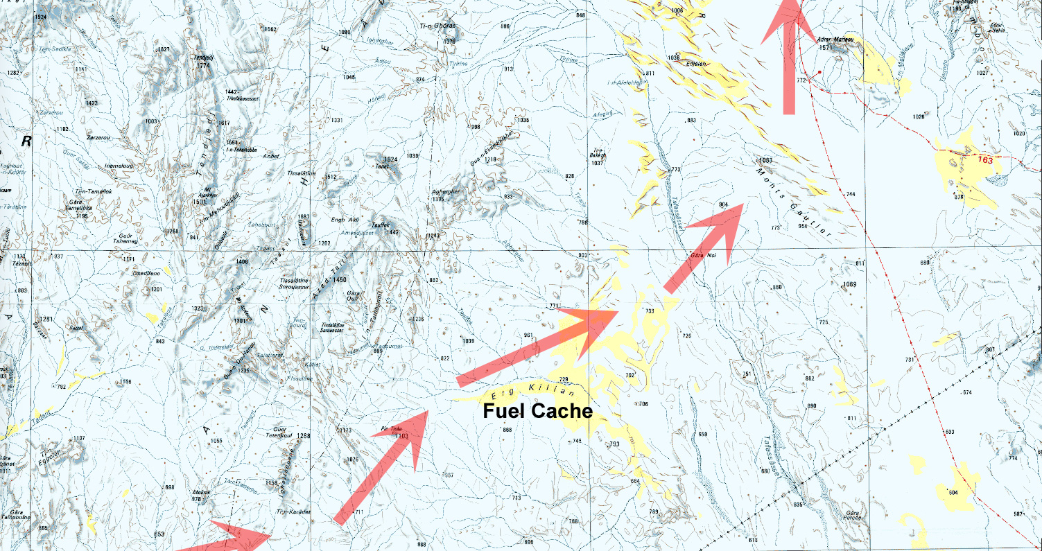
But in 1987 Pete didn’t even make it to Djanet on his Tenere. And soon after I arrived I learned what I now know. Since that aborted crossing, I’ve met others who tackled the route anyway and either got in big trouble in Dirkou in Niger (2001), or got brutally robbed before they even made it to the Niger cut line (2002; probably following a tip off in Djanet). Also in 2002, we came up the balise line from Erg Killian, the Monts Gautier and Berliet Balise 21 (below), but from Mariaou headed directly to Djanet across the very soft sands, bypassing Tiska.
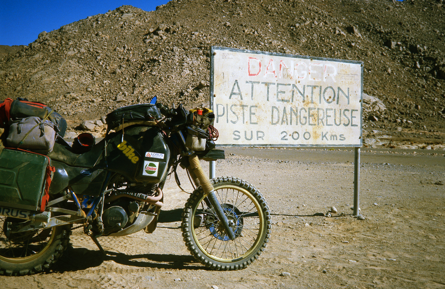
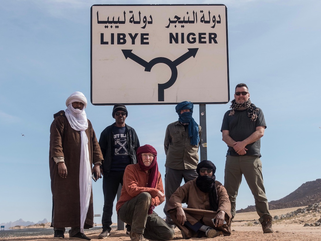
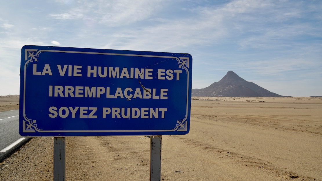
Today, an hour or two from Djanet a tarmac road leads off a roundabout in the middle of nowhere near the famous sign (left) and heads south to pass right by Tiska.
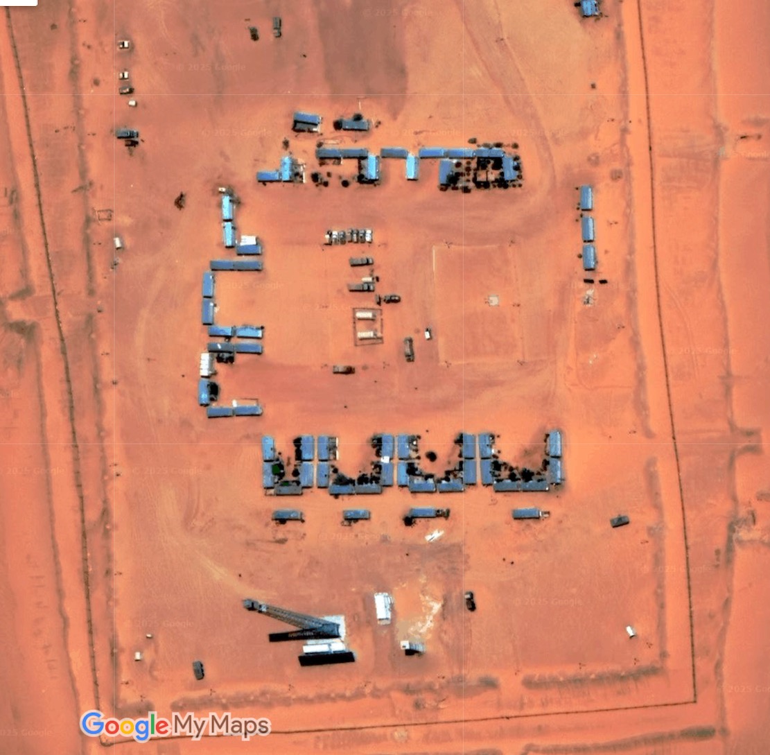
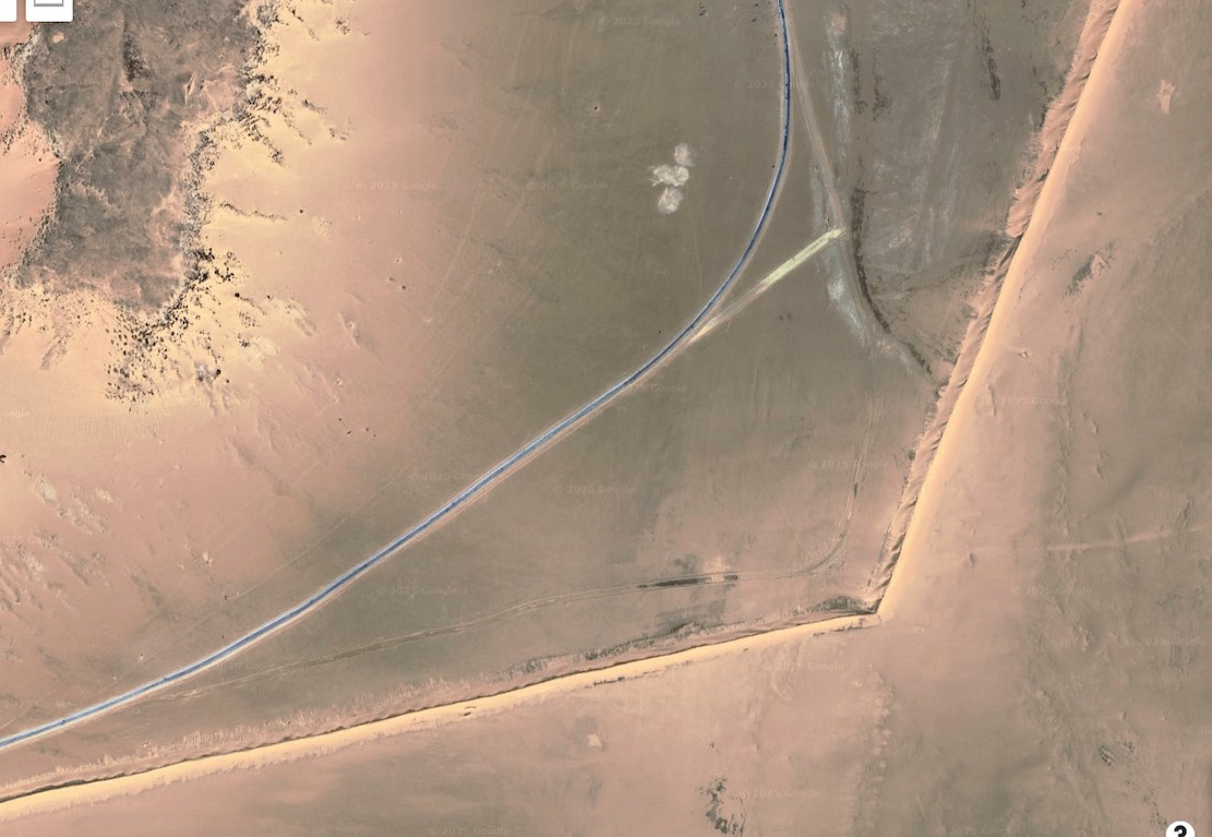
It’s part of a vast network of military roads, remote bases or perhaps migrant camps or prisons, and berms (sand walls) which Algeria has put up in the deep south to control smuggling, migration and jihadist movements.
BaseSand berm and border road
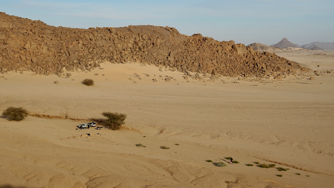
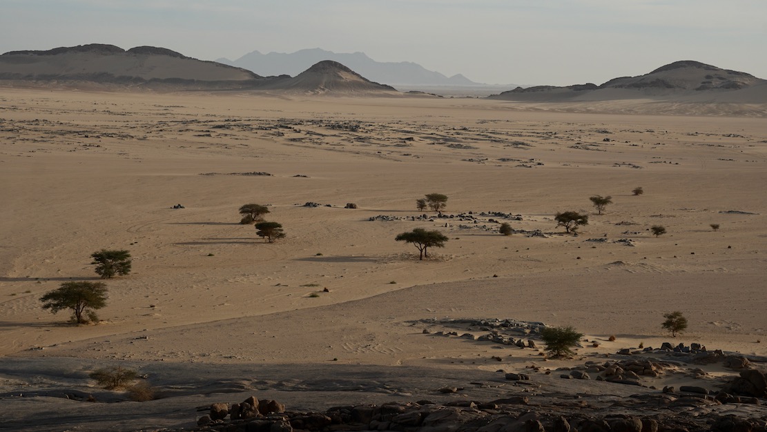
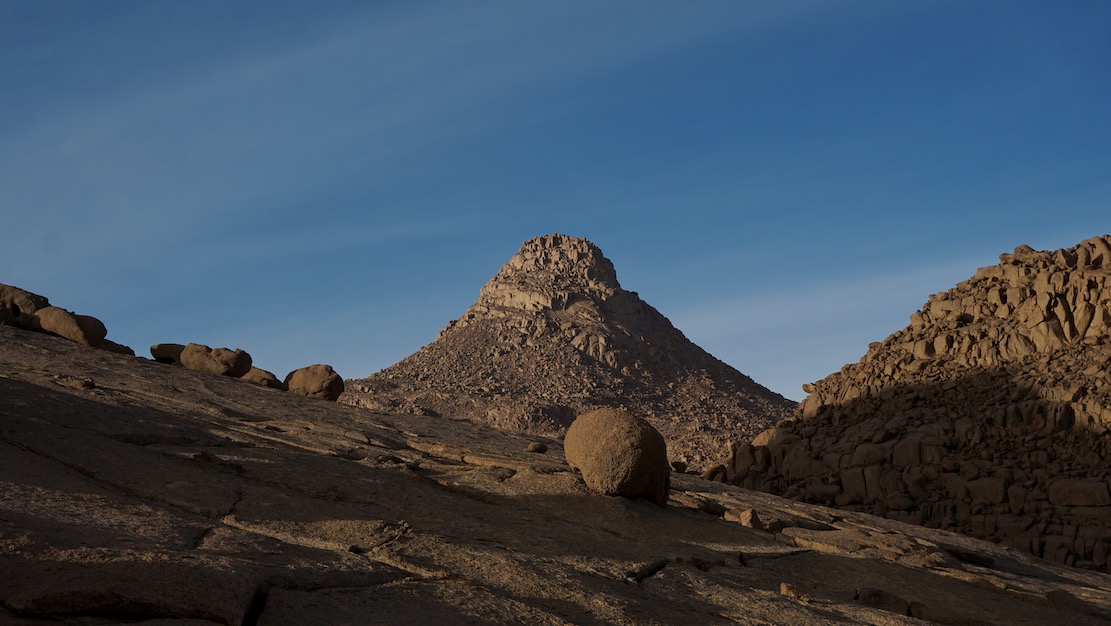
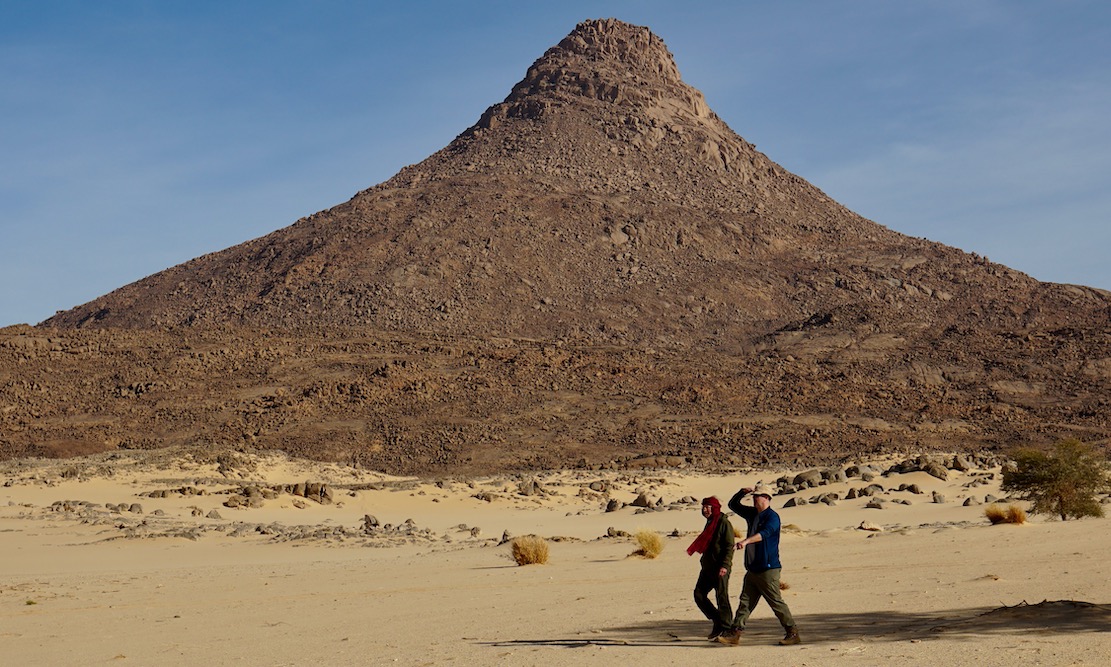
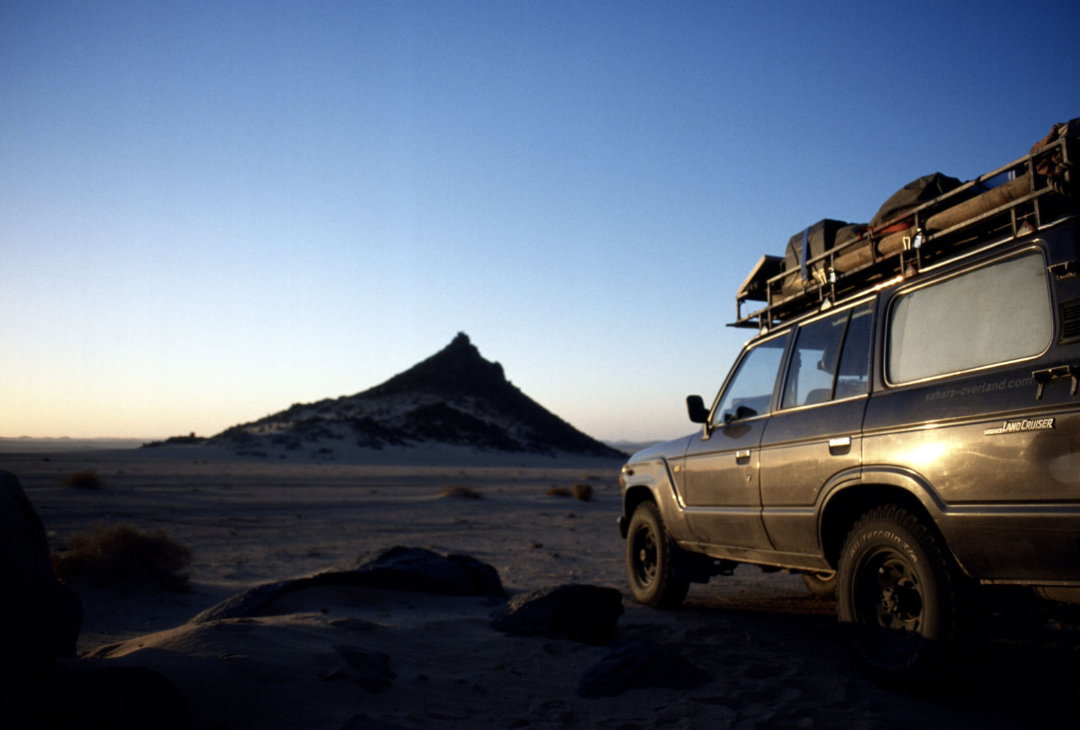
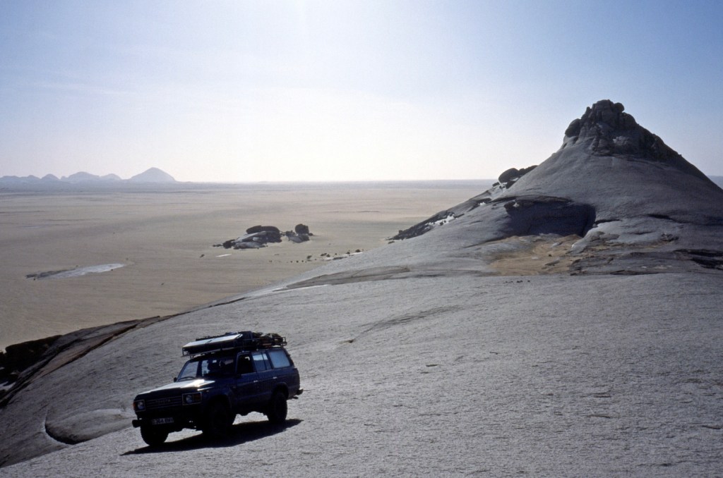
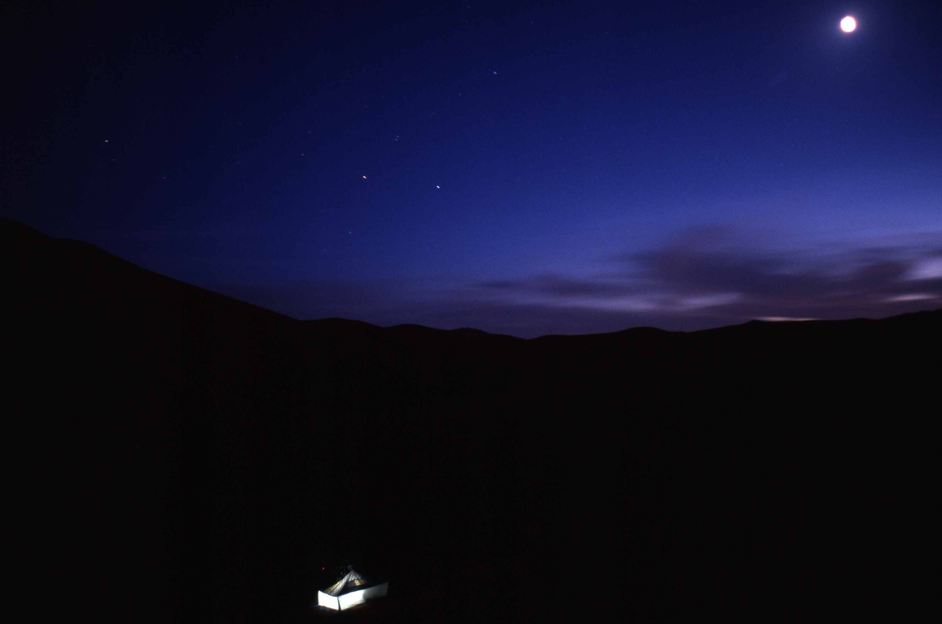
We pulled into a sheltered dip at the southern edge of the hill (below) and the cook got a fire going. Normally I’d have at least tried to climb to the top but at 500m above the desert floor, Tiska is bigger than it looks, one of the last outliers of the Tassili N’Ajjer before the ocean of sand that is the Tenere runs south to the Kaouar hills behind Bilma and the isolated Termit massif which is already in the Sahel, close to Lake Chad.
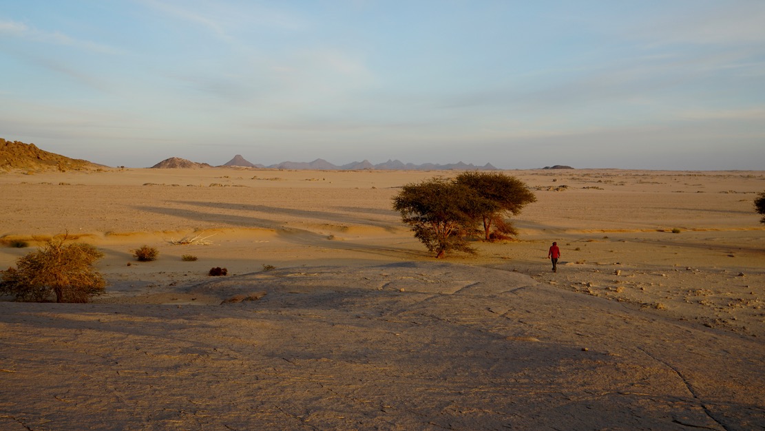
It was sure nice to stretch the limbs after being cooped up in the car for days, but it’s these cars which get us to such places. As always walking in the desert, it’s the tiniest things which catch your eye in the void.
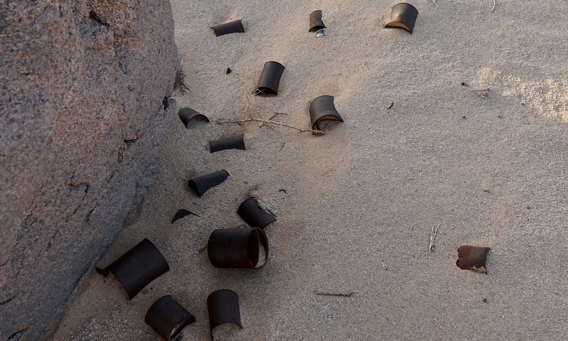
A trove of tin cans dumped by who knows who and who knows when. Anywhere else they’d be rubbish.
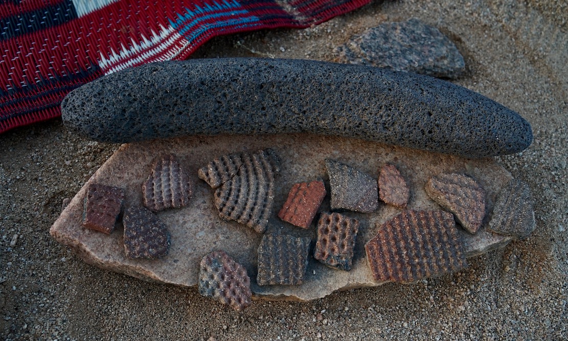
More rubbish perhaps dating back to the Neolithic era or earlier when the Sahara was less arid. Ceramic pottery fragments (commonly found) and some sort of grinding tool I’ve not seen before.
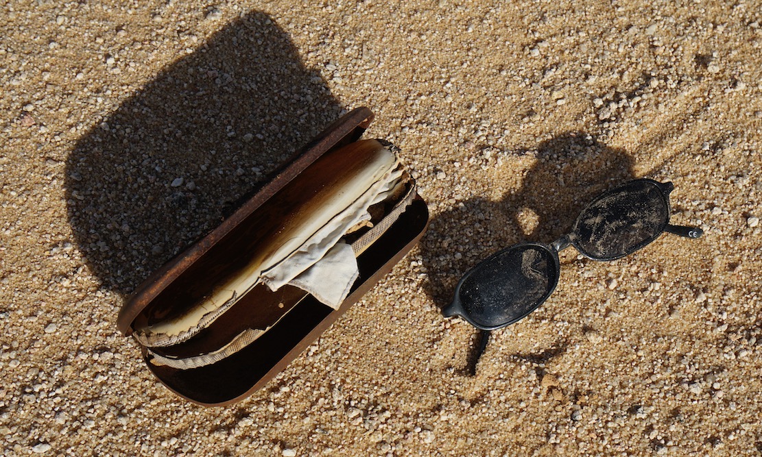
Cheap shades probably dropped by a migrant heading north to the Libyan border and a boat to Europe. Long before the current waves we met lines of migrants way back in in 2002, boldly marching over the Tassili towards Ghat.
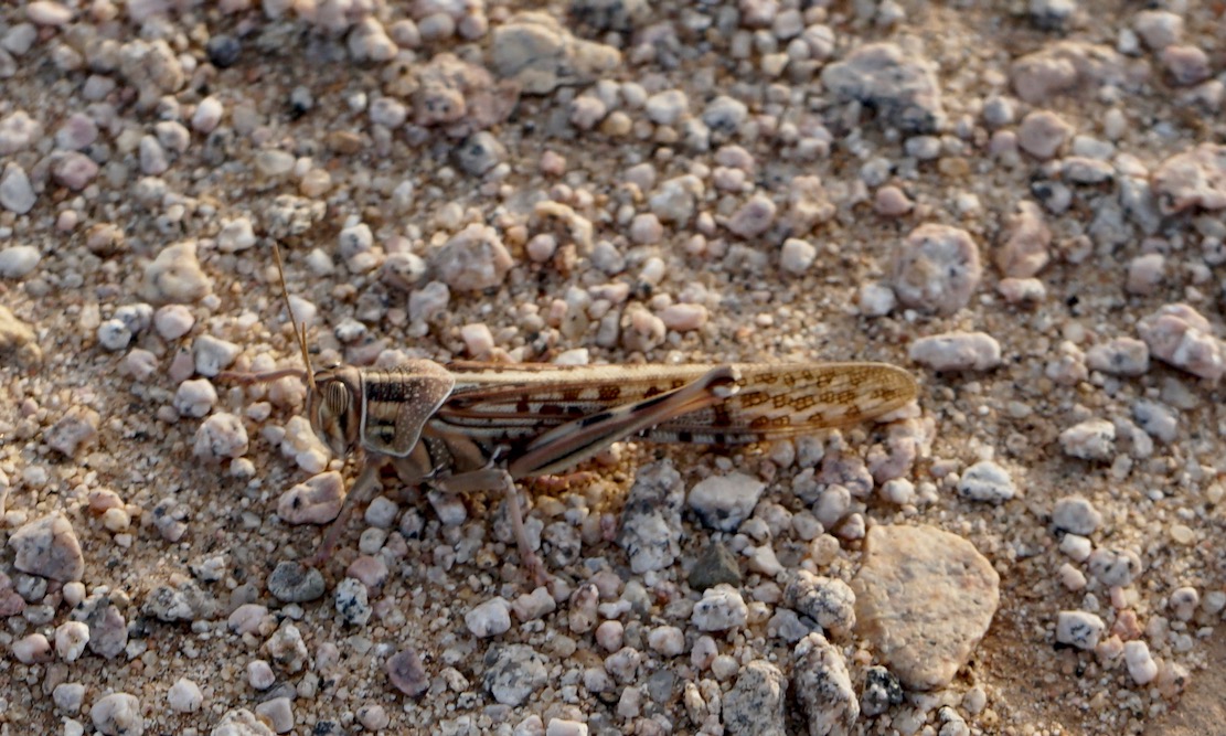
A locust takes a breather
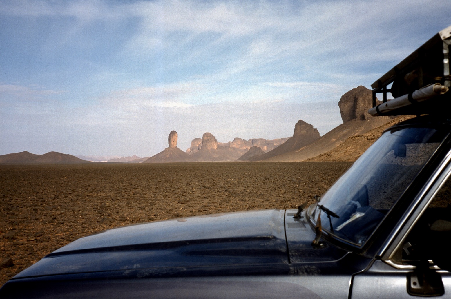
In the foreground the balise line used to start just beyond the ridge. And on the horizon, the mass of Adrar Mariaou and the piste to Chirfa in Niger.
The granite cone of Tiska. I could run a tour in south Algeria hoping from one granite T-mountain to the next.
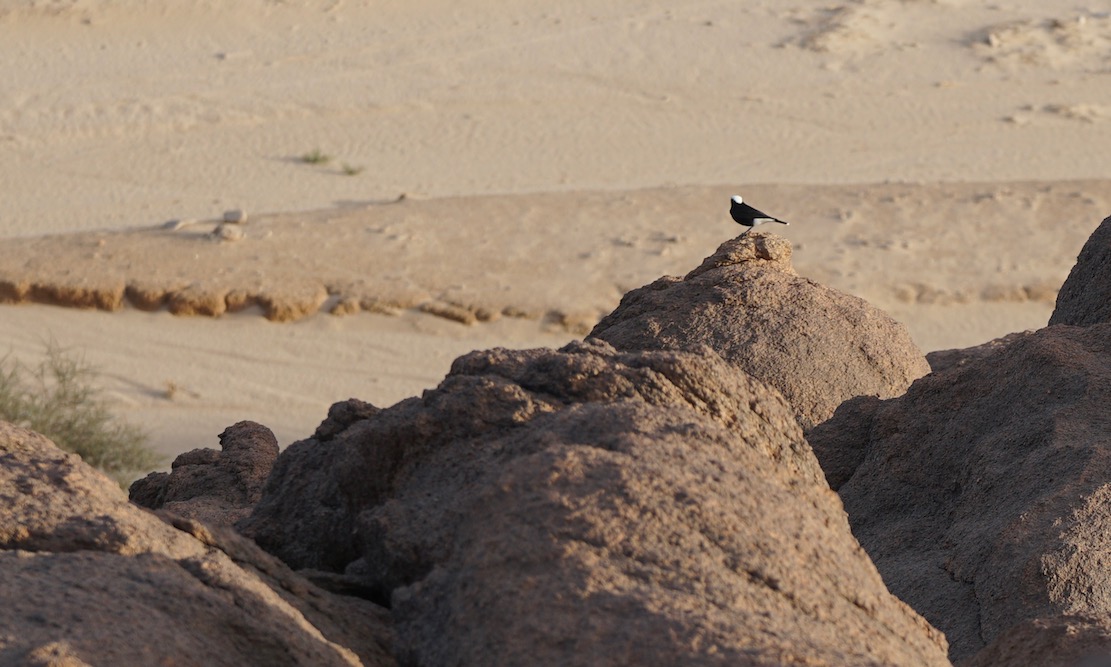
Moula Moula bird, the pigeon of the Sahara.
Sunset across the desert sands
Next morning the three of us set off to walk around the mountain while the crew pack up and catch us up. We carried on clockwise round the mountain, into a hidden bandit valley on the north side, and then back to the road.
Heading back to Djanet after a night out on Mt Tiska.
“It’s never over till it’s over” I’ve learned to say to myself over the years but it had barely begun when at Tunis port they whipped away my newly illegal GPS “telephone” unless I chose to arse about getting a permit from the Ministry of Stupid Ideas. I deposited it in a room full of CB radios (fair enough) while others did the same, a bit stunned about how to navigate down south. Luckily my real sat phone (which I had the presence of mind not to declare) had a rudimentary GPS.
Coming off the boat I’d met the famous David Lambeth coming back from supporting a bike rally – he was not keen on lending me his bells and buzzers Garmin 5, but another departee in a pink 110 kindly lent me an eTrex to back up the untried Thuraya sat phone navigator.
Then, trying to call g-friend down the road it turned out my PAYG Thuraya had expired its SIM (don’t use it much in London). This undermined the security of my solo route plans somewhat until my rendezvous with Prof. Nimbus in Djanet in ten days time. I was beginning to wonder was this going to be “one of those” trips – after all, all had gone remarkably to plan these past couple of years …
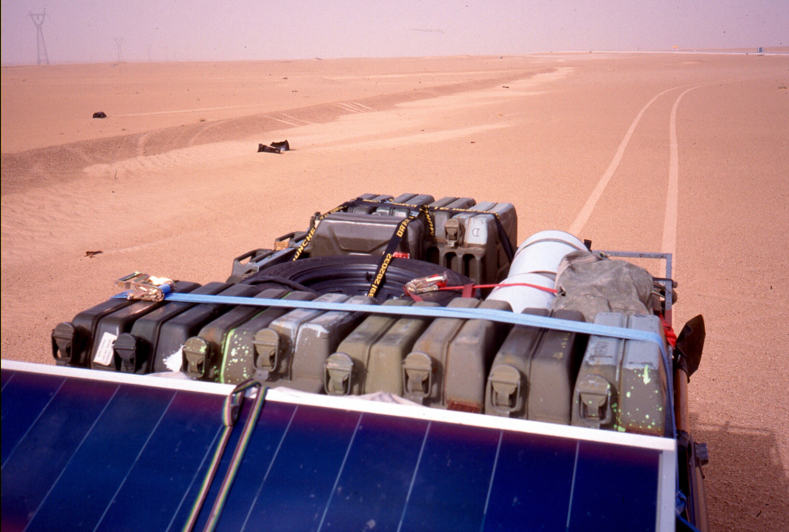
A fax to g-friend from Nefta saw some new SIMs on the way to Nimbus. Until then I was out of comms. Part of my job on this trip – my first solo car venture into the desert it transpired – was to dump food and fuel for my upcoming Desert Riders caper, scheduled for early 2003. D. Rider Jon had gone shopping for food just before I left and had been called by DR Andy asking him to buy one more of everything. I then spent a night by the Grand Erg scoffing at their tasty food choices and sorting the stuff out into packages we’d be able to carry on a bike from the fuel drops.
Next morning more problems. After fueling up for 1500km plus half a dozen petrol jerries to bury, HbG checkpoint made me take a soldier to Bordj Omar Driss but failed to tell me the piste from there was closed to Amguid (otherwise I’d not have bothered with the lift of course!). I’d heard this piste had been closed (due to smugglers he told me on the way back) and a barrier was pushed up against the piste at Quatre Chemins. It was the direct route to my planned fuel dump south of Amguid but anyway the weather was oddly hot, windy, hazy and even spitting rain. If nothing else my three Algerian trips this year have confirmed the unpredictability of Saharan weather. It boded ill for our much-postponed filming of Desert Driving in a couple of weeks…
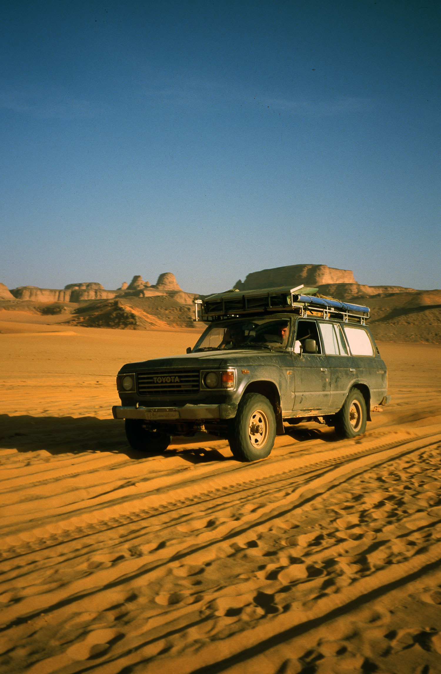
I’d half expected a closed piste so had plans to hit Amguid from the Djanet side. I had a hot/cold, windy/rainy night near Ohanet in the back of the car, and with time to kill before meeting Nimbus, soon got to savour the relaxed non-tour-leading pace while driving alone in the desert. I checked out the hotel at In Amenas (a dump, fyi) and explored Erg Bouharet as a great location for some planned DD scenes. We camped here in 1988 on my first bike tour (described in Desert Travels) and I was amazed to see my so-called “apostrophe dune” pictured on my g-friend’s wall unchanged in 14 years. As I suspected, the myth of dune mobility is much exaggerated, especially if part of an erg rather than stranded on a plain.
That night I popped out to Oued Djerat east of Illizi, the site for much rock art, it is said. Clear tracks lead into the canyon and after it got narrow I parked up but found nothing but a quiet night out. Next morning a Tuareg cameleer creeped up on me as they do while I was finishing off Michael Palin‘s book. I’d left a colourful array of kids’ clothes hanging from the nearby trees. He helped himself to the booty and told me the art was a bit further up the canyon where I’d spotted an encampment earlier on. Now that I knew where, it was one for next time.
Over the Fadnoun the weather was still hot and windy from the south. I washed the car in a guelta and recced a D Riders route along which we planned to emerge from Oued Samene (to Ifni). It looked good, as the TPC map suggested. Down the road at Afara junction I headed right onto the piste. I rode this route in 1990 with Steve in his car and some images remained: the nice dune/outcrops where I camped that night and a very steep descent to the Afara plain which I managed to negotiate without a scrape next morning, despite the half ton of fuel on board. I even had the presence of mind to film the undercarriage with a bullet cam taped to the chassis to use in the Desert Driving film later.
Afara
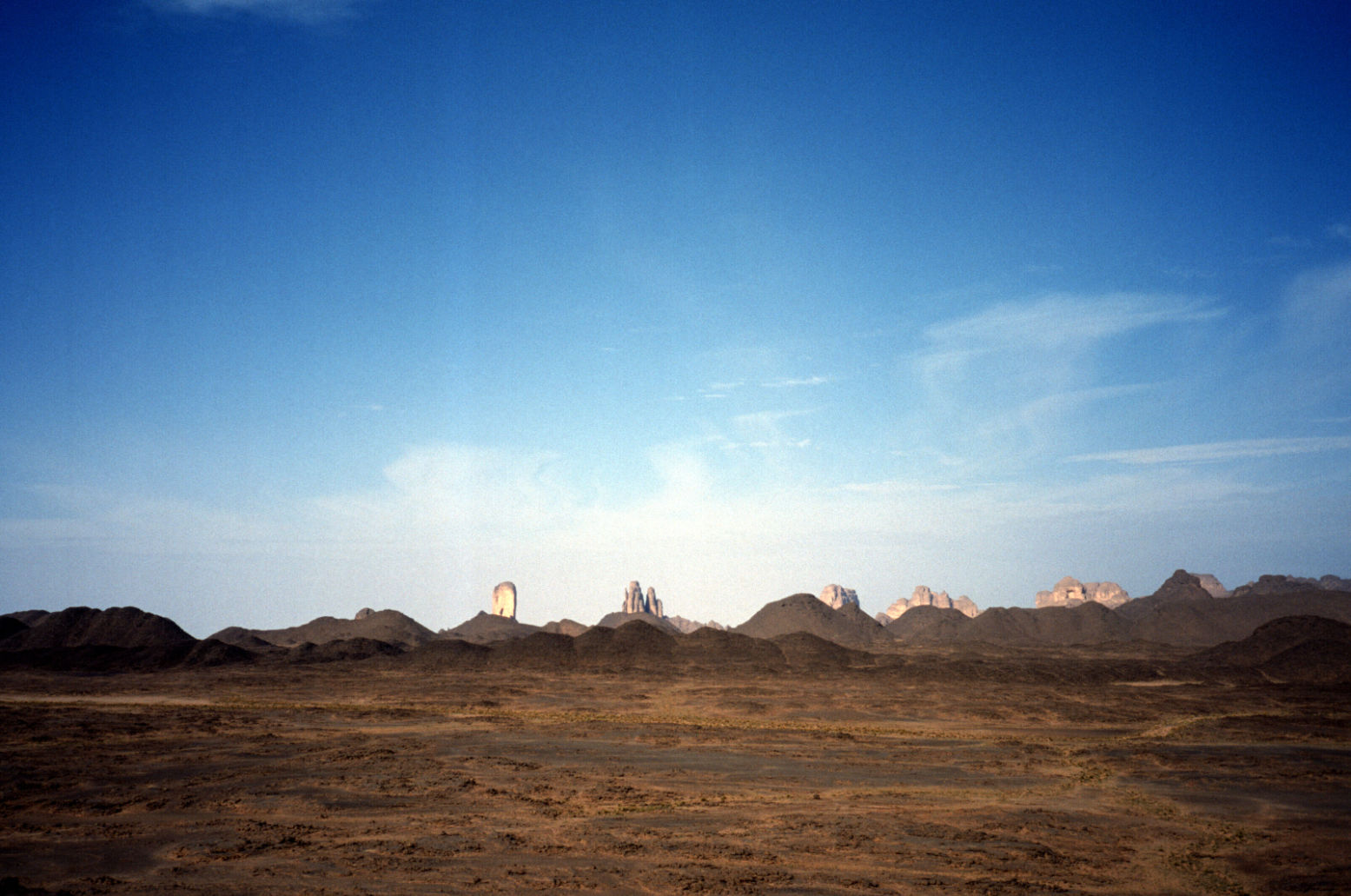
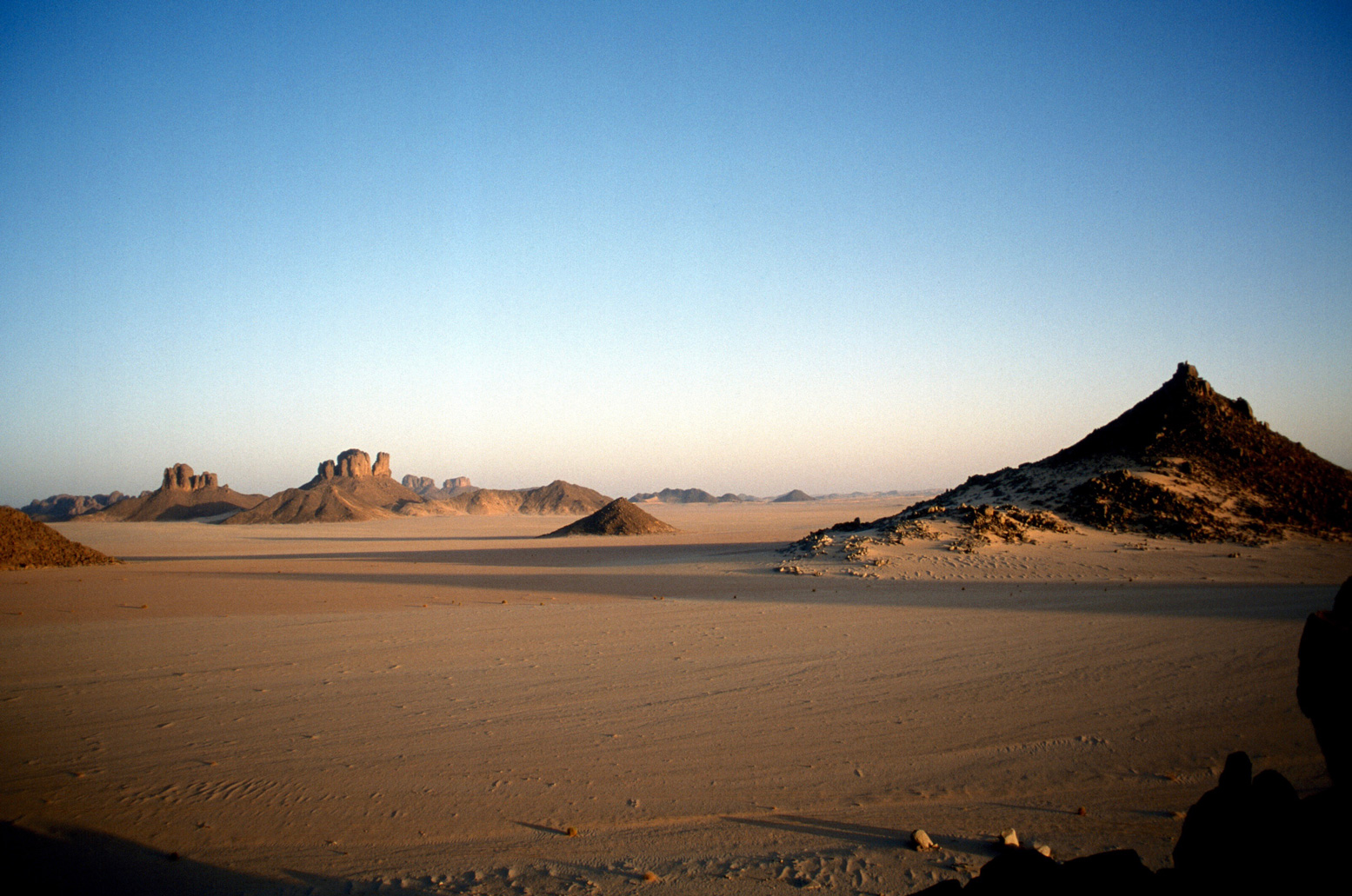
Afara north is pretty amazing – like Monument Valley but without Navajo souvenirs, and the southern bit coming onto the ‘Borne’ plain is nice too, but in between it’s a basalt bashing butt-jabber (something that had not affected me on a bike in 90). Still, at least the weather was now as blue as it gets.
More Afara
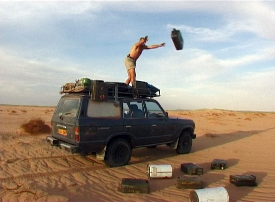
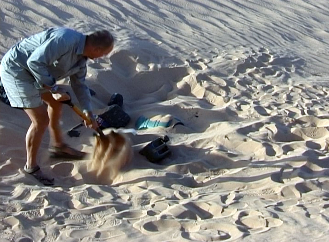
I came off this slow route in mid-afternoon trying to find the sandy pass on Route A7 KM195 (link below) with my sat phone GPS (I couldn’t work it out how to get the eTrex to do a “go to”). I’d been here a few months earlier on a tour, but still stumbled around until I found the pass. Then, again I got off track not concentrating on the compass or GPS, but finally picked up A7 and with the sun setting, dumped six cans for Amguid on a outcrop for collection later with Nimbus. I then retraced the route back east, enjoying the 120kgs missing off the roof.
Camping behind a fin of rock just past the KM195 pass, I decided to re-erect a fallen balise (steel post) to assist others. Even first time last March it had been tricky finding our way here. I excavated an old truck tyre and dragged the fallen balise over to the pass “gateway”. The balise had three sticky-out feet and by hoicking the truck tyre over the balise, it rested on the feet and, once filled with sand, held up the balise, sort of, now at KM 195 on A7.
Afara? Yes
That night I was freaked out by a car coming off the pass at 2am. It didn’t spot me behind my fin, but seeing the ‘new’ balise, circled it and swept me in its lights. By then I was already dressed and poised for a locked-in get-away, but the Patrol carried on back the way it came …. phew … and then came back! I was now slinging stuff into the car and ready to move out when it turned north before reaching me. I watched it trundle away for half an hour to make sure. Turns out they were probably as lost as I’d been earlier. Maybe a lot of night driving goes on in Ramadan. Or maybe it was connected with the mass kidnappings that were to occur near here a few months later.
On the way back to Djanet I explored north of Tazat, looking for the pass to Bordj el Haous (Zaoutallaz) as indicated on the TPC map. Climbing an outcrop and surveying the supposed Tehe-N-Essegh pass. it was all sanded up, no way from this side but maybe coming from the east with a slide down. I then slipped through the regular Tazat back corridor and followed a clear track almost all the way to Bordj, dumping the rest of my stash of old clothes with some hyena-like Tuareg kids.
With the plateau to the left and the dunes to the right, the run from Bordj El H’ to Djanet is one of the loveliest drives in the Sahara, even if it’s now sealed. Even though I’d done it several times over the years it still looks amazing and I enjoyed doing most of it on the sands north of the road, looking for new camps and generally marvelling at the scenery.
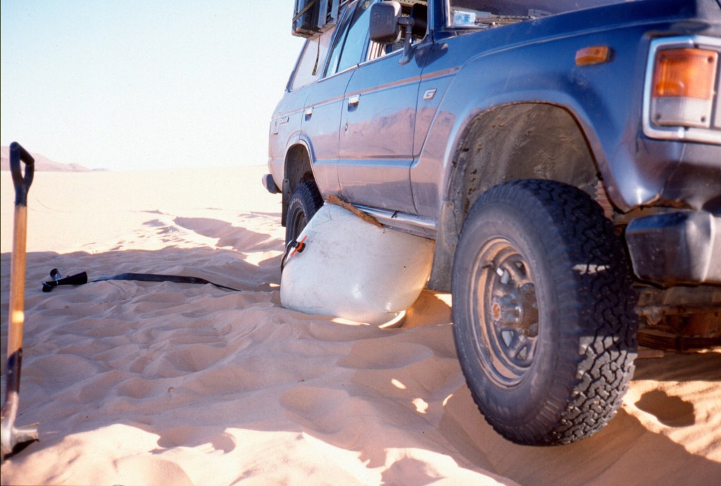
Move over hi-lift jackers; we’re air bagging
A couple of days later Prof. Nimbus, laden with Thuraya SIMs arrived at Djanet airport and I gave him the news: our double deep-southern run to Tam and back had been changed to a loop: up to Amguid then down to Tam and then back to Djanet, dropping fuel and food all along the way. Naturally, he was not bothered, it was all desert to him. We camped below Tazat that night, on the way trying out my airbag jack for the first time when I got sunk on a knoll of soft stuff. “I’ve never seen a car sink so deep” observed Nimbus without sarcasm. Turns out his petrol 2A hasn’t got the poke to sink itself like my tractor-engined TLC. I found this out for myself a few years later with an old Hilux, it’s an interesting benefit of a modestly powered 4×4, but at the time not enough to p-ex my 61 for a Series 2A. The airbag was nifty in the extreme, as you can see in the Desert Driving dvd which is now on youtube.
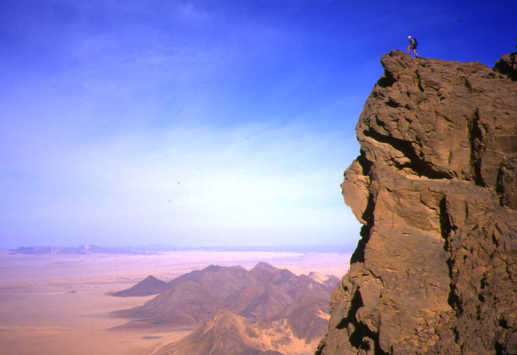
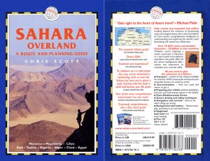
Next day we tried to climb Tazat mountain (2165m), but things got as complicated as they looked near the summit, so we satisfied ourselves with some low-angled shots that looked as good. Far below, ribbons of oueds rolled off towards the hazy horizon and the portly Tojo was but a speck. A smashing picture Nimbus took out there turned out to be the cover of the blue edition of Sahara Overland.
Tazat mountain
We carried on along A7, eventually locating the jerries I’d dumped a few days ago without needing a GPS (all hillocks don’t look the same it seems…). Then carried on up a new track to me – A5 up past Toukmatine ridge and Tiodane Erg. We lost the balises for a while but it was fast going until the complicated hills and knackered tracks which jam the entrance to the Amguid valley. Clouds rolled in that night and a mini sandstorm hit next day as we emerged onto the valley and set course for Foum el Mahek on the other side of the big valley. What a trucking slog this former route to Djanet would have been in the old – pre-Fadnoun – days!
The Foum emerged from the haze, bigger than I’d imagined and – bollocks – a family of Tuaregs camped by the mouth. Not a good spot to dump fuel then, so we blundered around and that night – 28°C at 8pm – crawled up a stony hill to stash 120 litres and a bottle of Dubonet, followed by a hot, windy night.
Sli Edrar 1982
Sli Edrar On my very first trip to the desert in 1982 I’d photographed a distinctive cluster of cone mountains (left) near Moulay Lahsane on the Trans Sahara highway, and always vowed to go back one day for a look around. Nimbus reckoned he’d visited Sli Edrar last year, so we set course alongside Tefedest westside. Other granite inselbergs proved to be decoys, but when we finally rolled up it was getting clearer that my 20-year old aspiration was about to be fulfilled. The flies were a pain and caterpillars were crawling all around, dying in the sands. I went for a wander and found some Neolithics in the crunchy granite sands, including a nice bone cruncher, and for sunset we climbed up to spot an unnoticed old camp in our hidden valley below.
On Sli Edrar’s granite flanks, View from above…
… view from below
Sli Edrar is just a few clicks off the highway, but hearing of fuel probs in Tam, we turned north 100km to Arak and tanked up there with 250 litres of diesel, plus another 120 of petrol and rolled down the highway to Tam, arguing bitterly whether In Ecker mountain was visibly shaken by its nuking in the early 1960s (below). In Tam cars where indeed queuing out into the hills for fuel – not due to washed-out supply routes but local politics.
Nuking ‘In Ecker’ mountain in 1962. Yes it did accidentally blow the doors off.
Spend too long near In Ecker and this happens
From Tam we were taking on an ambitious route back east to Djanet – 900kms via Erg Killian in the deep south, using a 20-year-old route description (RD) in German including five NavStar (pre-Garmin GPS) waypoints. Nimbus was worried about my fatalistic attitude to spares and safety “I can’t believe you wrote that book!” he said in horror as he trapped me in an arm lock and forced me to buy an engine’s worth of motor oil. It began an interesting branch to the erstwhile LR/TLC debate. Nimbo carries a complete change of undies for his antediluvian Series 2A. Me, I’ve long forgotten what I stashed in the back wings of my Eocene HJ61 many years ago. Radiator hoses and some Haribos perhaps?
Seriously though, we were much encouraged by our Thurayas. If the Tojo soiled itself we could ring any agency in south Alg or even get a message on the web for an eventual rescue. A pre-departure check revealed the 61’s front wheel bearings were pretty floppy. I’m sure I had them done once – or was that the TLC before? We tried to tighten them but some annoying ‘cone washers’ in the hub made it too hard. Destiny it seems wanted them left untouched. Anyway, the other 60s in Moktar’s stable were all as loose and in the end the car got all the way here with only a tad of shimmy @ 101kph.
The famous In Azaoua sign south of Tam on the way to the Niger border. One of two in 400km. Many missed it and inadvertently strayed left to their doom.
We’d used a lot of water on the Amguid truck piste and with no known wells till Djanet, four unknown days away, we stocked up with plenty and some fizzy drinks besides. Down out of town, past the south fuel station queues, people were running amok. Good tarmac led to bad and then none at all right up to the ancient In Azaoua sign right on cue.
Heading east towards Killian
From here it was fast SE, past a Dakar truck wreck down to a hook where we crossed a pass into the Taghrera (green sign) and headed north over grassy power-sapping sands with the classic Taghrera mushroom outcrops beyond. With half a mind to check out In Ebeggui well, we eventually found a little outcrop of our own, changed the TLCs oil for Algerian honey and enjoyed a nice desert camp.
Next day, into the unknown. We weaved through some barchans and got stuck in a nasty sandy/rocky pass (our old RD was not too specific) where you have to choose soft sand or tyre-shredding rocks. Further south we found a better crossing (which I was to use again with the MAN in 2007) and headed east from ridge to ridge to ridge – very nice driving cutting across masses of north-south tracks (some even corrugated!) used by what must be contrabanders. A full RD will follow (this is Route A14) but several passes later we rocked up at Killian Erg and headed for a good spot to dump a barrel of nosh and a pile of jerries for us to dig up in February 2003.
With the cache buried, we rode on east over the Taffassasset oued towards the bailse line. It was was eerily fast until we spotted some striking mountains unnamed on any map I’ve got of the area (the TPC J3B is particularly crap). Were they the insignificant-looking Monts Gautiers? Who knows, we tucked up under the cliff in this spectacular setting, satisfied that we’d broken the back of the Deep South link from Tam to Djanet.
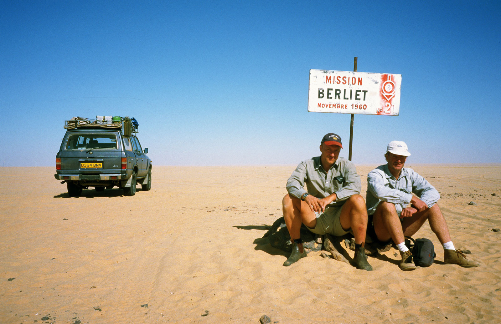
Heading for the Niger Balise Line (Route A15) we got stuck again, filmed it for posterity and hit the Line (over a 1000 markers planted every half km all the way to Chirfa!) just below Berliet 21. If anyone’s still reading, I left a Special Object in the drum at Balise 112, a bit south of Berliet 21. Retrieve it or present evidence of it and you can claim a prize.
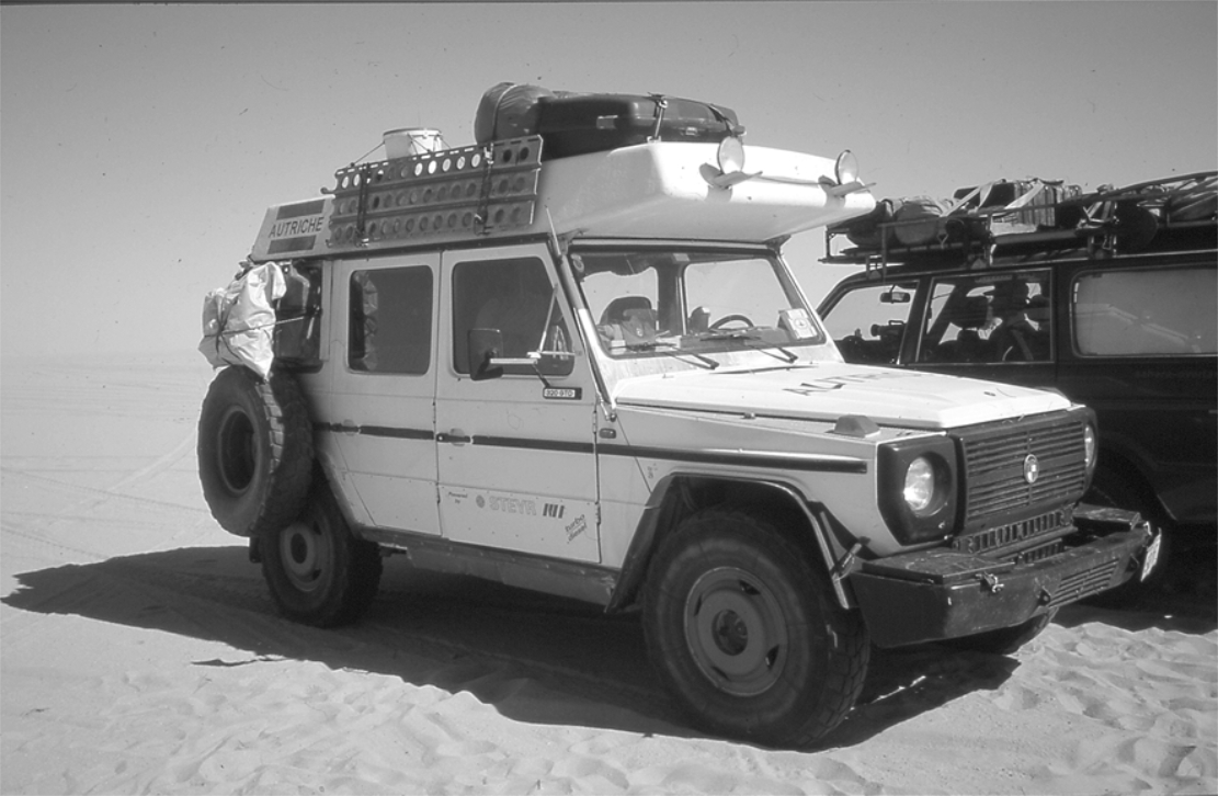
Hitting the Balise Line after so many years trying was another seminal Saharan experience. Nimbus had rolled down this way and into a whole lot of bother a couple of years back and at the famous Berliet Balise 21 we took some commemorative pics and met a tooled-up Austrian G-Wagen with a nice 16mm Bolex retracing our route to Tam. It even had a laptop displaying a live position on a scanned IGN map.
Nim had buried water along the Line in 2000 and we were interested to see if his GPS location worked 40 paces east off the balise. No such luck, After much prodding at two locations, we decided in a featureless area like to north Tenere (as some like to call it!) you need a discreet stone marker or something to pull off a fuel dump with any hope of retrieval. This I’d done yesterday with the cache at Erg Killian.
We eased past Adrar Mariaou checkpoint without being machine gunned to bits and hit the very soft sands near Djanet which, I like to think, killed the kpl down to a pretty poor 5.8 (16.5mpg) since topping up at Killian. We blundered around all sorts of unknown back tracks (including Djanet’s clandestine bitumen depot) until we hit the Libyan Piste and rolled into Djanet for some calamari and chips.
With a couple of days to spare, we organised a day out to Jabbaren with the Zeriba guys – only 30 euros and well worth it. A pre-dawn drive to the foot of the Tassili is followed by a lung-stretching slog up to the plateau – leaving smoking bikers Ahmed and Ian T (and the guide) far below. We shared the path with sub-Saharan migrant workers being guided along a short-cut to Ghat in Libya. I’d never actually been on the plateau but some of the rock art at Jabbaren (let alone the weird rock shapes) is quite amazing – even if you do get “cattled out” after a couple of hours. More here from a decade later.
Nimbus flew back to his day-job and I rolled back out to the Tassili plateau, exploring some nice canyons and slowly over the Fadnoun to Erg Bouharet camp (below), south of In Amenas, where I was set to meet Toby Savage and Rich to film the long-awaited sequel to Lawrence of Arabia: Desert Driving.