Ametetai – Abou Zeid’s stronghold in the Adrar des Ifoghas

See also: Kidnappings
abz

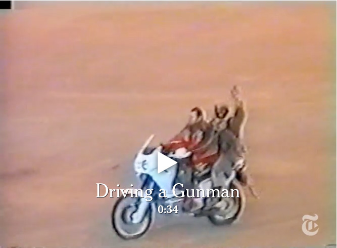
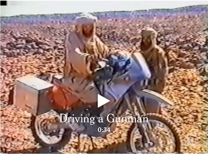
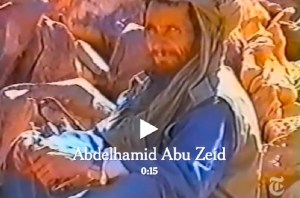
In early March 2013 AQIM confirmed that MBM rival Abu Zeid (left) was killed during the French Operation Serval in northern Mali. Full story here. Interestingly, the NYT video linked below shows the 4′ 9″ jihadist was involved in the 2003 abductions too (left). In 2015, and again in 2016, it was also reported that MBM had been killed by airstrikes in Libya. He no longer features on US wanted lists, but this article in 2017 suggests he’s still influential, while not spelling out if he’s actually alive.

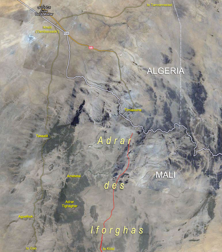
In March 2013, following weeks of ostensibly effortless liberations of north Malian towns while jihadists repeatedly slipped away into the desert to fight another day, the French-led Operation Serval concluded a decisive but protracted battle in the far north. At the time the Chadian army announced the death of the notorious Abou Zeid (‘ABZ’, left) in the valley of Ametetai (or Amettetaï) somewhere in the Adrar des Ifoghas hills. It was confirmed by DNA tests a few weeks later.

Mali_Serval

The strategic significance of this obscure valley became clear when the assault began in mid-February. A huge effort was made to defend it during which time scores of militants as well as many Chadian soldiers were killed and huge caches of arms were found. A few days after Ametetai had been ostensibly cleared there was perhaps hasty talk by the French of drawing down their troops in April, while the French defence minister deemed it safe enough to make a surprise visit to the battle site a few days later.

Video from Chad TV
Report from France24 after the battle
Report from Le Monde
keraten
mbm

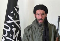
Just a day after ABZ’s death, Moktar Belmoktar (‘MBM’), supposedly ABZ’s rival and with him one of the three key jihadist ’emirs’ in north Mali at the time, was also (but incorrectly) reported killed by the Chadians. In fact the Pimpernel-like MBM had been ‘killed’ many times in the last decade or two (mostly recently in 2015 and 2016). In 2013 shot to Bin Laden-like prominence as the instigator of the suicidal attack on the Algerian gas plant at In Amenas.
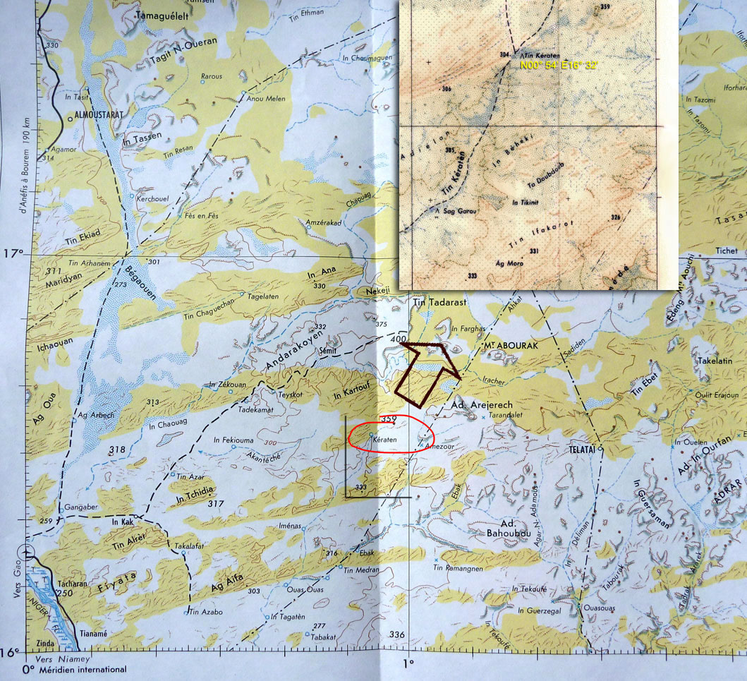
It’s more likely that at the time MBM (right) may have been directing AQIM operations further south, possibly in the region of Tin Keraten. Old maps label this as a well and a oued, some 100km northeast of Gao and 220km south of Kidal (see map above left). It doesn’t seem to match the terrain profile of Ametetai, but a battle was reported here a day or two later and where a fourth French soldier was killed. It’s also just as likely that before it’s all over MBM may yet again slip away into the neighbouring countries or that he was never there at all. The latest news is that following an ineffective US air strike in 2015, in November 2016 a French drone strike in southwest Libya injured MBM gravely. He has been removed from the American RFJ programme and has since lost his position in the Al-Mourabitoun group he led.
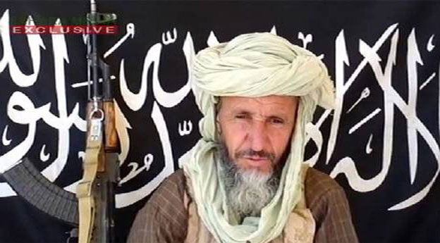
Abou Zeid
Real name Mohamed Ghadir, a small-time smuggler from Deb Deb in eastern Algeria close to the Libyan border (a book including his background reviewed here), Abou Zeid named his katiba or brigade ‘Tarek Ibn Ziyad’ after the 8th-century Moorish general who conquered Spain (‘Gibraltar’ is an anglicised version of Jebel Tarik). Following spells in prison, Abou Zeid rose up the ranks of the GSPC and became noted as a hardliner – ruling his group with ‘an iron fist’ as one former French hostage explained (her husband remains in captivity in north Mali). ABZ was said to be responsible for the execution of British-born hostage Edwin Dyer in 2009 (see link below) as well as more recent mutilations in Timbuktu in the name of Sharia laws. More on ABZ here.

Many news reports parroted the ‘Ametetai valley’ as the location of this decisive battle which led to ABZ’s death, though none mapped it any more precisely than this BBC image.   Seeing as it’s rare to get a specific location of what you presume might have been a key jihadist stronghold where some of the ten or so hostages may be kept and where ABZ’s brigade made their last stand, I tracked Ametetai down. (Some reports also mentioned air raids on ‘Etagho’ or ‘Oued? Entouwike’, as the ‘key to unlocking the bases in Adrar Tighaghar’ massif, but again, no accurate location was given and I couldn’t track them  down on the usual maps.)

ign-ametetai

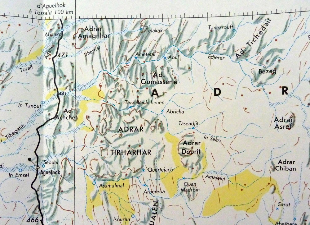
A well with the name ‘Ametetai’ was easily found on the IGN ‘Kidal’ NE-31 map (right), located on the northern edge of the Adrar Tighaghar hills and about 60km northeast of Aguelhok. Aguelhok is a village on the trans-Saharan Tanezrouft track which runs from Reggane, Algeria down to the Niger river and Gao (Route B1 in Sahara Overland).

amtertwo

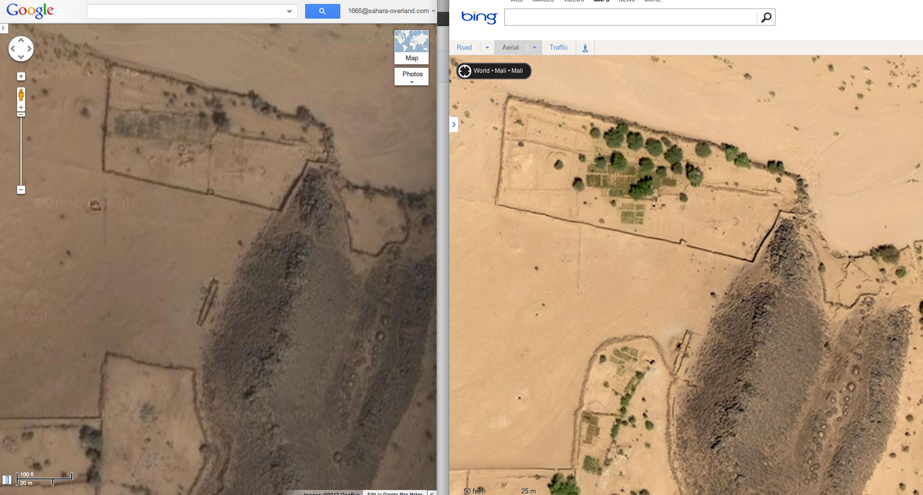
Bing vs Google imagery of Ametetai
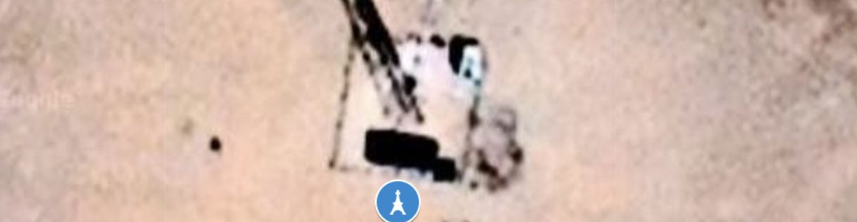
Zoom out and around this Google maps link centred close to the site of the well as shown on the IGN map and you’ll see this ~17km2 sat image tile or quadrant (dated Jan 2006 at time of writing) is higher res than the surrounding ones. The next nearest in high res are Aguelhok and Tessalit (which we visited in 2006 laying plans for our big crossing of north Mali) so a random hi-res tile in the middle of nowhere always makes you wonder. But the Ametetai tile is also oddly spotted with unseasonal clouds for January, few of which have corresponding ground shadows which seems even more odd. Is this obstruction of ground detail significant?

twosats

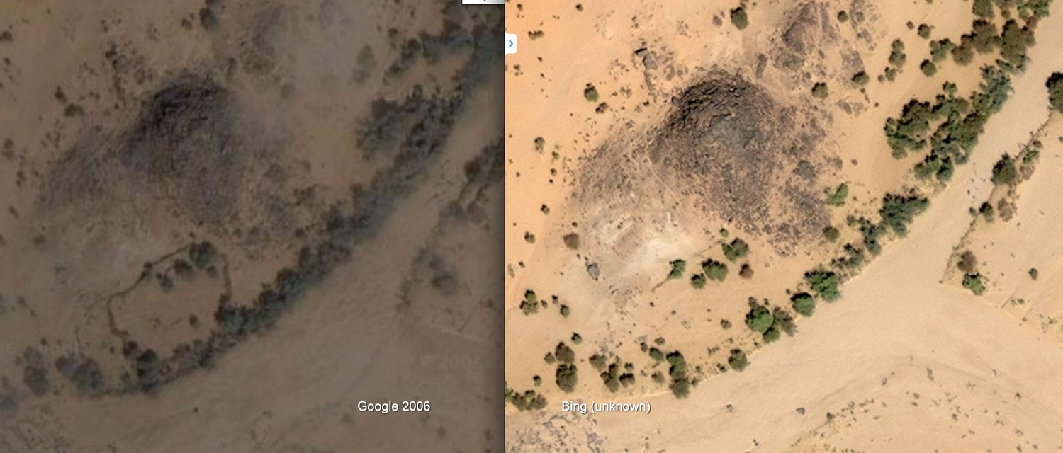
For the first time comparing Google with the same area on Bing ‘aerial’ maps, it comes up as much brighter and cloud free – clearly from another occasion and time of day. On Bing there’s much more cultivation evident (see above right) as well as better developed and unusual concentrations of tracks criss-crossing the hills as below right. This suggests Bing imagery is more recent except that there are more trees which implies it’s older. In my experience trees get cut down all over the Sahara quicker than they can grow back, even by a oued.

upwed

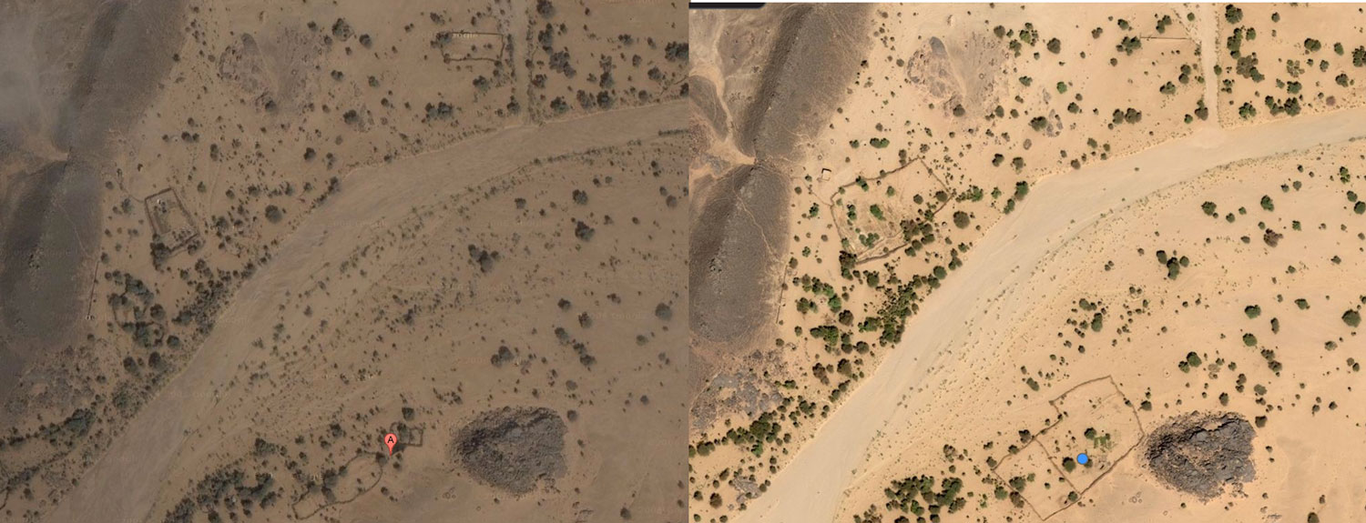
Continuing the comparison, some walled enclosures on Google are not present on Bing (above left), while a few more on Bing have been enlarged as above right and on the left (location upstream). Perhaps the ready-made stone in old walls was taken down to expand compounds elsewhere? Finally, are the shadowless Google clouds covering up something ‘tactical’ that’s exposed on Bing Aerial? Not as far as I can tell.

twotraxinhills

You can play this ‘spot the difference’ game for a while to try and fit what is now well known to all: the ‘narco-traffiquants‘ as Chad reports derisively describe AQIM/MUHAO/Ansar Dine, had a major stronghold in the Ifoghas as has been speculated on for years. And the Ametetai valley was probably it. Here they dug caches and laid traps while successfully camouflaging their actual presence from overhead drones and presumably preparing for the assault which finally came in the form of Operation Serval. The seeming expansion of cultivation and some enclosures in a place so far from other know villages with little evidence of actual dwellings might be seen as odd.
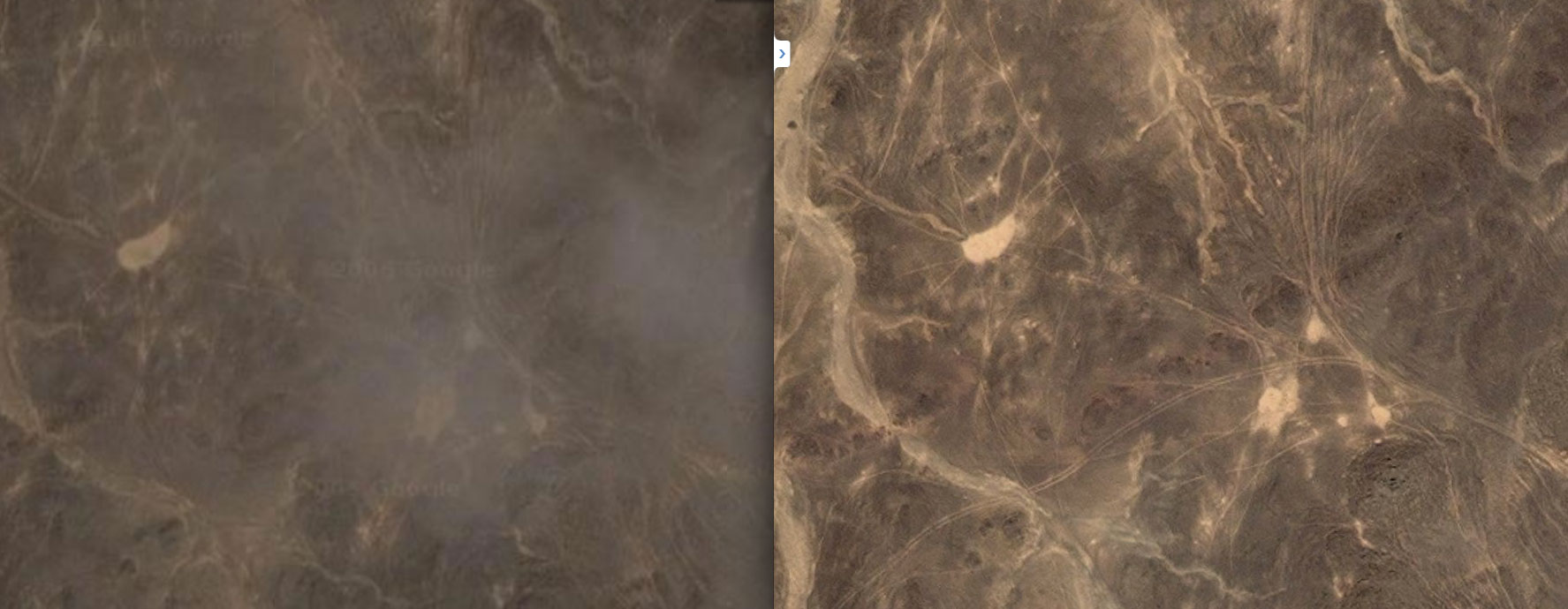
A couple of weeks later it was reported that fighting was continuing in the ‘Hades valley… 60km from Tessalit’. This could be the next, even narrower valley to the south of Ametetai in the Tighaghar massif called ‘In Tegant’ on some maps. An unusually dense mass of tracks joins the two valleys across the stony hilltops, including the image above right.

Note: Aerial images in the region may have been updated since this article was written
tessalit2005

What is the ‘Adrar des Ifoghas’?
‘Adrar’ usually means a region of low hills, escarpments or plateaux, but it can mean a single peak or jebel, like the Adrar Asref in the IGN map above. The Ifoghas (pronounced ‘Iforas’) is a region of low and dispersed, rubble hills spread across northeastern Mali and is also called the ‘Adagh’ by some. Separated by broad sandy plains and dissected by slender oueds, the actual ‘massifs’ barely rise a hundred metres above the surrounding 500m plain and can never be said to resemble ‘mountains’ far less a ‘near-impenetrable range’ as some reports describe. There are no distinctive peaks to speak of, nor a contiguous massif like the Hoggar in Algeria or the Tibesti in Chad, although you could say the Adrar Tighaghar is a small massif or eroded plateau within the Ifoghas.

lemondo

As with most low-lying Sahara hills, the composition is mostly sandstone or granite (as left), broken down by eons of weathering. In places this makes travel with anything with wheels very difficult or impossible, be it the sandy oueds which at least make natural byways, or more so on the crumbled plateaux to either side, as the Le Monde image left shows.
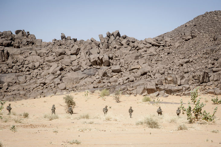
In my experience in the Sahara, it only takes a few inches variation in the ground’s surface to reduce car speeds to jogging pace, be it sand ripples or rubble and rock ledges. Bikes manage a little better, but even on foot the effort on the sort of terrain shown above is hugely amplified. Nevertheless, for in the hills either side of the Oued Ametetai the only way in was on foot with helicopter support. (As the reports above explained, the French and Chadians did so from three sides on the final assault.) This sort of terrain is so gnarly it’s also frequently but incorrectly ascribed as ‘volcanic’ in origin, but whatever you call it, trying to across it in 40°-heat with a 40-kilo backpack while trying to dodge bullets would be hard work indeed.

However, as this blog points out, comparisons with Afghanistan’s much more rugged and allegedly betunneled Tora Bora where OBL narrowly evaded capture in 2001 are inaccurate (as is calling all the north Malian jihadists ‘Al Qaeda’). Having said that the Ifoghas’ location close to the borders of Niger and Algeria does match the Tora Bora along the Pakistani border. This must have been a factor or a welcome coincidence when the Algerian-based GSPC (later AQIM) first established itself here in the late 90s. Hostages were frequently brought down into the Ifoghas from the north or east to a place which has always been a remote outlier in Mali, with Bamako some 1200km away. You get the feeling the indigenous Kel Ifoghas Tuareg were pretty much left to themselves or neglected, depending on your point of view, while from my observations a minority of entrepreneurial Berabish Arabs (Moors) controlled a low-value smuggling commerce from places like Al Khalil (In Khalil) hard against the Algerian frontier. (That all escalated once light, compact and high-value cocaine entered the picture a few years ago).

guelta

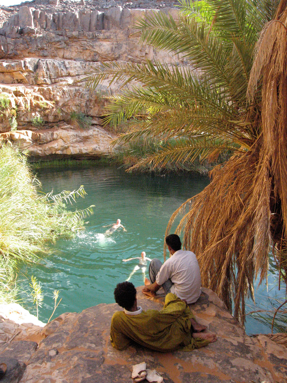
More than the sporadically rough terrain, the main thing that hampers occupation in the Ifoghas is the need for water. There are no river or lakes of course, but in this sub-tropical south side of the Sahara there are few perennial waterholes as can be relied on in southern Algeria (left), for example and which are easily spotted on sat imagery.

hiluxik

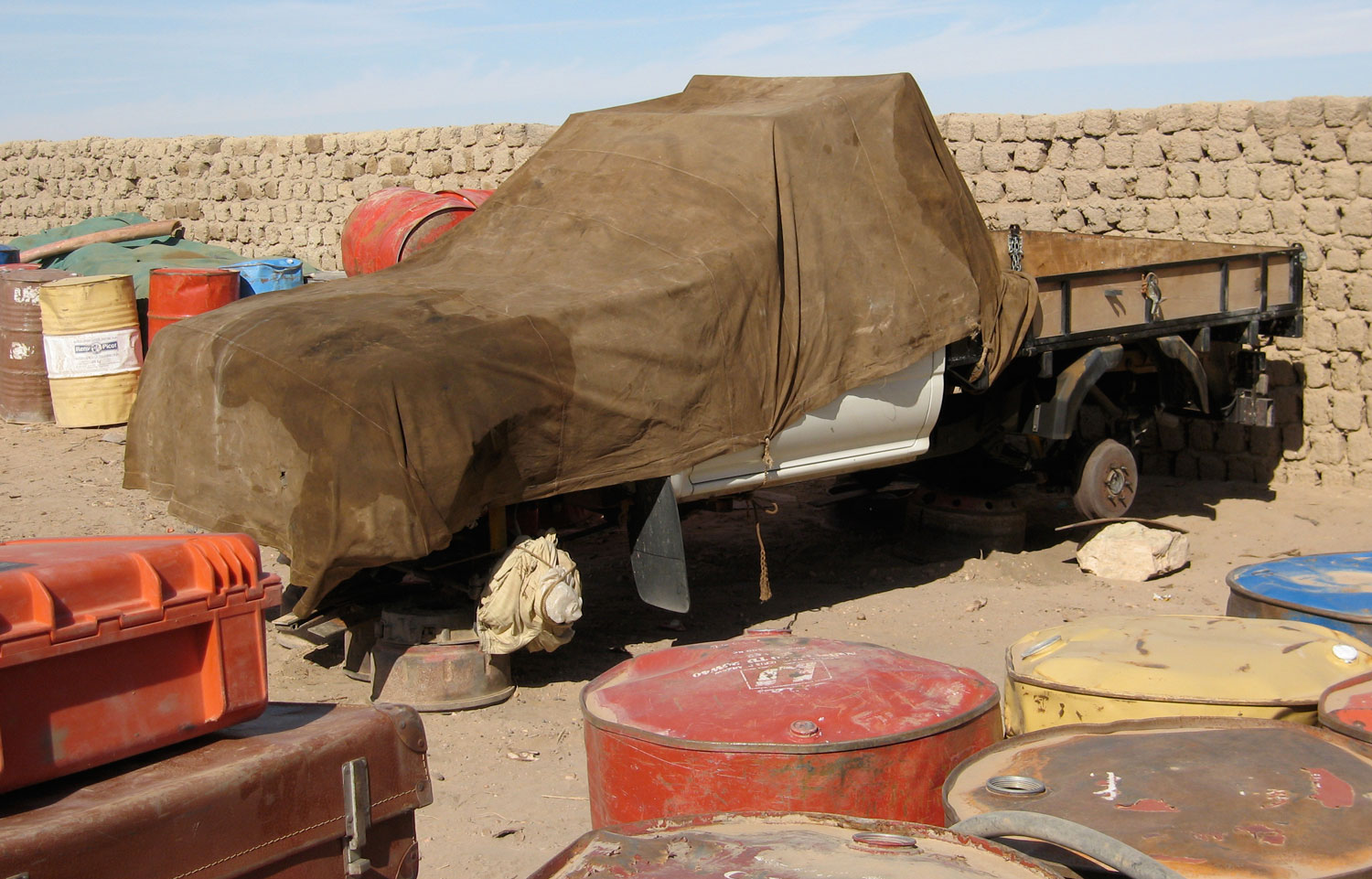
One benefit of the bare rocky massifs is they drive what late summer run off there is straight down into the many oueds where vegetation gets concentrated and trees can sink their roots, and where wells can more easily reach the water table. Because of this the Ifoghas hills are more suited to nomadic occupation than say, the sandy void (or ténéré in Tamashek) which fills the northwest corner of Mali. We crossed this ‘empty quarter‘ in 2006; we saw our last tree near Ouadane in Mauritania and the next as we neared Ikhalil, north of Tessalit, some 2000km later. Nor did we see another soul apart from our rescuers who met us midway. (As far as I know the remains of my Hilux – right – are still in Al Khalil).

One Chadian soldier in this Aljazeera video filmed after the Ametetai battle (see also Chad TV link top of the page) described the area as having ‘heavy tree cover’ which seems an exaggeration. Sure, there are small clusters of trees along the oueds, but more likely the sandy creek beds, huge granite boulders and low cliffs are what made hunting down the well entrenched jihadists so difficult.

tinariwen

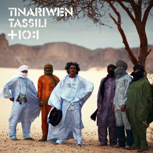
East of the Adrar Tighaghar Google depicts a well-used track (see map below) which doesn’t appear on any old maps and which leads up towards Timiaouine over the Algerian border and continues south to Kidal, about 120km southeast of Aguelhok. When I last travelled down the full length of the Tanezrouft piste in the late 80s, Kidal was the site of a political prison and off limits, but in recent years it opened up to a few intrepid tourists, visiting the Essouk music festival, nearby. The Tuareg group, Tinariwen (left) are originally from Kidal.
This track would have developed in the more recent smuggling and kidnapping era as the Kidal region became busier. Doubtless many other tracks developed in the area as AQIM and later groups established themselves in this region over the last decade. With the long overdue Operation Serval, you’d hope that era may be coming to an end. So far in 2016, it doesn’t look like it.

Chad Ennedi and Tubu films

I came across this great film on SVS’s Vimeo channel, mostly set in northeastern Chad. It’s in French but you’ll get the gist. Camels and crocs in Guelta Archei, some amazing paramotoring over Ounianga lakes and even scuba diving in one of the lakes.

camchad

thmon

It 90 mins long but cuts off at 1.11, on the way into the Mourdi Depression which is a shame. But if you try and find the complete show, watch out for torrentfrancais.com – the plug-in they recommend turns nasty. There’s another equally interesting film on SVS’s channel about Theodore Monod, also set in northern Chad.

On the same theme track down the Emir of Kano, and this one (English VO and subtitles) is about Tubu women in Niger trekking up from around Nguigmi to Bilma to exchange goats for dates. A few years ago the BBC ran a similar film in the same region about a Tubu caravan of women crossing to Termit from Agadem.

Chants du Hoggar – the artwork of Paul Élie Dubois

Poster-for-Le-Hoggar-exposition

Years ago a well-wisher based in France send me a CD of scanned artwork by a French Orientalist painter, called Paul Élie Dubois (1886-1949).

In the 1920s and 30s Dubois travelled frequently in the recently colonised Hoggar of southern Algeria and went on to exhibit his work as well as illustrate limited editions of popular books on the area, such as Chants du Hoggar, a series of courtly Tuareg legends and fables retold to the author, Angèle Maraval-Berthoin. A figure in one of the legends over whom Tuareg ‘knights’ fight is known as Dassine, also the name of the long-established campsite on the east side of Tam. Now I know.

Images from that book appear below, followed by a few general views of southern Algeria also by Dubois and which some may recognise.

Book review: DIE ERSCHLIESUNG DER SAHARA DURCH MOTORFAHRZEUGE 1901-1936 ~ Werner Nother

pid449828

DIE ERSCHLIESUNG DER SAHARA DURCH MOTORFAHRZEUGE 1901-1936
[Opening up the Sahara by Motor Vehicle, 1901-36]
Werner Nother (try amazon.de)

propcar

I would not normally review German books here, even if some of the best material may be in that language, but hardcore Saharans may be interested in this huge  book, a breeze block three times the size of Sahara Overland.
Werner Nother is one of a handful of German-speaking uber Saharans known to me and a registered ergoholic. Among his many Saharan achievements are mapping every last lake and paleo-lake in the Ubari Sand Sea years before they appeared on the tourist trail (his Hilux is pictured on p.82 of Sahara Overland).

I heard it took him ten or twenty years to complete this massive book – a record of every pioneering expedition by motor car and bike trip into the Sahara in the first third of the last century. I can’t understand a word of it but the many archive photos and crystal clear maps are good enough to illustrate the advent of the automobile in the Sahara. Some of the early solutions to the problem of soft sand traction are ingenious – they cottoned on to giant caterpillar/belt drives pretty early, though the propeller cars look like they may have had pilot suction problems. And our strange friend Byron Prorok (see other reviews) is in here too.

Interestingly, one sees that all the main pistes as depicted on the Mich 741 and including the Libyan Desert were all established by the mid-30s. And yet took them another 70-odd years to finally seal the Sahara (followed by an eternity of maintenance…). The many maps also highlight places and routes that may have slipped from the contemporary Saharan radar, offering endless opportunities for historic trips ‘in the wheel tracks of’. I suspect this is a fascinating account of early motoring in the Sahara.

Book review; Egypt, Civilisation in the Sands – Pauline and Phillipe de Flers

egypt

EGYPT, CIVILISATION IN THE SANDS
Pauline and Phillipe de Flers (Konemann, 2000, (o/p)

Thankfully not another ‘pharaohs and fellucas’ job. The first half covers the Western Oases (Siwa, Farafra, Dakhla, etc), the second the Sand Sea, Gilf and Uweinat: the history, rock art, inter-war explorers, geology, etc, all with great photos and interesting boxed asides. This sort of book would normally be 30-40 quid, but at Stanfords was remaindered at £9.99. I should have bought them all. Scarce on the web.

Book review: Flyaway ~ Desmond Bagley

flyaway

FLYAWAY
Desmond Bagley (House of Stratus)

Geographically authentic, fast-paced thriller set in the Hoggar, Tenere and Tassili of the central Sahara. This is Tintin for grown-ups, where laconic heroes like Burne say “what the hell…” a lot and casually swap diffs’ during sandstorms while chased by mysterious assassins. Women are usually somewhere else and “strangely attractive”. Compulsively entertaining departure lounge stuff and ten times better than Cussler’s terrible Sahara (see review). I loved it!


Clive Cussler’s Sahara

cuss

Clive Cussler’s 1992 book, Sahara was a load of implausible crap with a feeble eco-message. I found it effortlessly unfinishable and a waste of a good title.

cusslersahra

The film from 2005 gives a jokey ‘Indiana Jones’ take on the absurd caper because, one assumes, no other style was possible. Treasure hunter Dirt, sorry Dirk Pitt – unwittingly bringing to mind the Steve Zissou character in The Life Aquatic – jets up the Niger River in a speedboat with sidekicks Steve Zahn and another bloke to locate a long-lost ironclad battleship from the American Civil War which managed to end up the Malian Sahara. You what? Meanwhile dedicated WHO doctor Penelope Cruz (who can’t summon the unself-conscious gusto of the US cast) also wants to get into war-torn Mali to investigate the source of a plague which could contaminate the whole planet and bring about the end of life as we know it. Shite – the stakes are high then! I won’t spoil your film by telling you that, with the guys’ help she saves the planet, they find the treasure, the put-upon ‘Tuaregs’ (horse-mounted no less) overcome the tank corps, the baddies get shafted and Dirk ends up frolicking with Penny in the Californian surf.
Shot in Spain and Morocco, it has to be said the locations look good. Morocco really is not bad at all and the action sequences are as good as they get. Matthew McC lacks Cruz’s embarrassment at the production and his sidekick Steve Zahn is funny. What always gets me is the huge amount of work it must take to produce such a mass of quivering tripe, with split-second cuts piled on top of each other like an espresso pop video, and lashings of SFX, DFX and FX-knows what, but all for such a truly lame script. Maybe it’s for kids but it seems to parody itself, not least when, after trekking across the dunes handcuffed to a pick-up tray, the duo come across a crashed plane and deftly convert it into a sand yacht. Just like the book then, a waste of a good title.

Book review: The Forgotten Path ~ David Newman

In 2019 this route reopened.
The_Forgotten_Path

THE FORGOTTEN PATH
David Newman, 1965 (o/p)

This book is a cracker. In 1959, with the French Sahara convulsed by wars of independence, Newman, an engineer who’d failed to launch “a product two years ahead of its time”  jacks it all in to visit a friend in Nigeria. But unlike his friend, Newman decides to drive all the way across the desert – “the sort of adventure that had my nerve endings tingling”. And to make matters harder he chooses to do it in his new Ford Zephyr.
In a saloon car it’s impossible” his Nigerian friend urges him, having struggled to reach Nigeria from Dakar in a Landrover. “I’ll see you in six weeks” was Newman’s firm reply. Trouble was, he’d spent £3000 preparing the car, was running out on the HP, and was skint.

ford_zephyr

The romance sours and he’s turned back at the border near Foum el Hassan by the Moroccans where the FLN (sheltering in newly independent Morocco) and the French (clinging on to Algeria) were still battling it out. Infuriated by this reversal and convinced that his sheer determination and self-importance will win the day, he tries to bully people into overruling the decision but eventually has to storm off to Oujda on the opposite side of the country. Here again he’s repelled and so decides to charge illegally into Algeria.

“To hell with them. It was impossible was it? I’d show them whether it was!”

newmanmap

And so he and his Swiss hitcher muddle overnight through machine-gun fire into French/Algerian territory. He gets interrogated in Bechar, loses his suspicious companion and eventually gets permission to go west to Tindouf, alone. But it’s August so he has a hard time of it; gets repeatedly stuck, gets lost, gets desperate and at times flips out. He shoots his soup can with his ’45 and chases gazelles to exhaustion through the night – but then fondles them lovingly.
Arriving at Tindouf (then a military base) he’s treated as a hero, given much free hospitality, admiration and a guide to Bir Mogrein (“my big worry – that he would smell – was completely unfounded“). Then the poor old Zephyr begins to break up: first the drive shaft, then the clutch, he gets one shipped up from Dakar but the rally-spec engine blows up too. He flies to Dakar expecting the embassy or the Ford agents to bail him out, but merely gets repatriated ‘on bail’. Back home, he borrows some money from his mother, flies back out with a new companion and engine bits to then stagger down to Dakar, on the way exhausting his welcome with the French who now see him as an irresponsible scrounger.

The-Forgotten-Path

His bad reputation rolls ahead of him like a bow wave and in the Gambia he’s been forced to stay in natives’ lodgings. The climate turns on them and at one point he threatens to shoot a ferryman who – of all things – requests payment to barge him across the Faleme river into Mali. Penniless and with his companion now struck down with fever, they lurch from village to lorry, scrounging fuel, tow starts and food. After Bamako it’s relatively plain sailing to Nigeria (another engine in Ghana), but his friend has long since left. With his car a wreck, the book ends with Newman boasting that he’ll return north via the Hoggar route in summer. It’s impossible, after all! If he did, there is no record of a book about it, The Forgotten Path was published five years later when he was 35.
Even allowing for the era, Newman puts himself across like some arrogant, entitled pillock thinking the world owed him and his ‘impossible’ undertaking, making even Geoffrey ‘Fearful Void’ Moorhouse look reasonable. Time and again he boils over when friends, strangers, hotel staff or – for pity’s sake! – embassy refuse to bail him out, and yet he obviously started the trip nearly broke with plans of ‘selling film rights’ while bouncing cheques like a Haarlem Globetrotter.
It’s this breathtaking arrogance and the lively ‘what-on-earth-could-happen-next’ pace that drives you through this short book. One admires adventurousness of course, but in his own words Newman comes across as deeply obnoxious and who deserved everything he got. Available online for a couple of quid.

Book review: From Libyan Sands to Chad ~ Nigel Heseltine

chad

FROM LIBYAN SANDS TO CHAD
Nigel Heseltine, 1960 (o/p)

Of the same era but less petulant than Newman, the author sets off on what turns out to be a vexatious journey across the Sahara through Libya to Lake Chad via the Tubu lands of the Tibesti and Ennedi. What makes this book so unusual in the era of unreviewably lame Travel Book Club adventures, is that the author is no fluffy travel writer, but a well-read if rather stroppy Theroux-esque character who does not spare those who irritate him.

His Jeep blows its gearbox south of El Gatrun and he is forced to travel on in a lorry and the chirppy M. Gautier in his Landrover. Having studied his Nachitgal and other material, the author explores the rarely seen Tibesti, Ounianga and the Ennedi and the customs of the wily Tubu. It’s a credit to the author’s detailed research that it was used to fill the huge gaps in that Saharan turkey, Sahara, The Life of a Great Desert (see other reviews). From Libyan Sands… is about the best book available in English on the little known Sahara of Chad.

More on Chad here.

Book review: Grains of Sand ~ Michael Buckley

grains

GRAINS OF SAND
Michael Buckley, 2001

Starting in Chad, a former BBC journalist alluding to a mid-life crisis, travels on and off for two years, tracing the bands of desert which ring the globe around each hemisphere. Leaving N’Djamena at the height of summer, he struggles up to Bardai in the company of war-grizzled Tubu, and then through the Air to Iferouane with similarly combat-fatigued Tuaregs, returning to Agadez to stagger around with a camel for a few days. Timbuktu is reached aboard a pinasse from Mopti, and in Mauritania he claims to climb Guelb er Richat with his newly wed wife, though it reads like they never got out of St Louis. The Guelb account is either invented or exaggerated for literary effect (the reality as some of us may know, is rather disappointing). Other deserts in southern Africa, Chile, Mexico and southwest America. Australia, China, India and the Middle East see the book finish up in Israel. What must have sounded like a cracking proposal to a publisher largely fails to satisfy desert lovers. Over a third of the book covers Chad and Niger, and in the Air one learns much about the disastrous failure of the Tuareg rebellion. However Timbuktu is reached but not described by a single word, while an extraordinary country like Mauritania spans just three paragraphs! (OK, it was his honeymoon but it would have been better deleted). Confessing to disapproval with materialist Western ways, the sanitised New World deserts are briefly, dutifully and at times scornfully described, and yet there is no doubt these places are as beautiful and alluring as the “quintessential” Sahara.

One gets the impression that, after burning himself out in Chad and Niger, the author loses enthusiasm and energy for the whole idea and, with a brief recovery in China and the Indian subcontinent, just does what it takes to complete his ambitious assignment. The result is another white middle-class romantic’s travelogue, cataloguing the familiar range of encounters with locals, sun-fried ex-pats and fellow travellers we know so well. Roll on the ‘Glasgow School’ of British travel writing!

Most of his visits are at the height of summer. The reasons for this timing are not fully explained, but one suspects a “narcissistic masochism” was at play, along with a belief that the full power (if not appreciation) of a desert must be experienced at its most extreme. What bollocks. I look forward to Ranulph Fiennes’ next book about walking to the South Pole in winter! We also get the familiar plea for the futures of beleaguered nomadic tribal peoples – but as Michael Asher puts it in conversation with the author, this is “a rich man telling poor people they are better off poor”.

But one thing Michael Buckley has a good crack at (improving greatly on Geoff Nicholson’s limp ‘Day Trips in the Desert’ which came before) is unravelling the desert’s paradoxical fascination on our skewed western imaginations, the “instinctive discomfort and fear alongside exhilaration, aesthetic ecstasy and awe.” Here, over a couple of pages, he succeeds in getting to the heart of the matter.

In the end any travelogue relies greatly on the reader’s empathy with the narrator, but also on their diligence, at best offering an expansion of the reader’s understanding of an exotic or familiar environment. After a promising start the ambitious concept of ‘Grains of Sand’ quickly slips through the fingers.