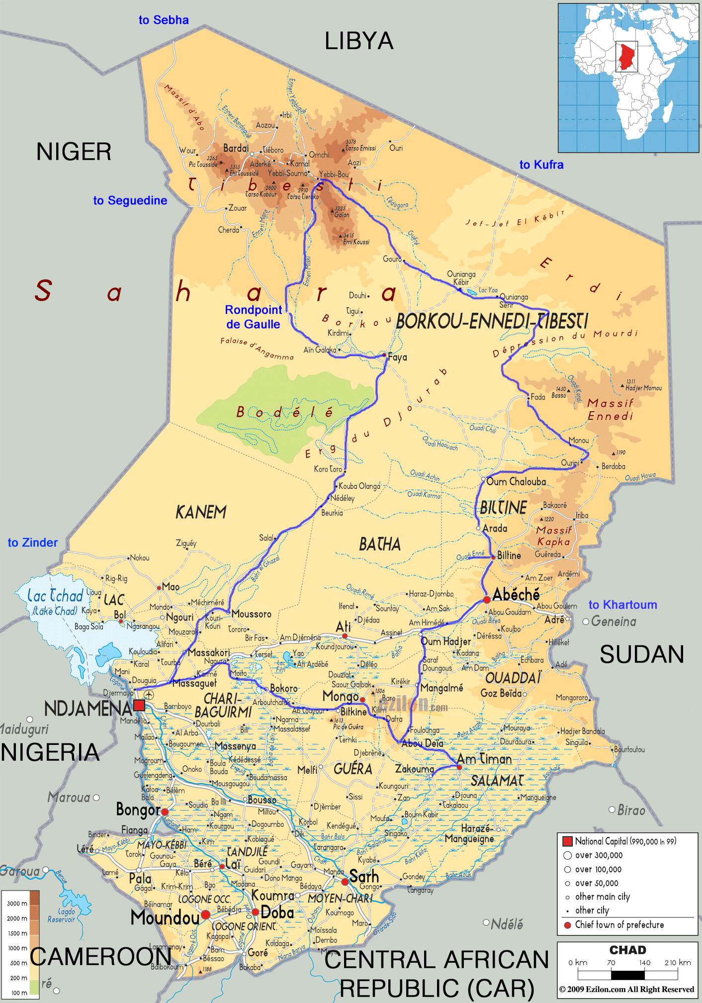
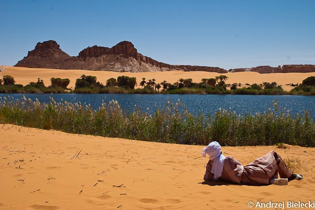
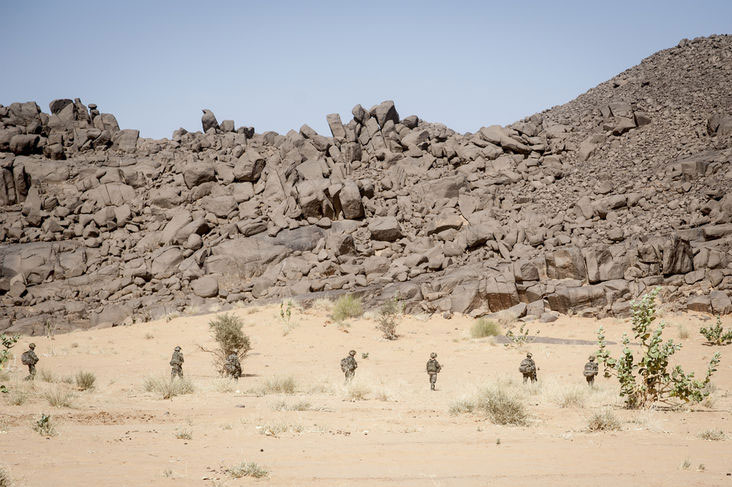
Together with four friends, I recently completed a four-week tour in Chad. One car came from Belgium via the Atlantic Route and then through West Africa. A second car was rented (with the compulsory driver) for 80,000 FCFA/day (‘XAF’; €120).
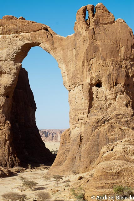
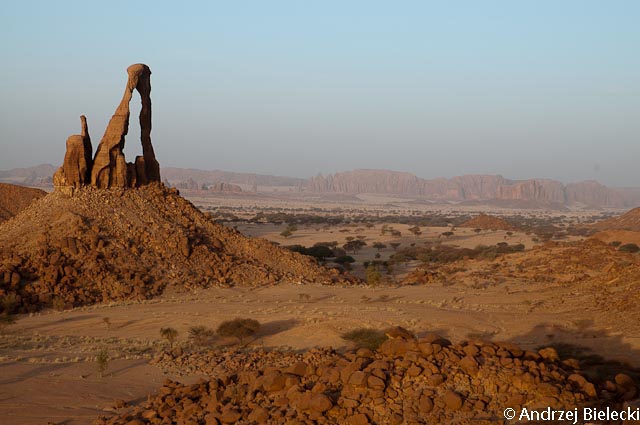
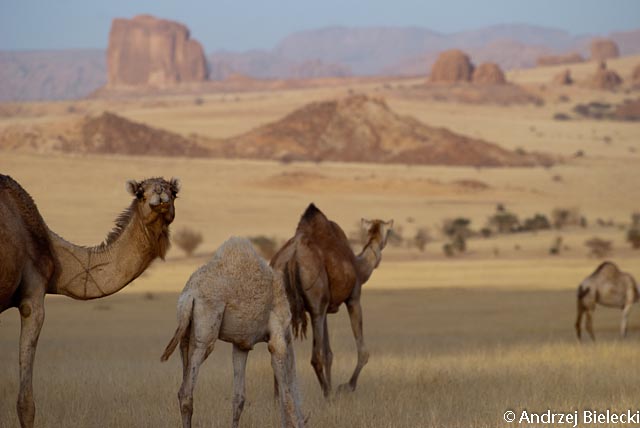
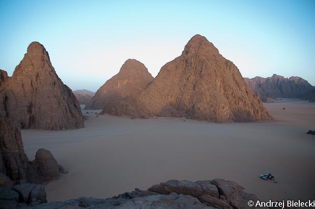
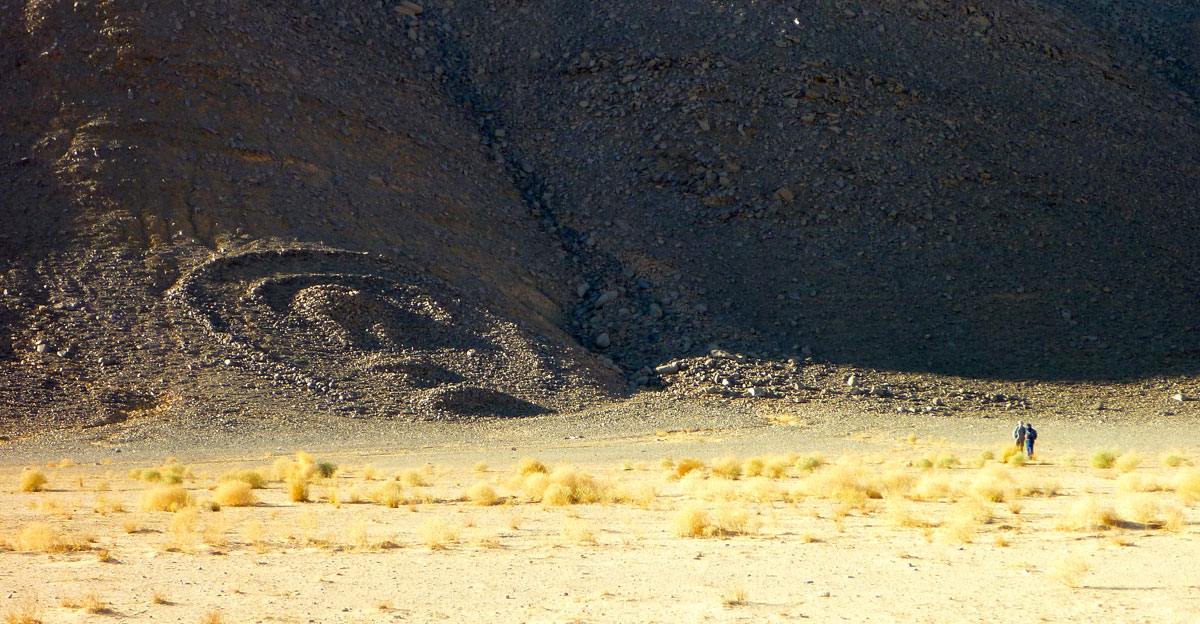
Our itinerary (see map, right) took us from Ndjamena anticlockwise down to Mongo, Zakouma NP, up to Abéché, Kalait, Ennedi, Fada, Demi, the Ounianga lakes, Gouro, Yebbi Bou in the Tibesti then Faya, Moussoro and back to Ndjamena.
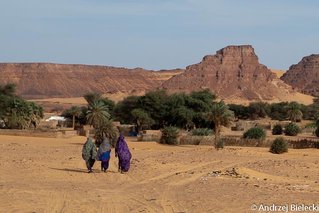
Although the era of ‘mass tourism’ might be said to have arrived to northern Chad, the Authorisation de Circuler is still compulsory, as is the registration in Ndjamena (procedure still the same). However, we didn’t have a single police/gendarmerie check during the whole stay. Only the newly created Office du Tourisme Tchadien (known to everybody as ‘OTT’) checks the AdC in Fada and Ounianga. In Gouro and Yebbi Bou the Gendarmerie/Sous-préfet were vaguely interested in it too.
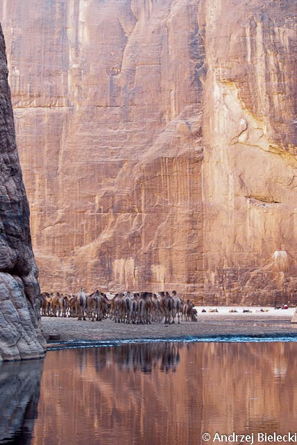
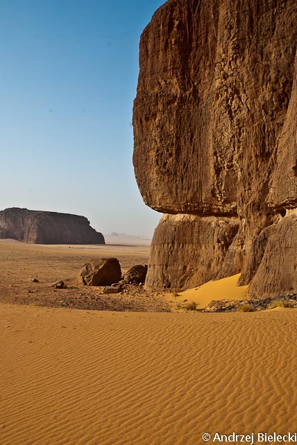
During the season the main sites around the Ounianga Lakes and in the Ennedi massif are visited on a daily basis by the tour groups of Point Afrique. Seven sites in this region now charge 5000 FCFA/person (€7.5; change from the former 50,000 FCFA per group policy) and even issue receipts. Some souvenir sellers have also have appeared. In Bachikele, near Guelta d’Archei, the chef du canton tried to charge us the old rate; we refused and left but were still, apparently, chased by young men with AK47s. We complained to OTT in Fada and the ‘délégué regional au tourisme’ admitted this was the fourth time this season this happened at Bachikele. But OTT does seem to have some kind of authority; they quickly found our guide in Fada and all of a sudden every Chadian that argues with tourists becomes very easy-going when OTT is mentioned (concrete example taken from a discussion with a guide we hired that wanted more than the agreed price…).
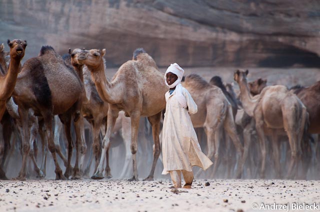
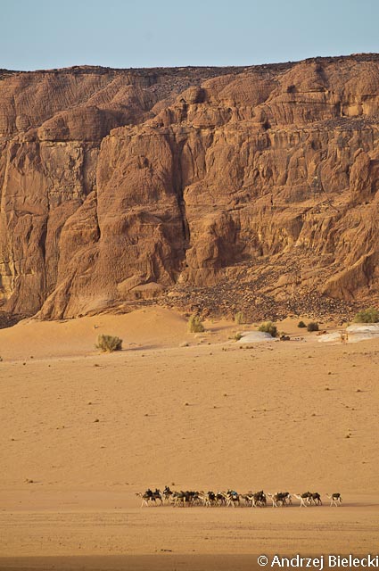
We took a guide from Fada to Gouro through Demi and the Ounianga lakes which is not absolutely essential but was still very useful (six days – 140,000 FCFA). The second guide (Gouro to Yebbi Bou, Meski, Rond Point de Gaulle and Faya) cost us 170,000 FCFA for five days. A guide south through the Erg du Djourab is not necessary unless there’s a sand storm; the tracks are very obvious and the balises clearly visible.
The three-day route from Ounianga Kebir to Kufra in southeast Libya sees only erratic traffic since 2011 and merchants were complaining. However, the Sebha to Faya piste through the Passe de Kourizo sees quite a few Mercedes trucks plying the route in about five days. We saw a few en route and about a dozen Libyan trucks in Faya. There is a Libyan consulate in Faya but only Tubus risk this drive (see also this).
As it probably comes from Libya, fuel is much cheaper in the north, but as before is sold only in 220-litre drums for between 75,000 and 90,000 FCFA. In the north it’s also much easier to find petrol as many cars are imported from Libya. In the Tibesti it might even be difficult to find diesel. In Ndjamena a litre costs about 550 FCFA (€0.84) in a fuel station.
Mobile coverage was widely available in the south. In northern Chad Salal, Faya, Gouro, Ounianga Kebir, Fada and Kalait had signals. The network broke down in Gouro three days before we came.
Road to Sudan From Abéché it’s possible to drive to Sudan; the border seems open. However, the Sudan embassy in Ndjamena only issues visas to residents of Chad. There’s also a consulate in Abéché but we weren’t able to check with them. There seems to be tarmac from El Geneina to Khartoum, but the trucks go in a convoy escorted by the Sudanese army every week or fortnight. I imagine one could show up in El Geneina and join the convoy or pay the army for a private escort. Abéché to Adré takes 3-4 hours. The road from Ndjamena through Mongo to Abéché is tarred almost all the way (will be finished in a few months). There are about six toll stations, each is 500 FCFA/vehicle and a receipt is issued.
AQIM Travel in the Sahara has long been disrupted by the activities of AQIM and similar groups including Boko Haram based in nearby northeastern Nigeria. And as we all know, Chadian troops are currently engaged with French and Malian forces in Operation Serval in northern Mali and there was a coup in CAR a few days ago, and you wonder if this might lead to a resumption of the normal Chadian state of affairs. Hopefully not. Our conviction was that as long as we stayed clear of border areas we would minimise the risks.
President Deby has recently decided on the creation of many new Départements, Régions and Sous-préféctures. Almost all villages in the north are now virtually sous-préféctures where the sous-préfet (usually a local elder barely speaking French) appreciates visits from the foreigners. They are the link between the State and the local tribal authorities and get new Land Cruisers, offices and even a residence. I imagine this is another way for Deby to strengthen his grip on the north. He himself originates from just south of the Ennedi and his tribe, the Zaghawa, extends as far as Bachikele and Monou. I cannot imagine that some of the revenue from tourism doesn’t flow back to high circles in Ndjaména. I therefore think there is a major interest in safeguarding security and preventing foreign infiltrations in Chad by ensuring a revenue and the preserving the power base of the President. That’s the assumption under which we travelled but only the future will tell if we were right.
Part of the occasional Sahara A to Z series
Hang around long enough and you’ll get the full set
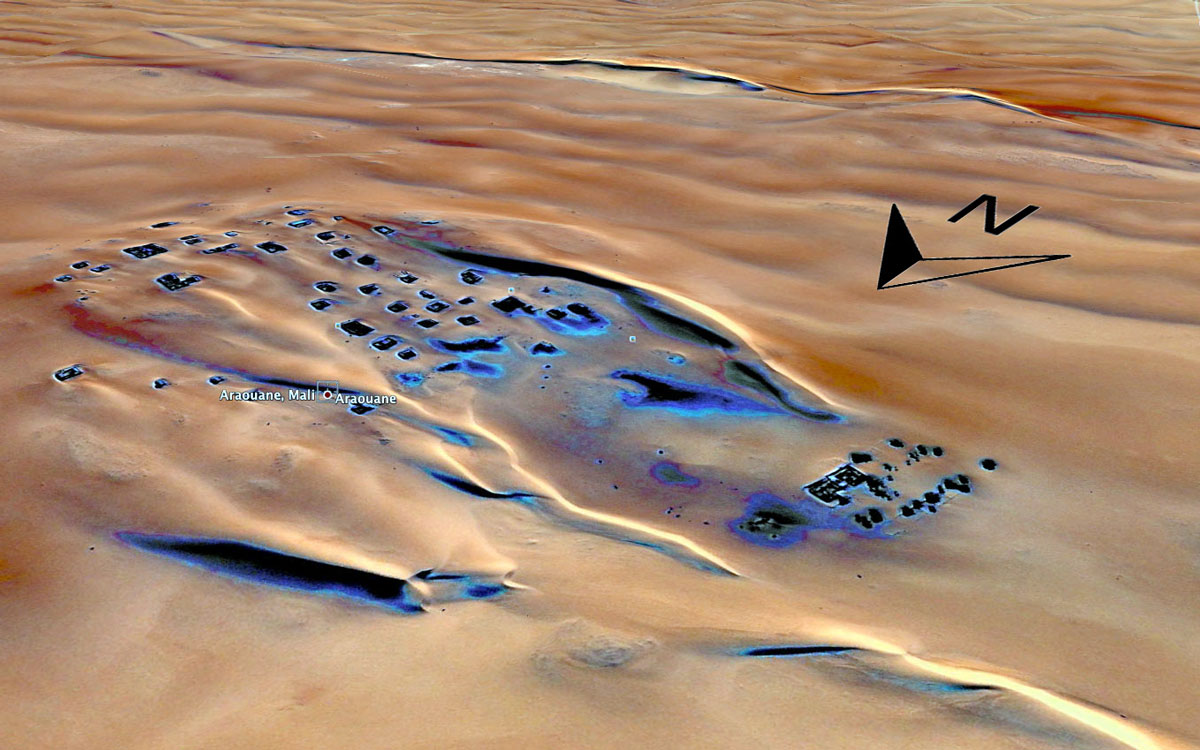
Looking at the screenshot of the Google sat image on the right (direct link), the village of Arawan some 250km north of Timbuktu seems to resemble the debris of a shipwreck adrift in a caramel swell.
I’ve never been there, though passed some 80km to the northeast during our SEQ transit to Algeria in 2006.
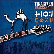
Some might recognise ‘Arawan’ as the rap track from a Tinariwen album, Amassakoul or ‘The Traveller’. As far as I can tell the lyrics match the received assumption of a once great but now near-abandoned town slowly being either swallowed up by the pitiless desert or simply changing times.
Photo Alistair Bestow
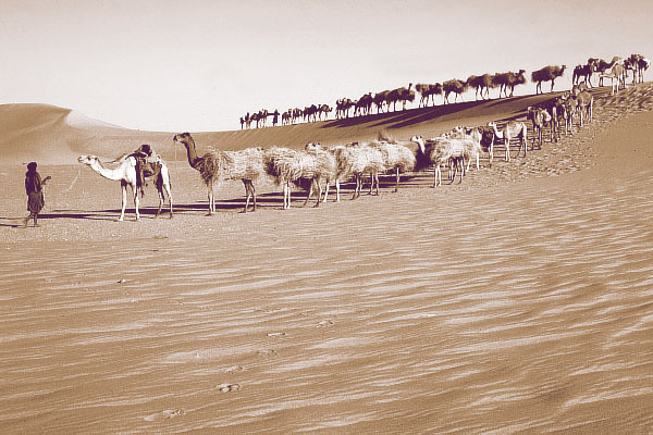
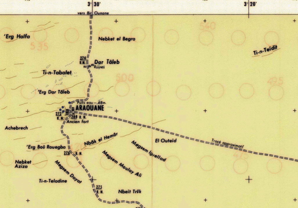
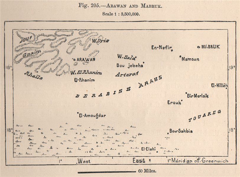
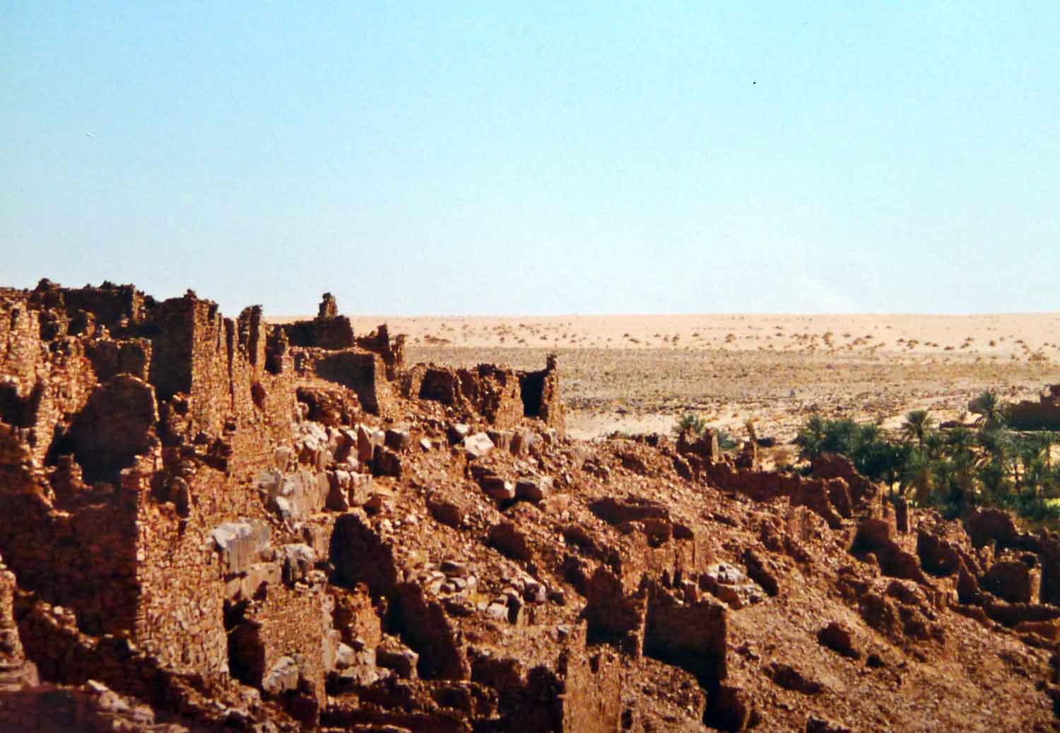
Arawan is the only permanently occupied village on the 700-km azalaï caravan route (left) to the salt mines of Taoudenni in the far northwest of Mali. Today, depending on the time of year, a couple of hundred live in Arawan, including an imam who tends to the shrine or mosque of the holy man or saint, Cheikh Sıdi Ahmed ag Ada (or Agadda; 1570-1640). It was he who refounded the settlement in the 17th century and is venerated as the ancestor of all the ahl Arawan (‘ahl’ being to Arabic as ‘kel’ is in Tamachek: ‘people of…’). The ruins of Dar Taleb (or Alphahou), just to the north of the village, have been dated back to the third century AD, making the site much older than Timbuktu.
The basis of any settlement is a reliable water source and Arawan once had scores of wells to enable the speedy watering of the passing caravans. You can only assume that nearly 500 years ago there was more pasture to sustain a livelihood than there is today. As it is, this flat expanse of northern Mali seems to be typified by enigmatic patches of grassy tussocks scattered across entirely barren sand sheets and the very occasional escarpment.
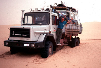
Fast forward from Sıdi Ahmed a few centuries and the Swiss American Ernst Aebi comes to Arawan. He’d made his fortune developing property in New York and had raced the Dakar. In the late 1980s he discovered the semi-derelict Arawan and decided to establish the ‘Arbres pour Araouane’ project to help revive the village.
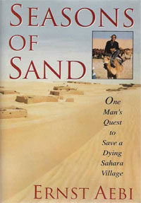
He helped build a small market garden, a tamarisk plantation and eventually even a small hotel; all typical ‘Aebian’ ventures, which owe more to his dynamism and energy than sustainable, long-term goals. Little remains of the hotel today and the garden was ransacked in the early 90s at which time he was forced to leave the region during a Tuareg rebellion and the vicious army reprisals which followed. He wrote a book, Seasons of Sand, about his time there, and later a film: ‘Barefoot in Timbuktu‘, was made about his return to Arawan, which had of course reverted to the state he’d found it in 20 years earlier.
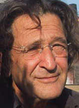
Now over 70, Aebi (left) does sound like quite a character. Pick on any post from his blog and you’ll get the picture of the guy who is still living full life.
More recently social anthropologist Judith Scheele wrote an interesting paper about a pilgrimage of urban, well-to-do ahl Arawani from Bamako to the shrine of their ancestor, Sıdi Ahmed ag Ada. I don’t read such material by habit, but her digestible account of the complex social interplay of the long departed ahl Arawan and their timely piety set against the poverty-stricken and somewhat cynical villagers is amusingly absorbing. It turns out their trek was not just a spur of the moment adventure. At that time in 2007 oil exploration was underway in the Taoudenni basin to the north, and throughout history the ahl Arawan traditionally had a stake in the control and subsequent revenue from the salt mines. By marching into town, the dilettante ahl Arawani hoped to flag up their credentials for all to see as historically legitimate beneficiaries of the region’s resources.
Her short paper also sheds a light on the complex ethnicity of northern Mali; doubtless no less than any other region of Africa. I’d assumed it as just desert Tuareg or void, but the Tuareg homeland is specifically in the Ifoghas or ‘Adagh’ as some like to call it; northeastern Mali centred around Kidal. To the west of the Tanezrouft piste are the Tilemsi Arabs, Kounta, also Arabs and what might be called ‘Moors‘ around Timbuktu, with Songhai (indigenous West Africans) spread right through. Setting aside the thorny issue of former slaves of both Arabs and Tuareg, there are added hierarchies based on religious ancestry or legitimacy – those who called themselves sharif or descended from the Prophet. I learned about the similar status of ‘Hassans’ from American PCVs in Mauritania in the late 80s. In this way a penniless nomad in Arawan may claim to be higher up the social scale than an ahl Arawan who’s just driven up from Bamako in a flash Land Cruiser.
Gregg Butensky. Madnomad.com
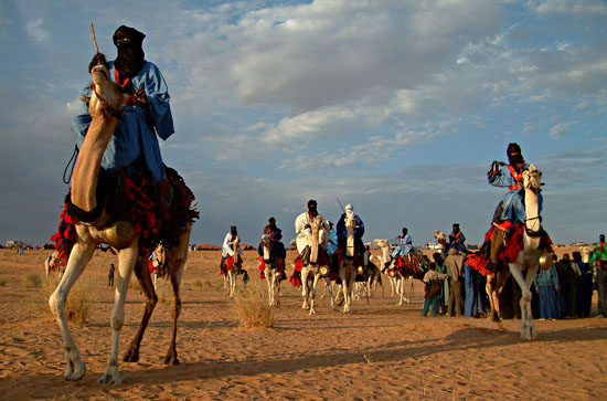
Some scoff at the holy man of Arawan. It’s clear from his name that Sıdi Ahmed ag Ada was no more than a Tuareg, probably from Essouk in the Ifoghas (‘ag’ being a Tamachek equivalent of the Arabic ‘bin’). Essouk, 60km northwest of Kidal, was the site of a Tuareg music festival (above) for some years; Gregg Butensky wrote about it in my Sahara Overland book. Nearby are the pre-medieval ruins of Tadmakka excavated by Sam Nixon Nixon and on a par with the better known former entrepôts of Koumbi Saleh or Aoudaghost in southern Mauritania, or Ouadane (left) further north.
mali-nord.de
For a good impression of the region north of Arawan here’s a detailed report and gallery from 2007 by Barbara and Henner Papendieck who paid a visit to Taoudenni as part of their humanitarian work in the region (map right, click for full size). This was just before the spate of kidnappings kicked in, but even then they needed to organise an armed military escort. There are some great images of the actual mine site as well as the old prison. Below is a dramatic picture of the Sidi’s mosque in Arawan.
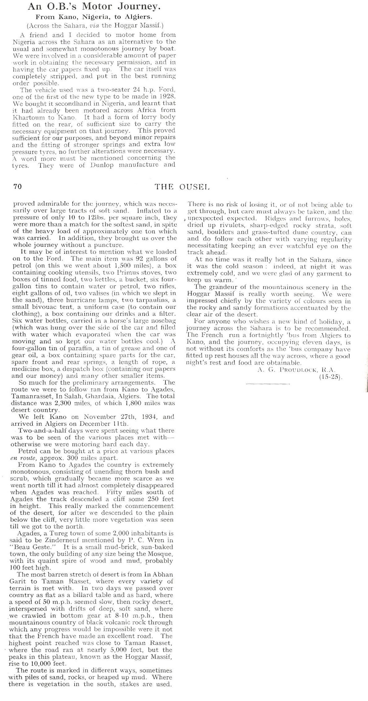
While having a clear out former trans-Sahara pilot, CP Hamp recently came across some copies of The Ousel, his old school magazine produced by Bedford School. One issue from 1934 contained a brief report of an Old Bedfordians’ trans Saharan adventure in 1934.
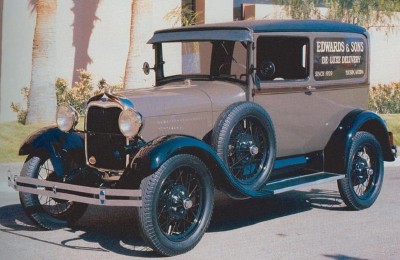
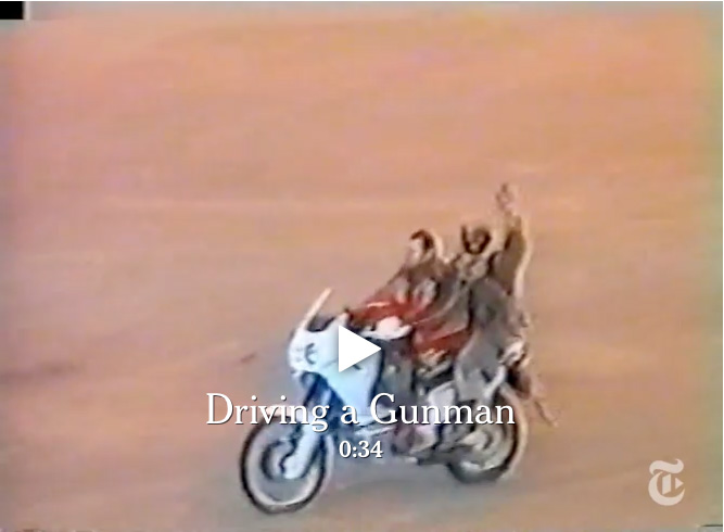
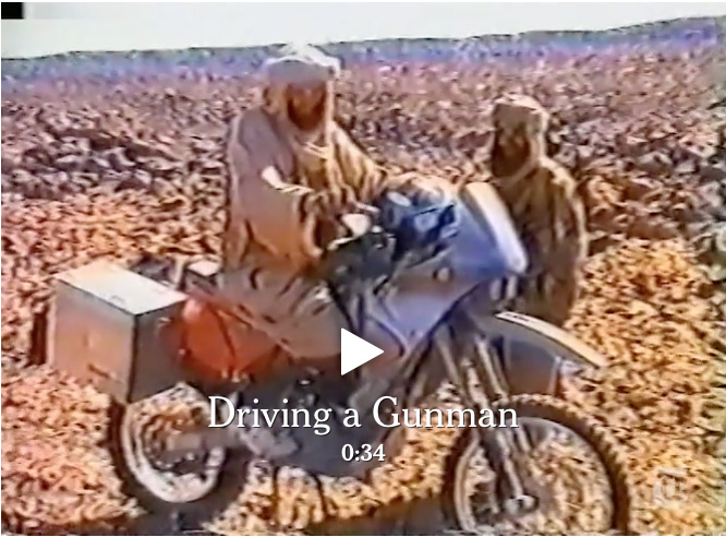
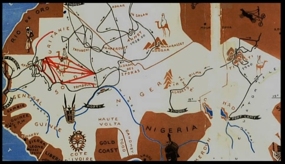
Following a spell in the army in Nigeria, the duo picked up a 1928 24-hp Model A Ford, probably like the one pictured above right and which had already been driven over to Kano from Khartoum. The ex-Bedford School duo’s off-road stage went north to Agadez and then via In Abangarit (the old piste to the west, not present day Arlit) to arrive in Algiers just two weeks later.
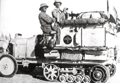
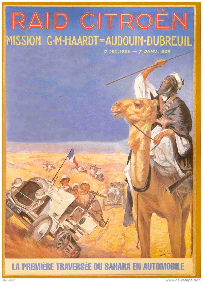
All this was barely 11 years after the first motorised crossing of the Sahara by half-track Citroën Kegresse ‘autochenilles‘ (left and right) which drove from Ouargla to Tam then southwest to Bourem on the Niger river via Tin Zaouatine and Essouk near ancient Tadmakka in the Adrar des Ifoghas, following a trans-Sahara route dating from the medieval era. You’d think this must have put the Old Bedfordians amongst the first Brits to motor across the Sahara at around the same time our man Bagnold was chasing the dastardly Almasy around the Gilf Kebir.
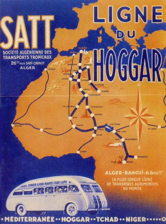
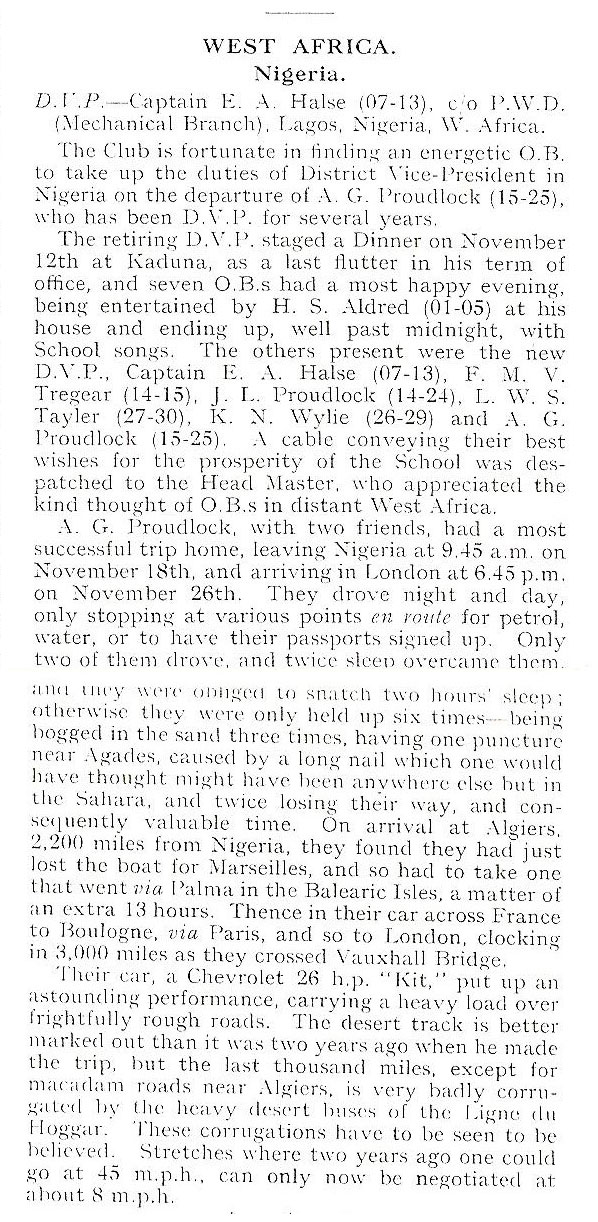
The author A G Proudlock mentions that the SATT bus service (left) did the same run in just 11 days so it seems two years later the plucky A G Proudlock decided to do it again, and this time outdo the streamlined desert bus. With a couple of chums they stuffed themselves into a 26-hp Chevrolet (possibly a 4-90 like this) and drove round the clock to incredibly clock up exactly 3000 miles between Kano, Majorca and Vauxhall Bridge astride the Thames in little more than a week!
Motoring across the Sahara during the French colonial era was quite different to recent years and was subject to much stricter regulations, but did at least come with the promise of rescue if overdue.
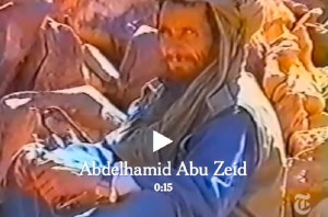
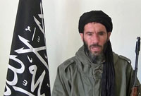
In early March 2013 AQIM confirmed that MBM rival Abu Zeid (left) was killed during the French Operation Serval in northern Mali. Full story here. Interestingly, the NYT video linked below shows the 4′ 9″ jihadist was involved in the 2003 abductions too (left). In 2015, and again in 2016, it was also reported that MBM had been killed by airstrikes in Libya. He no longer features on US wanted lists, but this article in 2017 suggests he’s still influential, while not spelling out if he’s actually alive.
In March 2013, following weeks of ostensibly effortless liberations of north Malian towns while jihadists repeatedly slipped away into the desert to fight another day, the French-led Operation Serval concluded a decisive but protracted battle in the far north. At the time the Chadian army announced the death of the notorious Abou Zeid (‘ABZ’, left) in the valley of Ametetai (or Amettetaï) somewhere inthe Adrar des Ifoghas hills. It was confirmed by DNA tests a few weeks later.
The strategic significance of this obscure valley became clear when the assault began in mid-February. A huge effort was made to defend it during which time scores of militants as well as many Chadian soldiers were killed and huge caches of arms were found. A few days after Ametetai had been ostensibly cleared there was perhaps hasty talk by the French of drawing down their troops in April, while the French defence minister deemed it safe enough to make a surprise visit to the battle site a few days later.
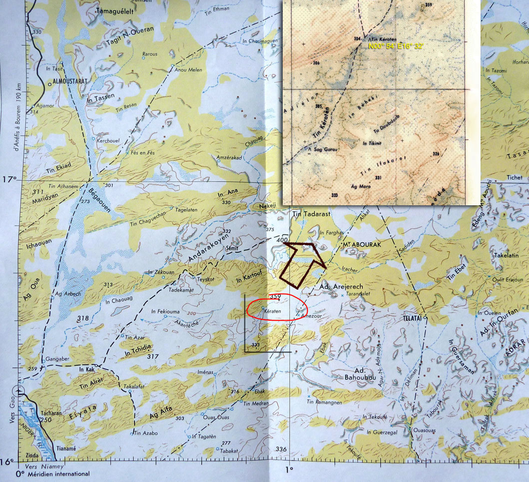
Just a day after ABZ’s death, Moktar Belmoktar (‘MBM’), supposedly ABZ’s rival and with him one of the three key jihadist ’emirs’ in north Mali at the time, was also (but incorrectly) reported killed by the Chadians. In fact the Pimpernel-like MBM had been ‘killed’ many times in the last decade or two (mostly recently in 2015 and 2016). In 2013 shot to Bin Laden-like prominence as the instigator of the suicidal attack on the Algerian gas plant at In Amenas. It’s more likely that at the time MBM (right) may have been directing AQIM operations further south, possibly in the region of Tin Keraten. Old maps label this as a well and a oued, some 100km northeast of Gao and 220km south of Kidal (see map above left). It doesn’t seem to match the terrain profile of Ametetai, but a battle was reported here a day or two later and where a fourth French soldier was killed. It’s also just as likely that before it’s all over MBM may yet again slip away into the neighbouring countries or that he was never there at all. The latest news is that following an ineffective US air strike in 2015, in November 2016 a French drone strike in southwest Libya injured MBM gravely. He has been removed from the American RFJ programme and has since lost his position in the Al-Mourabitoun group he led.
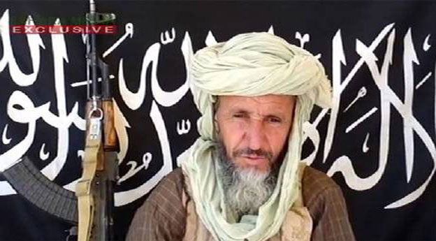
Abou Zeid
Real name Mohamed Ghadir, a small-time smuggler from Deb Deb in eastern Algeria close to the Libyan border (a book including his background reviewed here), Abou Zeid named his katiba or brigade ‘Tarek Ibn Ziyad’ after the 8th-century Moorish general who conquered Spain (‘Gibraltar’ is an anglicised version of Jebel Tarik). Following spells in prison, Abou Zeid rose up the ranks of the GSPC and became noted as a hardliner – ruling his group with ‘an iron fist’ as one former French hostage explained (her husband remains in captivity in north Mali). ABZ was said to be responsible for the execution of British-born hostage Edwin Dyer in 2009 (see link below) as well as more recent mutilations in Timbuktu in the name of Sharia laws. More on ABZ here.
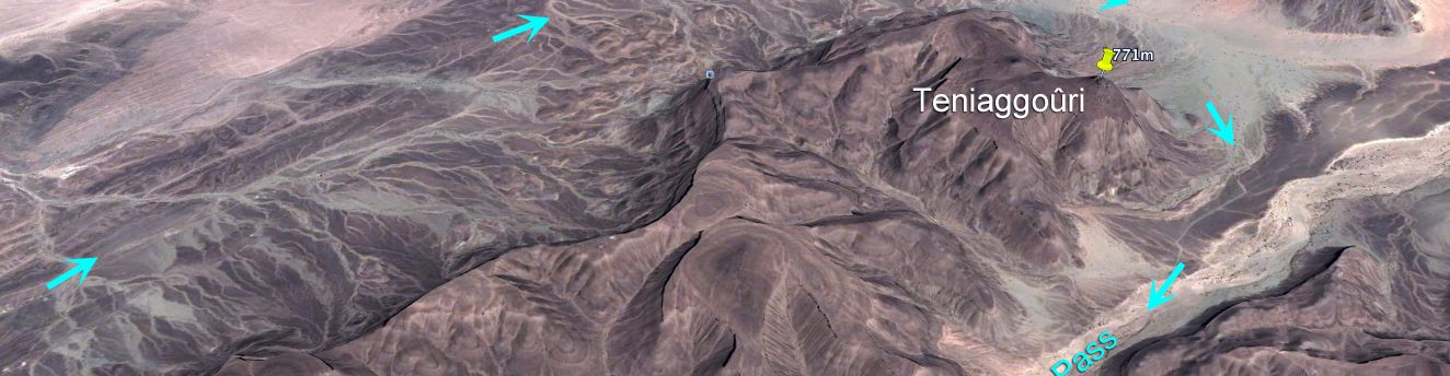
Many news reports parroted the ‘Ametetai valley’ as the location of this decisive battle which led to ABZ’s death, though none mapped it any more precisely than this BBC image. Seeing as it’s rare to get a specific location of what you presume might have been a key jihadist stronghold where some of the ten or so hostages may be kept and where ABZ’s brigade made their last stand, I tracked Ametetai down. (Some reports also mentioned air raids on ‘Etagho’ or ‘Oued? Entouwike’, as the ‘key to unlocking the bases in Adrar Tighaghar’ massif, but again, no accurate location was given and I couldn’t track them down on the usual maps.)
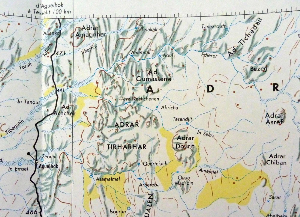
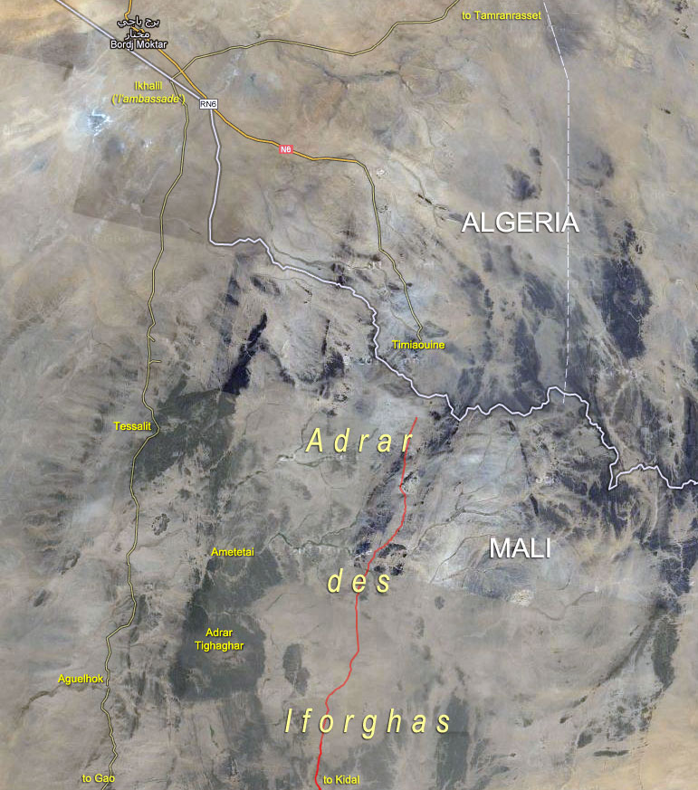
A well with the name ‘Ametetai’ was easily found on the IGN ‘Kidal’ NE-31 map (right), located on the northern edge of the Adrar Tighaghar hills and about 60km northeast of Aguelhok. Aguelhok is a village on the trans-Saharan Tanezrouft track which runs from Reggane, Algeria down to the Niger river and Gao (Route B1 in Sahara Overland).
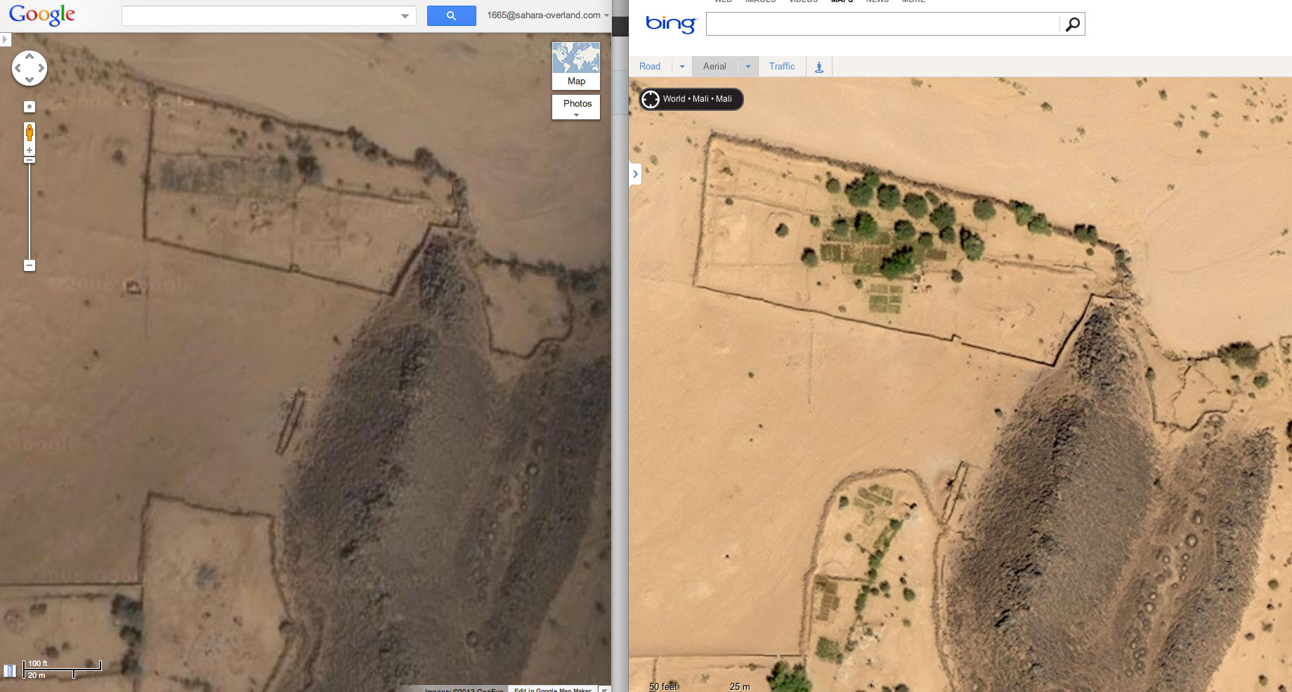
Bing vs Google imagery of Ametetai
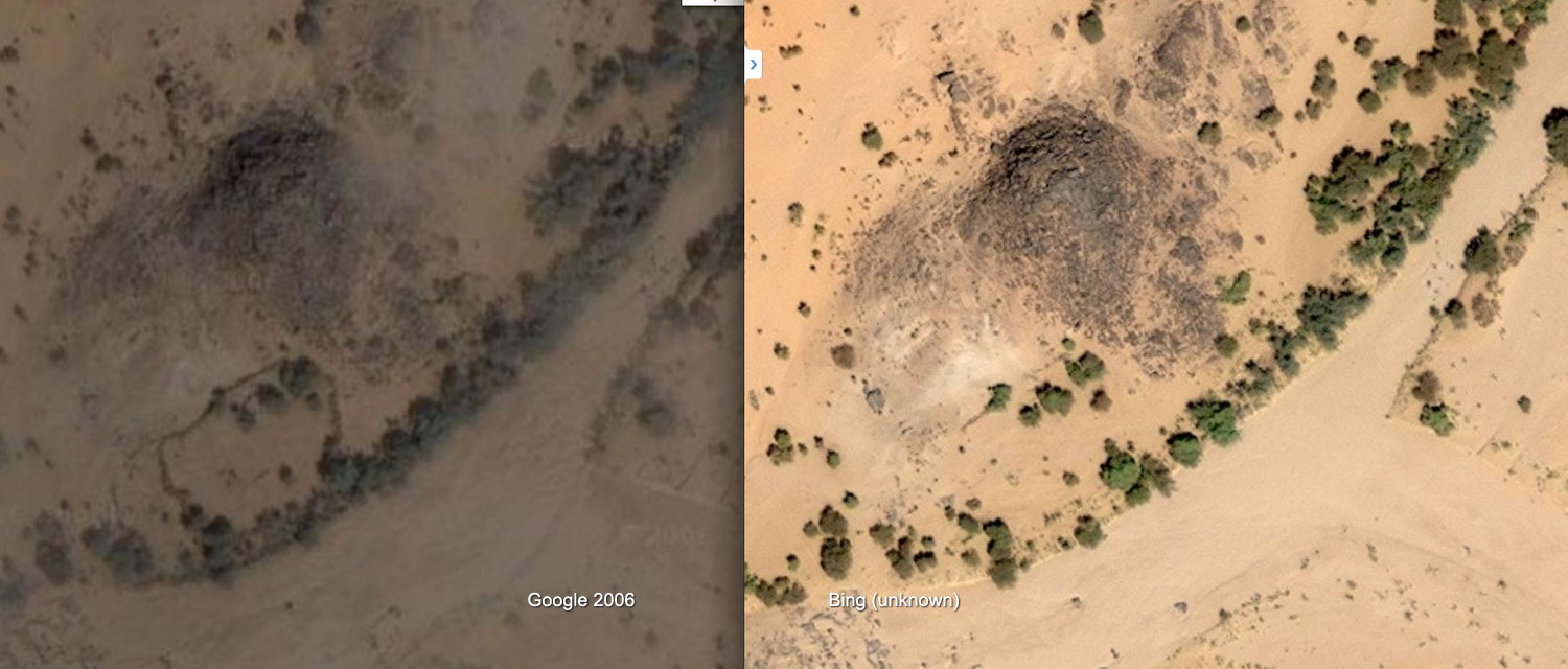
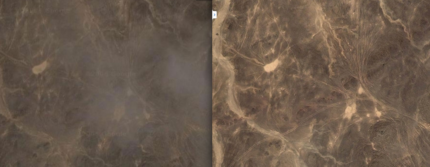
Zoom out and around this Google maps link centred close to the site of the well as shown on the IGN map and you’ll see this ~17km2 sat image tile or quadrant (dated Jan 2006 at time of writing) is higher res than the surrounding ones. The next nearest in high res are Aguelhok and Tessalit (which we visited in 2006 laying plans for our big crossing of north Mali) so a random hi-res tile in the middle of nowhere always makes you wonder. But the Ametetai tile is also oddly spotted with unseasonal clouds for January, few of which have corresponding ground shadows which seems even more odd. Is this obstruction of ground detail significant?
For the first time comparing Google with the same area on Bing ‘aerial’ maps, it comes up as much brighter and cloud free – clearly from another occasion and time of day. On Bing there’s much more cultivation evident (see above right) as well as better developed and unusual concentrations of tracks criss-crossing the hills as below right. This suggests Bing imagery is more recent except that there are more trees which implies it’s older. In my experience trees get cut down all over the Sahara quicker than they can grow back, even by a oued.
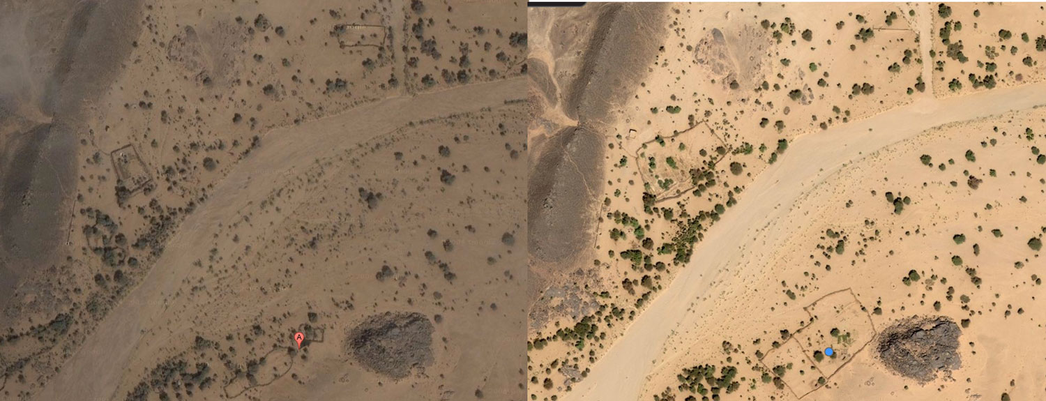
Continuing the comparison, some walled enclosures on Google are not present on Bing (above left), while a few more on Bing have been enlarged as above right and on the left (location upstream). Perhaps the ready-made stone in old walls was taken down to expand compounds elsewhere? Finally, are the shadowless Google clouds covering up something ‘tactical’ that’s exposed on Bing Aerial? Not as far as I can tell.
You can play this ‘spot the difference’ game for a while to try and fit what is now well known to all: the ‘narco-traffiquants‘ as Chad reports derisively describe AQIM/MUHAO/Ansar Dine, had a major stronghold in the Ifoghas as has been speculated on for years. And the Ametetai valley was probably it. Here they dug caches and laid traps while successfully camouflaging their actual presence from overhead drones and presumably preparing for the assault which finally came in the form of Operation Serval. The seeming expansion of cultivation and some enclosures in a place so far from other know villages with little evidence of actual dwellings might be seen as odd.
A couple of weeks later it was reported that fighting was continuing in the ‘Hades valley… 60km from Tessalit’. This could be the next, even narrower valley to the south of Ametetai in the Tighaghar massif called ‘In Tegant’ on some maps. An unusually dense mass of tracks joins the two valleys across the stony hilltops, including the image above right.
Note: Aerial images in the region may have been updated since this article was written
What is the ‘Adrar des Ifoghas’? ‘Adrar’ usually means a region of low hills, escarpments or plateaux, but it can mean a single peak or jebel, like the Adrar Asref in the IGN map above. The Ifoghas (pronounced ‘Iforas’) is a region of low and dispersed, rubble hills spread across northeastern Mali and is also called the ‘Adagh’ by some. Separated by broad sandy plains and dissected by slender oueds, the actual ‘massifs’ barely rise a hundred metres above the surrounding 500m plain and can never be said to resemble ‘mountains’ far less a ‘near-impenetrable range’ as some reports describe. There are no distinctive peaks to speak of, nor a contiguous massif like the Hoggar in Algeria or the Tibesti in Chad, although you could say the Adrar Tighaghar is a small massif or eroded plateau within the Ifoghas.
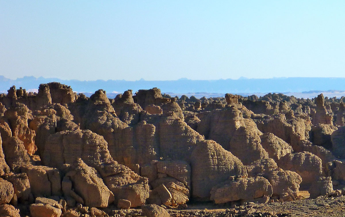
As with most low-lying Sahara hills, the composition is mostly sandstone or granite (as left), broken down by eons of weathering. In places this makes travel with anything with wheels very difficult or impossible, be it the sandy oueds which at least make natural byways, or more so on the crumbled plateaux to either side, as the Le Monde image left shows. In my experience in the Sahara, it only takes a few inches variation in the ground’s surface to reduce car speeds to jogging pace, be it sand ripples or rubble and rock ledges. Bikes manage a little better, but even on foot the effort on the sort of terrain shown above is hugely amplified. Nevertheless, for in the hills either side of the Oued Ametetai the only way in was on foot with helicopter support. (As the reports above explained, the French and Chadians did so from three sides on the final assault.) This sort of terrain is so gnarly it’s also frequently but incorrectly ascribed as ‘volcanic’ in origin, but whatever you call it, trying to across it in 40°-heat with a 40-kilo backpack while trying to dodge bullets would be hard work indeed.
However, as this blog points out, comparisons with Afghanistan’s much more rugged and allegedly betunneled Tora Bora where OBL narrowly evaded capture in 2001 are inaccurate (as is calling all the north Malian jihadists ‘Al Qaeda’). Having said that the Ifoghas’ location close to the borders of Niger and Algeria does match the Tora Bora along the Pakistani border. This must have been a factor or a welcome coincidence when the Algerian-based GSPC (later AQIM) first established itself here in the late 90s. Hostages were frequently brought down into the Ifoghas from the north or east to a place which has always been a remote outlier in Mali, with Bamako some 1200km away. You get the feeling the indigenous Kel Ifoghas Tuareg were pretty much left to themselves or neglected, depending on your point of view, while from my observations a minority of entrepreneurial Berabish Arabs (Moors) controlled a low-value smuggling commerce from places like Al Khalil (In Khalil) hard against the Algerian frontier. (That all escalated once light, compact and high-value cocaine entered the picture a few years ago).
More than the sporadically rough terrain, the main thing that hampers occupation in the Ifoghas is the need for water. There are no river or lakes of course, but in this sub-tropical south side of the Sahara there are few perennial waterholes as can be relied on in southern Algeria (left), for example and which are easily spotted on sat imagery.
One benefit of the bare rocky massifs is they drive what late summer run off there is straight down into the many oueds where vegetation gets concentrated and trees can sink their roots, and where wells can more easily reach the water table. Because of this the Ifoghas hills are more suited to nomadic occupation than say, the sandy void (or ténéré in Tamashek) which fills the northwest corner of Mali. We crossed this ‘empty quarter‘ in 2006; we saw our last tree near Ouadane in Mauritania and the next as we neared Ikhalil, north of Tessalit, some 2000km later. Nor did we see another soul apart from our rescuers who met us midway. (As far as I know the remains of my Hilux – right – are still in Al Khalil).
One Chadian soldier in this Aljazeera video filmed after the Ametetai battle (see also Chad TV link top of the page) described the area as having ‘heavy tree cover’ which seems an exaggeration. Sure, there are small clusters of trees along the oueds, but more likely the sandy creek beds, huge granite boulders and low cliffs are what made hunting down the well entrenched jihadists so difficult.
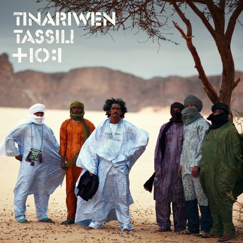
East of the Adrar Tighaghar Google depicts a well-used track (see map below) which doesn’t appear on any old maps and which leads up towards Timiaouine over the Algerian border and continues south to Kidal, about 120km southeast of Aguelhok. When I last travelled down the full length of the Tanezrouft piste in the late 80s, Kidal was the site of a political prison and off limits, but in recent years it opened up to a few intrepid tourists, visiting the Essouk music festival, nearby. The Tuareg group, Tinariwen (left) are originally from Kidal. This track would have developed in the more recent smuggling and kidnapping era as the Kidal region became busier. Doubtless many other tracks developed in the area as AQIM and later groups established themselves in this region over the last decade. With the long overdue Operation Serval, you’d hope that era may be coming to an end. So far in 2016, it doesn’t look like it.
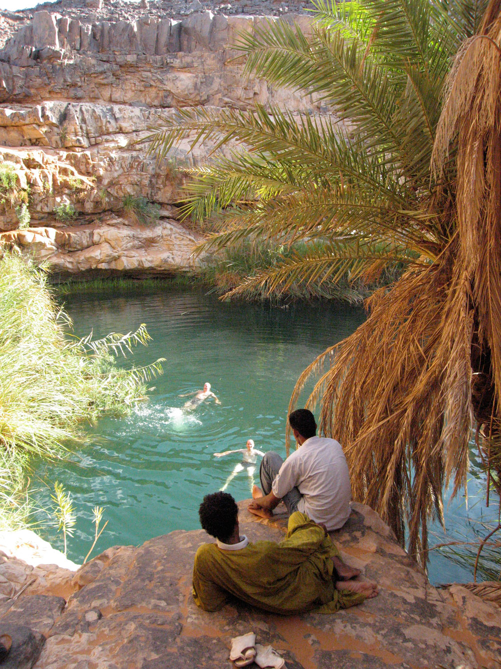
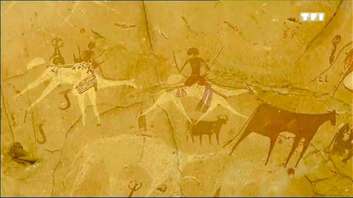
I came across this great film on SVS’s Vimeo channel, mostly set in northeastern Chad. It’s in French but you’ll get the gist. Camels and crocs in Guelta Archei, some amazing paramotoring over Ounianga lakes and even scuba diving in one of the lakes.
It 90 mins long but cuts off at 1.11, on the way into the Mourdi Depression which is a shame. But if you try and find the complete show, watch out for torrentfrancais.com – the plug-in they recommend turns nasty. There’s another equally interesting film on SVS’s channel about Theodore Monod, also set in northern Chad.
On the same theme track down the Emir of Kano, and this one (English VO and subtitles) is about Tubu women in Niger trekking up from around Nguigmi to Bilma to exchange goats for dates. A few years ago the BBC ran a similar film in the same region about a Tubu caravan of women crossing to Termit from Agadem.
This Business Week article paints a grim picture for the future of tourism in Algeria following the In Amenas gas plant attack. But Algeria is not new to atrocities like this, and unless such dramatic events become regular I think there’s still hope for small ventures.
In Djanet a week or two earlier the agent joked with us that at least they were now targeting the far more crucial gas industry instead tourism which never really recovered following ‘2003’. It was a hollow joke of course if your sole business is tourism. I suspect the agencies that have scraped by and are still be able to offer a service are those for whom tourism is not the sole source of revenue. What that other revenue might be to some it’s better not to ask. Both the freelance guides we used on our recent camel- and donkey treks moonlighted as plateau guides for smugglers from nearby Libya in the lean years of the 1990s, and at least one had a couple of spells in prison on account of it. These days such ventures are far more risky of course. The picture above right is the view east from Sefar, showing the Libyan Akakus about 50km away and the town of Ghat at it’s foot.
The golden era of the 1980s tourism may be over in Algeria, but as I suggest in that article enough expertise, great destinations and circuits have built up over the years to offer a solid foundation for those who still believe the deserts of Algeria are a worthwhile destination.
Picture below: Pre-Islamic tomb in the Tassili N’Ajjer. Also visible on Google Sat.
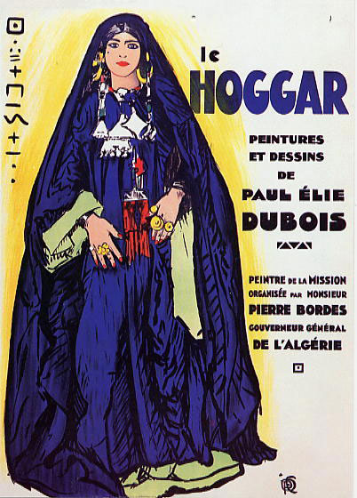
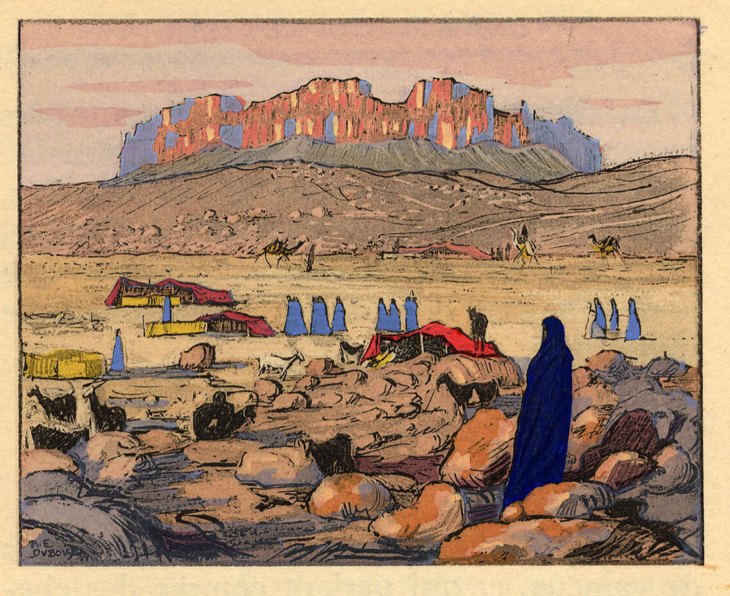
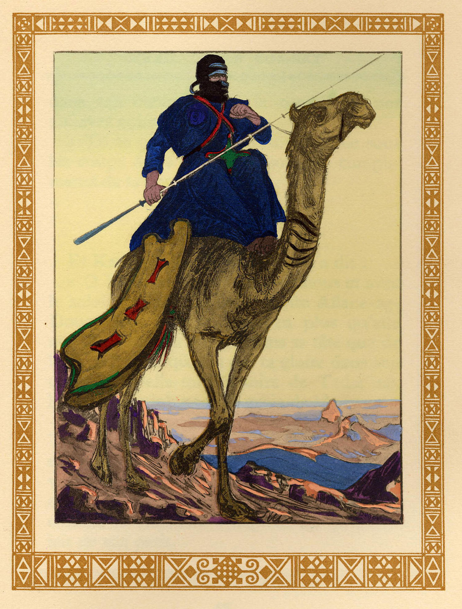
Years ago a well-wisher based in France send me a CD of scanned artwork by a French Orientalist painter, called Paul Élie Dubois (1886-1949).
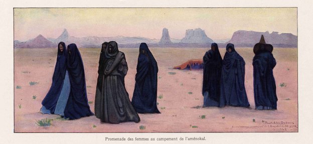
In the 1920s and 30s Dubois travelled frequently in the recently colonised Hoggar of southern Algeria and went on to exhibit his work as well as illustrate limited editions of popular books on the area, such as Chants du Hoggar, a series of courtly Tuareg legends and fables retold to the author, Angèle Maraval-Berthoin. A figure in one of the legends over whom Tuareg ‘knights’ fight is known as Dassine, also the name of the long-established campsite on the east side of Tam. Now I know.
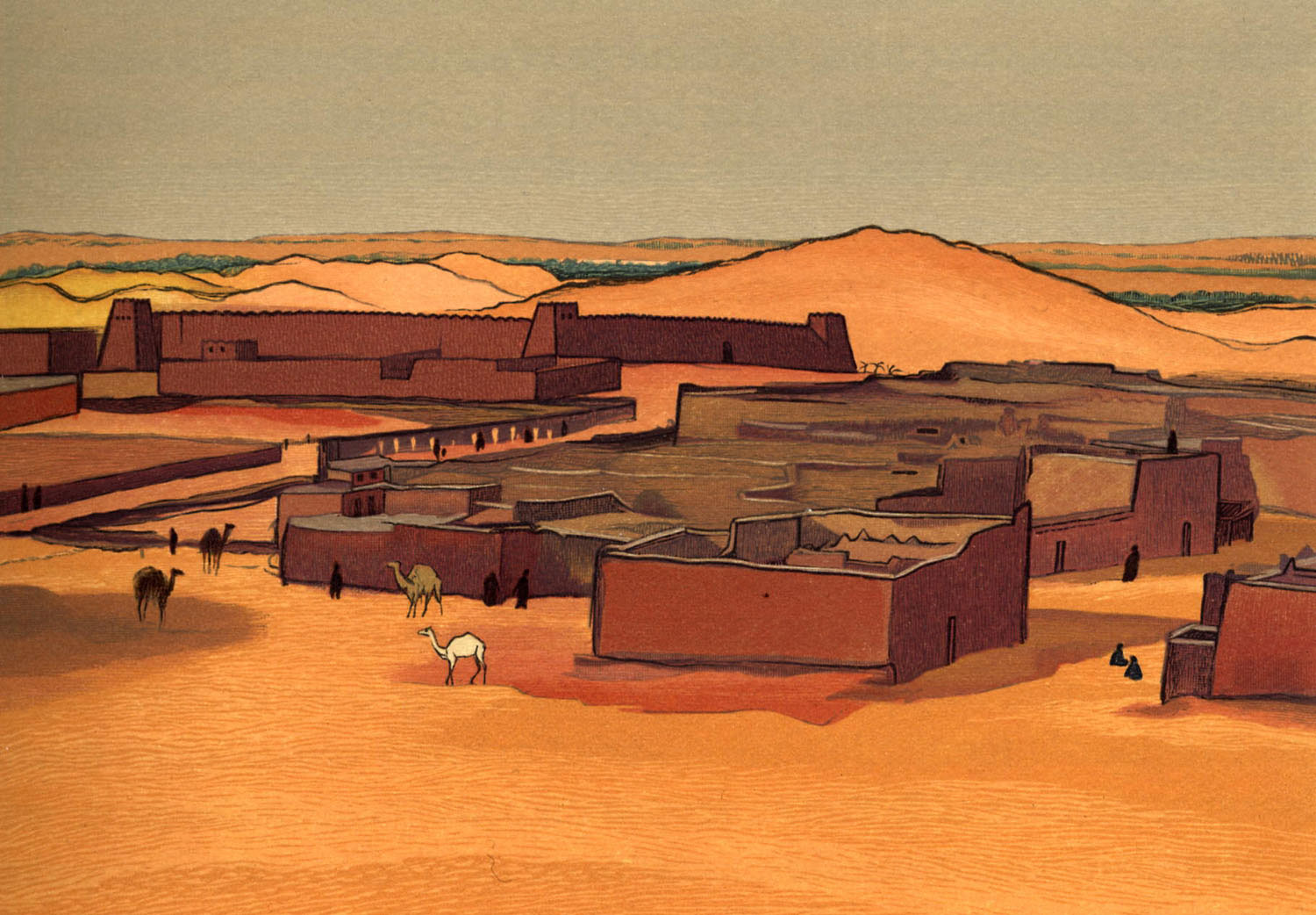
Images from that book appear below, followed by a few general views of southern Algeria also by Dubois and which some may recognise.
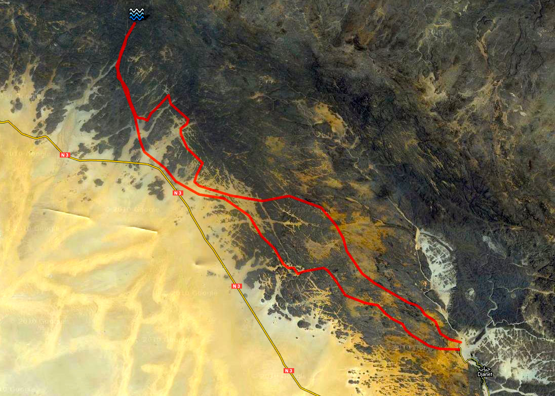
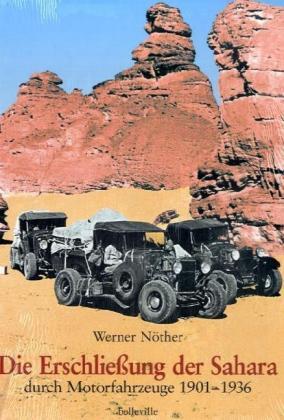
DIE ERSCHLIESUNG DER SAHARA DURCH MOTORFAHRZEUGE 1901-1936 [Opening up the Sahara by Motor Vehicle, 1901-36] Werner Nother (try amazon.de)
I would not normally review German books here, even if some of the best material may be in that language, but hardcore Saharans may be interested in this huge book, a breeze block three times the size of Sahara Overland. Werner Nother is one of a handful of German-speaking uber Saharans known to me and a registered ergoholic. Among his many Saharan achievements are mapping every last lake and paleo-lake in the Ubari Sand Sea years before they appeared on the tourist trail (his Hilux is pictured on p.82 of Sahara Overland).
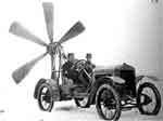
I heard it took him ten or twenty years to complete this massive book – a record of every pioneering expedition by motor car and bike trip into the Sahara in the first third of the last century. I can’t understand a word of it but the many archive photos and crystal clear maps are good enough to illustrate the advent of the automobile in the Sahara. Some of the early solutions to the problem of soft sand traction are ingenious – they cottoned on to giant caterpillar/belt drives pretty early, though the propeller cars look like they may have had pilot suction problems. And our strange friend Byron Prorok (see other reviews) is in here too.
Interestingly, one sees that all the main pistes as depicted on the Mich 741 and including the Libyan Desert were all established by the mid-30s. And yet took them another 70-odd years to finally seal the Sahara (followed by an eternity of maintenance…). The many maps also highlight places and routes that may have slipped from the contemporary Saharan radar, offering endless opportunities for historic trips ‘in the wheel tracks of’. I suspect this is a fascinating account of early motoring in the Sahara.
EGYPT, CIVILISATION IN THE SANDS Pauline and Phillipe de Flers (Konemann, 2000, (o/p)
Thankfully not another ‘pharaohs and fellucas’ job. The first half covers the Western Oases (Siwa, Farafra, Dakhla, etc), the second the Sand Sea, Gilf and Uweinat: the history, rock art, inter-war explorers, geology, etc, all with great photos and interesting boxed asides. This sort of book would normally be 30-40 quid, but at Stanfords was remaindered at £9.99. I should have bought them all. Scarce on the web.