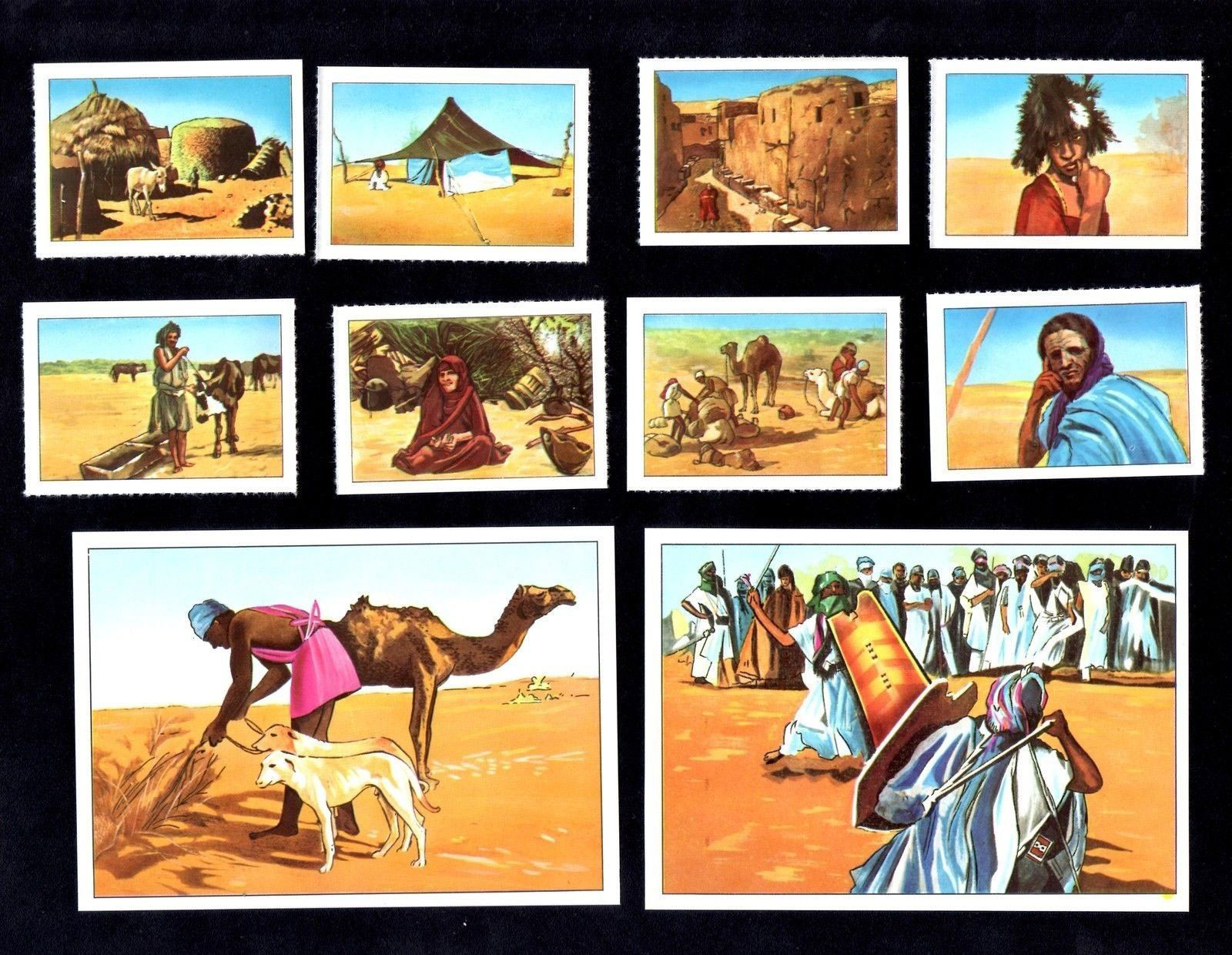
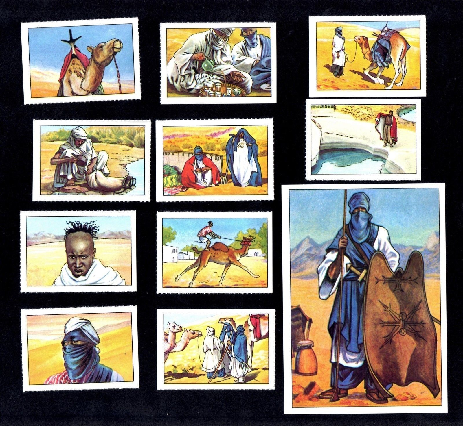
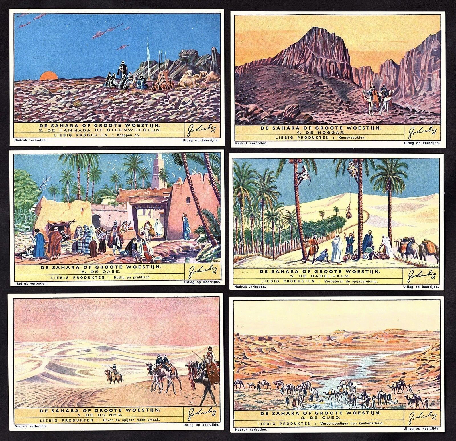
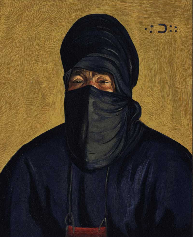
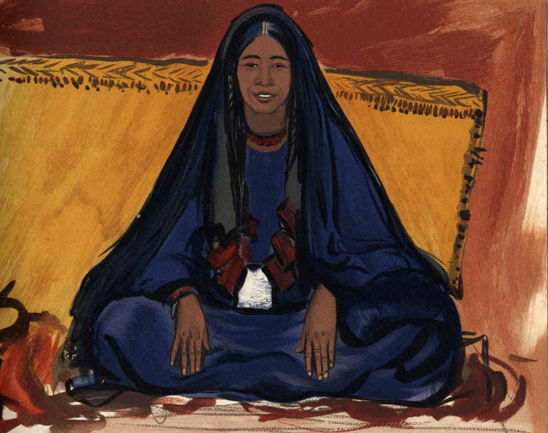
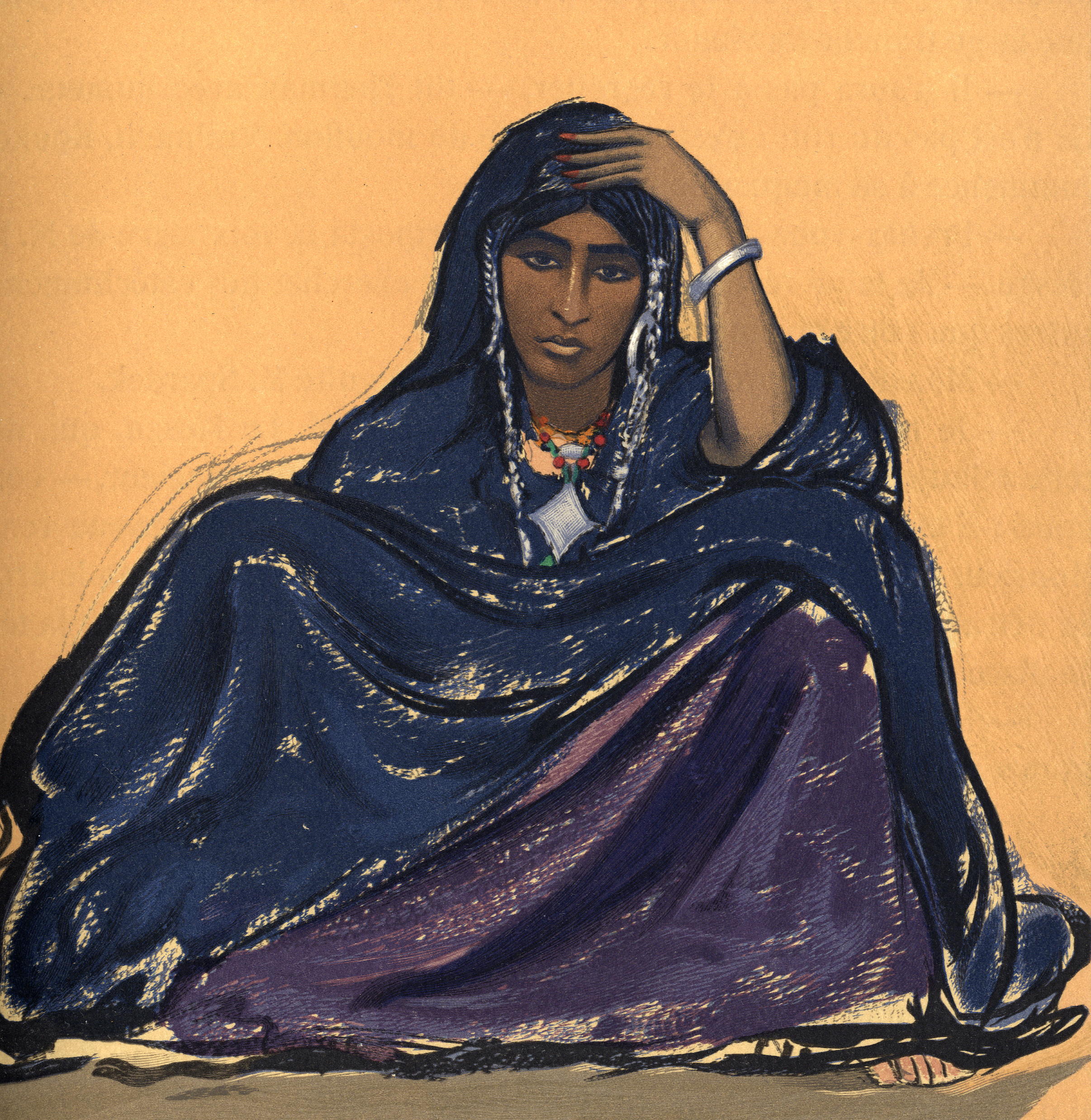
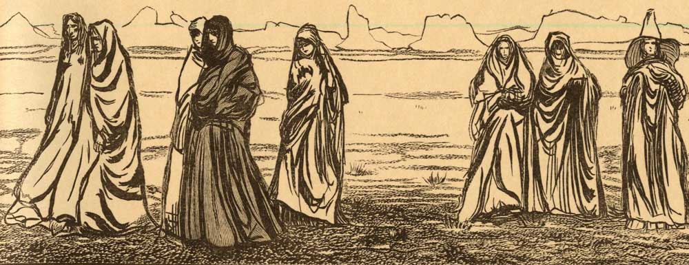
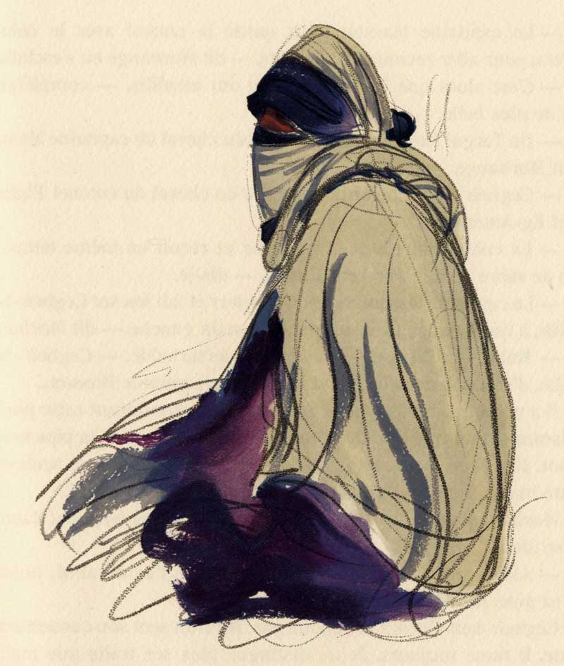
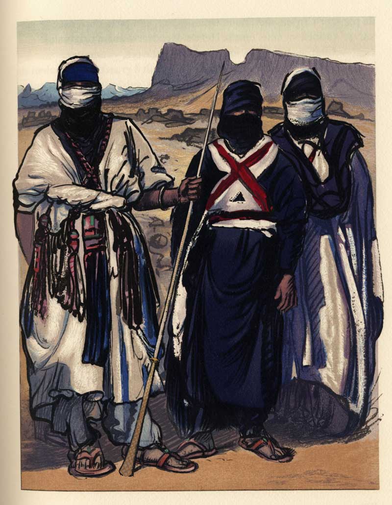
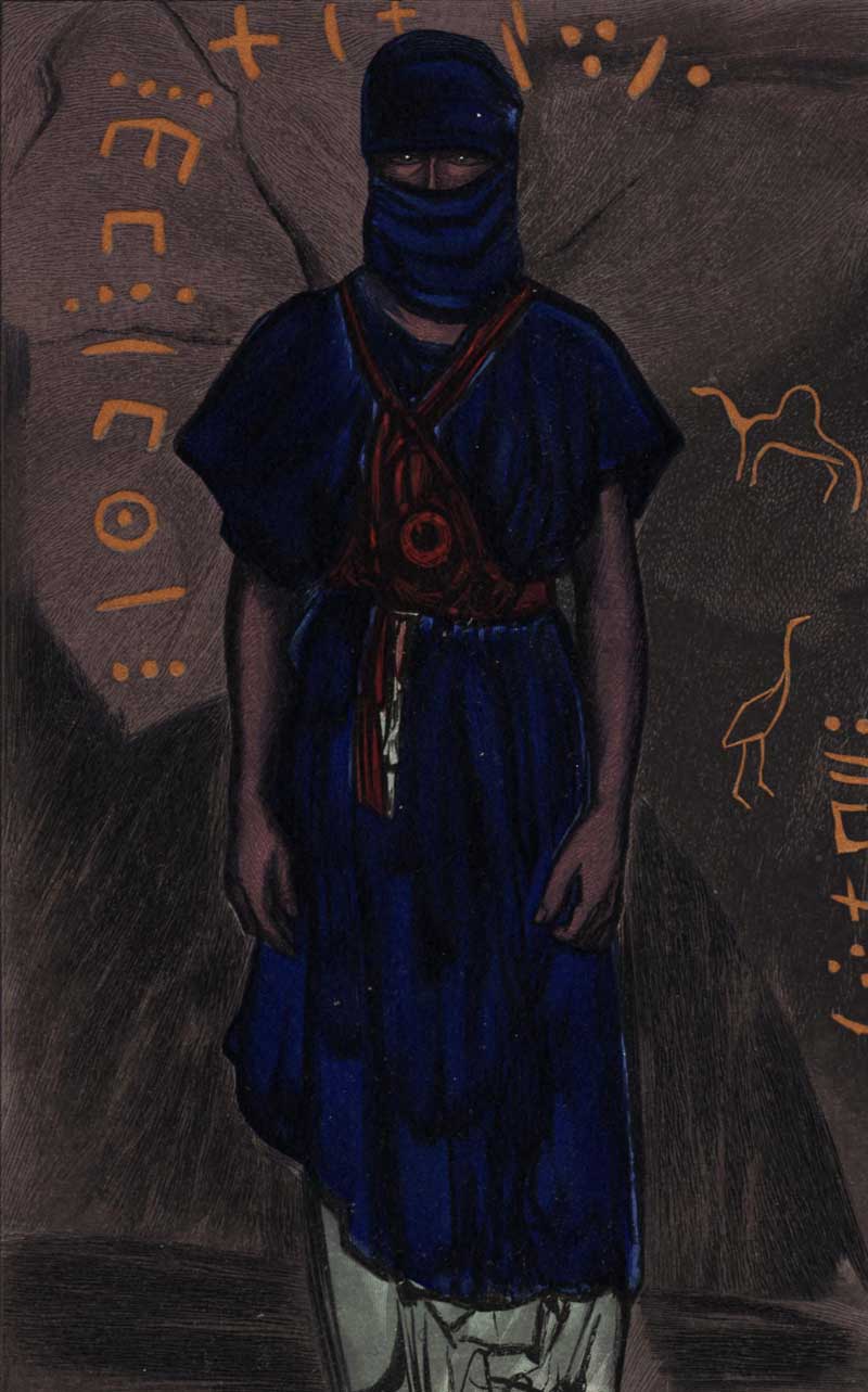
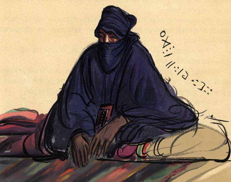
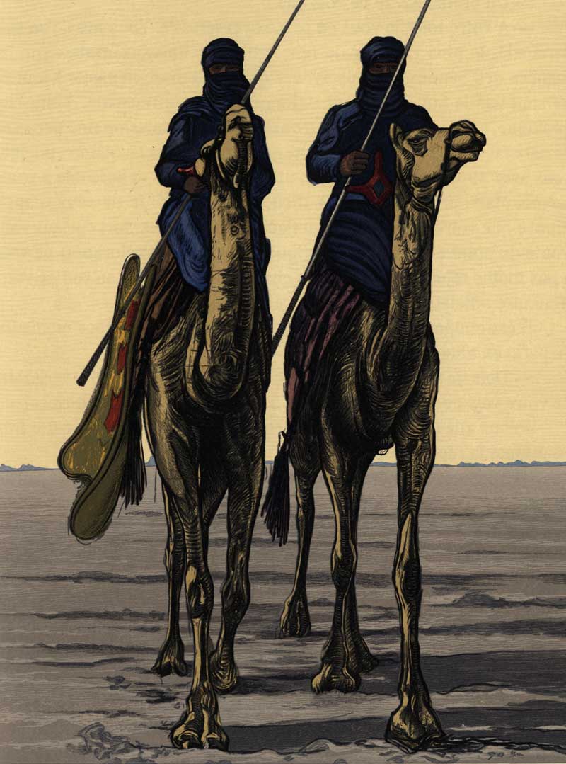
Some attractive cards featuring Saharan themes dating from around the middle of the 20th century. They’re being sold inexpensively by euro-cards on ebay. I have to say on the bottom one it looks like they have have got their tribal categories mixed up, but the Dutch ones (5 and 6) are especially attractive to an ex Tintin/Look & Learn fan.
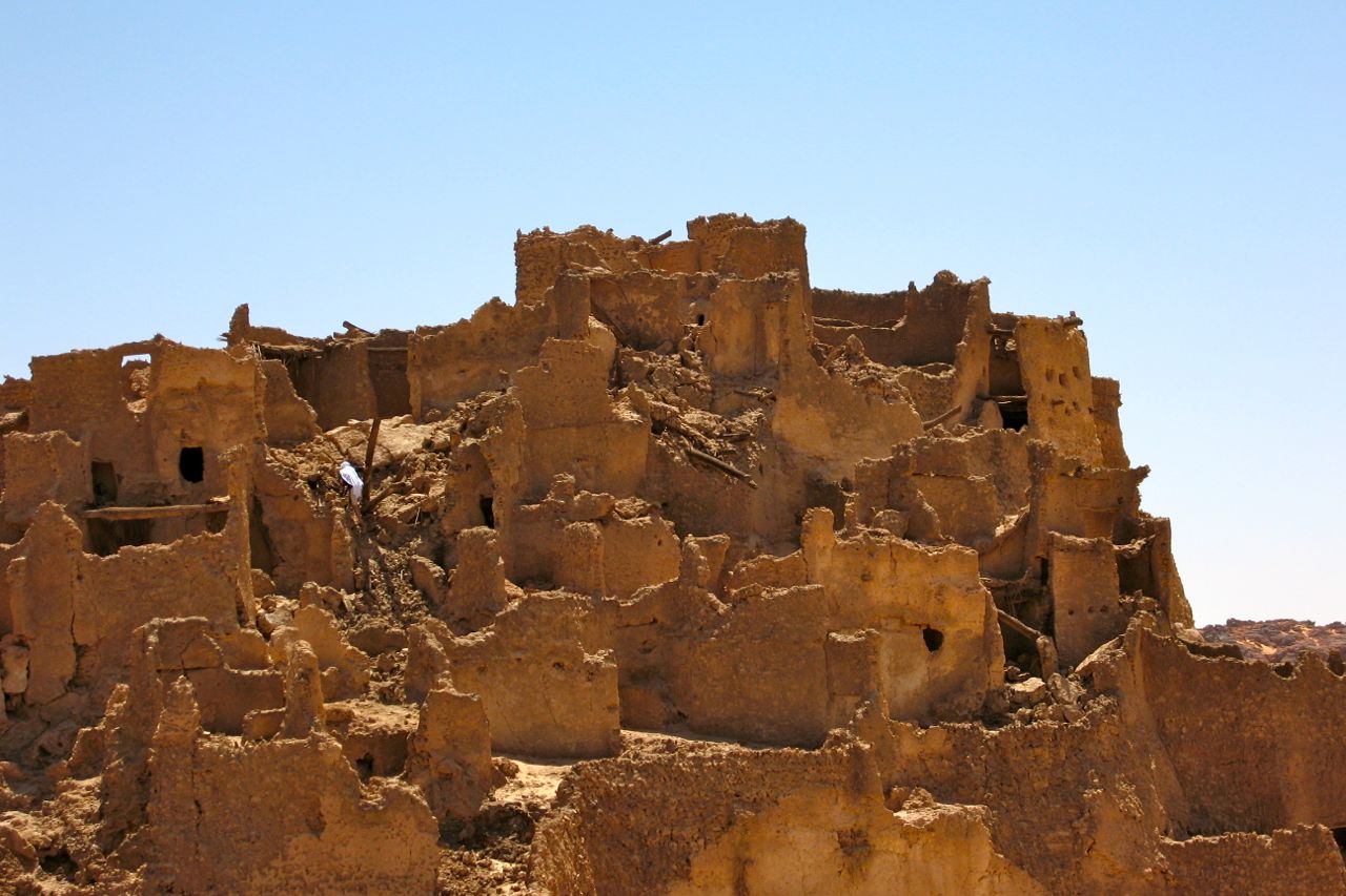
While reworking Desert Travels ahead of a small reprint, I came across this video from 2005 about an Italian expedition that set out from Bamako for Oualata north of Nema. Oualata was once as celebrated as nearby Timbuktu for being a place of Islamic learning, and the video spends a lot of time depicting the intricate bas-relief patterns for which the houses of Oualata are famous. As DT recalls, when I was there in 1989, no time was allowed to have a good look around, far less stay over.
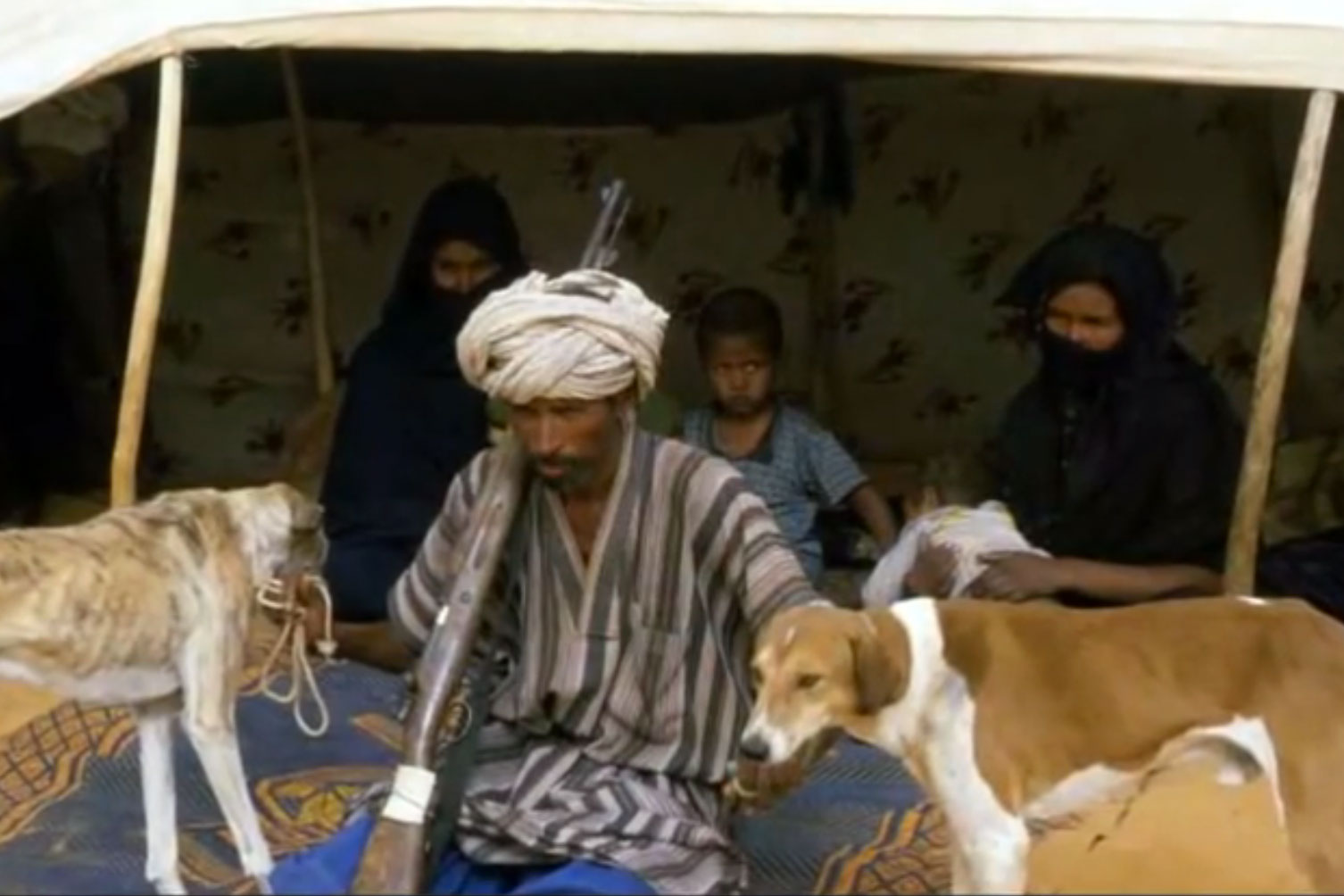
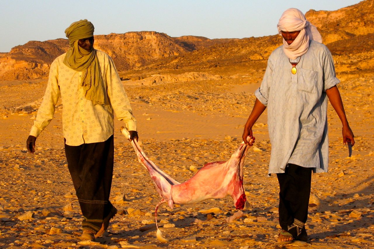
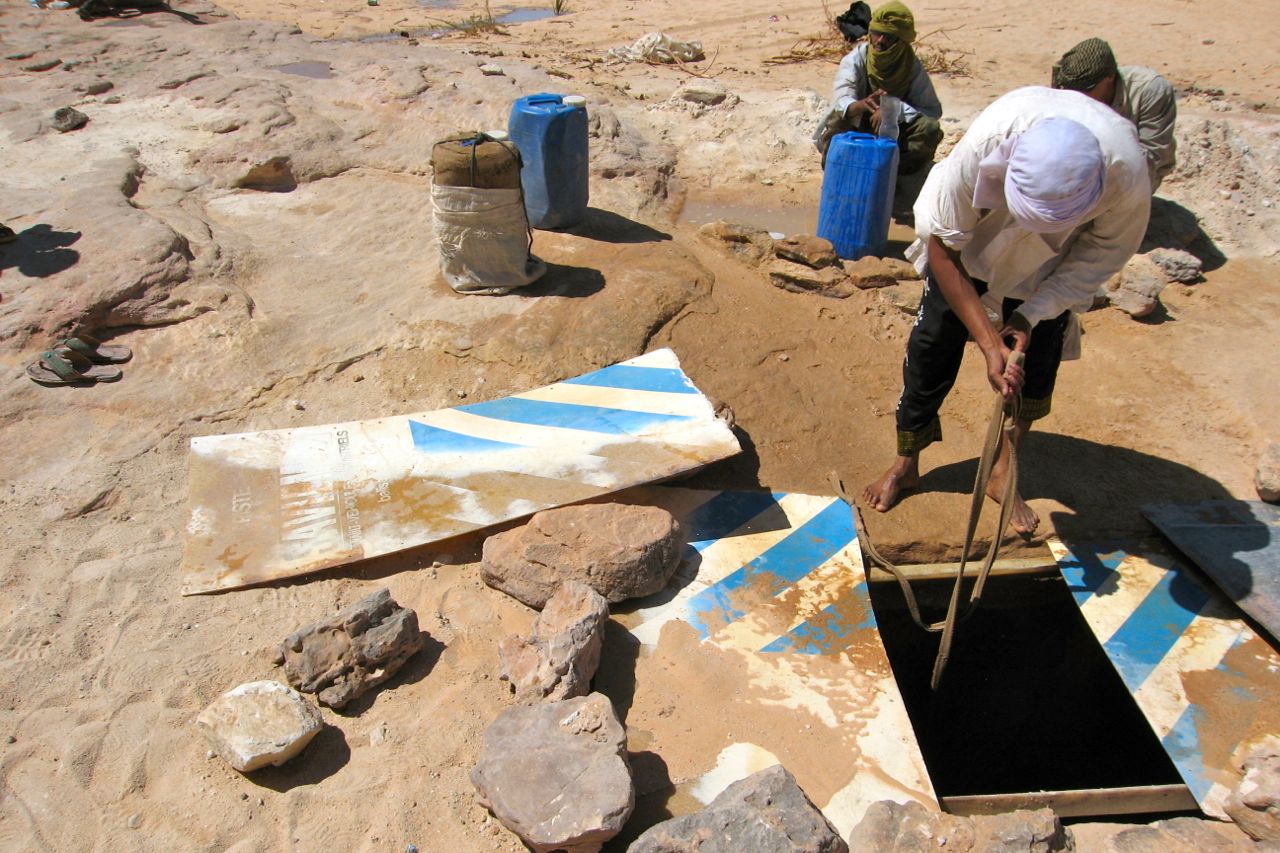
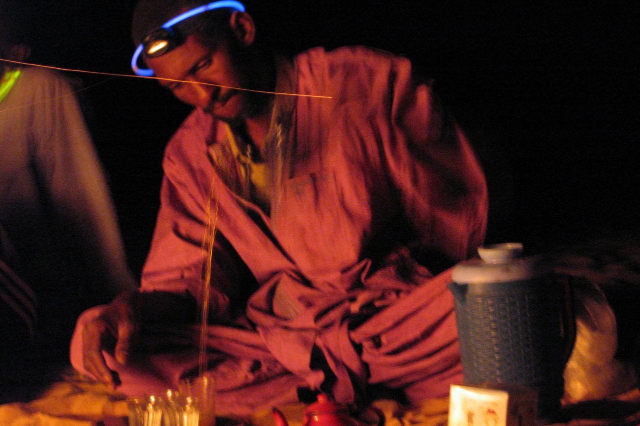
Then, amazingly to me at least, the Italians manage to track down a surviving Nemadi family, a survivor of the pariah-like tribe of dog hunters mentioned in Bruce Chatwin’s semi-fictional Songlines study of nomads. They live in what the vid calls the ‘Sarakolle’ desert. Not heard that designation before, but it seems Sarakolle also means Soninke, a tribe who live along the Malian border but who are indigenous to Africa and not Moors. Some sources attribute or connect them to the Imraguen fish catchers north of Nouamghar, also outsiders in Mauritania’s Moorish culture. Wiki makes a link for the etymology of ‘Nemadi’, something to do with Azer or dog master, but I just assumed it means ‘people from around Nema‘, like Saharawi. As you can see, the guy doesn’t wear the usual blue robe and his tent is not a Moorish raima, but more of a bent wood humpy. His camel too has no saddle to speak of and it looks like he sits behind the hump. But other items like the three-legged tea table are also used by Moors. At no point in the vid is Nemadi man separated from his ancient rifle.
I thought the Nemadi used to live along the Dhar Tichit beyond Oualata. There is a place call Aguelt Nemadi (Ogueilet en Nmadi) about a hundred miles NNE of Tidjikja or 300 miles NW of Oualata. That might mean ‘Nemadi waterhole’ but lost in the dunes, it looks a pretty lonesome spot on the map, perhaps a watering hole on the old caravan route between Tichit and Ouadane.
The video has no commentary, a few Italian subtitles and some great music. It looks like they set out to cross the 400km to Araouane in their Sixty-series Tojos, but something broke so they came back. The Nemadi guy appears at about 25m.
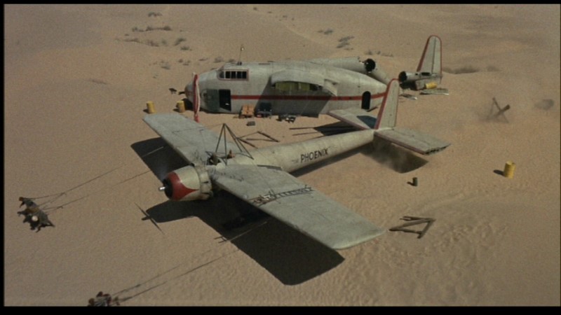
On page 350 of Sahara Overland II I wrote a box titled ‘If we’re done for we’re done for and that’s all there is to it‘ about some of the better known plane crashes in the Sahara. Anyone who’s seen the stellar cast at work in original 1965 movie, Flight of the Phoenix (left, not the dreadful 2004 remake) will know what a compelling story the tragedy of a plane crash in the desert can be.
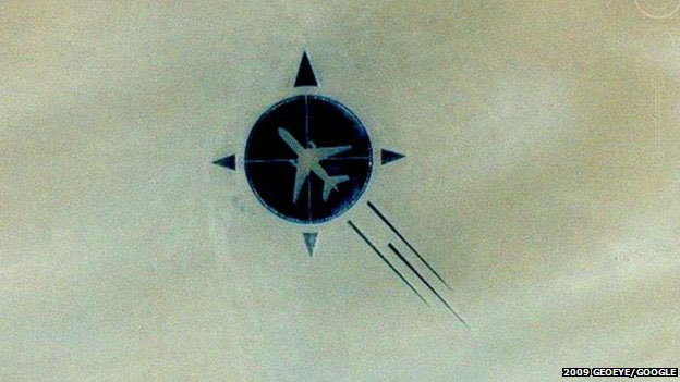
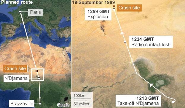
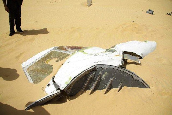
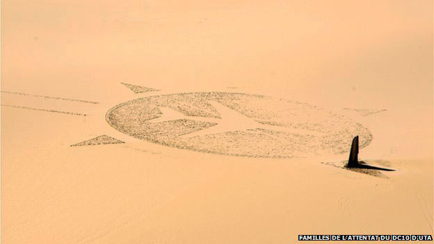
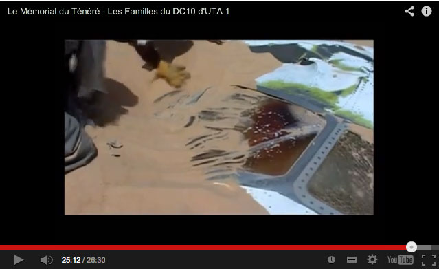
Last week a rather belated article appeared on the BBC where it trended for a day; the tale of how a victim’s relative from the September 1989 UTA 772 plane crash over Niger’s southern Tenere organised the construction of a striking memorial at the crash site to his father and the other 169 who perished.
Less than a year after a similar event over Lockerbie in Scotland, a bomb – said also to have been set by Libyan agents – saw the DC10 break in the sky some 450km east of Agadez, close to the Termit massif. One still of what looks like the cockpit (right) bears a resemblance to the similar well known image from Lockerbie.
Libya’s rather implausible motive was said to have been revenge for France’s support for Chad in the last stages of their border interventions into northern Chad’s Aouzou Strip between 1978 and 1987. This was a little-known Saharan war which had ended when they were roundly defeated first at Wadi Doum near Faya in the Tibesti, and then routed at Maaten al-Sarra, right in Libya itself. However, in July 2011, Gaddafi defectee and former Libyan foreign minister Abdel Rahman Shalgham, told a newspaper ‘The Libyan security services blew up the plane. They believed that opposition leader Mohammed al-Megrief was on board‘. With part of the £104m compensation gradually handed out by the Gaddafi family, Guillaume Denoix de Saint Marc set about building the huge memorial sculpture close to the crash site. It was completed in 2007 and appears on Google maps today.
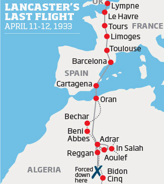
The other tale concerns an Avro Avian biplane which crashed in April 1933 between Poste Weygand and Bidon V in Algeria’s Tanezrouft. Featuring biplanes, romance and death in the desert, the story resonates with the popular but very fictional English Patient movie and book. But this tory is all true and a film-making descendant of the loan pilot, Bill Lancaster, is close to completing a documentary about his forebear titled: ‘My Great Uncle; The Lost Aviator‘.
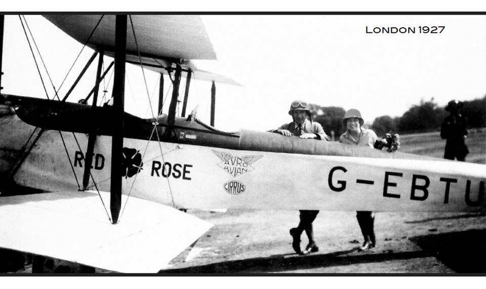
Bill Lancaster was a pioneering British aviator who found fame by flying from London to Darwin in 1927. Despite leaving a family back home, on route he fell for his co-pilot and financial supporter, Australian aviatrix Jessie ‘Chubbie’ Miller (not a nickname you’d think most women would covet).
The adventuresome duo’s romance soon became the Posh & Becks of its day and the couple set up house in Miami. Their relationship then rose to become an outright cause célèbre when, in April 1932 Lancaster was tried for shooting his love rival, Chubbie’s biographer and some say fiancé, Haden Clarke, at their Miami home Cleared of the charges despite the compelling evidence, Lancaster set off to rebuild his reputation by flying across the Sahara. While following what may have been the Tanezrouft beacons used by the Citroen motor crossing of 1922-3, his plane went down some 400 kilometres from the Mali border.
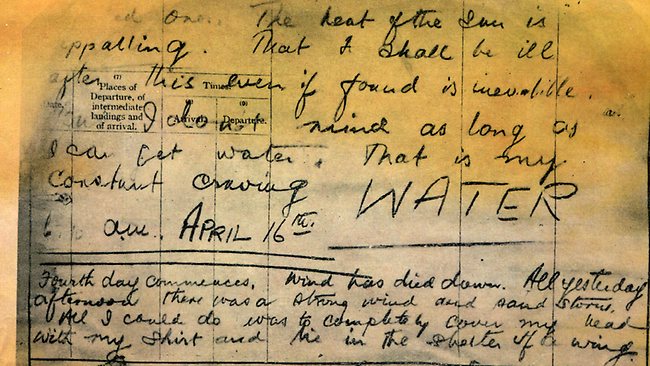
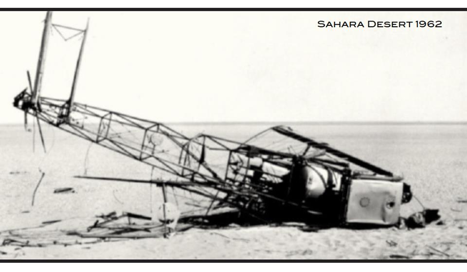
After eight days of suffering Bill Lancaster died one year to the day after Clarke’s unsolved murder. His body lay undiscovered by the wreckage of his Avro until 1962 where a recovered diary revealed his agonising last days (‘… the heat of the sun is appalling … my constant craving – WATER‘) as well as his undying love for Chubbie Miller.
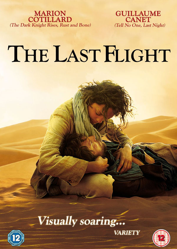
The story was fictionalised in 1985 as an Australian mini-series, The Lancaster Miller Affair and again in French in 2009 getting what looks like an exceedingly unsuccessful ‘English Patient’ makeover as Le Dernier Vol (The Last Flight, right) with Marion Cotillard. It sounds like the documentary based on true story may be much more interesting.
More on the Lost Aviator doc here and here and more pictures here.
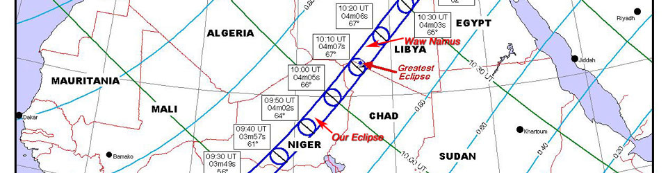
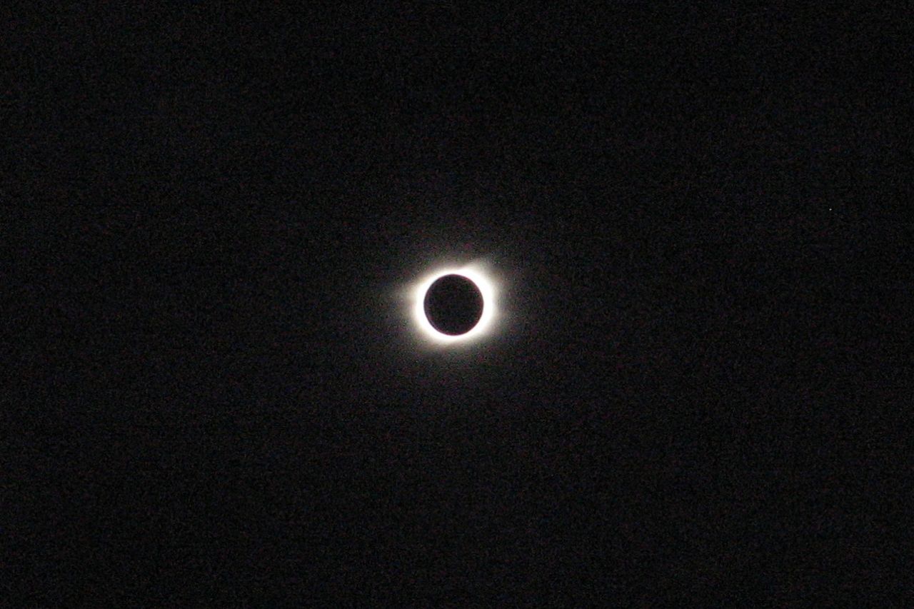
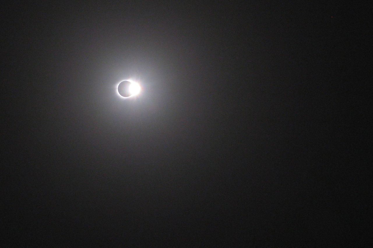
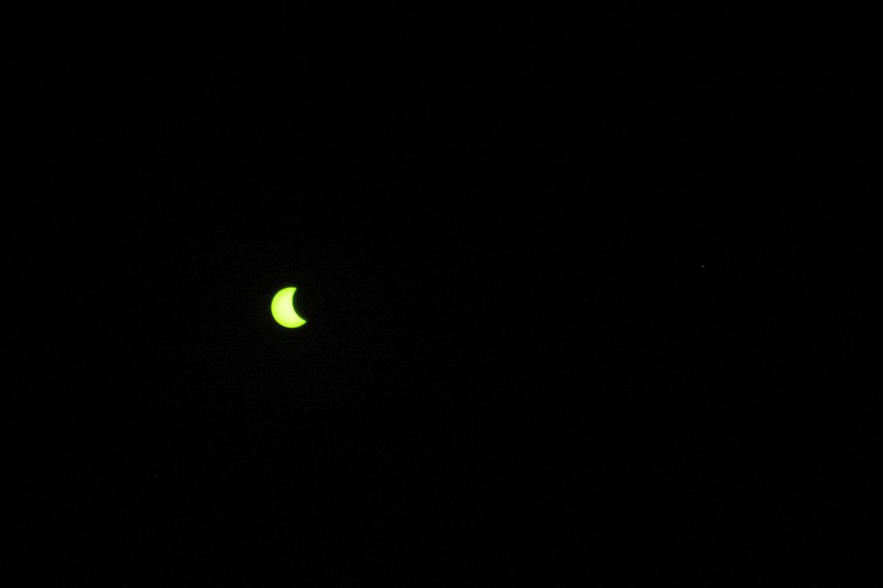
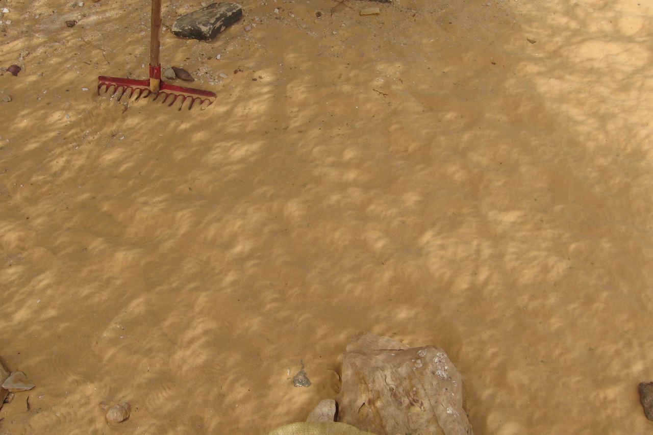
In March 2006 an eclipse sliced right across the Sahara, from Ghana to the Libyan-Egyptian border on the Med. On its way it passed close to the extinct volcano of Waw Namus in central Libya and it was clear that everyone and his camel would be heading there. Sure enough the place turned into an Eclipse Babylon where tours ops from around the world sought to capitalise on a unique event.
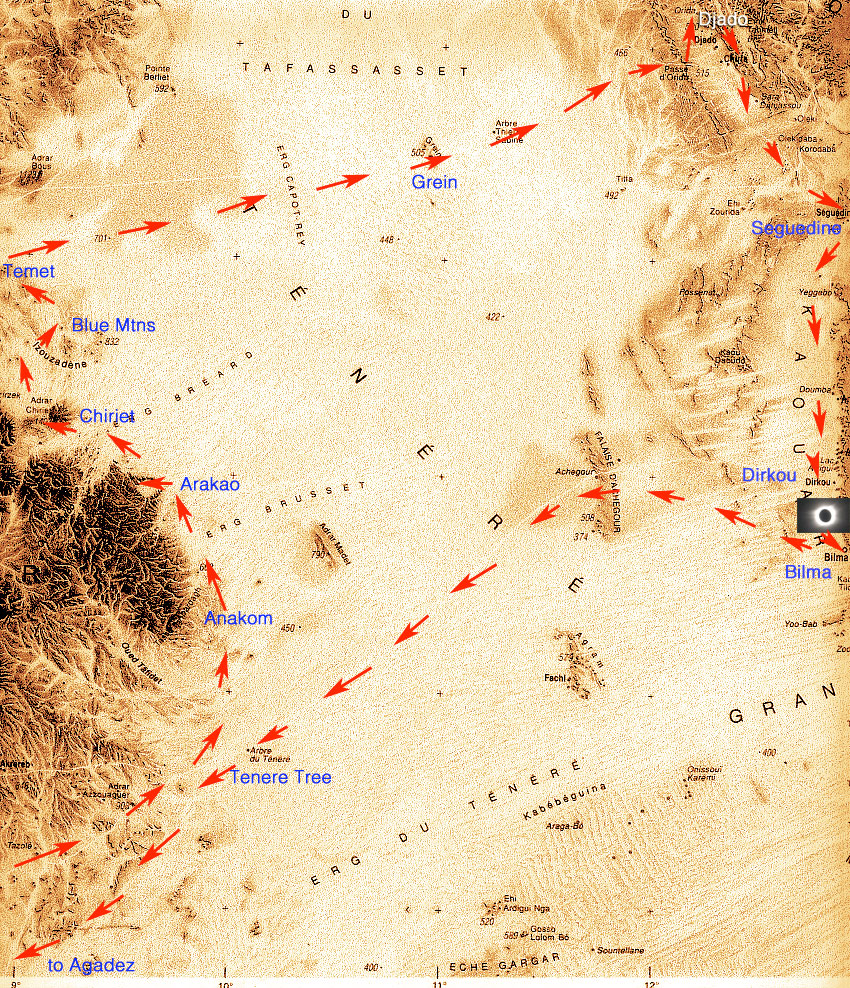
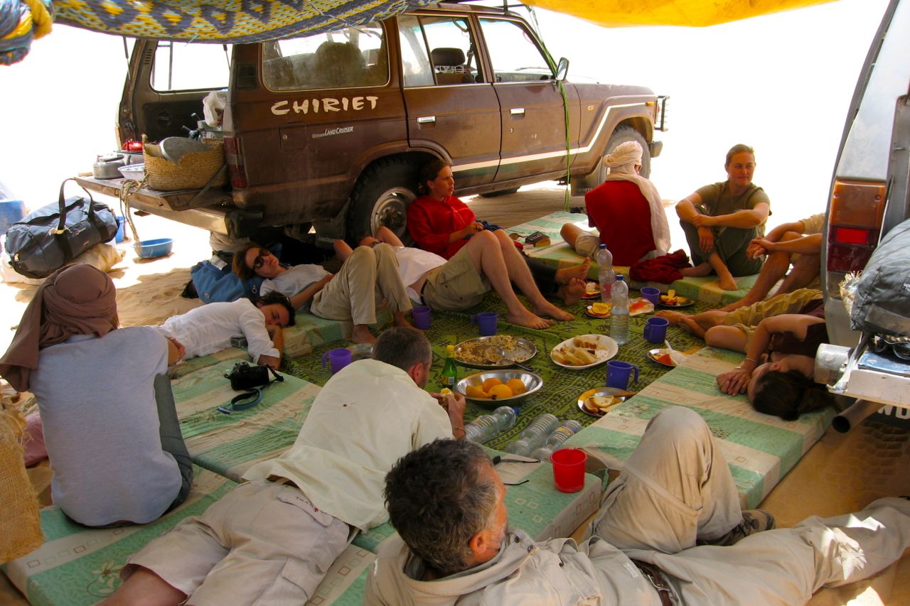
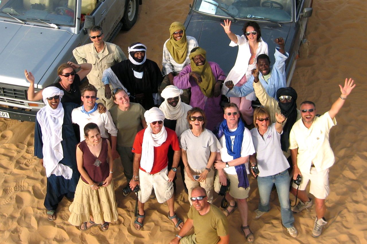
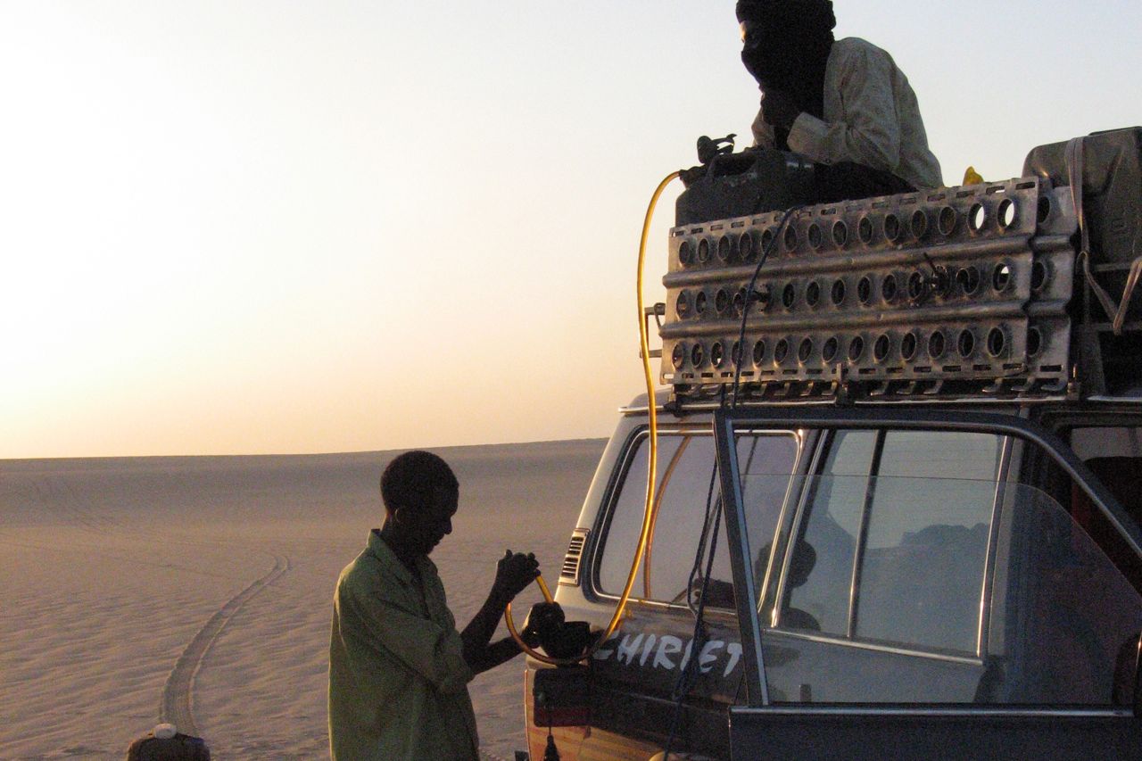
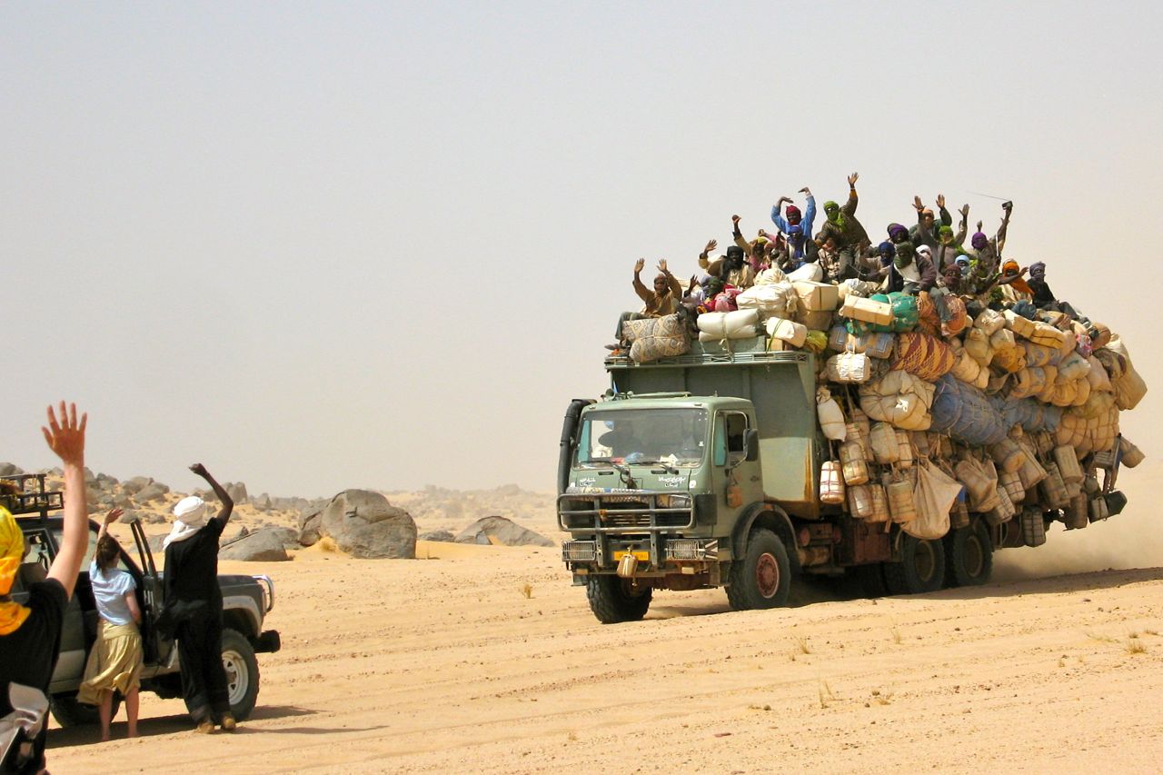
‘Clear skies or your money back’, I crowed confidentially when I pitched my tour. In my mind far better to take it to Niger, where the track of totality passed right between Dirkou and Bilma on the far side of the Tenere circuit. On the way we could take in the classic Tenere Loop (right), one of the best fortnight’s you can spend travelling in the Sahara. It includes the Aïr, Arakao, Adrar Chiriet, Temet dunes, east across the sands to the mysterious ruined citadels of Djado and Orida and the nearby salines of Seguedine and Bilma before heading back through the Bilma Erg and past the Tenere Tree to Agadez.
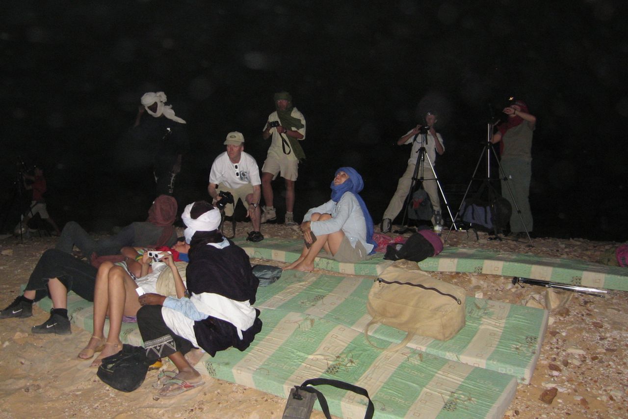
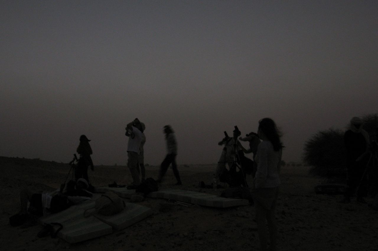
I secured ‘saharaneclipse.com’ in plenty of time and set up an enigmatic front page (left). Only those who moused over the eclipsed sun found their way to the back pages and further details. And so about eleven of us from seven countries shuffled across the tarmac of Agadez airport, paid the special ‘eclipse tax’, piled into the loaded jeeps and lit out into the Tenere to see what we could see. Came the day I was nearly forced to eat my ‘Clear skies…’ boast but a great local crew, the international group and not least the fabulous deserts of the Aïr, Tenere and Djado made for one of my most enjoyable and trouble-free Saharan tours.
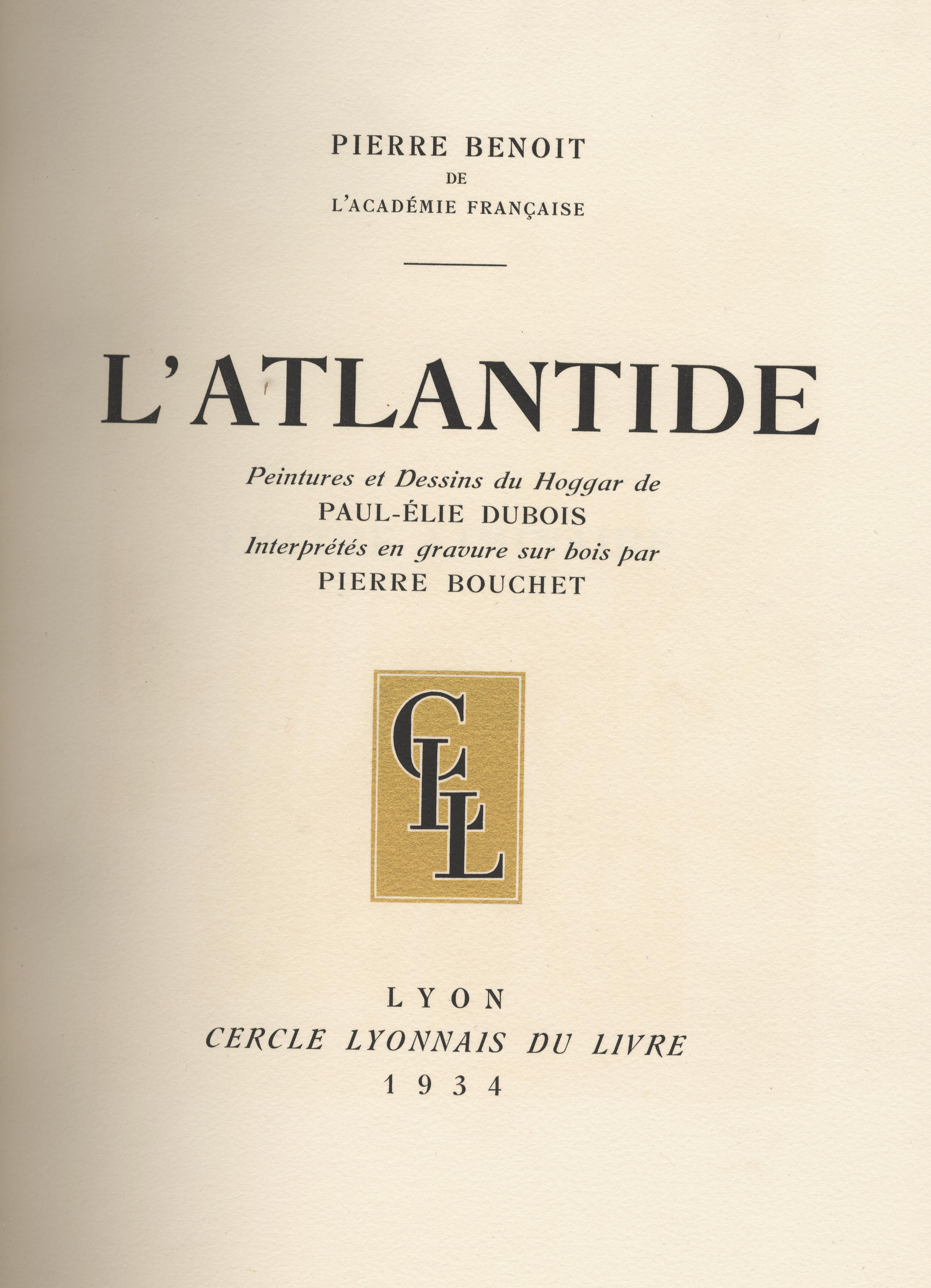
As well as illustrating Chants du Hoggar, French painter Paul Élie Dubois worked on a version of a celebrated novel of the time, L’Atlantide (Atlantis) by Pierre Benoit. It describes the vicissitudes of two French soldiers searching for lost compatriots in the Sahara and who end up in Atlantis, ruled by the beautiful Queen Antinea who seduces and then entombs her lovers. There’s more on the book and films here.
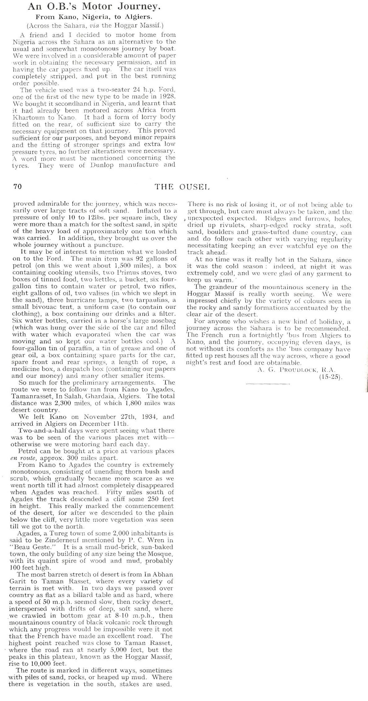
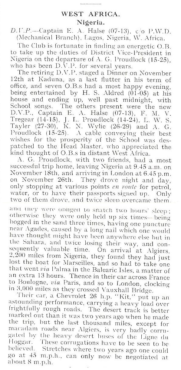
While having a clear out former trans-Sahara pilot, CP Hamp recently came across some copies of The Ousel, his old school magazine produced by Bedford School. One issue from 1934 contained a brief report of an Old Bedfordians’ trans Saharan adventure in 1934.
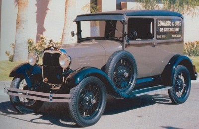
Following a spell in the army in Nigeria, the duo picked up a 1928 24-hp Model A Ford, probably like the one pictured above right and which had already been driven over to Kano from Khartoum. The ex-Bedford School duo’s off-road stage went north to Agadez and then via In Abangarit (the old piste to the west, not present day Arlit) to arrive in Algiers just two weeks later.
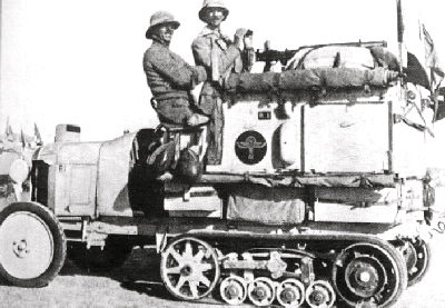
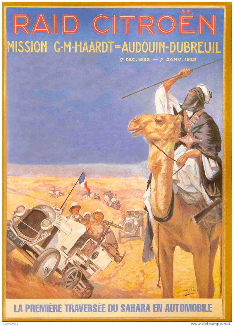
All this was barely 11 years after the first motorised crossing of the Sahara by half-track Citroën Kegresse ‘autochenilles‘ (left and right) which drove from Ouargla to Tam then southwest to Bourem on the Niger river via Tin Zaouatine and Essouk near ancient Tadmakka in the Adrar des Ifoghas, following a trans-Sahara route dating from the medieval era. You’d think this must have put the Old Bedfordians amongst the first Brits to motor across the Sahara at around the same time our man Bagnold was chasing the dastardly Almasy around the Gilf Kebir.
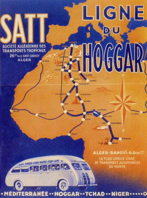
The author A G Proudlock mentions that the SATT bus service (left) did the same run in just 11 days so it seems two years later the plucky A G Proudlock decided to do it again, and this time outdo the streamlined desert bus. With a couple of chums they stuffed themselves into a 26-hp Chevrolet (possibly a 4-90 like this) and drove round the clock to incredibly clock up exactly 3000 miles between Kano, Majorca and Vauxhall Bridge astride the Thames in little more than a week!
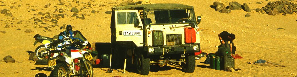
Motoring across the Sahara during the French colonial era was quite different to recent years and was subject to much stricter regulations, but did at least come with the promise of rescue if overdue.
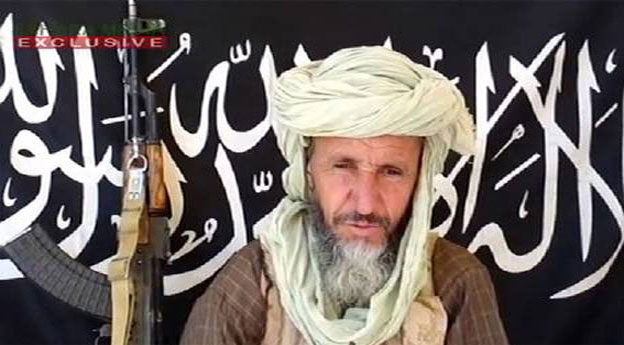
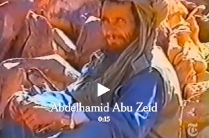
In early March 2013 AQIM confirmed that MBM rival Abu Zeid (left) was killed during the French Operation Serval in northern Mali. Full story here. Interestingly, the NYT video linked below shows the 4′ 9″ jihadist was involved in the 2003 abductions too (left). In 2015, and again in 2016, it was also reported that MBM had been killed by airstrikes in Libya. He no longer features on US wanted lists, but this article in 2017 suggests he’s still influential, while not spelling out if he’s actually alive.
In March 2013, following weeks of ostensibly effortless liberations of north Malian towns while jihadists repeatedly slipped away into the desert to fight another day, the French-led Operation Serval concluded a decisive but protracted battle in the far north. At the time the Chadian army announced the death of the notorious Abou Zeid (‘ABZ’, left) in the valley of Ametetai (or Amettetaï) somewhere inthe Adrar des Ifoghas hills. It was confirmed by DNA tests a few weeks later.
The strategic significance of this obscure valley became clear when the assault began in mid-February. A huge effort was made to defend it during which time scores of militants as well as many Chadian soldiers were killed and huge caches of arms were found. A few days after Ametetai had been ostensibly cleared there was perhaps hasty talk by the French of drawing down their troops in April, while the French defence minister deemed it safe enough to make a surprise visit to the battle site a few days later.
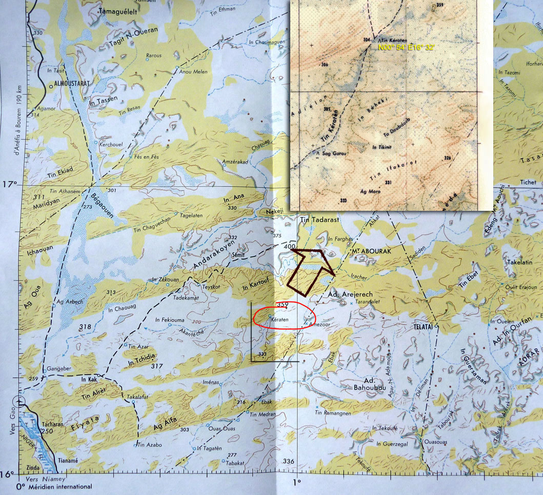
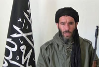
Just a day after ABZ’s death, Moktar Belmoktar (‘MBM’), supposedly ABZ’s rival and with him one of the three key jihadist ’emirs’ in north Mali at the time, was also (but incorrectly) reported killed by the Chadians. In fact the Pimpernel-like MBM had been ‘killed’ many times in the last decade or two (mostly recently in 2015 and 2016). In 2013 shot to Bin Laden-like prominence as the instigator of the suicidal attack on the Algerian gas plant at In Amenas. It’s more likely that at the time MBM (right) may have been directing AQIM operations further south, possibly in the region of Tin Keraten. Old maps label this as a well and a oued, some 100km northeast of Gao and 220km south of Kidal (see map above left). It doesn’t seem to match the terrain profile of Ametetai, but a battle was reported here a day or two later and where a fourth French soldier was killed. It’s also just as likely that before it’s all over MBM may yet again slip away into the neighbouring countries or that he was never there at all. The latest news is that following an ineffective US air strike in 2015, in November 2016 a French drone strike in southwest Libya injured MBM gravely. He has been removed from the American RFJ programme and has since lost his position in the Al-Mourabitoun group he led.
Abou Zeid
Real name Mohamed Ghadir, a small-time smuggler from Deb Deb in eastern Algeria close to the Libyan border (a book including his background reviewed here), Abou Zeid named his katiba or brigade ‘Tarek Ibn Ziyad’ after the 8th-century Moorish general who conquered Spain (‘Gibraltar’ is an anglicised version of Jebel Tarik). Following spells in prison, Abou Zeid rose up the ranks of the GSPC and became noted as a hardliner – ruling his group with ‘an iron fist’ as one former French hostage explained (her husband remains in captivity in north Mali). ABZ was said to be responsible for the execution of British-born hostage Edwin Dyer in 2009 (see link below) as well as more recent mutilations in Timbuktu in the name of Sharia laws. More on ABZ here.
Many news reports parroted the ‘Ametetai valley’ as the location of this decisive battle which led to ABZ’s death, though none mapped it any more precisely than this BBC image. Seeing as it’s rare to get a specific location of what you presume might have been a key jihadist stronghold where some of the ten or so hostages may be kept and where ABZ’s brigade made their last stand, I tracked Ametetai down. (Some reports also mentioned air raids on ‘Etagho’ or ‘Oued? Entouwike’, as the ‘key to unlocking the bases in Adrar Tighaghar’ massif, but again, no accurate location was given and I couldn’t track them down on the usual maps.)
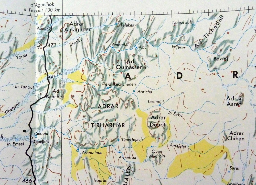
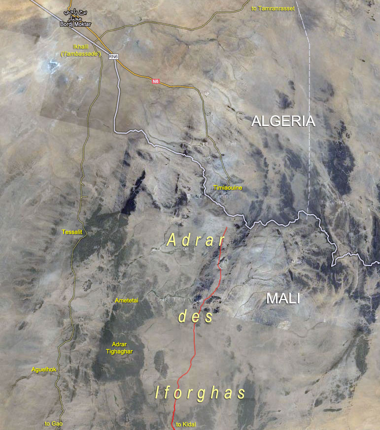
A well with the name ‘Ametetai’ was easily found on the IGN ‘Kidal’ NE-31 map (right), located on the northern edge of the Adrar Tighaghar hills and about 60km northeast of Aguelhok. Aguelhok is a village on the trans-Saharan Tanezrouft track which runs from Reggane, Algeria down to the Niger river and Gao (Route B1 in Sahara Overland).
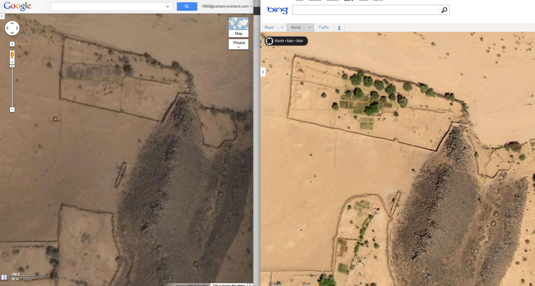
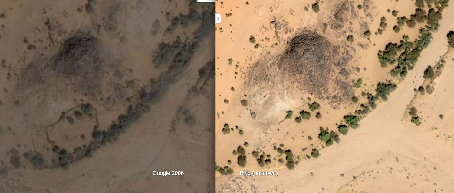
Bing vs Google imagery of Ametetai
Zoom out and around this Google maps link centred close to the site of the well as shown on the IGN map and you’ll see this ~17km2 sat image tile or quadrant (dated Jan 2006 at time of writing) is higher res than the surrounding ones. The next nearest in high res are Aguelhok and Tessalit (which we visited in 2006 laying plans for our big crossing of north Mali) so a random hi-res tile in the middle of nowhere always makes you wonder. But the Ametetai tile is also oddly spotted with unseasonal clouds for January, few of which have corresponding ground shadows which seems even more odd. Is this obstruction of ground detail significant?
For the first time comparing Google with the same area on Bing ‘aerial’ maps, it comes up as much brighter and cloud free – clearly from another occasion and time of day. On Bing there’s much more cultivation evident (see above right) as well as better developed and unusual concentrations of tracks criss-crossing the hills as below right. This suggests Bing imagery is more recent except that there are more trees which implies it’s older. In my experience trees get cut down all over the Sahara quicker than they can grow back, even by a oued.
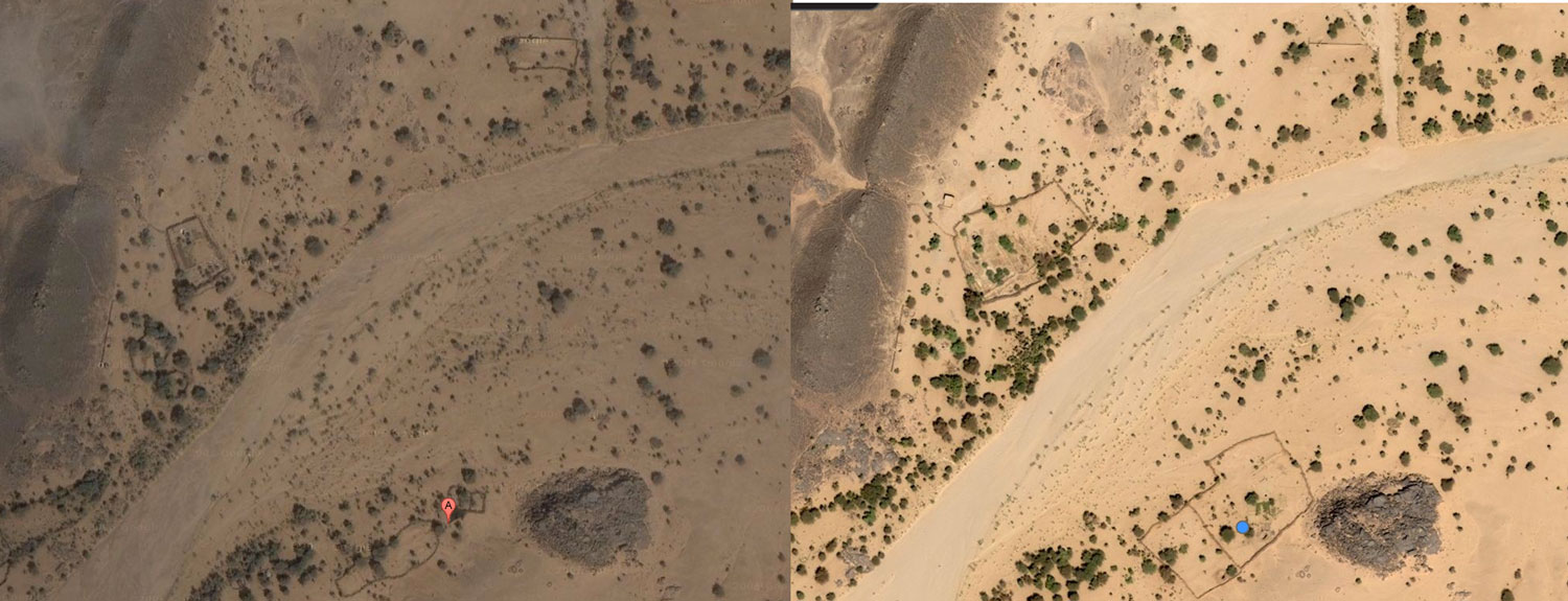
Continuing the comparison, some walled enclosures on Google are not present on Bing (above left), while a few more on Bing have been enlarged as above right and on the left (location upstream). Perhaps the ready-made stone in old walls was taken down to expand compounds elsewhere? Finally, are the shadowless Google clouds covering up something ‘tactical’ that’s exposed on Bing Aerial? Not as far as I can tell.
You can play this ‘spot the difference’ game for a while to try and fit what is now well known to all: the ‘narco-traffiquants‘ as Chad reports derisively describe AQIM/MUHAO/Ansar Dine, had a major stronghold in the Ifoghas as has been speculated on for years. And the Ametetai valley was probably it. Here they dug caches and laid traps while successfully camouflaging their actual presence from overhead drones and presumably preparing for the assault which finally came in the form of Operation Serval. The seeming expansion of cultivation and some enclosures in a place so far from other know villages with little evidence of actual dwellings might be seen as odd.
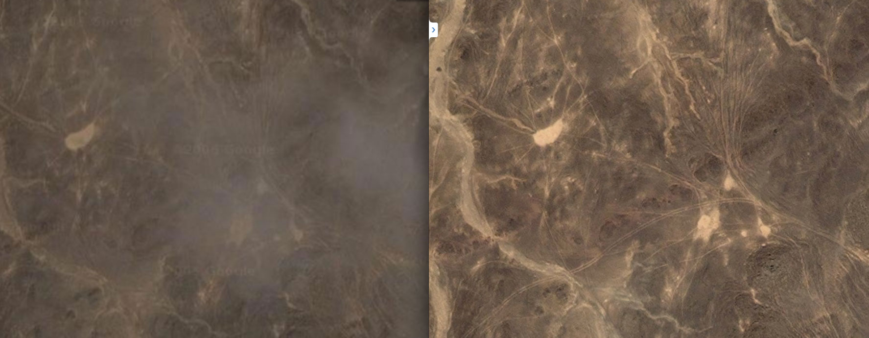
A couple of weeks later it was reported that fighting was continuing in the ‘Hades valley… 60km from Tessalit’. This could be the next, even narrower valley to the south of Ametetai in the Tighaghar massif called ‘In Tegant’ on some maps. An unusually dense mass of tracks joins the two valleys across the stony hilltops, including the image above right.
Note: Aerial images in the region may have been updated since this article was written
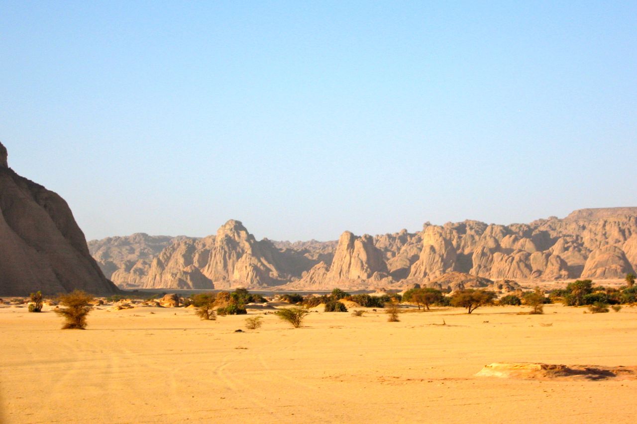
What is the ‘Adrar des Ifoghas’? ‘Adrar’ usually means a region of low hills, escarpments or plateaux, but it can mean a single peak or jebel, like the Adrar Asref in the IGN map above. The Ifoghas (pronounced ‘Iforas’) is a region of low and dispersed, rubble hills spread across northeastern Mali and is also called the ‘Adagh’ by some. Separated by broad sandy plains and dissected by slender oueds, the actual ‘massifs’ barely rise a hundred metres above the surrounding 500m plain and can never be said to resemble ‘mountains’ far less a ‘near-impenetrable range’ as some reports describe. There are no distinctive peaks to speak of, nor a contiguous massif like the Hoggar in Algeria or the Tibesti in Chad, although you could say the Adrar Tighaghar is a small massif or eroded plateau within the Ifoghas.
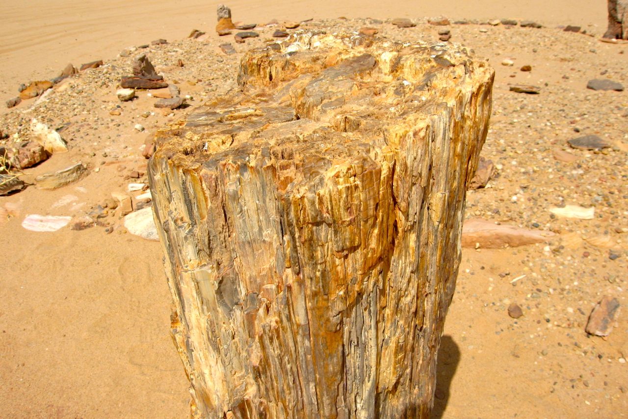
As with most low-lying Sahara hills, the composition is mostly sandstone or granite (as left), broken down by eons of weathering. In places this makes travel with anything with wheels very difficult or impossible, be it the sandy oueds which at least make natural byways, or more so on the crumbled plateaux to either side, as the Le Monde image left shows. In my experience in the Sahara, it only takes a few inches variation in the ground’s surface to reduce car speeds to jogging pace, be it sand ripples or rubble and rock ledges. Bikes manage a little better, but even on foot the effort on the sort of terrain shown above is hugely amplified. Nevertheless, for in the hills either side of the Oued Ametetai the only way in was on foot with helicopter support. (As the reports above explained, the French and Chadians did so from three sides on the final assault.) This sort of terrain is so gnarly it’s also frequently but incorrectly ascribed as ‘volcanic’ in origin, but whatever you call it, trying to across it in 40°-heat with a 40-kilo backpack while trying to dodge bullets would be hard work indeed.
However, as this blog points out, comparisons with Afghanistan’s much more rugged and allegedly betunneled Tora Bora where OBL narrowly evaded capture in 2001 are inaccurate (as is calling all the north Malian jihadists ‘Al Qaeda’). Having said that the Ifoghas’ location close to the borders of Niger and Algeria does match the Tora Bora along the Pakistani border. This must have been a factor or a welcome coincidence when the Algerian-based GSPC (later AQIM) first established itself here in the late 90s. Hostages were frequently brought down into the Ifoghas from the north or east to a place which has always been a remote outlier in Mali, with Bamako some 1200km away. You get the feeling the indigenous Kel Ifoghas Tuareg were pretty much left to themselves or neglected, depending on your point of view, while from my observations a minority of entrepreneurial Berabish Arabs (Moors) controlled a low-value smuggling commerce from places like Al Khalil (In Khalil) hard against the Algerian frontier. (That all escalated once light, compact and high-value cocaine entered the picture a few years ago).
More than the sporadically rough terrain, the main thing that hampers occupation in the Ifoghas is the need for water. There are no river or lakes of course, but in this sub-tropical south side of the Sahara there are few perennial waterholes as can be relied on in southern Algeria (left), for example and which are easily spotted on sat imagery.
One benefit of the bare rocky massifs is they drive what late summer run off there is straight down into the many oueds where vegetation gets concentrated and trees can sink their roots, and where wells can more easily reach the water table. Because of this the Ifoghas hills are more suited to nomadic occupation than say, the sandy void (or ténéré in Tamashek) which fills the northwest corner of Mali. We crossed this ‘empty quarter‘ in 2006; we saw our last tree near Ouadane in Mauritania and the next as we neared Ikhalil, north of Tessalit, some 2000km later. Nor did we see another soul apart from our rescuers who met us midway. (As far as I know the remains of my Hilux – right – are still in Al Khalil).
One Chadian soldier in this Aljazeera video filmed after the Ametetai battle (see also Chad TV link top of the page) described the area as having ‘heavy tree cover’ which seems an exaggeration. Sure, there are small clusters of trees along the oueds, but more likely the sandy creek beds, huge granite boulders and low cliffs are what made hunting down the well entrenched jihadists so difficult.
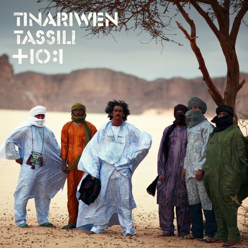
East of the Adrar Tighaghar Google depicts a well-used track (see map below) which doesn’t appear on any old maps and which leads up towards Timiaouine over the Algerian border and continues south to Kidal, about 120km southeast of Aguelhok. When I last travelled down the full length of the Tanezrouft piste in the late 80s, Kidal was the site of a political prison and off limits, but in recent years it opened up to a few intrepid tourists, visiting the Essouk music festival, nearby. The Tuareg group, Tinariwen (left) are originally from Kidal. This track would have developed in the more recent smuggling and kidnapping era as the Kidal region became busier. Doubtless many other tracks developed in the area as AQIM and later groups established themselves in this region over the last decade. With the long overdue Operation Serval, you’d hope that era may be coming to an end. So far in 2016, it doesn’t look like it.
I came across this great film on SVS’s Vimeo channel, mostly set in northeastern Chad. It’s in French but you’ll get the gist. Camels and crocs in Guelta Archei, some amazing paramotoring over Ounianga lakes and even scuba diving in one of the lakes.
It 90 mins long but cuts off at 1.11, on the way into the Mourdi Depression which is a shame. But if you try and find the complete show, watch out for torrentfrancais.com – the plug-in they recommend turns nasty. There’s another equally interesting film on SVS’s channel about Theodore Monod, also set in northern Chad.
On the same theme track down the Emir of Kano, and this one (English VO and subtitles) is about Tubu women in Niger trekking up from around Nguigmi to Bilma to exchange goats for dates. A few years ago the BBC ran a similar film in the same region about a Tubu caravan of women crossing to Termit from Agadem.
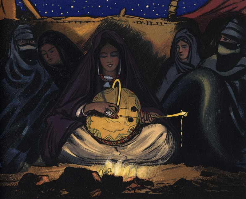
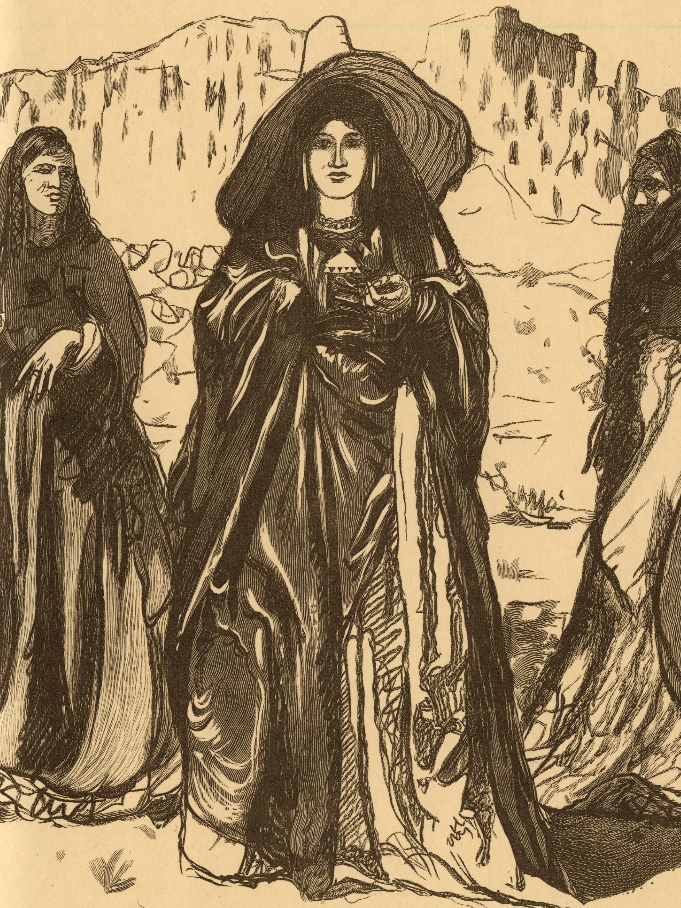
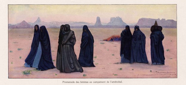
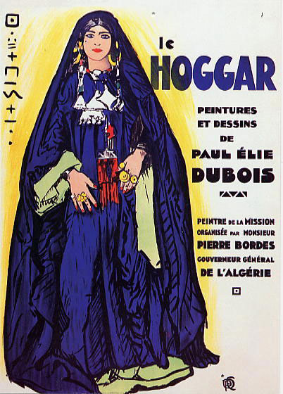
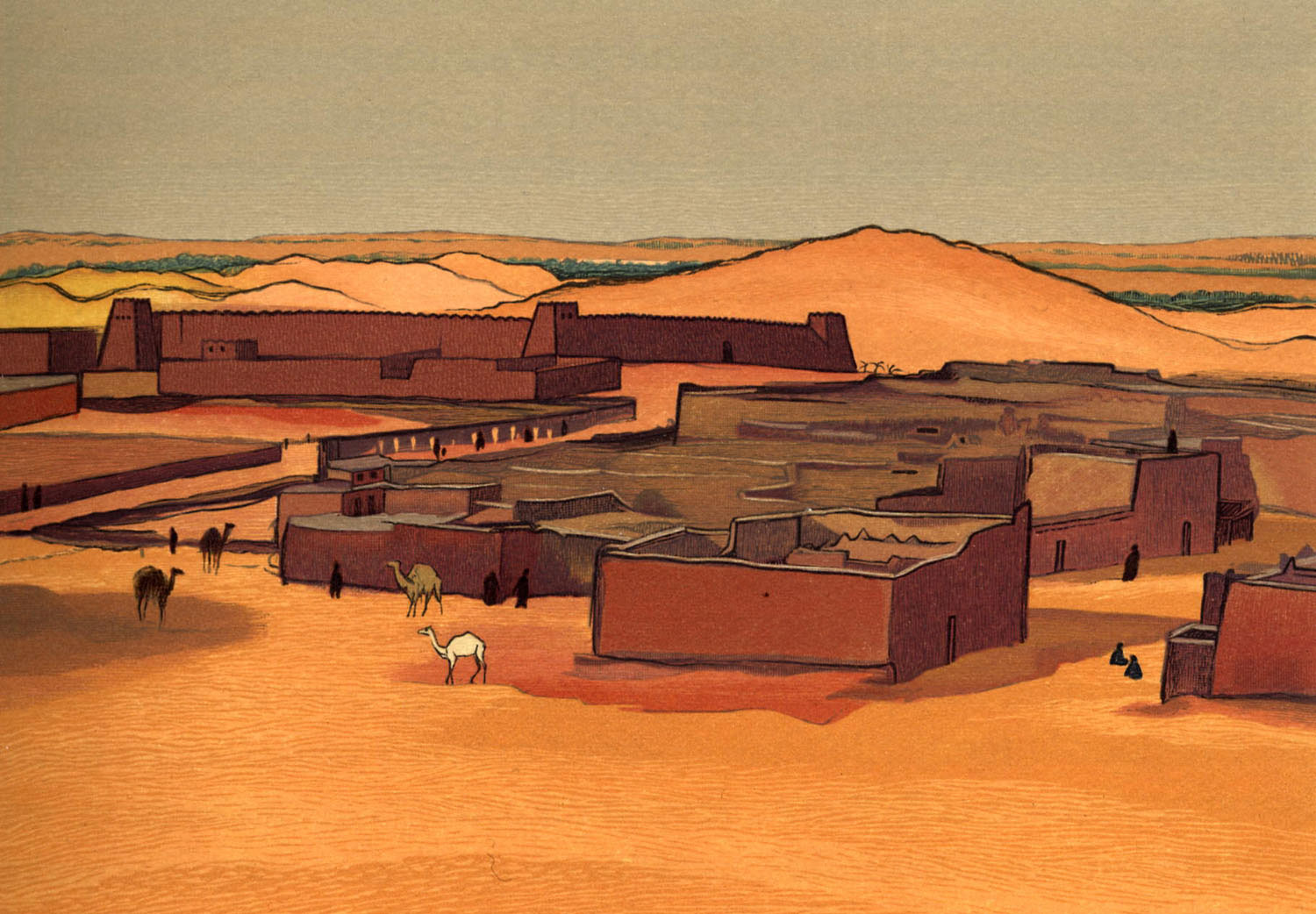
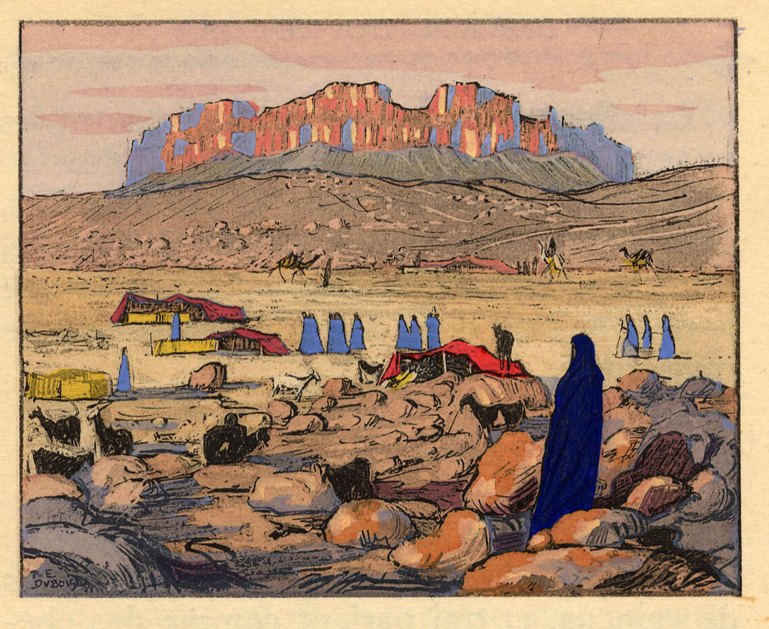
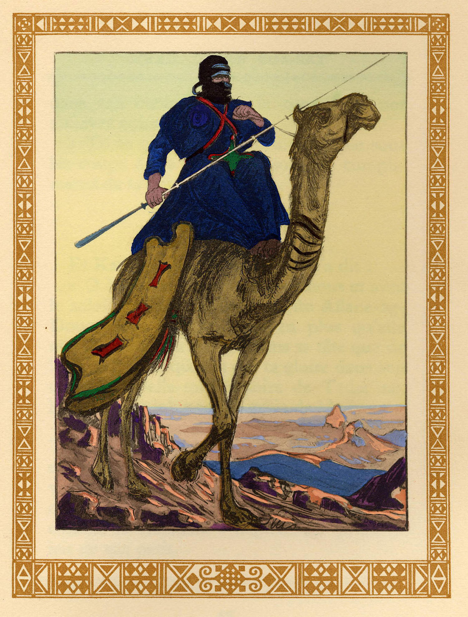
Years ago a well-wisher based in France send me a CD of scanned artwork by a French Orientalist painter, called Paul Élie Dubois (1886-1949).
In the 1920s and 30s Dubois travelled frequently in the recently colonised Hoggar of southern Algeria and went on to exhibit his work as well as illustrate limited editions of popular books on the area, such as Chants du Hoggar, a series of courtly Tuareg legends and fables retold to the author, Angèle Maraval-Berthoin. A figure in one of the legends over whom Tuareg ‘knights’ fight is known as Dassine, also the name of the long-established campsite on the east side of Tam. Now I know.
Images from that book appear below, followed by a few general views of southern Algeria also by Dubois and which some may recognise.
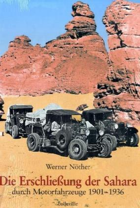
DIE ERSCHLIESUNG DER SAHARA DURCH MOTORFAHRZEUGE 1901-1936 [Opening up the Sahara by Motor Vehicle, 1901-36] Werner Nother (try amazon.de)
I would not normally review German books here, even if some of the best material may be in that language, but hardcore Saharans may be interested in this huge book, a breeze block three times the size of Sahara Overland. Werner Nother is one of a handful of German-speaking uber Saharans known to me and a registered ergoholic. Among his many Saharan achievements are mapping every last lake and paleo-lake in the Ubari Sand Sea years before they appeared on the tourist trail (his Hilux is pictured on p.82 of Sahara Overland).
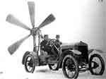
I heard it took him ten or twenty years to complete this massive book – a record of every pioneering expedition by motor car and bike trip into the Sahara in the first third of the last century. I can’t understand a word of it but the many archive photos and crystal clear maps are good enough to illustrate the advent of the automobile in the Sahara. Some of the early solutions to the problem of soft sand traction are ingenious – they cottoned on to giant caterpillar/belt drives pretty early, though the propeller cars look like they may have had pilot suction problems. And our strange friend Byron Prorok (see other reviews) is in here too.
Interestingly, one sees that all the main pistes as depicted on the Mich 741 and including the Libyan Desert were all established by the mid-30s. And yet took them another 70-odd years to finally seal the Sahara (followed by an eternity of maintenance…). The many maps also highlight places and routes that may have slipped from the contemporary Saharan radar, offering endless opportunities for historic trips ‘in the wheel tracks of’. I suspect this is a fascinating account of early motoring in the Sahara.