
See also:
Trans Sahara Highway
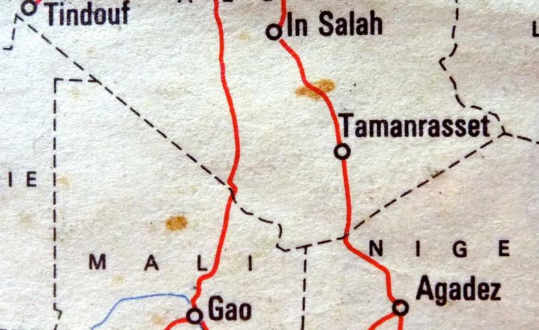
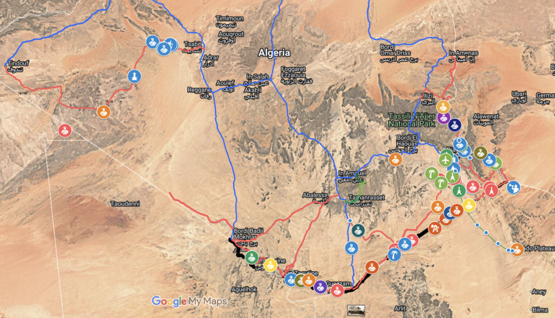
Over the span of some 2300km, along Algeria’s southern perimetre two largely straight lines (below) radiate northwest to Tindouf and northeast to the Salvador-Anai border tripoint. They mark Algeria’s desert frontier with Mali and Niger. For decades as porous as a string vest, they’re crossed by the original trans Sahara routes established at the dawn of the motor car era in the 1920s: the Trans-Sahara Highway from Algiers via Tamanrasset to Agadez in Niger, and the more desolate Tanezrouft from Reggane via Tessalit to Gao in Mali (below). Both are now largely sealed in Algeria but for years have been off limits to travellers.
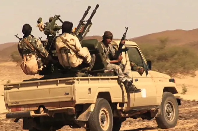
In 2011 the already dangerous Sahara was further unsettled as Gaddafi’s regime collapsed, and militias raided arms depots across Libya. Much of that weaponry flowed west across the desert to northern Mali, long controlled by Islamist insurgents (left) or Tuareg separatists.
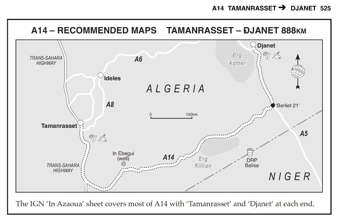
The quickest route was across southern Algeria, because south of the well-used road between Tam and Djanet, the 200 kilometre band of desert to the unmarked Niger border was entirely unpopulated but easily navigable. Even when we did Route A14 (left) in the early 2000s, we were surprised how well developed and even corrugated parts of this obscure track was. At that time Algeria had its own smuggling networks running between Mali and Niger, but come 2011 had nothing to gain and much to lose from the added instability brought about by the redistribution of Libyan arms.
These days controlling the flow of sub-Saharan migrants is probably the bigger concern. In Algeria most come up from Niger around In Guezzam (TSH) or the Chirfa piste (route A3 from the book), and are openly seen walking along the road or wrapped under a speeding pickup tray’s sheet, on the TSH north of Tam, or hanging out in Bordj el Haouas bound for the Fadnoun plateau on the N3, before being rounded up and deported en masse at In Guezzam. I remember way back in 2002 encountering what I later realised where dumped migrants on the Fadnoun, an hour south of Illizi, and later sharing the cliff path climb with others on the ascent to Jabbaren. For migrants this was a short-cut to Ghat in Libya and – long before the advent of Med boat crossings – the possibility of work there.
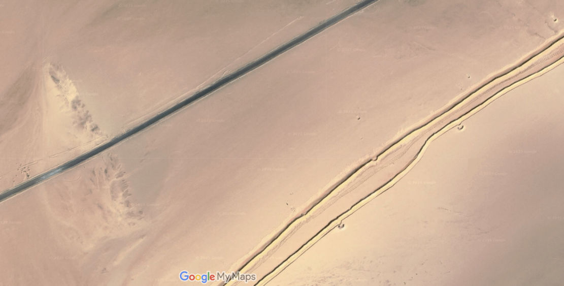
The answer to the latter has been an attempt to seal the exposed southern border with a series of double berms (car-blocking sand ridges; above) filling out the long gaps between impassable natural topography. This is just what Morocco did in the Western Sahara decades ago to define a de facto border with the PFZ, and what Algeria has also done along its Moroccan border to reduce illicit traffic.
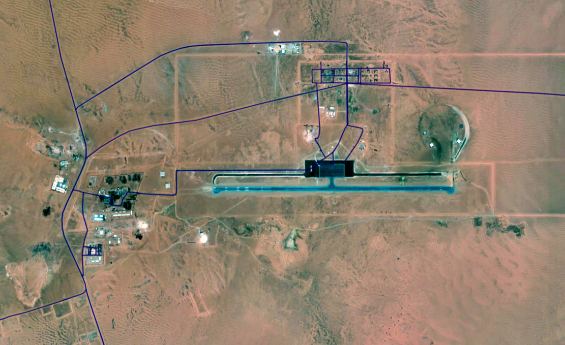
These efforts may be funded by the EU or other agencies and the berms (part-mapped below, in black) are backed up by new military access- and patrol roads (red, below), all linking scores of bases, some with huge runways (above) in the middle of nowhere. They run near continuously from the In Amenas oil producing area south of Ghadames in Libya, all the way round to Bordj Moktar and beyond. West of there towards Chenachen or Tindouf, the Erg Chech acts as a natural berm.
Not all roads and places shown. ‘Bases’ may be other, non-military installations.
Discover more from Sahara Overland
Subscribe to get the latest posts sent to your email.
