See also:
Trans Sahara Routes
Mauritania
The Railway Piste
Atlantic Route
Trans Sahara Highway
Updated Christmas 2025
Note that while traversing generally easy terrain, this is a long and desolate series of braided pistes where breaking down alone away from the main tracks could have dire consequences outside of the cool season. Don’t expect to see other overlanders, just passing trucks in the distance.
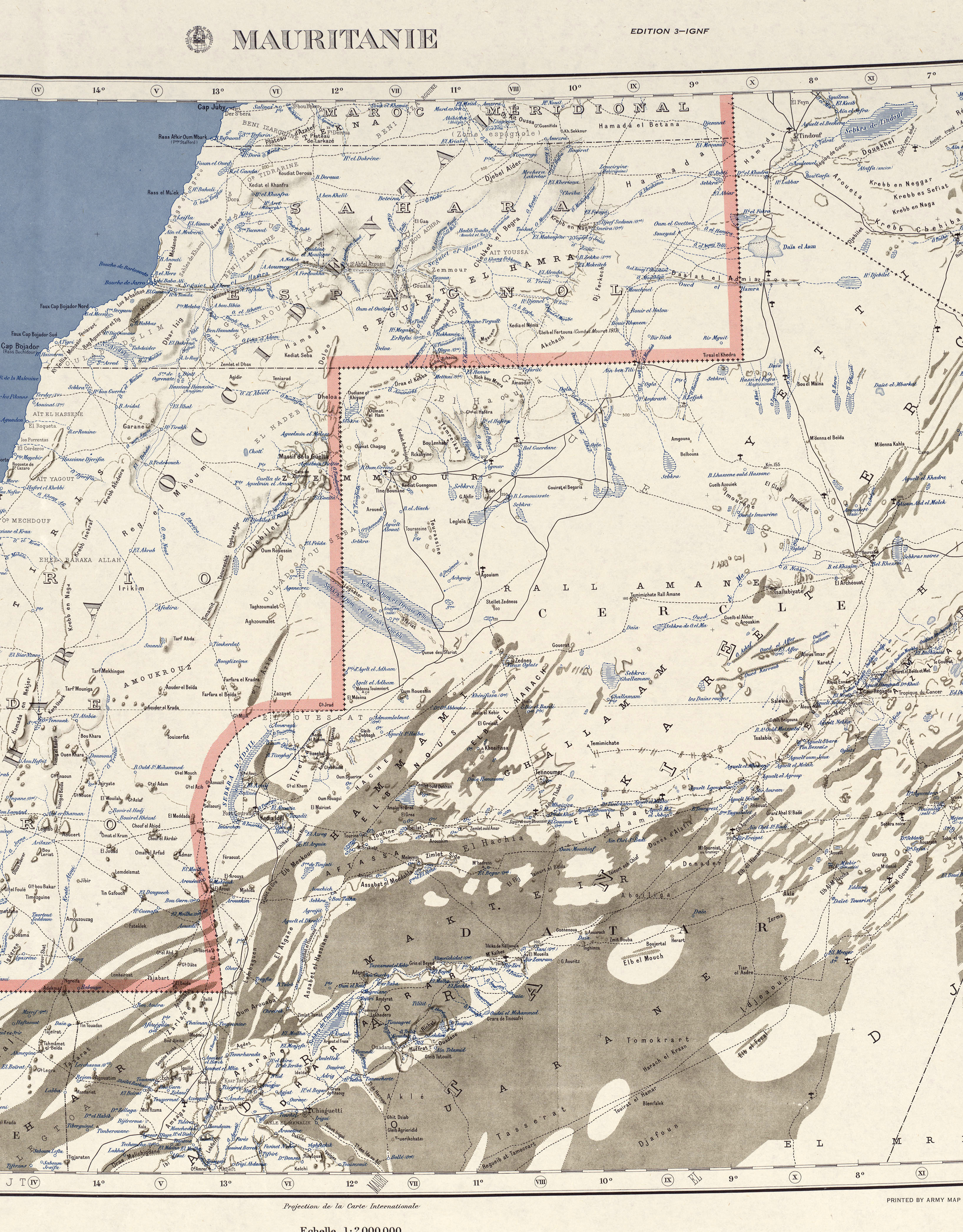
During the French colonial era the Tindouf track was known as the Piste Imperiale N°1 (below), the principle trans-Sahara route linking Algeria with Dakar in Senegal. Today’s Atlantic Route in Morocco was then in the adjacent colony of Spanish Sahara. The Tindouf route was closed in 1963 by which time both Algeria and Mauritania were independent from France. This 1965 book dramatically describes a transit in 1959 as wars of independence raged.

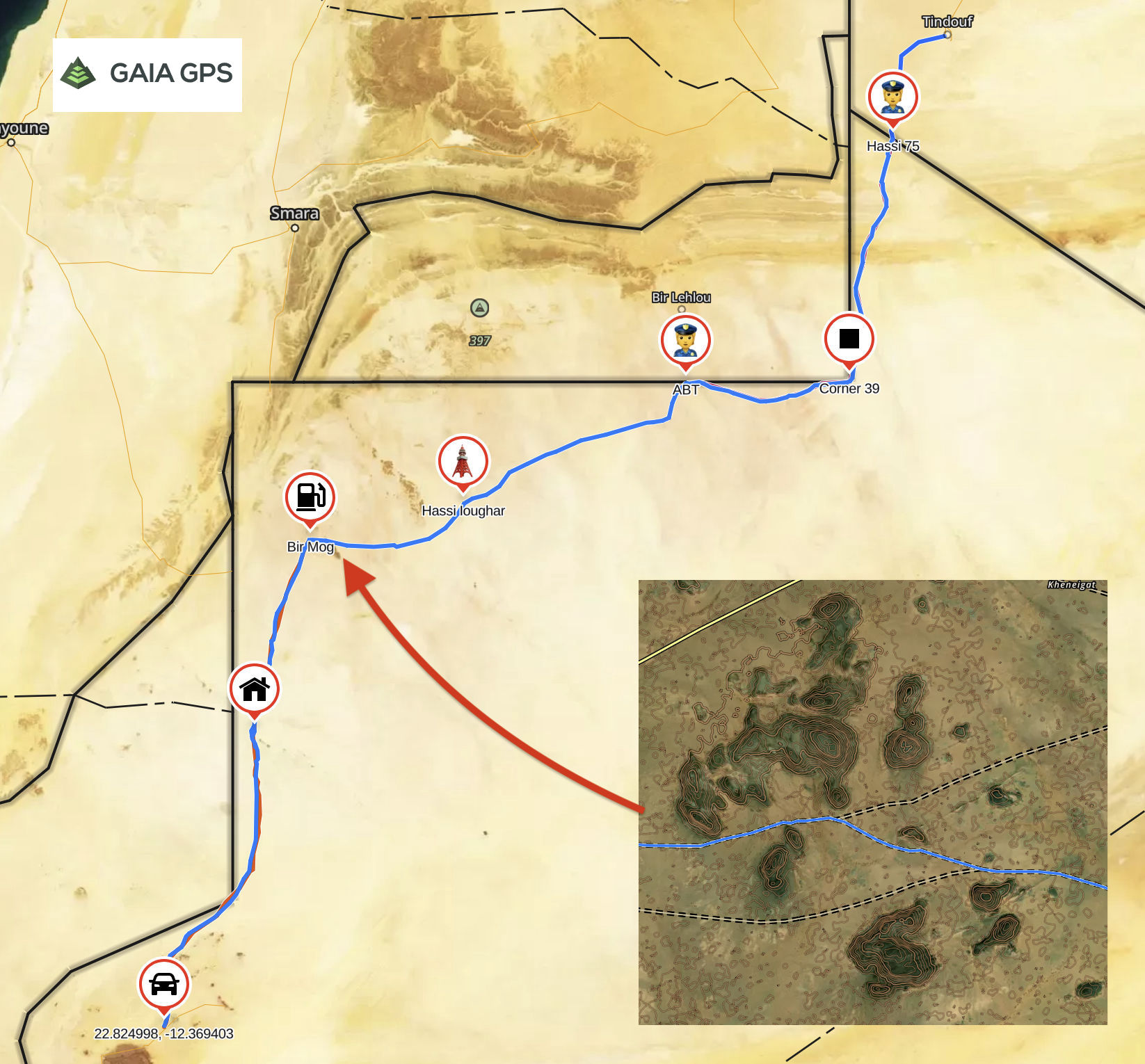
Following a provisional 2018 announcement on re-establishing the 860-km tarmac to tarmac link between Tindouf to Zouerat, by the winter of 2019 a couple of southbound tourists had slipped through. The pandemic slowed things down until 2023 when Algeria and Mauritania agreed to develop this new trans Sahara trade route. In February 2024 the route was officially opened to non-freight traffic at newly built border facility at Hassi 75.
A day or so later a Swiss couple crossed into Algeria, and now about 2-3 tourists a month traverse the route in winter, most northbound, while freight trucks ply the sands daily. Meanwhile, with Chinese help, a railway is being extended 600km from Bechar towards Tindouf to help exploit the revived Gâra Djebilet iron ore deposit 150km southeast of Tindouf.
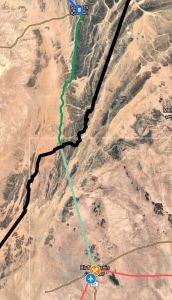
Note the route on the embedded Google Map is one of many possibilities and certainly does not follow the much longer, yellow ‘N1’ line as shown on Google Maps and copied by most others. This is the colonial road from 1950s (below left). Satellite imagery suggests that in many places this old road no longer exists.

The route as recorded in 2024 by Karim H is also a track featured on GaisGPS’ surprisingly good ‘Topo’ layer (above right). See also here. Additional details by Gerald G on a 250 moto in October 2025. Henriette also crossed in late November 2025.
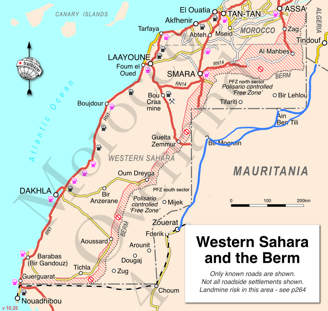
The Tindouf Route
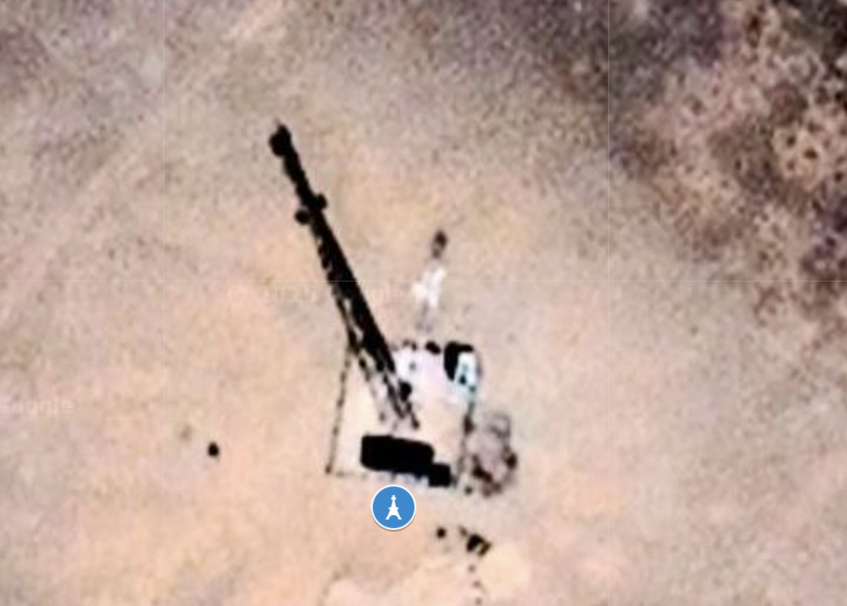
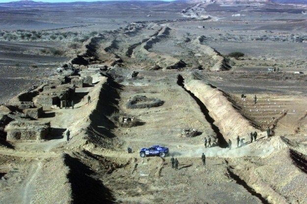
It’s about 860km from Tindouf to Zouerat where the tarmac network resumes. Coming from the north, at Abadla, 700km north east of Tindouf, you may have to join a military escort. Once in Tindouf you’ll definitely be escorted 75km from Tindouf to the Mauritanian frontier at ‘Hassi Abdallah 75‘ (above; no fuel). You will need an e-visa obtained in advance, as well as printed evidence of this visa. TVIP issued and vehicle stamped into your passport. No ouguiya money changers (or much else) until Bir Mogrein. You will need to visit Customs in Zouerat. A new road may be being laid but there is rarely a single clear piste. Tracks braid widely across the flat terrain as trucks seek the smoothest, firmest route.
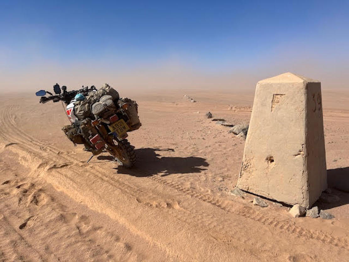
You will need a 300km fuel range from Tindouf to ABT Camp. Head south from Hassi 75, then turn west at ‘Corner 39’ (above; KM200) towards Ain Ben Tili Camp (KM300). This is a sandy region with no single defined track and is why the route went via the PFZ until Moroccan bombing discouraged that. Even gold prospectors getting too close to the berm have been targeted. Stay in Mauritania.
You may pass a couple of trucks an hour. Route markers are irregular until south of Ain Ben Tili. Head directly for for ABT Camp (fuel; shop), not the fort on the PFZ border which is off limits.
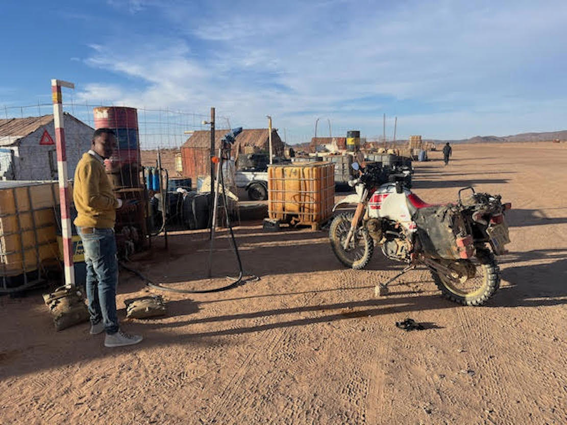
From Ain Ben Tili Camp (KM300) fort it’s 240km to Bir Mogrein. There are telecom masts (left) every 30km or so which have become informal way-stations where entrepreneurs sell water, food and maybe fuel.
Only where actually visible on sat imagery, have these masts been marked on the Google map above. You will pass others. You’ll also encounter more traffic towards Bir Mogrein. There is a high route via the masts, and the low route shown which picks up the masts halfway to Bir Mog.
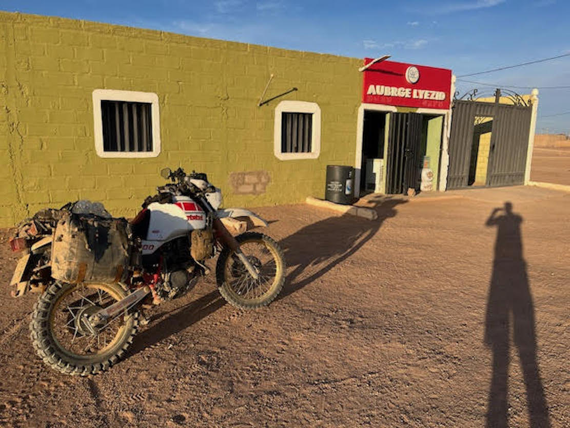
At Bir Mogrein there’s a basic auberge (up to €50). Change euros for ouguiya in shops (1:40) and buy fuel from the new fuel station at around €1-1.6/litre.
From Bir Mogrein southwards (below) there is even more traffic (left). The route again passes telecom masts every 30km all the way, but is heavily corrugated in places, bar one smooth chott.

Near the very end of the crossing you pass through some berms, then near a mine you join tarmac at 22.8267, -12.3708, 15km NE of Zouerat. This is a rough iron ore town where checkpoints will direct you to register your vehicle at Customs (see Google map above or 22.7388, -12.4708). You might try and buy a SIM and exchange money at a better rate than Bir Mog. Petrol is about 50 oogs a litre. It might also be possible to put your vehicle on a train to Nouadhibou on the coast.
The road continues via Fderik, the original iron town which preceded Zouerat, then heads south across the sands towards Choum (basic huts, train loading, railway piste west to Nouadhibou), and on to Atar for Tidjikja or Nouakchott.
The supposed Smara Connection – Route Nationale 17B
Interesting opinion
Like many neighbouring countries, the governments of Morocco and Algeria are long-time foes, and borders have been closed since 1995. Strategically placed neighbour Mauritania treads a tricky line of ‘positive neutrality’ between these two governments.
Hostilities date from the 1980s Polisario War, with Algeria’s continuing support of the Polisario cause today, despite an increasing number countries now favouring Morocco’s sovereignty over the whole of Western Sahara as a way to solve the impasse and reap trading benefits.
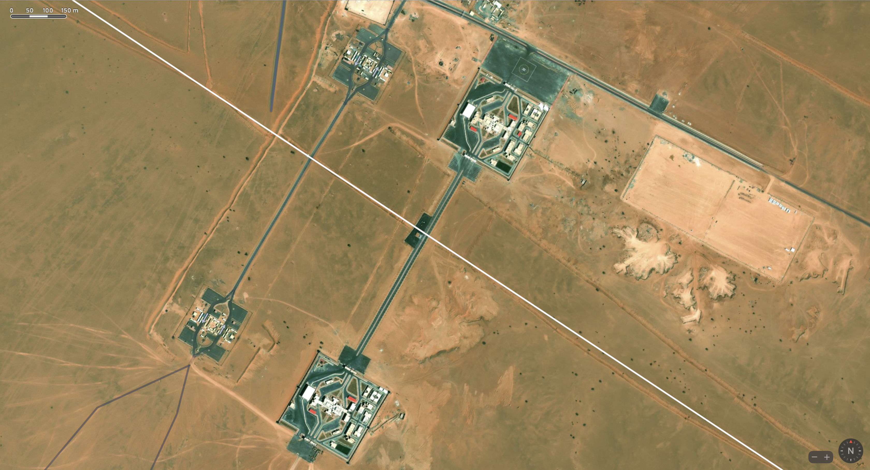
When Algeria initially announced the plan for a new trade route between Tindouf and Zouerat in 2018, Morocco quickly responded with intentions to tap into that route by extending asphalt the relatively short distance from Smara, south through the Berm to the border just below the 26th parallel, about 100km north of Bir Mogrein on the Tindouf Route.
This is the new RN17B (left). By doing so it could offer a second border crossing between the two countries; the other being at Guergarat on the Atlantic, near Nouadhibou, which everyone uses.
The Smara link to the border line is possible because the 2000-km long Berm built by Morocco to separate and isolate the two Polisario Free Zones (PFZ) cuts across the corner of Mauritania. See map above. Not all maps, not least MINURSO (as of February 2023) depict what is evident on aerial imagery. Who knows how Mauritania felt about this incursion across a far distant and unpopulated corner of its territory.
A real border?
Whether Morocco and Mauritania actually need another border crossing to join with the long piste to Zouerat is debatable. It’s hard to think what commodity or trade in either direction doesn’t benefit from using either the fully sealed Atlantic Highway, or shipping along the Atlantic coast from the expanding port at Dakhla. The distance from Nouakchott to say, Guelmim is the same, except the new route would have a 400-km corrugated gap in the asphalt from the border via Bir Mogrein to Zouerat the iron ore railhead to the Atlantic.
Morocco is certainly building a road from Smara to the border. Current satellite imagery shows the tarmac ending about 30km from Smara, roadworks all the way to the border area. But roads to the front line are common in Morocco. On the Mauritania side nothing is said to be happening and may not, even if the Mauritanians don’t spell this out. It’s also debatable whether Mauritania even wants this rather useless border route which will estrange Algeria and the Polisario.
The chief purpose of the Smara Connection could be a relatively inexpensive propaganda exercise to undermine Algeria’s Tindouf–Zouerat initiative and keep freight and other traffic rolling along their Atlantic Highway which Morocco has been improving over the years. Algeria was said to be funding the 850-kilometre road in Mauritania (currently surveyed to pass via Bir Mogrein), so it would be galling to pay for it only to have Morocco tap into it via a road from Smara.
For the overland traveller a new inland crossing from Morocco to inland northern Mauritania which avoids Algeria’s difficult visa and escort regimes would be appealing. But don’t hold your breath.
Moroccan info sources A and B.