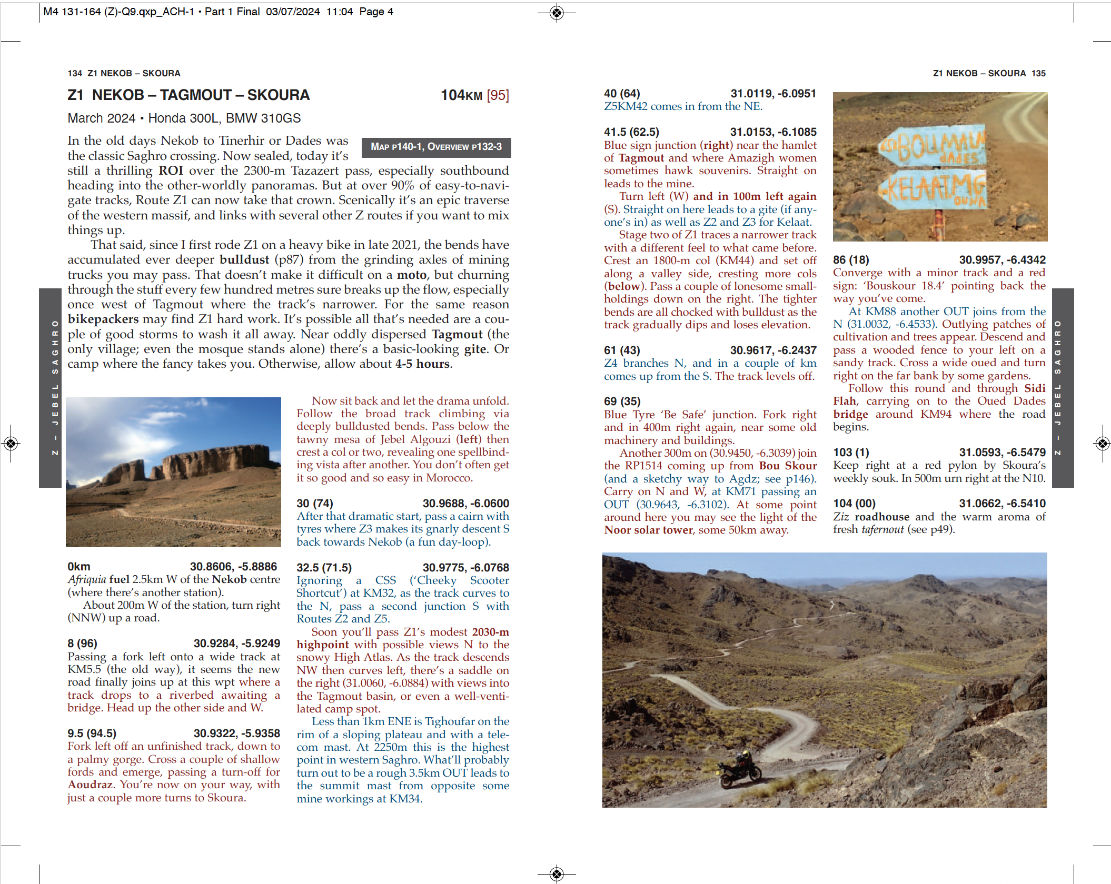
See also:
Morocco Overland 4
Updates & Corrections current edition
How to draw your own tracklog off a digital map
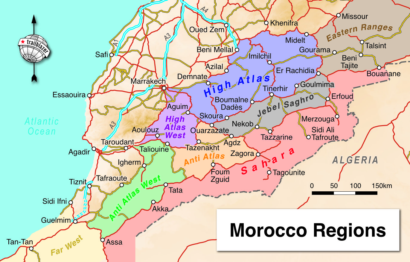
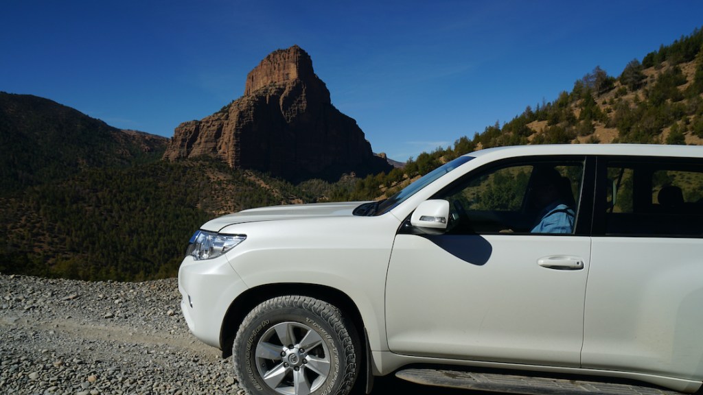
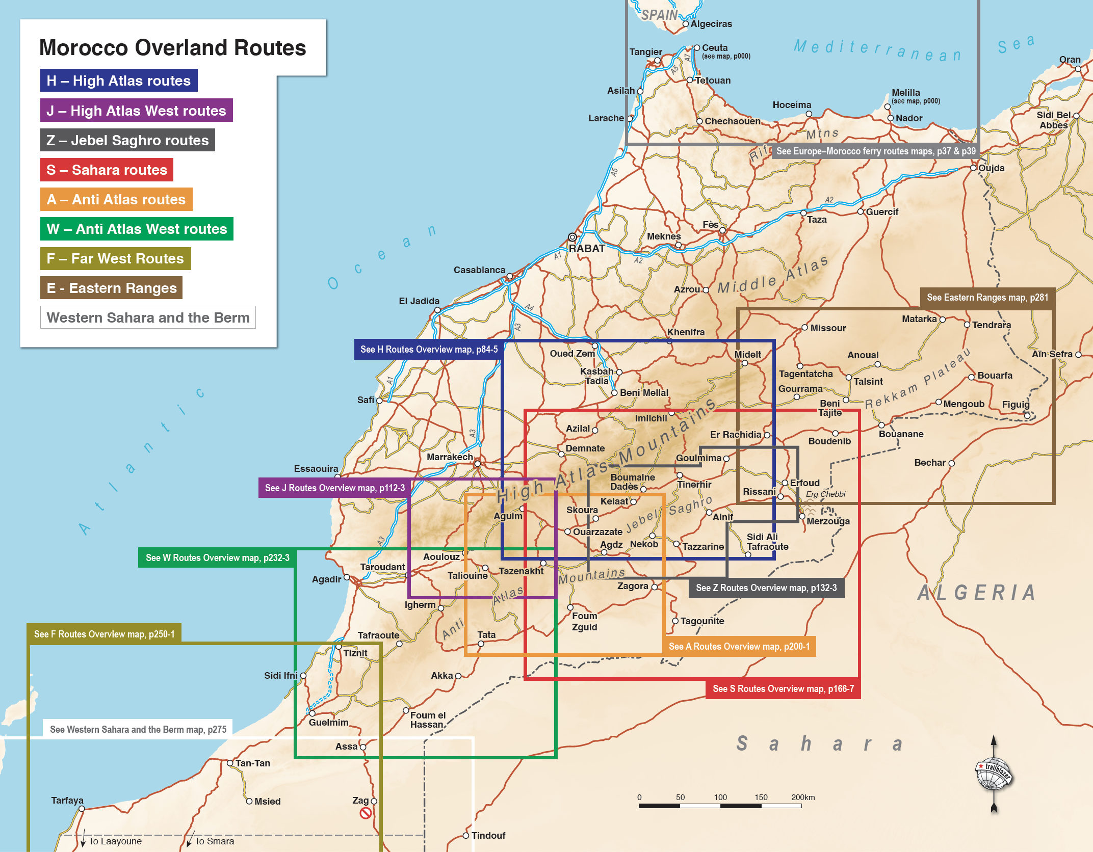
Edition 4’s 70-odd largely new routes are now spread across eight regions of southern Morocco (above). Each route has a description following the same proven format, but with improvements:
• intros are simplified and shortened
• the waypoint format is improved (see below)
• a third twin-column text colour (light blue) is used when referring to other branching tracks
• All trails verified on-, or added to the OSM database, which feeds into 3rd party, free OSM mapping.
Combined with OSM mapping, it should make the book’s routes easier to follow.
What, no waypoint downloads?!
Offering a few key downloadable waypoints was an OK idea when Morocco Overland was first published in 2009. Even then, in most cases you only really needed a route’s start point because, unlike the Sahara, once you’re on the way, Moroccan tracks are regularly used by locals and dead easy to follow.
Now that mapping has improved greatly and the way we navigate has become easier, key waypoints won’t be supplied for Edition 4. Most people want tracklogs and masses of such data already exists online for free. And as already mentioned: all M4 routes have been checked and verified on the free OSM source database, corrected where necessary, or added if they did not exist. Months later I am now seeing my new routes appearing on third party OSM mapping for Morocco. So the plan worked but note: I do not label the OSM source database with M4 tracks numberings as it is a public resource. It’s possible that no one would mind or notice, but we’ve all seen how unmoderated Google Maps gets spoiled by fake or personalised POIs. I also can’t guarantee my work won’t be modified or erased by subsequent OSM contributors.
Another big improvement to Morocco 4 is the adoption of decimal degrees (D.D°; eg: 30.0754, -5.4474) for waypoints. It is the default in mobile phones, afaik. Compare it to the old edition’s laborious N30° 04.52′ W05° 26.83′ (DDM) for the same location. When necessary, this makes transcribing a waypoint by hand into a digital device’s touch keypad much less error prone, combining the numbers with just a point, a comma and a hyphen.
With or without waypoints or tracklogs, you still need to engage with navigation, just as you have to concentrate on driving and all the rest. In this era of routable digital maps and smartphones-with-GPS, not everyone appreciates this. Meanwhile a digital map’s ‘go to’ routing function on your device won’t always recognise or even show obscure tracks, or will tie itself in knots trying. Google Maps is certainly like this and, while it’s got better, is a poor nav solution off main highways in Morocco.
Download a free GPS map instead and you won’t need a tracklog, waypoints or even the guide book, as long as you know where you want to go.

As said, in Morocco satnav routing functions can be hit and miss along roads, let alone tracks, but I’ve been surprised to see how many obscure routes (or parts of them) are now routable on Google. Failing that, just follow the track right under your nose; there’s usually only one.
You can always trace a tracklog off Google’s WYSIWYG aerial imagery, guided by the book’s waypoints, or (more easily but less reliably) use apps like Garmin BaseCamp, combined with imported OSM mapping. All are free but, like reading a route description, drawing your own tracklogs requires engagement and time, and for some is part of the planning process. If you don’t want to do that, you’ll find over 12,000 free but unedited (ie: random and messy) Moroccan tracklogs on Wikilocs. Some will doubtless align with Morocco Overland routes.