Part of the Sahara A to Z series
See also:
‘V’ is for Vintage Sahara Maps
Sahara – Blanks on the Map
Maps of the Sahara
I is for IGN and their Sahara Maps
I came across this old French map of the Saharan trade routes from 1889 [full-size source]. As always, it’s interesting to see where was prominent then and what has come since. Old spellings and some names differ.
Not a lot of people know that an earlier name for Marrakech was ‘Maroc’ or Morocco. Once this area was all known as ‘Mauretania’ – the Land of the Moors (Blacks) from which all these names derive. Mogador is today’s Essaouira.
Other well-known Moroccan towns are present, as well as the 52-days road to Timbuktu from Zagora or Sijilmassa (Rissani), all depicted with other names.
By this time most camel trade took the western route to Goulimim (Wadi Noun), which explains the vestiges of the tourist camel market there today. The original site is actually here.
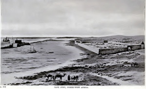
Cap Juby (today’s Tarfaya) we’ll be hearing more about shortly, but inland from here a tough route from Tindouf led to Taoudeni and also Timbuktu.
Southwest from Tindouf another track leads to Mauritania, the old colonial overland route to Dakar mid-last century, as driven by this nutter.
Mauritania has many familiar places like Atar, Chinguetti (right), Ouadane (left, where we coninued east across the Majabat for Algeria in 2006) as well as Oujeft leading to the ruins of Ksar el Barka, Tidjikja, Tichit, and Oualata for Timbuktu. But no Nouadhibou (Cap Blanc) or Nouadhibou (Tiourourt) yet, far less Zouerat. And no Dakar back then; St Louis was the colonial capital of French West Africa.
In Mali Timbuktu is central, with trade routes leading north via Araouane, or Tim Missao well (left) in Algeria where we stopped in 2006 and 1989 (right). No Tamanrasset or Djanet – the two biggest towns in southern Algeria today, but In Salah, Amguid and Temassinin (Bordj Omar Driss) are present.
In Libya little seems to have changed: Ghat and Ghadames are there, as well as Germa (Ubari) and Murzuk on the route for Lake Chad via Bilma (left). To the east the oases making up Kufra lead down to the Ounianga lakes in northern Chad. And east of there is the Darb al Arbain (Road of Forty Days) from El Fasher in Sudan, via Selima across the sand sheet (right) towards Kharga and Asyut on the Nile.


Pingback: F is for Flooding the Sahara | Sahara Overland
Pingback: ‘I’ is for IGN: How they made their Sahara Maps | Sahara Overland
Pingback: Sahara – Blanks on the Map | Sahara Overland
Pingback: ‘V’ is for Vintage Sahara Maps | Sahara Overland
Pingback: Maps of the Sahara | Sahara Overland